Browse the brochure - Visit Sunnhordland
Browse the brochure - Visit Sunnhordland
Browse the brochure - Visit Sunnhordland

Create successful ePaper yourself
Turn your PDF publications into a flip-book with our unique Google optimized e-Paper software.
www.visitsunnhordland.no<br />
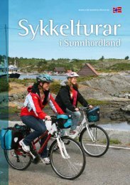
Bicycle trips<br />
in <strong>Sunnhordland</strong>
2<br />
The Barony Rosendal, Kvinnherad<br />
Cycling in <strong>Sunnhordland</strong><br />
E16<br />
E39 Trondheim<br />
Bergen<br />
Samnanger<br />
E39<br />
48<br />
Hatvik<br />
Venjaneset<br />
Fusa<br />
Nedstrand<br />
Norheimsund<br />
Tørvikbygd<br />
Jondal<br />
Kvanndal<br />
Odda<br />
Hufthamar<br />
Halhjem<br />
Varaldsøy Sundal<br />
48<br />
AUSTE VOLL<br />
Gjermundshavn<br />
546 Våge<br />
Årsnes<br />
Husavik<br />
Bekkjarvik<br />
T Y S NES<br />
Løfallstrand Folgefonna<br />
Sandvikvåg 49<br />
Rosendal<br />
FITJ A R E39<br />
K VINNHER A D<br />
Jektavik Hodnanes<br />
545 SUNNHORDLAND<br />
Nordhuglo<br />
Rubbestadneset<br />
Sunde<br />
S TO R D<br />
Ranavik<br />
Svortland<br />
Utåker<br />
Leirvik Halsnøy Matre<br />
E T N E<br />
B ØMLO Skjershlm.<br />
Mosterhamn<br />
Fjellberg Sydnes Skånevik 48<br />
541<br />
Utbjoa<br />
E134<br />
Sauda<br />
Førde<br />
Etne<br />
Langevåg Buavåg<br />
Ølen<br />
S V E I O<br />
E39<br />
Sandeid<br />
520<br />
46<br />
Ropeid<br />
47<br />
Sand 13<br />
Aksdal<br />
Haugesund<br />
Marvik<br />
Karmøy<br />
Nesvik<br />
Sjernarøyane Ombo<br />
Bokn<br />
Hjelmeland<br />
Skudeneshavn<br />
Arsvågen Finnøy<br />
Bergen<br />
Fister<br />
ÅrdalNORGE<br />
Mortavika<br />
Rennesøy<br />
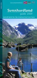
SUNNHORDLAND<br />
13<br />
Oslo<br />
Tau<br />
FjordNorge<br />
Sandefjord Strømstad<br />
Larvik<br />
Mekjarvik<br />
Jørpeland<br />
Stavanger<br />
SVERIGE<br />
Stavanger<br />
Kristiansand<br />
Kristiansand<br />
Oanes<br />
Hirtshals<br />
Frederikshavn<br />
Forsand<br />
Kiel<br />
D ANMARK<br />
København<br />
Sandnes<br />
Frafjord<br />
7<br />
49<br />
Hardangerfjorden<br />
Jelsa<br />
Lysefjorden<br />
Hardanger<br />
Utne<br />
Kinsarvik<br />
550<br />
13<br />
13<br />
E134<br />
Oslo<br />
K A R T : ELLEN JEPSON<br />
Cascading waterfalls, flocks of sheep along <strong>the</strong><br />
roadside and <strong>the</strong> smell of <strong>the</strong> sea. Experiences are<br />
closer and more intense from <strong>the</strong> seat of a bike. Enjoy<br />
local home-made food and drink en route, as cycling<br />
certainly uses up a lot of energy! Imagine returning<br />
from a holiday in better shape than when you left. It’s<br />
a great feeling!<br />
<strong>Sunnhordland</strong> is a region of contrast and variety. You<br />
can experience islands and skerries one day and fjords<br />
and mountains <strong>the</strong> next. Several cycling routes have<br />
been developed in <strong>Sunnhordland</strong>. Some of <strong>the</strong> cycling<br />
routes have been broken down into appropriate daily<br />
stages, with pleasant breaks on an express boat or<br />
ferry and lots of great experiences along <strong>the</strong> way.<br />
In Austevoll, Bømlo, Etne, Fitjar, Kvinnherad, Stord,<br />
Sveio and Tysnes, you can choose between long or<br />
short day trips. These trips start and end in <strong>the</strong> same<br />
place, so you don’t have to bring your luggage. The day<br />
trips vary from 4 to 65 km. Spend a whole day on a<br />
trip or take a trip as a training exercise.<br />
Publisher:<br />
Samarbeidsrådet for <strong>Sunnhordland</strong> IKS. The cycling guide is financed<br />
through commercial development measures/ compensation funds<br />
for increased national insurance funds managed by Hordaland County<br />
Council. We reserve <strong>the</strong> right to make changes and do not take<br />
responsibility for any errors in this guide.<br />
Foto: Gro Jensen Gjerde, Gro Røhne Andersen, Kjartan Pettersen,<br />
Terje Rakke, Karen L Våge, Rosendal Turisthotell, Atle Helland, Norske<br />
Bygdeopplevelser, Kristina Bergesen, Ellen Tveit, Kjell Pettersen,<br />
Kristian Birkeland, Ragna Flotve, Jan Morten W. Nesse, Ove Gjerde,<br />
Svein Andersland, Vestfoto ved Tove V. Brå<strong>the</strong>n, Øyvind Stavenjord,<br />
Erik Kvalheim, Ida Wollum, Ragna Flotve, Reidun Rykkje, Dagfinn Bjørge<br />
and Samarbeidsrådet for <strong>Sunnhordland</strong>. Edited 2013.
3<br />
View towards Rosendal, Kvinnherad<br />
Tips<br />
Tips<br />
• As a general rule, it may be a good idea to plan<br />
travelling around 10 km per hour including short<br />
breaks.<br />
• Never plan cycling stages that are so long that you<br />
don’t have time for unforeseen experiences en<br />
route.<br />
• Well-inflated tyres don’t puncture as easily.<br />
• Remember not to leave a trail behind you – show<br />
due consideration with respect to campfires, grazing<br />
animals and keeping dogs on a lead.<br />
• Bring an extra inner tube, repair kit, pump and<br />
spanner.<br />
• Pack saddlebags ra<strong>the</strong>r than a rucksack. A low<br />
centre of gravity is important.<br />
• Eat little and often, and drink water frequently.<br />
Ensure you have easy access to high-energy food<br />
(nuts, fruit).<br />
• Be prepared for fluctuating temperatures. It is better<br />
to wear several thin layers than one thick layer.<br />
Remember that cycling is at your own risk; have fun and wear a helmet!<br />
Map: <strong>Sunnhordland</strong> has GPS tracking units for many of its cycling routes. These can be downloaded from<br />
www.visitsunnhordland.no. You can also print detailed maps and route descriptions.<br />
Our trip recommendations give you an opportunity to take detours. Have a rest on a small wharf, a beach<br />
or at a viewpoint. You can find more information about attractions, activities, accommodation etc. in <strong>the</strong><br />
<strong>Sunnhordland</strong> guide. The <strong>Sunnhordland</strong> guide is available at tourist information offices in Hordaland, or you can order<br />
a copy by sending an email to: info@visitsunnhordland.no.<br />
i<br />
Practical information<br />
Accommodation:<br />
Cyclist-friendly accommodation is<br />
specially adapted for cyclists. This<br />
includes, among o<strong>the</strong>r things, safe<br />
bike parking, <strong>the</strong> opportunity to dry<br />
clo<strong>the</strong>s and bike tools/wheel repair<br />
kits on site. The accommodation<br />
enterprises have a special emblem on <strong>the</strong> outer door. It is<br />
often a good idea to book in advance.<br />
Bike hire in <strong>Sunnhordland</strong>:<br />
• Intersport Bekkjarvik, tel.: (+47) 56 18 08 56<br />
• Intersport Bremnes/Svortland, tel.: (+47) 53 42 12 80<br />
• Langevåg Bygdatun, tel.: (+47) 53 42 18 75/99 42 81 82<br />
• Rosendal Sport, tel.: (+47) 53 48 11 05<br />
• Fugl Fønix Hotell Etne, tel.: (+47) 53 77 14 40<br />
• Varehuset Larsen, Fitjar, tel.: (+47) 53 45 75 00<br />
• Joker Bakkasund, tel.: (+47) 56 18 32 05<br />
• Sveio Golfpark, tel.: (+47) 53 74 20 25<br />
• G sport Stord, tel.: (+47) 53 40 30 14
4 Trip suggestions - Austevoll<br />
Bekkjarvik<br />
Bekkjarvik – Stolmen (22,7 km)<br />
Austevoll municipality has become an ideal area for<br />
cycling now that <strong>the</strong> largest islands are connected<br />
by fantastic bridges. Cycling enthusiasts now have an<br />
opportunity to see a lot of Austevoll from <strong>the</strong> seat of<br />
<strong>the</strong>ir bike.<br />
Kvalvåg<br />
Stolmen<br />
Lundøya<br />
Selbjørn<br />
Bekkjarvik<br />
Starting in Bekkjarvik, you can cycle south to Stolmen via Sal<strong>the</strong>lla. The roads are<br />
great for cycling, and <strong>the</strong>re is little traffic. Take time to enjoy <strong>the</strong> views as you cycle<br />
across Stolmen bridge. On Stolmen, you can park your bike at <strong>the</strong> shop at Årland<br />
and go for a walk on <strong>the</strong> newly-marked North Sea Trail.<br />
Våge<br />
Bildetekst<br />
Bekkjarvik<br />
200m<br />
0m<br />
0m 5km 10km 15km 20km<br />
Difficulty level: Medium<br />
Length: 22,7 km<br />
Surface: Tarmac<br />
Max. altitude: 107 m
At Storekalsøy<br />
Trip suggestions - Austevoll<br />
5<br />
Bekkjarvik – Bakkasund (65 km) ‘Smile to <strong>the</strong> west’<br />
For those who would like to cycle a longer trip, a good<br />
alternative is to cycle from Bekkjarvik to Bakkasund.<br />
Bakkasund<br />
There are 26 km of excellent cycling paths from Bekkjarvik to Bakkasund. If you are<br />
going to cycle <strong>the</strong>re and back, <strong>the</strong> east side of Austevoll is recommended on <strong>the</strong> return<br />
trip. Cycling via Vinnes and Haukanes is like going back in time. You will see lovely<br />
green plains with impressive stone dykes, and <strong>the</strong> wild sheep will inquisitively watch<br />
you as you whiz past. In Storebø, you can have a bite to eat at Kulturbakeriet bakery.<br />
From Storebø, you <strong>the</strong>n cycle across Austevollsbrua bridge to Austevollshella. Take <strong>the</strong><br />
time to enjoy <strong>the</strong> views to <strong>the</strong> west from up on Austevollsbrua bridge. Here, you can<br />
enjoy great open views of <strong>the</strong> sea from <strong>the</strong> seat of your bike. There are also two lovely<br />
picnic areas on <strong>the</strong> series of bridges for those who have brought a packed lunch. Cycle<br />
across Hundvåkøy on ano<strong>the</strong>r great series of bridges to Storekalsøy and Bakkasund.<br />
The shop at Bahus on Bakkasund is worth a visit. The marina is a busy and lively place<br />
during summer.<br />
Kalve<br />
Hundvåkøy<br />
Storebø<br />
Huftarøy<br />
On Bakkasund, you can cycle out to Kalve and walk <strong>the</strong> marked North Sea Trail out to<br />
Skansen. There are wide open views of Sotra, Marsteinen lighthouse and <strong>the</strong> ocean<br />
from Skansen. The sea has worn <strong>the</strong> rock at Skansen into special formations, and <strong>the</strong><br />
sea shows its power and commands respect on windy days.<br />
You can cycle <strong>the</strong> whole ‘smile to <strong>the</strong> west’ circuit. From Bekkjarvik to Stolmen, return<br />
via Bekkjarvik and on to Bakkasund via <strong>the</strong> east side of Austevoll. If you plot in <strong>the</strong><br />
route on <strong>the</strong> map, you will see that a ‘smile to <strong>the</strong> west’ appears. Pack your bike and<br />
get out and smile back to Austevoll from <strong>the</strong> seat of your bike.<br />
Stolmen<br />
Selbjørn<br />
Bekkjarvik<br />
200m<br />
0m<br />
0m<br />
12km 24km 36km 48km 60km<br />
Difficulty level: Medium<br />
Length: 65 km<br />
Surface: Tarmac<br />
Max. altitude: 87 m
6 Trip suggestions - Bømlo<br />
Røyksundskanalen<br />
Around Siggjo (27,3 km)<br />
Ersland<br />
Rubbestadneset<br />
Foldrøyhamn<br />
Siggjarvåg<br />
When you come from Trekantsambandet (<strong>the</strong> Triangle<br />
Connection) and have cycled across Bømlabrua bridge,<br />
you come to Gassasundet sound. There is a car park<br />
here at <strong>the</strong> junction to Moster, which is <strong>the</strong> starting<br />
point for <strong>the</strong> Around Siggjo route.<br />
This is also where <strong>the</strong> round trip ends – at this junction on <strong>the</strong> Rv 541 road. But<br />
first, you cycle on a good 4-km walking and cycling path towards Siggjo. Follow<br />
this path on <strong>the</strong> outside of <strong>the</strong> Stokkajuvstunnelen tunnel. From <strong>the</strong> old road, you<br />
can look down on <strong>the</strong> old ferry quay in Siggjarvåg, which is now closed. The cycling<br />
path <strong>the</strong>n comes to an end for a while.<br />
Sakseid<br />
Siggjo<br />
Håvik<br />
After 6.5 km, you come to <strong>the</strong> crossroads at Ekornsætre. Turn left here towards<br />
Langevåg. When you have cycled a little while on <strong>the</strong> Erslandsvegen road, you<br />
can see Mount Siggjo rise to your left. Cycle a fur<strong>the</strong>r 3.3 km to Tormodsætre. At<br />
this crossroads, continue to follow <strong>the</strong> road to Langevåg on <strong>the</strong> left. The road <strong>the</strong>n<br />
narrows somewhat and twists and turns a bit. Follow Erslandsvatnet lake a while<br />
until you come to a small picnic area on <strong>the</strong> right-hand side of <strong>the</strong> road. From here,<br />
<strong>the</strong>re are idyllic views across Sakseidvågen bay. After ano<strong>the</strong>r 2.5 km, turn left<br />
towards Håvik at <strong>the</strong> Sakseid T-junction. Pass <strong>the</strong> old vicarage at Finnås on your<br />
right, before you come to <strong>the</strong> lovely beach in Åreiddalen.<br />
It is 5.5 km from Åreiddalen to Håvik, and a fur<strong>the</strong>r 2 km from Håvik to Røyksundkanalen<br />
canal. You cycle straight through Indre Håvik to get <strong>the</strong>re. When you get to<br />
<strong>the</strong> crossroads at Røyksund, turn left again unless you want to take a short detour<br />
to Moster. It is 1 km from <strong>the</strong> crossroads to Gassasundet sound, which brings you to<br />
<strong>the</strong> end of <strong>the</strong> round trip.<br />
200m<br />
Moster<br />
0m<br />
0m<br />
5km 10km 15km 20km 25km<br />
Difficulty level: Medium<br />
Length: 27,3 km<br />
Surface: Tarmac<br />
Max. altitude: 130 m
Trip suggestions - Bømlo<br />
Brandasund<br />
7<br />
Svortland – Brandasund (32,9 km)<br />
The trip to Brandasund starts in Svortland.<br />
In Hollundskjosen (<strong>the</strong> roundabout), turn left towards Brandasund. After 1.5 km, you<br />
come to Urangsvåg and its sheltered marina. The county road north to Brandasund is<br />
a varied, fun cycle and is narrow and hilly in parts. The road crosses several islands<br />
that are connected by bridges, and <strong>the</strong>re are great views of <strong>the</strong> islands and skerries.<br />
You can take detours to some nice places en route to Brandasund, such as Katla and<br />
Skinnhueneset. ‘Nillo på Skjèret’ once lived on <strong>the</strong> island of Torgjo (Torget). Today,<br />
her descendants run <strong>the</strong> traditional village shop <strong>the</strong>re. Now, it is only a fur<strong>the</strong>r 1.5<br />
km to Brandasund, and you are surrounded by <strong>the</strong> ocean on almost all sides. When<br />
you arrive in picturesque Brandasund, you will see white-painted houses huddled<br />
toge<strong>the</strong>r, with lots of passing boat traffic. You can grab a bite to eat here. There is also<br />
a small sales outlet for felted woollen products and a wood carver who can make just<br />
about anything.<br />
A walk to Brandasundsåta is also recommended while you are out at <strong>the</strong> ocean’s<br />
edge. It takes about 20 minutes to get to <strong>the</strong> top, where you get a real sense of being<br />
on top of <strong>the</strong> world.<br />
Follow <strong>the</strong> same road back to Svortland. The route has a total length of 32.9 km and<br />
an altitude difference of 58 metres.<br />
Brandasund<br />
Skinnhueneset<br />
Goddo<br />
Katla<br />
Rolfsnes<br />
Urangsvåg<br />
Svortland<br />
200m<br />
0m<br />
Brandasund<br />
0m<br />
6km<br />
12km<br />
18km<br />
24km<br />
30km<br />
Difficulty level: Easy – Medium<br />
Length: 32,9 km<br />
Surface: Tarmac<br />
Max. altitude: 59 m
8 Trip suggestions - Bømlo<br />
On <strong>the</strong> way to Hiskjo<br />
Øklandsvåg<br />
Meling<br />
Svortland<br />
Svortland – Hiskjo (23,5 km)<br />
Svortland is <strong>the</strong> starting point for <strong>the</strong> cycling trip to Hiskjo.<br />
Follow <strong>the</strong> road north past <strong>the</strong> council offices. At <strong>the</strong> roundabout, turn left towards<br />
Meling. At Økland, follow <strong>the</strong> signs to Hiskjo, to <strong>the</strong> left at <strong>the</strong> crossroads. Turn<br />
left at Melingskrysset crossroads, south towards Hiskjo. You <strong>the</strong>n cycle seven<br />
kilometres through open landscape on all sides.<br />
There are lovely beaches on <strong>the</strong> east side of <strong>the</strong> road and a lovely, old quay<br />
when you arrive in Hiskjo after 12 km. There is a marked road from <strong>the</strong> quay to<br />
Hiskholmen, called <strong>the</strong> ‘island of <strong>the</strong> Saga Kings’. There used to be a good harbour<br />
here both for small boats and <strong>the</strong>ir crew. When <strong>the</strong> wea<strong>the</strong>r was rough, this<br />
harbour always offered shelter out here at <strong>the</strong> ocean’s edge.<br />
The route has a total length of 23.5 km, and it is pretty flat and easy to cycle with<br />
an altitude difference of 44 metres.<br />
Hiskjo<br />
200m<br />
0m<br />
0m 5km 10km 15km 20km<br />
Difficulty level: Easy – Medium<br />
Length: 23,5 km<br />
Surface: Tarmac<br />
Max. altitude: 40 m<br />
Hiskjo
Trip suggestions - Etne<br />
9<br />
Lauvvik, Skånevikstranda<br />
Cycling <strong>the</strong> fjords between <strong>the</strong> beautiful villages (27 km) (Skånevik - Etne)<br />
The trip starts in Skånevik, also known as ’<strong>the</strong> gem<br />
of <strong>Sunnhordland</strong>’, among o<strong>the</strong>r things because of its<br />
building style that is reminiscent of Sou<strong>the</strong>rn Norway.<br />
Why not visit during <strong>the</strong> blues festival in July You can<br />
find more information about what you can see and do<br />
in Skånevik at www.visitsunnhordland.no.<br />
Utåker<br />
Halsnøy<br />
Skånevik<br />
Taraldsøya<br />
48<br />
48<br />
48<br />
48<br />
Åkra<br />
E134<br />
E134<br />
The trip to Etne heads west past Fjordhotellet and <strong>the</strong> idyllic bathing islet Peparen.<br />
After 700 metres, you pass a sports ground, and 500 metres later you come to<br />
Leknes, where <strong>the</strong> old Post Road to Etne crosses <strong>the</strong> road.<br />
Etne<br />
E134<br />
The next 4 to 5 km is through pleasant villages in a small-scale cultural landscape,<br />
before <strong>the</strong> island of Taraldsøy appears on your right. There are beautiful views of<br />
Halsnøy island and <strong>the</strong> distinctive mountain Sydnessåto towards <strong>the</strong> end of <strong>the</strong><br />
fjord. At Ebne, you see four gravestones in a field by <strong>the</strong> sea, which are part of <strong>the</strong><br />
biggest ancient burial ground in Skånevikstranda. At Sandvik, you can take a detour<br />
down to a large beach.<br />
The Ølensfjord and Etnefjord meet off Børkjenesklubben, which is where you<br />
turn east towards Etne. After a few turns in <strong>the</strong> road, you come to Svindal and<br />
Holmaseid. Nordstranda ascends steeply from <strong>the</strong> road, and is particularly steep at<br />
Dysjanes. Neset is a very popular fishing spot.<br />
You are now approaching Etne, and you can see Tongane industrial site from<br />
Fjøsnaneset. At <strong>the</strong> old Enge school, you turn right across Etneelva river. A fish trap<br />
has been set up here, which will catch escaped farmed salmon for a three-year<br />
period from 2013. You pass <strong>the</strong> SKAKKE centre on your way to <strong>the</strong> centre of Etne,<br />
which is <strong>the</strong> village’s cultural venue. Check out its cinema programme. There are<br />
many food and accommodation options in Etne, where you can relax after <strong>the</strong> trip.<br />
There is a Tourist Information office at Fugl Fønix Hotel.<br />
0m<br />
Ølen<br />
E134<br />
E134<br />
6km 12km 18km 24km<br />
Difficulty level: Medium<br />
Length: 27 km<br />
Surface: Tarmac<br />
Max. altitude: 70 m<br />
200m<br />
0m<br />
The statue of King<br />
Magnus Erlingsson
10 Trip suggestions - Fitjar<br />
Kalveid, Fitjar<br />
200m<br />
0m<br />
0m<br />
Fitjar<br />
Vestbøstad<br />
Storavatnet<br />
Rimbareid<br />
Vik<br />
Øvrebygda<br />
Årbøelva<br />
3km 6km 9km 12km 15km<br />
Difficulty level: Medium<br />
Length: 16 km<br />
Surface: Tarmac<br />
Max. altitude: 68 m<br />
Around Storavatnet lake (16 km)<br />
A nice trip around <strong>the</strong> largest lake in Fitjar.<br />
This is a lovely trip around Storavatnet, <strong>the</strong> biggest lake in Fitjar. The trip starts in <strong>the</strong><br />
centre of Fitjar, where you will find ‘Cyclist Welcome’ accommodation and bike hire,<br />
among o<strong>the</strong>r things. Follow <strong>the</strong> RV 545 road past Fitjar church and cycle southwards.<br />
After roughly two km, you come to a forestry plantation. If you like, you can leave<br />
your bike here and follow <strong>the</strong> walking path to Rimbareid on your left. There is a sign<br />
with a map at <strong>the</strong> start of <strong>the</strong> walk. Walking maps can also be purchased at Tourist<br />
Information.<br />
When you have cycled a fur<strong>the</strong>r one km on <strong>the</strong> RV 545 road, you arrive at <strong>the</strong> shore<br />
of Storavatnet lake. This is also where <strong>the</strong> ‘old road’ from Fitjar ends, which is an<br />
alternative to <strong>the</strong> main road if you would like to take a quieter route up to Vik. The<br />
road starts to <strong>the</strong> right of Fitjar church (skyssbrekka).<br />
Continue cycling on <strong>the</strong> walking/cycling path towards Tveita. After a fur<strong>the</strong>r two km,<br />
you turn left at a gravel car park, where a popular walking path starts. The path <strong>the</strong>n<br />
forks in two: One path goes south to Sørlivatnet lake and Klysgard, while <strong>the</strong> o<strong>the</strong>r<br />
goes north to Botnavatnet lake and Kidno.<br />
Follow <strong>the</strong> road on past Årbøelva river to <strong>the</strong> crossroads by <strong>the</strong> local Joker supermarket.<br />
You will find a table and benches <strong>the</strong>re, and it is a good place to have a rest<br />
midway in <strong>the</strong> trip. Then turn right off <strong>the</strong> RV 545 road towards Koløyholmen. Cycle<br />
one km on a narrow country road and <strong>the</strong>n turn right towards Fitjar at <strong>the</strong> crossroads<br />
at Øvrebygda Bedehus. After four km, you can turn right at a small car park, which<br />
brings you to Breiavikjo, a public bathing spot on <strong>the</strong> shore of Storavatnet lake. The<br />
bottom of <strong>the</strong> lake slopes gradually, and <strong>the</strong>re are tables and benches and a toilet.<br />
From <strong>the</strong>re, you cycle one km until you reach a crossroads where you turn left onto<br />
<strong>the</strong> Vestbøstadvegen road. The road to <strong>the</strong> right takes you onto ‘<strong>the</strong> old road’ and<br />
down to Fitjar/Vik. Follow <strong>the</strong> Vestbøstadvegen road along <strong>the</strong> sea until you arrive<br />
back in <strong>the</strong> centre of Fitjar.<br />
Storavatnet lake, Fitjar
Trip suggestions - Fitjar<br />
11<br />
Kråko Sjøhytteområde (13,5 km)<br />
This is a varied cycling trip on a quiet road through Kråko<br />
– a beautiful area of shoreside cabins.<br />
Fitjar<br />
Vestbøstad<br />
Rimbareid<br />
The trip starts in <strong>the</strong> centre of Fitjar, where you can hire bikes and find ‘Cyclist<br />
Welcome’ services, among o<strong>the</strong>r things. Follow <strong>the</strong> walking/cycling path along <strong>the</strong><br />
seaward side of Vestbøstadvegen road. After almost three km, you turn right down<br />
towards Fitjar Sjø & Camping, Fitjar Laks and Kråko Sjøhytteområde. After a short<br />
distance, you again turn right towards Kråko Sjøhytteområde. Continue past Fitjar<br />
Sjø & Camping and <strong>the</strong>n take <strong>the</strong> first left. You <strong>the</strong>n come to a lovely area of cabins<br />
situated in beautiful scenery, and you keep cycling until you end up by <strong>the</strong> sea. If<br />
you would like to do a slightly longer trip, you can turn right after about 6.5 km up to<br />
Vesthaugane Hyttegrend. You will find tables and benches on this short round trip.<br />
Turn left again when you return to <strong>the</strong> road and follow it <strong>the</strong> same way back to <strong>the</strong><br />
centre of Fitjar.<br />
Kråko<br />
Storavatnet<br />
200m<br />
0m<br />
Kråko Sjøhytteområde, Fitjar<br />
0m 3km 6km 9km 12km<br />
Difficulty level: Easy – Medium<br />
Length: 13,5 km<br />
Surface: Tarmac<br />
Max. altitude: 54 m<br />
Around Vestbøstad (5 km)<br />
An easy, short cycling trip with walking/cycling paths<br />
on parts of <strong>the</strong> route.<br />
The trip starts in <strong>the</strong> centre of Fitjar and follows Vestbøstadvegen road along <strong>the</strong><br />
sea. After 2.4 km, you come to a crossroads, where you turn left onto a narrow<br />
country road. You cycle along this road for 1.3 km until you come to ano<strong>the</strong>r country<br />
road where you turn left and continue past Rimbareid primary and lower secondary<br />
school and on down Sjøssbrekka hill back to <strong>the</strong> centre of Fitjar. ‘Cyclist Welcome’<br />
accommodation and bike hire available in <strong>the</strong> centre of Fitjar.<br />
Vestbøstad, Fitjar<br />
Fitjar<br />
Vestbøstad<br />
Rimbareid<br />
200m<br />
0m<br />
0m<br />
1km 2km 3km 4km<br />
Difficulty level: Easy<br />
Length: 5 km<br />
Surface: Tarmac<br />
Max. altitude: 66 m
12 Trip suggestions - Fitjar<br />
A view over <strong>the</strong> Fitjar islands<br />
Svartavatnet lake (12,3 km)<br />
A varied route with a steep ascent. On this trip, it’s up<br />
to you whe<strong>the</strong>r you walk or cycle up <strong>the</strong> mountain.<br />
Fitjar<br />
Rimbareid<br />
Storavatnet<br />
Svartavatnet<br />
The route starts in <strong>the</strong> centre of Fitjar, where you will find ‘Cyclist Welcome’<br />
accommodation and bike hire, among o<strong>the</strong>r things. Follow <strong>the</strong> RV 545 road south<br />
past Fitjar church before you turn left onto a narrow country road after one km.<br />
You follow this road up to a car park with a barrier.<br />
This is where <strong>the</strong> gravel path up to Svartavatnet lake starts. There is a steep ascent<br />
initially, but <strong>the</strong> path gradually flattens out.<br />
After cycling 1.7 km from <strong>the</strong> car park, you come to <strong>the</strong> first lake , Olskjødno. The<br />
next lake is situated 0.8 km fur<strong>the</strong>r ahead and is called Kidnavatnet. Midtvatnet<br />
lake <strong>the</strong>n comes into sight and after almost one km, you arrive at Svartavatnet<br />
lake, which is one of Fitjar’s sources of drinking water. Tables and benches have<br />
been set up along <strong>the</strong> gravel path.<br />
200m<br />
0m<br />
0m 3km 6km 9km 12km<br />
Difficulty level: Demanding<br />
Length: 12,3 km<br />
Surface: Tarmac and gravel path<br />
Max. altitude: 387 m<br />
The road to Svartavatnet lake
Trip suggestions - Kvinnherad<br />
13<br />
The view from <strong>the</strong><br />
main road towards Uskedalen.<br />
Cycling route – Uskedalen (18,1 km)<br />
Cycling around Uskedalen is a trip through a changing<br />
landscape. From <strong>the</strong> flat, gentle landscape down by<br />
<strong>the</strong> fjord, <strong>the</strong> valley changes as you get higher up to<br />
lush agricultural communities and on to more dramatic<br />
landscape with <strong>the</strong> sheer mountainsides of Ulvanosa<br />
towering over <strong>the</strong> valley.<br />
Uskedalen<br />
Haugland<br />
There are two roads at <strong>the</strong> bottom of Uskedalen valley, one on each side.<br />
They meet at Haugland and continue as one road all <strong>the</strong> way up to Friheim and<br />
Fjellandsbø vatnet lake.<br />
Start at <strong>the</strong> car park in <strong>the</strong> centre of Uskedalen and cycle up to Kjærlandssida and<br />
on to Haugland where <strong>the</strong> roads meet. The road <strong>the</strong>n continues past Haugland old<br />
school, which is now a museum. Guided tours by appointment; contact <strong>the</strong> cultural<br />
office of Kvinnherad municipality (tel.: +47 53 48 31 00).<br />
The valley narrows and <strong>the</strong> road passes Friheim, which is <strong>the</strong> uppermost farm<br />
in Uskedalen. This is <strong>the</strong> home of Friheim Gardsmat. This company makes meat<br />
products and has a sales outlet on <strong>the</strong> farm.<br />
Friheim<br />
Fjellandsbøvatnet<br />
200m<br />
If you cycle past Friheim, you come to Fjellandsbøvatnet lake, which is a lovely<br />
area. Please note that cattle may be grazing in <strong>the</strong> area!<br />
Return to <strong>the</strong> centre by <strong>the</strong> same route via Haugland and <strong>the</strong>n follow <strong>the</strong> left side<br />
of <strong>the</strong> valley back down to <strong>the</strong> main road.<br />
0m<br />
4km 8km 12km 16km<br />
Difficulty level: Demanding<br />
Length: 18,1 km<br />
Surface: Tarmac and gravel road<br />
Max. altitude: 210 m<br />
0m<br />
Fjellandsbøvatnet lake with<br />
<strong>the</strong> Ulvanosa mountain in <strong>the</strong> background.
14 Trip suggestions - Kvinnherad<br />
Bondhusvatnet lake with<br />
<strong>the</strong> Bondhusbrea glacier in <strong>the</strong> background.<br />
Cycling route – Bondhusdalen (7,1 km)<br />
Sundal<br />
Bondhusdalen<br />
Cycling into <strong>the</strong> Bondhusdalen valley is a trip in<br />
Folgefonna National Park.<br />
The trip starts at <strong>the</strong> car park in Bondhusdalen. This valley has attracted<br />
visitors for more than 100 years. There are good gravel roads from Sundal on<br />
<strong>the</strong> Maurangerfjord up to Bondhusvatnet lake, where you can enjoy views of<br />
Bondhusbrea glacier and <strong>the</strong> lake.<br />
Animals may be grazing along <strong>the</strong> road, so remember to shut gates!<br />
Fur<strong>the</strong>r up <strong>the</strong> valley, <strong>the</strong> trail turns off towards <strong>the</strong> cabins Fonnabu and<br />
Folgefonna. This trail was formerly known as ‘Keisarstien’ (Emperor’s path).<br />
See a separate description of this walk to Fonnabu.<br />
200m<br />
0m<br />
Bondhusvatnet<br />
0m 2km 4km 6km<br />
Difficulty level: Demanding<br />
Length: 7,1 km<br />
Surface: Tarmac and gravel road<br />
Max. altitude: 200 m<br />
There are tables and benches by Bondhusvatnet lake, where you can stop for a<br />
bite to eat. A path continues along <strong>the</strong> lake to <strong>the</strong> fur<strong>the</strong>rmost end, which is called<br />
Vetledalen valley. From <strong>the</strong>re, you look up to a glacier arm, which has receded<br />
considerably in recent years.<br />
The rich history of <strong>the</strong> Bondhusdalen valley and <strong>the</strong> tourists that flocked to <strong>the</strong><br />
Folgefonna glacier in <strong>the</strong> late 1800s has been documented in several books.<br />
Today, Folgefonni Breførarlag guides tourists across Folgefonna from Fonnabu to<br />
Holmaskjer on <strong>the</strong> side of <strong>the</strong> glacier nearest Odda. You can walk up to Fonnabu<br />
without a glacier guide.<br />
Cycling trip to <strong>the</strong> Bondhusvatnet lake
Trip suggestions - Kvinnherad<br />
Husnes by Opsangervatnet lake.<br />
15<br />
Cycling route – Husnes-Kaldestad-Sunde-Husnes (15 km)<br />
This cycling trip is on pleasant, quiet roads around<br />
Husnes.<br />
Start at Husnes Båthavn, which has been voted Norway’s best marina several<br />
times. On <strong>the</strong> road up from <strong>the</strong> sea, you pass Kvinnherad golf club and Undarheim<br />
golf course, which is a nine-hole course. To your left, you will also see <strong>the</strong><br />
aluminium factory at Husnes, SørNorge Aluminium.<br />
Turn right at <strong>the</strong> first crossroads and continue on to Husnes church. Turn right again<br />
at <strong>the</strong> church and cycle on to <strong>the</strong> next crossroads. Turn right <strong>the</strong>re as well. Turn left<br />
towards Sunde at <strong>the</strong> next crossroads (not towards Bogsnes).<br />
At <strong>the</strong> next crossroads, cycle straight ahead on <strong>the</strong> Kaldestadvegen road, not<br />
towards <strong>the</strong> centre of Husnes. There is <strong>the</strong>n a slight ascent where <strong>the</strong> road twists<br />
and turns up to Kaldestad. There is a lovely view of <strong>the</strong> fjord from up at Kaldestad.<br />
This is <strong>the</strong> starting point for <strong>the</strong> walking path to Kaldestadåsen. Having passed<br />
Grønstøl, <strong>the</strong> road descends again down into a little valley where you turn off to<br />
<strong>the</strong> right on <strong>the</strong> Vågsvegen road. Follow this road past Christmas tree plantations<br />
and pleasant small farm clusters.<br />
At <strong>the</strong> sign for Bjelland, you can take a detour and walk to Bjellandsneset. Continue<br />
on <strong>the</strong> Vågsvegen road to Sunde, where you first pass Sunde marina and <strong>the</strong>n cross<br />
<strong>the</strong> bridge into <strong>the</strong> old centre of Sunde. Turn off to <strong>the</strong> right after <strong>the</strong> bridge and<br />
continue past <strong>the</strong> old canning factory, which is now used as a salmon harvesting<br />
plant. A little fur<strong>the</strong>r on, you will see Sunde quay on <strong>the</strong> o<strong>the</strong>r side of <strong>the</strong> bay.<br />
Express boats call here on <strong>the</strong>ir way to both Bergen and Stavanger.<br />
Continue up <strong>the</strong> bay and don’t turn left towards Husnes, but cycle across <strong>the</strong> bridge<br />
and turn left towards Rosendal when you come to <strong>the</strong> next crossroads. The road<br />
<strong>the</strong>n continues up to Reset and <strong>the</strong> Fv 48 Vikefjellsvegen road, which you follow a<br />
while until <strong>the</strong> Post Road crosses <strong>the</strong> Fv 48 road. Lovely view of Opsangervatnet<br />
lake with Husnes on <strong>the</strong> far side of <strong>the</strong> lake.<br />
Turn off <strong>the</strong> Fv road at <strong>the</strong> Post Road sign, and follow <strong>the</strong> gravel road down towards<br />
Opsangervatnet lake. The Post Road takes you to <strong>the</strong> road in <strong>the</strong> centre of Husnes.<br />
Turn left towards <strong>the</strong> light sculpture ‘Samspel’ and continue to <strong>the</strong> roundabout by<br />
<strong>the</strong> Statoil service station at Husnes. Then turn right towards <strong>the</strong> golf course/church<br />
and return to Husnes Båthavn.<br />
0m<br />
Sunde<br />
Kaldestad<br />
Husnes Båthavn<br />
Husnes<br />
Opsangervatnet<br />
Reset<br />
3km 6km 9km 12km<br />
Difficulty level: Demanding<br />
Length: 15 km<br />
Surface: Tarmac and gravel road<br />
Max. altitude: 84 m<br />
200m<br />
0m
16 Trip suggestions - Stord<br />
Sagvåg guest marina<br />
Litlabø – Sagvågrunden (18 km)<br />
A varied round trip that takes you inland and<br />
along <strong>the</strong> coast.<br />
Sagvåg<br />
Nysæter<br />
Litlabø<br />
Heiane<br />
Leirvik<br />
The trip starts at <strong>the</strong> marina in Leirvik. Turn right at <strong>the</strong> roundabout and continue<br />
past Galleri Giga. Follow cycling route no 1 past Esso and out of <strong>the</strong> town centre.<br />
The route takes you up a gentle ascent past Knutsaåsen Aldersheim (old people’s<br />
home) to <strong>the</strong> end of <strong>the</strong> road where <strong>the</strong> road <strong>the</strong>n splits in two – follow <strong>the</strong> one<br />
that passes through an underpass. You will now be cycling on a gravel road. After<br />
<strong>the</strong> last house on this road, <strong>the</strong>re is a gradual descent down a carriage road. Follow<br />
cycling route no 1 and you will return to Gruvevegen road. Pass <strong>the</strong> old school at<br />
Stuva and continue through Litlabø. There are many lovely farms and fantastic<br />
cultural landscape along <strong>the</strong> road.<br />
After roughly 6.5 km, you come to an exit road on <strong>the</strong> right that takes you to <strong>the</strong><br />
Mining Museum at Litlabø. Iron pyrite was extracted here from 1865 to 1968. The<br />
museum has lovely grounds with a walking trail.<br />
200m<br />
0m<br />
0m 6km 12km 18km<br />
Difficulty level: Medium<br />
Length: 18 km<br />
Surface: Tarmac and gravel road<br />
The sculpture<br />
”Storddøra”<br />
(The Stord<br />
Door), Leirvik.<br />
From <strong>the</strong> Mining Museum, you can continue cycling on a walking path along<br />
Storavatnet lake. After roughly three km, you come to a crossroads in Sagvåg,<br />
which brings you to <strong>the</strong> west side of Stord. Follow cycling sign no 1 towards<br />
Haugesund (to <strong>the</strong> left) on Sagvågsvegen road towards <strong>the</strong> centre of Sagvåg,<br />
where <strong>the</strong>re is a grocery shop and service station. Sagvåg quay is situated about<br />
100 metres from Sagvågsvegen road to <strong>the</strong> right of <strong>the</strong> grocery shop. This is a nice<br />
area with benches, tables and an information board.<br />
Follow <strong>the</strong> road from <strong>the</strong> centre of Sagvåg towards Leirvik, and cycle on a footpath<br />
past <strong>the</strong> sign to Kunsthuset at Almås (detour 0.9 km on <strong>the</strong> left) and <strong>the</strong>n past<br />
ano<strong>the</strong>r road to Sætravik bathing spot (detour 1.2 km on <strong>the</strong> right). After around<br />
3.5 km, <strong>the</strong> road meets <strong>the</strong> E 39 road. Stick to <strong>the</strong> left and follow <strong>the</strong> signs to<br />
Leirvik over <strong>the</strong> footbridge (that crosses <strong>the</strong> E 39 road) and on behind Heiane<br />
Storsenter (shopping centre). Follow <strong>the</strong> blue signs towards Leirvik past Langeland<br />
school. The road meets Verftsvegen and you can take a detour down to Kværner<br />
Stord, <strong>Sunnhordland</strong>’s largest industrial employer. You can alternatively follow <strong>the</strong><br />
footpath towards <strong>the</strong> centre of Leirvik, along Andedammen pond and down to<br />
Kulturhuset and <strong>the</strong> marina.
Starting point for Landåsen<br />
Trip suggestions - Stord<br />
17<br />
Landåsen turområde (walking area) (4,5 km)<br />
Easy, short cycling trip suitable for families<br />
with small children.<br />
Start at Kulturhuset in <strong>the</strong> centre of Leirvik, and follow <strong>the</strong> narrow road on <strong>the</strong> lefthand<br />
side behind Kulturhuset up a steep hill. Continue cycling under <strong>the</strong> footbridge,<br />
past Andedammen pond and on along <strong>the</strong> main road until you come to a pedestrian<br />
crossing by a bus stop. Cross <strong>the</strong> pedestrian crossing and turn left. You <strong>the</strong>n come to<br />
<strong>the</strong> entrance to Landåsen walking area, 0.8 km from Kulturhuset. You can <strong>the</strong>n cycle a<br />
fur<strong>the</strong>r 1.5 km until you come to <strong>the</strong> end of Landåsvatnet lake, where <strong>the</strong>re are tables,<br />
benches and you can swim.<br />
Landåsen walking area is often used by <strong>the</strong> locals. Ano<strong>the</strong>r popular stop in Landåsen<br />
is <strong>the</strong> “fairy-tale forest” where you can see exhibitions of Norwegian folktales.<br />
Landåsen<br />
Vabakken<br />
Leirvik<br />
200m<br />
0m<br />
0m<br />
1km 2km 3km 4km<br />
Difficulty level: Easy<br />
Length: 4,5 km<br />
Surface: Tarmac and gravel road<br />
Max. altitude: 74 m<br />
The “fairy-tale forest”, Landåsen
18<br />
Trip suggestions - Stord<br />
Hystadmarkjo<br />
Leirvik – Hystadmarkjo – Fjellgardane – Ådlandsvatnet lake (20 km)<br />
200m<br />
0m<br />
Fjellgardane<br />
Ådlandsvatnet<br />
Stord Hospital<br />
Rommetveit<br />
Hystadmarkjo<br />
0m 4km 8km 12km 16km<br />
Difficulty level: Medium<br />
Length: 20 km<br />
Surface: Tarmac and gravel path<br />
Max. altitude: 160 m<br />
A lovely trip through beautiful scenery and charming<br />
cultural landscape.<br />
Starts at Kulturhuset in <strong>the</strong> centre of Leirvik. Cycle through <strong>the</strong> town centre and<br />
continue up Borggata Street. If you would like to visit <strong>Sunnhordland</strong> Museum, you<br />
can turn left up Skrivarvegen road and take <strong>the</strong> first right. At <strong>the</strong> top of <strong>the</strong> hill, you<br />
come to <strong>Sunnhordland</strong>stunet – a farm cluster of eleven old buildings where <strong>the</strong>re is<br />
a historical exhibition, a café that is open at weekends and lots more.<br />
From Borggata you continue on your right along Skrivarvegen road, past <strong>the</strong> church<br />
and up Hystadvegen road. After 2.3 km, you can turn right onto Valevegen road (a<br />
30-km zone). This is a narrower road with very little traffic and a nice view of <strong>the</strong><br />
sea. Alternatively, you can cycle on up Hystadvegen road.<br />
After cycling three km on Valevegen road, you come to <strong>the</strong> premises of <strong>the</strong><br />
business Apply. From here, you continue up to <strong>the</strong> left along Storhaugvegen road.<br />
After a fur<strong>the</strong>r 0.7 km, you come to a pedestrian crossing where you turn right<br />
into an area of gravel, where <strong>the</strong> road through Hystadmarkjo – <strong>the</strong> biggest alder<br />
forest in Nor<strong>the</strong>rn Europe – starts. There are benches and a toilet here. You must<br />
push your bike along <strong>the</strong> roughly two-km long trail but it’s worth it. At <strong>the</strong> end<br />
of Hystadmarkjo, you come to a large marina. Cycle along <strong>the</strong> marina and follow<br />
Sjoarvegen road back up to Hystadvegen road, where you turn right. After a<br />
total 7.3 km, you can take a detour to your left to Stord Golfpark. There is a good<br />
gravel road around <strong>the</strong> golf course. When you have cycled 7.7 km, you come to a<br />
sign for Rommetveit. Turn right past Samhaldet and cycle up a narrow, local road<br />
(Krokane) where you cycle through a small area of idyllic cultural landscape. After<br />
cycling 0.8 km, you come down onto Klingenbergvegen road. If you turn right, you<br />
come to Breidvik, a small beach with a wharf, tables and benches. Cycle back up<br />
Klingenbergvegen road, past HSH and onto Rommetveitvegen road.<br />
After cycling roughly 11 km, you come to <strong>the</strong> E39 road. You cross this road and<br />
cycle up Fjellgardsvegen road. After 4.8 km, you come to Saneset. Just before <strong>the</strong><br />
E39 road, you turn right down to a small area of gravel where you <strong>the</strong>n follow a<br />
narrow gravel path along Ådlandsvatnet lake. After almost one km, you arrive at<br />
<strong>the</strong> beach by Ådlandsvatnet lake, which is a lovely spot for swimming, and where<br />
<strong>the</strong>re are also tables and benches. When you have cycled 0.5 km, you come to<br />
an intersection under Ådlandsbrua bridge where you keep cycling straight ahead<br />
towards Krækjen Oppdrettsanlegg (fish farm) and up <strong>the</strong> hill to <strong>the</strong> left. You <strong>the</strong>n<br />
come out onto Ådlandsvegen road, which you follow down again to Stord Church.<br />
Then follow Hystadvegen road to <strong>the</strong> right back to <strong>the</strong> centre of Leirvik.<br />
Fjellgardane, Stord
Rødspollen, Sveio<br />
Trip suggestions - Sveio<br />
19<br />
Round trip Ålfjord (32,5 km)<br />
The route starts on <strong>the</strong> bike path along <strong>the</strong> main road<br />
and continues through peaceful forests and farmland<br />
with many gems along Ålfjorden. If you’d like, you can<br />
make a detour into <strong>the</strong> village in Førde, or go for a swim<br />
in Selsåsvika.<br />
Førde<br />
Selsåsvika<br />
Where <strong>the</strong> road from <strong>the</strong> Golf-park meets <strong>the</strong> road to <strong>the</strong> village, turn left and ride<br />
on <strong>the</strong> pedestrian-/cycle-track northwards alongside <strong>the</strong> Route 47. You have to cross<br />
to <strong>the</strong> right-hand side at Bjelland, and ride in <strong>the</strong> underpass at <strong>the</strong> intersection,<br />
continuing now alongside <strong>the</strong> highway E39. Pass Haukås service-station. After Rød, at<br />
Drange, <strong>the</strong> cycle-path stops, you have to ride on <strong>the</strong> road 1 km, and <strong>the</strong>re can be a<br />
lot of traffic. On <strong>the</strong> left turn into <strong>the</strong> old gravel road. (From here <strong>the</strong>re’s a walkingtrack<br />
to a stone-age settlement site, Geitalemmen.) At Hanaleite <strong>the</strong> cycle-track<br />
begins again. At Førde <strong>the</strong>re is a café and a shop down <strong>the</strong> hill on <strong>the</strong> left.<br />
Sveio<br />
Kvalvåg<br />
Erve<br />
You cross E39 and take <strong>the</strong> road to <strong>the</strong> right to Erve, with signposts. At Joavatnet<br />
<strong>the</strong>re’s a walking-track on <strong>the</strong> right to Børshovda, 189 metres high and a fortress<br />
about 500 A.D. At Selsåsvika <strong>the</strong>re is a recreation area where you can swim in <strong>the</strong><br />
fjord, and <strong>the</strong>re’s a public toilet. The road winds through forest and past peaceful<br />
farms, Framnes, Oa and Erve. At Våga <strong>the</strong>re is a quay and a shop which is open in<br />
<strong>the</strong> summer.<br />
From Våga you go up <strong>the</strong> hill, a sharp turn to <strong>the</strong> right, Continue past Mekjeland, in<br />
<strong>the</strong> underpass under E39, and to Krossgått. Here you turn right, past Lid school, and on<br />
up to <strong>the</strong> main road Route 47. Cross over, and ride southwards on <strong>the</strong> cycle-track back<br />
to <strong>the</strong> Golf-park.<br />
0m 8km 16km 24km 32km<br />
Difficulty level: Medium – Demanding<br />
Length: 32,5 km<br />
Surface: Tarmac and gravel path<br />
200m<br />
0m<br />
Mekjeland, Sveio<br />
Framnes, Sveio
20 Trip suggestions - Sveio<br />
Ryvarden lighthouse<br />
Round trip Ryvarden lighthouse in Sveio (25 km)<br />
A round trip on <strong>the</strong> peaceful village roads to<br />
Ryvarden Lighthouse.<br />
Ryvarden<br />
200m<br />
0m<br />
Eltravåg<br />
Mølstrevåg<br />
Sveio<br />
0m 6km 12km 18km 24km<br />
Difficulty level: Medium<br />
Length: 25 km<br />
Surface: Tarmac and gravel road<br />
From <strong>the</strong> Golf-park cycle past <strong>the</strong> shops and about 200 metres west of <strong>the</strong> church<br />
ride up <strong>the</strong> hill on <strong>the</strong> right, and after about 1/2 km turn right again, northwards<br />
along Tjernagelsvegen. This road is partly narrow and winding and is used by<br />
heavy transport. After about 3 km <strong>the</strong>re’s a side-road on <strong>the</strong> left with a sign to<br />
Eltravåg. Ride about 3 1/2 km until <strong>the</strong> road gets to Route 541.<br />
Turn left, southwards. When you come to Lyngholmsvegen on <strong>the</strong> right, you can<br />
take a detour out <strong>the</strong>re (2 km each way) to see <strong>the</strong> monument in memory of <strong>the</strong><br />
shipwreck, “DS Thor”, in 1906. Continuing along Route 541, past Vandaskog, you<br />
come to Mølstre crossroads. Turn right, following <strong>the</strong> signs to Ryvarden. From<br />
Mølstrevåg <strong>the</strong> last 2 1/2 km are on a narrow gravel road over a moor.<br />
At <strong>the</strong> lighthouse <strong>the</strong>re is a gallery and a café, open on Sundays, as well as<br />
weekdays in <strong>the</strong> summer. For accommodation, you can rent a cozy house with a<br />
living room, kitchen, a bathroom and four bedrooms. To book <strong>the</strong> house/make an<br />
agreement please contact Gunn Bente Håvardsholm on tel.: + 47 53 74 80 00.<br />
You can find more information on www.ryvarden.no<br />
To get back to Sveio village, cycle to <strong>the</strong> crossroads at Mølstre, turn left (north)<br />
and after about 250 metres, where <strong>the</strong>re is a little red house from <strong>the</strong> 1800’s, turn<br />
right onto <strong>the</strong> gravel road Paddevegen. Beware, <strong>the</strong>re is not much traffic here but<br />
you don’t always see or hear it until <strong>the</strong> last minute. Ride about 5 km, turn right<br />
and straight afterwards left on to <strong>the</strong> pedestrian-/cycle-track past <strong>the</strong> church and<br />
shops, and left back up to <strong>the</strong> Golf-park.<br />
If you want a longer trip, you can cycle from Sveio center towards Førde on E39.<br />
Down at <strong>the</strong> pier in Førde lies <strong>the</strong> restaurant/cafe Kaien AS.<br />
Ryvarden towards Hårsku, Sveio
Turforslag - Sveio<br />
Trip suggestions - Sveio<br />
Eilerås, Sveio<br />
21<br />
Round trip Kvalvåg/Kalland (37km)<br />
A round trip around Vigdarvatn lake, <strong>the</strong> largest lake in<br />
Sveio. Plenty of opportunities for a dip in fresh or salt<br />
water. The round trip follows a bike path and roads with<br />
little traffic.<br />
From <strong>the</strong> Golf-park cycle to <strong>the</strong> road to <strong>the</strong> village and turn left, on to <strong>the</strong> pedestrian-/<br />
cycle-track, going northwards alongside <strong>the</strong> main road Route 47. When <strong>the</strong> cycle-track<br />
stops, cross <strong>the</strong> road and cycle on <strong>the</strong> side-road, signposted “Kvalvåg”, eastwards past<br />
Lid school. At Krossgått turn left, towards Våga. The road goes under <strong>the</strong> E39, continue<br />
to Våga. Down a steep hill you come to a junction where you turn right.<br />
You continue past Kvalvåg, past Fjon camping-place, and a fish farm. Fur<strong>the</strong>r on you<br />
come to <strong>the</strong> highway E39 and you have to cycle to <strong>the</strong> left, on <strong>the</strong> highway about 200<br />
metres as far as <strong>the</strong> side-road with a sign to “Søre Våge”which takes off to <strong>the</strong> right.<br />
Along <strong>the</strong> next 10 km, past Eilerås and Kalland, <strong>the</strong>re are several lakes, but note that<br />
swimming is not allowed in lakes used for town water supplies (signposted).<br />
This road leads to <strong>the</strong> main road Route 47 where you turn right (north). Use <strong>the</strong> cycletrack,<br />
and turn into Route 541 with a sign to Buavåg. After about 1 km, keep to <strong>the</strong><br />
right, leaving R541, and ride along Vågedalen. At <strong>the</strong> intersection with Route 47, cross<br />
over and after a short distance on <strong>the</strong> cycle-track, turn right and follow <strong>the</strong> signs past<br />
Tveit on <strong>the</strong> local road. This leads back to R47 where <strong>the</strong> cycle-track begins again and<br />
goes past Krossleite housing area and under <strong>the</strong> main road. Then you turn right and<br />
come back to Sveio village, and fur<strong>the</strong>r on <strong>the</strong> Golf-park.<br />
Sveio<br />
Tveit<br />
0m 9km 18km 27km<br />
Difficulty level: Medium – Demanding<br />
Length: 37 km<br />
Surface: Tarmac<br />
Kvalvåg<br />
200m<br />
0m
22 Trip suggestions - Sveio<br />
At Nesheim, Sveio<br />
Mølstrevåg<br />
200m<br />
Vikse<br />
0m<br />
The coastal trip in Sveio (49 km) (Sveio – Rød – Auklandshamn – Bua – Vikse – Sveio)<br />
Buavåg<br />
Auklandshamn<br />
Tjernangel<br />
Sveio<br />
Tveit<br />
0m 10km 20km 30km 40km<br />
Difficulty level: Medium<br />
Length: 49 km<br />
Surface: Tarmac and gravel road<br />
Rød<br />
The route varies from cycle path along <strong>the</strong> main road,<br />
country road through beautiful farmland and roads along<br />
<strong>the</strong> coast. There is several opportunities to take detours if<br />
you like, or possible short cuts.<br />
Where <strong>the</strong> road from <strong>the</strong> Golf-park meets <strong>the</strong> road to <strong>the</strong> village, turn left and ride on<br />
<strong>the</strong> pedestrian-/cycle-track, signposted “Bergen”, i.e. northwards alongside <strong>the</strong> main<br />
road Route 47. When <strong>the</strong> cycle-track stops, you have to cross <strong>the</strong> road; <strong>the</strong> cycle-track<br />
resumes on <strong>the</strong> right-hand side. It continues through an underpass at <strong>the</strong> intersection<br />
with <strong>the</strong> highway E39, and you ride on, past a service-station on <strong>the</strong> east side, Haukås,<br />
until you get to Rød.<br />
At <strong>the</strong> sign to “Auklandshamn”, turn left, leaving <strong>the</strong> cycle-track. This road is narrow<br />
and winding, with local traffic. On <strong>the</strong> right-hand side is Langevatnet with places for<br />
swimming and for fishing if you buy a fishing-permit. You come to a road junction with<br />
a sign to “Tjernagel”. You can make a detour here by taking <strong>the</strong> road to <strong>the</strong> right, <strong>the</strong>n<br />
walk to <strong>the</strong> recreation area Slettene, where you can swim or picnic, and <strong>the</strong>re’s a public<br />
toilet. O<strong>the</strong>rwise go to <strong>the</strong> left at that junction. There is a store at Auklandshamn.<br />
You ride south along <strong>the</strong> coast with its inlets, towards Tjernagel. There is a riding<br />
school, and a little fur<strong>the</strong>r on down a hill to <strong>the</strong> right an old harbour and fishing-port.<br />
The road goes to Bua. On <strong>the</strong> left is Storevatnet where you can swim. Just past a<br />
kindergarten (previously school) on <strong>the</strong> left, you come to a crossroads. (Straight ahead<br />
is <strong>the</strong> shortest way back to Sveio village, a hilly road with traffic to and from <strong>the</strong> ferry.)<br />
The road to <strong>the</strong> right from <strong>the</strong> crossroads, with a sign to “Bømlo”, brings you to Buavåg<br />
where a car-ferry goes from. There is a public toilet in <strong>the</strong> waiting-room.<br />
From here <strong>the</strong> road southwards, Route 541, is part of <strong>the</strong> North Sea Cycle Route, in <strong>the</strong><br />
direction of Haugesund. Just south of Buavåg you can swim in <strong>the</strong> sea at Grunnavåg, 5<br />
minutes’ walk from <strong>the</strong> road. Fur<strong>the</strong>r on at Hovda <strong>the</strong>re is a place to stop with a view<br />
over Bømlafjord running out into <strong>the</strong> North Sea passage Sletto. Continuing southwards<br />
you pass Eltravåg and come to Lyngholmsvegen. Here is ano<strong>the</strong>r possible detour, to<br />
<strong>the</strong> right out to <strong>the</strong> monument in memory of <strong>the</strong> shipwreck “D S Thor” in 1906. Route<br />
541 goes past Vandaskog and on <strong>the</strong> left is <strong>the</strong> gravel road Paddevegen, with a small<br />
red house from 1800. This is <strong>the</strong> way back, but ano<strong>the</strong>r possible detour is to ride 1/2<br />
km fur<strong>the</strong>r on to Mølstre crossroads, and turn right at <strong>the</strong> sign. “Ryvarden Kulturfyr”, a<br />
lighthouse well worth visiting. About 7 kilometres <strong>the</strong>re and back (4 km gravel).<br />
From Mølstre crossroads you turn left and ride 1/2 km back to Paddevegen. There is<br />
little traffic on this gravel road but beware, because of <strong>the</strong> forest and <strong>the</strong> hills, you<br />
don’t always see or hear it until <strong>the</strong> last minute. When you get to <strong>the</strong> asphalt, turn right<br />
and shortly left on to <strong>the</strong> cycle-track back to <strong>the</strong> shops and on to <strong>the</strong> Golf-park.
A little break at Malkenes quay<br />
Trip suggestions - Tysnes<br />
23<br />
Malkenes – Haaheim Gaard (19,7 km)<br />
The cycling trip to <strong>the</strong> beautiful Haaheim Gaard<br />
starts at Malkenes quay, where <strong>the</strong> Hardangerfjordekspressen<br />
express boat calls on its way from Bergen<br />
to Rosendal.<br />
Malkenes<br />
Lundegrend<br />
The route is almost 20 km long, so it’s a good thing that <strong>the</strong>re’s a culinary treat at<br />
<strong>the</strong> o<strong>the</strong>r end of <strong>the</strong> route, where an unforgettable experience awaits you.<br />
You cycle up <strong>the</strong> road from <strong>the</strong> Malkenes quay to <strong>the</strong> crossroads on <strong>the</strong> Rv 49<br />
road, turn right to <strong>the</strong> west and follow <strong>the</strong> road to Lundegrend and Våge. Here,<br />
you can enjoy cycling on quiet roads while you enjoy <strong>the</strong> views of Humlevika<br />
cove, Gjersvikvågen bay and <strong>the</strong> Bjørnefjord with its wooded small islands,<br />
islets and skerries. After 3.5 km, you pass Lundegrend, where you can buy<br />
something to drink or fill your water bottle. If you really want to work up a<br />
sweat, you can take a detour after a fur<strong>the</strong>r 6 km by turning off towards Myrdal<br />
at <strong>the</strong> crossroads. This <strong>the</strong> shortest and steepest ascent up Tysnessåta (753<br />
metres). After 12 km, you get to Våge and follow <strong>the</strong> Rv 49 road to <strong>the</strong> left at<br />
<strong>the</strong> roundabout, south towards Stord, Hodnanes and Uggdal. Just before you get<br />
to Uggdal, <strong>the</strong>re are signs up towards Dalen. You <strong>the</strong>n follow <strong>the</strong> road along <strong>the</strong><br />
Reiso river <strong>the</strong> last 3 km to Haaheim Gaard.<br />
You will receive a warm welcome when you arrive at Haaheim Gaard, where you<br />
can enjoy <strong>the</strong> good life until you’re ready for <strong>the</strong> next adventure on <strong>the</strong> seat of<br />
your bike.<br />
Våge<br />
Haaheim Gaard<br />
Uggdal<br />
0m 5km 10km 15km<br />
Difficulty level: Medium<br />
Length: 19,7 km<br />
Surface: Tarmac<br />
Max. altitude: 145 m<br />
200m<br />
0m<br />
Cycling along Gripnesvågen bay
24 Trip suggestions - Tysnes<br />
Onarheim<br />
Våge<br />
Lunde<br />
Round trip Tysnes (43,5 km)<br />
This is an interesting cycling trip through highly varied<br />
scenery, which starts in <strong>the</strong> coastal village of Våge.<br />
Uggdal<br />
Onarheim<br />
Mæland<br />
Hovland<br />
You cycle through undeveloped areas, over flowering meadows and farm clusters, and<br />
through woodland. Large parts of <strong>the</strong> trip are along <strong>the</strong> Hardangerfjord with views of<br />
<strong>the</strong> Kvinnheradsfjella mountains and <strong>the</strong> Folgefonna glacier in <strong>the</strong> background. There<br />
are excellent views along <strong>the</strong> whole route, and it is <strong>the</strong> diversity and variation that<br />
make this route special, since you cycle on both <strong>the</strong> west, east and north sides of <strong>the</strong><br />
island as well as right across it. You experience fjords and mountains, and <strong>the</strong> coast and<br />
inland landscapes.<br />
Starts at <strong>the</strong> ferry quay at Våge. After about 350 metres, turn right at <strong>the</strong> roundabout on<br />
<strong>the</strong> Rv 49 road towards Hodnanes and Stord. After 4.8 km, after you have passed Uggdal<br />
church and just before Uggdal town hall, you come to a sign for Onarheim. Turn left, east<br />
towards Onarheim (13 km). Follow Uggdalsdalen valley right across Tysnesøy island.<br />
200m<br />
0m<br />
0m 10km 20km 30km 40km<br />
Difficulty level: Medium – Demanding<br />
Length: 43,5 km<br />
Surface: Tarmac<br />
Max. altitude: 166 m<br />
Våge guest marina<br />
When you have cycled a fur<strong>the</strong>r 8 km, you come to <strong>the</strong> old thoroughfare in<br />
Uggdalsdalen, which is preserved as a cultural heritage site. There are many traces of<br />
<strong>the</strong> people who lived by <strong>the</strong> thoroughfare during ancient times. The old thoroughfare<br />
went between Uggdal and Onarheim, and it is still visible in many places. There is an<br />
information board at <strong>the</strong> gateway to <strong>the</strong> thoroughfare.<br />
Innermost in <strong>the</strong> Uggdalsdalen valley, you start an ascent until you get to <strong>the</strong> highest<br />
point on <strong>the</strong> route by <strong>the</strong> turn-off to Singelstad. You are <strong>the</strong>n at an altitude of 166 metres.<br />
This uphill stretch corresponds to a climb of 90 metres over a distance of 3.3 km.<br />
At Onarheim church, <strong>the</strong>re is a sign towards Lunde to <strong>the</strong> north (16 km). Turn left and<br />
follow <strong>the</strong> road north towards Lunde at this crossroads. After a total of 24 km, you come<br />
to Årbakka, where <strong>the</strong>re is a traditional village shop where you can fill your water bottle<br />
and buy something to eat and drink. You can take a detour down to <strong>the</strong> sea and see<br />
<strong>the</strong> old Årbakka trading station and Årbakkavollen, a relic from <strong>the</strong> early Iron Age with<br />
standing stones and <strong>the</strong> remains of burial mounds. After 1.5 km, you come to a beach<br />
at Klubbavikja /Ølfarnes, where you can take a short break or a detour down to <strong>the</strong><br />
beach. This is one of <strong>the</strong> best beaches in Tysnes with views towards Melderskin, <strong>the</strong><br />
Folgefonna glacier and <strong>the</strong> Hardangerfjord.<br />
You come to a crossroads 7.5 km fur<strong>the</strong>r on, where you turn left and follow <strong>the</strong> Rv 49<br />
west to Lundegrend and back to Våge.<br />
The route has a total length of 43.54 km and an altitude difference of 685 metres.<br />
The highest point on <strong>the</strong> route is 166 metres, which you come to after 14 km.
Turforslag - Tysnes Trip suggestions - Tysnes 25<br />
Taking a break near Uggdal Church<br />
Flatråkervassdraget river (31 km)<br />
The cycling trip to Flatråkervassdraget starts in <strong>the</strong><br />
coastal village of Våge and takes you through wooded<br />
areas and along sparkling lakes.<br />
Våge<br />
You cycle through short avenues of sweet-scented pine trees and through huddled<br />
farm clusters with buildings right by <strong>the</strong> road. Every turn in <strong>the</strong> road and every<br />
plain will tempt you to stop and enjoy <strong>the</strong> picturesque scene and <strong>the</strong> peace and<br />
quiet. You will more or less have <strong>the</strong> road all to yourself. Grazing animals, <strong>the</strong> wind<br />
blowing though <strong>the</strong> treetops and <strong>the</strong> noise of your wheels on <strong>the</strong> tarmac are <strong>the</strong><br />
only sounds you’ll hear.<br />
Færavåg<br />
Uggdal<br />
Uggdalseidet<br />
Starts at <strong>the</strong> ferry quay at Våge. After about 350 metres, turn right at <strong>the</strong> crossroads<br />
on <strong>the</strong> Rv 49 road towards Hodnanes and Stord. Follow <strong>the</strong> Rv 49 road south<br />
to Flatråker, where you come to a crossroads that will take you east along <strong>the</strong><br />
Flatråkervassdraget river. At this point, you will have cycled 13.4 km. You follow<br />
<strong>the</strong> only tarmac road along <strong>the</strong> river. You pass Midtvatnet lake and <strong>the</strong>n come to<br />
Nordbustadvatnet lake after a while, where you cycle along <strong>the</strong> east side. The road<br />
now climbs approx. 71 metres up to an altitude of 144 metres. From here, <strong>the</strong>re are<br />
excellent views of Nordbustadvatnet lake and down <strong>the</strong> valley.<br />
Flatråker<br />
200m<br />
After a fur<strong>the</strong>r 8.2 km, you return to <strong>the</strong> Rv 49 road at Holma, where you turn right<br />
at <strong>the</strong> crossroads and follow <strong>the</strong> Rv road back to your starting point at Våge. On this<br />
stretch of <strong>the</strong> route, you pass <strong>the</strong> municipal centre Uggdal where you can take a<br />
detour down to <strong>the</strong> bathing spot at Kjevikjo to cool down.<br />
The route has a total length of 31.24 km and a total altitude difference of<br />
509 metres. The highest point on <strong>the</strong> route is 144 metres, which you come<br />
to after 21 km.<br />
0m 6km 12km 18km 24km 30km<br />
Difficulty level: Medium<br />
Length: 31 km<br />
Surface: Tarmac<br />
Max. altitude: 144 m<br />
0m
26<br />
Krokeide<br />
Til Bergen<br />
Austevoll: s.4-5<br />
Hufthamar<br />
Os<br />
Halhjem<br />
Storebø<br />
Distances<br />
Mosterhamn - Rubbestadneset...25 km<br />
Rubbestadneset - Brandasund....22 km<br />
Rubbestadneset - Svortland..........8 km<br />
Brandasund - Svortland................18 km<br />
Svortland - Sakseid/Finnås..........11 km<br />
Sakseid - Leirvik...........................23 km<br />
Leirvik - Fitjar................................30 km<br />
Fitjar - Hufthamar.........................31 km<br />
Rosendal - Matre..........................26 km<br />
Utåker - Husnes............................21 km<br />
Husnes - Rosendal........................29 km<br />
Leirvik - Jektevik...........................13 km<br />
Hodnanes - Gjermundshavn........53 km<br />
Gjermundshavn - Rosendal...........5 km<br />
Kvalvåg<br />
Brandasund<br />
AUSTEVOLL<br />
Bømlo: s.6-8<br />
Husavik<br />
Bekkjarvik<br />
Hope<br />
Solstråleøya Lunde<br />
Reksteren Våge<br />
Flygansvær<br />
Tysnes: s.23-25<br />
Uggdal<br />
Årbakka<br />
Sandvikvåg<br />
Fitjar: s.10-12<br />
FITJAR<br />
Hodnanes<br />
TYSNES<br />
Onarheim<br />
Flakkavåg<br />
Ølve<br />
Herøysu<br />
16<br />
Attraction<br />
Accommodation<br />
SVEIO<br />
STORD<br />
Cafes and restaurants<br />
Svortland Rubbestadneset<br />
Information<br />
Sørstokken<br />
Shops<br />
Leirvik<br />
Sagvåg<br />
Hufthamar–austevollshella–Møkster–Litlakalsøy Frå 1. januar–30. april 2006.<br />
BØMLO<br />
Fredag<br />
Fredag<br />
Mandag–fredag / Monday–Friday<br />
Fredag.<br />
Måndag–fredag<br />
Friday Sundag<br />
Friday Sundag a Snøggbåt til Bergen.<br />
Suggestions Monday–Friday for longer 1/5–30/9 Sunday trips<br />
1/5–30/9 Sunday<br />
20/6–12/8 1/5–17/6 og frå 15/8<br />
b Snøggbåt frå Bergen.<br />
og frå 7/4<br />
og frå 7/4<br />
Finnås<br />
c Ferje frå Krokeide.<br />
1 2 3 4 5 6 7 8 9 10 11 12 13 14 d Ferje til Krokeide. Føyno<br />
The 0650 Fjord and 1140 Mountain 1505 Route<br />
▼<br />
▲<br />
1845 Bekkjarvik 0815 1335 0830 1445 ★ ★ e Ikkje fredag.<br />
1/5–17/6<br />
og frå<br />
★ ★f 1515 ★ Lundøy 0805 0820 1430Fr ★<br />
★ 1155 1520 1735 1905 Litlakalsøy 0800 1320 0815 1425 ★ ★<br />
0710 1205 1525 1730 1910 Møkster 0755 1315 0810 1420 1730 ★<br />
0725 0740 1220 ★ 1925 Austevollshella ★ 1305 0740 ★ 1405 1715 ★<br />
★<br />
1940a<br />
Sandtorv<br />
Hufthamar<br />
★g<br />
0735i<br />
★Fr<br />
1255b<br />
★e<br />
1400b,p Lykling 1705b,n<br />
1800<br />
1755c 0730a,k 0745 1230a,h 1545d,k 1755d 0730 0750i 1945<br />
▼<br />
▲<br />
15/8<br />
▲<br />
The Islands and Skerries Route<br />
The Tysnes Route<br />
ruteendringar våren 2005:<br />
1. mai, 2. pinsedag og 17. mai sundagsruter.<br />
Kristi Himmelfartsdag og 1. pinsedag innstilt.<br />
The North Sea Cycle Route<br />
Onsdag 4. mai fredagsrute.<br />
espevær–eidesvik Fast ferry<br />
Frå 1. januar–30. april 2006. M/S «Espeværekspressen». ☎<br />
Ferry<br />
ruteendringar i jule- og nyårshelga 2005/2006: ruteendringar i påskehelga 2006:<br />
Julaftan, 1. juledag og nyårsaftan innstilt.<br />
Onsdag 12. april fredagsruter.<br />
2. juledag og nyårsdag sundagsruter.<br />
Skjærtorsdag, langfredag og 1. påskedag innstilt.<br />
2. påskedag sundagsruter.<br />
Espevær<br />
91 68 12 05<br />
Fr<br />
Langevåg<br />
f Gjeld tysd. og torsd.<br />
g Via Hufthamar<br />
dersom behov.<br />
h Buss til Bekkjarvik.<br />
Buss frå Stolmen<br />
og Kolbeinsvik.<br />
k Buss til Drøna<br />
og Stolmen.<br />
n Buss frå Storebø.<br />
p Buss frå Bekkjarvik.<br />
★ Stopp etter avtale.<br />
i<br />
Mosterhamn<br />
Måndag–fredag<br />
Mån, tys, tor, Fre Ons<br />
Laurdag<br />
Sundag<br />
Monday–Friday<br />
Mon, tue, thu, Fri Wed<br />
Saturday<br />
Sunday<br />
Tur nr. 1 2 3 4 5 6 7 8 9 10 11 12 13 14 15 16 17 18 19 20<br />
Espevær 0630 0730 0830 1030 1320 1430 1630 1830 2030 2140 0830 1030 1320 1630 1830 1030 1320 1530 1730 2030<br />
Eidesvik 0640 0740 0840a 1040 1330a 1440 1640a 1840 2040 2150 0840a 1040 1330 1640 1840 1040 1330 1540 1740a 2040<br />
Eidesvik 0640 0805 0905b 1110 1405b 1505 1705b 1905b 2115b 2205 0905b 1110 1405b 1705 1905 1110 1405 1610 1805b 2115b<br />
Espevær 0650 0815 0915 1120 1415 1515 1715 1915 2120 2215 0915 1120 1415 1715 1915 1120 1415 1620 1815 2125<br />
a Bil til Langevåg.<br />
Local b Bil frå Langevåg. routes:<br />
ruteendringar i påskehelga 2006:<br />
Skjærtorsdag og langfredag sundagsruter, men tur 20 er innstilt.<br />
Påskeaftan laurdagsruter.<br />
1. påskedag og 2. påskedag sundagsruter.<br />
Buavåg<br />
Jektevik<br />
Stord: s.16-18 Huglo<br />
Husnes<br />
Sunde V<br />
Ranavik<br />
Halsnøy<br />
Fjelberg Sydnes<br />
Utbjoa<br />
Sveio: s.19-22<br />
Ølensvåg<br />
Ø<br />
This is a map of <strong>the</strong> area. You can use <strong>the</strong> ’Stord-Fitjar’<br />
and ’Folgefonna-Hardangerfjorden’ walking maps.<br />
Map basis: Norge Digitalt (Hordaland County Authority).<br />
Til Stavanger
Kart<br />
27<br />
Mundheim<br />
Gjermundshamn<br />
Uskedalen<br />
nd<br />
KVINNHERAD<br />
Varaldsøy<br />
Hardangerfjorden<br />
Årsnes<br />
Løfallstrand<br />
Rosendal<br />
Omvikdalen<br />
Hesvik<br />
Jondalstunnelen<br />
Eikenes Kvinnherad: s.13-15 Til Odda<br />
Sundal<br />
Folgefonntunnelen<br />
Folgefonna<br />
Fjæra<br />
How to get to <strong>the</strong> area<br />
To Rosendal: Express boat (www.rodne.no) from<br />
Bergen, <strong>the</strong> trip takes less than two hours.<br />
You can also get <strong>the</strong>re by express bus (www.<br />
nor-way.no), local bus (www.skyss.no) or by<br />
car/ferry.<br />
To Skånevik: Express boat (www.norled.no) from<br />
Bergen, Stord, Haugesund, Stavanger. You can<br />
also take an express bus (www.nor-way.no),<br />
local bus (www.skyss.no) and car/ferry.<br />
To Leirvik/Stord: Express boat from Bergen,<br />
Stavanger and Haugesund (www.norled.no).<br />
Express boat between Leirvik/Stord – Ranavik –<br />
Sunde ODDA – Utbjoa – Skånevik – Ølen. You can also<br />
take an express bus (www.kystbussen.no, www.<br />
nettbuss.no), local bus (www.skyss.no) or plane<br />
(www.stordlufthavn.no).<br />
To Bømlo; Express boat goes to Rubbestadneset<br />
and Mosterhamn (www.norled.no) from Bergen,<br />
Leirvik, Haugesund, Stavanger. You can also take<br />
a local bus (www.skyss.no) or drive.<br />
To Austevoll: Express boat from Hufthamar to<br />
Bergen, Leirvik, Haugesund, Stavanger(www.<br />
norled.no). Local bus (www.skyss.no) and ferry<br />
(www.fosennamsos.no).<br />
For more information about timetables,<br />
tel.: +47 177. Local bus www.skyss.no<br />
alen<br />
Tourist Information Offices<br />
Austevoll Tourist Information Office<br />
NO-5399 Bekkjarvik, tel.: (+47) 951 87 698<br />
Utåker<br />
Skånevik<br />
ETNE<br />
Matre<br />
Åkra<br />
Etne: s.9<br />
Etnefjella<br />
Practical information<br />
Bømlo Tourist Information Office Rådhuset<br />
NO-5430 Bremnes, tel.: (+47) 53 42 30 14<br />
Etne & Skånevik Tourist Information Office<br />
Tel.: (+47) 53 77 14 40/ (+47) 53 77 07 00<br />
Fitjar Tourist Information Office, NO-5419 Fitjar<br />
Tel.: (+47) 53 45 77 00<br />
Folgefonn Information Centre<br />
NO-5470 Rosendal, tel.: (+47) 53 48 42 80<br />
Stord Tourist Information Office Kulturhuset,<br />
NO-5402 Stord, tel.: (+47) 53 49 69 50<br />
i<br />
Sveio Tourist Information Office<br />
NO-5550 Sveio, tel.: (+47) 53 74 80 00<br />
LEN<br />
Tysnes Tourist Information Office, “Flytenaustet”<br />
in Våge, NO-5680 Tysnes, tel.: (+47) 95 86 90 75
28 Suggestions for longer trips<br />
Peparen, Skånevik<br />
The Fjord and Mountain Route<br />
76 km<br />
This is a varied, easy cycle route which is suitable for a weekend. The Fjord and Mountain<br />
Route has been devised as a round trip from Rosendal, but it is also possible to start <strong>the</strong> trip<br />
at o<strong>the</strong>r locations. It may be best to follow <strong>the</strong> route in <strong>the</strong> direction we describe here, since<br />
<strong>the</strong> ascent from Omvikdalen valley is less challenging than from Matre. The Hardangerfjord<br />
Express boat (www.rodne.no) will take you from Bergen to Rosendal in less than two hours.<br />
If you arrive <strong>the</strong> previous evening you will have time to explore <strong>the</strong> Barony village before you<br />
jump on your bike. The putball park, where you can play football golf is in walking distance<br />
of <strong>the</strong> centre of Rosendal, as is <strong>the</strong> Stone Park, which is a beautiful area along <strong>the</strong> river<br />
which displays types of stone from <strong>the</strong> Folgefonna National Park.<br />
Rosendal – Omvikdalen – Matre – Skånevik: 26 km<br />
A visit to <strong>the</strong> small palace of <strong>the</strong> Barony Rosendal or Kvinnherad church is a must<br />
before you set off on your bike. The cycling trip to Skånevik is a great leg of <strong>the</strong><br />
trip which takes you through <strong>the</strong> agricultural community of Omvikdalen. Follow<br />
<strong>the</strong> rv. 551 road from <strong>the</strong> centre of Rosendal south towards Uskedalen valley. After<br />
roughly 3.5 km you will arrive at <strong>the</strong> Statoil service station in Omvikdalen. This is<br />
your last opportunity to stock up on provisions before <strong>the</strong> trip over <strong>the</strong> mountain<br />
to Matre. There are several farm cluster museums in Omvikdalen; Nistovetunet<br />
with its smoke house from <strong>the</strong> 18th century and Hauahuset (Tvedt-stova). The<br />
museums are only open on request.<br />
There is a 2-km gentle ascent up <strong>the</strong> Omvikdalen valley, followed by a 10-km<br />
steady ascent before a steep decline to Matre. There is a fantastic view of <strong>the</strong><br />
Matrefjord. The ferry from Matre to Skånevik takes 25 minutes.<br />
There are lots of activities throughout <strong>the</strong> summer in Skånevik, which is famous<br />
for its blues festival. There are lots of lovely bathing spots in Skånevik and you can<br />
take a nice walk through <strong>the</strong> centre of <strong>the</strong> village.<br />
The Barony Rosendal
Suggestions for longer trips<br />
29<br />
You can take a detour/extend you trip by cycling from Skånevikstranda to Etne, a<br />
distance of 26 km. You can get back to Skånevik by Skånevik fjordsafari or a local<br />
bus. If you fancy a hike, try <strong>the</strong> old postal road between Skånevik and Etne.<br />
Skånevik – Valen – Husnes – Uskedalen – Rosendal: 50 km<br />
The trip starts with a 20-minute ferry trip from Skånevik to Utåker. There are<br />
wonderful views on this leg of <strong>the</strong> trip, and you cycle close to <strong>the</strong> fjord all <strong>the</strong><br />
way. You cycle through beautiful, fertile communities and can take detours to<br />
various places such as <strong>the</strong> beautiful Handelandsdalen valley.<br />
At Sunde, you can take a detour to Halsnøy (Ranavik) or Stord (timetables at<br />
www.norled.no). The trip continues past Husnes, which is <strong>the</strong> biggest village in<br />
Kvinnherad. Here you can ei<strong>the</strong>r cycle through <strong>the</strong> village centre or follow <strong>the</strong> rv.<br />
48 road past Opsangervatnet lake. Take a detour to Herøysund (2 km), which used<br />
to be a traffic hub in <strong>the</strong> days of steam ships, and has a crafts shop and joiner’s<br />
shop.<br />
Skånevik centre<br />
A view towards Rosendal<br />
In Uskedalen, you can visit Bygdatunet Rød and <strong>the</strong> Haugland school museum. It is<br />
15 km from Uskedalen to Rosendal. There is a beautiful beach at Uskedalen.<br />
Back in Rosendal <strong>the</strong> Hardangerfjord Express is waiting to take you back to Bergen.<br />
If you want to cycle across to Stord or back to Bergen, you can do so by cycling<br />
across <strong>the</strong> island of Tysnes. The cycling trip can also be combined with <strong>the</strong> Islands<br />
and Skerries Route or <strong>the</strong> North Sea Cycle Route. You can also start your trip in<br />
Skånevik.<br />
Tips! In Rosendal: Take a walk in <strong>the</strong> Stone Park, a nice area along <strong>the</strong> river which<br />
displays types of stone from <strong>the</strong> Folgefonna National Park. The Barony park also<br />
lies in a walking distance from Rosendal centre. Or you can try putball (football<br />
golf), which is great fun for both children and adults.<br />
Charming accommodation in Rosendal<br />
In Skånevik: Experience “Fjord spa” at Skånevik Fjordhotell. Take <strong>the</strong> time to<br />
experience a fjord cruise with Åkrafjorden Adventure and see one of <strong>the</strong> 10 most<br />
beautiful waterfalls in <strong>the</strong> world, Langfoss (CNN 2011).<br />
Accommodation<br />
Rosendal Turist Hotell<br />
NO-5470 Rosendal, tel.: (+47) 53 47 36 66,<br />
booking@rosendalturisthotell.no<br />
Skånevik Fjordhotell<br />
NO-5593 Skånevik, tel.: (+47) 53 77 07 00,<br />
post@fjordhotellet.no,<br />
www.fjordhotellet.no<br />
Baroniet Rosendal Avlsgard<br />
& Fruehus<br />
NO-5470 Rosendal,<br />
tel.: (+47) 53 48 29 99,<br />
info@baroniet.no,<br />
www.baroniet.no<br />
Booking/information:<br />
Kvinnherad Tourist Information Office,<br />
tel.: (+47) 53 48 42 80,<br />
turistinfo@kvinnherad.kommune.no
30 Suggestions for longer trips<br />
Leirvik guest marina, Stord<br />
The Islands and Skerries Route<br />
The trip starts in varied coastal scenery on good-quality hilly<br />
roads and offers great impressions of <strong>the</strong> ocean, scenery<br />
and cultural landscape. On this trip you visit Mosterhamn,<br />
which was an important centre in <strong>the</strong> Viking Age, and<br />
has exhibitions and a stone church from <strong>the</strong> 12th century.<br />
The trip described here starts ei<strong>the</strong>r in Rubbestadneset or<br />
Mosterhamn. There is an express boat from Stavanger to<br />
Mosterhamn, and <strong>the</strong>re is also an express boat from Bergen<br />
to Rubbestadneset (www.norled.no).<br />
138 km<br />
Brandasund på Bømlo<br />
Mosterhamn – Rubbestadneset: 25 km<br />
Follow <strong>the</strong> Rv 542 road northwards from Mosterhamn, footpaths make up part of<br />
this stretch. There is a good cycling alternative to <strong>the</strong> Stokkajuvet tunnel. Follow<br />
<strong>the</strong> signs towards Rubbestadneset.<br />
Rubbestadneset – Brandasund – Svortland: ca 40 km<br />
The distance from Rubbestadneset to Brandasund is 22 km. The route goes back 3<br />
km along <strong>the</strong> road from Rubbestadneset, and <strong>the</strong>n crosses <strong>the</strong> island to Svortland/<br />
Bremnes. The county road north to Brandasund is a varied, fun cycle and is narrow<br />
and hilly in parts. The road crosses several islands which are connected by bridges<br />
and <strong>the</strong>re are great views of <strong>the</strong> islands and skerries. The idyllic old trading station<br />
and inn at Brandasund is situated right out at <strong>the</strong> edge of <strong>the</strong> ocean and has a<br />
shop and café. The route goes back on <strong>the</strong> same road to <strong>the</strong> municipal centre at<br />
Svortland/Bremnes. You can take a detour to Hiskjo with western Norway’s most<br />
rugged and charming coastal landscape.<br />
Fitjar sentrum<br />
Svortland – Leirvik: 37 km<br />
From Svortland, cycle south towards Mælandsvåg and Sakseid (11km). The road<br />
is narrow and twisting and is hilly in parts, but makes for great cycling. After<br />
Sakseid, cycle east towards Håvik (6 km) and <strong>the</strong> Triangle Link. The Triangle Link’s<br />
bridges have good cycling paths, and are an experience <strong>the</strong>mselves. At Heiane<br />
industrial estate, follow cycle sign no. 1 towards <strong>the</strong> centre of Leirvik.<br />
Bømlo
Suggestions for longer trips<br />
31<br />
Leirvik – Fitjar: roughly 30 km<br />
Follow <strong>the</strong> cycling signs (national cycle route no. 1) from Leirvik to Heiane and<br />
Fitjar. You can take a detour from Sagvåg to Litlabø and visit a former mining community<br />
where iron pyrite was mined. There is now a museum. After Sagvåg, <strong>the</strong><br />
rest of this part of <strong>the</strong> route is more hilly. At Storavatnet lake in Fitjar, <strong>the</strong> route<br />
runs along <strong>the</strong> western side of <strong>the</strong> lake and is slightly hilly with great views to<br />
<strong>the</strong> west. At <strong>the</strong> north end of <strong>the</strong> lake, <strong>the</strong>re is a great bathing spot with a toilet.<br />
Follow <strong>the</strong> cycling sign (no. 1) towards Fitjar/Bergen to <strong>the</strong> centre of Fitjar.<br />
Fitjar – Bekkjarvik – Hufthamar: 31 km<br />
The distance from <strong>the</strong> centre of Fitjar to <strong>the</strong> ferry quay at Sandvikvåg is 7 km. The<br />
ferry to Husavik takes 20 minutes. Follow <strong>the</strong> signs to <strong>the</strong> left towards Bekkjarvik.<br />
Bekkjarvik is an idyllic old trading station, which is a great place to take a break<br />
or spend <strong>the</strong> night. There is a fishing boat exhibition at Bekkjarvik Torg with boats<br />
from <strong>the</strong> 19th century up to <strong>the</strong> present day. Galleri Bekkjarvik has exhibitions<br />
of famous artists’ work in oils, water colours, graphic art and sculpture. From<br />
Bekkjarvik, you can take a detour and cycle across Selbjørn and across <strong>the</strong> bridges<br />
to Stolmen and Kvalvåg. Follow <strong>the</strong> Rv 546 road on <strong>the</strong> west side of Huftarøy<br />
north to Storebø. The municipal centre Storebø offers a number of services.<br />
Fitjar centre<br />
From Hufthamar, you can take a detour to Austevollshella and cycle right out to<br />
<strong>the</strong> west of <strong>the</strong> island to Store Kalsøy and Kalve. You also have <strong>the</strong> opportunity to<br />
conclude your trip and take <strong>the</strong> express boat to Bergen or Stavanger.<br />
Tips! Bømlo: <strong>Visit</strong> Mosterhamn marina and Moster Amfi. Moster was an important<br />
centre during <strong>the</strong> Viking Age. Inside Moster Amfi you can see <strong>the</strong> exhibition “From<br />
Hea<strong>the</strong>ndom to Christianity”. Moster Old Church (from <strong>the</strong> 12th century) lies in <strong>the</strong><br />
same area. <strong>Visit</strong> <strong>the</strong> village shop at Brandasundet and on “Skjeret”.<br />
Stord: Borggata Street at Leirvik is worth a visit. <strong>Visit</strong> <strong>the</strong> gallery Galleri Giga<br />
in Leirvik centre with art exhibitions and a gallery shop. An afternoon walk to<br />
<strong>Sunnhordland</strong>stunet (<strong>Sunnhordland</strong> Museum), or visit Stord Maritime Museum at<br />
Leirvik quay.<br />
Fitjar: The Håkonar Park lies in <strong>the</strong> middle of Fitjar centre. Here you can find a<br />
statue of Håkon <strong>the</strong> Good, who died in <strong>the</strong> battle against Eirik’s sons in 961. He<br />
got <strong>the</strong> lethal wound here in Fitjar. Every Wednesday in <strong>the</strong> school holiday <strong>the</strong>re is<br />
a guided cultural walk in Fitjar.<br />
Bekkjarvik Gjestgiveri<br />
Accommodation:<br />
Bømlo Hotell<br />
NO-5420 Rubbestadneset,<br />
tel.: (+47) 53 42 93 53,<br />
post@bomlo-hotell.no,<br />
www.bomlo-hotell.no<br />
Almås Hotell<br />
NO-5402 Stord,<br />
tel.: (+47) 53 40 99 99,<br />
post@almas-hotell.no,<br />
www.almas-hotell.no<br />
Grand Hotell<br />
NO-5401 Stord,<br />
tel.: (+47) 53 40 96 00<br />
booking@grand-hotell.com<br />
www.grand-hotell.com<br />
Stord Hotell<br />
NO-5411 Stord,<br />
tel.: (+47) 53 40 25 00,<br />
info@stord-hotel.no,<br />
www.stord-hotel.no<br />
Fitjar Sjø og Camping<br />
Kråko, NO-5419 Fitjar,<br />
tel.: (+47) 53 49 78 69<br />
fitjarcamping@haugnett.no,<br />
www.fitjarcamping.no<br />
Fitjar Fjordhotell, NO-5419 Fitjar,<br />
tel.: (+47) 53 45 77 00<br />
post@fitjar-fjordhotell.no<br />
www.fitjar-fjordhotell.no<br />
Bekkjarvik Gjestgiveri<br />
NO-5399 Bekkjarvik,<br />
tel.: (+47) 55 08 42 40<br />
post@bekkjarvikgjestgiveri.no<br />
www.bekkjarvik gjestgiveri.no
32<br />
Suggestions for longer trips<br />
Årbakka handelsstad – old trading station, Tysnes<br />
Ved Onarheim, Tysnes<br />
The Tysnes route<br />
71 km<br />
It is possible to cycle both around and across <strong>the</strong> mountain between Onarheim and Uggdal<br />
(Fv 78 road), or take a detour out to Reksteren (Fv 83 road), <strong>the</strong> second biggest island in<br />
<strong>the</strong> municipality. The roads in Tysnes are generally narrow and follow <strong>the</strong> terrain. There is<br />
generally light traffic. A trip around Tysnes is a concentrated experience of western Norway.<br />
Along <strong>the</strong> road, you will see cultural monuments from <strong>the</strong> Iron Age up to <strong>the</strong> modern day. It<br />
is easy to get to Bergen, Leirvik or Rosendal from Tysnes. A separate <strong>brochure</strong>, Sykkelstreif i<br />
Njardarlog - i historiske fotefar på Tysnes (cycling in Njardarlog – following historic footsteps<br />
on Tysnes), has been published.<br />
Leirvik - Hodnanes - Onarheim - Gjermundshamn - Løfallstrand - Rosendal:<br />
If you come from Leirvik, take <strong>the</strong> ferry from Jektevik to Hodanes. From here,<br />
you can follow <strong>the</strong> Fv 78 road to Lunde. After 5 km, you will pass <strong>the</strong> lime kiln at<br />
Flakka, a relic from <strong>the</strong> time when <strong>the</strong>y extracted lime from quarried stone in <strong>the</strong><br />
area and exported it to England, among o<strong>the</strong>r places. You will also pass Onarheim,<br />
which in <strong>the</strong> 14th century was <strong>the</strong> seat of <strong>the</strong> Onarheimsgildet guild, and on to<br />
Årbakka with its burial mounds, standing stones and <strong>the</strong> old trading station.<br />
After Hovland, follow <strong>the</strong> signs towards Lunde, past Vevatnet lake, where it is<br />
believed that gods were worshipped in pre-Christian times. You can catch a<br />
glimpse of mount Tysnessåto, 753 metres above sea level. From Lunde, you can<br />
take a left on <strong>the</strong> Rv 49 road towards Våge, take <strong>the</strong> ferry across to Halhjem and<br />
continue on to Bergen. Alternately, you can take a right on <strong>the</strong> Rv 49 road towards<br />
Gjermundshamn.<br />
The next 30 km of <strong>the</strong> route are through forest terrain and along <strong>the</strong> fjord.<br />
There is a great view of <strong>the</strong> fjord from <strong>the</strong> Lukksundbrua bridge. Ølve is a beautiful<br />
village with great views of both <strong>the</strong> Kvinnheradsfjella mountains and mount<br />
Hovlandsnuten. In Gjermundshamn, you take <strong>the</strong> ferry across to Løfallstrand<br />
(25 min.), and <strong>the</strong>n cycle 5 km on to Rosendal.<br />
Towards Onarheim, Tysnes
A stop in Skånevik<br />
Suggestions for longer trips<br />
33<br />
North Sea Cycle Route<br />
6000 km<br />
The coast of <strong>Sunnhordland</strong> is part of <strong>the</strong> international North Sea Cycle Route,<br />
<strong>the</strong> world’s longest cycling route. It is 6,000 km long and goes around <strong>the</strong> whole<br />
North Sea. In <strong>Sunnhordland</strong>, <strong>the</strong> route goes through Sveio, Bømlo, Stord and Fitjar.<br />
The route is sign-posted with national cycle route no. 1 signs. A separate description<br />
of <strong>the</strong> route and <strong>the</strong> different legs is available.<br />
www.northsea-cycle.com
34 Suggestions for longer trips<br />
Årskog museum, Fitjar<br />
North Sea Cycle Route<br />
- five to eight days<br />
On request<br />
5 days<br />
152 km<br />
Norway’s most varied coastal scenery! Starting in Egersund<br />
or Haugesund, you can cycle <strong>the</strong> North Sea Cycle Route<br />
along <strong>the</strong> coast and experience dramatic and idyllic fjords,<br />
high mountains and gentle slopes, a fantastic archipelago,<br />
rocky shores and long white sandy and pebble beaches.<br />
You can choose to cycle <strong>the</strong> entire way, or just parts of <strong>the</strong><br />
North Sea Cycle Route.<br />
Egersund - Haugesund: Six days / 197 km.<br />
Daily stages: 50/61/25/55 km<br />
Haugesund - Bergen: Five days / 152 km.<br />
Daily stages: 53/49/50 km<br />
The entire North Sea Route: Eight days / 349 km<br />
Included:<br />
• Five to eight nights’ accommodation<br />
including breakfast<br />
• 5-7 packed lunches/filled hot drinks flask<br />
• Two afternoon meals.<br />
• Map and daily guide.<br />
The trip is recommended for adults and<br />
children over 12 years.<br />
Only for groups, 6-8 persons. On request.<br />
Contact information:<br />
Norske Bygdeopplevelser,<br />
Tel.: +47 61 28 99 70.<br />
E-mail: info@norske-bygdeopplevelser.no<br />
Online booking: www.active-norway.com<br />
The bridge<br />
over Bømlafjorden
Suggestions for longer trips<br />
Along <strong>the</strong> Hardangerfjord in Kvinnherad<br />
35<br />
Around <strong>Sunnhordland</strong> by bike and boat<br />
Including luggage transport.<br />
Price 2013 from: 6 850,-<br />
5 days<br />
166 km<br />
This tour varies from flat to hilly fjord terrain. You’ll<br />
visit Rosendal, famous for its Barony, a beautiful<br />
historic manor and estate. You’ll pass through <strong>the</strong><br />
village Skånevik, well-known for its Blues Festival and<br />
<strong>the</strong> idyllic trading station of Bekkjarvik.<br />
Bergen - Rosendal - Skånevik - Stord - Fitjar - Bekkjarvik - Bergen<br />
The trip begins with <strong>the</strong> expressboat Hardangerfjordekspressen from Bergen to<br />
Rosendal, <strong>the</strong>n You cycle along <strong>the</strong> Hardangerfjord to Husnes and on to Utåker.<br />
The ferry takes you over to <strong>the</strong> lovely village of Skånevik. For those who wish<br />
to cycle more, <strong>the</strong>re is a nice detour from Skånevik to Etne and back, before <strong>the</strong><br />
expressboat takes you on to Stord. From Stord you cycle to Fitjar and get <strong>the</strong> ferry<br />
from Sandvikvåg to Husavik.<br />
There’s just a short distance from Husavik to <strong>the</strong> old merchant centre of<br />
Bekkjarvik, where tasty local cooking and comfortable beds awaits you. In<br />
Austevoll you can take extra trips across <strong>the</strong> bridge to <strong>the</strong> islands of Stolmen,<br />
Hundvåkøy and Store Kalsøy, before you get <strong>the</strong> expressboat back to Bergen.<br />
We recommend you stay an extra night in ei<strong>the</strong>r Rosendal or Skånevik, since<br />
both places have so much interesting to offer (this will be extra).<br />
Price includes:<br />
• 4 nights’ accommodation incl. breakfast and<br />
selfmade lunch pack / <strong>the</strong>rmos refill<br />
• 3 x 3-course dinner<br />
(not dinner in Leirvik)<br />
• Hardangerexpress from<br />
Bergen to Rosendal<br />
• Ferry Utåker - Skånevik<br />
• Expressboat Skånevik - Leirvik<br />
• Ferry Sandvikvåg - Husavik<br />
• Expressboat Hufthamar - Bergen<br />
• Map and tour description<br />
• LUGGAGE-TRANSPORT<br />
The trip is recommended for<br />
adults and children over 12 years.<br />
Daily stages: 0/50/52/44/20 km<br />
Contact information:<br />
Active Norway /<br />
Norske Bygdeopplevelser:<br />
+ 47 61 28 99 70<br />
info@norske-bygdeopplevelser.no<br />
Online booking:<br />
www.active-norway.com
Production: ZPIRIT - 2013<br />
Cycling in <strong>Sunnhordland</strong><br />
<strong>Sunnhordland</strong> is situated south of Bergen, at <strong>the</strong> mouth of<br />
<strong>the</strong> Hardangerfjord. It is a region full of contrast extending<br />
from <strong>the</strong> barren islands at <strong>the</strong> ocean’s edge to <strong>the</strong> steep<br />
mountainsides of <strong>the</strong> fjords and <strong>the</strong> lush interior.<br />
<strong>Sunnhordland</strong> also has a flourishing cultural scene, and festivals,<br />
shows, concerts, markets, exhibitions etc. are held throughout <strong>the</strong> summer.<br />
<strong>Visit</strong> our website for more information about <strong>the</strong> entertainment on offer.<br />
<strong>Sunnhordland</strong> is <strong>the</strong> perfect region for cycling holiday enthusiasts. We offer<br />
cycling routes that are broken down into suitable daily stages, with pleasant breaks on an<br />
express boat or ferry and lots of great experiences en route. This <strong>brochure</strong> contains several<br />
trip suggestions that are organised as round trips starting and stopping with express boat<br />
trips. Many of <strong>the</strong> trip suggestions are short day trips that start from a marina or your<br />
accommodation.<br />
If you would like to buy a complete cycling package that includes accommodation, meals,<br />
ferry and express boat tickets, contact Norske Bygdeopplevelser.<br />
It specialises in cycling trips and sells two different packages in <strong>Sunnhordland</strong>.<br />
Samarbeidsrådet for <strong>Sunnhordland</strong><br />
Postbox 444, 5403 Stord, NORWAY<br />
info@visitsunnhordland.no<br />
Tel.: (+47) 53 45 67 90<br />
www.visitsunnhordland.no<br />
www.cyclingnorway.no