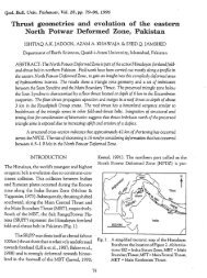
Overview By Dr. M. Asif Khan - National Centre of Excellence in ...
Overview By Dr. M. Asif Khan - National Centre of Excellence in ...
Overview By Dr. M. Asif Khan - National Centre of Excellence in ...

Create successful ePaper yourself
Turn your PDF publications into a flip-book with our unique Google optimized e-Paper software.
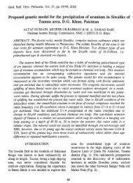
M. <strong>Asif</strong> <strong>Khan</strong>,<br />
<strong>National</strong> <strong>Centre</strong> <strong>of</strong> <strong>Excellence</strong> <strong>in</strong> Geology<br />
University <strong>of</strong> Peshawar
Kirthar Hill<br />
Torrents/<br />
Piedmont Pla<strong>in</strong>s<br />
Peshawar<br />
Bas<strong>in</strong> Hill<br />
Torrents/<br />
Piedmont<br />
Pla<strong>in</strong>s<br />
D.I. <strong>Khan</strong>-Bannu-<br />
Kohat Hill<br />
Torrents/<br />
Piedmont Pla<strong>in</strong>s<br />
Kachhi Bas<strong>in</strong> Hill<br />
Torrents/<br />
Piedmont Pla<strong>in</strong>s<br />
D.G. <strong>Khan</strong> Hill<br />
Torrents/<br />
Piedmont<br />
Pla<strong>in</strong>s<br />
Salt Range Hill<br />
Torrents/<br />
Piedmont<br />
Pla<strong>in</strong>s
• Mounta<strong>in</strong> Front Alluvial<br />
Pla<strong>in</strong>s constitute ~1/6 th <strong>of</strong><br />
Pakistan area (i.e., 200,000<br />
Km2).<br />
• All the four prov<strong>in</strong>ces<br />
partially constituted by<br />
these alluvial pla<strong>in</strong>s.<br />
• Be<strong>in</strong>g topographically<br />
higher than the Indus<br />
River, only partially<br />
irrigated by canals from the<br />
trunk river.<br />
• Irrigation dependent on hill torrents from Sulaiman-Kirthar<br />
Ranges, with some <strong>in</strong>put from ground water
IRRIGATION POTENTIAL<br />
Khyber-Paktunkhwa<br />
(NWFP)<br />
(Million<br />
Acres)<br />
Total Area (NWFP+FATA) 25.4<br />
Cultivable Area 6.72<br />
Irrigated Area<br />
Govt. Canals 1.2467<br />
Civil Canals 0.82<br />
Lift Irrigation Schemes 0.1095<br />
Tube Wells/Dug Wells 0.1008<br />
Total 2.277<br />
Potential Area for Irrigation 4.443<br />
Lakki Marwat 0.588<br />
D.I. <strong>Khan</strong> 1.472<br />
Tank 1.472<br />
Total 2.496<br />
Rest <strong>of</strong> Prov<strong>in</strong>ce 1.947<br />
After: Naseem Golra, KP Irrigation Department
Tribal Belt<br />
Watershed<br />
Hill Torrent Zone<br />
Piedmont &<br />
Flood Pla<strong>in</strong>s<br />
Indus R.<br />
WATERSHED & HILL<br />
TORRENT ZONE, KP<br />
(NWFP) & FATA<br />
•Southern KP (NWFP) lies<br />
between Indus (East) and<br />
Sulaiman Range<br />
Mounta<strong>in</strong> Front (West)<br />
•Comprises Arid<br />
Piedmont Pla<strong>in</strong>s (West)<br />
and Flood Pla<strong>in</strong>s (East)<br />
•Tribal Belt (FATA) marks<br />
the watershed for Hill<br />
Torrent Zone <strong>of</strong> Southern<br />
NWFP.<br />
•Watershed Environment<br />
<strong>of</strong> FATA is key to Hill<br />
Torrent Flood Mitigation<br />
and Rud Kohi Irrigation<br />
<strong>in</strong> Piedmont and Flood<br />
Pla<strong>in</strong> <strong>of</strong> the Southern KP.
Hill Torrent Floods D.I.<strong>Khan</strong> Region, 2010<br />
acquired July 10, 2010<br />
acquired August 11, 2010
After: KP Irrigation Dept<br />
SCHEMATIC LAY OUT MAP<br />
OF ROD KOHI SYSTEM
Potentials<br />
• Vast pla<strong>in</strong> area (e.g., DIK-Tank Area over 90,000 Km2)<br />
• Rich alluvial soils transported by hill torrents<br />
• Efficient recharge <strong>of</strong> the groundwater<br />
• Irrigation potential through hill torrents<br />
Impediments<br />
• Arid climate, < 200 mm annual ra<strong>in</strong>fall.<br />
• Monsoon precipitation highly variable (droughts to<br />
floods)<br />
• Susta<strong>in</strong>ability <strong>of</strong> Flood irrigation (Rod Kohi) difficult.<br />
• Soil erosion extensive.<br />
• Low agriculture/horticulture yield<br />
• Poor socioeconomic conditions.
• Reduction <strong>of</strong> flood damages on piedmont pla<strong>in</strong>s<br />
(<strong>in</strong>undation, soil erosion) and on <strong>in</strong>frastructures<br />
(villages, canals, roads, railways, bridges) and<br />
thereby reduc<strong>in</strong>g the ma<strong>in</strong>tenance costs.<br />
• Increased and susta<strong>in</strong>ed biomass production for<br />
susta<strong>in</strong>able livelihood through watershed<br />
management practices <strong>in</strong>clud<strong>in</strong>g development <strong>of</strong><br />
irrigation methodologies (flood and groundwater<br />
based irrigation), rangeland and livestock<br />
development, and forestry.<br />
• Watershed protection and ecological rehabilitation<br />
through soil and water conservation, revegetation.
Piedmont Pla<strong>in</strong>s (Southern KP-NWFP)<br />
• Flood management <strong>in</strong> piedmont pla<strong>in</strong>s by<br />
structural measures such as distribution and<br />
diversion structures<br />
• Permanent diversion structures to withstand<br />
heavy floods, to ensure reliable resources for<br />
irrigation, agriculture development and<br />
susta<strong>in</strong>able livelihood.<br />
Watershed/Catchment area (Tribal Belt-FATA)<br />
• Watershed needs structural and ecological<br />
rehabilitation to ensure <strong>in</strong>creased and susta<strong>in</strong>ed<br />
biomass production for the <strong>in</strong>habitants.<br />
• Flood management <strong>in</strong> the catchment area<br />
through structural (sediment traps, ra<strong>in</strong><br />
harvest<strong>in</strong>g ponds, slope stabilization) and nonstructural<br />
measures (graz<strong>in</strong>g management, grass<br />
seed<strong>in</strong>g, afforestation, bioeng<strong>in</strong>eer<strong>in</strong>g).
• Integrated Watershed Management<br />
• System (holistic) Approach. Rather than address<strong>in</strong>g the<br />
issue <strong>in</strong> parts, need to th<strong>in</strong>k <strong>in</strong> terms <strong>of</strong> “System”.<br />
• Process Oriented. Each component needs to be dealt with<br />
<strong>in</strong> terms <strong>of</strong> process (e.g., erosion control, sediment<br />
trapp<strong>in</strong>g, rangeland development, water harvest<strong>in</strong>g,<br />
storage-diversion structures)<br />
• Community oriented. Beneficiaries to be actively <strong>in</strong>volved<br />
<strong>in</strong> the detailed plann<strong>in</strong>g and implementation <strong>of</strong> the<br />
proposed measures.<br />
• Short-term, medium-term and long-term measures to<br />
constitute the plan.
• Water Conservation:<br />
• Storage <strong>of</strong> surface water<br />
• Optimal diversion to storage structures and fields<br />
• On-Farm best management practices.<br />
• Recharg<strong>in</strong>g <strong>of</strong> groundwater.<br />
• Seepage control<br />
• Evaporation reduction through aspect considerations, choice <strong>of</strong> plant<br />
species, on-farm water management.<br />
• Regenerat<strong>in</strong>g the Natural Vegetation<br />
• Community managed temporary closures from graz<strong>in</strong>g activity.<br />
• Rotational graz<strong>in</strong>g.<br />
• Renewed grass, shrub, tree seed<strong>in</strong>g for fodder development. native<br />
vegetation regeneration<br />
• Soil Retention<br />
• Earthen and stone bund<strong>in</strong>g<br />
• Vegetation
Piedmont Pla<strong>in</strong>s<br />
• Flood Mitigation Plans<br />
• Rod Kohi Development Plans<br />
• Groundwater Management Plan<br />
• Soil Conservation/Development Plan<br />
• Agriculture/Horticulture Development<br />
Plan<br />
Watershed/Catchment<br />
• Rangeland Management Plan
• Exist<strong>in</strong>g diversion structures<br />
(Modification/Repair<strong>in</strong>g/Rehabilitation)<br />
• New flood diversion structures<br />
• Water storage ponds/Ra<strong>in</strong> Harvest<strong>in</strong>g<br />
• Bund stabilization through:<br />
• Structural measures (e.g., stone pitch<strong>in</strong>g)<br />
• Bioeng<strong>in</strong>eer<strong>in</strong>g (e.g.,trees, shrubs, grass)
• Groundwater monitor<strong>in</strong>g for water levels,<br />
water quality, and abstraction from exist<strong>in</strong>g<br />
wells<br />
• Monitor<strong>in</strong>g <strong>of</strong> recharge conditions<br />
• Ra<strong>in</strong> harvest<strong>in</strong>g structures for <strong>in</strong>creased<br />
recharge<br />
• Water Conservation (improved irrigation<br />
techniques, on farm water management)
Objectives:<br />
• Reduced ra<strong>in</strong>water run <strong>of</strong>f.<br />
• Increase soil moisture through water retention.<br />
• Greater groundwater recharge<br />
• Reduce erosion and adverse siltation <strong>in</strong> water courses<br />
Possible Measures<br />
• Regenerat<strong>in</strong>g vegetation (grass, shrubs, trees).<br />
• Erosion control through structural measures for slope<br />
stability<br />
• Erosion Control with bioeng<strong>in</strong>eer<strong>in</strong>g<br />
• Temporarily clos<strong>in</strong>g/fenc<strong>in</strong>g <strong>of</strong> graz<strong>in</strong>g ground<br />
• Rotational graz<strong>in</strong>g<br />
• Multi-purpose grass/tree species (erosion control,<br />
water/moisture retention, fodder and fuelwood)<br />
Expected Benefits:<br />
• Increased livestock products/higher <strong>in</strong>come.<br />
• Increased charcol production<br />
• Greater retension <strong>of</strong> run <strong>of</strong>f water reduced flood damage<br />
• Groundwater recharge through higher <strong>in</strong>filtration rates<br />
• Reduced erosion and adverse siltation <strong>in</strong> downstream
• Inception Stage:<br />
• Homework started s<strong>in</strong>ce March 2010.<br />
• Organiz<strong>in</strong>g an <strong>in</strong>ternational workshop as part <strong>of</strong> the<br />
Inception Stage to formulate plann<strong>in</strong>g and strategies<br />
and identification <strong>of</strong> expert human resources<br />
• Identification <strong>of</strong> representative watersheds for pilot<br />
projects.<br />
• Preparation <strong>of</strong> Project Proposal (December 2010-<br />
January, 2011)
Terra<strong>in</strong> Mapp<strong>in</strong>g<br />
• Physiography (Topography, Geology, Geomorphology, Landforms, Soil<br />
(NCEG; Soil Survey <strong>of</strong> Pakistan)<br />
• Landuse/Vegetation (NCEG, PFI)<br />
• <strong>Dr</strong>a<strong>in</strong>age Pattern (WRRI_NARC, UET_Pesh, KPAU_Pesh)<br />
Surveys & Inventories<br />
• Agro-Economy Survey (KPAU)<br />
• Inventory <strong>of</strong> Flood Irrigation System (WRRI_NARC, KP Irrigation Dept)<br />
• Inventory <strong>of</strong> Exist<strong>in</strong>g Soil Conservation Measures (NCEG, WRRI_NARC,<br />
KP Irrigation Dept)<br />
• Inventory <strong>of</strong> Exist<strong>in</strong>g Water Conservation Measures (NCEG,<br />
WRRI_NARC, KP Irrigation Dept)<br />
• Assessment/Mapp<strong>in</strong>g <strong>of</strong> Soil Erosion (KPAU_Pesh, NCEG, SSP)<br />
• Socioeconomic Survey (UoP)<br />
• Rangeland Survey for grass, shrub varieties (PFI_Peshawar)<br />
• Water Resources Survey (Ra<strong>in</strong>fall data, Stream Flow-Gauge Data)<br />
NCEG, WRRI_NARC, KP Irrigation Dept<br />
• Sediment Load Survey (NCEG, WRRI_NARC, KP Irrigation Dept)<br />
• Ground Water Inventory (Exist<strong>in</strong>g well data, Water Table depth,<br />
Aquifers, Quality, Recharge) (NCEG, WAPDA)
Rangeland<br />
Non-Structural<br />
Afforestation (Plant, Grass<br />
Seed Nursery, Supply and<br />
Pasture Development)<br />
Graz<strong>in</strong>g Management<br />
(control/development<br />
measures)<br />
Livestock Development<br />
Structural<br />
Rangeland Erosion Control<br />
Catchment Sediment Traps<br />
Ra<strong>in</strong>water Harvest<strong>in</strong>g<br />
Structures<br />
Water Storage Structures<br />
(Ponds, small dams, Large<br />
Dams)<br />
Flood Control Structures<br />
Ra<strong>in</strong> Harvest<strong>in</strong>g Structures<br />
Piedmont<br />
Non-Structural<br />
Soil retension/stabilization/<br />
redevelopment plans<br />
Soil fertility plans<br />
Agriculture/horticulture<br />
development (crops, fruits)<br />
Bund stabilization<br />
bioeng<strong>in</strong>eer<strong>in</strong>g designs<br />
Flood water management<br />
(control/distribution, on-farm<br />
management)<br />
Structural<br />
Diversion Channel Structures<br />
(Earthen, Stone-Pitched,<br />
Concrete Bunds)<br />
Ra<strong>in</strong>water Harvest<strong>in</strong>g<br />
Structures<br />
Water Storage Structures<br />
(Ponds, small dams, Large<br />
Dams)<br />
<br />
<br />
Flood Control Structures<br />
Soil Erosion Control and New<br />
Soil Development Structures
• Pilot/Demonstration Project Approach<br />
•Fund<strong>in</strong>g to be arranged Government/International<br />
Donors<br />
• Consortium Approach<br />
Expertise from academia, governmental <strong>in</strong>stitutions,<br />
private sector to be synchronized as a consortium with<br />
proper <strong>in</strong>centives.<br />
• Project Directorate<br />
A dedicated Project Directorate to implement the<br />
Demonstration Project.<br />
•Relevant Government Departments to be <strong>in</strong>volved<br />
with appropriate <strong>in</strong>centives.<br />
•Maximum emphasis on community participation with<br />
appropriate <strong>in</strong>centives.
International Plann<strong>in</strong>g Workshop<br />
Watershed Management & Land Rehabilitation, NW Frontier<br />
Region, Pakistan<br />
• December 6-8, 2010<br />
• Auditorium, Pakistan Academy <strong>of</strong><br />
Sciences, Islamabad<br />
• Sponsored by:<br />
• U.S. Department <strong>of</strong> Agriculture<br />
• Higher Education Commission, Pakistan<br />
• 12 Foreign Participants from USA,<br />
Netherlands, Nepal, Egypt and Canada.<br />
• Overall 80 participants.<br />
• To be <strong>in</strong>augurated by Federal M<strong>in</strong>ster <strong>of</strong><br />
Food & Agriculture.<br />
• F<strong>in</strong>al Plenary Session Wednesday,<br />
December 8, 2010, which will be chaired by<br />
the Honourable Governor Khyber-<br />
Pakhtunkhwa Prov<strong>in</strong>ce.
International Plann<strong>in</strong>g Workshop<br />
Watershed Management & Land Rehabilitation, NW Frontier<br />
Region, Pakistan<br />
December 6-8, 2010<br />
WORKSHOP FORMAT<br />
Auditorium, Pakistan Academy <strong>of</strong> Sciences, Islamabad<br />
• 11 Sessions, 9 sessions are Technical.<br />
• 37 Technical Papers be<strong>in</strong>g presented.<br />
• Three Work<strong>in</strong>g Groups <strong>in</strong> 4 Technical Sessions : Way-Forward Plan<br />
WORKSHOP THEMES<br />
• Mounta<strong>in</strong>-Front Alluvial Fans, Pakistan: Geological and geomorphological<br />
aspects.<br />
• Hill torrents and flash floods: history, frequency, <strong>in</strong>tensity, distribution,<br />
hazards and possible remedies.<br />
• Flood irrigation practices (Rod Kohi); historical background, layouts,<br />
structures, achievements, shortcom<strong>in</strong>gs and way forward.<br />
• Irrigation eng<strong>in</strong>eer<strong>in</strong>g; channelization, diversion channels, sediment traps,<br />
reservoirs (dams), irrigation canals from Indus River.<br />
• Soil erosion, degradation, reclamation, stabilization, fertility and productivity.<br />
• Groundwater hydrology.<br />
• Agriculture development and afforestation