Part 2 The Indigenous people - Sapphire Coast
Part 2 The Indigenous people - Sapphire Coast
Part 2 The Indigenous people - Sapphire Coast

Create successful ePaper yourself
Turn your PDF publications into a flip-book with our unique Google optimized e-Paper software.
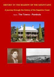
HISTORY IN THE SHADOW OF THE MOUNTAINS<br />
A journey through the history of the <strong>Sapphire</strong> <strong>Coast</strong><br />
<strong>Part</strong> 2 – <strong>The</strong> <strong>Indigenous</strong> People
<strong>The</strong> <strong>Indigenous</strong> <strong>people</strong> of the region<br />
Between 20 and 28 April 1770, Captain James Cook sailed north<br />
in the ship Endeavour along this part of the coast towards the<br />
place he named Botany Bay, arriving there on 29 April.<br />
<strong>The</strong> journals and diaries of James Cook, the botanist Joseph<br />
Banks and numerous members of the crew all record seeing the<br />
<strong>Indigenous</strong> <strong>people</strong> of the region. Most reported seeing smoke<br />
from several fires, while some individuals were observed on<br />
beaches near the mountain Cook named Mount Dromedary on 22<br />
April.<br />
First occupation of the land<br />
It is beyond the scope of this narrative to give proper respect to<br />
and describe the complex and sophisticated Aboriginal religious<br />
and creation stories. It may be sufficient to say that a common<br />
thread among the different cultural groups is a creation story<br />
woven into the landscape that records certain totemic animals and<br />
dramatic events involving ancestral beings. <strong>The</strong>se are recorded<br />
today in sites, plants, behaviour of specific animals and celestial<br />
and landscape features. Whilst the stories relate to distant<br />
creation times, the religious significance of these manifestations of<br />
creation is very much alive today, reinforced by stories, rituals,<br />
taboos, intermarriage, initiations and dance.<br />
Scientific studies interpret the initial occupation of the Australian<br />
landmass by Aboriginal <strong>people</strong> as the result of migration out of<br />
Africa. This migration was part of the great intercontinental
migration of modern humans in the Upper Palaeolithic period.<br />
Current scientific discussion suggests an arrival date on this<br />
continent about 50,000 years ago, during the last Ice Age. One<br />
definite date of occupation is the 42,000 year-old ritual burial sites<br />
at Lake Mungo in southwest New South Wales. <strong>The</strong>se are<br />
deemed to be of world significance and accordingly are inscribed<br />
on the World Heritage List.<br />
Upper Palaeolithic migration routes out of Africa (Wikipedia)<br />
For over 85% of the period of Aboriginal occupation of this region,<br />
the coastline was up to 20km east of the current shoreline due to<br />
much lower sea level. Sea level has been at its current level for<br />
the last 6000 years. Hence, most of the archaeological material,<br />
such as campfire charcoal and shell middens, that would provide<br />
evidence for that long history of occupation, is now under water.<br />
<strong>The</strong> coastal shell middens that can be seen today are dated at<br />
around 3000 years, in line with post-ice age sea levels.<br />
Ice age and current sea levels (Wikipedia)
<strong>The</strong> distribution of the different <strong>Indigenous</strong> language groups was<br />
recorded by the Anthropologist and Ethnologist Norman Tindale.<br />
<strong>The</strong>se are indicated on his map covering continental Australia<br />
(1974). Whilst this map is not comprehensive, it is a considered a<br />
reasonable attempt to depict Aboriginal tribal distribution at the<br />
time of the first European occupation.<br />
<strong>The</strong> extract from Tindale’s map shown below relates to this region<br />
and gives a brief description of each of the groups he catalogued.<br />
It should be noted that there are many alternative names for the<br />
groupings described by Tindale, reflecting the various attempts to<br />
anglicise <strong>Indigenous</strong> languages.<br />
Thaua<br />
From north of Merimbula south to Green Cape and west to<br />
the scarp of the Dividing Range. <strong>The</strong> Thaua were divided<br />
into two groups, the Katungal 'sea coast <strong>people</strong>,' and the<br />
Baianbal or Paienbara, the 'tomahawk <strong>people</strong>'.<br />
Djiringanj<br />
From Cape Dromedary (Kajan) south to beyond Bega and<br />
inland to the scarp of the Dividing Range east of Nimmitabel.<br />
One observer (Howitt 1904) used the term Yuin to embrace<br />
this tribe and the Thaua.
Walbanga<br />
Cape Dromedary north to near Ulladulla; Moruya, Braidwood<br />
and Araluen; and inland on the Shoalhaven River.<br />
Bidawal<br />
<strong>Coast</strong> between Green Cape and Cape Everard (Point Hicks);<br />
inland to Delegate, NSW; and on headwaters of the Cann<br />
and Bern rivers; chiefly in rainforest and wet sclerophyll<br />
forest country – environments that were inhospitable to<br />
others.<br />
Ngarigo<br />
Monaro tableland north to Queanbeyan; Bombala River from<br />
near Delegate to Nimmitabel; and west to the crest divide of<br />
the Australian Alps. In winter these tableland <strong>people</strong><br />
sometimes came down to coastal territories for shelter,<br />
thereby gaining a reputation for aggressiveness.<br />
Today, Yuin is the general or generic name for all tribes from<br />
Merimbula to Port Jackson. <strong>The</strong> Yuin, (or <strong>Coast</strong> Murring), as a<br />
broad group occupied territory from Cape Howe to the Shoalhaven<br />
River and inland to the Great Dividing Range. <strong>The</strong> population pre-<br />
1788 was estimated at about 11,000 between Cape Howe and<br />
Batemans Bay, comprising two main tribes, Walbanja and<br />
Dyiringanj. As a result of battles, smallpox epidemics and other<br />
diseases, the population is believed to have reduced by 95%,<br />
leaving only 600 survivors by the mid-1800s.<br />
This story of dramatic population decline through disease and<br />
conflict is repeated across Australia. <strong>The</strong> vulnerability of the<br />
eastern Australian <strong>Indigenous</strong> population to diseases brought by<br />
Europeans is reflected in other parts of the world. Researchers<br />
claim that 95% of the total population of the Americas died in the<br />
first 130 years after Europeans arrived and that 90% of the<br />
population of the Inca Empire died in disease epidemics. A<br />
University of California study estimated that the population in<br />
Mexico declined from 25.2 million in 1518 to 700,000 <strong>people</strong> in<br />
1623, less than 3% of the original population.
<strong>The</strong> spread of disease was not all one way. <strong>The</strong> Black Death<br />
plague, introduced from Asia, reduced Europe’s population by<br />
around 60% in the 14 th century.<br />
Contact with the first Europeans<br />
<strong>The</strong> first non-indigenous <strong>people</strong> on this part of the south coast<br />
were the trek survivors of the Sydney Cove shipwreck in Bass<br />
Strait in 1797, which included Europeans and Lascar seamen<br />
(probably from the Bay of Bengal area).<br />
In the early part of 18 th century, European contact with Aboriginal<br />
<strong>people</strong> in this region was generally around Twofold Bay and<br />
involved the sealing and whaling industries. <strong>The</strong> first record of<br />
conflict was in the Sydney Gazette of 6 April 1806. <strong>The</strong> report tells<br />
of weeks of tension ending in a confrontation between 11 sealers<br />
from the stranded whaler George and a tribal group which resulted<br />
in the death of nine Aboriginals. <strong>The</strong> report is silent on the cause<br />
of the tension however sealers were notorious for their treatment<br />
of Aboriginal <strong>people</strong> in Tasmania and the abduction of Aboriginal<br />
and Maori women.<br />
<strong>The</strong> impetus for expansion of European settlement into the region<br />
was the booming colonial wool economy of the 1820s and<br />
consequently the unauthorised occupation (squatting) on potential<br />
grazing land.<br />
<strong>The</strong> first squatters came to the area from the southern tablelands,<br />
guided by Aboriginal <strong>people</strong>. By the 1830s the best pastoral ‘runs’<br />
were fully occupied. Squatting tenure was formalised in the 1836<br />
Crown lands legislation that provided for grazing leases over the<br />
runs.<br />
This early pastoral settlement involved considerable conflict with<br />
Aboriginal <strong>people</strong> as the following account describes:<br />
Dr Imlay had two Aboriginal natives on board wearing the<br />
dress of Europeans and remarkably expert as shepherds<br />
and in the management of cattle; and he told me that his<br />
whaling station at Twofold Bay was manned almost entirely<br />
and carried on with great success by labourers selected from<br />
their fellow countrymen. But he added some exciting details<br />
of the carnage and merciless predatory warfare which is<br />
constantly going on between the stockmen and the tribes
which hover on the outskirts of the pastoral tracts (Wakefield<br />
1839-45).<br />
<strong>The</strong>se conflicts are still alive in the collective memory of <strong>people</strong> in<br />
the region. One story from the 1840s describes how the manager<br />
of Nungatta Station, knowing the Aboriginal <strong>people</strong> were fond of<br />
taking milk, killed many Aboriginal <strong>people</strong> by putting strychnine in<br />
milk. Another story from the Pambula area in the mid-19 th century<br />
tells of flour and milk poisoning causing many deaths. Another<br />
story from the Nungatta area tells of the deaths by shooting of<br />
‘thirty or forty Aboriginals’. An eight year-old child involved in this<br />
event survived into old age to tell the story.<br />
Around this time the Imlay brothers had 21 stations ranging across<br />
the far south coast region from Bitangabee Bay and the Towamba<br />
Valley in the south, to Cobargo in the north and Rocky Hall and<br />
Bemboka to the west. <strong>The</strong>y also had land in Tasmania, Gunning<br />
further inland in NSW and the North Island of New Zealand.<br />
Aboriginal men and women were employed on these first stations<br />
as cattle and sheep herders, for stripping bark from wattle trees,<br />
keeping birds and other animals away from crops, harvesting,<br />
shearing and sheep dipping (Returns on Aboriginal Employment<br />
1851).<br />
Twofold Bay shore-based whaling commenced in 1828. An 1844<br />
account talks about Aboriginal men, women and children from<br />
Bega, Belowra, Brogo, Biamanga, Cobargo, Gulaga, Mumbulla,<br />
Murrah, Tarraganda, Wolumla and Wandella as well as those from<br />
the Twofold Bay area. By the 1840s employment in the whaling<br />
industry occurred during winter and early spring, while wattle<br />
debarking and pastoral properties work occurred in late spring and<br />
early summer. Aboriginal whalers performed all tasks including<br />
those of steersman, harpooner, lookout, oarsman, flensing and the<br />
boiling down of the blubber.
Twofold Bay whalers in 1915<br />
<strong>The</strong> Katungal <strong>people</strong> and whales<br />
A special hunting relationship between the Katungal (sea coast<br />
<strong>people</strong>) of the Thawa group and Killer Whales (Orcas) had<br />
developed over a very long time. <strong>The</strong> Killer Whales would alert the<br />
Aboriginal hunters to the presence of larger whales and drive them<br />
inshore where hunters could spear them. Wounded animals would<br />
be prevented from escaping by the Killer Whales. <strong>The</strong> Killer<br />
Whales would be rewarded for their assistance with the lips and<br />
the tongue of the whale.<br />
This traditional skill was utilised in the shore-based whaling<br />
industry in Twofold Bay by the early European whalers.<br />
A remarkable photograph of a Killer Whale involved in hunting a<br />
Humpback whale
<strong>The</strong> special significance of Gulaga Mountain<br />
Gulaga seen from near Cobargo<br />
Historical sources support the notion of Gulaga as having a special<br />
association for Aboriginal <strong>people</strong>. Gulaga (or 'Cooliga' or 'Caluga'<br />
or 'Kolager' or 'Kolegar' as it was variously recorded last century)<br />
was recognised as “the big mountain of the blackfellow” by the<br />
editor of the Bega Standard in 1879.<br />
Early European anthropological work records a 'Gulaga Creation<br />
Story' that describes how <strong>people</strong> relate to supernatural beings as<br />
well as with totemic animals:<br />
<strong>The</strong> Bat and the Mur-an-rai (Emu-wren) are the men's brothers and<br />
Tintegallan (the tree-creeper) is the women's sister. It is said that the<br />
Mur-an-rai first made the human sexes distinct by splitting up the then<br />
existing <strong>people</strong> and by then sewing them up again. To kill a treecreeper<br />
would greatly offend the women and cause them to fight with<br />
the men.<br />
It is said that long ago there were no men or women on the earth but<br />
only animals, birds, reptiles and so on, that there were no trees and<br />
that the earth was bare and the sky, as ‘hard as a stone'. Daramulun<br />
lived on the earth with his mother Ngalal-bal. He placed trees on the<br />
earth. At this time when the earth was only inhabited by animals the<br />
land extended far out where there is now sea. <strong>The</strong> thrush (kabboka)<br />
when out hunting killed a wallaby and gave some of it to the other<br />
birds. <strong>The</strong>se looking at it and smelling it said `it is going rotten' and<br />
complained about it. <strong>The</strong> thrush being very much enraged, while the<br />
others were out hunting commenced to dance and sing the talmaru<br />
dance until he caused a furious gale of wind to arise. Whirlwinds swept<br />
leaves, sticks and dust into the air and torrents of rain fell and drowned<br />
the whole country and all the <strong>people</strong> in it except some who turned into<br />
fish and some who crawled out on the land and became men and<br />
women. Some say that only two survived, a man and a woman, who
crawled into Mt Dromedary [Gulaga] and then escaped and that's how<br />
all the Murring are descended.<br />
Daramulun all this time lived up in the sky with his wife and his mother<br />
Ngal-al-bal went up into the sky where he now is. It was Daramulun –<br />
the Biambun (Headman - ruler) who taught the Murring and instituted<br />
the Bunan and its ceremonies and gave his laws to old <strong>people</strong> who first<br />
lived and who handed it down from father to son to these times.<br />
A 1970s account of the cultural significance of Gulaga comes from<br />
Guboo Ted Thomas, the acknowledged spiritual leader of the<br />
Wallaga Lake Aboriginal Community, who recounts the 'Legend of<br />
Gulaga':<br />
To the Yuin <strong>people</strong>, Gulaga is the Mother Mountain. One day her<br />
young son came to her and asked if he could leave home, Gulaga let<br />
him so he moved far out to sea. On seeing that his big brother had left,<br />
Gulaga's baby son wanted to leave too. Because he was so young she<br />
permitted him to move only a short distance away where she could<br />
keep an eye on him. Gulaga is the Yuin name of Mt Dromedary, her<br />
baby is Nudgenooka and her other son is Barangooba.<br />
Another story tells:<br />
Many, many years ago a tribe of Aboriginals lived on top of Gulaga<br />
Mountain. A lovely young girl was pregnant and her husband went<br />
hunting to get her a beautiful white fur. While he was away, a young<br />
man came to her camp and killed her. When her husband returned<br />
carrying the beautiful white fur, he found her dead, so he wrapped the<br />
fur around her. To punish the young man, the elders of the tribe told<br />
him he had to go away, so he went and lived by himself.<br />
<strong>The</strong>n a great earthquake came and divided the mountain, so they<br />
never saw the young man again. <strong>The</strong>y called the little mountain,<br />
Najanara, after the young man. So that is why we have Gulaga,<br />
Najanara, and Montague which came up out of the sea.<br />
To this very day when you look up at the mountain, on the very top you<br />
will see a pregnant woman lying down. Sometimes you will see a cloud<br />
around the top of the mountain. <strong>The</strong> <strong>people</strong> say to one another, “Well,<br />
today she is wearing her white fur”.
Mumbulla Mountain<br />
Mumbulla Mountain from the Princes Highway<br />
In the mid-1970s logging operations were extending to the state<br />
forests of the Mumbulla Mountain area. As a consequence of<br />
increasing public debate about logging impacts, the NSW State<br />
Government established an Advisory Committee on South <strong>Coast</strong><br />
Wood Chipping. This coincided with a Parliamentary Select<br />
Committee visit to the Aboriginal Community at Wallaga Lake in<br />
February 1979.<br />
Guboo Ted Thomas, who led the protest against the desecration of<br />
Mumbulla Mountain, addressed the Committee in the following<br />
terms:<br />
Why we are interested in this land here, the Mumbulla Mountain and Mt<br />
Dromedary, is that they are sacred sites, they are part of us. You have<br />
your cathedrals in Sydney where you worship. It is the same for the<br />
Aboriginal <strong>people</strong>... We do not want to lose our culture. We are trying<br />
to restore all our sacred sites. We want to retain where we worship.<br />
This is what we are looking at. That mountain up there is a powerful<br />
mountain because it draws the <strong>people</strong> back.<br />
He asserted that the mountain was a highly significant landscape<br />
as it was not only the 'dreaming place' of the elder Jack Mumbler<br />
(Biamanga), but it also was a place where sacred and secret<br />
initiation ceremonies were held.<br />
<strong>The</strong> battle to save the mountain from logging stimulated wide<br />
community interest in the sacredness of the mountain and the<br />
knowledge held by a few senior <strong>people</strong>. This interest found<br />
expression in a ceremony involving Aboriginal and non-Aboriginal
<strong>people</strong> before dawn on the first day of spring in 1980 on the<br />
mountaintop.<br />
In 1984 the NSW Government declared the area to be protected<br />
as an Aboriginal Place under National Parks legislation. <strong>The</strong> site<br />
description includes:<br />
Biamanga (Mumbulla Mountain) is the central feature of Biamanga<br />
Aboriginal Place, which is part of a large ceremonial and cultural<br />
pathway on the south coast that includes Gulaga (Mt Dromedary),<br />
Umbarra (Merriman Island), Barungba (Montague Island), and Dithol<br />
(Pigeon House Mountain). Biamanga can be seen from across all of<br />
the Bega Valley and draws Aboriginal <strong>people</strong> back to the area. <strong>The</strong><br />
highest peak on Biamanga is the Dreaming place of the Yuin leader<br />
King Jack Mumbulla. He used to sit and meditate on the top of the<br />
mountain and send smoke signals to his <strong>people</strong> in the valley below.<br />
<strong>The</strong> Yuin <strong>people</strong> of the south coast held initiation ceremonies at a<br />
number of sacred sites on the mountain. <strong>The</strong> last initiation ceremony<br />
was held there in 1918. Some Yuin <strong>people</strong> remember tribal Elders who<br />
were initiated on the mountain, and who passed traditional information<br />
about the mountain's sacred sites on to them. Initiated men would go<br />
to sacred sites on the mountain to meditate and communicate with the<br />
spirits.<br />
<strong>The</strong> battle to protect sacred sites from logging revitalised cultural<br />
knowledge in the local Aboriginal community. <strong>The</strong> Yuin Tribal Council<br />
chose to name the place after the deceased elder, Jack Mumbler<br />
whose 'tribal' name was Biamanga.<br />
Biamanga National Park, which includes Biamanga Aboriginal Place,<br />
was given back to the Yuin <strong>people</strong> in May 2006. Today the Aboriginal<br />
community plays an important role in looking after Biamanga Aboriginal<br />
Place. <strong>The</strong> area is managed jointly by the Aboriginal owners and the<br />
NSW National Parks and Wildlife Service.
Biamanga, also known as Jack Mumbler, Merriman, an<br />
unknown man and Neddy with Biamanga's breast plate at<br />
Wallaga Lake, ca. 1900<br />
Joint management of Gulaga and Biamanga National Parks<br />
Although they are separate national parks, Biamanga and Gulaga<br />
form part of one continuous 'cultural landscape'. Inalienable<br />
freehold title to those places was given to the Yuin <strong>people</strong> in 2006.<br />
With the vesting of title, the parks were re-dedicated back to the<br />
Government for the purposes of national parks under 30 year<br />
leases.<br />
<strong>The</strong> leases provide Aboriginal owners with financial benefits in the<br />
form of rent, as well as increased involvement in land and cultural<br />
heritage management.<br />
<strong>The</strong> care, control and management of each park are vested in a<br />
Board of Management. A meeting quorum can only be reached if<br />
the majority of members present are Aboriginal owner members.<br />
A Board must spend rental monies for park management purposes<br />
of 'Community Development' or acquisition of land for addition to<br />
the park.
Gulaga and Biamanga national parks<br />
<strong>The</strong> photo captures the celebration on 6 May 2006 to mark the<br />
return of Biamanga and Gulaga national parks to their Aboriginal<br />
owners, the Yuin <strong>people</strong>, by the Minister for Environment. <strong>The</strong>se<br />
parks were the third and fourth parks to be returned to Aboriginal<br />
ownership in NSW and the first on the eastern seaboard. Mary<br />
Duroux and Lionel Montga hold up the declarations.
Aboriginal Places<br />
An Aboriginal Place is defined in NSW national parks legislation as<br />
a place that “is or was of special significance with respect to<br />
Aboriginal culture”. This gives protection to the intangible, social<br />
and spiritual heritage of Aboriginal <strong>people</strong> in NSW. Places that do<br />
not contain archaeological remains, but are culturally and socially<br />
important to Aboriginal <strong>people</strong> are also protected under the<br />
legislation. <strong>The</strong>se include sacred sites as well as fringe camps<br />
and Aboriginal reserves from the 19 th and 20 th centuries.<br />
Bermagui Waterhole boardwalk<br />
Bermagui Waterhole Aboriginal Place<br />
<strong>The</strong> local Yuin <strong>people</strong> camped at Bermagui Waterhole long before<br />
European settlement and continued to camp there regularly until<br />
the 1920s. In an interview in 1981, the Guboo Ted Thomas,<br />
respected Elder and knowledge-holder of the Yuin <strong>people</strong>, recalled<br />
camping at Bermagui Waterhole, and that “my grandfather,<br />
grandmother, and all the <strong>people</strong> from Wallaga Lake used to come<br />
down here”. Bermagui Waterhole was a popular camping spot<br />
because it was a permanent source of fresh water and there were<br />
plenty of fish and shellfish nearby. Although the waterhole is on<br />
Yuin traditional land, many other Aboriginal groups also used it as<br />
a camping place. <strong>The</strong>y would camp for a few weeks and then<br />
move on making sure they left behind enough food for others.<br />
Bermagui Waterhole is also part of a traditional walking track along<br />
the coast and to Yuin ceremonial and spiritual sites. Aboriginal<br />
<strong>people</strong> stopped off at Bermagui Waterhole as they followed the<br />
track to Biamanga (Mumbulla Mountain), a sacred site to the<br />
south, or to Gulaga (Mt. Dromedary), a ceremonial site to the
north. This was part of the ceremonial and initiation circuit of the<br />
Yuin <strong>people</strong>.<br />
<strong>The</strong> Bermagui Waterhole is a significant wetland, particularly for<br />
water birds. <strong>The</strong> site is the end of a spectacular coastal walk that<br />
starts next to Wallaga Lake and is highly recommended for visitors<br />
to the area. Visitors will find access to the boardwalk from the<br />
Wallaga Lake Road coming in to Bermagui town from the north.
Merriman Island Aboriginal Place<br />
Wallaga Lake with Merriman Island in the upper centre<br />
Merriman Island, shaped like a duck, is called Umbarra the black<br />
duck by the Yuin <strong>people</strong> for whom it is a totem. King Merriman, a<br />
Yuin Elder who died in 1904, had a special relationship with the<br />
black duck, which would warn him of danger by flapping its wings,<br />
diving down into the water and splashing.<br />
During a battle with a tribe from the south (from what is now the<br />
State of Victoria), King Merriman saw the black duck on the lake<br />
flapping its wings wildly - this was a warning that the tribe from<br />
Victoria was coming closer. This warning gave Merriman time to<br />
go across to the island and direct the battle from there. <strong>The</strong> Yuin<br />
<strong>people</strong> won the battle. <strong>The</strong> island was later named after King<br />
Merriman, and will always be associated with the story of this<br />
battle.<br />
Merriman Island was the first Aboriginal Place to be gazetted.<br />
Access to the island is restricted because of it is a sacred site of<br />
the Yuin Aboriginal <strong>people</strong>.<br />
King Merriman
<strong>The</strong> distribution of Aboriginal Places is not comprehensive and<br />
does represent all of the important sites of Aboriginal history and<br />
culture. With over 1000 generations of continuous occupation of<br />
the land, there is likely to be a wealth of undiscovered<br />
archaeological material and cultural stories associated with those<br />
sites. Much of this evidence of occupation is now drowned by sea<br />
level rise over a period of 20,000 years. Some will come to light in<br />
the archaeological surveys that are now part of NSW development<br />
planning and approval processes.
<strong>Indigenous</strong> Heritage Tourism<br />
Bundian Way<br />
<strong>The</strong> Bundian Way is a 265 km ancient Aboriginal route linking the<br />
Australian Alps to the coast. It connects Targangal (Mt<br />
Kosciuszko) to the Bilgarera coastal site (Fisheries Beach) on<br />
Tullenmullerer (Twofold Bay). <strong>The</strong> Bundian Way is of outstanding<br />
heritage significance as it represents the key traditional walking<br />
pathways that connected Aboriginal <strong>people</strong> to the land for trade,<br />
inter-tribal relationships and ceremonial events. This route was<br />
used later by the Europeans, mostly guided by Aboriginal <strong>people</strong>,<br />
to explore and settle new areas.<br />
Planning is currently underway to provide an <strong>Indigenous</strong> heritage<br />
tourism experience associated with the Bundian Way. It is<br />
envisaged that this will give visitors a range of different<br />
experiences that reflect different aspects of the landscape and the<br />
stories. <strong>The</strong> gateway to the route is the Monaroo-Bobberer-Gudu<br />
Keeping Place at Jigamy, next to Pambula Lake.<br />
When finalised, information about this outstanding heritage tourism<br />
experience will be posted on the websites of Australia’s <strong>Coast</strong>al<br />
Wilderness and <strong>Sapphire</strong> <strong>Coast</strong> Tourism.<br />
Mt Kosciuszko Byadbo Wilderness Twofold Bay<br />
<strong>The</strong> Bundian Way (Victoria-NSW border area)