Climate change - Geological Society of Australia
Climate change - Geological Society of Australia
Climate change - Geological Society of Australia

You also want an ePaper? Increase the reach of your titles
YUMPU automatically turns print PDFs into web optimized ePapers that Google loves.
The <strong>Geological</strong> <strong>Society</strong><br />
<strong>of</strong> <strong>Australia</strong> Inc<br />
tag<br />
Newsletter Number 158<br />
March 2011<br />
Combating<br />
the water<br />
crisis<br />
see p26<br />
Past<br />
climate<br />
<strong>change</strong><br />
see p29<br />
Hot<br />
planets<br />
see p33<br />
<strong>Australia</strong>’s water dilemma<br />
<strong>Climate</strong> <strong>change</strong> in the Quatertnary<br />
Is Mars warming up<br />
NEW: Geoscience tech reviews
The <strong>Australia</strong>n Geologist<br />
Newsletter 158, March 2011<br />
Registered by <strong>Australia</strong> Post<br />
Publication No. PP243459/00091<br />
ISSN 0312 4711<br />
Managing Editor Sue Fletcher<br />
Deputy Editor Heather Catchpole<br />
Technical Editor Bill Birch<br />
Send contributions to tag@gsa.org.au<br />
Central Business Office<br />
Executive Director Sue Fletcher<br />
Suite 61, 104 Bathurst Street,<br />
Sydney NSW 2000<br />
Telephone (02) 9290 2194<br />
Fax (02) 9290 2198<br />
Email info@gsa.org.au<br />
GSA website www.gsa.org.au<br />
Design Alan Taylor, The Visible Word Pty Ltd<br />
Typesetting Joan Taylor, The Visible Word Pty Ltd<br />
Printed by Ligare Pty Ltd<br />
Distributed by Trade Mailing & Fulfilment Pty Ltd<br />
Combating<br />
<strong>Australia</strong>’s water crisis<br />
p26<br />
Kyle Horner sums up<br />
hydrogeology issues and<br />
innovations in <strong>Australia</strong>.<br />
Quaternary climate<br />
<strong>change</strong> p29<br />
Brad Pillans takes us through<br />
the geological record for<br />
climate <strong>change</strong> during the<br />
Quaternary. Image courtesy<br />
NASA/GRACE team/DLR/Ben Holt Sr.<br />
Is Mars warming up<br />
p33<br />
Graziella Caprarelli examines if<br />
Mars' climate is warming and<br />
if we can make links between<br />
the Earth's and Mars’ climate<br />
systems. Image courtesy NASA.<br />
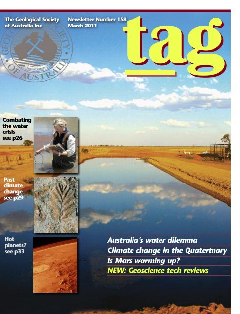
FRONT<br />
COVER<br />
Groundwater stored in a holding<br />
pond in the lower<br />
Murrumbidgee. Flooding in the<br />
area affected soil erosion rates<br />
and swamped native vegetation;<br />
in the past, drought<br />
conditions have seen low flows<br />
and isolated pools. <strong>Australia</strong>’s<br />
river systems have some <strong>of</strong> the<br />
world’s most variable flows, and<br />
we must manage a complex<br />
hydrological system to identify<br />
and secure sources <strong>of</strong> fresh<br />
water for the future.<br />
Image courtesy Kyle Horner.<br />
Inset images courtesy Murray-<br />
Darling Basin Authority; NASA;<br />
Brad Pillans.<br />
22 From the President<br />
23 Editor’s Comment<br />
24 <strong>Society</strong> Update<br />
Business Report<br />
Membership Update<br />
Letters to the Editor<br />
From the AJES Editor’s Desk<br />
Education & Outreach<br />
Stratigraphic Column<br />
Heritage Matters<br />
15 News from the Divisions<br />
16 News from the Specialist Groups<br />
17 News<br />
24 Young Earth Science News<br />
36 ARC Grants<br />
40 Tech talk<br />
41 Book Reviews<br />
46 Calendar<br />
47 Office Bearers<br />
48 Publishing Details
From the President<br />
Over the past few months there have been widespread,<br />
devastating floods in eastern <strong>Australia</strong> —<br />
a catastrophe for the people affected and also for<br />
the nation, including the mining industry. On one ABC<br />
television news broadcast, a reporter interviewed a “fluvial<br />
geomorphologist”, the first time I have seen this particular, precise<br />
label applied to an Earth Science interviewee. Naturally, as<br />
a geomorphologist (in part) myself, I welcome this opportunity<br />
not only for the discipline to receive publicity, but also the<br />
opportunity for a suitably-qualified scientist to provide expert<br />
comment. It is a sad fact, but true, that, in many natural<br />
disasters, the public pr<strong>of</strong>ile <strong>of</strong> Earth Scientists is raised and<br />
money for research becomes available. GSA members would<br />
doubtless recognise that preparedness for natural disasters,<br />
including earthquakes, floods, storms, tsunamis and landslides<br />
etc, is enhanced, in many instances, by geoscience research, but<br />
we need to sell that message more successfully to the wider<br />
community.<br />
Heavy rain in the Canberra region in December resulted in<br />
flooding in the Queanbeyan River catchment, a tributary <strong>of</strong> the<br />
Molonglo River that flows into Lake Burley Griffin. Huge<br />
numbers <strong>of</strong> trees were washed into the lake, forming large<br />
timber debris rafts that took weeks to clear. There was much<br />
local debate about the source <strong>of</strong> so much woody debris — was<br />
it from a recent willow-removal program which left excess<br />
dead woody material along the river banks Or was it just<br />
typical <strong>of</strong> a large flood event after many years <strong>of</strong> drought A<br />
fluvial geomorphologist might have usefully been consulted to<br />
investigate! In 1988, while I was living in New Zealand,<br />
Cyclone Bola caused massive floods in the North Island and<br />
trees were also in the news — many kauri trees were washed<br />
out <strong>of</strong> reserves and ended up on private property. Kauri is a<br />
prized and valuable timber, so land-owners were keen to pr<strong>of</strong>it<br />
from the unexpected windfall. At the time there were<br />
arguments about who owned the wood. I don’t recall how it<br />
was resolved, but I daresay it was lawyers rather than scientists<br />
that were employed to solve that case.<br />
In this issue, we report the<br />
results <strong>of</strong> the GSA poll <strong>of</strong> members,<br />
which produced a strong YES vote<br />
for the <strong>Society</strong> to have a statement<br />
on climate <strong>change</strong>. The GSA<br />
Executive will evaluate the full<br />
results <strong>of</strong> the poll, including comments provided by members,<br />
and undertake further member consultation in due course. Also<br />
in this issue <strong>of</strong> TAG is an extended summary <strong>of</strong> my talk ‘<strong>Climate</strong><br />
<strong>change</strong> — a view from the Quaternary’, given to GSA Divisions<br />
over the past few months. As I have said previously, this is a<br />
personal view, but one that I hope will be informative to<br />
readers with an interest in the causes <strong>of</strong> climate <strong>change</strong>,<br />
whether natural or anthropogenic.<br />
Suggestions for the National Rock Garden continue to flow<br />
in and updates on progress will be given in each issue <strong>of</strong> TAG<br />
henceforth. Once again, I thank all members for their<br />
suggestions and encourage your continued interest and<br />
support.<br />
<strong>Geological</strong> T-shirts continue to come my way, including the<br />
two featured here, which were Christmas presents from family<br />
members. Both were purchased online, though I don’t have<br />
details <strong>of</strong> their respective sources. Perhaps we should have a<br />
GSA T-shirt or a National Rock Garden T-shirt — what do<br />
members think<br />
BRAD PILLANS<br />
President<br />
2 | TAG March 2011
Editor’s Comment<br />
Earlier this year, as flooding in Queensland and Victoria<br />
devastated communities, followed by Cyclone Yasi in far<br />
north Queensland and bushfires in Perth, many <strong>of</strong> our<br />
members will have experienced a difficult and traumatic start<br />
to the year. On behalf <strong>of</strong> the TAG community I would like to<br />
emphasise that our thoughts are with those members affected<br />
during this time. I was affected by the Canberra bushfires in<br />
2003 and it was a truly awful time. I hope that this period is<br />
now behind members and that you have weathered these<br />
events.<br />
Prior to the flooding I commissioned one <strong>of</strong> the GSA’s most<br />
enthusiastic communicators, <strong>Australia</strong>n National University<br />
hydrogeologist Kyle Horner, to give us an update on water<br />
issues in the country. Geoscientists have a major role to play in<br />
many <strong>of</strong> the important issues facing our society and water is<br />
one <strong>of</strong> the key issues. You can read his report on p 26.<br />
As promised, GSA President Brad Pillans provides TAG with<br />
a feature based on his popular talks to Divisions throughout<br />
2010. Looking at past climate <strong>change</strong> in the Quaternary, this<br />
feature again emphasises the role Earth Scientists play in<br />
society’s big issues — whether you are an advocate <strong>of</strong> anthropogenic<br />
climate <strong>change</strong> or not, there is much <strong>of</strong> interest in this<br />
feature (p 29). <strong>Climate</strong> <strong>change</strong> is a controversial issue for Earth<br />
Scientists and much has been said about this in past issues <strong>of</strong><br />
TAG. You can read the results <strong>of</strong> the GSA-conducted climate<br />
<strong>change</strong> poll on page 5 this issue.<br />
Also this issue, Graziella Caprarelli looks at whether we can<br />
make links between the Earth and Mars’ climate systems and<br />
whether Mars’ climate is warming. Look out also for an update<br />
on the National Rock Garden, the GSA’s ambitious and exciting<br />
endeavour to create a truly <strong>Australia</strong>n ‘garden’ <strong>of</strong> rocks that<br />
promises to be a point <strong>of</strong> interest for National Capital tourists<br />
and science-lovers for years to come. The Earth Science History<br />
Group updates us on their exciting session on the history <strong>of</strong><br />
geological mapping in <strong>Australia</strong>, and in a new column “Cam<br />
Bryan” takes us through the history <strong>of</strong> colour in geology.<br />
We have updates from the<br />
Victoria Division’s awards and postgraduate<br />
scholarship winners, and we<br />
introduce you to the first <strong>of</strong> our<br />
pr<strong>of</strong>iles <strong>of</strong> young geoscientists —<br />
if you’d like to feature in TAG send in an email with a one<br />
paragraph description <strong>of</strong> your work. We also begin a new<br />
section on geoscience technology reviews — we’d welcome<br />
suggestions and contributions on geoscience technology you'd<br />
like to review or see reviewed in TAG. As usual we have many<br />
book reviews; please do keep sending these in and we apologise<br />
for any delay in publication.<br />
This will be my last issue <strong>of</strong> TAG as I head <strong>of</strong>f to undertake<br />
the role <strong>of</strong> Deputy Editor <strong>of</strong> the popular science magazine,<br />
Cosmos. I would like to extend my sincere thanks to the<br />
wonderful team at the GSA and externally who develop this<br />
magazine; Technical Editor extraordinaire Bill Birch, the team<br />
at the Visible Word, Alan and Joan Taylor and the team at the<br />
GSA <strong>of</strong>fice, especially Sue Fletcher who has been a<br />
personal inspiration and driving force behind our efforts in<br />
producing TAG and whose guidance and collaboration I have<br />
valued greatly for the past three years. Finally thanks to the<br />
members; I have been privileged to commune with you and look<br />
forward to keeping in touch!<br />
HEATHER CATCHPOLE<br />
Deputy Editor<br />
ISSUE COPY FINISHED INSERTS<br />
ART<br />
JUNE 2011 30 Apr 6 May 20 May<br />
SEPTEMBER 2011 29 Jul 8 Aug 15 Aug<br />
DECEMBER 2011 26 Oct 2 Nov 9 Nov<br />
MARCH 2012 28 Jan 3 Feb 2 Mar<br />
TAG March 2011|3
<strong>Society</strong>Update<br />
Business Report<br />
At the time <strong>of</strong> writing this report, Queensland, Victoria<br />
and Western <strong>Australia</strong> were recovering from floods,<br />
other parts <strong>of</strong> <strong>Australia</strong> had bushfires and I am<br />
reminded <strong>of</strong> Dorethea McKellar’s poem My Country (<strong>of</strong>ten<br />
mistakenly referred to as “I love a sunburnt country”). For our<br />
members who have experienced the harsher weather and the<br />
devastation <strong>of</strong> floods and fires, we have been thinking <strong>of</strong> you<br />
and hope the clean-up is finished.<br />
This issue <strong>of</strong> TAG is jam-packed with information for our<br />
members, with the usual enlightening columns, features on<br />
hydrogeology (Kyle Horner), Quaternary climate <strong>change</strong> (Brad<br />
Pillans) and Mars’ climate (Graziella Caprarelli), as well as the<br />
final report from Patricia Vickers-Rich on IGCP project 491<br />
(refer to the Books for Review on page 45 for details on the<br />
related publication, The Artist and the Scientists: bringing<br />
prehistory to life), a report on the December <strong>Climate</strong> Change<br />
poll, as well as our regular update on the National Rock Garden<br />
and the ARC Grants.<br />
We also highlight some <strong>of</strong> the exciting papers coming up in<br />
the next issues <strong>of</strong> the <strong>Australia</strong>n Journal <strong>of</strong> Earth Sciences<br />
(AJES). If you haven’t activated your AJES online membership,<br />
please do so now. You would have been sent an email from<br />
Taylor & Francis telling you how. Each year, you need to<br />
activate your membership after you have paid your<br />
membership fees for the new calendar year.<br />
We have two new publications, one from the Queensland<br />
Division: Rocks and Landscapes <strong>of</strong> the Gold Coast Hinterland<br />
and one from the Association <strong>of</strong> Australasian Palaeontologists:<br />
Fossil corals <strong>of</strong> <strong>Australia</strong>, New Zealand, New Guinea and<br />
Antarctica: bibliography and index. Both these publications are<br />
available from the GSA bookshop, which you can access online<br />
at www.gsa.org.au/bookshop.html<br />
We have managed to track down many ‘lost members’<br />
whose mail has been returned to the GSA, but as always we<br />
still need your assistance. Congratulations and welcome to the<br />
new GSA members! The approvals<br />
for membership late in the year<br />
don’t meet our TAG December copy<br />
deadline, so your approval is<br />
published in the March issue. As a<br />
new member you may want to join<br />
your local Division for an evening <strong>of</strong> informal talks or even<br />
participate on the committee. You are never too young or too<br />
old to contribute, and the GSA is only as active and effective as<br />
the contributions our members make. Your interests may be<br />
more specific and you may want to join one <strong>of</strong> the Specialist<br />
Groups — their contact details can be found on the GSA<br />
website (www.gsa.org.au), or you can always contact the<br />
<strong>of</strong>fice. Office-bearers for Specialists Groups and Divisions are<br />
listed on p 47 <strong>of</strong> TAG.<br />
This is your <strong>Society</strong>, so have your say and get involved in<br />
2011 as we gear up for the International <strong>Geological</strong> Congress<br />
in Brisbane (5–10 August 2012).<br />
Finally, congratulations and farewell to Heather Catchpole<br />
as Heather will be taking up the position <strong>of</strong> Deputy Editor at<br />
Cosmos magazine. Heather is a creative, talented pr<strong>of</strong>essional<br />
who has been a pleasure to work with on TAG and other GSA<br />
projects. With TAG we’ve had a joint vision about how we could<br />
develop the magazine and Heather has been the person who<br />
has brought our ideas to fruition, with new levels <strong>of</strong><br />
pr<strong>of</strong>essionalism, member engagement and interest. Heather<br />
has put forward many recommendations that we have adopted<br />
and no doubt her new employer will benefit from her<br />
enthusiasm and creative input – on behalf <strong>of</strong> the GSA thank<br />
you Heather and don’t forget if you ever need an Earth Science<br />
story, GSA members will be more than happy to help.<br />
SUE FLETCHER<br />
Executive Director<br />
New members<br />
The GSA welcomes the following new members to the<br />
<strong>Society</strong>. May you all have a long and beneficial association<br />
with the GSA:<br />
NSW<br />
M EMBER<br />
Grahame Bailey<br />
Todd H<strong>of</strong>fman<br />
S TUDENT<br />
Ross Timbs<br />
Sabin Zahirovic<br />
QLD<br />
M EMBER<br />
Julie Dingwall<br />
G RADUATE<br />
Karen Anderson<br />
Kyle Clarkson<br />
Elizabeth Coop<br />
Ashley Elliott<br />
Alana Kemmerling<br />
Ashley Uren<br />
Grace Westerman<br />
Lost members<br />
The following members’ mail is being returned to the GSA <strong>of</strong>fice<br />
‘return to sender/not known at this address’. If you have their<br />
contact details can you please forward to info@gsa.org.au<br />
Thank you to all members for assisting uniting members and<br />
their GSA mail, after we have exhausted postal, email and phone<br />
details, we rely on your assistance.<br />
Kyle Clarkson<br />
Andrea Dutton<br />
Paul Fiander<br />
Paul Flitcr<strong>of</strong>t<br />
Kyle Ford<br />
Rhiannon McKeon<br />
Bonnie Munchinsky<br />
Ashley Nash<br />
Richard Orlowski<br />
Timothy Raggatt<br />
Paul Tipping<br />
Helen Williams<br />
Nicky Yandowai<br />
Timothy Raggatt<br />
4 | TAG March 2011
Member survey on the GSA draft Position Statement<br />
on <strong>Climate</strong> Change<br />
Summary Report — February 2011<br />
Introduction<br />
In 2009, the GSA released a draft position statement on<br />
climate <strong>change</strong>. It attracted significant comment and debate from<br />
members <strong>of</strong> the <strong>Society</strong>. In response, the GSA executive<br />
committed to polling members regarding a position statement<br />
and to seek their views on global warming and related aspects <strong>of</strong><br />
climate <strong>change</strong>. As a first step, a survey asking about the value<br />
<strong>of</strong> having a GSA position statement on climate <strong>change</strong> was<br />
warranted.<br />
This survey was conducted during December 2010, via the<br />
online polling system SurveyGizmo, using questions formulated by<br />
the executive. The invitation to participate was emailed to 2086<br />
financial members. Of the emails sent, 1021 were opened, 1008<br />
were unopened (at the time <strong>of</strong> writing), and 57 could not be<br />
delivered for technical reasons. This is the highest ever proportion<br />
<strong>of</strong> email openings for a GSA email message to members, and it is<br />
well above the industry average for an email communication <strong>of</strong><br />
any kind.<br />
Members unable to receive email, or unable to respond to<br />
electronic surveys, received letters asking the same questions,<br />
with provision for response in writing.<br />
Of the 1008 members who opened the email, 786 viewed the<br />
survey. Of the latter, 661 members completed and submitted the<br />
survey online. A further 52 members responded in writing. Thus,<br />
34% <strong>of</strong> the financial membership completed the entire survey.<br />
Additionally, 120 surveys were answered in ways that did not register<br />
as a fully completed survey with SurveyGizmo. The total<br />
number <strong>of</strong> members who submitted partially or fully completed<br />
surveys was 833, or 40% <strong>of</strong> the financial membership.<br />
Results<br />
The results <strong>of</strong> the survey are broken down in relation to the<br />
questions asked from the total <strong>of</strong> 713 complete responses.<br />
Q1. Should the GSA have a position statement on <strong>Climate</strong> Change<br />
All respondents answered this question.<br />
Value Count Percentage<br />
Yes 539 75.6%<br />
No 174 24.4%<br />
Q2: Having answered YES to the first question, please check the<br />
additional statements you agree with:<br />
Not all Yes respondents answered this question. Percentage cited<br />
here is the percentage <strong>of</strong> those who answered Yes to Q1.<br />
Value — respondents ticked these boxes Count Percentage<br />
This is an important issue and the<br />
GSA should be involved 365 67.7%<br />
It is important that views <strong>of</strong> geoscientists<br />
be heard on this topic. 468 86.8%<br />
It is appropriate that GSA develop positions<br />
on important topical issues that require<br />
substantial geoscience input. 460 85.3%<br />
I do not agree with any <strong>of</strong> the<br />
above statements 1 0.2%<br />
Q3: Having answered NO to the first question, please check<br />
the additional statements you agree with:<br />
Not all No respondents answered this question. Percentage cited<br />
here is the percentage <strong>of</strong> those who answered No to Q1.<br />
Value — respondents ticked these boxes Count Percentage<br />
This is a divisive issue and the<br />
GSA should not be involved. 49 28.2%<br />
Geoscientists should not become<br />
involved in a public debate over<br />
climate <strong>change</strong>. 13 7.5%<br />
As a matter <strong>of</strong> policy, GSA<br />
should not develop public<br />
positions on topical issues. 78 44.8%<br />
I do not agree with any <strong>of</strong> the<br />
above statements. 35 20.1%<br />
Q4: Please provide a 500 character comment if you have anything<br />
to add (only the first 500 characters will be taken into consideration<br />
if more are supplied):<br />
Extended written comments were received from 261 members.<br />
They are still under analysis and there is not the space to<br />
reproduce them all in this summary. Most <strong>of</strong> the comments were<br />
constructive, thoughtful, and to-the-point, whether for or against<br />
the GSA having a position on climate <strong>change</strong>. Most also expanded<br />
upon the nature <strong>of</strong> what any such position should be. A summary<br />
<strong>of</strong> the range <strong>of</strong> opinions will be presented in a forthcoming issue<br />
<strong>of</strong> TAG.<br />
TAG March 2011|5
Data from incomplete surveys<br />
Responses received from 120 members were not completed in a<br />
manner that satisfied the protocols <strong>of</strong> SurveyGizmo. However, <strong>of</strong><br />
these partial responses, only 19 did not provide an answer to Q1.<br />
The remaining 101 surveys may be considered valid for Q1.<br />
Value Count Percentage<br />
Yes 80 79.2%<br />
No 21 20.8%<br />
If anything, the incomplete surveys increase the support for the<br />
Yes vote and, therefore, do not substantially <strong>change</strong> the outcome.<br />
The same is true for Q2 and Q3.<br />
Sources <strong>of</strong> error<br />
Two respondents may have accidently submitted their surveys<br />
more than once. Such a low rate <strong>of</strong> multiple responses indicates<br />
there should be a high level <strong>of</strong> confidence in the data.<br />
Although some <strong>of</strong> the written responses may have duplicated<br />
responses that were submitted electronically, the number <strong>of</strong> such<br />
duplicates is statistically insignificant.<br />
Conclusion<br />
A statistically significant number <strong>of</strong> members submitted<br />
completed surveys. A large majority <strong>of</strong> respondents were<br />
supportive <strong>of</strong> the GSA developing positions on topical issues that<br />
require substantial geoscience input, including a position on<br />
climate <strong>change</strong>.<br />
No conclusion regarding the nature <strong>of</strong> any such position can be<br />
drawn from this survey. The answers to Q4 may substantially<br />
inform the executive <strong>of</strong> the opinions <strong>of</strong> the membership on this<br />
issue.<br />
AUSTRALIAN<br />
ACADEMY<br />
OF SCIENCE<br />
AWARDS FOR<br />
SCIENTIFIC IC<br />
EXCELLENCE<br />
Nominations ns<br />
are sought<br />
for the<br />
2012 HADDON DON<br />
FORRESTER KING MEDAL<br />
sponsored by Rio Tinto for research<br />
in mineral exploration<br />
The Medal is one <strong>of</strong> the Academy’s<br />
prestigious career awards for life-long<br />
achievement and outstanding<br />
contribution to science.<br />
Criteria can be found at www.science.<br />
org.au/awards/awards/haddon.html<br />
Please contact awards@science.org.au<br />
for further information<br />
Closing date 31 July 2011<br />
Congratulations<br />
Tony!<br />
Congratulations to Anthony Vincent (Tony) Brown<br />
for the award <strong>of</strong> a Public Service Medal for<br />
outstanding public service as a leader in the<br />
application <strong>of</strong> information technology and<br />
innovation to Tasmania's mining industry.<br />
Tony has provided outstanding service to the<br />
Tasmanian public sector for almost 40 years.<br />
He has been instrumental in realising a vision to<br />
develop a digital management system to integrate,<br />
maintain and analyse geoscientific data in electronic form in delivering on<br />
the Tasmanian Information on Geoscientific and Exploration Resources<br />
(TIGER) system — a 3D geological model <strong>of</strong> Tasmania to provide precommercial<br />
data to the mining industry. This is a knowledge base for<br />
regional development, not only for mining and land use but also ultimately<br />
for the health and well-being <strong>of</strong> the community. His pr<strong>of</strong>essional<br />
accomplishments are also matched by a long commitment to the Tasmanian<br />
Museum and Art Gallery, including serving as Chairman <strong>of</strong> the Board <strong>of</strong><br />
Trustees from 1997 until 2005, and he remains on the Board as the Royal<br />
<strong>Society</strong> <strong>of</strong> Tasmania's nominee. Tony has been an outstanding representative<br />
<strong>of</strong> Tasmania and has contributed to its advancement, both economically<br />
and culturally.<br />
6 | TAG March 2011
Letters to the Editor<br />
Founding <strong>of</strong> the <strong>Geological</strong> Survey<br />
<strong>of</strong> Western <strong>Australia</strong><br />
Last issue, in TAG 157 (p 41) John Blockley<br />
reviewed the book The forgotten explorers;<br />
pioneer geologists <strong>of</strong> Western <strong>Australia</strong>,<br />
1826–1926 by John Glover and Jenny<br />
Bevan. This excellent book is recommended<br />
for anyone who is interested in the early<br />
history <strong>of</strong> geologists and geological work in<br />
Western <strong>Australia</strong>. However, it is not correct<br />
in its account <strong>of</strong> the founding <strong>of</strong> the<br />
<strong>Geological</strong> Survey <strong>of</strong> Western <strong>Australia</strong>,<br />
stating that it was founded by Andrew Gibb<br />
Maitland in 1896, whereas it should have<br />
acknowledged Harry Page Woodward to be<br />
the founder, in 1888.<br />
Western <strong>Australia</strong> appointed a number <strong>of</strong><br />
temporary Government Geologists during the<br />
period 1847–1885. However, on 26 August<br />
1886 the Legislative Council voted the sum<br />
<strong>of</strong> £1000 to establish a permanent <strong>Geological</strong><br />
Survey, and decided to appoint ET Hardman<br />
as Government Geologist. He had served the<br />
colony as a temporary Government Geologist<br />
from 1883 to 1885, but at the end <strong>of</strong> his<br />
contract he had returned to his former post<br />
with the <strong>Geological</strong> Survey <strong>of</strong> Ireland.<br />
Unfortunately, the <strong>of</strong>fer <strong>of</strong> permanent<br />
appointment never reached Hardman —<br />
he had died <strong>of</strong> typhoid fever in Dublin on<br />
6 April 1887 (Playford and Ruddock, 1985;<br />
Playford, 2005). The only other applicant for<br />
the position, HP Woodward, was then<br />
appointed, in 1888, at an annual salary <strong>of</strong><br />
£600 and an allowance <strong>of</strong> £400 (to cover<br />
field costs). He was later given two assistants,<br />
S Göczel (field geologist and mining<br />
engineer), and BH Woodward (curator <strong>of</strong><br />
the geological museum and assayer). The<br />
‘geological department’, as it was sometimes<br />
called at that time, became a branch <strong>of</strong> the<br />
Mines Department when that department was<br />
set up in 1894. The head <strong>of</strong> the Mines<br />
Department, HC Prinsep, received an annual<br />
salary <strong>of</strong> £350, which must have been somewhat<br />
galling to him in view <strong>of</strong> the fact that<br />
Woodward and Göczel each received salaries<br />
<strong>of</strong> £600.<br />
Logo to mark<br />
the centenary<br />
<strong>of</strong> the<br />
<strong>Geological</strong><br />
Survey <strong>of</strong><br />
Western<br />
<strong>Australia</strong> in<br />
1988.<br />
Following the resignation <strong>of</strong> HP Woodward<br />
to join a mining company, Andrew Gibb<br />
Maitland was appointed in 1896 as<br />
Government Geologist, and held that position<br />
until 1926. On appointment he prepared a<br />
proposal for an expanded ‘<strong>Geological</strong> Survey<br />
Department’ and set up an internal structure<br />
for the Survey that continued with relatively<br />
little <strong>change</strong> until the 1990s. In 1897, the<br />
Survey separated from the Mines<br />
Department, becoming an autonomous<br />
Department and answering directly to the<br />
Minister for Mines. But by 1902 it was<br />
re-incorporated into the Mines Department.<br />
Nevertheless, Maitland did his best to<br />
maintain its effective autonomy (as did some<br />
subsequent Government Geologists).<br />
In Maitland’s time, the Survey produced a<br />
prodigious number <strong>of</strong> geological reports and<br />
maps. However, Maitland acknowledged that<br />
under the leadership <strong>of</strong> his predecessor,<br />
HP Woodward, “the Survey...was able to issue<br />
21 voluminous reports and six geological<br />
maps”, which was achieved despite “a limited<br />
staff, still more limited appropriation, the<br />
difficulties presented by the vast area <strong>of</strong> the<br />
State, and the practical absence <strong>of</strong> railway<br />
communication” (Maitland, 1911, 1929).<br />
From these quotes it can be seen that<br />
Maitland himself recognised Woodward as<br />
the founder <strong>of</strong> ‘the Survey’ (ie the <strong>Geological</strong><br />
Survey <strong>of</strong> Western <strong>Australia</strong>).<br />
The <strong>Geological</strong> Survey celebrated its<br />
centenary in 1988 with a large dinner hosted<br />
by the Minister for Mines, which was attended<br />
by many representatives <strong>of</strong> the<br />
mining and petroleum industries, other<br />
Government<br />
departments, academia,<br />
and staff members.<br />
Lectures, with a slide<br />
presentation on the<br />
history <strong>of</strong> the <strong>Geological</strong><br />
Survey, were presented.<br />
This impressive event<br />
was also celebrated by<br />
the preparation <strong>of</strong><br />
Memoir 3 <strong>of</strong> the<br />
<strong>Geological</strong> Survey, on the<br />
geology and mineral<br />
resources <strong>of</strong> Western<br />
<strong>Australia</strong>. It included a<br />
foreword entitled ‘The<br />
<strong>Geological</strong> Survey <strong>of</strong><br />
Western <strong>Australia</strong>: a survey<br />
<strong>of</strong> a hundred years,<br />
1888–1988’ (Playford,<br />
1990). Publications <strong>of</strong> the <strong>Geological</strong> Survey<br />
in 1988–1990 also bore the special logo that<br />
accompanies this letter.<br />
I hope that this clarifies the reasons for the<br />
<strong>Geological</strong> Survey <strong>of</strong> Western <strong>Australia</strong> to<br />
recognise 1888 as the year <strong>of</strong> its foundation<br />
by Harry Page Woodward.<br />
PHILLIP PLAYFORD<br />
REFERENCES<br />
Maitland, AG, 1911, ‘The origin, history, and work <strong>of</strong><br />
the <strong>Geological</strong> Survey <strong>of</strong> Western <strong>Australia</strong>’ Journal <strong>of</strong><br />
the Natural History and Science <strong>Society</strong> <strong>of</strong> Western<br />
<strong>Australia</strong>, 3/2, p 110–115.<br />
Maitland, AG, 1929, ‘<strong>Geological</strong> Survey <strong>of</strong> Western<br />
<strong>Australia</strong>, origin and growth <strong>of</strong> a valuable branch’ The<br />
Civil Service Journal, 19/217, p 15–17.<br />
Playford, PE, 1990, ‘The <strong>Geological</strong> Survey <strong>of</strong> Western<br />
<strong>Australia</strong>, a survey <strong>of</strong> 100 years’ <strong>Geological</strong> Survey <strong>of</strong><br />
Western <strong>Australia</strong> Memoir 3, p xiii–xxviii.<br />
Playford, PE, 2005, ‘The Kimberley gold rush <strong>of</strong><br />
1885–1886’ <strong>Geological</strong> Survey <strong>of</strong> Western <strong>Australia</strong>,<br />
Annual Review 2004–2005, p 33–37.<br />
Playford, PE, and Ruddock, I, 1985, ‘Discovery <strong>of</strong> the<br />
Kimberley Goldfield’ Journal and Proceedings <strong>of</strong> the<br />
Royal Western <strong>Australia</strong>n Historical <strong>Society</strong>, V9, p<br />
76–106.<br />
The glacial age<br />
I would like to commend and congratulate<br />
warmly Bob Foster for his letter ‘Global<br />
Cooling Ahead!’. Too <strong>of</strong>ten in the past there<br />
has been a lot <strong>of</strong> pain caused by scientists<br />
with rigid theories, which have <strong>of</strong>ten been<br />
proven wrong in the future, with hindsight.<br />
One must remember the “Little Ice Age”, not<br />
so long ago. One could argue strongly, that<br />
TAG March 2011|7
we are still in the “Winsconsinan Glacial”. If<br />
the last two million years are a guide, we<br />
have most likely peaked in temperatures, and<br />
will slowly descend into glacial period, or at<br />
least a “mini Ice Age”, as natural Earth<br />
processes would have it. I do not believe in<br />
what has been termed “dangerous climate<br />
<strong>change</strong>” or “runaway climate <strong>change</strong>”. In the<br />
American version <strong>of</strong> the journal Foreign<br />
Affairs, ‘The World Ahead’, the Nov/Dec 2010<br />
Special Issue p 111 says: “...and the odds that<br />
the world will face catastrophic climate<br />
<strong>change</strong> are increasing”. This quote appears in<br />
an article entitled ‘Globalizing the energy<br />
revolution — how to really win the cleanenergy<br />
race’, in the first paragraph. I’d also<br />
like to commend and congratulate Ian Plimer<br />
for his wonderful book. I believe he is much<br />
closer to the truth than some adamant IPCC<br />
scientists. Well done Ian Plimer. Your media<br />
appearances are well noticed. I note a theory<br />
by Ewig in the 1950s, where continued melting<br />
<strong>of</strong> the Arctic Ice will lead to increased<br />
precipitation in northern America, in the way<br />
<strong>of</strong> snow, slowly accelerating the move<br />
towards glacial conditions. There are some<br />
who believe we are heading for conditions<br />
felt three million years ago. To this I say,<br />
what about the last two million years, with<br />
glacials and interglacials, have they forgotten<br />
these To my knowledge, has elevated carbon<br />
dioxide levels been decisively proven to<br />
cause global warming I seem to remember<br />
that some or even one glacial occurred<br />
irrespective <strong>of</strong> elevated carbon dioxide levels.<br />
To those quoting severe weather events as<br />
pro<strong>of</strong> <strong>of</strong> global warming, Europe is presently<br />
having a severe winter and eastern<br />
<strong>Australia</strong>n a cool/wet summer.<br />
PHILIP JOHN BROWN<br />
Tumut, <strong>Australia</strong><br />
Congratulations Lynton!<br />
Congratulations to Alan Lynton Jacques for the Public Service Medal, awarded for outstanding<br />
public service in leading the development <strong>of</strong> a comprehensive and integrated scientific and<br />
economic assessment <strong>of</strong> <strong>Australia</strong>'s energy resources: <strong>Australia</strong>'s Energy Resource Assessment.<br />
Lynton Jaques is the Chief Scientist at Geoscience <strong>Australia</strong> and an expert in the nature and<br />
formation <strong>of</strong> <strong>Australia</strong>n diamond-bearing rocks and in the activities <strong>of</strong> the minerals exploration<br />
industry. Most recently, he played a key leadership role in the development <strong>of</strong> a comprehensive<br />
and integrated scientific and economic assessment <strong>of</strong> <strong>Australia</strong>’s energy resources: <strong>Australia</strong>’s<br />
Energy Resource Assessment (AERA). This study is a world-first that examines the complete<br />
© Geoscience <strong>Australia</strong><br />
range <strong>of</strong> non-renewable and renewable resources available to <strong>Australia</strong>, both currently and for<br />
the period out to 2030. Lynton led a large team with a very diverse skill base (geologists, economists,<br />
engineers and graphic designers) working to very tight deadlines to deliver an outstanding study that will<br />
serve the nation for the foreseeable future. The work is an authoritative evidence base for future policy<br />
development in relation to <strong>Australia</strong>’s energy needs. Lynton’s personal contribution was substantial and<br />
fundamental to shaping the final product and it ensured that the AERA is <strong>of</strong> the highest standard and<br />
enduring value.<br />
8 |<br />
TAG March 2011
<strong>Society</strong>Update<br />
From the AJES Hon Editor’s Desk<br />
Upcoming in AJES<br />
Three papers on the important Early Cambrian Emu Bay Shale<br />
Lagerstätte on Kangaroo Island will be in issue number 3 for<br />
volume 58. Jago and Cooper describe the history <strong>of</strong> discovery<br />
<strong>of</strong> the site and its significance as the best Burgess Shale-type<br />
fauna in the Southern Hemisphere. These rich fossil beds<br />
provide an ideal window to study the unique diversity <strong>of</strong> Early<br />
Cambrian life between the Chenjiang fauna <strong>of</strong> South China and<br />
the Middle Cambrian Burgess Shale fauna <strong>of</strong> British Columbia.<br />
Gehling et al provide a geological description <strong>of</strong> the strata<br />
hosting and adjacent to the fossil beds and McKirdy et al<br />
discuss the geochemical environment with particular reference<br />
to redox state and alteration.<br />
Issue number 4 is a thematic issue to mark the<br />
contributions to a palaeomagnetism <strong>of</strong> Mike McElhinny and<br />
Phil McFadden. The issue is edited by Phil Schmidt, Chris<br />
Klootwijk and Bob Musgrave.<br />
Changes to AJES website<br />
From Volume 58 supplementary papers will also be available on<br />
the AJES website (www.ajes.com.au) or by following the link<br />
from the GSA website (www.gsa.org.au). For readers who<br />
access electronic versions <strong>of</strong> papers this will mean the<br />
published paper and its supplementary content will be<br />
available to view together. We will continue to also put the<br />
supplementary papers on the GSA website.<br />
We will also have early publication <strong>of</strong> papers that have<br />
completed the review process available through iFirst. Articles<br />
published with page spans can be cited as usual, because all<br />
final publication information (publication year, volume number,<br />
page spans) is already available. iFirst articles published as<br />
"Forthcoming articles" can be cited using their DOIs in addition<br />
to the article and journal titles. This will be important<br />
particularly for papers in thematic issues that can be delayed<br />
for completion <strong>of</strong> a volume.<br />
If you would like to be alerted to papers as they become<br />
available you can sign up to the Informaworld alerting system<br />
at www.informaworld.com/alerting. This system allows you to<br />
restrict alerts to particular subject areas as well as the status<br />
<strong>of</strong> the publication. The broader the definition, the greater the<br />
number <strong>of</strong> alerts, so carefully define what you are interested in<br />
to avoid flooding your email.<br />
Formatting references<br />
One <strong>of</strong> the most tiresome tasks for authors (and editors!) is<br />
getting the formatting <strong>of</strong> references correct. To date only a<br />
small number <strong>of</strong> papers I have received use referencemanaging<br />
programs despite many universities, government<br />
departments and businesses having site licenses to make them<br />
freely available to staff and students.<br />
There are several suitable<br />
programs in the marketplace but<br />
since taking on the role <strong>of</strong> Editor<br />
I’ve learnt to use one called<br />
EndNote. EndNote is a bibliographic<br />
management tool that manages<br />
reference databases, with input<br />
directly from databases or manual entry, and it can be used in<br />
conjunction with a word processor for automatic formatting <strong>of</strong><br />
in-text citations and appended bibliographies to a journal’s<br />
specified style.<br />
EndNote comes with working styles for over 4000 journals, but<br />
for simplicity distributes only 240 <strong>of</strong> them with routine purchases.<br />
The remainder, including the AJES style, can be downloaded from<br />
EndNote’s website or from that <strong>of</strong> Crandon Services, EndNote’s<br />
<strong>Australia</strong>n distributor (www.crandon.com.au). The Crandon<br />
Services website also contains some useful documents and<br />
tutorials on using EndNote. Alternatively I can easily reformat<br />
EndNote reference lists compiled in any other style to AJES<br />
requirements.<br />
If you’re writing papers for any journal, I recommend you<br />
explore the use <strong>of</strong> EndNote, either by downloading a working<br />
copy if you have a license source or by obtaining a free trial<br />
copy from Crandon Services. EndNote can be used in<br />
conjunction with most popular word processors (eg Micros<strong>of</strong>t<br />
Word, Open Office, Macintosh Pages), but is most flexible and<br />
versatile when used with Word, on either Macintosh or PC<br />
platforms.<br />
Updated AJES Editorial Board<br />
Editor-in-Chief: AS Andrew, North Ryde, NSW<br />
Executive<br />
AS Andrew, North Ryde, NSW<br />
PA Cawood, University <strong>of</strong> St Andrews, UK<br />
RJ Korsch, Geoscience <strong>Australia</strong>, ACT<br />
B Pillans, <strong>Australia</strong>n National University, ACT<br />
Associate Editors<br />
2009, 2010, 2011<br />
AP Belperio, Minotaur Exploration, SA<br />
BK Davis, Consolidated Minerals, WA<br />
CL Fergusson, University <strong>of</strong> Wollongong, NSW<br />
SM Hill, University <strong>of</strong> Adelaide, SA<br />
M Keep, University <strong>of</strong> Western <strong>Australia</strong>, WA<br />
AIS Kemp, James Cook University, Qld<br />
M Norman, <strong>Australia</strong>n National University, ACT<br />
FL Sutherland, <strong>Australia</strong>n Museum, NSW<br />
(Continued on page 10)<br />
TAG March 2011|9
(Continued from page 9)<br />
2010, 2011, 2012<br />
JC Aitchison, University <strong>of</strong> Sydney, NSW*<br />
FP Bierlein, Areva NC, SA*<br />
G Caprarelli, University <strong>of</strong> Technology Sydney, NSW<br />
RA Henderson, James Cook University, Qld*<br />
I Metcalf, University <strong>of</strong> New England, NSW*<br />
PW Schmidt, CSIRO, NSW*<br />
F VandenBerg, Geoscience Victoria, Vic*<br />
2011, 2012, 2013<br />
NG Direen, FrOG Tech Pty Ltd, Tas<br />
GL Fraser, Geoscience <strong>Australia</strong>, ACT<br />
RR Hillis, University <strong>of</strong> Adelaide, SA<br />
BG Lottermoser, University <strong>of</strong> Tasmania, Tas<br />
F Pirajno, <strong>Geological</strong> Survey <strong>of</strong> Western <strong>Australia</strong>, WA<br />
H Zwingmann, CSIRO, WA<br />
*appointed 2011<br />
ANITA ANDREW<br />
Hon Editor AJES<br />
AJES.Editor@gsa.org.au<br />
Out now in an<br />
AJES near you<br />
Meandering, river-like channels beneath Port Phillip<br />
Bay, Victoria, indicate the area dried up between 2800<br />
and 1000 years before present, according to new<br />
research in the February <strong>Australia</strong>n Journal <strong>of</strong> Earth<br />
Sciences. The data show river-like features up to five<br />
metres deep and 100 metres across on the floor <strong>of</strong> Port<br />
Phillip Bay. These features overlie older channels<br />
thought to have been made by the Yarra and Werribee<br />
rivers during the last glacial
<strong>Society</strong>Update<br />
Education&Outreach<br />
Welcome to a new year and the new<br />
challenges presented by the National<br />
Curriculum implementation program. So<br />
early in the year, it is too soon to understand just how<br />
the new science curriculum will play out with the various State<br />
jurisdictions, but serious opposition is to be expected on ‘States’<br />
rights’ grounds, and on issues surrounding balance and content.<br />
Watch this space!<br />
Some States, most notably Western <strong>Australia</strong>, have not<br />
waited for a national curriculum to improve Earth Science content<br />
and delivery. Earth Science Western <strong>Australia</strong> (ESWA) has<br />
been instrumental in convincing the State government, industry<br />
and curriculum advisors to re-write the senior and middle<br />
school curriculum documents to better reflect the importance<br />
<strong>of</strong> Earth Science within science and, at the senior level, the new<br />
Earth and Environmental Science subject. The process has been<br />
an outstanding success and the latest demonstration <strong>of</strong> this is<br />
the production <strong>of</strong> a new Earth and Environmental Science text<br />
book for Western <strong>Australia</strong>.<br />
This column is not the place for a book review. The next issue<br />
<strong>of</strong> TAG will have a detailed review <strong>of</strong> this new publication, but<br />
suffice to say it is probably the best text aimed at the Year<br />
11–12 teacher and student cohort since Perspectives <strong>of</strong> the<br />
Earth, published by the <strong>Australia</strong> Academy <strong>of</strong> Science in 1990.<br />
It is written specifically to address the WA Earth and<br />
Environmental Science curriculum and therefore is not directly<br />
applicable to other State curricula, although it will be an<br />
excellent resource for teachers elsewhere. It<br />
will also make an excellent template for a<br />
national text book should the senior national<br />
Earth and Environmental Science subject<br />
become a reality in the coming years. Something to truly look<br />
forward to.<br />
On a different but allied topic, Sue Jones and Brian Yates<br />
(University <strong>of</strong> Tasmania) are leading the Learning and Teaching<br />
Academic Standards project for Science. The overall aim is to<br />
identify and document a set <strong>of</strong> Threshold (or core/minimum)<br />
Learning Outcome (TLO) statements for undergraduate degrees<br />
in the Science discipline.<br />
To find out more, review and respond to the consultation<br />
document visit the TLO website:<br />
www.altc.edu.au/standards/disciplines/science<br />
As with the school curriculum reviews, the GSA plans<br />
to make a submission in response to this consultation<br />
document. Send any comments you think may assist the GSA in<br />
formulating the submission to geoservices@geoed.com.au<br />
GREG McNAMARA<br />
Education and Outreach<br />
Send all comments to Greg McNamara at<br />
outreach@gsa.org.au<br />
Congratulations Alison!<br />
Alison Ord, Adjunct Pr<strong>of</strong>essor, School <strong>of</strong> Earth and Environment, at the University <strong>of</strong> Western<br />
<strong>Australia</strong>, formerly Chief Research Scientist, CSIRO Exploration and Mining, has been elected<br />
to the Fellowship <strong>of</strong> the <strong>Australia</strong>n Academy <strong>of</strong> Technological Sciences and Engineering.<br />
Alison is an internationally acclaimed structural geologist who, over the past 20 years, has<br />
been responsible for introducing computer modelling technologies into the <strong>Australia</strong>n and<br />
international structural and economic geology communities with an emphasis on targeting<br />
procedures for mineralising systems. Her outstanding contribution lies in developing rigorous<br />
coupling between deformation, fluid-flow and thermal transport that has been successfully<br />
used by many companies to target mineralisation.<br />
TAG March 2011|11
<strong>Society</strong>Update<br />
Stratigraphic Column<br />
International connections —<br />
current activities and future opportunities<br />
Last year the International Commission on Stratigraphy (ICS)<br />
held a workshop in Prague on the GSSP concept (global<br />
stratotype section and point). The GSSP concept underpins<br />
the modern geological timescale through a series <strong>of</strong> carefully chosen<br />
‘golden spikes’ that globally define the base <strong>of</strong> each major<br />
chronostratigraphic unit. Not all units have golden spikes yet, and<br />
some <strong>of</strong> the existing ones have proved to be less than ideal.<br />
Although I was unable to attend, several other <strong>Australia</strong>ns<br />
were there (Jim Gehling, Ian Percival and Martin Van<br />
Kranendonk) and there were 53 representatives from 20<br />
countries altogether. We will have the opportunity to show <strong>of</strong>f<br />
our ‘golden spike’ at the base <strong>of</strong> the Ediacaran in 2012, and<br />
maybe campaign for more <strong>Australia</strong>n GSSPs.<br />
The outcomes <strong>of</strong> the Prague workshop are reported in the<br />
latest Newsletter from the International Subcommission on<br />
Stratigraphic Classification (ISSC). In part they report: “The ICS<br />
workshop did not formulate a recipe for the perfect GSSP, if such<br />
a thing exists. However, an instructive mix <strong>of</strong> the good, the bad<br />
and the ugly, made clear what mistakes to avoid when defining<br />
a GSSP. Multiple stratigraphies are now preferably used,<br />
including multiple bio-, chemo-, sequence-, cyclo- and<br />
magneto-stratigraphy. Consequently, it is very important that<br />
boundary stratotypes extend well above and below the GSSP as<br />
well as across it. Other pointers for good practice also emerged.<br />
Auxiliary boundary stratotypes, used to extend knowledge<br />
gained from a GSSP to other geographic regions, are useful but<br />
there is presently no mechanism within ICS to approve them.<br />
This might be a matter for subcommissions alone, and it<br />
represents important future work. Regional reference stratotype<br />
sections were also discussed, particularly some currently being<br />
adopted in Russia. It is not a goal <strong>of</strong> ICS to replace regional<br />
stages, but rather to provide a framework for global<br />
comparison.”<br />
As well as the GSSP concept, other issues discussed in Prague<br />
included the dual stratigraphic nomenclature <strong>of</strong> geochronologic<br />
(time) and chronostratigraphic (time–rock) units (Early and Late vs<br />
Lower and Upper etc). This dual nomenclature has been<br />
challenged from time to time, on grounds that ‘golden spikes’<br />
serve as reference points for geological time as well as for the<br />
rock record. There is, however, some value in separating evidence<br />
(rock record) and inference (time). The Prague meeting voted<br />
overwhelmingly to retain the dual nomenclature system, although<br />
acknowledging that some other languages do not even recognise<br />
some <strong>of</strong> the nuances that cause so much debate in English.<br />
12 | TAG March 2011<br />
The ISSC newsletter also reports on the status <strong>of</strong> the ‘New<br />
developments in stratigraphic classification’ project which has<br />
been underway since 2007. Task Groups on Cyclostratigraphy,<br />
Chemostratigraphy and Magnetostratigraphy have published<br />
papers, while the Sequence Stratigraphy text engendered heated<br />
online debate, and was rejected at review stage. A new group is<br />
aiming to distribute a new text for comment this year. Working<br />
Groups are in the process <strong>of</strong> writing up Biostratigraphy,<br />
Chronostratigraphy and Lithostratigraphy texts. ISSC Chair Brian<br />
Pratt points out that “this project will come to a close in 2012,<br />
and members <strong>of</strong> the ISSC (including <strong>Australia</strong>) will have to turn<br />
their minds to the next step, which is to prepare a revision <strong>of</strong> the<br />
International Stratigraphic Guide. It is time now to start thinking<br />
<strong>of</strong> what to do about this.”<br />
<strong>Australia</strong> is a voting member <strong>of</strong> the ISSC, through the<br />
<strong>Australia</strong>n Stratigraphy Commission. In 2012, <strong>Australia</strong>n<br />
geologists will have a great opportunity to discuss some <strong>of</strong> the<br />
successes and limitations <strong>of</strong> the current International<br />
Stratigraphic Guide with international colleagues. We can<br />
demonstrate how it is used and interpreted around <strong>Australia</strong>. We<br />
can, for example, show how inclusion <strong>of</strong> ‘geophysical character’<br />
in a unit description can be very helpful in defining not only<br />
<strong>of</strong>fshore units known from drill core, but also units with limited<br />
outcrop and lots <strong>of</strong> thin regolith cover.<br />
The ISSC also reported on the <strong>Geological</strong> <strong>Society</strong> <strong>of</strong> America’s<br />
Denver Annual meeting session on Stratigraphic Standards,<br />
which covered an interesting range <strong>of</strong> topics, many applicable to<br />
<strong>Australia</strong>, including: the lack <strong>of</strong> upcoming palaeontologists;<br />
formations — in concept and in the field; the role <strong>of</strong> lithodemic<br />
units (igneous and metamorphic rocks, where the law <strong>of</strong><br />
superposition doesn’t apply); a suggestion to revive the Tertiary<br />
period; and several papers on sequence stratigraphy. There are<br />
some thought-provoking abstracts that I hope will help to<br />
encourage a similar sort <strong>of</strong> session at the 34th IGC in Brisbane.<br />
For those interested in more detail, the ISSC newsletter is<br />
available from members <strong>of</strong> the <strong>Australia</strong>n Stratigraphy<br />
Commission (http://users.unimi.it/issc/index.php). Standards<br />
may not seem very exciting, but they are an important tool in<br />
helping us to communicate well.<br />
CATHY BROWN<br />
National Convenor, <strong>Australia</strong>n Stratigraphy Commission<br />
c/- Geoscience <strong>Australia</strong>, GPO Box 378, Canberra, ACT, 2601<br />
cathy.brown@ga.gov.au or cathyeb@netspeed.com.au<br />
Other Stratigraphy Commission contacts are available at:<br />
www.gsa.org.au/management/standing_committee.html<br />
or through www.ga.gov.au/products-services/dataapplications/reference-databases/stratigraphic-units.html
<strong>Society</strong>Update<br />
Heritage Matters<br />
Protecting <strong>Australia</strong>’s <strong>Geological</strong> Heritage<br />
While the issue <strong>of</strong> the out-<strong>of</strong>-date status <strong>of</strong> the GSA’s<br />
<strong>Geological</strong> Heritage Policy has been <strong>of</strong> concern for<br />
some time, the Heritage Standing Committee meeting,<br />
held in July 2010, was able to make significant progress on<br />
the matter and a draft <strong>of</strong> the Policy has been sent to the Division<br />
committees and the various subcommittees. It is being posted on<br />
the GSA website for wider comments and feedback. I provide<br />
here some <strong>of</strong> the Commonwealth legislative background and<br />
legislative <strong>change</strong>s, prior to and since the enactment <strong>of</strong> the<br />
Environment Protection and Biodiversity Conservation (EPBC)<br />
Act, 1999, and its amendments, for the identification and<br />
protection <strong>of</strong> sites <strong>of</strong> geoheritage significance. This emphasises<br />
the importance, to science and education, employment in the<br />
field <strong>of</strong> geology, and for the <strong>Geological</strong> <strong>Society</strong>, <strong>of</strong> developing a<br />
policy in today’s national legislative framework, created by the<br />
membership and interested parties, and which will be relevant to<br />
the Earth Sciences.<br />
The <strong>Australia</strong>n Constitution does not directly permit the<br />
Commonwealth to legislate in respect <strong>of</strong> sites other than those<br />
that fall within its own jurisdiction. However, where <strong>Australia</strong><br />
enters into international agreements, the Commonwealth can<br />
legislate to protect sites within certain categories. <strong>Australia</strong> is a<br />
signatory to a number <strong>of</strong> important International conventions,<br />
including the Convention concerning the Protection <strong>of</strong> the World<br />
Cultural and Natural Heritage, the Ramsar Convention and the<br />
Convention on Biological Diversity.<br />
The Register <strong>of</strong> the National Estate<br />
Honouring an election promise in 1975 by the Whitlam<br />
Government, the Natural Heritage Trust was enacted in<br />
Commonwealth legislation. Funding was made available to the<br />
States to identify and compile inventories <strong>of</strong> sites <strong>of</strong> national<br />
natural heritage significance. <strong>Australia</strong>’s heritage <strong>of</strong> places and<br />
structures deriving from these inventories became known as the<br />
Registry <strong>of</strong> the National Estate. It was the first-ever national<br />
survey <strong>of</strong> <strong>Australia</strong>’s heritage <strong>of</strong> natural, Indigenous and historic<br />
places. Over the subsequent 30 years, the Register, better known<br />
as the RNE, came to include over 13 000 places <strong>of</strong> outstanding<br />
individual significance, together with places representative <strong>of</strong><br />
<strong>Australia</strong>’s natural and cultural history. For its time, it was the<br />
most significant national inventory <strong>of</strong> natural and cultural<br />
places in <strong>Australia</strong>.<br />
However, by 1996, there was criticism that the RNE process<br />
had created duplication <strong>of</strong> effort in some areas, and had left<br />
complete gaps in others, causing confusion and unnecessary<br />
conflict. Work to correct this started on a number <strong>of</strong> fronts. The<br />
first <strong>of</strong> these was the review <strong>of</strong> Commonwealth/State Roles and<br />
Responsibilities for the Environment conducted by the Council <strong>of</strong><br />
<strong>Australia</strong>n Governments or COAG, and the second was the<br />
reform <strong>of</strong> Commonwealth environment and heritage legislation.<br />
One <strong>of</strong> the outcomes <strong>of</strong> the 1997 COAG review was an<br />
agreement to rationalise existing Commonwealth/State<br />
arrangements for identifying, protecting and managing places <strong>of</strong><br />
heritage significance. This was to be carried out through the<br />
cooperative development <strong>of</strong> a National Heritage Places Strategy<br />
— the first ever for <strong>Australia</strong>. This was because the<br />
Commonwealth government recognised that the States should<br />
have primary responsibility for protecting places <strong>of</strong> State and<br />
local significance through legislation and systems, including<br />
working strongly with local government.<br />
With the enactment <strong>of</strong> the Environmental Protection and<br />
Biodiversity Act (1999), some significant <strong>change</strong>s to <strong>Australia</strong>’s<br />
national heritage protection arrangements came about. Firstly,<br />
the <strong>Australia</strong>n Heritage Commission was replaced by the<br />
<strong>Australia</strong>n Heritage Council, with diminished powers. Secondly,<br />
the protective powers <strong>of</strong> the Commonwealth were extended to<br />
include protection for sites <strong>of</strong> biodiversity and Indigenous<br />
significance, and later with the passing <strong>of</strong> the Heritage Bill, for<br />
sites <strong>of</strong> natural heritage significance. Thirdly, in 2003 the<br />
Register <strong>of</strong> the National Estate was frozen (at which point the<br />
Register contained 13 127 places), meaning that no new places<br />
could be added or existing ones removed. Under the EPBS Act,<br />
the Register <strong>of</strong> the National Estate will only continue as a<br />
statutory register until February 2012, ie from February 2012<br />
all references to the RNE will be removed from Federal<br />
heritage legislation, and the Register will be only be maintained<br />
after this time as a publicly available archive.<br />
The EPBC Act (1999) was, in part, based on the premise <strong>of</strong><br />
1997 COAG agreement by Commonwealth Agreements with the<br />
individual States, agreeing to identify and legislate for the<br />
protection <strong>of</strong> natural heritage. Largely, this has not occurred, and<br />
since 2004 the only places to be transferred from the Register <strong>of</strong><br />
the National Trust and listed on the new National Heritage will<br />
be those that meet the criteria <strong>of</strong> comprising exceptional natural<br />
and cultural qualities that contribute to <strong>Australia</strong>'s national<br />
identity, and that: “define the critical moments in our<br />
development as a nation and reflect achievements, joys and<br />
sorrows in the lives <strong>of</strong> <strong>Australia</strong>ns. The criteria also encompass<br />
those places that reveal the richness <strong>of</strong> <strong>Australia</strong>'s<br />
extraordinarily diverse natural heritage”. In addition, it includes<br />
objects, collections and intangible aspects such as community<br />
values, customs, languages, beliefs, traditions and festivals.<br />
Further, a ceiling, or cap was placed on the number <strong>of</strong> sites that<br />
would be protected.<br />
TAG March 2011|13
To put this into context, the <strong>change</strong> <strong>of</strong> status and capping <strong>of</strong><br />
the number <strong>of</strong> listed places on the National Heritage List means<br />
that only a few <strong>of</strong> the 13 000 natural, historic and Indigenous<br />
places <strong>of</strong> an entire continent will be listed for protection under<br />
new criteria for legislative protection. Currently there are some<br />
85 on the National Heritage List, including World Heritage Sites,<br />
buildings such as the Qantas hangar at Longreach and places<br />
such the Melbourne Cricket Ground and the Flemington Race<br />
Course. In comparison, the US National Register <strong>of</strong> Historic Sites<br />
alone has over 60 000 places and there are over 450 000 historic<br />
places listed in the United Kingdom.<br />
While there are some positive aspects to the enactment <strong>of</strong><br />
EPBC Act, in that it does <strong>of</strong>fer strong legislative protection to<br />
sites listed under the Act, the negative aspects include:<br />
● restrictions to the types and numbers <strong>of</strong> sites that can be<br />
nominated and listed;<br />
● the decision on what sites are listed is Ministerial;<br />
● there is no systematic inventory-based assessment 1 <strong>of</strong> sites <strong>of</strong><br />
Geoheritage significance, at the State level, by the<br />
Commonwealth, or by the States (with the exception <strong>of</strong><br />
Tasmania);<br />
● only a select few sites <strong>of</strong> National Significance will be afforded<br />
legislative protection;<br />
● the loss <strong>of</strong> the enormous body <strong>of</strong> work, by the States’<br />
<strong>Geological</strong> Societies, and individuals, under the NHT funding and<br />
the RFA, that led to the listing <strong>of</strong> sites on the RNE;<br />
● there are no criteria that allow for sites to be nominated for<br />
science and education;<br />
● the EPBC Act is biased towards the protection <strong>of</strong> biodiversity;<br />
● there is no recognition that geodiversity underpins biodiversity;<br />
● there is no avenue for the <strong>Geological</strong> <strong>Society</strong> <strong>of</strong> <strong>Australia</strong> to<br />
represent the interests <strong>of</strong> science and education in the Earth<br />
Sciences in the selection and protection <strong>of</strong> sites <strong>of</strong> geoheritage<br />
significance.<br />
The continuation <strong>of</strong> this state <strong>of</strong> affairs can result in nonrecoverable<br />
damage, or the loss <strong>of</strong> not only sites that have been<br />
identified as sites <strong>of</strong> geoheritage significance, but also those<br />
that have yet to be identified.<br />
In a global context, save for Tasmania, the current framework<br />
<strong>of</strong> piecemeal and ad hoc conservation <strong>of</strong> sites <strong>of</strong> Geoheritage<br />
significance at both the Commonwealth and State level is over<br />
30 years behind the rest <strong>of</strong> the word in relation to inventorybased<br />
conservation, and at least 10 years behind the rest <strong>of</strong> the<br />
world in recognising the link that geodiversity underpins<br />
biodiversity.<br />
For up-to date information on the state <strong>of</strong> the discipline <strong>of</strong><br />
Geoheritage, I refer the readership to the European Association for the<br />
Conservation <strong>of</strong> European Geoheritage website www.progeo.se/<br />
as well as the new scientific journal Geoheritage<br />
(www.springer.com/earth+sciences/geology/journal/12371) and<br />
the <strong>Geological</strong> <strong>Society</strong> <strong>of</strong> Spain’s initiatives in putting<br />
geoconservation on the international (IUCN) agenda: ‘Major<br />
achievement towards geoconservation’<br />
(p 2; www.progeo.se/news/2009/pgn109.pdf).<br />
Where to from here for the GSA in the development <strong>of</strong> a<br />
revised Policy Statement<br />
The current Commonwealth framework and selection criteria<br />
for the National Heritage list are not compatible with the<br />
<strong>Geological</strong> <strong>Society</strong> <strong>of</strong> <strong>Australia</strong>’s objectives to conserve sites <strong>of</strong><br />
geological significance for science and education.<br />
There is a need to formulate a Policy Statement that reflects<br />
current thinking and global trends in geoconservation. Based on<br />
her work with the State Divisions in developing a revised Draft<br />
Policy, Susan White has provided the following background and<br />
comments as guidance for comments on the Draft Policy:<br />
(1) The policy must reflect GSA’s concern regarding the<br />
documentation and protection <strong>of</strong> various sites and features <strong>of</strong><br />
significance at both National, State and local levels. Therefore,<br />
the State Divisions have tried to make sure this policy is<br />
sufficiently broad to cope with these situations.<br />
(2) At the State (Division) level, the policy needs to be clear as<br />
to who can speak for GSA on geoheritage matters. Sometimes<br />
the issues are controversial, particularly in an industry where<br />
there are competing values, ie where extraction <strong>of</strong> economic<br />
geological material is a major activity. Some Divisions have very<br />
successful subcommittees, which work well with their Division<br />
committees; other Divisions have no such structures. In the<br />
latter case it therefore falls to the Division committee to fulfil<br />
this role.<br />
(3) The policy is only in draft form until ratified by the GSA<br />
Council at Brisbane in 2012. While the current policy has been<br />
a very robust and workable one — its general thrust has been<br />
one that most members find acceptable — for some the wording<br />
is dated. We need to reword and update the Policy without<br />
losing its advantages. One <strong>of</strong> these advantages is that it is<br />
focused on geoheritage, not all aspects <strong>of</strong> geotourism,<br />
geoconservation, or science and education.<br />
The Standing Committee therefore asks you to go to the website:<br />
www.gsa.org.au/heritage/, and read the Draft Policy critically.<br />
Please send your comments to: geoheritage@iinet.net.au<br />
MARGARET BROCX<br />
geoheritage@iinet.net.au<br />
Footnote: 1 This is separate from the important inventories being maintained by the<br />
GSA and/or State <strong>Geological</strong> Surveys.<br />
14 | TAG March 2011
News<br />
from the Divisions<br />
VIC<br />
Frank Canavan Award<br />
The Frank Canavan Award was set up in<br />
1996 by Mrs Canavan in honour <strong>of</strong> her late<br />
husband Frank, a well-known Victorian<br />
geologist who was very active in promoting<br />
geological education and was a member <strong>of</strong><br />
the Education Subcommittee <strong>of</strong> the Division.<br />
The Award is a cash sum for the purchase <strong>of</strong><br />
geological textbooks, and is awarded to the<br />
most promising student who has finished<br />
second-year geology at a Victorian university,<br />
as judged by the student’s academic<br />
performance. The 2010 Canavan Prize was<br />
awarded to Kathryn Owen from Monash<br />
University.<br />
DE Thomas Medal<br />
This silver medal commemorates David Evan<br />
Thomas, the well-known former head <strong>of</strong> the<br />
Victorian <strong>Geological</strong> Survey who was famous<br />
for his detailed and precise mapping. The<br />
Thomas Medal is <strong>of</strong>fered each year for the<br />
best geological map produced by a Victorian<br />
Honours-level student in Victoria.<br />
Submissions are sought by the selection<br />
committee from Geology or Earth Science<br />
Departments <strong>of</strong> Victorian universities.<br />
The 2010 Thomas Medal was awarded to<br />
Ashleigh Hood from the University <strong>of</strong><br />
Melbourne for her Honours project on the<br />
newly-discovered Oodnaminta Reef in the<br />
Flinders Ranges, South <strong>Australia</strong>. The reef is<br />
<strong>of</strong> Neoproterozoic (Cryogenian) age and<br />
contains evidence <strong>of</strong> pre-Ediacaran<br />
multicellular organisms. Ashleigh’s project<br />
was to study the field geology and petrology<br />
<strong>of</strong> the Oodnaminta Reef, and she produced a<br />
detailed map <strong>of</strong> the reef and surrounding<br />
sediments. Her mapping and petrology were<br />
outstanding and she gained a mark <strong>of</strong> 97%<br />
for her thesis. Ashleigh was awarded the<br />
GSA Canavan Prize in 2009.<br />
INGRID CAMPBELL<br />
Chair, Awards Committee<br />
LEFT TO RIGHT<br />
Ingrid Campbell<br />
(Chair, Awards<br />
Committee) and<br />
Kathryn Owen<br />
(Monash University),<br />
winner <strong>of</strong> the Frank<br />
Canavan Award.<br />
Ingrid Campbell<br />
presents Ashleigh<br />
Hood (University <strong>of</strong><br />
Melbourne) with the<br />
2010 DE Thomas<br />
Medal.<br />
Do you know your geologist...<br />
Hint: The year is<br />
1999, the place<br />
north-west<br />
Western <strong>Australia</strong>.<br />
(Answer p 35).<br />
TAG March 2011|15
16 |<br />
News<br />
from the Specialist Groups<br />
ESHG Newsletter unveils:<br />
“Greatest scientific<br />
program ever attempted<br />
in <strong>Australia</strong>”<br />
At the <strong>Australia</strong>n Earth Sciences Convention, held<br />
in Canberra in July 2010, the Topical session Earth<br />
Science History focused on “The greatest scientific<br />
program that has been attempted in <strong>Australia</strong>” (to<br />
quote Larry Harrington who suggested the<br />
theme). The program, the systematic geological<br />
mapping <strong>of</strong> the whole <strong>of</strong> the continent at scales<br />
<strong>of</strong> four miles to the inch and 1:250 000, was an<br />
endeavour that took place over about three<br />
decades from the 1950s to 1980s. Former Bureau<br />
<strong>of</strong> Mineral Resources (BMR) geologist, Alastair<br />
Stewart, was able to muster a quorum <strong>of</strong> past and<br />
present regional mappers from the BMR and most<br />
States and Territories who, with their colleagues,<br />
had traversed terrains ranging from sandy deserts<br />
to tropical rain forests so as to fill in their one by<br />
one-and-a-half degree quadrangles while coping<br />
with flies, floods, flat tyres, cantankerous fourwheel<br />
drives, and deadlines imposed by their<br />
Directors.<br />
David Branagan introduced the session with his<br />
keynote address: ‘The past is the key to the<br />
present: <strong>Australia</strong>n geological mapping from<br />
the 1830s to World War II’, thus laying the<br />
A capsized truck south <strong>of</strong> Forsayth, far north<br />
Queensland, heading for base camp on Robinson<br />
River, April 1958. Image courtesy Colin Branch.<br />
A field geologist’s <strong>of</strong>fice: mapping <strong>of</strong> <strong>Australia</strong> at<br />
1:250 000 scale at Millstream, north-west<br />
Western <strong>Australia</strong>, in 1959. Image courtesy<br />
Colin Branch.<br />
TAG March 2011<br />
foundation for the mapping theme. His talk was<br />
followed by accounts <strong>of</strong> the scientific achievements<br />
<strong>of</strong> the Burke and Wills expedition (Doug<br />
McCann with Bernie Joyce) and seismic pr<strong>of</strong>iling<br />
<strong>of</strong> the <strong>Australia</strong>n crust (Doug Finlayson). Larry<br />
Harrington then gave the background and raison<br />
d’être <strong>of</strong> the massive mapping program while<br />
Cathy Brown explained the need for a uniform<br />
method <strong>of</strong> stratigraphic nomenclature to apply to<br />
the maps. She was followed by the regional<br />
stories for Queensland (Ian Withnell), Northern<br />
Territory (Peter Dunn), Western <strong>Australia</strong><br />
(Dennis Gee), South <strong>Australia</strong> (Bob Dalgarno),<br />
New South Wales and the <strong>Australia</strong>n Capital<br />
Territory (John Watkins), Victoria (Fons<br />
Vandenberg) and Papua-New Guinea (Hugh<br />
Davies). Finally, Ian O'Donnell described<br />
the process <strong>of</strong> drafting and printing the large<br />
number <strong>of</strong> resulting maps, while Don Perkin<br />
summarised the economic benefits for <strong>Australia</strong><br />
<strong>of</strong> the whole program.<br />
Apart from Dave Branagan's keynote address,<br />
which is printed in full, the abstracts <strong>of</strong> the talks<br />
given during the AESC session have now been<br />
compiled into ESHG Newsletter 41, their austere<br />
texts and graphs being augmented by photographs<br />
showing the delights and vicissitudes <strong>of</strong><br />
regional mapping in the decades following World<br />
War II. Also in the Newsletter is another paper by<br />
David Branagan, this time on his favourite subject,<br />
Edgeworth David, and the contribution he<br />
made in describing the geology <strong>of</strong> the Sunny<br />
Corner mines near Bathurst in New South Wales.<br />
Doug Finlayson has also provided a second contribution<br />
— on the role that Pittman's geological<br />
map <strong>of</strong> 1910 played in guiding the layout <strong>of</strong><br />
Canberra. Other items in the Newsletter include<br />
the text <strong>of</strong> the speech given by John Glover <strong>of</strong><br />
UWA at the launch <strong>of</strong> his book (co-authored<br />
with Jenny Bevan) on early Western <strong>Australia</strong>n<br />
geologists and explorers, a review <strong>of</strong> Keith Johns'<br />
recent account <strong>of</strong> the discovery and development<br />
<strong>of</strong> the Olympic Dam ore body at Roxby Downs,<br />
and an announcement <strong>of</strong> the inauguration <strong>of</strong> the<br />
Tom Vallance Medal to recognise people who<br />
have made significant contributions to unravelling<br />
the history <strong>of</strong> geoscience and geoscientists in<br />
<strong>Australia</strong>.<br />
A video <strong>of</strong> the Earth Sciences History session at<br />
AESC2010, taken by Frank Meany <strong>of</strong> OneVision in<br />
Canberra, is included as a CD in the Newsletter.<br />
Copies can be made available (at cost) to other<br />
parties who may be interested in this historical<br />
record <strong>of</strong> the practices, privations and privileges<br />
<strong>of</strong> working in the field in remote <strong>Australia</strong> in the<br />
1950s, 1960s and 1970s.<br />
JEAN JOHNSTON, PETER DUNN and<br />
JOHN BLOCKLEY<br />
SGPG VSSEC–NASA<br />
<strong>Australia</strong>n Space<br />
Prize finalists in the<br />
category ‘Geology and<br />
Planetary Science’<br />
Two <strong>of</strong> our top <strong>Australia</strong>n geology Honours<br />
students, Ken McLean (Monash University) and<br />
Emily Bathgate (University <strong>of</strong> Technology, Sydney),<br />
represented geology and planetary geoscience<br />
in the VSSEC–NASA <strong>Australia</strong>n Space Prize<br />
competition, for a chance to be selected to work<br />
with a NASA scientist during the 2011 NASA<br />
Academy program.<br />
Ken’s thesis on numerical models <strong>of</strong> mantle<br />
convection and primitive magmatism at subduction<br />
zones was supervised by Patricia Durance–Sie<br />
(School <strong>of</strong> Geoscience, Monash) and Margarete<br />
Jadamec (School <strong>of</strong> Mathematical Sciences,<br />
Monash).<br />
Emily’s thesis on volcano–ice interaction<br />
processes in the Martian northern hemisphere<br />
was supervised by Graziella Caprarelli (School<br />
<strong>of</strong> the Environment, UTS).<br />
Theses were submitted in the following<br />
categories: Space Engineering; Space Physics and<br />
Astrophysics; Geology and Planetary Science;<br />
Data Processing and Electronics. The papers were<br />
judged by a panel <strong>of</strong> 15 experts in the fields,<br />
based both in <strong>Australia</strong> and in the USA. Their<br />
evaluations reflected the outstanding quality <strong>of</strong><br />
the students and <strong>of</strong> the research conducted in<br />
<strong>Australia</strong>n universities in a broad variety <strong>of</strong> space<br />
science and engineering fields.<br />
The VSSEC–NASA category winners were<br />
announced on 1 February 2011, with Emily<br />
Bathgate declared the winner for Geology and<br />
Planetary Science. The list <strong>of</strong> winners in all<br />
categories is published at: www.vssec.vic.edu.au/<br />
tertiary/vssec-nasa-australian-space-prize/<br />
(2010 Category Winners Announced). Among<br />
them one overall winner will be selected to<br />
attend one <strong>of</strong> the NASA Academy programs at<br />
Ames Research Center, Goddard Flight Center or<br />
Marshall Flight Center, or participate in a<br />
NASA-affiliated summer program in mid-2011.<br />
All other winners will receive a $1000 cash prize.<br />
The Specialist Group in Planetary Geoscience <strong>of</strong><br />
the <strong>Geological</strong> <strong>Society</strong> <strong>of</strong> <strong>Australia</strong>, one <strong>of</strong> the<br />
sponsors <strong>of</strong> the yearly competition, congratulates<br />
both Ken and Emily on their scientific achievements<br />
and wishes them the best in their future<br />
careers as geoscientists.<br />
GRAZIELLA CAPRARELLI (Chair, SGPG)<br />
MARC NORMAN (Inaugural Chair, SGPG)
NEWS<br />
In the news this issue:<br />
■ The National Rock Garden<br />
■ Searching for giant ore deposits: Theo Murphy Think Tank<br />
■ 5IAS wrap up<br />
■ CAVEPS: First circular<br />
■ News from MQ and ANSTO<br />
■ NEO 2010 wrap up<br />
■ IGCP project reports<br />
■ Young Earth Science News<br />
Alot has happened since the launch<br />
<strong>of</strong> the National <strong>Geological</strong> Heritage<br />
Garden at the <strong>Australia</strong>n Earth<br />
Science Convention last July, including a<br />
name <strong>change</strong> for the project (see TAG 156,<br />
p 17). After some reflection on the project<br />
name by a wider audience, and considering<br />
the nature <strong>of</strong> other institutions in the<br />
nation’s capital city like the National<br />
Museum <strong>of</strong> <strong>Australia</strong> and the <strong>Australia</strong>n<br />
National Botanical Gardens, the GSA decided<br />
to seek a name <strong>change</strong> to: ‘National Rock<br />
Garden — celebrating the geological heritage<br />
<strong>of</strong> <strong>Australia</strong>’. The new name awaits<br />
Ministerial approval.<br />
The aims <strong>of</strong> the project are to recognise,<br />
acknowledge and celebrate <strong>Australia</strong>’s rich<br />
geological heritage in a parkland setting within<br />
the nation’s capital, and demonstrate to<br />
present and future generations <strong>of</strong> <strong>Australia</strong>ns<br />
the diversity <strong>of</strong> the rocks and minerals that<br />
contribute so significantly to the nation’s<br />
landscapes, heritage and prosperity.<br />
In January, the GSA distributed the first project<br />
newsletter to the ‘Friends <strong>of</strong> the National Rock<br />
Garden’, and it can be downloaded as a PDF file<br />
from the GSA website www.gsa.org.au (look<br />
for the National Rock Garden links). If you<br />
would like to join the ‘Friends’ group, email<br />
rockgarden@gsa.org.au or contact the<br />
authors <strong>of</strong> this article.<br />
Some thought has now gone into landscape<br />
design and, without pre-empting any designs<br />
created ultimately by a pr<strong>of</strong>essional landscape<br />
architect, the sketch here gives some idea <strong>of</strong><br />
current thinking. The idea is to create an<br />
entrance avenue to a central focal area, with<br />
linking service roads and pathways across the<br />
higher parts <strong>of</strong> the sloping site that will lead<br />
to a broad pattern <strong>of</strong> increasing westward<br />
aging <strong>of</strong> rocks across the continent.<br />
National Rock Garden specimen rocks will be<br />
selected on the basis <strong>of</strong> criteria that reflect<br />
the project aims.<br />
Specimens must be large (10–20 tonnes),<br />
realistically collectable, sufficiently robust for<br />
transport and long-term survival in the<br />
Canberra environment, and they must meet<br />
more than one <strong>of</strong> the following selection<br />
criteria (not in any priority order).<br />
National Rock Garden theme and pathway<br />
layout.<br />
TAG March 2011|17
The site <strong>of</strong> the National Rock Garden on the<br />
shore <strong>of</strong> Lake Burley Griffin, Canberra.<br />
● Educational value and public/tourist<br />
interest: The public interest and education<br />
are <strong>of</strong> major importance. The National Rock<br />
Garden is for all <strong>Australia</strong>ns and must be<br />
seen as a unique public amenity and a ‘must<br />
do’ on the tourist agenda for any visit to the<br />
nation’s capital. It must be a pleasant and<br />
interesting place to visit;<br />
● Nationally recognised/iconic: Specimens<br />
should be readily identified by most<br />
<strong>Australia</strong>ns with a nationally significant location,<br />
culture, industry, economic or scientific<br />
heritage, etc, eg Sydney Basin (Hawkesbury)<br />
sandstone and Pilbara iron ore;<br />
● Story line/history: Specimens should<br />
have a fascinating story to tell vis-a-vis<br />
<strong>Australia</strong>n social history, scientific interest,<br />
industrial/economic importance or Indigenous<br />
cultural tradition, eg Moruya granite in<br />
Sydney Harbour Bridge and Flinders Ranges<br />
fossils within early life on planet Earth;<br />
● Interest/appearance: Specimens should<br />
have an intrinsically interesting rock type,<br />
shape, colour or texture, eg orbicular granite,<br />
columnar basalt, Banded Iron Formation. The<br />
collection must include a balance <strong>of</strong> rock<br />
types, ages, fossils (from forams to dinosaur<br />
footprints), resources (gold to iron ore and<br />
industrials), and structures, covering the<br />
length and breadth <strong>of</strong> the continent.<br />
GSA is in the process <strong>of</strong> establishing small<br />
State- and Territory-based groups <strong>of</strong> geologists<br />
from geological surveys, industry and<br />
academia that can advise on selecting and<br />
collecting appropriate rock specimens. Get in<br />
touch if you wish to get involved. Help GSA<br />
build a national asset and mature National<br />
Rock Garden that is a credit to <strong>Australia</strong>n<br />
cultural and natural heritage.<br />
DOUG FINLAYSON<br />
doug.finlayson@netspeed.com.au<br />
JOHN BAIN<br />
johnbain@tpg.com.au<br />
Searching for giant ore<br />
deposits undercover:<br />
Theo Murphy Think Tank<br />
In 1946, while the country was still exhausted<br />
from the Second World War, the great<br />
<strong>Australia</strong>n geologist Sir Harold Raggatt convinced<br />
the government to fund the geological<br />
mapping <strong>of</strong> our continent. His vision was that<br />
obtaining this fundamental scientific data<br />
would lead to many new major mineral<br />
discoveries and ultimately make <strong>Australia</strong> a<br />
wealthy nation. History has proven the prescience<br />
<strong>of</strong> this vision; mineral and energy<br />
exports have grown from essentially nothing<br />
in 1946 to A$160 billion in 2008/2009.<br />
Sir Harold’s vision was uppermost in the<br />
minds <strong>of</strong> more than 50 <strong>of</strong> <strong>Australia</strong>’s leading<br />
early and mid-career researchers when they<br />
came together (with a sprinkling <strong>of</strong> more<br />
senior mentors) in Canberra last August at<br />
the <strong>Australia</strong>n Academy <strong>of</strong> Science’s Theo<br />
Murphy Think Tank. Their task was to<br />
consider the problem <strong>of</strong> finding the next<br />
generation <strong>of</strong> giant mineral deposits undercover.<br />
The event is significant in that it was<br />
the first time that the Academy <strong>of</strong> Science<br />
had devoted their annual Theo Murphy Think<br />
Tank to a geoscience-related issue. The<br />
imperative for this was the increasing<br />
realisation that, 66 years after <strong>Australia</strong>n<br />
surface mapping began, we have probably<br />
found all the giant deposits near the surface.<br />
Finding the next generation undercover will<br />
require us to make major innovative leaps.<br />
The results <strong>of</strong> this two-day workshop were<br />
compiled in a comprehensive report by the<br />
Academy and launched on 11 January by<br />
Federal Resources Minister, Martin Ferguson,<br />
in Canberra. The crux <strong>of</strong> this report is a call<br />
for a new national mapping initiative for<br />
the 21st century, inspired by the success <strong>of</strong><br />
Sir Harold’s vision but now focused on the<br />
<strong>Australia</strong>n sub-surface. At the launch, the<br />
recommendations <strong>of</strong> this report were strongly<br />
supported by Minister Ferguson, who has<br />
always been a passionate advocate for greenfields<br />
mineral exploration.<br />
The report acknowledges the large amount <strong>of</strong><br />
relevant, world-class work that is already<br />
going on in <strong>Australia</strong> to address the challenge<br />
<strong>of</strong> undercover exploration and many <strong>of</strong> the<br />
recommendations are about providing a better<br />
framework to integrate this work. However,<br />
there are also some very specific, new recommendations<br />
such as a National Cover Map (its<br />
thickness and character), a National Map <strong>of</strong><br />
the Deep Crust and Upper Mantle, a National<br />
Distal Footprints Program and a National 4D<br />
Metallogenic Map (putting mineral deposits<br />
into a dynamic context). The emphasis on the<br />
word ‘map’ is intentional: the Think Tank felt<br />
very strongly that providing data in a spatial<br />
context (ie as ‘maps’) is critical for the<br />
effective support <strong>of</strong> mineral discovery.<br />
18 | TAG March 2011
The report is likely to be presented to the<br />
Prime Minister’s Science and Engineering<br />
Council, the national peak body for innovation.<br />
The contents <strong>of</strong> the report are likely to<br />
be influencing <strong>Australia</strong>n geosciences long<br />
before any outcomes from that process. For<br />
example, the report provides a powerful justification<br />
for the next generation <strong>of</strong> funding<br />
for Geoscience <strong>Australia</strong> and a very useful<br />
framework to guide that work.<br />
For those that are interested, the full proceedings<br />
report (including all presentations<br />
given during the Think Tank itself) can be<br />
downloaded from www.science.org.au/events<br />
/thinktank/thinktank2010/<br />
JON HRONSKY<br />
5th International Archean<br />
Symposium (5IAS)<br />
The 5IAS, the premier international symposium<br />
dedicated to Precambrian geoscience, was<br />
held on 5–9 September 2010 at the Burswood<br />
Entertainment Complex, Perth, Western<br />
<strong>Australia</strong>. The meeting continued a long-time<br />
line <strong>of</strong> successful IAS meetings held every<br />
decade by Geoconferences (WA) Inc. The<br />
meeting was attended by 315 geoscientists<br />
from 19 countries. A prominent feature was<br />
the 44 students who attended the meeting,<br />
many <strong>of</strong> them sponsored by Geoconferences<br />
through the Joe Lord Travel grants. In opening<br />
the four-day meeting (which was most fitting<br />
given his presence at every IAS), Alec Trendall<br />
regaled us with stories <strong>of</strong> past events. He also<br />
reminded us <strong>of</strong> why this meeting was established<br />
and remains so important in building<br />
both Western <strong>Australia</strong>n and global geoscience<br />
knowledge <strong>of</strong> the early Earth. The<br />
meeting was organised into four themes based<br />
on the biggest issues in the evolution <strong>of</strong> the<br />
early Earth. The standard <strong>of</strong> speaker was very<br />
high, reflecting the excellent work by Ian Tyler<br />
and his technical session team that resulted in<br />
over half <strong>of</strong> the speakers being invited or<br />
keynotes. The meeting was remarkably multidisciplinary,<br />
bringing together everything from<br />
regional geophysics, isotopic geochemistry,<br />
geochronology, structural geology and biology.<br />
Four pre- and post-conference field trips<br />
reflecting the four central themes provided<br />
highly successful overviews <strong>of</strong> key outcrops<br />
and mineralisation <strong>of</strong> Western <strong>Australia</strong>n<br />
early-Earth geology.<br />
The conference proceedings (including<br />
extended abstracts) and field excursion guides<br />
were published by the <strong>Geological</strong> Survey <strong>of</strong><br />
The spectacular 1.8-billion-year-old Duck Creek Dolomite outcrop, Western <strong>Australia</strong>, one <strong>of</strong> the<br />
locations <strong>of</strong> a 5IAS conference field trip visited by 20 eminent geoscientists led by Martin Van<br />
Kranendonk (GSWA). The Duck Creek hosts fossil stromatolites <strong>of</strong> various shapes such as conical<br />
structures and domes. Image courtesy Martin Van Kranendonk.<br />
Western <strong>Australia</strong> as the usual high quality<br />
GSWA records and are available digitally free<br />
<strong>of</strong> charge (www.dmp.wa.gov.au/7119.aspx).<br />
If you weren't at the meeting, we encourage<br />
you to check out the wealth <strong>of</strong> information in<br />
these publications.<br />
Highlighting individual speakers from such a<br />
high-quality list is <strong>of</strong>ten very subjective, but<br />
here are some personal highlights: Tony<br />
Kemp's stand-out review provided us with an<br />
overview <strong>of</strong> the differentiation and evolution<br />
<strong>of</strong> the Early Earth. Advances in analytical<br />
capability over the last decade has driven an<br />
explosion <strong>of</strong> new and exciting research,<br />
largely from the same small mineral (zircon)<br />
that revolutionised our understanding <strong>of</strong> the<br />
age <strong>of</strong> the Earth in previous decades. Bill<br />
Griffin combined geophysical and geochemical<br />
approaches to review GEMOC's progress<br />
in understanding the Archean lithospheric<br />
mantle. The Archean lithospheric mantle’s<br />
control on the evolution <strong>of</strong> the Earth was to<br />
reappear throughout the meeting. Jean<br />
Bedard was as entertaining as ever, with his<br />
ideas on Archean tectonics. The good natured<br />
discussion after the talk and throughout the<br />
meeting was an illustration <strong>of</strong> how science<br />
should be. Graham Begg’s keynote presentation<br />
on the role the lithosphere has played in<br />
controlling metallogeny highlighted the move<br />
away from forensic to predictive Economic<br />
Geology. This together with Shane Evans’<br />
and Dave Snyder’s presentations brought<br />
together regional geophysics, geology, and<br />
metallogeny. The origin <strong>of</strong> life continued to<br />
attract an expert and generalist audience.<br />
Nora N<strong>of</strong>fke's uniformitarian approach to<br />
microbial-induced sedimentary structures<br />
suggests cyanobacteria were constructing<br />
microbial mats by at least 3.2 Ga.<br />
The poster session contained the majority <strong>of</strong><br />
presentations and deserves special mention.<br />
Nicolas Thebaud put together an innovative<br />
short oral and poster approach that encouraged<br />
strong attendance. Premium wines and<br />
beer, cheese and a plethora <strong>of</strong> small pastries<br />
certainly kept the questions coming. Social<br />
events are always a highlight at meetings<br />
like this; they bring together friends and<br />
colleagues who see each other too<br />
infrequently. A highly successful BBQ<br />
showcased the <strong>Geological</strong> Survey <strong>of</strong> Western<br />
<strong>Australia</strong>’s core storage facility, and Martin<br />
Van Kranendonk's passion matched the<br />
quality <strong>of</strong> the geology to be seen in the<br />
Archean cores he had selected for viewing,<br />
as well as the quality <strong>of</strong> the core facility<br />
itself. A special note has to go to the<br />
catering throughout the conference, a stand<br />
out from any other meeting we have been to.<br />
Everyone went home a few kilos heavier!<br />
A special thanks to our numerous sponsors<br />
who ensured our being able to put together a<br />
highly successful event. See you all again in<br />
Perth in 10 years.<br />
STEVE BERESFORD, TIM GRIFFIN,<br />
IAN TYLER<br />
TAG March 2011|19
CAVEPS — 1st Circular<br />
13th Conference on Australasian<br />
Vertebrate Evolution Palaeontology and<br />
Systematics<br />
Perth Cultural Centre<br />
27 April–30 April<br />
You are invited to attend the 13th CAVEPS,<br />
a biennial meeting <strong>of</strong> vertebrate palaeontologists<br />
from <strong>Australia</strong> and around the<br />
world, jointly hosted by Curtin University,<br />
Western <strong>Australia</strong>n Museum, Murdoch<br />
University and University <strong>of</strong> Western<br />
<strong>Australia</strong>.<br />
CAVEPS is a multidisciplinary conference<br />
that covers morphology, phylogeny,<br />
taphonomy, taxonomy, palaeoecology and<br />
palaeoenvironment with respect to<br />
vertebrate evolution and we encourage<br />
attendance from a wide range <strong>of</strong><br />
disciplines. In addition to the general<br />
sessions within the four days we plan a<br />
number <strong>of</strong> symposia including:<br />
1. Tomography and palaeontology: new<br />
techniques in the investigation <strong>of</strong> old fossils;<br />
2. Extinction events throughout the history<br />
<strong>of</strong> <strong>Australia</strong>;<br />
3. Ancient DNA, molecules and isotopes:<br />
rare preservation in the fossil record;<br />
4. Vertebrate functional morphology;<br />
5. Preparatory and museum techniques;<br />
6. Whale symposium.<br />
The conference will be held in the heart<br />
<strong>of</strong> the Perth Cultural Centre in the wellequipped<br />
State Library Lecture Theatre,<br />
which is adjacent to the Western <strong>Australia</strong>n<br />
Museum. There are many accommodation<br />
options close to the conference venue, from<br />
backpackers to 5-star hotels and further<br />
information will be provided in future<br />
circulars. The venue is within the CBD and<br />
therefore has the advantage <strong>of</strong> having a<br />
great variety <strong>of</strong> restaurants, bars and<br />
entertainment options right on your<br />
doorstep. There will be a welcome function<br />
and conference dinner. Post-conference field<br />
trips will include the famous Margaret River<br />
wine area in the south as well as mammal<br />
sites, and for the early-vertebrate workers a<br />
tour including the Ningaloo Reef as well as<br />
Devonian reefs and Cretaceous sites.<br />
Please register your interest by contacting<br />
k.trinajstic@curtin.edu.au with your name,<br />
affiliation and address and the title <strong>of</strong> your<br />
presentation or poster. Please also indicate<br />
if you will be attending the Margaret River<br />
or Ningaloo field excursions. We are aiming<br />
to keep costs as low as possible.<br />
Synchrotron and neutron<br />
experimental studies <strong>of</strong><br />
deep-Earth environments<br />
Geoscientists need to use laboratory and<br />
computer experiments to try to recreate the<br />
enormous pressure–temperature conditions<br />
in the deep Earth and then measure the<br />
properties <strong>of</strong> minerals under these<br />
conditions. In this field <strong>of</strong> high-pressure<br />
mineral physics and chemistry, we apply<br />
mineral properties, stress–strain relationships<br />
in multiphase rocks, and processes<br />
such as partial melting at high pressures and<br />
temperatures, to geophysical observations <strong>of</strong><br />
the deep Earth. Early studies have constrained<br />
the pressure dependence <strong>of</strong> deformation<br />
<strong>of</strong> minerals such as olivine and the<br />
slip systems in high-pressure minerals such<br />
as wadsleyite and perovskite. These results<br />
have important implications for the depth<br />
variation <strong>of</strong> mantle viscosity and the geodynamic<br />
interpretation <strong>of</strong> seismic anisotropy.<br />
However, there is still much to be done. Since<br />
the early developments <strong>of</strong> experimental<br />
petrology and rock deformation (used to<br />
experimentally explore the deep Earth),<br />
shortcomings <strong>of</strong> the existing equipment<br />
available had become a hindrance, and new<br />
designs were, and are, being developed.<br />
Quantitative experimental studies <strong>of</strong> minerals<br />
and rocks under very deep mantle conditions<br />
are challenging, and major progress in this<br />
area has <strong>of</strong>ten been associated with the<br />
development <strong>of</strong> new techniques. Until very<br />
recently, reliable studies have been conducted<br />
only at pressures less than ~0.5 GPa<br />
(equivalent to ~15 km depth in Earth).<br />
Fortunately, technical developmental work<br />
has been undertaken over the past 10 years<br />
with the help <strong>of</strong> the National Science<br />
Foundation’s support <strong>of</strong> the consortium<br />
COMPRES (http://compres.us; Consortium for<br />
Materials Properties Research in Earth<br />
Sciences. Macquarie University has been<br />
an international member since 2007). One<br />
main aim was to develop new methods for<br />
quantitatively studying rheological properties<br />
and deformation microstructures under P–T<br />
conditions equivalent to Earth’s deep interior.<br />
Scientific advances have been helped by<br />
the development <strong>of</strong> high-P–T deformation<br />
apparatuses, such as the large volume D-DIA,<br />
and this has opened up the possibility <strong>of</strong><br />
determining physical and chemical processes<br />
in the upper mantle down to the transition<br />
zone in the Earth’s mantle. The D-DIA is a<br />
large volume, multi-anvil high pressure<br />
Image courtesy Tracy Rushmer.<br />
20 | TAG March 2011 D-DIA anvils and cell.<br />
and temperature apparatus capable <strong>of</strong><br />
deformation for in situ synchrotron<br />
experimentation. The D-DIA apparatus,<br />
in which deformation experiments are<br />
conducted at high pressures by moving two<br />
sets <strong>of</strong> anvils independently, has been<br />
regularly operated to P ~10 GPa and<br />
T ~1600 K and can achieve higher pressures,<br />
up to 20 GPa. The experiments have provided<br />
a large amount <strong>of</strong> new data on plastic<br />
deformation under these conditions.<br />
Currently, there are five such apparatuses,<br />
with most being housed in the US<br />
laboratories.<br />
To develop the capability to participate in<br />
this exciting new area <strong>of</strong> research, we plan<br />
to: 1) bring a D-DIA to <strong>Australia</strong> to perform<br />
state-<strong>of</strong>-the-art experiments on the<br />
Melbourne-based synchrotron; and 2) bring a<br />
modified D-DIA style multi-anvil apparatus<br />
to ANSTO/OPAL in order to complement<br />
X-ray information with neutron scattering<br />
techniques, allowing light elements to be<br />
explored. We have very recently found out<br />
that this modification has been done for the<br />
Los Alamos facility. The apparatus (a ‘ZIA’)<br />
has not yet been online due to funding a<br />
new beam line at Los Alamos. We are now in<br />
the process <strong>of</strong> applying for funding a ZIA<br />
through ANSTO for the ANSTO facility.<br />
Currently, we are funded for the D-DIA from<br />
Macquarie University and we are in the<br />
process <strong>of</strong> completing the needed funding<br />
request through ANSTO. The new beam-line<br />
experimental equipment also expands and<br />
complements current active high-pressure<br />
experimental laboratories at Macquarie<br />
University and ANU (piston-cylinders,<br />
Griggs’s Rig and multi-anvils).<br />
By combining novel techniques <strong>of</strong> neutron<br />
and synchrotron-based in situ stress–strain<br />
measurements with newly designed<br />
high-pressure apparatuses, a new generation<br />
<strong>of</strong> experimental studies <strong>of</strong> minerals and rocks<br />
under deep-mantle conditions is emerging.
In conclusion, this is a fully collaborative<br />
effort between the Bragg Institute,<br />
Macquarie University and the <strong>Australia</strong>n<br />
Synchrotron and will see an increase in<br />
research productivity and educational possibilities<br />
in the community.<br />
TRACY RUSHMER<br />
Dept <strong>of</strong> Earth and Planetary Sciences<br />
Macquarie University<br />
New England Orogen 2010<br />
The NEO2010 Conference, held at the<br />
University <strong>of</strong> New England (UNE)<br />
16–19 November 2010, was a great success<br />
with 157 participants attending the four-day<br />
conference. A wealth <strong>of</strong> new data and ideas<br />
are presented in the NEO2010 Conference<br />
volume, <strong>of</strong> which there are limited hard<br />
copies available for sale from the University<br />
<strong>of</strong> Armidale (ISBN 978 1 921597 24 4).<br />
All proceeds <strong>of</strong> the conference have gone<br />
towards scholarships for geology students at<br />
UNE in order to help UNE to continue to<br />
produce high-quality geology graduates. It<br />
has been over a decade since the last New<br />
England conference, following a tradition <strong>of</strong><br />
new England geology symposiums held in<br />
1982, 1988, 1993 and 1999. This conference<br />
covered four important themes including:<br />
tectonics, alumni, granites and mineralisation;<br />
it also honoured the lifelong works <strong>of</strong><br />
Peter Flood, Bruce Chappell and Paul Ashley<br />
for their contributions to tectonics, granites<br />
and mineralisation respectively in the New<br />
England Orogen.<br />
Pre-conference fieldtrip<br />
The pre-conference fieldtrip was attended by<br />
31 people, including the likes <strong>of</strong> John Dewey,<br />
David Branagan and Keith Crook. The first day<br />
spanned Quirindi to Nundle, looking at the<br />
Carboniferous–Permian volcanics <strong>of</strong> the<br />
western Tamworth Belt. After recouping at the<br />
Nundle Pub we travelled through the ‘Hills<br />
<strong>of</strong> Gold’ to look at the oldest and most<br />
complexly-deformed rocks <strong>of</strong> the NEO, the<br />
Cambrian ophiolitic fragments <strong>of</strong> the Weraerai<br />
terrane and Siluro-Devonian island-arc rocks<br />
<strong>of</strong> the Gamilaroi terrane, strung out along the<br />
Peel Fault at Hanging Rock and Barry Station.<br />
The outcrops <strong>of</strong> red ribbon-bedded chert at<br />
Chaffey Dam provide a world-class exposure<br />
<strong>of</strong> a Devonian sediment starved accretionary<br />
complex. Day 3 concentrated on the granites<br />
between Tamworth and Armidale. Bruce<br />
Chappell gave a fascinating account <strong>of</strong> the<br />
history <strong>of</strong> the alphabet (S- and I-type) granite<br />
classification scheme and the controversies<br />
surrounding granite formation.<br />
Conference proceedings<br />
Day 1 <strong>of</strong> the conference was dedicated<br />
to Peter Flood who has organised several<br />
<strong>of</strong> these conferences in the past and contributed<br />
greatly towards our understanding<br />
<strong>of</strong> the tectonic evolution <strong>of</strong> the New England<br />
Orogen. There were excellent talks and new<br />
data relating to the age and origin <strong>of</strong><br />
accretionary terranes, with some fascinating<br />
comparative presentations <strong>of</strong> modern collisional<br />
analogues in the Himalaya and Japan.<br />
At the conference dinner that night, Barry<br />
McKelvey gave a marvelous account <strong>of</strong> the<br />
history <strong>of</strong> the University <strong>of</strong> New England<br />
Geology department (1939–2010) and the<br />
enormous contribution that has been made<br />
by UNE geology staff <strong>of</strong> the past 70 years.<br />
On Day 2, heavy rain and road closures<br />
threatened to spoil the three mid-conference<br />
fieldtrips to Bingara-Barraba, Hillgrove-Halls<br />
Peak and Wongabinda Metamorphic<br />
Complex, but with a few diversions we<br />
managed to still see some excellent outcrops<br />
and it gave everyone a chance to have a chat<br />
and get to know one another on the bus.<br />
Day 3 morning session was dedicated to the<br />
UNE alumni and we witnessed one <strong>of</strong> the<br />
most entertaining talks by John Jackson<br />
regarding his GeoArt, which has been used for<br />
the front cover <strong>of</strong> the conference proceedings<br />
— see his website www.therockdoctor.com.au<br />
for examples. John highlights the effectiveness<br />
<strong>of</strong> art in communicating complex geological<br />
science and immense timescales to the<br />
general public. The afternoon session was<br />
dedicated to Bruce Chappell and his lifetime<br />
work on the granites <strong>of</strong> the New England. He<br />
has compiled a granites database for all <strong>of</strong><br />
the New England and it is available for download<br />
at www.brucechappell.com.au/. Lots <strong>of</strong><br />
new data were presented regarding the age<br />
and composition <strong>of</strong> granites in the New<br />
England which represents a substantial leap<br />
forward in our understanding <strong>of</strong> the evolution<br />
<strong>of</strong> the New England during the Permian–<br />
Triassic.<br />
Day 4 was dedicated to Paul Ashley for his<br />
lifetime contribution on the economic<br />
geology in the NEO area. It was fantastic<br />
to see such a strong turn-up by industry<br />
geologists and there were some exciting presentations<br />
on new deposits being found in<br />
the NEO. The talks on tectonics, granites and<br />
mineralisation made it glaringly apparent<br />
that the NEO has all <strong>of</strong> the right ingredients<br />
to host world-class mineral deposits and in<br />
theory should be no less or more prospective<br />
than other prospective orogens such as the<br />
Lachlan Fold Belt. Historically there has been<br />
plenty <strong>of</strong> gold found in the New England and<br />
yet there has been a general reluctance to<br />
commit serious exploration dollars to what is<br />
probably one <strong>of</strong> the most under-explored<br />
regions in <strong>Australia</strong>. Hopefully this will<br />
<strong>change</strong> in the future and conferences such as<br />
these will build closer ties between industry,<br />
government and academics.<br />
The low registration costs ($390 or $50 for<br />
students), inexpensive venue and the lowcost<br />
fieldtrips made this conference a<br />
particularly successful and well-attended<br />
event by academics, industry, retirees and<br />
students. Hopefully these types <strong>of</strong> ‘low-key’,<br />
region-specific conferences will become<br />
more prevalent in the future and we look<br />
forward to continuing the New England conference<br />
series more regularly in the future.<br />
The committee members comprise: Solomon<br />
Buckman, Peter Flood, Phil Blevin, Bruce<br />
Chappell, Jonathan Aitchison, Paul Ashley,<br />
John Patterson and Mel Jones. http://sites.<br />
google.com/site/newenglandorogenconference/<br />
SOLOMON BUCKMAN<br />
University <strong>of</strong> Wollongong, NSW<br />
IGCP 491 final report<br />
2010 saw the publication <strong>of</strong> the final volume<br />
for the project IGCP 491, ‘Middle Paleozoic<br />
vertebrate biogeography, palaeogeography<br />
and climate (2003–2007)’ in Palaeoworld<br />
V19, edited by co-leaders Zhu Min (China)<br />
and Gavin Young (<strong>Australia</strong>) — see page 45<br />
for review copy. Several <strong>Australia</strong>ns<br />
contributed major reviews to this volume;<br />
free download is possible as a sample issue<br />
from www.sciencedirect.com/<br />
Another recently published volume with<br />
further final contributions is a special<br />
Festschrift for Chinese Academician<br />
Meemann Chang, published by F Pfeil Verlag<br />
(www.pfeil-verlag.de/ef1.html). This work is<br />
the culmination <strong>of</strong> two decades <strong>of</strong> activity by<br />
members <strong>of</strong> the International Working Group<br />
on Paleozoic microvertebrates and related<br />
workers begun in the late 1980s. <strong>Australia</strong>ns<br />
have worked within the predecessor projects<br />
IGCPs 328 and 406, as well as in 410, 421,<br />
and 499 (more info at www.unesco.org). One<br />
successor project to IGCP 499 has been<br />
proposed this year.<br />
Australasian working group sum up<br />
Brisbane: Many years <strong>of</strong> work came to fruition<br />
for Sue Turner (Geoscience consultant and<br />
publisher) with the publication during 2007 <strong>of</strong><br />
the Handbook <strong>of</strong> Paleoichthyology Agnatha<br />
Part 1B, Thelodonti.<br />
TAG March 2011|21
Sue is currently working on the earliest<br />
sharks from Canada, the mid-western USA<br />
and <strong>Australia</strong> and has also been part <strong>of</strong> an<br />
international collaborative effort reviewing<br />
the affinities <strong>of</strong> conodonts.<br />
Carole Burrow (Queensland Museum) continues<br />
working on the Early Devonian fish faunas<br />
<strong>of</strong> the Gaspé Peninsula, Canada, as well<br />
as other research including the Early<br />
Devonian shark Mcmurdodus (with Gavin<br />
Young). She is also working with John Long<br />
(formerly Museum Victoria, now LA County<br />
Museum) and Kate Trinajstic (Curtin<br />
University) on Middle–Late Devonian acanthodians<br />
<strong>of</strong> Antarctica, and with John Long,<br />
Mike Coates (Chicago) and Michal Ginter<br />
(Warsaw) on the Gogo shark.<br />
Over the last four years Sue and Carole have<br />
been involved in a joint research effort with<br />
colleagues from Belgium, Canada, France,<br />
Germany and USA to show that conodonts<br />
are not vertebrates.<br />
Canberra: <strong>Australia</strong>n National University<br />
research included Gavin Young’s fieldwork on<br />
the NSW south coast; he also attended the<br />
2007 CAVEPS meeting in Melbourne in April,<br />
and the Early Vertebrate Symposium in<br />
Uppsala, Sweden in August. At the CAVEPS<br />
meeting he hosted IGCP 491 co-leader Zhu<br />
Min, plus two <strong>of</strong> his students from Beijing.<br />
Greg Bell started a project on the placoderm<br />
material from Jemalong quarry, near Forbes,<br />
NSW (which produced the jaw <strong>of</strong> the<br />
tetrapod Metaxygnathus, one <strong>of</strong> only two<br />
Devonian tetrapod body fossils found outside<br />
<strong>of</strong> Europe and America), and successfully<br />
trialled some acid-preparation techniques.<br />
Collaboration continued with Tim Senden<br />
(ANU) on XCT scanning and 3D visualisation<br />
<strong>of</strong> numerous Devonian fish specimens.<br />
Ken Campbell and Dick Barwick have<br />
continued their work on the morphology and<br />
phylogeny <strong>of</strong> Devonian dipnoans, again collaborating<br />
with Jan den Blaauwen<br />
(Amsterdam) and Tim Senden. Alex Ritchie<br />
(now in Canberra) continues to work on<br />
undescribed material in the huge <strong>Australia</strong>n<br />
Museum collection <strong>of</strong> fossil fish.<br />
Melbourne: At La Trobe University, work on<br />
the Viséan Ducabrook Formation was completed,<br />
although further field work is<br />
planned, subject to funding. Anne Warren<br />
published her description <strong>of</strong> the new half<br />
skull <strong>of</strong> Ossinodus, while Kate Parker is nearing<br />
completion <strong>of</strong> her paper on the Horton<br />
Bluff rhizodontid cranial and postcranial<br />
material, and was co-author on a new<br />
Barameda paper. Tim Holland continues his<br />
PhD on basal tetrapodomorph fish with John<br />
Long and Pat Rich (Monash University); his<br />
poster presentation at CAVEPS featured his<br />
Honours work on the rhizodontid Barameda,<br />
and he also talked on the tetrapodomorph<br />
Marsdenichthys from Mt Howitt, Victoria. At<br />
Museum Victoria, Brian Choo presented some<br />
<strong>of</strong> his PhD results on palaeoniscoids from the<br />
Gogo Formation in a poster and talk at<br />
CAVEPS and a talk at the Uppsala meeting.<br />
John Long has continued working with<br />
Kate Trinajstic (Curtin University), and has<br />
contributed to papers on the Fairy Formation<br />
vertebrates and s<strong>of</strong>t-tissue preservation in<br />
Gogo placoderms with regional coauthors.<br />
Perth: Kate Trinajstic was part <strong>of</strong> Annette<br />
George’s sedimentology group at the<br />
University <strong>of</strong> Western <strong>Australia</strong>, and has continued<br />
her biostratigraphic work on the<br />
Canning Basin and Lennard Shelf while at<br />
Curtin University to determine the time<br />
frame <strong>of</strong> significant events in the evolution<br />
<strong>of</strong> the reef complexes in the Canning Basin.<br />
She was recently awarded the Malcolm<br />
McIntosh Prize for Physical Scientist <strong>of</strong> the<br />
Year. She will host the 13th CAVEPS<br />
Symposium in Perth in April.<br />
Sydney: Zerina Johanson (formerly Macquarie<br />
University, now Natural History Museum<br />
London) published in 2007 on the Fairy<br />
Formation fauna (mid-Pragian <strong>of</strong> eastern<br />
Victoria) with regional coauthors John Talent,<br />
John Long and Jim Warren, and Philippe<br />
Janvier (Paris). Her projects included publications<br />
co-authored with many <strong>of</strong> the Victorian<br />
Paleozoic fossil-fish workers.<br />
New Zealand: Ian Macadie continues working<br />
on the Lower Devonian microvertebrates <strong>of</strong><br />
Reefton, NZ.<br />
IGCP 491 participants examine Silurian rocks in<br />
Gotland, Sweden. Image courtesy Sue Turner.<br />
22 |<br />
TAG March 2011
The Ediacaran puzzle: this first year <strong>of</strong> the IGCP<br />
587 report will shed light on this fascinating<br />
time period that marked the rise <strong>of</strong> animal life.<br />
Image courtesy Peter Trusler.<br />
Acknowledgements: Carole Burrow and<br />
Susan Turner gratefully received grant-in-aid<br />
from the <strong>Australia</strong>n IGCP Committee to<br />
participate in IGCP 491 conferences.<br />
CAROLE BURROW and SUSAN TURNER<br />
IGCP 587: Of identity, facies and<br />
time: the Ediacaran (Vendian)<br />
Puzzle<br />
The first year <strong>of</strong> this project saw a significant<br />
number <strong>of</strong> research papers published and<br />
four exhibitions were fielded during 2010:<br />
Wildlife <strong>of</strong> Gondwana (with venues in<br />
Singapore, Adelaide and Darwin, <strong>Australia</strong>), O<br />
Mundo Perdido Timor-Leste (a major upgrade<br />
for the ConocoPhillips-sponsored geology<br />
exhibition in Dili and two small regional<br />
exhibitions in the towns <strong>of</strong> Aileu and Baucau<br />
in Timor-Leste) and another launched in<br />
Melbourne at the Monash Science Centre,<br />
Monash University, titled The Artist and the<br />
Scientists.<br />
The catalogue for this last exhibition is the<br />
book The Artist and the Scientists: Bringing<br />
Prehistory to Life by Peter Trusler, Patricia<br />
Vickers-Rich and Thomas H Rich (see p 45 for<br />
a review copy). The research <strong>of</strong> Guy<br />
Narbonne and Jim Gehling was featured in<br />
the beautiful conclusion <strong>of</strong> David<br />
Attenborough’s First Life documentary<br />
released in late 2010 by the BBC and<br />
Atlantic Productions.<br />
http://firstlifeseries.com/<br />
The principal meeting <strong>of</strong> 2010 was<br />
Precambrian Life, Time, and Environment:<br />
Evolving Concepts and Modern Analogues<br />
held in Lucknow from 2–9 February. This<br />
meeting involved a field trip to the Sub-<br />
Himalayas (see website for more detail)<br />
examining a wide range <strong>of</strong> topics related to<br />
the Neoproterozoic sequences that crop out<br />
in this region — the Krol Belt in which<br />
Cryogenian Pre-Blaini to Tal Formations are<br />
exposed. Upwards <strong>of</strong> 100 were in attendance<br />
at the meeting in Lucknow with representatives<br />
from North America, Europe,<br />
<strong>Australia</strong>, China and India. The meeting<br />
planned for the Flinders Ranges was not run<br />
due to the conflict <strong>of</strong> schedules <strong>of</strong> several <strong>of</strong><br />
the participants and so delayed until 2011 or<br />
2012 with the prospect <strong>of</strong> running it in concert<br />
with the IGC to be held in Brisbane in<br />
2012.<br />
Further information on the project may be<br />
found at www.geosci.monash.edu.au/precsite<br />
PAT VICKERS-RICH<br />
Monash University<br />
IGCP 506: Jurassic marine and<br />
non-marine correlation<br />
(2005–2009)<br />
Final report <strong>of</strong> the <strong>Australia</strong>n working<br />
group<br />
The Jurassic, spanning approximately<br />
199.6–145.50 Ma, is an important period in<br />
geological history for the evolution <strong>of</strong> life<br />
and Earth. This IUGS:UNESCO IGCP project<br />
involved further refining global Jurassic correlation,<br />
particularly for international nonmarine<br />
exposures, and defining boundaries<br />
with the K–T (Cretaceous/Triassic) boundary<br />
not yet resolved on a global scale. In<br />
addition, the project looked at knowledge <strong>of</strong><br />
major geological events during the Jurassic<br />
interval as well as their record and potential<br />
correlation. As the international chronostratigraphical<br />
system is based on marine strata,<br />
the aim was to bring non-marine strata into<br />
the system using selected fossil content and<br />
geological data (Turner et al, 2009).<br />
<strong>Australia</strong>ns produced several further publications<br />
towards the aims during the last years<br />
<strong>of</strong> the project. It should be noted that there<br />
is very little funding to pursue work on<br />
Jurassic projects in this country.<br />
Brisbane: In the very limited time he has for<br />
palynological research these days, John<br />
McKellar (<strong>Geological</strong> Survey <strong>of</strong> Queensland)<br />
completed a paper in conjunction with Noel<br />
de Jersey on the stratigraphic location <strong>of</strong> the<br />
Triassic–Jurassic and Hettangian–Sinemurian<br />
boundaries in the eastern Clarence–Moreton<br />
Basin, employing palynological (miospore)<br />
correlation with the marine sequences in<br />
New Zealand, which have been accurately<br />
dated by their associated fauna. The manuscript<br />
has been reviewed and will be published<br />
in Palynology.<br />
Susan Turner (Monash University Geosciences<br />
and Queensland Museum Geosciences) is<br />
working on Jurassic sharks from Talbragar,<br />
NSW (see mention in Turner et al, 2009) with<br />
the discoverer Steve Avery (independent<br />
palaeontologist, NSW). They hope to submit a<br />
paper to the Journal <strong>of</strong> the Linnean <strong>Society</strong> <strong>of</strong><br />
NSW in 2011.<br />
Turner, S, et al, 2009, ‘Jurassic marine–non-marine in<br />
<strong>Australia</strong>’ IGCP 506 Symposium volume. GFF 131 (part<br />
1–2, June), p 49–70.<br />
Acknowledgement: Sue Turner thanks the<br />
<strong>Australia</strong>n IGCP Committee for grant aid to<br />
continue work during the life <strong>of</strong> this project.<br />
SUSAN TURNER<br />
Geoscience consultant and IGCP 506<br />
<strong>Australia</strong>n working group co-ordinator<br />
Sponsorships results in free<br />
access to Data Metallogenica<br />
The Foundation Sponsors <strong>of</strong> AMIRA’s global<br />
mineral deposit database, Data<br />
Metallogenica, have increasingly been taking<br />
up their rights to nominate and then provide<br />
indefinite free access to universities in developing<br />
countries. This gives those universities<br />
an important learning resource for their geological<br />
teaching and research, and will eventually<br />
lead to better graduates in those<br />
countries.<br />
Data Metallogenica (www.datametallogenica.com)<br />
is supported by over 100 companies, government<br />
agencies and pr<strong>of</strong>essional societies<br />
from around the world. Currently over 30<br />
universities from Africa, Asia, South America<br />
and Oceania have been provided with access<br />
for all staff and students to join. This is in<br />
addition to the 20 or so universities in developing<br />
countries that currently support DM.<br />
For further information contact Alan Goode,<br />
(alan.goode@amirainternational.com) at<br />
AMIRA.<br />
TAG March 2011|23
Young Earth Science News<br />
In the news this issue:<br />
■ Top young Earth Scientists<br />
■ GSAV Student research scholarship<br />
■ YES Network the 1st International Associate <strong>of</strong> the AGI<br />
Top young Earth Scientists<br />
This year, TAG presents a series <strong>of</strong> snapshots<br />
<strong>of</strong> young <strong>Australia</strong>n geologists. Our first pr<strong>of</strong>ile<br />
is from Lloyd White, PhD Candidate at the<br />
Research School <strong>of</strong> Earth Sciences, <strong>Australia</strong>n<br />
National University. If you would like to contribute<br />
to this section please send a short synopsis<br />
<strong>of</strong> yourself and your research to<br />
tag@gsa.org.au.<br />
Lloyd White, 27, PhD candidate<br />
TAG: What sparked <strong>of</strong>f your interest in Earth<br />
Science<br />
LW: Apart from toy plastic dinosaurs and<br />
dino-riders Well, when I was 15, my highschool<br />
science teacher gave me a textbook to<br />
study whilst travelling overseas with my<br />
parents. The rainy Scottish days ensured that<br />
I had plenty <strong>of</strong> time to read. For some reason<br />
the chapter on plate tectonics, volcanoes and<br />
earthquakes really grabbed me.<br />
TAG: Who or what has influenced the<br />
direction <strong>of</strong> your career/research<br />
LW: There are a number <strong>of</strong> people who have<br />
influenced my career and direction. Paul<br />
High up in the field: ANU Earth Scientist Lloyd<br />
White (centre, with Delhi University PhD student<br />
Rajesh Singh, and hotel owner CP Dorjey) at<br />
Penzila Pass in Zanskar, next to the Durung<br />
Drung glacier.<br />
Lennox at the University <strong>of</strong> New South Wales<br />
showed me the importance <strong>of</strong> field mapping<br />
as well as how much fun it could be. I therefore<br />
tried to get involved in as many field<br />
projects as possible, and this <strong>of</strong>ten required<br />
Paul to create tailored ‘special topic’ courses<br />
so that we could do more mapping.<br />
As for my career direction, I decided to try as<br />
many jobs as possible and eliminate the ones<br />
that I didn’t enjoy. I worked casually for a<br />
coal-seam gas company and the NSW<br />
<strong>Geological</strong> Survey, and spent summers<br />
working underground at the Mineral Hill mine<br />
near Condobolin, NSW, and in an open-pit<br />
mine at Kalgoorlie, WA.<br />
During my Honours year, I was accepted for<br />
Geoscience <strong>Australia</strong>’s graduate program. This<br />
was a great experience, and allowed me to<br />
sample a range <strong>of</strong> jobs, including structural<br />
mapping in the northern Yilgarn Craton,<br />
searching for potential carbon-sequestration<br />
sites in Queensland, developing an Intellectual<br />
Property policy and mapping the fault architecture<br />
<strong>of</strong> <strong>Australia</strong>’s southern margin. After<br />
two years at GA, I headed back to university<br />
to complete a PhD with Gordon Lister at ANU.<br />
Whilst each person that I have worked with<br />
along the way has shaped me in some-way or<br />
another, Gordon’s curiosity, enthusiasm and<br />
passion for science has definitely rubbed <strong>of</strong>f!<br />
TAG: Where was your best field trip experience<br />
and why<br />
LW: My best (and worst) field trip experience<br />
has been working in the north-west Indian<br />
Himalaya. During my second trip to the region<br />
in 2008 I flew into the town <strong>of</strong> Leh in Ladakh<br />
in far northern India. I spent a week sampling<br />
granitoids over some <strong>of</strong> the world’s highest<br />
road passes near the Indian/Pakistan/Chinese<br />
borders. This was followed by a two-week trek<br />
and sampling campaign though a remote valley<br />
in the Zanskar region, the most beautiful<br />
and peaceful place I’ve ever visited. However,<br />
during our return journey, our car suffered five<br />
flat tyres and we were eventually forced to<br />
stop travelling for 24 hours by successive<br />
roadblocks and rioting during local elections.<br />
TAG: In a few words describe your career/<br />
research area.<br />
LW: My primary interest is plate tectonics<br />
and structural geology. However, I realised<br />
the importance <strong>of</strong> constraining structural<br />
observations in time, so I’ve been trying to<br />
learn about the ins-and-outs <strong>of</strong> U–Pb<br />
geochronology and how these can be used<br />
to constrain tectonic reconstructions.<br />
TAG: Where would you like to go with Earth<br />
Science in the future What’s your dream job<br />
LW: My ultimate dream job would be a highpaying<br />
one with no stress — which I don’t<br />
think exists! I would like to keep research as a<br />
major component <strong>of</strong> my future job. However,<br />
I see the time, stress and disappointment<br />
associated with academics applying for<br />
research funding and, more times than not,<br />
being rejected.<br />
GSAV Student research<br />
scholarship<br />
With the help <strong>of</strong> the GSAV’s Student Research<br />
Scholarship, I was fortunate enough to be<br />
able to travel to and present my research at<br />
the 2010 International Symposium on<br />
Foraminifera. The conference was held at the<br />
University <strong>of</strong> Bonn, Germany from 5–10<br />
September and was attended by several<br />
hundred people from many different countries<br />
around the world. For those <strong>of</strong> you who don’t<br />
know, foraminifera are single-celled protists<br />
which can be useful in biostratigraphy and<br />
palaeoceanography amongst other things. I’ve<br />
been using benthic foraminifera to chart the<br />
fine-scale evolution <strong>of</strong> the Tsushima Current<br />
in the Sea <strong>of</strong> Japan and the Leeuwin Current<br />
which flows along the western coastline <strong>of</strong><br />
Western <strong>Australia</strong>.<br />
24 | TAG March 2011
Peter in his study area at the Sea <strong>of</strong> Japan.<br />
My talk was held in the morning <strong>of</strong> the<br />
Tuesday session and although I was extremely<br />
nervous, I think it went well. If one can<br />
measure success by the number <strong>of</strong> people who<br />
didn’t fall asleep, then I would have to say I<br />
was highly successful! Well, at least I didn’t<br />
hear any snoring! Having my talk early in the<br />
week meant that I was able to concentrate on<br />
the rest <strong>of</strong> the sessions for the week and I<br />
GEOQuiz<br />
This time we look at how<br />
some poets have treated<br />
geological matters.<br />
1. The publication Rock me hard...rock me s<strong>of</strong>t is a<br />
survey <strong>of</strong> the history <strong>of</strong> the GSA. The title comes<br />
from a poem The Shakedown on the Floor — “Rock<br />
me hard in steerage cabins / Rock me s<strong>of</strong>t in first<br />
saloons…”. Who wrote it<br />
2. “And some rin up hill and down dale, / knapping<br />
the chunky stanes to pieces wi’ hammers, / like sae<br />
many road makers run daft. / They say it is to see<br />
how the world was made.” Who wrote this picturesque<br />
description <strong>of</strong> geological field work<br />
3. Who wrote: “It seemed that out <strong>of</strong> battle I<br />
escaped / Down some pr<strong>of</strong>ound dull tunnel, long<br />
since scooped / Through granites which titanic<br />
wars had groined.”<br />
4. Thomas Huxley wrote an essay entitled ‘On a<br />
piece <strong>of</strong> chalk’, but who wrote: “To see the world<br />
in a grain <strong>of</strong> sand / And heaven in a wild flower, /<br />
Hold infinity in the palm <strong>of</strong> your hand / And eternity<br />
in an hour.”<br />
5. The Rev Peter Bulkeley wrote a poem beginning:<br />
“The solid earth, before an angry God, /<br />
Shakes at the terrors <strong>of</strong> His awful nod. / The<br />
balance <strong>of</strong> the mighty world is lost— / Its vast<br />
learned quite a lot. It was great to be able to<br />
meet and discuss with people who I know <strong>of</strong><br />
by name and reputation only! Putting a face<br />
to a name is always good.<br />
There was a choice <strong>of</strong> mid-conference field<br />
trips and I decided to visit the Messel Pit, a<br />
UNESCO World Heritage site that hosts amazingly<br />
well-preserved Eocene fossils, some displayed<br />
in a recently finished visitor’s centre.<br />
From fossilised bats and fish to birds and even<br />
a caiman, this is definitely worth a visit if you<br />
are ever in the area! We went on a tour <strong>of</strong> the<br />
pit, met some <strong>of</strong> the palaeontologists who are<br />
searching for fossils and even got to look for<br />
some fossils ourselves. I wasn’t successful, but<br />
that is OK since you aren’t allowed to take<br />
things from the pit anyway. All in all, attendance<br />
at the conference was a valuable<br />
opportunity to meet other researchers in my<br />
field, expand my knowledge <strong>of</strong> the field and to<br />
see where the future lies. Presentation <strong>of</strong><br />
research at an international conference is a<br />
major milestone for any PhD research student<br />
and I wish to thank the GSAV for making it<br />
possible.<br />
PETER HOILES<br />
University <strong>of</strong> Melbourne<br />
This article was originally published in The Victorian<br />
Geologist, November 2010<br />
foundations, in confusion toss'd, / Through all the<br />
hollows <strong>of</strong> its deepest caves / Rock like a<br />
vessel foundering in the waves.” What was he<br />
describing<br />
6. In the same vein, who wrote: “All things have<br />
second birth; / The earthquake is not satisfied at<br />
once.”<br />
7. “In time the Rockies may crumble, / Gibraltar<br />
may tumble, / they’re only made <strong>of</strong> clay…”. Who<br />
had this insight into the power <strong>of</strong> erosion (even if<br />
the lithology was wrong)<br />
8. Here is another poetic description <strong>of</strong> erosion<br />
and time: “Suppose there is a mountain, <strong>of</strong> very<br />
hard rock, much bigger than the Himalayas; and<br />
suppose that a man, with a piece <strong>of</strong> the very finest<br />
cloth <strong>of</strong> Benares, once every century should touch<br />
that mountain ever so slightly — then the time it<br />
would take him to wear away the entire mountain<br />
would be about the time <strong>of</strong> an Aeon." To whom is<br />
this saying attributed<br />
9. Who wrote “The poetry <strong>of</strong> earth is never dead: /<br />
when all the birds are faint with the hot sun, / And<br />
hide in cooling trees, a voice will run / From hedge<br />
to hedge about the new-mown mead.”<br />
10. An easy one to finish. Who wrote; “My love<br />
for Heathcliff resembles the eternal rocks beneath:<br />
/ — a source <strong>of</strong> little visible delight, but necessary”<br />
(Presumably to a geologist the eternal rocks are a<br />
source <strong>of</strong> visible delight.)<br />
BY TOR MENTOR<br />
Answers on p 38.<br />
YES Network the first<br />
International Associate <strong>of</strong> the<br />
AGI<br />
The YES Network, a pr<strong>of</strong>essional global network<br />
for the support <strong>of</strong> early-career pr<strong>of</strong>essionals<br />
and students in the geosciences, is the<br />
first International Associate <strong>of</strong> the American<br />
<strong>Geological</strong> Institute (AGI) Federation.<br />
The YES Network is a global network <strong>of</strong> individuals<br />
who are early-career geoscientists,<br />
students, or pr<strong>of</strong>essionals interested in<br />
supporting the development <strong>of</strong> the next<br />
generation <strong>of</strong> geoscientists. It was formed as a<br />
result <strong>of</strong> the International Year <strong>of</strong> Planet Earth<br />
in 2007 and held its first international<br />
Congress in Beijing, China in 2009. That meeting<br />
focused on climate, environmental and<br />
geoscience challenges facing today's society,<br />
as well as career and academic pathway challenges<br />
faced by early-career geoscientists.<br />
Since the congress, the YES Network has more<br />
than tripled its membership and now has<br />
members in 102 countries working on geoscience<br />
projects in every corner <strong>of</strong> the globe.<br />
The YES Network aims to establish an interdisciplinary<br />
global network <strong>of</strong> individuals<br />
committed to Earth Science solutions to the<br />
global society's challenges, and furthering the<br />
IYPE motto <strong>of</strong> ‘Earth Sciences for <strong>Society</strong>’. As<br />
the YES Network is a fully self-organising network,<br />
there are no membership fees or dues.<br />
All information about YES Network activities<br />
and its ongoing events are posted on the YES<br />
Network site: www.networkyes.org/<br />
To inquire about YES in <strong>Australia</strong> please<br />
contact GSA member Gabriela Perlingeiro at<br />
g.perlingeiro@uq.edu.au<br />
To join the GSA as a student member at<br />
discounted rates head to the GSA website:<br />
www.gsa.org.au<br />
TAG<br />
apologises...<br />
TAG 157, p 29:<br />
The Tennant Creek earthquakes were<br />
cited as occurring in 1987, they in<br />
fact occurred in 1988. TAG would<br />
further like to clarify that the earthquake<br />
return period referred to in<br />
the article as 20 years applies to<br />
quakes <strong>of</strong> magnitude 6.5 and above.<br />
TAG apologises for these errors.<br />
TAG March 2011|25
Feature<br />
Combating <strong>Australia</strong>’s water crisis<br />
In early 2011 <strong>Australia</strong> experienced flooding on a scale not<br />
seen in decades in Queensland, northern NSW and Victoria,<br />
possibly associated with a strong La Niña. Yet prior to this deluge<br />
<strong>Australia</strong>ns faced the prospect <strong>of</strong> tighter water restrictions in<br />
cities and decreased water allocations to farms due to a 14-year<br />
meteorological drought. While surface water reservoirs are currently<br />
full in many parts <strong>of</strong> the country, water managers and regulators<br />
are under pressure to secure sources <strong>of</strong> fresh water for the<br />
future that are less susceptible to, or dependent upon, these<br />
extreme weather conditions.<br />
With such extremes and with <strong>Australia</strong>’s rivers experiencing<br />
some <strong>of</strong> the world’s most variable flows, managing our fresh<br />
water is a complex issue. One <strong>of</strong> the most important aspects <strong>of</strong><br />
our water supply is groundwater. Groundwater is the generic<br />
term applied to any water located beneath the ground<br />
surface, residing in spaces between soil grains or in<br />
fractures and faults in rock. It represents one <strong>of</strong> the<br />
largest potential sources <strong>of</strong> fresh water, currently<br />
accounting for more than 30% <strong>of</strong> water consumed by<br />
<strong>Australia</strong>ns and providing the only reliable source <strong>of</strong> water for<br />
some rural and regional communities. Although the recent rain<br />
has replenished surface water stores, the subsurface groundwater<br />
reservoirs which were depleted during the drought will take<br />
much longer to recharge.<br />
Continuous bodies <strong>of</strong> saturated regolith or fractured rock are<br />
called ‘aquifers’. Numerous aquifers are present across <strong>Australia</strong>,<br />
from the Great Artesian Basin underlying almost one-quarter <strong>of</strong><br />
the country to small patches <strong>of</strong> weathered calcarenite in the<br />
Nullarbor. Not all aquifers are created equal, however, with<br />
variations in aquifer permeability or groundwater composition<br />
determining the suitability <strong>of</strong> aquifers for exploitation. Over the<br />
last century hydrogeologists have been working to characterise<br />
<strong>Australia</strong>’s groundwater resources and, while a fundamental<br />
understanding has emerged, continuing research is needed to<br />
ensure sustainable management <strong>of</strong> <strong>Australia</strong>’s finite subsurface<br />
water resources.<br />
The critical role groundwater is expected to play in meeting<br />
<strong>Australia</strong>’s future water needs is emphasised in the National<br />
Water Initiative, the <strong>Australia</strong>n Federal Government’s ‘blueprint’<br />
for water reform. This recognition increased the pr<strong>of</strong>ile <strong>of</strong><br />
hydrogeology in <strong>Australia</strong> and led to the foundation <strong>of</strong> the<br />
National Centre for Groundwater Research and Training<br />
(NCGRT) in 2009. The NCGRT, a multi-year, multi-million dollar<br />
Centre <strong>of</strong> Excellence jointly funded by the <strong>Australia</strong>n Research<br />
Council and the National Water Commission (NWC), is intended<br />
to build linkages between groundwater researchers, regulators,<br />
and managers within <strong>Australia</strong> and to provide a training ground<br />
for the next generation <strong>of</strong> groundwater researchers and<br />
pr<strong>of</strong>essionals. The Centre has 20 member organisations<br />
representing groundwater stakeholders and regulators,<br />
researchers, and managers working to ensure the continued<br />
supply <strong>of</strong> high-quality groundwater.<br />
26 | TAG March 2011<br />
Within the <strong>Geological</strong> <strong>Society</strong> <strong>of</strong> <strong>Australia</strong>, the<br />
Environmental Engineering & Hydrogeology Specialist Group<br />
(EEHSG) was established in response to the roles <strong>Society</strong> members<br />
are playing in the characterisation, management and protection<br />
<strong>of</strong> the environment, including surface water and<br />
groundwater. The EEHSG provides a forum through which<br />
<strong>Society</strong> members involved in the growing fields <strong>of</strong> environmental<br />
engineering and hydrogeology can share aspects <strong>of</strong> their<br />
research with <strong>Society</strong> members across <strong>Australia</strong>.<br />
Groundwater research in <strong>Australia</strong> encompasses a wide<br />
range <strong>of</strong> topics, from scientific methods for examining water<br />
quantity and quality to social, economic and political assessments<br />
<strong>of</strong> water-use practices and policies. The work <strong>of</strong> the<br />
<strong>Australia</strong>n hydrogeology community, comprising the largest<br />
national chapter within the International Association <strong>of</strong><br />
“Understanding the linkage between groundwater<br />
and surface water is critical...”<br />
Hydrogeologists (IAH), routinely features at conferences such as<br />
the IAH Annual Congress (which Perth will host 2013) and<br />
Groundwater 2010 – The Challenge <strong>of</strong> Sustainable Management,<br />
which was held from 31 October to 4 November 2010 at the<br />
National Convention Centre in Canberra.<br />
EEHSG members were amongst the presenters at<br />
Groundwater 2010, jointly hosted by the GSA and the IAH,<br />
which brought together delegates from industry, government,<br />
water management authorities, and research and education<br />
institutions to share new developments in groundwater research<br />
and management in <strong>Australia</strong> and overseas. An overview <strong>of</strong> the<br />
major scientific themes from the conference is provided in the<br />
following sections, highlighting the innovative groundwater<br />
research being conducted in <strong>Australia</strong>.<br />
Groundwater quality<br />
Advances in chemical analysis techniques and equipment have<br />
enabled more accurate measurement <strong>of</strong> natural and artificial<br />
substances in the environment, as well as the identification <strong>of</strong><br />
trace chemicals that previously eluded detection. As many <strong>of</strong><br />
these chemicals can have negative effects on human health and<br />
the environment if present in large concentrations, the<br />
improved ability to detect and measure them has provided<br />
a means to assess the health <strong>of</strong> groundwater systems. As our<br />
ability to detect pollutants improves, researchers are better able<br />
to examine the fate, transport and toxicity <strong>of</strong> contaminants in<br />
order to determine how they can best be remediated.<br />
Salinisation is one <strong>of</strong> the major mechanisms influencing<br />
groundwater quality in <strong>Australia</strong>. Salinisation is a naturally<br />
occurring process, albeit one which can be greatly enhanced by<br />
land-use practices and climate variability. Elevated salinity can<br />
limit the usability <strong>of</strong> groundwater and can also impact the<br />
quality and structure <strong>of</strong> soils.
In recent years, salinity research has evolved beyond a discussion<br />
<strong>of</strong> primary and secondary salinity, to more nuanced<br />
approaches integrating the numerous processes than can contribute<br />
to groundwater salinity. These new approaches, typified by<br />
the Hydrogeologic Landscape Framework being applied in New<br />
South Wales, integrate geology, geography, vegetation and land<br />
use, providing a way to understand the combined impact <strong>of</strong> all<br />
the factors controlling salinity in a landscape. Such methods provide<br />
land users and managers with better tools for identifying and<br />
managing salinity hazards and can be applied to other groundwater<br />
quality problems such as sodicity and acidity.<br />
Much <strong>of</strong> the research in groundwater chemistry does not<br />
involve contaminants, however. Variations in the concentration <strong>of</strong><br />
different substances, when combined with traditional physical<br />
groundwater measurements, can act as ‘tracers’, providing insight<br />
into a range <strong>of</strong> environmental processes. The use <strong>of</strong> environmental<br />
tracers (naturally occurring elements, compounds or isotopes,<br />
and also including other properties such as temperature) or<br />
anthropogenic tracers (chemicals such as industrial and agricultural<br />
compounds, as well as health and beauty products used in<br />
the home) is becoming an increasingly common part <strong>of</strong> groundwater<br />
investigations.<br />
<strong>Australia</strong>n researchers are finding innovative applications for<br />
chemical tracers, regularly using them to determine the age <strong>of</strong> a<br />
water body, identify recharge sources for an aquifer, quantify<br />
gains or losses <strong>of</strong> water in reservoirs or canals, and assess the<br />
causes <strong>of</strong> salinity in groundwater. For example, the use <strong>of</strong> groundwater<br />
chemistry to aid mineral exploration is increasing as<br />
improved understanding <strong>of</strong> ore deposit chemistry, water–rock<br />
interaction and metal transport in groundwater provide geochemists<br />
with an additional, cost-effective means to assay<br />
prospective ore deposits.<br />
Groundwater–surface water connectivity<br />
Many groundwater systems are hydraulically connected to surface<br />
water bodies, both natural (rivers, lakes and oceans) and<br />
artificial (weirs, dams and tailings ponds). While aquifers are<br />
commonly recharged by leakage from the surface, lakes and<br />
rivers can also be dependent on groundwater discharge for<br />
maintaining water levels, particularly during drier periods. For<br />
several inland aquifer systems in <strong>Australia</strong>, the link between<br />
rivers and the aquifers they overlie is the major factor determining<br />
the sustainability <strong>of</strong> regional water resources.<br />
Researchers are using combinations <strong>of</strong> physical and chemical<br />
techniques to quantify such linkages. Artificial tracers such as<br />
fluorescent dyes and high-salinity brines have been injected into<br />
aquifers to identify connections between rivers and aquifers,<br />
<strong>of</strong>ten producing vivid results. Geophysical surveys, especially<br />
effective in regions with contrasting water salinities, are used to<br />
detect losses and gains by surface water bodies, while vertical<br />
pr<strong>of</strong>iles <strong>of</strong> environmental tracers (such as water temperature)<br />
within a channel and underlying sediments are being used to<br />
measure connectivity at specific locations.<br />
Understanding the linkage between groundwater and surface<br />
water is critical in regions where ecosystems have evolved that<br />
rely upon groundwater for continuing health, even under nondrought<br />
conditions. These groundwater-dependent ecosystems<br />
(GDE) can include large bodies such as wetlands and lakes, as<br />
well as springs, billabongs, estuaries and even underground<br />
environments. As the exact dependence <strong>of</strong> each GDE and the<br />
vulnerability <strong>of</strong> each ecosystem to variations in groundwater<br />
availability must be assessed on a case-by-case basis, researchers<br />
are examining GDEs across <strong>Australia</strong> to determine how groundwater<br />
flows contribute to healthy ecosystems and to assess the<br />
quantity and quality <strong>of</strong> groundwater flows required to sustain<br />
each individual GDE.<br />
Several schemes have been developed in order to categorise<br />
GDEs, including characteristics such as the quantity <strong>of</strong> groundwater<br />
required and major threats to GDE health. These schemes<br />
provide a means for identifying GDEs and aid in the calculation<br />
<strong>of</strong> the minimum flow required to meet base ecological and<br />
environmental needs, which can then be included in the environmental<br />
flow requirements for a given water body.<br />
<strong>Climate</strong> variability<br />
Future climate is one <strong>of</strong> the major uncertainties to consider when<br />
characterising all groundwater resources. The potential impacts<br />
<strong>of</strong> different climate scenarios on <strong>Australia</strong>n groundwater<br />
Murray–Darling freshwater research centre staff member<br />
Prue McGuffie checks water for dissolved oxygen, pH, salinity<br />
and temperature at Tala creek on Billa Downs near Euston,<br />
NSW. Image courtesy Murray–Darling Basin Authority.<br />
Groundwater storage in a holding pond in the Murrumbidgee, NSW.<br />
Image courtesy Kyle Horner<br />
TAG March 2011|27
A site in the Capertee Valley, near Lithgow, NSW, with signs <strong>of</strong> damage from<br />
dryland salinity in the foreground. Image courtesy Leah Moore and Kathleen<br />
Harvey.<br />
The author sampling surface water at the Murrumbidgee River, one <strong>of</strong> NSW<br />
and the ACT’s main river systems. Image courtesy Kyle Horner.<br />
resources are significant, as <strong>change</strong>s to the amount and timing <strong>of</strong><br />
precipitation, as predicted by the different global climate models,<br />
would result in substantial modifications to recharge.<br />
“The potential impacts <strong>of</strong> <strong>change</strong>s to available water<br />
resources are social as well as environmental.”<br />
These could potentially alter the quantity and quality <strong>of</strong> groundwater,<br />
with some regions seeing increases in available groundwater<br />
supplies while other regions experience substantial decreases.<br />
The potential impacts <strong>of</strong> <strong>change</strong>s to available water resources<br />
are social as well as environmental. From groundwater-dependent<br />
ecosystems to groundwater-dependent communities, numerous<br />
potential conflicts over available water resources could result from<br />
a strong alteration in climate. Identifying aquifer systems that<br />
would be altered by climate <strong>change</strong> will help target regions where<br />
the development <strong>of</strong> management strategies is necessary.<br />
Aquifer recharge<br />
One tool in the management toolbox that is increasingly being<br />
considered for adapting water supplies to future climate<br />
regimes is aquifer recharge. This refers to a range <strong>of</strong> techniques<br />
developed to enhance the recharge <strong>of</strong> groundwater systems,<br />
either through improving natural recharge processes or by discharging<br />
water into the subsurface. Aquifer recharge techniques<br />
have been used to prevent salt-water intrusion into fresh<br />
aquifers, replenish groundwater in areas <strong>of</strong> over-extraction,<br />
protect reservoir water from evaporation via subsurface storage,<br />
and exploit natural processes to purify grey-water resources<br />
such as urban run<strong>of</strong>f and sewage effluent, thereby closing the<br />
loop in water infrastructure and adding a greater degree <strong>of</strong><br />
security to stressed water supplies. Aquifer-recharge techniques<br />
range from the simple impoundment <strong>of</strong> surface water behind<br />
dams or weirs, to more involved developments using shallow<br />
infiltration-drip networks or direct injection into aquifers<br />
through pumping bores.<br />
Aquifer-recharge techniques are even being<br />
considered as a means to mitigate climate <strong>change</strong>,<br />
not just adapt to it. <strong>Geological</strong> sequestration<br />
<strong>of</strong> CO 2 is a type <strong>of</strong> carbon capture and storage<br />
project in which carbon dioxide gas captured from<br />
emissions sources would be condensed into a liquid and then<br />
injected into the subsurface, typically into former oil reservoirs or<br />
deep groundwater aquifers. Researchers are exploring the myriad<br />
<strong>of</strong> technical hurdles associated with CO 2 sequestration, such<br />
as diffusion or leakage from reservoirs, acidification and the<br />
suitability <strong>of</strong> different geologic media for use in sequestration<br />
projects. While the challenges are numerous, the potential<br />
benefits <strong>of</strong> CO 2 sequestration are manifold and have enticed<br />
substantial investment by industry and government, ensuring<br />
continued research in this field.<br />
Groundwater today and tomorrow<br />
The vital role groundwater will play in meeting <strong>Australia</strong>’s future<br />
water needs is reflected both by State and Federal policy and by<br />
the breadth <strong>of</strong> hydrogeology research being conducted in<br />
<strong>Australia</strong>. Growing public and political awareness <strong>of</strong> groundwater’s<br />
value and vulnerability is helping drive the research,<br />
which encompasses the scientific, political and societal<br />
dimensions <strong>of</strong> water use. With continuing support, many <strong>of</strong> the<br />
critical questions about <strong>Australia</strong>’s groundwater resources can<br />
be answered, better preparing <strong>Australia</strong>ns to face whatever the<br />
future may hold.<br />
KYLE HORNER<br />
<strong>Australia</strong>n National University<br />
28 | TAG March 2011
Special Report<br />
<strong>Climate</strong> <strong>change</strong> — a view from the Quaternary<br />
Instrumental measurements over the last<br />
150 years indicate that atmospheric CO 2 , global<br />
temperature and sea level are all rising. CO 2<br />
is an infrared absorbing gas, so CO 2 -induced<br />
warming is likely. However, the patterns <strong>of</strong><br />
temperature and CO 2 rise do not exactly match.<br />
Other factors are therefore implicated, such as solar<br />
brightness, atmospheric water vapour, CH 4 and<br />
NO 2 , dust, volcanic eruptions, sulphate aerosols,<br />
surface albedo <strong>change</strong>s and so on.<br />
Instrumental records <strong>of</strong> global climate are<br />
rather short when it comes to estimating future<br />
climate <strong>change</strong>s because many <strong>of</strong> the processes<br />
operate on very long timescales. Current debate<br />
about the causes and consequences <strong>of</strong> global<br />
climate <strong>change</strong> can be informed by looking at the<br />
geologic record <strong>of</strong> past climate <strong>change</strong>s on<br />
timescales from hundreds to billions <strong>of</strong> years.<br />
Here, I focus on global climate <strong>change</strong>s during the Quaternary<br />
Period, or the last 2.6 million years. In so doing, I attempt to<br />
identify the major drivers (causes) <strong>of</strong> long-term climate <strong>change</strong> and<br />
their potential relevance to present and future climate <strong>change</strong>s.<br />
Note that I use the term “climate <strong>change</strong>” in the general sense, to<br />
encompass both natural and anthropogenic drivers unless<br />
otherwise stated.<br />
The Cenozoic Era — prelude to the Quaternary<br />
The last 65 million years (the Cenozoic Era) is a period <strong>of</strong> dramatic<br />
global climate <strong>change</strong>s (Fig 1), since the dinosaurs famously went<br />
extinct after a giant asteroid impact in the Gulf <strong>of</strong> Mexico (Schulte<br />
et al, 2010). The period from 65 to about 35 Ma (broadly equivalent<br />
to the Eocene and Paleocene Epochs) saw a significantly warmer<br />
world, with no Antarctic ice sheet, sea levels perhaps some 60 m<br />
higher than present and atmospheric CO 2 concentrations more<br />
than three times modern levels. During that time, the <strong>Australia</strong>n<br />
continent lay well to the south <strong>of</strong> its current position and the dominant<br />
vegetation was warm-to-cool temperate rainforest, including<br />
in central <strong>Australia</strong> (Martin, 2006). Indeed, until about 15 Ma,<br />
Noth<strong>of</strong>agus trees were still growing in Antarctica at latitude 78°S<br />
(Lewis et al, 2007; Ashworth, personal communication, 2010).<br />
From about 35 Ma (latest Eocene), the Antarctic ice sheet<br />
progressively increased in size, global temperatures decreased, sea<br />
levels fell and central <strong>Australia</strong> became progressively more arid as<br />
the <strong>Australia</strong>n continent moved northwards to straddle the zone <strong>of</strong><br />
subtropical high pressure that is characterised by mid-latitude<br />
deserts on both sides <strong>of</strong> the equator. Pollen evidence suggests that<br />
seasonal aridity may have been present in the Lake Eyre Basin<br />
(Alley, 1998) as early as 40 Ma (Middle Eocene), but desert-like<br />
conditions were probably not fully established until around three<br />
million years ago (Late Pliocene). For example, the oldest known<br />
desert landforms in <strong>Australia</strong> are stony deserts in northern South<br />
<strong>Australia</strong> which Fujioka et al (2005) showed, using cosmogenic 21 Ne<br />
FIGURE 1: Global climate during the Cenozoic Era (the last 65 million years)<br />
based on oxygen-isotope analyses <strong>of</strong> deep-sea foraminifera (from Zachos<br />
et al, 2008). The deep-ocean temperature scale on the right applies only to<br />
the time before major Antarctic ice sheets formed, ie prior to 35 million<br />
years ago, a period sometimes referred to as a “Greenhouse world” when<br />
atmospheric CO 2 levels exceeded 1000 ppm (cf ~390 ppm today) and global<br />
temperatures were significantly warmer than today.<br />
FIGURE 2: Earth’s orbital parameters affecting solar radiation distribution.<br />
(Based on figures from Zachos et al, 2001 and data from Berger & Loutre,<br />
1991.)<br />
TAG March 2011|29
and 10 Be dating, formed 2–4 million years<br />
ago. In contrast, major desert dunes and<br />
saline lakes are thought to have formed<br />
sometime later, around one million years<br />
ago (Chen and Barton, 1991; Fujioka et al,<br />
2009).<br />
The Quaternary Period<br />
(the last 2.6 million years)<br />
The so-called Quaternary ice ages represent<br />
the time when major Northern Hemisphere<br />
ice sheets waxed and waned in response to<br />
variations in the Earth’s orbital parameters<br />
— precession, obliquity (axial tilt) and<br />
eccentricity, which vary with frequencies <strong>of</strong><br />
approximately 23 000, 41 000 and 100 000<br />
years, respectively (Fig 2). The Serbian<br />
mathematician, Milutin Milankovitch,<br />
considered that ice-sheet growth and<br />
decay is strongly linked to summer<br />
insolation budgets (which he laboriously<br />
calculated by hand) at high latitudes in the<br />
Northern Hemisphere (Fig 3), particularly<br />
through <strong>change</strong>s in precession and<br />
obliquity (<strong>change</strong>s in eccentricity have a<br />
much smaller effect). When northern<br />
summers are cool (low obliquity and<br />
Northern Hemisphere summer at aphelion),<br />
snow melt is limited and ice sheets can<br />
grow, whereas when summers are warm (high obliquity and<br />
Northern Hemisphere summer at perihelion), snow melt increases<br />
and ice sheets will decrease in size. This link between Earth’s orbit<br />
and climate is usually referred to as the Astronomical or<br />
Milankovitch theory <strong>of</strong> climate <strong>change</strong>.<br />
Variations in Earth’s orbital parameters can also be calculated<br />
into the future, based on planetary masses and orbits within the<br />
solar system. These calculations show that summer radiation budgets<br />
at high northern latitudes have been decreasing over the last<br />
10 000 years and will reach a minimum in about 2000 years time.<br />
Already, insolation values are almost 10% lower than<br />
10 000 years ago, and the Earth should have been cooling since<br />
about 3500 years ago, allowing for a 6000–7000 year lag between<br />
orbital forcing and ice-sheet response. This lag is partly because<br />
direct insolation forcing alone is insufficient to cause the growth and<br />
decay <strong>of</strong> the massive ice sheets that periodically covered large areas<br />
<strong>of</strong> Scandinavia, North America and Russia — insolation <strong>change</strong>s<br />
also trigger a range <strong>of</strong> complex feedback mechanisms, eg through<br />
<strong>change</strong>s in ocean and atmospheric circulation, surface albedo<br />
(reflectivity) and greenhouse gases, all <strong>of</strong> which are slow to operate.<br />
The major glacial–interglacial fluctuations <strong>of</strong> the Quaternary<br />
are wonderfully reconstructed from detailed analyses <strong>of</strong> deep-sea<br />
sediment cores and, more recently, <strong>of</strong> ice cores more than 3 km<br />
deep, retrieved from Antarctica (Fig 4). Air bubbles trapped in the<br />
ice allow past concentrations <strong>of</strong> various trace gases in the atmosphere,<br />
including CO 2 , to be determined. The isotopic composition<br />
<strong>of</strong> the ice can also reveal past temperature <strong>change</strong>s extending back<br />
to 800 000 years ago (eg Luthi et al, 2008). Note the strong<br />
the last 800 000 years and 100 000 years into the future, based on astronomical<br />
data (after Berger and Loutre, 1991). Data available from:<br />
http://gcmd.nasa.gov/records/GCMD_EARTH_LAND_NGDC_PALEOCLIM_INSOL.html<br />
correlation between temperature and CO 2 records at the scale <strong>of</strong><br />
Fig 4, but that at high resolution CO 2 lags T by about 800 years. This<br />
lag is <strong>of</strong>ten claimed to demonstrate that atmospheric CO 2 concentration<br />
is a consequence rather than a cause <strong>of</strong> global warming, but<br />
in fact the two go hand-in-hand — initial warming is triggered by<br />
insolation <strong>change</strong>s which then pushes CO 2 higher, and then causes<br />
further temperature increase and so on in a positive feedback loop.<br />
Warm to cool climate: 15 million years ago, Noth<strong>of</strong>agus trees (inset) were<br />
still growing in Antarctica at latitude 78°S. Image courtesy NASA/GRACE<br />
team/DLR/Ben Holt Sr. Inset image courtesy Brad Pillans.<br />
30 | TAG March 2011 FIGURE 3: Calculated mid-summer (July) insolation variations at 65°N for
FIGURE 4: Glacial-interglacial temperature<br />
(upper curve) and CO 2 fluctuations (lower<br />
curve) recorded in the Dome C ice core from<br />
Antarctica (from Luthi et al, 2008). MIS =<br />
Marine Isotope Stage, with odd numbers<br />
corresponding to interglacial (warm) periods<br />
and even numbers corresponding to glacial<br />
(cold) periods. The Holocene Epoch (<strong>of</strong>ficially<br />
the last 11 700 years) is MIS 1, the current<br />
interglacial period. T I – T IX = glacial<br />
terminations, characterised by rapid<br />
global warming and rising CO 2 levels.<br />
Some further important things to note in Fig 4 are that:<br />
1) Interglacials (periods when global climate is similar to present)<br />
represent only about 15% <strong>of</strong> the time. In other words, during much<br />
<strong>of</strong> the last 800 000 years, global climate was significantly colder<br />
than present;<br />
2) Not all interglacials are identical in structure and duration, but<br />
they are all characterised by rapid warming at the end <strong>of</strong> the<br />
previous glacial interval — these times <strong>of</strong> rapid <strong>change</strong> are referred<br />
to as glacial terminations;<br />
3) CO 2 concentrations reached a maximum <strong>of</strong> around 300 parts per<br />
million (ppm) in all interglacial periods including the present<br />
(Holocene) interglacial, until industrial emissions drove it up to the<br />
current CO 2 level <strong>of</strong> 390 ppm, and still rising.<br />
Highly detailed records <strong>of</strong> Quaternary climate are also available<br />
from speleothems in caves located in south-east China (Wang et al,<br />
2001; Cheng et al, 2009), with the chronology based on precise<br />
U/Th dating with 2σ uncertainties <strong>of</strong> ±100 years on speleothems<br />
120 000 years old — even better than the age uncertainties in ice<br />
cores <strong>of</strong> similar age, based on annual layer counting. The δ 18 O ratio<br />
in the Chinese speleothems reflects the summer/winter precipitation<br />
ratio, and Wang et al (2001) also showed that the strength <strong>of</strong><br />
the summer monsoon correlates with summer insolation values at<br />
30°N (the latitude <strong>of</strong> the caves), punctuated by millennial-scale<br />
events that are also recorded in Greenland ice cores and North<br />
Atlantic sediments. These results confirm that there were massive<br />
and rapid linked hemispheric <strong>change</strong>s in ocean and atmospheric<br />
circulation, driven by orbital variations.<br />
Discussion<br />
On timescales <strong>of</strong> millions <strong>of</strong> years, major controls on global and<br />
regional climates include such things as atmospheric composition<br />
and plate tectonics. For example, high-latitude land masses in both<br />
hemispheres were a prerequisite for glaciation in both hemispheres<br />
in the Quaternary.<br />
On timescales <strong>of</strong> hundreds to thousands<br />
<strong>of</strong> years, other factors also become important,<br />
including variations in the Earth’s orbit,<br />
sea-level <strong>change</strong>s and <strong>change</strong>s in ocean and<br />
atmosphere circulation systems. Global climate<br />
can also be perturbed by major volcanic<br />
eruptions which inject massive amounts <strong>of</strong><br />
dust into the upper atmosphere that effectively<br />
acts as a heat shield to incoming solar<br />
radiation. Progressive closure <strong>of</strong> the Panama<br />
seaway, between the Atlantic and Pacific<br />
Oceans, in the late Pliocene, is considered to<br />
be a possible trigger for increased ice build up in the Northern<br />
Hemisphere, through increased flow <strong>of</strong> warm water to the North<br />
Atlantic via the Gulf Stream current (Sarnthein et al, 2009), an<br />
important moisture source to nourish Quaternary ice sheets.<br />
The well-known American palaeoclimatologist, Bill Ruddiman,<br />
has highlighted a number <strong>of</strong> significant differences between the<br />
present (Holocene) interglacial and previous interglacials<br />
(Ruddiman 2003a, 2006), including:<br />
1) Despite falling summer insolation values at high northern<br />
latitudes, since about 10 ka, ice volumes have not significantly<br />
increased;<br />
2) Atmospheric concentrations <strong>of</strong> both methane and CO 2 have<br />
increased over the past several thousand years, whereas they<br />
should have been decreasing in response to decreasing insolation,<br />
if the pattern <strong>of</strong> previous interglacials is a guide.<br />
Ruddiman (2003b) has suggested that anthropogenic emissions <strong>of</strong><br />
CO 2 and CH 4 , associated with early agriculture in Eurasia, have<br />
increased atmospheric concentrations <strong>of</strong> these two gases since<br />
8000 and 5000 years ago, respectively. Furthermore he has argued<br />
that these anthropogenic emissions have caused an extended<br />
period <strong>of</strong> global warming in the face <strong>of</strong> decreased summer solar<br />
radiation budgets (controlled by orbital variations) at high northern<br />
latitudes which would have otherwise led to global cooling in<br />
the last few thousand years (Fig 5). A climate model simulation by<br />
Kutzbach et al (2010) suggests that these anthropogenic emissions<br />
<strong>of</strong> CO 2 and CH 4 have resulted in an increase <strong>of</strong> about 2.7°C in mean<br />
global temperature during the last ~5000 years.<br />
Concluding remarks<br />
Back in the 1970s and early 1980s, when orbital variations were<br />
first conclusively demonstrated to be major drivers <strong>of</strong> Earth’s<br />
climate during the Quaternary, the coming <strong>of</strong> the next ice age was<br />
widely publicised, based on falling summer insolation values at<br />
high northern latitudes. Indeed, <strong>Australia</strong>n writer, Colleen<br />
McCullough had the coming ice age as a backdrop to her book<br />
TAG March 2011|31
A creed for the third millenium, the text <strong>of</strong> which indicates that she<br />
was well aware <strong>of</strong> the science at the time.<br />
However, the predicted ice age has not come and Bill<br />
Ruddiman’s analysis <strong>of</strong> the reasons seems quite compelling to me.<br />
Could it be that anthropogenic greenhouse gas emissions, since the<br />
intensification <strong>of</strong> agriculture in the mid Holocene, have staved it<br />
<strong>of</strong>f Even if Ruddiman is wrong about the anthropogenic sources <strong>of</strong><br />
the increased CO 2 and methane, we are still left with the climatic<br />
consequences <strong>of</strong> these higher greenhouse gas concentrations,<br />
whatever their source(s). It is tempting to speculate that the Little<br />
Ice Age, when global temperatures were about 1°C lower than<br />
present in the 16th to 19th centuries, may have been a failed<br />
attempt by the Earth’s climate system to trend even colder.<br />
The Quaternary Period <strong>of</strong>fers great opportunities for<br />
understanding global climate <strong>change</strong>, but so do earlier time<br />
periods. <strong>Geological</strong> archives <strong>of</strong> past climate <strong>change</strong> merit careful<br />
study, to better understand the Earth’s complex climate system.<br />
I think that the <strong>Geological</strong> <strong>Society</strong> <strong>of</strong> <strong>Australia</strong>, as well as individual<br />
members, should be encouraged to promote such important<br />
research. Regardless <strong>of</strong> whether climate <strong>change</strong> is from natural or<br />
anthropogenic causes, or a combination <strong>of</strong> both, human societies<br />
would benefit from knowing what to expect in the future and to<br />
plan how best to adapt.<br />
BRAD PILLANS<br />
Research School <strong>of</strong> Earth Sciences, ANU<br />
This article was developed from talks given to GSA Divisions across the country in<br />
2010 and early 2011.<br />
ABOVE: FIGURE 5. Phase relationships between Northern Hemisphere summer<br />
insolation, ice volume and greenhouse gases during the last 15 000 REFERENCES<br />
years (Ruddiman, 2003). Changes in orbital parameters (precession and<br />
Alley, NF, 1998, ‘Cainozoic stratigraphy, palaeoenvironments and geological evolution <strong>of</strong> the<br />
obliquity) suggest that global cooling (increased ice volume) should have<br />
Lake Eyre Basin’ Palaeogeography, Palaeoclimatology, Palaeoecology 144, p 239–263.<br />
been occurring since around 5000 years ago. Instead, increases in<br />
Berger, A, and Loutre, MF, 1991, ‘Insolation values for the climate <strong>of</strong> the last 10 million years’<br />
anthropogenic greenhouse gas emissions from agriculture have led to<br />
Quaternary Science Reviews Vol 10, issue 4, p 297–317.<br />
global warming <strong>of</strong> around 2.7°C (Kutzbach et al, 2010).<br />
Chen, XY, and Barton, CE, 1991, ‘Onset <strong>of</strong> aridity and dune-building in Central <strong>Australia</strong>:<br />
sedimentological and magnetostratigraphic evidence from Lake Amadeus’ Palaeogeography,<br />
Palaeoclimatology, Palaeoecology 84, p 55–71.<br />
BELOW: Lost creatures <strong>of</strong> the Quaternary: climate <strong>change</strong> and possibly<br />
Cheng, H, et al, 2009, Ice age terminations Science, 326, p. 248-252.<br />
human activities are blamed for the extinction <strong>of</strong> animals such as<br />
Fujioka, T, et al, 2005, ‘Global cooling initiated stony deserts in central <strong>Australia</strong> 2–4 Ma,<br />
Thylacoleo carnifex, preserved in the Victoria Fossil Cave, Naracoorte<br />
dated by cosmogenic 21 Ne- 10 Be’ Geology, 33, p 993–996.<br />
Caves National Park. Image courtesy Karora.<br />
Fujioka, T, et al, 2009, ‘<strong>Australia</strong>n desert dunes initiated with Pliocene–Pleistocene global<br />
climatic shift’ Geology, 37, p 51–54.<br />
Kutzbach, JE, et al, 2010, ‘<strong>Climate</strong> model simulation <strong>of</strong> anthropogenic influence on greenhouse-induced<br />
climate <strong>change</strong> (early agriculture to modern): the role <strong>of</strong> ocean feedbacks’<br />
Climatic Change, 99, p 351–381.<br />
Lewis, AR, et al, 2007, ‘Major middle Miocene global climate <strong>change</strong>: evidence from East<br />
Antarctica and the Transantarctic Mountains’ <strong>Geological</strong> <strong>Society</strong> <strong>of</strong> America Bulletin, 119,<br />
p 1449–1461.<br />
Lisiecki, LE, and Raymo, ME, 2005, ‘A Pliocene–Pleistocene stack <strong>of</strong> 57 globally distributed<br />
benthic 18O records’ Paleoceanography, 20, PA1003.<br />
Lüthi, D, et al, 2008, ‘High-resolution carbon dioxide concentration record 650 000–800 000<br />
years before present’ Nature, 453, p 379–382.<br />
Martin, HA, 2006, ‘Cenozoic climatic <strong>change</strong> and the development <strong>of</strong> arid vegetation in<br />
<strong>Australia</strong>’ Journal <strong>of</strong> Arid Environments, 66, p 533–563.<br />
Ruddiman, WF, 2003a, ‘Orbital insolation, ice volume, and greenhouse gases’ Quaternary<br />
Science Reviews, 22, p 1597–1629.<br />
Ruddiman, WF, 2003b, ‘The anthropogenic greenhouse era began thousands <strong>of</strong> years ago’<br />
Climatic Change, 61, p 261–293.<br />
Ruddiman, WF, 2006, ‘Orbital <strong>change</strong>s and climate’ Quaternary Science Reviews, 25,<br />
p 3092–3112.<br />
Sarnthein, M, et al, 2009, ‘Mid-Pliocene shifts in ocean overturning circulation and the onset<br />
<strong>of</strong> Quaternary-style climates’ <strong>Climate</strong> <strong>of</strong> the Past, 5, p 269–283.<br />
Schulte, P, et al, 2010, ‘The Chicxulub asteroid impact and mass extinction at the<br />
Cretaceous–Paleogene boundary’ Science, 327, p 1214–1218.<br />
Wang, YJ, 2001, ‘A high-resolution absolute-dated late Pleistocene monsoon record from Hulu<br />
Cave’, China Science, 294, p 2345-2348.<br />
Zachos, JC, et al, 2001, ‘Trends, rhythms, and aberrations in global climate 65 Ma to present’<br />
Science, 292, p 686–693.<br />
Zachos, JC, et al, 2008, ‘An early Cenozoic perspective on greenhouse warming and carboncycle<br />
dynamics’ Nature, 451, p 279–283.<br />
32 | TAG March 2011
Special FORUM Report<br />
Is Mars warming up<br />
Warming <strong>of</strong> planets in the solar system has sometimes<br />
been advocated as evidence that the Earth’s warming<br />
is unrelated to human activities. The reasoning is that,<br />
since global warming is being experienced not only on Earth but<br />
also on other planetary objects, therefore Earth’s warming has<br />
nothing to do with humans, but is due to astronomical causes.<br />
There is no doubt that astronomical factors, for example the<br />
position <strong>of</strong> a planet relative to the Sun, are responsible for the<br />
temperatures measured on the surfaces <strong>of</strong> planets in the solar<br />
system, but this is only one component <strong>of</strong> global planetary<br />
surface temperatures. Other parameters affecting planetary<br />
temperatures are: geological activity, planet composition, albedo,<br />
gravity and biological activities (where present). Plugging various<br />
combinations <strong>of</strong> the values <strong>of</strong> these parameters into the<br />
functions used to model surface planetary temperatures will<br />
occasionally lead to the same results, and to similar trends, eg<br />
warming or cooling, even though the modulations <strong>of</strong> the<br />
parameters in the relevant equations are different.<br />
Many fora in the blogosphere discuss warming <strong>of</strong> some outer<br />
planets <strong>of</strong> the solar system. Plenty <strong>of</strong> information (and<br />
disinformation) is already provided in those fora, and won’t be<br />
repeated here. Instead, I want to stress the importance <strong>of</strong> a<br />
proper understanding <strong>of</strong> the physical principles underpinning the<br />
way the temperatures <strong>of</strong> remote planetary objects are measured,<br />
the complexities inherent in the establishment <strong>of</strong> physical<br />
parameters needed to calculate those temperatures, and also the<br />
fact that when discussing planetary object temperatures one<br />
needs to be specific as to what temperature one is referring to.<br />
There exist various definitions (eg effective temperature, subsolar<br />
temperature, equilibrium temperature) with different<br />
implications in regards to the interpretation <strong>of</strong> the causes <strong>of</strong><br />
temperature variations. A very clear textbook summary <strong>of</strong> the<br />
physics <strong>of</strong> planetary temperatures can be found in de Pater and<br />
Lissauer (2010). A short and incomplete synthesis is given here.<br />
By balancing the insolation <strong>of</strong> a body with its re-radiation, ie<br />
the energy irradiated on the surface <strong>of</strong> the planetary body by the<br />
Sun during daytime (in the visible and ultraviolet wavelengths),<br />
and the radiation re-emitted (at infrared wavelengths) by the<br />
body throughout the day, the equilibrium temperature Tp <strong>of</strong> a<br />
planetary surface can be calculated using the equation (Zeilik and<br />
Gregory, 1998):<br />
T p = (1-A) 1/4 (R S /2r p ) 1/2 T S<br />
where A is the albedo, R S is the radius <strong>of</strong> the Sun,<br />
r p is the distance <strong>of</strong> a planet from the Sun, expressed in<br />
astronomical units (r Earth = 1), and T S is the temperature <strong>of</strong> the<br />
Sun (T S = 5800 K). For planets with atmospheres and which<br />
generate internal heat this equation is insufficient to model<br />
surface temperatures. Comprehensive models for calculating<br />
planetary surface temperatures require also knowledge <strong>of</strong> the<br />
spatial and spectral variation <strong>of</strong> the albedo, the circulation and<br />
heat retention <strong>of</strong> planetary atmospheres and the mode <strong>of</strong><br />
transfer <strong>of</strong> heat from the planetary interior to the surface<br />
(whether by convection or conduction). Obtaining, from the<br />
astronomical observations <strong>of</strong> objects at the periphery <strong>of</strong> the solar<br />
system, the data needed to model their surface temperatures is a<br />
scientific challenge in itself. Furthermore, modelling the values <strong>of</strong><br />
temperatures on their surfaces requires a number <strong>of</strong> assumptions<br />
to be made in regards to bodies which we can observe only from<br />
a distance. It is worth noting though, that the same physical<br />
principles applied to the modelling <strong>of</strong> surface temperatures <strong>of</strong><br />
remote planetary objects apply to Earth’s case. It is illogical to<br />
accept the results <strong>of</strong> those models for very far away objects for<br />
which there is a limited set <strong>of</strong> observations, and not to accept the<br />
results <strong>of</strong> the same models when applied to Earth, for which a<br />
ponderous record <strong>of</strong> observations and direct measurements <strong>of</strong><br />
physical parameters exists that can be fed into the models.<br />
The hypothesis <strong>of</strong> a linked Mars–Earth system in which<br />
parallel climate variations on both planets would be due to solar<br />
variability was initially made by Sagan and Young (1973). This has<br />
led some authors to surmise that we can learn much about<br />
Earth’s climate patterns from the study <strong>of</strong> Mars (eg Page, 2007).<br />
Presently the Martian surface is a dry desert, with temperatures<br />
too low for liquid water to exist. However, in a number <strong>of</strong> papers,<br />
observation <strong>of</strong> low-latitude platy surfaces and polygonal terrains<br />
has been interpreted as evidence <strong>of</strong> very recent freeze–thaw<br />
Weather on Mars: HiRISE images reveal dark markings on the dune-covered<br />
surface <strong>of</strong> Mars. Dust devils form as the surface is warmed by sunlight and<br />
are especially prevalent in the Martian summertime. Image courtesy<br />
NASA/JPL/University <strong>of</strong> Arizona.<br />
TAG March 2011|33
that there may be a link between the Martian and Earth’s<br />
climates applies only to the case <strong>of</strong> a putative ice age on Mars<br />
coinciding with Earth’s Pleistocene glaciation (Page et al, 2009)<br />
and to long-term climate patterns, not to the last few decades <strong>of</strong><br />
Earth’s global warming.<br />
Modelling suggests that the Martian surface may be warming<br />
(Fenton et al, 2007). This is, however, for reasons unrelated to any<br />
warming occurring on Earth. In spite <strong>of</strong> its atmosphere being<br />
tenuous, Mars has weather, as is known from the direct<br />
observation <strong>of</strong> violent dust storms. The storms effectively<br />
redistribute dust particles <strong>of</strong> different mineralogies across the<br />
Martian surface, so that decadal variations <strong>of</strong> the albedo patterns<br />
on the surface have been observed. The available record <strong>of</strong> the<br />
distribution <strong>of</strong> the Martian albedo features provides a database<br />
that has been used recently to model the positive feedback effect<br />
<strong>of</strong> surface albedo <strong>change</strong>s on the strength <strong>of</strong> the winds. Fenton<br />
et al (2007) carried out simulations that predict enhanced wind<br />
stress in darkened areas, and decreased wind stress in brightened<br />
areas, thus indicating that the effect <strong>of</strong> albedo shifts feeds back<br />
into the atmospheric circulation system, strengthening the winds<br />
that generate the albedo shifts. The simulations also predict a<br />
surface temperature increase <strong>of</strong> ~0.65 K, which in turn causes<br />
further increases in wind stress, producing additional cumulative<br />
effects on the albedo–wind patterns system. The calculated value<br />
<strong>of</strong> temperature increase will probably be refined by use <strong>of</strong> higher<br />
resolution data sets, such as those currently being acquired by<br />
Mars Reconnaissance Orbiter, but it should be evident that the<br />
causes <strong>of</strong> the predicted Martian temperature increase are<br />
unrelated to any climate <strong>change</strong> process currently happening on<br />
Earth.<br />
In conclusion, the causes <strong>of</strong> temperature variation trends<br />
need to be investigated for each planet based on the specific<br />
physical conditions <strong>of</strong> each. Similarities <strong>of</strong> trends (warming or<br />
cooling) that can be observed on more than one planet cannot be<br />
used by default as evidence that one or more common processes<br />
external to the planets themselves produce the observed trends.<br />
GRAZIELLA CAPRARELLI<br />
University <strong>of</strong> Technology, Sydney<br />
ABOVE: HiRISE image <strong>of</strong> polar pits containing gullies, small-scale slope features<br />
that require some amount <strong>of</strong> liquid water to form. The observation <strong>of</strong><br />
low-latitude platy surfaces and polygonal terrains has been interpreted as<br />
evidence <strong>of</strong> very recent freeze-thaw cycles on Mars. Image courtesy<br />
NASA/JPL/University <strong>of</strong> Arizona.<br />
BELOW: Atmosphere <strong>of</strong> Mars taken from low orbit by the Viking Orbiter, 1976.<br />
Image courtesy NASA.<br />
cycles on Mars (eg Murray et al, 2005; Page, 2007; Page et al,<br />
2009). These interpretations are not conclusive: there are still<br />
poor age constraints on the polygonal terrains, and low-latitude<br />
platy surfaces have been alternatively interpreted as having a<br />
volcanic origin (eg Keszthelyi et al, 2004; 2008). In any event, the<br />
implication from the recent freeze–thaw cycles interpretation<br />
REFERENCES<br />
de Pater, I, Lissauer, JJ, 2010, Planetary Sciences (2nd edition). Cambridge University<br />
Press, 674 pages.<br />
Fenton LK, et al, 2007, ‘Global warming and climate forcing by recent albedo<br />
<strong>change</strong>s on Mars’ Nature 446, p 646–649.<br />
Keszthelyi, L, et al, 2008, ‘High Resolution Imaging Science Experiment (HiRISE)<br />
images <strong>of</strong> volcanic terrains from the first six months <strong>of</strong> the Mars Reconnaissance<br />
Orbiter Primary Science Phase’ JGR 113, E04005, doi: 10.1029/2007JE002968.<br />
Keszthelyi, L, et al, 2004, ‘Icelandic analogs to Martian flood lavas’ G3 5(11),<br />
Q11014, doi: 10.1029/2004GC000758.<br />
Murray, JB, et al, 2005, ‘Evidence from the Mars Express High Resolution Stereo<br />
Camera for a frozen sea close to Mars’s equator’ Nature 434, p 352–355.<br />
Page, DP, 2007, ‘Recent low-latitude freeze-thaw on Mars’ Icarus 189, p 83–117.<br />
Page, DP, et al, 2009, ‘Dating martian climate <strong>change</strong>’ Icarus 203, p 376–389.<br />
Sagan, C, Young, AT, 1973, ‘Solar neutrinos, martian rivers, and praesepe’ Nature<br />
243, p 459–460.<br />
Zeilik, M, Gregory, SA, 1998, Introductory astronomy and astrophysics (4th edition).<br />
Thomson Learning Inc, USA, 515 pages + appendices.<br />
34 | TAG March 2011
Cam Bryan’s Geojottings<br />
Reflecting on colour<br />
Whatever would geologists do without colour A geological<br />
map without colour would be very difficult to<br />
read. You only have to look at the published maps in<br />
some journals where the map units — in black and white — are<br />
differentiated by numbers, or a complex legend <strong>of</strong> dots, dashes,<br />
cross hatching and lines <strong>of</strong> various spacings, to realise how<br />
reliant we are on colour. For the increasing number <strong>of</strong> geologists<br />
who produce computer images rather than maps, colour again<br />
is vitally important: who wants to look at a series <strong>of</strong> greyscales<br />
While geological maps have been produced in colour for many<br />
years (William Smith’s famous map <strong>of</strong> 1815 was in colour), colour<br />
photographs <strong>of</strong> geological interest are a more recent<br />
phenomenon. Even today we are more likely to see field<br />
photographs published in print in black and white, although they<br />
may appear in colour in the online version. This prompts me to<br />
wonder whether the print version <strong>of</strong> journals will survive the<br />
competition from the online version. A survey by the Reynolds<br />
Journalism Institute at the University <strong>of</strong> Missouri found that when<br />
it comes to newspapers many iPad users preferred to read the<br />
news on their tablets and were likely to drop their print<br />
subscriptions. With the rapid growth in ‘tablet technology’, online<br />
seems to be the way to go. My personal view used to be that I<br />
would much prefer to read a journal/book in bed than take a<br />
computer to bed, but the iPad and other tablets are changing that.<br />
Back to colour. While we admire the black and white<br />
photographs <strong>of</strong> Ansel Adams, Frank Hurley and Henri Cartier<br />
Bresson, most <strong>of</strong> us would prefer to take colour photographs:<br />
indeed the world is in colour, not black and white! Surely it was<br />
only the technological limitations <strong>of</strong> the time that enabled black<br />
and white photography to persist as long as it did.<br />
My wife <strong>of</strong>ten accuses me <strong>of</strong> being colour blind. In fact my<br />
problem is not being able to put a name to a subtle shade <strong>of</strong><br />
colour. I sympathise with the BBC commentator who, on a state<br />
occasion, described a lady’s smart dress as being ‘dark black’ in<br />
colour. Fortunately there are numerous colour scales available,<br />
one <strong>of</strong> the best-known being the Munsell Color System.<br />
According to Wikipedia, “Pr<strong>of</strong>essor Munsell, an artist,<br />
wanted to create a “rational way to describe colour” that would<br />
use decimal notation instead <strong>of</strong> colour names (which he felt<br />
were “foolish” and “misleading”), which he could use to teach<br />
his students about colour”. He started work on the system in<br />
1898 and published it in 1905; it has had several updates since<br />
then. If you have access to the Munsell colour chart then<br />
5Y 5/10 will mean more than ‘golden yellow’, but Wordsworth’s<br />
poem Daffodils would not read so well: ‘I wander’d lonely as a<br />
cloud / That floats on high o'er vales and hills, / When all at once<br />
I saw a crowd, / A host, <strong>of</strong> 5Y 5/10 daffodils…’<br />
It is relatively easy to match the colour <strong>of</strong> a rock to the<br />
colour on a Munsell colour chart and indeed many papers will<br />
record the colour as (for example) ‘reddish brown (5YR 5/6)’ or<br />
‘greenish grey (10Y 6/1)’. A recent paper labels both 5YR 5/6 and<br />
5Y4/6 as ‘yellowish red’, so I am obviously not alone in my<br />
inability to accurately name colours.<br />
While the four-colour theorem states that no more than<br />
four colours are required so that no two adjacent regions have<br />
the same colour, geological maps need many more colours to<br />
adequately display the rock types and ages <strong>of</strong> the various units.<br />
Problems arise in standardising the colour <strong>of</strong> different age units<br />
and then matching them with printers’ colours. FM Gradstein<br />
and JG Ogg (Appendix 1 in Gradstein et al, 2004) pointed out<br />
that there are some six well-known time-scale charts, all <strong>of</strong><br />
them differing in their use <strong>of</strong> colour.<br />
The work <strong>of</strong> the Commission for the <strong>Geological</strong> Map <strong>of</strong> the<br />
World (CGMW) culminated in the production <strong>of</strong> the UNESCO<br />
<strong>Geological</strong> World Atlas which used 35 colours in printing the<br />
atlas. As Gradstein and Ogg said (p 465): “This [number <strong>of</strong><br />
colours] was impractical for…low-cost commercial printing<br />
…and represents a standard unlikely to be emulated by many<br />
organisations, government or private”. In addition the CGMW<br />
scheme involves a mixture <strong>of</strong> the standard electronic-media<br />
colour schemes. Gradstein & Ogg favoured two colour schemes,<br />
both in RGB modes: one matches the CGMW map and is used in<br />
the International Stratigraphic Chart (which the AJES<br />
‘bookmark’ timescale uses); and the other matches the US<br />
<strong>Geological</strong> Survey colour code.<br />
It is worthwhile reading Gradstein and Ogg’s appendix in full<br />
to appreciate the ins and outs <strong>of</strong> producing a standard set <strong>of</strong><br />
colours for geochronological units.<br />
But colour has also crept into rock and mineral names. A few<br />
obvious ones come to mind: amber, bluejohn, blueschist,<br />
greensand, greenschist, greenstone, greywacke, redbeds and<br />
umber, and there must be many more!<br />
And <strong>of</strong> course some <strong>of</strong> our well-known geologists are<br />
colourful(!): Black, Brown(e), Gray/Grey, Green, White (I leave<br />
you to add the initials).<br />
REFERENCES<br />
FM Gradstein, JG Ogg, and AG Smith, 2004, A geologic time scale,<br />
Cambridge University Press.<br />
Did you know<br />
your Geologist<br />
(from p 15)<br />
<strong>Geological</strong> Survey <strong>of</strong> Western <strong>Australia</strong> geologist Rick<br />
Rogerson in the Pilbara, WA, August 1999. The trip was<br />
run by Martin Van Kranendonk and GSWA to inspect<br />
mapping on the North Shaw 1:100 000 sheet and was<br />
attended by industry, academics and GSWA staff. Image<br />
courtesy John Greenfield, Chief Geologist, Regional<br />
Mapping, <strong>Geological</strong> Survey <strong>of</strong> NSW. Please send your<br />
‘Know your Geologist’ to tag@gsa.org.au<br />
TAG March 2011|35
ARC Discovery projects for funding to commence 2011<br />
Discovery Grants<br />
PROJECT SUMMARY GRANT<br />
Geology<br />
Water-fluxed continental melting<br />
Roberto F Weinberg, Pavlina Hasalova<br />
Administering organisation:<br />
Monash University<br />
Active tectonics <strong>of</strong> East Timor: geomorphic<br />
responses to an evolving slab rupture<br />
Michael A Sandiford<br />
Administering organisation:<br />
University <strong>of</strong> Melbourne<br />
Multiscale and multiphase modelling <strong>of</strong><br />
deformable porous media<br />
Hans B Muhlhaus, Huilin Xing, Guoxiong G Wang,<br />
David A Yuen<br />
Administering organisation:<br />
University <strong>of</strong> Queensland<br />
Iron isotope variation in subduction magmas:<br />
Links to fluid flux and oxidation <strong>of</strong> the mantle<br />
wedge<br />
John D Foden, Marlina A Elburg, Galen P Halverson<br />
Administering organisation:<br />
University <strong>of</strong> Adelaide<br />
Consequences <strong>of</strong> extraterrestrial impacts on the<br />
biosphere and geosphere<br />
Fred Jourdan, Eric Tohver<br />
Administering organisation:<br />
Curtin University <strong>of</strong> Technology<br />
Multiple vertical tectonic movements in a<br />
continental interior: consequences <strong>of</strong> flatsubduction<br />
and foundering <strong>of</strong> an oceanic<br />
plateau<br />
ZhengXiang Li, Martin Danisik, Yigang Xu<br />
Administering organisation:<br />
Curtin University <strong>of</strong> Technology<br />
The early history <strong>of</strong> atmospheric oxygen<br />
Birger Rasmussen, Ian R Fletcher, Andrey Bekker<br />
Administering organisation:<br />
Curtin University <strong>of</strong> Technology<br />
Fleshing out the fossil record: using organically<br />
preserved s<strong>of</strong>t tissues and bone to explore the<br />
evolution <strong>of</strong> unique vertebrate characters<br />
Katherine M Trinajstic, Catherine A Boisvert,<br />
Per E Ahlberg, Zerina M Johanson, Moya M Smith<br />
Administering organisation:<br />
Curtin University <strong>of</strong> Technology<br />
Submarine volcanoes: degassing <strong>of</strong> silicic<br />
magma with implications for ascent and<br />
eruption processes<br />
Rebecca J Carey<br />
Administering organisation:<br />
University <strong>of</strong> Tasmania<br />
Melting <strong>of</strong> rocks happens during active continental tectonics, where<br />
rock deformation, water flow and melting feed into each other in a<br />
complex system. This project studies how water gets into and melt<br />
gets out <strong>of</strong> hot continental rocks to form magmatic bodies that control<br />
continent chemical evolution and origin <strong>of</strong> magmatic mineral deposits.<br />
Through analysis <strong>of</strong> the landscape evolution <strong>of</strong> East Timor, this project<br />
will establish new insights into basic dynamic processes responsible<br />
for formation <strong>of</strong> mountain systems. By quantifying slip rates on active<br />
faults and erosion rates across its landscape, it will provide new<br />
constraints on natural hazards for East Timor, and the broader region.<br />
The physics <strong>of</strong> our nation's most pressing engineering problems involve<br />
simultaneous processes on multiple scales. Our research conducts<br />
massive computer simulations <strong>of</strong> processes involving fluid flow in<br />
rock on a broad range <strong>of</strong> scales. Simulations <strong>of</strong> this kind make<br />
future technologies such as CO 2 sequestration more predictable and<br />
manageable.<br />
The plates <strong>of</strong> the outer tectonic shell <strong>of</strong> our Earth are in ceaseless<br />
motion; their collisions create huge earthquakes and their collapse into<br />
the Earth introduces surface water to these hot regions at >150km<br />
depth, creating melting and volcanic eruption. This project will use iron<br />
isotopes to map this surface water as it is introduced to the mantle.<br />
This project will investigate whether high-velocity meteorite impacts<br />
can account for the Earth's mass extinctions and whether meteorite<br />
impacts and mass extinctions were synchronous. This work will help<br />
scientists understand the long-term climatic and biologic effects <strong>of</strong><br />
massive injections <strong>of</strong> greenhouse gases into the atmosphere.<br />
This project will investigate how the subduction <strong>of</strong> particularly thick<br />
oceanic crust impacts on the landscape, climate, structure and<br />
composition <strong>of</strong> the adjacent continent. It will help in understanding<br />
the history and distribution <strong>of</strong> mineral and hydrocarbon resources <strong>of</strong><br />
similar provinces in <strong>Australia</strong>.<br />
Atmospheric oxygen is essential for advanced life and its accumulation<br />
on the ancient Earth was accompanied by pr<strong>of</strong>ound environmental,<br />
climatic and biological <strong>change</strong>. This project will clarify the complex<br />
interactions between the rise in atmospheric oxygen and <strong>change</strong>s<br />
in the Earth's surface environment, extreme climate <strong>change</strong> and<br />
biospheric evolution.<br />
This study integrates developmental, molecular and morphological<br />
data in both fossil and living species to provide insights into the<br />
evolutionary mechanisms which formed the musculo/skeletal system.<br />
Uncovering these evolutionary pathways has the potential to describe<br />
mechanisms common to all vertebrates and informs us about our own<br />
evolution.<br />
This research project will advance the basic understanding <strong>of</strong> how<br />
magma ascends and erupts in submarine settings. This study will<br />
identify the relative roles and timing <strong>of</strong> volcanic gas release from<br />
silicic magmas, using cutting-edge techniques newly available at<br />
the <strong>Australia</strong>n Synchrotron.<br />
2011: $110 000<br />
2012: $110 000<br />
2013: $110 000<br />
2011: $100 000<br />
2012: $100 000<br />
2013: $100 000<br />
2011: $140 000<br />
2012: $160 000<br />
2013: $140 000<br />
2011: $70 000<br />
2012: $65 000<br />
2013: $65 000<br />
2011: $60 000<br />
2012: $60 000<br />
2013: $50 000<br />
2011: $70 000<br />
2012: $70 000<br />
2013: $70 000<br />
2011: $160 000<br />
2012: $140 000<br />
2013: $140 000<br />
2014: $135 000<br />
2015: $110 000<br />
2011: $160 000<br />
2012: $160 000<br />
2013: $130 000<br />
2014: $130 000<br />
2015: $130 000<br />
2011: $105 000<br />
2012: $90 000<br />
2013: $85 000<br />
36 | TAG March 2011
PROJECT SUMMARY GRANT<br />
Deep time in the deep Earth: using traceelement<br />
diffusivities to constrain durations<br />
<strong>of</strong> deep-Earth processes<br />
Hugh S O'Neill, Joerg Hermann, Carl Spandler<br />
Administering organisation:<br />
<strong>Australia</strong>n National University<br />
Geophysics<br />
The effective strength <strong>of</strong> oceanic<br />
plate-bounding faults<br />
Craig J O'Neill, Juan C Afonso<br />
Administering organisation:<br />
Macquarie University<br />
New observational constraints on 2004–2007<br />
rupture <strong>of</strong> the Sumatra megathrust<br />
Phil R Cummins<br />
Administering organisation:<br />
<strong>Australia</strong>n National University<br />
Frequency-dependent seismic properties <strong>of</strong><br />
cracked and fluid-saturated crustal rocks:<br />
a systematic laboratory study<br />
Ian Jackson, Douglas R Schmitt<br />
Administering organisation:<br />
<strong>Australia</strong>n National University<br />
Three dimensional geospatial model <strong>of</strong> the<br />
<strong>Australia</strong>n continent from geologicallyconstrained<br />
inverse modelling <strong>of</strong> the Earth's<br />
gravity and magnetic fields<br />
Peter G Betts, Laurent Ailleres, Mark W Jessell,<br />
Eric A de Kemp<br />
Administering organisation:<br />
Monash University<br />
The link between the deep Earth<br />
and its dynamic surface<br />
Fabio A Capitanio, Louis N Moresi, Philip Allen<br />
Administering organisation:<br />
Monash University<br />
Taming the nonlinearity <strong>of</strong> geophysical<br />
inversions<br />
Malcolm Sambridge, Brian L Kennett<br />
Administering organisation:<br />
<strong>Australia</strong>n National University<br />
Three-dimensional subduction models <strong>of</strong><br />
overriding plate deformation and mantle flow<br />
using laboratory and numerical methods<br />
Wouter P Schellart, Alexander R Cruden,<br />
David R Stegman<br />
Administering organisation:<br />
Monash University<br />
Evaluation <strong>of</strong> deep-Earth resources requires knowing how long<br />
geological processes took, some record <strong>of</strong> which is <strong>of</strong>ten preserved<br />
by gradients in the chemical compositions <strong>of</strong> minerals. Experiments at<br />
very high temperatures and pressures will determine how this evidence<br />
can be used to constrain the durations <strong>of</strong> a rich variety <strong>of</strong> geological<br />
processes.<br />
This project will address the anomalously weak behaviour <strong>of</strong> the<br />
seismically active faults on the boundary <strong>of</strong> the <strong>Australia</strong>n plate, in<br />
three key geodynamic areas. This will constrain the mechanisms which<br />
weaken such faults, and produce a model for their effective strength<br />
and evolution over geological timescales.<br />
This project will develop innovative methods and generate new data<br />
for studying the rupture <strong>of</strong> giant subduction zone earthquakes and<br />
the generation <strong>of</strong> destructive tsunamis. This will lead to a better<br />
understanding <strong>of</strong> these phenomena that will enhance our ability to<br />
forecast, warn <strong>of</strong> and map the hazards associated with them.<br />
Novel experimental techniques will be used to build a better<br />
laboratory-based understanding <strong>of</strong> the seismic properties <strong>of</strong> fluidsaturated<br />
crustal rocks. The outcome will be an improved capacity<br />
to monitor the presence <strong>of</strong> fluids in diverse situations ranging from<br />
geothermal power generation and waste disposal to earthquake fault<br />
zones.<br />
This project enhances <strong>Australia</strong>'s reputation in the integration <strong>of</strong><br />
geology and geophysics and will create a 3D model <strong>of</strong> the <strong>Australia</strong>n<br />
crust that will image and define the geometry <strong>of</strong> the fundamental building<br />
blocks <strong>of</strong> the continent. The outcomes will create new<br />
concepts for resource exploration and hazard recognition.<br />
Modelling the two-way interaction <strong>of</strong> plate tectonics with the actions<br />
<strong>of</strong> erosion and sedimentation gives a fundamentally new view <strong>of</strong> the<br />
dynamics <strong>of</strong> our planet and the importance <strong>of</strong> the surface on the<br />
deep interior. It will improve our understanding <strong>of</strong> the formation<br />
<strong>of</strong> sedimentary basins, their evolution and their preservation over<br />
geological time.<br />
This project will develop new ways to extract information from complex<br />
geophysical data sets used to construct images <strong>of</strong> the Earth's interior.<br />
Applications will be important to indirect imaging problems in the<br />
physical and engineering sciences and particularly to the discovery <strong>of</strong><br />
resources within the Earth upon which <strong>Australia</strong>n society is dependent.<br />
This project investigates the interaction <strong>of</strong> the Earth's tectonic plates at<br />
subduction zones, places where one plate sinks below another plate<br />
into the Earth. This is important for understanding the evolution <strong>of</strong> the<br />
<strong>Australia</strong>n plate that has active subduction zones to the north and east,<br />
and how its geological evolution is controlled by subduction.<br />
2011: $100 000<br />
2012: $100 000<br />
2013: $100 000<br />
2011: $65 000<br />
2012: $65 000<br />
2013: $65 000<br />
2011: $110 000<br />
2012: $110 000<br />
2013: $100 000<br />
2011: $50 000<br />
2012: $50 000<br />
2013: $40 000<br />
2011: $100 000<br />
2012: $70 000<br />
2013: $90 000<br />
2011: $80 000<br />
2012: $60 000<br />
2013: $60 000<br />
2011: $115 000<br />
2012: $120 000<br />
2013: $130 000<br />
2014: $33 000<br />
2011: $100 000<br />
2012: $90 000<br />
2013: $80 000<br />
Geochemistry<br />
Origin <strong>of</strong> silicic magmas in a primitive island<br />
arc: the first integrated experimental and<br />
short-lived isotope study <strong>of</strong> the Tongan–<br />
Kermadec system<br />
Tracy A Rushmer, Simon P Turner<br />
Administering organisation:<br />
University <strong>of</strong> New England<br />
The Tongan arc forms a large portion <strong>of</strong> the <strong>Australia</strong>n plate boundary<br />
and is one <strong>of</strong> the most chemically primitive systems known. Oddly, it<br />
produces volumes <strong>of</strong> more evolved, dangerous silicic magmas. The<br />
results <strong>of</strong> this project will establish the source <strong>of</strong> these magmas and<br />
rates <strong>of</strong> migration, which are fundamental for understanding volcanic<br />
hazards.<br />
2011: $90 000<br />
2012: $80 000<br />
2013: $80 000<br />
TAG March 2011 | 37
PROJECT SUMMARY GRANT<br />
<strong>Australia</strong>n dust: its response to, and role in,<br />
climate <strong>change</strong><br />
Atmospheric dust plumes can affect global climate, but the impact <strong>of</strong><br />
<strong>Australia</strong>n dust on climate is poorly known even though it is a major<br />
dust source. This project will study the magnetism <strong>of</strong> dust deposits<br />
in marine sediments to understand how <strong>Australia</strong>n dust influences<br />
climate in order to better predict the influence <strong>of</strong> humans on future<br />
climate.<br />
2011: $180 000<br />
2012: $180 000<br />
Andrew P Roberts, Patrick De Deckker,<br />
2013: $180 000<br />
Marc D Norman, Paul Hesse<br />
Administering organisation:<br />
<strong>Australia</strong>n National University<br />
Tracing fluids and rare elements in the crust by Aqueous fluids are responsible for the transfer <strong>of</strong> elements, metals and 2011: $150 000<br />
combining microscale oxygen isotope analysis heat in the Earth's crust. This research will trace the mobility <strong>of</strong> fluids 2012: $130 000<br />
with geochronology<br />
and their interaction with minerals using microanalysis <strong>of</strong> oxygen 2013: $130 000<br />
Daniela Rubatto<br />
isotopes and radioactive elements. Understanding fluids is fundamental 2014: $130 000<br />
to understanding metamorphism and the formation <strong>of</strong> ore deposits. 2015: $80 000<br />
Administering organisation:<br />
<strong>Australia</strong>n National University<br />
A new paradigm for the accumulation and Metastable iron sulphide minerals have a critical role in controlling 2011: $80 000<br />
persistence <strong>of</strong> metastable iron sulphides in surface and groundwater quality. This project will transform our<br />
2012: $80 000<br />
sulphidic soils<br />
understanding <strong>of</strong> the environmental geochemistry <strong>of</strong> metastable iron 2013: $80 000<br />
Edward D Burton, Richard T Bush, Mats E Astrom,<br />
sulfides in sulfidic soils. This will greatly enhance our ability to predict 2014: $80 000<br />
Stefan Peiffer<br />
and manage water quality in a wide range <strong>of</strong> important aquatic systems. 2015: $60 000<br />
Administering organisation:<br />
Southern Cross University<br />
Unravelling the synergistic effect <strong>of</strong> ocean The purpose <strong>of</strong> this project is to investigate the role <strong>of</strong> ocean<br />
2011: $110 000<br />
acidification and pore-water advection on acidification and pore-water advection on the release <strong>of</strong> calcium<br />
2012: $100 000<br />
carbonate sediment dissolution: a global<br />
and alkalinity from carbonate sediments. The expected outcomes 2013: $100 000<br />
sink for CO 2 <br />
<strong>of</strong> this project lead to a better understanding <strong>of</strong> the role <strong>of</strong> carbonate<br />
Bradley D Eyre, Isaac R Santos, Ronnie N Glud<br />
sediments in buffering ocean acidification and the uptake <strong>of</strong><br />
atmospheric carbon dioxide.<br />
Administering organisation:<br />
Southern Cross University<br />
Physical Geography and Environmental Geoscience<br />
When the ice melts: a new perspective on the The project will assemble an unprecedented palaeoclimate time series 2011: $220 000<br />
causes <strong>of</strong> Quaternary glacial terminations extending back to 1.2 million years ago that will allow marine and ice 2012: $200 000<br />
Russell N Drysdale, John C Hellstrom,<br />
core records to be placed onto an absolute time scale. This will allow 2013: $200 000<br />
Jonathan D Woodhead, Roland Maas, Silvia Frisia, testing <strong>of</strong> fundamental hypotheses on why the Earth's climate shifts<br />
Giovanni Zanchetta, Anthony E Fallick,<br />
from glacial to interglacial states, with flow-on effects to climate<br />
Mathieu Daeron, Gerrit Lohmann, Maureen Raymo, models.<br />
Maria F Sanchez Goni, Christoph Spotl, Eric W Wolff<br />
Administering organisation:<br />
University <strong>of</strong> Newcastle<br />
The last glaciation maximum climate conundrum This project will show how climate systems in south-east <strong>Australia</strong> 2011: $120 000<br />
and environmental responses <strong>of</strong> the <strong>Australia</strong>n responded to large-scale global <strong>change</strong> the last time this happened, 2012: $120 000<br />
continent to altered climate states<br />
which was about 21 000 years ago. By determining the climate response 2013: $120 000<br />
James P Shulmeister, Timothy J Cohen,<br />
in <strong>Australia</strong> to this <strong>change</strong>, this project will help predict future response<br />
Kevin W Kiernan, Craig A Woodward,<br />
in rainfall and temperature to human-induced and natural climate<br />
Timothy T Barrows, Justine Kemp,<br />
<strong>change</strong>.<br />
Kathryn E Fitzsimmons, Douglas H Clark<br />
Administering organisation:<br />
University <strong>of</strong> Queensland<br />
GEOQuiz ANSWERS (from p 25)<br />
1. Henry Lawson<br />
7 August 2008 by Tora Asland, Norwegian Minister <strong>of</strong> Science and<br />
2. Sir Walter Scott in St Ronan’s Well<br />
Research.<br />
3. Wilfred Own Strange Meeting<br />
6. William Wordsworth in The Prelude.<br />
4. William Blake Auguries <strong>of</strong> innocence.<br />
7. Ira Gershwin in the song Love is here to stay in The Goldwyn<br />
5. The New England earthquake <strong>of</strong> 29 October 1653. Some later Follies.<br />
lines <strong>of</strong> the poem — “The earth doth heave, / with groanings <strong>of</strong> 8. The Buddha.<br />
distress, / Beneath the weight <strong>of</strong> human sinfulness. / Shall not our 9. John Keats, ‘On the grasshopper and cricket’.<br />
eyes drop penitential rain, / When all creation travaileth in pain” — 10. Emily Brontë in Wuthering Heights.<br />
were quoted at the opening ceremony <strong>of</strong> the 33rd IUGC in Oslo on
PROJECT SUMMARY GRANT<br />
Linkage Grants<br />
Geology<br />
Four-dimensional lithospheric evolution and<br />
controls on mineral-system distribution in<br />
Neoarchean to Paleoproterozoic terranes<br />
Thompson C McCuaig, Mark E Barley,<br />
Marco Fiorentini, Anthony I Kemp, John M Miller,<br />
Elena Belousova, Mark W Jessell, Kim A Hein,<br />
Graham C Begg, Janet Tunjic, Thomas Angerer,<br />
Nuru Said, Leon Bagas<br />
Administering organisation:<br />
University <strong>of</strong> Western <strong>Australia</strong><br />
Partner/Collaborating Organisation(s):<br />
AMIRA International Ltd, AngloGold Ashanti,<br />
Gold Fields, Northern Territory <strong>Geological</strong> Survey<br />
This project will resolve important questions about the links between<br />
the evolution and preservation <strong>of</strong> continents and important mineral<br />
deposits in <strong>Australia</strong> and West Africa between 2.7 and 1.8 billion years<br />
ago. The results will improve the understanding <strong>of</strong> a key period <strong>of</strong><br />
Earth history and make a major contribution to mineral exploration.<br />
2011: $540 000<br />
2012: $520 000<br />
2013: $560 000<br />
Geochemistry<br />
Chemical optimisation <strong>of</strong> geothermal<br />
heat extraction<br />
Katy A Evans, Hui Tong Chua<br />
Administering organisation:<br />
Curtin University <strong>of</strong> Technology<br />
Partner/Collaborating Organisation(s):<br />
Geothermal Power Pty Ltd, Greenrock Energy<br />
Electron flow in iron hyper-enriched acidifying<br />
coastal environments: reaction paths and<br />
kinetics <strong>of</strong> ironsulfurcarbon transformations<br />
Richard T Bush, Kliti Grice, John W Moreau,<br />
Leigh A Sullivan, Edward D Burton, Anew L Rose,<br />
Scott G Johnston, Angus E McElnea, Colin R Ahern<br />
Administering organisation:<br />
Southern Cross University<br />
Partner/Collaborating Organisation(s):<br />
QLD Department <strong>of</strong> Environment and Resource<br />
Management<br />
Geothermal energy can contribute to our energy needs, but we must<br />
understand chemical interactions between geothermal fluids, the host<br />
aquifers and the engineered environment to use the energy safely and<br />
efficiently. This project will assess those interactions, provide guidelines<br />
for geothermal energy use and train future geothermal scientists.<br />
Iron hyper-enriched acidifying coastal lowlands have a direct social,<br />
economic and environmental impact on communities in many parts<br />
<strong>of</strong> <strong>Australia</strong>. This project will determine how iron transforms and<br />
accumulates. The new knowledge will be <strong>of</strong> immediate relevance for<br />
the remediation <strong>of</strong> coastal plains.<br />
2011: $50 000<br />
2012: $50 000<br />
2013: $40 000<br />
2011: $200 000<br />
2012: $200 000<br />
2013: $200 000<br />
Geophysics<br />
Earthquake hazard in Indonesia<br />
Phil R Cummins, Paul Tregoning, Malcolm Sambridge,<br />
Sri Widiyantoro, Fauzi<br />
Administering organisation:<br />
<strong>Australia</strong>n National University<br />
Partner/Collaborating Organisation(s):<br />
<strong>Australia</strong>n Agency for International Development<br />
Beneath Bass Strait: linking Tasmania and<br />
mainland <strong>Australia</strong> using a novel seismic<br />
experiment<br />
Nicholas Rawlinson, Anya M Reading,<br />
Nicholas G Direen<br />
Administering organisation:<br />
<strong>Australia</strong>n National University<br />
Partner/Collaborating Organisation(s):<br />
FrOG Tech, GeoScience Victoria, Mineral Resources<br />
Tasmania<br />
This project will deliver breakthrough science that will strengthen<br />
Indonesia's ability to reduce its vulnerability to earthquake disasters.<br />
This will be achieved through a collaboration <strong>of</strong> <strong>Australia</strong>n and<br />
Indonesian scientists who will fundamentally improve understanding<br />
<strong>of</strong> the destructive potential <strong>of</strong> Indonesian earthquakes.<br />
A low-cost approach based on background seismic energy and<br />
earthquake recordings will be used to construct 3D maps <strong>of</strong> the deep<br />
structure beneath Bass Strait. Understanding the broad scale geology<br />
<strong>of</strong> south-east <strong>Australia</strong> is <strong>of</strong> national importance because the area is<br />
host to an abundance <strong>of</strong> petroleum, geothermal and mineral resources.<br />
2011: $300 000<br />
2012: $250 000<br />
2013: $250 000<br />
2011: $70 000<br />
2012: $90 000<br />
2013: $54 000<br />
TAG March 2011|39
Tech Talk<br />
iGeoLog<br />
Mangocreations<br />
$4.99 from the iTunes App Store<br />
The iTunes App Store site says that ‘iGeoLog is<br />
the first iPhone App for drawing geological<br />
sections in the field’. It can produce stratigraphic<br />
sections showing lithology, fossils and<br />
comments, and works on both iPhone and iPad.<br />
iGeoLog basically consists <strong>of</strong> a geological section<br />
editor, which enables you to set thickness (you<br />
can choose between cm, m and km via Settings),<br />
bulge, horizontal <strong>of</strong>fset, comments and numbering<br />
for each bed, together with the GPS coordinates,<br />
if you use it on an iPhone, and a feature<br />
library so you can add textures to beds (>40 textures<br />
for sedimentary rocks, >30 textures for<br />
igneous rocks) and fossils (>60 fossil groups).<br />
The feature library follows the FGDC Digital<br />
Cartographic Standard for Geologic Map<br />
Symbolisation. The section editor lets you add<br />
the GPS coordinates when you are in the field<br />
(iPhone only).<br />
This app is an interesting concept. However, I<br />
found it a little difficult to use — there is no help<br />
or instructions. First, it is difficult to set the precise<br />
thickness <strong>of</strong> a bed, the slider is quite sensitive<br />
to movement <strong>of</strong> your finger and I found that<br />
in subsequent editing the thickness had <strong>change</strong>d<br />
through some unwitting movement I must have<br />
made on the screen. Second, it took me ages to<br />
find how to add fossils to the stratigraphic<br />
section, although no doubt this will become easier<br />
with practice. However, my main concern is<br />
what you do with the geological section when<br />
you have entered it in the iPhone. There is no<br />
facility to transfer the information directly from<br />
iPhone to computer via iTunes (as there is with<br />
some apps) and a screen shot (jpeg) would only<br />
cover the screen, which is not very helpful if the<br />
section takes up more than one screen.<br />
Hopefully these problems will be sorted out in<br />
future updates.<br />
While the iPhone version might be handier to<br />
take into the field, the larger size <strong>of</strong> the iPad<br />
should make it much easier to use this app.<br />
TONY COCKBAIN<br />
iGeology<br />
British <strong>Geological</strong> Survey (BGS)<br />
Free from the iTunes App Store<br />
This application is described as ‘Interactive geological<br />
mapping <strong>of</strong> the UK’. Although designed<br />
for the iPhone it will also work on an iPad<br />
where, unlike many specifically iPhone apps, it<br />
can fill the screen — paradoxically there is a button<br />
at the lower right <strong>of</strong> the screen labelled 1x<br />
when the screen is filled and 2x when the app<br />
reverts to ‘iPhone’ size on the iPad.<br />
Basically the app will produce a geological map<br />
for anywhere in the UK. You can type in a location<br />
and the map will be drawn on the screen.<br />
You can then zoom in or out in the usual way.<br />
Clicking on a particular unit on the map produces<br />
a window telling you what formation it is.<br />
If you want further details you are sent to the<br />
BGS Lexicon <strong>of</strong> named rock units which will<br />
appear in your web browser. Alternatively you<br />
can go to ‘More detailed maps’ or ‘<strong>Geological</strong><br />
reports’ which sends you to the BGS bookshop or<br />
BGS GeoReports pages, respectively.<br />
As well as the maps, there is a news button<br />
which leads you to a list <strong>of</strong> ‘BGS in the news’<br />
items — presumably BGS press releases. Amongst<br />
the items mentioned when I wrote this review<br />
where: ‘Rock salt: an essential mineral keeps the<br />
country moving’; ‘Could waste heat from power<br />
stations be warming our homes’ and an advert<br />
for the position <strong>of</strong> Director <strong>of</strong> the <strong>Geological</strong><br />
Survey <strong>of</strong> Northern Ireland. The news items<br />
also include a diary section giving details <strong>of</strong><br />
forthcoming meetings in the UK.<br />
While this app will be mainly <strong>of</strong> interest to people<br />
living in the UK, I was keen to review it for<br />
TAG in the hope that our own geological surveys<br />
might take up the challenge <strong>of</strong> producing similar<br />
apps for each State, Territory and nationally.<br />
TONY COCKBAIN<br />
Coming up next issue we review<br />
the EarthObserver App.<br />
Got an idea for a geoscience technology review<br />
Please email contributions to tag@gsa.org.au<br />
40 |<br />
TAG March 2011
Book Reviews<br />
The illustrated history <strong>of</strong><br />
natural disasters<br />
Jan Kozák and Vladimir Cermák<br />
Springer<br />
203 pages<br />
2010<br />
What a surprising book!<br />
Given the title alone, I<br />
would probably not have<br />
volunteered to do the<br />
review — and been the<br />
loser. Without knowing the authors, only the<br />
reputation <strong>of</strong> publisher Springer swayed me to<br />
bid.<br />
The authors are senior research scientists at the<br />
Czech Academy <strong>of</strong> Sciences. Jan Kozák is also an<br />
ardent collector <strong>of</strong> old prints; copper etchings,<br />
wood blocks, xylographic prints and others,<br />
more than 2800 <strong>of</strong> them, <strong>of</strong> which about<br />
125 have been selected to illustrate the book.<br />
The individual studies were probably chosen on<br />
what prints were available in the collection; the<br />
juxtaposition <strong>of</strong> ancient prints and a few maps<br />
from worldwide websites is interesting.<br />
European earthquakes are the main focus <strong>of</strong> the<br />
study but volcanoes and significant tsunamis are<br />
also comprehensively discussed and illustrated<br />
including the 1755 Lisbon earthquake and<br />
tsunami, Europe’s greatest natural disaster. This<br />
is a timely review <strong>of</strong> this disaster given the<br />
choice <strong>of</strong> Lisbon by the International Association<br />
for Earthquake Engineering to host the 2012<br />
World Conference on Earthquake Engineering.<br />
The authors have included a valuable introduction<br />
to both natural disasters and the illustration<br />
techniques, which is followed by the section<br />
on volcanic eruptions (Figures 32–81). The<br />
collection <strong>of</strong> spectacular pre-photographic<br />
illustrations <strong>of</strong> Vesuvius in eruption no doubt<br />
determined the ordering <strong>of</strong> the chapters which<br />
include volcanoes further afield in South<br />
America, Hawaii, Indonesia and New Zealand.<br />
A xylographic print <strong>of</strong> the 1861 Sumatran<br />
tsunami is discussed in the introduction chapter.<br />
The seismic events are treated in chronological<br />
order starting with a Ukranian earthquake in<br />
1230 (Figure 82) and ending with the 1908<br />
Calabrian earthquake (Figure 125). One hopes<br />
that the designers <strong>of</strong> the proposed bridge across<br />
the Straits <strong>of</strong> Messina have read extensively<br />
about the 1908 and earlier earthquakes there and<br />
this book would be a good start if they haven’t.<br />
There is a very useful bibliography and index to<br />
close the volume, following the last chapter<br />
called Milestones in seismology. The latter<br />
includes a list <strong>of</strong> major earthquakes worldwide<br />
and historical snippets such as the compilation<br />
<strong>of</strong> the first earthquake catalogue, the first intensity<br />
scale, the first realisation that tsunamis<br />
were generated by earthquakes and a history <strong>of</strong><br />
earthquake engineering practice.<br />
Naturally I checked the index. <strong>Australia</strong> gets a<br />
mention but only in relation to the <strong>Australia</strong>n<br />
Plate and the 1868 Chilean tsunami; no squiggly<br />
dot paintings in sight.<br />
Nitpicking reviewers might suggest that the<br />
authors should have engaged an Englishspeaking<br />
editor but in my opinion the ‘rustic’<br />
English does not detract in any way from the<br />
beautiful illustrations and thoughtful discussion.<br />
The English could be tidied up in any 2nd edition<br />
and minor typos fixed, like the reference in the<br />
index to New Zealand on p 160 which is actually<br />
blank, and an incorrect date <strong>of</strong> 1858 for the 1868<br />
tsunami on p 190. The banner <strong>of</strong> each earthquake<br />
section includes the date and it would have been<br />
useful and consistent if the authors had done this<br />
for tsunami and volcano events.<br />
Few seismologists or volcanologists could pass<br />
up this book but it will appeal to a wider audience,<br />
those interested in the history <strong>of</strong> science<br />
and/or the conjunction <strong>of</strong> art and science.<br />
KEVIN McCUE<br />
<strong>Australia</strong>n Seismological Centre, Canberra<br />
Ostracods in British<br />
stratigraphy<br />
JF Whittaker and MB Hart (Eds)<br />
The Micropalaeontological <strong>Society</strong> Special<br />
Publications published by the <strong>Geological</strong><br />
<strong>Society</strong> London<br />
2009<br />
485 pages<br />
One <strong>of</strong> the objectives <strong>of</strong> the Micropalaeontological<br />
<strong>Society</strong> is “to prepare and present in a<br />
suitable monographic form, stratigraphical<br />
correlation <strong>of</strong> the British succession based on<br />
micropalaeontology”. The present work is an<br />
update <strong>of</strong> the earlier book, A stratigraphic index<br />
<strong>of</strong> British ostracods, published in 1978, and<br />
reviews the stratigraphical distribution <strong>of</strong><br />
ostracods in the Phanerozoic <strong>of</strong> Britain in<br />
17 chapters. Each chapter is devoted to a<br />
system, although the Jurassic covers four chapters<br />
and the Cretaceous three, and the<br />
Pleistocene has its own chapter.<br />
The chapters follow the same pattern:<br />
introduction, history <strong>of</strong> research, location <strong>of</strong><br />
principal collections, stratigraphy, biostratigraphy,<br />
palaeoecology, palaeobiogeography, future<br />
research/conclusions/problems remaining, and<br />
references. There are maps, correlation charts<br />
and range charts in each chapter together with<br />
several plates illustrating the major ostracod<br />
species in each system. The plate captions are<br />
extremely detailed covering figured specimen,<br />
diagnosis, range and remarks. There are<br />
comprehensive subject and systematic indexes.<br />
Whittaker’s introduction draws attention to the<br />
digital photography <strong>of</strong> Kevin Webb, who scanned<br />
and resized every image on the 82 original<br />
plates, saying “I would challenge a reviewer to<br />
fault his handywork [sic]”. As a reviewer I would<br />
also congratulate the editors on getting the 21<br />
authors to fit their contributions into a common<br />
format, while at the same time allowing them to<br />
develop their chapters in their own way — as an<br />
ex-editor I regard this as no mean feat!<br />
This volume will undoubtedly be a valuable<br />
research tool for all working on fossil ostracods<br />
in the British Isles, giving as it does an overview<br />
<strong>of</strong> studies on ostracods and their distribution in<br />
space and time. However, I was rather surprised<br />
to see that in one chapter the author “...found it<br />
necessary to erect two new taxa”: it seems a pity<br />
to ‘bury’ such systematics in what is essentially a<br />
review volume.<br />
My own fascination with palaeontology was<br />
undoubtedly stimulated by Neaverson’s book<br />
Stratigraphical palaeontology and copies <strong>of</strong> both<br />
editions <strong>of</strong> this work are amongst my treasured<br />
possessions: no doubt a third edition would be<br />
called ‘Biostratigraphy’ to keep up with the latest<br />
jargon. The present work is unashamedly<br />
about biostratigraphy. In the light <strong>of</strong> John<br />
Laurie’s remarks: “It is my firm belief that for its<br />
long-term survival, palaeontology must leave its<br />
biostratigraphic roots” in his recent stimulating<br />
article in TAG (TAG 155, p 23), it is interesting to<br />
read the various authors’ comments on future<br />
work on British ostracods. These include: “…still<br />
a need for primary taxonomic studies”<br />
(Ordovician); “…for certain horizons primary documentation<br />
<strong>of</strong> the faunas is still far from complete”<br />
(Silurian); “…the overriding problem...is<br />
ensuring the precise calibration <strong>of</strong> ostracod faunas<br />
from different regions and facies”<br />
(Carboniferous); “much information...[from <strong>of</strong>fshore<br />
exploration]...remains confidential...but as<br />
yet much remains unpublished” (Jurassic); “a<br />
more complete survey <strong>of</strong> currently known<br />
Cretaceous Ostracods...would most probably be<br />
a book in itself”; and “a great deal <strong>of</strong> further<br />
work will be necessary to test and improve the<br />
biostratigraphical scheme presented here”<br />
(Pleistocene). Perhaps there is still a need to dig<br />
into the biostratigraphic roots. This excellent<br />
volume shows what has been done and can be<br />
done in this field.<br />
TONY COCKBAIN<br />
TAG March 2011|41
Early Palaeozoic<br />
peri-Gondwana terranes:<br />
new insights from tectonics<br />
and biogeography<br />
MG Bassett (Ed)<br />
<strong>Geological</strong> <strong>Society</strong><br />
Special Publication 325<br />
2009<br />
287 pages<br />
List price £85.00,<br />
GSL Members price £42.50,<br />
other societies price £51.00<br />
This publication almost certainly has something<br />
<strong>of</strong> interest for any geoscientist concerned with<br />
Early Paleozoic Earth history. The topics explored<br />
actually range more widely in<br />
geographic extent than the title would suggest,<br />
to include aspects <strong>of</strong> all supercontinents and<br />
terranes then in existence, even those remote<br />
from the periphery <strong>of</strong> Gondwana. Of the dozen<br />
papers brought together in this volume, 11 were<br />
presented at a Lyell Meeting symposium that<br />
took place in London in 2007, jointly sponsored<br />
by the <strong>Geological</strong> <strong>Society</strong> and the<br />
Palaeontological Association. Together they span<br />
a critical time extending from the Late<br />
Precambrian into the Early Devonian, covering<br />
the evolution <strong>of</strong> Gondwana and more particularly<br />
the terranes that were marginal to this supercontinent.<br />
I have to be careful here that I am using the<br />
correct terminology, and there is a very useful<br />
and well-argued paper by Thomas Servais and<br />
Manuel Sintubin in this book that provides<br />
guidance in this regard. They assert that<br />
reference to microcontinents, and especially<br />
microblocks, in descriptions <strong>of</strong> regions defined<br />
solely on the basis <strong>of</strong> palaeobiogeographical<br />
affinities and palaeomagnetic constraints on<br />
palaeolatitude is inexact and potentially<br />
inaccurate. Terranes is by far the preferred<br />
terminology to avoid potential confusion<br />
between definitions based on palaeobiogeographical<br />
grounds (realms, provinces and<br />
the like), and geographic concepts <strong>of</strong> landmasses<br />
ranging in scale from continents to islands.<br />
A brief introductory overview <strong>of</strong> the volume by<br />
editor Mike Bassett is followed by a substantial<br />
paper by Trond Torsvik and Robin Cocks<br />
analysing the evolution <strong>of</strong> the north-eastern<br />
and eastern margin <strong>of</strong> Gondwana extending<br />
from Turkey to New Zealand. This contribution<br />
continues the collaboration between these two<br />
authors, one a palaeomagnetist and the other a<br />
palaeobiogeographer, which has seen them<br />
re-evaluate the palaeogeography <strong>of</strong> Siberia<br />
and Baltica in detail, and the entire Paleozoic<br />
history <strong>of</strong> the world, in several important<br />
papers over the past few years. In the present<br />
volume, Torsvik and Cocks discuss the faunal<br />
relationships amongst the collage <strong>of</strong> terranes<br />
extending through Asia between Tarim, South<br />
China and India, and use colour to clearly distinguish<br />
each <strong>of</strong> these terranes. Of local relevance<br />
is the summary <strong>of</strong> <strong>Australia</strong>n and New Zealand<br />
palaeobiogeography, largely based on the<br />
Cambrian, Ordovician and Silurian chapters in<br />
the AAP Memoir 23 published in 2000 (though<br />
authorship <strong>of</strong> the Cambrian is incorrectly<br />
attributed to the editors <strong>of</strong> the PAFF compilation,<br />
rather than to Brock et al, 2000).<br />
Although not truly a peri-Gondwanan terrane (or<br />
more correctly, series <strong>of</strong> terranes), Kazakhstan is<br />
the subject <strong>of</strong> the third paper (by Leonid Popov<br />
and colleagues) in the Special Publication, and<br />
I am very happy that it was included. An<br />
increasing number <strong>of</strong> papers on this enigmatic<br />
region have been published in mainstream<br />
English language scientific journals in recent<br />
years, but many <strong>of</strong> the earlier Soviet-era works<br />
in Russian are very hard to come by. The Popov<br />
et al paper cites many <strong>of</strong> these sources and<br />
combines them with the latest palaeontological<br />
research on Cambrian and Ordovician faunas <strong>of</strong><br />
the region to derive correlation charts and<br />
reconstructions that are very helpful in unravelling<br />
connections between the numerous Kazakh<br />
terranes and those <strong>of</strong> South China, Sibumasu<br />
and central Asia. Several <strong>of</strong> the diagrams in this<br />
paper stress the significant Ordovician faunal<br />
affinities between the Macquarie Arc <strong>of</strong> NSW<br />
and the Chu-Ili terrane <strong>of</strong> Kazakhstan.<br />
Other papers in the volume are mainly<br />
concerned with Europe and South America.<br />
Contributions dealing with terranes comprising<br />
parts <strong>of</strong> Europe include Olda Fatka and Michel<br />
Mergl reviewing the concept <strong>of</strong> Perunica in<br />
central Europe (regarded by Servais and Sintubin<br />
as a palaeobiogeographical province rather than<br />
a ‘microcontinent’), and Javier Alvaro and<br />
Brigitte van Vliet-Lanoe, who discuss the<br />
sedimentology <strong>of</strong> the Iberian and Hesperian<br />
platforms in north-east Spain. Robin Cocks and<br />
Richard Fortey describe the Lower Paleozoic<br />
history and faunal affinities <strong>of</strong> Avalonia, and<br />
David Harper collaborating with Alan Owen and<br />
David Brunton revisit the Celtic Province (characterised<br />
by brachiopods and trilobites) that<br />
spanned the Iapetus Ocean between Laurentia,<br />
Baltica and Gondwana in Ordovician times. Then<br />
follows a succinct article on the southern margin<br />
<strong>of</strong> Gondwana by Robert Pankhurst and Alan<br />
Vaughan that is a summary <strong>of</strong> their focus paper<br />
in Gondwana Research in 2008. Three papers<br />
dealing with South America commence with a<br />
description <strong>of</strong> coalified organic remains from<br />
Upper Silurian rocks in Bolivia (Edwards et al).<br />
The subsequent contribution by Juan Benedetto<br />
and colleagues from Argentina provides a<br />
comprehensive and pr<strong>of</strong>usely-illustrated<br />
overview <strong>of</strong> Cambro-Ordovician biogeography <strong>of</strong><br />
terranes accreted to the Gondwana craton and<br />
basins on its margin. In the final paper in this set<br />
from South America, Diane Edwards and her<br />
co-workers describe several Early Devonian plant<br />
assemblages from Argentina.<br />
The Special Publication concludes with a wideranging<br />
paper by Lesley Cherns and James<br />
Wheeley that examines Early Paleozoic (Late<br />
Cambrian to Late Silurian) cooling events, their<br />
evidence and consequences, with an almost<br />
worldwide context (though unfortunately<br />
excluding <strong>Australia</strong>). An index completes the<br />
volume.<br />
This hard-bound volume maintains the high<br />
standard <strong>of</strong> production characteristic <strong>of</strong> the<br />
<strong>Geological</strong> <strong>Society</strong> Special Publication series.<br />
I found the majority <strong>of</strong> the papers to be useful,<br />
both as sources <strong>of</strong> primary data and as excellent<br />
reviews <strong>of</strong> past work. All are extremely welledited<br />
and presented, and many are copiously<br />
illustrated. Highly recommended, particularly at<br />
the discounted price and current favourable<br />
ex<strong>change</strong> rates.<br />
IAN PERCIVAL<br />
<strong>Geological</strong> Survey <strong>of</strong> New South Wales,<br />
Londonderry<br />
The geodynamics <strong>of</strong> the<br />
Aegean and Anatolia<br />
T Taymax, Y Yilmaz, Y Dilek (Eds)<br />
<strong>Geological</strong> <strong>Society</strong> <strong>of</strong> London<br />
Special Publication, 291<br />
2007<br />
314 pages<br />
ISBN: 978-1-86239-230-4<br />
This book comprising 12<br />
papers is a useful reference<br />
for researchers interested<br />
in recent geodynamics <strong>of</strong><br />
Aegean and Anatolia in eastern<br />
Mediterranean, located in the<br />
Alpine–Himalayan Orogenic Belt, a collisional<br />
boundary between Gondwana and Laurasia.<br />
This area is recognised as ideal for study <strong>of</strong><br />
core-complex formation, synchronous basin<br />
evolution and graben development, and for<br />
the extensional tectonics <strong>of</strong> the region,<br />
whose interpretation may shed light on other<br />
extensional-tectonic regions. Papers are<br />
grouped under the themes, the Aegean Sea<br />
and the Cyclades, the Hellenic and the Cyprus<br />
arc areas and strike slip faulting. Most <strong>of</strong> the<br />
articles were presented in 2005 at the<br />
International Symposium on Geodynamics <strong>of</strong><br />
Eastern Mediterranean: Active Tectonics <strong>of</strong> the<br />
Aegean in Turkey.<br />
Under the theme <strong>of</strong> the Aegean Sea and the<br />
Cyclades, Katzir et al provide a review <strong>of</strong> the<br />
tectonic position and field relations <strong>of</strong> major<br />
42 |<br />
TAG March 2011
ultramafic occurrences in the Cyclades, with<br />
the aim <strong>of</strong> answering the question <strong>of</strong> how<br />
mantle-generated rocks are in-placed adjacent<br />
to exhumed subduction rocks. The paper by<br />
Mehl et al presents data from the islands <strong>of</strong><br />
Inos and Andros, indicating progressive evolution<br />
and suggesting that the strain localisation<br />
depends on rheological stratification and<br />
compositional heterogeneity.<br />
Canadian researchers Pe-Piper and Piper<br />
document the occurrences <strong>of</strong> Miocene igneous<br />
rocks on Samos, as part <strong>of</strong> the Late Miocene–<br />
Quaternary back-arc setting <strong>of</strong> the Aegean<br />
Sea, demonstrating regional extension, listric<br />
and strike-slip faulting. Under the same<br />
general topic, Piper et al have interpreted<br />
marine seismic reflection pr<strong>of</strong>iles across an<br />
800-km traverse around Santorini, showing<br />
the distribution <strong>of</strong> active faults and the<br />
occurrence <strong>of</strong> submarine rocks. As this island<br />
is located at the intersection <strong>of</strong> different<br />
faults, local volcanism is seen to be a result<br />
<strong>of</strong> varying faulting patterns.<br />
Evidence <strong>of</strong> the latest extensional event, within<br />
the back-arc setting in Northern Aegean<br />
about a subduction zone, is made by Bonev<br />
and Beccaletto, who demonstrate both<br />
syn- and post-orogenic Tertiary extension.<br />
Bonev and Beccaletto provide a review <strong>of</strong><br />
Oligocene-to-Present extension tectonics<br />
within a back-arc setting in north Aegean<br />
above a subduction zone. A study <strong>of</strong> block<br />
faulting in seismically active south-west<br />
Bulgaria using GPS and levelling data is made<br />
by Georgiev et al.<br />
Under the theme <strong>of</strong> Hellenic and the Cyprus<br />
arc areas, Karaginni and Papazachos present a<br />
regional earthquakes database consistent<br />
with strong lateral variations <strong>of</strong> the S-wave<br />
velocities for the crust and uppermost mantle<br />
in the Aegean region, confirming a relatively<br />
thin crust(
With the range <strong>of</strong> properties available from the<br />
well, true depth modelling that allows the<br />
realistic environmental conditions <strong>of</strong> the stratigraphic<br />
facies to be propagated laterally,<br />
between the locations <strong>of</strong> the seismic grid, into<br />
the model cells is now possible. However desirable<br />
such large models are for precision, this<br />
degree <strong>of</strong> physical detail cannot be utilised in<br />
practice, and the papers presented at the conference,<br />
and selected for publication by the<br />
<strong>Geological</strong> <strong>Society</strong> <strong>of</strong> London, describe the range<br />
<strong>of</strong> approaches used in developing the smaller<br />
simulation models that have guided the successful<br />
future development <strong>of</strong> hydrocarbon reservoirs.<br />
The availability <strong>of</strong> this publication could well<br />
allow future model makers to confidently assert<br />
that their practices and simulation results are<br />
adequate for reliable decision making.<br />
BILL McMAUGH<br />
Turramurra<br />
Madingley Rise and early<br />
geophysics at Cambridge<br />
CA Williams<br />
Third Millenium Publishing, London<br />
2009<br />
ISBN 978 1 90650718 3<br />
The author, Carol Williams, is in an ideal position<br />
to write this book, and the Earth Science<br />
community worldwide benefits from her having<br />
done so. She has been associated with Madingley<br />
Rise at Cambridge for some 40 years and she<br />
knows well the leading figures over this period.<br />
She contributes a nice watercolour<br />
painting <strong>of</strong> the Madingley Rise house itself.<br />
A history needs a point to start, and a point to<br />
finish. Often the latter is more difficult to set, not<br />
least when progress continues whilst a book is<br />
being written. This book takes as its concluding<br />
point the incorporation <strong>of</strong> the Department <strong>of</strong><br />
Geophysics and Geodesy in 1980 into a larger<br />
Department <strong>of</strong> Earth Sciences. This end point<br />
makes for a neat history, from many points <strong>of</strong><br />
view.<br />
The eight chapters <strong>of</strong> the book are contained<br />
between a preface by DP McKenzie, and then a<br />
postscript by the same author. There is a<br />
Bibliography, containing a selection <strong>of</strong> the most<br />
significant publications <strong>of</strong> geophysics over a century,<br />
connected to the contents <strong>of</strong> the book.<br />
The first chapter gives the setting <strong>of</strong> geophysics<br />
at Cambridge in its most general terms. It starts<br />
seven centuries ago and explains the development<br />
<strong>of</strong> the colleges, and then <strong>of</strong> the university<br />
itself. It was only in the 19th century that the<br />
University <strong>of</strong> Cambridge took its present form.<br />
The legacy <strong>of</strong> mathematics and science from that<br />
time was very rich, and led into the 20th-century<br />
setting for the development <strong>of</strong> geodesy. This first<br />
chapter also gives an erudite account <strong>of</strong> the history<br />
<strong>of</strong> physics. Significantly, marine science<br />
enters with the Challenger expedition <strong>of</strong><br />
1872–1876.<br />
The second chapter concentrates on HF Newall<br />
(1857–1944), a pivotal figure. A pr<strong>of</strong>essor <strong>of</strong><br />
astronomy, in 1891 he built Madingley Rise as his<br />
family house, near the low hills where the<br />
Cambridge observatory was situated. He tirelessly<br />
advocated the establishment <strong>of</strong> a department <strong>of</strong><br />
geodesy. He bequeathed his house to Trinity<br />
College, whence it later became the distinctive<br />
home <strong>of</strong> the Department <strong>of</strong> Geodesy and<br />
Geophysics.<br />
In Chapter 3 we meet G Lenox-Conyngham<br />
(1866–1956), whom Newall met in India on an<br />
expedition to view an eclipse. Lenox-Conyngham<br />
was the surveyor coming to a second career,<br />
having been knighted in 1919 for his service<br />
to the Trigonometrical Survey <strong>of</strong> India. It is<br />
significant that he was appointed on the basis <strong>of</strong><br />
his practical experience. The view at that time<br />
was that Cambridge was well-endowed with<br />
mathematicians, and needed a field man for the<br />
comprehensive training <strong>of</strong> geodesists.<br />
In Chapter 4 a School <strong>of</strong> Geodesy is established<br />
at Cambridge, in 1921, largely due to Newall’s<br />
efforts. This development partly arises from WWI,<br />
and partly it reflects the need to train<br />
surveyors for service throughout the British<br />
Colonial Empire. The course consists <strong>of</strong> surveying<br />
instruction by Lenox-Conyngham, and lectures by<br />
the likes <strong>of</strong> H Lamb on seismology, H Jeffreys on<br />
physics <strong>of</strong> the Earth, and GI Taylor on tidal theory.<br />
In 1924 a pendulum house is established at the<br />
Madingley Rise site, the first move <strong>of</strong><br />
geophysics to that site.<br />
After 10 years, in Chapter 5 the School <strong>of</strong><br />
Geodesy expands in1931 to become a<br />
Department <strong>of</strong> Geodesy and Geophysics.<br />
EC Bullard is recruited as a research student in<br />
experimental physics in the Cavendish Laboratory<br />
under Rutherford, and sets to work with the pendulum<br />
apparatus. His immediate duties are to<br />
make gravity measurements in support <strong>of</strong> Lenox-<br />
Conyngham’s research interest, and his traverse<br />
across the African rift valley forms a second part<br />
<strong>of</strong> his PhD thesis. As well as making important<br />
improvements to gravity measurements (for<br />
example in the timing <strong>of</strong> the pendulums) he<br />
expands into other topics <strong>of</strong> geophysics. These<br />
expansions foreshadow much <strong>of</strong> what is to come.<br />
Chapter 6 picks up the story post-WWII.<br />
Equipment had now entered a new phase, as<br />
had particularly marine geophysics, with ships<br />
and personnel experienced from the war. Also,<br />
significantly, the Department <strong>of</strong> Geodesy and<br />
Geophysics moves to the old Newall family home<br />
at Madingley Rise. Bullard however leaves for different<br />
pastures in 1948 (to return to Madingley<br />
Rise, knighted, in 1955) and other names take the<br />
lead. SK Runcorn, for example, creates a palaeomagnetism<br />
group which demonstrates that<br />
Europe and America have different polar-wander<br />
curves, demanding continental drift.<br />
Chapter 7, covering the decade from 1956,<br />
describes what might be termed the golden age<br />
at the Madingley Rise house. Bullard assumes<br />
headship <strong>of</strong> the department in 1960. Milestones<br />
are the 1963 Vine–Matthews paper, the 1965<br />
Bullard–Everett–Smith fit <strong>of</strong> the continents<br />
around the Atlantic, and much more. The social<br />
cohesion <strong>of</strong> successful research groups is <strong>of</strong><br />
known importance, and the significance to the<br />
success <strong>of</strong> this group <strong>of</strong> its own home in an<br />
attractive country house, with an outstanding<br />
leader, is clear.<br />
Chapter 8, for the period 1966–1980, is perhaps<br />
the denouement <strong>of</strong> this golden age. The flowerings<br />
<strong>of</strong> the subject opened up by the demonstrations<br />
<strong>of</strong> plate tectonics are numerous. There is<br />
perhaps a no more succinct summary for this<br />
period than the UNESCO map, given on<br />
p 140–141, <strong>of</strong> the ages <strong>of</strong> the ocean floors and<br />
continents, covering the whole Earth. JA Jacobs<br />
becomes head <strong>of</strong> department, following Bullard’s<br />
retirement in 1974. Then, in 1980 with Jacobs’<br />
own retirement imminent, the department<br />
combines with those <strong>of</strong> mineralogy and<br />
petrology, and geology, to form Earth Sciences.<br />
Before the concluding postscript, there are biographies<br />
<strong>of</strong> Hill, Browne, Stoneley, Bullard, Jeffreys,<br />
Runcorn and Matthews. There is a list <strong>of</strong> 134<br />
students, and their submitted theses.<br />
The book describes much <strong>of</strong> the development <strong>of</strong><br />
geophysics during the 20th century. Especially,<br />
it gives an inside account <strong>of</strong> a group <strong>of</strong><br />
distinguished scientists who took a remarkable<br />
lead in the plate-tectonics revolution. It is<br />
also, to an international reader, a wonderful<br />
commentary on English social history over a<br />
century. The book is hard-cover and produced<br />
at a high standard. There are many photos and<br />
illustrations, printed at high quality. Besides being<br />
educational reading, its beautiful presentation<br />
means that, left on a c<strong>of</strong>fee table, it will also be<br />
browsed with great interest.<br />
And finally, with his large field expeditions<br />
carrying heavy theodolites, what would Lenox-<br />
Conyngham have made <strong>of</strong> the extraordinary<br />
developments in modern geodesy Lasers,<br />
satellites and computers currently produce<br />
remarkable results for Earth’s gravity field, and<br />
measure geodynamic movement. Surely Lenox-<br />
Conyngham would, with satisfaction, see the<br />
present as a golden age <strong>of</strong> geodesy: one perhaps<br />
yet to reach its peak.<br />
TED LILLEY<br />
<strong>Australia</strong>n National University<br />
44 | TAG March 2011
Books for review<br />
Please contact the <strong>Geological</strong> <strong>Society</strong> <strong>of</strong> <strong>Australia</strong> Business<br />
Office (info@gsa.org.au) if you would like to review any <strong>of</strong><br />
the following publications. Review copies are complimentary<br />
but price information is included for your interest. <strong>Australia</strong>n<br />
prices <strong>of</strong> overseas publications are approximate.<br />
New publications<br />
Middle Palaeozoic vertebrate biogeography,<br />
palaeogeography and climate (IGCP Project 491)<br />
Qun Yang, Douglas H Erwin<br />
Palaeoworld V19 (special issue), Issues 1–2, March 2010, 194<br />
pages, $53 (s<strong>of</strong>tcover), $61 (hardcover)<br />
www.elsevier.com<br />
The Artist and the Scientists:<br />
bringing prehistory to life<br />
Peter Trusler, Patricia Vickers-Rich, Thomas H Rich<br />
Published 2010, 296 pages, $45<br />
www.cambridge.org<br />
The Olympic Dam Story: how Western Mining<br />
defied the odds to discover and develop the<br />
world’s largest mineral deposit<br />
David Upton<br />
Published 2010, 171 pages, $35<br />
email: davidupton3@bigpond.com<br />
Geology at ANU (1959–2009): 50 Years <strong>of</strong> history<br />
and reminiscences<br />
Mike Rickard<br />
Published 2010, 244 pages, $60<br />
http://epress.anu.edu.au/geology_citation.html<br />
Rudolph Glossop and the rise <strong>of</strong> geotechnology<br />
Ronald E Williams<br />
Published 2011, 274 pages, $130<br />
www.inbooks.com.au<br />
Re-advertised<br />
Frasnian (Upper Devonian) colonial disphyllid<br />
corals from Western Canada<br />
Ross McLean<br />
Published 2010, 189 pages, $69.95<br />
Earth surface processes, landforms<br />
and sediment deposits<br />
John S Bridge and Robert V Demico<br />
Published 2008, 741 pages,<br />
45.00 (A$71.80)<br />
www.cambridge.org<br />
A guide for mineral exploration through the<br />
regolith in the Cobar Region, Lachlan Orogen,<br />
New South Wales<br />
KG McQueen<br />
Published 2008, 109 pages, $15 (free download)<br />
http://crcleme.org.au/Pubs/cobar.html<br />
Seismic reflection processing with special<br />
reference to anisotropy<br />
SK Upadhyay<br />
Published 2004, 600 pages, $189<br />
<strong>Geological</strong> journeys: a traveller’s guide to<br />
South Africa’s rocks and landforms<br />
Nick Norman and Gavin Whitfield<br />
Published 2006, 311 pages, $34.49<br />
www.struik.co.za<br />
From the <strong>Geological</strong> <strong>Society</strong> <strong>of</strong> London<br />
The following books are published by the <strong>Geological</strong> <strong>Society</strong> <strong>of</strong><br />
London, www.geolsoc.org.uk/bookshop but are available from<br />
the GSA for review, contact info@gsa.org.au<br />
SP337 Petrological evolution <strong>of</strong> the European<br />
lithospheric mantle<br />
M Coltori, H Downes, M Gregorie and SY O’Reilly<br />
Published 2010, 236 pages, ₤85 (A$127.60),<br />
GSA Member price: ₤51 (A$81.35)<br />
SP23 Weathering as a predisposing factor to slope<br />
movements<br />
D Calcaterra and M Parise<br />
Published 2010, 232 pages, ₤80 (A$127.75),<br />
GSA Member price: ₤48 (A$76.65)<br />
SP329 Mesozoic and Cenozoic carbonate systems<br />
<strong>of</strong> the Mediterranean and the Middle East —<br />
stratigraphic and diagenetic reference models<br />
FSP van Buchem, KD Gerdes and M Esteban<br />
Published 2010, 412 pages, ₤110 (A$175.45),<br />
GSA Member price: ₤66 (A$105.30)<br />
SP331 Limestone in the built environment —<br />
present day challenges for the preservation<br />
<strong>of</strong> the past<br />
BJ Smith M Gomez-Jeras, HA Viles and J Cassar<br />
Published 2010, 249 pages, ₤85 (A$127.60),<br />
GSA Member price: ₤51 (A$81.35)<br />
SP332 Advances in interpretation <strong>of</strong> geological<br />
processes — refinement <strong>of</strong> multi-scale data and<br />
integration in numerical modelling<br />
MI Spalla, AM Marotta and G Gosso<br />
Published 2010, 218 pages, ₤85 (A$127.60),<br />
GSA Member price: ₤51 (A$81.35)<br />
SP333 Natural stone resources for<br />
historical monuments<br />
R Prikryl and A Torok<br />
Published 2010, 230 pages, ₤80 (A$127.60),<br />
GSA Member price: ₤48 (A$76.50)<br />
SP324 Thermochronological methods: from<br />
palaeotemperature constraints to landscape<br />
evolution models<br />
F Lisker, B Ventura & U A Glasmacher, Published 2009,<br />
336 pages, ₤100 (A$159.50), GSA Member price: ₤60 (A$ 95.70)<br />
SP313 Underground gas storage<br />
DJ Evans and RA Chadwick<br />
Published 2009, 360 pages, ₤90 (A$143.55),<br />
GSA Member price: ₤54 (A$86.15)<br />
SP308 Geodynamic evolution <strong>of</strong> east Antarctica<br />
M Satish-Kumar, Y Motoyoshi, Y Osanai, Y Hiroi and K Shiraishi<br />
Published 2008, 464 pages, ₤100 (A$159.50),<br />
GSA Member price: ₤60 (A$ 95.70)<br />
(Books for review continued bottom <strong>of</strong> next page)<br />
TAG March 2011|45
46 |<br />
Calendar<br />
2011<br />
23–24 March<br />
Geology <strong>of</strong> Gold Course<br />
School <strong>of</strong> Earth Sciences, University <strong>of</strong> Melbourne<br />
Kerry Greiser:kerryh@unimelb.edu.au<br />
3–8 April<br />
European Geosciences Union General Assembly<br />
2011: Pan-African Orogen: geochemistry,<br />
petrology, structural and tectonic evolution<br />
http://meetingorganizer.copernicus.org/EGU2011/session/7163<br />
11, 12, 13 May<br />
RIU Sydney Resources Round-up<br />
S<strong>of</strong>itel Wentworth Sydney Hotel, NSW<br />
doug@verticalevents.com.au<br />
31 May–1 June<br />
Sampling <strong>Australia</strong> 2011<br />
Perth, WA<br />
www.samplingaustralia.com.au/<br />
16–17 June<br />
Gold Coast Resources Showcase<br />
Sheraton Mirage Resort & Spa Gold Coast, QLD<br />
doug@verticalevents.com.au<br />
27 June–8 July<br />
2011 International Union <strong>of</strong> Geodesy and<br />
Geophysics (IUGG) General Assembly<br />
Melbourne Convention and Exhibition Centre<br />
www.iugg2011.com<br />
(Books for review continued from previous page)<br />
SP303 Biogeochemical controls on<br />
palaeoceanographic environmental proxies<br />
WEN Austin and RH James<br />
Published 2008, 200 pages, ₤85 (A$135.60),<br />
GSA Member price: ₤51 (A$81.35)<br />
SP293 Metasomatism in Oceanic and<br />
continental lithospheric mantle<br />
M Coltorti and M Gregoire<br />
Published 2008, 368 pages, ₤25 (A$39.90)<br />
SP276 Economic and palaeoceanographic<br />
significance <strong>of</strong> contourite deposits<br />
AR Viana and M Rebesco<br />
Published 2007, 360 pages, ₤25 (A$39.90)<br />
SP244 Submarine slope systems:<br />
processes and products<br />
DM Hodgson and SS Flint<br />
Published 2005, 232 pages, ₤75 (A$119.65),<br />
GSA Member price: ₤45 (A$71.80)<br />
TAG March 2011<br />
3–8 July<br />
17th International Congress on the<br />
Carboniferous and Permian (ICCP 2011)<br />
University <strong>of</strong> Western <strong>Australia</strong>, Perth<br />
www.iccp2011.org/<br />
20–21 July<br />
<strong>Australia</strong>n Uranium Conference<br />
Esplanade Hotel Freemantle, WA<br />
doug@verticalevents.com.au<br />
23–30 July<br />
XVIII International Botanical Congress<br />
(IBC2011)<br />
Melbourne Convention and Exhibition Centre<br />
www.ibc2011.com<br />
6–7 September<br />
RIU Good Oil Conference<br />
Esplanade Hotel, Freemantle, WA<br />
Email: doug@verticalevents.com.au<br />
28–29 September<br />
RIU Melbourne Resources Round-up<br />
S<strong>of</strong>itel Melbourne on Collins, VIC<br />
doug@verticalevents.com.au<br />
26, 27, 28 October<br />
Mining 2011 Resources Convention<br />
Brisbane, QLD<br />
doug@verticalevents.com.au<br />
SP 338 The evolving continents,<br />
understanding processes <strong>of</strong> continental growth<br />
TM Kusky, M–G Zhai and W Xiao<br />
Published 2010, 402 pages, ₤100 (A$159.50),<br />
GSA Member price: ₤60 (A$95.70)<br />
SP340 Sedimentary basin tectonics from the<br />
Black Sea and Caucasus to the Arabian<br />
Platform<br />
M Sosson, N Kaymakci, RA Stephenson, F Bergerat and<br />
V Starostenko<br />
Published 2010, 495 pages, ₤100 (A$159.50),<br />
GSA Member price: ₤60 (A$95.70)<br />
SP341 Evolution <strong>of</strong> the Levant Margin<br />
and Western Arabia Platform<br />
C Hombery and M Bachmann<br />
Published 2010, 326 pages, A$190, GSA Member price: A$114<br />
SP434 Dinosaurs and other extinct saurians:<br />
a historical perspective<br />
RTJ Moody, E Buffetaut, D Naish and DM Martill<br />
Published 2010, 380 pages, ₤6 (A$9.55)<br />
SP223 Permo–Carboniferous magmatism and<br />
rifting in Europe<br />
M Wilson, ER Neumann, GR Davies, MJ Timmerman, M<br />
Heeremans and BT Larsen<br />
Published 2004, 487 pages, ₤15 (A$23.90)
<strong>Geological</strong> <strong>Society</strong> <strong>of</strong> <strong>Australia</strong> Inc. Office Bearers 2010/2012<br />
MEMBERS OF COUNCIL<br />
AND EXECUTIVE<br />
President<br />
Brad Pillans<br />
<strong>Australia</strong>n National University<br />
Vice President<br />
Laurie Hutton<br />
Mines & Energy (DEEDI)<br />
Secretary<br />
Michelle Cooper<br />
Geoscience <strong>Australia</strong><br />
Treasurer<br />
Chris Yeats<br />
CSIRO <strong>Australia</strong><br />
Past President<br />
Peter Cawood<br />
University <strong>of</strong> St Andrews<br />
Hon Editor<br />
<strong>Australia</strong>n Journal <strong>of</strong> Earth Sciences<br />
Anita Andrew<br />
COUNCILLORS OF THE<br />
EXECUTIVE DIVISION<br />
Ian Graham<br />
University <strong>of</strong> New South Wales<br />
Jon Hronsky<br />
Western Mining Services, LLC<br />
Patrick Lyons<br />
Lincoln Minerals Ltd<br />
Ken McQueen<br />
<strong>Australia</strong>n National University<br />
Marc Norman<br />
<strong>Australia</strong>n National University<br />
Anna Petts<br />
Adelaide University<br />
Jim Ross<br />
STANDING COMMITTEES<br />
<strong>Geological</strong> Heritage<br />
National Convenor<br />
Susan White<br />
<strong>Australia</strong>n Stratigraphy<br />
Commission<br />
National Convenor<br />
Cathy Brown<br />
STATE CONVENORS<br />
ACT, External Territories<br />
Albert Brakel<br />
New South Wales<br />
Lawrence Sherwin<br />
<strong>Geological</strong> Survey <strong>of</strong> New South Wales<br />
Northern Territory<br />
Tim Munson<br />
Northern Territory <strong>Geological</strong> Survey<br />
Queensland<br />
Ian Withnall<br />
<strong>Geological</strong> Survey <strong>of</strong> Queensland<br />
South <strong>Australia</strong><br />
Wayne Cowley<br />
Primary Industries & Resources<br />
South <strong>Australia</strong><br />
Tasmania<br />
Stephen Forsyth<br />
Victoria<br />
Fons VandenBerg<br />
GeoScience Victoria<br />
Western <strong>Australia</strong><br />
Roger Hocking<br />
<strong>Geological</strong> Survey <strong>of</strong> Western <strong>Australia</strong><br />
DIVISIONS AND<br />
BRANCHES<br />
<strong>Australia</strong>n Capital Territory<br />
Chair: Brad Opdyke<br />
<strong>Australia</strong>n National University<br />
Secretary: Michelle Cooper<br />
Geoscience <strong>Australia</strong><br />
New South Wales<br />
www.nsw.gsa.org.au<br />
Chair: Ian Graham<br />
University <strong>of</strong> New South Wales<br />
Secretary: Dioni Cendon<br />
ANSTO<br />
Northern Territory<br />
Chair: Christine Edgoose<br />
Northern Territory <strong>Geological</strong> Survey<br />
Secretary: Linda Glass<br />
Northern Territory <strong>Geological</strong> Survey<br />
Queensland<br />
www.qld.gsa.org.au<br />
Chair: Laurie Hutton<br />
<strong>Geological</strong> Survey <strong>of</strong> Queensland<br />
Secretary: Friedrich von Gnielinski<br />
<strong>Geological</strong> Survey <strong>of</strong> Queensland<br />
South <strong>Australia</strong><br />
www.sa.gsa.org.au<br />
Chair: Caroline Forbes<br />
Adelaide University<br />
Secretary: Jim Jago<br />
University <strong>of</strong> South <strong>Australia</strong><br />
Tasmania<br />
Chair: Garry Davidson<br />
CODES<br />
Secretary: Mark Duffett<br />
Mineral Resources Tasmania<br />
Victoria<br />
www.vic.gsa.org.au<br />
Chair: David Cantrill<br />
Royal Botanic Gardens<br />
Secretary: Adele Seymon<br />
GeoScience Victoria<br />
Western <strong>Australia</strong><br />
www.wa.gsa.org.au<br />
Chair: Chris Yeats<br />
CSIRO Exploration & Mining<br />
Secretary: Katy Evans<br />
Curtin University<br />
Broken Hill Branch<br />
Chair: Barney Stevens<br />
<strong>Geological</strong> Survey <strong>of</strong> New South Wales<br />
Secretary: Kingsley Mills<br />
Hunter Valley Branch<br />
Chair: John Greenfield<br />
<strong>Geological</strong> Survey <strong>of</strong> New South Wales<br />
Secretary: Phil Gilmore<br />
<strong>Geological</strong> Survey <strong>of</strong> New South Wales<br />
SPECIALIST GROUPS<br />
Applied Geochemistry Specialist<br />
Group (SGAG)<br />
www.sgag.gsa.org.au<br />
Chair: Louisa Lawrance<br />
Secretary: Craig Rugless<br />
Association <strong>of</strong> Australasian<br />
Palaeontologists (AAP)<br />
www.es.mq.edu.au/mucep/aap/index<br />
President: Guang R. Shi<br />
Deakin University<br />
Vice-President: Alex Cook<br />
Queensland Museum<br />
Secretary: Elizabeth Weldon<br />
Deakin University<br />
Australasian Sedimentologists Group<br />
(ASG)<br />
Chair: Bradley Opdyke<br />
<strong>Australia</strong>n National University<br />
Secretary: Sarah Tynan<br />
<strong>Australia</strong>n National University<br />
Coal Geology (CGG)<br />
www.cgg.gsa.org.au<br />
Chair: Wes Nichols<br />
Secretary: Mark Biggs<br />
Earth Sciences History Group (ESHG)<br />
www.vic.gsa.org.au/eshg.htm<br />
Chair: Peter Dunn<br />
Secretary: John Blockley<br />
Economic Geology Specialist Group<br />
sgeg.gsa.org.au<br />
Chair: Frank Bierlein<br />
Areva NC <strong>Australia</strong><br />
Secretary: Oliver Kreuzer<br />
Regalpoint Exploration Pty Ltd<br />
Environmental Engineering &<br />
Hydrogeology Specialist Group<br />
(EEHSG)<br />
Chair: Ken Lawrie<br />
Geoscience <strong>Australia</strong><br />
Secretary: Vanessa Wong<br />
Geochemistry, Mineralogy &<br />
Petrology Specialist Group<br />
(SGGMP)<br />
www.gsa.org.au/specialgroups/sggmp.html<br />
Chair: Hugh O'Neill<br />
<strong>Australia</strong>n National University<br />
Secretary: Greg Yaxley<br />
<strong>Australia</strong>n National University<br />
<strong>Geological</strong> Education (SGE)<br />
Chair: Greg McNamara<br />
Geoscience Education & Outreach<br />
Services<br />
Planetary Geoscience Specialist<br />
Group (SGPG)<br />
Chair: Graziella Caprarelli<br />
University <strong>of</strong> Technology<br />
Solid Earth Geophysics Specialist<br />
Group (SGSEG)<br />
www.gsa.org.au/specialgroups/sgseg.html<br />
Chair: Nick Rawlinson<br />
Geoscience <strong>Australia</strong><br />
Secretary: Richard Chopping<br />
Geoscience <strong>Australia</strong><br />
Tectonics & Structural Geology<br />
Specialist Group (SGTSG)<br />
www.sgtsg.gsa.org.au<br />
Chair: Peter Betts<br />
Monash University<br />
Secretary: Tim Rawling<br />
Geoscience Victoria<br />
Volcanology (LAVA)<br />
www.es.mq.edu.au/geology/volcan/<br />
hmpg.htm<br />
Chair: Rick Squire<br />
Monash University<br />
Secretary: Karin Orth<br />
University <strong>of</strong> Tasmania<br />
TAG March 2011 | 47
Publishing Details<br />
The <strong>Australia</strong>n Geologist<br />
48 | TAG March 2011 Background Information<br />
GENERAL NOTE<br />
The <strong>Australia</strong>n Geologist (TAG) is a quarterly member magazine which includes society news,<br />
conference details, special reports, feature articles, book reviews and other items <strong>of</strong> interest to Earth<br />
Scientists. Each issue has a long shelf-life and is read by more than 3000 geologists, geophysicists,<br />
palaeontologists, hydrologists, geochemists, cartographers and geoscience educators from <strong>Australia</strong> COPYRIGHT<br />
and around the world.<br />
Schedule and Deadlines for 2011/2012<br />
I SSUE C OPY F INISHED A RT I NSERTS<br />
June 2011 30 April 6 May 20 May<br />
September 2011 29 July 8 August 15 August<br />
December 2011 26 October 2 November 9 November<br />
March 2012 28 January 3 February 2 March<br />
Artwork<br />
Material can be supplied electronically via Email or mail CD (MAC or PC). The advertisements or<br />
photographs can be sent as jpeg, eps or tiff. Word files are not accepted as finished art (please<br />
convert to pdf). Do not embed logos, images/pictures in Word documents. If artwork cannot be<br />
supplied in any <strong>of</strong> the preferred formats listed above, an additional production/typesetting fee<br />
will be charged. Material must be minimum <strong>of</strong> 300 dpi for JPEG, EPS or TIFF formats. Logotypes<br />
or line symbols 800dpi or larger, eps or tiff. If advertisements are two colour, black plus one spot<br />
colour, please supply as black and magenta. If finished art is to be provided for the advertising<br />
material supply by the copy deadline (see above). CDs will be returned upon request only. Please<br />
contact the <strong>Geological</strong> <strong>Society</strong> <strong>of</strong> <strong>Australia</strong> for more information or to discuss other options.<br />
Advertising Rates and Sizes<br />
Full colour advertising is available for inside-front and inside-back covers as well as the middle<br />
spread. Advance bookings are essential for colour advertising. Spot colour for other pages is<br />
available on request. Basic rates quoted are for finished art supplied in one <strong>of</strong> the file formats<br />
specified above. Discount rates apply where the same material is run in two issues within a calendar<br />
year. Where typesetting is required, only one typesetting fee is charged for multiple advertisements. BUSINESS CORRESPONDENCE<br />
Please note that an additional 10% GST applies to all advertising.<br />
DETAILS 1 ISSUE 2 ISSUES TYPESETTING<br />
Full Page<br />
250mm deep x 180mm wide (Type area)<br />
Full page Trim 275mm x 210mm plus 5mm Bleed<br />
Colour $1350 $1280 $tba<br />
EDITORIAL MATTERS<br />
Spot colour Price on request<br />
Black and White $750 $703 $tba<br />
1/2 Page Vertical 250mm deep x 88mm wide<br />
Black and White $375 $350 $tba<br />
1/4 Page 125mm deep x 88mm wide<br />
Black and White $200 $180 $tba<br />
1/2 Page Horizontal 125mm deep x 180mm wide<br />
Black and White $375 $350 $tba<br />
1/3 Page Horizontal 80mm deep x 180mm wide<br />
Black and White $290 $270 $tba<br />
2 Column Horizontal 125mm deep x 119mm wide<br />
(3 Column Page) Black and White $410 $390 $tba<br />
1 Column Vertical 250mm deep x 57mm wide<br />
(3 Column Page) Black and White $410 $390 $tba<br />
INSERTS (as supplied) PER ISSUE<br />
PER ISSUE<br />
A4 size $1285 $1180<br />
Colour Advertorials or Feature Articles<br />
Three to four page colour advertorials are accepted at a negotiable cost.<br />
It is requested however that these articles have a geological theme.<br />
Black and White Advertorials Cost negotiable.<br />
Contact Sue Fletcher, Executive Director <strong>Geological</strong> <strong>Society</strong> <strong>of</strong> <strong>Australia</strong> Inc<br />
Suite 61, 104 Bathurst St, Sydney NSW 2000<br />
Tel: 02 9290 2194 Fax: (02) 9290 2198 Email: info@gsa.org.au<br />
The <strong>Australia</strong>n Geologist (TAG) is published by the <strong>Geological</strong> <strong>Society</strong> <strong>of</strong><br />
<strong>Australia</strong> Inc four times a year, March, June, September and December.<br />
The Publication is copyright by the GSA Inc unless specifically stated<br />
otherwise. However, material in this issue may be photocopied by individuals<br />
for research or classroom use. Permission is also granted to use<br />
short articles, quotes, figures, tables, etc, for publication in scientific<br />
books and journals or in other scientific newsletters provided acknowledgement<br />
is made. For permission for any other use or publication <strong>of</strong><br />
longer articles please contact the Honorary Editor.<br />
Every effort has been made to trace and acknowledge copyright<br />
holders <strong>of</strong> material in this publication. If any rights have been omitted,<br />
apologies are <strong>of</strong>fered.<br />
The <strong>Geological</strong> <strong>Society</strong> <strong>of</strong> <strong>Australia</strong> Inc is a learned <strong>Society</strong>. The<br />
<strong>Australia</strong>n Geologist is published by the <strong>Geological</strong> <strong>Society</strong> <strong>of</strong> <strong>Australia</strong><br />
Inc, to provide information for the members and a forum for the<br />
expression <strong>of</strong> their pr<strong>of</strong>essional interests and opinions. Observations,<br />
interpretations and opinions published herein are the responsibility <strong>of</strong><br />
the contributors and are not necessarily supported by the <strong>Geological</strong><br />
<strong>Society</strong> <strong>of</strong> <strong>Australia</strong> Inc or the Hon Editor.<br />
While the Hon Editor and the <strong>Geological</strong> <strong>Society</strong> <strong>of</strong> <strong>Australia</strong> Inc<br />
have taken all reasonable precautions and made all reasonable efforts<br />
to ensure the accuracy <strong>of</strong> material contained in this publication the<br />
aforesaid make no warranties, expressed or implied with respect to any<br />
<strong>of</strong> the material contained herein.<br />
Advertising/Membership: All business enquiries and correspondence<br />
relating to advertising space, inserts and/or subscription matters,<br />
should be addressed to the Business Manager <strong>of</strong> the <strong>Society</strong>.<br />
Contributions: All editorial enquiries or contributions should be sent to<br />
tag@gsa.org.au or mailed to the GSA business <strong>of</strong>fice.<br />
Contributions are preferred as email. MS WORD documents for PC<br />
(or compatible) are the preferred file attachment. Photos, maps, etc,<br />
should be submitted as separate files and saved as either a .tif .pdf or<br />
.jpg at a resolution greater than 300 dpi. If contributors produce a<br />
file greater than 3MB it would be appreciated if they could be copied<br />
to CD and forwarded to the Hon Editor. Short clearly typed<br />
contributions (up to ~1000 words) are accepted, should a member be<br />
unable to send an email. The editor reserves the right to reject, revise<br />
and <strong>change</strong> text editorially.<br />
Photographs: Cover photograph submissions should preferably be<br />
digital taken at a resolution greater than 300dpi. Web resolution<br />
images and colour prints (unless exceptional) are not <strong>of</strong> sufficient<br />
quality for full colour printing.<br />
Colour transparencies are also acceptable. Photographs for articles<br />
may be prints, slides or digital images; they may be black and white<br />
and colour.<br />
Back issues are available for sale at $5 plus postage and<br />
handling. To order email publications@gsa.org.au