Port of Weipa Land Use Plan - North Queensland Bulk Ports ...
Port of Weipa Land Use Plan - North Queensland Bulk Ports ...
Port of Weipa Land Use Plan - North Queensland Bulk Ports ...

You also want an ePaper? Increase the reach of your titles
YUMPU automatically turns print PDFs into web optimized ePapers that Google loves.
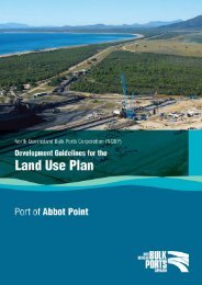
PORT OF WEIPA<br />
<strong>Land</strong> <strong>Use</strong> <strong>Plan</strong><br />
2013<br />
Prepared by <strong>North</strong> <strong>Queensland</strong><br />
<strong>Bulk</strong> <strong>Port</strong>s Corporation
PORT OF WEIPA | <strong>Land</strong> <strong>Use</strong> <strong>Plan</strong><br />
CONTENTS<br />
About this <strong>Land</strong> <strong>Use</strong> <strong>Plan</strong>. .............................1<br />
Purpose <strong>of</strong> the <strong>Port</strong> <strong>of</strong> <strong>Weipa</strong> <strong>Land</strong> <strong>Use</strong> <strong>Plan</strong>. ..............2<br />
Background. .......................................3<br />
About the Town <strong>of</strong> <strong>Weipa</strong> .................................3<br />
About the <strong>Port</strong> <strong>of</strong> <strong>Weipa</strong> .................................4<br />
<strong>Port</strong> trade ............................................4<br />
<strong>Port</strong> facilities ..........................................4<br />
<strong>Port</strong> <strong>of</strong> <strong>Weipa</strong>’s relationship with NQBP. . . . . . . . . . . . . . . . . . . . . .4<br />
<strong>Port</strong> <strong>of</strong> <strong>Weipa</strong>’s relationship with the<br />
<strong>Weipa</strong> Town Authority and Cook Shire Council ................5<br />
<strong>Port</strong> <strong>of</strong> <strong>Weipa</strong>’s relationship with Aurukun<br />
and Napranum Shire Councils ............................5<br />
Approved by the Minister for Transport and Main<br />
Roads on 2 April 2013.<br />
Notification published in the <strong>Queensland</strong> Government<br />
Gazette on 19 April 2013.<br />
Prepared by: <strong>North</strong> <strong>Queensland</strong> <strong>Bulk</strong> <strong>Port</strong>s<br />
Corporation Limited<br />
ACN: 136 880 218<br />
Registered Office: Level 1, Wellington House,<br />
181 Victoria Street,<br />
Mackay Qld 4740<br />
PO Box 3340,<br />
<strong>North</strong> Mackay Qld 4740<br />
Coordinating and integrating the Core Matters ................5<br />
<strong>Plan</strong>ning measures employed by the <strong>Land</strong> <strong>Use</strong> <strong>Plan</strong> ............7<br />
Development Vision. .................................8<br />
Desired Environmental Outcomes. ......................9<br />
Desired Environmental Outcome 1: Economic Strength<br />
and Resilience .........................................9<br />
Desired Environmental Outcome 2: Community ...............9<br />
Desired Environmental Outcome 3: Natural Environment ........9<br />
Precinct <strong>Plan</strong>. .....................................10<br />
<strong>Port</strong> Industry .........................................10<br />
Support Services ......................................11<br />
Offshore <strong>Port</strong> Infrastructure ..............................11<br />
Appendices .......................................12<br />
Appendix 1: Glossary ......................................13<br />
Appendix 2: <strong>Plan</strong> <strong>of</strong> <strong>Port</strong> Limits ..............................16<br />
Strategic <strong>Port</strong> <strong>Land</strong> holdings ......................17<br />
Precinct <strong>Plan</strong> ..................................18
PORT OF WEIPA | <strong>Land</strong> <strong>Use</strong> <strong>Plan</strong><br />
About this <strong>Land</strong> <strong>Use</strong> <strong>Plan</strong><br />
The Transport Infrastructure Act 1994 requires port authorities to prepare and implement <strong>Land</strong> <strong>Use</strong><br />
<strong>Plan</strong>s to guide the future development and operations on their Strategic <strong>Port</strong> <strong>Land</strong>.<br />
The <strong>Port</strong> <strong>of</strong> <strong>Weipa</strong> <strong>Land</strong> <strong>Use</strong> <strong>Plan</strong> articulates <strong>North</strong> <strong>Queensland</strong> <strong>Bulk</strong> <strong>Port</strong>s Corporation’s (NQBP’s)<br />
land use planning intentions at the <strong>Port</strong> <strong>of</strong> <strong>Weipa</strong>.<br />
The commentary and requirements in the <strong>Port</strong> <strong>of</strong> <strong>Weipa</strong> <strong>Land</strong> <strong>Use</strong> <strong>Plan</strong> will provide direction to<br />
development proponents and facilitate NQBP’s efforts to regulate future operations consistently<br />
and appropriately.<br />
The intent <strong>of</strong> the <strong>Port</strong> <strong>of</strong> <strong>Weipa</strong> <strong>Land</strong> <strong>Use</strong> <strong>Plan</strong> is to facilitate the future development <strong>of</strong> NQBP’s Strategic <strong>Port</strong> <strong>Land</strong> at the <strong>Port</strong> <strong>of</strong> <strong>Weipa</strong>.<br />
In accordance with the provisions <strong>of</strong> the Transport Infrastructure Act 1994, the <strong>Port</strong> <strong>of</strong> <strong>Weipa</strong> <strong>Land</strong> <strong>Use</strong> <strong>Plan</strong> will:<br />
• specify the existing and proposed Strategic <strong>Port</strong> <strong>Land</strong> holdings at the <strong>Port</strong> <strong>of</strong> <strong>Weipa</strong><br />
• identify the current and proposed uses <strong>of</strong> the land<br />
• coordinate and integrate the core matters that are relevant to the <strong>Port</strong> <strong>of</strong> <strong>Weipa</strong><br />
• identify the Desired Environmental Outcomes for the <strong>Port</strong> <strong>of</strong> <strong>Weipa</strong><br />
• include measures to help achieve the Desired Environmental Outcomes for the <strong>Port</strong> <strong>of</strong> <strong>Weipa</strong>.<br />
The outcomes <strong>of</strong> the <strong>Port</strong> <strong>of</strong> <strong>Weipa</strong> <strong>Land</strong> <strong>Use</strong> <strong>Plan</strong> will be achieved through the designation <strong>of</strong> appropriate land use precincts over Strategic <strong>Port</strong> <strong>Land</strong> and<br />
defining the Desired Environmental Outcomes that are sought for development within those areas.<br />
1
PORT OF WEIPA | <strong>Land</strong> <strong>Use</strong> <strong>Plan</strong><br />
Purpose <strong>of</strong> the <strong>Port</strong> <strong>of</strong> <strong>Weipa</strong> <strong>Land</strong> <strong>Use</strong> <strong>Plan</strong><br />
The <strong>Port</strong> <strong>of</strong> <strong>Weipa</strong> <strong>Land</strong> <strong>Use</strong> <strong>Plan</strong> provides the planning framework for development on all Strategic <strong>Port</strong> <strong>Land</strong> at the <strong>Port</strong> <strong>of</strong> <strong>Weipa</strong>. It also takes into<br />
consideration land use designations under Cook Shire Council’s <strong>Plan</strong>ning Scheme (as adopted in 2007) and <strong>Weipa</strong> Town Authority’s planning scheme,<br />
namely, the ‘Advisory Development <strong>Plan</strong>’ (as adopted in 1996).<br />
The <strong>Port</strong> <strong>of</strong> <strong>Weipa</strong> <strong>Land</strong> <strong>Use</strong> <strong>Plan</strong> has been developed to:<br />
• be respectful <strong>of</strong> the area’s traditional owners<br />
• consolidate the use <strong>of</strong> existing infrastructure and development<br />
• optimise the benefits <strong>of</strong> future development<br />
• look to facilitate the needs and concerns <strong>of</strong> the local and regional community<br />
• consider the interface with adjoining areas<br />
• be considerate <strong>of</strong> the existing environment and natural processes.<br />
When approved and gazetted, the <strong>Port</strong> <strong>of</strong> <strong>Weipa</strong> <strong>Land</strong> <strong>Use</strong> <strong>Plan</strong> will replace the <strong>Port</strong> <strong>of</strong> <strong>Weipa</strong> Strategic <strong>Plan</strong> which was approved in 1995.<br />
The Transport Infrastructure Act 1994 requires ports to review and prepare a new <strong>Land</strong> <strong>Use</strong> <strong>Plan</strong> at least every eight years. Therefore, the <strong>Port</strong> <strong>of</strong> <strong>Weipa</strong><br />
<strong>Land</strong> <strong>Use</strong> <strong>Plan</strong> is intended to have a life <strong>of</strong> eight years, at which time a new <strong>Land</strong> <strong>Use</strong> <strong>Plan</strong> would be prepared and implemented.<br />
2
Background<br />
About the Town <strong>of</strong> <strong>Weipa</strong><br />
<strong>Weipa</strong> is a small coastal community located on the north-west coast <strong>of</strong> the Cape York<br />
Peninsula, approximately 800km from Cairns.<br />
Facilitated by the Commonwealth Aluminium Corporation Pty Limited Agreement<br />
Act 1957 (the Comalco Act), <strong>Weipa</strong>’s economic and population growth has been<br />
predominantly linked to bauxite mining activities in the region.<br />
There is an Indigenous <strong>Land</strong> <strong>Use</strong> Agreement (ILUA) over the mining lease areas.<br />
The ILUA was registered with the National Native Title Tribunal under the Native Title<br />
Act 1993 on 24 August 2001. The Agreement is between 11 Traditional Owner Groups,<br />
four Shire Councils (Aurukun, Napranum, Mapoon and New Mapoon), Comalco (now<br />
Rio Tinto Alcan), the <strong>Queensland</strong> State Government and the Cape York <strong>Land</strong> Council<br />
on behalf <strong>of</strong> the Native Title Parties. The 11 Traditional Owner Groups are Alngith,<br />
Anathangayth, Ankamuthi, Peppan, Taepadhighi, Thanikwithi, Tjungundji, Warranggu,<br />
Wathayn, Wik and Wik-Way and Yupungathi.<br />
Today, <strong>Weipa</strong> is the largest community on the Cape York Peninsula, with an estimated<br />
5,000 permanent residents. <strong>Weipa</strong> provides many services and is a base for a number<br />
<strong>of</strong> government agencies in the region.<br />
3
PORT OF WEIPA | <strong>Land</strong> <strong>Use</strong> <strong>Plan</strong><br />
About the <strong>Port</strong> <strong>of</strong> <strong>Weipa</strong><br />
The <strong>Port</strong> <strong>of</strong> <strong>Weipa</strong> is managed by NQBP and is critically important for the <strong>Weipa</strong> township and broader region.<br />
The <strong>Port</strong> limits and current NQBP land holdings at <strong>Weipa</strong> are illustrated in the Appendices. The <strong>Port</strong>’s dry land is located on the northern bank <strong>of</strong> the<br />
Embley River. The <strong>Port</strong>’s substantial wet area extends down the Embley River into Albatross Bay.<br />
To support their large onshore bauxite processing and stockpiling facilities at <strong>Weipa</strong>, NQBP leases the demised premises and licences the surrounding<br />
areas within much <strong>of</strong> its landholdings to Rio Tinto Alcan.<br />
NQBP also has areas for tug berthing facilities, port services and administration, commercial activities, storage facilities, live export facilities, government<br />
operations and other ancillary uses.<br />
<strong>Port</strong> Trade<br />
The <strong>Port</strong> <strong>of</strong> <strong>Weipa</strong>’s primary commodity is bauxite, mined and exported by Rio Tinto Alcan. Rio Tinto Alcan’s <strong>Weipa</strong> bauxite mining operations have<br />
experienced steady growth in the last decade and are the world’s largest with over 25 million tonnes being exported through the port in 2011/2012. The<br />
mines are linked to the exporting facilities via rail and road access.<br />
The majority <strong>of</strong> bauxite mined in <strong>Weipa</strong> is shipped to Gladstone for processing, while some product is shipped directly to the international market.<br />
The <strong>Port</strong> <strong>of</strong> <strong>Weipa</strong> also caters for the loading and unloading <strong>of</strong> fuel, general cargo and livestock. The annual total volume <strong>of</strong> these products varies, as a<br />
reflection <strong>of</strong> the changing nature <strong>of</strong> underlying economic, social and environmental conditions.<br />
<strong>Port</strong> Facilities<br />
There has been considerable private and public sector investment in port infrastructure at the <strong>Port</strong> <strong>of</strong> <strong>Weipa</strong> to support the importing and exporting needs<br />
<strong>of</strong> the region. The <strong>Port</strong> is accessible by a shipping channel with a declared depth <strong>of</strong> -11.1m LAT. NQBP intends to deepen the existing shipping channel to<br />
-12.6m LAT. The shipping channel will be maintained through an annual maintenance dredging program.<br />
The <strong>Port</strong> <strong>of</strong> <strong>Weipa</strong>’s three wharves provide four berths that accommodate the loading and unloading <strong>of</strong> wet and dry bulk commodities, general cargo<br />
and livestock.<br />
The <strong>Port</strong> <strong>of</strong> <strong>Weipa</strong> provides for a range <strong>of</strong> ancillary port facilities that support operational needs. The <strong>Port</strong> also accommodates municipal facilities<br />
including a community centre, public boat ramp and sewage treatment plant. Whilst not core port activities, these facilities are located on Strategic <strong>Port</strong><br />
<strong>Land</strong> and provide important services to the <strong>Port</strong> and community.<br />
NQBP’s Administration <strong>of</strong> the <strong>Port</strong> <strong>of</strong> <strong>Weipa</strong><br />
NQBP manages seaport facilities integral to the export and import trade demands and economic growth <strong>of</strong> <strong>Queensland</strong> and Australia.<br />
NQBP was formed as a result <strong>of</strong> the 2008 <strong>Queensland</strong> Government Review <strong>of</strong> the <strong>Queensland</strong> <strong>Port</strong> Network Structure. On 1 July 2009, NQBP was given<br />
management responsibility for the <strong>Port</strong>s <strong>of</strong> Hay Point, Abbot Point, Mackay and <strong>Weipa</strong>, and the non-trading <strong>Port</strong> <strong>of</strong> Maryborough.<br />
NQBP is a Government Owned Corporation, a company under the Corporations Act 2001 and the Government Owned Corporations Act 1993, and a <strong>Port</strong><br />
Authority under the Transport Infrastructure Act 1994.<br />
The <strong>Port</strong>’s land holdings at <strong>Weipa</strong> are currently held by NQBP. As the <strong>Port</strong> Authority for the <strong>Port</strong> <strong>of</strong> <strong>Weipa</strong>, NQBP is responsible for:<br />
• strategic port planning<br />
• port business development<br />
• port infrastructure development<br />
• environmental management and marine pollution (within port limits)<br />
• port security and safety<br />
• port efficiency<br />
• maintaining navigable depths for shipping<br />
• issuing licences, leases and permits to other organisations for use <strong>of</strong> port land, infrastructure and facilities.<br />
4
PORT OF WEIPA | <strong>Land</strong> <strong>Use</strong> <strong>Plan</strong><br />
<strong>Port</strong> <strong>of</strong> <strong>Weipa</strong>’s Relationship with the <strong>Weipa</strong> Town Authority<br />
and cook shire council<br />
NQBP’s Strategic <strong>Port</strong> <strong>Land</strong> is located adjacent to land included within the <strong>Weipa</strong> Town Area and the local government area <strong>of</strong> Cook Shire Council.<br />
The <strong>Weipa</strong> Town Area is administered by the <strong>Weipa</strong> Town Authority, which is a division <strong>of</strong> Rio Tinto Alcan Pty Ltd, that has responsibilities under the<br />
Comalco Act for delivering local government functions to the management <strong>of</strong> the Town.<br />
While Strategic <strong>Port</strong> <strong>Land</strong> is not subject to the <strong>Weipa</strong> Town Authority’s ‘Advisory Development <strong>Plan</strong>’ or Cook Shire Council’s <strong>Plan</strong>ning Scheme, it is<br />
important that the <strong>Port</strong>’s proposed land use outcomes are consistent and compatible with the development that is in and around the <strong>Port</strong>.<br />
<strong>Port</strong> <strong>of</strong> <strong>Weipa</strong>’s Relationship with Aurukun and Napranum Shire Councils<br />
A small part <strong>of</strong> the <strong>Port</strong> <strong>of</strong> <strong>Weipa</strong> Strategic <strong>Port</strong> <strong>Land</strong> abuts land governed by Aurukun and Napranum Shire Councils. As with the land governed by <strong>Weipa</strong><br />
Town Authority and Cook Shire Council, it is important that current land uses and future proposed development at the <strong>Port</strong> <strong>of</strong> <strong>Weipa</strong> is compatible with the<br />
development in these neighbouring areas.<br />
Coordinating and Integrating the Core Matters<br />
The Transport Infrastructure Act 1994 specifies that the core matters must be coordinated and integrated into the <strong>Land</strong> <strong>Use</strong> <strong>Plan</strong>. Core matters relate to<br />
land use and development, port facilities and valuable features.<br />
As part <strong>of</strong> the Statement <strong>of</strong> Proposals, NQBP outlined the primary issues with the core matters. The following primary issues, relevant to the <strong>Port</strong> <strong>of</strong> <strong>Weipa</strong>,<br />
were identified in the assessment <strong>of</strong> core matters:<br />
• managing potential impacts <strong>of</strong> conflicting land uses<br />
• providing support for future growth required to maintain the <strong>Port</strong>’s significant economic contribution<br />
• optimising port accessibility via road and water<br />
• managing existing non-port-related land uses on Strategic <strong>Port</strong> <strong>Land</strong><br />
• protecting ecologically sensitive areas in the vicinity <strong>of</strong> the <strong>Port</strong>.<br />
5
PORT OF WEIPA | <strong>Land</strong> <strong>Use</strong> <strong>Plan</strong><br />
To coordinate and integrate the core matters into the <strong>Land</strong> <strong>Use</strong> <strong>Plan</strong>, the primary issues must be addressed. The table below outlines the variety <strong>of</strong> land use<br />
planning measures that will be used to respond to the primary issues.<br />
PRIMARY ISSUES<br />
Managing <strong>Land</strong> <strong>Use</strong><br />
Conflicts<br />
Supporting Future<br />
Growth<br />
Optimising <strong>Port</strong><br />
Accessibility<br />
Managing Existing<br />
Non-<strong>Port</strong>-Related<br />
Development on<br />
Strategic <strong>Port</strong> <strong>Land</strong><br />
Environmental and<br />
Cultural Heritage<br />
Protection<br />
RESPONSE<br />
The avoidance <strong>of</strong> potential land use conflicts is integral to the sustainable growth <strong>of</strong> the <strong>Port</strong> <strong>of</strong> <strong>Weipa</strong>.<br />
To ensure future port development is appropriate, the <strong>Land</strong> <strong>Use</strong> <strong>Plan</strong> contains Desired Environmental Outcomes<br />
that outline NQBP’s development expectations in each port precinct and provide a framework to guide the future built<br />
environment and land uses. The Precinct <strong>Plan</strong> reflects development and operational restrictions.<br />
The <strong>Land</strong> <strong>Use</strong> <strong>Plan</strong> encourages new trade-related development to capitalise on existing infrastructure.<br />
This is articulated in the Desired Environmental Outcomes and in the ‘Intent’ that supports the Precinct <strong>Plan</strong>.<br />
Trade-specific development (such as loading and unloading facilities) would not occur in the ‘Support Services’<br />
precinct unless the development cannot be accommodated within the <strong>Port</strong> Industry precinct.<br />
Efficient port access is critical to the port, both now and into the future.<br />
Whilst outside <strong>of</strong> the <strong>Land</strong> <strong>Use</strong> <strong>Plan</strong>’s scope, NQBP will continue to work with the relevant owners and managers<br />
<strong>of</strong> port access infrastructure to identify when and if improvements are required and how access corridors may<br />
be protected.<br />
The ability to use Strategic <strong>Port</strong> <strong>Land</strong> for non-port-related development is limited under the Transport Infrastructure<br />
Act 1994. However, NQBP will continue to support existing non-port-related uses such as government and voluntary<br />
organisations at the <strong>Port</strong> <strong>of</strong> <strong>Weipa</strong>.<br />
Primarily, NQBP must continue to perform its functions as a <strong>Port</strong> Authority under the Transport Infrastructure<br />
Act 1994, in making land available for the establishment, management and operation <strong>of</strong> effective and efficient port<br />
facilities, port services, and ancillary services required for the functioning <strong>of</strong> the <strong>Port</strong> <strong>of</strong> <strong>Weipa</strong>.<br />
Any development decision that could impact the existing non-port-related land uses will be made in discussion<br />
with the community.<br />
All future development will be considerate <strong>of</strong> the environmental and cultural heritage values <strong>of</strong> the area.<br />
The <strong>Land</strong> <strong>Use</strong> <strong>Plan</strong> specifically outlines NQBP’s expectations for the protection <strong>of</strong> these values.<br />
Future development that cannot clearly comply with these expectations will require further scientific, environmental<br />
or cultural heritage investigations. NQBP will not support development that does not satisfy the principles for<br />
environmental and cultural heritage protection.<br />
NQBP’s Development Code requires future development to effectively address environmental management and<br />
cultural heritage values at the <strong>Port</strong> <strong>of</strong> <strong>Weipa</strong>.<br />
6
PORT OF WEIPA | <strong>Land</strong> <strong>Use</strong> <strong>Plan</strong><br />
<strong>Plan</strong>ning Measures Employed by the <strong>Land</strong> <strong>Use</strong> <strong>Plan</strong><br />
To address the primary issues and core matters, the <strong>Land</strong> <strong>Use</strong> <strong>Plan</strong> contains a Development Vision, Desired Environmental Outcomes and a Precinct <strong>Plan</strong>.<br />
The Development Vision is a declaration from NQBP about our land use planning direction and our commitment to existing and future stakeholders at the<br />
<strong>Port</strong> <strong>of</strong> <strong>Weipa</strong>. The Development Vision provides the basis for the <strong>Land</strong> <strong>Use</strong> <strong>Plan</strong>.<br />
The Desired Environmental Outcomes are broad statements that guide future development and operations on Strategic <strong>Port</strong> <strong>Land</strong>. The Desired<br />
Environmental Outcomes outline NQBP’s expectations and will facilitate development proponents’ efforts to develop and operate responsibly.<br />
The Precinct <strong>Plan</strong> addresses the next level <strong>of</strong> detailed site planning, by defining the Intent and Indicative <strong>Use</strong>s for each port precinct. The Precinct <strong>Plan</strong><br />
directs future development, outlines development and operational restrictions and protects the social and environmental value <strong>of</strong> the area.<br />
To support the <strong>Land</strong> <strong>Use</strong> <strong>Plan</strong>, NQBP has prepared a Development Code. The Development Code articulates the operational and technical requirements for<br />
development on Strategic <strong>Port</strong> <strong>Land</strong>. The Development Code supports the intent <strong>of</strong> the Desired Environmental Outcomes and the Precinct <strong>Plan</strong>.<br />
All new development and operations (and significant increases in intensity and scale) must comply with the <strong>Land</strong> <strong>Use</strong> <strong>Plan</strong> and the<br />
Development Code and will be subject to the requirements <strong>of</strong> a range <strong>of</strong> <strong>Queensland</strong> legislation including, but not limited to, the Sustainable <strong>Plan</strong>ning<br />
Act 2009, the Environmental Protection Act 1994 and the Aboriginal Cultural Heritage Act 2003.<br />
Furthermore, any new development proposed which may have an impact on Matters <strong>of</strong> National Environmental Significance may also be subject to the<br />
Environment Protection and Biodiversity Conservation Act 1999 at the Commonwealth level.<br />
Note: The Development Code will not be a statutory component <strong>of</strong> the <strong>Land</strong> <strong>Use</strong> <strong>Plan</strong>. The Development Code operates in conjunction with the <strong>Land</strong> <strong>Use</strong> <strong>Plan</strong><br />
to definitively guide the form and structure <strong>of</strong> development on Strategic <strong>Port</strong> <strong>Land</strong>.<br />
7
Development<br />
Vision<br />
Our Development Vision is:<br />
“To facilitate the growth and diversification <strong>of</strong> <strong>Weipa</strong>’s economy<br />
through effective land use planning and responsible development<br />
management <strong>of</strong> Strategic <strong>Port</strong> <strong>Land</strong>.”<br />
8
PORT OF WEIPA | <strong>Land</strong> <strong>Use</strong> <strong>Plan</strong><br />
Desired Environmental Outcomes<br />
The Desired Environmental Outcomes seek to achieve the development vision. All new development and operations on Strategic <strong>Port</strong> <strong>Land</strong> must achieve<br />
the following Desired Environmental Outcomes:<br />
Desired Environmental Outcome 1: Economic Strength AND Resilience<br />
To enhance the role <strong>of</strong> the <strong>Port</strong> in furthering the growth and diversification <strong>of</strong> <strong>Weipa</strong>’s economy by:<br />
• enhancing existing trade-related development, infrastructure and facilities<br />
• managing future development in an orderly and systematic manner<br />
• responding to market demands and stakeholder needs<br />
• encouraging tailored infrastructure and development solutions<br />
• encouraging synergies with local and regional industries<br />
• promoting industries that provide employment opportunities for the regional population.<br />
Desired Environmental Outcome 2: Community<br />
To strengthen the community by:<br />
• requiring all development and operations to be safe<br />
• enhancing the cooperative interface between NQBP, the <strong>Weipa</strong> Town Authority and Cook Shire Council<br />
• operating in a respectful and amicable manner<br />
• maintaining a good relationship with the community and the <strong>Port</strong>’s tenants<br />
• requiring development to be regulated to avoid or minimise adverse impacts on sensitive land uses<br />
• maintaining Indigenous and non-Indigenous cultural heritage values.<br />
Desired Environmental Outcome 3: Natural Environment<br />
To uphold the integrity <strong>of</strong> the natural environment by:<br />
• protecting natural environmental processes<br />
• maintaining as far as practical the scenic and environmental values <strong>of</strong> the foreshore, whilst acknowledging the existence <strong>of</strong> a major world export port<br />
• promoting the incorporation <strong>of</strong> sustainable technologies and procedures into new development<br />
• committing to monitoring environmental performance and impacts<br />
• developing appropriate planning provisions to regulate potential air, noise, odour, light, water and contamination issues<br />
• requiring tenure to be effectively managed<br />
• requiring development to comply with Local, State and Commonwealth environmental legislation.<br />
9
PORT OF WEIPA | <strong>Land</strong> <strong>Use</strong> <strong>Plan</strong><br />
Precinct <strong>Plan</strong><br />
Strategic <strong>Port</strong> <strong>Land</strong> at the <strong>Port</strong> <strong>of</strong> <strong>Weipa</strong> consists <strong>of</strong> three land use precincts:<br />
• <strong>Port</strong> Industry<br />
• Support Services<br />
• Offshore <strong>Port</strong> Infrastructure.<br />
The Precinct <strong>Plan</strong> can be found in Appendix 2.<br />
The Precinct <strong>Plan</strong> illustrates the extent <strong>of</strong> the different precincts. The commentary below outlines the Intent <strong>of</strong> each precinct and lists the Indicative <strong>Use</strong>s<br />
that would be appropriate within each precinct.<br />
During the life <strong>of</strong> this plan, land may be acquired or disposed based on need and/or prior commitments. Such acquisitions or disposals will be subject to<br />
Ministerial approval.<br />
<strong>Port</strong> Industry<br />
Intent<br />
The primary intent <strong>of</strong> the <strong>Port</strong> Industry precinct is to support the trade-related needs <strong>of</strong> the region. This precinct will accommodate development and<br />
activities that facilitate the importing and exporting <strong>of</strong> commodities. Non-industrial uses are permitted in this precinct if they are ancillary to the primary<br />
development or activity. If there is no immediate trade-related development, this precinct may also accommodate other land uses on an interim basis.<br />
These interim land uses must satisfy the Desired Environmental Outcomes.<br />
Indicative <strong>Use</strong>s<br />
The following uses are consistent with the intent <strong>of</strong> the <strong>Port</strong> Industry precinct:<br />
• wet and dry bulk stockpiling facilities<br />
• wet and dry bulk loading and unloading facilities<br />
• live cattle handling facilities<br />
• hardstand areas<br />
• warehouse<br />
• maintenance and repair activities<br />
• packing and unpacking operations<br />
• facilities to service and store vessels<br />
• storage and distribution activities.<br />
10
PORT OF WEIPA | <strong>Land</strong> <strong>Use</strong> <strong>Plan</strong><br />
Support Services<br />
Intent<br />
The primary intent <strong>of</strong> the Support Services precinct is to accommodate the uses that support the operations <strong>of</strong> the <strong>Port</strong> <strong>of</strong> <strong>Weipa</strong>. Industrial development<br />
and activities may be accommodated in this precinct where it cannot be accommodated elsewhere within the <strong>Port</strong> Industry precinct. <strong>Use</strong>s that are not<br />
specifically support uses or industrial uses would be permitted in this precinct where they are ancillary to the primary development or activity. If there is<br />
no immediate development to support the operations at the <strong>Port</strong> <strong>of</strong> <strong>Weipa</strong>, this precinct may also accommodate other land uses on an interim basis. These<br />
interim land uses must satisfy the Desired Environmental Outcomes.<br />
Indicative <strong>Use</strong>s<br />
The following uses are consistent with the intent <strong>of</strong> the Support Services precinct:<br />
• tugs and pilot bases<br />
• transport operations<br />
• fuel depots (port-related)<br />
• port management and logistics centres<br />
• government and voluntary organisations<br />
• maintenance and repair activities<br />
• indicative uses associated with the ‘port industry’ precinct where they cannot be accommodated in that precinct.<br />
Offshore <strong>Port</strong> Infrastructure<br />
Intent<br />
The primary intent <strong>of</strong> the Offshore <strong>Port</strong> Infrastructure precinct is to accommodate the development and infrastructure essential to supporting the <strong>Port</strong> <strong>of</strong><br />
<strong>Weipa</strong>’s primary trade-related activities. Development and infrastructure in this precinct would accommodate navigation, accessibility and the storage,<br />
loading and unloading <strong>of</strong> cargo, commodities and people, or other port-related activities.<br />
Indicative <strong>Use</strong>s<br />
The following uses are consistent with the intent <strong>of</strong> the Offshore <strong>Port</strong> Infrastructure precinct:<br />
• wet and dry bulk loading and unloading facilities<br />
• navigational channels<br />
• swing basins<br />
• berth pockets<br />
• navigational aids<br />
• wharves<br />
• jetties<br />
• pontoons<br />
• boat ramps<br />
• maintenance and repair activities<br />
• other marine and port-related development and infrastructure.<br />
11
APPENDICES<br />
Appendix 1: Glossary .....................................13<br />
Appendix 2: <strong>Plan</strong> <strong>of</strong> <strong>Port</strong> limits ..............................16<br />
Strategic <strong>Port</strong> <strong>Land</strong> holdings ......................17<br />
Precinct <strong>Plan</strong> ..................................18<br />
12
PORT OF WEIPA | <strong>Land</strong> <strong>Use</strong> <strong>Plan</strong><br />
Appendix 1: Glossary<br />
Term<br />
Bauxite<br />
Break <strong>Bulk</strong><br />
Meaning<br />
A rock that is the principle ore <strong>of</strong> aluminium. Australia is the largest producer <strong>of</strong> bauxite in the world.<br />
Packaged, but non-containerised cargo shipped as a unit, for example bags, bales, barrels, or pallets.<br />
Core Matters As defined under the Transport Infrastructure Act 1994:<br />
In relation to a land use plan (including its preparation), means each <strong>of</strong> the following matters—<br />
(a) land use and development;<br />
(b) port facilities;<br />
(c) valuable features.<br />
Comalco Act<br />
Dead Weight Tonnage<br />
Desired Environmental<br />
Outcomes<br />
Development Code<br />
Development Vision<br />
Dry <strong>Bulk</strong><br />
Functions <strong>of</strong> <strong>Port</strong><br />
Authorities<br />
General Cargo<br />
Means the Commonwealth Aluminium Corporation Pty Limited Agreement Act 1957 (Qld).<br />
The amount <strong>of</strong> weight a ship is carrying.<br />
A set <strong>of</strong> principles that establish the economic, social and environmental framework to guide future development at<br />
the <strong>Port</strong>.<br />
NQBP’s document that articulates the operational and technical requirements for development on Strategic <strong>Port</strong> <strong>Land</strong>.<br />
A statement in the <strong>Land</strong> <strong>Use</strong> <strong>Plan</strong> that summarises the desired development outcomes for the <strong>Port</strong> that is informed<br />
by and represent the Desired Environmental Outcomes.<br />
Unpackaged or loose, homogenous non-liquid materials such as bauxite, cement, coal or grain.<br />
As defined under the Transport Infrastructure Act 1994:<br />
(1) The functions <strong>of</strong> a port authority are—<br />
(a) to establish, manage, and operate effective and efficient port facilities and services in its port; and<br />
(b) to make land available for—<br />
(i) the establishment, management and operation <strong>of</strong> effective and efficient port facilities and services<br />
in its port by other persons; or<br />
(ii) other purposes consistent with the operation <strong>of</strong> its port; and<br />
(c) to provide or arrange for the provision <strong>of</strong> ancillary services or works necessary or convenient for the<br />
effective and efficient operation <strong>of</strong> its port; and<br />
(d) to keep appropriate levels <strong>of</strong> safety and security in the provision and operation <strong>of</strong> the facilities and services; and<br />
(e) to provide other services incidental to the performance <strong>of</strong> its other functions or likely to enhance the usage<br />
<strong>of</strong> the port; and<br />
(f) without limiting any other paragraph <strong>of</strong> this subsection, in relation to Strategic <strong>Port</strong> <strong>Land</strong> <strong>of</strong> the following<br />
port authorities—<br />
(i) the Far <strong>North</strong> <strong>Queensland</strong> <strong>Port</strong>s Corporation Limited—to provide or arrange for the development and<br />
use <strong>of</strong> its Strategic <strong>Port</strong> <strong>Land</strong> at Cairns for residential and tourist accommodation;<br />
(ii) the Far <strong>North</strong> <strong>Queensland</strong> <strong>Port</strong>s Corporation Limited—to plan or carry out works in relation to the<br />
development and use <strong>of</strong> Strategic <strong>Port</strong> <strong>Land</strong> under subparagraph (i); and<br />
(g) to perform any other functions conferred on it under this or another Act or under the regulations.<br />
Unpackaged goods suitable for loading in general non-specialised stowage areas (such as pipes or timber)<br />
or packaged goods suitable for loading in standard shipping containers (such as boxes or pallets).<br />
13
PORT OF WEIPA | <strong>Land</strong> <strong>Use</strong> <strong>Plan</strong><br />
Term<br />
Key Issues<br />
<strong>Land</strong> <strong>Use</strong> and<br />
Development<br />
<strong>Land</strong> <strong>Use</strong> <strong>Plan</strong><br />
<strong>Land</strong> <strong>Use</strong> Precinct<br />
Lowest Astronomical<br />
Tide<br />
NQBP<br />
Meaning<br />
Aspects important in the consideration <strong>of</strong> port planning that may not necessarily fall under the definition<br />
<strong>of</strong> Core Matters.<br />
As defined under the Transport Infrastructure Act 1994:<br />
includes each <strong>of</strong> the following—<br />
(a) the location <strong>of</strong>, and the relationships between, the land uses in the area;<br />
(b) the current effects <strong>of</strong> land use in the area;<br />
(c) the likely effects <strong>of</strong> any proposed development <strong>of</strong> the land;<br />
(d) the accessibility to the area.<br />
As defined under the Transport Infrastructure Act 1994, a plan that:<br />
(a) specifies details <strong>of</strong> the port authority’s Strategic <strong>Port</strong> <strong>Land</strong>, future Strategic <strong>Port</strong> <strong>Land</strong>, current and proposed<br />
uses <strong>of</strong> the land;<br />
(b) coordinates and integrates the core matters relevant to the land use plan;<br />
(c) identifies the desired environmental outcomes for the land;<br />
(d) includes measures that will help achieve the desired environmental outcomes.<br />
A defined area within the <strong>Port</strong> <strong>Land</strong> <strong>Use</strong> <strong>Plan</strong> designated for certain land uses.<br />
The height <strong>of</strong> water at the lowest possible theoretical tide; lowest levels which can be predicted to occur under<br />
average meteorological conditions.<br />
<strong>North</strong> <strong>Queensland</strong> <strong>Bulk</strong> <strong>Port</strong>s Corporation Limited.<br />
<strong>Port</strong> Authority As defined under the Transport Infrastructure Act 1994:<br />
(a) means a port authority established under section 268 or a body declared to be a port authority under a<br />
regulation under section 274A; but<br />
(b) does not include a port authority that has been abolished under section 270 or for which the declaration has<br />
been revoked under a regulation under section 274A.<br />
<strong>Port</strong> Facilities As defined under the Transport Infrastructure Act 1994:<br />
(1) (a) <strong>of</strong> a port authority, means the facilities or land that are—<br />
(i) owned or controlled by—<br />
(A) the port authority; or<br />
(B) if the port authority is a GOC port authority—a wholly owned subsidiary <strong>of</strong> the port authority; and<br />
(ii) used in the operation or strategic management <strong>of</strong> the port authority’s port; or<br />
(b) <strong>of</strong> a port entity other than a port authority, means the facilities or land that are—<br />
(i) owned or controlled by a port entity other than a port authority, or leased or licensed to or occupied by,<br />
or constructed, managed, provided or maintained by a port entity other than a port authority; and<br />
(ii) used or intended to be used in connection with the management, operation, development,<br />
maintenance <strong>of</strong>, or access to, the port entity’s port.<br />
(2) For subsection (1)(b), a lease or licence <strong>of</strong> land or facilities granted, or other provision for the use <strong>of</strong> or<br />
access to land or facilities made, by a port entity other than a port authority for the benefit <strong>of</strong> a person is to be<br />
disregarded.<br />
(3) <strong>Port</strong> facilities for a port entity other than a port authority also include land or facilities prescribed by regulation<br />
to be port facilities.<br />
(4) <strong>Port</strong> facilities for a port entity other than a port authority do not include land or facilities prescribed by<br />
regulation not to be port facilities.<br />
14
PORT OF WEIPA | <strong>Land</strong> <strong>Use</strong> <strong>Plan</strong><br />
Term<br />
<strong>Port</strong> Limits<br />
Meaning<br />
The extent <strong>of</strong> a <strong>Port</strong> Authority (or other port entities) responsibility, as set out in Schedule 1 <strong>of</strong> the Transport<br />
Infrastructure Act 1994.<br />
<strong>Port</strong> Services As defined under the Transport Infrastructure Act 1994:<br />
the following services relating to the management <strong>of</strong> a port area or port facilities—<br />
(a) monitoring and management <strong>of</strong> the movement <strong>of</strong> vessels, vehicles, goods and people in the port area;<br />
(b) services in relation to port facilities;<br />
(c) services in relation to dredging;<br />
(d) services in relation to reclaiming land;<br />
(e) management, monitoring or administration <strong>of</strong> the use <strong>of</strong>, and access to, port facilities;<br />
(f) security services and security monitoring services in the port area;<br />
(g) services relating to the safety <strong>of</strong> persons or things in the port area;<br />
(h) services relating to the preservation <strong>of</strong> the environment;<br />
(i) issuing, and monitoring the use <strong>of</strong>, security identification;<br />
(j) traffic control services;<br />
(k) emergency services;<br />
(l) processing applications, reporting information and attending to other administrative matters<br />
for the management <strong>of</strong> the port.<br />
Quayside<br />
The area adjacent to a quay or wharf.<br />
Strategic <strong>Port</strong> <strong>Land</strong> As defined under the Transport Infrastructure Act 1994:<br />
<strong>Land</strong> that is identified in a land use plan as ‘Strategic <strong>Port</strong> <strong>Land</strong>’, where the land use plan has been approved under<br />
the Transport Infrastructure Act 1994.<br />
Throughput<br />
Volume <strong>of</strong> product exported and/or imported through the port in a given time period.<br />
Valuable Features As defined under the Sustainable <strong>Plan</strong>ning Act 2009:<br />
(a) resources or areas that are <strong>of</strong> ecological significance, including, for example, habitats, wildlife corridors, buffer<br />
zones, places supporting biological diversity or resilience, and features contributing to the quality <strong>of</strong> air, water<br />
(including catchments or recharge areas) and soil<br />
(b) areas contributing significantly to amenity, including, for example, areas <strong>of</strong> high scenic value, physical<br />
features that form significant visual backdrops or that frame or define places or localities, and attractive built<br />
environments<br />
(c) areas or places <strong>of</strong> cultural heritage significance, including, for example, areas or places <strong>of</strong> indigenous cultural<br />
significance, or aesthetic, architectural, historical, scientific, social or technological significance, to the present<br />
generation or past or future generations<br />
(d) resources or areas <strong>of</strong> economic value, including, for example, extractive deposits, fishery resources, forestry<br />
resources, water resources, sources <strong>of</strong> renewable and non-renewable energy and good quality agricultural land.<br />
Wet <strong>Bulk</strong><br />
Unpackaged, homogenous liquid materials such as oil, petroleum or molasses.<br />
15
PORT OF WEIPA | <strong>Land</strong> <strong>Use</strong> <strong>Plan</strong><br />
<strong>Plan</strong> <strong>of</strong> <strong>Port</strong> Limits<br />
Appendix 2: <strong>Plan</strong>s <strong>of</strong> <strong>Port</strong> Limits, Strategic<br />
<strong>Port</strong> <strong>Land</strong> Holdings and the Precinct <strong>Plan</strong><br />
141°40'E 141°50'E 142°00'E<br />
12°20'S<br />
GULF<br />
OF<br />
CARPENTARIA<br />
Nomenade Creek<br />
Pine River<br />
Pine River<br />
Bay<br />
12°30'S<br />
Jantz<br />
Point<br />
Duyfken<br />
Point<br />
Andoomajettie<br />
Point<br />
Mission<br />
River<br />
Kerr Point<br />
WEIPA<br />
WEIPA<br />
PENINSULA<br />
12°40'S<br />
Albatross<br />
Bay<br />
Hey Point<br />
Embley<br />
River<br />
Hey River<br />
12°50'S<br />
Boyd<br />
Point<br />
¯<br />
SCALE 1:350000<br />
nautical miles<br />
3 0 3 6<br />
Thud<br />
Point<br />
13°00'S<br />
Map Datum: GDA94<br />
Map S8po-20-1<br />
Copyright: The State <strong>of</strong> Qld 2008<br />
Prepared: 5 Aug 2008<br />
Maritime Safety Qld - Spatial Services<br />
WEIPA<br />
PORT LIMITS<br />
Transport Infrastructure (<strong>Port</strong>s) Regulation 2005<br />
16
Strategic <strong>Port</strong> <strong>Land</strong> Holdings<br />
PORT OF WEIPA | <strong>Land</strong> <strong>Use</strong> <strong>Plan</strong><br />
17
PORT OF WEIPA | <strong>Land</strong> <strong>Use</strong> <strong>Plan</strong><br />
Precinct <strong>Plan</strong><br />
18
PORT OF WEIPA<br />
Level 1, 324 Queen Street<br />
GPO Box 409, Brisbane Qld 4001<br />
Phone 07 3011 7900<br />
Facsimile 07 3011 7999<br />
(registered <strong>of</strong>fice <strong>of</strong> NQBP, MPL and PCQ)<br />
Level 1, Wellington House,<br />
181 Victoria Street, Mackay Qld 4740<br />
PO Box 3340, <strong>North</strong> Mackay Qld 4740<br />
Phone 07 4969 0700<br />
Facsimile 07 4969 0799<br />
info@nqbp.com.au<br />
www.nqbp.com.au<br />
<strong>North</strong> <strong>Queensland</strong> <strong>Bulk</strong><br />
<strong>Port</strong>s Corporation Limited<br />
ACN 136 880 218<br />
ABN 36 136 880 218<br />
<strong>Port</strong>s Corporation <strong>of</strong><br />
<strong>Queensland</strong> Limited<br />
ACN 126 302 994<br />
ABN 49 657 447 879<br />
Mackay <strong>Port</strong>s Limited<br />
ACN 131 965 707<br />
ABN 69 131 965 707