nymtc regional freight plan - New York Metropolitan Transportation ...
nymtc regional freight plan - New York Metropolitan Transportation ...
nymtc regional freight plan - New York Metropolitan Transportation ...

Create successful ePaper yourself
Turn your PDF publications into a flip-book with our unique Google optimized e-Paper software.
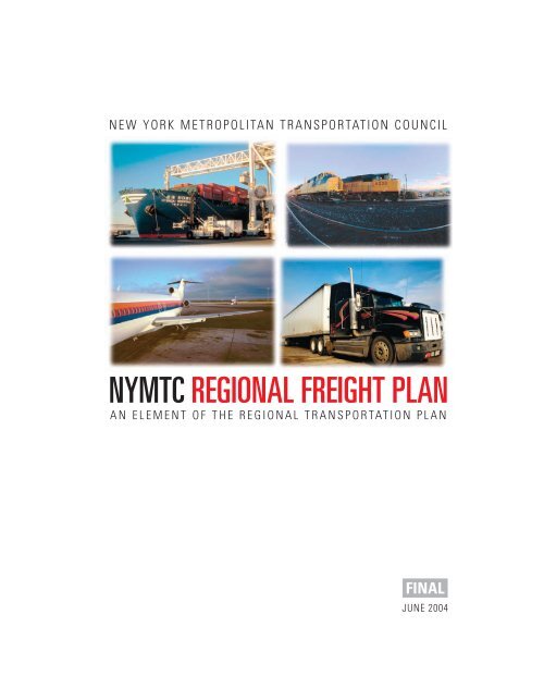
NEW YORK METROPOLITAN TRANSPORTATION COUNCIL<br />
NYMTC REGIONAL FREIGHT PLAN<br />
AN ELEMENT OF THE REGIONAL TRANSPORTATION PLAN<br />
FINAL<br />
JUNE 2004
DISCLAIMER: Preparation of this report was funded by the Federal<br />
Highway and Federal Transit Administrations of the United States<br />
Department of <strong>Transportation</strong> and the <strong>New</strong> <strong>York</strong> State Department<br />
of <strong>Transportation</strong>. The contents do not necessarily reflect the official<br />
views or policies of the Federal Highway Administration, Federal Transit<br />
Administration. This report does not constitute a standard, specification<br />
or regulation.
A Freight Plan for the NYMTC Region<br />
Table of Contents<br />
Executive Summary ............................................................................................................... ES-1<br />
Project Purpose, Goals, and Objectives ....................................................................... ES-1<br />
Problem Statement ......................................................................................................... ES-2<br />
Process.............................................................................................................................. ES-4<br />
Recommendations .......................................................................................................... ES-5<br />
Financing ......................................................................................................................... ES-12<br />
Organization of Report .................................................................................................. ES-13<br />
1.0 NYMTC’s Freight Plan: A Roadmap to a 21 st Century Freight System.............. 1-1<br />
2.0 Freight <strong>Transportation</strong> in the NYMTC Region Today and in the Future........... 2-1<br />
2.1 Existing and Forecast Conditions ........................................................................ 2-1<br />
2.2 Challenges Identified during the Plan ................................................................ 2-7<br />
2.3 Specific Conditions Identified through the Plan Effort .................................... 2-9<br />
3.0 Potential Strategies and How They Were Evaluated.............................................. 3-1<br />
4.0 Relationship among Performance Measures and Deficiencies<br />
and Recommendations ................................................................................................. 4-1<br />
5.0 Strategies of the Regional Freight Plan..................................................................... 5-1<br />
5.1 Goal #1 – Improve the <strong>Transportation</strong> of Freight by Removing<br />
Burdensome Government Regulations and Restrictions ................................. 5-8<br />
5.2 Goal #2 – Improve the Physical Infrastructure of the <strong>Transportation</strong> System<br />
for Freight-Related Transport between Shipping and Receiving Points........ 5-19<br />
5.3 Goal #3 – Improve the Reliability and Overall Movement of Freight in the<br />
Region by Encouraging Expedient and Multimodal Shipment of Freight .... 5-24<br />
5.4 Goal #4 – Improve the Reliability and Overall Movement of Freight in the<br />
Region by Expanding Alternatives for Trucks and Other Vehicles................ 5-36<br />
6.0 Regional <strong>Transportation</strong> System Impacts................................................................. 6-1<br />
6.1 Changes in Regional VMT and VHT................................................................... 6-1<br />
6.2 System User and Societal Benefits ....................................................................... 6-9<br />
6.3 Environmental Impacts ......................................................................................... 6-10<br />
7.0 Financing......................................................................................................................... 7-1<br />
7.1 Financial Needs ...................................................................................................... 7-1<br />
7.2 Issues Relating to Finance..................................................................................... 7-2<br />
7.3 Summary of Funding Sources .............................................................................. 7-4<br />
7.4 Recommendations.................................................................................................. 7-8<br />
Cambridge Systematics, Inc.<br />
7018.008<br />
i
A Freight Plan for the NYMTC Region<br />
List of Figures<br />
2.1 Freight Growth in the NYMTC Region<br />
(Base and Forecasted Flows by County) ..................................................................... 2-2<br />
2.2 National Freight Growth Forecast ............................................................................... 2-2<br />
2.3 Freight Growth in the NYMTC Region<br />
(Changes in Regional Mode Split – 1998 to 2025) ...................................................... 2-4<br />
2.4 Freight Mode Share Nationally .................................................................................... 2-5<br />
2.5 Freight Growth in the NYMTC Region, 1998-2025<br />
(Base and Forecasted Flows by Commodity) ............................................................. 2-5<br />
2.6 Annual Tons of Freight Arriving in the NYMTC Region (By Origin) .................... 2-6<br />
2.7 Annual Tons of Freight Leaving in the NYMTC Region (By Destination) ............ 2-6<br />
2.8 National Highway Freight Network ........................................................................... 2-10<br />
2.9 Trucking Challenge........................................................................................................ 2-10<br />
2.10 Congested Highways Nationally (2000) ..................................................................... 2-11<br />
2.11 Congested Highways Nationally (2020) ..................................................................... 2-11<br />
2.12 East of Hudson Freight <strong>Transportation</strong> Infrastructure ............................................. 2-12<br />
2.13 Limited Truck Access to Airports ................................................................................ 2-13<br />
2.14 Passenger Train Density ................................................................................................ 2-15<br />
2.15 Rail Equipment is Becoming Taller and Heavier....................................................... 2-15<br />
2.16 Regional Map of Tallest Allowable Car Types by Line............................................. 2-16<br />
2.17 National Rail Freight Network ..................................................................................... 2-16<br />
2.18 Railroad Capital Spending ............................................................................................ 2-17<br />
2.19 Major Arterial Network................................................................................................. 2-18<br />
Cambridge Systematics, Inc.<br />
iii
A Freight Plan for the NYMTC Region<br />
List of Figures<br />
(continued)<br />
3.1 Study Process .................................................................................................................. 3-1<br />
3.2 Regional Freight Plan Approach .................................................................................. 3-2<br />
3.3 Corridors Analyzed by Trip Purpose .......................................................................... 3-4<br />
3.4. Regional Highway Corridors........................................................................................ 3-5<br />
3.5 Regional Rail Corridors ................................................................................................. 3-6<br />
5.1 Fifty-Three-Foot Tractor-Trailer Routes...................................................................... 5-10<br />
5.2 NYCDOT Midtown Commercial Vehicle Parking Program.................................... 5-12<br />
5.3 Regional Toll Facilities................................................................................................... 5-17<br />
5.4 Staten Island Railroad Proposed Improvements ....................................................... 5-23<br />
5.5 East-of-Hudson Rail Freight Barriers .......................................................................... 5-26<br />
5.6 Potential Freight Villages .............................................................................................. 5-31<br />
5.7 Proposed Cross Harbor Freight Tunnel ...................................................................... 5-34<br />
5.8 Highbridge Interchange Proposed Improvements.................................................... 5-39<br />
5.9 Cross Bronx Expressway Improvements .................................................................... 5-40<br />
5.10 Staten Island Expressway Proposed Improvements ................................................. 5-43<br />
5.11 Gowanus Expressway.................................................................................................... 5-46<br />
5.12 Brooklyn Queens Expressway Clearance Restrictions.............................................. 5-48<br />
5.13 JFK Airport/Industrial Access Corridors ................................................................... 5-50<br />
7.1 Projected RTP Financial Analysis (2000-2025)............................................................ 7-2<br />
Cambridge Systematics, Inc.<br />
iv
A Freight Plan for the NYMTC Region<br />
Executive Summary<br />
• Project Purpose, Goals, and Objectives<br />
The purpose of the <strong>New</strong> <strong>York</strong> <strong>Metropolitan</strong> <strong>Transportation</strong> Council (NYMTC) Regional<br />
Freight Plan Project is to develop a roadmap for the improvement of <strong>freight</strong> transportation<br />
in the NYMTC region. The <strong>plan</strong> presents a wide range of strategies and actions that<br />
include capital projects, operational improvements, and policy changes. These strategies<br />
are multimodal, targeting highway, rail, and marine transport, and can be implemented in<br />
the short term (one to three years), mid term (three to 10 years), or long term (more than<br />
10 years). Some of the recommendations in the <strong>plan</strong> call for short-term actions around<br />
which a <strong>regional</strong> consensus for action already exists. In the case of the most capitalintensive<br />
projects, the <strong>plan</strong> recommends that agency owners continue the <strong>plan</strong>ning process.<br />
NYMTC has used this <strong>plan</strong>ning process to develop a consensus on the problems<br />
facing the region and the goals and objectives of a <strong>regional</strong> <strong>freight</strong> program.<br />
The Regional Freight Plan Project also emphasizes the importance of individual agency<br />
initiatives, and the need for coordination across these agencies. This is an appropriate<br />
function for a metropolitan <strong>plan</strong>ning organization (MPO), which typically looks beyond<br />
the operational and geographic responsibilities of individual agencies.<br />
Due to the complexity of this effort, many issues remain unresolved. However, it is hoped<br />
that the <strong>plan</strong> points the way for further resolution and action by project proponents and<br />
other stakeholders. In particular, this <strong>plan</strong> does not address “inside the gate” issues<br />
involving the operation of specific facilities such as airports, ports, and intermodal yards;<br />
this is a topic best left to the owners and operators. The NYMTC region also is part of a<br />
larger interdependent tri-state metropolitan area that includes parts of <strong>New</strong> Jersey and<br />
Connecticut. While NYMTC can only directly address projects originating within its own<br />
jurisdiction, the movement of <strong>freight</strong> does not recognize arbitrary political boundaries.<br />
Therefore, many of the issues and proposed actions discussed in this report have resonance<br />
in the larger region and will require a coordinated approach to their solution.<br />
The Regional Freight Plan Project was intended to achieve the following goals for the<br />
improvement of <strong>freight</strong> transportation, as originally defined in the Regional <strong>Transportation</strong><br />
Plan. It is intended that these goals be achieved in ways that protect the interests of communities<br />
throughout the region:<br />
Cambridge Systematics, Inc.<br />
ES-1
A Freight Plan for the NYMTC Region<br />
• To improve the transportation of <strong>freight</strong> by removing burdensome government regulations<br />
and restrictions;<br />
• To improve the physical infrastructure of the transportation system for <strong>freight</strong>-related<br />
transport among shipping and receiving points, and major terminals and ports;<br />
• To improve the reliability and overall movement of <strong>freight</strong> in the region by<br />
encouraging expedient and cooperative multimodal shipment of <strong>freight</strong>;<br />
• To improve the reliability and overall movement of <strong>freight</strong> in the region by expanding<br />
alternatives for trucks and other commercial vehicles; and<br />
• To improve the <strong>freight</strong> system’s strategic redundancy (NYMTC and other agencies<br />
currently are addressing this goal in other studies).<br />
In pursuit of these goals, the following objectives were established for the Freight Plan:<br />
• Develop a timely descriptive narrative of the current <strong>freight</strong> delivery system (Tasks 1,<br />
2, and 4);<br />
• Provide recommendations for capital and operating projects, policies, and programs<br />
(Tasks 5 and 6 and this report);<br />
• Suggest initiatives for further <strong>freight</strong> transportation <strong>plan</strong>ning and incorporate <strong>freight</strong><br />
needs into the <strong>regional</strong> transportation <strong>plan</strong>ning process (this report); and<br />
• Educate the public on <strong>freight</strong> transportation characteristics and issues from the point<br />
of view of shippers, carriers, and other affected stakeholders (ongoing Freight<br />
<strong>Transportation</strong> Working Group process).<br />
• Problem Statement<br />
Forecast economic growth in the 10-county NYMTC region is expected to significantly<br />
increase the volume of <strong>freight</strong> moved in the region. The 10-county NYMTC region<br />
already experiences the highest volume of <strong>freight</strong> movement of any metropolitan area in<br />
the nation. Regional commodity flows are expected to grow from 333 million annual tons<br />
in 1998 to 490.5 million annual tons in 2025, a 47 increase. Nationally, it is anticipated that<br />
the volume of <strong>freight</strong> will increase by 68 percent between 1998 and 2020. Thus, the<br />
growth of <strong>freight</strong> movement in the region is forecast to be slightly lower than in the nation<br />
as a whole.<br />
The commodities, modes, and origins and destinations of <strong>freight</strong> movement in the region<br />
are expected to change little. Highway-based modes are expected to continue to dominate<br />
other modes. Trucks carry over 80 percent of <strong>regional</strong> <strong>freight</strong> (measured in tons), while<br />
rail and air each carry less than one percent. Nationally, 16 percent of <strong>freight</strong> moves by<br />
rail. Among the 25 largest metropolitan areas in the country as measured by the Bureau<br />
Cambridge Systematics, Inc.<br />
ES-2
A Freight Plan for the NYMTC Region<br />
of Economic Analysis (BEA), the <strong>New</strong> <strong>York</strong> region (even including the <strong>New</strong> Jersey portion)<br />
ranks second to last in terms of rail mode share, just ahead of Boston.<br />
In general, the NYMTC region’s <strong>freight</strong> system serves admirably to move the large volume<br />
of goods needed to keep the nation’s largest <strong>regional</strong> economic engine running.<br />
However, those who reside and do business in the region face high levels of traffic congestion.<br />
This congestion impacts the predominant mode of <strong>freight</strong> travel in the region –<br />
trucks. As residents, this increases their cost of living. As businesspeople, this forces<br />
them to pay more for <strong>freight</strong> services. There are a number of specific issues that, in aggregate,<br />
create less than efficient conditions to move <strong>freight</strong>. The five deficiencies identified<br />
below relate to broad <strong>regional</strong> issues, specific bottlenecks, or detailed terminal interconnections<br />
at particular facilities.<br />
1. Lack of Coordination – Historically, <strong>freight</strong> transportation has evolved around independent<br />
modal networks, each competing with others in a redundant and often<br />
destructive manner.<br />
2. Modal Dependence – The region is overwhelmingly dependent on a highway infrastructure<br />
that is subject to tremendous congestion at all times of the day.<br />
3. State of Infrastructure – Freight movements over both rail and highway systems are<br />
restricted by inadequate dimensional envelopes to prevent rail cars and trucks from<br />
moving in the most logical and expedient fashion.<br />
4. Operational Limitations – Truck access is hampered by a highway system that is not<br />
always contiguous for commercial vehicle movement, while <strong>freight</strong> trains must share<br />
publicly owned and intensively used passenger rail lines.<br />
5. Economic Challenges – These deficiencies inflate the price of goods and services,<br />
impacting business locational decisions, reducing the profitability of existing companies,<br />
and otherwise sapping the region’s economic vitality.<br />
These challenges result in the following specific deficiencies:<br />
• Poor highway performance;<br />
• Inadequate access to <strong>freight</strong> handling facilities;<br />
• Inadequate infrastructure and underused modes;<br />
• <strong>Transportation</strong> network constraints; and<br />
• The need for higher security.<br />
These problems will worsen as the region continues to grow and prosper if action is not<br />
taken to fix them. Despite the recent recession and the aftermath of the September 11,<br />
2001 terrorist attacks, strong economic growth is still forecast for the region in the next 25<br />
years. An efficient transportation system is essential to achieve this growth, provide economic<br />
opportunity for the region’s residents, encourage businesses to locate and expand<br />
in the region, and to enhance the region’s preeminence in such fields as finance, technology<br />
and the arts.<br />
Cambridge Systematics, Inc.<br />
ES-3
A Freight Plan for the NYMTC Region<br />
• Process<br />
Strategies for the Regional Freight Plan were identified through the following process:<br />
• A public forum was held to solicit a broad and varied list of improvements. Further<br />
input was obtained from NYMTC’s Freight <strong>Transportation</strong> Working Group;<br />
• NYMTC’s member agencies, as represented by its Program, Finance and Administration<br />
Committee, generated a working list of candidate <strong>freight</strong> strategies and actions to test;<br />
• Actions were separated into short-term solutions with an implementation timeframe<br />
roughly corresponding to the current <strong>Transportation</strong> Improvement Program and<br />
Statewide <strong>Transportation</strong> Improvement Program <strong>plan</strong>ning horizons (one to three<br />
years), mid-term solutions (three to 10 years), and long-term solutions (more than 10<br />
years); and<br />
• Actions were further separated into three distinct alternative packages for analysis<br />
purposes:<br />
−<br />
−<br />
−<br />
Policy package of short-term operational strategies,<br />
Package of capital-intensive highway improvements, and<br />
Package of capital-intensive rail improvements.<br />
Projects were evaluated against both transportation and non-transportation measures.<br />
The transportation measures included a <strong>plan</strong>ning-level assessment of local vehicular<br />
operations disaggregated by subregion, vehicle type and time of day. Where an actual<br />
physical change in the roadway network was proposed and sufficiently defined by project<br />
proponents, the impact was assessed using the NYMTC Best Practices <strong>regional</strong> travel<br />
demand model (BPM). Non-transportation measures included qualitative assessments of<br />
impacts on the environment, economy, connectivity, communities, institutional and<br />
physical feasibility, and the use of new technologies. The analysis focused on the most<br />
significant <strong>freight</strong> corridors for the <strong>regional</strong> movement of <strong>freight</strong>, including the following:<br />
• The Northern Crossing corridor (I-95), consisting of the George Washington Bridge,<br />
Cross Bronx Expressway, and Major Deegan Expressway;<br />
• The Southern Crossing corridor (I-278), consisting of the Goethals Bridge, Outerbridge<br />
Crossing, Staten Island Expressway, and Verrazano Narrows Bridge;<br />
• The Eastern (I-278) corridor, consisting of the Gowanus and Brooklyn/Queens<br />
Expressways;<br />
• The Eastern (I-678) corridor, consisting of the Van Wyck and Clearview Expressways<br />
from the north to JFK International Airport and adjacent industrial areas; and<br />
• The Southern Brooklyn-Queens corridor to JFK consisting of Atlantic Avenue, Linden<br />
Boulevard, the Belt Parkway, and the Bay Ridge Branch of the Long Island Railroad<br />
(with no current roadway).<br />
Cambridge Systematics, Inc.<br />
ES-4
A Freight Plan for the NYMTC Region<br />
For analytical purposes, the latter two corridors were combined into a single study corridor<br />
of access routes to JFK Airport and environs.<br />
• Recommendations<br />
The Regional Freight Plan’s recommendations are summarized in Table ES.1, organized<br />
by project goals, and in Table ES.2, organized by the <strong>regional</strong> deficiencies outlined above.<br />
Table ES.1 provides a complete outline of each recommendation, including benefits, corridor<br />
impacts, responsible agencies, timeframes, next steps, and capital costs (where an<br />
estimate is available). Table ES.2 links each action to a specific deficiency or deficiencies in<br />
the <strong>regional</strong> <strong>freight</strong> network. The narrative description of each project that follows in the<br />
body of the report is organized as follows:<br />
• Project goal to be achieved;<br />
• Strategy to support the goal; and<br />
• Actions (specific projects) to implement the strategy.<br />
These recommendations provide a framework for future actions. They complete the<br />
iterative process that began with the description of the <strong>freight</strong> system. This process continued<br />
with the formation of goals that help define a healthy system, the development of<br />
performance criteria, the identification of possible solutions, and the evaluation of the<br />
solution. The process concludes, with this material, in the elaboration of a program that<br />
builds upon the previous steps by identifying follow-up activities and responsible organizations,<br />
as well as the timeframe within which they are to be accomplished.<br />
The actions identified in the roadmap were analyzed for this project by means of limited<br />
quantitative and qualitative methods as described in more detail in Section 3.0 More<br />
extensive analyses are being undertaken by project proponents. Based on the analyses<br />
conducted for this project or those analyses already conducted by project proponents, the<br />
identified actions could be expected to meet the following <strong>plan</strong> objectives:<br />
• Reduce future truck volumes on some roadways;<br />
• Improve traffic operations on some roadways;<br />
• Increase rail mode share in the region;<br />
• Improve environmental quality; and<br />
• Create a more efficient and cost-effective <strong>freight</strong> delivery system.<br />
The analysis of these benefits is described in Section 6.0.<br />
Cambridge Systematics, Inc.<br />
ES-5
Table ES.1 Actions by Goals and Strategies<br />
Goal Strategy Action Benefits Corridor Agency Timeframe Next Steps Cost<br />
1. Improve transportation<br />
of <strong>freight</strong> by<br />
removing burdensome<br />
government<br />
regulations and<br />
restrictions<br />
A. Improve management<br />
of truck routes<br />
Complete NYCDOT<br />
Truck Route<br />
Management Study<br />
Improved <strong>regional</strong><br />
connectivity and<br />
reduced community<br />
impacts<br />
Citywide NYCDOT Short Complete “Citywide<br />
Truck Route<br />
Management and<br />
Community Impact<br />
Study”<br />
N/A<br />
Assess alternatives for<br />
providing greater<br />
access to national standard<br />
53’ long, 102-inch<br />
wide tractor trailers<br />
Improved <strong>regional</strong><br />
connectivity<br />
Northern<br />
Southern<br />
Eastern (I-278)<br />
Eastern (I-678)<br />
NYSDOT<br />
NYMTC<br />
NYCDOT<br />
PANYNJ<br />
Short<br />
Conduct feasibility<br />
study<br />
N/A<br />
B. Improve the management<br />
of commercial<br />
vehicle loading<br />
and unloading zones<br />
Expand the commercial<br />
parking program in<br />
Manhattan and further<br />
assess impacts<br />
75 percent of trucks<br />
finish delivery within<br />
first hour – suggests<br />
VMT/VHT reduction<br />
Manhattan NYCDOT Short Expand program<br />
boundaries; continue<br />
to assess<br />
impacts<br />
Revenue will<br />
cover capital cost<br />
C. Expand the application<br />
of ITS to commercial<br />
vehicle<br />
operations<br />
Automate commercial<br />
vehicle permitting,<br />
credentialing and<br />
enforcement<br />
Enhanced truck movements<br />
and safety<br />
leading to reduced costs<br />
and travel time<br />
All<br />
NYSDOT<br />
NYSTA<br />
Short<br />
Implement program<br />
under development<br />
and assess impacts<br />
$3.5 M<br />
Expand Integrated<br />
Incident Management<br />
System in NYC area<br />
Accelerated incident All<br />
response time to reduce<br />
non-recurring congestion<br />
and improve public<br />
safety<br />
NYSDOT<br />
NYCDOT<br />
MTA<br />
NYPD<br />
Short<br />
Proceed with multiagency<br />
expansion as<br />
<strong>plan</strong>ned<br />
$2.5 M for the SIE<br />
NYCOEM<br />
Provide real time traveler<br />
information to<br />
commercial vehicle<br />
operators<br />
Enhanced truck movements<br />
leading to<br />
reduced costs and<br />
travel time<br />
Northern<br />
Southern<br />
I-95 NE<br />
Thruway<br />
NYSDOT<br />
NYCDOT<br />
PANYNJ<br />
Short<br />
Coordinate program<br />
development with<br />
I-95 Corridor<br />
Coalition<br />
N/A<br />
I-87 NYS<br />
Thruway<br />
Western
Table ES.1 Actions by Goals and Strategies (continued)<br />
Goal Strategy Action Benefits Corridor Agency Timeframe Next Steps Cost<br />
Continue experimentation<br />
with value pricing<br />
of toll facilities<br />
Reduced peak period<br />
congestion<br />
All<br />
NYSTA<br />
PANYNJ<br />
MTA<br />
NYSDOT<br />
Short<br />
Continue experimentation<br />
and<br />
analysis<br />
Complete Off-Peak<br />
Delivery Study<br />
Costs to be<br />
recovered from<br />
tolls<br />
2. Improve the physical<br />
infrastructure of the<br />
transportation system<br />
for <strong>freight</strong><br />
related transport<br />
between shipping<br />
and receiving points<br />
A. Use marine connections<br />
to enhance<br />
access to key<br />
distribution points<br />
PIDN – Transport port<br />
containers by barge and<br />
rail to out-of-region<br />
transshipment facilities<br />
1,256,356 TEUs moved<br />
by rail/barge instead of<br />
truck<br />
Northern<br />
Southern<br />
I-95 NE<br />
Thruway<br />
I-87 NYS<br />
Thruway<br />
PANYNJ<br />
Short to<br />
mid<br />
Assess impact of<br />
early deployments<br />
(Albany) and<br />
expand as <strong>plan</strong>ned<br />
$490 M<br />
Western<br />
Assess feasibility of<br />
<strong>regional</strong> truck ferries<br />
Reduced truck traffic on<br />
roads<br />
TBD<br />
NYMTC<br />
NYSDOT<br />
Short<br />
Conduct <strong>regional</strong><br />
Feasibility Study<br />
N/A<br />
PANYNJ<br />
NJTPA<br />
NJDOT<br />
B. Use rail connections<br />
to enhance access to<br />
key distribution<br />
points<br />
Restore service on<br />
Staten island railroad<br />
Travis Branch – 16,000<br />
carloads/year<br />
Howland Hook ondock<br />
rail – 20,000 rail<br />
cars/year<br />
Southern<br />
PANYNJ<br />
NYCEDC<br />
Short<br />
Implement existing<br />
<strong>plan</strong>s<br />
$263 M<br />
Improve First Avenue<br />
rail tracks in South<br />
Brooklyn waterfront<br />
Support bi-level auto<br />
carrier port – 81,000<br />
tons<br />
Southern NYCEDC Short Implement as<br />
<strong>plan</strong>ned<br />
$17 M
Table ES.1 Actions by Goals and Strategies (continued)<br />
Goal Strategy Action Benefits Corridor Agency Timeframe Next Steps Cost<br />
3. Improve the reliability<br />
of overall move-<br />
EoH rail service<br />
A. Reduce barriers to<br />
ment of <strong>freight</strong> in the<br />
region by encouraging<br />
multimodal<br />
shipment<br />
Provide a minimum of<br />
17’ 9” TOFC clearance;<br />
eliminate weight and<br />
clearance restrictions on<br />
plate F cars and tri-level<br />
auto carriers (19’ 6”);<br />
expand eventually to<br />
23-foot double-stack<br />
clearance<br />
300,000 to 700,000 tons<br />
annually to Pilgrim;<br />
69,000 tons on Hudson<br />
Line<br />
Western<br />
Long Island<br />
Expressway<br />
I-87 NYS<br />
Thruway<br />
I-95 NE<br />
Thruway<br />
NYSDOT<br />
MTA<br />
PANYNJ<br />
NYCEDC<br />
Short to<br />
mid<br />
Complete “Hudson<br />
Line Railroad Corridor<br />
<strong>Transportation</strong><br />
Plan”<br />
Complete “East of<br />
Hudson Rail Freight<br />
Study”<br />
Conduct Pilgrim EIS<br />
$0.75 M for<br />
Westchester<br />
Avenue<br />
Clearance<br />
(Harlem River<br />
Yard to Oak<br />
Point)<br />
Complete Cross<br />
Harbor EIS<br />
Reduce operational<br />
conflicts between passenger<br />
and <strong>freight</strong> service<br />
on region’s<br />
railroads<br />
69,000 tons on Hudson<br />
Line; others TBD<br />
Western<br />
Long Island<br />
Expressway<br />
I-87 NYS<br />
Thruway<br />
I-95 NE<br />
Thruway<br />
NYSDOT<br />
MTA<br />
PANYNJ<br />
Short to<br />
mid<br />
Complete “Hudson<br />
Line Railroad<br />
Corridor<br />
<strong>Transportation</strong><br />
Plan”<br />
Complete “East of<br />
Hudson Rail Freight<br />
Study”<br />
N/A<br />
B. Evaluate the further<br />
expansion of <strong>freight</strong><br />
yards and warehouses<br />
(<strong>freight</strong><br />
villages)<br />
Assess potential to<br />
develop Harlem River<br />
as intermodal yard<br />
TBD<br />
Western<br />
I-684<br />
I-87 NYS<br />
Thruway<br />
NYSDOT<br />
MTA<br />
Short to<br />
mid<br />
Complete “Hudson<br />
Line Railroad<br />
Corridor<br />
<strong>Transportation</strong><br />
Plan”<br />
N/A<br />
I-95 NE<br />
Thruway<br />
Assess potential to<br />
develop Pilgrim State<br />
Hospital in Deer Park<br />
as a bulk and/or intermodal<br />
facility<br />
300,000 to 700,000 tons Long Island<br />
Expressway<br />
NYSDOT<br />
Mid to long Conduct Pilgrim EIS $87 M
Table ES.1 Actions by Goals and Strategies (continued)<br />
Goal Strategy Action Benefits Corridor Agency Timeframe Next Steps Cost<br />
Assess potential to develop<br />
Phelps Dodge site and<br />
adjacent areas in Maspeth,<br />
Queens into a bulk or<br />
intermodal facility<br />
2.9 to 7.3 million tons<br />
of intermodal<br />
Northern<br />
Southern<br />
NYCEDC<br />
Mid to long Complete Cross<br />
Harbor EIS<br />
Funds included<br />
under Cross<br />
Harbor tunnel<br />
Assess potential to further<br />
develop existing yard at<br />
65 th Street, Brooklyn for<br />
bulk, intermodal, and/or<br />
port-related traffic<br />
TBD<br />
Northern<br />
Southern<br />
NYCEDC<br />
Mid to long Complete Cross<br />
Harbor EIS<br />
Advance Port<br />
Revitalization <strong>plan</strong>s<br />
N/A<br />
C. Improve Cross-<br />
Hudson Rail Service<br />
Conduct <strong>regional</strong><br />
Feasibility Study to<br />
identify additional sites<br />
Improve existing float<br />
bridges at Greenville, NJ<br />
TBD All NYMTC Short Conduct Feasibility<br />
Study<br />
TBD Southern TBD Short Implement <strong>plan</strong>s as<br />
designed<br />
N/A<br />
$8-10 M<br />
Assess cross-harbor rail<br />
<strong>freight</strong> tunnel<br />
9.4 to 14.9 million<br />
tons<br />
Northern<br />
Southern<br />
NYCEDC Long Complete Cross<br />
Harbor EIS.<br />
Single tunnel<br />
$4.46<br />
Double tunnel<br />
$7.3 B<br />
4. Improve the reliability<br />
and overall<br />
movement of <strong>freight</strong><br />
in the region by<br />
expanding alternatives<br />
for trucks<br />
A. Improve Northern<br />
Corridor Crossing<br />
Assess improvements to<br />
the Highbridge<br />
Interchange<br />
Improved traffic<br />
flow on I-95<br />
Northern NYSDOT Long Complete EIS N/A<br />
Assess continuity of<br />
connector road system on<br />
the CBE<br />
Improve Sheridan-<br />
Bruckner Interchange<br />
Improved traffic<br />
flow, reduced traffic<br />
diverted to local<br />
roadways<br />
Improve access to<br />
Hunts Point Market<br />
Northern NYSDOT Long “Bronx Arterial<br />
Needs Study”<br />
completed<br />
Evaluate better<br />
connection with<br />
TME/GWB<br />
CBE connector roads<br />
N/A<br />
Northern NYSDOT Long Complete EIS $200 M
Table ES.1 Actions by Goals and Strategies (continued)<br />
Goal Strategy Action Benefits Corridor Agency Timeframe Next Steps Cost<br />
B. Improve Southern<br />
Corridor Crossing<br />
Assess upgrading<br />
crossing at Goethals<br />
Bridge<br />
Improved traffic flow<br />
and reduced accidents<br />
Southern<br />
PANYNJ<br />
NYMTC<br />
Long<br />
Conduct EIS<br />
Conduct corridor<br />
study<br />
$450-650 M<br />
Assess completing a<br />
continuous bus/HOV<br />
system on the SIE and<br />
related improvements<br />
Increased capacity and<br />
volume<br />
Southern<br />
NYSDOT<br />
NYMTC<br />
NYCDOT<br />
Long<br />
Conduct EIS<br />
Conduct corridor<br />
study<br />
$500 M<br />
C. Improve Eastern<br />
Corridor (I-278)<br />
Assess removing clearance<br />
restriction on the<br />
BQE<br />
Reduced traffic diverted<br />
from local roadways<br />
Eastern (I-278)<br />
NYSDOT<br />
NYMTC<br />
Long<br />
Conduct Feasibility<br />
Study<br />
Conduct corridor<br />
study<br />
N/A<br />
Assess feasibility of offpeak<br />
truck use of<br />
Gowanus HOV lane<br />
Improved traffic flow<br />
on mainline<br />
Eastern (I-278)<br />
NYSDOT<br />
NYMTC<br />
Short to<br />
long<br />
Conduct demonstration<br />
project,<br />
analyze, and apply<br />
to Gowanus<br />
Reconstruction EIS;<br />
conduct corridor<br />
study<br />
N/A<br />
D. Improve JFK<br />
Airport/Industrial<br />
Access Corridor<br />
Assess options for<br />
improvements to the<br />
major routes in the<br />
corridor<br />
Improved access to JFK<br />
and adjacent areas<br />
Eastern (I-678)<br />
South Brooklyn/<br />
Queens<br />
NYSDOT<br />
NYMTC<br />
NYCDOT<br />
Long<br />
Conduct Corridor<br />
Study<br />
Complete S.<br />
Brooklyn TIS<br />
N/A<br />
PANYNJ
A Freight Plan for the NYMTC Region<br />
Table ES.2 Actions by Deficiency<br />
Existing Study<br />
or Project<br />
1. Poor Highway Performance<br />
Highbridge Interchange improvements<br />
Cross Bronx Expressway Connector roads<br />
Goethals Bridge improvements<br />
Staten Island Expressway Connector roads<br />
“Freightways” (Gowanus HOV)<br />
2. Inadequate Access to Freight Facilities<br />
Port Inland Distribution Network<br />
Freight ferries<br />
Staten Island Railroad restoration<br />
South Brooklyn track improvements – 1 st Avenue<br />
Sheridan/Bruckner Interchange – Access to Hunts Point Market<br />
Freight villages<br />
JFK Airport corridor improvements<br />
Goethals Bridge improvements<br />
TOFC clearance<br />
Commercial vehicle loading zones<br />
3. Inadequate Infrastructure and Underused Modes<br />
Cross Harbor Tunnel<br />
TOFC clearance<br />
Reducing rail <strong>freight</strong>/passenger operational conflicts<br />
Improve existing floats<br />
Increase track loading to accommodate 286,000 rail cars<br />
4. <strong>Transportation</strong> Network Constraints<br />
Truck route management study<br />
Reduce limitations on 53-foot trailers<br />
Brooklyn-Queens Expressway clearance<br />
Automated truck permitting and credentialing<br />
Value pricing<br />
Integrated Incident Management System<br />
TOFC clearance<br />
<br />
<br />
<br />
<br />
<br />
<br />
<br />
<br />
<br />
<br />
<br />
<br />
<br />
<br />
<br />
<br />
<br />
<br />
<br />
5. Need for Improved Security<br />
“Inside the gate” projects to be addressed by others<br />
Cambridge Systematics, Inc.<br />
ES-11
A Freight Plan for the NYMTC Region<br />
• Financing<br />
The NYMTC region faces a growing gap between the demand for transportation<br />
improvements and the likely supply of funding available from Federal, state, <strong>regional</strong>,<br />
and local sources. Choices will have to be made about which projects receive priority for<br />
advancement. Operational or capital improvements to roadways generally benefit the<br />
transportation of both people and goods. However, projects that mainly benefit <strong>freight</strong><br />
will compete against those that benefit passengers. The Regional <strong>Transportation</strong> Plan<br />
identifies financially constrained needs of $143 billion between 2000 and 2025 for state of<br />
good repair, normal replacement, and some capacity expansion projects. Few if any of the<br />
projects included in the NYMTC Regional Freight Plan are reflected in the Regional<br />
<strong>Transportation</strong> Plan’s needs assessment.<br />
Based on the limited estimates made available for this study, projects identified for<br />
advancement or further study in this report would cost approximately $2.0 billion. The<br />
Cross Harbor tunnel and ancillary facilities would cost an additional $4.4 to $7.3 billion<br />
depending on whether a single or double tunnel system were to be constructed. These<br />
estimates do not include the costs of potential major highway projects that would benefit<br />
both passenger and <strong>freight</strong> movement, such as improvements to the Highbridge<br />
Interchange, construction of continuous connector roads on the Cross Bronx Expressway,<br />
removal of the height clearance restriction on the Brooklyn-Queens Expressway, and as<br />
yet undefined improvements to the JFK Airport corridors. These projects, taken together,<br />
would comprise a multi-billion dollar program. They will be eligible to compete for<br />
Federal Highway Trust funds and matching state dollars.<br />
Many of the highway actions described in this report can potentially draw on longestablished<br />
state and Federal funding sources. Most of these actions would improve both<br />
<strong>freight</strong> and passenger transportation, and hence do not need to be justified as one or the<br />
other. The Federal Highway Administration distributes Highway Trust Fund revenue<br />
from the Federal gas tax to states on a formula basis, and states in turn distribute these<br />
funds to urban and rural areas. The Federal government will typically fund up to<br />
80 percent of the cost of eligible projects. Future funding amounts will depend on any<br />
potential changes in the formula allocation that may emerge from the reauthorization of<br />
the TEA-21 legislation, as well as overall authorization levels.<br />
In comparison, <strong>freight</strong> rail projects have historically received little Federal funding and the<br />
operators and owners of these facilities tend to have limited capital resources. For example,<br />
there is no Federal rail <strong>freight</strong> equivalent of the Federal Transit Administration’s <strong>New</strong><br />
Starts discretionary funding program. In the NYMTC region, many rail <strong>freight</strong> facilities<br />
are publicly owned but privately operated, complicating the task of public participation in<br />
funding rail <strong>freight</strong> projects. The best hope for funding such projects is either to develop a<br />
new dedicated Federal funding program specifically for this purpose under TEA-21<br />
reauthorization, or to Congressionally earmark funds for specific projects under existing<br />
program categories.<br />
Cambridge Systematics, Inc.<br />
ES-12
A Freight Plan for the NYMTC Region<br />
The Administration’s proposal for TEA-21 reauthorization the Safe, Accountable, Flexible<br />
and Efficient <strong>Transportation</strong> Equity Act of 2003 (SAFETEA), and a Congressional initiative<br />
called <strong>Transportation</strong> Equity Act Legacy for Users (TEALU) each contain several proposals<br />
that would broaden the Federal government’s ability to participate in <strong>freight</strong> projects.<br />
Other potential strategies include user tolls and surcharges and public/private development<br />
partnerships. In order to compete for these potential new funding sources, it is<br />
essential that the region coalesce around a set of priority projects.<br />
• Organization of Report<br />
This report is organized as follows:<br />
• Section 1.0 – Project Purpose;<br />
• Section 2.0 – Existing and Future Freight Movement in the Region and Identification<br />
of Deficiencies;<br />
• Section 3.0 – Potential Strategies and How They Were Evaluated;<br />
• Section 4.0 – Relationship between Performance Measures, Deficiencies, and<br />
Recommendations;<br />
• Section 5.0 – Strategies of the Regional Freight Plan;<br />
• Section 6.0 – Summary of Regional Impacts; and<br />
• Section 7.0 – Financing.<br />
The NYMTC Regional Freight Plan has required a great deal of analytical work. This<br />
work is presented in a series of technical memoranda that can be viewed on the NYMTC<br />
web site, http://www.<strong>nymtc</strong>.org.<br />
Cambridge Systematics, Inc.<br />
ES-13
A Freight Plan for the NYMTC Region<br />
1.0 NYMTC’s Freight Plan:<br />
A Roadmap to a 21 st Century<br />
Freight System<br />
The purpose of the <strong>New</strong> <strong>York</strong> <strong>Metropolitan</strong> <strong>Transportation</strong> Council (NYMTC) Regional<br />
Freight Plan Project is to develop a roadmap for improving <strong>freight</strong> transportation in the<br />
NYMTC region. The <strong>freight</strong> <strong>plan</strong> presents a wide range of strategies and actions that<br />
include capital projects, operational improvements, and policy changes. These strategies<br />
are multimodal, including highway, rail, and marine, and can be implemented in the short<br />
term (one to three years), mid term (three to 10 years), and long term (more than 10 years).<br />
Some of the recommendations in the report call for short-term actions around which a<br />
<strong>regional</strong> consensus already exists. In the case of most of the capital intensive, long-term<br />
projects, the recommendations are for the project proponent to proceed with the <strong>plan</strong>ning<br />
process such as the completion of a Major Investment Study (MIS) or Environmental<br />
Impact Statement (EIS) in conjunction with corridor-wide studies.<br />
NYMTC has used this <strong>freight</strong> <strong>plan</strong>ning process to reach a consensus on the problems facing<br />
the region and on the goals and objectives of a <strong>regional</strong> <strong>freight</strong> program. This process<br />
also emphasizes the importance of individual agency initiatives, and the need for coordination<br />
across these agencies. This is an appropriate function for a metropolitan <strong>plan</strong>ning<br />
organization (MPO), which typically looks beyond the operational and geographic<br />
responsibilities of individual agencies.<br />
Many related studies are underway or <strong>plan</strong>ned in the NYMTC region. Following is a list<br />
of the efforts (and their sponsors) that are discussed in this report:<br />
• Truck Route Management and Community Impact Reduction Study, <strong>New</strong> <strong>York</strong> City<br />
Department of <strong>Transportation</strong> (NYCDOT);<br />
• Port Inland Distribution Network, Port Authority of <strong>New</strong> <strong>York</strong> and <strong>New</strong> Jersey<br />
(PANYNJ);<br />
• Hudson Line Railroad Corridor <strong>Transportation</strong> Plan, NYSDOT, <strong>Metropolitan</strong> Transit<br />
Authority (MTA), Amtrak, and CSX Railroad;<br />
• East-of-Hudson Rail Freight Study, PANYNJ;<br />
• Pilgrim Intermodal Terminal Feasibility Study and EIS (pending), NYSDOT;<br />
Cambridge Systematics, Inc. 1-1
A Freight Plan for the NYMTC Region<br />
• Cross Harbor Freight Movement EIS, <strong>New</strong> <strong>York</strong> City Economic Development<br />
Corporation (NYCEDC);<br />
• Highbridge Interchange EIS, NYSDOT;<br />
• Gowanus Reconstruction EIS, NYSDOT;<br />
• Bronx Arterial Needs Study, NYSDOT;<br />
• Staten Island Expressway MIS, NYSDOT;<br />
• Goethals Bridge DEIS, PANYNJ;<br />
• <strong>New</strong> <strong>York</strong> City Arterial Goods Movement Study, NYCDOT;<br />
• South Brooklyn <strong>Transportation</strong> Improvement Study, NYMTC; and<br />
• Off-Peak Delivery Study, NYSDOT.<br />
Although many issues remain unresolved due to the complexity of this <strong>plan</strong>ning effort, it<br />
is hoped that this report points the way for further resolution and action by project proponents<br />
and other stakeholders. In particular, this <strong>plan</strong> does not address “inside the gate”<br />
issues that involve the operation of specific facilities such as airports, ports, and intermodal<br />
yards – a topic best left to the owners and operators. Rather, the report focuses on<br />
landside access to key <strong>freight</strong> facilities.<br />
The NYMTC region is part of a larger interdependent tri-state metropolitan area that<br />
includes parts of <strong>New</strong> Jersey and Connecticut. While NYMTC can only directly address<br />
projects originating within the region, the movement of <strong>freight</strong> does not recognize arbitrary<br />
political boundaries. Therefore, many of the issues and proposed actions discussed<br />
in this report have resonance in the larger region and will require a coordinated response.<br />
A great deal of analytical work was accomplished in the production of this <strong>plan</strong>. This<br />
analysis is presented in the following technical memoranda and can be viewed on the<br />
NYMTC web site (<strong>nymtc</strong>.org):<br />
• Task 1 – Internal and External Scan of information relating to <strong>freight</strong> movement in the<br />
region;<br />
• Task 2 – Documentation of Existing Conditions;<br />
• Task 4 – Evaluation of Deficiencies;<br />
• Task 5 – Identification of Alternatives; and<br />
• Task 6 – Analysis of Alternatives.<br />
Cambridge Systematics, Inc. 1-2
A Freight Plan for the NYMTC Region<br />
The Regional Freight Plan Project was intended to achieve the following goals as originally<br />
defined in the Regional <strong>Transportation</strong> Plan (RTP) and modified to a small degree<br />
during this <strong>plan</strong>ning process:<br />
• Improve the transport of <strong>freight</strong> by removing burdensome government regulations<br />
and restrictions;<br />
• Improve the physical infrastructure of the transportation system for <strong>freight</strong>-related<br />
transport among shipping and receiving points, and among major terminals and ports;<br />
• Improve the reliability and overall movement of <strong>freight</strong> in the region by encouraging<br />
expedient and cooperative multimodal shipment of <strong>freight</strong>;<br />
• Improve the reliability and overall movement of <strong>freight</strong> in the region by expanding<br />
alternatives for trucks and other commercial vehicles; and<br />
• Improve the <strong>freight</strong> system’s strategic redundancy (NYMTC and other agencies currently<br />
are addressing this goal in other studies);<br />
In pursuit of these goals, the following objectives were established for the Freight Plan:<br />
• Develop a timely descriptive narrative of the current <strong>freight</strong> delivery system (Tasks 1,<br />
2, and 4);<br />
• Provide recommendations for capital and operating projects, policies, and programs<br />
(Tasks 5 and 6 and this report);<br />
• Suggest initiatives for further <strong>freight</strong> transportation <strong>plan</strong>ning and incorporate <strong>freight</strong><br />
needs into the <strong>regional</strong> transportation <strong>plan</strong>ning process (this report); and<br />
• Educate the public on <strong>freight</strong> transportation characteristics and issues from the point<br />
of view of shippers, carriers, and other affected stakeholders (ongoing Freight<br />
<strong>Transportation</strong> Working Group process).<br />
Cambridge Systematics, Inc. 1-3
A Freight Plan for the NYMTC Region<br />
2.0 Freight <strong>Transportation</strong> in the<br />
NYMTC Region Today and in<br />
the Future<br />
The purpose of this section of the NYMTC Regional Freight Plan is to provide background<br />
on <strong>freight</strong> trends and <strong>freight</strong> system characteristics, to discuss specific challenges and<br />
issues arising from these trends, and to identify specific ways in which these challenges<br />
manifest themselves in the <strong>regional</strong> <strong>freight</strong> system.<br />
• 2.1 Existing and Forecast Conditions<br />
2.1.1 Volume of Freight<br />
Forecast economic growth in the 10-county NYMTC region is expected to significantly<br />
increase the volume of <strong>freight</strong> moved in the region. The region already experiences the<br />
highest volume of <strong>freight</strong> movement of any metropolitan area in the nation. Existing and<br />
forecast conditions are described in terms of overall volume, how <strong>freight</strong> is moved, the<br />
commodities that are moved, and origins and destinations. Regional commodity flows<br />
are expected to grow from 333 million annual tons in 1998 to 490.5 million annual tons in<br />
2025, a 47 percent increase. This trend is shown by county in Figure 2.1. Nationally, it is<br />
anticipated that the volume of <strong>freight</strong> movement will increase by 68 percent between 1998<br />
and 2020, as shown in Figure 2.2. Thus, the growth of <strong>freight</strong> movement in the region is<br />
forecast to be slightly lower than in the nation as a whole. However, more recent data<br />
produced by the Cross Harbor Freight Movement EIS shows that the rate of increase is<br />
now forecast to be higher than the national average. In either event, this rate of growth is<br />
significant and surpasses most other indicators of <strong>regional</strong> economic growth such as<br />
population and employment.<br />
Cambridge Systematics, Inc. 2-1
A Freight Plan for the NYMTC Region<br />
Figure 2.1<br />
Freight Growth in the NYMTC Region<br />
Base and Forecasted Flows by County<br />
Annual Tons (in Millions)<br />
250<br />
200<br />
1998 Data<br />
2025 Forecast<br />
150<br />
100<br />
50<br />
0<br />
Kings<br />
<strong>New</strong> <strong>York</strong> Suffolk Westchester Queens Nassau<br />
Bronx<br />
Rockland Richmond Putnam<br />
Counties<br />
Source: Reebie Associates 1998 TRANSEARCH database for the NYMTC region, purchased for the Regional<br />
Freight Plan Project, forecast to 2025 by DRI-WEFA, Inc.<br />
Figure 2.2<br />
National Freight Growth Forecast<br />
Tons (in Millions)<br />
30<br />
25<br />
20<br />
15<br />
10<br />
5<br />
0<br />
1998 2010 2020<br />
Source: FHWA, Freight Analysis Framework.<br />
Cambridge Systematics, Inc. 2-2
A Freight Plan for the NYMTC Region<br />
2.1.2 Change in How Freight Is Moved<br />
The transportation modes by which <strong>freight</strong> is moved are expected to change little over the<br />
next two decades, as shown in Figure 2.3. This forecast is based solely on economic<br />
changes and assumes nothing is done to divert volumes from mode to mode. Highwaybased<br />
modes are expected to continue to dominate other modes. Trucks carry over<br />
80 percent of <strong>regional</strong> <strong>freight</strong> (measured in tons), while rail and air each carry less than<br />
one percent. 1 However, because of the significant increase in <strong>freight</strong> volume, each mode’s<br />
relative volume also is expected to increase. A comparison of <strong>regional</strong> and national<br />
modes reveals that the NYMTC region is more heavily skewed to the highway mode and<br />
less to the rail mode than the national average. This is shown in Figure 2.4.<br />
2.1.3 The Commodities That Are Moved<br />
In the NYMTC region, the movement of certain commodities is expected to grow more<br />
quickly than others. Figure 2.5 shows the 10 fastest growing commodities between 1998<br />
and 2025. Three of the 10 – “petroleum or coal products,” “pulp paper or allied products,”<br />
and “lumber and wood products” – traditionally travel by modes other than truck, such as<br />
rail, barge, or pipeline. Five of the 10 – “food or kindred products,” “chemicals or allied<br />
products,” “waste or scrap material,” “primary metal products,” and “rubber or miscellaneous<br />
products” – could be attracted to either rail or marine modes if they are shipped in<br />
sufficient quantities over long enough distances. Only two of the 10 commodities – “secondary<br />
cargoes and drayage” and “clay, concrete, glass and stone products” – are considered<br />
truck-dependent because of the need for “just-in-time” delivery, local availability,<br />
and high sensitivity to transportation costs.<br />
2.1.4 Origins and Destinations<br />
Figures 2.6 and 2.7 show the origins and destinations, respectively, of <strong>freight</strong> moving into<br />
and out of the NYMTC region. <strong>New</strong> <strong>York</strong> State and the NYMTC region itself (intra<strong>regional</strong><br />
shipments) are the region’s largest trading partners, followed by the Mid-<br />
Atlantic, Southeast, and Midwest states. The volume of trade with the Western United<br />
States is much lower. This pattern is not forecast to change appreciably in the future.<br />
1<br />
An East-of-Hudson rail mode share of three percent is frequently quoted in public. This figure is<br />
a decade old. Most recent data show the correct figure to be in the one to two percent range.<br />
Reebie Associates, 1998 TRANSEARCH database (0.97 percent); 2000 database (1.68 percent).<br />
Cambridge Systematics, Inc. 2-3
A Freight Plan for the NYMTC Region<br />
Figure 2.3<br />
Freight Growth in the NYMTC Region<br />
Changes in Regional Mode Split – 1998 to 2025 (by Tons)<br />
1998 Mode Split for the NYMTC Region<br />
Water<br />
18.3%<br />
Rail<br />
0.8%<br />
Air<br />
0.2%<br />
Truck<br />
80.7%<br />
Forecasted Mode Split for the NYMTC Region<br />
Water<br />
18.0%<br />
Rail<br />
0.9%<br />
Air<br />
0.2%<br />
Truck<br />
80.9%<br />
Cambridge Systematics, Inc. 2-4
A Freight Plan for the NYMTC Region<br />
Figure 2.4<br />
Freight Mode Share Nationally<br />
• Trucks carry the<br />
majority of <strong>freight</strong><br />
• Rail <strong>freight</strong> plays an<br />
important role,<br />
particularly for moving<br />
heavier goods over<br />
longer distances<br />
Tons (in Millions)<br />
12<br />
78%<br />
10<br />
8<br />
88%<br />
Air<br />
Truck<br />
Rail<br />
Water<br />
6<br />
4<br />
2<br />
0<br />
60%<br />
16%<br />
6%<br />
28%<br />
12% 5% 6%<br />
1%<br />
Millions of Tons Billions of Ton-Miles Billions of Dollars<br />
Source: Reebie Associates and FHWA Freight Analysis Framework Project.<br />
Figure 2.5 Freight Growth in the NYMTC Region, 1998-2025<br />
Base and Forecasted Flows by Commodity<br />
Tons (in Millions)<br />
120<br />
1998<br />
2025<br />
100<br />
80<br />
60<br />
40<br />
20<br />
0<br />
Petroleum<br />
or Coal<br />
Products<br />
Clay,<br />
Concrete,<br />
Glass,<br />
or Stone<br />
Products<br />
Food or<br />
Kindred<br />
Products<br />
Secondary<br />
Cargoes<br />
And<br />
Drayage<br />
Chemicals<br />
or Allied<br />
Products<br />
Waste or<br />
Scrap<br />
Materials<br />
Lumber<br />
or Wood<br />
Products<br />
Excluding<br />
Furniture<br />
Pulp, Paper,<br />
or Allied<br />
Products<br />
Primary<br />
Metal<br />
Products<br />
Fabricated<br />
Metal<br />
Products<br />
Source: Reebie Associates.<br />
Cambridge Systematics, Inc. 2-5
A Freight Plan for the NYMTC Region<br />
Figure 2.6<br />
Annual Tons of Freight Arriving in the NYMTC Region<br />
By Origin<br />
Source: Reebie Associates.<br />
Figure 2.7<br />
Annual Tons of Freight Leaving in the NYMTC Region<br />
By Destination<br />
Source: Reebie Associates.<br />
Cambridge Systematics, Inc. 2-6
A Freight Plan for the NYMTC Region<br />
• 2.2 Challenges Identified during the Plan<br />
In general, the NYMTC region’s <strong>freight</strong> system serves to move the large volume of goods<br />
needed to keep the nation’s largest <strong>regional</strong> economic engine running. However, those<br />
who reside and do business in the region face high levels of traffic congestion, which<br />
impact the predominant mode of <strong>freight</strong> travel in the region – trucks. As residents, this<br />
increases their cost of living. As businesspeople, this forces them to pay more for <strong>freight</strong><br />
services. There are a number of specific issues that, in aggregate, create less than efficient<br />
conditions to move <strong>freight</strong>. The five deficiencies identified below relate to broad <strong>regional</strong><br />
issues, specific bottlenecks, or detailed terminal interconnections at particular facilities.<br />
1. Lack of Coordination<br />
To meet the dramatic forecast growth in goods movement, the NYMTC region will<br />
need to ensure the coordinated and rational use of all of its transportation resources.<br />
Freight transportation must be viewed as an overall system. Historically, <strong>freight</strong><br />
transportation has evolved around independent modal networks, each competing<br />
with the others in a redundant and often destructive manner. By encouraging modal<br />
systems to work together, the region can focus its energy on the more serious issue of<br />
balancing its need for convenient passenger transportation with its need for efficient<br />
and high-quality <strong>freight</strong> transportation. In this way, the region can increase its share<br />
of intermodal traffic.<br />
2. Modal Dependence<br />
One significant and recurring deficiency is the region’s overwhelming dependence for<br />
<strong>freight</strong> transportation on a highway infrastructure that can become “gridlocked” at<br />
any time of the day. Truck gridlock causes adverse economic and environmental<br />
impacts from delays and air pollution, and limits the capacity of major rail, port, and<br />
air terminals that depend on trucks for final goods delivery. Investing in a more<br />
modally balanced and efficient <strong>freight</strong> system could alleviate many <strong>regional</strong> deficiencies,<br />
and at less cost than a strategy that seeks only to expand the <strong>regional</strong> truck infrastructure.<br />
The <strong>regional</strong> rail <strong>freight</strong> infrastructure has not been sufficiently developed<br />
to provide a competitive alternative to trucking. While rail will not become the dominant<br />
mode of transport, or even eliminate the need for expanded truck infrastructure,<br />
an improved <strong>regional</strong> rail infrastructure can accommodate a significant portion of the<br />
large forecast increase in <strong>freight</strong> volumes.<br />
3. State of Infrastructure<br />
Freight mobility is restricted by limitations on the region’s infrastructure. The region<br />
lacks infrastructure appropriate to conducting modern <strong>freight</strong> transportation operations.<br />
Freight movements over both rail and highway systems are restricted in locations<br />
where inadequate dimensional envelopes prevent the passage of modern rail<br />
cars or truck trailers. As a result, private logistical approaches have been required to<br />
reroute <strong>freight</strong> shipments, thereby increasing costs and community impacts.<br />
Cambridge Systematics, Inc. 2-7
A Freight Plan for the NYMTC Region<br />
For example, some highway sections have lane widths that are too narrow, entrance<br />
and exit ramps that are too short, and overhead clearances that are too low to permit<br />
the safe passage of large tractor-trailers. Some stretches of railroad right-of-way also<br />
suffer from basic infrastructure constraints, such as inadequate track clearances<br />
(weight restrictions), tracks unsuited to heavier rail cars, and the lack of a direct crossharbor<br />
connection. Yards and reload facilities do not contain enough acreage to support<br />
increased shipments by rail. And everywhere, the rail and road systems are in<br />
need of overall improvement to bring them to a state of good repair.<br />
4. Operational Limitations<br />
The simple ability to travel from one point to another is hampered by a number of key<br />
restrictions. The traffic congestion that is pervasive for a large portion of the average<br />
weekday forces truck operators, <strong>freight</strong> transportation consumers, and warehouse and<br />
distribution facilities to adopt a variety of alternative, relatively inefficient logistical<br />
patterns. Longer travel times translate into longer turnaround times which delay<br />
shipments of mail, packages, manufactured goods, raw materials, food and other<br />
items. In addition, bridges and tunnels represent “choke points” for <strong>regional</strong> trips.<br />
Truck access is hampered by a highway system that is not always contiguous for commercial<br />
vehicle movement. This constraint is largely a result of a highway system<br />
separated into distinct components consisting of mixed traffic expressways (some of<br />
which have truck restrictions) and parkways from which all commercial vehicles are<br />
banned. Portions of the region have no limited access roadways for commercial<br />
vehicles. Commercial traffic is therefore routed through the local <strong>New</strong> <strong>York</strong> City truck<br />
network.<br />
Similar problems affect the rail <strong>freight</strong> carriers in the region. Freight trains must share<br />
publicly owned and intensively used passenger rail lines. While many stakeholders in<br />
the region might like to move more <strong>freight</strong> by rail, they cannot due to this highly competitive<br />
track usage. In addition, rail <strong>freight</strong> operators also are subjected to circuitous<br />
routings due to the paucity of cross <strong>regional</strong> rail links.<br />
5. Economic Challenges Posed by the Freight <strong>Transportation</strong> System<br />
These transportation deficiencies result in higher prices for goods and services, which<br />
can impact business locational decisions, reduce the profitability of existing companies,<br />
and otherwise hamper the region’s economic vitality. The NYMTC region has<br />
some of the highest <strong>freight</strong> shipment costs in the nation. Truck costs are double those<br />
of the national average. The high cost of land and the lack of focus on <strong>freight</strong> needs<br />
contributes to the relocation of <strong>freight</strong>-related businesses to other parts of the metropolitan<br />
area or indeed to other distant states. The lack of modal choices reduces the<br />
efficiency of the system and suppresses competition, which in turn results in higher<br />
costs.<br />
Cambridge Systematics, Inc. 2-8
A Freight Plan for the NYMTC Region<br />
• 2.3 Specific Conditions Identified through the Plan Effort<br />
As a result of the deficiencies identified in Section 2.2, the NYMTC region suffers from<br />
poor highway performance, inadequate access to <strong>freight</strong> handling facilities, inadequate<br />
infrastructure, underused modes, transportation network constraints, and insufficient<br />
system redundancy and security. These specific conditions are described in more detail in<br />
the following subsections.<br />
2.3.1 Poor Highway Performance<br />
Chronic roadway congestion exists throughout much of the day on the region’s major<br />
arterials and highways. This congestion imposes travel time and cost impacts on shippers,<br />
receivers, and consumers and reduces the reliability of shipping. Congestion also<br />
inconveniences the broader traveling public and degrades <strong>regional</strong> air quality and community<br />
health. This congestion is particularly critical given the region’s heavy reliance on<br />
trucking (80 percent of all <strong>freight</strong> movements), which further exacerbates <strong>regional</strong> roadway<br />
congestion and makes <strong>freight</strong> movement particularly vulnerable to the severe congestion<br />
experienced by all vehicles. 2 Figure 2.8 shows the density of the national highway<br />
network (in terms of tonnage transported) in the northeastern United States and in the<br />
NYMTC region. Figure 2.9 shows the forecast for dramatically worsening highway congestion<br />
in the region during the life of this Plan. Figures 2.10 and 2.11 show how highway<br />
congestion is expected to worsen nationally during the same time period. Total vehicular<br />
traffic on the region’s roadways is forecast to increase by 17 percent, but truck traffic is<br />
forecast to increase by 21 percent for all trucks and by 51 percent for “<strong>freight</strong> trucks.” 3 It<br />
does not appear likely that the region’s <strong>freight</strong> transportation infrastructure as presently<br />
constituted and operated can accommodate this growth.<br />
2<br />
Reebie Associates, TRANSEARCH database, 1998.<br />
3<br />
Freight trucks, also called “commodity trucks,” are the portion of the total trucking fleet that carry<br />
major point-to-point goods shipments within and between <strong>regional</strong> <strong>freight</strong> centers. They are<br />
generally large tractor-trailer combinations. In contrast to the broader truck fleet (including<br />
service vans and local delivery trucks) the behavior of <strong>freight</strong> trucks is highly regular, and easier<br />
to influence through public policy and investment decisions.<br />
Cambridge Systematics, Inc. 2-9
A Freight Plan for the NYMTC Region<br />
Figure 2.8<br />
National Highway Freight Network<br />
Tons Moved<br />
Source: Reebie Associates and FHWA Freight Analysis Framework Project.<br />
Figure 2.9<br />
Trucking Challenge<br />
Dramatically Worsening Roadway Congestion<br />
Source: <strong>New</strong> <strong>York</strong> State Department of <strong>Transportation</strong>.<br />
Cambridge Systematics, Inc. 2-10
A Freight Plan for the NYMTC Region<br />
Figure 2.10<br />
Congested Highways Nationally<br />
2000<br />
Source: FHWA HPMS data.<br />
Figure 2.11<br />
Congested Highways Nationally<br />
2020<br />
Source: FHWA HPMS data.<br />
Cambridge Systematics, Inc. 2-11
A Freight Plan for the NYMTC Region<br />
2.3.2 Inadequate Access to Freight Handling Facilities<br />
As shown in Figure 2.12, landside access is inadequate to many existing or potential major<br />
<strong>freight</strong> generators in the region, such as JFK International Airport, Hunts Point Market,<br />
the Brooklyn waterfront, and rail intermodal terminals. Figure 2.13 shows the limitations<br />
on <strong>regional</strong> highway access to airports. For example, truck access to JFK depends on the<br />
congested Van Wyck Expressway, since trucks are prohibited from the Belt Parkway and<br />
must cross Brooklyn on local arterials.<br />
Figure 2.12<br />
East-of-Hudson Freight <strong>Transportation</strong> Infrastructure<br />
JFK International Airport<br />
Source: <strong>New</strong> <strong>York</strong> City Economic Development Corporation<br />
and Cambridge Systematics, Inc.<br />
Cambridge Systematics, Inc. 2-12
A Freight Plan for the NYMTC Region<br />
Figure 2.13<br />
Limited Truck Access to Airports<br />
Low tunnel heights and<br />
congestion through<br />
Manhattan limit access<br />
to <strong>New</strong>ark Airport.<br />
Trucks not allowed<br />
on Grand Central<br />
Parkway access route<br />
to LaGuardia.<br />
Congested Van Wyck<br />
Expressway is the<br />
only limited access<br />
route to JFK.<br />
Time-sensitive air <strong>freight</strong> relies on efficient truck access to final delivery sites.<br />
2.3.3 Inadequate Infrastructure and Underused Modes<br />
The rail <strong>freight</strong> infrastructure is constrained by four factors: the dominance of passenger<br />
trains (see Figure 2.14); the lack of major rail <strong>freight</strong> crossings south of Albany; vertical/<br />
lateral clearance restrictions that limit the use of modern rail equipment (see Figures 2.15<br />
and 2.16); and limited land availability for major yards and warehousing facilities. As a<br />
result, only about one percent of goods (in tons) shipped in the NYMTC region travel by<br />
rail. 4 Nationally, rail accounts for a significant share of <strong>freight</strong> movement (16 percent in<br />
tons). Table 2.1 compares the <strong>New</strong> <strong>York</strong> <strong>Metropolitan</strong> region to the 25 largest Bureau of<br />
Economic Analysis (BEA) metropolitan regions in the country. Even accounting for the<br />
much higher rail mode share in the <strong>New</strong> Jersey part of the region than in the NYMTC part<br />
(about nine percent versus one percent), the <strong>New</strong> <strong>York</strong>/northern <strong>New</strong> Jersey region as a<br />
whole has a lower rail mode share than all of the 25 largest BEAs except for Boston. This<br />
pattern is shown in Figure 2.17, which highlights rail <strong>freight</strong> volume across the country<br />
and in the region. Railroad companies are relatively undercapitalized and hence unable to<br />
meet their own capital needs (see Figure 2.18 and the financing discussion in Section 6.0).<br />
However, as shown in Table 2.2, rail has significant efficiency and environmental benefits<br />
relative to truck transport.<br />
4<br />
Reebie Associates.<br />
Cambridge Systematics, Inc. 2-13
Table 2.1 BEA Mode Split<br />
Inbound Freight Flows by Mode for Top 25 BEAs Outbound Freight Flows by Mode for Top 25 BEAs<br />
BEA Termination Name Total Tons<br />
Rail<br />
Pct.<br />
Truck<br />
Pct.<br />
Air<br />
Pct.<br />
Water<br />
Pct. BEA Origin Name Total Tons<br />
10 <strong>New</strong> <strong>York</strong> Metro 496,725,955 6.4% 82.3% 0.1% 11.2% 10 <strong>New</strong> <strong>York</strong> Metro 418,938,317 2.9% 79.5% 0.1% 17.5%<br />
64 Chicago, IL 495,820,841 30.3% 58.2% 0.1% 11.3% 160 Los Angeles 403,095,497 8.8% 89.2% 0.2% 1.9%<br />
160 Los Angeles 467,143,588 10.7% 83.3% 0.1% 5.9% 64 Chicago, IL 402,931,558 28.3% 66.7% 0.1% 4.9%<br />
131 Houston, TX 334,141,229 21.7% 62.4% 0.1% 15.7% 143 Casper, WY 362,552,096 91.0% 9.0% 0.0% 0.0%<br />
163 San Fran/Oakland 270,056,004 8.3% 83.2% 0.1% 8.4% 131 Houston, TX 322,768,198 12.1% 72.1% 0.0% 15.8%<br />
127 Dallas-Fort Worth 261,794,189 19.4% 80.3% 0.2% 0.0% 163 San Fran/Oakland 271,597,503 5.0% 90.4% 0.2% 4.4%<br />
40 Atlanta, GA 237,163,443 18.3% 81.3% 0.3% 0.0% 96 St. Louis, MO 221,552,657 20.1% 46.2% 0.0% 33.6%<br />
12 Philadelphia 228,095,370 8.9% 79.0% 0.1% 12.0% 127 Dallas-Fort Worth 219,128,470 11.2% 88.5% 0.2% 0.0%<br />
13 Washington-Baltimore 228,092,560 15.4% 77.8% 0.1% 6.7% 47 Lexington, KY 218,245,477 72.4% 27.6% 0.0% 0.0%<br />
55 Cleveland-Akron, OH 227,722,796 19.8% 64.6% 0.0% 15.6% 83 <strong>New</strong> Orleans, LA 200,864,273 6.6% 50.6% 0.0% 42.8%<br />
57 Detroit, MI 221,621,490 14.0% 77.2% 0.1% 8.7% 48 Charleston, WV 193,097,404 47.0% 21.6% 0.0% 31.4%<br />
96 St. Louis, MO 210,207,552 34.5% 54.4% 0.1% 11.0% 12 Philadelphia 192,460,251 6.6% 74.4% 0.1% 18.8%<br />
167 Portland, OR 191,234,029 15.5% 75.9% 0.1% 8.5% 40 Atlanta, GA 188,617,850 6.1% 93.7% 0.1% 0.0%<br />
83 <strong>New</strong> Orleans, LA 187,633,092 8.1% 48.1% 0.0% 43.8% 57 Detroit, MI 178,411,981 10.7% 79.5% 0.1% 9.7%<br />
170 Seattle 186,397,933 10.0% 65.6% 0.1% 24.2% 170 Seattle 175,094,461 8.9% 75.2% 0.1% 15.8%<br />
3 Boston 176,191,923 4.9% 83.9% 0.1% 11.0% 53 Pittsburgh, PA 167,333,266 34.7% 43.9% 0.0% 21.4%<br />
107 Minneapolis 155,414,786 22.1% 76.1% 0.2% 1.6% 13 Washington-Baltimore 159,306,405 9.1% 82.5% 0.1% 8.2%<br />
53 Pittsburgh, PA 135,080,557 15.6% 48.3% 0.1% 35.9% 107 Minneapolis 157,810,940 22.6% 74.1% 0.1% 3.2%<br />
73 Memphis, TN 124,274,138 17.7% 66.2% 0.1% 16.1% 167 Portland, OR 155,856,172 8.1% 85.9% 0.1% 5.9%<br />
31 Miami, FL 122,729,694 8.5% 83.5% 0.1% 7.9% 55 Cleveland-Akron, OH 154,031,987 16.1% 75.1% 0.0% 8.8%<br />
99 Kansas City 110,867,872 35.9% 61.0% 0.1% 3.1% 3 Boston 132,862,914 2.6% 94.5% 0.1% 2.7%<br />
67 Indianapolis, IN 110,354,775 18.0% 81.9% 0.1% 0.0% 67 Indianapolis, IN 118,172,690 22.7% 77.0% 0.3% 0.0%<br />
34 Tampa, FL 105,724,445 25.4% 46.9% 0.1% 27.6% 31 Miami, FL 115,359,576 12.6% 82.4% 0.2% 4.8%<br />
49 Cincinnati, OH 105,299,346 15.3% 57.2% 0.2% 27.3% 84 Baton Rouge, LA 113,542,169 10.4% 57.2% 0.0% 32.4%<br />
141 Denver 103,412,461 22.3% 77.3% 0.4% 0.0% 109 Duluth, MN 106,618,720 34.1% 10.8% 0.0% 55.1%<br />
Rail<br />
Pct.<br />
Truck<br />
Pct.<br />
Air<br />
Pct.<br />
Water<br />
Pct.<br />
Source: TRANSEARCH 2000.
A Freight Plan for the NYMTC Region<br />
Figure 2.14<br />
Passenger Train Density<br />
Source: Cambridge Systematics, Inc.<br />
Figure 2.15<br />
Rail Equipment is Becoming Taller and Heavier<br />
Plate “C” Boxcar<br />
(15’-6” tall)<br />
Doublestack Well Car<br />
(20’-8” tall)<br />
Cambridge Systematics, Inc. 2-15
A Freight Plan for the NYMTC Region<br />
Figure 2.16<br />
Regional Map of Tallest Allowable Car Types by Line<br />
Source: Cambridge Systematics, Inc.<br />
Figure 2.17 National Rail Freight Network<br />
Tons Moved<br />
Tons (millions)<br />
Source: Reebie Associates and FHWA Freight Analysis Framework Project.<br />
Cambridge Systematics, Inc. 2-16
A Freight Plan for the NYMTC Region<br />
Figure 2.18<br />
Railroad Capital Spending<br />
Class I Net Funds Available for Reinvestment versus Capital Expenditures<br />
Dollars (in Billions)<br />
8<br />
7<br />
6<br />
5<br />
4<br />
3<br />
2<br />
Funds Shortfall<br />
Net Funds Available for Reinvestment<br />
Capital<br />
Expenditures<br />
•Investors are<br />
impatient with<br />
the railroads’<br />
failure to earn<br />
cost of capital<br />
•Debt is rising<br />
•ROI must improve<br />
with real growth<br />
or with reduced<br />
investment<br />
1<br />
0<br />
1982 1984 1986 1988 1990 1992 1994 1996 1998 2000<br />
Source: American Association of Railroads.<br />
Table 2.2<br />
Efficiency of Railroads versus Diesel Trucks<br />
Mode Fuel Infrastructure Cost Safety<br />
Railroad<br />
455 ton-miles per<br />
gallon<br />
216 million annual tons<br />
per track<br />
2.7¢ per ton-mile 0.61 fatalities per<br />
billion ton-miles<br />
Truck<br />
105 ton-miles per<br />
gallon<br />
37.8 million annual tons<br />
per lane<br />
5.0¢ per ton-mile 1.45 fatalities per<br />
billion ton-miles<br />
Sources and Notes:<br />
1 Theoretical capacity calculation assuming maximum density <strong>freight</strong> use.<br />
2 Based on latest available American Association of Railroads (AAR) and American Trucking Associations<br />
national revenue and volume statistics.<br />
3 Based on 2001 Federal Motor Carrier Safety Administration and AAR safety statistics.<br />
4 “Incidents” include all non-fatal injuries and property damage accidents.<br />
Cambridge Systematics, Inc. 2-17
A Freight Plan for the NYMTC Region<br />
2.3.4 <strong>Transportation</strong> Network Constraints<br />
Physical and regulatory constraints limit the movement of trucks (and particularly interstate<br />
standard trucks) within the region, and often result in the diversion of this traffic<br />
from <strong>regional</strong> highways to local arterials. 5 For example, only a single designated route<br />
(I-95/GWB to I-495) exists through the region for national standard 53-foot long tractor<br />
trailers. Many parkways that provide key connecting routes between interstate highways<br />
and key <strong>freight</strong> facilities (such as the Grand Central and Belt) prohibit most or all classes<br />
of trucks. The resulting diversion of trucks from <strong>regional</strong> to local facilities, combined with<br />
the need to access major <strong>freight</strong> hubs, often results in conflict within the region between<br />
two important goals: maintaining efficient <strong>freight</strong> movement and community quality of<br />
life. The major arterial network is shown in Figure 2.19.<br />
Figure 2.19<br />
Major Arterial Network<br />
(trucks<br />
prohibited)<br />
Source: Cambridge Systematics, Inc.<br />
5<br />
Interstate standard trucks are tractor-trailer combinations with trailers 53 feet long, nine feet<br />
wide, and 14 feet high.<br />
Cambridge Systematics, Inc. 2-18
A Freight Plan for the NYMTC Region<br />
2.3.5 Insufficient System Redundancy and Security<br />
Although security issues were not the primary focus of this study, concerns associated<br />
with the security of the region’s transportation infrastructure have been paramount since<br />
the events of September 11. In the immediate aftermath of the attack, <strong>freight</strong> transportation<br />
was impacted as a result of the immediate systemic effects of the events including<br />
road closures, the Single-Occupant Vehicle (SOV) ban in the southern half of Manhattan,<br />
random truck inspections at the entrances to bridges and tunnels, the grounding of the<br />
nation’s air carriers, and heightened enforcement activities at international gateways.<br />
However, the <strong>freight</strong> infrastructure and service system recovered relatively rapidly.<br />
Truck volumes on bridges and tunnels returned to pre- September 11 levels (accounting<br />
for the impact of the <strong>regional</strong> recession), and rail and air shipments resumed earlier patterns.<br />
Roadways reopened and operational restrictions were eased or eliminated.<br />
Shippers and receivers reported no material shortages or operational disruptions except<br />
those immediately related to the events of September 11. No major changes were made in<br />
warehouse and distribution facility security. Trucking companies reported that they had<br />
established a new equilibrium within one to two months of the events. “Fuel shortages”<br />
were increased due to both the increased price of fuel and the general cost increase caused<br />
by increased variability in travel times due to heightened security inspections. The rail<br />
industry experienced some slow orders and a three-day ban on hazardous materials<br />
shipments, but otherwise resumed normal operations with increased vigilance and field<br />
security.<br />
Several strategies have been suggested for further <strong>regional</strong> study to improve the current<br />
situation. One involves developing better staging areas for vehicle inspections at bridges<br />
and tunnels, none of which were designed to accommodate this activity. Another concerns<br />
the promotion of <strong>regional</strong> redundancy in <strong>freight</strong> movement, with particular concern<br />
focused on the region’s dependency on the George Washington Bridge for cross-Hudson<br />
<strong>freight</strong> movement. Several projects included in this report would address this redundancy<br />
issue – most particularly the Cross Harbor rail <strong>freight</strong> tunnel which would create an<br />
entirely new crossing of the Hudson River for <strong>freight</strong>, and several proposed<br />
improvements that together would better enable the Southern Corridor to handle more<br />
trucks in the event of an interruption in Northern Corridor. Third, continuing to expand<br />
the region’s robust marine transport system which is presently used primarily to move<br />
petroleum and other bulk products.<br />
Several major <strong>freight</strong>-related security initiatives are being undertaken on the national<br />
level. The U.S. Customs and Border Protection office within the Department of Homeland<br />
Security (DHS) is building on the U.S. Custom’s history of successful partnerships with<br />
shippers and carriers. Industry partners, many of them part of sophisticated supply<br />
chains, are working with Customs on deeper integration of security and supply chain<br />
processes through the Customs Trade Partnership (CT-PAT) Initiative. International governmental<br />
cooperation is evident in such initiatives as the Smart Border Accord between<br />
the United States and Canada in which the two countries are testing technology and<br />
improved processes to enhance security in North America. For railroads, DHS is experimenting<br />
with x-ray or gamma ray devices to screen containers or cars of moving trains at<br />
Cambridge Systematics, Inc. 2-19
A Freight Plan for the NYMTC Region<br />
borders to avoid having to stop them. The FHWA and FAA recently participated in an air<br />
cargo test of an electronic manifest imprinted on a smart card along with the truck driver<br />
biometric information so that the load could be electronically cleared upon arrival at the<br />
air cargo terminal at O’Hare Airport in Chicago.<br />
Reaping technology benefits from applications such as ITS for <strong>freight</strong> security also<br />
requires consistent and coherent standards, many of them international. The FHWA’s ITS<br />
program is pursuing intermodal <strong>freight</strong> standards in several areas such as data exchange<br />
and radio frequency identification (RFID) tracking devices such as truck transponders and<br />
container seals. The I-95 Corridor Coalition did a comprehensive scan of Federal and state<br />
security policies, programs, and initiatives for truck trailer and container security.<br />
AASHTO has assembled a committee and published initial guidance for state DOTs on<br />
security for transportation infrastructure.<br />
2.3.6 Conclusion<br />
The problems identified above will worsen as the region continues to grow and prosper if<br />
action is not taken to fix them. Despite the recent recession and the aftermath of<br />
September 11, strong economic growth is still forecast for the region over the next 25<br />
years. An efficient transportation system is essential to achieve this growth, provide economic<br />
opportunity for the region’s residents, encourage businesses to locate and expand<br />
in the region, and to enhance the region’s preeminence in such fields as finance, technology<br />
and the arts.<br />
The actions identified in the roadmap were analyzed for this project by means of limited<br />
quantitative and qualitative methods as described in more detail in Section 3.0 More<br />
extensive analyses are being undertaken by project proponents. Based on the analyses<br />
conducted for this project or those analyses already conducted by project proponents, the<br />
identified actions could be expected to meet the following <strong>plan</strong> objectives:<br />
• Reduced future rate of growth in truck volumes on some roadways;<br />
• Improved traffic operations on some roadways;<br />
• Increased rail mode share in the region;<br />
• Improved environmental quality; and<br />
• A more efficient and cost-effective <strong>freight</strong> delivery system.<br />
It is unrealistic to expect that any single project or set of projects could solve all of the<br />
challenges associated with <strong>regional</strong> <strong>freight</strong> movement and traffic congestion in such a<br />
dense, mature region.<br />
This section of the Plan has provided basic information on <strong>freight</strong> characteristics. It also<br />
has described the challenges the region faces to improve the <strong>freight</strong> system. Section 3.0,<br />
Potential Strategies and How They Were Evaluated, and Section 4.0, Strategies of the<br />
Regional Freight Plan, discuss, explore, and report on the evaluation of potential actions<br />
that could address the issues discussed above.<br />
Cambridge Systematics, Inc. 2-20
A Freight Plan for the NYMTC Region<br />
3.0 Potential Strategies and How<br />
They Were Evaluated<br />
This section describes how the alternatives selected for analysis were developed, the<br />
evaluation criteria used, and the geographic organization of the evaluation.<br />
Figure 3.1 shows the process by which the study was conducted.<br />
Figure 3.1<br />
Study Process<br />
Task 1<br />
Task 2<br />
Task 4<br />
Task 5<br />
External/<br />
Internal Scan<br />
Existing System<br />
•Infrastructure<br />
•Operations<br />
•Markets<br />
Needs Assessment<br />
•Infrastructure<br />
• Mobility<br />
• Safety<br />
Improvement<br />
Identification<br />
• Economic Growth<br />
•Quality of Life<br />
Community Outreach<br />
Task 6<br />
Assessment<br />
•Planning<br />
•Physical<br />
• Technical<br />
• Environmental<br />
Task 7<br />
Financing<br />
and Cost<br />
Task 8<br />
Implementation<br />
Program<br />
•Need<br />
• Feasibility<br />
• Short-Term<br />
•Mid-Term<br />
• Long-Term<br />
Cambridge Systematics, Inc. 3-1
A Freight Plan for the NYMTC Region<br />
Strategies were identified for the Plan through the following process:<br />
• A public forum was held to solicit a broad and varied list of improvements. Further<br />
input was obtained from NYMTC’s Freight <strong>Transportation</strong> Working Group (FTWG);<br />
• NYMTC’s member agencies, as represented by its Program, Finance and Administration<br />
Committee (PFAC), generated a working list of candidate <strong>freight</strong> strategies and actions<br />
to test; and<br />
• Actions were separated into short-term solutions with an implementation timeframe<br />
roughly corresponding to the <strong>plan</strong>ning horizons of the MPO’s current <strong>Transportation</strong><br />
Improvement Program (TIP) and the state’s State <strong>Transportation</strong> Improvement<br />
Program (STIP) <strong>plan</strong>ning horizons: (one to three years); mid-term solutions of three to<br />
10 years; and long-term solutions of more than 10 years.<br />
To facilitate technical analysis, strategies were initially grouped into three sets of “alternative<br />
packages” with a common functional theme, as shown in Figure 3.2. The three alternatives<br />
were:<br />
• Policy and operational projects for both highway and rail;<br />
• Capital-intensive rail projects; and<br />
• Capital-intensive highway projects.<br />
Figure 3.2<br />
Regional Freight Plan Approach<br />
Base<br />
Case<br />
Policy and<br />
Operations Package<br />
Rail<br />
Package<br />
Highway<br />
Package<br />
Modeling<br />
Modeling<br />
Modeling<br />
Modeling<br />
Compare to Base Case<br />
Analyze Using Performance Measures<br />
Future Scenario<br />
Modeling<br />
Cambridge Systematics, Inc. 3-2
A Freight Plan for the NYMTC Region<br />
Actions were analyzed based on the following two categories of impact criteria, which<br />
reflect the implementation of project goals and objectives:<br />
• <strong>Transportation</strong> criteria, including vehicle miles of travel, hours of travel, modal diversion,<br />
and a <strong>plan</strong>ning-level assessment of local traffic operations. Impacts were disaggregated<br />
by subregion, vehicle type, and time of day. Where a specific physical<br />
change in the roadway network was proposed and sufficiently defined, the impact<br />
was assessed using the NYMTC Best Practices Model (BPM). In other cases, qualitative<br />
assessments or analyses prepared by strategy proponents were used to assess the<br />
likely impacts on highway and/or railroad operations.<br />
• Non-transportation criteria, including impacts on the environment, and on local<br />
communities, economic development, <strong>regional</strong> connectivity, project feasibility (physical<br />
and institutional), and use of/dependence on emerging technology. The environmental<br />
and community assessment involved a scan of sensitive environmental conditions<br />
within likely project boundaries using existing sources of data, including geographic<br />
information system (GIS) maps and project assessments done by proponents. Economic<br />
development and connectivity were evaluated together by assessing the potential of<br />
projects to improve <strong>regional</strong> connectivity to major <strong>freight</strong> hubs. Project feasibility was<br />
assessed by reviewing existing sources regarding physical feasibility and applying the<br />
team’s knowledge of institutional issues in the region. Some actions addressed new<br />
technology applications rather than physical changes to the infrastructure.<br />
The analysis focused on specific travel corridors used for <strong>freight</strong>. Figure 3.3 illustrates<br />
the corridors used by trip purpose. Figure 3.4 shows that the greatest number of<br />
<strong>freight</strong> trips on the highway system occurs around the region’s core. As discussed in<br />
Section 2.0, congestion and physical barriers on the region’s highway system represent<br />
a major obstacle to efficient <strong>freight</strong> movement. However, as shown in Figure 3.5,<br />
physical and operational constraints in the region’s rail corridors are no less of a<br />
problem, so that in most cases rail is not a viable alternative to roadway transport.<br />
From a <strong>regional</strong> <strong>freight</strong> movement perspective, addressing deficiencies in these core<br />
corridors is the most critical task for a <strong>regional</strong> <strong>plan</strong> and is thus the focus of this report.<br />
Deficiencies in cross-harbor goods movement are addressed by proposed improvements<br />
on the Northern (I-95) and Southern (I-278) Crossing corridors of the Hudson<br />
River, which link the region to most North American destinations west of the Hudson.<br />
Deficiencies in intra<strong>regional</strong> goods movement are addressed by improvements to the<br />
two Eastern corridors (I-278 and I-678) and a South Brooklyn corridor, which connect<br />
the two Hudson River crossings and link the region’s core to Long Island and other<br />
easterly points such as <strong>New</strong> England.<br />
Priority corridors are as follows:<br />
• The Northern Crossing corridor, consisting of the George Washington Bridge, Cross<br />
Bronx and Major Deegan Expressways;<br />
• The Southern Crossing corridor, consisting of the Goethals Bridge or Outerbridge<br />
Crossing, Staten Island Expressway, and Verrazano Narrows Bridge;<br />
Cambridge Systematics, Inc. 3-3
A Freight Plan for the NYMTC Region<br />
• The Eastern (I-278) corridor, consisting of the Gowanus and Brooklyn/Queens<br />
Expressways;<br />
• The Eastern (I-678) corridor, consisting of the Van Wyck and Clearview Expressways;<br />
and<br />
• The Southern Brooklyn-Queens corridor to JFK Airport and surrounding industrial<br />
areas, consisting of several arterials and parkways (Atlantic Avenue, Linden<br />
Boulevard, and the Belt Parkway) and the Bay Ridge Branch of the Long Island Rail<br />
Road.<br />
In the analysis presented in Section 5.0, the Eastern (I-678) and South Brooklyn-Queens<br />
corridors were combined into a single JFK Airport/Industrial Access corridor.<br />
Tables 4.1 through 4.4 in the next section cross reference the evaluation criteria, the identified<br />
deficiencies, and proposed actions.<br />
Figure 3.3<br />
Corridors Analyzed by Trip Purpose<br />
Cambridge Systematics, Inc. 3-4
A Freight Plan for the NYMTC Region<br />
Figure 3.4<br />
Regional Highway Corridors<br />
Scaled by Current Freight Volume<br />
Cambridge Systematics, Inc. 3-5
A Freight Plan for the NYMTC Region<br />
Figure 3.5<br />
Regional Rail Corridors<br />
Cambridge Systematics, Inc. 3-6
A Freight Plan for the NYMTC Region<br />
4.0 Relationship among Performance<br />
Measures and Deficiencies and<br />
Recommendations<br />
The project team developed performance measures to provide benchmarks for assessing<br />
strategies and actions. Tables 4.1 through 4.4 provide a connection among the evaluation<br />
criteria, the identified deficiencies, and the first round of possible solutions. They are<br />
organized by the four primary modes – highway, rail, water, and air. This <strong>plan</strong> addresses<br />
deficiencies “outside the gate,” although other deficiencies were originally identified. Possible<br />
projects and solutions were later refined to reflect the projects included for analysis<br />
in Section 5.0. The deficiencies of the <strong>freight</strong> system were identified through the findings<br />
of several earlier reports: Internal and External Scan (Task 1), Existing Conditions report<br />
(Task 2) and Needs Assessment (Task 4). The deficiencies analysis served as a baseline for<br />
developing and testing alternatives.<br />
The tables in this section are intended to show, in outline form, the evolution of project<br />
definitions over time, and their relationship to performance measures and deficiencies.<br />
The solutions listed represent an initial menu of actions, prior to evaluation. For current<br />
project definitions and detailed descriptions of benefits and impacts, turn to Section 5.0.<br />
Cambridge Systematics, Inc. 4-1
A Freight Plan for the NYMTC Region<br />
Table 4.1<br />
Highway Analysis Summary Table<br />
Task 4 Task 5<br />
Performance Measures Current/Anticipated Deficiencies Possible Solutions/Alternatives<br />
Operating Measures:<br />
• Truck volumes (with respect to total<br />
traffic volumes)<br />
• Levels of service (LOS) for major truck<br />
routes<br />
• Average speed<br />
• Toll costs<br />
• Curbside space management (loading/<br />
unloading zones, parking enforcement,<br />
etc.)<br />
• Accident and incident rates<br />
Physical Measures:<br />
• Height clearances<br />
• Turning radii<br />
• Access width<br />
• Weight limitations<br />
• Truck delays at railroad/highway grade<br />
crossings<br />
• Usable shoulders<br />
• Highway design standards,<br />
acceleration/deceleration lanes, truck<br />
climbing lanes, etc.<br />
• Signage; and<br />
• Curbside capacity (for truck operations)<br />
Operating Limitations:<br />
• Chronic congestion on many <strong>regional</strong><br />
roadways<br />
• Poor signage along surface truck routes<br />
• Bridge and tunnel crossings act as<br />
“choke points” for <strong>regional</strong> traffic<br />
Limitations on Truck Access:<br />
• “Gaps” in <strong>regional</strong> <strong>freight</strong> network<br />
caused by truck-excluded roadway<br />
segments (ex., Grand Central Parkway)<br />
• Legally and illegally parked vehicles on<br />
already narrow and difficult to navigate<br />
surface streets<br />
Limited Truck Routes:<br />
• Trucks with 53-foot trailers are prohibited<br />
from serving destinations within<br />
<strong>New</strong> <strong>York</strong> City<br />
• Only one truck route within the<br />
NYMTC region for interstate-standard<br />
53-foot trailer vehicles serving Nassau<br />
and Suffolk Counties (<strong>New</strong> England<br />
Thruway, Throgs Neck Bridge,<br />
Clearview Expressway, Long Island<br />
Expressway) No limited-access, highspeed<br />
truck corridors in Manhattan<br />
(except the one-mile Trans-Manhattan<br />
Expressway)<br />
• Gowanus Expressway/Brooklyn<br />
Queens Expressway/Long Island<br />
Expressway is the only east-west truck<br />
route between Southern Brooklyn and<br />
Queens/Long Island<br />
• Long Island Expressway is the only<br />
east-west highway open to trucks<br />
serving Nassau and Suffolk Counties<br />
• Cross-Bronx Expressway is the only<br />
east-west arterial for the Bronx<br />
Infrastructure Improvements:<br />
• Eliminate vertical clearance limitations<br />
on highways that cause truck diversion<br />
to local streets (e.g., on BQE at Brooklyn<br />
Bridge)<br />
• Improved signage<br />
• Create new roadway links to access<br />
major truck trip generators (e.g., direct<br />
Hunts Point connection to the Bruckner<br />
Expressway)<br />
• Reconstruct bottleneck interchanges to<br />
improve flow (e.g., Highbridge<br />
Interchange)<br />
• Develop new east-west connector<br />
serving South Brooklyn and JFK<br />
Airport, on either new right-of-way or<br />
modification of existing routes to permit<br />
trucks<br />
• Develop continuous service roads along<br />
major highways to provide alternate<br />
truck routing in case of incidents<br />
• Increase capacity and lane widths at the<br />
Goethals Bridges<br />
• Improve capacity on the Tappan Zee<br />
crossing<br />
• Improve Sheridan-Bruckner Interchange<br />
and access to Hunts Point Market.<br />
Policy Improvements:<br />
• Investigate the use of key parkway<br />
segments by smaller trucks and vans to<br />
eliminate gaps in the truck network<br />
(e.g., one-mile pilot study of the Grand<br />
Central Parkway between the Triboro<br />
Bridge and BQE)<br />
• Allow smaller commercial vehicles to<br />
use parkways during nighttime hours<br />
(9:00 or 10:00 p.m. to 6:00 a.m.)<br />
Note: The tables in this section are intended to show, in outline form, the evolution of project definitions over time, and their relationship<br />
to performance measures and deficiencies. The solutions listed represent an initial menu of actions, prior to evaluation. For<br />
current project definitions and detailed descriptions of benefits and impacts, turn to Section 5.0.<br />
Cambridge Systematics, Inc. 4-2
A Freight Plan for the NYMTC Region<br />
Table 4.1<br />
Highway Analysis Summary Table (continued)<br />
Task 4 Task 5<br />
Performance Measures Current/Anticipated Deficiencies Possible Solutions/Alternatives<br />
Geometric Constraints:<br />
• Low clearances in Hudson River tunnels,<br />
and at highway overpasses<br />
• Substandard turning radii, lane widths,<br />
and grades at key points of <strong>regional</strong><br />
network<br />
• No shoulders<br />
• Short acceleration and deceleration<br />
lanes<br />
Poor Connections to Regional Freight<br />
Facilities:<br />
• Only one limited access route to JFK<br />
Airport (Van Wyck Expressway)<br />
• Trucks must use local streets extensively<br />
to access <strong>regional</strong> rail and port<br />
terminals (e.g., limited and difficult<br />
connections between Brooklyn waterfront<br />
<strong>freight</strong> terminals and the<br />
Gowanus Expressway truck route)<br />
Policy Improvements (continued):<br />
• Coordinate toll pricing management<br />
<strong>plan</strong> to influence truck route and timing<br />
choice (this management <strong>plan</strong> should<br />
address all vehicles, not just trucks)<br />
• Strictly enforce current truck routes and<br />
restrictions<br />
• Allow trucks to use <strong>regional</strong> highoccupancy<br />
vehicle (HOV) lanes during<br />
nighttime hours<br />
• Encourage off-peak deliveries in the<br />
central business district (CBD) through<br />
a combination of incentives and curbside<br />
regulations<br />
• Review/update current truck route<br />
network to maximize commercial accessibility<br />
and minimize community<br />
impacts<br />
• Review truck length and weight restrictions<br />
for U.S. compatibility<br />
Better manage commercial curbside space<br />
Operating/Technology Improvements:<br />
• Accelerate expansion of Intelligent<br />
<strong>Transportation</strong> Systems (ITS)<br />
• Target roadway geometry improvements<br />
at the most critical locations<br />
• Improve signage for truckers<br />
• Improve coordination between private<br />
logistics and public ITS systems<br />
Note: The tables in this section are intended to show, in outline form, the evolution of project definitions over time, and their relationship<br />
to performance measures and deficiencies. The solutions listed represent an initial menu of actions, prior to evaluation. For<br />
current project definitions and detailed descriptions of benefits and impacts, turn to Section 5.0.<br />
Cambridge Systematics, Inc. 4-3
A Freight Plan for the NYMTC Region<br />
Table 4.2<br />
Rail Analysis Summary Table<br />
Task 4 Task 5<br />
Performance Measures 1 Current/Anticipated Deficiencies 1 Possible Solutions/Alternatives<br />
Rail Freight Traffic Levels:<br />
• Rail carloads exchanged with<br />
East-of-Hudson origins/<br />
destinations<br />
• Container or trailer groundings<br />
in the East-of-Hudson<br />
region<br />
Rail Freight Levels of Service:<br />
• (Proprietary information, may<br />
be difficult to acquire)<br />
Rail Freight Market Share:<br />
• Rail as a percentage of total<br />
<strong>regional</strong> <strong>freight</strong> traffic<br />
Rail Freight Competition:<br />
• Number of competing carriers<br />
(preserving service options<br />
through future mergers)<br />
Rail Terminal Access:<br />
• Number of access modes<br />
(truck, barge/ferry)<br />
• Number of alternative access<br />
truck routes<br />
• Connection time/distance to<br />
nearest limited-access highway<br />
or mainline rail head<br />
• Average cost of dray<br />
operations<br />
Congestion Issues that Limit Potential<br />
Traffic Levels:<br />
• Scheduling conflicts with passenger<br />
rail service in East-of-Hudson market<br />
• Emerging rail congestion on West-of-<br />
Hudson rail network<br />
Operating Restrictions that Limit<br />
Levels of Service:<br />
• Clearance restrictions on East-of-<br />
Hudson rail network<br />
• Weight restrictions on East-of-<br />
Hudson rail network<br />
• Limited <strong>freight</strong> operating windows<br />
between passenger service<br />
Capacity/Infrastructure Deficiencies<br />
that Limit Market Share:<br />
• Yard and terminal capacity limits<br />
growth<br />
• Lack of an efficient cross-Hudson rail<br />
link<br />
• Heavy taxation on railroad property<br />
in <strong>New</strong> <strong>York</strong> State limits railroad<br />
investments in rights-of-way 2<br />
Limited Rail Terminal Access:<br />
• Hunts Point, Harlem River, Fresh<br />
Pond, and 65 th Street rail yards have<br />
poor highway access that requires<br />
trucks to travel extensively on local<br />
roads<br />
• Trucks serving proposed Pilgrim<br />
intermodal terminal will need direct<br />
access to LIE to avoid use of local<br />
streets<br />
Infrastructure Improvements:<br />
• 17’ 9” TOFC vertical clearance program: 3<br />
- Metro North Hudson Line (underway)<br />
- To Fresh Pond yard and Long Island Bay<br />
Ridge Line in Brooklyn<br />
- To Pilgrim State Hospital site<br />
• 20’ 8” East-of-Hudson double-stack vertical<br />
clearance program on all major rail lines<br />
• Create sufficient lateral clearances in keeping<br />
with AAR envelopes, paying extra attention to<br />
electrified third rails and station platforms on<br />
LIRR and MNR lines<br />
• Increase weight limits on select railroad lines<br />
(ongoing)<br />
• Improve West-of-Hudson rail line and terminal<br />
capacity (ongoing)<br />
• Increase East-of-Hudson terminal capacity<br />
(ongoing)<br />
• Develop new intermodal rail terminal at<br />
Maspeth, Queens (Phelps-Dodge) and Pilgrim<br />
State Hospital (Long Island)<br />
• Construct a permanent Cross-Hudson <strong>freight</strong><br />
rail connection<br />
• Provide direct truck access from proposed<br />
Pilgrim intermodal terminal to the LIE<br />
Policy Improvements:<br />
• Support the East-of-Hudson Rail Freight<br />
Operation Task Force (EOHRFOTF)<br />
• Monitor impacts of toll pricing on river crossings<br />
and rail mode share to shift discretionary<br />
traffic away from the most congested periods<br />
• Eliminate or reduce railroad taxation to spur<br />
railroad investment in infrastructure<br />
improvements<br />
Operating/Technology Improvements:<br />
• Continue coordination between passenger and<br />
<strong>freight</strong> rail operations, particularly on the<br />
Hudson Line and LIRR<br />
• Revitalize cross harbor car floats as a near-term<br />
solution to improved cross-Hudson<br />
connectivity<br />
• Restore <strong>freight</strong> service to Staten Island<br />
1 Performance Measures and Deficiencies identified here cover all aspects of the rail transportation system. However, in keeping<br />
with the scope of the Regional Freight Plan, the focus of subsequent project tasks was on deficiencies related to groundside access.<br />
2 Issue has subsequently been resolved.<br />
3 Canadian Pacific equipment requires 17’ 9” clearance.<br />
Note: The tables in this section are intended to show, in outline form, the evolution of project definitions over time, and their relationship<br />
to performance measures and deficiencies. The solutions listed represent an initial menu of actions, prior to evaluation. For<br />
current project definitions and detailed descriptions of benefits and impacts, turn to Section 5.0.<br />
Cambridge Systematics, Inc. 4-4
A Freight Plan for the NYMTC Region<br />
Table 4.3<br />
Port Analysis Summary Table<br />
Task 4 Task 5<br />
Performance Measures 1 Current/Anticipated Deficiencies 1 Possible Solutions/Alternatives<br />
Capacity:<br />
• Actual throughput (total and per<br />
acre)<br />
• Actual throughput as a percentage<br />
of theoretical “maximum<br />
practical capacity” by functional<br />
component of each terminal<br />
(wharf and crane operations, storage,<br />
gate)<br />
Operations:<br />
• Average cargo dwell time<br />
• Hours of terminal operation<br />
• Utilization of storage (highversus<br />
low-density)<br />
Port Terminal Access:<br />
• Number of access modes (truck,<br />
rail, barge/ferry)<br />
• Rail barge mode share<br />
• Number of alternative access<br />
truck routes<br />
• LOS on major truck access routes<br />
• Access to on-dock rail<br />
• Connection time/distance to<br />
nearest limited-access highway or<br />
mainline rail head<br />
• Average cost of dray operations<br />
Capacity Shortfalls:<br />
• Forecasted shortfall of container<br />
terminal capacity by 2005<br />
• Forecasted shortfall of auto terminal<br />
capacity by 2005<br />
• Insufficient marine terminal land<br />
area for forecasted demand<br />
Operations:<br />
• Currently satisfactory, but the following<br />
operational criteria could be<br />
improved to meet increased<br />
demand:<br />
• Reduced cargo dwell time<br />
• More efficient cargo storage and<br />
yard management<br />
• Increased use of non-truck modes<br />
(rail and barge/ferry)<br />
• More efficient truck gates and information<br />
systems<br />
Poor Connections to NYMTC Port<br />
Terminals:<br />
• Limited truck infrastructure constrains<br />
truck access options<br />
• Regional toll infrastructure (particularly<br />
at Howland Hook) impacts<br />
access decisions and dray<br />
operations<br />
• Brooklyn port connections use<br />
narrow, winding, and congested<br />
local streets, which creates a bottleneck<br />
to efficient <strong>freight</strong> movement<br />
• No access to on-dock rail at any<br />
port terminal in NYMTC region<br />
(although access is <strong>plan</strong>ned for<br />
Howland Hook)<br />
• Poor rail connections to national rail<br />
infrastructure limit attractiveness of<br />
efficient rail/port exchange<br />
Infrastructure Improvements:<br />
• Increase availability of “ExpressRail” style ondock<br />
rail and expand West-of-Hudson intermodal<br />
rail yard capacity<br />
• Develop Port Ivory Site as an on dock rail facility<br />
for Howland Hook<br />
• Consider on dock rail at South Brooklyn Marine<br />
Terminal<br />
• Improve NYMTC port terminal connections to<br />
<strong>regional</strong> rail network<br />
• Reactivate Staten Island’s North Shore Line and<br />
Arlington Yard to provide rail service to<br />
Howland Hook terminal via the Chemical Coast<br />
Line<br />
• Use revitalized First Avenue rail line to connect<br />
South Brooklyn Marine Terminal to the Bay<br />
Ridge Line<br />
• Construct cross-harbor rail tunnel<br />
• Improve truck circulation and port access<br />
• Construct <strong>New</strong> Port <strong>New</strong>ark exit on the <strong>New</strong><br />
Jersey Turnpike<br />
• Construct “Portway” in northern <strong>New</strong> Jersey<br />
• Improve the Goethals Bridge crossing<br />
• Add direct port access ramps or truck lane as<br />
part of a Gowanus expressway reconstruction<br />
Policy Improvements:<br />
• Combat “<strong>freight</strong> sprawl” by adopting land use<br />
policies that encourage warehouse and distribution<br />
center development in the existing metropolitan<br />
area<br />
Operating/Technology Improvements:<br />
• Use dedicated “inland distribution networks” to<br />
move port commodities through limited terminal<br />
space rapidly and efficiently<br />
• Use information systems to manage terminal<br />
resources:<br />
- Coordinate empty container supply to avoid<br />
excessive stacking of empties<br />
- Schedule container pickups or use incentive<br />
pricing to manage gate traffic and boxmoving<br />
resources<br />
- Fully implement PANYNJ’s FIRST program<br />
1 Performance Measures and Deficiencies identified here cover all aspects of the marine transportation system. However, in<br />
keeping with the scope of the Regional Freight Plan, only the deficiencies related to groundside access were developed through<br />
subsequent project tasks.<br />
Note: The tables in this section are intended to show, in outline form, the evolution of project definitions over time, and their relationship<br />
to performance measures and deficiencies. The solutions listed represent an initial menu of actions, prior to evaluation. For<br />
current project definitions and detailed descriptions of benefits and impacts, turn to Section 5.0.<br />
Cambridge Systematics, Inc. 4-5
A Freight Plan for the NYMTC Region<br />
Table 4.4<br />
Airport Analysis Summary Table<br />
Task 4 Task 5<br />
Performance Measures 1 Current/Anticipated Deficiencies 1 Possible Solutions/Alternatives<br />
Capacity:<br />
• Aircraft parking<br />
• Airfield capacity<br />
• Warehouse capacity<br />
Operations:<br />
• Availability/efficiency of Federal<br />
Inspection Services (FIS)<br />
• Tug distance to aircraft parking ramp<br />
Airport Access:<br />
• Number of alternative access truck<br />
routes<br />
• Connection time/distance to nearest<br />
limited-access highway or CBD<br />
• Average cost of dray operations<br />
Limited Capacity:<br />
• Heavy airfield congestion at JFK<br />
Airport, one of 15 major national<br />
airports cited by the FAA for<br />
significant delays; significant<br />
congestion also exists at<br />
LaGuardia<br />
• Aircraft parking and warehouse<br />
capacity are in high-demand, but<br />
not yet identified as significant<br />
capacity limitation<br />
Constrained Landside Access:<br />
• Constrained surface access to<br />
JFK currently is the most significant<br />
air <strong>freight</strong> deficiency<br />
• Heavily congested Van Wyck<br />
Expressway is the only major<br />
truck access route (Nassau<br />
Expressway also provides limited<br />
access)<br />
• No <strong>regional</strong> truck routes provide<br />
for goods delivery to LaGuardia<br />
Airport<br />
• Limited Hudson River capacity<br />
constrains truck traffic<br />
connecting <strong>New</strong>ark Liberty<br />
International Airport and<br />
Manhattan<br />
Infrastructure Improvements:<br />
• Investigate the construction of a new facility<br />
or upgrade existing arterials to create an<br />
east-west truck route from the South<br />
Brooklyn area to JFK<br />
• Improve key Hudson River crossings to<br />
facilitate access to <strong>New</strong>ark Liberty<br />
International Airport<br />
• Increase capacity or improve congestion<br />
management on the Van Wyck Expressway<br />
• Investigate development of a truck ferry<br />
service connecting Manhattan to JFK to<br />
provide an alternative access route for truck<br />
serving downtown locations<br />
Policy Improvements:<br />
• Permit trucks to use sections of parkways or<br />
other truck-excluded routes to access<br />
<strong>regional</strong> airports. For example:<br />
- Grand Central Parkway between the<br />
Triboro Bridge and the BQE<br />
• Permit small trucks and vans in HOV lanes<br />
Operating/Technology Improvements:<br />
• Develop a <strong>regional</strong> airport access <strong>plan</strong> that<br />
will be responsible for defining and<br />
addressing key airport access issues for each<br />
airport<br />
• Tailor land side access to complement the<br />
operating niche of local airport resources,<br />
including JFK, LaGuardia, Islip, <strong>New</strong>ark,<br />
and White Plains airports.<br />
• Improve operations of loading and<br />
unloading zones in Manhattan to facilitate<br />
efficient delivery of air dependent courier<br />
packages<br />
1 Performance Measures and Deficiencies identified here cover all aspects of the air transportation system. However, in keeping<br />
with the scope of the Regional Freight Plan, only the deficiencies related to groundside access were developed through subsequent<br />
project tasks.<br />
Note: The tables in this section are intended to show, in outline form, the evolution of project definitions over time, and their relationship<br />
to performance measures and deficiencies. The solutions listed represent an initial menu of actions, prior to evaluation. For<br />
current project definitions and detailed descriptions of benefits and impacts, turn to Section 5.0.<br />
Cambridge Systematics, Inc. 4-6
A Freight Plan for the NYMTC Region<br />
5.0 Strategies of the Regional<br />
Freight Plan<br />
This section contains the NYMTC Regional Freight Plan’s recommendations. The recommendations<br />
are summarized in Table 5.1, organized by project goals, and in Table 5.2,<br />
organized by the <strong>regional</strong> deficiencies outlined in Section 2.3. Table 5.1 provides a complete<br />
outline of each recommendation, including benefits, corridor impacts, responsible<br />
agency, timeframe, next steps, and capital costs (where an estimate is available). Table 5.2<br />
links each action to a specific deficiency or deficiencies in the <strong>regional</strong> <strong>freight</strong> network.<br />
This section is organized as follows:<br />
• Project goal to be achieved;<br />
• Strategy to support that goal; and<br />
• Actions (specific projects) to achieve the strategy.<br />
Section 5.0 provides a framework for future actions. It completes the iterative process that<br />
began with the description of the <strong>freight</strong> system, the formation of goals that help define a<br />
healthy system, the development of performance criteria, the identification of possible<br />
solutions, and an evaluation of the solutions. Finally with this material, it concludes with<br />
the elaboration of a program that builds upon the previous steps in the process by identifying<br />
follow-up activities and responsible organizations, as well as the timeframe within<br />
which they are to be accomplished.<br />
Cambridge Systematics, Inc. 5-1
Table 5.1<br />
Actions by Goals and Strategies<br />
Goal Strategy Action Benefits Corridor Agency Timeframe Next Steps Cost<br />
1. Improve transportation<br />
of <strong>freight</strong> by<br />
removing burdensome<br />
government<br />
regulations and<br />
restrictions<br />
A. Improve management<br />
of truck routes<br />
Complete NYCDOT<br />
Truck Route<br />
Management Study<br />
Improved <strong>regional</strong><br />
connectivity and<br />
reduced community<br />
impacts<br />
Citywide NYCDOT Short Complete “Citywide<br />
Truck Route<br />
Management and<br />
Community Impact<br />
Study”<br />
N/A<br />
Assess alternatives for<br />
providing greater<br />
access to national standard<br />
53’ long, 102-inch<br />
wide tractor trailers<br />
Improved <strong>regional</strong><br />
connectivity<br />
Northern<br />
Southern<br />
Eastern (I-278)<br />
Eastern (I-678)<br />
NYSDOT<br />
NYMTC<br />
NYCDOT<br />
PANYNJ<br />
Short<br />
Conduct <strong>regional</strong><br />
feasibility study<br />
N/A<br />
B. Improve the management<br />
of commercial<br />
vehicle loading<br />
and unloading zones<br />
Expand the commercial<br />
parking program in<br />
Manhattan and further<br />
assess impacts<br />
75 percent of trucks<br />
finish delivery within<br />
first hour – suggests<br />
VMT/VHT reduction<br />
Manhattan NYCDOT Short Expand program<br />
boundaries; continue<br />
to assess<br />
impacts<br />
Revenue will<br />
cover capital cost<br />
C. Expand the application<br />
of ITS to commercial<br />
vehicle<br />
operations<br />
Automate commercial<br />
vehicle permitting,<br />
credentialing and<br />
enforcement<br />
Enhanced truck movements<br />
and safety<br />
leading to reduced costs<br />
and travel time<br />
All<br />
NYSDOT<br />
NYSTA<br />
Short<br />
Implement program<br />
under development<br />
and assess impacts<br />
$3.5 M<br />
Expand Integrated<br />
Incident Management<br />
System in NYC area<br />
Accelerated incident All<br />
response time to reduce<br />
non-recurring congestion<br />
and improve public<br />
safety<br />
NYSDOT<br />
NYCDOT<br />
MTA<br />
NYPD<br />
Short<br />
Proceed with multiagency<br />
expansion as<br />
<strong>plan</strong>ned<br />
$2.5 M for the SIE<br />
NYCOEM<br />
Provide real time traveler<br />
information to<br />
commercial vehicle<br />
operators<br />
Enhanced truck movements<br />
leading to<br />
reduced costs and<br />
travel time<br />
Northern<br />
Southern<br />
I-95 NE<br />
Thruway<br />
NYSDOT<br />
NYCDOT<br />
PANYNJ<br />
Short<br />
Coordinate program<br />
development with<br />
I-95 Corridor<br />
Coalition<br />
N/A<br />
I-87 NYS<br />
Thruway<br />
Western
Table 5.1<br />
Actions by Goals and Strategies (continued)<br />
Goal Strategy Action Benefits Corridor Agency Timeframe Next Steps Cost<br />
Continue experimentation<br />
with value pricing<br />
of toll facilities<br />
Reduced peak period<br />
congestion<br />
All<br />
NYSTA<br />
PANYNJ<br />
MTA<br />
NYSDOT<br />
Short<br />
Continue experimentation<br />
and<br />
analysis<br />
Complete Off-Peak<br />
Delivery Study<br />
Costs to be<br />
recovered from<br />
tolls<br />
2. Improve the physical<br />
infrastructure of the<br />
transportation system<br />
for <strong>freight</strong><br />
related transport<br />
between shipping<br />
and receiving points<br />
A. Use marine connections<br />
to enhance<br />
access to key<br />
distribution points<br />
PIDN – Transport port<br />
containers by barge and<br />
rail to out-of-region<br />
transshipment facilities<br />
1,256,356 TEUs moved<br />
by rail/barge instead of<br />
truck<br />
Northern<br />
Southern<br />
I-95 NE<br />
Thruway<br />
I-87 NYS<br />
Thruway<br />
PANYNJ<br />
Short to<br />
mid<br />
Assess impact of<br />
early deployments<br />
(Albany) and<br />
expand as <strong>plan</strong>ned<br />
$490 M<br />
Western<br />
Assess feasibility of<br />
<strong>regional</strong> truck ferries<br />
Reduced truck traffic on<br />
roads<br />
TBD<br />
NYMTC<br />
NYSDOT<br />
Short<br />
Conduct <strong>regional</strong><br />
Feasibility Study<br />
N/A<br />
PANYNJ<br />
NJTPA<br />
NJDOT<br />
B. Use rail connections<br />
to enhance access to<br />
key distribution<br />
points<br />
Restore service on<br />
Staten island railroad<br />
Travis Branch – 16,000<br />
carloads/year<br />
Howland Hook ondock<br />
rail – 20,000 rail<br />
cars/year<br />
Southern<br />
PANYNJ<br />
NYCEDC<br />
Short<br />
Implement existing<br />
<strong>plan</strong>s<br />
$263 M<br />
Improve First Avenue<br />
rail tracks in South<br />
Brooklyn waterfront<br />
Support bi-level auto<br />
carrier port – 81,000<br />
tons<br />
Southern NYCEDC Short Implement as<br />
<strong>plan</strong>ned<br />
$17 M
Table 5.1<br />
Actions by Goals and Strategies (continued)<br />
Goal Strategy Action Benefits Corridor Agency Timeframe Next Steps Cost<br />
3. Improve the reliability<br />
of overall move-<br />
EoH rail service<br />
A. Reduce barriers to<br />
ment of <strong>freight</strong> in the<br />
region by encouraging<br />
multimodal<br />
shipment<br />
Provide a minimum of<br />
17’ 9” TOFC clearance;<br />
eliminate weight and<br />
clearance restrictions on<br />
plate F cars and tri-level<br />
auto carriers (19’ 6”);<br />
expand eventually to<br />
23-foot double-stack<br />
clearance<br />
300,000 to 700,000 tons<br />
annually to Pilgrim;<br />
69,000 tons on Hudson<br />
Line<br />
Western<br />
Long Island<br />
Expressway<br />
I-87 NYS<br />
Thruway<br />
I-95 NE<br />
Thruway<br />
NYSDOT<br />
MTA<br />
PANYNJ<br />
NYCEDC<br />
Short to<br />
mid<br />
Complete “Hudson<br />
Line Railroad Corridor<br />
<strong>Transportation</strong><br />
Plan”<br />
Complete “East of<br />
Hudson Rail Freight<br />
Study”<br />
Conduct Pilgrim EIS<br />
$0.75 M for<br />
Westchester<br />
Avenue<br />
Clearance<br />
(Harlem River<br />
Yard to Oak<br />
Point)<br />
Complete Cross<br />
Harbor EIS<br />
Reduce operational<br />
conflicts between passenger<br />
and <strong>freight</strong> service<br />
on region’s<br />
railroads<br />
69,000 tons on Hudson<br />
Line; others TBD<br />
Western<br />
Long Island<br />
Expressway<br />
I-87 NYS<br />
Thruway<br />
I-95 NE<br />
Thruway<br />
NYSDOT<br />
MTA<br />
PANYNJ<br />
Short to<br />
mid<br />
Complete “Hudson<br />
Line Railroad<br />
Corridor<br />
<strong>Transportation</strong><br />
Plan”<br />
Complete “East of<br />
Hudson Rail Freight<br />
Study”<br />
N/A<br />
B. Evaluate the further<br />
expansion of <strong>freight</strong><br />
yards and warehouses<br />
(<strong>freight</strong><br />
villages)<br />
Assess potential to<br />
develop Harlem River<br />
as intermodal yard<br />
TBD<br />
Western<br />
I-684<br />
I-87 NYS<br />
Thruway<br />
NYSDOT<br />
MTA<br />
Short to<br />
mid<br />
Complete “Hudson<br />
Line Railroad<br />
Corridor<br />
<strong>Transportation</strong><br />
Plan”<br />
N/A<br />
I-95 NE<br />
Thruway<br />
Assess potential to<br />
develop Pilgrim State<br />
Hospital in Deer Park<br />
as a bulk and/or intermodal<br />
facility<br />
300,000 to 700,000 tons Long Island<br />
Expressway<br />
NYSDOT<br />
Mid to long Conduct Pilgrim EIS $87 M
Table 5.1<br />
Actions by Goals and Strategies (continued)<br />
Goal Strategy Action Benefits Corridor Agency Timeframe Next Steps Cost<br />
Assess potential to<br />
develop Phelps Dodge<br />
site and adjacent areas<br />
in Maspeth, Queens<br />
into a bulk or intermodal<br />
facility<br />
2.9 to 7.3 million tons of<br />
intermodal<br />
Northern<br />
Southern<br />
NYCEDC<br />
Mid to long Complete Cross<br />
Harbor EIS<br />
Funds included<br />
under Cross<br />
Harbor tunnel<br />
Assess potential to<br />
further develop existing<br />
yard at 65 th Street,<br />
Brooklyn for bulk,<br />
intermodal, and/or<br />
port-related traffic<br />
TBD<br />
Northern<br />
Southern<br />
NYCEDC<br />
Mid to long Complete Cross<br />
Harbor EIS<br />
Advance Port<br />
Revitalization <strong>plan</strong>s<br />
N/A<br />
C. Improve Cross-<br />
Hudson Rail Service<br />
Conduct <strong>regional</strong><br />
Feasibility Study to<br />
identify additional sites<br />
Improve existing float<br />
bridges at Greenville,<br />
NJ<br />
TBD All NYMTC Short Conduct Feasibility<br />
Study<br />
TBD Southern TBD Short Implement <strong>plan</strong>s as<br />
designed<br />
N/A<br />
$8-10 M<br />
Assess cross-harbor rail<br />
<strong>freight</strong> tunnel<br />
9.4 to 14.9 million tons Northern<br />
Southern<br />
NYCEDC Long Complete Cross<br />
Harbor EIS.<br />
Single tunnel<br />
$4.46<br />
Double tunnel<br />
$7.3 B<br />
4. Improve the reliability<br />
and overall<br />
movement of <strong>freight</strong><br />
in the region by<br />
expanding alternatives<br />
for trucks<br />
A. Improve Northern<br />
Corridor Crossing<br />
Assess improvements<br />
to the Highbridge<br />
Interchange<br />
Improved traffic flow<br />
on I-95<br />
Northern NYSDOT Long Complete EIS N/A<br />
Assess completing a<br />
continuous connector<br />
road system on the CBE<br />
Improved traffic flow,<br />
reduced traffic diverted<br />
to local roadways<br />
Northern NYSDOT Long Complete “Bronx<br />
Arterial Needs<br />
Study”<br />
N/A<br />
Improve Sheridan-<br />
Bruckner Interchange<br />
Improve access to<br />
Hunts Point Market<br />
Northern NYSDOT Long Complete EIS $200 M
Table 5.1<br />
Actions by Goals and Strategies (continued)<br />
Goal Strategy Action Benefits Corridor Agency Timeframe Next Steps Cost<br />
B. Improve Southern<br />
Corridor Crossing<br />
Assess upgrading<br />
crossing at Goethals<br />
Bridge<br />
Improved traffic flow<br />
and reduced accidents<br />
Southern<br />
PANYNJ<br />
NYMTC<br />
Long<br />
Conduct EIS<br />
Conduct corridor<br />
study<br />
$450-650 M<br />
Assess completing a<br />
continuous bus/HOV<br />
system on the SIE and<br />
related improvements<br />
Increased capacity and<br />
volume<br />
Southern<br />
NYSDOT<br />
NYMTC<br />
NYCDOT<br />
Long<br />
Conduct EIS<br />
Conduct corridor<br />
study<br />
$500 M<br />
C. Improve Eastern<br />
Corridor (I-278)<br />
Assess removing clearance<br />
restriction on the<br />
BQE<br />
Reduced traffic diverted<br />
from local roadways<br />
Eastern (I-278)<br />
NYSDOT<br />
NYMTC<br />
Long<br />
Conduct Feasibility<br />
Study<br />
Conduct corridor<br />
study<br />
N/A<br />
Assess feasibility of offpeak<br />
truck use of<br />
Gowanus HOV lane<br />
Improved traffic flow<br />
on mainline<br />
Eastern (I-278)<br />
NYSDOT<br />
NYMTC<br />
Short to<br />
long<br />
Conduct demonstration<br />
project,<br />
analyze, and apply<br />
to Gowanus<br />
Reconstruction EIS;<br />
conduct corridor<br />
study<br />
N/A<br />
D. Improve JFK<br />
Airport/Industrial<br />
Access Corridor<br />
Assess options for<br />
improvements to the<br />
major routes in the<br />
corridor<br />
Improved access to JFK<br />
and adjacent areas<br />
Eastern (I-678)<br />
South Brooklyn/<br />
Queens<br />
NYSDOT<br />
NYMTC<br />
NYCDOT<br />
Long<br />
Conduct Corridor<br />
Study<br />
Complete S.<br />
Brooklyn TIS<br />
N/A<br />
PANYNJ
A Freight Plan for the NYMTC Region<br />
Table 5.2<br />
Actions by Deficiency<br />
Existing Study<br />
or Project<br />
1. Poor Highway Performance<br />
Highbridge Interchange improvements<br />
Cross Bronx Expressway Connector roads<br />
Goethals Bridge improvements<br />
Staten Island Expressway Service Roads<br />
“Freightways” (Gowanus HOV)<br />
2. Inadequate Access to Freight Facilities<br />
Port Inland Distribution Network<br />
Freight ferries<br />
Staten Island Railroad restoration<br />
South Brooklyn track improvements – 1 st Avenue<br />
Sheridan/Bruckner Interchange – Access to Hunts Point Market<br />
Freight villages<br />
JFK Airport corridor improvements<br />
Goethals Bridge improvements<br />
TOFC clearance<br />
Commercial vehicle loading zones<br />
3. Inadequate Infrastructure and Underused Modes<br />
Cross Harbor Tunnel<br />
TOFC clearance<br />
Reducing rail <strong>freight</strong>/passenger operational conflicts<br />
Improve existing floats<br />
Increase track loading to accommodate 286,000 rail cars<br />
4. <strong>Transportation</strong> Network Constraints<br />
Truck route management study<br />
Reduce limitations on 53-foot trailers<br />
Brooklyn-Queens Expressway clearance<br />
Automated truck permitting and credentialing<br />
Value pricing<br />
Integrated Incident Management System<br />
TOFC clearance<br />
<br />
<br />
<br />
<br />
<br />
<br />
<br />
<br />
<br />
<br />
<br />
<br />
<br />
<br />
<br />
<br />
<br />
<br />
<br />
5. Need for Improved Security<br />
“Inside the gate” projects to be addressed by others<br />
Cambridge Systematics, Inc. 5-7
A Freight Plan for the NYMTC Region<br />
• 5.1 Goal #1 – Improve the <strong>Transportation</strong> of Freight by<br />
Removing Burdensome Government Regulations and<br />
Restrictions<br />
The recommendations grouped under this goal would change policies that constrain <strong>freight</strong><br />
operations, particularly for trucks. One policy change analyzed earlier in the project –<br />
reducing the taxation of railroad property by <strong>New</strong> <strong>York</strong> State – was subsequently achieved.<br />
Strategies discussed below include better managing truck routes and loading zones and<br />
applying intelligent transportation system (ITS) technologies to truck operations.<br />
5.1.1 Strategy 1.A – Facilitate Truck Movements by Better Managing<br />
Truck Routes<br />
Action 1 – Complete NYCDOT’s Truck Route Management and Community<br />
Impact Reduction Study<br />
Description<br />
In April 2003, the NYCDOT initiated a study of truck route management across the city.<br />
The goal of the study is to coordinate engineering, educational, informational, and<br />
enforcement efforts so that trucks remain on designated truck routes until reaching their<br />
destination, avoiding residential streets whenever possible. There are two main reasons<br />
for analyzing and re-evaluating the city’s designated truck routes:<br />
• The city’s economy has shifted away from a manufacturing base to an information service<br />
base, and<br />
• The character of many of the city’s streets and neighborhoods has changed, often from<br />
predominantly industrial to residential land uses.<br />
The truck route study has been organized into a number of tasks, including:<br />
• Identify needs through community, industry-, and business-based assessment of key<br />
problem areas;<br />
• Collect and analyze empirical data, including a comprehensive inventory of truck<br />
routes;<br />
• Develop a signage program and recommendations on policy and traffic rules, as well<br />
as an education program; and<br />
• Develop an improved enforcement strategy.<br />
The study is expected to result in better signage, improved truck route enforcement, vigorous<br />
outreach to the trucking industry, and better management of the <strong>New</strong> <strong>York</strong> City’s<br />
truck route network.<br />
Cambridge Systematics, Inc. 5-8
A Freight Plan for the NYMTC Region<br />
<strong>Transportation</strong> Impacts<br />
Adjustments to the truck route network can offer transportation benefits in all corridors<br />
by ensuring that trucks move along the routes that are best able to accommodate them,<br />
consistent with community needs. The impacts will not be known until NYCDOT develops<br />
and analyzes recommendations.<br />
Other Impacts<br />
Improvements in <strong>regional</strong> connectivity and economic development could result from<br />
more efficient truck routes. Changing truck routes could raise major community issues by<br />
potentially opening up currently restricted routes to truck travel. In some cases, physical<br />
barriers such as low clearances may be present.<br />
Responsible Organization/Action Plan<br />
1. NYCDOT – Complete study, revise truck route network and regulations accordingly,<br />
and implement management <strong>plan</strong>.<br />
2. NYCDOT – Following completion of the study, monitor industry compliance and<br />
agency enforcement and assess impacts on traffic operations, local communities,<br />
<strong>freight</strong> carriers, and shippers and receivers. For example, do general traffic operations<br />
improve Is <strong>freight</strong> movement enhanced Are truck impacts on local communities<br />
reduced<br />
Action 2 – Address Alternatives for Providing Greater Access to National<br />
Standard 53-Foot Tractor Trailers on the Region’s Highways<br />
Description<br />
Presently, as shown in Figure 5.1, only one route is designated across <strong>New</strong> <strong>York</strong> City for<br />
through movements of interstate tractor-trailer equipment. This is the Northern Crossing<br />
corridor of the Hudson River, including the George Washington Bridge and I-95 Cross<br />
Bronx Expressway (CBE), the Throgs Neck Expressway (I-695) and Throgs Neck Bridge<br />
(I-295) connecting to the Long Island Expressway (I-495). Interstate standard trucks are<br />
currently not allowed to serve origins or destinations within the City of <strong>New</strong> <strong>York</strong>.<br />
Creating additional routes for interstate standard trailers could be achieved by a<br />
combination of removing physical constraints (such as the low clearances on the<br />
Brooklyn-Queens Expressway (BQE) and by allowing trucks on key connecting parkways<br />
such as the Grand Central – which also would require removal of physical constraints.<br />
Some of these options are discussed in more detail under specific projects below.<br />
Cambridge Systematics, Inc. 5-9
A Freight Plan for the NYMTC Region<br />
Figure 5.1 Fifty-Three-Foot Tractor-Trailer Routes<br />
Cambridge Systematics, Inc. 5-10
A Freight Plan for the NYMTC Region<br />
<strong>Transportation</strong> Impacts<br />
Expanding the interstate truck network could significantly benefit the corridors that serve<br />
major <strong>freight</strong> facilities and movement, such as the Northern Crossing, Southern Crossing,<br />
Eastern (I-278 and I-678) corridors. Assigning interstate standard truck routes to key<br />
<strong>freight</strong> generators in <strong>New</strong> <strong>York</strong> City such as JFK Airport, Hunts Point Market, and the<br />
Brooklyn Waterfront could shift goods movement in high-volume corridors from many<br />
small trucks to fewer, larger, more efficient trucks. This would reduce the number of<br />
truck trips generated by these key <strong>regional</strong> facilities.<br />
Other Impacts<br />
Expanding the interstate truck network likely is to have positive environmental and economic<br />
benefits, although such expansion could face physical and institutional barriers to<br />
the extent that large truck traffic is introduced onto roadways where it currently is<br />
restricted. Given adequate roadway geometries, however, the reduction in truck trips<br />
could offset the presence of larger trucks and yield benefits to the surrounding communities.<br />
The project has potentially major benefits to <strong>regional</strong> connectivity by providing<br />
higher capacity connections to major <strong>regional</strong> <strong>freight</strong> facilities. The project does not<br />
directly involve the introduction of new technology.<br />
Responsible Organizations/Action Plan<br />
NYMTC, NYSDOT, NYCDOT, and PANYNJ – Initiate a <strong>regional</strong> feasibility study through<br />
NYMTC’s Unified Work Program (UPWP).<br />
5.1.2 Strategy 1.B – Improve the Management of Commercial Vehicle<br />
Loading and Unloading Zones<br />
Action 1 – Expand NYCDOT’s Commercial Vehicle Parking Program<br />
Description<br />
A pilot commercial vehicle parking program has been implemented by the NYCDOT for<br />
Midtown Manhattan to help alleviate traffic congestion caused by double-parked commercial<br />
vehicles and vehicles using loading zones as long-term parking spaces. As shown<br />
in Figure 5.2, the program originally covered selected streets between 43 rd and 59 th , and<br />
between Fifth and Seventh Avenues, and has since been expanded to provide coverage<br />
from Second to Ninth Avenues. Single-space parking meters were removed and replaced<br />
with ticket-dispensing muni-meters to provide a commercial vehicle loading zone during<br />
the busiest hours of the day. Between 7:00 a.m. and 6:00 p.m. Monday through Friday, the<br />
curb spaces are designated for commercial vehicle use only, with parking rates of $2.00,<br />
$5.00, and 9.00 for one, two, and three hours, respectively. In addition, evening and<br />
weekend parking rates have been increased from $1.00 to $2.00 per hour in this designated<br />
area. Payment can be made by using either quarters, dollar coins, or the NYC Parking<br />
Card – a pre-paid debit card.<br />
Cambridge Systematics, Inc. 5-11
A Freight Plan for the NYMTC Region<br />
Figure 5.2 NYCDOT Midtown Commercial Vehicle Parking Program<br />
Cambridge Systematics, Inc. 5-12
A Freight Plan for the NYMTC Region<br />
The NYCDOT Bureau of Parking has the legal authority to implement this program on a<br />
citywide basis, and is currently studying areas throughout the five boroughs to create<br />
similar on-street loading zones.<br />
<strong>Transportation</strong> Impacts<br />
Post-implementation studies conducted by NYCDOT indicate that the parking occupancy<br />
on the affected streets has declined from 140 percent to 95 percent during the hours of<br />
operation, reflecting a substantial decline in the number of double-parked vehicles on<br />
these cross-streets. In addition, the median curbside occupancy period for commercial<br />
vehicles in this area has declined dramatically, from 160 minutes to 45 minutes, due to the<br />
financial incentive provided by the graduated parking rate. While other benefits such as<br />
improved cross-street travel speeds and air quality improvements have not been quantified,<br />
anecdotal information provided by NYCDOT suggests that one of the ancillary benefits<br />
has been a tangible decrease in truck VMT in Midtown Manhattan due to fewer commercial<br />
vehicles making multiple trips around blocks in search of open parking spaces.<br />
Other Impacts<br />
By reducing truck double-parking, idling, and circling for parking spaces, this project is<br />
likely to have positive environmental and economic impacts primarily in the Manhattan<br />
Crossing corridor. This will improve <strong>regional</strong> connectivity. The project has minimal<br />
physical barriers to implementation, but significant institutional barriers as many commercial<br />
interests have a stake in parking policy. The project relies heavily on the newest<br />
parking meter technology, including the use of parking fare cards which trucking and<br />
delivery companies view as a convenient innovation that enhances the management of<br />
their fleet operations.<br />
Responsible Organizations/Action Plans<br />
1. NYCDOT – Implement the expanded program by 2005, consistent with findings of initial<br />
analysis.<br />
5.1.3 Strategy 1.C – Expand the Application of Intelligent <strong>Transportation</strong><br />
Systems (ITS) to Commercial Vehicle Operations<br />
Action 1 – Automate the Commercial Vehicle Permitting, Credentialing, and<br />
Enforcement Systems<br />
Description<br />
Many initiatives are being undertaken in the region to improve traffic movement, safety<br />
and security through the implementation of intelligent transportation systems (ITS). For<br />
example, in recent years the PANYNJ has developed a web site to aid shippers and<br />
carriers in tracking the movement of their cargo through the Port of <strong>New</strong> <strong>York</strong>/<strong>New</strong><br />
Jersey. The following projects are in the <strong>plan</strong>ning stages.<br />
Cambridge Systematics, Inc. 5-13
A Freight Plan for the NYMTC Region<br />
NYSDOT is re-engineering and automating the processes for <strong>New</strong> <strong>York</strong> State DOT’s<br />
Divisible Load and Special Hauling permit programs. <strong>New</strong> processes have been developed<br />
to improve the efficiency and effectiveness of the Permit Section. These processes<br />
include the increased integration of structural engineering analysis and the use of graphical<br />
mapping software using <strong>New</strong> <strong>York</strong>’s extensive GIS. The system will be integrated<br />
with a centralized electronic payment component currently being selected by NYSDOT. It<br />
also will be integrated with the <strong>New</strong> <strong>York</strong> State Police Information Network (NYSPIN) for<br />
enforcement verification and violation management. This will result in the inclusion of<br />
1-D bar codes on all issued credentials and make possible field verification of valid permits<br />
by state troopers with hand held devices that incorporate bar code readers. The<br />
readers will be synchronized with active permit data on a daily basis.<br />
The <strong>New</strong> <strong>York</strong> State Thruway Authority (NYSTA) is developing a new Special Hauling<br />
Permit System. Motor carriers and permit services now have the ability to apply for and<br />
receive special hauling permits via the Internet or using the PC-based version of Permit CS .<br />
Once applications are received at NYSTA, the Permit CS system automatically screens the<br />
application; verifies the safety of the route requested by the motor carrier; calculates and<br />
collects permit fees; and provides an automated interface to the Bridge Department,<br />
NYSTA’s accounting system, enforcement officials, and NYSTA’s toll facilities for issuance<br />
and verification of permits in the field.<br />
<strong>Transportation</strong> Impacts<br />
Automation is expected to enhance roadway safety and security by permitting more thorough<br />
screening of vehicle and driver credentials and more targeted enforcement activities<br />
on high-risk operators. This can reduce truck-related crashes and non-recurring congestion,<br />
improve revenue collection, and increase commercial vehicle and DOT productivity.<br />
Other Impacts<br />
By improving the flow of truck traffic, automation is likely to lower truck-generated pollutants,<br />
reduce the time and cost of truck deliveries, and improve truck delivery reliability.<br />
It is non-corridor-specific, but can improve <strong>regional</strong> connectivity in general. There are<br />
no significant physical barriers to automating commercial vehicle permitting, credentialing,<br />
and enforcement systems, but institutional barriers relating to industry and agency<br />
acceptance of new technologies are potentially high.<br />
Responsible Organizations/Action Plan<br />
NYSDOT and NYSTA – Complete statewide permitting system improvements already<br />
under development.<br />
Cambridge Systematics, Inc. 5-14
A Freight Plan for the NYMTC Region<br />
Action 2 – Expand the Region’s Integrated Incident Management System (IIMS)<br />
Description<br />
The Integrated Incident Management System (IIMS) is an incident/emergency management<br />
project that enhances the coordination of multi-agency incident/emergency<br />
response and management. IIMS operates over an interconnected network linking emergency,<br />
public safety, public works, transportation operations centers, and mobile emergency<br />
responders with each other and with the incident scene. The IIMS initiative would<br />
be incorporated in a larger Advanced Traffic Management System (ATMS); NYSDOT’s<br />
existing ATMS covers 40 to 50 miles of roadway in <strong>New</strong> <strong>York</strong> City, which represents<br />
approximately 20 percent to 25 percent of the roadway-miles in NYSDOT’s jurisdiction in<br />
Region 11. The system is managed from NYSDOT’s Joint Traffic Operations Center in<br />
Long Island City and includes: 1) instrumentation to measure vehicular traffic volumes<br />
and speeds; 2) monitoring equipment for incident detection and standard emergency<br />
protocols for incident response; and 3) variable-message signs to warn motorists of<br />
changes in travel conditions.<br />
The existing ATMS covers four roadway segments:<br />
1. Van Wyck Expressway (I-678) from Grand Central Parkway to Shore Parkway;<br />
2. Long Island Expressway (I-495) from Brooklyn-Queens Expressway (I-278) to Grand<br />
Central Parkway;<br />
3. Cross Bronx Expressway from Harlem River to Bruckner Expressway (I-278); and<br />
4. Segments of the south end of the Gowanus Expressway (I-278).<br />
NYSDOT is now in the process of expanding ATMS coverage to include the entire length<br />
of the Staten Island Expressway (I-278), and is <strong>plan</strong>ning a future expansion to cover additional<br />
roadways in the Brooklyn and Eastern Queens subregions, including the Belt and<br />
Grand Central Parkways, and the Clearview, Long Island, and Nassau Expressways.<br />
<strong>Transportation</strong> Impacts<br />
By reducing incident response time and providing motorists with real time information on<br />
roadway conditions, the IIMS likely will help to reduce non-recurring congestion.<br />
Other Impacts<br />
The IIMS can improve safety and security by improving the ability of multiple agencies to<br />
coordinate their response to incidents.<br />
Responsible Organization/Action Plan<br />
NYSDOT – Continue <strong>plan</strong>ned expansion to additional facilities and agencies, including<br />
NYCDOT, NYCOEM, FDNY, NYPD and MTA.<br />
Cambridge Systematics, Inc. 5-15
A Freight Plan for the NYMTC Region<br />
Action 3 – Develop a Corridor-Wide Commercial Vehicle Real Time Traveler<br />
Information Network<br />
Description<br />
Truckers traveling long distances often have a difficult time obtaining traveler information<br />
in states and urban areas along their routes. The development of a multi-state information<br />
system using a variety of distribution means, including the Internet, would enable truckers<br />
to better avoid congested areas. The I-95 Corridor Coalition conducted an operational<br />
test of this concept called “Fleet Forward” several years ago, but has not moved to fully<br />
implement it.<br />
<strong>Transportation</strong> Impacts<br />
A multi-state information system would improve traffic flow for trucks and all vehicles.<br />
Other Impacts<br />
By improving the flow of truck traffic, this alternative is likely to have positive environmental<br />
and economic impacts. It can improve <strong>regional</strong> connectivity particularly along the<br />
I-95 corridor and related routes, including the Northern and Southern Crossings, I-95 NE<br />
Thruway, I-87 NYS Thruway, and Western Circumferential. There are no significant<br />
physical barriers to implementation, but institutional barriers involving industry and<br />
agency acceptance of emerging technologies are potentially high.<br />
Responsible Organization/Action Plan<br />
NYSDOT, PANYNJ, and NYCDOT – Work with the I-95 Corridor Coalition on the continued<br />
development and implementation of a larger <strong>regional</strong> system of real time traffic information<br />
targeted at <strong>freight</strong> carriers.<br />
Action 4 – Pricing Strategies<br />
Description<br />
Several agencies manage key <strong>regional</strong> highways, bridges and tunnels, including the<br />
PANYNJ, the MTA, the NYSTA, the <strong>New</strong> Jersey Turnpike Authority (NJTA), and the City<br />
of <strong>New</strong> <strong>York</strong>. The region’s toll facilities are shown in Figure 5.3. In recent years, the<br />
PANYNJ, the NJTA, and the NYSTA have implemented value pricing toll structures,<br />
including some special provisions for commercial vehicles, with the goal of shifting some<br />
truck traffic out of peak periods and encouraging the use of electronic toll collection<br />
devices (such as E-ZPass) that facilitate traffic movement at toll plazas. Many experiments<br />
in value pricing are taking place in the United States and around the world. London, for<br />
example, has instituted a cordon charge for all vehicles entering the CBD during peak<br />
periods. Access to Manhattan Island, which is possible only by bridge, tunnel, or ferry,<br />
already is subject to a form of CBD pricing but not all entry points are tolled. The option<br />
also exists to impose peak-period pricing on all vehicles, not just trucks.<br />
Cambridge Systematics, Inc. 5-16
A Freight Plan for the NYMTC Region<br />
Figure 5.3 Regional Toll Facilities<br />
Cambridge Systematics, Inc. 5-17
A Freight Plan for the NYMTC Region<br />
Three variable toll programs currently are in place in the region:<br />
1. The PANYNJ currently charges variable toll rates at all of the Hudson River and Staten<br />
Island bridge and tunnel crossings. Trucks using E-ZPass are charged $6.00 per axle<br />
during the peak periods (6:00 to 9:00 a.m. and 4:00 to 7:00 p.m.), $5.00 per axle during<br />
designated off-peak hours (9:00 a.m. to 4:00 p.m. and 7:00 p.m. to midnight), and $3.50<br />
per axle during overnight hours (midnight to 6:00 a.m.).<br />
2. The NYSTA has used a variable toll system on I-287 in Rockland and Westchester<br />
Counties since 1997. Commercial vehicles using E-ZPass receive an off-peak discount<br />
of up to 50 percent depending on the time of day. Peak hours are 7:00 to 9:00 a.m. for<br />
the Tappan Zee Bridge (southbound toll only) and 4:00 to 6:00 p.m. for the Spring<br />
Valley Toll Plaza (northbound toll only). During shoulder periods tolls vary in 15-<br />
minute increments from the peak rate to the off-peak rate.<br />
3. The NJTA offers a volume discount for commercial fleet owners whose trucks use<br />
E-ZPass during off-peak hours (all hours of the day other than from 7:00 to 9:00 a.m.<br />
and from 4:30 to 6:30 p.m.). This system is used primarily to maximize revenue from<br />
high-volume commercial carriers during off-peak periods by providing a reduced toll<br />
to carriers who might otherwise use parallel non-toll roadways.<br />
<strong>Transportation</strong> Impacts<br />
Some analysis has been done on the impact of value pricing in the region relative to specific<br />
agencies and/or facilities, but the specific impact of variable tolls is often difficult to ascertain.<br />
The <strong>New</strong> Jersey Turnpike has seen a general increase in truck traffic over the long term,<br />
but the Turnpike Authority has not specifically quantified the impact of its volume<br />
discount program on truck volumes. The PANYNJ has initiated an assessment of truck<br />
volume trends at its six interstate crossings.<br />
The NYSTA conducted comprehensive interviews with motor carriers to ascertain their<br />
response to the I-287 variable toll program. It was determined that offering discounts for<br />
off-peak travel would impact commuter patterns more than truck travel patterns. This<br />
was primarily because: 1) most carriers can pass along increased shipping costs to their<br />
customers, and 2) toll costs are relatively small for most truck trips as a percentage of<br />
other operating costs. Carriers wishing to cut costs (by saving time) generally adjust their<br />
shipping schedules in response to congested conditions on the I-287 corridor regardless of<br />
any toll considerations.<br />
Other Impacts<br />
By spreading out peak-period traffic, pricing strategies are likely to have transportation<br />
and environmental benefits. These projects face minor physical barriers to implementation<br />
and some institutional barriers due to the concerns of the shipping industry regarding<br />
the potentially adverse economic impact of discouraging deliveries at certain times of the<br />
day, and the concerns of toll authorities that these programs be revenue neutral. Pricing<br />
strategies do not directly address issues of connectivity. They rely heavily on the latest<br />
Cambridge Systematics, Inc. 5-18
A Freight Plan for the NYMTC Region<br />
fare collection technology, such as E-ZPass, which enables toll authorities to adjust fares<br />
by time of day.<br />
Responsible Organizations/Action Plans<br />
1. PANYNJ and NYSTA – Continue efforts to collect data and analyze the impacts of<br />
programs in place, including impacts on peak and off-peak traffic operations,<br />
trucking companies, shippers, receivers, and toll revenue.<br />
2. PANYNJ, NYSTA, and MTA – Investigate the potential for further refining existing<br />
programs or developing new demonstration projects to shift peak demand to offpeak<br />
periods.<br />
3. NYSDOT – Complete “Off-Peak Delivery Study” to assess the economic benefits and<br />
impacts on shippers, receivers, and carriers of shifting more deliveries to off-peak<br />
periods.<br />
• 5.2 Goal #2 – Improve the Physical Infrastructure of the<br />
<strong>Transportation</strong> System for Freight-Related Transport<br />
between Shipping and Receiving Points<br />
This goal involves pursuing of strategies that seek to improve rail and marine connections<br />
to key distribution points.<br />
5.2.1 Strategy 2.A – Use Marine Connections to Enhance Access to Key<br />
Distribution Points<br />
Action 1 – Expand the Port Inland Distribution Network<br />
Description<br />
For several years, PANYNJ has been developing and refining a concept known as the Port<br />
Inland Distribution Network (PIDN). The overall goal of the PIDN is to reduce the percentage<br />
of container traffic that moves to and from the Port of <strong>New</strong> <strong>York</strong> and <strong>New</strong> Jersey<br />
(PONYNJ) by truck, eliminating or delaying the need for highway improvements. At a<br />
program level, the PIDN aims to establish rail and barge services between the PONYNJ<br />
and a series of “dense trade clusters” generally located within a 75- to 400-mile radius.<br />
Table 5.3 shows PIDN dense trade clusters served by PONYNJ, with <strong>freight</strong> volumes<br />
measured in 20-foot equivalent units (TEU). Detailed data supporting the PIDN concept<br />
was developed for the PANYNJ by Moffatt and Nichol Engineers.<br />
Cambridge Systematics, Inc. 5-19
A Freight Plan for the NYMTC Region<br />
Table 5.3 PIDN Dense Trade Clusters Served by PONYNJ 1<br />
PIDN Trade Cluster<br />
1998/1999<br />
PONYNJ<br />
TEUs (Total)<br />
2020<br />
PONYNJ<br />
TEUs (Total)<br />
2020 TEUs<br />
via PIDN<br />
PIDN Mode<br />
Worcester and Framingham, MA 2 294,938 646,244 379,990 Barge/Rail<br />
Hanover, MD and Wilmington, DE 257,122 563,386 255,644 Barge<br />
Reading, PA and Camden, NJ 286,586 627,946 284,249 Barge/Rail<br />
Pittsburgh, PA 48,890 107,125 44,729 Rail<br />
Hartford and Springfield, CT 47,914 104,986 69,940 Barge<br />
Rochester, NY 47,394 103,846 43,372 Rail<br />
Albany, NY 24,574 53,844 122,508 1 Barge<br />
Buffalo, NY 33,012 72,334 30,202 Rail<br />
Syracuse, NY 28,115 61,604 25,722 Rail<br />
Total – Dense Trade Clusters 1,068,545 2,341,315 1,256,356<br />
1 Data includes projection for domestic (non-PONYNJ) intermodal TEUs.<br />
2 Container service for northern <strong>New</strong> Jersey railheads to a rail terminal at Worcester, Massachusetts is<br />
already in operation and handling approximately 17,000 containers per year.<br />
Source: Moffatt and Nichol, Port Inland Distribution Network Feasibility Study, 2000, updated in 2003.<br />
The various services are in different stages of development:<br />
• Pittsburgh – Rail service was initiated by Norfolk Southern in 2001.<br />
• Albany – Columbia Coastal Transport was selected to operate the barge service to<br />
Albany, which was initiated in April 2003. Weekly service is now being provided.<br />
• Bridgeport – A roll-on/roll-off container barge operation is <strong>plan</strong>ned to begin at the<br />
Port of Bridgeport in 2004. This would serve the Hartford/Springfield cluster.<br />
• Reading and Camden – A South Jersey (Camden) business <strong>plan</strong> is being developed to<br />
further quantify the market, service requirements, and investments associated with<br />
this service. The business <strong>plan</strong> for service at Camden is expected to be completed in<br />
2004.<br />
• Port of Providence – The Port of Providence is under consideration for implementation<br />
in late 2004 or early 2005. This service target is northern Rhode Island and southeastern<br />
Massachusetts market clusters.<br />
• Rail service to Buffalo by CSX is under consideration for implementation in 2004.<br />
Cambridge Systematics, Inc. 5-20
A Freight Plan for the NYMTC Region<br />
<strong>Transportation</strong> Impacts<br />
PIDN annual volume targets for the year 2020 are forecast to be 1,256,356 TEUs moved by<br />
barge or rail. This is the equivalent of roughly 12.9 million tons or 585,000 trucks removed<br />
from the highway system each year.<br />
Other Impacts<br />
There are demonstrable environmental benefits to PIDN, since increasing goods movement<br />
by rail or barge would not contribute to highway congestion. There also likely are<br />
economic benefits, since PIDN would promote <strong>freight</strong>-related businesses at dense trade<br />
clusters, all of which are outside the region. Fully implementing PIDN can improve<br />
<strong>regional</strong> connectivity for the region’s ports, particularly on the Northern and Southern<br />
Crossings, I-95 NE Thruway, I-87/NYS Thruway, and Western corridors. There are no<br />
major physical barriers to implementation, but engaging multiple state and local jurisdictions<br />
along the I-95 corridor may prove a major institutional challenge, particularly since<br />
operating subsidies will be necessary at start-up. The project often involves a novel application<br />
of water and rail transport technology to create new intermodal and inter-port service<br />
relationships beyond what is currently used in the region.<br />
Responsible Organization/Action Plans<br />
1. PANYNJ – Determine volume of tonnage moved on Albany barge service and estimate<br />
reduction in <strong>freight</strong> truck volume.<br />
2. PANYNJ – Work with prospective feeder port/rail partners to establish a viable business<br />
<strong>plan</strong> for the introduction of PIDN services. Assess impacts as in #1 above.<br />
Action 2 – Freight Ferries<br />
Description<br />
Several proposals have been advanced in recent years by both public and private interests<br />
for <strong>regional</strong> truck ferry services, including service between JFK Airport and Hunts Point<br />
Market in the Bronx and South Amboy in <strong>New</strong> Jersey. No operator has yet committed to<br />
begin service. Services are also being considered to move domestic <strong>freight</strong> via <strong>freight</strong> ferries<br />
between northern <strong>New</strong> Jersey and Boston, and between the <strong>New</strong> <strong>York</strong> metropolitan<br />
region and ports at key market locations between Connecticut and Florida.<br />
<strong>Transportation</strong> Impacts<br />
Extensive analysis has not been undertaken of potential truck ferries.<br />
Other Impacts<br />
Truck ferries generally have a positive impact on the environment because they remove<br />
trucks from <strong>regional</strong> highways. However, ferries may have a negative impact on communities<br />
near terminals where truck traffic and ferries are concentrated. The major challenges<br />
of truck ferries are institutional: attracting potential operators and estimating costs<br />
and benefits. Which corridors are impacted depends on the specific services developed.<br />
Cambridge Systematics, Inc. 5-21
A Freight Plan for the NYMTC Region<br />
Action Plan/Responsible Organizations<br />
NYMTC, NYSDOT, PANYNJ, NJTPA, and NJDOT – Conduct a <strong>regional</strong> feasibility study<br />
of the potential of truck ferries.<br />
5.2.2 Strategy 2.B – Use Rail Connections to Enhance Access to Key<br />
Distribution Points<br />
Action 1 – Restore the Staten Island Railroad<br />
Description<br />
The PANYNJ and the City of <strong>New</strong> <strong>York</strong>, through the NYCEDC are working together to<br />
restore rail <strong>freight</strong> connections between Staten Island and the national rail <strong>freight</strong> network<br />
in <strong>New</strong> Jersey. As shown in Figure 5.4, this project includes rebuilding a portion of<br />
Arlington Yard, reactivating the Arthur Kill Lift Bridge, extending the Travis Branch to<br />
the Fresh Kills Transfer Facility, building a direct connection between the former Staten<br />
Island Railroad and the Chemical Coast Line in <strong>New</strong> Jersey, and expanding the rail facilities<br />
for intermodal marine/rail traffic at Howland Hook by creating a new intermodal<br />
yard at Port Ivory. These improvements will serve two functions:<br />
• The Travis Branch will restore rail service to the local industrial base on Staten Island<br />
anchored by the Fresh Kills Transfer Facility; and<br />
• On-dock intermodal marine/rail service (direct transfer of containers from ship to rail<br />
with no grounding in between) will enable the Howland Hook Marine Terminal to be<br />
served by rail.<br />
<strong>Transportation</strong> Impacts<br />
• The Staten Island projects are estimated to generate 16,000 rail carloads per year on the<br />
Travis Branch and 20,000 rail carloads per year at Howland Hook.<br />
Other Impacts<br />
The Staten Island projects involve retaining and/or restoring industrial and <strong>freight</strong> transportation<br />
activities in areas in which they have long operated. No major environmental<br />
impacts are expected. To the extent that enhanced rail service diverts truck traffic from<br />
Staten Island, these projects can have environmental benefits. The projects can generate<br />
economic benefits at industrial sites in Staten Island. They can improve connectivity<br />
between Staten Island and the <strong>New</strong> Jersey rail hubs along the Southern Crossing corridor.<br />
There are no major physical or institutional barriers to implementation; the projects would<br />
advance on-dock rail transfer technology in the region.<br />
Responsible Organizations/Action Plan<br />
PANYNJ and NYCEDC – Implement Staten Island railroad improvements as <strong>plan</strong>ned in<br />
2004-2005 and assess impacts.<br />
Cambridge Systematics, Inc. 5-22
A Freight Plan for the NYMTC Region<br />
Action 2 – Improve Rail Tracks on First Avenue in the South Brooklyn Waterfront<br />
Description<br />
NYCEDC will make improvements to the rail tracks on First Avenue in the South<br />
Brooklyn waterfront district. Upgraded tracks in this heavily industrialized section of<br />
Brooklyn could increase the use of rail <strong>freight</strong> and reduce the number of trucks using the<br />
Gowanus Expressway or Third Avenue. The new track configuration, in conjunction with<br />
a refurbished South Brooklyn Marine Terminal, also would facilitate the development of<br />
an auto marine terminal, which could be served by bi-level auto-carrying rail cars. These<br />
improvements include:<br />
• Facility improvements at South Brooklyn Marine Terminal (SBMT), including on-dock<br />
rail and related track improvements;<br />
• Elimination of an S-curve between First and Second Avenues on 41 st Street; new rail on<br />
39 th Street for future South Brooklyn rail access to the First Avenue rail yard; and street<br />
track improvements for direct rail access to the SBMT along First Avenue from 41 st<br />
Street to 39 th Street;<br />
• Improvements to Brooklyn Army Terminal tracks; and<br />
• Rail improvements on First Avenue between the First Avenue Rail Yard at 51 st Street<br />
to the entrance of the Brooklyn Army Terminal.<br />
<strong>Transportation</strong> Impacts<br />
NYCEDC estimates that a South Brooklyn auto marine terminal would generate approximately<br />
81,000 tons of traffic.<br />
Other Impacts<br />
There are no other significant impacts.<br />
Responsible Organization/Action Plan<br />
NYCEDC – Complete <strong>plan</strong> as designed in 2004.<br />
• 5.3 Goal #3 – Improve the Reliability and Overall<br />
Movement of Freight in the Region by Encouraging<br />
Expedient and Multimodal Shipment of Freight<br />
This goal focuses on overcoming the three major types of barriers to expanded rail service<br />
in the East-of-Hudson region: physical and operational constraints; limited yard capacity;<br />
and limited cross-Hudson service.<br />
Cambridge Systematics, Inc. 5-24
A Freight Plan for the NYMTC Region<br />
5.3.1 Strategy 3.A – Reduce Physical Barriers to East-of-Hudson Rail<br />
Service<br />
Action 1 – Provide a Minimum of 17’ 9” Trailer-on-Flatcar Clearance on the Eastof-Hudson<br />
Rail Network and Reduce Other Physical Barriers 1<br />
Description<br />
Providing 17’ 9” trailer-on-flatcar (TOFC) service to the entire East-of-Hudson <strong>freight</strong> rail<br />
network, and eliminating weight and clearance restrictions for plate F cars (17-foot) and<br />
tri-level auto rack cars will enable the region to accommodate most modern rail<br />
equipment, including bulk and single-stack container-on-flatcar (COFC) cars. This could<br />
be a possible step toward eventually providing double-stack clearance to a minimum of<br />
20’ 8” or a maximum of the newest national standard 23 feet, although no formal <strong>plan</strong>s<br />
beyond TOFC clearance have been advanced or funded by the operators and owners of<br />
the affected railways.<br />
The initial steps, as shown in Figure 5.5, would include the following five railroad segments:<br />
• CSX Selkirk Yard (near Albany) via the CSX/MNR Hudson Line and the Oak Point<br />
link to Harlem River Yard in the Bronx. Rail traffic entering the region today from<br />
West-of-Hudson origins must cross the Hudson at Selkirk because, with the exception<br />
of limited carfloat service, cross-harbor connections are lacking. The MNR Hudson<br />
Line is the only route into the region. Although a temporary fix to achieve TOFC<br />
clearances on one track was achieved in summer 2003, as of December 2003 TOFC traffic<br />
had still not moved on the line due to institutional issues regarding the drayage of<br />
trailers between Harlem River Yard and Hunts Point. A contract has been let by<br />
NYSDOT and MNR to achieve a permanent fix at the Sugarhouse utility in Yonkers.<br />
PANYNJ funding has been identified for additional work to achieve TOFC clearance<br />
on two tracks for the entire route, but no contract has yet been let.<br />
• Access to Hunts Point Market in the Bronx from Harlem River Yard. Rail access to<br />
this major <strong>freight</strong> hub is constrained by two overhead bridges at East 149 th Street and<br />
at Legget Avenue near Oak Point Yard. PANYNJ funding has been identified to<br />
remove these constraints. The route between Oak Point yard and Hunts Point Market<br />
is grade-separated where it crosses Amtrak’s <strong>Metropolitan</strong> Division. As such, there<br />
are no vertical clearance issues with Amtrak’s overhead electrification. In addition,<br />
the Bruckner-Sheridan Project EIS is evaluating alternatives to access Hunts Point<br />
Market from the Harlem River Yard. These alternatives do not impact the existing<br />
bridge at East 149 th Street and Legget Avenue. Once of these modified alternatives<br />
(3B) calls for new railroad tracks, another (3A) for an exclusive truck route, and a third<br />
(3C) is for mixed traffic via Port Morris.<br />
1<br />
Canada Pacific trains require 18-foot clearances.<br />
Cambridge Systematics, Inc. 5-25
A Freight Plan for the NYMTC Region<br />
Figure 5.5 East-of-Hudson Rail Freight Barriers<br />
Cambridge Systematics, Inc. 5-26
A Freight Plan for the NYMTC Region<br />
• Harlem River Yard to Fresh Pond Yard in Queens via Freemont Secondary Track.<br />
Once TOFC <strong>freight</strong> enters the region via the Hudson Line, it is constrained by clearance<br />
restrictions beyond the Bronx on the LIRR. This line is presently not cleared for<br />
TOFC at two and possibly three locations west of Sunnyside Junction. There are no<br />
current <strong>plan</strong>s to achieve this clearance.<br />
• Fresh Pond Yard to proposed Pilgrim State Hospital Yard in Deer Park via LIRR<br />
mainline. The LIRR mainline must be upgraded – possibly by adding a new <strong>freight</strong>only<br />
track – to make the development of an intermodal yard at Pilgrim State Hospital<br />
viable. This issue will be addressed in the Pilgrim EIS.<br />
• Fresh Pond Yard on the Bay Ridge and Montauk (west) branches of the LIRR to 65 th<br />
Street yard in Brooklyn and to a proposed new yard at Maspeth, Queens to be constructed<br />
as part of the Cross Harbor tunnel. Clearance constraints on the Bay Ridge<br />
and Montauk (west) branches of the LIRR preclude TOFC service from reaching the<br />
existing intermodal yard at 65 th Street in Brooklyn and the proposed yard at Maspeth,<br />
Queens (the abandoned Phelps Dodge site). The Maspeth site would be the main<br />
intermodal yard servicing the Cross Harbor tunnel (see Section 5.3.3), but even without<br />
a tunnel a smaller yard also could service TOFC traffic coming from the north via<br />
the Hudson Line, absent the existing clearance constraints. The Cross Harbor EIS will<br />
examine means of achieving double-stack clearance on these lines, which would be a<br />
more expensive project than just achieving TOFC clearance.<br />
<strong>Transportation</strong> Impacts<br />
In June 2001, NYSDOT completed a feasibility study of developing a rail yard at Pilgrim.<br />
The study found that with relatively minor line improvements on the LIRR mainline, an<br />
annual market of 300,000 tons of bulk transload traffic could be developed by 2005. With<br />
major infrastructure improvements, such as an additional track on the main line, the study<br />
forecast an additional market of 700,000 tons of intermodal cargo by 2020. Further analysis<br />
will be conducted by NYSDOT and PANYNJ in the “Hudson Line Railroad Corridor<br />
<strong>Transportation</strong> Plan,” “East-of-Hudson Rail Freight Study,” and “Pilgrim EIS.”<br />
Other Impacts<br />
No significant environmental impacts are associated with improving clearance on the<br />
Hudson Line to Harlem River. The impacts of further clearance to Pilgrim will be determined<br />
by the Pilgrim EIS. To the extent that these projects divert <strong>freight</strong> movement from<br />
truck to rail, they can have positive environmental impacts. They are not likely to have<br />
major economic impacts, except in the immediate vicinity of the yards serviced by the new<br />
lines. Physical barriers to implementation include the cost of upgrading rail infrastructure<br />
to accommodate modern rail equipment. The primary institutional barrier is coordination<br />
among multiple agencies and operators. These improvements can strengthen <strong>regional</strong><br />
connectivity in the Western, I-95 NE Thruway, I-87 NYS Thruway, and Long Island<br />
Expressway (I-495) corridors. These improvements involve introducing an intermediate<br />
stage of railroad technology to the region – TOFC clearance of 17’ 9” – still below the<br />
national double-stack clearance standard of 23 feet.<br />
Cambridge Systematics, Inc. 5-27
A Freight Plan for the NYMTC Region<br />
Responsible Organizations/Action Plans<br />
1. NYSDOT/MNR/PANYNJ – Complete contract to remove clearance constraints at the<br />
Sugarhouse bridge; initiate work to achieve full TOFC clearance on two tracks on the<br />
Hudson Line.<br />
2. NYSDOT – Complete “Hudson Line Railroad Corridor <strong>Transportation</strong> Plan,” implement<br />
findings, and monitor impacts on <strong>freight</strong> tonnage on the Hudson Line.<br />
3. NYSDOT and PANYNJ – Use the $40 million Rail Capital Improvement Program to<br />
support implementation.<br />
4. PANYNJ – Complete “East-of-Hudson Rail Freight Study.”<br />
5. NYSDOT – Conduct Pilgrim EIS.<br />
6. NYCEDC – Complete Cross Harbor EIS.<br />
Action 2 – Reduce Operational Conflicts Between Passenger and Freight Services<br />
on the Region’s Railroads<br />
Description<br />
Freight access to the region from west-of-Hudson locations today is seriously constrained<br />
by the heavy volume of passenger trains, particularly on the Hudson Line and LIRR<br />
mainline. Freight service is generally limited to nighttime operations. This is a barrier to<br />
the growth in rail volume, in particular time-sensitive intermodal shipments. With the<br />
exception of cross-harbor floats, the Hudson Line is the only route by which rail service<br />
can enter the region today. The MTA and MNR (the owner of the Hudson Line south of<br />
Poughkeepsie) and CSX Railroad (the owner of the northern half of the line) currently are<br />
working with other users of the Hudson Line and NYSDOT to develop an improvement<br />
<strong>plan</strong>. The LIRR mainline issue will be addressed as part of the Pilgrim intermodal yard<br />
EIS.<br />
<strong>Transportation</strong> Impacts<br />
The “Hudson Line Railroad <strong>Transportation</strong> Plan” for the rail segments between Albany<br />
and the Bronx is developing infrastructure requirements to satisfy the operational needs<br />
of all users of the line, including MNR, Amtrak, CSX, and CP through 2020. The capacity<br />
goals include substantial increases in the capacity for <strong>freight</strong> operations providing sufficient<br />
line capacity for <strong>freight</strong> operation to increase from its current three percent of all<br />
weekday trains to as much as 10 percent of all weekday trains. The <strong>plan</strong> also calls for<br />
lifting the current restrictions on daylight operation of <strong>freight</strong> trains. Forecasts have not<br />
yet been developed on the volume of <strong>freight</strong> which could be moved under this operating<br />
scenario.<br />
Earlier work conducted as part of the Cross Harbor Freight Movement EIS indicated that<br />
one additional daily <strong>freight</strong> train could be accommodated on the Hudson Line with minor<br />
infrastructure upgrades such as signal improvements. This would result in an increase in<br />
Cambridge Systematics, Inc. 5-28
A Freight Plan for the NYMTC Region<br />
rail tonnage of 69,000 tons, from the 2.5 million tons currently moved in the region by rail. 2<br />
However, this analysis was based on the addition of a single additional trip. Several more<br />
trips are envisioned by the <strong>plan</strong> described above.<br />
Other Impacts<br />
No other impacts are expected, assuming additional <strong>freight</strong> movement on the Hudson<br />
Line and LIRR mainline does not interfere with passenger service. Regional connectivity<br />
could be improved in the Western, I-95 NE Thruway, I-87 NYS Thruway, and Long Island<br />
corridors.<br />
Responsible Organizations/Action Plans<br />
1. NYSDOT, Metro North Railroad, CSX, and Amtrak – Improve operating window for<br />
East-of-Hudson rail access based on outcome of “Hudson Line Railroad <strong>Transportation</strong><br />
Plan.”<br />
2. PANYNJ – Complete “East-of-Hudson Rail Freight Study.”<br />
5.3.2 Strategy 3.B – Evaluate the Further Expansion of Freight Yards and<br />
Warehouse/Industry Clusters (Freight Villages)<br />
Action 1 – Develop Freight Villages at Critical Rail Links<br />
Description<br />
At its most basic level, a <strong>freight</strong> village is a fusion of land use and transportation <strong>plan</strong>ning<br />
which clusters <strong>freight</strong>-dependent companies around a concentration of shared transportation<br />
infrastructure. To the extent that <strong>freight</strong> village development patterns allow rail or<br />
waterborne transportation to serve major industries more effectively, the general public<br />
benefits from reduced truck traffic and cost of goods and services. Thus, for the purposes<br />
of this discussion, a <strong>freight</strong> village is defined as an intermodal terminal around which<br />
clusters of related businesses such as warehousing and distributing centers arise.<br />
Privately developed <strong>freight</strong> and logistics clusters are increasingly drawn to suburban<br />
locations because scarce land and high real estate costs generally make large urban warehousing<br />
developments infeasible. From a public sector transportation standpoint, urban<br />
<strong>freight</strong> villages offer a more efficient development pattern because urban distribution and<br />
warehousing centers are more conducive than suburban sites to a rail- or water-oriented<br />
distribution pattern and allow for a greater reduction in truck VMT. From an economic<br />
development perspective, urban <strong>freight</strong> villages offer an opportunity to transform derelict<br />
industrial sites or brownfields (which typically have rail access) into high value-added<br />
employment and commercial centers.<br />
2<br />
Reebie Associates.<br />
Cambridge Systematics, Inc. 5-29
A Freight Plan for the NYMTC Region<br />
The major obstacle to constructing urban <strong>freight</strong> villages is acquiring sufficient land. Most<br />
suburban <strong>freight</strong> villages are larger than 125 acres. Such a large parcel of contiguous<br />
vacant property is difficult to assemble in most urban areas, even when brownfields are<br />
available for re-use. However, the public sector can play an important role by sponsoring<br />
economic development initiatives such as local redevelopment zones, in-place industrial<br />
parks, and brownfields redevelopment programs targeting <strong>freight</strong> villages.<br />
Four potential <strong>freight</strong> village sites identified to date are summarized below and shown in<br />
Figure 5.6.<br />
1. Maspeth, Queens – Development of this site centers on the vacant 27-acre Phelps Dodge<br />
industrial site adjacent to the Montauk (west) Branch of the LIRR and in the center of a<br />
large complex of warehousing, distribution, and manufacturing facilities. Connections<br />
to the <strong>regional</strong> highway system are excellent. Rail connections are adequate for bulk<br />
goods but not for intermodal traffic such as TOFC due to clearance restrictions and<br />
operational conflicts. Marine access via <strong>New</strong>town Creek also is possible. Further<br />
development and expansion of this site into an intermodal yard is addressed below in<br />
regard to the Cross Harbor rail tunnel.<br />
2. South Brooklyn Waterfront, Brooklyn – Further development could be encouraged at this<br />
site by improving access to the Gowanus Expressway and to the Brooklyn rail<br />
infrastructure.<br />
3. Harlem River Yard, The Bronx – This site enjoys the strongest rail and highway connections<br />
of the sites under consideration, as evidenced by the large number of existing<br />
warehousing and distribution facilities in the surrounding area. However, the Harlem<br />
River Yard lacks available land for core rail facilities. This shortage has become more<br />
pronounced due to an influx of non-transportation-related development at the yard itself.<br />
4. Pilgrim State Hospital Site, Suffolk County – A <strong>freight</strong> village on this site, while suburban<br />
in character, would function to some degree as an urban village because truck access<br />
to central Long Island is constrained by the need to pass through the severe congestion<br />
of <strong>New</strong> <strong>York</strong> City. The site has ready access to the Heartland Industrial Park, and the<br />
potential exists for further industrial development of the state hospital site. Other land<br />
uses in the area are primarily residential, but impacts could be buffered by the large<br />
amount of available land at the complex. The major drawback to this site is the heavy<br />
passenger train traffic on the LIRR mainline, which limits the size and frequency of<br />
possible rail deliveries to Pilgrim.<br />
<strong>Transportation</strong> Impacts<br />
It is difficult to analyze the impacts of <strong>freight</strong> village projects in isolation from the related<br />
projects that would provide the rail and/or highway connections needed to make the<br />
<strong>freight</strong> villages a success. To the extent that these projects encourage the <strong>regional</strong> diversion<br />
of <strong>freight</strong> shipments from truck to rail or water modes, they can improve traffic<br />
operations. Although increased truck traffic in the vicinity of the yards could impact local<br />
traffic, most truck movements tend to occur outside peak commuter hours. Consolidating<br />
a variety of <strong>freight</strong> shipment and industrial activities within a single site could reduce the<br />
need for intermediate truck trips.<br />
Cambridge Systematics, Inc. 5-30
A Freight Plan for the NYMTC Region<br />
Figure 5.6 Potential Freight Villages<br />
Cambridge Systematics, Inc. 5-31
A Freight Plan for the NYMTC Region<br />
Other Impacts<br />
The development impacts of a large intermodal yard at Maspeth are addressed in<br />
Section 5.3.3 below related to the Cross Harbor rail tunnel. An initial small bulk-only yard<br />
could be accommodated on the existing Phelps Dodge site. The Harlem River Yard is<br />
located within the coastal zone and non-<strong>freight</strong> transportation interests are competing for<br />
the site. The 65 th Street yard is part of an existing and extensive former transportation hub<br />
that has retained limited transportation functions over the years. The Pilgrim site is<br />
isolated from surrounding residential areas with potentially excellent rail and highway<br />
access.<br />
The <strong>regional</strong> environmental impact of the four <strong>freight</strong> village projects would generally be<br />
positive, although increased local truck and rail activities could have some negative<br />
impact. The local economic impacts would be positive due to the development of new<br />
<strong>freight</strong> and industrial activity. Freight villages can contribute to <strong>regional</strong> connectivity in<br />
almost all corridors. The greatest physical barrier to creating <strong>freight</strong> villages is the lack of<br />
available land for new facilities. In addition, community attitudes toward the introduction<br />
of new industrial activities tend to be mixed. The projects involve the introduction of<br />
more modern intermodal technology to the region.<br />
Responsible Organizations/Action Plans<br />
1. NYSDOT, MTA, Amtrak, CSX, and PANYNJ – Assess potential development of<br />
Harlem River yard as an intermodal terminal.<br />
2. NYSDOT – Conduct the Pilgrim EIS.<br />
3. NYCEDC – Complete Cross Harbor EIS (re: 65 th Street and Maspeth).<br />
4. NYMTC – Conduct a <strong>regional</strong> feasibility study of other yard or water access opportunities<br />
(such as <strong>New</strong>town Creek and the South Brooklyn waterfront), building on<br />
NYMTC’s 2002 inventory.<br />
5.3.3 Strategy 3.C – Improve Cross-Hudson Rail Service<br />
Action 1 – Improve Existing Float Services between <strong>New</strong> Jersey and Brooklyn<br />
Description<br />
Bulk cargo is floated across the harbor between Greenville Yards in Jersey City, <strong>New</strong><br />
Jersey, where it interchanges with national rail carriers, and the 51 st Street Yard (Bush<br />
Terminal) in Brooklyn, where it is delivered locally or interchanged with the <strong>New</strong> <strong>York</strong><br />
and Atlantic Railroad. The volume of this cargo has dwindled in recent years. In 1998, in<br />
an effort to make the existing float service more attractive, the NYCEDC opened two new<br />
float bridges at the 65 th Street Yard in Brooklyn. The Cross Harbor EIS describes the construction<br />
of new float bridges at the Greenville Yards as part of the <strong>Transportation</strong> System<br />
Management (TSM) Alternative. This <strong>plan</strong> would require the active support of <strong>New</strong><br />
Jersey transportation agencies and the PANYNJ.<br />
Cambridge Systematics, Inc. 5-32
A Freight Plan for the NYMTC Region<br />
<strong>Transportation</strong> Impacts<br />
While the construction of new float bridges would improve the reliability of float operations,<br />
as an independent action it is not expected to significantly increase Cross-Hudson<br />
<strong>freight</strong> volume.<br />
Other Impacts<br />
Few significant environmental impacts are likely to be associated with this project. The<br />
project can slightly improve <strong>regional</strong> connectivity in the Northern and Southern Crossing<br />
corridors. There are no major physical barriers to improving float service. Institutional<br />
barriers are significant, however, involving coordination across bi-state entities and<br />
among private railroad operators. The project involves minor upgrades to the current<br />
level of car float technology.<br />
Responsible Organizations/Action Plan<br />
To be determined – Resolve outstanding bi-state coordination issues and cross-harbor carrier<br />
issues.<br />
Action 2 – Complete Cross Harbor Tunnel and Ancillary Facilities DEIS<br />
Description<br />
The Cross Harbor Freight Movement DEIS being conducted by the NYCEDC includes an<br />
extensive analysis of future <strong>freight</strong> movement demand in the NYMTC region and an<br />
assessment of potential expansion of rail <strong>freight</strong> use resulting from the construction of a<br />
direct rail <strong>freight</strong> connection across the harbor. Though the DEIS has not been released at<br />
this writing, findings and methodology were made available to NYMTC for the purposes<br />
of this report. According to the DEIS, the Cross Harbor Tunnel investment program consists<br />
of three parts, as shown in Figure 5.7: 1) constructing a rail <strong>freight</strong> tunnel linking<br />
northern <strong>New</strong> Jersey and the East-of-Hudson region; 2) constructing an East-of-Hudson<br />
intermodal terminal to receive added rail traffic; and 3) making rail line improvements to<br />
support these facilities. Each part is described in detail below.<br />
1. Cross Harbor Rail Freight Tunnel Construction – A tunnel under the harbor would link<br />
the 65 th Street Yard in Brooklyn and the Greenville Yard in northern <strong>New</strong> Jersey. Single<br />
and double tunnel systems are under consideration. Each tunnel would contain<br />
one track. An alternative alignment across the north shore of Staten Island is<br />
expected to be ruled out in the DEIS.<br />
2. Maspeth Intermodal Terminal Construction – The proposed Maspeth terminal would be<br />
the hub for direct containerized intermodal service using a cross harbor tunnel. The<br />
terminal would handle traffic diverted to rail by new services made possible by the<br />
cross harbor rail tunnel. The Maspeth terminal would be connected to the tunnel via<br />
a two-track, <strong>freight</strong>-only route from the tunnel portal via the Bay Ridge and Montauk<br />
(west) Branches of the LIRR.<br />
Cambridge Systematics, Inc. 5-33
A Freight Plan for the NYMTC Region<br />
Figure 5.7 Proposed Cross Harbor Freight Tunnel<br />
Cambridge Systematics, Inc. 5-34
A Freight Plan for the NYMTC Region<br />
3. Double-stack, Weight, and Lateral Clearance Improvements on Major East-of-Hudson Freight<br />
Lines – The Cross Harbor EIS has considered line improvements to provide a minimum<br />
of 22-foot six-inch vertical clearance between the tunnel portal at 65 th Street and<br />
Maspeth Yard, and 286,000 pound per axle weight compliance for the tracks. The<br />
cross-harbor tunnel system also would provide a wide load route clear of third rail<br />
and passenger platform obstructions.<br />
<strong>Transportation</strong> Impacts<br />
The Cross Harbor Tunnel DEIS includes an extensive analysis of future <strong>freight</strong> movement<br />
demand in the NYMTC region and an analysis of potential expansion of rail <strong>freight</strong> use<br />
resulting from construction of a direct rail <strong>freight</strong> connection across the harbor. According<br />
to the DEIS, a single Cross Harbor tunnel would divert 9.4 million tons of <strong>freight</strong> from<br />
truck to rail in the forecast year of 2025, while a double tunnel would divert 14.9 million<br />
tons. In addition to the traffic diverted from trucks, it is estimated that logistical and<br />
competitive considerations would lead four million tons of rail traffic that would otherwise<br />
be routed via Metro-North’s Hudson Line to be rerouted through the tunnel. 3<br />
According to the Cross Harbor DEIS, this diversion would improve <strong>freight</strong> movement in<br />
the Northern and Southern Crossing corridors but have more limited impacts in other corridors.<br />
The DEIS forecasts that this diversion would reduce the future (2025) volume of<br />
large trucks using the Hudson River crossings by 500,000 to 1,000,000 annual one-way<br />
<strong>freight</strong> truck trips (single versus double tunnel) compared to the future No Build. This is<br />
because shipments diverted from truck by enhanced rail service could cross the Hudson<br />
River by rail, and would not appear as truck trips on the river crossings. On the George<br />
Washington Bridge, the reduction in annual one-way <strong>freight</strong> truck trips would be 141,000<br />
to 333,000 (single versus double tunnel); and on the Verrazano Narrows Bridge, 259,000 to<br />
333,000. Annual truck vehicle miles of travel in the region would be reduced by 41 to 62<br />
million miles out of a future total of 1.4 billion miles.<br />
To put these numbers in perspective, in 2025, <strong>freight</strong> trucks are forecast to represent<br />
almost seven percent of all truck trips in the region. However, <strong>freight</strong> trucks are generally<br />
the largest tractor-trailers which have the greatest impact on congestion, safety, roadway<br />
wear and tear, and emissions. Many of the other trucks are small pick-ups, vans, and<br />
utility vehicles.<br />
The single tunnel system will reduce the combined volume of <strong>freight</strong> trucks on the George<br />
Washington and Verrazano Narrows bridges by 400,000 one-way trips, plus another<br />
100,000 on the Tappan Zee Bridge and other Hudson River crossings. In 2025, the GWB<br />
and VNB are forecast to have a combined <strong>freight</strong> truck volume of about 4.7 million trips.<br />
3<br />
With the tunnel, CSX and CP would find that for much western traffic more frequent direct<br />
service through the new tunnel from Chicago would be superior to less frequent connecting<br />
service from Chicago on the Hudson Line with a classification in Albany. With the tunnel, NS<br />
would be able to compete with CSX for traffic to Long Island and NYC routed through Chicago<br />
that would otherwise be captive to CSX’s Hudson Line routing to <strong>New</strong> <strong>York</strong> City.<br />
Cambridge Systematics, Inc. 5-35
A Freight Plan for the NYMTC Region<br />
Therefore, the single tunnel system will reduce future <strong>freight</strong> truck trips on the two<br />
crossings by 8.5 percent. The double tunnel system will reduce truck trips on the two<br />
bridges by 666,000 or about 14 percent, plus another 334,000 at the other crossings combined.<br />
Counterbalancing this <strong>regional</strong> reduction in <strong>freight</strong> truck trips, the siting of an intermodal<br />
yard at Maspeth, Queens will increase the <strong>freight</strong> truck trips in the vicinity of the Yard.<br />
Other Impacts<br />
The tunnels and associated rail improvements involve some physical barriers to construction<br />
and would result in some adverse environmental impacts, both during construction<br />
and subsequently in at least the localized area around the improvement. The development<br />
of an intermodal yard at Maspeth would involve land takings and increased local<br />
truck traffic but also would generate new business activity in the vicinity. The package as<br />
a whole, however, is expected to result in significant environmental and economic benefits<br />
from the <strong>regional</strong> truck diversion to rail. The projects would improve <strong>regional</strong> connectivity<br />
primarily in the Northern and Southern Crossing corridors. The most significant<br />
institutional barriers are the lack of a dedicated funding source and the difficulty of<br />
coordinating among bi-state entities and private railroad operators. The projects would<br />
introduce railroad technology to the East-of-Hudson region that already is common in<br />
many parts of the country.<br />
Responsible Organization/Action Plan<br />
NYCEDC – Complete the EIS.<br />
• 5.4 Goal #4 – Improve the Reliability and Overall<br />
Movement of Freight in the Region by Expanding<br />
Alternatives for Trucks and Other Vehicles<br />
5.4.1 Strategy 4.A – Address Deficiencies in Select Regional Freight Corridors<br />
The NYMTC Freight Plan identifies the region’s important highway <strong>freight</strong> corridors and<br />
the major deficiencies of each. However it does not include a detailed analysis of each of<br />
these corridors or recommend specific improvements to address deficiencies. Portions of<br />
these corridors already are being studied by the agencies concerned. The five core corridors<br />
focused on this report are:<br />
1. The Northern Crossing corridor;<br />
2. The Southern Crossing corridor;<br />
3. The Eastern (I-278) corridor;<br />
4. The Eastern (I-678) corridor; and<br />
5. The JFK Airport and Industrial Access corridors.<br />
Cambridge Systematics, Inc. 5-36
A Freight Plan for the NYMTC Region<br />
The Plan would be incomplete if it did not recommend next steps for studying each of<br />
these important corridors in detail. All five experience high levels of congestion throughout<br />
the day. All five are the subject of major improvement studies. Most of these<br />
improvements would facilitate the movement of all vehicular traffic – including trucks,<br />
buses, and autos. The projects identified below would have particular significance for<br />
<strong>regional</strong> <strong>freight</strong> movement. Many are being independently evaluated through their own<br />
feasibility studies, MISs, and EISs. These studies will provide detailed quantitative analyses<br />
of the projects’ impacts on traffic congestion and air pollution.<br />
This section presents the impacts on traffic operations for some of these projects, determined<br />
by using NYMTC’s Best Practices Model, the <strong>regional</strong> travel demand model.<br />
Because a selected group of highway projects, including improvements to all of the corridors,<br />
was analyzed as part of a single model run, a comparative assessment of the<br />
improvements to each corridor was not conducted for this report. Nor could all projects<br />
be evaluated as part of the model run, as the definition of some of the projects changed<br />
during the course of the study or was insufficiently advanced to support a modeled analysis.<br />
A qualitative assessment is provided in these cases. Impacts other than direct transportation<br />
impacts also are qualitatively evaluated. These findings are not intended to be<br />
definitive, but rather to provide an order of magnitude sense of the potential impacts of<br />
the projects.<br />
Action 1 – The Northern Crossing Corridor – Conduct a Regional Analysis<br />
Description<br />
The Northern Crossing corridor is one of the most important <strong>freight</strong> and passenger corridors<br />
in the <strong>New</strong> <strong>York</strong> City region. The corridor extends from the George Washington<br />
Bridge in the west to the Throgs Neck Bridge in the east. It includes I-95 to the Bronx border<br />
with Westchester County, and extends south along the Major Deegan Expressway to<br />
the Triborough Bridge. The corridor includes at least four major bridges and numerous<br />
large north-south and east-west highways. Some of the region’s busiest transportation<br />
facilities, and some of the region’s worst traffic congestion, are found in the Northern<br />
Crossing corridor. The travel markets include trips to Manhattan, the Bronx, Long Island,<br />
Westchester County, and points further north in <strong>New</strong> England. The area spans two states,<br />
includes numerous counties, and contains facilities under the jurisdiction of at least four<br />
<strong>regional</strong> transportation agencies. This corridor also includes major rail <strong>freight</strong> facilities in<br />
the western and southern Bronx.<br />
The importance of the Northern Crossing corridor to <strong>regional</strong> <strong>freight</strong> movement was<br />
illustrated previously in Figures 3.3 and 3.4. This corridor, along with the Southern<br />
Crossing corridor described below, is critical to the cross-harbor movement of goods<br />
between the region and most of North America. Due to restrictions in the Holland and<br />
Lincoln Tunnels, the Northern and Southern Crossing corridors are the only two routes<br />
into the region available to full sized tractor-trailers and hazardous material carriers.<br />
Only the Northern Crossing permits today’s standard 53-foot trailers. While traffic from<br />
the north and through traffic seeking to circumvent the region can use the Tappan Zee<br />
Cambridge Systematics, Inc. 5-37
A Freight Plan for the NYMTC Region<br />
Bridge, this alternative route does not provide a direct routing for trucks entering the<br />
region from the south and west.<br />
The following transportation studies already underway in this corridor evaluate specific<br />
facilities and identify strategies for addressing problems on those facilities:<br />
• The Highbridge Interchange – NYSDOT is evaluating mid- and long-term improvements<br />
to the operations of this interchange, where the Major Deegan Expressway<br />
meets the Cross Bronx Expressway (CBE). Improvements to this interchange could<br />
have impacts on the George Washington Bridge, the Trans-Manhattan Expressway,<br />
the CBE and the Major Deegan Expressway.<br />
• The Bronx Arterial Needs Study – NYSDOT is evaluating the construction of a continuous<br />
system of connector roads and other arterial improvements in the vicinity of<br />
the Cross Bronx Expressway.<br />
• The Bruckner–Sheridan Interchange Study – NYSDOT is evaluating ways to improve<br />
the operation of these facilities, and in particular, to provide better and more direct<br />
truck access to the Hunts Point Market in the Bronx to improve <strong>freight</strong> movement and<br />
reduce community impacts.<br />
Both mid- and long-term improvements have been suggested for the Highbridge<br />
Interchange. In the mid term (three to 10 years), a series of ramp improvements would<br />
improve access to the Major Deegan Expressway. These improvements would likely<br />
attract additional volume to the George Washington Bridge without increasing capacity to<br />
the bridge access routes. In other words, this option would not benefit truck traffic on the<br />
Northern Crossing corridor. No reconstruction of the interchange is <strong>plan</strong>ned in NYSDOT’s<br />
current 12-year program. There are infrastructure improvements <strong>plan</strong>ned and a widening<br />
of the Alexander Hamilton Bridge as part of a deck replacement project.<br />
In the long term (more than 10 years), reconfiguration of the Highbridge Interchange<br />
could involve the construction of new northbound and southbound ramps from the Major<br />
Deegan Expressway. One possible approach is shown in Figure 5.8.<br />
As shown in Figure 5.9, improvements to the Cross Bronx Expressway would provide<br />
continuous eastbound and westbound service roads between Washington Bridge/<br />
University Avenue and Hugh Grant circle using new and existing streets. It is assumed<br />
that the connector roads would serve general-purpose local traffic as well as bus rapid<br />
transit, diverting truck trips with local origins and destinations from the CBE mainline<br />
and East Tremont Avenue. Some sections may be reconfigured for buses only.<br />
An EIS is currently underway for the Bruckner-Sheridan Interchange Reconstruction and<br />
Direct Access to Hunts Point Peninsula from the expressway system project. This project<br />
would alleviate congestion on the Bruckner Expressway by relieving a bottleneck near the<br />
Bronx River that restricts this highway from six to four lanes. Also, this project would provide<br />
direct access from the expressway system to the Hunts Point Peninsula commercial/<br />
industrial area, thus removing trucks from city streets.<br />
Cambridge Systematics, Inc. 5-38
A Freight Plan for the NYMTC Region<br />
Figure 5.8 Highbridge Interchange Proposed Improvements<br />
Cambridge Systematics, Inc. 5-39
A Freight Plan for the NYMTC Region<br />
<strong>Transportation</strong> Impacts<br />
The mid-term improvement to the Highbridge Interchange would not significantly<br />
improve traffic flow in the Northern Crossing corridor. The long-term improvement<br />
would be expected to eliminate difficult westbound weave movements and accidents on<br />
the Alexander Hamilton Bridge, and to relieve congestion on the Highbridge Interchange<br />
helix ramps, thereby improving traffic flow on the Northern Crossing and the Major<br />
Deegan Expressway (I-87) corridors. Because the project definition is still evolving, these<br />
improvements could not be analyzed for this report.<br />
Local truck delivery traffic would be attracted to the new CBE connector roads from both<br />
the CBE mainline and East Tremont Avenue, the only viable east-west alternative route<br />
across the Bronx. The connector roads would gain up to 1,500 truck trips per direction per<br />
day, of which about half would be diverted from East Tremont Avenue. About 800 non<strong>freight</strong><br />
truck trips and about 140 <strong>freight</strong> truck trips per day would be diverted from the<br />
CBE mainline. The connector road improvements would have a significant impact on<br />
<strong>freight</strong> mobility because of the diversion of truck trips from two heavily congested<br />
corridors, the CBE mainline and East Tremont Avenue.<br />
The Bruckner-Sheridan project would improve local access to Hunts Point Market. Since<br />
the alternative definition has changed since the original analysis was completed for this<br />
report, <strong>regional</strong> impacts could not be assessed here.<br />
Other Impacts<br />
The projects face major physical barriers to construction such as confined geometries at<br />
the Highbridge Interchange and dense development around the CBE. Closures during<br />
construction could cause adverse environmental impacts. Adverse impacts to nearby<br />
cultural, historic and visual resources also would be likely. An environmental justice<br />
study would likely be required. Hazardous material could be disturbed during construction.<br />
The capacity increases would lead to improved traffic flow, which could have environmental<br />
benefits, including air quality improvements in northern Manhattan and in the<br />
Bronx due to the diversion of truck traffic off East Tremont Avenue, and in the neighborhoods<br />
surrounding Hunts Point Market. Improved traffic flow in the Northern Crossing<br />
corridor could strengthen <strong>regional</strong> connections and give a boost to the <strong>regional</strong> economy.<br />
Institutional barriers are significant, including financing and community support. The<br />
projects do not involve the introduction of new technologies.<br />
Responsible Organizations/Action Plans<br />
1. NYSDOT – Complete Highbridge Interchange EIS.<br />
2. NYSDOT – Bronx Arterials Needs Study (completed).<br />
Cambridge Systematics, Inc. 5-41
A Freight Plan for the NYMTC Region<br />
Action 2 – The Southern Crossing Corridor – Coordinate Proposed Improvements<br />
Description<br />
Like the Northern Crossing corridor, the Southern Crossing corridor is an extremely<br />
important transportation system that serves many travel markets. The Southern Crossing<br />
corridor includes three major bridges and several major <strong>regional</strong> highways that carry high<br />
volumes of traffic and are often severely congested. It carries traffic to and from many<br />
parts of the region, including <strong>New</strong>ark and JFK airports; the seaport facilities in <strong>New</strong>ark/<br />
Elizabeth and Staten Island; and communities in Brooklyn, northern <strong>New</strong> Jersey, Staten<br />
Island, Queens, and Long Island.<br />
Two important transportation studies already are underway by the agencies responsible<br />
for these facilities that would impact travel in this corridor:<br />
1. The Goethals Bridge EIS – Working with the U.S. Coast Guard as the lead Federal<br />
agency, the PANYNJ is initiating a NEPA DEIS to examine strategies for improving<br />
the interstate crossing at the Goethals Bridge to address its functional obsolescence<br />
and improve safety, reliability, and level of service.<br />
2. The Staten Island Expressway MIS – NYSDOT has completed a study of the feasibility<br />
of constructing a bus/HOV lane system and other improvements along the Staten<br />
Island Expressway.<br />
A corridor-wide study would bring together the results of these studies and evaluate their<br />
overall impacts on the corridor. It also would permit the agencies conducting the facility<br />
studies to work together to identify an overall <strong>plan</strong> for assessing transportation problems<br />
in the corridor.<br />
The Goethals Bridge EIS is intended to address substandard features and improve levels<br />
of service. Increasing traffic volumes and wider standard vehicles accentuate the deficiencies<br />
of the existing bridge. Its two 10-foot-wide lanes in each direction are two feet narrower<br />
than current design standards. The bridge lacks shoulder lanes and has steep<br />
approach ramps. These features contribute to worsening congestion, recurring delays and<br />
above-average accident rates. Its sister Outerbridge Crossing faces similar traffic pressures<br />
and physical constraints.<br />
PANYNJ’s Goethals Bridge Modernization Plan will include among the alternatives to be<br />
assessed the replacement of the Goethals Bridge with a new structure. The original bridge<br />
deck will undergo major rehabilitation in the near term to extend its service life for seven<br />
to 10 years while the DEIS and <strong>plan</strong>s for eventual implementation of a capital improvement<br />
go forward.<br />
The Staten Island Expressway runs east-west and carries three travel lanes in each direction,<br />
separated by a median. As shown in Figure 5.10, the Staten Island Arterial Needs<br />
Study identified a number of proposed improvements along this corridor, including the<br />
addition of a bus/HOV or BRT lane in each direction on the Expressway and the<br />
Cambridge Systematics, Inc. 5-42
A Freight Plan for the NYMTC Region<br />
Expressway between Exit 12 (Slosson Avenue) and Exit 13 (Manor Road). These service<br />
roads generally have a speed limit of 35 mph and carry two travel lanes and a right curb<br />
lane used for parking. The proposed strategy assumes that the discontinuities in the service<br />
roads are bridged, and continuous service roads are provided along the entire length<br />
of the Staten Island Expressway.<br />
In addition, NYSDOT is preparing to begin construction in 2004 on median shoulders<br />
along the Staten Island Expressway from the Verrazano Narrows Bridge to Slosson<br />
Avenue. Buses would be permitted on these shoulders during the morning (eastbound)<br />
and evening (westbound) peak periods. An additional <strong>freight</strong>-related consideration for<br />
the corridor would permit trucks to use these shoulders during off-peak periods. The<br />
shoulder lanes would effectively function as a dedicated “<strong>freight</strong>way” during periods of<br />
the day when they are not used by buses.<br />
<strong>Transportation</strong> Impacts<br />
Improved level of service along the Southern Corridor is projected to open the Staten<br />
Island Expressway to greater traffic volumes. Combined with the completion of the<br />
Expressway service roads (see below), these improvements would help to improve traffic<br />
operations in the Southern Crossing corridor. Improving capacity of the Arthur Kill<br />
crossings without improvements to the Staten Island Expressway would still have<br />
independent utility by improving the safety of operations on the Goethals Bridge (by<br />
widening the lane widths). This would reduce accidents and non-recurring congestion in<br />
the Southern Crossing and improve access to the Howland Hook Marine Terminal.<br />
Although the proposed Staten Island Expressway service road improvements are aimed<br />
primarily at improving local access and bus operations along the Expressway corridor,<br />
they would provide needed capacity for the additional demand generated by the<br />
improvements to the Goethals Bridge by handling more of the existing local volume off of<br />
the mainline. Detailed highway capacity analysis is needed to ascertain whether the<br />
mainline could absorb an estimated increase of 5,000 total vehicles per day for the eastbound<br />
direction and 1,300 vehicles per day for the westbound direction. This is the total<br />
passenger and commercial traffic that would be attracted to the improved corridor. A<br />
before and after comparison of traffic volumes for the Staten Island Expressway shows<br />
that volume to capacity ratios would be similar to existing conditions, indicating that the<br />
improved roadway would accommodate more traffic at current levels of service. Thus,<br />
the overall throughput of the Southern Crossing corridor would be increased.<br />
Allowing trucks to use the “bus-only” shoulders on the Staten Island Expressway would<br />
provide the equivalent of one additional travel lane in each direction for the affected segment<br />
during off-peak hours. (This impact was not analyzed for this project.)<br />
Other Impacts<br />
These projects face significant physical barriers to construction. Property takings would<br />
be likely. Closures during construction could cause adverse environmental impacts. Any<br />
new bridge landings would be located within coastal zones. Hazardous material sites<br />
may exist in the vicinity of the new bridge footings. An environmental justice study may<br />
Cambridge Systematics, Inc. 5-44
A Freight Plan for the NYMTC Region<br />
be required. Improved operations may divert more trucks to the new bridges, as well as<br />
to the rest of the Southern and Eastern (I-278) corridors. With enhanced capacity to<br />
accommodate and better manage the additional volumes, improved traffic flow could lead<br />
to <strong>regional</strong> environmental benefits along either or both of the Southern and Northern<br />
Crossing corridors. This project could significantly improve <strong>regional</strong> connectivity. The<br />
Goethals Bridge improvements, in particular, could improve access to Howland Hook<br />
Marine Terminal and related industrial uses. The projects face major institutional barriers<br />
to implementation in terms of financing and community issues, and additional challenges<br />
in requiring bi-state support in the case of the Goethals Bridge improvements. The<br />
projects do not involve the introduction of new technologies.<br />
The use of the median shoulders for buses on the Staten Island Expressway is considered<br />
a “categorical exclusion” and therefore did not require an EIS. However, any operational<br />
changes above and beyond the proposed bus-only use would require such a study.<br />
Responsible Organizations/Action Plans<br />
1. NYMTC, NYSDOT and PANYNJ – Conduct corridor study.<br />
2. PANYNJ – Conduct Goethals Bridge EIS.<br />
3. NYSDOT – Conduct Staten Island Expressway EIS.<br />
Action 3 – Eastern (I-278) Corridor – Conduct a Regional Study<br />
Description<br />
The Eastern (I-278) corridor is an extension of the Southern Crossing Corridor and<br />
includes the Gowanus and Brooklyn Queens Expressways. It connects the Verrazano<br />
Narrows Bridge to the Long Island Expressway (I-495) and points further north and east,<br />
and serves the industrial and port facilities along the Brooklyn waterfront.<br />
Studies currently underway on improvements to several major highway facilities,<br />
including the Gowanus and Staten Island Expressways, offer the opportunity to consider<br />
creation of dedicated truck-only “<strong>freight</strong>ways” during certain time periods. The use of the<br />
bus-only shoulder on the Staten Island Expressway by trucks during off-peak periods is<br />
described above in Action 2; the “dedicated <strong>freight</strong>ways” proposed here for the Eastern<br />
Corridor is essentially an extension of this “off-peak <strong>freight</strong>way” concept through Brooklyn<br />
on the Gowanus Expressway.<br />
As shown in Figure 5.11, a peak-period high-occupancy vehicle (HOV) lane on the<br />
Gowanus is used from 5:00 a.m. to 10:00 p.m. in the inbound (eastbound/northbound)<br />
direction for buses and for E-ZPass customers with three or more passengers. The<br />
Gowanus Expressway is one of the most congested and capacity-constrained links of the<br />
<strong>regional</strong> truck route network. Even outside of peak periods, it is often difficult for trucks<br />
Cambridge Systematics, Inc. 5-45
A Freight Plan for the NYMTC Region<br />
Figure 5.11 Gowanus Expressway<br />
Cambridge Systematics, Inc. 5-46
A Freight Plan for the NYMTC Region<br />
to transit the roadway due to chronic congestion during much of the day. NYSDOT<br />
currently is conducting an EIS to assess long-term investment options aimed at improving<br />
conditions on the Gowanus. One possible near-term solution would be to allow trucks to<br />
use the Expressway’s HOV lane during off-peak periods. This policy shift would provide<br />
extra capacity for trucking on the Gowanus, and could reduce incidents by segmenting<br />
commercial traffic out of the general traffic stream. This improvement also could be beneficial<br />
in the medium/long term, where improvements as part of the Gowanus rehabilitation<br />
program could be used to further separate passenger and commercial vehicles. As<br />
part of the EIS, NYSDOT also is evaluating new ramps from the South Brooklyn waterfront<br />
to the Gowanus at 65 th Street. These ramps also could be incorporated as part of a<br />
package of <strong>freight</strong> movement improvements.<br />
As shown in Figure 5.12, there are overhead obstructions on both sides of the Brooklyn-<br />
Queens Expressway in the Brooklyn Heights area. The eastbound (northbound) roadway<br />
runs on top of the westbound (southbound) roadway in this area, and the Brooklyn<br />
Heights Es<strong>plan</strong>ade and Brooklyn and Manhattan Bridges represent the overhead<br />
clearance constraints for the eastbound roadway. The westbound Brooklyn-Queens<br />
Expressway has no posted height limitations. The eastbound roadway is posted with a<br />
12-foot two-inch height restriction south of Brooklyn Heights warning large trucks to exit<br />
at Exit 27 (Atlantic Avenue) or 28A (Cadman Plaza/Brooklyn Bridge). Navy Street<br />
(Exit 29B) is the point where eastbound trucks generally return to the Brooklyn-Queens<br />
Expressway.<br />
<strong>Transportation</strong> Impacts<br />
Allowing trucks to use the Gowanus HOV lane would significantly benefit truck operations,<br />
as over 600 trucks per day would shift from the general use to the HOV lanes.<br />
Regional truck movement would benefit from the use of the less congested HOV lanes<br />
during periods of no commuter use. One limitation of the HOV lanes is that they are<br />
oriented toward accessing the Brooklyn-Battery Tunnel; as such, the benefit for Queensbound<br />
trucks on the I-278 corridor would be minimal. In addition, the facility would have<br />
limited use as a <strong>freight</strong> facility unless it could be expanded to provide two-directional<br />
travel (NYSDOT is studying a two-directional HOV facility as part of Gowanus reconstruction/rehabilitation<br />
projects currently being developed). The 65 th Street ramps would<br />
improve connectivity between the South Brooklyn waterfront (for which there are several<br />
<strong>freight</strong>-related development <strong>plan</strong>s, including an auto port) and the Gowanus. However,<br />
absent additional truck capacity on the Gowanus, these improvements would not necessarily<br />
improve traffic operations as the Gowanus lacks the capacity to accommodate additional<br />
truck trips.<br />
Removing the physical constraint on the Brooklyn-Queens Expressway would reduce<br />
truck diversion to local streets and further improve truck operations on the Southern<br />
Crossing and Eastern corridors. Increasing truck throughput on the Gowanus without<br />
solving the clearance problem on the Brooklyn-Queens would simply increase diversion<br />
of trucks to local streets off of the latter, underscoring the need for a corridor-wide solution<br />
to the problem of congestion.<br />
Cambridge Systematics, Inc. 5-47
A Freight Plan for the NYMTC Region<br />
Figure 5.12 Brooklyn Queens Expressway Clearance Restrictions<br />
Cambridge Systematics, Inc. 5-48
A Freight Plan for the NYMTC Region<br />
Other Impacts<br />
Improved traffic flow and waterfront access to the Gowanus would have potential environmental<br />
benefits and reduce the diversion of truck traffic from the Gowanus to local<br />
roadways. There would be no significant physical barriers to implementation, as this<br />
alternative primarily involves an operational change; however, some physical upgrades<br />
would probably be required to accommodate or manage the access of commercial vehicles.<br />
Opening up HOV lanes to other uses poses significant institutional challenges<br />
involving local, state, and Federal interests. The project would improve <strong>regional</strong> connectivity<br />
and yield economic benefits in the Eastern (I-278) corridor, with implications for the<br />
Southern Crossing corridor as well.<br />
Increased truck throughput on the Gowanus would likely cause the diversion of more<br />
trucks off of the eastbound Brooklyn-Queens Expressway to local streets, with adverse<br />
environmental impacts. Removal of the clearance restriction would reduce this diversion<br />
and improve <strong>regional</strong> connectivity in the Southern and Eastern corridors with positive<br />
environmental and economic impacts. This project presents major physical challenges<br />
and is likely to be very expensive.<br />
Responsible Organizations/Action Plans<br />
1. NYMTC and NYSDOT – Conduct a feasibility study of the impact of truck use of the<br />
Gowanus HOV lane on corridor-wide <strong>freight</strong> mobility.<br />
2. NYSDOT – Assess the feasibility of incorporation of truck HOV-lane use into longterm<br />
<strong>plan</strong>s for Gowanus reconstruction.<br />
3. NYSDOT – Conduct a feasibility study to develop and assess strategies for removing<br />
the physical barriers to truck movement on the Brooklyn-Queens Expressway.<br />
4. NYMTC and NYSDOT – Conduct a corridor study.<br />
Action 4 – JFK Airport and Industrial Access Corridor – Conduct a Regional Study<br />
Description<br />
As shown in Figure 5.13, several industrial sites and JFK International Airport are located<br />
in southeast Queens and several areas of Brooklyn, such as Flatlands. Currently, there is<br />
one primary JFK Airport access route for commercial traffic, the Van Wyck Expressway.<br />
This route does not permit 53-foot trucks and it is congested throughout much of the day.<br />
Trucks share the road with buses and automobiles. It provides access from points to the<br />
north and east only. Access from the south and west is via arterial roadways such as<br />
Atlantic Avenue, crossing through residential and commercial areas of Brooklyn and<br />
Queens. Airport access for trucks is a multi-corridor issue that should be examined carefully<br />
to determine how the dynamic nature of improvements to one or more of the corridors<br />
would affect each of the others as well as the system as a whole.<br />
Cambridge Systematics, Inc. 5-49
A Freight Plan for the NYMTC Region<br />
Figure 5.13 JFK Airport/Industrial Access Corridors<br />
Cambridge Systematics, Inc. 5-50
A Freight Plan for the NYMTC Region<br />
Several proposals have been advanced for addressing the issue of access to JFK airport<br />
and related industrial areas. From the north, suggested strategies include extending the<br />
Clearview Expressway through a tunnel to JFK, or making further operational and capacity<br />
improvements to the Van Wyck Expressway. There is considerable community opposition<br />
to the Clearview extension and it has been dropped from further consideration.<br />
The need for capacity improvements along the Van Wyck Expressway corridor was identified<br />
as a key concern in the <strong>New</strong> <strong>York</strong> City Arterial Goods Movement Study (March 2003).<br />
NYSDOT and the PANYNJ recently completed some capacity improvements along the<br />
southernmost segment of the Expressway in conjunction with the JFK AirTrain project.<br />
These primarily involved minor improvements at ramp junctions, and the upgrade of<br />
shoulder segments to create weaving sections between adjacent on/off ramp pairs.<br />
NYSDOT currently has a project on the TIP that will examine operational issues at the<br />
Kew Gardens Interchange, where the Van Wyck crosses the Grand Central and Jackie<br />
Robinson Parkways. While only limited commercial traffic is permitted on a portion of<br />
the Grand Central, any operational improvements at this heavily congested interchange<br />
would have a positive impact on truck movement along the Van Wyck.<br />
A more ambitious <strong>plan</strong> for the Van Wyck corridor would involve the construction of an<br />
additional travel lane in each direction through the submerged section of roadway south<br />
of Jamaica Station. This would be a major undertaking, and would likely require<br />
substantial infrastructure improvements to widen the Van Wyck “trench” in this area and<br />
cantilever the Expressway service roads over the outermost lanes on the mainline below.<br />
From the south and west, current strategies include improvements to Atlantic Avenue and<br />
conversion of part of the Bay Ridge branch of the LIRR to a truck haul road while maintaining<br />
the railroad right-of-way. Due to the geometric configuration of the existing rightof-way,<br />
as well as response to concerns expressed by community groups, improvements<br />
on Linden Boulevard to facilitate truck traffic have been dropped from further consideration.<br />
In regard to the Belt Parkway, there are safety concerns, potentially high infrastructure<br />
upgrade costs, and community concerns associated with allowing commercial<br />
vehicles . There is no current proposal to allow commercial vehicles on the Belt Parkway.<br />
<strong>Transportation</strong> Impacts<br />
Improvements to the Van Wyck Expressway and Atlantic Avenue were not sufficiently<br />
defined to permit the inclusion of analysis in this report. The operational study of the<br />
Kew Gardens Interchange is included in the current TIP, while the more substantial widening<br />
of the Van Wyck is a conceptual proposal that has not yet been examined in any<br />
detail.<br />
Other Impacts<br />
Improvements to the Van Wyck Expressway and Atlantic Avenue were not sufficiently<br />
defined to permit the inclusion of analysis in this report.<br />
Cambridge Systematics, Inc. 5-51
A Freight Plan for the NYMTC Region<br />
Responsible Organizations/Action Plans<br />
1. NYMTC – Complete the South Brooklyn <strong>Transportation</strong> Improvement Study (TIS).<br />
2. NYMTC, NYSDOT, NYCDOT and PANYNJ – Conduct a multi-corridor feasibility<br />
study of strategies for improving air cargo access to JFK and adjacent industrial areas.<br />
Cambridge Systematics, Inc. 5-52
A Freight Plan for the NYMTC Region<br />
6.0 Regional <strong>Transportation</strong><br />
System Impacts<br />
The macro-level <strong>regional</strong> impacts of the three alternative packages were analyzed by calculating:<br />
1) the change in truck <strong>regional</strong> vehicle miles (VMT) and hours (VHT) of travel;<br />
and 2) the benefits to the <strong>regional</strong> highway system and its users. Each analysis is based on<br />
the output of the NYMTC Best Practices model. Specific projects that did not have readily<br />
modeled benefits are not included in this part of the analysis. Changes at this high level of<br />
analysis cannot be directly attributable to specific projects within a given package, but<br />
only to the package as a whole.<br />
• 6.1 Changes in Regional VMT and VHT<br />
VMT and VHT are important measurements of systemwide performance because they are<br />
surrogates for changes in <strong>regional</strong> congestion and macro-scale air quality. Tables 6.1 and<br />
6.2 show the change in commodity (<strong>freight</strong>) truck VMT and VHT produced by each of the<br />
three alternative packages as compared to the 2025 baseline. Note that in the tables,<br />
reductions in VMT and VHT are expressed as positive values (since that is the goal of the<br />
study) and increases in VMT and VHT are expressed as negative values. The change is<br />
presented both in terms of absolute change and percentage change. Results are presented<br />
for the broader 28-county region. This analysis includes the 10-county NYMTC region,<br />
two counties in Connecticut, 14 counties in northern <strong>New</strong> Jersey (roughly equivalent to<br />
the NJTPA region), and two Hudson Valley counties (Orange and Dutchess) which are not<br />
in the NYMTC region. Results are presented for each county individually and for six<br />
sub<strong>regional</strong> groupings of counties: <strong>New</strong> <strong>York</strong> City, Long Island, Hudson Valley,<br />
Connecticut, <strong>New</strong> Jersey, and the NYMTC region.<br />
The Operational, Policy, and Low-Cost package produces very small VMT reductions of<br />
0.1 percent and VHT reductions of 0.4 percent. The reductions in VMT are spread relatively<br />
evenly across the 28-county region. The reductions in VHT are concentrated most<br />
heavily in <strong>New</strong> <strong>York</strong> City, (0.9 percent) which is where most of the projects are physically<br />
located and where existing congestion is the worst.<br />
The Rail System package produces reductions in VMT and VHT of 4.6 percent each. This<br />
is consistent with the findings of the Cross Harbor DEIS, upon which this alternative is<br />
based. These changes are distributed relatively equally among the subregions with a few<br />
exceptions. Richmond County (Staten Island) experiences the largest reductions<br />
(14.7 percent of VMT and 16.4 percent of VHT) due to the diversion to rail of <strong>freight</strong> truck<br />
Cambridge Systematics, Inc. 6-1
A Freight Plan for the NYMTC Region<br />
traffic which would otherwise travel via the Staten Island Expressway to the Verrazano<br />
Narrows Bridge. Queens is the only county to experience an increase in both VMT<br />
(-2.6 percent) and VHT (-4.9 percent). This is due to the siting of a major intermodal yard<br />
in the Maspeth area. The reduction in <strong>regional</strong> cross-Hudson <strong>freight</strong> trips is offset by an<br />
increase in local truck moves into and out of this yard.<br />
Cambridge Systematics, Inc. 6-2
A Freight Plan for the NYMTC Region<br />
Table 6.1<br />
Commodity Truck VMT Comparison between Improvement<br />
Packages and the Baseline Condition<br />
County/Region<br />
Baseline<br />
VMT<br />
Policy Package Highway System Package Rail System Package<br />
VMT<br />
Percent<br />
Reduction<br />
VMT<br />
Percent<br />
Reduction<br />
VMT<br />
Percent<br />
Reduction<br />
<strong>New</strong> <strong>York</strong> 42,180 41,288 2.1% 41,116 2.6% 40,045 5.1%<br />
Queens 116,714 116,936 -0.2% 118,024 -1.1% 119,768 -2.6%<br />
Bronx 122,079 122,577 -0.4% 121,662 0.3% 117,074 4.1%<br />
Kings 74,630 74,683 -0.1% 77,647 -3.9% 69,402 7.0%<br />
Richmond 71,427 71,553 -0.2% 71,745 -0.4% 60,924 14.7%<br />
Subtotal NYC 427,030 427,037 0.0% 430,194 -0.7% 407,213 4.6%<br />
Nassau 107,130 106,835 0.3% 106,884 0.2% 102,921 3.9%<br />
Suffolk 119,032 119,105 -0.1% 118,904 0.1% 114,674 3.7%<br />
Subtotal Long Island 226,162 225,940 0.1% 225,788 0.2% 217,595 3.8%<br />
Westchester 253,536 254,304 -0.3% 254,142 -0.2% 242,586 4.3%<br />
Rockland 132,237 132,795 -0.4% 133,145 -0.7% 124,929 5.5%<br />
Putnam 85,823 85,955 -0.2% 86,075 -0.3% 79,970 6.8%<br />
Orange 442,345 442,325 0.0% 441,863 0.1% 415,830 6.0%<br />
Dutchess 164,898 164,700 0.1% 165,303 -0.2% 153,209 7.1%<br />
Subtotal Hudson Valley 1,531,163 1,531,959 -0.1% 1,532,104 -0.1% 1,451,714 5.2%<br />
Fairfield 171,120 170,856 0.2% 171,248 -0.1% 164,448 3.9%<br />
<strong>New</strong> Haven 199,993 199,727 0.1% 200,250 -0.1% 190,806 4.6%<br />
Subtotal SW Connecticut 371,113 370,583 0.1% 371,498 -0.1% 355,254 4.3%<br />
Bergen 229,270 226,640 1.1% 225,085 1.9% 214,174 6.6%<br />
Passaic 69,653 69,420 0.3% 69,496 0.2% 68,762 1.3%<br />
Hudson 120,050 119,906 0.1% 118,746 1.1% 115,568 3.7%<br />
Essex 225,235 224,463 0.3% 224,605 0.3% 216,797 3.7%<br />
Union 193,383 193,270 0.1% 193,817 -0.2% 188,590 2.5%<br />
Morris 208,996 208,555 0.2% 208,631 0.2% 206,754 1.1%<br />
Somerset 199,925 201,411 -0.7% 201,630 -0.8% 197,706 1.1%<br />
Middlesex 491,633 489,045 0.5% 490,560 0.2% 460,751 6.3%<br />
Monmouth 81,655 80,390 1.5% 79,938 2.1% 80,636 1.2%<br />
Ocean 35,139 34,776 1.0% 34,682 1.3% 34,668 1.3%<br />
Hunterdon 153,346 153,571 -0.1% 153,538 -0.1% 150,707 1.7%<br />
Warren 128,946 129,065 -0.1% 128,867 0.1% 127,591 1.1%<br />
Sussex 25,944 25,799 0.6% 26,180 -0.9% 25,227 2.8%<br />
Mercer 344,247 343,061 0.3% 344,467 -0.1% 320,670 6.8%<br />
Subtotal Northern <strong>New</strong><br />
Jersey<br />
2,507,422 2,499,372 0.3% 2,500,242 0.3% 2,408,601 3.9%<br />
Subtotal NYMTC 1,124,788 1,126,031 -0.1% 1,129,344 -0.4% 1,072,293 4.7%<br />
Total 7,166,034 7,158,530 0.1% 7,167,834 0.0% 6,836,963 4.6%<br />
Cambridge Systematics, Inc. 6-3
A Freight Plan for the NYMTC Region<br />
Table 6.2<br />
Commodity Truck VHT Comparison between Improvement<br />
Packages and the Baseline Condition<br />
County/Region<br />
Baseline<br />
VMT<br />
Policy Package Highway System Package Rail System Package<br />
VMT<br />
Percent<br />
Reduction<br />
VMT<br />
Percent<br />
Reduction<br />
VMT<br />
Percent<br />
Reduction<br />
<strong>New</strong> <strong>York</strong> 2,671 2,640 1.2% 2,596 2.8% 2,534 5.1%<br />
Queens 4,284 4,285 0.0% 4,230 1.3% 4,494 -4.9%<br />
Bronx 4,671 4,561 2.4% 4,658 0.3% 4,482 4.0%<br />
Kings 3,631 3,627 0.1% 3,741 -3.0% 3,406 6.2%<br />
Richmond 3,248 3,219 0.9% 3,131 3.6% 2,716 16.4%<br />
Subtotal NYC 18,505 18,332 0.9% 18,356 0.8% 17,632 4.7%<br />
Nassau 3,105 3,092 0.4% 3,100 0.2% 2,999 3.4%<br />
Suffolk 3,193 3,191 0.1% 3,189 0.1% 3,080 3.5%<br />
Subtotal Long Island 6,298 6,283 0.2% 6,289 0.1% 6,079 3.5%<br />
Westchester 7,009 6,978 0.4% 7,056 -0.7% 6,776 3.3%<br />
Rockland 3,805 3,779 0.7% 3,802 0.1% 3,600 5.4%<br />
Putnam 1,882 1,890 -0.4% 1,884 -0.1% 1,762 6.4%<br />
Orange 10,560 10,564 0.0% 10,546 0.1% 9,915 6.1%<br />
Dutchess 4,841 4,840 0.0% 4,855 -0.3% 4,504 7.0%<br />
Subtotal Hudson Valley 28,097 28,051 0.2% 28,143 -0.2% 26,557 5.5%<br />
Fairfield 7,006 6,945 0.9% 6,924 1.2% 6,806 2.9%<br />
<strong>New</strong> Haven 6,511 6,503 0.1% 6,497 0.2% 6,218 4.5%<br />
Subtotal SW Connecticut 13,517 13,448 0.5% 13,421 0.7% 13,024 3.6%<br />
Bergen 7,519 7,518 0.0% 7,349 2.3% 6,952 7.5%<br />
Passaic 2,095 2,092 0.1% 2,088 0.3% 2,075 1.0%<br />
Hudson 4,073 4,077 -0.1% 4,004 1.7% 3,933 3.4%<br />
Essex 6,715 6,693 0.3% 6,683 0.5% 6,474 3.6%<br />
Union 5,331 5,314 0.3% 5,425 -1.8% 5,202 2.4%<br />
Morris 5,858 5,870 -0.2% 5,855 0.1% 5,817 0.7%<br />
Somerset 5,799 5,852 -0.9% 5,868 -1.2% 5,746 0.9%<br />
Middlesex 16,795 16,601 1.2% 16,717 0.5% 15,644 6.9%<br />
Monmouth 2,230 2,199 1.4% 2,178 2.3% 2,198 1.4%<br />
Ocean 1,110 1,107 0.3% 1,099 1.0% 1,098 1.1%<br />
Hunterdon 4,199 4,208 -0.2% 4,203 -0.1% 4,124 1.8%<br />
Warren 2,452 2,454 -0.1% 2,449 0.1% 2,417 1.4%<br />
Sussex 858 852 0.7% 868 -1.2% 831 3.1%<br />
Mercer 10,600 10,502 0.9% 10,658 -0.5% 9,835 7.2%<br />
Subtotal Northern<br />
<strong>New</strong> Jersey<br />
75,634 75,339 0.4% 75,444 0.3% 72,346 4.3%<br />
Subtotal NYMTC 37,499 37,262 0.6% 37,387 0.3% 35,849 4.4%<br />
Total 208,468 207,567 0.4% 207,862 0.3% 198,930 4.6%<br />
Cambridge Systematics, Inc. 6-4
A Freight Plan for the NYMTC Region<br />
The Highway System package produces no change in <strong>regional</strong> VMT. This is not<br />
surprising since this alternative is not designed to divert truck trips to rail (as both of the<br />
other packages do), but rather to better accommodate forecasted <strong>freight</strong> truck trips. It<br />
does produce a small increase in VMT (0.4 percent) in the NYMTC region and a small<br />
decrease (0.3 percent) in <strong>New</strong> Jersey. Since all of the improvement projects are in the<br />
NYMTC region, this alternative results in some marginal diversion of <strong>freight</strong> truck routing<br />
from <strong>New</strong> Jersey to the NYMTC region. The test of whether this route diversion has overall<br />
positive or negative impacts can be determined by comparing the increase in demand<br />
to the improvements in capacity and operations as described in the Roadway Impact section.<br />
However, it is interesting to note that this alternative does result in a small reduction<br />
in <strong>regional</strong> VHT of 0.3 percent in the region as a whole, in <strong>New</strong> Jersey, and in the NYMTC<br />
region. Thus, even though there is a 0.4 percent increase in NYMTC <strong>freight</strong> truck VMT,<br />
there is still a reduction in VHT of 0.3 percent, implying a net improvement in highway<br />
operations related to <strong>freight</strong> truck movement. On a <strong>regional</strong> basis this level of reduction<br />
in VHT is small and comparable to what is achieved by the Policy package. However,<br />
there may be more significant localized impacts where specific physical improvements are<br />
made to the highway system as described in the Roadway Impact section.<br />
It is interesting to compare these forecasted changes in commodity truck VMT and VHT to<br />
the changes in all truck VMT and VHT. Commodity trucks represent a small portion<br />
(25-30 percent) of total truck VMT and VHT in the region. As shown in the summary<br />
table (Table 6.3), an examination of the changes in total truck VMT and VHT produces a<br />
somewhat different picture. Non-commodity trucks are more difficult to influence<br />
through <strong>plan</strong>ning efforts because their behavior is less predictable. Therefore, the analysis<br />
of the impact on all trucks was not the focus of the study. Nevertheless, these findings<br />
provide some additional context for interpreting the impact on commodity trucks discussed<br />
above.<br />
Table 6.3<br />
Change in Total Truck VMT and VHT<br />
Alternative VMT Reduction VHT Reduction<br />
Baseline 0 0<br />
Policy 0 0.14%<br />
Highway -0.02% 0.31%<br />
Rail 0.96% 0.88%<br />
Cambridge Systematics, Inc. 6-5
A Freight Plan for the NYMTC Region<br />
The Policy package still has a minimal impact and the Rail package still has the largest<br />
impact. However, the differential between the Rail package and the other packages is not<br />
as great as it was when only commodity trucks were analyzed because the Rail package<br />
diverts some <strong>freight</strong> from truck to rail but has no impact on the larger universe of truck<br />
trips. Conversely, the Highway package still results in an increase in total truck VMT but<br />
now has a more significant impact on truck VHT relative to the Policy and Rail packages.<br />
This is because all trucks benefit from the highway improvements included in this package.<br />
Expanding the universe of vehicles further to include all vehicles (trucks, autos,<br />
buses, etc.) dilutes the merits of and distinctions between the alternative packages among<br />
a much greater pool of traffic, and does not generate a meaningful comparison. The<br />
analysis of user and system benefits below provides a better comparison of the impact on<br />
all travelers and vehicles.<br />
Tables 6.4 and 6.5 disaggregate the non-commodity truck trips into the same geographic<br />
subregions as previously presented for commodity truck trips in Tables 6.1 and 6.2.<br />
Because there are more than twice as many non-commodity truck trips as commodity<br />
truck trips, the percentage changes are much smaller. All of the changes are less than<br />
one percent at the sub<strong>regional</strong> level although some individual counties [Queens,<br />
Richmond, Fairfield (Connecticut), and Hudson (<strong>New</strong> Jersey)] would experience larger<br />
reductions in VHT, primarily in the Highway package. These areas reflect the localized<br />
impacts of the more significant physical improvements included in the Highway package.<br />
These include the Highbridge Interchange reconstruction, continuous service roads on the<br />
Cross Bronx and Staten Island Expressways, the Clearview Expressway extension to JFK,<br />
and the Goethals Bridge capacity expansion. Clearly, the most significant sub<strong>regional</strong><br />
improvement in non-<strong>freight</strong> truck VHT occurs in NYC in the Highway package. The<br />
impact of the Rail and Policy packages on non-<strong>freight</strong> trucks trips is minimal. The<br />
Highway package does result in an overall net increase in non-<strong>freight</strong> truck VMT of<br />
0.3 percent in the NYMTC region versus a 0.1 percent reduction in northern <strong>New</strong> Jersey.<br />
In conclusion, it is important to note that the benefits of the Rail package are most significant<br />
when only <strong>freight</strong> transportation is considered, while the benefits of the Highway package<br />
are most significant when all truck transportation is considered. Therefore, while the<br />
Rail package can be judged by its impact on <strong>freight</strong> transportation alone, the Highway<br />
package should be evaluated as part of a larger <strong>regional</strong> transportation strategy impacting<br />
all truck traffic.<br />
Cambridge Systematics, Inc. 6-6
A Freight Plan for the NYMTC Region<br />
Table 6.4<br />
Non-Commodity Truck VMT Comparison between<br />
Improvement Packages<br />
County/Region<br />
Baseline<br />
VMT<br />
Policy Package Highway System Package Rail System Package<br />
VMT<br />
Percent<br />
Reduction<br />
VMT<br />
Percent<br />
Reduction<br />
VMT<br />
Percent<br />
Reduction<br />
<strong>New</strong> <strong>York</strong> 334,354 333,328 0.3% 332,289 0.6% 334,163 0.1%<br />
Queens 712,455 712,317 0.0% 719,912 -1.0% 712,059 0.1%<br />
Bronx 493,470 495,963 -0.5% 496,262 -0.6% 493,290 0.0%<br />
Kings 464,818 465,805 -0.2% 467,973 -0.7% 465,224 -0.1%<br />
Richmond 181,543 183,220 -0.9% 183,041 -0.8% 182,645 -0.6%<br />
Subtotal NYC 2,186,640 2,190,633 -0.2% 2,199,477 -0.6% 2,187,381 0.0%<br />
Nassau 693,726 693,453 0.0% 691,959 0.3% 693,597 0.0%<br />
Suffolk 956,178 956,450 0.0% 955,522 0.1% 956,119 0.0%<br />
Subtotal Long Island 1,649,904 1,649,903 0.0% 1,647,481 0.1% 1,649,716 0.0%<br />
Westchester 1,100,064 1,101,462 -0.1% 1,104,186 -0.4% 1,099,351 0.1%<br />
Rockland 480,354 484,489 -0.9% 482,099 -0.4% 482,308 -0.4%<br />
Putnam 258,091 258,315 -0.1% 259,542 -0.6% 258,184 0.0%<br />
Orange 1,302,473 1,306,677 -0.3% 1,299,309 0.2% 1,304,242 -0.1%<br />
Dutchess 529,202 529,270 0.0% 531,241 -0.4% 529,094 0.0%<br />
Subtotal Hudson Valley 3,670,184 3,680,213 -0.3% 3,676,377 -0.2% 3,673,179 -0.1%<br />
Fairfield 844,625 844,099 0.1% 844,617 0.0% 843,807 0.1%<br />
<strong>New</strong> Haven 874,746 874,477 0.0% 875,114 0.0% 875,059 0.0%<br />
Subtotal SW Connecticut 1,719,371 1,718,576 0.0% 1,719,731 0.0% 1,718,866 0.0%<br />
Bergen 842,290 838,238 0.5% 835,062 0.9% 840,600 0.2%<br />
Passaic 332,266 331,185 0.3% 332,783 -0.2% 332,060 0.1%<br />
Hudson 337,303 336,346 0.3% 335,096 0.7% 337,102 0.1%<br />
Essex 657,743 657,293 0.1% 654,819 0.4% 657,024 0.1%<br />
Union 474,145 474,495 -0.1% 476,020 -0.4% 474,520 -0.1%<br />
Morris 689,416 690,920 -0.2% 690,750 -0.2% 691,056 -0.2%<br />
Somerset 536,871 541,238 -0.8% 539,758 -0.5% 539,315 -0.5%<br />
Middlesex 1,170,455 1,166,459 0.3% 1,166,944 0.3% 1,169,482 0.1%<br />
Monmouth 583,207 582,239 0.2% 581,710 0.3% 583,315 0.0%<br />
Ocean 343,032 342,695 0.1% 342,547 0.1% 343,203 0.0%<br />
Hunterdon 385,092 383,888 0.3% 384,774 0.1% 383,620 0.4%<br />
Warren 218,514 218,203 0.1% 218,336 0.1% 218,085 0.2%<br />
Sussex 210,867 209,062 0.9% 211,616 -0.4% 210,463 0.2%<br />
Mercer 654,552 655,159 -0.1% 655,464 -0.1% 654,281 0.0%<br />
Subtotal Northern <strong>New</strong><br />
Jersey<br />
7,435,753 7,427,420 0.1% 7,425,679 0.1% 7,434,126 0.0%<br />
Subtotal NYMTC 5,675,053 5,684,802 -0.2% 5,692,785 -0.3% 5,676,940 0.0%<br />
Total 25,887,951 25,906,070 -0.1% 25,911,811 -0.1% 25,892,410 0.0%<br />
Cambridge Systematics, Inc. 6-7
A Freight Plan for the NYMTC Region<br />
Table 6.5<br />
Non-Commodity Truck VHT Comparison between<br />
Improvement Packages<br />
County/Region<br />
Baseline<br />
VMT<br />
Policy Package Highway System Package Rail System Package<br />
VMT<br />
Percent<br />
Reduction<br />
VMT<br />
Percent<br />
Reduction<br />
VMT<br />
Percent<br />
Reduction<br />
<strong>New</strong> <strong>York</strong> 26,401 26,465 -0.2% 26,225 0.7% 26,416 -0.1%<br />
Queens 32,843 32,790 0.2% 32,357 1.5% 32,851 0.0%<br />
Bronx 21,848 21,588 1.2% 21,921 -0.3% 21,883 -0.2%<br />
Kings 28,291 28,272 0.1% 28,088 0.7% 28,283 0.0%<br />
Richmond 9,044 9,072 -0.3% 8,799 2.7% 8,977 0.7%<br />
Subtotal NYC 118,427 118,187 0.2% 117,390 0.9% 118,410 0.0%<br />
Nassau 27,066 27,054 0.0% 26,982 0.3% 27,082 -0.1%<br />
Suffolk 33,248 33,251 0.0% 33,247 0.0% 33,248 0.0%<br />
Subtotal Long Island 60,314 60,305 0.0% 60,229 0.1% 60,330 0.0%<br />
Westchester 35,759 35,605 0.4% 35,932 -0.5% 35,755 0.0%<br />
Rockland 15,510 15,483 0.2% 15,431 0.5% 15,567 -0.4%<br />
Putnam 6,267 6,286 -0.3% 6,266 0.0% 6,279 -0.2%<br />
Orange 35,617 35,771 -0.4% 35,554 0.2% 35,594 0.1%<br />
Dutchess 16,703 16,720 -0.1% 16,770 -0.4% 16,714 -0.1%<br />
Subtotal Hudson Valley 109,856 109,865 0.0% 109,953 -0.1% 109,909 0.0%<br />
Fairfield 36,739 36,603 0.4% 36,353 1.1% 36,693 0.1%<br />
<strong>New</strong> Haven 30,456 30,432 0.1% 30,380 0.2% 30,496 -0.1%<br />
Subtotal SW Connecticut 67,195 67,035 0.2% 66,733 0.7% 67,189 0.0%<br />
Bergen 31,042 31,150 -0.3% 30,816 0.7% 30,954 0.3%<br />
Passaic 12,422 12,395 0.2% 12,423 0.0% 12,430 -0.1%<br />
Hudson 14,337 14,294 0.3% 14,121 1.5% 14,317 0.1%<br />
Essex 24,229 24,245 -0.1% 24,056 0.7% 24,210 0.1%<br />
Union 15,370 15,355 0.1% 15,584 -1.4% 15,336 0.2%<br />
Morris 23,439 23,513 -0.3% 23,466 -0.1% 23,522 -0.4%<br />
Somerset 18,347 18,513 -0.9% 18,461 -0.6% 18,450 -0.6%<br />
Middlesex 46,122 45,878 0.5% 45,778 0.7% 45,890 0.5%<br />
Monmouth 19,254 19,285 -0.2% 19,239 0.1% 19,255 0.0%<br />
Ocean 12,707 12,713 0.0% 12,696 0.1% 12,714 -0.1%<br />
Hunterdon 12,176 12,134 0.3% 12,169 0.1% 12,123 0.4%<br />
Warren 6,018 6,002 0.3% 6,009 0.1% 5,995 0.4%<br />
Sussex 7,697 7,614 1.1% 7,723 -0.3% 7,677 0.3%<br />
Mercer 20,033 20,065 -0.2% 20,179 -0.7% 20,016 0.1%<br />
Subtotal Northern <strong>New</strong><br />
Jersey<br />
263,193 263,156 0.0% 262,720 0.2% 262,889 0.1%<br />
Subtotal NYMTC 236,277 235,866 0.2% 235,248 0.4% 236,341 0.0%<br />
Total 974,777 973,940 0.1% 971,330 0.4% 974,565 0.0%<br />
Cambridge Systematics, Inc. 6-8
A Freight Plan for the NYMTC Region<br />
• 6.2 System User and Societal Benefits<br />
The transportation benefits of the various packages were calculated using procedures from<br />
the Surface <strong>Transportation</strong> Efficiency Analysis Model (STEAM). STEAM quantifies the<br />
annual current dollar value of changes (in the year 2025) in the following four categories of<br />
user benefits applied to all users (all vehicles) traveling on the <strong>regional</strong> roadway system:<br />
• In-vehicle travel time;<br />
• Fuel cost;<br />
• Other vehicle operating costs; and<br />
• Accidents (cost to users).<br />
STEAM quantifies three types of societal benefits:<br />
• Vehicle Emissions (CO, HC, NO x , PM 10 );<br />
• Noise; and<br />
• Accidents (cost to society).<br />
For each package, a benefit comparison is made to the 2025 Baseline condition. The findings<br />
are shown in Table 6.6, disaggregated by the two basic benefit categories (user and<br />
society) and by the NYMTC region and the remainder of the highway model coverage<br />
area. As shown, the Policy package produces $48 million in annual benefits; the Rail<br />
package produces $75 million in benefits; and the Highway package produces $166 million<br />
in benefits. This analysis takes the VMT/VHT discussion to its logical conclusion by<br />
analyzing the differences in impacts on all highway users and vehicles. While the VMT<br />
and VHT numbers are too large to highlight meaningful distinctions among the alternatives,<br />
STEAM magnifies these distinctions. This again highlights the fact that the benefits of<br />
the Rail package are concentrated on <strong>freight</strong> traffic while the benefits of the Highway package<br />
impact all traffic to a greater extent.<br />
The benefits of all of the alternative packages are largely user benefits rather than societal<br />
benefits, although this is somewhat less so for the Policy package. The benefits of the<br />
Policy package are split relatively evenly between the NYMTC region and the rest of the<br />
larger region (primarily northern <strong>New</strong> Jersey). The benefits of the Highway package<br />
accrue largely to the NYMTC region, by a factor of more than two to one, primarily because<br />
that is where all of the projects are located. The benefits of the Rail package accrue more<br />
to the rest of the region (by a factor of almost four to one) than to the NYMTC region. This<br />
is the case for two reasons: a) most of the commodity truck trips diverted to rail by the<br />
Cross Harbor project have to pass through <strong>New</strong> Jersey to reach the NYMTC region; and<br />
b) benefits to the NYMTC region are diluted somewhat by the local final delivery truck<br />
trips generated in the vicinity of the intermodal yard in Maspeth, Queens.<br />
Cambridge Systematics, Inc. 6-9
A Freight Plan for the NYMTC Region<br />
Table 6.6<br />
STEAM Benefit Comparison between Improvement Packages<br />
and Baseline Condition<br />
(In Millions of 2002 Dollars)<br />
Policy and<br />
Operations Package<br />
Highway Systems<br />
Package<br />
Rail Systems<br />
Package<br />
NYMTC Region<br />
User Benefit $25 $110 $15<br />
Societal Benefit $1 $6 $0.7<br />
Total Benefit $26 $116 $16<br />
Rest of BPM Model Coverage<br />
User Benefit $11 $39 $53<br />
Societal Benefit $11 $11 $6<br />
Total Benefit $21 $50 $59<br />
Total<br />
User Benefit $36 $149 $68<br />
Societal Benefit $12 $17 $7<br />
Total Benefit $48 $166 $75<br />
• 6.3 Environmental Impacts<br />
Table 6.7 contains a summary of the environmental impact analysis for the various <strong>freight</strong><br />
movement improvement alternatives. Improvements are first classified as having an adverse<br />
or beneficial impact. Three levels of environmental impact are then used to define the magnitude<br />
of the impact: no impact, moderate or site-specific impact, and significant impact.<br />
Due to the size of the study areas and the absence of final engineering designs in most<br />
cases, the environmental analysis is qualitative in nature. Generally, policy alternatives<br />
have little or no impact on the environment. Road widening projects and new construction<br />
generally result in the greatest environmental impacts. Projects with impacts to environmental<br />
justice communities have been noted in the “demographics” column of the<br />
table. Highlights of the analysis for each improvement package are presented below.<br />
Cambridge Systematics, Inc. 6-10
Table 6.7 Summary of Anticipated Environmental Impacts<br />
Generalized Study Area<br />
Land Use/<br />
Open<br />
Space<br />
Air<br />
Quality<br />
Noise<br />
Potential for Impacts to<br />
Cultural/ Wetlands,<br />
Historic Floodplains,<br />
Resources Coastal Zones Demographics<br />
Visual<br />
Resources<br />
Hazardous<br />
Materials<br />
Operational, Policy and Low-Cost Capital Package<br />
Manhattan Curb Space Manhattan-Bronx Study Area<br />
Management<br />
HOV Lane Access on Gowanus Brooklyn-Queens Study Area<br />
Expressway<br />
Toll Policy All Study Areas<br />
CVO/ITS and Related Actions All Study Areas<br />
Reform <strong>New</strong> <strong>York</strong> State Tax All Study Areas<br />
Policy<br />
Highbridge Interchange (low Manhattan-Bronx Study Area<br />
capital)<br />
Gowanus Expressway Ramps Brooklyn-Queens Study Area<br />
from Brooklyn waterfront<br />
Truck Restrictions on Canal Manhattan-Bronx Study Area<br />
Street Corridor<br />
Operational Improvements on Westchester and Rockland<br />
Hudson Line<br />
Counties Study Area,<br />
Manhattan-Bronx Study Area<br />
Harlem River Yard<br />
Manhattan-Bronx Study Area<br />
Improvements<br />
Expanded Railcar Floats Brooklyn-Queens Study Area<br />
TOFC Clearance-Bay Ridge and<br />
Montauk (west) Corridors<br />
Freight Ferries<br />
Freight Villages<br />
Brooklyn-Queens Study Area<br />
Brooklyn-Queens Study Area,<br />
Manhattan-Bronx Study Area<br />
Westchester and Rockland<br />
Counties Study Area,<br />
Manhattan-Bronx Study Area,<br />
Brooklyn-Queens Study Area,<br />
Nassau and Suffolk Counties<br />
Study Area
Table 6.7 Summary of Anticipated Environmental Impacts (continued)<br />
Generalized Study Area<br />
Land Use/<br />
Open<br />
Space<br />
Air<br />
Quality<br />
Noise<br />
Potential for Impacts to<br />
Cultural/ Wetlands,<br />
Historic Floodplains,<br />
Resources Coastal Zones Demographics<br />
Visual<br />
Resources<br />
Hazardous<br />
Materials<br />
Highway System Improvements Package<br />
Highbridge Interchange (major) Manhattan-Bronx Study Area<br />
Connector road for Cross-Bronx Manhattan-Bronx Study Area<br />
Expressway<br />
Service Roads for Staten Island Staten Island Study Area<br />
Expressway<br />
Extend Clearview Expressway Brooklyn-Queens Study Area<br />
to JFK Airport<br />
Expand Capacity on Goethals Staten Island Study Area<br />
Bridge<br />
Truck Height/Weight Vertical Brooklyn-Queens Study Area<br />
Clearance-on BQE<br />
Sheridan<br />
Manhattan-Bronx Study Area<br />
Expressway/Bruckner<br />
Interchange with Hunts Point<br />
connector<br />
Rail System Improvements Package<br />
Cross Harbor Tunnel<br />
Brooklyn-Queens Study Area<br />
Maspeth Intermodal Terminal Brooklyn-Queens Study Area<br />
Doublestack and Other<br />
Clearances<br />
Westchester and Rockland<br />
Counties Study Area,<br />
Manhattan-Bronx Study Area,<br />
Brooklyn-Queens Study Area,<br />
Nassau and Suffolk Counties<br />
Study Area<br />
Legend<br />
No impact Positive impact<br />
Moderate or site-specific impact Adverse impact<br />
Significant impact
A Freight Plan for the NYMTC Region<br />
7.0 Financing<br />
The NYMTC region faces significant capital financing needs for <strong>freight</strong>. Historically, it<br />
was believed that the private sector, which operates most <strong>freight</strong> services, would take care<br />
of these needs, driven by profit and the need to expand. Now, <strong>freight</strong> needs have come to<br />
be considered as societal needs as well due to the externalities generated by <strong>freight</strong><br />
movement. These externalities include congestion, air pollution, community impacts, and<br />
wear and tear on the infrastructure. In addition, in the NYMTC region, unlike in many<br />
areas, much of the rail <strong>freight</strong> infrastructure is publicly owned but privately operated. For<br />
these reasons, various levels of government have proposed or implemented projects and<br />
programs to address <strong>freight</strong> needs. Governments at the Federal, state, and local levels<br />
have made limited funding available for some categories of <strong>freight</strong> projects.<br />
The purpose of this section of the <strong>freight</strong> <strong>plan</strong> is to:<br />
• Describe the financial needs of <strong>freight</strong> movement in the NYMTC region;<br />
• Examine issues relating to finance;<br />
• Summarize funding sources; and<br />
• Discuss follow up activities.<br />
• 7.1 Financial Needs<br />
The NYMTC Regional <strong>Transportation</strong> Plan specifies transportation capital funding needs<br />
broken down by state of good repair, normal replacement, and capacity expansion. The<br />
Plan identifies $143 billion in projects during the years 2000 through 2025, versus a likely<br />
funding allocation of $150 billion from all Federal, state, and local sources. Because under<br />
Federal regulations <strong>regional</strong> <strong>plan</strong>s must be financially constrained, the Program of Projects<br />
is driven by an estimate of available funding, and not by an estimate of need. The transportation<br />
needs of the region far exceed available funding. This relationship of projects,<br />
funding, and needs is shown in Figure 7.1.<br />
Based on the limited cost estimates made available for this study, projects identified in<br />
Section 5.0 for further advancement or study would cost approximately $2 billion. These<br />
projects have cost estimates in the right-hand column of Tables ES.1 and 5.1. In addition,<br />
the Cross Harbor tunnel and ancillary facilities would cost between $4.4 and $7.3 billion,<br />
depending on whether a single or double tunnel system was constructed.<br />
Cambridge Systematics, Inc. 7-1
A Freight Plan for the NYMTC Region<br />
Figure 7.1 Projected RTP Financial Analysis (2000-2025)<br />
Needs versus Resources<br />
Dollars (in Billions)<br />
Vision Element<br />
160<br />
150<br />
140<br />
130<br />
120<br />
110<br />
Current TIP –<br />
$1 Billion<br />
SAS –<br />
$16 Billion<br />
Funding Available for Other Improvements<br />
$150 Billion<br />
including<br />
SAS and ESA<br />
$143 Billion<br />
100<br />
90<br />
80<br />
70<br />
60<br />
50<br />
Federal –<br />
$50 Billion;<br />
State/Local/<br />
Other –<br />
$91 Billion<br />
LIRR<br />
ESA –<br />
$6.3 Billion<br />
State of Good<br />
Repair –<br />
$121 Billion<br />
40<br />
30<br />
20<br />
10<br />
0<br />
Resources<br />
Needs<br />
These estimates do not include the costs of potential major highway improvements that<br />
would benefit both passenger and <strong>freight</strong> transport, such as the improvements to the<br />
Highbridge Interchange, continuous service roads on the Cross Bronx and Staten Island<br />
Expressways, removal of the height clearance restriction on the Brooklyn-Queens<br />
Expressway, and as yet undefined improvements to the JFK Airport corridors. Taken<br />
together, these projects would comprise a multi-billion dollar highway investment program.<br />
• 7.2 Issues Relating to Finance<br />
The NYMTC region faces a growing gap between the demand for transportation<br />
improvements and the likely supply of funding available from Federal, state, <strong>regional</strong>,<br />
and local sources. Choices will have to be made about which projects receive priority for<br />
advancement.<br />
Cambridge Systematics, Inc. 7-2
A Freight Plan for the NYMTC Region<br />
The region requires dedicated and predictable funding for all modes of <strong>freight</strong> transportation.<br />
The highway <strong>freight</strong> needs discussed in this <strong>plan</strong> have no dedicated funding<br />
source save for the NYS Industrial Access Program, although existing sources at the<br />
Federal and state level are often used. For example, traditional Federal funding sources<br />
such as Surface <strong>Transportation</strong> Program funds (STP) or Highway Bridge Repair and<br />
Replacement funds can be used to improve clearances for interstate standard trucks, and<br />
Interstate Highway funds can be used to increase highway capacity. To the extent that<br />
funds could be spent to expand capacity or to better manage the <strong>regional</strong> highway system,<br />
this would benefit truck <strong>freight</strong>. However, little highway expansion is foreseen for a variety<br />
of reasons, including funding constraints, community opposition, and environmental<br />
issues (the region is in non-attainment of Federal air quality standards). These constraints<br />
do not preclude capital improvements that would address traffic bottlenecks or improve<br />
road geometries and clearances. Nationally, public/private funding has been used for<br />
projects that provide connections to limited access highways but not for the highways<br />
themselves.<br />
The rail funding situation is complicated by the fact that most of the rail infrastructure<br />
used for <strong>freight</strong> in the NYMTC region is publicly owned but privately operated by either a<br />
Class 1, <strong>regional</strong>, or shortline railroads. This means that public funds must be made available<br />
and/or public/private partnerships created. The public ownership of rail <strong>freight</strong><br />
infrastructure provide certain advantages in that the responsible agencies make capital<br />
improvements and maintain the system so as to benefit both passenger and <strong>freight</strong> transportation.<br />
Public ownership also presents certain challenges given the natural primacy<br />
accorded to maintaining the viability of the region’s massive passenger rail system. In<br />
addition to the facilities owned by state and local agencies, Amtrak owns portions of the<br />
Northeast Corridor. One section, the Hell Gate Bridge, carries almost all of the rail <strong>freight</strong><br />
traffic that currently reaches geographic Long Island. This section requires a significant<br />
sum of money for track and deck improvements solely to keep it in a state of good repair.<br />
In addition, these improvements are necessary to support heavier rail <strong>freight</strong> cars.<br />
The large private railroads spend large sums of their own funds to maintain their existing<br />
systems and do not have the capital for large new projects. Evidence of this is the operating<br />
ratios, which in most cases exceed 70 percent of most Class 1 railroads. This leaves<br />
little capital available for large expansion projects. According to the Freight Rail Bottom<br />
Line Report commissioned by the American Association of State Highway and <strong>Transportation</strong><br />
Officials, America’s Class 1 railroads could have difficulty providing additional capacity<br />
in the future. The report examined the capacity that would be available under several<br />
financing scenarios. Under a constrained investment scenario with railroads providing<br />
additional investment above that provided today they could accommodate additional<br />
carload traffic but could not keep pace with growing demands. 1 The report estimates that<br />
Class 1 railroad state of good repair nationwide could cost $4 billion to $5 billion annually<br />
over the next 20 years and another $3.5 billion annually for improvements beyond state of<br />
1<br />
Invest In America, Freight Rail Bottom Line Report, American Association of State Highway and<br />
<strong>Transportation</strong> Officials, page 3.<br />
Cambridge Systematics, Inc. 7-3
A Freight Plan for the NYMTC Region<br />
good repair. Further, shortline railroads have limited capital funding for projects that<br />
directly affect them, such as providing structures that can handle 286,000 pound per axle<br />
<strong>freight</strong> cars. See Section 2.0 for more information on the undercapitalization of railroads.<br />
<strong>New</strong> <strong>York</strong> State formerly provided rail <strong>freight</strong> funding through its Local Rail Assistance<br />
Program. This program still exists legislatively but currently is unfunded. Recently, <strong>New</strong><br />
<strong>York</strong> State, in conjunction with the PANYNJ, provided a total of $40 million dedicated to<br />
the improvement of rail <strong>freight</strong>. This money will be used for projects related to state of<br />
good repair and system enhancement (such as TOFC clearance on the Hudson Line).<br />
However, the funding is a single application and may not be repeated, and will not result<br />
in major capacity expansion.<br />
A key component in <strong>freight</strong> is storage and distribution facilities. The need for additional<br />
warehousing and distribution facilities is normally fulfilled by the private sector based on<br />
the needs of operators of these types of facilities. Where the cost of warehousing and distribution<br />
proves too onerous for the private sector, the public sector can provide tax<br />
incentives or zoning opportunities.<br />
• 7.3 Summary of Funding Sources<br />
Many of the highway actions described in this report have straightforward funding<br />
options. Most of these actions would improve both <strong>freight</strong> and passenger transportation,<br />
and hence do not need to be justified as one or the other. The Federal Highway<br />
Administration distributes Highway Trust Fund revenue from the Federal gas tax to states<br />
on a formula basis, and states in turn distribute these funds among urban and rural areas.<br />
The Federal government will typically fund up to 80 percent of the cost of eligible projects.<br />
Future funding amounts will depend on any potential changes in the formula allocation<br />
which may emerge from the reauthorization of the TEA-21 legislation in 2004, as well as<br />
overall authorization levels.<br />
In comparison, <strong>freight</strong> rail and marine actions receive little Federal funding. There is no<br />
Federal rail <strong>freight</strong> equivalent to the Federal Transit Administration’s <strong>New</strong> Starts discretionary<br />
funding program or Federal Highway programs. The Federal short line funding<br />
source, the Federal Railroad Administration (FRA) Local Rail Freight Assistance Program,<br />
was last funded in 1995 and its authorization expired in 1994. Most rail <strong>freight</strong> operations<br />
in the United States are owned and operated by private, for-profit corporations, complicating<br />
the task of public participation in rail <strong>freight</strong> projects. The best hope for funding<br />
such projects is the development of a new dedicated Federal funding program specifically<br />
for this purpose under TEA-21 reauthorization or the Congressional earmarking of funds<br />
for specific projects under existing categories.<br />
The two major legislative initiatives currently under consideration are the Congressional<br />
initiative known as the <strong>Transportation</strong> Equity Act Legacy for Users (TEALU) and the<br />
Administration’s proposed Safe, Accountable, Flexible, and Efficient <strong>Transportation</strong><br />
Cambridge Systematics, Inc. 7-4
A Freight Plan for the NYMTC Region<br />
Equity Act of 2003 (SAFETEA). <strong>New</strong> <strong>freight</strong>-related initiatives are included in both but<br />
are far more significant in TEALU. 2<br />
TEALU includes the following features:<br />
• Funds five programs specifically designed to improve the movement of <strong>freight</strong>;<br />
• Provides close to $2 billion in funding to border states for highway projects that will<br />
improve the safe and efficient movement of people and goods at or across the border<br />
between the United States and Mexico and the United States and Canada;<br />
• Provides $3 billion in additional funding over six years to states for improvements on<br />
<strong>freight</strong> intermodal connectors, public roads leading to and from major intermodal<br />
facilities;<br />
• Creates a new program to fund projects of <strong>regional</strong> and national significance that will<br />
have a significant impact on the movement of goods and people beyond the immediate<br />
local area of the project;<br />
• Provides $5 billion over six years to fund a National Corridor Infrastructure<br />
Improvement program to fund <strong>regional</strong> and multi-state corridor projects that will<br />
improve mobility and economic growth in areas underserved by existing highway<br />
infrastructure;<br />
• Creates a new program to fund the construction of dedicated truck lanes to improve<br />
the safe and efficient movement of <strong>freight</strong> by separating truck traffic from traffic in<br />
regular lanes; and<br />
• Provides $150 million to deploy and expand the Commercial Vehicle Information<br />
Systems and Networks (CVISN) program. The program improves commercial motor<br />
vehicle efficiency by allowing motor carriers to by pass safety inspections and weigh<br />
stations, based on their safety records. This reduces vehicle downtime during roadside<br />
inspections.<br />
SAFETEA contains several proposals to broaden the ability of the Federal government to<br />
participate in <strong>freight</strong> projects:<br />
• Freight Gateways Program – This program would provide capital funding to address<br />
infrastructure and <strong>freight</strong> operational needs at <strong>freight</strong> transportation gateways. States<br />
would be allowed to “obligate funds apportioned to it for publicly owned intermodal<br />
<strong>freight</strong> transportation projects that provide community and highway benefits by<br />
addressing economic, congestion, security, safety, and environmental issues associated<br />
with <strong>freight</strong> transportation gateways.” 3 Eligible projects “may include publicly owned<br />
2<br />
HR 3550.<br />
3<br />
SAFETEA Sec. 1205(a), Sec. 325(d)(1).<br />
Cambridge Systematics, Inc. 7-5
A Freight Plan for the NYMTC Region<br />
intermodal <strong>freight</strong> transfer facilities, access to such facilities, and operational improvements<br />
for such facilities (including capital investment for Intelligent <strong>Transportation</strong><br />
Systems), except that projects located within the boundaries of port terminals shall<br />
only include the transportation infrastructure modifications necessary to facilitate<br />
direct intermodal access into and out of such a port.” 4 Public/private partnerships<br />
would be allowed.<br />
• Freight Intermodal Connections – A funding set-aside is proposed within the<br />
National Highway System (NHS) funding program for NHS routes connecting to<br />
intermodal <strong>freight</strong> terminals. These routes will share the funding set aside with<br />
Strategic Highway Network (STRAHNET) connectors to strategic military deployment<br />
ports. 5<br />
• TIFIA Eligibility – The <strong>Transportation</strong> Infrastructure Finance and Innovation Act<br />
(TIFIA) was created in TEA-21 to provide credit assistance to major projects of national<br />
significance. Under the SAFETEA proposal, it would be amended to expand the number<br />
of <strong>freight</strong> transportation facilities eligible for credit assistance. Eligible facilities<br />
would include public and private <strong>freight</strong> facilities, as well as public and private intermodal<br />
<strong>freight</strong> facilities. Any improvements at port terminals, however, are eligible for<br />
TIFIA credit assistance only if they are necessary to facilitate direct intermodal port<br />
access. Projects receiving both public and private sector funds, including private<br />
facilities receiving public funding, would be eligible to apply for TIFIA credit<br />
assistance. The threshold project cost eligibility for TIFIA credit assistance would be<br />
reduced from $100 million to $50 million. 6<br />
• Private Activity Bonds – Private activity bonds are tax-exempt bonds issued for projects<br />
that are owned or leased by private enterprises. Under SAFETEA, such bonds<br />
would be allowed for surface <strong>freight</strong> transfer facilities, defined as “facilities for the<br />
transfer of <strong>freight</strong> from truck to rail or rail to truck (including any temporary storage<br />
facilities directly related to such transfers).” This category does not include air/rail or<br />
air/truck facilities, but those facilities may be eligible under existing law for taxexempt<br />
financing under the exemption for airport facilities. 7<br />
Other innovative <strong>freight</strong> financing strategies involving combinations of public and private<br />
financing include:<br />
• Toll Policy and Management – Toll and user fees on highways and rail facilities can<br />
play an important role in financing multimodal transportation investment as has long<br />
been practiced in the <strong>New</strong> <strong>York</strong> region by agencies such as PANYNJ and the MTA,<br />
4<br />
SAFETEA Sec. 1205(a), Sec. 325(d)(2).<br />
5<br />
SAFETEA Sec. 1205(c).<br />
6<br />
SAFETEA Sec. 1304(a)(3).<br />
7<br />
SAFETEA Sec. 9004.<br />
Cambridge Systematics, Inc. 7-6
A Freight Plan for the NYMTC Region<br />
both of which use highway bridge and tunnel tolls to cross-subsidize public transportation<br />
and other activities. Tolls can also serve an important function in facility traffic<br />
management. Many innovations in toll policies have occurred in the region during the<br />
past decade including variable pricing by time of day, vehicle class, and use of<br />
E-ZPass transponders. These policies have resulted, for example, in shifting some<br />
truck traffic out of the peak periods. The creative adaptation of toll policy continues to<br />
hold promise as a major source of funding for all types of transportation investment in<br />
the region. A <strong>regional</strong> study should be initiated to consider a wide menu of tolling<br />
and financing options.<br />
The region already is unique in its reliance on vehicular toll revenues, not only to<br />
financing crossings and major highways, but to provide cross-subsidy to transit and<br />
other transportation facilities that balance demand and maintain mobility on the<br />
<strong>regional</strong> transportation network. Toll authorities in most instances rely on this source<br />
as the primary means of operating and maintaining the tolled facilities. Pooling of toll<br />
revenues with other resources provides a major source of support for existing<br />
PANYNJ and MTA capital programs. Additional use of this mechanism is a potential<br />
means to broaden the resources available for highway, rail, and other transportation<br />
improvements that would benefit <strong>regional</strong> goods movement. Toll structure refinements<br />
for different facilities and vehicle classes may also support other network management<br />
programs. Priorities for allocating this limited capital resource, and issues of<br />
equity among users and affected communities, would present a challenge in attempting<br />
to increase the region’s reliance on toll financing for transportation improvements.<br />
• Rail User Fees – Shippers using rail or the railroads themselves could be assessed a<br />
surcharge (which they may or may not chose to pass on to customers). The advantage<br />
of this approach is that the beneficiaries of the investments would help to pay for<br />
them. The disadvantages are that the railroads are relatively under capitalized corporations<br />
and are reluctant to pay for major infrastructure improvements; the use of privately<br />
operated facilities by competing carriers would need to be addressed; and<br />
increasing the cost of rail shipment would discourage the very effect it is trying to<br />
achieve – increasing rail mode share.<br />
• Private Development of Facilities – The greatest potential for private contributions<br />
probably lies in the development of yards and terminals that could be operated essentially<br />
as “shared asset facilities” for the benefit of all users, much on the model of the<br />
remaining Conrail facilities in the region. Anchor tenants (large shippers/receivers)<br />
who would be prime beneficiaries of a specific yard development could be contributors.<br />
Railroads or intermodal marketing companies also could be financial participants.<br />
• Special Purpose Needs – A variety of special purpose shippers in the region might<br />
benefit from enhanced <strong>freight</strong> transportation and could be potential contributors. One<br />
is the NYC Department of Sanitation (NYCDOS), which faces tremendous costs in<br />
shipping municipal solid waste out of the region.<br />
Cambridge Systematics, Inc. 7-7
A Freight Plan for the NYMTC Region<br />
• <strong>New</strong> <strong>York</strong> State’s Multimodal Program and Industrial Access Program – The<br />
Multimodal program was enacted in 1996 with an authorization of $350 million over<br />
four years. This fund has been primarily used for small projects of $1 million or less.<br />
For example, the fund recently provided one million dollars to the Noco Energy<br />
Corporation to expand its rail terminal in Towanda, <strong>New</strong> <strong>York</strong>. The Industrial Access<br />
Program provides no interest loans for road or rail access to industrial or commercial<br />
sites. One of the criteria for project selection is employment generation.<br />
Other proposals to improve public funding of <strong>freight</strong> projects have been advanced over<br />
the last few years, including special <strong>regional</strong> infrastructure banks for <strong>freight</strong> projects that<br />
have benefits beyond a single state, and tax credit bonds to finance a competitive or<br />
formula-driven list of projects.<br />
• 7.4 Recommendations<br />
The foregoing analysis has demonstrated the need for setting priorities and making<br />
choices within and across funding categories and modes – highways and rail, passenger<br />
and <strong>freight</strong>. It is highly unlikely that all of the major transportation investments currently<br />
being studied in the region will be funded in the next round of Federal transportation<br />
authorization, or beyond in the coming decades. This study has attempted to identify<br />
projects that would be most beneficial to <strong>freight</strong> movement in the region, and to chart a<br />
path forward for decision-makers. If the region cannot agree upon a shared agenda for<br />
transportation investment, it will lose out in the competition with other regions for<br />
earmarked projects and other funding sources.<br />
Other initiatives can be taken at the state and local levels:<br />
• Freight infrastructure needs require dedicated sources. <strong>New</strong> <strong>York</strong> State should<br />
consider refinancing its Local Rail Assistance Program along the lines of programs in<br />
Pennsylvania, Michigan, and Illinois.<br />
• Public/private or joint funding may have applicability in the construction and<br />
operation of rail <strong>freight</strong> yards, intermodal facilities, and highway facilities. Public/<br />
private funding has been used for projects such as those shown in Table 7.1. This type<br />
of financial arrangement helps maximize the amount of funding that could be available<br />
for a project. A report by the Federal Highway Administration titled Funding and<br />
Institutional Options for Freight Infrastructure Improvements, stresses that “project<br />
partnership formation is essential in developing major <strong>freight</strong> infrastructure projects.”<br />
Decision-makers should examine opportunities in zoning and tax incentives to<br />
encourage developers to become financially involved in the construction of warehousing<br />
and distribution facilities.<br />
Cambridge Systematics, Inc. 7-8
A Freight Plan for the NYMTC Region<br />
Table 7.1<br />
Examples of Public/Private Partnerships<br />
Project Name Sources<br />
Cost<br />
Federal<br />
Funds Used<br />
Federal<br />
Amount Project Type All Funding<br />
Columbia Slough Expansion<br />
Bridge Port Access<br />
$ 6.0 M CMAQ, ISTEA $3.1 M Federal Rail Federal aid, private<br />
Bensenville Rail Yard $35.0 M CMAQ $2.1 M Federal Rail Federal aid, private<br />
Stockton Airport Access $ 1.8 M Airport Improve.<br />
Prog.<br />
$1.4 M Highway Grants, private<br />
Kedzie Stoplight $ 3.5 M CMAQ $0.72 M Highway Federal aid/private<br />
Guilford Intermodal Yard $ 0.7 M CMAQ $0.7 M Private<br />
Intermodal yard<br />
Private equipment<br />
lease/Federal aid<br />
Source: Funding and Institutional Options for Freight Infrastructure Improvements, FHWA.<br />
Cambridge Systematics, Inc. 7-9