Mapping and Visualizing Sea Level Rise and ... - GeoTools - NOAA
Mapping and Visualizing Sea Level Rise and ... - GeoTools - NOAA
Mapping and Visualizing Sea Level Rise and ... - GeoTools - NOAA
SHOW LESS

Create successful ePaper yourself
Turn your PDF publications into a flip-book with our unique Google optimized e-Paper software.
Impacts of <strong>Sea</strong> <strong>Level</strong> <strong>Rise</strong><br />
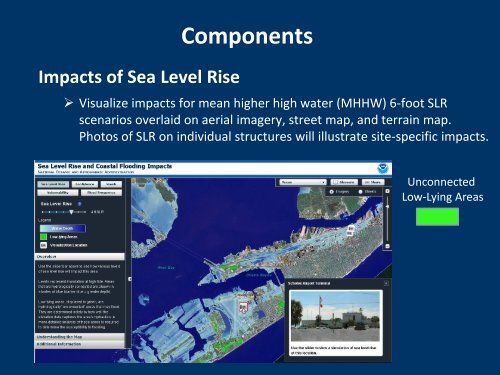
Components<br />
‣ Visualize impacts for mean higher high water (MHHW) 6-foot SLR<br />
scenarios overlaid on aerial imagery, street map, <strong>and</strong> terrain map.<br />
Photos of SLR on individual structures will illustrate site-specific impacts.<br />
Unconnected<br />
Low-Lying Areas