Using Multi-Objective Management to Reduce Flood Losses in Your
Using Multi-Objective Management to Reduce Flood Losses in Your
Using Multi-Objective Management to Reduce Flood Losses in Your

You also want an ePaper? Increase the reach of your titles
YUMPU automatically turns print PDFs into web optimized ePapers that Google loves.
This guidebook was prepared under grant number X 823852-01-0 <strong>in</strong> cooperation with the<br />
U.S. Environmental Protection Agency. The op<strong>in</strong>ions expressed here<strong>in</strong> are those of the<br />
authors and may not necessarily represent those of the EPA or the federal government.<br />
This guidebook is a general <strong>in</strong>troduction <strong>to</strong> multi-objective management and the plann<strong>in</strong>g<br />
process that helps a community select the flood loss reduction measures most suitable for its<br />
situation. To determ<strong>in</strong>e the best measures for specific sites, a community should obta<strong>in</strong><br />
additional guidance from eng<strong>in</strong>eers, planners, emergency managers, and other professionals<br />
experienced <strong>in</strong> flood loss reduction.<br />
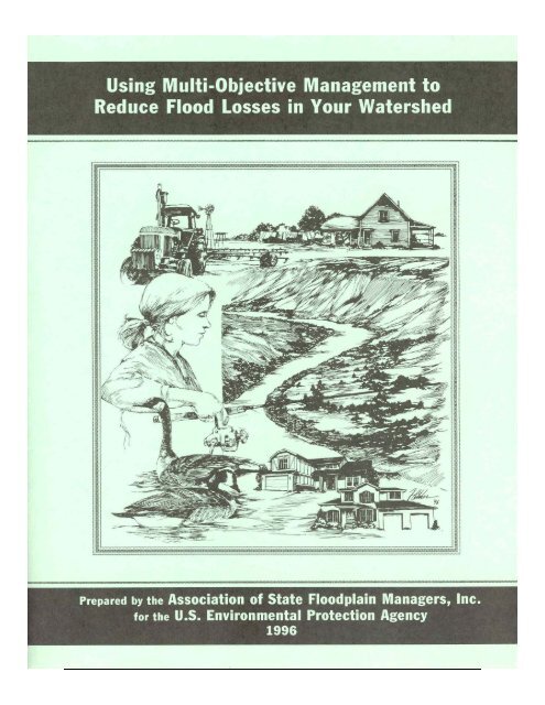
Cover art by Bob Fletcher, Arvada, Colorado
<strong>Us<strong>in</strong>g</strong> <strong>Multi</strong>-<strong>Objective</strong> <strong>Management</strong> <strong>to</strong><br />
<strong>Reduce</strong> <strong>Flood</strong> <strong>Losses</strong> <strong>in</strong> <strong>Your</strong> Watershed<br />
Prepared by the<br />
Association of State <strong>Flood</strong>pla<strong>in</strong> Managers<br />
Under a grant from the<br />
U.S. Environmental Protection Agency<br />
1996
Contents<br />
Acknowledgments.................................................................................................................... iv<br />
Executive Summary ...................................................................................................................v<br />
1. Introduction............................................................................................................................1<br />
So You Have a <strong>Flood</strong> Problem.........................................................................................1<br />
What is M-O-M ..............................................................................................................1<br />
Why use M-O-M.............................................................................................................2<br />
How <strong>to</strong> Use This Guide ....................................................................................................3<br />
2. Understand<strong>in</strong>g <strong>Your</strong> Watershed.............................................................................................5<br />
River<strong>in</strong>e <strong>Flood</strong><strong>in</strong>g.............................................................................................................5<br />
Coastal <strong>Flood</strong><strong>in</strong>g...............................................................................................................8<br />
Other <strong>Flood</strong> Hazards.........................................................................................................9<br />
What Information Do You Need ..................................................................................10<br />
3. <strong>Flood</strong> Loss Reduction Measures..........................................................................................13<br />
Prevention.......................................................................................................................13<br />
Property Protection.........................................................................................................19<br />
Emergency Services .......................................................................................................21<br />
Structural Projects...........................................................................................................23<br />
4. M-O-M Opportunities..........................................................................................................25<br />
Recreation.......................................................................................................................25<br />
Fish and Wildlife ............................................................................................................27<br />
Water Supply ..................................................................................................................29<br />
Water Quality .................................................................................................................31<br />
Urban Redevelopment ....................................................................................................32<br />
Economic Development .................................................................................................33<br />
Hous<strong>in</strong>g Improvement ....................................................................................................34<br />
Agriculture......................................................................................................................36<br />
His<strong>to</strong>ric Preservation ......................................................................................................38<br />
Education........................................................................................................................39<br />
Transportation and Infrastructure ...................................................................................42<br />
5. Prepar<strong>in</strong>g a M-O-M Plan .....................................................................................................45<br />
Organize..........................................................................................................................45<br />
Involve Other Local People............................................................................................47<br />
Involve Agencies and Organizations..............................................................................48<br />
Def<strong>in</strong>e the Problems .......................................................................................................50<br />
Agree on Goals and <strong>Objective</strong>s ......................................................................................52<br />
Review Alternatives and Select the Best Ones...............................................................53<br />
Prepare a Written Document ..........................................................................................55<br />
Get Public and Official Acceptance ...............................................................................56<br />
Implement and Follow Through.....................................................................................57<br />
Appendix A. National Agencies and Organizations ............................................................. A-1<br />
Appendix B. References .......................................................................................................B-1<br />
Appendix C. Terms and Acronyms........................................................................................C-1<br />
iii
Acknowledgments<br />
This guidebook was prepared by the Association of State <strong>Flood</strong>pla<strong>in</strong> Managers under a grant<br />
from the U.S. Environmental Protection Agency’s Wetlands Division.<br />
Project Officer: Jori Wesley, U.S. Environmental Protection Agency, Wash<strong>in</strong>g<strong>to</strong>n, D.C.<br />
Project Manager: Jerry Loutha<strong>in</strong>, Olympia, Wash<strong>in</strong>g<strong>to</strong>n<br />
Pr<strong>in</strong>cipal Author: French Wetmore, French & Associates, Park Forest, Ill<strong>in</strong>ois<br />
Technical edit<strong>in</strong>g and production: Jacquelyn L. Monday, Lakewood, Colorado<br />
Cover design and artwork: Bob Fletcher, Arvada, Colorado<br />
The guidebook could not have been developed without the technical <strong>in</strong>put and assistance of<br />
many experts <strong>in</strong> floodpla<strong>in</strong>, watershed, and multi-objective management. The follow<strong>in</strong>g<br />
people acted as project advisors:<br />
Richard Alexander, Department of Hous<strong>in</strong>g and Urban Development, Wash<strong>in</strong>g<strong>to</strong>n, D.C.<br />
Robert Bartels, Consoer Townsend Envirodyne, Chicago, Ill<strong>in</strong>ois<br />
Chris Brown, Recreation Resources, National Park Service, Wash<strong>in</strong>g<strong>to</strong>n, D.C.<br />
David Conrad, National Wildlife Federation, Wash<strong>in</strong>g<strong>to</strong>n, D.C.<br />
Bob Cox, Federal Emergency <strong>Management</strong> Agency, Denver, Colorado<br />
Mike Houck, Audubon Society of Portland, Portland, Oregon<br />
Jon Kusler, Association of State Wetland Managers, Berne, New York<br />
Larry Larson, Association of State <strong>Flood</strong>pla<strong>in</strong> Managers, Madison, Wiscons<strong>in</strong><br />
David McK<strong>in</strong>nie, Office of Ocean and Coastal Resources <strong>Management</strong>, Silver Spr<strong>in</strong>g, MD<br />
John McShane, Federal Emergency <strong>Management</strong> Agency, Wash<strong>in</strong>g<strong>to</strong>n, D.C.<br />
Jeanne Melanson, Natural Resources Conservation Service, Wash<strong>in</strong>g<strong>to</strong>n, D.C.<br />
Ann Pat<strong>to</strong>n, Public Works Department, Tulsa, Oklahoma<br />
Clancy Philipsborn, The Mitigation Assistance Corporation, Boulder, Colorado<br />
Doug Plasencia, Kimley-Horn & Associates, Phoenix, Arizona<br />
Don Porter, Waverly, Tennessee<br />
Jim Schwab, American Plann<strong>in</strong>g Association, Chicago, Ill<strong>in</strong>ois<br />
Holly S<strong>to</strong>erker, Upper Mississippi River Bas<strong>in</strong> Association, St. Paul, M<strong>in</strong>nesota<br />
Evelyn Swimmer, National Park Service, Philadelphia, Pennsylvania<br />
Gene Whitaker, National Wetlands Conservation Alliance, Wash<strong>in</strong>g<strong>to</strong>n, D.C.<br />
James Wright, The FPM Group, Seymour, Tennessee<br />
Ken Zwickl, U.S. Army Corps of Eng<strong>in</strong>eers, Wash<strong>in</strong>g<strong>to</strong>n, D.C.<br />
The illustrations on pages 28, 41, and 43 are repr<strong>in</strong>ted from A Casebook <strong>in</strong> Manag<strong>in</strong>g Rivers<br />
for <strong>Multi</strong>ple Uses, prepared <strong>in</strong> 1991 by the Association of State Wetland Managers, the<br />
Association of State <strong>Flood</strong>pla<strong>in</strong> Managers, and the National Park Service. The illustrations on<br />
pages 5, 7, and 51 were done by Bob Fletcher.<br />
iv
Executive Summary<br />
This guidebook was written for citizens and local officials who have a flood problem<br />
but have not yet found a solution. It capitalizes on the realization that the traditional,<br />
s<strong>in</strong>gle-issue approach <strong>to</strong> flood protection has not always been efficient or effective,<br />
and can take years <strong>to</strong> implement. Furthermore, people pursu<strong>in</strong>g s<strong>in</strong>gle issues-like<br />
flood control-have often found themselves compet<strong>in</strong>g with other local <strong>in</strong>terests and<br />
may <strong>in</strong>crease related problems or create new ones.<br />
This guidebook expla<strong>in</strong>s a proven approach <strong>to</strong> reduce flood losses and<br />
simultaneously address other community concerns. The approach is called “multiobjective<br />
management” or “M-O-M.” It succeeds because it coord<strong>in</strong>ates flood loss<br />
reduction with other community needs and goals <strong>to</strong> develop a stronger, more<br />
comprehensive program.<br />
There is noth<strong>in</strong>g magical about the multi-objective management approach. The<br />
basic idea is <strong>to</strong> get <strong>to</strong>gether everyone with a concern or problem that has the potential<br />
<strong>to</strong> affect or be affected by the flood problem. It requires communication between<br />
different parties and it capitalizes on the technical and f<strong>in</strong>ancial help that is already<br />
available from government agencies and private organizations.<br />
There are six basic guidel<strong>in</strong>es <strong>to</strong> the M-O-M approach:<br />
• Keep your effort locally based.<br />
• Understand your flood problem and its relationship <strong>to</strong> the watershed.<br />
• Th<strong>in</strong>k broadly about possible solutions <strong>to</strong> reduce flood losses.<br />
• Coord<strong>in</strong>ate flood loss reduction with other community needs, plans,<br />
and activities.<br />
• Obta<strong>in</strong> expert advice and assistance.<br />
• Build a partnership by develop<strong>in</strong>g a plan.<br />
There are four basic strategies for reduc<strong>in</strong>g flood losses, and each<br />
<strong>in</strong>corporates different measures that are appropriate for different conditions.<br />
• Prevention measures like plann<strong>in</strong>g, land acquisition, and regulations help<br />
modify development on floodpla<strong>in</strong>s and watersheds <strong>to</strong> reduce susceptibility <strong>to</strong><br />
flood damage. Preventive measures are usually adm<strong>in</strong>istered by the build<strong>in</strong>g,<br />
zon<strong>in</strong>g, plann<strong>in</strong>g, and/or code enforcement offices of your local government.<br />
• Property protection measures are usually undertaken by property owners<br />
themselves. They <strong>in</strong>clude elevat<strong>in</strong>g a build<strong>in</strong>g, build<strong>in</strong>g small barriers,<br />
floodproof<strong>in</strong>g, rais<strong>in</strong>g utilities, and buy<strong>in</strong>g <strong>in</strong>surance.<br />
• Emergency services m<strong>in</strong>imize the impact of a flood that is already happen<strong>in</strong>g.<br />
They are the responsibility of city or county emergency management staff and<br />
the opera<strong>to</strong>rs of major or critical facilities. They <strong>in</strong>clude warn<strong>in</strong>gs and<br />
emergency response.<br />
• Structural projects keep flood waters away from an area with a levee,<br />
reservoir, or other measure that controls the flow of water. Structural projects<br />
are usually designed by eng<strong>in</strong>eers and managed by public works staff.<br />
v
The floodpla<strong>in</strong> is not just a hazardous area. The floodpla<strong>in</strong>, the watershed,<br />
wetlands, and other flood-related areas have many different uses, most of them<br />
beneficial <strong>to</strong> the community. The multi-objective management approach br<strong>in</strong>gs<br />
<strong>to</strong>gether the people and groups that have <strong>in</strong>terests related <strong>to</strong> all these water-related<br />
uses. It helps reduce conflicts and <strong>in</strong>crease the opportunities for mutual support. <strong>Your</strong><br />
flood loss reduction measures become <strong>to</strong>ols <strong>to</strong> meet other objectives, <strong>to</strong>o. By ally<strong>in</strong>g<br />
yourself with these other <strong>in</strong>terests, you ga<strong>in</strong> longer-last<strong>in</strong>g, broader support for your<br />
common concerns.<br />
The number and types of special <strong>in</strong>terest groups and opportunities for<br />
cooperation will vary from community <strong>to</strong> community. The more common ones,<br />
covered <strong>in</strong> this guidebook, are:<br />
• Recreation ● Hous<strong>in</strong>g improvement<br />
• Fish and wildlife ● Agriculture<br />
• Water supply ● His<strong>to</strong>ric preservation<br />
• Water quality ● Education<br />
• Urban redevelopment ● Transportation and <strong>in</strong>frastructure.<br />
• Economic development<br />
There are literally hundreds of government agencies and programs, private clubs and<br />
other organizations, bus<strong>in</strong>esses, and <strong>in</strong>dividuals that can provide advice, assistance, and<br />
fund<strong>in</strong>g for flood loss reduction when it is comb<strong>in</strong>ed with other activities. Some of them are:<br />
local, state, and federal agencies for parks, environmental protection, recreation, economic<br />
development, hous<strong>in</strong>g, eng<strong>in</strong>eer<strong>in</strong>g, conservation, plann<strong>in</strong>g, community affairs, or natural<br />
resources; neighborhood associations; conservation and outdoor groups (Izaak Wal<strong>to</strong>n<br />
League, Audubon Society, Boy and Girl Scouts, Ducks Unlimited, Trout Unlimited, The<br />
Nature Conservancy, The Land Trust Alliance); recreational bus<strong>in</strong>esses (mar<strong>in</strong>as, sport<strong>in</strong>g<br />
goods s<strong>to</strong>res); local water departments and private water companies; farmers dependent on<br />
irrigation; <strong>in</strong>dustries and economic developers; chambers of commerce and bus<strong>in</strong>ess or<br />
manufacturers’ organizations; garden clubs; Urban Land Institute; and the National<br />
Community Development Association.<br />
A proper plann<strong>in</strong>g process is the key <strong>to</strong> determ<strong>in</strong><strong>in</strong>g what is best for your community<br />
and build<strong>in</strong>g consensus for what should be done. Plann<strong>in</strong>g is educational and it br<strong>in</strong>gs people<br />
<strong>to</strong>gether. And many state and federal programs require a plan as a prerequisite <strong>to</strong> provid<strong>in</strong>g<br />
you with assistance. Fund<strong>in</strong>g organizations want <strong>to</strong> know how their money fits <strong>in</strong><strong>to</strong> the<br />
community’s goals. These are the basic steps for multi- objective plann<strong>in</strong>g:<br />
(1) Get organized.<br />
(2) Involve other local people and groups.<br />
(3) Contact agencies and organizations that have an <strong>in</strong>terest or can<br />
provide advice and/or assistance.<br />
(4) Def<strong>in</strong>e the community problems.<br />
(5) Agree on goals and objectives for community plann<strong>in</strong>g and action.<br />
(6) Review alternatives <strong>to</strong> reduce flood losses and meet other needs.<br />
(7) Prepare a written document.<br />
(8) Get public and official acceptance of the plan.<br />
(9) Implement and follow through on the steps specified <strong>in</strong> the plan.<br />
Success s<strong>to</strong>ries <strong>in</strong> this guidebook give examples of how other communities have used the<br />
M-O-M approach. Additional <strong>in</strong>formation can be found by contact<strong>in</strong>g the agencies and<br />
organizations noted <strong>in</strong> Appendix A or by check<strong>in</strong>g the references <strong>in</strong> Appendix B.<br />
vi
Chapter 1<br />
Introduction<br />
This guidebook is a general <strong>in</strong>troduction <strong>to</strong> multi-objective management and the<br />
plann<strong>in</strong>g process that helps a community develop a flood loss reduction strategy most<br />
appropriate for its situation. It is for citizens and local officials who have a flood<br />
problem but have not yet found a solution.<br />
So You Have a <strong>Flood</strong> Problem<br />
A flood problem simply means that you are gett<strong>in</strong>g <strong>to</strong>o much water where you don’t<br />
want it. Because water does not respect property l<strong>in</strong>es or city limits, <strong>in</strong> most cases the<br />
solutions <strong>to</strong> your flood problem will <strong>in</strong>volve not just the people who suffered damage<br />
most recently, but rather the whole neighborhood, the entire community, and even the<br />
rest of the watershed.<br />
It’s hard <strong>to</strong> f<strong>in</strong>d a solution <strong>to</strong> a flood problem if you’re us<strong>in</strong>g a s<strong>in</strong>gle-m<strong>in</strong>ded<br />
approach. You may be the only one who cares about flood<strong>in</strong>g, but you’re certa<strong>in</strong>ly<br />
not the only person talk<strong>in</strong>g <strong>to</strong> City Hall about a problem or want<strong>in</strong>g <strong>to</strong> improve your<br />
neighborhood. There are other <strong>in</strong>terests out there and if everyone focuses only on<br />
their own concerns, you are all really compet<strong>in</strong>g with each other.<br />
This guidebook shows you a proven approach <strong>to</strong> reduce flood losses and<br />
simultaneously address other community concerns. It is called “multi-objective<br />
management” or “M-O-M.” It succeeds because with it you build alliances with other<br />
<strong>in</strong>terest groups <strong>in</strong> your area, use f<strong>in</strong>ancial and other resources that already exist, and<br />
look at the whole watershed that affects your flood<strong>in</strong>g problem.<br />
In the end you will have coord<strong>in</strong>ated flood loss reduction with some of the<br />
other goals and needs of your community. <strong>Your</strong> solutions <strong>to</strong> flood<strong>in</strong>g will be more<br />
effective, more sensitive <strong>to</strong> the environment, have broader support, be part of a more<br />
comprehensive program, and accomplish more than one objective.<br />
What is M-O-M<br />
There is noth<strong>in</strong>g magical about the multi-objective management approach. The basic<br />
idea is <strong>to</strong> get <strong>to</strong>gether everyone with a concern or problem that has the potential <strong>to</strong><br />
affect or be affected by the flood problem. It requires communication between<br />
different parties and it capitalizes on the help that is offered by government agencies<br />
and private organizations.<br />
There are six basic guidel<strong>in</strong>es <strong>to</strong> the M-O-M approach:<br />
(1) Keep your effort locally based. <strong>Your</strong> solutions must be acceptable <strong>to</strong> you,<br />
your neighbors, and others <strong>in</strong> the area. They must fit <strong>in</strong> with other local<br />
concerns and goals.<br />
(2) Understand your flood problem and its relation <strong>to</strong> the watershed. <strong>Your</strong><br />
problem is not isolated. Neither is it limited <strong>to</strong> your stream or your<br />
1
neighborhood. If you th<strong>in</strong>k <strong>in</strong> terms of the whole watershed (where the<br />
water comes from and where it goes), you will come up with more<br />
possible solutions and they will not cause problems for someone else.<br />
Chapter 2 covers understand<strong>in</strong>g your flood problem and watershed.<br />
(3) Th<strong>in</strong>k broadly about possible solutions <strong>to</strong> reduce your flood problem.<br />
There are more ways <strong>to</strong> do th<strong>in</strong>gs than conventional wisdom may suggest.<br />
Don’t get locked <strong>in</strong><strong>to</strong> want<strong>in</strong>g a floodwall or other s<strong>in</strong>gle-purpose project<br />
without first check<strong>in</strong>g out all the alternatives. The basic ways of reduc<strong>in</strong>g<br />
flood losses are <strong>in</strong>troduced <strong>in</strong> Chapter 3.<br />
(4) Identify the other community concerns and goals that could have a<br />
bear<strong>in</strong>g on the flood problem. Get people who are <strong>in</strong>terested <strong>in</strong> those<br />
other concerns <strong>to</strong> meet with you. Together, bra<strong>in</strong>s<strong>to</strong>rm the possible<br />
solutions that can reach more than one of your objectives. Chapter 4<br />
discusses some of the issues (and the people and organizations beh<strong>in</strong>d<br />
them) that could be coord<strong>in</strong>ated with flood loss reduction. Chapter 5<br />
describes ways <strong>to</strong> help you and the others reach agreement and work<br />
<strong>to</strong>gether.<br />
(5) Obta<strong>in</strong> expert advice and assistance from government agencies and<br />
private organizations. F<strong>in</strong>d out what f<strong>in</strong>ancial assistance and advice are<br />
available. Don’t put all your eggs <strong>in</strong> one basket and wait for that big<br />
“cure-all “project that may never be funded. There are literally hundreds<br />
of programs out there, you just have <strong>to</strong> pick them. The more commonly<br />
used ones are identified <strong>in</strong> Chapters 3 and 4. Their national contacts are<br />
listed <strong>in</strong> Appendix A.<br />
(6) Build a partnership among all the private and public groups and<br />
<strong>in</strong>dividuals you can enlist <strong>to</strong> work on the objectives. More m<strong>in</strong>ds and<br />
hands mean that better ideas will result, people will be more likely <strong>to</strong><br />
follow through, and there will be more people <strong>to</strong> do the work. It will help<br />
if you follow a systematic process <strong>to</strong> develop a M-O-M plan. Prepar<strong>in</strong>g a<br />
written plan helps keep you all organized, clarifies your solutions, and<br />
formalizes everyone’s participation. The plann<strong>in</strong>g process is described <strong>in</strong><br />
Chapter 5.<br />
Why Use M-O-M<br />
If you have a flood problem, you may ask “Why bother with this M-O-M stuff<br />
Why not just s<strong>to</strong>p the flood<strong>in</strong>g” This is not as easy as it sounds, especially if you<br />
are on a large river or the ocean. Structures <strong>to</strong> “s<strong>to</strong>p” or control the floods can be<br />
very expensive <strong>to</strong> build and ma<strong>in</strong>ta<strong>in</strong>; take a long time <strong>to</strong> plan, fund, and build;<br />
and can cost more than the value of the property they would protect. They may<br />
adversely affect other properties, the environment, and other people’s plans for the<br />
area. As shown by the Mississippi River flood of 1993, they don’t always work,<br />
especially if a flood is larger than was anticipated.<br />
2
If you have only one objective−“s<strong>to</strong>p the<br />
flood<strong>in</strong>g”−you may spend a lot of time and<br />
money on your one problem and you may create<br />
more problems for other people. You will be<br />
compet<strong>in</strong>g with other communities that want funds<br />
for expensive structural projects. You will even be<br />
compet<strong>in</strong>g with others <strong>in</strong> your own community<br />
who have different goals <strong>in</strong> m<strong>in</strong>d. The M-O-M<br />
approach helps you take charge of your future by<br />
look<strong>in</strong>g at all the th<strong>in</strong>gs your community needs<br />
and see<strong>in</strong>g how they can be comb<strong>in</strong>ed with<br />
possible ways <strong>to</strong> reduce flood losses. You do not<br />
put all your eggs <strong>in</strong> one basket, you are less<br />
dependent on outside agencies, and you have more<br />
sources of fund<strong>in</strong>g and technical advice.<br />
With M-O-M, you jo<strong>in</strong> forces with other<br />
people who are just as devoted <strong>to</strong> their goals−be<br />
they parks and recreation, economic development,<br />
<strong>to</strong>urism, or environmental education. You can all<br />
reach your objectives <strong>in</strong> a cheaper, faster, and less<br />
disruptive manner by us<strong>in</strong>g M-O-M. The M-O-M<br />
approach results <strong>in</strong> more permanent, less<br />
expensive flood loss reduction than try<strong>in</strong>g <strong>to</strong><br />
control the natural forces that cause floods.<br />
One reason the M-O-M approach gets such<br />
good results is that, with M-O-M, you treat the<br />
river’s floodpla<strong>in</strong> and its watershed as a resource.<br />
The floodpla<strong>in</strong> need not be just a place with a<br />
flood hazard, it is also an area that is important <strong>to</strong><br />
your community and <strong>to</strong> plant and animal life. The<br />
M-O-M process makes sure that flood projects<br />
don’t underm<strong>in</strong>e other community objectives and<br />
the need <strong>to</strong> protect the natural environment.<br />
AN EXAMPLE OF THE<br />
M-O-M APPROACH<br />
You want farmers and subdivisions<br />
<strong>in</strong> the watershed <strong>to</strong> reduce the<br />
amount of runoff that goes <strong>to</strong> your<br />
stream. The Soil and Water<br />
Conservation District wants<br />
agricultural practices that reduce<br />
erosion and soil loss. An<br />
environmental group wants more<br />
wetlands preserved from<br />
development. And the parks<br />
department needs more open space<br />
<strong>to</strong> serve a grow<strong>in</strong>g population.<br />
These other <strong>in</strong>terests can help<br />
you: The farm<strong>in</strong>g practices promoted<br />
by the Soil and Water<br />
Conservation District will reduce<br />
runoff and sedimentation. Wetlands<br />
s<strong>to</strong>re water before it reaches the<br />
stream. The most productive wetlands<br />
and watershed s<strong>to</strong>rage areas<br />
can make very attractive and<br />
<strong>in</strong>terest<strong>in</strong>g parks and provide water<br />
quality benefits.<br />
By identify<strong>in</strong>g the concerns of<br />
others, you can f<strong>in</strong>d opportunities<br />
for the different groups <strong>to</strong> work <strong>to</strong>gether.<br />
You may not have the same<br />
goals, but you have common<br />
<strong>in</strong>terests that can support each<br />
other.<br />
Take the case of Kampsville, a <strong>to</strong>wn of 400 residents on the Ill<strong>in</strong>ois River<br />
(see box, next page). Its residents could have cont<strong>in</strong>ued <strong>to</strong> endure flood<strong>in</strong>g, waited<br />
for a flood control project that would not be built, or looked for alternative ways<br />
<strong>to</strong> reduce flood losses. They chose the third option, and it paid off dur<strong>in</strong>g the<br />
1993 flood.<br />
How <strong>to</strong> Use This Guide<br />
This guidebook is an overview of the multi-objective management approach as it<br />
relates <strong>to</strong> flood loss reduction. Chapters 2−5 cover the M-O-M approach <strong>in</strong><br />
chronological order.<br />
<br />
Chapter 2 is about understand<strong>in</strong>g your watershed and how your<br />
flood problem fits <strong>in</strong><strong>to</strong> it.<br />
3
A M-O-M<br />
Success<br />
S<strong>to</strong>ry<br />
After the <strong>to</strong>wn was flooded <strong>in</strong> 1979 and aga<strong>in</strong> <strong>in</strong> 1982,<br />
Kampsville, Ill<strong>in</strong>ois, residents and local officials decided they<br />
wanted <strong>to</strong> do someth<strong>in</strong>g about this recurr<strong>in</strong>g problem. They<br />
knew that they were not go<strong>in</strong>g <strong>to</strong> s<strong>to</strong>p the Ill<strong>in</strong>ois River from<br />
flood<strong>in</strong>g and that <strong>to</strong> build a levee large enough would require<br />
remov<strong>in</strong>g many of the build<strong>in</strong>gs they wanted <strong>to</strong> protect.<br />
Therefore, they began a systematic plann<strong>in</strong>g process <strong>to</strong><br />
review alternative ways <strong>to</strong> reduce flood losses. One of the<br />
first th<strong>in</strong>gs they did was ask for help. The state floodpla<strong>in</strong> management agency<br />
provided them with staff support. Dur<strong>in</strong>g a series of plann<strong>in</strong>g meet<strong>in</strong>gs, other<br />
agencies were <strong>in</strong>vited <strong>to</strong> expla<strong>in</strong> their ideas and tell how they could help.<br />
It soon became apparent that the best solution was <strong>to</strong> purchase and relocate<br />
the worst-hit build<strong>in</strong>gs. Because this would leave the <strong>to</strong>wn with a large open<br />
area, folks started talk<strong>in</strong>g about what they would do with it. They were also<br />
concerned that they would lose some bus<strong>in</strong>esses when the flood-prone properties<br />
were bought out. Dur<strong>in</strong>g this process, they realized that they had <strong>to</strong> th<strong>in</strong>k about<br />
more than just flood<strong>in</strong>g; they had <strong>to</strong> consider the future of their village and its<br />
economic base.<br />
After that, they expanded their plann<strong>in</strong>g process <strong>to</strong> encompass other goals,<br />
<strong>in</strong>clud<strong>in</strong>g redevelop<strong>in</strong>g the acquired area, design<strong>in</strong>g a park, and build<strong>in</strong>g a base<br />
for <strong>to</strong>urism. The Village started sponsor<strong>in</strong>g recreation activities, <strong>in</strong>clud<strong>in</strong>g an<br />
annual celebration that br<strong>in</strong>gs <strong>in</strong> hundreds of people. They now view the<br />
riverfront as a resource, not a problem area.<br />
Kampsville received over $1 million <strong>to</strong> buy 50 properties and convert flooded<br />
and dilapidated build<strong>in</strong>gs <strong>to</strong> open space. The money was also used <strong>to</strong> elevate<br />
some build<strong>in</strong>gs that were not flooded very deeply, <strong>to</strong> floodproof the water<br />
treatment plant, and <strong>to</strong> relocate the fire station. A new ferry land<strong>in</strong>g and allweather<br />
access <strong>in</strong><strong>to</strong> <strong>to</strong>wn were also built. In all, f<strong>in</strong>ancial assistance was<br />
provided by three state agencies, two federal agencies, and the Village’s largest<br />
employer.<br />
Although it <strong>to</strong>ok almost 10 years <strong>to</strong> plan, fund, and complete, Kampsville’s<br />
approach paid off dur<strong>in</strong>g the 1993 Midwest flood. The <strong>to</strong>wn suffered some<br />
damage because flood waters exceeded the 100-year flood elevation. But<br />
Kampsville did not make the news because its damage was relatively m<strong>in</strong>or<br />
compared <strong>to</strong> that of its neighbors.<br />
Chapter 3 covers the variety of flood loss reduction measures you<br />
will want <strong>to</strong> consider.<br />
Chapter 4 lists some other problems or needs your community may<br />
have and expla<strong>in</strong>s how they can relate <strong>to</strong> the watershed, your flood<br />
problem, or the solutions <strong>to</strong> your flood problem.<br />
Chapter 5 describes a process that uses a formal partnership <strong>to</strong><br />
prepare a plan <strong>to</strong> achieve your and others’ goals.<br />
Throughout this guide there are references <strong>to</strong> government agencies and private<br />
organizations that can help you prepare or implement a M-O-M program. Their<br />
local offices can often be found <strong>in</strong> your phone book. Their national offices are<br />
listed <strong>in</strong> Appendix A. Remember, one of the key parts of the M-O-M approach is<br />
<strong>to</strong> ask for help−these programs are designed <strong>to</strong> provide that help. Appendix B<br />
lists references that can help you and your plann<strong>in</strong>g partners. Appendix C def<strong>in</strong>es<br />
some common terms and acronyms used by flood specialists.<br />
4
Chapter 2<br />
Understand<strong>in</strong>g <strong>Your</strong> Watershed<br />
There are many types of flood problems. You could have overbank flood<strong>in</strong>g from<br />
large rivers, coastal flood<strong>in</strong>g dur<strong>in</strong>g s<strong>to</strong>rms and hurricanes, flash flood<strong>in</strong>g on<br />
small streams, basement flood<strong>in</strong>g from sewer backups, or a comb<strong>in</strong>ation of those.<br />
The first step <strong>in</strong> tackl<strong>in</strong>g your flood problem is understand<strong>in</strong>g what causes it.<br />
To beg<strong>in</strong>, it is important <strong>to</strong> note that flood<strong>in</strong>g is a natural occurrence.<br />
Rivers, lakes, and salt-water bodies have always overflowed their normal beds <strong>to</strong><br />
<strong>in</strong>undate the nearby land. The land adjacent <strong>to</strong> these bodies of water is called the<br />
floodpla<strong>in</strong>.<br />
<strong>Flood</strong>pla<strong>in</strong> lands look dry most of the time, but nature <strong>in</strong>tends that they be<br />
covered with water periodically. As long as we can live with this, there will be no<br />
problems. <strong>Flood</strong> problems arise when we <strong>in</strong>terfere with the natural process of<br />
river<strong>in</strong>e, coastal, and other types of flood<strong>in</strong>g.<br />
River<strong>in</strong>e <strong>Flood</strong><strong>in</strong>g<br />
River<strong>in</strong>e flood<strong>in</strong>g simply means flood<strong>in</strong>g of a river, stream, or other channel. To<br />
understand river<strong>in</strong>e flood<strong>in</strong>g, you need <strong>to</strong> be aware of your watershed.<br />
The watershed<br />
A watershed is the area that dra<strong>in</strong>s <strong>to</strong> a lake, stream, or other body of water. It is<br />
also called a bas<strong>in</strong> or catchment area.<br />
The boundary of a watershed is a ridge or divide. The divide is the high<br />
ground and the river or lake is the lowest ground. Ra<strong>in</strong> and snowmelt flow from<br />
the divide <strong>to</strong> the receiv<strong>in</strong>g stream.<br />
A WATERSHED BOUNDARY<br />
5
Watersheds vary <strong>in</strong> size. They can be divided <strong>in</strong><strong>to</strong> smaller subwatersheds.<br />
The important th<strong>in</strong>g is that the stream and its watershed are connected. What<br />
happens <strong>in</strong> the watershed−even <strong>in</strong> the higher elevations up near the divide –<br />
affects th<strong>in</strong>gs both <strong>in</strong> the low-ly<strong>in</strong>g lands near the stream or lake and also<br />
farther downstream.<br />
The floodpla<strong>in</strong><br />
The size of a river depends on how much water it collects from the watershed.<br />
Most of the time, a river stays with<strong>in</strong> its banks. However, after heavy s<strong>to</strong>rms or<br />
snowmelt, the extra amount of water can be <strong>to</strong>o much for the channel, caus<strong>in</strong>g it<br />
<strong>to</strong> overflow on<strong>to</strong> normally dry land.<br />
A floodpla<strong>in</strong> can be def<strong>in</strong>ed accord<strong>in</strong>g <strong>to</strong> the frequency of the flood<strong>in</strong>g that<br />
WHAT ARE THE ODDS OF A<br />
100-YEAR FLOOD<br />
The term “100-year flood” has caused much<br />
confusion for people not familiar with statistics.<br />
Another way of look<strong>in</strong>g at it is <strong>to</strong> th<strong>in</strong>k of the<br />
Odds that a 100-year flood will happen<br />
sometime dur<strong>in</strong>g the life of a 30-year mortgage<br />
(26% chance).<br />
Chance of <strong>Flood</strong><strong>in</strong>g over a Period of Years<br />
Time<br />
<strong>Flood</strong> Size<br />
Period 10-year 25-year 50-year 100-year<br />
1 year 10% 4% 2% 1%<br />
10 years 65% 34% 18% 10%<br />
20 years 88% 56% 33% 18%<br />
30 years 96% 71% 45% 26%<br />
50 years 99% 87% 64% 39%<br />
Even these numbers do not convey the true<br />
flood risk because they focus on the larger,<br />
less frequent, floods. If a house is low<br />
enough, it may be subject <strong>to</strong> the 10- or<br />
25-year flood. Dur<strong>in</strong>g the proverbial 30-year<br />
mortgage, it may have a 26% chance of be<strong>in</strong>g<br />
hit by the 100-year flood, but the odds are<br />
96% (nearly guaranteed) that it will be hit by<br />
a 10-year flood. Compare those odds <strong>to</strong> the<br />
only 5% chance that the house will catch fire<br />
dur<strong>in</strong>g the same 30-year mortgage.<br />
covers it. An area that is flooded every<br />
year (a 1-year floodpla<strong>in</strong>) is smaller than<br />
the floodpla<strong>in</strong> that is <strong>in</strong>undated less<br />
frequently (a 15-year, 75-year, or even<br />
larger floodpla<strong>in</strong>).<br />
The base flood−The national<br />
standard for floodpla<strong>in</strong> management is the<br />
base or one percent chance floodpla<strong>in</strong>.<br />
This is the floodpla<strong>in</strong> that has at least one<br />
chance <strong>in</strong> 100 of be<strong>in</strong>g flooded <strong>in</strong> any<br />
given year. It is also called the 100-year<br />
floodpla<strong>in</strong>. This is the area shown on the<br />
<strong>Flood</strong> Insurance Rate Map (FIRM) for<br />
your <strong>to</strong>wn issued by the Federal<br />
Emergency <strong>Management</strong> Agency.<br />
The term “100-year flood “ has<br />
caused a lot of confusion. Some folks<br />
th<strong>in</strong>k hat it will only happen once <strong>in</strong> 100<br />
years, but that is def<strong>in</strong>itely not true.<br />
Instead, “100-year flood “ is a statistical<br />
term that refers <strong>to</strong> the odds of a flood of<br />
that size happen<strong>in</strong>g <strong>in</strong> any given year (see<br />
box). It is possible <strong>to</strong> have 100-year floods<br />
two years <strong>in</strong> a row.<br />
The floodway−Another term you<br />
will see is floodway. This is the river<br />
channel and the overbank area near the<br />
channel that carry the deeper and fastermov<strong>in</strong>g<br />
flood waters. Some maps show a<br />
regula<strong>to</strong>ry floodway, an area where construction regulations require special<br />
provisions <strong>to</strong> account for this extra hazard.<br />
<strong>Flood</strong> problems<br />
As noted above, flood<strong>in</strong>g is a natural occurrence but flood problems are the result<br />
of human development. <strong>Flood</strong>s may be acts of God, but flood damage results from<br />
human actions. <strong>Flood</strong> problems result from:<br />
6
Inappropriate development <strong>in</strong> the floodpla<strong>in</strong> (e.g., build<strong>in</strong>gs <strong>to</strong>o low,<br />
<strong>to</strong>o close <strong>to</strong> the channel, or block<strong>in</strong>g flood flows),<br />
Development <strong>in</strong> the watershed that <strong>in</strong>creases flood flows and creates a<br />
larger floodpla<strong>in</strong>, or<br />
A comb<strong>in</strong>ation of these two.<br />
Here is a typical example of how river<strong>in</strong>e flood problems develop: A watershed of<br />
10 square miles dra<strong>in</strong>s <strong>to</strong> Small Creek. The watershed orig<strong>in</strong>ally had many natural<br />
depressions and wetlands that<br />
s<strong>to</strong>red ra<strong>in</strong> and snowmelt.<br />
THE FLOODPLAIN OF SMALL CREEK, 1950<br />
For the last 1,000<br />
years, the creek has flooded<br />
periodically on<strong>to</strong> the floodpla<strong>in</strong>.<br />
When the area was first<br />
settled, the floodpla<strong>in</strong> was only<br />
used for farm<strong>in</strong>g−the farmers<br />
would lose a crop every 20 <strong>to</strong><br />
30 years due <strong>to</strong> a flood.<br />
Dur<strong>in</strong>g the 1950s and<br />
1960s the area began <strong>to</strong> be<br />
developed as suburban<br />
subdivisions grew out from an<br />
expand<strong>in</strong>g metropolitan area.<br />
Bridges were built across<br />
Small Creek, but their<br />
open<strong>in</strong>gs were only large enough <strong>to</strong> carry the 10-year flood. The channel was<br />
moved and straightened <strong>to</strong> make way for development.<br />
The people who had owned the land s<strong>in</strong>ce the 1940s had not seen any<br />
floods. There was a general sense that dry land would stay dry, so parts of the<br />
floodpla<strong>in</strong> were converted from farm<strong>in</strong>g <strong>to</strong> residential and commercial uses. Parts<br />
of the floodpla<strong>in</strong> were built on, us<strong>in</strong>g normal construction practices. The first<br />
floors were only a foot above ground level.<br />
The watershed was<br />
gradually chang<strong>in</strong>g. Lands that<br />
were once forests and farm<br />
fields were covered with<br />
streets and build<strong>in</strong>gs. Less ra<strong>in</strong><br />
water and snowmelt could soak<br />
<strong>in</strong><strong>to</strong> the ground, so more of it<br />
ran off <strong>in</strong><strong>to</strong> the stream.<br />
To get the extra surface<br />
water away from the build<strong>in</strong>gs,<br />
the developers built s<strong>to</strong>rm<br />
sewers and dra<strong>in</strong>age ditches.<br />
The wetlands were dra<strong>in</strong>ed or<br />
filled <strong>to</strong> allow more build<strong>in</strong>gs<br />
or larger farms. Now more<br />
THE FLOODPLAIN OF SMALL CREEK, 1990<br />
7
water is runn<strong>in</strong>g off the land <strong>in</strong><strong>to</strong> Small Creek and human development helps it get<br />
there even faster.<br />
The amount of water that used <strong>to</strong> come downstream once every 20 or 30<br />
years now comes down about every 10 years. Because of the build<strong>in</strong>gs, roads, and<br />
small bridge open<strong>in</strong>gs, there is less room <strong>in</strong> the floodpla<strong>in</strong> <strong>to</strong> carry the extra<br />
water. <strong>Flood</strong> waters rise higher, cover a larger area, and flood farmlands, roads,<br />
utilities, build<strong>in</strong>gs, and other development that had never been flooded before.<br />
In addition, the channel banks are exposed <strong>to</strong> faster-mov<strong>in</strong>g waters and<br />
have become more susceptible <strong>to</strong> erosion. Higher flood waters runn<strong>in</strong>g across bare<br />
construction sites and tilled farm lands cause more erosion and carry sediment <strong>in</strong><strong>to</strong><br />
the streams and lakes.<br />
Pollutants from lawn fertilizers, pesticides, farm chemicals, street surfaces,<br />
and <strong>in</strong>dustrial areas are also delivered <strong>to</strong> the rivers and lakes. Many beneficial<br />
plants and animals are harmed or exterm<strong>in</strong>ated by these pollutants and sediments.<br />
The orig<strong>in</strong>al species are be<strong>in</strong>g replaced by different ones that may not be desirable<br />
or beneficial <strong>to</strong> the rivers, lakes, or environment.<br />
It can be seen that there is a close relationship between natural flood<strong>in</strong>g,<br />
development <strong>in</strong> the floodpla<strong>in</strong>, and what happens <strong>in</strong> the rest of the watershed. As<br />
a general rule, the smaller the watershed, the more quickly it reacts <strong>to</strong> changes.<br />
As one experienced floodpla<strong>in</strong> manager has put it, “You don’t solve flood<br />
problems by work<strong>in</strong>g at the bot<strong>to</strong>m of the hill.” You must look at the whole<br />
picture−where the water comes from and where it goes.<br />
Coastal <strong>Flood</strong><strong>in</strong>g<br />
Areas along the seashore or lakeshores are prone <strong>to</strong> coastal flood<strong>in</strong>g and erosion.<br />
Coastal flood<strong>in</strong>g happens dur<strong>in</strong>g s<strong>to</strong>rms that drive water on<strong>to</strong> adjacent land. These<br />
can be hurricanes, “nor’easters,” or tropical s<strong>to</strong>rms, but even a severe w<strong>in</strong>ter<br />
s<strong>to</strong>rm or thunders<strong>to</strong>rm can cause flood<strong>in</strong>g.<br />
<strong>Flood</strong><strong>in</strong>g<br />
Coastal flood<strong>in</strong>g or s<strong>to</strong>rm surge is caused by high water from w<strong>in</strong>d and the air<br />
pressure differences that accompany a s<strong>to</strong>rm. A s<strong>to</strong>rm surge is not a tidal wave or<br />
sudden rush of water; it is more of a gradual <strong>in</strong>crease <strong>in</strong> water level. While this<br />
may sound harmless, a surge can be as high as 20 feet above normal water levels,<br />
flood<strong>in</strong>g normally dry areas far <strong>in</strong>land. Most of the damage and deaths caused by<br />
a hurricane are the result of flood<strong>in</strong>g, not high w<strong>in</strong>ds.<br />
Like communities with river<strong>in</strong>e flood<strong>in</strong>g, most coastal communities<br />
have a <strong>Flood</strong> Insurance Rate Map that shows their base floodpla<strong>in</strong>s. The maps<br />
also show the parts of the floodpla<strong>in</strong> subject <strong>to</strong> high damage potential from waves,<br />
known as velocity zones.<br />
Another form of coastal flood<strong>in</strong>g may or may not be shown on the<br />
map. A tsunami is a wave that is caused by an earthquake under the ocean.<br />
Tsunamis are not tidal waves nor are they related <strong>to</strong> s<strong>to</strong>rms, because they can<br />
happen on a clear day as a result of seismic activity hundreds of miles away. They<br />
can produce flood levels far above the mapped base floodpla<strong>in</strong>. In this country,<br />
they are most common on the Pacific coast, especially <strong>in</strong> Alaska, Hawaii, and the<br />
Northwest.<br />
8
Erosion<br />
The problem of coastal flood<strong>in</strong>g can be made worse by erosion. Along sandy<br />
coastl<strong>in</strong>es, the dunes and open beaches provide natural protection by caus<strong>in</strong>g the<br />
waves <strong>to</strong> break close <strong>to</strong> shore, away from development. But these natural<br />
protective features can be worn down by erosion, expos<strong>in</strong>g areas farther <strong>in</strong>land <strong>to</strong><br />
s<strong>to</strong>rm damage.<br />
Erosion causes its own damage when it undercuts the foundations under<br />
build<strong>in</strong>gs. Structures above the base floodpla<strong>in</strong> can be damaged dur<strong>in</strong>g or after a<br />
s<strong>to</strong>rm when the underly<strong>in</strong>g sand is washed away, remov<strong>in</strong>g the support for the<br />
foundations.<br />
Damage from coastal flood<strong>in</strong>g and erosion<br />
Under natural conditions, coastal flood<strong>in</strong>g and erosion cause little or no permanent<br />
damage. Plant life res<strong>to</strong>res itself after a s<strong>to</strong>rm. Sandy areas, such as barrier<br />
islands, move back and forth as the water and w<strong>in</strong>d move the sand. Coastal dunes<br />
and barrier islands migrate naturally and rebuild themselves from s<strong>to</strong>rm <strong>to</strong> s<strong>to</strong>rm.<br />
The problem arises when people build on coastal floodpla<strong>in</strong>s, putt<strong>in</strong>g<br />
property and lives <strong>in</strong> the path of s<strong>to</strong>rm surges and the natural erosion process.<br />
People want the sand <strong>to</strong> stay still so it will protect their build<strong>in</strong>gs from damage.<br />
Structures, like seawalls, that are <strong>in</strong>tended <strong>to</strong> protect build<strong>in</strong>gs from water and<br />
erosion, can make th<strong>in</strong>gs worse by concentrat<strong>in</strong>g the water forces <strong>in</strong> front of the<br />
wall or by transferr<strong>in</strong>g the problem <strong>to</strong> the properties at the end of the structure.<br />
Damage from coastal flood<strong>in</strong>g is <strong>in</strong>creas<strong>in</strong>g just as river<strong>in</strong>e flood damage<br />
is. This is primarily because of the great <strong>in</strong>crease <strong>in</strong> coastal development over the<br />
last 40 years: there are more and bigger structures built close <strong>to</strong> the shore. In<br />
some areas, erosion has left these structures closer <strong>to</strong> the flood hazard than they<br />
used <strong>to</strong> be.<br />
Other <strong>Flood</strong> Hazards<br />
River<strong>in</strong>e and coastal flood<strong>in</strong>g are the two most common flood hazards. Most<br />
scientific studies of a community’s flood risk del<strong>in</strong>eate the anticipated extent of a<br />
flood of a certa<strong>in</strong> frequency, and describe its hazards <strong>in</strong> terms of depth and<br />
velocity of the flood water. Some types of flood<strong>in</strong>g have additional hazards, such<br />
as sediment loads that can reroute stream channels. These additional hazards<br />
<strong>in</strong>clude:<br />
Sheet flow−In places where there are no def<strong>in</strong>ed channels, the flood<br />
water spreads out over a large area at a uniform depth.<br />
Pond<strong>in</strong>g−In flat areas, runoff collects or ponds <strong>in</strong> depressions and<br />
cannot dra<strong>in</strong> out. <strong>Flood</strong> waters must <strong>in</strong>filtrate slowly <strong>in</strong><strong>to</strong> the soil,<br />
evaporate, or be pumped out.<br />
Closed bas<strong>in</strong> lake flood<strong>in</strong>g−This occurs on lakes with either no outlet<br />
or a relatively small one. Seasonal <strong>in</strong>creases <strong>in</strong> ra<strong>in</strong>fall cause the lake<br />
level <strong>to</strong> rise faster than it can dra<strong>in</strong>. The water may stay at flood stage<br />
for weeks, months, or years.<br />
9
Flash flood<strong>in</strong>g−This is flood<strong>in</strong>g that occurs <strong>in</strong> a short period of time.<br />
It is most common when <strong>in</strong>tense local ra<strong>in</strong>s fall on areas with steep<br />
slopes or on built-up areas where impervious surfaces, gutters, and<br />
s<strong>to</strong>rm sewers speed up the flow of runoff.<br />
Alluvial fans−In mounta<strong>in</strong>ous areas, high velocity flood flows pick up<br />
sediment as they move downhill. At the base of the valley the slope<br />
flattens out. The flood waters slow and spread out, as <strong>in</strong> sheet flow,<br />
and drop the sediment over a wide fan-shaped area.<br />
Ice jams−Ice jam floods occur when warm weather and ra<strong>in</strong> break up<br />
frozen rivers. The broken ice floats downriver until it hits bot<strong>to</strong>m at a<br />
shallow spot or is blocked by an obstruction, such as a bridge. An ice<br />
dam forms and blocks the channel, caus<strong>in</strong>g flood<strong>in</strong>g upstream.<br />
Moveable bed streams−These are most common <strong>in</strong> the arid West,<br />
where steep slopes and lack of vegetation result <strong>in</strong> a lot of erosion.<br />
Dur<strong>in</strong>g a flood, a channel may be eroded more deeply or it may<br />
become filled with sediment and move <strong>to</strong> a different location.<br />
Sewer backup−Dur<strong>in</strong>g heavy ra<strong>in</strong>s, s<strong>to</strong>rmwater may overload a<br />
community’s sanitary or s<strong>to</strong>rm sewer system. If the water levels <strong>in</strong> the<br />
receiv<strong>in</strong>g streams are high, the s<strong>to</strong>rm sewers can’t dra<strong>in</strong>. The water<br />
will back up <strong>in</strong> the system, usually <strong>in</strong><strong>to</strong> basements and other low-ly<strong>in</strong>g<br />
areas.<br />
Just as with river<strong>in</strong>e and coastal flood<strong>in</strong>g, flood problems arise when development<br />
does not take these special hazards <strong>in</strong><strong>to</strong> account. An additional concern is that<br />
many flood hazard maps and flood loss reduction programs, such as build<strong>in</strong>g<br />
codes, do not reflect the additional danger and damage potential that accompany<br />
these other types of flood<strong>in</strong>g.<br />
To F<strong>in</strong>d Out More > > For more <strong>in</strong>formation on these “special” hazards,<br />
see Reduc<strong>in</strong>g <strong>Flood</strong> <strong>Losses</strong> <strong>in</strong> High Risk <strong>Flood</strong> Hazard Areas and CRS<br />
Commentary Supplement for Special Hazards Credit (see Appendix B).<br />
What Information Do You Need<br />
It is important <strong>to</strong> remember that every flood is different. The next flood could be<br />
worse than the floods you have already experienced. If you want protection from<br />
flood damage, don’t th<strong>in</strong>k only <strong>in</strong> terms of the last flood or the worst one you or<br />
your neighbors remember. You will need <strong>to</strong> collect some <strong>in</strong>formation on the actual<br />
risk of flood<strong>in</strong>g <strong>in</strong> the future.<br />
The floodpla<strong>in</strong> and flood levels<br />
Most regula<strong>to</strong>ry programs deal with the base flood. As discussed earlier, this is a<br />
statistical concept that takes <strong>in</strong><strong>to</strong> account both the severity of a flood and the<br />
likelihood of it occurr<strong>in</strong>g. Most of the nation’s base floodpla<strong>in</strong>s have been mapped<br />
10
y the Federal Emergency <strong>Management</strong> Agency on <strong>Flood</strong> Insurance Rate Maps or<br />
“FIRMs.”<br />
If you want <strong>to</strong> know what parts of your community are at risk of be<strong>in</strong>g<br />
flooded, your community’s FIRM will show the base floodpla<strong>in</strong> for larger<br />
watersheds. You can see the FIRM at your local build<strong>in</strong>g, plann<strong>in</strong>g, or zon<strong>in</strong>g<br />
office. The maps do not <strong>in</strong>clude the floodpla<strong>in</strong>s from<br />
smaller watersheds, such as those that dra<strong>in</strong> less than<br />
one square mile.<br />
In some cases, you should use a higher standard<br />
than the base flood. For example, if your community<br />
suffered a flood that was bigger than the mapped base<br />
flood, you should use the higher flood levels <strong>in</strong> your<br />
plann<strong>in</strong>g. (The highest flood recorded<br />
is called the flood of record.)<br />
In addition, facilities whose operation is critical<br />
<strong>to</strong> human health and safety, such as a<br />
hospital, fire station, power substation, or hazardous<br />
materials s<strong>to</strong>rage yard, should be protected from the<br />
500-year flood or the flood of record, whichever is<br />
larger. Most FIRMs show the 500-year floodpla<strong>in</strong>.<br />
Other flood data<br />
After you f<strong>in</strong>d out what areas would be affected by a<br />
flood, and how high the flood waters are predicted<br />
<strong>to</strong> be, you should also look for this <strong>in</strong>formation:<br />
A map of your watershed,<br />
Areas that have been flooded repeatedly,<br />
The amount of warn<strong>in</strong>g time that can be<br />
expected,<br />
How long the flood-prone area will stay<br />
under water (duration),<br />
Velocities, sediment, debris, and other perils that may accompany a<br />
flood,<br />
Whether there are any flood protection projects underway, and<br />
Other hazards that affect the area, such as earthquakes, wildfire, or<br />
releases from nearby chemical plants.<br />
To F<strong>in</strong>d Out More > > The best source of local flood data may be your<br />
municipal or county eng<strong>in</strong>eer. This office or the local permit office should have<br />
the community’s <strong>Flood</strong> Insurance Rate Map and its accompany<strong>in</strong>g <strong>Flood</strong> Insurance<br />
Study. They also should have copies of other studies that have been done on the<br />
local flood hazard. The municipal or county office may be the only place for data<br />
on flood<strong>in</strong>g from watersheds that are <strong>to</strong>o small <strong>to</strong> be mapped by a state or federal<br />
agency.<br />
Other possible sources of <strong>in</strong>formation about your flood problem are:<br />
• State <strong>Flood</strong> Insurance Coord<strong>in</strong>a<strong>to</strong>r (see Appendix A),<br />
• State natural resources or water resources agency,<br />
YOUR COMMUNITY’S FIRM<br />
The base floodpla<strong>in</strong> is shown as<br />
The “Special <strong>Flood</strong> Hazard Area”<br />
on the <strong>Flood</strong> Insurance Rate Map<br />
(FIRM) provided <strong>to</strong> your<br />
community by the Federal<br />
Emergency <strong>Management</strong> Agency.<br />
The base floodpla<strong>in</strong> is designated<br />
as an A Zone. In coastal areas,<br />
the base floodpla<strong>in</strong> with a wave<br />
hazard is designated as a V Zone.<br />
The 500-year floodpla<strong>in</strong> is<br />
shown as a B Zone and areas<br />
above the 500-year flood level are<br />
shown as C Zones. On newer<br />
maps, the B and C zones are<br />
called X zones.<br />
Even though it is designated<br />
as a B, C, or X Zone, an area still<br />
may be subject <strong>to</strong> local dra<strong>in</strong>age<br />
problems or flood<strong>in</strong>g from streams<br />
or ditches not mapped on the<br />
FIRM.<br />
11
12<br />
• Regional plann<strong>in</strong>g, sanitary, dra<strong>in</strong>age, or water management<br />
districts,<br />
• County emergency manager,<br />
• County or state highway or transportation department,<br />
• U.S. Department of Agriculture’s Natural Resources Conservation<br />
Service, which is usually co-located with your local soil and water<br />
conservation district (check the government list<strong>in</strong>gs <strong>in</strong> the phone<br />
book for your county seat),<br />
• U.S. Army Corps of Eng<strong>in</strong>eers, and<br />
• The geography, eng<strong>in</strong>eer<strong>in</strong>g, or natural sciences department or<br />
library of your local university.
Chapter 3<br />
<strong>Flood</strong> Loss Reduction Measures<br />
There is more than one way <strong>to</strong> reduce flood losses. One of the key <strong>in</strong>gredients <strong>in</strong><br />
multi-objective management is <strong>to</strong> review all possible options before arriv<strong>in</strong>g at a<br />
solution. This chapter reviews the techniques that are available (usually called<br />
“measures”) <strong>to</strong> help reduce flood losses. It also lists the agencies and<br />
organizations that can help you with each one. The next chapter shows how other<br />
<strong>in</strong>terest groups can support these measures.<br />
There are four basic strategies for reduc<strong>in</strong>g flood losses. Each strategy<br />
<strong>in</strong>corporates different measures that are appropriate for different conditions. In<br />
many communities, a different person may be responsible for each strategy. Each<br />
strategy is covered <strong>in</strong> a separate section of this chapter:<br />
Prevention measures keep flood problems from gett<strong>in</strong>g worse. Plann<strong>in</strong>g,<br />
land acquisition, and regulations help modify development on floodpla<strong>in</strong>s<br />
and watersheds <strong>to</strong> reduce their susceptibility <strong>to</strong> flood damage. Preventive<br />
measures are usually adm<strong>in</strong>istered by the build<strong>in</strong>g, zon<strong>in</strong>g, plann<strong>in</strong>g,<br />
and/or code enforcement offices of your local government.<br />
Property protection measures are usually undertaken by property owners<br />
themselves.<br />
Emergency services m<strong>in</strong>imize the impact of a flood that is already<br />
happen<strong>in</strong>g. These measures are the responsibility of city or county<br />
emergency management staff and the owners or opera<strong>to</strong>rs of major or<br />
critical facilities.<br />
Structural projects keep flood waters away from an area with a levee,<br />
reservoir, or other measure that controls the flow of water. Structural<br />
projects are usually designed by eng<strong>in</strong>eers and managed or ma<strong>in</strong>ta<strong>in</strong>ed by<br />
public works staff.<br />
Prevention<br />
Preventive measures are <strong>in</strong>tended <strong>to</strong> keep a flood problem from occurr<strong>in</strong>g or<br />
gett<strong>in</strong>g worse. They ensure that future development does not <strong>in</strong>crease flood<br />
damage. They <strong>in</strong>clude:<br />
Plann<strong>in</strong>g and zon<strong>in</strong>g<br />
Open space preservation<br />
<strong>Flood</strong>pla<strong>in</strong> development regulations<br />
Watershed management<br />
Wetlands protection<br />
Dra<strong>in</strong>age system ma<strong>in</strong>tenance<br />
Real estate disclosure laws or policies.<br />
13
Plann<strong>in</strong>g and zon<strong>in</strong>g<br />
Comprehensive plans and land use plans specify how a community should be<br />
developed (and where development should not occur). Through these plans, uses<br />
of the land can be tailored <strong>to</strong> match the land’s hazards. For example, flood hazard<br />
areas can be reserved for parks, golf courses, backyards, wildlife refuges, natural<br />
areas, or similar uses that are compatible with the natural flood<strong>in</strong>g process.<br />
Plans like these usually have limited authority. They reflect what the<br />
community would like <strong>to</strong> see happen. But they can be powerful because they<br />
shape the character of other local measures, such as capital improvement<br />
programs, zon<strong>in</strong>g ord<strong>in</strong>ances, and subdivision rules.<br />
A community’s capital improvement program identifies where major public<br />
expenditures will be made over the next 5 <strong>to</strong> 20 years. Capital expenditures may<br />
<strong>in</strong>clude acquir<strong>in</strong>g land for public uses, such as parkland, wetlands, or natural<br />
areas, and extension or improvement of roads and utilities. These publicly funded<br />
projects should not aggravate flood<strong>in</strong>g. In fact, they can reduce<br />
For more<br />
<strong>in</strong>formation on the<br />
agencies and<br />
organizations,<br />
check the<br />
M.O.M. Resource<br />
Direc<strong>to</strong>ry or see<br />
Appendix A. See<br />
Appendix B for<br />
more <strong>in</strong>formation<br />
on the references<br />
listed.<br />
flood<strong>in</strong>g by, for example, enlarg<strong>in</strong>g a culvert open<strong>in</strong>g while a<br />
road is be<strong>in</strong>g repaired.<br />
A zon<strong>in</strong>g ord<strong>in</strong>ance regulates development by divid<strong>in</strong>g the<br />
community <strong>in</strong><strong>to</strong> zones or districts and sett<strong>in</strong>g development criteria<br />
for each district. The floodpla<strong>in</strong> can be designated as one or more<br />
separate zon<strong>in</strong>g districts <strong>in</strong> which development is prohibited or<br />
allowed only if it is not susceptible <strong>to</strong> flood damage. Some<br />
districts that are appropriate for floodpla<strong>in</strong>s are those designated<br />
for public use, conservation, agriculture, and cluster or planned<br />
unit developments that keep build<strong>in</strong>gs out of the floodpla<strong>in</strong>,<br />
wetlands, and other risky or sensitive areas.<br />
To F<strong>in</strong>d Out More > > Technical advice about plann<strong>in</strong>g<br />
and zon<strong>in</strong>g can also be found at your local, regional, or state<br />
plann<strong>in</strong>g agencies. The American Plann<strong>in</strong>g Association and its<br />
state chapters can provide technical assistance <strong>to</strong> its members.<br />
Open space preservation<br />
Keep<strong>in</strong>g the floodpla<strong>in</strong> free from development is the surest way <strong>to</strong> prevent flood<br />
damage. Open space preservation should not be limited <strong>to</strong> floodpla<strong>in</strong>s, because<br />
some sites <strong>in</strong> the watershed (but outside the floodpla<strong>in</strong>) may be crucial <strong>to</strong><br />
controll<strong>in</strong>g runoff that adds <strong>to</strong> the flood problem. Areas that need <strong>to</strong> be preserved<br />
<strong>in</strong> a natural state should be listed <strong>in</strong> land use and capital improvement plans.<br />
Exist<strong>in</strong>g undeveloped areas can be preserved as open space through zon<strong>in</strong>g<br />
ord<strong>in</strong>ances. Lands that ought <strong>to</strong> be set aside as open space but are already be<strong>in</strong>g<br />
put <strong>to</strong> other uses can be converted <strong>to</strong> public ownership (acquisition) or <strong>to</strong> public<br />
use (easement). Once the land is owned by the county, municipality, or state,<br />
build<strong>in</strong>gs and other development subject <strong>to</strong> flood damage can be removed or<br />
prohibited. With an easement, a private owner is free <strong>to</strong> develop and use the<br />
property, but agrees <strong>to</strong> not build on the flood-prone part or the part set aside <strong>in</strong><br />
the easement. In exchange, property taxes are reduced or a payment is made.<br />
Open space lands and easements do not always have <strong>to</strong> be purchased<br />
outright. Developers can be required <strong>to</strong> dedicate land <strong>to</strong> the public for a park<br />
and/or <strong>to</strong> provide easements for flood flow, dra<strong>in</strong>age, or ma<strong>in</strong>tenance. These are<br />
usually l<strong>in</strong>ear parcels along property l<strong>in</strong>es or channels. Ma<strong>in</strong>tenance easements<br />
14
also can be provided by streamside property owners <strong>in</strong> return for a community<br />
channel ma<strong>in</strong>tenance program.<br />
After the 1993 Midwest floods, easements were used on a large scale.<br />
Federal programs funded the purchase of flood easements <strong>to</strong> reserve areas for uses<br />
that are not affected by flood<strong>in</strong>g−graz<strong>in</strong>g, wildlife habitat, and hunt<strong>in</strong>g clubs.<br />
To F<strong>in</strong>d Out More > > Technical advice about preserv<strong>in</strong>g open space can<br />
be found at the local, regional, or state plann<strong>in</strong>g, parks, conservation, and<br />
recreation agencies. The Land Trust Alliance or local or regional land trust<br />
organizations can help, <strong>to</strong>o.<br />
<strong>Flood</strong>pla<strong>in</strong> development regulations<br />
Zon<strong>in</strong>g and open space preservation work <strong>to</strong> keep damage-prone development out<br />
of hazardous or sensitive areas. <strong>Flood</strong>pla<strong>in</strong> development regulations impose<br />
construction standards on what is allowed <strong>to</strong> be built <strong>in</strong> the floodpla<strong>in</strong>. They<br />
protect build<strong>in</strong>gs, roads, and other projects from flood damage and also prevent<br />
the development from aggravat<strong>in</strong>g the flood problem. The three most common<br />
types of floodpla<strong>in</strong> regulations are subdivision ord<strong>in</strong>ances, build<strong>in</strong>g codes, and<br />
“stand-alone” floodpla<strong>in</strong> ord<strong>in</strong>ances.<br />
Subdivision regulations−Subdivision regulations govern how land will be<br />
subdivided <strong>in</strong><strong>to</strong> <strong>in</strong>dividual lots, often requir<strong>in</strong>g that every lot have a buildable area<br />
above the flood level. These regulations set construction and location standards for<br />
the <strong>in</strong>frastructure built by the developer, <strong>in</strong>clud<strong>in</strong>g roads, sidewalks, utility l<strong>in</strong>es,<br />
s<strong>to</strong>rm sewers, s<strong>to</strong>rmwater retention or detention bas<strong>in</strong>s, and dra<strong>in</strong>ageways. These<br />
standards, especially the s<strong>to</strong>rmwater and dra<strong>in</strong>age requirements, should require the<br />
subdivider <strong>to</strong> account for local dra<strong>in</strong>age and flood<strong>in</strong>g hazards.<br />
Build<strong>in</strong>g codes−<strong>Flood</strong> protection standards for all new and improved or<br />
repaired build<strong>in</strong>gs can be <strong>in</strong>corporated <strong>in</strong><strong>to</strong> the local build<strong>in</strong>g code. They should<br />
<strong>in</strong>clude criteria <strong>to</strong> ensure that the foundation will withstand flood forces and that<br />
all portions of the build<strong>in</strong>g subject <strong>to</strong> damage are above, or otherwise protected<br />
from, flood<strong>in</strong>g.<br />
<strong>Flood</strong>pla<strong>in</strong> ord<strong>in</strong>ances−Most communities with a flood problem<br />
participate <strong>in</strong> the National <strong>Flood</strong> Insurance Program (NFIP). The NFIP sets<br />
m<strong>in</strong>imum requirements for the communities’ subdivision regulations and build<strong>in</strong>g<br />
codes. Sometimes these are spelled out <strong>in</strong> a separate ord<strong>in</strong>ance. The NFIP<br />
m<strong>in</strong>imum requirements are summarized <strong>in</strong> the box on the next page. Remember,<br />
many states, regions, and communities have additional regula<strong>to</strong>ry standards.<br />
To F<strong>in</strong>d Out More > > Technical advice about floodpla<strong>in</strong> regulations can be<br />
found at local, regional, or state plann<strong>in</strong>g agencies, the Federal Emergency<br />
<strong>Management</strong> Agency, and the State NFIP Coord<strong>in</strong>a<strong>to</strong>r’s office.<br />
Watershed management<br />
Several measures can help reduce the runoff of s<strong>to</strong>rmwater and snowmelt<br />
throughout the watershed.<br />
Retention and detention regulations−Usually part of a subdivision<br />
ord<strong>in</strong>ance, these regulations require developers <strong>to</strong> build retention or detention<br />
bas<strong>in</strong>s <strong>to</strong> m<strong>in</strong>imize the <strong>in</strong>creases <strong>in</strong> runoff caused by new impervious surfaces and<br />
new dra<strong>in</strong>age systems. A typical requirement is that no development may allow<br />
s<strong>to</strong>rmwater <strong>to</strong> leave the property at a rate higher than it did before the parcel was<br />
developed.<br />
15
MINIMUM NATIONAL FLOODPLAIN REGULATION REQUIREMENTS<br />
The National <strong>Flood</strong> Insurance Program is adm<strong>in</strong>istered by the Federal Emergency <strong>Management</strong><br />
Agency. As a condition of mak<strong>in</strong>g flood <strong>in</strong>surance available for their residents, communities that<br />
participate <strong>in</strong> the program agree <strong>to</strong> regulate new construction <strong>in</strong> the base floodpla<strong>in</strong>.<br />
There are four major floodpla<strong>in</strong> requirements; additional regulations may be set by state or local law.<br />
o<br />
o<br />
o<br />
o<br />
All development <strong>in</strong> the base floodpla<strong>in</strong> must have a permit from the community.<br />
“Development” is def<strong>in</strong>ed as any human-made change <strong>to</strong> the land, <strong>in</strong>clud<strong>in</strong>g new build<strong>in</strong>gs,<br />
improvements <strong>to</strong> build<strong>in</strong>gs, fill<strong>in</strong>g, grad<strong>in</strong>g, m<strong>in</strong><strong>in</strong>g, dredg<strong>in</strong>g, etc.<br />
Development should not be allowed <strong>in</strong> floodway. The floodway is the channel and central<br />
portion of the floodpla<strong>in</strong> that is needed <strong>to</strong> convey the base flood. It is usually the most<br />
hazardous area of a river<strong>in</strong>e floodpla<strong>in</strong> and the most sensitive <strong>to</strong> development. At a m<strong>in</strong>imum,<br />
no development <strong>in</strong> the floodway can cause an obstruction <strong>to</strong> flood flows. An eng<strong>in</strong>eer<strong>in</strong>g<br />
study is usually needed <strong>to</strong> see if this will happen.<br />
New build<strong>in</strong>gs may be built <strong>in</strong> the floodpla<strong>in</strong>, but they must be protected from damage by the<br />
base flood. The lowest floors of residential build<strong>in</strong>gs must be elevated <strong>to</strong> or above the base<br />
flood elevation. Nonresidential build<strong>in</strong>gs must be elevated or floodproofed. Because of the<br />
restrictions described above, build<strong>in</strong>gs that are built <strong>in</strong> the floodpla<strong>in</strong> are usually located<br />
outside the floodway.<br />
When an addition, improvement, or repair of damage <strong>to</strong> an exist<strong>in</strong>g build<strong>in</strong>g is valued at more<br />
than 50% of the value of the orig<strong>in</strong>al build<strong>in</strong>g, than it is considered a substantial improvement.<br />
A substantial improvement is treated as a new build<strong>in</strong>g.<br />
Communities are encouraged <strong>to</strong> adopt local ord<strong>in</strong>ances that are more comprehensive or provide more<br />
protection than the state or federal criteria. This is especially important <strong>in</strong> areas with older maps that<br />
may not reflect the current hazard. Stricter standards could <strong>in</strong>clude prohibit<strong>in</strong>g certa<strong>in</strong> damage-prone<br />
uses from the floodway or requir<strong>in</strong>g structures <strong>to</strong> be elevated one or more feet above the base flood<br />
elevation.<br />
Watershed planners can identify the most effective location for a detention<br />
or retention bas<strong>in</strong>. The community then can require developers <strong>to</strong> contribute funds<br />
for a regional bas<strong>in</strong> <strong>in</strong> lieu of construct<strong>in</strong>g on-site detention. Some state and<br />
regional agencies have s<strong>to</strong>rmwater standards that all communities and developers<br />
must follow. In some places, s<strong>to</strong>rmwater projects are funded with utility or user<br />
fees. Each property <strong>in</strong> the watershed pays accord<strong>in</strong>g <strong>to</strong> the amount of runoff it<br />
generates.<br />
Best management practices−Best management practices (BMPs) reduce<br />
nonpo<strong>in</strong>t source pollutants that enter the waterways. Nonpo<strong>in</strong>t source pollutants<br />
are those carried by s<strong>to</strong>rmwater. They <strong>in</strong>clude lawn fertilizers, pesticides, farm<br />
chemicals, and oils from street surfaces and <strong>in</strong>dustrial areas.<br />
Many measures that combat nonpo<strong>in</strong>t source pollution also yield flood<br />
protection benefits. For example, one of the most important nonpo<strong>in</strong>t source<br />
16
pollutants is sediment. When soil is eroded, sediment accumulates <strong>in</strong> downstream<br />
waterways, settl<strong>in</strong>g out where the river slows down, such as where it enters a<br />
lake. Sedimentation will gradually fill <strong>in</strong> channels and lakes, reduc<strong>in</strong>g their ability<br />
<strong>to</strong> carry or s<strong>to</strong>re flood waters.<br />
BMPs reduce erosion and sedimentation by two techniques: m<strong>in</strong>imiz<strong>in</strong>g<br />
erosion with vegetation, and captur<strong>in</strong>g sediment before it leaves a site. Slow<strong>in</strong>g<br />
runoff on its way <strong>to</strong> a dra<strong>in</strong>age channel <strong>in</strong>creases <strong>in</strong>filtration <strong>in</strong><strong>to</strong> the soil and<br />
m<strong>in</strong>imizes the loss of <strong>to</strong>psoil from erosion and the result<strong>in</strong>g sedimentation. Runoff<br />
can be slowed down with vegetation, terraces, con<strong>to</strong>ur strip farm<strong>in</strong>g, no-till farm<br />
practices, and impoundments (sediment bas<strong>in</strong>s, farm ponds, wetlands, etc.).<br />
BMPs can also be <strong>in</strong>corporated <strong>in</strong><strong>to</strong> retention and detention bas<strong>in</strong>s,<br />
dra<strong>in</strong>ageways, and other parts of new developments. They clean s<strong>to</strong>rmwater runoff<br />
by filter<strong>in</strong>g it or lett<strong>in</strong>g pollutants settle <strong>to</strong> the bot<strong>to</strong>m of a bas<strong>in</strong> before it is<br />
dra<strong>in</strong>ed.<br />
Because of the need <strong>to</strong> improve the water quality <strong>in</strong> our rivers and lakes,<br />
several state and federal laws mandate the use of best management practices for<br />
new developments and various land uses. Specific BMPs and structural measures<br />
may be required on <strong>in</strong>dustrial sites, m<strong>in</strong>ed lands, construction sites, farms,<br />
forested areas, and <strong>in</strong>tensively used public lands.<br />
To F<strong>in</strong>d Out More > > Local and regional s<strong>to</strong>rmwater or sanitary agencies<br />
can give you <strong>in</strong>formation about s<strong>to</strong>rmwater management. Soil and Water<br />
Conservation Districts and their Natural Resources Conservation Service staff have<br />
both the expertise <strong>in</strong> watershed measures and the contacts with watershed<br />
landowners. State environmental protection or natural resources agencies can<br />
provide guidance on best management practices. Know <strong>Your</strong> Watershed is another<br />
group that can help.<br />
Wetlands protection<br />
Wetlands is the collective term for marshes, swamps, bogs, and similar<br />
areas found <strong>in</strong> flat vegetated areas, <strong>in</strong> depressions <strong>in</strong> the landscape, and between<br />
dry land and water along the edges of streams, rivers, lakes, and coastl<strong>in</strong>es.<br />
Wetlands filter runoff and adjacent surface waters <strong>to</strong> protect the quality of lakes,<br />
bays, and rivers, and protect many of our sources of dr<strong>in</strong>k<strong>in</strong>g water. They can<br />
s<strong>to</strong>re large amounts of flood waters, slow<strong>in</strong>g and reduc<strong>in</strong>g downstream flows.<br />
They can protect shorel<strong>in</strong>es from erosion. Wetlands serve as a source of many<br />
commercially and recreationally valuable species of fish, shellfish, and wildlife.<br />
Section 404 of the Clean Water Act regulates the discharge of dredged and<br />
fill material <strong>in</strong><strong>to</strong> waters of the United States, <strong>in</strong>clud<strong>in</strong>g wetlands. For purposes of<br />
the regula<strong>to</strong>ry program for Section 404, wetlands are def<strong>in</strong>ed as areas that are<br />
<strong>in</strong>undated or saturated by surface or ground water at a frequency and duration<br />
sufficient <strong>to</strong> support, and that under normal circumstances do support, a<br />
prevalence of vegetation typically adapted for life <strong>in</strong> saturated soil conditions.<br />
Activities <strong>in</strong> waters of the United States that are regulated under this program<br />
<strong>in</strong>clude fill for development, water resource projects (such as dams and levees),<br />
<strong>in</strong>frastructure development (such as highways), and conversion of wetlands <strong>to</strong><br />
uplands for farm<strong>in</strong>g and forestry.<br />
The Section 404 program is jo<strong>in</strong>tly adm<strong>in</strong>istered by the U.S. Army Corps<br />
of Eng<strong>in</strong>eers and the U.S. Environmental Protection Agency. The Corps<br />
adm<strong>in</strong>isters the day-<strong>to</strong>-day program, <strong>in</strong>clud<strong>in</strong>g permit decisions. The EPA<br />
develops and <strong>in</strong>terprets the environmental criteria used <strong>in</strong> evaluat<strong>in</strong>g Section 404<br />
17
permit applications. These environmental criteria are known as the Section<br />
404(b)(1) guidel<strong>in</strong>es. The U.S. Fish and Wildlife Service, the National Mar<strong>in</strong>e<br />
Fisheries Service, and the state resource agencies have important advisory roles.<br />
Under a Memorandum of Agreement, the U.S. Department of Agriculture’s<br />
Natural Resources Conservation Service is the lead federal agency for mak<strong>in</strong>g<br />
wetlands determ<strong>in</strong>ations on agricultural lands.<br />
Many states and some communities also have their own wetland protection<br />
programs. Local programs can fill the gaps <strong>in</strong> the federal or state regulations,<br />
particularly for smaller wetlands and unregulated activities.<br />
To F<strong>in</strong>d Out More > > City and county permit and eng<strong>in</strong>eer<strong>in</strong>g offices;<br />
state, county, and regional s<strong>to</strong>rmwater agencies; the state natural resources<br />
agency; the U.S. Fish and Wildlife Service; the U.S. Environmental Protection<br />
Agency; the Natural Resources Conservation Service; and the U.S. Army Corps<br />
of Eng<strong>in</strong>eers can provide <strong>in</strong>formation about wetlands protection. You can get<br />
copies of the U.S. Environmental Protection Agency’s Wetlands Fact Sheets and<br />
other help by call<strong>in</strong>g the EPA Wetlands Information Hotl<strong>in</strong>e at (800) 832-7828.<br />
Dra<strong>in</strong>age system ma<strong>in</strong>tenance<br />
Ongo<strong>in</strong>g ma<strong>in</strong>tenance programs are needed <strong>to</strong> clean out channels and detention<br />
bas<strong>in</strong>s blocked by overgrowth or debris. The work is usually done by a public<br />
works or dra<strong>in</strong>age district crew. These activities normally do not affect the shape<br />
of the channel or bas<strong>in</strong>, but they do affect how well it performs.<br />
Many people do not realize the consequences their actions have on the<br />
dra<strong>in</strong>age system. They may, for example, fill <strong>in</strong> the ditch <strong>in</strong> their front yard, not<br />
realiz<strong>in</strong>g that it is needed <strong>to</strong> dra<strong>in</strong> street runoff. They may not understand how<br />
regrad<strong>in</strong>g their yard, fill<strong>in</strong>g a wetland, or dump<strong>in</strong>g leaves or branches <strong>in</strong><strong>to</strong> a<br />
stream or ditch can cause problems both big and small.<br />
A dra<strong>in</strong>age system ma<strong>in</strong>tenance program should, therefore, <strong>in</strong>clude<br />
regulations prevent<strong>in</strong>g regrad<strong>in</strong>g, fill<strong>in</strong>g, dump<strong>in</strong>g <strong>in</strong>, or alter<strong>in</strong>g watercourses or<br />
s<strong>to</strong>rage bas<strong>in</strong>s. Public <strong>in</strong>formation materials should be available <strong>to</strong> expla<strong>in</strong> the<br />
reasons for the rules as well as the penalties. Regular <strong>in</strong>spections <strong>to</strong> catch<br />
violations also should be scheduled.<br />
To F<strong>in</strong>d Out More > > Agencies that can provide technical advice about<br />
dra<strong>in</strong>age system ma<strong>in</strong>tenance <strong>in</strong>clude local dra<strong>in</strong>age districts, the state natural or<br />
water resource agency, the U.S. Army Corps of Eng<strong>in</strong>eers, and the Natural<br />
Resources Conservation Service.<br />
Real estate disclosure<br />
After a flood, people often say they would have taken steps <strong>to</strong> protect themselves<br />
if only they had known they had purchased a flood-prone property. All federally<br />
regulated lend<strong>in</strong>g <strong>in</strong>stitutions must tell people who apply for a mortgage or other<br />
loan whether or not the build<strong>in</strong>g that secures the loan lies <strong>in</strong> a floodpla<strong>in</strong> as shown<br />
on the <strong>Flood</strong> Insurance Rate Map.<br />
Because the deadl<strong>in</strong>e for meet<strong>in</strong>g this requirement is only five days before<br />
clos<strong>in</strong>g, often the applicants are already committed <strong>to</strong> purchas<strong>in</strong>g the property<br />
when they first learn of the flood hazard. State laws and local practices by real<br />
estate boards can overcome this deficiency and advise newcomers about the hazard<br />
earlier. They may also require disclosure of past flood<strong>in</strong>g or sewer problems,<br />
regardless of whether the property is <strong>in</strong> a mapped floodpla<strong>in</strong>.<br />
18
To F<strong>in</strong>d Out More > > The Federal Emergency <strong>Management</strong> Agency can<br />
expla<strong>in</strong> the details of the federal disclosure requirement on lenders. <strong>Your</strong> local<br />
Board of Real<strong>to</strong>rs® or state real estate regula<strong>to</strong>ry agency can expla<strong>in</strong> your state<br />
laws and local practices.<br />
Property Protection<br />
Property protection measures reduce a build<strong>in</strong>g’s susceptibility <strong>to</strong> flood damage.<br />
They are often <strong>in</strong>expensive for the community because they are implemented by or<br />
cost-shared with property owners. In many cases the build<strong>in</strong>gs’ appearance or use<br />
is unaffected, so these measures are particularly appropriate for his<strong>to</strong>rical sites and<br />
landmarks. These measures <strong>in</strong>clude:<br />
Relocation and acquisition<br />
<strong>Flood</strong>proof<strong>in</strong>g<br />
Insurance<br />
Community programs.<br />
Relocation and acquisition<br />
Mov<strong>in</strong>g a build<strong>in</strong>g <strong>to</strong> higher ground is the surest and safest way <strong>to</strong> protect it from<br />
flood<strong>in</strong>g. This is especially true <strong>in</strong> the floodway and areas subject <strong>to</strong> erosion, ice<br />
jams, flash flood<strong>in</strong>g, deep water, or other special hazard. Relocat<strong>in</strong>g a build<strong>in</strong>g is<br />
also preferred for large lots with portions outside the floodpla<strong>in</strong> or <strong>in</strong> cases <strong>in</strong><br />
which the owner has another flood-free lot available.<br />
Acquisition of flood-prone property is undertaken by a government<br />
agency, so the cost is not borne by the property owner. After any structures are<br />
removed, the land is usually converted <strong>to</strong> public use, such as a park, or allowed <strong>to</strong><br />
revert <strong>to</strong> natural conditions. There are a variety of fund<strong>in</strong>g programs that can<br />
support a local acquisition project (over 8,000 homes were acquired or relocated<br />
by the Federal Emergency <strong>Management</strong> Agency after the 1993 Midwest flood).<br />
To F<strong>in</strong>d Out More > > The Corps of Eng<strong>in</strong>eers has <strong>in</strong>formation on<br />
relocation techniques. The Federal Emergency <strong>Management</strong> Agency and your<br />
State NFIP Coord<strong>in</strong>a<strong>to</strong>r can provide advice on fund<strong>in</strong>g for acquisition programs.<br />
<strong>Flood</strong>proof<strong>in</strong>g<br />
If a build<strong>in</strong>g cannot be removed from harm’s way, it can often be protected on<br />
site. In areas subject <strong>to</strong> slow-mov<strong>in</strong>g, shallow flood<strong>in</strong>g, build<strong>in</strong>gs can be elevated<br />
or barriers can be constructed <strong>to</strong> block the water’s approach <strong>to</strong> the build<strong>in</strong>g. These<br />
techniques have the advantage of be<strong>in</strong>g less disruptive <strong>to</strong> the neighborhood.<br />
It must be remembered, however, that dur<strong>in</strong>g a flood, a floodproofed<br />
build<strong>in</strong>g may be isolated and without utilities and therefore unusable, even though<br />
it has not been damaged. The streets, utilities, and other <strong>in</strong>frastructure that serve<br />
the property will still be exposed <strong>to</strong> flood damage. This is also a risk <strong>to</strong> any<br />
occupants who may try <strong>to</strong> get <strong>in</strong> and out of the build<strong>in</strong>g dur<strong>in</strong>g a flood.<br />
Elevation−Rais<strong>in</strong>g a house above the flood level is the best on-site<br />
property protection method. Water flows under the build<strong>in</strong>g, caus<strong>in</strong>g little or no<br />
damage <strong>to</strong> the structure or its contents. Another alternative is <strong>to</strong> raise the build<strong>in</strong>g<br />
and place fill under it before the build<strong>in</strong>g is lowered back down.<br />
19
Barriers−Levees, floodwalls, and berms keep flood waters from reach<strong>in</strong>g<br />
a build<strong>in</strong>g. They are useful only <strong>in</strong> areas subject <strong>to</strong> shallow flood<strong>in</strong>g. They can<br />
surround the entire build<strong>in</strong>g, tie <strong>in</strong><strong>to</strong> high ground, or be as small as a low<br />
floodwall built around an exterior stairwell <strong>to</strong> a basement.<br />
Care must be taken <strong>in</strong> locat<strong>in</strong>g barriers. They must be placed so as not <strong>to</strong><br />
create flood<strong>in</strong>g or dra<strong>in</strong>age problems on neighbor<strong>in</strong>g properties. All barriers must<br />
be kept out of regula<strong>to</strong>ry floodways.<br />
Dry floodproof<strong>in</strong>g−A dry floodproofed build<strong>in</strong>g is sealed aga<strong>in</strong>st flood<br />
waters. All areas below the flood protection level are made watertight. Walls are<br />
coated with waterproof<strong>in</strong>g compounds or plastic sheet<strong>in</strong>g. Open<strong>in</strong>gs like doors,<br />
w<strong>in</strong>dows, sewer l<strong>in</strong>es, and vents are closed, either permanently, with removable<br />
shields, or with sandbags. The flood protection level should be no more than 2 or<br />
3 feet above the <strong>to</strong>p of the foundation because the build<strong>in</strong>g’s walls and floors<br />
cannot withstand the pressure of deeper water.<br />
Wet floodproof<strong>in</strong>g−This approach is usually a last resort. <strong>Flood</strong> waters<br />
are <strong>in</strong>tentionally allowed <strong>in</strong><strong>to</strong> the build<strong>in</strong>g <strong>to</strong> m<strong>in</strong>imize water pressure on the<br />
structure. Wet floodproof<strong>in</strong>g can <strong>in</strong>clude mov<strong>in</strong>g a few valuable items <strong>to</strong> a higher<br />
place or completely rebuild<strong>in</strong>g the floodable area.<br />
Wet floodproof<strong>in</strong>g has an advantage over other approaches: no matter how<br />
little is done, flood damage will be reduced. Thousands of dollars <strong>in</strong> damage can<br />
be avoided just by mov<strong>in</strong>g furniture and appliances out of the flood-prone area.<br />
Sewer backup protection−Houses with downspouts, foot<strong>in</strong>g dra<strong>in</strong> tile,<br />
and/or a sump pump connected <strong>to</strong> the sanitary sewer service may be <strong>in</strong>undated<br />
when heavy ra<strong>in</strong>s overload the system. If the local code allows, these should be<br />
disconnected. Ra<strong>in</strong> and groundwater should be directed out on<strong>to</strong> the ground, away<br />
from the build<strong>in</strong>g.<br />
Overloaded sewers can be prevented from back<strong>in</strong>g up <strong>in</strong><strong>to</strong> a home by<br />
us<strong>in</strong>g a variety of alterations <strong>to</strong> plumb<strong>in</strong>g, <strong>in</strong>clud<strong>in</strong>g a floor dra<strong>in</strong> plug, a floor<br />
dra<strong>in</strong> standpipe, an overhead sewer, or a backup valve.<br />
To F<strong>in</strong>d Out More > > The State NFIP Coord<strong>in</strong>a<strong>to</strong>r and the Corps of<br />
Eng<strong>in</strong>eers have more <strong>in</strong>formation on elevation, barriers, and floodproof<strong>in</strong>g.<br />
Insurance<br />
Insurance has the advantage that, as long as the policy is <strong>in</strong> force, property losses<br />
will be m<strong>in</strong>imized, and no human <strong>in</strong>tervention is needed for it <strong>to</strong> work. Although<br />
most homeowner’s <strong>in</strong>surance policies do not cover flood damage, there are two<br />
ways an owner can <strong>in</strong>sure his or her build<strong>in</strong>g: through the National <strong>Flood</strong><br />
Insurance Program or by purchas<strong>in</strong>g basement flood<strong>in</strong>g <strong>in</strong>surance.<br />
National flood <strong>in</strong>surance−A community must jo<strong>in</strong> the National <strong>Flood</strong><br />
Insurance Program (NFIP) before its residents can buy flood <strong>in</strong>surance. Community<br />
participation allows local <strong>in</strong>surance agents <strong>to</strong> sell a separate flood <strong>in</strong>surance<br />
policy under rules and rates set by the Federal Emergency <strong>Management</strong> Agency.<br />
Rates do not change after claims are paid; they are set on a national basis.<br />
Basement flood<strong>in</strong>g <strong>in</strong>surance−Policies under the NFIP can cover seepage<br />
and sewer backup as long as there is a general condition of flood<strong>in</strong>g <strong>in</strong> the area<br />
that was the proximate cause of the basement’s gett<strong>in</strong>g wet. Several private<br />
<strong>in</strong>surance companies offer coverage for damage <strong>in</strong>curred if a sump pump fails or a<br />
sewer l<strong>in</strong>e backs up. Most of them exclude damage from surface flood<strong>in</strong>g that<br />
would be covered by the NFIP. Each company has different amounts of coverage,<br />
exclusions, deductibles, and arrangements.<br />
20
To F<strong>in</strong>d Out More > > Local <strong>in</strong>surance agents have <strong>in</strong>formation on both the<br />
NFIP and private <strong>in</strong>surance. You can also contact your State NFIP Coord<strong>in</strong>a<strong>to</strong>r<br />
(see Appendix A) or call the NFIP’s <strong>to</strong>ll-free number, 800-611-6123.<br />
Community programs<br />
Property owners usually implement their own property protection measures.<br />
However, communities can provide three k<strong>in</strong>ds of help and encouragement.<br />
Information−A community can <strong>in</strong>form residents about flood hazards and<br />
loss reduction techniques. This can be done with references <strong>in</strong> the public library,<br />
elementary and high school programs, park lectures and education programs,<br />
outreach projects, cable television shows, notices <strong>in</strong> public build<strong>in</strong>gs, booths at<br />
shopp<strong>in</strong>g centers, distribution of handbooks and videos, and public meet<strong>in</strong>gs.<br />
Technical assistance−In one-on-one sessions with property owners,<br />
community officials can provide advice and <strong>in</strong>formation on such matters as<br />
identify<strong>in</strong>g flood hazards at the site, correct<strong>in</strong>g local dra<strong>in</strong>age problems,<br />
floodproof<strong>in</strong>g, deal<strong>in</strong>g with contrac<strong>to</strong>rs, and fund<strong>in</strong>g.<br />
F<strong>in</strong>ancial assistance−Some communities have provided f<strong>in</strong>ancial assistance<br />
for property protection measures <strong>in</strong> the form of low-<strong>in</strong>terest loans, rebates,<br />
and grants. Some have fully funded the design and implementation of property<br />
protection projects, especially if they are shown <strong>to</strong> be more economical than other<br />
flood protection measures. The local staff can also provide <strong>in</strong>formation on<br />
f<strong>in</strong>ancial assistance available from state and federal programs.<br />
To F<strong>in</strong>d Out More > > The State NFIP Coord<strong>in</strong>a<strong>to</strong>r, the Federal<br />
Emergency <strong>Management</strong> Agency, and the Corps of Eng<strong>in</strong>eers can often provide<br />
advice and examples of community programs <strong>in</strong> your area. Ideas on <strong>in</strong>formation<br />
programs can be found <strong>in</strong> CRS Credit for Outreach Projects. Guidance on<br />
f<strong>in</strong>ancial assistance is covered <strong>in</strong> Local <strong>Flood</strong> Proof<strong>in</strong>g Programs.<br />
Emergency Services<br />
Emergency services protect people dur<strong>in</strong>g and after a flood. Most counties and<br />
many cities have emergency management offices <strong>to</strong> coord<strong>in</strong>ate warn<strong>in</strong>g, response,<br />
and recovery dur<strong>in</strong>g a disaster. Emergency services measures <strong>in</strong>clude:<br />
<strong>Flood</strong> warn<strong>in</strong>g<br />
<strong>Flood</strong> response<br />
Post-flood activities.<br />
<strong>Flood</strong> warn<strong>in</strong>g<br />
The first step <strong>in</strong> respond<strong>in</strong>g <strong>to</strong> a flood emergency is know<strong>in</strong>g that one is com<strong>in</strong>g.<br />
A flood threat recognition system provides early warn<strong>in</strong>g <strong>to</strong> emergency managers.<br />
On large rivers and <strong>in</strong> coastal areas, the flood threat recognition work is done by<br />
the National Weather Service. Communities on smaller rivers must develop their<br />
own systems with their own ra<strong>in</strong> and river gauges.<br />
Once the system tells the emergency manager that a flood is com<strong>in</strong>g, the<br />
next step is <strong>to</strong> notify the public and staff <strong>in</strong> other agencies and critical facilities<br />
21
WATCHES AND WARNINGS<br />
Most flood warn<strong>in</strong>g<br />
programs have two levels of<br />
notification:<br />
<strong>Flood</strong> watch−Conditions are<br />
right for flood<strong>in</strong>g.<br />
<strong>Flood</strong> warn<strong>in</strong>g−A flood has<br />
started or is expected <strong>to</strong><br />
occur.<br />
The National Weather<br />
Service may issue a “flash<br />
flood watch” for urban<br />
areas. This means the<br />
amount of ra<strong>in</strong> expected will<br />
cause pond<strong>in</strong>g and other<br />
flood<strong>in</strong>g on small streams <strong>in</strong><br />
urbanized watersheds.<br />
that a flood is imm<strong>in</strong>ent. The earlier and the more<br />
accurate the warn<strong>in</strong>g, the greater the number of people<br />
who can take protective action.<br />
A flood warn<strong>in</strong>g may be dissem<strong>in</strong>ated via<br />
sirens, radio, television, cable television, mobile public<br />
address systems, telephone trees, and even door-<strong>to</strong>door<br />
contact. <strong>Multi</strong>ple or redundant systems are most<br />
effective: if people do not hear one warn<strong>in</strong>g, they may<br />
still get the message from another part of the system.<br />
To F<strong>in</strong>d Out More > > Obta<strong>in</strong> <strong>in</strong>formation<br />
about warn<strong>in</strong>gs from the local, county, and state<br />
emergency management offices and the National<br />
Weather Service.<br />
<strong>Flood</strong> response<br />
After people are notified of a flood threat, the next step<br />
is <strong>to</strong> respond with actions <strong>to</strong> prevent or reduce damage<br />
or <strong>in</strong>jury. Such actions (and the responsible parties)<br />
could be:<br />
<br />
<br />
<br />
<br />
<br />
<br />
<br />
<br />
Activat<strong>in</strong>g the emergency operations center<br />
(emergency manager)<br />
Sandbagg<strong>in</strong>g certa<strong>in</strong> areas (public works or road department)<br />
Clos<strong>in</strong>g streets or bridges (police or sheriff’s department)<br />
Shutt<strong>in</strong>g off power <strong>to</strong> threatened areas (utility company)<br />
Releas<strong>in</strong>g children from school (school district)<br />
Order<strong>in</strong>g an evacuation (mayor)<br />
Open<strong>in</strong>g evacuation shelters (churches, schools, or the Red Cross)<br />
Moni<strong>to</strong>r<strong>in</strong>g water levels (eng<strong>in</strong>eer)<br />
Guard<strong>in</strong>g sandbag walls and other protection measures (police).<br />
A flood response or emergency action plan is the best way <strong>to</strong> ensure that all bases<br />
are covered and that the response activities are appropriate for the flood expected.<br />
The plan is developed <strong>in</strong> coord<strong>in</strong>ation with the agencies or offices that will be<br />
responsible for carry<strong>in</strong>g it out.<br />
Most critical facilities should have their own emergency response plans.<br />
Critical facilities fall <strong>in</strong><strong>to</strong> two categories: (1) build<strong>in</strong>gs or sites vital <strong>to</strong> the flood<br />
response effort, such as emergency operations centers and police and fire stations,<br />
and (2) build<strong>in</strong>gs or sites that, if flooded, would create secondary disasters, such<br />
as hazardous materials facilities and nurs<strong>in</strong>g homes.<br />
To F<strong>in</strong>d Out More > > Assistance on flood response is available from the<br />
local, county, and state emergency management or civil defense offices and the<br />
local chapter of the American Red Cross.<br />
Post-flood activities<br />
The flood response plan should identify appropriate measures <strong>to</strong> take after the<br />
flood. They would <strong>in</strong>clude such measures as:<br />
Patroll<strong>in</strong>g evacuated areas <strong>to</strong> prevent loot<strong>in</strong>g<br />
Provid<strong>in</strong>g safe dr<strong>in</strong>k<strong>in</strong>g water<br />
22
Vacc<strong>in</strong>at<strong>in</strong>g residents for tetanus<br />
Clear<strong>in</strong>g streets<br />
Clean<strong>in</strong>g up debris and garbage.<br />
The plan also should identify which agencies will be responsible for carry<strong>in</strong>g out<br />
these measures. Usually they are the police, sheriff, or public health authorities.<br />
To F<strong>in</strong>d Out More > > Obta<strong>in</strong> assistance and <strong>in</strong>formation about post-flood<br />
activities from local, county, and state emergency management offices.<br />
Structural Projects<br />
Structural projects are used <strong>to</strong> prevent flood waters from reach<strong>in</strong>g properties.<br />
These measures are “structural” because they require build<strong>in</strong>g structures <strong>to</strong> control<br />
the flow of water. They can be grouped <strong>in</strong><strong>to</strong> three types:<br />
Levees and floodwalls<br />
Reservoirs and diversions<br />
Channel and dra<strong>in</strong>age modifications.<br />
Most structural projects are very expensive. They have other shortcom<strong>in</strong>gs, <strong>to</strong>o:<br />
They disturb the land and disrupt natural water flows, often destroy<strong>in</strong>g<br />
habitats.<br />
They require regular ma<strong>in</strong>tenance that, if neglected, can have<br />
disastrous consequences.<br />
They are built <strong>to</strong> a certa<strong>in</strong> flood protection level that can be exceeded<br />
by larger floods, caus<strong>in</strong>g extensive damage.<br />
They can create a false sense of security, because people protected by<br />
a structure often believe that no flood can ever reach them.<br />
Levees and floodwalls<br />
Probably the best known structural measure is a barrier of either earth (levee) or<br />
steel or concrete (floodwall) erected between the watercourse and the property <strong>to</strong><br />
be protected. Levees need considerable room <strong>to</strong> fit between the river and the area<br />
<strong>to</strong> be protected. If space is a constra<strong>in</strong>t, more expensive floodwalls are used.<br />
Levees and floodwalls should be set back out of the floodway so they will<br />
not push flood waters on<strong>to</strong> other properties. Their design also should compensate<br />
for the flood s<strong>to</strong>rage they will displace and for access through or over the barrier.<br />
To F<strong>in</strong>d Out More > > The U.S. Army Corps of Eng<strong>in</strong>eers, the Natural<br />
Resources Conservation Service, and state natural or water resources agencies can<br />
provide <strong>in</strong>formation on construction criteria and fund<strong>in</strong>g assistance.<br />
Reservoirs and diversions<br />
Reservoirs and diversions control upstream water <strong>to</strong> reduce the amount that<br />
reaches an area at one time. A reservoir holds high flows beh<strong>in</strong>d a dam or <strong>in</strong> a<br />
23
s<strong>to</strong>rage bas<strong>in</strong>. After a flood peaks, water is released or pumped out at a rate that<br />
can be handled downstream. Reservoirs are most efficient <strong>in</strong> deep valleys with<br />
more room <strong>to</strong> s<strong>to</strong>re water, or on smaller rivers where there is less water <strong>to</strong> s<strong>to</strong>re.<br />
A diversion is a new channel, overflow weir, or tunnel that sends flood<br />
waters <strong>to</strong> a different location, thereby reduc<strong>in</strong>g flood<strong>in</strong>g along a watercourse.<br />
Dur<strong>in</strong>g normal flows, the water stays <strong>in</strong> the old channel. Dur<strong>in</strong>g flood flows, the<br />
stream spills over <strong>to</strong> the diversion channel or tunnel, which carries the excess<br />
water <strong>to</strong> a lake or another river.<br />
Reservoirs and diversions should be implemented after a thorough<br />
watershed analysis that identifies the most effective and efficient location for one<br />
or more structures and <strong>to</strong> ensure that they will not <strong>in</strong>crease flood<strong>in</strong>g somewhere<br />
else. Because they <strong>in</strong>volve more than one community and are so expensive, they<br />
are typically implemented with the help of state or federal agencies, such as the<br />
U.S. Army Corps of Eng<strong>in</strong>eers or the Natural Resources Conservation Service.<br />
To F<strong>in</strong>d Out More > > The U.S. Army Corps of Eng<strong>in</strong>eers, the Natural<br />
Resources Conservation Service, and state natural or water resources agencies can<br />
provide <strong>in</strong>formation on construction criteria and fund<strong>in</strong>g assistance. In western<br />
states, the Bureau of Reclamation can help.<br />
Channel and dra<strong>in</strong>age modifications<br />
When the conveyance of a channel, dra<strong>in</strong>age ditch, or s<strong>to</strong>rm sewer is <strong>in</strong>creased,<br />
more water can be carried away. However, care must be taken <strong>to</strong> not <strong>in</strong>crease a<br />
flood<strong>in</strong>g problem downstream.<br />
Channel modifications <strong>in</strong>clude mak<strong>in</strong>g a channel wider, deeper,<br />
smoother, or straighter. Some smaller channels can be l<strong>in</strong>ed with concrete or even<br />
enclosed <strong>in</strong> underground pipes.<br />
Dredg<strong>in</strong>g is one form of channel modification. It is often <strong>to</strong>o expensive <strong>to</strong><br />
be practical because the dredged material must be disposed of somewhere and the<br />
stream will usually fill back up with sediment <strong>in</strong> a few years. Dredg<strong>in</strong>g is usually<br />
undertaken only on larger rivers <strong>to</strong> ma<strong>in</strong>ta<strong>in</strong> a navigation channel.<br />
Dra<strong>in</strong>age modifications <strong>in</strong>clude human-made ditches and s<strong>to</strong>rm sewers<br />
that help dra<strong>in</strong> areas where the surface dra<strong>in</strong>age system is <strong>in</strong>adequate or where<br />
underground dra<strong>in</strong>ageways are safer or more attractive than above-ground ones.<br />
Dra<strong>in</strong>age and s<strong>to</strong>rm sewer projects usually are designed <strong>to</strong> carry the runoff from<br />
smaller, more frequent s<strong>to</strong>rms. They are particularly appropriate for depressions<br />
and low spots that will not dra<strong>in</strong> naturally.<br />
S<strong>to</strong>rm sewer improvements can <strong>in</strong>crease the sewer’s capacity or prevent<br />
overload<strong>in</strong>g from flood<strong>in</strong>g <strong>in</strong> certa<strong>in</strong> areas. These measures <strong>in</strong>clude <strong>in</strong>stall<strong>in</strong>g new<br />
sewers, enlarg<strong>in</strong>g pipes, modify<strong>in</strong>g s<strong>to</strong>rm sewer <strong>in</strong>lets, and prevent<strong>in</strong>g back flow.<br />
Street modifications may help because streets <strong>in</strong> many developments are<br />
used as part of the dra<strong>in</strong>age system <strong>to</strong> convey runoff <strong>to</strong> a receiv<strong>in</strong>g sewer, ditch,<br />
or stream. Streets can also be designed <strong>to</strong> s<strong>to</strong>re water from larger, less frequent<br />
s<strong>to</strong>rms. Allow<strong>in</strong>g water <strong>to</strong> stand <strong>in</strong> the streets and then dra<strong>in</strong><strong>in</strong>g them slowly can<br />
be more effective and less expensive than build<strong>in</strong>g bigger sewers and ditches.<br />
To F<strong>in</strong>d Out More > > The U.S. Army Corps of Eng<strong>in</strong>eers and the Natural<br />
Resources Conservation Service can provide <strong>in</strong>formation on projects for larger<br />
channels. Public works departments and eng<strong>in</strong>eers are the best sources of<br />
<strong>in</strong>formation on local dra<strong>in</strong>age and sewer projects.<br />
24
Chapter 4<br />
M-O-M Opportunities<br />
A person concerned with a flood problem is apt <strong>to</strong> look at the floodpla<strong>in</strong> only as a<br />
hazardous area−a place <strong>to</strong> avoid. However, the floodpla<strong>in</strong>, the watershed,<br />
wetlands, and other flood-related areas can have many different uses, most of<br />
them beneficial <strong>to</strong> the community. Where you may see a stream as a nuisance, a<br />
developer may see a recreational asset or an amenity that can <strong>in</strong>crease the value of<br />
a subdivision. A fisherman may see a resource that should be set aside for people<br />
<strong>to</strong> enjoy.<br />
The multi-objective management approach br<strong>in</strong>gs these <strong>in</strong>terests <strong>to</strong>gether <strong>to</strong><br />
reduce conflicts and <strong>in</strong>crease the opportunities for mutual support. <strong>Your</strong> flood loss<br />
reduction measure may also be a <strong>to</strong>ol that will meet other objectives.<br />
Other groups have one advantage over those promot<strong>in</strong>g flood loss<br />
reduction: their concerns usually last year-round. While <strong>in</strong>terest <strong>in</strong> flood<strong>in</strong>g often<br />
wanes as time passes and memories of the flood fade, there is always <strong>in</strong>terest <strong>in</strong><br />
economic development or improv<strong>in</strong>g recreation. By ally<strong>in</strong>g yourself with these<br />
other <strong>in</strong>terests, you ga<strong>in</strong> longer-last<strong>in</strong>g support for your common concerns.<br />
The number and types of <strong>in</strong>terest groups and opportunities will vary from<br />
community <strong>to</strong> community. This chapter reviews the ones that are most likely <strong>to</strong><br />
affect a flood problem:<br />
Recreation<br />
Fish and wildlife<br />
Water supply<br />
Water quality<br />
Urban redevelopment<br />
Economic development<br />
Hous<strong>in</strong>g improvement<br />
Agriculture<br />
His<strong>to</strong>ric preservation<br />
Education<br />
Transportation and <strong>in</strong>frastructure.<br />
Recreation<br />
Often the best recreational land lies <strong>in</strong> the floodpla<strong>in</strong>. Boat<strong>in</strong>g, fish<strong>in</strong>g, and other<br />
waterfront activities need <strong>to</strong> be on or near the river, lake, or other source of<br />
flood<strong>in</strong>g. Hunters as well as fishermen understand that their game supply depends<br />
on wetlands, rivers, lakes, or other floodpla<strong>in</strong> or watershed features that can also<br />
be important <strong>to</strong> s<strong>to</strong>r<strong>in</strong>g or convey<strong>in</strong>g runoff and flood waters.<br />
Hik<strong>in</strong>g and bik<strong>in</strong>g trails are more attractive and <strong>in</strong>terest<strong>in</strong>g when they<br />
follow a stream or shorel<strong>in</strong>e. People enjoy<strong>in</strong>g more passive recreation, such as<br />
picnick<strong>in</strong>g, stroll<strong>in</strong>g, bird watch<strong>in</strong>g, and just pla<strong>in</strong> sightsee<strong>in</strong>g, want the views and<br />
variety of terra<strong>in</strong> that a waterfront sett<strong>in</strong>g provides.<br />
25
Opportunities<br />
The follow<strong>in</strong>g list gives examples of how some flood loss reduction measures<br />
(discussed <strong>in</strong> Chapter 3) can also provide opportunities for recreation:<br />
Plann<strong>in</strong>g and zon<strong>in</strong>g−Certa<strong>in</strong> areas <strong>in</strong> the watershed and the floodpla<strong>in</strong><br />
can be set aside for outdoor recreation. This has the effect of leav<strong>in</strong>g the<br />
drier areas available for more damage-prone types of development. It also<br />
helps avoid adverse impacts on s<strong>to</strong>rmwater runoff and flood<strong>in</strong>g that can be<br />
caused by development <strong>in</strong> flood-prone or sensitive areas.<br />
For more<br />
<strong>in</strong>formation on<br />
the agencies<br />
and<br />
organizations<br />
mentioned,<br />
check the<br />
M.O.M.<br />
Resource<br />
Direc<strong>to</strong>ry or<br />
other sources<br />
listed <strong>in</strong><br />
Appendix A.<br />
Open space preservation−Acquir<strong>in</strong>g recreational sites and<br />
develop<strong>in</strong>g greenways along streams and around lakes prevents<br />
hazard-prone development on those sites and can preserve<br />
watershed s<strong>to</strong>rage areas.<br />
Relocation and acquisition−Clear<strong>in</strong>g damage-prone properties<br />
can expand exist<strong>in</strong>g parks.<br />
Community programs−Public <strong>in</strong>formation programs can<br />
comb<strong>in</strong>e descriptions of recreation and flood loss reduction<br />
programs and expla<strong>in</strong> how they are <strong>in</strong>terrelated.<br />
Reservoirs and diversions−A lake or s<strong>to</strong>rage bas<strong>in</strong> may be a<br />
recreational asset. Many bas<strong>in</strong>s are located <strong>in</strong> parks and serve<br />
as aesthetic amenities, fish<strong>in</strong>g areas, boat<strong>in</strong>g sites, and ice<br />
skat<strong>in</strong>g r<strong>in</strong>ks.<br />
Channel and dra<strong>in</strong>age modifications−A channel improvement project<br />
can <strong>in</strong>corporate a trail or greenway that can also be used by<br />
ma<strong>in</strong>tenance vehicles.<br />
Related <strong>in</strong>terests<br />
The follow<strong>in</strong>g <strong>in</strong>terests often have concerns l<strong>in</strong>ked <strong>to</strong> recreation. They are<br />
discussed elsewhere <strong>in</strong> this chapter.<br />
Fish and wildlife<br />
Water supply<br />
Water quality<br />
Education<br />
His<strong>to</strong>ric preservation<br />
Transportation and <strong>in</strong>frastructure (trails, bikeways).<br />
Advice and assistance<br />
These agencies and organizations can provide advice and/or assistance on a<br />
recreational program. They could also support flood loss reduction measures.<br />
Local and state park, recreation, or conservation agencies<br />
National Park Service<br />
26
The Nature Conservancy<br />
The Land Trust Alliance<br />
Neighborhood associations<br />
Conservation and outdoor groups (e.g., Izaak Wal<strong>to</strong>n League,<br />
Audubon Society, Boy and Girl Scouts)<br />
Hunt<strong>in</strong>g and fish<strong>in</strong>g organizations (e.g., Ducks Unlimited, Trout<br />
Unlimited)<br />
Recreational bus<strong>in</strong>esses (e.g., mar<strong>in</strong>as, sport<strong>in</strong>g goods s<strong>to</strong>res).<br />
Fish and Wildlife<br />
Preserv<strong>in</strong>g open space and res<strong>to</strong>r<strong>in</strong>g wetlands are prime goals of supporters of fish<br />
and wildlife. Sett<strong>in</strong>g development back from streams, wetlands, and shorel<strong>in</strong>es<br />
protects important habitats and keeps damage-prone activities out of the most<br />
hazardous parts of the floodpla<strong>in</strong>.<br />
Fish and wildlife <strong>in</strong>terest groups are very concerned about water quality<br />
and quantity. Watershed management practices that improve the quality of<br />
s<strong>to</strong>rmwater runoff can also control the amount of the runoff. Erosion management<br />
means cleaner water downstream and less sediment <strong>to</strong> fill <strong>in</strong> channels. Fish and<br />
wildlife advocates are also concerned about m<strong>in</strong>imum flows that are needed for<br />
fish and other aquatic animals.<br />
Opportunities<br />
The follow<strong>in</strong>g are ways <strong>to</strong> protect fish and wildlife habitats and simultaneously<br />
reduce flood losses:<br />
Plann<strong>in</strong>g and zon<strong>in</strong>g−Sett<strong>in</strong>g aside appropriate areas for habitats <strong>in</strong> the<br />
floodpla<strong>in</strong> and the rest of the watershed can reduce the adverse impacts of<br />
development on s<strong>to</strong>rmwater runoff and flood<strong>in</strong>g.<br />
Open space preservation−Acquir<strong>in</strong>g wetlands and other natural areas and<br />
requir<strong>in</strong>g setbacks along streams and around lakes prevent hazard-prone<br />
development and can also preserve places for watershed s<strong>to</strong>rage.<br />
Watershed management−S<strong>to</strong>rmwater detention bas<strong>in</strong>s, best management<br />
practices, erosion and sediment control measures, con<strong>to</strong>ur plow<strong>in</strong>g, and<br />
no-till farm<strong>in</strong>g all enhance water quality and reduce runoff. With careful<br />
design and management, these measures can enhance natural flows.<br />
Wetlands protection−Wetlands are vital habitats for many species and<br />
can be very effective and <strong>in</strong>expensive s<strong>to</strong>rage bas<strong>in</strong>s.<br />
Dra<strong>in</strong>age system ma<strong>in</strong>tenance−Often the most effective and least<br />
expensive dra<strong>in</strong>ageway is a natural one rather than a human-made ditch<br />
that must be constantly ma<strong>in</strong>ta<strong>in</strong>ed.<br />
27
A M-O-M<br />
Success<br />
S<strong>to</strong>ry<br />
In 1969, residents of Little<strong>to</strong>n, Colorado, were <strong>to</strong>ld that the South Platte<br />
River would be channelized <strong>to</strong> reduce flood<strong>in</strong>g. They were concerned<br />
that the project would destroy a natural area. The residents mounted a<br />
public <strong>in</strong>formation campaign and ga<strong>in</strong>ed the support of local newspapers<br />
and environmental groups.<br />
The residents also <strong>in</strong>itiated and passed a $400,000 bond issue <strong>to</strong> buy<br />
the land for a park. The city got match<strong>in</strong>g open space acquisition grants from two federal<br />
programs. The Corps of Eng<strong>in</strong>eers provided support with funds earmarked for the<br />
channelization project.<br />
A gravel company was allowed <strong>to</strong><br />
cont<strong>in</strong>ue its operations on part of<br />
the site. Seven ponds formed by<br />
gravel excavation were eventually<br />
reworked <strong>to</strong> be natural ponds and<br />
were s<strong>to</strong>cked with fish. A private<br />
group, Trout Unlimited, helped<br />
res<strong>to</strong>re the habitat.<br />
South Platte Park is now a<br />
625-acre natural area along 2.5<br />
miles of the river. It can absorb<br />
and s<strong>to</strong>re flood waters more<br />
efficiently than the channelization<br />
project would have.<br />
South Platte Park is the<br />
largest rema<strong>in</strong><strong>in</strong>g example of the<br />
South Platte River ecosystem. It is<br />
home <strong>to</strong> 60 species of plants, six<br />
times the number normally found<br />
<strong>in</strong> an urban Colorado wetland. It is<br />
now a class I cold-water fishery,<br />
home <strong>to</strong> wildlife, and a rest<strong>in</strong>g<br />
area for migrat<strong>in</strong>g birds and bald<br />
eagles. The park has nature trails<br />
and paths that connect <strong>to</strong> the 45-<br />
mile South Platte Greenway that<br />
runs through the Denver area.<br />
There is a nature center and<br />
educational programs are<br />
conducted by the schools for<br />
students and adults. This flood<br />
loss reduction project has protected<br />
a hazardous area from<br />
development. At the same time,<br />
the community has ga<strong>in</strong>ed an<br />
<strong>in</strong>valuable resource for recreation,<br />
education, and fish and wildlife<br />
habitat.<br />
28
Community programs−Public <strong>in</strong>formation programs can address both<br />
the flood hazards and the natural and beneficial functions of floodpla<strong>in</strong>s;<br />
this can encourage citizens and students <strong>to</strong> protect these sensitive areas.<br />
Reservoirs and diversions−A lake or s<strong>to</strong>rage bas<strong>in</strong> could support a<br />
hatchery and riparian wildlife.<br />
Related <strong>in</strong>terests<br />
The follow<strong>in</strong>g <strong>in</strong>terests often have concerns that can be l<strong>in</strong>ked <strong>to</strong> protect<strong>in</strong>g fish<br />
and wildlife and their habitats. They are discussed elsewhere <strong>in</strong> this chapter.<br />
Recreation<br />
Water supply<br />
Water quality<br />
His<strong>to</strong>ric preservation<br />
Education.<br />
Advice and assistance<br />
The follow<strong>in</strong>g agencies and organizations can provide advice and/or assistance on<br />
protect<strong>in</strong>g and res<strong>to</strong>r<strong>in</strong>g fish and wildlife habitats. They could also support flood<br />
loss reduction measures.<br />
State fish and wildlife agencies<br />
U.S. Fish and Wildlife Service<br />
U.S. and state environmental protection agencies<br />
Natural Resources Conservation Service<br />
U.S. Army Corps of Eng<strong>in</strong>eers<br />
Local and state park, recreation, or conservation agencies<br />
Soil and Water Conservation District<br />
Conservation and outdoor groups (e.g., Izaak Wal<strong>to</strong>n League,<br />
Audubon Society, Boy and Girl Scouts)<br />
Hunt<strong>in</strong>g and fish<strong>in</strong>g organizations (e.g., Ducks Unlimited)<br />
Recreational bus<strong>in</strong>esses (e.g., mar<strong>in</strong>as, sport<strong>in</strong>g goods s<strong>to</strong>res)<br />
Wetlands Information Hotl<strong>in</strong>e.<br />
Water Supply<br />
Many communities’ water supplies are drawn from the same river or lake that is<br />
flood<strong>in</strong>g you. Water supply is also important <strong>to</strong> farmers who irrigate their fields.<br />
Everyone has an <strong>in</strong>terest <strong>in</strong> see<strong>in</strong>g the water managed properly: they want <strong>to</strong> be<br />
sure there is enough of it and you don’t want <strong>to</strong>o much.<br />
Opportunities<br />
Here are some examples of how people concerned with water supply and those<br />
want<strong>in</strong>g flood losses reduced can reach compatible goals:<br />
29
Plann<strong>in</strong>g and zon<strong>in</strong>g−Guid<strong>in</strong>g higher density development <strong>to</strong> areas that<br />
can best be provided with water service may direct the development <strong>to</strong><br />
flood-free areas.<br />
Open space preservation−Wetlands and open floodpla<strong>in</strong>s can help<br />
recharge groundwater supplies.<br />
Watershed management−Water supply agencies are concerned about<br />
the quality of runoff that enters their rivers and reservoirs. They often<br />
have special legislation or zon<strong>in</strong>g restrictions on development <strong>in</strong> the<br />
watersheds that dra<strong>in</strong> <strong>to</strong> their reservoirs. Such regulations can be<br />
coord<strong>in</strong>ated with regulations that manage the quantity of runoff.<br />
Community programs -Some communities have extensive public<br />
<strong>in</strong>formation programs <strong>to</strong> promote water conservation. These same<br />
programs can also address the flood hazards and the natural and beneficial<br />
functions of floodpla<strong>in</strong>s.<br />
<strong>Flood</strong> warn<strong>in</strong>g -Water supply agencies may have their own gaug<strong>in</strong>g<br />
systems that can provide early notice of flood<strong>in</strong>g.<br />
Reservoirs and diversions -Reservoirs often serve several purposes:<br />
flood control, recreation, and water supply.<br />
Related <strong>in</strong>terests<br />
The follow<strong>in</strong>g <strong>in</strong>terests often have concerns that can be l<strong>in</strong>ked <strong>to</strong> protect<strong>in</strong>g water<br />
supplies. They are discussed elsewhere <strong>in</strong> this chapter.<br />
Recreation<br />
Water quality<br />
Economic development<br />
Agriculture<br />
Education<br />
Transportation and <strong>in</strong>frastructure.<br />
Advice and assistance<br />
The follow<strong>in</strong>g agencies and organizations can provide advice and/or assistance on<br />
protect<strong>in</strong>g water supply. They could also support flood loss reduction measures.<br />
State natural resource agencies<br />
U.S. Army Corps of Eng<strong>in</strong>eers<br />
U.S. and state environmental protection agencies<br />
Natural Resources Conservation Service<br />
Soil and Water Conservation District<br />
Community water departments and private water companies<br />
Farmers dependent on irrigation<br />
Industries and economic developers.<br />
30
Water Quality<br />
The environmental benefits of clean water are well known. Recreation, fish and<br />
wildlife, and water supply <strong>in</strong>terests are all concerned about the quality of the<br />
water they depend on. As with flood loss reduction, there is more than one way <strong>to</strong><br />
improve water quality. For example, the cost of treat<strong>in</strong>g public dr<strong>in</strong>k<strong>in</strong>g water can<br />
be significantly reduced by controll<strong>in</strong>g watershed development <strong>to</strong> keep runoff as<br />
clean as possible. New York City saved over $8 billion <strong>in</strong> new treatment facilities<br />
by manag<strong>in</strong>g the rivers that feed its reservoirs.<br />
Opportunities<br />
The follow<strong>in</strong>g are examples of how people concerned with water quality can help<br />
support flood loss reduction and vice versa:<br />
Watershed management−Best management practices can readily comb<strong>in</strong>e<br />
water quantity and water quality objectives. A detention bas<strong>in</strong> can s<strong>to</strong>re<br />
peak flows and let the pollutants settle out at the same time.<br />
Wetlands protection−Wetlands naturally filter and s<strong>to</strong>re surface waters,<br />
mak<strong>in</strong>g them cleaner as well as reduc<strong>in</strong>g peak flows. Water leav<strong>in</strong>g a wetland<br />
is cleaner than the water that enters it.<br />
Community programs−Many organizations have public education<br />
programs about protect<strong>in</strong>g water quality. These programs can easily <strong>in</strong>clude<br />
<strong>in</strong>formation about flood hazards and the natural and beneficial<br />
functions of floodpla<strong>in</strong>s.<br />
Related <strong>in</strong>terests<br />
The follow<strong>in</strong>g <strong>in</strong>terests often have concerns that can be l<strong>in</strong>ked <strong>to</strong> protect<strong>in</strong>g water<br />
quality. They are discussed elsewhere <strong>in</strong> this chapter.<br />
Recreation<br />
Fish and wildlife<br />
Water supply<br />
Agriculture<br />
Education.<br />
Advice and assistance<br />
The follow<strong>in</strong>g agencies and organizations can provide advice and/or assistance on<br />
protect<strong>in</strong>g water supply. They could also support flood loss reduction measures.<br />
State natural resource agencies<br />
U.S. and state environmental protection agencies<br />
Natural Resources Conservation Service<br />
Soil and Water Conservation District<br />
Community water departments and private water companies<br />
Farmers dependent upon irrigation.<br />
31
Urban Redevelopment<br />
<strong>Flood</strong>pla<strong>in</strong>s and waterfronts often co<strong>in</strong>cide with areas that are dilapidated or <strong>in</strong><br />
need of renewal or redevelopment. As warehouses and waterfront bus<strong>in</strong>esses close<br />
or repetitive flood<strong>in</strong>g eats away at homes, build<strong>in</strong>gs deteriorate and are<br />
abandoned. It has been said that the floodpla<strong>in</strong> of <strong>to</strong>day is the slum of the future.<br />
Many communities have city departments and neighborhood organizations<br />
dedicated <strong>to</strong> prevent<strong>in</strong>g or revers<strong>in</strong>g this trend. Other organizations address<br />
community beautification. They mobilize volunteers <strong>to</strong> clean up, plant flowers,<br />
moni<strong>to</strong>r property ma<strong>in</strong>tenance, and otherwise improve the appearance of the<br />
community. They often give awards for well-kept yards or improved build<strong>in</strong>g<br />
ma<strong>in</strong>tenance.<br />
Opportunities<br />
The follow<strong>in</strong>g are examples of ways <strong>in</strong> which people concerned with<br />
redevelopment of blighted areas, urban renewal, and beautification could comb<strong>in</strong>e<br />
their efforts with flood loss reduction measures discussed <strong>in</strong> Chapter 3:<br />
Plann<strong>in</strong>g and zon<strong>in</strong>g−Land use plans and zon<strong>in</strong>g regulations can redirect<br />
development, for example, allow<strong>in</strong>g a vacant warehouse district <strong>to</strong> be<br />
converted <strong>to</strong> a multi-family hous<strong>in</strong>g area that reserves the high hazard<br />
waterfront for open space for the new residents.<br />
Development regulations and dra<strong>in</strong>age system ma<strong>in</strong>tenance−People<br />
concerned with property ma<strong>in</strong>tenance and dump<strong>in</strong>g can help moni<strong>to</strong>r<br />
compliance with floodpla<strong>in</strong>, construction, and dump<strong>in</strong>g regulations as well.<br />
Relocation and acquisition−Clear<strong>in</strong>g away dilapidated build<strong>in</strong>gs directly<br />
supports both urban renewal and flood protection.<br />
<strong>Flood</strong>proof<strong>in</strong>g−Elevat<strong>in</strong>g or otherwise floodproof<strong>in</strong>g build<strong>in</strong>gs can<br />
prevent their cont<strong>in</strong>ued deterioration. Often the same fund<strong>in</strong>g program can<br />
support both redevelopment and flood protection if floodproof<strong>in</strong>g is<br />
considered part of br<strong>in</strong>g<strong>in</strong>g a build<strong>in</strong>g up <strong>to</strong> a safe and sanitary condition.<br />
Community programs−Local assistance programs and fund<strong>in</strong>g for<br />
property improvement can also cover <strong>in</strong>surance, floodproof<strong>in</strong>g, and even<br />
relocation costs.<br />
Related <strong>in</strong>terests<br />
The follow<strong>in</strong>g <strong>in</strong>terests often have concerns that can be l<strong>in</strong>ked <strong>to</strong> redevelopment,<br />
urban renewal, and community beautification. They are discussed elsewhere <strong>in</strong><br />
this chapter.<br />
Economic development<br />
Hous<strong>in</strong>g improvement<br />
His<strong>to</strong>ric preservation<br />
Transportation and <strong>in</strong>frastructure.<br />
32
Advice and assistance<br />
The follow<strong>in</strong>g agencies and organizations can provide advice and/or assistance on<br />
redevelopment, urban renewal, and community beautification. They could also<br />
support flood loss reduction measures.<br />
State community affairs and economic development agencies<br />
State plann<strong>in</strong>g offices<br />
U.S. Department of Hous<strong>in</strong>g and Urban Development<br />
Economic development agencies<br />
Hous<strong>in</strong>g authorities<br />
Community development and plann<strong>in</strong>g offices<br />
Chambers of commerce and bus<strong>in</strong>ess or manufacturers’ organizations<br />
Neighborhood organizations<br />
Garden clubs, beautification groups<br />
Urban Land Institute, National Community Development Association.<br />
Economic Development<br />
Some of the strongest community concerns are those that relate <strong>to</strong> the local<br />
economy: jobs, bus<strong>in</strong>ess survival and expansion, tax base, and viability of the<br />
down<strong>to</strong>wn. In some communities, the economic base was built on the waterfront.<br />
In other communities, the waterfront has potential for economic development of<br />
bus<strong>in</strong>esses like shipp<strong>in</strong>g, mar<strong>in</strong>as, restaurants, and resorts.<br />
Sometimes, economic development is seen as contrary <strong>to</strong> good floodpla<strong>in</strong><br />
management. Many people believe the best floodpla<strong>in</strong> is an empty one. However,<br />
with adequate safeguards <strong>to</strong> protect aga<strong>in</strong>st flood damage and <strong>to</strong> preserve natural<br />
floodpla<strong>in</strong> functions, economic development can be very supportive of a flood loss<br />
reduction program.<br />
A floodpla<strong>in</strong> that attracts people can also have signs and educational<br />
materials that tell them about the flood hazard and benefits of good floodpla<strong>in</strong><br />
management. They will see that the area is worth their attention and will become<br />
concerned about protect<strong>in</strong>g it. Another benefit of economic development is that the<br />
developers may help fund other flood loss reduction activities, such as a warn<strong>in</strong>g<br />
program or wetlands preservation.<br />
Opportunities<br />
The follow<strong>in</strong>g are examples of ways <strong>in</strong> which economic development and<br />
waterfront revitalization could support some of the flood loss reduction measures<br />
discussed <strong>in</strong> Chapter 3:<br />
Plann<strong>in</strong>g and zon<strong>in</strong>g−Land use plans and zon<strong>in</strong>g regulations can prevent<br />
<strong>in</strong>appropriate floodpla<strong>in</strong> development, such as <strong>in</strong>dustries that handle<br />
hazardous materials.<br />
Open space preservation−Waterfront renewal is most successful when<br />
plans <strong>in</strong>clude recreation, greenways, and economic development. Open<br />
space can support adjo<strong>in</strong><strong>in</strong>g bus<strong>in</strong>esses like shops and restaurants with<br />
33
views, picnic facilities, and playgrounds. Tourism is furthered by<br />
waterfront parks, trails, nature preserves, and similar appropriate<br />
floodpla<strong>in</strong> uses.<br />
Relocation and acquisition−Acquir<strong>in</strong>g run-down areas can clear the way<br />
for economic redevelopment.<br />
<strong>Flood</strong>proof<strong>in</strong>g−Elevat<strong>in</strong>g or otherwise protect<strong>in</strong>g build<strong>in</strong>gs from flood<br />
damage can reduce bus<strong>in</strong>ess down time dur<strong>in</strong>g and after floods, thereby<br />
reduc<strong>in</strong>g disaster assistance payments, unemployment compensation, and<br />
bankruptcies.<br />
Related <strong>in</strong>terests<br />
The follow<strong>in</strong>g <strong>in</strong>terests often have concerns that can be l<strong>in</strong>ked <strong>to</strong> economic<br />
development and waterfront revitalization. They are discussed elsewhere <strong>in</strong> this<br />
chapter.<br />
Recreation<br />
Water supply<br />
Urban redevelopment<br />
Transportation and <strong>in</strong>frastructure.<br />
Advice and assistance<br />
The follow<strong>in</strong>g agencies and organizations can provide advice and/or assistance on<br />
economic development and waterfront revitalization. They could also support<br />
flood loss reduction measures.<br />
State economic development agencies and <strong>to</strong>urism offices<br />
State plann<strong>in</strong>g offices<br />
U.S. Economic Development Adm<strong>in</strong>istration<br />
Community development and plann<strong>in</strong>g offices<br />
Economic development and job tra<strong>in</strong><strong>in</strong>g agencies<br />
Chambers of commerce and bus<strong>in</strong>ess or manufacturers’ organizations<br />
Recreational bus<strong>in</strong>esses (e.g., mar<strong>in</strong>as, sport<strong>in</strong>g goods s<strong>to</strong>res,<br />
restaurants, hotels)<br />
Water-dependent bus<strong>in</strong>esses, barge opera<strong>to</strong>rs, warehousers<br />
Utility companies, railroads, and others that serve bus<strong>in</strong>ess and<br />
<strong>in</strong>dustry<br />
Urban Land Institute, National Community Development Association.<br />
Hous<strong>in</strong>g Improvement<br />
Every community has homes and every homeowner and renter wants a better<br />
place <strong>to</strong> live. Therefore, there are many people who support hous<strong>in</strong>g<br />
improvement activities that range from ma<strong>in</strong>tenance code enforcement, f<strong>in</strong>ancial<br />
assistance <strong>to</strong> lower-<strong>in</strong>come residents, public hous<strong>in</strong>g, and technical and f<strong>in</strong>ancial<br />
assistance <strong>to</strong> ma<strong>in</strong>ta<strong>in</strong> or upgrade build<strong>in</strong>gs.<br />
34
Opportunities<br />
The follow<strong>in</strong>g are examples of ways that those <strong>in</strong>terested <strong>in</strong> hous<strong>in</strong>g improvement<br />
could support some of the flood loss reduction measures discussed <strong>in</strong> Chapter 3:<br />
Open space preservation−Recreation areas are desirable additions <strong>to</strong> a<br />
residential neighborhood and can enhance property values.<br />
Real estate disclosure−If they are advised of the hazard, newcomers can<br />
prepare, buy flood <strong>in</strong>surance, and retrofit their homes before a flood occurs.<br />
Relocation and acquisition−Relocat<strong>in</strong>g a family away from a hazardous<br />
area and a deteriorat<strong>in</strong>g build<strong>in</strong>g is one of the best hous<strong>in</strong>g improvement<br />
activities possible.<br />
<strong>Flood</strong>proof<strong>in</strong>g−Elevat<strong>in</strong>g or floodproof<strong>in</strong>g a home is a home<br />
improvement project. For example, by elevat<strong>in</strong>g a house eight feet, the<br />
owner gets a new garage and s<strong>to</strong>rage area on the lower level.<br />
Insurance−Well-<strong>in</strong>sured flood victims have used their claims payments,<br />
their own labor, and/or additional funds <strong>to</strong> replace flood-damaged items<br />
with new and better ones.<br />
A M-O-M<br />
Success<br />
S<strong>to</strong>ry<br />
Frankfort, Kentucky, developed a flood hazard mitigation<br />
plan <strong>to</strong> cover areas that were not scheduled <strong>to</strong> be<br />
protected by a planned floodwall. The areas <strong>in</strong>cluded<br />
residential, commercial, and <strong>in</strong>dustrial uses as well as<br />
his<strong>to</strong>ric build<strong>in</strong>gs. A task force was formed <strong>in</strong> 1991 with<br />
representatives from each of the affected neighborhoods<br />
and advisors from state and local agencies.<br />
The city has s<strong>in</strong>ce implemented most of the task force’s recommendations.<br />
The high-velocity floodway has been cleared. A loan program has helped<br />
residents f<strong>in</strong>ance floodproof<strong>in</strong>g projects. Support<strong>in</strong>g agencies <strong>in</strong>cluded the<br />
Federal Emergency <strong>Management</strong> Agency, the Department of Hous<strong>in</strong>g and<br />
Urban Development, the Kentucky Hous<strong>in</strong>g Corporation, Frankfort Hous<strong>in</strong>g<br />
Redevelopment, Inc., and Habitat for Humanity. The last three groups help<br />
obta<strong>in</strong> replacement hous<strong>in</strong>g for those whose properties were bought out.<br />
“Sp<strong>in</strong>-off benefits” from this project that were not related <strong>to</strong> the orig<strong>in</strong>al flood<br />
problem <strong>in</strong>clude:<br />
o <strong>in</strong>creased open space and recreation opportunities,<br />
o improved hous<strong>in</strong>g for those relocated from substandard homes,<br />
o improvements <strong>to</strong> non-flood-prone houses that were purchased and<br />
brought up <strong>to</strong> standard as replacement homes,<br />
o tra<strong>in</strong><strong>in</strong>g of the youths who helped rehabilitate replacement homes,<br />
and<br />
o an <strong>in</strong>crease <strong>in</strong> the property values of the surround<strong>in</strong>g area.<br />
35
Community programs−Local guidance and fund<strong>in</strong>g for hous<strong>in</strong>g<br />
ma<strong>in</strong>tenance and property improvement can also address floodproof<strong>in</strong>g,<br />
flood <strong>in</strong>surance, and other ways <strong>to</strong> protect the owner physically and<br />
f<strong>in</strong>ancially.<br />
Related <strong>in</strong>terests<br />
The follow<strong>in</strong>g <strong>in</strong>terests often have concerns that can be l<strong>in</strong>ked <strong>to</strong> hous<strong>in</strong>g<br />
ma<strong>in</strong>tenance and improvement. They are discussed elsewhere <strong>in</strong> this chapter.<br />
Recreation<br />
Urban redevelopment<br />
Economic development<br />
Education<br />
Transportation and <strong>in</strong>frastructure.<br />
Advice and assistance<br />
The follow<strong>in</strong>g agencies and organizations can provide advice and/or assistance on<br />
hous<strong>in</strong>g ma<strong>in</strong>tenance and improvement. They could also support flood loss<br />
reduction measures.<br />
U.S. Department of Hous<strong>in</strong>g and Urban Development<br />
State hous<strong>in</strong>g and plann<strong>in</strong>g agencies<br />
Local hous<strong>in</strong>g authorities<br />
Community development, plann<strong>in</strong>g, and code enforcement offices<br />
Neighborhood associations<br />
Home improvement s<strong>to</strong>res and contrac<strong>to</strong>rs<br />
Urban Land Institute, National Community Development Association.<br />
Agriculture<br />
Agricultural <strong>in</strong>terests <strong>in</strong>clude farmers, agribus<strong>in</strong>ess, and rural communities that<br />
have farm<strong>in</strong>g, forestry, or ranch<strong>in</strong>g as their economic base. Their livelihoods are<br />
dependent on the land, the water, and the weather, so what happens <strong>in</strong> the<br />
watersheds and floodpla<strong>in</strong>s is important <strong>to</strong> them. Comprehensive resource plann<strong>in</strong>g<br />
that balances economic and environmental concerns would be well received by the<br />
agricultural community and benefit all <strong>in</strong>terest groups.<br />
Poor or <strong>in</strong>appropriate farm<strong>in</strong>g, ranch<strong>in</strong>g, and forestry operations can have<br />
as adverse an effect on runoff and flood<strong>in</strong>g as urban development. Clear cutt<strong>in</strong>g,<br />
overgraz<strong>in</strong>g, and poor farm<strong>in</strong>g and tillage patterns can contribute greatly <strong>to</strong><br />
erosion and downstream sedimentation. Dra<strong>in</strong>age modifications may <strong>in</strong>crease<br />
runoff volumes. Many floodpla<strong>in</strong>s have been constricted by levees built <strong>to</strong> give<br />
farmers more “dry” and productive years. Lives<strong>to</strong>ck waste and farm chemicals<br />
add pollutants <strong>to</strong> rivers and lakes.<br />
36
Opportunities<br />
The follow<strong>in</strong>g are examples of ways that agricultural <strong>in</strong>terests can comb<strong>in</strong>e their<br />
activities with some of the flood loss reduction measures discussed <strong>in</strong> Chapter 3:<br />
Plann<strong>in</strong>g and zon<strong>in</strong>g−<strong>Flood</strong>pla<strong>in</strong>s often conta<strong>in</strong> very rich farmland. They<br />
can be preserved as farms with appropriate land use plans and zon<strong>in</strong>g<br />
regulations.<br />
Open space preservation−In some states, preserv<strong>in</strong>g farmland is<br />
encouraged by property tax credits. Landowners can be paid from the<br />
Wetland Reserve Program <strong>to</strong> protect wetlands.<br />
Watershed management−Runoff loads are reduced, water quality (and<br />
irrigation supplies) are improved, and erosion and land loss are m<strong>in</strong>imized<br />
through best management practices that reduce runoff from croplands, feed<br />
lots, and timbered areas; erosion and sediment control measures; con<strong>to</strong>ur<br />
strip farm<strong>in</strong>g; impoundment systems; farm ponds; and no-till farm<strong>in</strong>g.<br />
Dra<strong>in</strong>age system ma<strong>in</strong>tenance−In flat areas, especially on the prairie and<br />
<strong>in</strong> deltas, good dra<strong>in</strong>age of farm land is essential <strong>to</strong> make it productive.<br />
Ma<strong>in</strong>ta<strong>in</strong><strong>in</strong>g the dra<strong>in</strong>age system benefits both farmers and those concerned<br />
with flood<strong>in</strong>g.<br />
A M-O-M<br />
Success<br />
S<strong>to</strong>ry<br />
Agricultural development <strong>in</strong> the Upper St. John’s River bas<strong>in</strong><br />
<strong>in</strong> northeast Florida had reshaped the land s<strong>in</strong>ce 1900. The<br />
his<strong>to</strong>ric floodpla<strong>in</strong> had been shrunk by levees built <strong>to</strong> provide<br />
dry land for crops. Over 62% of the river’s headwater<br />
marshes had been destroyed.<br />
The St. Johns River Water <strong>Management</strong> District worked with<br />
the U.S. Army Corps of Eng<strong>in</strong>eers <strong>to</strong> devise a flood control plan that was also<br />
environmentally sensitive. They called the approach “semi-structural,” mean<strong>in</strong>g that<br />
it relies less on artificial controls and more on the function of the natural river<br />
floodpla<strong>in</strong> <strong>to</strong> s<strong>to</strong>re and manage floodwaters.<br />
Levees, spillways, and water control structures were built, but a large part of the<br />
water is s<strong>to</strong>red <strong>in</strong> four marsh conservation areas. There are also several small<br />
reservoir s<strong>to</strong>rage areas built on former farmland. The reservoirs are relatively deep<br />
because the farmland had subsided due <strong>to</strong> groundwater pump<strong>in</strong>g.<br />
The system is managed <strong>to</strong> provide flood protection, agricultural, and environmental<br />
benefits. After heavy ra<strong>in</strong>s, the system s<strong>to</strong>res excess water and lets it out slowly,<br />
protect<strong>in</strong>g downstream areas from flood<strong>in</strong>g. This approach also prevents high fresh<br />
water loads from damag<strong>in</strong>g the shell fishery <strong>in</strong> the Indian River Lagoon.<br />
The effluent from farm field and lives<strong>to</strong>ck pastures is segregated from the<br />
floodpla<strong>in</strong> and reused for farm irrigation and freeze protection. In all, there are more<br />
than 125,000 acres of prist<strong>in</strong>e and res<strong>to</strong>red freshwater marshes, which help clean<br />
the river water. They also provide habitat for fish and wildlife which, <strong>in</strong> turn,<br />
provides recreational opportunities.<br />
37
Reservoirs and diversions−The lake or s<strong>to</strong>rage bas<strong>in</strong> may provide water<br />
for irrigation.<br />
Related <strong>in</strong>terests<br />
The follow<strong>in</strong>g <strong>in</strong>terests often have concerns that can be l<strong>in</strong>ked <strong>to</strong> agricultural<br />
matters. They are discussed elsewhere <strong>in</strong> this chapter.<br />
Fish and wildlife<br />
Water supply<br />
Water quality<br />
Economic development<br />
Transportation and <strong>in</strong>frastructure.<br />
Advice and assistance<br />
The follow<strong>in</strong>g agencies and organizations can provide advice and/or assistance on<br />
matters of farm<strong>in</strong>g, forestry, and ranch<strong>in</strong>g. They could also support flood loss<br />
reduction measures.<br />
State agriculture departments<br />
U.S. Department of Agriculture<br />
Soil and Water Conservation District<br />
Farm organizations (e.g., Farm Bureau, Future Farmers of America)<br />
Agricultural bus<strong>in</strong>esses (e.g., chemical and seed companies)<br />
National Association of State Foresters.<br />
His<strong>to</strong>ric Preservation<br />
His<strong>to</strong>ric features <strong>in</strong>clude build<strong>in</strong>gs, museums, archeological sites, his<strong>to</strong>ric<br />
landscapes, and collections. Sometimes they are identified by his<strong>to</strong>ric preservation<br />
agencies or local organizations. Sometimes there are enough of them <strong>in</strong> a<br />
concentrated area <strong>to</strong> constitute a designated his<strong>to</strong>ric district.<br />
These features are irreplaceable. Most people responsible for their<br />
preservation or res<strong>to</strong>ration recognize that if they were hit by a flood or other<br />
disaster a valuable community and educational asset would be destroyed. Even<br />
“m<strong>in</strong>or problems” such as a flooded basement, high humidity, salt water, or loss<br />
of power can severely damage delicate or aged materials. Therefore, it is not<br />
uncommon for these features <strong>to</strong> have their own flood emergency plans.<br />
His<strong>to</strong>ric preservation personnel may also be concerned about the use of<br />
traditional structural measures. Reservoirs can flood his<strong>to</strong>ric or archeological sites.<br />
Levees and channel modifications can disrupt vistas. Accord<strong>in</strong>gly, people<br />
concerned with his<strong>to</strong>ric features are natural allies for those look<strong>in</strong>g at a variety of<br />
ways <strong>to</strong> reduce flood losses.<br />
Opportunities<br />
The follow<strong>in</strong>g are examples of ways that those <strong>in</strong>terested <strong>in</strong> his<strong>to</strong>ric preservation<br />
can support some of the flood loss reduction measures discussed <strong>in</strong> Chapter 3:<br />
38
Relocation and acquisition−Clear<strong>in</strong>g neighbor<strong>in</strong>g properties can improve<br />
the surround<strong>in</strong>gs of an his<strong>to</strong>ric site and even make it more closely<br />
resemble its orig<strong>in</strong>al condition. Sometimes an archeological or his<strong>to</strong>ric<br />
<strong>in</strong>ven<strong>to</strong>ry should be done before the site is redeveloped<br />
<strong>Flood</strong>proof<strong>in</strong>g−<strong>Flood</strong>proof<strong>in</strong>g an his<strong>to</strong>ric build<strong>in</strong>g is sometimes the only<br />
way <strong>to</strong> protect it without disrupt<strong>in</strong>g its appearance or sett<strong>in</strong>g.<br />
Community programs−Public <strong>in</strong>formation programs can cover the<br />
his<strong>to</strong>ry of flood<strong>in</strong>g and its impact on the site’s or the community’s past.<br />
<strong>Flood</strong> warn<strong>in</strong>g−Early warn<strong>in</strong>g may provide lead time <strong>to</strong> move collections<br />
and take other steps <strong>to</strong> protect his<strong>to</strong>ric features.<br />
Related <strong>in</strong>terests<br />
The follow<strong>in</strong>g <strong>in</strong>terests often have concerns that can be l<strong>in</strong>ked <strong>to</strong> his<strong>to</strong>ric<br />
preservation. They are discussed elsewhere <strong>in</strong> this chapter.<br />
Recreation<br />
Urban renewal<br />
Economic development<br />
Education.<br />
Advice and assistance<br />
The follow<strong>in</strong>g agencies and organizations can provide advice and/or assistance on<br />
his<strong>to</strong>ric preservation. They could also support flood loss reduction measures.<br />
State his<strong>to</strong>ric preservation office<br />
U.S. Department of the Interior, Preservation Assistance Division<br />
State and local his<strong>to</strong>rical societies<br />
Museums<br />
School and university his<strong>to</strong>ry departments<br />
Community development and plann<strong>in</strong>g.<br />
Education<br />
A community’s most important asset is its children−the future generations who<br />
will <strong>in</strong>herit the resources, <strong>in</strong>frastructure, and development left <strong>to</strong> them. They will<br />
be fac<strong>in</strong>g the same natural forces that cause periodic flood<strong>in</strong>g. The watersheds and<br />
floodpla<strong>in</strong>s will be theirs <strong>to</strong> farm, build on, and care for.<br />
Therefore, it is important that <strong>to</strong>day’s children know about flood<strong>in</strong>g, the<br />
forces that cause it, the fac<strong>to</strong>rs that cause flood problems, and the wisdom of<br />
protect<strong>in</strong>g the natural and beneficial functions of watersheds and floodpla<strong>in</strong>s.<br />
After economic development, education and schools are probably the most<br />
important issue <strong>in</strong> any community. Parent-teacher organizations are one of the<br />
strongest “grass roots” groups that reach out <strong>to</strong> many residents and have many<br />
active participants. They can be very useful <strong>in</strong> spread<strong>in</strong>g the word and ga<strong>in</strong><strong>in</strong>g<br />
39
support for a M-O-M plan that <strong>in</strong>cludes both education and flood loss reduction<br />
elements.<br />
Education is not limited <strong>to</strong> children. Adults, especially decision makers,<br />
elected officials, and those active <strong>in</strong> land development, benefit from a deeper<br />
knowledge of flood problems, their causes, and solutions. Closely allied <strong>to</strong><br />
educational <strong>in</strong>terests are those <strong>in</strong>volved <strong>in</strong> public <strong>in</strong>formation and research.<br />
Opportunities<br />
The follow<strong>in</strong>g are examples of ways that those <strong>in</strong>terested <strong>in</strong> education, schools,<br />
public <strong>in</strong>formation, and research could support flood loss reduction:<br />
Open space preservation−Many parks and preserves provide<br />
opportunities for <strong>in</strong>formational displays, nature and educational centers,<br />
<strong>in</strong>terpretive trails, and field work for research, study, or class projects.<br />
Acquisition and relocation−Schools may be <strong>in</strong>terested <strong>in</strong> convert<strong>in</strong>g<br />
adjacent floodpla<strong>in</strong> properties <strong>in</strong><strong>to</strong> athletic fields or park<strong>in</strong>g areas.<br />
Community programs−Some of the most effective public awareness<br />
projects <strong>in</strong>clude school programs. Parents are more likely <strong>to</strong> read what<br />
their children br<strong>in</strong>g home than <strong>in</strong>formational materials that may look like<br />
junk mail. <strong>Flood</strong>pla<strong>in</strong>s and wetlands have been used effectively as outdoor<br />
classrooms.<br />
<strong>Flood</strong> warn<strong>in</strong>g and response−Schools are required <strong>to</strong> have emergency<br />
drills. They can <strong>in</strong>clude flood warn<strong>in</strong>g and safety <strong>in</strong>formation.<br />
Related <strong>in</strong>terests<br />
The follow<strong>in</strong>g <strong>in</strong>terests often have concerns that can be l<strong>in</strong>ked <strong>to</strong> education. They<br />
are discussed elsewhere <strong>in</strong> this chapter.<br />
Recreation<br />
Fish and wildlife habitats<br />
Hous<strong>in</strong>g improvement<br />
His<strong>to</strong>ric preservation.<br />
Advice and assistance<br />
The follow<strong>in</strong>g agencies and organizations can provide advice and/or assistance on<br />
education, schools, public <strong>in</strong>formation, and research. They could also support<br />
flood loss reduction measures.<br />
State education, conservation, and recreation agencies<br />
U.S. Department of Education<br />
Local school districts, science teachers<br />
Municipal and county public <strong>in</strong>formation officers, emergency managers<br />
Parent-teacher organizations, teachers’ unions/associations<br />
40
A M-O-M<br />
Success<br />
S<strong>to</strong>ry<br />
The Wildcat and San Pablo Creeks flow through Contra<br />
floodpla<strong>in</strong>s were developed <strong>to</strong> house the labor forces that<br />
served the nearby shipbuild<strong>in</strong>g <strong>in</strong>dustry dur<strong>in</strong>g World War<br />
II. Proposed flood control plans <strong>to</strong> modify the creeks’<br />
channels were turned down by the residents and others<br />
because they were <strong>to</strong>o expensive, would destroy riparian<br />
habitat, and had no recreational or other community benefits.<br />
1982 SELECTED PLAN (ORIGINAL)<br />
A coalition was formed <strong>to</strong> prepare alternative plans. The coalition <strong>in</strong>cluded a<br />
neighborhoods coord<strong>in</strong>at<strong>in</strong>g council, environmental groups, and a parks<br />
committee. A consensus plan was developed with support from the county<br />
government and staff support from state and federal conservation and<br />
recreation agencies.<br />
The consensus plan <strong>in</strong>corporated natural channel geometry <strong>in</strong> the same area<br />
that had been reserved for the channel modifications, protection of wetlands<br />
from sediment loads, and res<strong>to</strong>ration of riparian vegetation. A low flow<br />
channel is ma<strong>in</strong>ta<strong>in</strong>ed us<strong>in</strong>g natural features and m<strong>in</strong>imal human <strong>in</strong>tervention.<br />
1986 CONSENSUS PLAN (FINAL)<br />
The channel and its floodpla<strong>in</strong> provide recreational and educational<br />
opportunities with trails and recreation areas. A nature study area was<br />
established at an elementary school that is located along Wildcat Creek.<br />
The plan was promoted as serv<strong>in</strong>g the multiple objectives of flood control,<br />
marsh res<strong>to</strong>ration, educational opportunities, and environmental enhancement.<br />
While the earlier s<strong>in</strong>gle-purpose channel project could not be funded, this plan<br />
was implemented with $2.5 million from the local park district, the U.S. Army<br />
Corps of Eng<strong>in</strong>eers, and three different state agencies. The M-O-M approach<br />
paid off after work<strong>in</strong>g on flood control alternatives had been at an impasse for<br />
29 years.<br />
41
Conservation organizations (Audubon Society, Izaak Wal<strong>to</strong>n League)<br />
Natural Resources Conservation Service<br />
Youth organizations (Boy and Girl Scouts, YMCA)<br />
Museums<br />
University and private research organizations<br />
Media: television, radio, newspapers<br />
National Project WET (Water Education for Teachers).<br />
Transportation and Infrastructure<br />
Many older communities <strong>in</strong> this country were settled on the floodpla<strong>in</strong> because of<br />
the transportation advantages. Seaports, harbors, wharves, and dock<strong>in</strong>g facilities<br />
all require locat<strong>in</strong>g valuable development on or next <strong>to</strong> the source of flood<strong>in</strong>g.<br />
Other development followed nearby and transportation systems were built <strong>to</strong> serve<br />
it all.<br />
Railroads and roads were built <strong>in</strong> the floodpla<strong>in</strong> because it provided<br />
vacant, flat land that facilitated right-of-way acquisition and construction. In<br />
mounta<strong>in</strong>ous areas, the river valleys provided the only access through rugged<br />
terra<strong>in</strong>. While railroads and roads are particularly exposed <strong>to</strong> flood damage, they<br />
can also be responsible for many local flood<strong>in</strong>g problems where their fill and<br />
bridge open<strong>in</strong>gs disrupt dra<strong>in</strong>age systems or obstruct flood flows.<br />
Other parts of a community’s <strong>in</strong>frastructure face deterioration that can be<br />
accelerated by flood<strong>in</strong>g. Water, gas, and power l<strong>in</strong>es can be exposed and broken<br />
by flood<strong>in</strong>g and scour<strong>in</strong>g. Sewer l<strong>in</strong>es get overloaded as new development adds <strong>to</strong><br />
the runoff. Sometimes the organic soils found <strong>in</strong> floodpla<strong>in</strong>s and wetlands facilitate<br />
the movement and breakage of the l<strong>in</strong>es.<br />
Communities are now faced with roads and utility l<strong>in</strong>es that need<br />
improvement and upgrad<strong>in</strong>g. Many times, people do not want simple<br />
replacements. They want the concrete highways removed from block<strong>in</strong>g their<br />
waterfront vistas, larger water and sewer l<strong>in</strong>es, and alternative facilities like<br />
bikeways and trails.<br />
Transportation concerns <strong>in</strong>clude water transportation. Many structural<br />
projects, especially dams, must account for boat traffic. Even nonstructural<br />
projects can improve navigation (see the next success s<strong>to</strong>ry).<br />
Opportunities<br />
The follow<strong>in</strong>g are examples of ways <strong>in</strong> which water and land transportation,<br />
public works, and utility <strong>in</strong>terests can support some of the flood loss reduction<br />
measures discussed <strong>in</strong> Chapter 3:<br />
Open space preservation−Parks, preserves, and l<strong>in</strong>ear greenways can<br />
<strong>in</strong>corporate hik<strong>in</strong>g and bik<strong>in</strong>g trails. These alternative transportation corridors<br />
can relieve the hazards of pedestrians and bicycles on heavily traveled streets<br />
and also reduce air pollution.<br />
Dra<strong>in</strong>age system ma<strong>in</strong>tenance−Keep<strong>in</strong>g bridges, culverts, and overhead<br />
utility l<strong>in</strong>es clear of debris will lengthen their life expectancy and m<strong>in</strong>imize<br />
their obstruction of flood flows.<br />
42
A M-O-M<br />
Success<br />
S<strong>to</strong>ry<br />
The Kissimmee River <strong>in</strong> Florida had been channelized <strong>in</strong> the 1960s.<br />
Over 80% of the floodpla<strong>in</strong>’s wetlands were dra<strong>in</strong>ed, filled, or<br />
converted <strong>to</strong> canals. Boats could travel dur<strong>in</strong>g low flows because<br />
dams kept water levels up. However, they could only go through the<br />
locks dur<strong>in</strong>g daylight.<br />
The U.S. Army Corps of Eng<strong>in</strong>eers worked with state and local<br />
committees <strong>to</strong> res<strong>to</strong>re the floodpla<strong>in</strong> <strong>to</strong> someth<strong>in</strong>g closer <strong>to</strong> its orig<strong>in</strong>al<br />
condition. Nearly 2/3 of the orig<strong>in</strong>al wetlands will be res<strong>to</strong>red and the<br />
entire system that serves the Everglades will be improved.<br />
The flood protection part of their plan <strong>in</strong>volved purchas<strong>in</strong>g floodpla<strong>in</strong> properties and<br />
convert<strong>in</strong>g them <strong>to</strong> open space. Over 53,000 acres will eventually be purchased or reserved<br />
through flood flowage easements. Over 70,000 acres will be able <strong>to</strong> flood naturally, s<strong>to</strong>r<strong>in</strong>g<br />
flood waters and reduc<strong>in</strong>g flows downstream.<br />
The canal is be<strong>in</strong>g backfilled <strong>in</strong> segments <strong>to</strong> res<strong>to</strong>re the river’s natural flow pattern.<br />
Although boats cannot travel dur<strong>in</strong>g low flows, they no longer need <strong>to</strong> rely on the locks.<br />
When there is enough water (90% of the year), they are free <strong>to</strong> move 24 hours a day.<br />
43
Relocation and acquisition−Remov<strong>in</strong>g build<strong>in</strong>gs from the floodpla<strong>in</strong><br />
elim<strong>in</strong>ates the need for the flood-prone roads and utilities that serve them.<br />
<strong>Flood</strong>proof<strong>in</strong>g−Keep<strong>in</strong>g flood waters out of build<strong>in</strong>gs protects sanitary<br />
sewers from <strong>in</strong>flow.<br />
Related <strong>in</strong>terests<br />
The follow<strong>in</strong>g <strong>in</strong>terests often have concerns that can be l<strong>in</strong>ked <strong>to</strong> water and land<br />
transportation, public works, and utility <strong>in</strong>terests. They are discussed elsewhere <strong>in</strong><br />
this chapter.<br />
Recreation (boat<strong>in</strong>g, trails)<br />
Water supply<br />
Urban redevelopment<br />
Economic development.<br />
Advice and assistance<br />
The follow<strong>in</strong>g agencies and organizations can provide advice and/or assistance on<br />
transportation and <strong>in</strong>frastructure. They could also support flood loss reduction<br />
measures.<br />
State transportation and highway agencies<br />
State plann<strong>in</strong>g offices<br />
U.S. Department of Transportation<br />
U.S. Department of Hous<strong>in</strong>g and Urban Development<br />
Local public works, streets, water, and sewer departments<br />
Utility companies, regional or metropolitan sanitary districts<br />
Community development, economic development, and plann<strong>in</strong>g offices<br />
Transportation companies (truckers, railroads, barge opera<strong>to</strong>rs).<br />
44
Chapter 5<br />
Prepar<strong>in</strong>g a M-O-M Plan<br />
A multi-objective management plan is a written statement of the facts, a review of<br />
alternatives, and recommendations on how <strong>to</strong> meet community goals and<br />
objectives. Anyone can prepare a plan−a report with recommendations of what<br />
should be done. But only by follow<strong>in</strong>g a proper plann<strong>in</strong>g process can you<br />
determ<strong>in</strong>e what is best for your community and get everyone <strong>to</strong> agree on what<br />
<strong>to</strong> do.<br />
The process is the key. You may not need <strong>to</strong> produce a fancy document or<br />
follow every step <strong>in</strong> detail. However, keep <strong>in</strong> m<strong>in</strong>d the overall process, which<br />
follows the head<strong>in</strong>gs for the sections <strong>in</strong> this chapter:<br />
Organize<br />
Involve other local people<br />
Involve agencies and organizations<br />
Def<strong>in</strong>e the problems<br />
Agree on goals and objectives<br />
Review alternatives and select the best ones<br />
Prepare a written document<br />
Get public and official acceptance<br />
Implement and follow through.<br />
Although the ma<strong>in</strong> objective <strong>in</strong> prepar<strong>in</strong>g a plan is <strong>to</strong> formalize your work, there<br />
are other benefits, <strong>to</strong>o. It is educational, because participants learn more about<br />
their own and others’ concerns and learn about the techniques and measures that<br />
can improve your community.<br />
In addition, plann<strong>in</strong>g br<strong>in</strong>gs people <strong>to</strong>gether. The act of work<strong>in</strong>g<br />
cooperatively <strong>to</strong> produce the document gives the participants “ownership” <strong>in</strong> the<br />
product. Many people will want <strong>to</strong> see that what they worked on actually gets<br />
implemented.<br />
F<strong>in</strong>ally, many state and federal programs require a plan as a prerequisite <strong>to</strong><br />
provid<strong>in</strong>g you with assistance. Fund<strong>in</strong>g organizations want <strong>to</strong> know how their<br />
money fits <strong>in</strong><strong>to</strong> what the community wants <strong>to</strong> do. They also want <strong>to</strong> know how<br />
their share can “leverage” more action by other people or groups. The written<br />
plan expla<strong>in</strong>s what you’re do<strong>in</strong>g and shows others how much you’re do<strong>in</strong>g for<br />
yourselves.<br />
Organize<br />
The most efficient way <strong>to</strong> get people <strong>to</strong> work <strong>to</strong>gether is <strong>to</strong> be organized.<br />
Organiz<strong>in</strong>g gives each participant a specific responsibility, so the workload is<br />
distributed and carried out by those who are or will become experts <strong>in</strong> certa<strong>in</strong><br />
<strong>to</strong>pics.<br />
Organiz<strong>in</strong>g can be done <strong>in</strong>formally by simply talk<strong>in</strong>g <strong>to</strong> the same people on<br />
a regular basis. However, a more formal organization can be more productive,<br />
especially as the issues expand and become more complex.<br />
45
WHY ORGANIZE<br />
A GROUP<br />
The participants <strong>in</strong> an<br />
organized group will<br />
recognize that they are<br />
<strong>in</strong>volved and will be<br />
more will<strong>in</strong>g <strong>to</strong> commit<br />
themselves <strong>to</strong> the<br />
process.<br />
The typical approach is <strong>to</strong> create a plann<strong>in</strong>g<br />
committee. This can be a self-appo<strong>in</strong>ted group of<br />
<strong>in</strong>dividual citizens; an organization created by your local<br />
government; another exist<strong>in</strong>g organization, like a<br />
neighborhood association; or part of a local comprehensive<br />
or community development plann<strong>in</strong>g effort.<br />
Gett<strong>in</strong>g started<br />
As long as there is more than one person <strong>in</strong>terested <strong>in</strong><br />
follow<strong>in</strong>g the M-O-M approach <strong>to</strong> reduce flood damage,<br />
there is a reason <strong>to</strong> get organized. Often, only one active<br />
Each participant can do and vocal person can get the ball roll<strong>in</strong>g. The key is <strong>to</strong><br />
some of the work, have people recognize that by work<strong>in</strong>g <strong>to</strong>gether, you<br />
especially data gather- have a better chance of reach<strong>in</strong>g everyone’s goals.<br />
<strong>in</strong>g, thereby reduc<strong>in</strong>g<br />
If you are a person who wants <strong>to</strong> see the process<br />
the overall cost.<br />
beg<strong>in</strong>, you should talk <strong>to</strong> others. Once you have 10−20<br />
A group or committee people who are will<strong>in</strong>g <strong>to</strong> support you, you should<br />
is an effective forum discuss gett<strong>in</strong>g more formally organized. If the others<br />
for discuss<strong>in</strong>g alterna- agree, start with your elected representatives on the city<br />
tives, debat<strong>in</strong>g goals council or <strong>to</strong>wn or county board.<br />
and objectives, and<br />
Even though you may view your city or county<br />
match<strong>in</strong>g the technical government as part of the problem, it can pay off <strong>to</strong><br />
requirements of a<br />
work with them and have a plann<strong>in</strong>g committee with<br />
program <strong>to</strong> your local<br />
situation.<br />
official government recognition. If your elected<br />
representatives realize that there is a flood problem and<br />
An organized approach that there are alternatives for solv<strong>in</strong>g it, they should<br />
gives participants a support you.<br />
feel<strong>in</strong>g of “ownership”<br />
Be<strong>in</strong>g an official committee appo<strong>in</strong>ted by your<br />
of the plan and its local government not only gives legitimacy <strong>to</strong> your work,<br />
recommendations,<br />
which helps build public<br />
but also can give you some needed staff and office support.<br />
support for it.<br />
State and federal agencies are more likely <strong>to</strong> respond <strong>to</strong><br />
requests for help from a representative of a local<br />
Committee members government (<strong>in</strong> fact, some agencies can only<br />
form a constituency respond <strong>to</strong> a government request).<br />
that will have a stake <strong>in</strong><br />
<strong>Your</strong> problem may extend beyond your<br />
ensur<strong>in</strong>g that the plan<br />
community’s corporate limits. You may need <strong>to</strong> <strong>in</strong>volve<br />
is implemented.<br />
several cities or counties. In that case, one group can<br />
take the lead and ask other entities <strong>to</strong> appo<strong>in</strong>t<br />
representatives. Check with an agency that covers the<br />
entire watershed or affected area, such as the county, a multi-county plann<strong>in</strong>g<br />
commission, or a water management district.<br />
If you f<strong>in</strong>d that you are just about the only person who cares and you<br />
cannot raise support from others, you may want <strong>to</strong> consider jo<strong>in</strong><strong>in</strong>g another<br />
plann<strong>in</strong>g body. For example, you may be more productive work<strong>in</strong>g on a<br />
recreation board or land use plann<strong>in</strong>g committee. Instead of those <strong>in</strong>terest groups<br />
com<strong>in</strong>g <strong>to</strong> your committee, you can take your concerns <strong>to</strong> them. <strong>Multi</strong>-objective<br />
management does not mean you have <strong>to</strong> manage a flood group. It means that other<br />
groups <strong>in</strong>corporate flood<strong>in</strong>g <strong>in</strong><strong>to</strong> their concerns, <strong>to</strong>o.<br />
46
Runn<strong>in</strong>g the committee<br />
A committee needs a chairperson. If the committee is created by the local<br />
government or another organization, the creat<strong>in</strong>g body will probably select the<br />
chair. A self-appo<strong>in</strong>ted committee can elect its own chair.<br />
The leader should be chosen for his or her ability <strong>to</strong> get<br />
people <strong>to</strong> work <strong>to</strong>gether and get th<strong>in</strong>gs done.<br />
The committee probably will need subcommittees so<br />
participants can spend more time on details that do not need<br />
<strong>to</strong> be discussed dur<strong>in</strong>g the meet<strong>in</strong>gs of the ma<strong>in</strong> committee.<br />
Usually the chair is given the power <strong>to</strong> name subcommittees<br />
and appo<strong>in</strong>t their members. Determ<strong>in</strong><strong>in</strong>g who has a vote<br />
usually is not necessary, because most issues are decided by<br />
consensus.<br />
Schedule meet<strong>in</strong>gs <strong>to</strong> <strong>in</strong>clude as many people as<br />
often as possible. One key threat <strong>to</strong> the process is that it<br />
starts <strong>to</strong> drag and become bor<strong>in</strong>g. N<strong>in</strong>e months of monthly<br />
meet<strong>in</strong>gs with noth<strong>in</strong>g <strong>to</strong> show but a draft piece of paper can<br />
discourage many committee members. Ma<strong>in</strong>ta<strong>in</strong><strong>in</strong>g<br />
momentum throughout the process is important.<br />
Field trips, for example, are both divert<strong>in</strong>g and<br />
CONSENSUS<br />
One of your goals is<br />
<strong>to</strong> have the various<br />
groups reach consensus<br />
on procedures,<br />
goals, and<br />
issues. Consensus<br />
does not mean<br />
majority vote. It<br />
means a general<br />
agreement or someth<strong>in</strong>g<br />
“everyone can<br />
live with.”<br />
educational. They allow committee members <strong>to</strong> see the problems and examples of<br />
solutions first hand. Dest<strong>in</strong>ations may <strong>in</strong>clude floodproof<strong>in</strong>g sites, reservoirs,<br />
emergency operations centers, res<strong>to</strong>red wetlands, and similar sites <strong>to</strong> give<br />
participants a first-hand view of how the flood loss reduction measures work.<br />
Such field trips often change skeptical m<strong>in</strong>ds.<br />
Involve Other Local People<br />
<strong>Your</strong> flood program will have <strong>to</strong> fit local needs. The only way <strong>to</strong> be sure that it<br />
does is <strong>to</strong> <strong>in</strong>volve other local <strong>in</strong>terest groups so their needs are recognized and<br />
built <strong>in</strong><strong>to</strong> the process and plan. <strong>Multi</strong>-objective management means gett<strong>in</strong>g people<br />
<strong>to</strong> support each other’s programs. If they are not <strong>in</strong>volved <strong>in</strong> your work, other<br />
folks will be compet<strong>in</strong>g with you for scarce resources. They will be try<strong>in</strong>g <strong>to</strong> get<br />
their own s<strong>in</strong>gle-purpose projects funded. It is better for everyone if you become<br />
allies <strong>in</strong> support of mutual objectives.<br />
The plann<strong>in</strong>g process will succeed only if the<br />
right people are <strong>in</strong>volved. Two groups of people are<br />
important: those affected by the issues (see below) and<br />
the technical staff of the agencies and organizations<br />
<strong>in</strong>volved <strong>in</strong> the solutions (see the next section). Those<br />
affected <strong>in</strong>clude:<br />
Owners and renters of flood-prone homes<br />
Homeowner or neighborhood organizations<br />
Managers of flood-prone bus<strong>in</strong>esses, power<br />
stations, schools, etc.<br />
Farmers and others who affect runoff<br />
conditions <strong>in</strong> the watershed<br />
BENEFITS OF<br />
INVOLVING OTHER<br />
INTEREST GROUPS<br />
o More local needs met<br />
o Stronger local support<br />
o A more realistic f<strong>in</strong>al plan<br />
o Fewer misunderstand<strong>in</strong>gs<br />
o A shared workload<br />
47
“River watchers,” “Friends of the ________ River,” and members of<br />
similar organizations<br />
Land developers, real estate agents, lenders, and others who affect the<br />
future of the floodpla<strong>in</strong> and watershed lands<br />
Local watershed councils or associations<br />
People <strong>in</strong>terested <strong>in</strong> other related causes, e.g., representatives of the<br />
agencies and organizations listed at the end of each section of<br />
Chapter 4.<br />
Remember, “<strong>in</strong>volvement” doesn’t mean that these people just sit on a committee<br />
or that they are expected <strong>to</strong> always support what the chair proposes. A good<br />
leader will make sure everyone is heard. You need them <strong>to</strong> make sure that<br />
committee proposals will be acceptable <strong>to</strong> their constituencies. These people have<br />
their own concerns and flood<strong>in</strong>g may not be one of their ma<strong>in</strong> ones. They should<br />
not be viewed as a burden but as people who can help you design a broader, more<br />
effective program and also provide support for it. There are many ways for them<br />
<strong>to</strong> participate:<br />
They can serve on or send a representative <strong>to</strong> the plann<strong>in</strong>g committee.<br />
You can <strong>in</strong>vite them <strong>to</strong> those meet<strong>in</strong>gs that address the issues that are most<br />
important <strong>to</strong> them.<br />
You can distribute a questionnaire or host a workshop <strong>to</strong> gather their<br />
<strong>in</strong>put.<br />
You can conduct a “waterfront day” or a demonstration project <strong>to</strong> attract<br />
public attention and raise awareness and <strong>in</strong>terest.<br />
They can be kept abreast of what’s go<strong>in</strong>g on through a newsletter or<br />
presentations at their own groups’ meet<strong>in</strong>gs.<br />
They may simply want <strong>to</strong> have a chance <strong>to</strong> review the draft plan.<br />
The level of other people’s <strong>in</strong>volvement depends on how much time they have<br />
available and how much the issues affect them. One of the most important th<strong>in</strong>gs<br />
is that they are asked <strong>to</strong> participate, that they are offered a chance <strong>to</strong> have a say <strong>in</strong><br />
your plann<strong>in</strong>g work.<br />
Involve Agencies and Organizations<br />
There are two reasons <strong>to</strong> <strong>in</strong>volve government agencies and private organizations <strong>in</strong><br />
your plann<strong>in</strong>g efforts. First, they may be do<strong>in</strong>g or plann<strong>in</strong>g someth<strong>in</strong>g that can<br />
affect flood damage or some of your community’s other concerns. You want <strong>to</strong><br />
avoid conflict<strong>in</strong>g with a government program or duplicat<strong>in</strong>g the work of another<br />
organization. State, regional, and federal agencies may be do<strong>in</strong>g flood control or<br />
watershed plann<strong>in</strong>g. Although they probably won’t <strong>in</strong>corporate all of your<br />
community’s concerns <strong>in</strong> their project, it is likely that they will do a thorough<br />
evaluation of flood control alternatives. That can save you a lot of work.<br />
The second reason <strong>to</strong> <strong>in</strong>volve outside agencies and organizations is <strong>to</strong> see<br />
if they can help. Help may be <strong>in</strong> the form of flood hazard data, technical<br />
<strong>in</strong>formation, guidance on regula<strong>to</strong>ry requirements, advice and assistance <strong>in</strong> the<br />
plann<strong>in</strong>g process, carry<strong>in</strong>g out a specific measure, and/or f<strong>in</strong>ancial assistance <strong>to</strong><br />
help you implement a recommended project.<br />
48
F<strong>in</strong>d<strong>in</strong>g the right organizations<br />
At a m<strong>in</strong>imum, your committee should contact the plann<strong>in</strong>g or eng<strong>in</strong>eer<strong>in</strong>g offices<br />
<strong>in</strong> the cities, villages, <strong>to</strong>wns, and county governments <strong>in</strong> your watershed. F<strong>in</strong>d out<br />
who is the most appropriate local official for flood-related matters and talk <strong>to</strong> that<br />
person. F<strong>in</strong>d out how <strong>in</strong>terested they are <strong>in</strong> flood<strong>in</strong>g issues and what they are<br />
do<strong>in</strong>g.<br />
Most of your recommended activities will be carried out at the community<br />
level, so the staff who will be responsible for implement<strong>in</strong>g the plan should be<br />
<strong>in</strong>volved <strong>in</strong> develop<strong>in</strong>g it. Which personnel <strong>to</strong><br />
<strong>in</strong>volve depends on the community’s<br />
organization and the measures that will likely<br />
be reviewed and/or selected dur<strong>in</strong>g the plann<strong>in</strong>g<br />
process.<br />
Other flood-related agencies and<br />
organizations <strong>in</strong>clude:<br />
The local build<strong>in</strong>g department that<br />
issues permits for floodpla<strong>in</strong> and<br />
watershed construction<br />
The soil and water conservation district<br />
The U.S. Department of Agriculture<br />
agencies that work with watershed<br />
property owners (e.g., the Natural<br />
Resources Conservation and the<br />
Cooperative Extension services)<br />
Regional or metropolitan water, sewer,<br />
or sanitary districts<br />
The city or county emergency<br />
management or civil defense agency<br />
The state natural resources or water<br />
resources agency<br />
Local watershed councils or associations<br />
The district office of the U.S. Army<br />
Corps of Eng<strong>in</strong>eers.<br />
Check <strong>in</strong> the “To F<strong>in</strong>d Out More” section under<br />
each flood loss reduction measure <strong>in</strong> Chapter 3<br />
<strong>to</strong> f<strong>in</strong>d additional agencies <strong>to</strong> contact. <strong>Your</strong><br />
committee should also contact the agencies and<br />
organizations listed at the end of each section<br />
IDENTIFYING<br />
AGENCIES AND PROGRAMS<br />
More references and contacts <strong>in</strong><br />
floodpla<strong>in</strong> management agencies and<br />
programs can be obta<strong>in</strong>ed through<br />
your State NFIP Coord<strong>in</strong>a<strong>to</strong>r (see<br />
Appendix A), the Association of State<br />
<strong>Flood</strong>pla<strong>in</strong> Managers ((608) 274-<br />
0123)) and the <strong>Flood</strong>pla<strong>in</strong> <strong>Management</strong><br />
Resource Center ((303) 492-6818)).<br />
An excellent source of <strong>in</strong>formation<br />
is the M.O.M. Resource Direc<strong>to</strong>ry<br />
prepared jo<strong>in</strong>tly by the Federal<br />
Emergency <strong>Management</strong> Agency and<br />
the National Park Service. It is a<br />
computer program that lists over 300<br />
government and private programs. It is<br />
easy <strong>to</strong> <strong>in</strong>stall and use. The software is<br />
designed <strong>to</strong> run <strong>in</strong> W<strong>in</strong>dows and is<br />
available free from:<br />
Rivers, Trails and Conservation<br />
Assistance<br />
National Park Service<br />
P.O. Box 25287 IMFA-RM-S<br />
Denver, CO 80225-0287<br />
(303) 969-2781 fax: 303-987-6676<br />
Assistance on wetlands issues can be<br />
obta<strong>in</strong>ed by call<strong>in</strong>g the USEPA<br />
Wetlands Information Hotl<strong>in</strong>e at (800)<br />
832-7828.<br />
<strong>in</strong> Chapter 4. For example, your committee may designate a representative from a<br />
parent-teacher organization <strong>to</strong> be the liaison with the school district and youth<br />
organizations.<br />
Reach<strong>in</strong>g the right offices<br />
It can be hard <strong>to</strong> f<strong>in</strong>d the right people, especially if they are <strong>in</strong> a big agency or<br />
organization. Start with your local offices and ask who their contacts are <strong>in</strong> the<br />
regional, state, and federal agencies.<br />
49
You can check the government pages <strong>in</strong> the telephone book and the names<br />
of private organizations <strong>in</strong> the white or yellow pages. If you can’t f<strong>in</strong>d the right<br />
office, use the list of national offices <strong>in</strong> Appendix A. You may have <strong>to</strong> call<br />
Wash<strong>in</strong>g<strong>to</strong>n, but they can tell you the location and phone number of the office of<br />
their agency closest <strong>to</strong> you.<br />
You can expect <strong>to</strong> have <strong>to</strong> expla<strong>in</strong> your situation several times and be<br />
routed <strong>to</strong> different people. When possible, obta<strong>in</strong> the name as well as the<br />
telephone number of someone <strong>in</strong> the office you are referred <strong>to</strong>. Above all, be<br />
patient, follow leads, and l<strong>in</strong>e up alternative sources <strong>to</strong> talk <strong>to</strong>.<br />
For example, if you want <strong>to</strong> know more about the rules for construction <strong>in</strong><br />
wetlands, check the section of this guidebook on “wetlands protection” <strong>in</strong> Chapter<br />
3. It notes that more <strong>in</strong>formation can be obta<strong>in</strong>ed from local permit and<br />
eng<strong>in</strong>eer<strong>in</strong>g offices. Those folks can tell you who <strong>to</strong> contact <strong>in</strong> a s<strong>to</strong>rmwater<br />
management agency or the Corps of Eng<strong>in</strong>eers.<br />
M-O-M plann<strong>in</strong>g assistance<br />
The agencies and organizations listed <strong>in</strong> each section of this guidebook can tell<br />
you about the more common assistance programs. And each one can give you<br />
leads <strong>to</strong> more programs.<br />
Help <strong>in</strong> organiz<strong>in</strong>g and conduct<strong>in</strong>g the M-O-M plann<strong>in</strong>g may be available<br />
from a local, regional, or state plann<strong>in</strong>g agency or a private organization. The<br />
National Park Service’s Rivers, Trails and Conservation Assistance Program<br />
provides staff support for local plann<strong>in</strong>g under certa<strong>in</strong> conditions. If they can’t<br />
help with the whole th<strong>in</strong>g, they may be able <strong>to</strong> help with some tricky parts, like<br />
provid<strong>in</strong>g a facilita<strong>to</strong>r for an all-day community <strong>in</strong>put workshop.<br />
Another source of assistance is a private consultant. Plann<strong>in</strong>g and<br />
eng<strong>in</strong>eer<strong>in</strong>g firms usually have personnel skilled <strong>in</strong> the various flood loss reduction<br />
measures and the plann<strong>in</strong>g process.<br />
Def<strong>in</strong>e the Problems<br />
The “problem” <strong>to</strong> be addressed by your plan is not just the flood problem. It<br />
<strong>in</strong>cludes all the concerns raised by the other groups <strong>in</strong>volved <strong>in</strong> your effort.<br />
Gett<strong>in</strong>g everyone <strong>to</strong> agree on a problem statement is the first step <strong>in</strong> gett<strong>in</strong>g them<br />
<strong>to</strong> agree on goals and solutions.<br />
The flood problem<br />
First, identify your plann<strong>in</strong>g area. Is it your immediate neighborhood, the whole<br />
city, or everyth<strong>in</strong>g <strong>in</strong> the watershed There should be a written description of the<br />
location and types of flood<strong>in</strong>g that occur <strong>in</strong> your area.<br />
The flood data listed <strong>in</strong> Chapter 2 should be sufficient for plann<strong>in</strong>g<br />
purposes. Most of what is needed is available <strong>in</strong> exist<strong>in</strong>g studies, so you probably<br />
don’t need <strong>to</strong> conduct studies <strong>to</strong> develop new flood maps or data.<br />
However, if people get wet, they consider it flood<strong>in</strong>g and they’ll want you<br />
<strong>to</strong> address it. Therefore, this step should review flood<strong>in</strong>g from small ditches,<br />
flood<strong>in</strong>g <strong>in</strong> depressional areas, and sanitary or s<strong>to</strong>rm sewer backup that isn’t<br />
shown on your <strong>Flood</strong> Insurance Rate Map or covered <strong>in</strong> exist<strong>in</strong>g eng<strong>in</strong>eer<strong>in</strong>g<br />
studies.<br />
50
How much time and effort is spent on collect<strong>in</strong>g data depends on the time<br />
and resources available. However, the plann<strong>in</strong>g process should not be delayed<br />
while wait<strong>in</strong>g for more data just so you can develop a highly detailed problem<br />
description. It’s more important <strong>to</strong> get mov<strong>in</strong>g.<br />
The problem description<br />
should <strong>in</strong>clude a map or maps of<br />
EXAMPLE FLOOD PROBLEM MAP<br />
the area of concern, which can be<br />
updated as more <strong>in</strong>formation<br />
comes <strong>in</strong>. It should also have a<br />
discussion of the impacts of<br />
flood<strong>in</strong>g. The follow<strong>in</strong>g should be<br />
mentioned:<br />
The number, types, and<br />
locations of build<strong>in</strong>gs<br />
affected by the base flood<br />
The type of damage<br />
expected (are the<br />
build<strong>in</strong>gs washed away or<br />
do they just get wet)<br />
Roads, bridges, and<br />
transportation facilities<br />
closed dur<strong>in</strong>g a flood<br />
Critical facilities affected<br />
(e.g., hospitals damaged<br />
or isolated)<br />
Areas of repetitive<br />
flood<strong>in</strong>g<br />
<strong>Flood</strong> protection measures<br />
<strong>in</strong> effect or under<br />
construction<br />
What happened <strong>in</strong> past floods<br />
Undeveloped areas and wetlands that can provide “natural and beneficial<br />
functions.”<br />
Other hazards<br />
A good plan should <strong>in</strong>tegrate consideration of other hazards besides flood<strong>in</strong>g.<br />
They can be natural hazards, such as hurricanes, earthquakes, <strong>to</strong>rnados, ice<br />
s<strong>to</strong>rms, drought, and wildfire; and “technological” hazards, such as releases from<br />
nuclear power plants and hazardous materials spills.<br />
Most of these hazards are not site specific. However, some technological<br />
hazard sites may be <strong>in</strong> the floodpla<strong>in</strong>. When they are flooded, the danger and<br />
damage caused by a flood is greatly <strong>in</strong>creased. The local and county emergency<br />
management office has more <strong>in</strong>formation on these hazards and what is be<strong>in</strong>g done<br />
<strong>to</strong> protect people from them.<br />
51
<strong>Your</strong> written problem<br />
statement may<br />
devote just as much<br />
space <strong>to</strong> each of the<br />
other concerns as it<br />
does <strong>to</strong> flood<strong>in</strong>g. To<br />
be a true multiobjective<br />
approach,<br />
you may have <strong>to</strong><br />
suppress your desire<br />
<strong>to</strong> make flood<strong>in</strong>g the<br />
number-one concern.<br />
Other concerns<br />
A M-O-M plan needs <strong>to</strong> discuss the other objectives besides<br />
protection from natural hazards. Dur<strong>in</strong>g this phase of the<br />
plann<strong>in</strong>g process, you should be <strong>in</strong>volv<strong>in</strong>g representatives of<br />
the other <strong>in</strong>terests discussed <strong>in</strong> Chapter 4. Some of them may<br />
already have written problem statements or plans that they can<br />
give you.<br />
A f<strong>in</strong>al <strong>to</strong>pic that should be addressed is the future.<br />
<strong>Your</strong> problem def<strong>in</strong>ition should review expected changes <strong>to</strong> the<br />
watershed and floodpla<strong>in</strong>, especially the development potential<br />
of vacant land. It should also note the trends for redevelop<strong>in</strong>g<br />
flood-prone areas.<br />
Agree on Goals and <strong>Objective</strong>s<br />
Up <strong>to</strong> now, the plann<strong>in</strong>g work has been relatively noncontroversial. You have<br />
been talk<strong>in</strong>g <strong>to</strong> agencies and organizations and collect<strong>in</strong>g and record<strong>in</strong>g facts. Now<br />
comes the <strong>to</strong>ugh part−gett<strong>in</strong>g people <strong>to</strong> agree on what should be done.<br />
Goals and objectives<br />
Goals are general statements of direction, such as “reduce flood damage <strong>to</strong><br />
exist<strong>in</strong>g build<strong>in</strong>gs” or “improve recreational opportunities.” <strong>Objective</strong>s are more<br />
specific targets. Examples of objectives that support these two goals could be<br />
“acquire and relocate the homes on Small Creek between 1 ST and 3 RD Avenues”<br />
and “double the number of boat slips so more people can use the lake.”<br />
Community goals and objectives and other potentially controversial issues<br />
may already have been resolved if the community has prepared other plans <strong>in</strong> the<br />
past. But it is more likely that you will need <strong>to</strong> identify and clarify everyone’s<br />
concerns and goals so you can all agree on the word<strong>in</strong>g of your statements of the<br />
goals and objectives.<br />
Reach<strong>in</strong>g agreement<br />
It is often fairly easy <strong>to</strong> reach agreement on overall goals, but it is not unusual <strong>to</strong><br />
take a long time <strong>to</strong> reach consensus on specific objectives as they relate <strong>to</strong><br />
particular areas of the community or <strong>in</strong>dividual properties. However, the time<br />
spent is well worth it, because this is vital <strong>to</strong> ga<strong>in</strong><strong>in</strong>g everyone’s agreement and<br />
cooperation.<br />
It helps if goals are positive statements, someth<strong>in</strong>g people can work for,<br />
rather than negative statements about the community’s deficiencies. Where<br />
possible, settle on goals and objectives that support more than one <strong>in</strong>terest, e.g.,<br />
“implement erosion reduction measures <strong>to</strong> susta<strong>in</strong> farmland, improve water<br />
quality, and reduce sedimentation <strong>in</strong> stream channels.”<br />
Generally, “agreement” means consensus or someth<strong>in</strong>g everyone can live<br />
with. You should strive for unanimous support or at least agreement that no one<br />
will oppose a goal or objective. Short of that, you have <strong>to</strong> judge for yourself if<br />
you must settle for a decision by majority vote on a particularly contentious issue.<br />
52
You probably will have a good feel for whether agree<strong>in</strong>g on goals and<br />
objectives will be difficult. If it does not appear <strong>to</strong> be <strong>to</strong>o divisive, try this simple<br />
approach:<br />
1. Have everyone write their goals and objectives down.<br />
2. Post them for all <strong>to</strong> see, comb<strong>in</strong><strong>in</strong>g those that are the same or similar.<br />
3. Restate them <strong>in</strong> summary form, us<strong>in</strong>g positive statements.<br />
4. Identify those that everyone can agree on.<br />
5. Discuss what problems people have with the ones that are left.<br />
6. See if agreement can be reached if some words are changed.<br />
If this approach doesn’t work, you have two options: either drop the more detailed<br />
statements and get consensus on the general goals or <strong>in</strong>vite an experienced<br />
facilita<strong>to</strong>r <strong>to</strong> help you move through a formal process of consensus build<strong>in</strong>g. You<br />
may want <strong>to</strong> l<strong>in</strong>e up a facilita<strong>to</strong>r <strong>in</strong> advance so you don’t lose your momentum or<br />
waste time argu<strong>in</strong>g over details.<br />
A tra<strong>in</strong>ed facilita<strong>to</strong>r can be very helpful. As a neutral outsider, he or she<br />
can be trusted by everyone <strong>to</strong> give all <strong>in</strong>terests a chance <strong>to</strong> be heard. Facilita<strong>to</strong>rs<br />
also know numerous exercises and other ways <strong>to</strong> identify common concerns and<br />
m<strong>in</strong>imize differences. They are skilled at separat<strong>in</strong>g issues and <strong>in</strong>terests from<br />
discussions of people and positions. They can build an atmosphere <strong>in</strong> which give<br />
and take is easier and productive.<br />
To F<strong>in</strong>d Out More > > See also the Guides for Watershed Partnerships<br />
Series’ booklets, Build<strong>in</strong>g Local Partnerships, Lead<strong>in</strong>g and Communicat<strong>in</strong>g, and<br />
Manag<strong>in</strong>g Conflict for additional guidance on build<strong>in</strong>g consensus.<br />
Review Alternatives and Select the Best Ones<br />
As shown <strong>in</strong> Chapters 3 and 4, many different measures can be brought <strong>to</strong> bear on<br />
the flood problem and help meet other goals. Many of them are <strong>in</strong>expensive and<br />
easy <strong>to</strong> implement. The M-O-M approach won’t work unless you exam<strong>in</strong>e all of<br />
the possible alternatives.<br />
How <strong>to</strong> review<br />
The section head<strong>in</strong>gs <strong>in</strong> Chapter 3 can be used as a checklist <strong>to</strong> ensure that<br />
everyth<strong>in</strong>g is considered. No measure should be discarded until you are sure you<br />
understand what is <strong>in</strong>volved. Although some measures may be quickly elim<strong>in</strong>ated<br />
as <strong>in</strong>appropriate, most deserve careful consideration, especially <strong>to</strong> make sure<br />
everyone understands how they work and what their costs and benefits will be.<br />
You and your fellow planners should systematically review each possible<br />
measure. Reject a measure only if you answer “no” <strong>to</strong> one or more of these<br />
questions:<br />
Is the measure technically appropriate for the flood hazard<br />
Does it support any of your goals and objectives<br />
Do its benefits equal or exceed its cost<br />
Is it affordable<br />
Do you know where the money will come from<br />
53
Will it comply with all local, state, and federal regulations<br />
Does it have a beneficial or at least neutral impact on the environment<br />
In some cases, answers will not be readily available−especially when a large<br />
structural project is be<strong>in</strong>g considered. Questions about technical matters or the<br />
details of agency programs should be directed <strong>to</strong> experts from the agencies or<br />
organizations.<br />
Fund<strong>in</strong>g<br />
Money is often the most important issue <strong>in</strong> review<strong>in</strong>g alternatives. Two questions<br />
arise: “Is the project worth the expense” and “Where can we get the money”<br />
Questions about the value of benefits ga<strong>in</strong> significance as the cost goes up.<br />
In these cases, you may need an additional, more detailed analysis before you can<br />
recommend someth<strong>in</strong>g. <strong>Your</strong> plan could recommend conduct<strong>in</strong>g a benefit-cost<br />
analysis before decid<strong>in</strong>g on a project or you could condition your recommendation<br />
on the availability of fund<strong>in</strong>g.<br />
Two documents about compar<strong>in</strong>g benefits and costs are the Corps’ <strong>Flood</strong><br />
Proof<strong>in</strong>g−How <strong>to</strong> Evaluate <strong>Your</strong> Options and the Federal Emergency <strong>Management</strong><br />
Agency’s computer software Benefit/Cost Analysis of Hazard Mitigation Projects.<br />
The latter is not only helpful, but also the Federal Emergency <strong>Management</strong><br />
Agency uses it <strong>to</strong> determ<strong>in</strong>e if a project should be funded under several of its<br />
programs. Remember that an economic review of benefits and costs or a system<br />
used by one agency should not be the sole determ<strong>in</strong>ant of whether a project is<br />
right for your situation.<br />
Sources of fund<strong>in</strong>g<br />
Where can you get the money This is where agencies and organizations can be of<br />
great assistance. There are literally hundreds of public and private programs that<br />
can help pay for worthy projects. They usually have several prerequisites, such as<br />
a written plan, a budget, and an explanation of the benefits−items that should be<br />
part of your M-O-M plan anyway.<br />
Start by talk<strong>in</strong>g <strong>to</strong> the agencies listed at the end of each section <strong>in</strong> Chapters<br />
3 and 4 and check<strong>in</strong>g the M.O.M. Resource Direc<strong>to</strong>ry. One project can be funded<br />
by several different parties, each of which is serv<strong>in</strong>g one or more goals. Often,<br />
they can fund only a part of the project and they give precedence <strong>to</strong> those projects<br />
that have other sources of fund<strong>in</strong>g. In other words, they want their money <strong>to</strong> go<br />
furthest, so they will support multi-objective projects. Every M-O-M Success<br />
S<strong>to</strong>ry <strong>in</strong> this guidebook was partially funded by several different outside sources.<br />
Don’t forget local sources. Bus<strong>in</strong>esses and organizations will frequently<br />
support projects that benefit their cus<strong>to</strong>mers, employees, or members or that make<br />
for good advertis<strong>in</strong>g. Lots of projects can be direct f<strong>in</strong>ancial benefits. For<br />
example, why should a bus<strong>in</strong>ess build a lunch room for its staff if it can have a<br />
picnic area across the street<br />
And don’t forget “<strong>in</strong>-k<strong>in</strong>d services.” You may not need cash <strong>to</strong> get some<br />
th<strong>in</strong>gs done. Instead of pay<strong>in</strong>g for park ma<strong>in</strong>tenance, why not have a service<br />
organization ma<strong>in</strong>ta<strong>in</strong> the area with volunteers Often, <strong>in</strong>-k<strong>in</strong>d services can be<br />
counted <strong>to</strong>ward the local share needed <strong>to</strong> match an outside source of funds.<br />
54
Go for a balanced program<br />
The M-O-M approach ensures balance <strong>in</strong> tackl<strong>in</strong>g flood and other community<br />
problems. It should not be considered an excuse <strong>to</strong> justify someone’s favorite<br />
project. Nor should you put all your eggs <strong>in</strong> one basket, such as a major structural<br />
project, and then wait years for it <strong>to</strong> be built. The odds are good that the area will<br />
be flooded before the project is completed.<br />
Although most attention is usually focused on reduc<strong>in</strong>g flood losses <strong>to</strong><br />
exist<strong>in</strong>g development, deal<strong>in</strong>g with future development and preserv<strong>in</strong>g natural<br />
areas pays off <strong>in</strong> the long run and prevents small problems from becom<strong>in</strong>g bigger<br />
ones. A balanced program with measures from each of the four flood loss<br />
reduction strategies (described <strong>in</strong> Chapter 3) will help <strong>to</strong> protect exist<strong>in</strong>g<br />
development, manage new development, and protect natural and beneficial<br />
floodpla<strong>in</strong> functions.<br />
<strong>Your</strong> first priority should be <strong>to</strong> develop a plan<br />
that meets your community’s needs, not one designed<br />
just <strong>to</strong> obta<strong>in</strong> funds or meet the requirements of only<br />
one state or federal agency. This can be difficult,<br />
because some grant programs encourage certa<strong>in</strong><br />
measures. For example, after a flood there is a strong<br />
tendency <strong>to</strong> develop a mitigation plan because one is<br />
required <strong>to</strong> receive acquisition fund<strong>in</strong>g. With only one<br />
goal <strong>in</strong> m<strong>in</strong>d, such plans tend <strong>to</strong> focus on acquir<strong>in</strong>g<br />
the worst hit areas and ignore other opportunities.<br />
EXAMPLE PLAN<br />
ORGANIZATION<br />
1. Introduction<br />
a. Why there is a plan<br />
b. How it was prepared<br />
c. Who was <strong>in</strong>volved<br />
2. Problem description<br />
a. <strong>Flood</strong><strong>in</strong>g<br />
b. Recreation needs<br />
c. Fish and wildlife<br />
d. etc...<br />
Prepare a Written Document<br />
Only after assess<strong>in</strong>g the problem, sett<strong>in</strong>g goals and<br />
objectives, and review<strong>in</strong>g all the possible solutions,<br />
can you beg<strong>in</strong> <strong>to</strong> select the most appropriate actions.<br />
This selection process culm<strong>in</strong>ates <strong>in</strong> the written<br />
plan−a series of recommendations detail<strong>in</strong>g what will<br />
be done, by whom, and when.<br />
The plan can be <strong>in</strong> almost any format.<br />
However, at a m<strong>in</strong>imum, it should <strong>in</strong>clude three<br />
th<strong>in</strong>gs:<br />
A description of how the plan was<br />
prepared−This helps readers (and potential<br />
fund<strong>in</strong>g agencies) understand the background<br />
and rationale for the plan and how public <strong>in</strong>put<br />
was obta<strong>in</strong>ed.<br />
Recommendations for action−The plan<br />
should clearly identify what will be done, by<br />
whom, by when, and how it will be f<strong>in</strong>anced.<br />
It can be a list of projects and project<br />
assignments−the more specific, the better.<br />
3. Goals and <strong>Objective</strong>s<br />
4. Alternative measures<br />
5. Recommended measures<br />
a. Measure #1<br />
• Description<br />
• <strong>Objective</strong>s supported<br />
• Who is responsible<br />
• When it must be done<br />
• Who can help<br />
• Budget<br />
b. Measure #2<br />
• Description<br />
• <strong>Objective</strong>s supported<br />
• Who is responsible<br />
• etc.<br />
6. Implementation and<br />
evaluation<br />
a. Adoption<br />
b. Implementation schedule<br />
c. Moni<strong>to</strong>r<strong>in</strong>g<br />
d. Evaluation and revision<br />
55
A budget−The plan should expla<strong>in</strong> how its recommendations will be<br />
f<strong>in</strong>anced. It should note those recommendations (like policies and public<br />
<strong>in</strong>formation activities) that can be implemented as part of a community’s or<br />
organization’s normal operations without special fund<strong>in</strong>g.<br />
Get Public and Official Acceptance<br />
You may see the need for another park, but the neighbors at the proposed site<br />
may object <strong>to</strong> hav<strong>in</strong>g children play<strong>in</strong>g so close <strong>to</strong> their homes. An acquisition<br />
project may threaten <strong>to</strong> dismantle a neighborhood. A plan <strong>to</strong> convert grassy back<br />
yards <strong>in</strong><strong>to</strong> effective but ugly concrete ditches may br<strong>in</strong>g protests by the score.<br />
Gett<strong>in</strong>g public acceptance is vital <strong>to</strong> reduce conflicts and build support for the<br />
plan’s recommendations.<br />
The draft plan should be made available for review by the residents and<br />
bus<strong>in</strong>esses who will be affected, appropriate community departments, <strong>in</strong>terested<br />
organizations, state and federal agencies, and neighbor<strong>in</strong>g communities.<br />
Public meet<strong>in</strong>g<br />
After people have had several weeks <strong>to</strong> digest the plan, a public meet<strong>in</strong>g or<br />
workshop should be held. A public meet<strong>in</strong>g is a requirement for many fund<strong>in</strong>g<br />
programs.<br />
In prepar<strong>in</strong>g for a public meet<strong>in</strong>g, adequate notice of the date, time, and<br />
place must be given, and <strong>in</strong>formation about the plan should be distributed well <strong>in</strong><br />
advance. The best notice is a flyer, brochure, or other announcement with a<br />
summary of the plan delivered <strong>to</strong> all potentially affected parties. The notice should<br />
tell people where they can obta<strong>in</strong> a copy of the draft plan for review before the<br />
meet<strong>in</strong>g.<br />
A public meet<strong>in</strong>g is not the same as a public hear<strong>in</strong>g. State or local laws<br />
usually require a public hear<strong>in</strong>g when a community is consider<strong>in</strong>g adopt<strong>in</strong>g or<br />
amend<strong>in</strong>g a land use plan or zon<strong>in</strong>g ord<strong>in</strong>ance. There are specific legal<br />
requirements for notify<strong>in</strong>g the public and conduct<strong>in</strong>g such a hear<strong>in</strong>g. These legal<br />
requirements need not be met for M-O-M plans <strong>in</strong> most communities, although <strong>to</strong><br />
be certa<strong>in</strong>, you should check with your at<strong>to</strong>rney.<br />
Official acceptance<br />
After the meet<strong>in</strong>g, the plann<strong>in</strong>g committee should make appropriate changes <strong>to</strong> the<br />
plan. To have a real impact, the plan should be adopted by the appropriate<br />
govern<strong>in</strong>g board(s). This may be the city council of the one city affected or it may<br />
be several city, <strong>to</strong>wn, and county boards.<br />
What counts is which governments are needed <strong>to</strong> implement the<br />
recommendations. For example, a plan with recommendations on watershed<br />
management could go <strong>to</strong> the soil and water conservation district for a vote of<br />
adoption or support.<br />
It always helps <strong>to</strong> get support from other entities. If plann<strong>in</strong>g committee<br />
members were selected <strong>to</strong> represent a particular <strong>in</strong>terest or organization, those<br />
organizations should pass a resolution or otherwise officially support the plan.<br />
The city council will probably act more favorably <strong>to</strong>wards a plan that has<br />
written support from the chamber of commerce and neighborhood organizations.<br />
56
In big cities and counties, you may need <strong>to</strong> circulate the plan for approval from<br />
various department heads before it goes <strong>to</strong> the govern<strong>in</strong>g board. A plan that needs<br />
Federal Emergency <strong>Management</strong> Agency fund<strong>in</strong>g should have a letter of support<br />
from the state emergency management agency and/or the State NFIP Coord<strong>in</strong>a<strong>to</strong>r.<br />
Implement and Follow Through<br />
Adoption by the various governments is not the last step <strong>in</strong> the M-O-M approach.<br />
You will probably have <strong>to</strong> do some moni<strong>to</strong>r<strong>in</strong>g and follow up <strong>to</strong> ensure that it is<br />
implemented.<br />
Implementation<br />
The key <strong>to</strong> success is that all the people responsible for the various<br />
recommendations understand what is expected of them and are will<strong>in</strong>g <strong>to</strong> work<br />
<strong>to</strong>ward their implementation. Thus, it is helpful <strong>to</strong> have people likely <strong>to</strong> be<br />
<strong>in</strong>volved <strong>in</strong> implementation−such as representatives of local departments and other<br />
agencies−participate <strong>in</strong> the plann<strong>in</strong>g process. It would help greatly if the plan (or<br />
the govern<strong>in</strong>g board’s resolution of adoption) clearly identified a person<br />
responsible for each recommendation.<br />
It also helps <strong>to</strong> associate the recommendations with the plans and activities<br />
of the implement<strong>in</strong>g agency or organization. For example, people responsible for<br />
specific recommendations could have the duties <strong>in</strong>cluded <strong>in</strong> their job descriptions<br />
or annual performance plans.<br />
It is a good idea for the plan <strong>to</strong> identify some highly visible but<br />
<strong>in</strong>expensive projects that can be done quickly. This helps reassure the public and<br />
the plann<strong>in</strong>g committee participants that someth<strong>in</strong>g is be<strong>in</strong>g done. Examples are<br />
locally funded projects (because they usually get done the quickest), such as a<br />
stream cleanup or distribution of public <strong>in</strong>formation materials.<br />
Moni<strong>to</strong>r<strong>in</strong>g<br />
No plan is perfect. As implementation proceeds, flaws will be discovered and<br />
changes will be needed. <strong>Your</strong> plan should have a formal process <strong>to</strong> measure<br />
progress, assess how th<strong>in</strong>gs are proceed<strong>in</strong>g, and recommend needed changes.<br />
Those responsible for implement<strong>in</strong>g the various recommendations probably<br />
have many other jobs <strong>to</strong> do. A moni<strong>to</strong>r<strong>in</strong>g system helps ensure that they don’t<br />
forget their assignments or fall beh<strong>in</strong>d <strong>in</strong> work<strong>in</strong>g on them. It can be as simple as<br />
a checklist kept by the person designated as responsible for the plan, or a more<br />
formal report<strong>in</strong>g system <strong>to</strong> a higher authority, such as the govern<strong>in</strong>g board or an<br />
oversight committee.<br />
The Community Rat<strong>in</strong>g System<br />
The Community Rat<strong>in</strong>g System (CRS) can help moni<strong>to</strong>r local flood loss reduction<br />
programs and encourage communities <strong>to</strong> keep implement<strong>in</strong>g them over the years.<br />
It is adm<strong>in</strong>istered by the Federal Emergency <strong>Management</strong> Agency under the<br />
National <strong>Flood</strong> Insurance Program. The flood <strong>in</strong>surance premium rates are<br />
reduced for properties <strong>in</strong> a CRS community based on the floodpla<strong>in</strong> management<br />
activities the community implements.<br />
57
The CRS encourages local governments <strong>to</strong> start new programs <strong>in</strong> areas<br />
such as public <strong>in</strong>formation, technical assistance <strong>to</strong> property owners, open space<br />
preservation, higher regula<strong>to</strong>ry standards, s<strong>to</strong>rmwater management, acquisition<br />
and relocation, and flood warn<strong>in</strong>g. Their work is moni<strong>to</strong>red by the Federal<br />
Emergency <strong>Management</strong> Agency. If the activity is forgotten or modified, the<br />
agency advises the local officials that the CRS classification is threatened and their<br />
residents’ <strong>in</strong>surance premiums could go up. This usually is sufficient <strong>to</strong> get the<br />
activities go<strong>in</strong>g aga<strong>in</strong>.<br />
Evaluation<br />
Even with full implementation, the plan should be evaluated <strong>in</strong> light of progress<br />
and chang<strong>in</strong>g conditions. <strong>Your</strong> plann<strong>in</strong>g committee could meet periodically <strong>to</strong><br />
review progress and submit its<br />
BEING PREPARED<br />
A good example of flexible<br />
implementation is Pla<strong>in</strong>field, Ill<strong>in</strong>ois.<br />
In 1990, a <strong>to</strong>rnado destroyed 20<br />
build<strong>in</strong>gs <strong>in</strong> the village’s floodway.<br />
Federal disaster assistance and<br />
state flood protection funds were<br />
made available <strong>to</strong> buy the properties<br />
and convert the damaged floodway<br />
lands <strong>in</strong><strong>to</strong> open space.<br />
recommendations <strong>to</strong> the agencies and<br />
organizations responsible for implementation.<br />
Although a M-O-M plan will usually<br />
produce the best and most efficient program, a<br />
community should be ready <strong>to</strong> act fast <strong>to</strong> take<br />
advantage of opportunities provided by<br />
disasters, extra end-of-the-year money, changes<br />
<strong>in</strong> one of the non-flood concerns, or heightened<br />
public <strong>in</strong>terest due <strong>to</strong> flood<strong>in</strong>g elsewhere. There<br />
may be a chance <strong>to</strong> effect major changes<br />
quickly.<br />
58
Appendix A<br />
National Agencies and Organizations<br />
This appendix lists the national offices of selected agencies and organizations that<br />
can help on various aspects of multi-objective management. In most cases, you<br />
should contact the local or state office.<br />
An excellent <strong>in</strong>itial source of <strong>in</strong>formation is the M.O.M. Resource<br />
Direc<strong>to</strong>ry prepared jo<strong>in</strong>tly by the Federal Emergency <strong>Management</strong> Agency and the<br />
National Park Service. It is a computer program that lists over 300 government<br />
and private programs. It is easy <strong>to</strong> <strong>in</strong>stall and use. The software is designed <strong>to</strong> run<br />
<strong>in</strong> W<strong>in</strong>dows® and is available free from<br />
Rivers, Trails and Conservation Assistance<br />
National Park Service<br />
P.O. Box 25287 IMFA-RM-S<br />
Denver, CO 80225-0287<br />
(303) 969-2781 fax: 303-987-6676<br />
State <strong>Flood</strong>pla<strong>in</strong> <strong>Management</strong> Agencies<br />
The State Coord<strong>in</strong>at<strong>in</strong>g Office for the National <strong>Flood</strong> Insurance Program is the<br />
recommended first po<strong>in</strong>t of contact for more <strong>in</strong>formation or assistance on<br />
floodpla<strong>in</strong> management programs.<br />
Note <strong>to</strong> readers of the 2005 Adobe Acrobat version of this manual.<br />
The list of state floodpla<strong>in</strong> management and federal agencies <strong>in</strong> the<br />
orig<strong>in</strong>al text was prepared <strong>in</strong> 1996. It is recommended that more<br />
recent website direc<strong>to</strong>ries be used, such as the ASFPM list of state<br />
contacts, which can be found at www.floods.org<br />
Additional advice about useful documents and ideas of whom <strong>to</strong> contact <strong>in</strong> floodpla<strong>in</strong><br />
management agencies and programs are available from the Association<br />
of State <strong>Flood</strong>pla<strong>in</strong> Managers at (608) 274-0123.<br />
Assistance on wetlands issues can be obta<strong>in</strong>ed by call<strong>in</strong>g the U.S. Environmental<br />
Protection Agency Wetlands Information Hotl<strong>in</strong>e at 800-832-7828.<br />
A-1
Note <strong>to</strong> readers of the 2005 Adobe Acrobat version of this manual.<br />
The list of state floodpla<strong>in</strong> management and federal agencies <strong>in</strong> the<br />
orig<strong>in</strong>al text was prepared <strong>in</strong> 1996. It is recommended that more<br />
recent website direc<strong>to</strong>ries be used, such as the ASFPM list of state<br />
contacts, which can be found at www.floods.org<br />
Federal Agencies<br />
Army Corps of Eng<strong>in</strong>eers (202) 272-0169<br />
Bureau of Reclamation (303) 236-4200 x552<br />
Consolidated Farm Service Agency (formerly ASCS) (202) 720-3760<br />
Environmental Protection Agency (202) 260-7963<br />
Federal Emergency <strong>Management</strong> Agency (202) 646-2717<br />
Fish and Wildlife Service (703) 358-1700<br />
National Oceanic and Atmospheric Adm<strong>in</strong>istration (301) 713-3109 x162<br />
National Park Service (202) 343-3780<br />
National Trust for His<strong>to</strong>ric Preservation (202) 673-4000<br />
National Weather Service (301) 713-1658<br />
Natural Resources Conservation Service (formerly SCS) (202) 720-3760<br />
Tennessee Valley Authority (615) 632-6065<br />
Private Organizations<br />
American Plann<strong>in</strong>g Association (312) 431-9100<br />
American Rivers (202) 547-6900<br />
Association of State <strong>Flood</strong>pla<strong>in</strong> Managers (608) 274-0123<br />
Association of Wetland Managers (518) 872-1804<br />
Coalition <strong>to</strong> Res<strong>to</strong>re Urban Waters [call the Izaak Wal<strong>to</strong>n League at<br />
(301) 548-0150 and ask for the CRUW <strong>to</strong> get the number of the nearest office]<br />
Ducks Unlimited (313) 332-0441<br />
Izaak Wal<strong>to</strong>n League, Save Our Streams Program (301) 548-0150 or<br />
800-BUG-IWLA<br />
Know <strong>Your</strong> Watershed (317) 494-9555<br />
Land Trust Alliance (202) 638-4725<br />
National Association of Conservation Districts (202) 547-6223<br />
National Audubon Society, Wetlands Campaign (202) 861-2242<br />
National Community Development Association (202) 293-7587<br />
National Coord<strong>in</strong>at<strong>in</strong>g Council on Emergency <strong>Management</strong> (703) 538-1795<br />
National Project WET (Water Education for Teachers) (406) 994-5392<br />
National Recreation and Parks Association (719) 632-7031<br />
National Wildlife Federation (202) 797-6697<br />
Natural Hazards Research Information Center (303) 492-6818<br />
River Network (503) 241-3506<br />
Riverwatch Network (800) 639-8108<br />
The American Greenways Program (703) 525-6300<br />
The Nature Conservancy (703) 841-5300<br />
Trout Unlimited (703) 522-0200<br />
Urban Land Institute (202) 624-7137<br />
A-2
Appendix B<br />
References<br />
These general references can help you f<strong>in</strong>d out more on particular multi-objective<br />
management <strong>to</strong>pics. You should first check those documents published by your<br />
state or regional agencies.<br />
Most of these publications are available free by call<strong>in</strong>g the telephone<br />
number listed.<br />
before a title means that it is recommended as an <strong>in</strong>troduc<strong>to</strong>ry reference<br />
for the <strong>to</strong>pic.<br />
Guides for Local <strong>Flood</strong> Loss Reduction Plann<strong>in</strong>g<br />
<strong>Flood</strong>s, <strong>Flood</strong>pla<strong>in</strong>s, and Folks: A Casebook <strong>in</strong> Manag<strong>in</strong>g Rivers for <strong>Multi</strong>ple<br />
Uses. National Park Service, 1996. (202) 343-3780.<br />
Address<strong>in</strong>g your Community’s <strong>Flood</strong> Problems: A Guide for Elected Officials.<br />
Association of State <strong>Flood</strong>pla<strong>in</strong> Managers and the Federal Interagency <strong>Flood</strong>pla<strong>in</strong><br />
<strong>Management</strong> Task Force, 1996. (608) 274-0123.<br />
A <strong>Multi</strong>-<strong>Objective</strong> Plann<strong>in</strong>g Process for Mitigat<strong>in</strong>g Natural Hazards, Federal<br />
Emergency <strong>Management</strong> Agency and the National Park Service, 1995.<br />
(303) 235-4830 or (303) 969-2850.<br />
A Guide for Develop<strong>in</strong>g A Pre-<strong>Flood</strong> Hazard Mitigation Plan for California<br />
Communities. California Department of Water Resources, 1985. (916) 324-3938.<br />
Benefit/Cost Analysis of Hazard Mitigation Projects. Federal Emergency<br />
<strong>Management</strong> Agency, 1995. (computer software with <strong>in</strong>structions).<br />
(800) 480-2520.<br />
Community <strong>Flood</strong> Mitigation Plann<strong>in</strong>g Guidebook. Wiscons<strong>in</strong> Department of<br />
Natural Resources, 1995. (608) 266-0161.<br />
Comprehensive Plann<strong>in</strong>g for <strong>Flood</strong> Hazard <strong>Management</strong>. Wash<strong>in</strong>g<strong>to</strong>n Department<br />
of Ecology, 1991. (360) 407-6796.<br />
CRS Coord<strong>in</strong>a<strong>to</strong>r’s Manual, Example Plans, and other Community Rat<strong>in</strong>g System<br />
guidance. Federal Emergency <strong>Management</strong> Agency, 1995. (212) 229-3672.<br />
<strong>Flood</strong> Proof<strong>in</strong>g: How <strong>to</strong> Evaluate <strong>Your</strong> Options. U.S. Army Corps of Eng<strong>in</strong>eers,<br />
1994. (202) 761-0169.<br />
<strong>Flood</strong> Hazard Mitigation. Ill<strong>in</strong>ois Department of Natural Resources, Office of<br />
Water Resources, 1988. (217) 782-3862.<br />
<strong>Flood</strong> Hazard Mitigation Handbook. Bruce Menerey and Kirst<strong>in</strong> K<strong>in</strong>zley,<br />
Michigan Department of Natural Resources, 1988. (517) 335-3182.<br />
B-1
<strong>Flood</strong> Hazard Mitigation <strong>in</strong> Northeastern Ill<strong>in</strong>ois, a Guidebook for Local<br />
Officials. Northeastern Ill<strong>in</strong>ois Plann<strong>in</strong>g Commission, 1995. (312) 454-0400.<br />
<strong>Flood</strong> Damage Prevention Handbook. Pennsylvania Department of Community<br />
Affairs, 1983. (717) 787-7403.<br />
Help<strong>in</strong>g Small Towns Adopt Programs for Nonstructural <strong>Flood</strong> Hazard Mitigation.<br />
French Wetmore and Larry Johns<strong>to</strong>n, Association of State <strong>Flood</strong>pla<strong>in</strong> Managers,<br />
1987. (608) 274-0123.<br />
Local <strong>Flood</strong> Proof<strong>in</strong>g Programs. U.S. Army Corps of Eng<strong>in</strong>eers, 1994.<br />
(202) 761-0169.<br />
Watershed Plann<strong>in</strong>g<br />
Clean Water <strong>in</strong> <strong>Your</strong> Watershed: A Citizen’s Guide <strong>to</strong> Watershed Protection.<br />
Terrene Institute, 1993. (202) 833-8317.<br />
Del<strong>in</strong>eat<strong>in</strong>g Watersheds−A First Step <strong>to</strong>wards Effective <strong>Management</strong> (brochure).<br />
U.S. Environmental Protection Agency, SCS/FWS, Terrene Institute, 1993.<br />
(202) 833-8317.<br />
Guides for Watershed Partnerships, a series of short guides put out by the Know<br />
<strong>Your</strong> Watershed Program. (317) 494-9555.<br />
A Watershed Approach <strong>to</strong> Urban Runoff: Handbook for Decisionmakers. Terrene<br />
Institute and U.S. Environmental Protection Agency, 1996. (202) 833-8317.<br />
Wetlands, Water Quality, and Habitat Protection<br />
Conserv<strong>in</strong>g <strong>Your</strong> Valuable <strong>Flood</strong>pla<strong>in</strong> Resources (brochure). Tennessee Valley<br />
Authority, 1990. (615) 632-4792.<br />
Environmental Plann<strong>in</strong>g for Small Communities, A Guide for Local Decision-<br />
Makers. U.S. Environmental Protection Agency EPA/625/R-94/009, 1994.<br />
(202) 260-7166.<br />
Environmental Considerations <strong>in</strong> Comprehensive Plann<strong>in</strong>g. Northeastern Ill<strong>in</strong>ois<br />
Plann<strong>in</strong>g Commission, 1994. (312) 454-0400.<br />
Environmental <strong>Management</strong>: A Guide for Town Officials. Ma<strong>in</strong>e Department of<br />
Environmental Protection, 1992. (207) 289-7688.<br />
Manag<strong>in</strong>g Natural Resources: A Plann<strong>in</strong>g Guide. Tennessee Conservation League,<br />
1994.<br />
Our National Wetland Heritage: A Protection Guidebook. Jon Kusler,<br />
Environmental Law Institute, 1983. (512) 872-1804.<br />
Protect<strong>in</strong>g <strong>Flood</strong>pla<strong>in</strong> Resources, A Guidebook for Communities. FEMA 268.<br />
Federal Interagency <strong>Flood</strong>pla<strong>in</strong> <strong>Management</strong> Task Force, 1995. (800) 480-2520.<br />
B-2
Protect<strong>in</strong>g Coastal and Wetlands Resources, A Guide for Local Governments. U.S.<br />
Environmental Protection Agency EPA 842-R-92-002, 1992. (202) 260-7166.<br />
Recogniz<strong>in</strong>g Wetlands (brochure). U.S. Army Corps of Eng<strong>in</strong>eers, 1987. Contact<br />
your local Corps of Eng<strong>in</strong>eers District Office.<br />
Wetlands and Water Quality: A Citizen’s Handbook for Protect<strong>in</strong>g Wetlands.<br />
Gerald Paulson, Lake Michigan Federation, 1990.<br />
Greenways and River Corridors<br />
A Casebook <strong>in</strong> Manag<strong>in</strong>g Rivers for <strong>Multi</strong>ple Uses. Association of State<br />
<strong>Flood</strong>pla<strong>in</strong> Managers, Association of State Wetland Managers, and National Park<br />
Service, 1991. (202) 343-3775.<br />
Economic Impacts of Protect<strong>in</strong>g Rivers, Trails & Greenway Corridors. National<br />
Park Service, 1991. (202) 343-3780.<br />
Greenways: A Guide <strong>to</strong> Plann<strong>in</strong>g, Design, and Development. Lor<strong>in</strong>g LaB.<br />
Schwarz, Edi<strong>to</strong>r, The Conservation Fund, 1993. (703) 525-6300.<br />
How Greenways Work: A Handbook on Ecology. Jonathan Labaree, National Park<br />
Service, 1992. (202) 343-3780.<br />
How <strong>to</strong> Save a River: A Handbook for Citizen Action. David Boll<strong>in</strong>g, River<br />
Network, 1994. (503) 241-3506.<br />
Riverwork Book, National Park Service, 1988. (202) 343-3780.<br />
Agricultural Protection<br />
Common Groundwork: A Practical Guide <strong>to</strong> Protect<strong>in</strong>g Rural and Urban Land.<br />
Western Reserve Resources Council and Institute for Environmental Education,<br />
1993. (800) 484-7949.<br />
Plann<strong>in</strong>g and Zon<strong>in</strong>g for Farmland Protection: A Community Based Approach.<br />
American Farmland Trust, 1987. (202) 659-5170.<br />
Economic Development and Protection of Bus<strong>in</strong>ess and Industry<br />
Cooperative <strong>Flood</strong> Loss Reduction: A Technical Manual for Communities and<br />
Industry. <strong>Flood</strong> Loss Reduction Associates, 1981. (717) 787-7403.<br />
Disaster Mitigation Guide for Bus<strong>in</strong>ess & Industry. Federal Emergency<br />
<strong>Management</strong> Agency, 1990. (800) 480-2520.<br />
Reduc<strong>in</strong>g Commercial and Industrial <strong>Flood</strong> <strong>Losses</strong>. William Kvaternik,<br />
Pennsylvania Department of Community Affairs, 1984. (717) 787-7403.<br />
His<strong>to</strong>ric Preservation<br />
Protect<strong>in</strong>g the Past from Natural Disasters. Carl L. Nelson, National Trust for<br />
His<strong>to</strong>ric Preservation, 1991. (202) 673-4000.<br />
B-3
Safeguard<strong>in</strong>g <strong>Your</strong> His<strong>to</strong>ric Site: Basic Preparedness and Recovery Measures for<br />
Natural Disasters. Sarah James, Federal Emergency <strong>Management</strong> Agency<br />
Region I, 1993. (800) 480-2520.<br />
Sav<strong>in</strong>g Place, A Guide and Report Card for Protect<strong>in</strong>g Community Character.<br />
Philip B. Herr, National Trust for His<strong>to</strong>ric Preservation, 1991. (202) 673-4000.<br />
Coastal <strong>Flood</strong><strong>in</strong>g<br />
Coastal <strong>Management</strong> Solutions <strong>to</strong> Natural Hazards. National Oceanic and<br />
Atmospheric Adm<strong>in</strong>istration, Technical Assistance Bullet<strong>in</strong> #103, 1990.<br />
(202) 673-5158.<br />
Coastal S<strong>to</strong>rm Hazard Mitigation. New Jersey Department of Environmental<br />
Protection and Federal Emergency <strong>Management</strong> Agency, 1985. (609) 292-8262.<br />
Reduc<strong>in</strong>g Hurricane & Coastal S<strong>to</strong>rm Hazards through Growth <strong>Management</strong>: A<br />
Guidebook for North Carol<strong>in</strong>a Coastal Localities. Brower, Beatley & Blatt,<br />
University of North Carol<strong>in</strong>a and Federal Emergency <strong>Management</strong> Agency, 1987.<br />
(919) 733-3867.<br />
Strik<strong>in</strong>g a Balance: A Guide <strong>to</strong> Coastal Processes & Beach <strong>Management</strong> <strong>in</strong><br />
Delaware. Delaware Dept of Natural Resources and Environmental Control, 1985.<br />
(302) 736-4764.<br />
Special <strong>Flood</strong> Hazards<br />
Alluvial Fans: Hazards & <strong>Management</strong>. Federal Emergency <strong>Management</strong> Agency,<br />
1989. (800) 480-2520.<br />
CRS Commentary Supplement for Special Hazards Credit. Federal Emergency<br />
<strong>Management</strong> Agency, 1995. (212) 229-3672.<br />
Reduc<strong>in</strong>g <strong>Losses</strong> <strong>in</strong> High Risk <strong>Flood</strong> Hazard Areas: A Guidebook For Local<br />
Officials. Association of State <strong>Flood</strong>pla<strong>in</strong> Managers and Federal Emergency<br />
<strong>Management</strong> Agency, 1987. (608) 274-0123.<br />
Utah Natural Hazards Handbook. Utah Division of Comprehensive Emergency<br />
<strong>Management</strong>, 1991. (801) 538-3400.<br />
Other References<br />
Shar<strong>in</strong>g the Challenge: <strong>Flood</strong>pla<strong>in</strong> <strong>Management</strong> <strong>in</strong><strong>to</strong> the 21st Century. Interagency<br />
<strong>Flood</strong>pla<strong>in</strong> <strong>Management</strong> Review Committee, 1994. (800) 480-2520.<br />
<strong>Flood</strong>pla<strong>in</strong> <strong>Management</strong> <strong>in</strong> the United States: An Assessment Report. L.R.<br />
Johns<strong>to</strong>n Associates for the Federal Interagency <strong>Flood</strong>pla<strong>in</strong> <strong>Management</strong> Task<br />
Force, 1992. (800) 480-2520.<br />
A Unified National Program for <strong>Flood</strong>pla<strong>in</strong> <strong>Management</strong>. Federal Interagency<br />
<strong>Flood</strong>pla<strong>in</strong> <strong>Management</strong> Task Force, 1994. (800) 480-2520.<br />
B-4
Appendix C<br />
Terms and Acronyms<br />
100-year flood: See “base flood.”<br />
Section 404: (1) Section of the Clean Water Act that establishes a program <strong>to</strong><br />
regulate the discharge of dredged and fill material <strong>in</strong><strong>to</strong> waters of the United States,<br />
<strong>in</strong>clud<strong>in</strong>g wetlands.<br />
Section 404: (2) The Federal Emergency <strong>Management</strong> Agency’s Hazard<br />
Mitigation Grant Program, authorized by Section 404 of the Stafford Act.<br />
ASCS: Agricultural Stabilization and Conservation Service, the old name for the<br />
U.S. Department of Agriculture’s Consolidated Farm Service Agency.<br />
ASFPM: Association of State <strong>Flood</strong>pla<strong>in</strong> Managers.<br />
Base flood: The flood hav<strong>in</strong>g a 1% chance of be<strong>in</strong>g equaled or exceeded <strong>in</strong> any<br />
given year, also known as the “100-year” or “1% chance” flood. The base flood<br />
is a statistical concept used <strong>to</strong> ensure that all properties are protected <strong>to</strong> the same<br />
degree aga<strong>in</strong>st flood<strong>in</strong>g.<br />
Bas<strong>in</strong>: See “watershed.”<br />
Best management practices: Pollution controls for nonpo<strong>in</strong>t source pollution.<br />
The controls can <strong>in</strong>clude structural, vegetative, or management systems <strong>to</strong> prevent<br />
water pollution orig<strong>in</strong>at<strong>in</strong>g from human activity.<br />
BFE: Base flood elevation. The elevation of the crest of the base or 100-year<br />
flood.<br />
BMP: Best management practice.<br />
Carry<strong>in</strong>g capacity: The level of use or extent of modification an environmental<br />
or human-made system may bear without experienc<strong>in</strong>g unacceptable deterioration<br />
or degradation.<br />
CDBG: Community Development Block Grant adm<strong>in</strong>istered by the Department<br />
of Hous<strong>in</strong>g and Urban Development and state, county, or municipal hous<strong>in</strong>g or<br />
community development agencies.<br />
Coastal high hazard flood<strong>in</strong>g: A condition of flood<strong>in</strong>g subject <strong>to</strong> high velocity<br />
waters, <strong>in</strong>clud<strong>in</strong>g, but not limited <strong>to</strong>, hurricane wave wash or tsunamis. Coastal<br />
high hazard flood<strong>in</strong>g is mapped as a velocity zone on a <strong>Flood</strong> Insurance Rate<br />
Map. Coastal flood<strong>in</strong>g without the high velocity hazard is mapped as a Zone A.<br />
Coastal barrier: Offshore formations of sand ly<strong>in</strong>g generally parallel <strong>to</strong> ma<strong>in</strong>land<br />
coastl<strong>in</strong>es. They may be connected <strong>to</strong> the ma<strong>in</strong>land or they may be spits or<br />
islands.<br />
C-1
COBRA: The Coastal Barrier Resources Act adm<strong>in</strong>istered by NOAA. COBRA<br />
places development restrictions on identified coastal barriers.<br />
Community: A term used by the Federal Emergency <strong>Management</strong> Agency <strong>to</strong><br />
designate local governments eligible <strong>to</strong> participate <strong>in</strong> the National <strong>Flood</strong> Insurance<br />
Program. A local government can be a “community” if the state enabl<strong>in</strong>g<br />
legislation gives it the authority <strong>to</strong> regulate land use and development. It usually<br />
<strong>in</strong>cludes cities, villages, <strong>to</strong>wnships, boroughs, Indian tribes, and counties (usually<br />
for their un<strong>in</strong>corporated areas only).<br />
Con<strong>to</strong>ur: A l<strong>in</strong>e of equal elevation on a <strong>to</strong>pographic (con<strong>to</strong>ur) map.<br />
Critical facilities: Build<strong>in</strong>gs or locations vital <strong>to</strong> the flood response effort, such<br />
as a police station or hospital, and build<strong>in</strong>gs or locations that if flooded would<br />
create secondary disasters, such as hazardous materials facilities.<br />
CRS: Community Rat<strong>in</strong>g System of the National <strong>Flood</strong> Insurance Program.<br />
Datum: A reference surface used <strong>to</strong> ensure that all elevation records are properly<br />
related. Many communities have their own datum, which was developed before<br />
there was a national standard. The current national datum is the National Geodetic<br />
Vertical Datum (NGVD), which is <strong>in</strong> relation <strong>to</strong> mean sea level. It is be<strong>in</strong>g<br />
replaced by the North American Vertical Datum (NAVD).<br />
Discharge: The amount of water that passes a po<strong>in</strong>t <strong>in</strong> a given period of time.<br />
Rate of discharge is usually measured <strong>in</strong> cubic feet per second (cfs).<br />
Divide: The boundary of a watershed. The divide is the high ground and the<br />
river or lake is the lowest ground. Ra<strong>in</strong> and snowmelt flow from the divide <strong>to</strong> the<br />
receiv<strong>in</strong>g stream or lake.<br />
Dra<strong>in</strong>age area: The <strong>to</strong>tal land area of a watershed, measured <strong>in</strong> acres or square<br />
miles.<br />
Dra<strong>in</strong>age bas<strong>in</strong>: See “watershed.”<br />
Dredg<strong>in</strong>g: Remov<strong>in</strong>g the sediment or sand from a stream channel, lake, or ocean<br />
<strong>to</strong> provide sufficient depth for navigation or <strong>to</strong> obta<strong>in</strong> material for construction or<br />
beach nourishment.<br />
EDA: U.S. Department of Commerce, Economic Development Adm<strong>in</strong>istration.<br />
EPA: The U.S. Environmental Protection Agency.<br />
Encroachment: An activity or development project with<strong>in</strong> a floodway that results<br />
<strong>in</strong> an obstruction <strong>to</strong> flood flows and/or an <strong>in</strong>crease <strong>in</strong> flood levels.<br />
Environmental assessment: An exam<strong>in</strong>ation of the positive and adverse impacts<br />
on the environment of a proposed project.<br />
C-2
Environmental impact statement: A detailed environmental analysis and<br />
documentation of a proposed project when the project is expected <strong>to</strong> have a<br />
significant effect on the quality of the human environment or the area’s ecology.<br />
Erosion: The process of the gradual wear<strong>in</strong>g away of land masses.<br />
FEMA: Federal Emergency <strong>Management</strong> Agency.<br />
Fetch: The horizontal distance (<strong>in</strong> the direction of the w<strong>in</strong>d) over which the w<strong>in</strong>d<br />
generates waves or creates a w<strong>in</strong>d setup.<br />
FIRM: <strong>Flood</strong> Insurance Rate Map.<br />
<strong>Flood</strong> Insurance Rate Map: An official map of a community, on which the<br />
Federal Insurance Adm<strong>in</strong>istration has del<strong>in</strong>eated both the Special <strong>Flood</strong> Hazard<br />
Areas and the risk premium zones applicable <strong>to</strong> the community. Most FIRMs<br />
<strong>in</strong>clude base flood elevations for some or all of a community’s floodpla<strong>in</strong>s.<br />
<strong>Flood</strong> Insurance Study: A report published by the Federal Insurance<br />
Adm<strong>in</strong>istration for a community <strong>in</strong> conjunction with the community’s <strong>Flood</strong><br />
Insurance Rate Map. The study conta<strong>in</strong>s such background data as the base flood<br />
discharges and water surface elevations that were used <strong>to</strong> prepare the FIRM. In<br />
most cases, a community FIRM with base flood elevations will have a<br />
correspond<strong>in</strong>g flood <strong>in</strong>surance study.<br />
<strong>Flood</strong> fr<strong>in</strong>ge: The portion of the floodpla<strong>in</strong> ly<strong>in</strong>g on either side of the floodway.<br />
<strong>Flood</strong> Hazard Boundary Map: The first floodpla<strong>in</strong> map prepared for a<br />
community for the National <strong>Flood</strong> Insurance Program. In most communities, this<br />
map has been replaced by the <strong>Flood</strong> Insurance Rate Map.<br />
<strong>Flood</strong>proof<strong>in</strong>g: Protective measures added <strong>to</strong> or <strong>in</strong>corporated <strong>in</strong> a build<strong>in</strong>g that is<br />
not elevated above the base flood elevation <strong>to</strong> prevent or m<strong>in</strong>imize flood damage.<br />
“Dry floodproof<strong>in</strong>g” measures are designed <strong>to</strong> keep water from enter<strong>in</strong>g a<br />
build<strong>in</strong>g. “Wet floodproof<strong>in</strong>g” measures m<strong>in</strong>imize damage <strong>to</strong> a structure and its<br />
contents from water that is allowed <strong>in</strong><strong>to</strong> a build<strong>in</strong>g.<br />
<strong>Flood</strong>way: The channel of a river and the portion of the overbank floodpla<strong>in</strong> that<br />
carries most of the base flood. The floodway must be kept open so that floods can<br />
proceed downstream and not be obstructed or diverted on<strong>to</strong> other properties.<br />
Freeboard: A marg<strong>in</strong> of safety added <strong>to</strong> the base flood elevation <strong>to</strong> account for<br />
waves, debris, miscalculations, or lack of data.<br />
Greenway: A l<strong>in</strong>ear open space established along a corridor, such as a riverfront,<br />
canal, or railroad right of way.<br />
Gro<strong>in</strong>: A structure built out from a beach, river bank, or shorel<strong>in</strong>e <strong>to</strong> direct<br />
water flow and/or reduce shorel<strong>in</strong>e erosion.<br />
C-3
Habitat Evaluation Procedure: A method developed by the U.S. Fish and<br />
Wildlife Service that evaluates the suitability of wetlands and other habitat types<br />
for fish and wildlife species.<br />
HEP: Habitat Evaluation Procedure.<br />
HUD: U.S. Department of Hous<strong>in</strong>g and Urban Development.<br />
Human <strong>in</strong>tervention: A person must be present at the flood-prone site <strong>to</strong> close<br />
an open<strong>in</strong>g or <strong>in</strong>stall or operate a protection device so that the measure will<br />
prevent flood damage.<br />
Hydraulics: The science deal<strong>in</strong>g with the mechanical properties of liquids; it<br />
describes the pattern and rate of water movement.<br />
Hydrology: The science deal<strong>in</strong>g with the waters of the earth. A flood discharge<br />
is developed by a hydrologic study.<br />
Jetty: A structure built perpendicular <strong>to</strong> the shorel<strong>in</strong>e at <strong>in</strong>lets <strong>to</strong> prevent lit<strong>to</strong>ral<br />
drift from fill<strong>in</strong>g the <strong>in</strong>let and <strong>to</strong> provide protection for navigation.<br />
Lit<strong>to</strong>ral: Of or perta<strong>in</strong><strong>in</strong>g <strong>to</strong> the shore, especially of the sea.<br />
Lit<strong>to</strong>ral drift: The movement of sand by lit<strong>to</strong>ral (longshore) currents <strong>in</strong> a<br />
direction generally parallel <strong>to</strong> the beach along the shore.<br />
Mean high water: The average height of the maximum elevation reached by each<br />
ris<strong>in</strong>g tide over a specific 19-year period.<br />
Mean low water: The average height of the m<strong>in</strong>imum elevation reached by each<br />
fall<strong>in</strong>g tide over a specific 19-year period. All depth measurements <strong>in</strong> coastal<br />
waters and all depths shown on navigation charts are referenced <strong>to</strong> MLW.<br />
Mean sea level: The arithmetic mean of hourly heights observed over a specific<br />
19-year period.<br />
Mitigation: (1) Any action taken <strong>to</strong> permanently elim<strong>in</strong>ate or reduce the longterm<br />
risk <strong>to</strong> human life and property and the negative impacts on natural and<br />
cultural resources that can be caused by natural and technological hazards. (2) An<br />
action that compensates for the impact of development on a wetland.<br />
NAVD: North American Vertical Datum (see “datum”).<br />
NFIP: National <strong>Flood</strong> Insurance Program adm<strong>in</strong>istered by the Federal Emergency<br />
<strong>Management</strong> Agency’s Federal Insurance Adm<strong>in</strong>istration.<br />
NGVD: National Geodetic Vertical Datum of 1929, the national datum used by<br />
the National <strong>Flood</strong> Insurance Program. NGVD is based on mean sea level. It was<br />
known formerly as the “Mean Sea Level Datum of 1929 (MSL).”<br />
C-4
No net loss: A term used <strong>in</strong> wetlands protection and res<strong>to</strong>ration programs <strong>to</strong><br />
signify the <strong>in</strong>tent <strong>to</strong> reduce the cumulative impact of wetland losses. No net loss<br />
determ<strong>in</strong>ations may be based on acreage and/or the functional value of wetlands.<br />
NOAA: U.S. Department of Commerce, National Oceanic and Atmospheric<br />
Adm<strong>in</strong>istration.<br />
Nonpo<strong>in</strong>t source pollution: Water pollution that orig<strong>in</strong>ates from diffuse sources,<br />
such as ra<strong>in</strong>fall runoff or snowmelt.<br />
Nonstructural measures: Techniques, such as regulations, acquisition, and<br />
floodproof<strong>in</strong>g, that modify susceptibility <strong>to</strong> flood<strong>in</strong>g, as opposed <strong>to</strong> structural<br />
methods that modify flood<strong>in</strong>g, like dams and levees.<br />
Noreaster or Northeaster: On the U.S. East Coast, a s<strong>to</strong>rm whose<br />
counterclockwise w<strong>in</strong>ds approach the shore from the northeast.<br />
NPDES: The National Pollutant Discharge Elim<strong>in</strong>ation System, a program<br />
managed by the U.S. Environmental Protection Agency <strong>to</strong> improve water quality.<br />
Larger bus<strong>in</strong>esses must work <strong>to</strong> improve the quality of s<strong>to</strong>rmwater runoff <strong>in</strong> order<br />
<strong>to</strong> get NPDES permits.<br />
NPS: U.S. Department of the Interior, National Park Service<br />
NRCS: U.S. Department of Agriculture, Natural Resources Conservation<br />
Service.<br />
NWS: National Weather Service.<br />
One percent chance flood: See “base flood.”<br />
Po<strong>in</strong>t source pollution: Water pollution that is discharged from a discrete<br />
location, such as a pipe, tank, pit, or ditch.<br />
Pond<strong>in</strong>g: A flood<strong>in</strong>g condition <strong>in</strong> flat areas caused when ra<strong>in</strong> runoff dra<strong>in</strong>s <strong>to</strong> a<br />
location that has no ready outlet. Pond<strong>in</strong>g water usually stands until it evaporates,<br />
seeps <strong>in</strong><strong>to</strong> the ground, or is pumped out.<br />
Post-FIRM: Constructed after the date of the community’s <strong>Flood</strong> Insurance Rate<br />
Map.<br />
Pre-FIRM: Constructed before the date of the community’s <strong>Flood</strong> Insurance Rate<br />
Map.<br />
Repetitive loss structure: A build<strong>in</strong>g that has <strong>in</strong>curred two or more losses of<br />
more than $1,000 over a specified period of time, usually over the last 10 years.<br />
Retrofitt<strong>in</strong>g: Techniques, such as floodproof<strong>in</strong>g, elevation, construction of small<br />
levees, and other modifications, made <strong>to</strong> an exist<strong>in</strong>g build<strong>in</strong>g or its yard <strong>to</strong> protect<br />
it from flood damage.<br />
C-5
Rip rap: Large rocks placed along a bank or shorel<strong>in</strong>e <strong>to</strong> protect it from erosion.<br />
Riparian ecosystem: A dist<strong>in</strong>ct association of flora, fauna, and soil occurr<strong>in</strong>g<br />
along a river, stream, or other body of water and dependent upon high water<br />
tables and occasional flood<strong>in</strong>g <strong>to</strong> ma<strong>in</strong>ta<strong>in</strong> its viability. These areas often exhibit<br />
high biological productivity and species diversity.<br />
River<strong>in</strong>e: Of or produced by a river. River<strong>in</strong>e floodpla<strong>in</strong>s have readily<br />
identifiable channels. <strong>Flood</strong>way maps can only be prepared for river<strong>in</strong>e<br />
floodpla<strong>in</strong>s.<br />
Sand dunes: Naturally occurr<strong>in</strong>g accumulations of sand that form ridges or<br />
mounds landward of a beach.<br />
SBA: U.S. Small Bus<strong>in</strong>ess Adm<strong>in</strong>istration.<br />
SCS: Soil Conservation Service, the old name for the U.S. Department of<br />
Agriculture’s Natural Resources Conservation Service.<br />
Sensitive area: An area def<strong>in</strong>ed by state or local regulations as deserv<strong>in</strong>g special<br />
protection because of its unique natural features or its value as habitat for a wide<br />
range of species of flora and fauna. A sensitive area is subject <strong>to</strong> more restrictive<br />
development regulations than other floodpla<strong>in</strong>s or wetlands.<br />
SFHA: Special <strong>Flood</strong> Hazard Area.<br />
Sheet flow: A condition of flood<strong>in</strong>g where there is mov<strong>in</strong>g water but no<br />
identifiable channel. <strong>Flood</strong><strong>in</strong>g depths are usually shallow (less than 3 feet). Sheet<br />
flow may have a high velocity, as on alluvial fans.<br />
SHMO: State hazard mitigation officer, usually <strong>in</strong> the state emergency<br />
management agency.<br />
SHPO: State his<strong>to</strong>ric preservation officer <strong>in</strong> the state his<strong>to</strong>ric preservation<br />
agency.<br />
Special <strong>Flood</strong> Hazard Area (SFHA): The base floodpla<strong>in</strong> del<strong>in</strong>eated on a <strong>Flood</strong><br />
Insurance Rate Map. The SFHA is mapped as a Zone A (see def<strong>in</strong>ition). In<br />
coastal situations, Zone V (see def<strong>in</strong>ition) is also a part of the SFHA. The SFHA<br />
may or may not encompass all of a community’s flood problems.<br />
Standard project flood: A very large, low-frequency flood used as the standard<br />
for design<strong>in</strong>g major flood control structures.<br />
Structural measures: <strong>Flood</strong> control techniques that modify flood flows.<br />
Examples are dams, reservoirs, levees, channel alterations, and diversions.<br />
Surcharge: An <strong>in</strong>crease <strong>in</strong> flood elevation due <strong>to</strong> an obstruction of the floodpla<strong>in</strong><br />
that has reduced its conveyance capacity. <strong>Flood</strong>way boundaries are usually set<br />
based on a specified surcharge that is allowed <strong>to</strong> be caused by new development <strong>in</strong><br />
the floodpla<strong>in</strong>.<br />
C-6
TDR: Transfer of development rights.<br />
Tsunami: Sea waves of seismic orig<strong>in</strong>.<br />
Typhoon: Pacific Ocean hurricane.<br />
USACE: U.S. Army Corps of Eng<strong>in</strong>eers.<br />
USGS: U.S. Geological Survey.<br />
Watershed: All of the area that dra<strong>in</strong>s <strong>to</strong> a particular stream or lake. It is also<br />
called a bas<strong>in</strong> or catchment area.<br />
Wetlands: The collective term for marshes, swamps, bogs, and similar areas<br />
found <strong>in</strong> flat vegetated areas, <strong>in</strong> depressions <strong>in</strong> the landscape, and between dry<br />
land and water along the edges of streams, rivers, lakes, and coastl<strong>in</strong>es.<br />
Zone A: The Special <strong>Flood</strong> Hazard Area (except coastal V Zones) shown on a<br />
community’s <strong>Flood</strong> Insurance Rate Map.<br />
Zone B: Area of moderate flood hazard depicted on a community’s <strong>Flood</strong><br />
Insurance Rate Map, usually between the limits of the base and 500-year floods.<br />
B Zones are also used <strong>to</strong> designate base floodpla<strong>in</strong>s of little hazard, such as those<br />
with average flood depths of less than 1 foot.<br />
Zone C: Area of m<strong>in</strong>imal flood hazard, usually depicted on a community’s <strong>Flood</strong><br />
Insurance Rate Map as above the 500-year flood level. C Zones may have<br />
flood<strong>in</strong>g that does not meet the criteria <strong>to</strong> be mapped as a Special <strong>Flood</strong> Hazard<br />
Area, especially pond<strong>in</strong>g and local dra<strong>in</strong>age problems.<br />
Zone D: Area of undeterm<strong>in</strong>ed but possible flood hazard depicted on a community’s<br />
<strong>Flood</strong> Insurance Rate Map.<br />
Zone V: The Special <strong>Flood</strong> Hazard Area subject <strong>to</strong> coastal high hazard flood<strong>in</strong>g<br />
depicted on a community’s <strong>Flood</strong> Insurance Rate Map.<br />
Zone X: Newer <strong>Flood</strong> Insurance Rate Maps show Zones B and C (see above) as<br />
Zone X.<br />
C-7