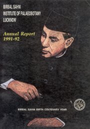
Annual Report 2011-2012 - Birbal Sahni Institute of Palaeobotany
Annual Report 2011-2012 - Birbal Sahni Institute of Palaeobotany
Annual Report 2011-2012 - Birbal Sahni Institute of Palaeobotany

You also want an ePaper? Increase the reach of your titles
YUMPU automatically turns print PDFs into web optimized ePapers that Google loves.
EBIRBAL SAHNI INSTITUT<br />
1946<br />
OF PALAEOBOTANY<br />
<strong>Annual</strong> <strong>Report</strong> <strong>2011</strong>-<strong>2012</strong><br />
footprint and fight global warming. It is a crucial element<br />
in the balance <strong>of</strong> oxygen and carbon dioxide in the<br />
atmosphere.<br />
S.K. Basumatary, Kanupriya Gupta, S.K. Bera<br />
[& S.K. Acharya & Sneha Bera (BCKB, W. Bengal) &<br />
M. Ahmad (Goalpara College, Assam)]<br />
Prepared manuscript based on Isotope analysis<br />
(d 13 C and d 18 O) <strong>of</strong> tree-ring <strong>of</strong> Abies pindrow collected<br />
from forest near to Dokriani Bamak glacier, Uttarakhand.<br />
A. Bhattacharyya & S.K. Shah [& R. Ramesh<br />
(PRL, Ahmedabad)]<br />
Past climate and vegetation history have been<br />
analyzed from two pr<strong>of</strong>iles collected from Nonkremp close<br />
to Shillong, Meghalaya based on pollen data.<br />
A. Bhattacharyya, S.K. Shah & Sandhya Misra [&<br />
Pawel Prokop Polish Academy <strong>of</strong> Sciences, Poland)<br />
Studied the tree line dynamics <strong>of</strong> Himalayan silver<br />
fir (Abies spectabilis D. Don) based on its tree-ring data<br />
and age stand distribution at Langtang National Park,<br />
Central Nepal. The study shows that the average tree<br />
density <strong>of</strong> the species in the study area (total 48 plots <strong>of</strong><br />
20 m x 20 m) was 236 no/ha while that for sapling and<br />
seedling in the study area was 255 and 350 no/ha,<br />
respectively. The stand character and age distribution <strong>of</strong><br />
the species showed a high level <strong>of</strong> recruitment in the recent<br />
decades, with decreased in average age along with<br />
increased altitude. Tree-growth climate relationship<br />
showed negative response with temperature <strong>of</strong> March-<br />
May. Upward advancement <strong>of</strong> tree line is expected in<br />
the coming recent decades though not necessarily uniform<br />
through the line.<br />
S.K. Shah [& R. Bhuju, Nepal Academy <strong>of</strong> S&T, Nepal)]<br />
Two Pleistocene-Holocene sedimentary pr<strong>of</strong>iles<br />
from Darjeeling Sub-Himalaya have been studied for<br />
palaeoclimatic reconstructions using pollen and phytolith<br />
proxies.<br />
Ruby Ghosh [& Subir Bera,<br />
University <strong>of</strong> Calcutta, Kolkata)]<br />
The ongoing collaborative work in Spiti Valley is<br />
to study for their sedimentary architecture and<br />
chronological parameters. Lith<strong>of</strong>acies analyses <strong>of</strong> relict<br />
sedimentary sequences located in the rain shadow zone<br />
<strong>of</strong> Tethyan Himalaya shows six different lith<strong>of</strong>acies. The<br />
six different lith<strong>of</strong>acies identified can be grouped into three<br />
lith<strong>of</strong>acies associations: i) glacial outwash, ii) sedimentation<br />
in channel and accreting bars under braided conditions,<br />
and iii) formation <strong>of</strong> lakes due to channel blockage by<br />
landslide activity. Abnormal Monsoon Years at 14-8 ka<br />
and 50-30 ka are responsible for the phases <strong>of</strong> channel<br />
damming and lake formation in the valley. A research<br />
paper is under review.<br />
Anupam Sharma & Binita Phartiyal [& Pradeep Srivastava<br />
& Yogesh Ray (WIHG, Dehradun)]<br />
The Spiti river basin in the NW Indian Himalaya<br />
(31–33°E:77–79°S), is tectonically unstable, exhibiting a<br />
complex topography, landscape relief and varied<br />
Quaternary sedimentation. The major geomorphic<br />
landforms are fill terraces, strath terraces, alluvial fans,<br />
debris cone, fluvio-lacustrine deposits, scree and talus<br />
cone are present throughout the valleys. The dynamics<br />
<strong>of</strong> landscape evolution <strong>of</strong> the region are currently not well<br />
understood. An attempt is made by using the<br />
geomorphometry approach to access the areas in terms<br />
<strong>of</strong> its neotectonic instability as this basin feeds the river<br />
Sutlej. The Spiti and the Parachu basin <strong>of</strong> the Sutlej valley<br />
are mapped and assessed in the valley to elucidate the<br />
spatio-temporal scale dependencies <strong>of</strong> surface have been<br />
in news several times in the last decade causing flooding<br />
downstream, due to the outburst <strong>of</strong> glacial lakes and the<br />
temporary lakes formed during the land sliding even by<br />
the processes active in the region.<br />
The Spiti river (constituting <strong>of</strong> Spiti and Parachu<br />
basins) is examined using and geomorphic field methods<br />
(Spiti basin), and OSL chronologies by Phartiyal et al.,<br />
(2009) are used. During the Quaternary a ubiquitous mass<br />
movements and catastrophic land sliding transported<br />
material from steep slopes to valley bottoms is seen which<br />
was responsible <strong>of</strong> forming lakes (preserved as thick piles<br />
<strong>of</strong> fine sediment), while the outburst floods redistributed<br />
sediment down valley along with affecting life and property<br />
downstream. The morphometric approach such as Basin<br />
Asymmetry (AF), Topographic Symmetric Factor (T),<br />
Stream length Gradient Index (GI) Hydauralic Sinuosity<br />
Index (HSI), Topographic sinuosity Index (TSI) and<br />
Standard Sinuosity Index (SSI) have helped in<br />
understanding tectonic and climatic perturbation. Our<br />
observations point towards a tectonically active region<br />
with enormous piles <strong>of</strong> loose, unconsolidated sediment<br />
cover which could be disastrous during the slight shift <strong>of</strong><br />
the climatic and tectonic forces operating in this area.<br />
Binita Phartiyal [& G.C. Kothyari (ISR, Gandhinagar)]<br />
In order to determine the mid Holocene climatic<br />
fluctuations, multi-proxy study involving palynology,<br />
phytolith, clay mineralogy, geochemistry and magnetic<br />
susceptibility are carried out on Wadhavana lake sediments<br />
<strong>of</strong> main land Gujarat area. The 2.3 m sediment pr<strong>of</strong>ile <strong>of</strong><br />
42<br />
www.bsip.res.in