Final Environmental Impact Report - Whittier Bridge/I-95 ...
Final Environmental Impact Report - Whittier Bridge/I-95 ...
Final Environmental Impact Report - Whittier Bridge/I-95 ...
- No tags were found...

Create successful ePaper yourself
Turn your PDF publications into a flip-book with our unique Google optimized e-Paper software.
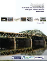
<strong>Whittier</strong> <strong>Bridge</strong>/I-<strong>95</strong> Improvement Project FEIR<br />
Chapter 2.0: Response to Comments on the <strong>Environmental</strong> Assessment/Draft <strong>Environmental</strong> <strong>Impact</strong> <strong>Report</strong><br />
the trail is currently proposed at that location. A physical connection should be considered to provide access to an<br />
existing rest area and because publicly-owned land adjacent to I-<strong>95</strong> is available to construct such a connection.<br />
Response: The project considered a number of potential connections from the Shared-Use Path to<br />
the vicinity of the existing Visitor Information Center at 520 Main Street. The visitor center, the former<br />
Smith‘s Chain <strong>Bridge</strong> Filling Station No. 3, has been determined by the State Historic Preservation<br />
Officer to be eligible for individual listing in the National Register of Historic Places. As such, any<br />
construction on its lot or modifications of the building would trigger review under Section 106 of the<br />
National Historic Preservation Act and would require modification of the project‘s Section 106<br />
Memorandum of Agreement. If determined to be an adverse impact under Section 106, Section 4(f)<br />
would be triggered. Additionally, the limited space available at the 520 Main Street location and the<br />
difference in elevation between the visitor center parcel and the Shared-Use Path (approximately 40<br />
feet) would make the connection infeasible, require a large ramp structure with grades in excess of<br />
handicapped accessibility requirements, and result in additional wetland impacts to Wetland I,<br />
located behind the visitor center building. Additional wetland impacts in excess of 40 square feet at<br />
Wetland I would result in the need for wetlands Variance for the project, the timeline for which would<br />
push the project outside of the Accelerated <strong>Bridge</strong> Program funding schedule.<br />
WB-5: Some amenities will be necessary for walkers on long walking routes. It would be appropriate to provide<br />
benches along the walk routes. The existing Amesbury Visitor Center at 505 Main Street would be a logical place for<br />
visitor services and restrooms, and is fortunately very close to the center of the bridge.<br />
Response: MassDOT will continue to coordinate with the three municipalities for the design of the<br />
Shared-Use Path and the location of amenities along the path, including benches or other<br />
opportunities for rest and observation. Three overlooks are planned on the new I-<strong>95</strong> northbound<br />
bridge. Picnic benches will be provided at the trailhead at the southern end of the path and at the<br />
interconnection points at Ferry Road in Newburyport and Old Merrill Street in Amesbury. It is<br />
anticipated that the final design of the path will incorporate benches at intervals along the path. As<br />
noted in the previous response, modification to the existing Visitor Information Center building would<br />
trigger additional compliance requirements under Section 106 of the National Historic Preservation<br />
Act, which might push the project outside of the Accelerated <strong>Bridge</strong> Program funding schedule.<br />
WB-6: A new trail access ramp could be connected directly to Merrill Street and the Amesbury Visitor Center. This<br />
ramp would connect directly with existing rest facilities and a parking area, both of which would benefit walkers. The<br />
Amesbury Visitor Center, only 1,000 feet from the center of the bridge, could become a new focus for walkers,<br />
cyclists and all visitors. The ramp could be a loop from the trail to the ground, as was done on the Maryland side of<br />
the Woodrow Wilson <strong>Bridge</strong> on the Washington Beltway (I-4<strong>95</strong>).<br />
Response: As noted above, there is limited space available to construct such a connection without<br />
impacting either the wetlands behind the Visitor Information Center or the Visitor Information Center<br />
property itself. Either would result in additional permitting, which might push the project outside of<br />
the Accelerated <strong>Bridge</strong> Program funding schedule.<br />
WB-7: The Merrill Street alignment provides direct access to Salisbury and Amesbury trails. From the Amesbury<br />
Visitor Center to Route 110 and Rabbit Road (the Merrill Street extension), Merrill Street could serve as the route of<br />
the shared use path, as it provides a straight alignment to connect with both the existing Ghost Trail in Salisbury and<br />
the potential connection into the Amesbury Riverwalk Trail. Sidewalks are already in place along the full length of the<br />
west side of Merrill Road and the part of Rabbit Road that leads to the Ghost Trail.<br />
2-53