chiang mai province
chiang mai province
chiang mai province
- No tags were found...

Create successful ePaper yourself
Turn your PDF publications into a flip-book with our unique Google optimized e-Paper software.
DO YOU WANT TO<br />
TRAVEL DIFFERENT<br />
BECOME A GREEN TRAVELLER TODAY<br />
By visiting the destinations highlighted in this guidebook,<br />
and by reporting your impressions and comments to<br />
www.tourismthailand.org/7greens<br />
you will help the Tourism Authority of Thailand<br />
promote and preserve the country’s natural wonders.<br />
T H A N K Y O U F O R Y O U R S U P P O R T.<br />
THAILAND<br />
50 GREAT GREEN ESCAPES
Become a Green Traveller Today<br />
Tourism Authority of Thailand
Published and distributed by Tourism Authority of Thailand<br />
Attractions Promotion Division<br />
Product Promotion Department.<br />
Editor: Richard Werly / AsieInfo Ltd, ITF Silom Palace, 163/658 Silom Road, Bangkok 10500.<br />
Producer: Titaya Jenny Nilrungsee<br />
Assistant editor: Thanutvorn Jaturongkavanich<br />
Assistant producer: Janepoom Chetuphon<br />
Design & Artwork: Tistaya Nakneam<br />
Writer: Chandra Hope Heartland<br />
Special Thanks: Simon Bowring, TAT Photo Bank, Solomon Kane<br />
Copyright © 2010 Tourism Authority of Thailand.<br />
Thailand Tourism Awards<br />
(www.tourismthailand.org/tourismawards)<br />
All rights reserved. No part of this book may be reproduced or transmitted in any form<br />
or by any means, electronic or mechanical, including photocopy, recording or any other<br />
information storage and retrieval system without prior permission in writing from<br />
Tourism Authority of Thailand.<br />
ISBN: 978-974-679-200-4<br />
Printed in Thailand by Amarin Printing and Publishing Public Company Limited.<br />
The production of this book was done in strict compliance with forward thinking environmental<br />
initiatives from the team. It was created using recyclable environmentally friendly materials with<br />
FSC certified paper for the cover and 100% EcoFibre paper for the pages using soy based ink.<br />
Seven<br />
the
Kayaking, Trat<br />
4 5
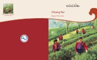
CHIANG RAI<br />
Contents<br />
CHIANG MAI<br />
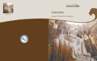
SUKHOTHAI<br />
KHON KAEN<br />
Foreword by TAT Governor 9<br />
Introduction 11<br />
Understanding Climate Change 16<br />
Thailand : Admitting Inconvenient Truths 20<br />
NAKHON<br />
RATCHASIMA<br />
UBON<br />
RATCHATHANI<br />
BANGKOK<br />
TRAT<br />
TAT Seven Greens Concept 24<br />
North 28<br />
South 66<br />
Northeast 106<br />
Central Plains 144<br />
SURAT<br />
THANI<br />
North<br />
Central Plains<br />
PHUKET<br />
HAT YAI<br />
Northeast<br />
South<br />
Conclusion 190<br />
Publications and Weblinks 192<br />
6 7
Foreword<br />
Khun Suraphon Svetasreni<br />
Governor<br />
Tourism Authority of Thailand<br />
,<br />
Achange is taking place in Thailand's tourism, and this book is a<br />
testimony of it.<br />
That change, though not yet visible in all parts of the country, is called Green<br />
Tourism. And it is the best gift that the Tourism Authority of Thailand (TAT)<br />
could offer to foreign visitors as it is commemoration its 50 th anniversary.<br />
Read the following pages and you will get to know it: From the farming villages<br />
of Isan, Thailand's Northeast, to the pristine beaches of the country's South,<br />
the preservation of the environment, and the willingness to accommodate<br />
visitors interested in interacting more with local communities has become a<br />
significant trend. Homestays are flourishing, national parks are going through<br />
a noted revival, and most of the country's top touristic destinations look today<br />
beyond the traditional crowd of visitors. Ecotourism excursions are more and<br />
more frequently offered. Rafting, kayaking, but also biking or hiking are not<br />
anymore an exception. Equipment rental is widely available, as are bicycles.<br />
Thailand's abundant nature and acclaimed biodiversity are reminding us of<br />
their foremost importance. The time for a green turn has hopefully come.<br />
Green Tourism, nevertheless, is facing and will continue to face difficulties<br />
and obstacles. That is why the TAT, conscious of those, is putting out new<br />
publications to help support this movement, in line with its dedication to fight<br />
global warming. We want this change to happen. Now aged 50, and more<br />
conscious than ever of its responsibility to the people of Thailand, TAT is<br />
ready to become Thailand's Green gateway. •<br />
the<br />
For TAT regional offices please visit www.tourismthailand.org or dial 1672 tourist<br />
hotline by TAT available daily from 8.00 a.m. - 8.00 p.m. from anywhere in the country.<br />
8 9
As the fight against climate warming<br />
is heating up the political debate<br />
worldwide, Thailand’s tourism<br />
operators are opening up on the<br />
need to answer foreign visitors'<br />
growing ecological concerns.<br />
Richard Werly<br />
Introduction<br />
Thailand's Green Turn<br />
Six years after the unforgettable tragedy of the 2004 tsunami in Asia,<br />
Thailand’s tourism sector is finally showing some willingness to take a<br />
badly needed green turn.<br />
I saw it with my own eyes while travelling throughout the country for our latest<br />
book “Travel Green Thailand - An ecotourism journey”. And I could get a further<br />
confirmation these last months, while touring the country again for this book.<br />
In many places, especially in the tsunami stricken South, the catastrophic<br />
consequences of ecosystem destruction have finally been understood,<br />
bringing the national and local authorities to act.<br />
Though nothing is ensured in the present volatile Thai political context,<br />
marked by last May’s tragic events in Bangkok, my firm impression is that<br />
numerous tourism operators and industryexecutives now realize how<br />
dangerous it would be for them to continue turning a blind eye to<br />
deforestation, beach pollution, or coral reef destruction. Moreover, as<br />
the United Nations Environment Programme (UNEP) just launched its<br />
global partnership to make tourism worldwide sustainable (www.unep.org),<br />
Thailand is expected to play a major role as one of the world ‘s finest leisure<br />
destinations.<br />
The country, luckily, does not start from scratch. After years of ecological abuses,<br />
Thailand is facing its unconvenient truths, like widespread deforestation,<br />
with courage and determination. Green consciousness in the Kingdom is<br />
taking root.<br />
Left: Heo Suwat Waterfall, Khao Yai National Park.<br />
10 11
Rigging the changes by example<br />
Public figures, like the defunct ecological hero and park activist Seub Nakasathien,<br />
are now very much referred and regularly quoted in speeches by Thai politicians and<br />
officials. And those words are backed up by generational changes in behaviour: a<br />
green fashion, though very commercial minded, is interestingly taking root among the<br />
country youths who, in the thronged huddle of consumer goods displayed in Bangkok,<br />
proudly buy T-shirts proclaiming the need to “live green” and “save the planet”.<br />
Nevertheless, this “green” call to arms demands more than words and fashion<br />
to be sustainable, especially for business owners or CEOs whose investment<br />
strategies need certainty for the future, and clearer political visibility.<br />
That is why I am a firm believer in “green standards” adapted to the<br />
Thai reality, and to the society’s appropriate level of acceptance and resilience.<br />
Our tour of the country’s 50 great greenescapes, initiated by the Tourism Authority<br />
of Thailand (TAT) wants precisely to play such a pioneer role. The promotion of<br />
Green Tourism shall be an “inclusive” process, where everybody is invited to come<br />
aboard if promising to respect and uphold previously agreed upon standards,<br />
whose implementation shall definitely be verified and followed up closely.<br />
Following the UNEP initiative on sustainable tourism, a lot of windows<br />
are opening up. Courageously, the Tourism Authority of Thailand (TAT) has<br />
grabbed some of those opportunities, setting up the “Green Leaf Foundation"<br />
to check on hotels and accommodation. But let us be optimistic: why not, tomorrow,<br />
form an advisory body on sustainable tourism made of Thai academics,<br />
environmental activists, non governmental organizations delegates and<br />
business operators This panel would issue periodic recommendations or<br />
warnings, upon learning of natural destruction damages in some part of the<br />
country. Because Green Tourism, after all, is judged by the visitors themselves.<br />
So be our guests. And be our judges. Be part, with us all, of this badly needed<br />
“Thailand Tourism Green Turn”. •<br />
Bungkaennakhon, Khon Kaen<br />
12 13
Sri Satchanalai Historical Park, Sukhothai<br />
14 15
Temperature<br />
increases<br />
from climate change are<br />
generally estimated at<br />
1.4-5.8°C by 2100 if<br />
further action is not taken.<br />
The EU intends to limit its<br />
greenhouse gases on par<br />
with a global rise of 2°C<br />
in 2020, but some studies<br />
indicate this still might not<br />
avoid catastrophe.<br />
Atmospheric<br />
Greenhouse<br />
Gases (GHG),<br />
most notably CO 2<br />
,<br />
methane, and NO 2<br />
,<br />
are the most threatening<br />
and avoidable agents of<br />
climate change. In 2008,<br />
CO 2<br />
levels hit 336 ppm,<br />
the highest in at least<br />
650,000 - and possibly<br />
20 million - years.<br />
Ocean Life<br />
and Acidity<br />
will result from the<br />
increased CO 2<br />
emissions,<br />
threatening all hubs of<br />
marine biodiversity.<br />
Ocean warming is adverse<br />
to growth of sea algae,<br />
the source of half of<br />
all photosynthesised<br />
oxygen and the basis<br />
of the marine food chain.<br />
Biodiversity<br />
Loss<br />
has already been seen.<br />
Climate change increases<br />
the risk of extinction for<br />
about 20-30% of all<br />
species and puts immense<br />
stress on ecological<br />
systems, particularly<br />
threatening those in<br />
tropical forest, alpine,<br />
and Arctic regions.<br />
Understanding Climate Change and<br />
Responding to Ecological Challenges<br />
Greater Climate<br />
Extremes<br />
through drought,<br />
floods, and extreme<br />
weather will affect global<br />
circulations of air and<br />
water. The result will<br />
be crippling to farmland,<br />
habitable land and<br />
water infrastructure,<br />
while increasing the<br />
spread of deadly<br />
diseases.<br />
Sources: NASA, UNFCCC, National Oceanic and Atmospheric Administration; J. Houghton, Global<br />
Warming: Complete Briefing; C. Gauthier, Oil, Water and Climate; Kump, Kasting, Crane, The Earth<br />
System; J. Lovelock, The Vanishing Face of Gaia; The Royal Society of London<br />
Future<br />
Generations<br />
are at stake. The needs<br />
of the present generation<br />
must not compromise the<br />
needs of future ones.<br />
Agricultural, economic,<br />
energy, and social<br />
practices that maximise<br />
energy efficiency, and<br />
organic replacement rates<br />
are therefore a priority.<br />
Managing<br />
the Cost<br />
of this climate change is<br />
crucial. It is estimated that<br />
the cost of keeping global<br />
warming below 2°C and<br />
reducing GHG emissions<br />
by 70% by 2020, could<br />
be as little as €530 billion,<br />
or 1% of the global GDP.<br />
Action shall be taken<br />
swiftly.<br />
The UN<br />
Copenhagen<br />
Conference<br />
has failed to decide on<br />
a post-2012 framework<br />
for climate change.<br />
Alas, the 25%-40%<br />
reduction in GHGs from<br />
1990 levels by 2020 as<br />
urged by the scientific<br />
community is still far<br />
from being met.<br />
16 17
Aerial view, Ko Chang, Trat<br />
18 19
Lack of<br />
knowledge is<br />
Thailand’s <strong>mai</strong>n<br />
challenge.<br />
According to a study<br />
by the University of<br />
Adelaide’s Environmental<br />
Institute in Australia, the<br />
country ranks among the<br />
world’s worst ten countries<br />
in terms of environmental<br />
degradation vs its total<br />
resource availability.<br />
Fortunately, environmental<br />
literacy is therefore a<br />
prime goal.<br />
Protecting<br />
the sea.<br />
Marine ecosystems<br />
are unprecedentedly<br />
threatened by rising water<br />
temperatures. March<br />
2010 saw the most widespread<br />
coral bleaching<br />
in almost two decades in<br />
both the Gulf of Thailand<br />
and the Andaman Sea<br />
when the sea<br />
temperatures hit 30˚C.<br />
Recovery could<br />
take years.<br />
Rethinking<br />
waste<br />
management.<br />
Each day, Bangkok alone<br />
produces about 8,500<br />
tons of solid waste, of<br />
which 1,800 tons are<br />
plastic bags. The Thai<br />
authorities came up with<br />
a campaign to create<br />
public awareness which,<br />
if successful, could save<br />
650 million Baht in waste<br />
collection costs and cut<br />
about 1 million tons<br />
of CO 2<br />
in one year’s time.<br />
Air pollution is<br />
a concern.<br />
In April 2010, the<br />
northernmost district,<br />
Mae Sai, experienced<br />
the worst air pollution in<br />
recent years with 281.1<br />
micrograms of dust per<br />
cubic meter. Urban areas<br />
also do not fare too well.<br />
Bangkok’s air standard<br />
exceeds WHO savety<br />
standards by 2.5 times,<br />
with traffic congestion<br />
as the <strong>mai</strong>n culprit.<br />
Thailand: Admitting Inconvenient Truths<br />
Defending<br />
wildlife.<br />
Several vulnerable or<br />
endangered species,<br />
elephants, tigers, gibbons,<br />
are being harmed<br />
intentionally or indirectly,<br />
by tourism excesses and<br />
lack of respect for existing<br />
regulations. Public efforts<br />
to curb poaching and<br />
illegal wildlife trade are<br />
a priority.<br />
Sources: Department of Marine and Coastal Resources, Pollution Control Department, Department of<br />
Disaster Prevention and Mitigation, Ministry of Natural Resources and Environment, Kasikorn Research<br />
Centre, World Wildlife Fund, World Health Organization<br />
Reviving<br />
Agriculture.<br />
It is predicted that in<br />
2010, the loss in the<br />
agricultural sector could<br />
amount to 6 billion Baht.<br />
Compared to 2009,<br />
the numbers of villages<br />
affected by drought has<br />
increased by 48 percent.<br />
In March 2010, the<br />
Mekong River reached<br />
its lowest level in 30 years<br />
and the water volume<br />
in several major dams<br />
in Thailand are hitting<br />
their record low.<br />
20 21
Rice paddies in Mae Hong Son<br />
22 23
Green Community:<br />
Preservation of the<br />
environment goes hand<br />
in hand with respect for<br />
the cultural landscape.<br />
It is important to support<br />
community-based tourism<br />
in both urban and rural<br />
areas, especially those<br />
eager to preserve both<br />
the nature and traditional<br />
ways of life.<br />
TAT Seven Greens Concept<br />
Seven<br />
the<br />
Green Heart:<br />
Without the right attitude<br />
and awareness, countering<br />
environmental threats is<br />
impossible. Every party<br />
involved - operators,<br />
service providers,<br />
visitors - has to realize<br />
that it is everyone’s<br />
responsibility to preserve<br />
and protect the<br />
environment because the<br />
damage done can<br />
be irreversible.<br />
Green Logistics:<br />
Getting to the destination<br />
is important, but so is how<br />
to get there. The means<br />
of transporting your<br />
guests or yourself should<br />
be energy-efficient or<br />
involve alternative energy<br />
so as not to produce<br />
excessive greenhouse<br />
gases. Green logistics<br />
also involves effort to<br />
use local products and<br />
services.<br />
Green Attraction:<br />
Destinations with natural<br />
beauty and possibilities for<br />
fun and excitement are<br />
desirable, but even more<br />
so if they are run with<br />
responsibility toward nature<br />
and the community. Our<br />
book’s <strong>mai</strong>n goal is precisely<br />
to promote such tourism<br />
choices. In addition, good<br />
practices can have a<br />
tremendous impact on<br />
tourism sustainability.<br />
Green Activity:<br />
Activities should be<br />
designed in a way that<br />
is not only fun and<br />
pleasureable for guests<br />
but should also provides<br />
opportunities for visitors<br />
to engage in rich<br />
and unique cultural<br />
experiences or gain<br />
knowledge about local<br />
ecosystems, without<br />
an adverse impact on<br />
the environment.<br />
Green Service:<br />
Great service can create<br />
a memorable experience<br />
for guests, but it must<br />
be provided with utmost<br />
concern and respect for<br />
the environment and<br />
community. Determination<br />
to preserve nature, wildlife,<br />
biodiversity, and culture<br />
is essential. Guests can<br />
play an important role by<br />
demanding sustainable<br />
services.<br />
Green Plus:<br />
Support to save the<br />
environment and community<br />
can come in many forms.<br />
Operators can help develop<br />
a community in a sustainable<br />
fashion. Manufacturers and<br />
organisations can promote<br />
and develop an environmentally<br />
-friendly approach. Individual<br />
visitors can participate by<br />
travelling responsibly.<br />
All parties can add a “plus”<br />
to Thailand’s green turn.<br />
24 25
Colourful Frangipani<br />
26 27
Chiang Rai<br />
Mae Hong Son<br />
Chiang Mai<br />
Lamphun<br />
Lampang<br />
Phayao<br />
Phrae<br />
Nan<br />
Uttaradit<br />
Sukhothai<br />
Tak<br />
Phitsanulok<br />
Kamphaengphet<br />
Phichit<br />
Phetchabun<br />
Nakhonsawan<br />
Uthaithani<br />
For TAT regional office, please visit<br />
www.tourismthailand.org or dial<br />
the TAT tourist hotline 1672<br />
from 8.00 a.m. - 8.00 p.m. from<br />
anywhere in the country.<br />
• Doi Inthanon, CHIANG MAI • Doi Chiang Dao, CHIANG MAI • Doi Phu Kha, NAN<br />
•Doi Pha Klong, PHRAE • Thi Lo Su, Tak • Flight of the Gibbon, Chiang Mai<br />
•Phuklon Country Club, Mae Hong Son • Huai Tueng Thao, Chiang Mai<br />
•Khek River Rafting, Phitsanulok •Doi Tung, Chiang Rai•Huai Khi Lek, Chiang Rai<br />
•Doi Mae Salong, Chiang Rai •Si Satchanalai, Sukhothai<br />
NORTH<br />
28 29
Phu Hin Rong Kla, Phitsanulok<br />
30 31
GPS Location<br />
N18° 32.104′<br />
E98° 31.148′<br />
North<br />
Nature<br />
Thailand Tourism Awards<br />
Online booking English spoken Suitable for family <br />
30-minute walk along the nearby Ang Ka nature trail. The neat,<br />
elevated wooden platform with railings leads through the moss<br />
covered forest, where mixed plant-societies on single trees can<br />
be observed.<br />
Toward the end of the trail, there is a path leading to the shrine<br />
of Chao Krom Kiat. The small spirit pavilion is built on a piece<br />
of helicopter wreckage as a memorial to Air Chief Marshal Kiat<br />
Mangkhlapruek and the late national park director who died on<br />
duty in a crash at that spot in May 1971.<br />
The rest of the day might be spent touring the waterfalls. The most<br />
enchanting are Wachirathan, Mae Klang, and Mae Ya. These<br />
falls are easy to access by car, with trails leading up to different<br />
levels. Picnic areas and restaurants are available. The first two falls<br />
are on the same road after the first checkpoint; only Mae Ya stands<br />
alone south of the <strong>mai</strong>n national park area, on the 14 km road<br />
that branches off Highway 1009 and meanders through a<br />
residential area.<br />
H o w T o G e t T h e r e<br />
From Chiang Mai, take a local<br />
taxi from the bus pool at Chiang<br />
Mai Gate to Chom Thong. From<br />
Chom Thong, take the local taxi<br />
going to Doi Inthanon or to<br />
Mae Chaem, and ask to be<br />
dropped at the Headquarters.<br />
The best way to get around<br />
within the Park is to either charter<br />
a local taxi in Chom Thong or at<br />
the Park entrance, or hire a car<br />
from Chiang Mai. Make sure the<br />
car is in good condition and has<br />
a skilled driver behind the wheel.<br />
C o n t a c t<br />
Doi Inthanon National Park<br />
Headquarters<br />
)0 5326 8550 or 0 5328 6728<br />
inthanon_np@hot<strong>mai</strong>l.com<br />
0 5393 9478 or 0 5326 8547<br />
daengdoiinthanon@yahoo.com<br />
Top : A remarkable nature<br />
trail atop Doi Inthanon,<br />
where you can study<br />
the ecosystem.<br />
Right: Naphaphon<br />
Phumsiri Chedi<br />
Doi Inthanon<br />
The rooftop of Thailand<br />
CHIANG MAI PROVINCE. Here are a few of the many<br />
reasons why one should visit Doi Inthanon National Park:<br />
the eponymous peak is the highest in Thailand; the Park includes<br />
1,274 plant species, 90 of which are orchids (31 of which are found<br />
uniquely there); and the area is home to 466 animal species,<br />
385 of those being birds (including the Green-tailed Sunbird).<br />
Besides being rich in floral and faunal life, the Park is dotted with a<br />
number of waterfalls of various sizes.<br />
Doi Inthanon has something for everyone, whether day-trippers<br />
or those planning to thoroughly explore the Park. The day might<br />
be filled with a visit to the highest point in Thailand, which can<br />
be reached by car, and is clouded with mist all year round, the<br />
temperature never exceeding 17º C. This may be followed with a<br />
A Whole Day Trekking<br />
Doi Inthanon also offers an array of treks. Most treks run all year<br />
round, and only a few routes require a ranger or local guide<br />
(contact National Park Headquarters at Km. 31 for information and<br />
arrangements). One of the most interesting routes is the Kio Mae<br />
Pan trail, which is open only from 1 June to 31 October, as its<br />
fragile ecosystem needs more time to recover than most. The<br />
distance of this circular trek is only 3 km, but discerning trekkers<br />
may take a whole day to complete it.<br />
Bird lovers should not forget to pack binoculars, and should try to<br />
visit between October and March. If an English speaking guide is<br />
required, just cross the street from the Park Headquarters to the<br />
Inthanon Bird Centre. The Centre has been there since 1962; its<br />
customer service attested to by walls lined with name cards from<br />
satisfied clients. •<br />
Discover N<br />
Doi Inthanon is the<br />
highest peak in Thailand<br />
and marks the end<br />
of the superb Himalaya<br />
Range. It is home to<br />
a number of endemic<br />
plants and animals not<br />
found elsewhere.<br />
Feel Y<br />
It is unbelievably<br />
refreshing and<br />
worthwhile to escape<br />
the heat of Chiang Mai<br />
just for a lungful of cool<br />
air on top of Doi Inthanon.<br />
Similarly, sipping coffee<br />
while enjoying the<br />
greenery covered with<br />
lingering fog is not to be<br />
missed. To prolong the<br />
cool retreat, park<br />
accommodations can be<br />
found within walkingdistance<br />
of the<br />
headquarters.<br />
32 33
GPS Location<br />
N19° 26.086′<br />
E98° 53.760′<br />
North<br />
Trekking<br />
Online booking (recommended) English spoken Bird watching Suitable for Camping families <br />
H o w T o G e t T h e r e<br />
There are daily buses from<br />
Bangkok direct to Chiang<br />
Dao. If departing from<br />
Chiang Mai, take a "Tha Ton"<br />
bus and inform the driver of<br />
your destination. You will get<br />
off in front of Chiang Dao Inn<br />
and continue by motorbike<br />
taxi. The headquarters of the<br />
Chiang Dao Wildlife<br />
Sanctuary is about 2 km<br />
along the <strong>mai</strong>n road from<br />
Chiang Dao Cave.<br />
C o n t a c t<br />
Chiang Dao Wildlife<br />
Sanctuary<br />
) 0 5345 5802<br />
(Staff do not speak English<br />
and bookings must be<br />
made 15 days in advance)<br />
Doi Chiang Dao<br />
Centre: Campers are<br />
required to ask for<br />
permission in advance.<br />
Drawing: The Ueang Si<br />
Chiang Dao orchid. 110 other orchid species.<br />
Doi Chiang Dao Camping point<br />
The view from the Den Ya Khat trail at dawn.<br />
The guardian spirits of Chiang<br />
CHIANG MAI PROVINCE. Chiang Dao was in the media<br />
limelight during 2003, when the government came up with<br />
a plan to builzd a cable car to the peak to boost tourism. The proposal<br />
met with unprecedented and widespread protest from both locals and<br />
environmental activists. Fortunately, the plan was not carried out.<br />
Doi Chiang Dao (under the Chiang Dao Wildlife Sanctuary’s care) is<br />
the third highest peak, and the only place where a sub-alpine<br />
ecosystem can be found in Thailand. Its height is 2,225 m above<br />
sea level, making a dramatic rise on the horizon when viewed on<br />
entering the district by Highway 107. The horseshoe-shaped<br />
mountain range of which it forms a part is home to more than<br />
340 species of wildlife, of which some 206 are birds, including the<br />
near-extinct Hume’s Pheasant (Symaticus humiae, found only<br />
here and in Pai). It is also the only home in the world to the newly<br />
discovered orchid Sirindhornia pulchella, as well as approximately<br />
Doi Chiang Dao also holds spiritual significance for the people<br />
of Chiang Mai. The mountain is believed to be the abode of Chao<br />
Luang Kham Daeng, the spirit revered by all spirits and ghosts. There<br />
are two routes to get to the peak of Doi Luang Chiang Dao - the Pang<br />
Wua trail and the Den Ya Khat trail.<br />
The Mountain of the Gods<br />
The starting points of the two trails<br />
are about 30 minutes and 1 hour<br />
away from the headquarters,<br />
respectively. There are camping<br />
sites on both trails, but the second<br />
one is longer, steeper, and thus<br />
more adventurous. The two trails<br />
converge mid-hill, and four more<br />
hours of walking will lead to<br />
Mae Salung, the last camping<br />
site before the top. From the<br />
Mae Salung camping site, a final<br />
45-minute climb (225 m of rocky,<br />
limestone trail) is required to get to the windy top, where there is<br />
no water source but plenty of wildflowers. Trekkers normally spend<br />
two nights before following the downward trail back to the headquarters,<br />
and must provide their own tents, food, and water for the whole trip.<br />
It must be emphasised that Chiang Dao Wildlife Sanctuary is devoted<br />
strictly to conservation; tourism is second on the agenda. That is<br />
why the Sanctuary is open for trekking only from 1 st November<br />
to 31 st March, and is suitable only for highly-devoted nature<br />
enthusiasts. For others still wanting to get a glimpse of its glory, there<br />
is a 2-km nature trail, at the foot of the mountain, accessible all year<br />
round. No guide is needed, but during the rainy season, the path is<br />
often concealed by tall grass. •<br />
Discover N<br />
Ueang Si Chiang Dao<br />
(Sirindhornia pulchella)<br />
is a terrestrial orchid<br />
endemic to this limestone<br />
terrain and can be found<br />
only here. It blooms<br />
and flaunts its exquisite<br />
pinkish-white flower from<br />
April to June.<br />
Feel Y For those not<br />
planning to trek to the<br />
peak and are content<br />
with admiring the<br />
majestic mountain from<br />
below, there are several<br />
accommodation options<br />
in the area. Our favourite<br />
is ‘Malee’s Nature Lover<br />
Bungalow’, where one<br />
can talk to owner Khun<br />
Malee about the cable<br />
car controversy while<br />
munching on fresh,<br />
homemade whole<br />
wheat toast.<br />
34 35
GPS Location<br />
N19° 11.898′<br />
E101° 04.810′<br />
Thailand Tourism Awards<br />
North<br />
Nature<br />
Online booking Rafting equipment rental <br />
H o w T o G e t T h e r e<br />
The Park is located in Pua<br />
district, 60 km from Nan on<br />
Highway 1080. On arrival<br />
in Pua, continue along<br />
Highway 1256 for another<br />
25 km to reach the park<br />
headquarters. Visitors<br />
can either wait for a Song<br />
Thaeo (‘Bo Kluea’ route, the<br />
last one leaves around<br />
2 p.m.) or charter one.<br />
Doi Phu Kha<br />
Botanist’s paradise<br />
NAN PROVINCE. Doi Phu Kha National Park is a great<br />
destination for those wanting to combine laid-back relaxation<br />
with moderate exploration of nature. Visitors will notice that the<br />
landscape has been groomed and altered to receive guests. That<br />
said, it does not mean they will not get a high dose of nature within<br />
C o n t a c t<br />
the Park.<br />
Doi Phu Kha National Park<br />
) 0 5470 1000<br />
Beginning with the journey up the mountain from Pua district,<br />
visitors will see that large patches of forest on the slope of the hills<br />
Top: The fog kisses the<br />
hilltops on the way to<br />
have been turned into fruit orchards, namely for lychee. The sight<br />
the National Park.<br />
may not be the best introduction, but on arrival in the Park area, it is<br />
Right: Brown-breasted a relief to find that most of its forest re<strong>mai</strong>ns intact.<br />
Bulbul<br />
Take time to view the exhibition in the Visitor Centre. Here, guests<br />
Drawing: Chomphu<br />
Phu Kha flower<br />
will learn that besides the star attraction, Chomphu Phu Kha<br />
Doi Chiang Dao Camping point<br />
flowers, there is also a chance to see a living fossil, Caryota gigas.<br />
Also known as Hahn ex Hodel, or Tao Rang Yak in Thai, this giant<br />
palm has a height of 40 m and is endemic to the area. The Park also<br />
offers the possibility of spotting a myriad of wild animals, ranging from<br />
rare birds (the most remarkable one being Sitta formosa) deer, and<br />
gibbons to bears, wild elephants, or even tigers.<br />
Something for Everyone<br />
For those content with lovely strolls through<br />
the woods, there are two nature trails near<br />
the Park headquarters to enjoy. The small<br />
trail is 2 km long; the longer one is 4 km,<br />
both winding through a forest of Kesiya, or<br />
three-needled, pine, whose fallen needles<br />
provide a soft brown carpet over the paths as<br />
they lead to Chomphu Phu Kha and Tao Rang Yak groves. The trails are<br />
sufficiently well-defined, but the Park recommends visitors be<br />
accompanied by a ranger. Trekking should be avoided during the rainy<br />
season, as leeches are quite brutal.<br />
Doi Phu Kha offers other activities the whole year round. From August<br />
to December, the river Nam Wa, with its 20 rapids, provides good<br />
rafting (contact the Visitor Centre to arrange a trip). Bird and butterfly<br />
lovers should visit between November and June. During February and<br />
March, the forest will be tinted with the pink blossoms of Chomphu<br />
Phu Kha. There are also a number of caves and waterfalls that can be<br />
explored from October to May.<br />
For more sedentary travellers, the Park provides comfortable and<br />
aesthetically pleasing accommodation. The smallest options are<br />
made from old carts and bamboo, with thatched roofs. Bigger<br />
bungalows perch on a small hill to enjoy a panoramic view of<br />
the mountain range. Alternatively, a tent can be pitched in the<br />
campground to enjoy stargazing. To wrap up the day, the Park also<br />
provides a pavilion to observe the sunset over the hill-lined horizon. •<br />
Discover N<br />
The botanical highlight<br />
of this 1,300 m high<br />
mountain is Bretschneidera<br />
sinesis Hemsl, more<br />
commonly known as<br />
Chomphu Phu Kha.<br />
It is a rare species,<br />
so rare that the Park<br />
is the only place in the<br />
world it can be found.<br />
The only time to relish<br />
its bunches of sweet,<br />
pink blossoms is during<br />
February and March.<br />
Feel Y This is one of<br />
the most pristine national<br />
parks in Thailand and<br />
fully deserved winning<br />
the Best National Park<br />
Award of 2008. We were<br />
very impressed with the<br />
Park authority’s creativity<br />
and attention to detail;<br />
such as, in utilising dead<br />
tree trunks by carving<br />
them into wash basins.<br />
36 37
H o w T o G e t T h e r e<br />
Doi Pha Klong National Park<br />
Headquarters is on Highway<br />
1023, about 20 km from Phrae.<br />
There are taxis<br />
(Phrae-Long route) leaving<br />
from Chomphu Ming Market<br />
(N18º 08.184′ E100º 08.860′).<br />
On the way back to town,<br />
you will need to wait on<br />
the roadside and flag<br />
a local taxi down.<br />
C o n t a c t<br />
Doi Pha Klong National Park<br />
)0 5450 1701<br />
Doi<br />
GPS Location<br />
N18° 09.188′<br />
E100° 00.240′<br />
Pha Klong<br />
A geological feast<br />
PHRAE PROVINCE. Doi Pha Klong National Park may not be the<br />
greenest place to visit. Those that do will not be protected from the sun<br />
by a lush canopy, and their skin will become sticky from humidity. The geography<br />
here is comprised mostly of limestone and dry evergreen forests of thorny<br />
trees with small leaves. They combine to create a curiously beautiful<br />
landscape, the charm of Doi Pha Klong.<br />
On arrival at the park headquarters, especially in the early morning or late<br />
afternoon, visitors will be greeted by a cacophony of bird calls. There is a 1.2-km<br />
nature trail along which to explore the flora and fauna of the dry evergreen<br />
forest. The beginning of the trail, paved with concrete blocks, boasts oddly,<br />
but naturally, sculpted trees with entangling vines. Along the trail as a whole,<br />
the most predominant plant species is the firework-shaped Dracaena sp.<br />
Although the trail is short, trekkers are mercilessly exposed to the sun. The<br />
informative and friendly rangers therefore warn visitors to take lots of water<br />
before setting out on the trek. The climb can be tough at some points, with<br />
sharp-edged rocks, but the path is well-defined, including intervals of wooden<br />
steps. After a good measure of sweating, one finally arrives at Hin Pakarang,<br />
a large, wondrously-shaped limestone hill peppered with bright green shrubs.<br />
The Park encompasses an area of 125 km 2 , covering a diverse range of<br />
geography and activities. About 60 km from the headquarters lies Kaeng<br />
Luang, a series of rapids in the Yom River. These provide a 10-km<br />
rafting route, though the river is best experienced in November or December.<br />
Visitors can also stop over at Erawan Cave to enjoy the stalagmites and<br />
stalactites, including those resembling a mythical three-headed elephant,<br />
from which the cave takes its name. Opportunities also exist to rappel down<br />
a 70-m cliff. To arrange an adventure trip, contact the Park headquarters.•<br />
North<br />
trekking/rafting<br />
Online booking Kayaks and rafting equipment rental <br />
Discover N<br />
Our favourite attraction<br />
in Doi Pha Klong National<br />
Park is Hin Pakarang,<br />
literally translated as<br />
“coral stone”. The name<br />
is misleading since it is<br />
actually a huge formation<br />
of limestone which forms<br />
a peculiar, wonderful<br />
landscape.<br />
Feel Y<br />
The facilities, such as<br />
park accommodation<br />
and canteen, may not<br />
be very attractive, but<br />
a day-trip is sufficient<br />
for a visit. We were very<br />
impressed with the<br />
hospitality of the<br />
rangers, who take<br />
good care of visitors.<br />
Left: At the end of the<br />
trail, you will reach the<br />
platform where you<br />
can take in the beauty<br />
of Hin Pakarang's<br />
limestone rock formations<br />
Top: A well-paved<br />
pathway invites visitors<br />
onto the nature trail.<br />
38 39
GPS Location<br />
N16° 02.021′<br />
E98° 45.202′<br />
North<br />
Nature<br />
Wifi @ Online booking Rafting gear rental <br />
H o w T o G e t T h e r e<br />
There is no direct bus or<br />
plane service from Bangkok<br />
to Umphang. You need to<br />
travel to the border town of<br />
Mae Sot first (by daily bus<br />
from Bangkok), then take<br />
a Mae Sot-Umphang<br />
Song Thaeo from the bus<br />
terminal. It is a tough 169<br />
km, 4-hour ride almost<br />
guaranteed to cause motion<br />
sickness, so be prepared.<br />
C o n t a c t<br />
TAT Tak Office<br />
0 5551 4341-3<br />
Thi Lo Su Waterfall<br />
The hidden giant<br />
TAK PROVINCE. A weekend at Thi Lo Su may make you come<br />
home drained of energy, but with piles of spectacular photos and<br />
fun memories.<br />
Visitors must steel themselves right from the start. The ‘Sky Highway<br />
1090’ winds from Mae Sot to Umphang through a mountainous region<br />
inhabited by hill tribes. Its 1,219 sharp curves, zigzagging through<br />
lush, forested landscapes, have churned many stomachs. After four<br />
hours, visitors arrive in Umphang, the biggest district in Thailand,<br />
sharing a 180 km border with Myanmar. It used to be inhabited solely<br />
by the Karen people, prior to Thais moving in from the North. Now, it<br />
is a hub of accommodation and tour operators organizing trips to the<br />
majestic Thi Lo Su Waterfall.<br />
Thi Lo Su is beautiful in her many guises. During the rainy season,<br />
visitors will be awed by the sight of an endless line of mighty water<br />
crashing down 300 m onto the rocks below. In the dry season, the<br />
gigantic waterfall spanning 500 m turns into numerous small cascades<br />
separated by mossed rocks and trees, making it appear as a<br />
patchwork of verdant gardens.<br />
Thi Lo Su is the star of the Wildlife Sanctuary, but its sister waterfall,<br />
Thi Lo Cho, should not be missed. To fully explore the area, a three-day<br />
tour is recommended. A typical programme will combine rafting on the<br />
Mae Klong River; visits to Thi Lo Su and Thi Lo Cho Falls; some trekking;<br />
and, upon request, stays in Karen villages, and total forest immersion<br />
via elephant back. However, it should be noted that the likelihood of<br />
seeing large animals during any of these activities is low. Also, trekkers<br />
should bring mosquito repellant and antimalarial medication.•<br />
Left: The lowest two tiers of the gigantic fall are favourites among travellers.<br />
They also provide pools perfect for dipping in.<br />
Right: Thi Lo Su exudes beauty even during the dry season.<br />
Discover N<br />
Thi Lo Su is the<br />
biggest waterfall in<br />
Thailand, hidden in the<br />
lush forest bordering<br />
Myanmar. During the<br />
rainy season, the<br />
Mae Klong River is<br />
a good location for<br />
white water rafting.<br />
Feel Y Umphang town<br />
is the transit lounge for<br />
Thi Lo Su visitors. Here<br />
you will find various<br />
types of accommodation,<br />
from camping sites to<br />
bungalows. Although<br />
most of them are<br />
simple, reflecting the<br />
adventurous spirit of<br />
the area, you will find<br />
all the basic facilities.<br />
The town is pleasant<br />
to explore on foot.<br />
40 41
Nanthaburi National Park, Nan<br />
42 43
“Empowering villagers<br />
in a sustainable way”<br />
Alberto, alias “Khun Bert” came from the Philippines and has<br />
been working with the PDA (Population and Community<br />
Development Association) for almost 20 years. He speaks Thai<br />
fluently and intensely cares for the welfare of people with lesser<br />
opportunity in this country. His work has always been in the<br />
developmental field, and now he is still continuing his mission<br />
with tourism as a useful tool.<br />
Chiang Rai is rich with hill tribal cultures and we are specialized<br />
in ethnic tourism," he explains. It is true that we offer trekking and<br />
visits to villages not dissimilar to other tour operators in Chiang Rai,<br />
but our choices of routes and destinations are unique. Another thing<br />
that makes us different is the principle behind the tour.<br />
“Tour operators need to prepare their clients<br />
with basic information”<br />
We aim to spread income to<br />
the villages along our trek by<br />
involving the villagers via<br />
activities; such as, giving a musical<br />
performances, cooking, and<br />
hosting guests. We try our best<br />
to distribute the income equally;<br />
for example, on the first of<br />
a 4-day-tour, we hire porters from<br />
the first village, and on the<br />
second day we hire from the next<br />
village, so everyone will get<br />
an equal chance to work.<br />
“However, income generating<br />
through tourism is actually our<br />
secondary objective. Our <strong>mai</strong>n goal<br />
is to help empower villagers<br />
in a sustainable way by setting up structures; such as, a community bank with<br />
shared ownership. Then tourism can help by bringing money into the system.<br />
What I see as problems with ethnic tourism in general are these: first, some<br />
operators do not use local guides who have a better understanding of the<br />
local traditions and way of life. Sometimes guides from the outside misinform<br />
guests, or even worse, show a lack of respect.<br />
Also, some tours have become industrialized; namely, the long-neck Karen<br />
villages. The first group fled the Burmese junta and arrived in Mae Hong Son.<br />
Investors saw an opportunity and started to ‘import’ and scatter them around<br />
for tourism. Exploitation then ensued. They are maltreated, for example, not<br />
even paid minimum wages and exhibited as if in a zoo. We strictly refuse to<br />
take anyone to these so-called villages.<br />
Sometimes travellers ask me if there is any village they can visit that still<br />
wear traditional costumes. My reply would be nowhere because those<br />
costumes are kept for special occasions and these days villagers have<br />
easier access to modern clothing (the idea is similar to tuxedos in the<br />
West). But such modernization turns out to be beneficial for their tradition.<br />
T o m e e t h i m<br />
C o n t a c t<br />
You can meet Khun Bert and get adequate<br />
information at the Hilltribe Museum & Education<br />
Centre, 3 rd floor, PDA Building, 620/25 Thanalai<br />
Road, Chiang Rai (N19º 54.530′ E99º 50.148′)<br />
Tel: 0 5374 0088. Open daily from 10:00 a.m.-6:30 p.m.<br />
That way, they make their costumes<br />
even more beautiful because the<br />
occasions to wear them are rare<br />
instead of making plain clothes for<br />
daily usage. This is a positive change.<br />
I’m optimistic and still believe that<br />
a balance between tradition and<br />
mod ernization can be struck.•<br />
Green Voices : Alberto de la Paz<br />
PDA Tour, Chiang Rai<br />
44 45
GPS Location<br />
N18° 51.952′<br />
E99° 21.217′<br />
North<br />
Adventure<br />
Online booking English spoken Suitable for family <br />
H o w T o G e t T h e r e<br />
The site is in Ban Mae<br />
Kampong, Mae On district,<br />
about 50 minutes east of<br />
Chiang Mai by car. However,<br />
the package includes a<br />
free pickup service from<br />
your accommodation in a<br />
communal van, which is<br />
more convenient and wastes<br />
less fuel.<br />
C o n t a c t<br />
www.treetopasia.com<br />
) 08 9970 5511<br />
info@treetopasia.com<br />
Top: Adventurers can<br />
get a close look at the<br />
rainforest flora while<br />
waiting on the<br />
tree-hugging platform.<br />
Center: You can also<br />
enjoy the canopy in a<br />
slower pace and greater<br />
detail here.<br />
Flight of the Gibbon<br />
Swaying over the treetops<br />
CHIANG MAI PROVINCE. Despite the name, visitors do<br />
not exactly brachiate from tree to tree like real gibbons.<br />
Nonetheless, gliding down 2-km long zip lines hanging some<br />
30-m over the canopy of a tropical forest must produce a<br />
similar feeling to that enjoyed by a swinging primate.<br />
The trip begins with a 50-minute ride from Chiang Mai, with the last<br />
leg up the serpentine road of the Mae Kampong hills. There is a<br />
choice between going early in the morning, at noon, or during the<br />
late afternoon. The whole excursion takes about three hours. The<br />
temperature suddenly drops on entering the densely vegetated<br />
area, and the fun begins there.<br />
After gearing up with straps and helmet, visitors are taken to the first<br />
of 15 stations--wooden platforms built on the tree top, and briefed<br />
on safety procedures. A sample first flight follows, on a short zip line,<br />
to acquaint customers with the equipment and motion. Of course, an<br />
adrenaline surge is the <strong>mai</strong>n aim of zip-lining, but equally wonderful is<br />
the sight of the diverse shades of green and mountain-lined horizon<br />
seen while waiting to whizz from station to station. The deeper one<br />
goes inside the forest, the more impressive the size and formation<br />
of the trees. The flight concludes with a drop from a gigantic tree, in<br />
which one can choose to fall head or feet first.<br />
Fun with Benefits<br />
What is greatly appreciated about this adventure is how the company<br />
is conscious about community and environmental issues. Before<br />
signing the disclaimer form, the<br />
staff make sure that visitors go<br />
through the recommendations for<br />
good environmental practices. In the<br />
area around the office, signs give<br />
information about the vital roles of<br />
the tropical rainforest ecosystem.<br />
The company also claims that 10%<br />
of its profits go to conservation<br />
projects.<br />
Before being driven back to the city,<br />
visitors are served lunch, with a<br />
stroll at the Mae Kampong Waterfall<br />
as dessert. The Waterfall is<br />
medium-sized with seven tiers, and<br />
it takes about 15 minutes to climb to the top. At the entrance to the<br />
waterfall, a number of trees with saffron-coloured strips of cloth tied<br />
around the trunks may be seen. These trees are ‘ordained’ and<br />
become sacred, so that no poacher would have the heart or dare to<br />
cut them down - a perfect example of utilizing folk wisdom as a<br />
conservation strategy. •<br />
Discover N<br />
The zipline of the Flight<br />
of the Gibbon hovers<br />
over the rainforest of<br />
the Mae Kampong area,<br />
allowing one to observe<br />
the vegetation from a<br />
bird’s-eye view,<br />
accompanied by<br />
thrilled screams from<br />
fellow visitors.<br />
Feel Y<br />
The Flight of the<br />
Gibbon Centre is<br />
located high in a lush,<br />
mountainous area<br />
which provides<br />
a lovely setting for<br />
the activity. The staff<br />
is hospitable, although<br />
their command of<br />
English may be<br />
a little shaky.<br />
Share ❖<br />
The company<br />
collaborates with<br />
FORRU (Forest<br />
Restoration and<br />
Research Unit) at<br />
Chiang Mai University<br />
in reforestation<br />
projects and has<br />
organized activities<br />
for volunteers in 2008<br />
and 2009.<br />
46 47
GPS Location<br />
N19° 25.491′<br />
E97° 57.181′<br />
North<br />
Health<br />
English spoken Suitable for family <br />
H o w T o G e t T h e r e<br />
From Mae Hong Son,<br />
take Highway 1095. After<br />
10 km, look for a diverging<br />
road to Ban Kung Mai Sak<br />
and a sign saying ‘Mud<br />
Spa’ on the left. Follow<br />
that road for 7 km. The<br />
entrance to the spa is on<br />
the right.<br />
C o n t a c t<br />
www.phuklon.co.th<br />
) 0 5328 2579<br />
Top: This beauty potion<br />
is concocted from<br />
purified mineral-enriched<br />
mud and a mixture of<br />
local herbs.<br />
Center: The staff<br />
perfects the recipe<br />
before applying the<br />
cold mud on clients.<br />
Top right: Rejuvenating<br />
facial mud mask .<br />
Bottom right: The pool<br />
of unprocessed mud.<br />
Phuklon Country Club<br />
Pamper yourself with mud<br />
MAE HONG SON PROVINCE. After a grueling ride from Pai,<br />
with thousands of curves along Highway 1095, what could be<br />
a better way to relax than to treat yourself to a spa experience before<br />
arriving in Mae Hong Son.<br />
Phuklon is not an ordinary spa. It offers up to visitors subterranean wealth<br />
of a very special kind—a variety of mineral mud with only three known<br />
sources worldwide. The boiling mud, with a temperature ranging from<br />
60º -140º C, emerges from the underground mineral water well visible<br />
upon entering the spa area. Signs will inform the visitor that the mud<br />
here is rich in calcium, bromine, magnesium, and many more elements.<br />
The dark oozing liquid is purified and then mixed with Thai herbs such<br />
as lemon grass and curcumin. Once cooled, it is ready to be applied.<br />
Treatments vary from a facial mud mask to full-body scrub, at surprisingly<br />
affordable prices. Those considering the full-body scrub and treatment<br />
should be warned they may feel a little over-indulgent, since staff will<br />
assist in every step, even with rinsing off the mud and bathing.<br />
The greenery surrounding the spa is also quite soothing. The field,<br />
dotted with farmers’ sheds, stretches from the wooden platform next<br />
to the body treatment rooms and makes a great waiting spot while<br />
the mud paste applied to the skin dries (the process takes about<br />
20 minutes). The open-air mineral swimming pool and jacuzzi<br />
is shaded with abundant trees and coloured with flowers. The<br />
buildings are camouflaged well in the garden, with their thatched<br />
roofs and partial wooden structures. Phuklon is the place where<br />
nature pampers both body and spirit.<br />
Fun with Benefits<br />
No health and beauty refuge is complete without<br />
a traditional Thai massage. Professional,<br />
therapeutic touch on a back stiff after four hours<br />
in a bus seat is nothing short of bliss. Foot<br />
massage is also popular among clients who want<br />
to pass the time while waiting for their facial mud<br />
mask to dry. After this reinvigoration of skin and<br />
muscle, mud-based cosmetic products, such as<br />
mud cleansing bars and mud mask powder, can<br />
be purchased for further pampering at home.<br />
Phuklon Country Club also provides a golf<br />
driving range nearby. There is no accommodation<br />
in Phuklon, but fortunately it is less than half an<br />
hour from Mae Hong Son.<br />
On the way back to town, one may want to stop for a cup of freshly<br />
brewed coffee and shop for OTOP products at the newly-opened<br />
Mae Hong Son Rajabhat University OTOP Centre (N19º 20.132′,<br />
E97º 57.965, look for the sign on the left if coming from Phuklon).<br />
Here will be found goods produced by villages of the region;<br />
such as, snacks made from sesame and local herbs and nuts, wine<br />
distilled from local fruits, and intricate and colourful accessories<br />
made from hand-woven tribal fabric. •<br />
Discover N}<br />
The boiling mud at<br />
Phuklon has been<br />
certified by a French<br />
laboratory as containing<br />
minerals suitable for<br />
cosmetic use. The<br />
quality of the mud here<br />
is claimed to rival that of<br />
the Dead Sea.<br />
Feel YThis is not a<br />
typical glittering luxury<br />
spa. Instead, the<br />
establishment is located<br />
in the middle of a field,<br />
with many of the facilities<br />
in the open air. The<br />
no-frills décor, combined<br />
with friendly local staff,<br />
creates a very laid-back<br />
atmosphere.<br />
48 49
To Doi Suthep<br />
700 Year Stadium 121<br />
Huay Tung Thao<br />
GPS Location<br />
N19° 25.491′<br />
E97° 57.181′<br />
North<br />
Biking<br />
H o w T o G e t T h e r e<br />
1004<br />
Huai Kaeo Road<br />
Bike for rent. Rafting. Fishing. Windsurfing •<br />
Getting there is very<br />
easy from Chiang Mai<br />
city center. Just drive<br />
up Canal Road, past<br />
the 700-Year Stadium,<br />
drive another 2 km.<br />
and follow the signs.<br />
The lake is in a lovely<br />
area with mountain<br />
views.<br />
To Chiang Mai University<br />
Suthep 2 Road<br />
1004<br />
Wat Phra Singh<br />
Thanon Huay Kaew<br />
Start<br />
Ratcha Damnoen Road<br />
Ratchamakkha Road<br />
Bamrungburi Road<br />
108<br />
To Amphoe Chom Thong<br />
Huai Tueng Thao<br />
Riding around mountains<br />
Chiang <strong>mai</strong> Province. Navigating the city’s morass of gentle<br />
lanes on cool summer nights can make this one of urban Thailand’s<br />
most enjoyable riding experiences. The route has been chosen from an<br />
interminable range of others for its flexibility to both novices and experts<br />
and its extremely convenient location just outside of Chiang Mai, at the<br />
crack between Huai Tueng Thao and Doi Suthep National Park.The route<br />
itself makes for a gloriously amiable shotgun-wedding between the area’s<br />
mountainous forests and lychee fields, and a number of more urbane<br />
amenities and activities with which to fill itinerary and stomach.<br />
A bit further down the road<br />
Starting from one of the bike rental shops on Sam Lan Road which runs<br />
past Wat Phra Sing, leave the city walls from the west, following the<br />
northbound quadrant of the moat up until the intersection at its corner<br />
before turning left down Huai Kaeo Road Pass Chiang Mai’s oldest<br />
shopping mall and keep going until the second large intersection, there,<br />
take a northward righturn. 1 km in, you can get off the <strong>mai</strong>n road and<br />
follow the dirt path running along the parallel canal, following the signs for<br />
the 700-Year Stadium, where you turn left at after 5 km. Huai Tueng Thao,<br />
actually a reservoir, is just a bit further down the road.<br />
But instead of heading straight there, make for the trails and go behind<br />
the Stadium, crossing the dam wall into the forest. Follow the lovely, blue<br />
and red-marked mixed terrain routes that leave you at Huai Tueng Thao<br />
after 10 km. Otherwise, circling the lake is fulfilling in itself and either way<br />
you can reward yourself at one of the many cheap and breezy lakeside<br />
restaurants before returning to Chiang Mai. •<br />
Discover N<br />
Sometimes it’s nice to<br />
get a little break from our<br />
busy lives and take a<br />
little breather to recharge<br />
our batteries. Here is<br />
Chiang Mai local’s<br />
getaway favorite spot.<br />
Feel Y<br />
For the romantics,<br />
Huai Tueng Thao Lake<br />
is an ideal place where<br />
you can enjoy stunning<br />
sunsets over<br />
Chiang Mai’s mountains.<br />
On a weekday<br />
evening, the place is<br />
almost deserted.<br />
Share There are<br />
a range of inoffensive<br />
activities here, from<br />
fishing to windsurfing<br />
and rafting. A nearby<br />
military training camp<br />
offers a perfect setting<br />
for fitness exercise.<br />
Floating bungalows over Tueng Tao Lake<br />
Right : Bikers enjoy a Zero CO 2<br />
ride around Huai Tueng Thao<br />
50 51
GPS Location<br />
N16° 52.493'<br />
E100° 37.857'<br />
North<br />
Rafting<br />
Equipment rental Suitable for families English spoken <br />
H o w T o G e t T h e r e<br />
The best rafting spot on<br />
the Khek River is in Wang<br />
Thong district, about<br />
40 km from Phitsanulok<br />
city. There are frequent<br />
buses (Phitsanulok-Nakhon<br />
Thai) leaving from the bus<br />
terminal in the city centre.<br />
C o n t a c t<br />
Most resorts in Wang<br />
Thong offer rafting and<br />
accommodation packages.<br />
Otherwise, look for<br />
operators along Highway<br />
12 (from Km 33 on).<br />
Top: Teamwork is key<br />
Right: The rapids you<br />
will encounter along<br />
the way<br />
Khek River Rafting<br />
Get carried away<br />
PHITSANULOK PROVINCE. At first glance, the Khek River<br />
appears like an ordinary river. It is of a modest width, snaking<br />
peacefully from its origin on a mountaintop in Phetchabun Province.<br />
Then, without warning, the smooth surface of the river becomes<br />
agitated like a boiling cauldron. That is when the fun begins.<br />
Khek River is one of the best sites for rafting in Thailand. The<br />
waterway is blessed with a number of rapids ranging from levels<br />
1 to 5. A typical rafting trip will take you through 8 km of river<br />
peppered with 13 rapids. Before you board the rubber dinghy,<br />
which can carry about 10 passengers, the crew will brief you on the<br />
technique of rowing and what to do when you fall off the craft. Most<br />
of the crew members do not speak English, but the tutorial is easily<br />
understood through body language.<br />
The first hundred metres are for getting familiar with your oars. You<br />
will then start from a very mild rapid to warm up both your rowing<br />
and vocal cords. The following six rapids range between level 2 and<br />
3. Between each rapid you will have time to savour the beautiful<br />
scenery. The banks are lined with hog plum trees and bamboos and<br />
lushly vegetated mountains. Normally the water is green and clear,<br />
but in the rainy season it turns brown due to the sediment and mud<br />
that comes with strong currents.<br />
The texture of the water at each rapid is also something to behold.<br />
The rock formation at some rapids makes the water appear like a<br />
giant fluttering piece of cloth glinting with sunlight. At others, the water<br />
bubbles fiercely and, despite its<br />
boiling look, is refreshingly cool.<br />
Phitsanulok<br />
12<br />
Dong Sak Sang<br />
Yao<br />
Wang Nam Yen<br />
End<br />
Sling Bridge<br />
Kaeng Song<br />
Waterfall<br />
Khek River<br />
Phitsanulok<br />
Suan<br />
Ratchamangkla<br />
Namtok<br />
Luang Suan<br />
Pak Yang<br />
Maradok<br />
Lom Sak<br />
Nang Khoy<br />
Thakan<br />
Start<br />
Sab Praiwarn<br />
Resort<br />
The real adventure lies in the<br />
last five rapids. The highlight<br />
is “Kaeng Yao” (“long rapid”),<br />
100 metres of bumpy level<br />
5 rapids that will keep you<br />
clinging to your dinghy rope.<br />
People do fall off sometimes<br />
so you should be extra<br />
careful here (the crew told us<br />
that some people find falling<br />
overboard great fun but not at<br />
this particular spot.)<br />
Different resorts and rafting<br />
operators might offer slightly different routes or include a different<br />
number of rapids, but the experience should be similarly thrilling. The<br />
best season for the adventure starts from June and ends in October<br />
(this year, we are told, it started late due to the drought.) Children<br />
should be older than 12 years old to participate, though some<br />
operators might overlook this rule. •<br />
Discover N<br />
Enjoy one of the<br />
best rafting sites in<br />
Thailand. This is an<br />
almost zero-carbon<br />
activity that allows you to<br />
enjoy both an adrenalin<br />
rush and the beautiful<br />
landscape of Wang<br />
Thong district.<br />
Feel Y<br />
A lot of the<br />
accommodation<br />
(some regrettably sitting<br />
right above the river)<br />
in the area combine this<br />
adventurous outdoor<br />
activity with spa and<br />
massage. Get yourself<br />
pampered while listening<br />
to the constant murmur<br />
of the river.<br />
Share ❖<br />
Rafting is a sport<br />
and adventure that<br />
cannot go without<br />
solidarity and team<br />
spirit. Bring your friends<br />
along, but also be open<br />
to new encounters and<br />
mutual challenges.<br />
Once on this very<br />
unpredictable river,<br />
we are all in the<br />
same boat.<br />
52 53
GPS Location<br />
N13°45.170'<br />
E100°44.212'<br />
North<br />
Community<br />
Handicraft and arboretum English spoken Package tours <br />
H o w T o G e t T h e r e<br />
From Chiang Rai, head<br />
to Mae Sai on Route 110.<br />
Numerous buses or vans<br />
are available. After Mae<br />
Chan, take the west turn-off<br />
for Doi Tung. Then, follow<br />
Route 1149 to reach the<br />
park and the Royal villa.<br />
Doi Tung<br />
From opium to coffee<br />
These days, you don’t have to come up to northernmost<br />
Chiang Rai <strong>province</strong> to run into the Doi Tung Foundation.<br />
Launched in 1969 under the auspices of the late Princess Mother,<br />
C o n t a c t<br />
this recognizable Royal Project’s logo is very visible nowadays in<br />
http://www.doitung.org<br />
most of the country’s cities, thanks to the well-established reputation<br />
of its coffee brand.<br />
Doi Tung coffee shops can be seen in Bangkok’s busy Silom Road.<br />
Handicrafts and clothes bearing this very name are also increasingly<br />
popular among the crowd of international visitors, as they symbolize<br />
Top: Smell the aroma both quality and a sustainable mode of production. With the help<br />
of coffee and flowers at of the United Nations, Doi Tung’s agricultural project for introducing<br />
crop substitution to curb the cultivation of opium is now being<br />
Café Doi Tung<br />
Drawing: Opium flower exported to neighbouring Myanmar, as well as Afghanistan.<br />
Doi Chiang Dao Camping point<br />
Nevertheless, don’t miss the opportunity to spend one or two days<br />
walking on these northernmost hills of Thailand, where hill tribes have<br />
been taught to grow nuts or coffee trees rather than poppies. Like<br />
many other Royal projects, the Doi Tung - Mae Fah Luang complex<br />
encompasses all fields of rural development, including legal,<br />
medical, and educational access, agricultural research, forest<br />
management, and a sustainable chain of production for coffee. Its<br />
giant arboretum makes a perfect day-walk.<br />
Accommodation is available in a nice<br />
guesthouse located below the Swiss style<br />
Royal Villa, with an adjacent badminton<br />
court for those who want to get some<br />
exercise. Thai employees enjoy playing<br />
there after 6 p.m. and will be delighted to<br />
share their racquets and shuttlecocks.<br />
On a more serious note, Doi Tung is<br />
a unique mix of an agricultural, political, and human experience.<br />
Although some villagers sometimes miss their ancient way of life within<br />
hill tribe communities accustomed to crossing borders to smuggle<br />
goods or dope, the Foundation has brought education, expertise, and<br />
real development to this impoverished area. It is for this reason<br />
that Doi Tung gained the recognition of the UN Drug Control Programme,<br />
based in Vienna, and several tourism awards including one from the<br />
Pacific Asia Travel Association (PATA).<br />
As for the mythology of the Golden Triangle, formerly the leading<br />
worldwide source of heroin, a visit to the “Hall of Opium”, 10 km<br />
north to the border town of Chiang Saen is highly recommended.<br />
Focused on history, the museum houses a collection of documents,<br />
photos, and drug related memorabilia, making it a necessary<br />
stop-in for those seeking to understand the troublesome period<br />
this region came across after World War II. •<br />
Discover N Become<br />
a coffee expert while<br />
listening to the<br />
plantation’s learned<br />
staff. Learn all about<br />
aroma, body and flavour.<br />
Produced on these<br />
northernmost hills,<br />
Doi Tung coffee is on<br />
its way to becoming an<br />
international trademark.<br />
Feel Y The whole place<br />
bears the mark of the late<br />
Princess Mother, Somdet<br />
Phra Srinagarindra,<br />
whose Royal villa<br />
replicates an alpine<br />
chalet from her beloved<br />
Switzerland. To know<br />
more about her, log on<br />
http://www.thailink.com/<br />
mom.htm<br />
Share ❖ Doi Tung<br />
and Mae Fah Luang<br />
being royal projects,<br />
donations are accepted.<br />
Volunteering is also<br />
possible, like teaching<br />
English to the local staff.<br />
54 55
Harvesting tea leaves, Mae Salong, Chiang Rai<br />
56 57
GPS Location<br />
N19°39.225'<br />
E99°32.322'<br />
North<br />
Community / Culture<br />
Swing festival Tour guideCultural exchange <br />
management of tourism, thus preserving their cultural identity<br />
while at the same time profiting from the additional funds such<br />
activities bring into the community coffers. A very positive point: both the<br />
Community- based tourism network (CBT) and the Tourism Authority<br />
of Thailand (TAT) have praised the work of this small village,<br />
distinctively Akha in nature and appearance, nestled above a valley<br />
defined by verdant rice terraces and mixed Thai and Lahu villages.<br />
The history of Huai Khi Lek also bears testimony to the recent<br />
destiny of Thailand’s hill tribes. The Thai authorities established the<br />
village in 1965, in a spot selected by community elders. Somsak<br />
Malee says, "The government has moved many of the hill tribes,<br />
around 80% of them, down to the lowlands in what they thought<br />
was an effort to draw them into Thai society and give them access<br />
to healthcare and basic education, while stemming the supposed<br />
cause of much mountain deforestation. This was a well-meaning<br />
but misguided move, as people entered into illicit and menial labor<br />
to supplement their income".<br />
H o w T o G e t T h e r e<br />
Huai Khi Lek stands on<br />
a peak above the Huai<br />
Masang River, some 30<br />
km north of Mae Suai (not<br />
to be confused with Mae<br />
Sai) in Thailand’s Chiang<br />
Rai <strong>province</strong>. Bus and vans<br />
are available also from<br />
Chiang Mai.<br />
C o n t a c t<br />
www.hilltribeguide.com and<br />
Somsak Malee on<br />
08 1765 5352<br />
Top: Akha hilltribe<br />
swing ceremony<br />
Right: Akha woman<br />
Huai Khi Lek<br />
The strength of the forest<br />
CHIANG RAI PROVINCE. Here is a village with a tale, so be<br />
prepared: enjoying the Akha hilltribe’s lifestyle in Huai Khi Lek<br />
means being able to listen, and keeping a close eye on religious<br />
beliefs and practices, as explained by our guide Somsak Malee.<br />
“In a way, he told Travel Green Thailand’s reporter Simon Bowring,<br />
protecting the environment comes here from a long history<br />
of living directly off it. Our people are at the forefront of climate<br />
change because they live with first-hand experience of nature and<br />
have begun to notice extremes in weather and water availability”.<br />
Without a doubt, the village of Huai Khi Lek and its surroundings<br />
offer much more than conversation and study of local customs.<br />
The villagers of Huai Khi Lek are themselves involved in the<br />
Rooted Animism and Rich Mythology<br />
As would be expected, traditions here are thriving, and today a visit<br />
to Huai Khi Lek is a perfect opportunity to discover the numerous<br />
agents of environmental protection invoked by this Akha community.<br />
“Spirit eyes forbidding tree cutting, sacred rivers and spirits where<br />
all human activity is banned by a deeply rooted animism, and rich<br />
mythology; huge areas of community-owned forest....”, details Travel<br />
Green Thailand (Asieinfo publishing, 2010). We must also remember<br />
the other side of recent Akha history in Thailand and the Golden<br />
Triangle, where this community has been equally associated with<br />
another activity: the most lucrative drug trade across the Chinese<br />
and Burmese borders. A must-read on this story is Alfred W. Mc Coy’s<br />
“Politics of Heroin in Southeast Asia” (Lawrence Hill Books). •<br />
Discover N Tourism<br />
here is a community<br />
managed project and<br />
profits are used to<br />
sponsor both Akha<br />
cultural activities and<br />
local forest conservation.<br />
Feel Y Spirituality is<br />
at the heart of the Akha<br />
lifestyle in Huai Khi Lek,<br />
where villagers of<br />
different beliefs coexist.<br />
Old religious customs<br />
are vibrant here, along<br />
the lines of both Buddhism<br />
and Christianity.<br />
Share ❖ All year<br />
round, various festivals<br />
draw crowds of visitors.<br />
Among them: the<br />
Chon Khai Daeng (April)<br />
and the Lo Chingcha or<br />
Akha Swing ceremony<br />
(mid-August-September)<br />
when women are treated<br />
to a fun time as a reward<br />
for rice planting.<br />
58 59
GPS Location<br />
N20° 16.968'<br />
E99° 66.212'<br />
North<br />
Nature /Relaxation<br />
Online booking (recommended) Suitable for Family English spoken English spoken Suitable Sightseeing for families <br />
H o w T o G e t T h e r e<br />
Chiang Rai city is accessible<br />
by buses. From there, take<br />
Highway 10 to Mae Chan<br />
District. Turn left at Km stone<br />
856. Follow Highway 1089<br />
until you reach Km stone<br />
55, and turn right. Santikhriri<br />
Village is 15 Km away<br />
C o n t a c t<br />
TAT Chiang Rai office<br />
0 5371 7433,<br />
0 5374 4674-5<br />
Doi Mae Salong<br />
Sipping tea in Santikhiri<br />
CHIANG RAI PROVINCE. Santikhiri Village on top of Doi Mae<br />
Salong has come a long way: the mountainous terrain used<br />
to be heavily deforested and a highly militarized zone. When<br />
Generalissimo Chiang Kai-Shek fled to Taiwan from China in<br />
1949 along with his Guomintang armies, two regiments of Division<br />
93 refused defeat, kept on fighting, and eventually settled in the<br />
north of Thailand. Then in 1961, 4,000 soldiers led by General Tuan Shi-<br />
Top: The view<br />
Wen arrived in Mae Salong and were allowed to stay by the Thai government<br />
on the condition that they help the Thai army fight minority and<br />
of fog-veiled<br />
Santikhiri village.<br />
communist insurgents. Bloody episodes involving battles and<br />
Right: Traditional thai<br />
house in Mae Salong<br />
opium trade ensued here and in the nearby area.<br />
Top Right: The<br />
Today, what used to be a restricted area has become a lovely holiday<br />
panoramic view<br />
hideout, especially for tea aficionados. Opium plantations were<br />
of Doi Mae Salong substituted with tea, which is the trademark of this area. Here you<br />
Doi Chiang Dao Camping point<br />
will find an array of teashops, from which aroma fuses with cool<br />
fresh air. Almost all teashops will happily let you sample their tea. To<br />
maximize the fun, you can also visit a tea plantation on horseback.<br />
Food Here is a Remnant of History<br />
When Division 93 settled<br />
here, they brought with<br />
them not only ammunition<br />
but also the cuisine from<br />
their former base in Yunnan,<br />
the southwest region of China.<br />
Yunannese food is rather<br />
spicy and especially greasy<br />
compared to other strands of<br />
Chinese food and the star ingredient is mushroom. Restaurants in<br />
Santikhiri invariably serve Yunnanese dishes, the notable ones being<br />
“Khamoo Man Tow” (marinated pig leg served with bun) and steamed<br />
shitake mushroom. The abundant tea is also featured in the kitchen: try<br />
“Yum Bai Cha” (spicy tea leaf salad).<br />
One relic of the war-ridden past re<strong>mai</strong>ns. The tomb of General Tuan<br />
was built in 1980 on a hilltop (about 300 metres high) that overlooks<br />
the village he helped establish. The whole structure was built with<br />
white marble, and is a great spot to enjoy panoramic views of the<br />
landscape. Four km from the village, at the end of a serpentine climb<br />
to the highest point of the hill, you will find a temple dedicated to<br />
H.M. the King's Mother, Princess Srinagarindra. From there you can see<br />
the Burmese border, another excellent viewpoint, especially at sunset.<br />
The best time to visit Santhikhiri Village is between December and February,<br />
when the road up hill is dazzlingly lined with Himalayan Wild Cherry trees<br />
(Prunus cerasoides D. Don) and the weather is especially cool. •<br />
Discover N Santikhiri<br />
Village holds a place in<br />
Thai military history as<br />
a buffer zone to fight<br />
communist insurgents.<br />
The village was thus<br />
christened “Mountain of<br />
Peace” to remind and at<br />
the same time mitigate<br />
the memory of violence.<br />
Feel Y The village<br />
is compact but well<br />
structured for visitors<br />
and you will find<br />
accommodations on<br />
most <strong>mai</strong>n streets.<br />
At the same time,<br />
nature is still within<br />
arm’s reach and thanks<br />
to the altitude, the place<br />
still retains its tranquility.<br />
Share ❖ Volunteer<br />
opportunities such as<br />
teaching English or<br />
building schools in the<br />
mountains of Chiang Rai<br />
are available. Check out<br />
www.mirrorartgroup.org<br />
60 61
5 Km.<br />
GPS Location<br />
N17°31.051'<br />
E99°45.357'<br />
Thailand Tourism Awards<br />
North<br />
Biking / Culture<br />
Bike for rent bPottery museum Tour guides<br />
Top: A serene Lord Buddha lends to<br />
the park's authenticity.<br />
Right: Detail of Lord Buddha statue<br />
Bike dropping<br />
point<br />
View Point<br />
Wat Khao<br />
Phnom Phloeng<br />
Bike Rental<br />
Wat Khao<br />
Suwan Khiri<br />
Wat Chang Lom<br />
Ceramic Kilns<br />
Wat Nang Phaya<br />
Wat Chedi chet thaew<br />
Y o m<br />
R i v e r<br />
Tourism Information Center<br />
Wat Khok Singkaram<br />
Highway no. 101<br />
H o w T o G e t T h e r e<br />
From Sukhothai, Road<br />
1201 takes you up to<br />
the Ko Noi Kilns on Yom<br />
River. Through the ruins<br />
is Route 1113, where<br />
you’ll come across some<br />
scenic rice fields.<br />
C o n t a c t<br />
Sukhothai Historical Park<br />
Tel: 0 5567 9211<br />
Wat Chao Chan<br />
Wat Phra Si<br />
Rattanamahatath<br />
Chaliang<br />
Wat Chom Cheun<br />
archaeological excavation pit<br />
Biking through Si Satchanalai<br />
Sukhothai Province. The well-known Sukhothai Historical Park<br />
is an ideal starting point for the 60 km (1 hr) northward bus ride to<br />
Si Satchanalai, also a UNESCO World Heritage Site, although often<br />
neglected by visitors for its paucity of nearby air or rail connections.<br />
After mounting a bike (which can be rented at the Park entrance), the<br />
best thing to do is to wind through the imposing 13 th century ruins that are<br />
scattered willy-nilly, keeping one eye or ear out for the cacophony of birds<br />
that inhabit the forested surroundings. Although the constant tree-borne<br />
warbling is impressive, it is best to leave your bike and stroll up towards<br />
Wat Chedi Chet Yot and Wat Suwan Khiri, where, if you take a seat, you<br />
become audience to the flailing circus of birds and monkeys above as<br />
they juggle for space on and between the tree branches.<br />
Push a little harder on your pedals to get to Ko Noi’s open-air pottery<br />
museum for the late afternoon, as the sun setting on the old<br />
kilns there gives life to a spectrum of colours. This area was once a<br />
ceramics-manufacturing hub where King Ramkhamhaeng the Great<br />
originally commissioned Chinese pottery masters to do their work.<br />
As many as 150 kilns once laid along the banks of the Yom River,<br />
producing the distinctive blue or off-white Sangkhalok porcelain that<br />
earned itself considerable fame. It reminds the visitor of the fact that<br />
Sukhothai’s rise as a cultural and trading hub was due largely to its<br />
geographically advantageous location over the old trade routes. •<br />
Discover N Natural<br />
beauty here interacts<br />
with the finest cultural<br />
heritage. Si Satchanalai<br />
has been registered by<br />
UNESCO as a World<br />
Heritage Site since<br />
1981.<br />
Feel Y Ignore the<br />
tour operators who will<br />
suggest a fast-track<br />
itinerary here.<br />
Si Satchanalai<br />
deserves much more<br />
than a few hours spent<br />
behind van windows.<br />
Share UNESCO<br />
needs your help to<br />
continue preserving<br />
World Heritage Sites,<br />
where mass tourism<br />
can have a negative<br />
impact. Log on to:<br />
http://whc.unesco.org/en/67<br />
62 63
Phu Soi Daw, Uttharadit<br />
64 65
Chumphon<br />
Ranong ng<br />
Surat r Thani<br />
Phang-nga<br />
Phuket<br />
N n i T<br />
Nakhon Si Thammarat<br />
Krabi<br />
Phatthalung<br />
Trang<br />
Satun<br />
Songkhla<br />
PPattani<br />
t<br />
Yala<br />
NarathiwatN<br />
For TAT regional office, please visit<br />
www.tourismthailand.org or dial<br />
the TAT tourist hotline 1672<br />
from 8.00 a.m. - 8.00 p.m. from<br />
anywhere in the country.<br />
• Emerald Pool, KRABI • Ko Yao Noi, Phang-nga • Ko Phayam, RANONG<br />
• Similan and Surin Archipelagos, PHANG-NGA • Tarutao Island, SATUN<br />
• Ko Libong, TRANG • Ko Ngai, Trang • Raksawarin Hot Springs, Ranong<br />
• Thale Noi, Phattalung • Ban Li Let, Surat Thani<br />
• Ko Pra Thong, Phang-Nga • Wat Suan Mokh, Surat Thani<br />
• Ban Kiri Wong, Nakhon si Thammarat<br />
SOUTH<br />
66 67
Ko Similan, Phang-nga<br />
68 69
GPS Location<br />
N7° 55.287’<br />
E99° 15.574’<br />
South<br />
Sightseeing/Relaxation<br />
Bird watching Suitable for family <br />
Mixture of calcium carbonate, magnesium and minerals results in sparkling green water.<br />
H o w T o G e t T h e r e<br />
From Krabi town, take<br />
Highway 4 southeast toward<br />
Khlong Thom District. Turn<br />
left onto Highway 4038. Turn<br />
right at the junction and follow<br />
the signs to the Emerald Pool.<br />
C o n t a c t<br />
TAT Krabi Office<br />
) 0 7621 1036, 0 7621 2213<br />
Drawing :<br />
Gurney's Pitta<br />
Right : When the shade<br />
of trees reflect in the<br />
pool mirror...<br />
Emerald Pool<br />
Immerse yourself in the green<br />
KRABI PROVINCE. Very often, natural attractions are named<br />
in a hyperbolic way. Words such as golden, heaven, or an<br />
array of precious stones are there to pepper the imagination.<br />
However, in the case of the Emerald Pool, it is as descriptive as<br />
you can get. The water you will find inside the naturally sunken<br />
pools varies from sapphirine blue to emerald green, due to its<br />
chemical compositions.<br />
When you arrive at the parking lot at the entrance, don’t get<br />
discouraged by the amount of food stalls and people, especially on<br />
weekends and festivals. Once you pay the entrance fee (200 Baht<br />
for an adult, half price for a child), the 800 m path through the forest<br />
will lead you to the first and the most popular pool--the eponymous<br />
Emerald Pool. Please note that food and tissue paper are not<br />
allowed inside the compound. A wise management decision, since<br />
this attraction is relatively clean and well-kept compared to most.<br />
After working up a sweat from the 800 m walk, dipping into the<br />
Emerald Pool (25 m in diameter and 2 m deep) suddenly seems<br />
like a good idea. Since the water in this terrain comes seeping<br />
from under the ground and is heated by magma, the temperature<br />
of the water is about 30-50˚C. You can follow the 500 m<br />
elevated wooden trail cutting through the tropical rain forest and<br />
primary forest to the Blue Pool, the spot where the crystal clear<br />
water originates from.<br />
Birdwatchers’ Dream<br />
The Emerald Pool compound is under the supervision of the<br />
Khao Pra-Bang Khram Wildlife Sanctuary. What is extremely<br />
special about this Sanctuary is that it is the only area in Thailand<br />
that you might be able to spot, if you are phenomenally lucky,<br />
Gurney’s Pitta (Pitta gurneyi). This species of bird is endemic<br />
to Thailand and Myanmar and was thought to be extinct until its<br />
rediscovery in 1986. One of the rarest birds on the planet, it is<br />
estimated that only 10-12 pairs exist in Thailand. Keep your<br />
eyes open for other species as well, since there are a number<br />
of bird spots scattered on the nature trails. You can get a copy<br />
of the map at the Information Centre at the entrance.<br />
To exit the compound, we recommend that you embark on<br />
another longer trail which passes through Sa Kaeo, another pool<br />
withteal-coloured water. After the mild hustle and bustle at<br />
the Emerald Pool, a walk on the trail is a lovely antidote where<br />
you can bask in a meditative atmosphere before leaving<br />
the compound.•<br />
Discover N The small<br />
natural sunken basins<br />
filled with emerald green<br />
water are the <strong>mai</strong>n<br />
attraction. There are<br />
also short, easy nature<br />
trails cutting through<br />
the tropical rain forest.<br />
Here is the only place in<br />
Thailand the near-extinct<br />
birds Gurney’s Pitta are<br />
found.<br />
Feel Y The calm after<br />
getting out of busy Krabi.<br />
Since you disengage<br />
yourself from the crowd<br />
and follow the nature<br />
trails, the experience can<br />
be peaceful and even<br />
meditative.<br />
70 71
GPS Location<br />
N8°104.1778’<br />
E98°62.2352’<br />
Thailand Tourism Awards<br />
South<br />
NATURE<br />
Suitable for family Bicycle rental. b. Bird watching. Internet access @<br />
H o w T o G e t T h e r e<br />
Just after entering Phuket,<br />
head for Bang Rong Pier,<br />
not far from the international<br />
airport. Lots of local buses<br />
and taxis can take you<br />
there. Then get into a boat<br />
for Tha Len, Ko Yao Noi’s<br />
harbour. The boat ride will<br />
take about 20 minutes.<br />
From there, you can also<br />
head for the bigger sister<br />
island: Ko Yao Yai.<br />
C o n t a c t<br />
Khun Praparn. Tha Kao<br />
Bay View.<br />
)08 3395 5885<br />
Top : Viewing the bay<br />
from your hidden<br />
island’s retreat.<br />
Right : Khun<br />
Thanaphat is<br />
Ko Yao Noi’s most<br />
famous birdwatcher.<br />
Ko Yao Noi<br />
A bastion of preservation<br />
Phang-nga Province. Tired of Phuket’s crowded beaches<br />
Eager to refresh yourself and relax in a jungle environment<br />
Ko Yao Noi, the smaller of a pair of islands in Phang-nga<br />
<strong>province</strong>, a twenty-minute boat ride from Phuket’s Bang Rong Pier,<br />
is one of the best options in that part of Southern Thailand to get<br />
yourself reconciled with nature, wildlife, and the charm of a pretty<br />
unspoiled island community.<br />
Not surprisingly, Ko Yao Noi holds the reputation for being a fierce<br />
bastion of environmentalism in the Phuket gulf. Though numerous<br />
of its youths, men, and women alike, migrate to work in hotels<br />
and resorts located in surrounding islets or coastlines, this green<br />
island has kept the charm of a Muslim fishermen community, held<br />
together by a strong will to re<strong>mai</strong>n different and, nevertheless,<br />
open to foreign visitors.<br />
Our two-day stay there started with a long ride on Khun Praparn's<br />
motorcycle, starting from Tha Len Pier. Like many of his relatives,<br />
as most of the island’s families are connected, Khun Praparn owns<br />
a jungle lodge located right by the beach, hidden in flush green<br />
trees, and he happens to be the chief of Ban Tha Khao village.<br />
Sure, his understanding of English is limited, and one cannot<br />
expect to have a long conversation with him or his wife, whose<br />
delicious cooking by their beach canteen will fill your stomach<br />
with a smile, as you dip your feet in the sand or seawater, But be<br />
patient: long-term foreign friends residing in Ko Yao Noi are always<br />
waiting to be found.<br />
Venturing in the Island’s Forests and Rubber Plantations.<br />
There are two options when deciding to board a fishing boat for<br />
Ko Yao Noi: the relaxing one, or the adventurous one.<br />
For those eager to relax, I would suggest choosing one of the<br />
many forest bungalows, where monkeys will watch you eating,<br />
laughing, chatting, or sharing more intimacy. There, you’ll be<br />
watching the emerald sea and the constant moves of local boats<br />
heading day and night for Ko Phi Phi or Krabi. Swimming will make<br />
your day, though Ko Yao Noi does not offer stunning beaches able to<br />
compete with those of the most luxury resorts nearby.<br />
Your life in Ko Yao Noi will be very different if you choose the more<br />
adventurous option, consisting of hiring either a mountainbike<br />
or a motorcycle to venture in the island’s forests and rubber<br />
plantations. A good idea would be to venture around with Khun<br />
Thanapat and convince him to lend you binoculars, spending<br />
the day to observe birds and local wildlife. Thanks to the local<br />
community efforts, nature has been well preserved on the island.<br />
So don’t hesitate to bring one or two good books on the country’s<br />
Southern history, as people here are Muslim of Malay descent.<br />
Ko Yao Noi, wild and quiet in the meantime, is simply an ideal retreat. •<br />
Discover N<br />
Close to Phuket,<br />
a Robinson Crusoe<br />
experience! No wonder<br />
Scandinavian tourists,<br />
used to nature in their<br />
own countries, have<br />
made Ko Yao Noi a<br />
favorite destination.<br />
Clearly, a wonderful<br />
hideaway.<br />
Feel Y<br />
The local community,<br />
unspoiled by mass<br />
tourism, is very<br />
welcoming and eager<br />
to take you on fishing<br />
trips or birdwatching.<br />
You’ll feel at home in<br />
Ko Yao Noi.<br />
Share<br />
Sit and share a drink with<br />
Khun Thanaphat (photo<br />
above), one of Thailand’s<br />
most experienced<br />
birdwatchers, who has<br />
gone from Chiang Mai to<br />
Satun to make foreigners'<br />
experience his passion.<br />
72 73
GPS Location<br />
N18° 32.104′<br />
E98° 31.148′<br />
South<br />
Relaxation<br />
WiFi @ Equipment rental English spoken <br />
Dusk on Ao Khao Khwai “Buffalo Bay” can exude a sense of other worldliness.<br />
H o w T o G e t T h e r e<br />
From Ranong town, follow<br />
the signs “Ko Phayam<br />
Pier” on Highway 4080.<br />
The Pier is located about<br />
9 km from the town centre<br />
in a small alley so keep your<br />
eye on the signs. There are<br />
daily buses leaving from<br />
Bangkok to Ranong. The<br />
closest airport and train<br />
station is in Surat Thani,<br />
about 2 hours drive from<br />
Ranong Province.<br />
Right (Top to bottom):<br />
Cashew nut (Drawing)<br />
is one of the island’s<br />
major income sources.<br />
Beaches of Ko Phayam<br />
are endowed with fine,<br />
densely packed sand.<br />
Ko Phayam<br />
The rough diamond of the Andaman<br />
RANONG PROVINCE. The sight of this great bird never fails to<br />
make us overjoyed. While we were going about sightseeing<br />
(done only on bike or motorbike as the roads on this island<br />
were not built for anything bigger than those), a pair of Hornbills<br />
nonchalantly glided by in front of us. You cannot get any closer to<br />
nature than that.<br />
Ko Phayam is the second largest island of Ranong, inhabited by<br />
approximately 160 families of fishermen and farmers. The latter<br />
have put Phayam on the Thai agricultural map, producing arguably<br />
the best cashew nuts in the country. The sight of red and yellow<br />
cashew fruits hanging heavy on the trees all over the island is best<br />
witnessed during January and February, when their fruity aroma<br />
intersperses among the air.<br />
There are no electrical grids on this island and almost every house<br />
is powered by generator and solar panel. Most resorts will have<br />
electricity available only at certain hours, but we sheepishly admit<br />
that the absence of the electric posts somehow enhances the<br />
landscape of the island. We recommend that you rent a bicycle<br />
(available at shops by the <strong>mai</strong>n pier or at resorts) and pedal your<br />
way around the island. The orchards are to be relished at a slow<br />
pace, and you might be able to stop by and talk to the villagers<br />
who are cracking cashew nuts. The better part of the roads are<br />
cemented and lined with cashew and rubber trees.<br />
Biking to the Most Beautiful Beach<br />
If your stamina allows, we suggest you ride up to Ao<br />
Kwang-Pip at the northern tip of the island. The route is<br />
still made up of dirt roads, but cuts into a less-trodden<br />
area. Once arriving, you will find the most beautiful and<br />
least visited beach on island. The beach is spotless, with<br />
soft white sand, and the tide is pretty stable so you can swim all day<br />
long. Unfortunately, this haven is inaccessible by road during the rainy<br />
season. Another two beaches that visitors love are Ao Khao Khwai<br />
(Buffalo Beach) and Ao Yai. These two stretches of fine beach are<br />
perfect for relaxation, with an array of accommodation so well-hidden<br />
among the trees that you have to look hard to spot them from the beach.<br />
Another asset Ko Phayam is blessed with is its coral reef. It may be<br />
overshadowed by the wealth of the nearby Surin Archipelago, but<br />
Ko Phayam has something to offer, too. There are many spots on<br />
the island where you can snorkel and see a myriad of hard corals.<br />
Surprisingly, there is a considerable amount of sea anemones as<br />
well. The best time to snorkel is in November when the visibility is<br />
the highest. If you want to explore further, there are boat trips to<br />
nearby islets and you will find dive shops here offering day-trips to<br />
Mu Ko Surin National Park.•<br />
Discover N<br />
Ko Phayam used to be<br />
renowned for the finest<br />
cashew nuts it produced.<br />
Today it is known as one<br />
of few islands that still<br />
re<strong>mai</strong>n unswept-over<br />
by mass tourism on the<br />
Andaman Sea. Some<br />
hidden corners welcome<br />
those seeking ultimate<br />
hideaways.<br />
Feel Y The sense<br />
of adventure and<br />
remoteness when<br />
opting for thatched-roof,<br />
bamboo bungalows in<br />
the middle of nowhere.<br />
74 75
GPS Location<br />
N18° 32.104′<br />
E98° 31.148′<br />
South<br />
Diving<br />
WiFi @ Scuba and snorkel gears rental English spoken <br />
Surin and Similan Archipelagos are blessed with numerous rocks and pinnacles that are home<br />
and feeding grounds to the gargantuan Whale Shark.<br />
H o w T o G e t T h e r e<br />
The most convenient base<br />
for exploring Mu Ko Similan<br />
and Mu Ko Surin National<br />
Parks is Khao Lak, the hub<br />
of dive centres which also<br />
offers a wide range of<br />
accommodation. There<br />
are buses leaving from<br />
Bangkok for Khao Lak daily.<br />
The journey takes about 12<br />
hours. The nearest airport<br />
is in Phuket, about 2 hours<br />
bus ride away.<br />
Right: Spotting a<br />
Manta Ray is every<br />
diver’s dream<br />
souvenir here.<br />
Similan & Surin Archipelagos<br />
A wealth of marine life<br />
PHANG-NGA PROVINCE. One of the most entertaining<br />
activities after you finish your sessions of diving in these<br />
archipelagos is when you open your tropical reef and fish guides.<br />
Chances are, you will have seen at least a fish on any given page.<br />
Sometimes you have seen so many that recording them in your log<br />
book becomes an effort.<br />
And not just the tiny ones swimming in a dazzling huge school,<br />
those solitary giants also grace the Archipelagos with their frequent<br />
presence. Dive masters can almost guarantee that, if you come<br />
in the right season, you will see Manta Rays flying by in Ko Bon<br />
(Surin); or at Richelieu Rock, the Whale Shark will glide feeding<br />
itself with plankton. Here you will see quite a number of sea turtles<br />
because Huyong Beach in Similan (conserved area, not open to<br />
diving) is where the shelled creatures lay their eggs, or look on the<br />
sandy bottom here if you want to see leopard sharks.<br />
You will find a lot of fellow divers who will tell you this is not their<br />
first dive here. Similan and Surin are capable of surprising the<br />
most experienced divers and their wealth of marine life is almost<br />
inexhaustible (that is, if properly taken care of). The diversity of<br />
creatures are world-renowned and more than 75% of the coral<br />
reefs of Thai seas can be found here. This is why we recommend a<br />
‘liveaboard’ trip where you will stay on a boat for three or more days<br />
and do nothing but dive instead of a day trip. It is less tiring, wastes<br />
less fuel, and you will get to experience the marine treasure to the<br />
fullest. It is true that all the dive shops in Khao Lak can put you on a<br />
boat, but we recommend you support the ones that adhere strictly<br />
to good environmental policy. You can look them up at the Green<br />
Fins Thailand website: www.greenfins-thailand.org.<br />
Beautiful at All Levels<br />
Non-divers can also relish these underwater treasure troves.<br />
The large shallow water area combined with crystalline water at<br />
Mu Ko Surin National Park makes it the best spot in Thailand to<br />
snorkel. There are dive shops in Khao Lak and Khura Buri that<br />
organise a day-trip snorkel tour. But you can also spend a night in<br />
Mu Ko Surin National Park accommodation and use the daily<br />
snorkel trip service offered by the Park.<br />
Most trips around Similan will stop on Ko Miang (The eighth island<br />
of the archipelago) where the Park headquarters is located. Here<br />
you will see the Sail Rock, the logo of the Archipelago. It is a small<br />
climb to get to the base of this fantastically shaped boulder where<br />
you can enjoy an unhindered panoramic view of sunset. A nice spot<br />
to recollect what wonderful sights you have seen under the ocean<br />
lying in front of you.<br />
Please note that the Archipelagos are closed yearly from mid-May<br />
to mid-November due to the monsoon and to allow the marine<br />
ecosystem to rejuvenate itself. •<br />
Discover N Whenever<br />
you look at the list of<br />
the world’s best dive<br />
sites, Similan and Surin<br />
Archipelagos invariably<br />
appear among the top<br />
ten. Here you have a<br />
very fat chance of<br />
spotting creatures<br />
dreamt of by every<br />
diver, the majestic Manta<br />
Ray, the gentle giant<br />
Whale Shark, and the<br />
curious sea turtles.<br />
Feel Y Both Marine<br />
National Parks are well<br />
managed in terms of<br />
visitor reception, with<br />
reasonably comfortable<br />
accommodation and<br />
well-stocked canteens.<br />
Mu Ko Surin NP is<br />
well-known for its<br />
environmental practices.<br />
Share Many dive<br />
centres in Khao Lak<br />
organise volunteer<br />
reef check or garbage<br />
picking dives. Ask<br />
around for more<br />
information.<br />
76 77
GPS Location<br />
Pak Bara Pier<br />
N6° 81.176’<br />
E99° 72.316’<br />
South<br />
Nature/History<br />
Internet booking Mountain bike rental b Suitable for family <br />
H o w T o G e t T h e r e<br />
Boats to Tarutao leave from<br />
Pak Bara Pier. Take<br />
Highway 4052 from La-ngu,<br />
the nearest town to the<br />
Pier. You can also take local<br />
orange taxis (Song Thaeo)<br />
which leave from the town<br />
centre frequently.<br />
C o n t a c t<br />
Tarutao National Park<br />
)0 7478 3485,<br />
0 7478 3597<br />
Top: Ao Talo-Wao is<br />
the historic site<br />
testimonial to the<br />
gruesome episode of<br />
Tarutao's penal days.<br />
Right:The mangrove of<br />
Crocodile Cave is best<br />
experienced by kayak.<br />
Tarutao Island<br />
A perfect combination of sea and forest<br />
SATUN PROVINCE. There is something ironic about Ko Tarutao.<br />
This insular refuge where people want to escape to was once<br />
the place people wanted to escape from.<br />
Tarutao is the fifth largest island of Thailand and was chosen as<br />
a penal colony because of the raging storms during the monsoon<br />
season, and its saltwater crocdiles, and shark-infested sea.<br />
Nowadays, the fearsome creatures have dwindled and the only<br />
part of the crocodile you will see is its skull in the Information<br />
Centre. However, the monsoon still operates and that is why the<br />
Tarutao National Park is closed during 15 May to 15 November<br />
annually.<br />
The island is a perfect combination of sea and forest. Once you<br />
set foot inside the Park area, on your right is the long stretch of<br />
fine, white sandy Phante Malaka Beach and on your left is the lush<br />
forested hills. The hill behind the Park Headquarters, To Bu Cliff, is<br />
the best spot to watch the sunset. The trail to the box seat takes<br />
about 20 minutes with well-made steps and chances to spot Dusky<br />
Langurs.<br />
Phante Malaka is just one among many beaches the island has to<br />
offer. The sand is so fine and densely packed that you hardly leave<br />
footprints on it. Most of the accommodation are here, so if you wish<br />
for a more secluded spot, try staying at Molae Gulf.<br />
Tarutao may not rival other islands in the Park in terms of<br />
snorkeling and diving since it is closer to the <strong>mai</strong>nland and the sea<br />
is not as clear. However, there are other diverse activities that more<br />
than make up for the lack.<br />
Never a Minute of Dullness<br />
There are a number of nature trails and waterfalls you can visit. You<br />
can also rent a mountain bike from the Visitor Centre and pedal<br />
your way to the Talo Wao Gulf on the other side of the island where<br />
the remnants of buildings from the penitentiary days still stand<br />
testimonial on the 500 m historical trail. The biking route, can be quite<br />
demanding at some points with a steep climb. The distance is 12 km<br />
from the Park Headquarters, and along the way you will see<br />
mostly local vegetation and a lot of monkeys. This might sound<br />
monotonous but the scenery makes you forget that you are on an<br />
island, so when you see the sea again, it is really a pleasant<br />
surprise.<br />
You can also kayak and explore the Crocodile Cave on Ruesi<br />
Gulf. You need to charter a boat to the cave's entrance and the<br />
ride itself is already worth it. The waterway is lined with abundant<br />
mangroves, their bright green leaves reflecting on the water.<br />
The Cave itself is not very impressive, with its modest 200 m<br />
passage covered in complete darkness. Inside the cave you<br />
will see bats and some stalactites and stalagmites. The mildly<br />
claustrophobic atmosphere only makes it difficult to shake off the<br />
story that this is where the last crocodiles of Tarutao were found. •<br />
Discover N Tarutao<br />
has an interesting history.<br />
It was a penal colony<br />
both for common and<br />
political prisoners during<br />
the 30’s and 40’s. It was<br />
also the den of pirates<br />
who once plagued the<br />
Malacca Strait.<br />
Feel Y The island is<br />
a rustic but pleasant<br />
destination. It is<br />
reasonably comfortable,<br />
with electricity available<br />
from 6 pm. to midnight.<br />
But who needs a fan<br />
when you can get a<br />
constant sea breeze.<br />
Share Spend some<br />
moments with the Park<br />
Rangers. They are doing<br />
a good job on keeping<br />
the accommodation<br />
clean and love to tell of<br />
their latest adventures<br />
with poachers.<br />
78 79
The magic of Coral Reefs, Similan Marine National Park<br />
80 81
“Homestay makes us proud<br />
Less than 5 km before the hustle and bustle of Ao Nang Beach, Ban<br />
Na Tin community is waiting to welcome visitors who are curious and<br />
eager to experience the lifestyle of local Thai Muslims. The leader of the<br />
community homestay, Khun Bancha, told us how this active<br />
community-based tourism group came to be.<br />
“Our homestay group was founded in 2001. The whole thing began<br />
because we wanted to solve the social problems in our village. We live<br />
near a very touristic area. Inevitably, we could not avoid being exposed to<br />
external culture that might disrupt our traditional way of life. Since mass<br />
tourism had arrived in this area in 1994, villagers started to<br />
abandon their village and looked for jobs outside for better income. Those<br />
who used to tend<br />
to their rubber plantation<br />
became kitchen-<br />
<strong>mai</strong>ds in resorts and<br />
children<br />
waited in restaurants.<br />
We wanted<br />
to create an alternative<br />
business so they<br />
wouldn’t have to leave<br />
the community.<br />
Tourism as a solution<br />
The problems started to be even more discernible in 1998. The divorce<br />
rate had increased among the families whose members worked in<br />
Ao Nang. Some teenagers became drug addicts. A lot of female teens<br />
became pregnant and single mothers.<br />
Eventually eight of the then community leaders sat together<br />
and discussed the problems. We figured that, as a solution, we should try<br />
to draw tourists from Ao Nang here, so<br />
villagers wouldn’t have to go out and<br />
expose themselves to those problems.<br />
Setting up a homestay seemed to be a<br />
good option.<br />
But the path wasn’t smooth. None of us<br />
had any idea what a homestay was.<br />
T o m e e t h i m<br />
C o n t a c t<br />
Bancha Kwaenglee<br />
Head of Ban Na Tin Homestay<br />
08 1968 8532 0 7563 7390<br />
krabihomestay@hot<strong>mai</strong>l.com<br />
of our way of life.”<br />
We only knew that it meant letting guests stay with villagers. So we went<br />
to model homestay communities in other <strong>province</strong>s to learn about the<br />
management.<br />
Then another problem occurred. We are a Muslim<br />
community and our religious leader thought that<br />
inviting outsiders to stay here could contaminate<br />
religious life. They feared that the sunbathers who<br />
were scantily dressed in Ao Nang would invade the<br />
community. We had to convince them that the purpose<br />
of the homestay was in fact to preserve and bring back<br />
our tradition and lifestyle.<br />
We would get to set our own code of conduct and at the<br />
same time screen visitors.<br />
We are really careful that our life has to continue as<br />
normal and unchanged by tourism. For example,<br />
we have an understanding between<br />
members that we will receive<br />
guests only three days a week;<br />
otherwise, we will have to<br />
focus too much on hosting<br />
instead of following our own<br />
routine. If you have to wake up at<br />
three to tap rubber trees, do it. This is<br />
what the visitors come to see.” •<br />
Green Voices : Bancha Kwaenglee<br />
Ban Na Tin Homestay<br />
82 83
GPS Location<br />
Hat Yao Pier<br />
N7° 18.666’<br />
E99° 24.091’<br />
South<br />
Nature/Culture<br />
Kayak and diving equipment rental English spoken Suitable for family <br />
Laem Chuhoi is an annual refuge for migratory birds<br />
fleeing the cold of the northern hemisphere.<br />
H o w T o G e t T h e r e<br />
Take a van to Hat Yao Pier<br />
from Tha Klang Road in<br />
Trang Town (N07º 33.536’,<br />
E099º 36.174’), leaving<br />
from 7 a.m. to 5 p.m. Inform<br />
the ticket seller of your<br />
destination. The boats at<br />
the pier run until about 4 p.m.<br />
Inner Top: The <strong>mai</strong>n<br />
pier of Libong<br />
receives both visitors<br />
and Libong dwellers<br />
who travel from<br />
<strong>mai</strong>nland Trang.<br />
Drawing: Dugong<br />
haven is an evidence<br />
of the island’s<br />
ecological richness.<br />
Ko Libong<br />
Swimming with the Dugongs<br />
TRANG PROVINCE. Everywhere you cast your glance in<br />
Trang town, you are likely to see a depiction of a dugong.<br />
This gentle marine mammal, also known endearingly as a seacow<br />
and mistaken as a mer<strong>mai</strong>d, is the symbol of the <strong>province</strong>. To spot<br />
a living one, you need to cross to Ko Libong, one of the very few<br />
islands still endowed with sea grass, the staple diet of dugongs.<br />
Not that there are a lot left. The latest survey gave a 129 head<br />
count. Dugong flesh is considered a delicacy to many seamen,<br />
its teeth are believed to bring good luck, and its ‘tear’ is sought<br />
after as a love potion. Sightings depend much on luck, but<br />
fortunately for dugong enthusiasts and researchers, the animals<br />
tend to cluster around the area, between Ao Pan Yang and Na Ban,<br />
where sea grass is most abundant. Every resort on Libong offers<br />
a dugong spotting boat rides. The vessel stops the engine, anchors<br />
in the aforementioned area, and hopeful passengers sweep<br />
their glance over the water for the creatures to surface for air.<br />
Sometimes sea turtles and dolphins make surprise appearances,<br />
too. Another more environmentally-friendly way to observe<br />
dugongs is by climbing the 150 m Batu Pute Hill.<br />
Ko Libong is also renowned as a hub for migratory birds from<br />
Siberia. The non-hunting area of Laem Chuhoi is where the birds<br />
socialise. A boat trip there often makes a short stopover at Hin Tok,<br />
a small compound of half-submerged trees where you may see<br />
branches covered with perching birds.<br />
A Glimpse of Local Colour<br />
The island is home to a vibrant<br />
Muslim community, which<br />
makes Libong a special holiday<br />
destination. While you are on your<br />
9 km ride from the <strong>mai</strong>n pier to the resorts<br />
on the west side of the island, you will see a lively<br />
community centred around mosques and a school alternating<br />
with orderly rows of rubber trees. The best way to explore the<br />
community and also get deep into the nature is by bike. Libong<br />
Nature Beach Resort offers a variety of eco-friendly activities and<br />
is the only place where a biking tour is organized. You can also<br />
mingle with the locals and see where that marvellously fresh squid<br />
you had for lunch came from at Libong Homestay.<br />
If you are not content with just sunbathing peacefully on the<br />
beach (the only shortcoming is that you might have seen cleaner<br />
beaches), you can always join a snorkelling trip to nearby<br />
Ko Lao Liang, and Ko Takiang, islands where swallow nests are<br />
unfortunately collected in their caves and hard coral reefs are<br />
found underwater. Scuba diving trips can also be arranged at<br />
Libong Beach Resort. The resorts are closed during the monsoon<br />
season starting mid-May. •<br />
Discover N This<br />
is the only place<br />
in Thailand where<br />
you will have a<br />
chance to spot the<br />
endangered dugong<br />
(Dugong dugon),<br />
the mammal that has<br />
become the mascot<br />
of Trang Province.<br />
Here is also a good<br />
spot to observe<br />
migratory birds<br />
from Siberia.<br />
Feel Y What is<br />
refreshing about<br />
Ko Libong is that<br />
its dwellers do not<br />
live on tourism.<br />
There is a big Muslim<br />
community whose<br />
<strong>mai</strong>n revenue comes<br />
from fishery and rubber<br />
plantations. Don’t<br />
hesitate to opt for<br />
a local homestay.<br />
84 85
GPS Location<br />
Pak Meng Pier<br />
N7° 49.658’<br />
E99° 32.681’<br />
South<br />
Nature/Relaxation<br />
Wifi @ Snorkel, scuba gear, kayak rental English spoken <br />
The crystal clear water of Ko Rok, one of islets in Ko Ngai archipelago.<br />
H o w T o G e t T h e r e<br />
From Trang town, take<br />
Highway 4046 and then<br />
4162 for 38 km. At the<br />
beachfront junction, turn<br />
right. The pier is about<br />
1 km away.<br />
You can also take a van<br />
from Tha Klang Road in<br />
Trang town (N07º 33.536’,<br />
E099º 36.174’). It leaves<br />
from 7 a.m. Early ride<br />
advised as boats usually<br />
stop running around 10 a.m.<br />
Right (Top to Bottom):<br />
Swallows build their<br />
nest on the cliff of<br />
Ko Ma.<br />
Snorkelling is popular<br />
among visitors<br />
besides lazing on the<br />
pristine beaches.<br />
Ko Ngai<br />
Like a natural bathtub<br />
TRANG PROVINCE. The island is more easily accessible<br />
from Trang and perfect for island-hoppers who enjoy taking<br />
things at leisurely pace and for those who enjoy lazing on the white<br />
powdery sand. The sea of this archipelago contains various shades<br />
of blue and dipping in its clear, calm water feels like being in a giant<br />
bathtub.<br />
Timing is the key, though. The depiction above is only available<br />
when you plan your holiday correctly. The lure of these islands is<br />
so great that it draws tourists by the thousands on a bad day. Avoid<br />
weekends and Thai public holidays at all costs, and we strongly<br />
recommend against buying a hectic one-day trip tour.<br />
Ko Ngai (sometimes pronounced Ko Hai), is the best base for<br />
island hopping due to its greater number of accommodation.<br />
On its pristine beach, you will face Ko Chueak and Ko Ma, the<br />
nearest snorkelling sites. And on a clear day, the sharp contrast<br />
between the immaculately white sand and the blue ocean is<br />
simply breathtaking.<br />
Every resort here offers snorkelling trips to the two aforementioned<br />
islands. However, the underwater landscape might not be as<br />
impressive as the view above the water. You will see extensive<br />
patches of Staghorn coral and a bit of soft corals at Ko Ma.<br />
Fish are aplenty although with little diversity. The boat trip will<br />
invariably take you to Emerald Cave which gains its name from<br />
the emerald green water at the entrance (look beneath the surface<br />
and you might spot a large school of fish swimming by). After<br />
swimming through a 80 m dark passage, you will find yourself<br />
on a tiny beach enclosed in a forested limestone cliff and an open<br />
sky overhead.<br />
You May Kiss the Bride Underwater.<br />
You can also choose to go an extra mile to Ko Kradan, arguably the<br />
most beautiful island of the Trang sea. It is the site where underwater<br />
weddings organized by TAT take place on Valentine’s Day every<br />
year. The island is blessed with a stretch of fine white sand on the<br />
east side and coral reef in the northeastern waters.<br />
If suddenly you miss your share of green while on Ko Ngai, there<br />
is a 30-minute trail cutting through rubber tree and coconut groves.<br />
The entrance of the trail is hidden behind Thanya Resort. The trail<br />
will take you to the west of the island which is quite isolated with<br />
only one resort. Be warned that the trail can be steep at some<br />
points and it is advisable to bring along mosquito repellant.<br />
Our final recommendation: during sunset when there is still light,<br />
bring your beach book and lay down next to the trees on the beach.<br />
Chances are you will see hornbills flying by and perching in pairs.<br />
A blissful way to end the day.•<br />
Discover N Ko Ngai<br />
is a great base for hopping<br />
among the islets of<br />
Trang Sea. Enjoy<br />
swimming and sunbathing.<br />
You may also have a<br />
very good chance of<br />
spotting hornbills.<br />
Feel Y Invest and<br />
choose a relatively<br />
‘fancier’ accommodation,<br />
since it can alter your<br />
experience considerably.<br />
Some resorts are very<br />
aesthetically pleasing<br />
and wisely adopt local<br />
resources as building<br />
materials.<br />
86 87
GPS Location<br />
N9° 958469’<br />
E98° 651271’<br />
South<br />
Adventure<br />
Spa Hiking Bird watching <br />
H o w T o G e t T h e r e<br />
From Ranong town,<br />
take a taxi or motorbike<br />
2 kilometres east to<br />
Raksawarin Park.<br />
C o n t a c t<br />
www.tourismthailand.org<br />
or dial 1672<br />
Top: Mineral deposits<br />
at the base of a<br />
spring.<br />
Center: Guests enjoy<br />
a relaxing dip in the<br />
Mother and Father<br />
pools.<br />
Raksawarin Hot Springs<br />
Bathing in healthful minerals<br />
RANONG PROVINCE. On a rainy day in Ranong town, the<br />
mountaintops disappear into clouds of ethereal mist. It may<br />
seem like your typical rural Thai town, but just 2 km to the east<br />
is a natural haven. Here, in Raksarawin Park, hot springs gush<br />
65˚C mineral water to the surface year round.<br />
There are three separate pools in which to enjoy the healthful minerals<br />
contained in the spring water- the Mother Pool, the Father Pool, and<br />
the Child Pool. As you submerge yourself, note the lusciousness of<br />
the emerald green mountains, which is greatly amplified by the cool<br />
misty rains that are present 8 months of the year. Wat Tapo tharam,<br />
a small temple dedicated to the spirit of the hot spring, also offers hot<br />
and cold mineral showers for a small donation. For those in search<br />
of a spa experience, visit the Raksawarin Park Arboretum, a private<br />
health club that offers a variety of treatments.<br />
When you’ve had enough of the heat, cross the wooden bridge<br />
to the edge of the forest, where you can cool off in a crystal clear<br />
mineral pool while taking in the vibrant surroundings. Here, under<br />
the canopy of colossal trees, you can enjoy the shade as you marvel<br />
at the flowers, mosses and mushrooms that thrive in the damp<br />
environment. The rich greens and browns of the trees also provide<br />
a perfect backdrop for viewing the fluttering birds and butterflies that<br />
call these branches home. Or, veer to the right and climb the stairs<br />
to a huge golden Buddha statue that contrasts spectacularly with<br />
the velvety green background. From this vantage point, you have a<br />
perfect view of the hot springs and the gushing milky stream below.<br />
Those more curious and<br />
discerning are advised<br />
to board a local bus<br />
and to make the most of<br />
pristine pools hidden in<br />
the nearby rainforests.<br />
Bathing there, like in<br />
Bo Nam Ron of Pak Phu<br />
village - 12 km from<br />
Khao Sok National Park -<br />
takes place often after<br />
5p.m., in the company of<br />
locals who have, craftily,<br />
arranged sandbags to<br />
filter out scum from the<br />
water flowing in.<br />
Back in Ranong, if all that<br />
relaxation has whetted<br />
your appetite, stop into<br />
one of the area’s restaurants to enjoy the local specialties - soft shell<br />
and blue crab fresh from the Andaman Sea. •<br />
Discover N<br />
Tucked away in lush<br />
green mountains,<br />
Ranong’s mineral-rich<br />
hot springs offer<br />
relaxation and health<br />
benefits. But frequent<br />
rains here also mean<br />
that the surrounding<br />
forests are bursting<br />
with life and color.<br />
Feel Y<br />
Relaxation is only the<br />
first step. Then come<br />
the rejuvenation and<br />
the pleasure of Thai<br />
Wellness. Remember<br />
that Earth, Water, Wind<br />
and Fire are the four<br />
basic elements of our<br />
body...And that for the<br />
Thais, the soul and<br />
spirits reside within us.<br />
Share ❖<br />
Ranong’s Hot Springs<br />
are not a destination<br />
to visit solo. Bathing<br />
here is far more fun<br />
with friends or family.<br />
And whether you’re a<br />
hiker, biker or spa<br />
enthusiast, you’ll find<br />
without difficulty<br />
a green way to spend<br />
your days.<br />
88 89
“We wanted a souvenir t0<br />
symbolise our <strong>province</strong>.”<br />
Khru Suphap (khru means teacher and is often used to show<br />
reverence for an elderly artisan) greeted us while we were browsing<br />
souvenirs which emitted a soothing faint tangy scent in the shop front.<br />
He invited us behind the outdoor wood shed where he could show us<br />
how to carve a dugong from a block of Theptharo wood and told us the<br />
story behind the popular memorabilia from Trang.<br />
I founded the woodcarving group here in Huai Yot district in 1999.<br />
The idea was that since we lived so near well-known Khao Kop<br />
Cave, souvenirs should be a good source of extra income<br />
for the locals. In the North, they carve elephants,<br />
similarly we decided to carve dugong which can be found<br />
only in Trang. Theptharo wood has a long-lasting soothing<br />
scent and is found mostly in this district and in Krabi <strong>province</strong>.<br />
It is also believed to be an auspicious wood where wood<br />
guardian angels live. If you put this wood inside your house,<br />
no evil will dare enter.<br />
These Theptharo wood blocks here are from dead trees.<br />
We dig these stumps from old rubber plantations.<br />
When this product first became popular, I thought that<br />
in three years we would run out of the raw materials.<br />
But it turned out that now we’re getting<br />
more material, even more than before,<br />
because since our group has become<br />
profitable, villagers got the<br />
idea to look for Theptharo<br />
wood in their orchard<br />
to supply us and make<br />
extra cash.<br />
Not every member works<br />
with woodcarving.<br />
When wood blocks are obtained, we<br />
select and decide which part will become<br />
dugongs, which will be carved into vases<br />
and other souvenirs. The most popular<br />
model is the dugong. We also carve<br />
‘Nok Khum’, the bird believed to keep<br />
you from harm. (Note: Khum in Thai<br />
means to protect)<br />
We don’t throw away wood shavings and<br />
wood chips. They can be bagged, put<br />
inside the wardrobe or boiled with water to<br />
help heal diarrhea. Oil extracted from the<br />
wood is good for curing itchiness and<br />
insect stings.<br />
T o m e e t t h e m<br />
C o n t a c t<br />
Khru Suphap Phollakharn<br />
The Head of Theptharo Wooden Craft Group<br />
www.thaitambon.com/TR/teptaro.htm<br />
0 7523 3082<br />
You can watch Theptharo woodcarving<br />
demonstrations at their shop in Khao Kop,<br />
Huai Yot District (N07º 48.057′, E99º 34.382′)<br />
This group helps its members earn extra income when they are not tending to their<br />
rubber plantations. Some of them help with marketing the products or tending to<br />
the booth at trade fairs, so they learn about the business. Also, a lot of members<br />
are youths and this helps them spend their time constructively.<br />
I myself teach woodcarving and often invite craftsmen from the North to teach us<br />
more of their beloved techniques. I am a teacher, and teach local art and craft at<br />
the nearby school.” •<br />
Green Voices : Khru Suphap Phollakharn<br />
Theptharo Wooden Craft Group<br />
90 91
Moo ko Angthong, Surat Thani<br />
92 93
H o w T o G e t T h e r e<br />
It’s best to catch a train or bus<br />
from Bangkok (Southbound)<br />
or Hat Yai (Northbound) and<br />
stop at Phattalung. From there,<br />
hop in a local bus or a<br />
collective taxi to Khuan<br />
Khanun district and Thale Noi<br />
lagoon. Distance from<br />
Phatthalung is 32 km.<br />
GPS Location<br />
N7° 78.333'<br />
E100° 16.666'<br />
South<br />
Wildlife<br />
Handicrafts Local guides <br />
C o n t a c t<br />
Royal Forestry Department<br />
0 7468 5230 (in Thai)<br />
Thale<br />
Covered withwater lily and bulrush, Thale Noi lagoon is a unique bird shelter.<br />
Noi<br />
Bird watcher’s paradise<br />
PHATTHALUNG PROVINCE: The Waterfowl Reserve at Thale Noi<br />
is the largest of its kind in Thailand, covering 450 km² of wetland<br />
territory in southern Phatthalung <strong>province</strong>. The Reserve is a designated<br />
IUCN Ramsar wetland site and has become an important national wildlife<br />
study centre, where more than 187 species of birds can be found.<br />
Some live here throughout the year and some migrate only in winter<br />
from October to March when the population density is at its highest.<br />
The low season is June-September, which is the nesting period.<br />
Species that are prevalent here are those of the heron and stork family,<br />
rails, such as, white-browed crake, white-breasted waterhen or the<br />
bronze-winged jacana. Guide services by the forestry rangers or<br />
volunteers from the Thale Noi community are available (200 Baht per<br />
person). Kayaking through the water lily covered lagoon in long tail<br />
boats, you would be signing up for a truly unique "green" experience.<br />
After having been named one of the best-preserved wetland sites<br />
prone to ecotourism development, the lagoon is slowly coming into the<br />
loop as a secondary excursion for visitors to Khao Sok National Park<br />
or Phang-nga Bay. Thale Noi belongs to the four freshwater to brackish<br />
lakes - "Thale Sap" in Thai – located along the coast of the southeastern<br />
part of the peninsula, north of Songkhla city.<br />
Another bird refuge is the Khu Khut Sanctuary located 35 km northwest<br />
of the Prince of Songkhla University, whose department for the study<br />
of forestry and wildlife is quite active and vibrant. All the inner lakes of<br />
Thailand’s deep South are also high on the list for fishing amateurs,<br />
the advantage being the availability of rather cheap and comfortable<br />
accommodation in the form of nearby bungalows or guesthouses.•<br />
Discover N<br />
Bird watching could not<br />
take place here if nature<br />
had not been so generous.<br />
This area of the sea looks<br />
like a giant pond, covered<br />
with assorted flora such<br />
as, water lily. A delight for<br />
nature photographers.<br />
Feel Y The joy of<br />
kayaking on the lagoon<br />
may be short-lived if you<br />
experience - like we<br />
did - painful sunstroke.<br />
So be careful.<br />
Share ❖ Experience<br />
the pleasure of mixing<br />
with local nature lovers,<br />
most of them being<br />
avid readers of wildlife<br />
magazines such as<br />
"Sarakadee".<br />
An occasion to befriend<br />
local activists.<br />
Top: Great Hornbill.<br />
Many of Thale Noi's<br />
birds are featured in<br />
"Thailand's Traveller<br />
Wildlife Guide"<br />
(www.arrisbooks.com)<br />
94 95
GPS Location<br />
N9° 122.39<br />
E99° 153.11<br />
Thailand Tourism Awards<br />
South<br />
Community<br />
Homestay English spoken Fishing <br />
H o w T o G e t T h e r e<br />
Ban Li Let is close to Surat<br />
Thani. Liaison by bus,<br />
plane and train available<br />
from Bangkok. Once in<br />
Surat, head for Phunphin<br />
district. The community<br />
is now quite well known,<br />
although a bit difficult to find<br />
if you drive on your own.<br />
C o n t a c t<br />
Community leader is<br />
Prasert Chunjukorn. He<br />
can be contacted through<br />
www.teata.or.th.<br />
Khun Ae: 08 5880 9912<br />
Ban Li Let<br />
An ecotourism model<br />
Surat Thani PROVINCE. Ban Li Let is now much more<br />
than a village name, on the outskirts of Surat Thani. Thanks<br />
to the efforts of the locals, the CBT network, and Thai Ecotourism and<br />
Adventure Travel Association (TEATA), has become a model for<br />
ecotourism development and homestay management in southern<br />
Thailand.<br />
One of the most well known “green destinations” in this part of<br />
the country, alongside Ko Yao Noi or Ban Khiriwong, Ban Li Let<br />
has won several awards and a recognition as a “nature<br />
learning centre” from the Tourism Authority of Thailand (TAT).<br />
Their website offers a thorough story on this community<br />
at: www.tatnews.org/emagazine/4671.asp.<br />
We reached Ban Li Let in the evening, close to sunset, and were<br />
welcomed by several young villagers volunteering to guide tourists<br />
around. They spoke reasonably good English, which made a great<br />
difference.<br />
Stay at one of the homestays along the river where, for around<br />
100 Baht, you’ll be given a room and most probably accommodated<br />
for dinner. The real experience will start early the next day when,<br />
after boarding a boat, you’ll be taken inside the mangrove forest<br />
where plants and aquatic life seem undisturbed. Villagers here are<br />
involved in clearing areas and re-planting, and while on the boat,<br />
you’ll see groves of trees that have grown to several metres in only<br />
four years. The current state of the mangrove forest stands in stark<br />
contrast with year 2000 when, realizing that “the water had turned<br />
black and we had no place to bathe”, Khun Prasert led a successful<br />
community rebellion against pollution and the destructive path of<br />
local enterprises, like industrially managed shrimp farms.•<br />
Right: Ban Li Let has become a model for sustainable tourism.<br />
Left: From fruit growing to fishing, experience this community’s life.<br />
Discover N Spending<br />
a day or two in Ban Li Let<br />
means you will learn<br />
a lot about Thailand’s<br />
mangrove forests.<br />
Classes are also<br />
available in kapi (shrimp<br />
paste) production, tree<br />
planting, crafting nipa<br />
roofing, or working on a<br />
fishing boat, day or night.<br />
Feel Y Sit down for a<br />
while and listen to Khun<br />
Prasert, Ban Li Let’s<br />
community leader. If<br />
you are lucky enough<br />
to meet him, remember<br />
what he told us: “As more<br />
foreign visitors come<br />
to enjoy homestays<br />
in our mangrove<br />
forest, our villagers<br />
will better understand<br />
the need to clean and<br />
protect this crucial<br />
natural resource”.<br />
96 97
GPS Location<br />
N 8° 55. 132'<br />
E 98° 15.224'<br />
South<br />
Community / Traditions<br />
Homestay Swimming Fishing <br />
H o w T o G e t T h e r e<br />
Best way to embark for a<br />
day or two in Ko Phrathong<br />
is to ask the locals at<br />
Kuraburi or Takua Pa <strong>mai</strong>n<br />
pier, about 100 km from<br />
Phuket along national<br />
road 4. The boat ride will<br />
take around one hour<br />
and will end on a pristine<br />
beach, where you'll have<br />
the chance to feel like a<br />
modern Robinson.<br />
C o n t a c t<br />
For diving amateurs:<br />
www.kohphrathong.com<br />
Ko Phra Thong<br />
Surviving the giant wave<br />
PHANG NGA PROVINCE. "On the horizon we see them, their<br />
flotilla of small hand-built boats, called kabang, like a mirage<br />
beneath the setting sun”, started the article published in National<br />
Geographic in April 2005. “They are wary of strangers: At our<br />
approach they split up and scatter. We close in on one boat, and<br />
I call out reassuring words in their language. The boat slows and<br />
finally stops, rolling on the swell in heavy silence. I jump aboard, a<br />
privileged trespasser and rare witness to another world.”<br />
That world belongs to the Moken, a nomadic sea culture of<br />
Austronesian people who likely migrated from southern China some<br />
4,000 years ago, and, moving through Malaysia, eventually split off<br />
from other migrant groups in the late 17 th century. Their home is the<br />
Mergui Archipelago, some 800 islands scattered along 250 miles<br />
(400 km) of the Andaman Sea, off Myanmar (formerly Burma).<br />
“The Moken are born, live, and die on their boats, and the umbilical<br />
cords of their children plunge into the sea”, goes an epic<br />
of the Moken. Indeed: As divers and beachcombers the Moken<br />
take what they need each day fish, mollusks, and sandworms<br />
to eat; shells, sea snails, and oysters for barter with the mostly<br />
Malay and Chinese traders they encounter. They accumulate<br />
little and live on land only during the monsoons.<br />
Much more could be written about the Mokens who inhabit<br />
Ko Phra Thong But the best option, before boarding a long tail boat<br />
in Khura Buri, is to open one of Jacques Ivanoff’s books on those<br />
nomadic people often called Sea Gypsies. Now based in Bangkok,<br />
Ivanoff is one of the foremost experts on the Mokens and after the<br />
2004 tsunami he was hired by the Swiss development aid agency to<br />
advise them on rehabilitating the devastated island. The results can<br />
be seen there, and are told in a book written afterwards.•<br />
Left: Aid has been pouring in to rebuild Ko Phra Thong’s traditional villages.<br />
Right: The area is largely flat, with expanses of inland savannah.<br />
Discover N<br />
A very good example<br />
of a community that<br />
was rebuilt after the<br />
Tsunami, notably thanks<br />
to Swiss assistance<br />
and the involvement<br />
of French ethnologist<br />
Jacques Ivanoff, one of<br />
the foremost specialists<br />
of the Mokens.<br />
Feel Y As symbols<br />
of Southern Thailand’s<br />
biological human<br />
diversity, the Moken’s<br />
culture is a legacy of<br />
their old survivalist<br />
wisdom that foreign<br />
tourists can support.<br />
Don’t go there if you<br />
are not ready to listen,<br />
watch, and be patient.<br />
Just try to make yourself<br />
as discreet as possible.<br />
98 99
GPS Location<br />
N9° 19.504'<br />
E99° 090.09'<br />
South<br />
Meditation<br />
English spoken Museum Guided tours<br />
the abrupt change as you are transported into a serene, peaceful Discover N<br />
world. The area is densely vegetated, almost like a forest, and the The personality and<br />
architecture is modest. Show respect by dressing politely and refrain teachings of Ajarn<br />
from making noises (i.e. talking on your mobile phone).<br />
Buddhadasa Bikkhu,<br />
one of Thailand’s most<br />
Ten Days of Practice and Meditation<br />
revered monks and<br />
spiritual leaders, who<br />
If you’re seriously interested in making a deeper exploration into<br />
passed away in 1993.<br />
meditation, we suggest you enroll in the 10-day silence retreat at<br />
His writings have been<br />
the International Dhamma Hermitage. The Hermitage was founded widely translated and<br />
in 1989 as an extension of Suan Mokkh Temple. During the ten days, can be found at Suan<br />
Foreign practitioners visiting the temple.<br />
English-speaking instructors will teach you the theory and practice Mokkh L0ibrary, as well<br />
of meditation. You will also be taught basic yoga to help relieve the as on the Internet.<br />
physical tension caused by sitting in<br />
Feel Y<br />
Wat Suan Mokkh<br />
a meditation position the whole day.<br />
The Hermitage takes the<br />
H retreat very seriously and<br />
o w T o G e t T h e r e<br />
Registration takes place on the last expects the participants<br />
day of each month (before 3 p.m.)<br />
Wat Suan Mokkh is about<br />
to do the same. Check<br />
53 km north of Surat Thani<br />
and the course starts the next day. with the website under<br />
city on Highway 41 linking the<br />
Make an Inner Journey<br />
the topic “Preparation”,<br />
<strong>province</strong> to Bangkok. It is a 30<br />
You have to be there in person to<br />
minute ride from Surat Thani<br />
enroll, and it is not possible to book<br />
and be prepared to live<br />
airport. You can either travel<br />
S<br />
and meditate for a few<br />
by bus from Bangkok (bound<br />
URAT THANI PROVINCE. For Thais, the late Buddhadasa<br />
in advance.<br />
days in the forest, cutting<br />
for Surat Thani, Nakhon Si<br />
Thammarat, or Hat Yai) and<br />
Bikkhu is an icon of spiritual enlightenment. He is revered not<br />
The retreat aims to strip you of yourself off from the<br />
ask to be dropped in front of only by devout Buddhists, but also by secularists and skeptics since<br />
unnecessary frills; therefore, you will noise and pressures of<br />
the temple, or you can take<br />
the train to Chaiya Station his approach to Buddhism is purged of (regrettably rife) superstition,<br />
live in the simplest conditions possible the outside world.<br />
and catch a local taxi for the and is a rediscovery of the original essence of Buddhism.<br />
Share<br />
so you can concentrate on what is<br />
❖<br />
last 6 km of your journey. The<br />
Hermitage is 1.5 km away He left behind a large body of Buddhist literature as a legacy, which<br />
essential to life. Vegetarian meals Buddhadasa Bikkhu’s<br />
from Suan Mokkh and on the<br />
is widely read and has been translated into many foreign languages.<br />
are served twice a day and only teachings emphasized<br />
opposite side of the road.<br />
very much the necessity<br />
C o n t a c t<br />
Ajarn Buddhadasa founded the Suan Mokkh temple and retreat<br />
before noon; reading and talking is<br />
of bringing people out of<br />
0 7743 1597<br />
in 1932 to share his insight with people regardless of their cultural<br />
prohibited; you will sleep on a straw mat without any mattress.<br />
www.suanmokkh-idh.org<br />
misery and social poverty.<br />
Khun.Reinhard@g<strong>mai</strong>l.com or religious backgrounds. His teaching focuses on detachment<br />
The course costs 2,000 Baht, all included. It is important to His “Handbook for<br />
from self and mindfulness as a means of peaceful living, and the<br />
check on the website given above for packing and code of conduct Mankind” is available<br />
temple was designed to reflect these ideas. Once you leave the<br />
guidelines so you can decide whether you are ready for this on www.buddhanet.net/<br />
Right:<br />
noisy highway behind and step inside the temple area, you will feel<br />
eye-opening experience. •<br />
budasa.htm.<br />
Suan Mokkh's garden<br />
100 101
GPS Location<br />
N 8°18.122'<br />
E 99°.46.416'<br />
Thailand Tourism Awards<br />
South<br />
Culture/ Nature<br />
Handicrafts Family English spoken <br />
H o w T o G e t T h e r e<br />
First reach Nakhon Si<br />
Thammarat town, then take<br />
Highway 4016. Turn left into<br />
Highway 4015. At the Km 9,<br />
turn right and Ban Khiri Wong<br />
will be about 9 km away.<br />
There are daily local taxis<br />
leaving from town centre from<br />
7 a.m. to 4 p.m.<br />
C o n t a c t<br />
Ban Khiri Wong Homestay<br />
0 7530 9010<br />
Khun Keeta 08 6788 8718<br />
www.kiriwonggroup.com<br />
Ban Khiri Wong<br />
A community against deforestation<br />
NAKHON SI THAMMARAT PROVINCE. On 22 November, 1988,<br />
the area around Khao Luang National Park was devastated by one<br />
of the worst natural disasters in recent Thai history. After weeks of torrential<br />
rains, mudslides claimed 700 lives and wiped out villages. This catastrophe<br />
prompted the logging ban act in the following year.<br />
In Ban Khiri Wong, evidence of the disaster reminds us of what deforestation<br />
could bring. The damaged Khiri Wong Temple stands as a local memorial, and<br />
is one of the highlights of your visit to the village.<br />
Today, Ban Khiri Wong is better known for its exemplary, award-winning<br />
management of community-based tourism. The secret of their success lies in the<br />
serene atmosphere amid the backdrop of the majestic Khao Luang (1,835 m),<br />
as well as the variety of activities that allow you to understand the local way of life.<br />
Here, villagers make a living selling produce from their fruit orchards.<br />
Khiri Wong people have passed on from generation to generation the<br />
technique of ‘Suan Somrom’--the practice of organically growing several<br />
kinds of fruits in the same plot: durian, mangosteen, coconut or banana trees.<br />
As a part of the programme, guests can take a stroll among the aromatic<br />
fruit trees, swim in the cooling stream and waterfall, and will be taken to see<br />
demonstrations at several handicraft cooperatives. You will get see the making of<br />
batik and tie-dye cloths, herbal cosmetic products, and the weaving of jewellery<br />
from cords and natural materials; such as, dried fruit shells and river stones.<br />
For the travellers interested in a botanical quest, try climbing to the top of<br />
Khao Luang mount, the highest peak of the South of Thailand. The trek to the<br />
top will take you three days. Contact the Homestay group for guide services. •<br />
Left top: The colorful produce grown here in Ban Khiri Wong<br />
Left bottom: Kiriwong hand-woven products are dyed with organic<br />
natural colors<br />
Discover N<br />
The village is hailed<br />
as one of the pilots<br />
of community-based<br />
tourism and is committed<br />
to providing a culturally<br />
enriching experience<br />
for guests. The location<br />
at the base of Mount<br />
Khao Luang is also<br />
ideal for nature lovers.<br />
Feel Y<br />
Ban Khiri Wong’s<br />
recent history as a<br />
community devastated<br />
by floods that managed<br />
to rise again from the<br />
ashes. Their commitment<br />
to the protection of the<br />
natural environment is<br />
telling of Thailand’s turn<br />
towards green tourism.<br />
Share ❖<br />
If you plan to go<br />
with their homestay<br />
package, call in advance<br />
to check availability<br />
(you may have to join<br />
other guests). There is<br />
accommodation in the<br />
village, as well as around<br />
and inside Khao Luang<br />
National Park.<br />
102 103
Mangrove forest, Krabi<br />
104 105
Loei<br />
Nong Khai<br />
Udon Thani<br />
Nong Bua Lam Phu<br />
Sakon<br />
Nakhon<br />
Nakhon Phanom<br />
Khon Kaen<br />
Kalasin Mukdahan<br />
Roi Et<br />
Chaiyaphum Maha<br />
Sarakham<br />
Yasothon<br />
Amnat Charoen<br />
Ubon Ratchathani<br />
Nakhon Ratchasima<br />
Buri Ram<br />
Surin<br />
Si Sa Ket<br />
For TAT regional office, please visit<br />
www.tourismthailand.org or dial<br />
the TAT tourist hotline 1672<br />
from 8.00 a.m. - 8.00 p.m. from<br />
anywhere in the country.<br />
• Pha Taem, Ubon Ratchathani •Mo Hin Khao, Chaiyaphum<br />
• Khao Phaeng Ma, Nakhon Ratchasima • Suan Pa Himawan, Loei<br />
• Chiang Khan, Loei •Khmer Temple Trail, Buri Ram<br />
• Gran Monte Vineyard, Nakhon Ratchasima • Ban Tha Sawang, Surin<br />
• Ban Dan Kwian, Nakhon Ratchasima • Walai Rukhavej, Maha Sarakham<br />
Northeast<br />
106 107
Prasat Hin Phi<strong>mai</strong>, Nakorn Ratchasima<br />
108 109
There rock painting date back to the prehistoric period around 3,500 - 1,500 years ago.<br />
GPS Location<br />
N15° 19-15o 52<br />
E105° 23-105o 4<br />
Thailand Tourism Awards<br />
Northeast<br />
Historical Site<br />
Trekking. Drinks and snacks Guide services <br />
H o w T o G e t T h e r e<br />
Head east from Ubon Ratchathani along Route<br />
217 and 2222 to Khong Chiam district. Pha Taem<br />
National Park is located 80 kilometres from the<br />
provincial town. Then continue on the Route 2134<br />
and turn right to 2112, for about 15 km.<br />
Pha Taem<br />
Thailand’s ancient footprints<br />
bon Ratchathani <strong>province</strong>. This historical site in the<br />
U easternmost part of the country is both a cultural attraction and a<br />
pleasant escape, especially for those enjoying a breathtaking<br />
views over the Mekong River’s banks.<br />
The three kilometers hike<br />
following the sandstone path<br />
that crisscross Pha Taem<br />
Mountain is fairly exhaustive<br />
in its odyssey of Thai cultural<br />
heritage. From the marked trail<br />
beneath the cliff, you’ll have to<br />
get used to the tropical humidity,<br />
which will inevitably take its toll<br />
on your ascent. But don’t give up when encountering the first group of<br />
foreign visitors sweating and taking a break: look at the Thai students<br />
ahead, who often visit the site in group tours. You’ll find their smile and<br />
good humour revitalizing.<br />
Up the trail, the focus of attention is rightly on the cliff face, whose<br />
ancient soil pigment paintings vividly depict the life led by the<br />
Mekong Basin’s inhabitants some 3,000-4,000 years ago. These<br />
are divided into four categories: man and hands, objects, geometric<br />
patterns, and animals, the latter of which features looming<br />
representations of the behemoth Pla Buek, or Mekong giant catfish,<br />
as well as elephants, dogs, and deer.<br />
Pha Taem National Park can also be a good starting point for a<br />
bicycle ride around the area. Located along Route 2112, you may<br />
experience wild adventures cycling up to Dong Na Tham and from<br />
there to Ban Pak La in the North. •<br />
Center: Pha Taem tourist center attracts numerous foreigners and thai visitors.<br />
Right: A glimpse of the mountain track leading to the paintings.<br />
Discover N A glimpse<br />
of Southeast Asia’s<br />
prehistoric past.<br />
Look above when<br />
hiking along Pha Taem<br />
cliff, and imagine<br />
being part of those<br />
ancient tribes living in<br />
caverns.<br />
Feel Y On the opposite<br />
side of the Mekong River<br />
lie the mountains of Lao PDR.<br />
Below lie the forest and<br />
the riverbanks, flushed<br />
with vegetation.<br />
Experience remoteness<br />
in your heart and soul.<br />
Share ❖ Hopefully,<br />
you may be touring<br />
Pha Taem along with<br />
a group of tourists<br />
accommodated by an<br />
experienced guide.<br />
Catch the opportunity to<br />
follow them closely and<br />
listen to his presentation.<br />
Local volunteers will<br />
also be eager to help,<br />
but their English is pretty<br />
bad, unfortunately.<br />
110 111
GPS Location<br />
N16°013.87'<br />
E101°889.17'<br />
Northeast<br />
Nature<br />
Hiking Camping Suitable for family <br />
The five standing pillar stones peer over the surrounding landscape.<br />
Lanhin Ton Soi Rock<br />
Parking Formation<br />
Klong Chang Rocks<br />
Royal Reforest Project<br />
Spillar stones<br />
Foot Part<br />
to view point<br />
Composite Toilet<br />
Ranger’s Office<br />
To park Entrance<br />
Right (Top to Bottom) :<br />
From higher up,<br />
another set of<br />
rounded stones.<br />
The view from the top<br />
looking down upon<br />
Chaiyaphum <strong>province</strong>.<br />
H o w T o G e t T h e r e<br />
Mo Hin Kao stands in Chaiyaphum <strong>province</strong>,<br />
360 km Northeast of Bangkok. Buses leave daily<br />
from Mo Chit terminal. From Chaiyaphum town,<br />
take Route 2051 Northeast approximately 6 km.<br />
Turn left at Route 2159 and continue on for 30 km<br />
to reach the Phu Laen Kha National Park entrance.<br />
From here, follow the signs to Mor Hin Khao,<br />
another 21 km.<br />
Mo Hin Khao<br />
A garden of rocks<br />
CHAIYAPHUM PROVINCE. High in the mountains, looking<br />
down upon Chaiyaphum’s sprawling farmlands and scattered<br />
towns, sits Mo Hin Khao, hidden away inside Phu Laen Kha<br />
National Park.<br />
Once you begin your descent up the mountainside, the road<br />
becomes a treacherous one, made of red dirt and deeply riveted by<br />
heavy rains. On the way you’ll pass through several small farming<br />
communities. These villages have been around since long before<br />
the area was declared a national park. If you want to try out the local<br />
products, stop at one of the many roadside stands.<br />
As the trees become sparse, the first rocks begin to jut awkwardly from<br />
the ground. The first site at Mo Hin Khao is the five Standing Pillar<br />
Stones. These naturally formed megaliths rise nearly 10 m tall, and sit<br />
neatly in a semi-circle. According to local legend, paying respect to<br />
the stones will help you attain your life goals. Those stones represent<br />
greatness, honour, professional success, victory, and health.<br />
Just past the Standing Pillar Stones sits the Mo Hin Khao<br />
campground, nestled between two rock sites. Those wishing to<br />
camp here are advised to bring their own tent and equipment. The<br />
campground is located just next to a ranger’s station where you can<br />
view topographic maps of the national park.<br />
Higher up the mountain are the Khlong Chang rocks, many of which<br />
feature interesting textures. While these formations may not be<br />
as tall as the Standing Pillars, their size is just as baffling.<br />
Continuing on, you’ll see the Lan Hin Ton Sai formations, where<br />
giant trees have miraculously grown up through the rock, their roots<br />
winding intricately through tiny cracks. The road continues on<br />
towards the highest point of Mo Hin Khao, the perfect place to sit<br />
and take in the staggering views of the land below. •<br />
Discover N<br />
The “Stonehenge of<br />
Thailand”, a garden<br />
of rocks that rise<br />
inexplicably from the<br />
ground, is a natural<br />
wonder said to be over<br />
175 million years old.<br />
Feel Y<br />
A great place to get lost<br />
in Mo Hin Khao’s giant<br />
rock formations and<br />
the panoramic views of<br />
Chaiyaphum <strong>province</strong>.<br />
In this remote location,<br />
no sounds can be heard<br />
but the chirping of birds<br />
and the gentle rustling<br />
of grass in the breeze.<br />
112 113
GPS Location<br />
N14° 23.362'<br />
E101° 47.705'<br />
Northeast<br />
Nature<br />
Wifi @ Family welcomed Equipment rental (binoculars) <br />
contact the Khao Phaeng Ma Conservation Group (see our green voice<br />
on page 116-117) who will take you up with a guide and binoculars on<br />
a 4WD. You can also ask your resort to contact them for you. That<br />
way, you can enjoy the scenery while contributing to the conservation<br />
project. The trip costs 900 Baht and the car can carry about<br />
10 passengers.<br />
H o w T o G e t T h e r e<br />
Nakhon Ratchasima <strong>province</strong><br />
is located in the Northeast<br />
of Thailand. From Bangkok,<br />
buses are available from Mo<br />
Chit Bus Terminal. Trains<br />
leave from Hua Lamphong.<br />
Khao Phaeng Ma is 200 km<br />
from Bangkok off Highway<br />
304. At the intersection<br />
between Prachin Buri and<br />
Korat, turn left at the shrine<br />
(before the market which will<br />
be on your right). Follow the<br />
road for another 6 km.<br />
C o n t a c t<br />
Khun Nok 08 7870 7788<br />
(No English spoken)<br />
Centre: In Thai, Gaurs<br />
are known as "Krating"<br />
Right: Wang Nam Keow<br />
district<br />
A The herd of gaur wandering in the forest<br />
Khao Phaeng Ma<br />
Into the world of the wild Gaur<br />
NAKHON RATCHASIMA PROVINCE. Wang Nam Khiao district<br />
is blessed with two major national parks and consequently<br />
a wonderfully fresh and cool climate. It is also home to the majestic<br />
bovine, the gaur.<br />
The beast is on the list of the largest mammals in the world and<br />
is marked as “vulnerable” by wildlife preservation organizations. In<br />
Thailand, it is estimated that about 950 gaurs exist in the wild, about<br />
90 of which roam here in the reforestation area of Khao Phaeng Ma.<br />
With luck, you can spot a herd nibbling the salted soil at the salt licks<br />
to replenish their needed minerals.<br />
The best time to spot gaurs is either in the morning or around 4-6 in<br />
the afternoon. The way up to the observation post is a 4-km dirt road.<br />
You can risk driving your sedan up there but we recommend you<br />
Be Equipped with Your Binoculars<br />
On top of the hill a life-size statue of a gaur stands in front of the<br />
Visitor Centre to welcome you. A 300-metre passage will then lead you<br />
to the observation post, where you will see two salt licks in the valley<br />
far below. Binoculars are a must, so make sure your guide brings<br />
some. Patience is the key. You may have to wait for a couple of hours<br />
to get a glimpse of the beasts, but it is undeniably worth the wait.<br />
Elephants can be spotted as well, if luck favours you.<br />
Another way of getting closer<br />
to the animals is through<br />
trekking. You can combine that<br />
with the volunteer trip to add<br />
salt to the salt licks, which is<br />
organized every 3 months<br />
by the aforementioned<br />
Conservation Group. They<br />
also offer other volunteer activities; such as, building weirs and<br />
tree-planting trips. However, youneed to bring your own guide<br />
since they do not speak English. Drop by their office at the<br />
entrance to Khao Phaeng Ma to shop for T-shirts or hand-woven<br />
cotton clothes from local people to support the project.<br />
Wang Nam Khiao district is also well known for its fresh<br />
agricultural produce. Along the Thai Samakkhi Road you will also<br />
find ‘farmstay’ accommodation where you can visit or stay amidst<br />
flower gardens and fruit plantations. •<br />
Discover N<br />
This is the spot where<br />
gaurs are most abundant<br />
in Thailand. “Those bulls<br />
are often solitary. They<br />
stay during the day in<br />
open forests and venture<br />
into open grasslands<br />
areas during the night”<br />
(cf: Thailand Traveller’s<br />
Wildlife Guide)<br />
Feel Y<br />
Fresh and clean air is<br />
the selling point of this<br />
attraction, which is why<br />
it is getting more popular<br />
among city dwellers.<br />
In addition, you can join<br />
the Khao Phaeng Ma<br />
Conservation Group for<br />
their volunteer activities<br />
(see p.124).<br />
114 115
“We try to educate kids about<br />
our local ecosystem”<br />
We were waiting for the gaurs to dine at the salt lick when a man<br />
good-naturedly discouraged us, “I don’t think you will see any<br />
today. Elephants were near the salt lick earlier. Their scent will keep the<br />
gaurs away.” We were somewhat dismayed and challenged his certainty.<br />
“Oh I just went down to add more salt to the salt lick It turns out that this<br />
direct, outspoken man is a member of the Khao Phaeng Ma<br />
Conservation Group and has been working on how to<br />
protect the fabulous beast for more than a decade. His<br />
name, Dindon, means “soil of the highland”- an apt name<br />
for someone who is so attached and dedicated to<br />
the forest of his home.<br />
Another problem is that very often gaurs venture out and eat the corn<br />
in the plantations. We are trying to lessen this by re-nourishing the forest;<br />
for example, to build more weirs to moisturize the forest and add more<br />
salt to the salt lick so the animals will not have to find food from outside.<br />
Some resorts are not helping. They made open fields to lure the gaurs to<br />
graze so their guests can see. That makes it easier for the animals to go<br />
over to the nearby corn plantations.<br />
Very often, gaurs venture out and eat corn<br />
I was born here and I had seen when the forest of<br />
Khao Phaeng Ma was destroyed by forest fire caused by<br />
corn farmers. The mountain you see here used<br />
to be bare. Then in 1994, there was a national<br />
reforestation campaign and the Group<br />
(formerly a part of the Wildlife Fund Thailand)<br />
participated. One year after that, gaurs started<br />
to return.<br />
Three years ago, we did a head count and<br />
found that there were 96 gaurs in this<br />
forest. Unfortunately, even though this is<br />
a protected area, poachers still shoot<br />
them down. On the other hand, last<br />
week a villager was gored to death by<br />
an injured gaur while he was gathering<br />
banana leaves.<br />
We also work a lot with children. We try to educate them about the local<br />
ecosystem by taking them out to trek in the forest and set up a youth group<br />
that disseminates knowledge to their peers. Our group here maybe small,<br />
but we have a network of like-minded friends all over the country. That is<br />
a big community of people who care about their homes.•<br />
T o m e e t T h e m<br />
C o n t a c t<br />
For volunteer activities and guides, call Nok at<br />
08 7870 7788. Please note that no English is<br />
spoken so you need to go with a Thai-speaking<br />
guilde or friend.<br />
Green Voices : Khun Dindon<br />
Khao Phaeng Ma Conservation Group<br />
116 117
H o w T o G e t T h e r e<br />
Since only registered<br />
guests are allowed on<br />
the Suan Pa Himawan<br />
premises, participants will<br />
meet at the Middle Way<br />
Bangkok office. From<br />
Bangkok’s Mo Chit BTS<br />
Station, take Phahonyothin<br />
Rd approximately 30 km<br />
to Khlong Luang Rd, or tell<br />
a cab driver to go to “Wat<br />
Phra Dhammakaya”.<br />
GPS Location<br />
N14°.13.893'<br />
E100°68.711'<br />
Suan Pa Himawan<br />
Finding peace of mind<br />
Nature walk . English spoken Meditation course <br />
LOEI PROVINCE. Far off the beaten path and away from<br />
the sound of cars, down a narrow dirt road and through a small<br />
village close to the Phu Ruea mountain range in Loei, lies the Suan<br />
Pa Himawan Retreat Centre.<br />
An oasis, tailor-made for those in need of a break from the everyday<br />
perils of our modern existence, the centre offers Dhammakaya<br />
meditation courses in Thai, English, Japanese, and Chinese. The<br />
Dhammakaya headquarters are in Bangkok, near the old Don Mueang<br />
Airport. The temple draws tens of thousands of visitors. The<br />
sect, led by Phadet Dattajeevo, has been put in the spotlight<br />
from time to time, and criticized by Buddhist academics for its<br />
huge budget and taste for modern architecture in constructing its<br />
temples. Nevertheless, the worldwide success of its meditation<br />
courses deserves a place in this book.<br />
What truly makes Suan Pa Himawan unique is that it has been<br />
created to accommodate people from a large range of backgrounds,<br />
and its relaxed atmosphere is comfortable even for those who have<br />
never set foot inside a Buddhist temple. Set in a remote location, it<br />
is open only to registered guests, ensuring that retreat participants<br />
get the peace and quiet they need to calm the waters of the mind.<br />
The Middle Way, based in Pathum Thani, is responsible for<br />
organizing the English-speaking retreats held nearly every month<br />
at Suan Pa Himawan. Before the retreat, participants meet at the<br />
Middle Way and travel together to the centre in Loei. Courses are<br />
offered at both beginner and intermediate levels, so whether you<br />
have years of meditation experience or are just curious about this<br />
ancient Buddhist practice, you have a place at Suan Pa Himawan.<br />
To reserve a spot in a retreat, visit www.meditationthai.org •<br />
Northeast<br />
Meditation<br />
Discover N<br />
The Middle Way<br />
practiced here is a form<br />
of Buddhism known as<br />
Dhammakaya. The <strong>mai</strong>n<br />
temple of that Buddhist<br />
sect is in Bangkok,<br />
drawing crowds of<br />
faithfuls. Dhammakaya<br />
is a Pali word meaning<br />
Enlightenment, coming<br />
from Dhamma ( truth)<br />
and Kaya (body).<br />
Share <br />
Taking "time-out"<br />
from your daily life to<br />
focus inward can be<br />
done in many temples<br />
offering meditation<br />
courses in Thailand.<br />
Specific to Dhammakaya<br />
is a "seven-day spiritual<br />
rehab" course,<br />
tailor-made for<br />
foreigners.<br />
Left: The meditation hall shows the style typical in Dhammakaya temples.<br />
Right (Top to Bottom): The view of Phu Ruea. Guest accommodations.<br />
118 119
Chiang Khan residents bearing food donations for local monks.<br />
H o w T o G e t T h e r e<br />
Daily buses to Loei<br />
run from the Mo Chit<br />
Bus Terminal in<br />
Bangkok and the<br />
Arcade Station in<br />
Chiang Mai. Once you<br />
arrive in Loei Town,<br />
head north<br />
on Route 201 for<br />
approximately 50<br />
kilometres.<br />
GPS Location<br />
N17°89.820'<br />
E101°66.621'<br />
Chiang Khan<br />
Pearl of the Mekong<br />
LOEI PROVINCE. Willing to escape the<br />
Bangkok heat in December or January<br />
to experience the pleasure of wearing a<br />
jacket while walking by the Mekong River<br />
Chiang Khan, on the Northern tip of Loei <strong>province</strong>, is one of the few<br />
regions in Thailand to experience near-freezing temperatures at night<br />
during winter. However, it’s just as beautiful year-round, surrounded by<br />
luscious vermillion rice paddies and rolling tree-covered hills.<br />
The town centre is abundant with guesthouses and homestays rather<br />
than large brand-name hotels, which is part of what gives the area its<br />
charm. Visitors have the opportunity to immerse themselves in the local<br />
culture by staying in one of these accommodations, where they can taste<br />
homemade Thai food and experience life in a wooden home. Many of<br />
the guesthouses are located right on the Mekong, allowing you to take full<br />
advantage of the scenery.<br />
Early risers can help support the local economy by visiting the daily<br />
morning market, featuring fresh farm-grown produce, local specialty<br />
snacks, and crafts made by Chiang Khan artisans. For the best<br />
goodies, locals advise arriving before 7 a.m. Or get up even earlier<br />
to view the sun rising over the Mekong, well worth missing a couple<br />
hours of sleep.<br />
To get up close and personal with the river, visit Kaeng Khutkhu,<br />
a site at the northeast corner of town. Here, you can take advantage of<br />
one of the best viewpoints in town, or take a ferry tour to see Chiang Khan<br />
from a new perspective. The sunset tour is highly recommended, as it<br />
allows you to see the brilliant colours cast over the water as the sun sinks<br />
behind the mountains. •<br />
Right: Traditional wooden homes set the stage for a lovely stroll.<br />
Bottom : Bicycles for rent at most guesthouses along Sri Chiang Khan Rd.<br />
Northeast<br />
Walking / Culture<br />
Guides Seminer English spoken Handicraft <br />
Discover N<br />
The flavor of<br />
neighboring Lao PDR is<br />
all over Chiang Khan.<br />
Standing on the bank,<br />
you’ll have the perfect<br />
vantage point to view<br />
the quite empty rural<br />
villages on the other<br />
side of the river.<br />
Feel Y<br />
The charm of<br />
Chiang Khan’s homestays<br />
or guesthouses. Popular<br />
with urban Thais in<br />
search of peace and<br />
green, this river town<br />
offers an occasion to<br />
sip on your drink while<br />
listening to local songs.<br />
Share <br />
Stunning sunrise and<br />
sunset views make<br />
Chiang Khan a typical<br />
romantic getaway.<br />
Watch lovers walking<br />
by the river when the<br />
afternoon comes to<br />
an end.<br />
120 121
Sunset near Kong Chiam, Ubon Ratchathani<br />
122 123
“Helping the Tai Dam people<br />
<strong>mai</strong>ntain their lifestyle”<br />
For over half a century, the Tai Dam people<br />
have been without a land to call their own.<br />
Originating in Vietnam, many fled to Laos during the<br />
French-Indochina war of the 1950’s. Then, twenty<br />
years later, the Laotian civil war forced many Tai<br />
Dam to again seek refuge elsewhere.<br />
Now, the Tai Dam Cultural Village in Loei<br />
<strong>province</strong> is where many of them call home.<br />
It is there that Chiang Mai native turned<br />
Chiang Khan guesthouse and shop<br />
owner Jodok Bhongrabhebhuvanadh is<br />
working in coalition with Tai Dam craftsmen to preserve<br />
a culture that is desperately close to extinction.<br />
Preserving local cultural identity<br />
"I worked in Bangkok for some years, but soon<br />
became fed-up with the fast-paced lifestyle, traffic,<br />
and stifling pollution, he explains, showing the<br />
various Tai Dam handicrafts and textiles in his<br />
shop. With this in mind, I moved to Chiang Khan<br />
with the dream of opening my own guesthouse.<br />
But I was equally interested in finding some<br />
way to help further the development of that<br />
community while still preserving its cultural<br />
identity.<br />
When I first came into contact with the Tai Dam village people, I noticed<br />
that they had a very unique style of dress made from hand-woven cloth<br />
with intricate patterns. Since I always had aninterest in textiles and<br />
design, it was an easy decision to begin buying these cloths to resell in<br />
my handicrafts shop. Many of the traditional patterns are passed down<br />
from generation to generation, not written or drawn, but from memory.<br />
Sadly, some of the more<br />
difficult and detailed patterns<br />
are becoming very rare,<br />
since much of the younger<br />
generation is leaving the village<br />
to find other work.<br />
As I developed a relationship with<br />
them, I began selling the traditional<br />
headdress cloths as well as<br />
scarves and shawls, which are<br />
now very popular in the shop.<br />
On weekends, an expert weaver comes in<br />
Soon, I had finally earned the trust of the Tai Dam villagers, and began<br />
working alongside the craftsmen to create unique products that are still<br />
made in a traditional, sustainable fashion, but are more marketable to the<br />
people who visit Chiang Khan. My hope is that I can help the Tai Dam<br />
people <strong>mai</strong>ntain their traditional<br />
lifestyle while at the same time<br />
helping them bring in an income to<br />
make it economically viable”.<br />
On weekends, an expert weaver<br />
comes in to work at the large loom in<br />
the centre of the store, giving<br />
visitors a rare opportunity to see<br />
traditional Tai Dam cloth as it is<br />
being made." •<br />
T o m e e t h i m<br />
C o n t a c t<br />
Visit the Husband and Wife guesthouse in<br />
Chiang Khan (http://www.husbandandwife<strong>chiang</strong>khan.com).<br />
Or call 08 5464 8008 (Basic<br />
English spoken).<br />
You can also visit the Tai Dam Cultural Village<br />
in Loei <strong>province</strong>. For details, call the Tai Dam<br />
Cultural Conservation Society at 081 048 2000<br />
Green Voices : Khun Jodok<br />
Tai Dam village, Chiang Khan<br />
124 125
Sam Pan Bok, Ubon Ratchathani<br />
126 127
GPS Location<br />
(Prasat Phanom<br />
Rung)<br />
N14°53.198'<br />
E102°94.086'<br />
Northeast<br />
Historical Site<br />
Bike for rent b Guide services .<br />
H o w T o G e t T h e r e<br />
Several itineraries will bring<br />
you to Isan’s hidden Khmer<br />
sanctuaries. A good starting<br />
point is the well-known<br />
Prasat Phanom Rung in<br />
Buri Ram <strong>province</strong>. Other<br />
localities are Ku Santarat<br />
in Maha Sarakham<br />
Ku Ka Sing in southern Roi<br />
Et <strong>province</strong>, or Prasat Ban<br />
Phluang, in southern Surin.<br />
C o n t a c t<br />
Khun Pong at Ku Ka Sing:<br />
087 237 22 98<br />
On the<br />
Khmer temple trail<br />
Buri Ram Province. The Northeastern area of Thailand is<br />
probably its most conducive for Green travelling opportunities,<br />
cultural discovery, and historical excursions. Still very much a backwater<br />
for foreign visitors, this impoverished part of the Kingdom retains the<br />
influence of the once great Angkor Empire, with trails of hospitals, temples,<br />
and fortresses made of stone in the midst of those vast rural rice plains.<br />
For those familiar with Khmer and Thai history, the utter warmth of<br />
the Northeastern villages will add to the pleasure of a ride among<br />
localities, linked by excellent roads, but unfortunately not that easy<br />
to reach by bus. The best option, definitely, is to rent a car for your<br />
group, starting from Buri Ram or Surin, two Southern Isan cities. A good<br />
idea is to visit the Surin Provincial Museum, completely reconstructed,<br />
which offers nice exhibitions in a modern architectural building. With<br />
the well-known Phanom Rung temple, it will serve as an introduction to<br />
a foray of smaller locations in more remote villages.<br />
Spreads of prasat (Thai for castle) are littered along the roadside, and<br />
locals will be more than willing to guide you to temples built here by<br />
the Khmer for their divine monarchy in the 6 th -14 th century, at the time<br />
of Angkor greatness.<br />
Another wonder of Isan, though very remote and at the time of<br />
this writing difficult to reach is the Unesco World Heritage Site of<br />
Khao Phra Wihan. Located in Cambodia, it is surrounded by a national<br />
park and can be reached only through Thailand as it is overlooking<br />
a cliff. Let us try here to defend the visitor’s point of view over the<br />
controversy opposing Thailand and Cambodia about this magnificent<br />
complex of carved stones and sanctuaries. A cliff-top splendour,<br />
surrounded by mountains covered with forests, it deserves a tour<br />
and our prayers for a common understanding between the two<br />
neighbouring countries.•<br />
Left: Phanom Rung Temple in Buriram is an archeologist dream<br />
Right: Ku Santarat, Maha Sarakham<br />
Discover N<br />
Equally a cultural trail<br />
and a green excursion,<br />
crossing into villages<br />
and rural communities.<br />
Some excursions to<br />
typical spots along the<br />
Thai-Cambodian border<br />
can be provided by<br />
local Khmer speaking<br />
farmers.<br />
Feel Y The finest Thai<br />
archaeologists have been<br />
working hard to help<br />
preserve this historical<br />
heritage. In Ku Santarat<br />
and Ku Ka Sing, the location<br />
of Khmer temples in<br />
nice gardened sanctuaries<br />
also offer nice places to<br />
sit and relax.<br />
Share ❖ Bring along<br />
with you a copy of French<br />
writer Andre Malraux’s<br />
"La Voie Royale" and<br />
experience the feeling of<br />
being a very special<br />
visitor, torn between<br />
history and nature.<br />
128 129
GPS Location<br />
N 14°34.082'<br />
E 101°.16. 654'<br />
Thailand Tourism Awards<br />
Northeast<br />
Culture / Tradition<br />
Wine tasting English spoken Biking b<br />
Vineyard tours are available, as well as tours of the actual winery<br />
building, where you can learn even more about the delicate process<br />
by which GranMonte’s homegrown Shiraz grapes are transformed<br />
into the holiest of spirits. This Khao Yai valley vineyard replicates,<br />
with more success, what was done previously in Loei <strong>province</strong>’s<br />
"Château de Loei", where the founder of Italthai group went on with<br />
Discover N The taste<br />
growing red Syrah and white Chenin, helped by French oenologists. of "2009 Chenin Blanc",<br />
Rows of Shiraz grow in the shadow of nearby mountains.<br />
Unfortunately, production there has gone down and it is no more a<br />
tourist attraction.<br />
which won a silver<br />
medal at the Vienna<br />
Wine Challenge 2009.<br />
For a truly unique experience,<br />
GranMonte Vineyard<br />
A very fresh wine with<br />
visit GranMonte in February<br />
H o w T o G e t T h e r e<br />
a beautiful bouquet and<br />
or March, when guests can take a clean finish. Thai food<br />
part in the harvesting of the<br />
The GranMonte Vineyard is<br />
tasting with Thai wines<br />
situated in the Asoke Valley,<br />
grapes, which are all painstakingly is a must-do here.<br />
Pak Chong, Nakhon An array of white and red<br />
handpicked to reduce the risk of Feel Y Visiting a<br />
Ratchasima (Korat),<br />
approximately 155<br />
N<br />
damaging the precious fruit. vineyard in Thailand is<br />
kilometres from Bangkok.<br />
AKHON RATCHASIMA PROVINCE. GranMonte Vineyard<br />
not as wine-oriented as<br />
Buses from Mo Chit Bus<br />
first opened its doors in 2000, just 6 years after the release<br />
After enjoying a hearty meal<br />
Terminal are available. But<br />
in Europe. Locals come<br />
renting a car/van if you of the first-ever grape wine produced in Thailand. Owners Visooth<br />
at VinCotto restaurant, you can<br />
for the view and spend a<br />
travel with your family or<br />
and Sakuna Lohitnavy officially founded GranMonte in 1999 with<br />
leisurely stroll through the good moment, not only<br />
within a group is a suitable<br />
alternative.<br />
a vision for a small, boutique family vineyard in the mountains of<br />
grounds, all the while taking to buy some fine bottles.<br />
C Khao Yai. Now, the winery produces an both white and red<br />
in views of the surrounding<br />
o n t a c t<br />
Do it alike: Thai wine is<br />
http://www.granmonte.com<br />
wines, and the establishment also features a guesthouse,<br />
mountains. Colourful flower also part of a new kind of<br />
0 2653 1522 (Bangkok<br />
European-style restaurant, and a large shop filled with an array<br />
gardens house throngs of "Thainess".<br />
Head Office) or<br />
08 1923 2007 (Winery)<br />
of delicacies. Nevertheless, they have done a splendid job of<br />
butterflies, and bird-watchers Share The best<br />
<strong>mai</strong>ntaining a cozy, welcoming atmosphere. In the wine shop, guests<br />
can get their fix at the specially designated birdwatching time to visit is the<br />
annual grape harvest in<br />
are welcome to sample each of GranMonte’s signature wines.<br />
pavilion located behind the guesthouse.<br />
January-February when<br />
Center: Grapes fresh<br />
Part of this welcoming atmosphere is a result of efforts deployed by<br />
While wine may not be the first thing that comes to mind when you GranMonte organizes<br />
off the vine during<br />
the winery founders’ daughter Nikki (or Visootha), managing director.<br />
think of Thailand, GranMonte is worth visiting. Those ready for more special harvest<br />
harvest.<br />
As the first female wine-maker in Thailand, she is often described<br />
physical exercise should venture further into Khao Yai National Park packages for wine<br />
Right: The tasting by wine specialists as "a young vintner on a mission". GranMonte’s<br />
for hiking or biking. But a good part of the crowd will surely stay here enthusiasts, including<br />
station in GranMonte's knowledgeable staff is also on hand to detail the steps of the<br />
and spend the day. Life is sweet when you’re relaxing on the bank of an early morning<br />
wine shop.<br />
winemaking process and to highlight each wine’s other intricacies.<br />
GranMonte’s lotus pond with a glass of wine in your hand. grape-picking contest!<br />
•<br />
130 131
GPS Location<br />
N14° 56.481'<br />
E103° 26 067'<br />
Northeast<br />
Culture<br />
Homestay Handicrafts English spoken <br />
H o w T o G e t T h e r e<br />
Tha Sawang Village is<br />
approximately 8 km from<br />
Surin. Buses are available<br />
from Bangkok. Tourists can<br />
go there by crossing the<br />
railway, opposite to Surin<br />
Plaza, then turn left at the<br />
intersection along Ko Loi<br />
Mueang Ling Road.<br />
C o n t a c t<br />
For accomodation, ask<br />
for Khun Wen or Khun<br />
Niramon at Ban Tha Sawang<br />
Homestay. Per the silk<br />
production, ask<br />
Prof. Wiratham.<br />
Tel: 08 1726 0397<br />
Top: An Isan Woman<br />
spinning the raw silk<br />
Inner Top: Spools of<br />
silk thread<br />
Center: Silk cocoons<br />
Ban Tha Sawang<br />
Isan’s finest silk brocade<br />
Surin Province. This Northeastern village became famous<br />
for its silk and for the quality of its weaving when it was<br />
commissionned to produce the silk outfits worn by APEC leaders for<br />
the final day of their Bangkok summit in 2003. Inspired by the Thai<br />
national dress, these Tha Sawng made silk brocades were produced<br />
by four workers in unison producing barely an inch of cloth each day,<br />
as explained by Australian expert Morrison Polkinghome.<br />
Touring the village is a pleasant thing to do alone, or with a companion.<br />
Don’t hesitate then to ask to visit the weavers' open-air workshop, by<br />
the road side, before heading for the beautiful Thai style house owned<br />
by Achan (professor) Wiratham. There, under a canopy of bamboo<br />
and tropical trees, you will be able to view ancient fabrics collected<br />
by this renowned silk specialist. He will most probably explain to you<br />
that, although Surin is known for Khmer-style fabric designs (typically<br />
stripes, checks, and small patterned mudmee in uniquely dark<br />
hues), the locals here use a technique similar to weaving damasks<br />
from a French-style jacquard loom. This is done manually with<br />
a process that requires not just four people to operate, but a<br />
three-meter high loom. Each loom fits for one design only.<br />
Take time, if you have brought a Thai interpreter along, to talk with<br />
the local women, especially the eldest one, who spent their live<br />
producing Phrae Wa silk. Traditional Isan textiles are still woven by<br />
villagers. Weaving fills the spare time between rice plantings and<br />
harvests, providing both supplementary income and a pastime. Ask<br />
them to bring you to their neighbors raising yellow silk cocoons. It<br />
takes 28 days for a cocoon to develop.<br />
Enjoying a night at Thasawang homestay<br />
Then, you may watch in a nearby<br />
house the extraction of the silk<br />
fibre from those mature cocoons,<br />
boiled in hot water. With a bit<br />
of luck and time, enjoying a<br />
night at Tha Sawang homestay,<br />
you’ll learn enough to entertain<br />
a conversation when you return in Bangkok on these Thai traditional<br />
treasures named mudmee, Phrae Wa and khit silk.<br />
Don’t hesitate, when you return to Surin town, to complete your<br />
Ban Tha Sawang experience with a stop at Surin Museum. Located<br />
in a brand new building, its collections of traditional handicrafts tell it<br />
all of the Northeastern lifestyle. Luckily, a museum booklet in English<br />
is available, therefore, making it possible to wander around without<br />
a translator. Another interesting spot, in the outskirts of Surin city, is<br />
the Queen Sirikit Sericulture center (Surin). The centre is situated at<br />
380 Mu 4, Ban Saeng Tawan, and covers around 20 hectares. And the<br />
whole chain of silk production is explained there by local experts. •<br />
Discover N Isan<br />
women still weave fine silk<br />
fabrics to be worn at the<br />
temple or for formal and<br />
festive ceremonies, such<br />
as, weddings. Explanations<br />
are available on<br />
www.tatnews.org/ given<br />
by Australian textile expert<br />
Morrison Polkinghome.<br />
Feel Y Each fabric is<br />
set for a specific occasion.<br />
By talking with the<br />
weavers, you’ll learn<br />
a lot about the Thai<br />
traditional way of life.<br />
Ask first about the<br />
"pha khao ma",<br />
the traditional long<br />
cloth featuring a<br />
chequered pattern<br />
inspired by rice fields.<br />
Share Along with<br />
Ban Chonnabot in Khon<br />
Kaen and Pak Thong Chai<br />
in Korat, Ban Tha Sawang<br />
is an award winning village<br />
where you can see looms<br />
operated by the locals.<br />
Ask to buy the fabrics<br />
there. You’ll contribute to<br />
the village’s income.<br />
132 133
Village temples are a must-see in Maha Sarakham<br />
134 135
“Cooperatives in Europe and<br />
Rather than a “mere” homestay, Khun Kanya’s house in Ban Thap Thai<br />
(about 20 km south of Surin), is above all a farm - and one with a<br />
mission. Here, the aim is to promote all things organic in agriculture, which<br />
involves production of organic rice and vegetables and feed for their<br />
free-range pigs and chickens.<br />
Luckily for the rare foreign visitors, Khun Kanya speaks English to a<br />
reasonable level, after several trips abroad at the invitation of international<br />
organizations or associations of peasants, most notably the Via Campesina<br />
network. “Cooperatives in Europe and America are our farmers' best<br />
allies”, she says, proudly displaying photographs of her appearances in<br />
several US cities defending the virtue of organic rice versus the<br />
industrialized and genetically modified seeds.<br />
The pride and frustrations of Isan’s farmers<br />
Even more stunning for this Thai woman living in such a remote<br />
northeastern village is her ability to intuitively explain her work as she<br />
gives you a tour around the rice fields (particularly during theJuly/August<br />
harvest season). Her smile defies the need for a dictionary. The advantage<br />
of spending a day in rustic Ban Pan Mo is that you will be able to catch a<br />
glimpse of the entire production<br />
T o m e e t h e r<br />
C o n t a c t<br />
Once you reach the city of Surin, contact the<br />
always-helpful Khun Kannika at Surin Rice<br />
Research Center. Tel: 08 7255 1447. Information<br />
available also on www.surinfarmersupport.org.<br />
Tel: 083 81 99 60<br />
process, accompanied by farmers<br />
who double as some of the finest<br />
earthenware craftsmen in the<br />
country. Ask Khun Kanya to introduce<br />
you to her friends producing pottery<br />
and traditional scarves in the<br />
neighbouring villages. “Green”<br />
America are our allies”<br />
wisdom is an evident asset in nearby localities such as Ban Khwao<br />
Sinarin or Ban Tha Sawang, as well as in Surin <strong>province</strong>.<br />
A seasoned traveller and organic spokesperson for Thailand, Khun<br />
Kanya relies on expertise and support from the Surin Rice Research<br />
Centre at the outskirts of Surin city. At the Centre, Khun Kannikka or<br />
Khun Ronachai will always greet you with a smile and try their best to<br />
accommodate your demands despite their limited English. Conveniently<br />
enough, wireless Internet was available at the reception of the Centre<br />
when we visited it at the end of 2009. A conference room, right behind<br />
the outdoor welcome desk, is also equipped with<br />
a computer where you can log on the web to search<br />
for more information.<br />
A tale of the Isan's farmers frustrations<br />
Located outside Surin on Route 214, the local Rice<br />
Research Centre welcomes you with the slogan<br />
"Responsibility, Integrity, Credibility and Excellence"<br />
and boasts a large quantity of seeds like the<br />
world-renowned "hommali", "red jasmine" or<br />
"tamarind" rice. The advantage of meeting Khun<br />
Kannika is that, as an agricultural expert<br />
who has worked here for 30 years, she<br />
can give you an informative tour of<br />
Tambon Thamo,the sub-district and<br />
where the Centre is located<br />
cultivates some fields. Life in the<br />
breadbasket of Thailand tells a<br />
tale of the Isan farmers’<br />
pride and frustrations,<br />
as they are too often<br />
forced to flock to the<br />
Kingdom’s metropolis,<br />
hoping to find a job and an<br />
income their native land can<br />
no longer provide.•<br />
Green Voices : Khun Kanya<br />
That Mai Ro Village<br />
136 137
GPS Location<br />
N14°46.186'<br />
E102°08.214'<br />
Northeast<br />
Culture<br />
Homestay Suitable for families <br />
Having said that, Ban Dan Kwian pottery villages offer a good<br />
introduction to the Northeastern lifestyle, roving around the<br />
cultivation and harvesting of rice. Located about 10 km south<br />
of Nakhon Ratchasima on Route 24, this series of villages is<br />
particularly interesting for two reasons: its unique pottery heritage,<br />
formed of the clay found at the nearby Mun River, and its historic<br />
role as a transit point along the trade route between the Isan plateau<br />
and Cambodia, where Ayutthaya merchants would rest and<br />
load up on ceramics for sale at ancient Khmer cities.<br />
Discover N<br />
Potteries Trading Dates Back to the Angkor Period<br />
Pottery is an art and a<br />
Dan Kwian potteries, very tough and dark brown, were during those lifestyle in the Northeast.<br />
ancient times produced on the very same type of wooden potter's Farmers here are<br />
wheel you can see still standing in the backyard of local houses. working with clay off their<br />
Ban Dan Kwian<br />
rice-planting season.<br />
H<br />
Exchanged against other goods, notably the excellent fish from<br />
o w T o G e t T h e r e<br />
Don’t hesitate to wander<br />
the Tonle Sap Lake in today’s Cambodia, those potteries, mostly<br />
around the village and<br />
You must first reach<br />
jars to preserve dry fish, were sent down to the magnificent Angkor look into houses’<br />
Nakhon Ratchasima<br />
complex, then capital of the Khmer Empire which, from the 8 th to<br />
(Korat), either by train or The pottery getaway<br />
backyards. Nice<br />
bus from Bangkok<br />
the 12 th centuries, included the Thai sanctuaries of Phanom Rung photographs to be taken.<br />
(4 hours bus ride from<br />
N<br />
(Buri Ram) and Phi<strong>mai</strong> (near Korat).<br />
Feel Y<br />
Mo Chit bus terminal).<br />
Then,<br />
AKHON RATCHASIMA PROVINCE. Leaving the<br />
Step outside the village<br />
Visiting Ban Dan Kwian requires a taste for rustic lifestyle. Old oxcarts<br />
Dan Kwian designates a<br />
bustling town of Korat and its newly opened shopping malls,<br />
along the Mun River,<br />
series of pottery villages,<br />
greet you at the village entrance. There, locals - very often women,<br />
starting 14 km south, on you will soon find yourself in the middle of Thailand's northeast<br />
and experience the Isan<br />
route 24 to Chok Chai.<br />
as their husbands, fathers, brothers and sons look after the cattle or farming lifestyle when<br />
Head preferably for the<br />
countryside, where farmers moonlight as pottery makers off rice<br />
sit at a nearby table playing cards - will be pleased to show you their men, at sunset, bring the<br />
smaller “muban”<br />
planting season. Ban Tha Sawang provides this rural atmosphere<br />
expertise. First, the clay extracted from the riverbanks is kept wet at cows and buffaloes back<br />
where "Thainess" is not only a marketing word but a realistic<br />
least for a night under some cover. The next day, the clay mixture is to their compounds.<br />
Top: When local<br />
description of local communities' unique lifestyle and agricultural<br />
craftswoman<br />
kneaded for 2 hours until it develops a good texture. The well-mixed Share <br />
welcomes the<br />
related traditions.<br />
clay then is formed manually on potter's wheels.<br />
Not that easy to share<br />
visitors...<br />
views here, due to the<br />
The <strong>mai</strong>n obstacle to travelling in Isan (and surely a primary<br />
The product is later left to dry under a plastic cover. After that, it is<br />
Inner top: A farmer<br />
lack of locals being<br />
cause of its touristic dearth), nevertheless, is the relatively<br />
bringing potteries<br />
baked in an earthen oven. You may see piles of pottery (as pictured able to speak English.<br />
back home<br />
minimal possibility of any foreign language use. In some words:<br />
here), in a field outside the village, mixing bowls, and jars for preserved<br />
fish (Plara), grinding bowls for local salad (Somtam), and a Thai friend or a good<br />
If possible, bring along<br />
Right : On the pottery despite the utter warmth of the Northeastern villages, access<br />
wheel..<br />
to them can be particularly difficult,.<br />
containers for local fermented liquor. dictionary.<br />
•<br />
138 139
H o w T o G e t T h e r e<br />
Maha Sarakham is<br />
470 kilometres Northeast<br />
from Bangkok, connected by<br />
bus. To reach Walai Rukhavej,<br />
take Highway No. 2040 and<br />
drive about 56 kilometeres.<br />
C o n t a c t<br />
Walai Rukhavej Botanical<br />
Research Institute<br />
Tel/Fax: (+66) 4375 4340<br />
Information can also be<br />
obtained at Maha Sarakham<br />
University's Faculty of Science.<br />
GPS Location<br />
N15°410.56'<br />
E103°154.50'<br />
Walai Rukhavej<br />
Discover the pulse of Isan<br />
MAHA SARAKHAM PROVINCE. Not many places in the<br />
Northeast of Thailand offer such a variety of attractions.<br />
One of the defaults here is that bikes are not available for rent, but<br />
with a bit of luck – and some basic knowledge of Thai – you may<br />
manage to convince the local workers at Walai Rukhavej homestay,<br />
or at the adjacent Phrathat Na Dun Sanctuary, to lend you their bikes<br />
so you can tour the area at sunset. Otherwise, jogging is a good<br />
experience in this natural, unspoiled environment.<br />
Officially, Walai Rukhavej Botanical Research Institute is engaged in<br />
doing fundamental and applied research in science and technology<br />
“in integration with the local wisdom with the ultimate goals of<br />
conserving biological resources and improving the quality of life of<br />
rural communities”. Main responsibilities of the institute, according to<br />
their researchers, include conserving, promoting, and documenting<br />
natural ecosystems and biodiversity within the Greater Mekong<br />
Sub-region. The general public will surely prefer to take a stroll<br />
around Phrathat Na Dun and pay a visit to the small but interesting<br />
Buddhism museum located nearby. The big advantage of this place<br />
is that everything is available on foot, even with kids. Still, the best<br />
option is to come here with a car, so you can connect later to other<br />
touristic spots like the Khmer sanctuaries of Ku Santarat.<br />
We strongly recommend spending a night at the local guesthouse.<br />
For 200 Baht a night, you’ll have the choice between small modern<br />
pavilions, equipped with running water and mosquito-protected windows.<br />
But our heart goes out to the traditional Isan houses where - we have<br />
learned - H.R.H. Princess Maha Chakri Sirindhorn came and slept once.<br />
Located in the middle of a green oasis, among flowers and tropical<br />
plants, those houses are rural palaces, both romantic and historical.•<br />
Northeast<br />
Culture<br />
Museum Bikingb Accommodation <br />
Discover N<br />
A peaceful retreat in<br />
the middle of rural<br />
Northeastern Thailand.<br />
In the very same<br />
compound, you’ll find a<br />
botanical research station,<br />
a Buddhism museum, a<br />
huge temple (Phrathat Na<br />
Dun), and an original Isan<br />
house museum.<br />
Feel Y<br />
For once, the local<br />
museum on Isan<br />
lifestyle deserves a visit.<br />
Old oxcarts and<br />
photographs of farming<br />
life bring you into a<br />
different world. Per the<br />
accommodation, nothing<br />
can be more rewarding<br />
than spending the night<br />
in an open, traditional<br />
Thai house under a<br />
mosquito net.<br />
Left: Phrathat Na Dun<br />
Temple<br />
Top: Traditional<br />
homestay<br />
140 141
House, isan<br />
Pu Kraduang, Loei<br />
142 143
Chainat<br />
Lop Buri<br />
Sing Buri<br />
Kanchana Buri<br />
Ratcha Buri<br />
Phetcha Buri<br />
Suphan Buri<br />
Ang Thong<br />
Sara Buri<br />
Ayutthaya Nakhon<br />
Nayok<br />
Nontha<br />
Phathum Thani Prachin Buri<br />
Nakhon<br />
Buri Bangkok<br />
Pathom<br />
Samut<br />
Sakhon<br />
Samut<br />
Songkham<br />
Samut<br />
Prakarn<br />
Chachhoengsao<br />
Chon Buri<br />
Rayong<br />
Sa Kaeo<br />
Chanthaburi<br />
Trat<br />
Prachuap Khiri Khan<br />
For TAT regional office, please visit<br />
www.tourismthailand.org or dial<br />
the TAT tourist hotline 1672<br />
from 8.00 a.m. - 8.00 p.m. from<br />
anywhere in the country.<br />
•Buddhamonthon, Nakhon Pathom • Bo Rai, Trad<br />
•Chaophraya Apaiphubet Hospital, Prachinburi•Sangkhlaburi, Kanchanaburi<br />
•Khao Chamao, Rayong •Ban Huay Raeng, Trat •Bang Krachao, Samut Prakan<br />
•Phraya Nakhon cave, Prachuap Khiri Khan •Abac Campus, Samut Prakan<br />
Central Plains<br />
•Elephant Kraal, Ayuthaya •Sam Chuk Market, Suphanburi •Amphawa, Samut Songkhram<br />
•Tree Top Park, Ko Chang •Kaeng Krachan, Phetchaburi<br />
144 145
Thai stayle floating house, Uthai Thani<br />
146 147
H o w T o G e t T h e r e<br />
From Bangkok, take the<br />
BTS Silom line to Wongwian<br />
Yai station. Catch a taxi to<br />
Buddhamonthon Sai 4. Once<br />
inside the park, follow the<br />
signs to “Dog Care”.<br />
GPS Location<br />
N13°77.773'<br />
E100°32.268'<br />
Central Plains<br />
Culture<br />
Left (top to bottom):<br />
A largestanding Buddha<br />
watches over the park.<br />
The Wheel of Dhamma,<br />
an important Buddhist<br />
symbol.<br />
Right: Dogs play and<br />
relax in the shade on<br />
Dog Island.<br />
Buddhamonthon<br />
A park for good deeds<br />
AKHON PATHOM PROVINCE. Built in 1957 to commemorate<br />
N 2,500 years since the birth of Buddhism, Buddhamonthon Park is a<br />
quiet, peaceful place where one can enjoy a meditative walk through lush<br />
green trees. Its grounds house the residence of the Supreme Patriarch,<br />
a large standing Buddha statue, meditation halls, gardens, and temples.<br />
But this park does more than just commemorate- it has given a home to<br />
a large community of stray dogs. Since the spirit of helping others is so<br />
central to the Buddhist faith, it’s no big surprise to see such compassion<br />
towards animals that are unable to advocate for themselves. Located<br />
at the back of the park, the Dog Island shelter, or Ko Ma, is easily<br />
accessible on foot, by bicycle, or by car. Just follow the park signs that read<br />
“Dog Care”.<br />
Operating almost entirely on cash and food donations, the shelter provides<br />
these lucky canines with a dry place to sleep, regular meals, and a<br />
caretaker with a true passion for animals. “I do this because I love the<br />
dogs and I worry for them”, says Auntie Ruen as she bathes one of the<br />
puppies at the shelter in a large metal bowl. Ruen has been here since<br />
the shelter was constructed after a park patron suffered a dog bite that<br />
called attention to the large community of strays in the area. Many of<br />
the dogs at Buddhamonthon were simply abandoned by their owners.<br />
Luckily, the shelter receives just enough donations to make sure every<br />
mouth is fed. And recently, they were able to build a roof to keep the<br />
animals dry during the rainy season. Still, with a growing population on the<br />
island and an ambition to ensure that each dog is sterilized and receives<br />
its shots, donations are much needed.<br />
Let the touching work of the shelter’s dedicated volunteers inspire you as<br />
you make your way back to the front of the park. You’ll surely notice that<br />
the dogs aren’t the only animals that call Buddhamonthon home. Monitor<br />
lizards, squirrels, fish, and a variety of beautiful birds are just some of the<br />
critters that can be spotted here. •<br />
Animal shelter Nature walk . Meditation <br />
Discover N One of<br />
the closest places from<br />
central Bangkok where<br />
you can truly enjoy calm<br />
and find inspiration<br />
in the good deeds of<br />
others. More than a<br />
park, Buddhamonthon<br />
is a personal – family<br />
pilgrimage.<br />
Feel Y Buddhism is<br />
at the heart of this huge<br />
park. The modern<br />
architecture of the<br />
temple gives a special<br />
flavour in this religious<br />
green setting. Check out<br />
the meditation hall for a<br />
glimpse of serenity.<br />
Share ❖ The dog’s<br />
island is one of the many<br />
good deeds you can<br />
perform in Buddhamonthon.<br />
You can also feed the<br />
fish, or help the local<br />
gardeners by doing a<br />
bit of park cleaning after<br />
the weekend. A truly<br />
green, animal friendly<br />
experience.<br />
148 149
GPS Location<br />
N12°57.535’<br />
E102°54.316’<br />
Central Plains<br />
Nature<br />
Historical site Waterfalls National park <br />
H o w T o G e t T h e r e<br />
Due to the lack of<br />
accommodation options<br />
in Amphoe Bo Rai, we<br />
recommend travelling<br />
first to Trat Town. Buses<br />
leave daily from Bangkok’s<br />
Eka<strong>mai</strong> Bus Terminal<br />
(250 Bahts each way).<br />
From Trat’s <strong>mai</strong>n square,<br />
you can take a “song<br />
thaeo”, or converted pickup<br />
truck, to Bo Rai, a 50 km<br />
commute.<br />
Top : The Soi Dao<br />
Mountains as seen<br />
from Amphoe Bo Rai.<br />
Center : A tier of the<br />
Khlong Kaeo Falls.<br />
Right : Abandoned<br />
mining equipment<br />
litters a field.<br />
Bo Rai<br />
When mining belongs to the past<br />
TRAt PROVINCE. This region, backed by the Soi Dao<br />
Mountains, is perhaps best known for its role in the Thai<br />
ruby-mining boom that lasted from the early 1960’s well into the late<br />
1980’s. When the area was declared devoid of gemstones in the<br />
early 1990’s, Bo Rai was faced with the loss of an economic identity<br />
their town had relied on for decades. This news, coming on the<br />
back of political tumult of the Khmer Rouge crisis in the late 1970’s<br />
that forced many Cambodian refugees into the area, left Bo Rai in<br />
a state of near ruin. Even now, the streets of the town are lined with<br />
dozens of abandoned gem trading posts and jewelry shops.<br />
While Amphoe Bo Rai holds much significance by the way of natural<br />
and political history, tourists rarely visit the area. As such, you won’t<br />
get very far here without the help of a Thai-speaking guide. When<br />
we visited, our hope was to track down an abandoned mining site<br />
by venturing into the history-laden mountains. When we met with<br />
a local farmer who was willing to help, he said that most of the<br />
mining sites had already been filled in and were now being used to<br />
grow crops - bad news for those searching for relics of the past, but<br />
good news for the future of this community. Plans are underway to<br />
repurpose the minefields in the hopes of revitalizing both the local<br />
economy and the environment.<br />
And so, there is hope for Bo Rai as they work towards building a new<br />
identity as a green destination where history meets the wild beauty<br />
of the Soi Dao Mountains. At the time we visited, locals strongly<br />
advised against hiking deeper into this region. The relatively<br />
uncharted area bleeds over into Cambodia’s Cardamom Rainforest,<br />
and is largely considered to be the last true wilderness of<br />
Southeast Asia.<br />
Rediscovering the wilderness of the<br />
Soi Dao mountains<br />
It is home to a rich variety of plant and<br />
animal life, including endangered species<br />
like the pileated gibbon, tiger, and Asian<br />
elephant, as well as over 450 species of<br />
birds. In addition to the risk of disrupting<br />
animal and plant life, undetonated<br />
landmines left behind by Thai-Cambodian<br />
border conflicts are still present higher in<br />
the hills. Therefore, we do not advocate<br />
amateur hiking here.<br />
However, visitors can still explore a bit at the Nam Tok Khlong Kaeo<br />
National Park, about 7 km west of town. For now, the park is<br />
the most accessible place in Trat to get a feel for the rainforest.<br />
Unfortunately, the concrete paths, numerous picnic areas, and<br />
brightly colored trash bins detract slightly from the natural beauty of<br />
the place. Still, the waterfalls are worth seeing, and the 800 meters<br />
trek up through the rocky streams to the fourth tier is good fun. The<br />
park is open daily until 4:30 PM •<br />
Discover N<br />
The history of Bo Rai,<br />
both as a former ruby<br />
mining hub and an entry<br />
point for Cambodian<br />
refugees that escaped<br />
the Khmer Rouge<br />
through the Soi Dao<br />
Mountains (known as the<br />
Cardamom Mountains<br />
on the Cambodian side).<br />
Feel Y A new hope<br />
for the area, which is<br />
currently undergoing a<br />
rehabilitation project to<br />
turn old mining lands<br />
into crop fields. The town<br />
has been economically<br />
troubled since the ruby<br />
mines dried up in the<br />
early 1990’s.<br />
Share ❖ Bo Rai’s<br />
gemstone museum, due<br />
to open in late 2010,<br />
will provide plenty of<br />
information about the<br />
history of gemstone<br />
mining in Trat <strong>province</strong>.<br />
150 151
GPS Location<br />
N14°03.298’<br />
E101°23.747’<br />
Central Plains<br />
Health<br />
Thailand Tourism Awards<br />
Massage Museum <br />
H o w T o G e t T h e r e<br />
The Hospital is 2.5 km<br />
east from Prachin Buri city<br />
centre and is located on<br />
Highway 3069 by the river.<br />
C o n t a c t<br />
0 3721 1088 ext 3166<br />
(No English spoken)<br />
www.abhaibhubejhr.org,<br />
www.abhaiherb.com<br />
Top: Chaophraya<br />
Abhaibhubejhr manor,<br />
now serving as a<br />
museum of Thai<br />
herbal healing.<br />
Centre: A tray full of<br />
goodies: herbal<br />
ingredients and<br />
scented wax candle.<br />
Right: Flowers and<br />
bag at the pharmacy.<br />
Chaophraya<br />
Abhaibhubejhr Hospital<br />
Heal yourself the Thai way<br />
PRACHIN BURI PROVINCE. You might wonder why we<br />
recommend a hospital as a holiday destination. To be honest,<br />
Chaophraya Abhaibhubejhr Hospital looks like any other hospital from<br />
the outside, if not a bit unsightly. But once you are inside the gate, you<br />
will notice a stately bright yellow Baroque manor fronted by a statue<br />
among well-groomed shrubs.<br />
The manor was built by Chaophraya Abhaibhubejhr, a courtier during the<br />
reign of King Rama V and Rama VI to receive royal visits. In the 1930’s,<br />
his heir decided to donate this building for public use. Prachin Buri<br />
Province Hospital was established and the building was converted<br />
into the unit for admitted patients. Today, it is the Museum of Traditional<br />
Thai Medicines where you can see the antique equipment and<br />
ingredients used to concoct medicinal potions (some of them are rather<br />
disturbing, we have to admit.) Unfortunately, the information is only<br />
in Thai but the interior of the building is beguiling, especially the<br />
exquisitely patterned floor tiles.<br />
The highlight of the visit is to actually experience traditional therapeutic<br />
methods. It is true that you can get a massage basically anywhere in<br />
Thailand, but the traditional healing unit here enhances the wisdom<br />
of old with systematic scientific methodology. The masseurs are<br />
graduates from the College of Thai Traditional Medicines (who worked<br />
with major hospitals of Thailand) and you will need to undergo some<br />
checkup from the resident doctor before actually getting kneaded.<br />
Treatment is the Priority, not Relaxation<br />
The programmes offered include traditional<br />
massage, herbal massage and sauna,<br />
reflexology and acupuncture which<br />
promises to cure you from aches, insomnia,<br />
allergy and many more (these require<br />
revisits.) You will not get a spa-like atmosphere<br />
but rather a serious, professional treatment<br />
since they are more therapy-oriented<br />
than for relaxation. The clinic is next to<br />
the Museum building, and opened daily<br />
from 8:30 AM-3:45 PM (until 7:00 PM<br />
on Tuesday and Thursday). The acupuncture<br />
clinic is in the same complex and opened<br />
only on Tuesday and Thursday from<br />
9:00 -11:00 AM Massage is an international<br />
language but it is better if you go with someone who can speak Thai so<br />
you can get your symptoms clearly explained.<br />
After the rejuvenation, you can visit Abhaibhubejhr shop (in the <strong>mai</strong>n<br />
hospital building, opposite the 7-11 outlet) where you can buy herbal<br />
cosmetic and medicinal products such as chili balm, lotion made from<br />
curcumin extract, and cucumber soap which make great souvenirs. •<br />
Discover N<br />
The Traditional Thai<br />
medicine department<br />
of this hospital is one<br />
of the best known<br />
institutes dedicated to<br />
alternative healing in the<br />
country. They are also<br />
famous for their herbal<br />
cosmetic products.<br />
Feel Y<br />
While waiting for your<br />
turn at the clinic, you<br />
can pass the time in<br />
the front lawn where<br />
you can get close to<br />
a throng of living and<br />
sculpted roosters, the<br />
founder's favourite<br />
animal.<br />
152 153
H o w T o G e t T h e r e<br />
There are buses leaving<br />
from Bangkok’s Mo Chit Bus<br />
Terminal to Sangkhlaburi daily.<br />
You can also take a van from<br />
the Victory<br />
Monument to Kanchanaburi<br />
and then catch another van to<br />
Sangkhlaburi. The ride takes<br />
about 6-7 hours.<br />
C o n t a c t<br />
TAT Kanchanaburi office<br />
0 3451 1200<br />
0 3462 3 691 Sangkhlaburi<br />
GPS Location<br />
N15°15.556'<br />
E98°45.333'<br />
A bridge between cultures<br />
KANCHANABURI PROVINCE. Sangkhlaburi is a little town that<br />
has much to offer in terms of culture, landscape, and activity. It is<br />
located less than 20 km away from the Thai-Burmese border and many of<br />
its local attractions result from the Vajiralongkorn Dam’s construction in 1979.<br />
Its reservoir submerged the whole Mon village and, ironically, created the<br />
famous "sunken temple" that has become a renowned attraction. Most of the<br />
accommodation stand by the reservoir. There are a couple of hip, bohemian<br />
cafes, which makes it comparable to Pai but in a more measured manner.<br />
All in all, the town is a perfect place to relax on a misty day.<br />
The Thai and Mon sides of the village are joined by the celebrated<br />
"Uttamanusorn" Bridge. This is the longest wooden bridge of Thailand, an<br />
assemblage of unpolished wooden boards and planks spanning over<br />
800 metres. The rickety feel and rawness of the material somehow makes it<br />
beautiful and picture perfect. Cross it and reach Wang Wiwekaram Temple<br />
of "Luangpho Uttama", a famous and highly revered monk who fled from the<br />
1990’s civil war in Myanmar and became the spiritual leader of the community.<br />
At 6:30 a.m. every morning, monks make their daily procession. You can<br />
participate in this rite at the entrance of the bridge on the Mon side. It is a good<br />
way to get a glimpse of the local culture.<br />
A visit to the sunken temple is almost compulsory. Depending on the season,<br />
you might see only the top of its bell tower. The relics of Buddha heads, the<br />
artfully eroded edifice with green hills and water as a background can be quite<br />
inspiring. You can either visit this holy place on a kayak by yourself or join an<br />
organized tour package with elephant riding and bamboo rafting (which can<br />
turn adventurous during the rainy season).<br />
When we were there, the water level in the reservoir hit its lowest in 20 years.•<br />
Left: The Mon wooden bridge, the longest in Thailand.<br />
Right: The <strong>mai</strong>n hall of Wang Wiwekaram Temple.<br />
Central Plains<br />
Culture<br />
Kayak and bicycles b WiFi @ English spoken <br />
Discover N Get a<br />
glimpse of the culture<br />
of the Mon people - an<br />
ethnic group originally<br />
from Myanmar. Three<br />
wonderfullandmarks here<br />
bear their footprint: the<br />
longest wooden bridge in<br />
Thailand, the submerged<br />
Wang Wiwekaram temple,<br />
and the Bodh Gaya pagoda.<br />
FeelY Popular among<br />
travellers, this town still<br />
<strong>mai</strong>ntains its pleasant<br />
simplicity and tranquility.<br />
A great place for outdoor<br />
adventurers.<br />
Share❖ Many<br />
humanitarian workers<br />
are based in the<br />
surrounding Burmese<br />
refugees camps. Shops<br />
sell products (mostly<br />
handwoven Karen fabric)<br />
whose profit helps<br />
support the volunteer<br />
work. Look for<br />
Ban Unruk shop.<br />
For more info<br />
www.baanunrak.org.<br />
154 155
GPS Location<br />
N12°54.758'<br />
E101°43.342'<br />
Central Plains<br />
Nature<br />
WiFi @ Online booking Rafting gear rental <br />
H o w T o G e t T h e r e<br />
From Bangkok, take the<br />
Motorway (Highway 7)<br />
and continue on Highway<br />
344 until you reach Klaeng<br />
district, Rayong <strong>province</strong>.<br />
Then take Highway 3 at the<br />
junction called “Talat Khao<br />
Din”. Continue for 16 km,<br />
you will see the sign<br />
pointing to the national park<br />
on your right.<br />
Contact person:<br />
Khao Chamao National Park<br />
0 3802 0510<br />
0 3889 4378<br />
Khao Chamao<br />
Kingdom of the carps<br />
RAYONG PROVINCE. Although Khao Chamao can be roughly<br />
translated as “the Get-drunk mountain”, it is not about any<br />
drunkard who fell into the waterfall. That name actually derives from<br />
the second of the seven tiers of this waterfall known as “Wang Matcha”,<br />
or the Palace of the Fish.<br />
Reach it, and you will see a huge patch of black in the clear green<br />
water: they are a big school of Soro Brook Carp swimming and<br />
nuzzling each other. These fish diet on the fallen fruits from the trees<br />
by the pool, which is toxic to humans but seems to be fine for the fish.<br />
The toxin stays in the fish’s system and once you eat them, you get a<br />
light-headed sensation akin to being drunk.<br />
The trail up the seven tiers of the waterfall cuts through a tropical<br />
broad-leaved evergreen forest and mixes exercise with relaxation.<br />
The total distance is about 1.6 km, which is moderately physically<br />
demanding. The initial part is paved with concrete but the rest you<br />
will need to follow a sufficiently well-defined trail and hop from rock<br />
to rock (especially in the rainy season.) Along the way you will see<br />
colourful butterflies and big dipterocarp trees more than a hundred<br />
years old. The name of each tier is descriptive to its characteristic. For<br />
example, the third tier is called “Wang Morakot”, or emerald palace,<br />
where you can swim in the deep green pool.<br />
Khao Chamao Waterfall belongs to the national park of the same<br />
name and it also includes other attractions. Situated about 40 km<br />
to the east of Khao Chamao Waterfall is a complex of 80 limestone<br />
caves in the mountain of Khao Wong (only 16 caves are open to<br />
visitors). There you can explore the stalactites and stalagmites and<br />
small streams inside the caves.•<br />
Left: The cool, clear water from the Chamao mountain top.<br />
Right: "Wang Matcha", the palace of fish.<br />
Discover N<br />
Don’t miss the<br />
second tier of<br />
Khao Chamao Waterfall,<br />
a medium-sized basin,<br />
densely inhabited with<br />
an impressive school<br />
of Soro Brook Carp<br />
(Neolissochilus<br />
soroides).<br />
Feel Y Popular among<br />
locals, this destination<br />
is a must if you manage<br />
to get there during<br />
weekdays. It is much<br />
less crowded and the<br />
trek can be quite a<br />
meditative experience.<br />
Share ❖ In increasingly<br />
popular fish spas, Soro<br />
carp babies are put in a<br />
tank, where clients dip<br />
their feet in and let the<br />
tiny nibblers eat away<br />
the dead skin and make<br />
your feet softer.<br />
156 157
The Sunken Wang Wiwekaram Temple, Sangkhlaburi<br />
158 159
“Our canal, our life, have been<br />
like this since I was young”<br />
I was born here”, repeats Khun Chusak to his guests at Ban Huai Raeng<br />
“ homestay. “The canal, the life, have been like this since I was young.<br />
Nothing has changed here. And since I have lived all my life here,<br />
it was hard for me to imagine what was so special about it for visiting<br />
foreigners. But when I saw how excited our guests were, I began to<br />
understand and appreciate what we had. We just had a Japanese guest<br />
who liked our home so much he returned to stay here for another week!<br />
The canal is central to our lives<br />
Also head of the community’s boat group, he adds: “The canal is central to<br />
our lives, so we have to take good care of it. We try to design our tourism<br />
activities to have the least effect on the canal. For example, we pack our<br />
guests’ lunch in soft betel bark, not only because it demonstrates the local<br />
lifestyle, but also because it is biodegradable.<br />
Last, but not least, Khun Chusak’s pride lays<br />
with the array of trophies visible in his<br />
traditional wooden house. The community<br />
won all of these trophies at boat races that<br />
took place during the Loi Krathong<br />
Festival each year in November. “We build<br />
the boats ourselves and have three<br />
competitions during the year.<br />
Sometimes we organize it at the<br />
temple, and we donate prize<br />
money and profit from<br />
the race to the<br />
community temple.”<br />
Inspired by the Sirindhorn Royal Trophy<br />
The races are similar to the more famous fluvial<br />
fitness competitions taking place at the same time<br />
of the year in Nakhon Nayok and Prachin Buri<br />
<strong>province</strong>s, where the prestigious Sirindhorn<br />
Royal Trophy features a grand parade of<br />
decorated long-tail boats. •<br />
During the cruise, we also encourage our guests to pick up garbage from<br />
the canal. My friend lives on a different part of the canal and it is hopelessly<br />
garbage-strewn. I think this is an<br />
T o m e e t h i m<br />
C o n t a c t<br />
The “Boat group” of Ban Huai Raeng Homestay<br />
08 7148 2881 (He speaks Thai only.)<br />
advantage of tourism. Since we set up<br />
the homestay, the amount of garbage<br />
has decreased. We have been<br />
running a campaign to keep the canal<br />
clean and pleasant, and it seems to<br />
be working.<br />
Green Voices : Khun Chusak Sibsan<br />
Ban Huai Raeng Homestay<br />
160 161
GPS Location<br />
N12°21.524 ‘<br />
E102°32.758’<br />
Thailand Tourism Awards<br />
Central Plains<br />
Culture and Traditions<br />
Handicrafts workshop Suitable for family Swimming <br />
durians stand mingling. At the edge of the orchards sits the wide<br />
canal, lined at its banks by Nipa Palms.<br />
A Cruise for All Tastes<br />
H o w T o G e t T h e r e<br />
The community centre is<br />
located inside Khlong Khut<br />
Temple on Sub-highway<br />
4001 (branching out from<br />
3157), about 10 km northeast<br />
from the city centre. There<br />
are only a couple of local<br />
taxis going that direction<br />
daily. The best way is to go<br />
by your own transportation.<br />
C o n t a c t<br />
Khun Noi (Secretary of<br />
Ban Huai Raeng Homestay<br />
Community)<br />
Mobile: 08 9247 9648<br />
Top: Here,<br />
visitors get to<br />
experience the<br />
serenity of the local<br />
life by Thailand’s<br />
waterways.<br />
Right: Dok Krut flower<br />
Ban Huai Raeng<br />
Life along the canal<br />
TRAT PROVINCE. It all began when the members of Huai<br />
Raeng community went on a trip to Kanchanaburi. There they<br />
saw a community by a canal and, with a sense of pride, decided<br />
that their hometown was way more impressive. Then a researcher<br />
from the neighbouring village came by and planted the seeds of<br />
an idea: to flaunt their treasure to visitors in the form of organized<br />
tourism. The researcher got a PhD using this project as a case<br />
study, and the community gained both renown and extra income.<br />
In Huai Raeng, visitors will experience the serenity of local life<br />
by the water, reminiscent of traditional Thai lifestyles in the era<br />
of Ayutthaya. There are nine homestays available, two of which<br />
are traditional elevated wooden houses. They are surrounded by<br />
orchards where fruit trees growing mangosteens, rambutans, and<br />
Typically, tourists arrive at the community around noon and are<br />
welcomed with lunch. If you are here during summer, you will then<br />
be taken for a seven-kilometre cruise to a group of small rapids<br />
where you can take a swim and defy the warm temperatures<br />
while enjoying the gentle current. If you visit in March, you can also<br />
enjoy blooming "Dok Khut" (Elaeocarpus grandiflorus Sm.), the rare<br />
signature flower of this community.<br />
Not to be missed are the treasures of art, handicrafts, and<br />
delicacies made by the locals from the Nipa Palm harvested here.<br />
The famous woven hats are the most common sights. At night,<br />
upon request, your host can take you on the evening cruise to<br />
enjoy the fireflies spectacle - a lovely way to wrap up the night<br />
before you crawl onto your mattress under the mosquito net.<br />
(Be warned, mosquitos can be vicious, be equipped with repellant.)<br />
There is also a small workshop where the villagers produce<br />
cosmetic products (e.g. soap, shampoo, lotion, etc) from<br />
mangosteen peel. You can watch the manufacturing process and<br />
also shop for mangosteen soap fresh out of their bamboo molds.<br />
At the moment, Huai Raeng is popular predominately among<br />
Thai visitors and although the community is very happy to<br />
welcome foreigners, they cannot communicate in English.<br />
So don’t hesitate, if time permits, to teach them some casual<br />
expressions and vocabulary, or immerse yourself in the local<br />
language, not forgetting to end your sentences with the ritual "khrup"<br />
for men and "kha" for women. It is best, though, if you bring your<br />
own Thai-speaking guide for better appreciation of the local<br />
culture and nature. •<br />
Discover N<br />
Don’t miss the<br />
bell-shaped flower<br />
“Dok Khut”. The best<br />
time to witness it is<br />
during March. This kind<br />
of flower can be found<br />
in many <strong>province</strong>s, but<br />
is known in different<br />
names.<br />
Feel Y The pristinely<br />
kept wooden houses,<br />
the gleaming green<br />
of the fruit orchards,<br />
the quiet canal around<br />
which Ban Huai Raeng<br />
is centred will bring you<br />
into the past peaceful<br />
rural life, similar to<br />
the one described in<br />
the country’s school<br />
textbooks. Some advice:<br />
bring a good book on<br />
Thai rural history like<br />
Pira Sudham’s<br />
"Monsoon Country"<br />
(Shire Publishing).<br />
162 163
GPS Location<br />
N19° 31.0'<br />
E100° 12.9'<br />
Central Plains<br />
Biking<br />
Bike and boat for rent bWeekend market Bird Watching <br />
H o w T o G e t T h e r e<br />
Catch a long-tail or shuttle<br />
boat to Samut Prakan from<br />
the Wat Khlong Toei Nok<br />
pier in central Bangkok.<br />
A short ride takes<br />
you across the<br />
Chao Phraya River.<br />
Top: Pier at Bang<br />
Krachao, with the<br />
city skyline in the<br />
background.<br />
Right: The concrete<br />
path leading through<br />
the villages.<br />
Rama 9 Bridge<br />
Sri Nakhon Kuen Kan Park<br />
Phet Phong Pier<br />
Bang Namphueng Market<br />
Chao Phraya<br />
R i v e r<br />
Wat Bang Namphueng Nok Pier<br />
Bangna Nok Pier<br />
Bang Krachao<br />
Exploring Bangkok’s<br />
“Green Lung”<br />
Samut Prakan <strong>province</strong>. Stepping off the boat into Bang<br />
Krachao, the luscious green surroundings, faint rustling of leaves<br />
and chirping birds stand in stark contrast to the whir of traffic and clouds<br />
of exhaust that hang in the air just across the river. To get around the<br />
area’s 11.810 rai of protected mangroves and orchards, rent a bike from<br />
the rental shop located right at the pier. The cost is about 100 Baht an<br />
hour. The route is marked by a series of arrows and bicycle icons painted<br />
on the raised concrete pathways and narrow roads that take you through<br />
the area. The pathways sit about 2 metres. above the mangrove swamp,<br />
and there’s no guardrail, so be prepared to take your time on the turns.<br />
Rent a Paddleboat to Get a Closer Look<br />
The first stop on the route is Wat Bang Nam Phueng Nai. Weekends from<br />
8 a.m. to 2 p.m. visitors can peruse the temple’s floating market, with<br />
its locally grown produce and homemade products. Next, the trail leads<br />
you to Wat Bang Nam Phueng Nok, a 19 th century temple that boasts its<br />
original ordination hall. Not to be missed is the third stop on the trail, the<br />
Si Nakhon Khuean Khan Park. Known as Bang Krachao’s Central Park,<br />
this final stop is the perfect place to rest on neatly manicured lawns under<br />
the shade of coconut trees. The large pond at the centre of the park is<br />
home to an array of fish, which you can view (and feed) from the shore.<br />
Or, rent a paddleboat to get a closer look.<br />
For those wishing to stray from the beaten path, be warned: the narrow<br />
raised pathways comprise a labyrinth of tight turns, making it easy to get<br />
disoriented beneath the heavy tree cover. Even if you get lost, you’ll<br />
probably run into a helpful local along the way. Bang Krachao’s less than<br />
40,000 residents live life at a slower pace, leisurely strolling the swampy<br />
corridors of the village, stopping occasionally to chat with neighbours. •<br />
Discover N<br />
This green oasis is<br />
just perfect to get out<br />
of Bangkok’s bustle.<br />
Refresh your mind<br />
and body in a natural<br />
setting while exploring<br />
a little-known<br />
community.<br />
Feel Y<br />
Since car traffic is<br />
virtually nonexistent on<br />
the island, it is an ideal<br />
place to enjoy a relaxing<br />
bike ride. A family walk<br />
in its park is a perfect<br />
Sunday outing.<br />
Share <br />
Don’t miss the temples<br />
and the local markets.<br />
Bang Krachao, so close<br />
to the capital’s business<br />
district, gives you<br />
a glimpse of the<br />
countryside.<br />
164 165
GPS Location<br />
N°12.2373<br />
E°99.9724<br />
Central Plains<br />
Sightseeing / Nature<br />
Hiking Wildlife English spoken <br />
H o w T o G e t T h e r e<br />
The cave is located in<br />
Khao Sam Roi Yot National<br />
Park, 63 km south of Hua<br />
Hin, along the Southbound<br />
railway line from Bangkok.<br />
Buses and vans leave from<br />
Sai Tai Terminal. When driving<br />
from Bangkok, move on<br />
Highway No. 4 to Pran Buri,<br />
and then, further 37 km to<br />
the headquarters.<br />
C o n t a c t<br />
Call 1672 (8 a.m.-8 p.m.)<br />
and visit http://www.<br />
tourismthailand.org<br />
Top: The royal<br />
pavilion of King Rama V<br />
Drawing: Dusky Langur<br />
Right: Stalactites on<br />
the cave ceiling<br />
Phraya Nakhon Cave<br />
A buried treasure with a noble past<br />
PRACHUAP KHIRI KHAN PROVINCE. A cave of not-so-humble<br />
beginnings, Phraya Nakhon was first discovered in 1800<br />
when a ship carrying the ruler of Nakhon Si Thammarat <strong>province</strong><br />
was forced ashore by a storm on the beaches of what we now call<br />
Khao Sam Roi Yot National Park.<br />
Seeking shelter from the deluge, Phraya Nakhon (the cave’s<br />
namesake) moved further inland, and happened upon this massive<br />
underground room. News of the natural wonder spread throughout<br />
the Kingdom, and in 1890, construction of a royal pavilion inside<br />
the cave’s walls began in anticipation of King Rama V’s 1896 visit<br />
to the site. The pavilion still stands, marked by signatures of the<br />
kings and statesmen who have visited here.<br />
From Laem Sala Beach, you can reach Phraya Nakhon Cave<br />
by walking directly back into the forest to the rocky trail up the<br />
mountainside. It’s quite a treacherous hike, so come prepared<br />
with appropriate shoes. The way up is lined with interesting sights,<br />
including small streams, beautiful plants, birds, and steep bluff<br />
faces. If you’re lucky, you might even run into a Dusky Langur,<br />
a rare species of monkey that inhabits Khao Sam Roi Yot’s forests.<br />
As you begin your descent into Phraya Nakhon’s first chamber,<br />
a welcoming drop in temperature draws you in.<br />
Walls Adorned by Stalactites and Stalagmites<br />
While we call Phraya Nakhon a cave, strictly speaking it isn’t. The<br />
collapse of a sinkhole just above the hollow ground has left a large<br />
hole in the cavern ceiling. In technical terms, Phraya Nakhon is<br />
known as a doline. The naturally formed skylight lets in fresh air,<br />
rainwater, and sunlight, allowing for the thriving plant life inside.<br />
Perhaps one of the most striking features of the cave is the<br />
presence of gargantuan trees that have taken root in its floor.<br />
Some of their branches just barely graze the ceiling - very<br />
impressive at a height of nearly 65 metres.<br />
Nearly as wide as it is tall, the interior chamber of Phraya Nakhon<br />
is simply massive. Its limestone walls are adorned with stalactites<br />
and stalagmites that range in size from miniscule to gargantuan.<br />
You’ll also note a great stone resembling a certain toothy, scaled<br />
amphibian, aptly named “Crocodile Rock”.<br />
Don’t forget also that the cave lies in Khao Sam Roi Yot National<br />
Park, one of the country’s prime bird-watching locales. The Park’s<br />
amazingly diversified vegetation and relatively inaccessible<br />
terrain make it home to more than 300 bird species. It is also the<br />
dwelling place of some peculiar creatures; such as the Mainland<br />
Serow and Irrawaddy Dolphin. A fine spot to enjoy the seashore is<br />
Laem Sala Beach, blanketed with soft white sand and surrounded<br />
by limestone bluffs. •<br />
Discover N A glimpse<br />
of Thai Royal history :<br />
since its discovery over<br />
two centuries ago, this<br />
enormous cave has<br />
merited visits from<br />
several Kings. From<br />
King Chulalongkorn in<br />
1890, to King Vajiravudh<br />
and, more recently,<br />
H.M King Bhumibol<br />
Adulyadej.<br />
Feel Y Not your typical<br />
dark dingy cave, Phraya<br />
Nakhon’s collapsed<br />
ceiling lets in streams<br />
of sunlight, lending to<br />
the mystical ambiance of<br />
the place.<br />
166 167
Kanchanaburi<br />
168 169
GPS Location<br />
N13°37.195'<br />
E100°50.393'<br />
Central Plains<br />
Nature<br />
Biking Swimming Sport facilities <br />
H o w T o G e t T h e r e<br />
Located alongside the<br />
Bang Na-Trat highway, the<br />
ABAC Campus is an easy<br />
ride from Bangkok, or from<br />
Suvarnabhumi Airport.<br />
When heading South from<br />
Bangkok, keep left and look<br />
for Caterpillar. Then look for<br />
the signboard and turn left<br />
soon after.<br />
Address: 88 Mu 8 Bang<br />
Na-Trat Km. 26 Bang Sao<br />
Thong, Samut Prakan.<br />
ABAC Campus<br />
Green oasis of studies<br />
SAMUT PRAKAN PROVINCE. Inviting foreign visitors and<br />
tourists to stop by the Assumption University's modern campus<br />
near Bangkok may seem pretty audacious. But we think it can offer<br />
Bangkok's residents and travellers a very fine one-day escape<br />
from the capital city’s urban nightmare.<br />
Our experience of this university campus, located 26 km South of<br />
Bangkok, alongside the Bang Na-Trat Highway, is admittedly very<br />
personal. Our editor, Richard Werly, discovered the place while<br />
visiting his son who studied business administration there for a year<br />
as an international exchange student.<br />
It Matches the Serenity of Buddhamonthon<br />
Where, so close to Bangkok, can you find such an oasis of peace where<br />
young people are mostly preoccupied with reading or completing their<br />
student homework Where, so close to Bangkok, can you enjoy a<br />
lake surrounded by flushing green, without stumbling into a golf cart<br />
ABAC Campus is, simply, a perfect Sunday hideaway for those in<br />
search of calm and green. The only place that matches its serenity is<br />
Buddhamonthon Park, widely described in this book.<br />
Moreover, walking or biking in the campus is only the tip of a green<br />
day there. Those armed with a bit of courage can ask (as we did)<br />
the permission to enjoy the Olympic size swimming pool, or the<br />
often-deserted tennis court. Though ABAC normally reserves those<br />
facilities for its students, guests are sometime welcome and we would<br />
advise you to take your chance, even for a small fee. Or if you prefer,<br />
read a good book while sipping a cold beverage bought in the only<br />
convenience store open 24 hours in this huge international campus.•<br />
Left: The ABAC campus includes plenty of green spaces.<br />
Right: Here, students and visitors can enjoy the lake view<br />
Discover N<br />
Campus life is quite a<br />
new thing in Thailand.<br />
Bangkok’s best universities -<br />
Chulalongkorn,<br />
Thammasat - are still<br />
headquartered in the<br />
capital city centre. The<br />
Catholic Assumption<br />
University was one of<br />
the first to opt for a huge<br />
green campus in rice<br />
fields, 30 minutes from<br />
Bangkok by road. Stop<br />
in while heading for the<br />
Eastern <strong>province</strong>s.<br />
Feel Y Assumption<br />
University campus does<br />
not need more publicity.<br />
In addition to the<br />
numerous students, from<br />
Thailand and overseas,<br />
their modern and green<br />
campus is well known<br />
among TV crews and<br />
newlyweds. A perfect<br />
setting for glamorous<br />
video clips or honeymoon<br />
style photographs.<br />
170 171
From Ayuthaya to Sukhothai, enter the realm of Buddhism<br />
172 173
GPS Location<br />
N14°20.529'<br />
E100°24.121'<br />
Central Plains<br />
Community / Culture<br />
Bike rental b Volunteering English spoken. <br />
H o w T o G e t T h e r e<br />
Ayutthaya is an easy bus<br />
or van ride from Bangkok.<br />
Once there, bikes are easy<br />
to rent. The Kraal is about<br />
2 km north from Ayutthaya.<br />
Just follow the signs or<br />
ask the mahout on their<br />
elephants in the historical<br />
park.<br />
C o n t a c t<br />
<strong>mai</strong>lto:info@elephantstay.<br />
com. Ask for Michelle at<br />
08 0668 7727 or<br />
08 7116 3307<br />
Top: Old elephants are<br />
fed here.<br />
Right (Top to Bottom):<br />
Michelle Reedy,<br />
Ganesh<br />
Ayutthaya's<br />
Elephant Kraal<br />
A sacred pilgrimage<br />
Phra Nakhon Si AYUTTHAYA PROVINCE. A little further<br />
North in Ayutthaya, take in an “elephant park” whose<br />
historical weight is nationally unsurpassed. This is the Kraal at<br />
Suan Phrik’s Elephant Palace and Royal Kraal where in times<br />
past, elephants captured from the forests were brought before and<br />
selected by the King: partly in the hope of seeking out a sacred<br />
white elephant, partly to beef up the military arsenal.<br />
Although highly tourist-oriented, the Kraal is more than a<br />
Kodak-moment destination. Mistreated animals are rehabilitated<br />
at the “elephant homestay” opened here a few years ago by<br />
Australian Michelle Reedy (see portrait). Natalie, an elephant<br />
infamous for killing six people during logging operations in the<br />
southern <strong>province</strong> of Trang, had found shelter here when we paid<br />
a visit. Natalie, cared for by the Phra Kochaban Foundation, could<br />
be seen in the Kraal looking after others’ offspring.<br />
Don’t miss stopping by the Kraal and, if you’re willing to volunteer<br />
a bit or learn more about the Asian elephants, don’t hesitate to<br />
ask questions to our friend Michelle and her partner, or exchange<br />
with the locals employed by the Phra Kochaban Foundation.<br />
Their “Mahout”, often coming from the northeastern villages of<br />
the country, ride elephants during the day along the Phar Nakhon<br />
Si Ayutthaya Historical Park for the joy of the tourists. But for once,<br />
let us point this out, those animals are neither exploited nor taken<br />
against their will. Many were found wandering among cars and<br />
pollution to beg for food or money, as is too often the case in<br />
Bangkok’s central districts.<br />
Elephants in the Wild<br />
Talking about the Elephant Kraal is a good opportunity to learn more<br />
about the largest terrestrial mammal in Thailand. Asian elephants<br />
seen here were once a diverse group that roamed much of<br />
the world. Herds can still be seen in the Western jungle of the<br />
Kingdom, led by an old female who knows all the best sites to find<br />
food, water and salt. Though it is not the case in touristic Ayutthaya,<br />
elephants usually avoid open sunny areas and spend much of the day<br />
in cool shady areas sleeping while standing up, explained in the<br />
excellent “Thailand Traveller's Wildlife Guide” (www.arrisbooks.com).<br />
The animals, revered in all of Southeast Asia, feed on leaves,<br />
bamboo, and other vegetation, and each adult needs 200 kg of<br />
food each day. Their legendary strength, not as visible in Ayutthaya,<br />
is attested in Thailand’s deep forest where they are still used<br />
for clearing logging areas,taking huge stocks of tropical timber out<br />
of the jungle to the adjacent rivers.•<br />
Discover N Elephants<br />
occupy a major place in<br />
Thailand’s history. In the<br />
past, white Elephants<br />
(actually those with light<br />
skin) were considered<br />
sacred. The Kraal was<br />
the place for the King to<br />
select the best animals.<br />
Share Elephantstay<br />
and the Phra Kochaban<br />
Foundation rely on<br />
volunteers. Don’t<br />
hesitate to ask for<br />
more information. You<br />
can help out by feeding,<br />
caring for, and riding the<br />
King of Thai wildlife.<br />
174 175
GPS Location<br />
N14º 45.330’<br />
E100º 05.704’<br />
Central Plains<br />
Culture/Cuisine<br />
Families welcomed ❖ Food tasting Traditional massage <br />
decorating the facades is not to be missed. On weekends, groups<br />
of students perform Thai classical music to enliven the place. The<br />
community knows its charm lies in its nostalgia-inducing atmosphere<br />
and thus makes the best use out of it (unfortunately the result<br />
can appear artificial in some cases). You can purchase long lost<br />
toys from decades ago, antique clocks, furniture, kitchen utensils,<br />
and even lovably obsolete technology like cassette tapes.<br />
It’s Best to Come with an Empty Stomach.<br />
A visit to Sam Chuk is<br />
indeed a gastronomic<br />
spree. You can find<br />
regular dishes that you<br />
would find anywhere;<br />
such as, rice with<br />
roasted duck, noodles<br />
with marinated pork,<br />
and so on. But what<br />
is special about this<br />
place, besides its<br />
overwhelming choices,<br />
is the availability of<br />
various traditional Thai sweets and snacks, rich with coconut milk and<br />
chewy toddy palm fruit. If the heat is getting unbearable, along the way<br />
you will find fresh coconut ice cream to cool you down. One of the most<br />
popular restaurants is a noodle shop that claims to serve the world’s<br />
biggest pork balls the size of a fist. This is one of the many tasty quirks<br />
you can find at the market. In order to make the most of your visit, it’s<br />
best to come here with an empty stomach. Foreign visitors will not<br />
have any problem enjoying the food, but a Thai companion will help in<br />
understanding the interesting cultural tidbits better. •<br />
H o w T o G e t T h e r e<br />
From Bangkok, head north<br />
toward Highway 340. You<br />
will arrive at Suphan Buri city<br />
centre after a 107 km ride.<br />
Then continue on the same<br />
highway (toward Chai Nat<br />
<strong>province</strong>). After about 30<br />
km, you will arrive at the<br />
junction with a Tesco Lotus<br />
outlet. Turn left to enter the<br />
market parking area.<br />
Top: A wide variety of<br />
local snacks.<br />
Centre: The entrance<br />
to Sam Chuk Market.<br />
Right: A local vendor<br />
serves up traditional<br />
Thai desserts.<br />
Sam Chuk Market<br />
Shopping into the past<br />
SUPHAN BURI PROVINCE. Sam Chuk Market has become<br />
popular among Thais in recent years. Families drive from<br />
Bangkok to enjoy a small trip back in time. However, the history<br />
of the market dates back over a hundred years. The area was<br />
once a junction where people of Thai, Chinese, and Mon descent<br />
gathered to barter and sell goods. Then, in 1894, a group of<br />
travelling merchants that frequented the region settled down and a<br />
community was born. Forty-four years later, that same community<br />
moved to its present location and became a vibrant commercial hub<br />
near the Tha Chin River.<br />
Sam Chuk Market is comprised of old wooden row houses, most of<br />
which are well preserved and look as they did a century ago. For<br />
those who have an eye for detail, the intricate wooden openwork<br />
Discover N<br />
Also known as the<br />
‘100-year-old market’,<br />
Sam Chuk has tried its<br />
best to conserve the old<br />
architecture, and some<br />
shops still sell products<br />
that were popular<br />
decades ago. This is a<br />
paradise for retro lovers.<br />
Feel Y<br />
The market is liveliest<br />
on weekends where all<br />
the shop fronts flaunt<br />
their colourful wares.<br />
A plethora of delicious<br />
foods are at the ready<br />
for those interested in a<br />
Thai culinary adventure.<br />
However, that also<br />
means that the place<br />
can be overcrowded.<br />
Visit early to avoid<br />
the heat.<br />
176 177
GPS Location<br />
N 13°30.569'<br />
E 99° 57.031'<br />
Central Plains<br />
Biking / Nature<br />
To Ratchaburi<br />
Top: Vendors at the<br />
floating market<br />
Center: Wat Phra<br />
Haruethai<br />
Right: Traditional<br />
building facade<br />
4005<br />
Ectourism Office<br />
Me Klong River<br />
Saphan<br />
Bangkhontei<br />
King Rama 2<br />
Memorial Park<br />
Wat Amphawa<br />
Amphawa<br />
6002<br />
Amphawa<br />
Canals, orchards and farms<br />
English spoken Bike rental b Floating market <br />
Discover N The local<br />
history of Ratchaburi<br />
<strong>province</strong> crosses paths<br />
with Thai national history<br />
at Wat Phleng Catholic<br />
Church, built by French<br />
missionaries. It is now<br />
one of the most sacred<br />
sites for Thailand’s<br />
Christian faithfuls.<br />
Feel Y Many places<br />
in Thailand’s Central<br />
region still offer vibrant<br />
scenes of life along the<br />
canals. But Amphawa,<br />
despite becoming<br />
increasingly popular with<br />
Bangkokians, retains<br />
a special flavour.<br />
Share ❖ Bike rental<br />
is available in all tourist<br />
resorts or guesthouses.<br />
Roads are quite empty,<br />
and protected from the<br />
sun by the shade of<br />
coconut trees. A perfect<br />
setting for a weekend on<br />
two wheels.<br />
Accessible from Highway 4, Amphawa has of late become a<br />
favourite for Bangkokians, who flock here on weekends to enjoy<br />
the authentic charm of its beautiful, huddled floating markets and<br />
abundant seafood. Despite this, the town re<strong>mai</strong>ns relatively unknown<br />
to foreigners and is a welcome backtrack to the canal-eddied<br />
life of early 20 th century Bangkok. Luckily, it is not yet as<br />
crowded as the nearby floating market of Damnoen Saduak<br />
in Ratchaburi <strong>province</strong>.<br />
While strolling in the city along the Mae Klong River, stop first<br />
at King Rama II Memorial Park, notable for the number<br />
of Phaya So coconut palms whose moniker - “King’s<br />
Fiddle” - derives from its use in the crafting of classical<br />
instruments. A cluster of traditional wooden houses<br />
serves as home to the King Rama II Museum. From<br />
here, it’s an easy walk to the adjacent Wat Amphawan<br />
Chetiyaram, whose walls are wreathed with<br />
murals depicting everyday life on the waterways.<br />
From the park, you can embark on a boat trip<br />
to explore the numerous canals and observe<br />
the traditional way of life along Thailand’s waterways. Stops<br />
will be made to visit Wat Bang Kung, built during the Ayutthaya<br />
period and completely intertwined with a huge Banyan Tree. Another<br />
stop will be made at Wat Phumarin, which exhibits a beautifully<br />
painted wooden Kudi.<br />
H o w T o G e t T h e r e<br />
Back on the surface, Route 3088 will delight those fond of biking<br />
due to the paucity of traffic running its surface, allowing you to halt<br />
Opt for the minivan service leaving from Victory Monument in Bangkok. They are stationed by the<br />
at whim’s leisure at the charming temples, coconut plantations, and<br />
department store linked to the BTS station. It will take you straight to Samut Songkhram Market<br />
bus station, where you should change for the short ride to Amphawa (1 ½ hrs, 100 Bahts).<br />
crisscross of bridges that line the Mae Klong River. Then there is Wat<br />
C Phleng (or Wat Phra Haruethai - the Sacred Heart of Jesus Church),<br />
o n t a c t<br />
www.amphawafloatingmarket.com<br />
the Catholic Church built here by French missionaries.•<br />
178 179
GPS Location<br />
N11° 59.208<br />
E102° 17.892<br />
Thailand Tourism Awards<br />
Central Plains<br />
Adventure<br />
From left to tight<br />
and top to bottom:<br />
These<br />
H o w T o G e t T h e r e<br />
The park is located on Ao<br />
Bailan beach, next to Dusit<br />
Princess Hotel. You can<br />
take a local taxi or pay an<br />
extra price for the pickup<br />
service (within White Sand<br />
beach) .<br />
C o n t a c t<br />
08 4310 7600<br />
www.treetopadventurepark.com<br />
Left and top right: Various actions<br />
from aerial stations.<br />
Bottom right: The pristine Bailan Beach.<br />
Online booking Suitable for family English spoken <br />
Tree Top Park<br />
Aerial adventure in Ko Chang<br />
TRAT PROVINCE. Ko Chang is no more a green traveller’s<br />
paradise. Upon your arrival, you’ll notice the maelstrom of signs<br />
and billboards advertising resorts and fast - food chains. Still, it<br />
<strong>mai</strong>ntains its lush mountainous landscape and it seems that a desire<br />
to protect the area’s culture and environment is making progress<br />
after years of developments.<br />
If you need a break from<br />
the resort-peppered beaches,<br />
Tree Top Adventure Park can<br />
be a good refuge. In this<br />
patch of the forest, 30 tree-top<br />
platforms make it possible for<br />
you to be airborne among the<br />
trees in a variety of ways.<br />
Hidden from the <strong>mai</strong>n road, the Park blends so well with the forests<br />
you can barely see it from afar. When you arrive, you’ll climb some<br />
stairs as an overture to your adventure. The reception lounge is an<br />
elevated wooden platform with a thatched roof. There you will sign<br />
a disclaimer, which asks you to be mindful with the trees and offers<br />
insurance. The staff will then get you geared up and take you on<br />
a short trial run to familiarize you with the equipment.<br />
The games awaiting you include rope bridges, zip lines, Tarzan<br />
swings, the ‘flying skateboard’ and many more, which can be quite<br />
physically demanding at some stages--at one station, you need to<br />
climb up a narrow ladder that is almost perpendicular to the tree.<br />
This rejuvenating activity will leave you with a bit of muscle ache<br />
as a souvenir. To participate, you must be taller than 140 cm and<br />
fit enough to enjoy up to 2 hours of constant movement<br />
among the treetops. And be warned: people with vertigo should<br />
not take part. •<br />
Discover N<br />
The location of this<br />
zero-carbon activity<br />
gratifies both sea--and<br />
forest--lovers. It allows<br />
you to observe the<br />
tropical vegetation and<br />
the sea from an unusual<br />
vantage point.<br />
Feel Y<br />
The park’s attempt to<br />
minimize their impact<br />
on the landscape is<br />
impressive. And the<br />
recreation activity itself<br />
made us feel like we<br />
were kids again.<br />
Share ❖<br />
Very often, local and<br />
international companies<br />
based in Bangkok bring<br />
their employees here<br />
for team building<br />
activities. An idea to<br />
have in mind if you are<br />
a human resources<br />
manager or a community<br />
leader.<br />
180 181
H o w T o G e t T h e r e<br />
To get there: Head<br />
first to Phetchaburi,<br />
115 kms south of<br />
Bangkok. Wide choice<br />
of trains and buses<br />
available. Then, take<br />
the direction to Tha<br />
Yang district, located<br />
20 kms north. A <strong>mai</strong>n<br />
road goes to the park,<br />
38 kms away.<br />
C o n t a c t<br />
Park Office. Tel: 03 246<br />
7326 or 086166 2991<br />
For accommodation, call:<br />
02 562 97 60<br />
H o w T o G e t T h e r e<br />
Kaeng Krachan National Park<br />
is located in Phetchaburi<br />
<strong>province</strong>, 115 kilometres<br />
from Bangkok. For those<br />
who will drive down south, or<br />
want to catch a bus, follow<br />
on the highway no.4. There<br />
is a turn-off road to the right<br />
at 6 km north of Phetchaburi.<br />
Follow this route till it meets<br />
the route no. 3499. Turn right<br />
(to the west) into the route<br />
no. 3499 to get to the park<br />
headquarters. Numerous<br />
hotels and accomodations<br />
available.<br />
Top: Birds’ eye view<br />
of Kaeng Krachan.<br />
Right: The late Seub<br />
Nakasathien<br />
Amphur<br />
Kaeng Krachan<br />
Kaeng Krachan<br />
Reservoir<br />
Tourism Information Center<br />
Wang Won<br />
Community<br />
Nong Puen Tak<br />
Community<br />
3349<br />
3301<br />
3219<br />
4<br />
3204<br />
To Bangkok<br />
Phetchaburi<br />
City Districe<br />
Kaeng Krachan<br />
Reservoir<br />
4<br />
Amphur Cha-am<br />
Amphyr Hua Hin<br />
3218<br />
GPS Location<br />
N12° 45.004'<br />
E99° 35.599'<br />
Thailand Tourism Awards<br />
Kaeng Krachan<br />
The backbone of biodiversity<br />
Central Plains<br />
Phetchaburi Province. As per Thung Yai Naresuan Wildlife<br />
Sanctuary in Kanchanaburi and Northern Tak Provinces, visiting<br />
Kaeng Krachan National Park brings you to discover the trials and<br />
tribulations of the environmental conservation movement in Thailand,<br />
which is in many ways best summed up by the life story of<br />
Seub Nakhasathien.A green activist and academic, he dedicated his life<br />
to the protection of natural habitats in this region.<br />
Kaeng Krachan, Thailand’s largest national park, is therefore essential<br />
for any traveller half-serious about taking in the region’s immense diversity<br />
of wild fauna which here include elephants, deer, bears, tigers, and<br />
leopards, as well as an equally impressive troupe of birdlife. Knowledgeable<br />
and friendly local guides or park rangers are, a requisite accompaniment<br />
in the park and will navigate you through the 45 square kilometres of<br />
vine-tendriled labyrinth bursting with hanging liana and orchid, in the hope<br />
of tracking and spotting species unique to the region, particularly the<br />
elusive Indo-Chinese tiger.<br />
Rustic bungalows and camping areas are available within the Park,<br />
and more luxurious accommodation can be found in the vicinity. Best to<br />
discover the Park is a day or two of hiking, eventually walking up to the<br />
top of Kaeng Krachan peak, at an altitude of 1200 m, where you’ll have<br />
a superb view of Kaeng Krachan that is located on the eastern slope of<br />
the Tenasserim Mountain Range constituting the border with Myanmar.<br />
As the Park is composed of two major watersheds and a large evergreen<br />
forest, humidity re<strong>mai</strong>ns high throughout the year, with heavy rain during<br />
the rainy season and cool weather. We recommend visiting during the dry<br />
season Birdwatching, rafting, hiking and camping are a must-do in this<br />
well preserved natural environment.•<br />
Nature / Wildlife<br />
Hiking Sightseeing Wildlife <br />
Discover N<br />
Many large mammals,<br />
rumored to include<br />
surviving specimen of<br />
the Sumatran Rhino,<br />
can be found in the Park.<br />
Adjacent to the wild<br />
forests of Myanmar,<br />
Kaeng Krachan is one<br />
of Thailand’s best<br />
preserved natural<br />
sanctuaries.<br />
Feel Y<br />
Thai ecologists' struggle<br />
to protect and preserve<br />
the wildlife. If Kaeng<br />
Krachan is as it is today,<br />
the late Seub Nakhasathien<br />
and his fellow activists<br />
played a tremendous role.<br />
Share ❖<br />
Seub Nakhasathien<br />
Foundation, created after<br />
his death is, obviously a<br />
right choice to give<br />
a donation. Otherwise,<br />
log on to the website of<br />
Freeland Foundation<br />
(www.freeland.org).<br />
Pa La-U Waterfall<br />
182 183
"knowledge and skills ARE<br />
Needed for ecotourism”<br />
How to promote Green Tourism And moreover, how to make the Thai<br />
tourism sector aware of both the opportunities and constraints of such<br />
a niche market For years, Khun Duangkamol Chansuriwong, Chairwoman<br />
of TEATA (The Thai Ecotourism and Adventure Travel Association), has<br />
addressed these two questions. Herself a travel agent, fluent in English, and<br />
well experienced in tourism management, Khun Duangkamol is becoming a<br />
regular guest speaker at TAT sponsored events regarding the organization’s<br />
“Seven Greens Concept”. Give tour operators knowledge and skills for<br />
engaging in more friendly ecotourism”, she argues, explaining in detail<br />
TEATA’s ongoing project with the European Union to promote<br />
more community-based attractions and destinations.<br />
Spreading the Word about the Latest<br />
“Green” Innovations<br />
Experts and foreign visitors with a Green mind can<br />
find a precious resource center on ecotourism and<br />
sustainability-related projects at TEATA. Our<br />
volunteers also stand ready to inform about the<br />
sector’s latest innovations. Founded in 1997, the<br />
Association has been one of the pioneers in<br />
defending Green travel, and pinpointing the<br />
need for better “Green” marketing among<br />
the foreign public. “By offering better<br />
quality Green products to EU tour<br />
operators, Thai suppliers will be able to<br />
reap the financial benefits of tourism<br />
while safeguarding the precious<br />
environment on which its future<br />
depends ”, explains Khun Duangkamol<br />
over a cup of coffee at the Ministry of<br />
Tourism and Sports,<br />
ministry’s<br />
open-air<br />
cafeteria, near<br />
MBK Centre in<br />
Bangkok.<br />
The TEATA<br />
project<br />
supported<br />
by the EU<br />
Delegation in<br />
T o m e e t t h e m<br />
C o n t a c t<br />
Information on TEATA is available on their<br />
website www.teata.or.th. Headquarters of the<br />
Association are at 133/14 Ratchaprarop Road,<br />
Ratchathewi, Bangkok 10400.<br />
Hotline Tel: 08 9794 1748. The best way is<br />
to contact Khun Duangkamol directly, as she<br />
speaks fluent English. Mobile: 08 1666 1798.<br />
Bangkok targets suppliers in the Thai tourism industry that offer sustainable<br />
tourism products, as well as local Thai communities.<br />
The ongoing project will run for 18 months, with 75% of its budget provided<br />
by the EU. The 236,000 Euros involved are primarily used for training and<br />
helping establish a sustainable tourism supply chain in Thailand.<br />
Preserving the Social, Cultural and Green Heritage<br />
Thanks to TEATA’s efficient lobbying and Khun Duangkamol’s ability to<br />
convince the tourism sector of regional opportunities, the Association of<br />
Southeast Asian Nations (ASEAN) is also seeking to multilaterally raise<br />
tourism standards by making countries like Thailand reference points for the<br />
convergence of high-volume tourism and the preservation of social, cultural,<br />
and environmental heritage. •<br />
Green Voices : Khun Duangkamol<br />
Chansuriwong, TEATA<br />
184 185
“As an informed traveller,<br />
Three books to help you understand the challenges of Green travel<br />
and the specific situation in Thailand. Three guidebooks to help you<br />
become an actor for change in the Kingdom: as we relied a lot on their<br />
pages and expertise for our own “50 Great Green Escapes”,<br />
we found it normal to pay tribute to our three print companions:<br />
“Thailand, the Natural Guide”; “Thailand Traveler Wildlife Guide”,<br />
and “Travel Green Thailand”.<br />
Those three books, whose covers are shown here, do cover nearly all<br />
issues we have touched upon in this travel guide, from Thailand’s nature<br />
and wildlife description, to long articles on the social changes happening<br />
in the country under the<br />
influence (positive or<br />
negative) of foreign tourism.<br />
Let us start with the “Thailand<br />
Traveller Wildlife Guide”<br />
(www.arrisbooks.com).<br />
Ecotravel Manual<br />
Written by David L. Pearson<br />
and Les Beletsky, you’ll find<br />
in 450 pages all you need to<br />
learn about the species, the<br />
jungle, and the fruits of T<br />
hailand. Its preface, we<br />
The 50 Green Escapes team at work<br />
easily admit, says it all:<br />
“The purpose of ecotravel<br />
is actually twofold”, the authors explain. “Yes, people want to undertake<br />
exciting, challenging, educational trips to exotic locales – wet tropical<br />
forests, wind blown deserts, high mountain passes, mid-ocean coral reefs<br />
– to enjoy the scenery, the animals, the nearby local cultures. But the<br />
second major goal of ecotourism is often as important: travellers want to<br />
help conserve the very places – habitats and wildlife – that they visit”. We<br />
could not have said it better. Here is the manual you need to feel in tune<br />
with Thailand’s nature and environment wherever you go in the Kingdom.<br />
So don’t hesitate, and accept to pay the physical price, as this guide is the<br />
heaviest of all...<br />
Be part of the solution”<br />
Our second “Bravo!” goes to “Thailand, The Natural<br />
Guide” (www.naturalguide.org), who enrolled among<br />
its contributors our journalist and researcher<br />
Thanutvorn Jaturongkavanich. She, alongside<br />
French researcher Eleonore Devillers, has travelled<br />
throughout the Kingdom depicting its traditions,<br />
lifestyle, threats to environments, and green escapes.<br />
The fact that this guidebook is at the moment only<br />
available in French is a handicap, as it is not<br />
distributed in Bangkok.<br />
Those Three Books are a Must Read<br />
But let us here quote one of their articles on Thai<br />
forests: “Always”, write the authors, “the forest has<br />
been at the heart of Thai history and Thai traditions.<br />
The very first inhabitants of the Kingdom settled<br />
near waterfalls and found in forests their necessary<br />
resources: wood, plants, food. Forests are Thailand’s<br />
national treasure”. Agreed. And thanks again for<br />
taking us, through the 520 pages of this guidebook, to<br />
all the remote corners of the country.<br />
Our final note will go to "Travel Green Thailand"<br />
(www.asiabooks.com), from which this book is<br />
derived. As publishers of this very first ecotourism<br />
guidebook on Thailand, we won’t dare comment<br />
on our own work. But our readers shall feel free to<br />
comment, suggest, and criticize. Bring “Travel Green<br />
Thailand” along and keep in mind, while on the road,<br />
this sentence from Thai novelist Sila Khomchai: “We,<br />
human beings, have destroyed nature outside and<br />
within us and now we find ourselves trapped and<br />
stifled in cities living in pollution, in strangling traffic...” •<br />
Bibliography<br />
• Change Tourism, not Climate by Anita Pleurom<br />
Third World Network, http://www.twnside.org.sg<br />
• Tourism investigation and monitoring team (Tim-Team)<br />
They produce the monthly Southeastasia Tourism Monitor.<br />
Contact: P.O.Box 51 Chorakhebua, Bangkok 10230, Thailand<br />
Green voices: Three guidebooks<br />
to make you travel different<br />
186 187
Along the Chaopraya river, Bangkok<br />
188 189
Travelling Green is the only way<br />
to preserve the heaven-like<br />
reputation of Thailand<br />
Professor Surachet Chettamart,<br />
Dean, Faculty of Tourism,<br />
Maha Sarakham University.<br />
Conclusion<br />
Engaging local people<br />
We shall definitely opt for more nature-based tourism, relying on protected<br />
areas and forest parks, as well as local villages and communities<br />
that show our authentic way of life. We should aim, in the meantime, for<br />
a tourism that generates a low impact for the affected regions, people and<br />
environment. I definitely believe that we have to engage local people in this<br />
respect. They shall pocket the benefits from an alternative, sustainable type<br />
of tourism, to begin with more educational input.<br />
The time is ripe for such a mobilization. Thailand’s tourism turn shall take<br />
place now. Climate warming, we all know, is destroying our most precious<br />
resources, like clean water. And its impact is huge on coastal destinations<br />
that are threatened by tsunamis and coastal erosion. European tourists know<br />
well that travelling Green is the only way to keep the heaven-like reputation<br />
of the Kingdom.<br />
What we Need is an Integrated Approach<br />
The European Union, with its tradition of homestay and tourism standards,<br />
can help us a lot. My own belief is that “Green” is not a concept that can stand<br />
alone when it comes to tourism and the travel industry. It is a societal change<br />
that we need.<br />
On the visitors’ side, we shall encourage them to rediscover the value and<br />
virtue of the local culture. Take the example of Northeast Thailand: it has<br />
an immense potential in terms of cultural diversity, folk art, traditions, and<br />
agro-tourism. Things differ from one village to another, which makes those<br />
Isan <strong>province</strong>s perfect hideaway destinations after some days of lying on<br />
the beach. We need an integrated approach. Our central government should<br />
come up with appropriate standards; our logistics industry should make<br />
tremendous efforts to change. How can we pretend to be Green when we rely<br />
<strong>mai</strong>nly on car transportation<br />
Our Cultural Diversity is an Enormous Potential<br />
Let us face the social and economic reality. Green tourism means more<br />
trains, more bicycle availability, and more eco-friendly buses. A low carbon<br />
tourism can only prosper with a low carbon economy. But this is an<br />
enormous challenge. Understanding Green tourism is the key of making<br />
it possible. Outside of the <strong>mai</strong>n touristic areas, all of them congested and<br />
seriously impacting the environment, the level of basic English among the<br />
Thai population is too low for foreign visitors to travel alone. It is clearly one<br />
of our <strong>mai</strong>n weaknesses, especially when we touch on some complicated<br />
issues like the protection of nature, or low carbon tourism. Again, travelling<br />
Green and focusing on sustainability can only happen if everybody<br />
understands, at the least, the meaning of the term. •<br />
When rice farming meets art<br />
190 191
Publications and Weblinks<br />
The Green Guide, Thailand<br />
Michelin practical information, <strong>province</strong> by <strong>province</strong>. www.viamichelin.com<br />
Thailande, The Natural Guide (in French)<br />
They went to all the destinations we could not cover. An excellent job. Congratulations !<br />
(Pages du Monde Publishing).<br />
The National Parks and other wild places of Thailand,<br />
An essential guidebook for the Green Traveller. (New Holland Publishing).<br />
Travel Green Thailand. (Asieinfo publishing).<br />
Togu and the Trees of Life<br />
One of UNEP’s cartoon books, on the tropical forests of Southeast Asia.<br />
PDF available at: www.unep.org/PDF/Togu_BOOK_Layout.pdf<br />
Leeled Handbook<br />
Published by Responsible Ecological and Social Tours, it provides an introduction to<br />
Community-based Tourism in Thailand. www.rest.or.th<br />
Voyage en Terre Durable (in French)<br />
An excellent French book bringing the reader to meet those people whose life and subsistence<br />
depends on sustainable tourism. (Glenat Publishing).<br />
National Geographic, May 2005 “Nomade des Mers en Birmanie” (in French)<br />
EED Tourism Watch special edition on Climate Change<br />
(September 2009) www.tourism-watch.de<br />
Environmental Security in Thailand www.tei.or.th/teipublicationforsale<br />
Climate Change and Tourism - Responding to Global Challenges<br />
www.unep.fr/scp/publications<br />
Bird Conservation Society of Thailand www.bcst.org/ehome.asp<br />
Natural Focus Thailand: www.naturalfocus-cbt.com<br />
Regional Climate Adaptation Knowledge Platform for Asia:<br />
www.sida.se/sensa<br />
Sustainable Tourism (in French): www.tourismeresponsable.org<br />
Green Volunteering (in French): www.ecovolontaire.org<br />
On Tomorrow’s Green Economy:<br />
www.forceforgood.com or www.thegreeneconomy.com<br />
European Green Cities Network: www.europeangreencities.com<br />
European Environment Agency: www.eea.europa.eu<br />
Asean Centre for Biodiversity: www.aseanbiodiversity.org<br />
Sea Lake, Songkhla<br />
192 193
Advertising<br />
Advertising<br />
TAT’s Seven Greens programme provides<br />
a conceptual framework and establishes practical guidelines<br />
for carefully balancing tourism promotion and a healthy,<br />
sustainable environment in the following seven areas.<br />
Going<br />
Green<br />
Green Heart: to urge tourists to be socially<br />
responsible and environmentally aware<br />
Green Logistics: to encourage more<br />
environmentally-friendly tourism-related modes of transport<br />
Green Attraction: to promote responsibly<br />
managed tourist sites that respect the environment<br />
Green Community: to support community-based<br />
tourism in both urban and rural areas that promote<br />
conservation of the environment, local traditions and ways<br />
of life<br />
Green Activity: to promote tourism activities<br />
that are well-suited to local communities.<br />
Green Service: to urge all tourism-related service<br />
providers to win hearts and minds by demonstrating respect,<br />
care and concern for the environment<br />
Green Plus: to encourage Corporate Social<br />
Responsibility (CSR) among operators. For example:<br />
refraining from causing environmental damage, promoting<br />
energy-saving initiatives and renewable energy sources or<br />
highlighting environmentally-friendly products<br />
Seven<br />
the
196