Bonneville Flood
Bonneville Flood
Bonneville Flood

You also want an ePaper? Increase the reach of your titles
YUMPU automatically turns print PDFs into web optimized ePapers that Google loves.
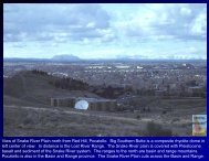
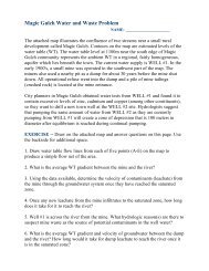
View of Red Rock Pass from the north. Oxford Peak is to the south, and Cache Valley east of it. At the time of<br />
Lake <strong>Bonneville</strong>, the benches on the west side of Cache Valley extended across and met the benches coming south<br />
from the Portneuf Range. The red rocks of the Pass were buried by gravel. The area on the west side of the view<br />
is a post flood landslide. The area of shaded uneven topography on the east side of the view is jumbled blocks of<br />
Cambrian limestone. The headwaters of March Creek, in shade on the east side of the view, make a 180 degree<br />
turn and head north into the Portneuf and Snake River. Formerly they flowed south to Cache Valley.