VILLAGE PLANS - Offaly County Council
VILLAGE PLANS - Offaly County Council
VILLAGE PLANS - Offaly County Council
- No tags were found...
You also want an ePaper? Increase the reach of your titles
YUMPU automatically turns print PDFs into web optimized ePapers that Google loves.
OFFALY COUNTY DEVELOPMENT PLAN 2009 - 2015<br />
Volume 2 - Settlement Plans<br />
Development Plan 2009-2015, Chapters 4 & 19.<br />
Of particular note: -<br />
Development shall be well designed with a view to<br />
maintaining and enhancing the existing attractive rural<br />
character of the village. The <strong>Council</strong> will resist<br />
inappropriate suburban styles.<br />
5.0 SPECIFIC DEVELOPMENT<br />
OBJECTIVES<br />
5.1 Archaeology<br />
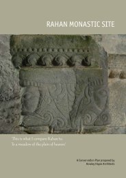
A zone of archaeological potential, which is contained<br />
within the book of Recorded Monuments for Co. <strong>Offaly</strong>,<br />
is located south of Rahan Bridge, (see accompanying<br />
map). It encompasses the site of St. Carthach’s Church<br />
(and Abbey), which is now in ruins and adjoining<br />
cemetery and also includes some lands on the west side<br />
of the road.<br />
It is an objective of the <strong>Council</strong> to secure the protection<br />
(i.e. preservation in situ or at a minimum protection by<br />
record) of all Recorded Monuments included in the<br />
Record of Monuments and Places as established under<br />
Section 12 of the National Monuments (Amendment)<br />
Act 1994, and their setting.<br />
5.2 Protected Structures<br />
A complete list is contained within the Record of<br />
Protected Structures for the <strong>County</strong>. Policies contained<br />
within Volume 1 of the plan will apply.<br />
5.3 Amenities (Open Space)<br />
Rahan village comprises two natural amenities of<br />
particular significance, namely the Grand Canal and the<br />
Clodiagh River. Their natural scenic beauty contributes<br />
to their attractiveness for scenic walks.<br />
The provision of a public open space on lands which<br />
adjoin the Clodiagh River at Rahan Bridge (south of the<br />
village) would be aesthetically pleasing and engender a<br />
greater sense of place for the village, (see<br />
accompanying map).<br />
The Grand Canal is designated as a Natural Heritage<br />
Area (NHA) and traverses lands to the south and west of<br />
Rahan village. The canal is very significant as an amenity<br />
and recreational area. The <strong>County</strong> Development Plan,<br />
Chapters 14, 15 and 16, outlines the <strong>Council</strong>’s policies in<br />
regard to the Grand Canal.<br />
All new in-depth residential development schemes<br />
should incorporate sufficient good quality open space<br />
in accordance with the <strong>County</strong> Development Plan<br />
standards. In this regard, the <strong>Council</strong> will endeavour to<br />
ensure that different development interests consider<br />
the above when designing any new residential<br />
developments.<br />
5.4 Trees and Boundaries<br />
The Tullybeg demesne comprises an attractively<br />
landscaped and aesthetically pleasing demesne<br />
landscape, which is enclosed by an alignment of mature<br />
trees and an attractive stone wall. This alignment of<br />
mature trees is protected under the <strong>County</strong><br />
Development Plan 2009 – 2015 by way of a Tree<br />
Preservation Order (refer to Volume 1, Chapter 15,<br />
Table 15.11).<br />
New development should ensure the protection of<br />
mature trees, hedgerows and the conservation of<br />
existing stone walls, and their integration into new<br />
development. Where the provision of new boundaries<br />
are required, these should comprise native hedgerow<br />
planting, or stone walls which consist of stone found in<br />
the locality. Where comprehensive new development<br />
occurs, it should take into account the pattern of<br />
existing hedgerows and incorporate same into layouts<br />
or plant connecting hedgerows where hedgerow<br />
removal to facilitate development works is necessary.<br />
The <strong>Council</strong> will require that all new development will<br />
respect the predominantly rural nature of the<br />
settlement, in particular through the provision of<br />
sensitive landscaping schemes. In the event that the<br />
removal of tree(s) is deemed to be necessary, it will be<br />
conditional on replacement with appropriate species.<br />
5.5 Local Issues<br />
a) The incremental provision of footpaths through<br />
development contributions / special<br />
development contributions or requirements for<br />
works as part of planning permissions granted is<br />
envisaged, to improve the amenities of the area.<br />
b) Adequate lighting to be provided along all routes<br />
within the village boundary, over time.<br />
c) Progressively underground overhead cables. In<br />
the case of new development, ducting will be<br />
required under new roads or new / upgraded<br />
footpaths.<br />
February 2009 | Rahan Village Plan | page 137


