VILLAGE PLANS - Offaly County Council
VILLAGE PLANS - Offaly County Council
VILLAGE PLANS - Offaly County Council
- No tags were found...
You also want an ePaper? Increase the reach of your titles
YUMPU automatically turns print PDFs into web optimized ePapers that Google loves.
OFFALY COUNTY DEVELOPMENT PLAN 2009 - 2015<br />
Volume 2 - Settlement Plans<br />
RAHAN <strong>VILLAGE</strong> PLAN<br />
1.0 GENERAL INTRODUCTION AND<br />
DEVELOPMENT CONTEXT<br />
The settlement plans stem directly from the policies<br />
and objectives contained in the <strong>County</strong> Development<br />
Plan with particular reference to Chapter 4, “Settlement<br />
Strategy” and Chapter 18, “Land Use and Zoning”. This is<br />
to facilitate the growth of a hierarchy of well-planned,<br />
sustainable and complementary settlements<br />
throughout the county presented in a consistent<br />
manner to allow ease of interpretation and<br />
implementation.<br />
Rahan has been designated as a village within <strong>Offaly</strong>’s<br />
settlement hierarchy, as set out in Chapter 4 of the<br />
<strong>County</strong> Development Plan 2009 – 2015. This settlement<br />
plan along with the zoning map is seen as a specific<br />
view of the village so that development pressures can<br />
be focused and properly managed in order that the<br />
settlement can fulfil this role effectively.<br />
1.1 Location<br />
Rahan village is a small rural settlement, located along<br />
the Grand Canal and Clodiagh River. The village is<br />
situated approximately 10 kilometres northwest of<br />
Tullamore, approximately 20 kilometres northeast of<br />
Cloghan and approximately 8 kilometres south of Clara.<br />
According to the 2006 Census, the total population of<br />
the district electoral division of Rahan was 696 persons.<br />
However, it is estimated that the current population<br />
situated within the proposed village boundary of Rahan<br />
is approximately 120 persons.<br />
1.2 Settlement Form<br />
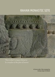
Historical records state that this settlement dates back<br />
to Pre-Christian times. However, in the year 594 AD, a<br />
monastery was founded on the flat fern covered terrain<br />
by the banks of the Clodiagh River and developed into<br />
a community of over 800 monks. Lands, which lie<br />
outside of the southeastern fringe of the village<br />
boundary, are of archaeological and historical<br />
significance.<br />
Expansion within this village has been largely in the<br />
form of farmsteads and ‘one off’ house developments in<br />
the environs along the constituent roads. A <strong>County</strong><br />
<strong>Council</strong> residential estate was developed within the<br />
eastern quadrant of the village. The old shop and post<br />
office can be regarded as being the former centre point<br />
of this settlement. These services have ceased operation<br />
in recent years. A former mill house is situated alongside<br />
the river, demonstrating the commercial vibrancy and<br />
tradition which was previously in existence within this<br />
village.<br />
Tullybeg demesne is situated in Rahan and was<br />
originally part utilised as the Jesuit College, whilst also<br />
comprises a burial ground and extensive grounds. It<br />
was last part - utilised as a retirement village and golf<br />
course.<br />
Rahan is a predominantly low rise and low-density<br />
settlement, which contains a number of different<br />
building styles.<br />
Rahan Bridge which crosses over the Clodiagh River acts<br />
as the focal point of this village. The ‘Bridge House’ and<br />
its farmstead are strategically located at this bridge,<br />
within the western quadrant of the proposed village<br />
boundary.<br />
A Conservation Plan for the Rahan Monastic Site has<br />
been prepared as per an action of the <strong>Offaly</strong> Heritage<br />
Plan 2007 – 2011 and the Planning Authority will have<br />
regard to this plan in relation to the assessing of<br />
applications in the vicinity of the site.<br />
1.3 Context<br />
Rahan has been designated as a village within <strong>Offaly</strong>’s<br />
settlement hierarchy, as set out in Chapter 4 of the<br />
<strong>County</strong> Development Plan 2009 – 2015. A development<br />
boundary has been identified for Rahan Village and is<br />
shown on the accompanying map. This is intended to<br />
delineate an area, which will: -<br />
• Foster the creation of a more coherent<br />
settlement, with adequate critical mass to<br />
February 2009 | Rahan Village Plan | page 134


