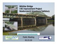
Salisbury - Whittier Bridge/I-95 Improvement Project
Salisbury - Whittier Bridge/I-95 Improvement Project
Salisbury - Whittier Bridge/I-95 Improvement Project

Create successful ePaper yourself
Turn your PDF publications into a flip-book with our unique Google optimized e-Paper software.
25 Nashua Road<br />
Bedford, NH 03110-5500<br />
(603) 472-5191<br />
(603) 472-7052 (Fax)<br />
www.normandeau.com<br />
December 1, 2011<br />
<strong>Salisbury</strong> Conservation Commission<br />
Town Hall<br />
5 Beach Road<br />
<strong>Salisbury</strong>, MA 01<strong>95</strong>2<br />
Commissioners:<br />
Please find attached a Notice of Intent (NOI) for the Massachusetts Department of Transportation<br />
Highway Division’s (MassDOT) <strong>Whittier</strong> <strong>Bridge</strong> replacement and I-<strong>95</strong> Widening project in Newburyport,<br />
Amesbury and <strong>Salisbury</strong> . The purpose of the project is to bring the <strong>Whittier</strong> <strong>Bridge</strong> up to current safety<br />
standards by creating a structure that can accommodate the traffic flow along Interstate <strong>95</strong>. The project<br />
will improve the bridge by adding a high speed shoulder and breakdown lane in each direction and<br />
increasing the travel lanes in each direction from three to four. A multi-use path will be constructed on the<br />
northbound side between Newburyport and Amesbury to ultimately connect with the Ghost Trail in<br />
<strong>Salisbury</strong>. MassDOT is undertaking the project under the Commonwealth's Accelerated <strong>Bridge</strong> Program.<br />
An ANRAD for the project area has been reviewed and approved your commission (ORAD dated<br />
January 6, 2010). The purpose of the NOI is to quantify impacts to resources protected by the Wetland<br />
Protection Act, present alternative analyses to minimize impacts, and identify mitigation measures for<br />
unavoidable impacts, as needed.<br />
The attached NOI application includes plans, calculations and fees only for those impacts within the<br />
Town of <strong>Salisbury</strong>. A supplemental report includes project-wide and town-specific details. Please note<br />
that MassDOT Highway is exempt from additional local ordinances and filing fees. Any charges for<br />
newspaper announcements should be billed to MassDOT:<br />
Ms. Irene Petsalis<br />
MassDOT<br />
10 Park Plaza - Room 4260<br />
Boston, MA 02116<br />
Phone: (617) 973-7487,<br />
Fax: (617) 973-8879<br />
Please feel free to contact me (603-637-1158) or Mr. Tim Dexter at MassDOT (617-973-8306)<br />
with questions or comments regarding this application. Thank you for your attention and we look<br />
forward to working with you during this review.<br />
Sincerely,<br />
NORMANDEAU ASSOCIATES INC<br />
Sarah Allen<br />
Principal Wetland Scientist<br />
Lewes, DE Bedford, NH, Corporate Haverstraw, NY Aiken, SC Wenatchee, WA<br />
Falmouth, ME Hampton, NH Drumore, PA Stevenson, WA Verona, WI<br />
Falmouth, MA Westmoreland, NH Stowe, PA Vancouver, WA<br />
An Employee-owned Company<br />
An Equal Opportunity Employer
Massachusetts Department of Environmental Protection<br />
Bureau of Resource Protection - Wetlands<br />
WPA Form 3 – Notice of Intent<br />
Provided by MassDEP:<br />
MassDEP File Number<br />
Massachusetts Wetlands Protection Act M.G.L. c. 131, §40<br />
Document Transaction Number<br />
<strong>Salisbury</strong><br />
City/Town<br />
Important:<br />
When filling out<br />
A. General Information<br />
forms on the<br />
computer, use<br />
only the tab key<br />
1. <strong>Project</strong> Location (Note: electronic filers will click on button to locate project site):<br />
to move your East and west of I-<strong>95</strong> from the Amesbury town <strong>Salisbury</strong> 01<strong>95</strong>2<br />
cursor - do not<br />
line to the visitor center/Toll Ramp flyover ramp b. City/Town c. Zip Code<br />
use the return <br />
key. 42° 51’ 36.49” -70° 53’ 36.99”<br />
Latitude and Longitude:<br />
d. Latitude e. Longitude<br />
N/A<br />
N/A<br />
f. Assessors Map/Plat Number g. Parcel /Lot Number<br />
2. Applicant:<br />
Timothy<br />
Dexter<br />
a. First Name b. Last Name<br />
Note:<br />
Massachusetts Highway Department<br />
Before<br />
c. Organization<br />
completing this<br />
10 Park Plaza<br />
form consult<br />
your local<br />
d. Street Address<br />
Conservation Boston MA 02116<br />
Commission e. City/Town f. State g. Zip Code<br />
regarding any<br />
municipal bylaw 617.973.8306 617.973.8879 timothy.dexter@state.ma.us<br />
or ordinance. h. Phone Number i. Fax Number j. Email Address<br />
3. Property owner (required if different from applicant): Check if more than one owner<br />
a. First Name<br />
Commonwealth of Massachusetts<br />
c. Organization<br />
b. Last Name<br />
d. Street Address<br />
e. City/Town f. State g. Zip Code<br />
h. Phone Number i. Fax Number j. Email address<br />
4. Representative (if any):<br />
Sarah<br />
Allen<br />
a. First Name b. Last Name<br />
Normandeau Associates<br />
c. Company<br />
25 Nashua Road<br />
d. Street Address<br />
Bedford NH 03110<br />
e. City/Town f. State g. Zip Code<br />
603.637.1158 603.471.8007 sallen@normandeau.com<br />
h. Phone Number i. Fax Number j. Email address<br />
5. Total WPA Fee Paid (from NOI Wetland Fee Transmittal Form):<br />
$1,050 $512.50 $537.50<br />
a. Total Fee Paid b. State Fee Paid c. City/Town Fee Paid<br />
wpaform3.doc • rev. 11/16/09 Page 1 of 8
Massachusetts Department of Environmental Protection<br />
Bureau of Resource Protection - Wetlands<br />
WPA Form 3 – Notice of Intent<br />
Massachusetts Wetlands Protection Act M.G.L. c. 131, §40<br />
A. General Information (continued)<br />
Provided by MassDEP:<br />
MassDEP File Number<br />
Document Transaction Number<br />
<strong>Salisbury</strong><br />
City/Town<br />
6. General <strong>Project</strong> Description:<br />
<strong>Whittier</strong> <strong>Bridge</strong>/I-<strong>95</strong> <strong>Improvement</strong> <strong>Project</strong> (See attached report).<br />
7a. <strong>Project</strong> Type Checklist:<br />
1. Single Family Home 2. Residential Subdivision<br />
3. Limited <strong>Project</strong> Driveway Crossing 4. Commercial/Industrial<br />
5. Dock/Pier 6. Utilities<br />
7. Coastal Engineering Structure 8. Agriculture (e.g., cranberries, forestry)<br />
9. Transportation 10. Other<br />
7b. Is any portion of the proposed activity eligible to be treated as a limited project subject to 310 CMR<br />
10.24 (coastal) or 310 CMR 10.53 (inland)<br />
1. Yes No If yes, describe which limited project applies to this project:<br />
2. Limited <strong>Project</strong><br />
8.<br />
Property recorded at the Registry of Deeds for:<br />
N/A<br />
a. County b. Certificate # (if registered land)<br />
c. Book d. Page Number<br />
B. Buffer Zone & Resource Area Impacts (temporary & permanent)<br />
1. Buffer Zone Only – Check if the project is located only in the Buffer Zone of a Bordering<br />
Vegetated Wetland, Inland Bank, or Coastal Resource Area.<br />
2. Inland Resource Areas (see 310 CMR 10.54-10.58; if not applicable, go to Section B.3,<br />
Coastal Resource Areas).<br />
Check all that apply below. Attach narrative and any supporting documentation describing how the<br />
project will meet all performance standards for each of the resource areas altered, including standards<br />
requiring consideration of alternative project design or location.<br />
Resource Area Size of Proposed Alteration Proposed Replacement (if any)<br />
For all projects<br />
affecting other<br />
Resource Areas,<br />
a. Bank<br />
1. linear feet 2. linear feet<br />
please attach a<br />
b. Bordering Vegetated<br />
narrative<br />
1. square feet<br />
Wetland<br />
2. square feet<br />
explaining how<br />
the resource<br />
area was c. Land Under<br />
delineated.<br />
Waterbodies and<br />
1. square feet 2. square feet<br />
Waterways<br />
3. cubic yards dredged<br />
wpaform3.doc • rev. 11/16/09 Page 2 of 8
Massachusetts Department of Environmental Protection<br />
Bureau of Resource Protection - Wetlands<br />
WPA Form 3 – Notice of Intent<br />
Massachusetts Wetlands Protection Act M.G.L. c. 131, §40<br />
Provided by MassDEP:<br />
MassDEP File Number<br />
Document Transaction Number<br />
<strong>Salisbury</strong><br />
City/Town<br />
B. Buffer Zone & Resource Area Impacts (temporary & permanent) (cont’d)<br />
Resource Area Size of Proposed Alteration Proposed Replacement (if any)<br />
d. Bordering Land<br />
Subject to Flooding 1. square feet 2. square feet<br />
e. Isolated Land<br />
Subject to Flooding<br />
3. cubic feet of flood storage lost 4. cubic feet replaced<br />
1. square feet<br />
2. cubic feet of flood storage lost 3. cubic feet replaced<br />
f. Riverfront Area<br />
1. Name of Waterway (if available)<br />
2. Width of Riverfront Area (check one):<br />
25 ft. - Designated Densely Developed Areas only<br />
100 ft. - New agricultural projects only<br />
200 ft. - All other projects<br />
3. Total area of Riverfront Area on the site of the proposed project:<br />
square feet<br />
4. Proposed alteration of the Riverfront Area:<br />
a. total square feet b. square feet within 100 ft. c. square feet between 100 ft. and 200 ft.<br />
5. Has an alternatives analysis been done and is it attached to this NOI Yes No<br />
6. Was the lot where the activity is proposed created prior to August 1, 1996 Yes No<br />
3. Coastal Resource Areas: (See 310 CMR 10.25-10.35)<br />
Check all that apply below. Attach narrative and supporting documentation describing how the project<br />
will meet all performance standards for each of the resource areas altered, including standards<br />
requiring consideration of alternative project design or location.<br />
Online Users:<br />
Include your Resource Area Size of Proposed Alteration Proposed Replacement (if any)<br />
document<br />
transaction<br />
number<br />
a. Designated Port Areas Indicate size under Land Under the Ocean, below<br />
(provided on your<br />
receipt page)<br />
with all<br />
b. Land Under the Ocean<br />
1. square feet<br />
supplementary<br />
information you<br />
submit to the<br />
2. cubic yards dredged<br />
Department. c. Barrier Beach Indicate size under Coastal Beaches and/or Coastal Dunes below<br />
d. Coastal Beaches<br />
e. Coastal Dunes<br />
1. square feet 2. cubic yards beach nourishment<br />
1. square feet 2. cubic yards dune nourishment<br />
wpaform3.doc • rev. 11/16/09 Page 3 of 8
Massachusetts Department of Environmental Protection<br />
Bureau of Resource Protection - Wetlands<br />
WPA Form 3 – Notice of Intent<br />
Massachusetts Wetlands Protection Act M.G.L. c. 131, §40<br />
Provided by MassDEP:<br />
MassDEP File Number<br />
Document Transaction Number<br />
<strong>Salisbury</strong><br />
City/Town<br />
B. Buffer Zone & Resource Area Impacts (temporary & permanent) (cont’d)<br />
Size of Proposed Alteration<br />
Proposed Replacement (if any)<br />
f. Coastal Banks<br />
g. Rocky Intertidal<br />
Shores<br />
h. Salt Marshes<br />
i. Land Under Salt<br />
Ponds<br />
1. linear feet<br />
1. square feet<br />
1. square feet 2. sq ft restoration, rehab., creation<br />
1. square feet<br />
2. cubic yards dredged<br />
j. Land Containing<br />
Shellfish<br />
1. square feet<br />
k. Fish Runs Indicate size under Coastal Banks, inland Bank, Land Under the<br />
Ocean, and/or inland Land Under Waterbodies and Waterways,<br />
above<br />
1. cubic yards dredged<br />
l. Land Subject to<br />
Coastal Storm Flowage 1. square feet<br />
4. Restoration/Enhancement<br />
If the project is for the purpose of restoring or enhancing a wetland resource area in addition to the<br />
square footage that has been entered in Section B.2.b or B.3.h above, please enter the additional<br />
amount here.<br />
a. square feet of BVW<br />
b. square feet of Salt Marsh<br />
5.<br />
<strong>Project</strong> Involves Stream Crossings<br />
a. number of new stream crossings b. number of replacement stream crossings<br />
C. Other Applicable Standards and Requirements<br />
Streamlined Massachusetts Endangered Species Act/Wetlands Protection Act Review<br />
1. Is any portion of the proposed project located in Estimated Habitat of Rare Wildlife as indicated on<br />
the most recent Estimated Habitat Map of State-Listed Rare Wetland Wildlife published by the Natural<br />
Heritage and Endangered Species Program (NHESP) To view habitat maps, see the Massachusetts<br />
Natural Heritage Atlas or go to<br />
http://www.mass.gov/dfwele/dfw/nhesp/regulatory_review/priority_habitat/online_viewer.htm.<br />
a. Yes<br />
(Not within<br />
<strong>Salisbury</strong>)<br />
No<br />
If yes, include proof of mailing or hand delivery of NOI to:<br />
Natural Heritage and Endangered Species Program<br />
Division of Fisheries and Wildlife<br />
Route 135, North Drive<br />
Westborough, MA 01581<br />
wpaform3.doc • rev. 11/16/09 Page 4 of 8
Massachusetts Department of Environmental Protection<br />
Bureau of Resource Protection - Wetlands<br />
WPA Form 3 – Notice of Intent<br />
Massachusetts Wetlands Protection Act M.G.L. c. 131, §40<br />
C. Other Applicable Standards and Requirements (cont’d)<br />
Provided by MassDEP:<br />
MassDEP File Number<br />
Document Transaction Number<br />
<strong>Salisbury</strong><br />
City/Town<br />
If yes, the project is also subject to Massachusetts Endangered Species Act (MESA) review (321<br />
CMR 10.18). To qualify for a streamlined, 30-day, MESA/Wetlands Protection Act review, please<br />
complete Section C.1.C, and include requested materials with this Notice of Intent (NOI); OR complete<br />
Section C.1.d, if applicable. If MESA supplemental information is not included with the NOI, by<br />
completing Section 1 of this form, the NHESP will require a separate MESA filing which may take up<br />
to 90 days to review (unless noted exceptions in Section 2 apply, see below).<br />
1. c. Submit Supplemental Information for Endangered Species Review ∗<br />
1. Percentage/acreage of property to be altered:<br />
(a) within wetland Resource Area<br />
(b) outside Resource Area<br />
percentage/acreage<br />
percentage/acreage<br />
2. Assessor’s Map or right-of-way plan of site<br />
3. <strong>Project</strong> plans for entire project site, including wetland resource areas and areas outside of<br />
wetlands jurisdiction, showing existing and proposed conditions, existing and proposed<br />
tree/vegetation clearing line, and clearly demarcated limits of work ** ∗∗<br />
(a)<br />
(b)<br />
<strong>Project</strong> description (including description of impacts outside of wetland resource area &<br />
buffer zone)<br />
Photographs representative of the site<br />
(c) MESA filing fee (fee information available at:<br />
http://www.mass.gov/dfwele/dfw/nhesp/regulatory_review/mesa/mesa_fee_schedule.htm).<br />
Make check payable to “Commonwealth of Massachusetts - NHESP” and mail to<br />
NHESP at above address<br />
<strong>Project</strong>s altering 10 or more acres of land, also submit:<br />
(d)<br />
(e)<br />
Vegetation cover type map of site<br />
<strong>Project</strong> plans showing Priority & Estimated Habitat boundaries<br />
d. OR Check One of the Following<br />
1. <strong>Project</strong> is exempt from MESA review.<br />
Attach applicant letter indicating which MESA exemption applies. (See 321 CMR 10.14,<br />
http://www.mass.gov/dfwele/dfw/nhesp/regulatory_review/mesa/mesa_exemptions.htm; <br />
the NOI must still be sent to NHESP if the project is within estimated habitat pursuant to <br />
310 CMR 10.37 and 10.59.)<br />
2. Separate MESA review ongoing.<br />
a. NHESP Tracking # b. Date submitted to NHESP<br />
∗<br />
Some projects not in Estimated Habitat may be located in Priority Habitat, and require NHESP review (see<br />
http://www.mass.gov/dfwele/dfw/nhesp/nhesp.htm, regulatory review tab). Priority Habitat includes habitat for state-listed plants and<br />
strictly upland species not protected by the Wetlands Protection Act.<br />
∗∗<br />
MESA projects may not be segmented (321 CMR 10.16). The applicant must disclose full development plans even if such plans are<br />
not required as part of the Notice of Intent process.<br />
wpaform3.doc • rev. 11/16/09 Page 5 of 8
Massachusetts Department of Environmental Protection<br />
Bureau of Resource Protection - Wetlands<br />
WPA Form 3 – Notice of Intent<br />
Massachusetts Wetlands Protection Act M.G.L. c. 131, §40<br />
C. Other Applicable Standards and Requirements (cont’d)<br />
Provided by MassDEP:<br />
MassDEP File Number<br />
Document Transaction Number<br />
<strong>Salisbury</strong><br />
City/Town<br />
3. Separate MESA review completed.<br />
Include copy of NHESP “no Take” determination or valid Conservation & Management<br />
Permit with approved plan.<br />
2. For coastal projects only, is any portion of the proposed project located below the mean high water<br />
line or in a fish run<br />
a. Not applicable – project is in inland resource area only<br />
b. Yes No If yes, include proof of mailing or hand delivery of NOI to either:<br />
South Shore - Cohasset to Rhode<br />
Island, and the Cape & Islands:<br />
North Shore - Hull to New Hampshire:<br />
Division of Marine Fisheries - Division of Marine Fisheries <br />
Southeast Marine Fisheries Station North Shore Office<br />
Attn: Environmental Reviewer<br />
Attn: Environmental Reviewer<br />
1213 Purchase Street – 3rd Floor 30 Emerson Avenue<br />
New Bedford, MA 02740-6694 Gloucester, MA 01930<br />
Also if yes, the project may require a Chapter 91 license. For coastal towns in the Northeast Region,<br />
please contact MassDEP’s Boston Office. For coastal towns in the Southeast Region, please contact<br />
MassDEP’s Southeast Regional Office.<br />
3. Is any portion of the proposed project within an Area of Critical Environmental Concern (ACEC)<br />
Online Users:<br />
If yes, provide name of ACEC (see instructions to WPA Form 3 or MassDEP<br />
a. Yes No<br />
Include your<br />
Website for ACEC locations). Note: electronic filers click on Website.<br />
document<br />
transaction<br />
b. ACEC<br />
number<br />
(provided on your 4. Is any portion of the proposed project within an area designated as an Outstanding Resource Water<br />
receipt page) (ORW) as designated in the Massachusetts Surface Water Quality Standards, 314 CMR 4.00<br />
with all<br />
supplementary a. Yes No<br />
information you<br />
submit to the 5. Is any portion of the site subject to a Wetlands Restriction Order under the Inland Wetlands<br />
Department. Restriction Act (M.G.L. c. 131, § 40A) or the Coastal Wetlands Restriction Act (M.G.L. c. 130, § 105)<br />
a. Yes No<br />
6. Is this project subject to provisions of the MassDEP Stormwater Management Standards<br />
a. Yes. Attach a copy of the Stormwater Report as required by the Stormwater Management<br />
Standards per 310 CMR 10.05(6)(k)-(q) and check if:<br />
1. Applying for Low Impact Development (LID) site design credits (as described in<br />
Stormwater Management Handbook Vol. 2, Chapter 3)<br />
2. A portion of the site constitutes redevelopment<br />
3. Proprietary BMPs are included in the Stormwater Management System.<br />
b. No. Check why the project is exempt:<br />
1. Single-family house<br />
wpaform3.doc • rev. 11/16/09 Page 6 of 8
Massachusetts Department of Environmental Protection<br />
Bureau of Resource Protection - Wetlands<br />
WPA Form 3 – Notice of Intent<br />
Massachusetts Wetlands Protection Act M.G.L. c. 131, §40<br />
C. Other Applicable Standards and Requirements (cont’d)<br />
2. Emergency road repair<br />
Provided by MassDEP:<br />
MassDEP File Number<br />
Document Transaction Number<br />
<strong>Salisbury</strong><br />
City/Town<br />
3. Small Residential Subdivision (less than or equal to 4 single-family houses or less than or<br />
equal to 4 units in multi-family housing project) with no discharge to Critical Areas.<br />
D. Additional Information<br />
Applicants must include the following with this Notice of Intent (NOI). See instructions for details.<br />
Online Users: Attach the document transaction number (provided on your receipt page) for any of the<br />
following information you submit to the Department.<br />
1. USGS or other map of the area (along with a narrative description, if necessary) containing<br />
sufficient information for the Conservation Commission and the Department to locate the site.<br />
(Electronic filers may omit this item.)<br />
2. Plans identifying the location of proposed activities (including activities proposed to serve as a<br />
Bordering Vegetated Wetland [BVW] replication area or other mitigating measure) relative to<br />
the boundaries of each affected resource area.<br />
3. Identify the method for BVW and other resource area boundary delineations (MassDEP BVW<br />
Field Data Form(s), Determination of Applicability, Order of Resource Area Delineation, etc.),<br />
and attach documentation of the methodology.<br />
4. List the titles and dates for all plans and other materials submitted with this NOI.<br />
Reconstruction of <strong>Whittier</strong> <strong>Bridge</strong> and Interstate <strong>95</strong> Widening - Notice of Intent Plans<br />
a. Plan Title<br />
MassDOT/Tetra Tech<br />
b. Prepared By c. Signed and Stamped by<br />
12/1/2011 1" = 40'<br />
d. Final Revision Date e. Scale<br />
Stormwater Report, <strong>Whittier</strong> <strong>Bridge</strong>/I-<strong>95</strong> <strong>Improvement</strong>s 11/16/11<br />
f. Additional Plan or Document Title g. Date<br />
5. If there is more than one property owner, please attach a list of these property owners not<br />
listed on this form.<br />
6. Attach proof of mailing for Natural Heritage and Endangered Species Program, if needed.<br />
7. Attach proof of mailing for Massachusetts Division of Marine Fisheries, if needed.<br />
8. Attach NOI Wetland Fee Transmittal Form<br />
9. Attach Stormwater Report, if needed.<br />
wpaform3.doc • rev. 11/16/09 Page 7 of 8
Massachusetts Department of Environmental Protection<br />
Bureau of Resource Protection - Wetlands<br />
NOI Wetland Fee Transmittal Form<br />
Massachusetts Wetlands Protection Act M.G.L. c. 131, §40<br />
Important: When<br />
filling out forms<br />
on the computer,<br />
use only the tab<br />
key to move your<br />
cursor - do not<br />
use the return<br />
key.<br />
A. Applicant Information<br />
1. Applicant:<br />
Timothy<br />
a. First Name<br />
Massachusetts Highway Department<br />
c. Organization<br />
10 Park Plaza<br />
d. Mailing Address<br />
Boston<br />
e. City/Town<br />
617-973-8306<br />
h. Phone Number<br />
617-973-8879<br />
i. Fax Number<br />
Dexter<br />
b. Last Name<br />
MA<br />
f. State<br />
timothy.dexter@state.ma.us<br />
j. Email Address<br />
02116<br />
g. Zip Code<br />
2.<br />
Property Owner (if different):<br />
a. First Name<br />
Commonwealth of Massachusetts<br />
c. Organization<br />
b. Last Name<br />
d. Mailing Address<br />
e. City/Town<br />
f. State<br />
g. Zip Code<br />
h. Phone Number<br />
i. Fax Number<br />
j. Email Address<br />
3.<br />
<strong>Project</strong> Location:<br />
To calculate<br />
filing fees, refer<br />
to the category<br />
fee list and<br />
examples in the<br />
instructions for<br />
filling out WPA<br />
Form 3 (Notice of<br />
Intent).<br />
a. Street Address b. City/Town<br />
B. Fees<br />
The fee should be calculated using the following six-step process and worksheet. Please see<br />
Instructions before filling out worksheet.<br />
Step 1/Type of Activity: Describe each type of activity that will occur in wetland resource area and<br />
buffer zone.<br />
Step 2/Number of Activities: Identify the number of each type of activity.<br />
Step 3/Individual Activity Fee: Identify each activity fee from the six project categories listed in the<br />
instructions.<br />
Step 4/Subtotal Activity Fee: Multiply the number of activities (identified in Step 2) times the fee per<br />
category (identified in Step 3) to reach a subtotal fee amount. Note: If any of these activities are in a<br />
Riverfront Area in addition to another Resource Area or the Buffer Zone, the fee per activity should be<br />
multiplied by 1.5 and then added to the subtotal amount.<br />
Step 5/Total <strong>Project</strong> Fee: Determine the total project fee by adding the subtotal amounts from Step 4.<br />
Step 6/Fee Payments: To calculate the state share of the fee, divide the total fee in half and subtract<br />
$12.50. To calculate the city/town share of the fee, divide the total fee in half and add $12.50.<br />
Wpaform3.doc • Wetland Fee Transmittal Form • rev. 2/21/08 Page 1 of 2
Massachusetts Department of Environmental Protection<br />
Bureau of Resource Protection - Wetlands<br />
NOI Wetland Fee Transmittal Form<br />
Massachusetts Wetlands Protection Act M.G.L. c. 131, §40<br />
B. Fees (continued)<br />
Step 1/Type of Activity Step 2/Number Step Step 4/Subtotal Activity<br />
of Activities 3/Individual Fee<br />
Activity Fee<br />
Roadway Construct. (Category 3c) 1 $1,050 $1,050<br />
Step 5/Total <strong>Project</strong> Fee: $1,050<br />
C. Submittal Requirements<br />
Step 6/Fee Payments:<br />
Total <strong>Project</strong> Fee:<br />
State share of filing Fee:<br />
City/Town share of filling Fee:<br />
$1,050<br />
a. Total Fee from Step 5<br />
$512.50<br />
b. 1/2 Total Fee less $12.50<br />
$537.50<br />
c. 1/2 Total Fee plus $12.50<br />
a.) Complete pages 1 and 2 and send with a check or money order for the state share of the fee, payable to<br />
the Commonwealth of Massachusetts.<br />
Department of Environmental Protection<br />
Box 4062<br />
Boston, MA 02211<br />
b.) To the Conservation Commission: Send the Notice of Intent or Abbreviated Notice of Intent; a copy of<br />
this form; and the city/town fee payment.<br />
To MassDEP Regional Office (see Instructions): Send a copy of the Notice of Intent or Abbreviated Notice of<br />
Intent; a copy of this form; and a copy of the state fee payment. (E-filers of Notices of Intent may submit these<br />
electronically.)<br />
Wpaform3.doc • Wetland Fee Transmittal Form • rev. 2/21/08 Page 2 of 2
WHITTIER BRIDGE/I-<strong>95</strong> IMPROVEMENT PROJECT<br />
SALISBURY, MASSACHUSETTS<br />
SUPPLEMENT TO WPA FORM 3 - NOTICE OF INTENT<br />
DECEMBER 2011
WHITTIER BRIDGE/I-<strong>95</strong> IMPROVEMENT PROJECT<br />
SALISBURY, MASSACHUSETTS<br />
SUPPLEMENT TO WPA FORM 3 - NOTICE OF INTENT<br />
December 2011
WHITTIER BRIDGE/I-<strong>95</strong> IMPROVEMENT PROJECT<br />
Table of Contents<br />
Page<br />
1.0 OVERVIEW.............................................................................................................................1<br />
2.0 EXISTING CONDITIONS .....................................................................................................1<br />
2.1 LOCATION AND SITE DESCRIPTION ..................................................................................1<br />
2.2 WETLAND RESOURCE AREAS...........................................................................................2<br />
2.3 OUTSTANDING RESOURCE WATERS.................................................................................2<br />
2.4 RARE SPECIES AND HABITATS .........................................................................................2<br />
3.0 PROPOSED WORK................................................................................................................3<br />
3.1 CONSTRUCTION ACTIVITIES IN SALISBURY .....................................................................3<br />
3.2 IMPACTS TO RESOURCE AREAS ........................................................................................4<br />
3.3 IMPACT MINIMIZATION AND MITIGATION .......................................................................4<br />
4.0 ALTERNATIVES ANALYSIS...............................................................................................6<br />
4.1 MERRIMACK RIVER CROSSING AND HIGHWAY WIDENING ALTERNATIVES ...................6<br />
4.2 BRIDGE DESIGN ALTERNATIVES ......................................................................................8<br />
4.3 SHARED-USE PATH ALIGNMENT ALTERNATIVES ............................................................9<br />
4.4 PREFERRED ALTERNATIVE .............................................................................................10<br />
5.0 COMPLIANCE WITH PERFORMANCE STANDARDS................................................10<br />
6.0 REFERENCES.......................................................................................................................11<br />
FIGURES<br />
APPENDICES<br />
Appendix A – Checklist for Stormwater Report<br />
Appendix B – Order of Resource Area Delineation<br />
Appendix C – Rare Species Information<br />
NOI supplement report-<strong>Salisbury</strong> -Final.doc 11/30/11 ii Normandeau Associates, Inc.
WHITTIER BRIDGE/I-<strong>95</strong> IMPROVEMENT PROJECT<br />
1.0 OVERVIEW<br />
This Notice of Intent has been prepared for the <strong>Whittier</strong> <strong>Bridge</strong>/I-<strong>95</strong> <strong>Improvement</strong> <strong>Project</strong> in<br />
accordance with the Massachusetts Wetlands Protection Act (WPA) (M.G.L. c. 131, §40) and its<br />
associated regulations (310 CMR 10.00). The project will provide additional Interstate (I)-<strong>95</strong> lane<br />
capacity to improve safety and alleviate congestion and will involve replacement/rehabilitation of<br />
several structures including the <strong>Whittier</strong> <strong>Bridge</strong> over the Merrimack River.<br />
The proposed work will impact Bordering Vegetated Wetland (BVW), Riverfront Area (RFA), and<br />
coastal resource areas in Newburyport, Amesbury, and <strong>Salisbury</strong>. BVW impacts will occur in the<br />
town of Amesbury, with permanent impacts totaling less than 5,000 square feet. Coastal resources<br />
associated with the Merrimack River will be impacted in Newburyport and Amesbury. Work will<br />
occur within RFA in Newburyport and Amesbury.<br />
The project is subject to provisions of the Massachusetts Department of Environmental Protection<br />
(MassDEP) Stormwater Management Performance Standards at 310 CMR 10.05(6)(k) through (q);<br />
therefore, a Stormwater Report is included with this submission (under separate cover). The checklist<br />
for the Stormwater Report is included as Appendix A of this report.<br />
2.0 EXISTING CONDITIONS<br />
2.1 LOCATION AND SITE DESCRIPTION<br />
The project area is located within the I-<strong>95</strong> right-of-way and extends from Interchange 57 (Route<br />
113/Storey Avenue) in Newburyport, across the Merrimack River, to Interchange 60 (State Route<br />
286/Main Street overpass and the Toll Road overpass) in <strong>Salisbury</strong>, south of the New Hampshire state<br />
line.<br />
The project area includes the John Greenleaf <strong>Whittier</strong> <strong>Bridge</strong>, a fixed-span steel-truss bridge, which<br />
spans the Merrimack River in Amesbury and Newburyport. The bridge, which has three lanes in each<br />
direction, was built in 1<strong>95</strong>1 and is considered structurally deficient and functionally obsolete. The<br />
current bridge does not meet current traffic volume requirements, is the location of an elevated<br />
number of accidents and fails to meet current Federal Highway Administration Interstate Highway<br />
design standards. Other bridges located within the project area include the I-<strong>95</strong> northbound, Route<br />
286, and Toll Road bridges in <strong>Salisbury</strong>.<br />
I-<strong>95</strong> within the project area currently consists of six lanes, while north and south of the project area I<br />
<strong>95</strong> has eight lanes. Peak hour traffic congestion occurs in this area and is highest during summer<br />
weekends. The drainage system associated with the existing roadway consists of a combination of<br />
open drainage flow from the roadway and a series of catch basins that are part of a drainage piping<br />
system with multiple discharge points. Stormwater flows directly into a wetland along the highway<br />
(Wetland O) via a ditch with little apparent treatment.<br />
Meader Brook, a fresh-water perennial stream, crosses the study area in <strong>Salisbury</strong> via a culvert under<br />
I-<strong>95</strong>. Other water bodies including wetlands, small ponds and unnamed intermittent streams are<br />
within or in close proximity to the study area.<br />
NOI supplement report-<strong>Salisbury</strong> -Final.doc 11/30/11 1 Normandeau Associates, Inc.
WHITTIER BRIDGE/I-<strong>95</strong> IMPROVEMENT PROJECT<br />
2.2 WETLAND RESOURCE AREAS<br />
The following resource areas regulated by the WPA occur within the study area:<br />
• Land Under the Ocean (tidal areas within the Merrimack River);<br />
• Banks of or Land Under the Ocean, Ponds, Streams, Rivers, Lakes or Creeks that<br />
Underlie an Anadromous/ Catadromous Fish Run (Fish Run);<br />
• Coastal Beach;<br />
• Land Subject to Coastal Storm Flowage (LSCSF);<br />
• Rocky Intertidal Shore;<br />
• Salt Marsh;<br />
• Riverfront Area (RFA);<br />
• Bordering Vegetated Wetlands (BVW); and<br />
• Bank.<br />
In <strong>Salisbury</strong>, fourteen BVWs (Wetlands 2, 3, 5, 6, 13, K, L, O, P, Q, R, S, W, and X), Bank<br />
associated with Meader Brook and unnamed intermittent streams, and RFA associated with Meader<br />
Brook occur within the project corridor.<br />
In addition to the resource areas described above, six isolated vegetated wetlands are located within<br />
the project corridor in <strong>Salisbury</strong> (Wetlands 1, 14, 17, M, U, and V). These wetlands have no<br />
hydrologic connection to other wetland resource areas and are not likely to pond more than 0.25-acre<br />
foot. Therefore, they do not fall under jurisdiction of the Massachusetts Wetlands Protection Act, but<br />
meet federal jurisdictional wetland definitions.<br />
The boundaries of resource areas located in <strong>Salisbury</strong> were approved by the <strong>Salisbury</strong> Conservation<br />
Commission in an Order of Resource Area Delineation dated January 6, 2010 (Appendix B).<br />
There are no certified vernal pools in the study area and 2009 spring surveys identified no pools<br />
supporting breeding populations of vernal pool species.<br />
The site is not subject to any known Wetlands Restriction Orders under the Inland Wetlands<br />
Restriction Act (M.G.L. c. 131, § 40A) or the Coastal Wetlands Restriction Act (M.G.L. c. 130, §<br />
105).<br />
2.3 OUTSTANDING RESOURCE WATERS<br />
No areas designated in the Massachusetts Surface Water Quality Standards (314 CMR 4.00) as<br />
Outstanding Resource Waters (ORWs) occur within the project area.<br />
2.4 RARE SPECIES AND HABITATS<br />
No state or federally-listed rare species habitat is known to occur within the portion of the project area<br />
in <strong>Salisbury</strong>. The bald eagle (Haliaeetus leucocephalus) and peregrine falcon (Falco peregrinus),<br />
both state-listed as endangered, occur in the Merrimack River and the adjacent riverbank areas within<br />
the project area in Newburyport and Amesbury. In addition, two fish species with special status are<br />
known to use the Merrimack River in the project area, shortnose sturgeon (Acipenser brevirostrum)<br />
NOI supplement report-<strong>Salisbury</strong> -Final.doc 11/30/11 2 Normandeau Associates, Inc.
WHITTIER BRIDGE/I-<strong>95</strong> IMPROVEMENT PROJECT<br />
and Atlantic sturgeon (Acipenser oxyrhynchus). The shortnose sturgeon is listed as endangered by the<br />
NHESP and the National Marine Fisheries Service (NMFS). The Atlantic sturgeon is also listed as<br />
endangered by the NHESP and as a candidate for listing by NMFS. Preliminary consultation with the<br />
NHESP indicated that impacts to bald eagle habitat will be unlikely. In 2011, the NHESP verified that<br />
a pair of peregrine falcon are utilizing the existing <strong>Whittier</strong> <strong>Bridge</strong> as nesting habitat. Consultation<br />
with the NHESP is ongoing; but currently the NHESP indicates they would prefer not to encourage<br />
nesting peregrines on the bridge due to adverse effects on other nearby protected species. Bald eagle<br />
and peregrine falcon have been delisted at the federal level and are no longer protected under the<br />
Endangered Species Act of 1973 (7 U.S.C. §136, 16 U.S.C. §1531 et seq., ESA). The NHESP will<br />
review this NOI jointly under the streamlined MESA/Wetlands Protection Act review process.<br />
Letters from the U.S. Fish and Wildlife Service (USFWS), NMFS, and the Massachusetts Division of<br />
Fisheries and Wildlife (DMF) regarding rare species at the site are provided in Appendix C.<br />
Consultation with DMF and NMFS is ongoing in regards to work at the <strong>Whittier</strong> <strong>Bridge</strong>, which exists<br />
outside of the <strong>Salisbury</strong> town boundary.<br />
The proposed project does not occur within an Area of Critical Environmental Concern (ACEC).<br />
3.0 PROPOSED WORK<br />
<strong>Project</strong>-wide proposed work will include the following:<br />
• Replacement of the John Greenleaf <strong>Whittier</strong> Memorial <strong>Bridge</strong> over the Merrimack River<br />
with a pair of new bridges, each with four travel lanes, a high-speed shoulder and a<br />
breakdown lane in each direction.<br />
• Widening, rehabilitation, or replacement of seven adjacent bridges along the I-<strong>95</strong><br />
alignment in Amesbury and Newburyport to accommodate eight lanes of traffic on I-<strong>95</strong><br />
and to meet current design standards as much as practicable.<br />
• Highway widening improvements from the existing six lanes to eight lanes along the<br />
4.25-mile project alignment from Exit 57 in Newburyport to Exit 59 in <strong>Salisbury</strong>.<br />
• Construction of a “shared-use path”, which will parallel the I-<strong>95</strong> alignment and cross the<br />
Merrimack River on the new I-<strong>95</strong> northbound bridge.<br />
• Stormwater management improvements to achieve compliance with the stormwater<br />
management standards. A new collection and conveyance system will be needed where<br />
the highway layout is relocated or expanded. In most areas where the layout will remain<br />
unchanged, portions of the existing infrastructure will be maintained. A majority of the<br />
existing stormwater discharges will remain under the post-development condition, but in<br />
some instances, discharges will be improved or relocated.<br />
Construction activities in <strong>Salisbury</strong> are described in Section 3.1 below. Impacts to resource areas<br />
associated with the proposed work are summarized in Section 3.2. Measures to minimize project<br />
impacts, including erosion and sedimentation control, stormwater management, and proposed wetland<br />
replication areas are described in Section 3.3.<br />
3.1 CONSTRUCTION ACTIVITIES IN SALISBURY<br />
<strong>Project</strong> work in <strong>Salisbury</strong> will include the following:<br />
NOI supplement report-<strong>Salisbury</strong> -Final.doc 11/30/11 3 Normandeau Associates, Inc.
WHITTIER BRIDGE/I-<strong>95</strong> IMPROVEMENT PROJECT<br />
• Widening of I-<strong>95</strong> from six to eight lanes from the Amesbury town line north to the State<br />
Route 286/Main Street overpass and the Toll Road overpass (Interchange 60).<br />
• Construction of the shared-use path paralleling the I-<strong>95</strong> northbound alignment, then<br />
following the northbound off ramp to Route 110 (Elm Street) to the intersection with<br />
Merrill Street and Rabbit Road. A small portion of this path will be located in <strong>Salisbury</strong>,<br />
extending from the Amesbury town line at Route 110 and terminating at the southwest<br />
corner of the Merrill Street and Rabbit Road intersection.<br />
• Stormwater improvements, including proposed extended detention basins (7A and 9A),<br />
infiltration basins (6 and 9B), Wet Basin 7B, sediment forebays, water quality swales<br />
with check dams and deep sump catch basins.<br />
The overall construction duration for the <strong>Project</strong> is expected to be 48 months, including a 42<br />
month in-water work period for demolition and reconstruction of the <strong>Whittier</strong> <strong>Bridge</strong> in Newburyport<br />
and Amesbury.<br />
3.2 IMPACTS TO RESOURCE AREAS<br />
The project will impact only Buffer Zone to BVW in <strong>Salisbury</strong>. Meader Brook in <strong>Salisbury</strong> has a<br />
200-foot RFA, but because the existing culvert under I-<strong>95</strong> is greater than 200 feet in length, the RFA<br />
halts at the culvert headwalls. The highway widening in this vicinity is located within the existing<br />
median and will not affect the RFA; therefore, no impacts to RFA in <strong>Salisbury</strong> will occur.<br />
Details of impacts associated with wetland resources in <strong>Salisbury</strong> are described in the following<br />
section.<br />
3.2.1 Wetland Resource Impacts<br />
As described above, no impacts to BVW will occur in <strong>Salisbury</strong>, The project will include temporary<br />
impacts to an isolated vegetated wetland in <strong>Salisbury</strong>, Wetland M; however, this wetland is not state<br />
regulated. Some of the proposed stormwater improvements, including Infiltration Basin 6 and Wet<br />
Basin 7B will be located partially within Buffer Zone to BVW.<br />
3.3 IMPACT MINIMIZATION AND MITIGATION<br />
<strong>Project</strong> planning and alternatives analyses have considered all feasible measures to avoid and/or<br />
minimize impacts to wetland resource areas (Section 4.0). The project has been designed so as to<br />
avoid all direct impacts to state-regulated wetland resource areas in <strong>Salisbury</strong>. Erosion/sedimentation<br />
control and stormwater management measures will be implemented to minimize potential impacts.<br />
3.3.1 Erosion/Sedimentation Control<br />
Erosion and sedimentation controls will be employed to minimize the transport of sediment into the<br />
existing drainage system and adjacent resource areas during the initial earthwork and subsequent<br />
construction phases of the project. All sedimentation control measures will be installed prior to<br />
excavation or disturbance and will be maintained throughout construction.. Proposed erosion and<br />
sedimentation controls are described in Section 3.2 of the Stormwater Report (provided under<br />
separate cover).<br />
NOI supplement report-<strong>Salisbury</strong> -Final.doc 11/30/11 4 Normandeau Associates, Inc.
WHITTIER BRIDGE/I-<strong>95</strong> IMPROVEMENT PROJECT<br />
A Storm Water Pollution Prevention Plan (SWPPP) will be prepared in accordance with the<br />
requirements of the National Pollutant Discharge Elimination System General Permit for Discharges<br />
from Large and Small Construction Activities in effect at the time of construction. The SWPPP will<br />
specify Best Management Practices (BMPs) and inspection and maintenance requirements to<br />
minimize erosion and control sediments. The SWPPP will identify further BMPs (such as good<br />
housekeeping strategies, construction equipment maintenance, and waste management) to minimize<br />
potential impacts, other than erosion and sedimentation, associated with construction activities.<br />
The Contractor will be responsible for preparing the SWPPP in support of construction activities.<br />
The NOI plans provide the minimum measures which the Contractor must include in the SWPPP.<br />
3.3.2 Stormwater Management<br />
The stormwater management system to be constructed for the <strong>Project</strong> will improve water quality<br />
associated with stormwater discharges to the Merrimack River and other project areas receiving<br />
waters compared to existing conditions.<br />
Stormwater detention, recharge, and improved water quality will be provided through use of the<br />
following BMPs:<br />
• Eight infiltration basins (four in Amesbury, two in Newburyport, and two in <strong>Salisbury</strong>);<br />
• Two wet basins (<strong>Salisbury</strong>);<br />
• Two extended detention basins (one in Amesbury and one in <strong>Salisbury</strong>);<br />
• Twelve sediment forebays (for pretreatment prior to discharge to an infiltration basin or<br />
wet basin);<br />
• Outlet control structure installed over existing drainage located in Route 110 Loop Ramp<br />
(Amesbury);<br />
• Water quality swales (in the median where space is available);<br />
• Three infiltration trenches (in Amesbury);<br />
• Deep sump catch basins (where the highway layout is relocated and where the roadway<br />
layout will be expanded).<br />
These BMPs are further described in the Stormwater Report (provided under separate cover), which<br />
was prepared for the project study area as required by the Stormwater Management Standards per 310<br />
CMR 10.05(6)(k)-(q). Under the provisions of the Massachusetts Wetlands Protection Act<br />
Regulations (310 CMR 10.00), stormwater discharges affecting jurisdictional resource areas or within<br />
the 100-foot buffer zone to certain resource areas are required to meet regulatory performance<br />
standards. The performance standards are listed at 310 CMR 10.05 and in the MassDEP<br />
Massachusetts Stormwater Handbook (2008). The <strong>Project</strong> qualifies as both new development and<br />
redevelopment and meets the Stormwater Performance Standards accordingly as detailed in the<br />
Stormwater Report. MassDEP’s stormwater checklist is provided in Appendix A.<br />
3.3.3 Mitigation<br />
As described in Section 3.2.1, the project will not impact BVW in <strong>Salisbury</strong>, therefore no mitigation<br />
is proposed.<br />
NOI supplement report-<strong>Salisbury</strong> -Final.doc 11/30/11 5 Normandeau Associates, Inc.
WHITTIER BRIDGE/I-<strong>95</strong> IMPROVEMENT PROJECT<br />
4.0 ALTERNATIVES ANALYSIS<br />
There are no practicable and substantially equivalent economic alternatives to the proposed project<br />
with less adverse effects on the interests identified in M.G.L. c. 131 § 40.<br />
Numerous alternatives to the Preferred Alternative design were screened for engineering,<br />
environmental, and cost factors as part of the Environmental Impact Report (EIR)/Massachusetts<br />
Environmental Policy Act (MEPA) process. These alternatives are summarized below and include<br />
highway widening and Merrimack River crossing alignment alternatives, alternative designs for the<br />
proposed replacement Merrimack River bridges, and alternative alignments and routes for the<br />
proposed shared-use path.<br />
4.1 MERRIMACK RIVER CROSSING AND HIGHWAY WIDENING ALTERNATIVES<br />
The following Merrimack River crossing and highway widening alternatives were analyzed:<br />
• No Build: This alternative would involve limited maintenance without additional travel<br />
lanes or breakdown shoulders rather than replacing or rehabilitating the <strong>Whittier</strong> <strong>Bridge</strong>.<br />
• River Crossing Alternatives:<br />
o Progressive Alternative: This alternative would replace the existing <strong>Whittier</strong> <strong>Bridge</strong><br />
with a new eight-lane bridge to be constructed in several stages of construction.<br />
o Rehabilitation Alternative: This alternative would involve extensive rehabilitation of<br />
the existing <strong>Whittier</strong> <strong>Bridge</strong> without widening of the bridge for additional travel<br />
lanes.<br />
o Retrofit with Adjacent Structure Alternative: This alternative would be similar to the<br />
Rehabilitation Alternative with the addition of a temporary bridge to carry traffic<br />
during construction. No additional travel lanes would be constructed.<br />
o New 6-Lane <strong>Bridge</strong> Alternative: This alternative would provide two new bridges,<br />
which would carry three lanes of traffic northbound and three lanes of traffic<br />
southbound.<br />
o New 8-Lane East – West <strong>Bridge</strong> Alternative: Under this alternative, two new<br />
four-lane bridges would be constructed to the east and west of the existing bridge.<br />
Traffic would then be transferred to the new bridges, and the existing bridge would<br />
be demolished.<br />
o New 8-Lane East <strong>Bridge</strong> Alternative: This alternative would provide a new bridge to<br />
the east of the existing bridge, to which all traffic would be temporarily relocated.<br />
The existing <strong>Whittier</strong> <strong>Bridge</strong> would then be demolished, and a second new bridge<br />
would be constructed in its place. When construction is completed, the two new<br />
bridges would be configured to carry four lanes of traffic northbound and four lanes<br />
of traffic southbound.<br />
o New 8-Lane West <strong>Bridge</strong> Alternative: This alternative is similar to the previous<br />
alternative, except a new bridge would be constructed to the west of the existing<br />
bridge.<br />
• Highway Widening Alternatives:<br />
o<br />
Inside Widening Highway Alternative (Northern Terminus to Route 286): This<br />
alternative would begin at the Route 110 interchange and end at the Route 286<br />
NOI supplement report-<strong>Salisbury</strong> -Final.doc 11/30/11 6 Normandeau Associates, Inc.
WHITTIER BRIDGE/I-<strong>95</strong> IMPROVEMENT PROJECT<br />
interchange. The alternative would widen the northbound and southbound barrels<br />
within the existing median.<br />
o Outside Widening Highway Alternative (Northern Terminus to Route 286): This<br />
alternative would begin at the Route 110 interchange and end at the Route 286<br />
interchange. This alternative would widen the northbound and southbound barrels to<br />
the outside of the existing highway.<br />
o Inside Northbound/Outside Southbound Widening Highway Alternative (Northern<br />
Terminus to Route 286): This alternative would begin at the Route 110 interchange<br />
and end at the Route 286 interchange. This alternative would widen the northbound<br />
barrel into the existing median and widen the southbound barrel to the outside of the<br />
existing highway.<br />
o Outside Northbound/Inside Southbound Widening Highway Alternative (Northern<br />
Terminus to Route 286): This alternative would also begin at the Route 110<br />
interchange and end at the Route 286 interchange. This alternative would widen the<br />
northbound barrel to the outside of the existing highway and widen the southbound<br />
barrel into the existing median.<br />
o Northern Terminus to Route 110 Widening Highway Alternative: This alternative<br />
would involve widening both the northbound and southbound barrels with a fourth<br />
lane to the outside of the existing highway between Route 110 and I-<strong>95</strong>.<br />
Evaluation Criteria<br />
The following engineering and environmental criteria were developed to screen the Merrimack River<br />
crossing and highway widening alternatives:<br />
• Purpose and Need (how each alternative met the Purpose and Need);<br />
• Highway Configuration (including horizontal alignment, vertical alignment and impacts<br />
to existing infrastructure);<br />
• <strong>Bridge</strong> Configuration (including design standards/complexities, structural safety,<br />
constructability, context sensitive structures, maintenance and inspection and life<br />
cycle/cost);<br />
• Traffic (including travel time, level of service, and capacity);<br />
• Right-of-Way (including fee taking, permanent easement and temporary/construction<br />
easement);<br />
• Cost (the relative cost differences of each alternative considering constructability, site<br />
access, construction staging ease/restraints, traffic management, ease of demolition, and<br />
schedule impact because of extended construction);<br />
• Construction (including utility relocation, constructability/demolition of existing<br />
structures, and maintenance of traffic during construction);<br />
• Schedule (the relative difference between alternatives for the estimated construction<br />
schedule duration of each alternative); and<br />
• Environmental (including stormwater [ability of each alternative to meet MassDEP<br />
stormwater performance standards], drinking water quality [the degree of impact on local<br />
drinking water supply protection areas], wetlands [total estimated impact to wetland<br />
resource areas within the project area], visual/viewpoints [the level of visual impact],<br />
historic [potential impact on the historic <strong>Whittier</strong> <strong>Bridge</strong>] and navigation [potential<br />
impacts to navigation on the Merrimack River]).<br />
NOI supplement report-<strong>Salisbury</strong> -Final.doc 11/30/11 7 Normandeau Associates, Inc.
WHITTIER BRIDGE/I-<strong>95</strong> IMPROVEMENT PROJECT<br />
After a thorough evaluation of the river crossing and highway widening alternatives, the New 8-Lane<br />
East <strong>Bridge</strong> River Crossing Alternative and the Inside Widening Highway Alternative (Northern<br />
Terminus to Route 286) were identified as the Preferred Alternatives. These alternatives best met the<br />
Purpose and Need, as well as Highway Configuration, Traffic (capacity), <strong>Bridge</strong> Configuration<br />
(design standards, structural safety, maintenance and inspection, and life cycle/costs), Construction<br />
(constructability), Right-of-Way, and Environmental criteria.<br />
4.2 BRIDGE DESIGN ALTERNATIVES<br />
Four bridge designs were evaluated as potential replacement structures for the existing <strong>Whittier</strong><br />
<strong>Bridge</strong>. The designs included structural options for the network tied-arch (steel plate or steel box<br />
girder approach spans), box girder (steel plate, concrete box or segmental concrete box girders), and<br />
cable-stayed (concrete or steel box girders). The following list includes a general description of the<br />
four overall bridge designs:<br />
• Network Tied-Arch: a modern version of an arch-style bridge reminiscent of the<br />
existing <strong>Whittier</strong> <strong>Bridge</strong>;<br />
• Box Girder: a bridge in which the main beams comprise girders in the shape of a hollow<br />
box, using either steel, concrete, or a combination;<br />
• Cable-stayed: a bridge that consists of one or more columns (towers or pylons) with<br />
cables supporting the bridge deck. There are two major types: a harp design with cables<br />
nearly parallel, and a fan design where all cables connect to or pass over the top of the<br />
towers (as is the case at the I-93 Zakim Bunker Hill <strong>Bridge</strong> in Boston and Cambridge);<br />
and<br />
• Extradosed: a type of cable-stayed bridge with a stiffer and stronger bridge deck that<br />
allows the cables to be omitted close to the tower and allows the towers to be lower in<br />
proportion to the span.<br />
The bridge design alternatives were comparatively evaluated for numerous engineering and<br />
environmental factors, including:<br />
• Structural/Redundancy (including difficulty of design and redundancy of structure);<br />
• Highway/Profile Impact (including profile impact of the structure);<br />
• Inspection and Maintenance (including accessibility and frequency);<br />
• Schedule Impacts (including suitability for Accelerated <strong>Bridge</strong> Construction and number<br />
of months to complete).<br />
• Constructability (including complexity of construction and shipping constraints);<br />
• Environmental (including shading [wetlands], loss of river bottom [square feet], noise,<br />
fisheries, wildlife, floodplains, historic and visual impacts);<br />
• Cost (including preventative maintenance cost, life cycle cost and construction cost);<br />
• Aesthetics (including the visual impact of structure, articulation of channel location, and<br />
driver’s view); and:<br />
• Section 106 Criteria (including use of granite in piers [all alternatives], graceful lines,<br />
iconic structure, elegant arch [arch alternative], and reuse of artifacts [arch alternative]).<br />
NOI supplement report-<strong>Salisbury</strong> -Final.doc 11/30/11 8 Normandeau Associates, Inc.
WHITTIER BRIDGE/I-<strong>95</strong> IMPROVEMENT PROJECT<br />
The evaluation concluded that the steel network tied-arch bridge with steel box girder approaches was<br />
the highest rated of all the bridge types evaluated, with the steel network arch bridge with steel plate<br />
girder approaches ranking as the second-most preferred type. As both of the highest-rated bridge<br />
types are network tied-arch designs, MassDOT has selected the network tied-arch as the preferred<br />
bridge design for the project. The project described in this Notice of Intent assumes the construction<br />
of new network tied-arch bridges over the Merrimack River.<br />
4.3 SHARED-USE PATH ALIGNMENT ALTERNATIVES<br />
As noted above, and as strongly expressed by the three communities during early coordination, the<br />
Preferred Alternative now includes a shared use path from the Exit 57 Park-and-Ride Lot in<br />
Newburyport, across the Merrimack River on the new I-<strong>95</strong> northbound bridge, and north to Exit 58<br />
(Route 110) in Amesbury, then east paralleling Route 110 to the intersection of Merrill Street and<br />
Rabbit Road with Route 110 in <strong>Salisbury</strong>.<br />
The shared-use path is intended to provide access and interconnections for alternative modes of<br />
transportation between various destinations (nodes) within the existing bicycle transportation network<br />
in the project area (the network is illustrated on Figure 2-2 in Chapter 2). Six nodes were identified,<br />
including the Exit 57 Park-and-Ride Lot in Newburyport, Maudslay State Park in Newburyport,<br />
Moseley Woods park in Newburyport, the Amesbury Visitors Center at the intersection of Main<br />
Street/Evans Place and Merrill Road, the western terminus of the Ghost Trail in <strong>Salisbury</strong>, and the<br />
eastern terminus of the Powwow Riverwalk, at the Carriagetown Marketplace on Route 110 west of<br />
I-<strong>95</strong> in Amesbury. A feasibility study (Parsons Brinckerhoff, 2010) for the shared-use path included<br />
various alignment alternatives for the path, and included variations on the origination and destination<br />
points of the path, alternative east to west connections between Maudslay State Park and Moseley<br />
Woods, and four alternative Merrimack River crossing alternatives. Two southerly path origination<br />
points were identified, including the Exit 57 Park-and-Ride Lot and Pine Hill/Ferry Road in<br />
Newburyport. The river crossing alternatives are limited to existing bridges in the project area and<br />
include:<br />
• U.S. Route 1 between Newburyport and <strong>Salisbury</strong>;<br />
• The Eastern Route Rail <strong>Bridge</strong> between Newburyport and <strong>Salisbury</strong><br />
(west of the U.S. Route 1 crossing);<br />
• The Hines and Chain <strong>Bridge</strong>s between Newburyport and Amesbury, located immediately<br />
downstream (east) of the <strong>Whittier</strong> <strong>Bridge</strong>; and<br />
• The Rock <strong>Bridge</strong> (East Main Street/Groveland Street) between West Newbury and<br />
Haverhill, located several miles upstream of the <strong>Whittier</strong> <strong>Bridge</strong>.<br />
Two potential east to west connections between Moseley Woods and Maudslay State Park in<br />
Newburyport were examined, including an on-road connection along Pine Hill Road and Ferry Road<br />
across the new Pine Hill/Ferry Road bridge and a connection under the new I-<strong>95</strong> bridges along the<br />
Merrimack River shoreline through the Newburyport Water Department land. The Merrimack River<br />
shoreline option was dismissed because of potential wetland impacts, the presence of Bartlett Springs<br />
Pond, an active drinking water reservoir to the west of I-<strong>95</strong>, and the need for extensive grading to the<br />
west of I-<strong>95</strong> to ensure that the path would meet accessibility standards. East-west connectivity for<br />
alternative transportation modes would be achieved along the new Pine Hill/Ferry Road <strong>Bridge</strong>.<br />
NOI supplement report-<strong>Salisbury</strong> -Final.doc 11/30/11 9 Normandeau Associates, Inc.
WHITTIER BRIDGE/I-<strong>95</strong> IMPROVEMENT PROJECT<br />
After considering all shared-use path alternatives, MassDOT selected the path alignment that<br />
originates at the Exit 57 Park-and-Ride Lot in Newburyport and extends north parallel to I-<strong>95</strong>, crosses<br />
the Merrimack River on the I-<strong>95</strong> northbound bridge, and extends to the intersection of Route 110 and<br />
Merrill Street and Rabbit Road in <strong>Salisbury</strong>.<br />
4.4 PREFERRED ALTERNATIVE<br />
As there is only one of each of the river crossing and widening highway alternatives remaining after<br />
the alternatives evaluation process, the New 8-Lane East <strong>Bridge</strong> Alternative and the Inside Widening<br />
highway alternative were combined into a single project build alternative. The New 8-Lane East<br />
<strong>Bridge</strong> with Inside Widening Highway Alternative with the selection of the Network Tied-Arch<br />
bridge design and with the inclusion of the shared-use path was designated as the Preferred<br />
Alternative for the EA/DEIR and is the project described in this Notice of Intent.<br />
5.0 COMPLIANCE WITH PERFORMANCE STANDARDS<br />
No alterations are proposed to state-regulated resource areas in <strong>Salisbury</strong>. Therefore, the performance<br />
standards at 310 CMR 10.54 - 58 do not apply.<br />
NOI supplement report-<strong>Salisbury</strong> -Final.doc 11/30/11 10 Normandeau Associates, Inc.
WHITTIER BRIDGE/I-<strong>95</strong> IMPROVEMENT PROJECT<br />
6.0 REFERENCES<br />
MassDEP, 2002. Massachusetts Inland Wetland Replication Guidelines. Massachusetts Department<br />
of Environmental Protection. Bureau of Resource Protection Wetlands and Waterways<br />
Program. March 2002.<br />
MassDEP, 2003. Massachusetts Erosion and Sediment Control Guidelines for Urban and Suburban<br />
Areas. A Guide for Planners, Designers and Municipal Officials. Originally prepared by:<br />
Franklin, Hampden, Hampshire Conservation Districts for Massachusetts Executive Office of<br />
Environmental Affairs. May 2003 reprint.<br />
MassDEP, 2006. Massachusetts Wildlife Habitat Protection Guidance for Inland Wetlands.<br />
Massachusetts Department of Environmental Protection. Bureau of Resource Protection<br />
Wetlands and Waterways Program. March 2006.<br />
MassDEP, 2008. Massachusetts Stormwater Handbook. Massachusetts Department of<br />
Environmental Protection. Revised and updated in accordance with revisions to the Wetlands<br />
regulations, 310 CMR 10.00, and the Water Quality Regulations, 314 CMR 9.00, relating to<br />
stormwater. February 2008.<br />
Parsons Brinckerhoff, 2010. Shared Use Path Feasibility Study. July 2010.<br />
NOI supplement report-<strong>Salisbury</strong> -Final.doc 11/30/11 11 Normandeau Associates, Inc.
WHITTIER BRIDGE/I-<strong>95</strong> IMPROVEMENT PROJECT<br />
FIGURES<br />
NOI supplement report-<strong>Salisbury</strong> -Final.doc 11/30/11 12 Normandeau Associates, Inc.
WHITTIER BRIDGE/I-<strong>95</strong> IMPROVEMENT PROJECT<br />
Proposed Work Area<br />
Figure 1. Locus Map, <strong>Whittier</strong> <strong>Bridge</strong>/I-<strong>95</strong> <strong>Improvement</strong> <strong>Project</strong><br />
Newburyport, Amesbury, <strong>Salisbury</strong>, Massachusetts<br />
NOI supplement report-<strong>Salisbury</strong> -Final.doc 11/30/11
WHITTIER BRIDGE/I-<strong>95</strong> IMPROVEMENT PROJECT<br />
APPENDIX A<br />
Checklist for Stormwater Report<br />
NOI supplement report-<strong>Salisbury</strong> -Final.doc 11/30/11
Massachusetts Department of Environmental Protection<br />
Bureau of Resource Protection - Wetlands Program<br />
Checklist for Stormwater Report <br />
Important: When<br />
filling out forms<br />
on the computer,<br />
use only the tab<br />
key to move your<br />
cursor - do not<br />
use the return<br />
key.<br />
A. Introduction<br />
A Stormwater Report must be submitted with the Notice of Intent permit application to document<br />
compliance with the Stormwater Management Standards. The following checklist is NOT a substitute for<br />
the Stormwater Report (which should provide more substantive and detailed information) but is offered<br />
here as a tool to help the applicant organize their Stormwater Management documentation for their<br />
Report and for the reviewer to assess this information in a consistent format. As noted in the Checklist,<br />
the Stormwater Report must contain the engineering computations and supporting information set forth in<br />
Volume 3 of the Massachusetts Stormwater Handbook. The Stormwater Report must be prepared and<br />
certified by a Registered Professional Engineer (RPE) licensed in the Commonwealth.<br />
The Stormwater Report must include:<br />
• The Stormwater Checklist completed and stamped by a Registered Professional Engineer (see<br />
page 2) that certifies that the Stormwater Report contains all required submittals. 1 This Checklist<br />
is to be used as the cover for the completed Stormwater Report.<br />
• Applicant/<strong>Project</strong> Name<br />
• <strong>Project</strong> Address<br />
• Name of Firm and Registered Professional Engineer that prepared the Report<br />
• Long-Term Pollution Prevention Plan required by Standards 4-6<br />
• Construction Period Pollution Prevention and Erosion and Sedimentation Control Plan required<br />
by Standard 8 2<br />
• Operation and Maintenance Plan required by Standard 9<br />
In addition to all plans and supporting information, the Stormwater Report must include a brief narrative<br />
describing stormwater management practices, including environmentally sensitive site design and LID<br />
techniques, along with a diagram depicting runoff through the proposed BMP treatment train. Plans are<br />
required to show existing and proposed conditions, identify all wetland resource areas, NRCS soil types,<br />
critical areas, Land Uses with Higher Potential Pollutant Loads (LUHPPL), and any areas on the site<br />
where infiltration rate is greater than 2.4 inches per hour. The Plans shall identify the drainage areas for<br />
both existing and proposed conditions at a scale that enables verification of supporting calculations.<br />
As noted in the Checklist, the Stormwater Management Report shall document compliance with each of<br />
the Stormwater Management Standards as provided in the Massachusetts Stormwater Handbook. The<br />
soils evaluation and calculations shall be done using the methodologies set forth in Volume 3 of the<br />
Massachusetts Stormwater Handbook.<br />
To ensure that the Stormwater Report is complete, applicants are required to fill in the Stormwater Report<br />
Checklist by checking the box to indicate that the specified information has been included in the<br />
Stormwater Report. If any of the information specified in the checklist has not been submitted, the<br />
applicant must provide an explanation. The completed Stormwater Report Checklist and Certification<br />
must be submitted with the Stormwater Report.<br />
1<br />
The Stormwater Report may also include the Illicit Discharge Compliance Statement required by Standard 10. If not included in<br />
the Stormwater Report, the Illicit Discharge Compliance Statement must be submitted prior to the discharge of stormwater runoff to<br />
the post-construction best management practices.<br />
2<br />
For some complex projects, it may not be possible to include the Construction Period Erosion and Sedimentation Control Plan in<br />
the Stormwater Report. In that event, the issuing authority has the discretion to issue an Order of Conditions that approves the<br />
project and includes a condition requiring the proponent to submit the Construction Period Erosion and Sedimentation Control Plan<br />
before commencing any land disturbance activity on the site.<br />
Stormwater-Checklist_Nov-2011 • 04/01/08 Stormwater Report Checklist • Page 1 of 8
Massachusetts Department of Environmental Protection<br />
Bureau of Resource Protection - Wetlands Program<br />
Checklist for Stormwater Report <br />
B. Stormwater Checklist and Certification<br />
The following checklist is intended to serve as a guide for applicants as to the elements that ordinarily<br />
need to be addressed in a complete Stormwater Report. The checklist is also intended to provide<br />
conservation commissions and other reviewing authorities with a summary of the components necessary<br />
for a comprehensive Stormwater Report that addresses the ten Stormwater Standards.<br />
Note: Because stormwater requirements vary from project to project, it is possible that a complete<br />
Stormwater Report may not include information on some of the subjects specified in the Checklist. If it is<br />
determined that a specific item does not apply to the project under review, please note that the item is not<br />
applicable (N.A.) and provide the reasons for that determination.<br />
A complete checklist must include the Certification set forth below signed by the Registered Professional<br />
Engineer who prepared the Stormwater Report.<br />
Registered Professional Engineer’s Certification<br />
I have reviewed the Stormwater Report, including the soil evaluation, computations, Long-term Pollution<br />
Prevention Plan, the Construction Period Erosion and Sedimentation Control Plan (if included), the Longterm<br />
Post-Construction Operation and Maintenance Plan, the Illicit Discharge Compliance Statement (if<br />
included) and the plans showing the stormwater management system, and have determined that they<br />
have been prepared in accordance with the requirements of the Stormwater Management Standards as<br />
further elaborated by the Massachusetts Stormwater Handbook. I have also determined that the<br />
information presented in the Stormwater Checklist is accurate and that the information presented in the<br />
Stormwater Report accurately reflects conditions at the site as of the date of this permit application.<br />
Registered Professional Engineer Block and Signature<br />
Signature and Date<br />
Checklist<br />
<strong>Project</strong> Type: Is the application for new development, redevelopment, or a mix of new and<br />
redevelopment<br />
New development<br />
Redevelopment<br />
Mix of New Development and Redevelopment<br />
Stormwater-Checklist_Nov-2011 • 04/01/08 Stormwater Report Checklist • Page 2 of 8
Massachusetts Department of Environmental Protection<br />
Bureau of Resource Protection - Wetlands Program<br />
Checklist for Stormwater Report <br />
Checklist (continued)<br />
LID Measures: Stormwater Standards require LID measures to be considered. Document what<br />
environmentally sensitive design and LID Techniques were considered during the planning and design of<br />
the project:<br />
No disturbance to any Wetland Resource Areas<br />
Site Design Practices (e.g. clustered development, reduced frontage setbacks)<br />
Reduced Impervious Area (Redevelopment Only)<br />
Minimizing disturbance to existing trees and shrubs<br />
LID Site Design Credit Requested:<br />
Credit 1<br />
Credit 2<br />
Credit 3<br />
Use of “country drainage” versus curb and gutter conveyance and pipe<br />
Bioretention Cells (includes Rain Gardens)<br />
Constructed Stormwater Wetlands (includes Gravel Wetlands designs)<br />
Treebox Filter<br />
Water Quality Swale<br />
Grass Channel<br />
Green Roof<br />
Other (describe):<br />
Standard 1: No New Untreated Discharges<br />
No new untreated discharges<br />
Outlets have been designed so there is no erosion or scour to wetlands and waters of the <br />
Commonwealth <br />
Supporting calculations specified in Volume 3 of the Massachusetts Stormwater Handbook included.<br />
Stormwater-Checklist_Nov-2011 • 04/01/08 Stormwater Report Checklist • Page 3 of 8
Massachusetts Department of Environmental Protection<br />
Bureau of Resource Protection - Wetlands Program<br />
Checklist for Stormwater Report <br />
Checklist (continued)<br />
Standard 2: Peak Rate Attenuation<br />
Standard 2 waiver requested because the project is located in land subject to coastal storm flowage<br />
and stormwater discharge is to a wetland subject to coastal flooding.<br />
Evaluation provided to determine whether off-site flooding increases during the 100-year 24-hour<br />
storm.<br />
Calculations provided to show that post-development peak discharge rates do not exceed predevelopment<br />
rates for the 2-year and 10-year 24-hour storms. If evaluation shows that off-site<br />
flooding increases during the 100-year 24-hour storm, calculations are also provided to show that<br />
post-development peak discharge rates do not exceed pre-development rates for the 100-year 24<br />
hour storm.<br />
Standard 3: Recharge<br />
Soil Analysis provided.<br />
Required Recharge Volume calculation provided.<br />
Required Recharge volume reduced through use of the LID site Design Credits.<br />
Sizing the infiltration, BMPs is based on the following method: Check the method used.<br />
Static Simple Dynamic Dynamic Field 1<br />
Runoff from all impervious areas at the site discharging to the infiltration BMP.<br />
Runoff from all impervious areas at the site is not discharging to the infiltration BMP and calculations<br />
are provided showing that the drainage area contributing runoff to the infiltration BMPs is sufficient to<br />
generate the required recharge volume.<br />
Recharge BMPs have been sized to infiltrate the Required Recharge Volume.<br />
Recharge BMPs have been sized to infiltrate the Required Recharge Volume only to the maximum<br />
extent practicable for the following reason:<br />
Site is comprised solely of C and D soils and/or bedrock at the land surface<br />
M.G.L. c. 21E sites pursuant to 310 CMR 40.0000<br />
Solid Waste Landfill pursuant to 310 CMR 19.000<br />
<strong>Project</strong> is otherwise subject to Stormwater Management Standards only to the maximum extent<br />
practicable.<br />
Calculations showing that the infiltration BMPs will drain in 72 hours are provided.<br />
Property includes a M.G.L. c. 21E site or a solid waste landfill and a mounding analysis is included.<br />
1<br />
80% TSS removal is required prior to discharge to infiltration BMP if Dynamic Field method is used.<br />
Stormwater-Checklist_Nov-2011 • 04/01/08 Stormwater Report Checklist • Page 4 of 8
Massachusetts Department of Environmental Protection<br />
Bureau of Resource Protection - Wetlands Program<br />
Checklist for Stormwater Report <br />
Checklist (continued)<br />
Standard 3: Recharge (continued)<br />
The infiltration BMP is used to attenuate peak flows during storms greater than or equal to the 10<br />
year 24-hour storm and separation to seasonal high groundwater is less than 4 feet and a mounding<br />
analysis is provided.<br />
Documentation is provided showing that infiltration BMPs do not adversely impact nearby wetland<br />
resource areas.<br />
Standard 4: Water Quality<br />
The Long-Term Pollution Prevention Plan typically includes the following:<br />
• Good housekeeping practices;<br />
• Provisions for storing materials and waste products inside or under cover;<br />
• Vehicle washing controls;<br />
• Requirements for routine inspections and maintenance of stormwater BMPs;<br />
• Spill prevention and response plans;<br />
• Provisions for maintenance of lawns, gardens, and other landscaped areas;<br />
• Requirements for storage and use of fertilizers, herbicides, and pesticides;<br />
• Pet waste management provisions;<br />
• Provisions for operation and management of septic systems;<br />
• Provisions for solid waste management;<br />
• Snow disposal and plowing plans relative to Wetland Resource Areas;<br />
• Winter Road Salt and/or Sand Use and Storage restrictions;<br />
• Street sweeping schedules;<br />
• Provisions for prevention of illicit discharges to the stormwater management system;<br />
• Documentation that Stormwater BMPs are designed to provide for shutdown and containment in the<br />
event of a spill or discharges to or near critical areas or from LUHPPL;<br />
• Training for staff or personnel involved with implementing Long-Term Pollution Prevention Plan;<br />
• List of Emergency contacts for implementing Long-Term Pollution Prevention Plan.<br />
A Long-Term Pollution Prevention Plan is attached to Stormwater Report and is included as an<br />
attachment to the Wetlands Notice of Intent.<br />
Treatment BMPs subject to the 44% TSS removal pretreatment requirement and the one inch rule for<br />
calculating the water quality volume are included, and discharge:<br />
is within the Zone II or Interim Wellhead Protection Area<br />
is near or to other critical areas<br />
is within soils with a rapid infiltration rate (greater than 2.4 inches per hour)<br />
involves runoff from land uses with higher potential pollutant loads.<br />
The Required Water Quality Volume is reduced through use of the LID site Design Credits.<br />
Calculations documenting that the treatment train meets the 80% TSS removal requirement and, if<br />
applicable, the 44% TSS removal pretreatment requirement, are provided.<br />
Stormwater-Checklist_Nov-2011 • 04/01/08 Stormwater Report Checklist • Page 5 of 8
Massachusetts Department of Environmental Protection<br />
Bureau of Resource Protection - Wetlands Program<br />
Checklist for Stormwater Report <br />
Checklist (continued)<br />
Standard 4: Water Quality (continued)<br />
The BMP is sized (and calculations provided) based on:<br />
The ½” or 1” Water Quality Volume or<br />
The equivalent flow rate associated with the Water Quality Volume and documentation is<br />
provided showing that the BMP treats the required water quality volume.<br />
The applicant proposes to use proprietary BMPs, and documentation supporting use of proprietary<br />
BMP and proposed TSS removal rate is provided. This documentation may be in the form of the<br />
propriety BMP checklist found in Volume 2, Chapter 4 of the Massachusetts Stormwater Handbook<br />
and submitting copies of the TARP Report, STEP Report, and/or other third party studies verifying<br />
performance of the proprietary BMPs.<br />
A TMDL exists that indicates a need to reduce pollutants other than TSS and documentation showing<br />
that the BMPs selected are consistent with the TMDL is provided.<br />
Standard 5: Land Uses With Higher Potential Pollutant Loads (LUHPPLs)<br />
The NPDES Multi-Sector General Permit covers the land use and the Stormwater Pollution<br />
Prevention Plan (SWPPP) has been included with the Stormwater Report.<br />
The NPDES Multi-Sector General Permit covers the land use and the SWPPP will be submitted prior<br />
to the discharge of stormwater to the post-construction stormwater BMPs.<br />
The NPDES Multi-Sector General Permit does not cover the land use.<br />
LUHPPLs are located at the site and industry specific source control and pollution prevention<br />
measures have been proposed to reduce or eliminate the exposure of LUHPPLs to rain, snow, snow<br />
melt and runoff, and been included in the long term Pollution Prevention Plan.<br />
All exposure has been eliminated.<br />
All exposure has not been eliminated and all BMPs selected are on MassDEP LUHPPL list.<br />
The LUHPPL has the potential to generate runoff with moderate to higher concentrations of oil and<br />
grease (e.g. all parking lots with >1000 vehicle trips per day) and the treatment train includes an oil<br />
grit separator, a filtering bioretention area, a sand filter or equivalent.<br />
Standard 6: Critical Areas<br />
The discharge is near or to a critical area and the treatment train includes only BMPs that MassDEP<br />
has approved for stormwater discharges to or near that particular class of critical area.<br />
Critical areas and BMPs are identified in the Stormwater Report.<br />
Stormwater-Checklist_Nov-2011 • 04/01/08 Stormwater Report Checklist • Page 6 of 8
Massachusetts Department of Environmental Protection<br />
Bureau of Resource Protection - Wetlands Program<br />
Checklist for Stormwater Report <br />
Checklist (continued)<br />
Standard 7: Redevelopments and Other <strong>Project</strong>s Subject to the Standards only to the maximum<br />
extent practicable<br />
The project is subject to the Stormwater Management Standards only to the maximum Extent <br />
Practicable as a: <br />
Limited <strong>Project</strong><br />
Small Residential <strong>Project</strong>s: 5-9 single family houses or 5-9 units in a multi-family development<br />
provided there is no discharge that may potentially affect a critical area.<br />
Small Residential <strong>Project</strong>s: 2-4 single family houses or 2-4 units in a multi-family development<br />
with a discharge to a critical area<br />
Marina and/or boatyard provided the hull painting, service and maintenance areas are protected<br />
from exposure to rain, snow, snow melt and runoff<br />
Bike Path and/or Foot Path<br />
Redevelopment <strong>Project</strong><br />
Redevelopment portion of mix of new and redevelopment.<br />
Certain standards are not fully met (Standard No. 1, 8, 9, and 10 must always be fully met) and an<br />
explanation of why these standards are not met is contained in the Stormwater Report.<br />
The project involves redevelopment and a description of all measures that have been taken to<br />
improve existing conditions is provided in the Stormwater Report. The redevelopment checklist found<br />
in Volume 2 Chapter 3 of the Massachusetts Stormwater Handbook may be used to document that<br />
the proposed stormwater management system (a) complies with Standards 2, 3 and the pretreatment<br />
and structural BMP requirements of Standards 4-6 to the maximum extent practicable and (b)<br />
improves existing conditions.<br />
Standard 8: Construction Period Pollution Prevention and Erosion and Sedimentation Control<br />
A Construction Period Pollution Prevention and Erosion and Sedimentation Control Plan must include the<br />
following information:<br />
• Narrative;<br />
• Construction Period Operation and Maintenance Plan;<br />
• Names of Persons or Entity Responsible for Plan Compliance;<br />
• Construction Period Pollution Prevention Measures;<br />
• Erosion and Sedimentation Control Plan Drawings;<br />
• Detail drawings and specifications for erosion control BMPs, including sizing calculations;<br />
• Vegetation Planning;<br />
• Site Development Plan;<br />
• Construction Sequencing Plan;<br />
• Sequencing of Erosion and Sedimentation Controls;<br />
• Operation and Maintenance of Erosion and Sedimentation Controls;<br />
• Inspection Schedule;<br />
• Maintenance Schedule;<br />
• Inspection and Maintenance Log Form.<br />
A Construction Period Pollution Prevention and Erosion and Sedimentation Control Plan containing<br />
the information set forth above has been included in the Stormwater Report.<br />
Stormwater-Checklist_Nov-2011 • 04/01/08 Stormwater Report Checklist • Page 7 of 8
Massachusetts Department of Environmental Protection<br />
Bureau of Resource Protection - Wetlands Program<br />
Checklist for Stormwater Report <br />
Checklist (continued)<br />
Standard 8: Construction Period Pollution Prevention and Erosion and Sedimentation Control<br />
(continued)<br />
The project is highly complex and information is included in the Stormwater Report that explains why<br />
it is not possible to submit the Construction Period Pollution Prevention and Erosion and<br />
Sedimentation Control Plan with the application. A Construction Period Pollution Prevention and<br />
Erosion and Sedimentation Control has not been included in the Stormwater Report but will be<br />
submitted before land disturbance begins.<br />
The project is not covered by a NPDES Construction General Permit.<br />
The project is covered by a NPDES Construction General Permit and a copy of the SWPPP is in the<br />
Stormwater Report.<br />
The project is covered by a NPDES Construction General Permit but no SWPPP been submitted.<br />
The SWPPP will be submitted BEFORE land disturbance begins.<br />
Standard 9: Operation and Maintenance Plan<br />
The Post Construction Operation and Maintenance Plan is included in the Stormwater Report and<br />
includes the following information:<br />
Name of the stormwater management system owners;<br />
Party responsible for operation and maintenance;<br />
Schedule for implementation of routine and non-routine maintenance tasks;<br />
Plan showing the location of all stormwater BMPs maintenance access areas;<br />
Description and delineation of public safety features;<br />
Estimated operation and maintenance budget; and<br />
Operation and Maintenance Log Form.<br />
The responsible party is not the owner of the parcel where the BMP is located and the Stormwater<br />
Report includes the following submissions:<br />
A copy of the legal instrument (deed, homeowner’s association, utility trust or other legal entity)<br />
that establishes the terms of and legal responsibility for the operation and maintenance of the<br />
project site stormwater BMPs;<br />
A plan and easement deed that allows site access for the legal entity to operate and maintain<br />
BMP functions.<br />
Standard 10: Prohibition of Illicit Discharges<br />
The Long-Term Pollution Prevention Plan includes measures to prevent illicit discharges;<br />
An Illicit Discharge Compliance Statement is attached;<br />
NO Illicit Discharge Compliance Statement is attached but will be submitted prior to the discharge of<br />
any stormwater to post-construction BMPs.<br />
Stormwater-Checklist_Nov-2011 • 04/01/08 Stormwater Report Checklist • Page 8 of 8
WHITTIER BRIDGE/I-<strong>95</strong> IMPROVEMENT PROJECT<br />
APPENDIX B<br />
Order of Resource Area Delineation<br />
NOI supplement report-<strong>Salisbury</strong> -Final.doc 11/30/11
WHITTIER BRIDGE/I-<strong>95</strong> IMPROVEMENT PROJECT<br />
APPENDIX C<br />
Rare Species Information<br />
NOI supplement report-<strong>Salisbury</strong> -Final.doc 11/30/11
United States Department of the Interior<br />
FISH AND WILDLIFE SERVICE<br />
New England Field Office<br />
70 Commercial Street, Suite 300<br />
Concord, New Hampshire 03301-5087<br />
http://www.fws.gov/northeastlnewenglandfieldoffice<br />
u.s.<br />
FISH "'WILDLIFE<br />
SERVICE<br />
~<br />
~O"T ... II<br />
January 2, 2009<br />
To Whom It May Concern:<br />
This project was reviewed for the presence of federally-listed or proposed, threatened or<br />
endangered species or critical habitat per instructions provided on the U.S. Fish and Wildlife<br />
Service's New England Field Office website:<br />
(http://www.fws.gov/northeast/newenglandfieldoffice/EndangeredSpec-Consultation.htm)<br />
Based on the information currently available, no federally-listed or proposed, threatened or<br />
endangered species or critical habitat under the jurisdiction of the U.S. Fish and Wildlife Service<br />
(Service) are known to occur in the project area(s). Preparation of a Biological Assessment or<br />
further consultation with us under Section 7 of the Endangered Species Act is not required.<br />
This concludes the review of listed species and critical habitat in the project location(s) and<br />
environs referenced above. No further Endangered Species Act coordination of this type is<br />
necessary for a period of one year from the date of this letter, unless additional information on<br />
listed or proposed species becomes available.<br />
Thank you for your cooperation. Please contact Mr. Anthony Tur at 603-223-2541 if we can be<br />
of further assistance.<br />
Sincerely yours,<br />
Thomas R. Chapman<br />
Supervisor<br />
New England Field Office
Commonwealth of Massachusetts<br />
Wayne F. MacCallum, Director<br />
August 31, 2011<br />
Timothy Dexter<br />
MassDOT<br />
10 Park Plaza<br />
Boston, MA 02116<br />
Re:<br />
<strong>Whittier</strong> <strong>Bridge</strong> I<strong>95</strong> <strong>Improvement</strong> <strong>Project</strong><br />
I<strong>95</strong>, Newburyport, Amesbury, and <strong>Salisbury</strong><br />
NHESP Tracking No. 0825969<br />
Dear Mr. Dexter,<br />
During the 2011 SpringSummer season the Natural Heritage and Endangered Species Program<br />
(NHESP) was made aware of a pair of Peregrine Falcons (Falco peregrinus) establishing a territory in<br />
the vicinity of the <strong>Whittier</strong> <strong>Bridge</strong>. The NHESP requests that a nesting box be installed at the <strong>Whittier</strong><br />
<strong>Bridge</strong>. The NHESP has worked with MassDOT Highway Division to successfully plan and install nest<br />
boxes for the species at bridge sites in western Massachusetts. The installation of the box will not affect<br />
construction and provide improved nesting habitat at this site. We look forward to working with MassDOT<br />
Highway Division in the design and installation of the nesting box.<br />
We appreciate the opportunity to comment. If you have any questions about this letter, please<br />
contact David J. Paulson, Endangered Species Review Biologist, at 5083896366<br />
(david.paulson@state.ma.us).<br />
Sincerely,<br />
Thomas W. French, Ph.D.<br />
Assistant Director<br />
www.masswildlife.org<br />
Division of Fisheries and Wildlife<br />
Field Headquarters, One Rabbit Hill Road, Westborough, MA 01581 (508) 389-6300 Fax (508) 389-7890<br />
An Agency of the Department of Fish and Game