PAGE/LINE - State Lands Commission
PAGE/LINE - State Lands Commission
PAGE/LINE - State Lands Commission

You also want an ePaper? Increase the reach of your titles
YUMPU automatically turns print PDFs into web optimized ePapers that Google loves.
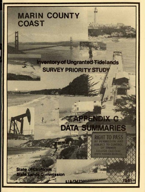
DIX C<br />
INVENTORY OF UNGRANTED TIDELANDS<br />
SURVEY PRIORITY STUDY<br />
MARIN<br />
DATA SUMMARIES<br />
THESE APPENDICES ARE ONLY APPURTENANT TO THE MAIN REPORT<br />
AND REPRESENT ONLY A FRACTION OF THE TOTAL DATA.<br />
PREPARED BY THE STAFF OF THE<br />
CALIFORNIA STATE LANDS COMMISSION<br />
IN RESPONSE TO CHAPTER 706, STATUTES OF 1975
APPENDIX C<br />
ta smry has been prepared for each of the coastal counties<br />
-- ------Ania ad for the offshore islands. These smries are attached<br />
as Appendix C, to the Report to the Legislature of the Inventory of<br />
Ungranted Tidelauds. Tne inventory and the report were mndated by<br />
Public Resources Ccde Sections 6331 et seq.<br />
The Tidelands Inventory program of the California <strong>State</strong> <strong>Lands</strong><br />
Carmission has, as its initial objective, the gathering and analyzing<br />
of data sufficient to enable the Curmission staff to rationally plan<br />
a long-term bdary program for ungranted <strong>State</strong>arned tidelands.<br />
Analysis of the data sumrized here has been limited to that<br />
level required to assign priorities to the varims regions of the<br />
California coast for further, more in-depth study, which will lead<br />
toward actual mapping of <strong>State</strong> mmership.<br />
.. ,<br />
This m r y is limited in scope to the open seacoast of the<br />
<strong>State</strong>. Bays, rivers, estuaries, ad lagoons will be covered in a later<br />
report. It is further limited to lards not granted in trust to other<br />
public agencies by the California Legislature.<br />
Determinations resulting from ananalysis of the data gathered<br />
=re made solely with a view to establishing priorities, ad should<br />
not be taken as an official position by either the Ccmnission or Cornnission<br />
staff . For example, certain observations about possible artificial<br />
conditions at various sites have been mde. These observations were<br />
based upon a preliminary examination of direct evidence (e.g., airphotos)<br />
of either current or historical artificial structures at or near the<br />
particular site. More irtdepth investigations my well disclose other,<br />
more remte, artificial cditions at the site, which my affect the<br />
location of the bodary of <strong>State</strong> minership.
TABLE OF COhTENTS APPENDIX C -- -<br />
MAP IM )EXES - YELLOW <strong>PAGE</strong>S<br />
The base raps were prepared from U.S. Geological Survey 7% minute<br />
quadrangle sheets. Ihe final map is in black ad white with elevation<br />
contours, roads, buildings, section lines, rivers, etc., but without<br />
the usual color overlays. Ihe map cwers a sanewhat smaller area than<br />
the USGS quad sheets in order to reprduce them at half scale (1 :48,000)<br />
on an 8% x 11 standard sheet. The maps have been laid out with the<br />
shoreline approxinately along the vertical center of the sheet. Shoreline<br />
mileage is listed along the waterward side a d is the same shoreline<br />
identification system used by other public agencies, also listed on<br />
landward side are the s mry mp numbers. (Note: the shoreline mileage<br />
shown may not agree with the length determined, and used, by this<br />
inventory and listed within the data sumries by parcel. 'Ihis discrepancy<br />
results because the inventory masuremnts were mde from public records).<br />
WHITE <strong>PAGE</strong>S<br />
The base maps for these pictorial smmries are the 1976-77 cmty<br />
assessor's plats. Shown on these mps are the upland parcels selected<br />
for study, artificial features, the limits of publiclyawned land,<br />
pertinent mps a d court cases, ad Mary line agreement locations.<br />
The data is symbolized according to the legend on the maps.<br />
DATA SUMMARIES, BY PARCEL<br />
PINK <strong>PAGE</strong>S<br />
These are canputer print-outs which sumnarize the data accmlated<br />
during the inventory for each study parcel. The last colm provides<br />
a means for the <strong>State</strong> <strong>Lands</strong> Ccmmission's staff to categorize the types<br />
and degrees of problems existing for each parcel.<br />
The infomtim listed in these print-outs has been sum~rized. Consequently,<br />
what is shown may not be the exact wording or candition existing.<br />
The study parcels are listed from north to south by a pge/line number.<br />
This twc-part nmber was assigned chrring the inventory. Ihe first<br />
portion of the number is the Smry Map page number as assigned by<br />
staff. The second prt is the individual parcel number given to the<br />
selected parcels in a consecutive north-south order for each Smry<br />
Map page. The page/line number is used throughout the inventory files<br />
to identify each inventory parcel. It is arbitrary, and should not<br />
be confused with assessor's parcel mbers. (Following the Data Smries<br />
print-outs is a cross-reference from assessor's parcel numbers to<br />
the page/line numbers. )
@ SHORE<strong>LINE</strong> MILSAG 1<br />
I<br />
INVENTORY OF UNGRANTED TIDELANDS<br />
STATE OF CALlFORWlL<br />
NUMBER<br />
"43
I<br />
O<br />
C E A N<br />
----GRANTED LANOS LIMITS INVENTORY OF UNGRANTED TIDELANDS<br />
B SHORE<strong>LINE</strong> MILEAOL PDlNT<br />
SThIE OF CALIFORWI*<br />
STATE LANDS COMMISSION<br />
HoTEi LOCATIONS ARE APPROXIMATE. Ism<br />
NUMBER MAP 49
m<br />
CMF 1584 - SUBD. NO.<br />
DILLON'S BEACH.<br />
MAPS 4/6
MnPS<br />
CMF 1584 - SUBO. NO. 2 DILLON'S<br />
BEACH. MAPS 4f5<br />
I<br />
-..../ Oroin. Jetty, brmhwatar. atc. 1<br />
Shore protlclion. 186*111, 11PIap1 BtC.<br />
a . ~ . .<br />
a<br />
. .. ' ... , -<br />
' ' .\\<br />
. .,<br />
;,: ' %. . . ,<br />
v.7 ~~-~ 7 "<br />
L-~<br />
,~ ,<br />
, \
- MAPS<br />
CMF 1577 - VIE<br />
SIR 12/7/77 . ' ,<br />
NOTE: LOCATIONS OF DATA ARE APPROXIMATE.
SIR 12/7/77 T<br />
- -<br />
I<br />
-<br />
CMF 1577 - VIEREGGIO. MAPS 5/51<br />
OF DATA ARE APPROXIMATE.<br />
,.' ;: '1 , , .',!< 190-",I7<br />
. ,<br />
.; ,., ,. . , -; j,, CciifQ
- MAPS<br />
CMF 1578<br />
MAPS 5<br />
SIR 12/7/77
MnPS_<br />
CMF 1578 - BOLINAS BEACH. MAPS 5/44<br />
I<br />
SIR<br />
12/7/77
ASPEN<br />
Q .~<br />
,J<br />
SIR 12/7/77<br />
@ + BIRCH RD<br />
I<br />
LEGEND*<br />
I
MAPS -<br />
CMF 1580 - CANVON ADDITION TO THE<br />
GRANDA VISTA TRACT, MAPS 5/20<br />
CMF 1653 -05 2/57
- MA1<br />
3<br />
CMI :<br />
-<br />
158Q - CANYON ADDl<br />
GI RANDA VISTA TRACT. W<br />
CMf 1596 - GRANDA VlSTl
DXIMATE.<br />
,.,a'", ' "."r ",\"-" . J.. .<br />
Comfy of hiorb, Calif.
-<br />
MAPS<br />
CMF 1581 - MESA ADOlTlON TO THE ORAN- GRANv*<br />
VISTA TRACT, MAPS 5/19<br />
CMF 1596 - GRANDA VISTA, MAPS 1/19<br />
0'<br />
LT<br />
\c SIR 12/7/77<br />
NOTE: LOCATIONS OF DATA ARE APPROXIMATE.<br />
TOWN OF BOLINAS<br />
Assessor's Map Bk.193-Pg.15<br />
County of Mririn, Calif.
EM. Bk.2- bg. 62<br />
O C E A N<br />
SIR 12/8/77 B<br />
Map Bk.195-Pg.30<br />
- of Morin, Calif.
4TA ARE APPROXIMATE.<br />
,271
. atc<br />
NOTE: LOCATIONS OF DATA ARE APPROXIMATE.<br />
Aspsror s map Bk.195-Pg 03<br />
County of Mcr~n, Calif.
POR RANCHO LA5 ~~AULIIVCS<br />
I,*' - t 1%<br />
56-013<br />
195-10<br />
,... MAPS -.. ..<br />
CMF 83.3 - UPTON TRACT.<br />
ctj %GI .- 263 - CIS 2/1/14<br />
,cccsor's Mup Bk.195-Pg.K)<br />
County of Morin, Calif.
POR RANCHO LAS BAULIN<br />
POR. RANCHO SAUCELITO<br />
MOTE: LOGATlO<br />
DATA ARE APPROXIMATE.<br />
'-.'%G .+<br />
Wm. -- . ....... . .-,...,. -.....on Bench, 0, S Bk 6-Pg.77 .<br />
Mop of NH Stinson's Subdivisim No.3, R.M. Bk4-490 .\;;csrol-':; lvlcrp Bk.195-t'g.22<br />
County of Morin. Colif.<br />
,j:~',r, ;,,
175 CAL 322.334<br />
2525 SC MRN<br />
45,445 SC MRN<br />
" ~~~~<br />
w<br />
CMF 957-NPS DRAWING NO. 8140/30.003<br />
GOLDEN GATE I<br />
CMF 1593-MAPS<br />
CMF 1652 - MAPS<br />
CB 172 - 173<br />
CA 114<br />
PaR OWN. MAP NO. 823. STINSON SB<br />
PRR OWN. MAP NO. 5131. MOUNT TAMALPAIS SP<br />
shore protection, amwall. riprap. .to.<br />
Pi.,*<br />
other types or armcia isaturaa<br />
conkinuava aitlflclal fraturw<br />
Invmfoly &tW pamII<br />
SIR 12/8/77 A
.j o m wpsa or artirir~si faatura,<br />
Ihvmrw study p.rc.1<br />
*SEE PROM, PME ion OiT*,LSD L..INO<br />
I<br />
SIR 12/8177A<br />
CMF 957 - NPS DRAWING NO. 8140/30.003<br />
GOLDEN GATE NRA<br />
CMF 1593 - MAPS 1/104<br />
PBR OWN. MAP NO. 5131, MOUNT TAMALPAIS SP
CMF 1593 -<br />
CMF 1641 -<br />
CMF 1643 -<br />
CMF 1646 .<br />
1 CMF 1649.
MAPS<br />
CMF 957 - NPS DRAWING NO. 814W30.003<br />
GOLDEN GATE NRA<br />
CMF 1593 - MAPS 11104<br />
CI<br />
CI<br />
CI<br />
Assessor's Mop Bk.199-Pg.16<br />
County of Morin, Calif.<br />
NOTE: LOCATIONS OF DATA ARE APPROXIMATE.<br />
W
or's Mop Bk.200Pg.08<br />
rnfy of Marin, Calif.
NOTE: LOCATIONS OF DATA ARE APPROXIMATE.
POR. LOT 39, SAUSALITO RANCHO<br />
- MAPS<br />
CMF 957 - NPS DRAWING NO. 8140/30.003<br />
GOLDEN GATE NRA<br />
Groin, la ty. braakwatm str.<br />
ShaM pratr~tlon, aaaw.11, rtprap. .tr.<br />
m,a<br />
Dthw typo11 of ~PLI~IcI~I feLtwIII<br />
C."ti""DUI 11I1flOl.l fI.L"I.8<br />
In~mfow &Y~Y paPcaI<br />
L<br />
NOTE: LOCATIONS OF DATA ARE APPROXIMATE.<br />
,,Oik A,, , 41 , I , , I '.,1,,1. ,lli,i\~~<br />
.i,; ,,,.I' i,,,. , , . , I , . ,,..I ,,,I,<br />
A:,ses!;or's M(JP Bk.200Pg.15<br />
County of Marin, Calif.
I SUMMARIES .
DATA SUMMARE
DATA SUMMARIES, BY PARCEL.<br />
RLCOflDING<br />
NURER<br />
DATE<br />
RLCOROEO<br />
OUNER- TITLE<br />
IOENTIFICATION SHIP SOURCE<br />
DILL<br />
DILL<br />
OILLOHIS<br />
EACH<br />
)EACH<br />
BEACH<br />
LAUSOMIS LANONG<br />
LAUSON~S LAVNB<br />
LAUSOM*S LANDNG<br />
POINT REYES NSS<br />
POIN REYES NSS<br />
POINT PEYES NSS<br />
~0141 REYES NSS<br />
AGATE BEACH PI(<br />
RANC<br />
RANC<br />
RANC<br />
s PAT<br />
S PAT<br />
S PAT<br />
S PAT<br />
S PAT<br />
8 PAT<br />
S PAT<br />
S PAT<br />
S PAT<br />
S PAT<br />
S PAT<br />
RANC<br />
RANC<br />
RANC<br />
RANC<br />
RANC<br />
RANC<br />
RANC<br />
RAW<br />
RANC<br />
RANC<br />
RANC<br />
RANC<br />
RANC<br />
RANC<br />
RANC<br />
RANC<br />
RANG<br />
RAMC<br />
RANC<br />
RANC<br />
RANG<br />
RANC<br />
RANC<br />
RANC<br />
RANC<br />
RANC<br />
RANC<br />
RANC<br />
RANC<br />
RANC<br />
RANC<br />
RAMC<br />
RANC<br />
RANC<br />
RANC<br />
RANC<br />
RANC<br />
RANC<br />
RANC<br />
RANC<br />
SHORE<br />
LtlkGTH OESC DESCRIPTION fits SPEC.<br />
(FEET) TYPE CALL ALONP WATER AVAIL. CONS.<br />
BEACH<br />
BEACH<br />
BEACH<br />
ORDINARY HT<br />
ORDINARY HT<br />
OROINARY HT<br />
HIGH TIDE<br />
HIGH TIDE<br />
HISH TIDE<br />
HIGH TIDE<br />
OCEAN<br />
MEAN H16H WATER<br />
MIDINARY HY<br />
ORDINARY HY<br />
SUCRE<br />
ORDIINARY HT<br />
HESH TIOE<br />
HIGH TIOE<br />
HIGH TIDE<br />
MAN HIGH TIDE<br />
ORDINARY HT<br />
OR~INARY HT<br />
OROINAIY HT<br />
D~DINARY n~<br />
ORDIWRY HT<br />
REAN HIGH TIDE<br />
ORDINARY HT<br />
MEAN HIGH TIDE<br />
MELN HIGH TIOE<br />
MZAN HIGH TIDE<br />
MEAN HIGH TIDE<br />
MEAN HIGH TIOE<br />
VCAN HIGH TIOE<br />
MLIN HIGH TIDE<br />
MEAN HIPH TIDE<br />
BULKHEAD<br />
BULKHEAD<br />
BULKHEAD<br />
REAN HIGH TIOE<br />
BO-XHEID<br />
BULKHEAD<br />
BULKHEIPO<br />
ORDINARY HU<br />
HISH YATER<br />
HI6H YATER<br />
MESH UATER<br />
BULKHEAD<br />
HIGH &ATER<br />
WAN HIGH TIDE<br />
ORDINARY NT<br />
MCAN HIGH TIDE<br />
NAP<br />
RAP<br />
OESC<br />
DESC<br />
BOTH<br />
NAP<br />
BOTH<br />
PA<br />
BOTH<br />
R*P<br />
BDTH<br />
RAP<br />
MAP<br />
VULTIPLE<br />
EnBpKvENT<br />
PIPE<br />
SHORE PROT<br />
SHOAE PROT<br />
SHORE PRO1 PROT<br />
SHOHE PROT<br />
SHONE pROT<br />
SHORE PROT<br />
SHORC PROT<br />
SHORE PROT<br />
HIST POSS<br />
nfsT PoSS<br />
HIST POSS<br />
HIST POSS<br />
HIST poss<br />
ursT PoSS<br />
HIST POSS<br />
SHORE PROT<br />
SHO~E PRO1<br />
NULTIPLE<br />
SHOW PROT<br />
SHORE PRO7<br />
SHORE PROT<br />
SHORE PROT<br />
SHORE PROT<br />
SHORE PRO1<br />
IrULTIPLE<br />
539551X 4<br />
533552X *<br />
533592X 4<br />
534551X 4<br />
sa4mix 4<br />
584551X 4<br />
51355lX I)<br />
513551X 4<br />
YES 213551X 1<br />
YES 213151X 1<br />
51 451s 4<br />
YES 333551X 3<br />
533551X 9<br />
533551X 4<br />
544551X 4<br />
541591X 4<br />
5455531: 4<br />
543551X 5<br />
534551X 4<br />
553551s 4<br />
5535611 @<br />
5535615 4<br />
524551X Y<br />
514551X 4<br />
511561X I)<br />
51409lX *<br />
51WBlX 4<br />
511551X 1(<br />
YES 114531X 1<br />
YES 114533X<br />
YES 111S31X 1<br />
YES 114531X 1<br />
YES 114J31X 1<br />
YES 114531X 1<br />
YES 114531X 1<br />
YES<br />
YE8<br />
1145111 1<br />
li4SIlX 1<br />
OUES 314S51X 3<br />
YE8 2115521 1<br />
YES 2115521 1<br />
YES Z1155ZX 1<br />
YES Z1Y552X 1<br />
YES 21155PX 1<br />
YES 2115521 1<br />
YES 111552X 1<br />
YES llSS3ZX 1<br />
YES 113532X 1<br />
YES J 113532X 1<br />
YES 113W3PX 1<br />
YES<br />
iw~azx 1<br />
YES i13582X 1<br />
YES rwaex 1<br />
YES 111532X 1<br />
YES ll4532X 1<br />
NOTE: THESE COMPUTER PRINT-OUTS ARE SUMMARIES, WHAT IS SHOWN MAY NOT BE THE EXACT WORDING OR CONDITION.
#+(r~<br />
SPEC.<br />
av4i~. CONS.<br />
BoTn<br />
BOTH<br />
BOTH<br />
BRT*<br />
BOTH<br />
BOTH<br />
BOW<br />
BOTH<br />
BOTH<br />
BOTH<br />
BOTH<br />
BOTH<br />
8oTn<br />
Bow<br />
BOTH<br />
BOTH<br />
BOTH<br />
BBTH<br />
BOTH<br />
BOTH<br />
BOTH<br />
BOTH<br />
BOTH<br />
BOTH<br />
BOTH<br />
BOTH<br />
BOTH<br />
BOTH<br />
BOTH<br />
BOTH<br />
BOTh<br />
BOTH<br />
BDtH<br />
B~TH<br />
BOTH<br />
NOTE: THljSE CQM PRI S S AY<br />
. a i r<br />
F ...<br />
u<br />
WORDING OR CONOWN.<br />
,
NOTE: THESE COMPUTER PRINT-OUTS ARE SUMMARIES, WHAT IS SHOWN MAY<br />
onoxim HU<br />
DROINARI HU<br />
ORPlNARV HU<br />
OMINARY UU<br />
ORoInkRY H*<br />
oRpwirRr HY<br />
OIIDWARY )(V<br />
ORDIMARY HV<br />
(MDItiART Hh<br />
ORDINART MY<br />
ORDINARY HI4<br />
OROIhART HY<br />
ORDIUARl HY<br />
ORBlNAql HU<br />
ORDINARY HY<br />
ORDLNCRT HY<br />
OROZgARy HY<br />
~DInbRy HY<br />
WOItIARY HY<br />
OR~INARY HY<br />
ORPINlRY HY<br />
OROINARY PU<br />
ORDINARY HY<br />
ORDIUARI HU<br />
DR!MNART uu<br />
OR~INAIIY HY<br />
00018ARl HU<br />
OROZNARY HU<br />
ORDINART HW<br />
ORDINARY HY<br />
ORDIN@Y HN<br />
OMlNARy HY<br />
OROZNARI' WU<br />
MObM81 HU<br />
orio>nihr HY<br />
MIDINIIRY HU<br />
ORDINARY HY<br />
ORDINARY HU<br />
ORDINkRY HY<br />
OROIkARY MY<br />
OROINARY W'<br />
wu<br />
OROJNARY<br />
OR~INART H*<br />
0WI)ULRY<br />
QRO&N&RY HU HY<br />
OROfNAF(Y HY<br />
XNMY HU<br />
ORD3NART MY<br />
BOTH<br />
BOTH<br />
BOTH<br />
BOTH<br />
BOTH<br />
BOTH<br />
BOTH<br />
BOTH<br />
BOTH<br />
BOTH<br />
BOTH<br />
BPTH<br />
BOTH<br />
BOTH<br />
BOTH<br />
BOTH<br />
BOTH<br />
BOTU<br />
BOTH<br />
BOTH<br />
BOTH<br />
BOTH<br />
BOIM<br />
BDlH<br />
BOTH<br />
BOTH<br />
BOTH<br />
BOTH<br />
BOJH<br />
BOTH<br />
BOTH<br />
BOTH<br />
80111<br />
80,H<br />
89.171<br />
pH<br />
BOTH<br />
BOTH<br />
BRTH<br />
BOTH<br />
BOTH<br />
BQTH<br />
BorH<br />
8QTk<br />
BOTH<br />
BOTH<br />
BOTH<br />
SPTH<br />
BOTH<br />
BofY<br />
$OTH<br />
60TW
OTE: THESE COMPUTER PRINT-OUTS ARE SUMMARIES, WHAT IS SHOWN MAY NOT BE THE EXACT WORDING OR CONDITION.
ASSESSOR 'S<br />
ASSESSOR 'S<br />
PARCEL NO. <strong>PAGE</strong>/I,I! :x PARCEL NO.
APN - <strong>PAGE</strong>/<strong>LINE</strong><br />
&SLSSUK '<br />
PARCEL NC<br />
ASSESSOR ' S<br />
PARCEL NO.<br />
ASSESSOR a<br />
PARCEI. NO.
. Files: The lists are canpiled by county<br />
front of the "abstract" file (see belaw).<br />
ABSTRACTS FROM OFFICE RESEARCH
photos1', "maps", a d "other".<br />
sLWARIES. OF HISTORICAL ARTIFICIAL FEBTURE/ACTION DATA<br />
a. Descri tign: These are tabulations of the historical artificial<br />
actions discovered Wng the inventory shidy.<br />
A separate sumrary is prepared for each county. For each item<br />
discovered, the sumrary provides a description, approximate<br />
location, dates, ard refereme source. %,items tabulated<br />
in geographic order.<br />
-<br />
b. Files: The smxmries are filed by county.<br />
NDTE: All artificial feature or action mds are filed exchively<br />
within the "imtory" files.<br />
3. m:<br />
-<br />
Descri tion For the inventory, an attempt was mde to aoquire<br />
a. +:t se mps applicable . to the <strong>State</strong>jupland Wary. The success<br />
of this effort varied, depetding primarily on the canpleteness<br />
of the ccunty's mp irdexing system.<br />
b. Files: All maps used in the imentoty work are filedJ in the<br />
lands E$sp Library (Sacrmmto). Tne maps are itdd<br />
by th~ stadard <strong>State</strong> Lads nap itdating system. The Sumnary<br />
Ma;& also reference the applicable maps $ee white pages).<br />
4. r3zcwmB:<br />
a. Descri tion: Donmnents acquired during the imntory consist<br />
&£<br />
vesting records, deeds, patents, executive orders,<br />
etc. An art- was mde to obtain the latest vesting docwent<br />
for each inventory parcel, ts.st this was not always feasible.<br />
b. Files: These records are filed exclusively within the imtwy<br />
files. The files are arranged by county. Within each county,<br />
the files are separated by type of docu~nt, deeds, official<br />
records, executive orders, etc., ard also by mlscellaneow<br />
maps. Within the subfiles, documents are filed by recording<br />
rnnnber and miscellanems maps are filed alphabtrtically. Ttw<br />
Sunwry Maps also reference the miscellaneous maps (see ad.lite<br />
pages).<br />
5. AERIAL PHCm)GRAPNY:<br />
a. Descri tion: Two sets of aerial photography were acquired<br />
dnventtory - one airrent ard historical. The current<br />
photography is in color ad has a scale of about 1" = 400'.<br />
nE historical photography varies in scale an3 date. Gemrally,<br />
the scale is greater than 1" = 2000' a& the Photography date<br />
is prior to 1942. For inventory puposes we selected aerial<br />
photography which covered relatively long stretches of shoreline;<br />
thus, better historical photography might be available for<br />
specific areas.
<strong>State</strong> Lads Aerial Pbtography File (Sacramento). The<br />
~hotographs are geographi,cally irdexed by the standard <strong>State</strong><br />
Lads aerial photograpny idsting system. lbe Parcel Sumnary<br />
Sheets (see "l", above) ,also reference the aerial photographs.<br />
6. LITIGATION:<br />
Sheets", which pr<br />
Sacramento includes many<br />
the inventory. The princ<br />
Data from these files .
EXHIBIT '"A"<br />
. ' Document No.<br />
Subdivision ............<br />
Sectional. ................<br />
Other '. ...................<br />
f itle Derived From<br />
.....<br />
...............<br />
Spanish/MexicmOmnt.<br />
. .<br />
S Patent 0<br />
..................<br />
Problems ,<br />
Ordinary High Water ........<br />
other water Line '. .........a<br />
Metes B Bounds Line.. ... .a<br />
Questionable ............. .a<br />
Other:. .................. 0<br />
Naturol ...........,......<br />
Artificial ................<br />
Study Required'. .;..<br />
.......<br />
Bnakwatsr ................<br />
Fill ......................<br />
Ev~dence:<br />
Dote<br />
I _<br />
Other ................<br />
i<br />
..<br />
..........<br />
NfaptDsscription Selected<br />
Study Required'.<br />
, .<br />
,'<br />
Form 40.25 15WO)