Executive Summary (5.30 MB) - Uttarakhand Environment Protection ...
Executive Summary (5.30 MB) - Uttarakhand Environment Protection ...
Executive Summary (5.30 MB) - Uttarakhand Environment Protection ...

Create successful ePaper yourself
Turn your PDF publications into a flip-book with our unique Google optimized e-Paper software.
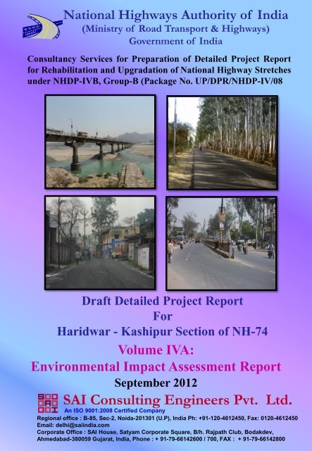
National Highways Authority of India<br />
(Ministry of Road Transport & Highways)<br />
Government of India<br />
Consultancy Services for Preparation of Detailed Project Report<br />
for Rehabilitation and Upgradation of National Highway Stretches<br />
under NHDP-IVB, Group-B (Package No. UP/DPR/NHDP-IV/08<br />
Draft Detailed Project Report<br />
For<br />
Haridwar - Kashipur Section of NH-74<br />
Volume IVA:<br />
<strong>Environment</strong>al Impact Assessment Report<br />
September 2012<br />
SAI Consulting Engineers Pvt. Ltd.<br />
An ISO 9001:2008 Certified Company<br />
Regional office : B-85, Sec-2, Noida-201301 (U.P), India Ph: +91-120-4612450, Fax: 0120-4612450<br />
Email: delhi@saiindia.com<br />
Corporate Office : SAI House, Satyam Corporate Square, B/h. Rajpath Club, Bodakdev,<br />
Ahmedabad-380059 Gujarat, India, Phone : + 91-79-66142600 / 700, FAX : + 91-79-66142800
Project: Detailed Project Report for Rehabilitation and Upgradation of National Highway Stretches<br />
Under NHDP-IVB, Group-B ( Package No. UP/DPR/NHDP-IV/08) Sheet: 1 of 4<br />
Document: 2983/DLRO/REP-001/NH-74/Vol-IVA/ Date: September 2012<br />
Table of Contents<br />
Revision: R0<br />
1 INTRODUCTION<br />
TABLE OF CONTENTS<br />
1.1 Introduction<br />
1.2 Project Road Area<br />
1.3 Scope of Study<br />
1.3.1 Overall Scope of Work<br />
1.3.2 <strong>Environment</strong>al Impact Assessment in the Project<br />
1.4 Approach To EIA<br />
1.4.1 Review of Applicable <strong>Environment</strong>al Regulations<br />
1.4.2 Assessment of Baseline <strong>Environment</strong>al Profile<br />
1.4.3 Consultations<br />
1.4.4 Assessment of Impacts<br />
1.4.5 Assessment of Alternatives<br />
1.4.6 Mitigations and Enhancement Measures<br />
1.4.7 <strong>Environment</strong>al Management Action Plans<br />
1.5 Structure of the Report<br />
2. PROJECT DESCRIPTION<br />
2.1 Existing Road Features<br />
2.1.1 Alignment<br />
2.1.2 Road Geometrics<br />
2.1.3 Road inventory<br />
2.1.4 Traffic Projections<br />
2.1.4.1 ROB’s and Level Crossings<br />
2.1.4.2 Utilities<br />
2.1.4.3 Reserve Forest, Water Bodies and Eco-sensitive Receptors<br />
2.2 Proposed Road Features<br />
2.2.1 Alignment Proposal<br />
2.2.2 Pavement<br />
2.2.3 Geometric Design Aspects<br />
2.2.4 Cross Drainage Structures<br />
2.2.5 Design of Intersections<br />
2.2.5.1 T Traffic Control and Road Safety Features<br />
2.2.6 Proposed Remedial Measures to Reduce Accidents<br />
2.2.6.1 Other Features<br />
2.2.7 Enhancement of Inventories<br />
2.2.8 Quarrying & Raw Materials<br />
3. ANALYSIS OF ALTERNATIVES<br />
3.1 With and Without Project Alternatives<br />
3.1.1 Without Project Scenario<br />
3.1.2 With Project Scenario<br />
3.2 Justification for <strong>Environment</strong>al Issues<br />
3.3 <strong>Environment</strong>al Considerations<br />
3.3.1 Improvement of Air and Noise Quality<br />
3.3.2 Avoidance of Impact of Sensitive, Cultural and Community Properties<br />
3.3.3 Analysis of Nose Barrier Materials<br />
3.4 Proposed Bypasses<br />
DRAFT DETAILED PROJECT REPORT<br />
SAI CONSULTING ENGINEERS PVT. LTD.
Project: Detailed Project Report for Rehabilitation and Upgradation of National Highway Stretches<br />
Under NHDP-IVB, Group-B ( Package No. UP/DPR/NHDP-IV/08) Sheet: 2 of 4<br />
Document: 2983/DLRO/REP-001/NH-74/Vol-IVA/ Date: September 2012<br />
Table of Contents<br />
Revision: R0<br />
4. DESCRIPTION OF THE ENVIRONMENT<br />
4.1 Project Area<br />
4.2 Physical <strong>Environment</strong><br />
4.2.1 Meteorology<br />
4.2.2 Land<br />
4.3 Description of the <strong>Environment</strong><br />
4.3.1 Air <strong>Environment</strong><br />
4.3.2 Micrometeorological Data<br />
4.3.3 Ambient Air Quality<br />
4.3.3.1 Selection of AAQ Locations<br />
4.3.4 Water <strong>Environment</strong><br />
4.3.4.1 Surface Water<br />
4.3.5 Noise<br />
4.3.6 Soil Quality<br />
4.4 Biological <strong>Environment</strong><br />
4.4.1 Forest Areas<br />
4.5 Social <strong>Environment</strong><br />
4.5.1 Land Use Land Cover Mapping Study<br />
4.5.1.1 Introduction<br />
4.5.1.2 Objective<br />
4.5.1.3 Project Site location<br />
4.5.1.4 Role of Remote Sensing &GIS<br />
4.5.1.5 Remote Sensing (RS)<br />
4.5.1.6 GIS<br />
4.5.1.7 Data Products<br />
4.5.1.8 Data Sources<br />
4.5.1.9 Data Used<br />
4.5.1.10 Methodology for Land Use\ Land Cover Mapping<br />
4.5.1.11 Spatial Data from SOI Toposheets<br />
4.5.1.12 Spatial Data from Satellite Data and Processing<br />
4.5.1.13 Geo coding and Geo- Referencing<br />
4.5.1.14 Digital image Enhancement of LISS III data<br />
4.5.1.15 Hardcopy Generation<br />
4.5.1.16 Generation of Thematic Maps Satellite Data<br />
4.5.1.17 Spatial Database Generation and Organization<br />
4.5.1.18 Spatial Data Generated From Toposheet(S)<br />
4.5.1.19 Spatial Data Generated From Satellite Date And Other Datasets<br />
4.5.1.20 Generation of Thematic Layers<br />
4.5.2 Settlement<br />
4.5.3 Educational Institutes<br />
4.5.4 Medical Facilities<br />
4.5.5 Cultural Properties<br />
4.6 Human and Economic Development<br />
4.6.1 Census Profile<br />
4.6.2 Settlements along the Project Road<br />
4.6.3 Cropping Pattern and Crop Productivity<br />
DRAFT DETAILED PROJECT REPORT<br />
SAI CONSULTING ENGINEERS PVT. LTD.
Project: Detailed Project Report for Rehabilitation and Upgradation of National Highway Stretches<br />
Under NHDP-IVB, Group-B ( Package No. UP/DPR/NHDP-IV/08) Sheet: 3 of 4<br />
Document: 2983/DLRO/REP-001/NH-74/Vol-IVA/ Date: September 2012<br />
Table of Contents<br />
Revision: R0<br />
5 ANALYSIS OF POTENTIAL ENVIRONMENT IMPACT & MITIGATION MEASURES<br />
5.1 Physical <strong>Environment</strong><br />
5.1.1 Meteorological Parameters<br />
5.1.2 Land<br />
5.1.3 Air<br />
5.1.4 Water sources<br />
5.1.5 Noise levels<br />
5.2 Biological environment<br />
5.2.1 Flora<br />
5.2.1.1 Forest areas<br />
5.2.1.2 Roadside plantations<br />
5.2.2 Fauna<br />
5.2.3 Aquatic Ecology<br />
5.3 Social <strong>Environment</strong><br />
5.3.1 Human Use Values<br />
5.3.2 Cultural properties<br />
5..3.3 Quality of Life Values<br />
5.4 Mitigation Measures Proposed<br />
5.4.1 Meteorological Parameters<br />
5.4.2 Land<br />
5.4.3 Soil Quality Monitoring-Mitigation<br />
5.4.4 Water-Mitigation<br />
5.4.5 Noise-Mitigation<br />
5.4.6 Biological <strong>Environment</strong><br />
5.4.7 Social <strong>Environment</strong><br />
5.5 Traffic Control and Safety during Construction<br />
5.6 Enhancement<br />
5.6.1 Generic Enhancement measures for Cultural Properties<br />
6. ENVIRONMENTAL MONITORING PROGRAMME<br />
6.1 <strong>Environment</strong> Monitoring Programme<br />
6.1.1 Monitoring of Earth-Work Activities<br />
7 ADDITIONAL STUDIES<br />
7.1 Objectives<br />
7.2 Consultation Sessions<br />
7.2.1 Consultations During Design<br />
7.2.2 Consultations for Specific Location Needs<br />
7.2.3 Process of Consultation<br />
7.2.4 Location of Public Consultants<br />
7.3 Details Of Structures To Be Affected<br />
7.4 Public Hearing<br />
7.5 Identifications of Issues<br />
7.5.1 Issues Raised During Consultations<br />
7.6 Key Findings of the Consultation<br />
DRAFT DETAILED PROJECT REPORT<br />
SAI CONSULTING ENGINEERS PVT. LTD.
Project: Detailed Project Report for Rehabilitation and Upgradation of National Highway Stretches<br />
Under NHDP-IVB, Group-B ( Package No. UP/DPR/NHDP-IV/08) Sheet: 4 of 4<br />
Document: 2983/DLRO/REP-001/NH-74/Vol-IVA/ Date: September 2012<br />
Table of Contents<br />
Revision: R0<br />
8 PROJECT BENEFITS<br />
8.1 Benefits of the Project<br />
9 ENVIRONMENTAL COST-BENEFIT ANALYSIS<br />
9.1 Budget<br />
9.1.1 Budget provision<br />
10. ENVIRONMENTAL MANAGEMENT PLAN<br />
10.1 <strong>Environment</strong>al Management Plan (EMP)<br />
10.1.1 Specific Activities by NHAI<br />
10.1.2 Sensitive Features<br />
10.1.3 Community Properties<br />
10.2 Implementation of EMP<br />
10.3 Existing <strong>Environment</strong>al Cell & NHAI<br />
10.4 Implementing Arrangements<br />
10.4.1 Contractor<br />
10.5 Reporting System<br />
10.6 <strong>Environment</strong>al Capacity Building<br />
10.7 Corporate Social Responsibility<br />
11. SUMMARY & CONCLUSIONS<br />
11.1 Project Background<br />
11.2 <strong>Environment</strong> Impact Assessment (EIA) Study in the Project<br />
11.3 Policy, Legal & Administrative Framework<br />
11.3.1 Institutional Setting<br />
11.3.2 Clearances<br />
11.4 Baseline <strong>Environment</strong> Profile<br />
11.4.1 Physical <strong>Environment</strong><br />
11.4.2 Biological <strong>Environment</strong><br />
11.4.3 Social environment<br />
11.5 Potential <strong>Environment</strong>al Impacts<br />
11.5.1 Impacts on Climate<br />
11.5.2 Impacts on Air Quality<br />
11.5.3 Impacts on Noise Levels<br />
11.5.4 Impacts on Water Resources and Quality<br />
11.5.5 Impacts on Ecological Resources<br />
11.5.6 Impacts on Land<br />
11.5.7 Impacts on Human use values<br />
11.6 Analysis of Alternatives<br />
11.7 Mitigation And Enhancement Measures<br />
11.8 Institutional Requirements And <strong>Environment</strong>al Monitoring Plan<br />
11.9 <strong>Environment</strong>al Management Plan<br />
11.10 Conclusions<br />
DRAFT DETAILED PROJECT REPORT<br />
SAI CONSULTING ENGINEERS PVT. LTD.
Project: Detailed Project Report for Rehabilitation and Upgradation of National Highway Stretches<br />
under NHDP-IVB, Group-B ( Package No. UP/DPR/NHDP-IV/08) Sheet: 1 of 2<br />
Document: 2983/DLRO/DDPR/NH-74/Vol IV-A/ Date: September 2012<br />
List of Tables<br />
Revision: R0<br />
LIST OF TABLES<br />
Table 2.1<br />
Table 2.2<br />
Table 2.3<br />
Table 2.4<br />
Table 2.5<br />
Table 2.6<br />
Table 2.7<br />
Table 3.1<br />
Table 3.2<br />
Table 3.3<br />
Table 3.4<br />
Table 3.5<br />
Table 4.1<br />
Table 4.2<br />
Table 4.3<br />
Table 4.4<br />
Table 4.5<br />
Table 4.6<br />
Table 4.7 a<br />
Table 4.7 b<br />
Table 4.8<br />
Table 4.9<br />
Table 4.10<br />
Table 4.11<br />
Table 4.12<br />
Table 4.13<br />
Table 4.14<br />
Table 4.15<br />
Table 4.16<br />
Table 4.17<br />
Table 4.18<br />
Table 4.19<br />
Table 4.20<br />
Table 5.1<br />
Table 5.2<br />
Table 5.3<br />
Table 5.4<br />
Table 5.5<br />
Table 5.6<br />
Table 5.7<br />
Traffic on the Project Road<br />
Average Annual Daily Traffic on Project Road<br />
The Projected Traffic on the Project Road<br />
List of Bridges for Haridwar – Kashipur Section of NH-74<br />
Proposed Design Speed for Various Terrains<br />
Proposed Drainage Details<br />
Improvement Proposal for Existing CD Structures<br />
With and Without" Project Scenarios - A Comparative Assessment<br />
Minimisation of <strong>Environment</strong>al Impacts<br />
Cost Analysis for Noise Barriers<br />
Widening Schedule of Project Road<br />
<strong>Summary</strong> of Recommended Bypass/Realignment<br />
Micro-Meteorological Parameters Considered For Study<br />
<strong>Summary</strong> Results of Micro-meteorological observations<br />
Air Pollution Receptors Types Identified along the Project Road<br />
Details of Monitoring Station for Air Quality Monitoring<br />
<strong>Summary</strong> of Ambient Air Quality Results<br />
Details of Water Quality Monitoring Station<br />
Water quality-Physico-Chemical Analysis of Ground water<br />
Water Quality-Physico-Chemical Analysis of Surface water<br />
Details of Noise Monitoring Station<br />
Observed Noise Levels along Road<br />
Noise Levels Standards dB (A)<br />
Details of Soil Quality Monitoring Station<br />
Physico-Chemical Characteristics of Soil Samples<br />
Details of Sources & the Maps Prepared<br />
Survey of India’s Topographic Maps<br />
Satellite Data of National Remote Sensing Centre<br />
USGS Land Use / Land Cover Classification System.<br />
Land use / Land Cover Statistics of the Study Area<br />
<strong>Uttarakhand</strong> Census Details<br />
Uttar Pradesh State Census Details<br />
Towns/Villages along the Project Road<br />
General Impacts on <strong>Environment</strong><br />
Likely Impacts on Water Resources during the Construction Stage<br />
Peak Water Requirement for Construction<br />
Noise Impacts<br />
Likely Impacts on Flora<br />
<strong>Summary</strong> of Mitigation on Impact on Land<br />
Mitigation Measures for Soil Contamination<br />
DRAFT DETAILED PROJECT REPORT<br />
SAI CONSULTING ENGINEERS PVT. LTD.
Project: Detailed Project Report for Rehabilitation and Upgradation of National Highway Stretches<br />
under NHDP-IVB, Group-B ( Package No. UP/DPR/NHDP-IV/08) Sheet: 2 of 2<br />
Document: 2983/DLRO/DDPR/NH-74/Vol IV-A/ Date: September 2012<br />
List of Tables<br />
Revision: R0<br />
Table 5.8<br />
Table 5.9<br />
Table 5.10<br />
Table 5.11<br />
Table 5.12<br />
Table 5.13<br />
Table 5.14<br />
Table 5.15<br />
Table 5.16<br />
Table 7.1<br />
Table 7.2<br />
Table 7.3<br />
Table 7.4<br />
Table 7.5<br />
Table 7.6<br />
Table 9.1<br />
Table 10.1<br />
Table 10.2<br />
Table 10.3<br />
Details of Borrow Areas Proposed<br />
<strong>Summary</strong> of Mitigations for Impacts on Air Quality<br />
<strong>Summary</strong> of Mitigations for Impacts on Water<br />
Sources of Noise Pollution, Impacts and Generic Mitigation Measures<br />
Specific Noise Mitigation Measures<br />
<strong>Summary</strong> of Mitigations for Impacts on Biological <strong>Environment</strong><br />
Species Recommended in Urban Areas (Within 1 km of Last Dwelling)<br />
Species Recommended in Rural & Semi Urban Areas<br />
Species Recommended for Median Plantation<br />
Public Consultations held at Different Stages of Project<br />
Total Structures in the Project Road<br />
Type of Families Affected<br />
Ownership of Structures<br />
Number structures affected on both sides of corridor<br />
Addresses General Issues and Concerns under the Project<br />
Components for <strong>Environment</strong>al Budget<br />
<strong>Environment</strong>al Management Plan<br />
<strong>Summary</strong> of Reporting of <strong>Environment</strong>al Components and Responsibilities<br />
Modules for Training<br />
DRAFT DETAILED PROJECT REPORT<br />
SAI CONSULTING ENGINEERS PVT. LTD.
Project: Detailed Project Report for Rehabilitation and Upgradation of National Highway Stretches<br />
under NHDP-IVB, Group-B ( Package No. UP/DPR/NHDP-IV/08) Sheet: 1 of 1<br />
Document: 2983/DLRO/DDPR/NH-74/Vol IV-A/ Date: September 2012<br />
List of Figures and Annexures<br />
Revision: R0<br />
LIST OF FIGURES<br />
Figure 1.0<br />
Figure 4.1<br />
Figure 4.2<br />
Figure 4.3<br />
Figure 4.4<br />
Figure 4.5<br />
Figure 4.6<br />
Figure 4.7<br />
Figure 4.8<br />
Figure 4.9<br />
Figure 4.10<br />
Figure 4.11<br />
Figure 4.12<br />
Figure 4.13<br />
Figure 4.14<br />
Location Map of the Project Corridor<br />
Seismic Map of India<br />
Mineral Map of Uttar Pradesh and <strong>Uttarakhand</strong><br />
Forest Map of <strong>Uttarakhand</strong><br />
Forest Map of Uttar Pradesh<br />
Meteorological Scenario –Wind Roses<br />
Ambient Air Quality Monitoring Locations<br />
Ganga River along the Project<br />
Water Sampling Locations along the Project Corridor<br />
Map Showing Noise Monitoring Locations<br />
Soil Sampling Locations<br />
Map Showing the Project Location with Study Area<br />
Base Map of Haridwar-Kashipur Section (15km Buffer)<br />
Flowchart for LU/LC Mapping Methodology<br />
Land Use/Land Cover Map of the Study Area<br />
ANNEXURES<br />
Annexure 1.1<br />
Annexure 5.1<br />
Annexure 5.2<br />
Annexure 5.3<br />
Annexure 5.4<br />
Annexure 5.5<br />
Terms of Reference, MoEF<br />
Guidelines for New Quarry Management<br />
Guideline for Rehabilitation of Dumpsites, Quarries and Borrow Areas<br />
Guidelines for Existing Quarry Management<br />
<strong>Environment</strong>al Monitoring plan<br />
Traffic Control and Safety During Construction<br />
DRAFT DETAILED PROJECT REPORT<br />
SAI CONSULTING ENGINEERS PVT. LTD.
Project: Detailed Project Report for Rehabilitation and Upgradation of National Highway Stretches<br />
under NHDP-IVB, Group-B ( Package No. UP/DPR/NHDP-IV/08) Sheet: 1 of 1<br />
Document: 2983/DLRO/DDPR/NH-74/Vol IV-A/ Date: September 2012<br />
Abbreviations<br />
Revision: R0<br />
ABBREVIATIONS<br />
Abbreviations Full Form Abbreviations Full Form<br />
AAQ Ambient Air Quality LHS Left Hand Side<br />
AAQMS Ambient Air Quality Monitoring<br />
Station<br />
NHAI<br />
National Highways authority of<br />
India<br />
MOEF Ministry of <strong>Environment</strong> and MoRTH Ministry of Road Transport and<br />
Forests<br />
Highways<br />
UKPCB <strong>Uttarakhand</strong> State Pollution Control<br />
Board<br />
NAAQS National Ambient Air Quality<br />
Standards<br />
UPPCB Uttar Pradesh State Pollution<br />
Control Board<br />
MDR Major District Road NGO Non Governmental<br />
Organizations’<br />
WB World Bank NH National Highway<br />
BPL Below Poverty Line NOC No-objection Certificate<br />
CE Chief Engineer NO X Oxides of Nitrogen<br />
CD Cross Drainage Works OP Operational Policies<br />
ODR Other District Roads PAF Project Affected Family<br />
CO Carbon Monoxide PAH Project Affected Household<br />
CoI Corridor of Impact PAP Project Affected Person<br />
CPCB Central Pollution Control Board PCC Project Co-ordinating<br />
Consultants<br />
DE Divisional Engineer PD Project Director<br />
DFO Divisional Forest Officer PF Protected Forest<br />
DR Drains PT Plain Terrain<br />
DLC District Level Committee PWD Public Works Department<br />
PIU Project Implementation Unit R&R Resettlement and Rehabilitation<br />
EIA <strong>Environment</strong>al Impact Assessment RAP Resettlement Action Plan<br />
RAS Rapid Assessment Survey RF Reserved Forest<br />
EMP <strong>Environment</strong>al Management Plan RHS Right Hand Side<br />
EPM Enhanced Periodic Maintenance ROW Right of Way<br />
RPM Respiratory Particulate Matter SC Supervision Consultant<br />
GEMS Global <strong>Environment</strong>al Monitoring SA<br />
Social Assessment<br />
System<br />
GO Government Order SH State Highways<br />
GoI Government of India SO 2 Sulphur Dioxide<br />
GoK Government of Karnataka SOS Strategic Options Study<br />
GWQMS Ground Water Quality Monitoring<br />
Station<br />
SWQMS Surface Water Quality Monitoring<br />
Station<br />
HC Hydrocarbons SPM Suspended Particulate Matter<br />
HD Highways Department SPCB State Pollution Control Board<br />
HQ Head Quarters TDS Total Dissolved Solids<br />
IMO Indian Meteorological Organization JD Joint Director<br />
IRC Indian Roads Congress LAO Land Acquisition Officer<br />
IS<br />
Indian Standard<br />
DRAFT DETAILED PROJECT REPORT<br />
SAI CONSULTING ENGINEERS PVT. LTD.
Project: Detailed Project Report for Rehabilitation and Upgradation of National Highway Stretches<br />
under NHDP-IVB, Group-B ( Package No. UP/DPR/NHDP-IV/08) Sheet: 1 of 5<br />
Document: 2983/DLRO/DDPR/NH-74/Vol IV-A/Chapter-1 Date: September 2012<br />
Introduction<br />
Revision: R0<br />
1.1 INTRODUCTION<br />
CHAPTER - 1<br />
INTRODUCTION<br />
National Highways Authority of India (NHAI) has been entrusted by the Ministry of Road<br />
Transport and Highways, Government of India with the task of the development of selected<br />
stretches of National Highways into 2-lane with paved shoulders configuration with provision<br />
of capacity augmentation. The project is being prepared for implementation under the<br />
NHDP, Phase-IVB programme on BOT Mode / EPC Mode.<br />
National Highways Authority of India (NHAI) has taken up the task of developing various<br />
National Highway Corridors where the intensity of traffic has increased significantly requiring,<br />
augmentation of capacity for safe and efficient movement of traffic. Golden Quadrilateral<br />
connecting four metros namely Delhi, Mumbai, Chennai and Kolkata and North-South and<br />
East-West Corridor connecting Srinagar (Jammu & Kashmir) to Kanyakumari (Tamil Nadu)<br />
and Silchar (Assam) to Porbander (Gujarat) respectively for a total length of about 13,000<br />
km has already been taken up.<br />
NHAI has been entrusted to implement the development, maintenance and management of<br />
National Highways under NHDP, Phase-IVB Programme for rehabilitation and upgrading of<br />
National highways to 4 lanes standards. The NHAI of India has accordingly taken up detailed<br />
project preparation of NH-74 Haridwar to Kashipur.<br />
1.2 PROJECT ROAD & AREA<br />
This section of project road is situated partially in Haridwar & Udham Singh Nagar districts of<br />
<strong>Uttarakhand</strong> and partially Bijnor district of UP. The stretch of road from km 0.000 to km<br />
30.000 and km 132.000 to km 175.000 of NH-74 lies in Haridwar & Udham Singh Nagar<br />
districts of <strong>Uttarakhand</strong> respectively. The remaining stretch of NH-74 from km 30.000 to km<br />
132.000 lies in Bijnor district of UP. Haridwar is located at 29°58' N and 78°09' E, Najibabad<br />
is located at 29°40'N and 78°20'E and the Kashipur is located at 29°15' N and 79°00' E.The<br />
project road predominantly passes through the rural area, except the towns like Najibabad,<br />
Kotwali, Nagina, Dhampur, Afjalgarh, Jaspur and Kashipur. There are also small<br />
commercial/residential built-up areas in location like Bhagguwala, Mandawali, Akbarabad,<br />
Sherkot, Udhowala, Kunda, Missarwala, Sarwarkhera, Hempur Ismail and Sultanpur Patti<br />
along the project road. In Najibabad, Kotwali, Nagina, Dhampur, Udhowala, Afjalgarh,<br />
Jaspur and Kashipur places, congestion was observed for a substantial length along the<br />
road. Particularly Najibabad, Dhampur, Udhowala, Jaspur and Kashipur are highly<br />
congested places. Apart from these locations there are also few settlements locations,<br />
where there is a bottleneck for a very small length. Elsewhere there is no major congested<br />
area, except few houses/building may be close to the existing road. There is no industrial<br />
area along the road. Few sugar/rice mills were observed along the road. However these<br />
mills are at sufficient distance from the road. Brick Kiln was also observed along the road<br />
DRAFT DETAILED PROJECT REPORT<br />
SAI CONSULTING ENGINEERS PVT. LTD.
Project: Detailed Project Report for Rehabilitation and Upgradation of National Highway Stretches<br />
under NHDP-IVB, Group-B ( Package No. UP/DPR/NHDP-IV/08) Sheet: 2 of 5<br />
Document: 2983/DLRO/DDPR/NH-74/Vol IV-A/Chapter-1 Date: September 2012<br />
Introduction<br />
Revision: R0<br />
near all the important towns. Initial 31 km length of road passes predominantly through<br />
Reserve Forest area. Location of the project was shown in Figure 1.0.<br />
The total length of the existing alignment of the section of project road is 175.000 km as per<br />
existing kilometer stone & 176.498 km as per Survey Chainage. As per Design Chainage,<br />
the total length of proposed/approved alignment of project road is 170.535 km. The project<br />
road is proposed to be developed as 4-lane divided road configuration for the entire length of<br />
the project road.<br />
Figure 1.1 Location Map of Project Corridor<br />
The project road connecting Haridwar-Kashipur Road section does not pass through<br />
any eco-sensitive areas. However, for a length of about 18.2 kms on RHS and 23.5 kms<br />
on LHS the stretch is passing through Shyampur and Chidiyanpur Reserve Forest, all<br />
along the project Alignment. Though, these are not legally defined eco-sensitive<br />
areas as per GOI regulations, the GOI regulations will not be applicable to this. The<br />
World Bank Operational Policy 4.01 on environmental and Natural habitats OP 4.04<br />
applies to this corridor.<br />
DRAFT DETAILED PROJECT REPORT<br />
SAI CONSULTING ENGINEERS PVT. LTD.
Project: Detailed Project Report for Rehabilitation and Upgradation of National Highway Stretches<br />
under NHDP-IVB, Group-B ( Package No. UP/DPR/NHDP-IV/08) Sheet: 3 of 5<br />
Document: 2983/DLRO/DDPR/NH-74/Vol IV-A/Chapter-1 Date: September 2012<br />
Introduction<br />
Revision: R0<br />
1.3 SCOPE OF STUDY<br />
1.3.1 Overall Scope of Work<br />
Ministry of <strong>Environment</strong> and Forest (MoEF) has made prior <strong>Environment</strong>al clearance (EC)<br />
for Highways among others mandatory through its notification dated 14 th September 2006<br />
and as amended on 1 st December 2009. Accordingly NHAI had applied for prior EC and<br />
presented their case through its environmental consultants before Expert Appraisal<br />
committee of MoEF on March 6, 2012 for scoping and terms of reference (TOR). MoEF had<br />
issued TOR to carryout <strong>Environment</strong> Impact assessment (EIA) for this project in the month<br />
of May 2012. Copy of the TOR is presented as Annexure 1.1 in this report. This report<br />
presents <strong>Environment</strong> Impacts, Remedial measures and <strong>Environment</strong>al Management plan<br />
during consultation and operation period of the project.<br />
M/s. SAI Consulting Engineers Pvt.Ltd. is the technical consultants for this project. The<br />
technical consultants have prepared DPR inter-alia includes Detailed Project Report would<br />
inter-alia include detailed highway design, design of pavement and overlay with options for<br />
flexible or rigid pavements, design of bridges and cross drainage structures and grade<br />
separated structures, design of service roads, quantities of various items, detailed working<br />
drawings, detailed cost estimates, economic and financial viability analysis, environmental<br />
and social feasibility, social and environmental action plans as appropriate and documents<br />
required for tendering the project on commercial basis for international / local competitive<br />
bidding.<br />
1.3.2 <strong>Environment</strong>al Impact Assessment in the Project<br />
The EIA has been included in project preparation to streamline <strong>Environment</strong>al issues in<br />
project design, constructional and operational stages. The scope of the <strong>Environment</strong>al<br />
Assessment (EA) as envisaged in the Terms of Reference (ToR) includes the delivery of a<br />
Technical Feasibility Report, which shall contain <strong>Environment</strong>al Screening and Preliminary<br />
<strong>Environment</strong>al Assessment of the project. The ToR also calls for a DPR report which<br />
includes Volume IVA: <strong>Environment</strong> Impact Assessment along with <strong>Environment</strong>al<br />
Management Plan. This report presents the <strong>Environment</strong>al Assessment of the project and<br />
the EMP for the anticipated impacts.<br />
1.4 APPROACH TO EIA<br />
The study methodology for the DPR stage EIA employs a simplistic approach and analyses<br />
of the environmental issues identified during the feasibility stage. The sections below details<br />
out the methodology adopted for the assessment of the environment for the project.<br />
1.4.1 Review of Applicable <strong>Environment</strong>al Regulations<br />
Applicability of various environmental regulations and guidelines was reviewed for the<br />
project and its allied activities.<br />
1.4.2 Assessment of Baseline <strong>Environment</strong>al Profile<br />
The baseline conditions of the project area were studied. Ambient air & noise, ground and<br />
surface water samples were monitored at various locations identified along the corridor. The<br />
DRAFT DETAILED PROJECT REPORT<br />
SAI CONSULTING ENGINEERS PVT. LTD.
Project: Detailed Project Report for Rehabilitation and Upgradation of National Highway Stretches<br />
under NHDP-IVB, Group-B ( Package No. UP/DPR/NHDP-IV/08) Sheet: 4 of 5<br />
Document: 2983/DLRO/DDPR/NH-74/Vol IV-A/Chapter-1 Date: September 2012<br />
Introduction<br />
Revision: R0<br />
monitoring and analysis for each component were carried out as per MoEF and CPCB<br />
guidelines. The results of the Monitoring<br />
were compared with the relevant national standards.<br />
As part of the baseline environmental profile, a detailed tree inventory along the RoW was<br />
carried out based on their chainage, species, girth and distance from the carriageway. All<br />
trees with a girths size more than 30cm that are falling within the proposed ROW were<br />
noted. In order to quantify the impacts of the project road on various receptors a survey was<br />
carried out. The receptors included educational institutes, hospitals, cultural & religious<br />
properties and community properties.<br />
1.4.3 Consultations<br />
Consultations with community members, PAPs, Focus Group Discussions with teachers,<br />
women groups and others and stakeholder were carried out. The feedback generated<br />
through these meetings has been incorporated as far as possible in the design and<br />
construction of the road. The consultation process shall continue even during the<br />
implementation stage to gauge the general opinion.<br />
1.4.4 Assessment of Impacts<br />
Assessments of general potential impacts were made based on the baseline data.<br />
Assessment of the environmental impacts was carried out to ascertain that the direct and<br />
indirect impacts likely to be induced due to the project are being adequately identified and<br />
addressed. The general impacts are land acquisition and allied impacts on society, dust and<br />
air pollution due to removal of structures, trees and vegetation, quarrying and other<br />
construction activities; noise pollution due to construction, loss of flora and its impacts on the<br />
ecology and impacts on water resources.<br />
1.4.5 Assessment of Alternatives<br />
Various project alternatives including with and without scenarios have been assessed during<br />
the project. The assessment of alternatives included that of realignments, widening options,<br />
service roads, noise barriers in sensitive areas etc. The chapter on Analysis of Alternatives<br />
elaborates the process.<br />
1.4.6 Mitigations and Enhancement Measures<br />
All affirmative actions not only to avoid and deter but also to capitalize on the opportunities<br />
provided by the project in order to improve the environmental conditions have been<br />
deliberated. The various mitigation and enhancement measures proposed have been<br />
included in the environmental budget and also in the technical specifications for the aid of<br />
the contractor. Based on their applicability, both general and case specific measures were<br />
incorporated as follows:<br />
• Generic measures: To avoid or mitigate impacts on environmental components,<br />
general mitigation measures were identified based on the characteristic features.<br />
• Site Specific: At representative sensitive locations, site-specific mitigation measures<br />
and enhancement designs have been formulated.<br />
DRAFT DETAILED PROJECT REPORT<br />
SAI CONSULTING ENGINEERS PVT. LTD.
Project: Detailed Project Report for Rehabilitation and Upgradation of National Highway Stretches<br />
under NHDP-IVB, Group-B ( Package No. UP/DPR/NHDP-IV/08) Sheet: 5 of 5<br />
Document: 2983/DLRO/DDPR/NH-74/Vol IV-A/Chapter-1 Date: September 2012<br />
Introduction<br />
Revision: R0<br />
1.4.7 <strong>Environment</strong>al Management Action Plans<br />
The EMP details out the implementation of the proposed mitigation and enhancement<br />
measures. A detailed study of the following has been carried out during the PR stage:<br />
‣ Prediction and addressal of impacts on the various environmental components;<br />
‣ Site specific designs for the mitigation measures provided;<br />
‣ Site specific enhancement designs for water bodies, cattle hats etc;<br />
‣ Traffic management plans during construction; and<br />
‣ Monitoring mechanisms and indicators during construction and operation periods.<br />
1.5 STRUCTURE OF THE REPORT<br />
The EIA report excluding the first chapter has been structured into the following chapters:<br />
Chapter - 1 Introduction describes the existing features of the project location, features of<br />
the alignment and also discusses the various proposed improvement programmes along the<br />
corridor;<br />
Chapter - 2 Project Description describes the existing features and also discusses the<br />
various proposed Improvement programmes along the corridor;<br />
Chapter - 3 Analysis of Alternatives (Technologies) describes about the various<br />
alternatives of site and technologies etc.<br />
Chapter - 4 Description of <strong>Environment</strong> describes the entire picture of the existing<br />
environmental set up of the project;<br />
Chapter - 5 Anticipated <strong>Environment</strong>al Impact and Mitigation Measures describes about<br />
the anticipated <strong>Environment</strong> impacts and mitigation measures;<br />
Chapter - 6 <strong>Environment</strong>al Monitoring Programme identifies and assesses the potential<br />
impacts on each of the environmental components due to the proposed project<br />
development; gives a brief about the present implementation arrangements for<br />
environmental components of the project, compliance monitoring and reporting<br />
mechanisms;<br />
Chapter - 7<br />
project.<br />
Additional studies discusses the various additional studies if applicable to the<br />
Chapter - 8 Project Benefits describes about the benefits from the project to the local<br />
people and the region etc.<br />
Chapter - 9 <strong>Environment</strong>al cost Benefit Analysis deals with the environmental and<br />
economical budget for the implementation of the project<br />
Chapter - 10 <strong>Environment</strong>al Management Plan details both the generic and specific EMPs<br />
for the project road.<br />
Chapter - 11 <strong>Summary</strong> & Conclusions describes about the overall scenario of the project<br />
based on the benefits and adverse effects.<br />
DRAFT DETAILED PROJECT REPORT<br />
SAI CONSULTING ENGINEERS PVT. LTD.
Project: Detailed Project Report for Rehabilitation and Upgradation of National Highway Stretches<br />
under NHDP-IVB, Group-B ( Package No. UP/DPR/NHDP-IV/08) Sheet: 1 of 2<br />
Document: 2983/DLRO/DDPR/NH-74/Vol IV-A/ Date: September 2012<br />
Annexure 1.1<br />
Revision: R0<br />
Finalization of ToR for rehabilitation and upgradation from 2- lane to 4 lane of<br />
Hardwar- Kashipur section of NH-74 in the State of <strong>Uttarakhand</strong> and Uttar<br />
Pradesh by M/s NHAI [F.No. 10-127/2011-IAIII]<br />
As presented by the project proponent the proposal is for rehabilitation and upgradation<br />
from 2- lane to 4 lane of Hardwar- Kashipur section of NH-74 in the State of <strong>Uttarakhand</strong> and<br />
Uttar Pradesh Project road starts at km 0.000 of NH74 at the junction of NH74 & NH58 ( km<br />
204.300 of NH58) at Haridwar and ends at km 175.000 of NH74, near Jagannathpur Village<br />
under Bajpur Tahsil.Covering about 175km length. The project road falls in Haridwar and<br />
Udham singh Nagar Districts of <strong>Uttarakhand</strong> state and Bijnor District of Uttar Pradesh state.<br />
The settlements are; Bhaguwala, Mandawali, Najibabad, Kotwali, Nagina, Dhampur,<br />
Afjalgarh, Jaspur, Kashipur, Sultanpur and Jagannathpur. The land use pattern within 10km<br />
on either side of the project area is predominantly agriculture and Built-up and also partly<br />
Forest. Land use pattern of Proposed ROW is also similar in nature. The project does not<br />
pass through National park/sanctuary/wild life corridor/eco-sensitive zone. Existing RoW of<br />
the project road on an average at varying widths is about 1050m. The proposed RoW is<br />
varying from 25-60m. Approximately 1118.32ha land proposed to be acquired for<br />
improvement and widening of the road out of which, agriculture, barren and Built up is about<br />
1042.585 ha. and Reserve forest land is about 75.735 ha.<br />
The project road has existing 17 major bridges and 28 minor bridges and 273<br />
pipe/slab/arch/box culverts. All the existing bridges and culverts are proposed to be<br />
improved.additional 8 minor bridges and 63 pipe/slab/Box culverts are proposed to be newly<br />
constructed. 6 Bypasses has been proposed at Najibabad(from km 42.598 to km 54.053),at<br />
Nagina(km 73.362 to km 79.808), at Dhampur (km 92.265 to km 97.005), at Udhhowala (km<br />
122.594 to km 126.335,at Jaspur (km 135.487 to km 145.935),and at Kashipur (km 149.445<br />
to km 174.880). There are 4 rail-road level crossings in this project. 3 ROBs, 1 flyover, 12<br />
vehicular under passes, 14 pedestrian/cattle under passes and 2 pedestrian foot over<br />
bridges are proposed. There are 48 junctions in the Existing Road which will be made 37<br />
junctions in proposed improvement. Service Road has been proposed about 17.859 km<br />
length at urban/semi urban areas at 7 no of locations. Flyash source is not available within<br />
reach of the Project road. Footpaths have been proposed at built up locations. Busbays have<br />
been provided at 52 locations on both sides. Truck lay byes have been proposed at 4<br />
locations on both sides at frequency of 15kms. One trauma centre (medical facilities) and<br />
ambulance facilities are proposed at 3 proposed toll plazas. There would be about 14000<br />
project affected persons due to improvement of project road. The entitled persons shall be<br />
compensated as per National Highways Act, 1956. Metallic crash barrier guard wall has<br />
been proposed at about 19.631km. High mass lights at about 7 locations. About 700 kld of<br />
water is proposed to be used (90% from surface water source& 10% from Groundwater<br />
source). App. 68,791 trees proposed to be felled for improvement of project road. Against<br />
which about 2, 06,373 trees shall be planted as avenue plantation as per IRC SP-21,<br />
2009. The approximate cost of <strong>Environment</strong>al Management works to be about Rs.<br />
9.38Crores. The cost of resettlement and compensation worked out to be about Rs.<br />
49.52Crores. The cost of land acquisition workout to be about 671.89 Crores. The total civil<br />
cost of the project is about Rs. 1325.162 Crores.<br />
During the discussions, the Committee finalized the following TOR for further study:<br />
(i)<br />
The proposal indicates the acquisition of 75.735 ha forest land. Necessary stage I<br />
forestry clearance shall be obtained as per OM dated 31.03.2011 and submitted<br />
along with final EIA report.<br />
DRAFT DETAILED PROJECT REPORT<br />
SAI CONSULTING ENGINEERS PVT. LTD.
Project: Detailed Project Report for Rehabilitation and Upgradation of National Highway Stretches<br />
under NHDP-IVB, Group-B ( Package No. UP/DPR/NHDP-IV/08) Sheet: 2 of 2<br />
Document: 2983/DLRO/DDPR/NH-74/Vol IV-A/ Date: September 2012<br />
Annexure 1.1<br />
Revision: R0<br />
(ii)<br />
(iii)<br />
(iv)<br />
(v)<br />
(vi)<br />
It is indicated that 68791 nos. trees are proposed to be cut, the information should be<br />
provided about their species and whether it also involved any protected or<br />
endangered species. Necessary green belt shall be provided on both side of the<br />
highway with proper central verge and cost provision should be made for regular<br />
maintenance.<br />
The projects is passing through an Elephant Corridor a map duly authenticated by<br />
Chief Wildlife Warden showing these features vis-à-vis the project location and the<br />
recommendations or comments of the Chief Wildlife Warden thereon should be<br />
furnished at the stage of EC. An underpass in Elephant corridor shall be provided.<br />
Submit the details of the road safety audit and plans for meeting the IRC safety<br />
requirements.<br />
The additional ToR and General Guidelines as per the annexure-I and Annexure-II<br />
respectively to this Minutes shall also be considered for preparation of EIA/EMP.<br />
Any further clarification on carrying out the above studies including anticipated<br />
impacts due to the project and mitigative measure, project proponent can refer to<br />
the model ToR available on Ministry website (http://moef.nic.in/Manual/<br />
Highways).<br />
Public hearing to be conducted for the project as per provisions of <strong>Environment</strong>al Impact<br />
Assessment Notification, 2006 and the issues raised by the public should be addressed in<br />
the <strong>Environment</strong>al Management Plan.<br />
A detailed draft EIA/EMP report should be prepared as per the above additional TOR and<br />
should be submitted to the Ministry as per the Notification.<br />
DRAFT DETAILED PROJECT REPORT<br />
SAI CONSULTING ENGINEERS PVT. LTD.
4.34 Finalisation of ToR for rehabilitation and upgradation from 2- lane<br />
to 4 lane of Hardwar- Kashipur section of NH-74 in the State of<br />
<strong>Uttarakhand</strong> and Uttar Pradesh by M/s NHAI [F.No. 10-127/2011-IA-<br />
III]<br />
As presented by the project proponent the proposal is for rehabilitation<br />
and upgradation from 2- lane to 4 lane of Hardwar- Kashipur section of NH-74<br />
in the State of <strong>Uttarakhand</strong> and Uttar Pradesh Project road starts at km 0.000<br />
of NH74 at the junction of NH74 & NH58 ( km 204.300 of NH58) at Haridwar<br />
and ends at km 175.000 of NH74, near Jagannathpur Village under Bajpur<br />
Tahsil.Covering about 175km length. The project road falls in Haridwar and<br />
Udham singh Nagar Districts of <strong>Uttarakhand</strong> state and Bijnor District of Uttar<br />
Pradesh state. The settlements are; Bhaguwala, Mandawali, Najibabad,<br />
Kotwali, Nagina, Dhampur, Afjalgarh, Jaspur, Kashipur, Sultanpur and<br />
Jagannathpur. The land use pattern within 10km on either side of the project<br />
area is predominantly agriculture and Built-up and also partly Forest. Land<br />
use pattern of Proposed ROW is also similar in nature. The project does not<br />
pass through National park/sanctuary/wild life corridor/eco-sensitive zone.<br />
Existing RoW of the project road on an average at varying widths is about 10-<br />
50m. The proposed RoW is varying from 25-60m. Approximately 1118.32ha<br />
land proposed to be acquired for improvement and widening of the road out of<br />
which, agriculture, barren and Built up is about 1042.585 ha. and Reserve<br />
forest land is about 75.735 ha.<br />
The project road has existing 17 major bridges and 28 minor bridges and<br />
273 pipe/slab/arch/box culverts. All the existing bridges and culverts are<br />
proposed to be improved.additional 8 minor bridges and 63 pipe/slab/Box<br />
culverts are proposed to be newly constructed. 6 Bypasses has been proposed<br />
at Najibabad(from km 42.598 to km 54.053),at Nagina(km 73.362 to km<br />
79.808), at Dhampur (km 92.265 to km 97.005), at Udhhowala (km 122.594 to<br />
km 126.335,at Jaspur (km 135.487 to km 145.935),and at Kashipur (km<br />
149.445 to km 174.880). There are 4 rail-road level crossings in this project. 3<br />
ROBs, 1 flyover, 12 vehicular under passes, 14 pedestrian/cattle under<br />
passes and 2 pedestrian foot over bridges are proposed. There are 48 junctions<br />
in the Existing Road which will be made 37 junctions in proposed<br />
improvement. Service Road has been proposed about 17.859 km length at<br />
urban/semi urban areas at 7 no of locations. Flyash source is not available<br />
within reach of the Project road. Footpaths have been proposed at built up<br />
locations. Busbays have been provided at 52 locations on both sides. Truck lay<br />
byes have been proposed at 4 locations on both sides at frequency of 15kms.<br />
One trauma centre (medical facilities) and ambulance facilities are proposed at<br />
3 proposed toll plazas. There would be about 14000 project affected persons<br />
due to improvement of project road. The entitled persons shall be compensated<br />
as per National Highways Act, 1956. Metallic crash barrier guard wall has<br />
been proposed at about 19.631km. High mass lights at about 7 locations.<br />
About 700 kld of water is proposed to be used (90% from surface water source
& 10% from Groundwater source). App. 68,791 trees proposed to be felled for<br />
improvement of project road. Against which about 2, 06,373 trees shall be<br />
planted as avenue plantation as per IRC SP-21, 2009. The approximate cost of<br />
<strong>Environment</strong>al Management works to be about Rs. 9.38Crores. The cost of<br />
resettlement and compensation worked out to be about Rs. 49.52Crores. The<br />
cost of land acquisition workout to be about 671.89 Crores. The total civil cost<br />
of the project is about Rs. 1325.162 Crores.<br />
During the discussions, the Committee finalized the following TOR for<br />
further study:<br />
(i)<br />
(ii)<br />
(iii)<br />
(iv)<br />
(v)<br />
(vi)<br />
The proposal indicates the acquisition of 75.735 ha forest land.<br />
Necessary stage I forestry clearance shall be obtained as per OM dated<br />
31.03.2011 and submitted along with final EIA report.<br />
It is indicated that 68791 nos. trees are proposed to be cut, the<br />
information should be provided about their species and whether it also<br />
involved any protected or endangered species. Necessary green belt shall<br />
be provided on both side of the highway with proper central verge and<br />
cost provision should be made for regular maintenance.<br />
The projects is passing through an Elephant Corridor a map duly<br />
authenticated by Chief Wildlife Warden showing these features vis-à-vis<br />
the project location and the recommendations or comments of the Chief<br />
Wildlife Warden thereon should be furnished at the stage of EC. An<br />
underpass in Elephant corridor shall be provided.<br />
Submit the details of the road safety audit and plans for meeting the IRC<br />
safety requirements.<br />
The additional ToR and General Guidelines as per the annexure-I and<br />
Annexure-II respectively to this Minutes shall also be considered for<br />
preparation of EIA/EMP.<br />
Any further clarification on carrying out the above studies<br />
including anticipated impacts due to the project and mitigative<br />
measure, project proponent can refer to the model ToR available on<br />
Ministry website http://moef.nic.in/Manual/ Highways.<br />
Public hearing to be conducted for the project as per provisions of<br />
<strong>Environment</strong>al Impact Assessment Notification, 2006 and the issues raised by<br />
the public should be addressed in the <strong>Environment</strong>al Management Plan.<br />
A detailed draft EIA/EMP report should be prepared as per the above<br />
additional TOR and should be submitted to the Ministry as per the Notification.
Annexure-I<br />
(i)<br />
(ii)<br />
(iii)<br />
Any litigation(s) pending against the proposed project and/or any<br />
directions or orders passed by any court of law/any statutory<br />
authority against the project is to be detailed out.<br />
Submit detailed alignment plan, with details such as nature of<br />
terrain (plain, rolling, hilly), land use pattern, habitation, cropping<br />
pattern, forest area, environmentally sensitive places, mangroves,<br />
notified industrial areas, sand dunes, sea, river, lake, details of<br />
villages, teshils, districts and states, latitude and longitude for<br />
important locations falling on the alignment by employing remote<br />
sensing techniques followed by ground truthing and also through<br />
secondary data sources.<br />
Describe various alternatives considered, procedures and<br />
criteria adopted for selection of the final alternative with reasons.<br />
(iv) Submit Land use map of the study area to a scale of 1: 25,000<br />
based on recent satellite imagery delineating the crop lands (both<br />
single and double crop), agricultural plantations, fallow lands,<br />
waste lands, water bodies, built-up areas, forest area and other<br />
surface features such as railway tracks, ports, airports, roads, and<br />
major industries etc. and submit a detailed ground surveyed map<br />
on 1:2000 scale showing the existing features falling within the<br />
right of way namely trees, structures including archeological &<br />
religious, monuments etc. if any.<br />
(v)<br />
(vi)<br />
(vii)<br />
If the proposed route is passing through any hilly area, examine<br />
and submit the stability of slopes, if the proposed road is to pass<br />
through cutting or embankment / control of soil erosion from<br />
embankment.<br />
If the proposed route involves tunneling, the details of the tunnel<br />
and locations of tunneling with geological structural fraction<br />
should be provided. In case the road passes through a flood plain<br />
of the river, the details of micro drainage, flood passages and<br />
information on flood periodicity at least of last 50 years in the area<br />
should be examined.<br />
The projects is located within 10km. of the sanctuary a map duly<br />
authenticated by Chief Wildlife Warden showing these features visà-vis<br />
the project location and the recommendations or comments<br />
of the Chief Wildlife Warden thereon should be furnished at the<br />
stage of EC.
(viii)<br />
(ix)<br />
(x)<br />
(xi)<br />
(xii)<br />
(xiii)<br />
(xiv)<br />
(xv)<br />
(xvi)<br />
Study regarding the Animal bypasses / underpasses etc. across the<br />
habitation areas shall be carried out. Adequate cattle passes for<br />
the movement of agriculture material shall be provided at the<br />
stretches passing through habitation areas.<br />
If the proposed route is passing through a city or town, with houses<br />
and human habitation on the either side of the road, the necessity<br />
for provision of bypasses/diversions/under passes shall be<br />
examined and submitted. The proposal should also indicate the<br />
location of wayside amenities, which should include petrol<br />
station/service centre, rest areas including public conveyance, etc.<br />
Submit details about measures taken for the pedestrian safety and<br />
construction of underpasses and foot-over bridges along with<br />
flyovers and interchanges.<br />
Assess whether there is a possibility that the proposed project will<br />
adversely affect road traffic in the surrounding areas (e.g. by<br />
causing increases in traffic congestion and traffic accidents).<br />
Examine and submit the details of use of fly ash in the road<br />
construction, if the project road is located within the 100 km from<br />
the Thermal Power Plant.<br />
Examine and submit the details of sand quarry, borrow area and<br />
rehabilitation.<br />
Climate and meteorology (max and min temperature, relative<br />
humidity, rainfall, frequency of tropical cyclone and snow fall); the<br />
nearest IMD meteorological station from which climatological data<br />
have been obtained to be indicated.<br />
The air quality monitoring should be carried out as per the new<br />
notification issued on 16 th November, 2009.<br />
Identify project activities during construction and operation<br />
phases, which will affect the noise levels and the potential for<br />
increased noise resulting from this project. Discuss the effect of<br />
noise levels on near by habitation during the construction and<br />
operational phases of the proposed highway. Identify noise<br />
reduction measures and traffic management strategies to be<br />
deployed for reducing the negative impact if any. Prediction of<br />
noise levels should be done by using mathematical modeling at<br />
different representative locations.
(xvii)<br />
Examine the impact during construction activities due to<br />
generation of fugitive dust from crusher units, air emissions from<br />
hot mix plants and vehicles used for transportation of materials<br />
and prediction of impact on ambient air quality using appropriate<br />
mathematical model, description of model, input requirement and<br />
reference of derivation, distribution of major pollutants and<br />
presentation in tabular form for easy interpretation shall be carried<br />
out.<br />
(xviii)<br />
Also examine and submit the details about the protection to<br />
existing habitations from dust, noise, odour etc. during<br />
construction stage.<br />
(xix)<br />
(xx)<br />
(xxi)<br />
(xxii)<br />
If the proposed route involves cutting of earth, the details of area to<br />
be cut, depth of cut, locations, soil type, volume and quantity of<br />
earth and other materials to be removed with location of disposal/<br />
dump site along with necessary permission.<br />
If the proposed route is passing through low lying areas, details of<br />
fill materials and initial and final levels after filling above MSL,<br />
should be examined and submit.<br />
Examine and submit the water bodies including the seasonal ones<br />
within the corridor of impacts along with their status, volumetric<br />
capacity, quality likely impacts on them due to the project.<br />
Examine and submit details of water quantity required and source<br />
of water including water requirement during the construction stage<br />
with supporting data and also classification of ground water based<br />
on the CGWA classification.<br />
(xxiii)<br />
(xxiv)<br />
Examine and submit the details of measures taken during<br />
constructions of bridges across river/canal/major or minor drains<br />
keeping in view the flooding of the rivers and the life span of the<br />
existing bridges. Provision of speed breakers, safety signals,<br />
service lanes and foot paths should be examined at appropriate<br />
locations through out the proposed road to avoid the accidents.<br />
If there will be any change in the drainage pattern after the<br />
proposed activity, details of changes shall be examined and<br />
submitted.<br />
(xxv)<br />
Rain water harvesting pit should be at least 3 - 5 m. above the<br />
highest ground water table. Provision shall be made for oil and<br />
grease removal from surface runoff.
(xxvi) If there is a possibility that the construction/widening of road will<br />
cause impact such as destruction of forest, poaching, reductions in<br />
wetland areas, if so, examine the impact and submit details.<br />
(xxvii) Submit the details of road safety, signage, service roads, vehicular<br />
under passes, accident prone zone and the mitigation measures.<br />
(xxviii)<br />
(xxix)<br />
(xxx)<br />
(xxxi)<br />
(xxxii)<br />
IRC guidelines shall be followed for widening & upgradation of<br />
road.<br />
Submit details of social impact assessment due to the proposed<br />
construction of road.<br />
Examine road design standards, safety equipment specifications<br />
and Management System training to ensure that design details<br />
take account of safety concerns and submit the traffic<br />
management plan.<br />
Accident data and geographic distribution should be reviewed and<br />
analyzed to predict and identify trends incase of expansion of the<br />
existing highway and provide Post accident emergency assistance<br />
and medical care to accident victims.<br />
If the proposed project involves any land reclamation, details to be<br />
provided for which activity land to reclaim and the area of land to<br />
be reclaimed.<br />
(xxxiii) Details of the properties, houses, businesses etc. activities likely to<br />
be effected by land acquisition and their financial loses annually.<br />
(xxxiv)<br />
Detailed R&R plan with data on the existing socio-economic status<br />
of the population in the study area and broad plan for resettlement<br />
of the displaced population, site for the resettlement colony,<br />
alternative livelihood concerns/employment and rehabilitation of<br />
the displaced people, civil and housing amenities being offered, etc<br />
and the schedule of the implementation of the project specific<br />
(xxxv) Submit details of Corporate Social Responsibility. Necessary<br />
provisions should be made in the budget.<br />
(xxxvi)<br />
Estimated cost of the project including environmental monitoring<br />
cost and funding agencies, whether governmental or on the basis<br />
of BOT etc and provide details of budget provisions (capital &<br />
recurring) for the project specific R&R Plan.
(xxxvii) Submit environmental management and monitoring plan for all<br />
phases of the project viz. construction and operation.<br />
General Guidelines<br />
Annexure-II<br />
(i)<br />
(ii)<br />
(iii)<br />
(iv)<br />
(v)<br />
The EIA document shall be printed on both sides, as for as<br />
possible.<br />
The status of accreditation of the EIA consultant with NABET/QCI<br />
shall be specifically mentioned. The consultant shall certify that<br />
his accreditation is for the sector for which this EIA is prepared.<br />
On the front page of EIA/EMP reports, the name of the<br />
consultant/consultancy firm along with their complete details<br />
including their accreditation, if any shall be indicated. The<br />
consultant while submitting the EIA/EMP report shall give an<br />
undertaking to the effect that the prescribed TORs (TOR proposed<br />
by the project proponent and additional TOR given by the MoEF)<br />
have been complied with and the data submitted is factually<br />
correct (Refer MoEF office memorandum dated 4 th August, 2009).<br />
While submitting the EIA/EMP reports, the name of the experts<br />
associated with/involved in the preparation of these reports and<br />
the laboratories through which the samples have been got<br />
analysed should be stated in the report. It shall clearly be<br />
indicated whether these laboratories are approved under the<br />
<strong>Environment</strong> (<strong>Protection</strong>) Act, 1986 and the rules made there<br />
under (Please refer MoEF office memorandum dated 4 th August,<br />
2009). The project leader of the EIA study shall also be<br />
mentioned.<br />
All the TOR points as presented before the Expert Appraisal<br />
Committee (EAC) shall be covered.
Project: Detailed Project Report for Rehabilitation and Upgradation of National Highway Stretches<br />
under NHDP-IVB, Group-B ( Package No. UP/DPR/NHDP-IV/08) Sheet: 1 of 8<br />
Document: 2983/DLRO/DDPR/NH-74/Vol IV-A/Chapter-2 Date: September 2012<br />
Project Description<br />
Revision: R0<br />
CHAPTER - 2<br />
PROJECT DESCRIPTION<br />
This Chapter describes the project and discusses the various improvement measures<br />
proposed as part of the project. The project description includes details of existing condition<br />
of project road, existing and proposed traffic, pavement conditions, road inventory, safety<br />
and community facilities.<br />
2.1 EXISTING ROAD FEATURES<br />
2.1.1 Alignment<br />
The existing alignment of the project road starts at km 0.000 of NH74 at the junction of NH74<br />
& NH58 at km 204.300 of NH58 at Haridwar and ends at km 175.000 of NH74 near<br />
Jagannathpur Village under Bajpur Tahsil. This section of project road passes through the<br />
towns of Bhaguwala, Mandawali, Najibabad, Kotwali, Nagina, Dhampur, Afjalgarh, Jaspur,<br />
Kashipur and Sultanpur Patti. The stretch of road from km 0.000 to km 30.000 and km<br />
132.000 to km 170.535 of NH74 lies in Haridwar & Udham Singh Nagar districts of<br />
<strong>Uttarakhand</strong> respectively. The remaining stretch of NH74 from km 30.000 to km 132.000 lies<br />
in Bijnor district of UP.<br />
The total length of the existing alignment of the section of project road is 175.000 km as per<br />
existing kilometer stone & 176.498 km as per Survey Chainage.<br />
2.1.2 Terrain<br />
The entire stretch of project road lies predominantly on plain terrain, except some stretches<br />
on hilly & rolling terrain between km 0.000 to km 13.000. The road lies on hilly terrain from<br />
km 1.300 to km 3.500, km 3.500 to km 5.500 lies on rolling terrain and km 5.500 km 13.000<br />
lies predominantly on rolling terrain on left side & plain terrain on right side, except few<br />
stretches on hilly terrain on left side. From km 13.000 to km 175.000, the stretch of this<br />
section of project road lies entirely on plain terrain, except few stretches on rolling terrain<br />
between km 13.000 to km 21.000.<br />
2.1.3 Road Inventory<br />
Road inventory has been carried out from the Starting point to ending point. The existing<br />
highway is a 2-lane single carriageway road with generally 7 m wide carriageway with 1.0 m<br />
earthen shoulder on both sides and without paved shoulder, except at few locations where<br />
paved shoulder exists. At Kashipur, non-standard 4-lane divided road exists from km<br />
156.800 to km 158.800. There are Seventeen (17) major bridges & twenty eight (28) minor<br />
bridges and 273 numbers of existing CD structures (pipe/slab/arch/box culverts) present on<br />
the project road section i.e. from Haridwar to Kashipur section of NH-74<br />
2.1.4 Traffic Homogenous Section<br />
For Traffic Study purpose, the project road has been divided in six (6) traffic homogenous<br />
sections as follows:<br />
DRAFT DETAILED PROJECT REPORT<br />
SAI CONSULTING ENGINEERS PVT. LTD.
Project: Detailed Project Report for Rehabilitation and Upgradation of National Highway Stretches<br />
under NHDP-IVB, Group-B ( Package No. UP/DPR/NHDP-IV/08) Sheet: 2 of 8<br />
Document: 2983/DLRO/DDPR/NH-74/Vol IV-A/Chapter-2 Date: September 2012<br />
Project Description<br />
Revision: R0<br />
Section-1: Haridwar to Mandawali (km 0.000 to km 40.000)<br />
Section-2: Mandawali to Najibabad (km 40.000 to km 50.750)<br />
Section-3: Najibabad to Dhampur (km 50.750 to km 94.000)<br />
Section-4: Dhampur to Afjalgarh (km 94.000 to km 120.500)<br />
Section-5: Afjalgarh to Kashipur (km 120.500 to km 158.350)<br />
Section-6: Kashipur to End of Project Road (km 158.350 to km 176.498)<br />
The Average Daily Traffic (ADT) and Average Annual Daily Traffic (AADT) in 2010 on the six<br />
traffic homogeneous sections of the existing alignment of the project road as determined<br />
from the traffic surveys are as detailed below in Table - 2.1<br />
Table 2.1 Traffic on the Project Road<br />
Section<br />
Total Vehicles<br />
Traffic in AADT<br />
PCU<br />
Section-1, (near Kangadi Village at Km 6.000<br />
of NH-74)<br />
Section-2, (near Puranpur Village at km<br />
48.000 of NH-74)<br />
Section-3, (Near Hotel Walia Residency,<br />
Najibabad at km 52.000 of NH-74)<br />
Section-4, (Outskirt of Dhampur at km 96.000<br />
of NH-74)<br />
Section-5, (near Missarwala Village at km<br />
153.200 of NH-74)<br />
Section-6, (near Multiwall Pulp & Board Mills<br />
at km 167.400 of NH-74)<br />
10930 15330<br />
12209 17645<br />
13830 20435<br />
12923 20132<br />
11746 15713<br />
12046 16737<br />
Mode wise average annual daily traffic (AADT) on 6 (six) traffic homogenous sections of the<br />
project road in the year 2010 are presented in Table below in Table -2.2.<br />
Table 2.2 Average Annual Daily Traffic on Project Road<br />
Type of<br />
Vehicles<br />
Two<br />
Wheeler<br />
Auto<br />
Rick.<br />
Car/<br />
Jeep/<br />
Taxi<br />
Near Kangri<br />
village,<br />
Haridwar<br />
ADT<br />
AAD<br />
T<br />
Outskirt of<br />
Najibabd<br />
ADT<br />
AAD<br />
T<br />
Near Hotel<br />
Walia<br />
residency<br />
ADT<br />
AAD<br />
T<br />
Outskirt of<br />
Dhampur<br />
ADT<br />
AAD<br />
T<br />
Near<br />
Missarwala<br />
village<br />
ADT<br />
AAD<br />
T<br />
Near<br />
Multiwall<br />
Pulp & Board<br />
Mills<br />
AAD<br />
ADT<br />
T<br />
2816 2816 3395 3395 3678 3678 3154 3154 3269 3269 3661 3661<br />
323 323 422 422 502 502 558 558 216 216 177 177<br />
3825 3825 3355 3355 3709 3709 3362 3362 2802 2802 3327 3327<br />
DRAFT DETAILED PROJECT REPORT<br />
SAI CONSULTING ENGINEERS PVT. LTD.
Project: Detailed Project Report for Rehabilitation and Upgradation of National Highway Stretches<br />
under NHDP-IVB, Group-B ( Package No. UP/DPR/NHDP-IV/08) Sheet: 3 of 8<br />
Document: 2983/DLRO/DDPR/NH-74/Vol IV-A/Chapter-2 Date: September 2012<br />
Project Description<br />
Revision: R0<br />
Type of<br />
Vehicles<br />
Van/<br />
Tempo<br />
Near Kangri<br />
village,<br />
Haridwar<br />
ADT<br />
AAD<br />
T<br />
Outskirt of<br />
Najibabd<br />
ADT<br />
AAD<br />
T<br />
Near Hotel<br />
Walia<br />
residency<br />
ADT<br />
AAD<br />
T<br />
Outskirt of<br />
Dhampur<br />
ADT<br />
AAD<br />
T<br />
Near<br />
Missarwala<br />
village<br />
ADT<br />
AAD<br />
T<br />
Near<br />
Multiwall<br />
Pulp & Board<br />
Mills<br />
AAD<br />
ADT<br />
T<br />
263 263 525 525 0 0 3 3 213 213 300 300<br />
Mini Bus 56 56 197 197 163 163 18 18 285 285 134 134<br />
Standard<br />
Bus<br />
628 628 639 639 654 654 643 643 483 483 260 260<br />
LCV 172 172 261 261 461 461 489 489 381 381 162 162<br />
2-Axle<br />
Truck<br />
3-Axle<br />
Truck<br />
Multi-<br />
Axle<br />
Truck<br />
Agricul.<br />
Tractor<br />
Agricul.<br />
Tracter &<br />
Trailer<br />
Car (Toll<br />
Exempte<br />
d)<br />
Bus (Toll<br />
Exempte<br />
d)<br />
LCV (Toll<br />
Exempte<br />
d)<br />
2/3-Axle<br />
(Toll<br />
Exempte<br />
d)<br />
Animal/<br />
Hand<br />
Drawn<br />
1209 1209 1199 1199 1524 1524 1492 1492 1206 1206 1732 1732<br />
334 334 545 545 743 743 874 874 559 559 726 726<br />
36 36 69 69 139 139 131 131 124 124 58 58<br />
31 31 15 15 15 15 47 47 305 305 285 285<br />
427 427 508 508 678 678 716 716 118 118 166 166<br />
19 19 6 6 2 2 0 0 14 14 7 7<br />
1 1 3 3 1 1 0 0 1 1 0 0<br />
2 2 0 0 0 0 0 0 0 0 0 0<br />
3 3 1 1 1 1 0 0 1 1 0 0<br />
6 6 101 101 32 32 43 43 87 87 54 54<br />
Cycle 742 742 824 824 1486 1486 1347 1347 1481 1481 861 861<br />
Cycle<br />
Rick.<br />
31 31 137 137 39 39 45 45 199 199 90 90<br />
Others 8 8 7 7 3 3 1 1 2 2 46 46<br />
Motorise<br />
d<br />
(Vehicles)<br />
Non-<br />
Motorise<br />
d<br />
1014<br />
4<br />
1014<br />
4<br />
1114<br />
0<br />
1114<br />
0<br />
1227<br />
0<br />
1227<br />
0<br />
1148<br />
7<br />
1148<br />
7<br />
9977 9977<br />
1099<br />
5<br />
1099<br />
5<br />
789 789 1069 1069 1560 1560 1436 1436 1769 1769 1051 1051<br />
DRAFT DETAILED PROJECT REPORT<br />
SAI CONSULTING ENGINEERS PVT. LTD.
Project: Detailed Project Report for Rehabilitation and Upgradation of National Highway Stretches<br />
under NHDP-IVB, Group-B ( Package No. UP/DPR/NHDP-IV/08) Sheet: 4 of 8<br />
Document: 2983/DLRO/DDPR/NH-74/Vol IV-A/Chapter-2 Date: September 2012<br />
Project Description<br />
Revision: R0<br />
Type of<br />
Vehicles<br />
(Vehicles)<br />
Near Kangri<br />
village,<br />
Haridwar<br />
ADT<br />
AAD<br />
T<br />
Outskirt of<br />
Najibabd<br />
ADT<br />
AAD<br />
T<br />
Near Hotel<br />
Walia<br />
residency<br />
ADT<br />
AAD<br />
T<br />
Outskirt of<br />
Dhampur<br />
ADT<br />
AAD<br />
T<br />
Near<br />
Missarwala<br />
village<br />
ADT<br />
AAD<br />
T<br />
Near<br />
Multiwall<br />
Pulp & Board<br />
Mills<br />
AAD<br />
ADT<br />
T<br />
Total<br />
(Vehicles)<br />
1093<br />
3<br />
1093<br />
3<br />
1220<br />
9<br />
1220<br />
9<br />
1383<br />
0<br />
1383<br />
0<br />
1292<br />
3<br />
1292<br />
3<br />
1174<br />
6<br />
1174<br />
6<br />
1204<br />
6<br />
1204<br />
6<br />
Motorise<br />
d (PCUs)<br />
Non-<br />
Motorise<br />
d (PCUs)<br />
Total<br />
(PCUs)<br />
1485<br />
7<br />
1485<br />
7<br />
1647<br />
3<br />
1647<br />
3<br />
1945<br />
6<br />
1945<br />
6<br />
1917<br />
0<br />
1917<br />
0<br />
1417<br />
4<br />
1417<br />
4<br />
1567<br />
6<br />
1567<br />
6<br />
496 496 1172 1172 979 979 962 962 1539 1539 1061 1061<br />
1533<br />
0<br />
1533<br />
0<br />
1764<br />
5<br />
1764<br />
5<br />
2043<br />
5<br />
2043<br />
5<br />
2013<br />
2<br />
2013<br />
2<br />
1571<br />
4<br />
1571<br />
4<br />
1673<br />
7<br />
1673<br />
7<br />
The projected traffic on the project road is presented in Table 2.3.<br />
Year<br />
Haridwar-<br />
Mandawali<br />
Section at Km<br />
6+000 of NH-74<br />
Table 2.3 The Projected Traffic on the Project Road<br />
Mandawali-<br />
Najibabad<br />
Section at Km<br />
48+000 of NH-74<br />
Najibabad-<br />
Dhampur<br />
Section at Km<br />
52+000 of NH-<br />
74<br />
Dhampur-<br />
Afjalgarh<br />
Section at<br />
Km 96+000<br />
of NH-74<br />
Afjalgarh-<br />
Kashipur<br />
Section at<br />
Km<br />
153+200 of<br />
NH-74<br />
Kashipur-<br />
End of<br />
Project<br />
Road at<br />
Km<br />
167+400 of<br />
NH-74<br />
2010 15330 17645 20435 20132 15713 16737<br />
2011 16737 18706 21656 21316 17093 18243<br />
2012 18284 19839 22960 22579 18613 19898<br />
2013 19981 21053 24354 23927 20277 21713<br />
2014 21844 22352 25845 25367 22100 23702<br />
2015 23889 23744 27442 26905 24097 25884<br />
2016 25083 24942 28826 28261 25302 27178<br />
2017 26338 26200 30280 29684 26567 28537<br />
2018 27654 27522 31806 31179 27895 29964<br />
2019 29037 28911 33410 32750 29290 31462<br />
2020 30489 30369 35095 34400 30755 33035<br />
2021 32013 31888 36850 36119 32292 34687<br />
2022 33614 33482 38692 37925 33907 36421<br />
2023 35295 35156 40627 39822 35602 38242<br />
2024 37060 36914 42658 41813 37382 40154<br />
2025 38913 38760 44791 43903 39252 42162<br />
2026 40858 40698 47030 46099 41214 44270<br />
2027 42901 42733 49382 48404 43275 46483<br />
2028 45046 44869 51851 50824 45439 48808<br />
DRAFT DETAILED PROJECT REPORT<br />
SAI CONSULTING ENGINEERS PVT. LTD.
Project: Detailed Project Report for Rehabilitation and Upgradation of National Highway Stretches<br />
under NHDP-IVB, Group-B ( Package No. UP/DPR/NHDP-IV/08) Sheet: 5 of 8<br />
Document: 2983/DLRO/DDPR/NH-74/Vol IV-A/Chapter-2 Date: September 2012<br />
Project Description<br />
Revision: R0<br />
2029 47298 47113 54444 53365 47711 51248<br />
2030 49663 49468 57166 56033 50096 53810<br />
2031 52147 51942 60024 58835 52601 56501<br />
2032 54754 54539 63025 61777 55231 59326<br />
2033 57492 57266 66177 64865 57992 62292<br />
2034 60366 60129 69485 68109 60892 65407<br />
2035 63384 63136 72960 71514 63937 68677<br />
2036 66554 66292 76608 75090 67134 72111<br />
2.2 PROPOSED ROAD FEATURES<br />
Typical Cross Sections<br />
Typical Cross Sections for widening of the project road has been developed based on<br />
guidelines of IRC and are depicted.<br />
Design Speed<br />
The proposed design speed on the project road is presented in Table 2.4<br />
Right-of-Way (ROW)<br />
Table 2.4 Proposed Design Speed for Various Terrains<br />
As per the Ministry circular and after discussions with client, The proposed RoW will be 60m<br />
on existing road at rural areas, 25m-45m on existing road at built-up areas, 60 m on<br />
Realignments/ Bypasses, 80 m near major junction, 135 m for Toll Plaza.<br />
Roadway Width<br />
Description<br />
Ruling Design Speed Minimum Design Speed<br />
(KMPH)<br />
(KMPH)<br />
Plain Terrain 100 80<br />
Rolling Terrain 80 65<br />
Hill/Ghat Terrain 50 40<br />
For Four Lane highways : 26.0 meters (as per IRC:SP:84 - 2009)<br />
All the new Bridges and Structures will be constructed for standard 4-lane in accordance<br />
with guidelines of the IRC: SP: 84 – 2009.<br />
Width of Carriageway<br />
The standard width of carriageway is as indicated below:<br />
4 Lane divided C/W : 17.5 m<br />
The typical widened cross-section would consist of the following salient features:<br />
i) 7.0 m carriageway for 2 lane road<br />
ii) 1.5 m wide paved shoulders<br />
DRAFT DETAILED PROJECT REPORT<br />
SAI CONSULTING ENGINEERS PVT. LTD.
Project: Detailed Project Report for Rehabilitation and Upgradation of National Highway Stretches<br />
under NHDP-IVB, Group-B ( Package No. UP/DPR/NHDP-IV/08) Sheet: 6 of 8<br />
Document: 2983/DLRO/DDPR/NH-74/Vol IV-A/Chapter-2 Date: September 2012<br />
Project Description<br />
Revision: R0<br />
Pavement<br />
iii) 2.0 m wide earthen shoulders<br />
iv) 7.0m carriageway for service roads in urban area along existing road.<br />
v) 2.0 m median (raised) in urban area and 4.5 m median (raised) in rural area for<br />
4 lane divided road<br />
vi) 0.25m kerb shyness/edge strip at the edge of median for rural & urban area for 4<br />
lane road.<br />
Flexible pavements are proposed for all throughout the road except at the toll plazas where<br />
rigid pavement is proposed. This is due to the high cost of construction involved for rigid<br />
pavements.<br />
Geometric Design Aspects<br />
All geometric design aspects have been carried out as per the IRC and NHAI standards and<br />
specifications. Adequate warnings have been provided or maintaining continuity has been<br />
emphasized in the design. The existing profile has been maintained all throughout the<br />
project road.<br />
The design speed has been kept quite consistent, and speed difference between two<br />
Consecutive curves is not exceeded.<br />
Cross Drainage Structures<br />
Drainage<br />
Road drainage includes the collection and diversion of surface and subsurface water. In<br />
order to ensure proper drainage of the road surface and the pavement layers different<br />
drainage arrangements have been considered for the project and details are given in Table<br />
2.5<br />
Table 2.5 Proposed Drainage Details<br />
Type of Drain<br />
Approx.Length (Km)<br />
Length of RCC Covered Drains 40.453<br />
Length of Trapezoidal open lined<br />
Earthen Drain 277.495<br />
Nil<br />
The proposed project as per the design will have following CD structures:<br />
Culverts<br />
There are 273 nos. of CD structures on the existing alignment of project road.<br />
Due to realignment/bypasses, the total no. of CD structures on the recommended alignment<br />
of the project road has increased to 336.<br />
Design of Intersections<br />
All major and minor junctions have been studied thoroughly with respect to traffic volume<br />
and geometric. The important minor junctions leading to villages and major settlements have<br />
been identified and proper junction layouts (including road marking, and traffic signs) have<br />
DRAFT DETAILED PROJECT REPORT<br />
SAI CONSULTING ENGINEERS PVT. LTD.
Project: Detailed Project Report for Rehabilitation and Upgradation of National Highway Stretches<br />
under NHDP-IVB, Group-B ( Package No. UP/DPR/NHDP-IV/08) Sheet: 7 of 8<br />
Document: 2983/DLRO/DDPR/NH-74/Vol IV-A/Chapter-2 Date: September 2012<br />
Project Description<br />
Revision: R0<br />
been applied as per IRC-SP: 41-1994. Design of major junctions has been based on peak<br />
hour traffic data.<br />
Traffic Control and Road Safety Features<br />
Traffic control devices and road safety features, including Traffic Signs, Road Markings,<br />
Road lighting & Crash Barriers are proposed and designed as per relevant IRC codes and<br />
standards.<br />
Proposed Remedial Measures to Reduce Accidents<br />
‣ Improvement of the road geometry with better horizontal and vertical profile.<br />
‣ Improvement of junctions with better traffic management and safety measures.<br />
‣ Provision of required traffic signage’s and retro-reflective road markings.<br />
‣ Provision of proper pedestrian facilities including lighting at the built-up sections and<br />
Industrial/institutional locations of merger of gradient.<br />
‣ Provision of bypass at locations where the geometry is very poor and heavily built up.<br />
‣ Provision of bus bays as per IRC standards<br />
Other Features<br />
There is 4 rail-road crossing on the existing alignment of project road. Three (3)<br />
numbers ROBs have been provided on the proposed alignment of the project<br />
road. One ROB will come on Najibabad Bypass, one ROB on at Nagina Bypass<br />
and remaining one ROBs cum Flyover will come on Kashipur Bypass.<br />
One (1) Flyover has been provided over NH-119 on Najibabad Bypass.<br />
Twelve (12) Vehicular Underpass & Fourteen (14) Pedestrian/Cattle Underpass<br />
have been proposed on bypasses for safety and partial access control.<br />
In addition, traffic calming measures like Pedestrian Crosswalk, ZEBRA Crossing<br />
and Rumble Strip along with pedestrian crossing signs will be provided on<br />
existing road at the important intersection locations, locations of school, hospital,<br />
religious places and also at the settlement locations for safe passage of<br />
pedestrians.<br />
Two (2) pedestrian foot over bridge have been proposed at Bhaguwala (Existing<br />
km 33.122) and Sherkot (Existing Km 102.110).<br />
Peak demand of water would be about 710KLD during construction, source of<br />
water will be ground and surface water bodies.<br />
Water harvesting system and oil grease separators have been proposed at<br />
various locations.<br />
Enhancement of Inventories<br />
Apart from widening of carriageway, the projects have also proposed several other<br />
enhancements such as bus-bays, parking provisions for trucks and cars, PCO and Police<br />
outposts etc as below:<br />
DRAFT DETAILED PROJECT REPORT<br />
SAI CONSULTING ENGINEERS PVT. LTD.
Project: Detailed Project Report for Rehabilitation and Upgradation of National Highway Stretches<br />
under NHDP-IVB, Group-B ( Package No. UP/DPR/NHDP-IV/08) Sheet: 8 of 8<br />
Document: 2983/DLRO/DDPR/NH-74/Vol IV-A/Chapter-2 Date: September 2012<br />
Project Description<br />
Revision: R0<br />
Three Toll Plazas comprising 3+3 - lanes for normal vehicles and 2x1-lane to<br />
cater for over sized/ toll free vehicles complete with administrative offices have<br />
been proposed at Existing Km 31.575 near Bhaguwala village, km 81.610 near<br />
Puraini village & km 147.225 near Jagatpurpatti village on NH-74 respectively.<br />
Provision has also been kept for adding additional lanes in future on either side as<br />
per guidelines of IRC: SP: 84-2009.<br />
Truck lay-bye at 4 (four) locations on both sides at km 6.575, 34.128, 54.850 &<br />
148.700 of NH-74 have been proposed to accommodate 15 to 20 trucks.<br />
At 52 places Bus bays with passenger shelter have been proposed. At each<br />
place bus bay will be placed for each traffic direction.<br />
Quarrying and Raw Materials<br />
Raw Materials Type<br />
Aggregates<br />
Sand<br />
Borrow<br />
Water<br />
Leads (Km) w.r.t. CG/ Locations<br />
13.9 Km<br />
35.00 Km<br />
5-15 Km<br />
Nearby surface/ground water/ Ganga,Pilli<br />
River/ Dhela River<br />
DRAFT DETAILED PROJECT REPORT<br />
SAI CONSULTING ENGINEERS PVT. LTD.
Project: Detailed Project Report for Rehabilitation and Upgradation of National Highway Stretches<br />
under NHDP-IVB, Group-B ( Package No. UP/DPR/NHDP-IV/08) Sheet: 1 of 19<br />
Document: 2983/DLRO/DDPR/NH-74/Vol IV-A/Chapter-3 Date: September 2012<br />
Analysis of Alternatives<br />
Revision: R0<br />
CHAPTER - 3<br />
ANALYSIS OF ALTERNATIVES<br />
The chapter tries to compare feasible alternatives to the proposed project with respect to<br />
site, technology, design etc. The alternatives examined take into account all possible and<br />
feasible options and includes both with and without project scenarios in terms of the potential<br />
environmental impacts for the justification of the project. The chapter focuses on discussing<br />
how environmental parameters were assigned due importance and were carefully<br />
considered in the analysis of alternatives.<br />
3.1 WITH AND WITHOUT PROJECT ALTERNATIVES<br />
3.1.1 Without Project Scenario<br />
The existing project road is a 2-lane Road. The road has many roadside settlements and the<br />
traffic flow is seriously impacted by severe conflicts between the local and through traffic.<br />
This is further compounded by the various land use conflicts, in terms of uncontrolled<br />
development along the highway and the encroachments onto the ROW. There will be<br />
obvious increase in population growth, increase in traffic volumes and the economic<br />
development along the corridor would continue to occur and would certainly worsen the<br />
already critical situation. The existing unsafe conditions and the adverse environmental<br />
consequences in terms of the environmental quality along the highway would continue to<br />
worsen in the absence of the proposed improvements. Moreover, if the decision is against<br />
proposed project, then the attendant reduced socio-economic development of this remote,<br />
relatively poorly connected area cannot be justified. Therefore, the no-action alternative is<br />
neither a reasonable nor a prudent course of action for the proposed project, as it would<br />
amount to failure to initiate any further improvements and impede economic development,<br />
social inclusiveness and environmental sustainability.<br />
3.1.2 With Project Scenario<br />
The „with project scenario‟ is found to have a positive impact in the long run on social,<br />
environmental, economic and financial issues. This scenario includes the widening to four<br />
lanes of the existing two lanes stretch as envisaged in the project objectives. The scenario is<br />
economically viable and will improve the existing conditions. It would contribute to the<br />
development goals envisaged by the Government of Uttar Pradesh as well as Government<br />
of <strong>Uttarakhand</strong> and enhance the growth potential of the region in particular and the nation in<br />
general. Improved road connectivity helps integration of communities of the region to a<br />
greater extent. It also ensures better transporting facilities between the two states.<br />
In spite of the various development benefits likely to accrue due to the project, as is the case<br />
of every road development project, the project would be accompanied by certain impacts on<br />
the natural, social and environmental components. The potential impacts on the various<br />
environmental components can be avoided through good environmental practices. Wherever<br />
avoidance of negative impact has not been possible, appropriate mitigation and<br />
enhancement actions will be worked out to effectively offset the environmental damages<br />
DRAFT DETAILED PROJECT REPORT<br />
SAI CONSULTING ENGINEERS PVT. LTD.
Project: Detailed Project Report for Rehabilitation and Upgradation of National Highway Stretches<br />
under NHDP-IVB, Group-B ( Package No. UP/DPR/NHDP-IV/08) Sheet: 2 of 19<br />
Document: 2983/DLRO/DDPR/NH-74/Vol IV-A/Chapter-3 Date: September 2012<br />
Analysis of Alternatives<br />
Revision: R0<br />
inflicted due to the project. A detailed Resettlement and Rehabilitation (R&R) Action Plan is<br />
also being worked out to improve the well-being and livelihood of the people to be impacted.<br />
Comparative assessments of the “with and without” project scenarios are presented in the<br />
following Table 3.1.<br />
Table 3.1 "With and Without" Project Scenarios - A Comparative Assessment<br />
Component "With" Project Scenario 'Without" Project Scenario<br />
Highway<br />
Geometrics<br />
Upgradation from two lane to four lane<br />
carriageway with improved geometrics<br />
Existing two lane carriageway<br />
with ordinary geometrics<br />
Total travel Will reduce about travel distance by More travel length<br />
length<br />
increasing in speed<br />
Design Speed<br />
80-100 kmph in plain terrain<br />
50-60 kmph in rural Sections,<br />
40 -60kmph in mountainous terrain 20-30 kmph in Urban Sections<br />
Segregation of local and through traffic by congestion in urban areas as<br />
Congestion in the provision of service roads or well as some of the rural<br />
Settlements realignment will greatly relieve<br />
areas<br />
congestion.<br />
Felling of road<br />
side trees<br />
Catle safety<br />
Pedestrian<br />
safety<br />
Road Safety<br />
Measures<br />
<strong>Environment</strong>al<br />
Quality<br />
One side widening has been proposed in<br />
rural area or the semi urban locations, so<br />
that felling of trees shall be minimum<br />
Provision of cattle underpasses to<br />
provide safety to both road users and<br />
cattle from accidents.<br />
Traffic calming measures like Pedestrian<br />
Crosswalk, zebra crossing, Rumble Strip<br />
along with pedestrian crossing signs will<br />
be provided on existing road at the<br />
important intersections, locations of<br />
school, hospital, religious places and also<br />
at the settlement locations for safe<br />
passage of pedestrians.<br />
Provision of proper road markings, zebra<br />
crossings, service roads, crash barriers<br />
and improvement of geometry to reduce<br />
accidents.<br />
Provision of service lane in urban<br />
settlements improves environmental<br />
quality within the urban areas due to<br />
lowered pollution levels and relieving of<br />
congestion.<br />
Besides an aggressive tree plantation<br />
No felling of trees. The old<br />
trees may become a safety<br />
hazard to the road users with<br />
passage of time.<br />
Accidents involving cattle and<br />
livestock shall be a concern.<br />
Moreover the area is<br />
predominantly built up and<br />
forest.<br />
Pedestrian safety an issue of<br />
major concern especially<br />
along the settlements and<br />
congested sections.<br />
Accident incidents shall rise<br />
with an increased traffic<br />
volume.<br />
Poor due to congestion and<br />
high emission levels because<br />
of slow movement of traffic. A<br />
further deterioration is<br />
expected due to Increase in<br />
traffic volumes and further<br />
DRAFT DETAILED PROJECT REPORT<br />
SAI CONSULTING ENGINEERS PVT. LTD.
Project: Detailed Project Report for Rehabilitation and Upgradation of National Highway Stretches<br />
under NHDP-IVB, Group-B ( Package No. UP/DPR/NHDP-IV/08) Sheet: 3 of 19<br />
Document: 2983/DLRO/DDPR/NH-74/Vol IV-A/Chapter-3 Date: September 2012<br />
Analysis of Alternatives<br />
Revision: R0<br />
Component "With" Project Scenario 'Without" Project Scenario<br />
and provision of enhancement features<br />
shall not only provide aesthetics but also<br />
improve the quality of air<br />
congestion.<br />
Drainage<br />
Road Side<br />
Amenities<br />
Wayside<br />
Facilities<br />
<strong>Environment</strong>al<br />
Enhancement<br />
Various types of drainage systems are to<br />
be laid down in accordance to IRC:SP 42<br />
Appropriate road side amenities to be<br />
provided at various locations along the<br />
corridor.<br />
Wayside facilities proposed at several<br />
locations, where necessary like rest<br />
areas, with appropriate facilities for<br />
recreation, motels, highway patrol,<br />
highway public telephones and Locations<br />
for bus stops and Truck lay byes<br />
Enhancement of community and cultural<br />
properties and also water front in an<br />
aesthetic manner.<br />
The drainage facilities are<br />
very poor and in some areas<br />
absent<br />
Not adequate.<br />
Not of adequate standards,<br />
quality and number.<br />
<strong>Environment</strong>al measures are<br />
not sufficient and often<br />
impossible to enhance..<br />
3.2 JUSTIFICATION FOR ENVIRONMENTAL ISSUES<br />
<strong>Environment</strong>al Issues:<br />
The implementation of this project envisages the following direct benefits:<br />
(i) Improved quality of life for the rural as well as urban population in the project area which<br />
will result in:<br />
Improving performance of road net work for enabling traffic to move safely,<br />
expeditiously, economically and comfortably;<br />
The potential for progress shall be great due to better transportation of both men and<br />
material.<br />
Improve road connectivity across ROW for stimulating growth, better access for<br />
interstate traffic and other facilities;<br />
Accessibility to remote areas will improve and thereby better governance;<br />
A more efficient and safe road transport system: through reduced road accidents,<br />
reduced vehicle operating and maintenance costs and reduced transportation costs<br />
for goods;<br />
The improved road will reduce travel times, fuel consumption and emissions from<br />
base traffic volumes.<br />
The journey would be more convincing with an appreciable environment.<br />
Drainage/erosion will be considerably improved because of the provision of improved<br />
side drains, culverts and causeways;<br />
(ii) Improved road surface will give a satisfactory service throughout the years;<br />
DRAFT DETAILED PROJECT REPORT<br />
SAI CONSULTING ENGINEERS PVT. LTD.
Project: Detailed Project Report for Rehabilitation and Upgradation of National Highway Stretches<br />
under NHDP-IVB, Group-B ( Package No. UP/DPR/NHDP-IV/08) Sheet: 4 of 19<br />
Document: 2983/DLRO/DDPR/NH-74/Vol IV-A/Chapter-3 Date: September 2012<br />
Analysis of Alternatives<br />
Revision: R0<br />
With the implementation of the project, following benefits apart from the benefits targeted<br />
through the objectives are envisaged:<br />
Short term employment opportunities due to construction activities and development<br />
of diversified skill set for local labour;<br />
Improved economic development of corridor villages;<br />
Improved environmental conditions along the roadside due to judicious design;<br />
Improved aesthetics due to enhancements and landscaping;<br />
Improvement in the drainage conditions along the corridors due to improved design<br />
and construction of cross drainage structures;<br />
Improved tree cover along the road due to afforestation / compensatory afforestation;<br />
Improved safety of road users and roadside communities;<br />
3.3 ENVIRONMENTAL CONSIDERATIONS<br />
The various avoidance measures for minimizing the extent of environmental impacts and<br />
avoiding of sensitive environmental features have been worked out. The Table 3.2 provides<br />
the measures that have been adopted for offsetting the impacts. A description of the<br />
measures has been presented in the following sections.<br />
Table 3.2 Minimization of <strong>Environment</strong>al Impacts<br />
Criteria<br />
Means<br />
Maintenance of Design Speed for Improved geometrics<br />
through traffic<br />
Segregation of through traffic from Accommodating service roads by reduced medians<br />
local traffic<br />
Improvement of Road Safety Intersection Improvements; Geometric<br />
improvements at curves; Grade separation;<br />
underpasses<br />
Adequate drainage<br />
Provision of cross drains<br />
Reduction of Air and Noise Pollution Intersection improvements; site specific attenuation<br />
measures; aggressive tree plantations<br />
Displacement of Local Population Limiting ROW; Provision of up gradation of skills of<br />
PAPs, financial assistance<br />
Minimization of Direct impact on Reduced width of the median<br />
adjoining settlements<br />
Minimization of Direct Impact on<br />
Sensitive Receptors, cultural and<br />
religious properties<br />
Public consultations, Realignment Service roads and<br />
underpasses provided at site specific locations and<br />
Good EMP measures<br />
Minimisation of Property acquisition Realignments; Concentric widening<br />
Displacement of Commercial Concentric widening<br />
Properties<br />
Minimisation of Loss of Utility Lines Centre line alterations<br />
Stabilization of Slope<br />
Turfing / Pitching<br />
DRAFT DETAILED PROJECT REPORT<br />
SAI CONSULTING ENGINEERS PVT. LTD.
Project: Detailed Project Report for Rehabilitation and Upgradation of National Highway Stretches<br />
under NHDP-IVB, Group-B ( Package No. UP/DPR/NHDP-IV/08) Sheet: 5 of 19<br />
Document: 2983/DLRO/DDPR/NH-74/Vol IV-A/Chapter-3 Date: September 2012<br />
Analysis of Alternatives<br />
Revision: R0<br />
3.3.1 Improvement of Air and Noise Quality<br />
‣ By improving intersections;<br />
‣ By removing traffic bottlenecks;<br />
‣ By maintaining a steady stream flow of traffic and by segregating slow and fast<br />
modes (also by segregation of through traffic by reducing median in small urban<br />
areas to accommodate service roads).<br />
3.3.2 Avoidance of Impact of Sensitive, Cultural and Community Properties<br />
By lateral shifting of the alignment, many cultural properties have been saved;<br />
By providing service roads at most of these locations especially where educational<br />
institutes are present<br />
By providing underpasses and zebra crossing for smooth travel of local populace<br />
Providing noise attenuation measures mainly along schools and hospitals<br />
Avoiding direct impact on sensitive receptors.<br />
3.3.3 Analysis of Noise Barrier Materials<br />
For a good noise barrier, a service life of 40 years is desirable, with no major maintenance<br />
required for 20 years. It is therefore inappropriate for environmental barriers to meet<br />
requirements for highway structures. Cost Analysis for Noise Barriers is shown inTable3.3:<br />
Earthen Mounds<br />
This is the most appropriate barrier form in the rural areas. The earth mound in conjunction<br />
with planting is likely to be attractive both to local residents and road users. Where space<br />
alongside the road is restricted, they can be built with steep faces by supporting them with<br />
retaining structures. An earthen mound is an obvious solution to noise pollution in rural areas<br />
because it can be made to fit in with the landscape more naturally especially as it can<br />
support planting which greatly improves its appearance in most rural contexts. The amount<br />
of space with an earthen mound requires is a major constraint - a 2 meter high earthen<br />
mound with 1 in 2 side slopes requires a minimum width of 9 m. Gentler side slopes,<br />
particularly on the protected side, are further more often desirable to blend the road with the<br />
natural slopes of the area. Land acquisition thus shall be a constraint for using this noise<br />
barrier. Mounded areas outside the highway boundary may need a legally binding condition<br />
placed on them to prevent the landowners subsequently removing the mounding or<br />
vegetation.<br />
Timber<br />
Timber is a common fencing material, but its maximum height is restricted by structural<br />
requirements. It is a requirement of the specification that timber screens remain serviceable<br />
for 40 years and require no maintenance for 20 years. Factory treatments can provide this<br />
life but on site modifications may significantly reduce the durability of timber. Timber<br />
paneling is versatile in that it can be readily modeled around existing ground features such<br />
as over the root systems of retained trees, thus ensuring the continuity of noise barriers.<br />
DRAFT DETAILED PROJECT REPORT<br />
SAI CONSULTING ENGINEERS PVT. LTD.
Project: Detailed Project Report for Rehabilitation and Upgradation of National Highway Stretches<br />
under NHDP-IVB, Group-B ( Package No. UP/DPR/NHDP-IV/08) Sheet: 6 of 19<br />
Document: 2983/DLRO/DDPR/NH-74/Vol IV-A/Chapter-3 Date: September 2012<br />
Analysis of Alternatives<br />
Revision: R0<br />
Noise absorbent timber barriers have been developed incorporating cavities and dispersing<br />
elements behind timber battens, which can be arranged in various patterns.<br />
Concrete<br />
Concrete is used in various ways in the construction of environmental barriers. Structural<br />
aspects of using concrete in structures are covered in IS 456:2000 and MoSRT&H. Concrete<br />
barriers benefit from low maintenance, but prefabricated barriers are relatively expensive.<br />
Concrete barriers are usually sufficiently robust to withstand vehicle impact damage, but a<br />
safety barrier may be needed to prevent excessive damage to vehicles if the surface finish is<br />
heavily textured.<br />
Brick Walls<br />
The height to which un-reinforced brick and masonry barriers can be built is limited by<br />
structural considerations, but their height can be increased considerably with reinforcement.<br />
Reference should be made to NHAI. Brick and masonry needs little maintenance apart from<br />
occasional cleaning to rectify uneven discoloration from pollutants and rain. In general,<br />
masonry walls are assumed to be acoustically reflecting. But absorbent bricks and blocks<br />
are available which have a perforated surface and resonant cavities filled with fibrous<br />
material.<br />
Table 3.3 Cost Analysis for Noise Barriers<br />
Sl.<br />
No.<br />
Barrier<br />
Type<br />
Construction Cost Indicators<br />
Assumed features Relative<br />
of design cost<br />
Maintenance Cost Indicators<br />
Factors taken into Relative<br />
consideration Cost<br />
1.<br />
Earthen<br />
Mound<br />
Agricultural land<br />
price, landscape<br />
planting excluded<br />
local source of fill<br />
Low<br />
grass cutting, planting<br />
maintenance<br />
Fairly Low<br />
assumed<br />
Designed in Moderate Inspection / repair, Moderate<br />
2. Timber accordance with<br />
periodic treatment<br />
current standards<br />
3. Concrete<br />
Pre cast pier, beams Fairly Inspection / repair, Very Low<br />
and panels<br />
High periodic cleaning<br />
Brick Standard facing brick Moderate Inspection / repair, Very Low<br />
4. Masonry<br />
periodic cleaning/<br />
Wall<br />
repainting<br />
Note: Costs of the following items not included - Piling, statutory diversions, safety fencing and<br />
accesses, damage repair and traffic management. Costs for these items will be additional and<br />
requirements will vary for different systems.<br />
Based on the site conditions, views of the stakeholders, client, availability of materials,<br />
durability and a host of other considerations, it is suggested that either Brick Masonry Wall<br />
structures or concrete screens are used as noise barrier materials for the Project road. As<br />
DRAFT DETAILED PROJECT REPORT<br />
SAI CONSULTING ENGINEERS PVT. LTD.
Project: Detailed Project Report for Rehabilitation and Upgradation of National Highway Stretches<br />
under NHDP-IVB, Group-B ( Package No. UP/DPR/NHDP-IV/08) Sheet: 7 of 19<br />
Document: 2983/DLRO/DDPR/NH-74/Vol IV-A/Chapter-3 Date: September 2012<br />
Analysis of Alternatives<br />
Revision: R0<br />
brick masonry wall is cost effective it is proposed as noise barrier. In case where space for<br />
construction of the wall shall be a constraint, concrete screen shall be used. However the<br />
contractor shall explore all those locations and get approval of the NHAI.<br />
3.4 Proposed Bypasses:<br />
3.4.1 Proposed Improvements<br />
The improvement proposals incorporated in the design of the project road are based on the<br />
guidelines of IRC: SP:84 – 2009.<br />
The existing alignment of the road is generally retained where the road geometry is within<br />
acceptable norms as per design standards and proposed ROW is possible to be acquired/<br />
available. The widening schedule for the project road is given in Table 3.4.<br />
Sl.<br />
No.<br />
Existing Chainage<br />
Table 3.4 Widening Schedule of Project Road<br />
Design<br />
Chainage<br />
From To From To<br />
1 0+000 3+025 0+000 2+850<br />
Widening<br />
Proposal<br />
Right Side<br />
2 2+672 2+875 2+500 2+700 Transition<br />
Remarks<br />
Chandi Mandir Area on Left<br />
side<br />
Chandi Mandir Area on Left<br />
side<br />
3 2+875 3+983 2+700 3+800 Left Side Canal on Right side<br />
4 3+983 4+183 3+800 4+000 Transition<br />
Transition from Right to Left<br />
Side<br />
(Existing Bridge at km 4.125<br />
will be part of left carriageway<br />
& new 2 lane bridge will be part<br />
of right carriageway)<br />
5 4+183 5+568 4+000 5+400 Right Side Canal on Left side<br />
6 5+568 5+718 5+400 5+550 Transition<br />
7 5+718 6+168 5+550 6+000 Both Side<br />
8 6+168 6+318 6+000 6+150 Transition<br />
Transition from Right Side to<br />
Centre<br />
Kangri Village Settlement on<br />
the both sides<br />
Transition from Centre to Right<br />
Side<br />
9 6+318 9+368 6+150 9+187 Right Side Left Side Reserve Forest<br />
10 9+368 10+480 9+187 10+332<br />
Realignment<br />
on RightSide<br />
Reserve Forest on Left Side<br />
∙Shyampur Police Station<br />
building on left side between<br />
km 9.600 & km9.725.Sani Dev<br />
Temple at km 9.790 on right<br />
side.<br />
11 10+480 19+698 10+332 19+482 Right Side Reserve Forest on both sides.<br />
12 19+698 19+898 19+482 19+682 Transition<br />
Transition from Right to Left<br />
Side<br />
13 19+898 20+740 19+682 20+582 Left Side Canal on Right side<br />
14 20+740 20+940 20+582 20+782 Transition<br />
Transition from Left to Right<br />
Side<br />
DRAFT DETAILED PROJECT REPORT<br />
SAI CONSULTING ENGINEERS PVT. LTD.
Project: Detailed Project Report for Rehabilitation and Upgradation of National Highway Stretches<br />
under NHDP-IVB, Group-B ( Package No. UP/DPR/NHDP-IV/08) Sheet: 8 of 19<br />
Document: 2983/DLRO/DDPR/NH-74/Vol IV-A/Chapter-3 Date: September 2012<br />
Analysis of Alternatives<br />
Revision: R0<br />
Sl.<br />
No.<br />
Existing Chainage<br />
Design<br />
Chainage<br />
From To From To<br />
Widening<br />
Proposal<br />
15 20+940 26+628 20+782 26+482 Right Side<br />
16 26+628 26+828 26+482 26+682 Transition<br />
17 26+828 32+554 26+682 32+382 Left Side<br />
18 32+554 32+704 32+382 32+532 Transition<br />
19 32+704 34+029 32+532 33+882 Both Side<br />
20 34+029 34+179 33+882 34+032 Transition<br />
21 34+179 35+351 34+032 35+232<br />
22 35+351 35+501 35+232 35+382<br />
23 35+501 36+069 35+382 35+982<br />
24 36+069 36+219 35+982 36+132<br />
Left Side<br />
Transition<br />
Both Side<br />
Transition<br />
Remarks<br />
Gurudwara at km 20.800 on<br />
left side<br />
Transition from Right to Left<br />
Side<br />
Forest Office on right side at<br />
km 27.200<br />
Transition from Left Side to<br />
Centre<br />
Bhaguwala Village Settlements<br />
on the both sides<br />
Transition from Centre to Left<br />
Side<br />
Built-up area on right side at<br />
some locations<br />
Transition from Left Side to<br />
Centre<br />
Mohanpur Village Settlements<br />
on the both sides<br />
Transition from Centre to Right<br />
Side<br />
25 36+219 36+919 36+132 36+832 Right Side Pond at km 36.325 on left side<br />
26 36+919 37+042 36+832 36+982<br />
27 37+042 37+442 36+982 37+382<br />
28 37+442 37+592 37+382 37+532<br />
Transition<br />
Both Side<br />
Transition<br />
Transition from Right Side to<br />
Centre<br />
Karoli Village Settlements on<br />
the both sides<br />
Transition from Centre to Left<br />
Side<br />
29 37+592 39+275 37+532 39+262 Left Side Built-up area on right side<br />
30 39+275 41+030 39+262 41+188<br />
31 41+030 42+598 41+188 42+751<br />
32 42+598 54+053 42+751 52+817<br />
New<br />
Alignment<br />
Left Side<br />
New<br />
Alignment<br />
Realignment at Mandawali<br />
on left side<br />
Hospital & School on right side<br />
between km 41.700 & km<br />
42.030<br />
Najibabad Bypass on right<br />
side<br />
33 54+053 58+450 52+817 57+306 Left Side Factory & Schools on right side<br />
34 58+450 58+600 57+306 57+456<br />
Transition<br />
Transition from Left Side to<br />
Centre<br />
35 58+600 59+088 57+456 57+956 Both Side Built-up area on both sides<br />
36 59+088 59+238 57+956 58+106<br />
37 59+238 60+517 58+106 59+406<br />
38 60+517 60+667 59+406 59+556<br />
Transition<br />
Left Side<br />
Transition<br />
Transition from Centre to Left<br />
Side<br />
Built-up area on right side at<br />
some locations<br />
Transition from Left Side to<br />
Centre<br />
39 60+667 61+268 59+556 60+181 Both Side Built-up area on both sides<br />
DRAFT DETAILED PROJECT REPORT<br />
SAI CONSULTING ENGINEERS PVT. LTD.
Project: Detailed Project Report for Rehabilitation and Upgradation of National Highway Stretches<br />
under NHDP-IVB, Group-B ( Package No. UP/DPR/NHDP-IV/08) Sheet: 9 of 19<br />
Document: 2983/DLRO/DDPR/NH-74/Vol IV-A/Chapter-3 Date: September 2012<br />
Analysis of Alternatives<br />
Revision: R0<br />
Sl.<br />
No.<br />
Existing Chainage<br />
Design<br />
Chainage<br />
From To From To<br />
40 61+268 61+418 60+181 60+331<br />
Widening<br />
Proposal<br />
Transition<br />
Remarks<br />
Transition from Centre to Left<br />
Side<br />
41 61+418 62+728 60+331 61+656 Left Side Built-up area on right side<br />
42 62+728 62+878 61+656 61+806<br />
Transition<br />
Transition from Left Side to<br />
Centre<br />
43 62+878 64+764 61+806 63+706 Both Side Built-up area on both sides<br />
44 64+764 64+914 63+706 63+856<br />
Transition<br />
Transition from Centre to Left<br />
Side<br />
45 64+914 66+407 63+856 65+368 Left Side Mango Garden on right side<br />
46 66+407 68+325 65+368 67+637<br />
New<br />
Alignment<br />
Realignment at Daulatabad<br />
on right side<br />
47 68+325 68+693 67+637 68+005 Both Side Built-up area on both sides<br />
48 68+693 70+995 68+005 69+609<br />
New<br />
Alignment<br />
Realignment at Kotwali on<br />
left side<br />
49 70+995 71+865 69+609 70+479 Both Side Built-up area on both sides<br />
50 71+865 72+011 70+479 70+629<br />
Transition<br />
51 72+011 73+362 70+629 71+983 Left Side<br />
52 73+362 79+808 71+983 77+585<br />
New<br />
Alignment<br />
53 79+808 82+688 77+585 80+445 Left<br />
54 82+688 82+818 80+445 80+595 Transition<br />
Transition from Centre to Left<br />
Side<br />
Religious Structures on right<br />
side at km 73.035, km 73.500<br />
& km 75.250 and School at km<br />
74.700 on right side. Also<br />
Mango Garden on right side<br />
from km 74.050 to km 74.650.<br />
OFC lines on right side.<br />
Realignment at Nagina on<br />
right side<br />
Hospital on Right Side at<br />
83.600 and also some<br />
buildings are there on right<br />
side.<br />
Transition from Left Side to<br />
Centre<br />
55 82+818 83+672 80+595 81+445 Both Side Built-up area on both sides<br />
56 83+672 83+822 81+445 81+595 Transition<br />
57 83+822 84+572 81+595 82+345 Left Side<br />
58 84+572 84+722 82+345 82+495 Transition<br />
Transition from Centre to Left<br />
Side<br />
Religious Structures on right<br />
side<br />
Transition from Left Side to<br />
Centre<br />
59 84+722 85+562 82+495 83+345 Both Side Built-up area on both sides<br />
60 85+562 85+712 83+345 83+495 Transition<br />
61 85+712 88+148 83+495 85+945 Right Side<br />
62 88+148 88+298 85+945 86+095 Transition<br />
Transition from Centre to Right<br />
Side<br />
College on Left Side from km<br />
87.700 to km 87.900<br />
Transition from Right Side to<br />
Centre<br />
63 88+298 89+489 86+095 87+295 Both Side Built-up area on both sides<br />
DRAFT DETAILED PROJECT REPORT<br />
SAI CONSULTING ENGINEERS PVT. LTD.
Project: Detailed Project Report for Rehabilitation and Upgradation of National Highway Stretches<br />
under NHDP-IVB, Group-B ( Package No. UP/DPR/NHDP-IV/08) Sheet: 10 of 19<br />
Document: 2983/DLRO/DDPR/NH-74/Vol IV-A/Chapter-3 Date: September 2012<br />
Analysis of Alternatives<br />
Revision: R0<br />
Sl.<br />
No.<br />
Existing Chainage<br />
Design<br />
Chainage<br />
From To From To<br />
Widening<br />
Proposal<br />
64 89+489 89+639 87+295 87+445 Transition<br />
65 89+639 90+437 87+445 88+245 Right Side<br />
66 90+437 90+650 88+245 88+445 Transition<br />
Remarks<br />
Transition from Centre to Right<br />
Side<br />
School on Left side at km<br />
91.375<br />
Transition from Right to Left<br />
Side<br />
67 90+650 91+236 88+445 89+045 Left Side Buildings on Right side<br />
68 91+236 91+436 89+045 89+245 Transition<br />
69 91+436 92+265 89+245 90+085 Right Side<br />
70 92+265 97+005 90+085 94+391<br />
New<br />
Alignment<br />
71 97+005 99+093 94+391 96+516 Right Side<br />
72 99+093 99+343 96+516 96+766 Transition<br />
73 99+343 101+034 96+766 97+466 Realignment<br />
101+034 101+584 97+466 98+016<br />
Left Side<br />
Widening<br />
74 101+584 101+734 98+016 98+166 Transition<br />
75 101+734 103+062 98+166 100+466 Both Side<br />
76 103+062 103+212 100+466 100+616 Transition<br />
77 103+212 104+112 100+616 101+566 Left Side<br />
78 104+112 104+312 101+566 101+766 Transition<br />
79 104+312 105+687 101+766 103+116 Right Side<br />
80 105+687 105+837 103+116 103+266 Transition<br />
81 105+837 106+634 103+266 104+066 Both Side<br />
82 106+634 106+784 104+066 104+216 Transition<br />
Transition from Left to Right<br />
Side<br />
Graveyard at km 92.500 and a<br />
school at km 92.875 on right<br />
side<br />
Realignment at Dhampur on<br />
left side<br />
Embankment of Khoh River on<br />
left side<br />
Transition from Right to Left<br />
Side<br />
Realignment for New 4-lane<br />
Bridge<br />
Built-up Area at Sherkot on<br />
right side<br />
Transition from Left Side to<br />
Centre<br />
Built-up area on both sides at<br />
Sherkot and also to improve<br />
the geometry along the strecth<br />
Transition from Centre to Leftt<br />
Side<br />
New Minor Bridge is suitable<br />
on left side at km 104.720<br />
Transition from Left to Right<br />
Side<br />
Pond from km 105.675 to km<br />
105.825 on left side<br />
Transition from Right Side to<br />
Centre<br />
Built-up area on both sides at<br />
Mubarakpur<br />
Transition from Centre to Left<br />
Side<br />
83 106+784 109+914 104+216 107+366 Left Side HT line on the left side<br />
84 109+914 110+064 107+366 107+516 Transition<br />
85 110+064 112+163 107+516 109+666 Both Side<br />
86 112+163 112+383 109+666 109+916 Transition<br />
Transition from Left Side to<br />
Centre<br />
Built-up area on both sides at<br />
Bhutpura<br />
Transition from Centre to Left<br />
Side<br />
87 112+383 114+713 109+916 112+216 Left Side School & Pond on right Side<br />
88 114+713 114+863 112+216 112+366 Transition<br />
Transition from Left Side to<br />
Centre<br />
DRAFT DETAILED PROJECT REPORT<br />
SAI CONSULTING ENGINEERS PVT. LTD.
Project: Detailed Project Report for Rehabilitation and Upgradation of National Highway Stretches<br />
under NHDP-IVB, Group-B ( Package No. UP/DPR/NHDP-IV/08) Sheet: 11 of 19<br />
Document: 2983/DLRO/DDPR/NH-74/Vol IV-A/Chapter-3 Date: September 2012<br />
Analysis of Alternatives<br />
Revision: R0<br />
Sl.<br />
No.<br />
Existing Chainage<br />
Design<br />
Chainage<br />
From To From To<br />
Widening<br />
Proposal<br />
Remarks<br />
89 114+863 115+331 112+366 112+816 Both Side Built-up area on both sides<br />
90 115+331 115+481 112+816 112+966 Transition<br />
Transition from Centre to Right<br />
Side<br />
91 115+481 117+195 112+966 114+721 Right Side Sugar Mill on the left side<br />
92 117+195 120+517 114+721 117+133<br />
New<br />
Alignment<br />
Realignment at Afjalgarh on<br />
right side<br />
93 120+517 121+504 117+133 118+116 Right Side School & Buildings on left side<br />
94 121+504 121+654 118+116 118+266 Transition<br />
Transition from Right Side to<br />
Centre<br />
95 121+654 122+594 118+266 119+206 Both Side Built-up area on both sides<br />
96 122+304 122+454 118+916 119+066 Transition<br />
Transition from Centre to Right<br />
Side<br />
97 122+454 122+594 119+066 119+206 Right Side Buildings on left side<br />
98 122+594 126+335 119+206 123+001 New Alignment<br />
99 126+335 128+031 123+001 124+721 Left Side<br />
100 128+031 128+231 124+721 124+921 Transition<br />
Realignment at Udhhowala<br />
on right side<br />
Building, School, Shops &<br />
canal/nalah on right side<br />
Transition from Left to Right<br />
Side<br />
101 128+231 128+931 124+921 125+621 Right Side Graveyard on Left side<br />
102 128+931 129+131 125+621 125+821 Transition<br />
103 129+131 129+416 125+821 126+271 Left Side<br />
104 129+416 129+616 126+271 126+471 Transition<br />
105 129+616 131+560 126+471 128+421 Right Side<br />
106 131+560 131+710 128+421 128+571 Transition<br />
Transition from Right to Left<br />
Side<br />
Building, School, & Shops on<br />
right side<br />
Transition from Left to Right<br />
Side<br />
Buildings & Gurudwara at km<br />
131.375 and Mazar on left side<br />
at km 131.840<br />
Transition from Right Side to<br />
Centre<br />
107 131+710 132+763 128+571 129+621 Both Side Built-up area on both sides<br />
108 132+763 132+963 129+621 129+821 Transition<br />
Transition from Centre to Right<br />
Side<br />
109 132+963 133+208 129+821 130+321 Right Side Canal on Left side<br />
110 133+208 133+358 130+321 130+471 Transition<br />
Transition from Right Side to<br />
Centre<br />
111 133+358 133+808 130+471 130+921 Both Side Built-up area on both sides<br />
112 133+808 133+982 130+921 131+071 Transition<br />
113 133+982 135+487 131+071 132+561 Left Side<br />
Transition from Centre to Left<br />
Side<br />
Buildings, Pipe Factory,<br />
School and Mazar on right side<br />
114 135+487 145+935 132+561 143+903 New Alignment Jaspur Bypass on left side<br />
115 145+935 146+697 143+903 144+683 Both Side Built-up area on both sides<br />
116 146+697 146+847 144+683 144+833 Transition<br />
Transition from Centre to Right<br />
Side<br />
DRAFT DETAILED PROJECT REPORT<br />
SAI CONSULTING ENGINEERS PVT. LTD.
Project: Detailed Project Report for Rehabilitation and Upgradation of National Highway Stretches<br />
under NHDP-IVB, Group-B ( Package No. UP/DPR/NHDP-IV/08) Sheet: 12 of 19<br />
Document: 2983/DLRO/DDPR/NH-74/Vol IV-A/Chapter-3 Date: September 2012<br />
Analysis of Alternatives<br />
Revision: R0<br />
Sl.<br />
No.<br />
Existing Chainage<br />
Design<br />
Chainage<br />
From To From To<br />
Widening<br />
Proposal<br />
117 146+847 148+262 144+833 146+263 Right Side<br />
118 148+262 148+362 146+263 146+363 Transition<br />
119 148+362 149+445 146+363 147+453 Left Side<br />
Remarks<br />
Buildings & important Majar at<br />
km 150.275 on left side with<br />
forest land on both side of the<br />
road between km 147.847 to<br />
km.148.437<br />
Transition from Right to Left<br />
Side<br />
Important Buildings on right<br />
side<br />
120 149+445 174+880 147+453 170+415 New Alignment Kashipur Bypass on right side<br />
121 174+880 175+000 170+415 170+535 Right side End of the project Road<br />
• Total length of Eccentric (one side) widening =81.783 Km<br />
• Total length of Concentric (both side) widening = 21.323 Km<br />
• Total length of New length (i.e. Bypass) = 67.429 Km<br />
3.4.2 Proposed Bypasses<br />
Based on site visit, discussion with concerned agencies, study of Development Plan (as<br />
available), existing RoW (as per details provided by PWD NH Divisions Roorkee,<br />
Ghaziabad & Haldwani and existing ROW as per revenue village maps), available present<br />
land width between buildings/structures, RoW required for 4 laning with/without service road,<br />
geometrics of existing road and associated problems of land acquisition, demolition of<br />
structures and utility shifting, it was considered necessary to provide realignment/ bypasses<br />
at Shyampur, Mandawali, Najibabad, Daultabad, Kotwali, Nagina, Dhampur, Afjalgarh,<br />
Udhhowala, Jaspur and Kashipur towns during Draft Feasibility Study Report (DFSR)<br />
stage.<br />
Need for Realignment at Shyampur (km 9.368 to km 10.480)<br />
There is an old & big Sani Temple at km 9.960 on right side and Shyampur Police Station<br />
(from km 9.775 to km 9.900) on left side of NH-74. The Sani Temple & Police Station are<br />
very close to road and improvement of existing road to 4 lane road will affect these<br />
structures. Acquisition of these structures is not feasible and may be avoided. Hence it is<br />
proposed to improve the existing 2 lane road to 2 lane road with paved shoulder<br />
configuration and new 2 lane road to be constructed on new alignment on right side of<br />
existing road. Hence considering the above realignment of road is proposed on right side<br />
from km 9.368 to km 10.480 of NH-74.<br />
Need for Realignment at Mandawali (km 39.275 to km 41.030)<br />
From km 39.750 to km 40.450 of NH-74 there is built-up area of Mandawali town. The<br />
available RoW in this stretch varies from 16 – 30 m broadly with average value of 24 m. The<br />
existing RoW varies from 19 – 30 m (average ROW 25 m) as per revenue village maps.<br />
However as per record available from Uttar Pradesh PWD, NH Division Ghaziabad the<br />
existing ROW is 24 m only. There are two sharp curves at km 39.975 & km 40.475 of NH-74.<br />
DRAFT DETAILED PROJECT REPORT<br />
SAI CONSULTING ENGINEERS PVT. LTD.
Project: Detailed Project Report for Rehabilitation and Upgradation of National Highway Stretches<br />
under NHDP-IVB, Group-B ( Package No. UP/DPR/NHDP-IV/08) Sheet: 13 of 19<br />
Document: 2983/DLRO/DDPR/NH-74/Vol IV-A/Chapter-3 Date: September 2012<br />
Analysis of Alternatives<br />
Revision: R0<br />
School and hospital area is also close to the road between km 39.975 & km 40.550. The<br />
built-up area is well & deeply developed and it is virtually impossible to acquire additional<br />
RoW land on either side of road. Acquisition of additional land for 4 lane divided carriageway<br />
with service road on both sides will create social and R & R problems, as large no. Of<br />
structures will be affected. Hence it is proposed to realign the road at Mandawali town<br />
between existing km 39.275& km 41.030 of NH-74.<br />
Need for Bypass at Najibabad (km 42.598 to km 54.053)<br />
From km 49.000 to km 52.700 the project road passes through the built-up area of Najibabd<br />
town. There is huge congestion in Najibabad town area through which the project road<br />
passes. The available ROW in Najibabad town between km 49.550 and km 50.650 varies<br />
from 6 m to 18 m with average value of 12 m. The existing ROW as per revenue village map<br />
record between km 49.550 and km 50.650 also varies from 6 m – 18 m. The geometry of<br />
road is also substandard between km 49.850 and km 50.950. The stretch of road from km<br />
49.800 to km 51.100 passes through the oldest & densely populated area of Najibabad town<br />
and there is no scope of improvement & widening of road. Land acquisition is also<br />
impossible. The average value of available ROW between km 51.100 & km 52.500 is 25 m.<br />
The existing ROW as per revenue village map/PWD NH Division Ghaziabad‟s record<br />
between km 51.100 & km 52.500 is 24 m only. Improvement of existing road to 4 lane road<br />
in Najibabd town area is not feasible as it will affect large number of structures leading to<br />
social and R&R problems and may be avoided.<br />
Further there is a built-up area of Rahatpur village between km 43.500 to km 44.225 of NH-<br />
74. Improvement of existing road to 4 lane road will affect large number of structures<br />
including 2 (two) schools. The available ROW from km 43.500 to km 44.225 varies from 16 –<br />
24 m, whereas the existing ROW varies from 16 – 26 m as per revenue village map. It may<br />
be noted that between km 43.800 & km 44.700 the existing ROW is only 16 m per revenue<br />
village map. Hence acquisition of additional land & structure is not feasible in this stretch &<br />
may be avoided.<br />
Hence considering the above, bypass has been proposed between km 42.598 to km 54.053<br />
of NH-74 covering Rahatpur village and Najibabad town on right side of NH-74.<br />
Need for Realignment at Daultabad (km 66.407 to km 68.325)<br />
From km 67.000 to km 67.450 of NH-74 there is built-up area of Daultabad village. The<br />
available RoW in this stretch varies from 18 – 22 m broadly with average value of 20 m. The<br />
existing RoW varies from 29 – 35 m (average ROW 29 m) as per revenue village map. Thus<br />
there is an encroachment of land of around 9 m. As the built-up area is well & deeply<br />
developed, it will not be possible to remove the encroachments on either side of road and<br />
also it is virtually impossible to acquire the additional RoW land on either side of road. Large<br />
number of structures will be affected if improvement of existing road is done, which is not<br />
feasible and may be avoided. Hence it is recommended to realign the road at Daultabad<br />
village between existing km 66.407 & km 68.325 of NH-74.<br />
Need for Realignment at Kotwali (km 68.693 to km 70.995)<br />
DRAFT DETAILED PROJECT REPORT<br />
SAI CONSULTING ENGINEERS PVT. LTD.
Project: Detailed Project Report for Rehabilitation and Upgradation of National Highway Stretches<br />
under NHDP-IVB, Group-B ( Package No. UP/DPR/NHDP-IV/08) Sheet: 14 of 19<br />
Document: 2983/DLRO/DDPR/NH-74/Vol IV-A/Chapter-3 Date: September 2012<br />
Analysis of Alternatives<br />
Revision: R0<br />
At existing Ch 69.850 of NH-74 there is a major junction due to crossing of NH-74 & SH-2.<br />
According to guidelines of IRC: SP: 84-2009, grade separator is required to be provided at<br />
this intersection. The existing alignment of NH-74 takes a sharp left turn at this junction.<br />
Improvement of existing 15 m radius to minimum 400 m will cause acquisition of lots of<br />
houses/shops & structures, which is not feasible.<br />
Built-up area of Kotwali town exist between existing Ch 69.500 & Ch 70.150 of NH-74.The<br />
available ROW in built-up area varies from 19m – 35 m with average value of 30 m. The<br />
existing ROW between existing Ch 69.500 & Ch 70.150 of NH-74 as per revenue village<br />
map varies from 25 m – 35 m with average value of 30 m.<br />
For a 4 lane divided road with service road on both sides, minimum 46.5 m ROW is required,<br />
for which additional 15 – 20 m width of land has to be acquired, which is not feasible as large<br />
number of structures will be affected, considering the well populated built-up area (shops &<br />
houses) along both sides of road.<br />
It may also be noted that provision of 400 m radius for grade separated structure (i.e.<br />
Flyover) will result in shifting of centre line of road by around 250 m on left side, which is not<br />
possible to be incorporated considering the site constraints & built-up area. Hence<br />
improvement of existing road may be avoided.<br />
Therefore, considering the above, realignment of road has been proposed at Kotwali on left<br />
side between existing km 68.693 & km 70.995 of NH-74.<br />
Need for Bypass at Nagina (km 73.362 to km 79.808)<br />
Built-up area of Nagina town is spread from km 74.450 to km 78.550 of NH-74. The stretch<br />
of road from km 76.300 to km 77.000 of NH-74 is most congested. The available ROW from<br />
existing km 76.300 to km 77.000 is around 14 – 19 m, with an average value of around 15<br />
m. The existing ROW for the corresponding stretch as per the revenue village map is 14 m.<br />
From km 76.300 to km 77.000, railway station area is situated on right side and residential &<br />
commercial area is on left side. Nagina Railway station is at km 76.800 on right side.<br />
Acquisition of additional land will affect large number of structures and consequently the<br />
inhabitants tremendously and will create R&R problems. Site conditions do not permit for<br />
additional land acquisition.<br />
Further, there is rail-road level crossing at km 76.225 and a minor junction at km 76.300.<br />
From junction at km 76.300, the road turns at 900. Construction of ROB (at km 76.225)<br />
along with improvement of Junction (at km 76.300) with proper geometry would not be<br />
possible.<br />
Hence considering the above, Bypass has been proposed at Nagina on right side between<br />
existing km 73.362 & km 79.808 of NH-74.<br />
Need for Bypass at Dhampur (km 92.265 to km 97.005)<br />
The built-up area of Dhampur town is lying between existing km 92.800 & km 96.000 of NH-<br />
74. The available ROW from km 92.800 to km 96.000 varies from 17 m - 32 m. But from km<br />
92.800 to km 95.100, the available ROW varies from 17 m – 26 m, with an average value of<br />
23 m. Built-up area of Dhampur town is well developed and densely populated. Acquisition<br />
DRAFT DETAILED PROJECT REPORT<br />
SAI CONSULTING ENGINEERS PVT. LTD.
Project: Detailed Project Report for Rehabilitation and Upgradation of National Highway Stretches<br />
under NHDP-IVB, Group-B ( Package No. UP/DPR/NHDP-IV/08) Sheet: 15 of 19<br />
Document: 2983/DLRO/DDPR/NH-74/Vol IV-A/Chapter-3 Date: September 2012<br />
Analysis of Alternatives<br />
Revision: R0<br />
of additional land is not feasible inside Dhampur town, as large number of structures will be<br />
affected and it will create R&R problems. Dhampur is the Sub Divisional town under Bijnor<br />
district of UP and it a good commercial centre with lot of Government offices, educational<br />
institutions and other activities.<br />
There are 2 (two) major junction at existing km 93.850 and km 95.150 at Dhampur, on which<br />
grade separated structures (Flyovers) will have to be provided as per IRC:SP:84-2009. At<br />
km 93.850 the road turns to left at almost 900. Considering the site constraints improvement<br />
of junction will require acquisition of additional land which is not feasible.<br />
For a 4 lane divided road with service road on both sides, minimum 46.5 m ROW is required,<br />
for which additional 24 m width of land has to be acquired, which is not possible considering<br />
the well populated built-up area (shops & houses) along both sides of road.<br />
Hence considering the above, Bypass has been proposed at Dhampur on left side between<br />
existing km 92.265 & km 97.005 of NH-74.<br />
Need for Realignment at Afjalgarh (km 117.195 to km 120.517)<br />
Built-up area of Afjalgarh extends from existing km 118.460 to km 119.450. At Afjalgarh the<br />
available ROW from km 118.460 to km 119.450 varies from 20 m – 30 m, with an average<br />
value of 25 m. However between existing km 118.800 & km 119.300 the available ROW<br />
varies from 20m – 26 m, with an average ROW of 24 m. As per revenue village map, the<br />
existing ROW from km 118.460 to km 119.450 varies from 20 m – 34 m, with an average<br />
value of 25 m.<br />
For a 4 lane divided road with service road on both sides, minimum 46.5 m ROW is required,<br />
for which additional 13 - 20 m width of land has to be acquired, which is not possible<br />
considering the well populated built-up area (shops & houses) along both sides of road.<br />
Further there is a junction at existing km 119.135 of NH-74 where the road takes sharp right<br />
turn for Kashipur at an angle less than 900. The improvement of junction will require<br />
acquisition of more land width.<br />
Considering that large number of structures will be affected, improvement of existing road to<br />
4 lane road is not feasible at Afjalgarh and may be avoided.<br />
Hence, realignment of road has been proposed at Afjalgarh on right side between existing<br />
km 117.195 & km 120.517 of NH-74.<br />
Need for Realignment at Udhhowala (km 122.594 to km 126.335)<br />
Built-up area of Udhhowala village extends from existing km 123.150 to km 123.950. At<br />
Udhhowala the available ROW from km 123.150 to km 123.950 varies from 8 m – 30 m, with<br />
an average value of 19 m. However between existing km 123.600 & km 123.875 the<br />
available ROW varies from 8 m – 9 m, showing that project road passes through a very<br />
congested stretch. As per revenue village map, the existing ROW from km 123.150 to km<br />
123.950 varies from 18 m – 25 m, with an average value of 20 m. This shows that there is<br />
encroachment of around 5 m – 10 m in Udhhowala village. But even then the existing ROW<br />
is insufficient for a 4 lane road with service road.<br />
DRAFT DETAILED PROJECT REPORT<br />
SAI CONSULTING ENGINEERS PVT. LTD.
Project: Detailed Project Report for Rehabilitation and Upgradation of National Highway Stretches<br />
under NHDP-IVB, Group-B ( Package No. UP/DPR/NHDP-IV/08) Sheet: 16 of 19<br />
Document: 2983/DLRO/DDPR/NH-74/Vol IV-A/Chapter-3 Date: September 2012<br />
Analysis of Alternatives<br />
Revision: R0<br />
Further, built-up area of Kashimpur village also exists from km 124.100 to km 125.400 of<br />
NH-74. The available ROW from km 124.100 to km 125.400 varies from 8 – 23 m with an<br />
average value of 20 m and existing ROW varies from 19 – 23 m with an average value of 20<br />
m.<br />
Improvement of existing road to 4 lane divided road with or without service road<br />
configuration will affect a large number of structures at Udhhowala and Kashimpur villages,<br />
which may be avoided.<br />
On both side of road population of inhabitants is dense. Acquisition of additional land will<br />
affect the inhabitants.<br />
Considering the above, realignment of road has been proposed between existing km<br />
122.594 to km 126.335 of NH-74 covering Udhhowala and Kashimpur villages on right of<br />
NH-74.<br />
Hence considering the above, bypass has been proposed between km 42.598 to km 54.053<br />
of NH-74 covering Rahatpur village and Najibabad town on right side of NH-74.<br />
Need for Bypass at Jaspur (km 135.487 to km 145.935)<br />
Jaspur town comes under Udham Singh Nagar district of <strong>Uttarakhand</strong> state. Built-up area of<br />
Jaspur is spread from km 138.550 to km 141.900 of NH74. The available ROW from km<br />
138.550 to km 141.900 varies from 8 m - 29 m, with an average value of 18 m. However<br />
from existing km 139.325 to km 140.700, the available ROW varies from 8 m – 15 m, with an<br />
average value of 11.5 m.<br />
As per revenue village map, the existing ROW from km 138.550 to km 141.900 of NH74<br />
varies from 9 m – 24 m, with an average value of 16 m. However from existing km 139.325<br />
to km 140.700, the existing ROW as per revenue village map, varies from 9 m – 15 m, with<br />
an average value of 11.0 m.<br />
There is huge congestion along the road in the main town for a length of around 2 km. The<br />
movement and volume of local traffic is also substantial. Acquisition of additional land will<br />
affect the inhabitants tremendously as the area is hugely & deeply populated. Further the<br />
geometrics of the road inside the Jaspur town are also not good, which require<br />
improvements.<br />
For a 4 lane divided road with service road on both sides, minimum 46.5 m ROW is required,<br />
for which additional 25 m - 38 m width of land has to be acquired, which is not feasible.<br />
Acquisition of land will affect large number of structures, which may be avoided.<br />
A PIL is already there in the Nainital High Court on which hearing is going on and the<br />
Honb‟le High Court is pressing NHAI to construct the Bypass at Jaspur as soon as possible.<br />
Hence considering the above facts for safe & smooth flow of traffic and the site condition as<br />
mentioned above, it is recommended to construct the bypass at Jaspur between existing km<br />
135.487 & km 145.935 of NH-74 on left side.<br />
Need for Bypass at Kashipur (km 149.445 to km 174.880)<br />
DRAFT DETAILED PROJECT REPORT<br />
SAI CONSULTING ENGINEERS PVT. LTD.
Project: Detailed Project Report for Rehabilitation and Upgradation of National Highway Stretches<br />
under NHDP-IVB, Group-B ( Package No. UP/DPR/NHDP-IV/08) Sheet: 17 of 19<br />
Document: 2983/DLRO/DDPR/NH-74/Vol IV-A/Chapter-3 Date: September 2012<br />
Analysis of Alternatives<br />
Revision: R0<br />
Kashipur is one of the most important town under Udham Singh Nagar district of<br />
<strong>Uttarakhand</strong> state. Built-up area of Kashipur town is spread from existing km 156.000 to km<br />
161.100 of NH74. There is huge congestion in Kashipur town, which creates impediments in<br />
safe and smooth flow of traffic. Traffic congestion has been observed extremely from<br />
existing km 157.350 to km 158.800. The available ROW from existing km 157.350 to km<br />
158.800 varies from 13 m – 21 m, with an average value of 16.5 m. From existing km<br />
156.000 to km 157.350 and km 158.800 to km 161.100, the available ROW varies from 14 m<br />
– 49 m (average ROW 33 m) and 16 m – 39 m (average value 22.5 m) respectively.<br />
As per revenue village map, the existing ROW from existing km 156.000 to km 157.275, km<br />
157.275 to km 158.470 and km 158.470 to km 161.100, varies from 18 m – 47 m (average<br />
ROW 33 m), 10 m – 22 m (average ROW 14 m) and 16 m – 36 m (average ROW 25 m)<br />
respectively.<br />
The area abutting the road in Kasipur town is densely & deeply populated with commercial<br />
activities. Kashipur Railway Station is situated at km 157.700 on right side. There is a major<br />
junction (NH121 & NH-74) at km 158.350. Kashipur Bus Depot is at km 158.650 on right<br />
side. There is a rail-road level crossing at km 158.600 of NH-74. There is frequent closure of<br />
gate at rail-road level crossing (LC), which causes traffic jam on both side of LC with traffic<br />
queue extending for a kilometre on either side of LC. The movement and volume of local<br />
traffic is also substantial. During peak hour traffic jam extends for 1-2 hours. There is no<br />
scope for acquisition of additional land in Kashipur town. Acquisition of additional land will<br />
affect the inhabitants tremendously and will create serious R&R problems.<br />
For a 4 lane divided road with service road on both sides, minimum 46.5 m ROW is required,<br />
for which additional 20 m - 37 m width of land has to be acquired, which is not feasible.<br />
Many VIP references have been sent to <strong>Uttarakhand</strong> PWD NH Division Haldwani, Govt. of<br />
<strong>Uttarakhand</strong> and MoRT&H for construction of a bypass at Kashipur. The PWD NH Division<br />
Haldwani had already submitted a proposal to MoRT&H New Delhi for construction of a<br />
bypass at Kashipur between existing km 153.000 to km 167.000 of NH74 on right side.<br />
Further, built-up area of Sultanpurpatti village also exists between km 171.000 & km 172.600<br />
of NH-74. The available ROW between km 171.000 & km 172.600 varies from 23 – 30 m.<br />
The existing ROW between km 171.100 & km 172.200 and km 172.200 & km 172.800 are<br />
around 10 m and 30 m respectively as per revenue village map.<br />
There are 3 (three) nos. sharp horizontal curves at km 171.420, km 171.620 & km 172.200<br />
of NH-74 at Sultanpurpatti village area.<br />
At Sultanpurpatti village also a large number of structures will be affected in case of land<br />
acquisition, which may be avoided. Thus improvement of existing road to 4 lane standard at<br />
Sultanpurpatti village is also not feasible.<br />
Hence considering the above facts for safe & smooth flow of traffic and the site condition as<br />
mentioned above, it is recommended to construct the bypass covering Kashipur town &<br />
Sultanpurpatti village between existing km 149.445 & km 174.880 of NH-74 on right side.<br />
Based on Alignment Options Study of Realignments/Bypass Alternatives, the Consultant has<br />
recommended realignments/bypasses at Shyampur (Km 9.368 to Km 10.480), Mandawali<br />
DRAFT DETAILED PROJECT REPORT<br />
SAI CONSULTING ENGINEERS PVT. LTD.
Length of Bypass (km)<br />
Length on NH-74 (km)<br />
Cost of Civil Works (Rs.<br />
millions)<br />
Project: Detailed Project Report for Rehabilitation and Upgradation of National Highway Stretches<br />
under NHDP-IVB, Group-B ( Package No. UP/DPR/NHDP-IV/08) Sheet: 18 of 19<br />
Document: 2983/DLRO/DDPR/NH-74/Vol IV-A/Chapter-3 Date: September 2012<br />
Analysis of Alternatives<br />
Revision: R0<br />
(km 39.275 to km 41.030), Najibabad (km 42.598 to km 54.053 of NH-74), Daultabad (Km<br />
66.407 to Km 68.325 of NH-74), Kotwali (km 68.693 to km 70.995 of NH-74), Nagina (km<br />
73.362 to km 79.808 of NH-74), Dhampur (km 92.265 to km 97.005 of NH-74), Afjalgarh (km<br />
117.195 to km 120.517 of NH-74), Udhhowala (km 122.594 to km 126.335 of NH-74), Jaspur<br />
(km 135.487 to km 145.935 of NH-74) and Kashipur (km 149.445 to km 174.880 of NH-74).<br />
All the Bypasses/ Realignment shall be constructed as 4 lane divided road. The summary of<br />
preferred alternative of bypasses is detailed in Table3.5 below:<br />
Table 3.5 <strong>Summary</strong> of Recommended Bypass/Realignment<br />
Start Point<br />
End Point<br />
Bypass<br />
Place<br />
Existing<br />
Chainage<br />
on NH-74<br />
Place<br />
Existing<br />
Chainage<br />
on NH-74<br />
Realignment<br />
at Shyampur<br />
Realignment<br />
at<br />
Mandawali<br />
Najibabad<br />
Bypass<br />
Realignment<br />
at Daultabad<br />
Realignment<br />
at Kotwali<br />
Nagina<br />
Bypass<br />
Dhampur<br />
Bypass<br />
Realignment<br />
at Afjalgarh<br />
Udhhowala<br />
Bypass<br />
Jaspur<br />
Bypass<br />
Shyampur km 9+368<br />
of NH-74<br />
km<br />
Meerampur<br />
39+275 of<br />
NH-74<br />
km<br />
Rahatpur<br />
42+598 of<br />
NH-74<br />
km<br />
Daultabad<br />
66+407 of<br />
NH-74<br />
km<br />
Gaunsipur<br />
68+693 of<br />
NH-74<br />
km<br />
Nagina<br />
73+362 of<br />
NH-74<br />
Rashulpur km<br />
Amla 92+265 of<br />
NH-74<br />
km<br />
Chauwala<br />
117+195<br />
of NH-74<br />
km<br />
Zigariwala<br />
122+594<br />
of NH-74<br />
Kishanpura km<br />
135+487<br />
Shyampur km 10+480<br />
of NH-74<br />
Mandawali km 41+030<br />
of NH-74<br />
Fajalpur km 54+053<br />
of NH-74<br />
Ghosipur km 68+325<br />
of NH-74<br />
Roshanpur km 70+995<br />
of NH-74<br />
Aligarh km 79+808<br />
of NH-74<br />
Dhampur km 97+005<br />
of NH-74<br />
Afzalgarh<br />
Badhigarh<br />
Govindpur<br />
km<br />
120+517 of<br />
NH-74<br />
km<br />
126+335 of<br />
NH-74<br />
km<br />
145+935 of<br />
1.145 1.163 182.028<br />
1.926 2.09 128.362<br />
10.066 11.828 1324.358<br />
2.269 1.91 163.404<br />
1.604 2.34 98.173<br />
5.602 6.486 581.490<br />
4.306 4.935 308.390<br />
2.412 3.312 185.667<br />
3.795 3.94 339.155<br />
11.342 10.5 737.862<br />
DRAFT DETAILED PROJECT REPORT<br />
SAI CONSULTING ENGINEERS PVT. LTD.
Length of Bypass (km)<br />
Length on NH-74 (km)<br />
Cost of Civil Works (Rs.<br />
millions)<br />
Project: Detailed Project Report for Rehabilitation and Upgradation of National Highway Stretches<br />
under NHDP-IVB, Group-B ( Package No. UP/DPR/NHDP-IV/08) Sheet: 19 of 19<br />
Document: 2983/DLRO/DDPR/NH-74/Vol IV-A/Chapter-3 Date: September 2012<br />
Analysis of Alternatives<br />
Revision: R0<br />
Start Point<br />
End Point<br />
Bypass<br />
Place<br />
Existing<br />
Chainage<br />
on NH-74<br />
Place<br />
Existing<br />
Chainage<br />
on NH-74<br />
Kashipur<br />
Bypass<br />
Kunda<br />
of NH-74<br />
km<br />
149+445<br />
of NH-74<br />
Jagannathpur<br />
NH-74<br />
km<br />
174+880 of<br />
NH-74<br />
22.962 24.888 2314.846<br />
DRAFT DETAILED PROJECT REPORT<br />
SAI CONSULTING ENGINEERS PVT. LTD.
Project: Detailed Project Report for Rehabilitation and Upgradation of National Highway Stretches<br />
under NHDP-IVB, Group-B ( Package No. UP/DPR/NHDP-IV/08) Sheet: 1 of 49<br />
Document: 2983/DLRO/DDPR/NH-74/Vol IV-A/Chapter- 4 Date: September 2012<br />
Description of the <strong>Environment</strong><br />
Revision: R0<br />
CHAPTER - 4<br />
DESCRIPTION OF THE ENVIRONMENT<br />
This chapter assesses the nature, type and dimensions of the study area and describes the<br />
physical, biological, culture components along the Road. The baseline data on the<br />
<strong>Environment</strong>al Components were generated by primary surveys conducted during project<br />
preparation including EIA study, interactions at various levels with local people and other<br />
stakeholders. The socio-economic profile has been distilled from the census report and the<br />
RAP Report.<br />
4.1 PROJECT AREA<br />
4.2 PHYSICAL ENVIRONMENT<br />
The project road falls in two states, <strong>Uttarakhand</strong> and Uttar Pradesh. Uttarkahand is a state<br />
in the northern part of India. It extends from 28º 43' N to 31º 27' N latitude and 77º 34'E to<br />
81º 02' E longitude. <strong>Uttarakhand</strong> is surrounding by Nepal in the East, China in the North,<br />
Himachal Pradesh in the West and U.P. in the South. <strong>Uttarakhand</strong> has a total geographic<br />
area of 53,566 km², of which 93% is mountainous. The state is endowed with good forest<br />
cover extending to about 64%of its geographical area. Most of the northern parts of the<br />
state are part of Greater Himalaya ranges, covered by the high Himalayan peaks and<br />
glaciers. Uttar Pradesh is a state located in the north western part of India. With an area of<br />
243,290 km 2 , Uttar Pradesh covers a large part of the highly fertile and densely populated<br />
upper Gangetic plain. It lies between 23º 52'N and 31º 28' N latitude and 77º 5'E and 84º 38'<br />
E longitude. The state can be divided into three physiographic regions viz. the northern<br />
mountains of Himalaya, the southern hills and plateau and the vast alluvial Gangetic plains<br />
between the two. It shares an international border with Nepal to the north. Other states along<br />
Uttar Pradesh's border include <strong>Uttarakhand</strong>, Haryana and Delhi to the north and northwest,<br />
Rajasthan on the west, Madhya Pradesh on the south, Chhattisgarh and Jharkhand on the<br />
south east, and Bihar on the east.<br />
This section of project road is situated partially in Haridwar & Udham Singh Nagar districts of<br />
<strong>Uttarakhand</strong> and partially Bijnor district of UP. The stretch of road from km 0.000 to km<br />
30.000 and km 132.000 to km 175.000 of NH-74 lies in Haridwar & Udham Singh Nagar<br />
districts of <strong>Uttarakhand</strong> respectively. The remaining stretch of NH-74 from km 30.000 to km<br />
132.000 lies in Bijnor district of UP. Haridwar is located at 29°58' N and 78°09' E, Najibabad<br />
is located at 29°40'N and 78°20'E and the Kashipur is located at 29°15' N and 79°00' E.<br />
4.2.1 Meteorology<br />
The study of meteorological and micro meteorological parameters is significant in a road<br />
project as these parameters regulate transport and diffusion of pollutants released in<br />
atmosphere.<br />
DRAFT DETAILED PROJECT REPORT<br />
SAI CONSULTING ENGINEERS PVT. LTD.
Project: Detailed Project Report for Rehabilitation and Upgradation of National Highway Stretches<br />
under NHDP-IVB, Group-B ( Package No. UP/DPR/NHDP-IV/08) Sheet: 2 of 49<br />
Document: 2983/DLRO/DDPR/NH-74/Vol IV-A/Chapter- 4 Date: September 2012<br />
Description of the <strong>Environment</strong><br />
Revision: R0<br />
Climate<br />
<strong>Uttarakhand</strong>-Climate<br />
The climate of <strong>Uttarakhand</strong> is stridently distinguished in its two diverse divisions: the major<br />
hilly terrain and the smaller plains. The northern part of the state enveloped in the mighty<br />
Himalayas shows complete traits of Himalayan climate exerting an appreciable extent of<br />
influence on monsoon and rainfall patterns. The climate however also varies within the<br />
mountains in accordance with the altitude of the place. In the southern foothills, the average<br />
summer temperatures vary between 30 o C and 18 o C and winter is also bearable and<br />
normal. In the areas of the Middle Himalayas, the summer temperatures are usually around<br />
15 0 C and 18 0 C; however winters temperature even drop below the freezing point. The<br />
higher altitudes of Himalayas (more than 15,000 feet) are cold throughout the year and at<br />
times become inaccessible due to heavy snowfall. The eastern edges of the Himalayan<br />
ranges are subject to heavy rainfall while the western division is relatively dry. However in<br />
Gangetic plains, summers are extremely hot and humid with temperature crossing the 40 o C<br />
mark. Winters here can be relatively quite cold with temperatures dipping below 50 o C at<br />
times.<br />
Uttar Pradesh-Climate<br />
The climate of Uttar Pradesh is predominantly subtropical but weather conditions change<br />
significantly with location and seasons:<br />
Temperature: Depending on the elevation, the average temperatures vary from 12.5–17.5<br />
°C (55–64 °F) in January to 27.5–32.5 °C (82–91 °F) in May and June. The highest<br />
temperature recorded in the State was 49.9 °C (121.8 °F) at Gonda on 8 May 1958.<br />
Rainfall: Rainfall in the State ranges from 1,000–2,000 mm (39–79 in) in the east to 600–<br />
1,000 mm (24–39 in) in the west. About 90% of the rainfall occurs during the southwest<br />
Monsoon, lasting from about June to September. With most of the rainfall concentrated<br />
during this four-month period, floods are a recurring problem and cause heavy damage to<br />
crops, life, and property, particularly in the eastern part of the state, where the Himalayanorigin<br />
rivers flow with a very low north-south gradient.<br />
4.2.2 Land<br />
Seismicity<br />
The project area falls in zone IV of seismic zone, in accordance with seismic zoning map,<br />
Fig: 4.1. Suitable seismic factor, as per the India Meteorological Department (IMD), would be<br />
adequate and considered for design purpose for Civil Engineering structures and while<br />
finishing civil designs.<br />
DRAFT DETAILED PROJECT REPORT<br />
SAI CONSULTING ENGINEERS PVT. LTD.
Project: Detailed Project Report for Rehabilitation and Upgradation of National Highway Stretches<br />
under NHDP-IVB, Group-B ( Package No. UP/DPR/NHDP-IV/08) Sheet: 3 of 49<br />
Document: 2983/DLRO/DDPR/NH-74/Vol IV-A/Chapter- 4 Date: September 2012<br />
Description of the <strong>Environment</strong><br />
Revision: R0<br />
Fig. 4.1 Seismic Map of India<br />
Geology<br />
The geology of the region belongs to Cenozoic era. These rocks have valuble deposits of<br />
petroleum and coal. Further the north rocks found in the Simla area are divided into three<br />
series, the Sabathu series consisting of grey and red shales, the Dagshai series comprising<br />
bright red clays and the Kasauli series comprising sandstones. Along the foothills of the<br />
Himilayas the Siwalik molasse is composed of sandstones, conglomerates and shales with<br />
thicknesses of 16,000 feet (4,877 m) to 20,000 feet (6,096 m) and ranging from Eocene to<br />
Pliocene. These rocks are famous for their rich fossil vertebrate fauna including many fossil<br />
hominoids.<br />
Geology of <strong>Uttarakhand</strong><br />
The <strong>Uttarakhand</strong> hills forms the easternmost part of the western Himalayas. The geology of<br />
this region resembles that of Himachal Pradesh in the west and Nepal in the east. The main<br />
difference between the geology of Himachal Pradesh and Garhwal-Kumaun is that in the<br />
former area, the tethyan zone is very well developed.<br />
From south to north, the <strong>Uttarakhand</strong> Himalayas may be divided into:<br />
1. Siwalik Himalayas or Sub-Himalayas<br />
2. Lower or lesser Himalayas<br />
3. Central or Higher Himalayas<br />
4. Trans or Tibetan or Tethvan Himalayas<br />
Geology of Uttar Pradesh<br />
The State of Uttar Pradesh comprises an area of about 2,40,928 sq. km and forms one of<br />
the largest states in the country. It extends from latitude 23052'15'': 30025'05"N and<br />
DRAFT DETAILED PROJECT REPORT<br />
SAI CONSULTING ENGINEERS PVT. LTD.
Project: Detailed Project Report for Rehabilitation and Upgradation of National Highway Stretches<br />
under NHDP-IVB, Group-B ( Package No. UP/DPR/NHDP-IV/08) Sheet: 4 of 49<br />
Document: 2983/DLRO/DDPR/NH-74/Vol IV-A/Chapter- 4 Date: September 2012<br />
Description of the <strong>Environment</strong><br />
Revision: R0<br />
longitude 77005'36" : 84038'10"E and is characterized by rock formations ranging in age<br />
from the Archean (the Bundelkhand Granitic gneisses ) to the Recent (the Ganga alluvium).<br />
The Ganga plain which dominates the landscape and nearly covers three fourth of the<br />
geographical area of the State, lies between the rocky Himalayan belt in the north and the<br />
southern hilly tract comprised of mainly Pre-Cambrian rocks. Flexing of the Indian<br />
lithosphere in response to the compressive forces due to collision, and thrust fold loading<br />
produced the Ganga Plain foreland basin. It is filled with recent alluvial sediments which is at<br />
places more than 1,000 m. thick and an amalgams of sand, silt, clay in varying proportions.<br />
The southern hilly tract is roughly parallel to the Ganga-Yamuna lineament. The tract is<br />
underlain by granitic complex in Bundelkhand region and in Sonbhadra. It is overlain by<br />
rocks Mahakoshal (Bijawar) and Vindhyan Supergroup. The younger rock comprise of coal<br />
bearing Gondwana in south Sonbhadra and basaltic rocks in southern part of Lalitpur. The<br />
granitic complex is considered to be potential for the search of metallic minerals like copper,<br />
lead, zinc, molybdenum, gold, nickel, Uranium and Platinum group of elements. The<br />
overlying sediments of Mahakoshal (Bijawar) and associated Iron Formation show a<br />
potential for the search of copper, uranium, and gold in Lalitpur and andalusite, sillimanite,<br />
gold, calcite, marble and clay in sonbhadra. The lower Vindhyan sediments of Sonbhadra<br />
contain deposits of cement grade limestone, flux grade dolomites, building stone and is also<br />
potential for the search of placer gold and other metals. While the Upper Vindhyan<br />
sandstones are suitable for making decorative slab/tiles or ballast. Deposits of silica sands<br />
and bauxite are available in Allahabad and chitrakoot districts while coal deposits occur in<br />
the Gondwana rocks in southwestern corner of Sonbhadra.<br />
Soil<br />
The formation soil type along all the stretches of the project road is alluvial soil<br />
(predominantly Silty Sand, some locations it may be Silty Clayey Sand) in plain terrain and<br />
matrix of sand-silt-clay-intermixed with boulders in hilly terrain. Soil type falls under the<br />
semi-impervious to impervious category. As per the soil classification for highway<br />
pavement construction use, the soil falls under poor to fair category for base course<br />
construction. However, it is fairly suitable for forming homogeneous embankment.<br />
Minerals<br />
Mineral resources of <strong>Uttarakhand</strong> play a significant role in the economy of <strong>Uttarakhand</strong>.<br />
Although, the mineral resources of <strong>Uttarakhand</strong> are not as varied as that of other Indian<br />
states, yet mineral resources at <strong>Uttarakhand</strong> largely contribute towards the economic well<br />
being of the state.<br />
The Chamoli district of <strong>Uttarakhand</strong> is especially famous for housing a number of mineral<br />
resources in <strong>Uttarakhand</strong>. The northern division of the district consist entirely of medium to<br />
high grade metamorphic rocks, which also contains bands of volcanic rocks in some areas;<br />
the southern division contains sedimentary and low-grade metamorphic rocks, with bands of<br />
volcanic rocks in some regions<br />
Although much is not known about the geology of the first division of Chamoli, yet the<br />
DRAFT DETAILED PROJECT REPORT<br />
SAI CONSULTING ENGINEERS PVT. LTD.
Project: Detailed Project Report for Rehabilitation and Upgradation of National Highway Stretches<br />
under NHDP-IVB, Group-B ( Package No. UP/DPR/NHDP-IV/08) Sheet: 5 of 49<br />
Document: 2983/DLRO/DDPR/NH-74/Vol IV-A/Chapter- 4 Date: September 2012<br />
Description of the <strong>Environment</strong><br />
Revision: R0<br />
mineral resources contain rocks such as quartzite, marble, and various types of schist and<br />
gneiss. The southern division contains rocks such as gneiss, limestone, phyllites, quartzite,<br />
sericite- biotite schist and slate. Mineral map of Uttarkhand and Uttar Pradesh is presented<br />
in Fig. 4.2.<br />
Fig. 4.2 Mineral Map of Uttar Pradesh and <strong>Uttarakhand</strong><br />
Forests<br />
Forests: This is the most important parameter in the environmental screening process<br />
because of the biodiversity related issues. More over if impacted it requires many months<br />
/years of legal process to obtain clearance for environmental and forestry clearances if the<br />
Forest in various importance (RF, Sanctuary, National parks etc) are impacted.<br />
<strong>Uttarakhand</strong><br />
<strong>Uttarakhand</strong> has about 65% of its island under forests. Forest cover of Uttarkhand is<br />
presented in Fig.4.3. Most of it is managed by the Forest Department. The variation in the<br />
landscape has created great diversity of flora and fauna, and consequently, resources. The<br />
Department has added to these resources through plantation activities. The resources<br />
pertaining to forest areas are briefly mentioned below.<br />
Uttar Pradesh<br />
Forests constitute about 12.8% of the total geographical area of the state. The Himalayan<br />
region and the terai and bhabhar area in the Gangetic plain have most of the forests. The<br />
Vindhyan forests consist mostly of scrub. The districts of Jaunpur, Ghazipur and Ballia have<br />
no forest land, while 31 other districts have less forest area. Forest cover of Uttar Pradesh is<br />
presented in Fig.4.4.<br />
DRAFT DETAILED PROJECT REPORT<br />
SAI CONSULTING ENGINEERS PVT. LTD.
Project: Detailed Project Report for Rehabilitation and Upgradation of National Highway Stretches<br />
under NHDP-IVB, Group-B ( Package No. UP/DPR/NHDP-IV/08) Sheet: 6 of 49<br />
Document: 2983/DLRO/DDPR/NH-74/Vol IV-A/Chapter- 4 Date: September 2012<br />
Description of the <strong>Environment</strong><br />
Revision: R0<br />
Fig. 4.3: Forest Map of <strong>Uttarakhand</strong><br />
Fig. 4.4 Forest map of Uttar Pradesh<br />
DRAFT DETAILED PROJECT REPORT<br />
SAI CONSULTING ENGINEERS PVT. LTD.
Project: Detailed Project Report for Rehabilitation and Upgradation of National Highway Stretches<br />
under NHDP-IVB, Group-B ( Package No. UP/DPR/NHDP-IV/08) Sheet: 7 of 49<br />
Document: 2983/DLRO/DDPR/NH-74/Vol IV-A/Chapter- 4 Date: September 2012<br />
Description of the <strong>Environment</strong><br />
Revision: R0<br />
4.3 DESCRIPTION OF ENVIRONMENT<br />
4.3.1 AIR ENVIRONMENT<br />
Dispersion of different air pollutants released into the atmosphere has significant impacts on<br />
the neighborhood air environment of an industrial/project and forms an important part of<br />
impact assessment studies. The ambient air quality status with respect to the study zone of<br />
10 km along the road alignment will form the base line information over which the predicted<br />
impacts due to the proposed expansion of project can be super imposed to find out the net<br />
(Final) impacts on air environment. From the final impacts a viable <strong>Environment</strong>al<br />
Management Plan (EMP) can be prepared based on the impact statement for the air<br />
environment. The baseline status of the ambient air quality can be assessed thorough<br />
scientifically designed ambient air quality monitoring network. The design of monitoring<br />
network in the air quality surveillance program has to be based on the following<br />
considerations.<br />
Meteorological conditions on synoptic scale<br />
Topography of the study area<br />
Representation of regional background levels<br />
Representation of cross sectional distribution in the downward direction<br />
Influence of the existing sources if any, are to be kept at minimum<br />
Inclusion of major distinct villages to collect the baseline status<br />
4.3.2 Micrometeorological Data<br />
Micro-meteorological data within the project area during the air quality survey period is an<br />
indispensable part of air pollution study. The meteorological data recorded during survey<br />
period is very useful for proper interpretation of the baseline information as well as for input,<br />
to predictive models for air quality impacts.<br />
To understand meteorological scenario the parameters considered for primary data<br />
collection and interpretation are presented in Table 4.1.<br />
Table 4.1 Micro-meteorological Parameters Considered for Study<br />
Meteorological data<br />
Primary data: Hourly data collected at site using AWS (10 days)<br />
Wind speed, Direction, Temperature, RH,RF & Solar radiation<br />
Meteorology of the study zones plays an important role in the study of air pollution.<br />
Micrometeorological conditions at the proposed project site regulate the dispersion and<br />
dilution of air pollutants in the atmosphere. For this purpose a weather station was installed<br />
near the Chhutmalpur for 10 days and recorded hourly observations for the parameters like<br />
Temperatures (ºC), Relative Humidity (%), Wind Speed (km/hr), Wind direction, Solar<br />
radiation and Rainfall (mm). <strong>Summary</strong> of the results are presented in Table 4.2.<br />
The hourly-recorded observations (wind velocity and wind direction) during the study period<br />
are used in computing percentage frequencies (0-7 morning, 8-15 noon, 16-23 evening & 0-<br />
24 hrs) and are depicted in the form of ‘wind roses’ in Fig. 4.5.<br />
DRAFT DETAILED PROJECT REPORT<br />
SAI CONSULTING ENGINEERS PVT. LTD.
(Kmph)<br />
Max.<br />
Project: Detailed Project Report for Rehabilitation and Upgradation of National Highway Stretches<br />
under NHDP-IVB, Group-B ( Package No. UP/DPR/NHDP-IV/08) Sheet: 8 of 49<br />
Document: 2983/DLRO/DDPR/NH-74/Vol IV-A/Chapter- 4 Date: September 2012<br />
Description of the <strong>Environment</strong><br />
Revision: R0<br />
Table 4.2 <strong>Summary</strong> Results of Micro-meteorological Observations<br />
Period<br />
Predominant<br />
Wind<br />
direction<br />
Wind Speed Temperature( 0 C)<br />
Rain fall<br />
Relative<br />
Humidity<br />
%<br />
(%)<br />
Calm Mean Max. Min. No. of rainy days<br />
May-12 SSE 8 10.33 31 35 27 67<br />
-<br />
Fig 4.5 Meteorological Scenario-Wind Rose<br />
4.3.3 Ambient Air Quality<br />
The monitoring of the ambient air quality (AAQ) for the various land uses along the project<br />
corridor was carried, by taking 24 hourly samples at each location as per guidelines of<br />
Central Pollution Control Board (CPCB) and the requirements of MoEF.<br />
4.3.3.1 Selection of AAQ Stations<br />
A network of six ambient air-sampling locations has been selected for assessment of the<br />
existing status of air environment within the study zone (Fig. 4.6). The heights of the<br />
sampling locations were kept between 3 to 6 m in all the locations. After reconnaissance of<br />
the area and observing the topographical features and review of the available meteorological<br />
data and local conditions the sampling sites were chosen which will be the representative of<br />
the local areas under study.<br />
DRAFT DETAILED PROJECT REPORT<br />
SAI CONSULTING ENGINEERS PVT. LTD.
Variables<br />
Dust<br />
Gases<br />
Project: Detailed Project Report for Rehabilitation and Upgradation of National Highway Stretches<br />
under NHDP-IVB, Group-B ( Package No. UP/DPR/NHDP-IV/08) Sheet: 9 of 49<br />
Document: 2983/DLRO/DDPR/NH-74/Vol IV-A/Chapter- 4 Date: September 2012<br />
Description of the <strong>Environment</strong><br />
Revision: R0<br />
Baseline AAQ Monitoring<br />
AAQ Stations were also considered with an idea of establishing correlation between pollution<br />
levels and road geometrics and air pollution and land use along the road. The methodology<br />
for the monitoring including instruments and techniques has been in accordance with the<br />
guidelines laid by the CPCB. Although the selection of locations is not in direct connivance<br />
with the traffic locations, the total no of stations have been distributed throughout the study<br />
area so as to get representative baseline of any variation in land use as well as road<br />
geometrics and traffic conditions across the project road. The purpose is also to establish a<br />
benchmark, which can form the reference for monitoring in the construction and operation<br />
phases. The following Table 4.3 gives the criteria for selection of the monitoring stations and<br />
Tabe 4.4 shows the details of the Air Quality Monitoring stations.<br />
Ambient level of pollutants such PM 10 , PM 2.5 , SO 2 , NOx and Carbon Monoxide was<br />
determined. The methodology of sampling and analysis in detail is given in the following<br />
tables.<br />
Air – Parameters Analyzed and Sampling Duration<br />
Attribute Parameter Frequency of Monitoring<br />
AAQ<br />
PM 10 ,PM 2.5<br />
SO 2 , NO x & CO<br />
24 hr sampling for PM 10 , PM 2.5 , SO 2 , NOx & 8 hr<br />
sampling for CO & Sampling height varies between 3-6<br />
m above ground level.<br />
Ambient Air Quality - Methodology<br />
Pollutant<br />
Method of analysis<br />
PM 10<br />
Particulate Matter less than 10µ<br />
size<br />
FDS (fine dust sampler)<br />
PM 2.5<br />
Particulate Matter less than 2.5µ<br />
size<br />
FDS (fine dust sampler)<br />
SO 2 Sulfur dioxide Improved West and Geake Method<br />
NOx Nitrous Oxides<br />
Jacob & Hochheisser Modified Na-<br />
Arsenate<br />
CO Carbon Monoxide GC method<br />
Various statistical parameters like standard deviation, geometric mean, minimum, maximum<br />
concentrations and different percentiles have been computed from the data generated<br />
during sampling in all sampling stations (Tables 4.4. to 4.6).<br />
DRAFT DETAILED PROJECT REPORT<br />
SAI CONSULTING ENGINEERS PVT. LTD.
Project: Detailed Project Report for Rehabilitation and Upgradation of National Highway Stretches<br />
under NHDP-IVB, Group-B ( Package No. UP/DPR/NHDP-IV/08) Sheet: 10 of 49<br />
Document: 2983/DLRO/DDPR/NH-74/Vol IV-A/Chapter- 4 Date: September 2012<br />
Description of the <strong>Environment</strong><br />
Revision: R0<br />
Table 4.3 Air Pollution Receptors Types Identified along the Project Road<br />
Sl.<br />
No<br />
1<br />
Location of Receptor<br />
Near sensitive areas viz., educational<br />
institutes, hospitals, forest areas, etc.<br />
2 Within urban areas<br />
3<br />
In rural areas that present a pristine<br />
environment<br />
Criteria for Selection<br />
To obtain baseline concentrations at<br />
sensitive receptors and benchmark existing<br />
pollution levels<br />
As a representative for concentrations in<br />
urban areas and also to check the available<br />
concentrations and to benchmark existing<br />
pollution levels<br />
As a representative sample for obtaining the<br />
concentrations in rural areas and to<br />
benchmark existing pollution levels<br />
Table 4.4 Details of Monitoring Station for Air Quality Monitoring<br />
Sl. No. Monitoring Station Code Location<br />
1 AAQ1 Haridwar<br />
2 AAQ2 Bhagowalla Village<br />
3 AAQ3 Najibabad<br />
4 AAQ4 Nagina<br />
5 AAQ5 Dhampur<br />
6 AAQ6 Afzalgarh<br />
7 AAQ7 Jaspur<br />
8 AAQ8 Kashipur<br />
DRAFT DETAILED PROJECT REPORT<br />
SAI CONSULTING ENGINEERS PVT. LTD.
Project: Detailed Project Report for Rehabilitation and Upgradation of National Highway Stretches<br />
under NHDP-IVB, Group-B ( Package No. UP/DPR/NHDP-IV/08) Sheet: 11 of 49<br />
Document: 2983/DLRO/DDPR/NH-74/Vol IV-A/Chapter- 4 Date: September 2012<br />
Description of the <strong>Environment</strong><br />
Revision: R0<br />
Figure 4.6 Ambient Air Quality Monitoring Locations<br />
Results & Analysis of Ambient Air Quality<br />
The maximum concentration of PM 10 and PM 2.5 was 140.0 g/m 3 and 76.0 g/m 3 at Haridwar<br />
and bhagowala village respectively. The maximum concentration of SO 2 found to be 16.0<br />
g/m 3 at Haridwar. The maximum concentration of NO x found to be 21.0 g/m 3. at Haridwar<br />
and Kashipur. The concentration of Carbon monoxide is found to be
Min<br />
Max<br />
Avg.<br />
Min<br />
Max<br />
Avg.<br />
Min<br />
Max<br />
Avg.<br />
Min<br />
Max<br />
Avg.<br />
Project: Detailed Project Report for Rehabilitation and Upgradation of National Highway Stretches<br />
under NHDP-IVB, Group-B ( Package No. UP/DPR/NHDP-IV/08) Sheet: 12 of 49<br />
Document: 2983/DLRO/DDPR/NH-74/Vol IV-A/Chapter- 4 Date: September 2012<br />
Description of the <strong>Environment</strong><br />
Revision: R0<br />
Table 4.5 <strong>Summary</strong> of Ambient Air Quality Results<br />
PM 10 ( g/m 3 ) PM 2.5 ( g/m 3 ) SO 2 ( g/m 3 ) NOx ( g/m 3 )<br />
Sl.<br />
No.<br />
Location<br />
CO<br />
(mg/m 3 )<br />
1. Haridwar 133 140 137 74 75 75 15 16 16 19 21 20
Project: Detailed Project Report for Rehabilitation and Upgradation of National Highway Stretches<br />
under NHDP-IVB, Group-B ( Package No. UP/DPR/NHDP-IV/08) Sheet: 13 of 49<br />
Document: 2983/DLRO/DDPR/NH-74/Vol IV-A/Chapter- 4 Date: September 2012<br />
Description of the <strong>Environment</strong><br />
Revision: R0<br />
Ganga River<br />
The Ganges River is the greatest waterway in India; it is one of the longest rivers in the world.<br />
The Ganges river flows through Bangladesh, but the greater part of it flows through India. The<br />
river begins high in the Himalayas as a pair of head streams. It begins in an ice cave in the<br />
mountains about 10,300 feet above sea level. The river flows across the northern corner of<br />
India. The Ganges flows across India and Bangladesh until it empties out into the Bay of<br />
Bengal. The great river provides water to many places, and many places rely on it.<br />
The Ganges River has always been known as a religious icon in the world. The River is known<br />
as a spiritual centre because the people of India rely on the river for most life functions in the<br />
area. The uses in India for the river are nearly endless; the main functions of the river are<br />
Agricultural use, Industry, as an energy source, transportation, Drinking, bathing, and<br />
baptisms. Along the river there are also many industries such as textiles, paper, leather, and<br />
many more who use the water for power, cleaning, etc. Power, which is used by industries, is<br />
also used by the common population.<br />
The Ganga has an exalted position in the Hindu ethos. It is repeatedly invoked in the Vedas,<br />
the Puranas, and the two Indian epics, the Ramayana and the Mahabharata. Babies are<br />
baptized in the river because they believe it cleanses the child, also when a person dies and is<br />
cremated their remains are released into the river for the same reason, because they believe it<br />
cleanses the soul. Ganges is the ultimate adventure point as far as river rafting in India is<br />
concerned. And the major rafting site from where any experienced rafter as well as an amateur<br />
one would love to start of his rafting trip in India is Rishikesh. Even the rafting gear that you<br />
require is an ordinary one, that is if you like to get wet. The magic of white water rafting on the<br />
Ganges, the adrenaline rush with the thrill of negotiating speedy river currents or just gently<br />
floating past terraced hillsides and forest is one experience you wouldn't like to miss. The<br />
moods of the Ganges rafting trip can be as diverse as an adventure lover seeks.<br />
In the <strong>Uttarakhand</strong> Himalayas where glacial water flowing from a cave at Gaumukh, is the<br />
origin of the Bhagirathi river. Gaumukh has been described as a desolate place at an altitude<br />
of about 4,000 meters (13,000 feet). Twenty-three kilometres from Gaumukh, the river reaches<br />
Gangotri, the first town on its path. Thousands of visitors come to Gangotri .each year, from<br />
every part of the world. The river which joins the Alaknanda river at Devaprayag, also in the<br />
<strong>Uttarakhand</strong> Himalayas, to form<br />
the Ganga. The Ganga then flows through the Himalayan valleys and emerges into the north<br />
Indian plain at the town of Haridwar. The river is shown snaking through the Himalayan<br />
mountains as one long, sandy stretch minus any water. Other rivers emanating from the<br />
Gangotri glacier, including the Bhilangana, the Assi Ganga and the Alaknanda, all tributaries of<br />
the Ganga river, are also drying up.<br />
DRAFT DETAILED PROJECT REPORT<br />
SAI CONSULTING ENGINEERS PVT. LTD.
Project: Detailed Project Report for Rehabilitation and Upgradation of National Highway Stretches<br />
under NHDP-IVB, Group-B ( Package No. UP/DPR/NHDP-IV/08) Sheet: 14 of 49<br />
Document: 2983/DLRO/DDPR/NH-74/Vol IV-A/Chapter- 4 Date: September 2012<br />
Description of the <strong>Environment</strong><br />
Revision: R0<br />
Ganga River in Plains<br />
On its 1,560-mi (2,510-km) course in plains, Ganga flows southeast through the Indian<br />
states of Uttar Pradesh, Bihar, and West Bengal. The Ganga passing some of the most<br />
populous cities of India, including Kanpur , Allahabad, Varanasi, Patna, and Kolkata. The<br />
Yamuna, which originates less than a hundred miles east of the Bhagirathi, flows parallel to<br />
the Ganga and a little to the south for most of its course before merging with the Ganga at<br />
the holy city of Allahabad, also known as Triveni Sangam. New Delhi, capital of India, and<br />
Agra, site of the Taj Mahal, are two of the major cities on the Yamuna River.<br />
The largest tributary to the Ganga is the Ghaghara, which meets it before Patna,in<br />
Bihar,bearing much of the Himalayan glacier melt from Northern Nepal. The Gandak, which<br />
comes from near Katmandu, is another big Himalayan tributary. Other important rivers that<br />
merge with the Ganga are the Son, which originates in the hills of Madhya Pradesh, the<br />
Gomti which flows past Lucknow, and then meets with the river Chambal.<br />
On its way it passes the towns of Mirzapur,<br />
Varanasi, Patna and Bhagalpur. At Bhagalpur, the<br />
river meanders past the Rajmahal Hills, and<br />
beings to change course southwards. At Pakaur,<br />
the river begins its first attrition with the branching<br />
away of its first distributary, the River Bhagirathi,<br />
which goes on to form the River Hooghly. Close to<br />
the border with Bangladesh, the Farakka Barrage,<br />
built in 1974 controls the flow of the Ganges,<br />
diverting some of the water into a feeder canal<br />
linking the Hooghly to keep it relatively silt<br />
free.After entering Bangladesh, the main branch<br />
of the Ganges is known as Padma River till it is joined by the Jamuna River the largest<br />
distributaries of the Brahmaputra. Further downstream, the Ganges is fed by the Meghna<br />
River, the second largest distributaries of the Brahmaputra and takes on its name. Fanning<br />
out into the 350 km (220 mi) wide Ganges Delta, it empties out into the Bay of Bengal. The<br />
delta of the Ganga, or rather, that of the Hooghly and the Padma, is a vast ragged swamp<br />
forest (42,000 sq km) called the Sundarbans world’s largest Ganga delta.<br />
Ramganga<br />
Ramganga West river originates from Doodhatoli<br />
ranges in the district of Pauri Garhwal,<br />
<strong>Uttarakhand</strong> state of India. The river Ramganga<br />
flows to south west from Kumaun Himalaya. It is a<br />
tributary of the river Ganga, originates from the<br />
high altitude zone of 800m-900m. Ramganga<br />
flows by the Corbett National Park near Ramnagar<br />
of Nainital district from where it descends upon<br />
the plains. Bareilly city of Uttar Pradesh is situated<br />
on its banks. There is a dam across this river at<br />
Kalagarh for irrigation and hydroelectric<br />
DRAFT DETAILED PROJECT REPORT<br />
SAI CONSULTING ENGINEERS PVT. LTD.
Project: Detailed Project Report for Rehabilitation and Upgradation of National Highway Stretches<br />
under NHDP-IVB, Group-B ( Package No. UP/DPR/NHDP-IV/08) Sheet: 15 of 49<br />
Document: 2983/DLRO/DDPR/NH-74/Vol IV-A/Chapter- 4 Date: September 2012<br />
Description of the <strong>Environment</strong><br />
Revision: R0<br />
generation. An annual festival of Ganga Dassahra is organised on its banks annually during<br />
the months of September and October at Chaubari village near Bareilly.<br />
Another Ramganga called Ramganga East originates from the Namik Glacier in Pithoragarh<br />
district of <strong>Uttarakhand</strong> and flows towards East. The river is fed by numerous small and big<br />
rivers and finally joins river Sarju at Rameshwar near Ghat of Pithoragarh. This river finally<br />
confluences with River Kali.<br />
Water Quality<br />
Selection of Sampling Location<br />
Representative surface water and ground water monitoring stations was selected based on<br />
their importance as source of irrigation and water supply, size, future impacts and quantum<br />
of water available. The physical and chemical parameters of the collected samples were<br />
tested as per established standard methods and procedures. The locations selected for<br />
water sampling are presented in Table 4.6. And water sampling locations are shown in<br />
Figure 4.8.<br />
The monitoring has been carried out with the following objectives:<br />
To establish the baseline water quality at critical locations to be impacted; and<br />
To work out the extent of enhancement of water resources along the corridor in terms<br />
of improvement of water quality.<br />
Table 4.6 Details of Water Quality Monitoring Station<br />
Sl. No. Location Code Location Type of sample<br />
1 GW1 Haridwar Bore well<br />
2 GW2 Nagina Bore well<br />
3 GW3 Afzalgarh Bore well<br />
4 GW4 Kashipur Bore well<br />
5 SW1 Ganga River(Near Haridwar) Surface water<br />
6 SW2 Near Najibabad Surface water<br />
7 SW3 Near Dhampur(Sherkot river) Surface water<br />
8 SW4 Near Jaspur Surface water<br />
DRAFT DETAILED PROJECT REPORT<br />
SAI CONSULTING ENGINEERS PVT. LTD.
Project: Detailed Project Report for Rehabilitation and Upgradation of National Highway Stretches<br />
under NHDP-IVB, Group-B ( Package No. UP/DPR/NHDP-IV/08) Sheet: 16 of 49<br />
Document: 2983/DLRO/DDPR/NH-74/Vol IV-A/Chapter- 4 Date: September 2012<br />
Description of the <strong>Environment</strong><br />
Revision: R0<br />
Figure 4.8 Water Sampling Locations Along the Project Corridor<br />
S.N<br />
o<br />
Table 4.7 a Water Quality - Physico-chemical Analysis of Ground Water<br />
Test<br />
Paramete<br />
rs<br />
Unit<br />
Haridwar<br />
(GW1)<br />
Nagina<br />
(GW2)<br />
Afzalgarh<br />
(GW3)<br />
Kashipur<br />
(GW4)<br />
Requirements As per<br />
IS 10500: 1991<br />
Permissibl<br />
Desirable<br />
e<br />
Limit<br />
Limit<br />
1 Colour Hazen < 5.0 < 5.0 < 5.0 < 5.0 5 Max 25 Max<br />
2 Odour<br />
Unobjection Unobjection Unobjection Unobjection Unobjection Unobjection Unobjection<br />
able able able able able able able<br />
3 Taste Agreeable Agreeable Agreeable Agreeable Agreeable Agreeable Agreeable<br />
4 Turbidity NTU < 1.0 < 1.0 < 1.0 < 1.0 5 Max 10 Max<br />
5 pH Value -- 7.64 7.61 7.62 7.64 6.5 – 8.5 6.5 - 8.5<br />
6<br />
Total<br />
Hardness<br />
mg/l 159.0 48.9 44.8 118.2 300 Max 600 Max<br />
7<br />
Iron (as<br />
Fe)<br />
mg/l 0.24 0.23 0.24 0.13 0.3 Max 1.0 Max<br />
8<br />
Chloride<br />
(as Cl)<br />
mg/l 55.7 19.7 23.6 35.4 250 Max 1000 Max<br />
Residual<br />
9 Free<br />
Chlorine<br />
mg/l Nil Nil Nil Nil 0.2 min when chlorinated<br />
DRAFT DETAILED PROJECT REPORT<br />
SAI CONSULTING ENGINEERS PVT. LTD.
Project: Detailed Project Report for Rehabilitation and Upgradation of National Highway Stretches<br />
under NHDP-IVB, Group-B ( Package No. UP/DPR/NHDP-IV/08) Sheet: 17 of 49<br />
Document: 2983/DLRO/DDPR/NH-74/Vol IV-A/Chapter- 4 Date: September 2012<br />
Description of the <strong>Environment</strong><br />
Revision: R0<br />
10<br />
11<br />
12<br />
13<br />
14<br />
15<br />
16<br />
17<br />
18<br />
Total<br />
Dissolved<br />
Solid<br />
Calcium<br />
(as Ca)<br />
Magnesiu<br />
m(as Mg)<br />
Manganes<br />
e(as Mn)<br />
Sulphate<br />
(as SO 4)<br />
Nitrate (as<br />
NO 3)<br />
Fluoride<br />
(as F)<br />
Mercury<br />
(as Hg)<br />
Conductivi<br />
ty<br />
mg/l 452.6 260 210.8 355.0 500 Max 2000 Max<br />
mg/l 57.1 11.4 16.3 24.5 75 Max 200 Max<br />
mg/l 10.3 9.3 8.7 14.5 30 Max 100 Max<br />
mg/l
Project: Detailed Project Report for Rehabilitation and Upgradation of National Highway Stretches<br />
under NHDP-IVB, Group-B ( Package No. UP/DPR/NHDP-IV/08) Sheet: 18 of 49<br />
Document: 2983/DLRO/DDPR/NH-74/Vol IV-A/Chapter- 4 Date: September 2012<br />
Description of the <strong>Environment</strong><br />
Revision: R0<br />
Sl.<br />
No<br />
Table 4.7 b Water Quality - Physico-chemical Analysis of Surface Water<br />
Parameter<br />
1 Odour<br />
2 Temperature<br />
Units<br />
Unobjection<br />
able<br />
Ganga<br />
River(Near<br />
Haridwar)<br />
(SW1)<br />
Unobjectionabl<br />
e<br />
Near<br />
Najibabad<br />
(SW2)<br />
Unobjectionabl<br />
e<br />
Near Dhampur<br />
(Sherkot river)<br />
(SW3)<br />
Unobjectionable<br />
Near jaspur<br />
(SW4)<br />
Unobjectionabl<br />
e<br />
o C 25 o C 25 o C 25 o C 25 o C<br />
3 pH Value -- 7.59 7.62 7.65 7.63<br />
4<br />
5<br />
6<br />
7<br />
8<br />
9<br />
10<br />
11<br />
12<br />
Conductivity<br />
at 25 o C<br />
Total<br />
Dissolved<br />
Solids<br />
Total<br />
Suspended<br />
Solids<br />
Dissolved<br />
Oxygen<br />
(D.O)<br />
Biochemical<br />
Oxygen<br />
Demand<br />
(BOD)<br />
@27°C<br />
3days<br />
Chemical<br />
Oxygen<br />
Demand<br />
(COD)<br />
Phosphate<br />
(as PO 4)<br />
Total<br />
Coliform<br />
Faecal<br />
Coliform<br />
µmhos/cm 210.4 230 410 410<br />
mg/l 128.5 141.9 251.1 250.2<br />
mg/l 15.60 12.72 2.52 2.40<br />
mg/l 7.9 7.9 7.9 7.4<br />
mg/l
Project: Detailed Project Report for Rehabilitation and Upgradation of National Highway Stretches<br />
under NHDP-IVB, Group-B ( Package No. UP/DPR/NHDP-IV/08) Sheet: 19 of 49<br />
Document: 2983/DLRO/DDPR/NH-74/Vol IV-A/Chapter- 4 Date: September 2012<br />
Description of the <strong>Environment</strong><br />
Revision: R0<br />
Results & Analysis of Water Quality Sampling<br />
As per IS: 10500 drinking water standards, the pH value shall be between 6.5 and<br />
8.5. The pH in all the 4 water samples collected in the study area, ranged between<br />
.7.61 and 7.64. the pH value was 7.64 at both Haridwar and kashipur<br />
As per IS: 2296 Surface water standards, the pH value shall be between 6.5 and 8.5.<br />
The pH in all the 4 water samples collected in the study area, ranges between 7.6<br />
and 7.7.<br />
The turbidity value was below 1.<br />
TDS for all the samples found be well within the permissible limits.<br />
The alkalinity values ranged between 98.8 and 2.2 mg/l. As per IS: 10500 the limits<br />
for alkalinity is 600mg/l.<br />
The chloride values ranged between 19.7 and 55.7mg/l.. and well were within the<br />
permissible limits<br />
The fluoride concentration in ground water ranges was found to be 0.08 and 0.17<br />
mg/l.<br />
The nitrate concentration in ground water ranged
Project: Detailed Project Report for Rehabilitation and Upgradation of National Highway Stretches<br />
under NHDP-IVB, Group-B ( Package No. UP/DPR/NHDP-IV/08) Sheet: 20 of 49<br />
Document: 2983/DLRO/DDPR/NH-74/Vol IV-A/Chapter- 4 Date: September 2012<br />
Description of the <strong>Environment</strong><br />
Revision: R0<br />
The monitoring of the ambient noise quality for the various land uses along the project<br />
corridor was carried out with the help of hand held noise level meters.<br />
Selection of Sampling Location<br />
Locations for noise monitoring along the corridor are identified based on the criteria same as<br />
those used for air monitoring. In case of noise monitoring locations, sensitive land use gains<br />
more importance due to ill effects of noise on schools and hospitals. The noise monitoring<br />
locations are shown in Figure 4.9.<br />
Methodology of Noise Measurement<br />
Spot noise measurement was used for this purpose. The sound pressure meter consists<br />
basically of a microphone and an electronic circuit including an attenuator, amplifier,<br />
weighting networks or filters and an indicating display unit. It measures the root mean square<br />
sound pressure with the aid of a microphone, which converts the sound signal to an equal<br />
electrical signal. The signal is passed through a weighting network, which provides a<br />
conversion and gives the sound pressure level in dB. The A-weighting network is the most<br />
useful one on the sound level meter for measuring human response. It indicates the A-<br />
weighted sound level, abbreviated dB (A). Sound level meter has a provision to take reading<br />
in slow, fast and impulse modes. Traffic change with time, and slow mode was used to<br />
average out the readings over 24 hourly longer periods. Readings were taken in auto mode,<br />
which continuously update automatically to show the maximum Sound Pressure Level of<br />
each (previously) second.<br />
Keeping in view of various land use patterns and residential areas in villages 8 noise level<br />
measurement locations were identified for assessment of existing noise level status.<br />
At each monitoring station, the noise levels recorded continuously for 24 hours. Hourly data<br />
has collected from each sampling point for 24 hours and day and night values were given<br />
separately in Tables.<br />
L day , L night and L dn values<br />
Hourly noise levels are recorded at each site and the measured noise levels are computed<br />
for finding out L day , L night and L dn values.<br />
The L eq is the equivalent continuous sound level, which is equivalent to the same sound<br />
energy as the actual fluctuating sound measured in the same period. This is necessary<br />
because sound from noise source often fluctuates widely during a given period of time.<br />
This is calculated from the following equation:<br />
L eq =L 50 +(L 10 –L 90 ) 2 /60<br />
L day is defined as the equivalent noise level measured over a period of time during day (6 am<br />
to 10 pm). L night is defined as the equivalent noise level measured over a period of time<br />
during night (10 pm. to 6 am).<br />
A noise rating developed by <strong>Environment</strong> <strong>Protection</strong> Agency, USEPA for specification of<br />
community noise from all the sources is Day-Night Sound Level, (L dn ).<br />
DRAFT DETAILED PROJECT REPORT<br />
SAI CONSULTING ENGINEERS PVT. LTD.
Project: Detailed Project Report for Rehabilitation and Upgradation of National Highway Stretches<br />
under NHDP-IVB, Group-B ( Package No. UP/DPR/NHDP-IV/08) Sheet: 21 of 49<br />
Document: 2983/DLRO/DDPR/NH-74/Vol IV-A/Chapter- 4 Date: September 2012<br />
Description of the <strong>Environment</strong><br />
Revision: R0<br />
L eq =L 50 + (L 10 –L 90 ) 2 /60<br />
L day is defined as the equivalent noise level measured over a period of time during day (6 am<br />
to 10 pm). L night is defined as the equivalent noise level measured over a period of time<br />
during night (10 pm. to 6 am).<br />
A noise rating developed by <strong>Environment</strong> <strong>Protection</strong> Agency, USEPA for specification of<br />
community noise from all the sources is Day-Night Sound Level, (L dn ).<br />
Day–Night Sound levels (L dn )<br />
The noise rating developed for community noise from all sources is the Day-Night Sound<br />
Level, (L dn ). It is similar to a 24hr equivalent sound level except that during nighttime period<br />
(10pm to 6am). A 10dB (A) weighting penalty is added to the instantaneous sound level<br />
before computing the 24hr average. This time penalty is added to account for the fact that<br />
noise during night when people usually sleep is judged as more annoying than the same<br />
noise during the daytime.<br />
The EPA has adopted L dn as the rating method used to describe community noise exposure.<br />
To arrive at a recommended outdoor L dn criterion, the EPA recommends that an L eq of<br />
45dB(A) should not be exceeded indoors in residential buildings: this allows freedom from<br />
speech interference. If the outdoor and indoor attenuation is taken, on average, as 12dB(A)<br />
with the windows partially open, this implies an outdoor criterion of L eq = 60dB(A). The EPA<br />
applies correction to this account for other annoyance factors, including the 10dB(A)<br />
nighttime penalty and a 5dB(A) margin of safety, to arrive at a recommended criterion of L dn<br />
= dB(A) as a desirable maximum outdoor noise level for residential areas. It should be<br />
noted; however that majority of urban and suburban areas are currently subjected to noise<br />
levels greater than this value.<br />
The L dn for a given location in a community may be calculated from the hourly L eq ’S, using<br />
the following equation.<br />
L dn = 10 log {1/24 [16(10 L d /10) + 8 (10 L n + 10) /10)]}.<br />
Where L d is the equivalent sound level during the daytime (6am to 10pm) and L n is the<br />
equivalent sound level during the night time (10pm to 6am).<br />
Results & Analysis of Noise Monitoring<br />
The noise monitoring survey shows that daytime noise levels are high in urban areas. In<br />
some cases the noise levels are higher than the prescribed limit for commercial area. This<br />
may be due to mix activities as well as vehicular movement on the road. In the village areas<br />
the ambient noise levels were observed within the prescribed limit for rural and residential<br />
areas during both day and night time as limited activities were observed within rural areas.<br />
The high levels of noise are due to activities like crushing, heavy vehicle movement etc.<br />
However, all the rural, semi urban and urban locations couldn’t be categorized as residential<br />
locations as they are all establishments along the State highway and are prone to activities<br />
of commercial and industrial nature. Noise, though is a major area of concern, at locations of<br />
sensitive receptors (educational establishments like schools and colleges, hospitals)<br />
DRAFT DETAILED PROJECT REPORT<br />
SAI CONSULTING ENGINEERS PVT. LTD.
Project: Detailed Project Report for Rehabilitation and Upgradation of National Highway Stretches<br />
under NHDP-IVB, Group-B ( Package No. UP/DPR/NHDP-IV/08) Sheet: 22 of 49<br />
Document: 2983/DLRO/DDPR/NH-74/Vol IV-A/Chapter- 4 Date: September 2012<br />
Description of the <strong>Environment</strong><br />
Revision: R0<br />
identified quite close to the road. Table: 4.8, Table 4.9 &Table 4.10 shows Noise monitoring<br />
locations, Noise levels measured and Noise levels standards respectively.<br />
Figure 4.9 Map Showing Noise Monitoring Locations<br />
Table 4.8 Details of Noise Monitoring Station<br />
Sl. No. Location Code Location<br />
1 N1 Haridwar<br />
2 N2 Bhaguwalla Village<br />
3 N3 Najibabad<br />
4 N4 Nagina<br />
5 N5 Dhampur<br />
6 N6 Afzalgarh<br />
7 N7 Jaspur<br />
8 N8 Kashipur<br />
DRAFT DETAILED PROJECT REPORT<br />
SAI CONSULTING ENGINEERS PVT. LTD.
Project: Detailed Project Report for Rehabilitation and Upgradation of National Highway Stretches<br />
under NHDP-IVB, Group-B ( Package No. UP/DPR/NHDP-IV/08) Sheet: 23 of 49<br />
Document: 2983/DLRO/DDPR/NH-74/Vol IV-A/Chapter- 4 Date: September 2012<br />
Description of the <strong>Environment</strong><br />
Revision: R0<br />
Table 4.9 Observed Noise Levels along Road<br />
SI. No Test Parameters N1 N2 N3 N4 N5<br />
1 L min<br />
2 L10<br />
3 L50<br />
4 L90<br />
5 Leq<br />
6 Lmax<br />
N6 N7 N8<br />
Units<br />
Noise Levels<br />
44.5 47.6 43.2 43.3 44.8 42.6 44.5 40.5 dB(A)<br />
74.5 71.3 55.4 72.0 65.3 61.5 71.8 70.5 dB(A)<br />
68.3 61.3 50.3 54.3 55.2 57.4 58.8 61.0 dB(A)<br />
51.7 49.5 44.6 45.3 46.9 44.2 46.1 44.1 dB(A)<br />
75.4 69.4 57.7 66.6 62.8 59.7 66.9 66.2 dB(A)<br />
87.3 80.3 56.3 73.4 73.4 71.2 75.2 74.5 dB(A)<br />
7 Leq- Day 77.0 71.0 52.8 68.2 64.1 61.0 68.5 67.8 dB(A)<br />
8 Leq- Night 63.9 55.0 47.4 50.6 57.5 54.4 55.1 55.4 dB(A)<br />
Note: The area categorization has been done by the consultants based on the sensitive features and not by the<br />
authorities<br />
Table 4.10 Noise Levels Standards dB (A)<br />
S.No. Standard For DAY NIGHT<br />
1 Industrial Area 75 70<br />
2 Commercial Area 65 55<br />
3 Residential Area 55 45<br />
4 Silence Zone 50 40<br />
CONCLUSION<br />
The maximum levels during day time (L day ) is 77.0 dB (A). The maximum night time value<br />
(L night ) is 63.9dB (A). Among the monitoring points in the study area, high noise levels are<br />
recorded at 87.3 dB (A) at Haridwar and 80.3dB (A) at Bhaguwala. Noise levels for all the<br />
locations were found to be below the limits as compared with prescribed limits for<br />
commercial area. The noise levels are more in Haridwar due to the heavy vehicular traffic at<br />
the highway and it is the centre for both the National High ways. But all the values are found<br />
to be within the limits.<br />
DRAFT DETAILED PROJECT REPORT<br />
SAI CONSULTING ENGINEERS PVT. LTD.
Project: Detailed Project Report for Rehabilitation and Upgradation of National Highway Stretches<br />
under NHDP-IVB, Group-B ( Package No. UP/DPR/NHDP-IV/08) Sheet: 24 of 49<br />
Document: 2983/DLRO/DDPR/NH-74/Vol IV-A/Chapter- 4 Date: September 2012<br />
Description of the <strong>Environment</strong><br />
Revision: R0<br />
4.3.6 Soil Quality<br />
Soil formation is influenced mainly by climate, geology, relief and other biotic interactions.<br />
Agricultural economy and rapid industrialization go hand in hand; hence it is essential to<br />
identify the impacts of the project operation in the study area on the soil characteristics,<br />
which would affect the agricultural, and afforestation potential. Accordingly, an assessment<br />
of the baseline soil quality has been carried out at 10 locations. Soil sampling locations with<br />
details are shown in Figure 4.10 & Table: 4.11 and Physico-chemical characteristics of soil<br />
are shown in Table: 4.12.<br />
Data Generation<br />
For studying soil profile of the region, sampling locations were selected to assess the<br />
existing soil conditions in and around the project area. These have been identified with the<br />
following objectives:<br />
‣ To determine project the baseline soil characteristics of the study area;<br />
‣ To determine project the impact of proposed activity on soil characteristics; and<br />
‣ To determine project the impact on soils more importantly from agricultural<br />
productivity point of view.<br />
Table 4.11 Details of Soil Quality Monitoring Station<br />
Sl. No. Location Code Location Area Category<br />
1 S1 Haridwar Urban Area<br />
2 S2 Bhagowalla Village Rural Area<br />
3 S3 Najibabad Urban Area<br />
4 S4 Nagina Rural Area<br />
5 S5 Dhampur Rural Area<br />
6 S6 Afzalgarh Rural Area<br />
7 S7 Jaspur Rural Area<br />
8 S8 Kashipur Urban Area<br />
DRAFT DETAILED PROJECT REPORT<br />
SAI CONSULTING ENGINEERS PVT. LTD.
Project: Detailed Project Report for Rehabilitation and Upgradation of National Highway Stretches<br />
under NHDP-IVB, Group-B ( Package No. UP/DPR/NHDP-IV/08) Sheet: 25 of 49<br />
Document: 2983/DLRO/DDPR/NH-74/Vol IV-A/Chapter- 4 Date: September 2012<br />
Description of the <strong>Environment</strong><br />
Revision: R0<br />
Results and Discussions<br />
• The soils collected in the study area are varying such as sandy clay & Silty loam.<br />
• The pH values are ranging from 7.82 to 8.32<br />
<strong>Summary</strong><br />
pH<br />
pH for samples collected at Haridwar,Dhanpur and Jaspur was found to be strongly alkaline,<br />
where pH for the remaining samples found to be moderately alkaline.<br />
Electrical Conductivity<br />
Electrical Conductivity observed in all the samples is found to be average.<br />
Phosphorus<br />
The amount of Phosphorus is observed to be less & medium.<br />
Potassium<br />
The amount of potassium observed in all the samples is found to be less.<br />
Figure 4.10 Soil Sampling Locations<br />
DRAFT DETAILED PROJECT REPORT<br />
SAI CONSULTING ENGINEERS PVT. LTD.
Project: Detailed Project Report for Rehabilitation and Upgradation of National Highway Stretches<br />
under NHDP-IVB, Group-B ( Package No. UP/DPR/NHDP-IV/08) Sheet: 26 of 49<br />
Document: 2983/DLRO/DDPR/NH-74/Vol IV-A/Chapter- 4 Date: September 2012<br />
Description of the <strong>Environment</strong><br />
Revision: R0<br />
Sl.<br />
N0<br />
Parameter<br />
Table 4.12 Physico-chemical Characteristics of Soil Samples<br />
Units<br />
Haridwar<br />
(S1)<br />
Bhagowala<br />
(S2)<br />
Najibabad<br />
(S3)<br />
Nagina<br />
(S4)<br />
1 Colour -- Brown Light Brown Brown Brown<br />
Dhampur<br />
(S5)<br />
Light<br />
Brown<br />
Afzalgarh<br />
(S6)<br />
Jaspur<br />
(S7)<br />
Kashipur<br />
(S8)<br />
Brown Brown Brown<br />
2 pH - 8.32 7.84 8.14 7.95 8.23 7.82 8.20 7.56<br />
3<br />
4<br />
5<br />
6<br />
Conductivit<br />
y<br />
Sodium<br />
(as Na)<br />
Potassium<br />
as K<br />
Phosphoru<br />
s<br />
µS/cm 472.3 512.3 468.1 483.4 562.6 468.5 586.8 546.4<br />
mg/Kg 296.3 292.6 294.5 287.4 299.6 289.5 296.3 310.5<br />
mg/Kg 48.3 46.2 37.4 45.1 299.6 42.6 58.6 65.3<br />
mg/Kg 48.6 49.1 49.5 65.6 43.5 68.7 69.6 65.6<br />
7 Soil Type -- Sandy Sandy Sandy Sandy Sandy Sandy Sandy Sandy<br />
8<br />
9<br />
10<br />
Cation<br />
Exchange<br />
Sulphate<br />
Water<br />
holding<br />
capacity<br />
Bulk<br />
Density<br />
Meq/100g<br />
m<br />
% by<br />
mass<br />
12.1 11.9 10.8 10.1 13.2 10.8 12.4 13.8<br />
22.4 19.45 23.32 25.4 22.45 28.73 21.34 29.34<br />
gm/cc 1.24 1.19 1.3 1.32 1.30 1.34 1.28 1.47<br />
11 Porosity % 17 16.79 16.4 15.4 16.45 14.7 15.95 13.45<br />
12<br />
Sodium<br />
Absorption<br />
Ratio<br />
(SAR)<br />
13 Texture<br />
-- 0.26 0.32 0.32 0.36 0.31 0.23 0.31 0.36<br />
A. Sand<br />
% by<br />
Mass<br />
78.34 79.43 76.4 75.6 76.34 73.45 77.73 72.34<br />
B. Silt<br />
% by<br />
Mass<br />
15.45 16.73 16.4 13.4 19.46 14.43 14.73 15.45<br />
C. Clay<br />
% by<br />
Mass<br />
6.21 3.84 7.2 11.0 4.2 12.12 7.54 12.21<br />
Note: SAR: Sodium Absorption Ratio, CEC: Cation Exchange Capacity<br />
4.4 Biological <strong>Environment</strong><br />
4.4.1 Forest Areas<br />
The proposed ROW is passing through the patches of Protected Forest different patches all<br />
along the 3 districts and Reserve forest (km 3025.000 to km 318.400 on left,Right and on<br />
both sides) in Shayampur RF, In Chidyanpur RF(km 19.200 to km 30.300 on on left,Right<br />
and on both sides) & Rampur RF(km 30.000 to km 130.900 on on left,Right and on both<br />
sides and 142.400 to 143.000) There is no endangered flora and fauna found in these<br />
Protected Forests and RF.<br />
Uttar Pradesh<br />
Flora<br />
Near the snow line there are forests of rhododendrons and Betula utilis (bhojpatra). Below<br />
them are forests of silver fir, spruce, deodar, chir and oak. On the foothills and in the teraibhabhar<br />
area grow the sal and gigantic haldu. Along river courses the shisham grows in<br />
abundance. The Vindhyan forests have dhak, teak, mahua, salai, chironji and tendu. The hill<br />
DRAFT DETAILED PROJECT REPORT<br />
SAI CONSULTING ENGINEERS PVT. LTD.
Project: Detailed Project Report for Rehabilitation and Upgradation of National Highway Stretches<br />
under NHDP-IVB, Group-B ( Package No. UP/DPR/NHDP-IV/08) Sheet: 27 of 49<br />
Document: 2983/DLRO/DDPR/NH-74/Vol IV-A/Chapter- 4 Date: September 2012<br />
Description of the <strong>Environment</strong><br />
Revision: R0<br />
forests also have a large variety of medicinal herbs. Sal, chir, deodar and sain yield building<br />
timber and railway sleepers. Chir also yield resin, the chief source of resin and turpentine.<br />
Sisso is mostly used for furniture while khair yields kattha, which is taken with betel leaves or<br />
pan. Semal and gutel are used as matchwood and kanju in the plywood industry. Babul<br />
provides the principal tanning material of the state. Some of the grasses such as baib and<br />
bamboo are raw material for the paper industry. Tendu leaves are used in making bidis<br />
(Indian cigarettes), and cane is used in baskets and furniture.<br />
Species of grasses have been collected from the Gangetic plain. Herbs include medicinal<br />
plants like Rauwolfia serpentina, Viala serpens, podophyllum, hexandrum and Ephecra<br />
gerardiana.<br />
Fauna<br />
Corresponding to its variegated topography and climate, the state has a wealth of animal<br />
life. Its avifauna is among the richest in the country. Animals that can be found in the jungles<br />
of Uttar Pradesh include the tiger, leopard, wild bear, sloth bear, chital, sambhar, jackal,<br />
porcupine, jungle cat, hare, squirrel, monitor lizards, and fox. These can be seen in all but<br />
the highest mountain ranges. The most common birds include the crow, pigeon, dove, jungle<br />
fowl, black partridge, house sparrow, peafowl, blue jay, parakeet, kite, mynah, quail, bulbul,<br />
kingfisher and woodpecker.<br />
Certain species are found in special habitats. The elephant is confined to the terai and the<br />
foothills. The gond and para also found in this region. The chinkara and the sandgrouse<br />
prefer a dry climate, and are native to the Vindhyan forests. The musk deer and the brown<br />
bear is found in the higher Himalayas. Among the game birds resident in the state are the<br />
snipe, comb duck, grey duck, cotton teal and whistling teal.<br />
<strong>Uttarakhand</strong><br />
<strong>Uttarakhand</strong> has about 65% of the land under forests. Most of it is managed by the Forest<br />
Department. The variation in the landscape has created great diversity of flora and fauna,<br />
and consequently, resources. The Department has added to these resources through<br />
plantation activities. The resources pertaining to forest areas are briefly mentioned below.<br />
Timber resources: The plains have plantations raised for commercial use. These include<br />
teak, sal, eucalyptus, poplar etc. Hills too provide timber from conifers like Deodar.<br />
(B) Non Timber Forest Produce: These include resin from Chir Pine, bamboos, fuel and<br />
fodder for use by local people, etc. Jatropha curcas is also being raised primarily as a<br />
potential substitute for petroleum.<br />
The proposed ROW NH-73 from Roorkee-UP/Haryana border is passing through the trees<br />
Planted by Saharanpur Forest Department in Uttar Pradesh State. There is no endangered<br />
flora and fauna found in these forests. Even at 10 m buffer on either side of the ROW the<br />
forest trees are found to be very less and there is no endangered species of animals are<br />
found.<br />
DRAFT DETAILED PROJECT REPORT<br />
SAI CONSULTING ENGINEERS PVT. LTD.
Project: Detailed Project Report for Rehabilitation and Upgradation of National Highway Stretches<br />
under NHDP-IVB, Group-B ( Package No. UP/DPR/NHDP-IV/08) Sheet: 28 of 49<br />
Document: 2983/DLRO/DDPR/NH-74/Vol IV-A/Chapter- 4 Date: September 2012<br />
Description of the <strong>Environment</strong><br />
Revision: R0<br />
4.5 Social <strong>Environment</strong><br />
4.5.1 Land Use & Land Cover Mapping Study<br />
4.5.1.1 Introduction<br />
The knowledge of land use and land cover is important for many planning and management<br />
activities as it is considered an essential element for modeling and understanding the earth<br />
system. The term land use relates to the human activity or economic function associated<br />
with a specific piece of land, while the term land cover relates to the type of feature present<br />
on the surface of the earth (Lillesand and Kiefer, 2000). Land cover maps are presently<br />
being developed from local to national to global scales. The use of panchromatic and<br />
medium scale aerial photographs to map land use has been an accepted practice since the<br />
1940s. More recently, small scale aerial photographs and satellite images have been utilized<br />
for land use and land cover mapping. The satellite remote sensing technology has found its<br />
acceptance worldwide for rapid resource assessment and monitoring, particularly in the<br />
developing world. National Aeronautical and Space Administration (NASA) of USA has made<br />
most significant contributions with satellite based remote sensing techniques. Since 1972,<br />
after the Landsat-1 was launched, remote sensing technology and its application has<br />
undergone a tremendous change in terms of sensing development, aerial flights with<br />
improved sensors, satellite design development and operations including data reception,<br />
processing, interpretation, and utilization of satellite images. All these advancement have<br />
widened the applicability of remotely sensed data in various areas, like forest cover,<br />
vegetation type mapping, and their changes on a regional scale. If satellite data is judiciously<br />
used along with the sufficient ground data, it is possible to carry out detailed forest<br />
inventories, monitoring of land use, and vegetation cover at various scales.<br />
4.5.1.2 Objective<br />
The objective of the present study is to prepare the Essential (Thematic) Maps to be<br />
provided to the Ministry of <strong>Environment</strong> & Forests as part of the EIA/EMP Report, for<br />
obtaining the <strong>Environment</strong>al Clearance (EC),as per <strong>Environment</strong>al Impact Assessment<br />
Guidance Manual for Highways,2010.<br />
1.Highway alignment plan with the help of latest available cloud free satellite imagery of<br />
Project alignment in 1:25,000 scale, and surrounding area covering 10 Km distance on either<br />
side of the proposed right of way showing the details of<br />
(i) Protected areas notified under the Wildlife (<strong>Protection</strong>) Act, 1972;<br />
(ii) Critically polluted areas as identified by the Central Pollution Control Board from time to<br />
time;<br />
(iii) Eco-sensitive areas as notified under section 3 of the <strong>Environment</strong> (<strong>Protection</strong>) Act,<br />
1986,<br />
(iv) Inter-State boundaries and international Boundaries<br />
2. Alignment plan, with details such as nature of terrain (plain, rolling, hilly), details of<br />
villages, tehsils, districts and states, latitude and longitude for important locations falling on<br />
the alignment shall be submitted.<br />
DRAFT DETAILED PROJECT REPORT<br />
SAI CONSULTING ENGINEERS PVT. LTD.
Project: Detailed Project Report for Rehabilitation and Upgradation of National Highway Stretches<br />
under NHDP-IVB, Group-B ( Package No. UP/DPR/NHDP-IV/08) Sheet: 29 of 49<br />
Document: 2983/DLRO/DDPR/NH-74/Vol IV-A/Chapter- 4 Date: September 2012<br />
Description of the <strong>Environment</strong><br />
Revision: R0<br />
3. A map derived from the recent satellite imagery covering aerial distance of 15 Km from<br />
the proposed alignment delineating environmental sensitive areas as specified in Form I of<br />
EIA notification dated 14th Sep 2006.<br />
4. Land use map of the study area to 1: 25,000 scale based on recent satellite imagery of<br />
the Study area delineating the crop lands (both single and double crop), agricultural<br />
plantations, fallow lands, waste lands, water bodies, built-up areas, forest area and other<br />
surface features such as railway tracks, ports, airports, roads, and major industries etc.<br />
5. Area drainage map covering 500 meters on either side of proposed right of way shall be<br />
clearly indicated. In case of any proposed diversion of nallah/canal/river either during the<br />
Construction phase or operational phase shall also be shown in the map.<br />
4.5.1.3 Project Site Location<br />
This section of project road is situated partially in Haridwar & Udham Singh Nagar districts of<br />
<strong>Uttarakhand</strong> and partially Bijnor district of UP. The stretch of road from km 0.000 to km<br />
30.000 and km 132.000 to km 175.000 of NH-74 lies in Haridwar & Udham Singh Nagar<br />
districts of <strong>Uttarakhand</strong> respectively. The remaining stretch of NH-74 from km 30.000 to km<br />
132.000 lies in Bijnor district of UP. Haridwar is located at 29°58' N and 78°09' E, Najibabad<br />
is located at 29°40'N and 78°20'E and the Kashipur is located at 29°15' N and 79°00' E.<br />
Figure 4.11 Map Showing the Project Location with Study Area.<br />
DRAFT DETAILED PROJECT REPORT<br />
SAI CONSULTING ENGINEERS PVT. LTD.
Project: Detailed Project Report for Rehabilitation and Upgradation of National Highway Stretches<br />
under NHDP-IVB, Group-B ( Package No. UP/DPR/NHDP-IV/08) Sheet: 30 of 49<br />
Document: 2983/DLRO/DDPR/NH-74/Vol IV-A/Chapter- 4 Date: September 2012<br />
Description of the <strong>Environment</strong><br />
Revision: R0<br />
4.5.1.4 Role of Remote Sensing & GIS<br />
Remote sensing and GIS are the modern techniques of Spatial Analysis which includes<br />
Land Use/Land Cover, Terrain Analysis and information generation. They not only ensure<br />
faster and easier analysis / interpretation but also help to modify / manipulate the data at will<br />
so as to meet the objective of the study.<br />
4.5.1.5 Remote Sensing (RS)<br />
Remote Sensing (RS) generally involves in processing of remotely sensed data in digital<br />
form using image-processing techniques. Remote sensing enables one to acquire<br />
information about an object or phenomena from a distance through detection or<br />
measurement of electromagnetic energy coming from the object. The use of remote sensing<br />
techniques for the study of natural resources has been found to be of considerable value.<br />
The information derived from the remote sensing is compatible with topographic maps of<br />
Survey of India on 1:50,000 or 1:25,000 scale. With the use of high-altitude sensor platform,<br />
it is now possible to record extensive areas on a single image, which covers a maximum of<br />
34,000 sq. km (185x185km) and minimum of 3600-sq.km area. Thus one can have a<br />
synoptic view over large area and also an integrated picture of the landscape. By using the<br />
satellite imagery it is possible to conduct surveys in areas, which are difficult to access.<br />
Some of the advantages of utilizing remote sensing techniques are given below:<br />
Satellite image serves as a permanent record of a landscape at a point of time from which<br />
land use changes can be monitored and evaluated.<br />
Satellite data is cost effective when compared to conventional methods. It can be obtained<br />
quickly; its information is accurate, reliable and up to date.<br />
Preparation of thematic layers by using satellite imagery is time saving when compared to<br />
conventional method.<br />
Satellite data can be effectively integrated with the conventional data for analysis, planning<br />
and decision-making.<br />
4.5.1.6 GIS<br />
Geographic Information System (GIS) is a powerful set of tool, which can perform<br />
correlation. GIS is a system for manipulating and analyzing spatial data to provide<br />
information to support planning and decision-making. GIS can also be defined as “decision<br />
support system involving the integration of spatially referenced data in a problem solving<br />
environment’ (Cowen, 1988). It comprises facilities for the input, management, retrieval,<br />
manipulation, analysis and display of spatial data. Its functions can be grouped as data<br />
acquisition, data utilization, data management, output and display.<br />
GIS technology is useful as planning / decision-making tool for resource management. The<br />
selective retrieval and analysis capabilities of GIS are used to manipulate the database and<br />
provide a variety of information for resource management. GIS is an aid to analyze the<br />
thematic maps prepared through remote sensing and field visits. It stores all the maps<br />
prepared and database attached to them in digital format, which permits rapid access and<br />
processing. Combination of Remote sensing and GIS technologies are very important for<br />
DRAFT DETAILED PROJECT REPORT<br />
SAI CONSULTING ENGINEERS PVT. LTD.
Project: Detailed Project Report for Rehabilitation and Upgradation of National Highway Stretches<br />
under NHDP-IVB, Group-B ( Package No. UP/DPR/NHDP-IV/08) Sheet: 31 of 49<br />
Document: 2983/DLRO/DDPR/NH-74/Vol IV-A/Chapter- 4 Date: September 2012<br />
Description of the <strong>Environment</strong><br />
Revision: R0<br />
assessment and management of natural resources, where integration of data from different<br />
sources is an essential requirement.<br />
4.5.1.7 Data Products<br />
The present study uses the data based on the source of acquisition of data. The data<br />
products, based on availability, are classified into four types namely, topographical data,<br />
thematic data, field data and collateral data. The details of these four types of data<br />
products are discussed below.<br />
4.5.1.8 Data Sources<br />
A heightened awareness of Natural resources problems has developed over the past several<br />
decades and this has spurred a need for reliable geospatial data to enable better<br />
understanding of Natural resource related problems and their impacts on environment. In<br />
view of critical role, digital data plays an important role in any kind of spatial modeling and<br />
analysis. Emphasis is given to new information gathering initiations for remotely sensed data<br />
and to advancements in integrating data from different sources with GIS. The availability of<br />
appropriate and adequate crop yield data, and other related data derived from collateral data<br />
and other field survey are important concerns. GIS and remote sensing function with a broad<br />
spectrum of geospatial data that are used for spatial analysis. These data generally come in<br />
different formats and from various sources and measurements. The examination and<br />
organization of data into a useful form produces information content, which is compatible to<br />
GIS and which enables appropriate analysis.<br />
In the present study, four different sources are used to collect the required data products.<br />
The four sources are remote sensing satellite systems, survey of India toposheets, related<br />
government and private agencies for existing data products and field surveys for collection of<br />
primary data products. In transforming this raw data to data compatible to GIS, care is taken<br />
for appropriate level of data precision and accuracy. The data types, important features and<br />
corresponding data sources used in the present study are listed below.<br />
4.5.1.9 Data Used<br />
The data is used for the preparation of different maps to study the natural resources. The<br />
data is used by using the application of Remote Sensing and GIS technologies.<br />
Table 4.13 Details of Sources & the Maps Prepared<br />
Serial<br />
No.<br />
1<br />
Source<br />
Survey of India’s topographic maps<br />
and satellite imageries<br />
2 Satellite imageries<br />
Maps Prepared<br />
Base Map<br />
Land Use / Land Cover and<br />
other Thematic Maps<br />
DRAFT DETAILED PROJECT REPORT<br />
SAI CONSULTING ENGINEERS PVT. LTD.
Project: Detailed Project Report for Rehabilitation and Upgradation of National Highway Stretches<br />
under NHDP-IVB, Group-B ( Package No. UP/DPR/NHDP-IV/08) Sheet: 32 of 49<br />
Document: 2983/DLRO/DDPR/NH-74/Vol IV-A/Chapter- 4 Date: September 2012<br />
Description of the <strong>Environment</strong><br />
Revision: R0<br />
Table 4.14 Survey of India’s Topographic Maps<br />
Serial No. Topographic Map No. Scale Year of Survey<br />
Year of<br />
Publication<br />
1 53K/I 1:50,000 1966-67 1970<br />
2 53K/II 1:50,000 1966-67 1970<br />
3 53K/I5 1:50,000 1966-67 1970<br />
4 53K/7 1:50,000 1966-67 1970<br />
5 53K/6 1:50,000 1966-67 1970<br />
6 53K/I6 1:50,000 1966-67 1970<br />
Table 4.15 Satellite Data of National Remote Sensing Centre<br />
Sl. No. Acquisition date Sensor<br />
1. - LISS III<br />
4.5.1.10 Methodology for Land Use/Land Cover Mapping<br />
The overall methodology adopted and followed to achieve the objectives of the present study<br />
involves the following steps:<br />
Collection of source data like satellite data of, SOI toposheets. These are the main<br />
inputs for the preparation of thematic layers.<br />
Satellite data of IRS P6 LISSIV data geometrically corrected and enhanced using<br />
principal component method and Cubic Convolution resampling technique. Finally<br />
after map composition satellite imagery is printed in FCC in 1:50,000 scale.<br />
Preparation of basic themes like base map, transport & settlement mapand from the<br />
source data. Then updating of base map, transport map and drainage map from the<br />
satellite image by visual interpretation.<br />
Thematic maps (related to natural resources) like land use / land cover map are<br />
prepared by visual interpretation of the satellite imagery. Visual interpretation is<br />
carried out based on the image characteristics like tone, size, shape, pattern, texture,<br />
location, association, background etc. in conjunction with existing maps/literature.<br />
Preliminary quality check and necessary corrections are carried out for all the maps<br />
prepared.<br />
Field visits are carried out to check the delineated units of the maps prepared by<br />
visual interpretation of satellite imageries. Where ever necessary field photographs<br />
are taken. Primary data of land use and secondary data related to land use and<br />
ground water are collected.<br />
Field observations are incorporated in to the related thematic layers.<br />
Final quality check and necessary corrections are carried out for all the maps<br />
prepared.<br />
All the maps prepared are converted into soft copy by digitization. In that process<br />
editing, labeling, mosaicing, quality checking, data integration etc., finally land use /<br />
land cover areas are measured in Square Kilometers.<br />
DRAFT DETAILED PROJECT REPORT<br />
SAI CONSULTING ENGINEERS PVT. LTD.
Project: Detailed Project Report for Rehabilitation and Upgradation of National Highway Stretches<br />
under NHDP-IVB, Group-B ( Package No. UP/DPR/NHDP-IV/08) Sheet: 33 of 49<br />
Document: 2983/DLRO/DDPR/NH-74/Vol IV-A/Chapter- 4 Date: September 2012<br />
Description of the <strong>Environment</strong><br />
Revision: R0<br />
4.5.1.11 Spatial Data from SOI Toposheets<br />
Creating a GIS spatial database is a complex operation, and is heart of the entire work; it<br />
involves data capture, verification and structuring processes. Because raw geographical<br />
data are available in many different analogue and digital forms such as toposheets, aerial<br />
photographs, satellite imageries and tables. Out of all these sources, the source of<br />
toposheets is of much concern to natural resource scientist and an environmentalist. In the<br />
present study, the thematic maps generated from toposheets are, base map, drainage map<br />
and Road network map, Terrain Map. These paper based maps are then converted to digital<br />
mode using scanning and automated digitization process. These maps are prepared to a<br />
certain scale and show the attributes of entities by different symbols or colorings. The<br />
location of entities on the earth’s surface is then specified by means of an agreed coordinate<br />
system. It is mandatory that all spatial data in a GIS are located with respect to a<br />
frame of reference. For most GIS, the common frame of reference co-ordinate system is that<br />
of plane, orthogonal Cartesian co-ordinates oriented conventionally north-south and eastwest.<br />
This entire process is called Georeferencing. The same procedure is also applied on<br />
remote sensing data before it is used to prepare thematic maps from satellite data.<br />
4.5.1.12 Spatial Data from Satellite Data and Processing<br />
The step-by-step procedure for preparing the spatial data derived from remote sensing<br />
satellite data for the entire study area is discussed as below:<br />
Satellite data processing using image processing software<br />
Geo processing and Geo referencing<br />
Digital enhancement<br />
Generation of hard copy<br />
Generation of thematic maps<br />
4.5.1.13 Geo-coding and Geo-referencing<br />
The following standard techniques have been adopted for geo referencing of LISS III data<br />
covering the study area. ERDAS image processing software has been used for this work.<br />
1:50,000 scale toposheets are scanned and raster file for study area is created. These are<br />
geo-referenced based on the longitudinal & latitudinal co-ordinates. After geo-referencing all<br />
the maps are edge-matched and a digital mosaic is prepared which depicts the continuity of<br />
the study area. The LISS IV data obtained from National Remote Sensing Centre (NRSC) is<br />
processed for initial corrections like drop outs, stripping and earth rotations etc. Sufficient<br />
numbers of well distributed ground control points are selected both on the maps and<br />
corresponding imagery. Care is taken to satisfy the condition on density of GCPs for image<br />
registration. Geo referencing is carried out using ERDAS image processing software. The<br />
geo-referenced image is further mosaicked and then feature matching is carried out. At the<br />
end of this process the digital data which is free from all distortions is available for digital<br />
image enhancement, classification for land use/land cover map preparation with the help of<br />
visual image analysis techniques.<br />
DRAFT DETAILED PROJECT REPORT<br />
SAI CONSULTING ENGINEERS PVT. LTD.
Project: Detailed Project Report for Rehabilitation and Upgradation of National Highway Stretches<br />
under NHDP-IVB, Group-B ( Package No. UP/DPR/NHDP-IV/08) Sheet: 34 of 49<br />
Document: 2983/DLRO/DDPR/NH-74/Vol IV-A/Chapter- 4 Date: September 2012<br />
Description of the <strong>Environment</strong><br />
Revision: R0<br />
4.5.1.14 Digital Image Enhancement of LISS III data<br />
Image enhancement deals with the individual values of the pixels in the image. The goal of<br />
spectral enhancement is to make certain features more visible in an image by bringing out<br />
more contrast. Initial display of LISS IV data through ERDAS software revealed that the<br />
features like minor roads and streams are not clear/ visible as the contrast of the imageries<br />
very dull because of the raw data values fall within a narrow range. Therefore, an attempt is<br />
made to apply linear contrast stretch technique in order to improve the contrast of the image,<br />
which can be capable of expanding the dynamic range of radiometric resolution of LISS IV<br />
digital data. To perform this technique, Look up Tables (LUT) is created that convert the<br />
range of data values to the maximum range of the display device. Based on these LUT’s an<br />
enhanced image is produced.<br />
4.5.1.15 Hardcopy Generation<br />
In order to derive spatial thematic data, a hardcopy of satellite image is generated through<br />
the following steps:<br />
Acquisition of satellite data from NRSC, Balanagar, Hyderabad and toposheets from<br />
Survey of India, Hyderabad.<br />
Geo-coding and geo-referencing of LISS IV digital data by extracting the Ground<br />
Control Points (GCPs) from SOI toposheets and GPS Points<br />
Digital image enhancement and application of correction models for making the<br />
digital data free from errors and distortions both radiometry and geometry of the<br />
satellite data.<br />
Satellite Image in FCC mode and is used for visual interpretation to extract the<br />
thematic data by applying both pre-visual interpretation, ground truthing and post<br />
visual interpretation techniques.<br />
A satellite hardcopy is generated for subsequent analysis.<br />
4.5.1.16 Generation of Thematic Maps from Satellite Data<br />
The thematic maps namely, land use/land cover are generated from satellite digital<br />
hardcopy. The standard basic elements and key elements for visual interpretation are<br />
applied on this satellite hardcopy digital image so as to extract the entropy or information<br />
extent in accordance with the above thematic maps. At the end of the interpretation process<br />
the above thematic maps in the form of paper based maps are ready for subsequent<br />
scanning and automated digitization and then created a digital database for GIS data<br />
analysis and modeling.<br />
4.5.1.17 Spatial Database Generation and Organization<br />
Mapping of different themes is carried out using the data derived from remote sensing data<br />
analysis, supported with ground truth studies on GIS platform. Spatial elements of GIS<br />
database, which depends upon the end use and defines the spatial data sets that will<br />
populate the database. The spatial elements are application specific and are mainly made of<br />
maps obtained from different sources. The spatial elements are categorized into primary<br />
elements, which are the ones that are digitized and or entered into the database, and<br />
DRAFT DETAILED PROJECT REPORT<br />
SAI CONSULTING ENGINEERS PVT. LTD.
Project: Detailed Project Report for Rehabilitation and Upgradation of National Highway Stretches<br />
under NHDP-IVB, Group-B ( Package No. UP/DPR/NHDP-IV/08) Sheet: 35 of 49<br />
Document: 2983/DLRO/DDPR/NH-74/Vol IV-A/Chapter- 4 Date: September 2012<br />
Description of the <strong>Environment</strong><br />
Revision: R0<br />
derived elements, those that are derived from the primary elements based upon GIS<br />
operation. To perform this study the spatial database is created with the help of scanning<br />
with automated digitization and GIS software. Thematic layers are generated for the study<br />
area using the data obtained from Survey of India toposheets, satellite digital data and<br />
ground observations. The step by step 4procedure for creating the spatial database is<br />
discussed in the following paragraphs.<br />
Flow of operations in spatial database generation<br />
Based on the design, the steps of database creation are worked out and a procedure lay<br />
down. The procedure for the spatial database creation adopted in general for preparation of<br />
all themes is described below:<br />
Creating Spatial Frame work: The spatial framework of the GIS database can be organized<br />
in the GIS by specifying the registration GCP points for the total database and specifying the<br />
coordinate system of the database. Registration points for the total area are entered through<br />
key -board.<br />
Master Template Creation: A master template is created as a reference layer and consisting<br />
of the boundary, drainage and base map features etc. This template is then used for the<br />
component themes digitization.<br />
Thematic Map Manuscript Preparation: Based on the spatial domain, the different themes<br />
oriented information is transferred from the base map to a transparent sheet. Spatial data<br />
manuscripts are consisting features that are to be digitized. And the instructions like,<br />
registration point locations and identifiers, features codes as per the defined codes, feature<br />
boundaries, tolerance specifications and other relevant digitization / scanning instructions to<br />
be followed.<br />
Digitization of Features: The features of the spatial data set are then digitized / scanned<br />
using the GIS package. The digitization / scanning is done for each map sheet of the<br />
spatial reference. The master registration reference points are used for the digitization.<br />
Each theme prepared, digitization is done as a component into a copy of the master<br />
template layer.<br />
Coverage Editing: The digitized coverage is processed for digitization errors such as<br />
dangles, constituting the overshoots or undershoots and labels for polygons. And finally the<br />
coverage is processed for topology creation using GIS in Arc / Info workstation.<br />
Attribute Coding Verification: The attribute codes for the different categories need to be then<br />
verified and additional attributes – feature name, description etc. are added into the feature<br />
database. After these operations the thematic coverage are ready for GIS analysis.<br />
4.5.1.18 Spatial Data Generated From Toposheet(S)<br />
The spatial databases from toposheet(s) of Survey of India (SOI) relevant for this study are:<br />
‣ Topographical Map<br />
‣ Base map<br />
‣ Road Network map<br />
‣ Terrain Map<br />
DRAFT DETAILED PROJECT REPORT<br />
SAI CONSULTING ENGINEERS PVT. LTD.
Project: Detailed Project Report for Rehabilitation and Upgradation of National Highway Stretches<br />
under NHDP-IVB, Group-B ( Package No. UP/DPR/NHDP-IV/08) Sheet: 36 of 49<br />
Document: 2983/DLRO/DDPR/NH-74/Vol IV-A/Chapter- 4 Date: September 2012<br />
Description of the <strong>Environment</strong><br />
Revision: R0<br />
Base Map<br />
Base Map is prepared by using Survey of India, Topographic Map sheets No. 53K/I , 53K/I I,<br />
53K/I5, 53K/747CP/9 &10,56C/8, 53K/6 & 53K/I6 on 1:50,000 scale. All the settlements,<br />
road network, water bodies are taken into consideration. By comparing the Survey of India<br />
topographic maps with that of the satellite image the size of all the settlements are increased<br />
and updated.<br />
Figure 4.12 Base Map of Haridwar-Kashipur Section (15km Buffer)<br />
4.5.1.19 Spatial Data Generated From Satellite Data and Other Datasets<br />
Before satellite images can provide meaningful measurements to user, the raw, unbiased<br />
reflectance values received by the satellite sensors require considerable mathematical<br />
processing. Manipulations are required both to register the grid of pixels to specific locations<br />
on the Earth’s surface and to transform the data into useful information. Understanding the<br />
various algorithms operating on the raw data is usually beyond the ability of non specialists,<br />
and the resulting spatial data must be accepted on faith. Frequently the result of this<br />
manipulation is classified data in which pixel values indicate classes of an attribute (e.g.,<br />
nominal data such as vegetation type or land use classes) rather than interval or ratio data<br />
classification algorithms and techniques are among the most highly disputed in the discipline<br />
DRAFT DETAILED PROJECT REPORT<br />
SAI CONSULTING ENGINEERS PVT. LTD.
Project: Detailed Project Report for Rehabilitation and Upgradation of National Highway Stretches<br />
under NHDP-IVB, Group-B ( Package No. UP/DPR/NHDP-IV/08) Sheet: 37 of 49<br />
Document: 2983/DLRO/DDPR/NH-74/Vol IV-A/Chapter- 4 Date: September 2012<br />
Description of the <strong>Environment</strong><br />
Revision: R0<br />
(Estes, 1995). Methods for statistically estimating the error resulting from the classification of<br />
satellite images have been developed and do provide some quality assurance (Burrough,<br />
1998).<br />
Remote Sensing Technology for Visual Image Interpretation<br />
The procedure consists of a set of image elements or characteristics like color / tone,<br />
texture, pattern, size, shape and so on, which help in the recognition or interpretation of<br />
various land use /land cover features systematically on the enhanced satellite imagery<br />
during the classification of features (Lillesand, 2000). The land use/ Land cover classification<br />
system used in this project is the system which is pioneered by United States Geological<br />
Survey (USGS) and is modified by National Remote Sensing Centre (NRSC) according to<br />
Indian conditions. A preliminary image classification key is prepared for the fussed pictorial<br />
data and is used during interpretation process. Using the image interpretation key,<br />
preliminary interpretation of satellite imagery is carried out by transferring the features from<br />
base map on to the transparency. This transparency with base line data features is then<br />
overlaid on the satellite imagery. Then the features of LU/LC are extracted and transferred<br />
from the satellite pictorial data. The doubtful areas (due to similar spectral response and<br />
spectral signature) identified during the preliminary image classification are listed out before<br />
ground verification. After finalizing the ground traverse plan the doubtful area are physically<br />
verified and field observation about terrain condition and land use pattern are noted. Based<br />
on the ground information collected, corrections and modifications of miss classified land<br />
use/land cover details and doubtful areas are carried out on enhanced imageries for final<br />
land use/land cover classification. The final land use/land cover classes are separated by<br />
assigning standard colors with respect to each one of the land use/land cover classes.<br />
4.5.1.20 Generation of Thematic Layers<br />
Based on the physical characteristics of the study area, their sources, method of derivation<br />
of maps (IMSD Technical Guidelines, NRSA, 1995), suitability and environmental sensitivity,<br />
the following maps are generated.<br />
‣ Drainage Map<br />
‣ Forest Map<br />
‣ Land Use / Land Cover Map<br />
Land Use / Land Cover Map<br />
Land use/land cover map is prepared by visual interpretation of high-resolution satellite data<br />
with the help of Survey of India Topographic maps on 1:50,000 scale.<br />
Level-II classification of National (Natural) Resources Information System (NRIS) has been<br />
followed for the delineation of units.<br />
Land use/ Land cover map of the study area is integrated with village map and analyzed with<br />
the help of GIS to get the village wise findings of the present land use of the study area,<br />
which is given elaborately in the following tables:<br />
DRAFT DETAILED PROJECT REPORT<br />
SAI CONSULTING ENGINEERS PVT. LTD.
Project: Detailed Project Report for Rehabilitation and Upgradation of National Highway Stretches<br />
under NHDP-IVB, Group-B ( Package No. UP/DPR/NHDP-IV/08) Sheet: 38 of 49<br />
Document: 2983/DLRO/DDPR/NH-74/Vol IV-A/Chapter- 4 Date: September 2012<br />
Description of the <strong>Environment</strong><br />
Revision: R0<br />
Land use refers to man’s activities and various uses, which are carried on land. Land cover<br />
refers to natural vegetation, water bodies, rock/soil, artificial cover and others resulting due<br />
to land transformation. Although land use is generally inferred based on the cover, yet both<br />
the terms land use and land cover are closely related and interchangeable. Information on<br />
the rate and kind of change in the use of land resources is essential to the proper planning,<br />
management and regulation of the use of such resources.<br />
Knowledge about the existing land use and trends of change is essential if the nation is to<br />
tackle the problems associated with the haphazard and uncontrolled growth. A systematic<br />
framework is needed for updating the land use and land cover maps that will be timely,<br />
relatively inexpensive and appropriate for different needs at national and state level. The<br />
rapidly developing technology of remote sensing offers an efficient and timely approach to<br />
the mapping and collection of basic land use and land cover data over large area. The<br />
satellite imageries are potentially more amenable to digital processing because the remote<br />
sensor output can be obtained in digital format. Land use data are needed in the analysis of<br />
environmental processes and problems that must be understood if living conditions and<br />
standards are to be improved or maintained at current levels.<br />
Basic Concepts of Land Use<br />
Clawson has given nine major ideas or concepts about land. These are:<br />
‣ Location or the relation of a specific parcel of land to the poles, the equator, and the<br />
major oceans and landmasses. There is also relationship between various tracts of<br />
land, as well as a political location.<br />
‣ Activity on the land, for what purpose this piece of land or tract is used.<br />
‣ Natural qualities of land, including its surface and subsurface characteristics and its<br />
vegetative cover.<br />
‣ Improvements to and on the land. This is closely related to the activity.<br />
‣ Intensity of land use or amount of activity per unit area.<br />
‣ Land tenure, i.e. who owns the land, which uses it.<br />
‣ Land prices, land market activity and credit as applied to land.<br />
‣ Interrelations between activities on the land and other economic and social activities.<br />
‣ Interrelations in the use between different tracts of land.<br />
Aims of Classification<br />
‣ The major aim of land use classification system is to provide a framework as broad<br />
as possible and would cover all the possible types of land use within the country that<br />
could be mapped within certain limitations.<br />
‣ The second objective is to see the applicability of IRS P6 LISSIV satellite data for<br />
delineating various land use, land cover categories through computer analysis as<br />
well as visual interpretation techniques.<br />
‣ The third objective is to provide a standardized land use, land cover classification<br />
system, which can be used with the satellite imagery available in India, at present.<br />
DRAFT DETAILED PROJECT REPORT<br />
SAI CONSULTING ENGINEERS PVT. LTD.
Project: Detailed Project Report for Rehabilitation and Upgradation of National Highway Stretches<br />
under NHDP-IVB, Group-B ( Package No. UP/DPR/NHDP-IV/08) Sheet: 39 of 49<br />
Document: 2983/DLRO/DDPR/NH-74/Vol IV-A/Chapter- 4 Date: September 2012<br />
Description of the <strong>Environment</strong><br />
Revision: R0<br />
Land Use / Land Cover Classification<br />
The USGS devised a land use and land cover classification system for use with remote<br />
sensing data in the mid-1970. The basic concepts and structure of this system are still valid<br />
today. The USGS classification system was devised according to the following criteria:<br />
‣ The minimum level of interpretation accuracy using remotely sensed data should be<br />
at least 85%<br />
‣ The accuracy of interpretation for the several categories should be about equal<br />
‣ Repeatable results should be obtainable from one interpreter to another<br />
‣ The classification system should be applicable over extensive areas<br />
‣ The categorization should permit land use to be inferred from the land cover types<br />
‣ The classification system should be suitable for use with remote sensing data<br />
obtained at different times of the year<br />
‣ Categories should be divisible into more detailed subcategories that can be obtained<br />
from large scale imagery or ground survey<br />
‣ Aggregation of categories must be possible<br />
‣ Comparison with future land use and land cover should be possible<br />
‣ Multiple uses of land should be recognized<br />
USGS specified the classification, which is principally of interest to users who desire<br />
information on a nationwide, interstate, or statewide basis. Levels III and IV can be utilized to<br />
provide information at a resolution appropriate for regional or local planning and<br />
management activities.<br />
Objectives of Land Use / Land Cover Map<br />
The main objectives of land use map are,<br />
‣ The land use map will be utilized as a basic database, which provides the information<br />
for allocating new land use practices.<br />
‣ It will incorporate demographic, economic and environmental impact, which has<br />
occurred in an area.<br />
‣ Not only will the information indicate where intensive development has already taken<br />
place and where there is open land suitable for future expansion, but it will also make<br />
it possible to determine special areas, such as prime agricultural lands.<br />
‣ Land use/ land cover map will serve as a basis for monitoring land use change.<br />
‣ The land use map will serve as a base in the integrated overall planning of<br />
agricultural and industrial development of the region.<br />
Land use refers to man’s activities and various uses, which are carried on land. Land cover<br />
refers to natural vegetation, water bodies, rock/soil, artificial cover and others resulting due<br />
to land transformation. Although land use is generally inferred based on the cover, yet both<br />
the terms land use and land cover are closely related and interchangeable. Information on<br />
the rate and kind of change in the use of land resources is essential to the proper planning,<br />
management and regulation of the use of such resources. Knowledge about the existing<br />
land use and trends of change is essential if the nation is to tackle the problems associated<br />
with the haphazard and uncontrolled growth. A systematic framework is needed for updating<br />
the land use and land cover maps that will be timely, relatively inexpensive and appropriate<br />
DRAFT DETAILED PROJECT REPORT<br />
SAI CONSULTING ENGINEERS PVT. LTD.
Project: Detailed Project Report for Rehabilitation and Upgradation of National Highway Stretches<br />
under NHDP-IVB, Group-B ( Package No. UP/DPR/NHDP-IV/08) Sheet: 40 of 49<br />
Document: 2983/DLRO/DDPR/NH-74/Vol IV-A/Chapter- 4 Date: September 2012<br />
Description of the <strong>Environment</strong><br />
Revision: R0<br />
for different needs at national and state level. The rapidly developing technology of remote<br />
sensing offers an efficient and timely approach to the mapping and collection of basic land<br />
use and land cover data over large area. The satellite imageries are potentially more<br />
amenable to digital processing because the remote sensor output can be obtained in digital<br />
format. Land use data are needed in the analysis of environmental processes and problems<br />
that must be understood if living conditions and standards are to be improved or maintained<br />
at current levels.<br />
Table 4.16 USGS Land Use / Land Cover Classification System<br />
Sl.No. Level I Level II<br />
1.<br />
Urban or<br />
built-up land<br />
11 Residential<br />
12 Commercial and service<br />
13 Industrial<br />
14 Transportation, communications and utilities<br />
15 Industrial and commercial complexes<br />
16 Mixed urban or built-up land<br />
17 Other urban or built-up land<br />
2. Agricultural land<br />
3. Rangeland<br />
4. Forest land<br />
5. Water<br />
6. Wetland<br />
7. Barren land<br />
8. Tundra<br />
9. Perennial snow or ice<br />
(Source: Lille sand, 2000)<br />
21 Cropland and pasture<br />
22 Orchards, groves, vineyards, nurseries and<br />
ornamental horticultural areas<br />
23 Other agricultural land<br />
31 Herbaceous rangeland<br />
32 Shrub and brush rangeland<br />
33 Mixed rangeland<br />
41 Deciduous forest land<br />
42 evergreen forest land<br />
43 Mixed forest land<br />
51 Streams and canals<br />
52 Lakes<br />
53 Reservoirs<br />
54 Bays and estuaries<br />
61 forested wetland<br />
62 Non forested wetland<br />
71 Dry salt flats<br />
72 beaches<br />
73 Sandy areas other than beaches<br />
74 Bare exposed rock<br />
75 Strip mines, quarries and gravel pits<br />
76 Transitional areas<br />
77 Mixed barren land<br />
81 Scrub and bush tundra<br />
82 herbaceous tundra<br />
83 Bare ground tundra<br />
84 Wet tundra<br />
85 Mixed tundra<br />
91 Perennial snowfields<br />
92 Glaciers<br />
Remote Sensing as Related to Land Use<br />
Land is the most important natural endowment on which all the man’s activities are based.<br />
The interaction between man and land (Soil), vegetation, water and other resources<br />
DRAFT DETAILED PROJECT REPORT<br />
SAI CONSULTING ENGINEERS PVT. LTD.
Project: Detailed Project Report for Rehabilitation and Upgradation of National Highway Stretches<br />
under NHDP-IVB, Group-B ( Package No. UP/DPR/NHDP-IV/08) Sheet: 41 of 49<br />
Document: 2983/DLRO/DDPR/NH-74/Vol IV-A/Chapter- 4 Date: September 2012<br />
Description of the <strong>Environment</strong><br />
Revision: R0<br />
culminates in the development of land use. A sequential development of land use with time<br />
results in different land utilization patterns and trends. Growing population and increased<br />
human activities are exerting pressure on limited land resources. This is evident by the<br />
decrease in per-capita available cultivable land from 0.48 ha. In 1951 to 0.22 ha. In 1991 the<br />
unprecedented demand on land for agriculture, urban and industrial, mining besides for<br />
forests and pastures (apart from land degradation and erosion) calls for an optimum<br />
utilization of land. This requires timely and up to date information about the spatial<br />
distribution, location, extent, type of different land use and its spatial pattern of changes over<br />
a period of time for scientific land use planning and management.<br />
Ever since the remotely sensed data are available (Since the launch of ERTS-1 in 1972), the<br />
mapping of land use/land cover has gained importance. Earlier to this, the land use details<br />
have been collected by village officers and the surveys lacked. The spatial representation,<br />
reliability are time consuming. By the time the details are compiled and it reaches the<br />
planner, the data become obsolete. Remotely sensed data, due to its synoptic, unbiased,<br />
repetitive coverage provides reliable information on spatial distribution of land use. Further,<br />
this is the only source for the inaccessible areas. Organization like Central Arid Zone<br />
Research Institute (CAZRI) in Jodhpur, National Remote Sensing Centre (NRSC) in<br />
Hyderabad, Space Application Center (SAC) in Ahmadabad, National Bureau of Soil Survey<br />
and Land Use Planning (NBSS&LUP) in Nagpur, All India Soil and Land Use Survey<br />
(AIS&LUS) in New Delhi and other state remote sensing centers have been engaged in land<br />
use mapping using remotely sensed data. NRSC has carried out land use surveys in some<br />
parts of the country using MSS, TM Pavam Terra and recently SPOT and IRS data.<br />
Wasteland mapping of the entire country on 1:1 M scale was completed using 1980-82 MSS<br />
false Color composites based on which around 53.3 million ha, (16.2%) of the total<br />
geographical area of the country was categorized as wastelands under eight different<br />
categories. Presently land use/land cover mapping of all the states and union territories is<br />
being carried out on 1:250,000 scale, based on IRS P6, LISS-IV image on 1:50,000 scale,<br />
besides other collateral data as available in the form of maps, charts, census records,<br />
reports, and Survey of India topographical maps.<br />
Some of the characteristics of remote sensing which are related to land use may be inferred<br />
from the criteria given by Anderson. These important characteristics are: The interpretation<br />
from one interpreter to another will vary greatly for certain types of interpretation where<br />
insufficient guidelines or poorly constructed and defined classes are used. Terrain<br />
appearance and the size of similar features change from place to place and the level of<br />
available detail may therefore change for similar imagery scales. Terrain appearance varies<br />
from season to season. Land use cannot be read directly from imagery. What can be<br />
obtained from the imagery is dependent on scale. Land cover must be used to infer land<br />
use.<br />
Application of Remote Sensing Techniques for Land Use/ Land Cover<br />
Remote sensing techniques provide reliable, accurate baseline information for land use<br />
mapping. Generalized delineation of land use classification for large area and spatial<br />
distribution of land use categories is possible by satellite imagery as it provides synoptic<br />
view. Satellite Remote sensing techniques are helpful to study changes at regular intervals.<br />
DRAFT DETAILED PROJECT REPORT<br />
SAI CONSULTING ENGINEERS PVT. LTD.
Project: Detailed Project Report for Rehabilitation and Upgradation of National Highway Stretches<br />
under NHDP-IVB, Group-B ( Package No. UP/DPR/NHDP-IV/08) Sheet: 42 of 49<br />
Document: 2983/DLRO/DDPR/NH-74/Vol IV-A/Chapter- 4 Date: September 2012<br />
Description of the <strong>Environment</strong><br />
Revision: R0<br />
Rapid small scale land use mapping for state and national series on 1:1,000,000 and<br />
1:250,000 is possible by satellite remote sensing techniques. Satellite remote sensing<br />
provides data in different bands of the electromagnetic spectrum. Also we can have the<br />
coverage of the same area on different dates. We can combine data in different bands to<br />
produce a color composite. Land use mapping both by visual interpretation and computer<br />
aided interpretation is possible by satellite remote sensing technique.<br />
Methodology for Land Use/ Land Cover Mapping<br />
‣ Land use and land cover mapping of the Study Area was carried out by following<br />
standard methods of analysis of remotely sensed data, like Digital Image Processing<br />
(DIP) supported by ground truth collection. For this purpose digital data on CDROMs<br />
was procured from National Remote Sensing Centre (NRSC), Hyderabad. DIP of the<br />
satellite data, preparation of various thematic maps, and their interpretation were<br />
achieved.<br />
‣ Before digitally processing of any image for image enhancement, transformation or<br />
classification, pre-processing was done for band separation. Different bands were<br />
loaded into the workstation using ERDAS Imagine 9.1. The images were checked for<br />
occasional shortcomings in the quality of radiometric and line dropouts. Band<br />
separation and windowing of the study area with the help of Survey of India (SOI)<br />
toposheets was performed. The registration of image was performed using the<br />
nearest neighbor resampling algorithm (Jensen, 1996). The scene was geometrically<br />
corrected with toposheets using proper identification of GCPs with a root-meansquare<br />
(RMS) error of0.0002 to 0.003 pixels. Indian Remote Sensing data was<br />
radiometrically corrected using dark pixel subtraction technique. They were then coregistered<br />
with SOI toposheets using UTM Zone - 44 N WGS84 projection systems.<br />
Geo-referencing of the composite image was done using digital vector layer of<br />
drainage, road network, water bodies, and other permanent ground features<br />
extracted from SOI toposheets. Distinguishable Ground Control Points (GCPs) both<br />
on image and vector database were identified. By using these GCPs the image was<br />
resampled and geo-coded. Sub-pixel image to map registration accuracy was<br />
achieved through repeated attempts. The image enhancement techniques like edge<br />
detection, filters, manipulation of contrast and brightness, histogram equalization etc.<br />
was performed by using different combinations for best image contrast. Standard<br />
false colour composite (FCC) image of the catchment area was prepared using<br />
bands 2, 3 and 4 of IRS-P6 and discrimination of features was made by visual<br />
interpretation on this image. The interpretation key was based on the relationships<br />
between ground features and image elements like texture, tone, shape, location, and<br />
pattern.<br />
‣ In order to provide higher resolution of base image (IRS-P6 LISS III), panchromatic<br />
(PAN) image was fused with MSS LISS-III image. In this process, a portion of high<br />
resolution PAN band, which corresponds to an area of interest (AOI) in the multispectral<br />
LISS - III image was extracted. Thereafter, both the images were coregistered<br />
and LISS-III image was resampled for merging with PAN image. Merging<br />
or image fusion was done by special enhancement module in Erdas Imagine 9.0.<br />
DRAFT DETAILED PROJECT REPORT<br />
SAI CONSULTING ENGINEERS PVT. LTD.
Project: Detailed Project Report for Rehabilitation and Upgradation of National Highway Stretches<br />
under NHDP-IVB, Group-B ( Package No. UP/DPR/NHDP-IV/08) Sheet: 43 of 49<br />
Document: 2983/DLRO/DDPR/NH-74/Vol IV-A/Chapter- 4 Date: September 2012<br />
Description of the <strong>Environment</strong><br />
Revision: R0<br />
‣ The digital vector layers like Settlements, Industrial area, National Highways, Major<br />
Roads, Minor Roads, Railway, Lakes/Ponds, Drainage, Canals, Rivers/Nalas, Single<br />
Crop, Double Crop, Plantation, Fallow Land, Forest, Vacant/Waste/Other Land.etc. of<br />
the study area were prepared by overlaying the Satellite Imagery on SOI toposheets<br />
in 1:50,000 scale.<br />
‣ In the preliminary analysis, image classification was done by unsupervised<br />
classification method by performing ISODATA training. It helped in assigning the<br />
classification of the image into land use categories. However, the boundaries of<br />
water bodies were separately mapped from SOI toposheets for image classification.<br />
The doubtful areas or wrongfully interpreted areas owing to various physical features<br />
controlling the study area were marked for ground truth collection. After ground truth<br />
collection, supervised classification was assigned for the final image classification.<br />
The classified map was regrouped and merged.<br />
The classified raster map thus, prepared was then converted to vector format for GIS<br />
analysis and the preparation of required thematic maps using Arc GIS 9.3.<br />
The overall methodology showing under below:<br />
Figure 4.13 Flowchart for LU/LC Mapping Methodology<br />
Basic data<br />
Data source<br />
Secondary<br />
data<br />
IRS–LISS-III<br />
Development of<br />
interpretation keys<br />
based on image<br />
characteristics<br />
Interpretation and mapping<br />
of land use /land cover<br />
categories<br />
Preparatio<br />
n of base<br />
map<br />
Validation and<br />
final<br />
interpretation<br />
key<br />
Ground verification of doubtful<br />
areas and modification of<br />
thematic details<br />
Final land use/land<br />
cover map with<br />
symbols and colours<br />
Area estimation of each<br />
land use/land cover<br />
class<br />
DRAFT DETAILED PROJECT REPORT<br />
SAI CONSULTING ENGINEERS PVT. LTD.
Project: Detailed Project Report for Rehabilitation and Upgradation of National Highway Stretches<br />
under NHDP-IVB, Group-B ( Package No. UP/DPR/NHDP-IV/08) Sheet: 44 of 49<br />
Document: 2983/DLRO/DDPR/NH-74/Vol IV-A/Chapter- 4 Date: September 2012<br />
Description of the <strong>Environment</strong><br />
Revision: R0<br />
Study Area Land Use / Land Cover Classification System<br />
Using the standard land use classification system proposed by NRSC (about five classes of<br />
level I, twelve of level II and four of level III) land use / land cover classes were identified and<br />
mapped using satellite data in the present study. The imagery is interpreted and ground<br />
checked for appropriate corrections. The land use / land cover Map is shown in Figure 4.14<br />
and in Table 4.17.<br />
Table 4.17 Land Use/ Land Cover Statistics of Study Area<br />
Land Use<br />
Percentage<br />
Built-up 0.1145<br />
Commercial 14.7145<br />
Agricultural 55.456<br />
Residential 12.743<br />
Industrial 0<br />
Reserve Forest 16.086<br />
Barren Land 0.543<br />
Open Land 0<br />
Others (Plantation, Religious, Institutional etc.) 0.343<br />
Total 100<br />
Figure 4.14 Land Use/ Land Cover Statistics of the Study Area<br />
DRAFT DETAILED PROJECT REPORT<br />
SAI CONSULTING ENGINEERS PVT. LTD.
Project: Detailed Project Report for Rehabilitation and Upgradation of National Highway Stretches<br />
under NHDP-IVB, Group-B ( Package No. UP/DPR/NHDP-IV/08) Sheet: 45 of 49<br />
Document: 2983/DLRO/DDPR/NH-74/Vol IV-A/Chapter- 4 Date: September 2012<br />
Description of the <strong>Environment</strong><br />
Revision: R0<br />
4.5.2 Settlements<br />
There are major and minor settlements varying in size and populations along the project<br />
corridor.<br />
4.5.3 Educational Institutes<br />
There are schools (both primary and secondary) and colleges (including private and<br />
government) along the project corridor. These sensitive receptors are exposed to dust and<br />
noise from the road. Some of these educational institutions are located on the edge of the<br />
road and is a serious concern from the point of safety and Signage and Safety measures are<br />
required.<br />
4.5.4 Medical Facilities<br />
There are some Health facilities located along the project road. None of these though are<br />
directly impacted.<br />
4.5.5 Cultural Properties<br />
The project highway traverses through a number of settlements and there are some religious<br />
and cultural properties which though not of archaeological significance are nevertheless,<br />
significant to the community. Cultural properties along the project highway were identified<br />
and documented based on site surveys and during strip mapping.<br />
4.6 Human and Economic Development<br />
4.6.1 Census Profile<br />
Population<br />
<strong>Uttarakhand</strong><br />
The total population of the State according to the 2001 Census, is 84.89 lacs of this, 80<br />
percent of the people live in rural areas and 20 percent live in urban areas. The State has a<br />
low density of population, about 151 persons per square kilometre. The sex ratio for the<br />
State is 962 females per 1,000 males. In rural <strong>Uttarakhand</strong>, however, there are more women<br />
than men, and the ratio is 1,007 women per 1,000 men, while in urban <strong>Uttarakhand</strong> the ratio<br />
is 845 women.<br />
Table 4.18 <strong>Uttarakhand</strong> Census Details<br />
Population Total Urban Rural<br />
Male 4325924 1181334 3144590<br />
Female 4163425 997740 3165685<br />
Total 84,89,349 2179074 6310275<br />
DRAFT DETAILED PROJECT REPORT<br />
SAI CONSULTING ENGINEERS PVT. LTD.
Project: Detailed Project Report for Rehabilitation and Upgradation of National Highway Stretches<br />
under NHDP-IVB, Group-B ( Package No. UP/DPR/NHDP-IV/08) Sheet: 46 of 49<br />
Document: 2983/DLRO/DDPR/NH-74/Vol IV-A/Chapter- 4 Date: September 2012<br />
Description of the <strong>Environment</strong><br />
Revision: R0<br />
Population According to Category (in percent)<br />
Category<br />
Percent<br />
Scheduled Castes 17.87<br />
Scheduled Tribes 3.01<br />
Other communities including Backward Classes 79.11<br />
Uttar Pradesh<br />
The total population of the State according to the 2001 Census, is 16, 61, 97,921 crores of<br />
this, 79.21 percent of the people live in rural areas and 20.78 percent live in urban areas.<br />
The State has a high density of population, about 689 persons per square kilometre. The sex<br />
ratio for the State is 898 females per 1,000 males. In rural Uttar Pradesh, however, there are<br />
more women than urban, and the ratio is 904 women per 1,000 men, while in urban Uttar<br />
Pradesh the ratio is 876 women.<br />
Table 4.19 Uttar Pradesh Census Details<br />
Population Total Urban Rural<br />
Male 87,56,5,369 1,84,07,899 6,91,57,470<br />
Female 7,86,32,552 1,61,31,683 6,25,00,869<br />
Total 16,61,97,921 3,45,39,582 13,16,58,339<br />
Population According to Category (in percent)<br />
Category<br />
Percent<br />
Scheduled Castes 21.14<br />
Scheduled Tribes 0.06<br />
Other communities including Backward Classes 78.78<br />
Geographical Area & Demographic Profile<br />
The project road falls in two states i.e. <strong>Uttarakhand</strong> and Uttar Pradesh. Uttarkahand is a<br />
state in the northern part of India. Uttrakhand extends from 28º 43' N to 31º 27' N longitude<br />
and 77º 34' east to 81º 02' E latitude. <strong>Uttarakhand</strong> is surrounding by Nepal in the East, China<br />
in the North, Himachal Pradesh in the west and U.P. in the South. <strong>Uttarakhand</strong> has a total<br />
geographic area of 53,566 km², of which 93% is mountainous and 64% is covered by forest.<br />
Most of the northern parts of the state are part of Greater Himalaya ranges, covered by the<br />
high Himalayan peaks and glaciers. Uttar Pradesh is a state located in the north western<br />
part of India. With an area of 93,933 sq mi (243,290 km 2 ), Uttar Pradesh covers a large part<br />
of the highly fertile and densely populated upper Gangetic plain. It lies between lat. 23º 52'<br />
and 31º 28' N and long. 77º 5' and 84º 38' E. The state can be divided into three<br />
DRAFT DETAILED PROJECT REPORT<br />
SAI CONSULTING ENGINEERS PVT. LTD.
Project: Detailed Project Report for Rehabilitation and Upgradation of National Highway Stretches<br />
under NHDP-IVB, Group-B ( Package No. UP/DPR/NHDP-IV/08) Sheet: 47 of 49<br />
Document: 2983/DLRO/DDPR/NH-74/Vol IV-A/Chapter- 4 Date: September 2012<br />
Description of the <strong>Environment</strong><br />
Revision: R0<br />
physiographic regions viz. the northern mountains of Himalaya, the southern hills and<br />
plateau and the vast alluvial Gangetic plains between the two It shares an international<br />
border with Nepal to the north. Other states along Uttar Pradesh's border include<br />
<strong>Uttarakhand</strong>, Haryana and Delhi to the north and northwest; Rajasthan on the west; Madhya<br />
Pradesh on the south; Chhattisgarh and Jharkhand on the south east; and Bihar on the east.<br />
4.6.2 Settlements Along the Project Road<br />
The project road is pasing through the many no. of urban, semi urban, towns and villages<br />
and the details of Towns/villages have been shown in the below Table 4.20.<br />
Table 4.20 Towns/Villages Along the Project Road<br />
Sl. No.<br />
Existing Chainage (km)<br />
From<br />
To<br />
Town/Village<br />
1 0+000 2+400 Haridwar<br />
2 5+500 6+100 Kangadi<br />
3 9+700 10+000 Shyampur<br />
4 17+900 18+000 Rishyabad<br />
5 20+417 21+010 Gandikhata<br />
6 32+700 34+000 Bhaguwala<br />
7 35+537 35+654 Mohanpur<br />
8 37+000 37+500 Karauli<br />
9 38+700 39+800 Meerampur<br />
10 39+800 41+000 Mandawali<br />
11 43+512 44+187 Rahatpur<br />
12 46+518 47+000 Sahanpur<br />
13 47+388 48+400 Puranpur<br />
14 49+000 52+200 Nazibabad<br />
15 55+900 56+800 Pajalpur<br />
16 58+600 59+000 Guniyapur<br />
17 60+700 61+000 Makhbara<br />
18 62+800 63+800 Sikandarpur<br />
19 64+100 64+800 Akbarabad<br />
20 67+000 67+500 Daultabad<br />
21 68+200 68+900 Kiratpur<br />
22 69+100 70+100 Kotwali<br />
23 71+300 71+800 Roshanpur<br />
24 75+900 77+300 Nagina<br />
DRAFT DETAILED PROJECT REPORT<br />
SAI CONSULTING ENGINEERS PVT. LTD.
Project: Detailed Project Report for Rehabilitation and Upgradation of National Highway Stretches<br />
under NHDP-IVB, Group-B ( Package No. UP/DPR/NHDP-IV/08) Sheet: 48 of 49<br />
Document: 2983/DLRO/DDPR/NH-74/Vol IV-A/Chapter- 4 Date: September 2012<br />
Description of the <strong>Environment</strong><br />
Revision: R0<br />
Sl. No.<br />
Existing Chainage (km)<br />
From<br />
To<br />
Town/Village<br />
25 80+300 80+600 Aligarh<br />
26 82+700 83+700 Puraini<br />
27 84+800 85+600 Mankawala<br />
28 88+700 88+900 Habibwala<br />
29 92+800 96+000 Dhampur<br />
30 99+890 102+715 Sherkot<br />
31 105+700 106+550 Mubarakpur<br />
32 110+700 111+200 Bhutpuri<br />
33 113+100 113+400 Alampur<br />
34 114+960 116+000 Bhajjawala<br />
35 118+500 119+800 Afzalgarh<br />
36 121+400 122+750 Zigari (Bhawanipur)<br />
37 123+150 124+000 Udhowala<br />
38 124+100 125+600 Kasimpur<br />
39 126+500 127+300 Bhadigarh<br />
40 129+000 129+600 Rehar<br />
41 131+683 132+913 Raipuri<br />
42 133+300 134+000 Dharampur<br />
43 135+300 135+700 Kishanpur<br />
44 137+230 141+875 Jaspur<br />
45 142+000 142+645 Dhyan nagar<br />
46 143+000 144+000 Narayanpur<br />
47 145+250 145+575 Govindpur<br />
48 146+000 148+435 Jagatpur Patti<br />
49 149+407 151+200 Kunda<br />
50 152+000 152+700 Missarwala<br />
51 153+160 155+700 Sarwarkhera<br />
52 155+700 161+150 Kashipur<br />
53 161+820 162+640 Kachnal<br />
54 162+900 164+200 Hempur Ismail<br />
55 164+475 165+700 Tarakhera<br />
DRAFT DETAILED PROJECT REPORT<br />
SAI CONSULTING ENGINEERS PVT. LTD.
Project: Detailed Project Report for Rehabilitation and Upgradation of National Highway Stretches<br />
under NHDP-IVB, Group-B ( Package No. UP/DPR/NHDP-IV/08) Sheet: 49 of 49<br />
Document: 2983/DLRO/DDPR/NH-74/Vol IV-A/Chapter- 4 Date: September 2012<br />
Description of the <strong>Environment</strong><br />
Revision: R0<br />
Sl. No.<br />
Existing Chainage (km)<br />
From<br />
To<br />
Town/Village<br />
56 166+100 167+000 Dabhaura Mustahkam<br />
57 171+000 172+700 Sultanpur Patti<br />
58 173+100 173+700 Pipliya<br />
59 173+900 174+400 Jagannathpur<br />
4.6.3 Cropping Pattern and Crop Productivity<br />
Uttarkhand<br />
About 90 per cent of the population of <strong>Uttarakhand</strong> depends on agriculture. The total<br />
cultivated area in the State is 7,84,117 hectares.<br />
Uttaranchal is an agrarian state. About 80% of the population of the state is dependent<br />
on agriculture for its livelihood. 12% of the available land is irrigated and 64% are fed by<br />
natural springs. The topography of Uttaranchal is characterized by sandy soils which do<br />
not retain water for long time. Due to unavailability of moisture in the soil the crop<br />
productivity is not very good in the region. Also, due to variation in altitude the rainfall<br />
also differs from place to place affecting the crop production.<br />
The major crops produced in the state include Rice, Wheat, Barley, Corn, Mandua,<br />
Hangora etc. The state is a major supplier of fruits like Apple, Leachy, Pulam, Naashpati,<br />
and Maalta etc. There are various organizations which are involved in the state to help in<br />
improving the productivity as well as to promote the cultivation of medicinal plants in the<br />
state. One such project is functioning near Pinder Valley in Chamoli district of the state<br />
which aims to produce fruits and vegetables by utilizing poly houses.<br />
Uttaranchal's distinct agro-climatic condition is favourable for the development of<br />
Horticulture. The soil conditions are good for the production of fruits and vegetables. The<br />
climatic and soil conditions allow growing sub-tropical and temperate fruits, vegetables<br />
and ornamentals. The various fruits grown in the state include mango, citrus, litchi,<br />
guava and jackfruit etc.<br />
Uttar Pradesh<br />
Agriculture is the main occupation of 66 per cent of the population of the state. The net<br />
cultivated area in the state is 167.50 lakh hectares. On an average annually the state<br />
produced 255.67 lakh metric tonnes of wheat, 130.22 lakh metric tonnes of rice, 23.80<br />
lakh metric tonnes of pulses and 6.44 lakh metric tonnes of oil seeds and 1127.54 lakh<br />
tones sugar cane.<br />
DRAFT DETAILED PROJECT REPORT<br />
SAI CONSULTING ENGINEERS PVT. LTD.
Project: Detailed Project Report for Rehabilitation and Upgradation of National Highway Stretches<br />
under NHDP-IVB, Group-B ( Package No. UP/DPR/NHDP-IV/08) Sheet: 1 of 40<br />
Document: 2983/DLRO/DDPR/NH-74/Vol IV-A/Chapter-5 Date: September 2012<br />
Analysis of Potential <strong>Environment</strong>al Impact & Mitigation Measures<br />
Revision: R0<br />
CHAPTER - 5<br />
ANALYSIS OF POTENTIAL ENVIRONMENTAL IMPACT &<br />
MITIGATION MEASURES<br />
This chapter assesses the nature, type and magnitude of the potential impacts likely on the<br />
various relevant physical, biological and cultural environmental components along the<br />
project corridor and their mitigation measures as well. For the assessment of impacts, the<br />
baseline information based on the field visits and the primary surveys of the various<br />
environmental components carried out. The description of the impacts on the individual<br />
components has been structured as per the discussion in Chapter 4: Description of the<br />
<strong>Environment</strong>.<br />
The existing alignment of NH- 74 has a two lane carriageway with varying widths. From the<br />
environmental point of view there exists numbers of small & big trees on either side of the<br />
existing Road.<br />
The improvement works will mainly consist of:<br />
‣ Raising the formation level where ever required.<br />
‣ Upgrading/ improving road geometrics<br />
‣ Widening & improvement of existing 2 lane to 4 lane<br />
‣ Pavement strengthening,<br />
‣ Improving cross drainage<br />
‣ Road stretches crossing urban areas may also require alternative new<br />
alignments or realignments, or provision for drains, sidewalks and parking along<br />
existing road.<br />
‣ Construction of bridges and their approach roads<br />
‣ River training works<br />
‣ Replacement of culverts and construction of new culverts:<br />
The replacement / rehabilitating of culverts will accommodate full lanes for the full<br />
formation width.<br />
The impacts on the various environmental components can occur at any of the following<br />
stages of the project planning and implementation:<br />
‣ Planning and design stage;<br />
‣ Construction stage; and<br />
‣ Operation stage.<br />
Table 5.1 presents the general environmental impacts expected due to the proposed up<br />
gradation of the project road. Impacts have been assessed based on the information<br />
collected from the screening & scoping of environmental attributes at feasibility stage. The<br />
quanta of all the impacts on Natural <strong>Environment</strong> are discussed in details in subsequent<br />
paragraphs. The description and magnitude of impacts for the various environmental<br />
components as visualized for the project are presented in the following sections.<br />
DRAFT DETAILED PROJECT REPORT<br />
SAI CONSULTING ENGINEERS PVT. LTD.
Project: Detailed Project Report for Rehabilitation and Upgradation of National Highway Stretches<br />
under NHDP-IVB, Group-B ( Package No. UP/DPR/NHDP-IV/08) Sheet: 2 of 40<br />
Document: 2983/DLRO/DDPR/NH-74/Vol IV-A/Chapter-5 Date: September 2012<br />
Analysis of Potential <strong>Environment</strong>al Impact & Mitigation Measures<br />
Revision: R0<br />
5.1 PHYSICAL ENVIRONMENT<br />
5.1.1 Meteorological Parameters<br />
Seasons<br />
The project area experiences typical Mountain climate. The moderating effects of the nearby<br />
mountains and the fairly high amount of relative humidity in the atmosphere have restricted<br />
the variability.<br />
The four seasons that are normally observed in the area are as follows:<br />
Haridwar<br />
Winter : November – March<br />
Pre-monsoon (summer) : March – May<br />
Monsoon : June – September<br />
Post-monsoon : Oct - Nov.<br />
Due to its location away from any major water body and its close proximity to the Himalayas,<br />
Haridwar has an extreme and erratic continental climate. Summers start in late March and<br />
go on up till early July, with average temperatures around 29 o C. The monsoon season starts<br />
in July and goes on up till October, with torrential rainfall, due to the blocking of the monsoon<br />
clouds by the Himalayas. The post monsoon season starts in October and goes on up till late<br />
November, with average temperatures sliding from 24 o C to 13 o C. Winters start in December,<br />
with lows close to freezing and frequent cold waves due to the cold katabatic winds blowing<br />
from the Himalayas. The total annual rainfall is about 2400 mm.<br />
Kashipur<br />
This region experiences a tropical to sub tropical climate. The mean monthly temperature in<br />
summer is 43 0 c, while that in winter is 22 0 c and the total annual precipitation is about 210<br />
cms.<br />
Temperature<br />
Seasonal variations in temperature follow closely the course of the Sun. The month of<br />
January is invariably the coldest and May the warmest month. With the onset of<br />
monsoon in early June, there is a reversal of temperature curve and the temperature<br />
during the period of monsoon remains very uniform at about 25ºC. During postmonsoon<br />
season, the temperature slightly increases above 25ºC, but gradually falls by the<br />
start of January. On an average, the temperature during summer months varies from 25ºC to<br />
44ºC, while in winter it ranges from 6ºC to 24ºC.<br />
Relative Humidity<br />
The Relative Humidity ranges between 70% and 90% in the monsoon period. Between<br />
November and January i.e. during winter months, the relative humidity varies from 64% to<br />
83%. The relative humidity generally is higher than 49% throughout the year.<br />
DRAFT DETAILED PROJECT REPORT<br />
SAI CONSULTING ENGINEERS PVT. LTD.
Project: Detailed Project Report for Rehabilitation and Upgradation of National Highway Stretches<br />
under NHDP-IVB, Group-B ( Package No. UP/DPR/NHDP-IV/08) Sheet: 3 of 40<br />
Document: 2983/DLRO/DDPR/NH-74/Vol IV-A/Chapter-5 Date: September 2012<br />
Analysis of Potential <strong>Environment</strong>al Impact & Mitigation Measures<br />
Revision: R0<br />
Rainfall<br />
Monsoon generally sets in around the second week of June and continues till late<br />
September. July and September are the wettest month all over the region. There is hardly a<br />
day without rain during these three months. Towards the later part of the season, as the<br />
frequency of rain decreases, the project area experiences oppressive hot weather<br />
associated with high relative humidity. It receives t h e m a x i m u m rainfall during<br />
southwest monsoon season. After this North-east monsoon starts. The average rainfall<br />
received ranges from 1500 mm to 2100 mm in a year. About 76 to 85 % of the rainfall is<br />
through monsoons.<br />
5.1.2 Land<br />
Physiography<br />
Pre Construction and Construction Stage<br />
Road construction activities involve alterations in the local physiography and drainage<br />
patterns. The impacts on physiography may include destabilization of slopes due to cut and<br />
fill operations. Cut-and-fills will be designed for improvement to the road geometry, and<br />
parallel cross drainage structures will be added to improve drainage. There would be no<br />
grading of the roadside area and the work would consist of raising the pavement<br />
embankments. The highway stretch falls is a gentle rolling plain terrain. In some stretches,<br />
some amount of cuts and fills would be necessary to accommodate the new pavement.<br />
There may be an impact on the topography as a result of accelerated erosion on the cutprofiles.<br />
Table 5.1 General Impacts on <strong>Environment</strong><br />
Env.<br />
Compon<br />
ent<br />
Affected<br />
Air -<br />
Land<br />
Planning<br />
and<br />
Design /<br />
Pre<br />
construct<br />
ion<br />
Phase<br />
Project Activity<br />
Land<br />
acquisiti<br />
on<br />
Loss of<br />
Producti<br />
ve Land<br />
Remova<br />
l of<br />
structur<br />
es<br />
Dust<br />
generati<br />
on<br />
during<br />
dismantl<br />
ing<br />
Generati<br />
on of<br />
Debris<br />
Removal<br />
of trees<br />
and<br />
Vegetatio<br />
n<br />
Reduced<br />
buffering<br />
of air &<br />
noise<br />
pollution,<br />
Hotter,<br />
drier<br />
microclim<br />
ate<br />
Erosion<br />
and loss<br />
of top soil<br />
Earth<br />
works<br />
including<br />
quarryin<br />
g<br />
Dust<br />
generati<br />
on<br />
Erosion<br />
and loss<br />
of top<br />
soil<br />
Construction Phase<br />
Laying<br />
of<br />
Pavem<br />
ent<br />
Asphalt<br />
odour<br />
Reducti<br />
on of<br />
ground<br />
water<br />
recharg<br />
e area<br />
Vehicle &<br />
Machine<br />
Operation<br />
&<br />
maintenan<br />
ce<br />
Noise,<br />
dust<br />
pollution<br />
Contamina<br />
tion by fuel<br />
&<br />
lubricants<br />
compactio<br />
n<br />
Asphalt &<br />
Crusher<br />
plants<br />
Noise,<br />
soot,<br />
odour,<br />
dust<br />
pollution<br />
Contamina<br />
tion<br />
compactio<br />
n of soil<br />
Sanitation<br />
& waste<br />
(labour<br />
campus)<br />
odour/Smo<br />
ke<br />
Contamina<br />
tion from<br />
wastes<br />
Road<br />
Operation<br />
Vehicle<br />
operation<br />
Noise,<br />
dust<br />
pollution<br />
Spill from<br />
accidents<br />
Deposition<br />
of lead<br />
Indirect<br />
effects of<br />
Operation<br />
or Induced<br />
Developm<br />
ent<br />
-<br />
Other<br />
pollution<br />
Change in<br />
cropping<br />
pattern<br />
DRAFT DETAILED PROJECT REPORT<br />
SAI CONSULTING ENGINEERS PVT. LTD.
Project: Detailed Project Report for Rehabilitation and Upgradation of National Highway Stretches<br />
under NHDP-IVB, Group-B ( Package No. UP/DPR/NHDP-IV/08) Sheet: 4 of 40<br />
Document: 2983/DLRO/DDPR/NH-74/Vol IV-A/Chapter-5 Date: September 2012<br />
Analysis of Potential <strong>Environment</strong>al Impact & Mitigation Measures<br />
Revision: R0<br />
Env.<br />
Compon<br />
ent<br />
Affected<br />
Water<br />
Noise -<br />
Flora -<br />
Planning<br />
and<br />
Design /<br />
Pre<br />
construct<br />
ion<br />
Phase<br />
Project Activity<br />
Loss of<br />
water<br />
resource<br />
s<br />
Fauna - -<br />
Agricultu<br />
ral land<br />
Building<br />
s and<br />
built-up<br />
structure<br />
s<br />
People<br />
and<br />
commun<br />
ity<br />
Cultural<br />
assets<br />
Utilities<br />
&<br />
amenitie<br />
s<br />
Labour's<br />
health &<br />
safety<br />
Anxiety<br />
and fear<br />
among<br />
communi<br />
ty<br />
Siltation<br />
due to<br />
loose<br />
earth<br />
Noise<br />
pollution<br />
Loss of<br />
Biomass<br />
Change<br />
in land<br />
use<br />
Siltation<br />
due to<br />
loose<br />
earth<br />
Noise<br />
pollution<br />
due to<br />
machinery<br />
-<br />
Disturban<br />
ce habitat<br />
loss<br />
Loss of<br />
land<br />
economic<br />
value<br />
Loss of<br />
structures<br />
, Debris<br />
generatio<br />
n, noise<br />
and air<br />
pollution<br />
Displace<br />
ment of<br />
people<br />
psycholog<br />
ical<br />
impact on<br />
people<br />
loss of<br />
livelihood<br />
Displace<br />
ment of<br />
structures<br />
from Row<br />
Interruptio<br />
n in<br />
supply<br />
Alteratio<br />
n of<br />
drainage<br />
, break<br />
in<br />
continuit<br />
y of<br />
ditches<br />
Siltation,<br />
Stagnant<br />
water<br />
pools in<br />
quarries<br />
Noise<br />
pollution<br />
Lowered<br />
productiv<br />
ity loss<br />
of<br />
ground<br />
for<br />
vegetatio<br />
n<br />
Disturba<br />
nce<br />
Loss of<br />
standing<br />
crops<br />
Loss of<br />
shade<br />
and<br />
communi<br />
ty trees,<br />
loss of<br />
fuel<br />
wood<br />
and<br />
fodder,<br />
loss of<br />
income<br />
loss of<br />
sacred<br />
trees<br />
Construction Phase<br />
-<br />
-<br />
-<br />
-<br />
Loss of<br />
product<br />
ive land<br />
Noise<br />
vibratio<br />
n may<br />
cause<br />
damag<br />
e to<br />
structur<br />
es<br />
Noise &<br />
air<br />
pollutio<br />
n<br />
Noise<br />
vibratio<br />
n may<br />
cause<br />
damag<br />
e to<br />
structur<br />
es<br />
Increas<br />
e of<br />
stagna<br />
nt<br />
water<br />
and<br />
disease<br />
s<br />
Contamina<br />
tion by fuel<br />
&<br />
lubricants<br />
compactio<br />
n<br />
Noise<br />
pollution<br />
Removal<br />
of<br />
Vegetation<br />
Disturbanc<br />
e<br />
Odour and<br />
dust<br />
Asphalt<br />
odour and<br />
dust<br />
Contamina<br />
tion by<br />
asphalt<br />
leakage or<br />
fuel<br />
Noise<br />
pollution<br />
Lower<br />
productivit<br />
y<br />
Use as<br />
fuel wood<br />
Disturbanc<br />
e<br />
Noise<br />
vibration -<br />
damage to<br />
structures<br />
Noise & air<br />
pollution<br />
collision<br />
with<br />
pedestrian<br />
s livestock<br />
and<br />
vehicles<br />
Damage<br />
from<br />
vibration<br />
and air<br />
pollution<br />
Damage to<br />
utility and<br />
amenities<br />
collision<br />
with<br />
pedestrian<br />
s livestock<br />
and<br />
vehicles<br />
Contamina<br />
tion from<br />
wastes<br />
Overuse<br />
-<br />
Felling<br />
trees for<br />
fuel<br />
Poaching<br />
Communit<br />
y clashes<br />
with<br />
migrant<br />
labour<br />
Pressure<br />
on existing<br />
amenities<br />
Increase in<br />
communic<br />
able<br />
diseases<br />
Road<br />
Operation<br />
Spill<br />
Contamina<br />
tion by<br />
fuel,<br />
lubricants<br />
&<br />
washing of<br />
vehicles<br />
Noise<br />
pollution<br />
Impact of<br />
pollution<br />
on<br />
vegetation<br />
Lowered<br />
productivit<br />
y Toxicity<br />
of<br />
vegetation<br />
Collision<br />
with traffic<br />
Vibration<br />
and Noise<br />
Noise<br />
pollution,<br />
Risk of<br />
accidents<br />
Damage<br />
from<br />
vibration<br />
and air<br />
pollution<br />
collision<br />
with<br />
pedestrian<br />
s livestock<br />
and<br />
vehicles<br />
Indirect<br />
effects of<br />
Operation<br />
or Induced<br />
Developm<br />
ent<br />
Increased<br />
Contamina<br />
tion of<br />
ground<br />
water<br />
Noise<br />
Pollution<br />
-<br />
Distorted<br />
habitat<br />
Conversio<br />
n of<br />
agricultural<br />
land<br />
Change in<br />
building<br />
use and<br />
characteris<br />
tics<br />
Induced<br />
pollution<br />
DRAFT DETAILED PROJECT REPORT<br />
SAI CONSULTING ENGINEERS PVT. LTD.
Project: Detailed Project Report for Rehabilitation and Upgradation of National Highway Stretches<br />
under NHDP-IVB, Group-B ( Package No. UP/DPR/NHDP-IV/08) Sheet: 5 of 40<br />
Document: 2983/DLRO/DDPR/NH-74/Vol IV-A/Chapter-5 Date: September 2012<br />
Analysis of Potential <strong>Environment</strong>al Impact & Mitigation Measures<br />
Revision: R0<br />
Geology and Seismology<br />
The project area falls in zone IV of seismic zone, in accordance with seismic zoning map,<br />
Fig. 4-1. Suitable seismic factor, as per the India Meteorological Department (IMD), would be<br />
adequate and considered for design purpose for Civil Engineering structures and while<br />
finishing civil designs.<br />
Pre-Construction, Construction and Operation Stage<br />
Quarries and Crushers<br />
The excavation of quarries and borrow pits used for obtaining rocks, soil and aggregate<br />
materials for road construction can cause direct and indirect long - term adverse impacts on<br />
the environment. The impacts of quarrying operations could be significant at various stages<br />
of road construction and are described stage wise.<br />
Pre Construction Stage<br />
Existing quarries that are already in operation with the required environmental clearances<br />
have been recommended for this project. No new quarries are proposed and hence no major<br />
impacts, which arise in making new quarries operational, are likely. In case the contractor<br />
decides in opening new stone quarries he shall follow the guidelines stipulated in Annexure<br />
5.1.<br />
A huge quantity of sand would be required for the cement concrete rigid pavement and for<br />
the cross-drainage structures proposed. Sand required for the construction will mostly be<br />
procured from the river quarries as identified. As an alternative to borrowing of sand from<br />
river bed, the possibility of using stone crusher dust has been explored. Stone dust from<br />
crusher can be used for the construction works provided the quantity and the quality<br />
produced is certified by the Consultant/NHAI to be satisfactory for all construction works,<br />
else river sand shall be used from the identified quarries.<br />
None of the sand quarry sites would require any preventive environmental measures.<br />
However, the long leads mean that care would have to be taken to prevent spillage of<br />
material and damage to the haul roads during transportation. No additional adverse<br />
environmental impact, except those resulting from spillage during transportation, is expected<br />
to occur.<br />
Construction Stage<br />
A major source of dust during the construction stage is from stone crushing operations from<br />
the crusher and the vibrating screen. The dust, in addition to being a health concern also<br />
reduces visibility thereby increasing safety concerns. As no new quarry needs to be opened<br />
for this project (majority of the material shall be from cut operations, reuse of old materials<br />
and existing quarries within the site itself), therefore, no new impacts are likely to arise due<br />
to quarrying operations. A properly enforced EMP could improve the working conditions of<br />
workers in the existing quarry areas selected for the project.<br />
Though the quarry materials are to be transported over long distances to the construction<br />
sites, almost all the quarries identified have proper access roads, therefore, no major<br />
impacts during the hauling of materials is envisaged. The issue of dust generation etc along<br />
DRAFT DETAILED PROJECT REPORT<br />
SAI CONSULTING ENGINEERS PVT. LTD.
Project: Detailed Project Report for Rehabilitation and Upgradation of National Highway Stretches<br />
under NHDP-IVB, Group-B ( Package No. UP/DPR/NHDP-IV/08) Sheet: 6 of 40<br />
Document: 2983/DLRO/DDPR/NH-74/Vol IV-A/Chapter-5 Date: September 2012<br />
Analysis of Potential <strong>Environment</strong>al Impact & Mitigation Measures<br />
Revision: R0<br />
the haul roads needs to be addressed through proper enforcement of dust suppression<br />
measures.<br />
Borrow Pits<br />
Significant borrowing of earth is required for the embankment fill material, and for the<br />
construction of the pavement.<br />
<br />
Pre Construction Stage<br />
As the borrowing is to be carried out in accordance to the guidelines laid out in IRC-10-1961,<br />
no major adverse impacts are anticipated. Also, productive agricultural areas have been<br />
avoided for borrowing. However, the borrow area pits, if not treated properly after the<br />
borrowing is complete, can form stagnant pools and pose health hazards to prevent which<br />
redevelopment of borrow areas need to be worked out. Additionally, they can also act as<br />
breeding ground for vectors like mosquitoes just after monsoon. It is expected that the<br />
implementation of the mitigation measures for borrow area redevelopment proposed as part<br />
of the project will reduce these impacts to acceptable levels.<br />
<br />
Construction Stage<br />
Cartage of the borrow materials to the construction sites can be of significance, as almost all<br />
such areas are accessible through dirt tracks only and therefore, spillage and compaction of<br />
soil along these tracks will be a significant impact. Proper protections measures need to be<br />
worked out for the minimising of such impacts during the haulage of borrow materials.<br />
Rehabilitation of borrow areas from which earth has been excavated can be a major<br />
potential problem. In addition to visual blight, the other problems more down-to-earth are the<br />
safety issues. At borrow area locations where the owners are willing to create ponds for<br />
fisheries etc, proper protection measures for the drainage of the surrounding land and slope<br />
protection measures need to be worked out. The soils along the corridor are in general<br />
capable to produce high yielding agricultural produce and may be negatively impacted if<br />
unduly borrowed. The loss of productive topsoil due to road construction is a direct adverse<br />
long-term impact. The contractor should ensure that in all such locations topsoil must be<br />
stacked aside and replaced after the borrowing activity is over. The soil heaps should be<br />
periodically compacted and sprinkled with water to avoid loss. Emphasis should be laid on<br />
maximum use of the stripped topsoil in medians, road junctions, redevelopment of borrow<br />
areas and additional landscaping works in the road project. The project shall take<br />
enforcement measures to prevent / minimize the use of topsoil from other locations such as<br />
borrow areas, stockyards, lands for diversions.<br />
The other problems more down-to-earth are the safety issues. At borrow area locations<br />
where the owners are willing to create ponds for fisheries etc, proper protection measures<br />
for the drainage of the surrounding land and slope protection measures need to be worked<br />
out. The soils along the corridor are in general capable to produce high yielding agricultural<br />
produce and may be negatively impacted if unduly borrowed. The loss of productive topsoil<br />
due to road construction is a direct adverse long-term impact. The contractor should ensure<br />
that in all such locations topsoil must be stacked aside and replaced after the borrowing<br />
activity is over. The soil heaps should be periodically compacted and sprinkled with water to<br />
DRAFT DETAILED PROJECT REPORT<br />
SAI CONSULTING ENGINEERS PVT. LTD.
Project: Detailed Project Report for Rehabilitation and Upgradation of National Highway Stretches<br />
under NHDP-IVB, Group-B ( Package No. UP/DPR/NHDP-IV/08) Sheet: 7 of 40<br />
Document: 2983/DLRO/DDPR/NH-74/Vol IV-A/Chapter-5 Date: September 2012<br />
Analysis of Potential <strong>Environment</strong>al Impact & Mitigation Measures<br />
Revision: R0<br />
avoid loss. Emphasis should be laid on maximum use of the stripped topsoil in medians,<br />
road junctions, redevelopment of borrow areas and additional landscaping works in the road<br />
project. The project shall take enforcement measures to prevent / minimise the use of topsoil<br />
from other locations such as borrow areas, stockyards, lands for diversions.<br />
Soil Erosion<br />
<br />
Pre Construction Stage<br />
The removal of roadside vegetation will cause erosion, and increased run-off would in turn<br />
lead to erosion of productive soil. The direct impact of erosion is the loss of embankment soil<br />
and danger of stability loss for the road itself. This impact is generally restricted to the ROW.<br />
The project has taken care of this issue at the engineering design stage itself, as at design<br />
gradients of 1:2, the slopes of the embankments are perceived to be stable for all stretches<br />
of road. These sections of the road embankment would need stone pitching or any other<br />
suitable turfing.<br />
<br />
Construction Stage<br />
Elevated sections of road in all sections, particularly all high embankments along the<br />
bridges, and the bridge approaches would be vulnerable to erosion and need to be provided<br />
proper slope protection measures to prevent erosion. Construction of new bridges involves<br />
excavation of riverbed and banks for the construction of the foundations and piers. If the<br />
residual spoil is not properly disposed off, increased sedimentation downstream of the bridge<br />
is likely. Though during construction period, drainage alteration and downstream erosion /<br />
siltation is anticipated, due to the improved design and added capacity of the cross-drainage<br />
structures, there should be an improvement in the drainage characteristics of the<br />
surrounding area.<br />
Adequate slope protection measures are proposed as part of engineering design. Removal<br />
of trees to facilitate construction will cause erosion problems until the proposed<br />
compensatory afforestation plantation is established. Silt fencing to be provided to prevent<br />
eroded material from entering watercourses. The regular cleaning of the drains by the<br />
contractor will ensure that these structures will not be overloaded or rendered Ineffective due<br />
to overload.<br />
<br />
Operation Stage<br />
No soil erosion is envisaged when the road is in operation as all the slopes and<br />
embankments of the project road shall be stabilised through sound engineering techniques.<br />
The issue has been addressed at the design stage itself and all slopes have been 1:2, which<br />
shall ensure stability of the embankment. Appropriate landscaping measures such as<br />
pitching of slopes and turfing shall prevent soil erosion taking place.<br />
DRAFT DETAILED PROJECT REPORT<br />
SAI CONSULTING ENGINEERS PVT. LTD.
Project: Detailed Project Report for Rehabilitation and Upgradation of National Highway Stretches<br />
under NHDP-IVB, Group-B ( Package No. UP/DPR/NHDP-IV/08) Sheet: 8 of 40<br />
Document: 2983/DLRO/DDPR/NH-74/Vol IV-A/Chapter-5 Date: September 2012<br />
Analysis of Potential <strong>Environment</strong>al Impact & Mitigation Measures<br />
Revision: R0<br />
Compaction of Soil<br />
<br />
Pre-Construction Stage<br />
Compaction of Soil will occur in the pre-construction stage (particularly during site clearance<br />
stage) due to movement of heavy machinery and vehicles. Transplantation of trees if carried<br />
out shall involve very heavy machinery to uproot trees and haul them to the site of<br />
transplantation. Similarly, compaction will take place during setting up of construction camps<br />
and stockyards. However, this is a short duration impact. Appropriate measures need to be<br />
specified in the <strong>Environment</strong> Management Plan to minimise the area of soil compaction.<br />
<br />
Construction Stage<br />
Compaction shall occur beyond the carriageway and within the vegetated area of the ROW<br />
by the movement of vehicles and heavy machinery. Movement of vehicles during road<br />
construction is the major cause of soil compactions. This impact is direct and will be the<br />
maximum in the ROW. It is necessary to ensure that there is no adverse impact of soil<br />
compaction in areas other than the ROW, where vegetation can grow and rain infiltration will<br />
take place.<br />
<br />
Operation Stage<br />
During the operation period compaction will be restricted to the CW itself. Compaction<br />
cannot be said to be an impact of the operation stage as the pavement itself is a function of<br />
compacted base and sub base.<br />
Contamination of Soil<br />
<br />
Pre-Construction Stage<br />
Contamination of oil in the pre-construction stage may be considered a short-term residual<br />
negative impact. Soil contamination may take place due to solid waste contamination from<br />
the labour camp set up during pre-construction stage. This impact is significant at locations<br />
of construction camps; stockyards, hot mix plants etc. will come up in this stage.<br />
<br />
Construction Stage<br />
Contamination of soil during construction stage is primarily due to construction and allied<br />
activities. The sites where construction vehicles are parked and serviced are likely to be<br />
contaminated because of leakage or spillage of fuel and lubricants. Pollution of soil can also<br />
occur in hot-mix plants from leakage or spillage of asphalt or bitumen. Refuse and solid<br />
waste from labour camps can also contaminate the soil. Contamination of soil during<br />
construction might be a major long-term residual negative impact. Unwarranted disposal of<br />
construction spoil and debris will add to soil contamination. This contamination is likely to be<br />
carried over to water bodies in case of dumping being done near water body locations.<br />
<br />
Operation Stage<br />
During the operation stage, soil pollution due to accidental vehicle spills or leaks is a low<br />
probability as one of the main objective of the project is to reduce accidents, but potentially<br />
disastrous to the receiving environment should they occur. These impacts can be long term<br />
and irreversible depending upon the extent of spill. There should be a disaster management<br />
plan in case of such major spills occurring.<br />
DRAFT DETAILED PROJECT REPORT<br />
SAI CONSULTING ENGINEERS PVT. LTD.
Project: Detailed Project Report for Rehabilitation and Upgradation of National Highway Stretches<br />
under NHDP-IVB, Group-B ( Package No. UP/DPR/NHDP-IV/08) Sheet: 9 of 40<br />
Document: 2983/DLRO/DDPR/NH-74/Vol IV-A/Chapter-5 Date: September 2012<br />
Analysis of Potential <strong>Environment</strong>al Impact & Mitigation Measures<br />
Revision: R0<br />
5.1.3 Air<br />
Air quality along the project corridor will be impacted both during the construction and<br />
operation stages of the project.<br />
Construction stage impacts will be of short term and have adverse impacts on the<br />
construction workers as well as the settlements adjacent to the road, especially those<br />
in the down wind direction.<br />
Operation stage impacts will not be as severe as the construction stage impacts and<br />
will be confined generally to a band of width ranging from 50 to 75m from the edge of<br />
the last lane on either side of the corridor.<br />
Both the construction and operation stage impacts can be effectively mitigated if the<br />
impacts have been assessed with reasonable accuracy in the design stage.<br />
Generation of Dust<br />
<br />
Pre Construction Stage<br />
Generation of dust is the most likely impact during this stage due to:<br />
Site clearance and use of heavy vehicles and machinery etc.;<br />
Procurement and transport of raw materials and quarries to construction sites;<br />
The impacts will mostly be concentrated in the ROW. If adequate measures such as<br />
sprinkling of water on haul roads around sites where clearance activities are on,<br />
covering material trucks especially those carrying sand and fly ash, then the impacts<br />
can be reduced to a great extent. It is likely that impacts due to dust generation are<br />
felt downwind of the site rather than on the site itself.<br />
Construction Stage<br />
As the entire project corridor has a soil type with high silt content and the construction<br />
activities to be carried out during the dry season when the moisture content would be less,<br />
dust generation, particularly due to earthworks will be significant. Dust is likely to be<br />
generated due to the various construction activities including:<br />
Stone crushing operations in the crushers;<br />
Handling and storage of aggregates in the asphalt plants;<br />
Concrete batching plants;<br />
Asphalt mix plants due to mixing of aggregates with bitumen; and<br />
Construction and allied activities.<br />
Generation of dust is a critical issue and is likely to have adverse impact on health of<br />
workers in quarries, borrow areas and stone crushing units. This is a direct adverse impact,<br />
which will last almost throughout the construction period. The <strong>Environment</strong>al Action Plan<br />
prepared by the contractor should lay emphasis on enforcement of measures such as<br />
provision of pollution masks, regular sprinkling of water to suppress dust along haul roads at<br />
quarries, crushers and borrow areas to mitigate this impact.<br />
<br />
Operation Stage<br />
The negative impacts on air quality during operation stage shall not be significant as<br />
that of construction stage. This is due to the reduction of dust particles.<br />
DRAFT DETAILED PROJECT REPORT<br />
SAI CONSULTING ENGINEERS PVT. LTD.
Project: Detailed Project Report for Rehabilitation and Upgradation of National Highway Stretches<br />
under NHDP-IVB, Group-B ( Package No. UP/DPR/NHDP-IV/08) Sheet: 10 of 40<br />
Document: 2983/DLRO/DDPR/NH-74/Vol IV-A/Chapter-5 Date: September 2012<br />
Analysis of Potential <strong>Environment</strong>al Impact & Mitigation Measures<br />
Revision: R0<br />
No dust generation is envisaged during the operation stage as the all road shoulders<br />
are proposed to be paved and all slopes and embankments shall be turfed as per<br />
best engineering practices.<br />
The air quality shall also improve due to the plantation activity carried out in the ROW<br />
during the end of construction phase.<br />
Generation of Exhaust Gases<br />
<br />
Pre Construction Stage<br />
Generation of exhaust gases is likely during the pre construction stage during movement of<br />
heavy machinery, oil tankers etc. This impact is envisaged to be insignificant during the pre<br />
construction stage.<br />
<br />
Construction Stage<br />
High levels of SO2, HC and hydrocarbons are likely from hot mix plant operations. Volatile<br />
toxic gases are released through the heating process during bitumen production. Although<br />
the impact is much localised, it can spread downwind depending on the wind speeds.The<br />
<strong>Environment</strong> Management Action Plan prepared by the contractor needs to ensure<br />
adequate measures are taken especially for health safety of workers such as providing them<br />
with pollution masks during working hours. Also, the contractor should ensure that hot mix<br />
plants, stockyards, etc. are away from residential areas and residential quarters of all<br />
workers. Contractors also should be asked to provide regularly Pollution under Control<br />
certificate for their equipments and machinery as per prevalent norms. If adequate measures<br />
are taken, then impacts from generated gases can be negligible.<br />
<br />
Operation Stage<br />
The major impact on air quality will be due to plying of vehicles. The impacts on air quality<br />
will at any given time depend upon traffic volume / rate of vehicular emission within a given<br />
stretch and prevailing meteorological conditions. Air pollution impacts arise from two<br />
sources: (i) inadequate vehicle maintenance; and (ii) use of adulterated fuel in vehicles.<br />
Enforcement standards to meet better vehicle performance in emissions and the<br />
improvement of fuel constituents can assist in improving regional air quality.<br />
5.1.4 Water Resources<br />
To facilitate the cross-drainage at water crossings, both slab and pipe culverts are proposed.<br />
The surface water bodies along the project road might be subject to adverse impacts due to<br />
the various construction activities as well as during the operation stage of the project. The<br />
impacts on water resources have been summarized in Table 5.2. There are a number of<br />
rivers, Mahanadi River, irrigation canals crosses the project corridor.<br />
DRAFT DETAILED PROJECT REPORT<br />
SAI CONSULTING ENGINEERS PVT. LTD.
Project: Detailed Project Report for Rehabilitation and Upgradation of National Highway Stretches<br />
under NHDP-IVB, Group-B ( Package No. UP/DPR/NHDP-IV/08) Sheet: 11 of 40<br />
Document: 2983/DLRO/DDPR/NH-74/Vol IV-A/Chapter-5 Date: September 2012<br />
Analysis of Potential <strong>Environment</strong>al Impact & Mitigation Measures<br />
Revision: R0<br />
Table 5.2 Likely Impacts on Water Resources during the Construction Stage<br />
Loss of water bodies<br />
Impacts due to Construction<br />
Loss of other water supply sources<br />
Alteration of drainage, run off, flooding<br />
Depletion of ground water recharge<br />
Use of water supply for construction<br />
Contamination from fuel and lubricants<br />
Contamination from improper sanitation and waste disposal<br />
in construction camps<br />
Indicators<br />
Area of water bodies affected<br />
Hand pumps, wells etc. affected<br />
No. of cross drainage channels<br />
Groundwater in Area rendered inaccessible &<br />
impervious<br />
Quantum of water used<br />
Nature and quantum of contaminators<br />
Area of camp / disposal site and proximity to water<br />
bodies / channels<br />
Alteration of Drainage<br />
Impacts of road construction, which lead to alteration of drainage, are generally widening at<br />
culvert or bridge locations. This requires river and or gully training for the period during which<br />
the bridge is to be constructed. Alteration of drainage can lead to soil erosion of adjacent<br />
areas, disturb local vegetation and impair local ecology.<br />
<br />
Pre Construction Stage<br />
No drainage modification of surface flow of rivers / streams is envisaged during pre<br />
construction period.<br />
<br />
Construction Stage<br />
Though the constructions along the watercourses are to be carried out in the lean flow<br />
periods, the river is perennial; the construction activities will necessitate the diversion of the<br />
waterway. This diversion of flow can significantly harm the aquatic habitat, if any. The<br />
waterway will be constricted, increasing velocity downstream of the bridge. This will mean<br />
increased sediment load with the flow, thereby allowing less sunlight to penetrate into the<br />
water and can reduce growth of micro flora. The impact shall be direct but short term in<br />
nature and shall last till the construction period.<br />
Short-term increase in runoff during construction may occur due to the removal of trees,<br />
vegetative cover and compaction of the surrounding soil during pre construction. Thus the<br />
increased sediment load will be a significant impact that needs to be addressed for all water<br />
bodies along the corridor and adequate silt fencing measures need to be provided.<br />
The design proposes the raising of the embankments from the existing levels to ensure that<br />
the finished pavement is above the maximum flood level so as to prevent any impacts due to<br />
any water seepage in the pavement. No significant impacts in the drainage pattern due to<br />
the raising of the road profile are likely, as the road design itself takes care of the crosspavement<br />
drainage.<br />
<br />
Operation Stage<br />
One of the unavoidable aftermaths of road construction is the increased surface run off. The<br />
new lanes, which are essentially a paved impervious surface, will cause increased surface<br />
runoff along the roadsides. Increase in surface run-off is due to the creation of impervious<br />
DRAFT DETAILED PROJECT REPORT<br />
SAI CONSULTING ENGINEERS PVT. LTD.
Project: Detailed Project Report for Rehabilitation and Upgradation of National Highway Stretches<br />
under NHDP-IVB, Group-B ( Package No. UP/DPR/NHDP-IV/08) Sheet: 12 of 40<br />
Document: 2983/DLRO/DDPR/NH-74/Vol IV-A/Chapter-5 Date: September 2012<br />
Analysis of Potential <strong>Environment</strong>al Impact & Mitigation Measures<br />
Revision: R0<br />
surfaces that prevent the flow of water into the ground. The project involves the construction<br />
of four lanes with paved shoulders on either side.<br />
Impacts due to surface runoff include increased soil erosion and local flooding or water<br />
logging. However, as the proposed lanes has been designed with ditches on both sides to<br />
take care of surface runoff local flooding due to the proposed increased runoff shall be taken<br />
care of effectively. Surface runoff shall be drained to the nearest cross drainage structure.<br />
The engineering design includes design of cross drainage structures, which should take care<br />
of the extra flow.<br />
Water Required for the Project<br />
<br />
Pre Construction and Construction Stage<br />
The most likely significant impact on water during construction is depletion of water table.<br />
The cement concrete construction works requires a considerable quantity of potable water<br />
for the various activities including construction of the pavement, dust suppression, curing<br />
etc. The peak water requirements for the various construction activities are presented in<br />
Table 5.3.<br />
Table 5.3 Peak Water Requirement for Construction<br />
Purpose<br />
Peak Demand (KLD)<br />
Maintain Hygiene in Labour Camps 100<br />
Mixed with Cement in batching plant 100<br />
Dust Suppression in Hot Mix plant 50<br />
Curing of Structures 100<br />
Rolling and Compaction 70<br />
Domestic Chores 80<br />
Drinking 100<br />
Others 100<br />
Total 700<br />
The peak demand of water to be used during the construction phase will be around 700<br />
KLD. The demand though is only indicative in nature and shall differ during the lean period of<br />
construction. The demand shall be met through both surface sources and ground water.<br />
As per the ground Water levels scenario in the project districts however is between safe and<br />
semi critical scenario. To minimise the minor impacts of the project on the water resources,<br />
water harvesting structures and ground water recharge measures have been proposed.<br />
<br />
Operation Stage<br />
The depletion of water is predominantly restricted to the construction phase. The road<br />
operation does not make a demand on the available water resources apart from time to time<br />
requirement during works such as maintenance of road side tree plantations. However, it is<br />
more likely that water from these rivers not be tapped at all for this purpose.<br />
Water Quality<br />
<br />
Pre Construction Stage<br />
DRAFT DETAILED PROJECT REPORT<br />
SAI CONSULTING ENGINEERS PVT. LTD.
Project: Detailed Project Report for Rehabilitation and Upgradation of National Highway Stretches<br />
under NHDP-IVB, Group-B ( Package No. UP/DPR/NHDP-IV/08) Sheet: 13 of 40<br />
Document: 2983/DLRO/DDPR/NH-74/Vol IV-A/Chapter-5 Date: September 2012<br />
Analysis of Potential <strong>Environment</strong>al Impact & Mitigation Measures<br />
Revision: R0<br />
Significant temporary impact to drainage is expected. With the construction of many<br />
culverts and bridges could lead to temporary impeding of natural drainage. This could<br />
lead to pollution from construction wastes, etc. Further unplanned construction<br />
methodologies can have catastrophic effects due to unexpected rain fall and resultant<br />
massive erosion of material.<br />
Water sources including flowing and stagnant water sources are likely to be contaminated<br />
due to activities such as setting up workers camp near water sources or transportation of<br />
construction material such as sand, borrow material etc without covering it. Due to tree<br />
felling soils around the water bodies and surface drainage channels will be exposed during<br />
the pre construction stage, during which, the suspended sediments and the associated<br />
pollutants can be washed in to these water sources. As soil all along the corridor isn’t of<br />
alluvial type, the impacts due to the increased sediment load will not be a significant impact<br />
that needs to be addressed for all water bodies along the corridor. Even then adequate silt<br />
fencing measures need to be provided.<br />
Contamination of ground water is another unavoidable impact of road construction and allied<br />
activities. The ground water recharge areas may be reduced due to an increased in<br />
impervious layers due to the construction. The contamination of the groundwater resources<br />
due to the project is likely at the following locations:<br />
Along construction sites, camps involving moving of construction equipments and<br />
machinery.<br />
At the various community water bodies and sources of water supply such as hand<br />
pumps etc<br />
Along the entire length of the corridor especially around urban areas and productive<br />
lands.<br />
The impact of contamination of water sources such as wells can be avoided if these sources<br />
are covered while site clearance is going on at the site. The Management Plan needs to<br />
ensure that proper precautions are taken to prevent / minimise contamination of all water<br />
sources.<br />
<br />
Construction Stage<br />
The impacts on water quality will be of greater concern during the construction stage.<br />
Increased sediment load during preparation of the site is the most likely adverse impact. The<br />
contamination by fuel and oil from construction vehicles or bitumen from hot-mix plants is<br />
less likely and in any case expected to be localised. Discharge from labour camps and<br />
vehicle parking areas will have to be treated before discharge into any watercourse. It is<br />
during the operation stage that the leakage or spillage from vehicles damaged, overturned or<br />
just badly maintained is more likely.<br />
The construction activities around the surface bodies can affect the water quality due to the<br />
disposal of solid and liquid wastes from labour camps, fuel and lubricant spills or leaks from<br />
construction vehicles, fuel storage and distribution sites and from bitumen or asphalt storage<br />
at hot-mix plants.<br />
Concentration of suspended solids is likely to be highest during the construction<br />
stage and immediately after the construction when vegetation has not been fully<br />
established on the embankment slopes.<br />
DRAFT DETAILED PROJECT REPORT<br />
SAI CONSULTING ENGINEERS PVT. LTD.
Project: Detailed Project Report for Rehabilitation and Upgradation of National Highway Stretches<br />
under NHDP-IVB, Group-B ( Package No. UP/DPR/NHDP-IV/08) Sheet: 14 of 40<br />
Document: 2983/DLRO/DDPR/NH-74/Vol IV-A/Chapter-5 Date: September 2012<br />
Analysis of Potential <strong>Environment</strong>al Impact & Mitigation Measures<br />
Revision: R0<br />
<br />
Oil and grease form a film on the water surface and hinder the transfer of oxygen into<br />
water.<br />
Though the compounds of lead are suspected to be carcinogenic, it is unlikely that<br />
leads pollution to have significant effects as 90-95% of lead in run-off is inert, and will<br />
be further diluted in the receiving water bodies, where the lead concentrations are<br />
minimal.<br />
Discharge from labour camps and vehicle parking areas will have to be treated<br />
before Discharge into any water course. It is during the operation stage that the<br />
leakage or Spillage from vehicles damaged, overturned or just badly maintained is<br />
more likely. The existing levels of contaminants, which can trace their origin to road<br />
run-off, indicate that water quality degradation is not a significant impact. Normally<br />
groundwater is shielded from the effects of such degradation, but if the discharges<br />
from construction camps were disposed off using soak-pits / septic-tanks that were<br />
not adequately designed, the consequences would be disastrous since restoration of<br />
groundwater quality is a much slower process.<br />
Operation Stage<br />
No contamination of any water source is envisaged during the operation period.<br />
Impact on other Water Supply Sources<br />
The impact on the local water supply sources like hand pumps, natural and manmade water<br />
bodies, wells and concrete tanks will be significant as many are directly impacted. These<br />
though shall be replaced with new sources at locations near to the existing ones.<br />
As part of the project preparation, the alignment has been carefully routed to avoid any<br />
direct impact on these water bodies, however, at some locations; the encroachment onto<br />
these water resources has been unavoidable. In such locations the relocations of all these<br />
water supply sources has been recommended and the cost of the relocation has been<br />
included as part of the project cost.<br />
5.1.5 Noise levels<br />
Though the level of discomfort caused by noise is subjective, there is a definite increase in<br />
discomfort with an increase in noise levels. Road noise depends on factors such as traffic<br />
intensity, the type and condition of the vehicles plying on the road, acceleration /<br />
deceleration / gear changes by the vehicles depending on the level of congestion and<br />
smoothness of road surface (IRC: 104-1988).<br />
The baseline noise levels monitored at various locations along the project packages indicate<br />
the baseline levels is within the permissible limits for residential and rural areas and exceeds<br />
in some commercial areas. Even the night levels recorded at the various locations are close<br />
to or higher than the noise levels allowed during daytime. Thus, noise is a major area of<br />
concern, especially since a number of sensitive receptors (schools, colleges and hospitals)<br />
have been identified to be quite close to the road. The impacts on noise due to the project<br />
will be of significance in both the construction as well as the operation stages.<br />
DRAFT DETAILED PROJECT REPORT<br />
SAI CONSULTING ENGINEERS PVT. LTD.
Project: Detailed Project Report for Rehabilitation and Upgradation of National Highway Stretches<br />
under NHDP-IVB, Group-B ( Package No. UP/DPR/NHDP-IV/08) Sheet: 15 of 40<br />
Document: 2983/DLRO/DDPR/NH-74/Vol IV-A/Chapter-5 Date: September 2012<br />
Analysis of Potential <strong>Environment</strong>al Impact & Mitigation Measures<br />
Revision: R0<br />
Table 5.4 Noise Impacts<br />
Sl. No. Phase Source Impact<br />
1 Pre Construction<br />
2 Construction<br />
Man, material and machinery<br />
movement<br />
Establishment of camps, site<br />
office, stock yards, construction<br />
plants etc.<br />
Plant site<br />
Crushing, hot mix plants,<br />
machineries, batching plants,<br />
excavation, grading, paving<br />
activities<br />
Work zones<br />
Community residing near the<br />
work zones<br />
Short duration<br />
Localised impact<br />
Negligible<br />
Plant site: significant<br />
impact within 500m<br />
Work zones:<br />
temporary and<br />
negligible<br />
3 Operation Increase in traffic Negligible impact<br />
Though the noise levels are within the stipulated standard, the noise levels are a concern<br />
due to the number of sensitive receptors located along the project road. The impacts on the<br />
receptors shall basically relate to increase in noise levels, access and physical damage to<br />
the structure. Even though complaints of noise and vibration are common, most of the<br />
receptors are quite far away from the road and hence the noise is dissipated.<br />
5.2 BIOLOGICAL ENVIRONMENT<br />
5.2.1 Flora<br />
5.2.1.1 Forest Areas<br />
The proposed ROW is passing through the patches of Protected Forest different patches all<br />
along the 3 districts and Reserve forest (km 3025.000 to km 318.400 on left,Right and on<br />
both sides) in Shayampur RF, In Chidyanpur RF(km 19.200 to km 30.300 on on left,Right<br />
and on both sides) & Rampur RF(km 30.000 to km 130.900 on on left,Right and on both<br />
sides and 142.400 to 143.000) There is no endangered flora and fauna found in these<br />
Protected Forests and RF.Even at 10 m buffer on either side of the ROW the forest trees are<br />
found to be very less and there is no endangered species of animals are found.<br />
5.2.1.2 Roadside Plantations<br />
The principal impact on flora involves the removal of trees for the creation of a clear zone<br />
within the Corridor of Impact. Reason for clearing trees is threefold:<br />
To prevent single-vehicle collision with the roadside trees, trees very close to the<br />
road need to be cleared. Roadside trees are safety hazards, particularly those trees<br />
with strong and rigid stems. Some trees are safety hazards because they preclude<br />
clear sight distances. Some trees such as Tamarindus indica have a propensity to<br />
overturn when old and are potential safety hazards depending upon age and decay<br />
condition. All trees that are safety hazards need to be cleared.<br />
DRAFT DETAILED PROJECT REPORT<br />
SAI CONSULTING ENGINEERS PVT. LTD.
Project: Detailed Project Report for Rehabilitation and Upgradation of National Highway Stretches<br />
under NHDP-IVB, Group-B ( Package No. UP/DPR/NHDP-IV/08) Sheet: 16 of 40<br />
Document: 2983/DLRO/DDPR/NH-74/Vol IV-A/Chapter-5 Date: September 2012<br />
Analysis of Potential <strong>Environment</strong>al Impact & Mitigation Measures<br />
Revision: R0<br />
<br />
To ease construction of the embankment for the widened road formation and, to<br />
permit construction of adequate roadside drainage structure, trees located within the<br />
area between the pavement and the daylight line needs to be removed.<br />
Trees need to be cleared to facilitate construction of traffic detours. As the present<br />
project road is mainly two lanes, there shall be need for diversions especially except<br />
for construction of bridges.<br />
The stage wise impact on roadside trees and plantation has been described in the<br />
following sections.<br />
Pre Construction Stage<br />
The project has a significant, direct and long-term impact on Roadside trees in the Pre<br />
construction stage. The cutting of trees shall have manifold impact. Most visible impact is the<br />
loss of shade. Also, there is a possibility of the local people being deprived of tree products,<br />
such as wood, fruits, leaves etc. Removal of roadside tress will reduce comfort levels for<br />
slow moving traffic and pedestrians. This is the only impact considered important after the<br />
effect on the embankment stability has been considered. It may be pointed out that this may<br />
be marginal in case of a full fledge Highway, where the segregation of through (fast-moving)<br />
and local (slow- moving and pedestrian) becomes a major consideration. This negative<br />
implication needs to be taken into consideration by compensating with new plantation along<br />
the ROW of the project highway. The felling of trees need to be compensated for by<br />
compensatory afforestation, and wherever possible, the options of transplantation of<br />
significant trees need to be worked out and adequate provisions for the monitoring of the<br />
same need to be worked out.<br />
A far less contentious issue, which normally takes the back seat, is the importance of the<br />
ecosystems supported by the roadside trees. Not only would the removal of trees lead to<br />
erosion, it would also mean that the micro-ecosystems developed on the roadside with the<br />
birds, animals and insects using the plantation over the years would be lost too. The only<br />
mitigation would be to ensure that the compensatory afforestation required as per the MoEF<br />
guidelines for the project is carried out with native species and proper care of the saplings is<br />
taken to ensure that the roadside plantation returns to its previous state as quickly as<br />
possible. Co-operation of locals to ensure that local cattle do not damage the saplings during<br />
the early stages of growth will be required.<br />
The roadside plantations will need to be cleared for the project. Though the loss of these<br />
trees is an irreversible and long-term impact, the loss of the roadside plantations shall have<br />
to be compensated in accordance to the principles of the Forest (Conservation) Act.<br />
<br />
Construction Stage<br />
The construction of new road shall involve removal of topsoil and clearing of vegetation<br />
cover and felling of trees. These activities will exert wide-ranging impacts on the<br />
surroundings as summarized in Table 5.5.<br />
DRAFT DETAILED PROJECT REPORT<br />
SAI CONSULTING ENGINEERS PVT. LTD.
Project: Detailed Project Report for Rehabilitation and Upgradation of National Highway Stretches<br />
under NHDP-IVB, Group-B ( Package No. UP/DPR/NHDP-IV/08) Sheet: 17 of 40<br />
Document: 2983/DLRO/DDPR/NH-74/Vol IV-A/Chapter-5 Date: September 2012<br />
Analysis of Potential <strong>Environment</strong>al Impact & Mitigation Measures<br />
Revision: R0<br />
Table 5.5 Likely Impacts on Flora<br />
Activity<br />
Cutting and removal of earth/rock<br />
Road Construction<br />
Workers Camps<br />
Impact<br />
Loss of vegetation cover (shrubs & grasses) canopies;<br />
Felling of trees of girth more than 30 cm;<br />
Reduced shade and shelter for roadside fauna<br />
Reduction in soil fertility, moisture and humidity<br />
Use of plants and trees as fuel wood<br />
5.2.2 Fauna<br />
Domesticated animals dominate fauna species. There are no endangered species reported<br />
within the study area. There is likelihood of slight impact to local domestic animals, which<br />
graze in the area especially after the road is constructed. Increased vehicle movement in the<br />
area might lead to accidents involving animals. In areas with high traffic volumes, road kill<br />
can be a considerable or even the predominant cause of mortality. To avoid such accidental<br />
kill, the project shall provide underpasses as part of the project. More over there shall be<br />
positive impact on the faunal species during the operational phase. The plantation activity<br />
carried out, as part of the project component shall provide shelter and food for the smaller<br />
avian and mammalian species, which in turn shall improve the overall food chain and food<br />
web and ultimately the ecology of the area.<br />
5.2.3 Aquatic Ecology<br />
The construction of new bridges will cause some contamination of the river water due to<br />
spillage of construction material, sediment loading & increased turbidity downstream of the<br />
bridge location. This change shall have some impact on the flora and faunal species and<br />
change the nature of the substratum resulting in decline in the number and diversity of plants<br />
and thus the food web. No negative impacts are envisaged on the aquatic ecology during the<br />
operational phase.<br />
5.3 SOCIAL ENVIRONMENT<br />
5.3.1 Human Use Values<br />
Amenities and Facilities<br />
Some of the infrastructures built to facilitate the basic needs of the communities in these<br />
areas may be affected by the project, the details of which are given in the RAP.<br />
Change in Land Use<br />
The development that the improved road will bring with it will induce a chain reaction towards<br />
change in land use. Change In land use will be sparked off as a result of land speculation.<br />
The road, which is flanked by agricultural fields, will witness overnight selling of these lands<br />
for the prices that they will fetch. Industrialization of fringe areas of cities is also a possible<br />
impact of a road development scheme. The availability of cheap labour and easy access to<br />
markets in the city will make roadside areas quite an incentive for the industrialist. Reduced<br />
transportation costs and availability of high-class transportation facilities for raw materials<br />
and products will be the most important advantage of the improved road. The mushrooming<br />
DRAFT DETAILED PROJECT REPORT<br />
SAI CONSULTING ENGINEERS PVT. LTD.
Project: Detailed Project Report for Rehabilitation and Upgradation of National Highway Stretches<br />
under NHDP-IVB, Group-B ( Package No. UP/DPR/NHDP-IV/08) Sheet: 18 of 40<br />
Document: 2983/DLRO/DDPR/NH-74/Vol IV-A/Chapter-5 Date: September 2012<br />
Analysis of Potential <strong>Environment</strong>al Impact & Mitigation Measures<br />
Revision: R0<br />
of industrial areas on roadside will mean that the use of whatever infrastructure facilities that<br />
may be available will preferentially go to the 'deep pockets' of the industry. This will further<br />
strain these almost non-existent services.<br />
Land Speculation<br />
Better connectivity will also mean that the value of roadside properties will rise almost<br />
overnight. The encroachment onto the ROW for the road to cash in on this opportunity is an<br />
almost universal occurrence, to varying degrees. Encroachment will mean that the future<br />
expansion / widening of the road scheme will be problematic and the issues related with<br />
easement and eviction will become a real challenge for the NHAI that is already stretched to<br />
the limit. However, the damage to encroaching structure, whatever its status, in case of an<br />
accident will be far more visible and potentially dangerous impact of such activity. Strict<br />
planning laws in conjunction with continuous unbiased monitoring of the development are<br />
the only proven strategies against such illegal activities.<br />
Cropping Pattern and Crop Productivity<br />
The proposed project is likely to bring in its wake industrialization and change in land use.<br />
This translates into change of land currently under agriculture to more commercial use. It is<br />
envisaged that due to this proposed change the crop productivity in the agricultural belt<br />
immediately adjoining the ROW shall decrease. This impact is envisaged only to be valid for<br />
the agricultural land immediate to the ROW. Although the spatial impact is likely to be<br />
insignificant the impact will be irreversible in nature.<br />
Exploitation of Resource Base<br />
Development of a road in areas previously not easily accessible can work like a doubleedged<br />
sword for the environmental resources in the area. While the road would unlock<br />
potential value in the area, stimulate growth and make the environment hospitable, the rapid<br />
depletion of natural resources, by means with which these areas cannot cope is a distinct<br />
possibility.<br />
Development of such vital Infrastructure will lead to over exploitation of the environmental<br />
resources (e.g. too much groundwater pumping, indiscriminate wastewater disposal, etc.).<br />
While the medium term impacts may not be large enough to be noticed, the long-term<br />
implications of such depletion are potentially disastrous. The severe depletion of ground<br />
water resources in certain areas and threats of saltwater ingress into aquifers in areas near<br />
the coast are likely if the expanded urban areas continue to<br />
use bore wells for their domestic water supply.<br />
Road Safety<br />
The improvement of the project road will entail doubling the existing carriageway to a twolane<br />
section and improve its condition to allow vehicles at design speeds of 80-100 km/hr.<br />
Increased vehicular speed mean that the fringe areas of the road are at increased risk from<br />
speeding vehicles. The existing facilities and amenities along the road shall be subjected to<br />
adverse impacts of road operation. The possibility of accidents is likely to increase. The<br />
DRAFT DETAILED PROJECT REPORT<br />
SAI CONSULTING ENGINEERS PVT. LTD.
Project: Detailed Project Report for Rehabilitation and Upgradation of National Highway Stretches<br />
under NHDP-IVB, Group-B ( Package No. UP/DPR/NHDP-IV/08) Sheet: 19 of 40<br />
Document: 2983/DLRO/DDPR/NH-74/Vol IV-A/Chapter-5 Date: September 2012<br />
Analysis of Potential <strong>Environment</strong>al Impact & Mitigation Measures<br />
Revision: R0<br />
possibility of this happening is a cause of concern as there are many educational, cultural<br />
and health institutes along the road.<br />
5.3.2 Cultural Properties<br />
Relocation of Cultural Assets<br />
Cultural properties (shrines, sacred and archaeological structures) lying near the ROW are<br />
most susceptible to impacts due to pre construction and construction activities. Clearing of<br />
the site during movement of road construction machinery is likely to require a belt of about 4-<br />
5m from the edge of the carriageway, which is likely to adversely impact cultural properties.<br />
Cultural properties will be subjected to varying degree of impact depending upon their<br />
placement in the ROW.<br />
5.3.3 Quality Of Life Values<br />
Socio-Economic Profile<br />
The detailed socio-economic analysis of people, structures and property likely to be<br />
impacted by the proposed project has been presented in the Resettlement Action Plan.<br />
Public Health and Safety<br />
Impacts on public health and safety may arise during the phases of pre-construction,<br />
construction and operation phases. During the pre-construction and construction phases,<br />
dismantling of the structures for ROW clearance and road construction activities may result<br />
in the following health hazards:<br />
Breaking and dismantling of properties during pre-construction has psychological<br />
impacts on their owners and others associated with them.<br />
Debris generated on account of the above-mentioned activities if not properly<br />
disposed might give rise to health problems in the area. However, the structures to<br />
be dismantled during pre-construction phase will mainly be of semi-permanent and<br />
temporary nature and much of the waste shall be salvageable.<br />
Dismantling of first row of structures (generally commercial) along the highway shall<br />
lead to exposure of second row of properties (generally residential) to higher dust, air<br />
and noise pollution levels. This is a long-term effect (might extend into the operation<br />
phase) and may increase the effected households' medical expenditure.<br />
In case of non-local labour (If so is arranged by the contractor), labour camps are set<br />
up at one or more sites adjacent to the alignment, and at some ancillary sites, like<br />
aggregate quarries. These labourers hired from outside can have clashes with the<br />
local population on account of cultural and religious differences. The influx of a large<br />
work force to an area, already hard pressed for basic services (medical services,<br />
power, water supply, etc.), can impose additional stress on these facilities.<br />
In and around forest areas if alternative fuels are not made available to the<br />
workforce, there is a likelihood that trees / branches will be cut down for cooking or<br />
heating purposes.<br />
DRAFT DETAILED PROJECT REPORT<br />
SAI CONSULTING ENGINEERS PVT. LTD.
Project: Detailed Project Report for Rehabilitation and Upgradation of National Highway Stretches<br />
under NHDP-IVB, Group-B ( Package No. UP/DPR/NHDP-IV/08) Sheet: 20 of 40<br />
Document: 2983/DLRO/DDPR/NH-74/Vol IV-A/Chapter-5 Date: September 2012<br />
Analysis of Potential <strong>Environment</strong>al Impact & Mitigation Measures<br />
Revision: R0<br />
During road construction allied activities like quarrying and crushing operations,<br />
traffic diversions, etc., may cause disruption of social and economic life of the local<br />
population of the nearby areas. Dust and noise generated in crushing and blasting<br />
operations may cause nuisance to the nearby communities. Other problems<br />
perceived during construction period is inconvenience to the local people as well as<br />
the highway passengers due to traffic jams and congestion, loss of access and other<br />
road accident risks, as a result of diversion of traffic and construction work on road.<br />
The traffic amount and speeds are likely to increase throughout the road corridors.<br />
The accident risk would tend to increase. Although the design speeds have been<br />
kept lower in the major settlement areas, some amount of severance is expected in<br />
the rural areas.<br />
Extent of Loss to Private Properties<br />
As a corollary to land acquisition, the project affects a number of families, and displaces<br />
some of them. These families are titleholders, and are distinct from the squatters and the<br />
encroachers. The details are being provided in the RAP report.<br />
5.4 MITIGATON MEASURES PROPOSED<br />
The negative impacts of road projects can be reduced or minimized only if proper<br />
safeguards are put in place during the design and construction stage itself. These can<br />
include reducing pollutant discharge from the harmful activities at source or protecting the<br />
sensitive receptor. An effective mitigation strategy will utilise a combination of both options to<br />
arrive at practically implementable measures. Conscious efforts have been worked out to<br />
minimize any adverse impacts on the various environmental and social components. Where<br />
the impacts on various environmental components have been unavoidable, mitigation<br />
designs have been worked out.<br />
The mitigation / avoidance / enhancement measures for the various environmental<br />
components for the different project packages are described below. These measures have<br />
been fully and adequately incorporated in the <strong>Environment</strong>al Management Plan prepared.<br />
The measures are described in the same order as detailed out in the Chapter on<br />
Assessment of Impacts.<br />
5.4.1 Meteorological Parameters<br />
Avoidance measures, such as the minimizing of the number of trees to be cut etc, have been<br />
worked out as part of the design finalization. However, there will be a significant tree felling<br />
due to the project. Though no major change in the macro-climatic setting (precipitation,<br />
temperature and wind) is envisaged due to the project, the microclimate is likely to be<br />
temporarily modified by vegetation removal, loss of roadside plantations and the addition of<br />
increased pavement surface. Compensatory afforestation, planting along the median and<br />
landscaping proposed shall help in restoring the green cover along the corridor along with<br />
the microclimate conditions that exist before the removal of trees, within 2-3 years.<br />
DRAFT DETAILED PROJECT REPORT<br />
SAI CONSULTING ENGINEERS PVT. LTD.
Project: Detailed Project Report for Rehabilitation and Upgradation of National Highway Stretches<br />
under NHDP-IVB, Group-B ( Package No. UP/DPR/NHDP-IV/08) Sheet: 21 of 40<br />
Document: 2983/DLRO/DDPR/NH-74/Vol IV-A/Chapter-5 Date: September 2012<br />
Analysis of Potential <strong>Environment</strong>al Impact & Mitigation Measures<br />
Revision: R0<br />
5.4.2 Land<br />
Land acquisition along with soil erosion an its subsequent contamination have emerged as<br />
major sources for causing land impacts especially in urban areas and nearby water courses<br />
.Due to proposed road improvements there will be a net result in economic growth in the<br />
region over the time.<br />
Table 5.6 <strong>Summary</strong> of Mitigation on Impact on Land<br />
Sl. No Particular Impact Reason Mitigation / Enhancement<br />
Direct,<br />
Extraction of materials No blasting is envisaged.<br />
Change in long term,<br />
1.<br />
(borrow earth, coarse Quarry Development Plan need to<br />
Geology negative<br />
and fine aggregates) be enforced.<br />
Impact<br />
2.<br />
3.<br />
4.<br />
5.<br />
6.<br />
7.<br />
Change in<br />
Seismolog<br />
y<br />
Loss<br />
land<br />
of<br />
Generatio<br />
n of<br />
Debris<br />
Soil<br />
Erosion<br />
Contamin<br />
ation of<br />
Soil<br />
Soil<br />
quality<br />
monitoring<br />
No<br />
Negative<br />
Impact<br />
Direct,<br />
long-term<br />
negative<br />
impact<br />
Negative<br />
Impact<br />
Moderate,<br />
direct,<br />
long-term<br />
negative<br />
impact<br />
Direct,<br />
long term<br />
negative<br />
impact<br />
Land Acquisition,<br />
Change in land use<br />
pattern<br />
May contaminate air,<br />
water and land, if not<br />
disposed properly<br />
Road slopes and spoils<br />
Construction of new<br />
bridges and culverts<br />
Quarry and Borrow<br />
areas<br />
Scarified bitumen<br />
wastes Oil and diesel<br />
spills Emulsion sprayer<br />
and laying of hot mix<br />
Production of hot mix<br />
and rejected materials<br />
Residential facilities for<br />
the labour and officers<br />
Routine and periodical<br />
maintenance<br />
Effectiveness / shortfall<br />
(if any) Any unforeseen<br />
impact<br />
Cross drainage structures are<br />
checked and complied with the<br />
seismological settings of the region<br />
(Zone)<br />
Land acquisition minimised. LA only<br />
at locations which require geometric<br />
correction<br />
Design restricted to within ROW<br />
Disposed properly to avoid<br />
contamination.<br />
Embankment protection through:<br />
Stone pitching<br />
Turfing<br />
Residual spoil need to be disposed<br />
properly<br />
Silt Fencing need to be provided<br />
Quarries need to be reclaimed<br />
Hazardous Wastes (Management<br />
and Handling) Rules, 1989 to be<br />
enforced.<br />
Oil Interceptor will be provided for<br />
accidental spill of oil and diesel<br />
Rejected material will be laid as<br />
directed by engineer.<br />
Septic tank will be constructed for<br />
waste disposal.<br />
Measures will be revised &<br />
improved to mitigate / enhance<br />
environment due to any unforeseen<br />
impact.<br />
DRAFT DETAILED PROJECT REPORT<br />
SAI CONSULTING ENGINEERS PVT. LTD.
Project: Detailed Project Report for Rehabilitation and Upgradation of National Highway Stretches<br />
under NHDP-IVB, Group-B ( Package No. UP/DPR/NHDP-IV/08) Sheet: 22 of 40<br />
Document: 2983/DLRO/DDPR/NH-74/Vol IV-A/Chapter-5 Date: September 2012<br />
Analysis of Potential <strong>Environment</strong>al Impact & Mitigation Measures<br />
Revision: R0<br />
Change in Seismology<br />
No negative impact on the seismological setting of the region is anticipated. Rather, as part<br />
of the project all the existing structures will be checked and constructed as per the<br />
seismological requirements of the region in conformity to the IS 1893(Part 1):2002.<br />
Erosion<br />
Incorporating appropriate type of treatments of slopes has reduced the potential for erosion<br />
of high embankments and bridge fills. The soil is assumed to have an angle of repose<br />
corresponding to 1V: 2H. Slope protection is normally required only for slopes steeper than<br />
this. The side slopes gentler than this will be turfed with shrubs and grasses as per IRC: 56-<br />
1974: Recommended Practices for Treatment of Embankment Slopes for Erosion Control.<br />
Contamination of Soil<br />
Contamination of soil can spoil the soil and can also contaminate the surface as well as<br />
ground water sources. Details of the activities from which the contamination can occur are<br />
presented below:<br />
Table 5.7 Mitigation Measures for Soil Contamination<br />
Potential impact<br />
Scarified<br />
Bituminous<br />
Wastes<br />
Scarified<br />
Bituminous<br />
Material<br />
Cut material<br />
Non<br />
Construction<br />
debris generated<br />
from dismantling<br />
of structures<br />
Soil<br />
Contamination<br />
due to accident<br />
spills<br />
Mitigation<br />
No scarification involved.<br />
In case contractor decides to scarify then the material to be reused in<br />
the GSB layer.<br />
Non reusable Bituminous wastes to be dumped in 30cm thick clay lined<br />
pits with the top 30cm layer covered with good earth for supporting<br />
vegetation growth over a period only after obtaining permission of<br />
Consultant.<br />
Used in the normal GSB layer (not the drainage layer)<br />
Reused as embankment, median & shoulder fill materials<br />
Excess material to be used for filling up of borrow areas identified by the<br />
contractor and approved by the Consultant<br />
Annexure 5.2: Guideline for Rehabilitation of Dumpsites, Quarries and<br />
Borrow Areas will be applicable<br />
Annexure 5.3: Guidelines for Existing Quarry Management<br />
An emergency response team to be created. The team shall contain<br />
members of the district and police administration and also have<br />
specialist in remediation. Responsibility of Contractor to inform the team<br />
to take actions. The roles and responsibility of the members of the ram<br />
shall be framed in conjunction with all the parties to address the situation<br />
arising out of the accidental spills resulting in situation like water and soil<br />
contamination, health hazards in the vicinity of the accident spot, fire and<br />
explosions etc.<br />
DRAFT DETAILED PROJECT REPORT<br />
SAI CONSULTING ENGINEERS PVT. LTD.
Project: Detailed Project Report for Rehabilitation and Upgradation of National Highway Stretches<br />
under NHDP-IVB, Group-B ( Package No. UP/DPR/NHDP-IV/08) Sheet: 23 of 40<br />
Document: 2983/DLRO/DDPR/NH-74/Vol IV-A/Chapter-5 Date: September 2012<br />
Analysis of Potential <strong>Environment</strong>al Impact & Mitigation Measures<br />
Revision: R0<br />
Potential impact<br />
Soil<br />
contamination<br />
due to Highway<br />
run off<br />
Mitigation<br />
Improvements of design shall lead to less accidents and hence less<br />
spillage of oil and grease<br />
Operation of<br />
residential<br />
facilities for<br />
labour camps,<br />
Vehicle parking<br />
areas<br />
Productive Top Soil<br />
During construction, the contractor and the contractor’s described<br />
previously. Fuel storage will be in proper bunded areas.<br />
All spills and collected petroleum products to be disposed off in<br />
accordance with MoEF and SPCB guidelines and as per the directions<br />
of the Emergency Response team.<br />
Fuel storage and fuelling areas will be located at least 300m from all<br />
cross drainage structures and significant water bodies.<br />
Vehicle parking area will be made impervious using 75 mm thick P.C.C.<br />
bed over 150 mm thick rammed brick bats. The ground will be uniformly<br />
sloped towards to adjacent edges towards the road. A drain will take all<br />
the spilled material to the oil interceptor (Fig 9-1)<br />
Efforts have been made to minimize the intake of productive lands. As the existing ROW is<br />
not sufficient at various locations to accommodate the proposed four-lane cross sections and<br />
the need for the provision of several bypasses along the corridor, acquisition of land is an<br />
alternative. To conserve the productive top soil the following measures have been proposed:<br />
The topsoil from all areas of cutting and all areas to be permanently covered shall be<br />
stripped to a specified depth of 150mm and stored in stockpiles. At least 10% the<br />
temporarily acquired area shall be earmarked for storing top soil.<br />
The stockpile shall be designed such that the slope does not exceed 1:2 (vertical to<br />
horizontal), and the height of the pile be restricted to 2m. To retain soil and to allow<br />
percolation of water, silt fencing shall protect the edges of the pile.<br />
The stockpiles shall be covered with gunny bags or tarpaulin.<br />
Such stockpiled topsoil will be returned to cover the disturbed area and cut slopes.<br />
Residual topsoil will be distributed on a areas as identified by contractor and<br />
approved by the Consultant in a layer of thickness of 75mm - 150mm. Top soil shall<br />
also be utilized for redevelopment of borrow areas, landscaping along slopes,<br />
medians, incidental spaces etc,<br />
During construction, some land will be temporarily needed to create detours, store<br />
equipment and material, site construction workers' camp and other amenities. The top 150<br />
mm of soil from these areas will be stripped off and stored in heaps of less than 2 m height.<br />
The slope of the pile will be maintained to lesser than 1:4 to reduce removal of sediment with<br />
runoff and to enhance percolation through stored soil. The stored soil will be used for:<br />
Covering all disturbed areas including for the rehabilitation of borrow areas<br />
DRAFT DETAILED PROJECT REPORT<br />
SAI CONSULTING ENGINEERS PVT. LTD.
Project: Detailed Project Report for Rehabilitation and Upgradation of National Highway Stretches<br />
under NHDP-IVB, Group-B ( Package No. UP/DPR/NHDP-IV/08) Sheet: 24 of 40<br />
Document: 2983/DLRO/DDPR/NH-74/Vol IV-A/Chapter-5 Date: September 2012<br />
Analysis of Potential <strong>Environment</strong>al Impact & Mitigation Measures<br />
Revision: R0<br />
Top dressing of the road embankments and fill slopes<br />
Distribution over barren / unproductive areas, for a depth of 75-100mm, to make<br />
these lands productive.<br />
Borrow Areas<br />
The soils to be used, as sub-grade, select sub-grade and shoulder materials need to be<br />
hauled from designated borrow areas. Similar to the identification of suitable quarries,<br />
suitable borrow areas for supply of soil to the new road formation were also identified. Based<br />
on the total requirement and availability of each soil type, estimates of soil quantity to be<br />
obtained from each of the borrow areas were worked out in accordance with IRC: 10-1961:<br />
Recommended Practice for Borrow Pits for Road Embankments constructed by Manual<br />
Operation.<br />
A total of 47 borrow areas have been identified along the existing project corridor given in<br />
Table 5.8. In the selection of the borrow areas, care shall be taken taken to ensure that:<br />
Sl No.<br />
Sufficient quantity of suitable soil is available from the borrow areas;<br />
The borrow areas are as close to the project road as possible;<br />
The loss of productive and fertile agricultural soil is minimum; and<br />
There is minimum loss of vegetation.<br />
Borrow<br />
Area<br />
Sample No.<br />
Table 5.8 Details of Borrow Areas Proposed<br />
Village Name Side Location Lead (m)<br />
1 BA-01 Kangadi Right 5+750 2000<br />
2 BA-02 Bhaguwala Left 30+200 200.0<br />
3 BA-03 Bhaguwala Left 30+800 200.0<br />
4 BA-04 Bhaguwala Left 31+100 300.0<br />
5 BA-05 Bhaguwala Left 32+250 250.0<br />
6 BA-06 Mandawali Left 40+000 5000.0<br />
7 BA-07 Jetpur Village Left 41+000 5000.0<br />
8 BA-08 Rahatpur Left 43+000 200.0<br />
9 BA-09 Rahatpur Left 44+000 200.0<br />
10 BA-10 Rahatpur Right 44+200 200.0<br />
11 BA-11 Nazibabad Town Left 53+200 250.0<br />
12 BA-12 Rahatpur Village Right 55+300 600.0<br />
13 BA-13 Bijepur Right 55+800 1500<br />
DRAFT DETAILED PROJECT REPORT<br />
SAI CONSULTING ENGINEERS PVT. LTD.
Project: Detailed Project Report for Rehabilitation and Upgradation of National Highway Stretches<br />
under NHDP-IVB, Group-B ( Package No. UP/DPR/NHDP-IV/08) Sheet: 25 of 40<br />
Document: 2983/DLRO/DDPR/NH-74/Vol IV-A/Chapter-5 Date: September 2012<br />
Analysis of Potential <strong>Environment</strong>al Impact & Mitigation Measures<br />
Revision: R0<br />
Sl No.<br />
Borrow<br />
Area<br />
Sample No.<br />
Village Name Side Location Lead (m)<br />
14 BA-14 Bajopur Right 56+200 4000<br />
15 BA-15 Akbarabad Left 66+000 400<br />
16 BA-16 Dultabad Right 67+800 500<br />
17 BA-17 Kotwali Left 70+200 1000<br />
18 BA-18 Kotwali Right 70+800 200<br />
19 BA-19 Roshanpur Right 72+100 200<br />
20 BA-20 Roshanpur Left 73+100 80<br />
21 BA-21 Roshanpur Left 73+600 100<br />
22 BA-22 Aligarh Right 80+100 100<br />
23 BA-23 Aligarh Left 81+200 200<br />
24 BA-24 Kalyanpur Left 85+600 200<br />
25 BA-25 Habibwala Left 89+000 250<br />
26 BA-26 Dhampur Left 92+500 600<br />
27 BA-27 Dhampur Right 97+600 200<br />
28 BA-28 Ghausiya Left 106+600 3000.00<br />
29 BA-29 Bhatigarh Left 127+000 1000<br />
30 BA-30 Haraywala Right 127+000 1500<br />
31 BA-31 Rehad Left 130+000 2000<br />
32 BA-32 Rehad Right 130+000 400<br />
33 BA-33 Dehlawala Left 131+000 2000<br />
34 BA-34 Dehlawala Left 131+600 200<br />
35 BA-35 Dharampur Left 132+900 100<br />
36 BA-36 Fica River Bank Left 135+200 150<br />
37 BA-37 Shyamnagar Left 147+000 4000<br />
38 BA-38 Shivrajpur Right 147+000 3000<br />
39 BA-39 Shivrajpur Right 148+500 75<br />
40 BA-40 Dhanori Left 166+450 3000<br />
41 BA-41 Maheshpura Right 177+800 600<br />
DRAFT DETAILED PROJECT REPORT<br />
SAI CONSULTING ENGINEERS PVT. LTD.
Project: Detailed Project Report for Rehabilitation and Upgradation of National Highway Stretches<br />
under NHDP-IVB, Group-B ( Package No. UP/DPR/NHDP-IV/08) Sheet: 26 of 40<br />
Document: 2983/DLRO/DDPR/NH-74/Vol IV-A/Chapter-5 Date: September 2012<br />
Analysis of Potential <strong>Environment</strong>al Impact & Mitigation Measures<br />
Revision: R0<br />
For opening new borrow areas other than those identified the contractor. The borrowing shall<br />
not be carried out in cultivable lands, unless and until, it shall be agreed upon by the<br />
Engineer that there is no suitable uncultivable land in the vicinity for borrowing, or there are<br />
private land owners willing to allow borrowing on their fields. Borrowing of earth shall be<br />
carried out at locations recommended as follows:<br />
Non-Cultivable lands: Borrowing of earth will be carried out to a depth of 1 m. The<br />
borrowing of earth shall not be done continuously and the slope of the edges shall be<br />
maintained at not more than 1:4.<br />
Productive lands: Borrowing of earth shall not be carried out on productive lands.<br />
However, in the event of borrowing from productive lands, the contractor has to<br />
obtain the prior permission of the Engineer. At such locations, the depth of borrow<br />
pits shall not exceed 45 cm and may be dug out to a depth of not more than 30 cm<br />
after stripping the 15 cm top soil aside and the topsoil shall be carried out and<br />
preserved.<br />
Borrow Areas near Settlements: Borrow pit location shall be located at least 0.8 km<br />
from villages and settlements. If unavoidable, they should not be dug for more than<br />
30 cm and should be drained.<br />
To avoid any embankment slippages, the borrow areas will not be dug continuously,<br />
and the size and shape of borrow pits will be decided by the Engineer. The borrow<br />
pits will be redeveloped by filling and providing 150 mm thick layer of preserved topsoil;<br />
by creating shallow pond for water harvesting etc. Re-plantation of trees along<br />
the edges of borrow areas will be carried out.<br />
Precautionary measures as the covering of vehicles will be taken to avoid spillage during<br />
transport of borrow materials. To ensure that the spills, which might result from the transport<br />
of borrow and quarry materials do not impact the settlements, it will be ensured that the<br />
excavation and carrying of earth will be done during day-time only, The unpaved surfaces<br />
used for the haulage of borrow materials will be maintained properly.<br />
Using Fly Ash as Fill Material in Embankment<br />
The proposed widening and construction of new alignment for the project, involves<br />
requirement of substantial amount of earthwork and large quantities of fill material. As per<br />
MoEF notification on fly ash, fill material required for the project should be filled up of fly ash.<br />
At certain locations near structures for example the embankment height might be feasible<br />
enough to use fly ash as per IRC. Fly ash for the proposed project will be taken from Captive<br />
Thermal Power plant at wadi, situated near by the project road.<br />
5.4.3 Soil Quality Monitoring – Mitigation<br />
The quality of the soil shall be monitored to find out the effectiveness of the mitigation<br />
measures and further improvement in designs if required. The monitoring plan shall be<br />
functional in construction as well as in operation stages. The soil quality shall be monitored<br />
at all the locations as given in Table 4.10.The frequency, duration and responsibility will be<br />
as per the Annexure 5.4 <strong>Environment</strong>al Monitoring Plan.<br />
DRAFT DETAILED PROJECT REPORT<br />
SAI CONSULTING ENGINEERS PVT. LTD.
Project: Detailed Project Report for Rehabilitation and Upgradation of National Highway Stretches<br />
under NHDP-IVB, Group-B ( Package No. UP/DPR/NHDP-IV/08) Sheet: 27 of 40<br />
Document: 2983/DLRO/DDPR/NH-74/Vol IV-A/Chapter-5 Date: September 2012<br />
Analysis of Potential <strong>Environment</strong>al Impact & Mitigation Measures<br />
Revision: R0<br />
Air Quality – Mitigation:<br />
Table 5.9 <strong>Summary</strong> of Mitigations for Impacts on Air Quality<br />
Sl.<br />
No.<br />
1.<br />
2.<br />
3.<br />
4.<br />
5.<br />
Item Impact Reason<br />
Meteorological<br />
factors and<br />
climate<br />
Dust<br />
generation<br />
Gaseous<br />
pollutants<br />
Air quality<br />
emissions<br />
Air quality<br />
monitoring<br />
Marginal<br />
impact<br />
Temporary<br />
and location<br />
specific<br />
Moderate<br />
impact<br />
Moderate<br />
impact<br />
Due to production and<br />
laying of hot bituminous<br />
mix<br />
Shifting of utilities,<br />
removal of trees &<br />
vegetation,<br />
transportation of<br />
material<br />
Clearing and grubbing<br />
materials dumping<br />
brushing of the surface<br />
access roads to borrow<br />
area hot mix plants,<br />
Crushers paving of<br />
asphalt layers, Labour<br />
Camps<br />
Air pollutants from<br />
traffic<br />
Effectiveness shortfall<br />
of any unforeseen<br />
impact<br />
Mitigation /<br />
Enhancement<br />
Comprehensive<br />
afforestation<br />
Avenue plantation<br />
Shrub plantation in the<br />
median / island<br />
Sprinkling of Water<br />
Fine materials to be<br />
completely covered,<br />
during transport and<br />
stocking.<br />
Plant to be installed in<br />
down wind direction<br />
from nearby settlement.<br />
Air pollution Norms will<br />
be enforced.<br />
Labourers will be<br />
provided mask.<br />
Local people will be<br />
educated on safety and<br />
precaution on access<br />
roads, newly<br />
constructed<br />
embankment etc.<br />
Compliance with future<br />
statuary regulatory<br />
requirements<br />
Measures will be revised<br />
& improved to mitigate<br />
enhance<br />
Design / Pre construction Stage At critical sections especially along the congested<br />
stretches of the existing highway, removal of bottlenecks and relieving congestion in built-up<br />
stretches were incorporated through improved design and improving road geometry and<br />
widening of road to smoothen traffic flow.<br />
Construction Stage<br />
Reduction in congestion due to better highway design being one of the objectives, an<br />
improvement in ambient air quality is expected to be one of the outcomes of the proposed<br />
improvements. However, these may be offset by the projected increase in traffic. Since the<br />
project cannot directly influence the adverse impacts of the operation stage, the efforts are<br />
DRAFT DETAILED PROJECT REPORT<br />
SAI CONSULTING ENGINEERS PVT. LTD.
Project: Detailed Project Report for Rehabilitation and Upgradation of National Highway Stretches<br />
under NHDP-IVB, Group-B ( Package No. UP/DPR/NHDP-IV/08) Sheet: 28 of 40<br />
Document: 2983/DLRO/DDPR/NH-74/Vol IV-A/Chapter-5 Date: September 2012<br />
Analysis of Potential <strong>Environment</strong>al Impact & Mitigation Measures<br />
Revision: R0<br />
concentrated in reducing air pollution during the construction phase. Several provisions can<br />
be incorporated within the contract, through the EMP, to ensure that the deterioration in air<br />
quality is limited to the maximum extent possible. During the construction stage, there are<br />
two major sources of Air pollution:<br />
Construction activities at working zones, which cause primarily dust emission and<br />
Operation of the construction plant, equipments and machinery, which causes<br />
gaseous pollutants.<br />
The specific measures include:<br />
Dust Control<br />
All precautions to reduce the level of dust emissions from the hot mix plants, crushers and<br />
batching plants and other transportation of materials will be taken up including:<br />
Vehicles delivering loose and fine materials like sand and fine aggregates shall be<br />
covered to reduce spills on existing roads<br />
Water will be sprayed on earthworks, temporary haulage and detour roads on a<br />
regular basis. During and after compaction of the sub-grade, water will be sprayed at<br />
regular intervals to prevent dust generation.<br />
The hot mix plant will be fitted with dust extraction units.<br />
It shall be ensured that the dust emissions from the crusher and vibrating screen at<br />
the stone quarries do not exceed the emission standards set by Central Pollution<br />
Control Board by covering hoods and incorporation of cyclones.<br />
Emission Control<br />
To ensure the control of exhaust emissions from the various construction activities, the<br />
contractor and the contractor shall take up the following mitigation measures:<br />
The asphalt plants and the batching plants will be sited at least 1 km in the downwind<br />
direction from the nearest human settlement.<br />
An adequate cyclone / scrubber to control emissions from the stack of hot mix plants<br />
will need to be provided in the event of the emissions exceeding the CPCB norms.<br />
Other potential measures include plantation around periphery of the hot-mix plants.<br />
To ensure the efficacy of the mitigation measures suggested, air quality monitoring<br />
shall be carried out at least once a month during the period the plant is in operation.<br />
All vehicles, equipment and machinery used for construction will be regularly<br />
maintained to ensure that the pollution emission levels conform to the CPCB norms.<br />
A vehicle maintenance schedule prepared by the contractor and the contractor and<br />
approved by the Engineer shall be adhered to.<br />
Operation Stage<br />
During the operation stage, the mitigation that the project can carry out is related more to<br />
facilities for checking levels of pollution. Additional measures proposed are as below:<br />
DRAFT DETAILED PROJECT REPORT<br />
SAI CONSULTING ENGINEERS PVT. LTD.
Project: Detailed Project Report for Rehabilitation and Upgradation of National Highway Stretches<br />
under NHDP-IVB, Group-B ( Package No. UP/DPR/NHDP-IV/08) Sheet: 29 of 40<br />
Document: 2983/DLRO/DDPR/NH-74/Vol IV-A/Chapter-5 Date: September 2012<br />
Analysis of Potential <strong>Environment</strong>al Impact & Mitigation Measures<br />
Revision: R0<br />
<br />
Broad-leaved pollution resistant species, which can grow in high pollutant<br />
concentrations or even absorb pollutants, shall be planted as they help settle<br />
particulates with their higher surface areas along with thick foliage, which can reduce<br />
the distance for which particulates are carried from the road itself. Cassia fistula<br />
(Amaltas), Ficus religiosa (Peepal), Ficus bengalensis (Banyan), Tamarindus indica<br />
(Imli), Polyalthia longifolia (Asok) and Azadirachta indica (Neem) are recommended.<br />
Other measures such as the reduction of vehicular emissions, ensuring vehicular<br />
maintenance and upkeep, educating drivers about driving behaviour I methods that<br />
will reduce emissions are beyond the scope of the project but will be far more<br />
effective in reducing the pollutant levels.<br />
Air Quality Monitoring<br />
Apart from provision of the mitigation measures, ambient air quality shall be monitored. The<br />
monitoring plan shall be functional in construction as well as in operation stages. The<br />
frequency, duration and responsibility will be as per the <strong>Environment</strong>al Monitoring Plan. The<br />
air quality shall be monitored at all the locations as given in Table 4.3. The frequency,<br />
duration and responsibility will be as per the Annexure 5.4 <strong>Environment</strong>al Monitoring<br />
Plan. All deviated results shall be reported to engineer, for remedial measures.<br />
5.4.4 Water – Mitigation<br />
The table below presents the adverse impacts on the water resources due to the project and<br />
the mitigation measures that are proposed.<br />
Table 5.10 <strong>Summary</strong> of Mitigations for Impacts on Water<br />
Sl.<br />
No.<br />
Item Impact Impact (Reason) Mitigation / Enhancement<br />
1.<br />
2.<br />
3.<br />
Loss of water<br />
bodies<br />
Alteration of<br />
Cross<br />
Drainage<br />
Runoff and<br />
drainage<br />
Major,<br />
direct<br />
impact<br />
Very<br />
Low<br />
Impact<br />
Direct<br />
Impact<br />
Part or complete<br />
acquisition of source of<br />
water<br />
Major bridge<br />
constructions<br />
Widening of minor<br />
bridges and culverts.<br />
Siltation of water<br />
bodies<br />
Reduction in ground<br />
recharge<br />
Increased drainage<br />
discharge<br />
Land acquisition to be minimized<br />
with provision of Retaining walls.<br />
Relocation of ground / surface<br />
water sources.<br />
Widening & construction of<br />
bridges, there will be an<br />
improvement in the drainage<br />
characteristics of the project area.<br />
Silt fencing to be provided.<br />
Recharge well to be provided to<br />
compensate the loss of pervious<br />
surface.<br />
Continuous drain is provided,<br />
unlined in rural area and lined in<br />
urban area.<br />
DRAFT DETAILED PROJECT REPORT<br />
SAI CONSULTING ENGINEERS PVT. LTD.
Project: Detailed Project Report for Rehabilitation and Upgradation of National Highway Stretches<br />
under NHDP-IVB, Group-B ( Package No. UP/DPR/NHDP-IV/08) Sheet: 30 of 40<br />
Document: 2983/DLRO/DDPR/NH-74/Vol IV-A/Chapter-5 Date: September 2012<br />
Analysis of Potential <strong>Environment</strong>al Impact & Mitigation Measures<br />
Revision: R0<br />
Sl.<br />
No.<br />
Item Impact Impact (Reason) Mitigation / Enhancement<br />
4.<br />
5.<br />
6.<br />
7.<br />
Water<br />
requirement<br />
for project<br />
Increased<br />
sedimentation<br />
Contamination<br />
of Water<br />
Water quality<br />
monitoring<br />
Direct<br />
impact<br />
Direct<br />
impact<br />
Direct<br />
adverse<br />
impact<br />
Water requirement for<br />
construction activity.<br />
Water requirement for<br />
labour<br />
Increased sediment<br />
laden run-off after the<br />
nature and capacity of<br />
the watercourse<br />
Scarified bitumen<br />
wastes<br />
Oil and diesel spills<br />
Emulsion sprayer and<br />
laying of hot mix<br />
Production facilities for<br />
the labour and officers.<br />
Routine and periodical<br />
maintenance<br />
Effectiveness /<br />
shortfall (if any)<br />
Any unforeseen impact<br />
Contractor needs to obtain<br />
approvals for taking adequate<br />
quantities of water from surface<br />
and ground water sources.<br />
This is required to avoid depletion<br />
of water sources.<br />
Water harvesting structures to be<br />
provided.<br />
Silt fencing to be provided<br />
Hazardous wastes (Management<br />
and Handling) Rules, 1989 to be<br />
enforced.<br />
Oil Interceptor will be provided for<br />
accidental spill of oil and diesel.<br />
Rejected material will be laid as<br />
directed by IC.<br />
Septic tank will be construction for<br />
waste disposal.<br />
Measures will be revised and<br />
improved to mitigate / enhance<br />
environment due to any<br />
unforeseen impact.<br />
The cost of mitigation measures and the relocation cost of the water resources impacted<br />
have been included in the EMP. The exact location of relocated water utilities shall be<br />
finalized by the contractor in consultation with the local community.<br />
Protecting Water Quality<br />
To prevent any degradation of water quality of various surface and ground water resources,<br />
the contractor and the contractor shall work out the following mitigation measures during the<br />
construction period:<br />
Provision of necessary mitigation measures at the various locations proposed in the<br />
design to prevent contamination and degradation of water quality.<br />
Construction work close to the streams or water bodies must be avoided during<br />
monsoon.<br />
The discharge standards promulgated under the <strong>Environment</strong>al <strong>Protection</strong> Act, 1986<br />
will be strictly adhered to.<br />
DRAFT DETAILED PROJECT REPORT<br />
SAI CONSULTING ENGINEERS PVT. LTD.
Project: Detailed Project Report for Rehabilitation and Upgradation of National Highway Stretches<br />
under NHDP-IVB, Group-B ( Package No. UP/DPR/NHDP-IV/08) Sheet: 31 of 40<br />
Document: 2983/DLRO/DDPR/NH-74/Vol IV-A/Chapter-5 Date: September 2012<br />
Analysis of Potential <strong>Environment</strong>al Impact & Mitigation Measures<br />
Revision: R0<br />
Impact on the river / nallah system can be minimized if the bridge construction is<br />
taken up during the lean flow season and construction work close to the water bodies<br />
avoided during monsoon.<br />
The fuel storage and vehicle cleaning area shall be stationed at least 500m away<br />
from the nearest drain / water body<br />
The slope of the embankments leading to water bodies shall be modified and rechannelled<br />
to prevent entry of contaminants into the water body.<br />
Provision of silt fencing and oil interceptors the details of which are given below<br />
Silt Fencing<br />
Silt fencing will be provided to prevent sediments from the construction site entering into the<br />
nearby watercourses. The silt fencing consists of geo textile with extremely small size<br />
supported by a wire mesh mounted on a panel made up of angle / wooden frame and post. It<br />
is expected a single person will be able to drive the angles by pressing from the top. The<br />
frame will be installed at the edge of the water body along which construction is in progress.<br />
The number of such units to be installed can be decided depending upon the length of the<br />
water body along the side of the road construction. This is based on the primary survey data<br />
and detailed discussions with structure engineers wherein it was found that the length shall<br />
be sufficient to cover all minor and major bridge locations and the road side water bodies.<br />
Depending on the length of the individual water body, the number of units of silt fencing to be<br />
installed is decided by the Consultant.<br />
Oil interceptor<br />
Oil and grease from road run-off is another major concern during construction as well as<br />
operation. During construction, discharge of oil and grease is most likely from workshops, oil<br />
and waste oil storage locations, vehicle parking areas of the contractor and the contractor s'<br />
camps. The arrested products shall be disposed as per MoEF and CPCB guidelines. The<br />
location of all fuel storage and vehicle cleaning area will be at least 300 m from the nearest<br />
drain / water body.<br />
Disruption to Other Users of Water During Construction<br />
The contractor shall arrange for water required for construction in such a way that the<br />
water availability and supply to nearby communities remain unaffected.<br />
If new tube-wells are to be bored, due to the non availability of water required for<br />
construction, prior sanctions and approvals by the Ground Water Department has to<br />
be obtained by the contractor.<br />
Wastage of water during the construction should be minimized.<br />
Construction over and close to any non-perennial streams shall be carried out in the<br />
dry season. Construction over irrigation canals should be carried out so as to<br />
minimize any disruption to the flows and to ensure that a high quality of water is<br />
maintained.<br />
DRAFT DETAILED PROJECT REPORT<br />
SAI CONSULTING ENGINEERS PVT. LTD.
Project: Detailed Project Report for Rehabilitation and Upgradation of National Highway Stretches<br />
under NHDP-IVB, Group-B ( Package No. UP/DPR/NHDP-IV/08) Sheet: 32 of 40<br />
Document: 2983/DLRO/DDPR/NH-74/Vol IV-A/Chapter-5 Date: September 2012<br />
Analysis of Potential <strong>Environment</strong>al Impact & Mitigation Measures<br />
Revision: R0<br />
Water Quality Monitoring<br />
Apart from provision of the mitigation measures, water quality shall be monitored to<br />
understand the effectiveness and further improvement in designs in reducing the<br />
concentration of pollutants. The monitoring plan shall be functional in construction as well as<br />
in operation stages. The frequency, duration and responsibility will be as per the<br />
<strong>Environment</strong>al Monitoring Plan. The water quality shall be monitored at all the locations as<br />
given in Table 4.5. The frequency, duration and responsibility will be as per the Annexure<br />
5.4 <strong>Environment</strong>al Monitoring Plan. All deviated results shall be reported to engineer, for<br />
remedial measures.<br />
5.4.5 Noise - Mitigation<br />
The contribution of project design towards mitigation of increased noise levels would be the<br />
improved riding surface and geometry, which will reduce vehicular noise generation, at least<br />
during the initial years after construction. The mitigation measures for noise are essentially<br />
aimed at protecting the receptor.<br />
Noise and vibration during construction is a significant impact especially around settlements<br />
and inhabited areas. During the construction stage, the most vulnerable population is the<br />
construction crew which is subjected to very high noise levels, albeit intermittently. Provision<br />
of Personal Protective Equipment (PPE) for the crew will be made a part of conditions of<br />
contract. Specifying construction timings will prevent disturbance to the local populations.<br />
The following mitigation measures as given in table below need to be worked out by the<br />
contractor and the contractor for the noise impacts associated with the various construction<br />
activities.<br />
Table 5.11 Sources of Noise Pollution, Impacts and Generic Mitigation Measures<br />
Source of Noise<br />
Pollution<br />
Mobilisation of heavy<br />
construction<br />
machinery;<br />
Acceleration /<br />
deceleration /gear<br />
changes by the<br />
vehicles depending<br />
on the level of<br />
congestion and<br />
smoothness of road<br />
surface;<br />
Excavation for<br />
foundations and<br />
grading of the site;<br />
Construction of<br />
structures and<br />
facilities;<br />
Impacts<br />
Increased<br />
Noise<br />
Levels<br />
causing<br />
discomfort<br />
to local<br />
residents<br />
and<br />
workers<br />
Generic Mitigative Measures<br />
All construction equipment, plants, machinery<br />
and vehicles will follow prescribed noise<br />
standards. All construction equipment used for<br />
an 8 hour shift shall conform to a standard of<br />
less than 90 dB (A). If required, machinery<br />
producing high noise as concrete mixers,<br />
generators etc, must be provided with noise<br />
shields;<br />
At construction sites within 500 m of human<br />
settlements, noisy construction shall be stopped<br />
between 9.00 PM and 6.00 AM;<br />
Vehicles and construction machinery shall be<br />
monitored regularly with particular attention to<br />
silencers and mufflers to maintain noise levels to<br />
minimum;<br />
Workers in the vicinity of high noise levels must<br />
wear ear plugs, helmets and should be engaged<br />
DRAFT DETAILED PROJECT REPORT<br />
SAI CONSULTING ENGINEERS PVT. LTD.
Project: Detailed Project Report for Rehabilitation and Upgradation of National Highway Stretches<br />
under NHDP-IVB, Group-B ( Package No. UP/DPR/NHDP-IV/08) Sheet: 33 of 40<br />
Document: 2983/DLRO/DDPR/NH-74/Vol IV-A/Chapter-5 Date: September 2012<br />
Analysis of Potential <strong>Environment</strong>al Impact & Mitigation Measures<br />
Revision: R0<br />
Source of Noise<br />
Pollution<br />
Crushing plants,<br />
asphalt production<br />
plants; and<br />
Loading,<br />
transportation and<br />
unloading of<br />
construction<br />
materials.<br />
Impacts<br />
Generic Mitigative Measures<br />
in diversified activities to prevent prolonged<br />
exposure to noise levels of more than 90 dB (A)<br />
per 8 hour shift;<br />
Hot mix plant, batching or aggregate plants shall<br />
not be located within 500 m of sensitive land use<br />
and settlements;<br />
All activities pertaining to procurement, storage,<br />
transport and handling of explosives and<br />
subsequent blasting will be carried out as per the<br />
statutory Indian Explosives Act 1984. Blasting<br />
shall be restricted only to daytime hours. Prior<br />
information of blasting operational times shall be<br />
given to people living near such blasting sites.<br />
The project road designed is a divided raised<br />
carriageway all throughout. This design shall<br />
help in reducing the impact of highway noise.<br />
Planting of trees, bushes and shrubs shall also to<br />
reduce noise levels.<br />
Provision of noise barriers. Noise barriers will be<br />
most effective if they break the line of sight<br />
between noise source and the properties being<br />
protected, and if these are thick enough or<br />
adsorb or reflect the noise received.<br />
Table 5.12 Specific Noise Mitigation Measures<br />
Sl.<br />
No.<br />
1.<br />
2a.<br />
Sensitive<br />
receptors<br />
Item Impact Reason<br />
Noise Pollution<br />
(Pre-Construction<br />
Stage)<br />
Direct<br />
impact<br />
Direct<br />
impact,<br />
short<br />
duration<br />
Increase in noise<br />
pollution Man, material<br />
and machinery<br />
movements.<br />
Establishment of labour<br />
camps, onsite offices,<br />
stock yards and<br />
construction plants<br />
Mitigation /<br />
Enhancement<br />
Noise barrier to be<br />
provided<br />
Traffic calming devises<br />
to be used.<br />
No Horn Zone sign<br />
Post.<br />
Area specific and for<br />
short duration.<br />
Machinery to be<br />
checked and complied<br />
with noise pollution<br />
regulations.<br />
Camps to be setup<br />
away from the<br />
settlements, in the<br />
DRAFT DETAILED PROJECT REPORT<br />
SAI CONSULTING ENGINEERS PVT. LTD.
Project: Detailed Project Report for Rehabilitation and Upgradation of National Highway Stretches<br />
under NHDP-IVB, Group-B ( Package No. UP/DPR/NHDP-IV/08) Sheet: 34 of 40<br />
Document: 2983/DLRO/DDPR/NH-74/Vol IV-A/Chapter-5 Date: September 2012<br />
Analysis of Potential <strong>Environment</strong>al Impact & Mitigation Measures<br />
Revision: R0<br />
Sl.<br />
No.<br />
2b.<br />
2c.<br />
3.<br />
Item Impact Reason<br />
Noise Pollution<br />
(Construction<br />
Stage)<br />
Noise Pollution<br />
(Operation Stage)<br />
Noise Pollution<br />
Monitoring<br />
Marginal<br />
Impact<br />
Marginal<br />
Impact<br />
Stone crushing, asphalt<br />
production plant and<br />
batching plants, diesel<br />
generators etc.<br />
Community residing near<br />
to the work zones.<br />
Due to increase in traffic<br />
(due to improved facility)<br />
Effectiveness / shortfall<br />
(if any) Any unforeseen<br />
impact<br />
Mitigation /<br />
Enhancement<br />
down wind direction<br />
Camps to be setup<br />
away from the<br />
settlements, in the<br />
down wind direction.<br />
Noise pollution<br />
regulation to be<br />
monitored and<br />
enforced.<br />
Temporary as the work<br />
zones will be changing<br />
with completion of<br />
construction.<br />
Will be compensated with<br />
the uninterrupted<br />
movement of heavy and<br />
light vehicles<br />
Measures will be revised<br />
and improved to mitigate<br />
/ enhance environment<br />
due to any unforeseen<br />
impact.<br />
To reduce noise and vibrations, noise barriers in the form of compound wall is proposed. In<br />
case of space crunch, the use of concrete screens is also suggested. However the<br />
contractor shall identify such areas where concrete screens shall be used. The noise barrier<br />
wall shall be constructed by excavation of foundation, laying of brick masonry wall up to a<br />
height of 2m above ground, plastering and coping as per the direction of the engineer and as<br />
laid in the specification. Creepers and paints shall be used in consultation with the affected<br />
community to give an aesthetic look. Shade and flowering trees shall be planted within the<br />
boundary of the sensitive receptor, between the building line and the compound wall,<br />
wherever space shall be available, 5m centre to centre.<br />
Noise Pollution Monitoring – Mitigation<br />
The effectiveness of mitigation measures and further improvement in designs to reduce the<br />
noise level due to construction and operational activity shall be monitored. The frequency,<br />
duration and monitoring plan shall be functional in construction as well as in operation<br />
stages as per the <strong>Environment</strong>al Monitoring Plan. Noise shall be monitored at all locations<br />
identified in Table 4.7. The frequency, duration and responsibility will be as per the<br />
Annexure 5.4 <strong>Environment</strong>al Monitoring Plan. Any value / result not within acceptable<br />
limits shall be reported to engineer, for remedial measures.<br />
DRAFT DETAILED PROJECT REPORT<br />
SAI CONSULTING ENGINEERS PVT. LTD.
Project: Detailed Project Report for Rehabilitation and Upgradation of National Highway Stretches<br />
under NHDP-IVB, Group-B ( Package No. UP/DPR/NHDP-IV/08) Sheet: 35 of 40<br />
Document: 2983/DLRO/DDPR/NH-74/Vol IV-A/Chapter-5 Date: September 2012<br />
Analysis of Potential <strong>Environment</strong>al Impact & Mitigation Measures<br />
Revision: R0<br />
5.4.6 Biological <strong>Environment</strong><br />
Flora<br />
The major adverse impacts on flora shall involve the removal of trees, shrub and ground<br />
cover from within the Corridor of Impact. As part of the project preparation, to minimize the<br />
loss of trees, clearance of only those trees identified from the design will be removed.<br />
Table 5.13 <strong>Summary</strong> of Mitigations for Impacts on Biological <strong>Environment</strong><br />
Sl. No. Item Impact Reason Mitigation / Enhancement<br />
1. Forest area<br />
Direct<br />
Impact<br />
Diversion of forest<br />
area<br />
2. Wild Life No Impact No wild life habitat Nil<br />
3.<br />
Trees<br />
Cutting<br />
4. Vegetation<br />
5.<br />
Cattle<br />
Grazing<br />
Direct<br />
Impact<br />
Direct<br />
Impact<br />
No impact<br />
Reserve Forest Areas - Mitigation<br />
Increase in soil<br />
erosion, silting of<br />
water bodies.<br />
Dust and noise<br />
pollution<br />
Loss of shade and<br />
loss of tree products<br />
Increase in soil<br />
erosion, silting of<br />
water bodies, noise<br />
pollution, dust<br />
pollution<br />
No cattle grazing<br />
found<br />
Diversion of forest land as per<br />
Forest Act<br />
Plantation of trees as per Forest<br />
Department<br />
Compulsory tree plantation in the<br />
ratio of 1:2.<br />
Option of compensatory<br />
afforestation through Forest<br />
Department.<br />
Avenue plantation along corridor,<br />
where ever possible.<br />
Identification of incidental spaces<br />
(ox bow areas) for group<br />
plantation.<br />
Transplantation of trees also<br />
explored.<br />
Clearing and grubbing will be<br />
minimized, and sprinkled with<br />
water to reduce dust pollution.<br />
Exposed surface like<br />
embankment slopes will be<br />
protected with stone pitching and<br />
turfing.<br />
Open land in and around plant<br />
will be vegetated.<br />
Minimum forest land has been proposed for diversion. The acquisition of forest land has<br />
been are being taken up in accordance to the Gol requirements. For stretches of the corridor<br />
through the forest areas, the contractor shall ensure that the construction activities shall be<br />
limited to the proposed ROW, so as to avoid any impacts on the vegetation within the forest<br />
areas. The measures for avoiding / mitigating adverse impacts on the reserve forest<br />
stretches are given below:<br />
No construction camp shall be allowed within the designate limits of the forest areas<br />
and within 1km from their boundaries.<br />
Nil<br />
DRAFT DETAILED PROJECT REPORT<br />
SAI CONSULTING ENGINEERS PVT. LTD.
Project: Detailed Project Report for Rehabilitation and Upgradation of National Highway Stretches<br />
under NHDP-IVB, Group-B ( Package No. UP/DPR/NHDP-IV/08) Sheet: 36 of 40<br />
Document: 2983/DLRO/DDPR/NH-74/Vol IV-A/Chapter-5 Date: September 2012<br />
Analysis of Potential <strong>Environment</strong>al Impact & Mitigation Measures<br />
Revision: R0<br />
No earthworks or surfacing permitted along stretches of road within these areas after<br />
sundown. No workmen allowed shall be allowed to stay within the areas after<br />
sundown except with adequate supervision.<br />
As far as possible, concreting along the stretch of road within the areas to be planned<br />
such that work after sundown is avoided or kept to the absolute minimum. Wherever<br />
this is unavoidable, the Engineer’s <strong>Environment</strong>al staff shall remain present at site.<br />
No disposal of debris shall be allowed within these areas except at locations<br />
identified during project preparation.<br />
Compensatory Afforestation<br />
Compensatory afforestation will be taken up as per the Forest (Conservation) Act,<br />
1980.<br />
The directions of the Forest Department on the issue of compensatory afforestation<br />
shall be binding.<br />
Efforts though shall be to convince the department to plant trees in the affected<br />
project area to compensate the ecological loss due to felling of the trees.<br />
Avenue and Block Plantation<br />
Avenue plantation along corridor, where ever possible given to compensate the loss<br />
of trees due to felling.<br />
Native indigenous trees species shall be used as far as practicable, strictly avoiding<br />
any exotic (but popular) species like Eucalyptus sp. that can have far-reaching<br />
adverse effects on the ecology and water regime of the area.<br />
Endeavour to initiate plantations before the construction is complete so that the trees<br />
are at least a year or two old when the project is completed.<br />
The contractor shall work out the number of trees to be planted around junctions and<br />
for enhancement purposes.<br />
Trees to be planted in the incidental spaces and along the project road inclusive of<br />
compensatory plantation.<br />
Pure avenue plantation with single species like Terminalia arjuna (arjuna), Magnifera<br />
indica (mango), Azadirachta indica (neem) only to be planted for a few kilometers (or,<br />
the stretch between two market places for example) to provide harmonious and<br />
pleasing look, and a regular and wavelike skyline. This row of trees forms the first<br />
and innermost line.<br />
Selection of tree species in outer rows (where multiple rows can be accommodated)<br />
has been considered from economic point of view. Therefore, trees that provide fuel<br />
and fruit as well as small timber for agricultural implements have been suggested.<br />
The plantation of trees has been done subject to availability of space in the ROW<br />
DRAFT DETAILED PROJECT REPORT<br />
SAI CONSULTING ENGINEERS PVT. LTD.
Project: Detailed Project Report for Rehabilitation and Upgradation of National Highway Stretches<br />
under NHDP-IVB, Group-B ( Package No. UP/DPR/NHDP-IV/08) Sheet: 37 of 40<br />
Document: 2983/DLRO/DDPR/NH-74/Vol IV-A/Chapter-5 Date: September 2012<br />
Analysis of Potential <strong>Environment</strong>al Impact & Mitigation Measures<br />
Revision: R0<br />
Table 5.14 Species Recommended in Urban Areas (Within 1 km of Last Dwelling)<br />
Scientific name Common Name Reason<br />
Anthocephalus cadamba Kadamba Landscaping, flowering, pollution sink<br />
Artocarpus heterophyllus Jackfruit, Economical, pollution sink<br />
Azadirachta indica<br />
Neem,<br />
Veepachettu<br />
Noise barrier, Pollution sink, Economic<br />
& Medicinal Value<br />
Bauhinia varigata, Bauhinia<br />
purpurea, Bauhinia racemosa<br />
Kachnar Landscaping, Flowering plant<br />
Emblica officinalis Amalaka Economic & Medicinal Value<br />
Ficus bengalensis<br />
Ficus religiosa<br />
Magnifera indica<br />
Spondias pinnata<br />
Tamarindus indica<br />
Banyan,<br />
Peddamarri<br />
Peepal,<br />
Ashwatha<br />
Mango,<br />
Maamidichettu,<br />
Maavi<br />
Ambate<br />
Tamarind<br />
Noise barrier, Pollution sink, Shade,<br />
Supports other species, Religious<br />
values<br />
Noise barrier, Pollution sink, Shade,<br />
Supports other species, Religious<br />
values<br />
Noise barrier, Pollution sink, Economic<br />
Value, Shade<br />
Table 5.15 Species Recommended in Rural & Semi Urban Areas<br />
Scientific Name Common Name Reason<br />
Albizia procera Tellachinduga Landscaping, Pollution sink<br />
Anthocephalus<br />
cadamba<br />
Kadamba<br />
Landscaping, flowering, pollution sink<br />
Azadirachta indica<br />
Neem<br />
tree, Noise barrier, Pollution sink, Economic<br />
Veepachettu<br />
& Medicinal Value<br />
Bauhinia purpurea, B.<br />
racemosa, B. Variegata<br />
Butea monosperma<br />
Cassia fistula<br />
Kachnar,<br />
Devakanchanamu,<br />
Kaanchanamu<br />
Flame of the forest,<br />
Mooduga, Palaasamu.<br />
Indian laburnum,<br />
Reelachettu,<br />
Vkoolaponna<br />
Landscaping, Flowering plant<br />
Landscaping, Flowering plant<br />
Landscaping, Flowering plant<br />
Dalbergia sisoo Sissoo, Errasissoo Economic Value<br />
Delonix regia<br />
Gulmohar,<br />
Seemasantkesula.<br />
Landscaping, Flowering Plant<br />
Emblica officinalis<br />
Amla,Amalakama,<br />
Raatausirika<br />
Economic & Medicinal Value<br />
Ficus bengalensis Banyan, Peddamarri<br />
Noise barrier, Pollution sink, Shade,<br />
Supports other species, Religious<br />
DRAFT DETAILED PROJECT REPORT<br />
SAI CONSULTING ENGINEERS PVT. LTD.
Project: Detailed Project Report for Rehabilitation and Upgradation of National Highway Stretches<br />
under NHDP-IVB, Group-B ( Package No. UP/DPR/NHDP-IV/08) Sheet: 38 of 40<br />
Document: 2983/DLRO/DDPR/NH-74/Vol IV-A/Chapter-5 Date: September 2012<br />
Analysis of Potential <strong>Environment</strong>al Impact & Mitigation Measures<br />
Revision: R0<br />
Scientific Name Common Name Reason<br />
values<br />
Ficus glomerata Atti, Medichettu<br />
Noise barrier, Pollution sink, Supports<br />
other species<br />
Ficus infectoria<br />
Pakur, jatijuvi, Badijuvvi<br />
Noise barrier, Pollution sink, Supports<br />
other species<br />
Noise barrier, Pollution sink, Shade,<br />
Ficus religiosa<br />
Peepal, Ashwatha Supports other species, Religious<br />
values<br />
Ficus semicordata Bommamarri Noise barrier, Pollution sink<br />
Jacaranda<br />
Neel Gulmohur,<br />
mimosaefolia<br />
Jacaranda<br />
Landscaping, Flowering plant<br />
Magnifera indica<br />
Mango, Maamidichettu, Noise barrier, Pollution sink, Economic<br />
Maavi<br />
Value (fruit bearing)<br />
Mimusops hexandra Pala Landscaping, Flowering plant<br />
Polyalthia longifolia Asokamu, Debdaru<br />
Noise barrier, Pollution sink, Religious<br />
Values<br />
Psidium guayava Guava, Goyya Economic Value (fruit bearing)<br />
Putranjiva roxburghii<br />
Kadrojuvi, Kudrajini,<br />
Putrajivika<br />
Landscaping<br />
Saraca asoka<br />
Ashok, Asokamu<br />
Noise barrier, Pollution sink, Religious<br />
Values<br />
Spathodea<br />
campanulata<br />
Indian Tulip Tree Landscaping, Flowering plant<br />
Syzygium cumini Jaman, Neereedu<br />
Tamarindus indica Tamarind, Chintachettu<br />
Noise barrier, Pollution sink, Economic<br />
& Medicinal Value<br />
Terminalia arjuna Arjun, Yerramaddi Noise barrier, Pollution sink<br />
Terminilia chebula Haritaki, Karakkaaya<br />
Noise barrier, Pollution sink, Economic<br />
Value (fruit bearing), Religious values<br />
Thespesia populnea<br />
Indian Tulip tree,<br />
Gangaraavichettu<br />
Landscaping, Flowering plant<br />
Table 5.16 Species Recommended for Median Plantation<br />
Scientific name Local Name Reason<br />
Bauhinia acuminata Kachnar Landscaping, Flowering plant<br />
Bouganvillea sp. Bouganvillea Landscaping, Flowering plant<br />
Hibiscus rosa<br />
sinesis<br />
Chinese Hibiscus, Dasanamu Landscaping, Flowering plant<br />
Lawsonig inermis Henna, Gorinta Landscaping, Flowering plant<br />
Nerium indicum Pink oleander, Karaviram Landscaping, Flowering plant<br />
Thevetia nerifolia<br />
Pila Kaneer, Yellow oleander,<br />
Pachaganneru<br />
Landscaping, Flowering plant<br />
DRAFT DETAILED PROJECT REPORT<br />
SAI CONSULTING ENGINEERS PVT. LTD.
Project: Detailed Project Report for Rehabilitation and Upgradation of National Highway Stretches<br />
under NHDP-IVB, Group-B ( Package No. UP/DPR/NHDP-IV/08) Sheet: 39 of 40<br />
Document: 2983/DLRO/DDPR/NH-74/Vol IV-A/Chapter-5 Date: September 2012<br />
Analysis of Potential <strong>Environment</strong>al Impact & Mitigation Measures<br />
Revision: R0<br />
Fauna<br />
As the entire corridor is subject to intense human habitation, there are no significant fauna<br />
species along the highway. The following measures need to be taken up during the<br />
construction stage by the contractor and the contractor.<br />
All works are to be carried out such that minimum damage and disruption to fauna is<br />
caused.<br />
Construction workers shall be instructed to protect natural resources and fauna,<br />
including wild animals and aquatic life.<br />
Hunting and unauthorized fishing shall be prohibited.<br />
During construction, at any point of time, if a rare / endangered / threatened fauna<br />
species is spotted, the contractor shall make all arrangements to intimate the wild<br />
life authorities and measures will be taken as for is conservation during the operation<br />
period also.<br />
5.4.7 Social <strong>Environment</strong><br />
Entire corridor will acquire a pattern of urban and rural stretches. At certain stretches the<br />
concentration, density and level of urbanization will be much higher due to the overlapping<br />
and amalgamation of two to three settlements over time. All along the corridor length the<br />
urban and rural stretches have been identified. Within the urban settlements the areas with<br />
highest, high, medium and low concentrations have been filtered and accordingly suggested<br />
appropriate treatment to avoid further and future ribbon development<br />
Loss of Land<br />
As far as possible the land acquisition has been kept to the minimum, by restricting the<br />
geometric improvement within the existing right of way. However the land acquisition will be<br />
done at sections having width, insufficient to accommodate the approved cross-sections &<br />
geometric Improvements.<br />
Traffic Control during Construction<br />
Detailed Traffic Control Plans will be prepared prior to commencement of works on any<br />
section of the project road by the contractor. These plans shall be approved by NHAI prior to<br />
execution. The traffic control plans will contain details of temporary diversions details of<br />
arrangements for construction under traffic and details of traffic arrangement after cessation<br />
of work each day.<br />
Temporary diversion (including scheme of temporary and acquisition) will be constructed<br />
with the approval of the Engineer. Special consideration will be given in the preparation of<br />
the traffic control plan to the safety of pedestrians and workers at night.<br />
The Contractor will ensure that the running surface is always properly maintained,<br />
particularly during the monsoon so that no disruption to the traffic flow occurs. The<br />
temporary traffic detours will be kept free of dust by frequent application of water, if<br />
necessary.<br />
DRAFT DETAILED PROJECT REPORT<br />
SAI CONSULTING ENGINEERS PVT. LTD.
Project: Detailed Project Report for Rehabilitation and Upgradation of National Highway Stretches<br />
under NHDP-IVB, Group-B ( Package No. UP/DPR/NHDP-IV/08) Sheet: 40 of 40<br />
Document: 2983/DLRO/DDPR/NH-74/Vol IV-A/Chapter-5 Date: September 2012<br />
Analysis of Potential <strong>Environment</strong>al Impact & Mitigation Measures<br />
Revision: R0<br />
The Contractor will take all necessary measures for the safety of traffic during construction<br />
and provide, erect and maintain such barricades, including signs, markings, flags, lights and<br />
flagmen as may be required by the Engineer for the information and protection of traffic<br />
approaching or passing through the section of the highway under improvement. Annexure<br />
5.5 Traffic Control and Safety during Construction gives the details of the road safety<br />
measured to be adopted during construction.<br />
5.6 ENHANCEMENT<br />
5.6.1 Generic Enhancement Measures for Cultural Properties<br />
The project strives to improve the experience of highway travelling by strengthening the<br />
physical link between the corridor and the cultural properties falling along the road.<br />
Depending upon site-specific situations the project strives to improve the access to these<br />
properties by providing walkway to the property from the highway. Locally available materials<br />
like stone and bricks have been preferred for paving. CC flooring also shall be adopted for<br />
ground treatment. At places plantation shall be used in addition to hard landscaping<br />
measures to define precinct boundaries.<br />
DRAFT DETAILED PROJECT REPORT<br />
SAI CONSULTING ENGINEERS PVT. LTD.
Project: Detailed Project Report for Rehabilitation and Upgradation of National Highway Stretches<br />
under NHDP-IVB, Group-B ( Package No. UP/DPR/NHDP-IV/08) Sheet: 1 of 3<br />
Document: 2983/DLRO/DDPR/NH-74/Vol IV-A/ Date: September 2012<br />
Annexure 5.1<br />
Revision: R0<br />
Annexure 5.1: Guidelines for New Quarry Management<br />
Management Plan for New Quarry<br />
The concessionaire shall prepare a quarry management plan for operation of new quarries and submit it to the<br />
IC for approval and necessary actions. The plan shall consist of the following:<br />
Selection Details<br />
1.1.1 Location and Layout<br />
Sketch plans and photographs to be provided along with adequate details:<br />
A map and sketch plan of the area showing the location of the proposed quarry site with respect to<br />
the project road, nearby villages, crusher plants and worker accommodation locations along with<br />
indicative distances of the different sites from each other and from the road.<br />
A detailed sketch plan of the quarry area showing approach and haulage roads, location of the rock<br />
outcrops to be quarried, indicating which sites will be quarried in which year or phase, location of<br />
stock piles, location of guard house, perimeter fence, location of water sources, amenities, and any<br />
further details.<br />
Photographs of the site<br />
1.1.2 Selection Criteria<br />
A brief statement as to how the site was chosen.<br />
Alternative sites that were considered to be mentioned.<br />
Record any public consultations involved while choosing and what the public concerns were, if any.<br />
1.1.3 Agreement with landowners<br />
Statement of ownership of the land along with lease / purchase agreements.<br />
1.1.4 Licenses and permits<br />
Operation<br />
Concessionaire to state the licences and permits that are necessary for operation, and attach them as<br />
appropriate.<br />
Method of extraction<br />
A brief method statement of extraction indicating the techniques to be used, use of explosives if any,<br />
if so how are the charges laid, how often the blasting shall be done, etc.<br />
Appropriate reference should be made to the concessionaire’s safety manual.<br />
A copy of the operator’s licence to handle explosives should be submitted to the IC.<br />
Loading and haulage<br />
Crusher Plant<br />
Concessionaire to describe the process in a few sentences of loading of rocks fragments; means of<br />
transportation to the crusher, and from the crusher to the site.<br />
Type, manufacturer, date of manufacture and principal specifications of the plant, details on testing<br />
and commissioning (by whom, to what standard, and when).<br />
Storage of explosives<br />
Products<br />
Concessionaire to state where these are to be procured from, where they will be stored and how the<br />
supply of explosives will be kept secure (if they are to be kept off site, state what precautions will be<br />
given for transportation).<br />
A list of aggregate sizes and any other products from the quarry. Make sure the sketch map states<br />
where these will be stock piled.<br />
Testing and quality assurance<br />
DRAFT DETAILED PROJECT REPORT<br />
SAI CONSULTING ENGINEERS PVT. LTD.
Project: Detailed Project Report for Rehabilitation and Upgradation of National Highway Stretches<br />
under NHDP-IVB, Group-B ( Package No. UP/DPR/NHDP-IV/08) Sheet: 2 of 3<br />
Document: 2983/DLRO/DDPR/NH-74/Vol IV-A/ Date: September 2012<br />
Annexure 5.1<br />
Revision: R0<br />
Refer quality assurance plan of concessionaire if any.<br />
If not, concessionaire to provide details of sampling frequency, who takes the does the testing, which<br />
standards are to be complied with, and any further pertinent details.<br />
Water sourcing<br />
Concessionaire to indicate the operations that shall need water, and its source (an indication on the<br />
sketch map will suffice).<br />
Safety<br />
Concessionaire to divulge safety measures.<br />
Ensure that workers at the quarry sites are aware of the appropriate sections of the safety plan.<br />
Workers Accommodation<br />
Concessionaire to provide details of how many workers will be accommodated on site and what the<br />
accommodation arrangements and standard will be.<br />
<strong>Environment</strong>al Management<br />
<strong>Environment</strong>al Management during Operation<br />
Removal of trees and plants<br />
Concessionaire to describe briefly the floral species that have had to be removed (it will be helpful<br />
give local names if English or scientific names are not known), and roughly how many.<br />
Overburden<br />
Concessionaire to state where this will be deposited (indicate on the sketch map), and what methods<br />
will be taken to contain it, if any.<br />
Silt management<br />
Concessionaire to state how silt arising from quarry operations will be managed, e.g. provision of a silt<br />
retention pond, and show where this is on the sketch map. Say how the silt retention pond will be<br />
managed (i.e. how often it will be dredged).<br />
Surface water drainage<br />
If it will be necessary to provide drainage channels, concessionaire to show on the sketch map where<br />
these are and confirm that they will be kept free of blockages.<br />
Soil and water contamination<br />
Concessionaire to list sources of possible contaminants to the soil (fuel stores, etc) and what will be<br />
done to control it (minimise spillages, control leaks from plant, etc).<br />
Air pollution<br />
What are the sources of air pollution<br />
Noise<br />
Traffic<br />
Details of air pollution control measures in each case.<br />
Details of worker protection equipment along with appropriate reference to the safety plan.<br />
Sources of noise, distance from settlement, labour camp and proposed mitigation to the population /<br />
workers exposed.<br />
Impact of quarry operations on traffic and how this may be controlled.<br />
Approach road<br />
Concessionaire to state whether this will be maintained, and if so in what condition.<br />
<strong>Environment</strong>al Management at Closure of the site<br />
Dismantling and removal of machinery<br />
Concessionaire to state whether and when this shall be done.<br />
Slope stabilisation and / or protection<br />
DRAFT DETAILED PROJECT REPORT<br />
SAI CONSULTING ENGINEERS PVT. LTD.
Project: Detailed Project Report for Rehabilitation and Upgradation of National Highway Stretches<br />
under NHDP-IVB, Group-B ( Package No. UP/DPR/NHDP-IV/08) Sheet: 3 of 3<br />
Document: 2983/DLRO/DDPR/NH-74/Vol IV-A/ Date: September 2012<br />
Annexure 5.1<br />
Revision: R0<br />
Rehabilitation<br />
Measures taken to protect the slope and to guard against any possible serious rockfall, or any<br />
measures to safeguard against hazards like this.<br />
Rehabilitation plan of the quarry.<br />
The concessionaire shall be responsible for the Redevelopment Plan prior to completion after five years,<br />
during the defect liability period. The NHAI shall be responsible for reviewing this case of redevelopment<br />
prior to the issuing the defect liability certificate.<br />
Hand-over<br />
Terms of hand-over of the quarry site to the owner/authority at the end of its use.<br />
Removal of debris and solid waste<br />
Confirmation of Concessionaire in removal of debris and solid wastes and disposal at a suitable site.<br />
For each aggregate-cum-quarry sand source, the plan should be the same. The table below gives the format:<br />
SI.<br />
No.<br />
1. Name / identity of the location<br />
2. Nearest project road Chainage.<br />
3. Name of the owner<br />
Item Unit Details<br />
4. Area involved m 2<br />
5. Existing land use (verification from land records with revenue department)<br />
6. Land use of the area surrounding the proposed site including a map<br />
7. Access roads – existing conditions, proposed development and maintenance<br />
8. Tree cutting and vegetation clearance if any, along with compensation measures Nos.<br />
9.<br />
Arrangement with the owner (agreement with land owner should be attached as an<br />
Annexure)<br />
10. Quantity of material to be withdrawn vis-a-vis the material available Cum<br />
11. Particular areas to be quarried should be clearly identified<br />
12. Machinery & equipment to be used<br />
13. Drainage plans<br />
14. Top soil management<br />
15. Description of the operating practices to be adopted.<br />
16. Health facilities<br />
17.<br />
Safety provisions made including fire protection systems and the availability of different<br />
personal protective equipment<br />
18. Monitoring plans for air, noise and water quality<br />
19. Copy of the consents to establish and operate should be attached as an Annexure.<br />
20. Copy of the license from Mining & Geology, Police & Fire dept.<br />
21. Conditions laid down in the clearances / licenses and plans to ensure compliance<br />
22.<br />
Information on whether or not the quarry will be closed under this project. If yes, the<br />
proposed closure & restoration plan.<br />
23.<br />
Concerns of the local people living in the immediate / near vicinity should be identified and<br />
appropriates measures should be reflected<br />
24. Photograph of the quarry prior to commencing operations.<br />
25. Sketch of the layout of the quarry<br />
Remarks by<br />
NHAI, if any<br />
Attach Photograph of Proposed Site, Location Map, Consents, licenses, safety plan, tree compensation plan, restoration<br />
plan, drainage plan, monitoring plan, Agreement with land owner etc. as annexure<br />
Submitted<br />
Signature<br />
Name<br />
Designation<br />
Concessionaire<br />
Signature<br />
Checked & Approved<br />
Name<br />
Designation<br />
DRAFT DETAILED PROJECT REPORT<br />
SAI CONSULTING ENGINEERS PVT. LTD.
Project: Detailed Project Report for Rehabilitation and Upgradation of National Highway Stretches<br />
under NHDP-IVB, Group-B ( Package No. UP/DPR/NHDP-IV/08) Sheet: 1 of 2<br />
Document: 2983/DLRO/DDPR/NH-74/Vol IV-A/ Date: September 2012<br />
Annexure 5.2<br />
Revision: R0<br />
Annexure 5.2: Guideline for Rehabilitation of Dumpsites,<br />
Quarries and Borrow Areas<br />
Dumpsites<br />
The dumpsites filled only up to the ground level could be rehabilitated as per guidelines below and to be decided by the<br />
engineer and the supervision consultant<br />
The dumpsites have to be suitably rehabilitated by planting local species of shrubs and other plants so that the<br />
landscape is coherent and is in harmony with its various components.<br />
In cases where a dumpsite is near to the local village community settlements, it could be converted into a play field<br />
by spreading the dump material evenly on the ground. Such playground could be made coherent with the landscape<br />
by planting trees all along the periphery of the playground.<br />
Some of the dumpsites could be used either for plantation or for growing agricultural produce.<br />
Care should always be taken to maintain the hydrological flow in the area.<br />
Quarries and Borrow Areas<br />
The contactor and the concessionaire shall use materials from the existing and licensed quarry areas only. In case any new<br />
quarries are opened by the contractor, he shall secure permissions for the same and shall follow the rehabilitation plan.<br />
The objective of the rehabilitation programme is to return the borrow pit sites to a safe and secure area, which the<br />
general public should be able to safely enter and enjoy. Securing borrow pits /quarry sites in a stable condition<br />
should be a fundamental requirement of the rehabilitation process. This could be achieved by filling the quarry /<br />
borrow pit floor to approximately the access road level.<br />
It is important to plan restoration from the outset and coordinate restoration with quarrying activities. In addition to<br />
the bio-diversity issues, land planning considerations are also taken into account when defining a rehabilitation<br />
project in order both to preserve the environment and to generate income for the local communities. In this<br />
framework quarry rehabilitation often leads to the creation of wetlands and natural reserves or recreation areas.<br />
Special quarry / borrow pit rehabilitation plan should be specified according to the location and shaping of the<br />
mining slopes after exploitation and overburdened dump, with different subsequent uses e.g. forest, meadow, water<br />
body etc., the re-greening and replanting methods..<br />
Other criteria which should be followed for rehabilitation of quarry/ borrow pits are as given below:<br />
Quarries and borrow pits will be backfilled with rejected construction wastes and will be given a vegetative cover. If<br />
this is not possible, then slopes will be smoothed and depression will be filled in such a way that it looks more or less<br />
like the original ground surface.<br />
During works execution, the contractor shall ensure preservation of trees during piling of materials; spreading of<br />
stripping material to facilitate water percolation and allow natural vegetation growth; reestablishment of previous<br />
natural drainage flows; improvement of site appearance; digging of ditches to collect runoff; and maintenance of<br />
roadways where a pit or quarry is declared useable water source for livestock or people nearby. Once the works are<br />
completed, and at own expense the concessionaire and contractor shall restore the environment around the work<br />
site to its original splits.<br />
To create a safe environment under the terms of The Mines and Quarries Act the faces have to be reduced to a<br />
naturally stable slope or be adequately fenced to prevent access to the top and bottom of the faces. Such a fence<br />
must be of a height as prescribed under The Mines Act with a barbed wire top strand designed to exclude the public<br />
from the quarry area. Depending on the location of the site presence of a permanent lake is considered to be a<br />
satisfactory alternative to a fence.<br />
Appropriate plant species for the planting programme have to be selected in consultation with ecological consultant<br />
and local forest department. Depending on the limitations on the availability of appropriate plant material, harsh<br />
growing conditions (lack of irrigation and hot summer) and ongoing quarry rehabilitation operations there may be<br />
substantial loss of plantation and the planting programme may have to be continued for over 3–5 years. As plantings<br />
are progressively established they should be monitored before undertaking the next stage to ensure maximum plant<br />
survival rates.<br />
DRAFT DETAILED PROJECT REPORT<br />
SAI CONSULTING ENGINEERS PVT. LTD.
Project: Detailed Project Report for Rehabilitation and Upgradation of National Highway Stretches<br />
under NHDP-IVB, Group-B ( Package No. UP/DPR/NHDP-IV/08) Sheet: 2 of 2<br />
Document: 2983/DLRO/DDPR/NH-74/Vol IV-A/ Date: September 2012<br />
Annexure 5.2<br />
Revision: R0<br />
The quarry or borrow pit immediate surroundings should be developed as a low maintenance reserve, with<br />
significant areas of native trees and shrubs and areas of longer grass and tussocks forming the open spaces.<br />
Walkways around the borrow site may be constructed. Provision for a future drive-in picnic area and car parking area<br />
may be developed.<br />
DRAFT DETAILED PROJECT REPORT<br />
SAI CONSULTING ENGINEERS PVT. LTD.
Project: Detailed Project Report for Rehabilitation and Upgradation of National Highway Stretches<br />
under NHDP-IVB, Group-B ( Package No. UP/DPR/NHDP-IV/08) Sheet: 1 of 2<br />
Document: 2983/DLRO/DDPR/NH-74/Vol IV-A/ Date: September 2012<br />
Annexure 5.3<br />
Revision: R0<br />
Annexure 5.3: Guidelines for Existing Quarry Management<br />
The Concessionaire will finalise the locations from the list given by Consultant's for procuring materials. The<br />
Concessionaire shall establish a new quarry only with the prior consent of the Consultant only in cases when:<br />
(i) Lead from existing quarries is uneconomical and (ii) Alternative material sources are not available. The<br />
Contractor shall prepare a Redevelopment Plan for the quarry site and get it approved by the NHAI.<br />
The construction schedule and operations plans to be submitted to the NHAI. prior to commencement of work<br />
shall contain a detailed work plan for procuring materials that includes procurement, transportation and<br />
storage of quarry materials.<br />
CONSTRUCTION STAGE<br />
Development of site: To minimise the adverse impact during excavation of material following measures are<br />
need to be undertaken:<br />
i) Adequate drainage system shall be provided to prevent the flooding of the excavated area<br />
ii)<br />
iii)<br />
lt the stockpiling locations, the Concessionaire shall construct sediment barriers to prevent the<br />
erosion of excavated material due to runoff<br />
Construction of offices, laboratory, workshop and rest places shall be done in the up-wind of the plant<br />
to minimize the adverse impact due to dust and noise.<br />
i) The access road to the plant shall be constructed taking into consideration location of units and also<br />
slope of the ground to regulate the vehicle movement within the plant.<br />
iv) In case of storage of blasting material, all precautions shall be taken as per The Explosive Rules, 1983.<br />
QUARRY OPERATIONS INCLUDING SAFETY<br />
i) During excavation, slopes shall be flatter than 20 degrees to prevent their sliding. In cases where<br />
quarry strata are good and where chances of sliding are less this restriction can be ignored.<br />
ii) In case of blasting, procedure and safety measures shall be taken as per The Explosive Rules, 1983<br />
iii) The contractor shall ensure that all workers related safety measures shall be dune as per guidelines<br />
for Workers and Safety.<br />
iv) The Concessionaire shall ensure maintenance of crushers regularly as per manufacturer's<br />
recommendation.<br />
Topsoil will be excavated and preserved during transportation of the material measures shall be taken to<br />
minimize the generation of dust and prevent accidents.<br />
The NHAI shall review the quarry site for the management measures during quarry operation, including the<br />
compliance to pollution norms.<br />
POST CONSTRUCTION STAGE<br />
The Concessionaire shall restore all haul roads constructed for transporting the material from the<br />
quarries to construction site to their original state.<br />
The NHAI. shall be entrusted the responsibility of reviewing the quarry site for the progress of<br />
implementation of Redevelopment Plan.<br />
The redevelopment of exhaust quarry shall be the responsibility of the agency providing the permit to<br />
ensure the implementation of Redevelopment Plan.<br />
For existing quarry managed directly by a third party / contractor from whom the concessionaire is sourcing<br />
the materials, the plan should contain the following:<br />
DRAFT DETAILED PROJECT REPORT<br />
SAI CONSULTING ENGINEERS PVT. LTD.
Project: Detailed Project Report for Rehabilitation and Upgradation of National Highway Stretches<br />
under NHDP-IVB, Group-B ( Package No. UP/DPR/NHDP-IV/08) Sheet: 2 of 2<br />
Document: 2983/DLRO/DDPR/NH-74/Vol IV-A/ Date: September 2012<br />
Annexure 5.3<br />
Revision: R0<br />
SI.<br />
No.<br />
1. Name / identity of the location<br />
2. Nearest project road Chainage.<br />
3. Name of the owner<br />
Item Unit Details<br />
4. Area involved<br />
Arrangement with the owner (agreement with the third party / contractor should be<br />
5. attached as an Annexure and should necessarily require the adaptation af good quarry<br />
management practices - a description af the requirements should be included)<br />
6. Quantity of material to be withdrawn vis-a-vis the material available<br />
8. Machinery & equipment to be used Cum<br />
9. Drainage plans<br />
10. Top soil management<br />
11. Description of the operating practices<br />
12. Health facilities<br />
13.<br />
Safety provisions made including fire protection systems and the availability of different<br />
personal protective equipment<br />
14.<br />
Copy of the consents to operate from PCB, licences from Mining & Geology, Police &<br />
Fire dept should be attached as an Annexure.<br />
15. Conditions laid down in the clearances / licenses and plans to ensure compliance<br />
16. Monitoing plans for air quality<br />
Information on whether or not the quarry will be closed under this project. If yes, the<br />
17.<br />
proposed closure & restoration plan.<br />
18. Photograph of the quarry prior to commencing operations.<br />
19.<br />
Sketch of the layout of the quarry<br />
Cum<br />
Remarks by<br />
NHAI, if any<br />
Attach Photograph of Proposed Site, Location Map, consents, licenses and Agreement with land owner<br />
REMARKS<br />
Submitted Checked Approved<br />
Signature Signature Signature<br />
Name Name Name<br />
Designation Designation Designation<br />
DRAFT DETAILED PROJECT REPORT<br />
SAI CONSULTING ENGINEERS PVT. LTD.
Project: Detailed Project Report for Rehabilitation and Upgradation of National Highway Stretches<br />
under NHDP-IVB, Group-B ( Package No. UP/DPR/NHDP-IV/08) Sheet: 1 of 2<br />
Document: 2983/DLRO/DDPR/NH-74/Vol IV-A/ Date: September 2012<br />
Annexure 5.4<br />
Revision: R0<br />
Annexure 5.4: <strong>Environment</strong>al Monitoring Plan<br />
<strong>Environment</strong>al<br />
Component<br />
Project Stage<br />
Parameters<br />
Special<br />
Guidance<br />
Monitoring<br />
Institutional Responsibility<br />
Standards Location Frequency Duration Implementation Supervision<br />
Air<br />
Construction<br />
Stage<br />
Construction<br />
Stage<br />
SPM, RSPM,<br />
SO2, NOX, CO,<br />
HC, Fugitive<br />
emissions from<br />
Hot mix plants<br />
SPM, RSPM<br />
High volume<br />
sampler to<br />
be located 50<br />
m from the<br />
plant in the<br />
downwind<br />
direction.<br />
Use method<br />
specified by<br />
CPCB for<br />
analysis<br />
High volume<br />
Sampler to<br />
be located 40<br />
m from the<br />
earthworks<br />
site<br />
downwind<br />
direction.<br />
Use method<br />
specified by<br />
CPCB for<br />
analysis<br />
Air<br />
(Prevention<br />
and Control<br />
of Pollution)<br />
Rules, CPCB,<br />
1994 &<br />
CPCB<br />
notification<br />
dated 16 th<br />
November<br />
2009<br />
Air<br />
(Prevention<br />
and Control<br />
of Pollution)<br />
Rules, CPCB,<br />
1994 &<br />
CPCB<br />
notification<br />
dated 16 th<br />
November<br />
2009<br />
Hot mix<br />
Plant /<br />
Batching<br />
Plant, Quarry<br />
sites<br />
Stretch of<br />
the road<br />
where<br />
construction<br />
is in progress<br />
near<br />
settlement /<br />
habitation<br />
area<br />
Three<br />
seasons<br />
annually for<br />
three years<br />
Moves with<br />
progress of<br />
construction<br />
during the<br />
three years<br />
Continuous<br />
24 hours /<br />
or for 1 full<br />
working day<br />
Continuous<br />
24 hours/or<br />
for 1 full<br />
working day<br />
Contractor<br />
through<br />
approved<br />
monitoring<br />
agency<br />
Contractor<br />
through<br />
approved<br />
monitoring<br />
agency<br />
Engineer,<br />
NHAI<br />
Engineer,<br />
NHAI<br />
Water Quality<br />
Construction<br />
Stage<br />
pH, TSS, TDS,<br />
Turbidity, Cl,<br />
Hardness,<br />
Coliform, Fe,<br />
Fluorides BOD,<br />
COD, Oil &<br />
Grease and<br />
(initially) NO3,<br />
Grab sample<br />
collected<br />
from source<br />
and analyse<br />
as per<br />
Standard<br />
Methods for<br />
Examination<br />
of Water and<br />
Wastewater<br />
Water<br />
quality<br />
standards<br />
by CPCB<br />
At locations<br />
identified by<br />
the engineer<br />
End of<br />
summer /<br />
before the<br />
onset of<br />
monsoon<br />
every year<br />
for 3 years<br />
-<br />
Contractor<br />
through<br />
approved<br />
monitoring<br />
agency<br />
Engineer,<br />
NHAI<br />
Operation Stage<br />
pH, TSS, TDS,<br />
Turbidity, Oil &<br />
Grease Cl,<br />
Hardness,<br />
Coliform, Fe,<br />
Fluorides BOD,<br />
COD<br />
Grab sample<br />
collected<br />
from source<br />
and analyse<br />
as per<br />
Standard<br />
Methods for<br />
Examination<br />
of Water and<br />
Wastewater<br />
Water<br />
quality<br />
standards<br />
by CPCB<br />
At locations<br />
identified by<br />
the engineer<br />
End of<br />
summer /<br />
before the<br />
onset of<br />
monsoon in<br />
the first<br />
three<br />
alternate<br />
years<br />
- NHAI NHAI<br />
Noise levels on<br />
dB (A) scale<br />
Free field at<br />
1 m from the<br />
equipment<br />
whose noise<br />
levels are<br />
being<br />
determined.<br />
Noise<br />
standards<br />
by CPCB<br />
At<br />
construction<br />
yards<br />
As required<br />
by the<br />
Engineer<br />
Readings to<br />
be taken at<br />
15 seconds<br />
interval for<br />
15 minutes<br />
every hour<br />
and then<br />
averaged<br />
Contractor<br />
through<br />
approved<br />
monitoring<br />
agency<br />
Engineer,<br />
NHAI<br />
Noise Levels<br />
Construction<br />
Stage<br />
Noise levels on<br />
dB (A) scale<br />
Equivalent<br />
Noise levels<br />
using an<br />
integrated<br />
noise level<br />
meter kept at<br />
a distance of<br />
15 m from<br />
edge of<br />
Pavement<br />
within<br />
settlements<br />
Noise<br />
standards<br />
by CPCB<br />
As directed<br />
by the<br />
Engineer (At<br />
maximum 12<br />
locations)<br />
Thrice a year<br />
for 3 years<br />
during the<br />
construction<br />
period<br />
Readings to<br />
be taken at<br />
15 seconds<br />
interval for<br />
15 minutes<br />
every hour<br />
and then<br />
averaged.<br />
Contractor<br />
through<br />
approved<br />
monitoring<br />
agency<br />
Engineer,<br />
NHAI<br />
DRAFT DETAILED PROJECT REPORT<br />
SAI CONSULTING ENGINEERS PVT. LTD.
Project: Detailed Project Report for Rehabilitation and Upgradation of National Highway Stretches<br />
under NHDP-IVB, Group-B ( Package No. UP/DPR/NHDP-IV/08) Sheet: 2 of 2<br />
Document: 2983/DLRO/DDPR/NH-74/Vol IV-A/ Date: September 2012<br />
Annexure 5.4<br />
Revision: R0<br />
<strong>Environment</strong>al<br />
Component<br />
Project Stage<br />
Parameters<br />
Special<br />
Guidance<br />
Monitoring<br />
Institutional Responsibility<br />
Standards Location Frequency Duration Implementation Supervision<br />
Soil Erosion<br />
Construction<br />
Stage<br />
Turbidity in<br />
Storm Water<br />
Silt load in<br />
water courses<br />
Soil quality<br />
standards<br />
by CPCB<br />
At locations<br />
identified by<br />
the engineer<br />
Premonsoon<br />
and postmonsoon<br />
seasons for 3<br />
years<br />
Supervision<br />
Consultant<br />
NHAI<br />
Construction<br />
Sites and<br />
Construction<br />
Camps<br />
Construction<br />
Stage<br />
Monitoring of:<br />
Storage Area<br />
Drainage<br />
arrangements<br />
Sanitation in<br />
Construction<br />
Camps<br />
The<br />
parameters<br />
mentioned<br />
are further<br />
elaborated in<br />
the reporting<br />
formats.<br />
These are to<br />
be checked<br />
for adequacy.<br />
To the<br />
satisfaction<br />
of the NHAI<br />
and the<br />
standards<br />
given in the<br />
reporting<br />
form.<br />
As storage<br />
area and<br />
construction<br />
camps<br />
Quarterly in<br />
the<br />
construction<br />
stage<br />
Engineer<br />
NHAI<br />
DRAFT DETAILED PROJECT REPORT<br />
SAI CONSULTING ENGINEERS PVT. LTD.
Project: Detailed Project Report for Rehabilitation and Upgradation of National Highway Stretches<br />
under NHDP-IVB, Group-B ( Package No. UP/DPR/NHDP-IV/08) Sheet: 1 of 1<br />
Document: 2983/DLRO/DDPR/NH-74/Vol IV-A/ Date: September 2012<br />
Annexure 5.5<br />
Revision: R0<br />
Annexure 5.5: Traffic Control and Safety During<br />
Construction<br />
A. TRAFFIC MANAGEMENT PRACTICES<br />
The traffic on roads has increased manifold and most of the roads are expected to operate at their maximum capacity in<br />
the near future. Under the circumstances, the existing methods of maintenance and construction which compromise safety<br />
and cause delay are no longer acceptable and a change in work procedures and method has become inevitable. Under the<br />
existing method of maintenance and reconstruction, the traffic is invariably diverted over unprepared shoulders or forced<br />
to use part of the existing roads under maintenance. This results in the increase in vehicle operating cost and reduction in<br />
safety besides causing environmental pollution. Therefore, the existing work procedure and contract conditions are<br />
required to be changed to provide for proper management of traffic during the execution of work. The traffic management<br />
strategies to be used at traffic control zones must include the following fundamental principles:<br />
(i)<br />
(ii)<br />
(iii)<br />
(iv)<br />
(v)<br />
Make traffic safety an integral and high priority element of every project<br />
Avoid inhibiting traffic as much as possible<br />
Guide drivers in a clear and positive way<br />
Perform routine inspection of traffic control elements and traffic operations<br />
Give care and attention to roadside safety<br />
B. TRAFFIC CONTROL DEVICES<br />
The primary traffic control devices used in work zones are signs, delineators, barricades, cones, pylons, pavement markings<br />
and flashing lights. The following general rules should apply to all traffic control devices within the traffic control zone.<br />
(i)<br />
(ii)<br />
(iii)<br />
C. SIGNS<br />
Comprehension: All traffic control devices should be capable of being easily understood. A particular device must<br />
convey one and only one meaning. Good and clean condition of the device aids comprehension.<br />
Visibility and Stability: Devices should be within the cone of vision of the driver and be placed such that it allows<br />
adequate time at the average approach speed or the desired speed through the traffic control zone. All traffic<br />
control devices should be clearly visible by day and night, at these speeds and under the usually prevailing climatic<br />
conditions. They should be kept properly aligned and legible at all times. Foliage or any other obstruction should<br />
not be allowed to impede the view of these devices, nor should wind, road dirt or the like be allowed to obscure<br />
their face. The traffic control devices must be able to resist the local wind pressure, rain and the vibrations etc. of<br />
the passing traffic but these should not act as rigid obstacles in the event of a collision;<br />
Installation and Removal: All traffic control devices should be installed for the minimum required time. Traffic<br />
control devices by their nature are a hindrance to the normal traffic flow and should be removed immediately after<br />
the need, being met by these is fulfilled. Existing devices like signs or lane markings should be removed during the<br />
temporary works and reinstated thereafter or covered while the temporary devices are in operation. The<br />
installation and removal of the temporary traffic control devices and the reinstatement of the pre-existing or new<br />
(where the scheme improves the road) traffic control devices must, therefore, be meticulously supervised to ensure<br />
the minimum period when there are no signs or markings<br />
The road construction and maintenance signs fall into the same three major categories as do other traffic signs, that is<br />
Regulatory Signs, Warning Signs and Direction (or Guidance) Signs. The IRC: 67 (Code of Practice for Road Signs)<br />
provides a list of traffic signs. Where possible, the size, colours and placement of sign shall conform to IRC: 67. The<br />
main signs that would be utilized are shown below. This also covers signs that are not included in IRC: 67 but are<br />
considered desirable to aid drivers’ comprehension of the route through the road works. Each sign should be well<br />
located so that its message is seen and is clear, which will be assisted if the surroundings are devoid of “unnecessary”<br />
signs and other clutter. These signs should be of retro-reflective sheets of high intensity grade or engineering grade<br />
depending upon the importance of the road as directed by the Engineer.<br />
`DRAFT DETAILED PROJECT REPORT<br />
SAI CONSULTING ENGINEERS PVT. LTD.
Appendix 5.6.2 (B)<br />
Preparation of Detailed Project Report for Rehabilitation and Upgradation of National<br />
Highway Stretches under NHDP-IVB, Group-B ( Package No. UP/DPR/NHDP-IV/08)<br />
BORROW AREA LOCATION AND QUANTITY AVAILABILITY FOR HARIDWAR-KASHIPUR SECTION OF<br />
NH-74<br />
Sl No.<br />
Borrow Area<br />
Sample No.<br />
Village Name Side Location Lead (m) Quantity (m 3 )<br />
1 BA-01 Kangadi Right 5+750 2000 200 x300 x2<br />
2 BA-02 Bhaguwala Left 30+200 200.0 100m x 100m x 2m<br />
3 BA-03 Bhaguwala Left 30+800 200.0 100m x 100m x 2.5m<br />
4 BA-04 Bhaguwala Left 31+100 300.0 150 x 100 x 1.5<br />
5 BA-05 Bhaguwala Left 32+250 250.0 500 x 300x2<br />
6 BA-06 Mandawali Left 40+000 5000.0 300 x 300 x 5<br />
7 BA-07 Jetpur Village Left 41+000 5000.0 300 x 150 x 2<br />
8 BA-08 Rahatpur Left 43+000 200.0 100 x 100 x 2<br />
9 BA-09 Rahatpur Left 44+000 200.0 100 x 150 x 1.5<br />
10 BA-10 Rahatpur Right 44+200 200.0 100 x 100 x 2.5<br />
11 BA-11 Nazibabad Town Left 53+200 250.0 100 x 100<br />
12 BA-12 Rahatpur Village Right 55+300 600.0 150 x 100 x 3<br />
13 BA-13 Bijepur Right 55+800 1500 100 x 100 x 3<br />
14 BA-14 Bajopur Right 56+200 4000 250 x 250 x 3<br />
15 BA-15 Akbarabad Left 66+000 400 150 x 150 x 2.5<br />
16 BA-16 Dultabad Right 67+800 500 100 x 100 x 2<br />
17 BA-17 Kotwali Left 70+200 1000 100 x 100 x 3<br />
18 BA-18 Kotwali Right 70+800 200 100 x 150 x 1.5<br />
19 BA-19 Roshanpur Right 72+100 200 300 x 300 x 2<br />
20 BA-20 Roshanpur Left 73+100 80 100 x 150 x 3<br />
21 BA-21 Roshanpur Left 73+600 100 150 x 100 x 3<br />
22 BA-22 Aligarh Right 80+100 100 100 x 100 x 2<br />
23 BA-23 Aligarh Left 81+200 200 300 x 300 x 2.5<br />
24 BA-24 Kalyanpur Left 85+600 200 150 x 200 x 3<br />
25 BA-25 Habibwala Left 89+000 250 100 x 100 x 3<br />
26 BA-26 Dhampur Left 92+500 600 100 x 300 x 2<br />
Page 1 of 2
Appendix 5.6.2 (B)<br />
Preparation of Detailed Project Report for Rehabilitation and Upgradation of National<br />
Highway Stretches under NHDP-IVB, Group-B ( Package No. UP/DPR/NHDP-IV/08)<br />
BORROW AREA LOCATION AND QUANTITY AVAILABILITY FOR HARIDWAR-KASHIPUR SECTION OF<br />
NH-74<br />
Sl No.<br />
Borrow Area<br />
Sample No.<br />
Village Name Side Location Lead (m) Quantity (m 3 )<br />
27 BA-27 Dhampur Right 97+600 200 150 x 150 x 2.5<br />
28 BA-28 Ghausiya Left 106+600 3000.00 200 x 200 x 3<br />
29 BA-29 Bhatigarh Left 127+000 1000 100 x 350 x 3<br />
30 BA-30 Haraywala Right 127+000 1500 200 x 100 x 3<br />
31 BA-31 Rehad Left 130+000 2000 500 x 500 x 2<br />
32 BA-32 Rehad Right 130+000 400 150 x 125 x 3.5<br />
33 BA-33 Dehlawala Left 131+000 2000 200 x 300 x 3<br />
34 BA-34 Dehlawala Left 131+600 200 200 x 300 x 4<br />
35 BA-35 Dharampur Left 132+900 100 150 x 100 x 3.5<br />
36 BA-36 Fica River Bank Left 135+200 150 250 x 150 x 4<br />
37 BA-37 Shyamnagar Left 147+000 4000 300 x 300 x 3.4<br />
38 BA-38 Shivrajpur Right 147+000 3000 500 x 500 x 1.5<br />
39 BA-39 Shivrajpur Right 148+500 75 100 x 125 x 3<br />
40 BA-40 Dhanori Left 166+450 3000 100 x 100 x 3<br />
41 BA-41 Maheshpura Right 177+800 600 300 x 200 x 3<br />
Page 2 of 2
Project: Detailed Project Report for Rehabilitation and Upgradation of National Highway Stretches<br />
under NHDP-IVB, Group-B ( Package No. UP/DPR/NHDP-IV/08) Sheet: 1 of 2<br />
Document: 2983/DLRO/DDPR/NH-74/Vol IV-A/Chapter-6 Date: September 2012<br />
<strong>Environment</strong>al Monitoring Programme<br />
Revision: R0<br />
CHAPTER - 6<br />
ENVIRONMENTAL MONITORING PROGRAMME<br />
6.1 ENVIRONMENTAL MONITORING PROGRAMME<br />
The <strong>Environment</strong>al Monitoring Programme has been detailed out in Annexure 5.4<br />
Successful implementation of the <strong>Environment</strong>al Monitoring Program is contingent on the<br />
following:<br />
o<br />
o<br />
o<br />
o<br />
The NHAI is to request the Contractor to commence all the initial tests for monitoring<br />
(i.e. for Air, Water Quality and Noise Levels) early in the Contract to establish 'base'<br />
readings (i.e. to assess the existing conditions prior to effects from the Construction<br />
activities being felt).<br />
The NHAI is to request the Contractor to submit for approval a proposed schedule of<br />
subsequent periodic tests to be carried out.<br />
Monitoring by the NHAI’s Officer of all the environmental monitoring tests, and<br />
subsequent analysis of results.<br />
Where indicated by testing results, and any other relevant on-site conditions, NHAI to<br />
instruct the Contractor to:<br />
Modify the testing schedule (dates, frequency)<br />
Modify (add to or delete) testing locations<br />
Verify testing results with additional testing as/if required<br />
Require recalibration of equipment, etc., as necessary<br />
Request the Contractor<br />
to stop, modify or defer specific construction equipment,<br />
processes, etc., as necessary, that are deemed to have contributed significantly to<br />
monitoring readings in excess of permissible environmental "safe" levels.<br />
6.1.1 Monitoring of Earthworks Activities<br />
Most of the environmental problems related to the construction works are anticipated to be<br />
associated with the earthworks, particularly for the Quarries and Borrow Areas. Details<br />
regarding the guidelines and procedures adopted to minimize the environmental impacts of<br />
opening, operating and closing of Quarries and Borrow Areas are presented in Annexure<br />
5.1 & 5.2. Other environmental effects associated with the earthworks include the<br />
development of adequate temporary drainage to minimize detrimental effects (e.g. erosion)<br />
due to run-off, and safety aspects related to Works implementation.<br />
DRAFT DETAILED PROJECT REPORT<br />
SAI CONSULTING ENGINEERS PVT. LTD.
Project: Detailed Project Report for Rehabilitation and Upgradation of National Highway Stretches<br />
under NHDP-IVB, Group-B ( Package No. UP/DPR/NHDP-IV/08) Sheet: 2 of 2<br />
Document: 2983/DLRO/DDPR/NH-74/Vol IV-A/Chapter-6 Date: September 2012<br />
<strong>Environment</strong>al Monitoring Programme<br />
Revision: R0<br />
6.1.2 Monitoring of Contractor's Facilities, Plant and Equipment<br />
All issues related to negative environmental impacts of the Contractor 's Facilities,<br />
Plant and equipment are to be controlled through:<br />
The contractor 's self-imposed quality assurance plan<br />
Regular / periodic inspection of the Contractor ’s plant and equipment<br />
Monthly appraisal of the Contractor.<br />
Other environmental impacts are to be regularly identified and noted on the monthly<br />
appraisal inspection made to review all aspects of the contractor’s operation. The officer is to<br />
review all monthly appraisal reports, and through the team leader is to instruct the contractor<br />
to rectify all significant negative environmental impacts.<br />
DRAFT DETAILED PROJECT REPORT<br />
SAI CONSULTING ENGINEERS PVT. LTD.
Project: Detailed Project Report for Rehabilitation and Upgradation of National Highway Stretches<br />
under NHDP-IVB, Group-B ( Package No. UP/DPR/NHDP-IV/08) Sheet: 1 of 6<br />
Document: 2983/DLRO/DDPR/NH-74/Vol IV-A/Chapter-7 Date: September 2012<br />
Additional Studies<br />
Revision: R0<br />
CHAPTER - 7<br />
ADDITIONAL STUDIES<br />
As a part of the project preparation and to ensure that the community support is obtained<br />
and the project supports the needs of the people; public consultations were carried out as an<br />
integral component. A continuous involvement of the stakeholders and likely to be affected<br />
community was obtained. The feedback in the consultation sessions has led to substantial<br />
inputs for the project preparation – including, influencing designs. Consultations involve<br />
soliciting people’s views on proposed actions and engaging them in a dialogue. It is a twoway<br />
information flow, from project authorities to people and, from people to project<br />
authorities. While decision making authority would be retained by the project authority,<br />
interaction with people and eliciting feedback allows affected populations to influence the<br />
decision making process by raising issues that should be considered in designing,<br />
mitigation, monitoring and management plans and the analysis of alternatives.<br />
This chapter documents the issues that are close to the community and their aspirations and<br />
to address them by the project authorities. Information source for the chapter has been<br />
similar to the one like documentation as part of the RAP, with the social team conducting<br />
these sessions. The objectives of consultation sessions, the procedure adopted and the<br />
outputs of the consultations conducted have been briefly described in the following sections.<br />
7.1 OBJECTIVES<br />
The main objective of the consultation process is to create awareness among the locals<br />
about the project and to minimise the false/imaginary notions and to maximise the benefits<br />
from the project to the community. The objectives of public consultation as part of this project<br />
are:<br />
Promote public awareness and improve understanding of the potential impacts of<br />
proposed Project and allow locals to participate freely to provide views and<br />
suggestions, if any;<br />
Identify alternative sites or designs, and mitigation measures;<br />
Solicit the views of communities/individuals who are likely to be affected on<br />
environmental, social including culture and tradition aspects;<br />
Improve environmental and social soundness;<br />
Clarify values and trade-offs associated with the different alternatives;<br />
Identify contentious local issues which might jeopardize the implementation of the<br />
project;<br />
Establish transparent procedures for carrying out proposed works;<br />
Inform the likely affected populace about the entitlement framework and to settle<br />
issues with mutual consent; and<br />
Create accountability and sense of local ownership during project implementation.<br />
DRAFT DETAILED PROJECT REPORT<br />
SAI CONSULTING ENGINEERS PVT. LTD.
Project: Detailed Project Report for Rehabilitation and Upgradation of National Highway Stretches<br />
under NHDP-IVB, Group-B ( Package No. UP/DPR/NHDP-IV/08) Sheet: 2 of 6<br />
Document: 2983/DLRO/DDPR/NH-74/Vol IV-A/Chapter-7 Date: September 2012<br />
Additional Studies<br />
Revision: R0<br />
7.2 CONSULTATION SESSIONS<br />
Consultations were held using various tools including, interviews with government officials,<br />
questionnaire-based information with stakeholders etc. These consultations were held at<br />
different times of the design period and were attended by experts of <strong>Environment</strong>al and<br />
Social Consultants.<br />
Table 7.1 Public Consultation held at Different Stages of Project<br />
Level Type Key Participants<br />
Individual Local level Consultation People along the project corridor<br />
Individual Door to Door Personal Contact People along the project corridor<br />
7.2.1 Consultations During Design<br />
Consultations were carried out at the design stages to identify:<br />
Location specific social and environmental issues to be addressed through designs;<br />
Socio-economic profile of community along the project route;<br />
Extent of likely social and environmental impact due to the project;<br />
Expectations and reservations of people towards project; and<br />
Resettlement and rehabilitation options.<br />
7.2.2 Consultations for Specific Location Needs<br />
Consultations were held with:<br />
Owners of property, land and building/structures or their tenants whose land or<br />
property is impacted;<br />
Locals for improvement of intersection and curves etc.<br />
Locals to identify the noise sensitive receptors etc and to address their issues.<br />
7.2.3 Process of Consultation<br />
Public consultation conducted at the screening stage played an important role in determining<br />
the level and extent of consultation that has taken up during the project preparation stage.<br />
Public consultations for this project have been carried-out at three levels as follows:<br />
Local level (village level) involving villagers whose properties, land, etc are being<br />
affected by the project;<br />
District level consultations involving various district level governmental departments<br />
and NGOs, officials of NHAI and PWD; and<br />
Institutional level consultations with Forest Department, State Pollution Control Board<br />
etc.<br />
Public Consultation was done using various tools including, interviews with government<br />
officials and questionnaire-based information with stakeholders etc. A reconnaissance<br />
DRAFT DETAILED PROJECT REPORT<br />
SAI CONSULTING ENGINEERS PVT. LTD.
Project: Detailed Project Report for Rehabilitation and Upgradation of National Highway Stretches<br />
under NHDP-IVB, Group-B ( Package No. UP/DPR/NHDP-IV/08) Sheet: 3 of 6<br />
Document: 2983/DLRO/DDPR/NH-74/Vol IV-A/Chapter-7 Date: September 2012<br />
Additional Studies<br />
Revision: R0<br />
survey was carried out informally drawing people into dialogue to obtain an overview of likely<br />
impacts and concerns of the community. These informal discussion and consultations were<br />
held at several locations along the project road alignment, covering settlements close to<br />
proposed alignment, thus covering the general public & property owners on the proposed<br />
ROW.<br />
A checklist of questions was kept ready and responses were elicited from people and<br />
guidelines were issued to field assistants for the purpose. The questions were kept simple<br />
for people to comprehend and notes were made for the responses and viewpoints presented<br />
by the people.<br />
7.3 DETAILS OF STRUCTURES TO BE AFFECTED<br />
List of structures to be affected is shown in Table 7.2 to 7.4<br />
Table 7.2 Total Structure in the Project Road<br />
Sl. No Type of Structures LHS RHS Total<br />
1 Residential 1102 900 2002<br />
2 Commercial 2318 3500 5818<br />
3 Squatters 65 64 129<br />
4 Total 3485 4464 7949<br />
Religious Structures<br />
Table 7.3 Type of Families Affected<br />
Family Type<br />
No. of Families<br />
Joint 8500<br />
Nuclear 5500<br />
Total 14000<br />
Table 7.4 Ownership of Structures<br />
Type Ownership<br />
No. of Structures<br />
Religious 92<br />
Society/Trust/others 23<br />
Government 79<br />
Total 199<br />
There are a total of 92 religious structures. All are temples and others. As far as possible,<br />
affect on religious structures shall be avoided by adopting suitable alternatives as these<br />
create emotive issues. If unavoidable, in consultation with village community, opinion<br />
leaders, trustee’s etc. amicable solution shall be found by consensus.<br />
DRAFT DETAILED PROJECT REPORT<br />
SAI CONSULTING ENGINEERS PVT. LTD.
Project: Detailed Project Report for Rehabilitation and Upgradation of National Highway Stretches<br />
under NHDP-IVB, Group-B ( Package No. UP/DPR/NHDP-IV/08) Sheet: 4 of 6<br />
Document: 2983/DLRO/DDPR/NH-74/Vol IV-A/Chapter-7 Date: September 2012<br />
Additional Studies<br />
Revision: R0<br />
Table 7.5 Number of Structures Affected on Both Sides of the Corridor<br />
7.4 PUBLIC HEARING<br />
Side of the Structures<br />
Number of Structures<br />
Left 4500<br />
Right 3724<br />
Total 8224<br />
In accordance with the EIA Notification Dated14 th September 2006, Public Hearing has to be<br />
conducted for “Widening & improvement of existing 2 laning to 4 laning of Haridwar to<br />
Kashipur section of NH 74 in the State of Uttar Pradesh and <strong>Uttarakhand</strong>” in each district<br />
through which project alignment passing by Uttar Pradesh State Pollution Control Board and<br />
<strong>Uttarakhand</strong> State Pollution Control Board respectively. Accordingly, SPCBs have been<br />
requested along with relevant information to conduct PH in line with the guidelines of the<br />
Notification.<br />
7.5 IDENTIFICATION OF ISSUES<br />
7.5.1 Issues Raised During Consultations<br />
Table 7.5 summarizes the issues raised during the survey. Both specific issues of villages<br />
and common issues raised by the villagers have been described. Based on the community<br />
consultation the key environmental, health, safety and social issues identified were:<br />
• Air Quality<br />
• Noise levels<br />
• Water pollution<br />
• Drinking water sources, water scarcity in non-monsoon months, construction<br />
water requirements<br />
• Roadside trees, tree plantation<br />
• Health issues, such as water borne diseases.<br />
• Possession of skills and the training needs<br />
• Employment opportunity during civil works<br />
• Location of labour camp and hot mix plant sites<br />
• Location of dumping sites<br />
• Safety issues<br />
• Impact on property and land acquisition<br />
• Resettlement Options<br />
• Enhancement of common property resources<br />
• Extension of Government Welfare schemes<br />
DRAFT DETAILED PROJECT REPORT<br />
SAI CONSULTING ENGINEERS PVT. LTD.
Project: Detailed Project Report for Rehabilitation and Upgradation of National Highway Stretches<br />
under NHDP-IVB, Group-B ( Package No. UP/DPR/NHDP-IV/08) Sheet: 5 of 6<br />
Document: 2983/DLRO/DDPR/NH-74/Vol IV-A/Chapter-7 Date: September 2012<br />
Additional Studies<br />
Revision: R0<br />
Table 7.6 Addresses General Issues and Concerns Under the Project<br />
Issue / Concern<br />
Dust and Air Pollution<br />
Increased noise levels<br />
Traffic Congestion<br />
Road safety<br />
Cultural properties<br />
Fauna and flora<br />
Roadside Drainage<br />
Water bodies<br />
Road side amenities<br />
Loss of Livelihood and<br />
income restoration option<br />
Assistance to vulnerable<br />
groups<br />
Employment of locals<br />
during construction<br />
Redress under the project<br />
Plantation of trees and shrubs along the highway and on median<br />
Turfing on earthen slopes and earthen shoulders<br />
Water spraying to be adopted near the crushers during construction<br />
stage.<br />
Provision of Noise attenuating wall near sensitive receptors<br />
No-horn signage near schools, colleges and hospitals<br />
Tree plantation and development of green belts along the project<br />
corridor abutting settlements to attenuate traffic noise<br />
Improvement of intersections<br />
Provision of Flyovers, bypasses, underpasses and service lanes etc<br />
at suitable locations<br />
Road widening itself will be a major factor to avoid traffic jams<br />
Provision of Service lane to separate local traffic from through traffic<br />
Proper highway signals provided<br />
Widening of bridges to avoid accidents<br />
Grade level pedestrian crossing<br />
Proper lighting at accident prone locations<br />
Care has been taken to preserve sites of cultural heritage as far as<br />
possible.<br />
Where unavoidable the religious structures within ROW to be<br />
relocated only after consultation with local community.<br />
Tree clearing within ROW has been avoided beyond what is directly<br />
required for construction activities and or to reduce accidents<br />
Compensatory afforestation would be done as per the directives of<br />
the forest department.<br />
Fruit bearing trees and shade trees, to be planted on the roadside.<br />
Rising of road sections and cross drainage structures in areas<br />
facing overtopping problems.<br />
Location of structures based on hydrological study<br />
Provision of proper drainage scheme for the settlements<br />
In unavoidable cases provision for increasing depth of water bodies<br />
to increase its capacity is made.<br />
Provision of facilities like Rest Areas, Truck stoppage site (lay bye)<br />
and bus stops along the highway<br />
The PAPs will be compensated as per National R&R policy<br />
RAP to detail out the assistance programme to the needy<br />
Special provisions have been made in the entitlement framework<br />
for assisting vulnerable groups to improve their quality of life.<br />
Locals will be given preference for employment during the project<br />
implementation<br />
7.6 KEY FINDINGS OF THE CONSULTATIONS<br />
Based on the community consultation the key social issues identified were:<br />
Employment opportunity during civil works<br />
Location of labour camp and hot mix plant sites<br />
DRAFT DETAILED PROJECT REPORT<br />
SAI CONSULTING ENGINEERS PVT. LTD.
Project: Detailed Project Report for Rehabilitation and Upgradation of National Highway Stretches<br />
under NHDP-IVB, Group-B ( Package No. UP/DPR/NHDP-IV/08) Sheet: 6 of 6<br />
Document: 2983/DLRO/DDPR/NH-74/Vol IV-A/Chapter-7 Date: September 2012<br />
Additional Studies<br />
Revision: R0<br />
Location of dumping sites<br />
Health issues, such as water borne diseases, HIV & STD<br />
Safety issues<br />
Impact on property and land acquisition<br />
Resettlement Options<br />
DRAFT DETAILED PROJECT REPORT<br />
SAI CONSULTING ENGINEERS PVT. LTD.
Project: Detailed Project Report for Rehabilitation and Upgradation of National Highway Stretches<br />
under NHDP-IVB, Group-B ( Package No. UP/DPR/NHDP-IV/08) Sheet: 1 of 1<br />
Document: 2983/DLRO/DDPR/NH-74/Vol IV-A/Chapter-8 Date: September 2012<br />
Project Benefits<br />
Revision: R0<br />
8.1 BENEFITS OF THE PROJECT<br />
CHAPTER - 8<br />
PROJECT BENEFITS<br />
The main objective of the consultation process is to minimize negative impacts of the project<br />
and to maximize the benefits from the project to the local populace. The benefits of project<br />
are:<br />
Local people will get fulltime and part time jobs;<br />
Land value will increase along the project road.<br />
All villages along the road side will be benefitted by the means of economical growth.<br />
Amenities will be developed along the project road which can be beneficial to the<br />
local people<br />
Transportation facilities will be developed<br />
Easy access to the entire zone for marketing Agri products<br />
Project road development will be boosting the development of the region as well as<br />
the nation.<br />
Smooth moving of traffic will be reducing the fuel consumption of vehicles, which will<br />
indirectly save the <strong>Environment</strong> and Economy of the nation.<br />
DRAFT DETAILED PROJECT REPORT<br />
SAI CONSULTING ENGINEERS PVT. LTD.
Project: Detailed Project Report for Rehabilitation and Upgradation of National Highway Stretches<br />
under NHDP-IVB, Group-B ( Package No. UP/DPR/NHDP-IV/08) Sheet: 1 of 3<br />
Document: 2983/DLRO/DDPR/NH-74/Vol IV-A/Chapter-9 Date: September 2012<br />
<strong>Environment</strong>al Cost Benefit Analysis<br />
Revision: R0<br />
9.1 BUDGET<br />
CHAPTER - 9<br />
ENVIRONMENTAL COST BENEFIT ANALYSIS<br />
The environmental budget is being proposed for various components and for various<br />
environmental management measures proposed in the EMP is detailed in Table 9.1. There<br />
are several other environmental issues that have been addressed as part of good<br />
engineering practices; the costs need to be accounted for in the Engineering Cost. Various<br />
environmental aspects covered under engineering costs are listed below:<br />
i) Turfing and pitching of slopes.<br />
ii) Construction of slope protection works as retaining walls; toe walls, drains, and gabions.<br />
iii) Construction of roadside amenities as bus stops etc<br />
Table 9.1 Components for <strong>Environment</strong>al Budget<br />
Component Stage Item<br />
Mitigation & Enhancement<br />
Forest Diversion Pre<br />
Construction<br />
Water<br />
Horticulture<br />
Pre<br />
Construction<br />
Construction<br />
NPV Value for Forest Diversion of 73.735 ha.<br />
Compensatory afforestation as proposed by the Forest<br />
Department and maintenance for a minimum of 3 years in<br />
the land provided in lieu of diverted forest land.<br />
Relocation and construction of hand pumps as per<br />
directions of the Engineer.<br />
Relocation and construction of affected water storage<br />
tanks as per directions of the Engineer.<br />
Relocation and construction of open wells as per directions<br />
of the Engineer.<br />
Relocation and construction of water taps as per directions<br />
of the Engineer.<br />
Compensatory Re-plantation to offset the loss of trees due<br />
to widening of the project corridor in accordance to the<br />
relevant forest laws (Minimum of 2 trees planted for every<br />
tree cut) including Plantation and maintenance of trees.<br />
Planting and maintenance of flowering plants and shrubs in<br />
the central verge for the entire duration of the contract<br />
period<br />
Half brick circular tree guard as per design provided by the<br />
engineer and complete in all respect as per MoSRT&H<br />
Standard Data book for analysis of rates.<br />
Bamboo tree guard as per design provided by the engineer<br />
and complete in all respect as per MoSRT&H Standard<br />
Data book for analysis of rates<br />
DRAFT DETAILED PROJECT REPORT<br />
SAI CONSULTING ENGINEERS PVT. LTD.
Project: Detailed Project Report for Rehabilitation and Upgradation of National Highway Stretches<br />
under NHDP-IVB, Group-B ( Package No. UP/DPR/NHDP-IV/08) Sheet: 2 of 3<br />
Document: 2983/DLRO/DDPR/NH-74/Vol IV-A/Chapter-9 Date: September 2012<br />
<strong>Environment</strong>al Cost Benefit Analysis<br />
Revision: R0<br />
Soil<br />
Noise<br />
Water Quality<br />
Air<br />
Water Quality<br />
Construction<br />
& Operation<br />
Construction<br />
& Operation<br />
Providing Oil Interceptors as per design and drawing at<br />
vehicle parking areas and as per directions of the<br />
<strong>Environment</strong>al Specialist / <strong>Environment</strong>al Engineer of the<br />
Engineer.<br />
1) Extension of the existing compound walls and 2)<br />
Dismantling and new construction of compound wall at<br />
govt. schools, health units etc. Identified in EIA report using<br />
brick masonry work including excavation, levelling,<br />
plastering, coping etc. up to a height of total 2m above<br />
ground level complete in all respect as per Technical<br />
Specifications and as per the direction of the Engineer.<br />
Silt Fencing around soil stockpiled near water bodies and<br />
at areas identified by the engineer.<br />
Rainwater Harvesting Structures complete in all respect<br />
and confirming to the relevant specifications as directed by<br />
the Engineer and as per drawing approved by Engineer.<br />
Sampling and monitoring ambient Air Quality of SPM and<br />
gaseous pollutants as per CPCB Standard Procedures at 6<br />
locations including approved hot mix plant locations,<br />
sensitive area and chainages as per direction by<br />
<strong>Environment</strong>al Specialist / <strong>Environment</strong>al Engineer of the<br />
Engineer of the Engineer for thrice a year for three years<br />
as per the Monitoring Plan given in Annex 5.4.<br />
Analysis charges of Ambient air from samples collected for<br />
SPM, PM 2.5, PM10, SO2, NOx & CO as per MoEF<br />
charges<br />
Collection of grab samples of water quality at 5 locations<br />
for 3 years at the end of summer / before start of monsoon<br />
as per the Monitoring Plan given in Annex 5.4. and as per<br />
direction of <strong>Environment</strong>al Specialist / <strong>Environment</strong>al<br />
Engineer of the Engineer.<br />
Analysis of water quality at 5 locations as per the<br />
monitoring plan given in Annex 5.4 for pH, Turbidity, total<br />
solids, turbidity, COD, BOD, DO, Chlorides, Hardness, Oil<br />
& Grease, TSS, TDS, Total Coliform, Iron, Fluorides,<br />
Nitrates, E. coli, Total coliform and faecal coliform as<br />
specified in "Standard Methods for Examination of Water<br />
and Wastewater" published by WEF, AWWA and APHA as<br />
per direction of <strong>Environment</strong>al Specialist / <strong>Environment</strong>al<br />
Engineer of the Engineer and as per MoEF rate list.<br />
DRAFT DETAILED PROJECT REPORT<br />
SAI CONSULTING ENGINEERS PVT. LTD.
Project: Detailed Project Report for Rehabilitation and Upgradation of National Highway Stretches<br />
under NHDP-IVB, Group-B ( Package No. UP/DPR/NHDP-IV/08) Sheet: 3 of 3<br />
Document: 2983/DLRO/DDPR/NH-74/Vol IV-A/Chapter-9 Date: September 2012<br />
<strong>Environment</strong>al Cost Benefit Analysis<br />
Revision: R0<br />
Noise<br />
Advocacy<br />
and<br />
making<br />
policy<br />
Training<br />
Miscellaneous<br />
Items<br />
Construction<br />
& Operation<br />
Monitoring Noise level at Equipment Yards, Sensitive area<br />
and Settlements using hand held noise meters at 8<br />
locations as per directions of <strong>Environment</strong>al Specialist /<br />
<strong>Environment</strong>al Engineer of the Engineer for thrice a year<br />
for three years as per the Monitoring Plan given in Annex<br />
5.4<br />
Holding meetings for policy planning and subsequent<br />
review meetings with Revenue Department, Forest<br />
Department, local representatives, NGOs, etc. regarding<br />
development controls<br />
Training<br />
Digital Camera for the <strong>Environment</strong> Cell<br />
Portable sound level meter<br />
9.1.1 Budget Provisions<br />
The total civil cost of the project is about Rs. 1325.162 Crores.<br />
The approximate <strong>Environment</strong>al Management works to be about. Rs. 9.38<br />
Crores.<br />
The cost of resettlement and compensation worked out to be about. Rs. 49.52<br />
Crores.<br />
Provision of 5% per annum as recurring cost of total capital cost of <strong>Environment</strong><br />
Management is proposed.<br />
DRAFT DETAILED PROJECT REPORT<br />
SAI CONSULTING ENGINEERS PVT. LTD.
Project: Detailed Project Report for Rehabilitation and Upgradation of National Highway Stretches<br />
under NHDP-IVB, Group-B ( Package No. UP/DPR/NHDP-IV/08) Sheet: 1 of 23<br />
Document: 2983/DLRO/DDPR/NH-74/Vol IV-A/Chapter-10 Date: September 2012<br />
<strong>Environment</strong>al Management Plan<br />
Revision: R0<br />
CHAPTER - 10<br />
ENVIRONMENTAL MANAGEMENT PLAN<br />
10.1 ENVIRONMENTAL MANAGEMENT PLAN (EMP)<br />
The <strong>Environment</strong>al Management Plan (EMP) is required to ensure sustainable development<br />
of the road during construction and operational phases. EMP is location and time specific. In<br />
general, NHAI with assistance from Contractor and Consultant is the responsible for<br />
ensuring that the mitigation measures are carried out. Mitigation measures for generic<br />
impacts are listed in Table 10.1.The list provide reference (NHAI specification), implementing<br />
organization and responsible entity.<br />
10.1.1 Specific Activities by NHAI<br />
The role of NHAI in the implementation of EMP involves the following activities:<br />
Clearance from Forest Department for diversion of 73.735 hectares of forest land.<br />
Permission from Forest Department for felling of trees.<br />
10.1.2 Sensitive Features<br />
Noise barriers in the form of compound walls have been proposed.<br />
The educational institutes (mainly primary and high schools) and hospitals wherein<br />
no direct impacts of the road widening shall happen, the existing compound walls<br />
shall be raised to a height of 2m.<br />
In case where in there shall be partial impacts, new boundary wall which shall also<br />
act as noise barrier shall be constructed to a height of 2 m. The schools and<br />
hospitals where new compound walls are proposed.<br />
101.3 Community Properties<br />
Some community properties are impacted. The relocation / rehabilitation shall be as<br />
recommended in the RAP.<br />
Govt. offices like panchayat buildings, police station etc. shall be provided access<br />
either in the form of service roads, median openings and zebra crossings. Advance<br />
signs shall be provided.<br />
Water resources to be impacted shall be relocated prior to construction works.<br />
10.2 IMPLEMENTATION OF EMP<br />
The <strong>Environment</strong>al Officer of the contractor should be available for the entire duration of the<br />
project. The <strong>Environment</strong>al Officer of the contractor shall be primarily responsible for<br />
compliance of EMP. The <strong>Environment</strong>al Specialist, who should ideally be deployed for the<br />
entire duration shall monitor the compliance of the EMP. The modifications to the MoRTH<br />
Specification. The key issues that require special attention along with the mitigations and<br />
enhancement measures to be implemented have been detailed in Table 10.1.<br />
DRAFT DETAILED PROJECT REPORT<br />
SAI CONSULTING ENGINEERS PVT. LTD.
Project: Detailed Project Report for Rehabilitation and Upgradation of National Highway Stretches<br />
under NHDP-IVB, Group-B ( Package No. UP/DPR/NHDP-IV/08) Sheet: 2 of 23<br />
Document: 2983/DLRO/DDPR/NH-74/Vol IV-A/Chapter-10 Date: September 2012<br />
<strong>Environment</strong>al Management Plan<br />
Revision: R0<br />
Table Error! No text of specified style in document.10.1 <strong>Environment</strong>al Management Plan<br />
<strong>Environment</strong>al<br />
Impact / Aspect<br />
DESIGN STAGE<br />
General<br />
consideration of<br />
Cross section<br />
Alternatives<br />
Mitigation Measures1 Location 2 Time Frame3<br />
Responsibility<br />
Implementation Supervision<br />
As per design specifications. During Design Contractor NHAI<br />
Geometric Design<br />
Issues from<br />
stakeholder<br />
Consultations<br />
Impact on Cultural<br />
Properties<br />
Preservation of<br />
trees<br />
Orientation of<br />
Implementation<br />
Agency<br />
Road safety issue<br />
due to poor<br />
The proposed alignment is selected / adjusted (within IRC<br />
/ NHAI specifications)<br />
To minimise land disturbance<br />
To avoid culturally & environmentally sensitive areas –<br />
cultural properties, water bodies etc.<br />
Various issues raised were examined & suitably<br />
incorporated based on merit & other road safety<br />
measures.<br />
Provide access facilities and / or relocate the affected<br />
structure as per the mitigation measures recommended in<br />
chapter 8.<br />
No tree will be cut beyond toe line.<br />
Identify incidental spaces for plantation of trees<br />
A comprehensive tanning / orientation schedule has been<br />
prepared at different stages of NHAI.<br />
Design of Geometric improvements as per IRC codes and<br />
NHAI Specifications<br />
During alignment Design Contractor NHAI<br />
During Design Contractor NHAI<br />
During alignment Design Contractor NHAI<br />
During alignment design Contractor NHAI,<br />
Department<br />
of Forest,<br />
A.P.<br />
During Design NHAI NHAI<br />
During alignment design Contractor NHAI<br />
geometrics<br />
PRE-CONSTRUCTION STAGE<br />
Implementation of All requirements of the RAP shall be complete before Right of Way Before construction starts NGOs, NHAI<br />
1 Some of the mitigation measures are preventive in nature while some others include additional measures in terms of environmental conservation and involve physical and construction work.<br />
2 Unless otherwise stated, the Project Site covers area beyond ROW, such as borrow areas, access roads, service roads and equipment storage sites (MoSRT&H: 306.3).<br />
3<br />
Time frame refers to the duration or instant of time when the mitigation measures will be taken.<br />
DRAFT DETAILED PROJECT REPORT<br />
SAI CONSULTING ENGINEERS PVT. LTD.
Project: Detailed Project Report for Rehabilitation and Upgradation of National Highway Stretches<br />
under NHDP-IVB, Group-B ( Package No. UP/DPR/NHDP-IV/08) Sheet: 3 of 23<br />
Document: 2983/DLRO/DDPR/NH-74/Vol IV-A/Chapter-10 Date: September 2012<br />
<strong>Environment</strong>al Management Plan<br />
Revision: R0<br />
<strong>Environment</strong>al<br />
Impact / Aspect<br />
RAP and LA<br />
Relocation of<br />
Utilities<br />
Loss of drinking<br />
water source<br />
Cultural Properties<br />
Mitigation Measures1 Location 2 Time Frame3<br />
Responsibility<br />
Implementation Supervision<br />
(ROW)<br />
Collaborating<br />
Agencies, SLAO,<br />
NHAI, Grievance<br />
Redressal Cells<br />
(GRC), District<br />
Revenue<br />
authorities<br />
Post design to Pre-construction NHAI Officer, NHAI<br />
Contractor<br />
start of construction stage. The activities broadly include<br />
acquisition of structures, cultural properties, relocation of<br />
utilities, common property resources etc<br />
The land acquisition will be done as per LA Act, 1894.<br />
Compensation will be paid to PAPs based on the RAP<br />
that includes the Entitlement Policy.<br />
All community underground and overhead utilities will be<br />
shifted as per Utility Shifting Plan, prior permission will be<br />
required from regional offices of Electricity,<br />
Telecommunications, OFC, Water works etc.<br />
Private drinking water source replaced according to RAP<br />
and public water sources replaced.<br />
Temporary arrangements shall be provided, if the existing<br />
water supply is disrupted accidentally.<br />
Cultural properties affected to be relocated as per RAP<br />
and Public Consultation.<br />
Post design to Pre-construction Contractor NHAI<br />
Pre-construction Contractor NHAI<br />
Loss of existing bus<br />
stops and waiting<br />
shed facilities<br />
Mitigation / enhancement measures have been suggested<br />
for each of the cultural property individually.<br />
Bus stops suitably relocated or integrated to the design.<br />
Bus lay byes and bus waiting shed designs are provided.<br />
During design stage.<br />
Design<br />
Consultants<br />
Mobilisation & Site Clearance<br />
Removal of<br />
Vegetation<br />
Procurement of<br />
Crushers, Hot-mix<br />
plants & Batching<br />
Plants, other<br />
Construction<br />
Vehicles,<br />
Equipment and<br />
Machinery<br />
Vegetation will be removed from the ROW before the<br />
commencement of Construction after obtaining necessary<br />
permissions from the CG forest Department.<br />
Specifications of crushers, hot mix plants and batching<br />
plants, other Construction Vehicles, Equipment and<br />
Machinery to be procured will comply to the relevant<br />
Bureau of Indian Standard (BIS) norms and with the<br />
requirements of the relevant current emission control<br />
legislations<br />
ROW<br />
Before construction Starts<br />
After centre line marking at site<br />
Contractor<br />
NHAI<br />
Prior to mobilisation at site Contractor NHAI<br />
DRAFT DETAILED PROJECT REPORT<br />
SAI CONSULTING ENGINEERS PVT. LTD.
Project: Detailed Project Report for Rehabilitation and Upgradation of National Highway Stretches<br />
under NHDP-IVB, Group-B ( Package No. UP/DPR/NHDP-IV/08) Sheet: 4 of 23<br />
Document: 2983/DLRO/DDPR/NH-74/Vol IV-A/Chapter-10 Date: September 2012<br />
<strong>Environment</strong>al Management Plan<br />
Revision: R0<br />
<strong>Environment</strong>al<br />
Impact / Aspect<br />
Setting up of<br />
construction camps<br />
Setting up of Hot<br />
mix Plants and<br />
crushers<br />
Identification of<br />
dumping sites<br />
Mitigation Measures1 Location 2 Time Frame3<br />
The construction camps will be located at least 500m<br />
away from habitations & 1 km away from sensitive<br />
locations<br />
The Contractor during the progress of work will provide,<br />
erect and maintain necessary (temporary) living<br />
accommodation and ancillary facilities for labour to<br />
standards and scales approved by the NHAI<br />
Hot mix plants, crushers and batching plants shall be<br />
located at least 1000m away from the nearest habitation.<br />
The contractor shall obtain the consent to operate the<br />
plants from the SPCB and submit a copy to the NHAI<br />
Location of dumping sites shall be finalized based on the<br />
guidelines given in Annexure 5.1 and the NHAI shall<br />
certify that :<br />
These are not located within designated forest areas.<br />
The dumping does not impact natural drainage courses<br />
Settlements are located at least 1 km away from the site.<br />
CONSTRUCTION STAGE<br />
Clearances and<br />
approvals<br />
Secure the following clearances prior to start of<br />
construction activity:<br />
Type of clearance Applicability<br />
NOC and consents For establishment of<br />
under Air, Water & construction camp.<br />
<strong>Environment</strong> Act and<br />
noise rules from SPCB<br />
NOC and consents<br />
under Air, Water &<br />
<strong>Environment</strong> Act and<br />
noise rules from SPCB<br />
Explosive License<br />
from Chief Controller<br />
of Explosives<br />
Permission for storage<br />
of hazardous chemical<br />
from CPCB<br />
For operating construction<br />
plant, crusher, batching<br />
plant etc.<br />
For storing fuel oil,<br />
lubricants, diesel etc.<br />
Manufacture storage and<br />
Import of Hazardous<br />
Chemicals<br />
All areas in<br />
immediate<br />
vicinity of<br />
construction<br />
campsite<br />
chosen by the<br />
contractor<br />
and approved<br />
by the NHAI<br />
All Hot mix<br />
Plants<br />
Batching<br />
Plants<br />
Throughout<br />
the corridor<br />
During Establishment, Operation and<br />
Dismantling of Such Camps.<br />
During erection, testing, operation<br />
and dismantling of such plants<br />
Responsibility<br />
Implementation Supervision<br />
Contractor . NHAI<br />
Contractor<br />
NHAI<br />
During mobilisation Contractor NHAI<br />
Construction stage (Prior to initiation<br />
of any work).<br />
Time period in getting the permission<br />
is 2-3 months.<br />
NHAI, SPCB,<br />
CPCB, Chief<br />
Controller of<br />
Explosives,<br />
District Collector<br />
State Department<br />
of Mines, State<br />
Ground Water<br />
Board, State<br />
Irrigation<br />
Department,<br />
Labour<br />
Commissioner<br />
Officer<br />
The<br />
Contractor<br />
DRAFT DETAILED PROJECT REPORT<br />
SAI CONSULTING ENGINEERS PVT. LTD.
Project: Detailed Project Report for Rehabilitation and Upgradation of National Highway Stretches<br />
under NHDP-IVB, Group-B ( Package No. UP/DPR/NHDP-IV/08) Sheet: 5 of 23<br />
Document: 2983/DLRO/DDPR/NH-74/Vol IV-A/Chapter-10 Date: September 2012<br />
<strong>Environment</strong>al Management Plan<br />
Revision: R0<br />
<strong>Environment</strong>al<br />
Impact / Aspect<br />
Land<br />
Soil Erosion and<br />
Sedimentation<br />
control<br />
Borrow Area, approval<br />
from District Collector,<br />
Consent letter, lease<br />
agreement with the<br />
Owner of land.<br />
Quarry Lease Deed<br />
and Quarry License<br />
from State Department<br />
of Mines<br />
Permission for<br />
extraction of ground<br />
water for use in road<br />
construction activities<br />
from State Ground<br />
Water Board<br />
Permission for use of<br />
water for construction<br />
purpose from irrigation<br />
department<br />
Labour license from<br />
labour commissioner<br />
Mitigation Measures1 Location 2 Time Frame3<br />
Borrow area for excavation<br />
of earth<br />
Quarry operation (for new<br />
quarry)<br />
Extraction of ground water<br />
Use of surface water for<br />
construction<br />
Engagement of Labour<br />
office\<br />
Provide a copy of all necessary clearances to the NHAI:<br />
Adhere to all clearance terms and conditions<br />
Obtain written permission from private landholders to<br />
conduct construction activities on their land prior to<br />
commencing works.<br />
Main reason of soil erosion is rains. Contractor should<br />
plan the activities so that No naked / loose earth surface<br />
is left out before the onset of monsoon, for minimising the<br />
soil erosion following preventive measures to be taken<br />
such as:<br />
Embankment slopes to be covered, soon after<br />
completion.<br />
Next layer / activity to be planted, soon after completion of<br />
clearing and grubbing, laying of embankment layer, sub-<br />
Throughout<br />
Project<br />
Corridor,<br />
Service roads<br />
and<br />
equipment<br />
storage sites,<br />
etc.<br />
Upon<br />
completion<br />
construction<br />
activities<br />
these sites.<br />
During<br />
construction<br />
of<br />
at<br />
Contractor<br />
Responsibility<br />
Implementation Supervision<br />
NHAI<br />
DRAFT DETAILED PROJECT REPORT<br />
SAI CONSULTING ENGINEERS PVT. LTD.
Project: Detailed Project Report for Rehabilitation and Upgradation of National Highway Stretches<br />
under NHDP-IVB, Group-B ( Package No. UP/DPR/NHDP-IV/08) Sheet: 6 of 23<br />
Document: 2983/DLRO/DDPR/NH-74/Vol IV-A/Chapter-10 Date: September 2012<br />
<strong>Environment</strong>al Management Plan<br />
Revision: R0<br />
<strong>Environment</strong>al<br />
Impact / Aspect<br />
Loss of agricultural<br />
top soil<br />
Compaction of Soil<br />
and Damage to<br />
Vegetation<br />
Mitigation Measures1 Location 2 Time Frame3<br />
grade layer, sub-base layer, scarification etc.<br />
Top soil from borrow area, Debris disposal sites; borrow<br />
area, construction site to be protected / covered for soil<br />
erosion.<br />
Debris due to excavation of foundation, dismantling of<br />
existing cross drainage structure will be removed from the<br />
water course immediately.<br />
Diversions for bridges will be removed from the water<br />
course before the onset of monsoon<br />
Along sections abutting water bodies, stone pitching<br />
needs to be carried out.<br />
At the outfall of each culvert, erosion prevention measure,<br />
such as the following, will be undertaken,<br />
All areas of cutting and all areas to be permanently<br />
covered will be stripped to a depth of 150 mm and stored<br />
in stockpile.<br />
The stockpile will be designed such that the slope does<br />
not exceed 1:2 (vertical to horizontal), and the height of<br />
the pile is to be restricted to 2m. Stockpiles will not be<br />
surcharged or otherwise loaded and multiple handling will<br />
be kept to a minimum to ensure that no compaction will<br />
occur. The stockpiles will be covered with gunny bags or<br />
tarpaulin. It will be ensured by the contractor that the<br />
topsoil will not be unnecessarily trafficked either before<br />
stripping or when in stockpiles.<br />
Top soil will be safeguard from erosion and will be reused<br />
as follows:<br />
Covering all borrow areas after excavation is over.<br />
Dressing of slopes of road embankment<br />
Agricultural field, acquired temporarily<br />
Construction vehicles should operate within the Corridor<br />
of Impact avoiding damage to soil and vegetation.<br />
Diversions, access road used will be redeveloped by<br />
Contractor , to the satisfaction of the owner / villagers.<br />
Construction vehicle, machinery and equipment shall<br />
move or be stationed in the ROW only. While operating<br />
on temporarily acquired agricultural land for any<br />
All along<br />
Project<br />
Corridor,<br />
where<br />
productive<br />
land is<br />
acquired<br />
Throughout<br />
Project<br />
Corridor and<br />
all<br />
temporarily<br />
acquired.<br />
areas<br />
During<br />
construction<br />
During<br />
construction<br />
Contractor<br />
Contractor<br />
Responsibility<br />
Implementation Supervision<br />
NHAI<br />
NHAI<br />
DRAFT DETAILED PROJECT REPORT<br />
SAI CONSULTING ENGINEERS PVT. LTD.
Project: Detailed Project Report for Rehabilitation and Upgradation of National Highway Stretches<br />
under NHDP-IVB, Group-B ( Package No. UP/DPR/NHDP-IV/08) Sheet: 7 of 23<br />
Document: 2983/DLRO/DDPR/NH-74/Vol IV-A/Chapter-10 Date: September 2012<br />
<strong>Environment</strong>al Management Plan<br />
Revision: R0<br />
<strong>Environment</strong>al<br />
Impact / Aspect<br />
Contamination of<br />
soil<br />
1. Quarrying<br />
2. Material sources<br />
Generation of<br />
Debris<br />
Disposal of Debris<br />
Mitigation Measures1 Location 2 Time Frame3<br />
construction activities, top soil will be preserved in<br />
stockpiles.<br />
Guidelines of “Hazardous waste (management and<br />
handling) rules, 1989 will be enforced.<br />
Vehicle / machinery and equipment operation,<br />
maintenance and refuelling shall be carried out in such a<br />
fashion that spillage of fuels and lubricants does not<br />
contaminate the ground. An “oil interceptor” will be<br />
provided for wash down and refuelling areas.<br />
Fuel storage shall be in proper bunded areas. All spills<br />
and collected petroleum products shall be disposed off in<br />
accordance with MoEF and SPCB guidelines at<br />
designated locations.<br />
Plant to be set up 500 m away from surface water body.<br />
Oil interceptor will be installed at construction site.<br />
Septic tank will be constructed for safe disposal of waste.<br />
Quarry material shall be sourced from approved and<br />
licensed aggregate and sand quarries as given in Chapter<br />
8. Copy of licenses to be submitted to the NHAI.<br />
For operating new quarries, the contractor shall obtain<br />
materials from quarries only after consent of the DoF or<br />
other concerned authorities and only after development of<br />
a comprehensive quarry’ redevelopment plan.<br />
Adequate safety precautions shall be ensured during<br />
transportation of quarry material from quarries to the<br />
construction site. Vehicles transporting the material shall<br />
be covered to prevent spillage. Operations to be<br />
undertaken by the contractor as per the direction and<br />
satisfaction of the NHAI.<br />
Debris generated due to the dismantling of the existing<br />
pavement structure and the cutting of the hillside for the<br />
widening shall be suitably reused in the proposed<br />
construction as fill materials for embankments<br />
The disposal of debris shall be carried out only at sites<br />
identified for the purpose. The contractor shall carry out<br />
the disposal as described in Annexure 5.2.<br />
All arrangement for transportation during construction<br />
At fuel<br />
storage areas<br />
– usually at<br />
construction<br />
camps,<br />
temporarily<br />
acquired site.<br />
Table 8.3 &<br />
8.4<br />
Throughout<br />
Project<br />
Corridor.<br />
Sites<br />
identified by<br />
the contractor<br />
and approved<br />
During<br />
Construction.<br />
During<br />
construction<br />
During<br />
Construction<br />
During<br />
Construction<br />
Contractor<br />
Contractor<br />
Contractor<br />
Contractor, NHAI.<br />
Responsibility<br />
Implementation Supervision<br />
NHAI<br />
NHAI<br />
NHAI<br />
NHAI<br />
DRAFT DETAILED PROJECT REPORT<br />
SAI CONSULTING ENGINEERS PVT. LTD.
Project: Detailed Project Report for Rehabilitation and Upgradation of National Highway Stretches<br />
under NHDP-IVB, Group-B ( Package No. UP/DPR/NHDP-IV/08) Sheet: 8 of 23<br />
Document: 2983/DLRO/DDPR/NH-74/Vol IV-A/Chapter-10 Date: September 2012<br />
<strong>Environment</strong>al Management Plan<br />
Revision: R0<br />
<strong>Environment</strong>al<br />
Impact / Aspect<br />
Air<br />
Dust Generation<br />
Equipment<br />
Selection,<br />
Maintenance and<br />
Operation<br />
Mitigation Measures1 Location 2 Time Frame3<br />
including provision, maintenance, dismantling and<br />
clearing debris, where necessary will be considered<br />
incidental to the work and should be planned and<br />
implemented by the contractor as approved and directed<br />
by the NHAI.<br />
Vehicles delivering materials should be covered to reduce<br />
spills and dust blowing off the load.<br />
Clearing and grubbing to be done, just before the start of<br />
next activity on that site.<br />
In laying sub-base, water spraying is needed to aid<br />
compaction of the material. After the compaction, water<br />
spraying should be carried out at regular intervals to limit<br />
the dust to below<br />
Road surface should be cleaned with air compressor and<br />
vacuum cleaners prior to the construction works. Manual<br />
labour using brooms should be avoided, if used labour to<br />
be provided masks.<br />
Embankment slopes to be covered with turfing / stone<br />
pitching immediately after completion.<br />
The Contractor shall take every precaution to reduce the<br />
level of dust emission from the hot mix plants and the<br />
batching plants up to the satisfaction of the NHAI..<br />
All existing highways and roads used by vehicles of the<br />
contractor , or any of his sub-Contractor or suppliers of<br />
materials or plant and similarly roads which are part of the<br />
works shall be kept clean and clear of all dust/mud or<br />
other extraneous materials dropped by such vehicles or<br />
their tyres.<br />
Plants, machinery and equipment shall be so handled<br />
(including dismantling) as to minimise generation of dust.<br />
The discharge standards promulgated under the<br />
<strong>Environment</strong> <strong>Protection</strong> Act, 1986 shall be strictly adhered<br />
to. All vehicles, equipment and machinery used for<br />
construction shall conform to the relevant Bureau of<br />
Indian Standard (BIS) norms.<br />
All vehicles, equipment and machinery used for<br />
by the NHAI.<br />
Throughout<br />
Project<br />
Corridor, all<br />
access roads,<br />
temporarily<br />
acquired<br />
sites.<br />
Throughout<br />
Project<br />
Corridor, all<br />
access roads,<br />
sites<br />
temporarily<br />
Beginning with<br />
& throughout<br />
construction<br />
until asphalting<br />
is completed<br />
and side slopes<br />
are covered.<br />
During<br />
Construction.<br />
Contractor<br />
Contractor<br />
Responsibility<br />
Implementation Supervision<br />
NHAI<br />
NHAI<br />
DRAFT DETAILED PROJECT REPORT<br />
SAI CONSULTING ENGINEERS PVT. LTD.
Project: Detailed Project Report for Rehabilitation and Upgradation of National Highway Stretches<br />
under NHDP-IVB, Group-B ( Package No. UP/DPR/NHDP-IV/08) Sheet: 9 of 23<br />
Document: 2983/DLRO/DDPR/NH-74/Vol IV-A/Chapter-10 Date: September 2012<br />
<strong>Environment</strong>al Management Plan<br />
Revision: R0<br />
<strong>Environment</strong>al<br />
Impact / Aspect<br />
Pollution from<br />
Crusher<br />
Water<br />
Loss of water<br />
bodies/ surface /<br />
ground<br />
Alteration of<br />
drainage<br />
Mitigation Measures1 Location 2 Time Frame3<br />
construction shall be regularly maintained to ensure that<br />
pollution emission levels comply with the relevant<br />
requirements of SPCB and the NHAI..<br />
All crushers used in construction shall conform to relevant<br />
dust emission control legislations. Clearance for siting<br />
shall be obtained from the SPCB.<br />
Alternatively, only crushers already licensed by the SPCB<br />
shall be used.<br />
Water will be sprayed during the non-monsoon months,<br />
regularly to minimise dust, in the whole crusher plant<br />
area.<br />
The suspended particulate matter contribution value at a<br />
distance of 40m from a controlled isolated as well as from<br />
a unit located in a cluster should be less than 500 g/m3.<br />
The monitoring is to be conducted as envisaged in the<br />
monitoring plan.<br />
No excavation from the bund of the water bodies.<br />
No debris disposal near any water body.<br />
Prior written permission from authorities for use of water<br />
for construction activity will be submitted to NHAI.<br />
Construction labours to be restricted from polluting the<br />
source or misusing the source.<br />
Shifting of source to be completed prior to disruption of<br />
the actual source.<br />
Alternate measures to be taken / ensured during<br />
disrupted period.<br />
Source to be replaced immediately, in case of accidental<br />
loss.<br />
Construction work shall be restricted to 3m – 4m width<br />
from the existing formation near ponds.<br />
The volume of water storage lost shall be compensated<br />
for by excavation of an equal volume of similar depth at<br />
closest possible location in the direction of flow and shall<br />
be done with the approval of the NHAI.<br />
Diversions will be constructed during dry season, with<br />
adequate drainage facility, and will be completely<br />
acquired and<br />
all borrow<br />
areas.<br />
All Aggregate<br />
Crushing<br />
Plants.<br />
Near all water<br />
bodies<br />
Throughout<br />
Project<br />
During<br />
Erection,<br />
Testing,<br />
Operation and<br />
Dismantling of<br />
Such plants.<br />
During<br />
construction<br />
Whenever<br />
encountered<br />
Contractor<br />
Contractor<br />
Contractor<br />
Responsibility<br />
Implementation Supervision<br />
NHAI<br />
Contractor<br />
NHAI<br />
DRAFT DETAILED PROJECT REPORT<br />
SAI CONSULTING ENGINEERS PVT. LTD.
Project: Detailed Project Report for Rehabilitation and Upgradation of National Highway Stretches<br />
under NHDP-IVB, Group-B ( Package No. UP/DPR/NHDP-IV/08) Sheet: 10 of 23<br />
Document: 2983/DLRO/DDPR/NH-74/Vol IV-A/Chapter-10 Date: September 2012<br />
<strong>Environment</strong>al Management Plan<br />
Revision: R0<br />
<strong>Environment</strong>al<br />
Impact / Aspect<br />
Runoff and<br />
drainage<br />
Water requirement<br />
for project<br />
Silting /<br />
sedimentation<br />
Contamination of<br />
water<br />
Mitigation Measures1 Location 2 Time Frame3<br />
removed before the onset of monsoon.<br />
Debris generated due to the excavation of foundation or<br />
due to the dismantling of existing structure will be<br />
removed from the water course.<br />
Temporary Silt fencing to be provided on the mouth of<br />
discharge into natural streams.<br />
Continuous drain (lined / unlined) is suggested / will be<br />
provided. Obstruction, if any, will be removed<br />
immediately.<br />
Throughout continuous drain is provided.<br />
Lined drain is provided at built-up locations for quick<br />
drainage.<br />
Increased runoff due to increased impervious surface is<br />
countered through increased pervious surface area<br />
through soak pits and rain water harvesting structures.<br />
Contractor will provide a list of sources (surface / ground)<br />
for approval from NHAI..<br />
Prior to use of source contractor will take the written<br />
permission from authority, to use the water in construction<br />
activity, and submit a copy to NHAI.<br />
During construction only permitted quantity (permission<br />
taken) from approved sources will be used.<br />
Contractor will ensure optimum use of water; discourage<br />
labour from wastage of water.<br />
Measures suggested under “Soil Erosion and<br />
Sedimentation control” will be enforced.<br />
Silt fencing is provided around water bodies.<br />
Construction activities will be stopped near water bodies<br />
during monsoon.<br />
Soil trap are suggested / will be provided in all ancillary<br />
sites and camps.<br />
Measures suggested under “Contamination of soil” will be<br />
enforced.<br />
Construction work close to water bodies will be avoided<br />
during monsoon.<br />
Labour camps will be located away from water bodies.<br />
Car washing / workshops near water bodies will be<br />
Corridor, all<br />
access roads,<br />
temporarily<br />
acquired<br />
sites.<br />
Throughout<br />
Project<br />
Corridor, all<br />
access roads,<br />
temporarily<br />
acquired<br />
sites.<br />
All areas in<br />
immediate<br />
vicinity of<br />
construction<br />
campsite<br />
chosen by the<br />
during<br />
construction<br />
During<br />
Construction<br />
During<br />
Construction<br />
Throughout<br />
construction<br />
period<br />
Throughout<br />
construction<br />
period, During<br />
Establishment,<br />
Operation and<br />
Dismantling of<br />
Contractor<br />
Contractor<br />
Contractor<br />
Contractor<br />
Responsibility<br />
Implementation Supervision<br />
NHAI<br />
NHAI<br />
NHAI<br />
NHAI<br />
DRAFT DETAILED PROJECT REPORT<br />
SAI CONSULTING ENGINEERS PVT. LTD.
Project: Detailed Project Report for Rehabilitation and Upgradation of National Highway Stretches<br />
under NHDP-IVB, Group-B ( Package No. UP/DPR/NHDP-IV/08) Sheet: 11 of 23<br />
Document: 2983/DLRO/DDPR/NH-74/Vol IV-A/Chapter-10 Date: September 2012<br />
<strong>Environment</strong>al Management Plan<br />
Revision: R0<br />
<strong>Environment</strong>al<br />
Impact / Aspect<br />
Noise<br />
Noise from<br />
Vehicles, Plants<br />
and Equipment<br />
Noise from Blasting<br />
or Pre-splitting<br />
Operations<br />
Mitigation Measures1 Location 2 Time Frame3<br />
avoided. contractor. Labour Camps.<br />
Noise standard at processing sites, eg. Aggregate<br />
crushing plants, batching plant, hot mix plant will be<br />
strictly monitored to prevent exceeding of noise<br />
standards.<br />
Workers in vicinity of loud noise, and workers working<br />
with or in crushing, compaction, concrete mixing<br />
operations shall wear earplugs and their working time<br />
should be limited as a safety measure.<br />
In construction sites within 150 m of sensitive receptors<br />
construction will be stopped from 22:00 to 06:00.<br />
Machinery and vehicles will be maintained to keep their<br />
noise to a minimum.<br />
Construction of noise barriers at sensitive receptors.<br />
All vehicles and equipment used in construction shall be<br />
fitted with exhaust silencers. During routine servicing<br />
operations, the effectiveness of exhaust silencers shall be<br />
checked and if found to be defective shall be replaced.<br />
Noise limits for construction equipment used in this<br />
project (measured at one metre from the edge of the<br />
equipment in free field) such as compactors, rollers, front<br />
loaders, concrete mixers, cranes (moveable), vibrators<br />
and saws shall not exceed 75 dB(A), as specified in the<br />
<strong>Environment</strong> (<strong>Protection</strong>) Rules, 1986.<br />
Blasting shall be carried out only with permission of the<br />
NHAI. All the statutory laws, regulations, rules etc.,<br />
pertaining to acquisition, transport, storage, handling and<br />
use of explosives shall be strictly followed.<br />
Blasting shall be carried out during fixed hours (preferably<br />
during mid-day), as permitted by the NHAI.The timing<br />
should be made known to all people within 500m (200m<br />
for pre-splitting) from the blasting site in all directions.<br />
People, except those who actually light the fuse shall be<br />
excluded from the area of 200m (50m for pre-splitting)<br />
from the blasting site in all directions at least 10 minutes<br />
before the blasting.<br />
Throughout<br />
Project<br />
Corridor, all<br />
access roads,<br />
sites<br />
temporarily<br />
acquired and<br />
all borrow<br />
areas.<br />
All Blasting<br />
and Presplitting<br />
Sites.<br />
Throughout<br />
construction<br />
During<br />
Preparation,<br />
Operation and<br />
Closure of<br />
Such Sites.<br />
Contractor<br />
Contractor<br />
Responsibility<br />
Implementation Supervision<br />
NHAI<br />
NHAI<br />
DRAFT DETAILED PROJECT REPORT<br />
SAI CONSULTING ENGINEERS PVT. LTD.
Project: Detailed Project Report for Rehabilitation and Upgradation of National Highway Stretches<br />
under NHDP-IVB, Group-B ( Package No. UP/DPR/NHDP-IV/08) Sheet: 12 of 23<br />
Document: 2983/DLRO/DDPR/NH-74/Vol IV-A/Chapter-10 Date: September 2012<br />
<strong>Environment</strong>al Management Plan<br />
Revision: R0<br />
<strong>Environment</strong>al<br />
Impact / Aspect<br />
Flora & Fauna<br />
Loss of trees and<br />
Avenue Planting<br />
Vegetation<br />
clearance<br />
Fauna<br />
Socio – Economic <strong>Environment</strong><br />
Public Health and<br />
Safety<br />
Mitigation Measures1 Location 2 Time Frame3<br />
Plant trees as per the plantation strategy specially<br />
developed for the project. Cost of plantation to be<br />
included in the EMP Budget.<br />
Contractor has to make sure that no trees / branches to<br />
be fell by labourer for fuel, warmth during winter. Enough<br />
provision of fuel to be ensured.<br />
Clearing and grubbing should be avoided beyond that<br />
which is directly required for construction activities.<br />
Next activity to be planned / started immediately, to avoid<br />
dust generation and soil erosion during monsoon.<br />
Turfing / re-vegetation to be started soon after completion<br />
of embankment.<br />
Construction workers must protect natural resources and<br />
wild animals.<br />
Hunting will be prohibited.<br />
Nesting grounds & migratory paths will be protected.<br />
Debris generated will be disposed to the satisfaction of<br />
NHAI.<br />
Monitoring of air, water, noise and land during<br />
construction and operational phase.<br />
Accidents The contractor will provide, erect and maintain<br />
barricades, including signs marking flats, lights and<br />
flagmen as required by the NHAI.<br />
Resettlement<br />
Action of People<br />
Sensitive<br />
community and<br />
cultural facilities<br />
A comprehensive resettlement action plan has been<br />
prepared to improve the standard of living of the affected<br />
population.<br />
Precaution to be taken for any accidental loss to<br />
community and cultural property<br />
Any loss made shall be the responsibility of the contractor<br />
and made good by him at his own cost<br />
Through access / identification to be maintained<br />
Endeavour towards enhancement of community and<br />
cultural property<br />
Community consultations for any relocation, mitigation<br />
measures adopted<br />
After<br />
completion<br />
construction<br />
activities<br />
of<br />
During cleaning<br />
operations.<br />
During<br />
construction<br />
During<br />
construction<br />
During<br />
Construction<br />
During<br />
Construction<br />
During<br />
Construction<br />
During<br />
Construction<br />
Contractor<br />
Contractor<br />
Contractor<br />
Contractor<br />
Contractor<br />
Contractor , NHAI<br />
Contractor<br />
Responsibility<br />
Implementation Supervision<br />
NHAI<br />
NHAI<br />
NHAI<br />
NHAI<br />
NHAI<br />
NHAI<br />
NHAI<br />
DRAFT DETAILED PROJECT REPORT<br />
SAI CONSULTING ENGINEERS PVT. LTD.
Project: Detailed Project Report for Rehabilitation and Upgradation of National Highway Stretches<br />
under NHDP-IVB, Group-B ( Package No. UP/DPR/NHDP-IV/08) Sheet: 13 of 23<br />
Document: 2983/DLRO/DDPR/NH-74/Vol IV-A/Chapter-10 Date: September 2012<br />
<strong>Environment</strong>al Management Plan<br />
Revision: R0<br />
<strong>Environment</strong>al<br />
Impact / Aspect<br />
Mitigation Measures1 Location 2 Time Frame3<br />
Temporary Loss of The Contractor shall provide safe and convenient All along the During<br />
Contractor<br />
Access<br />
passage for vehicles, pedestrians and livestock to and Project Construction<br />
from side roads and property accesses connecting the corridor<br />
project road. Work that affects the use of side roads and<br />
existing accesses shall not be undertaken without<br />
providing adequate provisions to the prior satisfaction of<br />
the NHAI.<br />
The works shall not interfere with or cause inconvenience<br />
to public or restrict the access to use and occupation of<br />
public or private roads, and any other access footpaths to<br />
or of properties whether public or private.<br />
Access across the work-zone will be provided for two<br />
slots every day during construction (2 hours in the<br />
morning and 2 hours in the afternoon). For this purpose<br />
the contractor shall maintain a strip of pavement across<br />
the work zone of such quality that light motor vehicles<br />
(LMV) can pass without difficulty or danger of breaking<br />
down.<br />
Road Safety And Construction Safety<br />
Traffic Delays and<br />
During<br />
Contractor<br />
Congestion<br />
Construction<br />
Traffic Control and<br />
Safety<br />
Detailed Traffic Control Plans shall be prepared and<br />
submitted to the NHAI. for approval, 5 days prior to<br />
commencement of works on any section of road. The<br />
traffic control plans shall contain details of arrangements<br />
for construction under traffic and details of traffic<br />
arrangement after cessation of work each day.<br />
The Contractor shall ensure that the running surface is<br />
always maintained in running condition, particularly during<br />
the monsoon so that no disruption to the traffic flow<br />
occurs.<br />
The Contractor shall take all necessary measures for the<br />
safety of traffic during construction and provide, erect and<br />
maintain such barricades, including signs, markings,<br />
flags, lights and flagmen as may be required by the NHAI<br />
for the information and protection of traffic approaching or<br />
passing through the section of the highway under<br />
improvement.<br />
All signs, barricades, pavement markings shall be as per<br />
All along the<br />
Project<br />
Corridor.<br />
Entire Project<br />
site.<br />
During<br />
Construction<br />
Contractor<br />
Responsibility<br />
Implementation Supervision<br />
NHAI<br />
NHAI<br />
NHAI<br />
DRAFT DETAILED PROJECT REPORT<br />
SAI CONSULTING ENGINEERS PVT. LTD.
Project: Detailed Project Report for Rehabilitation and Upgradation of National Highway Stretches<br />
under NHDP-IVB, Group-B ( Package No. UP/DPR/NHDP-IV/08) Sheet: 14 of 23<br />
Document: 2983/DLRO/DDPR/NH-74/Vol IV-A/Chapter-10 Date: September 2012<br />
<strong>Environment</strong>al Management Plan<br />
Revision: R0<br />
<strong>Environment</strong>al<br />
Impact / Aspect<br />
Risk from<br />
Operations<br />
Risk from Electrical<br />
Equipment<br />
Risk at Hazardous<br />
Activity<br />
Mitigation Measures1 Location 2 Time Frame3<br />
the MoSRT&H specification. Before taking up<br />
construction on any section of the highway, a traffic<br />
control plan shall be devised to the satisfaction of the<br />
NHAI.<br />
The Contractor is required to comply with all the<br />
precautions as required for the safety of the workmen as<br />
far as those are applicable to this contract.<br />
The contractor shall supply all necessary safety<br />
appliances such as safety goggles, helmets, masks, etc.,<br />
to the workers and staff.<br />
The contractor has to comply with all regulation regarding<br />
safe scaffolding, ladders, working platforms, gangway,<br />
stairwells, excavations, trenches and safe means of entry<br />
and egress.<br />
No child labour shall be utilized in the project<br />
Adequate precautions will be taken to prevent danger<br />
from electrical equipment.<br />
No material or any of the sites will be so stacked or<br />
placed as to cause danger or inconvenience to any<br />
person or the public.<br />
All necessary fencing and lights will be provided to protect<br />
the public.<br />
All machines to be used in the construction will conform to<br />
the relevant Indian Standards (IS) codes, will be free from<br />
defect, will be kept in good working order, will be regularly<br />
inspected and properly maintained as per IS provisions<br />
and to the satisfaction of the NHAI.<br />
All workers employed on mixing asphaltic material,<br />
cement, lime mortars, concrete etc., will be provided with<br />
protective footwear and protective goggles.<br />
Workers, who are engaged in welding works, would be<br />
provided with welder’s protective eye-shields.<br />
Stonebreakers will be provided with protective goggles<br />
and clothing and will be seated at sufficiently safe<br />
intervals.<br />
The use of any toxic chemical shall be strictly in<br />
accordance with the manufacturer’s instructions. The<br />
Entire Project<br />
site.<br />
Entire Project<br />
site.<br />
Entire Project<br />
site.<br />
During<br />
Construction<br />
During<br />
Construction<br />
During<br />
Construction<br />
Contractor<br />
Contractor<br />
Contractor<br />
Responsibility<br />
Implementation Supervision<br />
NHAI<br />
NHAI<br />
NHAI<br />
DRAFT DETAILED PROJECT REPORT<br />
SAI CONSULTING ENGINEERS PVT. LTD.
Project: Detailed Project Report for Rehabilitation and Upgradation of National Highway Stretches<br />
under NHDP-IVB, Group-B ( Package No. UP/DPR/NHDP-IV/08) Sheet: 15 of 23<br />
Document: 2983/DLRO/DDPR/NH-74/Vol IV-A/Chapter-10 Date: September 2012<br />
<strong>Environment</strong>al Management Plan<br />
Revision: R0<br />
<strong>Environment</strong>al<br />
Impact / Aspect<br />
Risk caused by<br />
Force’ Majure<br />
First Aid<br />
Safety Measures<br />
During<br />
Construction<br />
Hygiene<br />
Mitigation Measures1 Location 2 Time Frame3<br />
NHAI shall be given at least 6 working day’s notice of the<br />
proposed use of toxic chemical. A register of all toxic<br />
chemicals delivered to the site shall be kept and<br />
maintained up to date by the Contractor. The register<br />
shall include the trade name, physical properties and<br />
characteristics, chemical ingredients, health and safety<br />
hazard information, safe handling and storage<br />
procedures, and emergency and first aid procedures for<br />
the product.<br />
All reasonable precaution will be taken to prevent danger<br />
of the workers and the public from fire, flood, drowning,<br />
etc. All necessary steps will be taken for prompt first aid<br />
treatment of all injuries likely to be sustained during the<br />
course of work.<br />
At every workplace, a readily available first aid unit<br />
including an adequate supply of sterilised dressing<br />
material and appliances will be provided as per the<br />
Factory Act.<br />
Workplaces, remote and far away from regular hospitals<br />
will have indoor heath units with one bed for every 250<br />
workers. Suitable transport will be provided to facilitate<br />
take injured or ill person(s) to the nearest applicable<br />
hospital. At every workplace and construction camp,<br />
equipment and nursing staff shall be provided.<br />
All relevant provisions of the Factories Act, 1948 and The<br />
Building and other Construction Workers (regulation of<br />
Employment and Conditions of Service) Act, 1996 will be<br />
adhered to.<br />
Adequate safety measures for workers during handling of<br />
materials at site will be taken up.<br />
The register will include the trade name, physical<br />
properties and characteristics, chemical ingredients,<br />
health and safety hazard information, safe handling and<br />
storage procedures, and emergency and first aid<br />
procedures for the product.<br />
Latrines shall be provided with septic tank. The effluents<br />
can be diverted for horticulture inside the camps.<br />
Entire Project<br />
site<br />
Entire Project<br />
site.<br />
All<br />
construction<br />
sites<br />
All Worker’s<br />
Camps<br />
During<br />
Construction<br />
During<br />
Construction<br />
During<br />
construction<br />
During<br />
construction<br />
Contractor<br />
Contractor<br />
Contractor<br />
Contractor<br />
Responsibility<br />
Implementation Supervision<br />
NHAI<br />
NHAI<br />
NHAI<br />
NHAI<br />
DRAFT DETAILED PROJECT REPORT<br />
SAI CONSULTING ENGINEERS PVT. LTD.
Project: Detailed Project Report for Rehabilitation and Upgradation of National Highway Stretches<br />
under NHDP-IVB, Group-B ( Package No. UP/DPR/NHDP-IV/08) Sheet: 16 of 23<br />
Document: 2983/DLRO/DDPR/NH-74/Vol IV-A/Chapter-10 Date: September 2012<br />
<strong>Environment</strong>al Management Plan<br />
Revision: R0<br />
<strong>Environment</strong>al<br />
Impact / Aspect<br />
Clearing of<br />
Construction of<br />
Camps &<br />
Restoration<br />
Monitoring at<br />
critical locations<br />
OPERATION STAGE<br />
Water quality<br />
degradation due to<br />
road run-off<br />
Mitigation Measures1 Location 2 Time Frame3<br />
The septic tank may be cleaned once in 6 months and<br />
filter cleaned after a year.<br />
All temporary accommodation must be constructed and<br />
maintained in such a fashion that uncontaminated water<br />
is available for drinking, cooking and washing.<br />
Garbage bins must be provided in the camps and<br />
regularly emptied and the garbage disposed off in a<br />
hygienic manner.<br />
Adequate health care is to be provided for the work force.<br />
Unless otherwise arranged for by the local sanitary<br />
authority, the local medical health or municipal authorities.<br />
On completion of the works, all such temporary structures<br />
shall be cleared away, all rubbish burnt, septic tank and<br />
other disposal pits filled in and effectively sealed off and<br />
the outline site left clean and tidy, at the Contractor ’s<br />
expense, to the entire satisfaction of the NHAI.<br />
Contractor to prepare site restoration plans for approval<br />
by the NHAI. The plan is to be implemented by the<br />
contractor prior to demobilisation.<br />
On completion of the works, all temporary structures will<br />
be cleared away, all rubbish burnt, excreta or other<br />
disposal pits or trenches filled in and effectively sealed off<br />
and the site left clean and tidy, at the Contractor’s<br />
expense, to the entire satisfaction of the NHAI.<br />
Residual topsoil will be distributed on adjoining /<br />
proximate barren / rocky areas as identified by the NHAI<br />
in a layer of thickness of 75mm - 150mm.<br />
The monitoring of Air, land, water and Noise to be carried<br />
out identified critical locations as given in Chapter 4,<br />
besides locations identified by NHAI along the project<br />
corridor.<br />
Silt fencing, Oil & Grease traps, etc. shall be provided at<br />
sensitive water bodies to ensure that the water quality is<br />
not impaired due to contaminants from road run-off.<br />
Monitoring shall be carried out as specified in the<br />
Monitoring plan<br />
All Workers’<br />
Camps<br />
At sensitive<br />
water bodies<br />
identified.<br />
As specified<br />
in the<br />
During<br />
Operational<br />
Stage<br />
Contractor<br />
Contractor<br />
NHAI and / or<br />
SPCB<br />
Responsibility<br />
Implementation Supervision<br />
NHAI<br />
NHAI<br />
NHAI<br />
DRAFT DETAILED PROJECT REPORT<br />
SAI CONSULTING ENGINEERS PVT. LTD.
Project: Detailed Project Report for Rehabilitation and Upgradation of National Highway Stretches<br />
under NHDP-IVB, Group-B ( Package No. UP/DPR/NHDP-IV/08) Sheet: 17 of 23<br />
Document: 2983/DLRO/DDPR/NH-74/Vol IV-A/Chapter-10 Date: September 2012<br />
<strong>Environment</strong>al Management Plan<br />
Revision: R0<br />
<strong>Environment</strong>al<br />
Impact / Aspect<br />
Contamination of<br />
Soil and Water<br />
Resources from<br />
Spills Accidents<br />
Traffic and<br />
Accident Safety<br />
Accidents involving<br />
Hazardous<br />
Materials<br />
Road side tree<br />
plantation<br />
Mitigation Measures1 Location 2 Time Frame3<br />
Contingency plans to be in place for cleaning up of spills<br />
of oil, fuel and toxic chemicals.<br />
Spill of oil, fuel and automobile servicing units without<br />
adequate disposal systems in place to be discouraged.<br />
Accidental spills are potentially disastrous, but its<br />
probability is quite low as one of the objectives of this<br />
project is to enhance road safety.<br />
The Public will be informed about the regulations on land<br />
pollution.<br />
Land pollution monitoring program has been devised for<br />
checking pollution level and suggesting remedial<br />
measures.<br />
Depending on the level of congestion and traffic hazards,<br />
traffic management plans will be prepared.<br />
Traffic control measures including speed limits to be<br />
enforced strictly.<br />
Road control width to be enforced. Local government<br />
bodies and development authorities will be encouraged to<br />
control building development along the highway.<br />
Compliance with the Hazardous Wastes (Management<br />
and Handling) Rules, 1989<br />
Creation of an Emergency Response team<br />
For delivery of hazardous substances, permit license,<br />
driving license and guidance license will be required.<br />
Public security, transportation and fire fighting<br />
departments will designate a special route for vehicles<br />
delivering hazardous material. These vehicles will only be<br />
harboured at designated parking lots.<br />
In case of spill of hazardous materials, the relevant<br />
departments will be intimated at once to deal with it with<br />
the spill contingency plan.<br />
Trees planted along the corridor shall be maintained for a<br />
period of three years. Maintenance works include,<br />
watering of the saplings, and all necessary measures for<br />
survival of the sapling.<br />
monitoring<br />
plan<br />
Entire Project<br />
corridor.<br />
All along the<br />
Project<br />
corridor and<br />
surrounding<br />
areas.<br />
All along the<br />
Project<br />
corridor and<br />
surrounding<br />
areas<br />
All along the<br />
corridor<br />
Immediately<br />
from the<br />
During<br />
Operational<br />
Stage<br />
During<br />
Operational<br />
Stage<br />
During<br />
Operational<br />
Stage<br />
During<br />
Operational<br />
Stage<br />
Contractor<br />
Contractor, Local<br />
Government<br />
Bodies,<br />
Development<br />
Authorities.<br />
Contractor<br />
Contractor<br />
Responsibility<br />
Implementation Supervision<br />
NHAI<br />
NHAI / Contractor<br />
NHAI, Motor Vehicles Department,<br />
District Administration<br />
NHAI<br />
DRAFT DETAILED PROJECT REPORT<br />
SAI CONSULTING ENGINEERS PVT. LTD.
Project: Detailed Project Report for Rehabilitation and Upgradation of National Highway Stretches<br />
under NHDP-IVB, Group-B ( Package No. UP/DPR/NHDP-IV/08) Sheet: 18 of 23<br />
Document: 2983/DLRO/DDPR/NH-74/Vol IV-A/Chapter-10 Date: September 2012<br />
<strong>Environment</strong>al Management Plan<br />
Revision: R0<br />
<strong>Environment</strong>al<br />
Impact / Aspect<br />
Monitoring at<br />
critical locations<br />
Noise<br />
Mitigation Measures1 Location 2 Time Frame3<br />
The avenue plantation should be completed, maintained<br />
and casualties to be replaced.<br />
Discouraging local peoples from cutting tree / branches<br />
for fuel, cattle food etc.<br />
Educating people about the usefulness of trees.<br />
The monitoring of Air, land, water and Noise to be carried<br />
out identified critical locations as given in Chapter 4,<br />
besides locations identified by NHAI along the project<br />
corridor.<br />
HORN PROHIBITED sign post will be enforced<br />
Maintenance of noise barriers<br />
Discouraging local people from establishing sensitive<br />
receptor near the road.<br />
The public will be informed about the regulations on noise<br />
pollution.<br />
planting<br />
sapling<br />
of<br />
After<br />
completion of<br />
construction<br />
Throughout<br />
and after<br />
project<br />
development<br />
period<br />
During<br />
Operational<br />
Stage<br />
Contractor<br />
SPCB,<br />
Police,<br />
Police,<br />
Forest<br />
Transport<br />
Contractor<br />
Planning<br />
Authorities<br />
State<br />
Traffic<br />
State<br />
Dept.,<br />
Dept.,<br />
and<br />
Responsibility<br />
Implementation Supervision<br />
NHAI<br />
NHAI`<br />
DRAFT DETAILED PROJECT REPORT<br />
SAI CONSULTING ENGINEERS PVT. LTD.
Project: Detailed Project Report for Rehabilitation and Upgradation of National Highway Stretches<br />
under NHDP-IVB, Group-B ( Package No. UP/DPR/NHDP-IV/08 Sheet: 19 of 23<br />
Document: 2983/DLRO/DDPR/NH-74/Vol IV-A/Chapter-10 Date: September 2012<br />
<strong>Environment</strong>al Management Plan<br />
Revision: R0<br />
10.3 EXISTING ENVIRONMENTAL CELL & NHAI<br />
NHAI already has an organizational and institutional capacity at the headquarters created to<br />
meet the requirements for implementation of the environmental mitigation measures in the<br />
EMP. At present, the <strong>Environment</strong>al cell within the NHAI is headed by an <strong>Environment</strong>al<br />
Officer deputed from Forest Division. It is envisaged that the <strong>Environment</strong>al Cell will continue<br />
to:<br />
Monitor progress of the implementation of the EMP measures in consonance with the<br />
timeline for the project within the allotted budget;<br />
Maintain interaction with the various other statutory bodies like State Pollution<br />
Control Board and the SEIAA;<br />
Interact with the <strong>Environment</strong>al Expert of the NHAI on the state of the environment<br />
and mitigation and enhancement measures adopted;<br />
Occasionally inspect the environmental measures being implemented by the<br />
Contractor;<br />
Report progress of works, both in terms of physical progress and quality for<br />
transmission to statutory authorities such as the Ministry of <strong>Environment</strong> and Forests<br />
as well as the World Bank Group;<br />
Document and disseminate good practices, bottlenecks and their resolution during<br />
the implementation of environmental measures.<br />
10.4 IMPLEMENTING ARRANGEMENTS<br />
The NHAI is responsible for the implementation of the provisions made within the EMP<br />
through its site offices.<br />
10.4.1 Contractor<br />
Execution of works will be the responsibility of the contractor. The contractor may himself be<br />
the executioner of the project or might decide to outsource or hire contractor for highways<br />
and structures, who may in turn sublet some part of their work to petty contractors. In case<br />
the contractor decides to execute the work by himself then the responsibilities of the EO as<br />
given in Box 10.1 shall also be performed by the EO of the contractor. If the contractor<br />
decides to outsource the work then the contractors shall employ an <strong>Environment</strong>al Officer<br />
whose qualification and responsibilities shall be as per Box 10.1. The contractor shall be<br />
responsible for both the jobs done by the petty contactor (if Sublet) as well by him. In both<br />
the cases the contractor will implement the environmental measures (either through the<br />
contractors or themselves). This has been done with a view to ensure that road construction<br />
and environmental management go together.<br />
DRAFT DETAILED PROJECT REPORT<br />
SAI CONSULTING ENGINEERS PVT. LTD.
Project: Detailed Project Report for Rehabilitation and Upgradation of National Highway Stretches<br />
under NHDP-IVB, Group-B ( Package No. UP/DPR/NHDP-IV/08 Sheet: 20 of 23<br />
Document: 2983/DLRO/DDPR/NH-74/Vol IV-A/Chapter-10 Date: September 2012<br />
<strong>Environment</strong>al Management Plan<br />
Revision: R0<br />
Box 10.1: Qualification and Responsibilities of <strong>Environment</strong>al Officer of Contractor<br />
Qualifications & Experience<br />
Postgraduate in <strong>Environment</strong>al Science / <strong>Environment</strong>al Management / Zoology /<br />
Botany / Ecology / <strong>Environment</strong>al Planning / <strong>Environment</strong>al Engineering.<br />
5 years of experience with a minimum of 2 years in the implementation of EMP of<br />
highway projects and an understanding of environmental, health and safety issues.<br />
Prior practical experience in State and National Highways would be an advantage.<br />
Roles & Responsibilities<br />
The <strong>Environment</strong>al Officer shall report directly to the Resident Construction Manager<br />
/ Project Manager so that the pertinent environmental issues that he raises are<br />
promptly dealt with.<br />
He shall also have a direct interaction with the <strong>Environment</strong>al Expert and the<br />
<strong>Environment</strong>al Officer and the contractor respectively.<br />
Monitor / implement measures laid out in the EMP and or as directed by NHAI for the<br />
work executed both by petty contractors and the contractor.<br />
Provide key inputs in the development of the Contractors’ implementation plan for all<br />
construction activities, including haulage of material to site, adhering to the<br />
requirements of the EMP and getting approval of contractor and the NHAI on the<br />
same before start of works.<br />
Ensure that the regulatory permissions required for the construction equipment,<br />
vehicles and machinery (given in the EMP) have been obtained and are valid at all<br />
times during the execution of the project.<br />
Prepare / fill up the environmental and safety related forms given in the EMP<br />
Prepare Safety Plans, Emergency Response Plans and Quarry Management and<br />
other safety, health and environment related Plans for approval of the contractor.<br />
Identify locations for siting construction camps and other plants, machinery, vehicles<br />
and equipment, as well as locations for storage and disposal of wastes, both from the<br />
construction camps and from the site and obtain approval for the same from the<br />
contractor.<br />
Detail out site-specific environmental mitigation and enhancement measures and<br />
obtain approval of contractor and the NHAI for the same.<br />
Carry out the measurements of environmental mitigation and / or enhancement<br />
works and prepares bills for the same for approval and payment through the<br />
Contractor ’s <strong>Environment</strong>al Officer.<br />
Ensure that the safety of the workers and other site users is not compromised during<br />
construction.<br />
DRAFT DETAILED PROJECT REPORT<br />
SAI CONSULTING ENGINEERS PVT. LTD.
Project: Detailed Project Report for Rehabilitation and Upgradation of National Highway Stretches<br />
under NHDP-IVB, Group-B ( Package No. UP/DPR/NHDP-IV/08 Sheet: 21 of 23<br />
Document: 2983/DLRO/DDPR/NH-74/Vol IV-A/Chapter-10 Date: September 2012<br />
<strong>Environment</strong>al Management Plan<br />
Revision: R0<br />
Ensure that adequate monitoring facilities are available for collecting samples of all<br />
discharges from the Contractor’s plants, equipment and camps.<br />
Verify the extent of environmental compliance at sites from where the Contractor is<br />
procuring the material – quarries, crushers or even sand and suggest appropriate<br />
mitigation measures, if required.<br />
Responsible for implementation of safety and health regulations if also acting as<br />
safety officer.<br />
The environmental officer shall have a small environmental, health and safety team to help<br />
him in implementing the EMP. These team members may / may not report to him / her<br />
directly but shall apprise him of all the incidents and mark a formal report of any incident<br />
having an impact on the Health, <strong>Environment</strong> and Safety issues.<br />
10.5 REPORTING SYSTEM<br />
Reporting system provides necessary feedback for project management to ensure quality of<br />
the works and that the program is on schedule. The rationale for a reporting system is based<br />
on accountability to ensure that the measures proposed as part of the <strong>Environment</strong>al<br />
Management Plan get implemented in the project. Reporting system for the suggested<br />
monitoring program operates at two levels as:<br />
Reporting for environmental condition indicators and environmental management<br />
indicators<br />
Reporting for operational performance indicators at the NHAI site level.<br />
The reporting system will operate linearly – contractor who is at the lowest rung of the<br />
implementation system reporting to the Contractor, who in turn shall report to NHAI. All<br />
reporting by the contractor shall be on a quarterly basis, while the reporting time of the<br />
contractor shall be decided upon by the contractor. The NHAI Site Office will monitor the<br />
activities through its own staff or the consultant’s <strong>Environment</strong>al Specialist after it has<br />
obtained the Contractor’s report with the Consultant’s remarks on it during the construction<br />
phase. During the operation phase, the supervision as well as reporting responsibilities will<br />
lie with the NHAI site office.<br />
DRAFT DETAILED PROJECT REPORT<br />
SAI CONSULTING ENGINEERS PVT. LTD.
Project: Detailed Project Report for Rehabilitation and Upgradation of National Highway Stretches<br />
under NHDP-IVB, Group-B ( Package No. UP/DPR/NHDP-IV/08 Sheet: 22 of 23<br />
Document: 2983/DLRO/DDPR/NH-74/Vol IV-A/Chapter-10 Date: September 2012<br />
<strong>Environment</strong>al Management Plan<br />
Revision: R0<br />
Table 10.2 <strong>Summary</strong> of Reporting of <strong>Environment</strong>al Components and Responsibilities<br />
Format<br />
No.<br />
Item<br />
Timing<br />
CONTRACTOR MOBILIZATION AND SITE CLEARANCE<br />
M1<br />
M2<br />
M3<br />
M4<br />
Reporting by contractor for<br />
dumping locations &<br />
construction and labour camp<br />
site<br />
Reporting by contractor to<br />
NHAI for construction and<br />
labour camp site<br />
Target sheet for Tree cutting<br />
Reporting for borrow areas<br />
CONSTRUCTION PHASE<br />
C1<br />
C2<br />
Target sheet for Pollution<br />
Monitoring<br />
OPERATION PHASE<br />
O1<br />
O2<br />
Top soil Conservation<br />
Target sheet for Pollution<br />
Monitoring<br />
Redevelopment of Borrow Areas<br />
Before start of<br />
construction<br />
Before start of<br />
construction<br />
Before start of<br />
work<br />
Before start of<br />
construction<br />
As per Monitoring<br />
Plan<br />
Before start of<br />
work<br />
During Operation<br />
After completion of<br />
usage of Borrow<br />
Area<br />
Supervision<br />
Consultant<br />
Reporting<br />
As required Quarterly<br />
As required Quarterly<br />
As required After cutting<br />
As required Quarterly<br />
NHAI Site Office<br />
Overseeing /<br />
Compliance<br />
As required<br />
As required<br />
As required<br />
As required<br />
As required After Monitoring As required<br />
As required Quarterly<br />
As required<br />
As required After Monitoring As required<br />
As required After Monitoring As required<br />
O3 Survival Rate of Trees During Operation As required After Monitoring As required<br />
10.6 ENVIRONMENTAL CAPACITY BUILDING<br />
Training of staff will be done at a number of levels. Some short-term training is required for<br />
the <strong>Environment</strong> Manager, other staff members of the <strong>Environment</strong> Unit and the contractor<br />
staff to raise their levels of environmental awareness. The training can be conducted by<br />
either some external agency or through the help of in-house expertise of the NHAI and the<br />
consultants and help of Pollution Control Board can be sought in this regard. In the long-term<br />
training, special environmental issues will be examined and likely solutions provided to the<br />
<strong>Environment</strong> Unit.<br />
The proposed training should also allow the officials to enhance their skills for effective<br />
monitoring of project by understanding the formats developed for reporting. In addition, close<br />
interaction is required among members of the NHAI responsible for the <strong>Environment</strong>al and<br />
R&R activities since it is envisaged that the two aspects will have a considerable overlap. It<br />
is envisaged that the training as part of the project will include training on several issues<br />
important for both teams simultaneously. The following modules can be taken up:<br />
DRAFT DETAILED PROJECT REPORT<br />
SAI CONSULTING ENGINEERS PVT. LTD.
Project: Detailed Project Report for Rehabilitation and Upgradation of National Highway Stretches<br />
under NHDP-IVB, Group-B ( Package No. UP/DPR/NHDP-IV/08 Sheet: 23 of 23<br />
Document: 2983/DLRO/DDPR/NH-74/Vol IV-A/Chapter-10 Date: September 2012<br />
<strong>Environment</strong>al Management Plan<br />
Revision: R0<br />
Table 10.3 Modules for Training<br />
Sl<br />
No.<br />
1<br />
2.<br />
Timing<br />
After<br />
finalisation of<br />
Contracts for<br />
Civil Works<br />
During<br />
implementatio<br />
n<br />
Target Group<br />
Members of<br />
the NHAI site<br />
office,<br />
Contractor<br />
and the<br />
<strong>Environment</strong>al<br />
staff of the<br />
Civil<br />
Contractor<br />
Members of<br />
the NHAI site<br />
office,<br />
Counterpart<br />
staff from<br />
other<br />
departments<br />
such as<br />
Revenue,<br />
Forests, etc.<br />
Mode of<br />
training<br />
Lectures,<br />
Presentations,<br />
Discussions<br />
Lectures,<br />
Discussions,<br />
Presentations,<br />
Role Play<br />
Short Description<br />
Overview of<br />
responsibilities<br />
Reporting<br />
arrangements<br />
Contractual<br />
obligations,<br />
<strong>Environment</strong>al<br />
<strong>Protection</strong> and Social<br />
Development<br />
Inter-Departmental Coordination<br />
Clearance<br />
requirements<br />
and prescribed<br />
procedures<br />
Expectations of<br />
other<br />
departments –<br />
documentation<br />
and follow-up<br />
Developing<br />
formats for ease<br />
of reporting<br />
Responsibility<br />
External Agency<br />
or NHAI<br />
External Agency,<br />
Consultants,<br />
NHAI<br />
10.7 CORPORATE SOCIAL RESPONSIBILTY<br />
Concessionaire will undertake many activities at the project Alignment surroundings under<br />
Corporate Responsibility for <strong>Environment</strong> <strong>Protection</strong>:<br />
Drinking water/sanitation facilities in schools nearby project road alignment.<br />
Solar street lights to nearby villages<br />
Afforestation in villages<br />
<strong>Environment</strong>al awareness programs in the nearby villages.<br />
DRAFT DETAILED PROJECT REPORT<br />
SAI CONSULTING ENGINEERS PVT. LTD.
Project: Detailed Project Report for Rehabilitation and Upgradation of National Highway Stretches<br />
under NHDP-IVB, Group-B ( Package No. UP/DPR/NHDP-IV/08) Sheet: 1 of 9<br />
Document: 2983/DLRO/DDPR/NH-74/Vol IV-A/Chapter-11 Date: September 2012<br />
<strong>Summary</strong> & Conclusions<br />
Revision: R0<br />
CHAPTER - 11<br />
SUMMARY & CONCLUSIONS<br />
11.1 PROJECT BACKGROUND<br />
Road network is vital to the economic development, trade and social integration. It facilitates<br />
smooth conveyance of both people and goods. Due to India’s steady growth rate (over 8%)<br />
during past few years, transport demand in India has been growing rapidly. In recent years<br />
this demand has shifted mainly to the advantage of road transport since it provides easy<br />
accessibility, flexibility of operations, door-to-door service and reliability.<br />
NHAI has been entrusted to implement the development, maintenance and management of<br />
National Highways of the country under NHDP in phases for rehabilitation and upgrading of<br />
National Highways to 2-lane with paved shoulder standards at least by MoRTH, GOI.<br />
Accordingly, NHAI has taken up the project “Widening & improvement of existing 2 lane<br />
to 4 laning of Haridwar to Kashipur section of NH74 in the States of Uttar Pradesh and<br />
<strong>Uttarakhand</strong>”. NHAI has appointed M/s. SAI Consulting Engineers as project consultants to<br />
assist NHAI in all aspects of project preparation for implementation in accordance with the<br />
objectives as detailed in its Terms of Reference. Consequence upon the application by NHAI<br />
for prior EC to the project, MoEF has issued ToR vide letter dated---March 6,2012--- to<br />
conduct EIA study as envisaged in September 14, 2006 EIA notification.<br />
THE PROJECT ROAD & AREA<br />
This section of project road is situated partially in Haridwar & Udham Singh Nagar districts of<br />
<strong>Uttarakhand</strong> and partially in Bijnor district of UP. The stretch of road from km 0.000 to km<br />
30.000 and km 132.000 to km 175.000 of NH-74 lies in Haridwar & Udham Singh Nagar<br />
districts of <strong>Uttarakhand</strong> respectively. The remaining stretch of NH-74 from km 30.000 to km<br />
132.000 lies in Bijnor district of UP. Haridwar is located at 29°58' N and 78°09' E, Najibabad<br />
is located at 29°40'N and 78°20'E and the Kashipur is located at 29°15' N and 79°00' E.<br />
PROPOSED IMPROVEMENTS<br />
The existing project highway is presently a 2-Lane undivided carriage. The project proposes<br />
to:<br />
Developing the carriageway into 4 lane divided carriageway by overlays /<br />
rehabilitation / reconstruction.<br />
In addition to strengthening the existing carriageway, the project would improve the<br />
geometric deficiencies through curve improvements and the improvement of the<br />
various intersections.<br />
The proposed improvement includes repair / rehabilitation of existing cross-drainage<br />
(CD) structures.<br />
Structures on the highway and provision of new CD structures.<br />
The project highway passes through many settlements.<br />
DRAFT DETAILED PROJECT REPORT<br />
SAI CONSULTING ENGINEERS PVT. LTD.
Project: Detailed Project Report for Rehabilitation and Upgradation of National Highway Stretches<br />
under NHDP-IVB, Group-B ( Package No. UP/DPR/NHDP-IV/08) Sheet: 2 of 9<br />
Document: 2983/DLRO/DDPR/NH-74/Vol IV-A/Chapter-11 Date: September 2012<br />
<strong>Summary</strong> & Conclusions<br />
Revision: R0<br />
To minimise the adverse impacts on the various settlements and to minimize land<br />
acquisition, short realignments at two locations are proposed. The proposed ROW<br />
shall be limited to 25/40/60/80m. It is also proposed to have concentric widening to<br />
the extent possible to remove discrimination and local conflicts.<br />
Service roads are also proposed to be provided at a number of locations. These<br />
locations were proposed based on the proximity to cultural properties, educational<br />
and health units, and size of Settlements.<br />
Proper drainage, grade-separation, road furniture, utilities and amenities wherever<br />
required shall also be provided.<br />
11.2 ENVIRONMENTAL IMPACT ASSESSMENT (EIA) STUDY IN THE PROJECT<br />
The <strong>Environment</strong>al Impact Assessment study of the project road has been carried out as per<br />
terms of reference given by MoEF,GOI.<br />
The study methodology for EIA employs a simplistic approach in which the important<br />
environmental receptors were identified. Based on the identification baseline data was<br />
generated and then analyzed to predict the impacts and quantify them. Avoidance, Mitigation<br />
and Enhancement measures were then developed and these have been incorporated in the<br />
<strong>Environment</strong>al Management Plan (EMP), designs and / or Bills of Quantities as appropriate.<br />
Implementation arrangements including responsibilities of all facets have been streamlined<br />
and documented for guidance and implementation.<br />
11.3 POLICY, LEGAL AND ADMINISTRATIVE FRAMEWORK<br />
11.3.1 Institutional Setting<br />
The project has been initiated by the GOVT of Uttar Pradesh and GOVT of <strong>Uttarakhand</strong> and<br />
is being carried out by the NHAI. The primary responsibility of the project rests with the NHAI<br />
in providing encumbrance free ROW to the contractor, who shall implement the project.<br />
11.3.2 Clearances<br />
As part of the project preparations, NHAI shall seek forest diversion for 73.735 ha and tree<br />
felling permission from the respective Divisional Forest Officer, who is the designated officer<br />
under the WALTA act by GOVT of Uttar Pradesh and GOVT of <strong>Uttarakhand</strong>. The application<br />
for Forest diversion has also been processed and submitted to the Nodal Officer in the<br />
Forest Department.<br />
As additional right of way requirement for improvement of the project road is less than 10-<br />
15m, this project come under the purview of the MoEF Notification (Sept 2006). The<br />
assessment of the additional right of way has been made considering the average additional<br />
land width requirement over the length of the corridor.<br />
The contractor shall seek the following clearances, NOCs & licenses from the authorities<br />
prior to his work initiation:<br />
NOC And Consents Under Air , Water, EP Acts & Noise rules of SPCB for<br />
establishing and operating plants from SPCB<br />
DRAFT DETAILED PROJECT REPORT<br />
SAI CONSULTING ENGINEERS PVT. LTD.
Project: Detailed Project Report for Rehabilitation and Upgradation of National Highway Stretches<br />
under NHDP-IVB, Group-B ( Package No. UP/DPR/NHDP-IV/08) Sheet: 3 of 9<br />
Document: 2983/DLRO/DDPR/NH-74/Vol IV-A/Chapter-11 Date: September 2012<br />
<strong>Summary</strong> & Conclusions<br />
Revision: R0<br />
NOC under Hazardous Waste (Management and Handling) Rules, 1989 from SPCB<br />
PUC certificate for use of vehicles for construction from Department of Transport<br />
Quarry lease deeds and license and Explosive license from Dept. of Geology and<br />
Mines & Chief controller of explosives<br />
NOC for water extraction for construction and allied works from Ground Water<br />
Authority Apart from the above clearances, the contractor also has to comply with<br />
the following:<br />
Clearance of Engineer for location and layout of Worker’s Camp, Equipment yard<br />
and Storage yard.<br />
Clearance of Engineer for Traffic Management Plan for each section of the route<br />
after it has<br />
been handed over for construction.<br />
An Emergency Action Plan should be prepared by the contractor and approved by<br />
the Engineer for accidents responding to involving fuel & lubricants before the<br />
construction starts.<br />
Submit a Quarry Management Plan to the Engineer along with the Quarry lease<br />
deeds<br />
11.4 BASELINE ENVIRONMENTAL PROFILE<br />
11.4.1 Physical <strong>Environment</strong><br />
Meteorology<br />
The study of Meteorological and micro meteorological parameters is significant in a road<br />
project as these parameters regulate transport and diffusion of pollutants released into the<br />
atmosphere.<br />
Climate<br />
Seasons<br />
The project area experiences typical Mountain climate. The moderating effects of the nearby<br />
mountains and the fairly high amount of relative humidity in the atmosphere have restricted<br />
the variability.<br />
Haridwar<br />
Due to its location away from any major water body and its close proximity to the Himalayas,<br />
Haridwar has an extreme and erratic continental climate. Summers start in late March and<br />
go on up till early July, with average temperatures around 29 o C. The monsoon season starts<br />
in July and goes on up till October, with torrential rainfall, due to the blocking of the monsoon<br />
clouds by the Himalayas. The post monsoon season starts in October and goes on up till late<br />
November, with average temperatures sliding from 24 o C to 13 o C. Winters start in December,<br />
with lows close to freezing and frequent cold waves due to the cold katabatic winds blowing<br />
from the Himalayas. The total annual rainfall is about 2400 mm.<br />
DRAFT DETAILED PROJECT REPORT<br />
SAI CONSULTING ENGINEERS PVT. LTD.
Project: Detailed Project Report for Rehabilitation and Upgradation of National Highway Stretches<br />
under NHDP-IVB, Group-B ( Package No. UP/DPR/NHDP-IV/08) Sheet: 4 of 9<br />
Document: 2983/DLRO/DDPR/NH-74/Vol IV-A/Chapter-11 Date: September 2012<br />
<strong>Summary</strong> & Conclusions<br />
Revision: R0<br />
Kashipur<br />
This region experiences a tropical to sub tropical climate. The mean monthly temperature in<br />
summer is 43 0 c, while that in winter is 22 0 c and the total annual precipitation is about 210<br />
cms.<br />
Temperature<br />
Seasonal variations in temperature follow closely the course of the Sun. The month of<br />
January is invariably the coldest and May the warmest month. With the onset of<br />
monsoon in early June, there is a reversal of temperature curve and the temperature<br />
during the period of monsoon remains very uniform at about 25ºC. During postmonsoon<br />
season, the temperature slightly increases above 25ºC, but gradually falls by the<br />
start of January. On an average, the temperature during summer months varies from 25ºC to<br />
44ºC, while in winter it ranges from 6ºC to 24ºC.<br />
Relative Humidity<br />
The Relative Humidity ranges between 70% and 90% in the monsoon period. Between<br />
November and January i.e. during winter months, the relative humidity varies from 64% to<br />
83%. The relative humidity generally is higher than 49% throughout the year.<br />
Rainfall<br />
Monsoon generally sets in around the second week of June and continues till late<br />
September. July and September are the wettest month all over the region. There is hardly a<br />
day without rain during these three months. Towards the later part of the season, as the<br />
frequency of rain decreases, the project area experiences oppressive hot weather<br />
associated with high relative humidity. It receives t h e m a x i m u m rainfall during<br />
southwest monsoon season. After this North-east monsoon starts. The average rainfall<br />
received ranges from 1500 mm to 2100 mm in a year. About 76 to 85 % of the rainfall is<br />
through monsoons.<br />
Seismicity<br />
India has most tectonically active as well as most stable landmasses. India is divided into 5<br />
zones according to the probability of the earthquake occurrence. Zone 1 is the least active<br />
and zone 5 is the most active zone. The project area falls in zone IV of seismic zone, in<br />
accordance with seismic zoning map. as per the India Meteorological Department (IMD),<br />
would be adequate and considered for design purpose for Civil Engineering structures and<br />
while finishing civil designs.<br />
DRAFT DETAILED PROJECT REPORT<br />
SAI CONSULTING ENGINEERS PVT. LTD.
Project: Detailed Project Report for Rehabilitation and Upgradation of National Highway Stretches<br />
under NHDP-IVB, Group-B ( Package No. UP/DPR/NHDP-IV/08) Sheet: 5 of 9<br />
Document: 2983/DLRO/DDPR/NH-74/Vol IV-A/Chapter-11 Date: September 2012<br />
<strong>Summary</strong> & Conclusions<br />
Revision: R0<br />
Air Quality<br />
The air quality in the project area is generally pristine. The PM10, PM2.5 levels were found<br />
well within the prescribed standards of CPCB. The gaseous concentration such as SO2,<br />
NOX & CO was also within CPCB prescribed limits.<br />
Noise Quality<br />
It has been observed that noise levels exceed prescribed limits of CPCB in major locations,<br />
as normally observed in other State highways. The noise levels are below the stipulatory<br />
standards near rural and forest sections.<br />
Water Hydrology and Drainage<br />
To facilitate the cross-drainage at water crossings, cross-drainage structures are proposed.<br />
The water quality of the surface water bodies like Ganga River and amgangaen canal, when<br />
tested, indicates no biological contamination, making water from these sources suitable for<br />
drinking & bathing.<br />
11.4.2 Biological <strong>Environment</strong><br />
Forest Resources<br />
The proposed ROW is passing through the patches of Protected Forest different patches all<br />
along the 3 districts and Reserve forest (km 3025.000 to km 318.400 on left,Right and on<br />
both sides) in Shayampur RF, In Chidyanpur RF(km 19.200 to km 30.300 on on left,Right<br />
and on both sides) & Rampur RF(km 30.000 to km 130.900 on on left,Right and on both<br />
sides and 142.400 to 143.000) There is no endangered flora and fauna found in these<br />
Protected Forests and RF. Even at 10 m buffer on either side of the ROW the forest trees<br />
are found to be very less and there is no endangered species of animals are found.<br />
Trees within ROW<br />
Tree survey is being carried out along the proposed alignment. Most of the trees were<br />
planted along the roads in the past. From the environmental point of view there exists<br />
numbers of big trees on either side of the Existing Road. There are as many as 68791 trees<br />
in revenue & private land that are likely to be impacted.<br />
Fauna<br />
Domesticated animals mainly constitute the faunal population within the project area. Wild<br />
animals are not reported in the project vicinity. No endangered species of flora and fauna are<br />
found in the project area.<br />
DRAFT DETAILED PROJECT REPORT<br />
SAI CONSULTING ENGINEERS PVT. LTD.
Project: Detailed Project Report for Rehabilitation and Upgradation of National Highway Stretches<br />
under NHDP-IVB, Group-B ( Package No. UP/DPR/NHDP-IV/08) Sheet: 6 of 9<br />
Document: 2983/DLRO/DDPR/NH-74/Vol IV-A/Chapter-11 Date: September 2012<br />
<strong>Summary</strong> & Conclusions<br />
Revision: R0<br />
11.4.3 Social <strong>Environment</strong><br />
Settlement<br />
There exist settlements varying in size and populations along the project corridor.<br />
Cultural Properties<br />
The project highway traverses through a number of settlements and there are some religious<br />
and cultural properties which though not of archaeological significance are nevertheless,<br />
significant to the community.<br />
Census Profile<br />
Uttar pradesh<br />
According to the 2001 census of India, The total population of the State according to the<br />
2001 Census, is 16, 61, 97,921 crores of this, 79.21 percent of the people live in rural areas<br />
and 20.78 percent live in urban areas. The State has a high density of population, about 689<br />
persons per square kilometre. The sex ratio for the State is 898 females per 1,000 males. In<br />
rural Uttar Pradesh, however, there are more women than urban, and the ratio is 904 women<br />
per 1,000 men, while in urban Uttar Pradesh the ratio is 876 women.<br />
<strong>Uttarakhand</strong><br />
The total population of the State according to the 2001 Census, is 84.89 lacs of this, 80<br />
percent of the people live in rural areas and 20 percent live in urban areas. The State has a<br />
low density of population, about 151 persons per square kilometre. The sex ratio for the<br />
State is 962 females per 1,000 males. In rural <strong>Uttarakhand</strong>, however, there are more women<br />
than men, and the ratio is 1,007 women per 1,000 men, while in urban <strong>Uttarakhand</strong> the ratio<br />
is 845 women<br />
Public Consultation<br />
Public consultations were conducted during the project preparations. The main purpose of<br />
these consultations was to know the community’s reaction to the perceived impact of<br />
proposed project on the people at individual and settlement level. The issues of the most<br />
concern were related to rehabilitation and resettlements and have been dealt in social<br />
assessment report. It was also felt during the public consultation process that most of the<br />
people are aware about the project but they did not appreciate environmental problems<br />
associated with road projects. However, some people were concerned about environmental<br />
issues, mainly air and noise pollution. The other concerns raised at during public<br />
consultation were demand for submergence of project road and safety problems. The issues<br />
raised by the public have been duly incorporated in project design.<br />
11.5 POTENTIAL ENVIRONMENTAL IMPACTS<br />
The environmental components are mainly impacted during the construction and operational<br />
stages of the project and have to be mitigated for and incorporated in the engineering<br />
design. <strong>Environment</strong>al mitigation measures represent the project’s endeavour to reduce its<br />
environmental footprint to the minimum possible. These are conscious efforts from the<br />
DRAFT DETAILED PROJECT REPORT<br />
SAI CONSULTING ENGINEERS PVT. LTD.
Project: Detailed Project Report for Rehabilitation and Upgradation of National Highway Stretches<br />
under NHDP-IVB, Group-B ( Package No. UP/DPR/NHDP-IV/08) Sheet: 7 of 9<br />
Document: 2983/DLRO/DDPR/NH-74/Vol IV-A/Chapter-11 Date: September 2012<br />
<strong>Summary</strong> & Conclusions<br />
Revision: R0<br />
project to reduce undesirable environmental impacts of the proposed activities and offset<br />
these to the degree practicable. Enhancement measures are project’s efforts to gain<br />
acceptability in its area of influence. They reflect the pro-active approach of the project<br />
towards environmental management.<br />
11.5.1Impacts on Climate<br />
Impact on the climate conditions from the proposed road project widening will not be<br />
significant as no major deforestation and / or removal of vegetation is involved for the project<br />
11.5.2 Impact on Air Quality<br />
There will be rise in SPM levels during the construction activities, which shall again be within<br />
prescribed limit after the construction activities are over.<br />
11.5.3 Impact on Noise Levels<br />
The impact of noise levels from the proposed project on the neighbouring communities is<br />
addressed. It has been concluded that both day and nighttimes equivalent noise levels are<br />
within the permissible limits right from start of project life. Noise sensitive receptors have<br />
been identified along the project road.<br />
11.5.4 Impact on Water Resources and Quality<br />
The construction and operation of the proposed project roads will not have any major<br />
impacts on the surface water and the ground water quality in the area. Contamination to<br />
water bodies may result due to spilling of construction materials, oil, grease, fuel and paint in<br />
the equipment yards and asphalt plants. This will be more prominent in case of locations<br />
where the project road crosses rivers, canals distributaries, etc. Mitigation measures have<br />
been planned to avoid contamination of these water bodies.<br />
11.5.5. Impact on Ecological Resources<br />
There is no major loss of vegetation hence adverse impact in terms of availability of nesting<br />
sites for the bird doesn’t arise. Furthermore, there is no sensitive ecological area along the<br />
existing project roads, so the impact will be insignificant during construction period. But on<br />
the long run the project shall have a positive impact due to the compensatory forestation and<br />
avenue plantation.<br />
11.5.6 Impact on Land<br />
During the construction of the proposed project, the topography will change due to<br />
excavation of borrow areas, stone quarrying, cuts and fills for project road and construction<br />
of project related structures etc. Provision of construction yard for material handling will also<br />
alter the existing topography. The change in topography will also be due to the probable<br />
induced developments of the project. Benefits in the form of land levelling and tree<br />
plantations in the vicinity of the project road shall enhance the local aesthetics.<br />
DRAFT DETAILED PROJECT REPORT<br />
SAI CONSULTING ENGINEERS PVT. LTD.
Project: Detailed Project Report for Rehabilitation and Upgradation of National Highway Stretches<br />
under NHDP-IVB, Group-B ( Package No. UP/DPR/NHDP-IV/08) Sheet: 8 of 9<br />
Document: 2983/DLRO/DDPR/NH-74/Vol IV-A/Chapter-11 Date: September 2012<br />
<strong>Summary</strong> & Conclusions<br />
Revision: R0<br />
11.5.7 Impact on Human Use Values<br />
The PAPs shall be compensated as per the RAP. Accidents are bound to increase coupled<br />
with ribbon development. There shall also be some impacts on cultural or religious<br />
properties along the corridor.<br />
11.6 ANALYSIS OF ALTERNATIVES<br />
Detailed analyses of the alternatives have been conducted taking into account both with and<br />
without project scenario and the available alignment options. The analysis also dealt with the<br />
justification of selections of the proposed alignment and the modifications on it due to<br />
environmental considerations, realignment and bypasses and the minimization of negative<br />
impacts. Based on all these alternative studies the present alignment was proposed.<br />
11.7 MITIGATION AVOIDANCE AND ENHANCEMENT MEASURES<br />
Both generic and site specific mitigation and enhancement measures have been planned for<br />
identified adverse environmental impacts. The construction workers camp will be located at<br />
least 500m away from habitations. The construction yard, hot mix plants, crushers etc. will<br />
be located at 500m away from habitations and in downwind directions. Adequate cross<br />
drainage structures have been planned to maintain proper cross drainage. In order to<br />
compensate negative impacts on flora due to cutting of trees the project plans compensatory<br />
plantation in the ratio of 1:2 i.e. for every tree to be cut, two trees will be planted. The project<br />
shall also witness the plantation of trees for providing aesthetic beauty and shade. As the<br />
space for compensatory afforestation might not be adequate along the project road, this<br />
plantation shall be taken up by the forest department, after payment of the cost for raising<br />
and maintaining the saplings for three years. The project will take an opportunity to provide<br />
environmental enhancement measures to improve aesthetics in the project area. The<br />
planned environmental enhancement measures include plantation in available clear space in<br />
ROW, enhancement of water bodies, enhancement of cattle market etc. In order to avoid<br />
contamination of water bodies during construction sedimentation chambers, oils and grease<br />
separators, oil interceptors at storage areas and at construction yard have been planned.<br />
11.8 INSTITUTIONAL REQUIREMENTS AND ENVIRONMENTAL MONITORING PLAN<br />
The responsibility of implementing the mitigation measures and all activities under<br />
environmental management plan (EMP) lies with the contractor (selected through<br />
International Competitive Bidding) through the contractor. All construction activities being<br />
taken up by the contractor and shall be scrutinized by NHAI.<br />
The implementation of RAP shall be as per the details given in the RAP report. In the preconstruction<br />
phase of the project the consultant as appointed by NHAI shall review the EMP<br />
and RAP to identify environmental and social issues and arrive at a suitable strategy for<br />
implementation.<br />
For effective implementation and management of the EMP, The Contractor shall establish a<br />
Safety, Health and <strong>Environment</strong> (SHE) Cell headed by an <strong>Environment</strong> Officer to deal with<br />
the environmental issues of the project. This officer shall interact with the contractor, NHAI<br />
and other departments to ensure that the mitigation and enhancement measures mentioned<br />
DRAFT DETAILED PROJECT REPORT<br />
SAI CONSULTING ENGINEERS PVT. LTD.
Project: Detailed Project Report for Rehabilitation and Upgradation of National Highway Stretches<br />
under NHDP-IVB, Group-B ( Package No. UP/DPR/NHDP-IV/08) Sheet: 9 of 9<br />
Document: 2983/DLRO/DDPR/NH-74/Vol IV-A/Chapter-11 Date: September 2012<br />
<strong>Summary</strong> & Conclusions<br />
Revision: R0<br />
in the EMP are adhered. The <strong>Environment</strong>al officer of the contractor shall be the interface<br />
between the <strong>Environment</strong>al Specialist of IC and the <strong>Environment</strong>al Officer of the contractor.<br />
His prime responsibility shall be to appraise the <strong>Environment</strong>al Specialist about the ground<br />
conditions. He shall also procure the requisite clearances and the NOCs for the project and<br />
shall also strictly supervise that the contractor adheres to the EMP. The officer shall also<br />
participate in training programmes and assist NHAI in preparing documentation for good<br />
practices in environmental protection.<br />
The reporting system will operate linearly – contractor who is at the lowest rung of the<br />
implementation system reporting to the Contractor, who in turn shall report to NHAI. All<br />
reporting by the contractor shall be on a quarterly basis, while the reporting time of the<br />
contractor shall be decided upon by the contractor. The NHAI Site Office will be responsible<br />
for setting the targets for the various activities anticipated during construction phase and<br />
obtaining agreement from the Contractor after mobilization but before beginning of works on<br />
site. The contractor will report from then on regarding the status on each of these. The NHAI<br />
Site Office will monitor the activities through its own staff or the consultant’s <strong>Environment</strong>al<br />
Specialist after it has obtained the Contractor’s report with the Consultant’s remarks on it<br />
during the construction phase. During the operation phase, the supervision as well as<br />
reporting responsibilities will lie with the NHAI site office.<br />
11.9 ENVIRONMENTAL MANAGEMENT PLAN<br />
Project specific environmental management plan have been prepared for ensuring the<br />
implementation of the proposed measures during construction phase of the project,<br />
implementation and supervision responsibilities, sufficient allocation of funds, timeframes for<br />
anticipated activities etc. has been dealt with in this document, which will eventually form a<br />
part of the Contract documents between the NHAI and the Contractor.<br />
11.10 CONCLUSIONS<br />
Based on the EIA study and surveys conducted for the Project, it can be safely concluded<br />
that associated potential adverse environmental impacts can be mitigated to an acceptable<br />
level by adequate implementation of the measures as stated in the EIA Report. Adequate<br />
provisions shall be made in the Project to cover the environmental mitigation and monitoring<br />
requirements, and their associated costs as suggested in environmental budget. The<br />
proposed project shall improve Road efficiency and bring economic growth, social inclusion<br />
and environmental sustainability.<br />
DRAFT DETAILED PROJECT REPORT<br />
SAI CONSULTING ENGINEERS PVT. LTD.