

Table 2 - Department of Land Resources
Table 2 - Department of Land Resources
Table 2 - Department of Land Resources

You also want an ePaper? Increase the reach of your titles
YUMPU automatically turns print PDFs into web optimized ePapers that Google loves.
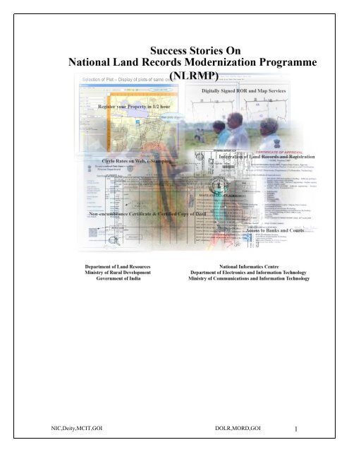
NIC,Deity,MCIT,GOI DOLR,MORD,GOI 1
TABLE OF CONTENTS<br />
Chapter Description Page no<br />
1 Bhoomi-Karnataka-Comprehensive System<br />
<strong>of</strong> <strong>Land</strong> Management<br />
2 HALRIS-Haryana-Integrated <strong>Land</strong> Records<br />
and Registration<br />
3 Mee-Seva-Andhra Pradesh-Service at Door<br />
Step<br />
4 Cadastral Survey-Gujarat-Use <strong>of</strong> modern<br />
instruments in Cadastral Survey<br />
3-21<br />
22-35<br />
36-58<br />
59-67<br />
5 Survey & Settlement-Jammu & Kashmir 68-96<br />
6 Modern Record Room-Rajasthan-<br />
Preservation, Arcchival & modalities <strong>of</strong><br />
Record Rooms<br />
7 Indian Cadastral mapping solution using<br />
open source technologies-Bhunaksha(Chhatisgarh,<br />
Haryana, MP, HP and<br />
UP)<br />
8 HimBhoomi-Integrated <strong>Land</strong> Records<br />
Computerisation in Himachal Pradesh-For<br />
bringing perceptible systemic changes and<br />
making public delivery systems efficient and<br />
corruption free<br />
97-117<br />
118-147<br />
148-153<br />
9 List <strong>of</strong> contributors (Annexure-I) 154-155<br />
NIC,Deity,MCIT,GOI DOLR,MORD,GOI 2
CHAPTER 1<br />
Bhoomi-Karnataka-Comprehensive<br />
System <strong>of</strong> <strong>Land</strong> Management<br />
NIC,Deity,MCIT,GOI DOLR,MORD,GOI 3
A good land records system is a necessity for any harmonious and progressive society.<br />
Over the years, significance <strong>of</strong> error-free, tamper pro<strong>of</strong> and effortlessly accessible land<br />
records has been the focus in India. It is estimated that about 30 million cases are pending<br />
across various courts in the country and astoundingly eighty percent <strong>of</strong> them are civil<br />
cases and greater part <strong>of</strong> these civil cases are in some way or the other, land related<br />
disputes. A study by Mckinsey (2002) has come out with a fact that, but for the proper<br />
land records management, growth in GDP would have been more by at least 1.3%<br />
situation is much worse in urban areas.<br />
Revenue <strong>Department</strong> in Karnataka has computerized 200 million records <strong>of</strong> land<br />
ownership <strong>of</strong> 6.7 million farmers in the state. Previously, farmers were solely dependent<br />
on Village Accountant (Village Level functionary <strong>of</strong> Revenue <strong>Department</strong> in Karnataka)<br />
to get a copy <strong>of</strong> the Record <strong>of</strong> Rights, Tenancy and Crops (RTC). RTC is a document<br />
needed for many tasks such as obtaining bank loans, selling properties, creating partition<br />
deeds etc. There were delays and harassment. Bribes had to be paid. Today, for a fee <strong>of</strong><br />
Rs.10, a printed copy <strong>of</strong> the RTC can be obtained online at computerized land record<br />
kiosks (Bhoomi centers) in 203 taluk <strong>of</strong>fices. All the taluk databases are being uploaded<br />
to a web-enabled central database. RTCs are available for view free <strong>of</strong> cost on web and<br />
are also being issued from rural tele centres setup under Nemmadi project in Karnataka.<br />
Project description<br />
BHOOMI is the project conceived and implemented by Government <strong>of</strong> Karnataka with<br />
National Informatics Centre as Technical partner based on the funding received from<br />
Government <strong>of</strong> India under CLR (Computerization <strong>of</strong> <strong>Land</strong> Records), now renamed as<br />
NLRMP (National <strong>Land</strong> Records Modernization Program) to have good land records<br />
management system which in itself, a good example <strong>of</strong> a paradigm shift from department<br />
centric approach to citizen centric approach and process oriented to service oriented.<br />
Under BHOOMI project about 20 million RTCs <strong>of</strong> 6.7 million farmers <strong>of</strong> Karnataka State<br />
have been digitized. All these records have been verified and certified by the revenue<br />
authorities before making digital database as the only source <strong>of</strong> land records. Manual<br />
records have been invalidated through amendment to Karnataka <strong>Land</strong> Revenue Rules<br />
1964. Any changes to record <strong>of</strong> rights will happen through online mutation application<br />
(BHOOMI) only. Changes to RTCs may be due to sale, partition, inheritance, pledge,<br />
release, government order, court order, phodi etc. Online mutation application handles all<br />
type <strong>of</strong> mutation so that no manual intervention in updating land records database.<br />
Workflow based user-friendly s<strong>of</strong>tware has been designed and developed by National<br />
Informatics Centre, Bangalore has bio-metric authentication to take care <strong>of</strong> nonrepudiation<br />
and scanning interface to scan important documents as evidence for<br />
electronic transaction. PKI (Public Key Infrastructure) enabled BHOOMI database and<br />
application with integration <strong>of</strong> digital signatures is in place to adhere to IT act 2000. On<br />
an average BHOOMI s<strong>of</strong>tware handles more than 0.1 million mutation a month. About<br />
NIC,Deity,MCIT,GOI DOLR,MORD,GOI 4
9,000 Village Accountants, 800 Revenue Inspectors, 203 Sheristedars, 1000 Operatorscum-Village<br />
Accountants, 203 Tahsildars and 52 Assistant Commissioners work on the<br />
system based on clear-cut roles and privileges given to them.<br />
Initially BHOOMI was implemented in 203 locations in phased manner from 1999 to<br />
2002 as standalone system with local server and clients. In 2005 a V-SAT based network<br />
was establish to connect all the taluka servers to State Data Centre (SDC) and replication<br />
<strong>of</strong> BHOOMI database between taluk and SDC was put in place. The replicated data in<br />
SDC helps in disaster recovery activities incase data is lost due to any reason in the taluk<br />
server. Data in SDC is also used in publishing record <strong>of</strong> rights on web and developing<br />
interfaces with different stakeholders. After commissioning <strong>of</strong> KSWAN (Karnataka State<br />
Wide Area Network), V-SAT based network has been discarded and KSWAN is being<br />
used for communication between taluk and SDC.<br />
Under BHOOMI project, maintenance <strong>of</strong> land records electronically was given first<br />
priority keeping all other interfaces as manual only. Initially all the registration events <strong>of</strong><br />
registration department, farm credit declarations from Banks and co-operatives societies,<br />
notifications from land acquisition authorities, government and court orders etc., were<br />
intimated to BHOOMI centre in paper form. BHOOMI project had employed “Bottom-<br />
Up” approach in implementing e-Governance which is evolutionary / synthesizing model<br />
wherein start with simple activities and scale up fast to achieve larger objectives within<br />
the department individually. Once the individual systems are stable and sustainable then<br />
start integrating them to achieve ultimate objectives. Started as simple vanilla application<br />
to maintain land records, today BHOOMI has been enhanced in such way that it has<br />
electronic interfaces with other departments / wings. SDC database is being used to<br />
publish web services to departments / wings <strong>of</strong> government machinery to use the land<br />
records data and submit the transactions electronically so that mutations can be started<br />
automatically without human intervention. Details <strong>of</strong> these interfaces are discussed in<br />
length under the heading stakeholders.<br />
Objectives <strong>of</strong> Project<br />
The major objectives <strong>of</strong> the BHOOMI project were:<br />
• Facilitating easy maintenance and prompt updating <strong>of</strong> land records.<br />
• Making land records tamper-pro<strong>of</strong>.<br />
• Allowing farmers easy access to their records.<br />
• Collating the information to construct a database regarding land revenue, cropping<br />
pattern, land use, etc.<br />
• Utilising the data for planning and for formulating development programmes.<br />
• Integrating all the land related activities electronically with BHOOMI so as to<br />
achieve single source <strong>of</strong> ROR data and its updation with minimum or no human<br />
intervention.<br />
NIC,Deity,MCIT,GOI DOLR,MORD,GOI 5
• Enabling usage <strong>of</strong> this BHOOMI database by banks, private organizations and<br />
companies, ISPs<br />
Significant features <strong>of</strong> BHOOMI s<strong>of</strong>tware<br />
• BHOOMI is an on-line system to carry out the mutation on the digital land records<br />
data.<br />
• It has built-in workflow automation, which moves transactions from one <strong>of</strong>ficer to<br />
another electronically.<br />
• The process <strong>of</strong> mutation (Change in the information displayed in the RTC)<br />
synchronizes with the field work done by the revenue <strong>of</strong>ficials.<br />
• It also facilitates to scan the field mutation order passed by revenue authorities and<br />
notice served to the public and store the same into the database so that it can be<br />
referred easily in future for different purposes.<br />
• BHOOMI processes requests on a First in First out (FIFO) order.<br />
• BHOOMI ensures non-repudiation by using Fingerprint (Bio-metrics) Identification<br />
Technology (FIT). This also ensures foolpro<strong>of</strong> authentication system instead <strong>of</strong><br />
traditional password based authentication system.<br />
• The s<strong>of</strong>tware is in local language (Kannada)<br />
• Documents such as RTC, mutation extract etc are digitally signed<br />
Services <strong>of</strong>fered in BHOOMI<br />
Through taluk kiosk<br />
<br />
<br />
<br />
<br />
<br />
<br />
RORs (Current and old) – Both Current and old RORs are available at the cost<br />
<strong>of</strong> Rs. Ten each. In case <strong>of</strong> PKI (Public Key Infrastructure) enabled taluks,<br />
digitally signed and bar coded RORs without ink signature are being issued.<br />
Mutation extract – This is the document that gives the details about<br />
acquisition <strong>of</strong> right, certified copy <strong>of</strong> this document is available at the cost <strong>of</strong><br />
Rs. Fifteen.<br />
RR5 and RR6 – Records <strong>of</strong> rights form – 5 and form - 6 which is commonly<br />
called as RR5 and RR6. These documents give history <strong>of</strong> transactions<br />
chronologically for a particular village and on a particular survey number for a<br />
given period respectively.<br />
Khatha Extract – All the land parcels owned by a person in a village will be<br />
listed in the Khatha extract.<br />
Mutation status – A document which talks about stage at which the requested<br />
transaction is currently held up and from how many days.<br />
Scanned copies <strong>of</strong> served notice, mutation extract, Tippan – Scanned<br />
documents such as served notice having signatures <strong>of</strong> the interested parties,<br />
NIC,Deity,MCIT,GOI DOLR,MORD,GOI 6
mutation order with signatures <strong>of</strong> Village Accountant and Revenue Inspector<br />
and scanned image <strong>of</strong> tippan (sketch <strong>of</strong> land parcel) are available for<br />
dissemination from taluk kiosk.<br />
Through rural tele centre<br />
<br />
<br />
<br />
RORs (Current and old)<br />
Mutation extract<br />
Mutation status<br />
Through web (for view only)<br />
<br />
RORs (Current and old)<br />
<br />
<br />
<br />
<br />
Mutation extract<br />
RR5 and RR6<br />
Mutation status<br />
Scanned copies <strong>of</strong> served notice, mutation extract, Tippan<br />
NIC,Deity,MCIT,GOI DOLR,MORD,GOI 7
SMS integration in BHOOMI and registration process helps the citizen to know the status<br />
<strong>of</strong> his transaction and brings much required transparency in the government process. This<br />
also helps the citizen to avoid bribing <strong>of</strong>ficials due to lack information.<br />
BHOOMI services are contributing significantly for sustainability <strong>of</strong> 800 rural tele<br />
centres started under NEMMADI project, the services from BHOOMI such as RORs,<br />
Mutation extract alone amount to on average Rs 1050 per month per tele centre. This is<br />
guaranteed income for tele centre in addition to service charges collected for G2C<br />
services <strong>of</strong> revenue department numbering about another 40 services.<br />
NIC,Deity,MCIT,GOI DOLR,MORD,GOI 8
Architecture Diagram <strong>of</strong> BHOOMI<br />
Description <strong>of</strong> different modules <strong>of</strong> BHOOMI<br />
Application Kiosk<br />
Accountability is most import aspect that any e-Governance system should address one<br />
need to keep track <strong>of</strong> all the inputs to the system so that monitoring activity becomes<br />
easy. Electronic system where incoming papers are not digitally captured will not be<br />
effective as <strong>of</strong>ficials working in the system decide when to attend which paper.<br />
Application kiosk is the module that provides the front end for the department to collect<br />
the details <strong>of</strong> requests for mutation from public and other stakeholders.<br />
The key users <strong>of</strong> the application kiosk module are:<br />
Bhoomi Operator<br />
Shirestedar<br />
Survey Supervisor<br />
NIC,Deity,MCIT,GOI DOLR,MORD,GOI 9
The role <strong>of</strong> Bhoomi Operator, Shirestedar and Survey Supervisor are critical in<br />
application kiosk module.<br />
Some <strong>of</strong> the key activities under Application kiosk module are detailed below:<br />
1. Receipt and acknowledgement <strong>of</strong> all types <strong>of</strong> mutation requests except for<br />
registered documents, pledge/release cases, <strong>Land</strong> Acquisition Notification.<br />
Registration, Pledge & release and land acquisition is done through electronic<br />
integration which is discussed in later part <strong>of</strong> this case study.<br />
2. Receipt and acknowledgement <strong>of</strong> crop change / correction requests.<br />
3. Receipt and acknowledgement <strong>of</strong> objections rose during online mutation process in<br />
BHOOMI. There is facility to handle objections pertaining to pre-BHOOMI days<br />
also.<br />
4. Receipt and acknowledgement <strong>of</strong> J-slips from Sub Registrar’s Office. (Online)<br />
5. Old J-Slips (intimation slips from Sub register’s <strong>of</strong>fice) entry<br />
6. Information dissemination on the application status.<br />
In application kiosk module, the data updation activity is done by the Bhoomi Operator<br />
where as the approval or rejection <strong>of</strong> the same is done by the Shirestedar, Survey<br />
Supervisor etc. The log-in for application kiosk is through biometric authentication.<br />
It has to be noted that the preliminary check that the system does while starting the<br />
application kiosk is on data back-up taken. It is mandatory that the data back-up should<br />
have been taken at least 3 days ago, which means to say there should not be a gap <strong>of</strong><br />
more than 3 days between back-ups. In case the gap exceeds 3 days, then the system does<br />
not allow the operator to log-in and proceed further unless the back-up is taken.<br />
BHOOMI<br />
BHOOMI is the main module <strong>of</strong> the whole BHOOMI application. The critical and<br />
sensitive activities <strong>of</strong> data changing, data updation, approvals etc… are done in Bhoomi<br />
NIC,Deity,MCIT,GOI DOLR,MORD,GOI 10
module for all the service requests. Any type <strong>of</strong> mutation request, after its initial<br />
acceptance at the Application Kiosk level is acted upon in the Bhoomi module. The<br />
primary users in the Bhoomi modules are the Bhoomi Operator, Shirestedar, Revenue<br />
Inspector, Survey Supervisor, Tahsildar and Village Accountant. Apart from mutation<br />
requests from Application Kiosk, there are many other mutation request that trigger<br />
transactions automatically to Bhoomi ie.. from sources like Bhoomi-Kaveri, land<br />
acquisition system, Bhoomi bank system, Bhoomi objection system etc…..<br />
Of the above mentioned users, the role played by operator, Shirestedars, Revenue<br />
Inspector and Survey Supervisor are critical in ensuring efficient discharge <strong>of</strong> services to<br />
the citizen. The Tahsildar’s role is limited in approving the mutation requests where<br />
Government land comes into picture.<br />
There are 11 different types <strong>of</strong> mutations with 37 different types <strong>of</strong> acquisitions for which<br />
the requests can come from the citizen’s / stakeholder’s end. BHOOMI module is used to<br />
address all the requirements with respect to processing the mutation requests.<br />
The list <strong>of</strong> different types <strong>of</strong> mutation and their relevant acquisition types are detailed in<br />
the following table:<br />
S.No Mutation Type<br />
2<br />
J-Slips<br />
Inheritance / Khata<br />
Change<br />
3 Rights and Liabilities<br />
4 <strong>Land</strong> Grant<br />
Acquisition Type<br />
Sale<br />
Gift Deed (Daana)<br />
Partition<br />
Gift Deed (Kanike)<br />
Release<br />
Sale (in case <strong>of</strong> owner / one <strong>of</strong> the owners is a minor) -<br />
Minor Guardian<br />
Transfer<br />
Settlement deed<br />
Lease<br />
Auction cum sale<br />
Alienated Update<br />
Inheritance (In case <strong>of</strong> death <strong>of</strong> father - Pitrargitha)<br />
Partition<br />
Will<br />
Release<br />
Pavati (Transfer <strong>of</strong> rights from Husband to Wife)<br />
Minor Guardian<br />
Pledge / Mortgage<br />
Release the pledge / mortgage on land<br />
Add / Remove Government Restriction<br />
Grant<br />
Grant under <strong>Land</strong> reforms<br />
NIC,Deity,MCIT,GOI DOLR,MORD,GOI 11
S.No Mutation Type<br />
Acquisition Type<br />
Re-Grant<br />
Akrama-Sakrama<br />
5 <strong>Land</strong> Acquisition <strong>Land</strong> Acquisition<br />
6<br />
<strong>Land</strong> conversion /<br />
Alienation<br />
<strong>Land</strong> Alienation<br />
New RTC<br />
7 Revenue Court Order<br />
RTC Correction<br />
Removal <strong>of</strong> RTC<br />
8 Court Stay<br />
Court Stay<br />
Revoking the stay order<br />
9 Cultivators Cultivators' inclusion<br />
10 Phodi<br />
11 RTC transfer<br />
Divide (Vibhajisu)<br />
Combine (Ottugoodisu)<br />
Change the extent (Vistheerna Badalaavane)<br />
Change in survey number<br />
Change the village<br />
Change the Hobli<br />
Village Transfer<br />
Hobli transfer<br />
NIC,Deity,MCIT,GOI DOLR,MORD,GOI 12
web<br />
services<br />
Mutation process flow diagram<br />
Application<br />
<strong>Land</strong><br />
Acquisition<br />
entries from<br />
SLAQ<br />
Pledges /<br />
Release from<br />
Banks<br />
J Slips from<br />
Registration<br />
Offices<br />
Transaction Entry in Bhoomi<br />
Checklist Generation by<br />
Operator<br />
Notice Approval by Sirestedar<br />
Notice Generation by Operator<br />
File Acknowledgement by RI<br />
Govt .<br />
<strong>Land</strong><br />
NO<br />
Kiosks<br />
Objections<br />
YE<br />
S<br />
B<br />
Notice Approval by<br />
Tahsildar<br />
NO<br />
Notice Required<br />
<br />
<br />
Notice Served Date<br />
YE<br />
S<br />
30 days Notice<br />
period<br />
NO<br />
Objectio<br />
n<br />
YE<br />
S<br />
Provisional Acceptance by RI<br />
O<br />
File Acceptance by Surveyor<br />
Order Ack. By Operator<br />
Order Entry Operator<br />
NO<br />
Sale/<br />
Inheritanc<br />
e<br />
YE<br />
S<br />
Approval by Surveyor<br />
Sal<br />
e<br />
Final Approval by Revenue Inspector<br />
DSC Signing <strong>of</strong> Mutation Extract by<br />
RI<br />
Approval by Sirestedar<br />
NO<br />
YE<br />
S<br />
PROCESS 79 AB<br />
VIOLATIONS<br />
YE<br />
S<br />
NO<br />
IMP<br />
DSC Signing <strong>of</strong> RTC Village<br />
NIC,Deity,MCIT,GOI DOLR,MORD,GOI 13<br />
Accountant
O<br />
Application<br />
Kiosks<br />
Objection Entry in Bhoomi<br />
RI Objection Entry Approval<br />
Correction<br />
Required<br />
YES<br />
Corrections to Entry<br />
Sirestedar Objection Entry Approval<br />
NO<br />
Notice Generation by Operator<br />
Sirestedar Objection Decision Entry<br />
NO<br />
Sirestedar Objection<br />
Approval<br />
YES<br />
Move the Objection details to achieves<br />
and close the Objection File<br />
Create New Court Order Transaction<br />
in BHOOMI<br />
B<br />
NIC,Deity,MCIT,GOI DOLR,MORD,GOI 14
Admin Module <strong>of</strong> BHOOMI<br />
BHOOMI Admin module is primarily used to creating, deleting and managing specific<br />
users <strong>of</strong> the BHOOMI application. In addition to creation and deletion <strong>of</strong> users, this<br />
module is also used for transferring the user rights temporarily from one user to the other<br />
user. The primary users <strong>of</strong> this module are:<br />
Tahsildar<br />
Shirestedar<br />
Tahsildar’s role in BHOOMI Admin module<br />
The Tahsildar’s role and specific activities in BHOOMI Admin module are as explained<br />
below:<br />
o New User creation<br />
o Log-in Deletion<br />
o Approval <strong>of</strong> Leave for the Officer / User<br />
o Revoking the Leave <strong>of</strong> the Officer / User<br />
o V.A Circles and Certificate Utilities<br />
The Shirestedar’s role and activities in Bhoomi Admin module: The Shirestedar’s log-in<br />
credentials are activated by the Tahsildar and the following options are available for the<br />
Shirestedar in the BHOOMI Admin module:<br />
o Approval <strong>of</strong> Issue <strong>of</strong> RTC for Government purposes<br />
o Approval <strong>of</strong> issue <strong>of</strong> mutation extract for Government purposes<br />
o Discount in RTC amount paid:<br />
o Adding Treasury, Drawing Officer and P.D account details:<br />
Backup Module<br />
Each taluka and Special taluka in the state has a BHOOMI set-up to service the citizens.<br />
Each location has complete IT infrastructure with manpower deployed to deliver the<br />
services. Each taluka is identified by its own domain with all activities <strong>of</strong> creation,<br />
updation and management <strong>of</strong> data happening locally. <strong>Land</strong> records data being very<br />
critical in nature, timely backing-up the data is absolutely essential. Currently the data<br />
back-up happen in two phases under BHOOMI.<br />
Data Back-up at Taluka level: This back-up activity is done as per the Disaster<br />
recovery management requirements at the taluka. The data back-up is taken once<br />
in a day.<br />
Data replication at State Data Centre: In addition to the data back-up at taluka<br />
level, the data at each location is replicated to State Data Centre once every 24<br />
hours. This measure has been introduced as a mean <strong>of</strong> alternate disaster recovery<br />
site. The taluka locations are connected to State Data Centre through K-SWAN.<br />
Taking data back-up at taluka is mandatory and the inbuilt checks within BHOOMI do<br />
not allow the BHOOMI Operator to proceed with the day’s activities unless the back-up<br />
for the previous day is taken.<br />
NIC,Deity,MCIT,GOI DOLR,MORD,GOI 15
Crop Updation<br />
This is one <strong>of</strong> the lengthy and time-consuming activities in land records maintenance and<br />
updation. The crop updation has to be carried out season-wise every year. This is because<br />
the crop has to be entered / updated for all the RTCs <strong>of</strong> the taluka. This module will allow<br />
changing the details <strong>of</strong> crop details as per the VA report by revenue <strong>of</strong>ficials/ data entry<br />
agency.<br />
Crop details are essential to be included in the RTC as they form the most important base<br />
on which the crop loans and crop insurance is sanctioned to the farmers. This makes it<br />
critical to ensure that the latest crop details are updated in the RTC. The primary users <strong>of</strong><br />
this module are:<br />
Tahsildar<br />
Shirestedar<br />
Bhoomi Operator<br />
Village Accountant<br />
The flow involved in this process is as follows<br />
Integration with Stakeholders<br />
In this section, benefits to each <strong>of</strong> the stakeholders are discussed along with integration<br />
achieved to reduce the human discretion and to automate the process as much as possible.<br />
NIC,Deity,MCIT,GOI DOLR,MORD,GOI 16
Registration department: Registration department is one <strong>of</strong> the main consumers <strong>of</strong> the<br />
RORs data as all the transactions to transfer the rights except inheritance transaction<br />
happens in Sub Registrar Office (SRO), which is field level <strong>of</strong>fice under registration<br />
department. In the pre-BHOOMI scenario, registration department was only dependent<br />
on the documents submitted by the parties at time <strong>of</strong> registration and there was no<br />
verification mechanism in place. There were instances where same piece <strong>of</strong> land had been<br />
sold more than once to different people. The vacuum <strong>of</strong> non availability <strong>of</strong> data at the<br />
time <strong>of</strong> registration with respect to agricultural land has been filled by integrating<br />
BHOOMI and KAVERI (Registration s<strong>of</strong>tware). Since 2006, BHOOMI is consuming the<br />
index data <strong>of</strong> transactions from KAVERI, now full and comprehensive integration has<br />
been achieved in Karnataka. The KAVERI system <strong>of</strong> the Stamps and Registration<br />
department now electronically talks to the BHOOMI system and ensures that the seller is<br />
indeed owner <strong>of</strong> the property as per the BHOOMI database. Soon after the transaction is<br />
over the extent in BHOOMI database <strong>of</strong> the seller gets decreased ensuring that he cannot<br />
sell more than what he owns or that he cannot sell the same piece <strong>of</strong> land to others.<br />
Immediately after the transaction is over in Sub-registrar <strong>of</strong>fice a mutation transaction is<br />
started in BHOOMI system automatically as all the required data for starting <strong>of</strong> such<br />
transaction is available due to electronic linkages between the two systems. Citizens are<br />
also sent the SMS automatically as their transactions pass various phases/stages in the<br />
mutation process in BHOOMI system. Integration <strong>of</strong> BHOOMI and KAVERI has not<br />
only helped prospective buyers but has also gone a long way in enhancing the credibility<br />
<strong>of</strong> the registration department. Integration has also helped in stopping transactions on<br />
government lands or lands on which government restrictions exists. Further it blocks the<br />
transactions on the lands on which court has given order/stay. The integration also throws<br />
light on whether transaction needs pre-mutation sketch or not which has contributed a lot<br />
NIC,Deity,MCIT,GOI DOLR,MORD,GOI 17
for reducing the disputes. Details about pre-mutation sketch and its importance in land<br />
administration are discussed under the heading survey department in this section.<br />
Banks and Co-operative Institutions: If we analyze the different types <strong>of</strong> transactions<br />
happening in BHOOMI, more than fifty percent <strong>of</strong> transactions pertain to pledge and<br />
release type. These are transactions wherein citizen has pledged his land to banks or cooperative<br />
institutions for getting farm credit or released the property after paying back the<br />
loan. On analyzing data for few taluks, it was clear that average time taken for data entry<br />
and initiating the transaction is maximum compared to any other stage. This is because,<br />
the volume <strong>of</strong> applications that are being received from these banks and co-operative<br />
institution for creating liabilities on the land. Keeping the volume <strong>of</strong> transactions and<br />
time taken for data entry <strong>of</strong> the same, Revenue department has decided to integrate<br />
BHOOMI and Bank activities electronically. Facility has been enabled for banks and cooperative<br />
institutions to raise digitally signed request for pledge or release over internet<br />
from the bank itself. The request will contain all the parameters to initiate the transaction<br />
in BHOOMI automatically. This has helped BHOOMI to reduce the pendency at data<br />
entry level and Banks are benefitted because they can access the land records database for<br />
confirming ownership, extents owned by the farmer, other liabilities that farmer has and<br />
also monitor the status <strong>of</strong> requests raised by them. Banks and co-operatives institution<br />
will also become interested parties for all those land parcels for which they have<br />
disbursed farm credit.<br />
<strong>Land</strong> acquiring bodies: <strong>Land</strong> acquisition is the process wherein agricultural and/or non<br />
agricultural lands are acquired by government for various activities such as village/town<br />
extension, roads, culverts, reservoirs, canals, military camps, railways, industries etc.,<br />
Regular Assistant commissioners in the revenue sub-divisions also act as <strong>Land</strong><br />
Acquisition Officers along with special <strong>Land</strong> Acquisition Officers appointed by<br />
government, urban development authorities, Industrial development authorities, National<br />
Highways etc., Keeping the volatile nature <strong>of</strong> land records, notifications are bound to go<br />
wrong keeping time required to collect the manual data and preparation <strong>of</strong> notification<br />
manually. Certain transactions which do not change the ownership such as podi keep<br />
happening even after notification resulting in change in key parameters itself. The paper<br />
based intimations from the land acquiring bodies were not getting implemented in land<br />
records system even though land records management was electronic in nature. It was up<br />
to the discretion <strong>of</strong> the <strong>of</strong>ficials to decide whether to initiate the transaction or not. In<br />
essence due to absence <strong>of</strong> direct electronic interface between the land acquisition <strong>of</strong>ficer<br />
and the administrator <strong>of</strong> record <strong>of</strong> right management, the notification <strong>of</strong> intended<br />
acquisition <strong>of</strong> land was not indicated on the record <strong>of</strong> right and most <strong>of</strong> the time there was<br />
a scope for changing the ownership, creation <strong>of</strong> liability on the land as well as there was<br />
an enormous scope for acquiring the same piece <strong>of</strong> land resulting in a huge loss to the<br />
State Exchequer in terms <strong>of</strong> paying compensation multiple times.<br />
NIC,Deity,MCIT,GOI DOLR,MORD,GOI 18
Electronic integration <strong>of</strong> BHOOMI and BHOOSWADEENA (An automated <strong>Land</strong><br />
Acquisition System) has brought synchronization between two systems. <strong>Land</strong> acquiring<br />
bodies consume the land records data electronically to create notifications in a workflow<br />
based <strong>Land</strong> Acquisition System. After every stage <strong>of</strong> notification, BHOOMI is informed<br />
about the event by sending XML (eXtensible Markup Language) file, which in turn is<br />
used in BHOOMI to create a transaction automatically either to create liability entry<br />
about published notification or to replace the owner with the name <strong>of</strong> the acquiring body<br />
depending on the stage <strong>of</strong> activity. Timely updation <strong>of</strong> land records is helping the<br />
prospective buyers to take decisions as ground reality is reflected on records <strong>of</strong> rights<br />
with respect to acquisition proceedings that are in progress on a particular land parcel.<br />
Registration department is also gets alerted before executing transaction as land<br />
acquisition notifications are updated on records <strong>of</strong> rights. On the other hand deserving<br />
land lords will be paid compensation without litigations. Computerization <strong>of</strong> <strong>Land</strong><br />
Acquisition Offices has resulted in better management <strong>of</strong> land acquisition activity as a<br />
whole.<br />
Survey department: While BHOOMI was in place by the year 2000 there were<br />
fundamental problems with the spatial data management and synchronization <strong>of</strong> it with<br />
textual records. The process <strong>of</strong> phodi (division <strong>of</strong> bigger property into a smaller hissas on<br />
NIC,Deity,MCIT,GOI DOLR,MORD,GOI 19
the ground) used to take lot <strong>of</strong> time after sale/inheritance transaction. Many a times it<br />
used to take even 15-20 years. This resulted in a situation wherein 2-3 people were<br />
shown as owners in a single property record but their rights on the ground were not<br />
delineated clearly.<br />
Karnataka <strong>Land</strong> Revenue Act was amended and it was mandated that a pre-mutation<br />
sketch is pre-requisite for any sale transaction to happen. The pre mutation sketch is<br />
created in the field using the services <strong>of</strong> licensed private surveyors on a basis <strong>of</strong> user<br />
charges and shows the area proposed for sale. This pre-mutation sketch is mandatory and<br />
no transaction in sub-registrar <strong>of</strong>fices can happen without the sketch. Whole <strong>of</strong> this<br />
activity <strong>of</strong> issuing pre-mutation sketch has been simplified using s<strong>of</strong>tware called<br />
‘MOJANI’. This mechanism has gone a long way to ensure that there are no disputes as<br />
the boundaries is known to the purchaser even before he purchases the land. The concept<br />
<strong>of</strong> private licensed surveyors has ensured that the public sector was not required to<br />
augment its own strength and there was no additional financial load on the system.<br />
Needless to say that MOJANI uses the BHOOMI database at the backend and is fully<br />
integrated with it for creation <strong>of</strong> any sketch. This scheme not only helps the Government<br />
and citizens but also help in employment <strong>of</strong> rural youths numbering about 3500.<br />
Pre-mutation sketch which is mandatory for transfer <strong>of</strong> properties would be used during<br />
mutation process; new concept called Integrated Mutation Podi has been introduced to<br />
achieve this objective. Along with transfer <strong>of</strong> ownership, new RTC is also created with<br />
new land parcel details bringing synchronization <strong>of</strong> spatial and textual data <strong>of</strong> land<br />
records.<br />
Other departments: Different departments such as <strong>Department</strong> <strong>of</strong> Economics and<br />
Statistics, Agriculture, Horticulture, Forest, Agricultural related boards and corporations<br />
use BHOOMI data extensively. Crop details <strong>of</strong> RORs are used by department <strong>of</strong><br />
Economics and Statistics, Agriculture and horticulture. Forest department uses RORs<br />
data for protecting forest land.<br />
Issues and challenges faced during implementation<br />
1. Making computerization <strong>of</strong> land records as primary activity was herculean task as<br />
this was seen as secondary activity compared to election, census, disaster etc., It<br />
use to lose importance every time any <strong>of</strong> the activities mentioned above occurred<br />
and one or the other such activity use to be there always. Project Champion<br />
struggle a lot to make it primary activity by making every one right from top<br />
bureaucracy and political leadership understand that proper maintenance and<br />
updation <strong>of</strong> land records are important for peaceful society.<br />
2. Digitization <strong>of</strong> legacy data <strong>of</strong> 20 million RTCs was a real challenge due to<br />
a. Preparing the records for data entry was phenomenal task as there were<br />
different ways <strong>of</strong> maintaining records in five different regions <strong>of</strong> the state.<br />
About 10,000 <strong>of</strong>ficials were trained in data preparation activity.<br />
NIC,Deity,MCIT,GOI DOLR,MORD,GOI 20
. Non availability <strong>of</strong> good data entry agencies at district level was another<br />
challenge. BHOOMI implementation team had to train the data entry<br />
agency staff also in carrying data entry legacy records.<br />
c. Total effort was about 20,000 man-months legacy data entry involving<br />
1200 operators.<br />
3. Verification <strong>of</strong> digitized records was a real challenge; certification <strong>of</strong> correctness<br />
<strong>of</strong> data entry is pre-requisite for any electronic system to become operational.<br />
Making field level functionary complete verification and certification was<br />
extraordinary task. There was a need to stop people from doing incremental<br />
correction instead <strong>of</strong> one time complete correction. Different levels <strong>of</strong> hierarchy<br />
right from Village Accountant to Deputy Commissioner were assigned with<br />
percentage <strong>of</strong> records to be verified and certified.<br />
4. Rigidity in redefining rules and procedures was another important challenge, all<br />
people in the hierarchy had to be convinced to bring amendments and procedural<br />
changes in maintaining legacy records.<br />
5. Lack <strong>of</strong> technical support at taluk level was the major hurdle in implementation,<br />
though district head quarters taluks could be operationalized with the help <strong>of</strong><br />
District Informatics Officers <strong>of</strong> National Informatics Centre, same thing could not<br />
be done as these <strong>of</strong>ficers were stationed at district head quarters and had assigned<br />
with many other computerization projects. Revenue <strong>Department</strong> had to recruit one<br />
district consultant per district to assist the department in implementation <strong>of</strong> the<br />
project across the state.<br />
6. Maintaining Hardware, UPS and provide consumable such as secured stationery,<br />
holograms, printer cartridges etc., at taluk level was another important challenge.<br />
Revenue department had to come out with a concept called facility management<br />
to overcome this. Today a single vendor manages computer, printer, UPS, supply<br />
<strong>of</strong> stationery etc.,<br />
7. Training and capacity building was most essential and critical activity for<br />
successful implementation. Whole <strong>of</strong> revenue hierarchy involved in BHOOMI<br />
activities had to be trained. A continuous training in batches were organised for<br />
more than one year to cover all <strong>of</strong>ficials initially. Now incremental trainings are<br />
being organized as and when new reforms are introduced.<br />
.<br />
NIC,Deity,MCIT,GOI DOLR,MORD,GOI 21
CHAPTER 2<br />
HALRIS-Haryana-Integrated <strong>Land</strong><br />
Records and Registration<br />
NIC,Deity,MCIT,GOI DOLR,MORD,GOI 22
Introduction<br />
<strong>Department</strong> <strong>of</strong> Revenue and Disaster Management Haryana is responsible for<br />
maintaining and updating <strong>of</strong> revenue records on the basis <strong>of</strong> transactions by way <strong>of</strong> sale,<br />
mortgage, inheritance and consolidation <strong>of</strong> land holdings etc. There exists a Single line <strong>of</strong><br />
hierarchy in the department for revenue and property registration related work. The<br />
Director <strong>Land</strong> Records (DLR) is also the Inspector General <strong>of</strong> registration (IGR) <strong>of</strong> the<br />
State. Tehsildar heads the Tehsil <strong>of</strong>fice, who function as circle revenue <strong>of</strong>ficer (CRO)<br />
while dealing with revenue matters and function as ex-<strong>of</strong>ficio Sub Registrar (SR) for<br />
registration <strong>of</strong> deeds.<br />
In the year 2000, Revenue department, Haryana in technical consultation with<br />
NIC-Haryana, decided to computerize the registration <strong>of</strong> documents at all sub registrar<br />
<strong>of</strong>fices (SRO) <strong>of</strong> Haryana in phased manner. The National Informatics Center (NIC) team<br />
studied entire deed registration work at SRO and a solution named as Haryana<br />
Registration Information System (HARIS) was developed.<br />
Initially HARIS system was implemented in six SROs on self-sustainable basis by<br />
using the District Red Cross society as the venture capitalist. User charges were fixed for<br />
the deed registration to meet the expenses <strong>of</strong> project implementation and to recover the<br />
seed money invested by Red Cross. By the year 2002-03, HARIS was rolled out in entire<br />
state. HARIS improved the delivery <strong>of</strong> services at SROs and also increased the stamp<br />
duty collection by standardizing the method <strong>of</strong> collector rate fixation and stopping the<br />
registration <strong>of</strong> under valued deeds.<br />
On the other side computerization <strong>of</strong> land records (CLR) was also going on as a<br />
100% sponsored scheme <strong>of</strong> <strong>Department</strong> <strong>of</strong> <strong>Land</strong> <strong>Resources</strong> (DoLR), Govt. <strong>of</strong> India.<br />
Though significant progress was made and almost 92% Jamabandi data was digitized<br />
using the FoxBase/Unix platform, but this data was not fully used for citizen services due<br />
to various reasons like lack <strong>of</strong> interest and heavy workload on Patwaries. This resulted<br />
into delay in data verification and finalization. Jamabandies were taken for data entry<br />
without standardizing the way <strong>of</strong> writing. It was found that each Patwari uses multiple<br />
ways <strong>of</strong> righting the shares <strong>of</strong> owners/cultivators in the same Jamabandi. Contractual staff<br />
was used for data creation and they also committed mistakes during the data entry. There<br />
has been no nodal <strong>of</strong>ficer to assign exclusive responsibility <strong>of</strong> the project at districts.<br />
With the success <strong>of</strong> HARIS system Revenue department Haryana decided to<br />
redesign and integrate the <strong>Land</strong> Records computerization solution with the HARIS<br />
System. In 2003 a new land records computerization solution named as Haryana <strong>Land</strong><br />
Records Information System (HALRIS) was designed and implemented in all the<br />
tehsil/sub-tehsils in phased manner. Data created by the erstwhile CLR scheme was<br />
converted and ported to the HALRIS system and jamabandies were made online by<br />
applying the pending mutations. Process <strong>of</strong> data updation was very big challenge for the<br />
department. Finally in year 2007 citizens services were started from the HALRIS system.<br />
Jamabandi data was also made available on web site www.jamabandi.nic.in<br />
HALRIS system provides the citizen services only for textual records, for copies<br />
<strong>of</strong> Maps etc public was going to concerned village patwaries. So in year 2008 Revenue<br />
department decided to digitize the cadastral maps <strong>of</strong> one tehsil on pilot basis. Maps <strong>of</strong><br />
NIC,Deity,MCIT,GOI DOLR,MORD,GOI 23
tehsil Ambala were digitized with the help <strong>of</strong> Haryana Remote Sensing Application<br />
center (HARSAC) and NIC developed the s<strong>of</strong>tware (Bhu-Naksha) to link the digitized<br />
maps with the jamabandi data and mutation process. So with this integration both<br />
jamabandi and cadastral maps were updated as a result <strong>of</strong> mutations.<br />
Motivators for the Solution<br />
<br />
<br />
<br />
<br />
Lack <strong>of</strong> high degree <strong>of</strong> transparency in valuation <strong>of</strong> properties and calculations <strong>of</strong><br />
stamp duty & registration fee.<br />
Delays in providing the services to the citizens & preparation and updation <strong>of</strong><br />
Revenue records.<br />
Problems in voluminous document management.<br />
Patwari is the only channel <strong>of</strong> Service delivery available to the public, which is<br />
not easily accessible.<br />
Major objectives <strong>of</strong> the Solution<br />
To improve the delivery <strong>of</strong> Government to Citizen (G2C) services related with<br />
<strong>Land</strong> Administration.<br />
To improve the overall efficiency <strong>of</strong> the Revenue <strong>of</strong>ficials.<br />
To reduce the dependency <strong>of</strong> the farmers on the Patwari.<br />
To implement a complete integrated solution for the management <strong>of</strong> <strong>Land</strong> records<br />
and property registration in the State.<br />
To Integrate <strong>Land</strong> Records with property registration to check the frauds at the<br />
time <strong>of</strong> registration.<br />
To provide the details <strong>of</strong> owners from the <strong>Land</strong> Records database, directly to the<br />
process <strong>of</strong> Property Registration System, to help stopping re-selling <strong>of</strong> property<br />
without the mutation and also eliminating the mutation pendency.<br />
To Accept the Mutation request at Tehsil level for all type <strong>of</strong> mutations including<br />
the mutations written on the basis <strong>of</strong> Patwari’s Roznamcha.<br />
Automatic generation <strong>of</strong> new Jamabandi at the time <strong>of</strong> consignment.<br />
Challenges Faced<br />
<br />
<br />
<br />
<br />
<br />
<br />
Importing the legacy jamabandi data created using FoxBase/Unix platform to<br />
windows based platform.<br />
S<strong>of</strong>tware modules were developed by NIC to convert and validate the legacy data.<br />
The S<strong>of</strong>tware development team and domain experts studied various types <strong>of</strong><br />
deeds, registration work, writing style <strong>of</strong> Jamabandies by Patwaries in different<br />
areas <strong>of</strong> the state, mutations types were also studied across the state.<br />
It was found that each Patwari uses multiple ways <strong>of</strong> writing the shares <strong>of</strong><br />
owners/cultivators in the same Jamabandi. Standardization <strong>of</strong> various processes<br />
involved in the updation <strong>of</strong> revenue records was biggest challenge.<br />
Availability <strong>of</strong> data entry operators capable <strong>of</strong> typing in hindi.<br />
Multiple prints <strong>of</strong> Jamabandies were generated for data verification and validation<br />
by the patwaries. Data verification and validation took significant amount <strong>of</strong> time.<br />
NIC,Deity,MCIT,GOI DOLR,MORD,GOI 24
Entry <strong>of</strong> all the backlog mutations to make the villages online (as on date) so that<br />
it can be integrated with the deed registration system.<br />
Strategies adopted<br />
a) Process <strong>of</strong> Involvement <strong>of</strong> Stakeholders: Financial Commissioner Revenue<br />
constituted state level standardization & Monitoring Committee. NIC Haryana<br />
also constituted a dedicated team <strong>of</strong> pr<strong>of</strong>essionals for the project. The workshops<br />
were organized at Division Commissioner level, where all stakeholders were<br />
called and various re-engineered processes were discovered and discussed. At the<br />
field level also, detailed discussions were held at Patwari level, private deeds<br />
writers, Panchayats, retired revenue <strong>of</strong>ficials and at the level <strong>of</strong> District Revenue<br />
<strong>of</strong>ficers, Tehsildars, Kanoongos etc. Each type <strong>of</strong> cases <strong>of</strong> writing the Jamabandi<br />
and incorporating the mutations were studied and standardized across the state.<br />
b) Process Standardization and Simplification: (a) All applicable deed types were<br />
studied and standardized to design 22 types <strong>of</strong> deed registration Templates. These<br />
templates were converted into XML documents and made available to all HARIS<br />
implementation centres in the state. (b) All type <strong>of</strong> reported cases related to<br />
writing <strong>of</strong> Jamabandi (ROR) and Mutations were studied and standardized and<br />
simplified so as to handle under HALRIS uniformly across the state. The cases,<br />
which could not be simplified, were incorporated in HALRIS through suitable<br />
customization and enhancement <strong>of</strong> HALRIS. (c) HARIS & HALRIS were<br />
dynamically integrated in a workflow environment to facilitate generation <strong>of</strong><br />
mutations notices and entry <strong>of</strong> mutations after the deed registration.<br />
c) Operational Flow in Online Scenario: In case <strong>of</strong> online villages HARIS<br />
immediately post the remarks in col. 12 <strong>of</strong> the Jamabandi <strong>of</strong> the khewats<br />
transacted in the registry. This remark shows the name <strong>of</strong> the seller and date <strong>of</strong><br />
registry. This is done to alert the perspective buyer from the multiple times sale <strong>of</strong><br />
land. This fills the gap that exists between the deed registration and entry <strong>of</strong><br />
mutation in the manual system. As for every registry seller has to take a fresh<br />
nakal <strong>of</strong> ROR from the Tehsils Centre and after registration ROR <strong>of</strong> affected<br />
khewats clearly show that some transaction has already been initiated on this<br />
khewat. Documents after the signatures <strong>of</strong> sub registrar come to mutation window<br />
for mutation entry. Request for Mutation not generated from registration process<br />
like Inheritance etc directly come to mutation entry window. Patwari sitting at the<br />
window examine the papers and help the data entry operator for mutation entry.<br />
Registration remarks automatically disappear after mutation entry and Pencil<br />
remarks as written by Patwari in the manual process, come automatically. Print <strong>of</strong><br />
the mutations is given to the <strong>of</strong>fice kanungo for verification and he records his<br />
verification report in the mutation verification module. If verification report is ok<br />
mutation can go for attestation. CRO take the computer-generated hard copies <strong>of</strong><br />
mutation to Jalsa-ai-Aam. All mutations decided by the CRO come to the Tehsil<br />
centre. CRO uses the mutation-sanctioning module to sanction or reject the<br />
mutations. Remarks in the col. 12 change to Red for khewats <strong>of</strong> sanctioned<br />
NIC,Deity,MCIT,GOI DOLR,MORD,GOI 25
mutations. Tehsil centre Patwari then execute the incorporate mutation module to<br />
implement the sanctioned mutations. Incorporation <strong>of</strong> the mutation updates the<br />
online jamabandi and turns the mutation remarks from Red to Black in the online<br />
Jamabandi where as in Parat Patwar they will remain in red color.<br />
d) Delegation <strong>of</strong> Authority: The Collectors has been authorized to declare any Tehsil<br />
on-line. Since the project is being implemented through District Red Cross<br />
Societies / District IT Societies, Collectors has been empowered at local level to<br />
appoint operators, out-sourcing <strong>of</strong> data entry & verification, procurement <strong>of</strong><br />
requisite H/W. The Collector can spend the funds collected as service charges as<br />
per local requirements. The Patwari posted at HALRIS Centre can issue a signed<br />
copy <strong>of</strong> ROR. Standard Deed templates have been provided in the system. Now<br />
another option is available with the citizens to get the deed written directly at<br />
HALRIS Centre without paying any extra cost.<br />
e) Capacity Building<br />
<br />
<br />
<br />
Regular training programmes were organized for Patwaries and Kanoongos and<br />
other revenue <strong>of</strong>ficials at field. The revenue <strong>of</strong>ficials were trained on computer<br />
fundamentals, <strong>of</strong>fice automation suit and usage <strong>of</strong> internet and e-mail. The<br />
Patwaires & Kanoongos are also trained on HALRIS operations on regular basis.<br />
The infrastructure <strong>of</strong> the IT Labs at district Mini Secretariats, Patwar training<br />
School at Hissar, Revenue Training Institute at Ambala are being used for<br />
Capacity Building <strong>of</strong> Revenue <strong>of</strong>ficials.<br />
One technical Support Pr<strong>of</strong>essional has been posted at each Tehsil HALRIS<br />
Centre. These persons have been sufficiently trained by NIC-Haryana to function<br />
as trainers for revenue <strong>of</strong>ficials in that district and for day to day management <strong>of</strong><br />
operations <strong>of</strong> Tehsil HALRIS Centres. They are also providing training on<br />
system operations & maintenance, back up & security to revenue <strong>of</strong>ficials on<br />
continuing basis. They also provide on the spot help and sort out the trivial<br />
problems. These persons along with NIC DIO/DIA are functioning as Capacity<br />
Building cell as far as the Integrated HALRIS project is concerned.<br />
Solutions developed<br />
Integrated Property Registration (HARIS), <strong>Land</strong> Records (HALRIS) and Cadastral<br />
Mapping solution includes following sub systems.<br />
1 Haryana Property Registration Information System (HARIS)<br />
The registration <strong>of</strong> deeds were computerized at all Tehsils / sub-Tehsils (a cluster <strong>of</strong><br />
villages, also known as a Taluka) using the Haryana Registration Information System<br />
(HARIS) developed by NIC. HARIS includes modules to capture the evaluation<br />
details, photos and biometric details <strong>of</strong> the parties. It also helps the citizen to prepare<br />
the deeds, evaluate the amount <strong>of</strong> stamp duty required to register the deed. The<br />
s<strong>of</strong>tware also generates various MIS reports like Index 1, Index 3 and Index 4.<br />
NIC,Deity,MCIT,GOI DOLR,MORD,GOI 26
Salient features <strong>of</strong> the HARIS<br />
<br />
<br />
<br />
<br />
<br />
<br />
Usage <strong>of</strong> Hindi language<br />
Provision to prepare deeds through s<strong>of</strong>tware<br />
Segment wise collector rates for each area<br />
On-line photo capturing <strong>of</strong> buyer, sellers and witnesses<br />
Captures the Biometrics <strong>of</strong> parties and witnesses.<br />
Data <strong>of</strong> registered deeds transmitted to the State Data Center Daily.<br />
Registration Entry<br />
10/09/2012 NIC-Haryana State Centre 14<br />
Property evaluation module <strong>of</strong> HARIS<br />
List <strong>of</strong> Deed templates<br />
Adoption<br />
Sale<br />
Cancellation<br />
Conveyance<br />
Gift<br />
Exchange<br />
SPA<br />
Trust<br />
Mortgage<br />
Partition<br />
Lease<br />
Mortgage with Possession<br />
Release<br />
Family Settlement<br />
GPA<br />
Implementation model<br />
Initially for implementing HARIS, District Red Cross Societies were found handy, as Dy.<br />
Commissioner is chairman and controller <strong>of</strong> its functions. District Red Cross Societies<br />
were taking service charges from each applicant as budgetary support for sustainability <strong>of</strong><br />
NIC,Deity,MCIT,GOI DOLR,MORD,GOI 27
the project. Later on District IT Society (DITS) were formed in each district, which are<br />
headed by Dy. Commissioner. The DIO, NIC-Haryana Centre is the Technical Member<br />
<strong>of</strong> DITS. The service charges, collected from the HARIS are now divided into Red Cross<br />
(40%), DITS (50%) and remaining 10% are sent to the State Revenue department for<br />
sustainability <strong>of</strong> the project and further IT initiatives <strong>of</strong> the department.<br />
Benefits Accrued to the Citizens<br />
<br />
<br />
<br />
<br />
HARIS has improved the quality <strong>of</strong> service in Tehsils, by reducing the total time<br />
taken by the Tehsil staff for registration. Now registered deeds are returned same<br />
day to the public, earlier sometimes it takes weeks/months to get a registered deed<br />
back.<br />
HARIS use the land rates, fixed by the collector, as reference rates, for computing<br />
the stamp duty. So in any case, it does not allow the registration <strong>of</strong> <strong>Land</strong> below<br />
the collector rates. This feature <strong>of</strong> HARIS has eliminated the requirements <strong>of</strong> pre<br />
registration audit. So state government has stopped the pre registration audit <strong>of</strong> the<br />
documents, which has saved the general public from the harassment at the hands<br />
<strong>of</strong> auditors.<br />
In HARIS the photographs <strong>of</strong> witnesses are also taken along with the sellers and<br />
buyers. This has reduced the incidents <strong>of</strong> wrong witnesses, which was very<br />
prevalent before the implementation <strong>of</strong> HARIS.<br />
The district Red Cross society is also using the HARIS service charges for<br />
running social welfare programs for the weaker sections <strong>of</strong> the society.<br />
Benefits to the Government<br />
After the implementation <strong>of</strong> HARIS there has been significant increase in the stamp duty<br />
collection. This increase was possible due to following reasons:<br />
<br />
<br />
<br />
HARIS has forced the collectors to make their collector rates uniform. Earlier<br />
there was big difference in the collector rate and the open market rates <strong>of</strong> the<br />
property. In HARIS, it is possible to fix a separate rate for different parts <strong>of</strong> the<br />
same locality by dividing it into number <strong>of</strong> segments. So this has reduced the<br />
practice <strong>of</strong> concealing the exact location <strong>of</strong> property for saving the stamp duty.<br />
In HARIS, it is not possible to register a document below the collector rate. This<br />
has stopped the revenue leakage caused by the registration <strong>of</strong> undervalued deeds.<br />
HARIS has also reduced the cases, under section 47-A <strong>of</strong> registration act, to a<br />
considerable extent. It was a common practice to register an undervalued deed in<br />
the first instance, thereafter; the parties were getting these impounded from the<br />
Tehsildar. Later on people were able to get the deed back, by paying bribe or<br />
small amount <strong>of</strong> fine.<br />
NIC,Deity,MCIT,GOI DOLR,MORD,GOI 28
HARIS project has been generating funds from more registrations as service<br />
charges, making HARIS a self-sustainable project.<br />
2 Haryana <strong>Land</strong> Records Information System (HALRIS)<br />
HALRIS system is designed to keep in mind the following goals and objectives<br />
<br />
<br />
<br />
To link the registration with mutations, so that mutation notice can be generated<br />
immediately after the registration <strong>of</strong> document, thereby, doing away with the<br />
second visit by citizens to Tehsil <strong>of</strong>fice for mutation entry.<br />
To generate Nakal (Copy <strong>of</strong> Record-Of-Right) on-line and issue it to general<br />
public at Tehsil level<br />
To generate new Jamabandies automatically.<br />
Salient Features <strong>of</strong> HALRIS<br />
<br />
<br />
<br />
<br />
<br />
<br />
<br />
<br />
<br />
Dynamic integration <strong>of</strong> registration and mutations.<br />
Automated mutation workflow.<br />
Online mutation incorporation facility to update the jamabandi.<br />
Automatic updating <strong>of</strong> Remarks in the Jamabandi.<br />
Generation <strong>of</strong> new jamabandies and consignment in the e-Record rooms.<br />
Usage <strong>of</strong> Hindi language<br />
Biometrics and role based security.<br />
2-D Bar coded copies <strong>of</strong> Record-<strong>of</strong>-Rights (RoR)<br />
Web enabled access to ROR data through http://jamabandi.nic.in & touch screen<br />
based kiosks interface. Provision is made to synchronize the Web nakal database<br />
at state data centers with the tehsil servers with in 15 minutes <strong>of</strong> occurrence <strong>of</strong> any<br />
transaction such as Deed Registration, Mutations.<br />
NIC,Deity,MCIT,GOI DOLR,MORD,GOI 29
List <strong>of</strong> Jamabandi cases handled by HALRIS (Owner Level)<br />
1 Group <strong>of</strong> individual owners from one family or multiple families.<br />
2 Group <strong>of</strong> institutional owners like company, govt department etc.<br />
3 Group <strong>of</strong> owners with their Hakdar Shamlats<br />
4 Group <strong>of</strong> owners with their Murthenans<br />
5 Combination <strong>of</strong> 1,2,3,4<br />
6 Group <strong>of</strong> owners and Mal cha Owners<br />
7 Selection <strong>of</strong> owners from some other khewat in case <strong>of</strong> Mundreja khewats<br />
8 Provision to enter kamaj marla owners<br />
List <strong>of</strong> Jamabandi cases handled by HALRIS (Cultivator Level)<br />
1 Khudkashat 10 Morusi 19 Hibba Grinda<br />
2 Hissedari Kashat 11 Rafai Aam 20 Rakba Grinda<br />
3 Gair Murusi 12 Share Aam 21 Malkiyat Grinda<br />
4 Patta Dehinda 13 Mushtri 22 Marfat<br />
5 Murthnan 14 Patta Grinda 23 Tehat<br />
6 Chakotedar 15 Tabadala Grinda 24 Kashat<br />
7 Bhondedar 16 Decree Grinda 25 Malkan Surplus<br />
8 Dholidar 17 Haq Grinda 26 Gair Marusi Awal<br />
9 Gair Marusi Doyam 18 Allottee<br />
List <strong>of</strong> Mutation cases handled by HALRIS<br />
Mutations triggered thru<br />
Registration<br />
Mutations<br />
triggered thru<br />
Roznamcha<br />
Mutations<br />
triggered thru<br />
Court Orders<br />
Mutations Thru<br />
Govt orders<br />
1 Sale 14 Aad Rahin 26 Sale 35 Lease<br />
2 Mortgage without 15 Fakal Aad<br />
36 Acquisition<br />
possession<br />
Rahin<br />
3 Redemption <strong>of</strong> mortgage<br />
without possession<br />
16 Tabdil<br />
Iksam Araji<br />
4 Mortgage with possession 17 Mortgage<br />
with<br />
possession<br />
5 Redemption <strong>of</strong> mortgage 18 Redemption<br />
with possession<br />
<strong>of</strong> Mortgage<br />
with<br />
27 Redemption<br />
<strong>of</strong> Mortgage<br />
with<br />
Possession<br />
28 Partition 37 Allotment<br />
29 Hakuk<br />
Tabdili<br />
30 Tamlik<br />
Nama<br />
possession<br />
6 Inheritance 19 Inheritance 31 Tabadala<br />
7 Lease 20 Partition 32 Akhraj<br />
Naam<br />
8 Redemption <strong>of</strong> Lease 21 Hakuk 33 Sehat Naam<br />
NIC,Deity,MCIT,GOI DOLR,MORD,GOI 30
Tabdili<br />
9 Change <strong>of</strong> Possession 22 Mansukh<br />
Patta<br />
10 Change <strong>of</strong> Ownership 23 Akhraj<br />
Naam<br />
11 Partition 24 Sehat Naam<br />
12 Exchange 25 Istrak<br />
13 Release<br />
34 Istrak<br />
Impact <strong>of</strong> HALRIS<br />
<br />
<br />
<br />
<br />
Availability <strong>of</strong> updated copies <strong>of</strong> ROR (Record <strong>of</strong> Right) to the public, through<br />
information kiosks added new dimensions to the delivery <strong>of</strong> services in the state.<br />
Reduction in litigations, due to on-line availability <strong>of</strong> updated record.<br />
Low manual intervention & data capturing at source, leading to less<br />
errors.<br />
Web enabling to bring land records from bag <strong>of</strong> Patwari to whole world and to<br />
bring transparency in accessing the ROR on anytime, anywhere basis.<br />
Dynamic integration <strong>of</strong> HARIS & HALRIS in an integrated workflow environment has<br />
provided a unified & complete system for management <strong>of</strong> Revenue records, which has<br />
been appreciated at national level, revenue secretaries conference <strong>of</strong> SAARAC (South<br />
Asian Association for Regional Cooperation) countries and visiting teams <strong>of</strong> World<br />
Bank.<br />
Copy <strong>of</strong> ROR (Before Computerization)<br />
NIC,Deity,MCIT,GOI DOLR,MORD,GOI 31
Copy <strong>of</strong> a ROR (After Computerization)<br />
3 Digitization <strong>of</strong> Cadastral Maps (Spatial Records)<br />
The digitization <strong>of</strong> Cadastral maps <strong>of</strong> Sirsa and Ambala district were taken-up through<br />
HARSAC (Haryana Space Application Centre), Hisar. The HARSAC has digitized all<br />
available cadastral maps <strong>of</strong> Sirsa and 346 villages <strong>of</strong> Ambala. There are about 70,000<br />
village maps (known as Mussavies / Cadastral Maps) in the State. The programme <strong>of</strong><br />
digitization <strong>of</strong> cadastral maps <strong>of</strong> remaining districts has been outsourced, through open<br />
tenders, with the technical support <strong>of</strong> HARSAC and NIC Haryana State Centre. The<br />
process <strong>of</strong> digitization <strong>of</strong> Cadastral maps & methodology adopted is briefly discussed<br />
below.<br />
For every village, there are cadastral maps having parcels <strong>of</strong> land (popularly known as<br />
Khasra), which form the basic record <strong>of</strong> revenue administration.<br />
Following steps were followed:<br />
Collection <strong>of</strong> village maps <strong>of</strong> the districts from the Patwaries.<br />
Cleaning / correction <strong>of</strong> maps to make these scan ready.<br />
Scanning <strong>of</strong> village maps at minimum 200 dpi gray scale mode in *.tiff format<br />
Perform the process <strong>of</strong> noise removal <strong>of</strong> the scanned maps<br />
Take a print out <strong>of</strong> the scanned map on 90-micron transparency sheet with 100%<br />
matching on 1:1 scale output and match them with the original maps, and if it<br />
matches with the original maps then take the final printout <strong>of</strong> the same.<br />
Conversion <strong>of</strong> scanned map to vector format - in the on screen digitization<br />
process, the scanned maps are converted from raster to vector using s<strong>of</strong>tware.<br />
NIC,Deity,MCIT,GOI DOLR,MORD,GOI 32
Quality Assurance <strong>of</strong> digitized Maps: The digitized data <strong>of</strong> each feature is<br />
assigned along with appropriate feature code and symbols, finally leading to the<br />
arrangement <strong>of</strong> data as per layering scheme. Next step is to classify the line, point<br />
and polygon features. Then create the polygons and edit the problems like<br />
undershoot / overshoot and duplicate lines etc. Manual checking is done by the<br />
revenue staff ensuring matching <strong>of</strong> each and every plot. Corrections are done by<br />
following the required quality standards.<br />
After completing all the checks, final printout <strong>of</strong> the digitized maps are taken and<br />
in the process <strong>of</strong> map composition, a standard template is created wherein<br />
different layers such as point, text, line, area etc are used. The final composition<br />
is done from a particular layer including various non-map features as letter boxes,<br />
railway lines etc.<br />
The final output map is the completely composed map, which is identical to the<br />
original map and the plot numbers are printed over them.<br />
The individual vectorized sheets are converted into shape file (.shp) format, which<br />
is used for integration with the Records-<strong>of</strong>-Rights.<br />
4. Integration Of HALRIS With Digitized Cadastral Maps<br />
To integrate the digitized maps with the mutation process <strong>of</strong> HALRIS, so that maps can<br />
be updated automatically, Bhu-Naksha s<strong>of</strong>tware, which is based on open source<br />
GeoTools developed by NIC was studied for its replication and customization as per<br />
Haryana requirements. The primary objective was to create the database <strong>of</strong> cadastral<br />
maps in digitized form and linking the same into the existing HARLIS s<strong>of</strong>tware,<br />
facilitating display, updating and printing <strong>of</strong> the cadastral maps. The Bhu-Naksha system<br />
provide following functionalities:<br />
a) The system imports the digitized and verified cadastral vector data to the spatial<br />
database. The system has the provision <strong>of</strong> importing geo-referenced spatial data.<br />
b) The s<strong>of</strong>tware displays the complete cadastral map or single plot /multiple plots<br />
along with appropriate scale and north direction. The system displays the linear<br />
dimensions <strong>of</strong> plot boundaries. There is a provision to overlay other layers like<br />
canal layer, road layer etc.<br />
c) The standard symbols (alamaths) can be attached wherever required.<br />
d) The s<strong>of</strong>tware allows the user to split the plots in to multiple parts as per the<br />
mutation process. It further assigns new plot numbers to divided parcels. The<br />
system also has the provision to merge plots.<br />
e) On selection <strong>of</strong> the Khasra (land plot) number, system shows the cadastral map<br />
along with the neighboring plots. It also shows the names <strong>of</strong> the owners <strong>of</strong> the plot.<br />
The system converts the output to print friendly version / pdf for citizen services.<br />
f) S<strong>of</strong>tware can provide spatial outputs based on queries on plots, ownership,<br />
government land, forest areas, and crop type as per the textual data availability.<br />
NIC,Deity,MCIT,GOI DOLR,MORD,GOI 33
Digitized Cadastral Map in Bhu-Naksha<br />
The mutation process <strong>of</strong> HALRIS was customized and integrated with the Bhu-naksha.<br />
In case <strong>of</strong> mutations involving the Tatima (division <strong>of</strong> plots) <strong>of</strong> khasras (plots), mutation<br />
entry component <strong>of</strong> HALRIS was enhanced to display the map <strong>of</strong> the selected khasra and<br />
division <strong>of</strong> the plot on the basis <strong>of</strong> map prepared by the patwari. After dividing and<br />
assigning the plots to the new owners, the mutation was saved in the two sets <strong>of</strong> databases<br />
(HALRIS and Bhu-Naksha). Mutation incorporation process <strong>of</strong> HALRIS was enhanced<br />
to update the cadastral map in case <strong>of</strong> mutations involving the division <strong>of</strong> plots. Digitized<br />
cadastral maps <strong>of</strong> 120 villages <strong>of</strong> Ambala tehsil are imported to the Bhu-Naksha, for rest<br />
<strong>of</strong> the tehsil the work <strong>of</strong> digitization <strong>of</strong> cadastral maps assigned to four private vendors.<br />
Nakal <strong>of</strong> Individual Plot<br />
NIC,Deity,MCIT,GOI DOLR,MORD,GOI 34
Service Delivery<br />
Property registration and land Records integrated solution is implemented at all the 118<br />
locations across the State. HALRIS centers are established at all the locations with the<br />
help <strong>of</strong> District IT Societies (DITS). Deputy Commissioner (DC) is the chairman <strong>of</strong> the<br />
DITS and DIO (NIC) is designated as the member secretary <strong>of</strong> the society. DITS provide<br />
all the resources like manpower and hardware required for the smooth running <strong>of</strong> the<br />
citizen services. User charges are fixed for deed registration and nakal <strong>of</strong> RoR to make<br />
the project self-sustainability. In August 2012, 63607 ROR Nakals and 25812 Deeds are<br />
registered at HALRIS centers.<br />
The end-to-end integrated solution provide following 20 e-services:<br />
1. Nakal <strong>of</strong> Record-<strong>of</strong>-Right (Parat Patwar)<br />
2. Nakal <strong>of</strong> RoR (Parat Sarkar) e-Record Room<br />
3. Copy <strong>of</strong> Khasra Girdawari<br />
4. Verification <strong>of</strong> Nakal <strong>of</strong> RoR<br />
5. Web based RoR Query Service<br />
6. Copy <strong>of</strong> Mutation Order<br />
7. Collector Rates <strong>of</strong> Property<br />
8. Stamp Duty Calculations<br />
9. Deeds Writing – Standard deed templates<br />
10. Buyers/Sellers Photographs and finger print Capturing<br />
11. Registration <strong>of</strong> Property Deeds<br />
12. Issuance <strong>of</strong> Copy <strong>of</strong> Registered Deed<br />
13. Issuance <strong>of</strong> Mutation Notice,<br />
14. Information on Registered Deeds<br />
15. Property Dealers Registration<br />
16. Query on Village Map<br />
17. Map <strong>of</strong> the selected khasra<br />
18. Division (Tatima) <strong>of</strong> khasra during the mutation entry<br />
19. Theme based queries<br />
20. Copy <strong>of</strong> Sajra Aksh (plot / parcel map), showing dimensions <strong>of</strong> each side, area &<br />
the adjoining plots and Textual RoR data.<br />
Future Roadmap<br />
<br />
<br />
<br />
<strong>Land</strong> Records data from tehsils centers to be shifted to State data center.<br />
Digitization <strong>of</strong> Cadastral maps will be completed in all the districts and integrated<br />
with the Jamabandi database.<br />
Property registration (HARIS) and <strong>Land</strong> Records (HALRIS) applications will be<br />
shifted to web based architecture.<br />
NIC,Deity,MCIT,GOI DOLR,MORD,GOI 35
CHAPTER 3<br />
Mee Seva-Andhra Pradesh-Service at<br />
Door Step<br />
NIC,Deity,MCIT,GOI DOLR,MORD,GOI 36
Mee Seva is easier, faster, online, web based, transparent and secured citizen-centric<br />
service facility to provide convenient access to the citizens without any need for them<br />
to go to multiple Government <strong>of</strong>fices for getting their work done. Efforts have been<br />
put to <strong>of</strong>fer various services through a seamless & integrated architecture and provide<br />
a very friendly interface to the citizens transacting their activities with various<br />
departments.<br />
The certificates/documents issued under Mee Seva project are digitally signed by the<br />
authorized signatories in consonance with the Information Technology (Amendment)<br />
Act, 2008 and Andhra Pradesh Information Technology Rules (Electronic Service<br />
Delivery) 2011. These Certificates/documents will be printed on secured stationery<br />
which has various security features to ensure that fake certificates are minimized.<br />
Every transaction in Mee Seva is monitored and tracked through a web based system.<br />
This enables strict adherence to the citizen charter time limits pertaining to those<br />
service. The facility has been provided to deliver the certificates / documents through<br />
post based on the citizen’s choice. The citizen also receives SMS alert once the<br />
request is approved / rejected.<br />
Services delivered through Mee Seva are broadly classified into Category “A” and<br />
Category “B”. Category “A” services can be delivered across the counter by the Mee<br />
Seva operator. Availability <strong>of</strong> digitally signed data is the prerequisite for these<br />
services. Category “B” service requires back end operations from concerned <strong>of</strong>fice<br />
<strong>of</strong> the issuing authority. These services are further classified into Category B1 and B2<br />
based on the nature and back-end process involved for delivering the service.<br />
Category “B1”services can be moved to category “A” from the second and<br />
subsequent request onwards. Category “B2”service is Transactional/Statutory in<br />
nature where Notices/Hearings/Field Inspections are required.<br />
Hon’ble CM has launched Mee Seva pilot in Chittoor district on 04.11.2011 <strong>of</strong>fering<br />
10 G2C services pertaining to Revenue and Registration <strong>Department</strong>s. On 17.01.2012<br />
six (6) more services <strong>of</strong> the Revenue department were added to Mee Seva services<br />
fold.<br />
AP State Data Centre<br />
• A communication network based initiative useful for all Government departments<br />
to have secure data storage through a state-<strong>of</strong>-the-art Data centre.<br />
• 50 TB storage space expandable to 500 TB<br />
• All Govt. departments’ data, application servers, web servers, and mail servers<br />
reside.<br />
• SDC acts as a mediator & convergence point between open unsecured public<br />
domain and sensitive government environment.<br />
• It enables various state departments to host their services/applications on a<br />
common infrastructure leading to ease <strong>of</strong> integration and efficient management.<br />
NIC,Deity,MCIT,GOI DOLR,MORD,GOI 37
NIC,Deity,MCIT,GOI DOLR,MORD,GOI 38
NIC,Deity,MCIT,GOI DOLR,MORD,GOI 39
NIC,Deity,MCIT,GOI DOLR,MORD,GOI 40
Priority first phase departments for Mee Seva<br />
1. Revenue<br />
2. Registration<br />
3. Agriculture<br />
4. Police <strong>Department</strong><br />
5. Civil Supplies<br />
6. Transport<br />
7. GHMC / CDMA<br />
8. Electricity<br />
NIC,Deity,MCIT,GOI DOLR,MORD,GOI 41
Summary <strong>of</strong> the department wise service count that exist in Mee Seva and to be<br />
added<br />
Proposed e-<br />
SI. Name <strong>of</strong> the Existing Services in<br />
District<br />
No. department services progress<br />
Services<br />
Total<br />
1 Revenue 14 4 2 19<br />
2 Registration 2 12 0 14<br />
3<br />
Agriculture<br />
<strong>Department</strong><br />
0 0 7 7<br />
4 Police <strong>Department</strong> 0 0 12 12<br />
5<br />
School Education<br />
<strong>Department</strong><br />
0 1 0 1<br />
6 Health <strong>Department</strong> 0 1 0 1<br />
7<br />
Civil Supplies<br />
<strong>Department</strong><br />
0 5 0 5<br />
8 Transport department 0 0 14 14<br />
9 Election Commission 0 1 0 3<br />
10 GHMC / CDMA 0 13 0 13<br />
11<br />
Electricity<br />
<strong>Department</strong><br />
0 0 2 2<br />
12 Labour <strong>Department</strong> 0 0 3 3<br />
Total 16 37 40 93<br />
NIC,Deity,MCIT,GOI DOLR,MORD,GOI 42
SI.<br />
No.<br />
I. The following are the list <strong>of</strong> services (16) <strong>of</strong>fered through Mee Seva:<br />
Service<br />
Revenue <strong>Department</strong><br />
1<br />
Extract <strong>of</strong> Adangal /<br />
Pahani<br />
Service Level<br />
Service<br />
Charges<br />
in Rs.<br />
Statutory<br />
Charges<br />
in Rs.<br />
Total in<br />
Rs.<br />
15 minutes 20 0 20<br />
2 Extract <strong>of</strong> ROR 1B 15 minutes 20 0 20<br />
3 Copy <strong>of</strong> FMB 15 minutes 20<br />
4 Income Certificate<br />
5 Residence Certificate<br />
6<br />
7<br />
Integrated Certificate<br />
(Caste-Nativity-Date<br />
<strong>of</strong> Birth)<br />
Sub-divisions <strong>of</strong><br />
lands<br />
Mutation <strong>of</strong> entries<br />
8<br />
in Revenue records<br />
Registration <strong>Department</strong><br />
Issue <strong>of</strong><br />
9 Encumbrance<br />
Certificate<br />
Certified copy <strong>of</strong><br />
10 Registration<br />
Document<br />
1st time - 7 days<br />
2nd time and thereafter - 15<br />
minutes<br />
1st time - 7 days<br />
2nd time and thereafter - 15<br />
minutes<br />
1st time - 30 days<br />
2nd time and thereafter - 15<br />
minutes<br />
30 days 30<br />
Rs. 50/-<br />
per sheet<br />
20/- +<br />
50/- per<br />
sheet<br />
30 0 30<br />
30 0 30<br />
30 0 30<br />
as<br />
stipulated<br />
30/- +<br />
Statutory<br />
charges<br />
45 days 30 0 30<br />
Same day, if submitted by 2<br />
PM<br />
20 100 120<br />
15 minutes 20 70 90<br />
NIC,Deity,MCIT,GOI DOLR,MORD,GOI 43
SI.<br />
No.<br />
New Services added to Mee Seva from 17.01.2012<br />
Service<br />
Revenue <strong>Department</strong><br />
11<br />
OBC Caste<br />
certificate<br />
12 EBC certificate<br />
13<br />
14<br />
15<br />
Agricultural income<br />
certificate<br />
No earning member<br />
Certificate<br />
Family Member<br />
Certificate (Social<br />
security schemes &<br />
govt. employees /<br />
pensioners)<br />
Service Level<br />
1st Time in 30days and<br />
2ndtime & thereafter 15<br />
minutes<br />
1st Time in 7 days and<br />
2ndtime & thereafter 15<br />
minutes<br />
1st Time in 7 days and<br />
2ndtime & thereafter 15<br />
minutes<br />
1st Time in 7 days and<br />
2ndtime & thereafter 15<br />
minutes<br />
1st Time in 7 days and<br />
2ndtime & thereafter 15<br />
minutes<br />
Service<br />
Charges<br />
in Rs.<br />
Statutory<br />
Charges<br />
in Rs.<br />
Total in<br />
Rs.<br />
30 0 30<br />
30 0 30<br />
30 0 30<br />
30 0 30<br />
30 0 30<br />
16 Copy <strong>of</strong> Village Map 5 days 20 200 220<br />
NIC,Deity,MCIT,GOI DOLR,MORD,GOI 44
II. Proposed Services (11) to be added to Mee Seva by January 31 st , 2012.<br />
SI.<br />
No. Service Status<br />
Election Commission<br />
1 Duplicate Electoral Photo Identity Card<br />
Revenue <strong>Department</strong><br />
2 F-Line petition<br />
GHMC & CDMA (Seven services from each department)<br />
3 Issuance <strong>of</strong> birth certificate<br />
Instructions from GAD<br />
(ELECTIONS) were issued to<br />
District Collectors for doing<br />
facsimile signature.<br />
Application development is in<br />
progress.<br />
GHMC:<br />
1. Installation <strong>of</strong> servers<br />
completed on 23.01.2012.<br />
4 Issuance <strong>of</strong> death certificate<br />
2. Training to AMOH is given<br />
on 23.01.2012.<br />
5 Non availability certificate - Birth<br />
3. The digital signing <strong>of</strong> Birth<br />
and Death data is in progress.<br />
6 Non availability certificate - Death<br />
4. APSWAN Connectivity to<br />
all circle <strong>of</strong>fices.<br />
7 Child name inclusion in Birth register CDMA:<br />
8 Corrections in birth certificate<br />
1. Bulk signing application<br />
development is in progress.<br />
9 Corrections in death certificate<br />
Civil Supplies <strong>Department</strong><br />
10 Ration card Mutation<br />
Registration <strong>Department</strong><br />
11 Hindu Marriage Certificate<br />
2. Birth & Death data with<br />
structure has been shared to<br />
development agency for<br />
application development<br />
Application development is in<br />
progress.<br />
Application development is<br />
completed.<br />
NIC,Deity,MCIT,GOI DOLR,MORD,GOI 45
III. Identified Services (26) for roll-out by March 31 st , 2012.<br />
SI.<br />
No.<br />
Service<br />
Status<br />
CDMA / GHMC<br />
1 Permission For Water Connections Proposed by <strong>Department</strong><br />
2 Transfer Of Title Deeds Proposed by <strong>Department</strong><br />
3 Applying for Trade license<br />
4 Renewal <strong>of</strong> trade license<br />
5 Applying for Building permission<br />
6 Assessment <strong>of</strong> Property tax<br />
Revenue <strong>Department</strong><br />
Presently these services are<br />
<strong>of</strong>fered in Hyderabad district<br />
Collectorate<br />
7 Apathbhandu<br />
8 Pattadar Pass book / Title deed<br />
9 National Family Benefit Scheme<br />
School Education <strong>Department</strong><br />
10 School Registration<br />
Health <strong>Department</strong><br />
11 Hospital Registration<br />
Civil Supplies <strong>Department</strong><br />
12 Key Register - Single Page / FULL<br />
13 Splitting <strong>of</strong> Ration cards<br />
14 Issuance <strong>of</strong> Duplicate Ration card<br />
15 Information on stock position (FP Shop wise)<br />
Registration <strong>Department</strong><br />
16 Slot Booking<br />
17 Pre-registration<br />
Society Registration<br />
18 Society Registrations<br />
19 Certified Copy <strong>of</strong> Bye-laws<br />
20 Amendment <strong>of</strong> Society<br />
21 Submission <strong>of</strong> Appeals<br />
22 Certified copy <strong>of</strong> Certificate <strong>of</strong> Registration<br />
Firms Registration<br />
23 Firms Registrations<br />
24 Certified copy <strong>of</strong> Certificate <strong>of</strong> Registration<br />
25 Firm Name Change<br />
26 Dissolution <strong>of</strong> Firm / Constitutional changes<br />
Presently <strong>of</strong>fered in Hyderabad<br />
district Collectorate<br />
Presently <strong>of</strong>fered in Hyderabad<br />
district Collectorate<br />
NIC,Deity,MCIT,GOI DOLR,MORD,GOI 46
IV. Services (40) identified from e-District for adding to Mee Seva fold<br />
SI.<br />
No.<br />
Service<br />
Status / Remarks<br />
Agriculture <strong>Department</strong><br />
1 Issuance <strong>of</strong> Soil health cards Proposed by <strong>Department</strong><br />
2 Application receipt for various welfare schemes Proposed by <strong>Department</strong><br />
3 Grant & Renewal & Amendment <strong>of</strong> seed license Proposed by <strong>Department</strong><br />
4 Information on market price Proposed by <strong>Department</strong><br />
5<br />
Grant / Renewal <strong>of</strong> license for distribution <strong>of</strong><br />
Insecticides / Fertilizers<br />
6<br />
Providing information on Farmer Social Security<br />
Scheme<br />
7<br />
Providing information on Agriulture Extension<br />
Programmes<br />
Transport <strong>Department</strong><br />
8 Slot booking for Learning License test<br />
9 Slot booking for Driving License test<br />
10 Slot booking for fresh registration<br />
11 Temporary Registration Certificate<br />
Information services on fee schedule, taxation<br />
12 schedule and registration numbers<br />
13 Endorsement <strong>of</strong> hire purchase<br />
14 Cancellation <strong>of</strong> hire purchase<br />
15 Issuance <strong>of</strong> Duplicate license<br />
16 Issuance <strong>of</strong> Duplicate Registration<br />
17 Issuance <strong>of</strong> NOC<br />
18 Application for Number reservation<br />
19 Application for issue <strong>of</strong> driving license extract<br />
20 Application for issue <strong>of</strong> RC extract<br />
Application for issue <strong>of</strong> Release order <strong>of</strong> ceased<br />
21 vehicle<br />
Revenue <strong>Department</strong><br />
22 Issuance <strong>of</strong> notices for revenue court cases<br />
23 Issuance <strong>of</strong> <strong>Land</strong> Value certificate<br />
Police <strong>Department</strong><br />
24 Information on Missing / Dead person<br />
25 Filing <strong>of</strong> petitions<br />
26 Issuance <strong>of</strong> FIR (based on the filed petition)<br />
27 Furnishing <strong>of</strong> Investigation Documents<br />
28 Report on Missing/Lost Documents<br />
Data centralization should take<br />
place.<br />
NIC,Deity,MCIT,GOI DOLR,MORD,GOI 47
29 Permissions / Bandobust For Private Functions<br />
30 Acceptance Of Permission and Bandobust<br />
31 Verification and Certificates<br />
Hotels / Lodges / Restaurants / Bars / Resorts<br />
Licenses<br />
32<br />
33 Acceptance Of Hotels/Lodges Licenses<br />
34 Registration <strong>of</strong> Foreigners<br />
35 Arms Licenses Renewal/Fresh<br />
Labour <strong>Department</strong><br />
36 Registration <strong>of</strong> Establishment / Shop (Form - I)<br />
37 Renewal <strong>of</strong> Establishment / Shop (Form - III)<br />
Issuance <strong>of</strong> duplicate certificate for Registered<br />
Establishment / Shop<br />
38<br />
Electricity <strong>Department</strong><br />
39 Application for New Service connection<br />
40 Application for Title Transfer<br />
NIC,Deity,MCIT,GOI DOLR,MORD,GOI 48
Action Plan for adding new services:<br />
All the departments have been requested to identify the services which can be<br />
delivered through Mee Seva Centers<br />
1. <strong>Department</strong> readiness:<br />
a. To identify services that can be <strong>of</strong>fered through Mee Seva.<br />
b. Digitization <strong>of</strong> data (Scanning / data entry <strong>of</strong> existing records)<br />
c. Verifying and correcting the digitized data.<br />
d. Porting <strong>of</strong> the digitized data to State Data Center (SDC)<br />
e. Procurement <strong>of</strong> PKI (Private Key Infrastructure / Digital Signature Certificate)<br />
for the authorized <strong>of</strong>ficials.<br />
f. Training on how to use Digital Signature Certificate<br />
g. Application for bulk digital signing.<br />
h. Digitally signing <strong>of</strong> the digitized data by the authorized <strong>of</strong>ficial.<br />
i. Work flow application for approving and digitally signing the Mee Seva<br />
request.<br />
j. Scanning uploading the Signature (with Blue / Black ink pen) (for digitally<br />
signing <strong>of</strong> approved category – B requests).<br />
k. Web services for Mee Seva portal to interact with the departmental database.<br />
l. Incorporation <strong>of</strong> statutory charges if any.<br />
m. Fix the SLA and user charges for delivering the identified services.<br />
2. Mee Seva portal:<br />
a. Front end application for Mee Seva operators to input the citizen requests will<br />
be developed.<br />
b. The application will interact with the departmental data base using the web<br />
services. One <strong>of</strong> the following three scenarios will occur;<br />
(i) Digitally signed data is available: The digitally signed certificate will be<br />
printed on the secured stationary and delivered across the counter.<br />
(ii) Data is available but not digitally signed: Such requests will be<br />
approved / rejected and digitally signed (if approved) using the work<br />
flow application developed by department.<br />
(iii)Non-availability <strong>of</strong> digitized data: In case the online digitized data is not<br />
available, requests are not being accepted at Mee Seva Centers. So<br />
departments are requested to ensure that all the possible data be made<br />
digitally available.<br />
3. Establishment <strong>of</strong> Mee Seva Centers:<br />
a. Minimum <strong>of</strong> 100 Mee Seva Centers to be established in each district before<br />
the launch <strong>of</strong> services in a district.<br />
b. It has been mandated to the service providers <strong>of</strong> the Mee Seva Centers to<br />
establish the centers as per specific norms (Min. infrastructure required in a<br />
center & color schemes) for common look and feel.<br />
NIC,Deity,MCIT,GOI DOLR,MORD,GOI 49
Mee Seva Hardware located at State Data Centre (SDC)<br />
SI.<br />
Description <strong>of</strong> item<br />
No.<br />
Annexure - I<br />
No. <strong>of</strong> Servers<br />
1 Database Server 2<br />
2 Application Server 2<br />
3 Web Server -<br />
4 Backup Management server -<br />
5 SMS server 1<br />
6 Report Server 1<br />
7 Test Server appln -<br />
8 Test db server 1<br />
9 SAN storage 20 TB<br />
10 Processing server -<br />
11 File server 1<br />
12 Gateway Server 1<br />
13 DR – Application Server -<br />
14 DR – Database server -<br />
Revenue<br />
1 Application Server 1<br />
2 Database Server 1<br />
3 Web Server 1<br />
4 Server for VLAN 1<br />
5 SAN Storage 2 TB<br />
Registration <strong>Department</strong><br />
1 Application Server 1<br />
2 Database Server 1<br />
3 SAN Storage 2 TB<br />
NIC,Deity,MCIT,GOI DOLR,MORD,GOI 50
No. <strong>of</strong> total mandals – 1088<br />
APSWAN connectivity to MRO <strong>of</strong>fice – 867<br />
Connectivity through MPDO <strong>of</strong>fice – 221<br />
Annexure – II<br />
Distance <strong>of</strong> Tahsildar <strong>of</strong>fice from MPDO <strong>of</strong>fice<br />
Sl. District 100 mtrs and >500 mtrs<br />
No.<br />
Annexure – III<br />
DIGITAL SIGNING STATUS OF FMB / TIPPON RECORDS<br />
SI.<br />
No. District No. <strong>of</strong> records Digitally Signed<br />
% <strong>of</strong> digitally<br />
signed<br />
1 Srikakulam 0 0 0<br />
2 Vizianagaram 189518 0 0<br />
3 Visakhapatnam 0 0 0<br />
4 East Godavari 290088 0 0<br />
5 West Godavari 0 0 0<br />
6 Krishna 318935 305542 96<br />
7 Guntur 0 0 0<br />
8 Prakasam 0 0 0<br />
9 Nellore 396035 396035* 100<br />
10 Chittoor 518369 517708 100<br />
11 Kadapa 0 0 0<br />
12 Ananthapur 88334 88334 100<br />
13 Kurnool 169416 0 0<br />
14 Mahabubnagar 0 0 0<br />
15 Rangareddy 0 0 0<br />
16 Medak 0 0 0<br />
17 Nizamabad 0 0 0<br />
18 Adilabad 3118 0 0<br />
19 Karimnagar 0 0 0<br />
20 Warangal 0 0 0<br />
21 Khammam 13199 4933 37<br />
22 Nalgonda 0 0 0<br />
Status <strong>of</strong> Digitally signed and ported the Certified Copies <strong>of</strong> Registration<br />
department<br />
SI.<br />
No.<br />
District Digitally Signed<br />
1 Chittoor 7,37,903<br />
2 Krishna 11,07,937<br />
1 Khammam 2,90503<br />
NIC,Deity,MCIT,GOI DOLR,MORD,GOI 52
SI.<br />
No.<br />
District<br />
Annexure - IV<br />
District-wise no. <strong>of</strong> eSeva, CSCs and APOnline centres<br />
New CSC<br />
eSeva Existing<br />
Total<br />
Agreements APOnline<br />
Centers CSCs<br />
CSCs<br />
Signed<br />
Total<br />
1 Hyderabad 100 NA NA NA 436 536<br />
2 Srikakulam 5 73 3 76 46 127<br />
3 Vizianagaram 6 50 15 65 9 80<br />
4 Vishakapatnam 21 77 20 97 82 200<br />
5 East Godavari 18 138 0 138 154 310<br />
6 Adilabad 7 35 16 51 21 79<br />
7 Karimnagar 8 51 21 72 69 149<br />
8 Nizamabad 7 43 26 69 20 96<br />
9 Warangal 6 35 24 59 83 148<br />
10 Guntur 18 55 158 213 79 310<br />
11 Prakasam 7 60 11 71 60 138<br />
12 Kurnool 12 21 15 36 48 96<br />
12 Krishna 22 73 12 85 108 215<br />
13 Khammam 9 43 19 62 48 119<br />
14 West Godavari 14 36 18 54 135 203<br />
15 Rangareddy 46 12 0 12 60 118<br />
16 Mahbubnagar 6 15 0 15 33 54<br />
17 Nalgonda 6 25 0 25 32 63<br />
18 Medak 5 19 0 19 21 45<br />
19 Ananthapur 12 0 0 0 39 51<br />
20 Chittoor 17 0 0 0 118 135<br />
21 SPSR Nellore 5 0 0 0 27 32<br />
22 YSR Kadapa 8 0 0 0 32 40<br />
Total 365 861 358 1219 1760 3344<br />
NIC,Deity,MCIT,GOI DOLR,MORD,GOI 53
Schedule- I<br />
Schedule <strong>of</strong> Events for <strong>Land</strong> records roll out to remaining districts<br />
SI.<br />
Activity Agency responsible From To<br />
No.<br />
1 Data Porting JCs / DIOs / NIC, 1/12/2011 31/12/2011<br />
Hyderabad<br />
2 Correction <strong>of</strong> records rejected JCs / Tahsildars 15/12/2011 31/1/2012<br />
during porting process.<br />
3 Issue <strong>of</strong> Digital Certificates to IT &C dept & NIC 15/11/2011 15/1/2012<br />
Tahsildars<br />
Hyderabad<br />
4 Training on Digital Signatures &<br />
ESD Rules 2011 to Tahsildars<br />
IT &C dept & NIC<br />
Hyderabad & CCLA<br />
15/11/2011 15/1/2012<br />
5 Training Handholding persons<br />
on Digital signing process, NIC<br />
land web application & ESD<br />
Rules 2011<br />
6 Verification <strong>of</strong> land records data<br />
on web and Digital signing <strong>of</strong><br />
land records<br />
Issuance <strong>of</strong> Digital Signature:<br />
<strong>of</strong>fice<br />
IT &C dept & NIC<br />
Hyderabad & CCLA<br />
<strong>of</strong>fice<br />
1/12/2011 20/12/2011<br />
JCs / Tahsildars 1/1/2012 28/2/2012<br />
All the Tahsildars, Sub registrars <strong>of</strong> the State and AMOH <strong>of</strong> GHMC, Commissioner<br />
and AMOH <strong>of</strong> Chittoor and AMOH <strong>of</strong> Ongole are issued digital certificates.<br />
Trainings:<br />
Extensive training is imparted to Mee Seva operators, Tahsildars, SROs and AMOsH<br />
<strong>of</strong> GHMC. Trainings to Handholding persons on porting and digitally signing the<br />
<strong>Land</strong> Records data completed.<br />
Computerization <strong>of</strong> Student Survey data:<br />
Student survey to capture caste, Income, nativity and residence information is in<br />
progress. Once the data is available it will be digitized and signed for delivering the<br />
certificates related to the above can be issued under category “A” (within 15 minutes<br />
across the counter).<br />
NIC,Deity,MCIT,GOI DOLR,MORD,GOI 54
Schedule - II<br />
Schedule <strong>of</strong> Events for Integrated Survey <strong>of</strong> students studying SSC and above<br />
S.<br />
Activity Agency responsible From To<br />
No.<br />
1 Development <strong>of</strong> web-based NIC, Hyderabad 25/11/2011 24/12/2011<br />
s<strong>of</strong>tware<br />
2 Training <strong>of</strong> Trainers programme NIC, Hyderabad & 28/12/2011 31/12/2011<br />
on NIC s<strong>of</strong>tware<br />
CCLA <strong>of</strong>fice<br />
3 Preparation <strong>of</strong> students data in Headmasters / 25/11/2011 15/12/2011<br />
Annexure-I by Headmasters /<br />
Principals<br />
Principals<br />
4 Collection Annexure-I from all<br />
Headmasters / Principals <strong>of</strong> a<br />
Tahsildars 16/12/2011 31/12/2011<br />
mandal<br />
5 Data entry <strong>of</strong> Annexure-I using<br />
the web-based s<strong>of</strong>tware<br />
developed by NIC, Hyderabad<br />
Tahsildars / Data<br />
Entry Operators /<br />
Handholding<br />
persons<br />
1/1/2012 15/1/2012<br />
Tahsildars 21/1/2012 23/1/2012<br />
6 Printing <strong>of</strong> Annexure-II Forms<br />
using the NIC s<strong>of</strong>tware<br />
7 Door-to-door survey, enquiry and Tahsildars / MRIs / 24/1/2012 28/2/2012<br />
collection <strong>of</strong> data in Annexure-II VROs<br />
8 Data entry <strong>of</strong> Annexure-II IT & C dept. / NIC / 15/2/2012 5/3/2012<br />
CCLA <strong>of</strong>fice<br />
9 Verification and Digital signing Tahsildars 6/3/2012 31/3/2012<br />
<strong>of</strong> data.<br />
NIC,Deity,MCIT,GOI DOLR,MORD,GOI 55
Sl.<br />
No.<br />
District<br />
Annexure – V<br />
Mee Seva – <strong>Land</strong> records – Porting & Digital signing -<br />
status as on 24-1-2012 (F/N)<br />
Total<br />
<strong>Land</strong><br />
records<br />
No. ported<br />
to SDC<br />
%<br />
Ported<br />
Digitally<br />
signed<br />
% Digitally Signed<br />
1 Vizianagaram 1032035 1964537 99 0 0<br />
2 Khammam 1167890 1091264 99 642491 55<br />
3 Ananthapur 1400000 1396857 99 0 0<br />
4 West Godavari 1354000 1352083 99 6 0<br />
5 Mahabubnagar 2797529 2484930 89 0 0<br />
6 Ranga Reddy 1137651 980114 86 80550 7<br />
7 Krishna 1826348 1399676 77 1120827 61<br />
8 Chittoor 3618318 2604368 72 2417956 67<br />
9 Nellore 1573654 1128386 72 35045 2<br />
10 Nizamabad 1520800 935451 62 0 0<br />
11 Nalgonda 2448405 1408830 58 1 0<br />
12 Srikakulam 2320821 1315169 57 0 0<br />
13 Kurnool 1172821 533398 45 0 0<br />
14 Adilabad 1020446 430361 42 88 0<br />
15 Warangal 1410034 404729 29 0 0<br />
16 Kadapa 1500818 233610 16 0 0<br />
17 Prakasam 1091076 110794 10 0 0<br />
18 Medak 1962079 44105 2 0 0<br />
19 Karimnagar 1179677 0 0 0 0<br />
20 East Godavari 1105139 0 0 0 0<br />
21 Guntur 1197740 0 0 0 0<br />
22 Visakhapatnam 1723065 0 0 0<br />
Total 35560346 19818662 56 4296964 12<br />
NIC,Deity,MCIT,GOI DOLR,MORD,GOI 56
Mee Seva - Status <strong>of</strong> Data entry <strong>of</strong> Students Survey -<br />
Annexure I as on 24/1/2012 (F/N)<br />
Annexure - VI<br />
Sl. No District SSC Inter Degree PG Others Total<br />
1 Krishna 45,715 61,480 48,039 7,355 39,584 202,173<br />
2 Chittoor 44,317 49,060 46,731 7,985 12,605 160,698<br />
3 Karimnagar 50,163 50,130 29,990 2,263 2,254 134,800<br />
4 Nalgonda 41,084 38,734 19,467 674 9,361 109,320<br />
5 Kadapa 24,661 31,258 24,277 1,372 16,456 98,024<br />
6 Vizianagaram 17,149 21,860 21,108 2,909 32,889 95,915<br />
7 Adilabad 30,967 36,995 19,244 503 5,751 93,460<br />
8 Nizamabad 29,494 36,036 13,804 944 5,886 86,164<br />
9 West Godavari 5,656 33,281 25,211 3,686 18,089 85,923<br />
10 Kurnool 32,258 25,469 5,663 1,770 8,182 73,342<br />
11 Medak 25,694 19,616 13,394 317 8,308 67,329<br />
12 Srikakulam 20,793 17,474 9,009 12 965 48,253<br />
13 Nellore 859 6 28,061 2 8,067 36,995<br />
14 Anantapur 17,865 11,769 5,744 358 801 36,537<br />
15 Warangal 26,064 626 8,608 820 13 36,131<br />
16 Khammam 16,479 1,165 82 0 11,986 29,712<br />
17 Ranga Reddy 23,199 3,869 0 0 97 27,165<br />
18 East Godavari 25,895 0 0 0 0 25,895<br />
19 Prakasam 3,343 1,881 927 0 89 6,240<br />
20 Guntur 3,174 747 797 251 98 5,067<br />
21 Mahabubnagar 1,027 202 1 0 0 1,230<br />
22 Hyderabad 448 0 0 0 0 448<br />
23 Visakhapatnam 284 0 0 0 0 284<br />
Grand Total 486,588 441,658 320,157 31,221 181,481 1,461,105<br />
NIC,Deity,MCIT,GOI DOLR,MORD,GOI 57
Annexure - VII<br />
District wise DSC issued to MROs and SROs as on 21/01/2012<br />
Revenue <strong>Department</strong> Registration <strong>Department</strong><br />
SI.<br />
No. District Total Issued Pending % Total Issued Pending %<br />
1 ADILABAD 52 49 3 94 11 10 1 91<br />
2 ANANTHAPUR 63 58 5 92 27 25 2 93<br />
3 CHITTOR 69 70 -1 101 51 51 0 100<br />
4 EAST GODAVARI 60 55 5 92 35 35 0 100<br />
5 GUNTUR 57 55 2 96 40 37 3 93<br />
6 HYDERABAD 18 18 0 100 17 17 0 100<br />
7 KADAPA 51 48 3 94 26 26 0 100<br />
8 KARIMNAGAR 57 52 5 91 19 19 0 100<br />
9 KHAMMAM 45 47 -2 104 12 12 0 100<br />
10 KRISHNA 54 56 -2 104 61 61 0 100<br />
11 KURNOOL 54 51 3 94 30 29 1 97<br />
12 MAHBOOBNAGAR 64 60 4 94 18 18 0 100<br />
13 MEDAK 46 44 2 96 16 16 0 100<br />
14 NALGONDA 59 59 0 100 19 19 0 100<br />
15 NELLORE 52 52 0 100 38 27 11 71<br />
16 NIZAMABAD 36 34 2 94 13 13 0 100<br />
17 PRAKASHAM 56 52 4 93 24 21 3 88<br />
18 RANGA REDDY 37 34 3 92 50 50 0 100<br />
19 SRIKAKULAM 38 38 0 100 19 19 0 100<br />
20 VIZAG 43 11 32 26 25 11 14 44<br />
21 VIJAYANAGARAM 35 35 0 100 17 15 2 88<br />
22 WARANGAL 51 57 -6 112 40 17 23 43<br />
23 WEST GODAVARI 46 46 0 100 35 35 0 100<br />
TOTAL 1143 1081 62 95 643 583 60 91<br />
NIC,Deity,MCIT,GOI DOLR,MORD,GOI 58
CHAPTER 4<br />
Cadastral Survey-Gujarat-Use <strong>of</strong><br />
modern instruments in Cadastral<br />
Survey<br />
NIC,Deity,MCIT,GOI DOLR,MORD,GOI 59
Survey Process Methodology and Deliverables:<br />
The complete activity divided in to three major parts:<br />
1. Pre-survey activity<br />
2. Survey Activity &<br />
3. Post<br />
Activity<br />
A - Pre Survey Activities<br />
Start<br />
Fix Geo Reference<br />
point in the village<br />
Fix the boundary<br />
point<br />
in the village<br />
using ETS/DGPS<br />
Obtain the village<br />
maps and<br />
KJP Durasti Patrak<br />
Obtain the village<br />
maps and<br />
KJP Durasti Patrak<br />
Form A<br />
Carryout Corrections<br />
in Village Map<br />
reflecting due to<br />
KJP Durasti & Form 7/12<br />
END<br />
A - Pre Survey Activities<br />
Collection <strong>of</strong> current record<br />
Collecting information about backlog <strong>of</strong> survey if any ( Sub –Division )<br />
Collection <strong>of</strong> village map ( s<strong>of</strong>t copy )<br />
Latest orders made by various land acquisition agency<br />
NIC,Deity,MCIT,GOI DOLR,MORD,GOI 60
Form A<br />
( acquisition made but its effects not given on map)<br />
Information <strong>of</strong> about changes in land use ( Kami Jasti Patrak )<br />
Collection <strong>of</strong> ROR data through E-Dhara (online ROR Data)<br />
Specially designed for downloading existing ROR data<br />
Data entry: Running no. for all probable survey No. e.g. One survey no. is divided<br />
in to 8 sub- division Marking in village map - 8 sub- division<br />
FORM A<br />
Data Entry required only for Chalta No.<br />
Other information is downloadable from ROR data- no data<br />
entry<br />
B<br />
Survey Activities:<br />
‣ Establishment <strong>of</strong> Ground Control Network in Entire<br />
‣ Detail Survey using DGPS/ ETS<br />
District using DGPS<br />
Establishment <strong>of</strong> GCN in District<br />
NIC,Deity,MCIT,GOI DOLR,MORD,GOI 61
Establishment <strong>of</strong> GPS Ground Control Network, Accuracy<br />
and Destination<br />
DGPS Control<br />
Interval –<br />
Distance K.M.<br />
GPS<br />
Observation<br />
Time<br />
Base Station Centre <strong>of</strong> AOI >24 Hrs & 12 < 24 Hrs 1: 50,000<br />
>12 Hrs. 1: 50,000<br />
4 - 6 K.M. > 4 Hrs. 1: 20,000<br />
Tertiary Control 1- 2 K.M. > 15 Minutes 1: 10,000<br />
Auxiliary<br />
Control Point<br />
200 Mtr. or<br />
more<br />
> 15 Minutes 1: 10,000<br />
Monuments & Control :<br />
DGPS<br />
Control<br />
Primary<br />
Control<br />
Secondary<br />
Control<br />
Tertiary<br />
Control<br />
Monumentation <strong>of</strong> Control Points<br />
Type and Size<br />
Rock Stone or<br />
Sand Stone<br />
30*30*75 CM<br />
Rock Stone or<br />
Sand Stone<br />
23*23*75 cm<br />
Rock Stone or<br />
Sand Stone<br />
23*23*75 cm<br />
Where to establish<br />
In protected areas like premises<br />
<strong>of</strong> permanent government<br />
<strong>of</strong>fices etc.<br />
As above + other protected<br />
structures, Village Tri-junction<br />
points, village Bi-junctions<br />
As above + Field tri-junction<br />
on bi-junction, Government<br />
lands etc., Field tri-junction on<br />
village boundaries or inside the<br />
village. Existing govt./ non-govt.<br />
buildings like GP <strong>of</strong>fice, school<br />
building, veterinary hospital,<br />
high tension lines etc.<br />
NIC,Deity,MCIT,GOI DOLR,MORD,GOI 62
NIC,Deity,MCIT,GOI DOLR,MORD,GOI 63
Detailed measurement:<br />
After conducting Gramsabha & providing schedule <strong>of</strong> survey to every holders , detailed<br />
survey is carried out in the presence <strong>of</strong> holder by ETS and DGPS as per their possession<br />
on ground. The data is filled by the surveyor.<br />
NIC,Deity,MCIT,GOI DOLR,MORD,GOI 64
Field Re-Survey data are required to be filled in Form B<br />
FORM B<br />
C :Post Survey activities<br />
• Issue <strong>of</strong> Notices<br />
• Inviting Objection<br />
• Redressal <strong>of</strong> Objection &<br />
• Promulgation <strong>of</strong> Record<br />
NIC,Deity,MCIT,GOI DOLR,MORD,GOI 65
Issue <strong>of</strong> Notices & inviting objection :<br />
On completion <strong>of</strong> survey , a notice containing land parcel map ( LPM) signed by<br />
Government Surveyor showing all details <strong>of</strong> measurement is served to the holder <strong>of</strong><br />
survey no. He or she have to check the detail <strong>of</strong> survey map and if any error is found ,<br />
he or she has a right to raise objection within 10 days <strong>of</strong> the serving <strong>of</strong> notice.<br />
NIC,Deity,MCIT,GOI DOLR,MORD,GOI 66
Sample <strong>of</strong> Notice<br />
Issue <strong>of</strong> Notices<br />
Redressal <strong>of</strong> Objection :<br />
After the completion <strong>of</strong> 10 days notice period , the Adjudicators who is the Government<br />
Surveyors visit the village & solve the objections in front <strong>of</strong> holder. If the adjudicator<br />
finds any error in survey work , he instruct the survey party to carryout survey once again<br />
in front <strong>of</strong> holder. The regenerated LPM is distributed again. After this process the<br />
agency prepares the final records and deliverables.<br />
Deliverables<br />
GCN data in hard & S<strong>of</strong>tcopy ( P-S-T Data Map+ Photograph+ location + XYZ<br />
data 0n WGS Datum )<br />
New District Map, Taluka Map, village Map and all LPM in 2 Hard Copies+ 1<br />
S<strong>of</strong>t copy<br />
New District Map, Taluka Map, village Map with GIS<br />
5 User License <strong>of</strong> GIS S<strong>of</strong>tware<br />
Properly binded 11 <strong>Land</strong> Records Registers- Size A4 to A2 size – 2 Hard<br />
copy + 1 S<strong>of</strong>tcopy<br />
Integration <strong>of</strong> spatial data with the non-spatial database<br />
All the records in vernacular language (Gujarati)<br />
NIC,Deity,MCIT,GOI DOLR,MORD,GOI 67
CHAPTER 5<br />
Survey and Settlement-Jammu &<br />
Kashmir<br />
NIC,Deity,MCIT,GOI DOLR,MORD,GOI 68
Administrative Map Of Jammu And Kashmir.<br />
NIC,Deity,MCIT,GOI DOLR,MORD,GOI 69
Background<br />
The State <strong>Land</strong> Revenue <strong>Department</strong> is structured with the composition <strong>of</strong> the following<br />
Administrative Units:-<br />
Division 2<br />
(Regional Settlement Divisions Proposed) 9<br />
Districts 22<br />
Tehsils 82<br />
Nayabat’s 251<br />
Girdawar Circles 440<br />
Patwar Halqas 1706<br />
Villages 7055<br />
The state has gone through a series <strong>of</strong> distinct <strong>Land</strong> reforms which have resulted in the<br />
fragmentation <strong>of</strong> holdings.<br />
The massive and drastic changes and fragmentation in the holdings made the exact<br />
reflection <strong>of</strong> these changes impossible to be implemented on the 100 year old Cadastral<br />
Maps. The net effect came as inevitability <strong>of</strong> fresh Survey and Settlement Operations.<br />
The cutting edge technology <strong>of</strong> land parcel survey Estate holdings to “mm“ accuracy with<br />
Electronic Total Station was introduced in 1998. Six Electronic Total Stations <strong>of</strong> make<br />
Topcon and Sokia were procured to start Pilot survey on same number <strong>of</strong> villages. The<br />
departmental staff with the Patwari as surveyor were trained by the machine vendors. The<br />
pilot projects/schemes <strong>of</strong> six villages were successfully completed through the<br />
departmental staff.<br />
The successful completion <strong>of</strong> the pilot paved way for the procurement <strong>of</strong> about Hundred<br />
ETS machines upto the year 2005. Hundred Survey teams with the following<br />
composition were trained to the job by organizing a number <strong>of</strong> training programs where<br />
Surveyors from Japan, Singapore and Swizerland imparted the Survey training through<br />
ETS to staff.<br />
1. Surveyor (Patwari/GQ) 1<br />
2. Settlement Assistant (Prism-man) 2<br />
For the team supervision and management Naib-Tehsildars were trained.<br />
NIC,Deity,MCIT,GOI DOLR,MORD,GOI 70
Thus the state has developed a fairly strong experience base for accomplishing Cadastral<br />
Survey through ETS. At this point in time we have ample technically equipped survey<br />
staff who are second to none to any <strong>of</strong> such pr<strong>of</strong>essionals throughout the world.<br />
The progress achieved in the Survey till date is reflected as<br />
• Total Villages 7055<br />
• Villages Surveyed 2317<br />
• Percentage completed 33%<br />
ETS Survey and Integrated <strong>Land</strong> Record Database<br />
The construction <strong>of</strong> integrated Digitized <strong>Land</strong> Records database can be bracketed under<br />
three headings.<br />
<br />
<br />
<br />
Pre-Survey preparation (preliminary Settlement work)<br />
Field Survey/Measurement<br />
One after the Physical measurement.<br />
I. Pre-Survey work:<br />
Physical survey cannot be started until some basic information is<br />
prepared/updated. The Settlement organization has prepared and issued a set <strong>of</strong><br />
detailed guidelines in this regard. A logical analysis for the purpose <strong>of</strong> this<br />
document is given as;<br />
1. Tasdeeq Tamheedi:-<br />
NIC,Deity,MCIT,GOI DOLR,MORD,GOI 71
i. Updation <strong>of</strong> the Quadrennial Jamabandi which includes<br />
Listing <strong>of</strong> implementation (Amaldaramad) <strong>of</strong> all the<br />
Mutations in the Remarks column.<br />
ii<br />
Updation <strong>of</strong> Pedigree table<br />
addition <strong>of</strong> the new nodes to the family tree.<br />
addition <strong>of</strong> new Surname nodes and the branches there<strong>of</strong>.<br />
2. Reading out <strong>of</strong> the updated data before the Village community for their<br />
objections and for arriving at the consensus.<br />
3. Freezing <strong>of</strong> the updation to the cut <strong>of</strong>f date<br />
4. Preparation <strong>of</strong> Final pedigree <strong>Table</strong> from the updated records.<br />
5. Preparation <strong>of</strong> conclusive title analysis registers called Chaant.<br />
6. Preparation <strong>of</strong> the plot/Khasra register as per the non- spatial<br />
records Chaant and Pedigree <strong>Table</strong>. This register is basically an image <strong>of</strong><br />
the holdings and Khasra/lots which has emerged from the conclusive title<br />
analysis. The register includes information under Temporary Khasra<br />
No.’s emerged from the analysis with the title text associated with it as per<br />
records. The possession, soil type etc. are not given as they are to be<br />
obtained from the field.<br />
7. Demarcation <strong>of</strong> village boundary in the field in consistent with the<br />
old Cadastral Map and in consultation with the villagers, <strong>of</strong> the village<br />
under measurement and the adjoining neighborhood villages. The<br />
demarcation is fixed by Physical temporary pegs dug into the boundary<br />
line.<br />
8. Demarcation <strong>of</strong> forest line if any with the village. The line is<br />
demarcated together with the help <strong>of</strong> the old Cadastral Map and the Forest<br />
map.<br />
9. Preparation <strong>of</strong> rough Sketch map showing the assumptive lines<br />
with reference to the old Cadastral Map and with relation to the position <strong>of</strong><br />
the field.<br />
NIC,Deity,MCIT,GOI DOLR,MORD,GOI 72
II. Physical Measurement:<br />
1. Identify a permanent land mark in a village to fix the Basic Station<br />
with feeding into the ETS arbitrary coordinate origin (1000<br />
Easting,1000 Northing).<br />
2. Monumentation <strong>of</strong> the Basic Station with stone pillar dug down into<br />
the earth . A unique ID designate to the village is embossed on to the<br />
stone monumentation. Specification <strong>of</strong> the Stone Pillar given at para<br />
4.<br />
3. Sighting/ Shooting <strong>of</strong> a reference station at a distance <strong>of</strong> at least 100<br />
meters from the basic Station towards North. Back sighting <strong>of</strong> the<br />
basic station from the reference station to freeze the permanent<br />
reference Co-ordinates.<br />
4. Monumentation <strong>of</strong> the Reference station with the Stone pillar <strong>of</strong><br />
specification 3’-6’’ with 1’ width from all three sides. 1’<strong>of</strong> the pillar is<br />
kept above the ground and rest is dug into the earth<br />
5. Shooting <strong>of</strong> the traverse station throughout the village taking a longest<br />
possible route rounding up and closing the circuit at the basic Station.<br />
This closed circuit traverse minimizes the chance <strong>of</strong> any overlapping<br />
or shooting <strong>of</strong> wrong co-ordinates <strong>of</strong> the plot vertices.<br />
6. Shooting <strong>of</strong> the polygon from the traverse Stations on the basic<br />
traverse line already established.<br />
7. Downloading <strong>of</strong> field collected coordinate data in the computer centers<br />
after regular intervals.<br />
NIC,Deity,MCIT,GOI DOLR,MORD,GOI 73
8. At the completion <strong>of</strong> collection <strong>of</strong> field data a manual sketch Map for<br />
counter check <strong>of</strong> the makeup <strong>of</strong> plot polygon is used to produce an<br />
Estate Map print out through computer.<br />
9. The printout is again verified in the field by the concerned field agency<br />
NIC,Deity,MCIT,GOI DOLR,MORD,GOI 74
10. The changes are incorporated if any at downloading computer centers<br />
to produce the Final Estate Map ready to be taken up for preparing the<br />
non –Spatial data in form <strong>of</strong> register called Khasra Paimaish.<br />
NIC,Deity,MCIT,GOI DOLR,MORD,GOI 75
11. The Khasra Paimaish is fed into a S<strong>of</strong>tware system to produce a<br />
computerized integrated Record Of Rights (ROR).<br />
12. The logic <strong>of</strong> the in house developed S<strong>of</strong>tware generating ROR has<br />
three input channels for producing a completely integrated ROR.<br />
NIC,Deity,MCIT,GOI DOLR,MORD,GOI 76
a. Estate Map Khasra vector data cotaining the coordinates <strong>of</strong> each<br />
and every polygon vertices with joining details. (ETS collected<br />
Data)<br />
b. Pedigree table <strong>of</strong> the current <strong>Land</strong> holders where every current<br />
<strong>Land</strong> holder is attached with a symbol relating to the type <strong>of</strong> right<br />
he has with respect to the holding (Khewat)<br />
NIC,Deity,MCIT,GOI DOLR,MORD,GOI 77
c. Share details which are to be fed against each owner node with<br />
reference to the Khasra No. vector data already available in the<br />
ETS collected coordinate data base.<br />
13. The relationed Spatial and non Spatial database thus constructed<br />
produces a hard and s<strong>of</strong>t copy <strong>of</strong> ROR with the village Estate Map.(Fig<br />
3)<br />
14. The ROR is again tested in the field for any correction and the Final<br />
ROR is produced.<br />
15. The Final ROR before being freezed and signed is promulgated before<br />
the village community and signatures <strong>of</strong> the concerned are recorded.<br />
NIC,Deity,MCIT,GOI DOLR,MORD,GOI 78
Sample Data Study<br />
A sample <strong>of</strong> 449 villages across the board between all the possible terrains was taken and<br />
the study for the time taken to complete the villages to the stage <strong>of</strong> promulgation and<br />
deposition was conducted. The data is reproduced here.<br />
Sno. Tehsil Village Name DDL Date_dep_RoR Khasra no exp<br />
1 Pampore Lethpora 10-Oct-03 27-Dec-06 7520 1174<br />
Pampore Khrew 10-Sep-04 08-Nov-07 6395 1154<br />
3 Pampore Namlabal 03-Apr-03 27-Dec-06 5535 1364<br />
4 Chadoora Chattergam 01-Oct-04 14-Jan-10 4978 1931<br />
5 Pampore Ladhoo 19-May-04 27-Dec-06 4673 952<br />
6 Pampore Samboora 23-Jan-06 31-Mar-07 4553 432<br />
7 Chadoora Surasyar 27-Jul-07 31-Dec-09 4441 888<br />
Pahroo(Mustafa<br />
aabad) 21-Dec-03 26-Feb-09 3994 1894<br />
8 Chadoora<br />
9 Chadoora Hayatpora 29-Oct-04 29-Jul-08 3735 1369<br />
10 Pampore Chandhara 12-Jul-05 27-Dec-06 3422 533<br />
11 Pampore Sharshali 03-Aug-06 31-Mar-07 3341 240<br />
NIC,Deity,MCIT,GOI DOLR,MORD,GOI 79
12 Chadoora Kralpora 02-Jun-04 27-Dec-08 3320 1669<br />
13 Chadoora Dad ompora 05-Sep-07 28-Feb-11 2983 1272<br />
14 Pampore Drangbal 22-May-04 27-Dec-06 2888 949<br />
15 Pampore Kadlabal 12-Feb-04 27-Dec-06 2879 1049<br />
16 Pampore Patal Bagh 27-May-02 27-Dec-06 2824 1675<br />
17 Pampore Meej 17-Jun-04 27-Dec-06 2680 923<br />
18 Chadoora Badipora 19-Jan-06 23-Dec-09 2679 1434<br />
19 Pulwama Qasbayar 28-Feb-07 20-Oct-08 2679 600<br />
20 Pampore Konibal 03-Jun-04 27-Dec-06 2660 937<br />
21 Ganderbal Sehpora 04-Jun-03 17-Sep-08 2641 1932<br />
22 Awantipora Kanji nagh 06-Apr-05 30-Oct-07 2477 937<br />
23 Budgam Ompora 12-Aug-06 21-Jan-09 2457 893<br />
24 Chadoora Chadoora 15-Jun-04 16-Sep-09 2444 1919<br />
25 Chadoora Gogjipathri 02-Nov-07 06-Jun-09 2356 582<br />
26 Budgam Budgam 10-Apr-08 21-Feb-12 2334 1412<br />
27 Chadoora Avanpora 18-Nov-03 12-Mar-08 2209 1576<br />
28 Pulwama Pahoo 01-May-07 14-Jun-08 2104 410<br />
29 Chadoora Wadipora 18-Oct-04 08-Jan-08 2052 1177<br />
30 Kulgam Badroo 02-Jul-08 20-Aug-09 2044 414<br />
31 Chadoora Buzgoo 19-Jan-06 30-Jan-09 2037 1107<br />
Rabitar Gund<br />
Roshan 22-Nov-08 30-Apr-11 1984 889<br />
32 Ganderbal<br />
33 Pulwama Khedermoo 24-Oct-07 19-Nov-08 1930 392<br />
34 Chadoora Dharambug 20-Mar-04 21-Jul-07 1882 1218<br />
35 Pulwama Dougam 16-Oct-06 09-Jun-08 1861 602<br />
36 Chadoora Bugam Batapora 04-Jan-05 26-May-09 1839 1603<br />
37 Chadoora Nowbug 12-Dec-03 29-Jan-08 1815 1509<br />
38 Pulwama Chevakalan 22-Apr-06 30-May-07 1802 403<br />
39 Pulwama Tengpuna 20-Dec-07 16-Mar-09 1778 452<br />
40 Budgam Garrend Kalan 22-Jan-08 04-Feb-11 1762 1109<br />
41 Pulwama Qalampora 15-Nov-07 12-May-09 1725 544<br />
42 Kulgam Shirpora 05-Mar-03 24-May-07 1720 1541<br />
43 Chadoora Kannier 03-Aug-07 11-Sep-08 1700 405<br />
44 Kulgam Dassand 06-Nov-08 04-Dec-08 1689 28<br />
45 Pulwama Gandipora 23-May-07 27-Jan-11 1662 1345<br />
46 Awantipora Ladermud 24-Nov-08 25-Aug-11 1655 1004<br />
47 Chadoora Baghat Kanipora 10-Oct-03 24-Oct-07 1621 1475<br />
48 Awantipora Browbandina 21-Nov-08 25-Aug-11 1615 1007<br />
49 Pulwama Urwan 08-May-07 11-Nov-08 1614 553<br />
50 Pampore Krunchoo 12-Jun-03 12-Jul-06 1605 1126<br />
51 Awantipora Reshipora Ullar 30-Jul-08 22-Mar-11 1570 965<br />
52 Sopore Nathipora 24-Mar-00 11-Dec-07 1562 2818<br />
NIC,Deity,MCIT,GOI DOLR,MORD,GOI 80
53 Beerwah<br />
Watalpora<br />
Banderpora 02-Jun-07 10-Sep-08 1539 466<br />
54 Chadoora Kheri gund 24-Aug-06 20-Jan-09 1536 880<br />
55 Kulgam Chowgam 13-Jan-03 17-Nov-07 1534 1769<br />
56 Chadoora Ranger 30-Aug-03 24-Jan-08 1533 1608<br />
57 Chadoora Sogam 31-Dec-03 12-Sep-07 1493 1351<br />
58 Khan Sahib Kulshi pora 11-Jan-03 13-Oct-07 1484 1736<br />
59 Ganderbal Kurg dumarg 01-Jan-03 23-Jan-07 1469 1483<br />
60 Pulwama Tumlahaal 18-Oct-07 15-Dec-08 1468 424<br />
61 Anantnag Doonipawa 02-Feb-11 12-Dec-11 1440 313<br />
62 Pampore Munpora 19-Jan-02 04-Dec-06 1426 1780<br />
Haniepora chati<br />
63 Pulwama nihama 22-Apr-06 25-May-07 1415 398<br />
64 Awantipora Rajpora Ullar 10-Apr-08 24-Sep-11 1413 1262<br />
65 Budgam Gotapora 15-Apr-07 18-Aug-08 1367 491<br />
66 Pulwama<br />
Nirola chowdary<br />
bagh 16-Nov-05 30-May-07 1338 560<br />
67 Handwara Yaroo 04-Feb-03 18-Feb-08 1301 1840<br />
68 Chadoora Nowhar 30-Oct-04 29-Sep-08 1293 1430<br />
69 Chadoora Qazipora 14-Jun-02 15-Sep-07 1278 1919<br />
70 Pulwama Talangam 01-May-07 21-Jun-08 1267 417<br />
71 Anantnag Batangoo 12-Jan-08 19-Jun-09 1266 524<br />
72 Budgam Razwan 11-Jul-03 30-Jun-08 1236 1816<br />
73 Chadoora Nowpora 24-Sep-04 06-Dec-08 1231 1534<br />
74 Sopore Lalad 23-May-07 02-Jun-08 1215 376<br />
75 Handwara Kawarie 15-Sep-07 15-Sep-08 1207 366<br />
76 Pulwama Karewa Lajoora 07-May-07 06-Dec-08 1188 579<br />
77 Kulgam Hawoora 14-Oct-08 10-Feb-11 1187 849<br />
78 Ganderbal Devipora 21-Nov-07 25-Nov-08 1187 370<br />
79 Chadoora Gopal Saif 19-Oct-03 13-Dec-08 1174 1882<br />
80 Pulwama Hakripora 16-Oct-06 16-Oct-07 1172 365<br />
81 Pulwama Pingalgam 27-Jun-06 28-Jun-07 1162 366<br />
82 Chadoora Hanjoora 31-Oct-04 29-Apr-08 1161 1276<br />
83 Chadoora Dooniwari 01-Oct-04 25-Jul-07 1146 1027<br />
84 Srinagar (S) Haiderpora 12-May-07 26-Oct-07 1117 167<br />
85 Kulgam Kaddar 13-Dec-06 24-Mar-08 1113 467<br />
86 Pulwama Urchersoo 01-Dec-07 06-Jan-09 1088 402<br />
87 Kulgam Kanchloo 18-Jan-03 25-Jun-07 1075 1619<br />
88 Pulwama Wahipora 22-Feb-06 06-Oct-07 1074 591<br />
89 Chadoora<br />
Zoohama<br />
Khanday pora 11-Nov-99 29-Sep-07 1065 2879<br />
90 Pulwama Arrigamcharaat 11-Sep-07 11-Feb-09 1064 519<br />
91 Pulwama Kathibug 17-Jan-06 27-Jun-07 1063 526<br />
NIC,Deity,MCIT,GOI DOLR,MORD,GOI 81
92 Pulwama Galbugh 03-Jul-07 20-Aug-07 1061 48<br />
93 Sogam<br />
Rakh gund<br />
marchin 10-Dec-09 26-Sep-11 1056 655<br />
94 Chadoora Brari gund 15-Mar-04 31-Jan-08 1053 1417<br />
95 Khan Sahib Raithan 20-Aug-06 31-May-08 1053 650<br />
96 Pulwama Kisrigam 30-Nov-07 09-Jul-08 1049 222<br />
97 Kulgam Kanjikulla 30-Oct-04 22-Aug-07 1047 1026<br />
98 Pulwama Okhu 01-Apr-02 15-Feb-07 1038 1781<br />
99 Sopore Pootkhah Muqam 05-Jun-08 23-Jan-10 1036 597<br />
100 Pulwama Norwah 13-Feb-07 28-Feb-08 1036 380<br />
101 Chadoora Panzan 01-Jul-04 20-Dec-07 1016 1267<br />
Banderpora<br />
Shahoora 22-Apr-06 17-Sep-07 1013 513<br />
102 Pulwama<br />
103 Pulwama Lerow 13-Feb-07 28-Jun-08 1013 501<br />
104 Kulgam Hanjan 17-Apr-08 08-Dec-08 1008 235<br />
105 Pulwama Pathan Pahloo 02-Jul-08 11-Nov-09 1006 497<br />
106 Chadoora Mochhwa 08-Jan-05 16-Dec-06 1005 707<br />
107 Rafi Abad<br />
Habgund<br />
Dooligund 19-Oct-07 20-Dec-08 996 428<br />
108 Srinagar (S) Suiteng 17-Mar-03 30-Jun-08 984 1932<br />
109 Pulwama Malwari 22-Feb-06 07-Sep-07 979 562<br />
110 Chadoora Wanpora Nagam 09-Sep-04 29-Jun-07 967 1023<br />
111 Chadoora Rangeen(Kultrich) 17-May-04 22-Oct-08 963 1619<br />
112 Handwara Sapan Yaroo 13-Sep-06 24-Oct-07 958 406<br />
113 Awantipora Chakhar 03-Nov-08 18-Mar-10 956 500<br />
114 Sopore<br />
Takia Khan<br />
Mohamad 14-Jul-00 13-Dec-07 955 2708<br />
115 Pulwama Rakhi Pahu 16-Nov-06 13-Dec-07 949 392<br />
116 Pulwama Singo Narbal 27-Jun-06 28-Jun-07 945 366<br />
117 Pulwama<br />
Banderpora<br />
Charat 13-Jun-05 25-Aug-07 943 803<br />
118 Chadoora Kuthairgund 05-Jul-01 27-Nov-07 941 2336<br />
119 Ganderbal Gundi Rehman 22-Apr-08 12-Mar-09 938 324<br />
120 Budgam Lakhripora 24-Jul-08 27-Oct-09 934 460<br />
121 Chadoora<br />
Hardu chati<br />
chekpora 30-Dec-04 26-Feb-08 919 1153<br />
122 Awantipora Jewbrarie. 08-Sep-04 27-Dec-06 918 840<br />
123 Pulwama Mandina 09-Dec-99 23-Aug-07 916 2814<br />
124 Chadoora Borwah 04-Dec-04 09-Jun-08 908 1283<br />
125 Pulwama Mechpuna 19-Jun-02 08-Sep-07 893 1907<br />
126 Kulgam Khanpora 13-Feb-07 11-Dec-07 889 301<br />
NIC,Deity,MCIT,GOI DOLR,MORD,GOI 82
127 Budgam Pymus 12-Apr-06 16-Apr-08 887 735<br />
128 Lar Gulab Bagh 02-Sep-09 27-Aug-11 880 724<br />
129 Handwara Khuramabad 13-Jun-08 22-Jul-09 875 404<br />
Turi gam<br />
Devbugh 20-Feb-03 29-Sep-07 875 1682<br />
130 Kulgam<br />
131 Pulwama Puchal 15-Mar-06 27-May-08 870 804<br />
132 Chadoora Patrigam 06-Oct-05 29-Feb-08 866 876<br />
133 Pulwama Banagund 31-Dec-04 28-Apr-07 864 848<br />
134 Sopore Bomai 10-Oct-01 25-Jul-07 859 2114<br />
135 Budgam Hanjik 24-Jun-08 26-Nov-09 857 520<br />
136 Budgam Dandoosa 04-Jan-05 08-Jan-08 855 1099<br />
137 Pulwama Marvel 02-Aug-99 28-Jan-08 852 3101<br />
138 Handwara Nihama 08-Jan-03 20-Dec-08 852 2173<br />
139 Chadoora Gangipora 29-Jul-03 30-Jun-07 851 1432<br />
140 Budgam Lalgam 02-Feb-05 23-Aug-07 846 932<br />
141 Handwara Sadergund 12-Aug-00 19-Sep-08 842 2960<br />
142 Chadoora Dowlatpora 17-Mar-08 24-Mar-11 836 1102<br />
143 Anantnag Sandoo 28-Feb-08 04-Dec-08 835 280<br />
144 Awantipora Awanpora 26-Apr-08 30-Jan-09 834 279<br />
145 Chadoora Suthsu Kalan 27-Apr-01 13-Mar-08 828 2512<br />
146 Kulgam Hablish 12-Apr-04 23-Jul-08 826 1563<br />
147 Chadoora Shanker pora 08-Jan-02 16-Dec-06 823 1803<br />
148 Ganderbal Kujar 14-Jun-08 13-May-09 821 333<br />
149 Pulwama Nowpora Nagam 07-Mar-07 23-Apr-08 814 413<br />
150 Chadoora Bangund 14-Jun-04 27-Sep-08 811 1566<br />
151 Kulgam Check-i- Hajan 07-May-08 15-Oct-09 799 526<br />
152 Chadoora Rakh-e-suthu 18-Dec-03 06-Dec-08 797 1815<br />
153 Chadoora Wagam 15-Mar-06 29-Jan-08 791 685<br />
154 Pulwama Rakhi Children 22-Feb-06 08-Jan-11 777 1781<br />
155 Ganderbal Fatehpura 24-Aug-07 22-Nov-08 769 456<br />
156 Budgam Munapapie 18-Sep-08 12-Dec-09 762 450<br />
157 Pulwama Uthmullah 07-May-07 25-Jun-08 762 415<br />
158 Budgam Zurigund 09-Dec-06 12-Sep-08 758 643<br />
159 Sumbal<br />
Wangipora<br />
Waheedpora 06-Dec-08 29-Aug-11 752 996<br />
160 Pulwama Mahirad Utterpora 29-Mar-06 24-Jan-08 750 666<br />
161 Sopore Chooru 17-Apr-09 03-Jan-11 745 626<br />
162 Handwara Khanpora 31-Jan-08 12-Jul-08 742 163<br />
163 Pulwama Petipora 30-Nov-07 16-Jul-08 733 229<br />
164 Pulwama Begum Bagh 31-Aug-06 11-Sep-07 730 376<br />
165 Pulwama Washabugh 29-Mar-06 19-Oct-07 729 569<br />
166 Chadoora Tarazi Khudd 11-Jul-03 21-Aug-07 728 1502<br />
NIC,Deity,MCIT,GOI DOLR,MORD,GOI 83
167 Kulgam Gasiraina 07-Mar-07 24-Jul-08 718 505<br />
168 Budgam Warsangam 03-Mar-07 28-May-08 705 452<br />
169 Srinagar (S) Morinder Bagh 05-Feb-08 11-Oct-08 704 249<br />
170 Pulwama Jandwal 09-Feb-02 24-Jul-07 700 1991<br />
171 Pulwama Kandizal 18-Sep-04 22-Aug-07 697 1068<br />
172 Handwara<br />
Mukam<br />
Handwandpora 01-Feb-08 30-Oct-08 696 272<br />
173 Budgam Hanjan 23-Oct-07 25-Oct-11 695 1463<br />
174 Pulwama<br />
Laribal<br />
patikakapora 05-Nov-02 08-Dec-07 693 1859<br />
175 Chadoora<br />
Check Govindjo<br />
Dhar 25-Sep-00 20-Aug-07 690 2520<br />
176 Pulwama Baghi trich 03-Apr-06 29-Dec-07 686 635<br />
177 Awantipora Rakhi Watalpora 20-Apr-06 07-Apr-08 686 718<br />
178 Chadoora Hushroo 26-May-04 10-Sep-07 685 1202<br />
179 Kulgam Ashmuji jagir 25-May-99 15-Sep-07 682 3035<br />
180 Chadoora Kachloo 27-Sep-06 27-Jun-08 681 639<br />
181 Pulwama Qazigund 03-Jan-07 23-Feb-08 676 416<br />
182 Pulwama Zasaw 23-Jan-02 11-Nov-08 676 2484<br />
183 Budgam<br />
Chitro<br />
Dangerpora 02-May-06 25-Jun-08 676 785<br />
184 Pulwama Lassipora 21-Apr-07 11-Jan-08 673 265<br />
185 Kulgam Khrewan lassipora 12-Mar-03 01-Sep-07 673 1634<br />
186 Handwara Chirpawa 15-May-08 09-Oct-09 672 512<br />
187 Handwara Kachrie 15-Jun-99 13-Feb-08 668 3165<br />
188 Ganderbal Haran 05-Sep-07 19-Apr-08 667 227<br />
189 Handwara Bungam 08-Aug-00 15-Jul-07 656 2532<br />
190 Handwara Lalbugh 21-Jun-01 11-Feb-08 655 2426<br />
191 Khan Sahib Gutlipora 04-Jul-03 29-Jun-07 653 1456<br />
192 Chadoora Check no.1 10-Oct-03 24-Sep-07 651 1445<br />
193 Pulwama Gulshanabad 24-Dec-07 20-Dec-08 642 362<br />
194 Pulwama Chevakhurd 18-Apr-07 11-Dec-08 639 603<br />
195 Kulgam Beegam 22-Nov-08 16-Jul-09 637 236<br />
196 Budgam Chatbugh 06-Dec-04 20-Dec-08 633 1475<br />
197 Sopore Nowpora Tujar 28-Nov-07 17-Jun-08 630 202<br />
198 Anantnag Andura 22-Oct-07 19-Jun-08 622 241<br />
199 Awantipora Khandaypora 18-Aug-01 26-Sep-07 618 2230<br />
200 Pulwama Nowpora Payeen 05-Nov-05 12-Jul-07 615 614<br />
201 Budgam Sheikhpora 15-Jun-07 10-Feb-11 612 1336<br />
202 Beerwah Paripora 12-Feb-07 28-Feb-07 607 16<br />
203 Pulwama Kechipora 21-Feb-06 07-Feb-08 607 716<br />
NIC,Deity,MCIT,GOI DOLR,MORD,GOI 84
204 Budgam<br />
Rakhi<br />
Hakarmulah 23-Jul-06 12-Sep-07 606 416<br />
205 Pulwama Bhatnoor 15-Mar-06 09-Aug-07 603 512<br />
206 Chadoora Buchroo 24-Jun-04 30-Mar-07 601 1009<br />
207 Khan Sahib Khaipora 24-Jan-06 29-Jun-07 601 521<br />
208 Pampore Mandakpal 19-Jan-01 27-Dec-06 597 2168<br />
209 Awantipora Pratabpora 26-May-09 28-Feb-11 596 643<br />
210 Chadoora Kralwari 20-Oct-04 22-Aug-07 592 1036<br />
211 Handwara Vodapora 13-Jun-08 22-Jul-09 588 404<br />
212 Pulwama Uzrampathri 23-Jul-99 18-Dec-07 581 3070<br />
213 Handwara Khanabal 03-Jun-08 29-May-09 574 360<br />
214 Sogam Dharamwari 24-Jun-09 28-Feb-11 569 614<br />
215 Anantnag Jugigund 29-May-08 04-Dec-08 568 189<br />
216 Pulwama Tenghar Tahab 15-Feb-07 23-Jan-08 567 342<br />
217 Khan Sahib Balpora 28-Feb-05 08-Jul-08 566 1226<br />
218 Khan Sahib Shuroo 29-Mar-04 28-Apr-08 566 1491<br />
219 Srinagar (N) Habak Khushki 14-Jun-01 19-Aug-08 563 2623<br />
220 Ganderbal Kuka Gund 31-May-07 31-Mar-09 561 670<br />
221 Pulwama Deeri 23-May-06 19-Jun-08 557 758<br />
222 Srinagar (S) Laway pora 13-Jan-03 24-Sep-08 550 2081<br />
223 Handwara Palpora 04-Apr-03 13-Dec-07 546 1714<br />
224 Chadoora Ck. No--2 30-Jun-99 20-Aug-08 536 3339<br />
225 Pulwama Akhal 29-Jul-99 14-May-08 533 3212<br />
226 Pampore Lalpora 21-Apr-01 12-Jul-06 532 1908<br />
227 Sopore Pethbug 03-Jun-99 07-Jun-08 529 3292<br />
228 Chadoora Shivpara 17-Nov-00 27-Feb-08 526 2658<br />
229 Pulwama Ashmandar 22-Apr-06 26-Sep-07 525 522<br />
230 Ganderbal Dady Nowbugh 08-Dec-01 12-Nov-07 524 2165<br />
231 Pulwama Hawall 13-Dec-07 13-Jan-09 516 397<br />
232 Budgam Budina 08-Apr-07 13-May-08 511 401<br />
233 Chadoora Yarikalan 27-Feb-02 30-Nov-07 496 2102<br />
234 Handwara Rakhi Shahlal 01-Feb-07 09-Sep-08 496 586<br />
235 Handwara Khower wara 09-Sep-08 29-Jun-09 489 293<br />
236 Ganderbal Gund Mumin 07-Dec-07 07-Oct-08 489 305<br />
237 Ganderbal Hakim Gund 06-Jul-00 30-Jun-07 487 2550<br />
238 Srinagar (N) Umerhair 12-Aug-00 25-Mar-09 486 3147<br />
239 Handwara Thokar pora 07-Feb-00 29-Dec-07 485 2882<br />
240 Awantipora Reenzipora 04-Sep-04 28-Aug-07 478 1088<br />
241 Awantipora Gorikadal 29-Dec-08 28-Feb-11 475 791<br />
242 Khan Sahib Banderpora 12-Aug-01 24-Apr-07 474 2081<br />
243 Shopian Lawahind 02-Jan-08 17-Sep-08 473 259<br />
244 Budgam Duroo 15-Mar-06 29-Jul-08 471 867<br />
NIC,Deity,MCIT,GOI DOLR,MORD,GOI 85
245 Pulwama Rajmahal 22-Feb-06 24-Aug-07 471 548<br />
246 Chadoora Kuthipora 09-Apr-99 26-Mar-07 468 2908<br />
247 Budgam Nadigam 20-Jul-07 27-Jun-08 466 343<br />
248 Kulgam Shurat Jagir 17-Nov-00 26-Jul-08 465 2808<br />
249 Beerwah Kanigund 05-May-02 10-Apr-07 461 1801<br />
250 Anantnag Chechripora 30-Mar-06 08-Jan-08 460 649<br />
251 Beerwah Mashoon 07-Jul-07 29-Nov-08 456 511<br />
252 Chadoora Baghi Bachroo 28-Jun-02 20-Mar-07 454 1726<br />
253 Shopian Dragad 24-Apr-08 29-Oct-08 454 188<br />
254 Chadoora Samarbugh 20-Jan-04 25-Jan-08 454 1466<br />
255 Budgam Hakermullah 21-Jun-00 05-Feb-08 453 2785<br />
256 Handwara Mangwalpora 22-Mar-02 28-May-07 449 1893<br />
257 Khan Sahib Kulbugh 06-Jan-03 27-Jul-07 441 1663<br />
258 Sopore Kharman Reshan 05-Oct-07 21-Jul-08 441 290<br />
259 Ganderbal Hadoora 15-Apr-08 16-Mar-09 440 335<br />
260 Pulwama Kadipora 31-Jul-07 22-Mar-08 439 235<br />
261 Kulgam<br />
Nasirabad<br />
(kanipora) 11-Sep-07 12-Sep-08 436 367<br />
262 Chadoora Kanipora Kalidar 29-May-03 30-Mar-07 426 1401<br />
263 Pampore Bathen 14-Sep-03 27-Dec-06 422 1200<br />
264 Khan Sahib Dhuroo 09-Mar-06 15-Dec-07 422 646<br />
265 Anantnag Sandsuma 11-Apr-09 12-Nov-11 422 945<br />
266 Chadoora Chekichadoora 02-Aug-01 29-Mar-07 420 2065<br />
267 Khan Sahib Yakbugh 15-Jul-08 30-Apr-11 418 1019<br />
268 Sopore Magraypora 09-Jun-99 18-Dec-07 414 3114<br />
269 Kulgam Zabenmatipora 21-Dec-00 02-Jan-03 413 742<br />
270 Shopian Marheng 03-Apr-08 17-Nov-08 412 228<br />
271 Kulgam Shigan pora 05-Apr-07 13-Dec-07 411 252<br />
272 Budgam Nagradkhah 08-Jun-08 18-Mar-09 410 283<br />
273 Pulwama Panjran 16-Oct-07 15-Sep-08 408 335<br />
274 Pampore Gundbal 19-Jun-00 06-Mar-06 407 2086<br />
275 Handwara Kalipora 22-May-07 06-Jun-08 407 381<br />
276 Handwara CheraKoot 14-Jun-02 21-Apr-08 402 2138<br />
277 Handwara Hanjeshart 26-Oct-99 26-Jul-07 402 2830<br />
278 Srinagar (S) Gulabpora 03-Jul-07 14-Aug-08 400 408<br />
279 Khan Sahib Hawoora 29-Sep-05 28-Jul-07 400 667<br />
280 Sopore Trumgund 05-Nov-07 13-Aug-08 399 282<br />
281 Pulwama Tujan Tenghar 06-May-07 14-Feb-08 397 284<br />
282 Budgam Kurhama 13-Mar-08 11-Nov-09 392 608<br />
283 Chadoora Purwara 07-Jul-99 11-Dec-07 390 3079<br />
284 Pahalgam Adoo 02-Jul-02 12-May-08 380 2141<br />
NIC,Deity,MCIT,GOI DOLR,MORD,GOI 86
285 Pulwama Zagigam 15-Apr-09 21-Feb-11 379 677<br />
286 Budgam Hardu batapora 27-May-08 24-Feb-09 378 273<br />
287 Budgam Patlibagh 08-Nov-08 15-Oct-09 377 341<br />
288 Handwara Tootigund 16-Oct-07 29-May-08 375 226<br />
289 Pulwama Badibagh 17-Jan-06 28-Apr-07 375 466<br />
290 Budgam Check Kalikhan 11-Jul-08 16-Sep-09 373 432<br />
291 Shopian Haripora 12-Apr-08 09-Oct-09 372 545<br />
292 Srinagar (S) Mufti bagh 12-May-01 19-Oct-07 372 2351<br />
293 Ganderbal Gangerhama 08-Oct-07 29-Mar-08 366 173<br />
294 Pahalgam Rakhi Chandipora 01-Nov-08 25-May-10 365 570<br />
295 Anantnag Argohal 02-Jan-09 12-Dec-11 364 1074<br />
296 Shopian Sarab 13-Jan-09 29-Sep-09 364 259<br />
297 Pulwama Reshipora Cherat 05-Jun-02 29-Mar-07 359 1758<br />
298 Shopian Poshama 25-Sep-08 26-Mar-09 358 182<br />
299 Beerwah Gundekhalil 19-Nov-06 10-Sep-07 355 295<br />
300 Budgam Udroo 24-Nov-01 18-Dec-07 354 2215<br />
301 Kulgam Nawa 14-Feb-09 29-Oct-09 353 257<br />
302 Khan Sahib Hernu 21-Oct-00 29-Jun-07 350 2442<br />
Rakhi Gund<br />
Aksha 22-Apr-08 24-Jun-09 348 428<br />
303 Srinagar (S)<br />
304 Khan Sahib Soznipora 27-Feb-06 21-Jul-08 337 875<br />
305 Handwara Gund Razaq 01-Jan-08 25-Oct-08 331 298<br />
306 Rafi Abad Aadilbagh 31-Dec-08 26-Nov-09 330 330<br />
307 Pahalgam Yaned 26-Jul-08 17-Jan-11 330 905<br />
308 Anantnag Bangi Nowgam 17-Jun-08 10-Dec-09 328 541<br />
309 Handwara Harnipora 23-Jul-06 15-Nov-07 327 480<br />
310 Handwara Shilther (Dig) 21-Aug-08 30-Jan-09 324 162<br />
311 Shopian Drawni 29-Nov-08 29-Sep-09 322 304<br />
312 Handwara Bangergund 29-Jul-09 25-Nov-09 321 119<br />
313 Pampore Zaintrag 27-Jun-03 15-Feb-06 321 964<br />
314 Handwara Gund Lasashah 15-Nov-07 26-Jun-08 315 224<br />
315 Shopian Wadipora 31-May-08 17-Nov-08 312 170<br />
316 Anantnag Kulgad 17-Jul-07 23-Jul-08 310 372<br />
317 Khan Sahib Kachiporan 19-Aug-08 22-Jan-09 306 156<br />
318 Anantnag Khirmen Turu 22-Mar-08 18-Aug-08 306 149<br />
319 Pulwama Gundibagh 25-Nov-05 24-May-07 303 545<br />
320 Anantnag Paibugh 26-Nov-02 07-Aug-08 300 2081<br />
321 Budgam Huroo 01-Jun-04 18-Oct-07 299 1234<br />
322 Budgam Ck. Wazir Panoo 17-Apr-07 14-Apr-08 295 363<br />
NIC,Deity,MCIT,GOI DOLR,MORD,GOI 87
323 Shopian Hallowpora 14-May-08 27-Nov-08 294 197<br />
324 Anantnag Bonagund 23-Jan-09 24-Nov-11 293 1035<br />
325 Shopian Noosipora 09-Aug-08 16-Jan-09 292 160<br />
326 Handwara Nabadzab (Diz) 15-Aug-09 15-Feb-10 291 184<br />
327 Shopian Laddi 19-Nov-07 10-May-08 290 173<br />
328 Anantnag Rakh Nowbugh 13-May-08 08-Dec-08 290 209<br />
329 Handwara Mankal (Dig) 21-Aug-08 06-Jan-09 288 138<br />
330 Srinagar (N) Gowmarg 04-Jan-03 02-Feb-08 287 1855<br />
331 Chadoora Shalina 07-May-99 30-Mar-07 283 2884<br />
332 Budgam Kadipora 16-Oct-07 13-Jun-08 274 241<br />
333 Shopian Narwaw 26-Oct-07 09-Apr-08 273 166<br />
334 Budgam S<strong>of</strong>i pora 18-Jun-05 17-Oct-07 270 851<br />
335 Pulwama Kawsoosi bagh 24-Apr-01 16-Apr-07 269 2183<br />
336 Sogam<br />
Mukamshariefdar<br />
( Dig) 30-May-09 22-Oct-09 266 145<br />
337 Pahalgam Serchen 05-Feb-09 31-Dec-10 264 694<br />
338 Awantipora Mirzapora 16-Oct-08 26-Mar-09 263 161<br />
339 Pahalgam Nowgam 25-Oct-08 29-Dec-09 257 430<br />
340 Anantnag Palpora 20-Apr-07 16-Oct-07 256 179<br />
341 Srinagar (N) Budi udder 29-Jul-99 26-Sep-07 255 2981<br />
342 Anantnag Rampora Ramhal 20-May-08 29-Nov-08 255 193<br />
343 Budgam Banday Bagh 14-Feb-05 26-Feb-08 251 1107<br />
344 Shopian Malibugh 20-Dec-08 22-Oct-09 251 306<br />
345 Handwara Wargipora (DIG) 15-Aug-08 19-Feb-09 250 188<br />
346 Sopore Check-e-hygam 15-Jun-99 28-May-07 250 2904<br />
347 Pulwama Gaberpora 23-Jun-06 31-May-07 248 342<br />
348 Srinagar (S) Ahal 03-Jan-02 29-Nov-07 247 2156<br />
349 Pahalgam Tulhad 01-Jan-08 27-Sep-08 245 270<br />
350 Shopian Chidipora 26-Oct-07 21-Apr-08 242 178<br />
351 Handwara Wauripora 28-Oct-99 25-Jul-07 232 2827<br />
352 Anantnag Ck.Hassanabd 25-Oct-07 08-Mar-08 231 135<br />
353 Srinagar (S) Inderhama 05-Jun-03 15-Oct-07 223 1593<br />
354 Pulwama Chinar Bagh 03-Mar-09 23-Mar-11 221 750<br />
355 Budgam Dusoonar (Dig) 26-Apr-07 24-Sep-09 215 882<br />
356 Handwara Bairgund 16-Jul-07 01-Sep-07 211 47<br />
357 Anantnag Tangmarg 08-Jul-08 26-Dec-08 208 171<br />
358 Pahalgam Malik Gund 01-Jan-08 22-Sep-08 206 265<br />
359 Budgam Telenpora 27-Jun-05 20-Nov-07 203 876<br />
NIC,Deity,MCIT,GOI DOLR,MORD,GOI 88
360 Anantnag Kishi Gund 02-Aug-06 16-Jul-08 194 714<br />
361 Budgam Ratnipora 31-Dec-07 27-Oct-09 187 666<br />
362 Beerwah Kant bagh 27-Dec-02 02-Aug-07 184 1679<br />
363 Shopian Habdipora 19-Nov-08 21-May-09 180 183<br />
364 Shopian Hajipora 12-Jul-08 13-Dec-08 173 154<br />
365 Shopian Mangipora 23-Jan-08 07-May-08 170 105<br />
366 Budgam Allowpora 06-Dec-04 28-Jun-07 168 934<br />
367 Pampore Sataphokhran 12-Oct-03 31-Mar-07 166 1266<br />
368 Pahalgam Dachigam 27-Dec-08 22-Dec-09 157 360<br />
369 Khan Sahib Khudpora 16-Aug-05 26-Sep-07 157 771<br />
370 Pahalgam Gundsilgam 10-May-08 30-Dec-08 153 234<br />
371 Budgam Gazargund (Dig) 03-Apr-08 18-Oct-08 147 198<br />
372 Shopian Gund Wuyan 08-May-08 25-Oct-08 147 170<br />
373 Rafi Abad Ahangarpora 09-Sep-08 14-Jul-09 143 308<br />
374 Pampore Bagi Anaitulla 18-May-00 24-Mar-03 140 1040<br />
375 Anantnag Kherman Telwani 19-Mar-08 12-Jul-08 140 115<br />
376 Pahalgam Kunzgam 28-May-08 16-Jul-09 140 414<br />
377 Pahalgam Hanumanpora 12-Dec-07 17-Mar-08 137 96<br />
378 Pahalgam Badaran 04-Mar-03 22-Aug-07 134 1632<br />
379 Handwara<br />
Khirmen<br />
Nandram 05-Nov-07 22-Jul-08 130 260<br />
380 Handwara Kherman hanod 15-Sep-05 27-Jul-07 130 680<br />
381 Pampore Naginder 23-May-03 15-Feb-06 122 999<br />
382 Anantnag Chaitipaibugh 26-Nov-02 22-Nov-07 91 1822<br />
383 Anantnag<br />
Mushkhas Rasool<br />
Khanday 24-Mar-08 16-Sep-08 82 176<br />
384 Pahalgam Mandlana (Dig) 16-Jul-08 15-Sep-08 80 61<br />
385 Budgam Check Gojar 01-May-08 20-Oct-08 75 172<br />
386 Handwara Doudkoul (diG) 27-Dec-07 23-Apr-08 64 118<br />
387 Shopian Chek Aziz Shah 25-Aug-07 03-Sep-07 63 9<br />
388 Pampore Jazira Sitara 20-May-00 14-Jan-03 32 969<br />
389 Srinagar (S) Baghi Hussain 06-Mar-06 18-Sep-07 17 561<br />
390 Shopian Baghi Hari pora 31-Jul-07 25-Sep-07 11 56<br />
391 Khan Sahib Check Chanapora 08-Apr-03 29-Mar-07 4 1451<br />
Chawni badam<br />
392 Srinagar (S) singh 05-Apr-07 19-Jun-07 4 75<br />
NIC,Deity,MCIT,GOI DOLR,MORD,GOI 89
393 Handwara<br />
Terina<br />
Tantraygund (Diz) 25-May-09 12-May-11 1459 717<br />
394 Kulgam Mohammadpora 29-Jun-09 31-Mar-11 1223 640<br />
395 Kulgam Kokergund 05-Oct-09 30-Jul-11 1341 663<br />
396 Sumbal Gulabwari (Dig) 20-Nov-10 31-Jan-11 19 72<br />
Khilan Gund<br />
397 Awantipora Musa 26-Feb-00 18-Mar-09 3308<br />
398 Beerwah Nowpora Payeen 28-Dec-10 23-Jan-12 139 391<br />
399 Beerwah Check Danish 06-Dec-10 31-Jan-11 18 56<br />
400 Shopian Gadapora 10-Nov-09 29-Jul-11 665 626<br />
401 Sumbal Tengpoar (Dig) 20-Nov-10 25-Jun-11 137 217<br />
402 Shopian Alishahpora 08-Mar-10 22-Nov-11 429 624<br />
403 Shopian Heffkuri 11-Nov-09 21-Nov-11 942 740<br />
404 Sopore Sempora 18-Jul-09 30-Apr-11 917 651<br />
405 Handwara Juhama 01-May-10 30-Mar-12 1023 699<br />
406 Chrarisharief Chrawni 21-Aug-03 16-Apr-08 2502 1700<br />
Loolipora<br />
407 Chrarisharief Hempora 10-May-04 28-May-08 1452 1479<br />
408 Sumbal Malikpora (Dig) 29-Nov-10 20-Oct-11 196 325<br />
409 Beerwah Pandevpora 28-Dec-10 28-Jul-11 92 212<br />
410 Kulgam Lirow 28-Jan-10 30-Apr-11 808 457<br />
411 Kulgam Supar 24-Dec-09 28-Sep-11 573 643<br />
412 Tral Sangram 21-Dec-09 18-May-10 124 148<br />
413 Handwara Drushpora (Dig) 16-Jun-09 24-Feb-11 641 618<br />
414 Bijbihara<br />
Rakhi Katri Taing<br />
(Dig) 16-Nov-09 22-Feb-10 15 98<br />
415 Handwara Rawalpora 18-Nov-09 29-Aug-11 898 649<br />
416 Chrarisharief Malpora Dardpora 05-Nov-04 31-May-08 2741 1303<br />
417 Budgam Gojra 01-May-08 25-Apr-11 849 1089<br />
418 Kulgam Danew 15-Jul-08 31-Jan-11 938 930<br />
419 Pulwama Nikloora 13-Oct-08 26-Feb-10 1938 501<br />
420 Budgam Chewa 21-May-08 25-Jul-11 788 1160<br />
421 Shopian Ahgam 16-Apr-09 25-Nov-09 375 223<br />
422 Beerwah Bonezaingam 02-Feb-08 24-Sep-11 1094 1330<br />
423 Kulgam Arigatnoo 16-Feb-08 28-Mar-11 926 1136<br />
424 Sopore Logripora 17-Jul-08 22-Jun-11 1277 1070<br />
425 Pulwama Nikas Mairakh 16-Apr-09 25-Feb-11 643 680<br />
426 Khan Sahib Nuchigam 15-Dec-08 04-Nov-11 376 1054<br />
NIC,Deity,MCIT,GOI DOLR,MORD,GOI 90
427 Pahalgam Walarhama 06-Aug-09 30-Apr-11 1014 632<br />
428 Tral Nazneenpora 08-Dec-08 15-Dec-09 607 372<br />
429 Pulwama Checki Badrinath 19-Jan-09 28-Feb-11 1338 770<br />
430 Pulwama Karima Abad 25-Apr-09 17-Dec-11 2075 966<br />
431 Kulgam Qaimoh 13-Feb-09 28-Jul-11 2315 895<br />
432 Shopian Badigam 19-Nov-08 17-Oct-11 807 1062<br />
433 Khan Sahib Nunar 15-Oct-08 27-Aug-11 764 1046<br />
434 Pulwama Chakoora 10-Sep-08 29-Oct-11 3369 1144<br />
435 Sopore Saidapora 21-Apr-07 10-Dec-09 1879 964<br />
436 Pulwama Rakh Lajoora 01-Dec-07 03-Oct-11 3351 1402<br />
437 Anantnag<br />
Kereva<br />
Kanganhall 13-Feb-08 09-Jul-08 694 147<br />
438 Pulwama Nihama 27-Jun-07 17-Jan-11 2402 1300<br />
Yadipora<br />
439 Rafi Abad Loorhama 05-Jun-07 31-Mar-09 1904 665<br />
Chanthan<br />
440 Lar Gulabpora 27-Jul-07 25-Nov-08 896 487<br />
441 Sopore Rashid abad 16-Aug-07 30-Oct-08 933 441<br />
Malpora<br />
Shekanoo 09-Jun-10 30-May-11 180 355<br />
442 Beerwah<br />
443 Pulwama Mohanwij 31-Aug-06 15-Oct-08 1144 776<br />
444 Pulwama Draklarn 30-May-09 26-Sep-11 737 849<br />
445 Kulgam Bogund 21-Apr-09 09-Feb-11 1533 659<br />
446 Pulwama Wakhrawan 16-Apr-09 24-May-11 779 768<br />
447 Shopian Choudary Gund 08-Apr-09 18-Apr-11 687 740<br />
448 Shopian Haidergund 25-Apr-09 17-Feb-11 650 663<br />
449 Handwara Tumina 04-Sep-09 29-Aug-11 1344 724<br />
Total Khasra No. Completed 405355<br />
No <strong>of</strong> total calender days used 433323<br />
Convert to working days @ 24 days/month 346658<br />
Khasra Nos completed by one team 3466.6<br />
Time taken to complete the Integrated record <strong>of</strong> one Khasra<br />
No. in Hrs 4.28<br />
NIC,Deity,MCIT,GOI DOLR,MORD,GOI 91
Challenges and alternatives<br />
1. The principal difficulty projected by the above given study <strong>of</strong> the sample data <strong>of</strong><br />
449 number <strong>of</strong> villages seems to the time for completion <strong>of</strong> digitization <strong>of</strong> (Spatial and<br />
non-Spatial)data. The time for completion <strong>of</strong> each khasra (Spatial & Non-Spatial) which<br />
comes to is @ 4.2 hours per Khasra No.<br />
A number <strong>of</strong> experiments were conducted to further explore the breakup <strong>of</strong> 4.2 hours<br />
into sub-processes.<br />
<br />
In preliminary work the preparation <strong>of</strong> Conclusive title register<br />
(Chaant) consumes 40% <strong>of</strong> time.<br />
The preparation <strong>of</strong> Chuminda Register and Chuminda consumes 10%<br />
<strong>of</strong> time.<br />
<br />
<br />
The demarcation <strong>of</strong> the village boundary, Govt. <strong>Land</strong>s, Common<br />
<strong>Land</strong>s in the field also consumes 40% <strong>of</strong> time.<br />
The actual shooting/measurement <strong>of</strong> lot polygon vertices consumes<br />
only 10% <strong>of</strong> the time.<br />
Thus it is deduced to speed up the process, Conclusive-Title- Analysis (Chaant),<br />
preparation <strong>of</strong> Chuminda-Register and demarcation be automated/computerized. The<br />
time taken to finish the integrated digitization <strong>of</strong> current Khasra No.’s shall be reduced to<br />
1/8 th <strong>of</strong> the time taken earlier for the same process.<br />
In order to implement the findings <strong>of</strong> above study an in-house s<strong>of</strong>tware solution has been<br />
developed to facilitate the generation <strong>of</strong> the conclusive title analysis register and<br />
Chuminda register from the data input consisting in the updated last Jamabandi entries.<br />
The s<strong>of</strong>tware is called “CHANT” and is named on the basis process it automates.<br />
NIC,Deity,MCIT,GOI DOLR,MORD,GOI 92
Further the demarcation <strong>of</strong> village estate boundaries and State lands, Common <strong>Land</strong>s was<br />
accomplished by the method <strong>of</strong> Staking-Out. This feature is inbuilt and available with all<br />
the Total Station make use in our field survey. In this feature basically it is the reverse <strong>of</strong><br />
ETS shooting <strong>of</strong> points. The prism is attached to the ETS telescope by aligning and<br />
connecting <strong>of</strong> a infra-red beam in between and the surveyor directed by the ETS s<br />
s<strong>of</strong>tware output to right, left, forward, backward until the prism reaches the point to be<br />
located on the ground.<br />
The process starts with the digitization <strong>of</strong> the village area boundary, Govt <strong>Land</strong> lots,<br />
Common <strong>Land</strong> lots from the available Cadastral Maps. The digitized data thus generated<br />
is formulated into a Total Station compatible Stream and uploaded into the Total Station.<br />
A permanent <strong>Land</strong> mark which has existed Since the last cadastral Survey is identified on<br />
NIC,Deity,MCIT,GOI DOLR,MORD,GOI 93
the map and the in the field. This is to set the basic station for staking-out <strong>of</strong> the digitized<br />
points.<br />
The machine is taken into the field to Stake out all and one permanent vertices. In this<br />
way only propriety plot details are to be shot in the field which are identified by the <strong>Land</strong><br />
owners <strong>of</strong> the village and are cross checked with the Chuminda Register.<br />
A pilot project for the measurement in this way was conducted and the time taken to<br />
complete the survey <strong>of</strong> these villages is less:-<br />
Name <strong>of</strong> village Start <strong>of</strong> Survey End <strong>of</strong> Survey Khasra No.<br />
(i) Check-Baksh 16-4-2010 20-4-2010 207<br />
(ii) Dud Koul 26-7-2011 27-7-2011 67<br />
During the downloading a tough impediment was faced by the department. Four Total<br />
Station brands were being operated in the field. All the four ETS systems were having<br />
their propriety data storing format. The data downloaded/copied onto the computer<br />
through the PMCIA card or otherwise could only be read by a particular third party CAD<br />
application, which was supplied by the Total Station vendors with these machines. In<br />
addition, the data downloaded to form a map was in binary form and could not be<br />
accessed by our engineers. The data was only useful to printout the hardcopies <strong>of</strong> Estate<br />
Map through third party s<strong>of</strong>tware application and in no way it could be integrated to form<br />
Spatial non-Spatial <strong>Land</strong> Record database.<br />
This was basically a business allied line followed by the ETS vendors which handicapped<br />
us to proceed further in some important areas like integration.<br />
A RND effort was perceived and an ASCII formatted data mask was developed for all the<br />
Total Stations.<br />
The ASCII downloaded data from all ETS brands was streamed to an in-house built<br />
s<strong>of</strong>tware called ETS data conversion<br />
NIC,Deity,MCIT,GOI DOLR,MORD,GOI 94
Which aliened all the Four ETS data format into the following ASCII<br />
Point No. Easting Northing Elevation Joining<br />
1 100 101 50 J0<br />
2 200 100 60 J1<br />
3 350 150 70 J1<br />
4 200 350 50 J1<br />
5 300 125 30 J1<br />
1 100 101 50 J1<br />
1<br />
2<br />
3<br />
5<br />
4<br />
NIC,Deity,MCIT,GOI DOLR,MORD,GOI 95
After processing <strong>of</strong> this data into the maps the data easily got integrated and stored in<br />
main <strong>Land</strong> Records database.<br />
NIC,Deity,MCIT,GOI DOLR,MORD,GOI 96
CHAPTER 6<br />
Modern Record Room-Rajasthan-<br />
Preservation, Archival & modalities <strong>of</strong><br />
Record Rooms<br />
NIC,Deity,MCIT,GOI DOLR,MORD,GOI 97
Project Background<br />
Presently Tehsil / District Record Rooms are being maintained manually in a systematic<br />
manner. The records are tied up in Lal Basta (Red Cloth). A huge number <strong>of</strong> lal basta are<br />
piled up in record rooms since 1956. As record rooms consists multiple year Jamabandies,<br />
Khasra Girdawari, Mutation registers, Recovery Register, dhal banch & various other<br />
registers. Hence a large number <strong>of</strong> various records are lying in record room. The records<br />
cannot be destroyed because it has long term- implication and legally these to be maintained<br />
for years to come.<br />
Therefore these records are piled up every year in record rooms and it has become difficult to<br />
trace the desired records in time. The legacy records are frequently required by the litigants<br />
to decide their revenue cases including government. A large number <strong>of</strong> land dispute cases are<br />
under trial in courts, these could not be decided because <strong>of</strong> non-availability <strong>of</strong> desired<br />
documents in time, and therefore the revenue cases are continuously increasing As a result<br />
the concept <strong>of</strong> Modern Record room at Tehsil level has been included in NLRMP.<br />
Modern Record room includes systematic accommodation <strong>of</strong> all legacy records, preservation<br />
<strong>of</strong> legacy records and instant service to citizen.<br />
Project Objective<br />
The overall objective <strong>of</strong> this project initiative is to create digital repository <strong>of</strong> legacy records,<br />
defining a structured archival, search and document retrieval mechanism and effective<br />
issuance <strong>of</strong> records instantly.<br />
Key Benefits<br />
Following are some <strong>of</strong> the benefits expected from the overall initiative:<br />
To facilitate the availability <strong>of</strong> various records in public domain and enable the citizens<br />
to View the documents over Web<br />
To enable Government Officials / Citizens for faster information search and Record<br />
retrieval<br />
To provide real-time records available through Web / single window, thereby, saving the<br />
citizen time and effort in obtaining property records<br />
To reduce the time and effort required for preparation and availability <strong>of</strong> real-time<br />
records, registration and mutation records etc.<br />
To enable the citizens in receiving authorized documents in lesser time from the Patwari<br />
Offices by depositing requisite fee<br />
NIC,Deity,MCIT,GOI DOLR,MORD,GOI 98
Proposed Documents for Scanning<br />
The Board <strong>of</strong> Revenue Ajmer and Settlement <strong>Department</strong> functions under the Revenue<br />
<strong>Department</strong>, Rajasthan and both these departments maintain the <strong>Land</strong> Records.<br />
Revenue<br />
Departme<br />
nt,<br />
Rajasthan<br />
Board <strong>of</strong><br />
Revenue<br />
Ajmer<br />
Settleme<br />
nt<br />
Departm<br />
ent<br />
Tonk Barmer Bhilwara Jodhpur SO 1-<br />
Jaipur<br />
SO 2- Sikar SO 3 SO4<br />
Tehsil 1<br />
Tehsil 2<br />
Tehsil 3<br />
Tehsil “ 1<br />
“<br />
“<br />
“<br />
‘<br />
NIC,Deity,MCIT,GOI DOLR,MORD,GOI 99
The documents being scanned under this project for the Board <strong>of</strong> Revenue Ajmer:<br />
1. Jamabandi ( Base Year , 1st, 2nd & 3rd settlement)<br />
Jamabandi is Record <strong>of</strong> Right having details like <strong>Land</strong> Holder Name, Khaata No.,<br />
Khasra No., Area <strong>of</strong> Khasra, Details <strong>of</strong> Khasra, Type <strong>of</strong> soil, Revenue rate<br />
2. Khasra Chausala (Girdawari) – Being scanned for Samvat 2008-2033 & prepared<br />
along with above Jamabandies<br />
Khasra Chausala (Girdawari) contains the details like; Khasra No., Area, Type <strong>of</strong> soil,<br />
Account No., Name, Crop details <strong>of</strong> four years.<br />
3. Maps, Momiya Sheet, Naksha Masabi<br />
Map <strong>of</strong> a revenue village in the pre-defined scale.<br />
4. Mutation Register<br />
Mutation Register is used to make any changes in the Record <strong>of</strong><br />
Rights.<br />
The documents being scanned under this project for Settlement <strong>Department</strong>:<br />
5. Misal Bandobast<br />
Misal Bandobast is prepared after every Settlement which normally happens<br />
once in 20 years time period. And the base year Jamabandi is prepared on this basis.<br />
Size: A3<br />
6. Misal Hakiyat<br />
Misal Hakiyat was prepared on the basis <strong>of</strong> the Base Year Settlement Record<br />
and this consist the Rights <strong>of</strong> tenants. However, it didn’t include the Revenue<br />
Rates.<br />
Size: A3<br />
7. Register Chakbandi<br />
Since Misal Hakiyat didn’t cover the Revenue Rates, hence during Samvat 1996-<br />
2003 Register Chakbandi was prepared to include the change in Record <strong>of</strong> Rights <strong>of</strong><br />
Tenants and the applied Revenue Rates (Lagaan).<br />
8. Khasra<br />
Normally, at locations where Misal Hakiyat & Misal Bandobast were not available,<br />
the Khasra was prepared to keep the record <strong>of</strong> Khasra No., Area (Rakbaa), Type and<br />
the Right.<br />
NIC,Deity,MCIT,GOI DOLR,MORD,GOI 100
Proposed solution<br />
Proposed solution for the assignments involve following steps:<br />
1. Step1: Identification <strong>of</strong> Documents<br />
Initially we need to identify which all land records document need to be scanned<br />
2. Step2: Document Preparation<br />
Prior to scanning <strong>of</strong> documents, Batch preparation <strong>of</strong> identified document is very<br />
important as this enable us to keep track <strong>of</strong> scanned and document yet to be<br />
scanned as well current condition <strong>of</strong> documents.<br />
3. Step3 : Scanning <strong>of</strong> Documents<br />
All identified documents after batch preparation will be scanned either through<br />
over head scanner or flatbed scanner. A detailed user manual is prepared under<br />
Annexure -1 which can be used by vendor and designated nodal <strong>of</strong>ficer for<br />
scanning purpose.<br />
4. Step4: Image Verification<br />
After a batch has been scanned, the person operating the scanner should quickly<br />
check the scanned images. The person should check for three things:<br />
o That all pages were scanned.<br />
o That all pages have the correct orientation.<br />
o That all pages are legible<br />
NIC,Deity,MCIT,GOI DOLR,MORD,GOI 101
After completion <strong>of</strong> scanning work every day, Image verification <strong>of</strong> scanned<br />
documents for the previous day will be done by designated nodal <strong>of</strong>ficer so that<br />
any changes or correction can be brought in notice <strong>of</strong> vendor at that instant only<br />
and this verification will be treated Final. And after verification <strong>of</strong> all the scanned<br />
documents <strong>of</strong> particular village designated <strong>of</strong>ficer will issue work completion<br />
certificate as per Annexure 2.<br />
5. Step5: Storage <strong>of</strong> Scanned Image in Disk<br />
All scanned image after verification will be stored in Disk and handed over for<br />
storage in repository or linking to the server<br />
6. Step5: Storage <strong>of</strong> Scanned Documents in D Space<br />
Once we receive disk containing scanned image they needed to uploaded in D<br />
Space.<br />
Saving Mechanism <strong>of</strong> Image<br />
The scanned images <strong>of</strong> <strong>Land</strong> Records would be stored in a managed way, so that retrieval <strong>of</strong><br />
any image becomes easier and in a defined way.<br />
The storage <strong>of</strong> any image file should be done with keying the important parameters <strong>of</strong> any<br />
particular record. Parameters like; District, Tehsil, Village, Khaata No., Khet No., Person<br />
Name, Year etc.<br />
NIC,Deity,MCIT,GOI DOLR,MORD,GOI 102
Fig: Key Parameters highlighted in Khasra Girdawari<br />
Fig: Key Parameters highlighted in Mutation Register<br />
NIC,Deity,MCIT,GOI DOLR,MORD,GOI 103
Image Uploading Process<br />
Below is the diagrammatical representation <strong>of</strong> storing a particular image. The storage process<br />
suggests that while storing an image <strong>of</strong> any particular <strong>Land</strong> Record first, the type <strong>of</strong> <strong>Land</strong><br />
Record (Jamabandi, Khasra Giridwari, and Mutation Register) is selected.<br />
Once the type <strong>of</strong> Record is defined, the District needs to be defined for which the record is<br />
being scanned. After defining the District <strong>of</strong> the land record, Tehsil, ILR Circle, Patwar<br />
Mandal and Village would be defined. Once all these details are captured, the Year <strong>of</strong> record<br />
would be defined.<br />
Once all the aforementioned details are captured, image could be uploaded and saved.<br />
Select District Name<br />
Select Tehsil, ILR Circle, Patwar Mandal & Village<br />
Select Type <strong>of</strong> <strong>Land</strong> Record (Jamabandi, Khasra Girdawari,<br />
Mutation Register)<br />
Select Samvat/Year <strong>of</strong> the record<br />
Save image<br />
Image verification by Nodal Officer<br />
Data uploading in s<strong>of</strong>tware by authenticated user<br />
Example:<br />
NIC,Deity,MCIT,GOI DOLR,MORD,GOI 104
Customized S<strong>of</strong>tware Application<br />
Fig: An example to showcase image uploading<br />
D Space<br />
D Space is an open source s<strong>of</strong>tware platform that enables organizations to:<br />
• Capture and describe digital material using a submission workflow module, or a<br />
variety <strong>of</strong> programmatic ingest options<br />
• Distribute an organization’s digital assets over the web through a search and retrieval<br />
system<br />
• preserve digital assets over the long term<br />
Pre-Requisite S<strong>of</strong>tware for Using D Space<br />
NIC,Deity,MCIT,GOI DOLR,MORD,GOI 105
‣ JAVA SDK: For writing and running java programs. Version we will be using is<br />
jdk-6u23-windows-i586.<br />
‣ APACHE-ANT: Ant supplies a number <strong>of</strong> built-in tasks allowing compiling,<br />
assembling, test and run Java applications. Version we will be using is apacheant-1.8.1-bin<br />
‣ APACHE-MAVEN: Maven manages a project's build, reporting and<br />
documentation from a central piece <strong>of</strong> information. Version we will be using is<br />
apache-maven-3.0.4-bin.zip.<br />
‣ POSTGRESQL SERVER: Postgre SQL is a powerful, open source objectrelational<br />
database system. It includes most SQL: 2008 data types, including<br />
INTEGER, NUMERIC, BOOLEAN, CHAR, VARCHAR, DATE, INTERVAL,<br />
and TIMESTAMP. It also supports storage <strong>of</strong> binary large objects, including<br />
pictures, sounds, or video. Version we will be using is postgresql-9.0.2-1-<br />
windows<br />
‣ APACHE-TOMCAT: Apache tomcat is required to host DSpace application.<br />
Version we will be using is apache-tomcat-7.0.5.jar.<br />
Search Mechanism <strong>of</strong> Scanned Image in D Space<br />
Process Flow <strong>of</strong> issuance <strong>of</strong> Nakal<br />
Document or Images in D Space are searched similarly as searched in Google. D Space<br />
has search option similar to Google where documents are searched through relevance.<br />
NIC,Deity,MCIT,GOI DOLR,MORD,GOI 106
D Space has Normal Search and Advance search options where documents are searched<br />
through specific field.<br />
Example: Person Name- Kalu Ram from Village Aminpura , Tehsil –Niwai, District –<br />
Tonk Requires Jamabandi Document <strong>of</strong> Samvat 2008.Then following step will be carried<br />
to find document:<br />
Step1: Open the S<strong>of</strong>tware<br />
Step2: Go to search Menu and type (Aminpura Niwai Tonk Jamabandi<br />
Samvat2008)<br />
Step3: All File containing Jamabandi <strong>of</strong> Aminpura Village <strong>of</strong> Samvat 2008 will<br />
Open<br />
Step4: Now Checking the Index Khata No. Operator can go to specific Page and<br />
can give the Print Out to Kalu Ram.<br />
User Manual for scanning<br />
A detailed user manual is prepared for the scanning purpose which would be helpful for the<br />
scanning vendor, Nodal <strong>of</strong>ficer and to all those involved in the scanning work. The user<br />
manual focuses on the below outlined parameters:<br />
• Steps for scanning<br />
• Checklist for verification<br />
• Verification <strong>of</strong> scanned images<br />
A detailed User Manual is appended in Annexure-2.<br />
NIC,Deity,MCIT,GOI DOLR,MORD,GOI 107
Prototype <strong>of</strong> Modern Record Room<br />
NIC,Deity,MCIT,GOI DOLR,MORD,GOI 108
NIC,Deity,MCIT,GOI DOLR,MORD,GOI 109
NIC,Deity,MCIT,GOI DOLR,MORD,GOI 110
Component wise sanction <strong>of</strong> Modern Record Room<br />
Sr. NO. Item description<br />
Amount<br />
In Lacs<br />
1. Site Renovation<br />
Renovation <strong>of</strong> existing record room<br />
At least 600-800 sq ft area<br />
Two records rooms<br />
Proper ventilation<br />
Anti-terminate Treatment<br />
Fire Extinguisher<br />
Iron grill if required<br />
Proper Reception Area<br />
Firepro<strong>of</strong> cabinet for the storage <strong>of</strong> media<br />
2. Mechanical Mobile Compactors having following specification :<br />
10 Units<br />
( One unit consists <strong>of</strong> four bodies . Each body is equivalent to one<br />
Almira and one unit will occupy 3*8.5 ft )<br />
Safety locking system, easy movement <strong>of</strong> shelves , Installation <strong>of</strong><br />
bodies to be bolted to undercarriages, expandable units<br />
3. Lamination <strong>of</strong> most torn-worn records as decided by the committee 1.00<br />
headed by District Collector<br />
4. Water Cooler 0.50<br />
Sub-Total (a) 14.00<br />
Hardware & S<strong>of</strong>tware<br />
5. Minimum Hardware Requirements for data storage and issuance<br />
mechanism <strong>of</strong> legacy records at local level (Tehsil). Also these will<br />
be used on day-to-day function<br />
Desktop -2<br />
DMP -1<br />
1.50<br />
Scanner -1<br />
6. Solar Penal for constant power supply 2.00<br />
7. A digital repository <strong>of</strong> documents : Scanning, Indexing and<br />
Archiving <strong>of</strong> Physical Records <strong>of</strong> Legacy Records<br />
5.00<br />
8. Networking <strong>of</strong> desktop 0.20<br />
9. Application Development ,Deployment ,Testing , Storage Media 3 .00<br />
, repository <strong>of</strong> data and its retrieval mechanism<br />
Sub-Total (b) 11.00<br />
Total Amount 25.00<br />
5.00<br />
7.50<br />
NIC,Deity,MCIT,GOI DOLR,MORD,GOI 111
Progress<br />
Total number <strong>of</strong> pages scanned so far:<br />
S.No. Description <strong>of</strong> documents<br />
Total Pages scanned<br />
1 Jamabandi 9256<br />
2 Khasra Chausala Gridwari 34194<br />
3 Mutetion Registar / Namantran Panji 155448<br />
4 Misal Bandobast / Safai Copy (Revenue 29082<br />
Dept.)<br />
5 Misal Hakiyat (Settlement Dept.) 132308<br />
6 Misal Bandobast (Settlement Dept.) 195770<br />
7 Survey sheets/Momiya Tress 98247<br />
8 Khasra -<br />
9 Register Chakbandi -<br />
Total 654305<br />
NIC,Deity,MCIT,GOI DOLR,MORD,GOI 112
Annexure-1 Key Parameters <strong>of</strong> Records being marinated at Settlement Office:<br />
मिसल हकियत<br />
The below example showcase the key parameters and their respective page<br />
number in the attached Misal Hakiyat.<br />
क्रम सख् ाt नtम कtगजtत पृष् ा सख् ाt<br />
1. ग्रtम कt नtम बीलवt बुजजगज<br />
2. तहसील सtांगtनेर<br />
3. जजलt जापुर<br />
4. सांवत 6991<br />
5. शीर्जक पत्र 3<br />
6. इन डेक् स 1<br />
7. ममसल हककात 33<br />
8. ममलtन रकबt 631<br />
9. फहररस् त मtफयाtत 639<br />
10. नक् शt हtहत 649<br />
11. वजजबुल अजज 696<br />
12. फर्ज मशकू कय 691<br />
13. जरtा आबपtसी ाह भtग इस गॉव में नही है।<br />
14. ममसल तस् र्ीक ाह भtग इस गॉव में नही है।<br />
15. शजरt ककस् तवtर ाह भtग इस गॉव में नही है।<br />
मिसल बन् ोगबत त<br />
्<br />
क्रम सख् ाt नtम कtगजtत<br />
1. ग्रtम कt नtम<br />
2. तहसील<br />
3. जजलt<br />
4. सांवत / सन<br />
5. शीर्जक पत्र<br />
6. इन डेक् स<br />
7. लगtन कय र्र<br />
NIC,Deity,MCIT,GOI DOLR,MORD,GOI 113
8. खतौनी बन र्Cबस् त<br />
9. फर्ज मुतtबबकत/ममलtन क्षैत्र<br />
10. नक् शt हtहत<br />
11. फहररस् त मtफय<br />
12. र्स् तूर गॉवt<br />
13. सूही सीमt चहन ह<br />
14. अजनतम आज्ञt<br />
रजित र किबन् ोी<br />
्<br />
क्रम सख् ाt नtम कtगजtत<br />
1. ग्रtम कt नtम<br />
2. तहसील<br />
3. जजलt<br />
4. सांवत / सन<br />
5. इन डेक् स<br />
6. रजजस् कर हकबन र्ी<br />
खसरा<br />
्<br />
क्रम सख् ाt नtम कtगजtत<br />
1. ग्रtम कt नtम<br />
2. तहसील<br />
3. जजलt<br />
4. सांवत / सन<br />
5. खसरt नम् बर<br />
NIC,Deity,MCIT,GOI DOLR,MORD,GOI 114
Annexure2: User Manual for Scanning<br />
स िे न िंग प्रकिया हेतु आवश यि िागगोमशगिा<br />
I. प्रभtरी अचिकtरी (भू-अमभ.) स ्के ननग कtाज हेतु वेन ्डर से पररहहtज के पश ्हtत एक कtाजक्रम<br />
बनtाेगt।<br />
II. सम ्बचित तहसीलर्tर ननात कtाजक्रमtनुसtर वेन ्डर कC रtजस ्व अमभलेख<br />
उपलब ्ि<br />
करtाेगें तथt पररमशर् ्क-A पर वर्णजत प्रtरूप में प्रर्tन ककाे गाे ररकtडज कय पtवती प्रर्tन<br />
करेगें।<br />
III. स्के ननांग के पश्हtत मूल ररकॉडज वेण्डर द्वtरt नCड़ल अचिकtरी/ प्रभtरी कC सांभलवtाt<br />
जtाेगt। नCड़ल अचिकtरी/ प्रभtरी द्वtरt एक प्रमtणपत्र जtरी ककाt जtाेगt जCकक प्रनतदर्न<br />
जtरी ककाे गाे ररकॉडज, वtपस सांभलवtाे गाे ररकॉडज एवां प्रमtर्णत पृष्ाों कय समरी के<br />
आिtरपर जtरी हCगt।<br />
IV. ररकॉडज के अनुसtर स्के न ककाे जtने हेतु पेज सtइज ननिtजररत है। (सांलग्न पररमशष्क-B)<br />
V. वेन ्डर प्रtप ्त ककाे गाे ररकtडज में ाह र्ेखेगt कक क् ाt कC पृर् ्ा गुम तC नही है ाt ककतने<br />
पृर् ्ा जीणज-शीणज/फके हुाे है। ादर् ऐसt है तC उक् त के सन ्र्भज में दकप ्पणी के कॉलम में अपने<br />
प्रनतवेर्न र्जज करेगt।<br />
A. वेण्डर द्वारा तिे न िंग हेतु अप ाई िा े वाली प्रकियााः<br />
1. ररिॉडग िा ििा ुसार व्यवजतित िर ााः स्के ननांग से पूवज वेण्डर प्रtप्त ककाे गाे ररकॉडज कC<br />
नCड़ल अचिकtरी/ प्रभtरी कय सहtातt से क्रमtनुसtर व्ावजस्थत करेगt तथt उसी क्रम में<br />
स्के ननांग कय जtाेगी।<br />
2. तिे न िंग िरते हुए ररिॉडग िे सम्बन्ध िें सावधा ी बरत ााः वेण्डर द्वtरt स्के ननांग हेतु<br />
पृष्ाtनुसtर स्के ननांग के मलाे बtइण्ड ररकॉडज के पृष्ा पलकते हुाे इस बtबत ् ववशेर् रूप से<br />
ध्ाtन रखt जtाेगt कक कC पृष्ा मुड़t हुआ, ाt मसलवकें पड़t हुआ नहीां रहे। इस प्रकक्राt में<br />
ाह भी सुननजश्हत करनt है कक पृष्ा सुरक्षक्षत रहें तथt कC पृष्ा स्के न हCने से शेर् न रहे।<br />
3. ररिॉडग िग न धागररत पेि साइि पर तिे िर ााः स्के ननांग हेतु चहजननत ररकॉडजस ् कय<br />
पृथक-पृथक पेज सtइज ननिtजररत एवां अनुमCदर्त है अतः वेण्डर द्वtरt प्रत्ाेक ररकॉडज कC<br />
उक्तtनुसtर ननिtजररत पेज सtइज पर ही स्के न ककाt जtाेगt।<br />
4. वेण्डर द्वारा खराब, फ े हुए या गायब पृष्ठों िा पृिि से लेखािंि िर ााः<br />
ररकtडज कय स्के ननांग करते हुए वेण्डर उन सभी पृष्ाों कt पृथक से अांकन करते हुए ररकॉडज<br />
NIC,Deity,MCIT,GOI DOLR,MORD,GOI 115
सांिtररत करेगt जC पृष्ा ाt तC फके हुए हैं, उनपर र्tग-िब्बे हैं ाt पूणजतः गtाब हैं। जजसके<br />
कtरण उनकय स्के ननांग ककाt जtनt सांभव नहीां है ाt उस पृष्क के कैक्सक कय पूणजतः स्के ननांग<br />
नहीां हC पt है। उक्त जtनकtरी कt उपाCग स्के न ररकॉडज कय इण्डैजक्सांग करने हेतु<br />
आवश्ाक है।<br />
5. ि े- फ े पृष्ठों िग यिासिंभव तिे िर ााः स्के ननांग के र्ौरtन ादर् कC पृष्ा ककt-फकt है<br />
तC वेण्डर उसपर केप हस्पtकर ाथtसांभव उसकय स्के ननांग करेगt तtकक पृष्क के समस्त<br />
कनकेनक कय शुद्धतt से स्के ननांग हC सके । इस हेतु इस बtत कt ववशेर् ध्ाtन रखt जtाे कक<br />
उपाCग में ली ग केप पtरर्शी हC तtकक कC कनकेनक छु पे नहीां। ादर् पृष्ा पर एक-पक्षीा<br />
कनकेनक है तC केप ववपरीत पक्ष पर हस्पt कय जtनी है।<br />
6. धुधिंले पृष्ठों िी फग गत े िगपी िग तिे िर ााः ररकॉडज के जजन पृष्कों पर कनकेनक बहुत<br />
िुांिले हैं ाt पृष्क बहुत पतले और पtरर्शी हैं, उन कय सही स्के ननांग हC पtनt सांभव नहीां हCतt<br />
है। जजलt प्रशtसन द्वtरt हtहने एवां अनतररक्त सांशtिन उपलब्ि करtने पर वेण्डर उक्त<br />
पृष्ाों कय पहले फCकCस्केक करेगt तथt फCकCस्केक कॉपी कC स्के नकर पृष्ा के क्रम में<br />
व्ावजस्थत करेगt।<br />
7. तिे न िंग िें पृष्ठों िे भाग एविं शीर्ग िग सही दोशा िें रख ााः वेण्डर द्वtरt स्के ननांग के र्ौरtन<br />
ाह भी ध्ाtन रखt जtाेगt कक सभी पृष्ाों के शीर्ज एक ही दर्शt में व्ावजस्थत रहें तथt<br />
स्के ननांग के र्ौरtन पृष्ा आडे-नतरछे नहीां रखे गाे हैं।<br />
8. तिे इिेि िग सेव िर ााः ररिाडग िग तिे िरते हुए न म् मलखखत पैरािी र िा पाल<br />
किया िायेगा-<br />
(i) स्के न ककाt जt रहt पृष्ा ादर् िुांिलt है तC आवश्ाकतtनुसtर 300dpi ाt अचिक पर<br />
स्के न ककाt जtाेगt।<br />
(ii) स्के ननांग 200dpi पर कय जtाेगी।<br />
(iii) ररकॉडजस ् कC PDF फtाल में स्के न ककाt जtाेगt। ककसी एक ररकॉडज कC सम्पूणज रूप से<br />
एक ही PDF फtाल में सेव ककाt जtाेगt।<br />
(iv) स्के न ररकॉडज कC DVD में सेवकर नCड़ल अचिकtरी/ प्रभtरी कC उपलब्ि करtाt जtाेगt।<br />
B. तिे न िंग िे प्रिाणीिरण हेतु िागगोमशगिा<br />
वेण्डर द्वtरt कय ग ररकॉडज कय स्के ननांग के प्रमtणीकरण कt कtाज नCडल अचिकtरी द्वtरt करवtाt<br />
NIC,Deity,MCIT,GOI DOLR,MORD,GOI 116
जtाेगt। प्रमtणीकरण हेतु ननम्नtनुसtर प्रकक्राt अपनt जtनी है-<br />
1. ाह सुननजश्हत ककाt जtाेगt कक स्के ननांग हेतु चहजननत समस्त ररकॉडज वेण्डर कC उपलब्ि<br />
करtाt गाt है तथt उसकt Log बनाt गाt है। तथt Log के अनुसtर वेण्डर द्वtरt स्के ननांग के<br />
पश्हtत मूल ररकॉडज सही एवां व्ावजस्थत र्शt में वtपस सांभलt दर्ाt गाt है।<br />
2. ाह सुननजश्हत ककाt जtाेगt कक ररकॉडज के समस्त पृष्ा स्के न ककाे गाे हैं।<br />
(i) इस हेतु कु ल पृष्ाों कt पृष्ा नां. के अनुसtर स्के न पृष्ाों कt ममलtन ककाt जtाेगt।<br />
(ii) कC भी पृष्ा एक से अचिक बtर स्के न नहीां ककाt गाt हC।<br />
(iii) कC भी खtली पृष्ा न हC।<br />
(iv) ररकॉडज के कु ल पृष्ा एवां स्के न फtाल के कु ल पृष्ा समtन हों।<br />
(v) एक ररकॉडज एक ही PDF फtाल में सेव ककाt गाt है।<br />
3. स्के न पृष्ाC के शीर्ज एक दर्शt में हCने कय जtांह करनt एवां ाह सुननजश्हत करनt कक कC पृष्ा<br />
आड़t-नतरछt स्के न नहीां हुआ है।<br />
4. प्रत्ाेक ररकtडज कC ननिtजररत पेज सtइज पर ही स्के न ककाt गाt है।<br />
5. स्के न इमेज कय स्पष्कतt कय जtाँह करनt।<br />
6. स्के न .pdf इमेज कय dpi कय जtांह करनt-<br />
(i) एक्रCबेक ाt एडCब रीडर में PDF इमेज कC खCलनt।<br />
(ii) उक्त PDF के Image मीनू में जtकर Image Size कt हान करें। इससे एक न ववण्डC<br />
खुलेगी जजसमें Pixel Dimensions एवां Print Size हCगt।<br />
(iii)ाहtाँ र्ेखें कक Resolution के ड्रtप-डtउन मीनू में Pixels/Inch हाननत है। अब Resolution<br />
के सtमने जC नम्बर प्रर्मशजत हC रहt है वही dpi है।<br />
NIC,Deity,MCIT,GOI DOLR,MORD,GOI 117
CHAPTER 7<br />
Indian Cadastral Mapping solution<br />
using open source technologies –<br />
Bhu-naksha (Chhatisgarh, Haryana,<br />
MP, HP, UP)<br />
NIC,Deity,MCIT,GOI DOLR,MORD,GOI 118
Introduction<br />
The Government <strong>of</strong> India took early note, way back in 1988-89, for the requirements <strong>of</strong><br />
the Information System for <strong>Land</strong> Records Management <strong>of</strong> the county. Management <strong>of</strong><br />
land records and the associated issues are the responsibilities <strong>of</strong> the respective State<br />
Governments. The evolution <strong>of</strong> land management is a long process and has roots in<br />
historical times <strong>of</strong> India and the documents and process invariably vary from region to<br />
region and State to State. NIC was chosen as Information Technology Consultant to<br />
prepare the Information System as per the needs <strong>of</strong> the State and support the necessary<br />
Information Communication Technology (ICT) infrastructure at various levels.<br />
Respective NIC State units prepared (studied the system, developed and maintained) the<br />
s<strong>of</strong>tware package suiting to State specific need and the same information system is being<br />
implemented in more then 500 districts and 4000 tehsils/taluks. This information system<br />
is catering to the needs <strong>of</strong> the citizen with reference to collection <strong>of</strong> the basic land records<br />
documents like the certified copy <strong>of</strong> Records <strong>of</strong> Right (ROR) and crop/revenue details <strong>of</strong><br />
the land parcel. These documents are maintained in various formats as prescribed by the<br />
State Government and are identified by various names like P1, Adangal Pahani, Khatoni,<br />
khata, Jamabandi, chitta and 7/12. These manuals /registers vary from State to State with<br />
respect to record keeping and updation.<br />
Government <strong>of</strong> India decided in 2008 to merge the then Computerisation <strong>of</strong> <strong>Land</strong><br />
Records (CLR) and Strengthening <strong>of</strong> Revenue Administration and Updating <strong>of</strong> <strong>Land</strong><br />
Records (SRA&ULR) under a new scheme in the name <strong>of</strong> National <strong>Land</strong> Records<br />
Modernization Programme (NLRMP). This integrated programme would modernize<br />
management <strong>of</strong> land records, minimize the scope <strong>of</strong> the land disputes, enhance<br />
transparency in the land records maintenance system and facilitate moving eventually<br />
towards guaranteed conclusive titles to immovable properties in the country.<br />
This integrated programme would eventually modernize land records management,<br />
reduce workload and minimize manipulations, land disputes and moving to guarantee<br />
conclusive title to immovable properties in long term. The major components <strong>of</strong> the<br />
programme are computerization <strong>of</strong> land records, digitization <strong>of</strong> existing cadastral maps,<br />
inclusion <strong>of</strong> maps with RoR and maps, undertaking survey/resurvey to depict true ground<br />
positions and boundaries, automation <strong>of</strong> registration process, integration <strong>of</strong> registration<br />
process with mutation for updation <strong>of</strong> records and strengthening the capacities <strong>of</strong> revenue<br />
and registration staff to handle new instruments/equipments and technologies.<br />
Computerisation <strong>of</strong> <strong>Land</strong> Records has been in practice for quite some time now and<br />
various states have already made significant headway in this regard. While Record Of<br />
Rights (RoR) data has been converted to electronic form by many states long back, the<br />
preservation and manipulation <strong>of</strong> Parcel maps on electronic media had been eluding due<br />
to cost and technology constraints till recent past. Though some states have taken<br />
initiative in this matter the solution provided by them was limited to scanning and<br />
printing the maps or generating the MIS reports based on digitized maps. The real need<br />
was to have a mechanism not only to store and secure the digitized maps but also to edit<br />
them to reflect the actual changes arising out <strong>of</strong> mutations.<br />
NIC,Deity,MCIT,GOI DOLR,MORD,GOI 119
In order to facilitate the integration <strong>of</strong> the attribute data (ROR) with the cadastral maps<br />
NIC has finalised a product using geotools for various operations like storage <strong>of</strong> the<br />
maps, fast retrival <strong>of</strong> the plots, display <strong>of</strong> a plot related to owners and updation <strong>of</strong> plots<br />
because <strong>of</strong> mutations. This tool is named as “BHU-NAKSHA” and is developed using<br />
open source java library called “GeoTools”. This tool caters to all basic necessities <strong>of</strong><br />
Patwari with regard to the cadastral map or land parcel management.<br />
Digitisation and Scanning Process<br />
For each village (one or two) cadastrals map sare available at Tehsil records rooms. It is<br />
very essential to convert them to electronic formats for further processing and records<br />
keeping process.Various steps involved in the digitization work are as under:<br />
Examination and availability <strong>of</strong> Cadastral Maps<br />
Digitization <strong>of</strong> Cadastral Maps depends upon availability <strong>of</strong> maps, their sizes, quality <strong>of</strong><br />
maps, scale, features, availability <strong>of</strong> grid points, S/W or color status, media used, etc.<br />
hence in the first step it would be required to examine availability <strong>of</strong> the same and<br />
evaluate them for further processing.<br />
In areas, where cadastral maps are not available or Cadastral maps are in bad quality or<br />
land pattern has changed, survey/re-survey using modern technology <strong>of</strong> surveying &<br />
mapping is proposed. In such cases a policy decision is to be taken for conducting fresh<br />
survey (De-novo Survey).<br />
Appointment <strong>of</strong> a Nodal Officer, Formation <strong>of</strong> QC Team, Single point <strong>of</strong> contact, Setting<br />
up <strong>of</strong> tolerance limit (depending upon the source map) should be finalised for the Tehsil.<br />
Indexing & Coding<br />
All the village maps may be indexed to the standard numbering/naming convention and<br />
the same should be used for scanning and further activities. This should enable to keep<br />
track <strong>of</strong> all sources in proper order.<br />
All sheets have to be indexed with appropriate index number. The index number is to be<br />
generated using the village metadata with respects <strong>of</strong> the various administrative codes<br />
(state, district, tehsil, revenue inspector/patwari circle/mouza and village code). The<br />
index number should be a unique number with information <strong>of</strong> the administrative<br />
hierarchy <strong>of</strong> the village. Census Codes may be used for sheet indexing.<br />
The source condition, legibility and completeness should be checked. If any<br />
discrepancies are observed with source material, they should be referred back to <strong>Land</strong><br />
Records <strong>Department</strong> for replacement or clarification.A “Village Index <strong>of</strong> Survey Sheets”<br />
is to be prepared. This process will help in effective monitoring and verification strategy<br />
<strong>of</strong> the project.<br />
NIC,Deity,MCIT,GOI DOLR,MORD,GOI 120
Preparation <strong>of</strong> Maps for scanning<br />
One <strong>of</strong> the very important processes before scanning is the highlighting the tics<br />
(wherever it is present) and transferring <strong>of</strong> the tics (where it is absent). Following<br />
procedures describes transfer the tics in different conditions:<br />
Gridlines & tics are available on the maps - The tics on the maps may be faint or in the<br />
form <strong>of</strong> grid lines. Uniformly distributed tics should be highlighted with a cross (X)<br />
depicting the exact intersection <strong>of</strong> the gridlines or tic position. The distance between the<br />
tics/gridlines, based on the scale has to be ascertained and measured. This will be useful<br />
in selecting the mathematical grid for GRID correction.<br />
Four corner tics available on the maps– The tentative distance <strong>of</strong> the corner tics has to be<br />
measured based on the scale and highlighted with a cross (X) depicting the tics position.<br />
NO Gridlines & tics are available – This map will have no reference points, but to<br />
remove the scanning error, if any, may be rectified by using the transferred tics. The tics<br />
from standard mathematical GRID (GRID will change depending upon the scale) has to<br />
be transferred on the analog sheets by overlay method on light-table. These transferred<br />
tics will rectify any distortion during scanning <strong>of</strong> the sheet. However, the map sheet can<br />
be corrected by registering the graphical scale with the standard template scale.<br />
Scanning<br />
Maps should be scanned at 200 dpi Black/White (8 bit gray tone) mode. If all the details<br />
are not picked up during scanning, the scanning parameters should be changed to 400 dpi<br />
on 24-bit color. The image should be stored in TIFF format *.TIF (this format is well<br />
accepted by the industry).<br />
If the cadastral map is not in a camera ready condition, the map should be re-traced on a<br />
mylar film and subsequently used for scanning.<br />
Tiling map using GRID<br />
At least 16 – 20 control points are identified on the scanned map as well as on the<br />
corresponding vector grid. A transformation model is developed to establish one-to-one<br />
correspondence between the vector grid and scanned raster map. The scanned map is<br />
rectified using the transformation model. After rectifying, the vector grid is overlaid on<br />
the rectified raster file to ensure that there are no gaps between the background grid lines<br />
and vector grid lines.<br />
NO Gridlines & tics are available: The transferred tics before scanning is to be stitched/<br />
tagged with its appropriate intersections <strong>of</strong> the gridlines <strong>of</strong> the mathematically GRID<br />
which was used to transfer the tics. Then first transformation is made. This will remove<br />
the scanning distortion, if any.<br />
Digitization <strong>of</strong> Cadastral maps<br />
Vectorisation is carried out keeping the rectified raster file in the background along with<br />
the paper/film manuscript if required and any other source that may be <strong>of</strong> use.<br />
NIC,Deity,MCIT,GOI DOLR,MORD,GOI 121
Creation <strong>of</strong> symbols<br />
A symbol library(Alamats) is made which contains the various symbols, and is shown in<br />
a village map. The main intention behind this is to keep its uniformity in all over the<br />
villages that has to be digitized.<br />
<br />
<br />
<br />
<br />
<br />
<br />
Polygons, points, and lines shall be captured in different layers.<br />
The coincident lines should be digitized only once and used for both the polygons.<br />
The data should be topologically correct for each <strong>of</strong> the layers.<br />
The features such as wells, temples, trees, village tri-junctions etc. should be<br />
digitized as point features.<br />
The features such as rivers and roads should be digitized as linear features<br />
Logical connectivity <strong>of</strong> the features should be followed i.e. a river would not join<br />
a road.<br />
Visual checks include verifying each tile <strong>of</strong> digital data with reference to the source data<br />
by one-to-one comparison. Missing / extraneous features should be identified and<br />
corrected with reference to the source data.<br />
Quality control checks shall include edge matching, topology checks, outside neat line<br />
check, incorrect extent check, double point check, pseudo/dangle node check etc. The<br />
errors identified in the data should be corrected accordingly. The output will be validated<br />
completely for physical dimensions, parcel size, vector, numbering, feature coding, etc.<br />
The corrections are marked on the output and incorporated in the digital data.<br />
Porting <strong>of</strong> the .shp file into spatial database<br />
The postgis extension <strong>of</strong> postgress database have been used to store the .shp files <strong>of</strong> the<br />
each village into the database.The point, line, polygon, multipoint, multiline,<br />
multipolygon, and geometrycollections can be stored in a table. There are two data types<br />
currently supported.The standard OGC geometry data type which uses a planar<br />
coordinate system for measurement and the geography data type which uses a geodetic<br />
coordinate system. Only WGS 84 long lat (SRID:4326) is supported by the geography<br />
datatype.<br />
By selecting ‘Import Shape file’ option in File menu one can import desired Shape file<br />
into PostGIS format. The village code as slecetd in also stored in the database.<br />
Salient features <strong>of</strong> Bhu-naksha are<br />
1. Developed using Open source s<strong>of</strong>tware.<br />
2. Works in Windows and Linux<br />
3. Plugin architecture to facilitate integration with any state ROR database.<br />
4. A plot can be divided into multiple subdivisions in a single mutation<br />
NIC,Deity,MCIT,GOI DOLR,MORD,GOI 122
5. ROR area is taken as the base for area calculation during division.<br />
6. Multiple methods for creating division lines.<br />
7. Grid to help in drawing segments.<br />
8. History <strong>of</strong> old plot is maintained during division.<br />
9. Distance measurement and calculation takes into consideration initial scale and local<br />
units<br />
10. Map can be displayed and printed to any scale.<br />
11. Layers on Plot map : can be displayed and printed<br />
12. Query based themes can be added by user.<br />
13. Import from multiple format : Supports importing data from multiple sources like shape<br />
file, .adf file and ETS data<br />
14. Display <strong>of</strong> all maps <strong>of</strong> plots owned by a person by clicking on any one single plot map.<br />
15. Print plot map along with adjoining plots and layers in any scale.<br />
16. Data backup and restore process is inbuilt in the application and can be scheduled and<br />
automated to avoid data loss.<br />
17. Adapts to the authentication and authorization features <strong>of</strong> ROR database users. Process<br />
flow can be maintained as in ROR s<strong>of</strong>tware<br />
18. Can be tightly integrated with ROR application by invoking specific modules <strong>of</strong> Bhu-<br />
Naksha from that application and passing proper parameters.<br />
19. Has a centralized web module for displaying village map, layers, plot map along with<br />
owner information.<br />
20. Data can be transmitted to web module in online or <strong>of</strong>fline mode.<br />
21. Web module can be integrated with web based ROR application.<br />
NIC,Deity,MCIT,GOI DOLR,MORD,GOI 123
NIC,Deity,MCIT,GOI DOLR,MORD,GOI 124
NIC,Deity,MCIT,GOI DOLR,MORD,GOI 125
Import Module<br />
Import module is intended for importing geometry and attribute data from external file to<br />
Postgresql (Postgis) database. During this process the plots and layers will get linked to<br />
the village code <strong>of</strong> ROR data. Plot numbers will get linked to plot numbers in ROR data.<br />
Bhu-Naksha can import data from external GIS files like Shape file, ADF file etc. ETS<br />
data can also be imported to Bhu-Naksha and digitized to identify plots and layers.<br />
View Information<br />
View information module in Bhu-Naksha has a number <strong>of</strong> sub modules which facilitate<br />
in viewing village map, area and owner information. It also provides thematic map <strong>of</strong><br />
different queries on village map. The following views are available in Bhunaksha.<br />
1. Complete map <strong>of</strong> selected village<br />
2. Area and owner information on selecting a plot. It will also highlight other plots<br />
<strong>of</strong> same owner.<br />
3. View <strong>of</strong> different layers on village map.<br />
4. Thematic map based on queries in ROR database. Queries can be designed on<br />
demand for different themes. Some example <strong>of</strong> such queries are Government land,<br />
Private land, Agricultural land, Plots having area beyond a limit etc.<br />
5. Dimensional view <strong>of</strong> a plot. It shows length in each direction.<br />
NIC,Deity,MCIT,GOI DOLR,MORD,GOI 126
Division <strong>of</strong> plots<br />
A plot can be split into any number <strong>of</strong> subdivisions. Splitting is done by drawing line.<br />
There are a number <strong>of</strong> methods for creating division line. A back ground grid can be<br />
used to help in creating division line. The angle and length <strong>of</strong> the division line will be<br />
displayed on the fly.<br />
The following different methods are available for creating division lines.<br />
1. Free hand drawing (Background grid can be used as a help)<br />
2. Distance and angle method<br />
3. Arc method<br />
4. Straight line method for joining two sides<br />
5. Methods based on area fractions (for almost rectangular plots)<br />
After division history <strong>of</strong> divided plot is saved for reference purpose. Divisions made can<br />
be temporarily made and forwarded to higher level user for approval. The levels can be<br />
customized through setup module.<br />
Users and groups in Bhu-Naksha are the same users in ROR application. Bhu-Naksha<br />
uses the same ROR user tables for logging into s<strong>of</strong>tware.<br />
An ROR user group can acquire four levels <strong>of</strong> permission which includes Approve ,Edit ,<br />
Print & view permissions. The groups to whom such permission is to be granted can be<br />
customized in setup module. The whole process will help in maintaining same work<br />
flow in both ROR application and Bhu-Naksha.<br />
NIC,Deity,MCIT,GOI DOLR,MORD,GOI 127
A sample work flow which can be achieved through bhunaksha after proper setup is<br />
depicted in the above diagram.<br />
Reports<br />
A number <strong>of</strong> reports are available in Bhu-Naksha for distributing to land owners and<br />
other validation purpose. State specific reports will automatically get added to<br />
Bhunaksha after designing pertaining to the interface specifications. A short overview <strong>of</strong><br />
available reports is given below:-<br />
1. Plot Report : This report can be used for distributing map <strong>of</strong> plot to land owners.<br />
This report contains information like plot sketch, layers, legend, owner details,<br />
ROR area and scale. Plot report can be viewed and printed to any specified scale<br />
or to best fit scale. All plots belonging to a particular owner can be shown in<br />
different pages <strong>of</strong> this report.<br />
2. Missing Plot Report: This report provides list <strong>of</strong> plot numbers having some<br />
mismatch in ROR data and map data. It can show plot numbers present in map<br />
data and missing in ROR data and vice versa. It can also show if there is any<br />
duplicate in plot numbers.<br />
NIC,Deity,MCIT,GOI DOLR,MORD,GOI 128
3. Mutation Report: This report lists all mutations taken place during a time period.<br />
4. Mutation Details: This report shows status <strong>of</strong> a plot after and before mutation<br />
5. Imported villages shows the list <strong>of</strong> villages whose map has been imported to Bhu-<br />
Naksha<br />
6. Village Map Print: This report can be used for viewing and printing map <strong>of</strong> entire<br />
village.<br />
7. Shape file Validation Reports: Using there reports shape files can be validated for<br />
geometry errors and area and plot numbers in ROR data.<br />
Backup & Restore<br />
Backup and restore <strong>of</strong> vector database can be performed from Bhu-Naksha. The backup<br />
process can be scheduled to automatically perform at a particular interval.<br />
Web Module<br />
Bhu-Naksha web module is a centralized web application which facilitates viewing and<br />
printing <strong>of</strong> village maps and plots. The web module has the following features.<br />
1. Scaleable upto country level. The same web application can work as a centralized<br />
system for individual states or for all states <strong>of</strong> India.<br />
2. High level <strong>of</strong> interactivity. The application provides ajax backed map navigation,<br />
zooming, panning etc.<br />
3. Plot details can be viewed by clicking a plot.<br />
4. Shows printable report <strong>of</strong> plot with owner and area details.<br />
5. Layers and themes can be viewed on top <strong>of</strong> village map.<br />
6. Can be integrated with web based ROR report in both direction. Web based ROR<br />
can be opened by selecting plot in map and plot map can be embedded in ROR<br />
report.<br />
7. Provides online and <strong>of</strong>fline data import from Bhu-Naksha client application to<br />
web application<br />
NIC,Deity,MCIT,GOI DOLR,MORD,GOI 129
Displaying Map <strong>of</strong> the Village and Other related information<br />
Drop down list for<br />
village selection<br />
Display the Map <strong>of</strong> selected village.<br />
Enter Plot<br />
No. Here<br />
Displaying Plot<br />
Information <strong>of</strong><br />
selected plot<br />
Displaying the selected Plot and their information.<br />
NIC,Deity,MCIT,GOI DOLR,MORD,GOI 130
Duplicate<br />
Khasara<br />
Display <strong>of</strong> <strong>Land</strong> Type<br />
Displaying duplicate khasara and plot no.<br />
Display <strong>of</strong> <strong>Land</strong> Type<br />
NIC,Deity,MCIT,GOI DOLR,MORD,GOI 131
Display <strong>of</strong> Plots for Haryana<br />
Getting Plot Information:-<br />
Plot information operation under More tab.<br />
NIC,Deity,MCIT,GOI DOLR,MORD,GOI 132
Vertices <strong>of</strong> the selected plot and their related information<br />
Print Report window for printing the Map <strong>of</strong> the plot<br />
NIC,Deity,MCIT,GOI DOLR,MORD,GOI 133
Report <strong>of</strong> The List <strong>of</strong> Imported Villages<br />
NIC,Deity,MCIT,GOI DOLR,MORD,GOI 134
Splitting a plot:-<br />
There are two ways to invoke Split Window.<br />
1. From Menu File -> Split Plot.<br />
If invoked from this option then you will have to Select a village and type plot number to<br />
load map <strong>of</strong> the plot for splitting.<br />
2. From Village Map.<br />
Select a plot and click Split Window menu from More..<br />
The following different methods are available for creating division lines.<br />
1. Free hand drawing (Background grid can be used as a help)<br />
2. Distance and angle method<br />
3. Arc method<br />
4. Straight line method for joining two sides<br />
5. Methods based on area fractions (for almost rectangular plots)<br />
Plot division operation under More Tab.<br />
NIC,Deity,MCIT,GOI DOLR,MORD,GOI 135
Overview <strong>of</strong> Split Window.<br />
Displaying the vertices <strong>of</strong> the plot and distance between vertices.<br />
NIC,Deity,MCIT,GOI DOLR,MORD,GOI 136
Creating a division line:-<br />
Placing the grid on the selected plot.<br />
Creation <strong>of</strong> division line using create line icon from division window.<br />
NIC,Deity,MCIT,GOI DOLR,MORD,GOI 137
Create Division Line using Distance angle method<br />
Creating division line by inputting distance and angle measurements<br />
The window has three parts:-<br />
First and last terminal points <strong>of</strong> the division line should intersect an edge <strong>of</strong> the<br />
plot.<br />
Terminal points can be either an existing vertex point or a point between two<br />
vertex points.<br />
For existing vertex point select the vertex from the combo box.<br />
For point between two existing vertices select the set <strong>of</strong> two points and specify distance<br />
from the first point in the set. The total distance between the set <strong>of</strong> points will be<br />
displayed on screen.<br />
The middle part is to place intermediate points <strong>of</strong> the division line.<br />
A series reference points and distance and angle from the reference point has to be<br />
typed in the middle table.<br />
The measurements are to be given with respect to actual measurements on ground.<br />
NIC,Deity,MCIT,GOI DOLR,MORD,GOI 138
The window has three parts. First and last terminal points <strong>of</strong> the division line should<br />
intersect an edge <strong>of</strong> the plot. Terminal points can be either an existing vertex point or a<br />
point between two vertex points. For existing vertex point select the vertex from the<br />
combo box. For point between two existing vertices select the set <strong>of</strong> two points and<br />
specify distance from the first point in the set. The total distance between the set <strong>of</strong> points<br />
will be displayed on screen.<br />
The middle part is to place intermediate points <strong>of</strong> the division line. A series reference<br />
points and distance and angle from the reference point has to be typed in the middle table.<br />
It will show the resulting division line when you feed the values. Click OK to accept the<br />
line created.<br />
Create division line Using Arc method(Adjacent side)<br />
In this approach define the following parameters:<br />
1. Select the first corner point.<br />
2. Define the distance towards second point.<br />
3. Define the distance towards last point.<br />
4. Define arc radius from first point.<br />
5. Define arc radius from second point.<br />
6. If there are two intersecting points for the Arcs inside the plot then you<br />
will have to select the actual point <strong>of</strong> interest.<br />
It will show the division line being created when you enter the values.<br />
Click OK to accept the line created.<br />
NIC,Deity,MCIT,GOI DOLR,MORD,GOI 139
Create division line Using Arc method(Opposite side)<br />
Select two center points <strong>of</strong> arc which are on opposite sides <strong>of</strong> the plot. Provide radius <strong>of</strong><br />
Arc from both center points. If there are more than one intersecting points then select the<br />
point <strong>of</strong> interest. Click OK to accept the line.<br />
NIC,Deity,MCIT,GOI DOLR,MORD,GOI 140
Division based on area and direction<br />
Area can be specified either as a fraction or numeric value. Division line can be generated<br />
vertically, horizontally, in any <strong>of</strong> the for corners or diagonally. This methodology is<br />
suited for almost regular plots.<br />
NIC,Deity,MCIT,GOI DOLR,MORD,GOI 141
NIC,Deity,MCIT,GOI DOLR,MORD,GOI 142
Data Transfer from Bhu-Naksha Desktop application to Web application<br />
Bhu-Naksha web module is a centralized web application which facilitates viewing and<br />
printing <strong>of</strong> village maps and plots. The web module has the following features.<br />
1. Scalable upto country level. The same web application can work as a centralized<br />
system for individual states or for all states <strong>of</strong> India.<br />
2. High level <strong>of</strong> interactivity. The application provides ajax backed map navigation,<br />
zooming, panning etc.<br />
3. Plot details can be viewed by clicking a plot.<br />
4. Shows printable report <strong>of</strong> plot with owner and area details.<br />
5. Layers and themes can be viewed on top <strong>of</strong> village map.<br />
6. Can be integrated with web based ROR report in both direction. Web based ROR<br />
can be opened by selecting plot in map and plot map can be embedded in ROR<br />
report.<br />
7. Provides online and <strong>of</strong>f-line data import from Bhu-Naksha client application to<br />
web application<br />
NIC,Deity,MCIT,GOI DOLR,MORD,GOI 143
Viewing the map <strong>of</strong> the village in browser window. Owner details <strong>of</strong> selected plot is<br />
diaplayed.<br />
Themes based on custom queries against ROR database.<br />
NIC,Deity,MCIT,GOI DOLR,MORD,GOI 144
Report <strong>of</strong> the plot in the browser window.<br />
NIC,Deity,MCIT,GOI DOLR,MORD,GOI 145
NIC,Deity,MCIT,GOI DOLR,MORD,GOI 146
Spatial Infrastructure<br />
The plot data can be accessed by the patwri at tehsil for day today operations like plot<br />
display, printing, query and map updations. The map data base is also proposed to be<br />
ported to the data center at district levels. From district levels the map data can be<br />
accessed over the web using mapserver.<br />
At the district level datacenters <strong>of</strong> the 5 TB are proposed to be constructed under NLRMP<br />
project. The attribute data and spatial data shall be made available to public over the web.<br />
Both the States <strong>of</strong> Madhya Pradesh and Chhattisgarh have already linked both their ROR<br />
data and the corresponding cadastral map data and this can be seen on the public domain<br />
at http://mpbhuabhilekh.nic.in/bhunakshaweb/ for Madhya Pradesh and at<br />
http://cg.nic.in/bhunakshaweb for Chhattisgarh.<br />
Technical Infrastructure and Details <strong>of</strong> Accessing the application at various levels<br />
Future Road map<br />
Any changes in the ROR data can be displayed on the map this can save the time<br />
<strong>of</strong> modification <strong>of</strong> the map, As it displays the plot information based on the<br />
updated ROR data.<br />
Map can be printed in any scale as per user requirement.<br />
Multi-Lingual support <strong>of</strong> Bhu-naksha provides to print and display the owner’s<br />
information as per region as the storage is in Unicode.<br />
ROR Data is the base and an important data for <strong>Land</strong> Records or attribute data.<br />
At Present BHU-NAKSHA is implemented for different tehsils <strong>of</strong> states like<br />
Madhya Pradesh, Chhatisgarh, Haryana, Uttar Pradesh, Himachal Pradesh and is<br />
various stages <strong>of</strong> customization for Assam, Sikkim, Maharashtra and other States<br />
who have evinced interest in this application.<br />
Client-Server architecture <strong>of</strong> BHU-NAKSHA provides different level <strong>of</strong> security<br />
for different user types as well as different access level based on user level.<br />
NIC,Deity,MCIT,GOI DOLR,MORD,GOI 147
CHAPTER 7<br />
HimBhoomi – Integrated <strong>Land</strong><br />
Records Computerisation in Himachal<br />
Pradesh- For bringing perceptible<br />
systemic changes and Making public<br />
delivery systems efficient and<br />
corruption free<br />
NIC,Deity,MCIT,GOI DOLR,MORD,GOI 148
Introduction<br />
The computerisation <strong>of</strong> <strong>Land</strong> Records in Himachal Pradesh has been a massive exercise<br />
over the last 20 years. Started as true replica <strong>of</strong> existing Record <strong>of</strong> Rights (RoR), it got<br />
integrated with the Registration process and thereafter, a number <strong>of</strong> Process Changes<br />
(reforms) have been effected in the recent years.<br />
During the process <strong>of</strong> computerization, the Revenue <strong>Department</strong> Himachal Pradesh in<br />
consultation with NIC HP has carried out many amendments to simplify and provide<br />
value additions to the RoR entries like; removing internal fractions (dar-var) while<br />
specifying shares owned by co-sharers, in case <strong>of</strong> Shajra Nasb removing the constraint <strong>of</strong><br />
maintaining record up to last 10 generations maximum etc.<br />
The computerization <strong>of</strong> land records has resulted in:<br />
Owner given a unique identification within a village/hamlet<br />
<strong>Land</strong> broadly categorized as cultivable and uncultivable. Cultivable further into<br />
two types namely; rainfed and irrigated.<br />
Designed to extract Irrigation sources information and holding size based data.<br />
NIC,Deity,MCIT,GOI DOLR,MORD,GOI 149
Only State to have computerized Shajra Nasb (genealogy tree) which acts as<br />
index for the RoR (Jamabandi).<br />
Data available in decentralized tehsil server is being accessed by central web<br />
interface to disseminate copy <strong>of</strong> Jamabandi and Shajra Nasb through Citizen<br />
Service Centres at Panchayat level.<br />
Objectives<br />
Anytime Anywhere availability <strong>of</strong> Certified copies <strong>of</strong> the RoR<br />
Achieve standardization in record writing and record keeping.<br />
Jamabandis were hand written by Patwaris and legibility was a big drawback. By<br />
computerizing the land records Jamabandi, Shajra Nasb and all related documents<br />
are now printed in a standard format and computer generated output is more<br />
legible.<br />
Easy access to <strong>Land</strong> Records for common citizen. In manual system individual<br />
had to approach concerned village Patwari for issuance <strong>of</strong> RoR. Patwari is<br />
looking after heterogeneous type <strong>of</strong> jobs due to which he is not easily accessible.<br />
<strong>Land</strong> Reforms through<br />
o Integration <strong>of</strong> Registration process with <strong>Land</strong> Records<br />
o Authorization <strong>of</strong> CSC operators for issuing RoR<br />
o Updation <strong>of</strong> Computerised land records within 7 days <strong>of</strong> every transaction<br />
o Option for Instant Mutation<br />
Strategy Adopted:<br />
Correct s<strong>of</strong>tware solution (Re-use <strong>of</strong> data once entered)<br />
Setting up <strong>of</strong> <strong>Land</strong> Record Computer Centres at District level<br />
Creation <strong>of</strong> a post <strong>of</strong> Naib Tehsildar-LRC<br />
o Supervision <strong>of</strong> data entry,<br />
o Keeping record <strong>of</strong> village manual records,<br />
o Coordinating with the visiting Patwaris who could come with the<br />
record from the field,<br />
o Making available print-outs <strong>of</strong> data entered,<br />
o Getting the data corrected<br />
o Getting the corrected data certified from the Patwaris and<br />
o Releasing payment to data entry operators.<br />
Outsourcing Initial Data Entry<br />
Training on IT tools and LRC SW to all Patwaris<br />
Substantial reduction in Manual work <strong>of</strong> Patwaris<br />
Distribution <strong>of</strong> RoR through Tehsil LRC Centres/ Sugam Centres<br />
Issuance <strong>of</strong> Necessary Government Orders<br />
o Updation <strong>of</strong> Computerised records within 7 days <strong>of</strong> every transaction<br />
o Authorizing LMK operators to issue certified copies <strong>of</strong> RoR<br />
o Integrating Registration process with <strong>Land</strong> Records database<br />
o Option for immediate Mutation upon Registration<br />
o Entry <strong>of</strong> Court Cases in <strong>Land</strong> Records<br />
o Change <strong>of</strong> Format <strong>of</strong> Jamabandi for easy understanding<br />
o Adoption <strong>of</strong> A4 size Jamabandi in place <strong>of</strong> A3 for easy handling<br />
purposes and printing through any cheaper printer<br />
NIC,Deity,MCIT,GOI DOLR,MORD,GOI 150
Benefits<br />
Citizens<br />
Reduced delivery times for registration/ mutation/ issuance <strong>of</strong> RoR copies<br />
RoR copies on anytime-anywhere basis: Availability <strong>of</strong> certified copies <strong>of</strong> RoR<br />
(Jamabandi) and Shajra Nasb (Family tree) through LokMitra Kendras (LMK-<br />
Citizen Service Centres on 24x7<br />
basis subject to the LMK Centre<br />
being open<br />
LMK Centres available at<br />
Panchayat level for these services<br />
No need to visit Patwari <strong>of</strong>fices for<br />
RoR<br />
Legible & Standard Format <strong>of</strong> RoR:<br />
A4 size Jamabandi copy in place <strong>of</strong><br />
A3 size paper for easy<br />
manageability<br />
Option to get instant mutation<br />
done at the time <strong>of</strong> Registration<br />
itself<br />
LMK Operators authorized to issue<br />
certified copies.<br />
Search fee for <strong>Land</strong> Records<br />
reduced to Zero as the process to<br />
make <strong>Land</strong> Records Data in public<br />
domain in underway<br />
<strong>Department</strong> <strong>of</strong> Revenue & Registration<br />
Simplified procedures for Mutation/ Entry <strong>of</strong> Court Cases/ Multiple Service<br />
points<br />
NIC,Deity,MCIT,GOI DOLR,MORD,GOI 151
Online System for Monitoring Progress <strong>of</strong> NLRM Programme<br />
<br />
Graphical Reports for Decision Makers<br />
<br />
<br />
<br />
<br />
<br />
<br />
Chances <strong>of</strong> fraud reduced due to integration <strong>of</strong> <strong>Land</strong> Records data with<br />
Registration<br />
Record up-dation frequency reduced to 7 days on computerized LRC<br />
Reduction in Reports Processing Time. New Jamabandi processing time reduced<br />
to just 4 days as compared to almost 6 months in manual system.<br />
Court case entry in RoR for easy reference<br />
Access <strong>of</strong> <strong>Land</strong> Records given to State Vigilance <strong>Department</strong> to check landed<br />
property details <strong>of</strong> corrupt Government <strong>of</strong>ficials<br />
Online verification <strong>of</strong> LMK Issued RoR copies<br />
Social Impact<br />
Revenue generating service for CSC-LMK Operators<br />
Vigilant land owners<br />
Check on Corruption<br />
Trust in Government Functioning<br />
Reduced service delivery times, simplified processes<br />
Increased Transparency<br />
NIC,Deity,MCIT,GOI DOLR,MORD,GOI 152
Awards Won<br />
AWARD: The HIMBHOOMI S<strong>of</strong>tware was short-listed for the final stage <strong>of</strong> Stockholm<br />
Challenge Award in the year 2006 under the Citizen Services category and was awarded<br />
the Stockholm Challenge Diploma.<br />
AWARD: The HIMRIS S<strong>of</strong>tware (Himachal Registration Information System) was<br />
awarded the National eGovernance Award (Golden Icon) under the Process Reengineering<br />
Category in the year 2006 during the eGovernance Conference at Kochi.<br />
Current Status <strong>of</strong> Implementation in Himachal Pradesh<br />
Total Districts: 12 Total Tehsils/SROs: 116<br />
Population : 66 Lakhs Area 55 Thousand square KMs<br />
HimBhoomi (<strong>Land</strong> Records<br />
Computerisation-Jamabandi)<br />
SW implemented in all 116 Tehsils<br />
Integrated with Registration SW<br />
Total Nakals issued : 9,79,214<br />
Total Registration Deeds : 34,3328<br />
On average, three Jamabandi Daurs<br />
available for every village<br />
HIMRIS (Integrated<br />
Registration MIS)<br />
BhuNaksha (Digitization <strong>of</strong><br />
Cadastral Maps)<br />
Sugam Citizen Service Centres<br />
at District level<br />
LokMitra Kendras (LMK-<br />
Citizen Service Centres at<br />
Panchayat Level)<br />
SW: Year 2005 in 99 Tehsils<br />
Integrated SW: Year 2009 in 95 Tehsils<br />
Instant Mutation option: Year 2012<br />
Total Registrations:<br />
Digitisation <strong>of</strong> manually prepared Musavis<br />
activity is undergoing in 4 Districts <strong>of</strong><br />
Chamba, Sirmaur, Mandi and Hamirpur. Data<br />
submitted for Holi Tehsil in District Chamba<br />
has been imported to Bhunaksha s<strong>of</strong>tware and<br />
Customization <strong>of</strong> Bhunaksha to carry out<br />
transactions is under process. The SW solution<br />
to provided Plot Map with Jamabandi through<br />
LMKs is ready.<br />
All 12 Sugam centres are using web interface<br />
to issue RoR.<br />
Made operational in February 2011<br />
RoR <strong>of</strong> whole State Available at CSC-LMK<br />
Centres<br />
2,000+ LMKs operational in State<br />
Total RoRs issued: 1,50,844<br />
Revenue: Rs.28 Lakhs & increasing daily<br />
NIC,Deity,MCIT,GOI DOLR,MORD,GOI 153
List <strong>of</strong> contributors to the case studies in this document were from<br />
<strong>Department</strong> <strong>of</strong> <strong>Land</strong> <strong>Resources</strong>: Consultations were held with<br />
Annexure-I<br />
1. Smt. Anita Chaudhary, IAS., Secretary, <strong>Department</strong> <strong>of</strong> <strong>Land</strong> <strong>Resources</strong>.<br />
2. Shri. Prabhu Dayal Meena, IAS., Additional Secretary, <strong>Department</strong> <strong>of</strong> <strong>Land</strong><br />
<strong>Resources</strong>.<br />
3. Shri. Surendra Kumar, Joint Secretary, <strong>Department</strong> <strong>of</strong> <strong>Land</strong> <strong>Resources</strong>.<br />
4. Shri. Charnjeet Singh, Director <strong>Land</strong> <strong>Resources</strong> Division, <strong>Department</strong> <strong>of</strong> <strong>Land</strong><br />
<strong>Resources</strong>.<br />
5. Shri. KK Phull, Under Secretary, <strong>Department</strong> <strong>of</strong> <strong>Land</strong> Ressources.<br />
State Governments <strong>of</strong><br />
Gujarat<br />
1. Sh. M.V.Joshi, IAS. Settlement Commissioner.<br />
2. Sh. Hemant Dalwadi, Director Survey.<br />
Jammu and Kashmir<br />
1. Sh. Mohd. Ishfaq Khan, Assistant Director, Computerization/Survey<br />
Rajasthan<br />
1. Sh.Navin Jain, IAS., Settlement Commissioner<br />
NIC-<strong>Land</strong> Records teams <strong>of</strong><br />
<strong>Land</strong> Records Information Systems Division, NIC(Hqrs)<br />
1. Sh. D C Misra, Deputy Director General<br />
2. Sh. Vinay Thakur, Senior Technical Director<br />
3. Sh. D.S.Venkatesh, Principal Systems Analyst<br />
4. Sh. Sunish Kumar, Systems Analyst<br />
Andhra Pradesh<br />
1. Sh. B.V.Sarma, Deputy Director General and State Informatics Officer<br />
2. Sh. G.N.Mallesh, Senior Technical Director<br />
3. Smt.Gayatri, Technical Director<br />
4. Sh. Rama Rao, Principal Systems Analyst<br />
Chhattisgarh<br />
1. Sh.M.K.Mishra, Senior Technical Director and State Informatics Officer<br />
2. Sh.Y.V.S.Rao, Technical Director<br />
Haryana<br />
1. Sh. G.S.Bansal, Deputy Director General and State Informatics Officer<br />
2. Sh. G.S.Saini, Senior Systems Analyst<br />
NIC,Deity,MCIT,GOI DOLR,MORD,GOI 154
Himachal Pradesh<br />
1. Dr.Saurabh Gupta, Senior Technical Director and State Informatics Officer<br />
2. Sh.Ajay Chahal, Senior Technical Director<br />
3. Sh.Sandeep Sood, Technical Director<br />
4. Sh. Lalit Kapoor, Principal Systems Analyst<br />
Karnataka<br />
1. Sh. A.Venkatesan, Deputy Director General and State Informatics Officer<br />
2. Sh.Samarth Ram, Principal Systems Analyst<br />
3. Sh. A.Suresh Babu, Senior Systems Analyst<br />
4. Sh. Satish Shankar, Senior Systems Analyst<br />
5. Sh. J.R.Kumar, Systems Analyst<br />
Madhya Pradesh<br />
1. Sh.Vinayak Rao, Senior Technical Director and State Informatics Officer<br />
2. Sh.Rajeev Aggarwal, Senior Technical Director<br />
3. Sh. Naveen Panicker, Senior Systems Analyst<br />
Rajasthan<br />
1. Ms. Indu Gupta, Deputy Director General and State Informatics Officer<br />
2. Sh. K.L.Jawaria, Senior Technical Director<br />
NIC,Deity,MCIT,GOI DOLR,MORD,GOI 155


