

1.2MB pdf - Geoscience Society of New Zealand
1.2MB pdf - Geoscience Society of New Zealand
1.2MB pdf - Geoscience Society of New Zealand

You also want an ePaper? Increase the reach of your titles
YUMPU automatically turns print PDFs into web optimized ePapers that Google loves.
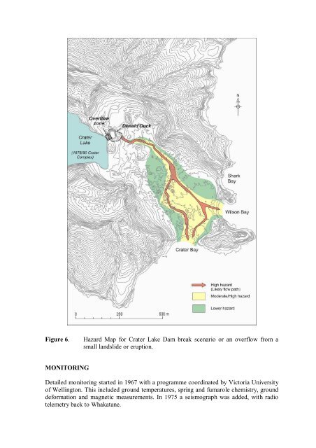
Figure 6.<br />
Hazard Map for Crater Lake Dam break scenario or an overflow from a<br />
small landslide or eruption.<br />
MONITORING<br />
Detailed monitoring started in 1967 with a programme coordinated by Victoria University<br />
<strong>of</strong> Wellington. This included ground temperatures, spring and fumarole chemistry, ground<br />
deformation and magnetic measurements. In 1975 a seismograph was added, with radio<br />
telemetry back to Whakatane.


