preliminary conference program - Floodplain Management
preliminary conference program - Floodplain Management
preliminary conference program - Floodplain Management

You also want an ePaper? Increase the reach of your titles
YUMPU automatically turns print PDFs into web optimized ePapers that Google loves.
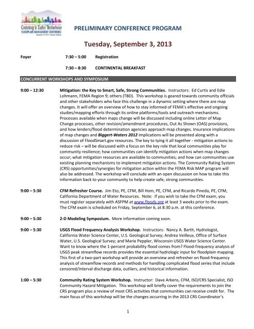
Foyer 7:30 – 5:00 Registration<br />
PRELIMINARY CONFERENCE PROGRAM<br />
Tuesday, September 3, 2013<br />
7:30 – 8:30 CONTINENTAL BREAKFAST<br />
CONCURRENT WORKSHOPS AND SYMPOSIUM<br />
9:00 – 12:30 Mitigation: the Key to Smart, Safe, Strong Communities. Instructors: Ed Curtis and Edie<br />
Lohmann, FEMA Region 9; others (TBD). This workshop is geared towards community officials<br />
and other stakeholders who face this challenge in a dynamic setting where there are map<br />
changes. It will offer an overview of how to stay informed of FEMA’s effective and ongoing<br />
studies/mapping efforts through its online platforms/tools and outreach mechanisms.<br />
Processes available when maps change will be discussed including online Letter of Map<br />
Change processes, other revision/amendment procedures, Out As Shown (OAS) provisions,<br />
and how lenders/flood determination agencies approach map changes. Insurance implications<br />
of map changes and Biggert-Waters 2012 implications will be presented along with a<br />
discussion of FloodSmart.gov resources. The key to tying it all together - mitigation actions to<br />
reduce risk – will be discussed with a focus on the key role that local communities play for<br />
community resilience; how communities can identify mitigation actions when map changes<br />
occur; what mitigation resources are available to communities; and how can communities use<br />
existing planning mechanisms to implement mitigation actions. The Community Rating System<br />
(CRS) opportunities/synergies for mitigation action within the FEMA Risk MAP <strong>program</strong> will<br />
also be addressed. The workshop will conclude with an open discussion on how to take this<br />
information back to your community to help create safe, strong communities.<br />
9:00 – 5:30 CFM Refresher Course. Jim Eto, PE, CFM, Bill Hom, PE, CFM, and Ricardo Pineda, PE, CFM,<br />
California Department of Water Resources. Note: if you wish to take the CFM exam, you<br />
must register separately with ASFPM at www.floods.org at least 3 weeks prior to the exam.<br />
The CFM exam is scheduled on Friday, September 6, at 8:30 a.m. at this <strong>conference</strong>.<br />
9:00 – 5:30 2-D Modeling Symposium. More information coming soon.<br />
9:00 – 5:30 USGS Flood Frequency Analysis Workshop. Instructors: Nancy A. Barth, Hydrologist,<br />
California Water Science Center, U.S. Geological Survey; Andrea Veilleux, Office of Surface<br />
Water, U.S. Geological Survey; and Marie Peppler, Wisconsin USGS Water Science Center.<br />
Want to know where the 1-percent probability flood comes from Flood-frequency analysis of<br />
USGS peak streamflow records provides the essential hydrologic input for floodplain mapping.<br />
This first of a two-part workshop will provide an overview and refresher on flood-frequency<br />
analysis of streamflow records and methods for handling complicated flood series that include<br />
censored/interval discharge data, outliers, and historical information.<br />
1:00 – 5:30 Community Rating System Workshop. Instructor: Dave Arkens, CFM, ISO/CRS Specialist, ISO<br />
Community Hazard Mitigation. This workshop will briefly cover the requirements to join the<br />
CRS <strong>program</strong> plus a review of most CRS activities that communities can receive credit for. The<br />
main focus of this workshop will be the changes occurring in the 2013 CRS Coordinator’s<br />
1
PRELIMINARY CONFERENCE PROGRAM<br />
Manual which is now in effect. The Community Rating System (CRS) provides flood insurance<br />
premium discounts in those communities that implement floodplain management activities<br />
above and beyond the minimum requirements of the National Flood Insurance Program<br />
(NFIP). The CRS has been proven to help motivate elected officials and residents to support<br />
flood protection <strong>program</strong>s. To date 83, of California's 518 communities in the NFIP are in the<br />
CRS. They have 64% of the flood insurance policies in the State, so these 83 represent the<br />
majority of California's flood problems. These communities are saving California residents<br />
more than $14 million each year.<br />
1:00 – 5:30 Central Valley Flood Risk Summit: From Central Valley to California Statewide – Practice and<br />
Integration. In the past 6 years, a lot of effort was put into the Central Valley (CV) to improve<br />
flood management. There have been many forward-thinking requirements, innovative<br />
approaches, and ground-breaking collaboration implemented throughout the process. The<br />
question becomes: how much these would translate into statewide practice or inspire broader<br />
integration The Summit offers a series of interactive panels examining lessons learned and<br />
opportunities for statewide policy and standards to improve floodplain management.<br />
1:00 – 5:30 Modifications of Stream Restoration Techniques for Arid and Semi-Arid Environments.<br />
Instructor: David T. Williams, PhD, PE, PH, CFM, CPESC, D.WRE, President, DTW and<br />
Associates, LLC. Most stream restoration design techniques have been developed for areas<br />
with climates and associated hydrology that are unlike those found in arid to semi-arid<br />
environments. The application of these techniques to arid environments will not work<br />
without appropriate adjustments, experience in arid environments, and understanding the<br />
underlying basis of the techniques and how they differ in arid areas. In fact, some techniques<br />
are not transferable to arid environments and alternative design techniques must be<br />
developed. This presentation/workshop will present the differences in these restoration<br />
techniques as they relate to climate differences in hydrology, regime relationships, channel<br />
forming discharge, equilibrium slope, design channel width and depth, and vegetative<br />
stabilization techniques.<br />
5:30 – 7:30 – EXHIBIT HALL OPENING RECEPTION!<br />
2
PRELIMINARY CONFERENCE PROGRAM<br />
Wednesday, September 4, 2013<br />
Foyer<br />
Exhibit Hall<br />
7:30-5:00 Registration<br />
7:30-8:30 CONTINENTAL BREAKFAST<br />
8:30 – 4:30 CRS One-on-One Sessions - By appointment only. If you are a currently a CRS community or a<br />
community interested in the CRS <strong>program</strong> please contact ISO/CRS Specialist Dave Arkens at<br />
dmarkens@iso.com or (702) 354-4674 for an appointment. Dave will discuss the upcoming CRS<br />
Manual changes with you or general CRS questions and concerns. Appointments are available<br />
each half hour. Contact Dave as soon as possible to reserve your time slot.<br />
8:30 – 10:30 PLENARY: Managing Flood Risk through Integrated Water <strong>Management</strong><br />
Welcome from the Chair: Marty Teal, FMA Board Chair, WEST Consultants<br />
Introduction of Conference Chairs and Committee: Iovanka Todt, Executive Director, FMA<br />
Josephine Axt, Josephine R. Axt, Ph.D., Chief of Planning, Los Angeles District, USACE<br />
Edie Lohmann, CFM, National Insurance Specialist, FEMA Region 9<br />
Gary Bardini, Deputy Director, California DWR<br />
Dusty Williams, General Manager, Riverside County Flood Control and Water Conservation<br />
District<br />
Celeste Cantu, Executive Director, Santa Ana Watershed Project Authority<br />
10:30 – 11:00 BREAK – Exhibit Hall<br />
11:00 – 12:30 CONCURRENT SESSIONS<br />
USACE Forum. This interactive session will discuss USACE policy and practice in flood risk<br />
management. More information to follow.<br />
ADVANCES IN FLOODPLAIN MAPPING<br />
Project <strong>Management</strong> for Risk MAP CTP’s – Define, Plan & Execute: The Keys to Delivering<br />
Quality Projects on Time, on Budget and Meet Expectations. Jeanne M. Ruefer, CFM, PMP,<br />
Accenture Federal Services and Alisa M. Sauvageot, CFM, Michael Baker Jr. Inc.<br />
California Deployment and Mapping Master Plan – A Collaborative Effort between FEMA<br />
Region IX and CA DWR. Ann Bechtel, PE, CFM, Senior Engineer II, Atkins<br />
Mapping All <strong>Floodplain</strong>s in Calaveras County on a Budget. Leo Kreymborg, Atkins<br />
COASTAL ANALYSIS - SAN FRANCISCO BAY AREA<br />
Sea Level Rise Vulnerability and Ecosystem-Based Adaptation in San Francisco Bay. Carlos<br />
Diaz, PE, Senior Associate Engineer II and Jeremy Lowe, Senior Coastal Geomorphologist,<br />
ESA PWA<br />
Coastal Hazard Analysis in Southern Alameda County Using a Two-Dimensional Modeling<br />
Approach. Rohin Saleh, Alameda County Flood Control and Water Conservation District<br />
3
PRELIMINARY CONFERENCE PROGRAM<br />
<br />
Sensitivity of Extreme Still Water Level to Length of Record in San Francisco Bay,<br />
California. Matt Brennan, PhD, PE, ESA PWA<br />
TUFLOW PRODUCTS DEMONSTRATION<br />
The TUFLOW Demonstration session returns to FMA. The session will discuss floodplain<br />
modeling fundamentals and the pros and cons of different approaches, considering accuracy,<br />
ease of use, efficiency and communications with stakeholders. This will also address technical<br />
aspects such as computational performance and stability and how to accurately represent<br />
structures and functionality. The second half of the session will describe the latest features of<br />
the three TUFLOW Products (Classic, FV and GPU); features that further enhance the modeler’s<br />
experience and expand the range of application. Presenters: Bill Syme and Chris Nielsen.<br />
ADVANCED MODELING SOLUTIONS FOR LOCAL FLOOD RISK I<br />
Hydraulic and Hydrologic Model Integration. Victor de Loza, Santa Clara Valley Water<br />
Disctrict<br />
Modeling Interior Urban <strong>Floodplain</strong>s Dependent on Pumping. Daniel Schaaf, PE, Principal,<br />
Schaaf & Wheeler Consulting Civil Engineers<br />
Advanced <strong>Floodplain</strong> Modeling Techniques in Rohner Creek, Fortuna California. Greg<br />
Garrison, EIT, Project Engineer, GHD Inc.<br />
WORKSHOP: Integrative <strong>Floodplain</strong> Design. Presenters: Stefan Lorenzato, Coordinator,<br />
Riparian Habitat Joint Venture, Dr. Tom Griggs, Senior Ecologist, River Partners, Inc. and Dr.<br />
Chris Bowles, President, CBEC Eco Engineering. Integrative <strong>Floodplain</strong> Design will bring<br />
together the science of riparian restoration and flood risk reduction. This workshop looks at the<br />
interplay of plants and floodplain hydraulics, the adaptations of plants to floods and how these<br />
adaptations can be used to our advantage when designing and operating flood management<br />
systems. Key considerations in plant community structure to support endangered species and<br />
the feedback cycles between plant communities and ecosystem processes will be discussed.<br />
Tapping these relationships to reduce risks associated with flooding will be illustrated through<br />
the application of computer models for conceptual and existing floodway designs. The notion of<br />
reconciliation design will be presented and examples of developing project goals and objectives<br />
consistent with the integration of plant community structure and flood conveyance will be<br />
presented. A set of key design criteria will also be presented.<br />
12:30 – 2:00 INNOVATION AND AWARDS LUNCHEON<br />
2:15 – 3:45 CONCURRENT SESSIONS<br />
Keynote Speaker: Susan Gilson, Executive Director, National Association of Flood and<br />
Stormwater <strong>Management</strong> Agencies<br />
PANEL: Understanding and Communicating Flood Risk. Moderator: Stuart McKibbin, Chief,<br />
Regulatory Section, Riverside County Flood Control and Water Conservation District. More<br />
information to follow.<br />
4
PRELIMINARY CONFERENCE PROGRAM<br />
COASTAL FLOOD RISK ANALYSIS AND MITIGATION I<br />
Building Coastal Resilience Through Adaptive Sea Level Rise Planning - A Case Study: Jacobs<br />
Avenue, Eureka, CA. Evan Wisheropp, Humboldt State University<br />
Going Above and Beyond… What Coastal Communities Can Do to Become More Resilient<br />
and Lower Flood Insurance Costs. Vince Geronimo, PE, CFM, Senior Project Manager,<br />
BakerAECOM<br />
Effect of Storm Surge on Sacramento-San Joaquin Delta Flood Stages. Dennis Huff, HDR<br />
Developing Long-Term Coastal Erosion Hazard Maps in Lakes Erie and Ontario. Jeremy<br />
Mull, AECOM Water<br />
EPA SWMM5/PCSWMM Demonstration Session. More information to follow.<br />
ADVANCED MODELING SOLUTIONS FOR LOCAL FLOOD RISK II<br />
Managing Floods and Sedimentation in Alameda Creek by Use of 1D and 2D Modeling<br />
Tools. Julio A. Zyserman, PhD, DHI Water & Environment, Inc.<br />
Investigating Flood Alternatives for the Yolo Bypass using the HEC 2D Model. William E.<br />
Fleenor, PhD, Center for watershed Sciences, University of California, Davis<br />
Flood Control Infrastructure Data Web-Access. Dan Matthies PE CFM and Cheng Soo PE,<br />
CFM, Wood Rodgers Inc.<br />
CENTRAL VALLEY FLOOD PROTECTION PLAN - CONSERVATION STRATEGY<br />
The Benefits of Multi-Objective Projects to Flood Protection and the Ecosystem Affected in<br />
the Central Valley Flood Protection Plan. Heidi Hall, Calif. Dept. of Water Resources,<br />
Floodway Ecosystem Sustainability Branch<br />
Central Valley Flood System Conservation Strategy: Species-focused Conservation Planning.<br />
Ron Melcer Jr., California Dept. of Water Resources<br />
Assessment of <strong>Floodplain</strong> Lowering and Levee Setback Actions to Support the Central<br />
Valley Flood System Conservation Strategy Program. Kevin Coulton, PE, CFM, cbec, inc.<br />
WORKSHOP: Understanding Foundation Flood Vents and FEMA’s Technical Bulletin 1.<br />
Presenter: Michael J. Graham, Smart Vent Products, Inc. This course provides insight into the<br />
importance of proper foundation flood vents and compliance with Building Codes and FEMA<br />
standards and how they can effectively prevent major damage to buildings due to flooding.<br />
The course will review applicable codes pertaining to foundation flood venting, including a<br />
complete review of FEMA’s new Technical Bulletin TB-1. After the course, participants will<br />
have a thorough understanding of the difference between non-engineered openings and<br />
engineered openings and the important role they play in designing a sustainable structure.<br />
3:45 – 4:15 BREAK – Exhibit Hall<br />
4:15 – 5:45 CONCURRENT SESSIONS<br />
COASTAL FLOOD RISK ANALYSIS AND MITIGATION II<br />
5
PRELIMINARY CONFERENCE PROGRAM<br />
<br />
<br />
<br />
Remapping the Coastal Hazards of California: Big Changes along the Pacific Coastline.<br />
Nicole Metzger, Oceanographer and Project Manager, Michael Baker Jr., Inc.<br />
What a New 50-Year Wave Hindcast Reveals About 1982-83 Winter of Extreme Storminess<br />
Along California Coast. Darryl Hatheway, BakerAECOM Water<br />
Fluvial Flood Risk in Response to Climate Change on the Santa Clara River and Ventura<br />
River in Ventura County, CA. James Gregory, MS PE, Fluvial Hydrologist, ESA |<br />
Environmental Hydrology<br />
INNOVATIVE APPLICATIONS OF 2D MODELING<br />
Integrated 1D/2D and 2D models for Emergency Response and Planning. Anthony Kuch,<br />
Vice President North America XP Solutions<br />
Silicon Valley BART Extension - An Analysis of Flood Hazard Impacts Using Two-<br />
Dimensional Modeling. Charles D. Anderson, PE, Principal, Schaaf & Wheeler Consulting<br />
Civil Engineers<br />
Eagle P3 Adverse Impact Analysis – Constructing a $2 Billion Transportation Corridor<br />
Across Drainage Mayhem. Don Jacobs, PE, Enginuity Engineering Solutions<br />
IMPROVING LEVEES FOR CERTIFICATION AND A HIGHER LEVEL OF PROTECTION<br />
The Winding Road to Levee Rehabilitation in Ventura County. Ike Pace, PE, Program<br />
Manager, Tetra Tech Inc.<br />
2015 Is Approaching – Do You Have a Plan for Attaining 200-year Flood Protection<br />
Kimberly Brown, HDR Engineering<br />
Raise Levees for FEMA Accreditation Without Raising Roadways - An Innovative Approach<br />
and Case Study. Steve Harris, Area Manager, FloodBreak<br />
OVERCOMING THE HURDLES OF FLOODPLAIN REGULATIONS<br />
Maintaining Compliance with the NFIP: Community Lessons Learned. Anthony D. Barry,<br />
PE, CFM, County of San Diego Flood Control Engineering<br />
City of Livermore Stream Maintenance Permit – First Step to Watershed-wide Public<br />
Stewardship and Seamless Watershed <strong>Management</strong>. Pamela Lung, PE, CFM, Associate Civil<br />
Engineer, City of Livermore and Jeff Thomas, ICF Jones & Stokes<br />
Regulation Quagmire. Tory R. Walker, PE, CFM, LEED GA, Tory Walker Engineering<br />
POST-WILDFIRE FLOODING: THE HAZARD ISN'T OVER YET!<br />
Sediment <strong>Management</strong> Strategies for Fire-Debris Preparedness: Pacoima Reservoir, Los<br />
Angeles County. Ira Artz, Divisional Vice President, Tetra Tech<br />
Postfire Flood Hazard Modeling from a Pre-fire Planning Perspective, Southern California.<br />
Jeremy T. Lancaster CEG, California Geological Survey<br />
Assessing Post-Wildfire Flood Hazard Potential - The Station Fire Revisited. Philip Shaller,<br />
Exponent, Inc.<br />
Exhibit Hall<br />
5:45 – 7:45 GRAND RECEPTION AND NETWORKING<br />
6
7:30-5:00 Registration<br />
PRELIMINARY CONFERENCE PROGRAM<br />
Thursday, September 5, 2013<br />
7:30-8:30 CONTINENTAL BREAKFAST - Exhibit Hall<br />
7:30-9:30 INNOVATION SESSION: DWR and USACE California Interactive Roundtable: Crafting<br />
California's Flood Future - Moving Forward in Managing the State's Flood Risk. More<br />
information to follow.<br />
7:30 – 11:30 CRS One-on-One Sessions - By appointment only. If you are a currently a CRS community or<br />
a community interested in the CRS <strong>program</strong> please contact ISO/CRS Specialist Dave Arkens at<br />
dmarkens@iso.com or (702) 354-4674 for an appointment. Dave will discuss the upcoming<br />
CRS Manual changes with you or general CRS questions and concerns. Appointments are<br />
available each half hour. Contact Dave as soon as possible to reserve your time slot.<br />
8:00 – 9:30 CONCURRENT SESSIONS<br />
WORKSHOP: <strong>Floodplain</strong> Mapping in HEC-RAS. Presenter: Mark Jensen, M.S., Senior<br />
Hydraulic Engineer, Hydrologic Engineering Center, Institute for Water Resources, U.S. Army<br />
Corps of Engineers. The Hydrologic Engineering Center’s River Analysis System (HEC-RAS) is<br />
widely used for computing water surface elevations with results processed to determine<br />
inundation extent and flood depths. These floodplain boundary and flood depth results are<br />
used to establish flood insurance rate maps, analyze severe flood events, establish<br />
emergency action plans, estimate flood damage losses, and evaluate habitat restoration<br />
alternatives. The new delineation capabilities in HEC-RAS allow the modeler to visualize the<br />
resulting floodplain directly, providing a more efficient environment for hydraulic model<br />
refinement than post-processing results in GIS. These dynamic mapping capabilities are<br />
particularly useful for refining models in 1D and 2D analysis. New capabilities in floodplain<br />
delineation can store maps in GeoTiffs format for use in other GIS <strong>program</strong>s, publish maps to<br />
a TMS (tile maps server) or public maps to a WMS (web map server). The TMS capability<br />
allows for flood maps to be viewed without any special software in a general web browser<br />
(computer, tablet or smart phone). The WMS capability allows for computed hydraulic results<br />
to be viewed in Google Earth.<br />
COMBINING 1D AND 2D MODELING & OTHER APPLICATIONS<br />
2-Dimensional Overland Flow for Storm Drain Infrastructure Design. Jay Sullivan, PE ,<br />
RBF Consulting, a Baker Corporation<br />
Lower San Joaquin River Embedding in FLO-2D Model: A Comparative Study with<br />
Unsteady HEC-RAS Model. Om Prakash, Ph.D., Senior Engineer, WEST Consultants, Inc.<br />
2D Hydraulic Modeling of Innovative Streambank Protection Measures. Venkat<br />
Gummadi, PE, Engineer, Geosyntec Consultants and Trevor Alsop, PE, Senior Engineer,<br />
Geosyntec Consultants<br />
7
PRELIMINARY CONFERENCE PROGRAM<br />
RESTORING RIVERS, STREAMS AND WATERSHEDS<br />
Effects of Native Establishment in Late Summer. Joseph Paternoster, DriWater, Santa<br />
Rosa, CA<br />
Lower Squaw Creek Design – A Case Study Of Hydro-Geomorphic Restoration. Mike<br />
Liquori, Arnie Thompson and Pam Boyle, Sound Watershed<br />
Interagency Collaboration: Working Together Towards Watershed Restoration in<br />
Northern California. Ryan Teubert, Flood Risk Coordinator, Western Shasta Resource<br />
Conservation District<br />
9:30 – 10:00 BREAK – Exhibit Hall<br />
LEVEE HAZARD AND BREACH ANALYSES<br />
A New and Innovative Methodology for Determining the Integrity of Levee / Bank<br />
Slope and Toe Protection. Chris Bowles, PhD, cbec eco engineering<br />
Hidden Erosion Hazards on the Lower Sacramento River Levees. Thomas W. Smith, PE,<br />
GE, President, RiverSmith Engineering, Inc.<br />
Review of Existing San Francisco Bay Restoration Levee Breaches: Breach Width<br />
Progression, Channel Depth, and Average Annual Rate of Widening. Rohin Saleh, PE,<br />
Alameda County Flood Control and Water Conservation District and Matthew Powers,<br />
PE, GEI Consultants, Inc.<br />
INNOVATIVE TOOLS AND APPROACHES IN FLOODPLAIN HYDROLOGY I<br />
Optimizing Flood Mitigation for Detention Basin Designs and Design Retrofits. Andrew<br />
Ronnau, PhD, PE, Project Manager, Pacific Advanced Civil Engineering, Inc.<br />
Detention Basin Efficiency Analysis and Policy Effectiveness. David Laak and Richard<br />
Gleason, Kasraie Consulting<br />
Updated Regional Curves of Creek Hydraulic Geometry for Marin and Sonoma<br />
Counties of the San Francisco Bay Area. Roger Leventhal, PE, CFM, Marin County Public<br />
Works<br />
10:00 – 11:30 CONCURRENT SESSIONS<br />
INTERACTIVE LEGAL PANEL: 2012 NFIP Reform: Legal Implications for Public Entities<br />
Andrea P. Clark, Attorney at Law, Downey Brand<br />
Edie Lohmann, National Flood Insurance Specialist, FEMA Region 9<br />
Roy Brewer, Attorney at Law, Brewer Lofgren<br />
Phyllis Helt, Selective Insurance<br />
LOCAL FLOOD CONTROL AND DRAINAGE SYSTEM IMPROVEMENT<br />
Achieving Regional Flood Impact Mitigation through Hydromodification and Peak<br />
Flow <strong>Management</strong> - A Case Study for the City of Salinas. Harvey Oslick, PE, CFM,<br />
CPSWQ, Senior Associate, RBF Consulting, A Baker Company<br />
8
PRELIMINARY CONFERENCE PROGRAM<br />
<br />
<br />
Unionhouse Creek Flood Control Improvement Project: A Local-Level Approach to<br />
Urban Flood Control Improvements. Jesse Patchett, Project Engineer, Peterson<br />
Brustad Inc.<br />
Using a Dynamic Approach for a Dynamic Project Site. Mark Seits, PE CFM, Vice<br />
President, HDR; John Chun, PE, Deputy Chief Harbor Engineer, Port of Long Beach; Kai<br />
Wang, PE, Project Engineer, HDR; Yuying Li, Senior GIS Analyst/Programmer, HDR<br />
COMBINING 1D AND 2D MODELING: SOFTWARE SOLUTIONS<br />
FLO-2D – EPA SWMM Integration: Surface Water - Storm Drain Exchange<br />
Enhancements. Noemi Gonzalez-Ramirez, PhD, Senior Hydraulic Engineer, FLO-2D<br />
Software, Inc.<br />
An Efficient and Fully Conservative Method to Couple 1-D and 2-D Hydraulic Flexible<br />
Mesh Models. Reinaldo Garcia, 2Hydronia, LLC<br />
Combined 1D and 2D Hydraulic Modeling with HEC-RAS. Gary W. Brunner, PE, D.WRE,<br />
Hydrologic Engineering Center, Institute for Water Resources, U.S. Army Corps of<br />
Engineers<br />
RESTORING ECOSYSTEMS AND INTEGRATING MULTIPLE FUNCTIONS TO FLOOD<br />
CORRIDORS<br />
Riparian Habitat Enhancement Improves Flood Conveyance Performance of the<br />
Pajaro River Flood Protection Project. Brad Hall, Principal, Northwest Hydraulic<br />
Consultants<br />
Ballona Wetlands Restoration: Integrated Habitat Restoration and Flood<br />
<strong>Management</strong> in Los Angeles. Nicholas Garrity, PE, Southern California Manager, ESA<br />
PWA<br />
DWR’s Flood Corridor Program – Restoring <strong>Floodplain</strong> Functions While Reducing<br />
Flood Risk. Ron Unger<br />
Chief, Environmental Support Section, Flood Corridor Programs & Environmental<br />
Support Branch, California Department of Water Resources - Division of Flood<br />
<strong>Management</strong><br />
REAL TIME FLOOD MODELING APPLICATIONS<br />
Delta Flood Emergency Response Real-Time Modeling Tool Developed for DWR’s<br />
Delta Flood Emergency Preparedness and Response and Recovery Program. Jeffrey E.<br />
Twitchell, PE, GEI Consultants; John F. DeGeorge, PhD, PE, Resource <strong>Management</strong><br />
Associates, Inc.; Martin W. McCann, Jr., Jack R. Benjamin & Associates, Inc.; and Dustin<br />
J. Jones, PE, CA Department of Water Resources<br />
30 Years of Flood Detection System Operation in Orange County, California – Key<br />
Milestones and Lessons Learned. Chris Crompton, Manager, Water Quality<br />
Compliance, County of Orange<br />
Real Time Flood Forecasting with PCSWMM, NEXRAD and SWMM5. Karen Finney,<br />
Computational Hydraulics International<br />
INNOVATIVE TOOLS AND APPROACHES IN FLOODPLAIN HYDROLOGY II<br />
ARkStorm: A Plausible Catastrophic Emergency Response Scenario in Ventura County,<br />
California. Brian J. Trushinski, BES, MA, CFM, <strong>Floodplain</strong> Manager, County of Ventura<br />
Sergio Vargas, PE., Deputy Director, Ventura County Watershed Protection District<br />
9
PRELIMINARY CONFERENCE PROGRAM<br />
<br />
<br />
Developing New Design Storms in the Arid Southwest. David C. Curtis, PhD, WEST<br />
Consultants<br />
Truckee River Flood <strong>Management</strong> Authority Regional Hydrologic Model. Jeffrey<br />
House, National Director of Water Resources, Manhard Consulting<br />
11:30 – 1:00 BUFFET NETWORKING LUNCH – Exhibit Hall<br />
1:00 – 2:30 CONCURRENT SESSIONS<br />
FEMA INTERACTIVE PANEL AND FORUM: Risk MAP and Discovery Meetings in<br />
Communities / Improving Flood Resilience through Risk MAP. More information to<br />
follow.<br />
FINANCING STRATEGIES AND PROGRAMS IN FLOOD RISK MANAGEMENT<br />
The Hybrid Integrated Flood Insurance Entity (HIFIE) – An Innovative Alternative to<br />
the National Flood Insurance Program. Jeffrey A. Adams, PhD, PE, Associate, ENGEO<br />
Incorporated<br />
Department of Water Resources’ Flood Grant Programs for Flood Projects and<br />
Evaluations in the Central Valley and Statewide. Michael Sabbaghian, Project<br />
Development Branch Chief, Flood Projects Office, Division of Flood <strong>Management</strong><br />
Funding the Future of Flood Control – Local and Regional Finance Strategies. Seth<br />
Wurzel, MBA, President, Seth Wurzel Consulting<br />
IMPROVING 2D MODELING RESULTS<br />
Strategies for Successful 2D Model <strong>Management</strong> and Review. Brian Rowley, PE, CFM,<br />
Senior Water Resources Engineer, ATKINS<br />
Automated Adjustment of the Manning n-values in the FLO-2D Model. Jimmy S.<br />
O’Brien, PE, Ph. D., President, FLO-2D Software, Inc.<br />
Regulatory Compliance in the Age of 2-D Modeling. Mark Glidden, PE, CH2M HILL, Inc.<br />
The Importance of Using Flexible Meshes to Simulate Flooding over Complex Terrain<br />
with Two-Dimensional Models. Reinaldo Garcia, 2Hydronia, LLC<br />
MULTI-OBJECTIVE APPROACHES IN FLOOD RISK MITIGATION<br />
Beyond Mitigation: Effective Integration of Environmental Stewardship Goals into<br />
Flood <strong>Management</strong> Projects. Elizabeth Andrews, PE, ESA PWA<br />
High Water, Dry Feet, and Low Lands: Opportunities and Barriers to Multiple Layers<br />
of Safety in the Netherlands and the United States. Jessica Ludy, Water Resources<br />
Planner, Arcadis-US<br />
Gobernadora Multipurpose Basin Project: Integrated Success! Joey Soto, MS,<br />
Consultant, Soto Resources and Don Bunts, PE, Chief Engineer, Santa Margarita Water<br />
District<br />
INTEGRATED PLANNING I<br />
Proactive versus Reactive <strong>Floodplain</strong> <strong>Management</strong> – The Diverse Consequences of<br />
the 2011 Australian Floods. Bill Syme, Associate, BMT WBM Pty Ltd<br />
10
PRELIMINARY CONFERENCE PROGRAM<br />
<br />
<br />
Upper Calleguas Creek Watershed <strong>Management</strong> Strategy Study. Brian Murphy, PE,<br />
PH, CFM, Water Resources Engineer, CDM<br />
Regional Watershed Planning Tool for Application of Integrated Flood <strong>Management</strong><br />
(IFM). Bruce Phillips, Senior Vice President, Stormwater <strong>Management</strong>, PACE Advanced<br />
Water Engineering<br />
2:30 – 3:00 BREAK – Exhibit Hall<br />
3:00 – 4:30 CONCURRENT SESSIONS<br />
FLOOD RISK EVALUATION AND MAPPING ON ALLUVIAL FANS<br />
Use of Two-Dimensional Models for Flood Hazard Assessment on Active Alluvial Fans.<br />
Jonathan Fuller, PE, RG, PH, CFM, D.WRE<br />
East Ojai <strong>Floodplain</strong> Mapping – An Integrated Approach to Assess Mixed Alluvial Fan<br />
and Riverine Flooding Risks. Sergio Vargas, Deputy Director, Planning & Regulatory<br />
Division, Ventura County Watershed Protection District<br />
A Comparison of Analytic Methods for Hydrologic and Sediment Transport Analysis<br />
on Alluvial Fans in the Arid Western United States. David A. Jaffe, PhD, PE, D.WRE,<br />
AECOM<br />
(NOTE: This session ends at 5:45 p.m.)<br />
PANEL: Managing Flood Risk on the West Coast: the Final Frontier. Panelists will share<br />
their experiences with local sea level rise analyses, discuss the key elements required for a<br />
statewide ‘proof of concept’ and make recommendations to chart a path toward a<br />
defensible Advisory SLR Map for California.<br />
Moderator: Ricardo Pineda, PE, Chief, <strong>Floodplain</strong> Risk <strong>Management</strong> Branch, California<br />
DWR<br />
Ed Curtis, PE, CFM, Senior Civil Engineer, FEMA Region IX Mitigation Division<br />
Moira McEnespy, Deputy Manager, State Coastal Conservancy, South Coast Program<br />
Lesley Ewing, PE, Senior Coastal Engineer, California Coastal Commission<br />
Patrick Barnard, PhD, Coastal Geologist, USGS<br />
Doug Marcy, Coastal Hazards Specialist, NOAA National Ocean Service / Coastal<br />
Services Center<br />
Abe Dougherty, Project Specialist, California Ocean Protection Council<br />
FLOOD AWARENESS INITIATIVES AND COMMUNITY ENGAGEMENT TOOLS<br />
Flood Risk, Flood Reform and Engaging Community Action. Bruce Bender, FloodSmart<br />
California Flood Preparedness Week – Community Outreach Tools. Judy Soutiere,<br />
CFM, Flood Risk Manager, Sacramento District, US Army Corps of Engineers and Maria<br />
T. Lorenzo-Lee, PE, CFM, Department of Water Resources, FloodSAFE Communications<br />
High Water Mark Initiative - Know Your Line. Representative, FEMA Region 9<br />
Immigrant Public Engagement in Emergency <strong>Management</strong>. Wendy Chang, Public<br />
Relations Specialist, BakerAECOM<br />
WHY THE DIFFERENCE COMPARING AND EVALUATING RESULTS IN 2D MODELING<br />
11
PRELIMINARY CONFERENCE PROGRAM<br />
<br />
<br />
<br />
<br />
Dam Breach Inundation Comparison using HEC-RAS 4.2 and FLO-2D. Cameron<br />
Jenkins, PE, Hydraulic Engineer, WEST Consultants Inc.<br />
Overland Flow Routing: Validating HEC-RAS Storage Area Results Using FLO-2D. Pani<br />
Ramalingam, PhD, PE, Senior Project Engineer, HDR Engineering<br />
Comparison of 2-D Modeling Results for Overland Flow. Michael Konieczki, PE, Brian<br />
Brown, PE, Tom Molls, PE, PhD - David Ford Consulting Engineers, Inc.<br />
Multi-Frequency Comparison of 2D Models in an Urban Area. Brent Siemer, City of<br />
Simi Valley Public Works Department and Hassan Kasraie, Kasraie Consulting, Ventura,<br />
CA<br />
SOLVING MODELING CHALLENGES FOR THE CVFED PROGRAM<br />
Resolution of Instabilities in Complex Unsteady HEC-RAS Models. Alan Turner, PE,<br />
CFM, CH2M HILL, Inc.<br />
Enhancing the Complex Lower Sacramento River System Using 1D- and 2D- Hydraulic<br />
Modeling Techniques. Chris Ferrari, PE, and Shyamal Chowdhurry, PE, Wood Rodgers<br />
Applying GIS Technology to Hydraulic Model Scenario <strong>Management</strong>. Sheng Tan, GISP<br />
and Kyle Morgan, Wood Rodgers, Inc.<br />
INTEGRATED PLANNING II<br />
The Evolution of Flood Risk in the South Orange County IRWMP. Patti Sexton, PE,<br />
CFM, Program Manager, Tetra Tech Inc. and Marilyn Thoms, Manager, Watershed<br />
<strong>Management</strong>, Orange County Public Works<br />
Planning, CA Style! Leveraging CA Planning Initiatives to Streamline Hazard<br />
Mitigation. Rob Flaner, CFM, Tetra Tech, Inc.<br />
The Time is Now—Responding to State Flood Risk Legislation and General Plan<br />
Amendments. Tracey Ferguson, Project Manager, Integrated Water Resources, ATKINS<br />
LEVEES: SPECIAL TOPICS<br />
Singing off the Same Sheet of Music: Synchronizing Levee Information <strong>Management</strong><br />
for FEMA and USACE. Xing Liu, Michael Baker Jr. Inc.<br />
Dealing with the Uncertainty Associated with Modeling Levee Breaches. John<br />
Pritchard, PE, CFM, Wood Rodgers, Inc. and Bill Syme, BMT WBM, Pty Ltd<br />
Advanced Hydrodynamic Modeling in Riverine Applications: Flood response, Levee<br />
Breach, Structures, Morphology and Advanced Hydrodynamics. Chris Nielsen,<br />
Associate, BMT WBM Pty Ltd<br />
4:30 – 8:00 CALIFORNIA DISNEY ADVENTURE! Join your colleagues exploring your<br />
choice of either the Disneyland Park or California Adventure Park. Note: Free Admission<br />
Tickets included in Full Conference Registration Only.<br />
12
PRELIMINARY CONFERENCE PROGRAM<br />
7:30 – 5:00 Registration<br />
7:30 – 8:30 CONTINENTAL BREAKFAST<br />
Friday, September 6, 2013<br />
8:00 – 9:00 FLOODPLAIN MANAGEMENT POLICY FORUM – State and National Topics<br />
8:30 – 12:00 CFM Exam. Advance registration with ASFPM required.<br />
9:00 – 10:30 CONCURRENT SESSIONS AND FIELD TRIP<br />
PANEL: Integration of Flood <strong>Management</strong>, Hydromodification, Habitat and Water<br />
Quality – Finding Common Goals and Practical Solutions. The focus of this interactive<br />
forum is to first identify from a panel of experts from various state and local agencies the<br />
challenges to integration of flood management, water quality and hydromodification goals.<br />
From the discussion of the challenges, potential common goals will be identified and<br />
examples where practical solutions should be pursued.<br />
Moderator: David H. Pohl, PhD, PE, Senior Program Manager, ESA PWA<br />
Cid Tesoro, San Diego County Dept. of Public Works<br />
Eric Bernstein, California Water Resources Control Board<br />
Eileen Takata, USACE, Los Angeles District<br />
Terri Grant, County of Los Angeles Public Works<br />
Jason Uhley, Riverside County Flood Control and Water Conservation District<br />
TOPICS IN 2D MODEL VALIDATION<br />
2D Model Calibration of 1998 El Niño Storm, Hassan Kasraie, Kasraie Consulting,<br />
Ventura, CA<br />
The Effect of Orientation of Square 2D Grid Elements on Possible Hydraulic Bias in<br />
Multiple-Direction Flow Hydraulic Models, Neil M. Jordan, PE, DWRE, Hromadka &<br />
Associates and Theodore Hromadka, Department of Mathematical Science, United<br />
States Military Academy, West Point, NY<br />
Benchmarking SWMM5/PCSWMM 2D Model Performance, Rob James,<br />
Computational Hydraulics International<br />
SPECIAL AGENCY MEETING: Southern California Silver Jackets Kick-Off Summit<br />
FIELD TRIP: Dominguez Wetlands Restoration. The $7 million treatment wetlands and<br />
spreading grounds project is the latest in a series of regional, multi-benefit projects<br />
implemented by the Los Angeles County Flood Control District, including the Sun Valley<br />
Park and Tuxford Green projects in the Sun Valley Watershed and the Tujunga Wash<br />
Greenway and River Restoration project in the San Fernando Valley's Valley Glen<br />
community. The wetlands project is one of the top five demonstration projects of the Los<br />
13
PRELIMINARY CONFERENCE PROGRAM<br />
Angeles River Master Plan. It maintains the integrity of flood protection along the urban<br />
lower reaches of the river, while introducing new water quality elements, groundwater<br />
recharge, restoration of native habitat, pedestrian and equestrian trails, environmental<br />
education, and river bike trail enhancements.<br />
10:30 – 12:00 2-D Roundtable: What have we learned Join the 2D Modeling “Geeks” in this lively and<br />
interactive forum on solutions and next steps for federal, state and local policy and<br />
regulation. Hosted by the FMA Modeling Committee.<br />
We look forward to seeing you next September in Santa Clara,<br />
California!<br />
14