San Francisco Relocation Guide - Antevia
San Francisco Relocation Guide - Antevia
San Francisco Relocation Guide - Antevia

You also want an ePaper? Increase the reach of your titles
YUMPU automatically turns print PDFs into web optimized ePapers that Google loves.
Sunset District, <strong>San</strong> <strong>Francisco</strong>, California<br />
From Wikipedia, the free encyclopedia<br />
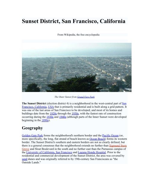
The Outer Sunset from Grand View Park<br />
The Sunset District (election district 4) is a neighborhood in the west-central part of <strong>San</strong><br />
<strong>Francisco</strong>, California, USA that is primarily residential and is built along a grid pattern. It<br />
was one of the last areas of <strong>San</strong> <strong>Francisco</strong> to be developed, and most of its homes and<br />
buildings date from the 1920s through the 1950s, with the fastest rate of construction<br />
occurring during the 1930s and 1940s (although parts of the Inner Sunset were developed<br />
beginning in the 1890s).<br />
Geography<br />
Golden Gate Park forms the neighborhood's northern border and the Pacific Ocean (or,<br />
more specifically, the long, flat strand of beach known as Ocean Beach) forms its western<br />
border. The Sunset District's southern and eastern borders are not as clearly defined, but<br />
there is a general consensus that the neighborhood extends no further than Sigmund Stern<br />
Grove and Sloat Boulevard in the south and no further east than the Parnassus campus of<br />
the University of California, <strong>San</strong> <strong>Francisco</strong> and Laguna Honda Hospital. Prior to the<br />
residential and commercial development of the Sunset District, the area was covered by<br />
sand dunes and was originally referred to by 19th-century <strong>San</strong> Franciscans as "the<br />
Outside Lands."