

Download - NASA Airborne Science Program
Download - NASA Airborne Science Program
Download - NASA Airborne Science Program

You also want an ePaper? Increase the reach of your titles
YUMPU automatically turns print PDFs into web optimized ePapers that Google loves.
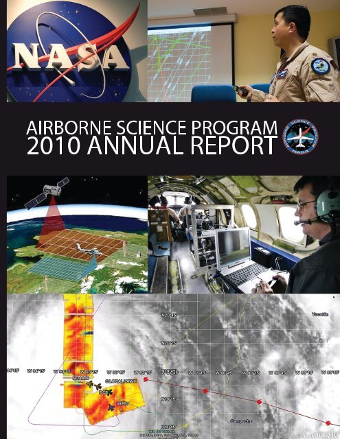
AIRBORNE SCIENCE PROGRAM<br />
2010 ANNUAL REPORT
<strong>Airborne</strong> <strong>Science</strong> <strong>Program</strong><br />
ANNUAL REPORT<br />
2010<br />
National Aeronautics and Space Administration
Table of Contents<br />
From the Director . . . . . . . . . . . . . . . . . . . . . . . . . . . . . 1<br />
The <strong>Airborne</strong> <strong>Science</strong> <strong>Program</strong>: FY10<br />
Introduction and <strong>Program</strong> Highlights 3<br />
Budget 4<br />
Recognition and Awards 6<br />
<strong>Science</strong> Support<br />
Major Missions Flown in 2010 7<br />
<strong>Science</strong> Support Data 8<br />
Requirements Analysis. . . . . . . . . . . . . . . . . . . . . . . . . . 12<br />
<strong>NASA</strong> Aircraft Platforms . . . . . . . . . . . . . . . . . . . . . . . . . . . . . . . . . . . . . 13<br />
Large Aircraft. 15<br />
High Altitude Aircraft . 18<br />
Small and Medium Aircraft 23<br />
Commercial/BPA Aircraft. . . . . . . . . . . . . . . . . . . . . . . . . 36<br />
Non-<strong>NASA</strong> Government Aircraft 37<br />
ASP Facility <strong>Science</strong> Instrumentation<br />
<strong>Airborne</strong> Sensor Facility 39<br />
New Instrument: PRISM 40<br />
<strong>Airborne</strong> <strong>Science</strong> Information Technology and<br />
Communications Support Systems<br />
ASP Website and Flight Request System 41<br />
Data and Communication Systems 42<br />
Future Data and Communications Infrastructure. . . . . . . . . . . . . . . . . 44<br />
Education and Outreach<br />
Student <strong>Airborne</strong> Research <strong>Program</strong> 47<br />
Collaborations and Partnerships 48<br />
iii
Appendices<br />
A. Five-Year Planning Schedule 51<br />
B. Aircraft Flight Profiles. 53<br />
C. <strong>Airborne</strong> <strong>Program</strong> History 61<br />
D. Acronyms and Abbreviations 65<br />
iv
From the Director<br />
I’d like to start off my first <strong>Airborne</strong> <strong>Science</strong><br />
<strong>Program</strong> Annual Report by echoing what I wrote<br />
for my first <strong>Airborne</strong> <strong>Science</strong> Newsletter; I am<br />
excited and proud to be a part of the <strong>NASA</strong><br />
<strong>Airborne</strong> <strong>Science</strong> <strong>Program</strong>. I continue to be<br />
impressed with the hard work and dedication of<br />
the people and am looking forward to another<br />
successful year in 2011. I also want to again thank<br />
Randy Albertson for his leadership and tutelage<br />
over these past few months and for keeping me on<br />
the right track.<br />
This year has been another busy year with over<br />
2700 flight hours flown, including deployments<br />
all over the world. We supported numerous<br />
satellite calibration and validation flights, multiple<br />
Earth <strong>Science</strong> missions including two Operation<br />
IceBridge deployments (Arctic and the Antarctic),<br />
as well as multiple deployments to the Gulf<br />
of Mexico for the response to the Gulf oil spill<br />
disaster. In addition, we trained 29 undergraduate<br />
and graduate students through our Student<br />
<strong>Airborne</strong> Research <strong>Program</strong> and participated in<br />
several major conferences to help spread the word<br />
about what we do.<br />
Even though it was a great year, it was not without<br />
its problems. We had maintenance and scheduling<br />
issues, which caused us to miss several data<br />
collection opportunities. We need to ensure, to the<br />
best of our abilities, that doesn’t happen in the<br />
future. We are looking at better ways to manage<br />
our infrastructure, train our people, and utilize<br />
our resources to meet Earth <strong>Science</strong> requirements.<br />
I’ve challenged the program leadership to take a<br />
long hard look in the mirror and remember why<br />
we exist and what we need to do as a program to<br />
perform our mission, on budget and on time. That<br />
is not to say that everyone hasn’t been doing their<br />
best, however, as an outsider looking in there are<br />
always ways to do things better. We will never be<br />
satisfied with the status quo, but will continue to<br />
more effectively and efficiently run the <strong>Airborne</strong><br />
<strong>Science</strong> <strong>Program</strong>.<br />
As part of continually improving the program,<br />
I am actively seeking feedback. I’ve started<br />
reaching out to the scientific community and will<br />
continue to do so throughout 2011. In addition to<br />
feedback, we have begun a series of infrastructure<br />
improvement projects to make the program more<br />
effective and efficient. We are revamping our<br />
website to make it easier to use and provide the<br />
information needed by the scientific community.<br />
We are also modernizing and updating our<br />
instrument interfaces for both power and data and<br />
improving our support systems. Again, I welcome<br />
suggestions on how to improve the program for<br />
you.<br />
Thank you for taking the time to read this year’s<br />
annual report. We hope we have provided useful<br />
information and given you an understanding of<br />
our capabilities and accomplishments in 2010.<br />
Bruce Tagg<br />
<strong>Airborne</strong> <strong>Science</strong> <strong>Program</strong> Director<br />
1
The <strong>Airborne</strong> <strong>Science</strong> <strong>Program</strong>: FY10<br />
Introduction and <strong>Program</strong> Highlights<br />
The <strong>Airborne</strong> <strong>Science</strong> <strong>Program</strong> (ASP) consists of the<br />
elements shown in Figure 1. Mr. Bruce Tagg became<br />
the Director of ASP in April 2010. The program<br />
structure is unchanged from FY09.<br />
Fig. 1: <strong>NASA</strong> <strong>Airborne</strong> <strong>Science</strong> <strong>Program</strong> Structure.<br />
The ASP had a busy year in 2010, with over 2700<br />
flight hours and missions for more than 200<br />
scientists. Among other major events, ASP flew<br />
the new Global Hawk Unmanned Aircraft System<br />
(UAS) in two science missions.<br />
3
Another highlight of 2010 was the selection of<br />
5 Earth Venture-1 (EV-1) projects. These 5-year<br />
projects, to be managed by the Earth System<br />
<strong>Science</strong> <strong>Program</strong> (ESSP) office at <strong>NASA</strong> LaRC, will<br />
use suborbital / airborne capability to perform<br />
relevant Earth science over a sustained period.<br />
The list of awarded projects and the aircraft to<br />
be used are included in Table 1.<br />
Table 1: EV-1 Projects.<br />
Title PI Institution Aircraft<br />
<strong>Airborne</strong> Microwave Observatory of<br />
Subcanopy and Subsurface (AirMOSS)<br />
<strong>Airborne</strong> Tropical Tropopause Experiment<br />
(ATTREX)<br />
Carbon in Arctic Reservoirs Vulnerability<br />
Experiment (CARVE)<br />
Deriving Information on Surface<br />
Conditions from COlumn and VERtically<br />
Resolved Observations Relevant to Air<br />
Quality (DISCOVER-AQ)<br />
Hurricane and Severe Storm Sentinel<br />
(HS3)<br />
University of Michigan / JPL<br />
ARC<br />
JPL<br />
LaRC<br />
GSFC<br />
G-III<br />
Global Hawk<br />
Twin Otter<br />
B-200, P-3B<br />
2 Global Hawks<br />
Budget<br />
The FY10 budget for the <strong>Airborne</strong> <strong>Science</strong><br />
<strong>Program</strong> was $44,099,000, which included<br />
the UAS/Smallsat Project and Operation<br />
IceBridge (OIB). The breakout of major<br />
components is shown in Figure 2. The<br />
history of the program’s budget is shown<br />
in Figure 3. Future budgets are subject to<br />
change at any time and may be reduced<br />
even further depending on how <strong>NASA</strong><br />
treats Civil Servant labor, which is currently<br />
included in the numbers.<br />
Fig. 2: ASP FY10 Budget.<br />
The <strong>Airborne</strong> <strong>Science</strong> <strong>Program</strong> was<br />
originally allocated $29,046,000 in American<br />
Recovery and Reinvestment Act (ARRA)<br />
funding. In FY2010, the program was fully<br />
engaged in developing statements of work<br />
and contracts as well as going through<br />
specialized ARRA reviews. There were a<br />
4
number of programmatic adjustments to the<br />
allocation due to activities like the Orbiting<br />
Carbon Observatory recovery effort that<br />
resulted in ending 2010 with an ARRA budget of<br />
$24,046,000.<br />
Categories of ARRA investments included:<br />
• WB-57 aileron refurbishment/replacement<br />
• DC-8 parts aircraft acquisition, engine<br />
inspection and auxiliary power unit, control<br />
surfaces and cabin windows overhauled<br />
• Funding for seven Operation IceBridge<br />
science and instrument teams<br />
• A third UAVSAR pod<br />
• <strong>Science</strong> aircraft navigation data recorder<br />
upgrades and new instrument interfaces.<br />
(See page 42.)<br />
• Dryden Aircraft Operations Facility<br />
infrastructure improvements including life<br />
support facility, fuel tank installation, science<br />
lab construction and completing administrative<br />
and operations area build out<br />
• King Air B200 modification<br />
• UAS in the National Air Space concept of<br />
operations development<br />
• Mobile Global Hawk Operations Center design<br />
and fabrication<br />
As a result of ARRA funding, the program was able<br />
to acquire parts and services that will enhance DC-8<br />
and WB-57 reliability, the first <strong>NASA</strong> Global Hawk<br />
Mobile Operations Center acquisition was initiated,<br />
updated common instrument interface standards on<br />
high-altitude aircraft were accelerated, Operation<br />
IceBridge science and instrument teams were<br />
funded, UAS in the NAS studies commissioned and<br />
infrastructure investments fulfilled.<br />
Fig. 3: ASP recent and projected budgets.<br />
Total ASP Budget<br />
$70<br />
2009 includes $28M ARRA funds<br />
$60<br />
2010 - 16 includes Operation IceBridge funds<br />
2012 - 16 includes Civil Servant Labor<br />
$50<br />
Dollars, Millions<br />
$40<br />
$30<br />
$20<br />
$10<br />
$-<br />
2000 2002 2004 2006 2008 2010#^ 2012*^ 2014*^ 2016*^<br />
* PPBE 13 budget documents<br />
# MFPR reporting<br />
^ Includes OIB<br />
5
Recognition and Awards<br />
On March 11, 2010, the <strong>Airborne</strong> <strong>Science</strong> <strong>Program</strong><br />
Office selected four nominations to receive awards.<br />
Selection was based upon the deliberations and<br />
recommendations of the ASP Awards Committee,<br />
with representatives from each <strong>NASA</strong> center. All<br />
awardees, or their designees, received their<br />
awards during the Spring 2010 <strong>Airborne</strong><br />
<strong>Science</strong> Team meeting. The awardees were:<br />
J. Brockton Howe<br />
Project Management Excellence<br />
CASIE Project Team<br />
Group Award<br />
In recognition for engineering<br />
excellence during the execution of<br />
the multi-faceted, multi-year project<br />
to increase the allowable gross<br />
weight of the WB-57 and to add the<br />
ER-2 Superpods to the aircraft.<br />
In recognition of exemplary performance and significant<br />
technical and managerial accomplishments in carrying<br />
out the first SIERRA science mission to Svalbard, Norway<br />
in support of the International Polar Year.<br />
David Van Gilst<br />
Engineering Excellence<br />
James Demmers<br />
Outstanding Achievement<br />
For exceptional performance in<br />
network, data display, software and<br />
communications engineering and<br />
outstanding customer service for<br />
multiple ASP platforms<br />
For outstanding Achievement in the<br />
performance of duties in support<br />
of the <strong>NASA</strong> Glenn Research<br />
Center T-34 hyperspectral imaging<br />
deployment to Aguadilla, Puerto<br />
Rico from January 24 - February 4,<br />
2010.s<br />
6
<strong>Science</strong> Support<br />
Major missions flown in 2010<br />
The <strong>Airborne</strong> <strong>Science</strong> <strong>Program</strong> flew more than<br />
2700 flight hours in support of <strong>Science</strong> Mission<br />
Directorate (SMD) Earth <strong>Science</strong>. Included were a<br />
number of significant accomplishments. <strong>NASA</strong>’s<br />
Global Hawk UAS flew its maiden science mission<br />
in Global Hawk Pacific (GloPac), traversing the<br />
Pacific Ocean and high Arctic carrying eleven<br />
atmospheric science payloads. Figure 4 below<br />
shows the path of <strong>Science</strong> Flight #3, reaching<br />
85N in April 2010. GloPac also paved the way<br />
for Global Hawk to join the Genesis and Rapid<br />
Intensification Processes (GRIP) mission, along<br />
with the DC-8 and WB-57, during the Atlantic<br />
Hurricane season.<br />
In FY 2010, Operation IceBridge (OIB) flew<br />
productive missions in Antarctica in the fall and<br />
in Greenland and Alaska in the spring. OIB has<br />
been so successful in providing much needed<br />
information on the cryosphere that SMD plans<br />
yearly spring and fall missions for the upcoming<br />
five years, with the intention of having the Global<br />
Hawk join other assets in this effort.<br />
Also in 2010, ASP supported major disaster<br />
management missions by monitoring conditions<br />
in Haiti following the January earthquake, and<br />
in the Gulf of Mexico, following the explosion of<br />
the Deepwater Horizon. Figure 5 shows imagery<br />
obtained with <strong>NASA</strong>’s MASTER instrument flying<br />
on the ER-2.<br />
Also, in support of future satellite missions, ASP<br />
utilized the UAVSAR in a US and Canadian<br />
partnership to develop and validate soil moisture<br />
algorithms and products from two new satellite<br />
platforms: the ESA Soil Moisture Ocean Salinity<br />
(SMOS) and the <strong>NASA</strong> Soil Moisture Active<br />
Passive (SMAP) missions.<br />
Fig. 4: GloPac <strong>Science</strong> Flight 3 and flight lines<br />
reaching 85N.<br />
Fig. 5: MASTER thermal infrared imagery acquired by<br />
the ER-2 31 on July 2010 over the Deepwater Horizon<br />
Gulf oil spill.<br />
7
<strong>Science</strong> Support Data<br />
The annual <strong>Airborne</strong> <strong>Science</strong> Call Letter was<br />
distributed in July of 2009. There were 175 flight<br />
requests submitted in 2010. Seventy-four flight<br />
requests were completed, some were deferred and<br />
the rest were withdrawn or canceled, depending<br />
upon the availability of resources at the time of the<br />
request. The details are listed in Table 2 below.<br />
Flight requests were submitted for 15 aircraft<br />
platforms and flew more than 2700 flight hours<br />
in all. Several large campaigns were successfully<br />
conducted this year (GloPAC, Operation<br />
IceBridge, GRIP and more). Aircraft utilization is<br />
indicated in Figure 6.<br />
Table 2: FY10 Flight Request Summary<br />
Aircraft<br />
Submitted<br />
Total<br />
Approved<br />
Total<br />
Completed<br />
Total <strong>Science</strong><br />
Flight Hours<br />
Flown<br />
DC-8 16 13 13 650.8<br />
ER-2 29 19 11 188.8<br />
P-3 9 5 2 112.1<br />
WB-57 12 5 4 40.0<br />
Twin Otter 22 10 9 292.1<br />
B-200 12 7* 6 274.6<br />
Aerosonde 1 0 0 0<br />
Cessna 206 1 1* 1 18.3<br />
Global Hawk 6 3 3 227.3<br />
Gulfstream G-3 38 32 24 278.8<br />
Ikhana 1 1 0 0<br />
Learjet 25 1 1* 1 14.6<br />
SIERRA 6 1* 1 10<br />
T-34 3 2* 2 73.7<br />
Other** 18 14 14 523.1<br />
TOTAL: 175 113 90 2704.2***<br />
KEY<br />
Submitted:<br />
Total Approved:<br />
Total Completed:<br />
Flight Request entered into the system.<br />
All flight requests that have been approved.<br />
Flight requests completed in FY10.<br />
*Some internally approved Langley B-200, Cessna 206, GRC Learjet 25 and T-34 flight requests were<br />
separate from the ASP FR system but the completed science hours are reflected in this summary.<br />
**Other Aircraft for 2010 include: Air Greenland Otter, Air Greenland TO, Cessna 182 or equivalent,<br />
DHC-3, Erickson Aircrane Helicopter, F-18, FS King Air, Kenn-Borek BT-67 (DC-3), Piper Aztec; URF,<br />
Piper Navajo (N11UT), PNNL/Battelle G-1, Shrike Commander, U Tenn Navajo, Ultima Thule TO,<br />
Viking 300 UAV, Wyoming King Air, Zeppelin.<br />
***The “Total Hours Flown” column includes all flight hours for flight requests with a status of<br />
Completed for 2010. For multi-year missions, this may include hours flown in years prior to 2010.<br />
Aircraft hours flown for maintenance, check flights and pilot proficiencies are not included in these<br />
totals.<br />
8
Fig. 6: Aircraft Utilization; ASP science flight hours are continuing to increase.<br />
The ASP supported science missions, as indicated<br />
in Table 3. Note that some of the missions support<br />
emergency response, cal/val and education. ASP<br />
also supported instrument development test flights<br />
(Table 4, page 10) of sensors developed under<br />
the Earth <strong>Science</strong> Technology Office Instrument<br />
Incubator and <strong>Airborne</strong> Instrument Technology<br />
Transfer programs.<br />
Table 3: <strong>Science</strong> Missions flown in FY10.<br />
Mission<br />
<strong>Science</strong> Missions<br />
Genesis and Rapid<br />
Intensification Processes<br />
(GRIP)<br />
GloPac - Global Hawk<br />
Pacific<br />
Earth surface, interior and<br />
vegetation<br />
ABACATE: <strong>Airborne</strong><br />
Biodiversity Assessment<br />
of Coastal and Terrestrial<br />
Ecosystems<br />
GLEAM: Great Lakes<br />
Environmental Analysis<br />
Measurement<br />
Aircraft<br />
Global Hawk,<br />
DC-8, WB-57<br />
CalNex & CARES B-200 -<br />
LARC<br />
Flight<br />
Hours Location Sponsor PI Instrument<br />
290 mid-Atlantic,<br />
from DFRC, Ft.<br />
Lauderdale and<br />
JSC<br />
Global Hawk 104.8 DFRC > Pacific,<br />
Arctic<br />
G-III 178 CA, HI, WA,<br />
Costa Rica,<br />
Panama<br />
Kakar Vasques, ARC MMS; APR02;<br />
CAPS/CVI/<br />
PIP;LASE;<br />
Dropsondes<br />
Albertson Craig, ARC Atmospheric<br />
chemistry<br />
packages<br />
Dobson<br />
Jones,<br />
Donnelan, etc.,<br />
JPL<br />
UAV-SAR<br />
T-34 49.6 GRC DeTroge Lekki, GRC GRC HSI<br />
T-34 24.1 GRC, Detroit<br />
River<br />
18.3 Ontario &<br />
Sacramento<br />
NOAA Lekki, GRC GRC HSI<br />
DOE Hostetler, LaRC HSRL, RSP,<br />
Applanix<br />
Joint EPA Sensors Mission Cessna 206 15.5 <strong>NASA</strong> Langley EPA Szykman, LaRC EMVIS<br />
9
(Table 3 continued)<br />
Mission<br />
Emergency Response<br />
Aircraft<br />
Flight<br />
Hours Location Sponsor PI Instrument<br />
Haiti G-III 40.2 Haiti Dobson Lundgren, GSFC UAV-SAR<br />
Gulf Coast oil spill<br />
Southern California Post-<br />
Fire Assessment<br />
Cal/Val<br />
CALIPSO Validation for<br />
FY10<br />
Education<br />
ER2, B-200,<br />
G-III<br />
195.3 Gulf of Mexico Bontempi,<br />
Wickland,<br />
Goodman,<br />
Dobson<br />
Leifer (UCSB),<br />
Ustin (UCD),<br />
Wright (USGS),<br />
Jones (JPL)<br />
AVIRIS,<br />
MASTER, DCS,<br />
Flurescent<br />
Lidar, UAV-SAR<br />
ER-2, B-200 22.5 So. Cal Wickland Hook, Roberts AVIRIS,<br />
MASTER<br />
B-200 - LaRC 20 <strong>NASA</strong> Langley &<br />
Caribbean<br />
Considine Hostetler, LaRC HSRL & RSP<br />
SARP 2010 DC-8 24.9 Palmdale, CA Albertson Shetter, UND MASTER; WAS<br />
Table 4: Instrument test flights flown in FY2010.<br />
Mission<br />
Instrument test<br />
Aircraft<br />
Flight<br />
Hours Location Sponsor PI Instrument<br />
AirMSPI ER-2 4.2 SoCal Kakar Diner, JPL AirMSPI<br />
SIMPL SERC Deployment Lear-25 14.6 MD ESTO, GSFC Harding, GSFC SIMPL<br />
HIWRAP WB-57 11.5 JSC Kakar Heymsfeld,<br />
GSFC<br />
HIWRAP<br />
Polscat Twin Otter 31 Colorado Entin Dinardo, JPL Polscat<br />
HIRAD<br />
WB-57,<br />
Global Hawk<br />
36.9 JSC, DFRC Kakar Miller, MSFC HIRAD<br />
To assist the science community in having upto-date<br />
information about sensors available to<br />
fly on <strong>NASA</strong> aircraft, a new Sensor Database is<br />
under construction. The basic format is shown in<br />
Table 5. Operational and integration details for<br />
the instruments will be included in the database<br />
information on the ASP website. Instructions for<br />
instrument operators and users will be available in<br />
early 2011.<br />
Table 5: New Sensor database under construction.<br />
Type<br />
Passive<br />
Active<br />
Pasive / active<br />
In situ<br />
Name and<br />
Acronym<br />
Specific<br />
type Facility or PI Aircraft<br />
Detailed<br />
Charactersitics<br />
TRL and<br />
availability<br />
10
The ASP is also supporting future Earth <strong>Science</strong><br />
satellite missions through flights that highlight<br />
algorithm development and instrument test or cal/<br />
val planning. Table 6 indicates a sample of 2010<br />
ASP efforts in support of Decadal Survey Missions.<br />
As an example of support for future satellite<br />
missions, ASP utilized the UAVSAR in a U.S.<br />
and Canadian partnership to develop and<br />
validate soil moisture algorithms and products<br />
from two new satellite platforms; the ESA Soil<br />
Moisture Ocean Salinity (SMOS) and the <strong>NASA</strong><br />
Soil Moisture Active Passive (SMAP) missions.<br />
SMOS, which was launched in late 2009, is in<br />
its post-launch calibration/validation (cal/val)<br />
phase. The campaign, known as CanEx (Canadian<br />
Experiment), provided aircraft and ground-based<br />
validation of the SMOS brightness temperature<br />
and soil moisture products. SMAP is due for<br />
launch in 2014. CanEx contributed to SMAP’s prelaunch<br />
algorithm development and validation and<br />
established post-launch validation infrastructure.<br />
In addition to the active L-band UAVSAR G-III<br />
aircraft, a Canadian Twin-Otter aircraft equipped<br />
Table 6: Decadal survey mission support.*<br />
Mission<br />
Aircraft<br />
Support for Decadal Survey Missions<br />
SMAP<br />
SMAPVEX 10 G-III 39.9 Sasakatoon,<br />
Canada<br />
Multi-resolution snow<br />
products for the hydrologic<br />
sciences.<br />
ICESat-2<br />
Operation IceBridge:<br />
Antarctic<br />
Operation IceBridge:<br />
Antarctic<br />
Flight<br />
Hours Location Sponsor PI Instrument<br />
Entin Jackson, USDA UAVSAR<br />
ER-2 5.7 Coloardo, USA Entin Painter, U UT AVIRIS,<br />
MASTER<br />
DC-8 283.5 Chile ><br />
Antarctica<br />
DC-8, P3-B,<br />
DCH-3<br />
304.8 Thule,<br />
Greenland/<br />
Fairbanks,<br />
Alaska/Iceland<br />
Albertson / ASP Martin, UWA ATM; LVIS;<br />
MCoRDS<br />
Albertson / ASP Koenig, GSFC ATM; LVIS; UAF<br />
Lidar<br />
DESDynI<br />
Desdyni: INSAR<br />
observations of forest<br />
gradient in Central America<br />
G-III 6.5 Costa Rica/<br />
Panama<br />
Dobson Hensley, JPL UAVSAR<br />
DESDynI G-III 6.1 US MS/LA/AR Cox Aanstoos, MSU UAVSAR<br />
<strong>Airborne</strong> lidar data<br />
collection in Chile and<br />
Greenland in support of<br />
<strong>NASA</strong> DESDynI Mission<br />
ASCENDS<br />
DC-8 8.5 Chile and Thule,<br />
Greenland<br />
Blair Blair, GSFC LVIS<br />
ASCENDS Test Flights DC-8 29.8 DFRC Jucks, Kakar Browell, LaRC ACCLAIM<br />
AID for ASCENDS 3 B-200-LaRC 19.2 <strong>NASA</strong> Langley Jucks Browell, LaRC ACCLAIM and<br />
In situ<br />
HYSPIRI<br />
Multiple AVIRIS and Master<br />
experiments<br />
ER-2, B-200 12.4 UT, CO, CA,<br />
NM, NV<br />
Turner, Platnick,<br />
Jucks<br />
Townsend,<br />
French, Pollock<br />
AVIRIS,<br />
MASTER<br />
*This is not a comprehensive list.<br />
11
with a passive L-band radiometer was flown<br />
simultaneously to simulate the active and<br />
passive capabilities of SMAP. Intensive ground<br />
based sampling of a large number of fields<br />
was also obtained concurrent with aircraft and<br />
satellite-overpass data acquisition. Over a twoweek<br />
period, seven sets of images were obtained<br />
over an agricultural region at various points in<br />
the wet / drying cycle. One mission was also<br />
conducted in a boreal forest region.<br />
Requirements Analysis<br />
The <strong>Program</strong> is guided by the requirements<br />
set forth by the science community and the<br />
mission teams that use aircraft to carry science<br />
payloads in support of <strong>NASA</strong> earth observing<br />
satellites. In FY2010 the <strong>Program</strong> completed a<br />
preliminary analysis of requirements related<br />
to the missions suggested by the NRC Decadal<br />
Survey. The survey of related instruments,<br />
planned calibration validation plans, and<br />
future campaigns provided insights into future<br />
aircraft usage, and guide modification and<br />
upgrades. Figure 7 below shows a summary of<br />
anticipated aircraft support for future missions.<br />
Another important aspect of ASP program<br />
analysis is the 5-yr planning process. By<br />
developing these projections with stakeholders,<br />
ASP management and aircraft teams can plan<br />
maintenance cycles, and work to reconcile<br />
possible schedule conflicts before they impact<br />
science or mission goals. The current 5-yr plan<br />
is shown in Appendix A.<br />
Fig. 7: ASP Aircraft are anticipated to support many upcoming satellite missions.<br />
<strong>NASA</strong> <strong>Airborne</strong> <strong>Science</strong> <strong>Program</strong><br />
supporting Decadal Survey Missions<br />
Glory<br />
Aquarius<br />
NPP<br />
LDCM<br />
OCO-2<br />
GPM<br />
SAGE-III<br />
GOES-R<br />
CLARREO<br />
SMAP<br />
ICESat-II<br />
DESDynI<br />
Hyspiri<br />
ASCENDS<br />
SWOT<br />
GEO-CAPE<br />
ACE<br />
LIST<br />
PATH<br />
GRACE-III<br />
SCLP<br />
GACM<br />
3D-Winds<br />
DC-8<br />
ER-2<br />
WB-57<br />
P-3<br />
G-III / UAVSAR<br />
Lear<br />
B-200<br />
Global Hawk<br />
SIERRA<br />
Twin Otter<br />
- IIP-funded instruments<br />
12<br />
- AITT-funded instruments
<strong>NASA</strong> Aircraft Platforms<br />
The task of providing sustained access to highly<br />
modified aircraft for research observations requires<br />
a diverse portfolio of <strong>NASA</strong> investments in core<br />
aircraft, coupled with strategic partnerships with<br />
<strong>NASA</strong> centers, other agencies and industry. The<br />
core platforms sustained by <strong>NASA</strong> ASP include the<br />
WB-57, ER-2, DC-8, G-III, P-3B, and Global Hawk.<br />
All are unique, highly modified aircraft with<br />
significant investments in ports, hard points, pods<br />
and other infrastructure.<br />
<strong>NASA</strong> has also invested in a few new technology<br />
platforms to determine and demonstrate their<br />
potential utility to airborne Earth system<br />
science investigations. As a result of significant<br />
investment and successful performance in 2010,<br />
Global Hawk is now considered part of the core<br />
fleet. SIERRA and Ikhana are also recent graduates<br />
of the new technology program.<br />
Also available are two <strong>NASA</strong> B-200’s, a UC-12,<br />
OV-10, Lear Jet 25, S-3 Viking, Twin Otter, and T-34<br />
The nominal flight regimes for the <strong>NASA</strong> aircraft<br />
are shown in Figure 8. The aircraft characteristics<br />
are summarized in Table 7 (page 14).<br />
These national assets provide assured access to<br />
capabilities that cannot be found anywhere else,<br />
including very high altitudes, extreme duration<br />
flight, and large payload, all for a reasonable<br />
hourly cost to the project.<br />
When the user requirements cannot be met by<br />
<strong>NASA</strong> core aircraft capabilities, other government<br />
Fig. 8: Flight regimes of <strong>NASA</strong> core aircraft with nominal payloads.<br />
13
Table 7: <strong>NASA</strong> aircraft performance characteristics.<br />
<strong>Airborne</strong><br />
<strong>Science</strong> <strong>Program</strong><br />
Resources Platform Name Center<br />
Duration<br />
(Hours)<br />
Useful<br />
Payload<br />
(lbs.)<br />
GTOW<br />
(lbs.)<br />
Max<br />
Altitude<br />
(ft.)<br />
Airspeed<br />
(knots)<br />
Range<br />
(Nmi)<br />
Core Aircraft ER-2 <strong>NASA</strong>-DFRC 12 2,900 40,000 >70,000 410 >5,000<br />
<strong>NASA</strong> Catalog<br />
Aircraft<br />
WB-57 <strong>NASA</strong>-JSC 6 6,000 63,000 65,000 410 2,172<br />
DC-8 <strong>NASA</strong>-DFRC 12 30,000 340,000 41,000 450 5,400<br />
Internet and Document<br />
References<br />
http://www.nasa.gov/centers/dryden/<br />
research/AirSci/ER-2/<br />
http://jsc-aircraft-ops.jsc.nasa.gov/<br />
wb57/<br />
http:///.nasa.gov/centers/dryden/<br />
research/AirSci/DC-8/<br />
P-3B <strong>NASA</strong>-WFF 12 16,000 135,000 30,000 330 3,800 http://wacop/wff.nasa.gov<br />
Gulfstream<br />
III (G-III)<br />
(mil: C-20A) <strong>NASA</strong>-DFRC 7 2,610 45,000 45,000 459 3,400<br />
Global Hawk <strong>NASA</strong>-DFRC 31 1500 25,600 65,000 335 11,000<br />
King Air B-200<br />
AND UC-12B <strong>NASA</strong>-LARC 6.2 4,100 12,500 35,000 260 1250<br />
DHC-6 Twin<br />
Otter <strong>NASA</strong>-GRC 3.5 3,600 11,000 25,000 140 450<br />
Learjet 25 <strong>NASA</strong>-GRC 3 3,200 15,000 45,000<br />
350/.81<br />
Mach 1,200<br />
S-3B Viking <strong>NASA</strong>/GRC >6 12,000 52,500 40,000 450 2,300<br />
Ikhana<br />
(Predator-B) <strong>NASA</strong>-DFRC 30 3,000 10,000 52,000 171 3,500<br />
SIERRA <strong>NASA</strong>-ARC 11 100 400 12,000 60 550<br />
http://airbornescience.nasa.gov/<br />
platforms/aircraft/g3.html<br />
http://airbornescience.nasa.gov/<br />
platforms/aircraft/globalhawk.html<br />
http://airbornescience.nasa.gov/<br />
platforms/aircraft/b-200.html<br />
http://www.grc.nasa.gov/WWW/<br />
AircraftOps/<br />
http://www.grc.nasa.gov/WWW/<br />
AircraftOps/<br />
http://www.grc.nasa.gov/WWW/<br />
AircraftOps/<br />
http://airbornescience.nasa.gov/<br />
platforms/aircraft/predator-b.html<br />
http://airbornescience.nasa.gov/<br />
platforms/aircraft/sierra.html<br />
agency aircraft can be suggested, as discussed<br />
later. Alternatively, the commercial aircraft<br />
may be a more appropriate choice. Commercial<br />
aircraft that respond to the yearly Broad Agency<br />
Announcement and clear interviews and<br />
inspections are then available under a Blanket<br />
Purchase Agreement (BPA) to immediately<br />
respond to project needs.<br />
NOTE: Flight profiles for all aircraft are located in<br />
Appendix B, beginning on page 51.<br />
14
Large Aircraft<br />
Fig. 9: <strong>NASA</strong> DC-8.<br />
<strong>NASA</strong> DC-8<br />
Dryden Flight Research Center<br />
Major Modifications in FY2010:<br />
• INMARSAT Satellite Communications<br />
System<br />
Provides dual channel high-speed (up<br />
to 432kbs per channel) satellite uplinkdownlink<br />
system for telephone services and<br />
transferring data to and from the aircraft in<br />
flight to support science mission objectives<br />
and aircraft operations requirements.<br />
• Edgetech Model 137 Vigilant Hygrometer<br />
Measures the dewpoint of the outside air to<br />
determine relative humidity.<br />
• Rosemount 102E4AL Total Air<br />
Temperature Sensor<br />
This provides a precise, fast response<br />
measurement of the total air temperature of<br />
the outside air.<br />
• AIMMS-20 Air Data Probe<br />
This probe provides 3D winds<br />
measurements, humidity, and high data rate<br />
position and attitude data.<br />
• Ktech Corporation airborne telemetry<br />
tracking/receiving system<br />
The DC-8 has been modified to allow rapid<br />
integration of the contractor owned Ktech<br />
Corporation telemetry tracking system to<br />
facilitate the capability to receive and record<br />
downrange missile telemetry data streams<br />
during boost/staging phases for systems<br />
health monitoring purposes.<br />
FY2010 Missions/Flight Hours:<br />
• Operation IceBridge Antarctic 2009 = 269.2<br />
hrs<br />
• Operation IceBridge Greenland 2010 = 132.7<br />
hrs<br />
• DESDynI Greenland (LVIS Instrument) = 7.5<br />
hrs<br />
• Hayabusa Reentry Observation = 43.6 hrs<br />
• Student <strong>Airborne</strong> Research Project II (SARP II)=<br />
13.8 hrs<br />
• ASCENDS (CO 2<br />
Instrument Development) = 29.8<br />
hrs<br />
• GRIP (Hurricane Genisis & Rapid Intensification<br />
Processes) = 138.9 hrs<br />
• Total flight hours = 635.5 hrs<br />
Aircraft Specifications:<br />
Representative DC-8 flight profiles are shown in<br />
Appendix B, page 51.<br />
Aircraft Info:<br />
http://www.nasa.gov/centers/dryden/aircraft/<br />
DC-8/index.html<br />
About the aircraft<br />
The <strong>NASA</strong> DC-8 is one of several research platform<br />
aircraft used to support the earth science community<br />
under <strong>NASA</strong> Headquarters’ <strong>Science</strong> Mission<br />
Directorate, <strong>Airborne</strong> <strong>Science</strong> <strong>Program</strong>. The Agency’s<br />
DC-8 <strong>Airborne</strong> Laboratory aircraft is located at the<br />
Palmdale California Dryden Aircraft Operations<br />
Facility (DAOF) where DC-8 flight operations are<br />
managed by the <strong>NASA</strong> Dryden Flight Research<br />
Center. The DC-8 flies three primary missions:<br />
sensor development, satellite sensor verification and<br />
basic research studies of the Earth’s atmosphere and<br />
surface.<br />
15
P-3B Orion<br />
<strong>NASA</strong> Wallops Flight Facility<br />
Major Modifications in FY2010:<br />
During fiscal year (FY) 2010, an upgraded aircraft<br />
project data system was installed and operated by<br />
the University of North Dakota. Updated sensors<br />
to the system include digital video cameras,<br />
hydrometer, IR temperature sensor, total air<br />
temperature probe, angle of attack and sideslip<br />
probes, cabin air pressure, and INMARSAT satellite<br />
uplink/downlink capability (internet and phone<br />
service) along with the REVEAL system. The data<br />
system supplies information from the assorted<br />
aircraft probes/antennas along with a myriad<br />
of aircraft flight parameters (airspeed, altitude,<br />
heading, roll/pitch/yaw information, GPS, timing,<br />
ARINC 429 bus data, etc.) via Ethernet lines to each<br />
experimenter station.<br />
A separate data collection system was also installed<br />
for use during Engineering Check Flights (ECF).<br />
This flight test data system provides angle of attack<br />
and sideslip data along with static and dynamic<br />
pressure data via a wing mounted boom assembly.<br />
Several cabin sensors were installed on the control<br />
cables and yokes to determine control surface<br />
deflections and forces along with a tail mounted<br />
accelerometer. Data provided by this system is<br />
evaluated post ECF to quantitatively determine<br />
the effect large aircraft modifications have on the<br />
overall performance of the P-3 in order to fly at an<br />
optimized safe flying regime.<br />
Updated experimenter equipment racks were<br />
designed and manufactured in FY10. These racks<br />
are designed as single bay racks, which can be<br />
bolted together to form standard double bay racks<br />
inside the aircraft. Each rack can be preloaded<br />
prior to aircraft install and can support up to<br />
490lbs of equipment (980lbs total in double bay<br />
arrangement). The new design allows for easier<br />
shipping and aircraft installation along with<br />
compatibility with other aircraft.<br />
Wallops acquired ten P-3 standard wing pylon<br />
mounts capable of supporting a wide array of<br />
wing-mounted sensors and probes. Along with<br />
the wing pylons, Wallops acquired a P-3 fiberglass<br />
tail boom for the aft tailcone, which is capable of<br />
supporting radar and magnetic field research.<br />
Fig. 10: <strong>NASA</strong> P-3B.<br />
16
Aircraft Specifications:<br />
• Duration: 8 Hous (12 hours with<br />
augmented crew)<br />
• Useful Payload: 14,700 lbs<br />
• Gross Take-off Weight: 135,000 lbs<br />
• Onboard Operators: 18 (including flight<br />
crew)<br />
• Max Altitude: 30,000 ft.<br />
• Max. Air Speed: 400 knots true airspeed<br />
(KTAS)<br />
• Max. Range: 4,000 nm<br />
The P3-B is shown in Figure 10. Representative<br />
flight profiles are shown in Appendix B, page 52.<br />
Aircraft Info:<br />
http://airbornescience.nasa.gov/platforms/<br />
aircraft/p-3b.html.<br />
17
High Altitude Aircraft<br />
<strong>NASA</strong> ER-2 (2 aircraft)<br />
Dryden Flight Research Center<br />
Major Modifications in FY2010:<br />
No major modifications took place in FY2010.<br />
FY2010 Missions/Flight Hours:<br />
• Tropospheric Wind Lidar Experiment<br />
(TWiLiTE) 2009= 5.4 hrs<br />
• <strong>Airborne</strong> Visible/Infrared Imaging<br />
Spectrometer Calibration & Validation 2009<br />
= 3.7 hrs<br />
• Atmospheric Carbon Observation from<br />
Space (ACOS) 2009 = 2.4 hrs<br />
• Gulf Oil Spill monitoring and assessment<br />
phase 1 Deployment 2010 = 76.6 hrs<br />
• Forest Genetic diversity and assessment of<br />
below ground microbial communities in<br />
populous tremuloides = 7.1 hours<br />
• Characterization of forest functional types<br />
and their role in mediating ecosystem<br />
response to global change = 8.0 hrs.<br />
• Northrop Grumman Multi-Role Tactical<br />
Communications Data Link (MR-TCDL)<br />
Deployment 2010 = 36.0 hrs<br />
• Gulf Oil Spill monitoring and assessment<br />
phase 2 Deployment 2010 = 62.3 hrs<br />
• Large Area Collectors (LAC) 2010 = 20.0 hrs<br />
• Sandia National Laboratories HATS Sensor<br />
= 42.7 hrs<br />
• Total flight hours = 264.2 hrs<br />
Fig. 11: <strong>NASA</strong> ER-2.<br />
18
About the aircraft<br />
<strong>NASA</strong> operates two ER-2 (806 & 809) aircraft<br />
as readily deployable high altitude sensor<br />
platforms to collect remote sensing and in situ<br />
data on earth resources, atmospheric chemistry<br />
and dynamics, and oceanic processes. The<br />
aircraft also are used for electronic sensor<br />
research, development and demonstrations,<br />
satellite calibration and satellite data validation.<br />
Operating at 70,000 feet (21.3 km) the ER-2<br />
acquires data above ninety-five percent of the<br />
earth’s atmosphere. The aircraft also yields an<br />
effective horizon of 300 miles (480 km) or greater<br />
at altitudes of 70,000 feet.<br />
Specifications for the ER-2 are listed in Table<br />
8. The aircraft is shown in Figure 11. A<br />
representative flight profile is shown in<br />
Appendix B, page 52.<br />
Aircraft Info:<br />
http://www.nasa.gov/centers/dryden/aircraft/<br />
ER-2/index.html.<br />
Table 8: Specifications for the ER-2.<br />
Crew<br />
Length<br />
Wingspan<br />
Engine<br />
Max altitude<br />
Endurance<br />
Max payload<br />
Cruise speed<br />
One Pilot<br />
62 feet, 1 inch<br />
103 feet, 4 inces<br />
One General Electric F-118-101 engine<br />
Above 70,000 feet<br />
Over 10 hours<br />
2600 lbs.<br />
~400 knots above 65,000 feet altitude (~210 meters/sec)<br />
19
WB-57 (2 aircraft)<br />
<strong>NASA</strong> Johnson Space Center<br />
Major Modifications in FY2010:<br />
• Gross weight increase<br />
• Superpod modification<br />
Fig. 12: <strong>NASA</strong> WB-57 on first flight with four superpods.<br />
FY2010 Missions/Flight Hours:<br />
• HIWRAP/HIRAD/DLH test flights<br />
• GRIP mission<br />
Total flight hours:<br />
- for SMD – 61.6<br />
- for N926 – 344.9<br />
- for both WB-57s – 633.1<br />
Major FY10 Activities:<br />
• This year brought greatly increased<br />
capability for the WB-57. Test flights were<br />
completed for gross weight increase and<br />
superpods modification. As the maximum<br />
gross weight for the aircraft increase from<br />
63,000 to 72,000 pounds, increasing the flight<br />
duration to approximately 6.5 hours. The<br />
payload capacity increased from 6,000 to<br />
8,800 pounds.<br />
• Test flights were flown in 2010 spring for the<br />
HIWRAP, HIRAD, and DLH instruments.<br />
• In summer 2010, the WB-57 joined the<br />
GRIP mission. The aircraft flew through<br />
Hurricane Earl and Tropical Storm Karl.<br />
Two media days were held with many local<br />
papers and news stations participating.<br />
• The WB-57 is shown in Figure 12.<br />
Representative flight profiles are shown in<br />
Appendix B, page 53.<br />
Aircraft Info:<br />
• http://jsc-aircraft-ops.jsc.nasa.gov/wb57/<br />
Aircraft specifications:<br />
• The two <strong>NASA</strong> WB-57 aircraft can fly as<br />
high as 55,000 ft with total flight duration up<br />
to 6.5 hours.<br />
20
Global Hawk Unmanned Aircraft System (UAS)<br />
Dryden Flight Research Center<br />
The two <strong>NASA</strong> Global Hawks, managed<br />
by the Dryden Flight Research Center, are<br />
mid-wing, long-range, long-endurance<br />
single-engine unmanned jet aircraft that<br />
typically operate as fully autonomous<br />
vehicles. The <strong>NASA</strong> Global Hawk air<br />
vehicles are the same geometry as the<br />
USAF RQ-4A (Block 10) air vehicles, and<br />
have similar performance characteristics.<br />
The Global Hawk provides a unique<br />
combination of high altitude and long<br />
endurance performance capabilities. It has<br />
demonstrated the capability to carry more<br />
than 1200 lb of payload to 65,000 ft altitude<br />
with mission endurance over 30 hours and<br />
a total range in excess of 10,000 nm. The<br />
Global Hawk is shown in Figure 13.<br />
The typical flight profile for the air vehicle,<br />
shown in Appendix B, page 53, consists of a<br />
rapid climb to approximately 50,000 ft. Then<br />
the air vehicle climbs at a steady rate as fuel<br />
is expended until the air vehicle reaches its<br />
maximum operational altitude of 65,000 ft.<br />
Then the air vehicle typically remains at<br />
the maximum operational altitude until it<br />
returns to the operations base and descends<br />
for landing.<br />
Fig. 13: Global Hawk during range flight take-off.<br />
Currently, Global Hawk flights begin and end<br />
at Edwards Air Force Base (EAFB), which is the<br />
location of the <strong>NASA</strong> Global Hawk Operations<br />
Center (GHOC). Range circles for flights over<br />
the Pacific Ocean from EAFB are shown in<br />
Figure 14-a. A portable version of the GHOC is<br />
in development and will be operational in late<br />
FY11. This new facility will permit operations<br />
from other locations, such as the Wallops Flight<br />
Table 9: Global Hawk flights in FY10.<br />
Dates TN871 TN872 Flight Objectives<br />
10/23/09 - 3/11/10 32.4 Check-out flights, pilot proficiency<br />
4/2 - 4/30/10 82.7 GloPac<br />
5/27 - 6/29/10 11.7 Check-out flights, pilot proficiency<br />
8/15 - 9/24/10 122.7 GRIP<br />
Total 6 flights/11.7 hrs 20 flights/237.8 hrs<br />
21
Facility (WFF). Range circles from WFF for the<br />
Atlantic Ocean, Gulf of Mexico, and Caribbean<br />
are shown in Figure 14-b. Figures 15-a shows the<br />
range circles for the Arctic region from both EAFB<br />
and WFF. One option for Antarctic missions is to<br />
conduct operations from the Edinburgh Royal<br />
Australian Air Force Base. Range circles for flights<br />
from Edinburgh to the Antarctic continent are<br />
shown in Figure 15-b.<br />
The two Global Hawks flew more than 250 hours<br />
combined in FY10, as indicated in Table 9.<br />
Fig. 14-a: Global Hawk range circle from EAFB.<br />
Fig. 14-b: Global Hawk range circle from WFF.<br />
Fig. 15-a: Global Hawk range circle from EAFB.<br />
Fig. 15-b: Global Hawk range circle from<br />
Australia.<br />
22
Small and Medium Aircraft<br />
<strong>NASA</strong> Gulfstream-III (C-20A)<br />
Dryden Flight Research Center<br />
Major Modifications in FY2010:<br />
No major modifications or capability<br />
enhancements to the G-III were performed in FY10.<br />
FY2010 Missions / Flight hours:<br />
The G-III, carrying UAVSAR, flew both local<br />
missions and deployed missions in FY10 as listed<br />
in Table 9. The local missions, based from the<br />
Dryden <strong>Airborne</strong> Operations Facility (DAOF)<br />
supported primarily Earth Surface and Interior<br />
science objectives. The deployments to various<br />
U.S., Canadian, and Central American locations<br />
supported a variety of ecosystem measurements.<br />
Aircraft Specifications:<br />
Nominal UAVSAR science missions are conducted<br />
at 41kft geometric altitude (~40kft pressure<br />
altitude) with a maximum on-station time of about<br />
6 hours. The aircraft is shown in Figure 16 and the<br />
typical flight profile is shown in Appendix B, page<br />
54.<br />
Aircraft Info:<br />
http://airbornescience.nasa.gov/platforms/<br />
aircraft/g3.html.<br />
Fig. 16: <strong>NASA</strong> G-III carrying UAVSAR in pod under the fuselage.<br />
23
Table 10: Local Missions and Deployments of the UAVSAR on the <strong>NASA</strong> G-III.<br />
Local Missions<br />
All missions flown from<br />
the G-III home base in<br />
Palmdale, CA.<br />
Deployed Missions<br />
Hawaii<br />
Costa Rica<br />
California fault lines (2 sets)<br />
SoCal Earthquake response<br />
Sacramento Delta Levee Monitoring<br />
Sacramento Delta Tidal Study<br />
Redwood Forest (AIST)<br />
San Gabriel Landslides (USGS)<br />
San Joaquin Soil Moisture<br />
Yellowstone<br />
UAVSAR Engineering<br />
Volcanoes<br />
Mapping<br />
Gulf Coast Subsidence<br />
Mississippi Levees<br />
Haiti Earthquake Response<br />
Biomass<br />
Volcanoes<br />
Mayan Archeology<br />
Missing Aircraft<br />
January 4-11, 2010<br />
January 25 - February 15, 2010<br />
Saskatoon Soil Moisture (SMAP) June 1-16, 2010<br />
Gulf of Mexico Oil Spill June 22-24, 2010<br />
Alaska<br />
Total FY10 Flight Hours = 447<br />
Volcanoes<br />
Biomass - Capital Forest<br />
August 3-6, 2010<br />
24
<strong>NASA</strong> Ikhana UAS<br />
Dryden Flight Research Center<br />
The Ikhana UAS, shown in Figure 17, is a long<br />
endurance aircraft.<br />
In previous years, the Ikhana has flown<br />
significant missions to monitor and map wildfires<br />
in the Western U.S. Similar activity is anticipated<br />
for the future. In FY10, the Ikhana supported<br />
missions for non-<strong>NASA</strong> customers.<br />
Major modifications in FY2010:<br />
<strong>NASA</strong> did not invest in any modifications or<br />
enhancements for Ikhana in FY10.<br />
Aircraft Specifications:<br />
Flight duration:<br />
• >24 hours at optimal altitudes, 20-30k ft.<br />
• Payload: Over 3000 lbs of radar, sensors,<br />
communications and imaging equipment.<br />
• POD available to carry remote sensing<br />
payloads.<br />
Aircraft info<br />
URL: http://www.nasa.gov/centers/dryden/<br />
aircraft/Ikhana/index.html.<br />
FY2010 Missions/Flight hours:<br />
A total of 42.0 hours for a non-<strong>NASA</strong> customer.<br />
Fig. 17: <strong>NASA</strong> Ikhana UAS.<br />
25
<strong>NASA</strong> B-200<br />
Dryden Flight Research Center<br />
The remote sensing configuration of the Dryden<br />
B-200, shown in Figure 18, is identical to the<br />
Langley aircraft that has been in service for<br />
many years. Experimenters will be able to<br />
use either aircraft without additional sensor<br />
integration design. The Dryden aircraft will<br />
increase availability of the popular B-200 type and<br />
provide more cost effective support for West coast<br />
missions due to its basing location in southern<br />
California. The Dryden B-200 also has a high<br />
bandwidth antenna to support payload data links.<br />
Major Modifications in FY2010:<br />
• Re-configuration to enable nadir oriented<br />
remote sensing using FAA certified design and<br />
previously implement on the Langley B-200.<br />
• 2 Nadir ports with removable BK-7 glass<br />
windows. (See Figure 19)<br />
• One port equipped with a pressure housing<br />
for IR systems<br />
• Sliding Foreign Object Debris (FOD) doors<br />
and air deflection fence<br />
• Pilot’s flight control system for remote sensing<br />
missions<br />
• Rear Compartment equipment racks<br />
• Chelton 7000 Inmarsat SwiftBroadband<br />
antenna<br />
All modifications to the airplane are now complete<br />
and have been validated in flight. The airplane<br />
is ready to begin science missions and several<br />
mission plans for 2011 are in progress.<br />
FY2010 Missions/Flight Hours:<br />
Functional check flights were flown; no science<br />
missions were conducted.<br />
The flight profile for the Dryden B-200 is the<br />
same as that for the Langley B-200, described in<br />
Appendix B, page 54.<br />
Fig 18: <strong>NASA</strong> B-200.<br />
Fig 19: Camera ports on the DFRC B-200.<br />
26
Hawker Beechcraft B-200 King Air<br />
<strong>NASA</strong> Langley Research Center<br />
Major Modifications in FY2010:<br />
There were no major modifications in FY10.<br />
FY2010 Missions/Flight Hours:<br />
• CALIPSO Cal/Val<br />
• CalNex and CARES<br />
Total flight hours: 186.3<br />
Aircraft specifications:<br />
• Service ceiling = 35,000 ft<br />
• Time on station (with 3 crew, at 28,000 ft,<br />
• 500 lb payload, 190 KTAS) = 4.25 hr<br />
• Two nadir portals<br />
• One 1-in dia. Zenith portal<br />
• Pressure dome fr aft nadir portal<br />
• GPS antenna<br />
• 4200 W research power<br />
• Applanix<br />
Representative flight profiles for the B-200<br />
are shown in Appendix B, page 54.<br />
Aircraft info:<br />
URL: http://airbornescience.nasa.gov/<br />
platforms/aircraft/b-200.html.<br />
The Langley B-200 is shown in Figure 20.<br />
Fig. 20: <strong>NASA</strong> Langley B-200.<br />
27
Hawker Beechcraft UC-12B Huron<br />
<strong>NASA</strong> Langley Research Center<br />
Major Modifications in FY2010:<br />
There were no major modifications in FY10.<br />
FY2010 Missions/Flight Hours:<br />
• AID for ASCENDS3<br />
Total flight hours: 19.2<br />
Aircraft specifications:<br />
• Service ceiling = 31,000 ft<br />
• Time on station (with 3 crew, at 28,000 ft, 500 lb<br />
payload, 190 KTAS) = 4.25 hr<br />
• Two nadir portals<br />
• One 1-in dia. Zenith portal<br />
• Pressure dome fr aft nadir portal<br />
• GPS antenna<br />
• 4200 W research power<br />
• Applanix available<br />
The flight profile for the UC-12 is essentially the<br />
same as the B-200, shown in Appendix B, page 54.<br />
The UC-12 aircraft is shown in Figure 21.<br />
Fig 21: <strong>NASA</strong> Langley UC-12B.<br />
28
Cessna 206 Stationair<br />
<strong>NASA</strong> Langley Research Center<br />
Major Modifications in FY2010:<br />
There were no major modifications in FY10.<br />
FY2010 Missions/Flight Hours:<br />
• Joint EPA sensors mission.<br />
Total flight hours: 18.3<br />
Aircraft specifications:<br />
• Service ceiling = 15,700 ft<br />
• Time on station (with 3 crew, at 10,000 ft, 500<br />
lb payload, 150 KTAS) = 5.7 hr<br />
• Two zenith portals<br />
• LaRC General Aviation Baseline Research<br />
System<br />
• Researcher work station<br />
• Belly cargo pod with nadir portals<br />
• 840 W research power<br />
The Cessna 206-H is shown in Figure 22.<br />
Nominal flight profiles are shown in Appendix B,<br />
page 55.<br />
Fig 22: <strong>NASA</strong> Langley Cessna 206-H.<br />
29
Rockwell OV-10G Bronco<br />
<strong>NASA</strong> Langley Research Center<br />
During FY10, <strong>NASA</strong> acquired two OV-10G<br />
aircraft (Figure 23). The basic specifications are<br />
listed below. No missions were flown in FY10.<br />
Aircraft specifications:<br />
• Service ceiling = 25,000 ft<br />
• Time on station (with 2 crew, at 20,000 ft, 500<br />
lb payload, 124 KTAS) = 4.6 hr<br />
• 72 cu.ft. cargo compartment<br />
• Wing pylons<br />
• Centerline hard points<br />
• Nose compartment<br />
Nominal flight profiles are shown in Appendix B,<br />
page 55.<br />
Fig 23: <strong>NASA</strong> Langley OV-10G Aircraft.<br />
30
S-3B Viking<br />
<strong>NASA</strong> Glen Research Center<br />
Major modifications in FY2010:<br />
• Wing-pylon wiring for research payloads.<br />
• 3-inch diameter nadir port for Hyperspectral<br />
imager.<br />
• Pylon mounted research pod with nadir<br />
port (16-inch) engineering design.<br />
• LED lighting for research stations.<br />
FY2010 Missions/Flight Hours:<br />
No dedicated science missions or deployments<br />
were flown in FY10.<br />
Total flight hours: 61.1 for other purposes.<br />
Aircraft specifications:<br />
• Surface to 40,000 ft msl<br />
• 120-420 KIAS<br />
• Range up to 2300nm.<br />
Representative flight profiles are shown in<br />
Appendix B, page 56.<br />
The aircraft is shown in Figure 24. The new<br />
port is shown in Figure 25.<br />
Aircraft Info:<br />
http://www.grc.nasa.gov/WWW/<br />
AircraftOps/index.htm<br />
Fig. 25: Nadir port on the S-3 Viking .<br />
Fig 24: GR 1 S-3B Viking aircraft.<br />
31
DHC-6 Twin Otter<br />
<strong>NASA</strong> Glen Research Center<br />
Major modifications in FY2010:<br />
• Engine overhaul.<br />
• Nadir port mod planned for FY11<br />
FY2010 Missions/Flight Hours:<br />
None; maintenance and mod work all year.<br />
Total flight hours: 4.5<br />
The Twin Otter is shown in Figure 26. Nominal<br />
flight profiles are shown in Appendix B, page 56.<br />
Aircraft Info:<br />
http://www.grc.nasa.gov/WWW/AircraftOps/<br />
index.htm<br />
Aircraft Specifications:<br />
• Surface to 25,000 ft msl.<br />
• 100-140 KIAS<br />
• Range up to 420nm<br />
Fig 26: GRC Twin Otter aircraft.<br />
32
Learjet 25<br />
<strong>NASA</strong> Glen Research Center<br />
Major modifications in FY2010:<br />
There were no major modifications in FY10.<br />
FY2010 Missions/Flight hours:<br />
• SIMPL (NE US)<br />
• Solarcell (CLE)<br />
• NAIMS (<strong>NASA</strong> Ames)<br />
Total flight hours: 56.0<br />
The Learjet is shown in Figure 27. Nominal flight<br />
profiles are shown in Appendix B, page 57.<br />
Aircraft Info<br />
http://www.grc.nasa.gov/WWW/AircraftOps/<br />
index.htm<br />
Aircraft Specifications:<br />
• Surface to 45,000 ft msl.<br />
• 350kias/0.81m<br />
• Range up to 1100nm<br />
Fig. 27: GRC Leartjet 25<br />
33
T-34C Turbo-Mentor<br />
<strong>NASA</strong> Glen Research Center<br />
Major modifications in FY2010:<br />
• 3-inch diameter nadir port.<br />
• Auto-pilot mod planned for FY11.<br />
Fig 28: T-34C Turbo-Mentor.<br />
FY2010 Missions/Flight Hours:<br />
• Puerto Rico Bio-diversity<br />
Hyperspectral<br />
• Detroit River Hyperspectral<br />
Total flight hours: 169.3<br />
Aircraft Specifications:<br />
• Surface to 25,000 ft msl.<br />
• 100-200 KIAS<br />
• Range up to 550nm<br />
The T-34C is shown in Figure 28.<br />
Nominal flight profiles are shown in<br />
Appendix B, page 57.<br />
Aircrafr Info:<br />
http://www.grc.nasa.gov/WWW/<br />
AircraftOps/index.htm<br />
34
SIERRA UAS<br />
<strong>NASA</strong> Ames Research Center<br />
In FY2010 the SIERRA UAS became an<br />
operational system, following the successful 2009<br />
CASIE mission deployment to Svalbard, Norway.<br />
Major capability enhancements took place in<br />
2010. Work began on the design and integration<br />
of the largest payload to date, a wideband<br />
ground penetrating SAR operating from 300-<br />
3000Mhz. The S-WAVE (Soil water and vegetation<br />
experiment) consists of a partnership between<br />
<strong>NASA</strong>, USDA-USFS, and DOI-USGS to evaluate<br />
new radar technologies for simulating SMAP<br />
and DESDynI data products, while investigating<br />
lower frequencies and polarizations for reducing<br />
uncertainties in soil moisture and above and<br />
below ground vegetation structure. The mission<br />
required a larger nose as well as a mast for the<br />
radar antenna, in addition to a more powerful<br />
alternator to support the significant power<br />
requirements. The SIERRA is shown in Figure 29.<br />
The flight profile is in Appendix B, page 58.<br />
Current specifications for the SIERRA are<br />
maximum payload of 100 lbs to 10,000 ft for 4<br />
hours, or payload of 50 lbs at 1000 ft for up to 11<br />
hours.<br />
In 2010, flights were conducted at Camp Roberts,<br />
California under a reimbursable mission for<br />
Shell to evaluate radar systems for mammal<br />
monitoring and search and rescue. Total flight<br />
hours for the year: 10.<br />
Aircraft Info:<br />
http://airbornescience.nasa.gov/platforms/<br />
aircraft/sierra.html<br />
Fig 29: SIERRA UAS with ground penetrating SAR.<br />
35
Commercial / BPA Aircraft<br />
The listing of manned and unmanned aircraft<br />
systems (UAS) (Table 11) are part of the <strong>Airborne</strong><br />
<strong>Science</strong> Commercial Catalog. Many of the<br />
commercial aircraft have been incorporated<br />
into a Blanket Purchase Agreement (BPA) that<br />
establishes rates and a contract mechanism to<br />
quickly use the companies’ services. At the same<br />
time, there is no minimum purchase requirement.<br />
The <strong>NASA</strong> Wallops Flight Facility is responsible<br />
for maintaining the catalog and contract support.<br />
Additional aircraft will be available in the near<br />
future. To find out more or contract the use of one<br />
of these aircraft, please contact Mike Cropper at<br />
757-824-2140, Michael.C.Cropper@nasa.gov.<br />
Table 11: Aircraft services available through <strong>NASA</strong> Blanket<br />
Purchase Agreement.<br />
Aircraft<br />
Location<br />
Twin Otter (DHC-6)<br />
CO, AK<br />
King Air (B-200)<br />
VA<br />
Cessna 402B<br />
MD<br />
Piper Aztec<br />
MD<br />
Piper Arrow<br />
MD<br />
L-1011 MD<br />
Gulfstream I<br />
WA<br />
OV-1<br />
FL<br />
SAAB 340<br />
VA<br />
Learjet 24D<br />
FL<br />
F-104 FL<br />
J-32 UT<br />
Grob Egrett<br />
CA<br />
King Air (B100/B200)<br />
VA<br />
Beechcraft Baron (B-55)<br />
VA<br />
Piper Navajo<br />
TN<br />
Piper Saratoga<br />
TN<br />
Cessna 210<br />
TN<br />
Extra 300<br />
TN<br />
B-727 FL<br />
Cessna 310<br />
WV<br />
Gulfstream II, III<br />
IL<br />
Learjet 35, 36<br />
GA<br />
Cessna Citation II<br />
ND<br />
Stemme S10<br />
ME<br />
Commercial UAS<br />
TARZAN TD-1c<br />
OH<br />
Super Ferret<br />
OH<br />
Viking 100/300/400<br />
MD<br />
Vector P<br />
MD<br />
Sky Jumper<br />
MD<br />
Aerosonde Mk4<br />
VA<br />
36
Non-<strong>NASA</strong> Government Aircraft<br />
Since the late 1990s, with the establishment of<br />
the Interagency Coordinating Committee for<br />
<strong>Airborne</strong> Geosciences Research and Applications<br />
(ICCAGRA), and through the Interagency<br />
Committee for Aviation Policy (ICAP), there has<br />
been an effort to educate the broader research<br />
community about the existence of federal (or<br />
contractor) aircraft available for airborne research.<br />
The following Table 12 identifies <strong>NASA</strong>’s partner<br />
airborne/geoscience research agencies. It also<br />
lists the fleet they operate and provides a point<br />
of contact to discuss access and use of agency<br />
aircraft.<br />
Table 12: <strong>NASA</strong>’s partner airborne/geoscience research agencies.<br />
Agency Aircraft Contact<br />
National Oceanographic and<br />
Atmospheric Administration<br />
(NOAA)<br />
WP-3D (2 aircraft)<br />
Gulfstream IV-SP<br />
Cessna Citation<br />
Gulfstream Jet Prop Commander<br />
Twin Otters (4 aircraft)<br />
Rockwell Aero Commander (2 aircraft)<br />
King Air<br />
Shrike Commander<br />
James McFadden<br />
Jim.d.mcfadden@noaa.gov<br />
U.S. Dept. of Energy Gulfstream I Jason Tomlinson<br />
Jason.Tomlinson@pnl.gov<br />
National <strong>Science</strong><br />
Foundation (NSF)<br />
C-130Q<br />
Gulfstream V<br />
LC-130 ski aircraft<br />
Jeff Stith<br />
stith@ucar.edu<br />
Jim Huning<br />
jhuning@nsf.gov<br />
University of Wyoming King Air Al Rodi<br />
rodi@uwyo.edu<br />
Naval Research Laboratory<br />
(NRL)<br />
Center for Interdisciplinary<br />
remotely piloted aircraft<br />
systems (CIRPAS)<br />
P-3 carrying Doppler radar, ELDORA Garron Morris<br />
Garron,Morris@nrl.navy.mil<br />
Twin Otter<br />
Pelican OPV<br />
Cessna 337<br />
Predator UAV<br />
Bob Bluth<br />
rtbluth@nps.edu<br />
37
ASP Facility <strong>Science</strong> Instrumentation<br />
<strong>Airborne</strong> Sensor Facility<br />
The <strong>Airborne</strong> <strong>Science</strong> <strong>Program</strong> provides a suite of<br />
facility instrumentation and supporting systems<br />
for community use by <strong>NASA</strong> investigators.<br />
These include multi-spectral infrared sensors<br />
(jointly supported by the EOS Project <strong>Science</strong><br />
Office) and other imaging devices that support<br />
multidisciplinary research applications; together<br />
with stand-alone navigation systems for precise<br />
determination of platform position and attitude.<br />
These are supported primarily by the <strong>Airborne</strong><br />
Sensor Facility (ASF) at Ames Research Center,<br />
together with engineers at UND/NSERC<br />
and <strong>NASA</strong> Dryden. The ASF also operates<br />
a community instrument calibration facility<br />
under the supervision of the EOS <strong>Program</strong>,<br />
which supports a variety of <strong>NASA</strong> airborne<br />
remote sensing systems. Table 13 lists the<br />
instrumentation and supported platforms.<br />
Table 13: Instrumentation maintained by the <strong>Airborne</strong> Sensor Facility (ASF).<br />
Instrument / Description<br />
MASTER (MODIS/ASTER <strong>Airborne</strong> Simulator)<br />
50 ch multispectral line scanner V/SWIR-MW/LWIR<br />
MAS (MODIS <strong>Airborne</strong> Simulator)<br />
50 ch multispectral line scanner V/SWIR-MW/LWIR<br />
AMS (Autonomous Modular Sensor)<br />
12 ch multispectral line scanner V/SWIR-MW/LWIR<br />
DCS (Digital Camera System)<br />
16 MP natural color or color infrared camera<br />
DMS (Digital Mapping System)<br />
21 MP natural color camera<br />
POS AV 510 (3) Position and Orientation Systems<br />
DGPS w/ precision IMU<br />
POS AV 610 (2) Position and Orientation Systems<br />
DGPS w/ precision IMU<br />
HDVIS<br />
High Definition Time-lapse Video System<br />
LowLight VIS<br />
High Definition Time-lapse Video System<br />
Supported Platforms<br />
B-200, CD-8, ER-2, WB-57<br />
ER-2<br />
Ikhana UAS, B-200, ER-2<br />
B-200, DC-8, ER-2, Twin Otter,<br />
WB-57<br />
DC-8, P-3B<br />
B-200, DC-8, ER-2, Ikhana UAS,<br />
P-3B<br />
DC-8, P-3B<br />
Global Hawk UAS<br />
Global Hawk UAS<br />
39
New Instrument: PRISM<br />
Funding through ARRA has provided the ASP<br />
an opportunity to develop a much-desired, new<br />
sensor for science. The Portable Remote Imaging<br />
Spectrometer (PRISM) is a pushbroom imaging<br />
spectrometer currently under development at<br />
the Jet Propulsion Laboratory that is sponsored<br />
by <strong>NASA</strong>’s Earth <strong>Science</strong> and Technology Office<br />
and the <strong>Airborne</strong> <strong>Science</strong> <strong>Program</strong>. <strong>Science</strong><br />
collaborators include Dr. Heidi Dierssen,<br />
University of Connecticut, and Dr. Bo-Cai Gao,<br />
Naval Research Laboratory.<br />
PRISM is intended to become a <strong>NASA</strong> facility<br />
instrument upon completion and delivery in<br />
2012. It is specifically designed for the challenges<br />
and needs of airborne coastal ocean science<br />
research. It covers the 350-1050 nm range with a<br />
3.1 nm spectral sampling and a 0.95 mrad spatial<br />
sampling, with 610 spatial cross-track elements.<br />
It also incorporates two additional wavelength<br />
bands at 1240 and 1610 nm in a spot radiometer<br />
configuration to aid with atmospheric correction.<br />
The design provides for high signal to noise<br />
ratio (>2000 at 450 nm under typical dark water<br />
conditions), high uniformity of response (>95%),<br />
and low polarization sensitivity (
<strong>Airborne</strong> <strong>Science</strong> Information<br />
Technology and Communications<br />
Support Systems<br />
ASP Website and Flight<br />
Request System<br />
The <strong>Airborne</strong> <strong>Science</strong> <strong>Program</strong> maintains<br />
aircraft and sensor assets to support the <strong>Science</strong><br />
Mission Directorate (SMD). The flight request<br />
system manages and tracks the allocation of the<br />
ASP aircraft and facility sensors. The <strong>Science</strong><br />
Operations Flight Request System (SOFRS) is<br />
a web-based database to facilitate the review<br />
and approval process for every airborne science<br />
mission using <strong>NASA</strong> SMD funds, personnel,<br />
instruments or aircraft. Requests for these assets<br />
and the scheduling of their use are accomplished<br />
through SOFRS. This system was designed to<br />
allow researchers who are funded by <strong>NASA</strong> or<br />
other agencies to have access to unique <strong>NASA</strong><br />
aircraft, as well as commercial aircraft with which<br />
<strong>NASA</strong> has made contracting arrangements. The<br />
only way to schedule the use of <strong>NASA</strong> SMD<br />
platforms and instrument assets is to submit<br />
a Flight Request for approval through SOFRS<br />
on the <strong>Airborne</strong> <strong>Science</strong> web page (http://<br />
airbornescience.nasa.gov/sofrs).<br />
The SOFRS team strives for continuous<br />
improvement by improving the interface with<br />
users and the data products. In 2009, the focus<br />
was on making the steps to submit a Flight<br />
Request easier with detailed procedures and<br />
an explanation for each field requested. This<br />
year, the focus was on the products the database<br />
can produce. Aircraft leads can now export<br />
an excel spreadsheet of all the Flight Requests<br />
they are associated with when needed. SOFRS<br />
administrators now have more tools to respond<br />
to changes and additions more efficiently and<br />
management has more products to track progress.<br />
More improvements for all users are in work for<br />
2011.<br />
41
Data and Communication<br />
Systems<br />
Sensor Network Infrastructure<br />
A state-of-the-art real-time data communications<br />
network is being implemented across the <strong>Airborne</strong><br />
<strong>Science</strong> <strong>Program</strong> core platforms (see Figure<br />
31). Utilizing onboard Ethernet networks and<br />
satellite communications systems, it is intended<br />
to maximize the science return from both singleplatform<br />
missions and complex multi-aircraft<br />
science campaigns. It also leverages the extensive<br />
data visualization software developed for the<br />
<strong>NASA</strong> DC-8 aircraft, together with data synthesis<br />
technologies funded through ESTO and Applied<br />
<strong>Science</strong> <strong>Program</strong> grants. The sensor network<br />
architecture includes standardized instrument<br />
interfaces, a new Experimenter Interface Panel<br />
(EIP. See Figure 32.), and an airborne network<br />
server and sat-com gateway known as the<br />
NASDAT (<strong>NASA</strong> <strong>Airborne</strong> <strong>Science</strong> Data and<br />
Telemetry system - the follow-on to the prototype<br />
REVEAL system.) These capabilities were<br />
successfully demonstrated on the Global Hawk<br />
UAS during its inaugural science campaigns in<br />
2010, and will be incrementally implemented<br />
on the DC-8, P-3B, ER-2, and the WB-57 aircraft.<br />
Other similarly equipped platforms, as indicated<br />
in Table 14, may also connect to the airborne<br />
sensor network.<br />
Figure 31: The Real-Time <strong>Airborne</strong> <strong>Science</strong> Data Network Architecture.<br />
42
Satellite Communications Systems<br />
Several types of airborne satellite<br />
communications systems are currently<br />
operational on the core science platforms. High<br />
bandwidth Ku-Band systems, which use a large<br />
steerable dish antenna, are installed on the<br />
Global Hawk and Ikhana UAS. New Inmarsat<br />
BGAN (Broadband Global Area Network) multichannel<br />
systems, using electronically-steered flat<br />
panel antennas, are now installed on many of<br />
the core aircraft. Data-enabled Iridium satellite<br />
phone modems are also in use on most of the<br />
science platforms as well. Although these have a<br />
relatively low data rate, unlike the larger systems<br />
they operate at high polar latitudes and are light<br />
weight and inexpensive to operate.<br />
Table 14: Sat-Com systems supported by ASP.<br />
Sat-Com System Type Data Rate (nominal) Equipped Platforms<br />
Ku-Band (single channel > 1 Mb/sec Global Hawk & Ikhana UAS<br />
Inmarsat BGAN (two channel systems) 432 Kb/sec per channel DC-8, WB-57, P-3B, S-3B, DFRC<br />
B-200 (ER-2 in 2011)<br />
Iridium (1-4 channel systems) 2.8 Kb/sec per channel Global Hawk, DC-8, P-3B, ER-2, WB-<br />
57, G-3, SIERRA, others<br />
43
Future Data and Communication<br />
Infrastructure<br />
The ARRA Act provided a much needed<br />
stimulus to ASP onboard data systems and<br />
telemetry. The SensorNet project implemented<br />
at the Ames <strong>Airborne</strong> Sensor Facility is<br />
upgrading the navigation data recorders<br />
and will provide new payload data- systems<br />
and processing capabilities for onboard data<br />
reduction and telemetry handling.<br />
Figure 32: The Experimenter Interface Panel (EIP).<br />
Global Hawk Operations Center<br />
The Global Hawk Operations Center (GHOC)<br />
is a fixed facility located in a building at DFRC.<br />
Most of this facility can be seen in Figure 44. This<br />
picture was taken during the GRIP campaign in<br />
September 2010. The GHOC is used to support all<br />
ground testing, training, and flight operations of<br />
the <strong>NASA</strong> Global Hawk air vehicles. The GHOC<br />
consists of consoles used for the command and<br />
control of the air vehicle, monitoring of the air<br />
vehicle systems, air traffic control coordination,<br />
mission planning, and all payload-related<br />
command and control and data display functions.<br />
The GHOC consists of three rooms, the Flight<br />
Operations Room (FOR), the Payload Operations<br />
Room (POR), and the Support Equipment<br />
Room (SER). The FOR contains workstations<br />
for the pilot, co-pilot, mission director, GHOC<br />
operator, and a range safety officer. The POR<br />
has workstations for up to 14 customers. Each<br />
POR workstation is connected to the air vehicle<br />
payload network via Iridium and Ku Satcom<br />
links. The SER contains the racks of equipment<br />
that support the workstations located in the FOR<br />
and POR. The SER also serves as an observation<br />
area while missions are being conducted.<br />
44
Fig. 31: Global Hawk Operations Center.<br />
Global Hawk Mobile Operations Facility<br />
(GHMOF)<br />
Funding from ARRA was also instrumental in<br />
the development of the Global Hawk Mobile<br />
Operations Facility (GHMOF). Currently, Global<br />
Hawk flight operations are restricted to flights<br />
beginning and ending at Edwards Air Force Base.<br />
This restriction limits or eliminates the ability<br />
to collect scientific data at important locations<br />
around the world. A portable ground station will<br />
permit flight operations at deployment out of the<br />
U.S. East Coast enabling improved Greenland and<br />
Atlantic hurricane coverage as well as coverage<br />
of Europe and portions of Africa. An Alaska<br />
deployment location will provide improved Arctic<br />
and northern Pacific coverage while a Southern<br />
Hemisphere deployment location will enable<br />
flights over the Antarctic region, surrounding<br />
oceans, and other landmasses in the Southern<br />
Hemisphere.<br />
For future remote deployments, the GHMOF is in<br />
development. It is scheduled to be operational in<br />
September 2011 and provides the same functions<br />
currently provided by the Flight Operations<br />
Room in the GHOC and is contained in a 53 ft<br />
long trailer that is air transportable. A companion<br />
trailer is also in development for remote payload<br />
operations and will have 14 workstations for<br />
customers. This facility will be operational in early<br />
FY12. In addition, a portable Ku ground station is<br />
being developed for use at EAFB and deployment<br />
locations.<br />
45
Common Operations Management Portal for<br />
<strong>Airborne</strong> <strong>Science</strong> Systems (COMPASS)<br />
The program also kicked off the COMPASS<br />
project, a joint effort between ARC, DFRC, MSFC,<br />
and UND to develop the next generation of online<br />
mission planning and execution tools. The project<br />
will marry expertise and lessons learned from<br />
previous work on the Real-Time Mission Monitor<br />
(RTMM), the Collaborative Decision Environment<br />
(CDE), and the Global Hawk Operations<br />
Center (GHOC) to provide a comprehensive<br />
set of mission tools in a seamless collaborative<br />
environment. The end product will enable<br />
scientists to visualize data and models to inform<br />
mission planning, and provide a communications<br />
platform at all organizational levels, including a<br />
bridge to the public.<br />
46
Education and Outreach<br />
Student <strong>Airborne</strong> Research <strong>Program</strong><br />
The second <strong>NASA</strong>/NSERC Student <strong>Airborne</strong><br />
Research <strong>Program</strong> (SARP) was held during<br />
June and July 2010. The 6 week program was<br />
designed to expose and engage advanced<br />
undergraduate and early graduate students<br />
into <strong>NASA</strong> research and airborne science and<br />
engineering. The program was based at both<br />
the University of California at Irvine in Irvine,<br />
California, for the lectures and data analysis,<br />
and the <strong>NASA</strong> Dryden Aircraft Operations<br />
Facility in Palmdale, CA for the preparation<br />
for and execution of two 6 hour research data<br />
flights.<br />
The program contained the following<br />
elements:<br />
• An introductory student poster session.<br />
The 28 participants (shown in Figure 32)<br />
from 24 different universities in 18 states<br />
presented their varied research interests<br />
to other participants, lecturers, and SARP<br />
faculty and staff.<br />
• Lectures on <strong>NASA</strong> research programs,<br />
the <strong>Airborne</strong> <strong>Science</strong> <strong>Program</strong>,<br />
instrumentation, meteorology,<br />
atmospheric chemistry research,<br />
Fig. 32: Participants and research mentors at the DC-8 for the first data flight.<br />
47
emote sensing techniques, oceanography,<br />
agricultural practices, instrument integration,<br />
airborne data systems, and sustainability and<br />
the environment.<br />
• Experiences with instrument integration,<br />
flight planning, and data collection on two<br />
six hour flights on the <strong>NASA</strong> DC-8.<br />
• Research projects included the atmospheric,<br />
oceanography, and land use topics.<br />
o<br />
o<br />
o<br />
Atmospheric effects of emissions from<br />
large commercial dairies in the Central<br />
Valley<br />
Distribution and abundance of giant kelp<br />
in Santa Barbara Channel and Monterey<br />
Bay<br />
Evapotranspiration from almond and<br />
pistachio orchards and row crops in the<br />
Central Valley.<br />
• Multispectral remote sensing and in situ<br />
sampling techniques were employed.<br />
• Field trips for ground truth validation the<br />
airborne measurements.<br />
o<br />
o<br />
o<br />
In situ measurements in almond<br />
orchards during the DC-8 overflight<br />
Comprehensive air sampling on the<br />
ground surrounding a dairy farm<br />
Collection of reference spectra in kelp<br />
beds from a boat in Monterey Bay<br />
• Sample and data analysis after the research<br />
flights.<br />
• The program culminated with each of the<br />
participant’s formal presentations of results<br />
and conclusions.<br />
• The participants with the best presentations<br />
in their research area were given the<br />
opportunity to present at the <strong>NASA</strong> booth<br />
during the Fall American Geophysical Union<br />
meeting in San Francisco.<br />
Collaborations and Partnerships<br />
The <strong>Airborne</strong> <strong>Science</strong> <strong>Program</strong> contributed<br />
to Working Group I/1 in ISPRS’s Technical<br />
Commission I which was chartered to improve<br />
interface standardization of airborne platforms<br />
internationally. Ten Terms of Reference (TOR)<br />
were established to address different aspects of<br />
airborne science with each of the TORs consisting<br />
of representatives from the United States,<br />
Europe and other countries that operate airborne<br />
research platforms. The <strong>Airborne</strong> <strong>Science</strong><br />
<strong>Program</strong> supports WGI/1 with membership on<br />
each TOR in addition to providing leadership.<br />
The past year was an active one for many TORs.<br />
Meetings were held in Europe, and Canada as<br />
well as in the United States. Organizations that<br />
are informally affiliated with Working Group<br />
I/1 also held meetings at which the Working<br />
Group programs were discussed. The Working<br />
Group has been able to leverage off of other<br />
international meetings that have airborne<br />
sessions such as the International Conference on<br />
<strong>Airborne</strong> Research of the Environment which<br />
was held in Toulouse where many members from<br />
the WG I/1 participated in TOR meetings (Figure<br />
33).<br />
Although still in development, ISPRS TC1<br />
WG I/1 Standardization of <strong>Airborne</strong> Platform<br />
Interface has already significantly increased<br />
the coordination between the US and<br />
European communities and looks to expand<br />
its membership to Pacific Rim countries. See<br />
Working Group I/1 website http://www.<br />
commission1.isprs.org/wg1/ for more detail.<br />
48
Fig. 33: WG1/1 Attendees at the International Conference on <strong>Airborne</strong> Research of the Environment<br />
(ICARE) meet in Toulouse, France, Oct. 2010, to assess progress and plan for the next year.<br />
The <strong>Airborne</strong> <strong>Science</strong> <strong>Program</strong> was very involved<br />
in the Interagency Working Group for <strong>Airborne</strong><br />
<strong>Science</strong> and Telecommunications Systems<br />
(IWGADTS) by providing the co-chair, Lawrence<br />
Freudinger, and members, predominantly from<br />
the <strong>Airborne</strong> Sensor Facility. This past year<br />
IWGADTS met in Toulouse, France jointly with<br />
international colleagues at the International<br />
Conference on <strong>Airborne</strong> Research for the<br />
Environment.<br />
The <strong>Airborne</strong> <strong>Science</strong> <strong>Program</strong> also participates<br />
on the Arctic Monitoring and Assessment<br />
<strong>Program</strong> (AMAP) UAS Expert Group which<br />
is focused on assisting the international Arctic<br />
scientific community with understanding the<br />
challenges associated in flying UAS with a<br />
particular focus on airspace issues. The UAS<br />
Expert Group is co-led by Ms. Brenda Mulac of<br />
<strong>NASA</strong>’s <strong>Airborne</strong> <strong>Science</strong> <strong>Program</strong> (United States)<br />
and Dr. Rune Storvold of NORUT (Norway).<br />
Representatives from each of the Arctic countries.<br />
In 2010, the UAS Expert Group met in<br />
Copenhagen in April, and in St Petersburg in<br />
October. As a result of these meetings, a clear<br />
understanding of the state of current access and<br />
regulations development in each of the Arctic<br />
countries has been reached, and a document that<br />
identifies the regulation and access methods in<br />
each country is being created.<br />
49
Appendix A<br />
Five-Year Planning Schedule<br />
51
Appendix B<br />
Aircraft Flight Profiles<br />
Fig. B1: DC-8 Flight Profiles for payloads of 20,000 and 30,000 lbs.<br />
Note: DC-8 details are on page 15.<br />
53
Fig. B2: P-3B Flight profiles.<br />
Note: P-3B details are on page 16.<br />
Fig. B3: ER-2 Flight Profile.<br />
54<br />
Note: ER-2 details are on pages 18-19.
Fig. B4: WB-57 Flight Profiles.<br />
Note: WB-57 details are on page 20.<br />
Fig. B5: Global Hawk nominal flight profile<br />
Note: Global Hawk details are on pages 21-22.<br />
55
Figure B6: <strong>NASA</strong> G-III flight profile.<br />
Note: G-III details are on pages 23-24.<br />
Fig. B7: Flight profile for the Langley and Dryden B-200 aircraft.<br />
Note: B-200 details are on pages 26-27.<br />
56
Fig. B8: Flight profile for the Langley Cessna 206-H aircraft.<br />
Note: Cessna 206-H details are on page 29.<br />
Fig. B9: Flight profile for the Langley OV-10G.<br />
OV-10G Flight Profiles<br />
30000<br />
Altitude, ft<br />
25000<br />
20000<br />
15000<br />
10000<br />
Normal power climb<br />
Military power climb<br />
Military Power Area<br />
Normal Power Cruise Ceiling<br />
Loiter Altitude<br />
10,000 ft<br />
20,000 ft<br />
25,000 ft<br />
5000<br />
0<br />
0 1 2 3 4 5 6 7<br />
Flight time, hrs<br />
Note: OV-10G details are on page 30.<br />
57
Fig. B10: GR2 Viking flight profile.<br />
Note: S3-B Viking details are on page 31.<br />
Fig. B11: DHC-6 flight profile.<br />
Note: DHC-6 details are on page 32.<br />
58
Fig. B12: Learjet 25 flight profile.<br />
Note: Learjet 25 details are on page 33.<br />
Fig. B13: T-34C flight profiles.<br />
Note: T-34C details are on page 34.<br />
59
Fig. B14: SIERRA flight profiles.<br />
Note: SIERRA details are on page 35.<br />
60
Appendix C<br />
<strong>Airborne</strong> <strong>Program</strong> History<br />
Introduction<br />
Over the years <strong>NASA</strong> has pioneered Earth System<br />
<strong>Science</strong> and observations, laying the foundation<br />
for a solid understanding of the physical process<br />
that drive our dynamic planet. Understanding our<br />
complex planet, how it supports life and how human<br />
activity impacts the environment is one of our<br />
greatest challenges. The <strong>Airborne</strong> <strong>Science</strong> <strong>Program</strong><br />
provides unique observations into the processes<br />
that drive our environment, and opportunities to<br />
verify and validate satellite measurements, along<br />
with support for development for of new sensor<br />
systems and activities inspiring new scientists and<br />
engineers.<br />
The <strong>Airborne</strong> <strong>Science</strong> <strong>Program</strong> has evolved over<br />
this time, reflecting the pressing priorities, (and<br />
personalities) of the agency. From 1964, when Ole<br />
Smistad headed the JSC Aircraft Office and flew<br />
the Convair 240 on a remote sensing missions<br />
supporting ERTS, to the present day UAS<br />
missions monitoring the polar ice packs, the ASP<br />
has provided the leadership and resources to make<br />
critical observations, in diverse and sometimes<br />
hostel environments. James (Jim) Huning served<br />
as Director of the <strong>Airborne</strong> <strong>Science</strong> <strong>Program</strong> from<br />
1989 to 1998, overseeing significant growth in the<br />
program, and consolidation of the aircraft at Dryden<br />
Flight Research Center.<br />
Jim Weber interviewed Jim Huning in November<br />
2007 as part of an ASP activity to capture the<br />
history of the program. This summary, contributed<br />
Jim Huning<br />
by Steve Wegener, attempts to highlight some of the<br />
important activities and contributions that occurred<br />
during Jim’s tenure with the program.<br />
Author’s perspective<br />
I’ve tried capturing a slice of ASP history<br />
from a too brief November 15, 2007 interview<br />
Jim Weber and Andy Roberts had with Jim<br />
Huning, former Director of the <strong>Airborne</strong><br />
<strong>Science</strong> <strong>Program</strong> within <strong>NASA</strong>’s Earth <strong>Science</strong><br />
Division. The Interview was 51 pages long,<br />
and it is tricky to distill such a rich history<br />
into these few pages. Fortunately many of the<br />
readers of this ASP Annual Report have an<br />
understanding of the scope of the <strong>Airborne</strong><br />
<strong>Science</strong> <strong>Program</strong>, and can appreciate many<br />
61
of Jim’s challenges in context. I encourage you<br />
visit the ASP history page to download Jim’s<br />
interview and enjoy a more intimate insight into<br />
the program than I’m able to capture here.<br />
Jim’s tenure<br />
Jim worked with FAA prior to coming to <strong>NASA</strong>.<br />
Jim anchored the <strong>Airborne</strong> <strong>Science</strong> <strong>Program</strong> from<br />
1989 to 1999. Other directors have included:<br />
• Olav (Ole) Smistad (1968-1982 JSC Aircraft<br />
Office),<br />
• Barney Nolan, (82-88)<br />
• Jim Huning (1989-1996, 1997-1999),<br />
• Gary Shelton (1996, 1999)<br />
• Sherwin Beck (1999)<br />
• Cheryl Yuhas (2000- 2006),<br />
• Andy Roberts 2007-2009,<br />
• Bruce Tagg 2010-present<br />
Jim served as Director of ASP from 1989 to 1998<br />
when he retired, then again as a consultant 98-<br />
99, In 1999 Jim had an opportunity work with<br />
NSF to oversee the acquisition and modification<br />
of a new mid size jet for airborne science. The<br />
opportunity was just too great and so he returned<br />
to government service.<br />
Jim reported to Shelby Tilford, and his deputy,<br />
Wes Huntress. Shelby was the Division<br />
Director of Code EE, Earth <strong>Science</strong>s Fisk was<br />
Associate Administrator of OSSA, the Office of<br />
Space <strong>Science</strong> and Applications, a very large<br />
organization. Dan Goldin (1996) separated OSSA<br />
into Micro-Gravity, Earth <strong>Science</strong>s and Space<br />
<strong>Science</strong>, Shelby Tilford became Acting Associate<br />
Administrator for Earth <strong>Science</strong>s.<br />
To say it was a dynamic environment is an<br />
understatement.<br />
U-2 Highlights<br />
Jim became director of ASP right after the<br />
<strong>Airborne</strong> Antarctic Stratospheric Experiment,<br />
confirming CFCs were a major factor in the<br />
spring ozone depletion observed over the<br />
south polar region. The ER-2 proved critical<br />
in assessing the physical process driving the<br />
ozone depletion the pilots were able to penetrate<br />
the stratospheric polar vortex where chemical<br />
conversion was happening.<br />
Ames had three of the older U-2 B and C models<br />
that Marty Knutson brought on board. <strong>NASA</strong><br />
acquired 2 U2R’s without engines. We borrowed<br />
engines from the Air Force on a lease agreement.<br />
The Air Force was not able to use all their<br />
U2’s. So they loaned us another U2-R, and we<br />
converted it to an ER2. The older U-2 models<br />
were phased out.<br />
About this time the Air Force was upgrading<br />
their U-2 fleet with new engines and other<br />
enhancements. It was important that <strong>NASA</strong> buy<br />
into the program or the ER-2s could have been<br />
isolated technologically from the AF support<br />
chain. The cost associated with that re-engining<br />
was about 13 million dollars.<br />
Bob Watson supported the upgrade. Jim worked<br />
with Bob and other program officers to identify<br />
funding over several years to make sure we had<br />
the total amount needed. Then at Ames, Andy<br />
Roberts worked the scheduling so that we were<br />
put into the proper slot for the work. It was<br />
as much an art as a science! The engines were<br />
GE F118s, which is the same engine as the B-2<br />
bomber. The engines required environmental<br />
and human health protection, too, because<br />
they used hydrazine for starting. That was<br />
an additional nearly $500,000 for the Moffett<br />
Field improvements. The engines required<br />
environmental and human health protection, too,<br />
because they used hydrazine for starting. The<br />
upgrade program was complete in FY ‘97.<br />
Another upgrade was explored; real time<br />
satellite communications via Ku. Jim and Andy<br />
Roberts were able to leverage a roughly six<br />
million-dollar Starlink communications system<br />
from the Air Force. Starlink was to utilize the<br />
<strong>NASA</strong> Tracking and Data Relay Satellite System<br />
62
(TDRSS). The system required from HQ about<br />
500 thousand dollars, which actually was a very<br />
good deal for us, but we did have scheduling<br />
problems with TDRSS for the data relay as I<br />
recall. Unfortunately continuation funding was<br />
not available, and the user community couldn’t<br />
justify the additional expense. This was a<br />
capability ahead of its time.<br />
DC – 8 Highlights<br />
One of the big issues I had at <strong>Airborne</strong> Office<br />
was the pressure on the DC8. The DC8 was, and<br />
is primarily, in my opinion, a flying chemistry<br />
laboratory. Chemistry missions require lots of<br />
inlets, pumps, and often compressed gases,<br />
scientists on board and a large complement<br />
of instruments to get the big picture. That<br />
was a great aircraft for that type mission<br />
and it still is as far as far as the national fleet<br />
is concerned. The competition for the DC-8<br />
was the JPL developed AIRSAR, a large side<br />
looking synthetic aperture radar. It was a pretty<br />
substantial piece of equipment, and it required<br />
the antennas mounted on the fuselage and large<br />
transmitters in the cabin C, L and P bands).<br />
Consequently, there was this tension that always<br />
existed between the AIRSAR community, solid<br />
earth community, and the airborne chemistry<br />
community as to whom would get access to<br />
the DC8. That’s when Jim implemented the<br />
five-year planning process. The idea was to try<br />
to coordinate the various discipline managers<br />
and plan major programs for the out years. So<br />
then the broad community would know that in<br />
year X the DC-8 was allocated for solid earth<br />
investigations and in year Y it would be allocated<br />
for chemistry or terrestrial ecology. After an<br />
initial breaking in period the 5 year plan was<br />
pretty well accepted by the community and<br />
programs were planned reasonably smoothly.<br />
At this time the last 707s came off the assembly<br />
line at Boeing. It was, as I recall, an E-6, and a<br />
hardened aircraft. The USAF did not need it and<br />
so the USAF flew it to Davis Monthan AFB in<br />
Arizona. It still had it anti-corrosion green paint<br />
job. It only had a total of 16.8 hours on it!<br />
The Air Force would transfer it to <strong>NASA</strong> for<br />
one dollar (that was probably just a general<br />
statement, I think it could have transferred<br />
without any charge). I envisioned the 707 as<br />
the dedicated AIRSAR aircraft. On a site visit,<br />
several HQ personnel, including Dr. Tilford, the<br />
JPL AIRSAR team, and Ames personnel went to<br />
inspect the aircraft. After the site visit and follow<br />
on discussion it was decided not to implement<br />
the AIRSAR plan. It would have been a great<br />
solution, but the primary reason it didn’t happen<br />
was a decision by Dr. Tilford.<br />
While Jim was not pleased with that decision,<br />
he did appreciate his reasoning, and the fact that<br />
he had to look at budget situations across his<br />
entire program. He did not have two different<br />
aircraft because that meant either increasing staff<br />
or having to cross train people. The fixed costs<br />
of having those two aircraft would increase the<br />
required budget by something on the order of<br />
$5M back then. Dr. Tilford’s decision paid out in<br />
later years when the application of the AIRSAR<br />
dropped off, and the need no longer existed.<br />
There was also the issue of a spare engine for<br />
the DC-8, something that Jim kept lobbying Dr.<br />
Tilford for. Shelby never approved purchasing<br />
a spare CFM engine for the DC-8, which would<br />
have been at the time, 3.5-4.0 million dollars.<br />
Shelby always said no about getting a spare<br />
engine. His position was ‘Why would I want<br />
to take out of our budget three and a half four<br />
million dollars. Buy a piece of equipment set it<br />
on a shelf as something we may need’ He said<br />
if the engine goes down and we have to get a<br />
new engine, we’ll buy one. But I don’t want to<br />
spend the money and set something on the shelf.<br />
That makes sense. That is why he was the boss!<br />
The DC-8 ended up having to get a new engine<br />
as a result of bird ingestion, the DC-8 was on a<br />
mission and we had a 48-hour turn around from<br />
the company in Chicago. So Shelby was right.<br />
I mean there was no reason to let the money sit<br />
on a shelf – when it was needed he was able to<br />
get the money from higher ups!, So, you know,<br />
Shelby was an excellent manager. He really<br />
did understand that we had more issues than I<br />
thought and he had to. I really liked Shelby. He<br />
was great to work for.<br />
63
Consolidation Highlights<br />
Consolidation was bringing all the aircraft to<br />
the Dryden Flight Research Center. The intent<br />
was a cost savings by consolidating the aircraft<br />
operations.<br />
Consolidation was mandated by the<br />
administrator Mr. Goldin. And, the activity was<br />
evaluated by a number of people including<br />
Mal Peterson. Also involved was the Inspector<br />
Generals Office, explaining that their evaluation<br />
was done for consolidation was suppose to<br />
highlight cost savings and not impact science.<br />
There had been a complete written report,<br />
showing that it was really cost effective to do this.<br />
And I in turn pointed out that there were a large<br />
number of fallacies in this report.<br />
From the get-go this was a political hot potato.<br />
I received a letter, or a copy of a letter sent<br />
to <strong>NASA</strong>. A lot of people were copied on the<br />
letter, which was from 6 Senators and a lot of<br />
members of the House. The letter stated that<br />
no aircraft, east of the Mississippi, would go to<br />
Dryden and that would be written into the <strong>NASA</strong><br />
appropriations. This is getting real interesting, I<br />
thought!<br />
When all was said and done, the consolidation<br />
occurred. Almost everyone from Ames was<br />
offered a position at Dryden and people either<br />
went or retired, unless they found another<br />
position within Ames. Obviously it was hard on<br />
families, and less so on single folks.<br />
a pro-active activity for airborne geo-sciences.<br />
This type of organization had really been lacking<br />
in the past. Breaking down our individual agency<br />
institutional barriers is not a trivial task!<br />
We are also involved in trying to extend<br />
this cooperation to the larger international<br />
community. We at NSF are working this because<br />
of the developments between our GV and the<br />
German DLR’s G550 aircraft. We have been able<br />
to collaborate significantly with them.<br />
We’re doing some common pods for instrument<br />
development, and we also have a great<br />
relationship with CNES in France. We have a<br />
good relationship now with CMA in China, and<br />
also with the National Technical University in<br />
Taiwan, on doing joint development programs.<br />
So both nationally and internationally we’re<br />
going to be expanding.<br />
Summary<br />
Jim headed the <strong>Airborne</strong> <strong>Science</strong> program over a<br />
decade, modernized and streamlined operations,<br />
and skillfully managed the consolidation of<br />
the aircraft at Dryden. Jim’s leadership was<br />
instrumental in expanding and maintaining a<br />
creative, flexible and responsive world-class<br />
airborne research capability at <strong>NASA</strong> and later<br />
NSF.<br />
Inter-agency cooperation highlights<br />
The need for interagency cooperation is obvious<br />
and led to the formation of the ICCAGRA group,<br />
the Inter-Agency Coordinating Committee for<br />
<strong>Airborne</strong> Geosciences Research and Applications.<br />
It was formed by Jim representing <strong>NASA</strong>, and<br />
representatives from NOAA, ONR, and the NSF.<br />
ICCAGRA was an organization formed to try<br />
and foster more inter-agency coordination, even<br />
asset sharing, of our various facilities. Because we<br />
were all realizing that we’re fiscally constrained<br />
and this is a way of improving our activities.<br />
Recently it has jumped up to a new level. But it’s<br />
64
Appendix D<br />
Acronyms and Abbrieviation<br />
A<br />
AAPEx<br />
ACCLAIM<br />
ACOS<br />
AID<br />
AIIT<br />
AIMMS<br />
AirMSPI<br />
AMAP<br />
ARRA<br />
ASCENDS<br />
ASP<br />
AVIRIS<br />
Alternative Aviation Fuel Experiment<br />
Advanced Carbon and Climate Laser International Mission<br />
Atmospheric Carbon Observation from Space<br />
Aircraft Instrument Demonstration<br />
<strong>Airborne</strong> Instrument Technology Transfer<br />
Aircraft Integrated Meteorological Measurement System<br />
<strong>Airborne</strong> Multiangle SpectroPolarimetric Imager<br />
Arctic Monitoring and Assessment <strong>Program</strong><br />
American Recovery and Reinvestment Act<br />
Active Sensing of CO2 Emissions over Nights, Days and Seasons<br />
<strong>Airborne</strong> <strong>Science</strong> <strong>Program</strong><br />
<strong>Airborne</strong> Visible and Infrared Imaging Spectrometer<br />
B<br />
BGAN<br />
BPA<br />
Broadband Global Area Network<br />
Blanket Purchase Agreement<br />
C<br />
CALIPSO<br />
CalNex<br />
Cal/Val<br />
CanEx<br />
CASIE<br />
CIRPAS<br />
CDE<br />
COMPASS<br />
Cloud Aerosol Lidar and Infrared Pathfinder Satellite Observation<br />
California Research at the Nexus of Air Quality and Climate Change<br />
Calibration/Validation<br />
Canadian Experiment<br />
Characterization of Arctic Sea Ice Experiment<br />
Center for Interdisciplinary Remotely Piloted Aircraft Systems<br />
Collaborative Decision Environment<br />
Common Operations Management Portal for <strong>Airborne</strong> <strong>Science</strong> Systems<br />
65
D<br />
DAOF<br />
DESDynI<br />
DFRC<br />
DLH<br />
DOI<br />
Dryden Aircraft Operations Facility<br />
Deformation, Ecosystem Structure and Dynamics of Ice<br />
Driden Flight Research Center<br />
Diode Laser Hygrometer<br />
Department of the Interior<br />
E<br />
EAFB<br />
ECF<br />
ESA<br />
ESTO<br />
EIP<br />
Edwards Air Force Base<br />
Engineering Check Flights<br />
European Space Agency<br />
Earth <strong>Science</strong> Technology Office<br />
Experimenter Interface Panel<br />
F<br />
FAA<br />
FOD<br />
FOR<br />
Federal Aviation Administration<br />
Foreign Object Debris<br />
Flight Operations Room<br />
G<br />
GHOC<br />
GHMOF<br />
GLEAM<br />
GloPac<br />
GRIP<br />
Global Hawk Operations Center<br />
Global Hawk Mobile Operations Facility<br />
Great Lakes Environmental Analysis Measurement<br />
Global Hawk Pacific Mission<br />
Genesis and Rapid Intensification Processes<br />
H<br />
HIRAD<br />
HIWRAP<br />
HYSPIRI<br />
Hurricane Imaging Radiometer<br />
High Altitude Imaging Wind and Rain Profiler<br />
Hyperspectral InfraRed Imager<br />
I<br />
ICCAGRA<br />
ICAP<br />
ICESat<br />
ISPRS<br />
Interagency Coordinating Committee for <strong>Airborne</strong> Geosciences<br />
Research and Applications<br />
Interagency Committee for Aviation Policy<br />
Ice, Cloud and Land Elevation Satellite<br />
International Society for Photogrammetry and Remote Sensing<br />
66
IIP<br />
IWGADTS<br />
Instrument Incubator Project<br />
Interagency Working Group for <strong>Airborne</strong> <strong>Science</strong> and<br />
Telecommunications System<br />
K<br />
KTAS<br />
Knots True Airspeed<br />
L<br />
LAC<br />
LaRC<br />
LVIS<br />
Large Area Collectors<br />
Langley Research Center<br />
Laser Vegetation Imaging Sensor<br />
M<br />
MASTER<br />
MR-TCDL<br />
MSFC<br />
MR-TCDL<br />
Modis/Aster <strong>Airborne</strong> Simulator<br />
Multi-Role Tactical Communications Data Link<br />
Marshall Space Flight Center<br />
Multi-Role Tactical Communications Data Link<br />
N<br />
NASDAT<br />
NOAA<br />
NRC<br />
NSF<br />
<strong>NASA</strong> <strong>Airborne</strong> <strong>Science</strong> Data and Telemetry<br />
National Oceanic and Atmospheric Administration<br />
National Research Council<br />
National <strong>Science</strong> Foundation<br />
P<br />
POR<br />
PolSCAT<br />
PRISM<br />
Payload Operations Room<br />
Polarimetric Scatterometer<br />
Portable Remote Imaging Spectrometer<br />
R<br />
REVEAL<br />
RTMM<br />
The Research Environment for Vehicle-Embedded Analysis on Linux<br />
Real-Time Mission Monitor<br />
S<br />
SAR<br />
SARP<br />
SER<br />
SERC<br />
Synthetic Aperture Radar<br />
Student <strong>Airborne</strong> Research <strong>Program</strong><br />
Support Equipment Room<br />
Smithsonian Environmental Research Center<br />
67
SFC<br />
SIERRA<br />
SIMPL<br />
SMAP<br />
SMAPVEX<br />
SMD<br />
SMOS ESA<br />
SOFRS<br />
S-WAVE<br />
Space Flight Center<br />
Sensor Integrated Environmental Remote Research<br />
Slope Imaging Multi-polarization Photon-Counting Lidar<br />
Soil Moisture Active Passive Mission<br />
Soil Moisture Active and Passive Validation Experiment<br />
<strong>Science</strong> Mission Directorate<br />
Soil Moisture Ocean Salinity<br />
<strong>Science</strong> Operations Flight Request System<br />
Soil, Water and Vegetation Experiment<br />
T<br />
TOR<br />
TWiLite<br />
Terms of Reference<br />
Tropospheric Wind Lidar Technology Experiment<br />
U<br />
UAVSAR<br />
USDA<br />
USFS<br />
USGS<br />
Unmanned Air Vehicle Synthetic Aperture Radar<br />
U.S. Department of Agriculture<br />
U.S. Forrest Service<br />
U.S. Geological Survey<br />
W<br />
WFF<br />
Wallops Flight Facility<br />
68


