

2009 Annual Report - NASA Airborne Science Program
2009 Annual Report - NASA Airborne Science Program
2009 Annual Report - NASA Airborne Science Program

Create successful ePaper yourself
Turn your PDF publications into a flip-book with our unique Google optimized e-Paper software.
payload, and enough fuel for a 4-5 hour high-altitude<br />
mission covering 800-1000 nautical miles.<br />
Over the past year these two aircraft have<br />
successfully re-integrated and flown four research<br />
payloads:<br />
• High Spectral Resolution Lidar (HSRL) -<br />
LaRC (B200)<br />
• Research Scanning Polarimeter (RSP) -<br />
<strong>NASA</strong> Goddard Institute for Space Studies<br />
(B200)<br />
• In situ Atmospheric Sampling System -<br />
LaRC (UC-12B)<br />
• Advanced Carbon and Climate Laser<br />
International Mission (ACCLAIM)<br />
instrument – ITT (UC-12B)<br />
FY09 mission accomplishments included 155 and<br />
73.2 research flight hours on the B200 and UC-12B<br />
aircraft, respectively. The following missions were<br />
flown:<br />
• Local CALIPSO validation flights on the<br />
B200 aircraft with HSRL<br />
• B200 deployment to Birmingham, Alabama<br />
for the Environmental Protection Agency<br />
(EPA) with HSRL and RSP<br />
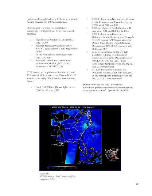
• B200 over flights of South Carolina wild<br />
fires with HSRL and RSP for the EPA<br />
• B200 deployment to Ponca City,<br />
Oklahoma for the Department of Energy’s<br />
(DOE’s) Routine AAF Clouds with Low<br />
Optical Water Depths Optical Radiative<br />
Observations (RACORO) campaign with<br />
HSRL and RSP<br />
• Local research flights on the UC-12B<br />
aircraft for Advance CO2 Sensing of<br />
Emissions over Nights, Days and Seasons<br />
(ASCENDS) with the LaRC In situ<br />
Atmospheric Sampling System and the ITT<br />
ACCLAIM instrument<br />
• UC-12B deployment to Ponca City,<br />
Oklahoma for ASCENDS with the LaRC<br />
In situ Atmospheric Sampling System and<br />
the ITT ACCLAIM instrument<br />
During FY09, the two LaRC aircraft flew<br />
coordinated patterns with several other atmospheric<br />
science platform aircraft. Specifically, the B200<br />
Figure 49:<br />
MODIS images of South Carolina wildfires,<br />
requested by EPA.<br />
65


