

2009 Annual Report - NASA Airborne Science Program
2009 Annual Report - NASA Airborne Science Program
2009 Annual Report - NASA Airborne Science Program

You also want an ePaper? Increase the reach of your titles
YUMPU automatically turns print PDFs into web optimized ePapers that Google loves.
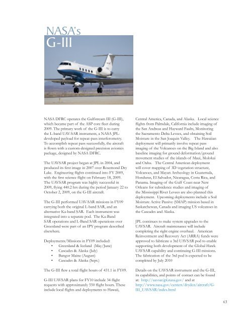
<strong>NASA</strong>’s<br />
G-III<br />
<strong>NASA</strong> DFRC operates the Gulfstream III (G-III),<br />
which became part of the ASP core fleet during<br />
<strong>2009</strong>. The primary work of the G-III is to carry<br />
the L-band UAV-SAR instrument, a <strong>NASA</strong> JPLdeveloped<br />
payload for repeat-pass interferometry.<br />
To accomplish repeat pass successfully, the aircraft<br />
is flown with a custom-designed precision avionics<br />
package, designed by <strong>NASA</strong> DFRC.<br />
The UAVSAR project began at JPL in 2004, and<br />
produced its first image in 2007 over Rosemond Dry<br />
Lake. Engineering flights continued into FY <strong>2009</strong>,<br />
with the first science flight on February 18, <strong>2009</strong>.<br />
The UAVSAR program was highly successful in<br />
<strong>2009</strong>, flying 440.2 hrs during the period January 22 to<br />
October 2, <strong>2009</strong>, on the G-III aircraft.<br />
The G-III performed UAV-SAR missions in FY09<br />
carrying both the original L-band SAR, and an<br />
alternative Ka-band SAR. Each instrument was<br />
integrated into a separate pod. The Ka-Band<br />
SAR operations and L-Band SAR operations over<br />
Greenland were part of an IPY program described<br />
elsewhere.<br />
Deployments/Missions in FY09 included:<br />
• Greenland & Iceland (May/June)<br />
• Cascades & Alaska (July)<br />
• Bangor Maine (August)<br />
• Cascades & Alaska (Sept.)<br />
The G-III flew a total flight hours of 431.1 in FY09.<br />
G-III UAVSAR plans for FY10 include 34 flight<br />
requests with approximately 550 flight hours. These<br />
include local flights and deployments to Hawaii,<br />
Central America, Canada, and Alaska. Local science<br />
flights from Palmdale, California include imaging of<br />
the San Andreas and Hayward Faults, Monitoring<br />
the Sacramento Delta Levees, and obtaining Soil<br />
Moisture in the San Joaquin Valley. The Hawaiian<br />
deployment will primarily involve repeat pass<br />
imaging of the Volcanoes on the Big Island and also<br />
baseline imaging for ground deformation/ground<br />
movement studies of the islands of Maui, Molokai<br />
and Oahu. The Central American deployment<br />
will cover mapping of 3D vegetation structure,<br />
Volcanoes, and Mayan Archeology in Guatemala,<br />
Honduras, El Salvador, Nicaragua, Costa Rica, and<br />
Panama. Imaging of the Gulf Coast near New<br />
Orleans for subsidence studies and imaging of<br />
the Mississippi River Levees are also planned this<br />
deployment. Upcoming deployments include a Soil<br />
Moisture Active Passive (SMAP) mission based in<br />
Saskatchewan, Canada and imaging US volcanoes in<br />
the Cascades and Alaska.<br />
JPL continues to make system upgrades to the<br />
UAVSAR. Aircraft maintenance will include<br />
completing the right engine overhaul. American<br />
Reinvestment and Recovery Act (ARRA) funds were<br />
approved to fabricate a 3rd UAVSAR pod to enable<br />
supporting both development of the Global Hawk<br />
UAVSAR capability and continuing G-III missions.<br />
The fabrication of the 3rd pod is expected to be<br />
completed by July 2010<br />
Details on the UAVSAR instrument and the G-III,<br />
its capabilities, and points of contact can be found<br />
at: http://uavsar.jpl.nasa.gov/ and at<br />
http://www.nasa.gov/centers/dryden/aircraft/G-<br />
III_UAVSAR/index.html<br />
63


