

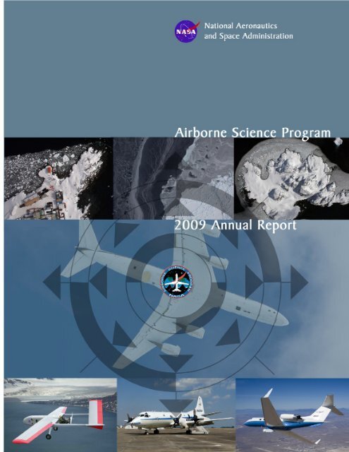
2009 Annual Report - NASA Airborne Science Program
2009 Annual Report - NASA Airborne Science Program
2009 Annual Report - NASA Airborne Science Program

You also want an ePaper? Increase the reach of your titles
YUMPU automatically turns print PDFs into web optimized ePapers that Google loves.
<strong>NASA</strong> <strong>Science</strong> Mission Directorate<br />
Earth <strong>Science</strong> Division<br />
AIRBORNE<br />
SCIENCE<br />
PROGRAM<br />
<strong>2009</strong> <strong>Annual</strong> <strong>Report</strong><br />
FEBRUARY 2010<br />
http://airbornescience.nasa.gov
TABLE OF CONTENTS<br />
Executive Summary .. . . . . . . . . . . . . . . 1<br />
From the Director.. . . . . . . . . . . . . . . . . 3<br />
<strong>Program</strong> Elements & Execution .. . . . 5<br />
<strong>Science</strong> Missions & Accomplishments<br />
AVIRIS . . . . . . . . . . . . . . . . . . . . . . . 11<br />
CALIPSO - Cal/Val. . . . . . . . . . . . . 12<br />
CASIE. . . . . . . . . . . . . . . . . . . . . . . . 13<br />
Decadal Survey Support<br />
Missions.. . . . . . . . . . . . . . . . . . . . 15<br />
DESDYNI.. . . . . . . . . . . . . . . . . . 16<br />
ASCENDS . . . . . . . . . . . . . . . . . . . 18<br />
SWOT. . . . . . . . . . . . . . . . . . . . . . . 19<br />
EPA Joint Sensors Mission.. . . . . . 20<br />
High Winds. . . . . . . . . . . . . . . . . . . . 22<br />
Interferometric SAR Ice<br />
Mapping in Greenland.. . . . . . . . 25<br />
Operation ICE Bridge . . . . . . . . . . . 28.<br />
Western States Fire. ............ 31<br />
AAFEx.. . . . . . . . . . . . . . . . . . . . . . 33<br />
RACORO . . . . . . . . . . . . . . . . . . . . . 35<br />
TM Relay. . . . . . . . . . . . . . . . . . . . . . 36<br />
Instrument Test Flights<br />
SIMPL. . . . . . . . . . . . . . . . . . . . . . . . 37<br />
TWiLiTE .. . . . . . . . . . . . . . . . . . . . 39<br />
CO 2 Laser Sounder.. . . . . . . . . . . . 41<br />
AESMIR...................... 43<br />
<strong>Airborne</strong> <strong>Science</strong> <strong>Program</strong> Elements:<br />
<strong>Science</strong> Requirements & Management<br />
<strong>Science</strong> & Requirements. . . . . . . . . . . . 47<br />
Flight Requests.. . . . . . . . . . . . . . . . . . . 48<br />
Joint <strong>Airborne</strong> <strong>Science</strong> Sensor Integration<br />
Working Group .. . . . . . . . . . . . . . . . . . 50<br />
Aircraft Platforms<br />
Introduction . . . . . . . . . . . . . . . . . . . . . . . 55<br />
DC-8.. . . . . . . . . . . . . . . . . . . . . . . . . . . 56<br />
ER-2 .. . . . . . . . . . . . . . . . . . . . . . . . . . . 59<br />
WB-57...........................61<br />
P-3 . . . . . . . . . . . . . . . . . . . . . . . . . . . . . 62<br />
G-III.. . . . . . . . . . . . . . . . . . . . . . . . . . . 63<br />
Catalog Aircraft<br />
<strong>NASA</strong> LaRC Aircraft...............64<br />
<strong>NASA</strong> GRC Aircraft .. . . . . . . . . . . . . . 66<br />
Ikhana.. . . . . . . . . . . . . . . . . . . . . . . . . . 68<br />
New Technology & Platform Development<br />
Global Hawk . . . . . . . . . . . . . . . . . . . . . 73<br />
SIERRA. . . . . . . . . . . . . . . . . . . . . . . . . 75<br />
Common Data &<br />
Communications Systems. .........77<br />
<strong>Science</strong> Instrumentation, Facilities, &<br />
Support Systems<br />
<strong>Airborne</strong> Sensor Facility. . . . . . . . . . . . 83<br />
Dryden Aircraft<br />
Operations Facility . . . . . . . . . . . . . . . 87<br />
v
Collaborations and Partnerships<br />
FAA Liaison Efforts. . . . . . . . . . . . . . . 93<br />
International Activities &<br />
Collaboration .. . . . . . . . . . . . . . . . . . 95<br />
Media, Education & Outreach<br />
NSERC . . . . . . . . . . . . . . . . . . . . . . . . 101<br />
ISRSE..........................103<br />
CeNAT Workshops.. . . . . . . . . . . . . . 104<br />
Newsletter. . . . . . . . . . . . . . . . . . . . . . 106<br />
Recognition & Awards.. . . . . . . . . . . . 107<br />
Looking Ahead to FY10<br />
and Beyond. ....................109<br />
Appendices<br />
In Memoriam.. . . . . . . . . . . . . . . . . . . 115<br />
<strong>Airborne</strong> <strong>Program</strong> History. ........117<br />
Five-Year Plan. . . . . . . . . . . . . . . . . . . 121<br />
ASP Bibliography Project. . . . . . . . . . 123<br />
Acronyms & Abbreviations . . . . . . . . 125<br />
vi
EXECUTIVE SUMMARY<br />
<strong>NASA</strong>’s <strong>Airborne</strong> <strong>Science</strong> <strong>Program</strong> had another<br />
busy year in FY09. The program flew missions and<br />
instrument tests on five core aircraft, eight catalog<br />
aircraft, and two new technology unmanned aircraft<br />
systems. The program completed a total of seventy<br />
flight requests for almost 1900 flight hours. More<br />
than a dozen different customer communities were<br />
served in all six focus areas of <strong>NASA</strong> Earth <strong>Science</strong><br />
and related aerospace fields.<br />
In <strong>2009</strong> we focused significant effort on the<br />
Cryosphere and completing IPY related missions.<br />
Greenland and Iceland ice monitoring missions were<br />
successful far-field missions for the G-III carrying<br />
the L-band UAVSAR and a new Ka-band SAR.<br />
The Characterization of Arctic Sea Ice Experiment<br />
(CASIE) mission proved our new SIERRA UAS,<br />
flying out of Svalbard, Norway. Operation Ice<br />
Bridge saw the P-3 in Greenland in the Spring while<br />
the DC-8 was outfitted for a major Fall mission<br />
over Antarctica, flying from Punta Arenas, Chile.<br />
The G-III with UAVSAR completed its first fully<br />
operational year with over 500 hours, including<br />
flights in Alaska.<br />
In addition to launching the mid-size SIERRA<br />
UAS, our Global Hawk UAS was readied for its first<br />
science mission – GloPac – to take place in early<br />
2010. Other missions, Pre-GRIP and GRIP, are in<br />
the pipeline for Global Hawk as well.<br />
The DC-8 was the laboratory home during summer<br />
<strong>2009</strong> for the inaugural session of the Student<br />
<strong>Airborne</strong> Research <strong>Program</strong> (SARP), headed by<br />
the National Suborbital Education and Research<br />
Center (NRERC). With this success, we are planning<br />
another program for 2010.<br />
<strong>Program</strong>matically, the <strong>Airborne</strong> <strong>Science</strong> <strong>Program</strong><br />
was impacted significantly in <strong>2009</strong> by the American<br />
Recovery and Reinvestment Act (ARRA), which<br />
has provided funds for needed upgrades and new<br />
capabilities. These efforts will provide payload<br />
portability and similar capability for near-real<br />
time data downlink on all platforms. Many of the<br />
outcomes from this program are expected during<br />
2010.<br />
Finally, the <strong>Airborne</strong> <strong>Science</strong> <strong>Program</strong> is looking<br />
forward to continued Operation Ice Bridge efforts,<br />
to participating in Earth Venture-1 missions, and to<br />
supporting upcoming satellite missions, including<br />
Decadal Survey missions.<br />
1
FROM THE DIRECTOR<br />
Welcome to <strong>NASA</strong>’s <strong>Science</strong> Mission Directorate <strong>Airborne</strong> <strong>Science</strong> <strong>Program</strong>.<br />
In this <strong>2009</strong> version of our <strong>Annual</strong> <strong>Report</strong>, you will be presented with the<br />
breadth of our accomplishments and the work done to benefit the Earth<br />
science community on behalf of <strong>NASA</strong> and the Nation. FY<strong>2009</strong> has been<br />
a truly memorable year for the <strong>Airborne</strong> <strong>Science</strong> <strong>Program</strong> with numerous<br />
firsts and some notable missions. I expect that after reading what we’ve done<br />
and plan, you will also recognize that <strong>NASA</strong>’s <strong>Airborne</strong> <strong>Science</strong> <strong>Program</strong> is a<br />
remarkable national capability.<br />
To start off though, I’d like to share an experience I<br />
had this year.<br />
I was explaining some aspects of the <strong>Airborne</strong><br />
<strong>Science</strong> <strong>Program</strong> to someone new to the program<br />
recently in the presence of one of our science<br />
focus area leads. In response to a question of how<br />
the program determines its portfolio, I conveyed<br />
that the program takes its guidance from our<br />
customer community; we focus on the priorities<br />
of our customers. Around this point, the science<br />
focus area lead, an individual I consider a strongly<br />
supportive customer, softly interjected: “partners”.<br />
I was somewhat unprepared for being corrected at<br />
that moment, but continued on with the discussion<br />
with the new “customer “ exchanging the term<br />
“customer” with “partner” as I thought appropriate.<br />
Over the next few weeks the conversation kept<br />
creeping into my thoughts. Why would someone<br />
want me to change “customer,” to “partner” Based<br />
on a substantial amount of customer feedback,<br />
the program had worked hard to be seen as highly<br />
customer focused and responsive to our customers<br />
versus process driven. From subsequent feedback,<br />
it had appeared that the program had turned the<br />
corner and was being viewed as very customer<br />
conscious, resulting in a lot more favorable customer<br />
feedback. One of my internal explanations went<br />
to identifying the differences between “customer”<br />
and “partner”. Without looking up the words in<br />
the dictionary I came up with customers are usually<br />
receivers of goods and services for which they pay.<br />
Partnership on the other hand infers a relationship<br />
based on some common goals and mutual interests.<br />
Partners are more likely to sacrifice for the greater<br />
good of achieving long term common goals.<br />
Partners are vested in each other. In the hierarchy<br />
of relationships, “Partners” appear to be on a<br />
higher level than “Customers”. In a subsequent<br />
meeting with the same focus area lead, I brought up<br />
the matter again and he concurred that his intent<br />
was to convey, probably both to me and the new<br />
customer, that he saw the relationship between<br />
the <strong>Airborne</strong> <strong>Science</strong> <strong>Program</strong> and his focus area<br />
as a “Partnership” rather than a receiver-provider<br />
“Customer” relationship.<br />
The <strong>Program</strong> is committed to staying on track:<br />
working collaboratively with our partners for<br />
mutually beneficial outcomes by providing quality,<br />
responsive and relevant airborne science services<br />
to the community. We’re here to support and do it<br />
in a safe, efficient, cost effective, and value-added<br />
manner.<br />
3
In keeping with those thoughts, I would like to<br />
cover some of the substantial achievements of<br />
the <strong>Airborne</strong> <strong>Science</strong> <strong>Program</strong> in <strong>2009</strong>. FY<strong>2009</strong><br />
saw the G-III with the Unmanned Aircraft Vehicle<br />
Synthetic Aperture Radar (UAVSAR) become<br />
operational and demonstrate some of its potential<br />
in supporting International Polar Year (IPY),<br />
tectonic, terrestrial ecology and hydrology science.<br />
The P-3 and DC-8 inaugurated the first Operation<br />
Ice Bridge campaign season flying over 400 hours<br />
(far exceeding expectations) and collecting data<br />
on sea ice and glacier elevation, ice extent and bed<br />
characteristics. Operation<br />
Ice Bridge also included<br />
some coordinated flights<br />
with the G-III / UAVSAR’s<br />
IPY mission, in addition to a<br />
collaborative effort with the<br />
National <strong>Science</strong> Foundation<br />
and British National<br />
Environmental Research<br />
Council’s ICECAP mission<br />
in Antarctica. To round<br />
out Operation Ice Bridge,<br />
a catalog aircraft flew in<br />
southeast Alaska to measure<br />
glaciers.<br />
In <strong>2009</strong>, the WB-57 saw the<br />
superpod nacelle mated to<br />
the wings and completion<br />
of the gross weight increase<br />
certification of the landing<br />
gear, both critical capability<br />
enhancements for future<br />
missions. The <strong>Program</strong> also<br />
experienced a number of firsts. As part of IPY, the<br />
SIERRA Unmanned Aircraft System (UAS) flew its<br />
first science mission: Characterization of Arctic Sea<br />
Ice Experiment (CASIE). The multi-sensor payload<br />
successfully flew over 3000 km of sea ice out of<br />
Svalbard, Norway. The Global Hawk UAS flew its<br />
first <strong>NASA</strong> flights using a totally redesigned ground<br />
operations center. Finally, the Student <strong>Airborne</strong><br />
Research <strong>Program</strong> (SARP) completed its first class<br />
with 29 students from all across the US.<br />
The <strong>Program</strong> is committed<br />
to staying on track:<br />
working collaboratively<br />
with our partners for<br />
mutually beneficial<br />
outcomes by providing<br />
quality, responsive, and<br />
relevant airborne science<br />
services to the community.<br />
program was also assigned a Small Satellite,<br />
Unmanned Aircraft System project to develop<br />
enabling technologies for those emerging platforms.<br />
<strong>Airborne</strong> <strong>Science</strong> also made progress in the<br />
international and national arenas. Nationally the<br />
program members finished their work on a Federal<br />
Aviation Administration Aviation Rulemaking<br />
Committee on Small UAS, executed work under<br />
a UAS Memorandum of Understanding with the<br />
National Oceanic and Atmospheric Administration,<br />
and remained active in UAS in the National Air<br />
Space and Interagency Coordinating Committee<br />
on <strong>Airborne</strong> Geoscience<br />
Research and Applications<br />
(ICCAGRA) efforts.<br />
Internationally, the <strong>Program</strong><br />
was active in developing<br />
collaborative relationships<br />
with the European Fleet<br />
for <strong>Airborne</strong> Research<br />
(EUFAR, the European<br />
Union counterpart to<br />
ICCAGRA) and the<br />
Chinese Center for<br />
Earth Observation and<br />
Digital Earth, as well as<br />
membership on a working<br />
group to address UASenabled<br />
Arctic science<br />
missions supporting the<br />
Arctic Council.<br />
The year also saw Andrew<br />
Roberts, our <strong>Program</strong><br />
Director for the past 2<br />
years, retire from <strong>NASA</strong>.<br />
Andy will be missed. During his tenure the <strong>Program</strong><br />
grew healthier as he focused on bringing funding<br />
and mission stability to the centers, recognizing the<br />
program’s professional performers, being increasingly<br />
responsive to the community and showing<br />
exceptional leadership. On behalf of the entire<br />
<strong>Airborne</strong> <strong>Science</strong> Team, I invite you to read through<br />
our <strong>2009</strong> <strong>Annual</strong> <strong>Report</strong>. We, as a program, are very<br />
proud of what we do and have accomplished and we<br />
would like to share that with you.<br />
<strong>Program</strong>matically, <strong>2009</strong> was an eventful year.<br />
<strong>Airborne</strong> <strong>Science</strong> was provided $28,046,000 of<br />
American Recovery and Reinvestment Act funding<br />
to execute the first year of Operation Ice Bridge,<br />
in addition to investments to modify and sustain<br />
its fleet and science support infrastructure. The<br />
Randal Albertson<br />
<strong>Airborne</strong> <strong>Science</strong> <strong>Program</strong> Director<br />
(Acting)<br />
4
PROGRAM ELEMENTS<br />
and EXECUTION<br />
The <strong>Airborne</strong> <strong>Science</strong> <strong>Program</strong> consists of the following<br />
program elements:<br />
1. <strong>Science</strong> Requirements and Management<br />
2. <strong>Airborne</strong> <strong>Science</strong> Platforms<br />
(a) Core Platforms (DC-8, WB-57, ER-2, G-III and P-3)<br />
(b) Catalog Platforms (agency, interagency, commercial)<br />
3. New Technology and Platform Development<br />
(a) UAS (Global Hawk, SIERRA)<br />
(b) Common Data and Communication Systems<br />
4. <strong>Science</strong> Instrumentation and Support Systems<br />
<strong>NASA</strong> Headquarters is responsible for determining<br />
program direction and content through the strategic<br />
planning and budget formulation processes. The<br />
program office is the interface to the <strong>Science</strong> Mission<br />
Directorate ensuring that program activities and<br />
investments support the broader agency. A major<br />
change in the program this past year was to remove<br />
core aircraft from the catalog and manage them<br />
individually.<br />
Implementation of the major program elements<br />
takes place at the various research centers.<br />
Ames Research Center has a lead role in program<br />
analysis, advanced planning, and science mission<br />
management. This includes management of<br />
<strong>Program</strong> flight requests and field campaign<br />
management through the Earth <strong>Science</strong> Project<br />
Office. Instrument and software support, flight<br />
planning, and development of interface standards<br />
are performed out of Ames <strong>Airborne</strong> Sensor Facility<br />
in partnership with the University of California. In<br />
addition, Ames personnel manage and operate the<br />
SIERRA UAS.<br />
5
Acting <strong>Airborne</strong> <strong>Science</strong><br />
<strong>Program</strong> Director<br />
Randy Albertson<br />
Functions:<br />
Portfolio Mgmt.<br />
Grant Studies & <strong>Report</strong> rqmnts<br />
Education & Outreach<br />
Facilities, Testbeds & Operations<br />
ARC ASP <strong>Program</strong><br />
Lead: Matt Fladeland<br />
Functions:<br />
SIERRA, Earth <strong>Science</strong><br />
Project Office<br />
Studies and <strong>Report</strong>s<br />
<strong>Airborne</strong> Sensor Facility,<br />
<strong>Science</strong> Mission Mgmt.<br />
DFRC ASP <strong>Program</strong><br />
Lead: Bob Curry<br />
Functions:<br />
DC-8/NSERC, ER-2,<br />
Ikhana, Global Hawk,<br />
G-III, Dryden Aircraft<br />
Operations Facility<br />
WFF ASP <strong>Program</strong><br />
Lead: George Postell<br />
Functions:<br />
P-3, Catalog Mgmt, Mission<br />
Mgmt, <strong>Report</strong>s, Budget<br />
Mgmt. support<br />
JSC ASP <strong>Program</strong><br />
Lead: Ken Cockrell<br />
Functions:<br />
WB-57, Mission Support<br />
<strong>Program</strong>s<br />
GRC<br />
Alan Micklewright<br />
S-3<br />
Twin Otter<br />
Lear Jet<br />
LaRC<br />
Howie Lewis<br />
B-200<br />
UC-12<br />
Cessna 206<br />
Figure 1:<br />
<strong>NASA</strong>’s <strong>Airborne</strong> <strong>Science</strong> <strong>Program</strong> organization.<br />
Dryden Flight Research Center leads the operation<br />
and maintenance of the core DC-8, ER-2 and G-III<br />
aircraft. They also operate and maintain aircraft in<br />
the new technology and platform development area,<br />
including the Global Hawks. Another area Dryden is<br />
been actively engaged in is over-the-horizon network<br />
and communications research and development.<br />
Dryden oversees the cooperative agreement with the<br />
University of North Dakota’s National Suborbital<br />
Education and Research Center. Dryden also<br />
manages the Dryden Aircraft Operations Center in<br />
Palmdale. For <strong>Program</strong> Year <strong>2009</strong>, the Ikhana will<br />
be moved to catalog management and the G-III will<br />
become a core platform.<br />
Goddard’s Wallops Flight Facility is the lead for<br />
operating and maintaining the core low-altitude<br />
heavy-lift P-3B aircraft, and managing the catalog<br />
aircraft program through safety oversight of<br />
contracted aircraft. Wallops also continues the<br />
work in the field of small-class Uninhabited Aircraft<br />
Systems (UAS) research.<br />
Johnson Space Center contributes to the program<br />
primarily by operating and maintaining the core WB-<br />
57 high-altitude research aircraft.<br />
6
Langley and Glenn Research Centers support the<br />
program by providing access to their platforms<br />
through the catalog.<br />
The FY09 budget for the <strong>Airborne</strong> <strong>Science</strong> <strong>Program</strong><br />
was $31,271,000 with additional $28,046,000 in<br />
stimulus (aka American Recovery and Reinvestment<br />
Act funds) for a total of $59,317,000.<br />
The breakdown into major components is shown<br />
in Figure 2. The history, including ARRA funds, is<br />
shown in Figure 3.<br />
<strong>Airborne</strong> <strong>Science</strong> <strong>2009</strong> Budget<br />
Education &<br />
Outreach<br />
DAOF<br />
<strong>Science</strong><br />
Management<br />
<strong>Airborne</strong><br />
Sensor Facility<br />
New<br />
Technology<br />
Catalog<br />
Demonstrations<br />
Core Fleet<br />
Figure 2:<br />
<strong>Airborne</strong> <strong>Science</strong> <strong>Program</strong> budget breakdown.<br />
<strong>Airborne</strong> <strong>Science</strong> <strong>Program</strong> Budget ($M)<br />
(*includes ARRA funds)<br />
60<br />
50<br />
40<br />
30<br />
20<br />
10<br />
0<br />
FY04 FY05 FY06 FY07 FY08 FY09* FY10 FY11 FY12 FY13 FY14 FY15<br />
Figure 3:<br />
<strong>Airborne</strong> <strong>Science</strong> <strong>Program</strong> recent and projected budgets.<br />
7
SCIENCE MISSIONS and<br />
ACCOMPLISHMENTS
AVIRIS<br />
<strong>Science</strong> Focus:<br />
HQ Sponsor:<br />
PI:<br />
Carbon Cycle and Ecosystem <strong>Science</strong><br />
Wickland<br />
Green<br />
From February 27 through August 31, <strong>2009</strong>,<br />
a total of 26 AVIRIS science flights were<br />
conducted on the ER-2 totaling 89.9 flight hours.<br />
It included a deployment to Wright-Patterson<br />
AFB, Dayton, OH, for the months of June and<br />
July. <strong>NASA</strong> sponsors included Diane Wickland<br />
and Andrew Roberts. Experiment sites included<br />
areas in central and southern California, New<br />
York, Vermont, New Hampshire, Massachusetts,<br />
Connecticut, Pennsylvania, West Virginia,<br />
Minnesota, Montana and South Dakota. AVIRIS<br />
data was also collected over experiment sites in<br />
Alberta and Ontario, Canada.<br />
The series of AVIRIS flights were initiated with<br />
an in-flight spectral, radiometric, spatial, and<br />
uniformity calibration and characteristics of<br />
the AVIRIS imaging spectrometer. The science<br />
data gathered over experiment sites included<br />
the following: The characterization of forest<br />
functional types and their role in mediating<br />
ecosystem response to environmental change;<br />
Carbon cycling, vegetation nitrogen status and<br />
surface albedo.<br />
<strong>Science</strong> data gathering was successfully completed<br />
by the ER-2 team over all requested experiment<br />
sites.<br />
Scientists included Philip Dennison, Dar Roberts,<br />
Scott Ollinger and Phil Townsend. The AVIRIS<br />
instrument manager was Michael Eastwood.<br />
For more information, visit: http//aviris.jpl.nasa.<br />
gov/<br />
Figure 4:<br />
Lunar Lake, NV Calibration site measured by<br />
AVIRIS from 65,000 feet on August 19, <strong>2009</strong>.<br />
11
CALIPSO Cal/Val<br />
<strong>Science</strong> Focus:<br />
HQ Sponsor:<br />
PI:<br />
Atmospheric Composition and Chemistry<br />
Maring<br />
McGill<br />
A series of flights on the LaRC B200 was flown<br />
to verify the calibration of the CALIOP lidar on<br />
the CALIPSO satellite before and after the switch<br />
from the primary to the backup CALIOP laser<br />
transmitter (http://earthobservatory.nasa.gov/<br />
Newsroom/view.phpid=38252) on March 12,<br />
<strong>2009</strong>. The High Spectral Resolution Lidar (HSRL)<br />
was deployed on the B200 for eleven underflights<br />
of the CALIPSO satellite starting in January and<br />
ending in April. The data proved conclusively that<br />
the calibration of the satellite instrument was not<br />
affected by the change in lasers.<br />
For more information, visit: http://science.larc.<br />
nasa.gov/hsrl/index.html<br />
Figure 5:<br />
HSRL Deployed in <strong>NASA</strong> Langley King Air<br />
B200.<br />
12
CASIE<br />
<strong>Science</strong> Focus:<br />
HQ Sponsors:<br />
PI:<br />
Cryosphere<br />
Kaye, Albertson<br />
Maslanik<br />
The Characterization of Arctic Sea Ice<br />
Experiment (CASIE), flown from Svalbard,<br />
Norway on the SIERRA UAS in July of <strong>2009</strong>,<br />
was the aircraft campaign portion of the larger,<br />
<strong>NASA</strong>-funded IPY project titled “Sea Ice<br />
Roughness as an Indicator of Fundamental<br />
Changes in the Arctic Ice Cover: Observations,<br />
Monitoring, and Relationships to Environmental<br />
Factors.” This 3-year research effort, which<br />
combined satellite data analysis, modeling, and<br />
aircraft observations, includes scientists, engineers<br />
and students from the University of Colorado,<br />
Brigham Young University, Fort Hays State<br />
University and <strong>NASA</strong>’s Jet Propulsion Laboratory<br />
working together with research aviation specialists<br />
from <strong>NASA</strong>’s Ames Research Center.<br />
The project is attempting to answer some of<br />
the most basic questions regarding the future of<br />
the Arctic’s sea ice cover. In particular, our work<br />
will help us better understand one of the most<br />
fundamental changes in sea ice cover in recent<br />
years – the loss of the oldest and thickest types of<br />
ice from within the Arctic Ocean. This change has<br />
been rapid and extreme. For example, our analysis<br />
of satellite data shows that the amount of older<br />
ice in <strong>2009</strong> is just 12% of what it was in 1988, a<br />
decline of 74%. The oldest ice types now cover<br />
only 2% of the Arctic Ocean as compared to<br />
20% during the 1980’s. Not only does this change<br />
affect the total amount of ice in the Arctic, but<br />
it also affect the ability of the ice cover to resist<br />
increased warming. In turn, this loss of the old ice<br />
types will influence activities such as shipping and<br />
mineral exploration, and it is important for marine<br />
mammals and fish that use the ice cover as safe<br />
havens and platforms.<br />
CASIE’s role in this project was to provide very<br />
detailed information on ice conditions by using<br />
a small unmanned aircraft (<strong>NASA</strong>’s SIERRA)<br />
that can fly long distances at low altitudes – a<br />
job that can be difficult and dangerous for large,<br />
manned aircraft, especially in the harsh Arctic<br />
environment. The primary payload consisted<br />
of 2 LIDARS and a C-Band SAR for providing<br />
information on ice surface roughness and<br />
topography, thickness, reflectance, and age. For<br />
this mission, the SIERRA team developed an icing<br />
warning system, in consultation with <strong>NASA</strong> GRC<br />
and NCAR, to provide the ground station with<br />
temperature and humidity data in real time.<br />
For more information, visit: http://espo.nasa.gov/<br />
CASIE<br />
13
Figure 6:<br />
This map shows the nearly 3000km of flight tracks over sea ice during 5<br />
separate science flights of the CASIE payload on the SIERRA UAS.<br />
Pyronometers (2)<br />
Spectrometer (2)<br />
LIDARs (2)<br />
Video camera<br />
SAR<br />
Pyrometers (2)<br />
Still cameras (2)<br />
Figure 7:<br />
This collection of images shows the SIERRA on the Svalbard tarmac and<br />
details the instruments integrated into the nose and forward fuselage.<br />
14
Decadal Survey<br />
Support Missions<br />
Since the National Research Council published<br />
its Decadal Survey report, “Earth <strong>Science</strong> and<br />
Applications from Space: National Imperatives for<br />
the Next Decade and Beyond” in 2007, <strong>NASA</strong>’s<br />
<strong>Science</strong> Mission Directorate has established science<br />
teams and is in the process of implementing these<br />
15 new missions. The <strong>Airborne</strong> <strong>Science</strong> program<br />
has been working in parallel to support the Decadal<br />
Survey missions by flying instrument simulators and<br />
algorithm development experiments, and preparing<br />
to fly calibration and validation missions. The<br />
<strong>Program</strong> has also established relationships with the<br />
science teams to understand their upcoming needs<br />
and assist in planning through use of the flight<br />
request system and 5-year planning process.<br />
In late FY08 and into early FY09, ASP flew PALS<br />
on the P-3 in support of Soil Moisture Active-<br />
Passive (SMAP). This will be the first of Decadal<br />
Survey missions to launch and additional fieldwork is<br />
anticipated. The Aerosol-Cloud-Ecosystems (ACE)<br />
mission will also make significant use of ASP assets<br />
beginning in 2010.<br />
The ICESatII mission is being supported by<br />
Operation ICE Bridge.<br />
Specific campaigns in FY09 in support of<br />
Deformation, Ecosystem Structure and Dynamics<br />
of Ice (DESDynI) and Active Sensing of CO 2<br />
Emissions over Nights, Days, and Seasons<br />
(ASCENDS) are discussed in detail below.<br />
The IPY experiment flying an experimental Ka-band<br />
SAR on the G-III (described in the IPY section) also<br />
supported the Surface Water/Ocean Topography<br />
(SWOT) mission by flying a payload comparable to<br />
a simulator instrument that will be flying in the near<br />
future.<br />
15
DESDYNI<br />
<strong>Science</strong> Focus:<br />
HQ Sponsors:<br />
PIs:<br />
Carbon Cycle & Ecosystem <strong>Science</strong>,<br />
Earth Surface and Interior<br />
Wickland, Dobson<br />
Simard, Saatchi, Sequeira, Parrish, Aanstoos,<br />
Kearny, Jones, Rignot, Zebker, Moeller<br />
The Deformation, Ecosystem Structure, and the<br />
Dynamics of Ice Mission (DESDynI) has been<br />
described as “a dedicated U.S. InSAR and LIDAR<br />
mission optimized for studying hazards and global<br />
environmental change.” The recently-developed<br />
Unmanned Aerial Vehicle Synthetic Aperture<br />
Radar (UAVSAR) system represents the L-Band<br />
Interferometric Synthetic Aperture Radar<br />
component of that mission. Designed to<br />
fly on multiple aircraft, including Global<br />
Hawk, the UAVSAR flew 440.2 hrs during<br />
the period January 22 to October 2, <strong>2009</strong>,<br />
on the <strong>NASA</strong> Gulfstream – III (G-III)<br />
aircraft. These sorties primarily were<br />
repeat-pass InSAR flights supporting early<br />
science objectives related to each of the<br />
focus areas for the DESDynI Mission.<br />
Deformation Studies in Southern California due to Seismic<br />
Activity<br />
Deformation studies in Southern California were<br />
conducted as a series of missions originating and<br />
recovering at Dryden. Large contiguous areas were<br />
imaged along the San Andreas and Hayward faults<br />
Deformation studies included seismic<br />
activity and mudslide potential studies<br />
along the Hayward and San Andreas<br />
faults; California, Levee studies in the<br />
Sacramento Delta and along the Mississippi<br />
River; Subsidence along the Gulf Coast<br />
of Louisiana, and Volcanic activity in the<br />
Cascades, Yellowstone, and the Alaskan<br />
Aleutian Islands.<br />
Figure 8:<br />
UAVSAR mounted under the G-III at Dryden Flight Research Center.<br />
Ecosystem Structure studies included Kings Canyon<br />
in the Sierra Nevada, Boreal Forest sites in Canada,<br />
New Hampshire, and Maine, mixed forests in<br />
Pennsylvania and at the Harvard and Duke Forests,<br />
and coastal wetlands in North Carolina and Florida.<br />
Finally, data to study the Dynamics of Ice were<br />
collected on a major deployment to Greenland and<br />
Iceland. (Described as part of IPY).<br />
from the San Francisco area to the Mexican border.<br />
Baseline imagery was collected from February 18 to<br />
April 4, <strong>2009</strong>. Repeat pass imagery was collected<br />
from September 9 through September 21, <strong>2009</strong>.<br />
The G-III flew 57.8 hours in support of three<br />
flight requests from Principal Investigators Paul<br />
Lundgren, Andrea Donnellan, and Eric Fielding to<br />
examine changes along the fault zones. Some of<br />
the same data are also being used by Eric Fielding<br />
and Catherine Jones to examine risk of mud slides<br />
in burned and defoliated landscapes. Additionally,<br />
16
epeat pass data were collected over<br />
the adjacent Sacramento delta region to<br />
examine potential stresses in the levee<br />
system (PI Jones).<br />
Volcano –related Deformation in the Cascades,<br />
Aleutians, and Yellowstone<br />
The G-III flew 51.4 hrs in support of<br />
Principal Investigator Paul Lundgren’s<br />
study of deformation related to magma<br />
movement in the Cascades, the Alaskan<br />
Aleutian Islands, and Yellowstone. The<br />
cascades were flown en route to and from<br />
two deployments to Anchorage, Alaska<br />
(June 21-23 and September 28- October<br />
2, <strong>2009</strong>). The Aleutians were flown on<br />
June 22 and September 29 using two<br />
sorties for each collection. (A refueling<br />
stop at Adak Is was necessary to complete<br />
each collection.) Baseline Imagery for<br />
Yellowstone was collected en route to New<br />
England on June 31, <strong>2009</strong>.<br />
Figure 9:<br />
G-III/UAVSAR Flight Crew at Adak Is.<br />
For more information, visit: http://desdyni.<br />
jpl.nasa.gov/<br />
Figure 10:<br />
Aleutian Islands Flight Lines.<br />
17
ASCENDS<br />
<strong>Science</strong> Focus:<br />
HQ Sponsor:<br />
PIs:<br />
Atmospheric Composition and Chemistry<br />
Jucks<br />
Abshire, Browell, Spiers<br />
One major near-term requirement for the Active<br />
Sensing of CO 2 Emissions over Nights, Days, and<br />
Seasons (ASCENDS) mission is to select a method<br />
and payload to measure CO 2 . To that end, <strong>NASA</strong><br />
had an outstandingly successful set of coordinated<br />
CO 2 laser flights over the DOE Atmospheric<br />
Radiation Measurement (ARM) Central Facility<br />
(CF) between 31 July and 7 August <strong>2009</strong>. Four<br />
coordinated flights were made in Oklahoma with<br />
the <strong>NASA</strong> Langley UC-12, <strong>NASA</strong> Glenn Lear-25,<br />
Twin Otter International’s Twin Otter, and the DOE<br />
Cessna covering altitudes from near the surface to 40-<br />
kft altitude. DOE in situ CO 2 point measurements<br />
were made on the tower at the ARM CF, and DOE<br />
radiosondes were launched to determine atmospheric<br />
state variables for each coordinated flight. The<br />
coordination between <strong>NASA</strong>, DOE, Vance AFB,<br />
and FAA for all operations was exceptional and<br />
enabled all flights to be conducted as planned. Two<br />
additional flights were conducted from <strong>NASA</strong><br />
Langley with the Glenn Lear and Langley UC-12.<br />
All lasers and in situ sampling systems worked well<br />
during the field campaigns. All in situ data sets,<br />
including those from the UC-12, have been collected<br />
and distributed to all of the laser system teams for<br />
their comparison to the remotely derived CO 2 laser<br />
measurements. Results from these comparisons are<br />
expected to be available in early 2010.<br />
Figure 11:<br />
<strong>NASA</strong> Langley UC-12B aircraft awaits take off clearance as the Glenn Lear 25<br />
takes off during joint operations in Ponca City, Oklahoma, in August <strong>2009</strong>.<br />
18
SWOT<br />
<strong>Science</strong> Focus:<br />
HQ Sponsor:<br />
PI:<br />
Water and Energy Cycle<br />
ESTO<br />
Moller<br />
The Surface Water and Ocean Topography mission<br />
(SWOT) is recommended by the NRC decadal<br />
survey to satisfy the elevation mapping requirements<br />
of two communities: surface water hydrology, and<br />
ocean surface topography. The primary instrument<br />
is a Ka-band Radar Interferometer (KaRIN) capable<br />
of simultaneously meeting coverage, accuracy and<br />
resolution requirements of both communities and<br />
enhances greatly the science achievable from a<br />
traditional profiling altimeter. The introduction of<br />
this new approach introduces additional algorithmic,<br />
characterization and calibration/validation needs<br />
that can be addressed through focused airborne<br />
campaigns in conjunction with traditional ocean<br />
altimeter calibration/validation measurements and<br />
existing and planned surface water gauge networks.<br />
Surface water phenomenology presents some of the<br />
more immediate measurement and characterization<br />
questions due to the diversity of terrestrial water<br />
environments coupled with a paucity of relevant<br />
measurements. A recent (April <strong>2009</strong>) opportunity<br />
arose to collect Ka-band data over terrestrial water<br />
bodies when the Glacier and Land Ice Surface<br />
Topography Interferometer (GLISTIN) (developed<br />
as a proof-of-concept sensor on the Gulfstream III<br />
under the <strong>NASA</strong> International Polar Year program<br />
– discussed elsewhere) transited to Greenland. En<br />
route to Greenland via North Dakota, data were<br />
collected in support of SWOT by rolling the G-III<br />
and collecting near-nadir backscatter profiles over<br />
local water bodies. Selected in collaboration with<br />
USGS and academic colleagues, these sites included<br />
Red River, Missouri River, Prairie Potholes, Devils<br />
Lake and the Big Bog. Flying into Thule, SWOT<br />
data was also collected over sea ice as a target of<br />
opportunity. These data will provide valuable<br />
backscatter statistics and for developing a land/water<br />
classification including over vegetated water.<br />
Figure 12:<br />
Ka-Band antenna, funded by ESTO as part of<br />
GLISTIN project.<br />
For more information, visit http://decadal.gsfc.nasa.<br />
gov/swot.html<br />
19
EPA Joint Sensors Mission<br />
HQ Sponsor:<br />
PI:<br />
Environmental Protection Agency<br />
Szykman<br />
In <strong>2009</strong>, <strong>NASA</strong> Langley integrated three<br />
instrument packages onto its Cessna 206 to<br />
provide support to the Ecosystem Services<br />
Research <strong>Program</strong> (ESRP) of the US<br />
Environmental Protection Agency’s (EPA’s)<br />
Office of Research and Development. The ESRP<br />
is a new, multi-year research initiative which<br />
will combine selected ecological indicator data<br />
and recent advances in resource economics to<br />
determine the value of services that terrestrial<br />
and aquatic ecosystems provide to humans. The<br />
instruments include a VISNIR Hyperspectral<br />
Imager called the Environmental Mapping<br />
Visible Imaging Spectrometer (EMVIS), a set<br />
of Hyperspectral ocean color radiometers<br />
(HyperOCR), and an infrared pyrometer.<br />
The instruments will provide optical and thermal<br />
data for research in the ESRP-Nitrogen and<br />
ESRP-Coastal Carolinas program to determine<br />
how changes in reactive nitrogen loading from<br />
terrestrial landscapes relate to changes in nutrient<br />
cycling and the impact to the ecosystem services<br />
associated with nutrient retention provided by<br />
freshwater and marine systems, specifically in lakes<br />
and drinking water reservoirs in New England and<br />
in the Albemarle/Pamlico Sound region.<br />
Results from Instrument Check Flights (ICF)<br />
on August 4, <strong>2009</strong> indicate strong correlations<br />
between remotely sensed sea surface temperatures<br />
and Chlorophyll-A concentrations, derived from<br />
a bio-optical model, and in situ data measured<br />
in the York River and Susquehanna River/<br />
lower Chesapeake Bay by the Virginia Institute<br />
of Marine <strong>Science</strong>s (VIMS) Virginia Estuarine<br />
and Coastal Observing system and the NOAA<br />
Chesapeake Bay Interpretive Buoy system.<br />
Following the ICFs, the Cessna 206 flew a series<br />
of science flights between August 25 and 30,<br />
<strong>2009</strong> spanning coastal to piedmont areas of<br />
North Carolina to collect EMVIS, HyperOCR,<br />
and thermal data for the ESRP Coastal Carolinas<br />
<strong>Program</strong>. A research goal is to integrate airborne<br />
hyperspectral remote sensor data and ENVISAT-1<br />
Medium Resolution Imaging Spectrometer<br />
(MERIS) satellite data with in situ monitoring<br />
data and ferry-based water quality monitoring<br />
to provide a nearly continuous multi-resolution<br />
phytoplankton bloom monitoring capability for<br />
the entire Albemarle and Pamlico Sound region<br />
and the Neuse River estuary. During these flights,<br />
Langley served as the base of operations.<br />
From September 13-18, <strong>2009</strong> the Cessna 206<br />
deployed to New England to support data<br />
collection and algorithm development for water<br />
quality indicators over Long Island and Rhode<br />
Island Sounds, followed by a series of inland<br />
flights over selected New England lakes and<br />
ponds. During the deployment, the Cessna<br />
206 surveyed 55 lakes in four states in a twoday<br />
period. Lakes were selected based on their<br />
trophic status. Aircraft data were supplemented<br />
by concurrently collected in situ data from<br />
several lakes by field crews provided by the states<br />
of Connecticut, Rhode Island, Massachusetts<br />
and New Hampshire, the University of New<br />
Hampshire, and coordinated by US EPA Region I.<br />
The Cessna 206 flights in New England were<br />
conducted to support the Remote Sensing of<br />
Phytoplankton <strong>Program</strong> (ReSePP) at the EPA’s<br />
Atlantic Ecology Division in Narragansett, Rhode<br />
Island.<br />
20
Figure 13:<br />
Installation of the three EPA hyperspectral ocean color<br />
radiometers on the <strong>NASA</strong> Cessna 206H aircraft.<br />
21
High Winds<br />
<strong>Science</strong> Focus:<br />
HQ Sponsor:<br />
PI:<br />
Water and Energy Cycle<br />
Entin<br />
Dinardo<br />
L-band microwave radiometry is the key remote<br />
sensing technique for <strong>NASA</strong>’s Aquarius satellite<br />
mission for ocean surface salinity research. The<br />
L-band radiometry acquires ocean surface brightness<br />
temperatures (TB), which respond to the change<br />
of sea surface salinity. To achieve accurate surface<br />
salinity measurements, the impact of ocean surface<br />
winds on L-band TB has to be corrected.<br />
In February and March <strong>2009</strong>, JPL’s Passive<br />
and Active L-System (PALS) and Polarimetric<br />
Scatterometer (PolSCAT) were installed on the<br />
<strong>NASA</strong> P-3 research aircraft to acquire coincident<br />
L-band radiometer and radar data over a wide range<br />
of ocean surface wind speed.<br />
The overall objective for the High-Winds’09 mission<br />
was to fly five instruments over predetermined flight<br />
lines over the North-Atlantic Ocean and Labrador<br />
Sea, based from Goose Bay, Newfoundland and<br />
Labrador, Canada. Engineering and program test<br />
flights were based from <strong>NASA</strong> WFF. All science<br />
team success criteria were determined by JPL PAL /<br />
PolSCAT science team.<br />
Success criteria for High-Winds’09 were as follows:<br />
• To acquire PALS and PolSCAT, passive<br />
and active microwave data to enable the<br />
development of algorithm during high wind<br />
conditions.<br />
• L-band microwave RFI detection and GPS<br />
reflection systems will be tested.<br />
• Dropping <strong>Airborne</strong> eXpendable Conductivity<br />
Temperature Depth (AXCTD) probes to study<br />
the near surface salinity signature<br />
The GISMOS and GPSRS systems flew as piggyback<br />
instruments to collect data during High-Winds’09<br />
allotted flights.<br />
Figure 14:<br />
P-3 performing PALS navigation calibration<br />
on Goose Bay taxi way.<br />
Figure 15:<br />
P-3 belly, PALS installed in the forward white<br />
radome, PolSCAT in the aft black radome.<br />
22
Figure 16:<br />
March 3, <strong>NASA</strong> P-3 Flight track from Goose Bay, Canada to the selected way<br />
point in the Labrador Seas. At the waypoint, the P-3 performed High Winds ’09<br />
“Star” pattern, Circle flights and Wing wags.<br />
The five instruments being flown aboard the <strong>NASA</strong><br />
WFF P-3B were as follows:<br />
• Passive Active L-band System (PALS) -<br />
Steven Dinardo, <strong>NASA</strong> JPL<br />
• <strong>Airborne</strong> Polarimetric Scatterometer<br />
(PolSCAT) - Steven Dinardo, <strong>NASA</strong> JPL<br />
• <strong>Airborne</strong> Expendable Conductivity<br />
Temperature Depth Probe (AXCTD), Dr.<br />
Daniel Jacob, <strong>NASA</strong> GSFC<br />
• GNSS Instrument System for Multistatic<br />
Occultation (GISMOS) – Dr. James<br />
Garrison, Perdue University<br />
• GPS Remote Sensing Instrument (GPSRS)<br />
– Dr. Michael Grant, <strong>NASA</strong> Langley<br />
Research Center<br />
The High Winds ‘09 mission started with a flight<br />
on February 12, flying over the National Data Buoy<br />
Center Buoy 41002, off South Carolina to verify the<br />
calibration of POLSCAT. Next, a region identified<br />
for winter high winds is the Northern Atlantic<br />
and Labrador Sea area. This location shows the<br />
highest regional wind speeds as per current <strong>NASA</strong><br />
QuickSCAT satellite data.<br />
On February 16, the aircraft was deployed to<br />
Labrador seas to acquire data under high wind<br />
conditions. The High-Winds’09 missions were flown<br />
over a 3.5 week period (February 16- March 9, <strong>2009</strong>),<br />
deployed out of Goose Bay airport. Goose Bay is<br />
a Canadian Forces Base (CFB) located in the town<br />
of Happy Valley-Goose Bay, Newfoundland and<br />
Labrador. CFB Goose Bay is presently operated as<br />
an air force base by Canadian Forces Air Command<br />
Figure 17:<br />
Local Goose bay film crew, interviewing Steve Dinardo, about<br />
the High-Winds’09 mission<br />
23
Figure 18:<br />
En route from Goose Bay to high winds waypoint, picture captures the end of<br />
the ice sheet.<br />
and is the site of NATO tactical flight training in<br />
Canada. It should be noted, The High Winds ’09<br />
mission received wonderful support from the CFB<br />
air operations and the Canadian weather services.<br />
Without there superb help, the High Wind Mission<br />
would not have been a success.<br />
While in Goose Bay, P-3 flights were scheduled based<br />
on daily field meetings. Satellite data and data provide<br />
by the Canadian Weather services, was reviewed by<br />
the JPL science team and flights were made during<br />
periods of predicated ocean surface winds in excess<br />
of 50 Knots.<br />
The P-3B High-Winds’09 campaign data is still<br />
being analyzed. Preliminary results are showing<br />
high correlation between PALS L-band radiometer<br />
and radar signals of ocean surfaces. The correlation<br />
of TB with radar backscatter is as high as the<br />
correlation with the surface wind speed (greater<br />
than 0.95). The results demonstrated the feasibility<br />
to use the radar backscatter to estimate the excess<br />
brightness temperature due to wind forcing.<br />
24
Interferometric SAR Ice<br />
Mapping in Greenland<br />
<strong>Science</strong> Focus:<br />
HQ Sponsors:<br />
PIs:<br />
Cryosphere<br />
Kaye, Albertson<br />
Zebker, Moller<br />
On May 1, <strong>2009</strong>, the <strong>NASA</strong> Gulfstream III<br />
(<strong>NASA</strong>502) departed Dryden Flight Research Center<br />
on its first deployment, a challenging mission to<br />
measure ice dynamics in Greenland and Iceland<br />
using first a Ka-Band and then an L-Band synthetic<br />
aperture radar. The aircraft and crew returned on<br />
June 17, having accomplished all primary and all<br />
secondary objectives. The two radar instruments<br />
successfully collected data over wetlands and flowing<br />
water in North Dakota, open ocean and ice packs,<br />
glaciers in Greenland and Iceland, wetland dynamics<br />
in the Florida everglades, coastal zone changes in the<br />
Louisiana gulf coast, and levees along the Mississippi<br />
River. In 31 sorties, encompassing over 170 flight<br />
hours, the DFRC/JPL crew collected approximately<br />
6 Tb of radar data, providing the science community<br />
with unique views of the dynamics of snow and ice<br />
during the arctic melt, as well as a number of other<br />
dynamic environmental processes.<br />
The deployment began with the Ka-Band radar,<br />
called GLISTIN (Glacier and Land Ice Surface<br />
Topography INterferometer ). The GLISTIN<br />
instrument is a derivative of the L-Band system,<br />
Figure 19:<br />
The G-III and UAVSAR landing at Keflavik, Iceland. (Photo: M.<br />
Thomson)<br />
25
Figure 20:<br />
Flight route of G-III from Dryden Flight Research Facility to<br />
Greenland and Iceland during IPY, including stops in North<br />
Dakota and the Everglades.<br />
designed and built as a proof-of-concept. Data were<br />
collected over prairie potholes, wetlands, and the Red<br />
and Missouri rivers in North Dakota and Minnesota<br />
in support of early design for the Decadal Study<br />
SWOT (Surface Water Ocean Topography) mission.<br />
<strong>NASA</strong>502 remained at Grand Forks, ND, overnight<br />
and proceeded to Thule, Greenland on May 2nd,<br />
collecting data over pack ice en route. For the next<br />
two weeks, Ka-Band data were collected over the<br />
Jacobshaven Glacier and along a transect to High<br />
Point (at 10,000 ft, the highest point in Greenland),<br />
allowing observations of a variety of snow and ice<br />
conditions. The flight on May 6 was a coordinated<br />
flight with the <strong>Airborne</strong> Topographic Mapper<br />
(ATM) sensor aboard the <strong>NASA</strong> P-3 as well as field<br />
measurements at Swiss Camp and High Point. Early<br />
results revealed that the Jacobshaven glacier calved<br />
approximately 1.5km over a 6-day interval.<br />
Flights with the second pod and L-Band UAVSAR<br />
(Unmanned Aerial Vehicle Synthetic Aperture<br />
Radar) began on May 15 and continued for the<br />
rest of the deployment. An inverter failure on that<br />
flight caused a re-deployment to Bangor, Maine for<br />
repairs, and the crew returned to Thule, with data en<br />
route, on May 20th. The crew changed out on May<br />
26. Except for a brief overnight at Kangerlussuaq<br />
(Sondre Stromfjord) on June 4th to permit<br />
acquisitions in Eastern Greenland, flights continued<br />
from the “Top of the World” over the Greenland<br />
glaciers and ice sheet until June 8, accomplishing all<br />
objectives and options in Greenland.<br />
Figure 21:<br />
Ka-Band antenna in pod mounted on G-III aircraft for<br />
flight to Greenland.<br />
26
Figure 22:<br />
Backscatter imagery for a short segment over Jakobshavn glacier.<br />
Data was collected at an altitude of 8km (MSL). The horizontal<br />
axis spans 7.5km and corresponds to the cross-track dimension of<br />
the radar. The map posting is 3m x 3m.<br />
Figure 23:<br />
Height elevation map corresponding to the same region as Figure<br />
18. The color wrap is 800m.<br />
On June 8, the crew transited to Keflavik, Iceland,<br />
for an intensive series of flights over Lanjokull and<br />
Hofsjokull glaciers. The Principal Investigator, Marc<br />
Simons, was enthusiastic in his hope that these data<br />
would be the first 3-D vector measurements made<br />
over these rapidly changing glaciers. On June 14,<br />
the crew began its journey home, collecting repeat<br />
pass UAVSAR data in the Florida everglades to<br />
study vegetation structure, data along the Louisiana<br />
gulf coast to characterize subsidence, and data<br />
along the Mississippi River conduct levee condition<br />
assessments.<br />
It took the science teams many months to analyze<br />
this large volume of data for scientific results. The<br />
response from the scientific community to the<br />
opportunity presented by this unique collection has<br />
been overwhelmingly positive. This was a highly<br />
ambitious undertaking, especially so for a first<br />
deployment. Despite the challenges of operating in<br />
an extreme environment with new systems, all the<br />
requested data were collected. This is a testimony<br />
to the excellence in design of the JPL radars and the<br />
DFRC Precision Autopilot, the robustness of the<br />
G-III as a platform aircraft, and the perseverance of<br />
the combined JPL/DFRC crew. This deployment,<br />
and the ones to come, will provide the science<br />
community new tools for environmental science,<br />
as well as providing pathfinders for the new<br />
instruments recommended by the NRC Decadal<br />
Study.<br />
For more information, visit http://www.nasa.gov/<br />
centers/dryden/Features/G-III_uavsar_09.html<br />
27
Operation ICE Bridge<br />
<strong>Science</strong> Focus:<br />
HQ Sponsor:<br />
PI:<br />
Cryosphere<br />
Albertson<br />
Martin<br />
Operation ICE Bridge <strong>2009</strong> was funded by the<br />
<strong>NASA</strong> Cryosphere <strong>Program</strong> Manager, Thomas<br />
Wagner and the <strong>NASA</strong> <strong>Airborne</strong> <strong>Science</strong> <strong>Program</strong><br />
Manager, Randal Albertson. The Operation ICE<br />
Bridge Project Scientist was Seelye Martin of<br />
the University of Washington. The OIB Project<br />
Manager was Kent Shiffer from the <strong>NASA</strong> Ames<br />
Earth <strong>Science</strong> Project Office.<br />
The Ice, Cloud, and land Elevation (ICE) Sat I<br />
satellite is nearing the end of its lifespan and is<br />
expected to be inoperable very soon. ICESat II is<br />
not expected to launch until 2014 at the earliest.<br />
With this in mind, the <strong>Airborne</strong> <strong>Science</strong> program<br />
established a campaign to bridge the data gap with<br />
<strong>NASA</strong> aircraft assets. This campaign was officially<br />
named “Operation ICE Bridge” or (OIB).<br />
Operation Ice Bridge is now well underway.<br />
Incorporated into OIB are several <strong>NASA</strong> and<br />
commercial entities that will provide data for both<br />
the Arctic and Antarctic. In calendar year <strong>2009</strong> the<br />
primary scientific focus for OIB were the Arctic and<br />
Antarctic regions of sea and land ice.<br />
Greenland and a long leg transit to/from Fairbanks,<br />
Alaska, while underflying ICESat I.<br />
In two separate measurement campaigns in May-<br />
June and in August-September, the University of<br />
Alaska Geophysical Institute’s Chris Larsen flew<br />
a single engine Otter aircraft with a laser altimeter<br />
to acquire elevation profiles and compute mass<br />
balances of the remote Stikine Glacier and glaciers<br />
surrounding Glacier Bay on the Alaskan peninsula<br />
near Juneau. Weather was favorable and the mission<br />
was completed on time. Dr. Larsen was able to<br />
complete 52.4 of the 60 flight hours allocated for<br />
these combined Alaska missions.<br />
In Austral Spring, October 15 –November 23, <strong>2009</strong>,<br />
the <strong>NASA</strong> DC-8 completed an unprecedented<br />
227.4 flight hours including 21 science flights in the<br />
From March 30 – May 6, <strong>2009</strong> the <strong>NASA</strong> P-3 from<br />
Wallops Flight Facility conducted the spring portion<br />
of OIB out of Thule and Kangerlussuaq, Greenland<br />
with great success. The P-3 aircraft and crew flew a<br />
total of 20 science flights over 172 flight hours, the<br />
most of any previous P-3 deployment.<br />
Instrumentation on the P-3 included the Laser<br />
Vegetation Imaging Sensor (LVIS), <strong>Airborne</strong><br />
Topographic Mapper (ATM), Pathfinder <strong>Airborne</strong><br />
Radar Ice Sounder (PARIS), and the University of<br />
Kansas Snow Radar. <strong>NASA</strong> P-3 flight lines included<br />
sea and land ice with ICESat I under-flights. These<br />
instruments provided observations of land ice,<br />
sea ice and extended Arctic sea ice along coastal<br />
28
southern hemisphere over Antarctica from Punta<br />
Arenas, Chile. Unusually clear weather over the<br />
glacial and sea ice targets provided measurements<br />
of some locations that have never been measured<br />
before.<br />
Figure 24:<br />
Operation Ice Bridge <strong>Science</strong> flight lines over Greenland and the<br />
Arctic, Mar. 30 through May 6, <strong>2009</strong>. (Image courtesy John<br />
Sonntag)<br />
Cryospheric instruments onboard the <strong>NASA</strong> DC-8<br />
included the ATM and LVIS instruments previously<br />
flown on the <strong>NASA</strong> P-3, the Multichannel Coherent<br />
Radar Depth Sounder/Imager (MCoRDS/I) ice<br />
sounder and KU band snow depth sounder from<br />
the University of Kansas, as well as an airborne<br />
gravimeter supplied by Lamont-Doherty Earth<br />
Observatory of Columbia University. Also included<br />
in the instrument mix was the Digital Mapping<br />
System (DMS) provided by John Arvesen of Cirrus<br />
Systems. This combination of instruments will<br />
provide extremely valuable data set to the earth<br />
science community. The <strong>NASA</strong> DC-8 platform<br />
has an extended range envelope that provides a<br />
substantial increase in time over the glacial and sea<br />
ice target areas when deployed for remote locations<br />
such as Punta Arenas, Chile.<br />
Figure 25:<br />
Western Greenland glacier, south of Thule Air Base.<br />
(Photo: James Yungel)<br />
Figure 26:<br />
<strong>NASA</strong> P-3 outside hangar 8, April <strong>2009</strong>, Thule<br />
Greenland. (Photo: Kent Shiffer)<br />
29
Atmospheric Chemistry instruments were<br />
added to the DC-8 payload as piggyback<br />
flyers to try to gain some experience over the<br />
rarely measured Antarctic atmosphere. These<br />
insitu measurement instruments included<br />
AVOCET measuring CO 2 , Diode Laser<br />
Hygrometer (DLH), Differential Absorption<br />
CO Measurement (DACOM), measuring the<br />
trace gases CO, CH 4 , N 2 O, CO 2 , and H2O(v)<br />
and the University of California, Irvine Whole<br />
Air Sampler (WAS).<br />
Figure 27:<br />
University of Alaska, Fairbanks, contracted single engine Otter on<br />
Alaskan glacier, May <strong>2009</strong> (Photo: Chris Larsen, UAF)<br />
In Austral Spring (November – December),<br />
Don Blankenship, Principle Investigator for<br />
the University of Texas, was contracted to<br />
provide science data for Antarctic glaciers that<br />
the DC-8 cannot reach from Punta Arenas<br />
with the Ken Borak, Basler BT-67 aircraft.<br />
[This was done in conjunction with an NSF/<br />
NERC science mission.] The focus work for<br />
the BT-67 is the Cook and Totten glaciers<br />
surface elevation and observation of East<br />
Antarctica. The instrumentation suite on board<br />
the BT-67 includes an Ice Penetrating Radar,<br />
Magnetometer, Laser Altimeter, and a Gravity<br />
Meter. Basic data from the instrumentation<br />
suite consists of profiles of (a) ice thickness, (b)<br />
ice-surface elevation, (c) free-air gravity and (d)<br />
magnetic field intensity. This work was done<br />
in conjunction with an NSF/NSERC science<br />
mission.<br />
More information can be found on the OIB<br />
web site at: http://www.espo.nasa.gov/oib/<br />
Antarctica <strong>2009</strong> Mission Blog sites<br />
http://www.nserc.und.edu/blogs/<br />
http://blogs.nasa.gov/cm/blog/icebridge<br />
Figure 28:<br />
A greeting from team members at Palmer Station, Antarctic<br />
Peninsula, during overpass flight of the <strong>NASA</strong> DC-8. Photo<br />
taken by the Digital Mapping System (John Arvesen, Principle<br />
Investigator, Cirrus Systems).<br />
30
Western States Fire<br />
<strong>Science</strong> Focus:<br />
HQ Sponsor:<br />
PI:<br />
Applied <strong>Science</strong>: Disaster Management<br />
Ambrose, Dorne<br />
Ambrosia<br />
The Western States UAS Fire Imaging effort<br />
project, received ARRA funding to continue<br />
support of wildfire imaging efforts through<br />
2011. The efforts focus on the use of the <strong>NASA</strong><br />
Ikhana UAS and the <strong>NASA</strong> DFRC B200 King<br />
Air (currently under airframe modifications). The<br />
Ikhana is currently allowed to fly fire missions<br />
within 50 nm of Special Use Airspace (SUA).<br />
This limitation has steered the WRAP team to<br />
look to additional manned platforms (<strong>NASA</strong><br />
DFRC B200 King Air) for less restrictive flight<br />
operation capabilities. The <strong>NASA</strong> DFRC B200<br />
King Air is being modified to allow various sensor<br />
packages and satellite data telemetry to be outfitted<br />
on the platform, and is planned for platform /<br />
sensor check-flights in Summer 2010, prior to the<br />
major western US fire season. The WRAP team<br />
anticipates use of that platform to support wildfire<br />
imaging efforts.<br />
Due to a minimal fire season in fall 2008 (early<br />
FY<strong>2009</strong>), the AMS-Wildfire sensor and the<br />
Ikhana did not support any fire data collection<br />
missions. During the second and third FY quarter<br />
of FY<strong>2009</strong>, the Autonomous Modular Scanner<br />
(AMS)-Wildfire sensor spectral characteristics<br />
were modified to prepare it for use in supporting<br />
atmospheric science on the <strong>NASA</strong> Global Hawk<br />
UAS, as part of the GloPac mission series. Due to<br />
weight and balance issues with the Global Hawk<br />
platform, the AMS-Wildfire was removed from<br />
the GloPac payload. The sensor was de-integrated<br />
and made available to support wildfire observation<br />
missions on the Ikhana in late summer <strong>2009</strong>.<br />
After sensor spectral channel modifications in<br />
September <strong>2009</strong> (to change the mid-IR channels to<br />
their fire imaging characteristics used previously),<br />
the AMS-Wildfire was further modified by<br />
expanding the sensor from 12-channels to<br />
16-channels, allowing for both high- and low-gain<br />
sensor spectral sensitivities in the mid-infrared<br />
(Mid-IR) and thermal-infrared (TIR) wavelength<br />
channels (channels 9-12). This allowed for<br />
improved discrimination of wildfire properties.<br />
After the sensor modifications were completed,<br />
the AMS was installed in the Ikhana and a test<br />
flight was flown to ensure system operations prior<br />
to supporting national / state fire emergencies.<br />
A four-hour test flight was flown September 11,<br />
<strong>2009</strong> within the confines of the Edwards Air<br />
Force Base (EAFB) Restricted Area, and system<br />
shakeout occurred. Following the test mission,<br />
various issues involving the aircraft / satcom data<br />
telemetry system were discovered (nationwide<br />
fleet issues) and the aircraft / sensor issues were<br />
worked on extensively.<br />
The western US fire season was considered “light”<br />
by previous fire year averages and nationwide,<br />
the season was closed by mid-October <strong>2009</strong>. No<br />
fire support missions were therefore flown in late<br />
FY <strong>2009</strong>. The southern California fire season<br />
remained an area of concern, due to the frequent<br />
occurrence of Santa Ana wind conditions,<br />
spawning large fire complexes. Due to these<br />
potential fire issues, both the <strong>NASA</strong>-ARC and<br />
<strong>NASA</strong>-DFRC Ikhana mission team remained<br />
at-the-ready to support any necessary wildfire<br />
emergency request flights in October / November<br />
<strong>2009</strong> (early FY2010).<br />
For more information, visit: http://geo.arc.nasa.<br />
gov/sge/WRAP/<br />
31
32<br />
Figure 29:<br />
Image of Station Fire that burned 160,000 acres in the Angeles National<br />
Forest obtained with AMS sensor.
AAFEx<br />
HQ sponsor: Aeronautics Research Mission Directorate<br />
During January and February <strong>2009</strong> the DC-8 was<br />
employed in a ground test series to support the<br />
Alternative Aviation Fuel Experiment (AAFEX)<br />
at the <strong>NASA</strong> Dryden Aircraft Operations Facility<br />
(DAOF) in Palmdale, California. The rising cost of<br />
oil coupled with the need to reduce pollution and<br />
dependence on foreign suppliers has spurred great<br />
interest and activity in developing alternative aviation<br />
fuels. Detailed studies are required to ascertain the<br />
exact impacts of the fuels on engine operation and<br />
exhaust composition. In response to this need,<br />
<strong>NASA</strong> acquired candidate alternative fuels from a<br />
variety of sources and burned the fuels in the <strong>NASA</strong><br />
DC-8 to assess changes in the aircraft’s CFM-56<br />
engine performance and emission parameters<br />
relative to operation with standard JP-8. The<br />
AAFEX Aeronautics Research Mission Directorate<br />
project managed by Dan Bulzan of <strong>NASA</strong> Glen<br />
Research Center and under the direction of the<br />
Project Lead Scientist Bruce Anderson of <strong>NASA</strong><br />
Langley Research Center, the AAFEX tests sought<br />
to establish fuel matrix effects on: 1) engine and<br />
exhaust gas temperatures and compressor speeds and<br />
pressures; 2) engine and auxiliary power unit (APU)<br />
gas phase and particle emissions and characteristics;<br />
and 3) volatile aerosol formation in aging exhaust<br />
plumes. A secondary goal of the study was to<br />
evaluate the role of ambient conditions in regulating<br />
volatile aerosol emissions. Gas phase measurements<br />
included the standard certification species (CO 2 , CO,<br />
NO x , and THC) along with hydrocarbons, hazardous<br />
air pollutants (HAPS), and oxygenated compounds.<br />
Measured particle parameters included smoke<br />
number; number density, size distribution and total<br />
Figure 30:<br />
Arial view of the AAFEX test setup showing DC-8 in the open-air engine run-up<br />
facility at the Dryden Aircraft Operations Facility in Palmdale, CA.<br />
33
mass; black carbon morphology, composition and<br />
total mass; volatile aerosol speciation and mass; and<br />
particle mixing state. In addition to <strong>NASA</strong>, test<br />
participants included DOD, FAA, EPA, Boeing,<br />
General Electric, Pratt & Whitney, Carnegie Mellon<br />
University, Harvard, MSU, UCSD, and UTRC.<br />
During AAFEX, the aircraft was parked outdoors<br />
in the DAOF open-air engine run-up facility<br />
and complete sets of gas and particle emission<br />
measurements were made as a function of thrust<br />
as the engine alternately burned JP-8 or one of the<br />
alternative fuels. Two fuels were procured for the<br />
tests: a Fischer/Tropsch (FT) fuel prepared from<br />
natural gas and an FT fuel made from coal. The<br />
test series consisted of five fuel configurations: (1)<br />
Standard JP-8, (2) Shell Fischer-Tropsch fuel from<br />
natural gas (FT1), (3) 50/50 JP-8/FT1 blend, (4)<br />
Sasol Fischer-Tropsch fuel from coal (FT2) and, (5)<br />
50/50 JP-8/FT2 blend.<br />
To delineate fuel-matrix related changes in emissions<br />
from those caused by changes in ambient conditions,<br />
samples were alternately drawn from the exhaust<br />
of an engine on the opposite wing, which was<br />
simultaneously burning JP-8. To examine plume<br />
chemistry and particle evolution in time, samples<br />
were drawn from inlet probes positioned 1, and 30<br />
m downstream of the aircraft’s inboard engines;<br />
instruments were also placed in a trailer parked<br />
~200 meters behind the aircraft to measure aerosol<br />
and gaseous properties in the more aged plume.<br />
In addition, the 1 m rake included multiple gas<br />
and aerosol inlet tips so that during initial tests,<br />
emissions could be mapped across the breadth of<br />
the engine exhaust plane to establish the extent of<br />
the core-flow region within the near-field plume.<br />
Taking advantage of the broad diurnal variation in<br />
air temperature in the Mojave Desert, tests were<br />
conducted in the early morning and at mid-day to<br />
examine the effect of ambient conditions on gas<br />
phase and volatile aerosol emissions.<br />
Preliminary results have shown that: (1) Alternative<br />
fuels do not affect engine performance but may<br />
cause fuel system seal leaks. (2) Engine black<br />
carbon emissions are substantially reduced when<br />
burning Fischer-Tropsch fuels. (3) The aircraft<br />
engine consumes ambient methane at most power<br />
settings. (4) A great deal was learned regarding the<br />
temperature dependence of engine emissions which<br />
will be used to influence local air quality modeling.<br />
For more information, visit:<br />
http://www.nasa.gov/topics/aeronautics/features/<br />
aafex.html<br />
34
RACORO<br />
Sponsor:<br />
PI:<br />
Ambrose, Dorne<br />
Hostetler<br />
RACORO was a deployment to Oklahoma for<br />
the Routine ARM Aerial Facility (AAF) Clouds<br />
with Low Optical Water Depths Optical Radiative<br />
Observations (RACORO) sponsored by the<br />
Department of Energy (http://acrf-campaign.<br />
arm.gov/racoro/ ). The B200 deployed the HSRL<br />
and the Research Scanning Polarimeter, which is<br />
the prototype for the Aerosol Polarimetry Sensor<br />
that will launch on the Glory satellite in 2010. On<br />
RACORO, the B200 flew coordinated patterns<br />
with the CIRPAS Twin Otter, which was outfitted<br />
with a variety of in situ cloud and aerosol sensors.<br />
In addition to significantly augmenting the science<br />
output from the DOE’s RACORO effort, this<br />
campaign also provided a data set that will be<br />
used to assess future satellite aerosol and cloud<br />
retrievals, including Air Particulate Sampler (APS)<br />
retrievals, combined APS-CALIPSO retrievals,<br />
and retrievals relevant to the next generation<br />
polarimeter and lidar combination on the ACE<br />
Decadal Survey mission.<br />
Figure 31:<br />
DOE Radiation monitoring site in Oklahoma. Flight tracks for<br />
Twin Otter flying below and the King Air flying above.<br />
For more information, visit: http://acrf-campaign.<br />
arm.gov/racoro/<br />
Figure 32:<br />
A High Spectral Resolution Lidar and Research Scanning Polarimeter<br />
are located within the King Air.<br />
35
TM Relay<br />
HQ sponsor:<br />
<strong>NASA</strong> Launch Services <strong>Program</strong><br />
<strong>NASA</strong> <strong>Airborne</strong> <strong>Science</strong> added yet another new role<br />
to its résumé in May when the DC-8, teamed with<br />
Ktech, successfully relayed and recorded telemetry<br />
transmitted by a Delta II rocket boosting a satellite<br />
into orbit. <strong>NASA</strong> Launch Services <strong>Program</strong> (LSP)<br />
asked the <strong>Airborne</strong> <strong>Science</strong> <strong>Program</strong> to show that<br />
the DC-8 could rendezvous over 1100 miles off the<br />
tip of Baja with a rocket launched from Vandenberg<br />
AFB and provide real-time data to the launch team<br />
back at Kennedy Space Center. The Delta II rocket<br />
provided by LSP contractor United Launch Alliance<br />
carried an experimental satellite for the Missile<br />
Defense Agency. Ktech provided the telemetry<br />
tracking and receiving equipment and technical<br />
support team on the DC-8.<br />
Figure 33:<br />
Launching of Delta II rocket from<br />
Vandenberg AFB.<br />
36
Instrument Test Flights<br />
In FY <strong>2009</strong>, the <strong>Airborne</strong> <strong>Science</strong> <strong>Program</strong><br />
continued to support technology development,<br />
including projects funded by the Earth <strong>Science</strong><br />
Technology Office (ESTO) Instrument Incubator<br />
<strong>Program</strong> (IIP) and <strong>Airborne</strong> Instrument Technology<br />
Transfer (AITT) program.<br />
These flights include a variety of science<br />
instruments including RADARs, LIDARs, optical<br />
instruments and passive microwave experiments.<br />
By demonstrating these instruments can operate<br />
in an aircraft environment, increased technology<br />
readiness levels can be demonstrated, bringing<br />
the development one step closer to being mission<br />
ready. Since some airborne experiments must be<br />
compact, rugged and semi-autonomous, this forces<br />
the instrument teams to develop technologies<br />
also needed for the rigors of space operation.<br />
<strong>Airborne</strong> instruments also supply data that can be<br />
used to design the operating parameters of space<br />
instruments. They are a vital link in the development<br />
of space-based instruments by providing actual<br />
measurements of real-world phenomena. This<br />
understanding enables space instruments to be<br />
properly designed and to optimize data collection<br />
parameters.<br />
Some of the more significant demonstration flights<br />
conducted this past year include SIMPL, TWiLiTE,<br />
and CO 2 Laser Sounder.<br />
SIMPL<br />
The first science flights of the Slope Imaging Multipolarization<br />
Photon-Counting Lidar (SIMPL) were<br />
conducted in February, <strong>2009</strong>. SIMPL’s development<br />
was sponsored by <strong>NASA</strong>’s Earth <strong>Science</strong><br />
Technology Office (ESTO) Instrument Incubator<br />
<strong>Program</strong> (IIP). The SIMPL project was selected by<br />
the IIP in response to a call for instrumentation that<br />
enabled improved elevation mapping of ice sheets,<br />
glaciers and sea ice. David Harding (Goddard Space<br />
Flight Center, Code 698) is the SIMPL Principal<br />
Investigator.<br />
SIMPL is an advanced technology airborne laser<br />
altimeter. It incorporates beam splitting, micropulse<br />
single-photon ranging and polarimetry technologies<br />
at visible (green, 532 nm) and near-infrared<br />
(NIR, 1064 nm) wavelengths in order to achieve<br />
simultaneous sampling of surface elevation and<br />
the physical state of the surface along four parallel<br />
profiles. The deployment goals were to demonstrate<br />
the instruments measurement capabilities and<br />
document the system performance by collecting data<br />
over snow and ice targets. SIMPL was deployed<br />
on Glenn Research Center’s Lear 25 flown out of<br />
Cleveland, OH. During three flights totaling about<br />
8 hours, data was collected over ice cover on Lake<br />
Erie and snow-covered landscapes in Ohio and<br />
Pennsylvania. Additional instrumentation included<br />
an Applanix POS-AV system provided by the<br />
<strong>NASA</strong> <strong>Airborne</strong> <strong>Science</strong> Office at Ames Research<br />
Center, collecting position and attitude data used to<br />
geolocate SIMPL’s profiles. Also deployed was nadir<br />
video to document the flight lines.<br />
37
Figure 34:<br />
SIMPL’s shared optical bench (grey) and off-axis parabola<br />
telescope (blue) maintains alignment between the transmit beams<br />
and the receiver.<br />
The ice cover results, providing an analog for sea<br />
ice, demonstrated the unique capabilities achieved by<br />
SIMPL. Depolarization data at both near-infrared<br />
and visible wavelengths differentiated open water<br />
leads, young translucent ice, older more granular<br />
ice and snow-covered ice, important differentiators<br />
for measuring sea ice free-board (height above<br />
water), which is an indicator of ice thickness. The<br />
high-precision single photon ranging differentiated<br />
smooth ice, roughened ice and compression<br />
ridges related to sea ice formation processes. The<br />
SIMPL demonstration of these capabilities is<br />
particularly important to the ICESat-2 mission<br />
now in formulation. ICESat-2, scheduled for a<br />
2015 launch, will use multi-beam, micropulse single<br />
photon ranging, either at visible or near-infrared<br />
wavelengths. ICESat-2, follow-on to the ICESat<br />
mission, has a focus on monitoring changes in ice<br />
sheet elevation and sea ice freeboard. SIMPL is<br />
serving as a pathfinder for ICESat-2 technology<br />
development.<br />
Figure 35:<br />
SIMPL’s receiver side.<br />
Figure 36:<br />
SIMPL’s transmitter side.<br />
38
TWiLiTE<br />
In September, <strong>2009</strong> Bruce Gentry (PI) and his<br />
team from <strong>NASA</strong>’s Goddard Space Flight Center<br />
completed successful integration and engineering<br />
flight testing of the Tropospheric Wind Lidar<br />
Technology Experiment (TWiLiTE) on the <strong>NASA</strong><br />
ER-2. The TWiLiTE Doppler lidar measures<br />
vertical profiles of wind by transmitting a short<br />
laser pulse into the atmosphere, collecting the laser<br />
light scattered back to the lidar by air molecules<br />
and measuring the Doppler shifted frequency of<br />
Council in the recent Decadal Survey for Earth<br />
<strong>Science</strong> and 2) to develop, for the first time, a<br />
fully autonomous airborne Doppler wind lidar<br />
instrument to demonstrate tropospheric wind profile<br />
measurements from a high altitude downward<br />
looking, moving platform to simulate spaceborne<br />
measurements.<br />
In February the team shipped the TWiLiTE<br />
instrument to Edwards AFB, integrated it into the<br />
Figure 37:<br />
Illustration of TWiLiTE assembled for ER-2.<br />
that light. The magnitude of the Doppler shift is<br />
proportional to the wind speed of the air in the<br />
parcel scattering the laser light. TWiLiTE was<br />
developed with funding from the Earth <strong>Science</strong><br />
Technology Office’s Instrument Incubator <strong>Program</strong><br />
(IIP). The primary objectives of the TWiLiTE<br />
program are twofold: 1) to advance the development<br />
of key technologies and subsystems critical for<br />
a future space based Global Wind Sounding<br />
Mission, as recommended by the National Research<br />
<strong>NASA</strong> ER2, and conducted initial engineering test<br />
flights that demonstrated autonomous operation<br />
and key engineering functions of TWiLiTE and<br />
generated a wealth of engineering data. Detailed<br />
analysis of the data enabled the team to make the<br />
modifications necessary to correct any remaining<br />
issues. The instrument and team returned to<br />
Edwards in September for an extended round of<br />
engineering flights to further test the instrument<br />
operation. In this deployment, 25 hours of flight<br />
39
data were obtained and, with support from the ER-2<br />
pilots and ground crew, a number of challenging<br />
problems were identified and addressed culminating<br />
in successful operation of the instrument. These<br />
flights validated the nadir viewing wind profiling<br />
measurement concept and provided system level<br />
validation of the key technologies. TWiLiTE is the<br />
first fully autonomous airborne Doppler wind lidar<br />
and represents an important step on the path to<br />
space.<br />
The TWiLiTE team is funded separately by <strong>NASA</strong><br />
HQ under the <strong>Airborne</strong> Instrument Technology<br />
Transition (AITT) program (<strong>Program</strong> Scientist:<br />
Dr. Ramesh Kakar) to reconfigure the TWiLiTE<br />
instrument to fly on the <strong>NASA</strong> DC-8. One<br />
objective of the AITT program will be to co-fly<br />
TWiLiTE with the Doppler Aerosol Wind (DAWN)<br />
lidar system currently in development by <strong>NASA</strong><br />
Langley under the IIP program. The DAWN lidar<br />
uses a different technology to measure winds using<br />
the backscattered laser light from atmospheric<br />
aerosols. The combination of a molecular<br />
Doppler lidar (TWiLiTE) and an aerosol Doppler<br />
lidar (DAWN) represents the ‘hybrid’ approach<br />
recommended by the National Research Council in<br />
the recent Earth <strong>Science</strong> Decadal Survey as the best<br />
solution to provide space based tropospheric wind<br />
measurements. Flights of TWiLiTE and DAWN<br />
will provide the first opportunity to examine the<br />
‘hybrid’ Doppler lidar approach experimentally.<br />
For additional information contact Bruce Gentry<br />
(Bruce.M.Gentry@nasa.gov).<br />
Figure 38:<br />
TWiLiTE roll-out with Space Shuttle in background<br />
at Dryden Flight Research Center.<br />
40
CO2 Laser Sounder<br />
During October 2008 Goddard’s CO2 Laser Sounder<br />
Team successfully demonstrated its new-pulsed<br />
airborne lidar to measure CO2 absorption. The<br />
instrument was configured to fly on the <strong>NASA</strong><br />
Glenn Research Center’s Lear 25 aircraft. The lidar<br />
measures the optical absorption due to atmospheric<br />
CO2 in the nadir column from the aircraft to the<br />
surface. The lidar uses a pulsed fiber laser whose<br />
wavelength is scanned across the CO2 line, a 20 cm<br />
diameter receiver telescope, and time and height<br />
resolved photon counting detector and signal<br />
processing.<br />
Initial measurements were demonstrated with the<br />
lidar scanning a CO2 line absorption near 1571 nm<br />
while flying in the vicinity of Cleveland OH. Laser<br />
backscatter and absorption measurements were<br />
over a variety of land surface types, including water<br />
surfaces and through thin clouds, broken clouds and<br />
to cloud tops. Strong laser signals were observed at<br />
altitudes from 2.5 to 11 km on two flights.<br />
The team completed three additional airborne flight<br />
tests during December 2008. During these the team<br />
flew its CO2 Sounder lidar on the <strong>NASA</strong>-Glenn<br />
Lear-25 and gathered over 6 hours of atmospheric<br />
CO2 column line shape and depth measurements.<br />
<strong>Airborne</strong> CO2 line shape measurements were made<br />
over Ohio on several flights while flying from 3-11<br />
km altitudes. Subsequently the team deployed to<br />
Ponca City, OK, just east of the DOE ARM site.<br />
There it made 2 flights with 4 hours of airborne<br />
Figure 39:<br />
Aircraft at ARM site.<br />
41
measurements. The flight patterns were at altitudes<br />
from 3-8 km centered above the ARM site. The<br />
increased CO2 absorptions at higher altitudes were<br />
evident in all flights.<br />
The flights were also coordinated with investigators<br />
at LBNL, who flew an in-situ CO2 sensor on a<br />
Cessna aircraft inside the CO2 sounder’s flight<br />
pattern. These yielded 2 profiles of CO2 from 5 km<br />
to the surface for comparisons. Data analyses showed<br />
agreement to better than 2% (6 ppm).<br />
Goddard’s CO2 Laser Sounder Team successfully<br />
completed an extensive set of airborne<br />
measurements with its lidar instrument in summer<br />
<strong>2009</strong>. The lidar measures the optical absorption<br />
of atmospheric CO2 in the nadir column from<br />
the aircraft to the surface by stepping a pulsed<br />
laser transmitter in wavelength across the 1572.33<br />
nm CO2 absorption line. The time resolved laser<br />
backscatter and CO2 absorption and line shape are<br />
measured by a photon counting receiver. Several<br />
instrument improvements were made since the lidar<br />
was flown in December 2008.<br />
The instrument was installed on the <strong>NASA</strong> Glenn<br />
Research Center’s Lear-25 aircraft in July <strong>2009</strong>. Nine<br />
science flights were flown over Nebraska, eastern<br />
Illinois, the DOE ARM site near Lamont OK,<br />
eastern North Carolina and over the Chesapeake<br />
Bay and the Eastern Shore of Virginia. Each flight<br />
was just over 2 hours long and was flown with<br />
altitudes stepped from 3-13 km. The instrument<br />
worked well and CO2 line shapes and absorptions vs.<br />
altitude were measured on all flights. Data analysis is<br />
underway.<br />
The Goddard airborne CO2 Sounder team is led<br />
by Jim Abshire (PI). The CO2 Sounder activity is a<br />
precursor for the <strong>NASA</strong> ASCENDS mission, and<br />
is supported by ASCENDS funding, and the ESTO<br />
IIP and the Goddard IRAD programs.<br />
Figures 40 and 41:<br />
Pulsed airborne version of CO2 Sounder Instrument on the <strong>NASA</strong> Glenn<br />
Lear-25.<br />
42
AESMIR<br />
The AESMIR <strong>2009</strong> test flights took place in<br />
January <strong>2009</strong>. Installed on the P3 flying out of<br />
WFF, the instrument operated successfully at<br />
25,000 ft. This experiment was internally funded<br />
by Goddard Space Flight Center. The PI was<br />
Edward Kim.<br />
AESMIR is a new passive microwave instrument.<br />
The goal of this project was to complete the first<br />
test flights of this instrument on the P-3. This<br />
was a new installation and general instrument<br />
performance checkout over ocean and land was<br />
desired. The flights took place offshore of WFF<br />
and up and down the coast. The instrument<br />
achieved successful operation at 25kft for<br />
7hrs,. Airspeeds were up to 300KIAS and the<br />
instrument experienced temperatures as low as<br />
-30C ambient. The tests also included low-level<br />
runs at 200ft.<br />
General plans include additional demonstration<br />
flights leading to deployment for satellite<br />
calibration/validation in the future.<br />
.<br />
Figure 42:<br />
Picture of AESMIR installed on the P-3.<br />
43
AIRBORNE SCIENCE<br />
PROGRAM ELEMENTS<br />
<strong>Science</strong> Requirements and<br />
Management
<strong>Science</strong> and Requirements<br />
The <strong>Science</strong> Requirements and Management<br />
program element, implemented from the <strong>Airborne</strong><br />
<strong>Science</strong> Office at <strong>NASA</strong> Ames, provides the<br />
information and analyses to ensure that the<br />
composition of the aircraft catalog, aircraft<br />
schedules, and investments in new technologies are<br />
directly and clearly traceable to current and planned<br />
science mission requirements. In addition, the Earth<br />
<strong>Science</strong> Project Office (ESPO) provides support<br />
through requirements analysis, flight request tracking<br />
and management, and mission concept and science<br />
instrument integration development and support.<br />
Requirements are collected and validated in<br />
partnership with the three key stakeholder groups<br />
within the earth science community:<br />
1. Mission scientists and managers of<br />
space flight missions in need of data<br />
for satellite calibration and algorithm<br />
validation.<br />
2. Engineers and developers of new<br />
instruments in need of test flight or<br />
operations.<br />
3. Scientists in need of airborne<br />
observations for answering science<br />
questions.<br />
Near term requirements are gathered primarily<br />
through the online flight request system as well as<br />
inputs from mission science teams, conferences<br />
and scientific literature. The need for airborne<br />
observations related to priority SMD missions<br />
is tracked using a 5-year plan, updated annually,<br />
and by frequent communications with the <strong>NASA</strong><br />
Earth <strong>Science</strong> <strong>Program</strong> Managers. For longerterm<br />
requirements, the program engages in a<br />
systematic process of collecting requirements from<br />
conferences, workshops, publications and interviews.<br />
Requirements gathered include platform altitude,<br />
endurance, range, and payload capacity, as well as<br />
telemetry, navigation data recorders, multidisciplinary<br />
sensors, and science-support systems.<br />
A major effort in FY<strong>2009</strong> concerned the formulation<br />
of the Operation Ice Bridge. The Ames team<br />
worked with Seelye Martin, then <strong>Program</strong> Manager<br />
for the Cryosphere <strong>Science</strong> <strong>Program</strong>, and the<br />
Cryosphere <strong>Science</strong> community to define areas<br />
that should be included in an airborne gap-filler<br />
campaign. The final report, “An Analysis and<br />
Summary of options for collecting ICESat-like<br />
data from aircraft through 2014”, was the basis for<br />
Operation Ice Bridge.<br />
In support of the National Research Council<br />
Decadal Survey entitled, “Earth <strong>Science</strong> and<br />
Applications from Space: National Imperatives for<br />
the Next Decade and Beyond,” in which fifteen new<br />
satellite missions were recommended for <strong>NASA</strong> to<br />
pursue, the <strong>Airborne</strong> <strong>Science</strong> Office at Ames began<br />
the process of documenting airborne requirements<br />
for supporting all aspects of the Decadal Survey<br />
missions in development including instrument<br />
development, future calibration/validation plans,<br />
and algorithm development. This report will include<br />
an overview of the missions, airborne instruments,<br />
plans for calibration and validation, and a schedule<br />
of expected activities and assets. A first draft<br />
has been completed and the final report will be<br />
completed in mid-FY2010.<br />
47
Flight Request System<br />
The year <strong>2009</strong> was very productive for the <strong>Airborne</strong><br />
<strong>Science</strong> <strong>Program</strong> <strong>Science</strong> Operations Flight Request<br />
System (SOFRS). Improvements have been made<br />
to the SOFR system to reflect additional requested<br />
changes in notifications and access. SOFRS can be<br />
accessed through the website (http://airbornescience.<br />
nasa.gov).<br />
There were 167 flight requests submitted in <strong>2009</strong>.<br />
Seventy flight requests were completed, 42 were<br />
rolled over to 2010 and the rest were withdrawn or<br />
canceled depending upon the availability of resources<br />
at the time of the request. The details are listed<br />
below.<br />
Flight requests were submitted for 15 aircraft platforms<br />
and flew more than 1800 flight hours in all.<br />
Several large campaigns were successfully conducted<br />
this year (CASIE, ASCENDS, Operation ICE Bridge<br />
etc).<br />
Aircraft Submitted Total Approved Total Completed<br />
Total <strong>Science</strong> Flight<br />
Hours Flown<br />
DC-8 8 3 3 20.3<br />
ER-2 31 17 13 150.7<br />
P-3 15 9 7 216.1<br />
WB-57 10 1 1 44.5<br />
Twin Otter 26 4 2 103.8<br />
B-200 13 8 8 331.8<br />
G-III 33 25 24 526.0<br />
Lear 25 5 NA* 3 66.7<br />
T-34 1 1 1 26.4<br />
Cessna 206 1 1 1 41.0<br />
Aerosonde 3 0 0 0<br />
Global Hawk 3 1 0 0<br />
Ikhana 3 0 0 0<br />
Blank 14 4 .. 10<br />
SIERRA 8 5 5 76<br />
Other 7 2 2 273.4<br />
TOTAL: 167 80 70 1876.7<br />
KEY<br />
Submitted:<br />
Total Approved:<br />
Flight Request entered into the system.<br />
All flight requests that have been approved.<br />
Total Completed: Flight requests completed in <strong>2009</strong>.<br />
Table 1: Flight requests for FY<strong>2009</strong>.<br />
*Some internally approved Langley B-200 and GRC Learjet 25 and T-34 flight requests were separate from the<br />
ASP FR system but the completed science hours are reflected in this summary.<br />
Aircraft hours flown for maintenance, check flights and pilot proficiencies are not included in these totals.<br />
The annual <strong>Airborne</strong> <strong>Science</strong> Call Letter was distributed in June of <strong>2009</strong>. <strong>Airborne</strong> <strong>Science</strong> aircraft science flight<br />
hours are continuing to increase.<br />
48
Figure 43:<br />
Aircraft Utilization FY 98-FY09.<br />
49
JASSIWG<br />
Joint <strong>Airborne</strong> <strong>Science</strong> Sensor<br />
Integration Working Group<br />
The <strong>Airborne</strong> <strong>Science</strong> <strong>Program</strong> has initiated<br />
a multi-center working group to examine the<br />
differences in engineering requirements and<br />
processes across the airborne science fleet, and<br />
to assess the potential benefits for common<br />
information and design requirements among<br />
the aircraft. The Joint <strong>Airborne</strong> <strong>Science</strong> Sensor<br />
Integration Working Group (or JASSIWG) was<br />
made up from representatives from six <strong>NASA</strong><br />
centers, as well as the Aerospace Corporation and<br />
NSERC.<br />
The goal of the working group is to improve access<br />
to <strong>NASA</strong> airborne platforms from the science<br />
community by coordinating and streamlining<br />
<strong>NASA</strong> aircraft instrument integration requirements<br />
and technical information across the platforms.<br />
This streamlining will allow a more consistent<br />
access experience by the science community, and<br />
will encourage migration of science instruments<br />
across the <strong>NASA</strong> fleet. It has the added advantage<br />
of reducing redundant activities and fostering<br />
communication across the <strong>NASA</strong> centers, as well as<br />
improving science management operations. A key<br />
element of the success of the JASSIWG effort is<br />
the consensus and acceptance by both the science<br />
and aircraft engineering communities to a more<br />
common requirements set.<br />
Current JASSIWG activities are focused on<br />
the development of updated aircraft platform<br />
Experimenter Handbooks, using a common<br />
structure and format, and analysis of aircraft<br />
integration requirements to assess potential for<br />
commonality.<br />
During FY09, the working group conducted two<br />
meetings to discuss general approach, planned<br />
work, and consensus documents. The working<br />
group developed a Payload Information Form<br />
(PIF), which will be used by the PI-community<br />
to define needs and requirements for integrating<br />
and flying scientific payloads on <strong>NASA</strong> <strong>Airborne</strong><br />
<strong>Science</strong> platforms. In addition, a standard<br />
outline, format, and requirements syntax for the<br />
Experiment Handbooks was agreed to. Each of<br />
the centers has agreed to update their respective<br />
handbooks by March 2010. These include the<br />
DC-8, ER-2, WB-57, P-3, G-III, Global Hawk,<br />
Langley B-200/UC-12B, S-3, Twin Otter, Learjet<br />
25, and SIERRA aircraft.<br />
Extensive effort was devoted to extracting,<br />
reviewing, and assessing aircraft requirements<br />
for four of the ASP platforms, the DC-8, ER-<br />
2, WB-57, and P-3. Approximately 850 design,<br />
operational, and safety requirements were<br />
identified for the four platforms, which were put<br />
into spreadsheet form for additional analysis.<br />
These requirements were binned by subsystem<br />
(electrical, mechanical, etc.) and were assessed<br />
for: (1) conditions under which they must be<br />
met by the PI, (2) clarity of description and<br />
syntax, potential redundancy with other similar<br />
requirements, and (3) the degree to which similar<br />
requirements might be made common (standard<br />
practice) across the aircraft.<br />
A web page has been developed as a part of the<br />
<strong>Airborne</strong> <strong>Science</strong> <strong>Program</strong> web site to describe<br />
the function of the working group and to be<br />
the source for the documents generated by the<br />
50
JASSIWG effort (http://airbornescience.nasa.<br />
gov/instrument/JASSIWG). In addition, an<br />
internal web archive was set up by NSERC to<br />
host working documents, draft analyses, past<br />
presentations, etc.<br />
Results of the JASSIWG efforts were presented at<br />
the <strong>2009</strong> ASP <strong>Annual</strong> Review and the Interagency<br />
Coordinating Committee for <strong>Airborne</strong><br />
Geosciences Research and Applications<br />
(ICCAGRA) working group meeting. Also, a<br />
technical paper and poster of the JASSIWG<br />
approach and results were given at the 33rd<br />
International Symposium on Remote Sensing<br />
of Environment (ISRSE), in Stresa, Italy in May<br />
<strong>2009</strong>.<br />
51
AIRCRAFT PLATFORMS<br />
Core Fleet and Catalog Aircraft
Aircraft Platforms<br />
Introduction<br />
The task of providing sustained access to highly<br />
modified aircraft for research observations requires<br />
a diverse portfolio of <strong>NASA</strong> investments in core<br />
aircraft coupled with strategic partnerships with<br />
<strong>NASA</strong> centers, other agencies and industry. The core<br />
platforms sustained by <strong>NASA</strong> ASP, which include<br />
the WB-57, ER-2, DC-8, G-III, and P-3B. All are<br />
unique, highly modified aircraft with significant<br />
investments in ports, hard points, pods and other<br />
infrastructure. These national assets provide assured<br />
access to capabilities that cannot be found anywhere<br />
else, including very high altitudes, extreme duration<br />
flight, large payload, all for a reasonable hourly cost<br />
to the project. When the core aircraft capabilities<br />
exceed partner requirements, the catalog aircraft,<br />
consisting of <strong>NASA</strong>, other government agency, and<br />
commercial aircraft are often a more appropriate<br />
choice. Commercial aircraft that respond to the<br />
yearly Broad Agency Announcement and clear<br />
interviews and inspections are then available under<br />
a Blanket Purchase Agreement to immediately<br />
respond to project need. <strong>NASA</strong> also invests in a<br />
few new technology platforms to determine and<br />
demonstrate their potential utility to airborne Earth<br />
system science investigations. Currently the Global<br />
Hawk is funded as a new technology platform, while<br />
the SIERRA and Ikhana are recent graduates.<br />
<strong>Airborne</strong><br />
<strong>Science</strong> <strong>Program</strong><br />
Resources Platform Name Center<br />
Table 2:<br />
Platform capabilities and specifications of available<br />
aircraft.<br />
Duration<br />
(Hours)<br />
Useful<br />
Payload<br />
(lbs.)<br />
GTOW<br />
(lbs.)<br />
Max<br />
Altitude<br />
(ft.)<br />
Airspeed<br />
(knots)<br />
Range<br />
(Nmi)<br />
Core Aircraft ER-2 <strong>NASA</strong>-DFRC 12 2,900 40,000 >70,000 410 >5,000<br />
<strong>NASA</strong> Catalog<br />
Aircraft<br />
WB-57 <strong>NASA</strong>-JSC 6 6,000 63,000 65,000 410 2,172<br />
DC-8 <strong>NASA</strong>-DFRC 12 30,000 340,000 41,000 450 5,400<br />
Internet and Document<br />
References<br />
http://www.nasa.gov/centers/dryden/<br />
research/AirSci/ER-2/<br />
http://jsc-aircraft-ops.jsc.nasa.gov/<br />
wb57/<br />
http:///.nasa.gov/centers/dryden/<br />
research/AirSci/DC-8/<br />
P-3B <strong>NASA</strong>-WFF 12 16,000 135,000 30,000 330 3,800 http://wacop/wff.nasa.gov<br />
Gulfstream<br />
III (G-III)<br />
(mil: C-20A) <strong>NASA</strong>-DFRC 7 2,610 45,000 45,000 459 3,400<br />
King Air B-200<br />
AND UC-12B <strong>NASA</strong>-LARC 6.2 4,100 12,500 35,000 260 1250<br />
DHC-6 Twin<br />
Otter <strong>NASA</strong>-GRC 3.5 3,600 11,000 25,000 140 450<br />
Learjet 25 <strong>NASA</strong>-GRC 3 3,200 15,000 45,000<br />
350/.81<br />
Mach 1,200<br />
S-3B Viking <strong>NASA</strong>/GRC >6 12,000 52,500 40,000 450 2,300<br />
Ikhana<br />
(Predator-B) <strong>NASA</strong>-DFRC 30 3,000 10,000 52,000 171 3,500<br />
New Technology Global Hawk <strong>NASA</strong>-DFRC 31 1500 25,600 65,000 335 11,000<br />
SIERRA <strong>NASA</strong>-ARC 11 100 445 12,000 60 550<br />
http://airbornescience.nasa.gov/<br />
platforms/aircraft/g3.html<br />
http://airbornescience.nasa.gov/<br />
platforms/aircraft/b-200.html<br />
http://www.grc.nasa.gov/WWW/<br />
AircraftOps/<br />
http://www.grc.nasa.gov/WWW/<br />
AircraftOps/<br />
http://www.grc.nasa.gov/WWW/<br />
AircraftOps/<br />
http://airbornescience.nasa.gov/<br />
platforms/aircraft/predator-b.html<br />
http://airbornescience.nasa.gov/<br />
platforms/aircraft/globalhawk.html<br />
http://airbornescience.nasa.gov/<br />
platforms/aircraft/sierra.html<br />
55
<strong>NASA</strong>’s<br />
DC-8<br />
The <strong>NASA</strong> DC-8 completed its second year<br />
of operations flying from its new home at the<br />
Dryden Aircraft Operations Facility (DAOF)<br />
located in Palmdale, California. The University<br />
of North Dakota, National Suborbital Education<br />
and Research Center (NSERC) under cooperative<br />
agreement with <strong>NASA</strong>, continues to promote<br />
and support science operations using the DC-8<br />
<strong>Airborne</strong> <strong>Science</strong> Laboratory.<br />
The <strong>NASA</strong> DC-8 aircraft flew 47 flight hours<br />
during FY09 in its support of the following major<br />
missions: TM (Telemetry) Relay, SARP (Student<br />
<strong>Airborne</strong> Research <strong>Program</strong>), and Operation ICE<br />
Bridge instrument integration missions. Operation<br />
Ice Bridge flights continued into FY10. The<br />
aircraft remained reliable throughout the year<br />
accomplishing all planned missions.<br />
Technology improvements to the DC-8 aircraft<br />
also continued throughout FY09. Aircraft facilities<br />
and hardware upgrades on the DC-8 included:<br />
• Installation of new high reliability data<br />
system servers and UPS systems.<br />
• Upgraded Iridium communications system<br />
that was increased from 4 channels to 8<br />
channels increasing the bandwidth to19.2<br />
KB/second.<br />
• New high speed dual channel Broadband<br />
Global Area Network (BGAN) Inmarsat<br />
communications systems providing 864<br />
KB/second possible bandwidth.<br />
• Yoke-mounted tablet computers linked to<br />
the aircraft data network that enable flight<br />
situational awareness and communications<br />
for the pilots.<br />
• New distribution system for pulse-persecond<br />
(PPS) timing data and National<br />
Maritime Electronics Association (NMEA)<br />
GPS data.<br />
New facility instruments are:<br />
- Three stage EdgeTech Hygrometers for<br />
relative humidity measurements<br />
- Heitronics Infrared Radiation Pyrometers<br />
for IR surface temperature measurements<br />
- Rosemount temperature probes for Total<br />
and Static Air temperature<br />
- High resolution cabin pressure transducers<br />
56
Figure 44:<br />
Ktech TM data receiving antenna mounted in nose of DC-8 supporting <strong>NASA</strong>/USAF<br />
Vandenberg, CA rocket launch TM Relay Mission. The SOFIA aircraft is in the<br />
background.<br />
Looking forward into FY10, the aircraft has<br />
recently completed its B-Check airworthiness<br />
inspection and is preparing to complete Service<br />
Bulletin inspections on all four engines and<br />
the wing fuel tanks in preparation for missions<br />
planned to start in March 2010. The maintenance<br />
work is ARRA funded. The aircraft will also enter<br />
a low utilization maintenance program (LUMP)<br />
beginning in 2010, which will minimize the<br />
amount of time out of service for maintenance in<br />
the future.<br />
Details on the DC-8, its capabilities, and points<br />
of contact can be found at: http://www.nasa.gov/<br />
centers/dryden/aircraft/DC-8/index.html<br />
57
Figure 45:<br />
Students return from another successful DC-8 SARP mission to Palmdale, CA<br />
Figure 46:<br />
University of Kansas MCoRDS antenna system is integrated to the<br />
DC-8 in preparation for Antarctic Operation ICE Bridge mission.<br />
58
<strong>NASA</strong>’s<br />
ER-2<br />
<strong>NASA</strong> operates two ER-2 (806 and 809) aircraft as<br />
readily deployable high altitude sensor platforms<br />
to collect remote sensing and in situ data on earth<br />
resources, atmospheric chemistry and dynamics,<br />
and oceanic processes. The aircraft also are used<br />
for electronic sensor research, development and<br />
demonstrations, satellite calibration and satellite<br />
data validation. Operating at 70,000 feet (21.3<br />
km), the ER-2 acquires data above ninety-five<br />
percent of the earth’s atmosphere. The aircraft<br />
also yields an effective horizon of 300 miles (480<br />
km) or greater at altitudes of 70,000 feet.<br />
In November 2008, ER-2 806 was taken out of<br />
service temporarily to conduct a required 200 hour<br />
phase inspection.<br />
In February, the ER-2 team integrated the<br />
Tropospheric Wind Lidar Experiment, TWiLiTE,<br />
sensor and flew its first flight on February 19,<br />
<strong>2009</strong>. Unfortunately, the sensor encountered<br />
some in-flight failures and had to be returned to<br />
home base for trouble shooting and repair. The<br />
sensor flew again in September.<br />
In March, the ER-2 team conducted four <strong>Airborne</strong><br />
Visible/Infrared Imaging Spectrometer (AVIRIS)<br />
flights over the Santa Monica Mountains and<br />
two Autonomous Modular Systems (AMS)<br />
sensor flights utilizing both aircraft 806 and 809,<br />
showing team flexibility on accomplishing flight<br />
requirements.<br />
In April, the ER-2 team continued to fly the<br />
AVIRIS sensor on A/C 809 over required<br />
experiment sites. Team also uploaded the Large<br />
Area Collectors (LAC) and began flying sensor<br />
towards end of April and into May. A new Sandia<br />
National Laboratories High Altitude Telemetry<br />
Sensor (HATS) sensor was successfully integrated<br />
into A/C 809 and flown over Albuquerque, New<br />
Mexico.<br />
In May, ER-2 team completed flying the LAC and<br />
the HATS sensor and began to prepare for the<br />
upcoming deployment campaign at Dayton Ohio.<br />
In mid June, the ER-2 809 deployed to Wright-<br />
Patterson AFB (WPAFB), in Dayton, OH, in<br />
support of the WPAFB-AVIRIS campaign.<br />
<strong>Science</strong> flights were also conducted over sites in<br />
Canada (Alberta, Ontario and North of Hudson<br />
bay), New York, Vermont, New Hampshire,<br />
Massachusetts, Connecticut, Pennsylvania, W.<br />
Virginia, Minnesota, Montana and South Dakota.<br />
The AVIRIS flights were conducted to gather<br />
data and characterize forest functional types<br />
by canopy-based measurement of three key<br />
59
functional traits: cell structure, shade tolerance,<br />
and recalcitrance. Data will also be used to<br />
investigate forest growth, carbon cycling and<br />
the interaction between ecosystems and climate.<br />
During the WPAFB-AVIRIS campaign the ER2<br />
806 flew a total of 55.2 hours (including 12 hrs<br />
of transit time) of the estimated 69.8 hrs (79%)<br />
during the WPAFB AVIRIS/CPL campaign. A<br />
total of 35 defined experimental sites were flown<br />
and some sites were repeated. The WPAFB-<br />
AVIRIS campaign was completed on July 29, <strong>2009</strong>.<br />
In August, the team continued to fly the AVIRIS<br />
sensor over required experiment sites in Southern<br />
and Northern California. In September, the<br />
TWiLiTE sensor returned to DFRC and was<br />
uploaded into A/C 806 and completed it required<br />
flights.<br />
In summary, the ER-2’s flew a total of 204 flight<br />
hours combined totaling 72 sorties.<br />
In addition, In <strong>2009</strong>, the ER-2 project supported<br />
several education and outreach events by providing<br />
a presentation and demonstration of the pressure<br />
suit. Presentations were made at several local<br />
schools in the Antelope Valley, at an Edwards<br />
AFB air show, at the TATTOO air show at<br />
WPAFB, Dayton Ohio, and at the special Air<br />
Force Junior ROTC “honors camps” at the<br />
University of Oklahoma and University of New<br />
Mexico. The ER-2 team also supported the<br />
<strong>NASA</strong> Headquarters aeronautics theme at the<br />
Albuquerque balloon festival in Albuquerque,<br />
New Mexico.<br />
In fiscal year 2010 the ER-2 operations will<br />
be re-located from DFRC hangar 4840, to the<br />
Dryden’s Aircraft Operations Facility (DAOF) in<br />
Palmdale. This move, along with efforts to share<br />
infrastructure with other projects, will allow the<br />
ER-2 to continue to maintain its reduced hourly<br />
flight cost.<br />
Details on the ER-2s, their capabilities, and points<br />
of contact can be found at: http://www.nasa.gov/<br />
centers/dryden/research/AirSci/ER-2/<br />
Figure 47:<br />
TWiLiTE in Q-Bay of ER-2.<br />
60
FY09 was a busy year for <strong>NASA</strong>’s WB-57s. In FY09,<br />
the two WB-57s flew a total of 849.6 hours, split almost<br />
equally between the two aircraft.<br />
The WB-57 did not fly any <strong>Airborne</strong> <strong>Science</strong> missions<br />
this year, but time was devoted to mission planning for<br />
upcoming <strong>Airborne</strong> <strong>Science</strong> flights. The MACPEX mission<br />
is currently planned for May-June of 2010 and will<br />
carry a suite of approximately 21 instruments. Instrument<br />
selection began in December of <strong>2009</strong>.<br />
The gross weight increase project, which began near the<br />
beginning of FY08, made great progress this year and<br />
will be completed in the first quarter of FY10. The goal<br />
is to increase the allowable take-off weight to 72,000 lbs,<br />
an increase of 9,000 lbs, or 14% over the existing weight.<br />
In parallel to the gross weight increase project, the superpods<br />
project was worked to allow the WB-57 to fly ER-2<br />
superpods on the mounts that were previously used for<br />
J-60 engines, just outboard of the main WB-57 TF-33<br />
engines. Each superpod assembly on the will be able to<br />
accommodate 400 pounds of payload in the forebody<br />
and an additional 175 pounds in the midbody.<br />
The addition of the superpod capability will enable the<br />
<strong>Airborne</strong> <strong>Science</strong> <strong>Program</strong> to fly selected payloads on<br />
either the ER-2 or WB-57 aircraft with no modification.<br />
The increased gross weight provides increased payload<br />
carrying capability, and increased fuel capacity in a variety<br />
of aircraft configurations. Aircraft range and endurance<br />
penalties due to payload weight will be reduced or eliminated<br />
for all configurations.<br />
In February <strong>2009</strong>, the President signed the American<br />
Recovery and Reinvestment Act of <strong>2009</strong> into law, $1.6<br />
million of which will go towards the remanufacture of<br />
ailerons for the WB-57. This is timely because currently<br />
there is no source of spare or replacement ailerons for<br />
the WB-57 aircraft. The aileron is a control surface<br />
located on the trailing edge of the wing that controls<br />
the aircraft in the roll axis. If the ailerons on either of<br />
<strong>NASA</strong>’s WB-57 aircraft fail or are damaged, the aircraft<br />
down time required for repair would be unacceptable<br />
from an operations and schedule perspective. A similar<br />
delay to phased maintenance would result if an unacceptable<br />
condition (crack, corrosion, etc.) were to be<br />
found on the aileron during inspection.<br />
A three-phase approach was taken, with phase zero being<br />
paid for with non-ARRA funds to get the project started<br />
as soon as possible. Phase zero includes the engineering<br />
evaluation of spare ailerons, and the engineering for<br />
both the honeycomb panels and the trim tabs. Phase<br />
<strong>NASA</strong>’s<br />
WB-57<br />
one includes the engineering for the leading edge assemblies<br />
and the procurement and manufacturing of<br />
the honeycomb panels and trim tabs. Phase two will<br />
include the leading edge procurement and manufacturing<br />
and the final assembly of the ailerons. The<br />
program is scheduled to be completed by the end of<br />
2010.<br />
Planned for early 2010 is a series of test flights for<br />
a new Instrument Incubator <strong>Program</strong> (IIP) instrument,<br />
the High-Altitude Imaging Wind and Rain<br />
Profiler (HIWRAP). The principle investigator is<br />
Gerald Heymsfield from <strong>NASA</strong>-GSFC. HIWRAP<br />
will be installed on a 6-foot pallet on the WB-57.<br />
Since the HIWRAP instrument will only take up<br />
a small fraction of the carrying capability of the<br />
WB-57, two payloads will piggyback on the HI-<br />
WRAP flights. The Hurricane Imaging Radiometer<br />
(HIRAD) from <strong>NASA</strong>-MSFC will measure ocean<br />
surface wind speeds. The Diode Laser Hygrometer<br />
(DLH), built by Glenn Diskin at <strong>NASA</strong>-LaRC is also<br />
scheduled to fly with HIWRAP. DLH testing began<br />
during the NOVICE mission in 2008, but was not<br />
completed at that time.<br />
Details on the WB-57’s, their capabilities, and points<br />
of contact can be found at: http://jsc-aircraft-ops.<br />
jsc.nasa.gov/wb57/.<br />
61
<strong>NASA</strong>’s<br />
P-3<br />
The P-3 is based at Goddard Space Flight Center’s<br />
(GSFC’s) Wallops Flight Facility (WFF). The<br />
P-3 participated in an instrument development<br />
experiment and two major missions during FY09.<br />
The instrument test experiment involved a series of<br />
local instrument development flights from Wallops<br />
for the GSFC <strong>Airborne</strong> Earth <strong>Science</strong> Microwave<br />
Imaging Radiometer (AESMIR) in January of <strong>2009</strong>.<br />
A total of 15.8 hours were flown in support of these<br />
test flights.<br />
The first major mission of the year was High Winds<br />
based out of Goose Bay, Canada in February and<br />
March <strong>2009</strong> for the purpose of Aquarius algorithm<br />
development. The principal objective was to develop<br />
algorithms capable of deriving ocean salinity in a<br />
high wind regime, for example, in the North Atlantic<br />
winter. The detailed objectives are described<br />
elsewhere in this report. All mission objectives<br />
were met with a total of 48.2 science flight hours in<br />
support of the High Winds mission.<br />
The second major mission of the year was<br />
Operation Ice Bridge (Greenland) that was<br />
conducted in late March through early May. The<br />
mission was an expansion of the annual P-3<br />
deployment to Greenland in order to “bridge”<br />
between ICESat-I and ICESat-II. The objectives<br />
were focused on ice sheet extent and thickness<br />
along with sea ice measurements and underflights<br />
of ICESat-I. This mission resulted in the most flight<br />
hours on the P-3 for any mission. Operation Ice<br />
Bridge will be an annual mission until ICESat-II<br />
is launched. There were 171.2 science hours flown<br />
supporting Operation Ice Bridge..<br />
The P-3 spent the rest of FY09 after Ice Bridge in<br />
heavy maintenance at the AeroUnion Corporation<br />
in Chico, CA. A thorough wing inspection was<br />
conducted as part of the Special Structural<br />
Inspection as a result of the aircraft reaching 19,000<br />
total flight hours. Some repairs were required as a<br />
result of the inspection. All of the required repairs<br />
were made.<br />
The P-3 flew a total of 291.5 flight hours in support<br />
of the <strong>Airborne</strong> <strong>Science</strong> <strong>Program</strong>.<br />
Figure 48:<br />
P-3 at Thule AFB for Operation Ice Bridge flights.<br />
Details on the P-3, its capabilities, and points of<br />
contact can be found at: http://wacop.wff.nasa.gov/<br />
LAAPBDesc.cfm<br />
62
<strong>NASA</strong>’s<br />
G-III<br />
<strong>NASA</strong> DFRC operates the Gulfstream III (G-III),<br />
which became part of the ASP core fleet during<br />
<strong>2009</strong>. The primary work of the G-III is to carry<br />
the L-band UAV-SAR instrument, a <strong>NASA</strong> JPLdeveloped<br />
payload for repeat-pass interferometry.<br />
To accomplish repeat pass successfully, the aircraft<br />
is flown with a custom-designed precision avionics<br />
package, designed by <strong>NASA</strong> DFRC.<br />
The UAVSAR project began at JPL in 2004, and<br />
produced its first image in 2007 over Rosemond Dry<br />
Lake. Engineering flights continued into FY <strong>2009</strong>,<br />
with the first science flight on February 18, <strong>2009</strong>.<br />
The UAVSAR program was highly successful in<br />
<strong>2009</strong>, flying 440.2 hrs during the period January 22 to<br />
October 2, <strong>2009</strong>, on the G-III aircraft.<br />
The G-III performed UAV-SAR missions in FY09<br />
carrying both the original L-band SAR, and an<br />
alternative Ka-band SAR. Each instrument was<br />
integrated into a separate pod. The Ka-Band<br />
SAR operations and L-Band SAR operations over<br />
Greenland were part of an IPY program described<br />
elsewhere.<br />
Deployments/Missions in FY09 included:<br />
• Greenland & Iceland (May/June)<br />
• Cascades & Alaska (July)<br />
• Bangor Maine (August)<br />
• Cascades & Alaska (Sept.)<br />
The G-III flew a total flight hours of 431.1 in FY09.<br />
G-III UAVSAR plans for FY10 include 34 flight<br />
requests with approximately 550 flight hours. These<br />
include local flights and deployments to Hawaii,<br />
Central America, Canada, and Alaska. Local science<br />
flights from Palmdale, California include imaging of<br />
the San Andreas and Hayward Faults, Monitoring<br />
the Sacramento Delta Levees, and obtaining Soil<br />
Moisture in the San Joaquin Valley. The Hawaiian<br />
deployment will primarily involve repeat pass<br />
imaging of the Volcanoes on the Big Island and also<br />
baseline imaging for ground deformation/ground<br />
movement studies of the islands of Maui, Molokai<br />
and Oahu. The Central American deployment<br />
will cover mapping of 3D vegetation structure,<br />
Volcanoes, and Mayan Archeology in Guatemala,<br />
Honduras, El Salvador, Nicaragua, Costa Rica, and<br />
Panama. Imaging of the Gulf Coast near New<br />
Orleans for subsidence studies and imaging of<br />
the Mississippi River Levees are also planned this<br />
deployment. Upcoming deployments include a Soil<br />
Moisture Active Passive (SMAP) mission based in<br />
Saskatchewan, Canada and imaging US volcanoes in<br />
the Cascades and Alaska.<br />
JPL continues to make system upgrades to the<br />
UAVSAR. Aircraft maintenance will include<br />
completing the right engine overhaul. American<br />
Reinvestment and Recovery Act (ARRA) funds were<br />
approved to fabricate a 3rd UAVSAR pod to enable<br />
supporting both development of the Global Hawk<br />
UAVSAR capability and continuing G-III missions.<br />
The fabrication of the 3rd pod is expected to be<br />
completed by July 2010<br />
Details on the UAVSAR instrument and the G-III,<br />
its capabilities, and points of contact can be found<br />
at: http://uavsar.jpl.nasa.gov/ and at<br />
http://www.nasa.gov/centers/dryden/aircraft/G-<br />
III_UAVSAR/index.html<br />
63
Catalog Aircraft<br />
The <strong>Airborne</strong> <strong>Science</strong> <strong>Program</strong> provides <strong>NASA</strong><br />
scientists with access to a virtual catalog of <strong>NASA</strong>owned<br />
aircraft, interagency aircraft, university<br />
operated aircraft, and commercial aircraft. In<br />
this, ASP leverages the ability to support our<br />
science customers with the right platform to get<br />
the required airborne measurements to produce<br />
effective, lowest cost science results. Since noncore<br />
aircraft are only used when needed, they are<br />
not funded except on a fully reimbursable basis,<br />
thus saving the agency significant funds while<br />
making available to the science community a wide<br />
variety of platforms in a cost efficient manner.<br />
Since FY2007, many of our commercial aircraft<br />
have been incorporated into a Blanket Purchase<br />
Agreement (BPA) that establishes rates and a<br />
contract mechanism to quickly use the companies’<br />
services. At the same time there is no minimum<br />
purchase requirement.<br />
<strong>NASA</strong> LaRC AircraftB-200<br />
B-200 and UC-12B<br />
The Research Services Directorate (RSD) at the<br />
<strong>NASA</strong> Langley Research Center (LaRC) operates<br />
a Hawker Beechcraft King Air B200 and a similar<br />
aircraft, a former military UC-12B. The aircraft<br />
are based at LaRC in Hampton, Virginia. RSD<br />
has experience working with science customers to<br />
optimize missions to meet their research requirements<br />
within the operational characteristics of the aircraft.<br />
The King Air aircraft are ideally suited for small to<br />
mid-sized instruments flying dedicated profiles or<br />
operating in conjunction with other instruments in<br />
these or other aircraft flying coordinated patterns.<br />
The two aircraft incorporate the following features<br />
and systems: GPS navigation systems, weather radar,<br />
up linked weather information and TCAS in the<br />
cockpit; 29 x 29-in. and 22 x 26-in. nadir-viewing<br />
portals with an available pressure dome fitted for the<br />
smaller aft portal; electrical power distribution and<br />
AC conversions systems; GPS antenna outputs; and<br />
Iridium satellite phone accessibility. An Applanix<br />
510 and associated PosTrak navigation and display<br />
system are available at LaRC to enhance the overall<br />
navigation system capabilities of either aircraft.<br />
Starting in FY09, the Applanix 510 has flown<br />
regularly on the B200 aircraft. An in situ sampling<br />
head, outside air temperature probe, and hygrometer<br />
probe are installed on the exterior of the UC-12B<br />
aircraft to support LaRC’s In situ Atmospheric<br />
Sampling System. Also, the UC-12B aircraft has a<br />
cargo door for oversized components, in addition to<br />
the passenger entry door.<br />
These twin-engine turboprop airplanes are certified<br />
to 35,000 ft for the B200 and 31,000 ft for the<br />
UC-12B aircraft, but are non-Reduced Vertical<br />
Separation Minima (RVSM) certified and, therefore,<br />
limited to 28,000 ft in the National Airspace<br />
System (NAS) without prior FAA coordination and<br />
approval. At maximum takeoff gross weights, the<br />
aircraft can carry a crew of three (pilot, co-pilot<br />
and research system operator), a 1200-lbs research<br />
64
payload, and enough fuel for a 4-5 hour high-altitude<br />
mission covering 800-1000 nautical miles.<br />
Over the past year these two aircraft have<br />
successfully re-integrated and flown four research<br />
payloads:<br />
• High Spectral Resolution Lidar (HSRL) -<br />
LaRC (B200)<br />
• Research Scanning Polarimeter (RSP) -<br />
<strong>NASA</strong> Goddard Institute for Space Studies<br />
(B200)<br />
• In situ Atmospheric Sampling System -<br />
LaRC (UC-12B)<br />
• Advanced Carbon and Climate Laser<br />
International Mission (ACCLAIM)<br />
instrument – ITT (UC-12B)<br />
FY09 mission accomplishments included 155 and<br />
73.2 research flight hours on the B200 and UC-12B<br />
aircraft, respectively. The following missions were<br />
flown:<br />
• Local CALIPSO validation flights on the<br />
B200 aircraft with HSRL<br />
• B200 deployment to Birmingham, Alabama<br />
for the Environmental Protection Agency<br />
(EPA) with HSRL and RSP<br />
• B200 over flights of South Carolina wild<br />
fires with HSRL and RSP for the EPA<br />
• B200 deployment to Ponca City,<br />
Oklahoma for the Department of Energy’s<br />
(DOE’s) Routine AAF Clouds with Low<br />
Optical Water Depths Optical Radiative<br />
Observations (RACORO) campaign with<br />
HSRL and RSP<br />
• Local research flights on the UC-12B<br />
aircraft for Advance CO2 Sensing of<br />
Emissions over Nights, Days and Seasons<br />
(ASCENDS) with the LaRC In situ<br />
Atmospheric Sampling System and the ITT<br />
ACCLAIM instrument<br />
• UC-12B deployment to Ponca City,<br />
Oklahoma for ASCENDS with the LaRC<br />
In situ Atmospheric Sampling System and<br />
the ITT ACCLAIM instrument<br />
During FY09, the two LaRC aircraft flew<br />
coordinated patterns with several other atmospheric<br />
science platform aircraft. Specifically, the B200<br />
Figure 49:<br />
MODIS images of South Carolina wildfires,<br />
requested by EPA.<br />
65
aircraft flew coordinated patterns with the CIRPAS<br />
Twin Otter during the RACORO mission. In<br />
addition, during the UC-12B’s deployment to Ponca<br />
City, the aircraft flew in conjunction with the DOE<br />
Cessna, <strong>NASA</strong> Glenn (GRC) Lear 25, and Twin<br />
Otter International’s Twin Otter. At the conclusion<br />
of the deployment, the LaRC UC-12B aircraft<br />
conducted two flights with the GRC Lear 25 from<br />
LaRC.<br />
The over flights of the South Carolina wild fires<br />
were made one day after receipt of the EPA’s request<br />
for HSRL measurements of the smoke plumes.<br />
The over flights were made from LaRC, with no<br />
deployments required.<br />
Projected missions for FY10 include: CALIPSO<br />
validation flights across a wide range of latitudes;<br />
ASCENDS development flights; EPA-sponsored<br />
biomass-burning research flights; the DOE’s<br />
Carbonaceous Aerosol and Radiative Effects<br />
Study campaign; and the National Oceanic and<br />
Atmospheric Administration’s (NOAA’s) CalNex<br />
campaign.<br />
The B200 and UC-12B aircraft have been included in<br />
four Earth Venture proposals.<br />
Cessna<br />
The Research Services Directorate (RSD) at LaRC<br />
also operates a Cessna 206H Stationair general<br />
aviation aircraft for aeronautics and atmospheric<br />
sciences research, in addition to the two King Air<br />
aircraft described elsewhere in this report. The<br />
aircraft is based at <strong>NASA</strong> LaRC in Hampton,<br />
Virginia.<br />
The Cessna 206H incorporates the following features<br />
and systems: GPS navigation systems; up-linked<br />
weather information in the cockpit; researcher<br />
work station in the rear seat; Universal Access<br />
Transceiver; ADS-B; <strong>NASA</strong> LaRC General Aviation<br />
Baseline Research System (GABRS); electrical power<br />
distribution and AC conversion systems; and GPS<br />
antenna outputs.<br />
The aircraft is certified to 15,700 ft (supplemental<br />
oxygen is required above 12,500 ft). With maximum<br />
fuel at 55% power, the aircraft can carry a crew<br />
of three (pilot, co-pilot, and researcher), a 575-lb<br />
payload (in excess of the GABRS), and enough fuel<br />
for a 5.7-hour flight covering 700 nautical miles.<br />
<strong>NASA</strong> GRC Aircraft<br />
The <strong>NASA</strong> Glenn Research Center continued<br />
their outstanding support of the <strong>Airborne</strong> <strong>Science</strong><br />
<strong>Program</strong> in <strong>2009</strong> flying over 220 total hours in four<br />
different aircraft.<br />
The Learjet 25 completed ESTO missions with the<br />
GSFC CO2 Sounder led by PI Jim Abshire and the<br />
SIMPL (lidar) led by Dave Harding. The aircraft also<br />
participated in the ACCLAIM coordinated operations<br />
mission flying the CO2 Sounder along with aircraft<br />
from LaRC, JPL, and DOE in Ponca City, OK. Additional<br />
missions for the Learjet included Solar Cell<br />
Calibration and Advanced Aircraft Systems sensor<br />
development .<br />
Figure 50:<br />
S-3B<br />
66
The Twin-Otter continued its airborne sensor development<br />
work for the Air Force Research Lab. Sensors<br />
first flown, developed and demonstrated on the<br />
GRC Twin-Otter are now being flown in both Iraq<br />
and Afghanistan in support of national objectives.<br />
The T-34C partnered with NOAA for the third<br />
consecutive year in providing hyperspectral imagery<br />
in support of Great Lakes research. The HSI was<br />
developed by GRC PI John Lekki. The T-34C underwent<br />
modification this year to incorporate a nadir<br />
port for the HSI and other sensors.<br />
The S-3B completed a successful ground test of<br />
the Argon ST/AFRL developed the Multi-mission<br />
Advanced Sensor Testbed (MAST) pod. This fully<br />
self-contained pod features the Argon ST Daedelus<br />
<strong>Airborne</strong> Multispectral Scanner (AMS) in addition<br />
to a Near-vis/Near-IR (NVIS/NIR) HSI sensor. It<br />
also features an integrated inertial and GPS navigation<br />
system and an L-band antenna and video transmitter<br />
which is compatible with ROVER. Coupled<br />
with the S-3 Inmarsat, the MAST pod should make<br />
the S-3 an extremely capable and versatile platform<br />
for a multitude of ASP missions. Flight test of the<br />
MAST pod is proposed during FY10.<br />
Figure 51:<br />
Learjet<br />
Figure 52:<br />
T-34C<br />
Figure 53:<br />
Twin Otter<br />
67
Ikhana<br />
<strong>NASA</strong> Dryden Flight Research Center’s remotely<br />
piloted Predator B aircraft equipped with an<br />
infrared imaging sensor recently conducted postburn<br />
assessments of two Southern California large<br />
wildfire sites, the Piute Fire in Kern County and the<br />
Station Fire in the Angeles National Forest. Named<br />
Ikhana, the unmanned aircraft completed a sevenhour<br />
imaging flight in November of <strong>2009</strong> from<br />
<strong>NASA</strong>’s Dryden Flight Research Center on Edwards<br />
Air Force Base, Calif. <strong>NASA</strong> and the U.S. Army<br />
partnered to obtain the post-burn imagery.<br />
More than 160,000 acres of burn area in the Angeles<br />
National Forest northeast of Los Angeles were<br />
scanned. The scanner collected images that will<br />
indicate any remaining hot spots in the fire area.<br />
Another use of the images is for the U.S. Forest<br />
Service’s Burned Area Emergency Rehabilitation,<br />
or BAER. The Station Fire imaging flight tracks<br />
were flown in the national airspace system though<br />
close coordination with the Federal Aviation<br />
Administration.<br />
The Autonomous Modular Scanner, developed by<br />
<strong>NASA</strong>’s Ames Research Center at Moffett Field,<br />
Calif., was carried in a pod under the aircraft’s wing.<br />
The scanner operates like a digital camera with<br />
specialized filters to detect light energy at visible,<br />
infrared and thermal wavelengths. The scanner<br />
operated with a new photo mosaic capability at the<br />
request of the U.S. Forest Service. A photo mosaic<br />
provides ease of interpretation for the end user,<br />
which in the case of an active wildfire is the fire<br />
incident commander.<br />
The BAER data is derived from autonomous<br />
processes operating on the multi-spectral data<br />
available on the Autonomous Modular Scanner. The<br />
processes can be changed mid-mission to optimize<br />
collection of critical information, either in mapping<br />
active fires or assessing post-burn severity.<br />
The post-burn images collected by the scanner were<br />
transmitted through a communications satellite to<br />
<strong>NASA</strong> Ames, where the images were superimposed<br />
over Google Earth and Microsoft Virtual Earth<br />
maps to better visualize the locations. The images<br />
then were made available to the Forest Service for<br />
initial assessment of the damage caused by the fires<br />
and rehabilitation required.<br />
Ikhana carried the Autonomous Modular Scanner for<br />
Western States Fire Mission flights in 2007 and 2008,<br />
imaging wildfires from south of the U.S. border<br />
with Canada to near the Mexican border. Critical<br />
information about the location, size and terrain<br />
around the fires was sent to commanders in the field<br />
in as little as 10 minutes.<br />
The Ikhana team obtains data by using<br />
instrumentation developed at the Ames Research<br />
Center, Moffett Field, Calif. They combined the<br />
sensor imagery with Internet-based mapping tools<br />
to provide fire commanders on the ground with<br />
information enabling them to develop strategies for<br />
fighting the blazes. In support of the Fire Missions,<br />
the Ikhana flew approximately 20 flight hours and<br />
helped to save both lives and property.<br />
68
The Ikhana is a civil variant of the Predator B<br />
aircraft built by the San Diego-based General<br />
Atomics Aeronautical Systems Inc. <strong>NASA</strong> dubbed<br />
the aircraft Ikhana (ee-KAH-nah), a Native American<br />
word from the Choctaw Nation meaning intelligent,<br />
conscious or aware.<br />
Ikhana supports Earth science missions and<br />
advanced aeronautical technology development. The<br />
aircraft also is a testbed to develop capabilities and<br />
technologies to improve the utility of unmanned<br />
aerial systems. Designed for long-endurance, highaltitude<br />
flight, Ikhana was modified and instrumented<br />
for use in multiple civil research roles.<br />
In <strong>2009</strong>, the Intelligence, Information Warfare<br />
Directorate (I2WD), a laboratory within the U.S.<br />
Army’s Communications-Electronics Research,<br />
Development, and Engineering Center (CERDEC)<br />
was Ikhana’s primary customer. I2WD is utilizing<br />
the Ikhana and Dryden’s UAS expertise to develop<br />
sensor technologies that will eventually be used on<br />
Predator B aircraft.<br />
A variety of atmospheric and remote sensing<br />
instruments, including duplicates of those sensors<br />
on orbiting satellites, can be installed to collect data<br />
during flights lasting up to 30 hours.<br />
<strong>NASA</strong>’s Ikhana has a wingspan of 66 feet and is 36<br />
feet long. More than 400 pounds of sensors can be<br />
carried internally and over 2,000 pounds in external<br />
under-wing pods. Ikhana is powered by a Honeywell<br />
TPE 331-10T turbine engine and is capable of<br />
reaching altitudes above 40,000 feet.<br />
There are no funded Earth <strong>Science</strong> related support<br />
projects planned for FY2010.<br />
69
NEW TECHNOLOGY<br />
and PLATFORM<br />
DEVELOPMENT
Global<br />
Hawk<br />
<strong>NASA</strong> Dryden and Northrop Grumman<br />
Corporation (NGC) are working under a five year<br />
partnership for the stand-up and operation of the<br />
<strong>NASA</strong> Global Hawk system. NGC is providing<br />
technical, engineering, maintenance, operations<br />
support and the command and control portion<br />
of the ground control station. <strong>NASA</strong> Dryden is<br />
providing the facilities for aircraft maintenance<br />
and ground control station, and is responsible<br />
for ensuring airworthiness of the vehicles, quality<br />
assurance, configuration management, and system<br />
safety. <strong>NASA</strong> and NGC are each providing<br />
approximately half of the project staffing and<br />
will share equal access to the <strong>NASA</strong> Global Hawk<br />
system.<br />
The Global Hawk system is the only available<br />
UAS with performance specifications suitable<br />
to meet certain high altitude, long endurance<br />
science payload objectives. During USAF Global<br />
Hawk operations, it has already demonstrated<br />
an endurance of more than 31 hours with the<br />
capability to take more than 1500 lb (680 kg)<br />
of payload to an altitude of 65,000 ft (20 km)<br />
while cruising at 350 knots. As such, it represents<br />
a major step forward in platform capabilities<br />
available for scientific research. The Global<br />
Hawk aircraft has numerous existing payload<br />
compartments and the potential for adding wing<br />
pods. The aircraft has the capacity to provide<br />
science payloads with substantial margins for<br />
payload mass, volume, and power in these payload<br />
spaces.<br />
At the beginning of <strong>2009</strong>, <strong>NASA</strong> and Northrop<br />
Grumman held a debut ceremony at <strong>NASA</strong><br />
Dryden to publicly announce the development of<br />
this new capability. Distinguished representatives<br />
from Northrop Grumman, the USAF, and<br />
<strong>NASA</strong>, including Andrew Roberts (Figure 48),<br />
gave speeches highlighting the <strong>NASA</strong>/NGC<br />
partnership and the use of the Global Hawk<br />
system for gathering Earth science data. Displays<br />
for each of the Global Hawk Pacific science<br />
campaign instruments were positioned around one<br />
of the Global Hawk aircraft.<br />
During the stand-up of the program, the two<br />
aircraft have undergone extensive inspections<br />
and maintenance prior to their return to flight.<br />
Also, modifications have been made to the aircraft<br />
command and control communications system<br />
and the payload support system. In addition, a<br />
building-based Global Hawk Operations Center<br />
(GHOC) has been developed that is configured<br />
to independently support aircraft and payload<br />
operations. The Flight Operations Room (FOR)<br />
of the GHOC consists of the workstations<br />
occupied by the personnel responsible for the<br />
73
flight control and management of the aircraft<br />
operations. The Payload Operations Room (POR)<br />
of the GHOC consists of the workstations<br />
occupied by the personnel responsible for the<br />
various aircraft payloads. The POR personnel can<br />
monitor payload status, receive payload data, and<br />
control the individual payloads.<br />
The first flight of a <strong>NASA</strong> Global Hawk occurred<br />
on October 23, <strong>2009</strong>. The purpose of this initial<br />
flight of TN 872 was to check out the aircraft<br />
systems and verify the functionality of the ground<br />
control station. The duration of the first flight<br />
was four hours and the aircraft reached an<br />
altitude of 61,400 ft. Four additional flights were<br />
conducted to further check out systems and gain<br />
experience with flight operations. During these<br />
flights, NOAA Commander Phil Hall became fully<br />
qualified as a Global Hawk Pilot. After the fifth<br />
flight was completed, modifications began on the<br />
aircraft to support the first science campaign,<br />
which is Global Hawk Pacific. TN 871 is being<br />
prepared for it’s first flight as a <strong>NASA</strong> aircraft,<br />
which will occur in early 2010.<br />
Figure 54:<br />
Then <strong>Airborne</strong> <strong>Science</strong> <strong>Program</strong> Manager Andrew<br />
Roberts at Global Hawk debut ceremony at DFRC.<br />
74
SlERRA<br />
The Sensor Integrated Environmental Remote<br />
Research Aircraft (SIERRA) is an unmanned, fixedwing<br />
aircraft, operated by <strong>NASA</strong> Ames, which is<br />
able to carry up to 100 lbs of science payload, with<br />
endurance from 8-12 hours, up to 12,000 ft. The<br />
project is a partnership between <strong>NASA</strong> ASP and<br />
the Naval Research Laboratory to demonstrate<br />
a multi-mission, medium payload platform for<br />
sensor development and science missions suited to<br />
unmanned aerial applications.<br />
In FY<strong>2009</strong> the SIERRA team completed the New<br />
Technology Demonstration phase of the project<br />
by successfully flying the CASIE mission from<br />
Svalbard, Norway in July <strong>2009</strong>. To prepare for this<br />
mission, the team conducted cold weather ground<br />
tests in Truckee, CA, and cold weather flight test<br />
in Dugway, Utah, in partnership with the US Army.<br />
An icing mitigation payload was also developed<br />
and implemented to provide realtime temperature<br />
and humidity data during the flight. The complex<br />
instrument integration, which included 2 LIDARS,<br />
a SAR, 3 digital cameras, 2 microspectrometers, a<br />
pyronometer, and pyrometer demonstrated the utility<br />
of SIERRAs relatively large payload accommodations<br />
for this class of UAS.<br />
In FY2010 the SIERRA UAS will enter into the ASP<br />
aircraft catalog and be available for <strong>NASA</strong> science<br />
missions. The SIERRA team anticipates supporting<br />
both EV-1 as well as AITT projects. In addition,<br />
partnerships with the USFS, USGS, and NOAA<br />
will provide additional resources for increasing the<br />
number of payloads available for future science<br />
missions.<br />
75
Figure 55:<br />
Preparation and precheck before first science flight of<br />
SIERRA.<br />
Figure 56:<br />
Post flight check out.<br />
76
Common Data and<br />
Communications Systems<br />
Full-scale development is underway on a new<br />
generation of airborne data systems that will<br />
be deployed on the core <strong>NASA</strong> science aircraft<br />
over the next several years. With the increasing<br />
availability of satellite communications systems<br />
for aircraft, the potential for greatly increasing<br />
the science utility of these platforms is becoming<br />
evident. Data from the payload instruments,<br />
together with aircraft position, but can be<br />
broadcast to science teams on the ground,<br />
who can then actively adjust their experiment<br />
plans, and coordinate multiple platforms, in<br />
near real-time. For unattended instruments on<br />
platforms such as the ER-2 or Global Hawk, these<br />
bidirectional links will also be used to monitor<br />
instrument performance, conduct real-time<br />
diagnostics, and command changes to system<br />
parameters over the course of a mission. Some<br />
of these techniques have been demonstrated on<br />
the Ikhana UAS with a Ku-band telemetry system,<br />
and on the DC-8 and ER-2 using Iridium satellite<br />
phone modems. A new Inmarsat BGAN sat-com<br />
system was also installed for this purpose on the<br />
DC-8 this year.<br />
Key elements of this new communication<br />
architecture include an onboard Ethernet<br />
network linking the payload instruments to a<br />
common server, and a user-transparent sat-com<br />
system that extends the network to a ground<br />
operations center. It will also utilize standard<br />
communications protocols and data formats,<br />
including the IWG-1 format developed by the<br />
Interagency Working Group for <strong>Airborne</strong> Data<br />
and Telecommunications Systems (IWGADTS.)<br />
Figure 57:<br />
Ethernet switch.<br />
77
Figure 58:<br />
The Experimenter Interface Panel (EIP) unit.<br />
Data visualization tools, customized to the<br />
different instrument types, are also essential to<br />
present the information to the science teams in<br />
a usable form for decision making. Software<br />
development for this purpose is being led by the<br />
University of North Dakota’s National Suborbital<br />
Education and Research Center (NSERC) and the<br />
Real Time Mission Monitor team at Marshall Space<br />
Flight Center. Based on initial implementations by<br />
NSERC on the DC-8, these tools will be further<br />
implemented in the Global Hawk Operations<br />
Center (GHOC) at <strong>NASA</strong> Dryden in early 2010.<br />
Elements of the <strong>NASA</strong> Ames Collaborative<br />
Decision Environment (CDE) and its related web<br />
applications, will also be incorporated to facilitate<br />
communication and data-sharing with extended<br />
science teams across the Internet. Derived from<br />
software used to manage the Mars planetary rovers<br />
and adapted to airborne platforms for the Western<br />
States Fire UAS Missions, the CDE enables realtime<br />
interchange between science investigators and<br />
mission participants from virtually any location.<br />
Along with the complex software required<br />
to support the real-time data environment,<br />
specialized flight hardware is also required. One<br />
essential element is an enhanced version of<br />
the navigation data recorders currently in use<br />
on the ER-2 and WB-57 aircraft. These units<br />
capture platform and other state data from the<br />
aircraft avionics systems and re-broadcast them<br />
to the payload instruments. Incorporating the<br />
Ethernet network functionality developed at<br />
Dryden Flight Research Center on the REVEAL<br />
project, the next-generation of these systems will<br />
be called the <strong>NASA</strong> <strong>Airborne</strong> <strong>Science</strong> Data and<br />
Telemetry (NASDAT ) system and is scheduled<br />
to deploy 2010. Modified versions of REVEAL<br />
were deployed on the P-3 and DC-8 this year, as<br />
NASDAT prototypes. Accompanying this will<br />
be a new standard Experimenter Interface Panel<br />
(EIP) that will provide electrical power, network<br />
communications, and the state data feeds to the<br />
various aircraft payload areas. The first of the<br />
new EIP units were completed in <strong>2009</strong>, and will<br />
be installed on the Global Hawk, together with a<br />
modified REVEAL unit, pending the availability<br />
of the new NASDATs. The EIP/NASDAT<br />
combination will eventually be installed on all<br />
the core <strong>NASA</strong> science platforms. In addition,<br />
the Global Hawk UAS has unique hardware<br />
requirements to transform it into a science<br />
platform. A Master Payload Control System/<br />
78
Power Distribution Unit (MPCS/PDU) system,<br />
also completed this year, will allow the mission<br />
pilot to monitor and control the power and basic<br />
functionality of each instrument individually. A<br />
separate telemetry Link Module was developed<br />
to interface with the high-speed Ku-band satcom<br />
system slated for the Global Hawk. The<br />
Link Module will include database software and<br />
mass storage for buffering science data, and a<br />
dedicated computer for onboard processing with<br />
mission-specific algorithms. This flight hardware<br />
development is being conducted at the <strong>Airborne</strong><br />
Sensor Facility (ASF) at <strong>NASA</strong> Ames Research<br />
Center.<br />
This integrated communications and data-sharing<br />
concept will be initially demonstrated on the<br />
Global Hawk UAS during its inaugural science<br />
missions in early 2010, with the associated<br />
visualization and web-based tools being hosted<br />
in the Global Hawk Operations Center. It will<br />
then be gradually implemented across the <strong>NASA</strong><br />
airborne science fleet as platforms are upgraded<br />
and satellite communications systems become<br />
more widely available. A universal web-portal for<br />
outside access to the real-time mission data is also<br />
slated for implementation.<br />
79
SCIENCE<br />
INSTRUMENTATION,<br />
FACILITIES and<br />
SUPPORT SYSTEMS
<strong>Airborne</strong> Sensor<br />
Facility<br />
Formerly known as the <strong>Airborne</strong> <strong>Science</strong> and<br />
Technology Laboratory, and located at Ames<br />
Research Center, the ASF jointly supports the<br />
<strong>Airborne</strong> <strong>Science</strong> <strong>Program</strong> and the EOS Project<br />
<strong>Science</strong> Office. It encompasses the development<br />
and operation of facility instrumentation and<br />
ancillary systems for community use by <strong>NASA</strong><br />
investigators. It also provides payload integration<br />
engineering support for the science platforms. The<br />
facility sensors at the ASF include the MODIS<br />
and ASTER <strong>Airborne</strong> Simulators (MAS and<br />
MASTER,) the Autonomous Modular Sensor (AMS)<br />
for UAS platforms, and various tracking cameras<br />
and precision navigation systems for mission<br />
documentation. Working in conjunction with<br />
UND/NSERC and several <strong>NASA</strong> engineers, this<br />
group is also leading the implementation of real-time<br />
airborne data networks and internet-based “sensor<br />
web” technologies for the program. In addition,<br />
the lab operates a calibration facility for remote<br />
sensing instruments, which functions as a community<br />
asset and supports a variety of <strong>NASA</strong> airborne<br />
sensors and radiometers. Additional functions of<br />
the ASF include flight data processing, distribution<br />
and archive, and flight planning support for remote<br />
sensing flight requests. The facility is staffed by the<br />
Univ. of California, Santa Cruz, under the <strong>NASA</strong><br />
Ames UARC (University Affiliated Research Center.)<br />
Highlights of <strong>2009</strong> activities follow.<br />
Global Hawk Payload Systems Project<br />
The design and implementation of the payload<br />
communications infrastructure for this major<br />
new science platform was completed in <strong>2009</strong>. A<br />
number of custom flight hardware modules were<br />
developed and tested, including a Master Payload<br />
Control System/Power Distribution Unit (MPCS/<br />
PDU) that allows the mission pilot to remotely<br />
monitor and control the power and basic function<br />
of each payload instrument. A new standard<br />
Experimenter Interface Panel was developed for<br />
fleet-wide use, which provides electrical power and<br />
data communications; and a prototype of the new<br />
NASDAT system (<strong>NASA</strong> <strong>Airborne</strong> <strong>Science</strong> Data<br />
and Telemetry module) was fielded on the DC-8 and<br />
P-3. Based on a modified REVEAL system, this will<br />
be the standard airborne network host for the larger<br />
science platforms. A Telemetry Link Module was<br />
also developed as a peripheral on the Global Hawk<br />
airborne network, which will host a database of<br />
the mission science data, and respond to download<br />
queries across the high-speed Ku-band sat-com<br />
system (See the New Technology section for related<br />
information.)<br />
MASTER (MODIS/ASTER <strong>Airborne</strong> Simulator)<br />
MASTER was a key instrument on the DC-8<br />
Student <strong>Airborne</strong> Research <strong>Program</strong> (SARP)<br />
missions. Students participated in data collections<br />
over a variety of study sites that included agricultural<br />
areas, and an algal bloom incubator zone in the<br />
waters of Monterey Bay. Several of the subsequent<br />
SARP teaching modules were based on these data<br />
sets. A ten-year time series was also continued,<br />
with MASTER data being collected over several<br />
long-term study sites in Arizona and New Mexico.<br />
These data are being used to monitor changes in<br />
desert hydrology, and to develop remote sensing<br />
methodologies for understanding surface energy<br />
balance. MASTER will be in extended maintenance<br />
through the spring of 2010.<br />
83
MAS (MODIS <strong>Airborne</strong> Simulator)<br />
After more than 650 high-altitude missions on<br />
the ER-2, the MAS system is undergoing partial<br />
refurbishment. The digitizer system is being<br />
upgraded, and the scanning optics section is being<br />
replaced. It is anticipated to return to service in mid-<br />
2010.<br />
AMS (Autonomous Modular Sensor)<br />
Designed for automated operations on a large UAS,<br />
the AMS has been used mainly to develop methods<br />
for real-time fire mapping, flying on the Ikhana<br />
Predator-B. This year it was temporarily converted<br />
for use on the upcoming Global Hawk GLOPAC<br />
missions, with an added spectral band for water<br />
Figure 59:<br />
3-D rendering of MASTER imagery over Santa Cruz, CA, from a DC-8 Student <strong>Airborne</strong><br />
Research <strong>Program</strong> (SARP) mission, July 22, <strong>2009</strong>.<br />
Figure 60:<br />
Lichfield Ice Bridge as captured by the DMS tracking camera during<br />
Operation Ice Bridge.<br />
84
vapor mapping, and was flight-tested on the ER-2.<br />
After being de-manifested from GLOPAC for weight<br />
reasons, it was re-configured for fire work, and flown<br />
on Ikhana for burned area assessment following the<br />
large Station Fire event in southern California.<br />
Digital Tracking Cameras<br />
These include 16- or 21-megapixel Cirrus digital<br />
cameras, synchronized to a precision navigation<br />
system on board the aircraft. They are used as<br />
secondary tracking devices to provide scene context<br />
and mission documentation for the science payload.<br />
Over 200,000 frames of imagery were collected this<br />
year during the IceBridge missions in Antarctica,<br />
where they will be used to study the surface texture<br />
and topology within coincident lidar and radar<br />
data sets. Time-lapse digital video cameras are also<br />
employed as needed, and a new Ethernet-hosted<br />
video system is being developed for the Global<br />
Hawk UAS, which will enable investigators on the<br />
ground to download imagery of selected areas during<br />
a mission, without monopolizing limited satellite<br />
communications resources.<br />
Applanix POS/AV (Aircraft Position/Orientation System)<br />
These stand-alone systems provide high-fidelity<br />
platform navigation and attitude data to science<br />
payload systems that require precision geo-location.<br />
They are interfaced directly to various facility<br />
instruments, and other sensors (e.g. Lidars) as<br />
required. This year POS/AV systems were deployed<br />
on the P-3, DC-8, ER-2, and several B200 aircraft.<br />
Figure 61:<br />
A typical DC-8 mission profile from Operation IceBridge, derived from the<br />
POS/AV system data. The operating base at Punta Arenas, Chile can be<br />
seen at top, together with multiple flight tracks over the Antarctic Peninsula<br />
(11/16/09.)<br />
85
Other <strong>Program</strong> Support Activities<br />
The ASF manages a sub-contract with Twin Otter<br />
International, Inc., which conducts flights with a<br />
variety of <strong>NASA</strong> remote sensing systems. The<br />
activities this year primarily involved the JPL Passive/<br />
Active L-/S-band microwave instrument (PALS) and<br />
the POLSCAT polarimetric Ku-band scatterometer.<br />
Data mining and distribution of precursor HyspIRI<br />
data sets, consisting of coincident MASTER,<br />
AVIRIS, and HyMap archival data sets, is ongoing<br />
together with JPL. AVIRIS and MASTER are slated<br />
to be flown together on the ER-2 over selected sites<br />
for HyspIRI algorithm development over the next<br />
several years.<br />
The facility is also responsible for maintaining the<br />
websites for the <strong>Airborne</strong> <strong>Science</strong> <strong>Program</strong>, and the<br />
MAS, MASTER, and AMS sensors. It also provides<br />
graphical support to the program for conference<br />
materials and education and outreach activities.<br />
Figure 62:<br />
A merged data set of HyMap and MASTER over Limon, Costa<br />
Rica. Acquired on 3/27/05, it covers a spectral region from 460nm<br />
to 13.0μm, and is being used as a precursor data set for the new<br />
HyspIRI satellite program.<br />
86
Dryden Aircraft<br />
Operations Facility<br />
The Dryden Aircraft Operations Facility (DAOF) in<br />
Palmdale, California now serves as the home base for<br />
the <strong>NASA</strong> DC-8, ER-2’s and G-III aircraft. Co-location<br />
of these airborne science platforms into a single<br />
hangar results in substantial cost savings through<br />
the sharing of infrastructure and aircraft support<br />
crews. The DAOF provides common services such<br />
as machine shops, ground equipment maintenance,<br />
over-head cranes, warehousing, and mission planning.<br />
The Stratospheric Observatory For Infrared Astronomy<br />
(SOFIA), a heavily modified Boeing 747-SP<br />
for astrophysics research is also based at the DAOF<br />
and will provide further cost savings to the airborne<br />
science program as it too shares infrastructure costs<br />
of the DAOF.<br />
Scientists from around the world are also benefitting<br />
from the new facility. An integration laboratory<br />
was included to allow instrument teams to assemble,<br />
check out and calibrate sensors prior to installation<br />
on the aircraft. The lab provides for safe handling of<br />
chemicals and cryogens, ground operations of lasers<br />
and simulation of aircraft power sources. Located<br />
about 65 miles north of Los Angeles, the City of<br />
Palmdale has convenient travel and logistics services<br />
for visiting experimenters as well as access to the U.S.<br />
Air Force Production Flight Test Complex (Plant 42)<br />
facilities.<br />
In <strong>2009</strong> deployments to sites ranging from Tahiti to<br />
Antarctica were staged from the DAOF. The versatile<br />
facility was also used to conduct ground-based<br />
experiments into engine exhaust properties and also<br />
provided lecture and laboratory space for the Student<br />
<strong>Airborne</strong> Research <strong>Program</strong>.<br />
Figure 63:<br />
Welcome sign for the Dryden Aircraft Operations Facility.<br />
87
Figure 64:<br />
The DAOF hangar allows co-location of numerous large and small aircraft.<br />
After over a year of modification and development,<br />
the DAOF was formally dedicated on April 9, <strong>2009</strong>.<br />
The ceremonies drew local, regional, state and federal<br />
officials along with several hundred guests to the<br />
cavernous hangar and office complex. Steve Volz,<br />
associate director for Flight <strong>Program</strong>s for <strong>NASA</strong>’s<br />
Earth <strong>Science</strong> division participated as the senior<br />
<strong>NASA</strong> official and spoke to the assembly on the<br />
importance of the airborne science program to the<br />
nation’s orbital assets for Earth observation.<br />
Figure 65:<br />
Steve Volz speaks at the DAOF dedication<br />
ceremony.<br />
Figure 66:<br />
Installation of the <strong>NASA</strong> meat-ball on the new facility.<br />
88
COLLABORATIONS<br />
and PARTNERSHIPS
Collaborations and<br />
Partnerships<br />
FAA Liaison Efforts<br />
In a continuing effort to address access for Unmanned<br />
Aircraft Systems (UAS) to the National<br />
Airspace system (NAS) in support of our science<br />
missions, the <strong>Airborne</strong> <strong>Science</strong> <strong>Program</strong> has maintained<br />
a liaison within the Federal Aviation Administration<br />
(FAA) Unmanned Aircraft <strong>Program</strong> Office<br />
(UAPO). The relationship between the FAA and<br />
<strong>NASA</strong> has grown stronger as a result of the liaison,<br />
with a greater understanding within the FAA of<br />
<strong>NASA</strong>’s mission needs and its robust safety processes.<br />
By actively working with the FAA, the <strong>Airborne</strong><br />
<strong>Science</strong> <strong>Program</strong> has been successful in obtaining key<br />
permissions for important and high profile operations.<br />
Two noteworthy successes occurred this year,<br />
with the granting of the Certificate of Authorization<br />
(COA) for Aerosonde Hurricane Operations in the<br />
Atlantic Ocean north of Barbados airspace, and for<br />
the Global Hawk Pacific Mission (GloPAC) that is<br />
to occur in early 2010 over the Pacific and Arctic<br />
Oceans. A significant amount of coordination by the<br />
FAA went into both of these COAs and reflects the<br />
relationship that has been established between the<br />
FAA and <strong>NASA</strong>.<br />
Certificate of Authorizations (COA)<br />
The Certificate of Authorization (COA) continues<br />
to be the only method for federal public UAS to<br />
access the NAS. This year a total of 12 COAs were<br />
issued to <strong>NASA</strong> and 16 applications for both new<br />
and renewals of continuing operations are waiting to<br />
be approved. The COAs are broken out by center in<br />
the table below.<br />
A record number of COA applications were received<br />
by the FAA this year, which has resulted in a severe<br />
backlog. A corresponding lag in application approvals<br />
has occurred, with many applications taking<br />
several months more than the standard 3 months<br />
to be processed. However, the FAA has recognized<br />
that there is an issue, and is taking multiple steps<br />
to remedy the problem. As a starting point, all the<br />
COAs that have applications awaiting approval that<br />
are renewals for previous operations have been given<br />
extensions that expire August 31, 2010. While this is<br />
not a solution in itself, it does demonstrate that the<br />
FAA is cognizant of the effect of the problem on<br />
<strong>NASA</strong> Center COAs Issued <strong>2009</strong> COAs Pending<br />
Ames Research Center 9 5<br />
Dryden Flight Research Center 2 0<br />
Langley Research Center 0 10<br />
Wallops Flight Facility 1 1<br />
Table 3: Certificates of Authorizations issued in <strong>2009</strong>.<br />
93
on the UAS community and that it is willing to<br />
take steps to assure that operations can continue<br />
uninterrupted until the backlog is relieved. Staffing<br />
levels are being increase and a full review of the<br />
COA process is underway to help identify ways to<br />
streamline the process, particularly for renewals that<br />
are unchanged from the previous year.<br />
UAS ExCom<br />
This year, <strong>NASA</strong> was invited to join the newly<br />
formed UAS Executive Committee (UAS ExCom).<br />
The UAS ExCom is a multi-agency Federal executivelevel<br />
committee comprised of the FAA, Department<br />
of Defense (DoD), Department of Homeland<br />
Security (DHS), and <strong>NASA</strong>. The committee was<br />
formed in recognition of the need for the UAS<br />
operated by each of these agencies to access to<br />
the National Airspace System (NAS) to support<br />
operational, training, and research and development<br />
requirements, and that technical, procedural,<br />
regulatory, and policy solutions are needed to deliver<br />
incremental capabilities leading to routine access.<br />
The primary goals of the UAS ExCom are to<br />
1) Coordinate and align efforts between key<br />
federal government agencies to achieve<br />
routine safe federal public UAS operations<br />
in the national airspace system (NAS).<br />
2) Coordinate and prioritize technical,<br />
procedural, regulatory, and policy solutions<br />
needed to deliver incremental capabilities.<br />
3) Develop a plan to accommodate the larger<br />
stakeholder community, at the appropriate<br />
time.<br />
4) Resolve conflicts between Federal<br />
Government agencies (FAA, DoD, DHS,<br />
and <strong>NASA</strong>), related to the above goals.<br />
The Associate Administrator of the Aeronautics<br />
Research Mission Directorate (ARMD) is<br />
representing <strong>NASA</strong> on the UAS ExCom. To<br />
ensure participation from the <strong>Science</strong> Mission<br />
Directorate (SMD), and thus the <strong>Airborne</strong> <strong>Science</strong><br />
<strong>Program</strong>, <strong>NASA</strong> has two representatives on the UAS<br />
ExCom Senior Steering Group (SSG), one from the<br />
<strong>Airborne</strong> <strong>Science</strong> <strong>Program</strong> and one from ARMD.<br />
These individuals work closely with the Associate<br />
Administrator to ensure all of <strong>NASA</strong>’s UAS interests<br />
are represented appropriately to the ExCom. The<br />
formation of the UAS ExCom is significant in<br />
that it represents a tangible commitment by FAA<br />
senior leadership to address the UAS airspace access<br />
challenge.<br />
Other FAA Activities<br />
The liaison continued to support the FAA UAPO<br />
with important technical studies and rulemaking<br />
activities. The recommendations produced by the<br />
Small UAS Aviation Rule Making Committee (sUAS<br />
ARC), an activity heavily supported by <strong>NASA</strong> last<br />
year and this, were finalized earlier in the year. The<br />
recommendations are now going through a Safety<br />
Risk Management Panel (SRMP) to be assessed for<br />
safety and <strong>NASA</strong> is participating in this activity.<br />
Other work includes an ongoing study about using<br />
TCAS on UAS and developing criteria for UAS<br />
contingency planning. <strong>NASA</strong> also participated<br />
in HUREX, a collaborative decision environment<br />
experiment conducted by MITRE to assess disaster<br />
response (specifically hurricane landfall) by multiple<br />
agencies using UAS.<br />
94
International Activities and<br />
Collaborations<br />
ICCAGRA/EUFAR<br />
In FY<strong>2009</strong>, Interagency Coordinating Committee<br />
for <strong>Airborne</strong> Geoscience Research and Applications<br />
(ICCAGRA) representatives voted to create a<br />
working group for coordinating agency activities<br />
related to the use of Unmanned Aircraft Systems<br />
(UAS). The working group was formed with<br />
representatives from <strong>NASA</strong>, NOAA, NSF, USGS,<br />
and NRL and was co-chaired by Matt Fladeland and<br />
Brenda Mulac from <strong>NASA</strong>. The purpose of the<br />
working group is to encourage open communication<br />
and information exchange between the agencies<br />
about plans to use UAS and to describe roadblocks<br />
to implementation. The working group provides<br />
a forum in which each of the member agencies<br />
can share lessons learned from UAS operations<br />
and other UAS experiences. The first priority of<br />
the working group is to summarize the various<br />
requirements and use cases for each agency, and then<br />
provide a concise summary to the FAA to further<br />
their understanding of our needs for accessing the<br />
National Airspace System.<br />
As a part of the <strong>Airborne</strong> <strong>Science</strong> <strong>Program</strong> (ASP)<br />
initiative to increase dialog and cooperation with<br />
the airborne activities of other nations, as well<br />
as with international governmental and nongovernmental<br />
multilateral organizations, we have<br />
increased our participation in the International<br />
Society of Photogrammetry and Remote Sensing<br />
(ISPRS). First, we have identified the International<br />
Symposium on Remote Sensing of Environment<br />
(ISRSE), an ISPRS symposium, as the major forum<br />
for increasing ASP dialog with the international<br />
airborne community as well as with the international<br />
community of researchers whose focus is space<br />
acquired data. In addition ASP initiated and<br />
currently participates in Working Group 1,<br />
Standardization of <strong>Airborne</strong> Platform Interface,<br />
of ISPRS Commission I, Image Data Acquisition-<br />
Sensors and Platforms.<br />
In May of <strong>2009</strong>, ASP participated in the 33rd<br />
International Symposium on Remote Sensing of<br />
Environment in Stresa, Italy. ASP participants<br />
exhibited <strong>NASA</strong> technology, attended workshops<br />
and exchanged technical papers with approximately<br />
1,000 delegates from more than 50 countries. The<br />
34th ISRSE will be convened in Sydney, Australia in<br />
April of 2011.<br />
The first meeting of ISPRS Working Group I-1 was<br />
convened as an adjunct to the 33rd ISRSE in Stresa.<br />
<strong>NASA</strong> and other members of the U.S. ICCAGRA<br />
Committee were joined in the working group<br />
meetings by the European Facility for <strong>Airborne</strong><br />
Research (EUFAR) from Toulouse, France and by<br />
the Center for Earth Observations and Digital Earth<br />
(CEODE) of the Chinese Academy of <strong>Science</strong>s<br />
from Beijing, China.<br />
The second meeting of the working group will be<br />
held in Calgary, Canada in June of 2010 as a part of<br />
the ISPRS Commission I Symposium.<br />
IWGADTS<br />
Since 2005 the Interagency Working Group for<br />
<strong>Airborne</strong> Data and Telecommunications Systems<br />
(IWGADTS) has been a subgroup to ICCAGRA<br />
for the purpose of developing recommendations<br />
leading to increased productivity and interoperability<br />
among airborne platforms and instrument payloads.<br />
The IWGADTS group produces increased synergy<br />
95
among research programs with similar goals and<br />
enables the suborbital layer of the Global Earth<br />
Observing System of Systems.<br />
This past year IWGADTS held its regular spring<br />
meeting in Boulder and conducted outreach via<br />
overview paper number PS-C3-13 at the 33rd<br />
International Symposium for Remote Sensing of<br />
Environment (ISRSE). The efforts of IWGADTS<br />
dominated EUFAR report DN6.4.1 (draft) on US<br />
standards and protocols for data exchange and<br />
data links. Works in progress this year include<br />
recommendations for sensor alert services and for<br />
command/query of remote instruments during<br />
real-time operations. For post flight data archives, file<br />
formats, metadata management, and data discovery<br />
recommendations are being discussed.<br />
96
MEDIA,<br />
EDUCATION<br />
and<br />
OUTREACH
Media, Education<br />
and Outreach<br />
NSERC<br />
The National Suborbital Education and Research<br />
Center – a cooperative agreement between <strong>NASA</strong><br />
and the University of North Dakota – provides<br />
education and public outreach support to the<br />
<strong>Airborne</strong> <strong>Science</strong> <strong>Program</strong>. Educational support<br />
includes student research opportunities and public<br />
outreach support includes mission-related outreach,<br />
exhibits at conferences, engaging the public through<br />
social networking outlets and connecting with<br />
national media outlets.<br />
The <strong>2009</strong> Student <strong>Airborne</strong> Research <strong>Program</strong><br />
they participated in a series of introductory lectures<br />
by project advisors and <strong>NASA</strong> program managers<br />
at the UC Irvine campus. The third week was spent<br />
in Palmdale, CA where students were given more<br />
lectures on mission planning. While in Palmdale,<br />
students also participated in two science flights on<br />
the DC-8 where they collected all their data. Field<br />
campaigns were also organized to coincide with<br />
over flights and students were able to participate<br />
in these as well. The fourth and fifth weeks were<br />
spent back at UC Irvine where students analyzed<br />
A major contribution to the ASP education activities<br />
was the implementation of the first Student<br />
<strong>Airborne</strong> Research <strong>Program</strong> (SARP). This program<br />
took place during July-August <strong>2009</strong> and included 29<br />
competitively selected undergraduate and graduate<br />
Earth system science and engineering students<br />
representing 26 schools from across the U.S. The<br />
objective of the program was to give these students<br />
access to Earth science research using the <strong>NASA</strong><br />
DC-8 research platform. The students engaged<br />
in three experiments: 1) in-situ atmospheric gas<br />
sampling using the Whole Air Sampler, 2) remote<br />
sensing of evapo-transpiration processes using<br />
the MASTER instrument, and 3) remote sensing<br />
of physical ocean processes using the MASTER<br />
instrument. The flights took place over California’s<br />
Central Valley for the gas sampling and evapotranspiration<br />
experiments, and over Monterey Bay<br />
for the oceanography experiment.<br />
The program was six weeks and started off with a<br />
week of teleconferences to discuss science topics<br />
with the students, introduce them to faculty and<br />
provide logistical information. The following week<br />
the students and faculty arrived in Irvine, CA where<br />
Figures 67:<br />
NSERC <strong>2009</strong> students.<br />
101
gas samples in a chemistry lab and multi-spectral<br />
imagery in a computer lab. The sixth week – also<br />
at UC Irvine – focused on data interpretation and<br />
the program ended with each student presenting<br />
their research results. These presentations, as well<br />
as introductory faculty and <strong>NASA</strong> program manager<br />
presentations, can be viewed on the NSERC-SARP<br />
website (http://www.nserc.und.edu/learning/<br />
SARP.html) under the SARP Multimedia button.<br />
Three SARP students were selected based on their<br />
outstanding projects and presentations to share their<br />
results at the <strong>NASA</strong> exhibit December <strong>2009</strong> during<br />
the American Geophysical Union Fall Meeting.<br />
Several media outlets covered the SARP mission<br />
including numerous local newspapers and a<br />
feature story on National Public Radio (See NPR.<br />
com “Earth <strong>Science</strong> From the Sky: The Next<br />
Generation”). A video of the mission was produced<br />
by NSERC and will be available for viewing through<br />
the NSERC website and NSERCTV on YouTube.<br />
Operation ICEBridge Education and Outreach<br />
Another ASP contribution to education activities<br />
was conducted during the most recent DC-8 mission<br />
Operation ICEBridge. For previous flights, data<br />
systems onboard the DC-8 have been configured<br />
so that people on the ground could chat with<br />
those on board the DC-8 during a flight as well as<br />
track the science flights in Google Earth. These<br />
applications were used as a classroom activity so that<br />
Earth science educators around the country could<br />
watch the science flights and interact with mission<br />
scientists. An announcement of this activity was<br />
emailed to the National <strong>Science</strong> Teachers Association<br />
Earth science educator list. Upon announcement<br />
of the activity, approximately 100 5th-12th grade<br />
teachers expressed interest in participating. A<br />
Google Earth KML file was created that included a<br />
DC-8 flight track feature as well as various landmarks<br />
throughout Antarctica. This file was emailed to all<br />
the participating educators so that they could track<br />
the DC-8 in real-time during OIB. Educators also<br />
had access to an internet-based chat application<br />
that allowed them to ask questions directly to<br />
scientists on board the DC-8. Plans are to include<br />
this classroom activity in all future airborne science<br />
missions when possible.<br />
In addition to the education activity, NSERC<br />
promoted OIB to the general public through a<br />
blog, video and photography. Video clips from<br />
science flights were posted to YouTube through<br />
the NSERCTV channel and photos were added to<br />
blog postings to give updates about flight schedules,<br />
objectives and outcomes. NSERC is currently<br />
producing an OIB mission video to highlight the<br />
mission science topics and the airborne instruments<br />
used for collecting data.<br />
Informational Booths at International Conferences<br />
NSERC maintained a booth at the 2008 AGU<br />
Fall Meeting showcasing a video of the ARCTAS<br />
mission and recruiting students for the first Student<br />
<strong>Airborne</strong> Research <strong>Program</strong> as well as promoting<br />
airborne science activities to the Earth science<br />
community. NSERC also supported ASP presence<br />
at the <strong>2009</strong> International Symposium of Remote<br />
Sensing of the Environment in Stresa, Italy. This<br />
was done in collaboration with the ASP group at<br />
UC Santa Cruz/<strong>NASA</strong> Ames. An exhibit displaying<br />
past and future ASP missions as well as airborne<br />
instruments was promoted to the international<br />
community of scientists present. Information on<br />
education and public outreach efforts were also<br />
shared with conference attendees. NSERC will also<br />
be supporting this same exhibit at the <strong>2009</strong> AGU<br />
Fall Meeting in conjunction with the <strong>NASA</strong> exhibit.<br />
Social Networking<br />
NSERC maintains a presence on YouTube<br />
(NSERCTV) and Facebook with an NSERC<br />
Facebook page. Mission news and updates are<br />
shared with Facebook fans and mission video<br />
clips are uploaded to NSERCTV and advertised<br />
through the Facebook page. The Facebook page<br />
has been very convenient for staying in touch with<br />
the airborne science community, especially the<br />
student demographic. Facebook users can connect<br />
to this page by doing a Facebook (www.facebook.<br />
com) search for “National Suborbital Education<br />
and Research Center” and becoming a fan. Recent<br />
updates sent to fans of the NSERC Facebook<br />
page include links to NPR audio stories covering<br />
Operation ICEBridge as well as links to the NSERC<br />
OIB blog.<br />
102
ISRSE<br />
<strong>NASA</strong>’s <strong>Airborne</strong> <strong>Science</strong> <strong>Program</strong> was well<br />
represented at the May <strong>2009</strong> International<br />
Symposium on Remote Sensing of the Environment<br />
(ISRSE) conference in Stresa, Italy, May 4-8. ASP<br />
staff presented papers and posters for sessions on<br />
airborne platforms, airborne science, UAS platforms<br />
and science, as well as a session on airborne science<br />
programs. In addition to the conference, side<br />
meetings included a joint meeting between the<br />
European Fleet for <strong>Airborne</strong> Research (EUFAR)<br />
and the U.S. Interagency Coordinating Committee<br />
for <strong>Airborne</strong> Geosciences Research and Applications<br />
(ICCAGRA) to explore partnering opportunities<br />
between U.S. agencies and our European colleagues.<br />
The <strong>Program</strong> also organized a kick-off meeting<br />
of the ISPRS WG1/I that will focus on airborne<br />
observations.<br />
In general, the meeting was very successful<br />
in creating interest in the next generation of<br />
capabilities and did well to communicate the<br />
leadership role that <strong>NASA</strong> maintains in airborne<br />
science.<br />
UAS Workshop<br />
A pre-conference workshop on UASs for remote<br />
sensing was a big success. More than 30 people<br />
from 6 continents attended. The workshop highlighted<br />
features of both large and small UASs, a variety<br />
of sensor systems, and a range of applications<br />
with a focus on wildfire monitoring. The speakers<br />
included <strong>NASA</strong> and U.S. Forest Service personnel,<br />
as well as users/ developers from Hungary, Spain,<br />
and Italy. The local Italian UAS company, Aermatica,<br />
brought a small vertical take-off-and-landing<br />
UAS to the exhibit hall.<br />
WETMAPP Seminar<br />
WETMAAP, developed by Chadron State College,<br />
the USGS National Wetlands Research Center, and<br />
the USGS Mid-Continent Geographic <strong>Science</strong> Center,<br />
is partially supported by the <strong>NASA</strong> <strong>Airborne</strong><br />
<strong>Science</strong> <strong>Program</strong>. A primary goal of the <strong>Program</strong><br />
is to improve science, math, and geography in the<br />
classroom through the appropriate use of <strong>NASA</strong><br />
Figures 68:<br />
August <strong>2009</strong> WETMAAP workshop field trip to Wallops<br />
Island study site.<br />
103
imagery, integrated with maps, aerial photography,<br />
and airborne and satellite imagery using wetland as<br />
the focal element.<br />
The WETMAAP <strong>Program</strong> develops and offers<br />
wetland training sessions and maintains a website for<br />
educators and professionals that provide basic instruction<br />
in ecological concepts, technological skills,<br />
and methods of interpretation necessary for understanding<br />
and assessing wetland and upland habitat<br />
change. Training sessions explore wetlands using<br />
multiple data sets and introduces traditional mapping<br />
technology to formal and informal educators.<br />
The WETMAAP materials are designed for use by<br />
secondary education teachers, undergraduate and<br />
graduates students, university and college professors,<br />
informal educators, and local and regional government<br />
officials. The <strong>Airborne</strong> <strong>Science</strong> <strong>Program</strong> has<br />
supported the WETMAAP program and selected<br />
workshops since 1995. Support has consisted of<br />
funding, ASP photography and digital imagery,<br />
and <strong>NASA</strong> satellite imagery. Also members of the<br />
<strong>Airborne</strong> <strong>Science</strong> <strong>Program</strong> staff have participated in<br />
WETMAAP workshops as trainers and guest lecturers.<br />
Of the 163 WETMAAP workshops facilitated between<br />
1995 and <strong>2009</strong>, <strong>NASA</strong> supported 36 workshops<br />
throughout the United States, Costa Rica, and<br />
Panama. For <strong>2009</strong>, WETMAAP completed the Wallops<br />
Island site and presented a two-day wetland education<br />
workshop held in August with 8 participants.<br />
Day 1 was the in class hands-on training and Day<br />
2 was a field experience visiting wetland locations<br />
associated with the site. The response by informal<br />
educators from Marine <strong>Science</strong> Consortium (MSC)<br />
who attended the session was positive. As a result<br />
of networking a collaborative effort was established<br />
between the MSC Undergraduate Education Coordinator<br />
and Education Coordinator at <strong>NASA</strong> Wallops<br />
Flight Facility to sustain the Wallops Island wetland<br />
training with additional sessions scheduled for 2010.<br />
For the International Symposium of Remote Sensing<br />
and the Environment (ISRSE) held in May at Stress,<br />
Italy, a pre-conference seminar on WETMAAP was<br />
also presented by ASP personnel. Briefing documents<br />
on “Developing Multiple Components for an<br />
Education Model for the <strong>NASA</strong> <strong>Airborne</strong> <strong>Science</strong><br />
program” were distributed. WETMAAP also completed<br />
the initial site visit and site identification for<br />
developing a workshop on coral reefs along the coast<br />
of Puerto Rico.<br />
CeNAT Workshops<br />
<strong>NASA</strong> aircraft have acquired data with<br />
various sensors for a variety of research<br />
objectives involving both <strong>NASA</strong> and Costa<br />
Rican investigators since the early 1980’s. This<br />
collaborative relationship lead to an agreement<br />
signed in 2002 which was the basis for the<br />
Costa Rican Aircraft Research and Technology<br />
Applications (CARTA I) project in 2003 and the<br />
CARTA II project in 2005. These agreements<br />
were implemented through the Costa Rican<br />
National Center for Advanced Technology (Centro<br />
Nacional de Alta Tecnologia - CeNAT) as part of<br />
its National <strong>Program</strong> for <strong>Airborne</strong> Research and<br />
Remote Sensing (PRIAS).<br />
Remotely-sensed data acquired through the<br />
CARTA I and II projects with sensors on<br />
the <strong>NASA</strong> WB-57 aircraft provided both<br />
multispectral and hyper spectral scanner data<br />
as well as digital camera imagery. In addition,<br />
Synthetic Aperture Radar (SAR) data was<br />
acquired with the AIRSAR sensor on the <strong>NASA</strong><br />
DC-8 aircraft in 2004, and Lidar data was<br />
acquired with the <strong>NASA</strong> LVIS sensor on a DOE<br />
aircraft in 2005. These data have been used for<br />
a variety of research and applications purposes<br />
by various Costa Rican agencies and Universities,<br />
and has been made available to the <strong>NASA</strong><br />
Decadal Survey and the <strong>NASA</strong>-SERVIR project<br />
104
for coverage of the Costa Rican portion of the<br />
Central American Biological Corridor.<br />
During early FY<strong>2009</strong>, it was decided that even<br />
more information could be derived from these<br />
data and future airborne science data acquisitions<br />
after more advanced training of Costa Rica<br />
scientists, natural resource managers, and graduate<br />
students. Subsequently, through a collaborative<br />
effort between the <strong>NASA</strong> <strong>Airborne</strong> <strong>Science</strong><br />
program and CeNAT, a series of workshops was<br />
arranged for additional training in the analysis<br />
of data acquired with sensors on airborne<br />
platforms. A series of two-day workshops were<br />
scheduled. Several were conducted in <strong>2009</strong> and<br />
several will take place in 2010. Each focuses on<br />
SAR (AIRSAR & UAVSAR), and Lidar (LVIS).<br />
Arrangements were made with U.S. experts in the<br />
analysis of each type of data to conduct each twoday<br />
workshop. The workshops take place in the<br />
CeNAT-PRIAS remote sensing lab with support<br />
of the PRIAS technical staff. The workshops<br />
involve a hands-on-the-computer approach using<br />
commonly available image analysis software.<br />
Emphasis is being given to the use of the data<br />
that exists in the CeNAT-PRIAS database that<br />
covers the entire country of Costa Rica, but the<br />
characteristics of data from other airborne science<br />
sensors are also covered. Workshop participants<br />
include personnel from Costa Rican government<br />
agencies, public universities (faculty and graduate<br />
students), and private organizations, each of<br />
which will focus SAR (AIRSAR & UAVSAR),<br />
and Lidar (LVIS). Arrangements were made with<br />
U.S. experts in the analysis of each type of data<br />
to conduct each two-day workshop. Workshop<br />
participants include personnel from Costa Rican<br />
government agencies, public universities (faculty<br />
and graduate students), and private organizations.<br />
Figures 69:<br />
A CeNAT workshop conducted in Costa Rica.<br />
105
Newsletter<br />
The <strong>Airborne</strong> <strong>Science</strong> <strong>Program</strong> (ASP), in an effort<br />
to reach out to program staff and the larger airborne<br />
science community, published our first newsletter in<br />
July 2008. These four-page quarterly editions strive<br />
to feature significant recent airborne deployment<br />
activities and program accomplishments, as well<br />
as brief highlights of other ongoing and planned<br />
activities. We also include a perspective from the<br />
ASP management, schedules of upcoming program<br />
activities, events of interest to our extended<br />
community, and capabilities of our core aircraft<br />
fleet. The ASP Newsletter is distributed broadly,<br />
via email to the ASP staff, and the larger airborne<br />
science community (<strong>Airborne</strong> <strong>Science</strong> Call Letter list<br />
server), and is available on the ASP web site (http://<br />
airbornescience.nasa.gov/)<br />
106
Recognition<br />
and Awards<br />
Spring <strong>2009</strong> Awards<br />
Team Achievement<br />
Wallops P-3 ARCTAS Upload Team<br />
Engineer<br />
Michael Cropper<br />
P-3 Configuration Manager<br />
Project/Mission Management<br />
Chris Naftel<br />
Global Hawk Project Manager<br />
Outstanding Achievement<br />
John McKee<br />
<strong>Airborne</strong> <strong>Science</strong> Range &<br />
Telemetry Liaison<br />
Special Award:<br />
Andrew C. Roberts<br />
Director, <strong>NASA</strong> <strong>Airborne</strong> <strong>Science</strong><br />
<strong>Program</strong>.<br />
For distinguished leadership of the<br />
<strong>Airborne</strong> <strong>Science</strong> <strong>Program</strong>.<br />
Fall <strong>2009</strong> Awards<br />
Team Achievement<br />
Global Test Range & Over-the-<br />
Horizon Networks (REVEAL), DFRC<br />
Exceptional Performance<br />
Peter Peyton<br />
Technician/Mechanic<br />
Sustained Achievement<br />
Bill Brockett<br />
Research Pilot<br />
Administrative Achievement<br />
Rosalie Toberman<br />
Contracting Officer<br />
In Appreciation for<br />
Extraordinary Support of<br />
Operation IceBridge:<br />
Eric Schmidt<br />
107
Looking Ahead<br />
to FY10 and<br />
Beyond<br />
The <strong>Airborne</strong> <strong>Science</strong> <strong>Program</strong> has benefitted<br />
substantially from the support provided from our<br />
<strong>NASA</strong> leadership, our partners and our science<br />
community. Our focus for the future is to deliver on<br />
our commitments to missions and field capabilities<br />
that cost effectively enhance the science return<br />
coming from airborne experiments.<br />
In 2010 and beyond, the <strong>Airborne</strong> <strong>Science</strong> <strong>Program</strong><br />
plans to further implement its vision of maximum<br />
sensor portability. NSERC will provide the P-3B<br />
with a data distribution and communication system<br />
like that on the DC-8 so that instruments integrated<br />
on one will require minimum change to be integrated<br />
on the other. Leveraging investments made possible<br />
through the American Recovery and Reinvestment<br />
Act (ARRA), the ASF will build and start fielding<br />
common equipment interface panels between the<br />
WB-57, ER-2, and Global Hawk.<br />
The year 2010 will also see some substantial<br />
platform sustainability activities undertaken. The<br />
P-3B will complete its depot level maintenance<br />
and special structural inspection and the DC-8<br />
and ER-2 will initiate low utilization maintenance<br />
programs appropriate for their operational tempo<br />
and projected to produce significant life-cycle cost<br />
savings. The WB-57 is scheduled to complete<br />
its Gross Weight Increase project with flight<br />
demonstration and certification. ARRA is enabling<br />
the upgrade of the P-3B’s avionics and autopilot<br />
systems as well as the design and fabrication of<br />
replacement ailerons for the WB-57. The B-200<br />
aircraft operated from DFRC will be modified to be<br />
a remote sensing capable aircraft. Other examples<br />
of <strong>Airborne</strong> <strong>Science</strong> funded ARRA efforts include:<br />
- DAOF modifications and upgrades<br />
- Construction of a third UAVSAR Pod for<br />
use on Global Hawk and the G-III<br />
- Operation Ice Bridge <strong>Science</strong> Team<br />
funding<br />
- Development of a Global Hawk Mobile<br />
Operation Facility for Aircraft command<br />
and control<br />
Several ASP-related ARRA projects are a partnership<br />
with the Earth <strong>Science</strong> Technology Office and the<br />
Research and Analysis <strong>Program</strong>. These include:<br />
- Laser Vegetation Imaging Sensor (LVIS) -2<br />
- Enhanced MODIS <strong>Airborne</strong> Simulator<br />
(eMAS)<br />
- Portable Remote Imaging SpectroMeter<br />
(PRISM)<br />
- Global Ozone Lidar Demonstrator<br />
(GOLD)<br />
- Global Hawk wing pylons<br />
Most ARRA projects awards are expected to be<br />
completed in 2010, with a few planned to continue<br />
into 2011.<br />
Mission-wise, the Global Hawk (GH) will perform<br />
its inaugural science mission: GLOPAC (Global<br />
Hawk Pacific), which is a combination Aura<br />
calibration-validation / IPY mission. Following<br />
GLOPAC, Global Hawk will prepare for the<br />
109
Genesis and Rapid Intensification Processes (GRIP)<br />
mission, an atmospheric dynamics mission to study<br />
hurricane processes, which will include both the<br />
DC-8 and Global Hawk. The “Pre-GRIP” mission<br />
will flight-demonstrate new sensor technologies<br />
and GRIP flight profiles. All the GH activities are<br />
in partnership with the NOAA Unmanned Aircraft<br />
System (UAS) <strong>Program</strong> Office. Operation Ice Bridge<br />
will start its second of six seasons, concentrating on<br />
Greenland with the DC-8 and P-3B. The G-III is<br />
projected to have a very full second operational year<br />
with many more years planned.<br />
The first ESSP Earth Venture Initiative (EV-1)<br />
projects will be awarded and start up to five years of<br />
systemic measurements. Decadal Survey missions<br />
are also expected to increase substantially in the<br />
upcoming years. The year 2010 will also be the first<br />
year in the development of PRISM a JPL ocean<br />
color hyperspectral imager as well as be the close-out<br />
year for IPY activities. The 2nd Student <strong>Airborne</strong><br />
Research <strong>Program</strong> mission will be accomplished,<br />
building on the <strong>2009</strong>’s success and lessons learned.<br />
Activities will continue to develop a permanent<br />
ISPRS committee on <strong>Airborne</strong> <strong>Science</strong>s in addition<br />
to our collaborations with EUFAR and CEODE.<br />
<strong>Airborne</strong> <strong>Science</strong> will continue to contribute to the<br />
efforts of ICCAGRA, UAS in the NAS and our UAS<br />
science partnerships with NOAA and DOE.<br />
<strong>Program</strong>matically, a permanent program director will<br />
be announced. The program will continue its efforts<br />
to continually improve its processes and products.<br />
We will prepare for the future by furthering<br />
payload portability and standardization efforts<br />
and understanding of the needs of our science<br />
community. <strong>Airborne</strong> <strong>Science</strong> remains committed<br />
and prepared to meet the challenges of the future<br />
and ready to contribute its part in <strong>NASA</strong>’s mission to<br />
understand the Earth system.<br />
110
APPENDICES
APPENDIX A<br />
In Memoriam<br />
Frank Caldeiro<br />
Figure 70:<br />
Frank Caldeiro<br />
On October 3 rd , the WB-57 team lost a valuable team<br />
member and friend, Fernando “Frank” Caldeiro. He<br />
had battled brain cancer for two and a half years.<br />
Prior to his career at <strong>NASA</strong>, Frank worked for<br />
Rockwell International. From 1985 through 1988,<br />
he served as a test director during the production<br />
and flight test of the Rockwell/USAF B-1B Bomber.<br />
In 1988, he transferred to Kennedy Space Center<br />
to work for Rockwell International as a propulsion<br />
specialist.<br />
Frank was hired by <strong>NASA</strong> at Kennedy Space Center<br />
in 1991 as a cryogenics and propulsion systems<br />
expert for the safety and mission assurance office.<br />
He participated in 52 space shuttle launches while at<br />
KSC. He enjoyed living in Florida and met his wife,<br />
Donna there.<br />
Frank was selected as an Astronaut in 1996, <strong>NASA</strong>’s<br />
16 th class of astronaut candidates, or “ascans”. His<br />
class was dubbed “The Sardines” because at 44<br />
members, they were the largest group of astronaut<br />
candidates ever chosen by <strong>NASA</strong>.<br />
Born in Buenos Aires, Argentina on June 12, 1958,<br />
Frank was the first person of Argentinean descent<br />
to train for a spaceflight. He was proud of his<br />
Argentinean and Spanish heritage, enjoying visits to<br />
both of those countries to visit relatives and friends.<br />
Frank started working with the WB-57 High Altitude<br />
Research <strong>Program</strong> in the Aircraft Operations<br />
Division in early 2006. He was a private pilot as well,<br />
flying a Rutan Long Ez experimental aircraft out<br />
of Ellington Field, so he loved the atmosphere of<br />
work in Aircraft Operations. Along with his work<br />
managing the integration of scientific instruments<br />
onto the WB-57, he also had the opportunity to<br />
fly as a test director with the C-9 Reduced Gravity<br />
<strong>Program</strong>.<br />
Frank is survived by his wife, Donna, and his two<br />
daughters, Annie and Michelle. He will be dearly<br />
missed by all who knew him.<br />
115
Bob Danielson<br />
Figure 71:<br />
Bob Danielson (right) talking with visitors to <strong>NASA</strong> Ames<br />
watching an ER-2 launch.<br />
116<br />
Bob was a Lockheed engineer, who was a critical<br />
player in the initial acquisition of the ER-2 aircraft<br />
(circa 1971) for the High Altitude Earth <strong>Science</strong><br />
program at Ames Research Center. Under Marty<br />
Knutson and in conjunction with a strong ARC<br />
management team, he formed the initial airborne<br />
science group, which elevated remote sensing into<br />
a state-of-the-art science contributor. Under his<br />
engineering oversight, the High Altitude Branch<br />
flourished and provided grist for the mill for the<br />
medium altitude aircraft, which included the C-130,<br />
Convair 990, Lear 23/24, DC-8, BE-200 and the<br />
C-141 Kuiper Space <strong>Science</strong> aircraft (circa 1974).<br />
During this time, Bob was an indispensable cog in the<br />
safety and oversight for the engineering development<br />
of such programs.<br />
Bob was the first front seater that came down from<br />
the USAF 58th Weather Reconnaissance Squadron<br />
at Kirtland AFB in September of 1968. The fleet of<br />
WB-57s they flew were used for the usual looking at<br />
other people from up high as well as atomic testing<br />
sampling. They called themselves “F Troop” after<br />
the TV show that was popular at the time. A major<br />
at the time, Bob acted as the contingent commander.<br />
<strong>NASA</strong>/JSC contracted with the USAF in 1968 to<br />
operate a WB-57F: this was the initiation of high<br />
altitude remote sensing in the agency. The 58th<br />
personnel, like Bob, flew front seat and <strong>NASA</strong><br />
and USAF personnel flew back seat as sensor<br />
operators/navigators. JSC modified the WB-57F<br />
at General Dynamics, Fort Worth, to accept a<br />
removable <strong>NASA</strong> earth observation pallet in the<br />
space that had served as the rotating bomb bay. In<br />
1972, the USAF left the program due to budget<br />
constraints and the aircraft was transferred to<br />
<strong>NASA</strong> and JSC. It was renumbered <strong>NASA</strong> 925<br />
and was the first <strong>NASA</strong> high altitude aircraft with<br />
remote sensing capabilities in the inventory. Bob<br />
was a pilot during these first years and in 1972<br />
returned to his USAF duties. Marty hired Bob<br />
when he retired from the USAF and the rest is<br />
history.<br />
I would be remiss, if I didn’t mention a personal<br />
experience with Bob. He was detailed to the DC-8<br />
program to provide engineering oversight during<br />
a major D check in Tucson, Arizona. There were<br />
six of us going to dinner at a steak house, where<br />
suit ties were not welcome and if you tried to<br />
enter with one, you were immediately grabbed<br />
and your tie was scissored off. Bob was the only<br />
one who didn’t get the message and the inevitable<br />
happened. He took it in stride and everyone had a<br />
good laugh.<br />
He will be missed.<br />
Contributed by Geary Tiffany and Ole Smistad
APPENDIX B<br />
<strong>Airborne</strong> <strong>Program</strong><br />
History<br />
Origins of an <strong>Airborne</strong> Earth<br />
<strong>Science</strong> <strong>Program</strong> at <strong>NASA</strong><br />
Marty Knutson, godfather of U-2s at <strong>NASA</strong>, revealed<br />
some of his highlights of the <strong>Program</strong> during a recent<br />
interview.<br />
Today’s <strong>Airborne</strong> <strong>Science</strong> <strong>Program</strong> (ASP) continues<br />
a proud tradition supporting the study of Earth<br />
from space, begun in the Gemini years, continuing<br />
through MTPE, EOS, and forward now with the<br />
Decadal Survey Recommendations. In 1964 Olav<br />
(Ole) Smistad was head of the JSC Aircraft Office<br />
at the Johnson Space Center where Ole Leo Childs<br />
and Harold Toy acquired a Convair 240, which flew<br />
its first Earth remote sensing mission that same year.<br />
From these simple beginnings, the management<br />
structure sprouted, that would evolve into our<br />
<strong>Airborne</strong> <strong>Science</strong> <strong>Program</strong>.<br />
In an effort to capture some of the heritage and<br />
evolution of the program, ASP is collecting and<br />
archiving program related history snippets when<br />
ever possible. In this short article I have tried to<br />
share some insight into the early years of the U-2<br />
program at <strong>NASA</strong>, highlighting the contributions of<br />
a stubborn, blunt speaking, professional aviator, who<br />
had a huge impact on <strong>Airborne</strong> <strong>Science</strong> at <strong>NASA</strong>.<br />
In 2008, Jim Weber and Andy Roberts talked to<br />
Marty Knutson in a taped interview. The thirty nine<br />
page interview transcript was rich with stories, often<br />
rambled and appeared stream of consciousness, with<br />
little direction from the interviewers. These stories<br />
117
spoke to the origins of the U-2 program at <strong>NASA</strong><br />
and twists of fate that brought them to Ames, the<br />
evolution of the reimbursable projects,, and Marty’s<br />
as facility director at Dryden. Unfortunately the<br />
interview ran out of steam before we got to the<br />
meaty topics of Aircraft consolidation at DFRC,<br />
or the establishment of Dryden as an independent<br />
Center. I have tried to take these war stories and<br />
place many of them in the context of <strong>NASA</strong><br />
themes of the late ‘60s, early ‘70s.<br />
In this short story, I have captured several of<br />
Marty’s stories in limited detail and without his<br />
colorful language.<br />
Contributed by Jim Weber<br />
Marty Knutson attended the University of Minnesota<br />
majoring in electrical engineering. He began his<br />
aviation career as an aviation cadet in the U.S. Air<br />
Force in 1950. Following service in the Korea conflict<br />
and participation in developmental test and operation<br />
missions in F-84s, he joined the CIA’s Air Division<br />
flying U-2s. He retired from the Air Force in 1970,<br />
having logged over 6,500 hours of flight time.<br />
Marty was flying U-2s out of Cyprus in mid 1970,<br />
when he retired from the Air Force. As Marty<br />
was retiring, the CIA was considering getting out<br />
of the air business, as the big eyes in space were<br />
becoming very capable. The agency was planning to<br />
give a couple of U-2s to <strong>NASA</strong>. Marty was asked<br />
to help <strong>NASA</strong> develop a U-2 <strong>Program</strong> Plan, Marty<br />
reluctantly agreed after loosing a drinking contest<br />
with Carl Duckett, the Deputy Director of the CIA.<br />
These were heady times for <strong>NASA</strong>, we were in the<br />
thick of the Apollo missions, and trying to come up<br />
with a new, post Apollo plan for the Agency. Thomas<br />
O. Paine was the <strong>NASA</strong> administrator. John Naugle<br />
was <strong>NASA</strong>’s Associate Administrator for Space,<br />
The Earth Resources Technology Satellite (ERTS)<br />
program was just starting. In 1970 <strong>NASA</strong> selected<br />
GE as prime contractor for ERTS.<br />
John Naugle was reluctant to embrace Marty, as<br />
he was concerned about Marty’s connection with<br />
the CIA, concerned about any connection with a<br />
spy agency. Naugle left an introductory meeting<br />
when he learned Marty was flying CIA missions as<br />
recently as the week before.<br />
Naugle came to want Marty to come to <strong>NASA</strong><br />
with the aircraft, currently slated to go to Rome<br />
NY. Marty, who grew up in Minnesota, knew he<br />
doesn’t like the cold, balked at the idea. After some<br />
wrangling, Marty agreed to start the U-2 program<br />
at Ames, an offer he couldn’t pass up. It seems<br />
JSC wasn’t interested in the U-2s, as they were<br />
convinced hey would crash.<br />
Hans Mark was the Director of Ames at the time.<br />
He had heard from the <strong>NASA</strong> Administrator<br />
and the Director of the CIA that Marty was<br />
coming. In 1971 Marty Joined <strong>NASA</strong> at the Ames<br />
Research Center as manager of the <strong>Airborne</strong><br />
Instrumentation Research Project. Shortly after<br />
arriving at Ames, Marty was prohibited from flying<br />
the U-2s, reflecting John Naugle’s fear of agency<br />
guys.<br />
Marty combined his knowledge of the U-2 ops,<br />
and the insight into the AF/CIA U-2 supply chain<br />
to ensure <strong>NASA</strong> got low hour airframes, Marty<br />
got three airplanes from the Agency, just out of<br />
overhaul, all the updates and everything. Marty<br />
repainted the U-2s in the <strong>NASA</strong> colors. The first<br />
airplane came to Ames Research Center in June of<br />
’71.<br />
118
Figure 72:<br />
1981 photo of Ames Aircraft on the ramp.<br />
The U-2s filled an important niche in the early ‘70s.<br />
ERTS was late and there were science investigators<br />
already funded. They let Marty design the sensors<br />
that would simulate what the satellite was supposed<br />
to produce, and then fly over three major test sites:<br />
the East Coast, the center of the U.S., and a bunch<br />
of other test areas.<br />
That’s when Marty started flying again. Headquarters<br />
had them on a flight schedule that they couldn’t<br />
meet. The airplane had more legs than the pilots did.<br />
So I started flying. So Marty went to Hans Mark and<br />
said, “Here’s the program and your plan you signed<br />
when it went to headquarters. And here’s the one we<br />
can use, because we don’t have enough pilots.”<br />
In 1984, on deployment to Alaska, while sitting in his<br />
BOQ room, Marty was putting new fishing line on<br />
his rod when Ames Center Director, Bill Ballhouse<br />
calls. Marty is summoned back to Ames. Marty<br />
returns quickly and when meeting with Ballhouse is<br />
requested to run the Dryden Flight Research Facility.<br />
Marty, not wanting to go to the desert again, was<br />
able to negotiate a number of changes, including<br />
that he maintain his position at Ames, in addition to<br />
managing the Dryden facility, keep his residence in<br />
Los Altos, be on TDY at Dryden, and have access<br />
to an airplane. Marty also made a point that should<br />
Dryden a full-fledged <strong>NASA</strong> Center and he would<br />
advocate for that In May, 1984, Martin A. Knutson<br />
was appointed Director of Flight Operations for<br />
119
<strong>NASA</strong>’s Ames Research Center at Moffett Field,<br />
California, and also was assigned the additional<br />
position as Site Manager of the Ames-Dryden Flight<br />
Research Facility at Edwards, California, a position<br />
he held until 1990. (Here the interview ends)<br />
Marty returned to Ames in 1990 as Chief of Flight<br />
Operations for Ames Research Center until his<br />
retirement from <strong>NASA</strong> in 1997.<br />
Marty has several awards including the Meritorious<br />
Service Medal and the Distinguished Flying Cross,<br />
both from the Air Force. He has also received<br />
the Intelligence Star twice, <strong>NASA</strong>’s Outstanding<br />
Leadership Award and the Presidential Rank of<br />
Meritorious Executive. He is an Associate Fellow<br />
of the Society of Experimental Test Pilots and<br />
a charter member of the federal government’s<br />
Senior Executive Service.<br />
120
APPENDIX C<br />
Five-Year Plan<br />
Task Name<br />
1 Atmosphere<br />
2 GloPac GH<br />
3 ASCENDS development<br />
4 GEO-CAPE simulation<br />
5 MACPEX<br />
6 PACE phase 1<br />
7 NSF DC3<br />
8 PACE phase 2<br />
9 PODEX<br />
10 ACM<br />
11 Carbon Cycle & Ecosystems<br />
12 HyspIRI sig dev<br />
13 AVIRIS CONUS<br />
14 UAVSAR - Eco structure<br />
15 LVIS CONUS<br />
16 AVIRIS CONUS<br />
17 UAVSAR - Eco structure<br />
18 AVIRIS CONUS<br />
19 HyspIRI - AVIRIS/MASTER<br />
20 pre-TEX<br />
21 UAVSAR - Eco structure<br />
22 LVIS CONUS<br />
23 UAVSAR - Eco structure<br />
24 AVIRIS CONUS<br />
25 LVIS-GH CONUS<br />
26 HyspIRI - AVIRIS/MASTER<br />
27 UAVSAR Eco-structure<br />
28 TEX<br />
29 LVIS-GH CONUS<br />
30 AVIRIS CONUS<br />
31 AVIRIS CONUS<br />
32 LVIS-GH CONUS<br />
33 AVIRIS CONUS<br />
34 Climate<br />
35 OIB - Antarctica<br />
36 OIB - Greenland<br />
37 OIB - Antarctica<br />
38 OIB - Greenland<br />
39 UAVSAR cryo<br />
40 OIB - Antarctica<br />
41 OIB - Greenland<br />
42 Ocean Salinity (Spring)<br />
43 Ocean Salinity (Fall)<br />
44 OIB - Antarctica<br />
45 OIB - Greenland<br />
46 UAVSAR cryo<br />
47 OIB - Antarctica<br />
48 OIB - Greenland<br />
49 OIB - Antarctica<br />
50 OIB - Greenland<br />
51 OIB - Antarctica<br />
52 Water & Energy<br />
53 HEX<br />
54 SMAPVEX-10<br />
55 SMAPVEX-11<br />
56 Monsoon<br />
57 SMAPVEX-13<br />
58 SMAPVEX-14<br />
59 Earth Surface & Interior<br />
60 UAVSAR for Faults/Landslides<br />
61 UAVSAR for Volcanoes<br />
62 Earthscape<br />
63 DESDyni demo - C Seq<br />
64 USGS/<strong>NASA</strong> Lidar survey<br />
65 Rapid Response<br />
66 High Altitude Lidar Mapping<br />
67 Weather<br />
68 GRIP precursor<br />
69 GRIP<br />
70 GPM alg dev<br />
71 GPM alg dev<br />
72 NAMMA 2/GPM alg dev<br />
73 GPM Cal/Val<br />
74 Applied <strong>Science</strong><br />
75 USFS/<strong>NASA</strong> Fire Imaging<br />
76 UAVSAR for levees<br />
77 UAVSAR for subsidence<br />
78 Other<br />
79 SARP II<br />
80 HWC Costa Rica<br />
81 HWC Darwin<br />
82 Instrument Development & Testing<br />
83 CO2 laser sounder - Abshire<br />
84 AirMSPI - Diner<br />
85 GOLD - Har<br />
86 DESDyni - LVIS/Steerable Lidar<br />
87 ASCENDS - Browel/Abshire/Spiers<br />
88 ACE - 3 polarimeters<br />
89 ACE - HSRL<br />
90 SWOT - HAMSR<br />
91 GEOCAPE - FTS/simulator<br />
92 Wind Lidar - Kawaya<br />
93 BA Wind Lidar - Grund<br />
94 TIR Imaging Spec - Hall<br />
95 CO2 Lidar - Heaps<br />
96 MW limb sounder - Stek<br />
97 HyTES - Hook<br />
98 EMAS - Myers<br />
99 LVIS-GH - Blair<br />
100 UAVSAR/GH - Naftel<br />
101 AVIRIS 2 - Green<br />
102 Flash Lidar - Weimer<br />
103 SMLA - Yu<br />
104 PRISM - Azkos<br />
105 Twilite/DAWNAIR1 - Gentry/Kawaya<br />
<strong>2009</strong> 2010 2011 2012 2013 2014 2015 2016 2017 2010<br />
Q4 Q1 Q2 Q3 Q4 Q1 Q2 Q3 Q4 Q1 Q2 Q3 Q4 Q1 Q2 Q3 Q4 Q1 Q2 Q3 Q4 Q1 Q2 Q3 Q4 Q1 Q2 Q3 Q4 Q1 Q2 Q3 Q4 Q1 Q2 Q3 Q4 Q1<br />
DC-8<br />
ER-2,WB-57<br />
WB-57<br />
WB-57,ER-2<br />
Kepler DC-8<br />
DC-8,ER-2,WB-57<br />
ER-2<br />
Twin Otter, ER-2<br />
G-III<br />
B-200<br />
ER-2, Twin Otter<br />
G-III<br />
ER-2, Twin Otter<br />
ER-2<br />
DC-8<br />
P-3, DC-8<br />
DC-8<br />
G-III<br />
B-200<br />
G-III<br />
ER-2, Twin Otter<br />
B-200<br />
ER-2<br />
G-III<br />
P-3, DC-8<br />
G-III<br />
GH,DC-8<br />
P-3,DC-8<br />
P-3<br />
P-3<br />
DC-8<br />
P-3<br />
G-III,GH<br />
Twin Otter, P-3, UAVSAR<br />
P-3, Twin Otter, G-III, UAVSAR<br />
P-3, Twin Otter, G-III, UAVSAR<br />
DC-8, ER-2<br />
Lear 25<br />
G-III<br />
WB-57<br />
GH<br />
DC-8, GH<br />
DC-8<br />
ER-2<br />
Ikhana, B-200<br />
DC-8<br />
G-III<br />
G-III<br />
G-III<br />
DC-8<br />
DC-8<br />
DC-8, Lear-25<br />
ER-2<br />
GH<br />
Twin Otter<br />
DC-8<br />
ER-2, P-3<br />
ER-2<br />
GH<br />
WB-57<br />
DC-8<br />
WB-57<br />
Twin Otter<br />
DC-8<br />
WB-57<br />
Twin Otter<br />
ER-2<br />
GH<br />
GH<br />
ER-2, Twin Otter<br />
Utah Twin Engine<br />
Lear 25<br />
G-III<br />
G-III<br />
G-III<br />
ER-2<br />
ER-2<br />
DC-8,WB-57, GH<br />
B-200<br />
ER-2, Twin Otter<br />
ER-2,Twin Otter<br />
B-200<br />
ER-2,Twin Otter<br />
GH,DC-8<br />
P-3<br />
GH,DC-8<br />
P-3<br />
GH,DC-8<br />
G-III, UAVSAR<br />
P-3, Twin Otter, G-III, UAVSAR<br />
DC-8, GH, ER-2<br />
DC-8<br />
121
APPENDIX D<br />
ASP Bibliography Project<br />
NSERC began working on a <strong>NASA</strong> <strong>Airborne</strong><br />
<strong>Science</strong> bibliography in September 2007. Scopus<br />
(www.scopus.com), an on-line database product<br />
of Elsevier Publishing Co., was used to conduct<br />
the search. Scopus currently contains 33 million<br />
references and is continuously updated. References<br />
date back to 1869. Scopus contains references from<br />
15,000 peer-reviewed journals representing all the<br />
sciences, in addition to conference proceedings,<br />
book series, trade publications, and other sources.<br />
Keywords were provided by <strong>NASA</strong>’s <strong>Airborne</strong><br />
<strong>Science</strong> <strong>Program</strong>, and were searched in both<br />
acronym and expanded form. A list of keywords<br />
used is given below. From the keyword searches,<br />
1,357 journal articles, 244 conference papers, and<br />
53 review papers were found. Each journal article<br />
abstract was read to confirm its relevance to <strong>NASA</strong><br />
<strong>Airborne</strong> <strong>Science</strong>. As of November <strong>2009</strong>, the<br />
tally for the number of citations related to journal<br />
articles is 15,437. The content of journal articles<br />
and conference proceedings published during<br />
<strong>2009</strong> included the CAMEX, INTEX, NAMMA,<br />
CRYSTAL-FACE, AVE, STRAT, TC4, ARCTAS<br />
and ATV-1 Jules Verne missions.<br />
The bibliography is constructed as an Excel file<br />
that can be sorted on many different parameters<br />
including year published, author and research<br />
aircraft. This file can be accessed at www.nserc.und.<br />
edu/missions/ASbiblio.html. References dating<br />
from 1979 to November <strong>2009</strong> are represented.<br />
The information compiled to date is likely<br />
incomplete. Scopus is not able to conduct fulltext<br />
search of references. Thus, if a keyword is<br />
not present in the abstract or title of a reference,<br />
the reference will be absent from bibliography<br />
as-is. Work will continue to locate additional<br />
<strong>NASA</strong> <strong>Airborne</strong> <strong>Science</strong> references. Plans for<br />
improving the bibliography include searching on<br />
more variations of the keywords; searching for key<br />
authors; and searching in alternate databases.<br />
Key words used for SCOPUS and Scirus search:<br />
1. African Monsoon Multidisciplinary Analyses<br />
(AMMA/NAMMA)<br />
2. <strong>Airborne</strong> Antarctic Ozone Experiment (AAOE)<br />
3. <strong>Airborne</strong> Arctic Stratospheric Expedition<br />
(<strong>NASA</strong> AASE)<br />
4. <strong>Airborne</strong> Southern Hemisphere Ozone<br />
Experiment (ASHOE)<br />
5. Arctic Mechanisms for Interaction Between<br />
Surface and Atmosphere (AMISA)<br />
6. Arctic Research of the Composition of the<br />
Troposphere (ARCTAS)<br />
7. ATV-1 Jules Verne<br />
8. Aura Validation Experiment (AVE/<strong>NASA</strong><br />
AVE/CR-AVE)<br />
9. Cirrus Regional Study of Tropical Anvils and<br />
Cirrus Layers (CRYSTAL-FACE)<br />
10. DC 8 mission<br />
11. DC-8<br />
12. ERAST<br />
13. Intercontinental Chemical Transport<br />
Experiment (INTEX/INTEX-A/INTEX-B)<br />
14. KWAJEX<br />
15. Measurement for Assessing the Effects of<br />
Stratospheric Aircraft (MAESA)<br />
16. <strong>NASA</strong> Convection And Moisture Experiment<br />
(<strong>NASA</strong> CAMEX)<br />
17. <strong>NASA</strong> DC 8<br />
18. <strong>NASA</strong> DC-8<br />
19. <strong>NASA</strong> ER-2<br />
20. <strong>NASA</strong> ERAST<br />
21. <strong>NASA</strong> Ozone and Nitrogen Experiment<br />
22. <strong>NASA</strong> P-3B<br />
23. <strong>NASA</strong> POLAR AVE<br />
123
24. <strong>NASA</strong> POLARIS<br />
25. <strong>NASA</strong> SAGE III<br />
26. <strong>NASA</strong> SASS Ozone and Nitrogen Experiment<br />
27. <strong>NASA</strong> SPADE<br />
28. <strong>NASA</strong> TC4<br />
29. <strong>NASA</strong> Tropical Cloud Systems and Processes<br />
30. <strong>NASA</strong> WB-57<br />
31. Ozone Loss and Validation Experiment<br />
32. Photochemistry of Ozone Loss in the Arctic<br />
Region in summer<br />
33. Polar Aura Validation Experiment<br />
34. SASS Ozone and Nitrogen Experiment<br />
35. Southern African Regional <strong>Science</strong> Initiative<br />
36. Stratospheric Photochemistry Aerosol and<br />
Dynamics Experiment (SPADE)<br />
37. Stratospheric Tracers of Atmospheric<br />
Transport (STRAT)<br />
38. Stratospheric Troposphere Exchange Project<br />
39. Tropical Cloud Systems and Processes<br />
40. Tropical Ozone Transport Experiment<br />
41. Twin Otter<br />
42. Vortex Ozone Transport Experiment<br />
124
APPENDIX E<br />
Acronyms &<br />
Abbreviations<br />
A<br />
AAFEx<br />
AAPS<br />
ACE<br />
ACCLAIM<br />
AESMIR<br />
AFB<br />
AGU<br />
AIAA<br />
AIRSAR<br />
AITT<br />
AMISA<br />
AMMA<br />
AMS<br />
AMS<br />
AOD<br />
ARC<br />
ARM AAF<br />
ARM CF<br />
ARMD<br />
ARRA<br />
ASCENDS<br />
ASF<br />
ASTER<br />
ASP<br />
Alternative Aviation Fuel Experiment<br />
Air Particulate Sampler<br />
Aerosol Cloud Ecosystems<br />
Advanced Carbon and Climate Laser International Mission<br />
<strong>Airborne</strong> Earth <strong>Science</strong> Microwave Radiometer<br />
Air Force Base<br />
American Geophysical Union<br />
American Institute of Aeronautics and Astronautics<br />
<strong>Airborne</strong> Synthetic Aperture Radar<br />
<strong>Airborne</strong> Instrument Technology Transfer<br />
Arctic Mechanisms of Interaction between Surface and<br />
Atmosphere<br />
African Monsoon Multidisciplinary Analyses<br />
American Meteorological Society<br />
Autonomous Modular Sensor<br />
Aerosol Optical Depth<br />
Ames Research Center<br />
Atmospheric Radiation Measurement Aerial Facility<br />
Atmospheric Radiation Measurement Central Facility<br />
Associate Administrator of Aeronautics Research Mission<br />
Directorate<br />
American Recovery & Reinvestment Act<br />
Active Sensing of CO 2 , Emissions over Nights, Days and<br />
Seasons<br />
<strong>Airborne</strong> Sensor Facility<br />
Advanced Spaceborne Thermal Emission & Reflection<br />
Radiometer<br />
<strong>Airborne</strong> <strong>Science</strong> <strong>Program</strong><br />
125
ATM<br />
AVIRIS<br />
AVOCET<br />
AXCTD<br />
<strong>Airborne</strong> Topographic Mapper<br />
<strong>Airborne</strong> Visible & Infrared Imaging Spectrometer<br />
Atmospheric Vertical Observations of CO2 in the Earth’s Troposphere<br />
<strong>Airborne</strong> eXpendable Conductivity Temperature Depth<br />
B<br />
BGAN<br />
BPA<br />
Broadband Global Area Network<br />
Blanket Purchase Agreement<br />
C<br />
CALIOP<br />
CALIPSO<br />
CASIE<br />
CDE<br />
CDF<br />
CeNAT<br />
CEODE<br />
CH 4<br />
CHAPS<br />
CIMH<br />
CIRES<br />
CIRPAS<br />
CLASIC<br />
CMU<br />
CO<br />
CO 2<br />
COA<br />
CPL<br />
Cloud-Aerosol Lidar with Orthogonal Polarization<br />
Cloud Aerosol Lidar & Infrared Pathfinder Satellite<br />
Observation<br />
Characterization of Arctic Sea Ice Experiment<br />
Collaborative Decision Environment<br />
California Department of Forestry<br />
Costa Rican National Center for Advanced Technology<br />
Center for Earth Observation & Digital Earth<br />
Methane<br />
Cumulus-Humilus Aerosol Processing Study<br />
Caribbean Institute for Meteorology<br />
Cooperative Institute for Research in Environmental <strong>Science</strong>s<br />
Center for Interdisciplinary Remotely-Piloted Aircraft Studies<br />
Cloud & Land Surface Interaction Campaign<br />
Carnegie Mellon University<br />
Carbon monoxide<br />
Carbon dioxide<br />
Certificate of Authorization<br />
Cloud Physics Lidar<br />
D<br />
DACOM<br />
DAOF<br />
DAWN<br />
Differential Absorption CO Measurement<br />
Dryden Aircraft Operations Facility<br />
Doppler Aerosol Wind [lidar]<br />
126
DCS<br />
DESDynI<br />
DFRC<br />
DHS<br />
DLH<br />
DMS<br />
DOD<br />
DOE<br />
DOE LBNL<br />
DSS<br />
Digital Camera System<br />
Deformation, Ecosystem Structure and Dynamics of Ice<br />
Dryden Flight Research Center<br />
Department of Homeland Security<br />
Diode Laser Hygrometer<br />
Digital Mapping System<br />
Department of Defense<br />
Department of Energy<br />
Department of Energy Lawrence Berkeley National<br />
Laboratory<br />
Decision Support System<br />
E<br />
EIP<br />
ENVISAT<br />
eMAS<br />
EMVIS<br />
EOS<br />
EPA<br />
ESA<br />
ESPO<br />
ESTO<br />
EUFAR<br />
ESRP<br />
Experimenter Interface Panel<br />
Environment Satellite<br />
Enhanced MODIS <strong>Airborne</strong> Simulator<br />
Environmental Mapping Visible Imaging Spectrometer<br />
Earth Observing System<br />
Environmental Protection Agency<br />
European Space Agency<br />
Earth <strong>Science</strong> Project Office<br />
Earth <strong>Science</strong> Technology Office<br />
European Fleet for <strong>Airborne</strong> Research<br />
Ecosystem Services Research <strong>Program</strong><br />
F<br />
FAA<br />
FEMA<br />
FOR<br />
FT<br />
Federal Aviation Administration<br />
Federal Emergency Management Agency<br />
Flight Operations Room<br />
Fisher/Tropsch<br />
G<br />
GABRS<br />
GE<br />
GHOC<br />
GISMOS<br />
General Aviation Baseline Research System<br />
General Electrics<br />
Global Hawk Operations Center<br />
Global Integrated Sustainability MOdel<br />
127
GLISTIN<br />
GloPac<br />
GOLD<br />
GPS<br />
GRIP<br />
GSFC<br />
GSPRS<br />
Glacier and Land Ice surface Topography Interferometer<br />
Global Hawk Pacific<br />
Global Ozone Lidar Demonstrator<br />
Global Positioning System<br />
Genesis & Rapid Intensification Processes<br />
Goddard Space Flight Center<br />
GPS Remote Sensor<br />
H<br />
H 2 O(v)<br />
HAPS<br />
HATS<br />
HI-WRAP<br />
HSRL<br />
HSRL<br />
HyperOCR<br />
HUREX<br />
Water vapor<br />
Hazardous air pollutants<br />
High Altitude Telemetry Sensor<br />
High Altitude Imaging Wind & Rain Profiler<br />
High Spectral Resolution LIDAR<br />
Histo-Scientific Research Laboratories<br />
Hyperspectral Ocean Color Radiometers<br />
Hurricane Exercise<br />
I<br />
ICCAGRA<br />
ICECAP<br />
ICESat<br />
ICF<br />
IIP<br />
INTEX<br />
IRAD<br />
IPY<br />
ISPRS<br />
ISRSE<br />
IWGADTS<br />
Interagency Coordinating Committee for <strong>Airborne</strong> Geosciences<br />
Research and Applications<br />
International Climate & Environmental change Assessment Project<br />
Ice, Cloud and Land Elevation Satellite<br />
Instrument Check Flights<br />
Instrument Incubator Project<br />
Intercontinental Chemical Transport Experiment<br />
Internal Research & Development<br />
International Polar Year<br />
International Society for Photogrammetry and Remote Sensing<br />
International Symposium on Remote Sensing of Environment<br />
Interagency Working Group for <strong>Airborne</strong> Data and<br />
Telecommunication System<br />
J<br />
JASSIWG<br />
Joint <strong>Airborne</strong> <strong>Science</strong> Sensor Integration Working Group<br />
128
JP-8<br />
JPL<br />
JSC<br />
Jet fuel<br />
Jet Propulsion Laboratory<br />
Johnson Space Center<br />
K<br />
KaSPAR<br />
Ka-band SWOT Phenomenology <strong>Airborne</strong> Radar<br />
L<br />
LAC<br />
LaRC<br />
LIDAR<br />
LSP<br />
LVIS<br />
Large Area Collectors<br />
Langley Research Center<br />
Laser Imaging Detection & Ranging<br />
Launch Services <strong>Program</strong><br />
Laser Vegetation Imaging System<br />
M<br />
MACC<br />
MACPEX<br />
MANPADS<br />
MAS<br />
MAST<br />
MASTER<br />
MCoRDS/I<br />
MERIS<br />
MODIS<br />
MOU<br />
MPCS/PDU<br />
MSU<br />
Multi-Agency Coordination Center<br />
Mid-latitude <strong>Airborne</strong> Cirrus Properties Experiment<br />
Man-Portable Air Defense Systems<br />
Modis <strong>Airborne</strong> Simulator<br />
Multi-mission Advanced Sensor Testbed<br />
Modis/Aster <strong>Airborne</strong> Simulator<br />
Multichannel Coherent Radar Depth Sounder<br />
Medium Resolution Imaging Spectrometer<br />
Moderate Resolution Imaging Spectrometer<br />
Memorandum of Understanding<br />
Master Payload Control System/Power Distribution Unit<br />
Missouri University of <strong>Science</strong> and Technology<br />
N<br />
N 2 O<br />
NAS<br />
Nitrogen oxide<br />
National Academy of <strong>Science</strong><br />
129
NAS<br />
<strong>NASA</strong><br />
NASDAT<br />
NCAR<br />
NGC<br />
NIR<br />
NMEA<br />
NOAA<br />
NOVICE<br />
NOx<br />
NRL<br />
NSF<br />
NSERC<br />
National Airspace System<br />
National Aeronautics and Space Administration<br />
<strong>NASA</strong> <strong>Airborne</strong> <strong>Science</strong> Data & Telemetry<br />
National Center for Atmospheric Research<br />
Northrup Grumman Corporation<br />
Near IR<br />
National Maritime Electronics Association GPS<br />
National Oceanic and Atmospheric Administration<br />
Newly-Operating and Validated Instruments Comparison Experiment<br />
Nitrogen oxides<br />
Naval Research Laboratory<br />
National <strong>Science</strong> Foundation<br />
National Suborbital Education and Research Center<br />
O<br />
OIB<br />
Operation ICE Bridge<br />
P<br />
PALS<br />
PolSCAT<br />
POR<br />
POS<br />
PPA<br />
PPS<br />
PPS<br />
PRIAS<br />
PSR<br />
Passive active L- and S-band (microwave instrument)<br />
Polarimetric Scatterometer<br />
Payload Operations Room<br />
Position & Orientation Systems<br />
Platform Precision Autopilot<br />
Precise Positioning Service<br />
Pulse per second<br />
National <strong>Program</strong> for <strong>Airborne</strong> Research and Remote Sensing<br />
Polarimetric Scanning Radiometer<br />
Q<br />
QuickSCAT<br />
Quick Scatterometer<br />
130
R<br />
RACORO<br />
ReSePP<br />
ROTC<br />
RSD<br />
RSP<br />
RTMM<br />
RTVSM<br />
Routine ARM Clouds with Low Optical Radiative<br />
Observations<br />
Remote Sensing of Phytoplankton <strong>Program</strong><br />
Reserve Officers’ Training Corps<br />
Research Services Directorate<br />
Research Scanning Polarimeter<br />
Real Time Mission Monitor<br />
Reduced Vertical Separation Minima<br />
S<br />
SAR<br />
SARP<br />
SIERRA<br />
SIMPL<br />
SMAP<br />
SMD<br />
SOFIA<br />
SOFRS<br />
SPS<br />
SSG<br />
sUAS ARC<br />
SUA<br />
SWOT<br />
Synthetic Aperture Radar<br />
Student <strong>Airborne</strong> Research <strong>Program</strong><br />
Sensor Integrated Environmental Remote Research Aircraft<br />
Slope Imaging Multi-polarization Photon-Counting Lidar<br />
Soil Moisture Active-Passive<br />
<strong>Science</strong> Mission Directorate<br />
Stratospheric Observatory for Infrared Astronomy<br />
<strong>Airborne</strong> <strong>Science</strong> Flight Request System<br />
Standard Positioning Service<br />
Senior Steering Group<br />
small UAS Aviation Rule Making Committee<br />
Special Use Airspace<br />
Surface Water and Ocean Topography<br />
T<br />
TC4<br />
TCAS<br />
THC<br />
TM<br />
TTL<br />
TWiLiTE<br />
Tropical Composition, Cloud & Climate Coupling<br />
Experiment<br />
Traffic Collision Avoidance System<br />
Total hydrocarbons<br />
Telemetry<br />
Tropical Tropopause Layer<br />
Tropospheric Wind Lidar Technology Experiment<br />
131
U<br />
UAPO<br />
UAS<br />
UAV<br />
UAVSAR<br />
UCSD<br />
UND<br />
URS<br />
UTRC<br />
Unmanned Aircraft <strong>Program</strong> Office<br />
Unpiloted Aircraft Systems<br />
Unmanned Aerial Vehicles<br />
Unmanned Air Vehicle Synthetic Aperture RADAR<br />
University of California San Diego<br />
University of North Dakota<br />
Uninterruptible power supply<br />
United Tech Research Center<br />
V<br />
VIMS<br />
Virginia Institute of Marine <strong>Science</strong>s<br />
W<br />
WAS<br />
WETMAAP<br />
WFF<br />
WPAFB<br />
WRAP<br />
WSFM<br />
Whole Air Sampler<br />
Wetland Education Through Maps and Aerial Photography<br />
Wallops Flight Facility<br />
Wright-Patterson Air Force Base<br />
Wildfire Research and Applications Partnership<br />
Western States Fire Mission<br />
132


