Winter 2012 Exploration, Travel and Voyage Books - Part 2
Winter 2012 Exploration, Travel and Voyage Books - Part 2
Winter 2012 Exploration, Travel and Voyage Books - Part 2

Create successful ePaper yourself
Turn your PDF publications into a flip-book with our unique Google optimized e-Paper software.
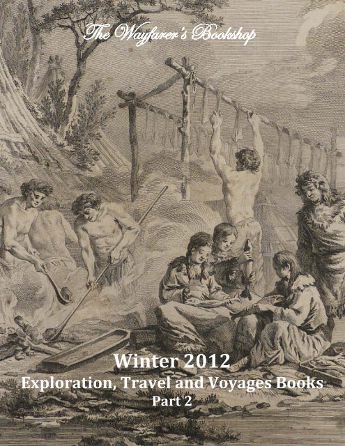
The Wayfarer’s <strong>Books</strong>hop<br />
<strong>Winter</strong> <strong>2012</strong><br />
<strong>Exploration</strong>, <strong>Travel</strong> <strong>and</strong> <strong>Voyage</strong>s <strong>Books</strong><br />
<strong>Part</strong> 2<br />
1
The Wayfarer’s <strong>Books</strong>hop<br />
<strong>Winter</strong> <strong>2012</strong><br />
<strong>Exploration</strong>, <strong>Travel</strong> <strong>and</strong> <strong>Voyage</strong>s <strong>Books</strong><br />
<strong>Part</strong> 2<br />
www.wayfarersbookshop.com; e-mail: wayfarers@shaw.ca<br />
phone: +1 (604) 921 4196; fax: +1 (604) 921 4197<br />
Cover illustration – Kamchadals preparing fish for winter, a plate<br />
from Chappe d'Auteroche ‘<strong>Voyage</strong> en Sibérie’ (item # 138)<br />
2
101. [ALARCÓN, Luis Ambrosio] (b. 1660).<br />
Memorial de D. Luis Ambrosio de Alarcon a Su<br />
Magestad, (que Dios guarde) Sobre la Plaza, i Antiguedad en el<br />
Concejo de Indias [Reflection of Don Luis Ambrosio de Alarcon<br />
to His Majesty (God preserve him) On the Place <strong>and</strong> Seniority<br />
in the Council of the Indies].<br />
Hispali [Seville]: Fanciscum Sanchez Reciente<br />
Typographum, 1729. First Edition. Folio (ca. 30,5x20 cm). [2], 35<br />
pp. With ornamental woodcut initials in text. 19th century white<br />
half vellum with marbled boards. Period ink inscription in<br />
Spanish at the end of the text. A very good copy.<br />
Very rare as no copies found in Worldcat.<br />
This tractate addressed to the Spanish King Philip V (1683-<br />
1746) gives a detailed report of Don Luis Ambrosio de Alarcon’s<br />
career, including his service as a Councillor <strong>and</strong> Magistrate in<br />
Spain <strong>and</strong> Italy (Naples, Santa Clara, Otranto, Madrid), <strong>and</strong> as<br />
the Superintendent of the royal mercury mines (Real Mina de<br />
Azogues) in Huancavelica (Peru) during the reign of the viceroy<br />
of Peru Carmine Nicolao Caracciolo, 5th Prince of Santo Buono<br />
(ruled in 1716-1720). The ‘biographical’ introduction is followed<br />
with three chapters where the author explains the reasons for<br />
the raise of Don Luis’s salary as a member of the Royal Council of the Indies.<br />
The period inscription in secretarial h<strong>and</strong> in the end of the text indicates that the sought-for raise<br />
has been granted: ‘Resol [vemos]. Se declare la plaza en [Hispali] 730. [] concedio la antiguedad’<br />
"The Council of the Indies; officially, the Royal <strong>and</strong> Supreme Council of the Indies (Real y Supremo<br />
Consejo de Indias), was the most important administrative organ of the Spanish Empire for the Americas<br />
<strong>and</strong> Asia. The large volume of Council <strong>and</strong> Crown's decisions <strong>and</strong> legislation for the Indies were formally<br />
codified in the 1680 publication, the Laws of the Indies (Recompilación de las Leyes de Indias) <strong>and</strong> recodified<br />
in 1791" (Wikipedia).<br />
The area around the city of Huancavelica "was the most<br />
prolific source of mercury in Spanish America, <strong>and</strong> as such was<br />
vital to the mining operations of the Spanish colonial era.<br />
Mercury was necessary to extract silver from the ores produced<br />
in the silver mines of Peru, as well as those of Potosí in Alto Perú<br />
("Upper Perú," now Bolivia), using amalgamation processes such<br />
as the patio process or pan amalgamation. Mercury was so<br />
essential that mercury consumption was the basis upon which<br />
the tax on precious metals, known as the quinto real ("royal<br />
fifth"), was levied" (Wikipedia).<br />
$1250USD<br />
101. Period manuscript grant<br />
at the end of the text<br />
102. [ANSON, Lord George] (1697-1762)<br />
A <strong>Voyage</strong> to the South Seas, <strong>and</strong> to many Other <strong>Part</strong>s of the World, performed from the month of<br />
September in the year 1740, to June 1744, by Commodore Anson, in his Majesty's Ship the Centurion,<br />
having under his comm<strong>and</strong> the Gloucester, Pearl, Severn, Wager, Trial, <strong>and</strong> two Store-Ships. By an<br />
Officer of the Squadron.<br />
101<br />
3
London: R.Walker, 1745. Second Edition, Best [] Octavo. x, 11-408, 54 pp. With a portrait<br />
frontispiece <strong>and</strong> five folding copper engraved plates. 19th century brown gilt tooled full calf with a<br />
Lichfield bookplate. Head of spine slightly rubbed, title-page (with small cut-out of right upper corner) <strong>and</strong><br />
two folding plates backed on old paper, otherwise a very good copy.<br />
Rare work with only twelve copies<br />
found in Worldcat. This second edition<br />
seems to include an additional plate in<br />
comparison to copies of the first edition.<br />
This unauthorized account "preceded the<br />
publication of the official narrative by<br />
Richard Walter. The appendix in this edition<br />
relates to the history of voyages <strong>and</strong><br />
explorations of the Pacific <strong>and</strong> the Far East,<br />
together with descriptions of some of the<br />
countries visited. There is a table for<br />
estimating the value of diamonds, <strong>and</strong><br />
interesting plates" (Hill 1787).<br />
"Consisting at the start of eight<br />
ships.., Seven ships were lost around Cape<br />
Horn <strong>and</strong> on the coast of Chile <strong>and</strong> out of<br />
900 men who left Engl<strong>and</strong> on board more<br />
than 600 perished. As usual scurvy took<br />
an appalling toll.., As with many a ship before <strong>and</strong> after, the isl<strong>and</strong> of Juan Fern<strong>and</strong>ez proved a blessing in<br />
restoring scurvy-stricken men to health" (Cox I, p. 49 (Official Account)). "This is a scarce, surreptitious<br />
account of Anson’s voyage, anticipating the official account by four years. On the outbreak of the war<br />
with Spain in 1739 Anson was recalled from his post in Carolina <strong>and</strong> dispatched to the South Seas with a<br />
fleet of eight vessels to harass Spanish shipping <strong>and</strong> cooperate with Vernon across the Isthmus of<br />
Panama. He lost seven ships on the South American coast" (Goodspeed); Sabin 1633.<br />
$3250USD<br />
102<br />
103. [B.C. GOLD RUSH WEEKLY NEWSPAPER]<br />
The Cariboo Sentinel: Vol. 1. No. 12.<br />
Barkerville, Williams Creek, British Columbia: Saturday,<br />
August 19, 1865. On a double Elephant Folio leaf (ca. 40,5x29,5<br />
cm or 16 x 11 ½ in). Four pages. With Two page Supplement<br />
laid in. Period pencil note "30 cops. Exp. Acc. F.J. Barnard" in<br />
the right upper corner; blue stamp "M.W. WAITT & Co. Govt.<br />
St. VICTORIA" in the left upper corner. Light staining along fold<br />
lines, chipping on the upper edge, but overall a very good copy.<br />
Very rare as only four runs of the newspaper located in<br />
Worldcat.<br />
One of the first issues of this almost legendary goldfields<br />
newspaper inscribed by a prominent BC businessman <strong>and</strong><br />
politician, the founder of famous Barnard’s Express: Francis<br />
Jones Barnard (1829-1889).<br />
The inscription ordered to send 30 copies of the<br />
newspaper to the office of a Victoria bookseller, publisher <strong>and</strong><br />
103. A stamp of M.W. Waitt & Co,<br />
bookseller in Victoria, above the title<br />
4
news agent M.W. Waitt & Co. (probably, on Barnard’s personal account). The reason for this was most<br />
likely the article letter from Victoria written anonymously by a member of the Legislature, which<br />
presented a lengthy defense of Union of the Colonies of BC <strong>and</strong> Vancouver Isl<strong>and</strong>, based partly on the<br />
value of the Cariboo miners to the Isl<strong>and</strong> economy <strong>and</strong>, reciprocally, the value of free trade to the miners<br />
(the union was concluded in 1866).<br />
"The Cariboo Sentinel was published in Barkerville, in the Cariboo region of central British<br />
Columbia, <strong>and</strong> ran from June 1865 to October 1875. At the time, Barkerville was home to a fast-growing<br />
community of miners who had been attracted to the Cariboo region by the discovery of gold. The Sentinel<br />
was published by George Wallace, <strong>and</strong> its stated objective was not only to disseminate "mining<br />
intelligence," but also to eradicate "official abuse[s]" of power, both within the Cariboo region <strong>and</strong><br />
beyond (vol. 1, no. 1, p. 2)" (UBC Library Catalogue).<br />
103<br />
"Francis Jones Barnard, often known as Frank Barnard Sr., was a prominent British Columbia<br />
businessman <strong>and</strong> Member of Parliament in Canada from 1879 to 1887. Most famously, Barnard was the<br />
founder of the B.X. Express freighting company ("Barnard's Express"), which was the main cartage <strong>and</strong><br />
passenger services company on the Cariboo Road. His son, Sir Francis Stillman Barnard, often known as<br />
Frank Barnard Jr., later became the Lieutenant-Governor of British Columbia.<br />
It was his next enterprise, begun in the fall of 1860, that would grow to become the B.X. Express<br />
one of the most important companies in the early history of the Colony, <strong>and</strong> which would remain in<br />
business for decades. He began by carrying mail <strong>and</strong> newspapers, on foot, all the way from Yale to the<br />
goldfield towns of the Cariboo, a 760-mile roundtrip journey, charging $2 per letter <strong>and</strong> selling<br />
newspapers in the goldfields for $1 a copy. In 1861 <strong>and</strong> 1862 he also carried packages between Yale <strong>and</strong><br />
New Westminster, a distance of 200 miles, <strong>and</strong> in 1862 established a one-horse pony express, with<br />
himself as sole rider, serving the Cariboo from Yale, where he met with services from New Westminster<br />
<strong>and</strong> Yale provided by Dietz & Nelson (one of the partners in which was the later Lieutenant-Governor<br />
Hugh Nelson) <strong>and</strong> couriered reliably from there to Barkerville. On his return journeys, he became<br />
entrusted with shipments of gold dust, <strong>and</strong> managed to reliably <strong>and</strong> safely convey earnings from the<br />
goldfields to Yale despite the ever-present risk of robbery, in addition to the difficulties posed by distance,<br />
climate, <strong>and</strong> the difficult canyon <strong>and</strong> plateau trails.<br />
With the completion of the first section of the Old Cariboo Road to Soda Creek in 1862 , Barnard<br />
used his own acquired capital <strong>and</strong> found a backer to launch Barnard's Express <strong>and</strong> Stage Line with<br />
5
fourteen six-horse coaches <strong>and</strong> a famous team of "crack whips" to drive them, including legendary drivers<br />
Steve Tingley <strong>and</strong> Billy Ballou. The onset of the busiest phase of movement of miners <strong>and</strong> goods to <strong>and</strong><br />
from the Cariboo Gold Rush began that year, <strong>and</strong> Barnard's new company prospered from a buys trade in<br />
services for passengers, freight, letters, newspapers <strong>and</strong> gold dust, <strong>and</strong> in 1864 was able to exp<strong>and</strong> his<br />
business further with the purchase of more rolling stock <strong>and</strong> also in winning the government contract to<br />
carry the mail. Barnard was also able to encourage the government to end the gold escort with the result<br />
that his company's coaches, equipped with armed guardsmen, would be fully in charge of the movement<br />
of gold from the Cariboo to the Coast. In 1866 Barnard bought out Dietz <strong>and</strong> Nelson <strong>and</strong> so came into<br />
control of the bulk of business connecting Victoria to Barkerville, as he was now in control of shipments<br />
between Victoria <strong>and</strong> Yale as well as from Yale northwards" (Wikipedia).<br />
$1250USD<br />
104. [CAMPO POMAR, Rafael] (1813-1890)<br />
Manifesto del Presidente del Salvador a los pueblos del estado<br />
[Manifest of the president of Salvador to the people of the state].<br />
Cojutepeque [Salvador]: Imprenta del Triunfo, 1857. First Edition.<br />
Octavo. 5 leaves. Disbound pamphlet. Period ink inscriptions<br />
(calculations) on the title page, otherwise a very good copy.<br />
Very Rare political pamphlet as no copies found in Worldcat.<br />
This pamphlet contains the speech of the president of El Salvador<br />
Rafael Campo to the citizens of the country dated the 21st of March<br />
1857.<br />
Rafael Campo Pomar was President of El Salvador 12 February<br />
1856 - 1 February 1858. Campo was elected president on 30 January<br />
1856. He turned over power to his vice president, Francisco Dueñas,<br />
on 12 May of the same year, but resumed the presidency on 19 July.<br />
He was a member of the Conservative <strong>Part</strong>y. Campo stepped down<br />
after the serious cholera epidemic of 1857 had exhausted the country.<br />
$475USD<br />
104<br />
105<br />
105. [CHÁVEZ, Coronado] (1807-1882)<br />
Exposition del Presidente del estado de Honduras a los Centro-<br />
Americanos. Año de 1845 [Exposition of the President of the State of<br />
Honduras to the Central Americans. Year of 1845].<br />
Comayagua [Honduras]: Imprenta del Estado, [1845]. First Edition.<br />
Octavo. [1], 12 pp. Original paper pamphlet with the title page as wrapper<br />
cover. Minor stains on the title page, otherwise a very good copy.<br />
Very Rare Honduras imprint as only 6 copies found in Worldcat. The<br />
pamphlet contains the speech of the 4th president of Honduras Coronado<br />
Chávez to the citizens of the Confederation of Central America (1842-45)<br />
dated the 26th of June 1845. The speech is supplemented with the official<br />
letter from José Maria Cisneros (Ministerio de Relaciones del Supremo<br />
Gobierno des Estado de Honduras) to the general-in-chief of the army of<br />
El Salvador regarding the current war between Salvador, Honduras <strong>and</strong><br />
Nicaragua.<br />
"Coronado Chávez was the 4th President of Honduras from 8 January<br />
1845 to 1 January 1847. For the week prior to his taking office he had been a member of the<br />
6
council of ministers that was running Honduras along with Casto Alvaro. Chávez succeeded in the<br />
war with El Salvador, a conflict that ended with the "Sensenti Treaty" in 1847. A conservative, Chávez<br />
accompanied General Francisco Ferrera in exile, living in El Salvador until his return to Honduras, where<br />
he died at his residence in Comayagua.<br />
Chávez was noted for a decree dated March 10, 1846, issued to support the ‘Literary Academy of<br />
Tegucigalpa’ which later became the State University. The Honduras Legislature proclaimed him on March<br />
19, 1846 as ‘Father Conscripto’ (Father of the Nation)" (Wikipedia).<br />
$575USD<br />
106. [COUNEAU, E.]<br />
A Madame Ernest Callot. Biskra. Quatorze Eaux-Fortes Gravées sur des Dessins Originaux.<br />
Souvenir d'une Excursion en Algérie [To Madame Ernest Callot. Biskra. Fourteen Etchings Drawings<br />
Originals Engraved on a trip to Algeria].<br />
1881. First Edition Author's Signed Presentation Copy. Folio. [iv] pp. With fourteen full page<br />
engravings. Original publisher's light brown printed paper wrappers. Spine renewed in style, otherwise a<br />
very good copy.<br />
Very rare work as only one copy found in Worldcat. Inscribed by the author "Souvenir Amical a<br />
L'Auteur a M. Teiloz, La Rochelle le 30 Mars 1911 E. Couneau." The well executed engravings illustrate<br />
scenes around Biskra, "the capital city of Biskra province, Algeria.., During Roman times the town was<br />
called Vescera, though this may have been simply a Latin transliteration of the native name. Around 200<br />
AD under Septimius Severus' reign, it was seized by the Romans <strong>and</strong> became part of the province of<br />
Numidia. As a major settlement in the border region, it was significant even then. Its name was<br />
apparently bowdlerized by the Romans to Ad Piscīnam ("at the piscīna"), implying the presence of<br />
important waterworks" (Wikipedia).<br />
$1500USD<br />
106<br />
7
107. [COURT OF BRITISH COLUMBIA]<br />
BEGBIE, Matthew Baillie, Sir (1819-1894)<br />
[Leaflet Titled]: Court of British Columbia. Order of Court. Whereas, by a Proclamation under the<br />
public seal of the said Colony, issued at Victoria, V.I., the 24th day of December, I, Matthew Baillie<br />
Begbie, Judge in the said Court, am authorised, while resident in Victoria, Vancouver Isl<strong>and</strong>, to make<br />
general Rules <strong>and</strong> Orders of Court in the same manner <strong>and</strong> of the same force <strong>and</strong> validity as if I were<br />
resident in British Columbia...<br />
[Victoria B.C.]: 24 December, [1858]. On a folded double folio<br />
leaf (ca. 28x39,5 cm or 11 x 15 ½ in) with the Royal Arms of the<br />
British Empire. 4 pp. The leaflet has a mild stain on the first page,<br />
minor creases on corners, otherwise a very good copy.<br />
Rare B.C. Incunabula with only thirteen copies found in<br />
Worldcat.<br />
Matthew Begbie’s establishment of the Court of the newly<br />
formed Colony of British Columbia (since August 2, 1858). The<br />
document contains 14 paragraphs <strong>and</strong> three forms of declarations<br />
by barristers, attorneys or solicitors, <strong>and</strong> attorneys on temporary<br />
rolls.<br />
"Begbie reached Fort Victoria on November 16, 1858. He was<br />
sworn into office in Fort Langley on November 19, as the new<br />
Colony of British Columbia was proclaimed. Given the influx of<br />
prospectors <strong>and</strong> others during Fraser Canyon Gold Rush <strong>and</strong> the<br />
following Cariboo Gold Rush of 1861, Begbie played a crucial role in<br />
the establishment of law <strong>and</strong> order throughout the new colony"<br />
(Wikipedia).<br />
"Sir Matthew Baillie Begbie was the first Chief Justice of the Crown Colony of British Columbia in<br />
colonial times <strong>and</strong> in the first decades after confederation of Canada. Begbie served as the first Judge of<br />
the Supreme Court, Colony of British Columbia 1858 to 1866 <strong>and</strong> then, in the same capacity in the<br />
Supreme Court, the United Colonies of Vancouver Isl<strong>and</strong> <strong>and</strong> British Columbia from 1866 to 1870. He was<br />
Chief Justice of the Supreme Court of the United Colonies from 1870 to 1871 <strong>and</strong>, following British<br />
Columbia joining confederation in 1871, he served as the first Chief Justice of the Supreme Court of the<br />
new Province of British Columbia until his death on June 11, 1894.<br />
In the years after his death, Begbie came to be known as the Hanging Judge. However, it appears<br />
that he does not deserve this reputation. The death penalty was m<strong>and</strong>atory in murder cases in those days<br />
unless the government approved a judge's recommendation for clemency. Indeed, Begbie successfully<br />
argued for clemency in several cases" (Wikipedia).<br />
$675USD<br />
108. [DE SOUSA COUTINHO, Rodrigo Domingos] (1755-1812)<br />
[LAW REGULATING GOLD AND DIAMOND MINING IN BRAZIL]: Eu o Principe Regente Faço saber<br />
aos que este Alvará com força de Lei virem: Que tendo-Me sido presentes os gravissimos prejuizos, que<br />
vem á Minha Real Fazenda, e aos Povos das Capitanias do Brazil, principalmente Mineiras, da fórma<br />
actual da Organizaçao, e Administraçao das Minas de Ouro, e Diamantes…<br />
[Lisbon]: Na Regia Officina Typographica, 1803. First Edition. Folio (ca. 29x20,5 cm). 38, [1] pp.<br />
Original marbled paper wrappers. A near fine copy.<br />
Very Rare official Portuguese imprint as no copies found in Worldcat.<br />
107<br />
8
The publication contains the full text<br />
of the law regulating gold <strong>and</strong> diamond<br />
mining in Brazil, in particular in the<br />
Captaincies of Minas Geraes <strong>and</strong> Goyaz. The<br />
text contains nine articles dedicated to the<br />
issues of organization of the Royal<br />
administrative council supervising mining<br />
<strong>and</strong> mintage (Junta Administrativa de<br />
Mineraçao e Moedahem); regulation of gold<br />
circulation <strong>and</strong> in particular the prohibition<br />
of circulation of gold powder; establishment<br />
of gold <strong>and</strong> diamond exchange institutions<br />
(Casas de Permuta); rules of exploitation of<br />
gold <strong>and</strong> diamond deposits <strong>and</strong> how they<br />
can be developed <strong>and</strong> also sold or leased to<br />
different entrepreneurs; et al. The law is<br />
108<br />
supplemented with a detailed table of tariffs<br />
for buying the extracted diamonds which are divided into four groups according to their quality.<br />
“Rodrigo de Sousa Coutinho, 1st Count of Linhares was a Portuguese nobleman <strong>and</strong> politician,<br />
Secretary of State <strong>and</strong> Minister of the Navy <strong>and</strong> Overseas Dominions (Secretário de Estado da Marinha e<br />
Domínios Ultramarinos) <strong>and</strong> the President of the Royal Treasury (Real Erário) in 1801-1803” (Wikipedia).<br />
$750USD<br />
109. [GOAN IMPRINT]<br />
BALSEMÃO, Eduardo Augusto de sa Nogueira Pinto de<br />
(1837-1902)<br />
Documentos que Dizem Respeito á Vida Publica de<br />
Eduardo Augusto de sa Nogueira Pinto de Balsemão<br />
[Documents Pertaining to Public Life of Eduardo Augusto de sa<br />
Nogueira Pinto de Balsemão].<br />
Nova-Goa: Imprensa National, 1880. First Edition. Quarto.<br />
[2 - blank], iv leaves, 130, [1] pp. Period brown quarter sheep gilt<br />
lettered on the spine, original publisher’s printed wrappers bound<br />
in; front wrapper acting as a title page. Spine with repaired tears<br />
at head <strong>and</strong> foot, mild foxing, a few leaves strengthened at outer<br />
margin. Overall a very good copy.<br />
Very Rare Goan imprint, as no copies found in Worldcat.<br />
A collection of official documents <strong>and</strong> letters about the<br />
public life of Eduardo Augusto de sa Nogueira Pinto de Balsemão,<br />
who was Chief Secretary to the Governments of Cabo Verde,<br />
Angola <strong>and</strong> Goa (the latter in 1877). He was a member of the<br />
Geographical Society of Lisbon <strong>and</strong> Society of Propagation of<br />
African Geographical Knowledge of Lu<strong>and</strong>a, <strong>and</strong> published<br />
several important works on the history of Angola <strong>and</strong> Portuguese<br />
India.<br />
$475USD<br />
109<br />
9
110. [GOAN IMPRINT]<br />
MACIVOR, William Graham (1825-1876), <strong>and</strong> RIVARA, Joaquim Heliodoro da Cunha<br />
Memoria Sobre a Propagação e Cultura das Cinchonas<br />
Medicinaes, ou Arvores de Quina do Peru [A Memoir about<br />
Propagation <strong>and</strong> Culture of Medical Cinchona, or Trees of Quinoa<br />
of Peru / Translated from English by J.H. Da Cunha Rivara].<br />
Nova-Goa: Imprensa National, 1864. First Edition. Octavo.<br />
[2], 36 pp. Later brown gilt lettered cloth, original publisher’s<br />
printed wrappers neatly restored <strong>and</strong> bound in. With a possible<br />
author’s inscription on verso of rear wrapper: "[] da Cunha Rivara.<br />
Arrayolos" (Arraiolos is a small town located in Évora District in<br />
Portugal the birthplace of Cunha Rivara). Some pages with very<br />
mild foxing, otherwise a very good copy.<br />
Very Rare as only one copy found in Worldcat.<br />
A report on the Cinchona cultivation in the Neilgherry<br />
mountains, introduced to British India in 1861 with seeds from<br />
Peru <strong>and</strong> Java. Translated by Cunha Rivara, <strong>and</strong> with an addendum<br />
by him (two articles originally published in Archivo de Pharmacia e<br />
Sciencias Accessorias da India Portuguesa, # 7 <strong>and</strong> 9, 1864). Mac<br />
Ivor, Kew Gardener, who came to India in 1848, became a director<br />
of a public garden at Ootacamund in Nilgira Hills, <strong>and</strong> was in charge<br />
of the Cinchona acclimatization project there. He also brought out<br />
several publications promoting horticulture.<br />
$575USD<br />
110<br />
111. [HONG KONG LAWS]<br />
Laws of the Colony of Hong Kong. 1841-54; [With] Ordinances of Hong Kong, 1854-1864.<br />
Hong Kong, 1855-64. First Edition. Small Folio, 2 vols. Volume 1: viii, 490; Volume 2: with over 200<br />
unnumbered leaves, some blank. With the British North Borneo Company exlibris <strong>and</strong> Foreign <strong>and</strong><br />
Commonwealth Office Library cancel stamps on the front free endpapers. Period brown patterned cloth<br />
with gilt arms embossed on cover of volume one. Rebacked using matching period cloth, extremities<br />
rubbed, otherwise a very good set.<br />
Incredibly Rare Hong Kong imprints as no copy found in Worldcat.<br />
Very important primary source for the<br />
history of Hong Kong with details on the cession<br />
of Hong Kong <strong>and</strong> the organization of the colonial<br />
government including proclamations,<br />
notifications, commissions <strong>and</strong> charters <strong>and</strong> 194<br />
ordinances including laws regarding slavery,<br />
printing, registry of deeds, good order <strong>and</strong><br />
cleanliness, prohibition of distilling alcohol,<br />
regulation for the police force, public gaming,<br />
establishment of courts, sale of opium,<br />
suppression of the Triad <strong>and</strong> other secret<br />
societies, restraint of trade with China,<br />
regulations of the goal. "The isl<strong>and</strong> of Hong Kong<br />
was first ceded to Great Britain in 1841, <strong>and</strong> the<br />
111<br />
10
cession was confirmed by the Treaty of Nanjing, Aug. 29 1842, the charter bearing the date April 5 1843"<br />
(China Illustrata Nova II, 989).<br />
"By the early 19th century, the British Empire trade was heavily dependent upon the importation of<br />
tea from China. While the British exported to China luxury items like clocks <strong>and</strong> watches, there remained<br />
an overwhelming imbalance in trade. China developed a strong dem<strong>and</strong> for silver, which was a difficult<br />
commodity for the British to come by in large quantities. The counterbalance of trade came with exports<br />
of opium to China, opium being legal in Britain <strong>and</strong> grown in significant quantities in the UK, <strong>and</strong> later in<br />
far greater quantities in India. A Chinese commissioner Lin Zexu voiced to Queen Victoria the Qing state's<br />
opposition to the opium trade. It resulted in the First Opium War, which led to British victories over China<br />
<strong>and</strong> the cession of Hong Kong to the United Kingdom via the enactment of the new treaties in 1842"<br />
(Wikipedia).<br />
$15,000USD<br />
112. [HUDSON'S BAY COMPANY]<br />
Report from the Select Committee on the Hudson's Bay Company; together with the Proceedings<br />
of the Committee, Minutes of Evidence, Appendix <strong>and</strong> Index [With the 'Plans referred to in the<br />
Report']: Ordered, by The House of Commons, to be Printed, 31 July <strong>and</strong> 11 August 1857 [Plans by<br />
'Henry Hansard, Printer']. Two items bound together.<br />
London: House of Commons, 1857. First<br />
Edition. Folio. [iv], xviii, 547, [1] pp. With three<br />
large h<strong>and</strong> colored folding lithographed maps.<br />
Original navy quarter cloth with original<br />
printed paper spine label <strong>and</strong> grey papered<br />
boards. Extremities slightly frayed <strong>and</strong><br />
bumped, otherwise a very good copy.<br />
"An important document containing the<br />
evidence of many witnesses on the suitability<br />
of Rupert's L<strong>and</strong> for agricultural settlement"<br />
(Peel 188). The Committee was convened to<br />
consider 'the State of those British Possessions<br />
in North America which are under the<br />
Administration of the Hudson's Bay Company,<br />
or over which they possess a License to Trade',<br />
at the 'near approach of the period when the<br />
license of exclusive trade, granted in 1838 for<br />
21 years, to the Hudson's Bay Company over<br />
112. Aboriginal map of North America<br />
that north-western portion of British America which goes by the name of the Indian Territories, must<br />
expire'. Highly detailed, <strong>and</strong> containing much first-h<strong>and</strong> testimony from notable figures (J. H. Lefroy; John<br />
Rae; Sir George Simpson; William Kernaghan; Sir John Richardson; Rear-Admiral Sir George Back; Edward<br />
Ellice). Nineteen appendices, containing transcripts of documents <strong>and</strong> other material. The HBC's 21-year<br />
monopoly, granted in 1838, was running out <strong>and</strong> pressure for opening its l<strong>and</strong>s to settlement was<br />
growing. This report urges restraint in opening up the l<strong>and</strong>s, warning of corruption of the Indians <strong>and</strong><br />
overhunting of the fur supply. TPL 3729.<br />
$975USD<br />
11
113. [ITALIAN ERITREA]<br />
[Italian Colonization of Eritrea: Two Rare Items]:<br />
[A Rare Russian Offprint]: TROYANSKY, Alex<strong>and</strong>er Stepanovich (1835-1905). Eritreiskaia Koloniia<br />
Italii [The Italian Colony in Eritrea]. Saint Petersburg: V. Kirschbaum, 1893. Large Octavo. Separately<br />
issued offprint of the article in "The Proceedings of the Statistical Department of the Russian Geographical<br />
Society" (Vol. VII, Issue II). [6], 65, 2 pp. Original greenish gray publisher’s printed wrappers. With author’s<br />
inscription on the title page "As a remembrance from Troyansky". Corners <strong>and</strong> sides of the wrappers with<br />
very minor tears <strong>and</strong> losses, otherwise a very good copy.<br />
[With An Early Italian Map of Eritrea]: La Baia d'Assab Carta Geografica per Seguire la Spedizione<br />
Militaire Italiana [Geographical Map of the Bay of Assab to Follow the Italian Military Expedition].<br />
Torino: Carlo Manfredi, [1884]. Terza Edizione. [Third Edition] Large chromolithographed folding map<br />
75x50 cm (29x20 inches). Original illustrated wrappers. Map with minor tears on folds <strong>and</strong> occasional<br />
spotting, wrappers soiled, with minor tears. Overall a good copy.<br />
113<br />
Troyansky’s work is a very rare short-run brochure as only 1 microform copy found in Worldcat. It is<br />
one of the first Russian books on Eritrea, written by the Russian General Council in Palermo just three<br />
years after the official formation of the colony <strong>and</strong> two years before the First Italian-Ethiopian War 1895-<br />
1896, which finally delineated the borders of the colony. The book gives an overview to the history of<br />
Eritrea <strong>and</strong> the establishing of the Italian colony there, Eritrea’s territory, climate <strong>and</strong> natural resourses;<br />
population, administration, finance, education et al; Italian immigration to Eritrea <strong>and</strong> Italian military<br />
forces in the country; Massawa <strong>and</strong> Assab ports <strong>and</strong> Eritrea’s intertational trade et al. Bibliography<br />
contains 19 Italian works.<br />
From the Preface: "Although African L<strong>and</strong>s have usually been out of attention of the Russian<br />
Geographical Society, because of recent increased attention to Abyssinia we decided to publish this<br />
account about a very important possession of one of the European countries next to Abyssinia.<br />
Troyansky’s work with all its briefness is comprehensive <strong>and</strong> significantly contributes to our modest<br />
literature about Africa". For this work the Russian Geographical Society awarded Troyansky with its silver<br />
medal.<br />
12
The Italian map of the Bay of Assab is a rare interesting map of the early history of Italian influence<br />
in Eritrea, no copies found in Worldcat. It contains a large map of the East Africa with outlining the Italian<br />
Colony in Assab <strong>and</strong> leaving Massawa still independent (it was occupied in 1885). Additional smaller maps<br />
show detailed charts of the ports of Assab <strong>and</strong> Massawa, Sudanese <strong>and</strong> Danakil territories. A special text<br />
block contains "Gli Interessi Italiani in Africa."<br />
The history of Eritrea is tied to its strategic position on the Red Sea littoral, with a coastline that<br />
extends more than 1,000 km.., In the period following the opening of the Suez canal in 1869, when<br />
European powers scrambled for territory in Africa <strong>and</strong> tried to establish coaling stations for their ships,<br />
Italy invaded <strong>and</strong> occupied Eritrea. In 1882 the Eritrean port Assab <strong>and</strong> in 1885 Massawa became an<br />
Italian colony <strong>and</strong> on January 1, 1890 the whole Eritrea officially became a colony. Italy planned to exp<strong>and</strong><br />
its possessions from Eritrea into the more fertile Abyssinian hinterl<strong>and</strong>, but Ethiopia's military victory in<br />
the First Italian-Ethiopian War secured it the distinction of being the only African nation to successfully<br />
resist European colonialism (Wikipedia).<br />
$675USD<br />
114. [KAZAN, ASTRAKHAN & GEORGIA]<br />
Der Allerneueste Staat von Casan, Astracan, Georgien und<br />
Vieler Andern dem Czaren, Sultan und Schach, Zinsbaren und<br />
Unterthanen Tartarn, L<strong>and</strong>schaften und Provinzien: samt Einer<br />
Kurzen Nachricht von der Caspischen See, dem Daria-Strom,<br />
ingleichen von dem Persischen Hof, und Dessen Allerneuesten<br />
Staats- und Kriegs- Verfassung; zur Erläuterung der Russisch- und<br />
Persischen Kriegs-Operationen Entworfen, und mit Dienlichen<br />
Kupfern Ausgezieret [The very Latest Account of Kazan, Astrakhan,<br />
Georgia <strong>and</strong> many Other Possessions of the Czar, Sultan <strong>and</strong> Chakh,<br />
Tributary <strong>and</strong> Subjects Tartars, L<strong>and</strong>scapes <strong>and</strong> Provinces: with a<br />
Brief Account on the Caspian Sea..,].<br />
Nurnberg: Wolfgang Moritz Endters sel. Erben, 1724. First<br />
Edition, Second Issue. Duodecimo. [xiv], 398 pp. With a copper<br />
engraved frontispiece, <strong>and</strong> four other folding copper engraved<br />
plates. Period quarter vellum with decorative papered boards.<br />
Rebacked with 17th century vellum with decorative manuscript<br />
initials, also with a brown ink inscriptions on the first endpaper<br />
(dated 1751) <strong>and</strong> a couple of library stamps on half title <strong>and</strong> title,<br />
otherwise a very good copy.<br />
Rare work <strong>and</strong> one of the first books on Russian-Persian War<br />
114. Sultan Husayn, a Safavid<br />
King of Persia in 1694-1722<br />
(1722-23), published anonymously just a year after the end of the<br />
war <strong>and</strong> thoroughly describing the regions of the Southern Russia,<br />
the Caucasus <strong>and</strong> the Caspian Sea. It contains an account of the<br />
events of the Russian-Persian war which ended with a Russian victory <strong>and</strong> the subsequent Russian<br />
annexation of the Persian cities Derbent, Baku, Rasht <strong>and</strong> the northern Persian provinces of Shirvan,<br />
Gilyan <strong>and</strong> others.<br />
The author describes all regions influenced by the war: the Volga River <strong>and</strong> its major cities – Kazan<br />
<strong>and</strong> Astrakhan (as two main centers of the organization of the Persian campaign); the Caucasus (Georgia,<br />
Mingrelia, Dagestan et al.); the Western Caspian Sea region <strong>and</strong> its largest cities Baku, Derbent <strong>and</strong><br />
Shemakha. It’s interesting that Baku inhabitants were described as sick <strong>and</strong> lethargic, due to the poor<br />
water that was contaminated by Naphtan (oil). There is also a description of the geography of the<br />
13
Caucasus Mountains, including Mount Elbrus, the manners <strong>and</strong> customs of the people, genealogy of local<br />
Georgian <strong>and</strong> Mingrelian princes <strong>and</strong> others. The book includes engraved portrait of Sultan Hossein who<br />
ruled Persia at the time, three copper engraved views of Derbent, Baku <strong>and</strong> Shemakha, the Baku view<br />
showing various images of mostly burning oil wells; <strong>and</strong> a copper engraved plate of the local costumes.<br />
Nitsche-Stender 189.<br />
$2750USD<br />
115. [PERON, Pierre Francois] (b. 1769)<br />
Memoires du Capitaine Peron, sur ses <strong>Voyage</strong>s aux Cotes d'Afrique, en Arabie, a l'Ile<br />
d'Amsterdam, aux Iles d'Anjouan et de Mayotte, aux Cotes Nord-Oeust de l'Amerique, aux Iles<br />
S<strong>and</strong>wich, a la Chine, etc. [Memoirs of Captain Peron on his <strong>Travel</strong>s on the Coasts of Africa, Arabia,<br />
Amsterdam Isl<strong>and</strong>, the Isl<strong>and</strong>s of Anjouan <strong>and</strong> Mayotte, Along the Coast of Western North America, the<br />
S<strong>and</strong>wich Isl<strong>and</strong>s, China, etc.].<br />
Paris: Brissot-Thivars,<br />
Libraire, Bossange Freres, 1824.<br />
First Edition. Octavo, 2 vols. [iv], v,<br />
328; [iv], 359 pp. With four folding<br />
lithographed maps <strong>and</strong> two folding<br />
lithographed plates. Original<br />
publishers blue printed papered<br />
wrappers mounted on period green<br />
paper with title in manuscript on<br />
the spines. A couple of leaves with<br />
minor marginal water staining,<br />
otherwise a very good set in very<br />
original uncut condition.<br />
"For a considerable time<br />
Peron, chief officer of the Otter<br />
under Captain Ebenezer Dorr Jr.,<br />
was engaged in the industry of<br />
carrying sealskins <strong>and</strong> furs from the<br />
northwest American coast to China.<br />
He gives particulars concerning parts of British Columbia, Vancouver Isl<strong>and</strong>, <strong>and</strong> the Queen Charlotte<br />
Isl<strong>and</strong>s. He also describes parts of California, particularly a visit to Monterey in 1796. Other places he<br />
visited were Tasmania <strong>and</strong> New South Wales in Australia, Hawaii <strong>and</strong> Sumatra" (Hill 1330). "A description<br />
of Bahia appears in Vol. 1" (Borba de Moraes, II p. 663); "Remarks on the Hawaiian Isl<strong>and</strong>s are in volume II<br />
(pp. 135-176)" (Forbes, Hawaiian National Bibliography 585); Howes P240; Howgego P64.<br />
In May 1796 Peron "reached the Strait of Juan de Fuca. In June his ship entered the Bay of Nootka,<br />
where Peron <strong>and</strong> his companions had long dealings with the famous Macuina, of whose treachery <strong>and</strong><br />
cruelty there is a long account. After several stops on the way north, Peron's ship entered the region of<br />
Bucareli Bay in the beginning of August, thus entering Alaskan waters.., Captain Peron's memoirs are wellwritten<br />
<strong>and</strong> described many interesting events in the life of a sea captain who travelled in most of the still<br />
little-known world where Western commerce was fast developing" (Lada-Mocarski 89); Sabin 61001.<br />
$1950USD<br />
115<br />
14
116. [PORTUGUESE NAVIGATION AND COLONIES]<br />
Annaes Maritimos e Coloniaes. Publicação Mensal Redigida sob a Direcção da Associação<br />
Maritima e Colonial [Maritime <strong>and</strong> Colonial Annals: Monthly Publication Issued under the Direction of<br />
the Maritime <strong>and</strong> Colonial Association].<br />
Lisboa: Imprensa Nacional, 1840-1846. First Edition. Octavo, 6 vols. 533, [3], 12; 583, [5]; 346, [2],<br />
641, [2]; [1 – t.p.], 409, [2], [1 – t.p.], 455, [2]; 235, [1], 512, [2]; 56, 135 pp. With a total of thirteen<br />
lithograph maps, plans <strong>and</strong> charts (twelve folding, three in color), nine lithograph plates (seven folding;<br />
one large), <strong>and</strong> one large folding table, plus many tables in the text. H<strong>and</strong>some period maroon <strong>and</strong> brown<br />
gilt tooled quarter sheep with marbled <strong>and</strong> papered boards. Bound in a similar but not quite uniform style.<br />
Vol. 2 bound without a title page. A couple of plates with repairs <strong>and</strong> markings of removed old adhesive<br />
tape, a couple of places of mild foxing but overall a clean very good set.<br />
A complete set (103 issues) of<br />
the first <strong>and</strong> only edition of this<br />
important Portuguese periodical<br />
dedicated to navigation, geographical<br />
exploration <strong>and</strong> colonial issues, <strong>and</strong><br />
published by the Associação Maritima e<br />
Colonial in Lisbon. The materials<br />
include important original articles on<br />
the Portuguese colonies in Africa<br />
(Angola <strong>and</strong> Mozambique), India (Goa),<br />
China (Macau), Indonesia (Timor <strong>and</strong><br />
other isl<strong>and</strong>s, e.g. Solor); official<br />
documents by the Portuguese<br />
government regarding maritime <strong>and</strong><br />
colonial issues, as well as current<br />
116<br />
15<br />
statistical information from the<br />
colonies; first publications of the<br />
accounts of Portuguese voyages of exploration (e.g. in the Central Africa); interesting archival documents<br />
regarding Portuguese voyages <strong>and</strong> discoveries from the XVth century onwards <strong>and</strong> many others.<br />
The collection includes three lengthy articles serialized through many issues: one is on the<br />
Portuguese colonies in Asia, including Macau <strong>and</strong> Timor, one on Portuguese explorations in the interior of<br />
Africa (diary of Dr. Francisco Jose de Lacerda e Almeida), <strong>and</strong> one on Portuguese colonies on the west<br />
coast of Africa (Angola). Other articles are dedicated to the Solor Isl<strong>and</strong> (Indonesia), Mozambique, the<br />
trade with the Malay Archipelago, the priority of Portuguese explorations in the Northern <strong>and</strong> Central<br />
Africa; problems of Christianisation <strong>and</strong> public education of the population of the Portuguese colonies et<br />
al. There are also accounts of the most important international expeditions of the time, e.g. Dumont-<br />
Dourville’s travel to the Antarctic (1837-40), Dupetit-Thouars’ circumnavigation of the frigate Venus<br />
(1836-39), Canadian Arctic exploration by the Hudson’s Bay Company vessels, the US Exploring Expedition<br />
in the South Pacific in 1838-40 et al. The publications also include texts of international anti-slavery<br />
treaties, documents on exports <strong>and</strong> imports, articles on the latest navigation techniques <strong>and</strong> machines,<br />
e.g. steam ships, et al.<br />
The charts are aimed at helping sailors to navigate in difficult ports, <strong>and</strong> show the harbors of Lisbon,<br />
Goa, Quellimane (Mozambique, h<strong>and</strong> coloured), Dilly (Timor), Mossamedes (modern Namibia, Angola)<br />
<strong>and</strong> Lobito (Benguela province of Angola); there are also folding plans of the city of Goa, a Portuguese fort<br />
in Pungo an Dongo (Angola); a topographical chart of the National Forest of Leiria (Portugal) <strong>and</strong> others.<br />
Plates include two views of the rapids de São Salvador da Pesqueira on the river Douro (Portugal) – before<br />
<strong>and</strong> after the works which removed the rapids <strong>and</strong> made the river navigable at this point; a nicely
executed large folding view of the façade of the famous ruin of St. Paul’s Cathedral in Macau, a reprint of<br />
a document in Chinese, a draft of a vapour vessel, a statistical table of the population of the Portuguese<br />
Goa <strong>and</strong> others.<br />
Volume I contains 11 issues <strong>and</strong> a supplement (pp. 529-33), followed by an index (3 pp.), as<br />
described in Fonseca, <strong>and</strong> "Estatutos da Associação Maritima" (12 pp., paginated separately), which is not<br />
mentioned in Fonseca. In volume II, there are 12 issues. Volumes III, IV <strong>and</strong> V each contain 24 issues: 12 in<br />
the "<strong>Part</strong>e Official," 12 more in the "<strong>Part</strong>e Não Official." In volume VI, only 4 issues each of the "<strong>Part</strong>e<br />
Official" <strong>and</strong> "<strong>Part</strong>e Não Official" were published. Fonseca calls for only 1 folding plate <strong>and</strong> 3 maps in the<br />
"<strong>Part</strong>e Não Official" of volume III, where this copy has 3 plates <strong>and</strong> 4 maps. Fonseca also fails to mention<br />
the single leaf preceding the text in both "<strong>Part</strong>es" of volume IV.<br />
Innocêncio I, 72; Sabin 1577a.<br />
$5500USD<br />
117. [SAKHALIN INCUNABULA]<br />
Сахалинскiй Календарь [Sakhalin Calendar/ Printed under<br />
the order of the Sakhalin Military Governor].<br />
Sakhalin: Printed in the typography on the Sakhalin Isl<strong>and</strong>,<br />
1899. First Edition. Octavo. [2], iii, 149, 176 pp. With 4 lithographed<br />
plates. Period style red half morocco with raised b<strong>and</strong>s <strong>and</strong> gilt<br />
tooled spine. Six leaves (p. 131-134, 139-142 145-148) with margins<br />
neatly strengthened, but overall a very good strong copy.<br />
Very rare <strong>and</strong> important Sakhalin imprint. The first book<br />
published on the isl<strong>and</strong>, "Sakhalin Calendar" was issued for 5 years,<br />
1895-1899. There are only two copies of single volumes in the<br />
world libraries (Harvard <strong>and</strong> Yale Universities); all five volumes are<br />
in the Russian State Library, while the collection of the Russian<br />
National Library doesn’t have the original of our, fifth volume (only<br />
a photocopy).<br />
Our copy is bound without the last article "About hygienic<br />
condition in Sakhalin convict prisons" (supposed to start on p. 177,<br />
with four plates). However, not all copies have this last article as it<br />
was perhaps suppressed. Thus, the copy from the collection of the<br />
117<br />
main Sakhalin library is identical to the present copy (Sakhalin<br />
Provincial Universal Scientific Library, Yuzhno-Sakhalinsk).<br />
"The ‘Sakhalin Calendars’ became the first books published on Sakhalin. They were printed in 1895-<br />
1899 in the typography of the police direction of the Alex<strong>and</strong>rovsky post (now Alex<strong>and</strong>rovsk-Sakhalinsky)<br />
with permission of the Sakhalin military comm<strong>and</strong>er Vladimir Dmitrievich Merkazin (1834-1903). The<br />
calendars contained Orthodox Christian, Catholic <strong>and</strong> other calendars, official documents <strong>and</strong> orders,<br />
statistical information, scientific <strong>and</strong> journalistic articles of local intelligentsia <strong>and</strong> political exiles"<br />
(Sakhalin Provincial Universal Scientific Library on-line).<br />
The editor of all the issues was the head of the Sakhalin medical administration Doctor V.<br />
Stsepensky; among the contributors were the exiled ethnographers L. Stenberg (1861-1927) <strong>and</strong> B.<br />
Piłsudski (1866-1918), a revolutionary <strong>and</strong> a father of Russian poet Daniil Kharms I. Yuvachev (Miroliubov)<br />
(1860-1940), doctor N. Kirilov (1860-1921), exiled revolutionary B. Ellinsky (1872-1942) <strong>and</strong> others.<br />
As the editorial to the Calendar for 1898 noted, "to be honest, it is very, very difficult to publish the<br />
‘Sakhalin Calendar.’ A very small group of people, real old-residents of the isl<strong>and</strong> who work on this<br />
project, would have most likely given it up, if recently numerous newspapers didn’t publish articles about<br />
16
Sakhalin which remind them of the stories of the ancient Phoenicians about their travels to legendary<br />
countries Sakhalin for the mother country is terra incognita – write what you want (it happens more<br />
<strong>and</strong> more in the recent years) – people will believe everything. To give the opportunity to everyone<br />
interested in Sakhalin to separate the wheat from the chuff, a h<strong>and</strong>ful of the mentioned above old<br />
residents is working with the goal to spread the truth about the isl<strong>and</strong>."<br />
Our issue of the calendar for 1899 contains a list of all officers <strong>and</strong> associates of civil <strong>and</strong> military<br />
administration of Sakhalin, information about Sakhalin state, civil <strong>and</strong> education institutions (churches,<br />
hospitals, schools, asylums, libraries, meteorological stations, penitentiaries, post); population, local<br />
troops; agriculture, industry, private enterprises <strong>and</strong> joint-stock companies, ships which visited Sakhalin in<br />
1897; charity et al.<br />
Very important is one of the earliest reports of the first Sakhalin museum which was founded in<br />
Alex<strong>and</strong>rovsky post in 1896 (now Sakhalin State Provincial Museum of Local History, Yuzhno-Sakhalinsk).<br />
The report compiled by the museum director Pogaevsky, encloses museum activities from January 1st<br />
1898 to January 1st 1899, including notes on new acquisitions (stuffed bears <strong>and</strong> a fox, a model of a<br />
Japanese warrior etc.) <strong>and</strong> a visit to the museum of Prince Heinrich of Prussia (1862-1929), an officer of<br />
the Imperial German Navy <strong>and</strong> comm<strong>and</strong>er of the East Asia Squadron in 1899-1903.<br />
The second part of the ‘Calendar’ contains extent articles about the climate of the Southern<br />
Sakhalin (by N. Kirilov); an overview of the care after suffering from mental sickness on Sakhalin in 1897-<br />
98 (based on the official data, by L. L<strong>and</strong>au); "About the routes of the Korsakov district" (by N. Kirilov);<br />
"Food of the Sakhalin galyaks (from the local museum)"; "Analysis of the weather of the Alex<strong>and</strong>rovsky<br />
post on Sakhalin for 1898 (from the report of Alex<strong>and</strong>rovsky meteorological station)."<br />
$2250USD<br />
118. [SAVELYEV-ROSTISLAVICH, Nikolay Vasiljevich] (1815-1854)<br />
Dimitriy Ioannovich Donskoy, Pervonachalnik Russkoy Slavi [Dimitriy Ioannovich Donskoy, the<br />
First Leader of the Russian Glory].<br />
Moscow: Typ. of N. Stepanov, 1837. First Edition. Octavo. 157,<br />
[7] pp. 19th century black quarter morocco with black papered boards,<br />
rebacked in period style using the original boards. A very good copy.<br />
Extremely rare as no copies are found in Worldcat. Rare Russian<br />
Biography of Dmitrii Donskoi, First Russian to Defeat the Army of the<br />
Mongol-Tatars. The first book by Nikolai Vasilievich Saveliev-<br />
Rostislavich, author of three major books <strong>and</strong> over a dozen articles in<br />
magazines Otechestvennye zapiski, Syn Otechestva, Moskovskiy<br />
nabljudatel, etc., in the dictionary "Military Encyclopedic Lexicon,"<br />
mostly devoted to the history of the Slavs <strong>and</strong> the ancient peoples of<br />
Europe (Scythians, Sarmatians, Vikings, Huns, Goths <strong>and</strong> others).<br />
This book is dedicated to the outst<strong>and</strong>ing Russian military<br />
leader, the Moscow Gr<strong>and</strong> Prince Dmitry Donskoy, who was the first<br />
among the Russian princes to defeat the army of the Mongol-Tatars: in<br />
1380 in the Battle of Kulikov field (not far from the river Don). Donskoy<br />
inflicted a crushing defeat against Khan Mamay, for what became<br />
known as 'Donskoy'. It was in his reign, that Moscow established its<br />
118<br />
leadership position in the Russian l<strong>and</strong>s. Dmitry Donskoy was the first to<br />
pass on power to his eldest son Basil without the sanction of the Golden Horde.<br />
Brockhaus-Efron Russian Online Dictionary; Russian Biographical Online Dictionary.<br />
$975USD<br />
17
119. [SIBERIAN UNIVERSITY IN TOMSK]<br />
OPISANIE PRAZDNESTVA, Byvshego v Gorode Tomske 26 i 27<br />
Avgusta 1880 Goda, po Sluchaiu Zakladki Sibirskogo Universiteta<br />
[Description of the Celebration of the Beginning of Construction of<br />
the Siberian University in Tomsk on the 27th <strong>and</strong> 28th of August<br />
1880].<br />
Tomsk: Mikhailov <strong>and</strong> Makushin, 1880. First Edition. Octavo.<br />
[2], 73 pp. Original publisher’s blue printed wrappers. A very good<br />
copy.<br />
Very rare short-run imprint as no copies found in Worldcat.<br />
The brochure describes the gr<strong>and</strong> ceremony of the beginning<br />
of the construction of the first university in Siberia – Tomsk Imperial<br />
University (nowadays Tomsk State University). The construction<br />
started on the 26th August 1880, <strong>and</strong> the University opened its<br />
doors in 1888. After that Tomsk received the nickname "The Siberian<br />
Athens." The brochure gives a detailed description of the whole<br />
celebration: a solemn reception, service of the Orthodox Church,<br />
119<br />
special dinner, public feast <strong>and</strong> fireworks. It includes texts of speeches<br />
of all important participants; list of main people who donated for the construction; telegrams with<br />
congratulations received from universities, schools, institutions <strong>and</strong> private people from all parts of<br />
Russia. The text on the rear wrapper says that all funds raised on selling of this book will be spent on<br />
construction of the student campus for the Siberian University.<br />
Tomsk University is now considered one of best universities in Russia; it has status of one of 39<br />
National Research Universities. Two Nobel Award laureates, more than 250 laureates of the State<br />
Premium of Russia <strong>and</strong> around 100 members of Academies of Sciences from different countries studied<br />
<strong>and</strong> worked here. The university is very proud of its Library with rich collection of rare books <strong>and</strong><br />
manuscripts <strong>and</strong> Botanical Garden founded in the 19th century.<br />
$475USD<br />
120. [UNION OF VANCOUVER ISLAND AND B.C., 1866]<br />
[Leaflet Titled]: Despatches [A letter dated 12 December 1865<br />
from Governor Kennedy to the Legislative Assembly enclosing<br />
despatches concerning crown l<strong>and</strong>s].<br />
Victoria, [1865]. 4 pp. On a folded folio leaf (ca. 27,5x35,5 cm<br />
or 10 ½ x 13 ¾ inches). Printed in double-columns. Signed by J.D.<br />
Pemberton (brown ink, in the right upper corner). Near fine, clean<br />
copy.<br />
A very rare leaflet as no copies located in Worldcat. Most likely<br />
the copy which belonged to Joseph Despard Pemberton (1821-1893),<br />
Surveyor General of the Colony of Vancouver Isl<strong>and</strong> at the time. The<br />
document contains several despatches from the Governor of<br />
Vancouver Isl<strong>and</strong> Arthur Edward Kennedy (1809-1883), J.D.<br />
Pemberton himself, attorney general of the Vancouver Isl<strong>and</strong> George<br />
Hunter Cary (1832-1866), <strong>and</strong> acting surveyor general of Vancouver<br />
Isl<strong>and</strong> Benjamin William Pearse (1832-1902) regarding surveys of the<br />
l<strong>and</strong>s of the Hudson’s Bay Company <strong>and</strong> other proprietors, in order<br />
to facilitate terms of the Union of the colonies of Vancouver Isl<strong>and</strong> <strong>and</strong> British Columbia. Lowther 261.<br />
$975USD<br />
18
121. [VERY RARE B.C. INCUNABULA]<br />
[EARLY REGISTRATION OF REAL ESTATE IN BRITISH COLUMBIA]<br />
[Broadside Titled]: An Act for Establishing a Registry of Deeds.<br />
[Victoria B.C.], [1858]. Folio (ca. 35,5x21,5 cm or 14 x 8 ½ in).<br />
Light blue paper. A couple of very small tears on the edges, otherwise a<br />
very good copy.<br />
Very Rare B.C. Incunabula with no copy located in Worldcat. This<br />
broadside establishes the "Registry of Deeds <strong>and</strong> other instruments<br />
affecting Real Property"; which purpose was "to simplify the<br />
conveyance of L<strong>and</strong> <strong>and</strong> other Real Property," to provide "the valid<br />
execution of Deeds, Acts of Instruments"; "<strong>and</strong> for the due recording of<br />
all Wills or Testaments" regarding "any Estate in L<strong>and</strong> or other Real<br />
Property."<br />
Most likely a preliminary version of the Council Bill which finally<br />
established the Registry in 1859. Clearly a draft, since the printing is<br />
rather poor <strong>and</strong> a blank space has been left at one place, <strong>and</strong> no royal<br />
seal is printed at the top of the text. The Minutes of the Council note<br />
the introduction by Douglas of this item for consideration at its meeting<br />
on Dec. 1st, 1858, so quite likely it was printed before that time. The<br />
importance of this legislation relegated it to discussion at council meetings<br />
for several months while various opinions as to its legality, etc., were sought. Unrecorded.<br />
$750USD<br />
121<br />
122. [VICTORIA AND ESQUIMALT RAILWAY COMPANY]<br />
[Broadside Titled]: An Act to Authorize the Victoria <strong>and</strong> Esquimalt Railway Company Limited to<br />
Make a Railway from Esquimalt to Victoria.<br />
Victoria B.C., 1862. One page on a folded<br />
double folio leaf (ca. 35,5x42,5 cm or 14 x 17 in).Pale<br />
blue paper. A fine copy.<br />
Very rare broadside with Worldcat only locating<br />
a copy at UBC. This is a draft of an act for a railway<br />
between Victoria <strong>and</strong> Esquimalt which most likely<br />
hadn’t been accepted; unlisted in the official set of<br />
Acts. According to the document, "the Victoria <strong>and</strong><br />
Esquimalt Railway Company Limited was duly<br />
registered on the 21st day of November, 1862" with<br />
the goal of "making of a Line of Railway between<br />
Victoria <strong>and</strong> Esquimalt, <strong>and</strong> the conveyance of<br />
passengers <strong>and</strong> goods between Esquimalt <strong>and</strong> Victoria."<br />
The Company will commit to "make <strong>and</strong> complete<br />
the permanent way of the said line within two years from the passage of this Act, unless hindered by<br />
the dangers of the sea or other unavoidable casualty." In case of approval, the Act "may be sited as the<br />
Victoria <strong>and</strong> Esquimalt Railway Act, 1862."<br />
$750USD<br />
122<br />
19
123. [WALLIS, J.]<br />
Wallis's New Pocket Edition of the<br />
English Counties or <strong>Travel</strong>lers Companion in<br />
which are carefully laid Down all the Direct<br />
& Cross Roads, Cities, Townes, Villages,<br />
Parks, Seats <strong>and</strong> Rivers with a General Map<br />
of Engl<strong>and</strong> <strong>and</strong> Wales.<br />
London: J. Wallis, [1812]. Duodecimo.<br />
[iv] pp. With forty-four h<strong>and</strong> coloured maps.<br />
Period red gilt tooled half sheep with marbled<br />
boards <strong>and</strong> red gilt sheep cover label. Lower<br />
spine with chip, contents slightly loose,<br />
otherwise a very good copy.<br />
The attractive English county maps<br />
show the main towns <strong>and</strong> roads. The map<br />
maker also published 'Wallis's New British<br />
Atlas Containing a Complete Set of County Maps in the same year.' Tooley Q-Z p.350.<br />
$475USD<br />
123<br />
124. ADALBERT, Prince of Prussia (1811-1873)<br />
<strong>Travel</strong>s in the South of Europe <strong>and</strong><br />
Brazil: with a <strong>Voyage</strong> up the Amazon, <strong>and</strong> its<br />
tributary the Xingu', now first explored.<br />
Translated by Sir R. H. Schomburgk <strong>and</strong> J. E.<br />
Taylor. With an introduction by Baron von<br />
Humboldt.<br />
London: David Bogue, 1849. First English<br />
Edition with a Signed Letter by Schomburgk.<br />
Octavo, 2vols. xvi, 338, [1]; v, 377 pp. With an<br />
aquatint frontispiece <strong>and</strong> four outline h<strong>and</strong><br />
colored folding maps. Original publishers<br />
brown patterned gilt cloth, set housed in a<br />
custom made matching slip case. Spine mildly<br />
sunned, otherwise a very good set.<br />
With an Autograph Letter Signed by Sir<br />
Robert H. Schomburgk (the editor of the book)<br />
124<br />
addressed to a Mr. Higgins <strong>and</strong> dated the 29th of May 1845.<br />
"FIRST EDITION IN ENGLISH, <strong>and</strong> the first edition to be published for the public. The first edition in<br />
German had been privately printed in 1847 in an edition of only 100 copies for distribution among the<br />
Prince's friends <strong>and</strong> family" (Christies). "Prince Adalbert <strong>and</strong> his suite arrived in Rio in 1842 <strong>and</strong> made<br />
several journeys in the vicinity (Nova Friburgo, Macae, Campos). From Rio they sailed to Para, <strong>and</strong> from<br />
there up the Amazon to the Xingu, venturing up this river to a point never reached by white men before.<br />
On returning to Para they made journeys into Maranghao, Recife, <strong>and</strong> Bahia, <strong>and</strong> from there went back to<br />
Europe" (Borba de Moraes I, p.14).<br />
"Of all the tributaries of the Amazon, the Xingu was the least known. A Dutch fort had been placed<br />
near its mouth in the early seventeenth century, <strong>and</strong> a few Jesuit missions had sprung up along the lower<br />
reaches. Adalbert's survey was the first of its kind, but saw only the lowest 300 kilometers of the river. In<br />
20
fact the upper Xingu remained unexplored until Karl von den Steinen arrived at the headwaters from<br />
Cuiba in August 1884" (Howgego 1800-1850, A3); Sabin 162.<br />
$1750USD<br />
125. ANDERSON, John (1795-1845)<br />
Mission to the East Coast of Sumatra, in M.DCCC.XXIII, under<br />
the direction of the Government of Prince of Wales Isl<strong>and</strong>. Including<br />
historical <strong>and</strong> descriptive sketches of the country, an account of the<br />
commerce, population <strong>and</strong> the manners <strong>and</strong> customs of the<br />
inhabitants, <strong>and</strong> a visit to the Batta cannibal state in the interior.<br />
Edinburgh & London: William Blackwood <strong>and</strong> T. Cadell, 1826.<br />
First Edition. Octavo. xxiii, 424 pp. With four folding engraved maps,<br />
eight engraved plates <strong>and</strong> a folding table. H<strong>and</strong>some period style<br />
light brown elaborately gilt tooled full calf with a maroon gilt label. A<br />
fine copy.<br />
"In February <strong>and</strong> March 1823 [Anderson] acted as agent for the<br />
governor of Penang in 'procuring engagements' from the sultans of<br />
Delly <strong>and</strong> Siack, <strong>and</strong> the rajah of Langkat, in Sumatra. He was also<br />
despatched to Perak <strong>and</strong> Selangor, fixing the state's boundary with<br />
that of Perak (Howgego 1800-1850, A10).<br />
125<br />
"In 1819 Anderson was appointed deputy warehouse-keeper<br />
<strong>and</strong> Malay translator to the government, which latter post he<br />
retained until his retirement. In January 1823 he was dispatched on a three-month mission to the east<br />
coast of Sumatra with instructions to promise protection to the Sumatran chiefs <strong>and</strong> to discourage them<br />
from entering trading agreements with the Dutch. Distributing gifts of European chintzes <strong>and</strong> Indian<br />
muslins, Anderson was well received along the coast, <strong>and</strong>, ignoring his orders to abstain from formal<br />
political negotiations, agreed new or reinvigorated treaties with the sultans of Deli <strong>and</strong> Siak <strong>and</strong> the rajas<br />
of Serdang <strong>and</strong> Langkat, which the court of directors subsequently ruled invalid. In 1826 he published an<br />
account of his journey, Mission to the East Coast of Sumatra, in 1823, designed to alert British<br />
manufacturers to the potential market for their goods in Sumatra" (Oxford DNB).<br />
$1750USD<br />
126. ANDREWS, Lieutenant-Colonel Mottram<br />
A Series of Views in Turkey <strong>and</strong> the Crimea, from the<br />
Embarcation at Gallipoli to the fall of Sebastopol.<br />
London: Thomas McLean, 1856. First Edition. Folio. With a<br />
lithographed pictorial title page, dedication leaf, subscribers' leaf, nine<br />
descriptive leaves <strong>and</strong> seventeen tinted views, two folding. H<strong>and</strong>some<br />
period style maroon elaborately gilt tooled half straight grained morocco<br />
with cloth boards <strong>and</strong> original cloth cover title mounted on front cover.<br />
Several plates with repaired margins, not affecting printed surface, title<br />
<strong>and</strong> a few plate margins with some mild finger soiling, otherwise a very<br />
good copy.<br />
Mottram Andrews served during the Crimean War (1853-56) as a<br />
Captain of the 28th Foot (North Gloucester) Regiment of the British<br />
Army; he retired <strong>and</strong> was promoted to an honorary rank of Lieutenant<br />
Colonel on September 9th, 1855 (Colburn’s United Service Magazine.<br />
126<br />
21
1855, <strong>Part</strong> 1, p. 315). The 28th (North Gloucestershire) Regiment of Foot participated in the Battles of<br />
Alma (20th September) <strong>and</strong> Inkerman (November 5, 1854) of the Crimean War, as well as in the Siege of<br />
Sevastopol (October 1854 – September 1855).<br />
The plates, executed, as noted on the title page, ‘with the latest improvements in tinted<br />
lithography’ show the views of war affected areas in Turkey – environments of Gallipoli <strong>and</strong> Varna, with a<br />
nice folding panorama of the lake of Devna; <strong>and</strong> the main battle grounds in Crimea – Balaklava, Inkerman<br />
<strong>and</strong> Sevastopol with the surroundings, including a large folding panorama of Sevastopol with its harbour.<br />
The interesting views show British encampments <strong>and</strong> weapon magazines, military barracks in the<br />
Korabelnaya harbour of Sevastopol.<br />
Abbey <strong>Travel</strong> 238.<br />
$4500USD<br />
127. ARAGO, J[acques Etienne Victor] (1790-1855)<br />
Promenade Autour du Monde, Pendant les Annees 1817, 1818, 1819 et 1820, sur les Corvettes du<br />
Roi l'Uranie et la Physicienne Comm<strong>and</strong>ees par M. Freycinet [Narrative of a <strong>Voyage</strong> Round the World in<br />
the Uranie <strong>and</strong> Physicienne Corvettes Comm<strong>and</strong>ed By Captain Freycinet, During the Years 1817, 1818,<br />
1819, 1nd 1820; on a Scientific Expedition Undertaken By Order of the French Government, in a Series<br />
of Letters].<br />
Paris: Leblanc, 1822. Author's Presentation First Edition. Octavo 2 vols & Folio Atlas. xxx, 452; [iv],<br />
506 pp. Atlas with a world map <strong>and</strong> 25 other lithograph plates. H<strong>and</strong>some period brown gilt tooled<br />
quarter sheep with marbled boards. Atlas exactly bound to match but marbled papers of text <strong>and</strong> atlas<br />
similar but not exactly the same, otherwise a near fine set.<br />
127<br />
Author's pencil presentation reads: "'À M.' h' Requin[] par L'auteur tous deux ans fait partie de<br />
cette compagne." The recipient could be M. Requin from Toulon who was a purser (commissaire aux<br />
revues) during the expedition <strong>and</strong> consequently one of Arago’s shipmates.<br />
"The Uranie, with a crew of 125 men under the comm<strong>and</strong> of Captain Louis de Freycinet, entered<br />
the Pacific from the West to make scientific observations on geography, magnetism, <strong>and</strong> meteorology.<br />
22
Arago was the artist of the expedition, which visited Western Australia, Timor, Hawaii, <strong>and</strong> New South<br />
Wales. The original ship was wrecked off the Falkl<strong>and</strong> Isl<strong>and</strong>s. Two months later the expedition continued<br />
aboard the Physicienne, which stopped for a time at Rio de Janeiro. Captain Freycinet's wife, Rose Pinon,<br />
was smuggled on board at the advent of the voyage <strong>and</strong> made the complete journey, causing some<br />
discord among the crew. Freycinet named an isl<strong>and</strong> he discovered after her - Rose Isl<strong>and</strong> among the<br />
Samoa isl<strong>and</strong>s. These entertaining letters, written in a lively <strong>and</strong> witty literary style, provide vivid<br />
descriptions of the topography <strong>and</strong> the inhabitants of the Pacific Isl<strong>and</strong>s. The book achieved great<br />
success" (Hill 28-9). "The Hawaiian portion of the text, contained on more than 150 pages, records<br />
impressions of the artist's stops on Hawaii, Maui, <strong>and</strong> Oahu. Extensive portions of the text also record the<br />
Arago impressions of Australia, Guam, <strong>and</strong> the Marianas Isl<strong>and</strong>s. The artist's main interest (as reflected by<br />
the plate subjects) are of peoples encountered. Several of the plates record somewhat gruesome aspects<br />
of Hawaiian culture" (Forbes 537); Ferguson 850; Sabin 1867.<br />
$8500USD<br />
128. BALDAEUS, Philip (1632-1672)<br />
A Description of ye East India Coasts of Malabar <strong>and</strong> Corm<strong>and</strong>el with Their Adjacent Kingdoms &<br />
Provinces & of the Empire of Ceylon <strong>and</strong> of the Idolatry of the Pagans in the East Indies.<br />
London: Henry Lintot <strong>and</strong> John Osborn, 1732. Second English Edition. Quarto. 323 (499-822) pp.<br />
With a copper engraved portrait frontispiece, an engraved title-page, <strong>and</strong> 37 other full <strong>and</strong> double-page<br />
engravings <strong>and</strong> many other in text copper engravings. H<strong>and</strong>some period style brown gilt tooled half calf<br />
with marbled boards, raised b<strong>and</strong>s <strong>and</strong> a red gilt morocco label. A very good copy.<br />
Complete in itself extract out of<br />
Churchill's <strong>Voyage</strong>s. "The author was a<br />
Dutch missionary in the Malabar <strong>and</strong><br />
Corom<strong>and</strong>el Districts. His narrative<br />
gives considerable information on the<br />
Dutch settlements in Southern India.<br />
He bears witness to the ravages of the<br />
dreaded Malabar pirates who still<br />
infested the western coasts of India"<br />
(Cox I, p. 283).<br />
"Baldaeus arrived in Ceylon in<br />
1656 from Batavia with four other<br />
pastors <strong>and</strong> remained on the isl<strong>and</strong><br />
until 1665. He immediately assigned<br />
himself <strong>and</strong> one other pastor to<br />
Jaffna, the Tamil region in the north of<br />
the isl<strong>and</strong>, while two more went to<br />
Galle <strong>and</strong> the fourth to Colombo.<br />
128<br />
The pastors set about taking over the churches <strong>and</strong> schools left by the various Catholic missions <strong>and</strong><br />
converting their flocks to the 'true Reformed faith.' Baldaeus <strong>and</strong> his pastors concentrated on the younger<br />
members of the community, the older ones being regarded as too entrenched in their Catholic practices.<br />
Baldaeus soon acquired a knowledge of Tamil <strong>and</strong> translated the Ten Comm<strong>and</strong>ments, the Lord's Prayer,<br />
<strong>and</strong> the Articles of Faith. In 1658 he was chaplain to the campaigns of Rijcklof van Goens along the coasts<br />
of Malabar <strong>and</strong> Ceylon, but in 1665 his challenge to the authority of Van Goens led to the missionary's<br />
sudden removal to Europe" (Howgego B10).<br />
$3250USD<br />
23
129. BARNIM, Adalbert von (1841-1860) & HARTMANN, Robert (1831-1893)<br />
[Text Volume] Reise des Freiherrn Adalbert von Barnim durch Nord-Ost-Afrika in den Jahren 1859<br />
und 1860 [<strong>Travel</strong>s Through North-East Africa].<br />
Berlin: Georg Reimer, 1863. First Edition. Folio. xvi, 651, xi, 108, [3] pp. Text volume with one<br />
lithographed portrait frontispiece, two other lithographed plates, three (two folding) lithographed maps,<br />
two wood engraved plates <strong>and</strong> 26 wood engravings in text. Original publisher's dark green gilt blind<br />
stamped cloth. Some scattered mild foxing, rear hinge with small crack, otherwise a very good copy.<br />
"The <strong>Part</strong>y ascended the Nile into<br />
Sudan, explored from Old Dongola to<br />
Khartoum, then proceeded up the Blue<br />
Nile as far as Fazogli on the border of<br />
Ethiopia. Von Barnim died during the<br />
expedition at Roseres but Hartmann<br />
returned to Germany <strong>and</strong> in 1863<br />
published [this] account of the<br />
expedition. Hartmann was appointed<br />
professor of zoology at the University of<br />
Berlin in 1867" (Howgego, Continental<br />
<strong>Exploration</strong> 1850-1940, B17). "In 1859-<br />
60 he accompanied Adalbert von<br />
Barnim , the son of Adalbert of Prussia<br />
129<br />
(1811-1873) on a mission to<br />
northeastern Africa (Egypt, Sudan <strong>and</strong><br />
Nubia). Here Hartmann performed<br />
ethnographical, zoological <strong>and</strong> geographical studies in the region. On the journey, Adalbert von Barnim<br />
became ill <strong>and</strong> died on June 12, 1860 at Roseires in the Sudan. Hartmann wrote about the expedition in a<br />
1863 treatise called Reisen des Freihern von Barnim durch Nordostafrika" (Wikipedia).<br />
$1750USD<br />
130. BEKE, Charles T[ilstone] (1800-1874)<br />
A Lecture on the Sources of the Nile <strong>and</strong><br />
on the Means Requisite for their Final<br />
Determination. Delivered in the Theatre of the<br />
London Institution, on Wednesday, January<br />
20th, 1864;<br />
[With] A Mounted Photograph (8,5x6<br />
cm) of Mr. & Mrs. Beke, ca. 1870, London<br />
(Ernest Edwards); With Six Pages of Loose<br />
Descriptive Text.<br />
London: Board of Management of the<br />
London Institution, 1864. First Edition. Octavo.<br />
35 pp. With three maps, one outline h<strong>and</strong><br />
colored. Recent gray wrappers. A fine copy.<br />
130<br />
Very Rare publication as only three copies found in Worldcat. Published after Speke's 'Discovery of<br />
the Sources of the Nile.' In this lecture to the London Institution, Beke took issue with Speke's claim that<br />
he had discovered the source of the Nile. Beke's counter claims were based on Beke's knowledge gained<br />
24
during his previous journeys to the region. "Beke spent the years 1840 to 1843 travelling in Abyssinia,<br />
spending most of his time in the provinces of Shoa <strong>and</strong> Gojam. His governing concerns were to advance<br />
commerce; aid the suppression of the slave trade; <strong>and</strong> make further geographical discovery, with the<br />
elucidation of the sources of the Nile River as his goal.., In the 1860s Beke's lifelong passions again<br />
brought him into the public eye. He continued, by lecture <strong>and</strong> articles, <strong>and</strong> his Sources of the Nile (1860),<br />
to debate the geography of the Nile basin" (Oxford DNB).<br />
$1250USD<br />
131. BELLOT, J[oseph] R[ene] (1826-1853)<br />
<strong>Voyage</strong> aux Mers Polaires a la Recherche de Sir John Franklin avec une Introduction par M. Paul<br />
Boiteau.Nouvelle Edition, illustre par M. Ad. Beaune [<strong>Voyage</strong> to the Polar Seas in Search of Sir John<br />
Franklin with an Introduction by Mr. Paul Boiteau, Ilustrated by Mr. Ad. Beaune].<br />
Paris: Garnier Freres, 1880. Limited<br />
New Edition # 19 of 25 on Chinese paper.<br />
Quarto. lix, 492 pp. With a wood engraved<br />
frontispiece <strong>and</strong> wood engraved title<br />
vignette <strong>and</strong> many other wood engravings<br />
on plates <strong>and</strong> in text <strong>and</strong> a folding map.<br />
Publishers' original beige pictorial printed<br />
wrappers. Covers with some small marginal<br />
tears <strong>and</strong> spine with some chipping of head<br />
<strong>and</strong> foot, otherwise a very good copy.<br />
"Account of the second voyage of the<br />
Prince Albert, outfitted <strong>and</strong> dispatched by<br />
Lady Franklin under comm<strong>and</strong> of Capt.<br />
William Kennedy. Describes the voyage to<br />
Prince Regent Inlet, establishment of a base<br />
in Batty Bay, Somerset Isl<strong>and</strong>; overl<strong>and</strong> trips<br />
around the isl<strong>and</strong> in Peel Sound region <strong>and</strong><br />
eastern Prince of Wales Isl<strong>and</strong>; Discovery of Bellot Strait. Includes throughout, observations on the ice,<br />
animals, <strong>and</strong> birds seen at sea, the physical features of the country <strong>and</strong> the climate, with notes on the<br />
Eskimos of West Greenl<strong>and</strong> <strong>and</strong> the Canadian Arctic Isl<strong>and</strong>s" (Arctic Bibliography 1304, about the First<br />
Edition).<br />
"In February 1852, Kennedy <strong>and</strong> Bellot set out from their winter quarters in Batty Bay on a dog<br />
sledging journey, travelling south to Brentford Bay, where they discovered Bellot Strait (a strait between<br />
Boothia Felix <strong>and</strong> Somerset Isl<strong>and</strong>). They then continued west to cross Prince of Wales Isl<strong>and</strong> to<br />
Ommanney Bay, returning to Batty Bay via Peel Sound <strong>and</strong> Cape Walker - a total trek of 1,800 km"<br />
(Wikipedia).<br />
$975USD<br />
132. BESSE, Jean-Charles de<br />
[FIRST ASCENT OF MOUNT ELBRUS] <strong>Voyage</strong> en Crimée, au Caucase, en Géorgie, en Arménie, en<br />
Asie-Mineure et à Contantinople, en 1829 et 1830; Pour servir à l’histoire de Hongrie [<strong>Travel</strong>s to Crimea,<br />
the Caucasus, Georgia, Armenia, Asia Minor <strong>and</strong> Constantinople in 1829 <strong>and</strong> 1830…].<br />
Paris: A , Delaunay, 1838. Signed First Edition by both the Author <strong>and</strong> the Editor. Octavo. 464 pp.<br />
With five lithographed plates <strong>and</strong> a map, three folding. Period style brown gilt tooled half straight grained<br />
131<br />
25
morocco with marbled boards. Uncut <strong>and</strong> with<br />
original yellow printed papered wrappers bound<br />
in. A near fine copy.<br />
Rare work as only six copies found in<br />
Worldcat. A narrative of the first ascent of the<br />
lower of the two summits of Elbrus "ascended on<br />
10 July 1829 (Julian calendar) by Khillar<br />
Khachirov, a Karachay guide for an Imperial<br />
Russian army scientific expedition [which<br />
included the author] led by General Emmanuel"<br />
(Wikipedia); "First <strong>and</strong> apparently only edition.<br />
The author travelled through the Caucasus in<br />
1829-30 in an attempt to trace the origins of the<br />
Magyar people" (Atabey I, 105); Miansarov3043;<br />
Salmaslian p.129.<br />
Besse gives an account of the first Russian<br />
scientific expedition to Elbrus, in which he also<br />
participated in. Organised by the Russian<br />
Academy of Sciences, the expedition was led by<br />
General Grigory Emmanuel (1775-1837) <strong>and</strong><br />
included several notable Russian scientists:<br />
Adolph-Theodor Kupffer (1799-1865) – geologist<br />
132. A view of Mount Elbrus<br />
<strong>and</strong> founder of the General Geophysical<br />
Observatory in Saint Petersburg; famous physicist Heinrich Friedrich Emil Lenz (1804-1865); first<br />
professional entomologist in Russia Édouard Ménétries (1802-1861); <strong>and</strong> botanist Karl von Meier (1795-<br />
1855), later director of the Botanical Garden of the Russian Academy of Sciences.<br />
The summit team included Kupffer, Lenz, Meier, Ménétries, expedition artist Bernardazzi, together<br />
with twenty Cossacks <strong>and</strong> guides, but a lack of experience forced most of the group to turn back. The final<br />
ascent was undertaken by Heinrich Lenz, Cossack Lysenkov <strong>and</strong> two local guides. At the altitude of 5300<br />
m. Lenz <strong>and</strong> his two companions had to descend due to a lack of strength, <strong>and</strong> it was Khillar Khachirov, a<br />
Karachay guide who became the first man to summit the eastern peak of Elbrus at 11 am, 10 th of July<br />
1829. To celebrate this event, General Emmanuel ordered a commemorating inscription to be made on a<br />
stone in the base camp, listing the names of the expedition members, the date of the ascent <strong>and</strong> finishing<br />
with the words "Let this modest stone tell the progeny the names of those who led the way to conquer<br />
Elbrus, hitherto considered impregnable!" The picture of the stone was reproduced in Besse’s book. It’s<br />
interesting, that the inscription was soon concealed under a layer of lichen <strong>and</strong> was only re-discovered<br />
103 years later by Soviet mountaineers.<br />
$2750USD<br />
133. BODE, Baron C[lement] A[ugustus] de<br />
<strong>Travel</strong>s in Luristan <strong>and</strong> Arabistan.<br />
London: J. Madden <strong>and</strong> Co, 1845. First Edition. Octavo. 2 vols. xx, 404; xii, 398, [1] pp. With fifteen<br />
lithographed <strong>and</strong> wood engraved plates (two folding) <strong>and</strong> two folding engraved maps. Recent period style<br />
brown gilt tooled half calf with marbled boards <strong>and</strong> black gilt morocco labels. A very good set.<br />
An important account on Persia with detailed descriptions of the antiquities, archaeological sites<br />
<strong>and</strong> the ancient history of the country. De Bode travelled from Tehran to Isfahan, Persepolis, Shiraz,<br />
Kazeroun, Shushtar, Susa, Khorramabad <strong>and</strong> back to Tehran. "Luristan" (modern "Loristan"), or the l<strong>and</strong> of<br />
26
the Luri people, is a western province of Persia <strong>and</strong> the main city is Khorramabad. "Arabistan" (modern<br />
"Khuzestan") is located in the Eastern Persia <strong>and</strong> the main city is Ahwaz.<br />
De Bode gives a detailed account of the ancient cities of Persepolis, the ceremonial capital of the<br />
Ahaemenid Empire, <strong>and</strong> Susa which used to be the capital of the legendary civilisation Elam, mentioned in<br />
the Bible. In his narrative he describes numerous archaeological sites, lists the names of settlements,<br />
describes the history of the local tribes <strong>and</strong> their manners <strong>and</strong> customs. As a supplement he published his<br />
observations on the routes of Timur <strong>and</strong> Alex<strong>and</strong>er the Great who crossed south-western Persia during<br />
their conquering marches. "It is with the view of rescuing from a second oblivion this once classical<br />
ground that the Author has endeavoured to draw aside a corner of the veil which still covers this<br />
mysterious region"(Preface).<br />
One of Bode’s advisors whom he acknowledges in the Preface, was a renowned Assyriologist Sir<br />
Henry Rawlinson (1810-1895), an expert in Persian <strong>and</strong> Indian vernacular languages who explored Susiana<br />
<strong>and</strong> Persian Kurdistan <strong>and</strong> was called by Budge, in The Rise <strong>and</strong> Progress of Assyriology (1925), "the<br />
father of Assyriology" (Oxford DNB). "Clement Augustus de Bode, a member of the Russian legation in<br />
Tehran, filled some empty spaces in existing maps" (Howgego 1800-1850, G2). "The author travelled in<br />
1841 from Tehran to Esfahan, Persepolis, Shiraz, Kazeroun, Shushtar, Dezful, Susa, Khorramabad,<br />
Boroujerd <strong>and</strong> back to Tehran. It is mostly a travel book, however, the author gives a good picture of tribal<br />
life <strong>and</strong> especially the political situation in Fars; principally the hostility between the Qashqai tribe which<br />
controlled Shiraz. There is also descriptions of historical sites <strong>and</strong> monuments along the way" (Ghani p.<br />
93).<br />
$2250USD<br />
134. BOSMAN, William (b. 1672)<br />
A New <strong>and</strong> Accurate Description of the Coast of Guinea, Divided into the Gold, the Slave <strong>and</strong> the<br />
Ivory Coasts. Containing a Geographical, Political <strong>and</strong> Natural History of the Kingdoms <strong>and</strong> Countries:<br />
With a <strong>Part</strong>icular Account of the Rise, Progress <strong>and</strong> Present Condition of all the European Settlements<br />
upon that Coast; <strong>and</strong> the Just Measures for Improving the several Branches of the Guinea Trade.<br />
133<br />
27
London: J. Knapton et al., 1705. First Edition. Octavo. [viii], 493, [16], [3] pp. With a copper engraved<br />
folding map <strong>and</strong> seven copper engraved plates. H<strong>and</strong>some period brown gilt tooled panelled full calf with<br />
a maroon gilt label. Several sections with some mild browning of text, hinges cracked but holding,<br />
otherwise a very good copy.<br />
"Bosman was the chief factor for the Dutch at the Castle of St. George d'Elmina. He gives an<br />
omnibus type of description" (Cox I p.368). Bosman was "an employee of the Dutch East India Company<br />
<strong>and</strong> chief Dutch factor at the castle of Elmina. He stayed on the coast for fourteen years, his <strong>Voyage</strong> de<br />
Guinee, published in 1704, being regarded as the first authoritative <strong>and</strong> detailed account of the West<br />
Coast of Africa. It is a major source for the Dutch slave trade during the second half of the Seventeenth<br />
century, <strong>and</strong> provides an interesting picture of international rivalry, current trade, <strong>and</strong> the wretched<br />
depraved existence of the European factors stationed permanently on the coast" (Howgego, F58).<br />
"An account of Dutch commercial activities in West Africa in the form of letters from Bosman to D.<br />
Havart in Rotterdam. Bosman was an employee of the Dutch West India Company" (Bell, B396).<br />
$1250USD<br />
134<br />
135<br />
135. BURTON, [Sir] Richard F[rancis] (1821-1890)<br />
Abeokuta <strong>and</strong> the Camaroons Mountains: An <strong>Exploration</strong>.<br />
London: Tinsley Brothers, 1863. First Edition. Octavo, 2 vols.<br />
xiii, 333; v, 306 pp. With five plates, including a photo portrait of<br />
Burton as frontispiece. This is likely a remainder edition usually<br />
issued without the photograph portrait frontispiece <strong>and</strong> the map<br />
but here with the photographic portrait frontispiece. Original<br />
publishers green gilt blind stamped cloth. With library blind stamps<br />
on title pages <strong>and</strong> frontispieces, extremities mildly rubbed,<br />
otherwise a good set.<br />
"In November 1861 Burton embarked on a third excursion,<br />
visiting the coasts opposite Fern<strong>and</strong>o Po <strong>and</strong>.., explored the<br />
Cameroon Mountains, naming three peaks Mount Isabel, Mount<br />
Selim <strong>and</strong> Mount Milnes" (Howgego, Continental <strong>Exploration</strong><br />
1850-194 B97).<br />
Burton "was offered the consulship at Fern<strong>and</strong>o Po, a small,<br />
28
unhealthy isl<strong>and</strong> in the Bight of Biafra on the west African coast [He] did not permit Isabel to<br />
accompany him to Fern<strong>and</strong>o Po, which he described as ‘the very abomination of desolation’. He slipped<br />
away from the post at every opportunity for excursions on the African mainl<strong>and</strong> or to meet Isabel in the<br />
Canaries or Engl<strong>and</strong>. Although he loathed Fern<strong>and</strong>o Po, he worked continuously at his writing with<br />
W<strong>and</strong>erings in West Africa (2 vols.) <strong>and</strong> Abeokuta <strong>and</strong> the Cameroons Mountains (2 vols.), both appearing<br />
in 1863. Two Trips to Gorilla L<strong>and</strong> <strong>and</strong> the Cataracts of the Congo (2 vols.), though written in 1862, was<br />
not published until 1876. He also compiled a collection of aphorisms, Wit <strong>and</strong> Wisdom of West Africa<br />
(1865). The most remarkable of his exploits during this time was a mission to Dahomey, where he was<br />
instructed to take diplomatic measures to suppress the slave trade. He was there during, though he did<br />
not actually witness, the human sacrifices that he described in A Mission to Gelele, King of Dahome (2<br />
vols., 1864). In August 1864 he returned to Engl<strong>and</strong> on home leave" (Oxford DNB).<br />
Burton was a member of the first European party to climb Mt. Cameroon. The portrait frontispiece<br />
is worth noting both because it is early for a photographic frontispiece <strong>and</strong> because, as Penzer says,<br />
portraits of the author rarely appear in his works. Penzer 70.<br />
$650USD<br />
136. CAPELLO, H[ermenegildo] (1841-1917) & IVENS, R[oberto] (1850-1898)<br />
De Benguella ás terras de Jácca descripção de una viagem na Africa central e occidental<br />
Comprehendendo narracões, aventuras e estudos importantes sobre as cabeceiras dos rios Cu-nene,<br />
Cu-bango, Lu-<strong>and</strong>o, Cu-anza e Cu-ango, e de gr<strong>and</strong>e parte do curso dos dois ultimos; alem da<br />
descoberta dos rios Hamba, Canali, Sussa e Cu-gho, e larga noticia sobre as terras de Quiteca N'bungo,<br />
Sosso, Futa e Iácca por H. Capello e R. Ivens : Expedição organisada nos annos de 1877-1880.<br />
[From Benguella to the Territory of Yacca. Description of a journey into central <strong>and</strong> west Africa.<br />
Comprising narratives, adventures, <strong>and</strong> important surveys of the sources of the River Cunene, Cubango,<br />
Lu<strong>and</strong>o, Cuanza <strong>and</strong> Cunago, <strong>and</strong> of great part of the course of the two latter; together with the<br />
discovery of the River Hamba, Cauali, Sussa, <strong>and</strong> Cugho, <strong>and</strong> a detailed account of the territories of<br />
Quiteca N'bungo, sosso, Futa, <strong>and</strong> Yacca... Expedition organized in the years 1877-1880].<br />
Lisboa: Imprenta Nacional, 1881. First Edition. Large<br />
Octavo, 2 vols. xviii, 379; xii, 391 +[24] pp. With many<br />
illustrations <strong>and</strong> maps on plates <strong>and</strong> in text. Original<br />
publishers period brown pictorial gilt cloth. Recased,<br />
otherwise a very good set.<br />
The expedition was part of the attempt by Portugal<br />
to establish sovereignty over a corridor linking the<br />
territories of Angola <strong>and</strong> Mozambique. It forms a<br />
companion to the account of Serpa Pinto, who set out on<br />
his own expedition after parting in disagreement with<br />
Capello <strong>and</strong> Ivens. This present account being an important<br />
survey of the sources of the Rivers Cunene, Cubango,<br />
Lu<strong>and</strong>o, Cuanza, <strong>and</strong> Cuango, <strong>and</strong> also discussing the<br />
discovery of the River Hamba, Cauali, Sussa, <strong>and</strong> Cugho, as<br />
well as giving a detailed account of the Territories of<br />
Quiteca N'bungo, Sosso, Futa, <strong>and</strong> Yacca. Capello "was<br />
selected to direct a scientific expedition to carry out a<br />
survey of the relationship betwenn the watersheds of the<br />
Congo <strong>and</strong> Zambezi rivers <strong>and</strong> to determine the course of<br />
136<br />
the major tributaries" (Howgego, Continental <strong>Exploration</strong> 1850-1940, C8).<br />
$975USD<br />
29
137. CASTRÉN, Matthias Alex<strong>and</strong>er (1813-1853)<br />
An Important Collection Containing Three Major Works: Nordiska Resor och Forskningar (6 vols.);<br />
With: Dissertatio Academica de Affinitate Declinationum in Lingua Fennica, Esthonica et Lapponica;<br />
With: Rese-Anteckningar i Sibirien [Nordic <strong>Travel</strong>s <strong>and</strong> Researches; With: Academic Dissertation about<br />
Affinities of Declination in Finnish; With: Estonian <strong>and</strong> Lapl<strong>and</strong> Languages; With <strong>Travel</strong> Notes in Siberia].<br />
Helsingfors: Finska Litteratursällskapets Tryckeri, 1852-1870. First Edition. Large Octavo, 8 vols.<br />
With a lithographed portrait frontispiece, two other lithographed plates <strong>and</strong> two lithographed maps.<br />
Period papered boards, publishers printed papered boards, period paper wrappers, all housed in a custom<br />
made grey papered clam-shell box with a printed paper label. A very good set.<br />
Printed in Swedish <strong>and</strong> Latin (the dissertation).<br />
First set includes: Reseminnen från åren 1838-1844; Reseberättelser och bref åren 1845-1849;<br />
Föreläsningar i Finsk Mytologi; Ethnologiska Föreläsningar öfver Altaiska Folken: samt Samojediska och<br />
Tatariska Sagor; Smärre Afh<strong>and</strong>lingar och Akademiska Dissertationer; Tillfålliga Uppsatser [<strong>Travel</strong><br />
Memoirs, 1838-1844; <strong>Travel</strong> Journals <strong>and</strong> Letters, 1845-1849; Lectures in Finnish Mythology;<br />
Ethnological Lectures about the Altaic Peoples: <strong>and</strong> Samoyedic <strong>and</strong> Tatar Fairy Tales; Small Essays <strong>and</strong><br />
Academic Dissertations; Miscellaneous Essays].<br />
Helsingfors: Finska Litteratursällskapets Tryckeri (vols. Iv-vi – in Kejserliga Alex<strong>and</strong>ers-Universitetet i<br />
Finl<strong>and</strong>), 1852-1870. First Edition. In Swedish. Large Octavo, 6 vols. [8], 320, [5]; xii, 463, [2 - errata]; [12],<br />
332; xviii, [1 - half title], 284, [1 - errata]; viii, 293, [1 - errata]; lxxviii, [1 - blank], 160, [3] pp. Vols. 1-5 in<br />
period blue papered boards with lithographed heraldic bookplates on first pastedown endpapers; also<br />
owner’s ink inscriptions on first free endpapers (in Swedish). Vol. 6 in publishers' printed papered boards.<br />
With: Dissertatio Academica de Affinitate Declinationum in Lingua Fennica, Esthonica et<br />
Lapponica. Helsingforiaes: Typis Frenckellianis, 1839. In Latin. Duodecimo. [2], 67, [1 - errata] pp. Period<br />
pink paper wrappers. Castrén’s first separately published work.<br />
137<br />
30
With: Rese-Anteckningar i Sibirien. Rare offprint of the article in: "Suomi" magazine. In Swedish.<br />
1846. Octavo. 62 pp. Period brownish paper wrappers.<br />
Our collection contains Castrén’s first separately published work - his dissertation on Finnish<br />
linguistics which was prepared after his first travel to Lapl<strong>and</strong> (in 1838) <strong>and</strong> defended in the Imperial<br />
Alex<strong>and</strong>er University of Finl<strong>and</strong> in 1839. There is also a rare offprint about his travels across Siberia in<br />
1845-1849 undertaken with the aim to research Siberian languages.<br />
$2250USD<br />
138. CHAPPE D'AUTEROCHE, l'Abbe Jean (1722-1769)<br />
<strong>Voyage</strong> en Sibérie, fait par ordre du roi en 1761;<br />
contenant les moeurs, les usages des Russes, et l'etat<br />
actuel de cette puissance; la description géographique & le<br />
nivellement de la route de Paris à Tobolsk; l'histoire<br />
naturelle de la même route; des observations<br />
astronomiques, & des expériences sur l'électricité<br />
naturelle: enrichi de cartes géographiques, de plans, de<br />
profils du terrein; de gravures qui représentent les usages<br />
des Russes, leurs moeurs, leurs habillements, les divinités<br />
des Calmouks, & plusieurs morceaux d'histoire naturelle.<br />
Par M. l'abbé Chappe d'Auteroche.<br />
[A Journey into Siberia, made by order of the King of<br />
France... containing an Account of the Manners <strong>and</strong><br />
Customs of the Russians, the Present State of Their<br />
Empire: with the Natural History, <strong>and</strong> Geographical<br />
Description of Their Country, the Level of the Road from<br />
Paris to Tobolsky];<br />
[With]: Contenant la Description du Kamtchatka...<br />
Par M. Kracheninnikov [The History of Kamtschatka, <strong>and</strong><br />
the Kurilski Isl<strong>and</strong>s, with the countries adjacent].<br />
138. Yurt, or underground habitation of<br />
Kamchadals during winter<br />
Paris: Debure, 1768. First Edition. Text: 2 vols. in 3 Small Folio & Elephant Folio Atlas. [iv], xxx, [ii],<br />
347; [iv], 347-777; xvi, 627, [i], [ii], [ii]. Engraved frontispiece, 3 engraved maps, 53 engraved plates, some<br />
folding, 1 engraved table, <strong>and</strong> engraved title vignettes, after Moreau le Jeune <strong>and</strong> Le Prince; atlas volume<br />
with engraved frontispiece index <strong>and</strong> 30 engraved maps, many folding, some h<strong>and</strong>-coloured in outline. The<br />
text volume in period brown elaborately gilt tooled mottled full calf with maroon gilt morocco labels <strong>and</strong><br />
atlas in period green gilt titled full vellum. Atlas with some mild foxing, otherwise a very good set in very<br />
original condition.<br />
This work has "splendid <strong>and</strong> accurate engravings <strong>and</strong>.., [gives a] powerful description of manners<br />
<strong>and</strong> character" (Cox I p.352). "This work deserves attention for its attractive <strong>and</strong> accurate engravings, <strong>and</strong><br />
for its forthright <strong>and</strong> sometimes provocative descriptions of Russian manners <strong>and</strong> character. Certain of<br />
these descriptions inspired the publication of an indignant rebuttal, sometimes attributed to Catherine<br />
the Great. Chappe d'Auteroche was a French priest <strong>and</strong> astronomer, who travelled to Siberia to observe<br />
the transit of Venus in 1761. The present work includes meteorological observations, descriptions of the<br />
climate, animals, birds, <strong>and</strong> insects, notes on the iron ore, copper, <strong>and</strong> gold mines, etc. Chappe<br />
d'Auteroche's translation of Stepan Petrovich Krasheninnikov's description of Kamchatka from the first<br />
Russian edition of 1755.., His translation of Krasheninnikov's Kamchatka contains considerable material<br />
on Alaska <strong>and</strong> the northwest coast of America" (Hill 277).<br />
31
"In 1761, by the order of the king of France, <strong>and</strong> by arrangement with Catherine II, he undertook an<br />
expedition into Siberia to observe the transit of Venus. From Paris he reached St. Petersburg, then<br />
sledged to Tobolsk, where in June 1761 the transit was duly observed. The expedition carried out a large<br />
number of scientific measurements en route, <strong>and</strong> reported on the geography of the region <strong>and</strong> the<br />
customs of its inhabitants" (Howgego C101).<br />
$19,500USD<br />
139. CHARDIN, John, Sir (1643-1713)<br />
[<strong>Voyage</strong>s of Chevalier Chardin in Persia, <strong>and</strong> other places of the East…] <strong>Voyage</strong>s du Chevalier<br />
Chardin, en Perse, et autres lieux de l’Orient, enrichis d’un gr<strong>and</strong> nombre de belles figures en tailledouce,<br />
représentant les Antiquités et les choses remarquables du pays. Nouvelle édition,<br />
soigneusement conférée sur les trois éditions originales, augmentée d’une Notice de la Perse, depuis<br />
les temps les plus reculés jusqu’à ce jour,<br />
de Notes, etc. Par L. Langlès.<br />
Paris: Le Normant, Imprimeur-<br />
Libraire, 1811. New <strong>and</strong> Best Edition.<br />
Octavo, 10 vols. & folio Atlas. xlviii, 452;<br />
[iv], 463; [iv],464; [iv],464; [iv],500; [iv],<br />
496; [iv], 492; [iv], 519; [iv], 573; [iv], 430<br />
pp. Text with several in text copper<br />
engraved vignettes; Atlas with 85<br />
engravings on 64 sheets (9 folding),<br />
including 1 map, portrait of Chardin, 18<br />
sheets with double-illustrations <strong>and</strong> 1<br />
sheet with 4. Text in 19th century dark<br />
brown gilt tooled quarter morocco with<br />
marbled boards. Atlas in more recent<br />
lighter brown gilt tooled quarter calf with<br />
marbled boards. Text with stamps on half<br />
titles <strong>and</strong> titles, otherwise a very good set.<br />
Best <strong>and</strong> most desirable edition enhanced with new <strong>and</strong> larger plates <strong>and</strong> by the notes of the<br />
orientalist Louis-Mathieu Langlès (1763-1824) <strong>and</strong> "conservator of the oriental manuscripts at the<br />
Bibliothèque Nationale in Napoleonic France" (Wikipedia). "Chardin's classic account of life <strong>and</strong> society in<br />
Persia, complete with new plates, co-incided with renewed French imperial ambitions, aimed at rivalling<br />
the British possessions in India" (Christies).<br />
"Chardin was a Huguenot who was forced to emigrate to Engl<strong>and</strong>. He was knighted by Charles II<br />
<strong>and</strong> on his death was buried in Westminster Abbey. His first visit to the East was made in 1665, at the age<br />
of twenty-two, when he both gratified a love of travelling <strong>and</strong> carried on his trade as a dealer in jewels.<br />
His more important voyage was made in 1671. His route differed from that usually taken by travellers to<br />
the East Indies in that he proceeded by way of the Black Sea <strong>and</strong> the countries bordering thereon. His<br />
account of the Persian court <strong>and</strong> of his business transactions with the shah are of great interest. Sir<br />
William Jones regarded his narrative as the best yet published on the Mohammedan nations" (Cox I p<br />
249-250).<br />
"Chardin set out for Persia for a second time in August 1671, but on this occasion diverted through<br />
Smyrna <strong>and</strong> Constantinople, <strong>and</strong> took the Black Sea Route to Caucasia, Mingrelia <strong>and</strong> Georgia, finally<br />
arriving at Esfahan in June 1673. In Georgia he heard of a race of warlike women, the Amazons, who had<br />
139<br />
32
at some time in the recent past invaded a kingdom to the northwest. He remained in Persia for four years,<br />
as he says 'chiefly following the court in its removals, but also making some particular journeys.., as well<br />
as studying the language.' He apparently knew Esfahan better than Paris, <strong>and</strong> visited nearly every part of<br />
the country. His account of the Persian court <strong>and</strong> his business transactions with the shah are of<br />
considerable interest. In 1677 he proceeded to India, afterwards returning to France by way of the Cape<br />
of Good Hope" (Howgego C102). “His second <strong>and</strong> more notable voyage to Persia, is important because it<br />
is in the account of this voyage that he describes life in late Safavid Persia" (Ghani p. 71).<br />
$6500USD<br />
140. COOK, Captain James (1728-1779) & KING, Captain James (bap. 1750, d. 1784)<br />
A <strong>Voyage</strong> to the Pacific Ocean; Undertaken by Comm<strong>and</strong> of His Majesty, for Ma king Discoveries<br />
in the Northern Hemisphere: Performed Under the direction of Captains Cook, Clerke, <strong>and</strong> Gore in the<br />
Years 1776, 1777, 1778, 1779, 1780. Being a Copious, Comprehensive, <strong>and</strong> Satisfactory Abridgement of<br />
the <strong>Voyage</strong>.<br />
London: Stockdale, Scatcherd,<br />
Whitaker, Fielding <strong>and</strong> Hardy, 1784. First<br />
Octavo Edition. Octavo, 4 vols. xii, 370; xii,<br />
359; xii, 400; xii, 310 + [35] index [24]<br />
subscribers pp. With a total of fifty-one<br />
copper engraved maps <strong>and</strong> plates, some<br />
large <strong>and</strong> folding. Period brown gilt tooled<br />
half calf with marbled boards. Bindings worn<br />
<strong>and</strong> volume one with cracked hinges, but<br />
overall still a very good set in very original<br />
condition.<br />
"Cook's third voyage was organized to<br />
seek the Northwest Passage <strong>and</strong> to return<br />
Omai to Tahiti. Officers of the crew included<br />
William Bligh, James Burney, James Colnett,<br />
<strong>and</strong> George Vancouver. John Webber was<br />
appointed artist to the expedition. After<br />
140<br />
calling at Kerguelen Isl<strong>and</strong>, Tasmania, New<br />
Zeal<strong>and</strong>, <strong>and</strong> the Cook, Tonga, <strong>and</strong> Society<br />
Isl<strong>and</strong>s, the expedition sailed north <strong>and</strong> discovered Christmas Isl<strong>and</strong> <strong>and</strong> the Hawaiian Isl<strong>and</strong>s, which Cook<br />
named the S<strong>and</strong>wich Isl<strong>and</strong>s. Cook charted the American west coast from Northern California through the<br />
Bering Strait as far north as latitude 70'' 44' before he was stopped by pack ice. He returned to Hawaii for<br />
the winter <strong>and</strong> was killed in an unhappy skirmish with the natives over a boat. Charles Clerke took<br />
comm<strong>and</strong>, <strong>and</strong> after he died sic months later, the ships returned to Engl<strong>and</strong> under John Gore. Despite<br />
contemporary English hostilities with the United States <strong>and</strong> France, the scientific nature of this expedition<br />
caused the various governments to exempt these vessels from capture. The voyage resulted in what Cook<br />
judged his most valuable discover – the Hawaiian Isl<strong>and</strong>s" (Hill 361, about the First Edition).<br />
"This abridged account is preferred by some readers because, the nautical <strong>and</strong> technical parts<br />
having been deleted, the work reads more like an adventure" (Hill 362); "This Edition had a very wide<br />
circulation <strong>and</strong> is notable for its extensive index" (Forbes, Hawaiian National Bibliography 69). Lada-<br />
Mocarski 37 (First Edition).<br />
$2250USD<br />
33
141. COOK, Captain James (1728-1779) & KING, Captain James (bap. 1750, d. 1784)<br />
A <strong>Voyage</strong> to the Pacific Ocean, undertaken by the Comm<strong>and</strong> of His Majesty, for Making<br />
Discoveries in the Northern Hemisphere. To determine the Position <strong>and</strong> Extent of the West Side of<br />
North America; its Distance from Asia; <strong>and</strong> the Practicality of a Northern Passage to Europe. Performed<br />
under the direction of Captains Cook, Clerke, <strong>and</strong> Gore, In His Majesty's Ships the Resolution <strong>and</strong><br />
Discovery, In the years 1776, 1777, 1778, 1779, <strong>and</strong> 1780.<br />
London: H. Hughs for G. Nicol <strong>and</strong> T. Cadell, 1785. Second Edition, Extra Illustrated. Quarto, 3 vols. &<br />
Folio Atlas. [x], xcvi, 421; [xii], 549; [xi], 548, [1] pp. Atlas with 87 maps <strong>and</strong> plates, including two large <strong>and</strong><br />
folding maps. Plus two extra illustrations: portraits of Cook <strong>and</strong> King by Webber engraved by Bartolozzi.<br />
Very h<strong>and</strong>some period brown elaborately gilt tooled treed full calf with red <strong>and</strong> green gilt labels. Spines<br />
with some cracks, otherwise a very good set in very original condition.<br />
141<br />
"Cook's third voyage was organized to seek the Northwest Passage <strong>and</strong> to return Omai to Tahiti.<br />
Officers of the crew included William Bligh, James Burney, James Colnett, <strong>and</strong> George Vancouver. John<br />
Webber was appointed artist to the expedition. After calling at Kerguelen Isl<strong>and</strong>, Tasmania, New Zeal<strong>and</strong>,<br />
<strong>and</strong> the Cook, Tonga, <strong>and</strong> Society Isl<strong>and</strong>s, the expedition sailed north <strong>and</strong> discovered Christmas Isl<strong>and</strong> <strong>and</strong><br />
the Hawaiian Isl<strong>and</strong>s, which Cook named the S<strong>and</strong>wich Isl<strong>and</strong>s. Cook charted the American west coast<br />
from Northern California through the Bering Strait as far north as latitude 70'' 44' before he was stopped<br />
by pack ice. He returned to Hawaii for the winter <strong>and</strong> was killed in an unhappy skirmish with the natives<br />
over a boat. Charles Clerke took comm<strong>and</strong>, <strong>and</strong> after he died sic months later, the ships returned to<br />
Engl<strong>and</strong> under John Gore. Despite contemporary English hostilities with the United States <strong>and</strong> France, the<br />
scientific nature of this expedition caused the various governments to exempt these vessels from capture.<br />
The voyage resulted in what Cook judged his most valuable discover – the Hawaiian Isl<strong>and</strong>s" (Hill 361,<br />
about the First Edition).<br />
"The second quarto edition, printed by H. Hughs rather than by W. And A. Strahan, with the<br />
wording of the title page altered <strong>and</strong> the three-column text completely reset. A distinguishing feature of<br />
the second quarto edition is the addition of engraved vignettes of the Royal Society Medal to the title<br />
34
pages.., The second edition of Cook's Third <strong>Voyage</strong> is considered typographically superior to the first<br />
edition" (Forbes, Hawaiian National Bibliography 85); "This long-delayed official account of the third<br />
voyage was so eagerly awaited by the public that it was sold out on the third day after publication"<br />
(Holmes 47); Lada-Mocarski 37 (First Edition).<br />
$19,500USD<br />
142. COOKE, Lt-Col A.C. (compiler at the Topographical & Statistical Department of the War Office)<br />
Routes in Abyssinia.<br />
London: HMSO, 1867. First Edition With a Signed Letter by Colonel Hozier. Folio. [iv], 252 pp. With a<br />
large folding map, coloured in outline (by E G Ravenstein), smaller folding map by Keith Johnstone) Period<br />
style navy gilt tooled half straight-grained morocco with navy cloth boards. A very good copy.<br />
A particularly interesting work<br />
produced at the time of the Abyssinian<br />
Campaign reviewing the different routes<br />
of exploration taken up to that date in<br />
Abyssinia, beginning with the 1541<br />
Portuguese Expedition <strong>and</strong> continuing<br />
with the routes taken by Salt, Pearce,<br />
Ferret et Galinier, Mansfield Parkyn,<br />
Munzinger, Merewether, Harris,<br />
D'Hericourt, Isenberg & Krapf, Coffin,<br />
Hamilton, Bruce, Beke, Combes &<br />
Tamisler, Mendez, Lefebvre, <strong>and</strong> Steudner.<br />
The last twenty pages describe <strong>and</strong> discuss<br />
the Line of Advance of the British<br />
Expedition. Also, a detailed description of<br />
Abyssinia is given <strong>and</strong> the large folding<br />
map is most likely the most detailed <strong>and</strong> accurate map of the country to that date.<br />
With an Autograph Letter Signed ‘Colonel Sir Henry Montague Hozier' to Mr. Carruthers (William<br />
Carruthers botanist <strong>and</strong> keeper of the Botanical Department at the Natural History Museum from 1871 to<br />
1895) looking forward to visiting the museum at South Kensington, dated the Netherton Meigle 26<br />
September no year given. Colonel Sir Henry Montague Hozier (1838-1907) was author of 'The British<br />
Expedition to Abyssinia'. "While serving as assistant military secretary to Lord Napier of Magdala on the<br />
Abyssinian expedition (1867), [Hozier] was again engaged by The Times as a war correspondent" (Oxford<br />
DNB).<br />
$975USD<br />
143. CORDEYRO, Antonio S.J. (1641-1722)<br />
[History of Portugal's Atlantic Isl<strong>and</strong>s..,] Historia Insulana das Ilhas a Portugal Sugeytas no Oceano<br />
Occidental.., Para a confirmaçam dos bons costumes, assim moraes, como sobrenaturaes, dos nobres<br />
antepassados Insulanos, nos presentes, e futuros Descendentes seus, & só para a salvação de suas<br />
almas, & mayor gloria de Deos.<br />
Lisboa: Antonio Pedrozo Galram, 1717. First Edition. Folio. [xvi], 528 pp. With woodcut vignette on<br />
title-page, woodcut headpieces, tailpieces <strong>and</strong> initials. H<strong>and</strong>some period brown elaborately gilt tooled full<br />
sheep. Title page with repaired upper right corner, not affecting text, rear cover with some repaired cut<br />
marks, otherwise a very good copy in very original condition.<br />
142<br />
35
Important history of Portugal's Atlantic isl<strong>and</strong>s, covering the<br />
prehistory <strong>and</strong> ancient history (including rumors that they were<br />
Atlantis) of the Canary Isl<strong>and</strong>s, Cabo Verde, Madeira (including Porto<br />
Santo), the Azores (sections on Santa Maria, São Miguel, Ilha Terceira,<br />
São Jorge, Graciosa, Fayal, Pico, Flores, <strong>and</strong> Corvo). The author, a Jesuit,<br />
was a native of Angra on the isl<strong>and</strong> of Terceira in the Azores. He died at<br />
the Collegio de Sancto Antão in Lisbon.<br />
"This work is an important source for the history <strong>and</strong> description<br />
of the Azores, Terceira in particular. Much of the material is derived<br />
from the Saudades da terra of Caspar Frutuoso. There are also chapters<br />
describing the Canaries, Cape Verde isl<strong>and</strong>s <strong>and</strong> Madeira, as well as<br />
some references to Brazil <strong>and</strong> the Americas. The section on Madeira<br />
includes an account of the introduction of sugarcane from Sicily, <strong>and</strong><br />
the development of the industry. This declined with the gradual<br />
depletion of wood-fuel stocks <strong>and</strong> then moved first to Sao Tom, <strong>and</strong><br />
then to Brazil" (Sotheby's). "A history of Portuguese exploration,<br />
colonization, <strong>and</strong> colonial administration in the isl<strong>and</strong>s of the Canary,<br />
Madeira, Azores, <strong>and</strong> Cape Verde groups" (Bell C619); Innocêncio I, 114; Sabin 16759.<br />
$3500USD<br />
143<br />
144. CORNISH, J.<br />
The Gr<strong>and</strong> Junction <strong>and</strong> the Liverpool <strong>and</strong> Manchester Railway Companion: containing an<br />
account of Birmingham, Liverpool, <strong>and</strong> Manchester, <strong>and</strong> all the towns on or near the line : together<br />
with every thing worthy of the attention <strong>and</strong> notice of the traveller on the line, the company's charges<br />
from one station to another, with their regulations, time of departure & arrival of each train, &c. &c.,<br />
with accurate engravings of the line of road a section of the line, &c.<br />
Birmingham: J. Cornish, 1837. First Edition. Duodecimo. 110 + errata slip pp. With a folding<br />
engraved route map with an illustration of the train <strong>and</strong> a folding fare table. Original gray printed<br />
wrappers. A very good copy.<br />
144<br />
"Authorised by Parliament in 1833 <strong>and</strong> designed by George Stephenson <strong>and</strong> Joseph Locke, the<br />
Gr<strong>and</strong> Junction Railway opened for business on 4 July 1837, running for 82 miles (132 km) from<br />
Birmingham through Wolverhampton (via Perry Barr <strong>and</strong> Bescot), Stafford, Crewe, <strong>and</strong> Warrington, then<br />
via the existing Warrington <strong>and</strong> Newton Railway to join the Liverpool <strong>and</strong> Manchester Railway at a<br />
36
triangular junction at Newton Junction. The GJR established its chief engineering works at Crewe, moving<br />
there from Edge Hill, in Liverpool.<br />
Shortly after opening with a temporary Birmingham terminus at Vauxhall, services were routed to<br />
<strong>and</strong> from Curzon Street station, which it shared with the London <strong>and</strong> Birmingham Railway (LBR) whose<br />
platforms were adjacent, providing a link between Liverpool, Manchester <strong>and</strong> London. The route between<br />
Curzon Street station <strong>and</strong> Vauxhall primarily consisted of the Birmingham Viaduct. It consisted of 28<br />
arches, each 31 feet (9.4 m) wide <strong>and</strong> 28 feet (8.5 m) tall <strong>and</strong> crossed the River Rea" (Wikipedia).<br />
Ottley 6452.<br />
$475USD<br />
145. COSTA, Diogo da<br />
Relaçam das Guerras da India Desde o Anno de 1736 até o de 1740. [Relation of the Wars in India<br />
from 1736 until 1740].<br />
Porto: Antonio Pedroso Coimbra, 1741. First Edition.<br />
Octavo. [20] pp. Period style brown gilt tooled full sheep. Without<br />
spine label, otherwise a very good copy.<br />
Rare work with only eleven copies found in Worldcat. This<br />
is an account of the three years war between Portuguese troops<br />
<strong>and</strong> the Marathas around Baçaim (Bassein) near Bombay<br />
(Mumbai). The Marathas attacked several Portuguese outposts in<br />
1736. However, this work concentrates on the battle for Baçaim,<br />
an important Portuguese trading post on the west coast of India<br />
that fell to the Maratha in 1738. After careful planning, Chimnaji<br />
Appa led a Maratha army into the Portuguese occupied territories<br />
in 1737. Chimnaji's strategy was to go for the weakest link in the<br />
chain to the strongest, thereby progressively weakening the<br />
Portuguese. "On March 28, 1737 Maratha forces attacked the fort<br />
<strong>and</strong> surprised the Portuguese who were caught with their guard<br />
down. The Portuguese retreated <strong>and</strong> gave up the fort"<br />
(Wikipedia). After four years of war the Portuguese finally<br />
surrendered. "Portuguese Captain Caetano de Souza Pereira<br />
signed the surrender as most of the top army officers were already<br />
145<br />
dead. Chimnaji was magnanimous in victory, <strong>and</strong> surviving Portuguese<br />
were given a safe passage" (Wikipedia).<br />
$650USD<br />
146. CRAWFURD, John (1783-1868)<br />
Letters from British Settlers in the Interior of India, Descriptive of Their Own Condition, <strong>and</strong> that<br />
of the Native Inhabitants Under the Government of the East India Company. With Notes.<br />
London: James Ridgway, 1831. First Edition. Octavo. 98 pp. Period brown silk cloth with paper label<br />
on spine. Some minor bubbling of the cloth <strong>and</strong> text with some foxing to margins, otherwise a very good<br />
copy.<br />
A collection of twenty-six letters from planters <strong>and</strong> settlers in the Indian provinces put before the<br />
Select Committee of the House of Commons inquiring into their relations with native inhabitants.<br />
Although they were rejected as evidence due to their anonymity, they provide a fascinating record of the<br />
state of British India as experienced by settlers. "The present publication will be found to contain<br />
some of the most authentic <strong>and</strong> valuable information on the actual state of British India ever submitted to<br />
37
the public" (the Preface). The letters include information about<br />
indigo plantations of English settlers <strong>and</strong> their territorial conflicts<br />
with locals, about l<strong>and</strong> taxes, British colonial administration <strong>and</strong><br />
justice, the state of the police, <strong>and</strong> on the character <strong>and</strong> condition of<br />
the people.<br />
The editor John Crawfurd, who acted as a general agent of the<br />
parties in Engl<strong>and</strong>, was a prominent orientalist <strong>and</strong> colonial<br />
administrator. He served in the East India Company in India, Java,<br />
Siam, Vietnam, Burma <strong>and</strong> Singapore. Crawfurd was the author of<br />
several books on South-East Asia <strong>and</strong> was considered the pioneer of<br />
the study of geology in the region (Oxford DNB).<br />
$750USD<br />
146<br />
147. CUNNINGHAM, Alex<strong>and</strong>er (1814-1893)<br />
Ladakh: Physical, Statistical <strong>and</strong> Historical With Notices of<br />
the Surrounding Countries.<br />
London: Wm. H. Allen & Co., 1854. First Edition. Large<br />
Octavo. [xiv], 485 pp. With a large linen backed folding map <strong>and</strong><br />
31 plates (17 colored). H<strong>and</strong>some period style red gilt tooled half<br />
straight grained morocco with marbled boards. Apparent binders<br />
flaw bound without pages 397-408 (replaced with high quality<br />
facsimiles on matching paper) otherwise a very good copy.<br />
"The author travelled the border of the country between<br />
Ladakh <strong>and</strong> Tibet in 1846. In 1847 <strong>and</strong> 1848, moreover he<br />
travelled, accompanied with H. Strachey <strong>and</strong> Thomas Thomson,<br />
the most part of Zanskar, Rupshu <strong>and</strong> Eastern Ladakh, <strong>and</strong> many<br />
l<strong>and</strong>s of Baltistan" (Yakushi C400).<br />
"In 1845 the British acquired control over the small<br />
mountain states of Kulu, Lahul <strong>and</strong> Spiti, located to the north of<br />
Simla, bordering on Tibet. In the following year the military<br />
engineer <strong>and</strong> amateur archaeologist Alex<strong>and</strong>er Cunningham<br />
carried out a preliminary survey of the watershed between these<br />
states <strong>and</strong> Ladakh, with object of defining a frontier. In 1847 the<br />
British Government in India extended its interest to the boundary<br />
between Ladakh <strong>and</strong> Tibet, appointing Cunningham, along with<br />
147<br />
Thomas Thomson <strong>and</strong> Lieutenant Henry Strachey, as boundary<br />
commissioners. Cunningham <strong>and</strong> Strachey joined Thomson in Simla in the summer <strong>and</strong> departed on<br />
2.8.47 to follow the Sutjey Valley to Spiti <strong>and</strong> thence to Hanle in Ladakh by a round-about route over the<br />
passes of Lanak <strong>and</strong> Parang" (Howgego 1800-1850, T7).<br />
$1250USD<br />
38
148. DA SILVA CASTRO, Francisco<br />
Apontamentos Para a Historia do Cholera-morbus no Pará em 1855. Offerecidos a’ Junta Central<br />
d’Hygiene Publica do Rio de Janeiro [Notes for the History of the Cholera decease in Para in 1855,<br />
Offered to the Central Board of Public Hygiene in Rio de Janeiro].<br />
Pará [Brazil]: Typ. De Santos & Filhos,<br />
1855. Author's Presentation First Edition.<br />
Octavo. 34, [2], [77] pp. With two folding<br />
statistical tables. Author’s presentation<br />
inscription to ‘Il[ustrisi]mo Señ[o]r Joaquim<br />
Maria Ozorio’ on verso of the title page.<br />
Original publisher’s light green wrappers<br />
with decorative borders. Wrappers worn,<br />
with tears <strong>and</strong> chips, overall a good copy.<br />
Very rare as only one copy found in<br />
Worldcat.<br />
A detailed overview of the history of<br />
cholera epidemic in the Pará district of<br />
northern Brazil by a local ‘eminent physician’<br />
<strong>and</strong> statesman Francisco da Silva Castro (see:<br />
Da Silva Lima, J.F. Medicinal plants<br />
indigenous at Pará useful in dysentery <strong>and</strong><br />
diarrhoea// The Boston Medical <strong>and</strong> Surgical<br />
Journal. New Series. Vol. III. Boston, 1869. P. 110). The book contains the history of the epidemic <strong>and</strong><br />
recommendations on the medical treatment of cholera, supplemented with the reproduction of the<br />
official correspondence, statistics of the death cases in 1852-1855 (number of people buried at the<br />
Soledade cemetery), with the indication of the diseases which caused deaths (cholera, yellow fever or<br />
other), <strong>and</strong> numbers of victims among adults <strong>and</strong> children. Two folding statistical plates at rear showcase<br />
the meteorological observations made in the Pará’s capital Belem in 1845-49.<br />
Our copy in the original publisher’s wrappers contains the author’s presentation inscription to<br />
Joaquim Maria Ozorio, a police officer in the Pará district (Subdelegacia de Nazareth, see: Almanak do<br />
Pará, 1888, p. 123).<br />
Francisco da Silva Castro was a medical doctor, president of the Pará Commission of public health,<br />
deputy of the provincial Legislative Assembly; he also published a work on the medical use of the paracary<br />
plant (Observações sobre o vegetal paracary, e suas applicaçoens therapéuticas; Pará, 1860) <strong>and</strong> an<br />
interesting geographical description of a journey from Belem to Villa Bella in Matto Grosso region of Brazil<br />
(Roteiro chorographico (inedito) da viagem que se costuma fazer da cidade de Belem do Grão-Pará para a<br />
Villa-bella de Matto-grosso; Pará, 1857).<br />
See also: González Pizarro J. A. [Article in Spanish]. [Dr. Francisco da Silva Castro, the paracary plant<br />
<strong>and</strong> the recognition of the Spanish crown for his medical work] //Asclepio. 1988. # 40. pp. 395-403. Sabin<br />
11451.<br />
$750USD<br />
149. DALZEL, Archibald (1740-1818)<br />
The History of Dahomy, an Inl<strong>and</strong> Kingdom of Africa; Compiled from Authentic Memoirs: with an<br />
Introduction <strong>and</strong> Notes.<br />
London: T. Spilsbury <strong>and</strong> Son, 1793. First Edition, Rare Thick Paper Edition. Quarto. xxxi, [i]+xxvi, [iv]<br />
230 pp. With a folding engraved frontispiece map, <strong>and</strong> six copper engraved plates. H<strong>and</strong>some period style<br />
148<br />
39
dark brown elaborately gilt tooled<br />
half calf with marbled boards <strong>and</strong> a<br />
maroon gilt label. Some minor<br />
foxing, otherwise a very good copy.<br />
"The official situation which<br />
the author held gave him<br />
opportunities of gaining much<br />
valuable information, the accuracy<br />
of which may be depended upon"<br />
(Cox I p.392).<br />
"Dalziel was stationed at<br />
Anoumabu on the Gold Coast, <strong>and</strong><br />
on account of his meagre salary<br />
turned to slave trading… In 1767 he<br />
became director of the English fort<br />
at Ouidah in the kingdom of<br />
Dahomey. Trading with the nearby<br />
Dutch <strong>and</strong> Portuguese, he<br />
accumulated capital. However, he<br />
149 'Armed women with the King at their head going to war'<br />
aspired to retire in affluence in Engl<strong>and</strong>,<br />
<strong>and</strong> he departed Ouidah in 1770, made<br />
a slave voyage to the West Indies, <strong>and</strong> returned to Engl<strong>and</strong> in 1771, possessed of about £2000. Less<br />
affluent than he had anticipated, Dalziel continued in the slave trade. He bought three slave ships, Little<br />
Archie, Hannah, <strong>and</strong> Nancy, <strong>and</strong> prospered until 1778, when he lost his capital to American privateers.<br />
That autumn he declared bankruptcy <strong>and</strong> altered his name from Dalziel to Dalzel.<br />
During the ensuing thirteen years Dalzel attempted piracy <strong>and</strong> served as captain of a slave ship,<br />
employed by London <strong>and</strong> Liverpool merchants. The African Committee of Liverpool called him to testify to<br />
the privy council in April 1788 when it heard evidence about the slave trade. His testimony minimized<br />
mortality on slave ships, asserted that slaves were well fed, <strong>and</strong> claimed that, while changes in slave ship<br />
construction were not necessary, some regulations on behalf of slaves <strong>and</strong> crew might be adopted. The<br />
abolitionist William Wilberforce quoted from Dalzel's testimony in the House of Commons in May 1789:<br />
‘the trade, says Mr Dalzel, at this time hangs upon a thread, <strong>and</strong> the smallest matter will overthrow it’<br />
(Rawley, 321).<br />
In 1791 the Company of Merchants Trading to Africa appointed Dalzel governor at Cape Coast<br />
Castle, its headquarters on the Gold Coast. In this capacity he resisted Danish efforts to exp<strong>and</strong> territorial<br />
possessions <strong>and</strong> Dutch efforts to monopolize the Portuguese trade. He unsuccessfully urged that the<br />
British west African stations be made colonial territories. During the years 1797-1803 the London ship<br />
Governor Dalzel made successive voyages from Cape Coast to American destinations.<br />
While Dalzel was in Africa his The History of Dahomy was published in London in 1793. He drew in<br />
part on his experience, but also on William Snelgrave's A New Account of Guinea (1754), Robert Norris's<br />
Memoirs of the Reign of Bossa Ahadee, King of Dahomy (1789), <strong>and</strong> others. His History was both a<br />
historical compilation <strong>and</strong> propag<strong>and</strong>a against abolition of the slave trade. He argued that the slave trade<br />
saved African victims from human sacrifice <strong>and</strong> slaughter. He also sought to exonerate Europeans from<br />
charges that they incited African wars to secure slaves, asserting that Africans had long engaged in wars<br />
among themselves. Although it is based on borrowed sources <strong>and</strong> is biased, the History remains<br />
important for its contents, pleasant style, <strong>and</strong> influence" (Oxford DNB).<br />
$1750USD<br />
40
150. DAVIS, John King (1884-1967)<br />
With the 'Aurora' in the Antarctic 1911-1914.<br />
London: Andrew Melrose, Ltd., 1919. First Edition. Quarto. xxi, 183 pp. With a portrait frontispiece,<br />
many other photo illustrations on plates, maps <strong>and</strong> diagrams in text <strong>and</strong> a large folding map. Original<br />
publishers navy pictorial gilt cloth. Spine with expertly removed label, otherwise a very good copy.<br />
"Mawson <strong>and</strong> Davis became closely<br />
acquainted during Shackleton's 1907-9<br />
expedition, <strong>and</strong> Mawson later recruited<br />
Davis to be Captain of the Aurora on the<br />
1911-14 Australasian Antarctic Expedition.<br />
"With the 'Aurora' in the Antarctic" is Davis'<br />
account with a history of the ship from its<br />
construction in 1876. Much of the<br />
expedition narrative consists of brief<br />
entries by date, different than Davis'<br />
private log later published in Trial by Ice"<br />
(Rosove 87); Conrad p. 205. "Discovered<br />
<strong>and</strong> explored King George V L<strong>and</strong> <strong>and</strong><br />
Queen Mary L<strong>and</strong>, which were claimed for<br />
the British Crown at Cape Denison"<br />
(Headl<strong>and</strong> 1789); Howgego 1850-1940, Polar Regions M28; Spence 354.<br />
150<br />
$975USD<br />
151. DE FILIPPI, Filippo [H.R.H. Prince Luigi Amedeo of Savoy, Duke of the Abruzzi]<br />
(1873-1933)<br />
Il Ruwenzori. Viaggio Di Esplorazione e Prime Ascensioni Delle Piu Alte Vette Nella Catena Nevosa<br />
Situata Fra I Gr<strong>and</strong>i Laghi Equatoriali Dell' Africa Centrale; [With]: Il Ruwenzori <strong>Part</strong>e Scientifica:<br />
Geologia, Petrografia, E Mineralogia; [With]: Camerano, Lorenzo; Estratto Dal Volume 1 Dell'Opera Il<br />
Ruwenzore Relazione Scientifische (five parts in one), Presentation Copy from the Author to the last<br />
King of Italy, Victtorio Emanuele III, with the King's book plate. [Ruwenzori: An Account of the<br />
Expedition of H.R.H. Prince Luigi Amedeo of Savoy, Duke of the Abruzzi].<br />
Milano: Ulrico Hoepli, 1908-9. First Editions. Quarto, 3 vols. xii, 360; xix, [iv], 286; 66, 22, 10, 6, 35<br />
pp. With a color frontispiece, 25 photogravures <strong>and</strong> five panoramas (four folding) by Vittorio Sella,<br />
numerous black & white illustrations from photographs, two folding diagrams, six folding maps including<br />
five in color, <strong>and</strong> 54 (plates 11 <strong>and</strong> 12 of the third part not bound in) illustrations on plates. Original blue<br />
cloth. Third volume period light brown gilt<br />
tooled quarter calf with marbled boards. The<br />
first two volumes housed in a matching<br />
slipcase. A very good set.<br />
"An account of the expedition of H.R.H.<br />
Prince Luigi Amadeo of Savoy, Duke of the<br />
Abruzzi. Classic reference work on this tropical<br />
range; the expedition succeeded in climbing all<br />
the principal peaks" (Neate F27). The second of<br />
the Duke's major expeditions.<br />
The Ruwenzori, Ptolemy's 'Mountain of<br />
the Moon', had never been seriously<br />
41<br />
151. The author's presentation inscription<br />
to the last king of Italy
attempted before this remarkable expedition made the first ascents of this mountain group in central<br />
Africa between Lake Albert <strong>and</strong> Lake Edward on the boundary between Ug<strong>and</strong>a <strong>and</strong> Zaire. With the rare<br />
second <strong>and</strong> third volumes of scientific data. Howgego, Continental <strong>Exploration</strong> 1850-1940, F11.<br />
$1750USD<br />
152. DOUGLAS, James, Sir (1803-1888)<br />
[GOLD MINING REGULATIONS IN BRITISH COLUMBIA] [Leaflet Titled]: Rules <strong>and</strong> Regulations,<br />
Issued in Conformity with the Gold Fields Act, 1859.<br />
Victoria B.C.: 24 February, 1863. 4 pp. On a folded double<br />
folio leaf (ca. 29,5x20 cm (11 ½ x 8 in) with the Royal Arms of the<br />
British Empire. Leaflet with minor foxing, corners creased where<br />
once turned down, otherwise a very good copy.<br />
Rare leaflet with only thirteen copies found in Worldcat.<br />
This leaflet contains the latest changes to the ‘Rules’ issued to<br />
make them consistent with legislation passed in 1859-63.<br />
The Gold Fields Act 1859 became the earliest regulation of<br />
mining in British Columbia <strong>and</strong> was issued during the height of<br />
Fraser Canyon Gold Rush. It implemented the appointment of two<br />
gold commissioners who registered claims, issued licenses <strong>and</strong><br />
adjudicated disputes with the advice <strong>and</strong> aid of elected district<br />
mining boards.<br />
"The Fraser Canyon Gold Rush, (also Fraser Gold Rush <strong>and</strong><br />
Fraser River Gold Rush) began in 1858 after gold was discovered<br />
on the Thompson River in British Columbia at its confluence with<br />
the Nicoamen River. This was a few miles upstream from the<br />
Thompson's confluence with the Fraser River at present-day<br />
Lytton. The rush overtook the region around the discovery, <strong>and</strong> was<br />
centered on the Fraser Canyon from around Hope <strong>and</strong> Yale to Pavilion <strong>and</strong> Fountain, just north of Lillooet.<br />
Though the rush was largely over by 1860, miners from the rush spread out <strong>and</strong> found a sequence<br />
of other gold rushes throughout the British Columbia Interior <strong>and</strong> North, most famously that in the<br />
Cariboo. The rush is credited with instigating European-Canadian settlement on the mainl<strong>and</strong> of British<br />
Columbia. It was the catalyst for the founding of the Colony of British Columbia, the building of early road<br />
infrastructure, <strong>and</strong> the founding of many towns" (Wikipedia).<br />
$675USD<br />
153. DREW, Frederick (1836-1891)<br />
The Northern Barrier of India. A Popular Account of the Jummoo <strong>and</strong> Kashmir Territories.<br />
London: Edward Stanford, 1877. First Edition. Octavo. x, [i], 336 pp. With three mounted woodbury<br />
type photographs of Kashmiris, wood-engravings in text., three maps on two folding sheets. Very<br />
h<strong>and</strong>some period blue elaborately gilt tooled polished school prize binding full calf with red gilt morocco<br />
label. A fine copy.<br />
"In February 1862, following representations by the British military comm<strong>and</strong>er of the Punjab <strong>and</strong><br />
the mediation of Sir Roderick Murchison, Drew resigned the geological survey to enter the service of the<br />
maharaja of Jammu <strong>and</strong> Kashmir, Ranbir Singh. He was initially engaged in a mineral reconnaissance of<br />
the territories, was then charged with the management of the forest department, <strong>and</strong> finally, in 1871,<br />
was appointed vizier (governor) of the province of Ladakh. In addition, he probably acted unofficially as a<br />
British political agent, providing intelligence on a state on India's northern frontier which was considered<br />
152<br />
42
to be of great strategic importance as a bulwark against Russian expansion. He acquired a detailed<br />
knowledge of the geology, topography, <strong>and</strong> anthropology of the country, which he employed in his major<br />
work, The Jummoo <strong>and</strong> Kashmir Territories: a Geographical Account (1875), which was written following<br />
his return to London in 1872. In 1877 he published an abridged, popular account under the title The<br />
Northern Barrier of India" (Oxford DNB).<br />
According to Peter Hopkirk, it was Frederic Drew who was in charge of the recovering of George<br />
Hayward's body in the Darkot village in the foothills of the Pamir Mountains. Hayward (1839-1870) was a<br />
British explorer who had been murdered during his expedition to Pamir, during one of the most tense<br />
phases of the Great Game (The Great Game, 2006, p.345-346).<br />
"The author made a stay in Kashmir for nine years between 1862 <strong>and</strong> 1871, <strong>and</strong> travelled widely in<br />
its country. And he discovered how G. Hayward was killed in 1870, <strong>and</strong> found the burial site" (Yakushi<br />
D327).<br />
$475USD<br />
154. DUHAUT-CILLY, Auguste (1790-1849)<br />
Viaggio Intorno al Globo Principalmente alla California ed alle Isole S<strong>and</strong>wich negli anni 1826,<br />
1827, 1828 e 1829 con l'aggiunta Delle Osservazoni Sugli Abitanti di Quei Paesi di Paolo Emilio Botta<br />
traduzione di Carlo Botta [<strong>Voyage</strong> around the World, Principally to California <strong>and</strong> the S<strong>and</strong>wich<br />
Isl<strong>and</strong>s...].<br />
Torino: Fontana, 1841. First Edition. Octavo, 2vols. xvi, 296; 392 pp. With four wood engravings on<br />
plates. Original publisher's beige printed papered wrappers housed in a custom made black gilt tooled<br />
quarter morocco clam shell box with marbled boards. Wrappers with some repair, otherwise a very good<br />
set.<br />
"This commercial enterprise, although a financial failure, resulted in the first foreign account of<br />
Spanish California by a literate <strong>and</strong> observant French Trader, who, while trying to sell his goods, visited<br />
most of the missions, presidios, <strong>and</strong> pueblos of Alta California, <strong>and</strong> wrote the best contemporary account<br />
of the region. He had splendid opportunity to observe affairs <strong>and</strong> took advantage of it, being the first<br />
outsider to become intimately acquainted with the then-thriving area. Captain Duhaut-Cilly's ship, the<br />
Heros, also visited Valparaiso, the Galapagos Isl<strong>and</strong>s, Hawaii, Macao, <strong>and</strong> Java.., Paulo Emilio Botta, was<br />
153<br />
43
the doctor aboard the Heros. A vocabulary of the<br />
Hawaiian language [not included in the French<br />
Edition] is included in this edition" (Hill 499-500).<br />
"This is an important edition of the Duhaut-<br />
Cilly narrative.., It includes for the first time, in<br />
book form, an essay by Dr. Paolo Emilio Botta,<br />
"Obsservazioni sugli abitanti dell isole S<strong>and</strong>wich e<br />
della California" (Hawaiian National Bibliography<br />
II, 1260); "Duhaut-Cilly arrived off Honolulu<br />
where he invited King Kamehahmeha III to dinner<br />
on the Heros" (Howgego 1800-1850, D33) &<br />
Howgego 1800-1850, B49 for Botta.<br />
$750USD<br />
155. DURAND, Jean-Baptiste-Léonard (1742-1812)<br />
[VOYAGE TO SENEGAL] <strong>Voyage</strong> au Sénégal, ou mémoires historiques, philosophiques et<br />
politiques sur les découvertes, les établissemens et le commerce des Européens dans les mers de<br />
l'Océan atlantique, depuis le Cap-Blanc jusqu'à la rivière de Serre-Lionne inclusivement ; suivis de la<br />
relation d'un voyage par terre de l'île Saint-Louis à Galam, et du texte arabe de trois traités de<br />
commerce faits par l'auteur avec les princes de pays.<br />
Paris: Chez H. Agasse, An X, [1802]. Second Edition. Text 8vo., 2 vols. & Quarto Atlas. lvi, 359, [1];<br />
383, [1];67 pp. Atlas with a copper engraved portrait frontispiece, forty-three numbered engraved plates,<br />
including sixteen folding maps. H<strong>and</strong>some period brown gilt tooled mottled full (text) & half (atlas) calf.<br />
Atlas with marbled boards. One text volume rebacked, otherwise a very good set.<br />
In 1785 Dur<strong>and</strong> was appointed head of the Third<br />
Company of Senegal on the Isle of St. Louis where he was a<br />
director between 1785-86. He then made a trip to Galam <strong>and</strong><br />
concluded several treaties with the Moors, to promote the<br />
gum trade. A <strong>Voyage</strong> to Senegal was inspired by the works of<br />
Father Labat <strong>and</strong> other writers, <strong>and</strong> includes a description of<br />
the journey of Mr. Rubault, who went to Galam <strong>and</strong> much<br />
information on the history, trade <strong>and</strong> commerce of the<br />
western African coast from Cape Blanc to the Sierra Leone<br />
River, which was the heart of the African slave trade in the<br />
18th century. The work contains a very detailed map of the<br />
region <strong>and</strong> also engravings of local life, fauna <strong>and</strong> flora.<br />
"During the eighteenth century the factories <strong>and</strong><br />
settlements on the coast of Senegal had changed h<strong>and</strong>s<br />
several times between the British <strong>and</strong> the French. The isl<strong>and</strong><br />
of Goree had been returned to the French in 1763 at the<br />
conclusion of the Seven Years War, <strong>and</strong> 1779 Louis Philippe<br />
Rigaud, marquis de Vaudreuil, had recovered Saint Louis"<br />
(Howgego 1800-1850, W23); Wikipedia.<br />
155. Dancing in Sierra Leone<br />
$2750USD<br />
154<br />
44
156. DUVALL, Alfred, engineer<br />
Informe dado en cumplimiento de la orden del supremo<br />
gobierno del Peru por el ingeniero Alfredo Duvall, sobre los<br />
proyectos de dar agua permanente á la ciudad de Piura y de la<br />
irrigacion de los lados del rio de la Chira [Report given in compliance<br />
with the order of the supreme government of Peru by the engineer<br />
Alfredo Duvall, on projects to give permanent water to the city of<br />
Piura <strong>and</strong> irrigation from the Chira River].<br />
Lima: Tip. De Toribio Villar, 1853. First Edition. Octavo. [1], [1], 46<br />
pp. With a folding h<strong>and</strong> coloured lithographed map. Original disbound<br />
pamphlet without wrappers. Overall a very good copy.<br />
Very Rare Lima imprint as only digital copies found in Worldcat.<br />
The pamphlet contains an early hydrographical survey of the Chira River<br />
valley in northern Peru which flows from the Ecuadorian Andes to the<br />
Pacific Ocean, with the mouth situated 20 km north of the provincial<br />
capital of Piura. The book is supplemented with a nicely executed map<br />
of the northern side of Chira River valley from Chocan to Amotape.<br />
From the report of the US consul in Paita (Peru), C.F. Winslow:<br />
156<br />
"After collecting the wild staple, at cheap rates, <strong>and</strong> exporting it for trial upon British looms, an<br />
enterprising English gentleman employed the services of our mechanical <strong>and</strong> civil engineer, Alfred Duvall,<br />
of Baltimore, who has already written a valuable treatise upon the subject, to lay out a plantation in the<br />
rich valley of the Chira, about twenty-five miles from this port. The valley of the Chira is a rich bottom,<br />
averaging more than two miles in width, extending from the bay to the Andes, <strong>and</strong> capable of irrigation<br />
from a small river that flows through its rich alluvial deposits. The Chira is perhaps the longest river, <strong>and</strong><br />
the valley perhaps the finest soil for cultivation of cotton on the western sides of the Andes. This spot was<br />
selected, <strong>and</strong> by a free outlay of capital several hundred acres of l<strong>and</strong>, neglected wilderness, have been<br />
converted into magnificent <strong>and</strong> productive cotton l<strong>and</strong>s in an incredibly short time. The water is raised by<br />
expensive machinery <strong>and</strong> led by ingenious devices <strong>and</strong> gigantic causeways in such a manner as to insure<br />
abundant crops by unfailing irrigation" (Report of the Commissioner of Agriculture for the Year 1864/<br />
House of Representatives, 38th Congress, 2nd session. Washington, 1865, p. 493).<br />
$675USD<br />
157. EDEN, Ashley, Sir (1831-1887)<br />
Political Missions to Bootan, comprising the reports of the Hon’ble<br />
Ashley Eden, - 1864; Capt. R.B. Pemberton, 1837, 1838, with Dr. W.<br />
Griffiths’s Journal; <strong>and</strong> the Account by Baboo Kishen Kant Rose.<br />
Calcutta: Bengal Secretariat Office, 1865. First Edition. Octavo. [ii], xi,<br />
206 pp. With a large folding outline h<strong>and</strong> colored engraved map <strong>and</strong> a<br />
folding topographical engraved profile of the route. Period style light brown<br />
gilt tooled half sheep with light brown cloth boards <strong>and</strong> a light brown gilt<br />
morocco label. Map backed on Japanese paper <strong>and</strong> browned <strong>and</strong> title page<br />
with remnants of old library stamp, otherwise a very good copy.<br />
A collection of early interesting accounts on relations between the<br />
British India <strong>and</strong> the Kingdom of Bhutan in 1860's, which was a time of<br />
growing tension between the two countries which resulted in the Duar<br />
War (1864-1865). The book includes the account by Sir Ashley Eden, later<br />
Governor General of British India. The second account is by Captain Robert<br />
157<br />
45
Boileau Pemberton (1798-1840) who led a diplomatic mission to Bhutan in 1837-8, together with the<br />
account by the member of the same embassy, Doctor William Griffith (1810-1845). The last account is an<br />
English translation of the relation by Baboo Kishen Kant Bose. The book is supplemented with a subject<br />
index.<br />
"In 1861 Eden was appointed special envoy to Sikkim <strong>and</strong>, backed by an army, wrung from the<br />
maharaja a treaty guaranteeing free trade <strong>and</strong> the cessation of raids into British territory. In 1863 he was<br />
sent on a similar mission to Bhutan but without the same military support <strong>and</strong> he found himself taken<br />
virtual prisoner by the Bhutanese <strong>and</strong> forced to sign a treaty humiliating to the British. The insult was<br />
amply repaid when Britain went to war against Bhutan in November 1864" (Oxford DNB).<br />
In 1863 Henry Haversham Godwin-Austen joined the "Political mission to Bhutan under Ashley<br />
Eden. In 1864 he carried out topographical surveys between Sikkim <strong>and</strong> Punakha, <strong>and</strong> produced a detailed<br />
map of Bhutan that would remain in use for thirty years" (Howgego 1850-1940 Continental G27).<br />
“The Duar War (1864-65) lasted only five months <strong>and</strong>, despite some battlefield victories by<br />
Bhutanese forces, resulted in Bhutan's defeat, loss of part of its sovereign territory, <strong>and</strong> forced cession of<br />
formerly occupied territories. Under the terms of the Treaty of Sinchula, signed on November 11, 1865,<br />
Bhutan ceded territories in the Assam Duars <strong>and</strong> Bengal Duars, as well as the eighty-three-squarekilometer<br />
territory of Dewangiri in southeastern Bhutan, in return for an annual subsidy of 50,000 rupees<br />
(Wikipedia)”.<br />
$2500USD<br />
158. EDMONSTONE, Archibald, Sir (1795-1871)<br />
A Journey to two of the Oases of Upper Egypt.<br />
London, 1822. First Edition. Octavo. xv, [i], 152 pp. With a folding lithographed frontispiece map <strong>and</strong><br />
twelve lithographed plates. H<strong>and</strong>some period brown gilt tooled half calf with cloth boards. A near fine<br />
copy.<br />
"Edmonstone went to Egypt at the end of 1818 where he met Belzoni who encouraged him to visit<br />
the oases of Upper Egypt <strong>and</strong> Dakel. He explored the ruins of three temples near to the Oasis Magna at<br />
Thebes shortly after they had been visited by Cailliaud, <strong>and</strong> he followed Drovetti to the Oasis of Dakel. In<br />
all he travelled nearly six hundred miles" (Sotheby's Blackmer Sale 565); Ibrahim-Hilmy I, 213; "At the<br />
oases, they visit the temples <strong>and</strong> transcribe inscriptions (included in the volume)" (Kalfatovic 250).<br />
$875USD<br />
158<br />
46
159. EGEDE, Hans Poulsen (1686-1758) & Poul Hanson (1708-1789)<br />
Omstændelig og Udførlig Relation, Angaaende den Grønl<strong>and</strong>ske Missions Begyndelse of<br />
Forsættelse, samt hvad Ellers mere der ved L<strong>and</strong>ets Recognoscering, dets Beskaffenhed, og<br />
Indbyggernes Væsen of Leve-Maade Vedkommende, er Befunden [A Comprehensive Relation About<br />
the Greenl<strong>and</strong> Mission, its Reconnaissance, its Character, <strong>and</strong> the Inhabitants];<br />
[With]: Continuation af Relationerne Betreffende den Grønl<strong>and</strong>ske Missions Tilst<strong>and</strong> og<br />
Beskaffenhed, Forfattet i Form af en Journal fra Anno 1734 till 1740. Af Colonien, Christians-haab udi<br />
Discobugt [Continuation the Relation of the Greenl<strong>and</strong> Mission Written in the form of a Journal from<br />
Anno 1734 till 1740..,].<br />
Copenhagen: J.C. Groth, 1738-41. First Editions. Small Quarto, 2 vols in one. [20],408; [8],184 pp.<br />
With two folding wood cut maps. Period dark brown elaborately gilt tooled full sheep with a light brown<br />
gilt label. Label faded, text mildly browned <strong>and</strong> with some very mild staining of a few leaves, maps with<br />
minor repairs <strong>and</strong> with a small library marking on the title page, otherwise a very good copy.<br />
“After much hardship Hans Poulsen Egede l<strong>and</strong>ed on the<br />
west coast of Greenl<strong>and</strong> with three ships <strong>and</strong> 40 people<br />
(including family) on 3 July 1721. Egede was the first<br />
missionary to the Inuit of Greenl<strong>and</strong>, where he served for 15<br />
years <strong>and</strong> founded the colony of Godthaab. His work was of<br />
fundamental importance for the colonization of Greenl<strong>and</strong>. As<br />
a missionary he was groundbreaking <strong>and</strong> was nicknamed the<br />
Apostle of Greenl<strong>and</strong>. He also gave an important contribution<br />
to the underst<strong>and</strong>ing of Greenl<strong>and</strong>'s geography <strong>and</strong> Inuit<br />
culture <strong>and</strong> language” (Universitetsbiblioteket i Oslo).<br />
Hans Poulsen Egede "established a successful mission<br />
among the Inuit <strong>and</strong> is credited with revitalizing Dano-<br />
Norwegian interest in the isl<strong>and</strong> after contact had been broken<br />
for hundreds of years. He founded Greenl<strong>and</strong>'s capital<br />
Godthåb, now known as Nuuk" (Wikipedia).<br />
"Egede first visited Nuk, the site of Godthab, the first<br />
year of his Greenl<strong>and</strong> colony, 1721, when seeking a better site<br />
159<br />
for permanent settlement than his temporary residence at<br />
Haabets Oe at the mouth of Godthab's Fjord. He found Nuk a<br />
fine site with a good harbour. He saw the site again several times in ensuing years, but it was not until<br />
1727 that he again took up the plan to move there"(Holl<strong>and</strong> p95); "Egede converted many of the Inuit to<br />
Christianity <strong>and</strong> eventually established a considerable commerce with Denmark" (Howgego E17).<br />
First <strong>Part</strong>: "detailed <strong>and</strong> full relation regarding the beginning <strong>and</strong> continuation of the Greenl<strong>and</strong><br />
mission: in addition to other things observations concerning the reconnaissance of the country, its nature<br />
<strong>and</strong> the manners <strong>and</strong> way of life of its inhabitants" (Arctic Bibliography 4366); Sabin 22021; Second <strong>Part</strong>:<br />
"The diaries of Poul Egede.., containing observations, mainly pertaining to the church <strong>and</strong> the mission,<br />
together with incidents from the everyday life in West Greenl<strong>and</strong>" (Arctic Bibliography 4370); Sabin<br />
22035.<br />
$3750USD<br />
160. EHRMANN, Theophil Friedrich (1762-1811)<br />
[Tartary] Beitraege zur Laender und Staadenkunde der Tartarei. Aus Russischen Berichten. Mit<br />
Einer Einleitung. Nebst Einer Neuberichtigten Charte von dem Kirgisenl<strong>and</strong>e [Contributions to the<br />
47
Geographical Information about Tartary. From Russian reports. With a Corrected Map of the L<strong>and</strong>s of<br />
Kirghizes].<br />
Weimar: F.G. Privil. L<strong>and</strong>es Industrie Comptoirs, 1804. First Edition. Octavo. [2], xxviii, 90, [2] pp.<br />
With one folding engraved map. Period style brown half calf gilt tooled on the spine, with red gilt lettered<br />
morocco label. A very good copy.<br />
Rare as only eleven copies found in Worldcat.<br />
Interesting German account<br />
of travels of "the Lower Tartary":<br />
Tashkent, Khiva <strong>and</strong> the l<strong>and</strong>s of<br />
Kirghizes, hitherto little known to<br />
German readers. First part,<br />
dedicated to Tashkent <strong>and</strong> Khiva,<br />
was based on the articles in<br />
"Deutschen St. Petersburger<br />
Zeitung." This extensive <strong>and</strong><br />
detailed sketch describes the<br />
government, economy, army,<br />
religion <strong>and</strong> customs of the cities,<br />
caravan routes from Orenburg to<br />
Khiva, the Caspian <strong>and</strong> Aral Seas,<br />
the Ural <strong>and</strong> Amu Darya rivers,<br />
regions of Karakalpakstan <strong>and</strong><br />
Mangyshlak etc. The second part is<br />
about the Kirghizian steppes<br />
160. 'New corrected map of the L<strong>and</strong>s of the Kirghizes of the Great Horde'<br />
based on the travel account of D. Schneegass who was in Russian service as a collegiate assessor <strong>and</strong> was<br />
on his way to Japan <strong>and</strong> later to Australia. The map of the Kirghizian l<strong>and</strong>s is published for the first time<br />
from the original drawing of a Russian General who gave it to Schneegass. According to Erhmann this map<br />
is more accurate, than the map of Asia by the famous English mapmaker Arrowsmith. The book is<br />
supplemented with the bibliography of the main works on the region compiled by Ehrmann. Initially it<br />
was published as a 14th part of a multi-volume geographical <strong>and</strong> scientific journal "Allgemeine<br />
Geographische Ephemeriden" (50 vols, 1798-1816).<br />
Theophil Friedrich Ehrmann was a geographical writer who published several multi volume<br />
collections of travels translated from French, English <strong>and</strong> Dutch, including "History of the most<br />
remarkable journeys, which since the 12th Century, have been made on water <strong>and</strong> l<strong>and</strong>" (13 vols, 1791-<br />
95), "New Country <strong>and</strong> Folklore, a geographical reading book for all levels" (11 vols, 1806-11), "Library of<br />
the latest <strong>and</strong> most important travel books (started by Matthias Sprengel; 43 vols, 1803-1811)" etc.<br />
(Deutsche Biographie on-line).<br />
$475USD<br />
161. FORREST, Thomas (c.1729-c.1802)<br />
A <strong>Voyage</strong> to New Guinea <strong>and</strong> the Moluccas, From Balambangan: Including an Account of<br />
Magindano, Sooloo, <strong>and</strong> other Isl<strong>and</strong>s; <strong>and</strong> Illustrated with Thirty Copperplates. Performed in the<br />
Tartar Galley, belonging to the Honourable East India Company During the Years 1774, 1775, <strong>and</strong> 1776,<br />
to which is added, a Vocabulary of the Magindano Tongue.<br />
London: G. Scott, 1779. First Edition. Quarto. xxiii, [i], 388, 13, [1] pp. With a portrait frontispiece<br />
<strong>and</strong> thirty other copper engraved plates, maps <strong>and</strong> plans, many folding. H<strong>and</strong>some period style brown<br />
48
elaborately gilt tooled half calf with marbled boards <strong>and</strong> a brown gilt label. A few plates tightly cropped at<br />
the plate mark, but overall a very nice copy.<br />
"This work supplies what is wanting in Sonnerat, as it is full on the physical <strong>and</strong> moral character of<br />
the inhabitants, <strong>and</strong> on their language, mode of life, <strong>and</strong> trade" (Cox II, p301).<br />
"Captain Forrest served for some<br />
years in the navy <strong>and</strong> made several<br />
voyages to the East. In 1770, he was<br />
engaged in forming the new settlement<br />
at Balambangan, which had been<br />
recommended by Alex<strong>and</strong>er Dalrymple.<br />
In 1774, when the council, in<br />
accordance with their instructions <strong>and</strong><br />
with a view to developing new sources<br />
of trade, desired to send an exploring<br />
party in the direction of New Guinea,<br />
Forrest offered his services. He sailed in<br />
the "Tartar", a native boat of about ten<br />
tons burden, with two English officers<br />
<strong>and</strong> a crew of eighteen Malays. He<br />
pushed the exploration as far as<br />
161. 'People of New Guinea <strong>and</strong> their boats'<br />
Geelvink Bay in New Guinea. The<br />
voyage was one of examination <strong>and</strong><br />
enquiry rather than of exploration, <strong>and</strong> the additions made to geographical knowledge were corrections of<br />
detail rather than startling discoveries, but the tact with which he conducted his intercourse with the<br />
natives, <strong>and</strong> the amount of work done in a small boat, deservedly won him credit as a navigator" (Hill 623).<br />
At Geelvinks Bay, Forrest "found one of the few nutmeg forests not under control of the Dutch.<br />
After exploring the Gilol Passage, between New Guinea <strong>and</strong> the Moluccas, he sailed to Mindanao, where<br />
the sultan gave him free choice of locations for future British bases. En route he also examined the Sulu<br />
Archipelago, M<strong>and</strong>iolo, Batchian <strong>and</strong> Waygiou.., In 1776, the 4000-mile odyssey of the Tartar ended"<br />
(Howgego F60).<br />
$3250USD<br />
162. FRITSCHE, Hermann (1839-1913)<br />
[From Peking to Saint Petersburg] Astronomicheskie, Magnitnie i Gipsometricheskie Nabliudeniia,<br />
Proizvedennie v 59 Punktakh na Puti ot Pekina, Cherez Mongoliiu, Nerchinskii Zavod, Irkutsk, Barnaul,<br />
Ekateriburg i Perm v S.-Petersburg [Astronomical, Magnetic <strong>and</strong> Hypsometrical Observations Executed in<br />
59 Points on the Way From Peking, Through Mongolia, Nerchinsk, Irkutsk, Barnaul, Ekaterinburg <strong>and</strong><br />
Perm to Saint Petersburg]. In: Izvestija Imperatorskogo Russkogo Geograficheskogo Obschestva [Bulletins of<br />
the Imperial Russian Geographical Society] 1875. Vol. 6, issue 1.<br />
Bound together with: RYKACHEV, Mikhail Alex<strong>and</strong>rovich (1840-1919)<br />
Podniatie na Vozdushnom Share v S.-Peterburge 20 Maia/ 1 Iiunia 1873 [Balloon Flight in S.-<br />
Petersburg on the 20th May / 1st June 1873]. In: Izvestija Imperatorskogo Russkogo Geograficheskogo<br />
Obschestva [Bulletins of the Imperial Russian Geographical Society] 1875. Vol. 6, issue 12.<br />
Saint Petersburg: Imperial Academy of Sciences, 1875. First Edition. Large Octavo. [6], 276; [2], 77<br />
pp. With five lithographed maps, <strong>and</strong> three lithographed tables. H<strong>and</strong>some period style red straight<br />
grained half morocco with raised b<strong>and</strong>s <strong>and</strong> gilt lettering on the spine. A very good uncut copy.<br />
49
Interesting account of Hermann Fritsche’s travel in 1873 from<br />
Peking where he worked as a director of the Russian meteorological<br />
station, to Saint Petersburg through Mongolia. On assignment of<br />
Russian Academy of Sciences he needed to inspect Siberian<br />
meteorological stations <strong>and</strong> the newly constructed telegraph lines in<br />
Siberia. Fritsche mentions Ferdin<strong>and</strong> Lütke who instructed him "to try<br />
to exp<strong>and</strong> our geographical knowledge on Central Asia". The article<br />
gives an interesting <strong>and</strong> detailed account of the Northern China <strong>and</strong><br />
Eastern Mongolia.<br />
The second article belongs to Mikhail Rykachev, a Russian<br />
meteorologist, director of the General Physical Observatory in Saint<br />
Petersburg (1896-1913) <strong>and</strong> a member of Russian Academy of<br />
Sciences. He was known for organising several flights on balloons with<br />
scientific purposes, <strong>and</strong> participated in them himself. Rykachev<br />
became the first head of the Aeronautical Department of the Russian<br />
Technical Society (1881), <strong>and</strong> the first Chairman of the International<br />
Aeronautical Congress (1904). The article describes his balloon flight in<br />
1873, together with several statistical tables.<br />
$975USD<br />
163. GARAY, Don Jose de<br />
An Account of the Isthmus of Tehuantepec in the Republic of Mexico; with Proposals for<br />
Establishing a Communication between the Atlantic <strong>and</strong> Pacific Oceans, based upon the Surveys <strong>and</strong><br />
Reports of a Scientific Commission, Appointed by the Projector;<br />
[Bound with]: Anderson, Arthur: Communications with India, China, &c. Via Egypt, 28pp., not<br />
printed for sale, [c. 1844]; [Bound with]: Galloway, John Alex<strong>and</strong>er: Observations on the Proposed<br />
Improvements in the Overl<strong>and</strong> Route via Egypt, with remarks on the Ship Canal, the Boulac Canal, <strong>and</strong><br />
the Suez Railroad, with a front free endpaper presentation inscription by the author.<br />
London: Ackermann <strong>and</strong> Co. et al., 1844.<br />
First Editions. Octavo, 3 works in one. [iv], 188; 28;<br />
24 pp. With six folding engraved maps, one h<strong>and</strong>colored,<br />
Period brown gilt tooled half calf with<br />
marbled boards. A very good copy.<br />
With the bookplate of Baron Hambro. An<br />
interesting sammelb<strong>and</strong> of three rare pamphlets<br />
on important 19th century transportation routes.<br />
In regards to the main work: "Since the days of<br />
Hernán Cortés, the Tehuantepec isthmus has been<br />
considered a favourable route, first for an<br />
interoceanic canal, <strong>and</strong> since the 19th century for<br />
an interoceanic railway. Its proximity to the axes of<br />
international trade gives it some advantage over<br />
the Panama route; the Isthmus of Panama,<br />
however, is significantly narrower, making for a<br />
163<br />
shorter traversal, even if the canal is farther from trade routes" (Wikipedia); Sabin 26546.<br />
$975USD<br />
162<br />
50
164. GILLES, Pierre (1490-1555)<br />
The Antiquities of Constantinople. With a Description of its Situation, the Conveniences of its<br />
Port, its Public Buildings, the Statuary, Sculpture, Architecture <strong>and</strong> other Curiosities of that City. With<br />
Cuts Explaining the Chief of them... Translated into English ... By John Ball.<br />
London: [John Ball], 1729. First English Edition. Octavo, 2 parts bound in one. [xviii], 295, [9], 63 pp.<br />
With a Copper engraved frontispiece <strong>and</strong> title-page, eleven other copper engraved plates (three folding)<br />
<strong>and</strong> a copper engraved vignette at the end of the second part. Period brown gilt tooled full sheep with red<br />
gilt morocco label. Extremities lightly rubbed, otherwise a fine copy in very original condition.<br />
First English edition of one of the<br />
earliest accounts of Constantinople under<br />
Turkish rule. The first edition was<br />
published in Latin with the title "De<br />
Topographia Constantinopoleos et de<br />
illius antiquitatibus, libri IV" (Lyon, 1561).<br />
"This account of the Antiquities of that<br />
City given us by Gullius is not only the<br />
best, but indeed the only collective<br />
history of them" (Preface). The English<br />
edition is supplemented with an appendix<br />
dedicated to the Statues of<br />
Constantinople; detailed Explanatory<br />
Index, additional chapter "A Description<br />
of the Wards of the City" <strong>and</strong> eleven<br />
engravings, giving "a complete view of<br />
whatsoever is most remarkable in the<br />
Antiquities of Constantinople" (Preface).<br />
The author, Pierre Gilles (Petrus Gyllius<br />
or Gillius) was a French naturalist, topographer <strong>and</strong> translator who extensively travelled <strong>and</strong> studied<br />
throughout the Mediterranean <strong>and</strong> Asia Minor, the royal librarian of Francis I of France. The latter was the<br />
first Christian monarch to start official diplomatic relations with the Ottoman Empire <strong>and</strong> in 1536 Pierre<br />
Gilles joined one of these embassies to Constantinople <strong>and</strong> the Holy L<strong>and</strong>. In 1544 he went to<br />
Constantinople <strong>and</strong> stayed there for four years, collecting ancient manuscripts <strong>and</strong> exploring the ruins of the<br />
old city. Having exhausted all his money <strong>and</strong> receiving no communication from France, Gilles, in order to<br />
survive, was forced to join the troops of the Turkish Sultan Suleiman the Magnificent. Thus, Gilles<br />
participated in the Turkish wars against the king of Persia <strong>and</strong> had the misfortune of losing all his collections.<br />
Finally he managed to inform France about his troubles <strong>and</strong> they sent him the money necessary to continue<br />
his explorations. Gilles visited the ruins of the city of Chalcedon in the Bithynia province. In 1548 in Aleppo<br />
he made the first detailed description of an elephant based on its dissection. Baron d'Aramont, the<br />
Ambassador of Francis I at the court of the Sultan, brought Gilles back to France in 1550.<br />
Gilles has left many works, all written in Latin. He is considered one the founders of the ichthyology<br />
of the Renaissance <strong>and</strong> "the father of the French zoology". He was the first of the modern naturalist who<br />
described the internal organs of an elephant <strong>and</strong> a hippopotamus. Information from Gilles’ books was<br />
used by Francois Rabelais in his famous "Gargantua <strong>and</strong> Pantagruel."<br />
"The first illustrated edition"(Atabey 498); Gilles "accompanied D'Aramon's Embassy to the Porte in<br />
1547, charged with collecting Greek Manuscripts <strong>and</strong> antiquities for Francois I of France. Gilles met Andre<br />
Thevet <strong>and</strong> travelled with him for a time in Asia"(Blackmer Collection 135-7); Weber (to 1801) 679.<br />
$1950USD<br />
164<br />
51
165. GOLOWNIN, Captain [Vasily Mikhailovich] (1776-1831)<br />
Recollections of Japan, Comprising a <strong>Part</strong>icular Account of the Religion, Language, Government,<br />
Laws <strong>and</strong> Manners of the People with Observations on the Geography, Climate, Population &<br />
Productions of the Country (...) To which are prefixed Chronological Details of the Rise, Decline, <strong>and</strong><br />
Renewal of British Commercial Intercourse with that Country.<br />
London: Henry Colburn, 1819. First English Edition. Octavo. viii, lxxxix, 302, [2] pp. Period style<br />
brown gilt tooled half calf with marbled boards <strong>and</strong> black gilt label. Some scattered very mild foxing,<br />
otherwise a very good copy.<br />
In 1808-1811 the Russian sloop "Diana" under the comm<strong>and</strong> of<br />
Vasily Golovnin <strong>and</strong> Peter Rikord, as the second-in-comm<strong>and</strong>, was sent as<br />
a second official Russian circumnavigation with the purpose of<br />
exploration <strong>and</strong> surveying of the Russian Far East, Kamchatka <strong>and</strong> Alaska.<br />
Upon return from Russian America in 1810, Golovnin started to chart the<br />
Kuril Isl<strong>and</strong>s. During his short stop at the isl<strong>and</strong> of Kunashir, Golovnin, his<br />
two officers <strong>and</strong> four sailors were taken prisoners, transported to the<br />
isl<strong>and</strong> of Hokkaido <strong>and</strong> there were kept in prison near the town of<br />
Matsumae for over two years.<br />
The peaceful solution of the conflict became possible only as a<br />
result of the friendly relationship between Peter Rikord, who organized<br />
<strong>and</strong> led three expeditions to rescue his comm<strong>and</strong>er Golovnin, <strong>and</strong> the<br />
prominent Japanese businessman <strong>and</strong> public figure Takadaya Kahei<br />
(1769-1827), who was captured by Rikord with his ship Kanze-maru, <strong>and</strong><br />
stayed in Russia for several months. Takadaya Kahei learned Russian, <strong>and</strong><br />
upon returning home he convinced the Japanese government that the<br />
165<br />
Russians could be trusted. The Russian sailors were then released from<br />
Japanese captivity (no one in history has ever returned from the Japanese<br />
captivity before). After Golovnin's release in 1813, his account of his captivity was published in English<br />
with the title" "Narrative of my Captivity in Japan During the Years 1811, 1812, 1813" <strong>and</strong> this work was<br />
later augmented with the current volume which gives a more detailed description of Japan <strong>and</strong> the<br />
Japanese people. Cordier Japonica 465; Howgego 1800-1850, G15.<br />
$1500USD<br />
166. GRANDPRE, L[ouis Marie Joseph Ohier<br />
Comte de] (1761-1846)<br />
<strong>Voyage</strong> dans l'Inde et au Bengale, fait dans les<br />
années 1789 et 1790: Contenant la description des îles<br />
Séchelles et de Trinquemalay, des détails sur le<br />
caractère et les arts industrieux des peuples de l'Inde,<br />
la description de quelques pratiques religieuses des<br />
habitans du Bengale: suivi d'un voyage fait dans la<br />
mer rouge, contenant la description de Moka, et du<br />
commerce des Arabes de l'Yémen; des détails sur leur<br />
caractère et leurs moeurs, etc.<br />
[A <strong>Voyage</strong> in the Indian Ocean <strong>and</strong> to Bengal,<br />
undertaken in the years 1789 <strong>and</strong> 1790: containing An<br />
Account of the Sechelles Isl<strong>and</strong>s <strong>and</strong> Trincomale; The<br />
Character <strong>and</strong> Arts of the People of India;... To which<br />
166<br />
52
is added, A <strong>Voyage</strong> in the Red Sea; including A Description of Mocha, <strong>and</strong> of the Trade of the Arabs of<br />
Yemen].<br />
Paris: Dentu, An IX - 1801. First Edition. Octavo, 2vols. [iv], 288; [iv], 318, [1] pp. With seven copper<br />
engraved folding plates. Original publisher's pink papered wrappers with printed paper labels. A near fine<br />
uncut set in very original condition.<br />
"Louis de Gr<strong>and</strong>pré was a French army officer who made an extensive tour of the Indian Ocean<br />
region in 1789-90, which was published in Paris in 1801 under the title <strong>Voyage</strong> dans l’Inde et au Bengale<br />
fait dans les années 1789 et 1790. Gr<strong>and</strong>pré began his voyage in the French-controlled Île de France (Isle<br />
of France), as Mauritius was called, passed by the Maldives, <strong>and</strong> visited the Seychelles, India, Cochin China<br />
(Vietnam), Yemen, <strong>and</strong> Ceylon (Sri Lanka), where he toured the fortress of Trincomale on the eastern<br />
coast of the isl<strong>and</strong>. Gr<strong>and</strong>pré was very much concerned with the relative influence of the different<br />
European powers in the places he visited, especially India. His work includes a detailed analysis of the<br />
position of the French at Pondicherry, the main center of French influence in India" (World Digital<br />
Library); Howgego P84.<br />
$1500USD<br />
167. GRAY, William, Major & DOCHARD, Staff Surgeon<br />
<strong>Travel</strong>s in Western Africa, in the years 1818, 19, 20, <strong>and</strong> 21, from the River Gambia, through<br />
Woolli, Bondoo, Galam, Kasson, Kaarta, <strong>and</strong> Foolidoo, to the River Niger.<br />
London: John Murray, 1825. First<br />
Edition. Octavo. xv, [i], 413 pp. With an<br />
engraved folding map, ten aquatints<br />
<strong>and</strong> four lithographs on plates.<br />
H<strong>and</strong>some period olive gilt tooled half<br />
straight-grained morocco with<br />
patterned cloth boards. Rebacked in<br />
style, a very good copy.<br />
Gray's expedition followed the<br />
disastrous missions of Major Peddie<br />
<strong>and</strong> Captain Campbell. "Captain<br />
William Gray <strong>and</strong> Staff-Surgeon John<br />
Dochard, who set out eastward from<br />
the Gambia with 100 men <strong>and</strong> 200<br />
pack animals. The expedition was decimated<br />
by fever, many of the men losing their minds <strong>and</strong> begging to be left behind. When the party arrived on<br />
the upper Senegal, Dochard went ahead with a sergeant <strong>and</strong> seven men <strong>and</strong> reached the Niger between<br />
Segou <strong>and</strong> Bamako. However, the king of Segou refused permission for the party to proceed further, so<br />
Dochard <strong>and</strong> the survivors made their way back to the coast in 1821" (Howgego 1800-1850, N12);<br />
"Disembarking at Saint Louis, [Caillie] walked 320 kilometers inl<strong>and</strong> in an attempt to join the expedition of<br />
Captain William Gray, who was following Mungo Park's route to the Niger" (Howgego 1800-1850, C2) but<br />
Caillie was refused by Gray. Abbey <strong>Travel</strong> I, 282; Gay 2899; Hess & Coger 5524.<br />
$750USD<br />
168. GUERNER, Christovão<br />
[HISTORY OF THE PORT WINE] Discurso Historico e Analytico Sobre o Estabelecimento da<br />
Companhia Geral da Agricultura das Vinhas do Alto Douro... [Historical Discourse <strong>and</strong> Analysis of the<br />
Establishment of the General Company of Agriculture of the Alto Douro Vineyards].<br />
167<br />
53
Coimbra: Na Real Imprensa da Univerisidade, 1827. Second<br />
corrected <strong>and</strong> enlarged edition. Octavo. 110 pp. H<strong>and</strong>some brown<br />
gilt tooled mottled full sheep. With a couple of library stamps on<br />
front free fly leaf, otherwise a very good copy.<br />
Very Rare as only four paper copies of the first edition (1814)<br />
found in Worldcat, <strong>and</strong> no copies of this, second enlarged <strong>and</strong><br />
corrected edition found. The book comprises of the detailed report<br />
written by a member of the Council of the famous Companhia Geral<br />
da Agricultura das Vinhas do Alto Douro (modern Real Companhia<br />
Velha) which was the first privileged producer of the Port wine in<br />
Portugal <strong>and</strong> whose history “is intimately linked to the history of the<br />
Porto Wine trade <strong>and</strong> to the history of Portugal itself” (Official<br />
website of Real Companhia Velha).<br />
The historical discourse embraces the period from the<br />
Company’s establishment by the Marquis of Pombal, Portugal’s<br />
prime minister in 1756 until 1826 (the first edition only covers the<br />
period of 1756-1812). It is supplemented with the detailed statistical<br />
tables showcasing the duties applied for the Company’s wines,<br />
vinegars, <strong>and</strong> spirits; the amount of Port wine which was exported<br />
from the region from 1678 (the first year when the written mention<br />
of the Port wine appeared) to 1826; the distribution of the Port<br />
168<br />
wine production across the different regions of Alto Douro; a table of profit received by the shareholders<br />
of the company in 1761-1826, <strong>and</strong> a full list of the Company’s administrators in 1756-1826, according to<br />
thirteen Councils (Junta Administração) acting during that period.<br />
“Pombal immediately established state control over the Port wine trade in the form of a company,<br />
the Companhia Geral da Agricultura das Vinhas do Alto Douro (later known as the Real Companhia or<br />
Companhia Velha), with a monopoly on trade with Engl<strong>and</strong> <strong>and</strong> Brazil as well as the production <strong>and</strong> sale<br />
of br<strong>and</strong>y in the north of Portugal. In the same year, the boundaries of the Port vineyard area were<br />
demarcated <strong>and</strong> marked out with 335 stone pillars, known as marcos pombalinos. In 1757 the first<br />
comprehensive classification of the Port vineyards was carried out (almost a century before a similar<br />
exercise was carried out in Bordeaux). Those producing the finest wines, known as vinhos de feitoria,<br />
were allowed to sell their wines for export <strong>and</strong> dem<strong>and</strong> a higher price, whilst those making wines of more<br />
modest quality, called vinhos de ramo, were restricted to the domestic market <br />
The draconian actions of the Marquis of Pombal <strong>and</strong> the monopoly company, although unpopular<br />
at the time, resulted in an improvement in the quality of Port wine <strong>and</strong> ushered in a new era of growth<br />
<strong>and</strong> prosperity for both producers <strong>and</strong> shippers. In establishing the geographical limits of the Port<br />
vineyards, classifying them according to quality <strong>and</strong> establishing st<strong>and</strong>ards for the production of the wine,<br />
Pombal was a visionary precursor of the modern concept of an AOC (appellation d’origine contrôlée).<br />
These pioneering measures laid the foundations for today’s legislation which is one of the most<br />
sophisticated of any classic wine region” (History of Port/ The official website of the Taylor’s Port wine).<br />
$975USD<br />
169. GUERREIRO, João Tavares de Velez<br />
Jornada; que Antonio de Albuquerque Coelho, Governador... Da cidade do Nome de Deos de<br />
Macao na China, fez de Goa atè chegar á dita cidade no anno de 1718, dividada em duas partes. Escrita<br />
pelo capitão João Tavares de Vellez Guerreito, e dedicada ao duque, por D. Jayme de la Te, y Sagau.<br />
54
[Journal of Antonio de Albuquerque Coelho Governor of the city<br />
of Macao, of the voyage from Goa to Macao].<br />
Lisboa: Officina da Musica, 1732. Second Edition, Rare Thick Paper<br />
Edition. Small Octavo. [xvi], 427 pp. H<strong>and</strong>some period gilt tooled full<br />
sheep with a maroon gilt label. Expertly rebacked in style using the<br />
original label, A few leaves with a very faint marginal water stain,<br />
otherwise a very good copy.<br />
The first edition of the Jornada, a legendary rarity, was printed<br />
xylographically in Macau in 1718.<br />
The author, a Portuguese naval officer serving as Capitão de Mar e<br />
Guerra in India, describes the journey on which he accompanied the<br />
Governor of Macao from Goa to Macao. They travelled through India <strong>and</strong><br />
the Malay Peninsula <strong>and</strong> endured a hazardous voyage along the coast of<br />
Indochina (pp. 403-14) <strong>and</strong> China. Along the way they became embroiled<br />
with the Buginese adventurer Raja Kechil in a civil war in Johore. The<br />
Jornada includes comments on trade relations between the interior of<br />
India <strong>and</strong> Portugal <strong>and</strong> Engl<strong>and</strong>.<br />
Antonio de Albuquerque Coelho (b. c. 1682) "arrived in Macao in<br />
May 1718 after travelling overl<strong>and</strong> to Madras, spending the winter in<br />
Johore, <strong>and</strong> sailing with an English pilot to Malacca. In 1721 he was<br />
169<br />
appointed governor of Timor <strong>and</strong> Solor, where he served until 1724" (Howgego A47); Cordier Sinica 3219.<br />
$4750USD<br />
170. GUESSFELDT, Paul (1840-1920); FALKENSTEIN, Julius & PECHUEL-LOESCHE, Eduard<br />
Die Loango-Expedition. Ausges<strong>and</strong>t von der Deutschen Gesellschaft zur Erforschung Aequatorial-<br />
Afrikas 1873-1876 [The Loango-Expedition Undertaken by the German Society for the <strong>Exploration</strong> of<br />
Equatorial Africa 1873-1876].<br />
Leipzig: Paul Froberg, 1879. First<br />
Edition. Quarto, 3 vols. in one. viii, 232;<br />
[viii], 183; [vi], 304, [iv] pp. With two<br />
chromolithograph plates, two<br />
chromolithograph maps <strong>and</strong> many wood<br />
engravings on plates <strong>and</strong> in text. Period<br />
brown gilt tooled half morocco with<br />
marbled boards. Some minor wear of<br />
spine, otherwise a very good copy.<br />
Paul Guessfeldt, on behalf of the<br />
German Africa Society led the Loango<br />
Expedition of 1873-75. Guessfeldt with A.<br />
Bastian established a scientific station at<br />
Chinchoxo on the Angola coast. From<br />
there attempts were made to explore<br />
170<br />
further inl<strong>and</strong>. They explored "the rivers<br />
of Loango.., The expedition's specific<br />
instructions were to trace the courses of the Ogobe <strong>and</strong> Ok<strong>and</strong>a rivers down to the Loango coast"<br />
(Howgego, Continental <strong>Exploration</strong> 1850-1940, G62); Henze II, 415.<br />
$750USD<br />
55
171. GUIGNES, Chretien Louis Joseph de (1759-1845)<br />
[Atlas Volume] <strong>Voyage</strong>s a Peking, Manille et l'Île de France faits dans l'intervalle des années 1784<br />
a 1801 [<strong>Voyage</strong>s to Peking, Manila <strong>and</strong> the Isle of France made in the Years 1784 to 1801].<br />
Paris: De l'Imprimerie Impériale, 1808. First Edition. Folio. [iv] pp. Atlas with ninety-four copperplate<br />
engravings on sixty-two leaves <strong>and</strong> six engraved maps <strong>and</strong> plans (four folding). Two of the engraved plates<br />
("Pagode Chinoise située à l’entrée du Port de Macao" <strong>and</strong> "Vue de la Porte occidentale de la Ville Tartare<br />
à Peking") are unnumbered <strong>and</strong> not included in the list of plates. Period red marbled papered boards.<br />
Extremities mildly worn, some scattered foxing of plates, otherwise a very good copy in very original<br />
condition.<br />
"Guignes, like his father before him, became an Orientalist scholar. He was appointed French<br />
resident in China <strong>and</strong> Consul in 1784. Ten years later, in 1794-95, he was an interpreter with the Dutch<br />
Embassy to Peking. In all, he spent seventeen years in China. This book, quite a comprehensive account,<br />
touches upon such subjects as industry, trades, professions, foreign trading companies etc."(Hill 733).<br />
The Titsing Mission to China in 1794-95 included "Guignes, who had lived in Canton for ten years<br />
<strong>and</strong> knew Chinese, <strong>and</strong> six others. The embassy spent fifty days crossing China, many of the roads proving<br />
impassable because of the unusually cold weather. They arrived exhausted at Peking on 11.1.95, but were<br />
received by the emperor on the following day" (Howgego T45); Cordier Sinica 2351-2; Lust 336.<br />
"In 1794-95, de Guignes served as interpreter for Isaac Titsingh, the Dutch ambassador to the court of<br />
the Qianlong Emperor of China. Titsingh travelled to Peking (Beijing) for celebrations of the sixtieth<br />
anniversary of the Emperor's reign. The Titsingh delegation also included the Dutch-American Andreas<br />
Everardus van Braam Houckgeest, whose description of this embassy to the Chinese court were soon<br />
published in the U.S. And Europe. In the year following the emperor's rebuff to the British mission headed<br />
by Lord George Macartney, Titsingh <strong>and</strong> his colleagues were much feted by the Chinese because of what<br />
was construed as seemly compliance with conventional court etiquette. The members of the Titsingh<br />
mission, including de Guignes, were the last European diplomats to savour the mid-winter splendor of the<br />
vast Summer Palace before its destruction by the Lord Elgin's troops during the punitive Second Opium War<br />
in 1860. In 1808, de Guignes published his account of the Titsingh mission, which provided an alternate<br />
perspective <strong>and</strong> a useful counterpoint to other reports which were then circulating. Neither the<br />
Europeans nor the Chinese could have known that the Titsingh embassy would turn out to have been the<br />
last occasion in which any European appeared before the Chinese Court within the context of traditional<br />
Chinese imperial foreign relations" (Wikipedia).<br />
$3250USD<br />
56<br />
171
172. HALLS, J[ohn] J[ames] (1776-1853)<br />
The Life <strong>and</strong> Correspondence of Henry Salt, Esq., F.R.S. &c. His Britannic Majesty's Late Consul<br />
General in Egypt.<br />
London: Richard Bentley, 1834. Second Edition. Octavo, 2 vols. xv, 502; viii, 440 pp. With two copper<br />
engraved portrait frontispieces. H<strong>and</strong>some period black gilt tooled half calf with marbled boards <strong>and</strong><br />
maroon gilt morocco labels <strong>and</strong> housed in a custom made black cloth slipcase. A few leaves with some<br />
minor staining, otherwise a very good set.<br />
This work represents a<br />
comprehensive biography of Henry<br />
Salt (1780-1827).<br />
"On 20 June 1802 Salt left<br />
Engl<strong>and</strong> on an eastern tour, as<br />
secretary <strong>and</strong> draughtsman to<br />
Viscount Valentia (later the earl of<br />
Mountnorris). He visited India,<br />
Ceylon, <strong>and</strong> the Red Sea, <strong>and</strong> in 1805<br />
was sent by Valentia on a mission<br />
into Abyssinia, to the ras of Tigré,<br />
whose affection <strong>and</strong> respect he<br />
gained, <strong>and</strong> with whom he left one of<br />
his party, Nathaniel Pearce. The<br />
return to Engl<strong>and</strong> in 1806 was made<br />
by way of Egypt, where he first met<br />
the pasha, Mehmet Ali. Lord<br />
Valentia's <strong>Travel</strong>s in India (1809) was<br />
partly written <strong>and</strong> completely illustrated by Salt,<br />
who published his own 24 Views in St Helena, India <strong>and</strong> Egypt in the same year.<br />
On 2 March 1809 Salt sailed on a mission from the British government to Abyssinia, to carry<br />
presents to the king <strong>and</strong> report on the state of the country. Owing to factious unrest, he was prevented<br />
from going to the king at Gondar <strong>and</strong> was obliged to deliver the presents instead to the ras of Tigré. While<br />
in Abyssinia he made many observations on the geography, the customs of the people, <strong>and</strong> the flora <strong>and</strong><br />
fauna. He brought back many specimens, including a previously unknown dik-dik. Another member of<br />
Salt's party, William Coffin, chose to remain in Abyssinia when Salt returned to Engl<strong>and</strong> in 1811. In 1812<br />
Salt became a fellow of the Royal Society <strong>and</strong> of the Linnean Society, <strong>and</strong> a correspondent of the Institut<br />
de France. In 1812 he was elected one of the very few honorary members of the African Association in<br />
acknowledgement of information he had procured in its interest. In 1814 he published A <strong>Voyage</strong> to<br />
Abyssinia, which was received with some acclaim" (Oxford DNB).<br />
$675USD<br />
173. HAMILTON, Charles, Esq. (1752/3-1792)<br />
An Historical Relation of the Origin, Progress, <strong>and</strong> Final Dissolution of the Government of the<br />
Rohilla Afghans in the Northern Provinces of Hindostan. Compiled from a Persian Manuscript <strong>and</strong> other<br />
Original Papers.<br />
London: Printed for G. Kearsley, 1787. First Edition. Octavo. xvii, 298 pp. Original grey papered<br />
boards rebacked in style with beige paper <strong>and</strong> printed paper label. A very good copy.<br />
Charles Hamilton, esq., an officer in the service of the Honourable East-India Company on the<br />
Bengal Establishment. The Rohillas, described by Macaulay as “the finest population in India” were<br />
172<br />
57
military adventurers from Afghanistan who had entered India some<br />
35 years earlier <strong>and</strong> settled in Rohilkind, a stretch of country between<br />
the Ganges <strong>and</strong> Himalayas on the north-western borders of Oudh. In<br />
1774 Shuja-ud-daula, with the assistance of a brigade of the East India<br />
Company's troops provided by Warren Hastings, invaded Rohilkind,<br />
killing their principal chief, Hafiz Rahmat, <strong>and</strong> annexing the country.<br />
This action figured later in the charges against Hasting during his<br />
impeachment.<br />
Hamilton, a lieutenant in the Indian army, served in the<br />
campaign against the Rohillas where he collected materials for this,<br />
his first book. He was a noted orientalist, <strong>and</strong> one of the first<br />
members of the Asiatic Society of Calcutta. In 1791, whilst in Engl<strong>and</strong>,<br />
he was appointed resident at the court if the gr<strong>and</strong> vizier at Oudh, but<br />
died, aged 39, before he could take up the appointment. A second<br />
edition was published in 1788 (Cox I, p 256); Bibliography of<br />
Afghanistan 2480.<br />
"A student of oriental languages, Hamilton was one of the first<br />
members of the Asiatic Society of Bengal. During an expedition<br />
against the Rohillas of Afghanistan he obtained a collection of Persian<br />
manuscripts from which he wrote his Historical relation of the origin,<br />
173<br />
progress, <strong>and</strong> final dissolution of the government of the Rohilla Afghans<br />
in the northern provinces of Hindostan (1787). In the year before its publication Hamilton gained<br />
permission to return home for five years in order to translate from the Persian the Hedaya (published in<br />
1791 as Hedaya, or, Guide), a commentary on Muslim laws, for which task he had been selected by the<br />
governor-general <strong>and</strong> council of Bengal" (Oxford DNB).<br />
$1250USD<br />
174. HANWAY, Jonas (1712-1786)<br />
An Historical Account of the British Trade over the Caspian Sea. With a Journal of <strong>Travel</strong>s from<br />
London through Russia into Persia; <strong>and</strong> back Through Russia, Germany <strong>and</strong> Holl<strong>and</strong>. To which are<br />
added, The revolutions of Persia during the present century, with the particular history of the great<br />
usurper Nadir Kouli.<br />
London: Dodsley et al, 1753. First Edition.<br />
Quarto, 4 vols. bound in 3. xx, 399; xv, [i], 374, [15];<br />
xv, 255; xv, [i], 301, [20] pp. With four copper<br />
engraved frontispieces, fifteen other copper engraved<br />
plates <strong>and</strong> nine folding engraved maps. Later period<br />
style brown gilt tooled quarter calf with grey papered<br />
boards <strong>and</strong> red <strong>and</strong> green gilt morocco labels. A very<br />
good set.<br />
The author "travelled to Russia in 1743 where<br />
he entered into a partnership with a certain Mr.<br />
Dingley, a merchant at St. Petersburg. In that year<br />
Hanway set out southward from Moscow with a<br />
caravan of woollen goods, followed the Volga <strong>and</strong> the<br />
western shores of the Caspian Sea, <strong>and</strong> arrived in<br />
Persia where he traded in the north of the country<br />
58<br />
174. Map of Persia with the Eastern Frontier
<strong>and</strong> along the Caspian coast. While there, according to his narrative published in 1753, he suffered many<br />
hardships <strong>and</strong> adventures. At Astrabad, his furthest east, he was robbed by Qajar rebels but, after visiting<br />
the shah at Hamadan, won compensation for his stolen goods. He returned in 1745 by way of the Caspian<br />
<strong>and</strong> Volga, <strong>and</strong> in 1750 returned to London, where, having amassed a considerable fortune, he retired<br />
from trade <strong>and</strong> 1753 published an account of his travels" (Howgego H21). "Hanway was a well known<br />
traveller <strong>and</strong> philanthropist, popularly remembered as the pioneer user of the umbrella" (Cox I, p. 255).<br />
"One of the earliest accounts of the Caspian region by a European" (Ghani p. 167).<br />
"On 18 February 1743 he joined the Russia Company as junior partner with Charles Dingley <strong>and</strong><br />
Henry Klencke, <strong>and</strong> took ship for Riga in April, <strong>and</strong> thence travelled overl<strong>and</strong> to St Petersburg, where he<br />
was soon engaged in fitting out an expedition to Persia by way of the Caspian Sea. Hanway's mission was<br />
to sell English broadcloth for Persian silk <strong>and</strong> to evaluate the potential of trade with Persia, then ruled by<br />
the last great steppe conqueror, Shah Nadir Kuli Khan (1688-1747). A trans-Caspian trade had been<br />
pioneered by the Muscovy Company in 1566, but it was a tenuous link, dependent on political stability in<br />
central Asia <strong>and</strong> the co-operation of rulers in both Persia <strong>and</strong> Russia both of which were distant hopes in<br />
Hanway's time.<br />
With only an English clerk, a Russian menial servant, a Tartar boy, <strong>and</strong> a Russian soldier, Hanway<br />
travelled to Moscow <strong>and</strong> thence to Astrakhan, where he boarded a British ship, the Empress of Russia,<br />
which conveyed him across the Caspian to Langarud. His destination was Mashhad, but his caravan was<br />
captured on the way by rebellious Khyars, allied to Turkomans from the steppes to the north. Robbed of<br />
his goods, <strong>and</strong> forced to flee in disguise along the bleak southern shores of the Caspian, he was rescued<br />
by merchant colleagues. He was later partially compensated by Nadir Shah, who desired cordial relations<br />
with the British in order to enlist British artisans to construct a Persian navy for the Caspian. However,<br />
Hanway, <strong>and</strong> those who sent him, had underestimated the insecurity of the route while exaggerating the<br />
potential of the trade. In retrospect he concluded that the trade held no great promise, for Persia was too<br />
poor <strong>and</strong> Russia was wholly disinclined to see the expansion of Persian power on its southern frontier.<br />
From these adventures he derived his motto in later life, ‘Never Despair’. Hanway spent the next five<br />
years in St Petersburg, trying to revive his trade <strong>and</strong> reputation, before he returned to Britain via<br />
Germany <strong>and</strong> the Netherl<strong>and</strong>s, in October 1750" (Oxford DNB).<br />
$1750USD<br />
175. HELMERSEN, Georg von (1803-1885)<br />
Der Telezkische See und die Teleuten im Oestlichen Altai<br />
[Teletskoe Lake <strong>and</strong> Teleuts of the Eastern Altai].<br />
Saint Petersburg: Kaiserlichen Akademie der Wissenschaften,<br />
1838. First Edition. Octavo. 110 pp. Period style brown half calf with<br />
marbled boards. Gilt tooled spine with black gilt lettered morocco label.<br />
Owner’s inscription on the title, otherwise a very good copy.<br />
Very Rare as only six copies found in Worldcat. One of the first<br />
printed descriptions of Teletskoe lake, the largest in the Altai mountains<br />
<strong>and</strong> second largest in Russia, after Lake Baikal (Teletskoe Lake is often<br />
called the younger brother of Lake Baikal). The Russian translation was<br />
published in 1840 as an article in the "Mining Journal" ("Gorni Zhurnal,"<br />
SPb.).<br />
The author, Georg von Helmersen travelled to the lake in 1834.<br />
He departed from Biisk travelling along the Bia River. He travelled along<br />
the shores of the lake making topographical <strong>and</strong> geological<br />
observations. It was the first geological survey of Teletskoe Lake. The<br />
175<br />
59
ook contains hitherto unknown information about geography, mineralogy <strong>and</strong> geology of Teletskoe<br />
Lake; interesting notes about the local tribes, in particular Teleuts, as well as the history of Russian<br />
discovery <strong>and</strong> settlement in the region <strong>and</strong> observations on the first attempts of organising fishing<br />
industry there.<br />
Georg von Helmersen was an outst<strong>and</strong>ing Russian geologist of Baltic German origin, a member of<br />
Russian Academy of Sciences, the first head of the Russian Geological Committee (established 1882). In<br />
1839 along with Karl Ernst von Baer he founded the first scientific journal of natural history in Russia<br />
known as "Beiträge zur Kenntniss des Russischen Reiches". He wrote numerous works on the geology of<br />
Russia, especially on coal <strong>and</strong> other mineral deposits. In 1842 for producing the first geological map of<br />
Russia, he was awarded with the Demidov prize of the Russian Academy of Sciences.<br />
$750USD<br />
176. HORNEMAN, Frederick (1772-1801)<br />
The Journal of Frederick Horneman's <strong>Travel</strong>s from Cairo to Mourzouk, the Capital of the Kingdom<br />
of Fezzan, in Africa. In the Years 1797-8.<br />
London: W. Bulmer <strong>and</strong> Co., 1802. First Edition. Quarto. xxvi, 195 pp. With 3 maps (2 large <strong>and</strong><br />
folding). Period brown gilt tooled full calf. Rebacked in period style, extremities mildly rubbed, otherwise a<br />
very good copy.<br />
"Horneman was one of<br />
the unlucky four sent out by the<br />
African Association to solve the<br />
vexatious question of the<br />
elusive Niger - where was its<br />
source, in what direction did it<br />
flow, <strong>and</strong> where did it empty.<br />
He set out in Egypt, reached<br />
Murzuk, but ended up in Tripoli.<br />
Starting from that country he<br />
made another attempt, but died<br />
somewhere on the Niger,<br />
without being able to inform<br />
the world of what he<br />
accomplished" (Cox I p. 398).<br />
176. Map showing the progress of discovery… of North Africa<br />
"Some intelligence of Horneman's fate was eventually gleaned from a certain Captain Smith, who in<br />
1817 was surveying the north coast of Africa <strong>and</strong> met the Bey of Fezzan, an Arab who had travelled with<br />
Horneman. It was not until 1819 that F. George Lyon <strong>and</strong> Joseph Ritchie reached Murzuk <strong>and</strong> collected<br />
information about Horneman's fate. He had apparently joined a caravan bound for Bornu (to the<br />
southwest of Lake Chad), crossed the Sahara <strong>and</strong> reached Katsina (in northern Nigeria), from where he<br />
had passed south into the Nupe Kingdom on the lower Niger. He apparently died of dysentery at<br />
Bakkanee (Bokanee, just north of the Niger)" (Howgego, H100).<br />
$650USD<br />
60
177. HOSKINS, G[eorge] A[lex<strong>and</strong>er] Esq. (1802-63)<br />
<strong>Travel</strong>s in Ethiopia, Above the Second Cataract of the Nile; Exhibiting the State of that Country,<br />
<strong>and</strong> its Various Inhabitants, Under the Dominion of Mohamed Ali, <strong>and</strong> Illustrating the Antiquities, Arts,<br />
<strong>and</strong> History of the Ancient Kingdom of Meroe.<br />
London: Longman, Rees, Orme, Brown, Green, &<br />
Longman, 1835. First Edition. Quarto. xix, 367 pp. With 54 (six<br />
colour) lithographed plates (on 53, as Nos.53 <strong>and</strong> 54 are<br />
printed on one sheet, as issued), 35 woodcuts in text <strong>and</strong> one<br />
folding map. Original publisher's blue-gray decorative pictorial<br />
gilt cloth. Spine very light faded <strong>and</strong> map with very mild foxing,<br />
otherwise a very good copy.<br />
"Hoskins explored, in 1833, a relatively little-known<br />
area: Ethiopia above the second cataract, especially Meroe. He<br />
was the first European to describe the antiquities of Meroe<br />
<strong>and</strong> he spent a year in Upper Egypt studying the monuments,<br />
sculpture <strong>and</strong> hieroglyphics" (Blackmer Sale Catalogue 695).<br />
He "first visited Egypt <strong>and</strong> Nubia in 1832-33. He returned later<br />
in life for reasons of health, but died in Rome in 1863. His two<br />
books, the first published after his first journey, <strong>and</strong> the<br />
second in the year of his death, are important for comparing<br />
how many of the ancient monuments had been carried off or destroyed during the intervening period"<br />
(Howgego 1800-1850 E4); Fumagalli 162; Gay 2574; Hess & Coger 1376; Ibrahim-Hilmy I, 310.<br />
$3750USD<br />
178. HUTTON, William<br />
A <strong>Voyage</strong> to Africa: Including a Narrative<br />
of an Embassy to one of the Interior Kingdoms,<br />
in the year 1820; with Remarks on the Course<br />
<strong>and</strong> Termination of the Niger, <strong>and</strong> Other<br />
Principal Rivers in that Country.<br />
London: Longman, Hurst, Rees, Orme, <strong>and</strong><br />
Brown, 1821. First Edition. Octavo. x, 488 pp.<br />
With two folding maps <strong>and</strong> four h<strong>and</strong>-colored<br />
aquatints on plates. H<strong>and</strong>some period brown gilt<br />
tooled treed full calf with a red gilt morocco<br />
label. Hinges cracked but holding, extremities<br />
mildly rubbed, Title page with expertly removed<br />
library marking, otherwise a very good copy.<br />
The author's journey closely followed the<br />
route of Thomas Edward Bowdich's Mission from<br />
Cape Coast Castle to Ashantee. "The author was<br />
178<br />
acting consul for Ashantee, <strong>and</strong> an officer of<br />
the African Company"(Bonhams). The book contains an account of the author's journey to Kumasi <strong>and</strong><br />
includes a vocabulary <strong>and</strong> short grammar of the Ashanti <strong>and</strong> Fanti languages. Also included is a account of<br />
the murder of Mr. Meredith, the governor of Winnebah Fort in 1812. Abbey <strong>Travel</strong>, 280; Gay 2871; Hess &<br />
Coger 6404; Cardinall 563.<br />
$975USD<br />
61
179. KEPPEL, Captain Henry (1809-1904)<br />
The Expedition to Borneo of H.M.S. Dido, for the Suppression of Piracy: with Extracts from the<br />
Journal of James Brooke of Sarawak (Now Her Majesty's Commissioner <strong>and</strong> Consul-General to the<br />
Sultan <strong>and</strong> Independent Chiefs of Borneo).<br />
London: Chapman <strong>and</strong> Hall, 1847. Third Edition. Octavo, 2 vols. xiv, [i], 429; viii, 315 pp. With two<br />
charts, four plans, one table <strong>and</strong> eleven lithographed plates. Original publisher's green blind stamped gilt<br />
cloth. Rebacked with original spines laid down, plates very mildly foxed <strong>and</strong> spines very mildly sunned,<br />
otherwise a very good set.<br />
"Keppel, a British naval officer who had served<br />
in the Opium War, participated in the campaign<br />
against the Borneo pirates in 1843-44. During the<br />
execution of his orders to protect trade <strong>and</strong><br />
suppress piracy in the Malazza Straits, he met James<br />
Brooke, who had received the title of rajah of<br />
Sarawak in perpetuity from the Sultan of Brunei"<br />
(Hill 918); Howgego 1800-1850, K8.<br />
"In August 1841 Keppel commissioned the<br />
corvette Dido for the China station, where he served<br />
with distinction during the latter part of the First<br />
Opium War under Sir William Parker. When peace<br />
was made in August 1842 Keppel was sent to<br />
Singapore as senior officer on that part of the<br />
station. There he made friends with Sir James Brooke,<br />
with whom he returned to Sarawak. For eighteen months<br />
he co-operated with Brooke for the suppression of Borneo piracy, <strong>and</strong>, after many engagements, the Dido,<br />
together with the East India Company's steamship Phlegethon, destroyed the chief stronghold of the<br />
pirates, together with some 300 prahus. After two years on half pay he was appointed in 1847 to the frigate<br />
Mae<strong>and</strong>er <strong>and</strong> returned to the same station, where his contact with Brooke was resumed" (Oxford DNB).<br />
$575USD<br />
180. KETTNER, Friedrich Gottlieb (1670-1739),<br />
<strong>and</strong> SUSCHKY, Johann Sigmund (respondent)<br />
Dissertatio Historica De Mumiis Aegyptiacis, & simul de Egregia Lipsiensi in Bibliotheca<br />
Instructissima Magnifici Senatus [Historical Dissertation on Egyptian Mummies...].<br />
Leipzig: Christiani<br />
Scholvinius, 1694. First<br />
Edition. Octavo. [24] pp.<br />
With a folding copper<br />
engraved frontispiece <strong>and</strong><br />
woodcut initial <strong>and</strong> a tail<br />
piece. Disbound pamphlet,<br />
with h<strong>and</strong>written<br />
numeration in the upper<br />
corners (pp. 335-359).<br />
Mildly age toned, otherwise<br />
a very good copy.<br />
180<br />
179<br />
62
Rare first edition with only seven copies found in Worldcat (another Latin edition under a slightly<br />
different title was published in Leiden the same year). The dissertation in Latin contains a preface <strong>and</strong> two<br />
chapters, illustrated with a nicely executed engraved plate showing Egyptian mummies <strong>and</strong><br />
sarcophaguses. Friedrich Gottlieb Kettner was a Lutheran theologian. During his last years he was the<br />
second pastor at St. John's in Magdeburg, Prussia. Other Latin editions see: Ibrahim-Hilmy. The Literature<br />
of Egypt <strong>and</strong> the Soudan from the earliest times to the 1885… (London, 1886, 2 vols; Vol. 1, p. 340).<br />
$675USD<br />
181. KLUTSCHAK, Heinrich W[enzel] (1847-1890)<br />
Als Eskimo Unter Den Eskimos: Eine Schilderung Der Erlebnisse Der Schwatka'schen Franklin-<br />
Aufsuchungs-Expedition in den Jahren 1878-80. [As an Eskimo Under the Eskimos: A description of the<br />
Experiences of the Schwatka Franklin Search Expedition in the years 1878-80].<br />
Vienna: A. Hartleben's Verlag, 1881. First Edition. Octavo. [vi], 247, [1] pp. With three lithographed<br />
maps (two folding) <strong>and</strong> twelve wood engraved plates <strong>and</strong> numerous wood engravings in text Original<br />
publisher's red gilt patterned blind stamped cloth. Spine very mildly faded, otherwise a very good copy.<br />
An account of the Schwatka Franklin<br />
search expedition in 1878-80 by the artist <strong>and</strong><br />
surveyor on the expedition. "Sponsored by the<br />
American Geographical Society to follow up on<br />
recent Eskimo reports that records <strong>and</strong><br />
journals of the Franklin expedition might still<br />
be preserved on King William Isl<strong>and</strong>. The five<br />
member expedition left for Hudson Bay on the<br />
whaler Eothen, whose captain, Thomas Barry,<br />
had brought the Eskimo rumor to the United<br />
States.., Records of Schwatka's expedition<br />
include observations on topography, travelling<br />
conditions, Eskimoes <strong>and</strong> their distribution <strong>and</strong><br />
travelling techniques, flora <strong>and</strong> fauna. The<br />
sledge journey to King William Isl<strong>and</strong>, covering<br />
5, 287 KM in 50 weeks, was a record distance<br />
181<br />
for any sledging expedition by whites at that<br />
time <strong>and</strong> has rarely been surpassed" (Holl<strong>and</strong> p.310-11).<br />
Henze 3, p.44; Not in the Arctic Bibliography.<br />
$475USD<br />
182. KOTZEBUE, Otto von (1787-1846)<br />
Entdeckungs-Reise in die Süd-See und nach der Berings-Strasse zur Erforschung einer<br />
nordöstlichen Durchfahrt: unternommen in den Jahren 1815, 1816, 1817 und 1818 auf Kosten Sr.<br />
Erlaucht des Herrn Reichs-Kanzlers Grafen Rumanzoff auf dem Schiffe Rurick unter dem Befehle des<br />
Lieutenants der Russisch-Kaiserlichen Marine, Otto von Kotzebue.<br />
[A <strong>Voyage</strong> of Discovery, into the South Sea, <strong>and</strong> Beerings Straits, for the Purpose of Exploring a<br />
North-East Passage, undertaken in the Years 1815-1818, at the Expense of his Highness the Chancellor<br />
of the Empire, Count Romanzoff, in the Ship Rurick, under the Comm<strong>and</strong> of the Lieutenant in the<br />
Russian Imperial Navy, Otto Von Kotzebue].<br />
Weimar: Gebruedern Hoffmann, 1821. First Edition. Quarto 3 vols. in one. xviii, [iii], 168; 176; [i],<br />
240 pp. 6 engraved maps, 5 folding, 19 h<strong>and</strong>-coloured aquatint plates from drawings by Choris, 4 double-<br />
63
page, 1 black <strong>and</strong> white plate, H<strong>and</strong>some brown period style elaborately gilt tooled half sheep with<br />
marbled boards. With an expertly removed library marking on title page, otherwise a near fine copy.<br />
"First Edition on laid paper with all the aquatint plates finely coloured by h<strong>and</strong>, of the second<br />
Russian circumnavigation <strong>and</strong> the first for scientific purposes, sponsored by Count Romanzoff, one of<br />
Russia's greatest patrons of the sciences. It proved to be one of the most important <strong>and</strong> fruitful of all<br />
Russian circumnavigations, contributing greatly to knowledge of the South Seas, Pacific Northwest <strong>and</strong><br />
Alaska, although without finding the North-West Passage (here termed the North-East by Kotzebue).<br />
[Kotzebue] comm<strong>and</strong>ed the Rurick <strong>and</strong> knew the North Pacific well from his earlier voyage with<br />
Krusenstern. With him were Louis Choris, expedition artist, <strong>and</strong> Adelbert von Chamisso, naturalist. Their<br />
valuable study of Pacific isl<strong>and</strong>s included Easter Isl<strong>and</strong>, the Tuamotus, Marshalls <strong>and</strong> the newly-discovered<br />
Romanzoff Isl<strong>and</strong>s, <strong>and</strong> Kotzebue's reports on coral atolls were later used by Charles Darwin. Reaching<br />
Kamchatka they passed through Bering Strait, explored Kotzebue Sound, <strong>and</strong> investigated the Pribilof<br />
Isl<strong>and</strong>s <strong>and</strong> Aleutians, recording excellent descriptions of the Chukchis, Aleuts <strong>and</strong> Eskimos. Before<br />
crossing the Pacific they made stops on the California coast, at San Francisco, followed by a long stay in<br />
Hawaii at the court of King Kamehameha I, h<strong>and</strong>somely portrayed by Choris. Choris' own illustrated<br />
account of the voyage was published in 1822" (Christies).<br />
"The second Russian expedition into the Pacific for scientific exploration, sponsored by Count<br />
Romanzoff, was comm<strong>and</strong>ed by Lieutenant Kotzebue, <strong>and</strong> also included the famous artist Ludovik Choris.<br />
Kotzebue had also sailed with Captain Kruzenshtern in 1803-06. Leaving Kronstadt in 1815, the Rurik<br />
rounded Cape Horn <strong>and</strong> visited Chile, Easter Isl<strong>and</strong>, <strong>and</strong> the Marshall Isl<strong>and</strong>s. Kotzebue explored the<br />
North American coast <strong>and</strong> Hawaii <strong>and</strong> searched unsuccessfully for a passage to the Arctic Ocean. The<br />
description of the northwest coast of America is a most important contribution" (Hill 943); Arctic<br />
Bibliography 9195; "A Celebrated narrative important for its descriptions of Alaska, California, Hawaii <strong>and</strong><br />
Micronesia" (Forbes 525); Howgego 1800-1850, K20; "The three volumes are rich in early original source<br />
material on Alaska" (Lada-Mocarski 80); Sabin 38284.<br />
$12,500USD<br />
182<br />
64
183. LESSON, [René] P[rimevere] (1794-1849)<br />
<strong>Voyage</strong> Autour du Monde Entrepris par Ordre du Gouvernement sur la Corvette la Coquille<br />
[<strong>Voyage</strong> Around the World in the Corvette La Coquille Undertaken by Order of the Government].<br />
Paris: P. Pourrat Frères,<br />
1838-9. First Edition. Octavo. 2 vols.<br />
[iv], 510, [2]; [iv], 547, [2] pp. With<br />
two engraved title vignettes, one<br />
engraved portrait frontispiece,<br />
twenty-three other engraved plates<br />
(some folding) <strong>and</strong> nineteen h<strong>and</strong><br />
colored plates. H<strong>and</strong>some period<br />
brown gilt tooled full mottled sheep<br />
with red <strong>and</strong> olive gilt morocco<br />
labels. Some mild foxing of some<br />
plates, otherwise a very good set.<br />
"Comm<strong>and</strong>ed by Louis<br />
Isidore Duperrey, This voyage of<br />
1822-25 was largely scientific in<br />
purpose, calling at Brazil <strong>and</strong> the<br />
183<br />
Falkl<strong>and</strong> Isl<strong>and</strong>s, <strong>and</strong> then rounding<br />
Cape Horn <strong>and</strong> sailing up the coast<br />
visiting Concepcion, Callao, <strong>and</strong> Payta. Heading towards the Tuamotu Archipelago, Duperrey discovered<br />
Clermont Tonnerre (Reao) <strong>and</strong> then proceeded to Tahiti. In June 1823, the 'Coquille' sailed for Port<br />
Jackson via Tonga, the Santa Cruz Isl<strong>and</strong>, New Britain, New Irel<strong>and</strong>, <strong>and</strong> the Moluccas. In 1824 Duperrey<br />
had arrived in the Bay of Isl<strong>and</strong>s at New Zeal<strong>and</strong>. He sailed to Rotuma, the Gilberts, the Carolines, New<br />
Guinea <strong>and</strong> Java before making his way home. The expedition achieved notable scientific results <strong>and</strong><br />
corrections in maps, accumulated much meteorological data, <strong>and</strong> brought back many rock samples <strong>and</strong><br />
botanical specimens. Lesson was the naturalist of this expedition, <strong>and</strong> his account of the voyage supplies<br />
details which Duperrey failed to include in his own account" (Hill 1012); Howgego 1800-1850, D37;<br />
O'Reilly-Reitman 828; Sabin 40214.<br />
$2250USD<br />
184. LILLINGSTON, Luke (1653-1713)<br />
Reflections on Mr. Burchet's Memoirs: Or Remarks on His Account of Captain Wilmot's<br />
Expedition to the West-Indies.<br />
London, 1704. First Edition. Octavo. [xviii], 171 pp. Period dark brown blind stamped panelled full<br />
calf, rebacked in style with red gilt label. Cover corners worn, otherwise a very good copy.<br />
"Lillingstone's battalion took part in Robert Wilmot's expedition to Jamaica in 1695, sent in<br />
response to alarmist reports that the isl<strong>and</strong> had fallen to France. In reality, French forces under Du Casse,<br />
based in Hispaniola, had simply raided Jamaica, although much property had been destroyed. Wilmot <strong>and</strong><br />
Lillingstone attacked the French-held section of Hispaniola in ill-conceived <strong>and</strong> poorly co-ordinated<br />
operations, failing to dislodge Du Casse from the south of the isl<strong>and</strong>. Wilmot died late in 1695 but, when<br />
Lillingstone returned to Engl<strong>and</strong> in 1696, he submitted to the council of trade <strong>and</strong> plantations a scathing<br />
indictment of Wilmot's conduct. At the root of the problem was a clash of personalities resulting in a<br />
failure of army-navy co-operation. Lillingstone's weakened battalion was disb<strong>and</strong>ed in 1697 <strong>and</strong> he was<br />
reduced to half-pay until 1705, although he was compensated by the retrospective grant of a pension of<br />
£200 by Queen Anne on 9 March 1702. In 1702 Lillingstone published an account of the Hispaniola<br />
65
operations <strong>and</strong> his reputation was further damaged by the rejoinder<br />
of Josiah Burchett, secretary of the Admiralty" (Oxford DNB).<br />
"Burchett evidently made some unfavorable remarks<br />
concerning Col. Lillingston's conduct in the West Indian Naval<br />
operations during 1694-97, <strong>and</strong> in this work the Colonel gives further<br />
particulars concerning the expeditions against Martinique <strong>and</strong> St.<br />
Domingo in which he was in comm<strong>and</strong> of the l<strong>and</strong>ing parties" (Cox II,<br />
p438).<br />
"Colonel Lillingston was Lieutenant-Colonel of Colonel<br />
Ffoulkes’s regiment of foot in the Martinique expedition in February<br />
to October, 1693. His brother, Jarvis Lillingston, an officer of Gustavus<br />
Hamilton’s (20th) foot, was made Major in Ffoulkes’s, <strong>and</strong> died on the<br />
expedition. Colonel Ffoulkes also died on the expedition, <strong>and</strong> Luke<br />
Lillington obtained the colonelcy. The expedition miscarried, <strong>and</strong><br />
Lillingston’s regiment was put on board the homeward-bound menof-war<br />
at Newfoundl<strong>and</strong> <strong>and</strong> Boston to supply the place of seamen.<br />
The regiment, 670 strong, was broken at Plymouth by order of Lord<br />
Cutts, <strong>and</strong> reformed with six hundred men of the regiment <strong>and</strong> six<br />
hundred of Colt, Norcott, <strong>and</strong> Farrington (29th foot), in December,<br />
184<br />
1694, <strong>and</strong> embarked as a reinforcement for Jamaica in January, 1695.<br />
That isl<strong>and</strong>, still suffering from the effects of the Port Royal earthquake of 1602, had been harried<br />
by buccaneering attacks from the French settlement in Hispaniola (St. Domingo). A naval squadron, under<br />
Captain Robert Wilmot, with Lillingston’s troops on board, acting in concert with the Spaniards, took <strong>and</strong><br />
destroyed the French port of Porto Paix, Hispaniola. Thereupon the English troops withdrew to Jamaica,<br />
<strong>and</strong> Governor William Beeston reported that Lillingston’s regiment was so weak <strong>and</strong> sickly that he had to<br />
send them into the country for change of air. Lillingston went home to recruit, <strong>and</strong> made various claims<br />
on the Government. His regiment disappeared from the rolls on the peace of Ryswick, <strong>and</strong> he published<br />
this reply to Burchett’s account of the Porto Paix affair, to which Burchett issued a rejoinder" (Maggs<br />
Catalogue (Publ. 1928); Sabin 41072.<br />
$1650USD<br />
185. LIVINGSTONE, David (1813-1873)<br />
[PRESENTATION COPY] Missionary <strong>Travel</strong>s <strong>and</strong> Researches in South Africa; Including a Sketch of<br />
Sixteen Years' Residence in the Interior of Africa, <strong>and</strong> a Journey From the Cape of Good Hope to Lo<strong>and</strong>a<br />
on the West Coast: Thence Across the Continent, Down the River Zambesi, to the Eastern Ocean;<br />
[With]: A Carte de Visite Portrait Photograph of David Livingstone with his Printed Signature from<br />
the London Stereoscopic & Photographic Company ca. 1860.<br />
London: John Murray, 1857. First Edition Presentation Copy to W .H. Wylde from the Author.<br />
Octavo. ix, [i], 687, [8] pp. Folding frontispiece, <strong>and</strong> 23 other wood engravings on plates, a portrait steel<br />
engraving, two folding maps (one large in rear pocket) <strong>and</strong> many wood engravings in text. Original brown<br />
blind stamped gilt cloth. Spine very mildly faded, otherwise a very good copy.<br />
"Presented to W. H. Wylde by the Author" written in ink on the top of the dedication page.<br />
"Livingstone was immediately hailed as the greatest British explorer since the time of Elizabeth I. He<br />
had achieved the first transcontinental African journey by a pure-blood European <strong>and</strong> his observations<br />
<strong>and</strong> cartography were far superior to anything achieved by the Portuguese, necessitating a complete<br />
redrawing of the map of Central Africa" (Howgego 1850-1940 Continental <strong>Exploration</strong>, L33); Hess & Coger<br />
3068; Mendelssohn I, p. 908-910.<br />
66
"Missionary <strong>Travel</strong>s <strong>and</strong> Researches in South Africa, evokes earlier accounts of southern Africa,<br />
notably by Philip <strong>and</strong> Moffat, but Livingstone's book st<strong>and</strong>s out from these by reason of its intellectual<br />
breadth. Throughout his sixteen years in Africa, Livingstone had kept himself supplied with reading matter<br />
on religion, medicine, natural history, <strong>and</strong> physical anthropology. He had, moreover, maintained an<br />
extensive correspondence with friends made in Glasgow, Ongar, <strong>and</strong> London. And from 1851, aware of his<br />
growing reputation as an explorer, he kept a journal. Here he recorded a miscellany of ruminations <strong>and</strong><br />
minute observation which attest to a wide-ranging curiosity about the human race <strong>and</strong> the natural world,<br />
<strong>and</strong> owe much to his medical training. When he came to write his book, he enriched a stirring narrative,<br />
told in conversational style, with insights acquired by informed eyes <strong>and</strong> ears, as well as with shafts of<br />
caustic humour" (Oxford DNB). The W. H. Wylde this book is presented to is possibly the same that<br />
explored the Ruwenzori Mountains <strong>and</strong> "with a companion named Ward climbed to the crest in the<br />
Mobuku valley" (Howgego 1850-1940, Continental <strong>Exploration</strong>, U1).<br />
$3250USD<br />
186. LYDEKKER, Richard<br />
The Great <strong>and</strong> Small Game of India, Burma <strong>and</strong> Tibet.<br />
London: Rowl<strong>and</strong> Ward, 1900. Numbered Limited First Edition #93 of 250 Signed by the Publisher.<br />
Quarto. xviii, 416 pp. With nine h<strong>and</strong>-coloured lithographed plates <strong>and</strong> sixty-two text illustrations. Recent<br />
maroon patterned cloth bound by Fancy Book Binder, Chotta Babu Bazar, Rawalpindi. Three plates<br />
without their descriptive leaves <strong>and</strong> one plate with the descriptive leaf text cut out <strong>and</strong> mounted on the<br />
following text page, plates quite browned, one plate trimmed, otherwise a good copy.<br />
"A sumptuous rendering of south Asia's<br />
wild game species in art <strong>and</strong> text. Lydekker<br />
describes more than seventy varieties of game<br />
with attendant notes on sport from experiences<br />
of Demidoff, Darrah, Valentine <strong>and</strong> others. The<br />
h<strong>and</strong>colored plates are espoecially striking. Quite<br />
scarce as only 250 copies printed <strong>and</strong> signed by<br />
Rowl<strong>and</strong> Ward" (Czech Asian Big Game p.129);<br />
Wood p.444; Yakushi L318.<br />
186<br />
$1750USD<br />
67<br />
185
187. MAKARENKO, Alexei Alexeevich (1860-1942)<br />
Sibirskii Narodnii Kalendar v Etnograficheskom Otnoshenii. Vostochnaia Sibir. Eniseiskaia<br />
Gubernia [Siberian Folk Calendar in Ethnographical Prospective. Eastern Siberia. Yenisei Province].<br />
Published as vol. 36 of "Zapiski Russkogo Geograficheskogo Obschestva po Otdeleniiu Etnografii" (The<br />
Proceedings of the Ethnographical Department of Russian Geographical Society /ed. By A.S. Ermolov).<br />
St. Petersburg: State Typography, 1913. First Edition. Large Octavo. [4], vii, 293 pp. With sixteen<br />
photographic plates. Period style red half morocco with marbled boards, gilt lettered spine with raised<br />
b<strong>and</strong>s. Front publisher’s printed wrapper bound in. A near fine copy.<br />
Very Rare as no copies found<br />
in Worldcat. First comprehensive<br />
ethnographic study of the religious<br />
<strong>and</strong> folk holidays <strong>and</strong> festivities in<br />
Eastern Siberia, in particular in the<br />
Yenisei province (Krasnoyarsk,<br />
Achinsk, Minusinsk). The author<br />
focuses mostly on Russian peasants<br />
<strong>and</strong> locals who had converted to<br />
Orthodox Christianity, but notes that<br />
paganism <strong>and</strong> superstitions of the<br />
natives highly influenced the<br />
traditions <strong>and</strong> mentality of the<br />
Russian settlers. Makarenko<br />
describes Siberian folk festivities for<br />
187<br />
every day of the year, their<br />
character, way of celebration <strong>and</strong><br />
place in people’s life. Illustrations are interesting photographs of Siberian peasants, their everyday<br />
activities, costumes, scenes of dances <strong>and</strong> games. The supplement contains the alphabet <strong>and</strong> subject<br />
Indexes of Siberian holidays; bibliography of the main works on the topic (p. 251-256); oral Siberian<br />
calendar from a blind Siberian peasant Chima, known for his phenomenal memory.<br />
$975USD<br />
188. MALLESON, George Bruce (1825-1898)<br />
[From the Library of Peter Hopkirk] The<br />
Russo-Afghan Question <strong>and</strong> the Invasion of<br />
India.<br />
London: George Routledge <strong>and</strong> Sons, 1885.<br />
Second Edition. Octavo. 192 pp. With a<br />
frontispiece map. Original publishers red cloth<br />
with black borders, black <strong>and</strong> gilt lettering on the<br />
upper board <strong>and</strong> spine. Book plate of Peter<br />
Hopkirk on the first paste down endpaper. Spine<br />
faded, minor foxing of the first pages, otherwise<br />
a very good copy.<br />
George Bruce Malleson was a British army<br />
officer <strong>and</strong> military historian. He joined the<br />
Bengal infantry in 1842 <strong>and</strong> spent most of his<br />
professional career in India <strong>and</strong> the Frontier,<br />
188<br />
68
writing numerous respected works, most notably History of the Indian Mutiny (3 vols., 1878-80) <strong>and</strong> many<br />
others. "He had a broad grasp, great industry, <strong>and</strong> a vigorous <strong>and</strong> picturesque style, but was apt to be a<br />
strong partisan. He did much to draw attention to Russian expansion in central Asia <strong>and</strong> its potential<br />
threat to British rule in India" (Oxford DNB).<br />
This work was written just after Panjdeh Incident 1885, when Russian forces seized Afghan territory<br />
south of the Oxus River around an oasis at Panjdeh. The incident created a diplomatic crisis between<br />
Russia <strong>and</strong> Great Britain which resulted in Russia annexing the oasis of Merv. “Following the incident, the<br />
Anglo-Russian Boundary Commission was established to delineate the northern frontier of Afghanistan.<br />
The commission did not have any Afghan involvement, <strong>and</strong> effectively led to Afghanistan becoming a<br />
buffer state between British India <strong>and</strong> the Russian Empire. The incident brought the southward expansion<br />
of Imperial Russia to a halt. The Russians founded the border town of Kushka in the conquered territory; it<br />
was the southernmost settlement of both the Russian Empire <strong>and</strong> the Soviet Union” (Wikipedia).<br />
This second edition was published the same year as the first.<br />
$375USD<br />
189. MARTYR, Peter (1457-1526)<br />
[Account of the Discovery <strong>and</strong> Conquest of the New World]<br />
De Rebus Oceanicis et Novo Orbe: Decades tres, Petri Martyris ab<br />
Angleria Mediolanensis. Item eiusdem, de Babylonica sua<br />
legatione, Libri III. Et item de Rebus Aethiopicis, Indicis, Lusitanicis<br />
& Hispanicis, opuscula queda Historica doctissima, quae hodie non<br />
facile alibi reperiuntur, Damiani. A Goes Equitis Lusitani. Quae<br />
omnia sequens pagina latius demonstrat. Cum duplici<br />
locupletissimo Indice.<br />
Cologne: Gervinus Calenius & Heirs of Quentel, 1574. Early<br />
Edition. Small Octavo. [xlviii], 655, [28] pp. 18th century brown gilt<br />
tooled marbled papered boards. Covers with wear <strong>and</strong> text with<br />
some scattered mild water staining of the bottom margin, otherwise<br />
a very good copy.<br />
"An early edition of Peter Martyr's important account of the<br />
discovery <strong>and</strong> conquest of the New World, assembled in part<br />
through personal correspondence with Columbus, Cabot, Vespucci,<br />
Magellan, Vasco de Gama, <strong>and</strong> Cortes. He wrote eight "decades," of<br />
which the present work contains the first three, covering the years<br />
1492 to 1516. It also contains the section De insulis nuper inventis<br />
relating Cortes' expedition to Mexico, <strong>and</strong> De babylonica legatione<br />
189<br />
covering the author's own diplomatic mission to Egypt in 1501-2.<br />
In 1520 Martyr was given the new post of chronicler to the Council of the Indies by Emperor Charles<br />
V, charged with describing the explorations to the New World. By 1530 the first edition of the full eight<br />
decades was published in Alcala" (Bonhams); Borba de Moraes II, 532; Howgego M65; Sabin 1558.<br />
"An early authoritative history of the discovery <strong>and</strong> conquest of the New World, containing the first<br />
account of Balboa's sighting of the Pacific Ocean, as well as the earliest account of Cabot's discoveries<br />
along the northeast coast of America (Decade III, Book 6). Anghiera was the first writer to emphasize the<br />
importance of his countryman Columbus <strong>and</strong> his discovery. As an Italian scholar, living in Spain from 1487,<br />
he was a friend <strong>and</strong> contemporary of Columbus, Cabot, Vespucci, Magellan, Vasco de Gama, <strong>and</strong> Cortes.<br />
Through personal correspondence with the navigators, <strong>and</strong> from the examination of documents to which<br />
he had access as an official of the Council for the Indies, he was able to record the events surrounding the<br />
69
discovery of the New World. The first edition of the first "decade" was published in 1511. Two more<br />
decades were added in 1516 <strong>and</strong> the first complete edition of eight decades appeared in 1530. The work<br />
was translated into English in 1555, <strong>and</strong> used by Hakluyt, who himself produced in Paris (1587) an edition<br />
of the complete work.<br />
The present edition contains the first three decades, covering the years 1492 to 1516, together<br />
with the De insulis nuper inventis relating Cortes' expedition to Mexico, <strong>and</strong> the three books of the De<br />
Babylonica Legatione, describing Anghiera's diplomatic mission to Egypt in 1501-1502. Also included are<br />
miscellaneous writings by Damiaeo de Goes, Portuguese historian <strong>and</strong> statesman, among them a<br />
description of Lapl<strong>and</strong> <strong>and</strong> an account of the religion <strong>and</strong> customs of the Ethiopians" (Sotheby's).<br />
$9750USD<br />
190. MEINSHAUSEN, Karl Friedrich (1819-1899)<br />
Nachrichten über das Wilui-Gebiet in Ostsibirien. Mit eine Karte [New Information about the<br />
Vilyuy district in the Eastern Siberia. With a Map]. Published as vol. 26 of "Beiträge zur Kenntniss des<br />
Russischen Reichs und der angrenzenden Länder Asiens" (ed. By K.E. V. Baer <strong>and</strong> Gr. V. Helmersen).<br />
Saint Petersburg: Kaiserlichen Akademie der Wissenschaften, 1871. First Edition. Large Octavo. [4],<br />
xii, 246 pp. With one folding lithographed map. Period style brown gilt tooled half calf with marbled<br />
boards, original blue printed front wrapper is bound in at the back. A near fine copy.<br />
One of the first published descriptions<br />
of the First Vilyuy Expedition (1853-1855)<br />
under the comm<strong>and</strong> of the famous explorer<br />
of Eastern Siberia Richard Maak (1825-<br />
1886). This was the first scientific enterprise<br />
of the newly formed Eastern-Siberian<br />
Department of the Russian Geographical<br />
Society (formed in 1851). The expedition<br />
explored the Valley of Viluyu River (the<br />
longest tributary of the river Lena) which<br />
was at the time the remotest <strong>and</strong> the least<br />
known part of the Eastern Siberia. The<br />
travellers visited Vilyuysk, Olekminsk,<br />
Yakutsk <strong>and</strong> numerous settlements amidst<br />
Vilyuy forest <strong>and</strong> swamps.<br />
190<br />
This account is mainly devoted to the botanical research of the expedition. The author, an associate<br />
of the Botanical Garden of the Russian Academy of Sciences, Karl Friedrich Meinshausen, systematizes the<br />
huge herbarium collected during the expedition (2300 plants) <strong>and</strong> presents 352 new species of plants. In<br />
preliminary chapter he also briefly describes the history, borders <strong>and</strong> geography of the Vilyuy region, its<br />
main rivers, lakes, settlements <strong>and</strong> their inhabitants; the route of the expedition. This research<br />
significantly contributed in the development of botany, <strong>and</strong> was used as a basis of the botanical part of<br />
the official account of the expedition, first published only six years later "Vilyuy Region of the Yakutskaya<br />
province" (3 vols, SPb., 1877-1887).<br />
Richard Maak was a Russian naturalist, geographer, <strong>and</strong> anthropologist, a member of the Siberian<br />
branch of the Russian Geographical Society, most known for his exploration of the Russian Far East <strong>and</strong><br />
Siberia, particularly the Ussuri <strong>and</strong> Amur River valleys. He wrote some of the first scientific descriptions of<br />
the natural history of remote Siberia <strong>and</strong> collected many biological specimens, many of which were<br />
70
original type specimens of previously unknown species. Maak’s works significantly contributed in the<br />
research of the flora of the Eastern Siberia, Amur <strong>and</strong> Ussuri regions.<br />
$675USD<br />
191. MEREDITH, Henry<br />
An Account of the Gold Coast of Africa: With a Brief History of<br />
the African Company.<br />
London: Longman, Hurst, Rees, Orme, <strong>and</strong> Brown, 1812. First<br />
Edition. Octavo. viii, 264, 16 pp. With a copper engraved folding<br />
frontispiece map. H<strong>and</strong>some light brown period style elaborately gilt<br />
tooled full calf with a maroon gilt label. A fine copy.<br />
Meredith was a member of the council of the African Company<br />
of Merchants <strong>and</strong> was Governor of Winnebah Fort. "The African<br />
Company of Merchants was a Chartered Company in the Gold Coast<br />
area of modern Ghana, in the coastal area where the Fante people<br />
lived. It was founded in 1752 <strong>and</strong> replaced the Royal African Company<br />
which was dissolved in that year. In 1817 the Company had signed a<br />
treaty of friendship that recognized Asante claims to sovereignty over<br />
large areas of the coast, including areas claimed by the Fante. The<br />
Company was abolished in 1821, as the slave trade had not been<br />
suppressed in these privately held areas. Authority over the area was<br />
given to Governor Charles MacCarthy, the governor of Sierra Leone,<br />
191<br />
who was subsequently killed in the First Anglo-Asante War" (Wikipedia).<br />
"Winneba, traditionally known as Simpa, also (informally) known as the L<strong>and</strong> of the Gharteys<br />
because its royals <strong>and</strong> many of its inhabitants bear this name, is an historic fishing town in Ghana, lying on<br />
the south coast, 35 miles (56 km) west of Accra <strong>and</strong> 90 miles (140 km) east of Cape Coast" (Wikipedia).<br />
Mr. Meredith, the governor of Winnebah Fort was murdered by the locals in 1812, an account of which is<br />
given in William Hutton's "A <strong>Voyage</strong> to Africa" London 1821. Hess & Coger 6425.<br />
$1750USD<br />
192. MEROLLA DA SORRENTO, P. Girolamo<br />
Breve Relazione del Viaggio nel Regno di Congo Nell'<br />
Africa Meridionale [Brief Relation of <strong>Travel</strong>s in the Kingdom of<br />
Congo in Southern Africa].<br />
Napoli: Per Francesco Mollo, 1692. First Edition. Small<br />
Octavo. [xxiv], 466, [39] pp. With an engraved frontispiece <strong>and</strong><br />
twenty other engraved plates. Beautiful period Italian style<br />
crimson very elaborately gilt tooled full morocco with a black<br />
gilt label. Several expertly removed library stamps, otherwise a<br />
very good copy.<br />
Extremely Rare Work as no copies of this first edition<br />
found in Worldcat. Girolamo Merolla was "a Capuchin from<br />
Sorrento who went to Africa in 1682. Between 1684 <strong>and</strong> 1688<br />
Merolla worked largely in the region of Songo, about 150 miles<br />
northeast of Lu<strong>and</strong>a. His Viaggio del Regno di Congo provides<br />
an interesting picture of life in seventeenth-century Angola <strong>and</strong><br />
is often cited for its anecdotal observations. He was possibly to<br />
192<br />
71
note the use of drums for military signalling. During a confrontation with an English slaver who was<br />
attempting to trade under the pretext that the Duke of York, the president of the Royal African Company,<br />
was a Catholic, Merolla infuriated the captain by suggesting that he would send a complaint about the<br />
behaviour of the English to his countrywoman Mary of Modena, Duchess of York. Apparently the King of<br />
the Congo did trade privately with the English, behind the back of the Capuchins" (Howgego M151).<br />
The author, who "comments upon the influence of the Portuguese in the Congo, describes in detail<br />
the life of the people <strong>and</strong> the natural resources of the region.., his narrative contains some interesting<br />
pictures of the life there <strong>and</strong> presents a good account of the superstitions of the natives" (Cox I, p373).<br />
"The Capuchins generally had three or four missionaries in the whole of Kongo, occasionally they<br />
had as many as ten, never enough to truly take over the instruction of the people or educate more than<br />
an elite of political actors <strong>and</strong> their own staff. The Capuchins generally constructed hospices near political<br />
centers, such as São Salvador, Mbamba, <strong>and</strong> Soyo or in territory relatively far from the political centers<br />
such as the hospice at Nsuku in the north of the country. There they <strong>and</strong> their staff of freed slaves (nleke)<br />
who carried them on their annual rounds of the countryside. While travelling they stopped at centrally<br />
located villages for a few days while people from neighboring settlements came in, <strong>and</strong> then they<br />
performed the sacraments, especially baptism, to thous<strong>and</strong>s. It was not uncommon for a long serving<br />
missionary to record tens of thous<strong>and</strong>s of baptisms in their reports, <strong>and</strong> many fewer marriages <strong>and</strong><br />
communions" (Wikipedia).<br />
$7500USD<br />
193. MILBERT, Jacques Gerard (1766-1840)<br />
<strong>Voyage</strong> Pittoresque a l'Ile de France, au Cap de Bonne Esperance et a l'Ile de Teneriffe<br />
[Picturesque <strong>Voyage</strong> to Mauritius, the Cape of Good Hope <strong>and</strong> the Isl<strong>and</strong> of Tenerife].<br />
Paris: Le Normant pour A. Nepveu, 1812. First Edition with Author's Presentation. Octavo Text 2<br />
vols. &. xiv, 392, [1], [1]; [iii], 390, [1]; [iii] pp. With 45 copper engraved views, plans <strong>and</strong> maps, many<br />
folding. H<strong>and</strong>some period style red gilt tooled quarter straight grained morocco with patterned papered<br />
boards <strong>and</strong> vellum tips. A very good set.<br />
With the presentation: "Donne par L'Auteur" inscribed on the title page of the atlas volume.<br />
"Jacques-Gérard Milbert was<br />
a French naturalist <strong>and</strong> artist. In<br />
1800, Milbert embarked on Nicolas<br />
Baudin's voyage to Australia.<br />
During the voyage, Milbert <strong>and</strong><br />
several other artists became ill,<br />
<strong>and</strong> the artists <strong>and</strong> the captain<br />
came into conflict. This caused<br />
several artists, including Milbert, to<br />
leave the voyage at Mauritius,<br />
leaving Charles-Alex<strong>and</strong>re Lesueur<br />
to produce the voyage's scientific<br />
drawings. Milbert returned to<br />
France, where in 1812 he<br />
published a series of views of<br />
Mauritius, the Cape Colony <strong>and</strong><br />
Tenerife, titled <strong>Voyage</strong> pittoresque à l'Ile de France, au Cap de Bonne Espérence et à l'Ile de Ténériffe"<br />
(Wikipedia). Milbert was invited on the expedition by M. Bory de Vincent. Gay 266; Mendelssohn II, p.13.<br />
$8750USD<br />
72
194. MINAEV, Ivan Pavlovich (1840-1890)<br />
Ocherki Tseilona i Indii: iz Putevikh Zametok Russkogo [Essays on Ceylon <strong>and</strong> India: From the<br />
<strong>Travel</strong> Notes of a Russian].<br />
Saint Petersburg: L.F. Panteleev, 1878. First <strong>and</strong> Only Edition. Small Octavo, 2 vols. [4], v, 285; [4], ii,<br />
239, [2 - catalogue] pp. Period style green quarter morocco with green cloth boards, with gilt lettered<br />
spines, custom made green slip case. Later owner’s inscriptions on the title pages, half titles <strong>and</strong> in the end<br />
of the text, otherwise a very good copy.<br />
Very rare interesting account on Northern India, Nepal <strong>and</strong> Ceylon. A very rare work as no copy<br />
found in Worldcat.<br />
Ivan Pavlovich Minaev was a<br />
prominent Russian specialist in Indian culture<br />
<strong>and</strong> moreover the founder of Russian<br />
scientific school of Indian studies. He worked<br />
as a professor in the Sanskrit department of<br />
the Eastern Faculty of Saint Petersburg<br />
University (from 1873), <strong>and</strong> was a member of<br />
Russian Geographical Society (from 1871).<br />
Minaev went on three travels to India,<br />
Ceylon, Burma <strong>and</strong> Nepal: in 1874-75, 1880<br />
<strong>and</strong> 1885-86, during which he collected a<br />
great deal of Sanskrit <strong>and</strong> Pali manuscripts.<br />
His main interest was Buddhism, <strong>and</strong> its<br />
philosophy; he translated <strong>and</strong> published<br />
several important pieces of Buddhist<br />
literature. He also was highly interested in the current state of India at the time.<br />
The present work is the first <strong>and</strong> only edition of his account of his first travel to India.<br />
Minaev spent two years there(1874-75) <strong>and</strong> went to most parts of Ceylon, Nepal, <strong>and</strong> northern India from<br />
Calcutta to Lahore, including the provinces of Bihar, Punjab <strong>and</strong> Rajputana (modern Rajastan). The trip<br />
was supported by the Russian Geographical society which provided Minaev with the necessary letters of<br />
introduction to the Indian officials <strong>and</strong> public figures. His main goal was to study Buddhism <strong>and</strong> Indo-<br />
Muslim relations which determined the route of the trip <strong>and</strong> content of his notes. It is no coincidence that<br />
Minaev chose to follow Carlyle’s words as an epigraph to his account: "It is well said, in every sense, that a<br />
man’s religion is the chief fact with regard to him."<br />
"Ocherki" contains an interesting description of Ceylon, as the author went to some of its<br />
furthermost parts, <strong>and</strong> the current decline of the isl<strong>and</strong> is described, in comparison to the "glorious past<br />
of Ceylon." He also describes Nepal, including Kathm<strong>and</strong>u, as well as India’s population, their occupation,<br />
especially agriculture, forms of l<strong>and</strong> possessions, manners <strong>and</strong> customs, entertainments, folklore.<br />
Noteworthy are his remarks of the relations between the Indian colonial administration <strong>and</strong> the<br />
locals: "The one who has seen the English rule in India itself <strong>and</strong>, not being carried away with wrongly<br />
understood patriotism, didn’t close his eyes for all the good which Englishmen done there, that person<br />
will of course be far away from the thought of a new foreign hegemony over Indians. It’s not the<br />
dreamlike plans of gr<strong>and</strong>iose conquest that should be the stimuli for studies of India in Russia. We need to<br />
know the richest English possessions because Engl<strong>and</strong> in Asia is our neighbour <strong>and</strong> our rival. The result of<br />
our rivalry strongly depends on our knowledge of British rule at home <strong>and</strong> over its oversee colonies; the<br />
better, more comprehensively <strong>and</strong> objectively we’ll estimate everything that has been done by Engl<strong>and</strong>,<br />
the closer will be our success" (p. Iv, emphasis added). In the Preface Minaev underlined, that the<br />
"comprehensive studying of ancient <strong>and</strong> modern India is one of the urgent necessities for Russia" (p. Ii).<br />
Russian Historic Encyclopaedia, Russian Brokhaus dictionary on-line, Great Soviet Encyclopaedia.<br />
$1750USD<br />
73<br />
194
195. MONTANUS, Arnoldus (1625-1683)<br />
Ambassades Mémorables de la Compagnie des Indes<br />
Orientales des Provinces Unies vers les Empereurs du Japon<br />
[Memorable Embassies of East India Company of the United<br />
Provinces to the Emperor of Japan].<br />
Amsterdam: Jacob de Meurs, 1680. First French Edition.<br />
Folio. [vi], 227, [8], 146, [6] pp. Title in red <strong>and</strong> black with<br />
integral engraved vignette. Engraved additional title, 26<br />
engraved maps <strong>and</strong> plates (1 folding map, 4 folding plates, 21<br />
double-page plates), 70 engraved illustrations, occasional<br />
engraved initials <strong>and</strong> head-pieces. Period full vellum h<strong>and</strong><br />
written title on spine in ink. Plates with some minor repaired<br />
tears, otherwise a very good copy.<br />
This work "is a rich compilation of descriptions of<br />
emissaries of the Dutch East India Company <strong>and</strong> their<br />
encounters with natives <strong>and</strong> Portuguese, devoted strictly to<br />
Japan, its l<strong>and</strong> <strong>and</strong> its people" (Christies). "It remains one of the<br />
most important works on Japan published in the seventeenth<br />
century, <strong>and</strong> includes fine town views of Edo (Tokyo), Osaka<br />
<strong>and</strong> the Dutch trading settlement Deshima" (Sothebys). This<br />
detailed, highly illustrated monumental work on Japan was<br />
compiled by the Dutch minister Arnold Montanus. He based his<br />
195<br />
work on journals from the Dutch East India Company Embassy<br />
of 1649 which had pretended to be "an official embassy from the Dutch government rather than from the<br />
VOC" (Lach: Asia in the Making of Europe p.1876) <strong>and</strong> "the description of Henry Indyk's Embassy to Edo<br />
in March 1661, [which] is unusually rich in details" (Lach p.1881).<br />
"During this period of isolation (Sakoku) that began in 1635.., the shogunate placed foreigners<br />
under progressively tighter restrictions. It monopolized foreign policy <strong>and</strong> expelled traders, missionaries,<br />
<strong>and</strong> foreigners with the exception of the Dutch <strong>and</strong> Chinese merchants who were restricted to the manmade<br />
isl<strong>and</strong> of Dejima in Nagasaki Bay <strong>and</strong> several small trading outposts outside the country"<br />
(Wikipedia); "The plates to this work represent a high-water mark in book illustrations of the 17th<br />
century" (Cox I p.325); Cordier Japonica 385; Howgego E4; L<strong>and</strong>wehr VOC 525.<br />
$7500USD<br />
196. MONTULE, Edouard de (b. 1792)<br />
[Atlas Volume] <strong>Voyage</strong> en Angleterre et<br />
en Russie, pendant les annees 1821, 1822 et<br />
1823 [<strong>Voyage</strong> to Engl<strong>and</strong> <strong>and</strong> Russia in the<br />
Years 1821, 1822 <strong>and</strong> 1823].<br />
Paris: Arthus Bertr<strong>and</strong>, 1825. First<br />
Edition. Folio. [iv] pp. With a lithographed title<br />
page <strong>and</strong> twenty-eight other lithographed<br />
plates. Period red gilt tooled quarter sheep with<br />
patterned papered boards. Ink inscription on<br />
the rear free fly leaf made by the owner<br />
‘Marestan, lieutenant d’artillerie’. A very good<br />
copy.<br />
196<br />
74
Atlas only of the first edition of Montulé’s travels across Western <strong>and</strong> Central Europe (was issued<br />
with two text volumes).<br />
The plates include street views of London, Westminster, Greenwich, Windsor, Edinburgh,<br />
Amsterdam, Krakow <strong>and</strong> Vienna. Natural wonders are represented with the impressive scenery of the<br />
Hebrides Archipelago, Giants’ Causeway in Irel<strong>and</strong>, druid’s monuments in Engl<strong>and</strong>, <strong>and</strong> two plates of the<br />
interior of the Wieliczka Salt Mine (southern Pol<strong>and</strong>) including a view of the chapel entirely curved out of<br />
the rock salt. The ten plates dedicated to Russia show the Red Square in Moscow with the St. Basil’s<br />
Cathedral, several views of the Kremlin, Petrovsky Palace in Moscow, a convent <strong>and</strong> a village; a nice<br />
panorama of Moscow taken from the road to Kaluga, a building of the Old Stock Exchange in Saint<br />
Petersburg, <strong>and</strong> a view of Smolensk.<br />
Édouard de Montulé was a Knight of the Legion of Honour, also known for his earlier travel to<br />
America, Italy <strong>and</strong> Egypt in 1816-1819 which is resulted in his book "<strong>Voyage</strong> en Amérique, en Italie, en<br />
Siciel et en Égypte, pendant les années 1816, 1817, 1818 et 1819" (Paris, 1821).<br />
$1750USD<br />
197. NARES, Captain George, Sir (bap. 1831, d. 1915)<br />
Journals <strong>and</strong> Proceedings of the Arctic Expedition, 1875-6;<br />
[With] a Carte de Viste Photograph of Nares produced by J. Griffin &<br />
Co. London ca. 1878.<br />
London: Her Majesty's Stationary Office, 1877. First Edition<br />
With a Carte de Viste Photograph of Nares. Folio. vii, 484 pp. With<br />
text illustrations plus nine uncolored maps (seven folding), seven<br />
colored maps (six folding), <strong>and</strong> sixteen plates (twelve folding). Period<br />
navy patterned gilt lettered full cloth. A near fine copy.<br />
This work is the official British government report of the Arctic<br />
Expedition of 1876- 7 comm<strong>and</strong>ed by Captain George S. Nares. The<br />
expedition's primary objective was to attain the highest northern<br />
latitude <strong>and</strong>, if possible, to reach the North Pole, <strong>and</strong> from winter<br />
quarters to explore the adjacent coasts within the reach of traveling<br />
parties. The expedition was the first to sail ships through the channel<br />
between Greenl<strong>and</strong> <strong>and</strong> Ellesmere Isl<strong>and</strong> <strong>and</strong> as far north as the<br />
Lincoln Sea. A sledging party under Captain Albert Hastings Markham<br />
also set a new record on l<strong>and</strong>, reaching as far north as 83° 20'.<br />
The "British Arctic expedition of 1875-6, in the vessels Alert <strong>and</strong><br />
197<br />
Discovery, [had] the chief aim of which was to reach the north pole.<br />
Reports of the American expeditions of Isaac Israel Hayes, 1860-61,<br />
<strong>and</strong> C. F. Hall, 1870-73, had revived the belief in an open polar sea <strong>and</strong><br />
suggested that l<strong>and</strong> extended far to the north, west of Robeson Channel. Both these theories proved to<br />
be wrong, but at the time they indicated the Smith Sound route as the best line of advance to the pole.<br />
The vessels sailed on 29 May 1875 <strong>and</strong> reached winter quarters on the coast of Grinnell L<strong>and</strong> (Ellesmere<br />
Isl<strong>and</strong>), the Discovery in latitude 81°44' N., <strong>and</strong> the Alert, with Nares, in latitude 82°27' N ‘the most<br />
northerly point hitherto reached in the Canadian Arctic’ (Levere, 281). The following spring sledge parties<br />
were sent out. That led by Lieutenant Pelham Aldrich of the Alert explored the north coast of Ellesmere<br />
Isl<strong>and</strong> westwards. They reached its most northerly point (Cape Columbia) <strong>and</strong> continued to Cape Alfred<br />
Ernest (Alert Point) before turning back, having charted some 400 km of new coastline (Hattersley-Smith,<br />
121). Lieutenant Lewis A. Beaumont of the Discovery followed the coast of Greenl<strong>and</strong> northwards to<br />
Sherard Osborn Fjord. Meanwhile, a party led by Comm<strong>and</strong>er A. H. Markham of the Alert struck out over<br />
75
the ice in an attempt to get to the pole. They reached 83°20' N, a heroic achievement considering that the<br />
pack ice was extremely rough, <strong>and</strong> also drifting south almost as fast as they were travelling northwards.<br />
Their experience <strong>and</strong> an outbreak of scurvy affecting both ships led Nares to call off the entire expedition<br />
<strong>and</strong> return home early, in the late summer of 1876" (Oxford DNB).<br />
This official work includes reports of the expedition's two ships, the Alert <strong>and</strong> the Discovery, <strong>and</strong><br />
various autumn 1875 <strong>and</strong> spring 1876 traveling parties (including journals of the various sledge parties).<br />
The volume provides incredible detail concerning the daily activities <strong>and</strong> experience of the expedition,<br />
including descriptions of the ice, weather, wildlife, vegetation, <strong>and</strong> the health <strong>and</strong> activities of the<br />
members of the expedition. The appendix: Nares' report on the quality <strong>and</strong> quantity of the provisions, is<br />
also of great interest, noting which supplies were particularly worthwhile <strong>and</strong> which items were useless.<br />
Howgego 1850-1940, Polar Regions N6.<br />
$3500USD<br />
198. OBRUCHEV, Sergey Vladimirovich (1891-1965)<br />
[Last Major Discovery in Siberia] V Nevedomykh Gorakh<br />
Yakutii. Otkrytie Khrebta Cherskogo [In the Unknown Yakutian<br />
Mountains: Discovery of the Chersky Range].<br />
Moscow-Leningrad: Gosugarstvennoe Izdatelstvo, 1928. First<br />
Edition. 247 pp. With illustrations in text (portrait, views, maps) <strong>and</strong><br />
one folding color map. Period style brown half sheep with gilt tooled<br />
<strong>and</strong> gilt lettered spine <strong>and</strong> marbled boards. Illustrated front wrapper<br />
preserved in the binding. A very good copy.<br />
First account of the discovery of the Chersky Range in Northeastern<br />
Siberia, between the Yana <strong>and</strong> Indigirka rivers. This was the<br />
last mayor discovery of a blank spot on the map of Russia. Sergey<br />
Obruchev, the son of the famous Russian explorer <strong>and</strong> writer<br />
Vladimir Obruchev (1863-1956), <strong>and</strong> himself a prominent Soviet<br />
traveller <strong>and</strong> geologist explored the basins of Yana <strong>and</strong> Indigirka in<br />
1926, later proving them to be gold-bearing. Obruchev named the<br />
newly discovered range of mountains after traveller <strong>and</strong> explorer<br />
Ivan Chersky who died in the region during his scientific expedition to<br />
the Kolyma River in 1892.<br />
The account is written in a captivating manner <strong>and</strong> describes the l<strong>and</strong> the expedition crossed, its<br />
nature <strong>and</strong> inhabitants, the hardships they encountered, extremely low temperatures etc. The book is<br />
illustrated with numerous photographs of the expedition, natives, <strong>and</strong> the Yakutian l<strong>and</strong>scapes. <strong>Part</strong>s of<br />
north-eastern Siberia are mapped for the first time.<br />
As the author notes in the Preface, "there are countries which are extremely popular amongst the<br />
lovers of geography. Everybody is captivated by travels to Central Asia, Africa, South America, the Poles.<br />
And no one is interested in the vastness of Northern Siberia, whose unexplored l<strong>and</strong>s are not smaller than<br />
in Africa. Who of the general readers knows what hardships await a scientist in Yakutia or Taimyr<br />
Everyone can knows about the circumstances of the deaths of Sedov or Scott, but who knows about the<br />
sufferings <strong>and</strong> death of the Great Northern Expedition or about Middendorf’s crossing of the Taimyr when<br />
he, dying, lay in the snow for 18 days.. I’m far away from creating a romantic halo around Siberian<br />
North... My task is just to tell about my expedition to Indigirka - to the places entirely unknown before."<br />
$850USD<br />
198<br />
76
199. OVALLE, Alonso de (1618-1651)<br />
An Historical Relation of the Kingdom of Chile of the Company<br />
of Jesus.<br />
London: Henry Lintot <strong>and</strong> John Osborn, 1732. Second English<br />
Edition. Folio. [iv], 138 pp. H<strong>and</strong>some period style brown gilt tooled<br />
half calf with marbled boards, raised b<strong>and</strong>s <strong>and</strong> a red gilt morocco<br />
label. A very good copy.<br />
Complete in itself extract out of Churchill's <strong>Voyage</strong>s. "The work<br />
is dived into six books in which the author treats of the natural state of<br />
the kingdom of Chile, the dispositions of its inhabitants, the coming of<br />
the Spaniards <strong>and</strong> their conquest of the country, the war fare with the<br />
Indians etc" (Cox II, p. 265); "For many years the Historic relacion<br />
(Spanish First Edition of this work) was the principal <strong>and</strong> preferred<br />
source of information about Chile for European readers, due to its<br />
elegant prose, [<strong>and</strong>] power of synthesis" (Howgego O24).<br />
$475USD<br />
199<br />
200. PALLAS, Peter Simon (1741-1810)<br />
<strong>Voyage</strong>s de M. P.S. Pallas en Differentes Provinces de L'Empire de Russie, Et Dans L'Asie<br />
Septentrionale; Traduits de L'Allem<strong>and</strong>, Par M. Gauthier de la Peyronie, Commis des Affaires Etrangeres<br />
[<strong>Travel</strong>s of P.S. Pallas in different Provinces of the Russian Empire, <strong>and</strong> in Northern Asia,<br />
Translated from the German, By Mr. Gauthier de la Peyronie, Commisioner of Foreign Affairs].<br />
Paris: Maradan, 1789-93. First French Edition. Quarto 5 vols. & Smal lFolio Atlas. xxxii, 773, [3]; [iv],<br />
550, [1]; [iv], 491, [1]; [iv], 722, [2]; [iv], 559, [1]; [iv] pp. With a large folding h<strong>and</strong>-colored copperengraved<br />
map on 2 sheets; 122 copper engravings on 107 sheets, 29 of them folding or double-page.<br />
Original pink papered boards, rebacked in style with new printed paper labels. A few leaves with very mild<br />
water staining, otherwise a very h<strong>and</strong>some large uncut set in very original condition.<br />
"In 1767 Pallas received an<br />
invitation from Catherine II of Russia to<br />
take a position at the Academy of<br />
Sciences in St. Petersburg. From that<br />
position he was authorized to lead an<br />
expedition into Siberia to observe the<br />
transit of Venus. He took seven<br />
astronomers <strong>and</strong> five naturalists with<br />
him, <strong>and</strong> the expedition became<br />
primarily oriented toward natural<br />
history. The exploration continued from<br />
1768 to 1774, during which time some of<br />
the information was prepared for<br />
publication. The first volume appeared in<br />
1771, a German edition printed in St.<br />
Petersburg, with subsequent volumes<br />
200<br />
77
issued to 1776. The text is a broad survey of all aspects of natural history, as well as a study of the various<br />
peoples of Siberia. The atlas includes a number of maps, plus natural history, costume, <strong>and</strong> scenery, etc"<br />
(PBA Galleries).<br />
"The expedition set out from Moscow on 30.4.68.., The first summer was spent traversing the<br />
plains of European Russia, <strong>and</strong> the winter passed at Simbirsk on the Volga. The next year was spent on the<br />
borders of Kalmuk Tartary, when Pallas carefully examined the shores of the Caspian Sea. The transit of<br />
Venus on 3.6.69 was observed at Tobolsk. The party then proceeded through Orenburg <strong>and</strong> passed the<br />
next winter (1769-70) at Ufa. In 1770 Pallas crossed the Ural Mountains to Katarinenburg, examining the<br />
mines in the neighbourhood. In 1771 the members of the expedition reached the Altai Mountains, from<br />
where they travelled to winter at Krasnoyarsk, observing that the mercury froze in their thermometers.<br />
They also found a wide distribution of mammoth <strong>and</strong> rhinoceros fossils in the Siberian Ice. In the<br />
following spring (1772) Pallas penetrated as far as Lake Baikal, <strong>and</strong> followed the caravan route as far as<br />
Kiakhta on the Mongolian border. For the next two years the members of the expedition slowly<br />
proceeded homewards, on the way visiting Astrakhan <strong>and</strong> the Caucasus Mountains. Pallas arrived back in<br />
St. Petersburg in July 1774 with a vast amount of data <strong>and</strong> many fossil specimens, but broken in health.<br />
His hair was apparently whitened with fatigue, <strong>and</strong> nearly all of his companions had died" (Howgego P10);<br />
Atabey 918.<br />
$4750USD<br />
201. PARROT, [Johann Jacob] Friedrich [Wilhelm] (1792-1841)<br />
Journey to Ararat.<br />
London: Longman, Brown, Green, <strong>and</strong> Longmans, 1845. First<br />
English Edition. Octavo. xii, 375 pp. With a folding engraved map <strong>and</strong><br />
numerous wood engravings in text. Extra illustrated with a tinted<br />
lithographed frontispiece. Original publisher’s brown cloth decorated<br />
with blind-stamped <strong>and</strong> gilt ornaments on cover <strong>and</strong> gilt lettered on<br />
the spine. All edges gilt. Spine slightly faded <strong>and</strong> extremities slightly<br />
rubbed, but overall a very good copy.<br />
Captivating description of the first ascent of Ararat made in<br />
1829 by the Baltic German naturalist <strong>and</strong> traveller Dr. Friedrich<br />
Parrot. The very rare first German edition was published in 1834<br />
(Berlin). Parrot was one of the last travellers to visit the Agori village<br />
<strong>and</strong> the monastery of Saint Jacob, located on Ararat’s slopes, before<br />
a disastrous earthquake completely buried both in May 1840. The<br />
English edition of his account is supplemented with an interesting<br />
description of the earthquake which supposedly was accompanied<br />
by Ararat’s eruption.<br />
201<br />
Johann Jacob Friedrich Wilhelm Parrot was a Baltic German naturalist <strong>and</strong> traveller, professor of<br />
the University of Dorpat <strong>and</strong> Russian Imperial Councillor of State. Together with Khachatur Abovian<br />
(Armenian writer <strong>and</strong> national public figure), Parrot became the first modern explorer to reach the<br />
summit of Mount Ararat, subsequent to the onset of Russian rule in 1829. Abovian <strong>and</strong> Parrot crossed the<br />
Aras River <strong>and</strong> headed to the Armenian village of Agori situated on the northern slope of Ararat 4,000 feet<br />
above sea level. They set up a base camp at the Monastery of Saint Jacob some 2,400 feet higher, at an<br />
elevation of 6,375 feet. They reached the summit on the third attempt, eventually using the northwestern<br />
slope.<br />
78
"We passed without stopping over a couple of hills; there we felt the mountain wind; I pressed<br />
forward round a projecting mound of snow, <strong>and</strong> behold! Before my eyes, now intoxicated with joy, lay the<br />
extreme cone, the highest pinnacle of Ararat. Still, a last effort was required of us to ascend a tract of ice<br />
by means of steps, <strong>and</strong> that accomplished, about a quarter past three on the 27th September, 1829, WE<br />
STOOD ON THE TOP OF ARARAT" (from the account).<br />
Abovian dug a hole in the ice <strong>and</strong> erected a wooden cross facing north. He also picked up a chunk of<br />
ice from the summit <strong>and</strong> carried it down with him in a bottle, considering it water holy. In a couple of<br />
weeks Parrot <strong>and</strong> Abovian climbed up the second peak of the mountain, or the Lesser Ararat (Wikipedia).<br />
The book also contains numerous scientific observations (barometrical, temperature, magnetic,<br />
astronomical, geological etc); appendix includes the analysis of the relative level of the Caspian Sea.<br />
Atabey 925; Blackmer 1257; Neate P13.<br />
$875USD<br />
202. PATERSON, Lieutenant William (1755-1810)<br />
A Narrative of Four Journeys into the Country of the Hottentots, <strong>and</strong> Caffraria, in the Years 1777,<br />
1778, 1779.<br />
London: J. Johnson, 1790. Second Corrected <strong>and</strong> Enlarged Edition. Quarto. xii, 175 pp. With a folding<br />
map <strong>and</strong> nineteen copper engraved plates. H<strong>and</strong>some period style brown gilt tooled speckled half calf<br />
with marbled boards. Some plates very slightly foxed, otherwise a very good copy.<br />
"Mr. Patterson accompanied Colonel<br />
Gordon (Comm<strong>and</strong>er of the Troops of the<br />
Dutch East India Company in South Africa)<br />
<strong>and</strong> Jacob van Reenen in several trips to<br />
the interior. He remarked that he does not<br />
give a description of the Cape as he would<br />
be only repeating what Sparrman <strong>and</strong><br />
Mason (Masson) had already<br />
communicated in their publications. In the<br />
course of his travels the author penetrated<br />
as far as Namaqual<strong>and</strong> on the west, <strong>and</strong><br />
the Great Fish River on the south-east.<br />
Although the principal feature of the work<br />
is a description of the botanical specimens<br />
collected <strong>and</strong> noted by Mr. Paterson, there<br />
are many interesting notes respecting the<br />
natives, with a few remarks on the Dutch<br />
Colonists" (Mendelssohn II p.143).<br />
202. Bushmens' habitations<br />
"Paterson is credited with having brought to Engl<strong>and</strong> the first giraffe skin ever seen there. He made<br />
four expeditions into the interior from the Cape to the Orange River <strong>and</strong> Kaffir l<strong>and</strong>, mainly in the interest<br />
of natural history. He collected many birds <strong>and</strong> numerous specimens of plants. In 1789 he was one of the<br />
lieutenants who were chosen to recruit <strong>and</strong> comm<strong>and</strong> a corps for the purpose of protecting the new<br />
convict colony at Botany Bay. Later he was appointed Governor of New South Wales" (Cox I p.390);<br />
"Paterson's journal, one of the first in English to describe the interior of South Africa, was published in<br />
1789" (Howgego P28).<br />
$2250USD<br />
79
203. PEREIRA-CALDAS<br />
Ihlas Carolinas, Conflicto Hispano-Allemao. Arbitrativamente<br />
Solvido em Roma a 17 de Dezembro de 1885, Pelo Papa Leao XIII em<br />
Mediacao Diplomatica Entre os Contendentes Escolhida [Caroline<br />
Isl<strong>and</strong>s, Spanish-German Conflict, Arbitration solved in Rome on<br />
December 17, 1885, by Pope Leo XIII in Diplomatic Mediation<br />
Chosen by the Contenders].<br />
Porto: A. J. Da Silva Teixeira, 1886. Limited First Edition. Large<br />
Octavo. 29, [2] pp. Original publishers light-blue printed wrappers.<br />
Covers a little dust soiled <strong>and</strong> with a couple of small edge chips of rear<br />
cover, text mildly browned otherwise a very good copy.<br />
Very Rare work as no copy found in Worldcat. Unnumbered<br />
copy of a total edition of 630 copies. "It took about five stopovers by<br />
five different European ships before the name "Islas de Carolina" was<br />
used to refer to the stretch of isl<strong>and</strong>s located south of Guam. The<br />
name finally stuck when in 1686, a Spaniard by the name of Francisco<br />
Lazcano, named them after King Charles II of Spain who funded the<br />
expedition.<br />
Some few Western travellers subsequently visited the isl<strong>and</strong>s, but an early visit of missionaries<br />
(1732) resulted in one of several murderous attacks on the newcomers; <strong>and</strong> only in 1875 did Spain,<br />
claiming the group, make some attempt to assert her rights. The Caroline Isl<strong>and</strong>s were subsequently<br />
placed under the Spanish East Indies, administered from the Philippines. Germany, which had occupied<br />
Yap, disputed the Spanish claim, <strong>and</strong> the matter went to the arbitration of Pope Leo XIII in 1885. He<br />
decided in favor of Spain, but gave Germany free trading rights. The Spanish did not occupy any isl<strong>and</strong><br />
formally until 1886.<br />
Then in 1899 in the German-Spanish Treaty (1899), as a consequence of the Spanish-American War<br />
of 1898, Spain sold the isl<strong>and</strong>s to Germany for 25,000,000 pesetas or respectively 17 million Marks (nearly<br />
1,000,000 pounds sterling), which administered them as Karolinen, administratively associated with<br />
German New Guinea" (Wikipedia).<br />
$475USD<br />
203<br />
204. PINTO, Fernão Mendes (ca.1509-1583)<br />
Peregrinaçaõ de Fernaõ Mendes Pinto e por elle escritta que<br />
consta de muytas, e muyto estranhas cousas, que vio, & ouvio no<br />
reyno da China, no da Tartaria, no de Pegú, no de Martavaõ, & em<br />
outros muytos reynos, & senhorios das partes orientaes... E agora<br />
novamente correcta, e acrecentada com o Itenerario de Antonio<br />
Tenreyro, que da India veyo por terra a este reyno de Portugal, em<br />
que se contém a viagem, & jornada que fez no dito caminho, &<br />
outras muytas terras, & cidades, onde esteve antes de fazer esta<br />
jornada…<br />
[The <strong>Voyage</strong>s <strong>and</strong> Adventures, of Fern<strong>and</strong> Mendez Pinto, a<br />
Portugal: During his <strong>Travel</strong>s for the space of one <strong>and</strong> twenty years in<br />
the Kingdoms of Ethiopia, China, Tartaria, Cauchin-china,<br />
Calaminham, Siam, Pegu, Japan, <strong>and</strong> a great part of the East-Indiaes.<br />
With a Relation <strong>and</strong> Description of most of the Places thereof].<br />
204<br />
80
Lisboa: na officina Ferreyrinana, 1725. Exp<strong>and</strong>ed & Corrected Portuguese Fourth Edition. Small<br />
Folio. [iv], 468 pp. Very h<strong>and</strong>some period style brown elaborately gilt tooled full calf. A near fine copy.<br />
Very Rare as only one copy found in Worldcat. This edition with "Breve discurso, em que se conta a<br />
conquista do reino de Pegu..." (p. 435-458).<br />
This is a translation from the Spanish of Manuel d'Abreu Mousinho on the conquest of Pegu<br />
(Burma) in 1600 which is not present in the first <strong>and</strong> second editions. Pinto a Portuguese explorer whose<br />
"exploits are known through the posthumous publication of his memoir Pilgrimage (Portuguese:<br />
Peregrinação) in 1614. In the course of his travels in the Middle <strong>and</strong> Far East, Pinto visited Ethiopia, the<br />
Arabian Sea, China (where he claimed to have been a forced laborer on the Great Wall), India <strong>and</strong> Japan.<br />
He claimed to have been among the first group of Europeans to visit Japan <strong>and</strong> initiate the Nanban trade<br />
period. He also claimed to have introduced the gun there in 1543. It is known that he funded the first<br />
Christian church in Japan, after befriending a Catholic missionary <strong>and</strong> founding member of the Society of<br />
Jesus later known as St Francis Xavier" (Wikipedia).<br />
Upon returning to Portugal, Pinto wrote "his famous Peregrinacao, now regarded as one of the<br />
finest travel books of all time” (Howgego P99). "It is, moreover, a classic record of the experiences <strong>and</strong><br />
observations of one of the earliest Europeans to penetrate into the interior of oriental countries, which, in<br />
that era, were practically unknown. He was the first European to enter Japan (in 1542), seven years<br />
before Saint Francis Xavier, the Apostle of the Indies" (Cox I, p. 324).<br />
$2500USD<br />
205. POLIAKOV, Ivan Semenovich (1845-1887)<br />
[Siberian Arctic <strong>and</strong> Khanty Tribes] Pisma i Otcheti o Puteshestvii v Dolinu Reki Obi, Ispolnennom<br />
po Porucheniu Imperatorskoi Akademii Nauk [Letters <strong>and</strong> Reports of the <strong>Travel</strong> to the Basin of the River<br />
Ob, Executed on Assignment of the Imperial Academy of Sciences]. Supplement #2 to the Volume XXX<br />
"Proceedings of the Imperial Academy of Sciences."<br />
Saint Petersburg: Imperial Academy of Sciences, 1877. First Edition. Octavo. [6], 187 pp. Period<br />
brown half sheep with marbled boards <strong>and</strong> red sheep label on the spine with faded gilt lettering. A very<br />
good copy.<br />
Very rare short-run imprint as no copies found in Worldcat.<br />
The book is based on the expedition undertaken in the summer of<br />
1876 on assignment of Imperial Academy of Sciences. Poliakov went<br />
from Saint Petersburg through Perm, Yekaterinburg <strong>and</strong> Tumen to<br />
Tobolsk, sailed down the Irtysh <strong>and</strong> Ob rivers to Ob’s mouth, went up<br />
the Gulf of Ob to the River Nadym <strong>and</strong> turned back.<br />
Poliakov thoroughly described the Irtysh, Ob <strong>and</strong> Nadym rivers,<br />
the shores of the Arctic Ocean at the Gulf of Ob; its geography, flora<br />
<strong>and</strong> fauna. A separate part was dedicated to the Khanty tribes<br />
(Ostiaks) inhabiting the region, conditions of their life, occupation,<br />
customs, food, costumes etc. The purpose of the book is "to draw a<br />
picture of the most remarkable features of the nature of this l<strong>and</strong><br />
<strong>and</strong> its inhabitants" (Preface).<br />
Ivan Poliakov was a Russian geographer, zoologist <strong>and</strong> writer,<br />
the Curator of the Zoological Museum of the Imperial Academy of<br />
Sciences. Born near the River Argun on Russian-Chinese border, he<br />
studied in Irkutsk, <strong>and</strong> later in Saint Petersburg University. After<br />
meeting members of the Eastern-Siberian department of the Russian<br />
Geographical Society, Poliakov went on several scientific travels to<br />
81<br />
205
Siberia (Olekma basin, Lake Baikal, Sajani), Northern <strong>and</strong> Central Russia, Caucasus, Sakhalin <strong>and</strong> Japan. He<br />
edited "The Proceedings of the Russian Geographical Society" <strong>and</strong> wrote about 50 articles on numerous<br />
topics of natural history <strong>and</strong> geography. For his work Poliakov was awarded with the silver <strong>and</strong> small gold<br />
medals of the Russian Geographical Society.<br />
$750USD<br />
206. RAMOS, Accurcio Garcia<br />
Noticia do archipelago dos Açores e do que ha mais importante<br />
na sua historia natural [News of the Archipelago of the Azores <strong>and</strong><br />
Important Information of Their Natural History].<br />
Angra do Heroismo (Terceira Isl<strong>and</strong>): Typ. Terceirense, 1869. First<br />
Edition Author's Presentation Copy. Octavo. [vi], 150, [1] pp. Author's<br />
presentation inscription to M.P da Mira Franco on initial blank leaf<br />
recto. Later brown gilt tooled mottled half sheep with faux crocodile<br />
papered boards. Original publishers printed front wrapper bound in. A<br />
very good copy.<br />
A very rare early Azorian imprint with only two copies found in<br />
Worldcat. An interesting account of the Azores <strong>and</strong> its inhabitants,<br />
describing the geography, natural <strong>and</strong> political divisions, climate, flora<br />
<strong>and</strong> fauna, manners, customs <strong>and</strong> dress. The author, a native of<br />
Terceira, received a degree in surgical medicine from the Escholas<br />
Medico-Cirurgica in Lisbon.<br />
Innocêncio XX, 80.<br />
$875USD<br />
207. RASSAM, Hormuzd (1826-1910)<br />
Narrative of the British Mission to Theodore, King of Abyssinia, with Notices of the Countries<br />
Traversed from Massowah, through the Soodan, the Amhara, <strong>and</strong> Back to Annesley Bay, from Magdala.<br />
London: John Murray, 1869. Author's Presentation First Edition. Octavo, 2 vols. xvi, 320, 32; ix, [i],<br />
360, 18 pp. With two wood engraved frontispieces, three other wood engraved plates, two folding, two<br />
folding maps <strong>and</strong> four text wood engravings. Recent maroon gilt tooled half morocco with cloth boards<br />
<strong>and</strong> blue gilt labels. New endpapers,<br />
overall a very good set.<br />
With the inscription on the<br />
volume II title page:"Presented to<br />
Chett: Coll: Library by the Author,<br />
Sept. 1872, Rassam"; no library<br />
markings.<br />
"Rassam's responsibilities in<br />
both southern Arabia <strong>and</strong> the African<br />
coast opposite led to his selection in<br />
1864 for the delicate <strong>and</strong> dangerous<br />
mission, carried out under the aegis<br />
of the Foreign Office, of delivering a<br />
letter from Queen Victoria to<br />
Emperor Theodore of Ethiopia. This<br />
was an attempt to secure the release<br />
82<br />
207
of the British consul, Charles Duncan Cameron, <strong>and</strong> a number of Europeans, among them Henry Aaron<br />
Stern <strong>and</strong> other missionaries, some with families, who had been working for the London Mission to the<br />
Jews. All were held prisoner in the Ethiopian highl<strong>and</strong>s.<br />
Rassam l<strong>and</strong>ed at Massawa in the Sudan, which was then under Egyptian rule, on 23 July 1864 <strong>and</strong>,<br />
apart from a short visit to Cairo, remained there for over a year before receiving Theodore's permission to<br />
enter Ethiopia. Accompanied by Lieutenant W. F. Prideaux of the Bombay staff corps <strong>and</strong> Dr Henry Blanc<br />
of the Indian Medical Service, Rassam eventually left Massawa in October 1865 on the long <strong>and</strong> difficult<br />
trek to Theodore's camp at Damot, where on 28 January 1866 he delivered the queen's letter to the<br />
emperor. At first all seemed to go well; the prisoners were released <strong>and</strong> allowed to join Rassam, <strong>and</strong> were<br />
ready to leave for the coast with him in April when the unpredictable Theodore had the whole party,<br />
including Rassam, arrested. They were taken to the mountain fortress of Magdala where they were put in<br />
chains, <strong>and</strong> where they remained until April 1868 when they were saved by the arrival of Sir Robert<br />
Napier <strong>and</strong> his troops from India. Remarkably, despite incarceration, Rassam remained on relatively good<br />
terms with the emperor <strong>and</strong> was able to communicate via Massawa with Aden.<br />
Rassam reached London on 22 June 1868. His detailed report on his mission to Ethiopia was<br />
published in December as a parliamentary paper, together with a letter to him from the foreign secretary,<br />
Lord Stanley, expressing the British government's:<br />
high sense of your conduct … you appear throughout to have acted for the best, <strong>and</strong> your prudence,<br />
discretion, <strong>and</strong> good management seem to have tended greatly to preserve the lives <strong>and</strong> thus to secure<br />
the ultimate release of the captives. (‘Report’)<br />
He was also awarded £5000 as compensation for his four-year ordeal.<br />
Before retiring on an India Office pension at the end of 1869 Rassam took leave . He also had<br />
his two-volume Narrative of the British Mission to Theodore, King of Abyssinia published" (Oxford DNB);<br />
Hess & Coger 853; Howgego, Continental <strong>Exploration</strong> 1850-1940, R5.<br />
$1250USD<br />
208. RENNELL, James (1742-1830)<br />
Memoir of a Map of Hindoostan; Or the Mogul Empire: With an Introduction, Illustrative of the<br />
Geography <strong>and</strong> Present Division of that Country... To Which is Added, an Appendix, Containing an<br />
Account of the Ganges <strong>and</strong> Burrampooter Rivers.<br />
83<br />
208
London: M. Browne, for the Author, 1788. First Edition. Quarto. cxi, [i], 295, [51] pp. With four<br />
copper engraved maps, all but one folding. Period speckled brown full calf with maroon gilt label. Hinges<br />
cracked but holding, extremities rubbed, otherwise a very good copy.<br />
Rennell's "maps were of the greatest importance.., He was a close friend of Sir Joseph Banks, the<br />
eminent naturalist. Admiral Markham remarks of him that he was the greatest geographer that Great<br />
Britain has yet produced" (Cox I, p302). "In 1764 Rennell was appointed Surveyor-general for Bengal, <strong>and</strong><br />
supervised much of the early mapping of eastern India, work which culminated in the publication in 1780<br />
of his famous Bengal Atlas. He left India in 1777 <strong>and</strong> after returning to London devoted himself to the<br />
study of geography" (Howgego R29).<br />
"Rennell's general map of India, first published as ‘Hindoostan’ in 1782 <strong>and</strong> dedicated to Sir Joseph<br />
Banks, was, on the other h<strong>and</strong>, a compilation of the surveys, reports, <strong>and</strong> sketches of others, <strong>and</strong> subject<br />
to constant revision by him. Two versions of the map were published, in 1782 <strong>and</strong> 1788, the first with two<br />
editions of Memoir of a Map of Hindoostan, the second with three editions to 1793 of a new Memoir <strong>and</strong><br />
various appendices. Rennell was elected a fellow of the Royal Society in 1781, <strong>and</strong> awarded the society's<br />
Copley medal in 1791" (Oxford DNB).<br />
$975USD<br />
209. RENNELL, James (1742-1830)<br />
Map of Bengal <strong>and</strong> Bahar in VIII <strong>Part</strong>s [A Bengal Atlas: containing maps of the theatre of war <strong>and</strong><br />
commerce on that side of Hindostan : compiled from the original surveys, <strong>and</strong> published by order of the<br />
Honourable the Court of Directors for the affairs of the East India Company].<br />
[London]: J. Rennell, [1781]. First Edition. Folio. Copper engraved title page (dated 1779), contents<br />
leaf <strong>and</strong> twenty-one copper engraved folding views <strong>and</strong> maps. Period style brown gilt tooled half calf with<br />
marbled boards <strong>and</strong> maroon gilt label. Contents leaf <strong>and</strong> several maps mounted, some maps with repaired<br />
chipped edges (some with minor loss of printed surface, several maps with repaired tears, overall a quite<br />
heavily restored but good copy.<br />
Rennell's "maps were of the<br />
greatest importance.., He was a close<br />
friend of Sir Joseph Banks, the<br />
eminent naturalist. Admiral Markham<br />
remarks of him that he was the<br />
greatest geographer that Great Britain<br />
has yet produced" (Cox I, p302). "In<br />
1764 Rennell was appointed Surveyorgeneral<br />
for Bengal, <strong>and</strong> supervised<br />
much of the early mapping of eastern<br />
India, work which culminated in the<br />
publication in 1780 of his famous<br />
Bengal Atlas. He left India in 1777 <strong>and</strong><br />
after returning to London devoted<br />
himself to the study of geography"<br />
(Howgego R29).<br />
209<br />
"In Engl<strong>and</strong> in 1778 Rennell proposed a new set of maps of Bengal to replace the inadequate smallscale<br />
maps published by the East India Company from his earlier surveys, <strong>and</strong>, with the guarantee of a<br />
bulk order from the company, had plates engraved to publish A Bengal Atlas first in 1780. The bulk<br />
consignment, en route for India for the use of company officials, was captured at sea by French <strong>and</strong><br />
84
Spanish ships, <strong>and</strong> Rennell produced a new enlarged Atlas, with river maps <strong>and</strong> tables of distances, in<br />
1781. A Bengal Atlas remained the st<strong>and</strong>ard administrative map of Bengal for almost fifty years, the river<br />
maps being pirated in Calcutta in 1825, <strong>and</strong> the last recorded London reprint appearing in 1829 or 1830"<br />
(Oxford DNB).<br />
$2250USD<br />
210. RENOUARD DE SAINTE-CROIX, Felix<br />
<strong>Voyage</strong> commercial et politique aux Indes Orientales, aux iles Philippines, a la Chine, avec des<br />
notions sur la Cochinchine et le Tonquin, pendant les années 1803, 1804, 1805, 1806 et 1807, contenant<br />
des observations et des renseignements, tant sur les productions territoriales et industrielles que sur le<br />
commerce de ces pays; des tableaux d'importations et d'exportations du commerce d'Europe en Chine,<br />
depuis 1804 jusqu'en 1807; des remarques sur les moeurs, les coutumes, le gouvernement, les lois, les<br />
idiômes, les religions, etc.; un apperçu des moyens à employer pour affranchir ces contrée.<br />
[Commercial <strong>and</strong> Political <strong>Voyage</strong> to the East Indies, Philippine Isl<strong>and</strong>s, China, <strong>and</strong> Cochin China<br />
<strong>and</strong> Tonquin, during the years 1803, 1804, 1805, 1806 <strong>and</strong> 1807..,].<br />
Paris: Crapelet for Clament frères,<br />
1810. First Edition. Octavo, 3 vols. x, 301;<br />
[iv], 390; [iv], 291, [1] pp. With two<br />
engraved h<strong>and</strong> colored folding maps <strong>and</strong><br />
four folding tables. Period brown gilt tooled<br />
quarter sheep with orange gilt labels <strong>and</strong><br />
marbled boards housed in a matching slip<br />
case. A very good set.<br />
Sainte-Croix was a French officer,<br />
responsible for the defence of the<br />
Philippines. Renouard de Sainte-Croix<br />
arrived in Pondicherry, India, in 1802 <strong>and</strong><br />
was almost immediately imprisoned by the<br />
English. After he was liberated, he stayed<br />
for two more years in India <strong>and</strong> went<br />
amongst others to the coasts of<br />
210<br />
Corom<strong>and</strong>el <strong>and</strong> Malabar. He then travelled<br />
to the Philippines where he visited Manila,<br />
<strong>and</strong> the gold mines of Mabulao. Cordier Indosinica, 2425; Howgego 1800-1850, D12; Lust 384.<br />
$3250USD<br />
211. RODEVICH, Vsevolod Mikhailovich (1878-1942)<br />
[Russian Annexation of Tuva] Ocherk Uriankhaiskogo Kraia (Mongolskogo Basseina Reki Eniseia)<br />
[An Essay on the Uriankhai Region (Mongolian Basin of the Yenisei River)].<br />
Issued as vol. XXIV of "Materiali dlia Opisaniia Russkikh Rek I Istorii Uluchsheniia ikh<br />
Sudokhodnikh Uslovii" [Materials for Description of Russian Rivers <strong>and</strong> the History of Enhancing the<br />
Navigation Along Them].<br />
Saint Petersburg: Ministry of Transport, 1910. First Edition. Quarto. [2], II, [4], 206 pp. With 20<br />
photographic plates <strong>and</strong> a large folding color lithographed map. Period style dark brown sheep with gilt<br />
lettered spine, with front publisher’s wrapper bound in. A few library stamps on the title <strong>and</strong> in the text,<br />
otherwise a very good copy.<br />
Very Rare as only two copies found in Worldcat.<br />
85
211. Map of the Uriankhai region<br />
(modern Republic of Tuva)<br />
Important account of the Russian expedition<br />
1907-1909 to the Uriankhai Region on the Upper<br />
Yenisei, between Sayan <strong>and</strong> Tannu-Ola Mountains,<br />
then a territory of China. The official purpose of the<br />
expedition was to determine how navigable the<br />
Yenisei River was on the way from Minusinsk to the<br />
Russian border <strong>and</strong> further, to its upper reaches. The<br />
expedition though had an obvious political intention<br />
as Uriakhai had for a long time been a sphere of<br />
Russian interests. It was attractive because of rich<br />
deposits of gold (the first two Russian gold mines were<br />
founded in the Sayan Mountains in 1838-39),<br />
profitable trade with the locals (started in 1840's) <strong>and</strong><br />
vast territories suitable for Russian settlers who came<br />
there in large numbers in 1870's. In 1906-1910 the<br />
Russian government sent several expeditions to<br />
Uriankhai to prospect its deposits of gold <strong>and</strong> asbestos<br />
<strong>and</strong> determine the viability for the construction of the<br />
Usinskii Tract, the latter started in 1911.<br />
Our account written by the head of the research party, "can serve as a reference on the ‘Uriankhay<br />
question’ in its modern state" (Preface). Richly illustrated with photographs made by a member of the<br />
Minusinsk Photographic Society, N. Fedorov, the book describes the Uriankhai geography, population,<br />
history of relations with Chinese, Mongolians <strong>and</strong> Russians; Russian population in the region <strong>and</strong> its main<br />
activities; transport; "Uriakhai border question," "Migration to Uriankhai"; "Measures of Support of<br />
Russian Entrepreneurs in Uriankhai" <strong>and</strong> others. Eight supplements include statistics on the Russian<br />
settlements, gold mines, trade turnover etc; main bibliography of the question <strong>and</strong> a detailed map of<br />
Uriankhai showing railroads, caravan roads, mountain trails <strong>and</strong> passes, river rapids, gold deposits etc.<br />
Russia’s annexation of Uriankhai was raised just two years after the book was published. With the<br />
end of the Xinhai Revolution in China (1911) a few major feudal lords in Uriankhai asked the Russian<br />
Emperor to take the region as a Russian protectorate. It happened on the April 17, 1914, <strong>and</strong> Uriankhai<br />
was included into the Irkutsk Province. In 1921 Uriankhai became the People’s Republic of Tannu-Tuva, in<br />
1944 it was included into Russian Socialistic Republic, currently it’s the Tuva Republic, a south-Siberian<br />
part of Russian Federation. Several sources including the "Bulletin of Russian Academy of Sciences" (1994)<br />
defined Tuva (especially in 1990's) an unstable region with strong separatist tendencies <strong>and</strong> tension<br />
between Native ethnicities <strong>and</strong> a diminishing Russian population.<br />
$975USD<br />
212. ROHLFS, Gerhard (1831-1896)<br />
Drei Monate in der Libyschen Wüste. Mit Beiträgen von P. Ascherson, W. Jordan und K. Zittel<br />
[Three Months in the Libyan Desert].<br />
Kassel: Theodor Fischer, 1875. First Edition. Octavo. [xii], 340 pp. With sixteen tipped in original<br />
photographs from Remele, eleven lithographs (some folding), eighteen wood engravings. Lacking the large<br />
folding map. Original red decorative pictorial gilt cloth. Recased <strong>and</strong> plates mildly foxed, otherwise a good<br />
copy.<br />
86
"This well-planned enterprise was intended to provide detailed<br />
information on the Sahara, its inhabitants, geography <strong>and</strong> botany, <strong>and</strong><br />
was backed by a team of eminent scientists. From Asyut in December<br />
1873 Rohlfs followed the caravan route to the Farafra Oasis, then the<br />
next year proceeded to the oasis of Dakhla. From there he struck southsouthwest<br />
into the s<strong>and</strong> desert for about 150 kilometers, turned northnorthwest<br />
<strong>and</strong> after an epic crossing of the Great s<strong>and</strong> sea, which he was<br />
the first European to penetrate, arrived back at the Siwa oasis. Returning<br />
to Dakhla by a safer <strong>and</strong> more easterly route, he passed through the<br />
oasis of El Kharga to reach the Nile at Esneh in April 1874" (Howgego,<br />
Continental <strong>Exploration</strong> 1850-1940, R28).<br />
$675USD<br />
213. SALES, Jean-Baptiste-Claude Delisle de (1741-1816)<br />
Histoire d'Assyrie, ou Histoire des Monarchies de Ninive, de Babylone, et d'Ecbatane; avec des<br />
vues sur la population de l'Asie [History of Assyria, or History of Monarchies of Nineveh, Babylon, <strong>and</strong><br />
Ecbatana, with Views on the Asian Population].<br />
Paris: Avec Approbation & Privilege du Roi, 1780. First Edition. Octavo, 2 vols. xlviii, 332, [4]; 300 pp.<br />
With a folding engraved map, four folding engraved plates, <strong>and</strong> two large folding engraved tables.<br />
H<strong>and</strong>some period brown elaborately gilt tooled full sheep. Extremities with mild wear, otherwise a very<br />
good set.<br />
Very rare work as only two copies found in Worldcat. An interesting account on the history of<br />
Assyria with attractive engravings.<br />
The author "was a French<br />
philosopher noted for his multi-edition,<br />
multi-volume opus The Philosophy of<br />
Nature: Treatise on Human Moral Nature<br />
Sales challenged the young earth<br />
biblical 6,000 year old date of creation<br />
which was popular in his day; because of<br />
this he was put in jail <strong>and</strong> most of his<br />
books were burned, he believed the<br />
earth was around 140,000 years old <strong>and</strong><br />
that the earth took 40,062 years to cool<br />
down since its formation, he claimed he<br />
obtained this knowledge from<br />
astronomical data. He however rejected<br />
the 3 million year old date of the earth<br />
213<br />
which was taught in India at the time.<br />
Sales was a close friend of Voltaire who in 1777<br />
visited a then imprisoned Sales, giving him 500 pounds to towards his release" (Wikipedia).<br />
$1250USD<br />
214. SALZBACHER, Dr. Joseph<br />
Meine Reise nach Nord-Amerika im Jahre 1842. Mit statistischen Bemerkungen über die Zustände<br />
der katholischen Kirche bis auf die neueste Zeit [My <strong>Travel</strong>s to North America in 1842..,].<br />
212<br />
87
Wien: Wimmer, Schmidt & Leo,<br />
1845. First Edition. Octavo. [viii], [iv], 479,<br />
xii, [1], [1] pp. With a large outline h<strong>and</strong><br />
coloured folding lithographed map. Period<br />
black gilt quarter cloth with marbled<br />
boards <strong>and</strong> blue gilt label. A very good<br />
copy.<br />
Salzbacher's started from New York<br />
<strong>and</strong> travelled through Baltimore,<br />
Richmond, Charleston, Pittsburgh,<br />
Louisville, <strong>and</strong> St. Louis, <strong>and</strong> back to New<br />
York via Detroit <strong>and</strong> Buffalo. "An<br />
important journal of travels <strong>and</strong><br />
observations in Virginia <strong>and</strong> Carolina, <strong>and</strong><br />
thence westward to Ohio <strong>and</strong> Missouri<br />
<strong>and</strong> northward to Illinois <strong>and</strong> Michigan" (Eberstadt); Howes S58.<br />
$375USD<br />
214<br />
215. SCHERER, Alex<strong>and</strong>er Nicolaus (1772-1824)<br />
Versuch Einer Systematischen Uebersicht der Heilquellen des Russischen Reichs [Attempt of a<br />
Systematic Review of the Mineral Springs of the Russian Empire].<br />
St. Petersburg: Kayserlichen Akademie der Wissenschaften, 1820. First Edition. Octavo. xviii, 338, [2]<br />
pp. With eleven folding h<strong>and</strong> colored maps including one large map of the Russian Empire. Period brown<br />
gilt tooled half calf with marbled boards. Rebacked in period style using original boards. A near fine copy.<br />
A rare work with only 15 copies<br />
found in Worldcat. First edition of this "for<br />
Russia meaningful work" (ADB), of the first<br />
systematic survey of spas in tsarist Russia.<br />
The eleven maps, which were most<br />
probably engraved after Julius Klaproth<br />
(1783-1835) by Carl Mar show all spas of<br />
the Russian Empire, with special maps of<br />
lake Baikal, Caucasus, Urals, Siberia,<br />
Caspian region <strong>and</strong> others.<br />
Alex<strong>and</strong>er Nicolaus v. Scherer (in<br />
Russian Alex<strong>and</strong>er Ivanovich) was a Russian<br />
chemist of German origin, member of<br />
Russian Science Academy since 1815. The<br />
author of the first original chemistry<br />
215. Map of the mineral springs of Lake Baikal<br />
textbook, published in Russian<br />
('Rukovodstvo k prepodavaniiu khimii',<br />
1808). Founder <strong>and</strong> first director of Saint Petersburg Pharmaceutical Society (1818). Actively promoted<br />
the progressive 'oxygen' theory of Antoine Lavoisier <strong>and</strong> significantly contributed in the development of<br />
Russian chemistry nomenclature.<br />
Graduated from Jena University in 1794 <strong>and</strong> worked in Germany for several years. In 1803 returned<br />
to Russia <strong>and</strong> worked as a professor in Dorpat University, later, as a professor of chemistry in Medical<br />
Surgery Academy, Mining Cadet Corps <strong>and</strong> other educational institutions in Saint Petersburg. Also he a<br />
88
member of Copenhagen <strong>and</strong> Erfurt Science Academies, scientific societies of Berlin, Gottingen, Erfurt,<br />
Brussels, Paris, Leipzig <strong>and</strong> others. Created numerous scientific works regarding chemistry, pharmacology<br />
<strong>and</strong> mineralogy. In 1819-22 published in Saint Petersburg chemist magazine "Allgemeine nordische<br />
Annalen der Chemie." Russian Brokhaus Encyclopaedia; Russian Biographic Dictionary/ed. Polovtsov;<br />
Catalogue of Russian National library.<br />
$1500USD<br />
216. SEMEDO, Alvaro (1586-1658)<br />
Imperio de la China y cultura evangelica en él, por los<br />
Religiosos de la Compañia de Jesus, sacado de las noticias del P.<br />
Alvaro Semmedo… [Empire of China <strong>and</strong> the Christian culture of the<br />
Society of Jesus, taken from the accounts of P. Alvaro Semmedo].<br />
Lisbon: Officina Herreriana, 1731. Second Spanish Edition.<br />
Small Folio. [xix], 252 pp. Period style dark brown gilt tooled full calf<br />
with a red gilt morocco label. A few leaves with minor repair to blank<br />
margins, otherwise a very good copy.<br />
Rare work. Semedo was the Portuguese Procurado General for<br />
China. This is a general description of Chinese society which describes<br />
the foreign missions <strong>and</strong> the Manchu campaigns. The manuscript was<br />
written by Semedo in Goa in 1638 <strong>and</strong> contains the first description<br />
of tea in a European work on China.<br />
"Semedo first arrived in China in 1613, <strong>and</strong> worked there for<br />
the next twenty-four years. During this time he was associated with<br />
Johann Adam Schall von Bell, whom he joined at Xian in 1628, <strong>and</strong><br />
was responsible for the first European translation of the engraved<br />
pillar commemorating the arrival of the Nestorian Alopen. Sent back<br />
216<br />
to Europe as procurator in Rome for the China mission, he called at<br />
Goa, where in 1638 he completed his Relacao da propagacao de fe no regno da China e outras adjacentes,<br />
a valuable account of the conditions in China at the end of the Ming dynasty. The Portuguese original of<br />
the work eventually reached the h<strong>and</strong>s of the Portuguese historian, Manuel Faria y Sousa, who edited it<br />
into an historical form <strong>and</strong> had it translated into Spanish" (Howgego S81).<br />
"This work gives a long account of China, its various provinces, inhabitants <strong>and</strong> their manners <strong>and</strong><br />
customs, Government <strong>and</strong> Military Art, propagation of the Gospel, <strong>and</strong> more particularly an account of<br />
the labours of the Jesuits there" Cox. I, p. 323); Cordier Sinica 23-24.<br />
"On 29 March 1608, [Semedo] left for Goa <strong>and</strong> the Far East aboard Na. Sra. Do Vencimento. He<br />
arrived to Macau in 1610, <strong>and</strong> to Nanjing in 1613. Along with another Jesuit, Alfonso Vagnoni, he was<br />
imprisoned during an anti-Christian campaign in Nanjing in 1616, <strong>and</strong> then sent back to Macau, where he<br />
stayed till 1621. As the persecution campaign in the mainl<strong>and</strong> China abated, Fr. Semedo changed his<br />
Chinese name from Xie Wulu to Zeng Dezhao <strong>and</strong> re-entered China, now working in Jiangsu <strong>and</strong> Jiangnan<br />
provinces. He spent most of his term in China in the central <strong>and</strong> southern provinces; perhaps his only trip<br />
north was the one he made to Xi'an in 1625, during which he was the first European to see the recently<br />
unearthed Nestorian Stele" (Wikipedia).<br />
$2250USD<br />
217. SHOWERS, Charles Lionel (1816-1895)<br />
[From the Library of Peter Hopkirk] "The Central Asian Question" <strong>and</strong> Massacre of the Cabul<br />
Embassy.<br />
89
London: W. Mitchell <strong>and</strong> C°, Military Publishers, 1879. First Edition. Octavo. 29 pp. Later paper<br />
wrappers with a book plate of Peter Hopkirk on verso of the front wrapper. Small ink inscription on the<br />
title. A very good copy.<br />
Very Rare as only four copies found in Worldcat.<br />
The pamphlet was published at the height of<br />
the Second Anglo-Afghan war 1878-80 when the<br />
military actions, almost finished in May 1879 with<br />
signing the Treaty of G<strong>and</strong>amak between<br />
Mohammad Yaqub Khan <strong>and</strong> English ambassador Sir<br />
Pierre Cavagnari, started again in October the same<br />
year. The whole British embassy in Kabul including<br />
Cavagnari was murdered by mutinous Afghani troops<br />
on September 3rd. Astonished, as all British society,<br />
the publishers decided to print the present pamphlet<br />
by a Mayor-General of the Bengal Staff Corps, C.L.<br />
Showers, which, though written in 1869, turned to be<br />
very up-to-date. It analysed First Anglo-Afghan War<br />
1839-42, when the British embassy <strong>and</strong> garrison in<br />
Kabul were also massacred, as well as the<br />
subsequent events in Central Asia.<br />
The editors’ note about the cause of the death of Cavagnary’s embassy sounds like an explanation<br />
of the massacre of Sir Alex<strong>and</strong>er Burnes in 1841: "The direct <strong>and</strong> immediate causes of the catastrophe are<br />
not far to seek, lying as they do on the surface - in the neglect at once of past warnings that the Afghans<br />
are not to be trusted, <strong>and</strong> the placing of our Embassy at their mercy by sending it with a mere honorary<br />
escort."<br />
$475USD<br />
218. SKOGMAN, C[arl Johan Alfred] (1820-1907) & VIRGIN, Christian Adolf (1797-1870)<br />
[First Swedish Circumnavigation - <strong>Travel</strong> Account & Scientific Results]. <strong>Travel</strong> Account: Fregatten<br />
Eugenies Resa Omkring Jorden Ären 1851-1853, Under Befäl Af C.A.Virgin...<br />
[With: Scientific Results]: Kongliga svenska fregatten Eugenies resa omkring jorden under befäl af<br />
C.A. Virgin. Åren 1851-53. Vetenskapliga<br />
iakttagelser på konung Oscar den förstes<br />
befallning utgifna af K. Svenska<br />
Vetenskapsakademin. Three parts in five<br />
volumes. Uppsala & Stockholm 1857-<br />
1910.<br />
Stockholm & Uppsala: Adolf<br />
Bonniers & Almquist & Wiksells, 1854-<br />
1910. First Editions. All in fine condition<br />
<strong>and</strong> housed in a matching box.<br />
Skogman: 2 vols. in one; [vi], 250; v,<br />
224, [2] pp. With three folding tinted maps,<br />
<strong>and</strong> 20 lithographs (18 colored), 6 woodengraved<br />
plates <strong>and</strong> numerous woodcuts<br />
in text. Original publishers navy gilt tooled<br />
full morocco.<br />
218<br />
217<br />
90
Scientific reports: 3 vols. in 5; [ii], 142; [vi], 617, [iv], 36, [iv], 78; [ii], 153, [viiii], 77 pp. With 54<br />
lithographed plates <strong>and</strong> one folding map. Original publishers gray printed wrappers.<br />
"The official account of the first Swedish circumnavigation, on the Eugenie, under the comm<strong>and</strong> of<br />
Captain Christian Adolf Virgin.., Skogman was the astronomer of this voyage, which lasted from 1851 to<br />
1853, <strong>and</strong> visited the east <strong>and</strong> west coasts of South America <strong>and</strong> Pacific <strong>and</strong> Indian Ocean isl<strong>and</strong>s. Ports of<br />
call in the Atlantic were Madeira, the Cape Verde Isl<strong>and</strong>s, Rio de Janeiro, Montevideo, Buenos Aires, <strong>and</strong><br />
the Strait of Magellan. In the Pacific, Chile, Panama, the Galapagos, Honolulu, San Francisco, Tahiti, the<br />
Cook Isl<strong>and</strong>s, Samoa, Tonga, Fiji, Sydney, <strong>and</strong> Port Jackson, Seringapatam shoal, Guam, Hong Kong,<br />
Canton, Manila, Singapore, <strong>and</strong> Batavia were visited" (Hill 1578).<br />
"Skogman gives an interesting account of the method of towing ships into Honolulu harbor by the<br />
use of native manpower. He provides a sound picture of the town <strong>and</strong> its marketplace, <strong>and</strong> the<br />
architecture <strong>and</strong> physical improvements to Honolulu. He took a walk up Nuuanu valley to see the Pali"<br />
(Hawaiian National Bibliography; Howgego 1850-1940 Oceans, S29 &V10. "These volumes are the<br />
scientific results of a famed Swedish voyage of exploration. The volume pertaining to botany contains the<br />
outst<strong>and</strong>ing paper of Nils Johan Andersson on the vegetation of the Galapagos Archipelago" (Hill 942).<br />
$2250USD<br />
219. SNELGRAVE, Captain William<br />
A New Account of Some <strong>Part</strong>s of Guinea <strong>and</strong> the Slave Trade, Containing: I. The history of the late<br />
conquest of the kingdom of Whidaw by the king of Dahome ... II. The manner how the negroes become<br />
slaves ... III. A relation of the author's being taken by pirates, <strong>and</strong> the many dangers he underwent.<br />
London: James, John, & Paul<br />
Knapton, 1734. First Edition. Octavo.<br />
[xxiv], 288 pp. With a copper engraved<br />
folding map of the west coast of Africa<br />
(perhaps map variant). H<strong>and</strong>some<br />
period style dark brown gilt tooled half<br />
morocco with marbled boards <strong>and</strong> red<br />
gilt morocco label. Some pages mildly<br />
browned <strong>and</strong> foxed, otherwise a very<br />
good copy.<br />
"A slave trader's general yet vivid<br />
account of his experiences as captain of<br />
a number of ships sailing the Engl<strong>and</strong>-<br />
Guinea-West Indies route" (Bell S359).<br />
"This is an interesting work by one of<br />
the old slave trader. The author gives a<br />
vivid picture of the capture of his<br />
vessel" (Cox I p.375). "William<br />
Snelgrave, Captain of the slaver Bird Gallery<br />
whose vessel was seized by the pirates, Captain Cocklyn <strong>and</strong> Captain Davis, off Sierra Leone on 1.4. 1719"<br />
(Howgego F58). "Snelgrave was a slave-trader who in 1719 succeeded in transporting 600 slaves from the<br />
Gulf of Guinea to the West Indies" (Christies); Kress 4197; Sabin 85380. This account largely based on<br />
voyages the author made in 1727 <strong>and</strong> 1730 to Whydah <strong>and</strong> Jakin, offers an important account of the<br />
kingdom of Dahomey (now Benin).<br />
$1250USD<br />
219<br />
91
220. SNODGRASS, John James, Major (1786-1828)<br />
Narrative of the Burmese war, Detailing the Operations of Major-General Archibald Campbell's<br />
Army, from its l<strong>and</strong>ing at Rangoon in May 1824, to the conclusion of a treaty of peace at Y<strong>and</strong>aboo, in<br />
February 1826.<br />
London: John Murray, 1827. First Edition. Octavo. xii, 319 pp. With an engraved frontispiece, one<br />
other engraved plate <strong>and</strong> a large folding engraved map. Period brown gilt tooled half calf with marbled<br />
boards. Rebacked in style using original boards with new endpapers <strong>and</strong> map with some off-setting,<br />
otherwise a very good copy.<br />
Major Snodgrass was military secretary to Campbell’s expedition, <strong>and</strong> this narrative is one of the<br />
main accounts of the first Anglo-Burmese War. "The First Anglo-Burmese War (1824-1826) was the first of<br />
three wars fought between the British <strong>and</strong> Burmese Empire in the 19th century. The war, which began<br />
primarily over the control of north-eastern India, ended in a decisive British victory, giving the British total<br />
control of Assam, Manipur, Cachar <strong>and</strong> Jaintia as well as Arakan <strong>and</strong> Tenasserim.., The war was the<br />
longest <strong>and</strong> most expensive war in British Indian history. Fifteen thous<strong>and</strong> European <strong>and</strong> Indian soldiers<br />
died, together with an unknown number of Burmese army <strong>and</strong> civilian casualties" (Wikipedia); Cordier<br />
Indosinica.450.<br />
Major-General Archibald<br />
Campbell (1769-1843) was "nominated<br />
to comm<strong>and</strong> the expedition against the<br />
Burmese. He arrived at Rangoon in May<br />
1824 at the head of 11,500 men,<br />
including four British regiments, <strong>and</strong> at<br />
once took Rangoon. His first attack on<br />
the great Shwedagon pagoda at<br />
Kemmendine, near Rangoon, was<br />
repulsed with loss on 3 June, <strong>and</strong> he<br />
had to take the comm<strong>and</strong> in person;<br />
under his personal directions the<br />
pagoda was stormed on 10 June 1824.<br />
In July he detached a force, under<br />
Colonel H. F. Smith CB, to Pegu, which<br />
stormed the pagoda at Syriam on 4<br />
August; the heavy rains then put an end<br />
to further operations, <strong>and</strong> caused much<br />
disease among the troops. He wrote<br />
urgently for reinforcements during<br />
the winter months of 1824-5, for in November 1824 he was besieged in Rangoon by the ablest Burmese<br />
chief, Maha Bundoola. He was joined by the 47th regiment <strong>and</strong> by two brigades of sepoys, <strong>and</strong> after<br />
storming the stockade of Kokein on 16 December he left Rangoon on 11 February 1825 <strong>and</strong> marched<br />
along the banks of the Irrawaddy towards Prome, accompanied by about forty gunboats under<br />
Commodore Chads <strong>and</strong> Captain Marryat. On 7 March the advanced brigades, under Brigadier-General<br />
Cotton, were utterly defeated in an attack on the stockades of Danubyu, but Campbell at once moved to<br />
the front, <strong>and</strong> directed a fresh attack on 1 April which was entirely successful, <strong>and</strong> Maha Bundoola was<br />
killed. Campbell entered Prome on 5 May 1825 <strong>and</strong> established his headquarters there for the rainy<br />
season; he again lost at least a seventh of his forces between May <strong>and</strong> September.<br />
Towards the close of the rainy season Campbell who had been promoted major-general on 27 May<br />
1825 for his services prepared to advance from Prome on Ava (at that time the capital of Burma), when<br />
Burmese envoys came into Prome <strong>and</strong> asked for terms. Campbell, who had been specially entrusted by<br />
92<br />
220
Lord Amherst with the political as well as the military conduct of the campaign, announced that peace<br />
would be granted only on terms which were rejected, <strong>and</strong> Campbell again advanced. An assault upon the<br />
stockades of Wetthigan failed, <strong>and</strong> Brigadier-General Macdowall was killed on 16 November, but<br />
Campbell was again able to make up for the failures of his subordinates by storming the stockades on 26<br />
November. On his approach towards the capital the king of Burma sent envoys to his camp once more,<br />
<strong>and</strong> a truce was made on 26 December. Campbell soon discovered that the negotiations were intended<br />
only to gain time, <strong>and</strong> therefore continued his advance on 2 January. By storming Melloon, the last<br />
fortified place on the way to Ava, he so frightened the king that he accepted the terms offered, <strong>and</strong><br />
signed a treaty of peace at Y<strong>and</strong>abo on 26 February 1826. The successful termination of this war was<br />
received with enthusiasm in Britain <strong>and</strong> India" (Oxford DNB).<br />
$475USD<br />
221. SONNINI, C[harles] [Nicolas] S[igisbert] (1751-1812)<br />
<strong>Travel</strong>s in Upper <strong>and</strong> Lower Egypt: Undertaken by<br />
Order of the Old Government of France.<br />
London: J. Debrett, 1800. First Quarto Edition. Quarto.<br />
xl, 730, [12], [2] pp. With frontispiece portrait, <strong>and</strong> large<br />
folding map <strong>and</strong> 27other copper engraved plates of views,<br />
antiquities, zoology, botany <strong>and</strong> portraits. Original<br />
publishers' gray papered boards, rebacked in style with<br />
printed paper label. A very good uncut copy in very original<br />
condition.<br />
This expedition was made with the intention of<br />
collecting rare Egyptian birds, however Sonnini includes<br />
some unusual <strong>and</strong> fascinating details of native life <strong>and</strong><br />
customs such as female <strong>and</strong> male circumcision <strong>and</strong><br />
homosexuality, leprosy <strong>and</strong> other diseases, serpent eating<br />
etc. Cox I p.395.<br />
"Sonnini set out with Baron de Tott's expedition in<br />
1777. On arrival at Alex<strong>and</strong>ria he found orders to explore<br />
Egypt from Louis XVI awaiting him. This he proceeded to do,<br />
going on to Turkey, Greece, Crete <strong>and</strong> the Archipelago during<br />
which time he took part in naval combat near Milo between<br />
the Mignonne <strong>and</strong> two English cutters" (Blackmer Collection<br />
Sale 1006-7); Atabey 1155; Hilmy II, p.245; Howgego S135.<br />
$650USD<br />
221. Cleopatra's Needle <strong>and</strong> Pompey's Pillar<br />
222. SPINOLA, Antonio Ardizzone<br />
Saudades da India: Manifesta das as Magestades de Portvgal na Solemnidade do Glorioso<br />
Apostolo S. Thome, aos 21, de Dezembro de 1648 [Longing for India, Manifested in Portugal's<br />
Possessions there <strong>and</strong> the Solemnity of the Glorious Apostle Sao Thome].<br />
Lisboa: Na officina Crassbesekiana, 1652. First Edition. Small Quarto. 40 pp. Period Portuguese style<br />
speckled dark brown full gilt tooled full sheep. A very good copy.<br />
Very Rare work as only six copies found in Worldcat. This work gives valuable information on the<br />
Portuguese possessions in India, especially the missions there. "Thomas the Apostle, also called Doubting<br />
Thomas or Didymus (meaning "Twin"), was one of the Twelve Apostles of Jesus. He is best known for<br />
disbelieving Jesus' resurrection when first told of it, then proclaiming "My Lord <strong>and</strong> my God" on seeing<br />
93
Jesus in John 20:28. He was perhaps the only Apostle who went<br />
outside the Roman Empire to preach the Gospel. He also believed<br />
to have crossed the largest area, which includes the Persian Empire<br />
<strong>and</strong> India" (Wikipedia).<br />
$1250USD<br />
223. TSAGARELI, Alex<strong>and</strong>er Antonovich, Prof. (1844-<br />
1928)<br />
Snosheniia Rossii s Kavkazom v XVI-XVIII Stoletiiakh<br />
[Russian Relations with the Caucasus in the 16-18th Centuries].<br />
Saint Petersburg: V. Kirshbaum, 1891. First Edition. Large<br />
Octavo. [2], 51 pp. Period luxury black full sheep, with gilt stamped<br />
decorative border on the front cover (blind stamped on the rear<br />
board) <strong>and</strong> gilt lettered title on the front cover. Moiré endpapers,<br />
marbled edges. A work of "A. Ek" bindery (blind stamp on the<br />
bottom of the rear cover). Extremities very mildly rubbed,<br />
otherwise a near fine copy.<br />
Luxury Binding from the Library of Georgian Prince <strong>and</strong> Helena Rubinstein’s Husb<strong>and</strong><br />
Very Rare short run imprint as only one copy found in Worldcat. From the library of Prince Artchil<br />
Gourielli-Tchkonia (coat of arms bookplate on the front<br />
pastedown).<br />
A gr<strong>and</strong> speech written for the Yearly Congress in Saint<br />
Petersburg University held on the 8th of February, 1891. The<br />
author, Alex<strong>and</strong>er Tsagareli was a professional Georgian linguist,<br />
professor of Georgian <strong>and</strong> Armenian linguistics, literature <strong>and</strong><br />
history in Saint Petersburg University (since 1886), author of<br />
numerous articles on the topic, including those in the Russian<br />
Brockhaus Encyclopaedic Dictionary. The speech is dedicated to<br />
the history of Russian-Georgian relations in the 16-18th centuries<br />
<strong>and</strong> ends with the annexation of Georgia to Russia in the beginning<br />
of the 19th century. It also outlines the main Russian travels to<br />
Georgia <strong>and</strong> is supplemented with the main bibliography of the<br />
topic.<br />
Prince Artchil Gourielli-Tchkonia (1895-1955) was the<br />
Georgian born husb<strong>and</strong> of Cosmetician Helena Rubinstein, head of<br />
the House of Gourielli, manufacturers of cosmetics for men. Some<br />
have claimed that Artchil’s nobility was doubtful <strong>and</strong> that his<br />
marriage with Rubinstein was not more than a marketing ploy.<br />
$1250USD<br />
224. UBALDINI, Petruccio (ca.1524-ca.1600)<br />
A Genuine <strong>and</strong> most Impartial Narration of the Glorious Victory obtained, by Her Majesty's navy :<br />
Under the Conduct of Charles Lord Howard of Effingham, Lord High-Admiral of Engl<strong>and</strong>, over the<br />
falsely-stiled Invincible Armada of Spain, A.D. 1588. Translated from the Italian, written by Petruccio<br />
Ubaldino, Citizen of Florence, <strong>and</strong> Inscribed to the High-Admiral, by A. Ryther. Illustrated with a useful<br />
Postscript. To which are annexed, by Way of Appendix, I. Original Letters, with other Curious Papers,<br />
222<br />
223<br />
94
elating to this ever-memorable Event. II. A choice Narrative of the notable Exploit of <strong>Part</strong> of the English<br />
Fleet against a Squadron of Spanish Galeons, in 1656. III. Descriptions of Puerto Bello <strong>and</strong> the Isl<strong>and</strong><br />
Cuba. IV. Authentic Accounts of Puerto Bello's being taken by Capt. H. Morgan, in 1669; <strong>and</strong> by V.A.<br />
Vernon, in 1739: With a Plan of that City, its Harbour, late Fortifications, &c. As also of Cartagena <strong>and</strong><br />
Havana.<br />
London: Printed for R. Montagu, 1740. New Edition with Additions. Octavo. [ii], iv, 117 pp. With an<br />
engraved folding plates with three plans. H<strong>and</strong>some period style brown panelled full calf with a maroon<br />
gilt label. Several leaves with some edge wear, otherwise a very good copy.<br />
A rare work being a new "edition, with the addition of American sections, of Ubaldini’s Discourse<br />
concerning the Spanishe fleete, 1590" (Sabin 97661). This work also includes information on Cartegena,<br />
Cuba <strong>and</strong> Porto Bella not found in Ubaldini's original work. Also included is an account of how the English<br />
fleet destroyed <strong>and</strong> captured a Spanish treasure fleet off Cádiz in 1656. Additionally, an account of how<br />
Porto Bello in Panama was taken by Captain H. Morgan in 1669 <strong>and</strong> by Vice Admiral Edward Vernon in<br />
1739. "In the summer of 1668 Margan left Jamaica again, this time with 460 buccaneers <strong>and</strong> a squadron<br />
of nine ships, to attack the settlements of Darien. Porto Bello was ransomed, <strong>and</strong> the fleet sailed on to the<br />
desolate south coast of Cuba where the loot was divided- 400 pieces of eight for every man" (Howgego<br />
M170).<br />
$1250USD<br />
225. VANNUTELLI, L. & CITERNI, C. (1860-1897)<br />
Seconda Spedizione Bottego. L'Omo. Viaggio D'Esplorazione Nell'Africa Orientale. Sotto gli auspici<br />
della Società Geografica Italiana [The Second Bottego Expedition. The Omo. <strong>Travel</strong>s of <strong>Exploration</strong> in<br />
East Africa. Under the auspices of the Italian Geographic Society].<br />
Milano: Ulrico Hoepli Editore, 1899. First Edition. Quarto. xvi, 650 pp. With 141 illustrations in text,<br />
eleven plates <strong>and</strong> nine maps, some folding. H<strong>and</strong>some period style maroon gilt tooled straight-grained<br />
morocco with marbled boards. A very good copy.<br />
224<br />
95
"Vittorio Bottego was an Italian<br />
army officer <strong>and</strong> one of the first explorers<br />
of Jubal<strong>and</strong> in Africa (now part of<br />
Somalia), where he led two expeditions.<br />
In [t]his second expedition (1895-1897)<br />
he ventured in the still then unknown<br />
region of the upper Juba, Lake Rudolf <strong>and</strong><br />
the Sobat, along the Omo River, trying to<br />
return passing through Ethiopia, then at<br />
war with Italy. There he found his death<br />
near Jellen in a battle with an Oromo<br />
tribe. His body was never found <strong>and</strong> his<br />
last story told years later by two of his<br />
companions, Vannutelli <strong>and</strong> Citerni, who<br />
survived the battle but were kept in<br />
prison for two years by Menelik II,<br />
emperor of Ethiopia" (Wikipedia); Howgego B60.<br />
$475USD<br />
225<br />
226. VIDAL, Léopold<br />
[Hectographed Edition]: Les Territoires Aurifères du Soudan Français. De France au<br />
Déébédougou, au Koukadougou et au Bouré [Gold Field Territories in French Sudan].<br />
[Hyères], ca. 1897. Folio. 123 pp. With seventy original<br />
photographs mounted on separate leaves <strong>and</strong> in text with<br />
manuscript or hectographed captions, including 21 larger ones, ca.<br />
10x16 cm, <strong>and</strong> 49 smaller ones, ca. 6x8 cm. Owner’s stamps<br />
"Adolphe Roux, Expert Géomètre. Hyères (Var)" on the first <strong>and</strong><br />
last pages. Recent blue marbled papered boards with maroon gilt<br />
label. Title page backed with old paper, several pages with<br />
strengthened margins, otherwise a very good copy.<br />
Important, interesting <strong>and</strong> extremely rare report on the gold<br />
deposits of the Bambouk region of French Sudan, modern eastern<br />
Senegal <strong>and</strong> Western Mali with no copy found in Worldcat. "The<br />
area was renowned as a major centre for gold mining from the<br />
12th century until the 19th, <strong>and</strong> some gold mining still takes place<br />
on the Malian side of the border" (Wikipedia).<br />
Explorer <strong>and</strong> geologist, Leopold Vidal undertook two<br />
expeditions in the area: the first, in 1894-1895, for ten months,<br />
with four Europeans; <strong>and</strong> the second in 1896-1897, for 20 months,<br />
with 10 Europeans (see page 47). During this last expedition, he<br />
was assisted by more than 200 natives (p. 74).<br />
The text, divided into 11 chapters, first gives a detailed description of a journey from France to<br />
Senegal (shipping companies, rates, taxes <strong>and</strong> duties); then from Dakar to Saint Louis by rail, then from St.<br />
Louis to Kayes along the Senegal River, <strong>and</strong> again by railway from Kayes to Dioubéba. There is also a<br />
description of the different routes from Kayes to Diébédougou, Koukadougou <strong>and</strong> Bure.<br />
The author then presents an extensive description of the Bambouk region, south of Kayes (its<br />
political organization, business <strong>and</strong> indigenous industries, commerce <strong>and</strong> trade, agriculture, <strong>and</strong> mineral<br />
226<br />
96
deposits), <strong>and</strong> gives special attention to the gold deposits, giving a detailed geological survey, including<br />
the average thickness of alluvium, composition <strong>and</strong> average gold grade, native farms, <strong>and</strong> the water<br />
issues. He concludes this part by describing a gold mining project that can process 100 tons per day. There<br />
is also a special study on the fields of Bure, located near the Niger River (its location <strong>and</strong> analysis of<br />
exploitation of a prospect gold-bearing quartz deposits in Sétiguya-Koutinian).<br />
The last two chapters contain practical information for European travelers wishing to visit these<br />
areas: equipment, food, clothing, weapons, indigenous personnel, guards, interpreters, boys, penalties<br />
<strong>and</strong> rewards, specific diseases in Sudan, hygienic rules et al.<br />
The photographs, taken by the author, include views of the main towns or villages of the region (St.<br />
Luis, Podor, Kayes, Médine, Mahina, Diouroudiourou, Falémé <strong>and</strong> Liguiri), l<strong>and</strong>scapes (Senegal <strong>and</strong> Niger<br />
Rivers, Félou Falls, baobabs, Cliffs in Tambaoura, Koukadougou plain, alluvial l<strong>and</strong>s in Falémé), scenes of<br />
everyday life, numerous portraits of local people in groups <strong>and</strong> alone (types of Moors, Malinke women<br />
drawing water, Malinke family, a chief of Malinke village, a wedding dance, a group of boys on the<br />
circumcision ceremony) et al. Also an image of Vidal`s house in Sanougou <strong>and</strong>, most likely, a self portrait<br />
with a huge rock on the background (p. 78) <strong>and</strong> in the environs of Boukaria (94); there is also an<br />
interesting image of the native ways of gold mining in Batteé.<br />
This report, printed in a few copies only, is not mentioned in the catalogs of Bibliothèque Nationale<br />
de France <strong>and</strong> Catalogue Collectif de France. No reference to Leopold Vidal is found in the inventories of<br />
the Geographical Society. However, the National Archives have, in Series F 17 (Education), 31 pieces on<br />
his exploration mission in Sudan in 1894 (Inventory of Scientific missions granted by the Ministry of<br />
Education in Sub-Saharan Africa, F/17/3013). In addition, the National Archives Overseas contains 5<br />
pieces of correspondence dating from 1893 on an exploration of Faleme by Leopold Vidal, Hyères<br />
(Missions French Sudan, 1890-1893, document FR 1603 COL ANOM 7).<br />
$4500USD<br />
227. WHITE, John (1742-1840)<br />
A <strong>Voyage</strong> to Cochin China.<br />
London: Longman, Hurst, Ress, Orme, Brown, <strong>and</strong> Green, 1824.<br />
First British Edition. Octavo. xi, 372 pp. Recent period style brown gilt<br />
tooled quarter calf with marbled boards. Some minor foxing,<br />
otherwise a very good copy.<br />
"The arrival at Saigon in 1819-20 is also recorded for the<br />
American entrepreneur trader John White. The background to<br />
White's mission dates from as early as 1787 when Thomas Jefferson,<br />
then an American minister in Paris, became taken with the flavour<br />
<strong>and</strong> yield of a certain strain of rice from South Vietnam. In the<br />
following year, through the intermediation of the French<br />
missionaries, he signed an agreement with Prince Canh to have the<br />
strain exported to the United States. But it was only in 1819 that<br />
White managed to have that contract fulfilled after three months<br />
negotiating in Saigon. White sailed from Salem, Massachusetts, in<br />
January 1819 with the Franklin <strong>and</strong> Marmion. The voyage occupied<br />
twenty months <strong>and</strong> ascended the Dong Nai River; the crew spent<br />
much of their time at Saigon. Although White succeeded in bringing<br />
silks back to America, the precious cargo of rice was destroyed by<br />
pests during the voyage" (Howgego 1800-1850, V5).<br />
227<br />
97
"This was the first American voyage to ascend the Dong Nai River, <strong>and</strong> the crew spent a<br />
considerable amount of time in Saigon. Although much of John White's narrative is devoted to Cochin<br />
China, its inhabitants <strong>and</strong> their language, it also contains an abundance of observations on Vietnam <strong>and</strong><br />
the Vietnamese" (Hill 1860-1); Sabin 103411.<br />
$475USD<br />
228. ZIMMERMANN, Henri[ch] (1741-1805)<br />
Dernier <strong>Voyage</strong> du Capitaine Cook Autour du Monde, ou se<br />
Trouvent les Circonstances de sa Mort [Last <strong>Voyage</strong> of Captain Cook<br />
Round the World, <strong>and</strong> the Circumstances of his Death].<br />
Berne: Chez la Nouvelle Societe Typographique, 1783. Second<br />
French Edition. Octavo. xvi, 200 pp. Very h<strong>and</strong>some period red gilt<br />
tooled quarter straight-grained morocco with vellum tips <strong>and</strong> yellow<br />
paste paper boards. Original boards, rebacked in style, otherwise a fine<br />
uncut copy.<br />
"With possible exception of John Rickman's Journal, earliest<br />
account of Cook's last voyage" (Howes Z14). And thus one of the first<br />
works to mention Hawaii. Also, one of the most interesting narratives<br />
of this voyage.<br />
"In 1776, after several unsuccessful attempts at various<br />
professions, Zimmermann, a native of Speyer, signed on as a common<br />
sailor on the Discovery. Sir Maurice Holmes, in his Cook Biography,<br />
writes of Zimmermann, "from the start of the voyage he determined to<br />
keep a shorth<strong>and</strong> journal <strong>and</strong> to retain it, despite the instructions...<br />
Dem<strong>and</strong>ing the surrender of all logs <strong>and</strong> journals.' the original account,<br />
printed in 1781, was suppressed in Germany at the request of the<br />
228<br />
British Admiralty in accordance with the instructions given to the personnel of the ship that all journals<br />
were to be turned over to them for use in the official account of the expedition" (Hill p. 333).<br />
"The second French-language edition, which closely follows that of the first edition (Berne, 1782)<br />
with the title <strong>and</strong> text reset. Zimmermann's narrative ends on page 117, followed on page 118 by a life of<br />
Cook, "Abregee de la vie du capitaine Cook," as in the first French (Berne ) edition, <strong>and</strong> an important<br />
series of "Notes" (Forbes 59). Zimmermann's work is one of the rarest of all accounts of Cook's third<br />
voyage <strong>and</strong>, with Rickman's narrative, the earliest published account of the third voyage, the death of<br />
Cook, <strong>and</strong> the discovery of Hawaii. The first edition came out in German at Mannheim in 1781. Beddie<br />
1630; Lada-Mocarski 33; Sabin 106436.<br />
$7500USD<br />
229. ZURRADOR, Garrote D., Maestro de Capilla de Asangaro<br />
[WAR OF THE PERU-BOLIVIAN CONFEDERATION, 1836-39]<br />
Babador. Para Limpiar las Babosidades del discurso pronunciado en puno por el Ilustrisimo Señor<br />
provisor y vicario Jeneral D.D. Matias Alday. Fabricado para desengaño de santacrucistas perdidos por<br />
D. Garrote Zurrador… [Babador. To clean up the rubbish from the speech pronounced in Puno by the<br />
illustrious Senor… Matias Alday… Done to disillusion the lost supporters of Santa Cruz…].<br />
Arequipa [Peru]: Imprenta de Anselmo Valdés, 1839. First Edition. Octavo. 28 pp. Period papered<br />
wrappers with a chip of the upper left corner of the front wrapper. Overall a very good copy<br />
Very rare political pamphlet as no copies found in Worldcat.<br />
98
This political pamphlet was printed in Arequipa in southern<br />
Peru during the final stage of the war between the Peru-Bolivian<br />
Confederation on one side <strong>and</strong> Chile, Peruvian dissidents <strong>and</strong><br />
Argentina, on the other (1836-39). The creation of the Confederation<br />
by Marshal Andrés de Santa Cruz (note ‘santacrucistas’ in the title) in<br />
1836 “aroused the opposition of Argentina <strong>and</strong>, above all, Chile, due<br />
not only to its great territorial expanse but also to the perceived<br />
threat that such a rich state signified for the area” (Wikipedia).<br />
During the first stage of the war the Confederation had an<br />
advantage; the Chilean army which occupied Arequipa in October<br />
1837 was blockaded in the city by the troops of Santa Cruz, <strong>and</strong> the<br />
Chilean comm<strong>and</strong>er Admiral Manuel Blanco Encalada eventually<br />
signed the peace treaty of Paucarpata (November 1837). It wasn’t<br />
ratified by the Chilean government, <strong>and</strong> during the second stage of<br />
the war 1838-39 the Confederation army was defeated, Lima was<br />
occupied <strong>and</strong> Andrés de Santa Cruz fled to Ecuador. In August 1839<br />
229<br />
the Confederation was officially dissolved.<br />
This rare Arequipa imprint shows the important polemics in the Peruvian society of the time; most<br />
likely it was issued under pseudonym as ‘garrote’ in Spanish means ‘bludgeon’, <strong>and</strong> ‘zurrar’ means ‘to<br />
thrash’. Probably the choice of the pseudonym was influenced by another ‘Don Garrote Zurrador’ whose<br />
‘Epistolario’ was included in the ‘Index Librorum Pronibitorum’ (Madrid, 1747. p. 407).<br />
$750USD<br />
99