EASTERN MEDITERRANEAN
EASTERN MEDITERRANEAN
EASTERN MEDITERRANEAN

Create successful ePaper yourself
Turn your PDF publications into a flip-book with our unique Google optimized e-Paper software.
PUB.<br />
132<br />
SAILING DIRECTIONS<br />
(ENROUTE)<br />
★<br />
<strong>EASTERN</strong><br />
<strong>MEDITERRANEAN</strong><br />
★<br />
Prepared and published by the<br />
NATIONAL GEOSPATIAL-INTELLIGENCE AGENCY<br />
Bethesda, Maryland<br />
© COPYRIGHT 2011 BY THE UNITED STATES GOVERNMENT<br />
NO COPYRIGHT CLAIMED UNDER TITLE 17 U.S.C.<br />
2011<br />
THIRTEENTH EDITION<br />
For sale by the Superintendent of Documents, U.S. Government Printing Office<br />
Internet: http://bookstore.gpo.gov Phone: toll free (866) 512-1800; DC area (202) 512-1800<br />
Fax: (202) 512-2250 Mail Stop: SSOP, Washington, DC 20402-0001
II<br />
Preface<br />
0.0 Pub. 132, Sailing Directions (Enroute) Eastern Mediterranean,<br />
Thirteenth Edition, 2011, is issued for use in conjunction<br />
with Pub. 140, Sailing Directions (Planning Guide) North Atlantic<br />
Ocean and Adjacent Seas. Companion volumes are Pubs.<br />
131.<br />
0.0 Digital Nautical Charts 9 and 10 provide electronic chart<br />
coverage for the area covered by this publication.<br />
0.0 This publication has been corrected to 22 January 2011, including<br />
Notice to Mariners No. 4 of 2011.<br />
Explanatory Remarks<br />
0.0 Sailing Directions are published by the National Geospatial-<br />
Intelligence Agency (NGA), under the authority of Department<br />
of Defense Directive 5105.40, dated 12 December 1988, and<br />
pursuant to the authority contained in U. S. Code Title 10,<br />
Sections 2791 and 2792 and Title 44, Section 1336. Sailing<br />
Directions, covering the harbors, coasts, and waters of the<br />
world, provide information that cannot be shown graphically<br />
on nautical charts and is not readily available elsewhere.<br />
0.0 Sailing Directions (Enroute) include detailed coastal and<br />
port approach information which supplements the largest scale<br />
chart produced by the National Geospatial-Intelligence<br />
Agency. This publication is divided into geographic areas<br />
called “Sectors.”<br />
0.0 Bearings.—Bearings are true, and are expressed in degrees<br />
from 000° (north) to 360°, measured clockwise. General<br />
bearings are expressed by initial letters of points of the compass<br />
(e.g. N, NNE, NE, etc.). Adjective and adverb endings<br />
have been discarded. Wherever precise bearings are intended<br />
degrees are used.<br />
0.0 Charts.—Reference to charts made throughout this publication<br />
refer to both the paper chart and the Digital Nautical<br />
Chart (DNC).<br />
0.0 Coastal Features.—It is assumed that the majority of ships<br />
have radar. Available coastal descriptions and views, useful for<br />
radar and visual piloting are included in geographic sequence<br />
in each Sector.<br />
0.0 Corrective Information.—Users should refer corrections,<br />
additions, and comments to NGA’s Maritime Operations Desk,<br />
as follows:<br />
0.0 1. Toll free: 1-800-362-6289<br />
0.0 2. Commercial: 301-227-3147<br />
0.0 3. DSN: 287-3147<br />
0.0 4. DNC web site: http://msi.nga.mil/NGAPortal/<br />
DNC.portal<br />
0.0 5. Maritime Do-<br />
0.0 main web site: http://msi.nga.mil/NGAPortal/<br />
MSI.portal<br />
0.0<br />
0.0 6. E-mail: navsafety@nga.mil<br />
0.0 7. Mailing address: Maritime Domain<br />
0.0 National Geospatial-Intelligence<br />
0.0 Agency<br />
Mail Stop D-44<br />
0.0 4600 Sangamore Road<br />
0.0 Bethesda MD 20816-5003<br />
0.0 New editions of Sailing Directions are corrected through the<br />
date of the publication shown above. Important information to<br />
amend material in the publication is available as a Publication<br />
Digital Update (PDU) from the NGA Maritime Domain website.<br />
0.0NGA Maritime Domain Website<br />
http://msi.nga.mil/NGAPortal/MSI.portal<br />
0.0<br />
0.0 Courses.—Courses are true, and are expressed in the same<br />
manner as bearings. The directives “steer” and “make good” a<br />
course mean, without exception, to proceed from a point of<br />
origin along a track having the identical meridianal angle as the<br />
designated course. Vessels following the directives must allow<br />
for every influence tending to cause deviation from such track,<br />
and navigate so that the designated course is continuously<br />
being made good.<br />
0.0 Currents.—Current directions are the true directions toward<br />
which currents set.<br />
0.0 Dangers.—As a rule outer dangers are fully described, but<br />
inner dangers which are well-charted are, for the most part,<br />
omitted. Numerous offshore dangers, grouped together, are<br />
mentioned only in general terms. Dangers adjacent to a coastal<br />
passage or fairway are described.<br />
0.0 Distances.—Distances are expressed in nautical miles of 1<br />
minute of latitude. Distances of less than 1 mile are expressed<br />
in meters, or tenths of miles.<br />
0.0 Geographic Names.—Geographic names are generally<br />
those used by the nation having sovereignty. Names in parentheses<br />
following another name are alternate names that may<br />
appear on some charts. In general, alternate names are quoted<br />
only in the principal description of the place. Diacritical marks,<br />
such as accents, cedillas, and circumflexes, which are related to<br />
specific letters in certain foreign languages, are not used in the<br />
interest of typographical simplicity. Geographic names or their<br />
spellings do not necessarily reflect recognition of the political<br />
status of an area by the United States Government.<br />
0.0 Heights.—Heights are referred to the plane of reference<br />
used for that purpose on the charts and are expressed in meters.<br />
0.0 Index-Gazetteer.—Navigational features and place-names<br />
are listed alphabetically in the back of the book. The approximate<br />
position, along with the Sector and paragraph numbers<br />
(e.g. 1.1), facilitate location in the text.<br />
0.0 Internet Links.—This publication provides internet links to<br />
web sites concerned with maritime navigational safety, including<br />
but not limited to, Federal government sites, foreign Hydrographic<br />
Offices, and foreign public/private port facilities.<br />
NGA makes no claims, promises, or guarantees concerning the<br />
accuracy, completeness, or adequacy of the contents of the web<br />
sites and expressly disclaims any liability for errors and omissions<br />
of these web sites.<br />
0.0 Light and Fog Signals.—Lights and fog signals are not described,<br />
and light sectors are not usually defined. The Light<br />
Lists should be consulted for complete information.<br />
0.0 Ports.—Directions for entering ports are depicted where<br />
appropriate by means of chartlets, sketches, and photos, which<br />
facilitate positive identification of landmarks and navigational<br />
Pub. 132
III<br />
aids. These chartlets and sketches are not always to scale, however,<br />
and should be used only as a general informational guide<br />
in conjunction with the best scale chart. Specific port facilities<br />
are omitted from the standard format. They are tabulated in<br />
Pub. 150, World Port Index.<br />
0.0 Radio Navigational Aids.—Radio navigational aids are not<br />
described in detail. Publication No. 117 Radio Navigational<br />
Aids and NOAA Publication, Selected Worldwide Marine<br />
Broadcasts, should be consulted.<br />
0.0 Soundings.—Soundings are referred to the datum of the<br />
charts and are expressed in meters.<br />
0.0 Special Warnings.—A Special Warning may be in force for<br />
the geographic area covered by this publication. Special<br />
Warnings are printed in the weekly Notice to Mariners upon<br />
promulgation and are reprinted annually in Notice to Mariners<br />
No. 1. A listing of Special Warnings currently in force is<br />
printed in each weekly Notice to Mariners, Section III, Broadcast<br />
Warnings, along with the notice number of promulgation.<br />
Special Warnings are also available on the Maritime Division<br />
website.<br />
0.0 Wind Directions.—Wind directions are the true directions<br />
from which winds blow.<br />
Reference List<br />
0.0 The principal sources examined in the preparation of this<br />
publication were:<br />
0.0 British Hydrographic Department Sailing Directions.<br />
0.0 Canadian Hydrographic Service Sailing Directions.<br />
0.0 Various port handbooks.<br />
0.0 Reports from United States naval and merchant vessels and<br />
various shipping companies.<br />
0.0 Other U.S. Government publications, reports, and documents.<br />
0.0 Charts, light lists, tide and current tables, and other documents<br />
in possession of the Agency.<br />
0.0 Internet Web sites, as follows:<br />
1. Aksaz, Port of<br />
http://www.aksaz.com<br />
2. Ashdod, Port of<br />
http://www.ashdodport.org.il<br />
3. Holiday Suites Hotel and Resort<br />
http://HolidaySuites.com<br />
4. Tripoli, Port of<br />
http://tripoli-city.org<br />
Pub. 132
Pub. 132 V<br />
0.0SECTOR LIMITS—PUB. 132
Conversion Tables<br />
Feet to Meters<br />
Feet 0 1 2 3 4 5 6 7 8 9<br />
0 0.00 0.30 0.61 0.91 1.22 1.52 1.83 2.13 2.44 2.74<br />
10 3.05 3.35 3.66 3.96 4.27 4.57 4.88 5.18 5.49 5.79<br />
20 6.10 6.40 6.71 7.01 7.32 7.62 7.92 8.23 8.53 8.84<br />
30 9.14 9.45 9.75 10.06 10.36 10.67 10.97 11.28 11.58 11.89<br />
40 12.19 12.50 12.80 13.11 13.41 13.72 14.02 14.33 14.63 14.93<br />
50 15.24 15.54 15.85 16.15 16.46 16.76 17.07 17.37 17.68 17.98<br />
60 18.29 18.59 18.90 19.20 19.51 19.81 20.12 20.42 20.73 21.03<br />
70 21.34 21.64 21.95 22.25 22.55 22.86 23.16 23.47 23.77 24.08<br />
80 24.38 24.69 24.99 25.30 25.60 25.91 26.21 26.52 26.82 27.13<br />
90 27.43 27.74 28.04 28.35 28.65 28.96 29.26 29.57 29.87 30.17<br />
Fathoms to Meters<br />
Fathoms 0 1 2 3 4 5 6 7 8 9<br />
0 0.00 1.83 3.66 5.49 7.32 9.14 10.97 12.80 14.63 16.46<br />
10 18.29 20.12 21.95 23.77 25.60 27.43 29.26 31.09 32.92 34.75<br />
20 36.58 38.40 40.23 42.06 43.89 45.72 47.55 49.38 51.21 53.03<br />
30 54.86 56.69 58.52 60.35 62.18 64.01 65.84 67.67 69.49 71.32<br />
40 73.15 74.98 76.81 78.64 80.47 82.30 84.12 85.95 87.78 89.61<br />
50 91.44 93.27 95.10 96.93 98.75 100.58 102.41 104.24 106.07 107.90<br />
60 109.73 111.56 113.39 115.21 117.04 118.87 120.70 122.53 124.36 126.19<br />
70 128.02 129.85 131.67 133.50 135.33 137.16 138.99 140.82 142.65 144.47<br />
80 146.30 148.13 149.96 151.79 153.62 155.45 157.28 159.11 160.93 162.76<br />
90 164.59 166.42 168.25 170.08 171.91 173.74 175.56 177.39 179.22 181.05<br />
Meters to Feet<br />
Meters 0 1 2 3 4 5 6 7 8 9<br />
0 0.00 3.28 6.56 9.84 13.12 16.40 19.68 22.97 26.25 29.53<br />
10 32.81 36.09 39.37 42.65 45.93 49.21 52.49 55.77 59.06 62.34<br />
20 65.62 68.90 72.18 75.46 78.74 82.02 85.30 88.58 91.86 95.14<br />
30 98.42 101.71 104.99 108.27 111.55 114.83 118.11 121.39 124.67 127.95<br />
40 131.23 134.51 137.80 141.08 144.36 147.64 150.92 154.20 157.48 160.76<br />
50 164.04 167.32 170.60 173.88 177.16 180.45 183.73 187.01 190.29 193.57<br />
60 196.85 200.13 203.41 206.69 209.97 213.25 216.54 219.82 223.10 226.38<br />
70 229.66 232.94 236.22 239.50 242.78 246.06 249.34 252.62 255.90 259.19<br />
80 262.47 265.75 269.03 272.31 275.59 278.87 282.15 285.43 288.71 291.99<br />
90 295.28 298.56 301.84 305.12 308.40 311.68 314.96 318.24 321.52 324.80<br />
Meters to Fathoms<br />
Meters 0 1 2 3 4 5 6 7 8 9<br />
0 0.00 0.55 1.09 1.64 2.19 2.73 3.28 3.83 4.37 4.92<br />
10 5.47 6.01 6.56 7.11 7.66 8.20 8.75 9.30 9.84 10.39<br />
20 10.94 11.48 12.03 12.58 13.12 13.67 14.22 14.76 15.31 15.86<br />
30 16.40 16.95 17.50 18.04 18.59 19.14 19.68 20.23 20.78 21.33<br />
40 21.87 22.42 22.97 23.51 24.06 24.61 25.15 25.70 26.25 26.79<br />
50 27.34 27.89 28.43 28.98 29.53 30.07 30.62 31.17 31.71 32.26<br />
60 32.81 33.36 33.90 34.45 35.00 35.54 36.09 36.64 37.18 37.73<br />
70 38.28 38.82 39.37 39.92 40.46 41.01 41.56 42.10 42.65 43.20<br />
80 43.74 44.29 44.84 45.38 45.93 46.48 47.03 47.57 48.12 48.67<br />
90 49.21 49.76 50.31 50.85 51.40 51.95 52.49 53.04 53.59 54.13<br />
Pub. 132 VI
Abbreviations<br />
The following abbreviations may be used in the text:<br />
Units<br />
°C degree(s) Centigrade km kilometer(s)<br />
cm centimeter(s) m meter(s)<br />
cu.m. cubic meter(s) mb millibars<br />
dwt deadweight tons MHz megahertz<br />
FEU forty-foot equivalent units mm millimeter(s)<br />
grt gross registered tons nrt net registered tons<br />
kHz kilohertz TEU twenty-foot equivalent units<br />
Directions<br />
N north S south<br />
NNE northnortheast SSW southsouthwest<br />
NE northeast SW southwest<br />
ENE eastnortheast WSW westsouthwest<br />
E east W west<br />
ESE eastsoutheast WNW westnorthwest<br />
SE southeast NW northwest<br />
SSE southsoutheast NNW northnorthwest<br />
Vessel types<br />
LASH Lighter Aboard Ship ro-ro Roll-on Roll-off<br />
LNG Liquified Natural Gas ULCC Ultra Large Crude Carrier<br />
LPG Liquified Petroleum Gas VLCC Very Large Crude Carrier<br />
OBO<br />
Ore/Bulk/Oil<br />
Time<br />
ETA estimated time of arrival GMT Greenwich Mean Time<br />
ETD estimated time of departure UTC Coordinated Universal Time<br />
Water level<br />
MSL mean sea level LWS low water springs<br />
HW high water MHWN mean high water neaps<br />
LW low water MHWS mean high water springs<br />
MHW mean high water MLWN mean low water neaps<br />
MLW mean low water MLWS mean low water springs<br />
HWN high water neaps HAT highest astronomical tide<br />
HWS high water springs LAT lowest astronomical tide<br />
LWN<br />
low water neaps<br />
Communications<br />
D/F direction finder MF medium frequency<br />
R/T radiotelephone HF high frequency<br />
GMDSS Global Maritime Distress and Safety System VHF very high frequency<br />
LF low frequency UHF ultra high frequency<br />
Navigation<br />
LANBY Large Automatic Navigation Buoy SPM Single Point Mooring<br />
NAVSAT Navigation Satellite TSS Traffic Separation Scheme<br />
ODAS Ocean Data Acquisition System VTC Vessel Traffic Center<br />
SBM Single Buoy Mooring VTS Vessel Traffic Service<br />
Miscellaneous<br />
COLREGS Collision Regulations<br />
IALA<br />
International Association of Lighthouse<br />
Authorities<br />
No./Nos.<br />
PA<br />
Number/Numbers<br />
Position approximate<br />
IHO International Hydrographic Office PD Position doubtful<br />
IMO International Maritime Organization Pub. Publication<br />
loa length overall St./Ste. Saint/Sainte<br />
VII Pub. 132
Contents<br />
Preface. . . . . . . . . . . . . . . . . . . . . . . . . . . . . . . . . . . . . . . . . . . . . . . . . . . . . . . . . . . . . . . . . . . . . . . . . . . . . . . . . . . . . . . . . . . . . . . . . II<br />
Chartlet—Sector Limits . . . . . . . . . . . . . . . . . . . . . . . . . . . . . . . . . . . . . . . . . . . . . . . . . . . . . . . . . . . . . . . . . . . . . . . . . . . . . . . . . . V<br />
Conversion Tables. . . . . . . . . . . . . . . . . . . . . . . . . . . . . . . . . . . . . . . . . . . . . . . . . . . . . . . . . . . . . . . . . . . . . . . . . . . . . . . . . . . . . . . VI<br />
Abbreviations . . . . . . . . . . . . . . . . . . . . . . . . . . . . . . . . . . . . . . . . . . . . . . . . . . . . . . . . . . . . . . . . . . . . . . . . . . . . . . . . . . . . . . . . . VII<br />
Sector 1<br />
Libya . . . . . . . . . . . . . . . . . . . . . . . . . . . . . . . . . . . . . . . . . . . . . . . . . . . . . . . . . . . . . . . . . . . . . . . . . . . . . . . . . . . . . . . . . . . . . . . . . 1<br />
Sector 2<br />
Egypt . . . . . . . . . . . . . . . . . . . . . . . . . . . . . . . . . . . . . . . . . . . . . . . . . . . . . . . . . . . . . . . . . . . . . . . . . . . . . . . . . . . . . . . . . . . . . . . . 15<br />
Sector 3<br />
Israel, Lebanon, and Syria . . . . . . . . . . . . . . . . . . . . . . . . . . . . . . . . . . . . . . . . . . . . . . . . . . . . . . . . . . . . . . . . . . . . . . . . . . . . . . . . 27<br />
Sector 4<br />
Cyprus . . . . . . . . . . . . . . . . . . . . . . . . . . . . . . . . . . . . . . . . . . . . . . . . . . . . . . . . . . . . . . . . . . . . . . . . . . . . . . . . . . . . . . . . . . . . . . . 41<br />
Sector 5<br />
Turkey—South Coast—Kassab Bay to Alobi Burnu . . . . . . . . . . . . . . . . . . . . . . . . . . . . . . . . . . . . . . . . . . . . . . . . . . . . . . . . . . . 49<br />
Sector 6<br />
Rodhos (Rhodes), Nisos Karpathos, and Kriti (Crete) . . . . . . . . . . . . . . . . . . . . . . . . . . . . . . . . . . . . . . . . . . . . . . . . . . . . . . . . . . . 61<br />
Sector 7<br />
Greece—West Coast and Dhiorix Korinthou (Corinth Canal) . . . . . . . . . . . . . . . . . . . . . . . . . . . . . . . . . . . . . . . . . . . . . . . . . . . . 83<br />
Sector 8<br />
Greece—West Coast and Albania—Nisos Oxia to Kep I Kefali . . . . . . . . . . . . . . . . . . . . . . . . . . . . . . . . . . . . . . . . . . . . . . . . . . 93<br />
Sector 9<br />
Albania, Montenegro, and Croatia—Kep I Kefali to Rt Bat . . . . . . . . . . . . . . . . . . . . . . . . . . . . . . . . . . . . . . . . . . . . . . . . . . . . . 105<br />
Sector 10<br />
Croatia and Bosnia-Herzegovina—Rt Bat to Rt Movar and Off-lying Islands . . . . . . . . . . . . . . . . . . . . . . . . . . . . . . . . . . . . . . . 117<br />
Sector 11<br />
Croatia—Rt Movar to Rt Marlera . . . . . . . . . . . . . . . . . . . . . . . . . . . . . . . . . . . . . . . . . . . . . . . . . . . . . . . . . . . . . . . . . . . . . . . . . 129<br />
Sector 12<br />
Greece—Akra Tainaron to Akra Skillaion . . . . . . . . . . . . . . . . . . . . . . . . . . . . . . . . . . . . . . . . . . . . . . . . . . . . . . . . . . . . . . . . . . 145<br />
Sector 13<br />
Greece—Saronikos Kolpos . . . . . . . . . . . . . . . . . . . . . . . . . . . . . . . . . . . . . . . . . . . . . . . . . . . . . . . . . . . . . . . . . . . . . . . . . . . . . . 155<br />
Sector 14<br />
Greece—Kikladhes Nisoi . . . . . . . . . . . . . . . . . . . . . . . . . . . . . . . . . . . . . . . . . . . . . . . . . . . . . . . . . . . . . . . . . . . . . . . . . . . . . . . 167<br />
Pub. 132 IX
Contents<br />
Sector 15<br />
Greece—Channels West of Nisos Evvoia . . . . . . . . . . . . . . . . . . . . . . . . . . . . . . . . . . . . . . . . . . . . . . . . . . . . . . . . . . . . . . . . . . . 181<br />
Sector 16<br />
Greece—Nisoi Vorioi Sporadhes and Pagasitikos Kolpos . . . . . . . . . . . . . . . . . . . . . . . . . . . . . . . . . . . . . . . . . . . . . . . . . . . . . . 191<br />
Sector 17<br />
Greece—Thermaikos Kolpos to Alexandroupolis . . . . . . . . . . . . . . . . . . . . . . . . . . . . . . . . . . . . . . . . . . . . . . . . . . . . . . . . . . . . . 199<br />
Sector 18<br />
Greece—Dhodhekanisos and the Southwest Coast of Turkey . . . . . . . . . . . . . . . . . . . . . . . . . . . . . . . . . . . . . . . . . . . . . . . . . . . 209<br />
Sector 19<br />
Turkey—West Coast—Samos Strait to Izmir . . . . . . . . . . . . . . . . . . . . . . . . . . . . . . . . . . . . . . . . . . . . . . . . . . . . . . . . . . . . . . . . 219<br />
Sector 20<br />
The Dardanelles Approach and the Adjacent Coast and Islands . . . . . . . . . . . . . . . . . . . . . . . . . . . . . . . . . . . . . . . . . . . . . . . . . . 229<br />
Glossaries . . . . . . . . . . . . . . . . . . . . . . . . . . . . . . . . . . . . . . . . . . . . . . . . . . . . . . . . . . . . . . . . . . . . . . . . . . . . . . . . . . . . . . . . . . . . 239<br />
X Pub. 132
1.<br />
Libya<br />
Pub. 132<br />
1.0Additional chart coverage may be found in NGA/DLIS Catalog of Maps, Charts, and Related Products (Unlimited Distribution).<br />
SECTOR 1 — CHART INFORMATION<br />
1
3<br />
SECTOR 1<br />
LIBYA<br />
1.0 Plan.—This sector describes the coast of Libya. The descriptive<br />
sequence is W to E from the border with Tunisia to<br />
the border with Egypt.<br />
General Remarks<br />
1.1 The greater part of this stretch of coast is only charted<br />
at small scale and inshore obstructions are shown only symbolically,<br />
with many of then remaining uncharted. From Ras<br />
Ajdir, the coast extends E for 860 miles to the border with the<br />
Arab Republic of Egypt. Important ports along this coast include<br />
Tarabulus, Banghazi, and Tubruq.<br />
1.1 Regulations.—See Pub. 140, Sailing Directions (Planning<br />
Guide) North Atlantic Ocean and Adjacent Seas for information<br />
concerning special regulations for Libyan waters.<br />
1.1 The following are declared prohibited areas:<br />
1. Zone A—An area bound by lines joining the following<br />
positions:<br />
a. 32°52.8'N., 13°24.5'E.<br />
b. 32°57.7'N., 13°24.5'E.<br />
c. 32°57.7'N., 13°18.0'E.<br />
d. 32°53.8'N., 13°22.3'E.<br />
2. Zone B—An area bound by lines joining the following<br />
positions:<br />
a. 32°53.7'N., 13°20.6'E.<br />
b. 32°55.9'N., 13°18.0'E.<br />
c. 32°55.9'N., 13°15.0'E.<br />
d. 32°54.5'N., 13°15.0'E.<br />
3. Zone C—An area bound by lines joining the following<br />
positions:<br />
a. 31°09.0'N., 19°42.0'E.<br />
b. 31°09.0'N., 19°19.0'E.<br />
c. 31°56.0'N., 19°42.0'E.<br />
d. 31°56.0'N., 19°19.0'E.<br />
4. Zone D—An area bound by lines joining the following<br />
positions:<br />
a. 32°58.0'N., 13°06.0'E.<br />
b. 32°53.0'N., 13°06.0'E.<br />
c. 32°58.0'N., 12°48.0'E.<br />
d. 32°52.0'N., 12°44.0'E.<br />
1.1 Caution.—Tunny nets may extend up to 6 miles offshore<br />
from many of the fishing harbors along the coast and constitute<br />
a hazard. A detailed description of these nets is given in Pub.<br />
140, Sailing Directions (Planning Guide) North Atlantic Ocean<br />
and Adjacent Seas.<br />
1.1 Submarines exercise off the coasts described within this sector.<br />
1.1 Libyan authorities have established cable protection zones<br />
around many submarine cables. Damaging a submarine cable<br />
is likely to result in heavy penalties.<br />
1.1 During the winter, vessels anchoring in the roadsteads off<br />
the coast of Libya and working cargo by day are advised to anchor<br />
farther out for the night as at that time of year there are<br />
frequent strong winds and occasional NW gales.<br />
1.1 Special Warnings are in effect for vessels calling at Libyan<br />
ports. See Notice to Mariners No. 1 for details.<br />
Ras Ajdir to Tarabulus<br />
1.2 Ras Ajdir (33°10'N., 11°34'E.) is a low and inconspicuous<br />
point marked by a beacon. The boundary between<br />
Libya and Tunisia is situated in its vicinity.<br />
1.2 The current from Ras Ajdir to Zuwarah is strong and sets SE<br />
close inshore.<br />
1.2 Ras at Talijah (33°07'N., 11°41'E.), located 8 miles SE of<br />
Ras Ajdir, is the NW extremity of a low and narrow peninsula<br />
which forms the only unusual feature along this coast. Shoals<br />
extend up to 6 miles E and N from both of the above points and<br />
some are visible in clear weather. A light is shown from a<br />
building situated 2 miles ESE of Ras at Talijah.<br />
1.3 Abu Kammash Industrial Complex (33°04'N.,<br />
11°49'E.) is situated 7 miles SE of Ras at Talijah. A jetty, suitable<br />
for coasters, extends 0.4 mile N from the shore fronting<br />
the complex and has a depth of 6.7m at its head.<br />
Port of Abu Kammash Home Page<br />
http://www.gcci.ly<br />
1.3 The complex can be easily identified from seaward by two<br />
white tanks, one larger than the other, and by two marabouts<br />
standing on a hill, 21m high, 1 mile E.<br />
1.3 A fairway channel, dredged to a depth of 7.9m over a width<br />
of 150m and marked by buoys which are liable to be washed<br />
away, extends about 1.8 miles SW from the fairway to a turning<br />
basin off the jetty.<br />
1.3 Pilotage is compulsory and is provided by Zuwarah. Requests<br />
for pilots should be addressed to Zuwarah, which can be<br />
contacted by telephone (218-21-3615181). The pilot boards as<br />
directed by Zuwarah.<br />
1.3 The complex monitors VHF channels 8, 12, and 16.<br />
1.4 Bouri Oil Field (33°54'N., 12°39'E.) (World Port Index<br />
No. 45337), consisting of two production platforms and an<br />
offshore loading platform (SPM), lies about 70 miles NE of<br />
Ras at Talijah. All vessels waiting to load should remain 2<br />
miles S of the SPM. A storage tanker (FSO Slough) is moored<br />
to the SPM and vessels up to 150,000 dwt may load alongside<br />
it. Pilotage is compulsory for all vessels. An ETA message<br />
should be sent 72 hours, 48 hours, and 24 hours in advance to<br />
AGIP Oil Tripoli. The 72-hour message should contain the vessel’s<br />
ETA in local time, vessel name, master’s name, flag, gross<br />
tons, nrt, dwt, loa, draft, quantity of cargo required, and any additional<br />
information requested. Changes to the ETA of more<br />
than 12 hours should be reported immediately. The pilots and<br />
terminal are available on VHF channels 6, 16, and 70. The pilot<br />
boards in the waiting area 2 miles S of the storage tanker. Racons<br />
are situated at all the platforms.<br />
Pub. 132
4 Sector 1. Libya<br />
1.5 Zuwarah Marina (32°56'N., 12°07'E.), a village, lies<br />
24 miles SE of Ras at Talijah and is fronted by a small harbor.<br />
This harbor has depths of 4 to 5m and is formed by two moles.<br />
Shoals and irregular depths lie in the approaches and it is only<br />
entered by small vessels with local knowledge. A light is<br />
shown from a framework structure standing on a peninsula<br />
close W of the harbor.<br />
1.5 The town of Zuwarah stands 1.5 miles NW of the harbor and<br />
can be identified by a palm oasis and three conspicuous water<br />
towers. Anchorage is available in an area, 1 mile in radius, centered<br />
about 3 miles NE of the light. A dangerous wreck lies<br />
about 4.5 miles N of the harbor.<br />
1.5 Marsa Zuwaghah, a small indentation, lies 18 miles ESE of<br />
Zuwarah and is mostly used by fishing vessels. Fish canneries,<br />
painted white, and four conspicuous chimneys stand on the<br />
shore. Marsa Sabrathah, another small indentation, lies 2 miles<br />
E of Marsa Zuwaghah and is used by fishing vessels and small<br />
craft. The ruins of a prominent amphitheater stand on the<br />
shore. Anchorage is obtainable by small vessels, in depths of 5<br />
to 7m, rocky bottom, within these two indentations.<br />
1.5 Mellitah (32°52'N., 12°14'E.) is a new port. Pilotage is compulsory.<br />
Pilots an be contacted on VHF channels 16 or 72. The<br />
pilot or mooring master boards at the anchorage/waiting area<br />
about 1 mile NW of the fairway lighted buoy.<br />
1.5 Vessels should provide an ETA at least 7 days in advance.<br />
Vessels arriving with less than a 7-day transit should provide<br />
an ETA 72 hours, 48 hours, and 24 hours in advance. The initial<br />
ETA message should provide the following information:<br />
1. Vessel’s name and call sign.<br />
2. Master’s name in full.<br />
3. Vessel’s flag and port of registry.<br />
4. Registered owner.<br />
5. Last port of call and next port of call.<br />
6. Particulars of last two cargos transported.<br />
7. Quantity and type of cargo required.<br />
8. If SBT or CBT—quality of ballast on arrival (% of<br />
SDW).<br />
9. Quantity of cargo on board.<br />
10. Draft .<br />
1.6 Zawia Oil Terminal (32°48'N., 12°43'E.) (World<br />
Port Index No. 45335) lies 10 miles E of Marsa Sabrathah and<br />
fronts the shore close to the town of Sidi Nasir. A refinery, with<br />
two conspicuous burn-off flares and a water tank, are situated<br />
in this vicinity. A prominent wind motor stands 1 mile E of the<br />
town. A small jetty fronts the refinery.<br />
1.6 The<br />
Port of Az Zawiyah Home Page<br />
http://www.azzawiyahoil.com<br />
offshore facilities include the following:<br />
1. No. 1 Berth, lying 0.8 miles NNE of the jetty, consists<br />
of an SPM (SALM) moored in a depth of 22m. Vessels up to<br />
100,000 dwt and 17m draft can be accommodated.<br />
2. No. 2 Berth, lying 1.5 miles ENE of the jetty, consists<br />
of a SPM (CBM) moored in a depth of 21m. Vessels up to<br />
25,000 dwt and 10m draft can be accommodated. The berth<br />
uses two stern anchors secured to mooring buoys.<br />
3. No. 3 Berth, lying 1.2 miles NE of the jetty, consists<br />
of an SPM (SALM) moored in a depth of 24m. Vessels up to<br />
140,000 dwt and 19m draft can be accommodated<br />
1.6 Pilotage is compulsory from the anchorage to the berths. The<br />
terminal can be contacted on VHF channels 16, 25, 27, and 73,<br />
and vessels should do so as soon as possible upon approaching<br />
to report their ETA. The pilot boards in the tanker anchorage<br />
area. Vessels awaiting a berth should anchor, in a depth of 25m,<br />
sand over rock, about 1 mile N of the loading berths. The<br />
berths are in the open sea and vessels must have their main engines<br />
ready for immediate use at all times. Operations may be<br />
interrupted by strong winds, particularly during the winter.<br />
1.7 Zanzur (Janzur) (32°50'N., 13°04'E.), a settlement, is<br />
situated 20 miles ENE of Sidi Nasser. The white buildings and<br />
chimneys of a tuna cannery stand near the shore and are prominent.<br />
Two radio masts stand close to the coast, 1.5 miles ENE<br />
of Zanzur.<br />
1.7 The coast between Zanzur and Ras el Ahmar, 6 miles ENE,<br />
is rugged and uncultivated. A prominent radio mast stands 12<br />
miles S of Ras el Ahmar.<br />
1.7 Caution.—Several submarine cables, which may best be<br />
seen on the chart, extend seaward from a point on the coast, 1<br />
mile ENE of Ras el Ahmar.<br />
Tarabulus (32°54'N., 13°11'E.)<br />
World Port Index No. 45330<br />
1.8 Tarabulus, the principal port in Libya, lies in a flat<br />
coastal oasis. The old part of the city stands on a rocky promontory<br />
and is surrounded by a wall. The harbor fronts the NE<br />
side of the city and is protected by breakwaters.<br />
Port of Tarabulus Home Page<br />
http://www.tripoliport.com<br />
1.8 Winds—Weather.—In winter, the prevailing winds are from<br />
the N and NW which occasionally attain gale force. During<br />
summer, the prevailing winds are from the NE. During spring<br />
and autumn, a hot dust-laden wind from the S may limit visibility<br />
and interrupt port operations. With a sudden squall or<br />
NW sea, entering the harbor may be difficult. Strong NW<br />
winds are reported to raise heavy seas in the entrance.<br />
1.8 Refraction (Fata Morgana) is frequent and errors in estimating<br />
distances are possible. Mist or haze is common, especially<br />
with winds from between the E to S, and visibility may be reduced.<br />
With winds from the S and SW, the coast appears considerably<br />
nearer, while the opposite occurs with winds from the<br />
E and SE.<br />
1.8 Tides—Currents.—The tidal rise is slight, being only about<br />
0.5m at springs. The water level in the harbor may be raised by<br />
as much as 1m by strong N winds, or by the Marrobbio, which<br />
consists of a series of waves or surges.<br />
1.8 The current off the port sets SE with a rate of 0.5 to 1 knot.<br />
Because of the prevailing NE winds during the summer, a set in<br />
the opposite direction may be experienced. A surface current<br />
associated with the Marrobbio may set across or through the<br />
harbor entrance. This current may be very strong and has been<br />
reported to attain a rate of over 3 knots, causing eddies and<br />
Pub. 132
Sector 1. Libya 5<br />
rips. It does not set in one direction for more than 30 minutes<br />
after which it may set strongly in the opposite direction and<br />
then gradually dissipate.<br />
1.8 Depths—Limitations.—It has been reported that the approach<br />
and entrance channels are dredged to a depth of 12m<br />
over a minimum width of 150m.<br />
1.8 The harbor is divided into inner and outer parts by two<br />
moles. Small naval bases lie in the SE corner of the outer harbor<br />
and the SE corner of the inner harbor. Several mooring<br />
buoys are situated within the harbor.<br />
1.8 There is 4,100m of total commercial berthing space, with<br />
depths of 3 to 12m alongside. There are facilities for ro-ro,<br />
container, bulk, and tanker vessels. Vessels of any size up to<br />
8.3m draft can be accommodated.<br />
1.8 Aspect.—From seaward, the white buildings and minarets of<br />
the city stand out clearly against the green of the surroundings.<br />
1.8 Spanish Mole extends 1 mile NE from the N part of the town<br />
and forms the N side of the harbor. The N breakwater extends<br />
1.1 miles NE from the NE end of Spanish Mole and then turns<br />
SE to form the entrance. The S breakwater extends 0.6 mile<br />
NNW from the S shore of the harbor.<br />
1.8 A light is shown a prominent structure, 27m high, standing<br />
near the root of the N breakwater.<br />
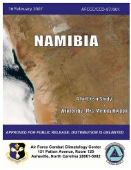
1.8 Conspicuous landmarks include a water tower, 30m high,<br />
standing 0.3 mile SW of the light; The Castle, with two flagstaffs,<br />
situated 0.5 mile SSE of the light; the belfry of the<br />
church of Santa Maria degli Angeli standing 0.4 mile S of the<br />
light; the cathedral, with its octagonal dome and belfry, situated<br />
1 mile SE of the light; and the square tower of the Hotel<br />
Waddan standing 0.9 mile SE of the light.<br />
Tarabulis—The Castle<br />
1.8 Ras Az Zur Reef is composed of small islets and rocks and<br />
fronts the N side of Spanish Mole and the S part of the N<br />
breakwater.<br />
1.8 Kaliyusha Reef (Caliuscia Bank), with a least depth of 2.7m,<br />
extends between 1.5 miles and 3.7 miles ENE of the light. This<br />
reef breaks in strong N winds and a dangerous wreck lies on its<br />
E part.<br />
1.8 The approach channel, which leads S through Kaliyusha<br />
Reef, is marked by lighted buoys and beacons. The approach<br />
and entrance fairways are indicated by lighted ranges which<br />
may best be seen on the chart.<br />
1.8 A radiobeacon is situated 1.5 miles ESE of the light.<br />
1.8 Pilotage.—Pilotage is compulsory. Pilots can be contacted<br />
on VHF channel 8 or 10 and board vessels about 0.5 mile N of<br />
the entrance to the approach channel.<br />
1.8 Regulations.—Vessels should send an ETA 12 hours in advance.<br />
1.8 Signals.—The following traffic signals may be displayed:<br />
1. Black cone, point up—Port open to vessels entering.<br />
2. Two black cones, bases together—Port open to vessels<br />
leaving.<br />
3. Three black balls, vertically disposed—Port closed.<br />
4. Red flag or red flashing light—Port closed due to bad<br />
weather.<br />
1.8 The following whistle or siren signals may be sounded within<br />
the port or anchorage:<br />
1. Succession of short blasts—Fire alarm.<br />
2. One short blast, two long blasts, short blast—Police<br />
required.<br />
3. One short blast, two long blasts—Doctor required.<br />
4. One long blast—Lighters required.<br />
5. Two long blasts— Floating crane required.<br />
6. Three long blasts—Pilot required.<br />
7. Four long blasts—Tug required.<br />
1.8 Anchorage.—A designated anchorage area, the limits of<br />
which are shown on the chart, lies centered 2 miles NW of the<br />
head of the N breakwater. The holding ground in this vicinity is<br />
reported to be good.<br />
1.8 Caution.—Several mined areas lie in the approaches to<br />
Tarabulus and may best be seen on the chart.<br />
1.8 Sudden wind squalls, especially between October and February,<br />
can make anchoring in the harbor very hazardous.<br />
1.8 Due to the existence of submarine cables, a prohibited anchoring<br />
area lies E of the N breakwater and may best be seen<br />
on the chart.<br />
1.8 Construction is being carried out within the port.<br />
Tarabulus to Khalij Surt (Gulf of Sidra)<br />
1.9 Ras Tajura (32°54'N., 13°24'E.), a low point, is located<br />
9 miles E of the E breakwater at Tarabulus and is marked<br />
by a light. The coast between is sandy and numerous rocks extend<br />
up to 0.5 mile offshore along the first 6 miles.<br />
1.9 A prominent group of five small oil tanks stands on the summit<br />
of a low and brown cliff, 2.2 miles ENE of the SE breakwater<br />
at Tarabulus. A water tower stands 0.5 mile SE of this group<br />
of tanks and an aeronautical light is occasionally shown from<br />
it.<br />
1.9 Ockba Ben-Nafah Airfield (Wheelus Airfield) is situated in<br />
the vicinity of this water tank; a dark grey hangar building is<br />
situated near it. A control tower stands 0.3 mile S of the water<br />
tank and a similar water tower stands 0.8 mile E.<br />
1.9 A conspicuous tower stands 5.5 miles E of the SE breakwater<br />
at Tarabulus and is situated among oil installations. A submarine<br />
pipeline extends 1 mile NNE from the shore fronting<br />
this tower to an offshore tanker berth. This berth consists of<br />
mooring buoys and lies in a depth of 16m. The approach to the<br />
berth is indicated by range beacons which may best be seen on<br />
the chart.<br />
1.9 Caution.—A restricted area, which may best be seen on the<br />
chart, lies in the vicinity of the offshore tanker berth.<br />
1.9 Mined areas, which may best be seen on the chart, front the<br />
coast in places between Tarabulus and Ras Tajura.<br />
1.9 A prohibited area, which may best be seen on the chart,<br />
fronts the coast to the E of Tarabulus.<br />
1.10 Ras al Hallab (32°48'N., 13°48'E.), marked by a<br />
light, is located miles 2 miles ESE of Ras Tajura and is formed<br />
by rocky promontory, 13m high.<br />
1.10 Trig el Gefara, a prominent disused fort, stands 1.5 miles<br />
Pub. 132
6 Sector 1. Libya<br />
SSE of Ras Tajura; a conspicuous wind pump is situated 3.2<br />
miles SE of it.<br />
1.10 Caution.—Due to the existence of submarine cables, an anchoring<br />
and fishing prohibited area, which may best be seen on<br />
the chart, extends up to 9 miles NE from a point on the coast, 3<br />
miles SE of Ras Tajura.<br />
1.11 Ras al Misann (32°41'N., 14°14'E.), a low and rocky<br />
point, is located 23 miles ESE of Ras al Hallab and is fronted<br />
by a reef. Anchorage, with good holding ground and sheltered<br />
from NW winds, can be taken, in depths of 5 to 7m, about 0.2<br />
mile S of the reef.<br />
1.11 Qasr Al Jifarah, a prominent building, stands 7 miles SSE of<br />
Ras al Hallab.<br />
1.11 Bintal Rock lies close offshore, 10.2 miles SE of Ras al Hallab.<br />
This rock has a pointed top and is prominent from seaward.<br />
Sidi Abd al Ghani, a prominent marabout, stands 3.8 miles<br />
SSW of Bintal Rock.<br />
1.11 A radio mast stands 3 miles S of Ras al Misann. Gasr al Misann,<br />
a massive isolated fort, is situated close SSW of the mast.<br />
1.11 Ras al Wazif (32°40'N., 14°15'E.) is located 2.7 miles SE of<br />
Ras al Misann. A light is shown from a tower, 19m high, standing<br />
on this point. Al Khums, a small town, is situated within<br />
Ras al Wazif and is backed by hills. A prominent minaret<br />
stands 0.3 mile S of the light. The town is fronted by a small<br />
boat harbor. Anchorage can be taken, in a depth of 10m, rocky<br />
bottom, about 0.4 mile E of the light.<br />
1.11 Sidi Barku, a low and conical hill, stands 2.5 miles SE of Ras<br />
al Wazif and is surmounted by a ruined fort.<br />
1.12 Al Khums (32°41'N., 14°15'E.) is an artificial harbor<br />
situated on the SE side of Ra’s al Misann. The town is located<br />
1.5 miles SE of Ra’s al Wazif. The port handles motor vehicles,<br />
containers, and other cargo. It is also a naval base. The port is<br />
approached directly from seaward. It has been reported (1999)<br />
that the coast line gives good radar ranges up to 18 miles.<br />
1.12 Tides—Currents.—From Al Khums to Qasr Ahmad, the<br />
current sets SW at a rate of from 0.2 to 4 knots, being influenced<br />
by the NW winds at the latter point. In summer, the current<br />
is weak and sets NW and N at 0.2 to 1 knot.<br />
1.12 Depths—Limitations.—The controlling depth in the approach<br />
is 13.9m. The maximum size vessel handled has been<br />
reported to be 14,500 dwt, with a draft of 12m. The harbor consists<br />
of a basin enclosed on its NE side by a breakwater and on<br />
its SE side by a mole. The harbor entrance, between the mole<br />
and the breakwater, is 150m wide. Three sides of the basin are<br />
quayed. There is a T-shaped jetty in the S part of the harbor. It<br />
has been reported (1999) that there are nine berths within the<br />
harbor, with alongside depths of between 8 and 12m.<br />
1.12 Pilotage.—Pilotage is compulsory. Pilots must be arranged<br />
in advance as the pilot is based in Tarabulus. Pilots can be contacted<br />
on VHF channels 8, 10, and 12. The pilot boards in the<br />
vicinity of the Fairway Lighted Buoy (32°41.2'N., 14°18.0'E.).<br />
1.12 Regulations.—Vessels should provide notice of ETA upon<br />
departure from the last port of call and 24 hours prior to arrival.<br />
Vessels should confirm the ETA, position, course, and speed<br />
when 12 miles from the port.<br />
1.12 The port is unlit; movement of vessels is restricted to daylight<br />
hours only.<br />
1.12 Anchorage.—It has been reported (1999) that vessels may<br />
anchor between 1.5 and 3 miles E to ESE of the breakwater<br />
head. A designated anchorage clear of the submarine cables is<br />
located within a 1-mile radius of position 32°42.2'N,<br />
14°19.1'E.<br />
1.12 Directions.—From the pilot boarding station, the track leads<br />
WSW then NW towards the harbor entrance, passing SW of<br />
the breakwater head and NE of two special lighted buoys.<br />
1.13 Khoms (Al Khums) Power Station (32°38'N.,<br />
14°20'E.) (World Port Index No. 45323) is located 1.5 miles<br />
SE of Sidi Barcu and may be easily identified by four chimneys,<br />
each 100m high.<br />
1.13 A pier projecting 1,500m NNE from the shore fronting the<br />
power station has a depth of 16m at its head. The berth at the<br />
head of this pier is flanked by dolphins and fronted by mooring<br />
buoys. It was reported (1989) that tankers with drafts up to<br />
13m can be handled.<br />
1.13 Vessels approaching the pier are required to contact Tarabulus<br />
Port Control. A local pilot is provided from Al Khums to<br />
assist in the berthing operation which is carried out only in<br />
daylight.<br />
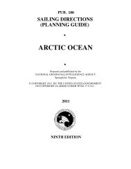
1.13 Sidi Muftah, a conspicuous white-domed building backed by<br />
palms, stands 7 miles SE of Al Khums.<br />
Sidi I Muftah Marabout<br />
1.13 Al Qalb (32°30'N., 14°34'E.), a high and conical hill, stands<br />
10.5 miles SE of Sidi Miftah. Marsa Zlitan Light is shown<br />
from a tower, 5m high, standing on this hill.<br />
1.13 A conspicuous radio mast, 76m high, stands 0.7 mile S of the<br />
light. Unsheltered and temporary anchorage can be taken, in a<br />
depth of 10m, about 0.5 mile NNE of the light.<br />
1.13 Ras al Barq (Ras Zorug) (32°22'N., 15°13'E.), a low and<br />
rocky point, is located 34 miles ESE of Al Qalb. The coast between<br />
is fronted by reefs which extend up to 0.4 mile offshore<br />
in places; several stranded and dangerous wrecks lie along it. A<br />
light is shown from a structure, 8m high, standing on the point.<br />
The town of Qasr Ahmad (Misurata Marina) is situated close S<br />
of the point.<br />
Khalij Surt (Gulf of Sidra)<br />
1.14 Khalij Surt (32°00'N., 18°00'E.), an extensive gulf, is<br />
entered between Qasr Ahmad (Misurata Marina) and Banghazi,<br />
about 250 miles E. Several important oil terminals are situated<br />
on the shores of the gulf.<br />
1.14 The prevailing winds in the gulf are from the NW and NE,<br />
and they often raise heavy swells which pound the shores of<br />
the gulf. The ghibli, a hot and dry wind from the desert, blows<br />
from the S and SE into the gulf and often carries sand and dust.<br />
This wind blows more frequently in spring and autumn, and<br />
may last from a few hours to several days.<br />
Pub. 132
Sector 1. Libya 7<br />
1.14 The prevailing current in the gulf sets SW, at a rate of 0.2 to<br />
0.7 knot, depending on the wind force from the NW or NE.<br />
During the winter, the current sets SE during the NW wind; in<br />
summer, the current sets NW.<br />
1.14 The current appears to form a clockwise gyre in the E part of<br />
Khalij Surt, and flows S and W along the E and S shores of the<br />
gulf. It turns N when E of Surt, where it again joins the main E<br />
flow along the Libyan coast to Egypt.<br />
1.15 Qasr Ahmad (Misurata) (32°22'N., 15°13'E.) (World<br />
Port Index No. 45320), a small port, lies close S of Ras al Barq<br />
and is protected by breakwaters. It has facilities for dry cargo,<br />
ro-ro, container, and general cargo vessels.<br />
1.15 Tides—Currents.—During the winter, the current caused<br />
by the prevailing NW winds sets SE, at a rate of 1 to 4 knots.<br />
During the remainder of the year, the prevailing SW wind causes<br />
a NW current.<br />
1.15 Depths—Limitations.—The entrance channel is about<br />
150m wide and is dredged to a depth of 13m. A turning basin,<br />
470m wide, lies close inside the entrance and is dredged to a<br />
depth of 12m. There is 1,125m of total commercial quayage<br />
with berths of 185 to 200m long and depths of 11 to 12m<br />
alongside. There are facilities for general cargo, tanker, bulk,<br />
and ro-ro vessels. Additional berths are under construction.<br />
Vessels up to 30,000 dwt and 11m draft can be handled.<br />
1.15 In addition, a quay fronts a steel works which is situated 1<br />
mile SE of the main harbor. It is 350m long and has a depth of<br />
15m alongside.<br />
1.15 Aspect.—The town was formerly enclosed by a wall, but<br />
only parts of it now remain. Several prominent silos stand on<br />
the E breakwater and some conspicuous dish aerials of a radio<br />
station stand near the root. A prominent chimney stands at the<br />
power station situated 3 miles SSE of the light on Ras al Barq.<br />
A prominent radio mast stands 7.6 miles WNW of the light.<br />
1.15 The harbor should be approached from a position about 3<br />
miles E of the entrance. The fairway channel is indicated by a<br />
lighted range and marked by lighted buoys.<br />
1.15 Pilotage.—Pilotage is compulsory. Pilots can be contacted<br />
on VHF channel 12 or 16 and board about 1 mile off harbor entrance.<br />
1.15 Regulations.—Vessels should send an ETA 72 hours, 48<br />
hours, 24 hours, and 12 hours in advance.The 24-hour message<br />
should contain the following information:<br />
1. Vessel’s name, call sign, and flag.<br />
2. Date of build.<br />
3. Owner’s name and address<br />
4. Charterer’s name and address.<br />
5. Agent’s name.<br />
6. Consignee name.<br />
7. Master’s name and nationality.<br />
8. Beam, loa, grt, and nrt.<br />
9. Type of cargo and quantity.<br />
10. Cargo in transit.<br />
11. Date and time of sailing from last port.<br />
12. ETA at next port.<br />
13. Number of crew and passengers.<br />
14. Details of any animals or mail on board.<br />
15. Speed.<br />
16. Point of approach.<br />
17. Sea state and draft.<br />
18. Degree of list, if any.<br />
19. Name of last ten ports.<br />
20. Stowaways, if any.<br />
1.15 Anchorage.—Vessels can take anchorage, in a depth of<br />
13m, about 1 mile offshore, E of the light.<br />
1.16 Al Bu’ayrat (31°24'N., 15°44'E.), a nearly deserted<br />
village, is situated 63 miles SE of Qasr Ahmad and can be<br />
identified by a white fort and a white domed monument. The<br />
coast between is fronted by several dangerous wrecks. Sheltered<br />
anchorage may be obtained, in a depth of 6m, about 1.2<br />
miles offshore, NE of the monument.<br />
1.16 In the vicinity of Al Bu’ayrat, the current is influenced by<br />
the wind. In winter, with strong NW winds, the current sets SE,<br />
at a rate of 1 to 2 knots. In summer, the current generally sets<br />
NW, at a rate of 0.2 to 0.5 knot.<br />
1.16 Surt (31°13'N., 16°35'E.), a small harbor, lies 49 miles ESE<br />
of Al Bu’ayrat. The modern harbor opened partially in 2010.<br />
When complete it will accommodate container, general, and<br />
ro-ro cargo and will connect to a new railway system now under<br />
construction (2010).<br />
1.16 Depths—Limitations.—The entrance channel, 150m wide<br />
and 10.5m in depth, runs SW from the sea, then WSW between<br />
the breakwater heads. The harbor basin is dredged to 9.5m and<br />
is almost square, with a 150m long jetty extending E from the<br />
NW corner. Two berths either side of the jetty are dredged to a<br />
depth of 8m.<br />
1.16 Aspect.—The town can be identified by a minaret, a ruined<br />
castle, several radio masts, and a fort, all of which are prominent<br />
from up to 10 miles seaward. A light is shown from a water<br />
tower standing close NW of the fort.<br />
1.16 Anchorage.—A designated anchorage lies within a 1-mile<br />
radius of position 31°15.8'N, 16°40.9'E.<br />
1.16 Caution.—Works are in progress (2010) to construct additional<br />
berths.<br />
1.16<br />
1.16 Ras as Sultan (31°04'N., 17°24'E.) is located 42 miles ESE<br />
of Surt. A reef extends up to about 1.5 miles E of this point.<br />
Small vessels can anchor, in a depth of 9m, in the lee of the<br />
point and the reef. A large white house is reported to stand 4.7<br />
miles SSE of the point. A prominent red sand dune stands 17<br />
miles ESE of the point.<br />
1.16 Caution.—Numerous oil rigs, platforms, and associated service<br />
vessels may be encountered within about 23 miles of the<br />
coast between Ras es Sultan and As Sidr (Es Sider), 57 miles<br />
ESE.<br />
1.16<br />
1.16 Jabal al Mudawwar (30°50'N., 17°43'E.), 121m high, is a<br />
flat-topped mountain which is conspicuous from seaward.<br />
1.16 Ras al’Uwayja (30°55'N., 17°52'E.) is a high, rocky, and<br />
prominent cape. A reef, with a least depth of 2.7m, extends 3.2<br />
miles ESE from this cape. Anchorage can be taken, in depths<br />
of 9 to 14m, within the bight entered close SE of the cape. Local<br />
knowledge is required.<br />
As Sidr (30°38'N., 18°22'E.)<br />
World Port Index No. 45297<br />
1.17 As Sidr is an open roadstead with an offshore marine<br />
Pub. 132
8 Sector 1. Libya<br />
oil terminal. Several buildings and a pumping station are situated<br />
near the shore and are fronted by a boat harbor which is<br />
used by terminal officials.<br />
Port of As Sidr Home Page<br />
http://www.wahaoil.net<br />
1.17 Tides—Currents.—Tides are negligible, being only 0.3m at<br />
springs.<br />
1.17 The currents are wind induced and are predominantly from<br />
the SE with occasional maximum rates of up to 2 knots.<br />
1.17 Depths—Limitations.—There are four offshore loading terminals<br />
which are connected to the pumping station by submarine<br />
pipelines. No. 1 Berth and No. 3 Berth consist of several<br />
mooring buoys. No. 4 Berth and No. 5 Berth consist of an<br />
SBM.<br />
1.17 No. 1 Berth lies 1.8 miles NE of the pumping station and can<br />
handle vessels up to 281m in length and 15.54m draft.<br />
1.17 No. 3 Berth lies 1.8 miles NNE of the pumping station and<br />
can handle vessels up to 290m in length and 15.54m draft.<br />
1.17 No. 4 Berth lies 2.5 miles NNE of the pumping station and<br />
can handle vessels up to 351m in length and 19.05m draft.<br />
1.17 No. 5 Berth lies 4 miles NE of the pumping station and can<br />
handle vessels up to 355m in length and 22.25m draft.<br />
1.17 Aspect.—A conspicuous water tower, 20m high, and a conspicuous<br />
radio tower stand in the vicinity of the pumping station.<br />
1.17 An aeronautical radiobeacon is situated 0.4 mile SSE of the<br />
water tower; a conspicuous group of oil tanks stands 3.6 miles<br />
WSW of the water tank; and a prominent radio mast, 50m high,<br />
stands 0.3 mile NW of the oil tanks.<br />
1.17 The offshore berths are marked by lighted buoys; the approach<br />
is indicated by a lighted range, which may best be seen<br />
on the chart.<br />
1.17 Pilotage.—Pilotage is compulsory. Pilots can be contacted<br />
on VHF channel 8 or 16 and board about 4 miles NNE of the<br />
terminal. Vessels should send an ETA 72 hours, 24 hours, 12<br />
hours, and 4 hours in advance.<br />
1.17 It is reported that Mooring Masters board vessels in the vicinity<br />
of the anchorage area and remain on board until the vessels<br />
depart the loading berths. They advise vessels regarding<br />
communications, mooring, unmooring, connecting hoses, disconnecting<br />
hoses, and all other relevant operations.<br />
1.17 Anchorage.—The recommended anchorage area, which<br />
may best be seen on the chart, lies centered 4.5 miles NNE of<br />
the conspicuous water tower and has depths of 27 to 33m,<br />
sand. A continuous listening watch is required on VHF channels<br />
8 and 16 while at anchor.<br />
1.17 Caution.—Vessels approaching the anchorage area from the<br />
N or NW should disregard the terminal ranges and mooring<br />
buoy marker lights which are shown intermittently and are only<br />
for the use of the mooring masters.<br />
1.17 VLCCs are not berthed at night.<br />
1.17 An prohibited anchorage area lies in the vicinity of the terminals<br />
and may best be seen on the chart.<br />
1.17 The approaches to the terminal offshore berths are clear of<br />
known dangers; however, rigs, platforms, and vessels involved<br />
in oil and gas drilling operations may be encountered up to several<br />
miles offshore between this terminal and Marsa al<br />
Burayqah (Marsa el Brega), 64 miles ESE.<br />
1.17 The offshore berths are untenable in high winds. Main engines<br />
must remain ready for use at these berths.<br />
Ras Lanuf (30°31'N., 18°34'E.)<br />
World Port Index No. 45296<br />
1.18 Ras Lanuf, a low and sandy point, is located 13 miles<br />
SE of As Sidr and is fronted by an offshore oil terminal. In addition,<br />
a harbor, which is protected by breakwaters, lies within<br />
the point and provides alongside gas and oil loading facilities.<br />
Port of Ras Lanuf Home Page<br />
http://www.raslanuf.ly<br />
Ras Lanuf Oil Terminal Home Page<br />
http://www.vebalibya.com<br />
1.18 Tides—Currents.—Tides are negligible, being only 0.3m at<br />
springs.<br />
1.18 The currents are wind induced and are predominantly from<br />
the SE with occasional maximum rates of up to 2 knots.<br />
1.18 Depths—Limitations.—The harbor approach channel is<br />
dredged to a depth of 15.5m. Three finger jetties are situated in<br />
the harbor and provide six oil berths with depths of 11.5 to<br />
14m alongside. Vessels up to 50,000 dwt, 250m in length, and<br />
12.5m draft can be accommodated. In addition, there is a cargo<br />
quay, 177m long, which has a depth of 11m alongside. Vessels<br />
up 20,000 dwt, 177m in length, and 9.5m draft can be accommodated.<br />
1.18 The offshore terminal consists of four berths, each connected to<br />
the shore by a submarine pipeline. No. 1 Berth and No. 2 Berth<br />
consist of several mooring buoys. No. 3 Berth and No. 4 Berth<br />
consist of an SBM.<br />
1.18 No. 1 Berth and No. 2 Berth have depths of 21 to 27m and<br />
can handle vessels up to 130,000 dwt.<br />
1.18 No. 3 Berth lies in a depth of 30m and can handle vessels up<br />
to 300,000 dwt.<br />
1.18 No. 4 Berth lies in a depth of 30m and can handle vessels up<br />
to 255,000 dwt and 29m draft.<br />
1.18 Aspect.—A conspicuous water tower, from which a light is<br />
shown, stands 1.5 miles W of Ras Lanuf. Several oil tanks are<br />
situated 4 miles SW of the water tower and are prominent from<br />
seaward. Marble Arch, a prominent monument, spans the<br />
coastal highway, 3.5 miles S of Ras Lanuf.<br />
1.18 An outer lighted buoy, moored about 1.7 miles E of the head<br />
of the N breakwater, marks the seaward entrance of the harbor<br />
approach channel. A lighted range, which may best be seen on<br />
the chart, indicates the fairway leading through the harbor entrance.<br />
An outer lighted buoy, moored 3 miles N of Ras Lanuf,<br />
marks the approach to the offshore terminal.<br />
1.18 Pilotage.—Pilotage is compulsory. Pilots can be contacted<br />
on VHF channel 11, 14, or 16 and board vessels proceeding to<br />
the harbor in the vicinity of the outer lighted buoy or at the anchorage.<br />
Mooring Masters, also serving as pilots, will board<br />
vessels proceeding to the offshore terminal close NW of the<br />
berths or at the anchorage.<br />
Pub. 132
Sector 1. Libya 9<br />
1.18 Regulations.—Vessels should send an ETA 72 hours, 48<br />
hours, and 24 hours in advance, with a confirmation message 4<br />
hours before arrival. Vessels should also report any change to<br />
their ETA of over 1 hour.<br />
1.18 After securing the vessel at a berth, the Mooring Master will<br />
remain aboard in an advisory capacity until departure from the<br />
port.<br />
1.18 Anchorage.—A designated anchorage area for vessels proceeding<br />
to the harbor, which may best be seen on the chart, lies<br />
centered 2.5 miles NE of the harbor entrance. A designated anchorage<br />
area for vessels proceeding to the offshore terminal,<br />
which may best be seen on the chart, lies centered 2.8 miles N<br />
of the harbor entrance. The anchorages have depths of 30 to<br />
31m, sand, good holding ground.<br />
1.18 Caution.—Navigation and anchoring are prohibited, except<br />
for vessels using the port facilities or the offshore terminal,<br />
within an area which may best be seen on the chart, and extends<br />
up to 3.5 miles from the shore.<br />
1.18 Rigs, platforms, and vessels involved in oil and gas drilling<br />
operations may be encountered in the approaches to Ras Lanuf.<br />
1.19 Ras al Ali (30°23'N., 18°48'E.) is a low point which is<br />
fronted by shoals. An old jetty, 150m long, projects from the<br />
point and has a depth of 3.6m alongside its head (1981). Small<br />
craft with local knowledge can find partly sheltered anchorage,<br />
in depths of 6 to 9m, SE of the point.<br />
1.19 The barren coast from this point to the head of Khalij Surt is<br />
backed by occasional ridges.<br />
1.19 Al Uqaylah (30°16'N., 19°12'E.) can be identified by several<br />
reddish buildings which have the appearance of forts and stand<br />
0.5 mile inland. One of these buildings is encircled by a wall<br />
on which there is a lookout tower. A house, painted in black<br />
and white checkers, stands near the beach; the ruins of a lighthouse<br />
are situated close to it. Anchorage can be taken during<br />
daylight N of Al Uqaylah, in depths of 16 to 18m, good holding<br />
ground, about 2 miles offshore.<br />
1.19 Jazirat Bu Shu’ayfah, an above-water rock, lies about 1.3<br />
miles offshore, 4.2 miles NW of Al Uqaylah. It is dark and can<br />
be easily identified against the yellow background of the sand.<br />
Anchorage can be taken, in depths of 10 to 13m, about 1 mile<br />
SE of this rock.<br />
1.19 Khashm Aritu (Ras al Magdar) (30°26'N., 19°38'E.), a low<br />
point, is fronted by foul ground and depths of less than 10m lie<br />
up to 0.5 mile N of it.<br />
1.19 El Magdar Reef (30°27'N., 19°37'E.) lies centered about 1<br />
mile NW of Khashm Aritu. It is extensive, rocky, and has rocks<br />
awash.<br />
Marsa al Burayqah (30°25'N., 19°36'E.)<br />
World Port Index No. 45295<br />
1.20 Marsa al Burayqah, a bay, lies 22 miles ENE of Al<br />
Uqaylah and is entered between Khashm Aritu (Ras al Magdar)<br />
and a point, 3 miles SW.<br />
An important oil terminal is situated in the SW part of the<br />
bay and consists of a harbor, protected by breakwaters, and<br />
several offshore berths.<br />
Port of Marsa al Burayqah Home Page<br />
http://www.soc.com.ly<br />
1.20 Depths—Limitations.—The offshore terminal formerly<br />
consisted of six berths connected to the shore by submarine<br />
pipelines.<br />
1.20 No. 1 Berth, No. 3 Berth, and No. 4 Berth are now out of service,<br />
but some of the ground chains, mooring buoy clumps, and<br />
pipelines are still in position.<br />
1.20 No. 2 Berth consists of several mooring buoys and lies in a<br />
depth of 13.4m. Vessels up to 70,000 dwt, 244m in length, and<br />
12.8m draft can be handled.<br />
1.20 No. 5 Berth is situated 2 miles NNW of the radar tower and<br />
consists of an SBM. It lies in a depth of 37m and can handle<br />
vessels up to 300,000 dwt.<br />
1.20 No. 6 Berth is situated 2 miles NW of the radar tower and<br />
consists of an SBM. It lies in a depth of 42m and can handle<br />
vessels up to 300,000 dwt.<br />
1.20 The harbor can handle general cargo, ro-ro, bulk, gas, and<br />
tanker vessels. There is a general cargo quay, 390m long, with<br />
a depth of 10m alongside; a bulk berth, 200m long, with a<br />
depth of 9.2m alongside; two gas berths, 320m and 333m long,<br />
with a depth of 11.3m alongside; and two refined product<br />
berths, 334m and 341m long, with a depth of 12.2m alongside.<br />
1.20 Generally, general cargo vessels up to 15,000 dwt and 9.2m<br />
draft can be accommodated and tankers up to 30,000 dwt and<br />
10m draft can be accommodated.<br />
1.20 Aspect.—Several conspicuous burn-off flares are situated in<br />
the vicinity of the oil refinery at the SW side of the harbor and<br />
can be seen from 25 miles seaward. A prominent radar tower,<br />
marked by a light, stands near the root of the W breakwater. A<br />
conspicuous red water tower, with the ruins of a fort close NW<br />
of it, stands 0.6 mile SW of the radar tower.<br />
1.20 An outer approach lighted buoy, moored about 2.7 miles<br />
NNW of the harbor entrance, marks the seaward entrance of<br />
the harbor approach channel. The fairway of this channel is<br />
marked by lighted buoys and is indicated by a lighted range<br />
which may best be seen on the chart.<br />
1.20 Other lighted ranges indicate the approaches to the offshore<br />
loading berths and also may best be seen on the chart.<br />
1.20 Pilotage.—Pilotage is compulsory. Pilots can be contacted<br />
on VHF channel 6, 9, 12, 13, 14, or 16 and board in the vicinity<br />
of the outer approach lighted buoy.<br />
1.20 Mooring Masters, also serving as pilots, will board vessels<br />
proceeding to the offshore terminal berths. After securing the<br />
vessel at a berth, the Mooring Master will remain aboard in an<br />
advisory capacity until departure from the port.<br />
1.20 Regulations.—Vessels should send an ETA 72 hours, 48<br />
hours, and 24 hours in advance.<br />
1.20 Anchorage.—Vessels should anchor, in a depth of 36m, between<br />
the NE and E about 0.5 mile from the outer approach<br />
lighted buoy, but staying clear of the E lighted range.<br />
Pub. 132
10 Sector 1. Libya<br />
1.20 Caution.—A foul area, in which numerous rocks awash lie,<br />
extends up to 0.5 mile N from the vicinity of the root of the W<br />
breakwater. The coastal bank, with depths of less than 10m, extends<br />
up to 0.5 mile N of the N extremity of this foul area and<br />
is marked by a lighted buoy.<br />
1.20 Navigation is prohibited, except for vessels using the port facilities<br />
or the offshore terminal, within a restricted area which<br />
may best be seen on the chart and extends up to 2 miles from<br />
the shore.<br />
1.21 Jabal Lamaresc (30°35'N., 19°51'E.), 62m high, is<br />
prominent and has a truncated summit. This hill stands 1 mile<br />
inland, 17 miles NE of Marsa al Burayqah.<br />
1.21 Ez Zueitina (30°57'N., 20°07'E.), a coastal village, can be<br />
identified by several conspicuous buildings and a large white<br />
fortification with a tall watch tower. An old and disused barracks<br />
stands 4 miles SSW of the village and is prominent.<br />
Three flares and three white tanks are reported to stand 0.8<br />
mile NE and 0.2 mile N, respectively, of the barracks.<br />
1.21 Anchorage can be taken, in depths of 12 to 14m, sand, good<br />
holding ground, about 1.2 miles WNW of the village. A dangerous<br />
wreck is reported to lie about 0.7 mile WNW of the village.<br />
1.21 Tre Scogli (30°54'N., 20°03'E.), a conspicuous group of<br />
rocks, with some above-water, lies 1 mile offshore, 5 miles SW<br />
of Ez Zueitina. Scoglio Sud, the S rock, is marked by a light.<br />
Trinity Shoal, a rock awash, lies about 0.6 mile SW of this<br />
light.<br />
1.21 A tanker hulk, which is used as a workshop by the nearby oil<br />
terminal, fronts the shore, 1 mile SE of Scoglio Sud.<br />
1.21 Scoglio Nord, a group of rocks, lies about 1.4 miles offshore,<br />
2.5 miles NNE of Scoglio Sud.<br />
1.21 Caution.—Between Marsa al Burayqah and Ez Zueitina,<br />
several reefs, shoals, and islets lie up to almost 5 miles offshore.<br />
The outermost include North Lamaresk Reef, with rocks<br />
awash, which lies 4.8 miles offshore, 5.8 miles NNW of Jabal<br />
Lamaresc; Hericha Rock, above-water, which lies 6.7 miles NE<br />
of North Lamaresk Reef; and Gharah Islet, surrounded by<br />
shoals, which lies 2.5 miles NE of Hericha Rock.<br />
Az Zuwaytinah (30°51'N., 20°03'E.)<br />
World Port Index No. 45290<br />
1.22 Az Zuwaytinah (Ez Zueitina) Terminal, which consists<br />
of several offshore oil loading berths and facilities for liquefied<br />
petroleum gas, lies close S of Tre Scogli.<br />
1.22 Depths—Limitations.—The offshore terminal consists of<br />
five berths which are connected to the shore by submarine<br />
pipeline. Alpha Berth, Charlie Berth, and Echo Berth each consist<br />
of an SBM. Bravo Berth and Delta Berth each consist of<br />
several mooring buoys (CBM).<br />
Alpha Berth is reported (2003) to be temporarily out of service.<br />
Bravo Berth lies in a depth of 21.9m and can handle vessels<br />
up to 150,000 dwt.<br />
Charlie Berth lies in a depth of 30.5m and can handle vessels<br />
up to 275,000 dwt.<br />
Delta Berth lies in a depth of 20m and can handle vessels up<br />
to 110,000 dwt.<br />
Echo Berth lies in a depth of 25.3m and can handle vessels<br />
up to 150,000 dwt. This berth was reported (1999) to be out of<br />
service.<br />
1.22 A pier, which shelters a small boat harbor, extends 0.5 mile<br />
from the shore in the vicinity of Tre Scogli and has an LPG<br />
berth at its head. This berth consists of mooring dolphins and<br />
can accommodate vessels up to 213m in length and 8.7m draft.<br />
1.22 Aspect.—A prominent radio tower, marked by a light, stands<br />
at the terminal, 4.2 miles S of Scoglio Sud. Several conspicuous<br />
oil tanks are situated close S of it.<br />
1.22 Sidi Alib, a conspicuous tomb, stands 0.7 miles NE of the radio<br />
mast.<br />
1.22 The approach channel, which leads to the LPG Berth, lies<br />
between Tre Scogli and Trinity Shoal, and is marked by a lighted<br />
buoy and indicated by a lighted range which may best be<br />
seen on the chart. This berth can handle vessels of 213m in<br />
length and 8.7m draft.<br />
1.22 Pilotage.—Pilotage is compulsory. Vessels should send an<br />
ETA 72 hours, 48 hours, and 24 hours in advance and contact<br />
the pilots on VHF channel 13 or 16 when within range. Mooring<br />
Masters, serving as pilots, will board vessels in the vicinity<br />
of the terminal fairway lighted buoy or at the anchorage. They<br />
will remain aboard until the vessel departures from the port and<br />
advise in the loading operations.<br />
1.22 Anchorage.—A designated anchorage area, which may best<br />
be seen on the chart, lies centered 2.2 miles WNW of Scoglio<br />
Sud.<br />
1.22 Caution.—During the winter, vessels at the offshore loading<br />
berths and the anchorage may be forced to leave by sudden<br />
strong winds and heavy swells.<br />
1.22 Anchorage is prohibited in the dredged area seaward of the<br />
berths as best seen on the chart.<br />
1.22 A shoal, with a least depth of 7.3m, lies about 5.5 miles NW<br />
of the terminal radio mast and is marked by a lighted buoy.<br />
1.23 Ras Kurkurah (31°28'N., 20°00'E.), a low and rocky<br />
point, forms the N end of a small bay and is fronted by abovewater<br />
rocks which extend up to 0.2 mile seaward. It is surmounted<br />
by the low ruins of a castle. Sheltered anchorage can<br />
be taken, in a depth of 6m, about 0.8 mile SE of the point.<br />
1.23 Bu Zaribah, a fort in ruins, is situated 10 miles N of Ras<br />
Kurkurah and is conspicuous from seaward.<br />
1.23 Bernice Reef (32°01'N., 19°56'E.), a rock awash, lies 1.2<br />
miles offshore at the NW extremity of a rocky spit with depths<br />
of less than 5m. A rocky patch, with a least depth of 3.7m, lies<br />
about 3.2 miles NE of Bernice Reef, and from a point on the<br />
coast 1.2 miles E of this patch a spit with depths of less than<br />
3.7m extends 1 mile N.<br />
1.23 Caution.—It is reported that winds and currents between Az<br />
Zuwaytinah and Banghazi tend to set vessels onshore.<br />
1.23 Several wrecks, some dangerous, lie up to 3 miles offshore<br />
between Az Zuwaytinah and Banghazi and may best be seen<br />
on the chart.<br />
Banghazi (32°07'N., 20°03'E.)<br />
World Port Index No. 45280<br />
1.24 Banghazi is a commercial center and summer resort.<br />
The town contains many large and modern buildings and is sit-<br />
Pub. 132
Sector 1. Libya 11<br />
uated on a low point at the E entrance to Khalij Surt (Gulf of<br />
Sidra). The port is protected by breakwaters and is divided into<br />
outer, middle, and inner harbors.<br />
1.24 Winds—Weather.—In winter, the prevailing winds are from<br />
the NW and SW; they infrequently attain gale force. Considerable<br />
variations in the prevailing winds are caused by land<br />
breezes and the topography.<br />
Port of Banghazi Home Page<br />
http://mail.spclibya.com<br />
1.24 Tides—Currents.—The tidal range is negligible, being only<br />
0.3m at springs. The wind direction can account for differences<br />
in the harbor water level which may be as much as 0.6m.<br />
1.24 The currents are strongly influenced by the winds. Off the<br />
harbor, the current sets S and SW with a rate of 0.8 knot, increasing<br />
in strength with W and NW winds which may also<br />
cause a heavy scend to enter the harbor.<br />
1.24 Depths—Limitations.—A controlling depth of 13.5m<br />
(1988) exists in the entrance fairway.<br />
1.24 The main facilities are given in the accompanying table.<br />
Banghazi—Berthing Facilities<br />
Berth Length<br />
Depth<br />
alongside<br />
Rasif Libya No. 1 40m 5.5m<br />
Rasif Libya No. 2 130m 5.5m<br />
Rasif Libya No. 3 115m 5.5m<br />
Outer Harbor No. 1 310m 9.0m<br />
Outer Harbor No. 2 280m 9.0m<br />
Outer Harbor No. 3 170m 9.0m<br />
Tanker Berth 107m 8.0m<br />
1.24 There are facilities for ro-ro, general cargo, container, and<br />
tanker vessels. Vessels up to 168m in length and 8.5m draft can<br />
be accommodated.<br />
1.24 It is reported (1993) that extensive reclamation and development<br />
have been carried out within the port and quays with<br />
depths of 10 to 12m alongside have been constructed. The local<br />
authorities should be consulted for the latest information concerning<br />
depths at these new facilities.<br />
1.24 Aspect.—A light is shown from a water tower, 22m high,<br />
standing in a cemetery, 200m NE of the root of the N breakwater.<br />
A directional light, indicating the harbor entrance, is shown<br />
from a structure standing on the elbow of the N breakwater.<br />
1.24 Conspicuous landmarks include an old and disused lighthouse,<br />
33m high, standing 0.1 mile NW of the light; the cathedral,<br />
surmounted by two domes, situated on the waterfront 0.7<br />
mile SSW of the light; a minaret, 33m high, standing 0.2 mile<br />
SW of the light; the Manaar Palace and the Hilton Hotel standing<br />
near the waterfront 0.5 mile SSW of the light.<br />
1.24 Pilotage.—Pilotage is compulsory. Pilots can be contacted<br />
on VHF channel 12 or 16 and generally board about 0.5 mile<br />
seaward of the harbor entrance. Vessels should send an ETA 48<br />
hours in advance.<br />
Banghazi Light<br />
1.24 Signals.—Visual signals are displayed on a mast at the Post<br />
Office. The signals and their meanings are, as follows:<br />
1. Flag Alpha—A vessel is at anchor in the roads.<br />
2. Flag Bravo—A vessel is leaving the harbor.<br />
3. Flags Echo, November, or Whiskey—A vessel has<br />
been sighted approaching the port from the E, N, or W.<br />
4. Three blacks balls, vertically disposed—Port is<br />
closed.<br />
1.24 Anchorage.—Exposed anchorage is available in a designated<br />
area, which may best be seen on the chart, lying centered 4<br />
miles NW of the head of the N breakwater. Strong W winds<br />
cause a very heavy sea which renders this roadstead dangerous<br />
and during the winter it is seldom used.<br />
1.24 Directions.—Vessels approaching the port from the SW<br />
should remain 2 to 3 miles offshore until near the harbor in order<br />
to avoid the coastal shoals. Vessels approaching from the N<br />
should, in thick weather, make their landfall to the NE of the<br />
harbor as the landmarks are more prominent than those to the<br />
SW of the port and there are no dangers more than 2.5 miles<br />
offshore.<br />
1.24 Caution.—Several charted dangers lie in the approaches to<br />
the harbor and may best be seen on the chart.<br />
1.24 Due to the existence of submarine cables, an anchoring and<br />
fishing prohibited area, which may best be seen on the chart,<br />
lies close S of the harbor entrance and extends up to 6 miles<br />
from the shore.<br />
1.24 Several disused submarine cables extend seaward from the<br />
vicinity of the root of the N breakwater and may best be seen<br />
on the chart.<br />
Banghazi to Marsa Tubruq<br />
1.25 Banghazi Petroleum Terminal (32°11'N., 20°05'E.)<br />
is situated 4.3 miles NE of the port of Banghazi and 0.3 mile<br />
SW of Al Minqar al Kabir (Mengar es-Seghir). It consists of a<br />
jetty which extends about 1 mile NW from the shore and has<br />
two berthing platforms.<br />
1.25 The first platform, at the head, has a depth of 15m alongside<br />
and can accommodate vessels of 1,000 to 50,000 dwt. The second<br />
platform, situated 650m from the shore, can accommodate<br />
vessels of 500 to 10,000 dwt.<br />
1.25 A power station, with three prominent chimneys, stands 2<br />
miles NE of Al Minqar al Kabir. A lighted buoy is moored<br />
close offshore in this vicinity and marks the seaward end of a<br />
water intake pipe.<br />
1.25 Sidi Suwaykir Marabout (32°20'N., 20°17'E.), a small<br />
Pub. 132
12 Sector 1. Libya<br />
white building, is situated 17 miles NE of Banghazi. A light is<br />
shown from a tower, 15m high, standing close W of the marabout.<br />
1.25 Driana Point, low and inconspicuous, is located 4.5 miles<br />
NE of this light. Driana Reef, with depths of 4 to 9m, extends<br />
up to 7 miles NE of the point and 2.5 miles offshore. Kawn al<br />
Asal, 350m high, stands 9 miles E of Driana Point and is prominent<br />
from seaward.<br />
1.26 Tukrah (32°32'N., 20°34'E.), a walled coastal village,<br />
is situated 36 miles NE of Banghazi. It has the appearance of a<br />
small fortified town and is conspicuous from seaward.<br />
1.26 A conspicuous fort is situated 3.5 miles E of Tukrah and a radio<br />
mast, 61m high, stands close SW of it.<br />
Tukrah from NW<br />
1.26 Tulmaythah (32°43'N., 20°57'E.), a coastal village, is<br />
backed by hills. A light is shown from a tower, 16m high,<br />
standing at the W side of the village. A conspicuous water tower<br />
is situated 0.4 mile SSW of the light.<br />
1.26 Anchorage can be taken in the small and exposed roadstead<br />
off the village. Good holding ground can be found in a depth of<br />
18m, sand, about 0.5 mile NW of the light.<br />
1.26 Several reefs and rocks front the coast and extend up to<br />
about 2 miles from the shore to the SW of this village.<br />
1.27 Al Haniyah (32°51'N., 21°31'E.), a coastal village, is<br />
situated amongst several sand hills which are surmounted by<br />
prominent forts. Anchorage can be taken, by small craft, in the<br />
entrance to a sandy cove which is entered 1 mile SW of the village.<br />
Local knowledge is required and shelter from S winds is<br />
afforded. Larger vessels can anchor off the entrance over a<br />
sandy bottom.<br />
1.27 Between Al Haniyah and Ras al Hamamah, 7.5 miles NE,<br />
several sandy coves indent the low and rocky coast, but they afford<br />
no shelter.<br />
1.27 Sidi Abd ad Daien, a white marabout with a prominent<br />
dome, stands 5 miles NE of Al Haniyah, but is hidden by a<br />
sand dune when on a SE bearing. Ras al Hamamah, a promontory,<br />
may be identified by the ruins of a fort which stand on it<br />
and by the mouth of a large cave.<br />
1.27 Near Ras al Hamamah, the E current divides. One part continues<br />
E toward Ras al Hilal at an average rate of 0.5 knot, and<br />
then at a greater rate approaching Ras at Tin; the other branch<br />
of the current turns SW at Ras al Hamamah toward Banghazi.<br />
The initial rate of the current is very slight, but becomes stronger<br />
as it travels SW and may reach a rate of 1 to 2 knots, depending<br />
on the strength of the winds.<br />
1.27 Ras Amir (32°56'N., 21°22'E.) is located 4 miles NE of Ras<br />
al Hamamah. A light is shown from a structure, 11m high,<br />
standing on this point. The wreck of a floating dock lies stranded<br />
on the beach 2 miles WSW of the light and is conspicuous.<br />
1.27 Between Ras Amir and Marsa Susah, 14 miles E, a narrow<br />
and rocky beach lies at the foot of some remarkable hills which<br />
rise steeply to heights of over 200m and have a sea face like a<br />
wall, broken by deep ravines.<br />
1.28 Marsa Susah (32°54'N., 21°58'E.), a small and conspicuous<br />
coastal town, is encircled by green vegetation and situated<br />
between two hills which are fortified by batteries. A<br />
group of columns, the remains of an ancient city, stand close E<br />
of the town.<br />
1.28 Foul ground, with above-water rocks, extends up to 0.3 mile<br />
N and E of the town. A light is shown from a prominent structure,<br />
7m high, standing in the town. A conspicuous minaret and<br />
a conspicuous belfry are situated close SSE and close SW, respectively,<br />
of the light. A square and reddish stone fort backs<br />
the town.<br />
1.28 A small wharf fronts the town. Anchorage, exposed to onshore<br />
winds, can be taken, in depths of 10 to 18m, good holding<br />
ground, W of the light. Local knowledge is advisable.<br />
1.28 An above-water rock, with a shallow rock close E, lies 2<br />
miles ENE of the light. These rocks lie about 0.3 mile offshore<br />
and are both usually marked by breakers.<br />
1.28 An aeronautical light is reported to be occasionally shown<br />
form a structure standing 3.5 miles S of the town.<br />
1.29 Ras al Hilal (32°55'N., 22°11'E.), a moderately low<br />
point, is fronted by foul ground and rocky patches which extend<br />
up to 0.3 mile N and 0.2 mile E of it. A light is shown<br />
from a structure, 12m high, standing on this point.<br />
1.29 Marsa Al Hilal, an open bay, extends S from Ras al Hilal and<br />
large caves appear in its shores. A minaret and a tower, both<br />
conspicuous, stand 2.5 miles S and 0.8 mile SW, respectively,<br />
of the light.<br />
1.29 A concrete pier, 91m long, extends from the head of the bay.<br />
This pier has depths of 5.2 to 7m alongside its outer part and its<br />
inner part shoals rapidly. A dolphin marks the outer end of several<br />
sunken blocks which lie off the pier head. Anchorage,<br />
sheltered from offshore winds, can be taken in this bay, in<br />
depths of 11 to 18m, sand and weed, good holding ground.<br />
1.29 Jazirat Karissah (Isola Chersa) (32°51'N., 22°30'E.), a<br />
group of above and below-water rocks, is the outermost danger<br />
lying off the steep and rocky coast between Ras al Hilal and<br />
Darnah, 26 miles ESE. This group lies centered 2 miles offshore<br />
and a channel leads between it and the coast, but is not<br />
recommended.<br />
1.29 An off-lying shoal, with a depth of 10.9m, is reported (1964)<br />
to lie about 10 miles NE of Jazirat Karissah.<br />
1.29 Darnah Power Station (32°47'N., 22°35'E.) is situated<br />
close to the coast 3 miles WNW of Darnah. The main building,<br />
32m high, appears as a light-colored rectangular block with<br />
dark bands at mid-height and at roof level. Four prominent<br />
chimneys, 47m high, stand close SW of the main building.<br />
Three large oil storage tanks are situated close W of the main<br />
building and a desalination plant stands to the SE of the power<br />
station.<br />
Pub. 132
Sector 1. Libya 13<br />
1.29 An oil discharging jetty extends 550m NE from the shore in<br />
the vicinity of the oil tanks; two mooring buoys are situated<br />
close to its head. Vessels secure stern-to the head of this jetty<br />
which has a depth of 11m alongside. There are no berths alongside<br />
the sides of the jetty, which is lighted along its whole<br />
length at night. Pilotage is compulsory and is available during<br />
daylight hours.<br />
1.29 Ras Bu Azzah is located 3 miles ESE of the power station. A<br />
monument and a prominent disused light structure stand on the<br />
point and a conspicuous tower stands 1.5 miles SW of this<br />
point.<br />
1.30 Darnah (Derna) (32°46'N., 22°39'E.) (World Port Index<br />
No. 45240), a coastal town, stands near the mouth of Wadi<br />
Darnah (Uadi Darnah) which reaches the sea close SE of Ras<br />
Bu Azzah.<br />
1.30 Tides—Currents.—The prevailing current off the port sets<br />
SE at a rate of 1 knot; however, both the direction and speed of<br />
the current may be changed by the winds.<br />
1.30 Depths—Limitations.—The harbor is protected by two<br />
breakwaters and is subject to constant silting caused by large<br />
quantities of weed brought in by the current.<br />
1.30 In 1984, the harbor entrance was dredged to a depth of 10m.<br />
The Old Quay, 120m long, has a depth of 6m alongside. In addition,<br />
new quays provide 950m of total berthing space with<br />
depths of 8 to 9m alongside. There are facilities for general<br />
cargo, container, and bulk vessels. Vessels up to 10,000 dwt<br />
and 8.2m draft can be accommodated.<br />
1.30 Aspect.—The river flows through a conspicuous ravine<br />
which cuts through the hills close NW of the harbor. Forts situated<br />
on either side of this ravine and a reservoir, which stands<br />
close to the W fort, are also very prominent. A light is shown<br />
from a structure, 12m high, standing 1.8 miles SE of the harbor.<br />
A prominent radio mast, marked by a light, stands 1.7<br />
miles S of the harbor.<br />
1.31 Ras at Tin (32°38'N., 23°07'E.), formed by a low<br />
tongue of land, is located 25 miles ESE of Darnah and is fronted<br />
by rocks. A light is shown from a structure, 7m high, standing<br />
on the point. Vessels should give this point a berth of at<br />
least 1.5 miles.<br />
1.31 Off Ras at Tin, the current sets SW at a rate of 1 knot. Close<br />
offshore, the current follows the trend of the coast from N to S,<br />
at a rate of 0.2 to 0.5 knot, except between Jazirat Misratah and<br />
Punta Bomba, where it sets NE because of shoals in the vicinity.<br />
1.32 The Gulf of Bumbah (32°38'N., 23°07'E.) lies between<br />
Ras at Tin and Ras al Mahattah, 40 miles SSE. It contains<br />
several bays which are sheltered from the SW and NW<br />
winds. The shore of the gulf is low and sandy, and is backed by<br />
conspicuous high ground. A prominent tower stands on a plateau,<br />
5.5 miles WNW of Ras at Tin.<br />
1.32 Mist occurs in the Gulf of Bumbah during the morning<br />
hours. Refraction is also experienced along this coast.<br />
1.32 Anchorage, sheltered from W winds, can be taken, in a depth<br />
of 14m, within Marsa Umm al Qarami, a bay, which lies 2.5<br />
miles S of Ras at Tin. Currents at the anchorage set SW.<br />
Melelao Bay lies between Punta Bumbah, located 14 miles S<br />
of Ras at Tin, and Ras al Milh, 5.3 miles SSE. The latter point<br />
can be identified from offshore by a group of ruined houses.<br />
Shoals and rocks lie up to 2 miles offshore to the NE of Punta<br />
Bumbah. Anchorage, sheltered from N winds, can be taken, in<br />
a depth of 11m, about 1.5 miles S of Punta Bumbah. Currents<br />
at the anchorage set W.<br />
1.32 Jazirat Barda ah, high and rocky, lies 5 miles ESE of Punta<br />
Bumbah and is the most prominent island in the gulf.<br />
1.32 Jazirat al Ulbah, a low island, lies 1.8 miles offshore, 12<br />
miles SE of Punta Bumbah. A shoal, with a depth of less than<br />
9m, extends up to 1.2 miles NW of the island. Anchorage, sheltered<br />
from E winds, can be taken by small vessels with local<br />
knowledge in the channel lying to the W of the island.<br />
Darnah Light from NW<br />
1.30 Pilotage.—Pilotage is compulsory for all merchant vessels.<br />
Pilots can be contacted on VHF channel 16 and board, during<br />
daylight hours only, close seaward of the breakwater heads.<br />
1.30 Anchorage.—Anchorage is available within a designated area,<br />
which may best be seen on the chart, lying centered 3 miles<br />
NNW of the harbor.<br />
1.33 Marsa as Sahl (32°08'N., 23°50'E.), located 5.3 miles<br />
ESE of Ras al Mahattah, is the most conspicuous of the numerous<br />
coves in this vicinity and can be identified by three large<br />
white patches on the coast. A remarkable cave, with a circular<br />
mouth rising to a height of 30m above the water, is located 2.5<br />
miles E of Marsa as Sahl.<br />
1.33 A white tomb, with a red dome, and the walls of the abandoned<br />
Forte Perrone stand 1.5 miles WSW and 0.5 mile SE, respectively,<br />
of Marsa al’Awdah, which is located 6.5 miles ESE<br />
of Marsa as Sahl. Shoals extend up to 1 mile offshore in the vicinity<br />
of this latter point.<br />
1.33 Minqar al Markab, located 4.5 miles ESE of Marsa al ’Awdah,<br />
is the N extremity of a headland. A shoal, with a least<br />
depth of 8m, lies about 1 mile ENE of this point.<br />
1.33 A conspicuous long and white sand dune extends S from<br />
Minqar al Markab.<br />
1.33 Punta Tobruk (32°04'N., 24°01'E.) is located 0.8 mile S of<br />
Minqar al Markab. A light is shown from a structure, 5m high,<br />
standing on the point.<br />
Pub. 132
14 Sector 1. Libya<br />
Marsa Tubruq (32°05'N., 23°59'E.)<br />
World Port Index No. 45220 and 45225<br />
1.34 Marsa Tubruq, a roomy inlet, is entered between Punta<br />
Tobruk and a point, 1.1 miles SSE. It extends 2 miles W and<br />
is sheltered from all winds except those from the E.<br />
1.34 The port of Tubruq lines the N side of this inlet and its main<br />
harbor basin is protected by breakwaters.<br />
1.34 Marsa Al Hariga Oil Terminal is situated on the S side of the<br />
inlet.<br />
Port of Marsa Tubruq Home Page<br />
http://www.agoco.com.ly<br />
1.34 Winds.—Weather.—The prevailing W winds, which are<br />
usually light, may strengthen during the winter, but strong<br />
winds are infrequent. During spring and autumn, the ghiblis,<br />
which are hot and dry desert winds, may blow from S to E at<br />
rates up to 50 knots.<br />
1.34 Depths—Limitations.—There are general depths of 14 to<br />
18m in the entrance. The main commercial facilities in Tubruq<br />
include Quay No. 3, 25m long, with a depth of 3.5m alongside;<br />
and Quay No. 4, which has 416m of total berthing space, with<br />
depths of 6.5 to 9.2m alongside. Vessels up to 123m in length<br />
and 8.9m draft can be accommodated.<br />
1.34 Marsa al Hariga Oil Terminal has a T-shaped jetty, 800m<br />
long, which is connected to the shore by an approach arm,<br />
200m long. This jetty has two berths which are extended by<br />
dolphins and have a depth 18.3m alongside. In addition, an offshore<br />
berth, formed by several mooring buoys, lies close W of<br />
the jetty in a depth of 14.9m. Tankers up to 190m in length and<br />
9.1m draft can be accommodated at the terminal.<br />
1.34 Aspect.—The German War Memorial, a conspicuous yellow<br />
building with towers, is situated on the S side of the inlet, 2<br />
miles SW of Punta Tubruq. A prominent group of oil tanks<br />
stands 0.5 miles SE of the memorial.<br />
1.34 A light is shown from a prominent structure standing 1.3<br />
miles NW of Punta Tubruq.<br />
1.34 Lighted buoys are moored about 0.5 mile SSE and 1 mile SE<br />
of Punta Tubruq. A lighted range and an unlighted beacon<br />
range, which may best be seen on the chart, are situated on the<br />
S side of the inlet and aid in the marking of the approach to the<br />
harbor and the oil terminal.<br />
1.34 Pilotage.—Pilotage is compulsory. Pilots and oil terminal<br />
mooring masters can be contacted on VHF channel 9, 12, 16,<br />
or 19 and board in the vicinity of the outer lighted buoy, about<br />
1 mile SE of Punta Tubruq Light.<br />
1.34 Regulations.—Vessels should send an ETA at least 72 hours<br />
in advance.<br />
1.34 Anchorage.—Anchorage is available within a designated area,<br />
which may best be seen on the chart, lying centered 1.5<br />
miles E of Punta Tubruq.<br />
1.34 Caution.—Several foul areas lie within the inlet and may<br />
best be seen on the chart.<br />
1.34 Deep-draft vessels should pass to the S of the lighted buoy<br />
which is moored 0.5 mile SSE of Punta Tubruq.<br />
1.34 A restricted area surrounds the oil terminal and may best be<br />
seen on the chart. Vessels are prohibited from entering this area<br />
without prior permission from the oil terminal.<br />
Marsa Tubruq to the Egyptian Border<br />
1.35 Marsa Umm ash Shawush (32°03'N., 24°01'E.), a<br />
small inlet, is entered close E of the S entrance point of Marsa<br />
Tubruq and is used by small craft.<br />
1.35 An isolated shoal, with a depth of 9.8m, lies about 4 miles<br />
ESE of Punta Tubruq.<br />
1.35 Secca Ahal (Ahal Shoal), a shoal with a depth of 5.2m, lies<br />
about 2.5 miles offshore, 5.5 miles ESE of Punta Tubruq.<br />
1.35 Secca Sceich (Shiek Rocks), with a depth of 0.6m, lies about<br />
1 mile offshore, 9 miles ESE of Tubruq Point. Foul ground lies<br />
between these rocks and the coast where there is a prominent<br />
cleft.<br />
1.35 Ras Azzaz (31°58'N., 24°59'E.) is located 50 miles E of<br />
Punta Tubruq. A light is shown from a structure, 11m high,<br />
standing on this point.<br />
1.35 From Sheik Rocks to Ras Azzaz, the rocks and shoals fringing<br />
the coast lie within 1.5 miles of the shore.<br />
1.35 Ras al Muraysah (31°55'N., 25°02'E.), located 4.5 miles SE<br />
of Ras Azzaz, is the W entrance point of Khalij as Sallum<br />
(Gulf of Sollum). Vessels, with local knowledge, can seek shelter<br />
from W winds and anchor in the roadstead of Marsa al Muraysah<br />
(Marsa el Mreisa), close S of the point.<br />
1.35 Caution.—Vessels are advised to give the coast between Ras<br />
Azzaz and Ras al Muraysah a wide berth as depths of less than<br />
9m extend up to 0.8 mile offshore and the current here tends to<br />
set towards the shore.<br />
1.36 Mina Bardiyah (31°46'N., 25°06'E.) (World Port Index<br />
No. 45210), a small and natural harbor, is entered close<br />
NW of Minqar Rai Ruhah, a point which rises to a height of<br />
95m and is marked by a light. A prominent tower stands on the<br />
cliffs at the N side of the entrance. The village is mostly in ruins.<br />
This natural harbor provides sheltered anchorage for small<br />
craft. Anchorage outside the harbor entrance is obtainable, in a<br />
depth of 42m, sand, about 0.5 mile ENE of the tower.<br />
1.36 The coastal boundary between Libya and Egypt lies about<br />
6.5 miles S of Mina Bardiyah.<br />
1.36 Caution.—Unusual refraction and mirages occur in this vicinity,<br />
usually during periods when the ghibli, a hot dry wind,<br />
is blowing off the desert.<br />
Pub. 132
2.<br />
Egypt<br />
Pub. 132<br />
2.0Additional chart coverage may be found in NGA/DLIS Catalog of Maps, Charts, and Related Products (Unlimited Distribution).<br />
SECTOR 2 — CHART INFORMATION<br />
15
17<br />
SECTOR 2<br />
EGYPT<br />
2.0 Plan.—This sector describes the coast of Egypt from Marsa er<br />
Ramla, near its W border, to Tall Rafah, at the Israeli border. The<br />
ports of Al Iskandariyah and Bur Sa’id, the N entrance of the Suez<br />
Canal, lie on opposite sides of the Nile Delta and are included<br />
within this sector. The descriptive sequence is from W to E.<br />
General Remarks<br />
2.1 Regulations.—All vessels in the Mediterranean Sea<br />
navigating to and from Egyptian ports should keep 12 miles<br />
clear of the Egyptian coast during daytime and 24 miles clear<br />
at night. Vessels permitted by Egyptian authorities to navigate<br />
between Egyptian ports should proceed inside the coastal passage<br />
routes which are described in effective Notices to Mariners<br />
and depicted on the charts.<br />
2.1 Requirements for vessels entering Egyptian ports are, as follows:<br />
1. Inform the Egyptian authorities through their agents at<br />
least 48 hours before arrival for permission to enter and confirm<br />
their ETA, including course and speed, at least 24 hours<br />
before arrival.<br />
2. Contact the port authorities by radio when within 24<br />
miles of the coast in order to receive entering instructions.<br />
3. Follow the instructions of the Suez Canal Authority<br />
when approaching the Suez Canal.<br />
4. Keep clear of all prohibited and danger areas declared<br />
by the Egyptian authorities. These areas may extend up to 25<br />
miles from the coast and vessels bound for Egyptian ports<br />
are advised to obtain the latest information from their agents.<br />
2.1 A Recommended Track (Route), which can best be seen on<br />
the chart, lies between Al Iskandariyah and the approach area<br />
off Bur Sa’id; this track lies outside the danger and prohibited<br />
areas situated W of Bur Sa’id.<br />
2.1 Vessels proceeding to Egyptian ports should do so by way of<br />
the Approach Sectors which are situated off the ports and may<br />
best be seen on the charts. Designated Anchorage/Waiting Areas<br />
lie off the ports and also may best be seen on the charts.<br />
Khalij as Sallum (Gulf of Sollum)<br />
2.2 Khalij as Sallum (Gulf of Sollum) (31°35'N.,<br />
25°20'E.) is entered between Ras al Muraysah (Ras el Mreisa)<br />
and Ras Hulaymah, 48 miles ESE. The W shore of the gulf is<br />
high, cliffy, and bold. The S shore is low and sandy with occasional<br />
rocky points. The NE edge of Hajjaj el Aqaba, the Great<br />
Libyan plateau, ends near the Bay of Sallum at the head of this<br />
gulf.<br />
2.2 The Bay of Sallum (31°33'N., 25°10'E.) (World Port Index<br />
No. 45190) lies at the head of the gulf. As Sallum, a small village,<br />
is situated on the W shore of this bay. Beacon Point, the N<br />
entrance point of the bay, is surmounted by a beacon and fronted<br />
by a shoal on its S side. A small plateau, 29m high, stands<br />
within the NE side of the point. A prominent cone-shaped pagoda,<br />
6m high, stands close W of the beacon on the high<br />
ground of the point. Fort Sallum, a conspicuous white fort with<br />
a barracks situated close N, stands 1.2 miles W of Beacon<br />
Point. These buildings are especially conspicuous when approaching<br />
from the E.<br />
2.2 Observatory Point, located 1 mile SW of Beacon Point, is the<br />
S end of a plateau, 23m high, on which stands several buildings.<br />
A small pier, with depths of 4 to 6m alongside, extends<br />
SW from this point but is only suitable for small vessels. A distilling<br />
plant is situated near the root of the pier.<br />
2.2 A light, with a racon, marks the head of the pier.<br />
2.2 Two small houses stand near the coast, 1.7 miles SSW of<br />
Beacon Point and are prominent from seaward. Yorke Patches,<br />
a group of several rocks, lies about 0.3 mile S of Observatory<br />
Point and has a least depth of 5.5m. A mooring buoy lies close<br />
ESE of Observatory Point.<br />
2.2 Small vessels may obtain good anchorage, in a depth of 8m,<br />
sand and weed, about 200m SSE of the pier. Vessels may also<br />
anchor as convenient, in depths of 11 to 16m, sand and weed,<br />
about 0.5 mile NE of the pier. An outer designated Anchoring/<br />
Waiting Area is best seen on the chart.<br />
2.2 Caution.—The Bay of Sallum (As Sallum) was closed to<br />
navigation by the Egyptian authorities in 1974 and will not reopen<br />
until further notice.<br />
Khalij al Sallum to Al Iskandariyah<br />
2.2 Ras Hulaymah (31°38'N., 25°55'E.), the E entrance point of<br />
Khalij as Sallum, is located 38 miles E of the Bay of Sallum. A<br />
light is shown from this point. A racon is situated at the light.<br />
2.2 Between Ras Hulaymah and Ras Alam ar Rum, 76 miles<br />
ESE, the coast is low, rocky, and backed by small sand hills.<br />
The land in the vicinity of Ras Hulaymah gradually rises from<br />
the coast. A conspicuous beacon is situated inland, 0.5 mile E<br />
of the light. Sidi Barrani, a village, is situated close SE of the<br />
light and a conspicuous coast guard station stands in its vicinity.<br />
A cove, which is only 37m wide, fronts this village and affords<br />
shelter from N swells to small craft with local<br />
knowledge. Anchorage, entirely exposed, can be taken off Sidi<br />
Barrani, in a depth of 16m, about 0.2 mile N of the cove.<br />
2.3 Ras Abu Lahw (31°27'N., 26°59'E.) is a moderately<br />
high and cliffy point from which a range of hills, 183m high,<br />
extends 8 miles S. Gezirat Ishaila, an islet, lies about 1.9 miles<br />
offshore, 18 miles WNW of this point. It is 18m high, surrounded<br />
by rocks, and prominent.<br />
2.3 Marsa Umm ar Rakham, a bay, lies 7 miles SE of Ras Abu<br />
Lahw and affords shelter from N and W winds inside a broken<br />
line of reefs which extend 4 miles E from its W entrance point.<br />
Part of these reefs, lying 1.5 miles E of the point, are abovewater.<br />
Anchorage, with local knowledge, can be obtained, in<br />
depths of 14 to 18m, sand, about 0.4 mile SE of the highest part<br />
of the reefs, but it is dangerous to approach without sending a<br />
boat to sound ahead.<br />
2.3 Caution.—Between Ras Hulaymah and Ras Abu Lahw, nu-<br />
Pub. 132
18 Sector 2. Egypt<br />
merous reefs, shoals, and rocks lie up to 4 miles offshore in<br />
places.<br />
2.4 Mersa Matruh (31°21'N., 27°14'E.) (World Port Index<br />
No. 45180), an inlet, is entered between Point Labeit and<br />
Matruh Point, 0.8 mile E. It is almost completely sheltered<br />
from seaward by reefs and rocks which extend from the entrance<br />
points. The town of Matruh stands along the S shore of<br />
the inlet, which consists of a range of sandhills, 6 to 9m high,<br />
with scrub and several palm trees. The W shore of the inlet,<br />
with the exception of the rocky entrance point, is sandy and<br />
subject to flooding.<br />
2.4 An outer designated Anchoring/Waiting Area is best seen on<br />
the chart. The best berth is 0.15 mile N of Drama Point, in a<br />
depth of 7m.<br />
2.4 The harbor, situated at the E end of the inlet, is sheltered<br />
from the N by a rocky spit and from the W by a rubble breakwater.<br />
The E shore of the harbor is flat, sandy, and also subject<br />
to flooding.<br />
2.4 Prominent landmarks include the Lido Hotel, a red building,<br />
standing 0.6 mile S of Point Labeit; a water tower standing 1.7<br />
miles SW of Point Labeit; the minaret, 35m high, standing<br />
close SE of the Lido Hotel; a bank building standing 0.6 mile S<br />
of Matruh Point; four radio masts standing 2.5 miles S of the<br />
bank building; a television mast standing 1 mile ESE of<br />
Matruh Point; and the buildings of the airport situated 2.5<br />
miles SSW of Matruh Point.<br />
2.4 The entrance channel is dredged to 9m and is indicated by a<br />
series of range beacons on each leg.<br />
2.4 Caution.—It is reported that there is extensive ongoing<br />
commercial development and construction in the harbor. The<br />
new facilities are to consist of 1,000m of total quayage with a<br />
depth of 9m alongside. The entrance channel is to be dredged<br />
to a depth of 9m and vessels up to 8,000 dwt and 8m draft are<br />
to be accommodated alongside.<br />
2.5 Ras Alam ar Rum (31°22'N., 27°14'E.), a promontory,<br />
is the termination of a spur, 41m high, which projects from<br />
the apex of two ranges of hills. A light with a racon is shown<br />
from the point.<br />
2.5 Khalij Abu Hasha’ ifah (31°16'N., 27°35'E.), a large bay,<br />
lies between Ras Alam ar Rum and Ras al Hikmah, 27 miles<br />
ESE. It is indented by several sandy inlets and backed by hills<br />
which stand 5 miles inland. Reefs extend up to 8 miles SSE of<br />
Ras Alam ar Rum and lie up to 3 miles offshore.<br />
2.5 Marsa Al Fallih, a cove, is entered 1 mile SSE of Ras Alam<br />
ar Rum and can be identified by several conspicuous salt stacks<br />
close N of it. A pier extends 75m SSW from the N entrance<br />
point of this cove. A beacon, from which a light is occasionally<br />
shown, marks the N end of a rocky shoal that extends about<br />
100m SE from the head of the pier. Another beacon stands in<br />
the cove about 100m W of the extremity of the rocky shoal.<br />
2.5 Ras Abu Hasha’ ifah, a white bluff headland, is located 17.5<br />
miles SE of Ras Alam ar Rum and is marked by a small cairn.<br />
This headland is fronted by shoals and Jazirat Abu Hasha’ ifah,<br />
an island surrounded by a reef, lies 0.3 mile SE of it. Anchorage,<br />
sheltered from NW and W winds, can be obtained, in a<br />
depth of 11m, sand and rock, about 0.2 mile S of the E end of<br />
this island, but the holding ground is poor. Local knowledge is<br />
required.<br />
2.5 Marsa Baqqush, located 1.6 miles SE of Ras Abu Hasha’ ifah,<br />
is a small inlet which forms a natural harbor. It is suitable<br />
for small craft with local knowledge. Hashafat el Najithhe, the<br />
E entrance point of this shallow harbor, is a large black rock<br />
which appears conspicuous against the sandhills behind it. This<br />
rock is connected to the mainland by a narrow neck. The harbor,<br />
which lies within a line of rocks extending W from<br />
Hashafet el Nagith, can be entered by three narrow passages,<br />
the E one of which has a depth of 5.5m. There are depths of 1<br />
to 5m in the inlet.<br />
2.6 Khalij al Hikmah (31°09'N., 28°00'E.), a gulf, is entered<br />
between Ras al Hikmah and Ras ad Dab’ah, 32 miles<br />
ESE. A remarkable gap in the land lies close within Ras al Hikmah;<br />
from a distance this point appears as an island. A mooring<br />
buoy is situated about 3.5 miles SSE of Ras al Hikmah.<br />
2.6 Caution.—A prohibited area, best seen on the chart, surrounds<br />
Ras al Hikmah.<br />
2.6 The shores of the gulf are fronted by numerous small islets,<br />
rocks, reefs, and shoals which extend up to 1.5 miles offshore<br />
in places. Along the middle part of this gulf, a line of conspicuous<br />
black cliffs, 4 miles long, is backed by prominent hills.<br />
2.6 Ras ad Dab’ah is surmounted by a coast guard watch tower<br />
and a reef, which lies up to 0.5 mile offshore, extends 3.5 miles<br />
W of it.<br />
2.7 Khalij al’Arab (Arabs Gulf) (31°00'N., 29°00'E.), a<br />
large gulf, lies between Ras ad Dab’ah and Al Iskandariyah, 75<br />
miles E.<br />
2.7 Unless approaching the oil terminals, vessels should not proceed<br />
into depths of less than 50m as many reefs and shoals,<br />
which may best be seen on the chart, extend seaward up to 5<br />
miles from the shores of this gulf. In addition, it is also reported<br />
that a strong current sets into this gulf.<br />
2.7 Ras Jubaysah (Gibisa), located 18 miles ESE of Ras ad<br />
Dab’ah, is surmounted by a coast guard station. The small<br />
mosque of Sidi’Abel ar Rahman, situated 1.7 miles SW of Ras<br />
Jubaysah, is the only conspicuous landmark situated in this<br />
part of the gulf.<br />
2.7 The SE shore of the gulf consists of a sandy beach backed by<br />
low hills which stand close inland.<br />
El Hamra (El Alamein) Oil Terminal<br />
(30°59'N., 28°52'E.)<br />
World Port Index No. 45175<br />
2.8 El Hamra (El Alamein) Oil Terminal lies in the SW<br />
part of Khalij al’Arab in the vicinity of Ras ash Shaqiq, a point<br />
located 4 miles SE of Ras Jubaysah.<br />
2.8 Winds—Weather.—The prevailing winds are from the W,<br />
NW, and N. During the windiest months, February and July,<br />
the maximum velocity of the wind is 24 knots, except during<br />
local windstorms. In the least windy months, May and October,<br />
the winds rarely exceed a velocity of 19 knots. Waves, the direction<br />
of which is directly related to the wind, do not usually<br />
exceed 2.4m in height at the terminal.<br />
2.8 Depths—Limitations.—The offshore berth consists of an<br />
SBM (Mono-Buoy) moored 2.5 miles NE of Ras ash Shaqiq, in<br />
a depth of 20.1m. Two submarine pipelines extend SW from<br />
Pub. 132
Sector 2. Egypt 19<br />
the berth to the shore. Tankers up to 100,000 dwt and 19.6m<br />
draft can be handled.<br />
2.8 Aspect.—A light is shown from a structure, 15m high,<br />
standing on Ras ash Shaqiq. A racon and a radiobeacon are situated<br />
at the light.<br />
2.8 A radio mast stands 1.2 miles S of the light and several oil<br />
tanks and the terminal administrative offices are situated close<br />
to it.<br />
2.8 War memorials (monuments) stand 3 miles SSE and 4.5<br />
miles SE of Ras ash Shaqiq and are prominent.<br />
2.8 Pilotage.—Pilotage is compulsory. Pilots, or mooring masters,<br />
can be contacted on VHF channels 10, 12, 14, and 16 and<br />
will board about 2 miles NE of the berth. Vessels should send<br />
an ETA 72 hours, 48 hours, 24 hours, and 12 hours prior to arrival<br />
via Alexandria Radio.<br />
2.8 Anchorage.—Vessels can obtain anchorage, in a depth of<br />
22m, good holding ground, about 1 mile E of the offshore<br />
berth.<br />
2.8 Caution.—An anchorage prohibited area lies in the vicinity<br />
of the offshore berth and may best be seen on the chart.<br />
2.8 Dangerous wrecks are reported to lie about 1.5 miles E and<br />
1.7 miles NW of the offshore berth.<br />
2.8 Gibisa Reef, shallow and rocky, lies 1.3 miles NNW of Ras<br />
ash Shaqiq.<br />
Sidi Kerir Oil Terminal (31°06'N., 29°37'E.)<br />
World Port Index No. 45172<br />
2.9 Sidi Kerir Oil Terminal, with six offshore berths, lies<br />
in the NE part of Khalij al’Arab, 9 miles SW of Al Iskandariyah<br />
(Alexandria). This is the Mediterranean Sea terminus for<br />
the SUMED pipeline.<br />
2.9 Tides—Currents.—The tidal range is small, being only<br />
about 0.5m at springs. The tidal currents set W and E, parallel<br />
with the coast, at rates up to 0.5 knot.<br />
2.9 Depths—Limitations.—The terminal consists of six SBM<br />
berths which lie up to 4.4 miles from the shore and are connected<br />
to the tank farm by submarine pipelines.<br />
2.9 Three SBM berths (A4, A5, A6) can accommodate tankers<br />
up to 250,000 dwt, with a maximum draft of 16m. Three SBM<br />
berths (A1, A2, A3) can accommodate tankers up to 370,000<br />
dwt, with a maximum draft of 22.9m.<br />
2.9 Aspect.—A large tank farm situated at the terminal is conspicuous<br />
and a prominent radio mast stands near it. A water<br />
tower stands 3.7 miles SW of the tank farm and a prominent radio<br />
mast is reported to stand about 10.3 miles SW of it. A conspicuous<br />
pylon stands 4 miles ENE of the tank farm. A former<br />
Roman light structure stands on a low hill, 10 miles SW of the<br />
tank farm.<br />
2.9 Pilotage.—Pilotage is compulsory. Pilots, who acts as mooring<br />
masters, may be contacted on VHF channels 3, 16, 78, and<br />
79 and embark by launch (24 hours) or helicopter (daylight<br />
hours only) about 2 miles N of Offshore Berth No. 1.<br />
2.9 Vessels should send an ETA 72 hours, 48 hours, and 24<br />
hours before arrival, reporting any amendments of more than 6<br />
hours, via Alexandria Radio. The initial message should contain<br />
the following:<br />
1. Vessel name and call sign.<br />
2. Summer dwt.<br />
3. Summer draft.<br />
4. Cargo requirements.<br />
5. Loading rate.<br />
6. Last port of call<br />
2.9 Vessels should contact the terminal 6 hours before arrival on<br />
VHF channel 78 or 3, if available, or on VHF channel 16. Vessels<br />
should maintain a listening watch on VHF channel 78 during<br />
loading operations.<br />
2.9 Anchorage.—A designated Anchoring/Waiting Area, with<br />
depths of 35 to 40m, is situated about 2.5 miles W of the offshore<br />
berths.<br />
2.9 Caution.—A prohibited area extends up to about 1 mile<br />
from the shore in the vicinity of the terminal and may best be<br />
seen on the chart.<br />
Al Iskandariyah (Alexandria)<br />
(31°10'N., 29°50'E.)<br />
World Port Index No. 45165<br />
Port of Alexandria Home Page<br />
http://www.alexportic.net<br />
2.10 The port of Al Iskandariyah (Alexandria) is one of the<br />
principal ports in the Mediterranean and extends up to 7 miles<br />
along the low shore. It comprises of El Dikheila harbor, at the<br />
SW side; Al Iskandariyah harbor, in the middle; and Eastern<br />
harbor, at the NE side. The inner approaches to the main commercial<br />
harbors lie between Tabiyet el Abbasiya and Ras el<br />
Tin, and are encumbered by a line of reefs and shallows about<br />
1 mile wide, through which four entrance channels pass. There<br />
is a dangerous wreck 5.5 miles WSW of Ras el Tin Light.<br />
2.10 Winds—Weather.—There are two well-defined seasons<br />
with transitional periods in between. Winter months are cloudy<br />
with mild temperatures and most of the annual rainfall. It is not<br />
unusual for port operations to be halted during the winter because<br />
of bad weather. Summer months are clear with little rainfall,<br />
high humidity, and temperatures from 20 to 30°C.<br />
2.10 Tides—Currents.—There is little or no current within the<br />
harbor, but it is reported that strong NW winds cause a N set<br />
across the entrance to Al Iskandariyah harbor.<br />
2.10 During strong W winds, the water level in the harbor may be<br />
raised by as much as 0.5m. Fresh N winds sometimes raise a<br />
short sea within the outer harbor, which, although not dangerous<br />
to vessels at anchor, may halt lighterage operations.<br />
2.10 Depths—Limitations.—El Dikheila harbor, a large basin, is<br />
protected to the N by a breakwater which extends 0.8 mile NE.<br />
It is entered through El Dikheila Pass, which is 250m wide and<br />
is reported to have a least depth of 20m on the range.<br />
2.10 A mineral pier, 750m long, extends from the S shore of this<br />
harbor. It has two berths, each 315m long, with depths of 16 to<br />
20m alongside. Vessels up to 160,000 dwt and 19m draft can<br />
be handled.<br />
2.10 A jetty, with 780m of berthing space and a depth of 14m<br />
alongside, is located 0.5 mile W of the mineral pier.<br />
2.10 A container jetty is located 0.2 mile further W. The S side of<br />
the jetty has 500m of berthing space, with an alongside depth<br />
of 14m; the N side of the jetty has 240m of berthing space,<br />
with an alongside depth of 12m. Work is in progress to extend<br />
Pub. 132
20 Sector 2. Egypt<br />
the container jetty to the WSW.<br />
2.10 A fairway channel, 150 to 210m wide, extends WSW from<br />
El Dikheila Pass, the main entrance channel. It leads to an extensive<br />
commercial complex and has a dredged depth of 14m.<br />
This complex includes two container berths, each 500m long,<br />
with depths of 12 to 14m alongside; two ro-ro berths, each 50m<br />
long, with a depth of 12m alongside; and 1,620m of total berthing<br />
space for general and bulk cargo, with depths of 12 to<br />
15m alongside. Vessels up to 13m draft can be accommodated<br />
at this complex.<br />
2.10 Al Iskandariyah harbor is protected from the N by a breakwater<br />
which extends 0.7 mile SW and then 1.3 miles SSW<br />
from Ras el Tin.<br />
2.10 El Bughaz el Kabir (Great Pass), reported (1994) to be 180m<br />
wide and dredged to 13.7m, is the principal channel leading into<br />
Al Iskandariyah harbor. It is used by all deep-draft vessels<br />
and is the only available channel at night.<br />
2.10 El Bughaz (Bughaz Pass), which is only used during the day,<br />
is 91m wide and has a least depth of 9.1m. This secondary<br />
channel is suitable for vessels with drafts up to 7m, but is impracticable<br />
when there is a heavy sea or swell. A considerable<br />
cross current, apparently caused by the prevailing wind, has<br />
frequently been experienced in this channel.<br />
2.10 Corvette Pass (Abu Baker Strait), the NE entrance channel,<br />
is only used by small vessels with local knowledge and has a<br />
least depth of 5.8m.<br />
2.10 Within Al Iskandariyah harbor, a dredged channel leads from<br />
the outer basin to the inner basin and has a least depth of<br />
13.5m. A naval base is situated along the N side of the harbor.<br />
2.10 The harbor has 10,500m of total commercial quayage with<br />
depths of 5 to 14m alongside. This includes 65 operational<br />
berths with facilities for general cargo, bulk, passenger, ro-ro,<br />
and timber vessels. Vessels up to 9.8m draft can be handled.<br />
2.10 A petroleum and natural gas basin lies on the SE side of the<br />
entrance to the outer basin of Al Iskandariyah harbor and has<br />
five berths, with depths up to 11.6m alongside. Tankers up to<br />
213m in length and 10.7m draft, and gas vessels up to 122m in<br />
length and 8.5m draft can be handled.<br />
2.10 A butane terminal, accessible to butane tankers up to 3,000<br />
dwt and 7.3m draft, is situated 1.2 miles WSW of El Mex High<br />
Light.<br />
2.10 An offshore oil berth is situated to the W of the main harbors<br />
and can handle tankers up to 50,000 dwt and 13.7m draft. It<br />
consists of an SBM which is moored 2.4 miles WSW of Tabiyet<br />
el Abbasiya and is connected to the shore by a submarine<br />
pipeline.<br />
2.10 Eastern Harbor, at the NE end of the port, is protected by<br />
breakwaters and fronted by shoals. A fort stands at the root of<br />
the N breakwater. It is only used by small craft and fishing<br />
boats with local knowledge.<br />
2.10 Aspect.—Tabiyet el Abbasiya, at the SW end of the port, is<br />
surmounted by a tower. A light is shown from a structure<br />
standing 0.5 mile NE of Tabiyet el Abbasiya. A racon is situated<br />
at this light.<br />
2.10 A light is shown from a prominent tower standing on Ras at<br />
Tin (31°12'N., 29°52'E.) at the NE end of the port. A racon is<br />
also situated at this light. A conspicuous radio mast, 100m<br />
high, stands about 0.3 mile NE of the light.<br />
2.10 Prominent landmarks in the W part of the port are a minaret,<br />
0.6 mile SE of Mineral Jetty, and an aeronautical light, about<br />
0.6 mile S of the head of the same jetty.<br />
2.10 Great Pass Beacon Light is shown from a structure, 21m<br />
high, standing on the SW side of Great Pass, 1.8 miles NE of<br />
Tabiyet el Abbasiya.<br />
2.10 Great Pass Low Light is shown from a tower, 20m high,<br />
standing near the shore, 2 miles SE of Great Pass Beacon<br />
Light. A radio beacon is situated at this light. A disused light<br />
structure is situated 0.2 mile NE of this light.<br />
2.10 El Meks (El-Maks) High Light is shown from a tower standing<br />
0.4 mile SE of Great Pass Low Light.<br />
2.10 The entrance channels leading through the line of reefs are<br />
marked by lighted buoys and beacons. The center and sides of<br />
the channel fairways are indicated by lighted ranges and range<br />
beacons and may best be seen on the chart.<br />
2.10 An outer approach lighted buoy is moored about 12 miles<br />
NW of Great Pass Beacon Light.<br />
2.10 Pilotage.— Pilotage is compulsory for all vessels over 300<br />
gross tons. Pilots can be contacted on VHF channel 11, 13 or<br />
16 and sea pilots will board about 1 mile NW of Great Pass<br />
Beacon Light. Harbor pilots will generally board at the outer<br />
entrances of the harbor entrance channels.<br />
2.10 All vessels proceeding to the port must identify themselves<br />
and advise the pilot station of their arrival before anchoring.<br />
2.10 It has also been reported that the pilot boards 1.7 miles NE of<br />
El Agami Islet; in heavy weather the pilot boat remains inside<br />
the harbor entrance.<br />
2.10 Regulations.—All vessels must proceed to the vicinity of<br />
the port by the designated approach sector which may best be<br />
seen on the chart.<br />
2.10 The following are extracts from the port traffic regulations<br />
and apply to El Bughaz el Kebir (Great Pass) and El Bughaz<br />
(Boghaz Pass):<br />
1. Only one vessel at a time is permitted to enter the<br />
same channel.<br />
2. Vessels departing have priority over those entering.<br />
3. Vessels not intending to enter the port should not approach<br />
the channels except under unavoidable circumstances.<br />
2.10 Vessels should send an ETA 24 hours in advance.<br />
2.10 Anchorage.— There is an outer designated Anchoring/Waiting<br />
Area which is best be seen on the chart.<br />
2.10 The outer part of Al Iskandariyah harbor provides Anchoring/Waiting<br />
Areas with several protected free swinging berths,<br />
in depths of 6 to 17m. There are also numerous mooring buoys<br />
situated in depths of 6 to 12m.<br />
2.10 Caution.—The depths decrease rapidly towards the coast<br />
and vessels should not approach within a depth of less than<br />
35m unless proceeding to one of the entrance channels.<br />
2.10 A prohibited area, which may best be seen on the chart, extends<br />
up to 5 miles NW of Al Iskandariyah harbor. Vessels<br />
bound to and from Port Said may pass through this area, keeping<br />
strictly to the recommended track.<br />
2.10 Several anchorage prohibited areas, best be seen on the<br />
chart, are in the vicinity of the Al Iskandariyah harbor channel.<br />
2.10 Buoys marking the entrance channels are liable to be moved<br />
without prior warning.<br />
2.10 An anchorage prohibited area, which may best be seen on<br />
the chart, lies in the vicinity of a wreck 2 miles NNW of Great<br />
Pass Beacon Light.<br />
2.10 Several spoil ground areas lie in the approaches to the port<br />
Pub. 132
Sector 2. Egypt 21<br />
and may best be seen on the chart.<br />
2.10 A prohibited area, which may best be seen on the chart,<br />
fronts the naval base on the N side of Al Iskandariyah harbor.<br />
2.10 The Port Authority must be consulted for the latest information<br />
on depths in the port and channels.<br />
Al Iskandariyah to the River Nile<br />
2.11 Burg Fort (Abu Qir) (31°20'N., 30°04'E.), which is<br />
conspicuous, is situated 11 miles NE of the E harbor at Al Iskandariyah.<br />
The coast between is fronted by small islets, rocks,<br />
and shoals which extend up to 1.3 miles offshore in places.<br />
2.11 The extensive suburbs of Al Iskandariyah extend along the<br />
coast of the Ras at Tin peninsula for nearly 7 miles. Qasr el<br />
Safa (Ramleh Palace), a conspicuous building with a pointed<br />
cupola, is situated 4.3 miles NE of the root of the E breakwater<br />
of Eastern harbor. A prominent radio mast, 103m high, and a<br />
conspicuous minaret, 44m high, stand 0.5 mile SSE and 0.7<br />
mile NE, respectively, of Qasr el Safa.<br />
2.11 El Muntaza Palace, a large red building with a tower, is situated<br />
3 miles NE of Qasr el Safa and a prominent water tower<br />
stands 0.3 mile S of it.<br />
2.11 Caution.—Due to the existence of submarine cables, a prohibited<br />
anchorage area, which may best be seen on the chart,<br />
fronts the coast between Eastern Harbor and Burg Fort and extends<br />
up to 10 miles seaward.<br />
2.11 A prohibited area, extending up to 3 miles off the coast between<br />
Tabiyet el-Burg and a point on the coast 7.5 miles SW,<br />
can best be seen on the chart.<br />
2.11 Between Al Iskandariyah and Bur Sa’id, numerous unmarked<br />
well heads, some projecting up to 6m above the sea<br />
floor, exist between the 200m curve and the coast. Considerable<br />
oil and gas exploration activity may be encountered in this<br />
area.<br />
2.12 Khalij Abu Qir (31°20'N., 30°10'E.), a bay, lies between<br />
Burg Fort and Masabb Rashid (Rass Umm El Nabayil),<br />
17 miles NE. A number of forts, all disused, are situated along<br />
the shores of the bay which are very low and sandy. Abu Qir, a<br />
summer resort, is situated on the W shore of the bay close SW<br />
of Burg Fort and a conspicuous minaret stands in this village.<br />
A small harbor fronts the village and is mainly for military use.<br />
A recommended track, which may best be seen on the chart,<br />
passes W of Gaziret Dusuqi and leads SSW and SW to the harbor<br />
entrance.<br />
2.12 A conspicuous water tower stands on columns at Fort Rami,<br />
0.8 mile SSE of Abu Qir. A sea wall extends along the coast<br />
from Fort Rami to Fort El Hamra, 5 miles SE. Fort El Hamra,<br />
situated at the head of the bay, is conspicuous with two towers<br />
and a building, 15m high, standing on it.<br />
2.12 The Abu Qir Bay Gas Field occupies the central area of<br />
Khalij Abu Qir and consists of numerous platforms, wellheads,<br />
and submarine pipelines which may best be seen on the chart.<br />
The outermost platform is reported to be situated 13.5 miles N<br />
of Gaziret Dusuqi.<br />
2.12 Pilotage is compulsory and is available from 0800 to1800.<br />
The pilots can be contacted on VHF channel 6 or 16 and board<br />
in the waiting area centered on position 31°22.6'N, 30°21.0'E.<br />
An ETA should be sent 7 days prior to arrival and confirmed 72<br />
and 24 hours before arrival. Vessels should contact the pilot<br />
station or port control 2 hours prior to arrival.<br />
2.12 Gaziret Dusuqi (Nelson Island) (31°21'N., 30°06'E.), 9m<br />
high, lies 2.5 miles NE of Burg Fort. This islet is surrounded by<br />
foul ground and lies amongst numerous reefs and rocks which<br />
break and encumber the SW part of the bay. A light is shown<br />
from a structure, 3m high, standing on the islet. A racon is situated<br />
at the light.<br />
2.12 El Dahl el Akhdar, a shoal patch with a depth of 15.2m, lies<br />
about 12.4 miles N of Gaziret Dusuqi.<br />
2.12 Dibt Kawaly, a shoal with a least depth of 6.4m, lies in the<br />
middle of the bay, 7.1 miles ENE of Gaziret Dusuqi.<br />
2.12 Dangerous wrecks lie about 1.6 miles and 4.7 miles NE of<br />
Gaziret Dusuqi and 1.8 miles W of Dibt Kawaly.<br />
2.12 Caution.—Several mooring buoys are situated to the N of<br />
the recommended coastal track in the vicinity of Khalij Abu<br />
Qir.<br />
2.13 El Maaddiya (31°16'N., 30°09'E.), a small port, lies<br />
5.7 miles SE of Burg Fort. The harbor, which is protected by<br />
breakwaters, contains two berths, each 250m long, which can<br />
accommodate vessels up to 4.5m draft. The port is approached<br />
through an access channel, 100m wide, which is marked by<br />
buoys and indicated by a lighted range. A flare is situated close<br />
E of the harbor. Pilotage is compulsory. Pilots may be contacted<br />
on VHF channel 69 and board in a Anchoring/Waiting Area<br />
centered 2 miles ESE of Gaziret Dusuqi. Pilots for the ammonia<br />
terminal are provided from Abu Qir. An offshore ammonia<br />
terminal, consisting of several mooring buoys, lies 3.5 miles N<br />
of the harbor. A submarine pipeline extends SW from the berth<br />
to the S shore of the bay. Pilotage is compulsory and vessels up<br />
to 7.5m draft can be handled. Vessels should send an ETA 7<br />
days prior to arrival. The ETA should be confirmed 72 hours<br />
and 24 hours in advance. The pilots are available on VHF<br />
channel 6 or 16 and board in the waiting area NW of the berth.<br />
2.14 IDKU LNG Port (31°22'N., 30°11'E.) lies 8 miles to<br />
the E of El Maaddiya, on the E side of Khalig Abu Qir. It consists<br />
of a jetty used for the export of LNG and a small harbor.<br />
Vessels of up to 113,000 tons, with an loa of 300m and a draft<br />
of 11.7m, can be accommodated.<br />
2.14 Pilotage is compulsory. Pilots can be contacted on VHF<br />
channel 16 or 17. The pilot boards in position 31°26.5'N,<br />
30°13.5'E.<br />
2.14 Vessels should send an ETA 72 hours, 48 hours, 24 hours,<br />
and 6 hours prior to arrival.<br />
2.14 There is a designated anchorage centered on position<br />
31°27.6'N, 30°13.6'E.<br />
The River Nile<br />
IDKU LNG Terminal Home Page<br />
http://www.egyptianing.com<br />
2.15 The River Nile, at a position a few miles N of Cairo,<br />
divides into two main streams which enter the Mediterranean<br />
Sea via Masabb Rashid (Rass Umm El Nabayil) and Masabb<br />
Dumyat. The area enclosed between the two branches is the<br />
present delta of the River Nile. Considerable erosion of this<br />
Pub. 132
22 Sector 2. Egypt<br />
delta coast has taken place in recent years.<br />
2.15 The construction of the Aswan High Dam resulted in the<br />
control of the annual flood of the River Nile. The flow is mostly<br />
equal throughout the year with some small releases during<br />
the late spring to mid summer. The dam also created Lake<br />
Nasser. This large lake provides additional farming land<br />
around the lake as increased irrigation of the surrounding area<br />
is now possible. A thriving fishing industry is another consequence<br />
of the dam construction and resulting lake.<br />
2.15 The end of the annual flood has made life for farmers different<br />
downstream. More fertilization of crops is now required.<br />
The dam is also a source of hydroelectric power<br />
2.16 Masabb Rashid (Rass Umm El Nabayil) (31°30'N.,<br />
30°20'E.), at the NE side of Khalij Abu, is 0.2 to 0.5 mile wide<br />
and nearly barred by extensive sand banks which extend up to<br />
about 1.3 miles seaward. These banks vary their formation and<br />
position in accordance with the state of the river and the prevailing<br />
weather conditions. A very narrow channel, with a<br />
depth of 2m, leads between these banks, but its position is subject<br />
to constant change. Inside the bar, the depths increase rapidly<br />
to between 3m and 6m and these depths are maintained for<br />
many miles. Local craft are brought into the river by a local pilot<br />
who sounds out the channel shortly before their arrival.<br />
2.16 Rosetta Light is shown from a structure standing on the E<br />
bank, 4.5 miles SE of the entrance. A racon and a radiobeacon<br />
are situated at the light.<br />
2.16 Two disused forts, one on each side of the channel, stand 1<br />
mile within the river mouth. A minaret, 19m high, stands on<br />
the E bank 2.2 miles W of the light, and a disused fort is situated<br />
close S of it, on the opposite bank. Two minarets, 36m and<br />
46m high, stand in the town of Rashid (Rosetta), which is situated<br />
2.5 miles S of the light.<br />
2.16 Dangerous wrecks lie about 4.5 miles and 7 miles NW of the<br />
river mouth.<br />
2.16 Between Masabb Rashid and Masabb Dumyat, the bottom<br />
close off the coast is formed of dark and heavy sand. It is quite<br />
different from that lying W of Khalij Abu Qir, which is of a<br />
light color and formed by coral and shells.<br />
2.16 Caution.—During the summer, a large sardine fishing fleet<br />
may be encountered off Masabb Rahid.<br />
2.16 Masabb Rashid is reported to be as much as 2 miles SE of<br />
the charted position. Mariners are advised to exercise extreme<br />
caution navigating in the vicinity.<br />
2.17 Cape Burullus (Brulos) (31°35'N., 30°59'E.), located<br />
nearly midway between the entrances of the two branches of<br />
the River Nile, is the E entrance point of a small outlet from the<br />
extensive Buhayrat al Burullus (Lake Burullus). A conspicuous<br />
water tower stands on this cape.<br />
2.17 The coast to the W of the cape is low and sandy while that to<br />
the E consists of low sandhills. The outlet is navigable by shallow<br />
fishing craft with local knowledge.<br />
2.17 El Burullus Light is shown from a structure standing 5.5<br />
miles E of the cape. A racon and a radiobeacon are situated at<br />
the light.<br />
2.17 A large hotel and several buildings are situated in the vicinity<br />
of the light.<br />
2.17 Several forts, mostly in ruins and having the appearance of<br />
sand mounds are situated along the coast to the E of the cape.<br />
Damietta (31°28'N., 31°45'E.)<br />
World Port Index No. 45151<br />
2.18 Damietta, lying 5 miles W of Massab Dumyat, is a<br />
deep-water port which is connected to the River Nile by a<br />
barge canal with a dredged depth of 5m.<br />
2.18 Depths—Limitations.—The entrance channel, which is entered<br />
6 miles NNE of the breakwaters, is 250 to 300m wide and<br />
is dredged to a depth of 15m. The harbor has 14 main commercial<br />
berths. Four container berths, each 250m long, have a<br />
depth of 14.5m alongside; two bulk berths, each 300m long,<br />
have a depth of 14.5m alongside; and eight general cargo<br />
berths, each 200m long, have a depth of 12m alongside. In addition,<br />
there are two ro-ro berths and 700m of quayage, with a<br />
depth of 4.5m alongside.<br />
2.18 Bulk vessels up to 80,000 dwt, 250m in length, and 12.5m<br />
draft can be accommodated. General cargo vessels are limited<br />
to 11m draft.<br />
2.18 Aspect.—The harbor is protected by two breakwaters. A<br />
prominent silo also stands on the E side of the harbor basin.<br />
The entrance channel is marked by lighted buoys and indicated<br />
by a lighted range which may best be seen on the chart.<br />
2.18 Pilotage.—Pilotage is compulsory. Vessels should send an<br />
ETA to the port authority 7 days and 24 hours in advance. Vessels<br />
should then contact the pilot station on VHF channel 14 or<br />
16 when within 6 or 7 miles of the breakwaters. Pilots will generally<br />
board in the vicinity of the waiting area, about 6.5 miles<br />
N of the harbor entrance.<br />
2.18 Regulations.—Mariners are advised that Traffic Separation<br />
Schemes and associated Precautionary Areas in the approaches<br />
to Mina Dumyat and Bur Sa’id have been established by the<br />
government of Egypt. A vessel traffic monitoring system is in<br />
operation in the port.<br />
2.18 Vessel Traffic Service.—A Vessel Traffic Service is in operation<br />
in the port of Damietta.<br />
2.18 Anchorage.—A designated Anchoring/Waiting Area, which<br />
is best seen on the chart, has depths of 15 to 16m and is marked<br />
by a lighted buoy.<br />
2.18 Caution.—Damietta Banks, with depths of 4 to 8m, lie on<br />
the W side of the entrance channel and extend up to 8.5 miles<br />
offshore.<br />
2.18 A fishing prohibited area, which may best be seen on the<br />
chart, lies in the vicinity of the port and extends up to 10 miles<br />
offshore.<br />
2.19 Masabb Dumyat (Damietta Mouth) (31°32'N.,<br />
31°51'E.), the entrance of the E branch of the River Nile, lies<br />
between Ras al Barr and Kawa (Kara) Burun, 1 mile NE. Ras<br />
al Barr is the termination of a low sandspit which forms the W<br />
bank of the river. The mouth is nearly filled by a sand bank<br />
which is partly awash. A very narrow channel, with a greatest<br />
depth of 2.4m over a shifting bar, lies about 0.5 mile NE of Ras<br />
al Barr. Another channel, with a greatest depth of 1.2m over a<br />
shifting bar, lies close off Kawa Burun. Following heavy gales,<br />
these channels are subject to changes in depth and position, so<br />
passage should not be attempted, even in boats, without the aid<br />
of a local pilot. A heavy surf usually breaks on the sandbank<br />
and landing is frequently stopped for up to several days. The<br />
river deepens considerably within the bar and has a depth of<br />
Pub. 132
Sector 2. Egypt 23<br />
6.4m up to 1.5 miles above the mouth.<br />
2.20 Domiat (Damieatta) (31°25'N., 31°49'E.), a large<br />
town, is situated on the E bank of this branch, 7.5 miles above<br />
the mouth. The town is fronted by two quays and four wooden<br />
piers. Several minarets, chimneys, and water towers stand in<br />
the town and may be seen from seaward over the trees.<br />
2.20 A light is shown from a prominent structure standing on the<br />
E side of the entrance. A radiobeacon and a racon are situated<br />
at the light.<br />
2.20 This light structure is visible from seaward before the land is<br />
sighted. The ruins of a fort, having the appearance of a flattopped<br />
sand mound, stand 0.2 mile SSW of the light; a water<br />
tower is situated close S of them. Another fort, with conspicuous<br />
yellow walls, stands 0.6 mile S of the water tower. A prominent<br />
tower stands on the E bank of the river, 3.5 miles S of Ras<br />
al Barr.<br />
2.20 The current in this vicinity is uncertain, but generally sets E<br />
at 0.5 to 1 knot. It is greatly influenced by strong winds. Within<br />
about 100m of the shore, a strong current is reported to set W<br />
and make landing hazardous.<br />
2.20 Local vessels, which cannot cross the bar, often anchor NW<br />
of it, in a depth of 7m. During W winds, small vessels can find<br />
shelter under the lee of Kawa Burun.<br />
2.20 Caution.—Depths of less than 11m extend up to 3.5 miles N<br />
and 5.5 miles NE of the mouth of Masabb Dumyat.<br />
2.20 A fishing prohibited area, which may best be seen on the<br />
chart, lies in the vicinity of Masabb Dumyat and extends up to<br />
10 miles from the coast.<br />
2.21 Bight of Diba (31°25'N., 32°05'E.) lies between Masabb<br />
Dumyat and Bur Sa’id, 29 miles SE. The shore of this<br />
bight is formed by a strip of very low sand which separates Buhayrat<br />
al Manzalah (Lake Manzala) from the sea.<br />
2.21 The ruins of a fort, which appear as a flat sand mound, stand<br />
on the coast, 16 miles SE of Masabb Dumyat. These ruins<br />
mark the ancient Mendesian mouth of the River Nile which is<br />
now closed. Another fort, which also has the appearance of a<br />
sand mound, stands on the NW side of the entrance to Buhayrat<br />
al Manzalah, 7.5 miles farther SE. A beacon is situated<br />
near this fort; three conspicuous beacons stand between the fort<br />
and the entrance of Bur Sa’id, 6.5 miles ESE.<br />
2.21 Off this part of the coast, the current generally sets SE at 0.5<br />
to 1 knot, but is greatly influenced by strong winds. The limit<br />
of the outflow of the river is clearly marked by the muddy appearance<br />
of the water. This limit varies considerably, but in the<br />
past, was not observed at more than 12 miles offshore.<br />
2.21 Caution.—A prohibited area, which may best be seen on the<br />
chart, fronts the entrance to Buhayrat al Manzalah and extends<br />
up to 1.5 miles from the shore.<br />
2.21 An anchoring and fishing prohibited area, which may best be<br />
seen on the chart, fronts the Bight of Diba and extends up to 11<br />
miles seaward in places.<br />
2.21 A wreck, with a depth of 12m, is reported to lie about 15.7<br />
miles NE of Masabb Dumyat.<br />
Bur Sa’id (Port Said) (31°16'N., 32°18'E.)<br />
World Port Index No. 45140<br />
2.22 Bur Sa’id (Port Said), a principal port, lies at the entrance<br />
to Qanat el Suweis (Suez Canal). It is protected by<br />
breakwaters and consists of several basins which lie along the<br />
main waterway. The city of Bur Sa’id is situated on the W side<br />
of the harbor and the large suburb of Bur Fu’ad (Port Fouad),<br />
which includes a free zone, is situated on the E side.<br />
2.22 All vessels entering and leaving the canal pass through Bur<br />
Sa’id. Shallow-draft vessels enter through the main harbor and<br />
deep-draft vessels enter and all vessels leave through Bur Sa’id<br />
By-Pass, which lies 2.5 miles E of the city.<br />
Port Said Home Page<br />
http://www.psdports.org<br />
Port Sa’id (aerial view)<br />
2.22 Tides—Currents.—In the approaches to Bur Sa’id, the current<br />
is variable and affected by the wind. With prolonged NW<br />
or N winds, especially in summer, the current is SSE, at rates<br />
of 0.5 to 1.5 knots.<br />
2.22 A severe and sudden set has been reported in the vicinity of<br />
Buoy Hm60 and Buoy Hm80 in Bur Sa’id Bypass Approach<br />
Channel.<br />
2.22 Depths—Limitations.—The W breakwater extends 3.3<br />
miles NE from the W side of the harbor entrance with about<br />
1.2 miles of its seaward end submerged. The E breakwater extends<br />
0.7 mile N from the E side of the harbor entrance.<br />
2.22 The W approach channel, about 3.7 miles long, leads SW to<br />
the harbor entrance and is maintained to a dredged depth of<br />
16.5m. The harbor entrance channel is dredged to a maintained<br />
depth of 14.8m.<br />
Pub. 132
24 Sector 2. Egypt<br />
2.22 Numerous mooring buoy berths line the sides of the main<br />
waterway within the harbor. There is 1,980m of total commercial<br />
quayage in the port with depths of 5 to 14m alongside.<br />
There are facilities for general cargo, ro-ro, container, tanker,<br />
passenger, and bulk vessels. Vessels up to 292m in length and<br />
11.5m draft have been accommodated.<br />
2.22 The E approach channel, which leads SSW to the Bur Sa’id<br />
By-Pass entrance, is dredged to a maintained depth of 22.5m.<br />
2.22 It is reported that the least depth in the canal passage is<br />
19.5m and vessels up to 17.07m draft and 70.1m beam can be<br />
accepted with no restriction upon length. Vessels of 155,000<br />
dwt, fully laden; 250,000 dwt, partially laden; and 555,000<br />
dwt, in ballast, have completed the passage. It has been reported<br />
(2003) that there are plans to deepen the Suez Canal to a<br />
depth of 20.1m by 2006.<br />
2.22 The maximum dimensions vary from vessel to vessel as the<br />
Suez Canal Authority accepts vessels based on a beam and<br />
draft ratio table. For more information, see Pub. 172, Sailing<br />
Directions (Enroute) Red Sea and the Persian Gulf.<br />
2.22 Aspect.—The coast in the vicinity of Bur Sa’id is unusually<br />
low. El Bahar Light is shown from a tower standing 2.2 miles<br />
WSW of the head of the E breakwater. A racon and a radiobeacon<br />
are situated at the light.<br />
2.22 A pilot tower, marked by a light, stands in the approaches between<br />
the two channels, 2.1 miles NE of the head of the E<br />
breakwater. A racon is situated at this tower.<br />
2.22 The green tiled dome, 37m high, of the Suez Canal Authority’s<br />
Office is conspicuous and is situated on the W side of the<br />
harbor, 1.5 miles SW of the head of the E breakwater. A disused<br />
light structure stands 0.5 mile NE of the dome and a<br />
prominent church tower is situated 0.6 mile N of the dome.<br />
2.22 The approach channel is marked by lighted buoys and is indicated<br />
by a lighted range which may best be seen on the chart.<br />
An outer approach lighted buoy is moored about 3.3 miles<br />
NNW of the pilot tower. A route, marked by lighted buoys,<br />
leads SSE from the vicinity of the outer lighted buoy to the entrance<br />
of the approach channel.<br />
2.22 The approach channel leading to Bur Sa’id By-Pass is<br />
marked by lighted buoys and its seaward entrance lies 7.4 miles<br />
NNE of the pilot tower.<br />
2.22 Pilotage.—Pilotage is compulsory for all vessels entering,<br />
leaving, or moving within the canal waters or the port. Pilots<br />
can be contacted on VHF channels 12 and 13 and board large<br />
vessels in the North Anchorage Areas. Other vessels are boarded<br />
in the vicinity of Bur Sa’id Channel Outer Lighted Buoy.<br />
2.22 The harbor pilots embark close inside the head of the W<br />
breakwater.<br />
2.22 Vessels intending to transit the canal should contact Ismailia<br />
Traffic Control (SUQ) by VHF when 15 miles from Bur Sa’id<br />
By-Pass Outer Approach Lighted Buoy. Within the canal, radio<br />
communication is usually carried out on UHF which is provided<br />
by the pilot.<br />
2.22 Traffic surveillance of the canal and port approaches is maintained<br />
by radar from Ismailia.<br />
2.22 See General Remarks in paragraph 2.1 for further information.<br />
2.22 Regulations.—Regulations for navigation in the Suez Canal<br />
and the ports within the canal are contained in the Rules of<br />
Navigation which are issued by the Suez Canal Authority. Extracts<br />
from these regulations are listed in Pub. 172, Sailing Directions<br />
(Enroute) Red Sea and the Persian Gulf.<br />
2.22 The following documents must be readily available:<br />
1. Suez Canal Special Tonnage Certificate.<br />
2. Certificate of Registry.<br />
3. Statistical Declaration.<br />
4. Extract from any of the vessel’s official documents<br />
and information concerning its type and cargo.<br />
5. Declaration concerning the use of double bottom<br />
tanks and the lower part of high tanks.<br />
6. Declaration concerning vessels in ballast.<br />
7. Declaration of state of navigability.<br />
8. The last classification certificate issued.<br />
9. Capacity plan.<br />
10. General arrangement plan.<br />
11. Piping plan of LPG and LNG vessels.<br />
12. Canal searchlight certificate.<br />
13. Four copies of the crew list.<br />
14. Four copies of the passenger list.<br />
15. Any other information relevant to the vessel’s transit.<br />
2.22 These documents are required to be handed to the authorities.<br />
In the event the above documents are not on board, it is advised<br />
that they be forwarded to the agents concerned ahead of<br />
time in order to avoid a delay.<br />
2.22 Every vessel transiting the canal must carry projectors<br />
(searchlights) in accordance with the specifications required by<br />
the Suez Canal Authority.<br />
2.22 The draft and load line marks are required to be clearly visible<br />
on both sides of the vessel, fore, aft, and midships.<br />
2.22 Signals.—Vessels maneuvering in Bur Sa’id harbor must<br />
display the appropriate signals. When entering Bur Sa’id or<br />
Bur Sa’id Bypass, vessels carrying dangerous cargo must also<br />
display the appropriate signals. Both sets of signals are shown<br />
in the accompanying tables.<br />
Bur Sa’id Maneuvering Signals<br />
Day Night Meaning<br />
Flag G<br />
PT1<br />
White light over red<br />
light<br />
White light over red<br />
light<br />
I am maneuvering to<br />
get underway to proceed<br />
to sea.<br />
I am maneuvering to<br />
get underway to proceed<br />
to sea.<br />
Two vertical white<br />
PT2<br />
I am making fast.<br />
lights<br />
A vessel showing one of these signals should not be<br />
passed or overtaken. When the maneuver has been completed,<br />
the signal must be hauled down or extinguished.<br />
Bur Sa’id/Bur Sa’id Bypass Dangerous Cargo Signals<br />
Day Night Cargo<br />
Black ball over<br />
Flag B<br />
White light over<br />
two red lights<br />
Explosives, non<br />
gas-free tank vessels,<br />
LPG, LNG,<br />
or chemicals in<br />
bulk.<br />
Pub. 132
Sector 2. Egypt 25<br />
Bur Sa’id/Bur Sa’id Bypass Dangerous Cargo Signals<br />
Day Night Cargo<br />
Black ball over<br />
Flag B over<br />
black ball<br />
Flag B over<br />
black ball<br />
Flag B over<br />
black ball<br />
Three vertical red<br />
lights<br />
Two red lights<br />
over one white<br />
light<br />
Four vertical red<br />
lights<br />
Petroleum in bulk<br />
(flash point below<br />
23°C).<br />
Petroleum in bulk<br />
(flash point between<br />
23°C and<br />
48°C).<br />
Petroleum in bulk<br />
(flash point between<br />
23°C and<br />
48°C).<br />
2.22 Anchorage.—Off Port Said, three anchorage areas are available;<br />
they are all best seen on the chart.<br />
2.22 North Anchorage (Zone 1) is for deep-draft vessels with a<br />
draft greater than 12.8m waiting to enter the Suez Canal.<br />
2.22 North Anchorage (Zone 2) is for deep-draft vessels waiting<br />
to enter the Suez Canal. Vessels authorized to use this anchorages<br />
are third generation container vessels, VLCCs in ballast<br />
or partially loaded, and vessels with drafts between 11.9m and<br />
12.8m. Each of the eight anchorage berths has a radius of 750m<br />
and are designated V1 through V8.<br />
2.22 South Anchorage is for vessels with a draft of up to 11.9m<br />
waiting to enter Bur Said Harbor or the Suez Canal through<br />
Bur Said Harbor. Each of the 15 anchor berths has a radius of<br />
500m and are designated C1 through C15. The bottom is mud,<br />
good holding ground.<br />
2.22 Anchorage is prohibited within a charted Prohibited Anchorage<br />
Area W of charted anchorages. Anchorage is also prohibited<br />
between the E limit of North Anchorages (Zone 2) and<br />
South Anchorage and Bur Said East Branch.<br />
2.22 A cargo transhipment area, which is best be seen on the<br />
chart, can be used by vessels with drafts less than 18.3m.<br />
2.22 A second cargo transhipment area, which is best be seen on<br />
the chart, can be used by vessels with drafts of 18.3m or more.<br />
2.22 Vessels from sea should, if practicable, avoid entering the<br />
Bur Sa’id (Port Said) anchorage areas between 0100 and 0500<br />
when vessels within these areas are leaving to form convoys for<br />
entering the canal.<br />
2.22 Caution is necessary in this area; some vessels waiting to<br />
make a southbound transit of the Suez Canal do not anchor, but<br />
drift or transit slowly in the area N of the anchorage areas.<br />
2.22 Caution.—Several wrecks, some dangerous, lie in the approaches<br />
to the port and may best be seen on the chart.<br />
2.22 A wreck, with a depth of 10.5m, lies close W of the seaward<br />
entrance to Bur Sa’id By-Pass Approach Channel and is<br />
marked by a lighted buoy.<br />
2.22 Within the harbor and the approach channels, the depths are<br />
continually changing; local authorities should be contacted for<br />
the latest information.<br />
2.22 Extensive dredging and widening are continuously being<br />
carried out throughout the port, the canal, and the approaches.<br />
Dredges, floating cranes, barges, and other craft engaged in<br />
this work may be frequently encountered within the canal and<br />
its approaches. Navigational aids, particularly buoys, may be<br />
temporarily removed, relocated, or altered in shape or characteristics.<br />
2.22 A danger area, within which navigation is prohibited, lies in<br />
the vicinity of the entrance to Bur Sa’id By-Pass. It extends up<br />
to 2.7 miles from the shore and may best be seen on the chart.<br />
2.22 Spoil ground areas lie in the approaches to the port and canal<br />
and may best be seen on the chart.<br />
2.22 It has been reported (2008) that charted navigational aids in<br />
the approaches to Port Said (Bur Said) may be difficult to discern<br />
at night due to excessive background lighting.<br />
Bur Sa’id to Tall Rafah<br />
2.23 Khalij At Tinah (El Tina Bay) (31°10'N., 32°40'E.)<br />
lies between Bur Sa’id and Ras Burun, 40 miles E. The E shore<br />
of this bay is low, with a narrow strip of sand which separates<br />
an extensive salt lake from the sea. A ruined square fort, 9m<br />
high, stands near the coast, 10.5 miles SE of Bur Sa’id. The<br />
bay is mostly shallow with depths of less than 10m lying up to<br />
about 14 miles offshore in places. Ras Burun is formed by a<br />
small and conspicuous range of sand hills up to 60m high.<br />
2.23 A continuation of the low and narrow strip of sand, which<br />
separates the salt lake from the sea, extends 38 miles ESE from<br />
Ras Burun to Al’Arish.<br />
2.23 Al’Arish (31°08'N., 33°48'E.), a small town, stands on low<br />
ground on the banks of the Wadi al’Arish. It is situated among<br />
palm trees and sand dunes 1 mile inland. Numerous buildings<br />
are visible from seaward; the minaret of the mosque is conspicuous.<br />
The port is approached by a 2 mile long access channel,<br />
which is 100m wide with a depth of 7.5m. The town has a quay<br />
200m long, with a depth of 6.5m alongside. Pilotage is compulsory.<br />
The port monitors VHF channels 13 and 16.<br />
2.23 A prominent palm grove and a conspicuous sand hill are located<br />
5 miles W and 8 miles SSW, respectively, of Al’Arish.<br />
2.23 Tall Rafah lies 24 miles ENE of Al’Arish. The coast between<br />
consists of almost bare sand dunes, 46 to 61m high, with numerous<br />
scattered palms and bushes close inland. In clear<br />
weather, the mountain ranges farther inland are visible from<br />
seaward.<br />
2.23 The boundary between Egypt and Israel (Gaza Strip) is situated<br />
in the vicinity of Tall Rafah.<br />
2.23 Caution.—The shore between Bur Sa’id and Al’Arish is,<br />
with the exception of Ras Burun, extremely low and is fronted<br />
by several shoals. Vessels should give this stretch of coast a<br />
wide berth, especially in February and March, when dense fog<br />
is not uncommon.<br />
Pub. 132
3.<br />
Israel, Lebanon, and Syria<br />
27<br />
3.0Additional chart coverage may be found in NGA/DLIS Catalog of Maps, Charts, and Related Products (Unlimited Distribution).<br />
SECTOR 3 — CHART INFORMATION<br />
Pub. 132
29<br />
SECTOR 3<br />
ISRAEL, LEBANON, AND SYRIA<br />
3.0 Plan.—This sector describes the W coasts of Israel, Lebanon,<br />
and Syria. The general descriptive sequence is NNE from<br />
Tall Rafah to Ras al Basit.<br />
General Remarks<br />
3.1 Winds—Weather.—Off the coast of Lebanon, the<br />
prevailing winds are S or W in the winter and W or SW in the<br />
summer. The sea breeze, which in the summer is extremely effective<br />
in lowering the air temperature, usually starts about<br />
1000, but can start as early as 0600. Wind velocities increase<br />
until the afternoon, then diminish to near calm after sunset. The<br />
land breeze, which usually begins about 2000 and lasts until<br />
sunrise, is generally weaker than the sea breeze. Gales occur<br />
more frequently in winter along the coast.<br />
3.1 Visibility on the Lebanese coast is generally good, although<br />
haze is common in summer and early morning fog is sometimes<br />
experienced. In winter, the visibility is principally restricted<br />
by rainfall.<br />
3.1 Off the Syrian coast, prevailing winds are predominantly W<br />
to SW, with the direction being more variable in the winter<br />
than in summer. Land and sea breezes are prominent, especially<br />
in July and August. The sea breeze ordinarily sets in during<br />
the forenoon, after a period of morning calm. It increases until<br />
about noon, then dissipates and becomes calm around sunset.<br />
3.1 In general, visibility along the Syrian coast is good, with<br />
some local fog and haze at times.<br />
3.1 Tides—Currents.—The general E current on the N coast of<br />
Africa turns NE and N on the coasts of Israel, Lebanon, and<br />
Syria, where it becomes weak and variable and affected by the<br />
winds; the velocity of the N current occasionally exceeds 1<br />
knot during strong W winds.<br />
3.1 The approach of the tidal progression in the Mediterranean<br />
Sea indicates that the flood currents probably set E and the ebb<br />
currents probably set W. The small tidal range indicates that<br />
these currents are weak and easily influenced by the winds.<br />
The flood current is probably accelerated by W winds and retarded<br />
by E winds. The reverse is probably true of the ebb current.<br />
Regulations.—Special regulations are in effect for vessels<br />
bound for ports in Israel, Lebanon, and Syria. See Pub. 140,<br />
Sailing Directions (Planning Guide) North Atlantic Ocean and<br />
Adjacent Seas for details.<br />
All vessels bound for any Israeli port are advised to approach<br />
the Israeli coast only through the charted recommended routes.<br />
All coastal traffic transiting along the Israeli coast must transit<br />
within the charted coastal route. Vessels navigating within Israeli<br />
territorial waters are advised not to exceed a maximum<br />
speed of 15 knots. For further information, see Pub. 140, Sailing<br />
Directions (Planning Guide) North Atlantic Ocean and Adjacent<br />
Seas.<br />
3.1 Caution.—Prohibited areas, which are permanently closed<br />
to navigation, extend seaward from the W coast of Israel and<br />
may best be seen on the chart. For details, see Pub. 140, Sailing<br />
Directions (Planning Guide) North Atlantic Ocean and Adjacent<br />
Seas.<br />
Tall Rafah to Ashdod<br />
3.2 Tall Rafah (31°19'N., 34°13'E.) is situated in the vicinity<br />
of the border between Egypt and Israel (Gaza Strip). The<br />
coast here has vegetation, in the form of scattered trees and<br />
small groves, but for the most part undulating sand hills predominate.<br />
In clear weather, the mountain ranges inland are visible<br />
for a considerable distance offshore.<br />
3.2 A line of cliffs, up to 21m high, is located 7 miles NE of Tall<br />
Rafah and extends for about 5 miles along the coast. Khan Yunis,<br />
a village, stands 4.5 miles ENE of Tall Rafah. It is visible<br />
from seaward, but may be difficult to distinguish because the<br />
houses tend to blend into the sandy foreground.<br />
3.2 Ghazzah (Gaza) (31°30'N., 34°28'E.), a large town, is situated<br />
2 miles inland and separated from the coast by hills of drifting<br />
sand, 31 to 46m high. Two minarets stand in the town and<br />
are occasionally visible from seaward between the sand hills. A<br />
conspicuous tomb is situated on a hill 1 mile SE of the town.<br />
This hill, having a flat-topped appearance, rises considerably<br />
higher than those surrounding it. The town is reported to be<br />
fronted by a pier which is protected by a breakwater.<br />
3.2 The current off this part of the coast is normally weak and<br />
variable, but during and after W gales in the spring, a N set is<br />
experienced of up to 0.5 knot.<br />
3.2 Caution.—Israel and the Palestinian Authority have agreed<br />
to establish a maritime zone extending 20 miles to seaward<br />
from the Gaza Strip. Entry into the zone by foreign ships is<br />
prohibited.<br />
3.3 Ashkelon (31°40'N., 34°33'E.) (World Port Index No.<br />
45110), an offshore oil terminal, lies 8 miles NE of Ghazzah. It<br />
is situated at the outlet of the Elat-Ashkelon overland pipeline.<br />
Ashkelon Oil Terminal Home Page<br />
http://www.eapc.co.il.<br />
3.3 Tides—Currents.—The current off Ashkelon is usually<br />
weak, but during and after W gales in the spring, a N set at<br />
about 0.5 knot has been observed.<br />
3.3 Depths—Limitations.—A recommended approach route<br />
channel, 4 miles wide, leads to the oil terminal and may best be<br />
seen on the chart. The terminal consists of four offshore berths<br />
which are connected to the shore by submarine pipelines.<br />
3.3 Berth No. 1 and Berth No. 2 consist of multi-buoy berths lying<br />
in depths of 25m and 22m, respectively. They can accommodate<br />
vessels up to 80,000 dwt.<br />
3.3 Berth No. 3 and Berth No. 4 consist of SBM (monobuoy)<br />
berths lying in depths of 30m. They can accommodate VLCCs<br />
up to 250,000 dwt.<br />
Pub. 132
30 Sector 3. Israel, Lebanon, and Syria<br />
3.3 A coal jetty is located in the SW area of the port. The jetty<br />
has eight berthing dolphins, nine mooring dolphins, and a<br />
depth of 15m alongside.<br />
3.3 Aspect.—The town is situated 2 miles N of the terminal and<br />
can be easily identified from seaward by the numerous groves<br />
of fruit trees in its vicinity. These groves contrast with the arid<br />
wastes to the N and S of the town. Little remains of the ancient<br />
town except the huge ramparts which stand on the S and SE<br />
sides and enclose a mass of ruins. El Jura, a small modern village,<br />
stands close NE of the old town. En Nabi Hsein, a conspicuous<br />
white tomb, stands amongst trees on the summit of<br />
some rising ground, 0.7 mile ESE of the town.<br />
3.3 A prominent tank farm is situated at the oil terminal. A light<br />
is shown from a structure standing near this tank farm.<br />
3.3 Pilotage.—Pilotage is compulsory. Pilots (call sign: Delek)<br />
can be contacted on VHF channel 13. Pilots board in the following<br />
positions:<br />
a. 31°41'08.4''N, 34°28'31.8''E.<br />
b. 31°40'39.0''N, 34°29'27.0''E.<br />
c. 31°40'15.0''N, 34°29'07.8''E.<br />
3.3 Regulations.—Vessels should send an ETA 72 hours, 48<br />
hours, and 24 hours in advance via Haifa Radio. The 72-hour<br />
notice should include the following information:<br />
1. Arrival draft.<br />
2. Whether fully or partially loaded. Nature and quantity<br />
of cargo. If ballasted, the type of ballast and quantity to be<br />
discharged including the estimated de-ballasting time.<br />
3. If loading, the quantity to be loaded and requested<br />
loading rate.<br />
4. Any defects in the vessel or equipment that might affect<br />
safe operations.<br />
5. Confirm the inert gas system is operational and the<br />
oxygen content of the tanks does not exceed 8% by volume.<br />
6. Nature of slops on board and their description.<br />
7. Additional information to be included in the notice for<br />
OBO carriers includes confirmation that tank covers are<br />
tight, tank pressure is at least 500mm water gauge at vessel’s<br />
arrival, capacity of common tank vent system and confirmation<br />
that it is fully operational, and confirmation that segregated<br />
ballast is clean.<br />
3.3 Additional reporting requirements apply to colliers. Contact<br />
the port authorities for further information.<br />
3.3 Anchorage.—Anchorage may be obtained, in a depth of<br />
18m, about 1 mile offshore anywhere along this coast, but clear<br />
of the prohibited areas. The bottom is sand, which changes to<br />
mud about 1.5 miles offshore, and the holding is good. Vessels<br />
should contact the harbor authorities for the latest information.<br />
3.3 Caution.—A prohibited area, which may best be seen on the<br />
chart, lies in the vicinity of the offshore berths. Vessels must<br />
receive permission before entering this area.<br />
Ashdod (31°49'N., 34°39'E.)<br />
World Port Index No. 45100<br />
3.4 The port of Ashdod lies close N of the mouth of the<br />
Lakhish River about 24 miles S of Tel Aviv. It consists of an<br />
offshore oil terminal and a harbor which is protected by breakwaters.<br />
3.4 Tides—Currents.—The tides are almost negligible, but<br />
winds from the W and SW may raise the water level by as<br />
much as 0.6m. Winds from the E may lower it by the same<br />
amount. After strong W winds prevail, a current sets N at 1 to<br />
1.5 knots and may cause anchored vessels to roll heavily.<br />
3.4 Depths—Limitations.—A recommended approach route<br />
channel, 4 miles wide, leads ESE for 45 miles to the port and<br />
may best be seen on the chart. The harbor entrance should be<br />
approached from the NW, keeping clear of the offshore berths.<br />
3.4 The main facilities include a bulk quay, 250m long, with a<br />
depth of 12.5m alongside; a container quay, 485m long, with a<br />
depth of 12m alongside; and a multi-purpose quay, 380m long,<br />
with a depth of 13m alongside. In addition, there is 4,063m of<br />
total berthing space, with depths of 6.4 to 10.4m alongside.<br />
There are facilities for general cargo, bulk, passenger, container,<br />
coal carriers, and ro-ro vessels. Vessels up to 12m draft can<br />
be accommodated.<br />
3.4 Two offshore tanker berths, consisting of several mooring<br />
buoys, lie in depths of 16m, 1.3 miles NE of the harbor entrance.<br />
They are marked by lighted buoys and are connected to<br />
the shore by submarine pipelines.<br />
3.4 Aspect.—A light is shown from a prominent structure, 42m<br />
high, standing at the S end of the port.<br />
3.4 A group of five prominent chimneys and a conspicuous radio<br />
mast stand 1.5 miles NE of the light. Two lighted buoys mark<br />
the harbor entrance fairway.<br />
3.4 A lighted buoy is reported to be moored about 4.5 miles NW<br />
of the head of the main breakwater.<br />
3.4 Pilotage.—Pilotage is compulsory. Pilots can be contacted<br />
on VHF channel 14 or 16 and generally board about 1.5 miles<br />
NW of the main breakwater. Vessels should send an ETA at<br />
least 12 hours in advance.<br />
3.4 Pilots for Ashkelon Oil Terminal are also provided at this<br />
station.<br />
3.4 Anchorage.—Exposed anchorage can be taken, in depths of<br />
24 to 29m, about 0.8 mile W of the main breakwater and clear<br />
of the prohibited area. Limited anchorage can be taken within<br />
the breakwaters, in a depth of 11m, sand.<br />
3.4 Caution.—An anchoring and fishing prohibited area, which<br />
may best be seen on the chart, lies in the vicinity of the harbor<br />
entrance and the offshore oil berths.<br />
3.4 It is reported (2002) that development and construction are<br />
being carried out N of the present harbor. The new facilities,<br />
named Hayovel (Jubilee) port, will expand current capacity in<br />
the area. The first phase of construction is due to be completed<br />
in 2004.<br />
Ashdod to Haifa<br />
Ashdod Home Page<br />
http://www.ashdodport.co.il<br />
3.5 Nahal Soreq (31°56'N., 34°42'E.) flows into the sea<br />
7.5 miles NNE of Ashdod. A minaret stands on the S bank of<br />
this river 1.5 miles within its mouth. It is prominent from the<br />
NW but is mostly obscured by sand hills. The coast in this vicinity<br />
is generally low and consists of cultivated fields and pas-<br />
Pub. 132
Sector 3. Israel, Lebanon, and Syria 31<br />
ture land. A mountain range stands 25 miles inland and has<br />
numerous villages situated along its slopes.<br />
3.5 Caution.—Navigation prohibited areas front this stretch of<br />
the coast and may best be seen on the chart.<br />
3.5 A marine farm, marked by a lighted buoy, is reported (1994)<br />
to lie about 7.5 miles NW of the mouth of Nahal Soreq.<br />
3.6 Tel Aviv Yafo (32°04'N., 34°46'E.) consists of Tel<br />
Aviv and Yafo (Jaffa), which have expanded to form a single<br />
town.<br />
3.6 Two offshore tanker berths, consisting of several mooring<br />
buoys, lie off the N end of the town and are connected to the<br />
shore by submarine pipeline. The N end of the town is fronted<br />
by a lighter basin and a marina. The S end of the town is fronted<br />
by an extensive small craft and yacht harbor.<br />
3.6 Roadsteads lying adjacent to both N and S ends of the town<br />
provide ample anchorage, in depths of 12 to 18m.<br />
3.6 Since the port of Ashdod opened, the port of Tel Aviv Yafo<br />
has been closed to commercial shipping.<br />
3.6 Caution.—An anchoring and fishing prohibited area, which<br />
may best be seen on the chart, fronts the central part of the<br />
town and extends up to 10 miles seaward.<br />
3.6 A navigation prohibited area, which may best be seen on the<br />
chart, is situated close N of the N end of the town. It lies adjacent<br />
to the airport and extends up to 0.7 mile offshore.<br />
Hadera (32°28'N., 34°53'E.)<br />
World Port Index No. 45085<br />
3.7 Hadera, a terminal serving a power station, consists of<br />
an offshore oil berth and a coal discharging jetty.<br />
3.7 Depths—Limitations.—A jetty, 2,000m long, extends from<br />
the shore and has a coal discharging berth at its head. The<br />
berth, with several mooring dolphins, is 300m long and has a<br />
depth of 20.5m alongside. Vessels up to 200,000 dwt, 310m in<br />
length, and 18.5m draft can be handled.<br />
3.7 The offshore oil berth consists of several mooring buoys and<br />
is connected to the shore by a submarine pipeline. It lies in a<br />
depth of 18m and can handle vessels up to 70,000 dwt.<br />
3.7 Aspect.—Two conspicuous chimneys, 254m high, stand adjacent<br />
to the power station. The small town of Hadera is situated<br />
2 miles SE of the terminal.<br />
3.7 Pilotage.—Pilotage is compulsory. Pilots may be contacted<br />
on VHF channel 10 or 16 and board about 1 mile N of the head<br />
of the coal jetty. Vessels should establish contact on VHF channel<br />
10 when within range.<br />
3.7 Anchorage.—Vessels waiting for a berth may anchor, in<br />
depths of 25 to 30m, about 1.5 miles NNW of the head of the<br />
jetty.<br />
3.7 Caution.—During the winter, vessels may be unable to berth<br />
due to the exposed nature of the jetty.<br />
3.7 Several prohibited areas front the shore to the S of the terminal<br />
and may best be seen on the chart.<br />
3.8 Atlit (32°42'N., 34°56'E.), an ancient port, stands on a<br />
rocky promontory with a small bay at its S side. Extensive ruins,<br />
dating from the time of the Crusaders, cover this area and<br />
include a square tower which is conspicuous from seaward.<br />
Atlit village is situated 1 mile S of this tower.<br />
3.8 Cape Carmel (Har Karmel) (32°50'N., 34°58'E.) is the NW<br />
extremity of the headland which forms the W side of the approach<br />
to Hefa (Haifa). A light is shown from a conspicuous<br />
structure, 20m high, standing on the cape. A radiobeacon is situated<br />
at the light.<br />
3.8 A monastery, with a conspicuous red dome and a belfry,<br />
stands close SE of the light.<br />
3.8 Reefs, with depths of less than 5m, extend up to 1.3 miles<br />
NW and N of the cape and are marked by a lighted buoy. In<br />
moderate weather, the sea breaks heavily on these reefs.<br />
3.8 Tell es Semak, a remarkable hill standing 0.5 mile SW of the<br />
cape, and Har Karmel (Mount Carmel), standing 6 miles SE of<br />
the cape, are both excellent marks from seaward. The coast in<br />
this vicinity is usually visible from a great distance, but at<br />
times it may be obscured by early morning haze.<br />
3.8 Other conspicuous objects in the vicinity of the cape include<br />
a hospital situated 0.9 mile ENE of the light; a grain silo situated<br />
1.4 miles ESE of the light; Bahai Tomb, with a golden cupola,<br />
situated 1.2 miles SE of the light; a hotel standing on Har<br />
Karmel ridge 0.3 mile SSW of the tomb; a tower, 90m high,<br />
standing 0.7 mile S of the hotel; and a water tower standing in<br />
the settlement of Qiryat Hayyim, 5.5 miles E of the light. The<br />
tomb and tower are both reported (2009) to be hard to see<br />
against the backdrop of other city buildings.<br />
3.8 Several prominent chimneys stand at a power station 3 miles<br />
ESE of the light.<br />
3.8 Caution.—An anchoring and fishing prohibited area, which<br />
may best be seen on the chart, lies 5.5 miles SW of Cape Carmel.<br />
3.8 Several prohibited areas lie in the vicinity of the cape and<br />
may best be seen on the chart.<br />
Mifraz Haifa (Bay of Acre)<br />
3.9 Mifraz Haifa (32°50'N., 35°01'E.) is entered between<br />
Cape Carmel and the town of Akko, situated 6.5 miles NE. The<br />
E side of this bay is backed by low sand hills, 5 to 12m high.<br />
Tel Afeq, a hill, stands 5 miles SSE of Akko. It is 38m high and<br />
prominent from seaward.<br />
3.9 Akko (Acre) (32°55'N., 35°04'E.), an ancient town, stands<br />
on a small peninsula and is surrounded by old fortifications. A<br />
light is shown from a structure, 10m high, standing at the SW<br />
side of these fortifications. A prominent minaret, 49m high<br />
with a green top, stands 0.3 mile NNE of the light and a prominent<br />
clock tower is situated in the SW part of the town. A small<br />
craft harbor lies close E of the town and is protected by a<br />
breakwater. Manara Rock, 7m high, lies 0.3 mile E of the light.<br />
3.9 Vernon Reefs, with a least depth of 6m, and Talbot Reefs,<br />
with a least depth of 8m, lie centered 1.1 miles WNW and 1.6<br />
miles SW, respectively of Akko. Akko Ledge, with depths of<br />
4.9 to 8.8m, extends up to 1.2 miles SSW of Akko. Foxhound<br />
Reefs, with a least depth of 8.2m, lies centered 1.4 miles SSW<br />
of the S end of Akko Ledge.<br />
3.9 An offshore chemical berth lies 1.1 miles S of Akko and is<br />
connected to the shore by a pipeline.<br />
3.9 Pilotage is compulsory and is provided from Haifa. Pilots<br />
may be contacted on VHF channel 14 or 16. Vessels should<br />
send an ETA at least 12 hours prior to arrival. Contact with the<br />
pilots should be established at least 2 hours prior to arrival at<br />
the pilot pick up point.<br />
Pub. 132
32 Sector 3. Israel, Lebanon, and Syria<br />
3.9 Anchoring and fishing are prohibited in the vicinity of this<br />
terminal.<br />
3.9 Caution.—A prohibited area, which may best be seen on the<br />
chart, fronts the E side of the bay and extends up to 0.5 mile<br />
offshore.<br />
Haifa (Hefa) (32°49'N., 35°00'E.)<br />
World Port Index No. 45080<br />
3.10 Haifa (Hefa), the principal port of Israel, lies along<br />
SW side of Mifraz Haifa. It consists of an offshore oil terminal,<br />
Qishon Harbor, and Main Harbor which is protected from the<br />
N by an extensive breakwater. An Israeli naval base is located<br />
in the W part of the harbor .<br />
Haifa Home Page<br />
http://www.haifaport.co.il<br />
3.10 Winds—Weather.—Calm weather prevails for the greater<br />
part of the year, but during the winter, occasional SW gales<br />
make entry dangerous for vessels in ballast. Visibility may be<br />
affected in spring and autumn by low stratus clouds and fog<br />
which occur intermittently during early morning, but disperse<br />
rapidly after sunrise.<br />
3.10 Throughout the year, the sea breeze begins at about 1000, attains<br />
considerable force between 1300 and 1400, and disperses<br />
rapidly after 1600. During the strength of the breeze, sea conditions<br />
make lightering difficult.<br />
3.10 Tides—Currents.—The tidal rises are almost negligible,<br />
being only 0.6m at springs.<br />
3.10 Depths—Limitations.—A recommended route channel, 4<br />
miles wide, leads 50 miles ESE to the port. The entrance channel<br />
is 183m wide between the breakwaters and has a depth of<br />
13.8m.<br />
3.10 The main port has a total of 12 quays and a number of auxiliary<br />
piers. Quay 2 through Quay 4, with a total length of 375m<br />
and alongside depths of 8 to 10m, handle general cargo.<br />
3.10 Quay 5 and Quay 6, with a combined length of 259m and<br />
alongside depths of 10 to 11.5m, handle passenger vessels and<br />
general cargo.<br />
3.10 Quay 7, with a length of 158m and an alongside depth of<br />
11.5m, handles general and bulk cargo vessels.<br />
3.10 Quay 8 and Quay 9 have a total length of 232m and an<br />
alongside depth of 13.8m for grain cargo.<br />
3.10 Quay 10 and Quay 11 are located at the W container terminal<br />
(West Quay) and have a length of 396m and depths of 8.5<br />
to 10.5m. There is a ro-ro berth at West Quay.<br />
3.10 Quay 12, with a length of 224m and an alongside depth of<br />
8m, accommodates ro-ro vessels and ferry traffic.<br />
3.10 The East Quay is 650m long and has alongside depths of 12<br />
to 13.5m for container and bulk vessels.<br />
3.10 The Nemal Qishon zone extends E of the main port and is<br />
enclosed by breakwaters. The approach channel to the zone is<br />
0.5 mile in length, with a width of 80m and a depth of 12m.<br />
3.10 The Nemal Qishon zone contains docks and facilities for<br />
chemical and general cargo, a fishery dock, and a marina. Quay<br />
1 through Quay 4 have a total length of 625m, with an alongside<br />
depth of 10m, for the handling of general cargo. The North<br />
Chemical Terminal and the South Chemical Terminal have a<br />
combined docking length of 410m, with alongside depths of up<br />
to 9m.<br />
3.10 Shipbuilding and ship repair facilities are available at two<br />
floating dockyard quays, with depths of up to 11.5m<br />
3.10 An offshore tanker berth, consisting of several mooring<br />
buoys, lies in depths of 14 to 15.5m about 1.5 miles NNE of<br />
the head of the main breakwater. Tankers with a maximum<br />
draft of 12m can be accommodated.<br />
3.10 Aspect.—Prominent landmarks in the approaches are described<br />
with Cape Carmel in paragraph 3.8. A new and very<br />
conspicuous high building is reported to stand in the vicinity of<br />
the hospital, 0.9 mile ENE of the light.<br />
3.10 Pilotage.—Pilotage is compulsory for all merchant vessels<br />
and foreign warships. Pilots can be contacted on VHF channel<br />
12, 14, or 16 and board 0.75 mile N of the head of the main<br />
breakwater. Pilots are also provided for the offshore chemical<br />
berth in the NE part of the bay.<br />
3.10 Regulations.—Vessels should check in with the Israeli Navy<br />
on VHF channel 16 prior to entering Israeli territorial waters.<br />
3.10 Anchorage.—A designated tanker anchorage area, which<br />
may best be seen on the chart, lies centered 2 miles NW of the<br />
head of the main breakwater.<br />
3.10 During summer, vessels can anchor off the port in any convenient<br />
depth and clear of the prohibited areas. The depths are<br />
regular, the bottom is sand, and the holding ground is good. In<br />
bad weather, the sea breaks in exposed places where the depths<br />
are less than 5m.<br />
3.10 New anchorage areas are established and are in use, as follows:<br />
1. Anchorage Area A—Vessels of up to 140m in length.<br />
2. Anchorage Area B—Vessels of up to 250m in length.<br />
3. Anchorage Area C—Chemical tankers of up to 180m<br />
in length.<br />
4. Anchorage Area D—Vessels of 250m in length and<br />
above.<br />
5. Anchorage Area G—Vessels between 140 and 250m<br />
in length.<br />
6. Anchorage Area T—Oil and chemical tankers over<br />
180m in length.<br />
3.10 Caution.—An anchoring and fishing prohibited area, which<br />
may best be seen on the chart, lies in the inner approaches to<br />
the port.<br />
3.10 Several prohibited areas, which may best be seen on the<br />
chart, lie in the outer approaches to the port.<br />
3.10 A wreck, with a depth of 29m, lies about 4.8 miles N of Cape<br />
Carmel and is marked by a lighted buoy. The wreck is identified<br />
as R. SMG. SCIRE, an Italian submarine sunk during<br />
World War I, and is designated a war memorial containing the<br />
interred remains of Italian sailors. Underwater activity should<br />
be avoided in the vicinity of this wreck.<br />
3.10 It has been reported (2010) that there is a slight onsetting<br />
current at the foot of the cargo jetty.<br />
Haifa to Sidon<br />
3.11 Ras en Naqurah (Rosh HaNiqra) (33°06'N.,<br />
35°06'E.), located 10.5 miles N of Akko, is a prominent white<br />
headland, 79m high, which is surmounted by a tower. A conspicuous<br />
round-topped peak stands 1.7 miles E of the headland<br />
Pub. 132
Sector 3. Israel, Lebanon, and Syria 33<br />
and the land rises gradually towards it.<br />
3.11 Between Akko and Ras an Naqurah, several settlements stand<br />
near the coast. Nahariyya, a large settlement, is situated 4.5 miles<br />
S of Ras en Naqurah and contains a prominent water tower, 45m<br />
high. A conspicuous arched aqueduct stands 2.7 miles S of this<br />
settlement. Reefs, with a least depth of 4.5m, front the S part of<br />
Nahariyya and extend up to 1.2 miles offshore.<br />
3.11 The coastal boundary between Israel and Lebanon lies in the<br />
vicinity of Ras en Naqurah.<br />
3.11 Caution.—Prohibited areas, which may best be seen on the<br />
chart, front the coast between Akko and Ras an Naqurah.<br />
3.11 Ar Ras al Abyad (Ras el Baiyada) (33°09'N., 35°10'E.), a<br />
cape, is formed by a bold white cliff which is surmounted by<br />
the ruins of an ancient temple. It is W termination of the Jebel<br />
Belat, a range of hills, which rises to a height of 778m about<br />
6.5 miles ESE. A prominent table-topped hill, 371m high,<br />
stands 1.8 miles SE of the cape.<br />
3.12 Sur (Sour) (33°16'N., 35°11'E.), formerly known as<br />
Tyr, is a small town situated on a low and flat peninsula. A light<br />
is shown from a structure standing on the N end of this peninsula<br />
and a prominent tower is situated 0.4 mile SSE of it. A<br />
conspicuous white building stands on a rocky mound, 40m<br />
high, 1.6 miles ESE of the light.<br />
3.12 A chain of low islets, rocks, and shoals extends up to about<br />
0.7 mile N of the light<br />
3.12 A small harbor, protected by breakwaters, lies on the N side<br />
of the peninsula. It is mostly silted up and is only used by small<br />
craft. It was reported (1990) that a pier, with a depth of 5.3m<br />
alongside its head, was used by ro-ro vessels.<br />
3.12 Large vessels may anchor, in depths of 15 to 17m, sand and<br />
weed, about 1.8 miles NNE of the light and NW of the white<br />
building. Small vessels may anchor E of the chain of islets and<br />
shoals. A good berth, in depths of 7 to 11m, sand, lies about 0.6<br />
mile NE of the light.<br />
3.12 Nahr al Litani, a large river, flows into the sea 4.5 miles NNE<br />
of Sur. Two prominent bridges span this river within 0.5 mile<br />
of its entrance.<br />
3.12 Jabal Ash Shaykh (Mount Hermon) rises 30 miles inland of<br />
the mouth of the river. Its isolated and snow-capped peak.<br />
2,814m high, is prominent from seaward.<br />
3.12 Ras Sarafand, a double headed bluff cliff, is located 6 miles<br />
NNE of Nahr al Litani and is skirted by low plains on both<br />
sides. Several villages stand on the rising hills close inland of<br />
this cliff. A light is shown from a structure standing on an islet<br />
lying 0.8 mile W of the cliff. This islet is the outermost of several<br />
dangers in this vicinity.<br />
3.12 Between Sur (Sour) and Sayde (Sidon), the coast is fronted<br />
by several islets, reefs, and rocks which extend up to 1.5 miles<br />
seaward in places.<br />
Sidon (Sayde) (Saide) (33°30'N., 35°21'E.)<br />
World Port Index No. 45040<br />
3.13 Sidon is formed by an outer breakwater extending NE<br />
parallel to the coast and by a short mole extending NNW from<br />
the W side of the town. The cargo berths are arranged along the<br />
outside of the outer breakwater. The harbor within the breakwater<br />
and mole is now almost entirely silted up.<br />
3.13 Tides—Currents.—The tidal rise is negligible, being only<br />
0.4m at springs.<br />
3.13 Normally, no current is experienced off Sidon. However, occasional<br />
strong S sets are experienced.<br />
3.13 Depths—Limitations.—There are two piers used for general<br />
cargo and bulk. Berth No. 1 and East Berth are at the N end<br />
of the breakwater. Berth No. 2 is at the S end of the breakwater.<br />
3.13 The tanker berth is situated at Az Zahrani (33°33'N.,<br />
35°21'E.).<br />
3.13 Cargo vessels up to 10,000 dwt and 5.5m draft can be handled.<br />
3.13 Aspect.—Several radio towers and a tall black chimney<br />
stand near the shore in the S part of the port. The town stands<br />
on the NW slope of a rocky promontory at the N end of the<br />
port. Az Zirah, an islet, lies 0.4 mile NNW of the town. It is 6m<br />
high and is marked by a light at the S end. A small and shallow<br />
harbor fronts the N side of the town.<br />
3.13 Pilotage.—Pilotage is compulsory. Pilots can be contacted<br />
on VHF channel 16.<br />
3.13 Regulations.—Vessels should send an ETA 7 days, then 72<br />
hours, 48 hours, and 24 hours, in advance. Vessels should then<br />
contact the port on VHF 4 hours before arrival.<br />
3.13 Anchorage.—Vessels awaiting a berth may anchor, in<br />
depths of 11m, 0.6 mile W of the breakwater.<br />
3.13 Caution.—A dangerous wreck is reported to lie about 1.3<br />
miles SW of Az Zirah.<br />
3.13 An anchorage prohibited area, which may best be seen on<br />
the chart, lies in the vicinity of the offshore berths.<br />
Sidon to Bayrut<br />
3.14 Nahr al Awwali (33°35'N., 35°23'E.) flows into the<br />
sea 3 miles NNE of Sidon. A conspicuous hotel stands on the S<br />
side of the entrance to this river. Vessels may find anchorage, in<br />
a depth of 16m, about 0.5 mile WNW of the river mouth.<br />
3.14 Between the river and Ras as Sa’diyat, 6.2 miles NNE, the<br />
coast retains its rocky, steep, and barren characteristics. Part of<br />
Jabal Lubnan (Jebel Libnan), a Lebanese mountain range,<br />
stands inland and runs parallel to the coast. Jabal Tawmat Niha,<br />
a rounded double peak, rises 13 miles ESE of the entrance to<br />
the river and is prominent.<br />
3.14 Ras Bayrut (33°54'N., 35°28'E.), located 13 miles NNE of<br />
Ras as Sa’diyat, is the W extremity of the promontory which<br />
forms the S side of the port of Bayrut. It is fronted by rocks and<br />
shoals. A light is shown from a prominent structure, 27m high,<br />
standing on the point.<br />
3.14 The red sand hills standing SE of the point are conspicuous<br />
from seaward. The coast between Ras as Sa’diyat and the point<br />
contains numerous villages and monasteries. A prominent radio<br />
mast and two aeronautical lights are situated in the vicinity<br />
of the airport, 4 miles S of Ras Bayrut.<br />
3.14 Caution.—A submarine pipeline extends 3.5 miles WSW<br />
from a point along the shore in the vicinity of the airport.<br />
Bayrut (Beirut) (33°54'N., 35°31'E.)<br />
World Port Index No. 45030<br />
3.15 Bayrut (Beirut), a large port, lies between Ras Bayrut<br />
Pub. 132
34 Sector 3. Israel, Lebanon, and Syria<br />
View, in two parts, of the coast in the vicinity of Bayrut<br />
and Quarantine Point, 3 miles E. The main harbor is protected<br />
from the N by an extensive breakwater. An offshore petroleum<br />
berth, which is connected to the shore by submarine pipeline,<br />
lies at the E end of the port.<br />
Bayrut (Beirut) Home Page<br />
http://www.portdebeyrouth.com<br />
3.15 Winds—Weather.—During the winter, strong onshore<br />
winds, sometimes accompanied by rain, set up very heavy<br />
swells in the outer part of the harbor and often generate heavy<br />
surges in the inner part of the harbor. At such times, port operations<br />
may be frequently interrupted for two or three days.<br />
3.15 Tides—Currents.—The tidal rise is very small, being only<br />
0.4m at springs.<br />
3.15 A strong current usually sets to the N in the vicinity of Ras<br />
Bayrut.<br />
3.15 Depths—Limitations.—The entrance fairway has a depth<br />
of 15.2m over a width of 320m. The harbor has four basins<br />
which provide 3,400m of main commercial berthing space.<br />
There are 14 quays, 180 to 450m long, with depths of 8 to 14m<br />
alongside. In addition, there are three mooring buoy berths<br />
within the harbor. There are facilities for bulk, passenger, general<br />
cargo, and ro-ro vessels. Vessels up to 96,800 dwt, 265m<br />
in length, and 12.9m draft have been accommodated.<br />
3.15 The offshore oil berth, consisting of several mooring buoys,<br />
lies 0.7 mile SE of the head of the main breakwater. It is reported<br />
that tankers using this terminal are limited to a maximum<br />
draft of 10.7m.<br />
3.15 Aspect.—Numerous minarets and prominent buildings stand<br />
in the town. A conspicuous white silo, 160m high, stands in the<br />
center of Mole 2. A lighted buoy is moored close off the head<br />
of the main breakwater.<br />
3.15 Pilotage.—Pilotage is compulsory. Pilots can be contacted<br />
on VHF channel 14 and board close NE of the head of the<br />
breakwater.<br />
3.15 Regulations.—Initial contact with the pilots should be made<br />
at 12 nautical miles from the port on VHF channel 16. Vessels<br />
should send an ETA 48 hours and 24 hours in advance.<br />
3.15 Anchorage.—Vessels may find temporary anchorage as<br />
convenient to the N of the main breakwater, but clear of the<br />
harbor entrance and the prohibited anchorage area. Vessels<br />
should not attempt to anchor to the W of the prohibited anchorage<br />
area, as the depths are excessive. The greater part of the<br />
roadstead is rocky and is covered by sand or mud.<br />
3.15 Caution.—Due to the existence of submarine cables, a prohibited<br />
anchoring area, which may best be seen on the chart,<br />
extends up to 1.5 miles N from a point on the shore close W of<br />
the root of the main breakwater.<br />
3.15 The city and port are still in the process of restoration and rebuilding<br />
following the damages incurred during the civil war.<br />
Local authorities must be contacted for current information prior<br />
to entering port.<br />
3.15 Vessels approaching the port from the S should give Ras<br />
Bayrut a very wide berth in order to avoid the rocky coastal<br />
ledge.<br />
3.15 Several wrecks, some dangerous, lie in the approaches to the<br />
port and may best be seen on the chart.<br />
3.15 Navigational aids in the vicinity of the port may be missing<br />
or extinguished.<br />
Bayrut to Tarabulus<br />
3.16 Jun Mar Jurjus (Baie Saint Georges) (33°55'N.,<br />
35°34'E.), fronted by a sandy shore, lies between the E end of<br />
the port of Bayrut and Ras el Kelb, 3.7 miles NNE. Numerous<br />
prominent buildings stand inland along the shore of this bay.<br />
3.16 Nahr El Kelb, a large river, enters the sea close N of Ras el Kelb.<br />
Several conspicuous monasteries stand 1 mile inland to the N of<br />
the river mouth. During the summer, anchorage can be taken, in<br />
depths of 12 to 16m, mud and sand, NW of the river entrance.<br />
3.17 Jounieh (33°59'N., 35°37'E.), a small port, lies on the<br />
S side of Baie de Jounieh (Baie de Djounie) and is protected by<br />
breakwaters. The bay has considerable depths in its N and central<br />
parts. A conspicuous statue of Notre Dame de Liban stands<br />
at the base of a hill on the S shore of the bay. Two prominent<br />
monasteries are situated on a precipitous spur of a mountain at<br />
the NE side of the bay.<br />
3.17 The harbor has 640m of total berthing space, with depths up<br />
to 4m alongside, and is used by small craft, yachts, and coasters.<br />
Vessels up to 60m in length and 3.7m draft can be accommodated.<br />
Anchorage can be taken by larger vessels, in a depth<br />
of 14m, sand, about 0.5 mile NNE of the harbor entrance. The<br />
port can be contacted by VHF and local pilots are available.<br />
Pub. 132
Sector 3. Israel, Lebanon, and Syria 35<br />
Jounieh<br />
Courtesy of Holiday Suites Hotel and Resort<br />
3.17 Zouk, a small harbor, fronts the coast 1 mile S of Jounieh. It<br />
is used by small tankers and LNG carriers which serve a local<br />
power station.<br />
3.17 Nahr Ibrahim flows into the sea 4.8 miles N of Jounieh. This<br />
river is spanned by a prominent bridge 2.5 miles inland. A light<br />
(Tabarja) is shown from a framework tower standing 1.8 miles<br />
SSW of the river mouth. A conspicuous tower stands in the village<br />
of Jubayl (Jebail), 3.5 miles N of the river mouth. A light is shown<br />
from Ras Aamchite (Ras Amshit), 2 miles NNE of Jubayl.<br />
3.17 Ras Selata, a steep-to point, is located 9.5 miles N of Jubayl<br />
and is surmounted by a prominent tower.<br />
3.17 Selaata (34°16'N., 35°39'E.), a small port, lies in the vicinity<br />
of the point and is protected by a breakwater. The harbor can be<br />
contacted on VHF channel 16 and a local pilot is available and<br />
will board about 0.5 mile N of the entrance. The harbor has one<br />
main commercial quay, with a depth of 14m alongside, which<br />
can accommodate vessels up to 70,000 dwt, 230m in length,<br />
and 13m draft.<br />
3.18 Ras Shikka (Cape Madona) (34°19'N., 35°41'E.), located<br />
2.3 miles NE of Ras Selata, is the W termination of a tableland,<br />
233m high. The cape is surmounted by a chapel on its<br />
NW edge and the sides are precipitous and wooded.<br />
3.18 Al Huri, a small and open bay, is entered between Ras Shikka<br />
and Ras an Natur, 4.5 miles NE. A conspicuous large square<br />
building stands on the latter point and is a good landmark from<br />
seaward.<br />
3.18 A conspicuous chimney, illuminated at night, stands in the<br />
village of Shikka Atiqah which is situated about midway between<br />
the entrance points. By day, a dense cloud of white<br />
smoke rises from this chimney and is visible for a considerable<br />
distance offshore. A light is shown from a structure standing on<br />
the coast in the SW part of the village. A jetty, 40m long, fronts<br />
the shore close N of the light. Vessels with drafts up to 8.1m<br />
can berth at the head of this jetty with the use of mooring<br />
buoys. Anchorage can be taken, in a depth of 16m, sand, in the<br />
S part of the bay.<br />
3.18 The village of Anfah (Enfe) is situated in the N part of the<br />
bay and is marked by a light. A ridge of rocks fronts the village<br />
and extends up to 1 mile seaward.<br />
3.18 Al Mina (34°27'N., 35°48'E.), formed by a low promontory, is<br />
located 6 miles NE of Ras an Natur at the W side of Tarabulus.<br />
The coast between is fronted by rocks and shoals which extend up<br />
to about 1 mile, in places, from the shore. A conspicuous convent<br />
stands on a hill, 4.2 miles SSW of Al Mina.<br />
3.18 Jazirat Ramkin (34°30'N., 35°45'E.) is the outermost of a<br />
chain of islets, rocks, and shoals which extends up to 3.8 miles<br />
NW of Al Mina. A light is shown from a structure, 5m high,<br />
standing at the W side of this islet.<br />
3.18 Sanani Channel, with a depth of 11m, leads through this<br />
chain of dangers 2 miles NW of Al Mina. This passage has a<br />
fairway 0.3 mile wide, is unmarked, and is only used by small<br />
vessels with local knowledge.<br />
Tarabulus (Tripoli) (34°27'N., 35°50'E.)<br />
World Port Index No. 45025<br />
3.19 Tarabulus (Tripoli), a large city, extends E of Al Mina<br />
and contains numerous high-rise buildings. The port complex<br />
fronts the N shore of the city and consists of a harbor basin,<br />
protected by a breakwaters at the W end, and an offshore tank-<br />
Pub. 132
36 Sector 3. Israel, Lebanon, and Syria<br />
Ports of Tarabulus (Tripoli) and Al Mina<br />
Courtesy of Tripoli-city.org<br />
Tarabulus (Tripoli) from NW<br />
er terminal at the E end. Deep-draft vessels frequently transfer<br />
cargo to lighters in the roadstead close N of the harbor basin.<br />
3.19 Winds—Weather.—Port operations in the roadstead are<br />
usually suspended for up to 20 days from December through<br />
March as a result of N gales. During the rainy season (January<br />
and February), periods of intermittent rain may last up to 11<br />
days.<br />
3.19 Tides—Currents.—The tidal rise is very small, being only<br />
0.6m at springs.<br />
3.19 Tidal currents are weak and variable and are often hidden by<br />
surface currents generated by the wind.<br />
3.19 Depths—Limitations.—The entrance fairway is about<br />
150m wide and has a dredged depth of 9m. A pier, 600m long,<br />
has two berths on its W side with depths of 8 to 10m alongside.<br />
Vessels up to 150m in length and 6.8m draft can be accommodated<br />
alongside.<br />
3.19 The oil terminal has five offshore loading berths which lie in<br />
depths of 11.6 to 20.1m. The berths consist of several mooring<br />
buoys and are connected to the shore by submarine pipelines.<br />
Berth No. 5 can handle tankers up to 35,000 dwt with a maximum<br />
draft of 7.5m draft; Berth No. 4 can handle tankers up to<br />
25,000 dwt and 9.7m draft; Berth No. 3 can handle tankers up<br />
to 87,000 dwt and 14.3m draft; Berth No. 2 can handle tankers<br />
up to 250,000 dwt and 18.3m draft; and Berth No. 1 can handle<br />
Pub. 132
Sector 3. Israel, Lebanon, and Syria 37<br />
Coast of Syria between Al Marqab Castle and Jazirat Arwad<br />
tankers up to 140,000 dwt and 17m draft.<br />
3.19 Aspect.—Jabal Turbul, a round-topped peak, stands 6 miles<br />
E of Al Mina. It is 681m high and is an excellent landmark in<br />
clear weather.<br />
3.19 The Tower of Lions, 21m high, stands near the root of the E<br />
breakwater. This tower is conspicuous and it is marked by a<br />
light. A prominent silo stands on the E breakwater. A radio<br />
tower, 74m high, stands 0.3 mile WSW of The Tower of Lions.<br />
The ruins of Chateau de Ramond, a large castle, are situated on<br />
a hill, 60m high, in the S part of the city. Several flares, two radio<br />
towers, a signal station, and a large group of oil storage<br />
tanks are situated along the coast in the vicinity of the oil terminal.<br />
3.19 A lighted buoy is moored about 3.2 miles NE of the head of<br />
the W breakwater and marks the approach to the offshore<br />
berths.<br />
3.19 Pilotage.—Pilotage is compulsory. Pilots can be contacted<br />
on VHF channel 16 and board about 1.5 miles NE of the head<br />
of the W breakwater.<br />
3.19 Regulations.—Vessels should send an ETA at 72 hours, 48<br />
hours, and 24 hours in advance through Tarabulus (Tripoli)<br />
(ODC8), and a confirmation 1 hour before arrival.<br />
3.19 Anchorage.—Anchorage is provided N of the harbor area.<br />
The S part of the roadstead, with depths of 11 to 14m, lies<br />
about 0.9 mile NNW of the outer head of the W breakwater.<br />
The N part of the roadstead, with depths of 14 to 35m, is used<br />
by tankers. In NE gales, anchorage can be taken, in depths of<br />
14 to 20m, sand, SW of Al Mina.<br />
3.19 Caution.—When approaching the roadstead from the S, vessels<br />
should give the W side of Jazirat Ramkin a wide berth<br />
when rounding the islet.<br />
3.19 A restricted area, which may best be seen on the chart, lies<br />
the vicinity of the offshore oil berths.<br />
3.19 Several wrecks, some dangerous, lie in the approaches to the<br />
port complex and may best be seen on the chart.<br />
Tarabulus to Tartus<br />
3.20 Qal’ at Hakmun (34°30'N., 35°56'E.), consisting of<br />
two mounds covered with ruins, is located close N of the<br />
mouth of An Nahr al Barid, 7 miles NE of the harbor basin at<br />
Tarabulus. El Kulat (Al Qulayat), a large and conspicuous ruined<br />
fort, stands on the summit of a mound 5.5 miles NE of<br />
Qal’ at Hakmun. An airport is situated close NW of this ruined<br />
fort. A conspicuous factory stands on the coast 3.5 miles SSW<br />
of this ruined fort.<br />
3.20 Nahr al Kebir flows into the sea 4 miles NNW of El Kulat.<br />
Ash Shaykh Jabir, a prominent tomb, is situated on the N side<br />
of the river entrance.<br />
3.20 The coastal boundary between Lebanon and Syria lies in the<br />
vicinity of this river mouth.<br />
3.20 Jazirat Arwad (Ruad Island) (34°51'N., 35°51'E.), reddish<br />
in color, lies 1.5 miles offshore, 14.6 miles NNW of Nahr al<br />
Kebir. The coast between is fronted by rocks and shoals, which<br />
lie up to 2 miles offshore, and should be given a wide berth.<br />
3.20 The island is 24m high and fine quality sponges are found in<br />
its vicinity. A large ruined fort, with a minaret on its NE corner,<br />
is situated near the middle of the island. A light is shown from<br />
a structure, 4m high, standing on this fort.<br />
3.20 Anchorage can be taken, in depths of 9 to 11m, sand and<br />
mud, good holding ground, off the NE side of the island.<br />
3.20 A conspicuous pillar stands on the coast at Amrit, 2.9 miles<br />
ESE of the island. A beacon stands near the shore close W of<br />
this pillar. The pillar and beacon form a range which indicates<br />
a passage through the coastal reefs.<br />
Tartus (34°54'N., 35°52'E.)<br />
World Port Index No. 45003<br />
3.21 Tartus, a small town, stands on the coast 2.5 miles NE<br />
Pub. 132
38 Sector 3. Israel, Lebanon, and Syria<br />
of Jazirat Arwad. The town is built on gentle terrain but is<br />
dominated by hills in the background within 4 miles. The port<br />
is primarily used for the trans-shipment of cargo and was designed<br />
to relieve the congestion at Al Ladhiqiyah. It is also a<br />
naval base and a tourist center. The harbor fronts the N part of<br />
the town and is protected by extensive breakwaters. The old<br />
town is situated near the S part of the port and can be identified<br />
by an old fortified wall.<br />
Tartus Home Page<br />
http://www.tartusport.com<br />
Tartus Oil Terminal Home Page<br />
http://www.scot-syria.com<br />
3.21 Depths—Limitations.—The main harbor consists of four<br />
basins which provide 22 commercial berths. There is 6,000m<br />
of total quayage, with depths of 4 to 14m alongside. There are<br />
facilities for ro-ro, container, and bulk vessels. Vessels up to<br />
65,000 dwt and 13m draft can be accommodated.<br />
3.21 The oil terminal has two offshore berths which consist of<br />
several mooring buoys and are connected to the shore by submarine<br />
pipelines. Berth No. 1 lies in a depth of 23.2m; Berth<br />
No. 2 lies in a depth of 21.9m. Tankers up to 100,000 dwt,<br />
280m in length, and 20.5m draft can be handled.<br />
3.21 An approach channel, 2 miles wide, leads E to the port and<br />
may best be seen on the chart.<br />
3.21 Aspect.—Two prominent minarets and the ruins of a cathedral<br />
stand in the town 0.3 mile S of the root of the S breakwater. The<br />
observatory building stands 0.3 mile NNE of the root of the S<br />
breakwater and is prominent from seaward. A conspicuous silo<br />
stands in the S part of the harbor. An outer approach lighted buoy<br />
is moored about 0.5 mile NW of the head of the S breakwater and<br />
the entrance fairway is marked by buoys.<br />
3.21 Several prominent chimneys stand at the oil refinery 3.7<br />
miles NNE of the main harbor.<br />
3.21 Jazirat an Maml (Ipsiri Islet) lies about 0.5 mile offshore, 4<br />
miles N of the main harbor.<br />
3.21 Pilotage.—Pilotage for Tartus is compulsory. Pilots can be<br />
contacted on VHF channel 11, 13, 14 or 16 and board in position<br />
34°54.6'N., 35°49.3'E.<br />
3.21 Pilotage for Tartus Oill Terminal is compulsory. Vessels<br />
should contact the terminal at least 2 hours prior to arrival in<br />
the anchorage area to obtain berthing instructions. The pilots<br />
are available on VHF channel 16 and board in position<br />
34°57.0'N, 35°49.7'E.<br />
3.21 Regulations.—Vessels bound for Tartus should send an ETA<br />
72 hours and 24 hours in advance and then contact the pilot station<br />
2 hours before arrival.<br />
3.21 Vessels bound for Tartus Oil Terminal should send their ETA<br />
72 hours, 48 hours, 24 hours, and 4 hours prior to arrival.<br />
3.21 Anchorage.—Vessels can anchor, in depths of 14 to 20m,<br />
rocky bottom, good holding ground, between 0.3 and 0.7 mile<br />
W of the head of the S breakwater.<br />
3.21 Caution.—Several wrecks, some dangerous, lie the approaches<br />
to the port and may best be seen on the chart.<br />
3.21 An anchoring prohibited area lies in the vicinity of the offshore<br />
berths and may best be seen on the chart.<br />
Baniyas (35°11'N., 35°57'E.)<br />
World Port Index No. 45005<br />
3.22 Baniyas, an oil terminal port, fronts the coast 17 miles<br />
N of Tartus. It consists of six offshore berths which are connected<br />
to the shore by submarine pipelines.<br />
Baniyas Home Page<br />
http://www.scot-syria.com<br />
3.22 Depths—Limitations.—An approach channel, 3 miles wide,<br />
leads E to the port and may best be seen on the chart.<br />
3.22 The terminal berths consist of several mooring buoys and can<br />
accommodate tankers up to 120,000 dwt. Berth No. 2 can handle<br />
tankers up to 275m in length and 15.5m draft; Berth No. 3 can<br />
handle tankers up to 290m in length and 15.8m draft; Berth No. 4<br />
can handle tankers up to 229m in length and 12.8m draft; Berth<br />
No. 5 can handle tankers up to 213m in length and 10.4m draft;<br />
and Berth No. 6 can handle tankers up to 213m in length and 9.8m<br />
draft.<br />
3.22 Berth No. 7 is used by LPG and jet fuel carriers and can handle<br />
vessels up to 213m in length and 8m draft.<br />
3.22 Aspect.—Ras al Burj is located 2 miles S of Baniyas. A light<br />
is shown from a structure, 11m high, standing near this point.<br />
Al Marqab Castle, a conspicuous fortress, surmounts a hill 1.5<br />
miles ENE of the light.<br />
3.22 A prominent power station with two tall chimneys is situated<br />
on Ras al Marj, 1.5 miles N of Ras al Burj.<br />
3.22 A prominent minaret stands on the NW side of the town, and a<br />
conspicuous military camp is situated on the N side of the town.<br />
3.22 A prominent tank farm backs the oil terminal; a radiobeacon<br />
is situated in its vicinity. A conspicuous signal station stands<br />
on the shore in the N part of the terminal.<br />
3.22 An outer lighted buoy is moored about 2 miles NW of the<br />
town and SSW of the offshore berths.<br />
3.22 Pilotage.—Pilotage is compulsory. Pilots and mooring masters<br />
can be contacted on VHF channels 13 and 16 and board about 0.5<br />
mile NW of Marqab Lighted Buoy in position 35°12.8'N,<br />
35°54.4'E.<br />
3.22 Regulations.—Vessels must send an ETA to Baniyas (YKM5)<br />
72 hours, 48 hours, 24 hours, 12 hours, and 4 hours in advance.<br />
Vessels should contact the terminal on VHF channel 16 when at<br />
least 2 hours from the pilot boarding position. Vessels should<br />
maintain a continuous listening watch on VHF channels 13 and<br />
16.<br />
3.22 The 72-hour, 48-hour, and 24-hour notices should include the<br />
following information:<br />
1. Vessel’s name.<br />
2. ETA.<br />
3. Quantity of cargo required and maximum draft on departure/arrival<br />
(24-hour notice only).<br />
4. Cargo quality and grade.<br />
5. Maximum rate of loading/discharging.<br />
6. SWL of derrick capacity.<br />
7. Specific gravity and temperature.<br />
Pub. 132
Sector 3. Israel, Lebanon, and Syria 39<br />
8. Arrival draft and nrt.<br />
3.22 Anchorage.—Vessels awaiting a berth are advised to anchor, in<br />
depths of 14 to 18m, about 1.7 miles NW of the town and S of the<br />
offshore berths. The bottom is rock, coral, and sand.<br />
3.22 Caution.—Due to excessive depths, vessels are not advised<br />
to anchor seaward of the offshore berths.<br />
Baniyas to Al Ladhiqiyah<br />
3.23 Ras Baldat al Malik (35°16'N., 35°55'E.) is located<br />
at the S side of the entrance to Nahr Sinn, close N of the oil terminal<br />
at Baniyas. Rocks and shoals extending up to 0.8 mile<br />
seaward in this vicinity are marked by a lighted buoy.<br />
3.23 Jablah (35°22'N., 35°55'E.), a town surrounded by gardens,<br />
is situated 6 miles N of Ras Baldat al Malik and is fronted by a<br />
small craft harbor. A prominent mosque, with three domes and<br />
a minaret, stands on the N side of this town.<br />
3.23 Tall Sukas, a hill, stands on the coast 3.2 miles S of the town.<br />
It is 40m high and conspicuous from seaward.<br />
3.23 Ras Ziyarah (35°31'N., 35°46'E.), a rocky promontory,<br />
forms the S side of the approach to Al Ladhiqiyah. A light is<br />
shown from a structure standing on the S extremity of this<br />
promontory. A prominent stranded wreck is reported (1983) to<br />
lie about 0.2 mile SW of the light.<br />
Al Ladhiqiyah (Latakia) (35°32'N., 35°47'E.)<br />
World Port Index No. 45010<br />
3.24 Al Ladhiqiyah is situated on the Ras Ziyarah promontory.<br />
The harbor fronts the N side of the town and is protected<br />
from the W by a breakwater.<br />
Latikia Home Page<br />
http://www.lattakiaport.gov.sy<br />
3.24 Winds—Weather.—The prevailing winds are from the SW,<br />
but gales from the NE have been experienced with winds attaining<br />
speeds of 55 knots at times. During winter storms (November<br />
through March), heavy seas and rain are frequent and<br />
may last for 2 or 3 days. At such times, the port may become<br />
inaccessible and cargo operations at the roadstead are halted.<br />
3.24 Tides—Currents.—The tidal rise is small, being only 0.6m<br />
at springs.<br />
3.24 Currents at the harbor entrance are reported to be weak.<br />
3.24 Depths—Limitations.—The main commercial facilities in<br />
the inner part of the harbor include Khahaleh Quay, 600m long,<br />
with a depth of 9.5m alongside; Silo Quay, 185m long, with a<br />
depth of 8.5m alongside; and Passenger Quay, 260m long, with<br />
depths of 7 to 9.5m alongside. In addition, there is also 700m<br />
of berthing space with depths of 2.5 to 7m alongside.<br />
3.24 The new facilities at the outer part of the harbor include<br />
2,150m of total quayage, with depth of 7 to 13.3m alongside.<br />
Vessels up to 123,400 dwt, 260m in length, and 13m draft can<br />
be accommodated.<br />
3.24 An offshore oil berth, consisting of several mooring buoys, is<br />
situated in the outer part of the harbor. It lies in a depth of<br />
12.2m and is connected to the shore by a submarine pipeline.<br />
3.24 Aspect.—A large and prominent tank farm is situated at the<br />
N end of the town. A prominent cathedral, with two belfries,<br />
stands 0.8 miles NE of the root of the breakwater. A conspicuous<br />
silo, 65m high, stands in the vicinity of the root of the<br />
breakwater.<br />
3.24 A light is reported (1994) to be shown from a structure<br />
standing in the SE part of the harbor, 0.5 mile NNE of the root<br />
of the breakwater.<br />
3.24 Pilotage.—Pilotage is compulsory for vessels over 1,000<br />
tons and for all vessels during inclement weather. Pilots and<br />
mooring masters can be contacted on VHF channels 12, 14,<br />
and 16 and board about 1.5 miles WSW of the head of the<br />
breakwater.<br />
3.24 An approach route channel, 2 miles wide, leads E to the port<br />
and may best be seen on the chart.<br />
3.24 Anchorage.—A designated Anchoring/Waiting Area, with<br />
depths of 18 to 22m, is best seen on the chart. All anchored<br />
vessels awaiting a berth must maintain a listening watch on<br />
VHF channel 16 from 0600-0900 and 1800-2100 for berthing<br />
instructions.<br />
3.24 Caution.—Dangerous wrecks lie about 1.4 miles W and 1.6<br />
miles WSW of the head of the breakwater.<br />
Al Ladhiqiyah to Ras Al Basit<br />
3.25 Ras Ibn Hani (35°35'N., 35°43'E.), the NW extremity<br />
of a low peninsula, is surmounted by the remains of a temple.<br />
When viewed from a distance to the S, this peninsula<br />
appears as a chain of rocky islets. A light is shown from a<br />
prominent structure standing on the point.<br />
3.25 Several small and shallow bays lie in the vicinity of the peninsula<br />
and are obstructed by reefs.<br />
3.25 Minet El Beida (35°37'N., 35°46'E.), a small harbor, lies on<br />
the SW side of a bay and is protected by a breakwater. It provides<br />
475m of berthing space with depths of less than 5.5m<br />
alongside.<br />
3.25 Ras al Fasuri (35°40'N., 35°46'E.), a conspicuous promontory,<br />
consists of steep-to bold cliffs. A light is shown from a<br />
structure standing on the point. Considerable deep depths lie<br />
close off this point.<br />
3.25 Borj Islam Terminal (35°41'N., 35°47'E.), an LPG loading<br />
berth, lies close NE of Ras al Fasuri. A conspicuous cement<br />
factory, with a prominent chimney, stands near the terminal.<br />
LPG carriers and tankers, up to 5,000 tons, berth close inshore<br />
with anchors down ahead and their sterns secured by lines to<br />
the shore. Local pilots are provided from Al Ladhiqiyah.<br />
3.25 Ras al Basit (35°52'N., 35°48'E.), a projecting low headland, is<br />
surmounted by a flat-topped limestone hill, 50m high. A light is<br />
shown from a tower, 12m high, standing on the point.<br />
3.25 A prominent point, surmounted by the ruins of a tower, is located<br />
1 mile S of the light.<br />
3.25 The coastal boundary between Syria and Turkey lies in the<br />
vicinity of Kassab Bay, about 7 miles NE of Ras al Basit.<br />
Pub. 132
4.<br />
Cyprus<br />
Pub. 132<br />
4.0Additional chart coverage may be found in NGA/DLIS Catalog of Maps, Charts, and Related Products (Unlimited Distribution).<br />
SECTOR 4 — CHART INFORMATION<br />
41
43<br />
SECTOR 4<br />
CYPRUS<br />
4.0 Plan.—This sector describes Cyprus, the third largest island<br />
in the Mediterranean. The general descriptive sequence is S<br />
from Cape Arnauti, then E to Cape Greco, then NE to Cape<br />
Andreas, and finally W along the N coast.<br />
General Remarks<br />
4.1 Cyprus (35°00'N., 33°00'E.), one of the largest islands<br />
in the Mediterranean, has about 400 miles of coastline.<br />
The terrain consists of two mountainous areas which are divided<br />
by a plain. This plain trends in a general E to W direction<br />
across the N part of the island between Famagusta Bay and<br />
Morphou Bay. The greater part of the coast is backed by mountains.<br />
Olympus, the summit of the island, rises in the W half of<br />
the island.<br />
4.1 The principal ports include Famagusta, Limassol, Larnaca,<br />
and Kyrenia.<br />
4.1 Winds—Weather.—The Mediterranean climate of Cyprus<br />
is characterized by cool, rainy winters (November through<br />
February) and hot, dry summers (June through August). The<br />
two transitional seasons, spring (March through May) and autumn<br />
(September through October), have few distinctive<br />
weather characteristics of their own.<br />
4.1 On all coasts of Cyprus, a W wind is prevalent in summer<br />
and frequent in winter. On the S coast, E winds are as equally<br />
frequent as W winds in December and January, and S winds total<br />
30 per cent annually. On the N coast, E winds and W winds<br />
comprise over 50 per cent of the annual observations. On the E<br />
coast in summer, 25 per cent of the winds are from the E and<br />
17 per cent are from the SW. Calms are infrequent but are relatively<br />
more frequent on the E coast, December through March.<br />
Most gales occur in winter. Gales are most frequent on the E<br />
coast. About 80 per cent of all wind speeds are 10 knots or less.<br />
4.1 There is very little fog; in late spring and summer it sometimes<br />
occurs over the land in the first hour or two after sunrise.<br />
Sea fog begins to appear in April and attains a maximum in<br />
June. Dense coastal fog lasting for about 2 hours near dawn occurs<br />
at Larnarca 2 or 3 days a month in June and July. Farther<br />
W along the coast, reduced visibility occurs more frequently<br />
but is less intense. The N coast appears to be free from serious<br />
restricted visibility.<br />
4.1 Tides—Currents.—The general current circulation around<br />
Cyprus is part of the counterclockwise circulation of the E basin<br />
of the Mediterranean. The speed seldom exceeds 1 knot,<br />
and then only during strong W winds. During summer, the current<br />
off the N coast of Cyprus sometimes sets E with a velocity<br />
of 0.5 to 1 knot, increasing to 2 knots with strong W winds.<br />
During the same season, the currents off the W and S coasts of<br />
Cyprus may set E at 0.5 to 0.8 knot.<br />
4.1 Haze appears over the sea in summer. It is typically an early<br />
morning occurrence, but in some cases it lasts all day. Summer<br />
nights are clear with good visibility.<br />
4.1 Regulations.—Under European Union (EU) Directive 2009/<br />
106/EC and the Paris Memorandum of Understanding (PMoU)<br />
New Inspection Regime (NIR), a mandatory reporting system<br />
for vessels arriving at or departing from a port or anchorage in<br />
the EU or the PMoU region has been introduced. For further<br />
information, see Pub. 140, Sailing Directions (Planning Guide)<br />
North Atlantic Ocean and Adjacent Seas, specifically North<br />
Atlantic Ocean—Regulations and Cyprus—Regulations.<br />
4.1 Caution.—Submarines frequently exercise in the waters<br />
around Cyprus.<br />
4.1 Marine farms may lie close off the shores of the island in<br />
places and are generally marked by lighted buoys.<br />
West Coast—Cape Arnauti to Cape Zhevgari<br />
4.2 Cape Arnauti (35°06'N., 32°17'E.), the NW extremity<br />
of Cyprus, is a low headland. It rises inland to a moderately<br />
high mountain range which extends SSE for 16 miles. A prominent<br />
building, in ruins, stands on a hill with a double peak 1<br />
mile S of the cape. Mazaki Islet lies 0.4 mile N of the cape at<br />
the extremity of a rocky ledge. A stranded wreck was reported<br />
to lie close NE of the cape.<br />
4.2 Paphos Point (34°45'N., 32°24'E.), the extremity of a low<br />
peninsula, is fronted by a stranded wreck. A light is shown<br />
from a prominent structure, 20m high, standing 0.5 mile NE of<br />
its seaward extremity.<br />
4.2 Except in very calm weather, the sea breaks constantly on<br />
the reefs and rocky ledges which front the coast between Cape<br />
Arnauti and this point.<br />
4.2 Paphos (34°45'N., 32°24'E.), a small harbor, lies on the S<br />
side of Paphos Point and is formed by two moles. It is used by<br />
small craft up to 18m in length and 2m draft, and is no longer<br />
used for commercial purposes.<br />
4.2 From seaward, several tall chimneys; a water tower; and a<br />
church, with a prominent dome, stand in the town and are all<br />
conspicuous. The entrance channel is indicated by a lighted<br />
range which may best be seen on the chart. Anchorage can be<br />
taken, in a depth 26m, sand and shell, about 0.6 mile SSW of<br />
the harbor, but this berth is exposed to W and S winds and has<br />
poor holding ground.<br />
4.2 Moulia Rocks, consisting of two rocky shoals, have depths<br />
of less than 5m. They lie 2 miles SE of Paphos and extend up to<br />
1.2 miles offshore. Several above-water rocks lie on the E<br />
shoal. During summer, anchorage can be taken, in a depth of<br />
12m, sand and mud, good holding ground, about 0.3 mile E of<br />
these rocks. This roadstead is reported to be the best anchorage<br />
along this section of the coast. The rocks are marked by a light.<br />
4.3 Cape Aspro (34°38'N., 32°42'E.), a bold and lightcolored<br />
headland, is formed by a line of cliffs which are divided<br />
into three parts by two ravines. The land rises steeply inland<br />
of the cape and attains a height of 276m at about 1 mile.<br />
4.3 Episkopi Bay (34°37'N., 32°50'E.) is entered between Cape<br />
Aspro and Cape Zevghari, 12 miles SE. Several small sandy<br />
bays lie along its N shore. The E part of this bay is backed by<br />
high white cliffs. Jubilee Shoal, with a least depth of 14.6m,<br />
Pub. 132
44 Sector 4. Cyprus<br />
lies 3.5 miles ESE of Cape Aspro. Cape Zevghari is fronted by<br />
rocks and two prominent stranded wrecks lie N of it. A conspicuous<br />
hospital building is situated on this cape.<br />
4.3 The village of Episkopi is situated in the NE part of the bay<br />
and can be identified by a conspicuous white church with a red<br />
roof. A prominent dome stands near the shore 2.5 miles W of<br />
the village. Anchorage can be taken within the bay, but it is exposed<br />
to S and SW winds.<br />
4.3 Caution.—Episkopi Bay is frequently used as a firing area<br />
and several targets may be moored within it.<br />
4.3 A United Kingdom sovereign base area, which may best be<br />
seen on the chart, is situated in the vicinity of Episkopi Bay<br />
and the Akrotiri Peninsula.<br />
South Coast—Cape Zhevargi to Limassol<br />
4.4 The Akrotiri Peninsula (34°34'N., 32°59'E.) separates<br />
Episkopi Bay from Akrotiri Bay and is the S extremity of<br />
Cyprus. A large salt lake lies in the center of this peninsula and<br />
the village of Akrotiri is situated at its SW corner. A prominent<br />
church stands in the village and can be seen from off both sides<br />
of the peninsula.<br />
4.4 Cape Gata (34°34'N., 32°02'E.), the SE extremity of the<br />
peninsula, is formed by a sheer cliff, 52m high. A prominent<br />
cove is located 1 mile W of this cape. Between Cape Gata and<br />
Cape Zevghhari, 5 miles W, the coast is mainly cliffy and<br />
steep-to. A light is shown from a structure standing 0.6 mile<br />
WSW of the cape.<br />
4.4 A conspicuous radar antenna is situated 1 mile WNW of the<br />
light and a prominent pylon stands on a hill 1 mile NNW of it.<br />
An aeronautical light is shown from the vicinity of an airport<br />
situated 2.3 miles NW of the light.<br />
4.4 At a position about 1.2 miles SSW of Cape Gata, a current<br />
has been observed to set ENE at a rate of 0.8 knot.<br />
4.4 Akrotiri Bay is entered between Cape Gata and Cape Dolos,<br />
14.5 miles NE. It is deep and mostly free of dangers. The port<br />
of Limassol lies in the NW part of the bay.<br />
4.5 Akrotiri Harbor (34°34'N., 33°02'E.), enclosed by a<br />
mole, lies 0.3 mile NW of Cape Gata and is used by small<br />
craft. A ro-ro terminal, consisting of a platform and several<br />
dolphins, is situated outside the small harbor and has a depth of<br />
5.5m alongside the berth.<br />
4.5 An offshore tanker terminal lies 1.2 miles NNW of Cape Gata.<br />
The berth consists of several mooring buoys and is connected<br />
to the shore by a submarine pipeline which extends SSW<br />
from it. Tankers up to 183m in length and 9.7m draft can be<br />
handled.<br />
4.5 Pilotage is compulsory for the ro-ro facilities and offshore<br />
tanker berth but is not compulsory for Akrotiri mole. Pilots are<br />
provided from Limassol. Pilots monitor VHF channels 16 and<br />
74.<br />
4.5 Vessels should provide an ETA at least 24 hours in advance.<br />
Anchorage may be found, in depths of 20 to 25m, within 0.4<br />
mile of the ro-ro terminal.<br />
4.5 Caution.—A controlled area, which is marked by lighted<br />
buoys, fronts the coast between Cape Gata and a position 2.3<br />
miles NNW. Fishing is prohibited in the area.<br />
4.5 It is reported that a second offshore terminal is being developed<br />
about 0.8 mile NNW of Cape Gata.<br />
Limassol (34°40'N., 33°03'E.)<br />
World Port Index No. 44950<br />
4.6 Limassol, one of the principal ports of Cyprus, lies at<br />
the head of Akrotiri Bay. It consists of an open roadstead with<br />
a lighter basin fronting the N end of the town and a new harbor,<br />
protected by breakwaters fronting the SW end of the town. In<br />
addition, two offshore tanker berths lie to the E of the port at<br />
Moni.<br />
Limassol Home Page<br />
http://www.cpa.gov.cy<br />
4.6 Depths—Limitations.—The fairway channel of the harbor<br />
and the turning basin inside the harbor have been dredged to a<br />
depth of 15m. East Quay and North Quay have dredged depths<br />
of 11m alongside. West Quay has dredged depths of 11 to 13m<br />
alongside. The West Basin, along with the two container<br />
wharves, have dredged depths of 14m alongside. There are facilities<br />
for ro-ro, container, general cargo, and bulk vessels.<br />
Vessels up to 13.5m draft can be accommodated alongside with<br />
no limitation of length. Vessels with greater drafts are worked<br />
by lighters in the roadstead.<br />
4.6 An extensive marina, protected by breakwaters, fronts the<br />
coast 6 miles ENE of Limassol.<br />
4.6 The two offshore tanker berths front the coast at Moni 7.5<br />
miles E of Limassol. The W berth, which serves a power station,<br />
lies in a depth of 18m about 0.5 mile offshore. It consists<br />
of several mooring buoys and is connected to the shore by a<br />
submarine pipeline. This berth can handle vessels up to 225m<br />
in length and 12.2m draft.<br />
4.6 The E berth, which serves a cement factory, lies in a depth of<br />
13.7m about 0.3 mile offshore. It consists of several mooring<br />
buoys and is connected to the shore by a submarine pipeline.<br />
This berth can handle vessels up to 198m in length and 10.7m<br />
draft.<br />
4.6 Aspect.—Behind the town the land rises gradually in treecovered<br />
hills. Troodos, a summer resort, is situated in the hills<br />
17 miles NNW of the town and is visible in the background<br />
from seaward.<br />
4.6 Landmarks in the vicinity of the town include the blue dome<br />
of the cathedral, a high water tower, the twin towers of the<br />
church, and the white roof of an asbestos works.<br />
4.6 Two prominent loading gantries and several conspicuous silos<br />
are situated in the vicinity of the new harbor.<br />
4.6 An illuminated factory chimney standing 4 miles W of Cape<br />
Dolos is also a useful mark.<br />
4.6 The entrance channel leading into the new harbor is indicated<br />
by a lighted range which may best be seen on the chart.<br />
4.6 Pilotage.—Pilotage is compulsory. Pilots can be contacted<br />
on VHF channel 10 when 6 miles from the port entrance. Pilots<br />
board about 1 mile E of the new outer breakwater. Vessels<br />
should send an ETA at least 24 hours in advance.<br />
4.6 Vessel Traffic Service.—A Vessel Traffic Service (VTS) is<br />
established for Limassol. Vessels should contact Limassol VTS<br />
on VHF channel 9 when 12 miles from the port entrance, giving<br />
the following information:<br />
1. Vessel name and call sign or IMO Number.<br />
Pub. 132
Sector 4. Cyprus 45<br />
2. Time and position<br />
3. Course and speed.<br />
4. Draft.<br />
5. Cargo (for vessels carrying petroleum products or<br />
dangerous or polluting substances).<br />
6. Defects or damage in accordance with the provisions<br />
of SOLAS or MARPOL.<br />
7. Any defects, damages, deficiencies, or limitations.<br />
4.6 Anchorage.—Anchorage can be taken off the port, in depths<br />
of 12 to 27m, good holding ground, between 0.4 and 0.8 mile<br />
offshore. A lighter anchorage area lies about 0.4 mile ENE of<br />
the lighter basin.<br />
4.6 Caution.—During the summer, the prevailing winds sometime<br />
reach gale force in the afternoon.<br />
4.6 A dangerous wreck lies about 0.8 mile ENE of the entrance<br />
to the new harbor.<br />
South Coast—Limassol to Larnaca<br />
4.7 Vasilikos (34°43'N., 33°19'E.), a small port, lies near<br />
the E entrance point of a bay which is entered close E of Cape<br />
Dolos. It consists of a small harbor, protected by breakwaters,<br />
an offshore ore loading berth, and an offshore tanker berth.<br />
4.7 Depths—Limitations.—The harbor fronts a section of reclaimed<br />
land located close W of the mouth of the Vasilo River.<br />
There are 540m of total quayage with a depth of 9m alongside.<br />
Vessels up to 150m in length and 8.4m draft can be accommodated.<br />
4.7 The offshore ore loading berth is situated close W of the harbor<br />
and consists of a conspicuous loading pylon, 26m high, and<br />
several mooring buoys. This pylon is connected to installations<br />
on the shore by an overhead ropeway carried on three intermediate<br />
trestles. The berth lies in a depth of 10m and can accommodate<br />
vessels up to 10,000 dwt and 9.1m draft.<br />
4.7 The offshore tanker berth lies in a depth of 12.2m about 0.3<br />
mile W of the ore loading pylon. It consists of several mooring<br />
buoys and is connected to the shore by a submarine pipeline.<br />
This berth can accommodate vessels up to 170m in length and<br />
10m draft.<br />
4.7 Pilotage.—Pilotage is compulsory. Pilots may be contacted<br />
on VHF channel 8 or 16.<br />
4.7 Regulations.—Vessels should send an ETA 24 hours in advance<br />
stating vessel’s name, call sign, nationality, loa, draft,<br />
gross tons, and nrt.<br />
4.7 Tugs are available from Larnaca with 12 hours advance notice.<br />
4.7 Caution.—A submarine cable extends SSE from a point on<br />
the shore 4.5 miles ENE of Vasilikos.<br />
4.8 Cape Kiti (34°49'N., 33°36'E.), the SW entrance<br />
point of Larnaca Bay, is formed of cliffs, 12m high. The white<br />
cliffs on the E side of the cape, although low, are conspicuous<br />
from seaward. A light is shown from a prominent structure<br />
standing on the cape. An aeronautical radiobeacon is situated<br />
2.5 miles WNW of the light.<br />
4.8 A prominent tower, 8m high, stands on high ground 1 mile N<br />
of the cape. Two belfries are situated close together, 1.5 miles<br />
WNW of the cape, and are also prominent.<br />
4.8 Shoals lie up to 1 mile off Cape Kiti and it should be given a<br />
wide berth.<br />
Larnaca (34°55'N., 33°39'E.)<br />
World Port Index No. 44960<br />
4.9 Larnaca, a large town, is situated on the W side of<br />
Larnaca Bay, 6.5 miles N of Cape Kiti. The port fronts the<br />
town and consists of a main harbor, a yacht harbor, and an offshore<br />
oil and gas terminal.<br />
4.9 Depths—Limitations.—An extensive yacht harbor, with<br />
depths of 1.8 to 4.9m, fronts the town and is protected by<br />
breakwaters.<br />
4.9 The main harbor fronts the N part of the town and is protected<br />
by breakwaters. The entrance fairway has a dredged depth<br />
of 13m over a width of 107m. The main commercial quays include<br />
North Quay, 326m long, and South Quay, 340m long,<br />
which have a depth of 12m alongside. In addition, a pontoon<br />
quay provides 200m of berthing space, with an alongside depth<br />
of 6.5m.<br />
4.9 There are facilities for general cargo, passenger, ro-ro, container,<br />
and bulk vessels. Vessels up to 200m in length and<br />
11.4m draft can be accommodated alongside.<br />
4.9 The oil and gas terminal consists of five offshore berths<br />
which front the coast to the NE of the main harbor and lie in<br />
depths up to 13.7m. Gas carriers up to 110m in length and 11m<br />
draft can be handled. Tankers up to 220m in length and 11.6m<br />
draft can be handled.<br />
4.9 Aspect.—Mount Stavrovouni, surmounted by a monastery,<br />
stands 10 miles W of Larnaca. This isolated peak is very conspicuous<br />
from any part of the bay.<br />
4.9 A conspicuous minaret, 30m high, stands 1.1 miles SSW of<br />
the head of the S breakwater at the main harbor; a fort building<br />
is situated close E of it. A prominent radio mast stands 0.5 mile<br />
N of the minaret. A conspicuous flare, occasionally burning,<br />
and several storage tanks are situated at an oil refinery 1 mile N<br />
of the main harbor.<br />
4.9 An outer lighted buoy is moored about 0.3 mile NE of the<br />
head of the S breakwater and marks the main entrance channel.<br />
4.9 Pilotage.—Pilotage is compulsory; however, vessels are not<br />
allowed to enter the main harbor or berth at the offshore terminal<br />
without a pilot unless permission has been granted by the<br />
port authorities. Pilots can be contacted on VHF channel 14<br />
and generally board in the roadstead. Vessels should send an<br />
ETA 24 hours in advance.<br />
4.9 Anchorage.—A designated tanker anchorage area, as well<br />
as a designated passenger and cargo vessel anchorage area, are<br />
best seen on the chart.<br />
4.9 Caution.—An anchorage prohibited area, which may best<br />
be seen on the chart, lies in the vicinity of the main harbor entrance<br />
and extends up to 1.6 miles offshore.<br />
4.9 Numerous small craft, which are reported to frequently show<br />
no lights, may be encountered along the shore to the S of the<br />
port and vessels are advised to keep at least 1.5 miles from the<br />
coast.<br />
4.9 Due to outfall pipelines and submarine cables, anchoring and<br />
fishing prohibited areas, which may best be seen on the chart,<br />
lie S of the port and extend up to 2.3 miles offshore.<br />
South Coast—Larnaca to Farmagusta<br />
4.10 Dhekelia (34°58'N., 33°43'E.) (World Port Index No.<br />
Pub. 132
46 Sector 4. Cyprus<br />
44965), a small port, lies in the NE part of Larnaca Bay, 6<br />
miles NE of Larnaca. There are four small coves all open to the<br />
S. Quarantine Point separates the two E coves.<br />
4.10 Depths—Limitations.—An offshore berth for tankers supplying<br />
the power station lies about 0.3 mile SE of Quarantine<br />
Point. Vessels up to 224m long, with a maximum draft of<br />
12.5m, can be accommodated.<br />
4.10 Aspect.—A prominent stone beacon and a prominent church<br />
stand 1.2 miles W and 0.4 mile NNW, respectively, of Quarantine<br />
Point. A conspicuous hospital building is situated 1.5<br />
miles NNW of Quarantine Point. A group of oil tanks and the<br />
four chimneys of the power station stand prominently close E<br />
of the town.<br />
4.10 Pilotage.—Pilotage is compulsory at the offshore berths. Pilots<br />
can be contacted on VHF channel 6 and are provided from<br />
Larnaca.<br />
4.10 Regulations.—Vessels should provide an ETA 72 hours and<br />
24 hours in advance.<br />
4.10 Anchorage.—Anchorage, sheltered from NE winds, can be<br />
taken, in a depth of 27m, mud and weeds, good holding<br />
ground, SE of the beacon and S of the church.<br />
4.10 Caution.—A United Kingdom sovereign base area, which<br />
may best be seen on the chart, is situated in the vicinity of<br />
Dhekelia.<br />
4.11 Cape Pyla (34°56'N., 33°51'E.), the NE entrance<br />
point of Larnaca Bay, is located 6 miles ESE of Dhekelia. It is<br />
95m high and is surmounted by a conspicuous ruined tower.<br />
4.11 Cape Greco (34°57'N., 34°05'E.), the SE extremity of Cyprus,<br />
is the termination of a small peninsula which is connected<br />
to the mainland by a narrow isthmus. A small bay, with rocky<br />
shores and a bottom of sand with patches of weed, lies on the S<br />
side of this isthmus.<br />
4.11 A light is shown from a prominent structure, 15m high,<br />
standing on the cape. Three conspicuous radio masts are situated<br />
close NW of the light.<br />
4.11 A conspicuous cliff, which has the appearance of an old fortress,<br />
stands 1 mile W of the cape. It is reported that several<br />
wind pumps are situated N of the cape and have the appearance<br />
of palms from a distance.<br />
4.11 A current, with a velocity of 0.5 to 0.7 knot, is reported to set<br />
to the W off the cape.<br />
Famagusta (35°07'N., 33°56'E.)<br />
World Port Index No. 44970<br />
4.12 Famagusta, the largest port in Cyprus, lies within Famagusta<br />
Bay 12.5 miles NW of Cape Greco.<br />
4.12 Winds—Weather.—Strong NE winds frequently cause vessels<br />
in the roadstead to lie broadside-to and roll considerably.<br />
In winter, strong N winds often raise a short choppy sea off the<br />
port. Strong ENE gales sometimes occur in October, December,<br />
January, and March.<br />
4.12 Tides—Currents.—The tidal rise is very small, being only<br />
0.4m at springs<br />
4.12 Depths—Limitations.—The approach channel is dredged<br />
to a depth of 10.2m over a width of 183m.<br />
4.12 The inner harbor has a commercial quay, 540m long, with a<br />
depth of 7.3m alongside. It can accommodate vessels up to<br />
131m in length and 6.7m draft.<br />
4.12 The outer harbor has a commercial quay, 655m long, with a<br />
depth of 9.7m alongside. It can accommodate vessels up to<br />
220m in length and 9.1m draft.<br />
4.12 There are facilities for tanker, passenger, ro-ro, container,<br />
and bulk vessels.<br />
4.12 Aspect.—The harbor is protected from the E by a curved<br />
breakwater, 0.5 mile long, which extends NNW and then W. A<br />
chain of shoals, with depths of 4 to 9m, extends up to 1.1 miles<br />
NNW of this breakwater. The area lying close W of this chain<br />
is sheltered and forms the approach channel to the harbor. An<br />
outer approach lighted buoy is moored about 1.1 miles NNW<br />
of the head of the breakwater.<br />
4.12 Famagusta Light is shown from a prominent structure, 11m<br />
high, standing 0.9 mile WNW of the head of the breakwater. A<br />
conspicuous beacon, which forms an approach range, is situated<br />
0.2 mile NE of this light.<br />
4.12 South Bastion Light is shown from a tower, 11m high, standing<br />
in the SW part of the harbor.<br />
4.12 The town is prominent and is enclosed by massive fortress<br />
walls. Saint Nicholas Mosque, with a conspicuous minaret,<br />
stands in the center of the town. A conspicuous radio mast,<br />
51m high, and a prominent hotel stand 0.3 mile WSW and 0.8<br />
mile ESE, respectively, of the mosque. The white customhouse<br />
and several warehouses with red roofs are situated close SE of<br />
the harbor area and are all conspicuous from seaward.<br />
4.12 Pilotage.—Pilotage is compulsory for all vessels over 300<br />
grt. Pilots can be contacted on VHF channel 6 or 16 and board<br />
in the anchorage or in the vicinity of the outer approach lighted<br />
buoy.<br />
4.12 Regulations.—Vessels should send an ETA 24 hours in advance<br />
to their agent in order to arrange a pilot and berthing facilities.<br />
4.12 Anchorage.—Large vessels may obtain anchorage, in a<br />
depth of 18m, about 1.1 miles NE of the light. A recommended<br />
berth for naval vessels, in depths of 24 to 29m, lies about 1.4<br />
miles ESE of the light.<br />
4.12 Caution.—Shoals and rocks extend up to 0.4 mile offshore<br />
in places between Cape Greco and Famagusta, and this section<br />
of coast should be given a wide berth.<br />
East Coast—Farmagusta to Cape Andreas<br />
4.13 Salamis (35°09'N., 33°55'E.), a small inlet, lies 3<br />
miles NNW of Famagusta and is the site of an ancient port. A<br />
large and conspicuous white church, with two domes, stands<br />
on high ground 1 mile W of the inlet.<br />
4.13 The coast extending for 4 miles to the N of Salamis is low,<br />
densely wooded, and consists of numerous modern buildings.<br />
A conspicuous hotel, marked by a light, stands near the coast<br />
2.5 miles N of Salamis and is reported to be a useful mark.<br />
4.13 Boghaz (35°18'N., 33°58'E.), a small trading station, lies in<br />
the NW part of Famagusta Bay and is fronted by a shallow pier<br />
which is used by lighters. A large grain storehouse, a customs<br />
station, and a hotel stand near the pier. A prominent chimney<br />
stands at a factory, 0.5 mile NE of the customs station. Anchorage<br />
can be taken off the station, in a depth of 16m, ESE of the<br />
storehouse.<br />
4.13 Gastria Bay Oil Terminal (35°19'N., 33°59'E.), an offshore<br />
berth, lies in a small bay 2 miles E of Boghaz and is marked by<br />
Pub. 132
Sector 4. Cyprus 47<br />
a lighted buoy. The berth consists of three mooring buoys lying<br />
at the seaward end of a submarine oil pipeline extending 400m<br />
SSE from the shore. Several conspicuous tanks stand in the vicinity<br />
of this terminal.<br />
4.13 A cement loading jetty, 42m long, projects SW from the<br />
shore 0.7 mile E of the oil terminal. It has a depth 6m alongside<br />
and is used by vessels up to 100m in length. Two mooring<br />
buoys are moored 275m WSW of the jetty. Two concrete silos,<br />
35m high, stand near this jetty.<br />
4.14 Cape Elea (35°20'N., 34°05'E.) is the NE entrance<br />
point of Famagusta Bay. A light is shown from a prominent<br />
tower, 11m high, standing 0.7 mile W of the cape.<br />
4.14 A stranded wreck lies 2.5 miles NNE of the cape.<br />
4.14 Koma Tou Yialou, a village, is situated 6 miles NE of Cape<br />
Elea. Two churches, with prominent belfries, and a prominent<br />
building, with a red roof, stand in it. A disused small trading<br />
station, fronted by a jetty, is situated 1 mile S of this village.<br />
Anchorage can be taken, in a depth 18m, sand and weed, about<br />
0.6 mile SE of the jetty.<br />
4.14 Mount Pamboulos, 356m high, stands inland 8 miles NE of<br />
Koma Tou Yialou. Another mountain, 378m high, rises 1 mile<br />
E of Mount Pamboulos and is the most prominent in this vicinity.<br />
4.14 Khelones, a small promontory, is located 7.5 mile WSW of<br />
Galounopetra Point and a storehouse, with a red roof, stands on<br />
its S side. A small pier fronts the shore close SE of the storehouse.<br />
Anchorage can be taken, in a depth 37m, SE of the<br />
storehouse.<br />
4.15 Galounopetra Point (35°41'N., 34°35'E.), fronted by<br />
rocks, is located 31 miles NE of Cape Elea. A conspicuous<br />
monastery, with a white belfry, stands 1.2 miles N of the point.<br />
4.15 Anchorage can be taken, in depths of 35 to 37m, about 0.5<br />
mile offshore along this section of coast between Khelones and<br />
Cape Andreas, except off Galounopetra Point. Anchorage is<br />
recommended only during offshore winds or in good weather.<br />
4.15 Cape Andreas (35°41'N., 34°35'E.), the NE extremity of<br />
Cyprus, is marked by several ruins and tombs. Klidhes Islet,<br />
29m high, lies 1 mile NE of the cape and is surrounded by<br />
rocks and shoals. A light with racon is shown from a structure,<br />
8m high, standing on the NE end of this islet.<br />
4.15 The current off Klidhes Islet may attain a rate of 1.5 knots at<br />
times and confused seas build up in this vicinity after strong<br />
winds. The strength and direction of the current may vary from<br />
one side of the islet to the other. Vessels rounding this islet are<br />
advised to give it a berth of at least 1 mile.<br />
North Coast—Cape Andreas to Cape Arnauti<br />
4.16 Cape Plakoti (35°34'N., 34°10'E.), a broad promontory,<br />
projects from the coast 22 miles SW of Cape Andreas.<br />
The intervening coast is of little significance to shipping. A<br />
light is shown from a small fishing boat harbor situated 1.3<br />
miles E of Cape Plakoti.<br />
4.16 Two churches with prominent belfries are situated in the village<br />
of Yialoussa, 1.5 miles S of Cape Plakoti.<br />
4.16 Dhavlos, a village, stands 15.5 miles SW of Cape Plakoti<br />
and contains a conspicuous hotel and church. Ayios Photios,<br />
502m high, and Kantara Castle, 630m high, are two conspicuous<br />
peaks which stand 2.5 miles E and 1.2 miles SSE, respectively,<br />
of Dhavlos.<br />
4.16 A prominent church, with one large and three small domes,<br />
stands at Akanthou, 8 miles WSW of Dhavlos. A large concrete<br />
warehouse is situated on the coast 9 miles WSW of Akanthou.<br />
Khoti Islet, 3m high, lies 0.3 mile offshore 10.8 miles E<br />
of Kyrenia.<br />
4.17 Kyrenia (35°20'N., 33°19'E.) (World Port Index No.<br />
44900), a large town, is fronted by an old harbor which is used<br />
by small craft and yachts. A new harbor, which is used by ferries<br />
and cruise vessels, lies close E of the old harbor and is protected<br />
by breakwaters.<br />
4.17 Depths—Limitations.—The old harbor has depths of 2 to<br />
3.2m and can handle small craft and yachts up to 35m in length<br />
and 2.6m draft.<br />
4.17 The new harbor has an entrance that is 180m wide. It has six<br />
quays which provide 707m of berthing space, with depths of 4<br />
to 8m alongside. There are facilities for vehicle ro-ro, passenger,<br />
ferry, cruise, and hydrofoil vessels. Vessels up to 150m in<br />
length and 7m draft can be accommodated.<br />
4.17 Aspect.—The town contains numerous white buildings and<br />
is easily identified from seaward.<br />
4.17 Prominent landmarks include the thin spire of the church<br />
standing on the W side of the old harbor, the massive fort<br />
standing on the E side of the old harbor, and the white minaret<br />
standing on the S side of the old harbor.<br />
4.17 A light is shown from a prominent structure standing close S<br />
of the root of the main breakwater at the new harbor.<br />
4.17 Buffavento Castle surmounts a mountain, 955m high, lying<br />
5.5 miles SE of the town.<br />
4.17 Pilotage.—Pilotage is compulsory for all vessels over 300<br />
grt. Pilots can be contacted on VHF channel 16 and board close<br />
off the harbor entrance.<br />
4.17 Anchorage.—Good anchorage can be taken, in a depth of<br />
24m, about 0.3 mile N of the old harbor. The holding ground is<br />
good and the bottom is formed of mud, sand, weed, and small<br />
boulders.<br />
4.17 Caution.—Two mooring buoys are situated about 0.2 mile N<br />
of the breakwater of the old harbor.<br />
4.18 Cape Kormakiti (35°24'N., 32°55'E.), located 21<br />
miles W of Kyrenia, is the extremity of a low point which rises<br />
to a small flat-topped hill 3 miles inland. A light is shown from<br />
a prominent tower, 22m high, standing on the cape.<br />
4.18 The cape is fronted by foul ground which extends up to 0.5<br />
mile seaward, and a small islet, 6m high, lies close N of it. Ormonde<br />
Bank, with a least depth of 19.8m, lies 1.2 miles NW of<br />
the cape.<br />
4.18 Liveras, Kormakiti, and Orga are prominent villages, which<br />
can be identified from seaward, standing 2 miles SE, 5.7 miles<br />
SE, and 6 miles ESE, respectively, of the cape. Mount Kornos,<br />
945m high, stands 6.5 miles SW of Kyrenia and is conspicuous.<br />
A large and conspicuous sand scar is situated on the coast<br />
4 miles S of Cape Kormakiti.<br />
4.18 Morphou Bay is entered between Cape Kormakiti and Kokkina<br />
Point, 17.5 miles SW. It is deep and free of dangers; Xeros<br />
and Karavostasi, two small ports, lie in its S part.<br />
4.18 Morphou, a large town, is situated 3.7 miles inland 13 miles<br />
SSE of Cape Kormakiti. The bay is surrounded by hills and of-<br />
Pub. 132
48 Sector 4. Cyprus<br />
fers shelter from all winds except those from the NW.<br />
4.19 Xeros (New Soli) (35°08'N., 32°50'E.) (World Port<br />
Index No. 44910), a village, stands at the head of Morphou<br />
Bay and serves as an ore exporting facility for a mining company.<br />
The village is fronted by a lighter pier and vessels work cargo<br />
in the roadstead. Pilotage is not compulsory, but a mining<br />
company pilot is available and will assist with berthing. Local<br />
knowledge is advised.<br />
4.19 A prominent hospital building with a red roof stands near the<br />
coast 2 miles ENE of the village, but when viewed from the<br />
roadstead, it is obscured by trees. A prominent chimney stands<br />
close S of the pier. Vessels anchor, in a depth of 22m, about 0.7<br />
mile NW of the pier.<br />
4.19 Tankers discharge at an offshore berth lying 0.2 mile NNE of<br />
the pier. The berth consists of several mooring buoys and is<br />
connected to the shore by a submarine pipeline. Three white<br />
prominent tanks stand near the inshore end of the pipeline.<br />
4.20 Karavostasi (35°08'N., 32°49'E.) lies 0.7 mile W of<br />
Xeros and consists of a customhouse, with a flagstaff, and a<br />
group of houses.<br />
4.20 A pier, 427m long, extends NNE from a point on the shore,<br />
0.4 miles WNW of the customhouse and is used for loading<br />
ore. It has a depth of 14.9m off the outer end and can handle<br />
vessels up to 15,000 dwt.<br />
4.20 Vouni Palace Hill, 254m high and surmounted by the ruins of<br />
a palace, stands 2.6 miles WNW of Karavostasi and is conspicuous.<br />
4.21 Pomos Point (35°10'N., 32°33'E.), a low and sandy<br />
projection, is located 13 miles W of Karavostasi and is fronted<br />
by rocks. The land behind this point rises abruptly to high and<br />
towering peaks. Mount Olympus (Troodos), the highest mountain<br />
on Cyprus, rises to a height of 1,952m 20.5 miles SW of<br />
the point. Its slopes are thickly covered with pine trees and a<br />
military camp and a hotel are situated near the summit.<br />
4.21 Kakoskaliou Islet lies about 0.4 mile offshore, 12 miles SW<br />
of Pomos Point.<br />
4.21 Mavroli, a small village, stands 8.5 miles SW of Pomos<br />
Point and is fronted by two small piers which are connected to<br />
the mines by a ropeway. A prominent water tank, 33m high,<br />
stands 0.3 mile inland of the piers and serves as a useful landmark.<br />
A lighter anchorage lies centered 1.5 miles WNW of the<br />
piers.<br />
4.21 Latzi, situated 3 miles W of Mavroli, has a customhouse and<br />
several storehouses. It is fronted by a jetty, 42m long, with a<br />
depth of 1.5m at the head which is used by lighters.<br />
4.21 In summer, vessels can obtain anchorage in moderate depths<br />
with good holding between Pomos Point and Kakoskaliou Islet.<br />
4.21 Cape Arnauti, located 3 miles NW of Kakoskaliou, has previously<br />
been described in paragraph 4.2.<br />
Pub. 132
5.<br />
Turkey—South Coast—Kassab Bay to Alobi Burnu<br />
Pub. 132<br />
5.0Additional chart coverage may be found in NGA/DLIS Catalog of Maps, Charts, and Related Products (Unlimited Distribution).<br />
SECTOR 5 — CHART INFORMATION<br />
49
51<br />
SECTOR 5<br />
TURKEY—SOUTH COAST—KASSAB BAY TO ALOBI BURNU<br />
5.0 Plan.—This sector describes the Mediterranean coast of<br />
Turkey from Kassab Bay (Syrian border) to Alobi Burnu. It also<br />
describes the Dhodhekanisos Islands (Dodecanese Islands),<br />
which lie in the vicinity of Nisos Meyisti (36°09'N., 29°35'E.)<br />
and are Greek. The general descriptive sequence is N and then<br />
W.<br />
General Remarks<br />
5.1 Winds—Weather.—Weather observations in the extreme<br />
NE Mediterranean show widely varying wind directions<br />
with N winds predominating from November through February<br />
and S winds from March through September. Winds appear to<br />
be light to moderate with numerous calms and occasional winter<br />
gales from the NE. The direction of the winds is considerably<br />
influenced by the local topography and varies sharply<br />
from place to place.<br />
5.1 Tides—Currents.—The current on the S coast of Turkey,<br />
unless affected by gales, generally sets W, with its rate increasing<br />
as the distance W from the coasts of Syria and Lebanon becomes<br />
greater. Some distance from the land the current is<br />
weak, but close in to the coast its rate is occasionally considerable.<br />
Kassab Bay to Iskenderun Korfezi<br />
5.2 Antakya Korfezi (Bay of Antioch) (36°00'N.,<br />
35°51'E.) lies between Akinci Burnu and Ras al Basit, 28 miles<br />
S. Its shores are fringed with rocks and shoals which extend up<br />
to 0.3 mile seaward in places.<br />
5.2 Kassab Bay (35°56'N., 35°55'E.), a small coastal indentation,<br />
lies in the SE part of Antakya Korfezi. The coastal border<br />
between Turkey and Syria lies in the vicinity of this indentation<br />
24 miles SSE of Akinci Burnu.<br />
5.2 Anchorage can be taken in Kassab Bay, in a depth of 35m,<br />
sand, about 0.4 mile offshore.<br />
5.2 Cebeli Akra, a conspicuous peak, rises abruptly to the E of<br />
Kassab Bay. Its upper part is entirely bare while its base and<br />
ridges are thickly wooded.<br />
5.2 Asi Nehri flows into the sea 5.2 miles NE of Kassab Bay.<br />
This shallow river leads to the town of Antakya. Anchorage<br />
can be taken, in a depth of 16m, about 0.5 mile off the bar at<br />
the river mouth. This anchorage is exposed to W winds; a<br />
heavy swell is reported to set in.<br />
5.3 Ras al Mina, a conspicuous cape, is located 6 miles<br />
NW of the mouth of Asi Nehri and can be identified by extensive<br />
ruins on its SE side. These ruins are white and are visible<br />
for some distance seaward. The cape is fronted by a small islet<br />
and several rocks.<br />
5.3 Musa Dagi (Koccagiz Tepe), 1,281m high, stands 2.5 miles<br />
inland, 11 miles SE of Akinci Burnu. This mountain is the<br />
highest peak of a heavily-wooded range, with numerous deep<br />
ravines on its W side, down which streams usually run.<br />
5.3 Akinci Burnu (36°19'N., 35°47'E.), the SE entrance point of<br />
Iskenderun Korfezi, is high and steep. It is the W termination<br />
of Kizil Daglar and rises to a height of 1,698m about 4 miles<br />
ESE. A light is shown from a structure, 5m high, standing on<br />
the N part of this cape.<br />
Iskenderun Korfezi<br />
5.4 Iskenderun Korfezi (36°19'N., 35°47'E.), a wide and<br />
deep gulf, recedes to the NE and is entered between Akinci<br />
Burnu and Kararas Burnu (Fener Burnu), 25 miles NW. This<br />
gulf has an average width of 18 miles, with depths in excess of<br />
50m in its central part. The large port of Iskenderun lies in its<br />
SE part.<br />
5.4 The tides in the gulf are negligible, but S and W winds may<br />
sometimes raise the water level by as much as 0.6m. Winds<br />
from the N and E may lower it by a similar amount. During<br />
fresh winds, a strong N current has been observed in the entrance<br />
to the gulf.<br />
5.4 Ulucinar (Arsuz), a small village situated 7.5 miles NE of<br />
Akinci Burnu, can be identified by a prominent white mosque<br />
and the ruins of its ancient walls. Anchorage can be taken by<br />
small vessels with local knowledge, in a depth of 8m, sand, off<br />
the village.<br />
5.4 Caution.—Iskenderun Korfezi is subject to severe and unpredictable<br />
storms.<br />
Iskenderun (36°36'N., 36°10'E.)<br />
World Port Index No. 44880<br />
5.5 The port of Iskenderun, consisting of an outer and an<br />
inner harbor, is protected on its E side by a range of mountains<br />
and on its W side by an extensive breakwater. In addition, three<br />
offshore berths lie close NE of the outer harbor.<br />
Iskenderun Home Page<br />
http://www.tcdd.gov.tr/tcdding/iskenderun_htm<br />
5.5 Winds—Weather.—Winds are usually light during early<br />
winter, but may be interspersed with squalls and N gales. In<br />
March, S and SE winds increase, with some periods of strong<br />
SW winds. In April, generally variable conditions prevail, with<br />
light winds and calm periods. The wind speed depends greatly<br />
on the local topography and varies from place to place. Light<br />
SW winds and land and sea breezes prevail from May through<br />
September. During the autumn, light and variable conditions<br />
are most common.<br />
5.5 Depths—Limitations.—Depths in the approaches are in excess<br />
of 35m. A boat harbor, protected by breakwaters, lies<br />
close W of the root of the main breakwater.<br />
5.5 The harbors provide 1,812m of total quayage, with berths<br />
166 to 200m long having depths of 10 to 12m alongside. There<br />
Pub. 132
52 Sector 5. Turkey—South Coast—Kassab Bay to Alobi Burnu<br />
are facilities for general cargo, container, bulk, and ro-ro vessels.<br />
Vessels up to 185m in length and 11.5m draft can be accommodated.<br />
5.5 Three offshore tanker berths, consisting of several mooring<br />
buoys, are situated NNE of the harbor. They lie in depths of<br />
12.2m and are connected to the shore by submarine pipelines.<br />
Tankers up to 195m in length and 10.9m draft can be handled.<br />
5.5 Aspect.—A light is shown from a structure standing near the<br />
shore 7 miles SW of the root of the breakwater.<br />
5.5 A conspicuous silo, marked by a light, is situated 0.5 mile<br />
ESE of the head of the breakwater. Numerous oil tanks stand to<br />
the E and N of the harbor area and are prominent from seaward.<br />
The town, with numerous buildings, is situated WSW of<br />
the harbor area and can be easily identified.<br />
5.5 Pilotage.—Pilotage is compulsory for Turkish vessels over<br />
300 grt and all foreign vessels. Pilots can be contacted on VHF<br />
channel 13 or 16 and board within 2 miles of the harbor entrance.<br />
Vessels should send an ETA, with a request for a pilot,<br />
24 hours in advance and 48 hours in advance if carrying dangerous<br />
cargo.<br />
5.5 Anchorage.—The general anchorage lies, in depths of 13 to<br />
24m, mud, about 0.7 mile W of the breakwater. A designated<br />
explosives anchorage area which is best seen on the chart, lies<br />
centered 1 mile NW of the head of the breakwater.<br />
5.5 Caution.—When approaching the port from the W, vessels<br />
should use caution, especially at night, as the water shoals<br />
abruptly towards the coastal points and the distance from the<br />
shore is difficult to estimate because of the high land behind it.<br />
5.5 Sudden winds, up to 100 knots, occasionally blow off the<br />
mountains towards the harbor. These winds, though very infrequent,<br />
can occur at any time of the year.<br />
5.6 Sariseki (36°40'N., 36°13'E.), a small town, stands at<br />
the foot of a deep and prominent chasm through which a river<br />
flows. A conspicuous railroad station, with a red roof, is situated<br />
on the N side of the river mouth and a medieval fortress, in<br />
ruins, is situated 0.4 mile SE of it.<br />
Sariseki Terminal Home Page<br />
http://www.gubretas.com.tr<br />
5.7 Isdemir (36°44'N., 36°11'E.), a small port, lies 2<br />
miles S of Yakacik. It serves the local iron and steel works and<br />
is protected by breakwaters.<br />
Isdemir Home Page<br />
http://www.medmarine.com.tr<br />
5.7 Depths—Limitations.—There is 620m of berthing space at<br />
the inner side of the N breakwater, with depths of 12 to 18.5m<br />
alongside. A broad mole, which projects from the head of the<br />
harbor, provides 550m of berthing space with depths of 8 to<br />
10m alongside. Bulk vessels up to 150,000 dwt and 16m draft<br />
can be accommodated alongside.<br />
5.7 A platform for iron ore imports stands 2 miles S of the S<br />
breakwater. The platform is 230m long. Vessels with a maximum<br />
draft of 10m can berth on either side of the platform.<br />
5.7 A fuel pier is situated outside the main harbor on the N side<br />
of the N breakwater. It has a depth of 14m alongside; vessels<br />
berth stern-to.<br />
5.7 Pilotage.—Pilotage is compulsory. Pilots can be contacted<br />
on VHF channel 14 or 16 and board between 0.5 and 1.5 miles<br />
from the entrance.<br />
Isdemir Pilots Home Page<br />
http://www.dekaspilot.com<br />
5.7 Regulations.—Vessels should send an ETA 24 hours in advance<br />
and 72 hours in advance if carrying dangerous cargo.<br />
5.7 Anchorage.—A designated anchorage area, which may best<br />
be seen on the chart, lies centered 1.5 miles W of the harbor entrance<br />
and has depths of 24 to 37m.<br />
5.8 Dortyol Oil Terminal (36°50'N., 36°14'E.) lies 8<br />
miles N of Isdemir and consists of two offshore berths and a T-<br />
headed pier. A prominent tower and several tanks stand near<br />
the root of the pier. The town is situated 4 miles ESE of the terminal<br />
and contains a large school building, with a red roof, and<br />
a prominent minaret. A prominent water tower stands at the<br />
railroad station 2 miles W of the town.<br />
5.6 A phosphate factory is situated close N of the river mouth<br />
and is fronted by a jetty. This jetty is 860m long and has a<br />
depth of 9m at its head.<br />
5.6 A fueling jetty is situated 0.3 mile S of the river mouth. It is reported<br />
to have depths of 9.7m alongside and 15.9m at the head.<br />
5.6 It is reported that a jetty, 0.4 mile long, extends WSW from a<br />
point on the shore, 1.4 miles NNW of Sariseki.<br />
5.6 Vessels must contact the terminal on VHF channel 14 or 16<br />
when 15 miles from the facility.<br />
5.6 Yakacik (36°46'N., 36°11'E.) stands amidst groves of trees<br />
at the foot of a steep and craggy mountain. Prominent landmarks<br />
in the vicinity of the town include the ruins of a castle, a<br />
domed mosque, a walled village, a minaret, and a square tower.<br />
The old harbor, which fronted the town, is silted up and only<br />
the remains of a pier can still be seen. An outfall pipeline extends<br />
0.4 mile SW from the shore fronting the town and is<br />
marked by a buoy.<br />
Delta Oil Terminal Home Page<br />
http://www.deltapetrol.com<br />
5.8 The pier is 50m long and has a depth of 14m at its head; vessels<br />
berth stern-to. The offshore berths each consist of three<br />
mooring buoys and are connected to the shore by submarine<br />
pipelines. The outer berth lies in a depth of 12.6m and can handle<br />
tankers up to 40,000 dwt and 220m in length. The inner<br />
berth can handle LPG tankers up to 5000 dwt.<br />
5.8 An offshore LPG berth can accommodate vessels up to<br />
80,000 dwt.<br />
5.8 Pilotage is compulsory. Pilots can be contacted on VHF<br />
channel 16 and are provided at Botas Oil Terminal. Pilots will<br />
board vessels in position 36°50.0'N, 36°06.5'E.<br />
5.8 Vessels should provide an ETA 72 hours, 48 hours, and 24<br />
hours in advance stating ETA, quantity of cargo required and<br />
maximum loading rate, maximum draft after loading, gas-free<br />
Pub. 132
Sector 5. Turkey—South Coast—Kassab Bay to Alobi Burnu 53<br />
status, and any technical information required by the terminal.<br />
5.8 A designated anchorage area, which may best be seen on the<br />
chart, lies centered 1.5 miles W of the pier head.<br />
5.9 Ceyhan Limani (36°53'N., 36°56'E.), a port lying at<br />
the N end of Iskenderun Korfezi, is comprised of Botas Oil<br />
Terminal (Golovasi Oil Terminal) and Toros Fertilizer Terminal.<br />
Botas Terminal Home Page<br />
http://www.botas.gov.tr<br />
Ceyhan Marine Terminal Home Page<br />
http://www.botasint.com<br />
5.9 Depths—Limitations.—Botas Oil Terminal is situated at<br />
the SW end of the port at the termination of the Iraq crude oil<br />
pipeline. Numerous storage tanks stand in this vicinity.<br />
5.9 A jetty, 1,950m long, extends SE and SSE from the shore<br />
and provides two loading platforms with mooring dolphins.<br />
These platforms each consist of two berths.<br />
5.9 Berth No. 3 and Berth No. 4 have a depth of 18m alongside<br />
and can accommodate tankers up to 150,000 dwt, 300m in<br />
length, and 16.7m draft.<br />
5.9 Berth No. 1 and Berth No. 2 have a depth of 23m alongside<br />
and can accommodate tankers up to 300,000 dwt, 355m in<br />
length, and 21.6m draft.<br />
5.9 Toros Fertilizer Terminal is situated at the NE end of the port<br />
and consists of two jetties.<br />
5.9 Jetty No. 1 is 1,200m long and has a loading platform at its<br />
head, with a depth of 11m alongside. It provides three berths<br />
and can handle two vessels up to 40,000 dwt and one vessel up<br />
to 1,000 dwt simultaneously.<br />
5.9 Jetty No. 2 is 1,600m long and has facilities for bulk, general<br />
cargo, container, and ro-ro vessels. Its main platform is 187m<br />
long, with a depth of 16m alongside, and can handle two vessels<br />
up to 100,000 dwt simultaneously. The central platform is<br />
155m long, with a depth of 12m alongside, and can handle two<br />
vessels up to 35,000 dwt simultaneously. The inner platform is<br />
101m long, with a depth of 4.8m alongside, and can handle<br />
coasters up to 2,500 dwt.<br />
5.9 Pilotage.—Pilotage is compulsory. Pilots can be contacted<br />
on VHF channel 16 or 22 and are located at Botas Oil Terminal.<br />
5.9 Pilots will board vessels in position 36°49.5'N, 35°57.0'E.<br />
5.9 Regulations.—Vessels should send their ETA 72 hours, 48<br />
hours, 24 hours, and 4 hours in advance.<br />
5.9 Anchorage.—A designated anchorage area, which may best<br />
be seen on the chart, lies centered 2.5 miles ESE of the head of<br />
the oil terminal jetty. An additional anchorage area is available<br />
4 miles SSW of the jetty head.<br />
5.9 Caution.—It is reported that anchoring outside the designated<br />
areas is prohibited.<br />
5.9 An additional wharf is reported (2003) under construction.<br />
5.9 A discharge pipeline, best seen on the chart, is located SW of<br />
Botas.<br />
5.9 A restricted area, best seen on the chart, limits entry to the<br />
Botas Terminal.<br />
5.10 Yumurtalik Limani (36°45'N., 35°43'E.) is entered between<br />
Yumurtalik, a small town, and Devegecegi, a point 4.5<br />
miles SW. This inlet recedes to the W and is sheltered from all but<br />
E and SE winds. It is very shallow in the inner reaches and has numerous<br />
lagoons lying on the W and S shores. A light is shown<br />
from Devegecegi; a beacon stands 0.3 mile ENE of the light.<br />
5.10 Yumurtalik is of little commercial importance. It is fronted<br />
by a boat harbor which is reported to have silted up. A light is<br />
shown from a structure, 10m high, standing close NE of the<br />
town. An islet, 8m high, lies close E of the town and is surmounted<br />
by a massive building.<br />
5.10 Dede Dag (36°50'N., 35°34'E.), 436m high, is a prominent<br />
peak which can easily be identified from seaward. Nur Dagi,<br />
789m high, stands 7.5 miles NE of Dede Dag; its peak appears<br />
wedge shaped when viewed from the S.<br />
5.10 The ruins of a tower stand on the shore 0.5 mile W of<br />
Yumurtalik. A beacon stands on Liman Burnu (Bittern Point),<br />
which is located 3.2 miles W of the tower.<br />
5.10 Large vessels anchor, in a depth of 11m, soft mud, about 0.7<br />
mile S of Liman Burnu. Small vessels anchor, in depths of 4 to<br />
6m, soft mud, about 1 mile WSW of Liman Burnu. The holding<br />
ground is generally good, but vessels sometimes are reported<br />
to drag their anchors.<br />
5.10 Winds from the N occasionally cause a decrease of the water<br />
level up to 0.7m within this inlet. During the winter, it is reported<br />
that NE gales sometimes commence with little warning.<br />
5.10 Yumurtalik Oil Terminal (36°45'N., 35°44'E.), an offshore<br />
berth, lies 1.5 miles SE of Liman Burnu. It is connected to the<br />
shore by a submarine pipeline and consists of several mooring<br />
buoys. Tankers up to 20,000 dwt and 10.3m draft can be handled.<br />
There are no pilots, but local representatives of the oil<br />
company will board at Iskenderun and assist with berthing.<br />
Vessels are prohibited from anchoring or fishing in the vicinity<br />
of the pipeline.<br />
5.11 Ceyhan Nehri (36°35'N., 35°34'E.) discharges into<br />
Iskenderun Korfezi, 12 miles SW of the SW entrance point of<br />
Yumurtalik Limani. This river is marked by high reeds along<br />
its banks and surf on the entrance bar. Depths on the bar vary,<br />
being 3 to 4.9m. The river is about 70m wide and is navigable<br />
by boats for 24 miles, but it cannot be entered during SE winds.<br />
Considerably lesser depths than charted may exist in the vicinity<br />
of the river mouth and vessels should give it a wide berth.<br />
5.11 Karatas Burnu (Fener Burnu) (36°32'N., 35°20'E.), the NW<br />
entrance point of Iskenderun Korfezi, has low white cliffs and<br />
is easily identified from seaward. The prominent ancient ruins<br />
of the town of Megarsus are situated 0.5 mile NNE of the cape.<br />
A light is shown from a prominent structure, 12m high, standing<br />
on the cape. A coast guard station, with a mast, is situated<br />
close to the light.<br />
5.11 Karatas, a small town, stands 2.5 miles NE of the cape and<br />
contains a prominent customhouse. A minaret, with a white<br />
dome, is situated 0.5 mile SW of the town. A small craft harbor,<br />
protected by breakwaters, fronts the town and two islets lie<br />
about 0.5 mile offshore close ESE of it. Good anchorage, sheltered<br />
from strong N winds, can be taken, in depths of 9 to 13m,<br />
sand, about 1 mile offshore between Ceyhan Nehri and Karatas<br />
Burnu. During the summer, anchorage can be taken, in depths<br />
of 7 to 11m, white sand, about 1.4 miles E of the small harbor.<br />
Anchorage, sheltered from NE winds, can also be taken, in a<br />
Pub. 132
54 Sector 5. Turkey—South Coast—Kassab Bay to Alobi Burnu<br />
depth of 8m, sand and rock, about 1 mile ESE of Karatas Burnu.<br />
Designated anchorages are found 4 miles SE and 7 miles<br />
ESE of the harbor. The latter anchorage is a designated explosives<br />
anchorage area.<br />
Iskenderun Korfezi to Incekum Burnu<br />
5.12 Between Karatas Burnu (Fener Burnu) and Deli Burnu,<br />
24 miles NW, the intervening coast consists of a beach<br />
which rises to high sandhill. A shallow salt lake, 10 miles long,<br />
lies NNW of Karatas Burnu and is surrounded by a sandy<br />
plain.<br />
5.12 A light is shown from a pylon, 8m high, standing on Deli<br />
Burnu. A spit extends up to 1 mile seaward of the light and<br />
should be given a wide berth.<br />
5.12 Karadivar, a prominent village, is situated 11 miles NW of<br />
Deli Burnu and is fronted by two small harbors which are protected<br />
by breakwaters and used by fishing boats. Kazanli, another<br />
prominent village, is situated 3 miles E of Karadivar.<br />
5.12 A conspicuous white monument, with a silvery dome, stands<br />
2.5 miles NE of Karadivar. Several tanks, a flare, and a radio<br />
mast are situated at a refinery 0.8 mile NE of Karadivar and are<br />
all prominent from seaward.<br />
Mersin (36°48'N., 34°38'E.)<br />
World Port Index No. 44860<br />
5.13 Mersin, a large port, lies at the head of Mersin Korfezi,<br />
2 miles W of Karadivar. The harbor is protected by extensive<br />
breakwaters.<br />
Mersin Home Page<br />
http://www.mersinport.com.tr<br />
5.13 Winds—Weather.—High winds, occasionally reaching gale<br />
force, are frequent during the winter. Morning fogs occur often<br />
during the summer, but rarely affect vessel traffic.<br />
5.13 Tides—Currents.—The tidal rise is negligible, being only<br />
0.3m at springs. Winds from the S and W may raise the water<br />
level by as much as 0.6m, while winds from the N and E may<br />
lower it by a similar amount.<br />
5.13 Winds from the SW and E often produce strong currents<br />
within the port.<br />
5.13 Depths—Limitations.—The harbor fairway has a dredged<br />
depth of 12.2m. There is 3,140m of total quayage, with berths<br />
175 to 502m long having depths of 6 to 12m alongside. In addition,<br />
an oil pier is situated in the E part of the harbor and has<br />
two berths, 350m long, with depths of 12 to 13m alongside.<br />
Generally, vessels of any length can be accommodated provided<br />
that they do not exceed the drafts specified in the port regulations.<br />
Tankers up to 280m in length can be handled.<br />
5.13 Aspect.—The town is prominent and contains several highrise<br />
buildings. Conspicuous landmarks include a minaret standing<br />
1 mile NW of the head of the SW breakwater, a factory<br />
with two chimneys situated 1.1 miles NE of the minaret, and<br />
several silos standing 1 mile N of the head of the NE breakwater.<br />
5.13 A light is shown from a prominent structure, 15m high,<br />
standing 0.3 mile SW of the root of the SW breakwater. Two<br />
lighted buoys are moored about 0.7 mile SE of the harbor entrance<br />
and mark the approach channel. A lighted range, which<br />
may best be seen on the chart, indicates the fairway leading to<br />
the inner part of the harbor.<br />
5.13 Pilotage.—Pilotage is compulsory for Turkish vessels of<br />
1,000 grt or more and for foreign vessels of 150 grt or more.<br />
Pilots can be contacted on VHF channel 6, 12, 13, 14, or 16<br />
and generally board 1 to 2 miles SE of the harbor entrance.<br />
Tankers are boarded to seaward of the fairway lighted buoys.<br />
5.13 Regulations.—Vessels should send an ETA with a request<br />
for the pilot 24 hours in advance and 48 hours in advance if<br />
carrying dangerous cargo.<br />
5.13 The following are extracts from the port regulations:<br />
1. Between 16 December and 15 March, cargo vessels<br />
with drafts of more than 9m, or tankers with drafts of more<br />
than 12.2m, are not allowed to enter or leave the harbor. Between<br />
16 March and 15 December, the restrictions are 9.5m<br />
for cargo vessels and 12.5m for tankers<br />
2. Vessels exceeding 500 tons, having entered the harbor<br />
and awaiting a berth, may anchor close to the SW breakwater.<br />
Vessels of less than 500 tons may anchor off the berths in<br />
the SW part of the harbor<br />
3. Vessels with drafts of more than 7m within the harbor,<br />
or 9m within the entrance channel, are forbidden to use their<br />
engines. Vessels with less draft may do so, but only for very<br />
slow speeds. Vessels exceeding 1,000 tons must not use their<br />
engines within 50m of any wharf or quay. Vessels of more<br />
than 1,000 grt must employ one tug; vessels of more than<br />
4,000 grt must employ two tugs; and vessels of more than<br />
15,000 grt must employ three tugs.<br />
5.13 Anchorage.—Three anchorage areas, including an explosives<br />
anchorage and the quarantine anchorage, are located in<br />
Mersin Korfezi, and are best seen on the chart.<br />
5.13 Caution.—Anchoring prohibited areas, which may best be<br />
seen on the chart, lie in the vicinity of the harbor entrance near<br />
the seaward side of the NE breakwater, and extend up to 4<br />
miles SSW from the vicinity of the light.<br />
5.13 A military base lies in the NE part of the inner harbor within<br />
a prohibited area. Entry requires permission from Turkish naval<br />
authorities.<br />
5.13 An outfall pipeline extend 0.5 mile SSE from the elbow of<br />
the SW breakwater and is marked by a lighted buoy.<br />
5.13 A submerged breakwater extends W from the elbow of the<br />
SW harbor breakwater to the shore.<br />
5.13 A dumping ground area, which may best be seen on the<br />
chart, lies at the outer side of the NE breakwater.<br />
5.13 It is reported that an SPM, with a dangerous wreck close N<br />
of it, is moored about 2.3 miles SE of the harbor entrance.<br />
5.14 Ayaskahvesi (36°30'N., 34°10'E.), the site of an ancient<br />
city, is now a mere collection of huts. Several ruins are<br />
situated along the coast in this vicinity, including a conspicuous<br />
6-mile long aqueduct.<br />
5.14 Two conspicuous ruined castles stand near the coast at Korghos,<br />
3.8 miles SW of Ayaskahvesi. The N castle is the larger<br />
and is situated on a point on the mainland which is fronted by a<br />
small pier. The other castle, with two towers, surmounts an islet<br />
which lies close offshore, 0.5 mile SSW of the point.<br />
5.14 Persenti (Susanoglu), an ancient town, stands at the head of a<br />
Pub. 132
Sector 5. Turkey—South Coast—Kassab Bay to Alobi Burnu 55<br />
Ovacki Burnu, bearing 225°, distant 14.3 miles<br />
Kizil Burnu, bearing 078°, distant 12 miles<br />
bay, 4 miles SW of Korghos. The town is surrounded by extensive<br />
ruins and is fronted by a pier.<br />
5.14 Goksu Nehri (Goksu Irmagi) flows out with a strong current<br />
7 miles SSW of Persenti, and its muddy course is usually<br />
sharply defined.<br />
5.14 Caution.—An area, within which measuring instruments are<br />
moored, lies off the coast 8 miles NE of Ayaskahvesi and may<br />
best be seen on the chart.<br />
5.14 Submarines frequently exercise in the waters off the coast<br />
between Iskenderun Korfezi and Incekum Burnu.<br />
Incekum Burnu to Antalya Korfezi<br />
5.15 Incekum Burnu (36°14'N., 33°57'E.) is the extremity<br />
of a long projecting low point of sand which is fronted by foul<br />
ground. Shoal patches, with a least depth of 7m, lie up to 2.3<br />
miles SSW of the point and it should be given a wide berth. A<br />
light is shown from a structure standing on the E side of the<br />
point, 2 miles NNE of its S extremity.<br />
5.15 The coast for 5 miles NNW of Incekum Burnu is fringed by<br />
numerous overfalls and shifting shoals and should be given a<br />
wide berth.<br />
5.15 Tasucu Korfezi, a fairly large bay, is entered between Incekum<br />
Burnu and Ovacik Burnu, 14 miles SW. The E shore of<br />
the bay is mostly low and is bordered by sand dunes, whereas<br />
the W shore is high and steep.<br />
5.16 Tasucu (36°19'N., 33°53'E.) (World Port Index No.<br />
44850) lies at the head of the bay and serves as the port for Silifke,<br />
a town situated 4 miles N. A prominent mosque and a<br />
chimney stand in Tasucu, which is fronted by two small harbors,<br />
protected by breakwaters.<br />
Tasucu Home Page<br />
http://www.tasucuport.com<br />
5.16 The W harbor has depths of 1 to 6m and is used by small<br />
ferries. A jetty extends SSW from the outer W end of the S<br />
breakwater. It is 140m long and has a depth of 8m at the head.<br />
5.16 The E harbor has a quay, 163m long, with depths of 5 to 7m<br />
alongside. It can accommodate vessels up to 8,000 dwt.<br />
Pilotage is compulsory.<br />
Anchorage is obtainable in the N part of Tasucu Korfezi, on<br />
either side of the fairway. Two anchorages are located S of the<br />
harbor; the E one is an explosives anchorage.<br />
5.17 Dana Adasi (36°11'N., 33°47'E.), an island, lies in<br />
the SW part of Tasucu Korfezi, 5 miles NE of Ovacik Burnu.<br />
This island has numerous ruins on its NW side and rises to a<br />
height of 274m near its SW end. A light is shown from a structure,<br />
4m high, standing on the NE extremity of the island. A<br />
steep-to rock, awash, lies 0.5 mile WSW of the SW extremity<br />
of the island.<br />
5.17 Ovacik Burnu (36°08'N., 33°41'E.) is the S extremity of a<br />
promontory, 151m high, which is connected to the mainland by<br />
a low and narrow isthmus. Small bays are formed on either side<br />
of this isthmus. A light is shown from a structure 43m high,<br />
standing on this point.<br />
5.18 Soguksu Limani (36°08'N., 33°19'E.) lies 19 miles<br />
W of Ovacik Burnu. The coast between is indented by three<br />
small bays which are separated by two promontories, Ada Burnu<br />
and Sancak Burnu. The village of Ovacik stands at the head<br />
of the E bay.<br />
5.18 Anchorage can be taken, in a depth of 20m, about 0.7 mile<br />
off Ovacik, but this roadstead is exposed to winds from between<br />
the SSE and WSW.<br />
5.18 Soguksu Limani is a small and secure inlet with depths of 2<br />
to 7m. A village stands on its NW side and is fronted by a<br />
small jetty. Small vessels with local knowledge can obtain<br />
shelter within this inlet.<br />
5.18 Kizil Burnu (36°04'N., 33°05'E.), the S extremity of a small<br />
peninsula, is bold and 193m high. A high hill, surmounted by a<br />
Pub. 132
56 Sector 5. Turkey—South Coast—Kassab Bay to Alobi Burnu<br />
castle, stands 5 miles WNW of this point and dominates a pier<br />
and village, both in ruins.<br />
5.18 Anamur Burnu (36°01'N., 32°48'E.), the E entrance point<br />
of Antalya Korfezi, is bold and steep. A light is shown from a<br />
prominent structure, 10m high, standing on the cape.<br />
5.18 A village and the ruins of an ancient city are situated in the vicinity<br />
of the cape. A hill, 318m high, stands 1 mile NNW of the<br />
cape and its summit is surmounted by two conspicuous domes.<br />
5.18 Anchorage can be taken, in a depth of 18m, about 0.7 mile<br />
ESE of the light. The bottom is formed of fine sand with good<br />
holding ground. During E and N winds, the sea breaks heavily<br />
in this anchorage. During W winds, small vessels can anchor<br />
off the E side of the cape, in a depth of 14m.<br />
Antalya Korfezi<br />
5.19 Antalya Korfezi (36°30'N., 31°00'E.), a wide and deep<br />
gulf, lies between Anamur Burnu and Yardimci Burnu (Taslik<br />
Burnu) (36°13'N., 30°24'E.), 116 miles W. Its E and W sides are<br />
bounded by parallel ranges of the high Taurus Mountains.<br />
5.19 The seaward approaches to the gulf are mainly clear, the<br />
only dangers being several inshore islets lying close off the W<br />
side. A dangerous wreck was reported to lie about 1.5 miles<br />
offshore, 9.5 mile of W of Anamur Burnu.<br />
5.19 Antiochia, the site of extensive ruins, is located 19 miles<br />
WNW of Anamur Burnu. Bright lights are sometimes visible<br />
from the mines situated along this section of the coast.<br />
5.19 Selinti Burnu (36°14'N., 32°19'E.) is located 28 miles<br />
WNW of Anamur Burnu. A light is shown from a pylon, 8m<br />
high, standing on the point.<br />
5.19 Gazipasaan, an ancient city in ruins, stands 2 miles N of the<br />
light near a point formed by cliffs, 175m high. It can be identified<br />
by a large mausoleum, surrounded by 110 columns, which<br />
is situated near the mouth of a small stream.<br />
5.20 Alanya (36°32'N., 32°00'E.) (World Port Index No.<br />
44825), a small town, stands on the E side of a promontory,<br />
230m high, and is fronted by a harbor.<br />
Alanya Home Page<br />
http://www.alanyacruiseport.com<br />
Dildarde Burnu, the SW extremity of the promontory, is bordered<br />
by dark red cliffs. A light is shown from a structure, 6m<br />
high, standing on this cape and a prominent tower stands 0.5<br />
mile NNE of it.<br />
5.20 A castle surmounts a high ridge which extends SW from the<br />
cape.<br />
5.20 A pier in the harbor provides four berths with depths of 8 to<br />
12m alongside. Lighters are available to handle larger vessels<br />
at the anchorage.<br />
5.20 Pilotage is compulsory for all vessels of 150 gross tons and<br />
more. The pilot boards 1 mile S of the jetty. Pilots can be contacted<br />
on VHF channels 12 and 16.<br />
5.20 Vessels should provide ETA 24 hours prior to arrival. The<br />
ETA should be confirmed or amended 4 hours prior to arrival.<br />
5.20 Anchorage can be taken E of Dildarde Burnu. A good berth,<br />
in a depth of 11m, lies about 0.6 mile E of the prominent tower.<br />
Shelter is provided from N and W winds. During the winter,<br />
strong S winds, heavy surf, and poor holding ground are reported<br />
to render this roadstead untenable and caution is advised.<br />
5.21 Kara Burnu (36°39'N., 31°40'E.), a cliffy point, is<br />
covered with dark trees and can easily be identified. Figla Burnu<br />
is located 5 miles SE of Kara Burnu and is fronted by a<br />
small islet and several rocks. The ruins of an ancient city stand<br />
on this point.<br />
5.21 Selimiye (36°46'N., 31°23'E.), an ancient town, stands on a<br />
promontory which extends 0.5 mile WSW from the coast and<br />
is marked by a light.<br />
5.21 The muddy discharge from a river, which flows into the sea<br />
5.5 miles SE of Selimiye, is usually visible for several miles<br />
offshore. The mouth of this river is not visible, but a large gap<br />
in the mountains through which the river passes can be identified<br />
from seaward.<br />
5.21 Baba Burnu (36°51'N., 30°45'E.), located 4 miles SE of<br />
Antalya, can be identified by its conspicuous overhanging<br />
cliffs. A light is shown from a structure, 6m high, standing on<br />
this point. The ruins of an ancient town and harbor are situated<br />
2 miles E of the light.<br />
Antalya (36°53'N., 30°42'E.)<br />
World Port Index No. 44820<br />
5.22 Antalya, a large town, is situated at the head of Antalya<br />
Korfezi and is fronted by an old harbor. It is built on cliffs,<br />
30m high, and is surrounded by a ancient ditch and a rampart<br />
with numerous towers. This old harbor is small and is mostly<br />
used by yachts and small craft.<br />
Antalya Home Page<br />
http://www.antalyaport.com<br />
5.22 A new commercial harbor situated 5 miles SW of the town is<br />
protected by two curved breakwaters.<br />
5.22 The port of Antalya includes all the waters N of a line drawn<br />
from Taslik Burnu (36°13'N, 30°25'E.) to a position on the<br />
shore 5.2 miles ESE of Selimiye Light (36°46'N, 31°23'E.), 62<br />
miles NE.<br />
5.22 Winds—Weather.—In summer, moderate winds blow from<br />
the N and W. In autumn and winter, winds up to force 6 blow at<br />
reasonably frequent intervals from between the S and ESE.<br />
Winds from the S can make the anchorage uncomfortable and<br />
strong S and ESE winds are reported to bring swells into the<br />
harbor.<br />
5.22 Tides—Currents.—The tidal rise is negligible, but S and<br />
SW winds may raise the water level by as much as 0.6m.<br />
Winds from the N and NE lower it by a similar amount.<br />
5.22 Depths—Limitations.—The main commercial quays have<br />
dimensions, as given in the accompanying table.<br />
Antalya Berth Information<br />
Berth Length Depth Cargo<br />
1 150m 8.6-9.0m Minerals<br />
Pub. 132
Sector 5. Turkey—South Coast—Kassab Bay to Alobi Burnu 57<br />
Antalya Berth Information<br />
Berth Length Depth Cargo<br />
2/3 162m 11.0m Fish<br />
4 35m 8.4m Ro-ro vessels<br />
5/6 290m 7.1-9.8m General cargo<br />
7 170m 9.5m Aluminum<br />
8 170m 9.8m Passengers<br />
9/10 340m 8.9-10.2m Passengers/general<br />
cargo<br />
11/12 210m 8.1-8.9m Bulk cargo<br />
5.22 Vessels up to 9.5m draft can be accommodated.<br />
5.22 Two offshore tanker berths are situated 0.4 mile offshore, 2<br />
miles NE of the entrance to the new harbor. These berths consist<br />
of several mooring buoys and are connected to the shore by<br />
submarine pipelines.<br />
5.22 Aspect.—A conspicuous minaret stands in the center of the<br />
town. Several prominent storage tanks stand near the coast, 3<br />
miles NE of the new harbor; a prominent tower is situated 5.2<br />
miles N of them.<br />
5.22 Pilotage.—Pilotage is compulsory for all foreign vessels and<br />
Turkish vessels over 300 grt. Pilots can be contacted on VHF<br />
channel 12 or 16 and board about 0.3 mile NE of the breakwaters.<br />
Vessels should send an ETA 24 hours in advance.<br />
5.22 Anchorage.—Off the commercial harbor, an anchorage designated<br />
for merchant vessels and foreign warships is centered<br />
about 0.6 mile SE of the S breakwater.<br />
5.22 A designated explosives anchorage is located about 1 mile<br />
SSE of Sican Adasi. The limits are defined by a line drawn between<br />
the following positions:<br />
a. 36°47.0'N, 30°35.0'E.<br />
b. 36°47.6'N, 30°35.3'E.<br />
c. 36°47.6'N, 30°36.0'E.<br />
d. 36°47.0'N, 30°36.7'E.<br />
5.22 A designated long term anchorage is centered about 1 mile<br />
SSW of Antalya.<br />
5.22 Caution.—A restricted area, which may best be seen on the<br />
chart, lies in the vicinity of a quay which is used by the military.<br />
Entry into this area is prohibited without prior permission.<br />
5.22 Submarines frequently exercise within Antalya Korfezi.<br />
5.23 Sican Adasi (36°48'N., 30°36'E.) lies about 0.4 mile<br />
offshore, 1.8 miles SSW of the new harbor at Antalya. This island<br />
is 74m high and prominent.<br />
5.23 Av Burnu (Koca Burnu) (36°36'N., 30°35'E.), a high and<br />
bold cliff, rises to a hill, 302m high, and is fronted by foul<br />
ground. A light is shown from a structure standing near the N<br />
extremity of this cape. A shallow rock, fringed by shoals, lies<br />
about 0.7 mile offshore, 1.2 mile NW of the cape and is marked<br />
by a light. A marina, protected by breakwaters, lies 0.8 mile W<br />
of the cape.<br />
5.23 Two remarkable brown rocks, 100m high, are located 2 miles<br />
SSE of Av Burnu.<br />
5.23 Ucadalar lies about 2 miles offshore, 8 miles SSW of Av<br />
Burnu. It consists of a group of several islets up to 23m high,<br />
which are surrounded by reefs.<br />
5.23 Cavus Burnu, located 7.2 miles SSW of Ucadalar, is fronted<br />
by a small and barren islet. Cineviz Adasi (Karaca Yarimadasi),<br />
located 2 miles NW of Cavus Burnu, is a small peninsula,<br />
formed by white cliffs, which has a cove on each side of the<br />
isthmus connecting it to the mainland.<br />
5.23 Kucukcavus Burnu, the S entrance point of a small bay, is located<br />
3 miles SW of Cavus Burnu. A light is shown from a<br />
structure, 10m high, standing on this point. Small vessels with<br />
local knowledge can find shelter within the bay.<br />
5.23 Sulu Ada (36°14'N., 30°29'E.), a rugged and bare island,<br />
lies 1.2 miles offshore, 3.6 miles S of Kucukcavus Burnu. It is<br />
165m high and is surrounded by reefs. A natural archway<br />
through the island can be used by boats.<br />
5.23 Yardimci Burnu (Taslik Burnu) (36°13'N., 30°25'E.), the W<br />
entrance point of Antalya Korfezi, is the S end of a steep-to<br />
promontory. A light is shown from a structure, 9m high, standing<br />
on this point. Besadalar, a group of four islets, lies between<br />
0.5 and 2.5 miles S of the point.<br />
5.23 The current off the point generally sets to the W at a rate of 1<br />
knot, but large variations in rate and direction have been observed.<br />
Antalya Korfezi to Fethiye Korfezi<br />
5.24 Finike Korfezi (36°16'N., 30°16'E.), an open bay, is<br />
entered between Yardimci Burnu (Taslik Burnu) and Bunda<br />
Burnu, 14 miles WNW. A small inlet lies on its E side and the<br />
town of Finike stands on its W side.<br />
5.24 Finike (36°18'N., 30°09'E.), a small harbor, fronts the town<br />
and is protected by two moles. A jetty, 80m long, has depths of<br />
3 to 5m alongside and is used by coasters, ferries, small craft,<br />
and yachts with local knowledge. The port monitors VHF<br />
channel 16. Anchorage can be taken, in depths of 37 to 53m,<br />
about 0.2 mile off the town. A light is shown from a prominent<br />
structure, 30m high, standing 1 mile S of the town. A radiobeacon<br />
is situated at the light.<br />
5.24 Bunda Burnu, the W entrance point of the bay, rises inland to<br />
high, towering, and snow covered peaks. A castle, in ruins,<br />
stands on Kum Burnu, a point located 6 miles WSW of Bunda<br />
Burnu.<br />
5.25 Gokkaya Limani (36°12'N., 29°55'E.), a small open<br />
bay, is surrounded by high and rugged mountains. It is entered<br />
between Kum Burnu and Kekova Adasi, an island to the WSW.<br />
Light draft vessels, with local knowledge, can shelter in this<br />
bay, but the holding ground is poor.<br />
5.25 Kekova Adasi (36°11'N., 29°53'E.), a long island, is separated<br />
from the mainland to the N by a narrow passage. This island<br />
is 183m high and lights are shown from its E and W<br />
extremities. Anchorage can be taken in the narrow passage, in<br />
depths of 7 to 42m, good holding ground. The most convenient<br />
berth for large vessels is about 0.3 mile from the mainland and<br />
about 1.7 miles NE of the SW extremity of the island. Anchorage<br />
can be taken within the inlets lying to the W of Kekova<br />
Adasi by small vessels with local knowledge.<br />
5.25 The coast between Kekova Adasi and Ulu Burnu, 8 miles<br />
WSW, is fronted by a long and narrow peninsula. Ic Ada, a<br />
small islet, lies off the SW extremity of this peninsula, 3 miles<br />
E of Ulu Burnu. The bay lying N of Ic Ada appears to be deep,<br />
but has only been partially examined.<br />
Pub. 132
58 Sector 5. Turkey—South Coast—Kassab Bay to Alobi Burnu<br />
5.26 Kolpos Kastellorizon (36°07'N., 29°37'E.), a small<br />
gulf, is bordered by Ulu Burnu and several islets lying to the<br />
SW, by the Vathi Peninsula to the N, and by Nisos Meyisti to<br />
the W. Several channels lead into the gulf, the best being Vathi<br />
Channel, which passes between the Vathi Peninsula and Nisos<br />
Meyisti.<br />
5.26 Two bays lying at the head of the gulf and E of the Vathi<br />
Peninsula provide anchorage. The N bay is frequented by small<br />
coasters with local knowledge. The S bay is more sheltered,<br />
but has very deep depths.<br />
5.26 Vrakhonisis Strongili (Nisis Strongili) (36°07'N., 29°38'E.)<br />
is the outermost of the chain of small islands, islets, and rocks<br />
which extends SW from Ulu Burnu. This island is 197m high<br />
and steep-to. A light is shown from a prominent structure, 10m<br />
high, standing near its SW end.<br />
5.26 Nisos Meyisti (36°09'N., 29°35'E.), the largest island in the<br />
gulf, lies 4 miles W of Ulu Burnu. This island rises to a height<br />
of 273m and is marked by a light on its N extremity. Anchorage<br />
is provided to vessels with local knowledge, in depths of 6<br />
to 13m, within Limin Kastellorizon, a roadstead, on the NE<br />
side of the island.<br />
5.26 Two groups of islands and rocks, with a least depth of 10.1m<br />
between them, lie midway between the NE side of Nisos Meyisti<br />
and the mainland. Besmi Adasi, an above-water rock, lies<br />
in the middle of the passage which leads between the above<br />
group of islands and rocks and the dangers extending E from<br />
Nisos Meyisti.<br />
5.26 Meyisti (Kastellorizon) (36°09'N., 29°37'E.) (World Port Index<br />
No. 43225), a small inlet, lies in Limin Kastellorizon on<br />
the NE side of Nisos Meyisti and forms a sheltered harbor.<br />
This harbor is entered through a narrow channel which has<br />
depths of 6 to 12m in its central part. Cargo may be worked by<br />
lighters at the confined anchorage within the harbor. Local<br />
knowledge is advisable.<br />
5.26 Port Vathi (36°12'N., 29°40'E.), an inlet, lies between the<br />
mainland and Cukurbag Yakimadasi, which extends 2.7 miles<br />
WSW and terminates in Ada Burnu. This inlet, which forms a<br />
sheltered harbor, is 0.2 mile wide and has a least depth of 9m in<br />
its outer part and a least depth of 12m in its inner part. Anchorage<br />
can be taken by vessels with local knowledge, in a depth of<br />
12m, at the head of the harbor. Shelter is provided, but at times<br />
NE winds of great force blow down from the mountains.<br />
5.27 Nisis Ro (36°09'N., 29°30'E.), located 3.5 miles W of<br />
Nisos Meyisti, is steep-to on all except its E side, which is<br />
fronted by two small islets. An inlet, lying on the S side of this<br />
islet, has depths of 10 to 15m and provides suitable shelter for<br />
small vessels up to 300 tons with local knowledge.<br />
5.27 Kormenli Adasi, an islet, lies 2.4 miles NE of Nisis Ro and is<br />
30m high. Several low and steep-to rocks lie 1 mile SSE of this<br />
islet.<br />
5.27 Yali Burnu (36°14'N., 29°21'E.) is the W entrance point of<br />
Yali Limani. Catal Adalar, marked by a light, lies 1 mile S of<br />
the point and is the outermost of the islets in this vicinity. A<br />
prominent television mast is reported to stand 2.5 miles N of<br />
the light. Yali Limani is open to the S and has considerable<br />
depths in its inner reaches. This bay provides anchorage with<br />
poor holding ground. The town of Kalkan stands on its NE<br />
shore and is fronted by a small craft harbor.<br />
5.27 Ince Burnu, the E entrance point of Yali Limani, is located 3<br />
miles E of Yali Burnu. Heybeli Ada, an islet, lies 2 miles SE of<br />
the point and is the outermost danger.<br />
5.27 Yedi Burnu Basi (36°24'N., 29°07'E.), high and bold, is the<br />
N cape of Yedi Burunlar. Kotu Burnu, located 1 mile S of this<br />
cape, is marked by a light. Yedi Burunlar consists of seven<br />
capes. These capes are the outer extremities of the spurs projecting<br />
from Sandak Dagi, a range of high and rugged mountains,<br />
which stand parallel to the coast 7 miles inland. Zeytin<br />
Burnu, the S cape, is located 7 miles SE of Yali Burnu Basi.<br />
5.27 Iblis Burnu (36°33'N., 29°01'E.), the high W extremity of<br />
an irregular shaped peninsula, is the E entrance point of<br />
Fethiye Korfezi. A light is shown from a structure standing on<br />
the point. The intervening coast between Yedi Burnu Basi and<br />
Ilbiz Burnu is indented by several small inlets and coves which<br />
are of little commercial significance.<br />
Fethiye Korfezi<br />
5.28 Fethiye Korfezi (36°40'N., 29°00'E.), a large gulf, is<br />
entered between Ilbiz Burnu and Kurdoglu Burnu, 8.5 miles<br />
WNW. The depths in the entrance to the gulf are deep and<br />
clear, but the inner reaches are encumbered by numerous islands<br />
and sunken dangers lie on the N and W sides.<br />
5.28 The E coast of the gulf between Ilbis Burnu and Sahin Burnu,<br />
5 miles NNE, is indented by two small open bays which are<br />
backed by high and bold cliffs. The projection which separates<br />
these two bays rises inland to a prominent peak, 529m high.<br />
5.28 Kurdoglu Burnu, the W entrance point of the gulf, is fronted<br />
by rocks. It is the S extremity of a rugged peninsula which rises<br />
close N to Kapu Dag, a peak, 472m high. Between this peninsula<br />
and a point, 5.2 miles NE, the W coast of the gulf is fronted<br />
by numerous islands and shoals which are intersected by<br />
deep passages. There are no harbors of any commercial importance<br />
in this vicinity.<br />
5.28 Peksimet Adasi (36°34'N., 28°50'E.) lies 1.7 miles SW of<br />
Kurdoglu Burnu. This small islet is 26m high and steep-to, but<br />
irregular depths lie between it and the mainland. A light is<br />
shown from a structure, 35m high, standing on this islet.<br />
5.28 Skopea Limani, a small bay, lies along the W side of the<br />
gulf, 5.3 miles NNE of Kurdoglu Burnu. The depths in this bay<br />
are too deep to provide anchorage.<br />
5.28 An ore-loading facility is situated within Kocek Limani, a<br />
small and sheltered inlet lying in the NW inner corner of the<br />
gulf. Vessels loading ore moor with their sterns secured to a<br />
wharf. The wharf is reported to be 125m long, with depths of 9<br />
to 11m alongside.<br />
5.28 Kizil Adalar (36°39'N., 29°03'E.), an island located 5 miles<br />
NW of Fethiye, shelters an anchorage N of the island. A light,<br />
with a racon, is shown from a structure, 32m high, on the S<br />
point of the island.<br />
5.29 Fethiye (36°38'N., 29°06'E.) (World Port Index No.<br />
44810), an ore port, lies in a small bay on the SE side of the<br />
gulf. This bay, although low and marshy on its E side, provides<br />
complete shelter. Several islands lie in the approach to the bay,<br />
which is deep, and protect it from the W.<br />
5.29 There is a pier, 193m long, which has depths of 10 to 11m<br />
alongside and can handle vessels up to 15,000 dwt. Another<br />
pier, 127m long, has depths of 1 to 4m alongside and is used by<br />
small craft and yachts. Anchorage is provided, in depths of 12<br />
Pub. 132
Sector 5. Turkey—South Coast—Kassab Bay to Alobi Burnu 59<br />
to 18m, mud and sand, within the bay. A shallow bank fronts<br />
the E shore of the bay and is marked by lighted buoys. Pilotage<br />
is not compulsory, but can be arranged from Izmir (38°26'N.,<br />
27°08'E.) if required.<br />
Fethiye Korfezi to Alobi Burnu<br />
5.30 Disbilmez Burnu (36°42'N., 28°38'E.), a bold cape,<br />
rises steeply to a summit, 337m high. The intervening coast between<br />
Kurdoglu Burnu and this cape is indented by three deep<br />
and exposed bays.<br />
5.30 Akca Burun, a prominent point, is located 4.7 miles NW of<br />
Kurdoglu Burnu. Eren Tepe, 556m high, stands 2.5 miles E of<br />
this point. This conspicuous peak is the S summit of a mountain<br />
range which extends to the N.<br />
5.30 Nar Adasi, an islet, lies 2.1 miles SW of Akca Burun. It is<br />
32m high and steep-to.<br />
5.30 A prominent brick pyramid surmounts the summit of Baba<br />
Adasi, an islet, which lies about 0.5 mile offshore, 3.2 miles E<br />
of Disbilmez Burnu. A light is shown from a pylon, 8m high,<br />
standing near the pyramid.<br />
5.30 Koycegiz Limani (36°48'N., 28°35'E.), an open bay with<br />
considerable depths, provides safe anchorage for small vessels<br />
in its upper reaches. It is entered between Delikada, an island<br />
lying close S of a point, and Kizil Burun, 2.7 miles WSW. A<br />
light is shown from a tower, 6m high, standing on the island.<br />
The conspicuous walls and tombs of an ancient ruined city<br />
stand 2 miles inland and on the W bank of a river which discharges<br />
into the bay close NE of Delikada.<br />
5.30 Good anchorage can be taken during the summer, in depths<br />
of 5 to 16m, sand and mud, off Delikada.<br />
5.31 Karaagac Limani (Karaagac Korfezi) (36°50'N.,<br />
28°27'E.), an extensive inlet, is entered between Kukuc Burnu,<br />
located 1.9 miles W of Kizil Burun, and Turnali Burun, 4.6<br />
miles W. Secure anchorage is obtainable, in depths of 18 to<br />
46m, good holding ground, within this inlet.<br />
5.31 Yilancik Adasi lies in the approaches to the inlet, 1.8 miles<br />
SE of Turnali Burun. This island is 100m high and steep-to. A<br />
light is shown from a structure, 7m high, standing on the summit<br />
of the island. Yilancik Bank, with a least depth of 29m, lies<br />
about 1.5 miles SSE of the island.<br />
5.31 It is reported a pier is under construction and extends from<br />
the main wharf in a N direction with depths between 10.9 to<br />
13.7m.<br />
5.31 The pilot is reported to board inside Karaagac Korfezi inlet.<br />
5.31 Caution.—A restricted area, which may best be seen on the<br />
chart, lies in the approaches to Karaagac Limani and extends<br />
up to 2.5 miles S of Kukuc Burun. Anchoring, trawling, diving,<br />
and landing are prohibited within this area.<br />
5.31 Karaagac Limani lies within a prohibited area which may<br />
best be seen on the chart. Entry is limited to special traffic only<br />
and prior permission must be obtained.<br />
5.31 Turnali Kayasi (Edmonds Rocks), with a least depth of 1.8m,<br />
lies about 1 mile SW of Turnali Burun. The sea usually breaks<br />
over this shoal patch.<br />
5.32 Aksaz (Aksaz Limani) (36°51’N., 28°24’E.) (World<br />
Port Index No. 44805), a naval base, lies in Aksaz Limani<br />
about 9 miles E of Marmaris.<br />
Aksaz Home Page<br />
http://www.aksaz.com<br />
5.32 Winds—Weather.—Weather is reported to be excellent all<br />
year, with some strong winds in the winter months.<br />
5.32 Tides—Currents.—Tides are negligible. Currents average<br />
about 0.5 knot and are SW during the winter.<br />
5.32 Depths—Limitations.—The approach to the base is both<br />
wide and deep. There are four finger piers, two quays, and a<br />
drydock. Vessels should be prepared to med-moor to the piers.<br />
5.32 Aspect.—The entrance is well defined between two shoulders<br />
of land. Visual aids are reported difficult to identify.<br />
5.32 Pilotage.—Pilotage is compulsory. The pilots monitor VHF<br />
channels 6, 14, 16, and 67. High mountains in the area interfere<br />
with VHF communications. Pilots should be called on VHF<br />
channel 6 using call sign “Aksaz Control.” The pilot boards in<br />
the vicinity of Yilancik Island.<br />
5.32 It is reported (2010) that the pilot may board in Aksaz<br />
Bogazi instead of in the vicinity of Yilancik Island. It is reported<br />
that the pilots prefer to use visual cues instead of courses to<br />
steer and that they have difficulty controlling tugs.<br />
5.32 Anchorage.—Anchorage is available inside the bay. There<br />
are several mooring buoys available in the bay.<br />
5.32 Caution.—An isolated patch of shoal water, Kurucayol<br />
Sigligi, is located NE of the drydock and is best seen on the<br />
chart.<br />
5.32 Speed restrictions are in effect within the port approaches. A<br />
10-knot limit exists between Turnah Burnu and Gokyar Burnu.<br />
The limit is reduced to 6 knots W of Akburnu Point to the<br />
piers.<br />
5.33 Marmaris Limani (36°50'N., 28°17'E.), an extensive<br />
inlet, is entered between Turnali Burnu and Kadirga Burnu, 6<br />
miles SW. It recedes NW for 6.8 miles and the small town of<br />
Marmaris stands at the head. A light is shown from a structure,<br />
12m high, standing on Kadirga Burnu.<br />
5.33 Yildiz Adasi, a large peninsula, lies across the entrance and<br />
is connected to the E shore by an isthmus of shingle, about<br />
75m wide. This peninsula is covered with pine trees and the ruins<br />
of a fortress stand on its summit which is 360m high. A<br />
light is shown from the NW extremity of this peninsula.<br />
5.33 The channel leading to the W of Yildiz Adasi is divided into<br />
East Pass and West Pass by Keci Adasi, an irregular shaped<br />
small island. This island is 184m high and the ruins of a fortress<br />
stand on its W side. A light is shown from a structure,<br />
12m high, standing on an islet which lies close S of the S extremity<br />
of Keci Adasi.<br />
5.33 East Pass, the preferable channel, has a least width of 0.4<br />
mile between the fringing shoals. The fairway is deep and<br />
clear.<br />
5.33 West Pass is tortuous and is encumbered by Karga Adasi, an<br />
above-water danger, which lies in the middle of the S part of<br />
the channel. The fairways leading to the E and N of Karga<br />
Adasi are deep and clear<br />
5.34 Marmaris (36°51'N., 28°16'E.), a small town, stands<br />
on a rocky eminence at the head of the inlet and is fronted by a<br />
Pub. 132
60 Sector 5. Turkey—South Coast—Kassab Bay to Alobi Burnu<br />
small harbor. A conspicuous minaret stands in the N part of the<br />
town and a prominent red mound, 66m high, is located close N<br />
of it. A conspicuous hotel stands 1.7 miles SW of the town.<br />
Marmaris Home Page<br />
http://www.marmariscruiseport.com<br />
5.34 There is a pier, 462m long, with a depth of 12m alongside<br />
which is used by large passenger vessels. In addition, there is<br />
an extensive marina.<br />
5.34 Pilotage is compulsory for all foreign vessels of more than<br />
150 grt and all Turkish vessels of 1,000 grt or more. The pilot<br />
boards in position 36°49.5'N, 28°15.9'E (inner) or 36°47.0'N,<br />
28°16.6'E (outer). The pilots can be contacted on VHF channel<br />
14 or 16.<br />
5.34 Vessels should send an ETA 24 hours in advance.<br />
5.34 Caution.—An anchoring and fishing prohibited area, which<br />
may best be seen on the chart, lies in the vicinity of East and<br />
West Pass.<br />
5.35 Alobi Burnu (Alaburun) (36°33'N., 28°01'E.), bold<br />
and steep-to, is the outer extremity of the peninsula which extends<br />
SW from Kadirga Burnu. This point is fronted by sunken<br />
rocks and should be given a wide berth. A light is shown from<br />
a framework tower, 10m high, standing on the point.<br />
5.35 The above section of coast forms the SE side of a long and<br />
narrow peninsula which projects SW from the mainland of<br />
Asia Minor and separates Sombeki Korfezi, to the N, from the<br />
passage leading N of Rodhos. The coast is steep, rugged, and is<br />
fronted by several islets. It rises inland to a high range of<br />
mountains. Numerous ancient and medieval ruins are found on<br />
this peninsula.<br />
5.35 Pirnarbuku and Serce Limani are two bays lying 4.5 miles<br />
NE of Alobi Burnu. Pirnarbuku, which does not afford anchorage,<br />
has steep and rocky shores. A peak, 542m high, rises close<br />
N of the head of this bay and is conspicuous. Serce Limani, a<br />
landlocked bay, is available only to small vessels with local<br />
knowledge.<br />
5.35 Bozuk Buku, an inlet, is entered 2.2 miles NE of Alobi Burnu.<br />
It is narrow and has depths of 60m in the entrance, decreasing<br />
to 20m near the head. Small vessels can anchor, in a depth<br />
of 7m, sand, close to the beach at the head of the bay. Large<br />
vessels can anchor, in a depth of 18m, about 300m from the<br />
beach. The entrance points are fringed by rocks and should be<br />
given a wide berth. A fort stands on the W entrance point.<br />
5.35 Note.—See paragraph 18.1 for the continuation of the coast<br />
and islands to the N and NW of Alobi Burnu.<br />
Pub. 132
6.<br />
Rodhos (Rhodes), Nisos Karpathos, and Kriti (Crete)<br />
Pub. 132<br />
6.0Additional chart coverage may be found in NGA/DLIS Catalog of Maps, Charts, and Related Products (Unlimited Distribution).<br />
SECTOR 6 — CHART INFORMATION<br />
61
63<br />
SECTOR 6<br />
RODHOS (RHODES), NISOS KARPATHOS, AND KRITI (CRETE)<br />
6.0 Plan.—This sector describes the main islands of Nisos Rodhos<br />
(Rhodes), Nisos Karpathos, and Kriti (Crete) together with<br />
the adjacent smaller islands and passages.<br />
General Remarks<br />
6.1 Regulations.—Under European Union (EU) Directive<br />
2009/106/EC and the Paris Memorandum of Understanding<br />
(PMoU) New Inspection Regime (NIR), a mandatory<br />
reporting system for vessels arriving at or departing from a port<br />
or anchorage in the EU or the PMoU region has been introduced.<br />
For further information, see Pub. 140, Sailing Directions<br />
(Planning Guide) North Atlantic Ocean and Adjacent<br />
Seas, specifically North Atlantic Ocean—Regulations and<br />
Greece—Regulations.<br />
Nisos Rodhos—Southeast Coast<br />
6.3 Akra Prasonisi (35°52'N., 27°45'E.), the SW extremity<br />
of Rodhos, is the seaward end of a rocky peninsula which is<br />
connected to the island by a low and sandy isthmus. It is often<br />
mistaken for an island. Akra Prasonisi Light is shown from a<br />
prominent structure, 14m high, standing on this point.<br />
Nisos Rodhos<br />
6.2 Nisos Rodhos (Rhodes) (36°10'N., 27°55'E.) is the<br />
main island of the Dhodhekanisos (Dodecanese). Oros Ataviros,<br />
the summit of the island, stands on the W side and rises to<br />
a height of 1,219m. The center of the island is mountainous<br />
and there are areas of cultivation in the valleys and along the<br />
coasts.<br />
6.2 Winds—Weather.—Rodhos has an agreeable and healthful<br />
climate. It is never very hot during the summer, as a steady NW<br />
wind prevails. During this season, vessels may anchor with<br />
safety off the E shore of the island.<br />
6.2 During winter S winds blow, bringing cloudy and foggy<br />
weather; in this season vessels must navigate with caution in<br />
the channel separating the island from the mainland. Southeast<br />
winds attain considerable violence and raise heavy seas.<br />
6.2 During winter months, the E coast of Rodhos is beset by SE<br />
winds, which render it inaccessible. During summer, when<br />
winds from the W are almost continuous, the E coast affords<br />
shelter for vessels; however, this wind is sometimes so violent<br />
that communication with the shore is impossible.<br />
6.2 The W side of Rodhos is inaccessible during W winds in the<br />
summer and also with winds between NW and SE in winter.<br />
6.2 Tides—Currents.—The current generally sets W in the<br />
channel between Akra Milon and the Turkish mainland. Near<br />
Akra Milon, a strong current, which, with winds between N<br />
and NW, tends to set onto the cape. Vessels approaching the<br />
cape must exercise caution during winds from either the NW or<br />
NE quadrant.<br />
6.2 A current, with a velocity of 0.7 to 1.5 knots, sets NW over a<br />
bank extending SSW from Rodhos; during NW winds there is<br />
a cross sea, which is dangerous to deeply-laden small vessels.<br />
6.2 The SE coast of the island provides safe anchorage during<br />
the summer. However, in winter, S winds frequently bring<br />
cloudy and foggy weather.<br />
Akra Prasonisi Light<br />
6.3 A bank, with a depth of less than 200m, extends up to 8<br />
miles SSW of Akra Prasonisi. A current is reported to set NW<br />
over this bank at rates up to 1.5 knots, causing a cross sea during<br />
NW winds.<br />
6.3 Nisos Khina lies 7.5 miles E of Akra Prasonisi and consists<br />
of two small and steep-to islets, 2 to 4m high. They are reported<br />
to be difficult to see by day in low visibility and are dangerous<br />
at night.<br />
6.3 Akra Katabia (Akra Katavia) is located 2.3 miles ENE of<br />
Akra Prasonisi. A shoal, with a least depth of 4.6m, lies about<br />
0.6 mile E of this cape.<br />
6.3 Akra Vigli, located 2.8 miles ENE of Akra Katabia, is a low<br />
point which is fronted by foul ground and surmounted by a<br />
prominent black tower.<br />
6.3 Akra Istros, located 1 mile NE of Akra Vigli, is whitish in<br />
color; a hill, 50m high, stands near it. A dangerous wreck lies<br />
about 0.2 mile SW of this cape.<br />
6.3 Plimiri, a village, stands close W of Akra Istros and can be<br />
identified by several small buildings surrounded by a white<br />
wall. The village is fronted by a small pier which is used by<br />
small craft. Vessels can anchor, in a depth of 10m, sand, about<br />
400m SSW of the pier. Vessels can also anchor, in depths of 10<br />
to 12m, off the bight lying between Akra Istros and Akra Lakhania.<br />
Pub. 132
64 Sector 6. Rodhos (Rhodes), Nisos Karpathos, and Kriti (Crete)<br />
6.3 Akra Lakhania is located 2.5 miles NE of Akra Istros. The<br />
village of Lakhania is situated 1.5 miles W of the point and can<br />
be identified by several windmills.<br />
6.3 Ormos Yemadhi, a straight stretch of coast, extends between<br />
Akra Lakhania and Akra Merminga, 6.5 miles NNE. Akra<br />
Merminga is the N of two small projections which extend SE<br />
from the coast.<br />
6.3 Ormos Lardhos, open to the S, is entered between Akra Merminga<br />
and Akra Lindhos, 6 miles E. Akra Lindhos is the SE<br />
extremity of a high and flat promontory and is surmounted by a<br />
ruined tower. Cape Yenuri (Cape Ianuri), a prominent point,<br />
lies 1.7 miles WNW of Akra Lindhos; several houses stand on<br />
it.<br />
6.4 Vrakhos Paximadha (36°01'N., 28°05'E.), high and<br />
steep-to, lies 2 miles S of Akra Lindhos. A light is shown from<br />
a structure standing on this rock.<br />
6.4 Ormos Ayiou Nikolou lies between Akra Lindhos and Akra<br />
Soumani, 1.5 miles N. Pendanisos, which is comprised of two<br />
groups of above-water rocks, lies in the approaches to this bay.<br />
The N group consists of one large and one small rock, and lies<br />
on a shoal 0.5 mile SSE of Akra Soumani. The S group consists<br />
of two large rocks and one small rock, and lies 0.3 mile N<br />
of Akra Lindhos.<br />
6.4 A detached shoal, with a least depth of 6.1m, lies about 1.5<br />
miles SE of Akra Soumani. Two shoal patches with depths of<br />
11.6m and 14.3m, lie about 0.3 mile NNW and 0.4 mile SSE,<br />
respectively, of this detached shoal.<br />
6.4 Limin Lindhos (36°06'N., 28°05'E.), an inlet, forms a natural<br />
harbor and is entered 0.9 mile N of Akra Soumani. Two islets<br />
lie close offshore on the N side of the approach to this<br />
harbor. Two small bays, which extend NW and SW, lie at the<br />
head of the harbor. There are depths of 5 to 7.3m within the<br />
harbor, but it is only accessible to small vessels with local<br />
knowledge. The village of Lindhos is situated on the N and W<br />
sides of a rocky hill which rises on the S side of the harbor. A<br />
conspicuous castle is situated on the summit of this hill.<br />
6.4 A coast between Akra Ayios Aimilianos, located 3 miles N<br />
of Akra Lindhos, and Akra Arkhangelos, 5.2 miles NNE, is indented<br />
by a bight formed by two bays.<br />
Ormos Viglika lies in the S part of the bight, and although open<br />
to the NE and E, is considered safe for anchoring during the<br />
winter. The SW part of the bay affords the best anchorage, in<br />
depths of 12m to 35m, mud.<br />
6.4 Ormos Malonas lies in the N part of the bight, but does not<br />
provide good anchorage. A conspicuous ruined castle is situated<br />
on its SW side.<br />
6.5 Akra Vayia (36°15'N., 28°10'E.) lies 4.5 miles NNE<br />
of Akra Arkhangelos. Oros Tsambikas, 305m high, stands 1.5<br />
miles SW of this cape and is prominent. It is reported (1990)<br />
that several radio masts stand 1 mile NW of this cape.<br />
6.5 Ormos Afandou is entered between Akra Vayia and Akra Ladhiko,<br />
4.5 miles NNE. The shores of this bay are sandy. A<br />
shoal patch, with a depth of 6.7m, lies about 0.6 mile offshore,<br />
1.2 miles NNE of Akra Vayia. Akra Ladhiko, 164m high, is<br />
surmounted by a white house which is reported to be not visible<br />
from the N.<br />
6.5 Kolpos Kalithion is entered N of Akra Ladhiko. The S part<br />
of this bay is encumbered with shallow rocky patches and a detached<br />
shoal, with a depth of 12m, lies about 2 miles NNE of<br />
Akra Ladhiko.<br />
6.5 Akra Voudhi (36°23'N., 28°15'E.), located 3.8 miles NNE<br />
of Akra Ladhiko, is a low and rocky point. The village of Koskhinou,<br />
situated 1.5 miles W of the cape, can be identified by<br />
a conspicuous church belfry and several windmills. A radio<br />
mast stands on high ground, 0.5 miles W of the village.<br />
6.5 A conspicuous power station is situated on the coast 2.5<br />
miles N of Akra Voudhi. It is fronted by two outfall pipelines<br />
and several mooring buoys.<br />
Nisos Rodhos—Southwest Coast<br />
6.6 Akra Karavolas (35°56'N., 27°43'E.), a prominent<br />
headland, is located 4 miles NNW of Akra Prasonisi. The coast<br />
between is formed by a sheer promontory and is generally<br />
cliffy.<br />
6.6 Nisos Karavolas, a rocky islet, lies 0.8 mile WSW of Akra<br />
Karavolas. Nisos Khtenies, a low and rocky islet, lies about 1.8<br />
miles offshore, 3 miles N of Akra Karavolas. This islet has a<br />
sharply-serrated outline and is surrounded by foul ground.<br />
6.6 Ormos Apollakia lies between Akra Karavolas and Akra<br />
Monolithos, 10.5 miles N. Akra Phurni, a high and precipitous<br />
headland, extends from the N side of this bay 2 miles ESE of<br />
Akra Monolithos. Nisos Strongili, a rocky islet, lies close W of<br />
Akra Monolithos and is 75m high.<br />
6.6 Akra Armenistis (36°09'N., 27°41'E.) is located 2.4 miles<br />
NNW of Akra Monolithos and is fronted by an above-water<br />
rock. The coast between is high, rocky, and indented by small<br />
bays which are fringed with rocks. A prominent brown tower<br />
stands 2.7 miles NE of this cape.<br />
Nisos Rodhos—Southwest Coast—Off-lying Islands<br />
6.7 Nisos Khalki (36°13'N., 27°34'E.), the W island of a<br />
group, lies with Akra Mirtos, its SW extremity, located 8.5<br />
miles NW of Akra Armenistis. The summit of this mountainous<br />
island stands in its E part and is 600m high.<br />
6.7 Akra Kefalos is the NW extremity of the island and a tower<br />
is situated 0.5 mile SE of it. Akra Trakhra is the S extremity of<br />
a small peninsula which is connected to the S coast of the island<br />
by a narrow isthmus. A castle stands on a hill, 305m high,<br />
close N of the isthmus.<br />
6.7 Ormos Emborio lies at the SE end of Nisos Khalki. This<br />
small bay is sheltered from the E by an islet, 78m high, which<br />
lies close off the entrance and is marked by a light. Small vessels,<br />
with local knowledge, can find shelter at the head of the<br />
bay in summer, but the holding ground is not good. The village<br />
of Khalki is situated on the slopes surrounding the bay and is<br />
fronted by a small breakwater. A light is shown from the promontory<br />
on the N side of the bay.<br />
6.7 Nisis Alimnia (36°16'N., 27°42'E.), 268m high, lies with its<br />
S extremity 4 miles ENE of the E extremity of Nisos Khalki. A<br />
small bay on the SW side of the island forms a natural harbor<br />
and provides shelter in all winds. A deserted village is situated<br />
at the head. Vessels with local knowledge can anchor, in depths<br />
of 14 to 18m, off the village. A prominent ruined castle stands<br />
close E of the summit of the island.<br />
6.7 Nisos Tragousa (36°13'N., 27°42'E.), a rocky islet, lies 1.3<br />
Pub. 132
Sector 6. Rodhos (Rhodes), Nisos Karpathos, and Kriti (Crete) 65<br />
miles S of the S extremity of Nisis Alimnia. This islet is 59m<br />
high and foul ground fronts its S side. A light is shown from a<br />
structure standing on the NE side of this islet.<br />
6.7 Nisis Strongili, a rocky islet, lies 3 miles NE of Nisos Tragousa<br />
and is 75m high. Nisis Makri, another rocky islet, lies<br />
0.8 mile N of Nisis Strongili and an above-water rock lies 0.4<br />
miles SW of its S end.<br />
6.7 Several small islets, rocks, and dangers, which may best be<br />
seen on the chart, lie in the area between Nisos Khalki, Nisis<br />
Alimnia, and Nisis Tragousa. Passage among these islets and<br />
rocks should be undertaken with extreme caution because of<br />
the possibility of uncharted dangers. The passage leading to the<br />
E of Nisis Alimnia and Nisis Tragousa is deep and clear.<br />
Nisos Rodhos—Northwest Coast<br />
6.8 Akra Kopria (36°16'N., 27°48'E.) is located 9 miles<br />
NE of Akra Armenistisis. The coast between is mostly high<br />
and rocky. From Akra Kopria to Akra Milon (Akra Zonari), 23<br />
miles ENE, the coast consists of a sandy beach.<br />
6.8 A prominent ruined castle stands close E of Akra Kopria.<br />
The village of Kastello, situated 1.3 miles SE of the castle, is<br />
hardly visible from seaward, but several conspicuous windmills<br />
stand in its vicinity.<br />
6.8 Langonia, a small bay, lies 1 mile NE of Akra Kopria and is<br />
sheltered from the W. A light is shown from the W entrance<br />
point and a mole projects from the W side of the bay. This<br />
mole is used by small craft and ferries. Small vessels with local<br />
knowledge can anchor in this bay.<br />
6.8 Oros Profitis Ilias, 799m high and wooded, stands 6 miles E<br />
of Akra Kopria. A conspicuous radio mast surmounts this<br />
peak.<br />
6.8 Akra Ayios Minas, located 7 miles NE of Akra Kopria, is<br />
surmounted by a ruined tower. A dangerous wreck lies about<br />
0.2 mile offshore, 0.5 mile W of this cape.<br />
6.8 The village of Kalavardha is situated 1.5 miles E of Akra Ayios<br />
Minas, and a white prominent church stands at its E end.<br />
The village of Fanes is situated 3 miles ENE of Akra Ayios Minas,<br />
and an isolated windmill stands near it.<br />
6.8 A prominent power station is situated near the village of<br />
Tholos, 5.5 miles NE of Akra Ayios Minas. An L-shaped<br />
breakwater, marked by a light, fronts the shore and projects<br />
80m NNE. Two submarine pipelines and several mooring<br />
buoys are situated in the vicinity of this breakwater.<br />
6.8 The villages of Damatria and Villanova are situated 3 miles<br />
E and 3.8 miles ENE, respectively, of the breakwater, and aeronautical<br />
lights are shown from structures standing in their vicinity.<br />
An aeronautical radiobeacon is situated in the vicinity of<br />
the village of Kremasti, 1.4 miles ENE of Villanova.<br />
6.8 Ormos Trianda, a bay, lies 3.2 mile ENE of the village of<br />
Kremasti, and the village of Trianda stands 0.5 mile S of its W<br />
entrance point. Oros Filermo, a prominent hill, stands 1 mile S<br />
of Trianda. It is wooded and is surmounted by a ruined fort<br />
with towers. This bay provides anchorage during the winter to<br />
vessels with local knowledge. However, winds from the NW<br />
are reported to raise a heavy surf within this bay.<br />
6.8 Akra Milon (Akra Zonari) (36°27'N., 28°13'E.), the NE extremity<br />
of Rodhos, is a low and sandy cape. A light is shown<br />
from a prominent structure standing on the cape.<br />
6.8 A conspicuous aquarium is situated close S of the light. A<br />
signal station stands 1 mile SSW of the light. Brousali Pier,<br />
with a depth of 4m at its outer end, fronts the shore at<br />
Neokhori, 0.5 mile SSW of Akra Milon.<br />
6.8 The current setting between Nisos Rodhos and the coast of<br />
Asia Minor primarily sets W. However, close off Akra Milon,<br />
with winds between N and NW, this current tends to set towards<br />
the cape and vessels should use caution.<br />
6.8 Caution.—Anchorage is prohibited to the N of a line which<br />
runs E and W through a point located about 0.2 mile S of Akra<br />
Milon.<br />
Rodhos (Rhodes) (36°27'N., 28°14'E.)<br />
World Port Index No. 43210<br />
6.9 Rodhos, the port of Nisos Rodhos, consists of three<br />
harbors which are protected by breakwaters and known collectively<br />
as Limin Rodhou.<br />
6.9 Tides—Currents.—The tidal rise is negligible, being only<br />
0.3m at springs. However, winds from the S may raise the water<br />
level slightly and winds from the N may lower it.<br />
6.9 Depths—Limitations.—Limin Mandhraki is the W and inner<br />
harbor basin. It has 720m of total quayage, with depths of 4<br />
to 6m alongside, and is used mostly by small craft and yachts.<br />
6.9 Limin Akandia is the E and outer harbor basin. It has two<br />
main piers which are used by cruise and passenger vessels. One<br />
pier is 60m long, with a depth of 6m alongside, and the other is<br />
285m long with a depth 6.6m alongside.<br />
6.9 Commercial Harbor (Limin Emborikos) is the central harbor<br />
basin and is used by commercial vessels. Vessels with a draft of<br />
up to 9.7m can be accommodated. Kolona Quay, on the W side<br />
of Commercial Harbor, is 190m long with depths of 5.2 to<br />
6.6m alongside.<br />
6.9 The central wharf has the following dimensions:<br />
Location Length Depth<br />
West side 360m 5.8-8.0m<br />
North side 140m 8.5-9.1m<br />
East side 480m 6.9-9.2m<br />
6.9 Aspect.—The ancient city of Rodhos is enclosed by walls<br />
and is built in the form of an amphitheater on ground rising<br />
gently from the coast. A modern town, in which stands the cathedral<br />
and the Palace of the Governor, has been built around<br />
the ancient city.<br />
6.9 Conspicuous landmarks include the market, a building with a<br />
green roof and central dome, situated on the SW side of Limin<br />
Mandhraki; a belfry standing 250m N of the market; Ayios Nikolaos<br />
Fort, standing on the SE breakwater of Limin Mandhraki,<br />
250m E of the belfry; Ayios Angelos Tower, 27m high,<br />
standing on the pier 0.4 mile SE of the fort; and three windmills<br />
situated on the breakwater 200m S of the fort.<br />
6.9 A light is shown from a tower standing on Ayios Nikolaos<br />
Fort.<br />
6.9 Pilotage.—Pilotage is compulsory. Pilots can be contacted<br />
on VHF channel 12 and generally board about 1 mile from the<br />
harbor entrance. Vessels should send an ETA and a request for<br />
a pilot 24 hours prior to arrival and confirm the request 1 hour<br />
Pub. 132
66 Sector 6. Rodhos (Rhodes), Nisos Karpathos, and Kriti (Crete)<br />
prior to arrival.<br />
6.9 Anchorage.—Vessels can anchor in the roadstead off the<br />
port and S of the prohibited anchorage area. The bottom is<br />
comprised primarily of sand, but this anchorage is reported to<br />
be untenable in SE, NE, or N winds.<br />
6.9 Caution.—Strong winds from the S may create dangerous<br />
conditions in the port entrance.<br />
Dhiavlos Karpathou—Dhiavlos Kasou<br />
6.10 Vessels approaching the Aegean Sea from the SE use<br />
either Dhiavlos Karpathou (Scarpanto Strait) or Dhiavlos Kasou<br />
(Kaso Strait), depending on their destination. Dhiavlos<br />
Karpathou leads N between Rodhos, on the E side, and Nisos<br />
Karpathos and Nisis Saria, on the W side. Dhiavlos Kasou<br />
leads N between Nisos Kasos, on the E side, and Kriti, on the<br />
W side. Both of these straits are deep and clear of dangers in<br />
their central parts.<br />
A bank, with a depth of 67m, lies in the center of Dhiavlos<br />
Kasou, about 18 miles SE of Akra Sidheros (35°19'N.,<br />
26°19'E.). In addition, a bank, with a depth of 25 to 33m, lies<br />
about 8 miles E of the E coast of Kriti (Crete).<br />
6.10 Tides—Currents.—The currents within both of these straits<br />
generally set to the S. However, occasionally, winds from the S<br />
or SW will generate a current that sets E in the S part of the<br />
Aegean and increases the rate of the current through these<br />
straits.<br />
Nisis Karpathos<br />
6.11 Nisis Karpathos (35°37'N., 27°08'E.), one of the<br />
largest islands of the Dhodhekanisos (Dodecanese), has a ridge<br />
of high mountains which extends its whole length. The coasts<br />
of the island are steep with many indentations; Korifi Kalolimni<br />
(Lastra), the summit, stands 12 miles N of the S extremity<br />
and is 1,215m high.<br />
Nisis Karpathos—South and West Coasts<br />
6.12 Akra Kastellos (35°24'N., 27°08'E.), marked by a<br />
light, is the S extremity of Nisos Karpathos. Ormos Elaaris<br />
(Kastellos), lying close NW of this cape, affords shelter from N<br />
or NE winds in depths of 18 to 36m, but it is open to the SW.<br />
6.12 Akra Ayioi Theodhoroi is located 4 miles NW of Akra Kastellos<br />
and is fronted by foul ground. The coast between is rocky<br />
and indented. Ifalos Karpathos, a shallow and rocky shoal, lies<br />
about 1.5 miles W of Akra Ayioi Theodhoroi. This shoal lies<br />
upon a bank which is steep-to and has general depths of less<br />
than 18m. A detached shoal, with a least depth of 3.7m, lies<br />
about 0.4 mile NNW of Akra Ayioi Theodhoroi.<br />
6.12 Akra Palaiokastron, located 2 miles NE of Akra Ayioi<br />
Theodhoroi, is the W extremity of a peninsula which extends<br />
0.5 mile from the coast. Vrakhonisis Khalkias, an above-water<br />
rock, lies 0.4 mile SW of seaward end of this peninsula.<br />
6.12 Small vessels with local knowledge can anchor, with offshore<br />
winds, in depths of 11 to 18m, close S of Akra Palaiokastron.<br />
6.12 Ormiskos Arkasa, a small cove, lies on the N side of the peninsula<br />
and is used by small craft with local knowledge. Ormiskos<br />
Foiniki, another small cove, lies close N of Ormiskos<br />
Arkasa and is protected by a breakwater extending from its W<br />
entrance point. A quay fronting the W side of the cove is used<br />
by small craft with local knowledge.<br />
6.12 Akra Sokastro, the W extremity of Nisos Karpathos, is located<br />
7.6 miles NNW of Akra Palaiokastron. Vrakhonisis Sokastro,<br />
a small islet, lies close off this point and is connected to it<br />
by a ridge of rocks.<br />
6.12 Angali Ayia Irini lies 5 miles NE of Akra Sokastro and is<br />
open to the W and SW. This small bay is used as a haven of refuge<br />
by small vessels with local knowledge.<br />
6.12 Akra Vourgounda, the NW extremity of the island, is located<br />
8.2 miles NNE of Akra Sokastro.<br />
6.12 Ormos Tristoma, an inlet, lies 2.5 miles NE of Akra Vourgounda<br />
and forms a natural harbor which affords excellent<br />
shelter. A light is shown from the S side of the entrance. A least<br />
depth of 4.9m lies on the bar and small vessels up to 64m in<br />
length can enter. This inlet is generally closed from June to the<br />
middle of September, when NW winds raise a continuous<br />
heavy sea and strong current.<br />
Nisis Karpathos—East Coast<br />
6.13 Akra Liki (Lingi) (35°26'N., 27°10'E.) is located 2.5<br />
miles NE of Akra Kastellos. The coast between is fronted by<br />
shoals, with depths of 3 to 5m, which extend up to about 0.4<br />
mile offshore.<br />
6.13 Ormos Makris Yialos, entered close N of Akra Liki, affords<br />
anchorage, sheltered from N and W winds, in moderate depths<br />
about 0.3 mile offshore. Vrakhonis Moira, an islet fringed by<br />
rocks, lies about 0.4 mile offshore, 1.7 miles N of Akra Liki.<br />
6.13 Akra Volakas, fronted by rocks, is located 4 miles NE of<br />
Akra Liki. Ormos Amorfos, entered close SW of this cape, also<br />
affords anchorage, sheltered from N and W winds, in moderate<br />
depths about 0.3 mile offshore.<br />
6.13 Ormos Pigadhia (35°31'N., 27°14'E.) is entered 3 miles N<br />
of Akra Volakas. This bay affords anchorage and the village of<br />
Pigadhia is situated on its S shore. A light is shown from the<br />
largest and outermost of several rocky islets which lie in the<br />
SW corner of the bay. Vessels usually anchor, in depths of 20<br />
to 28m, about 200m E of this islet. However, with NW winds it<br />
is advisable to anchor, in depths of 9 to 18m, in the NW part of<br />
the bay. A harbor, used by small craft, fronts the village and is<br />
protected by a breakwater.<br />
6.13 Dhiafana, a village, is situated on the SW shore of a small<br />
bay, 14.7 miles N of Ormos Pigadhia. The coast between is<br />
mostly formed of high cliffs with numerous indentations and is<br />
fronted by rocks and foul ground. A pier, used by small craft,<br />
fronts the village and is marked by a light close SE.<br />
6.13 Caution.—Two submarine pipelines, marked by buoys, extend<br />
up to 300m offshore from the vicinity of a power station<br />
situated in the NW part of Ormos Pigadhia.<br />
6.13 Due to the existence of submarine cables, a prohibited anchorage<br />
area, which may best be seen on the chart, lies in the<br />
NW part of Ormos Pigadhia and extends up to 1.5 miles NE<br />
from the shore.<br />
6.13 A dangerous wreck lies about 1 mile NNE of Dhiafana.<br />
6.14 Nisis Saria (35°52'N., 27°13'E.) lies close N of Nisos<br />
Karpathos and rises to a height of 629m near its S end. The E<br />
coast of this island, which forms the W side of Dhiavlos Kar-<br />
Pub. 132
Sector 6. Rodhos (Rhodes), Nisos Karpathos, and Kriti (Crete) 67<br />
pathou, is mostly comprised of rocky cliffs. It is steep-to except<br />
at Ormiskos Palatia, a small and sandy bay, which lies 1.2<br />
miles S of Akra Alimounda, the NE extremity of the island.<br />
6.14 Akra Paraspori, the N extremity of the island, is located 1<br />
mile WNW of Akra Alimounda. A light is shown from a prominent<br />
structure standing on this cape.<br />
6.14 A bank, with a least depth of 29m, lies centered 10.5 miles<br />
ENE of Akra Paraspori.<br />
6.14 Nisos Kasos (35°24'N., 26°58'E.), the S island of the Dhodhekanisos<br />
(Dodecanese), is formed of limestone and is very<br />
mountainous. Korifi Priona, the summit of this island, stands<br />
on the SE side and rises to a height of 590m.<br />
6.14 Akra Avlaki, the SW extremity of the island, is marked by a<br />
light. Nisis Plati, a small islet, lies 1.5 miles NW of Akra Avlaki<br />
and is the outermost of several islets and rocks which front<br />
the SW end of the island. A light is shown from a structure<br />
standing at the W end of this islet.<br />
6.14 Kavo Aktis is the NE extremity of Nisos Kasos. Vrakhonisis<br />
Strongili, a small islet, lies 0.3 mile NNE of this point and is<br />
marked by a light.<br />
6.14 Vrakhonisis Kolofonos, an above-water rock fringed with<br />
sunken rocks, lies about 0.6 mile offshore, 2.2 miles W of Vrakhonisis<br />
Strongili.<br />
6.14 Khorion Ophris (Fri) stands at the head of a small bay on the<br />
N side of the island, 4.5 miles WSW of Vrakhonisis Strongili.<br />
A small and shallow harbor fronts this village and is protected<br />
by a breakwater which extends from the W side of the bay.<br />
During good weather, vessels can anchor, in a depth of 6m,<br />
about 0.5 mile N of a small islet which lies 0.7 mile offshore in<br />
the S part of the bay.<br />
6.15 Kasonisia (35°27'N., 26°53'E.), an extensive group of<br />
islets, lies within 2.2 miles of and almost parallel to the NW<br />
coast of Nisos Kasos. Nisis Armathia, 106m high, is the largest<br />
islet of the group and lies 3.2 miles NW of Khorion Ophris.<br />
Makronisi, 81m high, lies 1 mile ENE of Nisis Armathia and is<br />
prominent. Ifalos Kasou (Kaso Rock), with a least depth of<br />
4.6m, lies in the W part of the passage between Nisos Kasos<br />
and Kasonisia, 1 mile S of Nisis Armathia.<br />
6.15 Anchorage may be taken in the lee of these islets, sheltered<br />
from NW winds. The best berth lies off the middle of Makronisi,<br />
in depths of 18 to 22m.<br />
Kriti<br />
6.16 Kriti (Crete) (35°05'N., 26°00'E.) is traversed<br />
throughout its length by a mountain range with serrated peaks<br />
which attain heights up to 2,457m. For the most part, this large<br />
island is barren with numerous rivers which drain off stony<br />
waste, in torrents, to the sea.<br />
6.16 While there are no secure harbors on the S coast of the island,<br />
anchorages may be found off several of the bays. These<br />
roadsteads provide shelter during the summer and during N<br />
winds. However, due to the depths increasing rapidly offshore,<br />
the available anchorages are usually limited. During N winds,<br />
strong squalls, which come up suddenly and which may be violent<br />
close offshore, blow down along the S coast of the island<br />
from the mountains.<br />
6.16 The W coast of the island is exposed to bad weather from the<br />
Ionian Basin and during the winter, vessels should avoid approaching<br />
the shore too closely due to the large swell.<br />
6.16 The E coast of the island is mostly precipitous. The SE section<br />
of the coast is subject to squalls of exceptional violence<br />
which descend from the mountains during N winds. These<br />
squalls make passage within 4 or 5 miles of this coast hazardous.<br />
6.16 All the principal harbors are found along the N coast of the<br />
island which is indented by large bays, especially at the W and<br />
E ends.<br />
6.16 Winds—Weather.—Along the N coast of Kriti, the same<br />
weather conditions prevail as those in the S Aegean. During the<br />
summer the trade winds are the only winds which create unfavorable<br />
conditions for navigation, and they blow almost always<br />
from NW. Their force is not as strong as that of the corresponding<br />
winds in the central part of the Aegean and, while it lessens<br />
as a vessel approaches the W part of Kriti, it never becomes<br />
negligible.<br />
6.16 During the summer S winds are rare along this coast and are<br />
always of small intensity. During the winter their intensity is<br />
exceptionally strong and, already having a slight deviation to<br />
the SE or SW, may suddenly shift to the N.<br />
6.16 There are a number of anchorages along the N coast where<br />
shelter is available from all winds, although at some of them a<br />
troublesome sea prevails. Landing is difficult or impossible,<br />
but the safety of the vessel is practically always assured.<br />
6.16 The S coast of Kriti during the winter is subject to bad<br />
weather from the S, and in summer violent N winds descend<br />
from the high mountains. As a result of these weather conditions,<br />
the S coast lacks good anchorages. With bad weather<br />
from the SW, some of the highest waves in the Mediterranean<br />
are encountered in the vicinity of Elafonisi, the island at the<br />
SW extremity of Kriti. During the winter, storms cause a heavy<br />
sea along the W coast of Kriti.<br />
Kriti—South Coast<br />
6.17 Nisis Elafonisi (Elaphonisos) (35°16'N., 23°32'E.), a<br />
narrow and low islet, forms the SW extremity of Kriti. A light<br />
is shown from its W part, which rises to a height of 30m. Numerous<br />
rocky patches surround the islet and a narrow boat<br />
channel, mostly obstructed by rocks, separates its NE side from<br />
the coast.<br />
6.17 Caution.—Two dangerous wrecks, with a minimum depth<br />
of 10.5m, lie within 1.2 miles SE of the light.<br />
6.17 Two conspicuous white radar domes stand 5 miles ENE of<br />
this islet.<br />
6.17 During bad weather, a large swell, which comes in from the<br />
SW, may be experienced in this vicinity. Temporary anchorage<br />
during N gales may be taken in Ormos Vroulias, which is entered<br />
1.5 miles SE of Nisis Elafonisi. Vessels may anchor, in<br />
depths of 14 to 22m, sand, about 0.2 mile from the head of this<br />
cove.<br />
6.18 Akra Krios, which is formed by the bold termination<br />
of the W mountains of Kriti, is located 4 miles SE of Nisis<br />
Elafonisi. Akra Trakhalo is located 2.5 miles E of Akra Krios<br />
and the coast between is fronted by rocks. Akra Trakhalo, the<br />
extremity of a small promontory, is fronted by a reef and has a<br />
small cove on its W side.<br />
6.18 Khersonisos Palaiokhora (35°14'N., 23°41'E.), located 2<br />
Pub. 132
68 Sector 6. Rodhos (Rhodes), Nisos Karpathos, and Kriti (Crete)<br />
miles E of Akra Trakhalo, is a low and flat peninsula surmounted<br />
by the walls of a ruined fort. A village is situated on<br />
the E side of the low isthmus which connects the peninsula to<br />
the mainland. A conspicuous white church, with a red dome,<br />
and a prominent spire stand close N of the village. A shallow<br />
boat harbor fronts the E side of the peninsula and is protected<br />
by a mole. It is used by small craft and fishing boats. A cove on<br />
the W side of the peninsula affords anchorage to small vessels<br />
with local knowledge.<br />
6.18 Vrakhonisis Skhisto, 12m high, lies close off the SW end of<br />
Khersonisos Palaiokhora. A light is shown from the N side of<br />
this small islet.<br />
6.18 Akra Mavro Mouria, a precipitous headland, is located 5.5<br />
miles E of Vrakhonisis Skhisto and a prominent cave lies at its<br />
base. A conspicuous ruined tower stands close W of the mouth<br />
of a prominent gorge, 8.7 miles E of Akra Mavro Mouria.<br />
6.18 Akra Mouros (35°11'N., 24°04'E.) is the S extremity of a<br />
small peninsula which is fringed by reefs on its SW side.<br />
6.18 Ormos Foinikias, a small bay, lies on the W side of this peninsula,<br />
but is reported to be seldom used.<br />
6.18 Ormos Loutro (35°12'N., 24°05'E.), a small bay, lies close E of<br />
Akra Mouros and affords the only good shelter along the S coast<br />
of Kriti during winter. Anchorage can be taken off the entrance, in<br />
depths of 28 to 37m, sand. The village of Loutro is situated behind<br />
a narrow shingle beach at the NW corner of the bay. A light is<br />
shown from a small islet, 11m high, which lies close off the W entrance<br />
point of the bay. Small vessels with local knowledge can<br />
anchor N of this islet, in depths of 27 to 36m.<br />
6.18 The town of Khora Sfakion, situated 2.6 miles E of Loutro,<br />
is a summer resort. It stands at the head of a small bay and is<br />
visible from seaward. Vessels can anchor, in summer only, off<br />
the town, in a depth of 28m, sand, good holding ground.<br />
Kriti—South Coast—Off-lying Islands<br />
6.19 Nisis Gavdhos (34°50'N., 24°05'E.), 368m high, lies<br />
20 miles S of Ormos Loutro. Akra Tripiti, the S extremity of<br />
this island, is marked by a light and is prominent because of<br />
three natural arches. The SW side of the island is formed by<br />
high cliffs and the N side is low and shelving. A sunken reef,<br />
on which two rocky islets lie, extends up to 1.6 miles N of the<br />
N side of the island.<br />
6.19 Anchorage can be taken by vessels, with local knowledge, in<br />
depths of 20 to 40m, mud and sand, off the E coast of the island.<br />
During N winds, vessels can also anchor, in a depth of<br />
25m, about 0.2 mile E of the S extremity of the island.<br />
6.19 Nisis Gavdhopoula (34°56'N., 24°00'E.) lies 4 miles NW of<br />
Nisos Gavdhos and is 113m high. A light is shown from the<br />
NW extremity of this island. Vessels using the channel leading<br />
between Nisos Gavdhos and Nisis Gavdhopoula are advised to<br />
favor the side closer to the latter island.<br />
6.19 Caution.—Currents, with rates up to 3.5 knots and of variable<br />
directions, have been experienced between Nisos Gavdhos<br />
and the coast of Kriti.<br />
Kriti—South Coast (continued)<br />
6.20 Akra Melissa (35°06'N., 24°34'E.) is located 25<br />
miles ESE of Akra Mouros and the coast between is indented<br />
by numerous bays. Several steep-sided valleys extend inland<br />
from the heads of these bays and are conspicuous from seaward.<br />
6.20 Akra Frangokastello, located 7.6 miles E of Akra Mouros, is<br />
fronted by a reef and several above-water rocks. This point is<br />
surmounted by a prominent ruined fort.<br />
6.20 Akra Stavros, 402m high, and Akra Kakomouri, 207m high,<br />
are two prominent rocky headlands located 6 miles E and 7.8<br />
miles ESE, respectively, of Akra Frangokastello. Several prominent<br />
churches stand near the shore along this stretch of the<br />
coast.<br />
6.20 Nisidhes Paximadhia (Litoai) (35°00'N., 24°35'E.), consisting<br />
of two rocky islets, lies 5.5 miles S of Akra Melissa. The W<br />
islet is 252m high and the E islet is 166m high. They are surrounded<br />
by deep water, but the narrow channel between them<br />
is encumbered by rocks.<br />
6.21 Ormos Messara (35°00'N., 24°42'E.), a gulf, is entered<br />
between Akra Melissa and Akra Lithinon, 14 miles SE.<br />
The shore in the SE part of this gulf consists of low, white<br />
cliffs. Akra Lithinon, marked by a light, is the S end of a bold<br />
and salient cliffy headland. For the most part, anchorage may<br />
be obtained in any part of Ormos Messara.<br />
6.21 Ayias Galinis (35°06'N., 24°41'E.), a village and resort, is<br />
situated on the N side of the gulf. It is fronted by a small harbor<br />
which is protected by a breakwater. This harbor has depths of 1<br />
to 6m and provides shelter to small craft and yachts from SW,<br />
W, and N winds. Anchorage may be taken by vessels, with local<br />
knowledge, in depths of 7 to 10m, about 200m SE of the<br />
breakwater head.<br />
Megalonisi (34°56'N., 24°48'E.), 59m high, lies about 0.2<br />
mile offshore, 3.4 miles E of Akra Lithinon and is marked by a<br />
light. Nisis Papadhoplaka, a small islet, lies about 0.3 mile offshore,<br />
0.6 mile W of Megalonisi.<br />
6.21 Akra Ayios Pavlos is located 3.5 miles E of Akra Lithinon.<br />
Nisis Ayios Pavlos, 28m high, lies close E of this point and is<br />
separated from it by a deep but narrow passage. Several conspicuous<br />
fuel tanks stand on this islet.<br />
6.21 Caution.—The S coast of Nisis Ayios Pavlos is surrounded<br />
by numerous rocks, and an isolated dangerous wreck can be<br />
seen to the S of the W protrusion of the island. Extreme caution<br />
should be used while navigating in these waters.<br />
6.22 Ormos Kalon Limenon (34°56'N., 24°49'E.) is entered<br />
between Akra Ayios Pavlos and Akra Trafos, 1.3 miles<br />
ENE. The W corner of this bay forms a sheltered natural harbor;<br />
a fuel station is situated here.<br />
6.22 Three T-headed piers extend 50m from the N side of Nisis<br />
Ayios Pavlos and provide berths for vessels up to 338m in<br />
length and 13.4m draft. Pilotage is compulsory. Pilots can be<br />
contacted on VHF channel 16 and board 1 mile ESE of Nisis<br />
Ayios Pavlos. Vessels should send an ETA 48 hours in advance.<br />
6.22 Due to the existence of submarine cables, a prohibited anchorage<br />
area, marked by mooring buoys, lies between Nisis<br />
Ayios Pavlos and the mainland to the NW.<br />
6.22 Nisos Trafos, an islet 22m high, lies at the NE end of the bay.<br />
The NW shore of the bay is fronted by rocks. Mavronisi, 11m<br />
high, is a steep and black colored rock which lies in the center<br />
of the bay about 0.2 mile NNE of Nisis Ayios Pavlos. During N<br />
or W winds, vessels with local knowledge can anchor between<br />
Nisis Ayios Pavlos and Mavronisi, in depths of 10 to 37m.<br />
Pub. 132
Sector 6. Rodhos (Rhodes), Nisos Karpathos, and Kriti (Crete) 69<br />
6.22 Anchorage in Ormos Kalon Limenon is preferred to that in<br />
Kolpos Messara, as there is better protection during N winds.<br />
Because of the configuration of the land, there is often a moderate<br />
and steady breeze blowing within Ormos Kalon Limenon<br />
at a time when a strong gale is raging in Kolpos Messara, especially<br />
in the mornings.<br />
6.23 Akra Kefalas (Kephala) (34°56'N., 24°55'E.), located<br />
9.5 miles E of Akra Lithinon, is a conspicuous promontory<br />
which, from certain directions, looks like a crouching lion. A<br />
prominent church stands close NE of this point.<br />
6.23 Akra Martelos is located 9 miles E of Akra Kefalas and a<br />
conspicuous church stands 0.5 mile NNW of it. Oros Kofinas is<br />
the conspicuous summit of a range of mountains which rises<br />
close N of this point to a height of 1,230m. This peak terminates<br />
in a remarkable swan neck shape or pointed crag which<br />
forms a good landmark.<br />
6.23 Between Akra Martelos and Akra Alikapounda, 4.5 miles E,<br />
the coast recedes to form a bight.<br />
6.23 Ormos Tsoutsouros, a bay, is entered between Akra Kerkellos,<br />
located 4 miles ENE of Akra Alikapounda, and Akra<br />
Karasah, 1.8 miles ENE. A bank, with depths of less than 10m,<br />
extends up to 0.3 mile seaward in places from the N shore of<br />
this bay. Small vessels can anchor in the bay, in depths of 12 to<br />
18m, about 0.3 mile off the mouth of the stream at the head.<br />
6.23 Ormos Keratokampos lies between the mouth of Potamos<br />
Anapodharis, located 3.2 miles ENE of Akra Kerkellos, and<br />
Akra Peristerionas, 4 miles E. A coastal bank, with depths of<br />
less than 9m, extends up to about 0.4 mile seaward in places<br />
from the shore of this bay. An above-water rock, surrounded by<br />
sunken rocks, lies on this bank 1.5 miles E of the W entrance<br />
point. This bay provides a more spacious anchorage than Ormos<br />
Tsoutsouros, but it is not as sheltered from the W winds<br />
and swell. The best berth lies about 0.5 mile offshore near the<br />
head of the bay and S of the village of Kastri.<br />
6.23 Akra Theofilos (35°53'N., 25°16'E.), a salient point, is located<br />
4.5 miles E of Akra Peristerionas and is marked by a<br />
light. A conspicuous school building stands 3.8 miles ENE of<br />
this point.<br />
6.23 Ifalos Kaloyeroi, a reef which dries in places, extends up to<br />
about 1 mile from the shore, 7 miles E of Akra Peristerionas.<br />
This reef, whose position is not easily ascertained, should be<br />
given a wide berth.<br />
6.24 Ierapetra (35°00'N., 25°44'E.), an ancient walled<br />
town, is situated close N of Akra Ierapetra. This low point is<br />
surmounted by a conspicuous fort and fronted by a boat harbor.<br />
A prominent chimney and a minaret are situated in town. Small<br />
vessels, with local knowledge, can anchor, in depths of 7 to<br />
9m, sand, about 0.5 mile E of the fort.<br />
6.24 A small white church stands on the coast, 4.7 miles E of the<br />
town.<br />
6.24 Nisis Fotia, 9m high, lies 0.3 mile offshore 6.7 miles E of<br />
Akra Ierapetra. This small islet is surrounded by rocks.<br />
6.24 Nisis Khrisi (Gaidhourinisi) (34°52'N., 25°42'E.), a small island,<br />
lies 8 miles S of Ierapetra and rises to a height of 27m at<br />
its NE end. A light is shown from a structure standing on the N<br />
side of its W part. Mikronisi, an islet, lies 0.4 mile E of the E<br />
extremity of this island. This islet is cone-shaped and 16m<br />
high. A depth of 16m was reported (1955) to lie about 2.5<br />
miles SSE of the islet.<br />
6.24 The island provides shelter from both N and S winds. Depending<br />
on the wind, temporary anchorage can be obtained on<br />
the coastal bank either S or N of the island. During S winds,<br />
anchorage can be taken, in a depth of 15m, fine sand, about 0.6<br />
mile N of Mikronisi and NE of the NE end of Nisis Khrisi.<br />
During SE or S gales, vessels can anchor, in depths of 18 to<br />
37m, white sand, not less than about 0.5 mile off the N side of<br />
the island.<br />
6.25 Ormos Makris Yialos (35°02'N., 25°59'E.) is entered<br />
12 miles E of Akra Ierapetra and offers temporary anchorage<br />
over a bottom of sand. Akra Kalo Nero, the E entrance point of<br />
this bay, is fronted by shallow detached rocks.<br />
6.25 Ormos Goudhouras is entered between Akra Plaka, located<br />
1.2 miles ESE of Akra Kalo Nero, and Akra Goudhoura, 3.5<br />
miles ESE. A large and conspicuous monastery, surrounded by<br />
a high white wall, stands on the E side of a river which flows<br />
into this bay, 2.7 miles NW of Akra Goudhoura. A detached<br />
patch, with a depth of 12.8m, lies in the approach to the bay,<br />
about 0.5 mile E of Akra Plaka.<br />
6.25 Prasonisi, an islet 4m high, lies close inshore, 0.8 mile E of<br />
Akra Goudhoura. A prominent hill, 283m high, stands close N<br />
of this small islet.<br />
6.25 Akra Trakhilas (35°02'N., 26°14'E.), the SE extremity of<br />
Kriti, is located 7 miles ENE of Akra Goudhoura. Nisis<br />
Koumeli, a small islet, lies about 0.3 mile ESE of a point located<br />
2.2 miles SW of Akra Trakhilas.<br />
6.25 Nisidhes Kavalloi, consisting of three steep-to islets, lies<br />
about 0.5 mile off Akra Trakhilas. A light is shown from the S<br />
islet, which is 59m high.<br />
6.26 Stenon Koufonisou (34°59'N., 26°08'E.), a strait,<br />
separates Nisis Koufonision from the S coast of Kriti. It has a<br />
navigable width of 1.5 miles and depths greater than 200m<br />
along the middle part of the fairway. With N winds, squalls<br />
from the mountains can be very violent within this strait.<br />
Nisis Koufonision (34°56'N., 26°09'E.), 64m high, lies 3.5<br />
miles SSE of Akra Goudhoura and a light is shown from its<br />
summit. This island stands out because of its high white cliffs,<br />
which are unlike any others in this locality. It is surrounded by<br />
several islets, rocks, and shoals and should not be closely approached.<br />
6.26 Nisis Lafonisi and Vrakhonisis Strongilo, 12m and 18m<br />
high, respectively, lie on a reef close off the N extremity of<br />
Koufonision, and Nisis Trakhilos lies close off the S extremity.<br />
6.26 Stranded wrecks are reported to lie about 0.4 mile SSE of the<br />
E extremity of Koufonision and about 0.6 mile N of Vrakhonisis<br />
Strongilo.<br />
Kriti—West Coast<br />
6.27 Akra Lendos (35°18'N., 23°31'E.), 43m high, is located<br />
1.7 miles N of Nisis Elafonisi. This salient point is surrounded<br />
by rocks and a conspicuous monastery, comprised of a<br />
church with a belfry and a chapel, is situated 0.8 mile N of it.<br />
The monastery stands on a low rocky mound near the middle<br />
of the head of a small bay.<br />
6.27 The W coast of Kriti, extending N of Akra Lendos, is indented<br />
by several small bays and is mostly fringed by rocks which<br />
Pub. 132
70 Sector 6. Rodhos (Rhodes), Nisos Karpathos, and Kriti (Crete)<br />
lie close inshore.<br />
6.27 Akra Touzoula (35°28'N., 23°33'E.) is located 11 miles<br />
NNE of Akra Lendos. Prasonision and two other prominent islets,<br />
all of which are surrounded by sunken rocks, lie close N of<br />
this point. A light is shown from a point 0.8 mile NE of Akra<br />
Touzoula.<br />
6.27 Akra Koutri, a cliffy and conspicuous headland, is located<br />
2.5 miles N of Akra Touzoula and several islets and rocks lies<br />
close SW of it. The conspicuous church of Ayia Paraskevi is<br />
situated 0.8 mile SE of this headland.<br />
6.27 Anchorage may be taken by vessels with local knowledge, in<br />
depths of 20 to 29m within Ormos Koutris, which is entered S<br />
of Akra Koutri. The bottom of this bay is mostly rock interspersed<br />
with patches of sand.<br />
6.27 Akra Vouxa is located 7 miles N of Akra Koutri and is fronted<br />
by a reef. The coast between forms the W side of Khersonisos<br />
Gramvousa, a peninsula, which rises to a height of 762m.<br />
6.27 Akra Tigani, a small promontory, projects NW from the<br />
coast 2.5 miles SSW of Akra Vouxa. It is 122m high and is<br />
fronted by several prominent above-water rocks and reefs. Yellow<br />
cliffs are located at the head of the bay on the S side of this<br />
promontory and are conspicuous from seaward.<br />
6.27 Caution.—A dangerous wreck lies S of the point of land on<br />
the S coast of Nisis Gramvousa.<br />
6.28 Nisis Gramvousa (35°37'N., 23°35'E.), 124m high,<br />
lies 1 mile N of Akra Tigani. It is precipitous and is fringed<br />
with rocks and reefs. This islet may be identified from the W<br />
by a conspicuous ruined fort which is situated on the W side of<br />
its S end.<br />
6.28 Ormos Gramvousa, a small bay which lies between the S extremity<br />
of Nisis Gramvousa and Akra Tigani, has depths of 6 to<br />
15m. Small vessels, with local knowledge, can anchor within<br />
this bay.<br />
6.28 Nisis Agria Gramvousa (35°39'N., 23°35'E.), bold and barren,<br />
lies with its SE extremity 0.4 mile NW of Akra Vouxa.<br />
This islet is 103m high and forms the NW extremity of Kriti.<br />
6.28 A light is shown from a prominent structure standing at Akra<br />
Kokkala, the NW extremity of the islet.<br />
6.28 Pondikonision (35°35'N., 23°28'E.), 164m high, lies 4.7<br />
miles W of Akra Tigani and is the only off-lying islet along the<br />
W coast of Kriti. This island is mostly steep-to; an above-water<br />
rock lies close off its SW end.<br />
Kriti—North Coast<br />
6.29 Kolpos Kissamou (35°36'N., 23°39'E.), a gulf, is entered<br />
between the NW end of Nisis Agria Gramvousa and Akra<br />
Spatha, 8 miles ENE. Akra Spatha (Akra Spathi) is the N extremity<br />
of Khersonisos Rodhopou, a high peninsula. This point<br />
can easily be identified by a cone-shaped peak, 369m high,<br />
which surmounts its bluff extremity. Onikhas, the summit of<br />
the peninsula, is 748m high and stands 5.7 miles S of Akra<br />
Spatha.<br />
6.29 Akra Nisi, surmounted by a prominent church, lies on the E<br />
side of the gulf 6 miles S of Akra Spatha. A notable crescentshaped<br />
cave, which is conspicuous from the E, is located on the<br />
W side of the gulf, 3.5 miles S of Akra Vouxa.<br />
6.29 Kastellion (35°30'N., 23°40'E.), a small town, stands at the<br />
head of the gulf. The ruins of an old fortress are situated near<br />
the town and a factory, with a conspicuous chimney, stands 1.5<br />
miles E of it.<br />
6.29 A small harbor fronts the shore 1 mile NW of the town and is<br />
protected by a breakwater and a mole. There is 415m of berthing<br />
space, with a depth of 6.5m alongside. Small vessels with<br />
local knowledge can anchor about 0.4 mile offshore NNE of<br />
the town.<br />
6.29 Generally, anchorage within Kolpos Kissamou is not recommended<br />
as it is open to the N and the holding ground is poor.<br />
6.29 Kolpos Khanion (35°35'N., 24°00'E.), an extensive bay, is<br />
entered between Akra Spatha and Akra Tripiti, 20 miles ESE.<br />
6.29 Ormiskos Menies lies on the W side of this bay, 2.5 miles SE<br />
of Akra Spatha. This small bay has depths of 7 to 9m and provides<br />
shelter to small vessels, with local knowledge, from<br />
winds from between the W and NW.<br />
6.29 The conspicuous monastery of Gonias stands 7 miles S of<br />
Ormiskos Menies and consists of a white building with a dome<br />
and a tower. A school building is situated 0.5 mile S of the<br />
monastery and is also conspicuous.<br />
6.29 Nisis Ayios Theodhoros, 156m high and barren, lies 0.7 mile<br />
offshore, 7.5 miles E of the monastery. This island, with a<br />
small islet lying off its N side, is separated from the coast by<br />
Stenon Ayios Theodhoron, a narrow passage, which is obstructed<br />
by rocky patches.<br />
6.30 Akra Tripiti (35°36'N., 24°07'E.), a bluff headland,<br />
is the E entrance point of the bay and the N extremity of<br />
Khersonisos Akrotiri.<br />
6.30 Akra Mavromouri, a low cape, is located 2.3 miles WSW of<br />
Akra Tripiti. This part of the coast should be given a wide berth<br />
as it is fringed with dangers and with strong N winds, a heavy<br />
swell is encountered here.<br />
6.30 Limon Khania (35°31'N., 24°01'E.), a small harbor, fronts<br />
the SE shore of Kolpos Khanion and is protected by a breakwater.<br />
The main quay has a depth of 3.7m alongside and can accommodate<br />
small coasters up to 60m in length and 3m draft.<br />
The harbor, which can be contacted on VHF channel 12, is<br />
mostly used by small craft and yachts. Exposed anchorage can<br />
be taken, in a depth of 37m, about 0.7 mile N of the breakwater.<br />
6.30 Caution.—Kolpos Khanion is almost entirely exposed to N<br />
winds, which cause heavy seas and difficult conditions at its<br />
head. Vessels at anchor within the bay should put to sea without<br />
delay on warning of a N gale, or when a rapid veer to the N<br />
is indicated by a sudden rise in the barometric pressure during<br />
or immediately after bad weather from the SW.<br />
6.31 Khersonisos Akrotiri (35°33'N., 24°08'E.), a large<br />
peninsula, is joined to the mainland by an isthmus which separates<br />
Kolpos Khanion from Ormos Soudhas. Sklopa, the summit<br />
of this peninsula, is cone-shaped and 532m high. It stands 4<br />
miles SSE of Akra Tripiti and is surmounted by a radio mast.<br />
6.31 Akra Maleka, a bluff headland, forms the NE extremity of<br />
Khersonisos Akrotiri. It is located 2.3 miles ESE of Akra Tripiti<br />
and is marked by a light.<br />
6.31 Caution.—Submarines frequently exercise in areas, which<br />
may best be seen on the chart, lying N, NE, and E of Akra<br />
Maleka.<br />
6.31 A magnetic anomaly has been reported to exist off Khersonisos<br />
Akrotiri.<br />
Pub. 132
Sector 6. Rodhos (Rhodes), Nisos Karpathos, and Kriti (Crete) 71<br />
Kolpos Khanion—Nisis Ayioi Theodhoroi from E, distant 2 miles<br />
Khania Light<br />
Pub. 132
72 Sector 6. Rodhos (Rhodes), Nisos Karpathos, and Kriti (Crete)<br />
Sklopa from SE<br />
6.32 Ormos Soudhas (35°29'N., 24°11'E.) (World Port Index<br />
No. 43100), a large bay, lies on the S side of Khersonisos<br />
Akrotiri and forms one of the safest and largest harbors in the E<br />
Mediterranean. Although primarily a naval base, there are<br />
commercial facilities.<br />
6.32 Winds—Weather.—Winds from the N are not dangerous in<br />
the bay, but S winds are very gusty. Along the N shore, the<br />
wind is often very different from the wind outside the bay or in<br />
the center. This is mainly because of the high land. When the<br />
wind outside is from the NW or N, it often blows from the W<br />
or WNW over most of the bay and is weaker near the entrance.<br />
6.32 Depths—Limitations.—A designated navigation fairway,<br />
which may best be seen on the chart, passes S of Nisis Soudha<br />
and leads to the head of the bay.<br />
6.32 A pier projects about 0.2 mile NNE from the central part of<br />
Soudha, and has depths of more than 5.5m alongside the outer<br />
half of its length.<br />
6.32 The NATO Fuel Depot is situated N of Nisis Soudha. The<br />
East Refueling Wharf consists of Berth K10 and Berth K12,<br />
with a total length of 450m and depths alongside of 13 to 15m;<br />
vessels up to 34,000 dwt can be accommodated. The Refueling<br />
Jetty, Berth K14, is located about 0.4 mile W of the East Refueling<br />
Wharf; the wharf is 300m long, with a depth of 13m<br />
alongside. Both facilities are protected by floating booms<br />
which are opened and closed as required to allow vessels to<br />
berth and get underway.<br />
6.32 Three piers front the town and have depth of 7.9 to 9.8m<br />
alongside. Vessels up to 200m in length and 9.7m draft can be<br />
accommodated. In addition, several mooring buoys are situated<br />
in the vicinity of the head of Ormos Soudhas.<br />
6.32 Aspect.—Ormos Soudhas is entered between Akra Pelegri,<br />
located 5 miles S of Akra Maleka, and Akra Dhrapanon, 3.5<br />
miles SE. Steep and barren hills stand on both sides of the bay<br />
and a plain, with olive groves, extends W from its head.<br />
6.32 Nisis Palaiosoudha lies on the N side of the entrance, close S<br />
of Akra Pelegri. This islet is 23m high and is marked by a beacon.<br />
A lighted float is moored about 0.2 mile S of the islet<br />
(May to October).<br />
6.32 Nisis Soudha lies 1.5 miles WSW of Nisis Palaiosoudha and<br />
is surmounted by a ruined fort. It is 31m high and has prominent<br />
white cliffs. A light is shown from the S extremity of this<br />
islet. Nisis Leon, a small islet, lies close NW of Nisis Soudha.<br />
6.32 Lintaviana, a conspicuous mound, stands at the head of the<br />
bay and is 43m high.<br />
6.32 Akra Dhrapanon, on the S side of the entrance, is a bold<br />
headland which rises to a prominent tableland. Dhrapanokefala,<br />
the culmination of this tableland, is 527m high and stands 2<br />
miles S. A rocky spit and several shoals front this headland. A<br />
light is shown from a prominent structure, 7m high, standing<br />
on this headland.<br />
6.32 Akra Soudha is located 4.5 miles W of Akra Dhrapanon; a<br />
prominent fort and a factory are situated S of it. The S shore is<br />
steep between Akra Soudha and the E end of the naval base at<br />
Soudha, 3.5 miles WNW.<br />
6.32 A prominent unnamed peak, 606m high, stands on the S<br />
shore of the bay about 3 miles W of Akra Soudha.<br />
6.32 The town of Soudha lies along the S side of the head of the<br />
bay. A prominent mill, 35m high, stands in the W part of town.<br />
6.32 Pilotage.—Pilotage is not compulsory for vessels entering<br />
Ormos Soudhas. Naval pilots are available by advance arrange-<br />
Pub. 132
Sector 6. Rodhos (Rhodes), Nisos Karpathos, and Kriti (Crete) 73<br />
Akra Dhrapanon and Dhrapanokefala from N<br />
Nisis Palaiosoudha from SE<br />
Pub. 132
74 Sector 6. Rodhos (Rhodes), Nisos Karpathos, and Kriti (Crete)<br />
Akra Kaliyeros<br />
Dhrapanokefala from W<br />
Pub. 132
Sector 6. Rodhos (Rhodes), Nisos Karpathos, and Kriti (Crete) 75<br />
Akra Soudha from E<br />
Akra Soudha—Abandoned fort from N<br />
Pub. 132
76 Sector 6. Rodhos (Rhodes), Nisos Karpathos, and Kriti (Crete)<br />
Unnamed 606m high peak W of Akra Soudha<br />
Nisis Soudha from E<br />
Pub. 132
Sector 6. Rodhos (Rhodes), Nisos Karpathos, and Kriti (Crete) 77<br />
Soudha from E<br />
Ormos Soudhas—NATO Fuel Depot Berth K10 (left) and Berth K12 (right)<br />
Pub. 132
78 Sector 6. Rodhos (Rhodes), Nisos Karpathos, and Kriti (Crete)<br />
Ormos Soudhas—NATO Fuel Depot Berth K14<br />
ment. The port (call sign: Soudha Port Control) can be contacted<br />
on VHF channel 10, 12, or 16. Pilots will board off the<br />
entrance in position 35°29'N, 24°11'E.<br />
6.32 Anchorage.—The best anchorage in the bay may be found,<br />
in depths of 23 to 30m, off the naval base and closer to the S<br />
shore than the N shore.<br />
6.32 Caution.—Several prohibited areas, which may best be seen<br />
on the chart, lie within Ormos Soudhas and its approaches.<br />
Navigation without prior permission from the appropriate naval<br />
authorities is prohibited within these areas.<br />
6.32 Several anchoring and fishing prohibited areas, which may<br />
best be seen on the chart, lie in the vicinity of the bay entrance.<br />
6.32 A minesweeping area, which may best be seen on the chart,<br />
lies 0.7 mile N of Akra Dhrapanon. A Prohibited Area has been<br />
established in the vicinity of Akra Dhrapanon.<br />
6.32 A measured distance (1,852m), which may best be seen on<br />
the chart, lies in the vicinity of Akra Pelegri and is indicated by<br />
beacons.<br />
6.32 Several wrecks lie in the approaches and within the designated<br />
entrance fairway and may best be seen on the chart.<br />
6.32 Warnings of naval exercises in the local area are made on<br />
VHF channels 12 and 16.<br />
6.32 Works are reported (2008) in progress to widen Adhria Jetty,<br />
(Berth K8),<br />
6.33 Ormos Almirou (35°23'N., 24°20'E.) lies between<br />
Akra Dhrapanon and Akra Mavromouri, 10.7 miles SE.<br />
6.33 Yeoryioupoleos is situated on the S side of the Potamos<br />
Almiros, which flows into the bay 7 miles S of Akra Dhrapanon.<br />
This village is comprised of several conspicuous white<br />
houses and a ruined fort. A small islet, 3m high, lies close off<br />
the mouth of the river. It is connected by a causeway to the S<br />
entrance point of the river and is surmounted by a prominent<br />
chapel.<br />
6.33 Caution.—A prohibited anchoring and fishing area, which<br />
may best be seen on the chart, lies close S of Akra Dhrapanon<br />
and extends up to 2 miles seaward.<br />
6.33 A minesweeping area, which may best be seen on the chart,<br />
lies in the SW corner of Ormos Almitou and extends up to 2<br />
miles seaward.<br />
6.34 Rethimnon (35°22'N., 24°28'E.), a small town, is situated<br />
3 miles E of Akra Mavromouri. It is fronted by a small<br />
harbor which is formed by two moles. There is 820m of berthing<br />
space with depths of 5 to 8m alongside. Vessels up to<br />
4,000 grt can be accommodated.<br />
6.34 Conspicuous landmarks in the town include two minarets; a<br />
clock tower standing near the middle; a citadel, with a prominent<br />
dome, standing at the N end; and a church situated near<br />
the W end. Pilotage is compulsory and available. The harbor<br />
can be contacted by VHF. There are various forms of documentation<br />
required to enter the port. The ship’s agent should<br />
contact the port prior to leaving to obtain the list.<br />
6.34 Anchorage may be taken by vessels, with local knowledge,<br />
in a depth of 9m, muddy sand, about 0.5 mile NE of the town.<br />
However, caution is advised as this roadstead is open to the N<br />
and is suitable only during good weather in summer or with<br />
settled winds. Large vessels can anchor, in a depth of 18m,<br />
sand, about 0.6 mile NW of the town. There are two outer anchorage<br />
areas, located 1 mile NNW and 1.5 miles NE, respec-<br />
Pub. 132
Sector 6. Rodhos (Rhodes), Nisos Karpathos, and Kriti (Crete) 79<br />
tively, of the head of the N mole. The W anchorage is for<br />
vessels subject to the International Ship and Port Facility Security<br />
Code. The E anchorage is for vessels not subject to the<br />
code.<br />
6.34 Akra Khondros Kavos (35°26'N., 24°42'E.), a rocky headland,<br />
is located 11.8 miles ENE of Rethimnon and is marked<br />
by a light. A conspicuous hotel stands on the W side of a point<br />
2.7 miles W of the light.<br />
6.34 Ormiskos Panormou, a small bay, lies close W of the light<br />
and the buildings of a village situated at its head are prominent.<br />
6.34 Akra Stavros, a low lying and salient point, is located 13<br />
miles E of Akra Khondros Kavos and is marked by a light. The<br />
coast between is indented and fronted by several small islets. A<br />
conspicuous radar station is reported to be situated 3 miles SSE<br />
of the light.<br />
6.35 Akra Dhia (35°25'N., 25°02'E.), 62m high, is located<br />
2.5 miles E of Akra Stavros. This rocky headland forms the NE<br />
extremity of the high and rugged coast which extends E from<br />
close W of Akra Khondros Kavos. A small rock, which looks<br />
like a sailing vessel when viewed from the W, fronts this headland.<br />
6.35 Nisis Dia (35°27'N., 25°13'E.) lies in the NE approach to<br />
Kolpos Irakliou, 8 miles ENE of Akra Dhia. This island is a<br />
mass of limestone and rises to a height of 267m. It is largely<br />
bare and sterile, and is reported to be a sanctuary for wild<br />
goats.<br />
6.35 Akra Marmara, the N extremity of this island, is marked by a<br />
light. Nisis Petalidhi, 19m high, lies 1.2 miles W of this light.<br />
The channel lying between this rocky islet and the island is almost<br />
closed by reefs.<br />
6.35 Akra Apiri, the SE extremity of the island, is marked by a<br />
light. Nisis Paksimadi (Paximadhi), a rocky islet, lies 1.7 miles<br />
SE of this light and is 44m high.<br />
6.36 Ormos Mesaios, a small bay, lies on the S coast of Nisis<br />
Dia, 1.4 miles WNW of Akra Apiri. It provides anchorage<br />
to vessels with local knowledge and has depths of 44 to 69m.<br />
Ormos Agrilias, another small bay, is entered close W of Akra<br />
Apiri. It affords anchorage to vessels with local knowledge and<br />
has a depth of 25m near the center.<br />
6.36 Kolpos Irakliou (35°22'N., 25°05'E.) is entered between<br />
Akra Panayia, located 2.1 miles SE of Akra Dhia, and the town<br />
of Iraklion, 5 miles SE. The remains of Palaiokastron, a ruined<br />
fort, are situated on the W side of this gulf, 1.7 miles SSW of<br />
Akra Panayia. Good anchorage, sheltered from most winds,<br />
can be found, in depths of 27 to 45m, about 0.2 to 0.3 mile off<br />
the coast abreast Palaiokastron.<br />
6.36 Linoperamata Oil Terminal (35°21'N., 25°03'E.) fronts<br />
several fuel installations at the head of the gulf. Two piers<br />
project NE from the shore and submarine oil pipelines extend<br />
up to 400m offshore near these piers. Vessels secure their<br />
sterns to mooring buoys which lie in depths of 7m near the offshore<br />
ends of the pipelines.<br />
6.37 Iraklion (35°21'N., 25°09'E.) (World Port Index No.<br />
43130), a small port, lies on the S side of Kolpos Irakliou and<br />
is protected by an extensive outer breakwater.<br />
Iraklion Home Page<br />
http://www.portheraklion.gr<br />
6.37 Tides—Currents.—The tidal rise is very small and seldom<br />
exceeds 0.4m. The currents off the harbor entrance are influenced<br />
by the wind and usually set NW at rates up to 1.5 knots.<br />
6.37 Depths—Limitations.—An inner basin has depths of 2 to<br />
3.7m and is used by small craft and yachts.<br />
6.37 The N breakwater is 2,000m long and has berths on its S<br />
side, with depths of 9 to 11m alongside. The S breakwater has<br />
420m of berthing space on its W side, with depths of 6 to 8m<br />
alongside. In addition, there is 850m of total berthing space on<br />
the S side of the harbor, with depths of 7 to 9.1m alongside.<br />
Vessels up to 16,300 grt, 250m in length, and 9m draft can be<br />
accommodated.<br />
6.37 Aspect.—A conspicuous fort stands near the root of the<br />
main breakwater. A prominent cathedral, with a dome and two<br />
towers, stands in the middle of the town 0.5 mile SW of the<br />
fort.<br />
6.37 A aeronautical light is shown from the control tower of the<br />
airport standing 1.4 miles SE of the head of the main breakwater.<br />
Oros Yiouktas, 811m high, rises 6 miles S of the town and<br />
is prominent. The ruins of the Minoan city of Knossos are situated<br />
3 miles SSE of the town.<br />
6.37 Pilotage.—Pilotage is compulsory for all foreign vessels. Pilots<br />
can be contacted on VHF channel 12 and board about 0.5<br />
mile NE of the harbor entrance. Vessels should send an ETA 48<br />
hours, 24 hours, and 12 hours in advance. The ETA should be<br />
confirmed 1 hour prior to arrival on VHF channel 12.<br />
6.37 Anchorage.—In summer, vessels can anchor, in a depth of<br />
33m, mud and sand, about 0.7 mile N of the root of the N<br />
breakwater. In winter, vessels can find safe anchorage within<br />
the bays on the S side of Nisis Dia.<br />
6.37 Caution.—Due to the existence of submarine cables, a prohibited<br />
anchorage area, which may best be seen on the chart,<br />
lies centered 3 miles E of the harbor entrance and extends up to<br />
1.3 miles seaward.<br />
6.38 Akra Khersonisos (35°20'N., 25°23'E.) is located<br />
11.5 miles E of Iraklion and the coast between is low. This<br />
cape is fronted by a small islet and a reef and is surmounted by<br />
a prominent church and a mill.<br />
6.38 A conspicuous radar station, with two dish-shaped antennae,<br />
stands on a hill, 323m high, 3.5 miles WSW of the cape.<br />
6.38 Small vessels, with local knowledge, can find shelter in the<br />
summer in a small bay which is entered close S of the cape.<br />
These vessels can anchor, in depths of 9 to 11m, sand and<br />
weed. Large vessels may find good anchorage, in depths of 16<br />
to 18m, in the SE approach to this bay.<br />
6.38 Kolpos Malion is entered between Akra Khersonisos and<br />
Akra Pounda, 8.4 miles E. A conspicuous mill is situated close<br />
SE of Akra Pounda. Anchorage can be taken, in a depth of<br />
29m, about 0.5 mile NNW of a small islet which lies close offshore<br />
4.2 miles SE of Akra Khersonisos.<br />
Pub. 132
80 Sector 6. Rodhos (Rhodes), Nisos Karpathos, and Kriti (Crete)<br />
6.38 Akra Kastri, a small promontory, is located 1 mile SSE of<br />
Akra Khersonisos and is surmounted by a church and the ruins<br />
of a fort. A small craft harbor, protected by a mole, lies on the<br />
S side of this promontory.<br />
6.38 Akra Ayios Ioannis (35°20'N., 25°46'E.), 90m high, is located<br />
10.8 miles E of Akra Pounda. A light is shown from a<br />
prominent structure standing on this cape.<br />
6.38 Nisis Avgo (Nisis Ovo) (35°36'N., 25°35'E.), 52m high, lies<br />
18.5 miles NNW of Akra Ayios Ioannis. This precipitous and<br />
steep-to islet is marked by a light.<br />
6.38 A bank, with a least depth of 70m, lies 12.5 miles E of Nisis<br />
Avgo.<br />
6.39 Kolpos Merabellou (35°20'N., 25°46'E.) is entered<br />
between Akra Ayios Ioannis and Akra Faneromeni, 16 miles<br />
ESE. The land on both sides of this large gulf is mountainous<br />
and the head is backed by Ierapetra, a low isthmus.<br />
6.39 Khersonisos Spinalongas, a large island, lies off the W side<br />
of the gulf and is connected to the mainland by a narrow isthmus<br />
which is surmounted by three prominent windmills.<br />
6.39 Nisis Spinalonga, located 3 miles SW of Akra Ayios Ioannis,<br />
lies on the S side of the entrance to Ormos Spinalongas and<br />
close off the N extremity of Khersonisos Spinalongas. This islet<br />
is 41m high and is surmounted by a ruined fort. Large vessels<br />
can anchor close N of Nisis Spinalonga. However, due to<br />
the limited space and frequent violent squalls, this roadstead<br />
should be used with caution. A safe anchorage, for vessels with<br />
drafts of less than 5m and with local knowledge, lies W of Nisis<br />
Spinalonga. Ormos Spinalongas, which extends between<br />
Khersonisos Spinalongas and the mainland, is obstructed by a<br />
shallow bar.<br />
6.39 Ormos Porou is entered between Akra Vangi, the SE extremity<br />
of Khersonisos Spinalongas, and Akra Pleora, 1.5 miles<br />
SW. A bank of coral, with a least depth of 31m, lies in the center<br />
of this bay, about 1 mile N of Akra Pleora. Anchorage may<br />
be taken, sheltered from N and NE gales, by vessels with local<br />
knowledge, in depths of 27 to 36m, in the E part of this bay.<br />
The bottom is formed of mud, sand, and weed and is a good<br />
holding ground.<br />
6.39 Several fuel storage tanks stand at the head of a small bay,<br />
1.4 miles SW of Akra Pleora. An offshore berth, consisting of<br />
four mooring buoys, is reported to lie in a depth of 23m about<br />
0.5 mile SE of the tanks.<br />
6.40 Ayios Nikolaos (35°12'N., 25°43'E.), a town and resort,<br />
is situated in a small bay 2.7 miles SSW of Akra Pleora.<br />
The town, which has several prominent buildings, is fronted by<br />
a small harbor protected by a mole. There is 370m of quayage<br />
with depths of 3 to 8.5m alongside. Vessels up to 130m in<br />
length and 8m draft can be accommodated. Pilotage is not<br />
compulsory, but local pilots are available. The harbor can be<br />
contacted on VHF channels 12 and 19. The pilot boards NE or<br />
SE of Nisis Ayios Pantes, depending on the weather conditions.<br />
Ayios Nikolaos Home Page<br />
http://www.ayiosnikolaos.gr/port.htm<br />
6.40 Nisis Ayios Pantes, 47m high, fronts the harbor and lies 0.5<br />
mile ENE of the entrance. This small island is surmounted by a<br />
prominent chapel. Nisis Mikronisos, 27m high, lies close N of<br />
the N side of Nisis Ayios Pantes. This small islet is marked by<br />
a light. Large vessels can anchor in suitable depths off the S<br />
end of Nisis Ayios Pantes. The harbor can be approached by<br />
passing SW or NW of Nisis Ayios Pantes.<br />
6.40 Nisis Kounidha (35°08'N., 25°49'E.), 20m high, lies in the<br />
SE corner of the gulf, 6 miles SE of Ayios Nikolaos. A light is<br />
shown from this rocky islet.<br />
6.40 Nisis Psira, 231m high, lies on the E side of the gulf, 7 miles<br />
E of Ayios Nikolaos. This rocky islet is precipitous on its NW<br />
and SW sides. Ifalos Merembellou, a bank, lies 3.2 miles W of<br />
Nisis Psira and has a least depth of 36m.<br />
6.40 Several small boat harbors lie along the S and E shore of the<br />
gulf.<br />
6.41 Ormos Sitias (35°13'N., 26°08'E.), a small bay, is entered<br />
between Akra Vamvakia, located 2.5 miles ESE of Akra<br />
Faneromeni, and Akra Mavromouris, 3 miles E.<br />
6.41 Akra Vamvakia, the W entrance point of the bay, is fronted<br />
by a rocky spit and is marked by a light. Lofos Modhioros,<br />
541m high, rises 2.5 miles SSE of Akra Mavromouris and is<br />
prominent.<br />
6.41 Sitia (35°13'N., 26°07'E.), a small town with a ruined fort, is<br />
situated on the W side of the bay, 1 mile SSW of Akra Vamvakia.<br />
This town is fronted by a small harbor, protected by a<br />
breakwater, and a marina. A pier, 150m long, has a depth of<br />
10m alongside and is mostly used by ferries. A jetty, 50m long,<br />
has depths of 3 to 4m alongside. Vessels up to 150m in length<br />
and 9m draft can be accommodated. The harbor is reported to<br />
be subject to silting. Vessels can anchor, in a depth of 11m,<br />
mud and sand, about 0.2 mile E of the head of the jetty. Larger<br />
vessels can anchor, in a depth of 26m, mud, about 0.5 miles E<br />
of the head of the jetty.<br />
6.42 Nisidhes Yianisadhes (Dionysiades) (35°20'N.,<br />
26°10'E.), a group of four steep-to islets, lies 7 miles N of Akra<br />
Mavromouris, the E entrance point of Ormos Sitias.<br />
6.42 Nisis Paximadha (35°23'N., 26°11'E.), the N islet of the<br />
group, is 133m high and its N extremity is marked by a light.<br />
6.42 Nisis Dhragonadha, 128m high, is the largest islet and lies 1.8<br />
miles S of Nisis Paximadha. A small islet lies close N of its N side.<br />
6.42 Nisis Yianisadha, 147m high, is the S islet of the group and<br />
is separated from the S side of Nisis Dhragonadha by a channel,<br />
0.3 mile wide. A light is shown from its SE extremity.<br />
6.42 Ifalos Spitfaiar (35°19'N., 26°15'E.), a shallow and isolated<br />
rock, lies 3.2 miles E of the SE extremity of Nisis Yianisadha.<br />
6.42 Akra Mavros (35°17'N., 26°14'E.), a prominent headland, is<br />
located 4 miles NE of Akra Mavromouris and is 187m high.<br />
6.42 Skopelos Gravroulia, a dangerous rock, lies offshore about<br />
0.3 mile, 1 mile NE of Akra Mavros.<br />
6.42 Nisidhes Kiriamadhi (35°18'N., 26°16'E.), consisting of<br />
two islets, lies 0.8 mile offshore, 2.3 miles NE of Akra Mavros.<br />
These rocky islets are 10m high and form the outer danger, except<br />
for Ifalos Spitfaiar, in this vicinity. The NW islet is<br />
marked by a light.<br />
6.43 Akra Sidheros (35°19'N., 26°19'E.), the NE extremity<br />
of Kriti, is located 4.7 miles NE of Akra Mavros. The coast between<br />
is formed by the NW side of a narrow peninsula which is<br />
indented by several small bays. Within the point, the land rises to a<br />
Pub. 132
Sector 6. Rodhos (Rhodes), Nisos Karpathos, and Kriti (Crete) 81<br />
height of 209m about 0.5 mile SW. A light is shown from a prominent<br />
structure, 15m high, standing on the point.<br />
6.43 The bays, which indent the NW coast of the peninsula, are<br />
separated from those on the SE side by narrow isthmuses. This<br />
configuration causes the peninsula, when seen from the E or W,<br />
to appear as two islands. Vessels with local knowledge can find<br />
shelter from offshore winds within these bays.<br />
6.43 Vrakhoi Pinakl, a group of rocks, extend up to about 0.3 mile<br />
offshore, 1 mile W of Akra Sidheros. Nisis Sidhero, 5.5m high,<br />
lies 0.5 mile WNW of Akra Sidheros and a shallow rock lies<br />
close NNE of it.<br />
6.43 Skopeloi Sidheros is a group of rocks, awash in places,<br />
which lies about 0.3 mile E of Akra Sidheros. Several isolated<br />
shoals lie up to 0.9 mile E of the group and Vrakhoi Karavi, a<br />
group of rocks, awash, lies 0.7 mile S the group. Vessels are<br />
advised to give this area a wide berth.<br />
6.43 Caution.—A dangerous wreck was reported to be located on<br />
the reef between Akra Sidheros and Skopeli Sidheros. Navigation<br />
between the reefs and Akra Sidheros should be avoided.<br />
Kriti—East Coast<br />
6.44 Nisis Elasa (35°17'N., 26°20'E.) lies in the NE approaches<br />
to Ormos Grandes, 3 miles SSE of Akra Sidheros.<br />
This islet is 72m high, barren, rocky, and uninhabited.<br />
6.44 The E coast of Kriti is mostly part precipitous and is backed<br />
by mountains rising to heights of 800m.<br />
6.44 Ormos Grandes (35°14'N., 26°17'E.), a large bight, lies between<br />
Akra Sidheros and Akra Plaka, 7 miles S.<br />
6.44 Ormos Erimoupolis, a small bay, lies at the NW end of Ormos<br />
Grandes and is entered 3.7 miles SW of Akra Sidheros.<br />
Mavros Vrakhos (Black Rock) and another above-water rock<br />
lie on the SE part of a reef, which extends up to 0.3 mile ESE<br />
from the S entrance point of the bay. Vessels with local knowledge<br />
can anchor in the approaches to this bay. A good berth, in<br />
depths of 22 to 31m, mud and sand, lies about 0.5 mile NE of<br />
Mavros Vrakhos.<br />
6.44 Nisidhes Grandes lies in the approach to the S part of Ormos<br />
Grandes, 0.7 mile NW of Akra Plaka. This group consists of an<br />
island, 32m high, with an islet lying off each of its ends. Vessels<br />
may obtain sheltered anchorage, in depths of 23 to 33m, S<br />
of Nisidhes Grandes during N gales.<br />
6.44 Ormos Kouremenos, a bay with a sandy beach, lies W of<br />
Nisidhes Grandes. It affords shelter during S winds and during<br />
gales from the N and NW. Anchorage may be obtained, in<br />
depths of 16 to 22m, sand and mud.<br />
6.45 Akra Plaka (35°12'N., 26°19'E.), marked by a light,<br />
is a steep-to promontory, 83m high. Akra Zakros is located 7<br />
miles SSW of Akra Plaka. A small bay, entered close N of this<br />
point, has a prominent gorge at its head.<br />
6.45 Ifalos Zakros, with a least depth of 10m, lies about 1 mile<br />
offshore, 2.4 miles NNE of Akra Zakros.<br />
6.45 A bank, with depths 25 to 32m, lies between 2.7 miles and<br />
6.7 miles E of Ifalos Zakros. A detached shoal area, with a<br />
depth of 67m, lies about 16 miles ENE of Ifalos Zakros and<br />
lesser depths were reported to lie in this vicinity.<br />
6.45 Akra Trakhilas (35°02'N., 26°14'E.), the SE extremity of<br />
Kriti, is located 3.8 miles SSW of Akra Zakros and has been<br />
previously described in paragraph 6.25.<br />
Pub. 132
7.<br />
Greece—West Coast and Dhiorix Korinthou (Corinth Canal)<br />
83<br />
7.0Additional chart coverage may be found in NGA/DLIS Catalog of Maps, Charts, and Related Products (Unlimited Distribution).<br />
SECTOR 7 — CHART INFORMATION<br />
Pub. 132
85<br />
SECTOR 7<br />
GREECE—WEST COAST AND DHIORIX KORINTHOU (CORINTH CANAL)<br />
7.0 Plan.—This sector describes the SW and W sides of the peninsula<br />
of Peloponnisos, from Akra Tainaron to Nisos Oxia, and<br />
the shores of the gulfs which separate it from the mainland.<br />
Dhiorix Korinthou (Corinth Canal) is also included. The descriptive<br />
sequence is W and N to Akra Papas, and then E to the<br />
SE entrance of the canal.<br />
General Remarks<br />
7.1 Regulations.—Under European Union (EU) Directive<br />
2009/106/EC and the Paris Memorandum of Understanding<br />
(PMoU) New Inspection Regime (NIR), a mandatory<br />
reporting system for vessels arriving at or departing from a port<br />
or anchorage in the EU or the PMoU region has been introduced.<br />
For further information, see Pub. 140, Sailing Directions<br />
(Planning Guide) North Atlantic Ocean and Adjacent<br />
Seas, specifically North Atlantic Ocean—Regulations and<br />
Greece—Regulations.<br />
Messiniakos Kolpos<br />
7.2 Messiniakos Kolpos (36°50'N., 22°02'E.) is deep and<br />
clear of off-lying dangers. The only port of importance within<br />
this gulf is Kalamai, which lies in the NE part. The peninsula<br />
forming the E side of the gulf consists of a generally flattopped<br />
mountain range. This range rises steadily to Profitas Ilias<br />
(Mount Taygetos), its highest peak, which is snow covered,<br />
2,407m high, and stands 34 miles N of Akra Tainaron.<br />
7.2 The N shore is bordered by a low plain and several streams,<br />
mostly dry in summer, flow into the head of the gulf. The N<br />
part of the W shore is formed by the slopes of Oros Likodhimon,<br />
which is 960m high and stands 13.5 miles SW of Kalamai;<br />
the S part is formed by hills. The currents formed by the<br />
wind off the S end of the W shore sometimes attain rates up to<br />
2 knots.<br />
7.3 East side.—Akra Tainaron (36°23'N., 22°29'E.), the<br />
S extremity of Peloponnisos, is marked by a light and is fully<br />
described in paragraph 12.3.<br />
7.3 Vrakhonisis Karavi, a group of rocks, lies 4 miles WNW of<br />
Akra Tainaron.<br />
7.3 Akra Girosso, 310m high, is located 7.8 miles NW of Akra<br />
Tainaron and is the SW extremity of a conspicuous promontory.<br />
Reddish cliffs front the shore for 2.7 miles NNW of this<br />
point.<br />
7.3 Akra Tigani, the N extremity of this promontory, is located<br />
4.2 miles N of Akra Girosso. This point is 65m high, white in<br />
color, steep, and is surmounted by the ruins of a tower. Oros<br />
Miniatika, a flat-topped peak, stands 3 miles NE of Akra<br />
Tigani and is prominent.<br />
7.3 Ormos Limeniou, an inlet, is entered 8.5 miles N of Akra<br />
Tigani and is the best natural harbor within the gulf. A light is<br />
shown near the S entrance point and the village of Limeni is<br />
situated on the S shore of the inlet. Small vessels can anchor, in<br />
depths of 5 to 18m, off the S shore.<br />
7.3 Several small bays along the coast between Akra Tainaron<br />
and Ormos Limeniou provide shelter to coasters with local<br />
knowledge.<br />
7.3 Akra Trakhilas, located 6 miles NNW of Ormos Limeniou,<br />
is a narrow and prominent headland.<br />
7.3 Akra Selenitas (Akra Tsaknova), located 3.2 miles NNW of<br />
Akra Trakhilas, is marked by a light. The village of Kardhamili<br />
is situated 4 miles NNW of Akra Selenitas. It is fronted by a<br />
small jetty, which is used by coasters, and a breakwater which<br />
is marked by a light. Nisos Meropi (Chapel Islet) lies close offshore<br />
0.3 mile S of Kardhamili and is surmounted by a prominent<br />
church. Vessels can anchor, in a depth of 12m, off the<br />
village.<br />
7.3 Akra Kitries (36°55'N., 22°08'E.), a steep-to point, is the W<br />
extremity of a conspicuous bold promontory. A light is shown<br />
from a prominent structure, 11m high, standing on the point.<br />
7.3 Vessels can anchor, in a depth of 12m, in Ormos Almiro,<br />
which is entered 5 miles N of Akra Kitries, and about 0.3 mile<br />
offshore.<br />
7.4 West side.—Akra Akritas (36°43'N., 21°52'E.), the<br />
W entrance point of the gulf, is a steep pinnacle which is connected<br />
to the mainland by a low isthmus.<br />
7.4 Nisis Venetiko, 174m high, lies 1 mile SSE of Akra Akritas<br />
and is marked by a light at its N end. Petrokaravo (Nisidhes<br />
Avgo), consisting of four above-water rocks, lies 1 mile S of<br />
Nisis Venetiko. The S and largest rock of this group is 9m high.<br />
7.4 Akra Livadhies, located 6.5 miles NE of Akra Akritas, is<br />
marked by a light. This prominent headland has the conspicuous<br />
ruins of a castle standing close W of it and the village of<br />
Koroni is situated on its N side. This village is fronted by a<br />
small craft harbor which is protected by a breakwater with<br />
depths of 1.8 to 5.5m alongside. The current is reported to set<br />
strongly around this headland. Vessels can anchor, in depths of<br />
14m to 18m, mud, about 0.5 mile NE of the breakwater head.<br />
Vessels can also anchor within Ormos Nemi, which is entered<br />
2 miles SW of Akra Livadhies, in depths of 16m to 18m, sand,<br />
about 0.5 mile offshore.<br />
7.4 Akra Petalidhi, located 10 miles N of Akra Livadhies, is low,<br />
marked by a light, and surmounted by a prominent white<br />
church. The village of Petalidhion stands close W of this point.<br />
Vessels, with local knowledge, can anchor within Ormos Petalidhion,<br />
in depths of 10m to 13m, sand and mud, about 0.6<br />
mile NNE of the light. Anchoring is prohibited to the S of this<br />
position.<br />
7.4 The Potamos Pamissos flows into the head of the gulf, 4.6<br />
miles NE of Akra Petalidhi and is navigable by boats. Vessels<br />
can anchor, in a depth of 15m, about 0.8 mile off this river<br />
mouth.<br />
7.5 Kalamai (Kalamata) (37°01'N., 22°07'E.) (World<br />
Port Index No. 41940), a small port, lies 6.5 miles N of Akra<br />
Kitries. The harbor is protected by breakwaters and an oil ter-<br />
Pub. 132
86 Sector 7. Greece—West Coast and Dhiorix Korinthou (Corinth Canal)<br />
minal is situated 1.8 miles W of the town.<br />
7.5 Depths—Limitations.—The harbor has 1,200m of total<br />
commercial quayage and provides berths, 160 to 460m long,<br />
with depths of 7.1 to 10m alongside. There are facilities for<br />
general cargo, bulk, tanker, ro-ro, and container vessels. Vessels<br />
up to 20,000 dwt, 200m in length, and 8.5m draft have<br />
been accommodated.<br />
7.5 An offshore berth lies about 250m S of the oil terminal. It<br />
consists of several mooring buoys and is connected to the shore<br />
by several submarine pipelines.<br />
7.5 Aspect.—The town is situated on a plain with hills to the N<br />
and NE. A conspicuous citadel stands on a wooded hill close N<br />
of the harbor. A prominent mill stands on the W side of the harbor<br />
and a tall chimney is situated 0.2 mile NW of it.<br />
7.5 Pilotage.—Pilotage is compulsory for all foreign vessels and<br />
Greek vessels of more than 500 tons. Pilots can be contacted<br />
on VHF channel 12 or 18 and board about 0.5 mile SE of the<br />
breakwater red light. Vessels should send an ETA and draft 48<br />
hours in advance.<br />
7.5 Anchorage.—Temporary anchorage may be taken, in depths<br />
of 22 to 40m, sand and mud, good holding ground, SE and S of<br />
the harbor.<br />
7.5 Caution.—The harbor is subject to silting; the harbormaster<br />
should be contacted for the latest information concerning<br />
depths.<br />
Peloponnisos—West Coast<br />
7.6 Winds—Weather.—In winter, the winds are rather<br />
variable, but generally alternate between mild S winds and cool<br />
NE winds. The change to NE winds occurs usually in a squall<br />
with heavy rain and thunder. The NE winds blow from high<br />
land and consequently are squally and may reach high velocities<br />
locally; for example, the wind blowing out of Messiniakos<br />
Kolpos is often strong and squally, with sudden changes in direction<br />
between NE and SE.<br />
7.6 The scirocco is most frequent in autumn and spring. Its onset<br />
is marked by a sudden rise in temperature and in relative humidity.<br />
7.6 In summer, NW winds prevail.<br />
7.6 Land and sea breezes are experienced in settled weather in<br />
winter and increase considerably in spring. Near the coast, land<br />
and sea breezes are well-developed. The land breeze in many<br />
areas is reinforced by winds blowing down from the mountains<br />
and may reach force 4. Off the W coast of Peloponnisos, it<br />
blows from N or NE, while on the S coast, it blows out of the<br />
gulfs.<br />
7.6 Tides—Currents.—The current parallels the coast in a general<br />
NW direction; off Akra Tainaron may reach a velocity of 1<br />
knot. The current is invariably stronger in the channels between<br />
the islands.<br />
7.7 Akra Sakouli (36°49'N., 21°42'E.), located 10 miles<br />
NW of Akra Akritas, is the S extremity of a small islet which is<br />
connected to a low promontory on the mainland by a causeway.<br />
This islet is surmounted by a conspicuous tower; the promontory<br />
to which it is connected is surmounted by a conspicuous<br />
fortress.<br />
7.7 A small craft harbor, protected by a mole, fronts the E side of<br />
the promontory and the town of Methoni is situated 0.7 mile N<br />
of it. Small vessels can anchor, in a depth of 9m, about 0.3 mile<br />
ESE of Akra Sakouli.<br />
7.7 Nisis Sapientza lies with Akra Karsi, its N extremity, located<br />
1 mile S of Akra Sakouli. Akra Karsi is marked by a light. Two<br />
unmarked shoals, with depths of 7.2 to 9.2m, lie in the middle<br />
of Stenon Methonis, the passage which leads between Akra Sakouli<br />
and Nisis Sapientza. This passage should not be used by<br />
large vessels.<br />
7.7 Nisis Sapientza rises to a height of 219m; a light is shown<br />
from a prominent structure, 8m high, standing on a hill 0.5<br />
mile inland at the S end of the island.<br />
7.7 Nisis Skhiza, low and barren, lies 3 miles SE of Nisis Sapientza<br />
and rises to a height of 202m near its N end. Nisis Ayia<br />
Mariani, rocky and barren, lies 0.8 mile W of the N end of Nisis<br />
Skhiza and is 30m high.<br />
7.7 The coves lying on the S side Nisis Skhiza and the E side of<br />
Nisis Sapientza afford shelter to small vessels with local<br />
knowledge.<br />
7.8 Ormos Navarinou (36°54'N., 21°40'E.) (World Port<br />
Index No. 41910), a circular bay, forms the largest harbor in<br />
Peloponnisos and provides anchorage to large vessels, including<br />
VLCCs. This bay is protected from the W by Nisos Sfaktiria<br />
and the town of Pilos stands on its SE shore.<br />
7.8 Depths—Limitations.—Pilos, an open port, is fronted by a<br />
215m long pier, which has a depth of 9.8m alongside. Vessels<br />
up to 110m in length and 8m draft can be accommodated. In<br />
addition, there is 600m of berthing space suitable for small<br />
craft.<br />
7.8 Aspect.—Nisis Sfaktiria, rocky and barren, rises to a height<br />
of 150m near its N end. Steep and white cliffs stand in the vicinity<br />
of the S end of this island and are conspicuous from seaward.<br />
7.8 Nisis Pilos, 37m high, lies close S of the S extremity of Nisis<br />
Sfaktiria and is marked on its SE side by a light. A conspicuous<br />
monument is situated close N of the light. This rocky islet is<br />
perforated near its N end and the aperture resembles an arch.<br />
7.8 The bay is entered between Nisis Pilos and Akra Varela, 1<br />
mile SSE. Shoals, with a least depth of 11m, lie in the S approaches<br />
about 1 mile WSW of Akra Varela.<br />
7.8 Oros Likodhimon, 959m high, stands 8 miles E of Pilos and<br />
is conspicuous from the offing. Neokastro, a conspicuous ruined<br />
castle, stands close W of Pilos and a light is shown from<br />
its W side.<br />
7.8 Palaiokastron, a prominent ruined fortress, stands 0.5 mile N<br />
of the N end of Nisis Sfaktiria and has cliffs on its N and S<br />
sides.<br />
7.8 Nisis Khelonisi lies in the N part of the bay, 1.6 miles N of<br />
Pilos. This small islet is 7m high and is marked by a light.<br />
Sfaktirias Xera, a shallow shoal, lies in the NW part of the bay,<br />
0.7 mile WNW of Nisis Khelonisi.<br />
7.8 Pilotage.—Pilotage is compulsory. Pilots can be contacted<br />
on VHF channel 12, 16, 18, or 68 and generally board about<br />
0.5 mile seaward of Nisis Pilos. Vessels should make an initial<br />
arrival call to the pilots 1 hour prior to arrival on VHF channel<br />
12. Vessels should send an ETA and a request for a pilot 48<br />
hours, 24 hours, and 12 hours prior to arrival.<br />
7.8 Anchorage.—Anchorage can be taken within the bay according<br />
to draft, except in the N part, which is foul. In summer,<br />
large vessels usually anchor, in a depth of 18m, about 0.3 mile<br />
Pub. 132
Sector 7. Greece—West Coast and Dhiorix Korinthou (Corinth Canal) 87<br />
N of Pilos. In winter, to avoid much of the heavy swell, vessels<br />
usually anchor, in depths of 18 to 24m, E of Nisis Khelonisi.<br />
7.8 Caution.—A seaplane operations area lies 0.5 mile NNW of<br />
the entrance to Pilos harbor.<br />
7.9 Akra Marathos (37°03'N., 21°34'E.), a low point, is<br />
surmounted by a village and backed by a cultivated plain.<br />
7.9 Nisis Proti, a wooded island, lies 0.5 mile W of the point and<br />
rises to a height of 184m in its N part. A light is shown from<br />
the S extremity of this island The passage leading between the<br />
island and the mainland is shoal and should only be used by<br />
small craft.<br />
7.9 Vessels can anchor, in a depth of 13m, sand and rock, about<br />
0.4 mile SW of Akra Marathos. It has been reported (1981) that<br />
large vessels can find good anchorage about 0.5 mile W or N of<br />
Nisis Proti, according to the weather.<br />
7.9 Nisoi Strofadhes (37°15'N., 21°00'E.), consisting of two islets<br />
connected by a ridge of sunken rocks, lies 28 miles NW of<br />
Nisis Proti. The S and larger islet is rocky with cliffs up to 11m<br />
high. A stone monastery, 26m high, stands near its N shore and<br />
a light is shown from a structure, 11m high, standing on its NW<br />
extremity.<br />
7.9 Akra Katakolou (37°38'N., 21°19'E.), a promontory, extends<br />
2 miles S from the coast. A light is shown from a prominent<br />
structure, 9m high, standing near the S extremity of the<br />
cape. A conspicuous radio mast is situated near the town of Pirgos,<br />
which stands on a hill 6 miles ENE of the light.<br />
7.10 Katakolon (37°39'N., 21°19'E.) (World Port Index<br />
No. 41880), a small town, is situated on the W shore of Ormos<br />
Katakolou, a bight, which is entered close E of Akra Katakolou.<br />
The town is fronted by a small harbor which is protected<br />
by breakwaters. There is 600m of total commercial berthing<br />
space, with depths of 3 to 8m alongside. Vessels up to 16,000<br />
grt and 7.5m draft can be accommodated.<br />
7.10 The harbor can be contacted on VHF channel 12, 16, or 18.<br />
Pilotage is not compulsory, but local pilots are available and<br />
are recommended for vessels without local knowledge. The pilot<br />
boards 0.5 mile ENE of the breakwater light. Vessels can<br />
anchor, in a depth of 9m, about 0.2 mile SE of the breakwater<br />
heads.<br />
Nisos Zakinthos<br />
Katakolon Light<br />
7.11 Nisos Zakinthos (37°46'N., 20°47'E.) lies with Akra<br />
Yeraki, its low SE extremity, located 16 miles WNW of Akra<br />
Katakolou. The W part of this island is mountainous and the E<br />
part is formed by a wooded and cultivated plain.<br />
7.11 Kolpos Lagana, a bay, indents the SE side of the island. It is<br />
seldom used because it is obstructed with rocks and shoals and<br />
has a rocky bottom. A light is shown from a prominent structure,<br />
7m high, standing on Akra Keri, the S extremity of the island.<br />
7.11 Akra Skinari, the NW extremity of the island, is 61m high<br />
and flat-topped. A light is shown from a prominent structure,<br />
9m high, standing on this point. The summit of the island,<br />
676m high, rises 7 miles S of this point.<br />
7.11 Akra Krioneri, a low point, is located on the E side of the island,<br />
12 miles SE of Akra Skinari, and is marked by a light. An<br />
uncharted patch, with a depth of 4.8m, is reported (1988) to lie<br />
about 1 mile N of Akra Krioneri.<br />
7.12 Limin Zakinthou (Zante) (37°47'N., 20°54'E.), a<br />
small bay, is entered close S of Akra Krioneri. The town of<br />
Zakinthos is situated on the NW side of this bay and is fronted<br />
by a small harbor which is protected by a breakwater. The harbor<br />
has general depths of 2 to 4m. The main commercial quay<br />
is 500m long and has depths of 5 to 6.7m alongside. Vessels up<br />
to 100m in length and 5m draft can be handled. Vessels can also<br />
anchor, in depths of 18 to 22m, about 0.5 mile NE of the N<br />
breakwater head and work cargo from lighters. Because of submarine<br />
cables, vessels should not anchor to the W of the above<br />
position.<br />
7.12 Conspicuous landmarks include a church situated in the<br />
town, a red chimney standing S of the harbor, a belfry standing<br />
near the root of the S breakwater, the ruins of a fortress situated<br />
close behind the town, and a radio mast standing 2 miles SW of<br />
the town. The harbor can be contacted on VHF channel 12 or<br />
18. Pilotage is not compulsory, but local pilots are available.<br />
The pilot boards 0.3 mile from the harbor entrance.<br />
7.12 Caution.—Seaplane operations areas, aligned NNW and<br />
ENE, lie 0.6 mile and 0.5 mile, respectively, from the entrance<br />
to Limin Zakinthou.<br />
Peloponnisos—West Coast (continued)<br />
7.13 Akra Tripiti (37°50'N., 21°06'E.), a low cliffy point,<br />
is marked by a light. A conspicuous castle stands on the summit<br />
of a hill which rises 1.5 miles inland, 3.1 miles NE of this<br />
point.<br />
7.13 Mesokanali Reef, with a least depth of 5m, lies 7 miles NW<br />
of Akra Tripiti.<br />
7.13 Akra Killinis, located 6 miles N of Akra Tripiti is low and<br />
rocky. Depths of less than 10m extend up to 0.8 mile NW and<br />
NE of the point and foul ground extends up to 1.2 miles N of<br />
the point. Vessels should give this point a wide berth.<br />
7.13 Nisis Kavkalidha, a small and low islet, lies close W of Akra<br />
Killinis. A light is shown from a prominent structure, 15m<br />
high, standing on this islet.<br />
7.13 Limin Killinis, a small craft harbor, lies on the E side of<br />
Akra Killinis and is protected by a breakwater. Small vessels<br />
can anchor, in depths of 9 to 11m, about 0.8 mile E of the<br />
breakwater.<br />
7.14 Akra Pappas (Akra Araxos) (38°13'N., 21°22'E.) is<br />
located 20 miles NE of Akra Killinis. The coast between is<br />
low, sandy, and backed by wooded and cultivated land. This<br />
point is marked by a light and shoals, with depths of less than<br />
Pub. 132
88 Sector 7. Greece—West Coast and Dhiorix Korinthou (Corinth Canal)<br />
Akra Krioneri Light<br />
11m, extend up to 1 mile seaward of it. A dangerous wreck and<br />
a wreck, with a depth of 16m, lie about 1.2 miles and 3 miles<br />
WSW, respectively, of Akra Pappas.<br />
7.14 The prominent ruins of a fortress stand on Akra Kounoupeli,<br />
which is located 7 miles S of Akra Pappas; an aeronautical<br />
light is occasionally shown from a structure standing 5 miles<br />
NE of it.<br />
7.14 Caution.—A submarine cable, which may best be seen on<br />
the chart, extends seaward from a point on the shore 0.5 mile N<br />
of Akra Tripiti. Anchorage is prohibited within the vicinity of<br />
the cable.<br />
7.14 A prohibited area, which may best be seen on the chart,<br />
fronts the coast in the vicinity of Akra Pappas and extends up<br />
to 1.5 miles from the shore.<br />
Patraikos Kolpos<br />
7.15 Patraikos Kolpos (38°15'N., 21°30'E.), a gulf, separates<br />
Peloponnisos from the mainland to the N and is entered<br />
between Akra Pappas and Nisos Oxia, 13 miles WNW. There<br />
are no detached dangers in the middle of the fairway of this<br />
channel. Though the shores bordering this gulf are generally<br />
low, they are backed by high land.<br />
7.15 Winds—Weather.—In the gulf, the prevailing NE wind<br />
blows for 9 months of the year, but during the summer, a fresh<br />
NW wind or sea breeze blows occasionally.<br />
7.15 Tides—Currents.—A countercurrent sets in the opposite<br />
direction to that of the wind on the S coast of the gulf. This current<br />
either sets toward or away from Patrai, depending on the<br />
direction of the wind.<br />
7.15 Southwest of Akra Pappas, the current parallels the coast in a<br />
general NW direction on the order of 0.2 to 0.4 knot, but it is<br />
invariably stronger in the passages between the islands. In the<br />
vicinity of Akra Pappas, the current is caused almost entirely<br />
by the wind. With fresh NE winds the current sets W at a velocity<br />
of 1.5 knots or greater, and sets E with NW winds<br />
7.15 Caution.—Numerous fishing vessels may be encountered<br />
within Patraikos Kolpos. These vessels often work in pairs,<br />
about 0.5 mile apart, with a net extended between them.<br />
7.16 Patraikos Kolpos—South shore.—Akra Vardhia<br />
(38°13'N., 21°23'E.), located close E of Akra Pappas, is surmounted<br />
by the prominent ruins of a tower. The lagoon entered<br />
between these points is the site of Papas, a small craft harbor,<br />
which is protected by a breakwater and is used as a military<br />
base.<br />
7.16 From Akra Vardhia, the S coast of the gulf extends 15 miles<br />
E to Patrai and is low and sandy. Several villages stand along<br />
the shore.<br />
7.16 Akra Ayia, a low point, is located 1.7 miles NNE of Patrai<br />
and is marked by a light. A tower stands close N of the light.<br />
7.16 Akra Rion (38°19'N., 21°47'E.) is located at the SE end of<br />
the gulf, 2.4 miles NNE of Akra Ayia. The coast between is<br />
low and sandy. A castle is situated on the point and is marked<br />
by a light. An oil terminal, with several tanks, is situated close<br />
E of the point and is fronted by a short jetty. A berth, consisting<br />
of several mooring buoys, lies close off the jetty and is reported<br />
(1994) to accommodate tankers up to 160m in length and 9.1m<br />
draft.<br />
Patrai (38°15'N., 21°44'E.)<br />
World Port Index No. 41850<br />
7.17 The city of Patrai (Patron) is situated along the S<br />
shore of the gulf and is fronted by a large harbor which consists<br />
of several basins protected by an extensive detached breakwater.<br />
Patrai Home Page<br />
http://www.patrasport.gr<br />
7.17 Wind—Weather.—During the winter, winds from between<br />
the NE and SE prevail and occasionally attain gale force.<br />
7.17 Tides—Currents.—The tidal rise is small, being only 0.5m<br />
at springs.<br />
7.17 During strong NE winds, a current may occasionally set<br />
strongly to windward off the port. The tidal current, which<br />
does not exceed 0.5 knot, usually sets SW on the ebb and NE<br />
on the flood.<br />
7.17 Depths—Limitations.—Vessels normally enter and leave<br />
the port by the N entrance.<br />
7.17 The main commercial facilities include Psilis Quay, 180m<br />
long, with a depth of 7m alongside; Gounari Jetty, which has<br />
530m of total berthing space, with a depth of 8.5m alongside;<br />
Agiou Nikolaou Jetty, which has 824m of total berthing space,<br />
with depths of 6.5 to 8.5m alongside; Astinges Jetty, 380m<br />
Pub. 132
Sector 7. Greece—West Coast and Dhiorix Korinthou (Corinth Canal) 89<br />
long, with depths of 8.5 to 11.5m alongside; Glyfadas Quay,<br />
244m long, with a depth of 10.5m alongside; and North Jetty,<br />
300m long, with a depth of 12m alongside.<br />
7.17 There are facilities for general cargo, ro-ro, passenger, and<br />
container vessels. Ro-ro vessels up to 200m in length can be<br />
handled. Other vessels up to 11.3m draft, with no length limitations,<br />
can be accommodated.<br />
7.17 An extensive marina, protected by a breakwater, lies close N<br />
of the main harbor.<br />
7.17 Aspect.—The city is conspicuous from seaward. Oros Panakhaikon,<br />
1,929m high, stands 9 miles ESE of the harbor and is<br />
prominent.<br />
7.17 Prominent landmarks include Ayios Pandokrator Church,<br />
with three domes, standing about 0.8 mile SSE of the elbow of<br />
the breakwater; Venetia Castle (Frourion Patron), situated on a<br />
hill 0.4 mile NE of Ayios Pandanassa Church; and a high chimney<br />
situated in the N part of the city.<br />
7.17 Pilotage.—Pilotage is compulsory for all foreign merchant<br />
vessels and Greek vessels over 1,300 gross tons. Pilots can be<br />
contacted on VHF channel 12 and board about 1 mile seaward<br />
of the breakwater. Advance notice of ETA via the vessel’s<br />
agents is required.<br />
7.17 Vessel Traffic Service—A Vessel Traffic Service (VTS) has<br />
been established in Patraikos Kolpos and the approaches to<br />
Patrai. Participation is mandatory for the following vessels:<br />
1. Commercial vessels of more than 300 gross tons.<br />
2. Vessels over 40m in length.<br />
3. Vessels restricted in maneuvering ability.<br />
4. Vessels carrying dangerous cargo.<br />
5. Vessels carrying more than 50 passengers.<br />
7.17 Sector 1 of the VTS (call sign: Patrai Traffic) is contacted on<br />
VHF channels 13 and 14 The E boundary of Sector 1 extends<br />
from 38°16.9'N, 21°44.8'E to 38°20.7'N, 21°41.2'E; the W<br />
boundary is a line joining 38°20.0'N, 21°05.0'E to 38°07.0'N,<br />
20°54.0'E, then to 37°56.0'N, 21°10.2'E.<br />
7.17 Sector 2 of the VTS (call sign: Rio Traffic) is contacted on<br />
VHF channels 13 and 14. Further information can be found in<br />
paragraph 7.20.<br />
7.17 Formats and information requirements for the initial, arrival,<br />
departure, final, and other reports are found in Pub. 140, Sailing<br />
Directions (Planning Guide) North Atlantic Ocean and Adjacent<br />
Seas.<br />
7.17 Anchorage.—Large vessels usually anchor to the W of the<br />
breakwater, in depths of 22 to 29m, mud and sand.<br />
7.18 Patraikos Kolpos—North shore.—Akra Oxia<br />
(38°17'N., 21°06'E.), the S extremity of Nisos Oxia, is steep-to<br />
and forms the NW entrance point of Patraikos Kolpos. A light<br />
is shown from a prominent structure, 8m high, standing on this<br />
point. Nisis Oxia appears as two islands from the offing because<br />
of the low neck lying at its central part.<br />
7.18 Akra Evinou, a low and shingle point, is located 18 miles E<br />
of Akra Oxia. Shoals, which are subject to continuous silting,<br />
extend S of this point and are marked by a lighted buoy.<br />
7.18 The N shore of the gulf between Akra Oxia and the vicinity<br />
of Akra Evinou is formed by a chain of low and sandy islands<br />
which form the seaward side of the extensive Mesolongion Lagoon.<br />
This lagoon is accessible only to boats and vessels<br />
should not approach the coastal bank in this area.<br />
7.19 Limin Mesolongion (38°22'N., 21°25'E.) (World Port<br />
Index No. 41800), a small harbor, lies within Mesolongion Lagoon<br />
and is accessible via a narrow entrance channel. This<br />
channel is marked by lighted beacons and has a dredged depth<br />
of 5.5m over a width of 40m (1993). Vessels up to 5.4m draft<br />
can be handled. The harbor can be contacted by VHF; vessels<br />
are advised to ascertain the latest information concerning<br />
depths, as the channel and harbor are subject to frequent silting.<br />
Pilotage is not compulsory, but unlicensed pilots are available<br />
and are recommended for vessels without local<br />
knowledge.<br />
7.19 Lighted buoys, which mark the seaward entrance of the<br />
channel, are moored about 0.5 mile SW of Nisos Tourlis, a<br />
small islet, which is connected to the harbor by a causeway lying<br />
close E of the channel. A passenger landing pier is situated<br />
at Nisos Tourlis and vessels can anchor, in depths of 10 to 13m,<br />
close S of the entrance channel.<br />
7.19 Nisis Ayios Sostis (38°19'N., 21°22'E.), low and sandy, lies<br />
2 miles W of the entrance to Limin Mesolongion. A light is<br />
shown from a prominent structure, 11m high, standing on the E<br />
end of this islet.<br />
7.19 Krioneri (38°21'N., 21°36'E.), a small town, is situated at<br />
the head of a bight, 6 miles NE of Akra Evinou. It stands at the<br />
foot of Ormos Varasovon, which rises to a height of 914m. A<br />
small pier, with a depth of 3.7m alongside, fronts the town and<br />
is approached via a buoyed channel with a dredged depth of<br />
4m. Local knowledge is necessary for entry.<br />
7.19 Akra Andirrion (38°20'N., 21°46'E.) is located at the NE<br />
end of the gulf, 8 miles E of Krioneri. A light is shown from a<br />
conspicuous old fortress standing on this low point.<br />
Korinthiakos Kolpos<br />
Akra Oxia Light<br />
7.20 Korinthiakos Kolpos is entered from the W through a<br />
narrow strait, which is known as The Narrows (Stenon Rion)<br />
and is connected to Saronikos Kolpos by Dhiorix Korinthou<br />
(Corinth Canal). This canal shortens the route from the E part<br />
of Greece to the W part by about 150 miles. The main passage<br />
through the center of this gulf is clear of dangers.<br />
7.20 Winds—Weather.—The NW wind blowing during the summer<br />
raise a considerable sea in the E part of the gulf, but at<br />
night it is usually calm. In the W part of the gulf a NE wind<br />
prevails, which usually increases in force as the entrance to the<br />
gulf is approached. In Krissalos Kolpos and Andikiron Kolpos,<br />
Pub. 132
90 Sector 7. Greece—West Coast and Dhiorix Korinthou (Corinth Canal)<br />
Akra Andirrion Light<br />
it is usually calm during the summer, although a fresh breeze<br />
may be blowing in the middle of the gulf.<br />
7.20 The Narrows (38°19'N., 21°46'E.), lying between Akra Rion<br />
and Akra Andirrion, has a least depth of 27m in the fairway.<br />
At springs, the tidal currents attain a rate of 2 knots in this<br />
strait, but they are influenced by the force and direction of the<br />
wind. The currents generally set E with the flood and W with<br />
the ebb. During strong winds, the ebb current flowing out of<br />
the gulf may attain rates of 3.5 knots in the center and 5 knots<br />
at the sides of The Narrows. This current diminishes to the E of<br />
the strait.<br />
7.20 Vessel Traffic Service.—The Stenon Riou-Andirriou Vessel<br />
Traffic Service, established in the vicinity of the bridge linking<br />
the mainland with Peloponnisos (call sign: Rio Traffic), is contacted<br />
on VHF channels 13 and 14. The VTS is Sector 2 of the<br />
Patrai VTS and coordinates traffic flow near the bridge.<br />
7.20 Vessels approaching the bridge must contact the appropriate<br />
VTS at a distance of 12 miles, 5 miles, and 2 miles from the<br />
bridge to gain permission for passage, as follows:<br />
1. Vessels approaching from the E contact Rio Traffic.<br />
2. Vessels approaching from the W contact Patrai Traffic<br />
(see paragraph 7.17).<br />
7.20 Formats and information requirements for the initial, arrival,<br />
departure, final, and other reports are found in Pub. 140, Sailing<br />
Directions (Planning Guide) North Atlantic Ocean and Adjacent<br />
Seas.<br />
7.20 Caution.—Ferries frequently cross between the Akra Riou<br />
and Akra Andirrion.<br />
7.20 A prohibited anchorage area, which may best be seen on the<br />
chart, lies in the vicinity of The Narrows.<br />
7.21 Korinthiakos Kolpos—South side.—Akra Dhrepanon<br />
(38°20'N., 21°52'E.), located 3.5 miles NE of Akra Rion,<br />
is low and sandy. A light is shown from a prominent structure,<br />
7m high, standing on this point. A shallow spit extends<br />
NW from this point; its seaward extremity is marked by a lighted<br />
buoy.<br />
7.21 A cement factory, fronted by a quay, is situated 0.3 mile<br />
SSW of Akra Dhrepanon. This quay is 300m long and has<br />
depths of 9.8 to 11.6m alongside. Vessels of up to 30,000 tons<br />
can be accommodated alongside.<br />
7.21 Aiyion (38°15'N., 22°05'E.) (World Port Index No. 41840), a<br />
Akra Dhrepanon Light<br />
small town, stands at the head of Ormos Aiyiou, a small bay. A<br />
pier and a quay front the town. The pier is 90m long and has a<br />
depth of 5m at its head. The quay is 213m long and has depths<br />
of 5.2 to 8.5m alongside. Pilotage is compulsory for foreign<br />
vessels; pilots are provided from Patrai. The port monitors<br />
VHF channels 12 and 21.<br />
7.21 Vessels can anchor, in a depth of 27m, mud, good holding<br />
ground, about 0.2 mile NW of the head of the pier.<br />
7.21 The town is prominent and stands on the seaward side of a<br />
flat hill. A conspicuous chimney is situated at a papermill<br />
standing on the W side of the bay. Several jetties front the papermill<br />
and are used by small coasters.<br />
7.21 Akra Likoporia (38°08'N., 22°29'E.), a low headland, is<br />
overlooked by a prominent hill, 172m high, which stands near<br />
the shore. A light is shown from a prominent structure, 15m<br />
high, standing on this point.<br />
7.21 Between Ormos Aiyiou and the entrance to Dhiorix Korinthou,<br />
45 miles ESE, the S shore of the gulf is quite regular,<br />
with no significant indentations.<br />
7.21 Kiaton (38°01'N., 22°45'E.), a small town, is fronted by a<br />
harbor which is formed by two moles. There are depths of 2 to<br />
8m in this harbor which is used by coasters.<br />
7.22 Korinthiakos Kolpos—North side.—Akra Mornos<br />
(38°22'N., 21°52'E.), located 5.8 miles NE of Akra Andirrion,<br />
is low and sandy. This point is marked by a light and is the S<br />
extremity of a swampy delta. Navpaktos, a small town, stands<br />
at the head of a bay 2.5 miles NW of the point. This town is<br />
fronted by a small craft harbor; vessels can anchor, in depths of<br />
13 to 24m, about 0.4 mile S of it.<br />
7.22 Akra Marathias, located 6 miles ENE of Akra Mornos, is<br />
low and wooded. Ifalos Marathias, a reef, has a least depth of<br />
3.8m and lies about 0.7 mile SE of this point.<br />
7.22 Nisis Trizonia lies 0.3 mile offshore 3.5 miles SE of Akra<br />
Marathias. This island can be easily identified by prominent<br />
reddish cliffs on its S and W sides. A light is shown from the<br />
NE side of the island and an islet lies 0.5 mile E of the SE extremity<br />
of the island.<br />
7.22 Akra Psaromita (38°19'N., 22°11'E.) is a steep-to point; the<br />
land behind it rises in three gradual slopes. A light is shown<br />
from a prominent structure, 9m high, standing on this point.<br />
7.22 Akra Andromakhi is located 9 miles E of Akra Psaromita<br />
Pub. 132
Sector 7. Greece—West Coast and Dhiorix Korinthou (Corinth Canal) 91<br />
tral part is deep and clear. Pilotage is compulsory within the<br />
gulf. Pilots can be contacted by VHF channel 12 and board 1<br />
mile off the coast in daylight hours only.<br />
7.24 At the head of the bay is Aspra Spitia Ore Terminal, an aerial<br />
loading stage for bauxite ore. It is 70m long, with mooring dolphins<br />
on either side and an alongside depth of 8.4m.<br />
7.24 Small vessels can anchor, in depths of 18 to 37m, about 0.2<br />
mile off the town. Three offshore berths, connected by a submarine<br />
pipeline, lie in the E part of the gulf and can accommodate<br />
vessels up to 183m in length and 10.3m draft.<br />
7.24 In addition, a quay, 240m long and with an alongside depth<br />
of 9.1m, is situated on the NE side of the gulf.<br />
7.24 Caution.—A prohibited anchorage area, which may best be<br />
seen on the chart, lies in the NE part of gulf.<br />
Akra Psaromita Light<br />
and the shore between is indented by several small coves. The<br />
prominent village of Eratini is situated at the head of the W<br />
cove. This point is bold, 93m high, and is marked by a light.<br />
7.23 Itea (38°26'N., 22°25'E.) (World Port Index No.<br />
41820), a small ore port, lies at the head of Kolpos Itea, a gulf,<br />
which is entered between Akra Andromakhi and Akra Makri<br />
Nikolas, 8.8 miles ESE.<br />
7.23 Depths—Limitations.—Numerous islets, rocks, and shoals<br />
lie in the W part of the gulf and large or deep-draft vessels<br />
should keep clear of them and not attempt to pass through the<br />
constricted and unmarked passages which lead between them.<br />
7.23 A general cargo pier fronts the town and has two berths with<br />
depths of 6.3 to 7.5m alongside. Vessels up to 130m in length<br />
and 6m draft can be accommodated.<br />
7.23 Two bauxite ore berths, each consisting of short piers, lie<br />
within Limin Itea and can accommodate vessels up to 40,000<br />
dwt, with a maximum draft of 10.5m.<br />
7.23 Pilotage.—Pilotage is compulsory for foreign vessels and<br />
Greek vessels of more than 500 gross tons. Pilots can be contacted<br />
on VHF channel 12 and board about 0.6 mile SE of the pier. In<br />
bad weather, vessels should enter the bay at the head of the gulf<br />
without the pilot, and anchor. Vessels should send an ETA 24<br />
hours in advance.<br />
7.23 Anchorage.—Anchorage can be taken in Limin Iteas, a bay<br />
at the head of the gulf. A good berth lies, in a depth of 18m,<br />
mud, about 0.3 mile SW of the pier at Itea.<br />
7.23 A designated anchorage area for laid up vessels, the limits of<br />
which may best be seen on the chart, occupies most of the SW<br />
part of Limin Itea.<br />
7.23 Vessels may also anchor, in depths of 22 to 26m, within Ormos<br />
Galaxidhiou. This bay lies at the W side of the gulf and is<br />
sheltered by a chain of islets and reefs which extends NE<br />
across its entrance.<br />
7.23 Caution.—Several outfall pipelines lie in the vicinity of the<br />
port and may best be seen on the chart.<br />
7.25 Akra Melangavi (38°02'N., 22°51'E.) is located 13.5<br />
miles SSE of Akra Velanidhia. A light is shown from a prominent<br />
structure, 13m high, standing on this point.<br />
7.25 Kolpos Alkionidhon, a large gulf, lies at the NE end of Korinthiakos<br />
Kolpos and is entered between the above two points.<br />
This gulf is surrounded by high ground and mountain ranges;<br />
Nisoi Alkionidhes, a group of four islands, lies in its central<br />
part. The depths within the bays lying along the shores of this<br />
gulf are too great for anchoring and this area is unimportant for<br />
shipping.<br />
7.25 Ormos Korinthou (38°00'N., 22°52'E.), a deep bay lying at<br />
the SE end of Korinthiakos Kolpos, is entered between Akra<br />
Melangavi and Kiaton, 4.5 miles WSW. The S shore of this bay<br />
is low and cultivated, but the land rises to mountains close inland.<br />
The N shore is formed of generally high ground.<br />
7.26 Korinthos (Poseidonia) (37°57'N., 22°56'E.) (World<br />
Port Index No. 41830), a small town, is situated at the S side of<br />
the head of the bay. It is fronted by a small harbor which is<br />
formed by an angled mole. This harbor has depths of 2 to 7.9m<br />
and is used mostly by small craft and coasters. Vessels can anchor,<br />
in a depth of 26m, about 0.3 mile ENE of the mole. Pilotage<br />
is not compulsory, but is advised for vessels without local<br />
knowledge.<br />
7.26 Vessels can also anchor, in depths of 16 to 33m, about 0.3<br />
mile off the village of Loutraki, which is situated at the NE<br />
head of the bay 3 miles NNE of Korinthos.<br />
7.26 Caution.—Due to the existence of submarine cables, a prohibited<br />
anchorage area, which may best be seen on the chart,<br />
lies 1.5 miles SSW of Loutraki.<br />
Dhiorix Korinthou (Corinth Canal)<br />
7.27 Dhiorix Korinthou (Corinth Canal) (37°56'N.,<br />
22°59'E.) is a canal, 3 miles long, which cuts through the narrowest<br />
part of the isthmus between Peloponnisos and the mainland.<br />
The sides of the canal at either end are formed by the<br />
sloping contour of the land, but the central part passes through<br />
a deep cutting in the land.<br />
7.24 Andikira (Aspra Spitia) (38°22'N., 22°38'E.), a small<br />
town, is situated at the head of Andikiron Kolpos, an irregular<br />
bay entered between Akra Pangalos, located 1.5 miles E of<br />
Akra Maki-Nikolas, and Akra Velanidhia, 8.7 miles ESE. Several<br />
islets and shoals lie along the sides of the gulf, but the cen-<br />
7.27 The<br />
Corinth Canal Home Page<br />
http://www.corinthcanal.com<br />
prevailing wind in the canal is from the NW, but E and N<br />
Pub. 132
92 Sector 7. Greece—West Coast and Dhiorix Korinthou (Corinth Canal)<br />
winds are occasionally experienced. The usual current, which<br />
changes direction every 6 hours, attains a rate of about 2.5<br />
knots, but is influenced greatly by the wind.<br />
7.27 The canal provides direct access between Korinthiakos Kolpos<br />
and Saronikos Kolpos, described beginning in paragraph<br />
13.1. Vessels bound from ports in Italy and the Adriatic Sea to<br />
ports in the E part of Greece and the Aegean Sea can save considerable<br />
distance by the use of the canal. For example, a vessel<br />
bound from Brindisi to Piraievs would save 130 miles by using<br />
the canal rather than rounding Akra Tainaron, the S extremity<br />
of Peloponnisos.<br />
7.27 Depths—Limitations.—The NW entrance of the canal lies<br />
between two curved breakwaters, 1.5 miles NE of Korinthos.<br />
The SE entrance lies at the town of Isthmia, between a curved<br />
N breakwater and the shore close W.<br />
7.27 Transit of the canal is permitted day and night, except on<br />
Tuesday from 0600 to 1800, when it is closed for maintenance.<br />
7.27 The best time to pass through the canal is when the vessel is<br />
stemming the current. With N winds, special care is required when<br />
entering the NW end of the canal. Special care is also required to<br />
stay in the deepest part of the canal at either end, where the width<br />
at the surface is much greater than at the bottom.<br />
7.27 The canal is maintained at a depth of 8m over a bottom width<br />
of 21m. At sea level, it is 50m wide. Several bridges span the<br />
canal and have a minimum vertical clearance of 52m.<br />
7.27 There is no limitation concerning the length of vessels. However,<br />
passage through the canal is dependent upon vessel beam<br />
and draft, as follows:<br />
1. Beam of 15.5 to 16.5m—maximum draft of 6.2m.<br />
2. Beam of 15.0 to 15.5m—maximum draft of 6.6m.<br />
3. Beam of 14.5 to 15.0m—maximum draft of 6.8m.<br />
4. Beam of 14.0 to 14.5m—maximum draft of 7.0m.<br />
7.27 In all cases, the maximum beam allowed is 18.3m and the<br />
maximum draft is 7.2m.<br />
7.27 Pilotage.—Pilotage is compulsory for all vessels using tug services<br />
and in the hours of darkness for all vessels over 100 nrt. The<br />
pilot stations can be contacted on VHF channel 11. The canal authority<br />
monitors VHF channel 11. Pilots are reported to assume no<br />
responsibility for handling, but place their experience and knowledge<br />
of the canal at the disposal of shipmasters.<br />
7.27 An ETA should be sent 72 hours, 24 hours, 6 hours, and 3 hours<br />
prior to arrival.<br />
7.27 Regulations.—Use of tugs is compulsory for vessels over<br />
800 nrt, for vessels carrying dangerous cargo, and whenever it<br />
is deemed necessary. Warships are required to use pilots and<br />
tugs.<br />
7.27 The speed of vessels should not exceed 3 knots when entering<br />
the canal nor exceed 6 knots during transit of the canal.<br />
7.27 The Canal Authority desires a message of notice of intention<br />
to transit the canal. This message should include the name of<br />
the vessel, flag, vessel type, last port, next port, destination,<br />
loa, beam, maximum draft, number of passengers, type of cargo,<br />
any dangerous cargo on board, and nrt.<br />
7.27 It is reported that naval vessels and vessels carrying mail<br />
have priority of towage, provided that the interval between<br />
their arrival and that of a cargo vessel does not exceed 1 hour.<br />
7.27 The canal is closed on Tuesdays from 0600 until 1800 for<br />
maintenance.<br />
Pub. 132
8.<br />
Greece—West Coast and Albania—Nisos Oxia to Kep I Kefali<br />
93<br />
8.0Additional chart coverage may be found in NGA/DLIS Catalog of Maps, Charts, and Related Products (Unlimited Distribution).<br />
SECTOR 8 — CHART INFORMATION<br />
Pub. 132
95<br />
SECTOR 8<br />
GREECE—WEST COAST AND ALBANIA—NISOS OXIA TO KEP I KEFALI<br />
8.0 Plan.—This sector describes the W coasts of Greece and Albania<br />
between Nisos Oxia and Kep i Kefali and the off-lying<br />
islands. The descriptive sequence is NNW from Nisos Kefallinia<br />
to Kerkira (Corfu).<br />
General Remarks<br />
8.1 Winds—Weather.—Over the open sea W of Greece,<br />
winds of gale force have been observed at times from early November<br />
until the middle of March. However, they are almost<br />
unknown from May to September. Local squalls are quite common<br />
along this coast during the summer months, especially<br />
during windy weather.<br />
8.1 On the coast of Greece fog is uncommon. It usually forms at<br />
night and clears soon after sunrise. Calms or light winds from<br />
between SE and W and a clear sky are favorable for formation.<br />
8.1 Rain usually falls in the winter from September to April but<br />
the summer, as a rule, is rainless.<br />
8.1 Tides—Currents.—Off the W coast of Greece, a general<br />
current sets from the Kikladhes (Cycladhes) along the coast<br />
and into the Adriatic Sea. Its strength is greatest near the coast<br />
and decreases with the distance offshore. Its average velocity<br />
off the coast of Greece, with good weather, is from 0.5 to 0.7<br />
knot. With strong W and SE winds, the velocity is increased<br />
considerably.<br />
8.1 Regulations.—Under European Union (EU) Directive 2009/<br />
106/EC and the Paris Memorandum of Understanding (PMoU)<br />
New Inspection Regime (NIR), a mandatory reporting system<br />
for vessels arriving at or departing from a port or anchorage in<br />
the EU or the PMoU region has been introduced. For further<br />
information, see Pub. 140, Sailing Directions (Planning Guide)<br />
North Atlantic Ocean and Adjacent Seas, specifically North<br />
Atlantic Ocean—Regulationsand Greece—Regulations.<br />
Nisos Kefallinia—South Coast<br />
8.2 Nisos Kefallinia (38°10'E., 20°35'E.), the largest of<br />
the Ionian Islands, lies in the W approach to Patraikos Kolpos.<br />
The island is mountainous and irregular in shape. Oros Ainos,<br />
its summit, is 1,618m high and stands in the S part of the island.<br />
Argostolion, the largest town, is situated in the W part of<br />
the island and fronted by a roadstead which can be used by<br />
large vessels.<br />
Akra Mounda (38°04'N., 20°47'E.), the SE extremity of the<br />
island, consists of a steep cliff, 30m high, which descends to a<br />
low plain on its N side. A reef, with a least depth of 2.4m, extends<br />
up to about 1.7 miles SE from this cape. When rounding<br />
this cape, vessels are advised to give it a wide berth.<br />
8.2 Akra Katelios, marked by a light, is located 1.9 miles WNW<br />
of Akra Mounda. Several prominent white cliffs, 61 to 91m<br />
high, extend to the W of this point.<br />
8.2 A submarine cable extends SSE from a point on the shore<br />
close NE of Akra Katelios and anchoring is prohibited in its vicinity.<br />
8.2 Akra Liakas, a low shelving point, is located 10.5 miles<br />
WNW of Akra Mounda and rises gradually inland to cultivated<br />
land. Several sunken rocks front this point and Danistri Rock,<br />
2.7m high, lies 0.5 mile SSW of it.<br />
8.2 Caution.—A mine warfare practice area is centered 4 miles<br />
due S of Akra Liakas.<br />
8.2 Akra Ayios Nikolaos, located 4.2 miles NW of Akra Liakas, is a<br />
low shelving point which is fronted by an islet and several rocks.<br />
A monastery, with a high tower, stands 0.8 mile ENE of this point<br />
and a prominent white house is situated 0.5 mile E of it.<br />
8.2 Nisos Vardhianoi (38°08'N., 20°26'E.), a low and narrow island,<br />
lies about 1.5 miles offshore, 2.8 miles SW of Akra Ayios<br />
Nikolaos. This island is surrounded by a reef which has depths<br />
of less than 9m and extends up to 0.3 mile S and 0.5 mile W of<br />
it. A light is shown from a structure, 8m high, standing on the<br />
SE part of the island. The passage lying between this island<br />
and mainland to the N is mostly foul and should not be used<br />
except by small vessels with local knowledge.<br />
8.2 Kolpos Argostoliou (38°09'N., 20°28'E.), a long and narrow<br />
gulf, indents the W part of the S coast and is entered between<br />
Akra Ayios Yeoryios, located 1.5 miles NNE of Nisos Vardhianoi,<br />
and Akra Lardhigos, 1.8 miles E. A conspicuous concrete<br />
works stands on the S side of the latter point. Depths in<br />
the gulf range from 18 to 28m in the fairway and shoal gradually<br />
to 11m and less near the head. The land on the E side of the<br />
gulf is backed by high, steep mountains, whereas the land on<br />
the W side is comparatively low.<br />
8.2 Northeast and SE winds prevail in Kolpos Argostoliou during<br />
the winter months, while NW winds prevail during the<br />
summer months. Heavy squalls occur frequently during the<br />
winter months.<br />
8.2 Lixourion (38°12'N., 20°27'E.), a small harbor, lies on the<br />
W side of the gulf and is protected by two breakwaters. The entrance<br />
is 370m wide and there are depths of 4 to 5m in the harbor.<br />
Anchorage can be taken by large vessels, in depths of 11 to<br />
18m, mud, about 0.3 mile NE of the entrance.<br />
8.3 Argostolion (38°11'N., 20°31'E.) (World Port Index<br />
No. 41790) is the largest town on Nisos Kefallinia. It is situated<br />
on the W side of a sheltered inlet which lies between a peninsula<br />
extending N from Akra Lardhigos and the mainland to the E.<br />
A main commercial quay, 210m long, fronts the town and has<br />
depths of 5.5 to 7m alongside. An approach channel, with<br />
depths of 6.1 to 7m, leads to this quay which can accommodate<br />
vessels up to 5.5m draft. A prison building stands near the N<br />
end of town, a group of windmills and a chapel at a cemetery<br />
situated on the SE side of the inlet, and an obelisk standing<br />
near the center of a causeway at the S end of the inlet are all<br />
conspicuous and easily identified. Vessels can also anchor or<br />
secure to mooring buoys to work cargo. Large vessels usually<br />
anchor near the middle of the inlet, in a depth of 18m, soft<br />
mud. Pilotage is compulsory for all foreign vessels. Pilots can<br />
be contacted by VHF and board at the N end of the inlet.<br />
Pub. 132
96 Sector 8. Greece—West Coast and Albania—Nisos Oxia to Kep I Kefali<br />
8.3 Two submarine pipelines, marked by lighted buoys, extend<br />
up to 240m seaward from a power station which stands on the<br />
side of the inlet.<br />
8.3 Caution.—Due to changes in depths and terrain resulting<br />
from earthquakes, all vessels entering the gulf should use extreme<br />
caution.<br />
Nisos Kefallinia—West Coast<br />
8.4 Akra Yerogombos (38°11'N., 20°21'E.), a rocky<br />
headland, forms the SW extremity of Nisos Kefallinia. A light<br />
is shown from a structure, 13m high, standing on this point. It<br />
is reported that this light structure can not be easily identified<br />
against the background.<br />
8.4 A prominent monastery stands close to the shore 1.2 miles N<br />
of the headland.<br />
8.4 Between Akra Yerogombos and Akra Atheras, 11.5 miles N,<br />
the coast is backed by bold and steep-to cliffs. Akra Atheras is<br />
a rugged headland and can easily be identified by several steep<br />
white cliffs on its W side.<br />
8.4 Kolpos Mirtou, an exposed and deep bay, lies 4 miles E of<br />
Akra Atheras and has no commercial significance. The Assos<br />
Peninsula, a high and double peaked promontory, is located on<br />
the NE side of this bay, 6.5 miles ENE of Akra Atheras. The<br />
conspicuous ruins of a fortress are situated on the outer edge of<br />
this promontory. Temporary anchorage can be taken, in depths<br />
of 24 to 31m, in a bight lying close N of this promontory.<br />
8.4 Akra Vlioti, the N extremity of Nisos Kefallinia, is located 6<br />
miles N of Kolpos Mirtou. Several high and reddish-colored<br />
cliffs stand along the coast close S of this cape.<br />
Nisos Kefallinia—East Coast<br />
8.5 Akra Kapri (38°07'N., 20°49'E.), the steep-to E extremity<br />
of Nisos Kefallinia, is located 3.3 miles NNE of Akra<br />
Mounda. It is marked by a light and rises close W to a high and<br />
sharp-topped wooded hill.<br />
8.5 Akra Pronos, marked by a light, is located 2.4 miles NW of<br />
Akra Kapri. This point is surmounted by a conspicuous building.<br />
8.5 Akra Dhikhalia (38°17'N., 20°41'E.), marked by a light, is<br />
located 9.5 miles NW of Akra Pronos. The coast between is<br />
steep-to. Akra Sikia, located 3 miles SE of Akra Dhikhalia, is<br />
formed by a conspicuous rocky and perpendicular cliff, 30 to<br />
40m high. Akra Dhikhalia is a bold and rocky headland which<br />
rises close SW to a high conspicuous peak. During the summer,<br />
temporary anchorage can be taken, in depths of 18 to<br />
22m, within a small bay which is entered close S of this headland.<br />
8.5 Ormos Samis (38°16'N., 20°39'E.), a large bight, indents<br />
the coast close W of Akra Dhikhalia and is sheltered from all<br />
except N winds. The village of Sami stands along the S shore<br />
of Kolpos Samis, a bay lying in the S part of the bight. This village<br />
is fronted by a small harbor which is protected by two<br />
moles. The harbor has depths 5 to 7m and is used by coasters<br />
and ferries. Anchorage may be taken, in a depth of 7m, off the<br />
village.<br />
8.5 Ormos Ayias Evfimia, a small bay, lies in the NW part of the<br />
bight. A village, fronted by a pier, stands at its head. Anchorage<br />
by small vessels may be taken, in depths of 4 to 14m, off<br />
the pier, good holding ground.<br />
8.5 Akra Fiskardho (38°28'N., 20°35'E.), marked by a light, is<br />
located 11.7 miles NNW of Akra Dhikhalia. This point is surmounted<br />
by a rounded tower and two ruined square towers. Ormos<br />
Fiskardho, a small bay, is entered close S of this point and<br />
a resort village is situated along its W shore. The village is<br />
fronted by a small craft harbor protected by a breakwater.<br />
Coasters with local knowledge can anchor, in a depth of 14m,<br />
good holding ground, near the head of the bay.<br />
Nisos Ithaki<br />
8.6 Nisos Ithaki (38°26'N., 20°40'E.) is high, mountainous,<br />
and generally steep-to. This island is nearly divided into<br />
two parts by Kolpos Molou, which indents its E side. Several<br />
indentations lie along its rocky coasts and provide shelter to local<br />
craft. Ithaki, the principal town, stands at the head of Ormos<br />
Vathi on the E coast. The E coast is considerably more irregular<br />
than the W coast, being indented by numerous small bays<br />
and coves.<br />
8.6 Porthmos Ithakis, a deep strait, separates Nisos Kefallinia<br />
from Nisos Ithaki.<br />
8.6 Akra Ayios Ioannis (38°19'N., 20°47'E.), the SE extremity<br />
of Nisos Ithaki, is marked by a light. This point is fringed by<br />
foul ground and backed by a high peak close inland.<br />
8.6 Kolpos Moulou, a deep and steep-to gulf, is entered between<br />
Akra Skhoinos, located 4.8 miles NNW of Akra Ayios Ioannis,<br />
and Akra Ayios Ilias, 2.5 miles N. This gulf extends 4.2 miles<br />
SSW to its head.<br />
8.6 Ithaki (Vathi) (38°22'N., 20°43'E.) (World Port Index No.<br />
41770), a small harbor, lies at the head of Limin Vathi, a bay,<br />
which is entered on the SE side of the gulf. The town of Vathi<br />
stands along the shore of the bay. This harbor provides limited<br />
berthing facilities for small vessels and large vessels can work<br />
cargo at the anchorage. During the winter, strong W and NW<br />
squalls occur quite frequently. There is a main commercial<br />
quay, 50m long, which has a depth of 7m alongside and is used<br />
by ferries and small passenger vessels.<br />
8.6 An islet, marked by a light, lies on the W side of the bay, 0.3<br />
mile from the head. It is conspicuous and is surmounted by a<br />
prominent building, a former prison. The most suitable anchorage<br />
lies between this islet and the W shore of the bay, in a<br />
depth of 14m, mud and sand. Vessels can also anchor E of the<br />
islet, in depths of 16 to 18m.<br />
8.7 Ormos Frikes (38°28'N., 20°41'E.), a small and open<br />
bay, lies 2.2 miles NW of Akra Ayios Ilias. It provides anchorage,<br />
in depths of 3 to 6m. A small craft harbor, protected by a<br />
breakwater, fronts the village of Frikes at the head of this bay.<br />
A detached shoal, with a depth of 9.1m, lies in the SE approach<br />
to the bay, about 0.4 mile SE of the S entrance point.<br />
8.7 Akra Melissa (Ayios Ioannis), the N extremity of Nisos Ithaki,<br />
is located 5 miles NW of Akra Ayios Ilias. Kolpos Afalon,<br />
an open gulf, is entered between Akra Melissa and Akra Exoyi,<br />
2 miles SW. It is too deep to provide secure anchorage or shelter.<br />
Akra Exoyi, formed by the outer end of a high promontory,<br />
is the NW extremity of Nisos Ithaki.<br />
8.7 A small bay lies 2.6 miles SE of Akra Exoyi, and a conspicuous<br />
church is situated on its S entrance point.<br />
8.7 Akra Ayiou Andreou (38°18'N., 20°43'E.), the S extremity<br />
Pub. 132
Sector 8. Greece—West Coast and Albania—Nisos Oxia to Kep I Kefali 97<br />
of Nisos Ithaki, is located 11.7 miles SE of Akra Exoyi.<br />
8.7 Nisos Arkoudhiou (38°33'N., 20°43'E.), a high and rocky<br />
island, lies 4 miles NE of the N extremity of Nisos Ithaki.<br />
8.7 Nisis Atokos (38°29'N., 20°49'E.), a rocky and conspicuous<br />
island, lies 7.5 miles E of the N extremity of Nisos Ithaki. The<br />
summit of this island, which rises near its S end, consists of<br />
three peaks of near similar height, the tallest being 334m high.<br />
Nisos Levkas<br />
8.8 Nisos Levkas (38°42'N., 20°39'E.), the third largest<br />
of the Ionian Islands, is mountainous and irregularly shaped.<br />
Stavrotos, 1,182m high, is the highest peak and stands in the<br />
central part of the island. The NE end of the island is separated<br />
from the mainland by a narrow channel through which a canal<br />
has been dredged. Nisos Meganisi, a fairly large island, and<br />
several small islets lie off the E coast of Nisos Levkas.<br />
8.8 Akra Dhoukaton (38°34'N., 20°33'E.), the SW extremity of<br />
Nisos Levkas, is fronted by a small dark islet. A light is shown<br />
from a prominent structure, 15m high, standing 0.2 mile N of<br />
the extremity of the cape.<br />
8.8 Akra Ayiou Ioannou, the NW extremity of the island, is located<br />
17 miles NNE. The coast between is fairly regular and<br />
steep-to within 0.5 mile of the shore.<br />
8.8 Akra Pidhimatis Sapfous, a white triangular cliff, is located 2<br />
miles N of Akra Dhoukaton. It is 238m high and conspicuous.<br />
8.8 Nisis Sesoula, 35m high, lies 1.2 miles offshore, 8 miles N of<br />
Akra Dhoukaton. This rock is the outermost danger along this<br />
stretch of the coast and is marked by a light.<br />
8.8 Ormos Fleva, a small and open bay, lies between Akra Ayiou<br />
Ioannou and Akra Yirapetra, 2 miles NE. Several windmills<br />
stand near the shore at the head of this bay and are prominent.<br />
A narrow peninsula extends E from Akra Yirapetra, the N extremity<br />
of the island. The E end of this peninsula forms the W<br />
side of the N entrance to the channel which separates Nisos<br />
Levkas from the mainland.<br />
8.9 Ormos Vasilikis (38°36'N., 20°36'E.), a wide and<br />
deep bay, is entered E of Akra Dhoukaton. It provides anchorage,<br />
in depths of 22 to 28m, sand, near the head with excellent<br />
shelter. Good anchorage can also be taken, in a depth of 18m,<br />
about 0.5 mile W of the village of Vasiliki, which stands on the<br />
E side of the bay.<br />
8.9 Oros Poros (38°39'N., 20°43'E.), 545m high, is the summit<br />
of a mountainous ridge the termination of which forms the SE<br />
extremity of Nisos Levkas.<br />
8.9 Nisos Meganisi (38°04'N., 20°47'E.), an irregular-shaped island,<br />
lies off the S part of the E coast of Nisos Levkas from<br />
which it is separated by Stenon Meganisiou, a narrow and deep<br />
passage. Akra Kefal is the termination of a long and narrow<br />
peninsula which extends SE from the W part of Nisos Meganisi.<br />
The bight formed by this peninsula and Akra Langadha, located<br />
4 miles N of Akra Kefali, has considerable depths and is<br />
backed by high and prominent cliffs. Nisis Kithros, a small islet,<br />
lies close S of Akra Langadha. Between Akra Langadha<br />
and Akra Makria Pounda, the N extremity of the island, the<br />
coast is indented by several inlets. Small vessels with local<br />
knowledge can shelter within these inlets.<br />
8.10 Stenon Meganisiou (38°38'N., 20°44'E.), a narrow<br />
channel, leads between Nisos Levkas and Nisos Meganisi. This<br />
channel has a least depth of 42m and Nisis Thilia, an islet, lies<br />
on its E side close W of the NW part of Nisos Meganisi. Anchorage<br />
can be taken by small vessels, in depths of 18 to 22m,<br />
sand, in the passage lying between Nisis Thilia and Nisos<br />
Meganisi. Anchorage can also be taken by small vessels, with<br />
local knowledge, in Limin Spilia and Ormos Vathi, two inlets,<br />
which indent the N coast of Nisos Meganisi.<br />
8.10 Nisos Skorpios (38°42'N., 20°44'E.) lies 1.5 miles N of the<br />
NW part of Nisos Meganisi and divides the channel into two<br />
branches. Nisis Sokava lies about 200m W of Nisos Skorpios.<br />
This small islet is 18m high and is fronted by foul ground on its<br />
N and S sides. Nisis Madhhouri lies close off the E coast of Nisos<br />
Levkas, 1 miles NW of Nisos Skorpios. This islet is 44m<br />
high and a shoal lies about 0.3 mile SSW of it. Nisis Skorpidhi<br />
is located about 200m N of Nisos Skorpios and a least depth of<br />
18m lies in the narrow passage between them. Nisis Sparti lies<br />
1 mile N of Nisos Skorpios and is steep-to on its E side.<br />
8.10 Vessels proceeding through the W branch of Stenon Meganisiou<br />
should pass W of Nisis Sokava, SE of Nisis Madhouri,<br />
NW of Nisos Skorpidhi, and SE of Nisos Sparti. These vessels<br />
should not closely approach Nisis Sokava, because of the foul<br />
ground extending NNW from it.<br />
8.10 Vessels proceeding through the E branch of Stenon Meganisiou<br />
can pass on either side of the shoal patches which lie in<br />
the middle of the passage between Nisos Skorpios and Nisos<br />
Meganisi.<br />
8.10 Ormos Vlikho (38°42'N., 20°43'E.), a small bay, lies on the<br />
E side of Nisos Levkas, 1.5 miles W of Nisos Skorpios. It is entered<br />
from the N through a narrow channel with a least depth of<br />
7.3m. Nisis Madhouri and Nisis Sparti lie in the approaches<br />
and may be passed on either side. The bay is sheltered, backed<br />
by high land on all sides, and the village of Vlikho stands along<br />
its W shore. It is mostly used by small craft and yachts. Anchorage<br />
can be taken in the middle of the bay, in a depth of 7m,<br />
mud.<br />
8.10 Caution.—Several submarine cables lie within Stenon<br />
Meganisiou and may best be seen on the chart. Anchoring is<br />
prohibited in their vicinity.<br />
Nisis Oxia to the Levkas Canal<br />
8.11 Akra Oxia (38°17'N., 21°06'E.) forms the NW entrance<br />
point of Patraikos Kolpos and is fully described in paragraph<br />
7.18.<br />
8.11 Potamos Akheloos, the largest river in Greece, flows into the<br />
sea 1.5 miles N of the N end of Nisis Oxia. The bar, which lies<br />
across the narrow entrance, has a depth of 0.6m and breaks<br />
during SW winds. A low and grassy island lies in the mouth<br />
and forms two narrow entrance channels. Sand banks, nearly<br />
awash, border these channels on either side. The river has<br />
depths of 2.5 to 7m for up to 30 miles above the mouth.<br />
8.11 Nisoi Ekhinadhes (38°22'N., 21°02'E.), a group of islands,<br />
lies in the N approaches to Patraikos Kolpos, 5 miles NW of<br />
Nisis Oxia. Nisos Vromonas, high and flat-topped, is the outermost<br />
island of the group and lies 5 miles WNW of the mouth<br />
of Potamos Akheloos. Nisis Makri lies 1.5 miles ESE of Nisis<br />
Vromonas and has a conspicuous conical summit, 124m high.<br />
Nisis Kouneli, 25m high, lies close E of Nisis Makri and is<br />
marked by a light. The passages between these islands are deep<br />
Pub. 132
98 Sector 8. Greece—West Coast and Albania—Nisos Oxia to Kep I Kefali<br />
and clear.<br />
8.12 Voriai Ekhinadhes (Nisoi Dhragonera) (38°28'N.,<br />
21°02'E.), a group consisting of several small islands and several<br />
above-water rocks, fronts the coast N of Nisoi Ekhinadhes<br />
and lies across the entrance to Ormos Astakou, a large bay.<br />
Navigable channels lead between most of the islands. Nisos<br />
Dhragonera, the largest island of the group, lies 6.8 miles N of<br />
Nisis Makri. Nisis Kaloyeros lies 0.5 mile NE of Nisis<br />
Dhragonera and is marked by a light. Nisis Prasa, 12m high,<br />
lies 1.9 miles W of the W side of Nisis Dhragonera and is the<br />
outermost danger of the group.<br />
8.12 Custance Shoal, with a least depth of 12.8m, lies on Venerable<br />
Banks, about 2.3 miles NNW of Nisis Prasa. Deep-draft<br />
vessels should avoid this area.<br />
8.12 Ormos Platiyiali (38°28'N., 21°06'E.), a small and enclosed<br />
inlet, is thoroughly sheltered and provides anchorage, in a<br />
depth of 24m, mud. In the S part of the bay is an angled quay,<br />
700m in length, extending E for 400m, with depths alongside<br />
of 10.9 to 12.8m, then NE for 300m, with depths alongside of<br />
9.5 to 10m. At the head of the bay three jetties extend SE, each<br />
200m in length, with alongside depths of 6.5 to 7m; another<br />
quay extends SE for 300m, with depths alongside of 6 to 6.5m.<br />
Astakos-Platiyiali Home Page<br />
http://www.akarport.com<br />
8.12 Ormos Astakou (38°31'N., 21°05'E.), an open bay, provides<br />
shelter. The NW side of the bay is rugged and rises abruptly to<br />
heights of over 600m. The town of Astakos is situated at the<br />
NW head of the bay and is fronted by a pier which is used by<br />
ferries. The pier is 200m long and has a depth of 3.7m alongside.<br />
Tankers load/offload at the Astakos Terminal. Pilotage is<br />
compulsory. The pilots can be contacted on VHF channel 12<br />
and board 2 miles from the terminal. Anchorage can be taken,<br />
in depths of 22 to 24m, mud, about 0.3 miles SE of the pier.<br />
Anchorage is limited to a period of 5 days unless the port authority<br />
approves a 2-day extension.<br />
8.13 Ormos Vourkos (38°40'N., 20°58'E.), a small bay,<br />
lies 10 miles NNW of Ormos Astakou. It is sheltered and provides<br />
anchorage, in depths of 22 to 28m, sand, about 0.7 mile E<br />
of the W entrance point. Anchorage can also be taken, in<br />
depths of 15 to 18m, sand, within Ormos Mitikas, a small bay,<br />
which is entered close W of Ormos Vourkos.<br />
8.13 Akra Kamilafka (38°40'N., 21°55'E.), the W entrance point<br />
of Ormos Mitikas, is marked by a light. This cape is fronted by<br />
irregular depths and should not be closely approached.<br />
8.13 Oros Kandhili, 1,877m high, stands 1.5 miles NNE of this<br />
cape and is very conspicuous.<br />
8.13 Nisos Kastos (38°34'N., 20°54'E.), a narrow and mountainous<br />
island, lies with its N end located 4 miles S of Akra Kamilafka.<br />
This island is steep-to and its summit, 148m high, stands<br />
near the N end. Small craft harbors lie on its E and W sides.<br />
8.13 Nisos Kalamos (38°38'N., 20°55'E.), a mountainous island,<br />
lies close N of Nisos Kastos and is separated from it by a deep<br />
channel. A conspicuous flat-topped peak stands in its central<br />
part and a light is shown from the E extremity of the island.<br />
The town of Kalamos is situated on the SE side of the island<br />
and is fronted by a small craft harbor which is protected by an<br />
angled breakwater. Anchorage can be taken, in depths of 14 to<br />
16m, about 0.2 mile offshore NE of the breakwater.<br />
8.13 Nisis Formikoula (38°34'N., 20°52'E.), 14m high, lies 1.2<br />
miles SW of the SW extremity of Nisos Kalamos. This small<br />
islet is flat-topped, marked by a light, and fronted by abovewater<br />
rocks. Ifaloi Formikoula, a group of shallow shoals, extend<br />
up to about 0.8 mile NNW and NW of this islet.<br />
8.13 The above islet and shoals are the only dangers encountered<br />
by vessels which are proceeding directly to the Levkas Canal<br />
from Patraikos Kolpos or the S part of Peloponnisos.<br />
8.13 Caution.—Submarine cables, which may best be seen on the<br />
chart, extend between the mainland and the N coast of Nisos<br />
Kalamos and between the S coast of Nisos Kalamos and the N<br />
end of Nisos Kastos. Anchoring in the vicinity of these cables<br />
is prohibited.<br />
8.14 Ormos Palairou (38°46'N., 20°51'E.), a small and<br />
open bay, lies 7.5 miles NNW of Akra Kamilafka. The village<br />
of Palairos is situated on its E side and is fronted by a pier. A<br />
conspicuous white house stands on a ridge, 2 miles SE of the<br />
village. Anchorage can be taken at the head of this bay, in a<br />
depth of 18m, mud.<br />
8.14 Akra Kefali (38°45'N., 20°45'E.), a bold point, is located 9<br />
miles NW of Akra Kamilafka and is the SE entrance point of<br />
Ormos Dhrepanou. It is 11m high, fronted by rocks, and is<br />
marked by a light.<br />
8.14 Ifalos Miaouli, a reef, lies about 0.5 mile SE of Akra Kefali<br />
and has a least depth of 2.7m.<br />
8.14 Ormos Dhrepanou (38°46'N., 20°44'E.) leads to the S entrance<br />
of Levkas Canal and is entered between Akra Kefali and<br />
Akra Mayemenos, 1.7 miles WSW. This bay has a depths of<br />
over 60m in the entrance, decreasing to 8m at its head.<br />
8.14 Nisis Volios, 5m high, lies at the E side of the entrance to the<br />
canal and is marked by a light. A conspicuous fortress stands<br />
on a hill, 0.3 mile E of this small islet.<br />
The Levkas Canal<br />
Nisis Volios Light<br />
8.15 The Levkas Canal (38°49'N., 20°44'E.), 3.5 miles<br />
long and nearly 30m wide, has a least depth of 4.3m. It was reported<br />
that the least depth in the channel was 4.9m. Vessels<br />
bound for Stenon Prevezis from the W side of Peloponnisos<br />
can save 12 miles by using the canal and avoid inclement<br />
weather. Vessels up to 4m draft can transit the canal during<br />
daylight hours only.<br />
8.15 The depths in the canal decrease about 0.3m with N winds<br />
and increase a similar amount with S winds. The current in the<br />
canal is also influenced by the wind. It sets most frequently<br />
from N to S with a velocity of 1 to 2.5 knots.<br />
8.15 The limits of the fairway are marked by posts with triangular<br />
reflectors. In addition, the entrances are marked by lights and<br />
Pub. 132
Sector 8. Greece—West Coast and Albania—Nisos Oxia to Kep I Kefali 99<br />
lighted buoys.<br />
8.15 A conspicuous citadel stands on the E side of the N entrance<br />
and is marked by a light. Pilotage is compulsory for merchant<br />
vessels. Pilots can be contacted by VHF and board about 0.5<br />
mile off the S entrance and about 2.5 miles off the N entrance.<br />
Light on the citadel at the N end of the Levkas Canal<br />
8.15 A floating swing bridge crosses the canal close W of the citadel<br />
at the N entrance. It will be opened upon request and has a<br />
main channel with a width of 30m. Overhead power cables<br />
span the canal and have a vertical clearance of 40m.<br />
8.15 Levkas (38°49'N., 20°44'E.), a small town, is situated on the<br />
W side of the canal close S of the N entrance and is fronted by<br />
a small craft harbor. Small vessels can anchor off the town, in a<br />
depth of 5m.<br />
8.15 In good weather during the summer, vessels can anchor off<br />
the N entrance of the canal, in a depth of 10m, about 0.5 mile<br />
NE of the citadel. Large vessels can anchor farther out, in<br />
depths of 16 to 18m. This roadstead is exposed to N and NW<br />
winds which usually raise a heavy sea.<br />
8.15 Vessels may also anchor on the W side of the S entrance of<br />
the canal. This roadstead provides good holding ground, in a<br />
depth of 12m, mud and weeds, about 150m offshore.<br />
8.15 Caution.—Anchoring is prohibited within the fairway of the<br />
canal.<br />
8.15 The N entrance of the canal is reported to be subject to silting.<br />
Stenon Prevezis<br />
8.16 Stenon Prevezis (38°55'N., 20°44'E.), a narrow and<br />
tortuous channel, leads into Amvrakikos Kolpos (Gulf of Amvrakia).<br />
It is entered between Akra Skilla (Akra Kokala), a low<br />
promontory, and an unnamed point, 1.2 miles NW, which is<br />
surmounted by the ruins of Fort Pandokrator.<br />
8.16 An extensive bar, consisting of coarse sand and gravel covered<br />
with weed, lies across the entrance to this channel.<br />
8.16 Ifalavlax Alexandrou Chrisanthi, a dredged fairway, leads<br />
ENE across the bar and into depths of more than 11m. This<br />
fairway has a width of 60m and is dredged to a depth of 8.8m.<br />
It is indicated by a lighted range and marked by lighted buoys<br />
which may best be seen on the chart.<br />
8.17 Preveza (38°57'N., 20°45'E.) (World Port Index No.<br />
41730), a small town, stands on the W side of Ormos Prevezis, a<br />
bay, which lies at the inner end of Stenon Prevezis. This town is<br />
fronted by a small harbor which is protected by an angled breakwater.<br />
Large vessels may anchor in the harbor to work cargo.<br />
8.17 Tides—Currents.—The currents in Stenon Prevezis, although<br />
mainly tidal, are irregular and strong. The ebb current,<br />
when accompanied by a N wind, sometimes attains a rate of<br />
3.5 knots.<br />
8.17 The tidal currents usually set along the axis of the channel in<br />
the central part. They set E and W at the W end of the channel<br />
and NE and SW at the E end. Vessels entering the channel with<br />
the current on their port sides will have the current on their<br />
starboard sides when leaving it, and vice versa.<br />
8.17 Depths—Limitations.—Entry is controlled by the dredged<br />
channel which leads through Stenon Prevezis. The main commercial<br />
facilities include a pier, 250m long, with a depth of<br />
13m alongside; a pier, 100m long, with depths of 11 to 13m<br />
alongside; a pier, 110m long, with depths of 6 to 12m alongside;<br />
and a pier, 100m long, with depths of 4 to 9m alongside.<br />
Vessels up to 165m in length and 8.5m draft can be accommodated.<br />
8.17 Aspect.—Fort Aktion, white and conspicuous, stands on the<br />
E side of the channel, 1.4 miles NE of Akra Skilla. Fort Ayios<br />
Yeoryios, consisting of high buildings, is situated in the N part<br />
of Preveza, 1 mile NNW of Fort Aktion.<br />
8.17 Pilotage.—Pilotage is not compulsory. The port can be contacted<br />
on VHF channel 12 or 18. The pilot boards about 1 mile<br />
seaward of the outer lighted channel buoys. Vessels must inform<br />
the harbor authority at Preveza before entering or leaving<br />
Stenon Prevezis.<br />
8.17 Anchorage.—Vessels awaiting a pilot may anchor, in depths<br />
of 14 to 16m, about 1 mile SW of the ruins of Fort Pandokrator.<br />
Larger vessels, or those intending to remain for any length of<br />
time, should anchor farther out, in a depth of 20m, mud.<br />
8.17 Anchorage can be taken in the harbor, in a depth of 12m,<br />
mud, about 0.2 mile off the center of the town.<br />
8.17 Caution.—Several submarine cables and pipelines, which<br />
may best be seen on the chart, lie across Stenon Prevezis. Anchorage<br />
is prohibited in their vicinity.<br />
8.17 Ferries frequently cross Stenon Prevezis.<br />
Amvrakikos Kolpos<br />
8.18 Amvrakikos Kolpos (38°58'N., 20°58'E.), an extensive<br />
landlocked body of water, is entered N of Akra Akra,<br />
which is located at the NE end of Stenon Prevezis. A buoy<br />
marks the extreme N boundary of shoals NE of Cape Akra<br />
Akra. Caution should be exercised while navigating in this area<br />
due to numerous shoals and depths less than 5m in the vicinity<br />
of the N coast of Cape Akra Akra. The shoreline of this gulf is<br />
very irregular, being indented by numerous coves and small<br />
bays. The S and E coasts are fairly steep-to, but the N coast of<br />
the gulf is formed by an irregular stretch of swampy land and<br />
lagoons. Several villages stand along the shores, but are only of<br />
local importance.<br />
8.18 The W end of the gulf is divided by a large peninsula that extends<br />
in a SE direction from the shore to the N of Preveza. The<br />
main part of the gulf is entered between this peninsula and<br />
Akra Panayia, the outer extremity of a bold and steep tongue of<br />
land, which extends N from the S shore.<br />
8.19 Ormos Salaoras (39°01'N., 20°48'E.), a large and<br />
fairly deep bay, lies in the NW part of the gulf. A coastal bank,<br />
with depths of less than 8m, fronts the N shore of this bay and<br />
Pub. 132
100 Sector 8. Greece—West Coast and Albania—Nisos Oxia to Kep I Kefali<br />
extends up to 2 miles S. Akra Salaora, marked by a light, is the<br />
S extremity of an island-like peninsula which extends from the<br />
N shore. Anchorage can be taken, in depths of 6 to 7m, about<br />
0.7 mile S of this point.<br />
8.19 The N coast of the gulf to the E of Ormos Salaoras is fronted<br />
almost extensively by a series of projecting shoals. Inland, the<br />
low and swampy shore is intersected by several rivers and canals<br />
of no commercial significance.<br />
8.19 Ormos Koprainis (39°01'N., 21°06'E.), an open bay, lies in<br />
the NE corner of the gulf. The small village of Aliki is situated<br />
in its NW part and the village of Menidi, a resort, is situated in<br />
its NE corner. Anchorage can be obtained, in depths of 12 to<br />
18m, mud, about 0.7 mile NE of the W entrance point of the<br />
bay.<br />
8.20 Ormos Vonitsis (39°01'N., 20°58'E.) lies in the SW<br />
part of the gulf and is deep in its outer part. The town of Vonitsa<br />
is situated at the head of this bay and is fronted by a small<br />
craft harbor protected by a mole. A prominent fort stands on a<br />
hill close W of the town. An extensive valley extends S from<br />
the head and is bordered by steep mountains. Anchorage can<br />
be taken, in depths of 10 to 14m, about 0.2 mile N of the town.<br />
8.20 Ormos Loutrakiou (38°54'N., 21°04'E.), the largest bay on<br />
the S coast of the gulf, lies 7.5 miles E of Ormos Vonitsis and is<br />
deep in its central part. The village of Loutrakion is situated on<br />
the W side of a narrow inlet at the head of this bay. Small craft<br />
can anchor, in depths of 4 to 6m, off the village.<br />
8.20 Ormos Palaiomilou, a cove, lies along the W shore of this<br />
bay. Good anchorage may be taken, in depths of 6 to 8m, mud,<br />
about 0.3 mile S of its N entrance point.<br />
8.20 Ormos Amfilokhias (38°54'N., 21°09'E.), a long and narrow<br />
bay, indents the SE corner of Amvrakikos Kolpos and is<br />
deep in most parts. Anchorage can be taken, in depths of 15 to<br />
20m, at the head of the bay close off the town of Amfilokhia<br />
(Karvasaria).<br />
8.20 The coast extending N of Ormos Amfilokhias along the E<br />
side of the gulf is steep-to. It is mountainous inland and has no<br />
towns or bays of any commercial significance.<br />
Stenon Prevezis to Nisos Kerkira<br />
8.21 Akra Mitikas (39°00'N., 20°43'E.), a cliffy point, is<br />
located 3.9 miles NNW of the N entrance point of Stenon Prevezis.<br />
A shallow bank, with rocks, fronts this point and extends<br />
up to about 0.8 mile seaward. A light is shown from a structure<br />
standing on a rock 0.2 mile NW of the point.<br />
8.21 A dangerous wreck is reported (1993) to lie about 0.8 mile<br />
offshore, 3.5 miles NNW of the light.<br />
8.21 Ormos Nikopoleos, an open bay, is entered between Akra<br />
Mitikas and Akra Kastrosikia, 6.2 miles NNW. The latter point<br />
is a low and red bluff. The prominent ruins of a fort stand on a<br />
high hill 3 miles NW of this point.<br />
8.21 Ormos Fanari, a small bay, lies 11.5 miles NW of Akra Kastrosikia.<br />
A conspicuous castle, in ruins, stands 2.5 miles E of<br />
the entrance of this bay. During summer, temporary anchorage<br />
can be taken, in a depth of 18m, about 0.3 mile SW of the entrance<br />
to this bay. A dangerous wreck is reported (2004) to lie<br />
3.2 miles SSE of Ormos Fanari.<br />
8.21 Ormos Ayiou Ioannou is entered 2 miles N of Ormos Fanari.<br />
This small bay provides sheltered anchorage for small vessels<br />
with local knowledge. During N winds, anchorage can be taken,<br />
in a depth of 24m, mud, in the middle of this bay.<br />
8.21 Ormos Pargas (39°17'N., 20°24'E.), lying 3.5 miles W of Ormos<br />
Ayiou Ioannou, is divided into two inlets by a high and conical<br />
projection which is surmounted by a ruined fortress. The E<br />
inlet is protected on its SE side by a chain of rocks and small islets<br />
which extend up to about 0.3 mile SSW from the shore. The town<br />
of Parga stands on the shore behind the ruined fortress and extends<br />
E along the N shore of the E inlet. A small pier fronts the E end of<br />
the town. Coasters with local knowledge can anchor within these<br />
inlets. During the summer, temporary anchorage can be taken off<br />
the bay, in a depth of 37m, mud.<br />
8.21 Nisos Sivota (39°24'N., 20°13'E.), high and thickly wooded,<br />
is located 11 miles NW of Ormos Pargas. This rocky island lies<br />
close W of Akra Megalo Mourtemeno, the seaward extremity<br />
of a small peninsula. The intervening coast between Ormos<br />
Pargas and Nisos Sivota is indented by a few small bays of no<br />
importance. Lofos Giouteki, an isolated hill, stands 4.5 miles<br />
SE of Nisos Sivota. It is 345m high and the prominent village<br />
of Arilla is situated on its S slope.<br />
8.21 Nisos Sivota is conspicuous because of its dark color. A light<br />
is shown from a prominent structure standing near the NW extremity<br />
of the island.<br />
8.22 Nisos Paxoi (39°12'N., 20°11'E.) is the N of two islands<br />
which lie 8.5 miles off the mainland coast. It is generally<br />
flat, but rises to a summit, 230m high, which stands in the central<br />
part and is surmounted by a conspicuous radio mast. The<br />
coasts of the island are bold, particularly on the W side which<br />
rises in steep white cliffs. Gaios (Paxoi), a prominent town,<br />
stands on the E side of the island. A light is shown from a<br />
prominent structure, 10m high, standing on Akra Lakka, the N<br />
extremity of the island.<br />
8.22 Ifalos Panayias (Madonna), an isolated reef fringed by<br />
shoals, is the only off-lying danger in this area and lies about<br />
2.5 miles NE of the S extremity of Nisos Paxoi.<br />
8.22 This reef has a minimum depth of 1m; caution should be exercised<br />
while transiting this area.<br />
8.22 Nisis Mongonisi is connected to the SE extremity of the island;<br />
the inlet so formed provides anchorage for small craft with local<br />
knowledge, in depths of 2 to 4m. Ormiskos Longos, a small cove,<br />
lies on the E side of the island. It is protected by a breakwater and<br />
provides good shelter for small craft.<br />
8.22 Caution.—A seaplane operations area has been established<br />
(2008) close NNW of Akra Strepounda.<br />
8.23 Nisos Andipaxoi (39°09'N., 20°14'E.), the S island, is<br />
separated from Nisos Paxoi by a channel, 1 mile wide. This island<br />
is mostly level, but rises to a height of 118m at its NW<br />
end. A light is shown from a prominent structure, 11m high,<br />
standing on Akra Ovoros, the SE extremity of the island.<br />
8.23 Nisoi Dhaskalia, a small group of islets and rocks, lies about<br />
0.8 mile S of Akra Ovoros.<br />
8.23 Caution.—Submarine cables extend seaward from the E<br />
side of Nisos Paxoi and may best be seen on the chart.<br />
Nisos Kerkira (Corfu)<br />
8.24 Nisos Kerkira (Corfu) (39°30'N., 19°54'E.), the most<br />
important of the Ionian Islands and the second largest, lies a<br />
Pub. 132
Sector 8. Greece—West Coast and Albania—Nisos Oxia to Kep I Kefali 101<br />
Nisis Paxoi from NNW, distant 5 miles<br />
short distance off the mainland near the boundary of Greece<br />
and Albania. This island is extremely mountainous throughout<br />
most of its area. Oros Pandokrator, 911m high, is the summit of<br />
the island and stands in the NE part.<br />
8.24 Akra Asprokavos (Cape Bianco) (39°22'N., 20°07'E.), the<br />
SE extremity of Nisos Kerkira, is composed of high white<br />
cliffs. Shoals front this cape and extend up to about 2.3 miles E<br />
and SE of it.<br />
8.24 The W coast of the island between Akra Asprokavos and<br />
Akra Arilla, 31 miles NW, is of little importance to commercial<br />
shipping. There are few landmarks and the only anchorages<br />
available are for the use of small craft with local knowledge.<br />
The numerous rocks, islets, and shoals found along this section<br />
of the coast lie within 1.5 miles of the shore.<br />
8.24 Vrakhoi Lagoudhia, consisting of two small islets, lies about<br />
1 mile offshore, 10.3 miles NW of Akra Asprokavos. These islets<br />
are surrounded by shoals and are marked by a light.<br />
8.24 Ormos Liapadhes, a small bay, is entered 4 miles SE of Akra<br />
Arilla. During N and E winds, vessels can anchor here, in a<br />
depth of 18m, fine sand. Ormos Ayiou Yeoryiou, another small<br />
bay, is entered close S of Akra Arilla and provides anchorage,<br />
in depths of 10 to 14m, sand, in its N part.<br />
8.24 Akra Arilla (39°43'N., 19°39'E.), 91m high, is the bold termination<br />
of a peninsula and is marked by a light.<br />
8.24 Between Akra Arilla and Akra Dhrastis, 5.2 miles NNE, the<br />
NW coast of Nisos Kerkira is fronted by numerous small islets,<br />
rocks, and shoal patches which extend between it and the island<br />
of Nisos Mathraki, 5.5 miles W.<br />
8.24 Caution.—A seaplane operations area has been established<br />
(2008) close NE of Akra Kommeno.<br />
8.25 Nisos Mathraki (Nisos Samothraki) (39°46'N.,<br />
19°31'E.), 155m high, is a fairly large island. It is fringed by<br />
foul ground which extends up to 1.5 miles offshore in places. A<br />
detached patch, with a depth of 3.2m, lies about 1.7 miles NW<br />
of the N extremity of the island. Vessels, without local knowledge,<br />
should not attempt to pass between the island and the<br />
NW coast of Nisos Kerkira. Nisis Trakhia, 28m high, lies on a<br />
bank 1 mile SW of Akra Sakki, the N extremity of the island.<br />
8.25 Nisos Othonoi (39°51'N., 19°24'E.), pine covered, lies 7<br />
miles NW of Nisos Mathraki. This island is precipitous on its<br />
W side and rises to heights of 315m in its NW part and 393m<br />
in its SW part. A light is shown from a prominent structure,<br />
10m high, standing near Akra Kastri, the NE extremity of the<br />
island. Another light is shown from the S extremity of the island.<br />
8.25 Nisos Erikousa (39°53'N., 19°35'E.), 121m high, is N of the<br />
Ionian Islands and lies 7.5 miles NNE of Nisos Mathraki. Its N<br />
and W sides are formed by high cliffs. A light is shown from a<br />
structure standing near its E extremity.<br />
8.25 Both Nisos Othonoi and Nisos Erikousa are fringed with<br />
dangers which extend up to about 1 mile seaward in places. A<br />
shoal, with a depth of 11m, lies about 2.5 miles NNE of Akra<br />
Kastri.<br />
8.25 Akra Ayia Aikaterini (39°49'N., 19°51'E.), 61m high, is located<br />
8 miles ENE of Akra Dhrastis. This point is marked by a<br />
light and is surmounted by a conspicuous church. The coast between<br />
is generally low, sandy, and is fronted by foul ground.<br />
8.25 Caution.—Submarine cables extend between the NW coast<br />
of Nisos Kerkira and the off-lying islands and may best be seen<br />
on the chart.<br />
8.26 Akra Levkimmis (39°28'N., 20°04'E.), marked by a<br />
light, is located 6.3 miles NNW of Akra Asprokavos. This<br />
point is the N extremity of a low and sandy peninsula which is<br />
difficult to distinguish.<br />
8.26 Ormos Levkimmis, a small open bay, lies between Akra<br />
Levkimmis and Akra Voukari, 3.5 miles W. It provides excellent<br />
anchorage, in depths of 28 to 31m.<br />
8.26 Between Ormos Levkimmis and Akra Anemomilos, 10<br />
miles NE, the shore recedes to the W and N. Several villages,<br />
with anchorages for small craft, are situated along this section<br />
of the coast.<br />
8.26 Ormos Garitsa, a shallow bay, is entered close N of Akra Anemomilos.<br />
It is frequented by fishing craft and Garitsa, a suburb<br />
of the town of Kerkira, stands at the head.<br />
8.26 Akra Sidhero (39°38'N., 19°56'E.), the N entrance point of<br />
Ormos Garitsa, is the E extremity of a rocky promontory on<br />
which stands the citadel of Kerkira. A light is shown from a<br />
tower standing on the citadel. A disused signal station is situated<br />
near the light.<br />
8.26 Akra Ayios Nikolaos, the E entrance point of Kerkira Harbor,<br />
lies 0.4 mile WNW of Akra Sidhero.<br />
8.26 Nisis Vidhon (39°39'N., 19°55'E.), a wooded island, lies 0.7<br />
mile N of Akra Ayios Nikolaos. This island is 38m high and is<br />
fringed by foul ground and several above-water rocks. A light<br />
is shown from its S extremity. Nisis Kaloyiros, 2m high, lies on<br />
a shoal bank 0.4 mile WNW of the SW extremity of the island.<br />
8.26 Nisis Lazaretton (Nisos Gouvinon) lies 2 miles WNW of Nisis<br />
Vidhon. This small island is 20m high and fringed by a reef.<br />
8.27 Kerkira (Corfu) (39°37'N., 19°56'E.) (World Port Index<br />
No. 41720), the largest town on Nisos Kerkira and the capital<br />
of the island, extends along the shore to the W of Akra<br />
Ayios Nikolaos. A small harbor, with several piers, fronts the<br />
town. Large vessels secure to mooring buoys or anchor in the<br />
roadstead to work cargo.<br />
8.27 Depths—Limitations.—Depths in the approach, E and SE<br />
of Nisis Vidhon, are in excess of 35m. They decrease gradually<br />
to 18 to 30m in the roadstead N of the harbor area. The main<br />
commercial facilities include 2,050m of quayage, with depths<br />
of 5.8 to 6.5m alongside. There are facilities for general cargo,<br />
Pub. 132
102 Sector 8. Greece—West Coast and Albania—Nisos Oxia to Kep I Kefali<br />
ro-ro, bulk, and ferry vessels. Vessels up to 7.5m draft can be<br />
accommodated alongside.<br />
8.27 Aspect.—Two prominent radio masts stand close W of an<br />
airfield 1.8 miles SW of Akra Sidhero. A conspicuous white<br />
tower, with a large red dome, stands 300m W of Akra Ayios<br />
Nikolaos. A conspicuous chimney stands 1.2 mile W of Akra<br />
Sidhero.<br />
8.27 Pilotage.—Pilotage is compulsory for all vessels except private<br />
yachts under 500 gross tons. Pilots can be contacted on<br />
VHF channel 12 and board in the channel between Kerkira and<br />
Nisis Vidhon. Vessels should advise of pilotage requirements<br />
48 hours and 24 hours in advance and confirm their ETA 24<br />
hours prior to arrival.<br />
8.27 Vessel Traffic Service.—A Vessel Traffic Service has been<br />
established for Kerkira. The Vessel Traffic Service must be<br />
contacted (call sign: Kerkira Traffic) 2 hours prior to arrival on<br />
VHF channel 13.<br />
8.27 Participation is mandatory for the following vessels:<br />
1. Commercial vessels of more than 300 gross tons.<br />
2. Vessels over 40m in length.<br />
3. Vessels restricted in maneuvering ability.<br />
4. Vessels carrying dangerous cargo.<br />
5. Vessels carrying more than 50 passengers.<br />
8.27 The N limit of the VTS is formed by a line joining Akra Agia<br />
Aikaterini on the N coast of Nisos Kerkyra to 39°55.0'N,<br />
19°36.0'E then to 39°58.4'N, 19°42.0'E then the coast as defined<br />
by JRCC Piraievs at the Greek-Albanian border. The S<br />
limit is formed by a line from Akra Kountouri on the SE coast<br />
of Nisos Kerkyra to Yfalos Panagia, then to the coast at Akra<br />
Trofali. This is Sector 1 of the VTS.<br />
8.27 Sector 2 of the VTS is located with Kerkira VTS (see paragraph<br />
8.29).<br />
8.27 Formats and information requirements for the initial, arrival,<br />
departure, final, and other reports are found in Pub. 140, Sailing<br />
Directions (Planning Guide) North Atlantic Ocean and Adjacent<br />
Seas.<br />
8.27 Anchorage.—Anchorage can be taken, in depths of 18 to<br />
29m, stiff mud and clay, in the roadstead N of the town. During<br />
the winter, this anchorage is sheltered from NE winds by Nisis<br />
Vidhon. During SE winds, the recommended anchorage lies<br />
about 0.4 mile SW of the SE extremity of Nisis Vidhon.<br />
8.27 Caution.—Foul ground areas (sunken booms), which may<br />
best be seen on the chart, lie between the SE extremity of Nisis<br />
Vidhon and Akra Ayios Nikolaos and in the vicinity of the SW<br />
extremity of Nisis Vidhon.<br />
8.27 A submarine cable, which may best be seen on the chart, lies<br />
between Nisis Vidhon and Akra Ayios Nikolaos.<br />
8.27 Ferry traffic in the harbor is considerable.<br />
8.27 Works are reported (2008) in progress in the harbor.<br />
8.28 Ormos Gouvion (39°39'N., 19°51'E.), a shallow and<br />
sheltered bay, is only used by small craft and small coasters.<br />
Banks extend from both of the entrance points and form only a<br />
narrow entrance channel. A marina is situated within this bay.<br />
8.28 Ormos Ipsou (39°42'N., 19°51'E.) lies between Akra Kefaloipsos,<br />
located 2 miles N of Ormos Gouvion, and a point 1.5<br />
miles NNE. The shores of this bay are fringed by a bank, with<br />
depths of less than 9m, which extends up to 0.4 mile seaward<br />
in places. A conspicuous red house stands 0.3 mile NW of<br />
Akra Kefaloipsos. Vessels occasionally anchor, in depths of 12<br />
to 18m, sand, in the S part of the bay, but the holding ground is<br />
poor.<br />
8.28 Akra Ayios Stefanos (39°46'N., 19°57'E.) is located 6.7<br />
miles NE of Ormos Ipsou. The coast between is bold and<br />
steep-to. Several small bays lie along this section of the shore,<br />
but are of no commercial importance. A detached patch, with a<br />
depth of 16m, lies about 1.2 miles S of Akra Ayios Stefanos. A<br />
prominent tower stands 0.4 mile NW of the point.<br />
8.28 Ifalos Serpa (39°46'N., 19°58'E.), a reef with an above-water<br />
rock, lies about 0.3 mile NE of Akra Ayios Stefanos and is<br />
marked by a lighted buoy and a beacon. In calm weather, this<br />
danger can be distinguished by the reddish colored water in its<br />
vicinity. Vessels should pass to the E of the lighted buoy.<br />
8.28 Akra Psaromita (39°47'N., 19°57'E.), located 1.2 miles<br />
NNW of Akra Ayios Stefanos, is marked by a light. Ormos<br />
Bolana (Ormos Volanas), a small and open bay, lies 0.6 mile W<br />
of this point and provides shelter from S winds. Akra Kassiopis,<br />
the W entrance point of the bay, is located 1.4 miles WNW<br />
of Akra Psaromita. It is fringed by a reef and surmounted by<br />
the ruins of a fort.<br />
8.28 Between Akra Kassiopi and Akra Ayia Aikaterini, 3.8 miles<br />
NW, the coast is fronted by a bank, with depths of less than 9m,<br />
which extends up to 0.5 mile seaward.<br />
8.28 Caution.—A prohibited area, which may best be seen on the<br />
chart, extends along the NE coast of Nisos Kerkira, between the<br />
NE part of Ormos Ipsou and Akra Ayia Aikaterini, the N extremity<br />
of the island. Navigation, without prior permission of the appropriate<br />
naval authorities, is prohibited within this area.<br />
Nisos Sivota to Kep I Kefali<br />
8.29 Notion Stenon Kerkiras (39°21'N., 20°12'E.), a<br />
strait, leads into Corfu Channel and is entered between Akra<br />
Asprokavos, the SE extremity of Nisos Kerkira and Nisos<br />
Sivota. The W side of the approach is obstructed by the foul<br />
ground which extends up to 2 miles seaward of Akra Asprokavos.<br />
The E side of the approach is clear and deep, having general<br />
depths of 55 to 73m.<br />
8.29 The E side of Notion Stenon Kerkiras, between Nisos Sivota<br />
and Kep i Stilo, 20 miles NNW, is very irregular and is indented<br />
by numerous bays and coves. Potamos Thiamis, the largest<br />
of many rivers and streams along this part of the coast, discharges<br />
through two mouths. Its S mouth lies 8 miles N of Nisos<br />
Sivota and its N mouth lies 10 miles SE of Stilo.<br />
Ormos Igoumenitsis (39°30'N., 20°14'E.), the most sheltered<br />
of the many bays along this part of the coast, lies 6 miles<br />
N of Nisos Sivota. The entrance of this bay is obstructed by a<br />
bar through which an access channel leads. This channel is<br />
marked by buoys and has a least depth of 7.9m (1993). A shoal,<br />
with a least depth of 5.5m, lies about 0.3 mile W of the entrance<br />
to the channel. Simultaneous passage of vessels in opposite<br />
directions is prohibited within the channel. General depths<br />
of 16 to 26m exist in the greater part of bay within the bar.<br />
8.29 The town of Igoumenitsa, a tourist center, is situated at the E<br />
side of the bay and a prominent ruined fort stands at its S end.<br />
8.29 A pier, extending SW from the shore, fronts the town and is<br />
used by ferries. A berth on its W side is 125m long and has a<br />
depth of 7m alongside. A berth on its E side is 100m long and<br />
has a depth of 5.8m alongside.<br />
8.29 A jetty extends 120m W from the shore close S of the pier<br />
Pub. 132
Sector 8. Greece—West Coast and Albania—Nisos Oxia to Kep I Kefali 103<br />
and has depths of 8.5 to 10m alongside its N side and head. In<br />
addition, there is also 480m of quayage with depths of 3 to 6m<br />
alongside.<br />
8.29 An oil installation is situated in the SE corner of the bay and<br />
is fronted by a small pier. A cement factory is situated close<br />
NW of the oil installation and is fronted by a small T-head pier<br />
with depths of 8 to 9m alongside.<br />
8.29 Vessel Traffic Service.—A Vessel Traffic Service has been<br />
established for Igoumenitsa. This is Sector 2 of the Kerkira<br />
VTS (see paragraph 8.27). The VTS (call sign: Igoumenitsa<br />
Traffic) can be contacted on VHF channel 13 or 14. The VTS<br />
coordinates one-way traffic flow through a narrow dredged<br />
channel between Vrakhos Xeronisi and Thiamis Potamoi.<br />
8.29 The W limit of the VTS area is formed by a line joining<br />
39°32'N, 20°08'E and 39°27'N, 20°12'E.<br />
8.29 Vessels are required to maintain contact with traffic control<br />
on VHF channel 14 when within 1 mile of the dredged channel.<br />
8.29 Formats and information requirements for the initial, arrival,<br />
departure, final, and other reports are found in Pub. 140, Sailing<br />
Directions (Planning Guide) North Atlantic Ocean and Adjacent<br />
Seas.<br />
8.29 Caution.—Due to the existence of submarine cables, anchoring<br />
and fishing are prohibited in an area, which may best<br />
be seen on the chart, extending between Nisos Kerkira and a<br />
point on the shore close NW of the entrance to Ormos Igoumenitsis.<br />
8.30 Nisis Prasoudhi (39°30'N., 20°09'E.), a small island,<br />
lies about 0.8 mile offshore, 6.7 miles NW of Nisos Sivota. It is<br />
40m high, covered in vegetation, and marked by a light. A detached<br />
shallow reef lies about 0.4 mile ENE of this island.<br />
8.30 Ormos Sayiadhas (39°37'N., 20°10'E.), which indents the<br />
coast for 2 miles, lies centered 6.5 miles N of Nisis Prasoudhi.<br />
A shallow bank fronts the coast on the SE side of the bay. The<br />
small town of Sayiadha is situated at the head of the bay and is<br />
fronted by a shallow pier. Vessels can anchor, in depths of 7 to<br />
22m, mud, W of the town.<br />
8.30 Akra Strovili, the N entrance point of Ormos Sayiadhas, rises<br />
to a conspicuous conical hill, 115m high.<br />
8.30 Khersonisos Pagania, an irregular shaped peninsula, is located<br />
1.7 mile WNW of Akra Strovili. This peninsula is 77m high<br />
and has coves on its SE and NW sides.<br />
8.30 Kep i Stilo (Kep i Stilit) (39°41'N., 19°59'E.), a low and salient<br />
headland, is located 5.5 miles WNW of Khersonisos Pagania.<br />
Stilos, a prominent hill, stands 2 miles NE of the point<br />
and is 272m high. Nisis Stilos, 82m high, lies close offshore<br />
0.4 mile SE of the point.<br />
8.30 Ormos Ftelias lies 1 mile E of Kep i Stilo and the coastal<br />
border between Greece and Albania lies in its vicinity.<br />
8.30 Caution.—A prohibited area, which may best be seen on the<br />
chart, extends along the coast between Nisis Prasoudhi and Ormos<br />
Ftelias. Navigation, without prior permission of the appropriate<br />
naval authorities, is prohibited within this area.<br />
8.31 Gji i Butrintit (39°44'N., 19°59'E.), an open bay, lies<br />
close S of the mouth of Lum i Butrintit. It is considered to afford<br />
the best anchorage on the E side of Notion Stenon<br />
Kerkiras. Anchorage can be taken, in a depth of 31m, mud,<br />
about 0.3 mile offshore in the S part of the bay.<br />
8.31 Kep i Skales (Kep i Shkalles) is located 4 miles NNW of Kep<br />
i Stilo. In the vicinity of this point, the strait leading into Corfu<br />
Channel is at its narrowest. A prominent monastery stands on a<br />
hill 3.7 miles NNE of Kep i Skales.<br />
8.31 The coast between Kep i Skales and a headland, 1.1 miles<br />
NNE, is prominent and rises sharply inland to a height of<br />
144m. A bay lies 2 miles NE of Kep i Skales and is obstructed<br />
by a small group of islets in its S part. Vessels with local<br />
knowledge occasionally anchor off the S side of these islets, in<br />
depths of 16 to 18m, sand.<br />
Nisis Peristerai Light<br />
8.31 Nisis Peristerai (39°48'N., 19°58'E.), a small whitish islet,<br />
lies on the W side of the strait, 2.4 miles NNW of Kep i Skales.<br />
A light is shown from a prominent structure, 10m high, surmounting<br />
the islet.<br />
8.31 Barketa, a rock nearly awash, lies on a shoal bank about 0.5<br />
mile E of Nisis Peristerai.<br />
8.32 Gji i Sarandes (39°51'N., 20°00'E.), a small bay, is<br />
entered between Kep i Dente, located 5.2 miles NNE of Kep i<br />
Skales, and Kep i Ferruc, 2 miles NNW. This bay provides anchorage<br />
in its central part, in depths of 24 to 31m, mud and<br />
sand, good holding ground. The small town of Sarande stands<br />
at the N end of the bay and is fronted by a pier which is used by<br />
small craft. A conspicuous fort stands on a hill at the E side of<br />
the bay.<br />
8.32 Pilotage for Sarande is compulsory but is only available during<br />
daylight hours. The port monitors VHF channels 11 and 16.<br />
8.32 Kep i Kefali (Kepi i Qefalit) (39°55'N., 19°55'E.) is located<br />
4.5 miles NW of Kep i Ferruc, the N entrance point of Gji i Sarandes.<br />
This point is 149m high and steep-to. It is covered in<br />
bushes and is marked by a light.<br />
Pub. 132
9.<br />
Albania, Montenegro, and Croatia—Kep I Kefali to Rt Bat<br />
105<br />
9.0Additional chart coverage may be found in NGA/DLIS Catalog of Maps, Charts, and Related Products (Unlimited Distribution).<br />
SECTOR 9 — CHART INFORMATION<br />
Pub. 132
107<br />
SECTOR 9<br />
ALBANIA, MONTENEGRO, AND CROATIA—KEP I KEFALI TO RT BAT<br />
9.0 Plan.—This sector describes the W coasts of Albania, Montenegro,<br />
and Croatia (formerly Yugoslavia). The descriptive sequence<br />
is generally N from Kep i Kefali to the Albania-<br />
Montenegro border and then NW to Rt Bat.<br />
General Remarks<br />
9.1 Winds—Weather.—Bora is the name of the cold and<br />
dry NE or N wind which blows with great strength and affects<br />
the Adriatic Sea in the cool season. It is less frequent and generally<br />
weaker in summer. This wind is felt strongly along both<br />
sides of the Adriatic and is especially violent where mountains<br />
fall steeply to the coast. Winds from the SE, S, and SW sometimes<br />
blow with great force and cause rough seas along the E<br />
side of the Adriatic Sea.<br />
9.1 Along this coast the sirocco and the bora, which is forecast<br />
by the formation of masses of white clouds above or behind the<br />
mountains, are most prevalent during the autumn and winter<br />
months. The mistraele is the prevailing wind during the summer<br />
months and SW winds frequently attain considerable force<br />
and set up high seas. Land and sea breezes, alternating with<br />
great regularity, prevail during the summer months and frequently<br />
cause a rather heavy sea.<br />
9.1 In general, the prevailing wind in the winter is from the<br />
NNW through N to NNE although SE and SW winds are frequent.<br />
During the summer the prevailing wind is from the<br />
WNW through N to NE, and SE and SW winds are rare.<br />
9.1 In the winter along the NW coast of Pellg i Drinit the NE bora<br />
is severe and most frequent and alternates with the sirocco, a<br />
SE wind, which is more frequent in the autumn than in the winter.<br />
The sirocco is often accompanied by thick weather, making<br />
approach to the ports difficult.<br />
9.1 Pilotage.—Pilotage is compulsory for vessels over 500 grt<br />
and all vessels carrying dangerous chemical or combustible<br />
substances while proceeding between Croatian ports and while<br />
in Croatian coastal waters.<br />
9.1 Regulations.—It is reported that all foreign vessels must receive<br />
prior permission from the proper authorities before entering<br />
the territorial waters of Albania.<br />
9.1 All vessels calling at Croatian ports must send an ETA 24<br />
hours in advance through a Croatian radio station.<br />
9.1 Under European Union (EU) Directive 2009/106/EC and the<br />
Paris Memorandum of Understanding (PMoU) New Inspection<br />
Regime (NIR), a mandatory reporting system for vessels arriving<br />
at or departing from a port or anchorage in the EU or the<br />
PMoU region has been introduced. For further information, see<br />
Pub. 140, Sailing Directions (Planning Guide) North Atlantic<br />
Ocean and Adjacent Seas, specifically North Atlantic<br />
Ocean—Regulations and Croatia—Regulations.<br />
9.1 Caution.—Vessels are advised that while navigating the waters<br />
described within this sector, the chart soundings and the<br />
coastline are not dependable. Piers and berthing facilities within<br />
some of the harbors may be in disrepair or have collapsed,<br />
and consultation with the port authorities before entering is<br />
recommended.<br />
9.1 It is reported (1995) that measures have been taken to clear<br />
the coastline of mines. The area is now considered safe for surface<br />
navigation, but could still present a hazard for vessels anchoring,<br />
fishing, or engaged in any submarine or seabed<br />
activity. Vessels are advised to use the recommended approach<br />
routes.<br />
Kep i Kefali to Gjiri i Vlores<br />
9.2 Kep i Kefali (Kepi i Qefalit) (39°55'N., 19°55'E.), the<br />
NE entrance point of Corfu Channel, has been previously described<br />
in paragraph 8.32.<br />
9.2 From this point the coast trends N and NW for 42 miles to<br />
Kep i Gjuhezes. It is visible from a considerable distance offshore<br />
and presents a long line of sparsely forested gray cliffs<br />
which rise directly from the sea with little or no beach.<br />
9.2 Tides—Currents.—The coastal current that enters the Adriatic<br />
Sea through Stenon Kerkiras sets in a NW direction along<br />
the coast as far as Kep i Gjuhezes, where it sets in a general N<br />
direction. The velocity of this current is irregular and is affected<br />
by prevailing winds. The average velocity is about 0.5 knot<br />
and increases perceptibly as it reaches Kep i Gjuhezes, especially<br />
during SE winds.<br />
9.2 The NW coastal current sets NE through the passage between<br />
Kep i Gjuhezes and Sazan and then N between Sazan<br />
and the mainland, but it is not very strong, except with strong<br />
SE winds.<br />
9.2 The offshore current sets in a general N and NNW direction<br />
at a velocity of 0.5 to 2 knots. This current is affected by the<br />
wind in the approximate manner of the coastal current.<br />
9.2 Porte e Palermos (40°03'N., 19°47'E.), a small bay, is frequented<br />
primarily by coasters. It is entered between Kep i Palermos<br />
and Kep i Kavadonit, 0.8 mile NW. A small projection,<br />
which is surmounted by an old fort with a tower, extends from<br />
the NE shore of the bay directly opposite the entrance and divides<br />
it into two arms. Porte e Palermos provides good shelter,<br />
but the depths increase rapidly from the shore. The best anchorage<br />
is in depths of 18 to 55m, mud, about 0.2 mile off the<br />
head of Armarida Bay, the N arm.<br />
9.2 Kep i Palermos, the S entrance point, is 103m high and is<br />
marked by a light.<br />
9.2 Gryk’e Spiles, entered 2.5 miles NW of Porte e Palermos, is<br />
a small coastal indentation which is open to the SW. This indentation,<br />
although steep-to, affords moderate shelter. Small<br />
vessels, with local knowledge, can anchor, in depths of 9 to<br />
28m, sand and mud, about 250m off the N shore.<br />
9.2 Rrug e Bardhe, located 11.5 miles NW of Porte e Palermos,<br />
is a remarkably and conspicuous white watercourse. Great torrents<br />
descend steeply down it from Maja e Cikes, 2,045m high,<br />
which stands inland 3 miles NE.<br />
9.2 Kep i Gjuhezes (40°25'N., 19°18'E.), a comparatively small<br />
and low point, is located at the NW extremity of a mountainous<br />
peninsula which forms the W side of Gjiri i Vlores. The sum-<br />
Pub. 132
108 Sector 9. Albania, Montenegro, and Croatia—Kep I Kefali to Rt Bat<br />
mit of this peninsula is 831m high and stands 4 miles SE of the<br />
point.<br />
9.2 Kep i Karlovecit (40°26'N., 19°20'E.), the S entrance point<br />
of Gjiri i Vlores, is located 1.8 miles NE of Kep i Gjuhezes.<br />
This point is the N extremity of the peninsula and is marked by<br />
a light.<br />
9.3 Ishulli i Sazanit (40°30'N., 19°17'E.), an island, lies<br />
2.5 miles NNW of Kep i Karlovecit and attains a height of<br />
331m. Two almost equally-elevated peaks are separated by a<br />
depression and give this island, from a distance, the appearance<br />
of being two islands. The W side of the island is formed by vertical<br />
cliffs, up to 91m high in places, and is marked by several<br />
clefts and caves. The E side is less rugged, but is mostly inaccessible<br />
except at Porto San Nicolo in the NE part. A signal<br />
station surmounts the summit of the island. A light is shown<br />
from a prominent structure, 12m high, standing in the NW part<br />
of the island.<br />
9.3 Porto San Nicolo (40°30'N., 19°17'E.), a small harbor, lies<br />
at the head of a bay on the NE side of the island. It is protected<br />
by breakwaters and has an entrance, 90m wide, with a depth of<br />
4.5m. There is 209m of quayage, with depths of 1.8 to 5m<br />
alongside, which is used by small craft and coasters.<br />
9.3 Caution.—A prohibited area, which may best be seen on the<br />
chart, surrounds Ishulli i Sazanit and extends 1 mile seaward.<br />
Vessels should request permission from the local authorities<br />
before entering this area and attempting to enter Porto San Nicolo.<br />
Gjiri Vlores<br />
9.4 Gjiri i Vlores (Valona Bay) (40°24'N., 19°26'E.) is<br />
entered between Kep i Karlovecit and Kep i Trelimes, 5.2 miles<br />
NE. This large bay extends up to 9 miles SE and is about 5<br />
miles wide. The W shore is formed by the high and almost precipitous<br />
peninsula which extends SE from Kep i Gjuhezes. The<br />
E shore for the most part consists of white sandy beaches<br />
backed by sand dunes. The SE part of the bay is backed by hills<br />
while the head is low, wooded, and marshy in places.<br />
9.5 Vlores (40°28'N., 19°30'E.) (World Port Index No.<br />
41690), a small town, is situated on the NE side of the bay and<br />
is fronted by a small harbor protected by two jetties.<br />
Vlore Home Page<br />
http://www.portivlore.com<br />
9.5 Depths—Limitations.—The main commercial facilities include<br />
East Pier, 100m long, with depths of 6 to 7.5m alongside,<br />
which can handle ro-ro vessels; and West Pier, 100m long, with<br />
depths of 5 to 8m alongside, which is used for bitumen. Vessels<br />
up to 6,000 dwt and 7.4m draft can be accommodated.<br />
9.5 An oil terminal (Krionero) is situated close N of Kep i Kalas<br />
and is the W terminus of several pipelines extending from the<br />
Kucove Oil Fields. A berth lies in a depth of 11m and consists<br />
of several mooring buoys and a small pier which front the terminal.<br />
9.5 An offshore tanker loading station, consisting of a structure<br />
on piles and several mooring buoys, lies 4 miles NW of the<br />
harbor in a depth of 12m.<br />
9.5 Aspect.—The prominent ruins of a castle surmount a peak,<br />
379m high, standing 1.8 miles ESE of the harbor. A conspicuous<br />
oil refinery is situated close N of Kep i Kalas, a point located<br />
2.2 miles S of the harbor.<br />
9.5 Pilotage.—Pilotage is compulsory to the tanker loading station.<br />
The bay may be entered without a pilot after contacting<br />
harbor control. Pilots can be contacted on VHF channel 10 and<br />
board in the vicinity of the anchorage 0.7 mile SW of the harbor.<br />
Vessels should send an ETA 48 hours in advance.<br />
9.5 Regulations.—Vessels must approach and enter Gjiri i<br />
Vlores by a recommended route track, which may best be seen<br />
on the chart, leading between Ishulli i Sazanit and Kep i Karlovecit.<br />
9.5 Anchorage.—Vessels may anchor, in depths of 18 to 24m,<br />
mud and weed, about 0.7 mile offshore SW of Vlores. This<br />
roadstead is exposed to NW winds which may cause a heavy<br />
sea and the bora is felt severely here. Patches of rock have been<br />
reported to exist in this area and may cause anchors to drag.<br />
9.5 Caution.—The waters in the approaches to Gjiri i Vlores are<br />
reported to be unsafe because of mines. Vessels should enter<br />
only during daylight hours and closely follow the recommended<br />
track.<br />
9.5 A prohibited area, which may best be seen on the chart, extends<br />
along the SW coast of the bay and extends up to 1 mile<br />
seaward.<br />
9.5 Anchoring is prohibited within Gjiri i Dukatit, the S part of<br />
Gjiri i Vlores.<br />
Gjiri i Vlores to Durres<br />
9.6 Kep i Treporteve (40°30'N., 19°25'E.), the NE entrance<br />
point of Gjiri i Vlores, is the S extremity of a low line of<br />
hills which rise to heights of 60m close inland. A light is<br />
shown from a structure, 10m high, standing 1 mile NNW of the<br />
point.<br />
9.6 The coast from Kep i Treporteve to Kep i Rodonit, the S entrance<br />
point of Pellg i Drinit, trends in a general N direction for<br />
66 miles and presents a marked contrast to the rugged and<br />
mountainous land in the vicinity of Gjiri i Vlores.<br />
9.6 Between Kep i Treporteve and Kep i Lagit, the S point of entrance<br />
of Gjiri i Durresit, 39 miles NNE, there are few landmarks<br />
of navigational interest. The shore is formed by a<br />
continuous sandy beach which is interrupted only by the<br />
mouths of the rivers discharging into the sea. Sand dunes lie<br />
behind the beach and inland, a deltaic plain, consisting of a<br />
wide expanse of lagoons and marshes, extends as far as the<br />
hills of the interior.<br />
9.6 Between Gjiri i Durresit, the only place of commercial importance<br />
along this stretch of coast, and Kep i Rodonit, the<br />
coast becomes bold and presents a rugged aspect.<br />
9.6 Caution.—The coastal hydrography between Gjiri i Vlores<br />
and Gjiri i Durresit is taken from old surveys and adjusted to<br />
more recent shoreline information. Because of this and the incomplete<br />
nature of the surveys, it is recommended that vessels<br />
remain well offshore when navigating in this area.<br />
9.7 Lumi i Vjoses (40°40'N., 19°19'E.) flows into the sea<br />
10 miles NNW of Kep i Treporteve (Kep i Trelimes). The<br />
Pub. 132
Sector 9. Albania, Montenegro, and Croatia—Kep I Kefali to Rt Bat 109<br />
Durres from SSW<br />
mouth of this river is subject to great changes and is marked by<br />
a light. It is fronted by a shallow bank, formed from alluvial<br />
deposits, and should be given a wide berth.<br />
9.7 Kep i Semanit (40°48'N., 19°22'E.), located 18 miles N of<br />
Kep i Treporteve, is a low projection which floods during bad<br />
weather. It is surmounted by several buildings, but has been reported<br />
to be not easily seen.<br />
9.7 A sand spit, about 1 mile long, projects from the N side of<br />
the point and Skele e Semanit, a natural basin, is formed between<br />
it and the coast. This basin is used as an anchorage by<br />
local craft.<br />
9.7 Monastir i Ardenices, a conspicuous monastery, stands on a<br />
hill 9 miles E of Kep i Semanit. Another monastery is situated<br />
near the village of Frakull’e Pashajt, 12 miles SE of the point,<br />
and is also a useful landmark.<br />
9.7 Gryka e Semanit and Gryka e Shkumbinit, two rivers, flow<br />
into the sea 9 miles N and 13.5 miles NNE, respectively, of<br />
Kep i Semanit. A wreck, with a depth of 8.5m, is reported to lie<br />
about 2 miles W of the mouth of the former river.<br />
9.7 Kep i Lagit (Kep i Turres) (41°09'N., 19°26'E.), the S entrance<br />
point of Gji i Durresit, is the NW extremity of a wooded<br />
range of hills that extend 8 miles SE from the cape. A light is<br />
shown from a prominent tower, 8m high, standing on this cape.<br />
9.8 Gji i Durresit (41°15'N., 19°29'E.) lies between Kep<br />
i Lagit and Kep i Durresit, 9.8 miles N. This bay recedes 4<br />
miles E and its shores are low and sandy except at Shkembi i<br />
Kavajes and the two entrance points. Shkembi i Kavajes is located<br />
at the E side of the bay, 4 miles SE of Kep i Durresit. It is<br />
formed by a conspicuous white cliff, 104m high.<br />
9.8 Selada Banks, which occupy the S portion of the bay, extend<br />
up to 4 miles N of Kep i Lagit and can be dangerous to vessels<br />
approaching in thick weather.<br />
9.8 Kep i Durresit is surmounted by a round hill, 112m high. It is<br />
the S extremity of a high coastal ridge that extends 4 miles N.<br />
This ridge, known as Mal i Durresit, rises to a flat summit 1.5<br />
miles N of the cape and is conspicuous from seaward. A light<br />
is shown from a prominent structure, 14m high, standing on the<br />
cape.<br />
Durres (41°19'N., 19°27'E.)<br />
World Port Index No. 41670<br />
9.9 The port of Durres lies close E of Kep i Durresit and<br />
consists of a harbor protected by breakwaters. This port is the<br />
largest on the Albanian coast and serves as the principal center<br />
of commerce for Tirane, the capital of Albania.<br />
Durres Home Page<br />
http://www.apdurres.com.al<br />
9.9 Depths—Limitations.—Durres Bank and Talbot Shoal,<br />
with depths of less than 4m, extend up to about 2 miles S of<br />
Kep i Durresit. An approach channel, 2.1 miles long, leads<br />
NNE to the harbor entrance and was reported to have a controlling<br />
depth of 8.9m. The channel is not dredged regularly and<br />
the depths are subject to change. Several wrecks lie about 2<br />
miles SSE of Kep i Durresit. They lie adjacent to the W side of<br />
the channel and are marked by a lighted buoy.<br />
9.9 There are ten berths in the harbor, with depths of 7 to 8.8m<br />
alongside. There are facilities for general cargo, bulk, and ferry<br />
vessels. In addition, a dolphin berth for tankers has a depth of<br />
7m alongside. Vessels up to 25,000 dwt and 8.4m draft can be<br />
accommodated.<br />
9.9 Aspect.—The harbor approach channel is marked by buoys.<br />
Range lights, aligned 018°, lead through a former mined area<br />
to the harbor.<br />
9.9 The Royal Villa, a conspicuous white castle, is situated close<br />
NE of Kep i Durresit and overlooks the W side of the town. It<br />
is easily identified and is visible for a considerable distance in<br />
clear weather. Several prominent chimneys stand to the N of<br />
the harbor.<br />
9.9 Pilotage.—Pilotage is compulsory. Pilots can be contacted<br />
on VHF channel 11, 13, or 17 and board about 3 miles SSW of<br />
the harbor entrance. Inbound vessels are advised to anchor and<br />
await a pilot. It has been reported (1997) that pilotage is not always<br />
available.<br />
9.9 Regulations.—Vessels must approach the bay by a recommended<br />
route track, which may best be seen on the chart. This<br />
track leads NE towards the S part of the bay and then NNE towards<br />
the port.<br />
9.9 Vessels arriving from ports in Slovenia, Croatia, Montenegro,<br />
Italy, and Greece must send an ETA 24 hours in advance.<br />
Vessels arriving from ports outside the Adriatic Sea must send<br />
an ETA 48 hours in advance.<br />
9.9 All vessels must also send a further ETA 24 hours in advance.<br />
Messages may be sent through Durres Radio (ZAD) and<br />
should include the following information:<br />
1. Vessel name.<br />
2. Flag.<br />
3. Last port of call.<br />
4. Arrival draft.<br />
5. Cargo description.<br />
Pub. 132
110 Sector 9. Albania, Montenegro, and Croatia—Kep I Kefali to Rt Bat<br />
6. Cargo distribution.<br />
7. State of health.<br />
8. Tonnage.<br />
9. Length.<br />
9.9 Anchorage.—Anchorage can be taken by large vessels, in a<br />
depth of 9m, mud, about 3.7 miles SSE of Kep i Durresit. This<br />
roadstead is exposed to the SW and strong winds from that direction,<br />
although rare, possibly require the use of both anchors.<br />
9.9 Caution.—The waters in the approaches to Durres are reported<br />
to be unsafe because of mines. Vessels should enter only<br />
during daylight hours and closely follow the recommended<br />
track. Caution is required as the latter route passes only 1 mile<br />
W of Selada Shoals.<br />
9.9 Due to the existence of submarine cables, an anchorage prohibited<br />
area, which may best be seen on the chart, extends up to<br />
7 miles W and SW of Kep i Durresit.<br />
9.9 A spoil ground area, which may best be seen on the chart,<br />
lies in the approaches 3.5 miles SSW of Kep i Durresit.<br />
9.9 Several wrecks, some dangerous, lie in the approaches and<br />
may best be seen on the chart.<br />
9.9 The navigational aids in Durres and its approaches have been<br />
reported unreliable; they may be missing, out of position, or<br />
not as charted.<br />
9.9 Navigation may be dangerous due to ships anchoring in the<br />
fairway and fishing nets being laid out between the turning basin<br />
and the harbor entrance.<br />
Durres to Bar<br />
9.10 Kep i Palit (41°25'N., 19°23'E.), 73m high, is the NW<br />
extremity of a hilly and wooded projection which extends 2<br />
miles from the coast. This point is marked by a light and is<br />
fronted by a rocky spit extending about 0.5 mile NW. Vessels<br />
are advised to give this point a berth of at least 1.5 miles.<br />
9.10 Small craft, with local knowledge, can anchor, sheltered only<br />
from SW winds, in a depth of 7m, mud, about 1 mile ENE of<br />
the point.<br />
9.10 Gji i Lalzes is the NE part of the bight formed between Kep i<br />
Palit and Kep i Rodonit, 11 miles NNE. It affords temporary<br />
anchorage, in a depth of 11m, mud, about 1 mile offshore.<br />
However, caution is necessary as the depths in the vicinity of<br />
the coast and the bay are subject to frequent changes.<br />
9.10 Kep i Rodonit (41°35'N., 19°27'E.) is a narrow and conspicuous<br />
ridge, 30m high, which forms the bold and steep termination<br />
of a wooded promontory. This point is marked by a light,<br />
fronted by a spit with uneven depths, and should be given a<br />
berth of at least 3 miles.<br />
9.10 Pellg i Drinit (41°43'N., 19°29'E.) is an extensive gulf lying<br />
between Kep i Rodonit and Rt Mendre, 25 miles NW. The E<br />
and N shores of this gulf are low, being formed by the deltas of<br />
several rivers, but the NE shore is backed by mountains which<br />
almost parallel the coast. The shore in the vicinity of the river<br />
deltas should not be closely approached, as the depths are subject<br />
to frequent changes. Anchorage is available, in depths of<br />
11 to 22m, mud, in the SE portion of the gulf, about 1 mile offshore<br />
This anchorage is sheltered from SW winds, but is open<br />
to the NW.<br />
9.10 The current along this coast sets in a general NW direction at<br />
a velocity of from 0.5 to 2 knots. The current frequently sets<br />
onshore at a velocity of about 0.7 knot when influenced by SE<br />
winds, and sometimes even in a calm. During SE winds eddies<br />
are formed off the entrance of Boka Kotorska.<br />
9.10 Kep i Shengjin, marked by a light, is located 14.8 miles NNE<br />
of Kep i Rodonit. This point is the SE extremity of a mountainous<br />
ridge which attains a height of 561m at Maja e Zeze, near<br />
its NW end. The point is prominent, being sharply in contrast<br />
with the lowlands to the SE, and several buildings are situated<br />
on it.<br />
9.11 Shengjin (41°49'N., 19°36'E.) (World Port Index No.<br />
41660), a small town, stands on the W side of a small bay lying<br />
at the E side of Kep i Shengjin. It is fronted by a small harbor<br />
which has depths up to 6.5m and is used by coasters. A pier,<br />
60m long, has depths of 1.8 to 5.5m alongside. The harbor entrance<br />
is obstructed by shallow banks, which extend from both<br />
sides of the bay, and is approached through a narrow channel.<br />
This channel is marked by buoys and is indicated by lighted<br />
range beacons. A conspicuous white cross on a stone pyramid<br />
is situated at the head of the harbor, 0.7 mile NE of Kep i<br />
Shengjin. Pilotage is compulsory and available during daylight<br />
hours only. A local pilot is available and can be contacted on<br />
VHF channel 16 or 71. The pilot boards in position 41°48'N,<br />
19°35'E. Vessels can anchor, in depths of 20 to 22m, sand and<br />
mud, about 1.3 miles SSW of Kep i Shengjin.<br />
9.11 Caution.—A dangerous wreck is reported to lie 0.8 mile W<br />
of the harbor entrance.<br />
9.12 Rijeka Bojana (Lumi i Bunes) (41°35'N., 19°27'E.)<br />
discharges into Pellg i Drinit 10 miles WNW of Shengjin. The<br />
mouth of this river is divided into two branches, the depths of<br />
which vary considerably and frequently. Depths of 4m exist in<br />
the river for about 15 miles above the mouths, which have<br />
depths of 1.5 to 30m, depending upon the season and the<br />
winds. The river is used by small craft and barges.<br />
9.12 The approximate coastal boundary between Albania and<br />
Montenegro lies in the vicinity of the SE mouth of this river.<br />
9.12 Hrid Deran, a red rock, 4m high, lies 1 mile offshore, 5 miles<br />
WNW of the SE mouth of Rijeka Bojana. Reefs surround this<br />
prominent rock and it should not be closely approached.<br />
9.12 Ulcinj (41°55'N., 19°12'E.), a tourist resort, is situated 4<br />
miles NW of Hrid Deran. This small town is walled and fortified.<br />
It stands in the form of an amphitheater and is conspicuous<br />
from seaward. The coast in the vicinity of the town is hilly<br />
and presents a strong contrast with the lowlands to the E. A<br />
small harbor fronts the town and has depths up to 4m. It is used<br />
by small craft, ferries, and coasters. Pilotage is compulsory. A<br />
local pilot is available and can be contacted by VHF.<br />
9.12 Two submerged pipelines originating from Rt Deran and a<br />
point close E of Ulcinj, respectively, extend up to 1.3 miles<br />
seaward.<br />
9.12 The coast to the SE of Ulcinj becomes low and swampy, particularly<br />
in the vicinity of Rt Deran and the Bojane River<br />
(Bune River) delta.<br />
9.12 The international boundary between Montenegro and Albania<br />
is defined by the lowest portion of the Bojane River and the<br />
E branch of the mouth.<br />
9.13 Rt Mendre (41°57'N., 19°09'E.), steep-to and covered<br />
with green brush, projects WNW from the coast 3 miles<br />
Pub. 132
Sector 9. Albania, Montenegro, and Croatia—Kep I Kefali to Rt Bat 111<br />
NW of Ulcinj. A light is shown from a prominent structure, 8m<br />
high, standing on this cape. Uvala Valdanos, a small cove, lies<br />
close N of this cape and is open to the NW. It provides anchorage<br />
for small vessels, in depths of 10 to 15m, mud and weed,<br />
about 0.3 mile within the entrance.<br />
9.13 Otocic Stari Ulcinj, 44m high, lies close off the coast, 2.5<br />
miles N of the cape. This prominent islet is surmounted by a<br />
building and is connected to the shore by a rocky ridge.<br />
9.13 Rt Volujica (42°05'N., 19°04'E.), the S entrance point of<br />
Barski Zaliv, is located 9 miles NNW of Rt Mendre and is the<br />
NW extremity of a mountainous and barren projection. Several<br />
conspicuous storage tanks are situated on this cape. A light is<br />
shown from a tower, 6m high, standing on the cape.<br />
9.13 Barski Zaliv, a bay, lies between Rt Volujica and Crni Rt, 4<br />
miles NW, and is backed by bold and mountainous land.<br />
Bar (42°05'N., 19°05'E.)<br />
World Port Index No. 41640<br />
9.14 The port of Bar lies close NE of Rt Volujica in the SE<br />
corner of Barski Zaliv. It consists of a harbor protected by<br />
breakwaters.<br />
9.14 Depths—Limitations.—The harbor entrance is 200m wide<br />
and has a depth of 14m. There is a total of 2,691m of principal<br />
commercial quayage, with depths of 10 to 13m alongside, and<br />
facilities for bulk, chemical, container, ro-ro, and tanker vessels.<br />
Vessels up to 160,500 dwt and 12.5m draft can be accommodated.<br />
Tankers up to 80,000 dwt can be handled. In<br />
addition, there is 760m of quayage, with a depth of 6m alongside,<br />
which is used by small passenger vessels and coasters.<br />
9.14 Aspect.—Mount Petilje, 715m high, stands 2.3 miles N of<br />
the harbor and Fort Susanj is situated on its slope 0.5 mile SW<br />
of the summit. The old town of Stari Bar is situated on a hill<br />
2.5 miles E of the harbor.<br />
9.14 Mount Rumija, 1,593m high, stands 4 miles E of the harbor.<br />
It is prominent and the highest peak of many in this vicinity.<br />
9.14 Pilotage.—Pilotage is compulsory for vessels over 500 grt<br />
and for all vessels carrying chemical or combustible substances.<br />
Pilots can be contacted on VHF channel 14 or 16 and board<br />
about 1 mile NW of the harbor entrance in the vicinity of<br />
Lighted Buoy P. Vessels must send an ETA 24 hours in advance<br />
through Montenegro Radio.<br />
9.14 Anchorage.—Vessels may anchor, in a depth of 30m, mud,<br />
about 1.3 miles NW of Rt Volujica.<br />
9.14 Caution.—Anchorage is prohibited to the E of a line joining<br />
Rt Volujica and Rt Rotac, 2 miles NNW.<br />
9.14 Strong winds from the W and SW raise a heavy sea in the<br />
bay and may make the roadstead untenable.<br />
Bar to Boka Kotorska<br />
Bar Home Page<br />
http://www.lukabar.me<br />
9.15 Spicanski Zaliv (42°08'N., 19°03'E.), a small bay,<br />
lies between Rt Rotac, located 2 miles NNW of Rt Volujica,<br />
and Crni Rt. Small vessels can anchor, with offshore winds, in<br />
a depth of 16m, sand, within this bay. However, with onshore<br />
winds it is completely exposed. This bay is a resort area and<br />
several hotels stand along the shore.<br />
9.15 Crni Rt (42°08'N., 19°01'E.), the N entrance point of Barski<br />
Zaliv, is a bold and steep-to headland which rises to a height of<br />
496m about 1 mile NNE of its extremity. A small cove lies 1.5<br />
miles N of the headland and affords shelter to small craft from<br />
NW winds.<br />
9.15 Rt Dubovica, a poorly defined but precipitous point, is located<br />
3 miles NW of Crni Rt. A prominent hill, 314m high, stands<br />
0.6 mile SE of the point. Hrid Mravinjak, an above-water rock,<br />
lies on foul ground which extends up to about 250m seaward<br />
from the point.<br />
9.15 Rt Crvena Stijena, 323m high, is a steep-to and rugged point located<br />
2.5 miles NW of Rt Dubovica. The coast between is indented<br />
by Uvala Buljarica, a small bay. Petrovac, a small village, is<br />
situated 0.5 mile E and within Rt Crvena Stijena. It is fronted by a<br />
stone quay, 50m long, with a depth of 4m alongside.<br />
9.15 Hrid Sveta Nedelja, 33m high, is surmounted by a white<br />
chapel. This islet is located 0.7 mile SSE of the W extremity of<br />
Rt Crvena Stijena and lies on a shoal bank with depths of less<br />
than 9m. A small islet lies close S of Hrid Sveta Nedelja, and<br />
Plic Katic, a shallow and steep-to reef, lies on the S end of the<br />
above bank about 0.7 mile offshore. A submarine pipeline is<br />
reported to extend about 0.7 mile SW from the vicinity of the<br />
village of Petrovac.<br />
9.15 Sveti Stefan, a small and rocky peninsula, is located 3.2<br />
miles NNW of Rt Crvena Stijena. It is connected to the mainland<br />
by a low and narrow neck of land. A village, with a prominent<br />
chapel, is situated on this peninsula and a small quay,<br />
with a depth of 3m alongside, projects from the N shore. Small<br />
vessels with local knowledge can anchor in the small coves<br />
formed on either side of the peninsula. A submarine pipeline is<br />
reported to extend 0.7 mile SW from a point on the shore close<br />
S of Sveti Stefan.<br />
9.16 Otocic Sveti Nikola (42°16'N., 18°51'E.), 121m high,<br />
lies with its S extremity 1.5 miles W of Sveti Stefan. The W<br />
shore of this island is precipitous and is fronted by rocks and<br />
foul ground. The E shore is sloped and cultivated. A light is<br />
shown from the S end of the island and a chapel stands on the<br />
N end.<br />
9.16 Uvala Mala Luka (42°16'N., 18°52'E.) is entered between<br />
Sveti Stefan and Otocic Sveti Nikola. This bay is free of dangers<br />
and is protected from all winds. Rt Zavala, the S extremity<br />
of a small projection, is located at the head of the bay and the<br />
ruins of a fort stand above it. The bay provides anchorage, in<br />
depths of 16 to 29m, good holding ground. Uvala Zavala, an<br />
inlet, lies WNW of Rt Zavala and provides good shelter for<br />
small vessels in depths of 12 to 17m. The W side of this inlet is<br />
bordered by a rocky spit which extends N from the NW extremity<br />
of Otocic Sveti Nikola. A submarine pipeline extends<br />
1.2 miles S from Rt Zavala. A submarine pipeline and a cable<br />
extend across the NW side of Uvala Zavala.<br />
9.17 Luka Budva (42°17'N., 18°50'E.) (World Port Index<br />
No. 41630), a small harbor, lies in a bay formed between the<br />
mainland and two rocky spits which extend N and NW from<br />
the N extremity of Otocic Sveti Nikola. The town of Budva, a<br />
Pub. 132
112 Sector 9. Albania, Montenegro, and Croatia—Kep I Kefali to Rt Bat<br />
Budva and the adjoining coast<br />
resort, is situated on a small promontory at the SW side of the<br />
bay.<br />
9.17 Lovcen, 1,749m high, stands 7 miles N of the town. The<br />
summit of this mountain has two peaks. One peak is<br />
surmounted by a radio tower and the other by a mausoleum.<br />
Spas, 389m high, stands close W of the town. This hill is<br />
shaped like a pyramid; from a distance it appears as an island.<br />
A prominent belfry is situated in the town.<br />
9.17 The harbor is enclosed by two moles and has depths of 1 to<br />
5m alongside the quays. It is used by pleasure craft, small craft,<br />
and small passenger ferries. Vessels can anchor, in depths of 7<br />
to 8m, mud and weed, to the E of the harbor. Pilotage is compulsory.<br />
Pilots must be requested in advance and are provided<br />
from Bar.<br />
9.17 Caution.—A submarine pipeline, which may best be seen<br />
on the chart, extends from a point close SW of the harbor at<br />
Budva to the NW part of the head of Uvala Jaz.<br />
9.18 Uvala Jaz (42°17'N., 18°49'E.), a small inlet, indents<br />
the coast 1 mile W of Budva. Uvala Trsteno, another small inlet,<br />
indents the coast 1 miles W of Uvala Jaz. Both of these inlets<br />
are sheltered, but are open to the S. Anchorage is available,<br />
in depths of 7 to 18m, sand, under the E shore of Uvala Jaz.<br />
Rt Platamon (42°16'N., 18°47'E.), a rounded point, forms<br />
the SE end of a large and steep-to hilly projection which extends<br />
5 miles NW to Rt Zukovac. A light is shown from a<br />
prominent tower, 10m high, standing on the point.<br />
9.18 A conspicuous chapel is situated near the shore, about midway<br />
between the point and Rt Zukovac and a prominent conical<br />
hill, 364m high, stands 1 mile SE of it. Anchorage can be<br />
taken, in a depth of 40m, about 0.2 mile SW of the chapel, but<br />
vessels in this vicinity should depart at once on the indication<br />
of S winds.<br />
9.18 Greben Kamenik, a steep-to rock, lies about 0.4 mile NW of<br />
Rt Zukovac. It is nearly awash and is marked by a beacon.<br />
9.19 Zaliv Traste (42°22'N., 18°41'E.), a fairly large bay,<br />
is entered between Rt Traste and Rt Kotciste, 1.5 miles WNW.<br />
A low isthmus is located at the head and connects the hilly peninsula<br />
that forms the W side of the bay with the high land to the<br />
SE of it. Mount Prcja Glava, 409m high, rises 2.3 miles ESE of<br />
Rt Traste and forms a conspicuous landmark from the W. Rt<br />
Taste is marked by a light and fronted by a spit, with a least<br />
depth of 3.3m, which extends up to 0.3 mile N.<br />
9.19 Uvala Bigova, a small cove, lies in the SE corner of the bay<br />
and the village of Traste, with a conspicuous church, stands at<br />
its head. Anchorage, protected from S winds, can be taken, in<br />
depths of 12 to 14m, sand, about 0.3 mile NE of Rt Traste.<br />
9.19 Caution.—A submarine pipeline, which may best be seen<br />
on the chart, extends 2 miles SSW from the N shore of Zaliv<br />
Traste.<br />
9.19 An explosives dumping area, which may best be seen on the<br />
chart, lies centered 14 miles SW of Rt Platamon.<br />
9.19 It is reported that charted depths along this part of the coast<br />
are unreliable and the coastline may differ in places.<br />
Boka Kotorska<br />
9.20 Boka Kotorska (42°23'N., 18°32'E.), a large gulf,<br />
consists of an entrance channel and three natural and interconnecting<br />
basins which provide excellent shelter for vessels of all<br />
sizes. The bottom is mostly mud near the middle of the basins<br />
and sand, mud, and shells near the shores.<br />
9.20 Rt Ostra (42°24'N, 18°32'E), the W entrance point of Boka<br />
Kotorska, is 62m high and precipitous. This point is the SE extremity<br />
of a narrow and rocky peninsula that extends 1.5 miles<br />
SE from the mainland. It is surmounted by a conspicuous fort<br />
and a signal station. Rt Ostra Light is shown from a red tower<br />
on a house, 2m high, situated on a signal station (black and<br />
white bands with flagstaff) on Rt Ostra.<br />
9.20 Rt Miriste, the E entrance point, is located 1.5 miles E of Rt<br />
Ostra and the tower of an old fort stands on its extremity. Otocic<br />
Mamula, a small islet, lies 1 miles NE of Rt Miriste. It is<br />
surmounted by a fort and marked by a light.<br />
9.20 Generally, the basins are surrounded by high land with a<br />
number of peaks which stand out prominently in clear weather.<br />
Mount Radostak, 1,446m high, stands 6.3 miles N of Rt Ostra<br />
and Mount Dobrostica, 1,570m high, stands 1 mile WNW of it.<br />
9.20 Topaljski Zaliv, the W bay of Boka Kotorska, is 3.5 miles<br />
long and is surrounded by high land with numerous settlements<br />
along the shores. The harbors of Hercegnovi, Meljine, and Zelenika<br />
lie along the N shore of this bay and are of some commercial<br />
importance. The small harbor of Kotor lies in the S<br />
corner of the Kotorski Zaliv, the E bay.<br />
9.20 Winds—Weather.—The bora, the dry NE and N wind, and<br />
the scirocco, the humid SE and S wind, occur here more frequently<br />
in winter. They may be dangerously sudden and blow<br />
with great violence down the slopes and through the gorges of<br />
the surrounding mountains. The bora may be accompanied by<br />
fog, snow, and sudden changes in temperature, but the scirocco,<br />
a warm wind, usually brings fog and rain.<br />
9.20 Tides—Currents.—In the entrance to the gulf the currents<br />
set to the NW along the E shore and SE along the W shore, frequently<br />
attaining a velocity of 2.5 knots in either direction. In<br />
Pub. 132
Sector 9. Albania, Montenegro, and Croatia—Kep I Kefali to Rt Bat 113<br />
the narrows of Kumbur the current usually sets to the W and is<br />
very strong, but in Verige the current is variable in direction<br />
and never exceeds a velocity of 0.5 knot under normal conditions.<br />
9.20 Off the entrance to Boka Kotorska, the coastal current is deflected<br />
by an outflow caused by SE winds, which sets the water<br />
towards shore and causes eddies.<br />
9.20 Pilotage.—Pilotage is compulsory for vessels over 500 gross<br />
tons. Pilots can be contacted on VHF channel 16 and board<br />
about 1 mile SE of Rt Ostra. Vessels should send an ETA and a<br />
request for pilot 24 hours in advance.<br />
9.20 Caution.—In the N part of the entrance channel leading into<br />
Boka Kotorska, the NW and SE currents meet at the change of<br />
the tide and with a S wind can cause a heavy and dangerous sea<br />
in this vicinity.<br />
9.20 The coastal border between Montenegro and Croatia lies in<br />
the vicinity of the mouth of Boka Kotorska.<br />
9.21 Hercegnovi (42°27'N., 18°32'E.) (World Port Index<br />
No. 41570), a small harbor, is enclosed by a breakwater on the<br />
S side, and a small jetty on the W side. The town stands NE of<br />
the harbor and is conspicuous against the terraced hill sides of<br />
the background. A prominent belfry, with a monastery 0.3 mile<br />
ENE of it, is situated in the E part of the town.<br />
9.21 There are depths of 6 to 8m in the harbor entrance. The outer<br />
120m of a quay, on the S side of the harbor, is reported to have<br />
depths of 4.9 to 8.8m alongside and is used by medium-sized<br />
vessels or coasters. The inner part of the harbor is used by<br />
lighters and small craft.<br />
9.21 Greben Karatoc, a dark and jagged rock, lies close SE of the<br />
breakwater and must be avoided.<br />
9.21 Meljine (42°27'N., 18°34'E.) (World Port Index No. 41580),<br />
a small harbor, lies at the head of a bay and is formed by two<br />
jetties protected by a short breakwater. The harbor has depths<br />
of 1 to 4m and is used by small craft.<br />
9.21 A conspicuous naval hospital and a monastery are situated<br />
near the W entrance point of the bay and a conspicuous and<br />
large hotel stands on the NE shore. Greben Savina, an abovewater<br />
rock, lies close offshore S of the hospital and a prominent<br />
church stands on a hill 0.5 mile ENE of the hotel.<br />
9.21 Zelenika (42°27'N., 18°35'E.), a small harbor, lies on the E<br />
shore of Uvala Meljine and maintains the pilot station for Boka<br />
Kotorska. It is reported that the harbor was damaged by an<br />
earthquake and is closed to commercial shipping. Reconstruction<br />
is in progress.<br />
9.22 Tivatski Zaliv (42°26'N., 18°40'E.), the middle bay<br />
of Boka Kotorska, is connected to Topaljski Zaliv by Kumborski<br />
Strait, a deep passage. This bay is steep and rocky on its S<br />
side, but the NE and NW shores, which are backed by mountains,<br />
are low and cultivated. Uvala Kukuljina and Uvala<br />
Krtole, separated from each other by a group of islands and a<br />
reef, lie in the SE part of this bay and are backed by the lowlands<br />
of the valley of Zupa. The NW shore of the bay is fairly<br />
well populated with several small towns, some of which are<br />
fronted by piers suitable for coasters. The Naval Base of Tivat<br />
is situated along the E shore of the bay.<br />
9.22 Ostrvo Stradioti, the largest of the islands lying in the SE<br />
part of the bay, is 37m high and is marked by several beacons<br />
at its W extremity. It is easily recognized against the lowlands<br />
in the background. Otocic Otok, the W and smallest island in<br />
the group, can be identified by a church with a prominent belfry<br />
standing on its N shore.<br />
9.22 Plicina Jezicac, nearly awash, lies at the outer end of a spit<br />
which extends about 0.5 mile WNW from the N extremity of<br />
Ostrvo Stradioti. Vessels should not attempt to pass between<br />
this reef and the islands to the E.<br />
9.22 Vessels may take anchorage, in depths of 13 to 15m, mud,<br />
within Uvala Kukuljina about 1 mile E of Plicina Jezicac.<br />
9.22 Caution.—Anchorage prohibited areas, which may best be<br />
seen on the chart, lie in the vicinity of the naval base.<br />
9.22 Tivatski Zaliv is the center of much naval activity. A torpedo<br />
range, 3.2 miles long, and target buoys are situated in the S part<br />
of the bay.<br />
9.23 Tivat (42°26'N., 18°42'E.) (World Port Index No.<br />
41620), a naval arsenal and base, lies along the NE shore of Tivatski<br />
Zaliv, 9 miles within the entrance to Boka Kotorska. It<br />
can be easily identified by numerous prominent buildings. The<br />
harbor lies along the quayed shorefront of the arsenal and consists<br />
of a rectangular basin which is entered between its SW<br />
corner and a finger pier on the S side. A floating drydock is<br />
moored outside and close W of the harbor. The harbor has<br />
depths of 3 to 7.9m. Stanisic Quay, situated close SE of the<br />
harbor, can be used by commercial coastal vessels with drafts<br />
up to 4.5m. Vessels can take anchorage, in depths of 29 to 39m,<br />
about 0.5 mile NW of Rt Seljanova, a point, which lies 0.5 mile<br />
NW of Tivat and is marked by a light.<br />
9.23 A small town, which contains a church with a conspicuous<br />
belfry, is situated 1 mile NNW of Tivat. This belfry is visible<br />
from all parts of Tivatski Zaliv.<br />
9.23 Verige Strait, a narrow and deep passage, is steep-to and<br />
leads 1.3 miles NNE. It connects Tivatski Zaliv with a basin to<br />
the SE known as Kotorski Zaliv and with a basin to the NW<br />
known as Morinjski Zaliv. Caution is necessary when leaving<br />
the passage because the convergence of the currents from Kotorski<br />
Zaliv and Morinjski Zaliv sometimes causes a race.<br />
9.23 Otocic Sveti Dorde and Otocic Gospa od Skrpjela, two small<br />
islets, lie close together 0.5 mile N of the N entrance of Verige<br />
Strait. Each of these islets is surmounted by a chapel. Vessels<br />
may pass on either side of these islets, although the channel to<br />
the S is preferred. However, no attempt should be made to pass<br />
between them.<br />
9.23 Morinjski Zaliv is divided into two small bays. Several small<br />
villages are situated on the shores of these bays and most are<br />
fronted by quays which are suitable for coasters or small craft.<br />
9.24 Risan (42°31'N., 18°42'E.) (World Port Index No.<br />
41590), a small harbor, lies at the NW head of Morinjski Zaliv<br />
and is protected by a breakwater. The town is situated close E<br />
of the harbor and can be easily recognized by a large hospital<br />
standing in its N part and a church, with a prominent belfry,<br />
standing near the center. The harbor has depths of 2.7 to 5.2m<br />
and is used by small vessels and coasters. Anchorage can be<br />
taken, in depths of 13 to 16m, mud, about 0.5 mile SSW of the<br />
harbor entrance. Caution is advised as squalls can blow with<br />
strength into this bay.<br />
9.25 Kotor (42°25'N., 18°46'E.) (World Port Index No.<br />
41610), a small port, lies on the E side of the head of Kotorski<br />
Pub. 132
114 Sector 9. Albania, Montenegro, and Croatia—Kep I Kefali to Rt Bat<br />
Zaliv and 15 miles from the entrance of Boka Kotorska.<br />
Kotor Home Page<br />
http://www.portofkotor.co.me<br />
9.25 Winds—Weather.—The bora and the scirocco both blow<br />
with considerable force within Kotorski Zaliv, particularly<br />
along the N shore. However, the harbor at Kotor is sheltered.<br />
9.25 Depths—Limitations.—The main quay, about 360m long,<br />
fronts the town and has depths of 5.1 to 8m alongside. Vessels<br />
up to 144m in length and 7.9m draft can be accommodated.<br />
9.25 Aspect.—Drazin Rt is located about midway along the N<br />
shore of Kotorski Zaliv. Several conspicuous buildings stand in<br />
the vicinity of this point. Sveti Stasije is situated on the E shore<br />
of the bay, 2.7 miles NNW of Kotor. A light is shown here and<br />
a prominent church is situated near it. The E and SW shores of<br />
the bay are populated with small and prominent villages, some<br />
of which are fronted by piers suitable for small craft or coasters.<br />
9.25 The ancient walls surrounding part of the town of Kotor are<br />
prominent from seaward. A conspicuous obelisk stands near<br />
the shore at the N side of the town.<br />
9.25 Pilotage.—Pilotage is compulsory for vessels of more than<br />
500 gross tons and is available 24 hours. Vessels should send<br />
an ETA 24 hours in advance. Pilots may be contacted on VHF<br />
channel 16 and board 1 mile SE of Rt Ostra.<br />
9.25 Regulations.—In order to prevent damage to boats or floating<br />
objects secured alongside wharves and to small craft underway,<br />
all vessels are prohibited from proceeding at a speed of<br />
more than 12 knots anywhere within Kotorski Zaliv.<br />
9.25 Anchorage.—Vessels can take anchorage, in depths of 16 to<br />
18m, mud, about 0.3 mile NW of the head of the quay. Large<br />
vessels can take anchorage within Kotorski Zaliv, in a depth of<br />
31m, mud, about 1 mile NW of Sveti Stasije.<br />
9.25 Caution.—It has been reported that, with the exception of a<br />
heavily-guarded section under naval control, the entire Kotorski<br />
Zaliv has been mined due to the existing (1999) state of war<br />
and that all maritime activity has been declared prohibited.<br />
Boka Kotorska to Dubrovnik<br />
9.26 Rt Jubuka (42°27'N., 18°25'E.), located 7 miles NW<br />
of Ostri Rt, is the NW extremity of a hammerhead shaped projection<br />
which extends 1 mile offshore and forms two small<br />
bights. Ostrvo Molunat is the largest of two small islets which<br />
lie close off the SE extremity of this projection. It is 49m high<br />
and marked by a light.<br />
9.26 Luka Mali Molunat, the SE bight of the above projection, affords<br />
sheltered anchorage to small vessels with local knowledge<br />
which can proceed through the narrow opening between<br />
Ostrvo Molunat and the mainland to the NE. Luka Veliki Molunat,<br />
the NW bight, provides a temporary refuge from SE<br />
gales, but is open to the NW and heavy seas frequently set into<br />
it.<br />
9.26 Snijeznica, 1,234m high, stands 4 miles inland, 6.5 mile<br />
NNW of Rt Jubuka. This mountain has a bare and conspicuous<br />
summit which can be seen from any position off this section of<br />
the coast.<br />
9.26 Rt Sustjepan (42°35'N., 18°13'E.), 49m high, is the NW extremity<br />
of a narrow projection which extends 1 mile NW from<br />
the coast. Rt Rat is the NW extremity of a similar projection,<br />
42m high, located 0.3 mile NE. Cavtatska Luka, an inlet, is entered<br />
between these points; the town of Cavtat is situated in the<br />
vicinity of its head.<br />
9.26 Otocic Cavtatski Grebeni (42°34'N., 18°12'E.), a group of<br />
islets and above-water rocks, lies up to 2 miles W of Rt Sustjepan.<br />
Otocic Mrkan, the largest islet, is 65m high and appears<br />
dark from seaward.<br />
9.27 Zupski Zaliv (42°36'N., 18°12'E.) is entered between<br />
Rt Sustjepan and Rt Pelegrin, 2.5 miles NW. The E and SE<br />
shores of this bay are backed by mountains, but a valley<br />
through which a river flows lies within the N shore. Malastica,<br />
628m high, stands 1 mile N of the bay. This hill has a somewhat<br />
sharp peak and is prominent from seaward. A conspicuous<br />
church stands on the NW side of the bay. Anchorage can<br />
be taken, in depths of 28 to 37m, mud, about 0.5 mile off the E<br />
shore of the bay. The anchorage is sheltered from S and SE<br />
winds, but NW and SW winds sometimes send in a heavy sea<br />
and caution is advised.<br />
9.27 Otok Supetar lies 0.7 mile NNW of Rt Sustjepan. This islet<br />
is 8m high and a prominent building stands near its summit.<br />
Hrid Superka, an above-water rock, lies on a rocky patch about<br />
0.3 mile SE of this islet.<br />
9.27 Cavtatska Luka is generally steep-to except at its head. This<br />
inlet provides shelter for coasters and a mooring buoy is situated<br />
in the center. The town of Cavat is fronted by 270m of quayage<br />
which may be used by small craft and small coasters. The<br />
harbor monitors VHF channels 10 and 16.<br />
9.28 Otok Lokrum (42°38'N., 18°07'E.), 89m high, lies in<br />
the approaches to Dubrovnik, 3 miles WNW of Rt Pelegrin, the<br />
W entrance point of Zupski Zaliv. This rocky and steep-to island<br />
has two summits and is covered by evergreen trees and<br />
bushes. From the SW, it appears as two islets. The ruins of a<br />
fort are situated on the N summit and a monastery stands on the<br />
S flat part of the island.<br />
9.28 Rt Petka (42°39'N., 18°03'E.), the W extremity of the Lapad<br />
Peninsula, is bold, steep-to, and covered with brushwood.<br />
Mount Petka, 192m high, rises above the point. This hill has<br />
two peaks and reddish brown cliffs on its seaward side.<br />
9.28 Hridi Grebeni (42°35'N., 18°13'E.) consists of a chain of<br />
barren, jagged, and reddish above-water rocks that lie on a reef<br />
between 0.2 and 0.6 mile W of Rt Petka. A passage leads between<br />
these rocks and the point, but it is only used by small<br />
vessels with local knowledge. A light is shown from a prominent<br />
structure, 13m high, standing on the W rock of this chain.<br />
9.29 Uvala Sumartin (42°39'N., 18°03'E.), a small bay, is<br />
open to the W. It indents the W end of the Lapad Peninsula and<br />
lies between Rt Petka and Rt Gnjiliste, 0.6 mile N. Small vessels<br />
can find temporary shelter here, but anchorage is dangerous<br />
in winter.<br />
9.29 Otocic Daksa (42°40'N., 18°04'E.), a densely-wooded island,<br />
lies with its S extremity located 0.3 mile N of Rt Gnjiliste.<br />
Its summit is surmounted by a ruined fort. A light is<br />
shown from a structure, 4m high, standing near the shore on<br />
the N extremity of the island. A prominent disused light structure<br />
stands above the light.<br />
Pub. 132
Sector 9. Albania, Montenegro, and Croatia—Kep I Kefali to Rt Bat 115<br />
9.29 Luka Zaton (42°41'N., 18°03'E.), a small and narrow inlet,<br />
is entered 0.9 mile NNW of Otocic Daksa and extends 1 mile<br />
NNW. The coast in the approaches is rocky and steep-to, but<br />
the shores of this inlet are bordered by ledges and shoals. A<br />
narrow channel, with depths of 18 to 23m, leads into the inlet<br />
between these shoals. Anchorage can be taken in the middle of<br />
the inlet, in depths of 19 to 22m, mud, but caution is recommended<br />
as the area is exposed to S winds. The village of Veliki<br />
Zaton is situated on the W shore of the inlet and is fronted by a<br />
small boat harbor.<br />
9.30 Rt Bat (42°41'N., 18°03'E.), the W entrance point of<br />
Luka Zaton, is located 1 mile NNW of Otocic Daksa and is described<br />
in paragraph 10.2<br />
9.30 Caution.—A submarine pipeline extends 0.8 mile S from a<br />
point on the coast 0.4 mile E of Rt Petka.<br />
9.30 A submarine cable, which may best be seen on the chart, extends<br />
inshore along the coast between Ostri Rt and Hridi<br />
Grebeni.<br />
9.30 Several submarine cables and a pipeline extend between the<br />
N side of Otok Lokrum and the mainland.<br />
Dubrovnik (42°40'N., 18°05'E.)<br />
World Port Index No. 41550<br />
9.31 Dubrovnik, a large city, stands on the mainland shore<br />
to the N of Otok Lokrum and extends to the N. Stara Luka, the<br />
old harbor, lies on the SE side of the walled and prominent part<br />
of the city. It is protected by breakwaters and used by small<br />
craft. The main commercial port facilities are situated within<br />
Luka Gruz and Rijeka Dubrovacka, which front the NW side of<br />
the city.<br />
Dubrovnik Home Page<br />
http://www.portauthority.hr/dubrovn2.html<br />
9.31 Winds—Weather.—Strong NW and S winds send heavy<br />
seas into Velika Vrata, but they are usually of short duration.<br />
Luka Gruz is sheltered from all winds except the bora which<br />
blows with exceptional violence in this vicinity.<br />
9.31 Depths—Limitations.—Luka Gruz (42°40'N., 18°05'E.)<br />
(World Port Index No. 41540), the main commercial harbor for<br />
Dubrovnik, extends 0.9 mile SE from Rt Kantafig. Gruz, a suburb<br />
of Dubrovnik, is situated on the E side of this inlet and has<br />
many tall buildings. Lapad is situated on the W side of the harbor<br />
and consists mainly of villas and hotels.<br />
9.31 There are depths of 35m in the harbor approach. There is<br />
1,934m of quayage within the harbor, which provides nine<br />
berths for ocean-going vessels. In addition, there is 534m of<br />
quayage which provides five berths for small vessels and coasters.<br />
These berths have depths of 6.5 to 13m alongside. There<br />
are facilities for general cargo, bulk, ro-ro, and container vessels.<br />
Containerized cargo is handled at Pier 16 which is 185m<br />
long and has an alongside depth of 10.2m. The ro-ro berth is<br />
100m long and can accommodate vessels of up to 12m draft.<br />
Vessels up to 60,000 dwt, 230m in length, and 9.7m draft have<br />
been accommodated.<br />
9.31 Rijeka Dubrovacka, a narrow inlet, extends 2 miles E from<br />
Rt Kantafig and serves as an additional mooring area for Dubrovnik.<br />
There is a tanker berth which can handle vessels up to<br />
10,000 dwt, 110m in length, and 7m draft.<br />
9.31 Extensive yacht marinas lie near the heads of both Luka<br />
Gruz and Rijeka Dubrovacka.<br />
9.31 Aspect.—Rt Kantafig, located 0.9 mile E of Otocic Daksa, is<br />
the SW entrance point of Rijeka Dubrovacka and the NW entrance<br />
point of Luka Gruz. A light is shown from a structure,<br />
5m high, standing on this point.<br />
9.31 Pilotage.—Pilotage is compulsory for vessels over 500 grt<br />
and all vessels carrying dangerous chemical or combustible<br />
substances. Pilots can be contacted on VHF channel 12 and<br />
board about 0.7 mile N of Hridi Grebeni Light. Vessels must<br />
send an ETA 24 hours in advance to Radio Dubrovnik (YUX)<br />
and confirm the ETA 2 hours in advance of arrival.<br />
9.31 Pilots board and disembark 0.7 mile N of Hridi Grebeni<br />
Light or in position 42°37.2'N, 18°08.4'E for passenger vessels<br />
intending to anchor in Lokrumski.<br />
9.31 Anchorage.—Anchorage can be taken, in depths of 35 to<br />
42m, mud, about 0.2 mile W of Otocic Daska. The anchorage<br />
is not recommended in S winds.<br />
9.31 Directions.—Vessels entering Luka Gruz or Rijeka Dubrovacka<br />
should pass through Velika Vrata, which leads W of Hridi<br />
Grebeni. Vessels may then pass on either side of Otocic<br />
Daksa. The NW side of Mala Vrata, the S channel, should be<br />
favored as a shoal bank borders the mainland shore.<br />
9.31 It is reported that all vessels are prohibited from using Mala<br />
Vrata between 1 April and 1 October annually.<br />
9.31 Caution.—Submarine cables, which may best be seen on the<br />
chart, lie in the approaches to the port.<br />
9.31 Due to the existence of submarine pipelines and cables, anchoring<br />
prohibited areas, which may best be seen on the chart,<br />
lie in the vicinity of the entrance to and within Rijeka Dubrovacka<br />
and Luka Gruz.<br />
9.31 Several wrecks, which may best be seen on the chart, lie<br />
within Luka Gruz and are marked by buoys.<br />
Pub. 132
10.<br />
Croatia and Bosnia-Herzegovina—Rt Bat to Rt Movar and Off-lying Islands<br />
Pub. 132<br />
10.0Additional chart coverage may be found in NGA/DLIS Catalog of Maps, Charts, and Related Products (Unlimited Distribution).<br />
SECTOR 10 — CHART INFORMATION<br />
117
119<br />
SECTOR 10<br />
CROATIA AND BOSNIA-HERZEGOVINA—RT BAT TO RT MOVAR<br />
AND OFF-LYING ISLANDS<br />
10.0 Plan.—This sector describes the coasts of Croatia and Bosnia-Herzegovina<br />
and the off-lying islands. The descriptive sequence<br />
is NW along the coast from Rt Bat, with the exception<br />
of that part bordering Neretvanski Kanal which is described towards<br />
the S. The off-lying islands are first described in general<br />
terms followed by a description of the channels separating<br />
them.<br />
General Remarks<br />
10.1 Winds—Weather.—Bora is the name of the cold and<br />
dry NE or N wind which blows with great strength and affects<br />
the Adriatic Sea in the cool season. It is much less frequent and<br />
generally much weaker in summer. This wind is felt strongly<br />
along both sides of the Adriatic and is especially violent where<br />
mountains fall steeply to the coast. Winds from the SE, S, and<br />
SW sometimes blow with great force and cause rough seas<br />
along the E side of the Adriatic Sea.<br />
10.1 Along this part of the coast, the bora blows with violence, especially<br />
close to the mainland, attaining its greatest force off<br />
Uvala Vrulja, at the E end of Bracki Kanal. The whole of<br />
Splitski Kanal and its entrance channels, as well as the S shore<br />
of Ostrvo Brac, are swept with strong bora winds. An indication<br />
of an arriving bora is the formation over the coastal peaks<br />
of white clouds, from which radiate small plumes.<br />
10.1 In general, the bora blows more steadily and with less force<br />
in the vicinity of Ostrvo Vis than leeward of Ostrvo Hvar and<br />
the mainland. It is presaged a few hours by the formation, on<br />
the NE horizon, of white cumulus over a bank of dark compact<br />
clouds.<br />
10.1 When the sky becomes lead-colored, it indicates a violent<br />
bora accompanied by gusts of hurricane force, which last briefly.<br />
With this indication present, the first violent gusts from the<br />
N or NNE are preceded by a brief period of calm.<br />
10.1 The sirocco blows fresh through the channels between the islands<br />
and brings fog. It is forecast by the formation of clouds<br />
on the mountain summits of the mainland and principal islands;<br />
frequently the atmosphere becomes so clear that vessels<br />
can sight Promontorio del Gargano. The scirocco and the libeccio<br />
cause high seas and strong ebb tidal currents near Rt Movar<br />
and on the W sides of the islands.<br />
10.1 In summer, the night land breeze from the E, and the day<br />
breeze from the NW or W, becomes established near the mainland<br />
coast.<br />
10.1 Tides—Currents.—Between Rt Rat and Rt Podkapec, the<br />
coastal current flows toward the NW along the open coast and<br />
in the channels, with a mean velocity of 0.5 knot. The tidal current<br />
affects somewhat the coastal current; the ebb is stronger<br />
than the flood. When the ebb flows in the same direction as the<br />
coastal current, the resultant velocity may reach 1 knot along<br />
the open coast and in the larger channels, and 1.5 knots in the<br />
more constricted channels. Persistent winds from the NW or<br />
SE decrease or increase, respectively, the velocity of the current.<br />
10.1 Between Rt Podkapec and Rt Movar, the coastal current<br />
flows toward the NW along the open coast and in the channels,<br />
with a mean velocity of 0.5 knot. The tidal current affects<br />
somewhat the coastal current; the ebb is stronger than the<br />
flood. When the ebb flows in the same direction as the coastal<br />
current, the resultant velocity may reach 1 knot along the open<br />
coast and in the larger channels, and 1.5 knots in the more constricted<br />
channels. Persistent winds from the NW or SE decrease<br />
or increase, respectively, the velocity of the current.<br />
10.1 Pilotage.—Pilotage is compulsory for vessels over 500 grt<br />
and all vessels carrying dangerous chemical or combustible<br />
substances while proceeding between Croatian ports and while<br />
in Croatian coastal waters.<br />
10.1 Regulations.—All vessels calling at Croatian ports must<br />
send an ETA 24 hours in advance through a Croatian radio station.<br />
10.1 Under European Union (EU) Directive 2009/106/EC and the<br />
Paris Memorandum of Understanding (PMoU) New Inspection<br />
Regime (NIR), a mandatory reporting system for vessels arriving<br />
at or departing from a port or anchorage in the EU or the<br />
PMoU region has been introduced. For further information, see<br />
Pub. 140, Sailing Directions (Planning Guide) North Atlantic<br />
Ocean and Adjacent Seas, specifically North Atlantic<br />
Ocean—Regulations and Croatia—Regulations.<br />
Kolocepski Kanal and Off-lying Islands<br />
10.2 Rt Bat (42°41'N., 18°03'E.), marked by a lights<br />
shown from a tower, 6m high, is the steep-to extremity of a<br />
wooded peninsula which borders the W side of Luka Zaton.<br />
The coast to the N of this point is rocky, steep-to, and is backed<br />
a short distance inland by mountainous country with little intervening<br />
space of cultivated ground.<br />
10.2 Otok Kolocep (42°40'N., 18°01'E.) is the SE island of a<br />
chain which lies close off the mainland coast. This island is<br />
125m high near its W end and lies on the NW side of the entrance<br />
to Luka Gruz. It is barren and rocky except for a wooded<br />
peak rising in the S part. A light is shown from its SE extremity.<br />
10.2 Otok Lopud (42°41'N., 17°57'E.) lies close NW of Otok<br />
Kolocep. This island has two summits and the numerous trees<br />
and bushes give it a dark aspect. The walls of a ruined fort are<br />
situated on the NW slope of the NE summit. Uvala Lopud, a<br />
cove, lies on the NW side of the island and the village of Lopud<br />
is situated at its head. The village is fronted by a small harbor<br />
which is formed by a mole and used by small vessels. Anchorage<br />
can be taken, in depths of 20 to 36m, mud, near the E shore<br />
of this bay.<br />
10.2 Kolocepski Vrata, a channel, leads between Otoc Kolocep<br />
and Otoc Lopud. Otocic Skupio, a small islet with a 5.8m shoal<br />
close E of it, lies on the NW side of this channel 0.6 mile SW<br />
of the SE extremity of Otoc Lopud. A 3.5m shoal lies almost in<br />
Pub. 132
120 Sector 10. Croatia and Bosnia-Herzegovina—Rt Bat to Rt Movar<br />
the middle of the narrowest part of the channel and the preferred<br />
fairway passes to the W of it.<br />
10.3 Otok Sipan (42°44'N., 17°53'E.), lying close NW of<br />
Otoc Lopud, is the largest and most populated island of the<br />
chain. It rises to a height of 234m at the N end and a prominent<br />
conical hill, 224m high, stands 2 miles NW of the SE extremity.<br />
Ruda, a bush-covered islet, lies 0.5 mile SE of the NE extremity<br />
of the island and Misnjak, a small islet, 13m high, lies<br />
close off the NW extremity. A light is shown from Rt Tiha at<br />
the NW side of the island.<br />
10.3 Lopudska Vrata, a channel, leads between Otoc Lopud and<br />
Otoc Sipan. It is deep and sheltered from NW winds.<br />
10.3 Otocic Sveti Andrija (42°39'N., 17°57'E.), the outer islet of<br />
the chain, lies 2.3 miles SW of the NW extremity of Otok<br />
Kolocep. This islet is covered with vegetation, is precipitous on<br />
its SW side, and is surmounted by a convent. A light is shown<br />
from a prominent structure, 17m high, standing at the NW side<br />
of the islet.<br />
10.3 Otoc Jakljan (42°45'N., 17°48'E.), fronted by islets on its N<br />
side, lies close NW of the SW extremity of Otoc Sipan. A<br />
white stony peak, 225m high, stands near the center of this island<br />
and is conspicuous from seaward.<br />
10.3 Otoc Olipa (42°46'N., 17°47'E.), 206m high, lies with its SE<br />
side 0.5 mile NW of the NW extremity of Otoc Jakljan. This island<br />
is rocky and partly wooded. A light is shown from a prominent<br />
tower, 11m high, standing on the S extremity.<br />
10.3 Veliki Vratnik, a channel, leads between Otoc Jakljan and Otoc<br />
Olipa. A strong current usually sets W through this channel.<br />
10.3 Caution.—Several submarine cables, which may best be<br />
seen on the chart, extend between the islands and islets in the<br />
above chain.<br />
10.3 A prohibited area, which may best be seen on the chart, extends<br />
up to 0.3 mile seaward from the SW side of Otoc Sipan.<br />
10.4 Kolocepski Kanal (42°42'N., 17°58'E.) extends NW<br />
from the vicinity of Rt Bat and leads between the mainland<br />
coast and the above-described chain of islands. This channel is<br />
easy to enter at all seasons and provides good anchorage almost<br />
throughout its entire length because of the protection<br />
from the NE and SW. Entrance into the channel can be made at<br />
the S end, by Veliki Vrata, in the middle, by Lopudska Vrata,<br />
or at the N end by Veliki Vratnik.<br />
10.4 Luka Slano (42°47'N., 17°53'E.), entered at the NW end of<br />
Kolocepski Kanal, is a nearly landlocked inlet which provides<br />
protection from S winds. Anchorage can be taken, in a depth of<br />
11m, near the head. The town of Slano is situated at the head of<br />
the inlet and is fronted by a quay suitable for small craft. Vessels<br />
can also anchor off the entrance, in a depth of 50m, about<br />
0.2 mile SW of the SE entrance point.<br />
10.4 Poluotok Peljesa (42°53'N., 17°33'E.), an extensive peninsula,<br />
projects 38 miles NW from a point on the mainland at the<br />
N end of Kolocepski Kanal, 2 miles NE of Otoc Olipa. It consists<br />
of two parallel mountain ranges, separated by a conspicuous<br />
saddle, with the greatest heights being in the NW part.<br />
Sveti Ilija, the summit, is 961m high and stands 7 miles W of<br />
Rt Osicac, the SW extremity of the peninsula.<br />
10.4 Rt Lovisce (43°03'N., 17°00'E.), the NW extremity of the<br />
peninsula, is covered with shrubs. A light is shown from a<br />
prominent tower, 9m high, standing on the point.<br />
10.4 Stonski Kanal (42°47'N., 17°47'E.), a deep inlet, indents the<br />
SE end of Poluotok Peljesac at the NW end of Kolocepski Kanal.<br />
Its shore rises rapidly on each side and provides protection<br />
from NE and SW winds. The village of Brocej is situated on<br />
the S shore 3.8 miles within the entrance. It is fronted by several<br />
small craft piers. A narrow channel leads 1 mile NW to the<br />
village of Ston at the head of the inlet. It is marked by lighted<br />
beacons and is dredged to a depth of 2.5m. A quay, used by<br />
small coasters, is situated at Ston.<br />
10.4 Large vessels can anchor within Stonski Kanal, in a depth of<br />
38m, mud, about 2 miles NE of Rt Grbljava, the E entrance<br />
point. Smaller vessels can anchor, in a depth of 22m, mud, under<br />
the NE shore about 0.6 mile ESE of Broce.<br />
10.4 Caution.—Vessels over 500 grt and all vessels carrying dangerous<br />
substances or which are not declared gas free are prohibited<br />
from navigating through Kolocepski Kanal. In<br />
exceptional circumstances and with a pilot, vessels carrying oil<br />
may navigate in the channel between 1 October and 31 March<br />
with prior permission.<br />
Off-lying Channels and Islands<br />
10.5 Otok Mljet (42°43'N., 17°40'E.) lies with Rt Gruj, its<br />
SE extremity, located 3.5 miles S of the E end of Poluotok Peljesac.<br />
This island extends 20 miles WNW and consists of a<br />
chain of wooded hills with a deep depression lying about 6<br />
miles from its SE end. The N side of this island is generally<br />
cultivated but the S shore is rocky and barren. Veliki Grad,<br />
514m high, is the summit of the island and rises near the center.<br />
Anchorage can be taken by vessels with local knowledge within<br />
several inlets along the coasts which are fronted and sheltered<br />
by small islets.<br />
10.5 Caution.—Navigation is prohibited within 500m of Rt Gruj.<br />
10.6 Mljetski Kanal (42°47'N., 17°35'E.) leads between<br />
Otok Mljet and Poluotok Peljesac. It is clear, free of dangers,<br />
and of easy access. The NE shore of the channel is high and of<br />
a whitish aspect with scattered patches of brush. It is backed by<br />
mountains which rise directly above it.<br />
10.6 Otocic Lirica (42°53'N., 17°26'E.) lies close off Rt Prezdra,<br />
the NW entrance point of Mljetski Kanal. This small islet is<br />
27m high and a light is shown from a prominent tower, 14m<br />
high, standing on its W end.<br />
10.6 Zaton Zuljana, a bay, lies N of the islet and within Rt<br />
Prezdra. It terminates in two small coves which are used by<br />
small craft. Luka Trsenik, a small inlet, lies at the NW side of<br />
the head of the bay. A small quay, protected by a short breakwater,<br />
is situated in this inlet and is used by small vessels. Anchorage,<br />
in good weather only, can be taken by vessels, in a<br />
depth of 29m, mud, in the entrance to the inlet SE of the breakwater.<br />
10.6 Caution.—A submarine pipeline, which may best be seen<br />
on the chart, lies across the W end of Mlljetski Kanal.<br />
10.6 Several submarine cables, which may best be seen on the<br />
chart, extend between the above islands and the mainland.<br />
10.7 Otok Lastovo (42°45'N., 16°52'E.), fronted by numerous<br />
islets and rocky shoals, consists of a mountainous<br />
mass. Brdo Hum, the summit of the island, rises near the center.<br />
It is 417m high and surmounted by a chapel. The coasts are<br />
Pub. 132
Sector 10. Croatia and Bosnia-Herzegovina—Rt Bat to Rt Movar 121<br />
rocky, steep-to, and cliffy. With the exception of the SE side,<br />
the island is indented with numerous bays and coves.<br />
10.7 Rt Struga (42°43'N., 16°54'E.) is the W extremity of a<br />
promontory which lies at the E end of the S side of Otoc Lastovo.<br />
A light is shown from a prominent structure, 23m high,<br />
standing on the S end of the promontory.<br />
10.7 Anchorage can be taken, in a depth of 50m, mud, within the<br />
E part of Skrivena Luka, a bay, entered close W of Rt Struga.<br />
However, this roadstead is not safe with winds from the S. Anchorage<br />
can also be taken by medium-sized vessels, in depths<br />
of 51 to 55m, sand, within Luka Velji Lago which lies at the N<br />
part of the W side of Otok Lastovo.<br />
10.8 Otocic Glavat (42°46'N., 17°09'E.), lying 9 miles E<br />
of the E end of Otok Lastovo, is the outermost danger at the E<br />
side. This small islet is bare and 20m high. A light is shown<br />
from a prominent structure, 5m high, standing on the islet.<br />
10.8 Navigation within the dangers lying between Otoc Lastovo<br />
and Otocic Glavat requires great caution and local knowledge<br />
because of the numerous submerged rocks and strong currents.<br />
10.8 Otocic Tajan Velji (42°49'N., 16°59'E.), a small islet, lies<br />
3.4 miles NE of the NE extremity of Otoc Lastovo. It is marked<br />
by a light and is the outermost danger in this vicinity. Vessels<br />
are advised not to pass S of this islet.<br />
10.8 Otocic Bijelac (42°46'N., 16°45'E.), lying 6 miles W of the<br />
W end of Otoc Lastovo, is the outermost danger at the W side.<br />
This rock is 15m high and has light-colored vertical sides.<br />
10.8 Hrid Pod Mrcaru (42°47'N., 16°47'E.), an above-water<br />
rock, lies 2.3 miles WNW of the NW extremity of Otoc Lastovo.<br />
It is marked by a light and is the outermost danger in this<br />
vicinity.<br />
10.8 Caution.—Navigation is prohibited within 300m of the SW<br />
shore of Otok Lastovo.<br />
10.9 Otok Susac (42°46'N., 16°31'E.) rises to heights of<br />
82m in the SW part and 239m in the NE part. From a distance,<br />
this island appears as two islets. Its sides are partly wooded,<br />
cliffy, and steep-to. A light is shown from a conspicuous structure,<br />
20m high, standing on Rt Triscavac, the SW extremity of<br />
the island.<br />
10.9 Otok Palagruza (42°24'N., 16°16'E.), a Croatian island, lies<br />
24 miles SSW of Otoc Susac and is fully described in Pub. 131,<br />
Sailing Direction (Enroute) Western Mediterranean.<br />
10.9 Lastovski Kanal (42°50'N., 16°51'E.) leads between Otok<br />
Lastovo and Otok Korcula. This channel is clear, wide, and<br />
deep and is a W continuation of Mljetski Kanal. Usually, a normal<br />
W current sets through the channel, but when accelerated<br />
by E winds, this current forms eddies at the W entrance. In<br />
winter, the bora blows heavily within this channel and it is prudent<br />
for sailing or low-powered vessels to endeavor to find<br />
some shelter at the first indications of its approach.<br />
10.10 Otok Korcula (42°57'N., 17°00'E.) lies on the N side<br />
of Lastovski Kanal. This island consists of a chain of tree-covered<br />
mountains which traverses its entire length.<br />
10.10 Rt Raznjic, the SE extremity of the island, is marked by a<br />
light. This point is formed by a bare tongue of land and a stone<br />
pile, surmounted by a cross, stands on it.<br />
10.10 Caution.—Navigation is prohibited within 500m of Rt<br />
Raznjic.<br />
10.10 Brdo Klupa, 568m high, is the summit of the island and rises<br />
9 miles W of Rt Raznjic. Brdo Kom, 510m high, rises 6.5 miles<br />
W of Brdo Klupa and has a conspicuous double peak.<br />
10.10 Rt Velo Dance, the SW extremity of the island, is marked by<br />
a light and fronted by rocks.<br />
10.10 Otocic Proizd (42°59'N., 16°37'E.), a brushwood-covered<br />
islet, lies close offshore 3.5 miles NNW of Rt Velo Dance. It is<br />
fringed by shoals and rocks and forms the NW extremity of<br />
Otoc Korcula. A light is shown from a tower, 8m high, standing<br />
on the W extremity of this islet.<br />
10.10 Zaliv Vella Luka, a large bay, is entered between Rt Vella<br />
Luka and Otocic Proizd and provides good anchorage for large<br />
vessels. The shores of this bay are heavily indented and are<br />
fronted by numerous islets. Vela Luka, a small town, stands at<br />
the head of the bay and is fronted by a small harbor, with<br />
depths of 2 to 4.8m, which is used by small craft and ferries.<br />
Coasters with local knowledge can anchor, in depths of 11 to<br />
22m, off the town. Ocean-going vessels can anchor, in depths<br />
of 38 to 47m, sand, about 0.3 mile ENE of the E extremity of<br />
Otocic Osjak which lies on the S side of the bay, 2.7 miles NE<br />
of Rt Velo Dance.<br />
10.11 Peljeski Kanal (42°58'N., 17°10'E.), leading between<br />
Otok Korcula and the W end of Poluotok Peljesac, is just over<br />
0.5 mile wide at its narrowest part and has depths of 18 to 55m<br />
over the route taken by ocean-going vessels. The bora winds<br />
blow strongly in this channel and cause violent squalls in the E<br />
part; the scirocco winds blow fresh and usually produce a<br />
heavy and choppy sea. During calms and light breezes, the current<br />
in the channel is generally tidal and its rate varies from 0.5<br />
to 1.5 knots. With winds of long duration, this current may attain<br />
a rate up to 3 knots.<br />
10.11 The E entrance of the channel is obstructed by a group of islets<br />
which may best be seen on the chart. Otocici Sestrice, consisting<br />
of two small islets, lies 2.7 miles NNE of Rt Raznjic<br />
and forms the NE and outer danger. A light is shown from a<br />
prominent structure, 12m high, standing on the NW and larger<br />
of the two islets.<br />
10.11 Large vessels generally use the passage leading E and N of<br />
Otocici Sestrice; only small vessels with local knowledge proceed<br />
through the group of islets to the S and W. Because of numerous<br />
small craft, vessels navigating Peljeski Kanal are<br />
restricted in most of it to a maximum speed of 12 knots.<br />
Ocean-going vessels can take anchorage under the N shore of<br />
the channel, in depths of 18 to 36m, gravel and shells. Small<br />
vessels can anchor in any of the coves and inlets along the S<br />
shore of the channel.<br />
10.11 Caution.—Several submarine cables and pipelines lie in the<br />
vicinity of the above islands, islets, and channels and may best<br />
be seen on the chart.<br />
10.11 Vessels over 500 grt and all vessels carrying dangerous substances<br />
or which have not been certified gas-free are prohibited<br />
from navigating through Peljeski Kanal. In exceptional circumstances<br />
and with a pilot, the above-mentioned vessels of less<br />
than 5,000 grt may navigate in Peljeski Kanal from 1 October<br />
to 31 March. The pilot boards, as follows:<br />
1. About 0.5 mile SW of Rt Sveti Liberan.<br />
2. Close NE of Sestrice.<br />
Pub. 132
122 Sector 10. Croatia and Bosnia-Herzegovina—Rt Bat to Rt Movar<br />
Mid-Adriatic Islets and Dangers<br />
10.12 Otocic Jabuka (43°06'N., 15°28'E.), 96m high, lies<br />
nearly in the middle of the Adriatic about 50 miles WSW of<br />
Split. This rock is barren, reddish-colored, and steep-to. When<br />
viewed from the SW or NE, it appears as a vessel under sail.<br />
10.12 Plicina Jabuka, an isolated rocky patch, lies about 1.2 miles<br />
WNW of this rock and has a least depth of 6.5m.<br />
10.12 Being nearly in the center of the Adriatic, Otocic Jabuka is<br />
an excellent landmark for vessels which are bound from the<br />
Italian coast to the channels leading to Split and Zadar. The<br />
rock can be seen for a considerable distance and may be approached<br />
from any direction in safety.<br />
10.12 Caution.—Navigation is prohibited within 300m of Otok<br />
Svetac and Otocic Jabuka.<br />
10.12 A disused explosives dumping ground area, which may best<br />
be seen on the chart, lies centered 2.5 miles NW of Otocic Jabuka.<br />
10.13 Otok Svetac (Andrija) (43°02'N., 15°45'E.), 305m<br />
high, lies 13 miles ESE of Otocic Jabuka and is generally<br />
steep-to. The coast of the island is rocky and reddish in color<br />
on the NW side. Its SW end is fronted by a few rocks. Hrid Kamik,<br />
a dark and jagged above-water rock, lies 0.7 mile W of the<br />
SW extremity of the island.<br />
10.13 Otocic Brusnik, dark and surrounded by rocks and reefs, lies<br />
1.7 miles SE of Otok Svetac and should not be closely approached.<br />
A rocky shoal, with a depth of 7m, lies about 0.2<br />
mile N of this islet.<br />
10.14 Otok Vis (43°03'N., 16°10'E.), a large island, appears<br />
as a compact mountainous mass from a distance. The coasts of<br />
the island are high and steep-to, except along the SE side<br />
where numerous small islets and reefs front the shore and extend<br />
up to about 1 mile seaward. A light is shown from a conspicuous<br />
tower, 28m high, standing on Rt Stoncica, the NE<br />
extremity of the island.<br />
10.14 An isolated rocky patch, with a depth of 10.5m, lies about 5<br />
miles SE of Rt Stoncica. A bank, with a least depth of 22m, is<br />
reported (1983) to lie about 4 miles E of this patch.<br />
10.14 Rt Stupisce, marked by a light, is the SW extremity of the island.<br />
Brdo Hum, 587m high, stands 2.5 miles NE of this point<br />
and is the summit of the island. This conspicuous peak is bare<br />
and surmounted by a signal station.<br />
10.14 Zaliv Komiza, a large and deep bay, is entered close N of Rt<br />
Stupisce. The town of Komiza is situated in the NE part of the<br />
bay and is fronted by a small craft harbor which is protected by<br />
a mole. The harbor monitors VHF channels 10 and 16. Anchorage<br />
can be taken by large vessels, in depths of 21 to 40m, mud<br />
and sand, about 0.4 mile S or 0.3 mile W of the head of the<br />
mole. Caution is recommended because the depths shoal rapidly<br />
in the approach to the shore.<br />
10.14 Shoals, with depths of less than 12m, extend up to about 2<br />
miles NW of the NW extremity of the island; this area should<br />
be given a wide berth.<br />
10.14 Anchorage can be taken by small vessels, in depths of 20 to<br />
38m, sand and pebbles, in the middle or the S part of Viska Luka<br />
which is entered on the N side of the island, 2 miles W of Rt<br />
Stoncica. The entrance to this small bay is obstructed by islets<br />
and rocks and the small town of Vis, with a small craft harbor,<br />
stands at the head. This bay is only used by vessels with local<br />
knowledge. The port monitors VHF channels 10 and 16.<br />
10.14 Caution.—Navigation is prohibited within 300m of those<br />
open parts of the coast of Otok Vis where there are no islets or<br />
facilities.<br />
10.14 Several submarine cables extend between Otok Vis and the<br />
surrounding islands and may best be seen on the chart.<br />
10.15 Otok Bisevo (42°58'N., 16°01'E.) is hilly and wooded.<br />
This small island rises steeply to its summit which is 239m<br />
high and stands near the SE end. A light is shown from the extremity<br />
of a small promontory on the NE side of the island.<br />
10.15 Bisevski Kanal (42°00'N., 16°02'E.), 2.2 miles wide, leads<br />
between Otok Bisevo and Otok Vis. This channel, in good<br />
weather, can be used to advantage to shorten the route out of<br />
the Adriatic. However, in winter with strong winds and currents<br />
it is best avoided.<br />
Inner Channels and Islands<br />
10.16 Korculanski Kanal (43°03'N., 16°35'E.) can be entered<br />
from the S, between Otok Vis and Otok Korcula, or from<br />
the W via Viski Kanal which leads between Otok Vis and Otok<br />
Hvar. This channel connects with Neretvanski Kanal to the E<br />
and is part of the main approach to Kardeljevo. It is easily navigated<br />
and vessels may pass on either side of Otok Scedro and<br />
Otocic Plocica although the central route is safer for larger vessels.<br />
10.16 Caution.—Several submarine cables extend across Korculanski<br />
Kanal and Neretvanski Kanal and may best be seen on<br />
the chart.<br />
10.16 The bora sometimes blows with great strength within the vicinity<br />
of Korculanski and Neretvanski Kanals.<br />
10.16 Magnetic anomalies have been experienced within Korculanski<br />
Kanal and Neretvanski Kanal.<br />
10.16<br />
10.17 Hridi Lukavci (43°05'N., 16°35'E.) is formed by two<br />
bare light-colored rocks which lie on a reef in the W part of<br />
Korculanski Kanal. During E winds, the currents set strongly<br />
in this vicinity. A light is shown from a tower, 8m high, standing<br />
on the S rock.<br />
10.17 Otocic Plocica (43°02'N., 16°49'E.) lies 4.7 miles SE of the<br />
E extremity of Otok Scedro. This small islet is 12m high and is<br />
surrounded by rocks and foul ground. A light is shown from a<br />
prominent structure, 25m high, standing on this islet.<br />
10.17 Otok Scedro (43°05'N., 16°42'E.) lies 3 miles E of Hridi<br />
Lukavci. The island is elevated at each end and slopes towards<br />
the sea in the middle. Its shores are indented by coves and are<br />
generally steep-to. A light is shown from a structure, 8m high,<br />
standing 0.3 miles SE of Rt Scedra, the W extremity of the island.<br />
10.17 Neretvanski Kanal (43°05'N., 17°05'E.), a continuation of<br />
Korculanski Kanal, is entered N of Rt Lovisce, the NW extremity<br />
of Poluotok Peljesa. It is wide and mostly free of dangers.<br />
This channel leads E for 11 miles and then SE for 9 miles<br />
where it narrows at the entrance to Malo More.<br />
Pub. 132
Sector 10. Croatia and Bosnia-Herzegovina—Rt Bat to Rt Movar 123<br />
Kardeljevo (Ploce) (43°03'N., 17°26'E.)<br />
World Port Index No. 41410<br />
10.18 Luka Kardeljevo, an inlet, lies in the N part of the delta<br />
area of Rijeka Neretva, a large river. The town of Kardeljevo<br />
is situated in the E part of the inlet and is connected to the inland<br />
regions by barge canal. The commercial port lies on the E<br />
side of the inlet.<br />
Kardeljevo Home Page<br />
http://www.port-authority-ploce.hr<br />
10.18 Winds—Weather.—The bora sweeps violently through the<br />
valley of Rijeka Neretva, but Luka Kardeljevo is somewhat<br />
protected by the hills to the NE and the greatest force of the<br />
wind is felt to the E of the river mouth.<br />
10.18 Tides—Currents.—Strong currents have been reported<br />
(1998) off the pier.<br />
10.18 Depths—Limitations.—The entrance channel has been<br />
dredged (1994)to a depth of 10.9m over a width of 600m.<br />
There is 1,671m of commercial quayage in the port which provides<br />
11 berths for ocean-going vessels. The main facilities include<br />
Bosanska Obala, 227m long, with depths of 6.3 to 9.5m<br />
alongside; Biokovska Obala, 368m long, with depths up to<br />
9.8m alongside; Obala No. 3, 410m long, with depths up to<br />
9.8m alongside; and Obala No. 5, 507m long, with a depth of<br />
10.5m alongside. There are facilities for container, general cargo,<br />
and bulk vessels. Vessels up to 230m in length and 11.3m<br />
draft can be accommodated.<br />
10.18 In addition, an oil berth lies at the W side of Kanal Vlaska<br />
which is entered close S of Luka Kardeljevo. Tankers up to<br />
27m beam and 9.2m draft can be accommodated with no restriction<br />
for length. Navigation within Kanal Vlaska is prohibited<br />
when the wind blows over 10 knots in a N/S direction or<br />
over 14 knots in an E/W direction. Transit through Kanal Vlaska<br />
is restricted to daylight hours and requires the assistance of<br />
two tugs.<br />
10.18 Rueka Neretva, about 250 miles long, carries extensive barge<br />
and local small craft traffic to the towns lining its banks. The<br />
entrance channel, which is buoyed, has a depth of about 3m<br />
over the bar and requires local knowledge. Metkovic, situated<br />
10 miles above the entrance, is quayed and used by small<br />
coasters and small craft.<br />
10.18 Aspect.—The low marshy delta of Rijeka Neretva is bounded<br />
by abruptly higher land on each side which serves to identify<br />
the positions of the river mouth and the entrance to the<br />
harbor, close N.<br />
10.18 Rt Visnjica, the N entrance point of Luka Kardeljevo, is<br />
formed by a bluff and is marked by a light. Otocic Osinj lies on<br />
the SE side of the river entrance 3 miles SE of Rt Visnjica. This<br />
island is covered with brushwood and has two conical peaks. It<br />
shows up very well against the land behind it.<br />
10.18 Lighted buoys, moored S of Rt Visnjica, mark the entrance<br />
channel leading into Luka Kardeljevo.<br />
10.18 Pilotage.—Pilotage is compulsory for vessels of over 500<br />
gross tons. Pilots can be contacted on VHF channel 12 and<br />
usually board within 3 miles of Rt Visnjica. Pilots board vessels<br />
carrying dangerous chemical or combustible substances<br />
about 2 miles N of Rt Lovisce.<br />
10.18 Vessels carrying dangerous cargo should request a pilot on<br />
VHF channel 9 or 16 at least 6 hours prior to arrival. Other vessels<br />
should send their pilot request on the same channels at<br />
least 1 hour in advance.<br />
10.18 Regulations.—Vessels approaching the port from the N or<br />
NW are required to keep at least 1 mile off Rt Visnjica until on<br />
the line of bearing of the axis of the entrance channel.<br />
10.18 Vessels departing the entrance and proceeding to the N or<br />
NW are required to round Rt Visnjica at a distance of 0.5 mile<br />
to avoid incoming traffic.<br />
10.18 Vessels leaving the entrance channel take precedence over<br />
vessels entering.<br />
10.18 A speed limit of 6 knots exists within the inlet.<br />
10.18 Anchorage.—Large vessels can anchor, in a depth of 25m,<br />
good holding ground within Neretvanski Kanal and W of the<br />
prohibited anchorage area in the approaches.<br />
10.18 Caution.—The lighted buoys, which mark the entrance<br />
channel, have been reported to shift in severe weather.<br />
10.18 An anchoring prohibited area, which may best be seen on the<br />
chart, lies in the approaches to the harbor.<br />
10.18 A prohibited area lies in Uvala Bacino at the N end of Luka<br />
Kardeljevo and may best be seen on the chart.<br />
10.18 The entrance channel is subject to silting.<br />
Inner Channels and Islands (Continued)<br />
10.19 Malo More (42°58'N., 17°28'E.) is a narrow continuation<br />
of Neretvanski Kanak. It is entered 3.5 miles SE of the<br />
entrance to Luka Kardeljevo and extends SE for 4 miles.<br />
10.19 Kanal Malog Stona (42°55'N., 17°35'E.) is a landlocked<br />
continuation of Malo More. This channel extends 10.5 miles to<br />
the head, narrowing as it progresses. Its SE part is known as<br />
Zaliv Malog Stona. The shores of the channel are rocky and<br />
steep-to with mountainous terrain closely backing them. Rapid<br />
changes in the water level (seiches) of up to 2m occur periodically<br />
within Kanal Malog Stona and cause strong currents of<br />
variable direction.<br />
10.19 Rt Nedjelja (42°53'N., 17°39'E.) is the NW extremity of a<br />
tongue of land which extends 0.9 mile NW from the N side of<br />
Poluotok Peljesac. Kanal Malog Stona becomes constricted<br />
and shallow SE of this point and can only be used by small<br />
craft with local knowledge. Sheltered anchorage can be taken,<br />
in depths of 22 to 25m, mud, anywhere under the N shore of<br />
Kanal Malog Stona in its outer part.<br />
10.20 Zaliv Klek Neum (42°56'N., 17°35'E.), a narrow bay,<br />
lies on the NE side of Kanal Malog Stona and is a resort area. It<br />
is entered between Rt Rep Kleka, located 5.3 miles NW of Rt<br />
Nedjelja, and Rt Meded, 0.4 mile NW. The shores of this bay,<br />
although not particularly steep-to, are closely backed by steep<br />
mountainous terrain. Rt Rep Kleka is fringed by a shoal bank<br />
and marked by a light. Hrid Lopata, a low above-water rock,<br />
lies on a reef 0.6 mile E of Rt Rep Kleka and must be avoided.<br />
The village of Polace, fronted by a wharf, is situated on the<br />
N side of the E part of the bay and serves the town of Neum<br />
which stands 0.5 mile inland. The village of Klek is situated<br />
0.8 mile NNE of Rt Rep Kleka and has two prominent towers<br />
and a cross. Pilotage is compulsory and provided by Ploce. The<br />
pilots can be contacted on VHF channel 12 and board approxi-<br />
Pub. 132
124 Sector 10. Croatia and Bosnia-Herzegovina—Rt Bat to Rt Movar<br />
mately 2 miles S of Rt Visnjica. Anchorage can be taken as<br />
convenient within the bay. Anchorage is prohibited in the E<br />
portion of the bay due to the presence of unexploded ordnance.<br />
10.20 Caution.—The coastal border between Croatia and Bosnia-<br />
Herzegovina extends SW into the NW part of Kanal Malog<br />
Stona in the vicinity of Rt Meded, the N entrance point of Zaliv<br />
Klek Neum. The border then continues SE along the approximate<br />
center of Kanal Malog Stona to the vicinity of Rt Nedjelja<br />
where it extends NE towards the mainland coast.<br />
10.20 Shellfish farming is reported to be carried out in Kanal Malog<br />
Stona and parts of Malo More.<br />
10.20 The bora occasionally blows, with violent squalls from the<br />
mountains, in the vicinity of Zaliv Klek Neum.<br />
10.20 A sunken submarine, with unexploded ordnance aboard, has<br />
been reported to lie about 90m S of Uvala Moracna. Recent reports<br />
(2008) cast doubt on the presence of this submarine.<br />
10.20 A bridge is reported (2008) under construction near the<br />
mouth of Neum Bay.<br />
10.21 Otok Hvar (43°08'N., 17°00'E.) is one of the largest<br />
and most populated islands in this vicinity. It is traversed by a<br />
range of mountains which descends abruptly on the S side to<br />
the sea. Vrh Sveti Nikola, 626m high, is the summit of the island.<br />
It stands 10.5 miles ESE of the W extremity of the island<br />
and is surmounted by a chapel.<br />
10.21 Rt Sucuraj (43°08'N., 17°12'E.), the E extremity of Otok<br />
Hvar, lies 2.5 miles from the mainland coast. This point is low<br />
and a chapel is situated on it. A light is shown from a prominent<br />
structure, 14m high, standing on the point.<br />
10.21 Rt Pelegrin (43°12'N., 16°22'E.), the W extremity of Otok<br />
Hvar, is marked by a light and from a distance, resembles a<br />
dark hill. A conspicuous radio mast, 120m high, stands 2.5<br />
miles ESE of the point.<br />
10.21 Pakleni Otocic (43°10'N., 16°20'E.), a group of islands and<br />
islets, lies S of Rt Pelegrin and extends 6 miles W from the SW<br />
part of Otok Hvar. Otok Vodnjak Veli is the W and outer island<br />
of the group. This island has two shrub-covered peaks and a<br />
light is shown from its SW extremity. A historic wreck, located<br />
E of the island near Otocic Parzanj, is best seen on the chart.<br />
10.21 Pakleni Kanal (43°11'N., 16°22'E.) lies between Pakleni<br />
Otoci and Otok Hvar. It is a deep and wide channel, with access<br />
at both ends, which leads to Luka Hvar. This channel is<br />
frequented by small vessels with local knowledge and affords<br />
good shelter from the bora, although heavy squalls may be encountered.<br />
The currents in the channel are strong and irregular.<br />
They change with the tide, but are greatly influenced by the<br />
prevailing winds.<br />
10.21 Otocic Pokonji Dol (43°09'N., 16°27'E.), a small islet, lies<br />
0.3 mile offshore at the E end of Pakleni Kanal. A light is<br />
shown from a prominent structure, 15m high, standing on this<br />
islet. Small vessels enter the channel by passing close N of this<br />
islet.<br />
10.22 Luka Hvar (43°10'N., 16°27'E.), the only harbor of<br />
any consequence on the S shore of Otok Hvar, lies at the NE<br />
side of Pakleni Kanal and is protected by several islets. Sveti<br />
Marko Church, with a conspicuous tall belfry, is situated at the<br />
W side of the town. Svijecnice Church, low and prominent,<br />
stands on a hill 1.2 miles N of Sveti Marko Church. Spanjol<br />
Fort, massive and in ruins, stands on a slope just N of the town<br />
and is visible for a considerable distance to seaward.<br />
10.22 The harbor, which fronts the town, is quayed on three sides.<br />
The E and main quay is 200m long and has depths up to 6m<br />
alongside. It is used by ferries and small vessels with drafts up<br />
to 5m. Large vessels can anchor in the outer part of the harbor,<br />
in depths of 20 to 35m, mud covered with weed. This roadstead<br />
is open to the S and caution is necessary because of the uneven<br />
bottom. Local knowledge is required. The harbor can be contacted<br />
on VHF channel 10 or 16 and local pilots are available.<br />
10.22 Starigradski Zaliv (43°12'N., 16°33'E.), a bay open to the<br />
NW, is entered SW of Rt Kabal, the W extremity of a promontory<br />
extending from the N coast of Otok Hvar. Rt Kabal is located<br />
7 miles ENE of Rt Pelegrin and is marked by a light. The<br />
bay gives excellent protection and the town of Stari Grad is situated<br />
at its head. Anchorage can be taken over a bottom of mud<br />
and sand anywhere in the bay. The town is fronted by a small<br />
harbor, with depths of 2 to 4.5m alongside, which is used by<br />
small craft and ferries. The harbor monitors VHF channels 10<br />
and 16.<br />
10.22 Hvarski Kanal (43°15'N., 16°32'E.), which is 1.8 miles<br />
wide at its narrowest part, leads between the N side of Otok<br />
Hvar and the S side of Otok Brac. Although this channel is<br />
deep and clear, it is seldom used except by vessels proceeding<br />
to Makarska from the W.<br />
Coastal Features<br />
10.23 Gradac (43°06'N., 17°21'E.), a resort town, stands 5<br />
miles NW of Rt Visnjica, the N entrance point of Luka Kardeljevo.<br />
It is fronted by a small craft harbor which is protected by<br />
a breakwater. Vessels can anchor, in depths of 25 to 30m, close<br />
S of the town.<br />
10.23 From Gradac, the coast extends NW and is backed by mountainous<br />
and prominent terrain.<br />
10.23 Rt Podkapec (43°08'N., 17°17'E.) is located 3 miles NW of<br />
Gradac. Brdo Susvid, 1,155m high, stands 1.4 miles inland 5.5<br />
miles NW of this point. It has a conical summit and is the highest<br />
and most conspicuous peak along this part of the mainland<br />
coast.<br />
10.23 Luka Makarska (43°18'N., 17°01'E.), a small bay, lies at<br />
the NE end of Hvarski Kanal 15.2 miles NW of Rt Podkapec.<br />
Rt Sv Peter is the W extremity of the small peninsula which<br />
forms the NW side of this bay. A light is shown from a prominent<br />
structure, 14m high, standing on this point; a prominent<br />
chapel surmounts the summit of the peninsula. The sides of the<br />
peninsula are formed by conspicuous steep, red cliffs.<br />
10.23 The resort town of Makarska, fronted by a small craft harbor,<br />
is situated on the NE side of the bay at the foot of the mountains.<br />
Vessels can anchor, in a depth of 40m, sand, as convenient<br />
off the harbor entrance. The harbor monitors VHF<br />
channels 10 and 16.<br />
10.23 Bracki Kanal (43°22'N., 16°52'E.) leads between the mainland<br />
and Otok Brac. It is mostly clear and deep except in its<br />
NW part where there are several patches with depths of less<br />
than 10m. The N shore of this channel is barren and desolate<br />
with mountainous terrain closely backing the coast. Sveti Fure,<br />
1,762m high, stands 3.5 miles NNE of Makarska. This peak is<br />
the highest in the vicinity and is conspicuous because of its<br />
bare and whitish summit.<br />
10.23 At<br />
Uvala Vrulja, located 8.5 miles NW of Makarska, a con-<br />
Pub. 132
Sector 10. Croatia and Bosnia-Herzegovina—Rt Bat to Rt Movar 125<br />
spicuous gorge lies between the coastal mountain ranges and<br />
allows the bora to funnel through with particular violence. This<br />
wind often commences suddenly without warning even in the<br />
summer, but in the latter case it is of brief duration.<br />
10.24 Sidriste Omis (43°27'N., 16°42'E.) (World Port Index<br />
No. 41340), a roadstead bay, lies 8.7 miles WNW of Uvala<br />
Vrulja. The town of Omis is situated on the E bank of the<br />
mouth of the Rijeka Cetina, a shallow but important river,<br />
which flows into the head of the bay.<br />
10.24 The deep valley through which the river approaches the sea<br />
is conspicuous from seaward. The town stands at the foot of a<br />
hill, 311m high, which is surmounted by the prominent ruins of<br />
a fort. Ravnice is situated on the E side of the bay 1 mile SE of<br />
Omis.<br />
10.24 This small town is fronted by a quay, 250m long, with a<br />
depth of 5m alongside. It can be identified by several prominent<br />
factory buildings and a tall chimney. Omis can easily be<br />
identified by a monastery with a conspicuous spire. This town<br />
is fronted by a mole with a depth of 3.4m alongside.<br />
10.24 A shoal, developed by river sediment, fronts the NW side of<br />
the roadstead and extends up to 0.4 mile offshore. Its seaward<br />
side is steep-to and is marked by a buoy. A dangerous wreck,<br />
marked by two beacons, lies about 0.3 mile SW of the head of<br />
the mole at Omis.<br />
10.24 Large vessels can anchor in the roadstead, in depths of 30 to<br />
35m, soft mud, S of the monastery spire. Small vessels can anchor,<br />
in depths of 15 to 26m, mud and sand, close W of the<br />
monastery. Local knowledge is advisable. Local pilots are<br />
available and are provided from Split. The port monitors VHF<br />
channels 10 and 16.<br />
10.25 Dugi Rat (43°19'N., 16°24'E.), a small town, is situated<br />
at the head of a small inlet 2.3 miles W of Omis. A conspicuous<br />
factory building stands close W of the town and is fronted<br />
by a quay, 160m long, with a depth of 8.3m alongside. Vessels<br />
up to 15,000 dwt can be handled here and local pilots are provided<br />
from Split. A shallow bank extends along the W side of<br />
the inlet and is marked by a lighted buoy.<br />
10.25 The mainland coast extends 10 miles WNW from Dugi Rat<br />
to the approaches to Split. Shoals, with depths of 8 to 15m, lie<br />
up to about 3 miles seaward of the shore and may best be seen<br />
on the chart.<br />
10.25 Caution.—Several submarine cables and pipelines extend<br />
between the mainland coast and the off-lying islands and may<br />
best be seen on the chart.<br />
Islands and Channels in the Approach to Split<br />
10.26 Otok Brac (43°20'N., 16°40'E.) is the highest of all<br />
the Adriatic islands and the most populated and fertile of the<br />
Dalmatian group.<br />
10.26 Rt Lascatna (Rascatna), the E extremity of the island, is<br />
marked by a light. This point is rugged and lies 5.3 miles<br />
WNW of Makarska. Brdo Vidova Gora, 778m high, is the<br />
highest and most conspicuous peak on this mountainous island.<br />
It stands near the S coast 13 miles W of Rt Lascatna and is surmounted<br />
by a television mast.<br />
10.26 Rt Razanj (43°19'N., 16°24'E.), the SW extremity of the island,<br />
falls to the sea at the end of a steep range of mountains<br />
which extends along the S coast. A light is shown from a prominent<br />
structure, 14m high, standing on this point.<br />
10.26 The N shore of the island gradually alters from the barren region<br />
in the vicinity of Rt Lascatna to a more cultivated and<br />
sloping area on which are situated numerous villages. Generally,<br />
these villages are situated within or near the many inlets<br />
which indent this coast.<br />
10.26 Bol, the main town, stands on the S coast at the SE foot of<br />
Brdo Vidova Gora. It is fronted by a small craft harbor which is<br />
protected by breakwaters. Ocean-going vessels can anchor, in<br />
depths of 30 to 50m, mud, SW of the town.<br />
10.26 The village of Sumartin is situated at the head of Luka<br />
Sumartin, a small inlet, which is entered 2.3 miles SW of Rt<br />
Lascatna. The E entrance point of the inlet is marked by a light.<br />
The harbor monitors VHF channels 10 and 16. Anchorage can<br />
be taken, in depths of 30 to 60m, mud, off the entrance of the<br />
inlet or, in depths of 30 to 38m, in the center of the inlet.<br />
10.26 Luka Povja, lying 3.2 miles NW of Rt Lascatna, is the SE<br />
cove of several located within a bay which extends in several<br />
directions.<br />
10.26 Anchorage can be taken, in a depth of 30m, mud, in the outer<br />
part of this cove under the NE shore. The small town of Povja<br />
stands near the head of this cove and has a prominent belfry. It<br />
is fronted by a jetty used by small craft.<br />
10.26 Luka Pucisce, a narrow inlet, lies on the N coast 8 miles<br />
WNW of Rt Lascatna. The small town of Pucisce is situated<br />
around the head of a cove at the SW end of the inlet. Small vessels<br />
with local knowledge can anchor, in a depth of 11m, soft<br />
mud and sand, at the entrance to this cove.<br />
10.26 Luka Supetar, an inlet, is entered on the N coast 7.3 miles<br />
NE of Rt Razanj. The E entrance point is marked by a light and<br />
the W entrance point is surmounted by a mausoleum.<br />
10.26 The small town of Supetar stands on a hill near the head of<br />
the inlet and is fronted by a harbor which is protected by breakwaters.<br />
The harbor is used by small craft and ferries. The harbor<br />
monitors VHF channels 10 and 16. A conspicuous belfry<br />
stands in the town. Ocean-going vessels can anchor, in a depth<br />
of 26m, sand, NE of the harbor. Caution is necessary to avoid a<br />
shoal, with a least depth of 5.4m, lying about 0.5 mile N of the<br />
entrance.<br />
10.26 The village of Sutivan, situated 3.5 miles W of Luka Supetar,<br />
is fronted by a small craft harbor which is protected from the<br />
NE by a breakwater. Ocean-going vessels can anchor, in depths<br />
of 20 to 30m, mud, N of this harbor.<br />
10.26 The resort town of Milna is situated at the head of Luka Milna,<br />
a large inlet, lying 1.4 miles ENE of Rt Razanj. This inlet is<br />
protected from all but N and NW winds. The town is fronted by<br />
a harbor which has depths of 2 to 5m and is used by small craft<br />
and coasters. The harbor monitors VHF channels 10 and 16.<br />
Ocean-going vessels can anchor, in depths of 26 to 35m, in the<br />
middle of the inlet.<br />
10.26 Otocic Mrduja, an islet, lies in the S part of the approach to<br />
Luka Milna 1.2 miles N of Rt Razanj. It is covered in scrub,<br />
surmounted by conspicuous ruins, and is marked by a light.<br />
10.27 Otok Solta (43°22'N., 16°20'E.) is located with Rt<br />
Livka, its SE extremity, lying 0.8 mile NW of Rt Razanj, the<br />
SW extremity of Otok Brac. A light is shown from a prominent<br />
structure, 10m high, standing on Rt Livka.<br />
10.27 When viewed from the S, this island can easily be recog-<br />
Pub. 132
126 Sector 10. Croatia and Bosnia-Herzegovina—Rt Bat to Rt Movar<br />
nized by a flat and cultivated plain lying near its center. The S<br />
shore of the island is steep-to, but the N shore, which is indented<br />
by several bays, is fronted by shoals in several places. Brdo<br />
Vela Straza, 235m high, stands 2.3 miles NW of Rt Livka and<br />
is the summit of the island. Several small harbors lie within the<br />
small bays along the N coast and are used by small craft and local<br />
ferries.<br />
10.27 Otocic Stipanska (43°19'N., 16°24'E.), lying 1.4 miles W of<br />
the W end of Otok Solta, is the W and outermost island of a<br />
group which fronts the W side of Otok Solta. It is 67m high<br />
and brush covered.<br />
10.28 Splitska Vrata (43°20'N., 16°25'E.), lying between<br />
Otok Brac and Otok Solta, is the shortest and most frequented<br />
passage leading to Split and into Kastelanski Zaliv. Although<br />
this passage has a navigable width of only 0.3 mile, it presents<br />
no difficulties and has a depth of 18m in mid-channel. Within<br />
the passage, the W side is fringed by a shoal bank and the E<br />
shore should be favored. Pilotage for Splitska Vrata is available<br />
upon advance request to Split. Pilots will board close SW of Rt<br />
Razanj and will take the vessel through the channel and into<br />
Kastelanski Zaliv.<br />
10.28 Otok Veli Drvenik (43°27'N., 16°10'E.) lies in the W approaches<br />
to Split 2 miles NW of Otocic Stipanska. Brod Buhaj,<br />
the summit of the island, is 181m high and stands in the NE<br />
part. The E part of the island is wooded and the S side is cultivated<br />
with numerous olive groves. A conspicuous chapel is situated<br />
1 mile W of the summit. Ocean-going vessels may obtain<br />
anchorage, in a depth of 46m, sand and gravel, off the entrance<br />
to Luka Drvenik, an inlet, on the NW coast of the island. The<br />
small town of Drvenik, situated at the head of the inlet, is fronted<br />
by a small craft harbor.<br />
10.28 Otocic Orud, 29m high, lies, with Otocic Macaknar close E<br />
of it, on a shoal bank 1 mile SE of the SW extremity of Otoc<br />
Veli Drvenik.<br />
10.28 Otok Mali Drvenik (43°27'N., 16°05'E.), lying 1.5 miles W<br />
of Otok Veli Drvenik, can easily be distinguished by its hilly<br />
and completely cultivated appearance. This island is very indented;<br />
ocean-going vessels can take temporary sheltered anchorage,<br />
in depths of 18 to 36m, sand and pebbles, within<br />
Uvala Vela Rina, an inlet located on the SW side.<br />
10.28 Otocic Murvica (43°28'N., 16°04'E.), a bare and light-colored<br />
islet, lies 1 mile N of Rt Rat, the W extremity of Otok Mali<br />
Drvenik. A light is shown from a prominent structure, 7m<br />
high, standing on this islet.<br />
10.29 Soltanski Kanal (43°25'N., 16°10'E.), leading between<br />
Otok Solta and Otok Veli Drvenik, is entered from the<br />
SW by passing close W of Otocic Stipanska. Because of the islets<br />
and shoals lying in the W part of the entrance and the lack<br />
of navigational aids, this passage is not recommended for use<br />
at night. Otocic Stipanska is reported to be conspicuous in daylight<br />
because of its dense covering of dark green shrubs which<br />
distinguish it from the other islets in this vicinity.<br />
10.29 This channel is swept by the full force of the bora winds. The<br />
scirocco winds usually blow at right angles across the channel<br />
but are sometimes deflected into the entrances. The currents<br />
within the channel are mostly tidal but are effected greatly by<br />
winds. The scirocco winds may cause the W ebb current to attain<br />
a rate of 2 knots and produce eddies in the channel.<br />
10.29 Drvenicka Vrata (43°26'N., 16°06'E.) leads between Otok<br />
Mali Drvenik and Otok Veli Drvenik and has a fairway only<br />
0.8 mile wide. This channel is seldom used as the current causes<br />
considerable eddies; the N entrance is partly obstructed by a<br />
small islet and several shoals.<br />
10.30 Drvenicki Kanal (43°28'N., 16°05'E.), 0.8 mile wide<br />
at its narrowest point, lies between the mainland coast and the<br />
N shores of Otok Mali Drvenik and Otok Veli Drvenik. This<br />
channel is deep and clear with the exception of two shoals,<br />
each with a least depth of 18m. One shoal lies in the W entrance<br />
about 0.7 miles NW of the W extremity of Otok Mali<br />
Drvenik and the other lies in the E entrance 1.2 miles NE of the<br />
NE extremity of Otok Veli Drvenik. The passage is easily navigated<br />
and is the main route for vessels proceeding between<br />
Split and the North Adriatic Sea. Generally, under ordinary circumstances,<br />
a W current sets through the channel at a rate of<br />
0.5 knot, but it may be effected by the winds.<br />
10.30 The channel is entered between Otocic Murvica and the N<br />
extremity of Otok Mali Drvenik. The steep-to N coast of Otok<br />
Veli Drvenik should be favored when in the E part of the channel<br />
in order to avoid any dangers.<br />
10.30 Plic Macina (43°27'N., 16°14'E.), a dangerous steep-to<br />
shoal, lies in the W part of Splitski Kanal near the intersection<br />
of Soltanski and Drvenicki Kanals. This danger has a least<br />
depth of 0.2m and is marked by a lighted beacon. It was reported<br />
that this beacon is difficult to distinguish and may be<br />
washed away during rough weather. An isolated shoal, with a<br />
least depth of 11.5m, lies about 0.4 mile NW of Plic Macina.<br />
10.30 Otok Ciovo (43°30'N., 16°18'E.), 218m high, forms the SW<br />
side of the entrance and inner part of Kastelanski Zaliv. This island<br />
appears from a distance as a smoothly rising mound with a<br />
low E extremity. The S shore is steep-to with the exception of<br />
the W end which is fronted by several islets and reefs. The island<br />
is connected at the middle of its N side to the mainland by<br />
a swing bridge.<br />
Split (43°30'N., 16°26'E.)<br />
World Port Index No. 41320<br />
10.31 The extensive port of Split lies at the W end of Bracki<br />
Kanal. It is divided into three main parts. Gradska Luka, the S<br />
harbor, lies on the S side of the town and is entered from<br />
Bracki Kanal. Luka Lora, the naval harbor, and Sjeverna Luka,<br />
the N commercial harbor, lie within the E part of Kastelanski<br />
Zaliv on the N side of the town.<br />
Split Home Page<br />
http://www.portsplit.com<br />
10.31 Depths—Limitations.—The port provides 15 berths for<br />
ocean-going vessels. Gradska Luka, the S harbor, has 1,700m<br />
of quayage, with depths of 3 to 9m alongside. This harbor,<br />
which is protected by breakwaters, is mostly used by passenger<br />
vessels and ro-ro ferries with drafts up to 8.3m.<br />
10.31 Splitska Kanal, a deep channel, leads NW from Bracki Kanal<br />
into Kastelanski Zaliv. Plicina Supetarski Bad, an isolated<br />
bank, lies at the N end of Splitski Kanal and has a least depth<br />
Pub. 132
Sector 10. Croatia and Bosnia-Herzegovina—Rt Bat to Rt Movar 127<br />
of 12.6m.<br />
Split, Croatia<br />
Sjeverna Luka (North Harbor)—Main Facilities<br />
Facility<br />
Length<br />
Maximum<br />
vessel draft<br />
Bazen Vranjic 870m 10.3m<br />
Partizan Cement Quay 222m 9.7m<br />
Prvoborac Cement Quay 274m 8.2m<br />
Jugovinil LPG Quay 80m 9.7m<br />
Silo Grain Quay 110m 11.3m<br />
Vucicic Asbestos Quay 262m 7.3m<br />
Tanker Quay 150m 11.6m<br />
10.31 Generally, general cargo vessels up to 10.7m draft; bulk vessels<br />
up to 11.3m draft; and tankers up to 11.6m draft can be accommodated<br />
without any restrictions for length.<br />
10.31 Aspect.—The church spires, belfries, and tall buildings of<br />
the city are conspicuous and are easily identified from seaward.<br />
A light is shown from a conspicuous obelisk, 38m high, standing<br />
at the E side of Gradska Luka, the S harbor. A prominent<br />
oceanographic institute is situated on the W extremity of the<br />
peninsula on which the city stands. Several rocks and shoals,<br />
marked by lights and buoys, lie within Kastelanski Zaliv in the<br />
approaches to Sjeverna Luka and may best be seen on the<br />
chart.<br />
10.31 Pilotage.—Pilotage is compulsory for vessels of over 500<br />
gross tons. Pilots can be contacted on VHF channel 12 and<br />
board about 0.5 mile S of the entrance to Gradska Luka, the S<br />
harbor. Pilots will board vessels carrying dangerous cargoes in<br />
the vicinity of the N part of the W entrance to Drvenicki Kanal<br />
about 2.3 miles W of Otocic Murvica. Vessels should send an<br />
ETA 24 hours in advance and confirm the ETA 1 hour prior to<br />
arrival.<br />
10.31 Anchorage.—Small vessels not carrying dangerous cargo<br />
can obtain anchorage during good weather, in depths of 40 to<br />
45m, mud, about 0.5 mile SSE of the entrance to the S harbor.<br />
This anchorage is undesirable during the bora or strong S<br />
winds and vessels should proceed into Kastelanski Zaliv.<br />
10.31 Large vessels may anchor, in depths of 12 to 20m, good<br />
holding ground, in Kastelanski Zaliv, SE of Kastel Kambelovac.<br />
10.31 Vessels carrying dangerous cargo with drafts of less than<br />
7.5m can anchor in a designated area bound by lines joining<br />
the following positions:<br />
a. 43°29.2'N, 16°29.6'E.<br />
b. 43°29.2'N, 16°31.6'E.<br />
c. 43°28.4'N, 16°31.6'E.<br />
d. 43°28.4'N, 16°29.6'E.<br />
10.31 Vessels carrying dangerous cargo with drafts of 7.5m and<br />
over can anchor in a designated area bound by lines joining the<br />
following positions:<br />
a. 43°27.8'N, 16°29.6'E.<br />
b. 43°27.8'N, 16°31.6'E.<br />
c. 43°26.6'N, 16°31.6'E.<br />
d. 43°26.6'N, 16°29.6'E.<br />
10.31 Caution.—Vessels approaching the port must take care to<br />
avoid the shoal patches which extend S from the shore in the E<br />
approaches.<br />
10.31 A submarine pipeline, which may best be seen on the chart,<br />
extends 1 mile SSE from the E of Gradska Luka, the S harbor.<br />
Its seaward end is marked by a lighted buoy.<br />
10.31 Stopping, anchoring, and fishing are prohibited within an area,<br />
which may best be seen on the chart, lying on the S side of<br />
the entrance to the N harbor and fronting the naval installations<br />
and shipyard. Vessels should also reduce speed when passing<br />
the shipyard.<br />
10.31 Several submarine cables lie in the vicinity of the harbors<br />
and their approaches and may best be seen on the chart.<br />
10.31 Wrecks are reported to lie in position 43°30.5'N, 16°27.5'E<br />
and position 43°30.5'N, 16°27.4'E.<br />
Trogirski Kanal<br />
10.32 Trogirski Kanal (43°31'N., 16°15'E.), lying at the W<br />
end of Kastelanski Zaliv, divides the mainland from Otok Ciovo<br />
and leads into Trogirski Zaliv.<br />
10.32 The E part of Kastelanski Zaliv is occupied by the N harbor<br />
of Split and has previously been described above in paragraph<br />
10.31. The W part of the bay is generally populated along the<br />
N shore where there are several resort villages which are fronted<br />
by small craft and pleasure boat harbors. Anchorage can<br />
generally be taken anywhere under the N coast which is backed<br />
by high land. Pilotage is compulsory for all of Kastelanski<br />
Zaliv and pilots are available at Split.<br />
10.32 Trogirski Kanal, which is marked by buoys, is quite narrow.<br />
It leads through mud flats, which occupy most of the area, and<br />
has a least depth of 4.1m. A swing bridge with an opening,<br />
25m wide, spans the channel between Trogir and Otok Ciovo.<br />
Vessels wishing to pass through this bridge must notify the authorities<br />
at Trogir in advance. Generally, the normal current in<br />
Trogirski Kanal sets W. Its rate is variable, but a velocity of 3<br />
knots has been reported at times.<br />
10.32 Trogir is built on an islet lying in the narrowest part of Tro-<br />
Pub. 132
128 Sector 10. Croatia and Bosnia-Herzegovina—Rt Bat to Rt Movar<br />
girski Kanal. This islet is located close off the mainland and is<br />
connected to it by a bridge. Trogir is fronted by a small harbor<br />
which has 335m of berthing space and is used by small craft<br />
and coasters. The harbor monitors VHF channels 10 and 16.<br />
10.32 Divulje, formerly a seaplane base, is situated on the mainland<br />
2 miles ENE of Trogir at the NE entrance to the channel.<br />
Several prominent hanger buildings stand in this vicinity and<br />
the base is fronted by a small craft harbor which is protected by<br />
a mole.<br />
10.32 Caution.—Anchoring and stopping are prohibited in Trogirski<br />
Kanal when in the vicinity of the swing bridge.<br />
10.32 Navigation, stopping, and fishing are prohibited by all vessels,<br />
except military craft, in an area which extends 600m E<br />
and W and 250m S from the mole at Divulje. This area contains<br />
several mooring buoys.<br />
10.33 Trogirski Zaliv (43°30'N., 16°12'E.) may be entered<br />
from the NE via Trogirski Kanal or from the E end of Drvenicki<br />
Kanal. The S and latter entrance lies between the W extremity<br />
of Otok Ciovo and the mainland coast, 1.2 miles W. This<br />
entrance is obstructed by a chain of islets and rocks through<br />
which several narrow and deep channels lead.<br />
10.33 Trogirski Zaliv is divided into two branches. Zaliv Marina,<br />
the W branch, is surrounded by high land on its S side and<br />
backed by mountainous land on its N side. The village of Marina<br />
stands at the head of this branch and is fronted by a shallow<br />
boat quay. Large vessels can anchor, in depths of 13 to 37m, in<br />
the middle of this branch. Zaliv Saldun, the E branch, has<br />
mostly low and sandy shores. A shipyard and a floating dock<br />
are situated along its N side. Large vessels can anchor, in a<br />
depth of 29m, sand and mud, in the middle of this branch.<br />
10.33 Pilotage is compulsory for Trogirski Zaliv. Pilots are provided<br />
from Split and, with advance notice, will board close S of<br />
the chain of islets in the entrance.<br />
Coastal Features<br />
10.34 Otocic Arkandel (43°28'N., 16°02'E.), 72m high, lies<br />
close offshore on the N side of the W entrance to Drvenicki<br />
Kanal. It is steeply sloped and scrub covered. This islet can<br />
easily be recognized by the conspicuous ruins standing on its<br />
NE side. The mainland coast in this vicinity is steep and rocky<br />
with numerous small bights and coves.<br />
10.34 Otocic Muljica, partly overgrown with shrubs, lies 0.4 mile<br />
W of the W end of Otocic Arkandel. A light is shown from a<br />
structure, 5m high, standing on the SE end of this islet. Hridi<br />
Muljica, an above-water rock, lies about 0.5 mile NW of Otocic<br />
Muljica. This bare rock is yellowish in color; the sea occasionally<br />
breaks over it.<br />
10.34 Anchorage can be obtained by large vessels, in depths of 20<br />
to 31m, sand, in the NE part of Uvala Stari Trogir, an inlet,<br />
which lies 0.8 mile NE of Otocic Muljica. Vessels entering this<br />
inlet from the W are advised to pass N of Hridi Muljice.<br />
10.34 Rt Ploca (43°30'N., 15°58'E.), located 3 miles NW of Otocic<br />
Arkandel and marked by a light, is a steep headland which<br />
consists of whitish rock. It is surmounted by the conspicuous<br />
ruins of a chapel and fringed by rocks. A hill, standing 0.8 mile<br />
NNW of the headland, is prominent from seaward because its<br />
light color shows up easily against the darker mountains<br />
inland. Otocic Melevrin, over which the sea often breaks, lies<br />
0.5 mile ESE of the headland. The currents in the vicinity of Rt<br />
Ploca are strong and onshore winds are reported to cause<br />
considerable eddies around it.<br />
10.34 Rt Movar (43°30'N., 15°57'E.), located 1 mile NW of Rt<br />
Ploca, is fully described in paragraph 11.2.<br />
Pub. 132
11.<br />
Croatia—Rt Movar to Rt Marlera<br />
129<br />
11.0Additional chart coverage may be found in NGA/DLIS Catalog of Maps, Charts, and Related Products (Unlimited Distribution).<br />
SECTOR 11 — CHART INFORMATION<br />
Pub. 132
131<br />
SECTOR 11<br />
CROATIA—RT MOVAR TO RT MARLERA<br />
11.0 Plan.—This sector describes the coast, islands, and channels<br />
of Croatia from Rt Movar to Rt Marlera. The descriptive sequence<br />
is N along the general alignment of the coast and from<br />
seaward into the approach channels.<br />
General Remarks<br />
11.1 Winds—Weather.—During spring and summer,<br />
moderate SE and N winds prevail. The former is accompanied<br />
by rain squalls and lasts generally two or three days. The N<br />
wind brings good weather and is encountered at night, sometimes<br />
beginning about 2 hours before sunrise, then ceasing at<br />
sunrise. During summer, SSW or WNW breezes are usual during<br />
daylight.<br />
11.1 In autumn and winter, the bora is the most violent wind encountered,<br />
enduring often for two or three days. In the S part of<br />
the area it is more moderate than in the N part, where, in Tihi<br />
Kanal and its vicinity, it can achieve hurricane force. The scirocco<br />
in winter is also strong and is accompanied by continuous<br />
rain. The libeccio is also encountered in severe force for a few<br />
hours, declining in velocity but continuing thereafter with mist<br />
and rain for long periods<br />
11.1 The winds and weather in Velebitski Kanal and in Mali<br />
Kvarneric are those prevailing generally in the Gulf of Quarnaro.<br />
The high land of the NE shore of Velebitski Kanal produces<br />
violent bora squalls rendering navigation dangerous, especially<br />
since there are few tolerable anchorages. Small vessels usually<br />
hug the NE shore so that refuge can be obtained quickly in its<br />
coves and never remain underway at night during winter.<br />
11.1 The bora blows violently in Mali Kvarneric but shelter can<br />
be found at times to leeward of some of the islands.<br />
11.1 The scirocco blows stronger in the N part of Mali Kvarneric<br />
than in the S.<br />
11.1 The summer land breeze blows from the E and the sea breeze<br />
blows from the NW. Often in place of the sea breeze there are<br />
variable light airs and calms, most particularly in the S part of<br />
Mali Kvarneric. Calms are rare near Ostrvo Rab, where local<br />
variable winds are frequent.<br />
11.1 Tides—Currents.—The waters entering the NE part of the<br />
inlet from Rijeka Krka produce a constant current toward Kanal<br />
Svete Ante, normally in the order of 0.5 to 1.5 knots. In Kanal<br />
Svete Ante, the current always sets outward, being stronger<br />
on the N side. In summer, the velocity reaches 0.5 knot while<br />
in winter, after heavy rains, it may reach 3 knots<br />
11.1 The axis of the NW coastal current, which has a normal velocity<br />
of 0.4 to 0.5 knot, lies approximately 9 miles off Dugi<br />
Otok and Ostrvo Kornat. In a position SW of Ostrvo Premuda,<br />
the coastal current forks into two branches, one entering Mali<br />
Kvarneric between Ostrvo Unjie and Ostrvo Losinj, and the<br />
other continuing along the W coast of Istria.<br />
11.1 Under normal conditions the coastal current in Paski Kanal<br />
is affected by a slight tidal current, the NW being in the order<br />
of 1 knot and the SE being weak. The influence of the wind on<br />
the current is dependent on its duration, direction, and strength.<br />
11.1 The constant coastal current enters Rijecki Zaliv from Tihi<br />
Kanal, proceeds along the N and W shores, where it enters Kanal<br />
Vela Vrata. Its average velocity is 0.5 knot. During a strong<br />
and prolonged scirocco, the current in and leaving Tihi Kanal<br />
can increase to 3 knots. Similarly, during a strong bora, the current<br />
in Kanal Vela Vrata can reach 4 knots.<br />
11.1 Pilotage.—Pilotage is compulsory for vessels over 500 grt<br />
and all vessels carrying dangerous chemical or combustible<br />
substances while proceeding between Croatian ports and while<br />
in Croatian coastal waters.<br />
11.1 Regulations.—All vessels calling at Croatian ports must<br />
send an ETA 24 hours in advance through a Croatian radio station.<br />
11.1 Under European Union (EU) Directive 2009/106/EC and the<br />
Paris Memorandum of Understanding (PMoU) New Inspection<br />
Regime (NIR), a mandatory reporting system for vessels arriving<br />
at or departing from a port or anchorage in the EU or the<br />
PMoU region has been introduced. For further information, see<br />
Pub. 140, Sailing Directions (Planning Guide) North Atlantic<br />
Ocean and Adjacent Seas, specifically North Atlantic<br />
Ocean—Regulations and Croatia—Regulations.<br />
Coastal Features<br />
11.2 Rt Movar (43°30'N., 15°57'E.), a round hilly headland,<br />
is located 4.5 miles NW of the W entrance to Drvenicki<br />
Kanal which leads E to Split. The coast to the N of this headland<br />
is considerably indented, bordered by numerous islets and<br />
shoals, and is backed by bare and rugged mountainous terrain.<br />
11.2 Hrid Mulo (43°31'N., 15°55'E.), a small and rocky islet, lies<br />
1.5 miles WNW of Rt Movar and is conspicuous from the S. A<br />
light is shown from a prominent structure, 18m high, standing<br />
on this islet.<br />
11.2 Plic Veli Brak, an isolated shoal, lies about 1 mile NNW of<br />
Hrid Mulo. It has a least depth of 4.5m and is marked by a<br />
buoy. It is reported that this buoy is liable to break adrift in<br />
rough weather. Otocic Svilan, a small islet, lies 2 miles NW of<br />
Hrid Mulo and is 36m high.<br />
11.2 Otocic Smokvica Vela lies 0.5 mile NW of Rt Movar. A<br />
small islet and several rocks lie on a shoal bank which extends<br />
up to about 0.5 mile NNE of the N end of this islet.<br />
11.2 Rt Konj, 35m high, is located 0.6 mile N of Rt Movar and is<br />
the NW extremity of a small promontory.<br />
11.3 Luka Rogoznica (43°31'N., 15°58'E.), a landlocked<br />
inlet, is entered between Rt Koni and Rt Gradina, which is<br />
marked by a light, 0.5 mile NE. This inlet is divided by Otok<br />
Rogoznica, 72m high, which is connected at its N end to the N<br />
shore of the inlet by a causeway. The small town of Rogoznica<br />
stands on the NW side of this islet and is fronted by a small<br />
craft quay with depths of 2 to 3.4m alongside. The harbor monitors<br />
VHF channels 10 and 16.<br />
11.3 Large vessels can take anchorage, in depths of 25 to 30m,<br />
mud and weed, in the E part of the inlet about 0.3 mile E of the<br />
Pub. 132
132 Sector 11. Croatia—Rt Movar to Rt Marlera<br />
town.<br />
11.3 Caution.—A prohibited anchorage area, which may best be<br />
seen on the chart, lies in the entrance and W part of Luka<br />
Rogoznica.<br />
11.4 Rt Kremik (43°35'N., 15°56'E.), located 4.3 miles<br />
NNW of Rt Movar, rises steeply from the sea and can be easily<br />
recognized. A light is shown from a conspicuous tower, 8m<br />
high, standing on this point. Luka Peles, an inlet with two<br />
branches, is entered 1 mile S of Rt Kremik. An extensive marina<br />
lies in the N branch.<br />
11.4 Luka Primosten is entered between Rt Kremik and Rt Sela,<br />
0.5 mile NNE. The resort town of Primosten, dominated by a<br />
conspicuous spire, stands on the N side of this inlet and is<br />
fronted by a small craft harbor. Numerous prominent hotel<br />
buildings are situated along the shores of this inlet. A quay,<br />
73m long, is situated in the NE part of the inlet. It has a depth<br />
of 5.5m alongside and is used by automobile ferries from Italy.<br />
The harbor monitors VHF channels 10 and 16. Vessels can anchor,<br />
in a depth of 16m, sand, near the middle of the inlet.<br />
11.4 Otocic Lukomjak (43°35'N., 15°52'E.), 23m high, lies 2<br />
miles W of Rt Kremik. This islet is the outermost danger of a<br />
group of islets, rocks, and shoals which front this point.<br />
11.4 An isolated shoal patch, with a depth of 10.1m, lies about 1.8<br />
miles SSW of Otocic Lukomjak. Large vessels should pass at<br />
least 2 miles W of the islet in order to avoid this danger.<br />
11.4 Caution.—A prohibited anchorage area, which may best be<br />
seen on the chart, fronts Luka Peles.<br />
Approaches to Sibenik<br />
11.5 Sibenski Kanal (43°40'N., 15°52'E.) leads between<br />
Rt Rat, the SE extremity of Otok Zlarin, and the NW extremity<br />
of Otocic Dvainka, 0.4 mile SE. Both of these points are<br />
marked by lights. Vessels approaching Sibenik from the S are<br />
advised to use this channel as it is the most direct route and<br />
provides the easiest access to Kanal Sveti Ante. The entrance<br />
can readily be identified by the opening seen between the larger<br />
Otok Zlarin and the several smaller islets lying to the E.<br />
11.5 Zlarinski Kanal (43°41'N., 15°49'E.) leads along the SW<br />
side of Otok Zlarin and is entered midway between Rt Rat and<br />
Otocic Komorica, a small islet marked by a light, 1.5 miles<br />
SW. This channel is sometimes used as an alternate route to Sibenik<br />
by vessels entering Sibenska Vrata, the middle passage,<br />
which leads NE along the N end of Otok Zlarin. Although<br />
Zlarinski Kanal is deep and clear, the entrance to the middle<br />
passage within Sibenska Vrata is more restricted and the channel<br />
generally is used only by vessels proceeding to or from the<br />
NW.<br />
11.5 Several submarine cables lie in the above channels and may<br />
best be seen on the chart.<br />
Sibenik (43°44'N., 15°53'E.)<br />
World Port Index No. 41290<br />
11.6 Luka Sibenik consists of a long and narrow basin<br />
which is surrounded by high land. The town of Sibenik stands,<br />
in the form of an amphitheater, on the E side of the basin and is<br />
fronted by the harbor. Kanal Sveti Ante leads between rocky<br />
cliffs into the basin. This passage is tortuous and narrow, but<br />
steep-to and deep.<br />
11.6 Tides—Currents.—A constant current sets outward<br />
through Kanal Sveti Ante at rates of 0.5 to 1.5 knots. After<br />
heavy rains, the velocity of this current may reach 3 knots and<br />
cause some rips.<br />
Sibenik Home Page<br />
http://www.lukasibenik.hr<br />
11.6 Depths—Limitations.—The basin provides 1,630m of total<br />
commercial berthing space and has depths of 17 to 40m within<br />
it.<br />
11.6 Information on the main facilities is given in the accompanying<br />
table.<br />
Sibenik Main Berthing Facilities<br />
Berth<br />
Length<br />
Depth<br />
alongside<br />
Obala Oslobodjenja Quay 293m 3.2m<br />
Gat Krka Quay 128m 3.0 to 5.0m<br />
Obala Jug Mornavice Quay 444m 3.0 to 5.0m<br />
Vrulje Quay 101m 3.0 to 9.8m<br />
Obala Dobrika 144m 10.0m<br />
Obala Rogac 125m 8.9 to 10.0m<br />
Obala Jugodrvo 293m 5.9 to 7.9m<br />
Obala Elektrozeljezara Quay 110m 7.0 to 7.9m<br />
11.6 There are facilities for general cargo, bulk, and timber vessels.<br />
Vessels up to 40,000 dwt, 190m in length, and 9.9m draft<br />
have been accommodated.<br />
11.6 Aspect.—The summit of Otok Zlarin, standing at its SW<br />
side, is surmounted by a conspicuous iron cross.<br />
11.6 Rt Jadrija, the N entrance point of Kanal Sveti Ante, is<br />
marked by a light shown from a prominent structure. Fortress<br />
Sveti Nikola stands on an islet which lies on the S side of the<br />
entrance to Kanal Sveti Ante 0.2 miles E of Rt Jadrija. It is<br />
very conspicuous from the approaches. Hrid Rocni, marked by<br />
a light, lies 0.2 mile SE of Rt Jadrija. It is the northernmost<br />
above-water rock of a group which lies on a bank extending<br />
from the mainland. Several rocks and shoals, which may best<br />
be seen on the chart, lie in the middle passage within Sibenska<br />
Vrata and are marked by lighted beacons or buoys.<br />
11.6 Pilotage.—Pilotage is available. Pilots may be contacted on<br />
VHF channel 9 or 12 and board vessels approaching from the<br />
W about 3 miles WSW of the entrance to Kanal Sveti Ante. Pilots<br />
usually board vessels approaching from the S in Sibenski<br />
Kanal about 2 miles SSE of the entrance to Kanal Sveti Ante.<br />
Vessels carrying dangerous cargoes are boarded about 1 mile S<br />
of the S entrance to Sibenski Kanal. Pilot services should be requested<br />
24 hours in advance and confirmed 2 hours in advance<br />
on VHF channel 12.<br />
11.6 Regulations.—The movement of vessels over 50 grt and all<br />
vessels with tows within Kanal Sveti Ante, the entrance chan-<br />
Pub. 132
Sector 11. Croatia—Rt Movar to Rt Marlera 133<br />
nel, is controlled by the local authorities. The order of passage<br />
is generally determined by the time of request for transit. However,<br />
naval vessels and vessels on regular scheduled services<br />
have priority.<br />
11.6 Speed through the channel must not exceed 6 knots.<br />
11.6 A semaphore station is situated at Rt Burnji Turan.<br />
11.6 Anchorage.—A designated anchorage area, which may best<br />
be seen on the chart, lies in S part of Sibenski Kanal 3 miles<br />
SSE of the entrance to Kanal Sveti Ante.<br />
11.6 Caution.—An anchoring prohibited area, which may best be<br />
seen on the chart, lies in the approaches and extends up to 1.5<br />
miles W of the seaward entrance to Kanal Sveti Anta.<br />
11.6 Large vessels, which may need the assistance of a tug to enter<br />
Kanal Sveti Ante, should make the necessary arrangements<br />
well in advance.<br />
11.6 A restricted area, which may best be seen on the chart, lies in<br />
the S part of the basin and fronts the naval base.<br />
11.6 Several submarine cables lie in the approaches and may best<br />
be seen on the chart.<br />
Off-lying Islands and Channels<br />
11.7 Otocic Blitvenica (43°37'N., 15°35'E.), a small islet,<br />
is the SW and outer feature of the group of islands, islets,<br />
rocks, and reefs which front the mainland and lie in the approaches<br />
to Sibenik. A light is shown from a prominent structure,<br />
21m high, standing on this islet.<br />
11.7 Zirjanski Kanal (43°40'N., 15°41'E.) leads NW between<br />
Otok Zirje and Otok Kakan. This channel, which is deep and<br />
clear, is frequently used by vessels proceeding into Murtersko<br />
More and can be easily navigated.<br />
11.7 Otocic Hrbosnjak (43°39'N., 15°44'E.) lies in the middle of<br />
the SE entrance to the channel and may be passed close N or S.<br />
A light is shown from a tower, 6m high, standing on this small<br />
islet.<br />
11.7 Plicina Cavlin (43°44'N., 15°33'E.), with a least depth of<br />
1.8m, lies in the NW end of Zirjanski Kanal. This shoal is located<br />
4 miles NW of the NW extremity of Otok Kakan at the<br />
NW end of a group of dangers.<br />
11.8 Vrgadski Kanal (43°50'N., 15°33'E.), 7 miles long,<br />
leads between Otok Murter and Otok Vrgada and is the principal<br />
channel used in the S approach to Pasmanski Kanal and Zadar.<br />
Vessels with a maximum draft of 6.4m may pass through<br />
Pasmanski Kanal. Vessels with drafts over 6.4m must either<br />
proceed through Srednji Kanal or seaward of Dugi Otok, entering<br />
the inner channels via Prolaz Maknare or Kvarnericka Vrata.<br />
11.8 Otocic Prisnjak (43°50'N., 15°34'E.) lies at the E side of the<br />
S entrance to the channel. A light is shown from a prominent<br />
structure, 15m high, standing on the SW side of this small islet.<br />
11.8 Vrgadski Kanal narrows to a width of about 1 mile at a position<br />
2 miles NW of Otocic Prisnjak.<br />
11.8 Another channel, about 1 mile wide, passes W of Otok Vrgada<br />
and E of Otocic Obun, but a shoal patch, with a depth of<br />
9.6m, lies in its center.<br />
11.8 Pirovacki Zaliv (43°50'N., 15°37'E.), a nearly landlocked<br />
bay, lies between Otok Murter and the mainland. It is entered<br />
from the NW by an intricate passage which is partially obstructed<br />
by several islets and shallow rocky shoals. The entrance<br />
fairway has a depth of 6.4m in mid-channel and requires<br />
local knowledge. Otocic Artica, marked by a light, lies at the<br />
W side of the entrance channel 2.8 miles NW of Otocic Prisnjak.<br />
Anchorage, sheltered from all winds, can be taken almost<br />
anywhere within the bay, in depths of 13 to 24m, mud. The village<br />
of Pirovac is situated on the NE shore of the bay and is<br />
fronted by a small craft harbor.<br />
11.8 Large vessels can take anchorage outside of Pirovacki Zaliv,<br />
in a depth of 30m, mud, about 0.7 mile N of Otocic Artica.<br />
11.8 Otocic Ostarije (43°55'N., 15°28'E.) lies close off the mainland<br />
shore 3.8 miles NW of Otocic Artica. A lighted beacon,<br />
7m high, stands in the shoal water close SW of this small islet.<br />
11.9 Pasmanski Kanal (43°56'N., 15°25'E.) is the normal<br />
passage used by medium-sized vessels proceeding to and from<br />
Zadar. It is entered from the SE between Otocic Ostarije and<br />
the S end of Otok Pasman, 1 mile NE, and is encumbered with<br />
numerous islands, islets, and shoals. Otocic Babac, the largest<br />
of these obstructions, divides the channel into two passages.<br />
11.9 The E channel, with a least depth of 6.5m, is generally used<br />
by traffic transiting N as it is well marked and can be navigated<br />
with ease. The W channel, with a least depth of 7.8m, is generally<br />
used by traffic transiting S. However, because shoals lying<br />
in the vicinity of Otocic Babac restrict the navigable width of<br />
the channel to about 250m, a maximum draft of 6.4m is recommended.<br />
Vessels proceeding N with drafts too great for the E<br />
channel may use the W channel, but extreme caution is recommended.<br />
11.9 The bottom consists of sand and shells almost everywhere.<br />
The water in the channels is generally clear and sometimes<br />
gives the appearance of less than actual depths in the shoaler<br />
areas.<br />
11.9 Several villages situated along the sides of the channel have<br />
conspicuous belfries standing in them. Biograd is situated on<br />
the NE side of the channel 2 miles NW of Otocic Ostarije. A<br />
conspicuous modern hotel stands in this town and is visible<br />
from the entire length of the channel. The harbor monitors<br />
VHF channels 9, 10, and 16. Anchorage can be taken according<br />
to draft N or NW of Biograd, in depths of 5 to 11m, mud<br />
and sand.<br />
11.9 Zadarski Kanal is an extension at the N end of Pasmanski<br />
Kanal which forms the approaches to Zadar.<br />
11.9 Caution.—A maximum speed of 10 knots is allowed between<br />
Biograd and Otocic Komornik, 3 miles NW, due to small<br />
craft moorings.<br />
11.9 The passage of vessels greater than 500 grt, vessels carrying<br />
dangerous substances, and vessels not certified gas free is prohibited<br />
within the S part of Pasmanski Kanal S of Rt Podvara<br />
(44°03'N., 15°18'E.).<br />
Zadar (44°07'N., 15°13'E.)<br />
World Port Index No. 41220<br />
11.10 The town of Zadar is situated on a close off-lying<br />
peninsula. The old harbor lies within an inlet formed between<br />
the peninsula and the mainland and is protected by a breakwater.<br />
The new deep-water harbor lies at Luka Gazenica, 2.5<br />
Pub. 132
134 Sector 11. Croatia—Rt Movar to Rt Marlera<br />
miles SE of the town.<br />
Zadar Home Page<br />
http://www.portauthority.hr/zadar2.html<br />
11.10 Depths—Limitations.—The entrance to the old harbor,<br />
which is mostly used by passenger vessels and coasters, is 70m<br />
wide and has a depth of 7m. There is 900m of total berthing<br />
space within the harbor with depths of 5 to 7m alongside. Generally,<br />
vessels up to 97m in length and 6.4m draft can be accommodated.<br />
11.10 There are depths of 15 to 30m in the approach to the deepwater<br />
harbor at Luka Gazenica. The main commercial facilities<br />
include the following;<br />
1. Dry Cargo Berth N, 144m long, with a depth of 8.5m<br />
alongside.<br />
2. Dry Cargo Berth S, 155m long, with a depth of 7.2m<br />
alongside.<br />
3. Bulk Cargo Berth N, 150m long, with a depth of 15m<br />
alongside.<br />
4. Tanker Berth, with a 60m long face and depths of 11<br />
to 15m alongside.<br />
11.10 Bulk vessels up to 11.6m draft can be accommodated alongside.<br />
Tankers up to 80,000 dwt can be handled with forward<br />
drafts up to 8.7m and aft drafts up to 10.7m. This harbor is also<br />
used as a base by vessels supporting offshore drilling operations.<br />
11.10 Aspect.—Otocic Osljak lies in the approaches on the W side<br />
of Zadarski Kanal 1.8 miles SW of the town. This islet is conspicuous<br />
from a considerable distance because of its conical<br />
and wooded appearance and a light is shown from its NE extremity.<br />
11.10 Bokanjac, a hill, stands 1.5 miles NE of Zadar. It is covered<br />
by vegetation and is conspicuous from nearly all directions.<br />
11.10 On closer approach, the belfry of the cathedral, standing near<br />
the center of the town, and the chimney of a distillery, standing<br />
0.3 mile N of the belfry, are very conspicuous and identifiable.<br />
11.10 Pilotage.—Pilotage is compulsory. Pilots can be contacted<br />
on VHF channel 12. Vessels should request a pilot 2 hours in<br />
advance on VHF channel 12. Pilots board about 1 mile W or 2<br />
miles SE of the harbor entrance, as shown on the chart. Pilots<br />
will board vessels carrying dangerous substances in the entrance<br />
to Silbanski Kanal (44°23.3'N., 14°34.6'E.). This station<br />
provides pilot services for Gazenica.<br />
11.10 Anchorage.—Vessels awaiting a pilot or berth can take anchorage,<br />
in a depth of 36m, mud, about 0.5 mile W of the entrance<br />
to the inlet. Large vessels can also take anchorage, in<br />
depths of 15 to 22m, mud, S of the deep-water harbor.<br />
11.10 Vessels carrying dangerous cargoes must anchor within a<br />
designated area, which may best be seen on the chart.<br />
11.10 Caution.—Anchorage is prohibited in the entrance to the<br />
Luka Zadar and also in the vicinity of several submarine cables<br />
and pipelines which lie in the approaches and may best be seen<br />
on the chart.<br />
Outer Islands and Channels<br />
11.11 Srednji Kanal (44°00'N., 15°13'E.), also known as Middle<br />
Channel, has sufficient depths for large vessels. However, it is<br />
little used except by vessels proceeding between Sibenik and Zadar<br />
which are unable to navigate Pasmanski Kanal. The channel is<br />
entered between Otocic Kosara (43°53'N., 15°24'E.) and Hrid<br />
Galijolica, 1.5 miles SW, and is generally clear and deep in the<br />
middle. Otocic Kosara, a steep-to and yellowish colored islet, is<br />
marked by a light on its SW side. Hrid Galijolica, a rock, is 1m<br />
high and is also marked by a light.<br />
11.11 Otok Pasman and Otok Ugljan, two long and narrow islands,<br />
border Srednji Kanal on its NE side and form a barrier for its<br />
full length with the exception of Prolaz Zdrelac, a narrow passage,<br />
which leads between the two islands. This passage has a<br />
depth of 4m and is spanned by a bridge with a vertical clearance<br />
of 18m. Sveti Mihovil Castle, surmounted by a signal station,<br />
is situated on the S slope of Otok Ugljan and is<br />
conspicuous from most parts of Srednji Kanal.<br />
11.11 The SW side of Srednji Kanal is bordered by numerous islands,<br />
the largest of which are Otok Sit and Otok Iz. Several<br />
narrow passages, which are occasionally used by coasters, lie<br />
between the SW side of the channel and the E coast of Dugi<br />
Otok. These passages should not be attempted without local<br />
knowledge and in daylight only.<br />
11.11 Rivanjski Kanal (44°10'N., 15°00'E.) continues NW from<br />
the N end of Srednji Kanal and leads between Otok Rivanj and<br />
Otok Sestrunj. It is generally used by vessels proceeding between<br />
Srednji and Zadarski Kanals. Otocic Tri Sestrice, a<br />
group of islets and rocks, extend up to 2 miles NW of Rt<br />
Zanavin, the NW extremity of Otok Rivanj. Vessels proceeding<br />
to Zadar may use the narrow channel which leads between the<br />
S islet of this group and Rt Zanavin but caution is necessary as<br />
dangers lie adjacent to the sides of the fairway.<br />
11.11 Plicina Sajda, a steep-to rock, lies about 1 mile NNE of the<br />
N extremity of Rt Rivanj. It has a least depth of 4.5m and is<br />
marked by a lighted beacon.<br />
11.11 Caution.—The passage of vessels greater than 500 grt, vessels<br />
carrying dangerous substances, and vessels not certified<br />
gas free is prohibited within an area which has been established<br />
in the channels between Otok Kornat (43°50'N., 15°17'E.) and<br />
Dugi Otok, on the W side, and Otok Pasman and Otok Ugljan,<br />
on the E side. This area, which may best be seen on the chart,<br />
extends from Otok Zirje (43°39'N., 15°40'E.), at the S end, to<br />
Otok Molat (44°15'N., 14°49'E.), at the N end. In exceptional<br />
circumstances and with a pilot embarked, vessels carrying oil<br />
may navigate in this area between 1 October and 31 March.<br />
11.11 The tidal current in Rivanjski Kanal may, at springs, attain a<br />
velocity of 4 knots. At such times, vessels navigating within<br />
the narrow channels in this vicinity must exercise great caution.<br />
Offshore Approaches<br />
11.12 Dugi Otok (43°59'N., 15°04'E.) is comprised of a<br />
range of ash colored rocky hills. Vessels approaching the seaward<br />
coast of this island from the W will most likely first sight<br />
Vela Straza, 338m high. This peak is the summit of the island<br />
and stands close S of its central part. The NW end of Dugi<br />
Otok is low and whitish in color.<br />
11.12 Rt Veli Rat (44°09'N., 14°49'E.) is the NW extremity of the<br />
island. A light is shown from a conspicuous tower, 41m high,<br />
standing on this point. Another tower is situated 0.4 mile NNE<br />
of the light. Several small islets and rocks lie on a shoal bank<br />
Pub. 132
Sector 11. Croatia—Rt Movar to Rt Marlera 135<br />
which extends up to 1.6 miles NW of the point. A stranded<br />
wreck lies about 0.8 mile NNW of the point.<br />
11.12 Otok Kornat, with several prominent peaks, lies SE of Dugi<br />
Otok and is separated from it by Prolaz Proversa, a narrow<br />
channel, which is obstructed by several islets and shoals and is<br />
suitable only for small craft.<br />
11.12 Numerous islands and islets extend to the SW of Otok Kornat.<br />
These and the passages leading between them are of interest<br />
only to small craft and coasters with local knowledge.<br />
11.13 Luka Telascica (43°53'N., 15°10'E.), a large inlet,<br />
lies at the S end of Dugi Otok and extends 4 miles NW. It consists<br />
of several natural basins, is surrounded by barren hills,<br />
and provides one of the best anchorage roadsteads in the Adriatic.<br />
The inlet is entered between Rt Vidilica, the SE extremity<br />
of Dugi Otok, and the W side of Otocic Aba Velka, 0.3 mile<br />
ENE. Otocici Sestrice, consisting of two small islets, lies on<br />
the SE side of the approach 0.8 mile SE of Rt Vidilica. A light<br />
is shown from a prominent tower attached to a dwelling, 26m<br />
high, standing on the NW end of the NW islet.<br />
11.13 Ocean-going vessels can take anchorage, in depths of 20 to<br />
60m, mud, in the vicinity of Otocic Korotan which lies 1.2<br />
miles within Luka Telascica. Small vessels, with drafts of less<br />
than 6m, can enter the NW part of the inlet and take anchorage<br />
nearly anywhere.<br />
11.13 Caution.—Strong winds from the S raise a considerable sea<br />
within Luka Telascica.<br />
11.13 Luka Telascica is reported to lie within the Kornati National<br />
Park.<br />
11.14 Rt Bonaster (44°12'N., 14°51'E.), the SW extremity<br />
of Otok Molat, is marked by a light and forms the N entrance<br />
point of the passage known as Prolaz Maknare. An isolated<br />
rocky shoal patch, with a depth of 11m, lies about 0.3 mile<br />
SSW of the point. Plic Bonaster, with a least depth of 6.5m,<br />
lies about 0.3 mile E of the point.<br />
11.14 Prolaz Maknare (44°12'N., 14°56'E.) leads E through the<br />
islets lying off the N end of Dugi Otok and is generally used by<br />
vessels proceeding to Zadar. The channel leads into Visko<br />
More, an expanse of water lying at the N end of Zadarski Kanal,<br />
and can be navigated by day or at night. The normal controlling<br />
depth within the fairway is 10m. However, by avoiding<br />
the 11m rocky patch lying SSW of Rt Bonaster, a least depth of<br />
15m is achieved.<br />
11.14 Otocic Golac, marked by a light, lies 0.7 mile SSE of Rt<br />
Bonaster. This small islet divides the entrance into two channels<br />
but the passage to the S of it is obstructed by a shallow<br />
shoal and is dangerous.<br />
11.14 Velo Zaplo, the narrow part of Prolaz Maknare, lies 2.5 miles<br />
E of Otocic Golac. The main channel leads between the NW<br />
extremity of Otok Tun Veli, which is marked by a sector light,<br />
and Otocic Tun Mali, a small islet, which lies 0.2 mile NW and<br />
is also marked by a light.<br />
11.14 Otocic Vrtlac, marked by a light, lies 3.8 miles E of Rt Bonaster<br />
at the E end of the passage. The main channel passes between<br />
the S side of this islet and Rt Kriz, the NW extremity of<br />
Otok Sestrunj, 0.6 mile SE.<br />
11.14 The flood current flows E through the narrows of Prolaz<br />
Maknare at a velocity of 2.5 knots and meets the N flowing<br />
current from Srednji Kanal. It sometimes forms eddies in the<br />
vicinity of Otocic Vrtlac. The ebb current flows W through the<br />
narrows but usually does not exceed a velocity of 1.5 knots.<br />
11.14 Brguljski Zaliv, a sheltered inlet, indents the S side of Otok<br />
Molat and is entered close E of Rt Bonaster. The village of Molat<br />
stands at the head of a cove, which is entered 1.5 miles ENE<br />
of Rt Bonaster, and is fronted by a small craft harbor. Small<br />
vessels can anchor, in depths of 35 to 45m, mud and rock, in<br />
the center of the inlet.<br />
11.14 Caution.—Submarine cables lie within Brguljski Zaliv and<br />
Prolaz Maknare and may best be seen on the chart.<br />
11.14 Deep-draft vessels are advised to transit Prolaz Maknare<br />
only in daylight.<br />
11.15 Rijecki Zaliv (45°15'N., 14°25'E.) is an extensive basin<br />
in which several ports lie. It may be approached through<br />
three main channels and entered via three straits.<br />
11.15 Kvarner (44°50'N., 14°10'E.), the W and widest channel,<br />
leads from the open Adriatic Sea end enters the basin via Kanal<br />
Vela Vrata, which is described in paragraph 11.39.<br />
11.15 Kvarneric (44°49'N., 14°33'E.), the middle channel, leads<br />
through Srednja Vrata into the basin. This channel is connected<br />
at its S end to the N end of Zadarski Kanal and to the open sea<br />
by Kvarnericka Vrata.<br />
11.15 Velebitski Kanal (45°00'N., 14°50'E.), the E channel, is<br />
long and narrow and lies close W of the mainland. It is separated<br />
from Kvarneric to the W by several large islands. This channel<br />
leads through Vinodolski Kanal and Tihi Kanal at its N end<br />
and enters the NE head of the basin.<br />
11.15 There are numerous anchorages for small craft along both<br />
shores of the N part of this channel. However, as there is little<br />
shelter for large vessels, this part of the channel is generally<br />
avoided during the late autumn and winter. At such times, large<br />
vessels proceed to Rijecki Zaliv via Srednja Vrata or Kvarner.<br />
Mainland Coast—Inner Islands and Channels<br />
11.16 Rt Skala (44°12'N., 15°09'E.), the NE entrance point<br />
of Zadarski Kanal, is located 6 miles NW of Zadar and is low<br />
and rocky. Rt Radman, located 1 mile SE of Rt Skala, is prominent,<br />
covered by trees, and is marked by a light.<br />
11.16 Sidriste Zaton, a small bay, lies between Rt Skala and Rt Artic,<br />
4.5 miles NNW. It provides good anchorage for ocean-going<br />
vessels, in depths of 14 to 20m, mud, about 1 mile offshore.<br />
An isolated shoal, with a depth of 8.4m, lies about 2 miles NW<br />
of Rt Skala and should be avoided by large vessels using this<br />
roadstead. A lighted buoy is moored close W of Rt Artic and<br />
marks the shallow coastal bank.<br />
11.16 Otok Vir (44°18'N., 15°04'E.) rises gently from the sea to a<br />
bare and double summit, 112m high. A light is shown from a<br />
prominent structure, 21m high, standing on the SW side of the<br />
island.<br />
11.16 Privlacki Zaton, a bay, lies between Rt Artic and Rt Kozjac,<br />
2 miles NW. Anchorage can be taken within this bay, in depths<br />
of 11 to 20m, soft mud, under the S shore of Otok Vir. Privlacki<br />
Gaz, a boat channel, lies between the SE end of Otok Vir and<br />
the mainland. It is 27m wide and is marked by beacons. A<br />
bridge, with a vertical clearance of 9m, spans the channel and<br />
connects Otok Vir to the mainland.<br />
11.16 Otok Pag (44°25'N., 15°04'E.) is a long, narrow, and jagged<br />
island which lies NW and W of the mainland coast and forms<br />
Pub. 132
136 Sector 11. Croatia—Rt Movar to Rt Marlera<br />
the SW side of the S part of Velebitski Kanal (Planinski Kanal).<br />
It is indented with several inlets, some of which offer<br />
good shelter.<br />
11.16 Svedi Vid, 349m high, is the summit of the island and is surmounted<br />
by a conspicuous chapel. This hill rises abruptly near<br />
the center of the island and can easily be identified even with<br />
the higher mountains of the mainland in the background.<br />
11.17 Kanal Nove Povljane (44°19'N., 15°05'E.), entered<br />
between Otok Vir and the SE end of Otok Pag, leads 5 miles<br />
SE into Ninski Zaliv. Shoals at the inner end of this channel restrict<br />
the fairway to a width of about 250m, with a controlling<br />
depth of 8m. Vessels with a draft of over 6m are advised not to<br />
use this channel.<br />
11.17 Ninsko-Ljubacki Kanal (44°18'N., 15°15'E.), a tortuous<br />
channel, connects the SE end of Kanal Nove Povljane with<br />
Ljubacka Vrata. This channel leads through the deep inlets<br />
which indent the SE coast of Otok Pag, on the NW side, and<br />
the mainland, on the SE side. It is entered between Rt Prutna,<br />
which is the S extremity of Otok Page and is marked by a light,<br />
and the NW extremity of Poluotok Jesenovo. Anchorage can<br />
be taken in any of the deep inlets, according to draft.<br />
11.17 Ljubacka Vrata (44°19'N., 15°16'E.), a narrow and deep<br />
passage, separates the S end of Otok Page from the mainland<br />
and connects the E end of Ninsko-Ljubacki Kanal with the S<br />
end of Velebitski Kanal. A bridge, with a vertical clearance of<br />
35m, spans this passage.<br />
11.17 Before entering this passage in clear weather, vessels over 50<br />
grt and all vessels with a tow must sound one long blast. The<br />
vessel which first sounds this signal has the priority to enter<br />
and all other vessels must wait outside. Vessels already navigating<br />
the passage must answer the single long blast of another<br />
vessel by sounding at least four short blasts. Special signals are<br />
required for passage in thick weather and the local authorities<br />
should be consulted in this case.<br />
11.17 Generally, a current with a rate of 1 knot sets S through Ljubacka<br />
Vrata but, at times, a rate of 3 knots has been experienced.<br />
11.17 Pilotage through Ljubacka Vrata is compulsory for foreign<br />
vessels over 500 grt; pilots are available, with advance notice,<br />
at Zadar.<br />
Velebitski Kanal—South Part<br />
11.18 The S part of Velebitski Kanal trends SE for 12 miles<br />
from the E entrance of Ljubacka Vrata to the entrance of Novsko<br />
Zdrilo (Maslenicki Kanal). The NE shore of the channel is<br />
high and precipitous and contrasts considerably with the SW<br />
side which is backed by low and sloping hills.<br />
11.18 Otocic Razanci, consisting of three small and low islets, lies<br />
on a shoalbank in the middle of the channel 3 miles ESE of the<br />
E entrance of Ljubacka Vrata. These islets are not easily seen<br />
in periods of reduced visibility. A light is shown from a structure,<br />
6m high, standing on the SE end of Razanac Veli, the SE<br />
and largest islet. A conspicuous statue stands on the summit of<br />
this islet. The passage lying on the N side of these islets is preferred,<br />
but no attempt should be made to pass between them.<br />
The channel narrows 5 miles SE of Otocic Razanci and the<br />
fairway is bordered by coastal banks and reefs.<br />
11.18 Nosko Zdrilo (Maslenicki Kanal) (44°15'N., 15°31'E.) is<br />
entered at the N end between Rt Baljenica, a conspicuous<br />
brown and yellowish point, and Rt Korotanja, 0.2 mile SW.<br />
These entrance points are fringed by shoals which are marked<br />
by buoys. The fairway of the entrance has a least depth of<br />
7.9m. The channel is 2 miles long and has a minimum width of<br />
200m with depths of 18 to 33m. Generally, vessels up to 140m<br />
in length and 7.9m draft can transit the passage.<br />
11.18 Pilotage is compulsory for foreign vessels over 500 grt<br />
through Novsko Zdrilo. Pilots are available, with advance notice,<br />
from Zadar and will board in daylight only outside the entrance<br />
to the channel.<br />
11.18 It has been reported (1994) that passage through Novsko<br />
Zdrilo is prohibited to all vessels. Vessels should contact the<br />
authorities at Zadar for the latest information concerning transit<br />
through this channel.<br />
11.18 A new bridge, with a vertical clearance of 77m, now spans<br />
the S end of the channel.<br />
11.19 Maslenica (44°13'N., 15°33'E.), a small harbor, lies<br />
on the NE side of the S entrance of Novsko Zdrilo and is used<br />
for loading bauxite. A quay, 120m long, has a depth of 10m<br />
alongside. However, vessels are limited by the depths within<br />
the fairway of Novsko Zdrilo.<br />
11.19 It is reported (1995) that this harbor is closed to shipping due<br />
to the destruction of the bridge at the S end of Nosko Zdrilo.<br />
11.19 Novigradsko More (44°12'N., 15°32'E.), a landlocked bay,<br />
lies at the S end of Novsko Zdrilo and provides good anchorage.<br />
Rijeka Zrmanja flows into the bay at the E side. This river<br />
is navigable by small craft as far as the village of Obrovca, 6<br />
miles above the mouth.<br />
11.19 Luka Novigrad, a narrow inlet, lies at the S end of Novigradsko<br />
More. The small town of Novigrad stands along the shore<br />
and on the slopes of the hills at the E side of the head of the inlet<br />
and is fronted by a small craft harbor. Karinsko Zdrilo, a<br />
narrow and tortuous channel, leads from the SE end of Novigradsko<br />
More into Karinsko More, a landlocked basin. This<br />
passage has depths of 11 to 20m in the fairway, but a sharp turn<br />
in the S part, with a width of only 90m, restricts its use to small<br />
craft and local coasters.<br />
11.19 Caution.—Mussel beds, oyster beds, and tunny fisheries lie<br />
along the shores of Novigradsko More and Karinsko More.<br />
Velebitski Kanal—Central Part<br />
11.20 The central part of Velebitski Kanal trends NW from<br />
the E entrance of Ljubacka Vrata and leads between the mainland<br />
and the E side of Otok Pag. The N shore of the channel is<br />
high and steep but the S shore is lower and gently sloping. The<br />
fairway is deep and clear and easily navigated, but is exposed<br />
to the full force of frequent NW winds.<br />
11.20 Paski Zaliv (44°28'N., 15°01'E.), a large bay, lies on the E<br />
side of Otok Pag and offers good shelter. The entrance is located<br />
11.5 miles NW of the E entrance of Ljubacka Vrata and lies<br />
close S of Rt Kristofor, a steep point, which is marked by a<br />
light and fronted by shallow rocks which extend up to 0.4 mile<br />
S of it. The entrance fairway has depths of 20 to 57m, but a<br />
shoal, with a depth of 10.4m, lies on its E side W of Rt Kristofor.<br />
11.20 The small town of Pag is situated in the S part of the bay, 2.3<br />
miles SSW of Rt Kristofor, and is fronted by a small harbor<br />
Pub. 132
Sector 11. Croatia—Rt Movar to Rt Marlera 137<br />
with a depth of 4m. A salt flat, 3 miles long, occupies the valley<br />
to the SE of the town and is crossed by a bridge. The W<br />
side of the town is quayed and is approached through a marked<br />
channel, 50m wide, with a depth of 4.3m. Small vessels loading<br />
salt and ferries use this harbor. The tidal currents in the<br />
channel are appreciable and sometimes attain rates of 4 knots.<br />
Anchorage can be taken by large vessels, in depths of 18 to<br />
25m, soft mud, about 0.7 mile NW of the church spire standing<br />
in the town. Good anchorage for large vessels can also be<br />
found in the NE part of Paski Zaliv, in depths of 25 to 35m,<br />
sand and mud. Pilotage is compulsory for foreign vessels over<br />
500 grt. Pilots are available and will board, with advance notice,<br />
off Rt Kristofor. The port monitors VHF channels 10 and<br />
16.<br />
11.21 Rt Deda (44°37'N., 14°52'E.), marked by a light, is<br />
located 11.8 miles NW of Rt Kristofer and is the NE entrance<br />
point of Uvala Stara Novalja, a deep bay. This bay has easy access<br />
and is free of dangers except near its head which is shallow.<br />
The small town of Stara Novalja is situated along the NE<br />
side of the bay and is fronted by a small craft harbor which has<br />
a depth of 3.5m and is used by ferries. A prominent chapel<br />
stands in the town. Large vessels can take anchorage, in depths<br />
of 27 to 38m, sand and mud with good holding ground, close<br />
W of the harbor.<br />
Outer Islands and Channels<br />
11.22 Otok Molat (44°14'N., 14°51'E.), the S end of which<br />
forms the N side of Prolaz Maknare, is bordered on its W side<br />
by numerous islets and shoals. Otocic Tramerka, the largest<br />
and outer islet, lies 1.5 miles offshore. It is 51m high and can<br />
be easily distinguished by a double hump. Greben Bacvica, a<br />
shallow rock, lies about 0.5 mile SE of Otocic Tramerka and<br />
frequently breaks. The E shore of Otok Molat is generally clear<br />
except for a line of islets and shoals which lies parallel to it and<br />
about 1 mile offshore.<br />
11.22 Otok Ist (44°16'N., 14°45'E.), covered with brush and much<br />
indented, is separated from Otok Molat by Prolaz Zapuntel, a<br />
narrow channel with a least depth of 6m. The island is nearly<br />
divided into two parts by bays on its NW and SE sides, which<br />
are separated by a narrow isthmus of low land. Siroka Bay is<br />
on the SE coast of the island with Ist Harbor at its head. The<br />
harbor monitors VHF channels 10 and 16. Several small islets<br />
lie up to 1 mile off the W side of this island and may best be<br />
seen on the chart. A chain of narrow islets and shoals extends<br />
up to 4.4 miles NW of the N extremity of the island.<br />
11.22 Otok Skarda (44°17'N., 14°43'E.), 102m high, is covered<br />
with brush and is hilly. Skardska Vrata, a narrow and deep passage,<br />
separates this indented island from the NW side of Otok<br />
Ist. This channel leads from the open sea into the SE end of Silbanski<br />
Kanal, but navigation through it is complicated by several<br />
islets and shoals lying in the N and S approaches and by<br />
the tidal currents which attain rates of 3 to 4 knots.<br />
11.22 Otok Premuda (44°17'N., 14°43'E.), 88m high, lies with Rt<br />
Lopata, its SE extremity, located 1 mile NW of Otok Skarda.<br />
This narrow island is rounded and mostly covered with brush,<br />
but it is not easily identified from a distance. A number of islets<br />
and rocks lie on a reef which extends up to about 1 mile NW of<br />
the NW end of the island.<br />
11.22 Premudska Vrata leads between Otok Skarda and Otok Premuda.<br />
A ridge, with depths of 10.4 to 14m, extends across the<br />
channel between Rt Suha, the NW extremity of Otok Skarda,<br />
and Rt Lopata, the SE extremity of Otok Premuda. The tidal<br />
currents in this passage attain rates of 2 knots and occasionally<br />
cause eddies on the ridge. Transit is recommended only in daylight<br />
with local knowledge.<br />
11.23 Kvarnericka Vrata (44°26'N., 14°34'E.), 5 miles<br />
wide, is the principal channel leading between the open sea and<br />
the S part of Mali Kvarneric. It lies between Otok Premuda and<br />
Otok Silba, on the S side, and Otok Ilovik, on the N side.<br />
11.23 Hrid Grujica (44°25'N., 14°34'E.) lies in the center of this<br />
channel. A light is shown from a prominent structure, 15m<br />
high, standing on this small islet.<br />
11.23 The main passage, 2.5 miles wide, leads S of Hrid Grujica<br />
and N of the islets lying off the N end of Otok Premuda. The<br />
passage lying to the N of Otocic Grujica is not recommended<br />
except with local knowledge as an unmarked shoal patch, with<br />
a depth of 7m, lies nearly in its center.<br />
11.23 A shoal patch, with a depth of 15m, lies about 1.7 miles NW<br />
of the N extremity of Otok Premuda and should be avoided by<br />
deep-draft vessels. An isolated shoal, with a depth of 9.5m, lies<br />
about 1.5 miles SE of Hrid Grujica and can best be avoided by<br />
passing about 0.6 mile SE of the islet. Veli Brak, an isolated<br />
rocky shoal, lies about 3.2 miles NE of Hrid Grujica. It has a<br />
depth of 2m and is marked by a lighted beacon.<br />
11.23 Silbanski Kanal (44°22'N., 14°38'E.) leads between Otok<br />
Premuda, on the SW side, and Otok Silba, on the NE side. It is<br />
divided roughly in the center by the chain of narrow islets and<br />
rocks which extend NW from the N end of Otok Ist.<br />
11.23 Otok Silba (44°23'N., 14°42'E.) is low in the middle and has<br />
hills at the N and S ends. The summit of the island is 83m high<br />
and stands in the N part. The village of Silba occupies the<br />
whole width of the low part of the island and is fronted by<br />
small craft harbors on both coasts. The harbors monitor VHF<br />
channels 10 and 16. Two conspicuous church steeples stand in<br />
the village.<br />
11.23 Otok Olib (44°23'N., 14°47'E.) is similar to Otok Silba, being<br />
low in the middle and high at both ends. The summit of the<br />
island is 74m high and stands in the S part. The slopes of the island<br />
are mostly covered by olive trees. The village of Olib is<br />
situated on the W side of the island and is fronted by a small<br />
craft harbor. A conspicuous chapel belfry stands in this village.<br />
Several islets and rocks lie on a shoal bank which extends NW<br />
from the N end of the island. Plic Morovnik, a rocky patch, lies<br />
about 3 miles NW of the N end of the island. This shoal has a<br />
least depth of 4.6m and is the outer danger.<br />
11.23 Otok Planik, a small island, lies 2.8 miles NE of the S end of<br />
Otok Olib and is mostly covered with bushes. Several rocks lie<br />
on a shoal bank which extends up to 1.2 miles SE of the S extremity<br />
of this island. An isolated shoal patch, with a depth of<br />
4.6m, lies about 1 mile SSW of the S extremity of the island.<br />
11.24 Olipski Kanal (44°22'N., 14°44'E.) leads NNW between<br />
the E side of Otok Siba and the W side of Otok Olib and<br />
merges into the N end of Pohlipski Kanal. This channel is deep<br />
and has a minimum navigable width of 0.7 mile. It is often<br />
used by vessels proceeding to and from Zadar. Good anchorage<br />
is available, in depths of 13 to 18, mud, at the E side of the<br />
Pub. 132
138 Sector 11. Croatia—Rt Movar to Rt Marlera<br />
channel about 0.6 mile off the harbor at the village of Olib.<br />
11.24 Otok Maun (44°25'N., 14°56'E.), 65m high, is a narrow island<br />
which is partly covered in bushes and grass. A ruined<br />
chapel stands on the W side of the N part of the island. Several<br />
islets lie on a shoal bank which extends up to 1.8 miles ESE of<br />
the S end of the island. Otok Skrda, a rocky and bare island,<br />
lies 1 mile NW of the NW extremity of Otok Maun and is<br />
fronted by a reef at its SE end. A light is shown from a structure,<br />
12m high, standing on the NW side of the island.<br />
11.24 Pohlipski Kanal (44°26'N., 14°50'E.) leads between the E<br />
side of Otocic Planik and the W side of Otok Maun. This channel<br />
is the main inner route to the S, but small vessels will sometimes<br />
find Maunski Kanal, which lies between Otok Maun and<br />
the E side of Otok Pag, to be more suitable during daylight and<br />
in bad weather.<br />
11.24 Otocic Pohlib (44°24'N., 14°53'E.), a bare and steep-to islet,<br />
lies in the middle of Pohlipski Kanal. A light is shown from a<br />
prominent structure, 10m high, standing on the summit of this<br />
islet.<br />
Kvarneric<br />
11.25 Rt Lun (44°42'N., 14°44'E.), the NW extremity of<br />
Otok Pag, is a slender point bordered on its W side by a reef<br />
and several shoals. A ruined chapel stands on the point.<br />
11.25 Plic Plitvac, with a depth of 7.1m, lies 0.6 mile W of the<br />
point and is the outer danger. A conspicuous church stands in a<br />
small town, which is situated 1.2 miles SE of Rt Lun, and is<br />
visible from all directions.<br />
11.25 Otocic Dolfin (44°41'N., 14°41'E.), an islet partly covered<br />
with grass, lies 2 miles WSW of Rt Lun and is marked by a<br />
light. This islet is the S and largest of a chain of islets and rocks<br />
which extend up to about 4 miles NW.<br />
11.25 Paski Kanal (44°43'N., 14°45'E.) leads between the NW<br />
end of Otok Pag and the W side Otok Rab. This channel is deep<br />
and connects the central part of Velebitski Kanal with the S<br />
part of Kvarneric.<br />
11.26 Otok Rab (44°24'N., 14°53'E.), a much-indented island,<br />
is traversed by a chain of hills. The summit of this island<br />
stands at the center of the NE side. It is 410m high and surmounted<br />
by a conspicuous television mast. The NE side of the<br />
island is mostly steep and bare. The SW side slopes more gently<br />
and is partly covered by trees.<br />
11.26 Rt Kalifront, the W extremity of the island, is a broad, low, and<br />
wooded point which is marked by a light. A large indentation,<br />
which is divided into two inlets, lies between this point and Rt<br />
Sorinj, 2.7 miles NNE. Supertarska Draga, the NE inlet, provides<br />
good anchorage protected from all but NW winds, in depths of 20<br />
to 30m, soft mud, about 1 mile from its head.<br />
11.26 The NE end of Otok Rab consists of a much indented and<br />
rocky peninsula which is fringed by reefs. The resort village of<br />
Lopar, which is fronted by a small craft harbor, is situated at<br />
the head of an inlet which indents the N side of this peninsula.<br />
11.26 Rt Glavina, the SE extremity of the island, is located at the W<br />
side of Velebitski Kanal 1 mile W of the mainland. A shallow<br />
shoal, marked by a lighted beacon, lies close S of this point.<br />
11.26 Otok Dolin, a steep-to and narrow island, lies parallel to the<br />
SW shore of Otok Rab. Barbatski Kanal, 0.2 mile wide, leads<br />
between the SW shore of Otok Rab and the NE side of Otok<br />
Dolin and is sometimes used as a place of refuge.<br />
11.26 Rab (44°45'N., 14°46'E.), a resort town, stands on a small<br />
peninsula at the W side of Otok Rab. It is fronted by a small<br />
quayed harbor which is protected by breakwaters. The harbor<br />
is approached between the NW extremity of Otok Dolin and<br />
the SE extremity of a tongue of land, 0.8 miles NW. The quays<br />
have depths of 3 to 5.4m alongside and are mostly used by<br />
small craft, coasters, ferries, and pleasure craft. Large vessels<br />
may anchor, in depths of 16 to 20m, soft mud, in the sheltered<br />
roadstead and work cargo from lighters. Pilotage is compulsory.<br />
The port monitors VHF channels 10 and 16. Pilotage is provided<br />
by Rijeka.<br />
11.27 Otocic Oruda (44°33'N., 14°35'E.), almost flat with a<br />
few trees, is the largest of a group of whitish islets and rocks<br />
which lie on a bank extending up to about 6 miles SE of the SE<br />
end of Otok Cres. Hrid Bik, a rock almost awash, lies 1.5 miles<br />
ESE of Otocic Oruda and is the SE and outer danger. A light is<br />
shown from a structure, 7m high, standing on this rock. Although<br />
it is fairly steep-to, vessels are advised to pass at least 1<br />
mile SE of this rock.<br />
11.27 An inner passage, with depths of 15 to 19m, leads NE over<br />
the bank about 1.2 miles S of the S end of Otok Cres. However,<br />
depths of less than 10m lie close adjacent to the channel and local<br />
knowledge is advised.<br />
11.27 Otok Losinj (44°40'N., 14°22'E.), a narrow and indented island,<br />
consists of several mountainous heights connected by low<br />
isthmuses and appears from a distance as three separate islands.<br />
The summit of the island is 589m high and stands in the<br />
N part. A peak, 334m high, stands in the S part of the island<br />
and is surmounted by a prominent chapel.<br />
11.28 Luka Mali Losinj, a large and natural inlet, lies on the<br />
W side of the lower and middle part of the island and is considered<br />
one of the best roadstead anchorages in the N Adriatic.<br />
The resort town of Mali Losinj stands on a hill at the SE end of<br />
the inlet and is fronted by a small harbor used by coasters and<br />
small craft. Pilotage is compulsory for vessels over 500 gross<br />
tons. The pilot boards in position 44°33.4'N, 14°24.8'E. The<br />
port monitors VHF channels 9, 10, and 16. Several islets,<br />
which provide good shelter, lie in the approaches to the inlet.<br />
Mali Losinj Home Page<br />
http://www.luckauprava-losinj.hr<br />
11.28 Otocici Orjule, consisting of two light-colored islets, lies on<br />
a shoal bank 0.8 mile E of the SE end of Otok Losinj. The N<br />
and largest islet is 30m high.<br />
11.29 Losinjski Kanal (44°30'N., 14°34'E.) extends 13<br />
miles NW along the E side of Otok Losinj from the vicinity of<br />
Otocici Orjule. The N end of this channel is shallow and converges<br />
to form Osorski Tjesnac, a narrow passage, which leads<br />
between Otok Losinj and the SE side of Otok Cres and connects<br />
the head of Losinjski Kanal with the E side of Kvarner.<br />
This passage, which is 150m long and only 12m wide, is available<br />
to small vessels with drafts of less than 3m and is spanned<br />
by a swing bridge. There are strong and irregular currents in<br />
the N part of the passage due to the considerable differences of<br />
Pub. 132
Sector 11. Croatia—Rt Movar to Rt Marlera 139<br />
water levels between Losinjski Kanal and Kvarner.<br />
11.29 Otok Cres (44°52'N., 14°21'E.) is 35 miles long and a chain<br />
of mountains extends along its entire length. The E shore of the<br />
island, which is indented in the S part, forms the W side of<br />
Kvarneric. The W shore of the island forms the E side of Kvarner;<br />
several villages are situated along its N part and the land<br />
backing the coast is cultivated with olive groves and vines. The<br />
highest peaks rise in the N part and the summit, 604m high,<br />
stands 6 miles S of Rt Jablanac, the N extremity of the island.<br />
The central part of the island is lower and includes an inland<br />
lake, but rises to a peak, 482m high, at its W side. The S part of<br />
the island has peaks of 60 to 154m high and is wooded.<br />
11.30 Cres (44°58'N., 14°24'E.) (World Port Index No.<br />
41050), a resort town and fishing center, is situated at the NE<br />
end of Luka Cres, an inlet, which indents the W side of the island.<br />
This inlet forms an excellent natural harbor. It is surrounded<br />
by hills which are steep on their NE sides and give<br />
good protection from the winds. The town is fronted by quays,<br />
with depths of 3 to 5.5m alongside, which are used by small<br />
craft, fishing vessels, and ferries. Pilotage is compulsory for<br />
vessels over 500 gross tons. The port monitors VHF channels<br />
9, 10, and 16. The pilot boards in position 44°57.5'N,<br />
14°22.5'E.<br />
11.30 Otocic Trstenik (44°40'N., 14°35'E.), an islet fringed by a<br />
shoal bank, lies 2.5 miles NE of the SE end of Otok Cres. A<br />
light is shown from a prominent structure, 12m high, standing<br />
on the summit of this islet.<br />
11.30 Otok Krk (45°05'N., 14°35'E.), a large island, lies at the NE<br />
end of Kvarneric. The summit, 569m high, stands in the SE<br />
part. Several large bays indent the coasts of the island and offer<br />
good shelter. The N end of the island is connected to the mainland<br />
by a road bridge and an airport is situated on a plateau 1.7<br />
miles SSE of the N extremity of the island.<br />
11.30 Srednja Vrata (45°00'N., 14°29'E.) leads between the NE<br />
part of Otok Cres and the W side of Otok Krk and connects<br />
Kvarneric with Rijecki Zaliv.<br />
11.30 Otok Plavnik (44°58'N., 14°32'E.) lies with Rt Veli Pin, its<br />
N extremity, located 0.7 mile E of the E side of Otok Cres and<br />
divides Srednja Vrata in its S part into two channels. This cliffy<br />
island is 194m high and partly wooded. Several small islets lie<br />
on a shoal bank which extends about 1.5 miles SE from its S<br />
end.<br />
11.30 Three shoals lie in the channel which passes to the E of the<br />
island. Sika od Kormata, with a depth of 4.6m, Sika od Negrita,<br />
with a depth of 6.7m, and Plicina But, with a depth of 8.8m, lie<br />
about 1.2 miles E, 1.7 miles ENE, and 2.2 miles NE, respectively,<br />
of the SE extremity of Otok Plavnik.<br />
11.30 Kanal Krusija leads to the W of Otok Plavnik. This channel<br />
is frequented because of its steep-to shores and deep passage.<br />
A strong current may occasionally be experienced in this channel,<br />
depending on local weather conditions, but this passage is<br />
recommended over the one leading E of Otok Plavnik.<br />
11.31 Krk (45°01'N., 14°34'E.), a small town, is situated at<br />
the head of Krcki Zaliv, a bay, entered at the SW side of Otok<br />
Krk. It is fronted by a small harbor which is protected by a<br />
breakwater. There are depths of 2.4 to 4m in the harbor which<br />
is used by small craft, coasters, and ferries. The harbor monitors<br />
VHF channels 10 and 16. Anchorage can be taken by large<br />
vessels, in depths of 35 to 40m, sand and mud, in the bay about<br />
0.6 mile SE of the harbor. A prominent cathedral stands in the<br />
town.<br />
11.31 Puntarska Draga, an almost landlocked sandy basin, lies at<br />
the head of Krcki Zaliv. It is entered through a narrow and shallow<br />
channel, marked by buoys and lighted beacons, and only<br />
used by small craft.<br />
11.31 Bascanska Draga (44°58'N., 14°45'E.) is entered at the SE<br />
end of Otok Krk between Rt Skuljica, marked by a light, and<br />
Rt Rebica, 0.3 mile ENE. The small resort town of Baska is situated<br />
at the head of this bay and stands at the foot of steep<br />
hills. It is fronted by a small craft harbor which is used by local<br />
ferries. Large vessels can take anchorage, sheltered except<br />
from the SE, in depths of 20 to 30m, soft mud, near the head of<br />
the bay and about 0.3 mile SE of the town. The harbor monitors<br />
VHF channels 10 and 16.<br />
Velebitski Kanal—North Part<br />
11.32 Jablanac (44°42'N., 14°54'E.), a small town, is situated<br />
on the mainland at the E side of the entrance to the N part of<br />
Velebitski Kanal. It stands at the head of a small bay and is<br />
fronted by a small craft harbor which is used by ferries. The<br />
harbor monitors VHF channels 10 and 16. A light is shown<br />
from Rt Stokic close N of the harbor.<br />
11.32 The fairway of Velebitski Kanal is only 1 mile wide in this<br />
vicinity and may easily be navigated as the mainland coast is<br />
barren and precipitous.<br />
11.32 Otok Goli (44°50'N., 14°49'E.), bare and precipitous in its<br />
NE part, lies on the W side of Velebitski Kanal 9 miles NNW<br />
of Jablanac. This island is generally steep-to except at its SE<br />
extremity where a rocky reef extends up to about 0.5 mile SE.<br />
Rt Sajalo, the NW extremity of the island, is marked by a light<br />
and fringed by rocks.<br />
11.32 Otok Sveti Grgur (44°52'N., 14°46'E.), 225m high, lies 1<br />
mile NW of Otok Goli. This island is also mostly steep-to and<br />
bare, with some bushes on its S side.<br />
11.32 Rapski Kanal is deep and leads between Otok Sveti Grgur<br />
and Otok Rab. This channel is seldom used as the fairway is<br />
only 0.3 mile wide in places and several rocky patches lie adjacent<br />
to its S side.<br />
11.32 Otok Privic (44°55'N., 14°47'E.), 357m high, is hilly, barren,<br />
and steep-to. Rt Strazica, the NW extremity of the island,<br />
is marked by a light. It is reported that a prominent tree stands<br />
0.4 mile SSE of this point.<br />
11.32 Senjska Vrata, the passage leading between the S end of<br />
Otok Krk and Otok Privic, is 0.4 mile wide at its narrowest part<br />
and is generally deep. This channel is primarily used by vessels<br />
proceeding from the SW part of Kvarneric to the N reaches of<br />
Velebitski Kanal.<br />
11.33 Luka Senj (44°59'N., 14°54'E.) (World Port Index<br />
No. 41090), a small harbor, lies within a bay at the entrance of<br />
a deep ravine on the mainland coast. The prominent town of<br />
Senj stands around the bay and is overlooked by the conspicuous<br />
ruins of a castle situated on a hill. The harbor is protected<br />
by two short breakwaters and has depths of 2.5 to 6m alongside<br />
the quays. It is used by coasters and small vessels up to 4,000<br />
dwt. Pilotage is compulsory for foreign vessels over 500 grt<br />
and pilots are available with advance notice from Rijeka. The<br />
Pub. 132
140 Sector 11. Croatia—Rt Movar to Rt Marlera<br />
pilot boards 0.5 mile WNW of the harbor entrance. The pilots<br />
can be contacted on VHF channel 9, 10, or 16. During good<br />
weather, large vessels can anchor, in depths of 20 to 30m, mud,<br />
to the W of the S breakwater.<br />
11.33 Otocic Zecevo (45°00'N., 14°50'E.), 12m high, lies in the<br />
fairway 2.7 miles W of the entrance to Luka Senj. This small<br />
islet is bare and steep-to, except at its W side.<br />
11.33 Novi Vinodolski (45°08'N., 14°47'E.) (World Port Index No.<br />
41080), a small resort town, is situated on the mainland 9 miles<br />
NNW of Luka Senj. It stands on high ground, with a conspicuous<br />
tall belfry, and is fronted by a small harbor enclosed by<br />
breakwaters. There are depths of 2 to 5m alongside the quays<br />
and the harbor is used by small craft and coasters. A conspicuous<br />
water tower stands 0.6 mile ENE of the harbor. The port<br />
monitors VHF channels 10 and 16.<br />
11.34 Vinodolski Kanal (45°11'N., 14°40'E.) is an extension<br />
of Velebitski Kanal and leads between the E side of Otok<br />
Krk and the mainland. The channel, 9 miles long, extends NW<br />
from the vicinity of Novi Vinodolski to the S end of Tihi Kanal.<br />
11.34 The Adriatic Highway follows the mainland coast, close inland,<br />
along the E side of the channel and is conspicuous in<br />
places.<br />
11.34 Rt Silo (45°09'N., 14°40'E.), marked by a light, is located on<br />
the W side of the channel and is fringed by shoals. This point is<br />
the termination of a narrow and low tongue of land which<br />
projects from the E side of Otok Krk. Plic Konjska, with a<br />
depth of 4.4m, lies about 0.5 mile SE of the point.<br />
11.34 Zaliv Soline, a nearly landlocked small bay, lies 1.5 miles<br />
WNW of Rt Silo and is entered through a narrow channel. Although<br />
there are depths of 10 to 12m over a width of 100m in<br />
the entrance, the bay has depths of only 2 to 4m and is used<br />
mostly by small craft.<br />
Tihi Kanal (45°13'N., 14°37'E.), 3 miles long, connects the<br />
NW end of Vinodolski Kanal to Rijecki Zaliv. The channel is<br />
deep and tortuous and leads between the mainland and the NE<br />
end of Otok Krk. Otocic Sveti Marko, barren and light-colored,<br />
lies close off the N extremity of Otok Krk and divides the N<br />
part of the fairway into two passages. The main passage leads<br />
NE of the island and is 0.2 mile wide. During strong gales, the<br />
current in this channel may attain a rate of 3 knots. The passage<br />
leading SW of the island is suitable only for small craft. A light<br />
is shown from the NE side of Otocic Sveti Marko.<br />
11.34 A road bridge spans the two passages of Tihi Kanal at the S<br />
end of Otocic Sveti Marko. The W passage has a vertical clearance<br />
of 50m and the E passage, under the center span, has a<br />
vertical clearance of 60m.<br />
11.34 Southbound vessels using Tihi Kanal are generally given the<br />
right of way. Approval to transit Tihi Kanal must be obtained<br />
from the Rijeka port authority.<br />
Kvarner and Approaches<br />
11.35 Otok Susak (44°31'N., 14°18'E.), the S and outer island<br />
in the approaches to Kvarner, is bold and mostly flat. Its<br />
extremities are fronted by shallow banks. A light is shown from<br />
a prominent structure, 12m high, surmounting the summit<br />
which rises near the center of the island. The village of Susak,<br />
with a prominent belfry, is situated in a cove at the NE side of<br />
the island.<br />
11.35 Otok Unije (44°38'N., 14°15'E.), a long and irregular<br />
shaped island, lies with Rt Vnetak, its SW extremity, located 7<br />
miles NNW of Otok Susak. The island consists of a chain of<br />
partly wooded hills and the summit, 132m high, stands in the<br />
SE part. The shores are rocky in places and indented, especially<br />
along the E side. A reef, marked by a beacon, extends up to<br />
0.3 mile S from Rt Arbit, the S extremity of the island. Rt<br />
Lokunji, the N extremity of the island, is marked by a light.<br />
The village of Unjie, with a prominent church, stands at the<br />
head of a small bay near the center of the W side of the island.<br />
It is fronted by a small craft harbor used by local ferries. Vessels<br />
can anchor in the bay, in depths of 20 to 25m, mud, about<br />
0.6 mile offshore. Local knowledge is advised.<br />
11.35 Otococi Srakane, consisting of two narrow islets, extends up<br />
to 3.7 miles SE of the SE extremity of Otok Unije. These islets<br />
are partly wooded and steep-to. Hrid Silo lies close SE of the<br />
SE islet. A light is shown from a prominent structure, 10m<br />
high, standing on this rock.<br />
11.36 Unijski Kanal (44°37'N., 14°20'E.) leads between<br />
Otok Unije and Otococi Srakane, at the W side, and Otok Losinj,<br />
at the E side. This passage is partially landlocked and affords<br />
good shelter for a large number of vessels. It is reported<br />
to be a refuge for fishing vessels. Anchorage can be taken nearly<br />
anywhere, according to draft and shelter required, but the<br />
bottom close to the shore of Otok Losinj is reported to be<br />
rocky. The currents in the channel are tidal and are affected by<br />
the winds. The flood current is reported to sometimes attain a<br />
rate up to 2.5 knots. Loaded tankers greater than 500 gross tons<br />
are prohibited from using Unijski Kanal.<br />
11.36 Hrid Galiola (44°44'N., 14°11'E.), a low and rocky islet, lies<br />
on a reef 5 miles WNW of the N extremity of Otok Unijski. A<br />
light is shown from a conspicuous structure, 19m high, standing<br />
on this islet at the E side of the entrance to Kvarner.<br />
Hrid Galiola Light<br />
11.37 Otocic Zeca (44°46'N., 14°19'E.), a light-colored islet,<br />
lies at the E side of the channel 1.5 miles off the W coast of<br />
Otok Cres. The summit of the islet, 65m high, rises near its S<br />
end and is surmounted by a pyramid topped with a globe and a<br />
staff. A light is shown from a tower, 8m high, standing at the<br />
SW side of the island.<br />
Pub. 132
Sector 11. Croatia—Rt Movar to Rt Marlera 141<br />
11.37 Rt Pernat (44°57'N., 14°19'E.), a conspicuous and steep-to<br />
point, is located on the W coast of Otok Cres 10 miles N of<br />
Otocic Zeca. Brdo Helm, 482m high, rises 5.5 miles SSE of the<br />
point and is prominent.<br />
11.37 Hrid Zaglav, marked by a light, is located at the E side of the<br />
channel. This rock lies on a shoal about 0.6 mile offshore 2<br />
miles SSW of Rt Pernat.<br />
11.38 Rt Crna Punta (44°57'N., 14°09'E.) is located on the<br />
W side of Kvarner 7.2 miles W of Rt Pernat. This point is darkcolored,<br />
steep-to, and thickly wooded. It rises to Vrh Brdo<br />
which stands 1.5 miles NNW and is surmounted by a stone<br />
pyramid. A light is shown from a prominent structure, 7m high,<br />
standing on the point and a stone monument is situated 0.3<br />
mile NW of the light.<br />
11.38 The coast to the S of Rt Crna Punta is described beginning in<br />
paragraph 11.45.<br />
11.38 Vrh Ucka (45°17'N., 14°12'E.), double-peaked, rises 3<br />
miles inland 20 miles N of Rt Crna Punta. This mountain is<br />
1,401m high and is surmounted by a television mast. It is very<br />
conspicuous from all parts of Kvarner.<br />
11.38 Rt Sveti Andrija (45°04'N., 14°10'E.), marked by a light, is<br />
located 7 miles N of Rt Crna Punta and several prominent hotels<br />
are situated to the NE of it. Luka Rabac, a sheltered inlet, is<br />
entered SW of this point and the small resort town of Rabac<br />
stands on its NE side. The town is fronted by a small harbor<br />
which has depths of 3 to 4.5m alongside the quays and is used<br />
by small craft, coasters, and local ferries. Anchorage can be<br />
taken by medium-sized vessels, in depths of 17 to 22m, mud, in<br />
the center of the inlet. The harbor monitors VHF channels 10<br />
and 16.<br />
11.38 Caution.—Numerous submarine cables lie within the above<br />
channels and may best be seen on the chart.<br />
11.39 Kanal Vela Vrata (45°08'N., 14°15'E.) connects the<br />
N end of Kvarner to Rijecki Zaliv and leads between the N end<br />
of Otok Cres, on the E side, and the mainland coast, on the W<br />
side. The channel is deep and clear, the bottom being formed of<br />
mud.<br />
11.39 Rt Prestenice (45°07'N., 14°17'E.) is located at the E side of<br />
the channel. This point is steep-to, partly wooded, and rises<br />
rapidly to the SE. A light is shown from a prominent structure,<br />
13m high, standing on the point.<br />
11.39 Rt Brestova is located on the W side of the channel 2.3 miles<br />
WNW of Rt Prestenice. A light is shown from a framework<br />
tower, 5m high, standing on this point.<br />
11.39 Regulations.—A Traffic Separation Scheme has been established<br />
within Kanal Vela Vrata and may best be seen on the<br />
chart. This scheme is not IMO-adopted. All vessels with a<br />
length greater than 20m are required to use the traffic lanes. It<br />
has been reported (2003) that an extended navigation detail is<br />
necessary for transiting the TSS.<br />
Rijeka (45°20'N., 14°26'E.)<br />
World Port Index No. 41010<br />
11.40 Rijeka, an extensive port, lies on the N shore of Rijecki<br />
Zaliv and comprises of the combined facilities of Rijeka Luka<br />
and Susacka Luka, close E. The main commercial harbor<br />
has several piers projecting from the shore which are protected<br />
by an extensive breakwater.<br />
Rijeka Home Page<br />
http://www.portauthority.hr<br />
11.40 Winds—Weather.—The bora, dry winds from N to NE, often<br />
blows with extreme violence during the winter in the N part<br />
of Rijecki Zaliv, but the position of the harbor on the NE side<br />
of the gulf gives considerable protection from these storms.<br />
The scirocco, humid winds from S to SE, predominates in<br />
spring and autumn and raises a small sea in the W part of the<br />
harbor. These winds are often accompanied by prolonged rain<br />
and thick mists.<br />
11.40 Depths—Limitations.—The approaches to the port are<br />
deep. Rijeka Luka, the main harbor, has 2,545m of total quayage<br />
and provides 30 berths for ocean-going vessels. These<br />
berths are 79 to 246m long and have depths of 6.3 to 9.6m<br />
alongside. There are general depths of 15 to 30m within the basin.<br />
In addition, there is 450m of berthing space, with depths<br />
up to 6m alongside, which is used by passenger ferries, fishing<br />
vessels, and small craft. Vessels up to 250m in length can be<br />
handled.<br />
11.40 Susacka Luka, entered near the root of the main breakwater,<br />
is protected by short breakwaters and has an entrance 43m<br />
wide. This basin has 904m of principal commercial quayage,<br />
with depths of 6.5 to 8m alongside.<br />
11.40 The container terminal, situated E of Susacki Luka, consists<br />
of 407m of quayage with depths of 10 to 12m alongside. A roro<br />
berth, 60m wide, lies close E of Susacki Luka and has a<br />
depth of 11m.<br />
11.40 Aspect.—The city, with many prominent buildings, stands<br />
along the shore and is backed by high land. A light is shown<br />
from a conspicuous structure, 38m high, standing N of the head<br />
of the breakwater of the main commercial harbor.<br />
11.40 A large and conspicuous stone hospital, with a red roof, is<br />
situated 0.3 mile ESE of the light. Numerous office buildings<br />
are situated to the E of this hospital. Numerous industrial installations,<br />
including a refinery and tanks, are situated to the W<br />
of the light.<br />
11.40 Pilotage.—Pilotage is compulsory for vessels over 500 grt<br />
and all vessels carrying dangerous cargo. Pilots can be contacted<br />
on VHF channel 12 and board within the anchorage areas or<br />
about 2.3 miles SW of the head of the main breakwater. Pilots<br />
will board vessels carrying dangerous cargo about 8.5 miles<br />
SSE of the main breakwater. Vessels should send an ETA 24<br />
hours in advance and a confirmation 2 hours in advance.<br />
11.40 Pilots are available at Rijeka, with advance notice, for all<br />
Croatian harbors in Rijeka Zaliv.<br />
11.40 It is reported that pilots, on request, will board vessels over<br />
200,000 dwt about 2 miles S of the S entrance to Kanal Vela<br />
Vrata.<br />
11.40 Anchorage.—Two designated anchorage areas, which may<br />
best be seen on the chart, lie centered 2.5 miles SW and 2.5<br />
miles SE of the head of the main breakwater and have depths<br />
of 47 to 63m. A designated tanker anchorage area, which may<br />
best be seen on the chart, lies centered 4.5 miles SE of the head<br />
of the main breakwater and has depths of 57 to 63m.<br />
11.40 In strong S winds, this roadstead may become untenable and<br />
Pub. 132
142 Sector 11. Croatia—Rt Movar to Rt Marlera<br />
vessels should seek shelter off the NW coast of Otok Krk.<br />
11.40 Caution.—Although the approach to Rijeka generally presents<br />
little difficulty, vessels in winter should be prepared for severe<br />
weather in case of the rapid appearance of bora winds.<br />
11.40 A prohibited anchorage area, which may best be seen on the<br />
chart, fronts the shore and extends SSW from the main harbor<br />
entrance between the two designated anchorage areas.<br />
11.40 Several wrecks, some dangerous, lie in the approaches to the<br />
port and may best be seen on the chart.<br />
11.40<br />
11.41 Luka Martinscica (45°19'N., 14°29'E.), a shipyard<br />
complex, is situated 1.5 miles SE of Rijeka. This facility lies<br />
within a natural inlet and is protected by breakwaters. It can<br />
handle vessels up to 60,000 dwt.<br />
11.41 Urinj Oil Terminal (45°17'N., 14°32'E.) is situated at Rt<br />
Skrkovac, 4.2 miles SE of Rijeka. This anchorage berth can accommodate<br />
tankers up to 200,000 dwt which secure stern-to.<br />
The depths at the berth are reported to be from 45m forward to<br />
20m aft, over mud. Two mooring buoys, lying about 70m offshore<br />
in a depth of 17m, mark the limits to which the stern of<br />
the vessel may approach the shore.<br />
11.41 It is reported that an LPG terminal is situated at Srscica in<br />
the vicinity of the W entrance point of Bakarski Zaliv. The<br />
berth, 68m long, has a depth of 10m alongside and can handle<br />
vessels up to 4,500 dwt.<br />
Bakar (45°18'N., 14°32'E.)<br />
World Port Index No. 41030<br />
11.42 The port of Bakar lies within Bakarski Zaliv, a large<br />
and nearly landlocked basin, which is entered 6 miles ESE of<br />
Rijeka. It serves as the bulk cargo harbor for Rijeka and has facilities<br />
for oil and ore.<br />
11.42 Winds—Weather.—The bora blows with great violence in<br />
the vicinity of Bakarski Zaliv and although the NW part of the<br />
basin is protected, the wind coming off the slopes in the S part<br />
sometimes renders the entrance impossible to navigation. The<br />
bora approaches suddenly, sometimes lasting for two or three<br />
days, and then ceases just as rapidly. The scirocco blows along<br />
the axis of the basin and sometimes produces seas which frequently<br />
inundate the area.<br />
11.42 Depths—Limitations.—There are depths of 30 to 44m in<br />
the middle of the entrance to Bakarski Zaliv and 20 to 35m<br />
within the basin.<br />
11.42 The main facilities on the NW shore include a bulk berth,<br />
384m long, with a depth of 18.5m alongside which can accommodate<br />
vessels up to 170,000 dwt and 18m draft. The oil facilities<br />
on the SW shore can handle tankers up to 80,000 dwt,<br />
mooring stern-to, and tankers up to 40,000 dwt and 9.7m draft,<br />
berthing alongside.<br />
11.42 Aspect.—The shores of the basin are bold and rise steeply<br />
on all sides. Shoals, which front the entrance points, are<br />
marked by lighted buoys. A prominent castle stands close NE<br />
of the E entrance point and several conspicuous industrial installations<br />
are situated in the vicinity of the W entrance point.<br />
11.42 Pilotage.—Pilotage is compulsory for vessels over 500 grt<br />
and all vessels carrying dangerous cargo. Pilots can be contacted<br />
on VHF channel 10 or 16 and board in the vicinity of the anchorage<br />
areas. Pilots are provided by Rijeka.<br />
11.42 Anchorage.—Sheltered anchorage can be taken nearly anywhere,<br />
in depths of 24 to 29m, mud, within the NW part of<br />
Bakarski Zaliv. Vessels carrying inflammable cargo are prohibited<br />
from anchoring, except for the purpose of berthing, within<br />
the basin.<br />
11.43 Omisalj Oil Terminal (45°13'N., 14°33'E.) (World<br />
Port Index No. 41045) lies within Omisaljski Zaliv, an inlet,<br />
which is entered on the NW coast of Otok Krk, 7 miles SE of<br />
Rijeka.<br />
11.43 Depths—Limitations.—The entrance to the inlet is 700m<br />
wide; there are depths of 55m in the approaches and 30m within<br />
the entrance. The oil terminal consists of two T-shaped piers<br />
with depths of 28m alongside Berth No. 1 and 26m alongside<br />
Berth No. 2. Tankers up to 350,000 dwt and 27m draft can be<br />
accommodated alongside.<br />
11.43 Aspect.—The W side of the inlet is formed by Tenka Punta<br />
peninsula, on which stands a prominent tank farm. The village<br />
of Omisalj, with a prominent belfry, is situated on a hill at the<br />
head of the inlet. The entrance fairway is indicated by a lighted<br />
range which may best be seen on the chart.<br />
11.43 Pilotage.—Pilotage is compulsory for vessels over 500 gross<br />
tons. Pilots can be contacted on VHF channel 9, 10, or 16 and<br />
are available day and night. Vessels should send an ETA 72<br />
hours, 48 hours, and 24 hours in advance. Pilots are provided<br />
by Rijeka. The pilot boards in the Tanker Anchorage Area.<br />
Vessels of more than 200,000 dwt may request the pilot board<br />
in the N portion of Kvarney Bay in position 45°02'N, 14°14'E.<br />
11.44 Port Dina (45°12'N., 14°33'E.), a petrochemical and<br />
gas terminal, lies in the vicinity of Rt Zaglav which is located 2<br />
miles S of the entrance to Omisaljski Zaliv and is the S entrance<br />
point of Uvala Sapan (Uvala Sepen).<br />
11.44 An LPG berth, formed by an L-shaped jetty with mooring<br />
dolphins, has a depth of 11.5m alongside and can handle gas<br />
carrier vessels up to 15,000 cubic meters and 10.5m draft.<br />
11.44 A chemical berth, formed by a T-shaped jetty and mooring<br />
dolphins, has a depth of 15m alongside and can handle vessels<br />
up to 60,000 dwt and 14.5m draft.<br />
11.44 In addition, there is a multi-purpose quay, 90m long, with a<br />
depth of 6m alongside.<br />
11.44 Anchorage.—A designated gas carrier vessel anchorage area,<br />
which may best be seen on the chart, lies centered about 2.5<br />
miles WSW of Rt Zaglav.<br />
Mainland Coast—Rt Crna Punta to Rt Marlera<br />
11.45 Rt Crna Punta (44°57'N., 14°09'E.), previously described<br />
in paragraph 11.38, is the E entrance point of a double<br />
bay, formed by a small projection. Uvala Voscice, the E and<br />
smallest bay, is not recommended for anchorage. Anchorage,<br />
sheltered from N and W winds, can be taken, in a depth of<br />
44m, mud over rock, in the outer part of Uvala Koromacno, the<br />
W bay. A cement factory, with a tall chimney and a silo, is situated<br />
near the village of Koromacno in the NE corner of this bay<br />
and is fronted by a quay used by small craft.<br />
11.45 Zaliv Rasa (44°59'N., 14°05'E.) is entered between Rt Ubac,<br />
which is located 3.5 miles WSW of Rt Crna Punta and marked<br />
by a light, and Rt Mulac, 0.5 miles WSW. This irregular shaped<br />
inlet is narrow, deep, and extends about 6 miles N to connect<br />
Pub. 132
Sector 11. Croatia—Rt Movar to Rt Marlera 143<br />
with a shallow canal.<br />
11.45 Anchorage can be taken nearly anywhere within this inlet,<br />
but the best anchorages lie in the sheltered coves on the E side.<br />
11.45 The village of Trget is situated in a cove 4.7 miles N of Rt<br />
Ubac and fronted by two piers. A timber terminal quay, 150m<br />
long, has a depth of 11m alongside. A livestock terminal quay,<br />
which can handle vessels up to 100m in length, has a depth of<br />
7m alongside.<br />
11.45 Anchorage can be taken, in a depth of 16m, mud and gravel,<br />
about 0.2 mile S of the village of Trget.<br />
11.45 The village of Brsica (Rasa) is situated at the head of Zaliv<br />
Rasa and has a small coal loading facility. There are two quays,<br />
with depths of 6m alongside, and a T-head pier, 70m long, with<br />
a depth of 8.8m at its head.<br />
11.45 Pilotage.—Pilotage is compulsory for vessels over 500 grt.<br />
Pilots can be contacted on VHF channels 9 and 12 and are<br />
available day and night. For further information, see pilotage<br />
for Rijeka in paragraph 11.40.<br />
11.45 Caution.—Local magnetic anomalies have been reported<br />
within Zaliv Rasa.<br />
11.45 Unmarked shellfish havens lie in places along the shores of<br />
Zaliv Rasa.<br />
11.45 Several submarine cables lie across the S part of the inlet and<br />
should be avoided when anchoring.<br />
11.46 Luka Krnica (44°57'N., 14°03'E.), a narrow inlet, indents<br />
the coast close S of the entrance to Zaliv Rasa. It has high<br />
sides and provides shelter from all but SE winds. A small fishing<br />
village is situated at the head.<br />
11.46 Luka Vinjole, a wooded inlet, is entered 1.9 miles SSW of<br />
Luka Krnica and provides shelter to small craft with local<br />
knowledge It is divided into two parts by a rock, with a least<br />
depth of 0.3m, which lies close within the center of the entrance.<br />
11.46 Luka Budava (44°53'N., 14°00'E.) is entered between Rt<br />
Seka, located 1.3 miles SSW of Luka Vinjole, and Rt Arne, 0.8<br />
mile SSW. This inlet extends W and NW and has high sides<br />
covered with shrubs. Hrid Seka, a rock, lies at the N side of the<br />
entrance about 0.2 mile S of Rt Seka and is marked by a light.<br />
The village of Valtura, with a prominent belfry, stands 1 mile<br />
W of the head of the inlet. A point, surmounted by a house, divides<br />
the head of the inlet into two shallow coves. Temporary<br />
anchorage can be taken, in depths of 13 to 20m, about 0.2 mile<br />
SE of this point.<br />
11.46 Rt Marlera (44°48'N., 14°00'E.), marked by a light, is located<br />
5.2 miles S of the entrance to Luka Budava and is fully described,<br />
along with the coast to the SW of the point, in Pub.<br />
131, Sailing Directions (Enroute) Western Mediterranean.<br />
Pub. 132
12.<br />
Greece—Akra Tainaron to Akra Skillaion<br />
145<br />
12.0Additional chart coverage may be found in NGA/DLIS Catalog of Maps, Charts, and Related Products (Unlimited Distribution).<br />
SECTOR 12 — CHART INFORMATION<br />
Pub. 132
147<br />
SECTOR 12<br />
GREECE—AKRA TAINARON TO AKRA SKILLAION<br />
12.0 Plan.—This sector describes the S and SE coasts of<br />
Peloponnisos and the passages which lead into the Aegean Sea<br />
from the SW. The general descriptive sequence is NE from<br />
Akra Tainaron to Akra Skillaion.<br />
General Remarks<br />
12.1 Tides—Currents.—The currents between the islands<br />
and the mainland, as well as outside the islands, depend principally<br />
on the force and direction of the winds. It often happens,<br />
however, that the land and sea breezes in summer cause great<br />
variation in the currents; the land breezes out of Argolikos Kolpos<br />
and Saronikos Kolpos necessarily cause eddy currents in<br />
the vicinity of Nisos Spetsai and Nisos Idhra, both in the channel<br />
within and outside the islands. To this may be ascribed,<br />
about halfway between the E end of Nisos Idhra and Stavronisi,<br />
a ripple occasioned by the meeting of the two currents,<br />
which generally appears at intervals between the land and sea<br />
breezes, and which before now, here and elsewhere, had been<br />
taken for shoal water.<br />
12.1 Regulations.—Under European Union (EU) Directive 2009/<br />
106/EC and the Paris Memorandum of Understanding (PMoU)<br />
New Inspection Regime (NIR), a mandatory reporting system<br />
for vessels arriving at or departing from a port or anchorage in<br />
the EU or the PMoU region has been introduced. For further<br />
information, see Pub. 140, Sailing Directions (Planning Guide)<br />
North Atlantic Ocean and Adjacent Seas, specifically North<br />
Atlantic Ocean—Regulationsand Greece—Regulations.<br />
is sometimes the cause of distances being underestimated. In<br />
about mid-Apri1, with a high and steady barometer, bad weather<br />
from the NE accompanied by thick mist has been known to<br />
last for up to 36 hours.<br />
Lakonikos Kolpo—West Side<br />
12.3 Akra Tainaron (36°23'N., 22°29'E.), the W entrance<br />
point of Lakonikos Kolpos, is the S extremity of a small peninsula.<br />
This small peninsula has an isthmus, 3.2 miles wide, at its<br />
N end and forms the S end of Peloponnisos. It appears as a triangular<br />
or wedge-shaped island when seen from the E or W.<br />
When the summit of this small peninsula is below the horizon,<br />
Ori Miniatika, a flat-topped mountain, may still be identified.<br />
This conspicuous peak stands 10.5 miles NNW of the point<br />
and is 1,076m high.<br />
12.3 When viewed from the S, Akra Tainaron is sometimes reported<br />
to be difficult to recognize against the background of<br />
high land. However, Akra Kisternes, located 1 mile NE of the<br />
point, and the terraced cliffs of Akra Grosso, located 7.5 miles<br />
NNW of the point, are conspicuous. A light is shown from a<br />
prominent structure, 16m high, standing on Akra Tainaron.<br />
12.3 Caution.—During strong N winds, vessels near the coast in<br />
the vicinity of Akra Tainaron should be prepared for heavy<br />
squalls which descend from the high land. Squalls that descend<br />
from the mountains on the W side of Lakonikos Kolpos are especially<br />
severe.<br />
Lakonikos Kolpos<br />
12.2 Lakonikos Kolpos (36°30'N., 22°40'E.), an extensive<br />
gulf, is entered between Akra Tainaron, formerly known as<br />
Cape Matapan, and Akra Ayia Maria, 22 miles ENE. Yithion,<br />
in the NW corner of the gulf, is the principal port of this area.<br />
Several mountains stand on the W side of the gulf and the most<br />
conspicuous peaks, from N to S, include Oros Taiyetos, rising<br />
35 miles N of Akra Tainaron, Mavrovouna, Oros Kouvenova,<br />
Ori Sangia, Ori Miniatika, and Oros Kakorouni. The highest<br />
peak of Oros Taiyetos is nearly always covered with snow except<br />
during the summer months. In clear weather, these peaks<br />
may be sighted from a great distance, but Oros Taiyetos is almost<br />
always enveloped in clouds, except during the dry summer<br />
months. During SE winds, most of these mountains are<br />
usually covered with clouds.<br />
12.2 Kourkoula, round-topped and easily distinguished, rises near<br />
the NE corner of the gulf. Also conspicuous are Dhidhimoi Korifai<br />
and Korifi Kimatissa which stand along the E side.<br />
12.2 Korifi Xili, a prominent promontory, extends 2 miles S from<br />
the E side of the gulf. Its summit, in the form of a truncated<br />
cone, appears like an island when seen from the S. Several<br />
white rocks surmount this summit and resemble the ruins of a<br />
castle. From the W, this promontory has a different appearance.<br />
12.2 The visibility within the gulf is normally extremely good and<br />
Akra Tainaron Light<br />
12.4 Limin Asomaton, entered 0.7 mile NNE of Akra Tainaron,<br />
affords good shelter from all winds except those between<br />
S and SE. As the hills surrounding this small inlet are not as<br />
high as those around many of the others. There are depths of 18<br />
to 30m in its outer part.<br />
12.4 Akra Kisternes, a small promontory, is located 1 mile NE of<br />
Akra Tainaron. It is 105m high and has a conspicuous, sharp,<br />
and rounded summit.<br />
12.4 Ormos Vathi, a narrow inlet, is entered close N of Akra Kisternes<br />
and is subject to heavy squalls from all directions. Anchorage<br />
is available near the head, in a depth of 20m, but the<br />
inlet here is only 120m wide.<br />
12.4 Limin Kagio (36°26'N., 22°29'E.), entered 2 miles NNW of<br />
Akra Kisternes, has a low isthmus at the head. This bay, although<br />
open to the E, forms a natural sheltered harbor for small<br />
Pub. 132
148 Sector 12. Greece—Akra Tainaron to Akra Skillaion<br />
craft. A light is shown from the S entrance point and a conspicuous<br />
tower surmounts a hill which rises close inland of the SW<br />
shore. The prominent buildings of a former monastery are situated<br />
within the NW shore.<br />
12.4 Harbor Shoal, with two rocky and shallow heads, lies in the<br />
middle of the bay. This danger can usually be distinguished in<br />
the daytime by the color of the water over it. Anchorage, sheltered<br />
from E winds, can be taken, in a depth of 31m, in the S<br />
part of the bay. Anchorage can also be obtained N of Harbor<br />
Shoal, in a depth of over 50m. It is reported (1991) that a fish<br />
haven lies close SSE of the S head of Harbor Shoal.<br />
12.4 A light is shown from the NW entrance point of Ormos Melingani,<br />
a small bight, lying 4.5 miles N of Limin Kagio. A<br />
prominent tower and a chapel surmount the hill which rises<br />
close SW of the light.<br />
12.5 Ormos Kolokithias (36°36'N., 22°30'E.), entered between<br />
the S extremity of a bluff red promontory and a point,<br />
marked by a tower, 2 miles SW, affords poor anchorage due to<br />
its exposed position and because of the brief squalls which frequently<br />
descend from the surrounding high land. The village of<br />
Kotronas stands at the head of the bay. The only recommended<br />
anchorage berth lies in the NE part of the bay.<br />
12.5 Ormos Skoutari (36°39'N., 22°31'E.) is entered between<br />
Akra Stavri, the NE extremity of the bluff, reddish promontory<br />
and Akra Pagania, 2.1 miles NE. A prominent hill rises close<br />
NW of Akra Stavri and the white dome of a church standing in<br />
the village at the head of the bay is conspicuous. Akra Pagania,<br />
fronted by a reef, is 120m high and the bold extremity of a flat<br />
promontory. A sheltered anchorage berth, in a depth of 20m,<br />
lies about 0.7 mile SE of the village.<br />
12.5 A conspicuous tower stands on a small coastal projection 3<br />
miles NNW of Akra Pagania.<br />
12.6 Yithion (Gythion) (36°45'N., 22°34'E.) (World Port<br />
Index No. 41950), a small port, is fronted by an open roadstead<br />
which is sheltered from the S by Nisis Kranai, an islet joined to<br />
the mainland at its W end by a causeway. Large vessels work<br />
cargo at the anchorage with the use of lighters.<br />
12.6 Depths—Limitations.—The harbor fronts the N part of the<br />
town and is protected from the E by a quayed mole extending<br />
N and then NE. There are depths of 2 to 8m alongside the<br />
quays which are used by fishing craft, coasters, small craft, and<br />
yachts. Vessels up to 130m in length and 7m draft have been<br />
accommodated alongside.<br />
12.6 Aspect.—A light is shown from a prominent tower, 23m<br />
high, standing on the E end of Nisis Kranai. A prominent ruined<br />
turret is situated close W of the light; a conspicuous<br />
church surmounts a hill which rises close behind the town.<br />
Yithion Light<br />
12.6 Akra Mounda, located 1.2 miles S of Nisis Kranai, is fronted<br />
by rocks. Mavrovounion, a village, stands on rising ground 0.5<br />
mile NW of the point and is conspicuous from all directions.<br />
12.6 Anchorage.—Vessels should anchor, in a depth of 31m,<br />
about 0.3 mile NNW of the light on Nisis Kranai.<br />
12.6 Caution.—A foul ground area lies about 0.3 mile N of the<br />
light tower on Nisis Kranai and should be avoided.<br />
12.6 Strong E winds sometimes create a swell in the roadstead.<br />
Lakonikos Kolpos—East Side<br />
12.7 Potamos Evrotas (River Iris) (36°48'N., 22°40'E.)<br />
flows through a cultivated valley at the head of Lakonikos Kolpos<br />
and enters the gulf via several mouths. The coast along the<br />
head of the gulf is low and marshy and should not be approached<br />
within 1 mile.<br />
12.7 Elaia (36°45'N., 22°48'E.), a prominent village, stands on<br />
the NE side of the gulf and is fronted by a small craft harbor<br />
and an open roadstead. Akra Molaon, located close S of the village,<br />
is surmounted by a conspicuous tower and fronted by an<br />
islet, 12m high. The depths in the vicinity of the roadstead are<br />
irregular. Vessels should anchor about 0.5 mile W of the village,<br />
in depths of not less than 22m, taking care to avoid a shallow<br />
spit which extends seaward from a low and sandy point N<br />
of the village.<br />
12.7 Akra Xilis (36°39'N., 22°49'E.), marked by a light, is the S<br />
extremity of a small peninsula which forms the S end of Korifi<br />
Xili, a prominent promontory previously described in paragraph<br />
12.2.<br />
12.7 Ormos Xilis, open to the S, is entered between Akra Xilis<br />
and Akra Koukourianikon, 2.5 miles E. The village of Plitra,<br />
fronted by a mole, stands at the head of this bay and the submerged<br />
ruins of an ancient town lie nearby. Anchorage can be<br />
taken in the N part of the bay, in depths of 22 to 33m, sand.<br />
12.7 Akra Arkhangelos, formed by a narrow tongue of land with a<br />
hill standing near its extremity, is located 2.7 miles SE of Akra<br />
Xilis. Anchorage within a bight can be taken, in a depth of<br />
38m, about 0.4 mile ENE of this point.<br />
12.7 Akra Kakavlaki, a bluff point, is located 1.5 miles SE of<br />
Akra Arkhangelos. This point is fronted by rocks and a prominent<br />
tower stands close NE of it. Glaronisi, an islet, lies on a<br />
coastal shoal bank about 0.4 mile offshore, 0.8 mile SE of the<br />
point.<br />
12.8 Akra Koulendi (36°34'N., 22°56'E.), 103m high, is<br />
located 5.3 miles SE of Akra Arkhangelos and is surmounted<br />
by a conspicuous tower. The coast to the S of this headland is<br />
low whereas the coast to the N is high and mountainous.<br />
12.8 Nisos Elafonisos (36°29'N., 22°58'E.), 276m high, is a mostly<br />
barren island which lies close offshore on the E side of the<br />
entrance to Lakonikos Kolpos. Ormos Sarakiniko, a bay, indents<br />
the S side of the island and provides anchorage, in depths<br />
of 15 to 27m. A village, with a prominent white church, is situated<br />
at the NE side of the island. A boat channel leads between<br />
the N shore of the island and the mainland. A rock, marked by<br />
a light, lies close off the NE extremity of the island.<br />
12.8 Akra Ayia Maria (36°28'N., 22°56'E.), the SW extremity of<br />
Elafonisos, forms the E entrance point of Lakonikos Kolpos<br />
and lies on the N side of Stenon Elafonisou.<br />
Pub. 132
Sector 12. Greece—Akra Tainaron to Akra Skillaion 149<br />
Stenon Elafonisou<br />
12.9 Stenon Elafonisou (36°25'N., 23°00'E.) leads between<br />
Elafonisos and the SE extremity of Peloponnisos, on the<br />
N side, and Nisos Kithira, on the S side. This passage forms the<br />
most direct route for vessels proceeding to the Grecian archipelago<br />
from the W, although it is the narrowest of the three<br />
channels which lie between the mainland of Greece and the island<br />
of Kriti (Crete). Heavy traffic is reported in both directions<br />
through this channel.<br />
12.9 Strong winds and sudden changes of weather are frequent in<br />
Stenon Elafonisou. Winds from the NW may blow to the W of<br />
Akra Maleas when winds from the N or NE are blowing to the<br />
E of this cape.<br />
12.9 Ormos Viatika (Neapoleos) (36°30'N., 23°02'E.), a large<br />
bay, lies on the N side of Stenon Elafonisou and is frequented<br />
by vessels encountering strong adverse winds. A prominent<br />
church stands in the village of Neapolis which is situated on<br />
the NE side of the bay. The village is fronted by a small craft<br />
pier which was reported to be damaged. Vessels anchor as convenient<br />
off Neapolis, in a depth of 27m, or about 0.5 mile from<br />
the head of the bay, in depths of 18 to 22m. The bottom on the<br />
E side of the bay is uncertain, being rocky in places, and winds<br />
from the S cause a heavy swell within the bay.<br />
12.10 Nisos Kithira (36°15'N., 23°00'E.), a mountainous<br />
volcanic island, lies with Akra Spathi, its N extremity, located<br />
5 miles S of Akra Ayia Maria. Oros Mirmingari, the summit of<br />
the island, is 506m high and rises near the center of the W side.<br />
12.10 Akra Spathi is formed by steep cliffs up to 100m high and is<br />
fronted by a reef. Vessels should pass at least 0.5 mile off this<br />
point. A light is shown from a prominent structure, 25m high,<br />
standing close S of the extremity of the point.<br />
Akra Spathi Light<br />
12.10 Akra Armenopetra, the NW extremity of the island, is located<br />
5 miles SW of Akra Spathi. A rock, 10m high, lies close off<br />
this point and appears as a well-defined cone when seen from<br />
the N or S.<br />
12.10 Ormos Fana Kopia, which affords the only anchorage in this<br />
vicinity, is entered between Akra Koufoyialos, located 3 miles<br />
SSE of Akra Armenopetra, and Akra Limniona, 2.3 miles<br />
SSW. Two rocky islets lie on a shoal bank which extends 0.8<br />
mile NNE of Akra Limniona. The bay is protected from the E<br />
and W, but the backwash caused by the swell striking the cliffs<br />
in the N part creates a confused sea and swell. Vessels should<br />
anchor, in a depth of 29m, off the SE side of the bay.<br />
12.10 Akra Trakhilos (36°08'N., 23°00'E.), located at the S end of<br />
Nisos Kithira, is the S extremity of a narrow tongue of land<br />
which extends S from the shore.<br />
12.10 Nisidhes Lindho (36°12'N., 22°54'E.), consisting of two islets<br />
fringed by rocks, lies about 0.5 mile offshore, 5.7 miles<br />
NW of Akra Trakhilos. The S and largest islet is 28m high.<br />
12.10 Nisidhes Strongila, consisting of two islets, lies about 0.8 mile<br />
offshore, 1.4 miles SSE of Nisidhes Lindho. The N islet is 30m<br />
high and the S islet is 33m high. Being comparatively small and<br />
low, all of these islets are difficult to identify against the high land,<br />
especially at night, and they should be given a wide berth.<br />
12.10 Ormos Kapsaliou (36°08'N., 23°00'E.), a small bay exposed<br />
to the S, is entered close E of Akra Trakhilos and forms a<br />
natural harbor. During strong winds from between SE and SW,<br />
this bay is unsafe. Oros Kapsali, 477m high, stands 1.7 miles<br />
NW of the bay. This prominent peak is flat topped and a conspicuous<br />
monastery is situated on its NW shoulder. Another<br />
prominent hill, 322m high, stands immediately N of the bay<br />
and is surmounted by a white house. A conspicuous white mill<br />
stands on Akra Grosso, the E entrance point of the bay. The<br />
town of Kithira, fronted by a large fortress, stands on the NW<br />
side of the bay and is very conspicuous. The town is fronted by<br />
a small-craft harbor. The best anchorage berth is in a depth of<br />
29m, mud and sand, about 0.3 mile SSW of the harbor.<br />
12.10 Akra Kapello (36°08'N., 23°03'E.), the SE extremity of Nisos<br />
Kithira, is located 2.3 miles E of Ormos Kapsaliou and is<br />
fronted by rocks. During N and NE winds, a heavy swell is experienced<br />
off this point and it should be given a wide berth.<br />
12.10 Ormos Ayiou Nikolaou, a bay, is entered 5.5 miles N of Akra<br />
Kapello and is subject to a heavy swell during S and SE winds.<br />
Limin Avlemonos, a cove, lies at the head of the bay and provides<br />
shelter to small craft. Vessels can anchor in the bay, in a<br />
depth of 31m, sand and mud, about 0.4 mile SW of the castle<br />
which stands on the NW entrance point of Limin Avlemonos.<br />
12.11 Vrakhonisidhes Dhragoneres (36°13'N., 23°06'E.),<br />
consisting of two islets, lies close off the E extremity of the island.<br />
Nisis Dhragonera, the S and larger islet, is 39m high. Nisis<br />
Andidhragonera, the N islet, is 20m high and is marked by a<br />
light. Both of these islets are covered with scanty grass and low<br />
scrub and both appear similar, having a dip in the middle between<br />
two hummocks. During NE winds, the sea breaks heavily<br />
over the rocks which front the E side of Nisis Dhragonera.<br />
Small vessels can obtain temporary anchorage, in depths of 20<br />
to 37m, between the island and the two islets. Local knowledge<br />
is required as patches of foul ground lie in the approach.<br />
12.11 Makronisi (36°16'N., 23°05'E.) lies close off the coast 2.5<br />
miles NW of Nisis Andidhragonera. This islet is 29m high and<br />
is marked by a light at the N end, but is low at its S end. It is<br />
connected at the S extremity to the mainland by a rocky ledge,<br />
with a depth of 0.6m, which acts as a breakwater during S<br />
winds. Fidhonisi, a small rock, lies 0.5 mile SE of the islet and<br />
is 13m high.<br />
12.11 Limin Dhiakofti, also known as Angirovolion Makris, is a<br />
small natural harbor formed between the islet and the mainland<br />
coast. The village of Dhiakofti stands in the SW part of this<br />
harbor and is fronted by a stone pier which is used by coasters.<br />
Vessels with local knowledge can obtain good anchorage, in a<br />
depth of 22m, near the middle of the harbor.<br />
12.11 Ayia Pelayias (36°19'N., 22°59'E.), a village, is situated on<br />
the coast 6 miles NW of Makronisi and can be identified by a<br />
tower standing close S of it. A mole, 220m long, fronts the village<br />
and has depths of 1.5 to 4m alongside. Small vessels can<br />
anchor, in a depth of 22m, off the village.<br />
Pub. 132
150 Sector 12. Greece—Akra Tainaron to Akra Skillaion<br />
12.11 Caution.—Several submarine cables extend across Stenon<br />
Elafonisou and may best be seen on the chart.<br />
Dhiekplous Kithiron<br />
12.12 Dhiekplous Kithiron (36°05'N., 23°05'E.), the middle<br />
channel of the three leading from the W into the Grecian archipelago,<br />
leads between Nisos Kithira and Nisos Andikithira.<br />
Several islets and dangers lie off both of these islands at the<br />
sides of the passage.<br />
12.12 Nisis Avgo (36°06'N., 23°00'E.) lies 3.1 miles SW of Akra<br />
Kapello, the SE extremity of Nisos Kithira. This islet is 194m<br />
high and has a rounded surface which appears, as its name implies,<br />
like a large egg.<br />
12.12 Nisidhes Kofinidhia (36°06'N., 23°09'E.), located 5 miles<br />
ENE of Nisis Avgo, consists of two small and rocky islets lying<br />
0.6 mile apart. In cases of necessity, vessels can pass between<br />
these islets, but caution is necessary as the currents are strong<br />
and irregular in this vicinity. The N and larger islet is 10m high<br />
and flat. A rock, with a depth of 2.7m, lies close off its S side.<br />
Rocky patches, with depths of about 25m, lie 1.7 miles SE and<br />
1.2 miles S of the S islet.<br />
12.12 Nisis Pori (35°58'N., 23°15'E.), a rocky islet, lies on the S<br />
side of the channel and is 126m high and precipitous. A shoal,<br />
with a depth of 7m, lies about 0.8 mile N of this islet.<br />
12.12 Vrakhos Poreti, a small and cliffy islet, lies 2 miles SW of<br />
Nisis Pori and is 40m high and also precipitous. Vrakhos<br />
Navtilos, 3m high, lies 1.2 miles SSE of Vrakhos Poreti and is<br />
surrounded by submerged rocks. From a distance, this abovewater<br />
rock has the appearance of several scattered rocks, being<br />
very pointed and rugged. A shoal, with a depth of 6m, lies<br />
about 0.5 mile N of the rock.<br />
12.13 Nisos Andikithira (35°52'N., 23°18'E.), a rocky and<br />
hilly island, has a barren aspect and rises to a summit, 378m<br />
high. Its coasts consist of steep and inaccessible cliffs. Akra<br />
Kefali, the N extremity of the island, is formed by red cliffs,<br />
220m high. Akra Apolitares, the S extremity of the island, is<br />
formed by a level point, 24m high. A light is shown from a<br />
prominent structure standing on this point.<br />
12.13 Ormos Potamou, an inlet, indents the N coast and offers the<br />
only shelter of the island. A light is shown from Akra Kastro,<br />
its E entrance point, and Potamos, a small village, is situated at<br />
the head. The sides of the inlet are high and rocky and a fort<br />
surmounts a hill which rises at the SE side. Small craft can anchor<br />
near the head of this inlet, in depths of 11 to 18m, but a<br />
heavy and dangerous swell rolls in during strong N winds.<br />
12.13 Singular and conspicuous horizontal marks, which attract the<br />
eye, may be observed, at precisely the same level, all around<br />
Nisos Andikithira, Nisis Pori, and Vrakhos Poreti. Located<br />
about 2m above the water, these uniformly straight and horizontal<br />
marks are formed by the rock being worn away to a<br />
depth of 5cm and resemble the high water mark of places subject<br />
to regular tides. In winter, it is reported that the water level<br />
is much higher than usual, but never reaches the mark.<br />
Stenon Andikithiron<br />
12.14 Stenon Andikithiron (35°45'N., 23°25'E.), the S<br />
channel of the three leading from W into the Grecian archipelago,<br />
lies between the S end of Nisos Andikithira and the NW<br />
end of Kriti (Crete). Levka Ori, the high peaks of Kriti, may be<br />
seen from the approaches to the channel and are nearly always<br />
capped with snow. When using this passage, vessels are advised<br />
to keep to the N side. During N or NE winds, a strong<br />
current has been observed to set to the W.<br />
Peloponnisos—East Coast<br />
12.15 Akra Maleas (36°26'N., 23°12'E.), the SE extremity<br />
of Peloponnisos, is formed by a bold headland, 553m high. A<br />
light is shown from a prominent structure, 15m high, standing<br />
1 mile N of the point.<br />
12.15 Violent squalls occur frequently near this headland, spilling<br />
over from the high mountains above it. The coast extending N<br />
from the point to the head of Argolikos Kolpos is mountainous,<br />
extremely rugged, and inhospitable in its general appearance.<br />
12.15 The current in the vicinity of Akra Maleas generally sets W<br />
at a velocity of 1 knot, but its strength and direction can vary<br />
because of the wind.<br />
12.15 Akra Kamili, a small and low promontory, is located 6.5<br />
miles NW of Akra Maleas. A hummock, which closely resembles<br />
the hump of a camel, is located on this point. Several small<br />
islets and numerous rocks front the coast between this point<br />
and Monemvasia.<br />
12.15 Monemvasia (36°41'N., 23°03'E.) is connected to the mainland<br />
at its W end by a bridge, under which only boats can pass,<br />
and a causeway. This small and narrow island is 199m high and<br />
a conspicuous castle surmounts its summit. A town, enclosed<br />
by walls, is situated on the S side and a light is shown from its<br />
E extremity.<br />
12.15 Kolpos Monemvasias, a bay, is entered between the E end of<br />
Monemvasia and Akra Kremmidhi, 3 miles NE, and provides protection<br />
from N, NW, and NE winds. Good anchorage can be taken<br />
within this bay, in depths of 9 to 18m, sand. The small village of<br />
Gephyra stands on the mainland W of Monemvasia and is fronted<br />
by a small craft harbor used by local fishing boats.<br />
12.15 A small harbor, protected by a mole, fronts the NW end of<br />
the island in the SW corner of the bay. It has depths of 4 to 5m<br />
and is used by small craft. During the summer, temporary anchorage<br />
can be taken, in depths of 27 to 33m, sand and weeds,<br />
about 0.4 mile N of the bridge and causeway. Local knowledge<br />
is advised.<br />
12.15 Akra Palaio Monemvasia is located on the N side of the bay<br />
2 miles WNW of Akra Kremmidhi. This point is marked by a<br />
light and divides the N side of the bay into two parts. Vessels<br />
can take anchorage, in depth of 9 to 18m, sand, within Ormos<br />
Palaias Monemvasias, the NW part of the bay. Vessels can also<br />
take anchorage, in depth of 11 to 35m, within Ormos Kremmidhi,<br />
the NE part of the bay, but should avoid the foul ground<br />
caused by a sunken boom lying across the entrance.<br />
12.16 Ormos Ierakos (36°47'N., 23°06'E.), a small inlet,<br />
lies 3.2 miles N of Akra Kremmidhi. It is entered between<br />
Akra Kari and Akra Koufanda, 0.3 mile NW. The entrance is<br />
backed by high land and is reported to be difficult to distinguish<br />
from seaward. However, vessels approaching from the N<br />
may sight a church which stands on the summit of a hill 2.5<br />
miles NW of the entrance. The inlet is sheltered from all except<br />
NE winds and is used by local small craft.<br />
Pub. 132
Sector 12. Greece—Akra Tainaron to Akra Skillaion 151<br />
Ormos Ierakos bearing 204°<br />
12.16 Akra Nisaki (36°58'N., 23°00'E.), marked by a light on its NW<br />
side, forms the S entrance point of Ormos Kiparissiou, a small<br />
bay, and is fronted by rocks on the E side. Akra Kortia, located 0.8<br />
mile N of Akra Nisaki, forms the N entrance point of the bay and<br />
is also marked by a light. A village is situated near the SW corner<br />
of the bay. Small vessels with local knowledge can take anchorage,<br />
in depths of 11 to 25m, within the bay.<br />
12.16 Akra Sambateki (37°11'N., 22°55'E.), the SW entrance<br />
point of Argolikos Kolpos, is located 14 miles NNW of Akra<br />
Nisaki. This point is fronted by rocks and is marked by a light.<br />
12.16 Plaka (Skala Leonidhion) (37°10'N., 22°52'E.) (World Port<br />
Index No. 42030), a small harbor, lies on the NW side of Ormos<br />
Poulithra 3 miles SSW of Akra Sambateki. It is protected<br />
by a mole and has depths of up to 6m alongside the quays.<br />
Small vessels of up to 4.5m draft can be handled. A conspicuous<br />
white sandy beach extends 1.3 miles N from the village in<br />
which a prominent white church stands. Vessels can anchor, in<br />
depths of 9 to 27m, within Ormos Poulithra.<br />
12.16 Caution.—A submarine exercise area, which may best be<br />
seen on the chart, lies centered 16 miles SE of Akra Sambateki.<br />
Off-lying Islands and Islets<br />
12.17 Nisis Falkonera (36°50'N., 23°53'E.), the outermost<br />
island lying off this part of the coast, is 183m high and marked<br />
by a light on its SE peak. A small above-water rock lies close<br />
off its NW extremity.<br />
12.17 Nisidhes Karavi (36°46'N., 23°36'E.), consisting of a group<br />
of three sheer and barren islets, lies 14 miles WSW of Nisis<br />
Falkonera. The largest islet is 33m high; they resemble a ship<br />
under sail from a distance.<br />
12.17 Nisis Velopoula (Nisis Parapola) (36°55'N., 23°28'E.), 227m<br />
high, is almost inaccessible. A light is shown from a prominent<br />
structure, 10m high, standing in the NW part of the island.<br />
Argolikos Kolpos<br />
12.18 Argolikos Kolpos (37°15'N., 23°00'E.), an extensive<br />
gulf, is entered between Akra Sambatikis and Nisos Spetsai, 10<br />
miles ENE, and is bounded on both sides by mountains. The<br />
slightly irregular W shore is low in places while the E shore is<br />
indented by several bays and is fronted by several islands. Navplio,<br />
a port, lies at the head of the gulf.<br />
12.18 In Argolikos Kolpos during the summer the land and sea<br />
breezes are very irregular. The sea breeze, which normally<br />
reaches a force of from 4 to 5 at about 1600, sets in from the<br />
SSE about 1100 and blows until between 2000 and 2200. It is<br />
then succeeded by the land breeze from the NNE, which continues<br />
until about 0600, when it falls calm until the sea breeze<br />
sets in again.<br />
12.18 Akra Tirou (37°15'N., 22°53'E.), located 3.8 miles NW of<br />
Akra Sambateki, is the S entrance point of Ormos Tirou, a<br />
small bay, which offers shelter to small craft. This point is<br />
fronted by a reef and surmounted by three conspicuous windmills.<br />
Akra Trikeri, located 1.6 miles NNW of Akra Tirou, is<br />
bold and rises to a height of 293m. Ormos Zaritsi, another<br />
small bay, lies 2.7 miles NW of Akra Tirou and offers shelter to<br />
small vessels. A small prominent church stands near the shore<br />
of this bay.<br />
12.19 Paralion Astros (37°25'N., 22°46'E.), a small harbor,<br />
lies on the N shore of Ormos Astros 10 miles NW of Akra<br />
Trikeri. The coast between is indented by several small bays<br />
which provide shelter to small vessels with local knowledge.<br />
The harbor fronts the S side of a small promontory and is protected<br />
by two moles. It has depths of 2 to 4m and is used by<br />
small craft. A light is shown from the SE extremity of the<br />
promontory. Anchorage can be taken, in depths of 12 to 18m,<br />
mud and sand, about 250m S or SE of the harbor.<br />
12.19 Ormos Navplion (37°33'N., 22°46'E.) is entered between<br />
Akra Kiveri and Akra Khondros, 4 miles E, and forms the N<br />
portion of Argolikos Kolpos. Anchorage can be taken anywhere<br />
in the bay where depths permit. However, several obstructions<br />
and foul areas, which may best be seen on the chart,<br />
lie within the bay.<br />
12.19 The sides of this bay are backed by high mountains while the<br />
head is low and marshy and is backed by a cultivated plain.<br />
Kiveri, a village, is situated 0.5 mile NW of Akra Kiveri and<br />
near the conspicuous ruins of a medieval castle. Temporary anchorage<br />
can be taken off this village, in depths of 11 to 15m,<br />
sand. Anchorage can also be taken, in a depth of 13m, good<br />
holding ground, about 1 mile E of the village of Miloi which<br />
stands 1.8 miles NNW of Kiveri.<br />
12.19 The conspicuous acropolis of Larissa, with a beacon, is situated<br />
on a hill, 285m high, standing close W of the town of Argos,<br />
5.2 miles N of Miloi. A prominent chimney stands 2.7<br />
miles NE of Miloi, close E of the village of Nea Kios.<br />
12.20 Navplio (37°34'N., 22°48'E.) (World Port Index No.<br />
42050), a small port, lies on the E side of the bay and fronts the<br />
N side of Khersonisos Akronavplias, a small flat-topped peninsula.<br />
The harbor is protected from the SW by a mole and from<br />
Pub. 132
152 Sector 12. Greece—Akra Tainaron to Akra Skillaion<br />
the N by a stone breakwater, 0.5 mile long.<br />
12.20 Depths—Limitations.—The entrance fairway has depths of<br />
5.5 to 7m. The harbor has three piers and provides 1,100m of<br />
quayage, with depths of 2 to 6.4m alongside. Small vessels of<br />
up to 6,300 dwt and 5.5m draft can be accommodated. Larger<br />
vessels may load and discharge cargo from lighters in the anchorage.<br />
12.20 Aspect.—The prominent resort town of Navplion is situated<br />
on the flat-topped peninsula with its modern part extending to<br />
the E. A light is shown from Akra Panayitsa, the SW extremity<br />
of the peninsula. A prominent prison building stands close NE<br />
of the light.<br />
12.20 Nisis Bourtzi, a small rocky islet, lies on the W side of the<br />
harbor, 0.4 miles N of Akra Panayitsa. It is 20m high and is<br />
surmounted by a conspicuous fort. The entrance fairway leads<br />
close N of the head of the W mole and is marked on its N side<br />
by a lighted buoy.<br />
12.20 Lofos Palamidhion, 223m high, is a precipitous ridge standing<br />
0.5 mile E of Akra Panayitsa. It is located at the W end of a<br />
range of barren hills and is surmounted by a conspicuous fort.<br />
12.20 Pilotage.—Pilotage is not compulsory, but is advisable if entering<br />
the harbor for the first time. Local pilots are available<br />
and can be contacted by VHF.<br />
12.20 Anchorage.—A recommended anchorage berth lies, in<br />
depths of 10 to 14m, about 0.6 mile WNW of Akra Panayitsa.<br />
12.20 Caution.—A submarine cable and a pipeline extend S from<br />
Nisis Bourtzi and may best be seen on the chart.<br />
12.21 Akra Khondros (37°32'N., 22°49'E.) is the SE entrance<br />
point of Ormos Navplion. Ormos Karathona, a small<br />
bay, is entered 0.8 mile N of this point and provides good shelter.<br />
A small islet, 14m high, lies 0.2 mile NNW of Akra Khondros.<br />
Good anchorage can be taken, in a depth of 20m, about<br />
0.3 mile N of this islet. A prominent church stands on the shore<br />
near the center of the bay.<br />
12.21 Ayiou Vlkendiou, an isolated sponge reef, lies about 0.5 mile<br />
SW of Akra Khondros and has a depth of 10.1m.<br />
12.21 Nisis Tolo (37°30'N., 22°52'E.), also known as Nisis Romvi,<br />
is bold, rocky, and rises to heights of 154m in its W part and<br />
87m in its E part. Lights are shown from the W extremity and<br />
SE end of this island. Nisis Dhaskalia, 52m high, lies in the entrance<br />
to a small bay close off the S side of the island. The ruins<br />
of an old fort and a church stand on this islet. A narrow<br />
passage, with a least depth of 12.8m, leads between the N side<br />
of Nisis Tolo and the mainland.<br />
12.21 Tolos Reef, with a least depth of 3.6m, lies about 0.8 mile SE<br />
of the SE end of Nisis Tolo.<br />
12.21 Tolo is situated on the mainland 0.3 mile NW of the N extremity<br />
of Nisis Tolo. This resort village is fronted by a small craft harbor<br />
and Nisis Koronisi, a small islet, lies 0.3 mile E of it.<br />
12.21 Limin Dhrepanon, a small bay, lies 3.4 miles E of Tolo. It<br />
has a high shore line which provides protection from all winds.<br />
The entrance to the bay, which is 0.3 mile wide, is reported to<br />
be difficult to identify. The ruins of a fort stand on the W entrance<br />
point and the E entrance point is marked by a light and<br />
surmounted by a small chapel.<br />
12.21 Nisis Platia (37°30'N., 22°55'E.), a rugged and uninhabited<br />
island, lies 2 miles ESE of the SE end of Nisis Tolo and rises to<br />
a height of 82m. A prominent white triangular cliff is located<br />
on its W side.<br />
12.21 Akra Iria (37°28'N., 23°00'E.), 70m high, is the S termination<br />
of a low stretch of coast. A dangerous reef, with a depth of<br />
5.4m, lies 0.4 mile offshore about 1.2 miles NW of this point.<br />
12.21 Nisis Ipsili, 243m high, lies 1.8 miles SW of Akra Iria. The S<br />
coast of this island is formed of prominent sheer cliffs and its<br />
SW extremity is marked by a light.<br />
12.22 Koilas (37°25'N., 23°07'E.), a resort town, is situated<br />
on the SW side of Ormos Koiladhia, a harbor formed by a natural<br />
inlet. The inlet is entered between Akra Kokkinos, which<br />
is marked by a light, and a prominent headland, 0.9 mile E.<br />
12.22 Nisis Koiladhi, an islet, lies in the entrance to this inlet and is<br />
fringed by rocks on its SW and SE sides. It is 24m high and<br />
provides protection from NW winds.<br />
12.22 The entrance channel leading SW of the islet, which is normally<br />
used by vessels, is 0.2 mile wide and has depths in the<br />
fairway decreasing from 9 to 5m. The channel leading NE is<br />
also 0.2 mile wide and has depths in the fairway decreasing<br />
from 11 to 5m. It is clearer and much easier to navigate than<br />
the SW passage, but should not be used at night. The town is<br />
fronted by a small craft harbor.<br />
12.22 Anchorage may be obtained, in depths of 5 to 10m, mud,<br />
about 0.3 mile S of the E extremity of Nisis Koiladhia. A conspicuous<br />
monastery stands close NW of the town.<br />
12.22 Caution.—Several submarine cables lie within the inlet and<br />
may best be seen on the chart.<br />
12.23 Akra Korakas (37°21'N., 23°04'E.), marked by a<br />
light, is fronted by rocks. Ormos Ververoudha, a bay, is entered<br />
between this point and Akra Ververoudha, 2.5 miles ESE. The<br />
N shore of this bay is steep and fronted by numerous rocks.<br />
The E shore is low.<br />
12.23 Limin Kheliou (Porto Heli) (37°19'N., 23°09'E.) (World<br />
Port Index No. 42060), an inlet, is entered 1.6 miles SE of Akra<br />
Ververoudha and forms a natural harbor. An entrance channel,<br />
0.2 mile wide, leads NE into the inlet which has depths of 6 to<br />
10m. The small town of Porto Kheli stands on a promontory at<br />
the W side of the inlet. It is fronted by a small craft harbor<br />
which is mostly used by local ferries and yachts. Small vessels<br />
can anchor in the central part of the inlet, in depths of 6 to 10m,<br />
mud with good holding ground.<br />
12.23 Numerous villas and hotels are situated around the shores of<br />
the inlet. The NW entrance point of the channel is marked by a<br />
light and a conspicuous building stands 0.4 mile NNE of it. Nisis<br />
Khinitsa lies 0.4 mile S of the SE entrance point. This islet<br />
is 10m high, and has two prominent hillocks. A detached rocky<br />
shoal, with a depth of 7m, lies about 0.2 mile offshore, 0.6 mile<br />
SE of the islet. It is sometimes marked by a discoloration of the<br />
water.<br />
12.23 Akra Aimilianos (Akra Milianos) (37°17'N., 23°12'E.), a<br />
steep and white point, is surmounted by a prominent chapel.<br />
Vralchoi Kounoupia, a rocky reef, extends about 0.3 mile S of<br />
this point and is marked at its S edge by a light.<br />
12.24 Steno Spetson (37°17'N., 23°08'E.), a channel mostly<br />
used by coastal vessels, lies at the SE side of Argolikos Kolpos<br />
and leads between Nisos Spetsai and the mainland. The passage<br />
itself has a minimum width of about 1 mile and is clear of<br />
dangers, but a few shoals lie in the SE approaches.<br />
12.24 Ifalos Aimilianos, an isolated rocky shoal, lies about 1.3<br />
Pub. 132
Sector 12. Greece—Akra Tainaron to Akra Skillaion 153<br />
miles S of Akra Aimilianos and has a least depth of 7m. Ifalos<br />
Trikeri, with a least depth of 5m, lies about 1.2 miles ESE of Ifalos<br />
Aimilianos.<br />
12.24 Currents in the vicinity of these shoal patches sometimes set<br />
with considerable strength. Their direction and velocity depend<br />
mainly on the direction and force of the recent winds.<br />
12.24 Caution.—Due to the existence of submarine cables, anchorage<br />
is prohibited within an area, which may best be seen<br />
on the chart, extending N between the NE side of Nisos Spetsai<br />
and the mainland.<br />
12.25 Nisos Spetsai (Nisos Spetses) (37°16'N., 23°08'E.), a<br />
resort island, is generally rocky. The summit, 248m high,<br />
stands near the center of a ridge, which runs through the middle<br />
of the island, and is surmounted by a small chapel. The S<br />
and W sides of the island are wooded while the NE side is barren.<br />
12.25 Nisis Petrokaravo, 22m high, lies 0.7 mile NW of the NW<br />
extremity of the island. This small islet lies on a rocky bank<br />
and is marked by a light.<br />
12.25 Spetsai (37°16'N., 23°10'E.) extends for about 1 mile along<br />
the shore on the NE side of Nisos Spetsai. For the most part,<br />
this town consists of small houses and narrow streets, but some<br />
larger buildings stand near the seafront. A large yellow hotel,<br />
with a conspicuous dome between two steeples, is reported to<br />
stand at the W end.<br />
12.25 A small harbor fronts the town and is protected by breakwaters.<br />
It has depths of up to 6m and is mostly used by small craft<br />
and yachts. Vessels can anchor off the town, in depths of 22 to<br />
27m, mud, sand and small coral.<br />
12.25 Akra Fanari, marked by a light, is the termination of a small<br />
promontory which extends N from the SE side of Nisos Spetsai.<br />
Ormos Baltiza, a small inlet, is entered close W of the<br />
point and is used by small craft with local knowledge. The outer<br />
part of this inlet is 250m wide and has depths of 5 to 7m.<br />
12.25 Nisis Spetsopoula (37°32'N., 22°49'E.), 109m high, lies<br />
close off the SE end of Nisos Spetsai and is covered in vegetation.<br />
Dhiavlos Spetsopoulas, with a least depth of 12.8m, lies<br />
in the fairway leading between this islet and Nisos Spetsai.<br />
12.25 Nisis Ayios Ioannis, surmounted by a chapel, lies 0.7 mile<br />
NE of the S extremity of Nisis Spetsopoula. It is the largest of a<br />
group of rocky islets and rocks which lie in this vicinity.<br />
12.25 Caution.—Due to the existence of submarine cables, anchorage<br />
is prohibited within an area, which may best be seen<br />
on the chart, extending between Nisis Spetsopoula and the SE<br />
end of Nisos Spetsai.<br />
Kolpos Idhras and Approaches<br />
12.26 Kolpos Idhras (37°22'N., 23°25'E.) lies off the SE<br />
end of the peninsula which separates Argolikos Kolpos from<br />
Saronikos Kolpos. This gulf is bounded on its S side by Nisos<br />
Dhokos and Nisos Idhra. It may be approached from the E via<br />
Stenon Idhras and from the SW via Stenon Petasi and Stenon<br />
Dhokou.<br />
12.26 During strong NE winds Kolpos Idhras is subject to heavy<br />
squalls from all directions because of the high land. It often<br />
happens that the sea breeze, which blows from the E, abates<br />
just as it reaches Nisos Dhokos. At times the current sets E<br />
even with a fresh NE breeze.<br />
12.27 Nisis Trikeri (37°16'N., 23°17'E.), 127m high, is the<br />
largest islet of a chain which extends WSW from the W end of<br />
Nisos Idhra. It consists of two parts, each rising to a summit,<br />
which are connected by a narrow ridge. Vrakhonisis Dhrapi,<br />
38m high, is the tallest of a group of three small islets lying 1.8<br />
miles E of the S end of Nisis Trikeri. A shoal, with a depth of<br />
7m, lies about 0.6 miles NE of this group.<br />
12.27 Nisis Karteli, which is fronted on its N side by a reef, lies 1.5<br />
miles NE of Vrakhonisis Dhrapi. Nisis Ventza, 20m high, and<br />
Vrakhonisis Dhisaki, a group of rocks, lies 1.2 miles ESE and<br />
0.9 mile SE, respectively, of Nisis Karteli. A shoal, with a least<br />
depth of 3.9m, lies close NE of Vrakhonisis Dhisaki. Nisis Alexandos,<br />
73m high, lies 0.5 mile NNE of Nisis Ventza and 0.6<br />
mile S of the S end of Nisos Idhra.<br />
12.27 Nisos Idhra (37°20'N., 23°28'E.) rises to form several peaks<br />
and is almost entirely composed of bare, sterile, mountainous<br />
land. Oros Eros (Klimakion), the summit, stands near the center<br />
of the island and is 564m high. A light is shown from a<br />
prominent structure standing on Akra Zourvas, the precipitous<br />
E extremity of the island.<br />
12.27 Nisis Pondikonisi, 34m high, lies 0.6 mile NNW of Akra<br />
Bisti, the W extremity of Nisos Idhra. Nisis Petasi, a prominent<br />
islet, lies 0.5 mile ENE of Nisis Pondikonisi. Nisis Kivotos,<br />
consisting of two small islets and a rock, lies 0.4 mile offshore,<br />
1.7 miles NE of Nisis Petasi. Vrakhonisis Palamidhas, a rocky<br />
islet, lies 0.2 mile offshore, 1 mile NE of Nisis Kivtos. A shoal<br />
patch, with a least depth of 14.9m, lies about 0.6 mile NW of<br />
this islet.<br />
12.28 Idhra (37°21'N., 23°28'E.), a small harbor, lies at the<br />
head of a small bay and is protected by breakwaters. The entrance<br />
is 60m wide and has a depth of 8m. Depths decrease to<br />
3m or less in the S and inner part of the harbor. There are<br />
depths of up to 4.5m alongside the quays which are mostly<br />
used by local ferries, small craft, and yachts. The town is built<br />
on the hills surrounding the harbor and a light is shown from<br />
the E entrance of the bay. In good weather, temporary anchorage<br />
can be taken, in depths of 30 to 60m, within the bay and<br />
close outside the harbor.<br />
12.28 Nisis Kamini, a small islet, lies about 0.2 mile offshore, 0.7<br />
mile W of the entrance to the bay and is surmounted by a small<br />
chapel. Vrakhonisis Vliko, also surmounted by a chapel, lies<br />
0.3 mile offshore, 0.4 mile WSW of Nisis Kamini.<br />
12.28 Nisis Dhokos (37°20'N., 23°20'E.) is rocky and barren. The island<br />
rises to heights of 268m in the W part and 293m near the SE<br />
extremity from which a light is shown. Ormos Skindos, a bay, indents<br />
the N coast of the island and provides safe anchorage, in<br />
depths of 13 to 40m. This bay lies within a restricted area and entry<br />
is prohibited by all vessels.<br />
12.29 Nisis Stavros (37°15'N., 23°27'E.) is the S and outermost<br />
islet lying in the approach to Kolpos Idhras. It is 100m<br />
high, steep sided, and surmounted by a prominent chapel.<br />
12.29 Ifalos Stavros, a dangerous shoal, lies about 0.8 mile SSW of<br />
Nisis Stavros and has a least depth of 0.6m.<br />
12.29 Stenon Petasi (37°19'N., 23°22'E.) leads NE into Kolpos<br />
Idhras between Nisos Idhra and Nisos Dhokos. Although deep<br />
and clear of dangers, vessels should favor the N side of this<br />
passage at night. Due to the high and steep land on both sides,<br />
heavy squalls from various directions are sometimes experi-<br />
Pub. 132
154 Sector 12. Greece—Akra Tainaron to Akra Skillaion<br />
enced. The current in the channel usually runs E, even with<br />
fresh NE winds.<br />
12.29 Stenon Dhokou (37°21'N., 23°17'E.), the narrower of the<br />
two channels leading into Kolpos Idhras from the SW, lies between<br />
the W end of Nisos Dhokos and the mainland. It is only<br />
0.4 mile wide, but is clear of offshore dangers. The wind in the<br />
passage is almost always variable and calms under the high<br />
barren land of Nisos Dhokos are frequent.<br />
12.30 Akra Mouzaki (37°21'N., 23°17'E.), marked by a<br />
light, is the extremity of a small promontory, 207m high. Akra<br />
Steno, the E extremity of a small peninsula, is located 1.4 miles<br />
NW of Akra Mouzaki. Nisis Kapari, an islet, and several rocks<br />
lie on a shoal bank which extends up to about 0.8 mile ENE of<br />
this point. A detached shoal, with a depth of 9m, lies about 1.1<br />
miles ENE of the point.<br />
12.30 Ormos Kapari (37°23'N., 23°15'E.) is entered between<br />
Akra Steno and Akra Kastri, 1 mile N. The town of Ermioni,<br />
with several prominent white buildings, stands along the low<br />
tongue of land of which Akra Kastri, marked by a light, is the E<br />
extremity. Limin Kastri, a small inlet, lies on the N side of this<br />
tongue and has depths of 5 to 15m. A quay and two piers on the<br />
S side of this inlet have depths of 1 to 3.5m alongside and are<br />
used by local ferries and small craft with local knowledge.<br />
12.30 Anchorage can be taken in the S part of Ormos Kapari, in<br />
depths of 16 to 24m, stiff mud, good holding ground.<br />
12.30 Ormos Dardiza (Dartouzas), a small bay, is entered 1 mile<br />
NE of Akra Kastri and several factories, fronted by a small pier<br />
and a mooring buoy, stand along its E shore.<br />
12.30 Akra Metokhion (37°24'N., 23°25'E.), a low and shingly<br />
point, is located 7.4 miles ENE of Akra Kastri. A small and<br />
prominent chapel stands 0.9 mile NW of this point and several<br />
factories are situated along the coast to the W of it.<br />
12.30 Caution.—Due to the existence of submarine cables, anchoring<br />
and fishing are prohibited in an area, which may best<br />
be seen on the chart, extending SSE between Akra Metokhion<br />
and the N coast of Nisos Idhra.<br />
12.31 Akra Skillaion (37°26'N., 23°31'E.) is located at the<br />
NE end of Kolpos Idhras 5.6 miles ENE of Akra Metokhion.<br />
12.31 Nisidhes Tselevinia, consisting of two islets, lies close E of<br />
this point. Nisis Spathi, the W of the two islets, is connected to<br />
the S part of Akra Skillaion by a shallow reef. Nisis Skilli, the<br />
E islet, is fronted by a reef on its E side. A light is shown from<br />
a hut standing on the NE extremity of this islet. A narrow passage,<br />
with a depth of 16m in the fairway, leads between the two<br />
islets.<br />
12.31 A prominent monastery is situated close to a point which is<br />
located 1.6 miles WSW of Akra Skillaion and fronted by a<br />
small islet.<br />
12.31 Stenon Idhras (37°24'N., 23°30'E.), the E entrance of Kolpos<br />
Idhras, is entered between Akra Zourvas, the E extremity<br />
of Nisos Idhra, and Akra Skillaion, 5 miles NNW. It leads<br />
NNW between the mainland and the NE side of Nisos Idhras.<br />
At night, vessels are advised to give the N shore of the passage<br />
a wide berth.<br />
Pub. 132
13.<br />
Greece—Saronikos Kolpos<br />
Pub. 132<br />
13.0Additional chart coverage may be found in NGA/DLIS Catalog of Maps, Charts, and Related Products (Unlimited Distribution).<br />
SECTOR 13 — CHART INFORMATION<br />
155
157<br />
SECTOR 13<br />
GREECE—SARONIKOS KOLPOS<br />
13.0 Plan.—This sector describes Saronikos Kolpos, beginning<br />
with the W side, and includes the off-lying islands and the port<br />
of Piraievs. The N part of the gulf, including Kolpos Elevsinos,<br />
is then described as far as the entrance to Dhiorix Korinthou<br />
(Corinth Canal).<br />
General Remarks<br />
13.1 Winds—Weather.—Saronikos Kolpos is subject to<br />
strong winds from the S and SW during the period from November<br />
through March. These winds have been known to make<br />
entry into the gulf very difficult. Usually, the winds from the S<br />
are the most violent and they can change direction rapidly to W<br />
and NW after rain.<br />
13.1 Regulations.—Under European Union (EU) Directive 2009/<br />
106/EC and the Paris Memorandum of Understanding (PMoU)<br />
New Inspection Regime (NIR), a mandatory reporting system<br />
for vessels arriving at or departing from a port or anchorage in<br />
the EU or the PMoU region has been introduced. For further<br />
information, see Pub. 140, Sailing Directions (Planning Guide)<br />
North Atlantic Ocean and Adjacent Seas, specifically North<br />
Atlantic Ocean—Regulationsand Greece—Regulations.<br />
13.1 Caution.—A Traffic Separation Scheme (TSS), which may<br />
best be seen on the chart, has been established within Saronikos<br />
Kolpos and lies between Nisos Aiyina and Nisis Fleves.<br />
This scheme is IMO-adopted and Rule 10 of the International<br />
Regulations for Preventing Collisions at Sea (1972) applies.<br />
13.1 Large vessels should reduce speed to bare steerage way before<br />
entering the northbound lane of this TSS.<br />
13.1 Vessels in the area lying between the N boundaries of this<br />
TSS and the adjacent coasts of the mainland, including Stenon<br />
Salaminos, should proceed with caution as heavy traffic may<br />
be encountered from all directions. This traffic usually consists<br />
of small craft, fishing boats, and pleasure craft.<br />
13.1 Submarines frequently exercise within areas, which may best<br />
be seen on the chart, lying in Saronikos Kolpos.<br />
Saronikos Kolpos<br />
13.2 Saronikos Kolpos (37°40'N., 23°40'E.), a large gulf,<br />
is entered between Akra Skillaion and Akra Sounion, 27 miles<br />
NE, and contains the large islands of Poros, Aiyina, and Salamis<br />
along with a considerable number of smaller islands and<br />
islets. Traffic is usually heavy in the outer and NW parts of the<br />
gulf which form the approaches to the port of Piraievs and<br />
Dhiorix Korinthou. Both sides of the gulf are mountainous.<br />
Akra Skillaion is the termination of a mountainous range<br />
which reaches its summit 15 miles WNW. Spartare Panion<br />
Oros, 647m high, is the summit of a mountainous range which<br />
extends 11 miles SSE to Akra Sounion. Oros Imittos, 1,026m<br />
high, is the summit of a mountainous range, 9 miles long,<br />
which stands centered 8 miles E of Piraievs.<br />
13.2 Nisis Ayios Yeoryios (37°29'N., 23°55'E.), 300m high, lies<br />
near the middle of the SE approach to Saronikos Kolpos and is<br />
fringed by rocks. A light is shown from the SE extremity of<br />
this small and rocky island.<br />
Saronikos Kolpos—West Side<br />
13.3 Akra Skillaion (37°26'N., 23°32'E.) is the SW entrance<br />
point of Saronikos Kolpos. Nisidhes Tselevinia, the islets<br />
lying close off this point, are fully described with Kolpos<br />
Idhras in paragraph 12.26.<br />
13.3 Akra Aliki is located at the E side of a small bay 3.6 miles<br />
NW of Akra Skillaion. The coast between is fronted by rocks<br />
in many places. Nisis Bourtzi, 20m high, lies 0.4 mile NNW of<br />
Akra Aliki and is surmounted by an ancient fort. Ifalos<br />
Mavrokordhatou lies about 0.6 mile ENE of the islet. This<br />
shoal has a least depth of 11m and is rocky and steep-to.<br />
13.3 Nisos Poros (37°31'N., 23°29'E.) is a mountainous island<br />
which is conspicuous due to its granite rocks and extensive<br />
pine woods. Vigla, the summit of the island, is 354m high and<br />
stands in the E part. Nisis Modhi, a rocky islet, lies 0.8 mile<br />
SSE of the E extremity of Nisos Poros. It is 102m high and resembles<br />
a crouched lion from a distance. Ifalos Lonev, a detached<br />
shoal, lies about 1.6 miles ENE of Nisis Modhi and has<br />
a least depth of 9m.<br />
13.3 Due to the high land of Nisos Poros, the deep channel leading<br />
between its SE side and Nisis Modhi is subject to calms or<br />
unsteady winds.<br />
13.3 Khersonisos Porou, a small peninsula, projects from the S<br />
side of Nisos Poros and is marked by a light at the S end. It is<br />
80m high and connected to the island by a low and sandy isthmus.<br />
Several conspicuous windmills are reported to be situated<br />
on this peninsula.<br />
13.3 Stenon Porou leads between the S end of Khersonisos Porou<br />
and the mainland. This passage is only available to small vessels<br />
and ferries with local knowledge. The fairway, which is<br />
marked by buoys, is only 100m wide and has a least depth of<br />
4m. An overhead power cable spans the fairway and has a least<br />
vertical clearance of 44m.<br />
13.3 Ormos Porou is entered E of Khersonisos Porou and a prominent<br />
monastery stands close inland on its NE shore. This small<br />
bay provides good anchorage, in depths of 27 to 34m, sand.<br />
13.3 Nisis Platia lies 1.4 miles NE of the N extremity of Nisos Poros.<br />
This small islet is 7m high and is surrounded by foul<br />
ground. Nisis Petrokaravo, 15m high, is the largest of a group<br />
of rocks, lying 2.6 miles NNW of Nisis Platia.<br />
13.3 Caution.—An area prohibited to navigation extends 50m<br />
from the shore of Ormos Porou and Khersonisos Porou. Vessels<br />
must not enter this area without permission from the naval<br />
authorities.<br />
13.3 Due to submarine cables and pipelines, which may best be<br />
seen on the chart, anchorage is prohibited in the W end of Stenon<br />
Porou.<br />
13.4 Limin Pogonos (37°30'N., 23°25'E.), a bay, lies between<br />
the SW side of Nisos Poros and the mainland and is one of the best<br />
Pub. 132
158 Sector 13. Greece—Saronikos Kolpos<br />
natural harbors in Greece for size, convenient depths, and shelter.<br />
It is entered from the N between Akra Dana and Akra Formi, 0.3<br />
mile W. The fairway is clear and has depths of 30 to 40m. The N<br />
side of the harbor is deep, but the S side is fronted by a bank with<br />
depths of less than 5m. Good anchorage can be taken within<br />
Limin Pogonos, in depths of 15 to 28m.<br />
13.4 Ormos Vidhi forms the W end of Limin Pogonos. A water<br />
terminal, with a floating stage pipeline, is situated at the head<br />
of this small and shallow inlet.<br />
13.4 Poros (37°30'N., 23°27'E.), a large town, stands along the W<br />
side of Khersonisos Porou at the E end of Limin Pogonos. The<br />
small town of Galatas is situated on the mainland to the S of it.<br />
A conspicuous clock tower and a black marble column stand<br />
on the SW extremity of Khersonisos. A naval college stands on<br />
a small promontory 0.3 mile NNE of the clock tower and is<br />
fronted by several mooring buoys. Quays fronting the town are<br />
used by ferries, small craft, and yachts with drafts of up to<br />
3.5m.<br />
Stenon Methanon (37°39'N., 23°25'E.), deep and clear of<br />
dangers, lies between Khersonisos Methanon, on the S side,<br />
and the islands of Aiyina, Moni, and Angistrion, on the N side.<br />
13.4 Caution.—Due to the existence of submarine power cables,<br />
anchoring prohibited areas, which may best be seen on the<br />
chart, extend between the E part of the N coast of Khersonisos<br />
Methanon and Nisos Aiyina and between the W part of the N<br />
coast of Khersonisos Methanon and Nisis Agistri.<br />
13.5 Khersonisos Methanon (37°36'N., 23°22'E.), a<br />
mountainous peninsula, is joined to the mainland at the S end<br />
by a rocky isthmus, 77m high. Its coasts are precipitous and are<br />
fronted in places by above-water rocks. Korifi Kheloni (Khioniza),<br />
an extinct volcano, stands near the center of the peninsula.<br />
It is 743m high and forms the summit. The town of Methana<br />
stands at the SE side of the peninsula and is fronted by a small<br />
harbor. The quays have depths of up to 6m alongside and are<br />
used by local ferries and small coasters. There is also a small<br />
craft and yacht basin.<br />
13.5 Nisis Moni (37°41'N., 23°26'E.), a rugged islet, is separated<br />
from the SW coast of Nisos Aiyina by Stenon Monis, a narrow<br />
channel with depths of 27 to 36m, within which the winds are<br />
always confusing. This islet is 179m high, steep-to, and is covered<br />
with pine trees in its N part. A light is shown from its SW<br />
extremity.<br />
13.6 Nisis Angistri (37°42'N., 23°21'E.), 292m high, is<br />
covered with pine trees. Nisis Dhorousa, a rocky islet, lies<br />
close off the SW end of this island. A channel, 0.2 mile wide,<br />
leads between the island and the islet and has depths of 13 to<br />
15m in the fairway. The village of Angistri is situated on the<br />
NW side of the island and is fronted by a small craft harbor.<br />
13.6 Stenon Vathi leads between Akra Kostis, the SW extremity<br />
of Nisis Moni, and Akra Skilomanga, the S extremity of Nisis<br />
Angistrion, 4 miles WSW.<br />
13.6 Nisis Kira lies 2.3 miles WNW of Nisis Dhorousa. This<br />
small island is 137m high and is fronted by rocks on its SE<br />
side. Spalathronisi, a steep-to islet, lies 0.7 mile W of Nisis<br />
Kira and is marked by a light on its NE side. The passage lying<br />
between them is deep and clear.<br />
13.6 Nisis Metopi lies with its S end located 0.8 mile NE of Nisis<br />
Angistrion. This islet is 18m high and surrounded by rocky<br />
foul ground. Stenon Angistrioun a narrow channel, lies between<br />
this islet and the NE side of Akra Angistrion and is<br />
available to small vessels with local knowledge. The fairway,<br />
which has a least depth of 5.5m, leads between the rocky shoal<br />
banks extending from either shore and is only about 200m<br />
wide.<br />
13.7 Nisos Aiyina (37°43'N., 23°30'E.) lies on the NE side<br />
of Stenon Methanon and near the middle of the gulf. This island<br />
consists generally of barren hills, but some fertile valleys<br />
and plains lie on its W side. Oros, 532m high, is the summit of<br />
the island and stands near the S end. The Temple of Aphaia, a<br />
perfectly developed classical temple, stands on a hill at the NE<br />
end of the island.<br />
13.7 Akra Krasopilia is the NE extremity of Nisos Aiyina. Akra<br />
Tourlos is located 0.5 mile S of Akra Krasopilia and is marked<br />
by a light. This point is fronted by five small and rocky islets,<br />
one of which resembles a boat under sail. Nisis Nisidha, a<br />
small islet, lies about 0.2 mile offshore, 0.7 mile WNW of<br />
Akra Krasopilia. It is surrounded by rocks and should be given<br />
a wide berth.<br />
13.7 Ormos Ayias Marinas, a small bay, is entered 2 miles SW of<br />
Akra Krasopilia and affords temporary anchorage, during fine<br />
weather, in any convenient depth over a bottom of sand and<br />
weeds. Yachts anchor, in depths of 4 to 6m, in the NW corner<br />
of the bay and landing can be effected at a pier in a cove at the<br />
N end of the bay. A village, with a prominent church and several<br />
hotels, is situated close within the head of the bay.<br />
13.7 Akra Plakakia, marked by a light, is the NW extremity of Nisos<br />
Aiyina and lies 7 miles W of Akra Krasopilia. The coast<br />
between is fronted by rocks in several places.<br />
13.7 The town of Aiyina, with several prominent buildings and a<br />
cathedral, stands 1.2 miles SSE of Akra Plakakia and is fronted<br />
by a small harbor which is protected by breakwaters. The<br />
quays have depths of up to 3.7m alongside and are used by<br />
yachts, fishing vessels, and local ferries. The harbor monitors<br />
VHF channels 12 and 19.<br />
13.7 Ormos Marathonos, a small bay, indents the SW side of Nisos<br />
Aiyina and is sheltered from W and NW winds. It provides<br />
spacious and excellent anchorage. A good berth, in depths of<br />
18 to 35m, mud and sand, lies about 0.5 mile SW of the town<br />
of Marathon which stands on the NE side of the bay.<br />
13.7 Stenon Metopis leads between the shoals fronting the NW<br />
side of Nisos Aiyina and the shoal extending ENE from the N<br />
end of Nisis Metopi. The navigable fairway through this passage<br />
is 0.4 mile wide and has a least depth of 8.5m.<br />
13.7 Caution.—Vessels are prohibited from approaching within<br />
50m of the N and E coasts of Nisos Aiyina for 2 miles W and S<br />
of Akra Krasopilia.<br />
13.8 Kolpos Epidhavrou (37°35'N., 23°17'E.), a small<br />
gulf, is entered between the NW side of Khersonisos Methanon<br />
and Akra Kleftis, about 6.5 miles W. A conspicuous church<br />
stands near the coast at its SW end. This gulf is subject to<br />
heavy squalls because of the surrounding mountainous land if<br />
there is any wind.<br />
13.8 Ormos Ayios Vlasi, a small bay, lies close S of Akra Kleftis.<br />
During good weather, especially in summer, this bay affords<br />
temporary anchorage in its N part, in depths of 24 to 37m,<br />
sand. However, vessels should leave this roadstead if winds<br />
Pub. 132
Sector 13. Greece—Saronikos Kolpos 159<br />
from the E arise.<br />
13.8 Limin Palaias Epidhavrou, a small inlet, is entered between<br />
Akra Kleftis and Akra Kalamaki, 0.4 mile N. Small vessels<br />
with local knowledge can anchor in its SW part, in depths of 3<br />
to 6m. A small town, with a conspicuous church, is situated at<br />
the head of the inlet and stands at the foot of steep wooded<br />
slopes. It is fronted by a shallow small craft harbor.<br />
13.8 Akra Trakhili, fronted by a small islet, is located 4.5 miles N<br />
of Akra Kalamaki. The coast between is indented by several<br />
small coves which provide limited protection to small vessels<br />
with local knowledge.<br />
13.8 Ormos Sofikou lies in the NW part of a bight which is entered<br />
between Akra Trakhili and Akra Trelli, 2.8 miles NNW.<br />
This cove affords anchorage to small vessels with local knowledge,<br />
in depths of 7 to 9m, hard and fine sand. However, as this<br />
cove is surrounded by high land, the winds are always confusing.<br />
13.8 Petronisi, 54m high, lies 1 mile E of Akra Trelli and is fronted<br />
by a bank, with a depth of 14.8m, on its E side. The passage<br />
leading W of this islet is deep and clear.<br />
13.9 Akra Spiri (37°48'N., 23°10'E.) is located 2.6 miles<br />
N of Petronisi and a chain of islets projects E for 14 miles from<br />
this point.<br />
13.9 Nisoi Dhiaporioi (Nisidhes Pendanisia) (37°49'N.,<br />
23°16'E.), consisting of a group of six islets, lies at the W end<br />
of this chain. Nisis Ayios Thomas, 42m high, is the W islet of<br />
this group and lies 2.8 miles E of Akra Spiri. Nisis Ayios Ioannis,<br />
81m high, is the N and largest of the group. Nisis Molathi,<br />
the E islet of the group, lies 1 mile SE of the E end of Nisos<br />
Ayios Ioannis and is fringed with rocks and shoals. Vessels<br />
should avoid approaching this group of islets.<br />
13.9 Nisis Ipsili, 140m high, lies 2 miles ESE of Nisis Molathi<br />
and is the highest islet of the chain. Nisis Stakhtorroi, 20m<br />
high, lies 1.5 miles NE of Nisis Ipsili and is fringed by a shoal<br />
on its S side. Nisis Platia, 15m high, lies 1 mile ESE of Nisis<br />
Stakhtorroi and is steep-to except at its SW side.<br />
13.9 Nisidhes Eleousai (Nisidhes Lagouses) (37°49'N.,<br />
23°28'E.), consisting of a group of four islets fringed by reefs,<br />
lies 3.6 miles E of Nisis Platia. Nisis Lagousa, the E and largest<br />
islet of this group, is 34m high and is marked by a light at its E<br />
end.<br />
13.9 Kolpos Kenkhreon (37°53'N., 23°05'E.), a large bay, lies at<br />
the NW end of Saronikos Kolpos and is entered between Akra<br />
Spiri and Akra Ayioi Theodhoroi, 7.5 miles NNW.<br />
13.9 Nisis Evraios, 83m high, lies in the S approach to the bay 3.5<br />
miles NNW of Akra Spiri. This bluff islet is marked by a light<br />
on its NE side and several rocks lie close off its W extremity.<br />
Nisis Platia, 25m high, lies 2.5 miles W of Nisis Evraios and is<br />
fringed by a shoal bank.<br />
13.10 Akra Kekhries (37°52'N., 23°00'E.) is a small and<br />
rugged promontory on which stands the ruins of a mill. It is the<br />
S entrance point of Ormos Kenkhreon, a small bight, which<br />
lies at the W side of Kolpos Kenkhreon. This bight is open to<br />
the E and provides anchorage to small vessels with local<br />
knowledge.<br />
13.10 Akrokorinthos, a conspicuous city in ruins, will be seen rising<br />
over the comparatively low land extending to the W of Ormos<br />
Kenkhreon. It is situated on a hill, 573m high, which rises<br />
6.5 miles WNW of Akra Kekhries.<br />
13.10 The SE entrance of Dhiorix Korinthou (Corinth Canal) lies 3<br />
miles N of Akra Kekhries. The town and port of Isthmia lie on<br />
the N side of the canal entrance. The port monitors VHF channels<br />
12, 19, and 21. The pilots can be contacted on VHF channel<br />
11. For further information on the canal, see paragraph<br />
7.27.<br />
13.10 Several white mounds of earth stand along the W side of the<br />
approach to the canal entrance and are conspicuous from seaward.<br />
13.10 Vessels waiting to enter the canal may anchor in a designated<br />
area, which may best be seen on the chart, which extends up to<br />
0.7 mile SE of the canal entrance. This area has depths of 11 to<br />
31m and the holding ground is good. The bottom consists of<br />
sand in the center and mud and sand near the shore. Care must<br />
be taken not to obstruct the approach to the canal entrance.<br />
13.10 Ormos Kalamakiou (37°53'N., 23°00'E.) is entered 3.7<br />
miles NNE of Akra Kekhries at the NW extremity of Kolpos<br />
Kenkhreon.<br />
13.10 The village of Kalamaki stands on the NE side of Ormos<br />
Kalamaki; a soya factory is situated close SE of it. The factory<br />
is fronted by a T-shaped pier with a berthing face 85m long and<br />
a depth of 11m alongside.<br />
13.10 The N side of Kolpos Kenkhreon to the E of Kalamaki is described<br />
with the N side of Saronikos Kolpos beginning in paragraph<br />
13.32.<br />
13.10 Caution.—A prohibited anchorage area, which may best be<br />
seen on the chart, extends S from the N shore of Kolpos Kenkhreon.<br />
Saronikos Kolpos—East Side<br />
13.11 Akra Sounion (37°39'N., 24°02'E.), the SE entrance<br />
point of Saronikos Kolpos, is formed by a high headland. It is<br />
surmounted by the conspicuous ruins of a temple which consist<br />
of about fifteen columns of white marble. A rocky shoal, with a<br />
least depth of 6m, lies close off the SW side of the point.<br />
13.11 Limin Sounion, a cove, lies on the W side of Akra Sounion<br />
and provides shelter for small craft with local knowledge during<br />
N winds. Anchorage can be taken, in depths of 7 to 11m, in<br />
the center of the cove. The bottom is mainly coarse sand and<br />
the depths decrease to 2m near the shore. There are also patches<br />
of stones and rocks which cause the holding ground to be<br />
uncertain in places. Nisis Arkhi, a small islet, lies in the approach<br />
to the cove 0.4 mile W of Akra Sounion.<br />
13.11 Ormos Legrainon, with a noticeable sandy beach, is entered<br />
between a point, located 1.2 miles WNW of Akra Sounion and<br />
another point 1 mile W. This small bay provides convenient<br />
shelter and is frequently used when strong N or NE winds combine<br />
with a current setting S and make the passage of low-powered<br />
vessels through Stenon Keas and Dhiekplous Kafireos<br />
impracticable. Vessels can anchor, in a depth of 10m, mud, in<br />
the center of the bay.<br />
13.11 Nisis Patroklou (Nisis Gaidhouroniso) (37°39'N., 23°57'E.),<br />
251m high, is precipitous and is marked by a light on its NE<br />
side. This island is separated from the mainland by a passage<br />
with a least depth of 11m in the fairway. A dangerous wreck<br />
lies close off the SW extremity of this island and a dangerous<br />
rock lies about 0.7 mile E of the NE extremity.<br />
Pub. 132
160 Sector 13. Greece—Saronikos Kolpos<br />
13.12 Akra Katafili (37°40'N., 23°56'E.), located 4.2 miles<br />
WNW of Akra Sounion, is marked by a light. A prominent hill,<br />
233m high, stands close inland of this point.<br />
13.12 Ormos Anavissou, a small bay, is entered 2.7 miles N of<br />
Akra Katafili and, during summer, affords suitable anchorage<br />
for small vessels with local knowledge. It is not safe in winter<br />
except during N winds. Depths decrease from 20m in the entrance<br />
to 8m within the bay. The village of Fokaia, with several<br />
prominent hotels, is situated at the E side of the bay and is<br />
fronted by a small craft harbor.<br />
13.12 Nisis Arsidha, 137m high, lies 0.5 mile SW of the N entrance<br />
point of Ormos Anavissou.<br />
13.12 Vrakhoi Kouthounoi, a shallow and rocky spit, extends 1<br />
mile SW from a point on the coast located 1 mile N of the N<br />
entrance point of Ormos Anavissou.<br />
13.12 Akra Zostir is located 7 miles NW of Nisis Arsidha. The<br />
coast between recedes and forms a bay which is fronted by several<br />
islets and rocks which lie up to 1.4 miles from the shore.<br />
Due to these dangers, vessels are advised to give this area a<br />
wide berth.<br />
13.12 Ormos Vouliagmenis, a small inlet, is entered between Akra<br />
Zostir and the S end of Khersonisos Lomvardha, a small peninsula,<br />
0.7 mile W. A conspicuous hotel stands on Khersonisos<br />
Lomvardha and Vrakhonisis Kasidhis, a rock, is located 0.3<br />
mile SSW of the S extremity. This rock is 10m high and lies on<br />
a shoal bank which extends up to about 0.6 mile seaward. The<br />
inlet has depths of 5 to 10m and affords good anchorage.<br />
13.12 Nisis Fleves (37°46'N., 23°46'E.), 93m high, lies 1.8 miles<br />
SSW of the entrance to Ormos Vouliagmenis. This island is<br />
fringed by rocks and a small islet lies close off its NE extremity.<br />
A light is shown from a structure standing on the SW side of<br />
this island.<br />
13.12 Caution.—All vessels, except naval vessels, are prohibited<br />
from anchoring within Ormos Vouliagmenis without permission<br />
of the authorities.<br />
13.14 Nisis Psittalia (37°56'N., 23°35'E.), an island, lies on<br />
the NW side of the SW approach to Piraievs. A light is shown<br />
from a prominent structure, 14m high, standing at the NE end.<br />
Several white tombs, resembling beacons, are situated near this<br />
light. The summit of the island rises near the middle. It is 45m<br />
high and is surmounted by a monument with a mast. A light is<br />
shown from the SW extremity of the island. A wreck lies about<br />
0.2 mile off the N coast of the island, 0.5 mile NE of the SW<br />
extremity; it has a depth of 18m. A dangerous wreck is reported<br />
to lie about 1.8 miles SSE of the E end of Nisis Psittalia.<br />
13.14 Poros Themistokleous, 0.3 mile wide, is the strait leading between<br />
the E side of Nisis Psittalia and the mainland. Poros Aiyiniton<br />
is the strait leading NW of the island.<br />
13.14 Nisis Atalandi, marked by a light, lies 0.4 mile WSW of the<br />
SW extremity of Nisis Psittalia. This islet is surrounded by a<br />
shallow bank which extends 0.4 mile WSW from its W side.<br />
Several stranded wrecks lie on this bank.<br />
13.14 Dangerous wrecks are reported to lie about 0.4 mile SSW<br />
and 0.7 mile S of Nisis Atalandi. Another dangerous wreck lies<br />
close NW of the island.<br />
13.14 Vrakhoi Skrofes, a group of above and below-water rocks,<br />
lies on a shoal about 0.9 mile WSW of Nisis Atalandi.<br />
13.14 Caution.—Submarine pipelines, which may best be seen on<br />
the chart, extend up to 0.8 mile seaward of the S side of Nisis<br />
Psittalia and anchoring and fishing are prohibited in their vicinity.<br />
Due to the existence of submarine cables, a prohibited anchorage<br />
area, which may best be seen on the chart, extends<br />
between the E end of Nisis Psittalia and the mainland.<br />
13.14 Anchoring is prohibited in the approaches to Ormos<br />
Baikhoutsi, a small cove, which indents the SW end of Piraikis<br />
Khersonisos.<br />
13.14 Vessels without permission are prohibited from entering Ormos<br />
Kanellopoulou, a small cove, which fronts the naval college<br />
at the W side of Piraikis Khersonisos.<br />
13.13 Akra Kavouri (37°49'N., 23°46'E.), 40m high, is the<br />
W extremity of a wooded peninsula and is surmounted by two<br />
prominent radio masts. Kavouronisi, a small islet, lies close W<br />
of this point. Ifalos Kakowidhi, a rocky shoal, lies about 1 mile<br />
N of Akra Kavouri and has a least depth of 3m.<br />
13.13 Prasonisi, a small islet, lies 1.5 miles NNW of Akra Kavouri<br />
and is connected to the coast by a shallow shoal bank.<br />
13.13 Vrakhoi Mermingia, consisting of a group of above and below-water<br />
rocks, lies 2 miles NW of Akra Kavouri and is<br />
marked by a lighted beacon.<br />
13.13 Akra Kolias, surmounted by a small chapel, is located 5.2<br />
miles NW of Akra Kavouri. A rocky and shallow spit extends<br />
up to 0.5 mile SW from the vicinity of this point and is marked<br />
by a lighted beacon. An airport, with an aeronautical light, is<br />
situated 0.5 mile SE of the point.<br />
13.13 Piraikis Khersonisos (37°56'N., 23°38'E.) is located 5 miles<br />
NW of Akra Kolias and is surmounted by the buildings of the<br />
city of Piraievs. This peninsula has white and reddish-colored<br />
cliffs and appears as an island when viewed from about 10<br />
miles to the S. Ormos Falirou, a large bay, is entered 1 mile E<br />
of the peninsula. Several small boat harbors and yacht marinas,<br />
protected by breakwaters, front the coast and the shores of the<br />
bays lying between Akra Kolias and Piraikis Khersonisos.<br />
Piraievs (37°56'N., 23°38'E.)<br />
World Port Index No. 42230<br />
Piraievs (Piraeus)<br />
13.15 Piraievs, the port for Athinai (Athens), is formed by<br />
an inlet which indents the coast between the N side of Piraikis<br />
Pub. 132
Sector 13. Greece—Saronikos Kolpos 161<br />
Khersonisos and the S side of Dhrapetsona, an industrial area.<br />
It consists of three harbor basins. Prolimin, the outer harbor;<br />
Limin Kendrikos, the main or central harbor; and Limin Alon,<br />
the inner harbor which is used by small local vessels and ferries.<br />
Port of Piraievs Home Page<br />
http://www.olp.gr<br />
13.15 Annexes to the port, which are described later, include Limin<br />
Foron (paragraph 13.16), Limin Dhrapetsona (paragraph<br />
13.16), Hercules Port (Limin Irakleous) (paragraph 13.19), and<br />
the Perama coast facilities (paragraph 13.19).<br />
13.15 Depths—Limitations.—The entrance to the harbor of Piraievs<br />
is protected by two breakwaters, the heads of which<br />
should be given a wide berth, and has a depth of 26m.<br />
13.15 The harbor has 6,800m of total berthing space, with depths<br />
of 3.2 to 12m alongside. There are facilities for general cargo,<br />
container, passenger, cruise, and ro-ro vessels. The maximum<br />
allowable draft for Piraevs is 10.9m (1998).<br />
13.15 The port annexes also have extensive repair facilities with<br />
several dry docks. The largest dry dock is 420m long and 75m<br />
wide and can handle vessels of up to 500,000 dwt.<br />
13.15 Aspect.—From the S approaches, the buildings and acropolis<br />
of Athinai, standing 4.2 miles NE of Piraievs and 2.5 miles<br />
inland, are plainly visible. The buildings of the city of Piraievs,<br />
standing on Piraikis Khersonisos, are also prominent. A signal<br />
station surmounts a conspicuous silo which stands on a pier<br />
projecting from the N side of the middle of the harbor. The<br />
gantry cranes standing at the container quays are conspicuous.<br />
13.15 Pilotage.—Pilotage is compulsory for foreign vessels and<br />
Greek vessels of more than 500 grt within the Piraievs pilotage<br />
area, which includes Poros Themistokleous, Piraievs harbor,<br />
Ormos Keratsiniou, Stenon Navstathmou, Kolpos Elevsinos,<br />
Ormos Salaminos, and Poros Megaron.<br />
13.15 Vessels proceeding to Piraievs harbor may embark a pilot<br />
about 1 mile from the entrance.<br />
13.15 Vessels proceeding to harbors and port installations E of Nisos<br />
Salamis, or entering Kolpos Elevsinos via Stenon Navstathmou,<br />
may embark a pilot about 1.5 miles S of the entrance to<br />
Piraievs harbor.<br />
13.15 Vessels proceeding to harbors and port installations W of Nisos<br />
Salamis, or entering Kolpos Elevsinos via Poros Megaron,<br />
may arrange to embark the pilot off Akra Petritis (37°56'N.,<br />
23°22'E.). However, vessels navigating the area for the first<br />
time are advised to embark a pilot off Piraievs.<br />
13.15 Pilots can be contacted on VHF channel 12. Vessels should<br />
send an ETA 48 hours and 24 hours in advance.<br />
13.15 Regulations.—A speed limit of 5 knots is in force within the<br />
harbor.<br />
13.15 Vessel Traffic Service.—A Vessel Traffic Service is established<br />
in the approaches to Piraievs. and can be contacted (call<br />
sign: Piraievs Traffic) on VHF channels 13, 14, and 15.<br />
13.15 Participation is mandatory for the following vessels:<br />
1. Commercial vessels of more than 300 gross tons.<br />
2. Vessels over 40m in length.<br />
3. Vessels restricted in maneuvering ability.<br />
4. Vessels carrying dangerous cargo.<br />
5. Vessels carrying more than 50 passengers.<br />
13.15 The N limit of the area is contained within Kolpos Elevsinas<br />
and extends from 38°01.5'N, 23°29.2'E to 38°00.3'N,<br />
23°29.2'E on the N coast of Nisos Salamina. The W limit extends<br />
from Akra Kohki on the S coast of Nisos Salamina to<br />
Akra Plakakia on the NW coast of Nisos Aiyina then from<br />
Akra Tourlos on the NE coast of Nisos Aiyina to Akra Kalavria<br />
on the E coast of Nisos Poros. The S boundary is formed by a<br />
line from Akra Kalavria to position 37° 35.7'N, 23° 57.1'E.<br />
13.15 Formats and information requirements for the various reports<br />
required are found in Pub. 140, Sailing Directions (Planning<br />
Guide) North Atlantic Ocean and Adjacent Seas.<br />
13.15 Signals.—The following traffic signals are shown from a<br />
mast at the signal station surmounting the silo:<br />
Piraievs Traffic Signals<br />
Day Night Meaning<br />
Cone, point up,<br />
between two<br />
vertical balls<br />
Two cones, points<br />
together, over a<br />
ball<br />
Two cones, points<br />
together, over a<br />
cone, point down<br />
Three balls, vertically<br />
disposed<br />
White light between<br />
two red<br />
lights, vertically<br />
disposed<br />
Green light,<br />
white light, and<br />
red light, vertically<br />
disposed<br />
Green light,<br />
white light, and<br />
green light, vertically<br />
disposed<br />
Three red lights,<br />
vertically disposed<br />
Entry is prohibited<br />
Entry and departure<br />
are<br />
prohibited<br />
Departure is<br />
prohibited<br />
Port is closed<br />
Note.—When no signal is shown, vessels may enter<br />
or leave freely.<br />
13.15 Anchorage.—A designated anchorage area, which may best<br />
be seen on the chart, extends S and SW of Nisis Atalandi.<br />
13.15 Caution.—Heavy traffic is frequently encountered in the approaches<br />
to Piraievs with small craft proceeding in all directions<br />
and numerous large vessels at anchor.<br />
13.16 Akra Themistokleous (37°57'N., 23°37'E.) is located<br />
0.5 mile NW of the head of the N breakwater at Piraievs harbor.<br />
A conspicuous cement works with tall chimneys is situated<br />
in the vicinity of this point.<br />
13.16 Limin Foron (37°57'N., 23°37'E.), an annex to the port of<br />
Piraievs, is entered close N of Akra Themistokleous. A fertilizer<br />
plant and a glass works stand on the shore of this inlet and<br />
are fronted by a quay, 200m long, with a depth of 7m alongside.<br />
Provlis Socony, a T-shaped pier, projects 115m W from<br />
the W end of the promontory forming the N side of this inlet.<br />
The berthing face at the head is 64m long and has a depth of<br />
9m alongside.<br />
13.16 Limin Dhrapetsonas (37°57'N., 23°37'E.), an annex to the<br />
port of Piraievs, is entered close N of Provlis Socony. This inlet<br />
is mostly used by tankers and has 1,000m of total berthing<br />
space, with depths of 5 to 11.5m alongside. Vessels of up to<br />
198m in length and 10.6m draft can be accommodated along-<br />
Pub. 132
162 Sector 13. Greece—Saronikos Kolpos<br />
side. It is reported that there is also a repair berth and a new vehicle<br />
carrier berth within this inlet.<br />
13.17 Akra Keos (37°57'N., 23°36'E.) is located 0.3 mile W<br />
of the N entrance point of Limin Dhrapetsonas and a wreck,<br />
with a depth of 18m, lies close WSW of it. A breakwater,<br />
marked by a light at its seaward end, projects 0.4 mile W from<br />
a point on the shore close N of Akra Keos.<br />
13.17 Due to the existence of submarine cables, a prohibited anchorage<br />
area extends for a radius of 300m, centered on the<br />
point of the N shore of Akra Keos.<br />
Nisos Salamis (Nisis Salamina) (37°56'N., 23°30'E.), a large<br />
island, lies along the N shore of Saronikos Kolpos. It rises to a<br />
height of 390m and is mostly rocky and hilly. Long and tortuous<br />
channels lying on its NE and NW sides separate this island<br />
from the mainland and lead into Kolpos Elevsinas.<br />
13.17 Stenon Salaminos (37°59'N., 23°33'E.), the channel passing<br />
NE of Nisos Salamis, consists of Ormos Keratsiniou and Stenon<br />
Navstathmou.<br />
Nisos Salamis—Southeast Side<br />
13.18 Akra Konkhi (37°52'N., 23°27'E.) is the S extremity<br />
of the island. A light is shown from a prominent structure, 12m<br />
high, standing on this point. Nisidhes Peristeria, consisting of a<br />
group of small islets, lies on a coastal bank 0.5 mile E of Akra<br />
Konkhi. This group is fronted by a reef on its S side.<br />
13.18 Akra Perani is located 4.2 miles NE of Akra Konkhi. An islet<br />
lies in the entrance of a bay 0.5 mile W of this point. Akra<br />
Tourlos, on which two beacons stand, is located 1.3 miles NE<br />
of Akra Perani.<br />
13.18 Akra Kinosoura (37°57'N., 23°35'E.), the E extremity of<br />
Nisos Salamis, is the E end of Khersonisos Kinosoura, a narrow<br />
and hilly peninsula. This point is marked by a light; several<br />
stranded wrecks are reported to lie along the N shore of the<br />
peninsula.<br />
13.18 Ormos Keratsiniou (37°57'N., 23°34'E.), which forms the S<br />
part of Stenon Salaminos, is entered between Akra Kinosoura<br />
and Akra Keos, 1.2 miles E. This bay may be approached via<br />
Poros Themistokleous, which leads E of Nisis Psittalia, or via<br />
Poros Aiyiniton, which leads NW of the island.<br />
13.18 From its entrance, the fairway of Ormos Keratsiniou leads to<br />
the S end of Stenon Navstathmou, 2 miles WNW.<br />
13.18 Caution.—An area in which anchorage is prohibited, which<br />
may best be seen on the chart, lies in the SW part of Ormos<br />
Keratsinou.<br />
13.18 A submarine pipeline, which may best be seen on the chart,<br />
crosses the NW end of Ormos Keratsinou near the S entrance<br />
of Stenon Navstathmou.<br />
13.18 A dangerous wreck, marked by a lighted buoy, lies in the bay<br />
about 0.4 mile NW of Akra Kinosoura. Wrecks, with depths of<br />
18.2m and 24m, lie about 0.3 mile NNE of Akra Kinosoura.<br />
13.19 Hercules Port (Limin Irakleous) (37°58'N.,<br />
23°36'E.), an annex to the port of Piraievs, lies at the NE corner<br />
of Ormos Keratsiniou. It consists of an inner harbor, protected<br />
by a breakwater, and an outer container terminal which extends<br />
to the W of the inner harbor. A conspicuous tall chimney<br />
stands near a mill which is situated close to the root of the<br />
breakwater.<br />
13.19 The inner harbor has 5,450m of total berthing space with<br />
depths of 4 to 12.5m alongside. It has facilities for general cargo,<br />
bulk, and ro-ro vessels. Vessels of up to 10m draft can be<br />
accommodated alongside.<br />
13.19 The container terminal has two quays, 950m and 700m long,<br />
with depths of 7.2 to 13m alongside. Works are in progress<br />
(2007) to extend the E side of the container jetty.<br />
13.19 Perama (37°58'N., 23°35'E.), a small town, is situated along<br />
the W part of the N shore of Ormos Keratsiniou and is an annex<br />
of the port of Piraievs. An oil terminal fronts a storage depot<br />
situated in the E part of the town. It consists of a jetty<br />
which extends 350m SE and has depths of 9 to 11m alongside.<br />
The W part of the town is fronted by extensive ship repair facilities.<br />
A small harbor for fishing vessels fronts the W end of the<br />
town.<br />
13.19 Ormos Ambellkion (37°57'N., 23°33'E.), a small inlet, lies<br />
in the SW corner of Ormos Keratsiniou and contains moorings<br />
and repair facilities for naval vessels. There are depths of 6 to<br />
10m in the entrance which decrease regularly toward the shallow<br />
and sandy head of the inlet. Several lay-up berths extend<br />
along the N side of Khersonisos Kinosoura to the E of the entrance<br />
to this inlet.<br />
13.19 Caution.—Several dangerous wrecks are located N of Khersonisos<br />
Kinosoura and caution should be exercised while navigating<br />
in the vicinity.<br />
13.20 Stenon Navstathmou (38°00'N., 23°35'E.), the N<br />
part of Stenon Salaminos, is entered from Ormos Keratsiniou<br />
NE of Akra Pounda which is located 1.4 miles WNW of Akra<br />
Kinosoura. A coastal bank extends about 0.4 mile E of Akra<br />
Pounda and is marked at its seaward edge by a lighted buoy.<br />
13.20 Nisis Ayios Yeoryios lies at the SW end of the channel 0.7<br />
mile NW of Akra Pounda. This islet is 9m high and is connected<br />
at its W end to the E side of Nisos Salamis by a causeway. A<br />
conspicuous tank stands at the E end of this islet. A shoal lies<br />
on the W side of the channel about 0.3 mile N of the E end of<br />
the islet. It has a least depth of 7.1m and is marked by a lighted<br />
buoy.<br />
13.20 A government dockyard and a naval base, which are backed<br />
by hills, front the E side of Nisos Salamis between Nisis Ayios<br />
Yeoryios and Akra Arapis, 1.3 miles N. A prominent hill,<br />
210m high, stands 0.7 mile W of Akra Arapis.<br />
13.20 Nisis Leros, 61m high, is located with its NE extremity 0.9<br />
mile NNE of Akra Arapis. This islet lies at the NW side of the<br />
channel and is connected at its SW end to Nisos Salamis by a<br />
causeway. Several mooring buoys lie along the W side of the<br />
channel between Nisis Ayios Yeoryios and Nisis Leros.<br />
13.20 Akra Filatouri, marked by a light, is located on the E side of<br />
the channel 0.6 mile E of Akra Arapis. Nisis Arpidhoni lies 0.2<br />
mile offshore, 0.6 mile NE of Akra Filatouri. This islet is located<br />
at the seaward edge of the coastal bank and is marked by a<br />
light at its W end.<br />
13.20 Nisis Megali Kira, 18m high, lies at the NE end of the channel<br />
and is marked by a light. This islet along with Nisis Mikri<br />
Kira, another islet lying close SE, are collectively known as<br />
Nisidhes Farmakousai. These islets are connected to each other<br />
and to the mainland by causeways. A pier, 100m long, extends<br />
SE from the SE side of Nisis Megali Kira and a pier, 120m<br />
long, extends SSW from the SW side of Nisis Mikri Kira.<br />
13.20 Limeniskos Amfiali, a small harbor, lies on the NE side of<br />
Pub. 132
Sector 13. Greece—Saronikos Kolpos 163<br />
the channel, 1.2 miles NE of Akra Filatouri. It is protected by a<br />
breakwater and the quays in the N part have a depth of 4.9m<br />
alongside.<br />
13.20 The fairway leading through Stenon Navstathmou has a<br />
maximum permissible draft of 10.9m (1998).<br />
13.20 Regulations.—A speed limit of 6 knots is in force within the<br />
channel.<br />
13.20 Vessels are prohibited from passing in the channel and, at all<br />
times, S bound vessels have priority of passage over N bound<br />
vessels.<br />
13.20 Tug escorts are required for vessels over 120m in length for<br />
daytime transits and for vessels over 75m in length for night<br />
transits.<br />
13.20 All traffic movements are controlled by the naval authorities.<br />
Foreign vessels desiring to transit this passage should request<br />
permission from Piraievs Port Authority or Elevsis Port Authority.<br />
Requests should include the name of the vessel, nationality,<br />
grt, length, maximum draft, destination, cargo, and time<br />
of passage.<br />
13.20 Night transits are discouraged by the authorities. However, if<br />
unavoidable, requests for such must be made at least 6 hours in<br />
advance and not later than 2000.<br />
13.20 Caution.—Landing on Nisis Ayios Yeoryios is prohibited.<br />
13.20 A ferry runs across the S part of the channel.<br />
13.20 Navigation prohibited areas, which may best be seen on the<br />
chart, front the shores on both sides of the channel fairway.<br />
13.20 Several submarine cables and pipelines lie across the channel<br />
and may best be seen on the chart.<br />
Nisos Salamis—Southwest Side<br />
13.21 Akra Kanakia (37°53'N., 23°24'E.) is located 2.5<br />
miles NW of Akra Konkhi, the S extremity of the island. The<br />
coast between is rocky, indented and mostly steep-to. A rocky<br />
reef, with a least depth of 7.1m, lies about 0.3 mile SSW of<br />
Akra Kanakia.<br />
13.21 Nisidhes Kanakia, consisting of two islets, lies 0.7 mile<br />
NNW of Akra Kanakia and is fronted by rocks. The W and<br />
smaller islet is marked by a light.<br />
13.21 Akra Petritis (37°56'N., 23°24'E.), fronted by rocks, is located<br />
2.1 miles NNE of Akra Kanakia. Ifalos Mastif, a rocky<br />
reef, lies about 1 mile N of this point and has a least depth of<br />
7.1m.<br />
13.21 Ormos Salaminos (37°57'N., 23°25'E.) indents the W coast<br />
of Nisos Salamis and is entered between Akra Petritis and Akra<br />
Karas, 1.7 miles NNE. Akra Karas is the W extremity of the N<br />
part of Nisos Salamis and is marked by a light. The town of<br />
Salamis (Koulouri) is situated at the head of this bay and is<br />
fronted by a small craft harbor. Vessels can anchor, in a depth<br />
of 9m, mud, about 0.4 mile SW of the harbor or in a depth of<br />
22m, mud and weed, about 1 mile SW of the harbor.<br />
13.21 A prominent war memorial is reported to stand on the N side<br />
of the bay near the head.<br />
13.21 A naval fuel depot is situated on the S side of the bay, 1.5<br />
miles E of Akra Petritis. It is fronted by a T-shaped jetty with<br />
dolphins and mooring buoys on each side. The head is 60m<br />
long and has a depth of 10m alongside. A submarine pipeline<br />
extends about 300m NNE from close E of the jetty and several<br />
buoys lie at its seaward end.<br />
13.21 Pilotage is compulsory within Ormos Salaminos. For further<br />
information, see pilotage for Piraievs in paragraph 13.15.<br />
13.21 Caution.—Navigation and anchoring without permission are<br />
prohibited within an area, which may best be seen on the chart,<br />
which extends up to 0.5 mile N of the fuel depot. This area is<br />
marked by yellow conical buoys. Similar buoys mark the limit of<br />
shoal water on the W side of the approach to the jetty.<br />
Poros Megaron—Southwest Approach<br />
13.22 Nisis Revithousa (37°58'N., 23°24'E.), 47m high, lies<br />
with its SE extremity, which is marked by a light, located 0.5<br />
mile WNW of Akra Karas, the N entrance point of Ormos<br />
Salaminos. A shoal, with a least depth of 5.8m, lies about<br />
300m W of the W end of this island and is marked by a lighted<br />
buoy moored close W of it. Vessels proceeding into Kolpos<br />
Elevsinos generally pass to the E of this island.<br />
13.22 Nisis Makronisos (37°58'N., 23°25'E.), 42m high, lies in the<br />
inner approach to Poros Megaron, 0.5 mile N of Akra Karas.<br />
This island is marked at its W extremity by a light. A channel,<br />
suitable for small craft, leads N of the island. The fairway is<br />
narrow and has a least depth of 5.3m.<br />
13.22 The main channel leading to Poros Megaron passes to the SE<br />
of Nisis Makronisos. The fairway, which has a least depth of<br />
10.8m, is marked by lighted buoys.<br />
13.22 Akra Tikhos (37°58'N., 23°25'E.), located 0.8 mile NNE of<br />
Akra Karas, is the E termination of a promontory and forms the<br />
SW entrance point of Poros Megaron. A conspicuous radio<br />
mast stands close W of this point.<br />
13.23 Megara Oil Terminal (Agia Trias) (37°58'N.,<br />
23°24'E.) (World Port Index No. 42160) lies on the S side of<br />
the promontory 0.8 mile W of Akra Tikhos. A T-head pier,<br />
205m long, extends SE from the shore. Its head is 63m wide<br />
and has a depth of 12.8m alongside. Tankers of up to 85,000<br />
dwt and 12m draft can be accommodated.<br />
13.23 Pilotage is compulsory and is provided from Piraievs. Pilots<br />
can be contacted on VHF channel 16 and with prior notice<br />
board off Akra Petritis. Vessels proceeding to this terminal for<br />
the first time are advised to embark the pilot off Piraievs harbor.<br />
Anchorage can be obtained SW of North Pachi Island, in a<br />
depth of 55m.<br />
13.24 Desfa LNG Terminal (37°58'N., 23°24'E.) lies on the<br />
N side of Nisos Revithousa within the anchoring and fishing<br />
prohibited area shown on the chart.<br />
Desfa LNG Terminal Home Page<br />
http://www.desfa.gr<br />
13.24 Pilotage is compulsory and should be ordered via the agent.<br />
Pilots can be contacted on VHF channel 6 or 68. The pilot<br />
boards in position 37°57'N, 23°24'E. Vessels should provide<br />
their ETA via the agent.<br />
13.25 Ormos Ayiou Yeoryiou (37°58'N., 23°26'E.) lies at<br />
the E side of the inner approach to Poros Megaron 1.4 miles<br />
ENE of Akra Karas. This bay provides good shelter and is bordered<br />
on its N side by a promontory which forms the NW end<br />
of Nisos Salamis. Depths of less than 5m lie up to 0.2 mile off-<br />
Pub. 132
164 Sector 13. Greece—Saronikos Kolpos<br />
shore at the head of this bay and a patch of foul ground lies in<br />
the NE corner. Vessels can anchor, in a depth of 13m, mud and<br />
sand, good holding ground, about 0.4 mile W of the head of the<br />
bay.<br />
13.25 Ormos Vourkadhi, a shallow bay, lies on the W side of Poros<br />
Megaron, 1.2 miles NW of Akra Tikhos. It is available only to<br />
small craft with local knowledge.<br />
13.25 Poros Megaron (37°59'N., 23°25'E.) lies between the NW<br />
side of Nisos Salamis and the mainland to the W. This strait<br />
consists of a channel which leads 0.6 mile NW from the S entrance<br />
and then 0.9 mile NE into Kolpos Elevsinos. The fairway,<br />
which is marked by lighted buoys, is dredged to a depth of<br />
7.9m over a bottom width of 180m.<br />
13.25 A conspicuous tank farm is situated on the NW side of the<br />
channel.<br />
13.25 Generally, vessels up to 183m in length and of suitable draft<br />
can use this passage.<br />
13.25 Pilotage is compulsory for foreign vessels of 150 grt and<br />
over and Greek vessels over 1,000 grt. For further information,<br />
see pilotage for Piraievs in paragraph 13.15.<br />
13.25 Caution.—Vessels about to enter Poros Megaron from either<br />
end should give a signal of one prolonged blast.<br />
13.25 A ferry runs across the N part of the channel.<br />
13.26 Kolpos Elevsinos (38°01'N., 23°31'E.) is a landlocked<br />
gulf lying at the N head of Kolpos Saronikos. It can be<br />
approached from the SE via Stenon Salaminos or from the SW<br />
via Poros Megaron.<br />
13.26 The S, SE, and N sides of the gulf are backed by steep mountains.<br />
The coast on the NE side is low and is backed by a cultivated<br />
plain. Numerous factories and industrial plants are<br />
situated along this stretch of the gulf. The NW side of the gulf<br />
is covered with pine woods and backed by a plain.<br />
13.26 The bottom of this gulf is notably level and the shores are,<br />
for the most part, bordered by shallow banks. Long periods of<br />
N winds may reduce the water level in Kolpos Elevsinos by as<br />
much as 0.6m.<br />
13.26 A wreck, with a depth of 10.5m, lies about 1 mile NNW of<br />
the N entrance of Stenon Salaminos and is marked by a lighted<br />
buoy.<br />
13.26 Dangerous wrecks are reported to lie about 0.8 mile N, 0.6<br />
mile ENE, 0.8 mile ENE, and 1.8 miles NE of the N entrance<br />
of Stenon Salaminos.<br />
13.26 Caution.—An extensive area, 0.4 mile wide, within which<br />
anchoring and stopping are prohibited, extends NE and SE between<br />
the N entrances of Poros Megaron and Stenon Salaminos<br />
and may best be seen on the chart.<br />
13.26 A submarine pipeline lies close W of Akra Ayios Nikolaos<br />
and extends between the N and S shores of Kolpos Elevsinos.<br />
13.26 A prohibited area, which may best be seen on the chart,<br />
fronts a small harbor, used by naval craft, lying at the W side of<br />
Ormos Palaska, 1.5 miles E of the N entrance of Stenon<br />
Salaminos.<br />
13.27 Nea Peramos (38°00'N., 23°25'E.) is situated on the<br />
NW shore of the gulf, 0.8 mile NNE of the N entrance of Poros<br />
Megaron. This town can easily be identified by its conspicuous<br />
church. A tall mast and several prominent buildings stand at an<br />
airport close N of the town.<br />
13.27 Akra Ayios Nikolaos (38°02'N., 23°29'E.), located 3.5 miles<br />
ENE of Nea Peramos, is surmounted by a chapel. Loutropirgos,<br />
a prominent resort village, is situated 0.7 mile W of this<br />
point.<br />
13.27 Voxitos Ore Terminal (38°02'N., 23°30'E.) lies on the N<br />
side of the gulf, 0.3 mile ENE of Akra Ayios Nikolaos. It consists<br />
of an ore discharging pier, 50m long, with several mooring<br />
buoys situated off its head.<br />
13.28 Elevsis Shipyard (38°02'N., 23°30'E.) lies in the NW<br />
part of Ormos Tourkolimano, 0.6 mile NE of Akra Ayios Nikolaos.<br />
It is fronted by a quay, 640m long, which has depths of<br />
7 to 8m alongside. A jetty, 200m long, extends SE from the<br />
quay and has depths of 7 to 9m alongside and 9 to 10m at its<br />
head. Several floating docks are situated at the SW end of the<br />
quay. A conspicuous overhead crane stands in the N part of the<br />
shipyard.<br />
13.28 Petrola Hellas Oil Terminal (38°02'N., 23°31'E.) lies in the<br />
NE part of Ormos Tourkolimano, 1.2 miles NE of Akra Ayios<br />
Nikolaos. This terminal fronts a refinery and a large tank farm<br />
and consists of a quay and three jetties.<br />
13.28 No. 1 Jetty, the middle jetty, is 240m long; No. 2 Jetty, the E<br />
jetty, is 512m long; and No. 3 Jetty, the W jetty, is 200m long.<br />
Each of these jetties has a depth alongside of at least 14.3m.<br />
The quay, which extends E from the root of No. 2 Jetty, has a<br />
depth of 11.5m alongside and can handle LPG carriers up to<br />
150m in length. Drafts alongside are limited by the maximum<br />
draft permitted through Stenon Navstathmou.<br />
13.29 Elevsis (38°02'N., 23°33'E.) (World Port Index No.<br />
42200) fronts a projecting part of the N shore of Kolpos Elevsinos.<br />
The town, in which a conspicuous clock tower and several<br />
tall chimneys stand, is an industrial center with several large<br />
factories.<br />
13.29 Depths—Limitations.—The old harbor consists of a small<br />
basin formed by two moles. It has depths of 4 to 5.5m in the<br />
center and is used primarily by small craft.<br />
13.29 The main harbor lies close E of this small basin and consists<br />
of a quay, 310m long, with depths of 7 to 9m alongside and a<br />
pier which projects 300m SSW from the E end of the quay and<br />
has depths of 7 to 12m alongside. Vessels up to 10m draft can<br />
be handled, but docking can be difficult during strong W<br />
winds.<br />
13.29 A jetty, 235m long, extends SW from a point on the shore<br />
0.2 mile NW of the small basin. It is quayed for 93m on either<br />
side and has depths of 10 to 11m alongside. A mooring buoy<br />
lies close SW of the head of this jetty.<br />
13.29 A pier and a quay front a cement factory which is situated<br />
0.4 mile NW of the small basin. The pier, 110m long, projects<br />
SSW from the shore and has a depth of 10m alongside its head.<br />
The quay, 442m long, extends NW from the root of the pier<br />
and has depths of 9.5 to 10m alongside.<br />
13.29 A jetty fronts a steel plant which is situated 1.1 miles ENE of<br />
the small basin. It is 180m long and has depths of 9 to 10m<br />
alongside.<br />
13.29 Pilotage.—Pilotage is compulsory for all vessels. Vessels<br />
should send an ETA 72 hours, 48 hours, and 24 hours in advance.<br />
For further information, see pilotage for Piraievs in<br />
paragraph 13.15.<br />
13.29 Anchorage.—Anchorage may be taken off Elevsis, in<br />
depths of 12 to 20m, mud. A recommended berth lies in a<br />
Pub. 132
Sector 13. Greece—Saronikos Kolpos 165<br />
depth of 13m, about 0.2 mile W of the W jetty.<br />
13.29 Caution.—A prohibited area, which may best be seen on the<br />
chart, fronts the shore at the E side of Elevsis and extends up to<br />
0.4 mile seaward. Several mooring buoys lie within this area<br />
and permission for entry must be obtained from the naval authorities.<br />
13.30 Aspropirgos Oil Terminal (38°02'N., 23°36'E.), consisting<br />
of two jetties, lies at the E side of Kolpos Elevsinos, 2.6<br />
miles ESE of the town of Elevsis. The N jetty projects 170m W<br />
from the shore and has depths of 7.2 to 7.9 alongside. It provides<br />
berths for coastal tankers of up to 5,000 dwt and 100m in<br />
length. The S jetty projects 430m S and then 350m W from the<br />
root of the N jetty. It provides berths, with depths of 11.8m<br />
alongside, for tankers of up to 60,000 dwt and 200m in length.<br />
An LPG berth, situated between the two jetties, has a depth of<br />
7.2m alongside and can handle vessels of up to 115m in length.<br />
Drafts alongside the terminal are limited by the maximum permitted<br />
through Stenon Navstathmou. Pilotage is compulsory<br />
and is provided by Piraievs. The pilot boards 1 mile off the Piraievs<br />
breakwater. Vessels should send an ETA 72 hours, 48<br />
hours, and 24 hours in advance.<br />
13.30 Mobil Oil Terminal (38°01'N., 23°35'E.) is situated 0.4<br />
mile S of Aspropirgos Oil Terminal. It consists of a jetty which<br />
projects 250m NW and then 300m WSW from the shore and<br />
has a depth of 13m alongside. A mooring buoy lies 270m SSE<br />
of the head.<br />
13.31 Skaramanga Shipyard (38°01'N., 23°35'E.) lies at<br />
the SE side of Kolpos Elevsinos and fronts the shore for a distance<br />
of 0.5 mile. The yard has 20 repair berths, two dry docks,<br />
and three floating docks. Repairs of all kinds can be effected<br />
for vessels of up to 500,000 dwt.<br />
13.31 Skaramanga Oil Terminal (38°00'N., 23°35'E.) is situated<br />
close SW of the shipyard and consists of a jetty projecting<br />
200m NW from the shore. Vessels generally secure stern-to at<br />
the head of this jetty in a least depth of 8.5m. A wreck, with a<br />
depth of 9m, is reported to lie about 0.3 mile NW of the head<br />
of this jetty.<br />
13.31 Caution.—The SW side of Skaramanga oil jetty falls within<br />
the limits of a prohibited area.<br />
Saronikos Kolpos—North Side<br />
13.32 Kolpos Megaron (37°57'N., 23°20'E.) is a slight indentation<br />
which lies between Akra Tikhos and Akra Ayioi<br />
Theodhoroi, 14 miles WSW.<br />
13.32 Pakhi (37°58'N., 23°22'E.) (World Port Index No. 42190), a<br />
village, stands 2.8 miles W of Akra Tikhos and is fronted by a<br />
small craft harbor which is protected by two moles and sheltered<br />
on its W side by a small promontory. This village serves<br />
as the port for the town of Megara which is situated 1.3 miles<br />
NW.<br />
13.32 Nisis Pakhaki, an islet, lies S of the promontory and is separated<br />
from it by a passage, 0.2 mile wide, with a least depth of<br />
10m. Nisis Pakhi, 47m high, lies SSE of Nisis Pakhaki and its<br />
E end is marked by a light. A passage, 0.2 mile wide, leads between<br />
these islets and has a least depth of 15m in the fairway.<br />
A detached shoal, with a depth of 23m, lies about 0.5 mile ESE<br />
of the E end of Nisis Pakhi and is marked by lighted buoy.<br />
13.32 Pilotage is compulsory. The pilot boards off Akra Petritis.<br />
Vessels should send an ETA 72 hours, 48 hours, and 24 hours<br />
in advance.<br />
13.32 Anchorage may be taken NE of Nisis Pakhi, in depths of 25<br />
to 46m. Small vessels may anchor, in depths of 7 to 10m, close<br />
off the harbor.<br />
13.33 Pakhi Oil Terminal (37°58'N., 23°23'E.) fronts a refinery<br />
which stands 0.8 mile E of the village of Pakhi. A T-<br />
shaped pier projects 100m S from the shore and has a berthing<br />
face, 130m long, with a least depth of 30m alongside. Tankers<br />
of up to 600,000 dwt and 29m draft can be accommodated.<br />
13.33 Pilotage is compulsory and is provided from Piraievs. Pilots<br />
can be contacted on VHF channel 16 and with prior notice<br />
board off Akra Petritis. Vessels proceeding to this terminal for<br />
the first time are advised to embark the pilot off Piraievs harbor.<br />
Vessels should send an ETA 72 hours, 48 hours, and 24<br />
hours in advance.<br />
Akra Ayioi Theodhoroi (37°55'N., 23°08'E.) is located 11<br />
miles WSW of Pakhi in the vicinity of a resort area. A conspicuous<br />
church is situated 1.8 miles W of this point.<br />
13.33 Yerania Ori, 1,370m high, is a conspicuous peak standing 6<br />
miles N of Akra Ayioi Theodhoroi.<br />
13.33 Akra Sousaki, located 4 miles W of Akra Ayioi Theodhoroi,<br />
is a small and low promontory. This point is marked by a light,<br />
but on certain bearings it is reported to be difficult to distinguish<br />
against the background shore lights.<br />
13.34 Ayioi Theodhoroi Oil Terminal (37°55'N., 23°05'E.)<br />
fronts a refinery, with two conspicuous chimneys, which is situated<br />
on the N shore of Kolpos Kenkhreon 2.5 miles W of<br />
Akra Ayioi Theodhoroi.<br />
Ayioi Theodhoroi Oil Terminal Home Page<br />
http://www.moh.gr<br />
13.34 Depths—Limitations.—The terminal consists of a T-shaped<br />
pier projecting 300m SE from the shore. From the midpoint of<br />
this pier, a jetty projects 90m NE and another jetty projects<br />
160m SW. In addition, there are numerous dolphins and mooring<br />
buoys. This facility provides five berths, with depths of 7 to<br />
22m alongside, and can accommodate vessels of up to 21.9m<br />
draft. It was reported that tankers of up to 323,100 dwt and<br />
346m in length have been handled.<br />
13.34 Pilotage.—Pilotage is compulsory. Pilots can be contacted<br />
on VHF channel 10 and board 1 mile SE of the terminal. Vessels<br />
should send an ETA 72 hours, 48 hours, 24 hours, and 12<br />
hours in advance.<br />
13.34 Anchorage.—Tankers waiting for a berth may anchor, for<br />
periods not exceeding 10 days, in a designated area, which may<br />
best be seen on the chart, extending up to 1 mile S of the terminal.<br />
13.34 Caution.—A prohibited anchorage area, which may best be<br />
seen on the chart, lies in the NW part of Kolpos Kenkhreon.<br />
Pub. 132
14.<br />
Greece—Kikladhes Nisoi<br />
167<br />
14.0Additional chart coverage may be found in NGA/DLIS Catalog of Maps, Charts, and Related Products (Unlimited Distribution).<br />
SECTOR 14 — CHART INFORMATION<br />
Pub. 132
169<br />
SECTOR 14<br />
GREECE—KIKLADHES NISOI<br />
14.0 Plan.—This sector describes the islands of the S Aegean archipelago<br />
which are collectively known as Kikladhes Nisoi.<br />
The descriptive sequence begins with the W group, which lies<br />
on the E side of the S approach to Saronikos Kolpos, and proceeds<br />
N from Nisos Milos to Nisos Kea. The S group is then<br />
described and includes Nisidhes Khristiani, Nisos Thira, and<br />
Nisos Anafi. Descriptions of the N and S central groups follow.<br />
The S central group includes Nisos Folegandros, Nisos Ios, Nisos<br />
Anidhros, Nisos Amorgos, and Nisidhes Liadhi. The N<br />
central group includes Nisos Paros and Nisos Naxos with their<br />
neighboring islands. Lastly, the N group is described and includes<br />
Nisos Yiaros, Nisos Siros, Nisos Mikonos, Nisos Tinos,<br />
and Nisos Andros.<br />
General Remarks<br />
14.1 Tides—Currents.—The general S or SW current in<br />
Dhiekplous Kafireos sets at 2 to 3 knots. However, it is greatly<br />
accelerated by strong N winds and rates of 5 to 7 knots have<br />
been experienced.<br />
14.1 This S or SW current continues through Steno Keas. The<br />
general rate of the current in this passage is 2 to 3 knots, but<br />
with very strong N winds, rates of 5 to 7 knots have been experienced.<br />
14.1 Regulations.—Under European Union (EU) Directive 2009/<br />
106/EC and the Paris Memorandum of Understanding (PMoU)<br />
New Inspection Regime (NIR), a mandatory reporting system<br />
for vessels arriving at or departing from a port or anchorage in<br />
the EU or the PMoU region has been introduced. For further<br />
information, see Pub. 140, Sailing Directions (Planning Guide)<br />
North Atlantic Ocean and Adjacent Seas, specifically North<br />
Atlantic Ocean—Regulationsand Greece—Regulations.<br />
14.1 Caution.—Navigation within Dhiekplous Kafireos can be<br />
difficult for low-powered vessels, small craft, and sailing vessels<br />
because of strong currents and N winds, especially during<br />
the summer months. Such vessels should use Stenon Dhisvaton<br />
or Stenon Mikonou and in either case pass S of Nisos Kea. Vessels<br />
unable to pass through this channel in a NE direction are<br />
advised to seek shelter in Ormos Gavriou or Ormos Karistou.<br />
Numerous submarine cable areas extend between the islands and<br />
islets of Kikladhes Nisoi and may best be seen on the chart.<br />
Kikladhes Nisoi—West Group<br />
14.2 Nisos Milos (36°41'N., 24°27'E.), a mountainous island,<br />
is almost divided into two parts by Ormos Milou, an extensive<br />
bay. When approached from the NW, it has the<br />
appearance of two peaked hills. Korifi Profitis Ilias, the summit<br />
of the island, stands near the SW end and is 751m high. The<br />
surface of the island is rugged and bare, while the valleys and<br />
low-lying areas are fertile. There are thermal springs on the island<br />
and extensive mineral deposits.<br />
14.2 Nisis Paximadhi (36°38'N., 24°19'E.), marked by a light,<br />
lies 1 mile SSW of Akra Psalis, the SW extremity of Nisos Milos.<br />
This low islet is surrounded by dangerous rocks and should<br />
be given a wide berth. The inshore passage is clear in midchannel<br />
but vessels are advised to pass to the SW of the islet.<br />
14.2 Nisidhes Ananes (36°33'N., 24°09'E.), a group of rocky islets,<br />
lies 9.2 miles SW of Nisis Paximadhi. A light is shown<br />
from the highest islet which attains a height of 70m. This group<br />
should be given a wide berth.<br />
14.2 Akra Psalis (36°39'N., 24°19'E.), the SW extremity of Nisos<br />
Milos, is fringed with rocks. The S coast of the island is steepto,<br />
for the most part, with shoals extending seaward from a few<br />
points.<br />
14.2 Ormos Provato lies 6 miles E of Akra Psalis and is entered<br />
between Akra Akrotiri and Akra Zefiros, 1.7 miles E. Small<br />
craft may obtain anchorage, sheltered from N winds, near the<br />
head of this bay which is divided into two parts by a small projection.<br />
A reef, with a depth of 2m, lies on a rocky shoal which<br />
extends up to 0.4 mile S of Akra Zefiros.<br />
14.2 Akra Stili (36°40'N., 24°31'E.), the SE extremity of Nisos<br />
Milos, is the termination of a tongue of land which is fronted<br />
by foul ground and a large above-water rock. A rocky shoal,<br />
with a depth of 3.7m, lies about 0.5 mile SE of this point. Vessels<br />
rounding the point should keep well clear.<br />
14.2 Vrakhoi Ktenia (36°38'N., 24°35'E.), lying 3.2 miles SE of<br />
Akra Stili, consists of two isolated, steep-to, and unmarked<br />
above-water rocks.<br />
14.2 Akra Roma, the E extremity of Nisos Milos, is located 2<br />
miles NNE of Akra Stili and a conspicuous factory is reported<br />
to stand 0.3 mile N of it.<br />
14.2 Ormos Voudhia (36°45'N., 24°32'E.), entered 3 miles N of<br />
Akra Roma, is open to the E. A jetty, used for loading ore, is<br />
situated at the N end of this bay. It is 100m long and has a<br />
depth of 11m alongside the head. Vessels of up to 23,000 dwt<br />
can be accommodated. Strong winds from the S or SE make<br />
berthing dangerous. A local pilot is available. The terminal<br />
monitors VHF channel 10. On arrival, vessels usually anchor<br />
within the bay. The recommended berth is about 0.5 mile SSE<br />
of the jetty.<br />
14.3 Akra Akrotiri (36°41'N., 24°19'E.), located 4.2 miles N<br />
of Akra Psalis, is a prominent point fronted by several rocks. Akra<br />
Kalefati is located 1.5 miles NNE of Akra Akrotiri and is also<br />
fronted by rocks. Akra Vani, the NW extremity of Nisos Milos, is<br />
located 1 mile NE of Akra Kalefati and is high and rocky.<br />
14.3 Nisos Andimilos (36°48'N., 24°14'E.), rugged and precipitous,<br />
lies 6 miles NW of Akra Vani and attains a height of 686m. This<br />
island is surrounded by great depths and is conspicuous from a<br />
great distance. A light is shown from its W side.<br />
14.3 Dhiavlos Andimilou, the channel leading between Nisos Andimilos<br />
and Nisis Milos, is deep and clear of dangers. Due to<br />
the high land, sudden gusts of wind often blow close offshore<br />
on both sides of this strait. A current is reported to set S, close<br />
to the W coast of Nisos Andimilos.<br />
14.3 Ormos Milou (36°43'N., 24°26'E.), a large bay, indents the<br />
N coast of the island and provides a safe anchorage. It is en-<br />
Pub. 132
170 Sector 14. Greece—Kikladhes Nisoi<br />
tered between Akra Vani and Akra Fourkovouni, 2.4 miles E.<br />
The shores of the bay are generally high and bold, but the land<br />
within the head is low and marshy.<br />
14.3 Akra Bombardha is located on the NE side of the bay, 2.5<br />
miles SE of Akra Fourkovouni. This point is formed by a lightcolored<br />
bluff and is marked by a light. A prominent war monument<br />
stands 0.2 mile NE of the light. Akra Kalamaria, a very<br />
prominent projection, is located on the SW side of the bay, 2.2<br />
miles ESE of Akra Vani.<br />
14.3 Adhamas, a small port, lies on the N side of the head of the<br />
bay, 0.5 mile ENE of Akra Bombardha. The harbor is formed<br />
by a mole and a jetty and has 200m of berthing space with<br />
depths of up to 5.5m alongside. Small craft, passenger ferries,<br />
and coasters, with drafts of up to 4.9m, can be accommodated.<br />
Upon request, persons with local knowledge are available to<br />
assist when berthing. The harbor monitors VHF channels 12<br />
and 19. Health officials require an ETA 24 hours in advance.<br />
14.3 The town of Milos, formerly known as Plaka, is situated on a<br />
rocky elevation 1.3 miles SE of Akra Fourkovouni.<br />
14.3 Titan pier projects from the E shore 1.2 miles E of Akra<br />
Bombardha. It has depths of up to 3.7m alongside the head and<br />
is used by vessels loading cement.<br />
14.3 Mikobar jetty projects from the E shore, 1.7 miles ESE of<br />
Akra Bombardha. It is used by vessels loading ore and several<br />
mooring buoys lie close off the head.<br />
14.3 Anchorage can be obtained in the bay as convenient, in<br />
depths of 18 to 45m, mud.<br />
14.3 Caution.—Several foul patches and wrecks lie within the<br />
bay and may best be seen on the chart.<br />
14.3 Anchoring prohibited areas, which may best be seen on the<br />
chart, lie close E of Akra Vani, close N of Akra Fourkovouni,<br />
and 1.5 miles W of Akra Bombardha.<br />
14.4 Akra Lakidha (36°46'N., 24°24'E.) is located 1.1<br />
miles NNE of Akra Fourkovouni. Monopodhro lies on a bank<br />
about 0.2 mile offshore, 0.5 mile SSW of this point. This bold<br />
rock is 5m high and very prominent.<br />
14.4 Nisis Akradhia (36°47'N., 24°24'E.), consisting of two<br />
rocky islets, lies 1 mile NW of Akra Lakhida. A light is shown<br />
from the NW side of the W islet.<br />
14.4 Akra Spilas, the N extremity of Nisos Milos, is located 1<br />
mile ENE of Akra Lakidha. The coast between is fronted by<br />
rocks. To the E of this point, the N coast of the island forms a<br />
wide gulf, open to the N. Akra Pounda, a salient point, is located<br />
1.6 miles SE of Akra Spilas. Nisis Kara, a small islet, lies<br />
0.5 mile NW of this point. Vrakhoi Kaloyeroi, a group of<br />
rocks, lies in the E part of the gulf, 1.7 miles ENE of Akra<br />
Pounda. Vrakhoi Kounidhi, another group of rocks, lies 1.2<br />
miles ENE of Vrakhoi Kaloyeroi and extends up to 0.3 mile N<br />
from the E entrance point of the gulf.<br />
14.4 Akra Pelekouda (36°46'N., 24°31'E.), a prominent point, is<br />
located 0.8 mile E of Vrakhoi Kounidhi and is marked by a<br />
light. Nisis Pilonini, formerly a small islet, lies 1 mile SE of the<br />
light and is joined to the shore at its W side by a narrow isthmus<br />
of rubble.<br />
14.5 Stenon Milou Kimolou (36°46'N., 24°32'E.) separates<br />
the NE end of Nisos Milos from Nisos Kimolos. This<br />
channel has depths of 6m over a least width of 0.4 mile and<br />
presents no difficulty for small craft. However, rocky banks extend<br />
from each side of the channel and the fairway for large<br />
vessels, with a depth of 12m, only has a least width of about<br />
200m.<br />
14.5 Nisis Ayios Yeoryios (36°45'N., 24°34'E.), an islet fringed<br />
by rocks and shoals, lies on a bank 1.5 miles E of Nisis Pilonini<br />
and can be passed on either side.<br />
14.5 Nisis Ayios Evstathios, another islet fringed by rocks and<br />
shoals, lies 0.7 mile N of Nisis Ayios Yeoryios. A small chapel<br />
is situated on the W side of this islet. A light is shown from a<br />
framework tower standing at the N end of the islet and a conspicuous<br />
ruined structure is situated close N of it. Depths lying<br />
between this islet and Nisis Kimolos do not exceed 11m and<br />
vessels are advised to transit through Stenon Piryi.<br />
14.5 Caution.—Due to submarine cables, anchoring is prohibited in<br />
an area, which may best be seen on the chart, extending between<br />
the NE end of Nisos Milos and the SW side of Nisis Kimolos.<br />
14.6 Nisos Kimolos (36°47'N., 24°34'E.) is mostly mountainous<br />
and barren. Paleokastros, 345m high, is the summit of<br />
the island and stands in the N part. Several small islets and<br />
rocks lie close off the shores in places.<br />
14.6 Akra Poloni, the S extremity of Nisis Kimolos, is surmounted<br />
by a conspicuous small church. Vrakhoi Thermo, a group of<br />
rocks, lies close off the NW coast of the island. Nisis Klima, a<br />
rocky islet, lies on a bank 0.2 mile off the E coast of the island<br />
and is surrounded by rocks.<br />
14.6 Nisos Poliaigos (36°46'N., 24°39'E.), a barren and hilly island,<br />
lies SE of Nisos Kimolos and is separated from it by<br />
Stenon Piryi. The summit of the island is 370m high and its<br />
coasts are bold and irregular. Several rocks, some of which are<br />
above-water, front the shores in places. A light is shown from a<br />
structure standing at the NE side of the island. The light structure<br />
is situated halfway up a steep cliff and is reported to be<br />
difficult to identify.<br />
14.6 Dhiekplous Kimolou (36°52'N., 24°40'E.) leads between<br />
Nisos Poliaigos and Nisos Kimolos, on its S side, and Nisos<br />
Sifnos, on its N side. This strait is 6.5 miles wide, deep, and<br />
free from dangers in mid-channel.<br />
14.6 Stenon Poliaigou Folegandrou (36°42'N., 24°45'E.) lies between<br />
the SE side of Nisos Poliaigos and the NW extremity of<br />
Nisos Folegandros. This strait is 10 miles wide, deep, and clear<br />
of dangers.<br />
14.7 Nisos Sifnos (36°58'N., 24°42'E.) is traversed by a series<br />
of mountains extending N to S. Moni Prof Ilias, the summit<br />
of the island, is 694m high and stands near the center. The<br />
coasts of the island are generally precipitous.<br />
14.7 Nisis Kitriani, 103m high, lies about 0.3 mile offshore, 0.7<br />
mile E of Akra Kondos, the SW extremity of the island. A<br />
shoal patch, with a least depth of 8.8m, lies about 0.8 mile S of<br />
this islet.<br />
14.7 Ormos Vathi, indenting the SW side of the island, is entered<br />
0.9 mile N of Akra Kondos. This small bay offers anchorage<br />
within its N part, in depths of 5 to 8m, sand, to small craft.<br />
Akra Maistros, the S entrance point of the bay, is marked by a<br />
light.<br />
14.7 Ormos Kamares is entered 4 miles NNW of Ormos Vathi<br />
and offers good shelter from N winds. A small craft harbor<br />
fronts the village at the head of the bay and is protected by two<br />
Pub. 132
Sector 14. Greece—Kikladhes Nisoi 171<br />
moles. Vessels can anchor near the center of the bay, in depths<br />
of 25 to 35m. Akra Kokkala, the N entrance point of the bay, is<br />
marked by a light.<br />
14.7 Caution.—Two reefs lie SSE of the light on Akra Kokkala.<br />
The first lies 0.3 mile SSE of the light and has a minimum<br />
depth of 15m. The second lies 0.5 mile SSE of the light and has<br />
a minimum depth of 31m. Caution should be exercised while<br />
approaching the bay from SSE.<br />
14.8 Akra Filippos (37°03'N., 24°38'E.), the NW extremity<br />
of the island, is marked by a light. This point is formed by<br />
the end of a small peninsula, 100m high, and is fronted by a<br />
small islet and several shoals. Tsoukala, a detached rock, lies<br />
0.4 mile NW of the point and is 1m high.<br />
14.8 Ormos Faros indents the S coast of the island and is entered<br />
3.2 miles NE of Akra Kondos. Akra Stavros, a promontory<br />
fringed by rocks, forms the E entrance point of this bay and is<br />
marked by a light. Nisis Khrisopiyi, a low islet, lies close offshore,<br />
0.2 mile WSW of Akra Stavros. This islet, which is surmounted<br />
by a church, forms the W entrance point of the bay.<br />
Small vessels can take anchorage, in depths of 10 to 12m, firm<br />
sand, about 200m off the village at the head of the bay.<br />
14.8 Ormos Platiyialos is entered 1.3 miles SW of Akra Stavros.<br />
This bay is open to the SE, but provides anchorage, in a depth of<br />
12m, sand and weed, about 300m from the head. Local knowledge<br />
is required. During strong N winds, this bay is unsafe because of<br />
violent squalls which blow down off the high land.<br />
14.8 Dhiekplous Sifnou (37°05'N., 24°34'E.) separates Nisos<br />
Sifnos from Nisos Serifos. This strait is 7 miles wide is clear of<br />
dangers in mid-channel.<br />
14.9 Nisos Serifos (37°10'N., 24°29'E.) is mountainous<br />
and barren. Troulles, 483m high, is the summit of the island<br />
and stands near the center. Abandoned mines dating from the<br />
Roman era remain in many parts of the island.<br />
14.9 Akra Kiklops (37°07'N., 24°25'E.), marked by a light, is the<br />
SW extremity of the island. Ormos Koutala, entered 1.9 miles<br />
ENE of Akra Kiklops, provides anchorage to small craft with<br />
local knowledge. A pier, formerly used to load ore, projects<br />
from the W side of the bay.<br />
14.9 Akra Spathi, marked by a light, is located 4.4 miles ESE of<br />
Akra Kiklops. Ormos Livadhi, a deep bay, is entered 1.3 miles<br />
NE of this point and is well sheltered. A village, situated at the<br />
head of the bay, is fronted by a small craft harbor. Small vessels<br />
can anchor within the bay, in depths of 15 to 20m, firm<br />
sand. Local knowledge is required.<br />
14.9 Nisis Vous, a rocky islet, lies off the E side of the island, 1.6<br />
miles NE of Akra Amino, the E entrance point of Ormos Livadhi.<br />
It is 132m high and is fringed by rocks and foul ground,<br />
14.9 Nisis Serfopoula (37°15'N., 24°36'E.) lies on a bank 4.5<br />
miles NE of Nisos Serifos. This islet is 190m high and has<br />
steep cliffs on the S side. A small rock fronts its E extremity.<br />
14.9 Nisis Piperi (37°18'N., 24°32'E.), 216m high, lies near the<br />
middle of the E approach to Dhiekplous Serifou, 5.5 miles<br />
NNE of Nisos Serifos. This islet slopes uniformly down from<br />
its steep SE end to its NW point and presents a remarkable<br />
wedge-shaped appearance, particularly when viewed from the<br />
N. Currents in the vicinity of this islet are reported to be strong.<br />
14.9 Dhiekplous Serifou (37°15'N., 24°27'E.) leads between Nisos<br />
Serifos and Nisos Kithnos and is generally frequented only<br />
by local vessels. This strait is 7 miles wide and is clear of dangers<br />
in mid-channel, except for the two islets lying in the E approach<br />
which have been described above.<br />
14.10 Nisos Kithnos (37°24'N., 24°25'E.) is hilly and rugged.<br />
Petrovounio, 355m high, is the summit of the island and stands in<br />
the NW part. Several small rivers flow through ravines between<br />
the hills. During the summer, or the Etesian season, high winds<br />
may be encountered in the vicinity of this island.<br />
14.10 Akra Ayios Dhimitrios (37°18'N., 24°22'E.), the SW extremity<br />
of the island, is marked by a light and is fringed by<br />
shoals.<br />
14.10 Akra Kolias lies in the middle of the island on its W side.<br />
Close NNW of this point is situated Nisis Merikou, a low rocky<br />
islet. The channel between the two is foul and forms the entrance<br />
points for Ormos Merikhas.<br />
14.10 Merikha (37°23'N., 24°23'E.), a small harbor, lies at the<br />
head of Ormos Merikhas, a bay, which indents the W coast of<br />
the island 6 miles NNE of Akra Ayios Dhimitrios. This bay is<br />
entered between Akra Merikha and Nisis Merikou, a low islet<br />
lying close offshore about 0.2 mile SW. A dangerous wreck,<br />
with a depth of 1m over it, lies close N of Nisis Merikou.<br />
14.10 Akra Merikha, marked by a light, is the extremity of a promontory<br />
which is surmounted by a hill, 60m high. A wreck is reported<br />
to lie about 500m SSE of this point. Another wreck is<br />
reported to lie 150m SW of Akra Baka.<br />
14.10 The harbor is protected by a mole and has 173m of berthing<br />
space with depths of up to 6m alongside. It is used by small<br />
craft, coasters, and local ferries, but local knowledge is necesary.<br />
Vessels can anchor in the middle of the bay, in depths of<br />
20 to 29m, mud and weed, good holding ground.<br />
14.11 Ormos Apokrousis (37°25'N., 24°24'E.) is entered<br />
0.8 mile N of Ormos Merikhas and offers good anchorage for<br />
small craft, in depths of 10 to 24m, firm sand and shells. Local<br />
knowledge is advised.<br />
14.11 Akra Kefalos (37°29'N., 24°26'E.), marked by a light, is the<br />
N extremity of the island. A prominent hill, 168m high, stands<br />
close SW of this point.<br />
14.11 Ormos Loutron (37°26'N., 24°26'E.) indents the NE side of<br />
the island. The buildings of the village of Loutra, a former<br />
health resort, stand close within the head of the bay and are visible<br />
from seaward. A quay, 84m long, is reported to front the<br />
village and is protected by a mole. Close N, a small mole,<br />
which forms part of a tramway, extends SE from the shore.<br />
14.11 Anchorage can be obtained by small vessels in the center of<br />
the bay, in depths of 25 to 35m. Care should be exercised upon<br />
entering this bay due to the numerous shoals which extend<br />
from its shores. Local knowledge is advisable.<br />
14.11 Ormos Ayiou Stefanou indents the SE side of the island and<br />
is entered 7 miles NE of Akra Ayios Dhimitrios. This bay offers<br />
shelter to small craft and a fishing settlement is situated<br />
near the head. The outer part of the bay is too deep for anchoring<br />
and local knowledge is required for entry.<br />
14.12 Dhiekplous Kithnou (37°30'N., 24°22'E.) separates<br />
Nisis Kea from Nisis Kithnou. This strait is 6 miles wide and is<br />
clear of dangers. In summer, winds cause a strong SW current<br />
to set through the center of this passage.<br />
14.12 Nisos Kea (37°38'N., 24°20'E.), the N island of the W<br />
Pub. 132
172 Sector 14. Greece—Kikladhes Nisoi<br />
Nisis Eskhati<br />
group, is mountainous with a ridge extending along its E side.<br />
Oros Ayios Ilias, the summit of the island, stands close E of the<br />
center. It is 561m high and is surmounted by two conspicuous<br />
radio towers.<br />
14.12 Ormos Ayiou Nikolaou (37°40'N., 24°19'E.), a small bay,<br />
indents the NW side of the island. It forms a natural harbor and<br />
provides the best shelter in the island. Akra Ayiou Nikolaou,<br />
the SW extremity of a narrow promontory, is the N entrance<br />
point of the bay. This point is fronted by rocks and is marked<br />
by a light shown from a prominent structure. The village of<br />
Korissia, with several prominent buildings, is situated on the W<br />
side of an inlet in the S part of the bay. It is fronted by a small<br />
quayed harbor which is protected by a mole. The main berth is<br />
80m long and has a depth of 6.5m alongside. It is used by small<br />
vessels and ferries. There are facilities for small craft and<br />
yachts at several other places within the bay.<br />
14.12 Anchorage may be obtained by large vessels in the NW part<br />
of the bay, in depths of 25 to 30m, mud. The recommended<br />
berth is about 0.3 mile ENE of Akra Ayiou Nikolaou.<br />
14.12 Akra Tamelos (37°31'N., 24°17'E.), the S extremity of Nisos<br />
Kea, is marked by a light shown from a conspicuous structure.<br />
14.12 Steno Keas (37°40'N., 24°15'E.) separates Nisos Kea from<br />
Makronisos. This strait is 8 miles wide and is free of dangers in<br />
mid-channel. Small craft and low-powered vessels may experience<br />
difficulty when transiting NE through this passage.<br />
Kikladhes Nisoi—South Group<br />
14.13 Nisidhes Khristiani (36°15'N., 25°12'E.) consists of<br />
a group of three islets lying on a bank.<br />
14.13 Nisis Khristiani, the N and largest islet, is 285m high, bold,<br />
and rugged. An above-water rock lies close off its SW extremity.<br />
14.13 Nisis Askania, the middle islet, lies 0.5 mile SSE of Nisis<br />
Khristiani. It is 143m high and is closely fringed with rocks.<br />
The channel lying between these two islands is foul.<br />
14.13 Nisis Eskhati, the S and smallest islet, lies 1 mile SE of Nisis<br />
Askania. It is 17m high, fringed by rocks, and is marked by a<br />
light.<br />
14.13 Nisos Thira (36°24'N., 25°24'E.) is the largest and principal<br />
island of a group of islands and islets which presently form the<br />
remains of a circular volcanic island known as Kallisti. Nisis<br />
Thirasia and Nisis Aspro lie on the W edge of the crater. Nisis<br />
Palaia Kameni and Nisis Nea Kameni rise from great depths in<br />
the middle of the crater.<br />
14.13 Profitis Ilias, the conical summit of Nisos Thira, stands in the<br />
SE part of the island. It is 566m high and surmounted by a<br />
large and conspicuous white monastery which at a distance appears<br />
as a brilliant snowcap. Two radio masts stand close to the<br />
monastery and several ancient tombs are cut into the rock at the<br />
SE side of this peak. Three other prominent peaks, each over<br />
300m high, stand in the N part of the island. The coasts of Nisos<br />
Thira are fronted by rocks and reefs in many places. A conspicuous<br />
chimney is reported to stand 0.7 mile NW of Akra<br />
Kamari, the E extremity of the island.<br />
14.13 Akra Akrotiri (36°21'N., 25°21'E.), the SW extremity of<br />
the island, is marked by a light shown from a prominent structure.<br />
An aeronautical radiobeacon is situated at the E side of<br />
the island, 6.5 miles NE of the light.<br />
14.13 The W side of the island consists of a deep gulf formed by<br />
the crater of a submarine volcano. The sides of the gulf are<br />
formed by dark cliffs, 150 to 300m high, of volcanic material.<br />
This gulf may be entered from the SW, W, and N. The SW<br />
channel leads between Akra Akrotiri and Nisis Aspro and has a<br />
least depth of 12m over the bar. The W channel leads between<br />
Nisis Aspro and Nisos Thirasia and has a least depth of 18m<br />
over the bar. The N channel leads between Nisos Thirasia and<br />
Nisos Thira. It is 0.8 mile wide and very deep in mid-channel.<br />
14.13 Nisis Palaia Kammeni, 97m high, lies 2.7 miles NNE of<br />
Akra Akrotiri and is dark. Nisis Nea Kammeni, 134m high, lies<br />
close NE of Nisis Palaia Kammeni and is formed by a mass of<br />
solid lava. Both of these islets form the plug of the volcano.<br />
14.14 Skala Thira (36°25'N., 25°26'E.), a small craft harbor,<br />
lies at the foot of the cliffs on the E side of the gulf. The<br />
town, with several prominent buildings, stands at the top of the<br />
cliffs and is connected to the waterfront by a cable car. Several<br />
mooring buoys lying off the harbor are used by passenger liners<br />
and vessels loading pumice.<br />
14.14 It is reported that a quay, 180m long, with facilities for ro-ro<br />
vessels lies 1.8 miles S of the town. This quay is situated in Ormos<br />
Athiniou, a small cove, and is used by ferries.<br />
14.14 Depths in the gulf are generally too deep for anchoring. During<br />
offshore winds, anchorage can be obtained, in a depth of<br />
16m, about 0.7 mile ENE of Akra Exomitis which is located<br />
4.5 miles ESE of Akra Akrotiri. Anchorage can also be obtained<br />
within bights entered 1 mile and 2.7 miles ESE of Akra<br />
Akrotiri. These bights are sheltered from all N winds and have<br />
depths of 12 to 15m over bottoms of sand and weed.<br />
14.14 Nisis Thirasia (36°26'N., 25°20'E.) is low, rocky, and fronted<br />
by rocks in several places.<br />
Pub. 132
Sector 14. Greece—Kikladhes Nisoi 173<br />
14.14 Nisis Aspro (36°23'N., 25°21'E.), fronted by shoals, lies 1.6<br />
miles NNW of Akra Akrotiri. This islet is 61m high and has a<br />
prominent white summit. Ifalos Mansell, a detached reef, lies<br />
about 1.7 miles NW of Nisis Aspro. It has a least depth of 2.7m<br />
and should be given a wide berth.<br />
14.14 During good weather, temporary anchorage can be obtained,<br />
in depths of 16 to 18m, sand and weed, about 0.3 mile S of the<br />
SW end of Nisis Aspro.<br />
14.14 Ifalos Kolombos (36°31'N., 25°28'E.), an isolated shoal, lies<br />
3.5 miles NE of Akra Kolomvos, the NE extremity of Nisos<br />
Thira. It has a least depth of 18m, consists of cinders, and is the<br />
remains of a volcanic island.<br />
14.15 Nisos Anafi (36°22'N., 25°47'E.) is hilly, barren, and<br />
fronted by shoals and rocks. Ayios Elias, 579m high, is the<br />
summit of the island and stands close N of the center.<br />
14.15 The village of Anafi is situated close inland at the middle of<br />
the S coast of the island. It is fronted by a small craft harbor<br />
which is protected from the W by a breakwater extending<br />
200m S to a small islet. A jetty in the harbor is used by local<br />
ferries and fishing boats. Small craft can anchor, in a depth of<br />
3m, sand, good holding ground, off the harbor.<br />
14.15 Vrakhonisis Ftena, 15m high, and Vrakhonisis Flini, 18m<br />
high, are two small islets which lie 2.3 miles SSE of the harbor<br />
and are surrounded by rocks and foul ground.<br />
14.15 Nisis Pakhia (36°16'N., 25°50'E.), a small island 223m<br />
high, lies 5 miles SSW of the E extremity of Nisos Anafi.<br />
14.15 Nisis Makra (36°16'N., 25°53'E.), another small island, lies<br />
5 miles SSE of the E extremity of Nisos Anafi. It is 128m high<br />
and fronted by rocks and shoals which extend up to 1 mile seaward.<br />
14.15 Caution.—A submarine cable, which may best be seen on<br />
the chart, extends between Nisos Thira and Nisis Thirasia and<br />
anchoring is prohibited in its vicinity.<br />
Kikladhes Nisoi—South Central Group<br />
14.16 Nisos Folegandros (36°38'N., 24°54'E.) is a barren<br />
and hilly island with high and precipitous coasts. It consists of<br />
two parts which are joined by a narrow neck. Korifi Ayios<br />
Eleutherios, the summit of the island, is 415m high and stands<br />
in the S part. The NW part of the island is 311m high.<br />
14.16 Ormos Vathi, a small bay, indents the SW side of the island<br />
and is open to the SW. It is sometimes used as a refuge in N<br />
and E winds. Anchorage can be taken, in a depth of 15m, sand<br />
and weed, about 300m SSW of a small promontory located<br />
near the head of the bay. A reef, with a depth of 3.5m, lies midway<br />
between this berth and the promontory. Local knowledge<br />
is advised. A light is shown from a prominent structure standing<br />
on the S coast of the island, 2 miles SE of the W extremity.<br />
14.16 Karavostasi (36°37'N., 24°57'E.), a settlement, is situated at<br />
the head of Ormos Karavostasi at the SE end of the island. This<br />
settlement is fronted by a small craft harbor and the village of<br />
Folegandros stands 1.7 miles NW of it. A small islet, with a<br />
chapel situated near its center, lies close offshore in the S approach<br />
to the bay and two small islets, fronted by shoals, lie<br />
close offshore in the N approach. Small vessels can anchor in<br />
the center of the bay, in a depth of 12m. Local knowledge is required.<br />
14.16 The passage between Nisos Folegandros and Nisos Sikinos<br />
is partly obstructed by islets and shoals, but depths in most of<br />
the narrow channels are deep. Vrakhonisidhes Adhelfia, consisting<br />
of two small islets, lies 1.5 miles NE of the SE extremity<br />
of Nisos Folegandros and is fronted by rocks. The E islet is<br />
93m high and the W islet is 55m high. A detached shoal, with a<br />
least depth of 4.5m, lies 0.4 mile NW of the W islet.<br />
14.16 Nisis Kardhiotissa, 154m high, lies 1.6 miles NE of Vrakhonisidhes<br />
Adhelfia and is the largest islet in the passage. Nisis<br />
Kaloyeros, a small islet, lies 1.1 miles E of the NE end of Nisis<br />
Kardhiotissa and 0.3 mile SW of the SW end of Nisos Sikinos.<br />
An above-water rock lies close off the NW end of this islet. A<br />
shoal, with a least depth of 6.7m, lies in mid-channel about 0.6<br />
mile WSW of Nisis Kaloyeros. This shoal is usually indicated<br />
by a sudden change in the color of the water and vessels are advised<br />
to pass to the W of it.<br />
14.17 Nisos Sikinos (36°41'N., 25°07'E.), 552m high, is a<br />
rocky and barren island which is fronted by small islets and<br />
rocks in several places. Ormos Skala, a small bay, indents the<br />
middle of the SE coast and a light is shown from the E entrance<br />
point. A settlement stands around the bay and is fronted by a<br />
small craft harbor. Small craft can anchor in the center of the<br />
bay, in a depth of 6m.<br />
14.17 Stenon Sikinou Iou (36°43'N., 25°13'E.) separates the NE<br />
extremity of Nisos Sikinos from the W extremity of Nisos Ios.<br />
This strait is 3 miles wide, deep, and clear.<br />
14.17 Nisos Ios (36°44'N., 25°20'E.) is a rocky and mountainous<br />
island. Korifi Pirgos, the summit, is 713m high and stands near<br />
the center. Some of the land is fertile and cultivated with olive<br />
groves and orchards. The shores of the island are fronted in<br />
places by several small islets and rocks and vessels should stay<br />
at least 1 mile from the coast.<br />
14.17 Ormos Manganari, a small bay, indents the S side of the island<br />
and is open to the S. It is entered between Akra Akhladhi,<br />
the S extremity of the island, and Akra Pirgari, 1.2 miles ENE.<br />
This bay provides anchorage, in depths of 10 to 20m, firm<br />
sand. The best berth, in a depth of 11m, lies about 250m SSW<br />
of Nisis Pori, an islet lying at the head.<br />
14.17 Ormos Tris Klisies, a small bay, is entered 1.5 miles NNE of<br />
Ormos Manganari and offers shelter in N and W winds. Vessels<br />
with local knowledge can anchor, in a depth of 20m, mud and<br />
sand, about 0.3 mile W of Akra Louka, the N entrance point of<br />
the bay.<br />
14.17 Ormos Kalamos, on the SE side of the island, is entered 2<br />
miles N of Ormos Tris Klisies. Temporary anchorage, during<br />
W winds, can be taken, in depths of 10 to 18m, in the middle of<br />
this bay, but the shores are fringed with rocks.<br />
14.18 Ormos Iou (36°43'N., 25°16'E.) indents the NW part<br />
of the island and a small quayed harbor lies on its E side. A<br />
small promontory projects from the head of this bay, close N of<br />
the harbor, and is surmounted by several prominent buildings.<br />
The town of Ios stands 0.5 mile E of the harbor. There are<br />
depths of 2 to 6m alongside the quays which are mostly used<br />
by small craft, yachts, and ferries. Small vessels can anchor<br />
within the bay, in depths of 10 to 20m. Local knowledge is advised.<br />
Akra Fanari, the W entrance point of the bay, is marked<br />
by a light and fronted by a reef. A prominent small church<br />
stands 0.7 mile NE of the light.<br />
14.18 Nisis Anidhros (36°38'N., 25°41'E.), an uninhabited islet,<br />
Pub. 132
174 Sector 14. Greece—Kikladhes Nisoi<br />
lies 15.7 miles E of the S extremity of Nisos Iou and is 194m<br />
high. A rock, almost awash, lies 0.7 mile SW of its S end and a<br />
conical rock lies close off its SE end.<br />
14.18 Nisos Amorgos (36°50'N., 25°55'E.) is mountainous<br />
throughout and has cliffs rising sheer from the sea in places.<br />
The surface of the island is broken into detached rocky peaks<br />
which are separated by cultivated valleys. Oros Krikelos, the<br />
summit, stands in the NE part of the island and is 821m high.<br />
14.18 Akra Kaloteri (36°48'N., 25°45'E.), the W extremity of the<br />
island, is fronted by rocks. Nisis Gramvousa, a small island,<br />
lies close N of this point. A group of small islets lies on a shoal<br />
bank off the N end of this island. A light is shown from the N<br />
islet. A narrow passage, with a depth of 13m, leads between the<br />
S side of Nisis Gramvousa and the N side of Akra Kaloteri.<br />
However, it is bordered by rocks and vessels are advised to<br />
pass to the N of the islets lying off the N end of Nisis Gramvousa.<br />
Small vessels can obtain temporary anchorage, in<br />
depths of 18 to 24m, about 0.2 mile off the SW side of Nisis<br />
Gramvousa.<br />
14.18 Ormos Katapola (36°50'N., 25°52'E.) indents the N coast<br />
of the island. This bay is entered between Akra Ayios Ilias,<br />
marked by a light, and Akra Kato Akrotiri. 0.5 mile SE. The<br />
bay is clear of dangers except for a shoal patch, with a depth of<br />
5m, which lies close off its N shore, 0.4 mile ESE of Akra Ayios<br />
Ilias. The head of Ormos Katapola affords safe anchorage,<br />
in depths of less than 20m, over a bottom of light sand. The<br />
holding ground is good and vessels ride safely even during<br />
strong NE gales when squalls are experienced.<br />
14.18 A settlement, situated at the S side of the bay, is fronted by a<br />
small quayed harbor. The main quay is 60m long and is used<br />
by coasters, ferries, and small craft.<br />
14.19 Nisis Nikouria (36°53'N., 25°55'E.) lies close off the<br />
N coast of Nisos Amorgos, 4 miles NE of Akra Ayios Ilias.<br />
This islet is 365m high and the narrow passage leading between<br />
its E end and the coast is shallow and foul. Ormos Kalotiri,<br />
a bay, is formed by the S side of Nisis Nikouria and the<br />
NW coast of Nisos Amorgos. It is open to the W and subject to<br />
squalls and variable winds. Vessels with local knowledge can<br />
anchor in this bay, in depths of 33 to 37m. The best berth lies<br />
about 0.9 mile WSW of the E extremity of Nisis Nikouria<br />
where the holding ground is good.<br />
14.19 Akra Langadhia (36°55'N., 25°57'E.), marked by a light, is<br />
located on the NW coast of the island, 2.5 miles NE of Nisis<br />
Nikouria. Ormos Ayias Annas, a small and deep bay, lies S of<br />
this point. It is open to the W and is subject to heavy weather<br />
from that direction. The holding ground in this bay is bad, but<br />
in an emergency, vessels can anchor, in a depth of 25m, loose<br />
shingle, in the NE corner. Aiyialis, a small village, is situated<br />
in the SE part of the head of the bay. It is fronted by a small<br />
craft harbor which is formed by a mole. There is a berth, 95m<br />
long, with depths of up to 6m alongside which is used by small<br />
craft and ferries. During unsettled weather, sudden wind shifts<br />
and violent gusts are sometimes encountered in the bay because<br />
of the high surrounding land.<br />
14.19 Akra Korax (36°46'N., 25°48'E.), the S extremity of the island,<br />
is located 3.2 miles SE of Akra Kaloteri and is marked by<br />
a light. The S coast of Nisos Amorgos offers no anchorages or<br />
shelter of any significance.<br />
14.19 Nisidhes Liadhi (36°54'N., 26°10'E.), consisting of four islets,<br />
forms the E group of Kikladhes Nisoi. The N and largest<br />
islet is 61m high, barren, and marked by a light. The S islet is<br />
low, flat, and surrounded by shoals.<br />
Kikladhes Nisoi—North Central Group<br />
14.20 Nisis Strongilo (36°57'N., 24°58'E.), 187m high, is a<br />
bold and rugged islet which is marked by a light on its SW<br />
side. A shoal patch, with a depth of 4.6m, lies about 0.9 mile N<br />
of the N extremity of this islet.<br />
14.20 Nisis Dhespotiko is 195m high and is marked by a light at its<br />
E extremity. This islet lies close E of Nisis Strongilo and is<br />
separated from it by a deep channel, 0.4 mile wide.<br />
14.20 Nisos Andiparos (37°00'N., 25°03'E.), 300m high, is a relatively-flat<br />
island. A large grotto, considered to be one of the<br />
most remarkable in the world, is entered on the E slope of the<br />
summit of the island which stands near the center.<br />
14.20 Nisidhes Portes (37°06'N., 25°06'E.), consisting of two<br />
above-water rocks, lies at the outer end of a chain of islets,<br />
rocks, and shoals which extend up to 3.2 miles NNE of the N<br />
end of the island. A light is shown from the NE side of the NE<br />
rock.<br />
14.20 Ormos Dhespotiko lies between the SW side of Nisos Andiparos<br />
and the E extremity of Nisis Dhespotiko. Nisis Tsimindiri,<br />
a small islet, lies in the N part and obstructs the passage.<br />
Shallow boat channels pass on either side of this islet. Small<br />
vessels with local knowledge may obtain anchorage, in depths<br />
of 5 to 10m, firm sand, in the center of this bay.<br />
14.20 Stenon Andiparou (37°01'N., 25°05'E.) separates Nisis Andiparos<br />
from Nisos Paros. The narrowest part of the strait is obstructed<br />
by rocks and shoals. Nisis Pandieronisi lies 3 miles NE<br />
of the S extremity of Nisos Andiparos. It is the outer islet of a<br />
chain of small islets and rocks which extend NW into the S entrance<br />
of the strait. Two shallow channels, used by local small<br />
craft, extend through the passage.<br />
14.20 Nisos Paros (37°03'N., 25°11'E.) has the appearance of a<br />
round mountain with two peaks. Korifi Ayios Ilias, the NW<br />
peak, is 770m high and Korifi Karmboli, the SE peak, is 747m<br />
high. Both stand close S of the center of the island. The coast<br />
of the island is irregular and fronted in places by numerous<br />
small islets, rocks, and reefs.<br />
14.21 Ormos Trio (37°00'N., 25°14'E.) indents the SE coast<br />
of the Nisos Paros 2.5 miles NE of Akra Mavros, the S extremity<br />
of the island. This bay lies between Akra Pirgos and Akra<br />
Khoni, 1.8 miles NE. It is open to the SE, but affords anchorage,<br />
in a depth of 15m, in its center.<br />
14.21 Trionisi, a small island, lies 1 mile E of Akra Mavros. Makronisi,<br />
another small island, lies 0.7 mile SE of Akra Khoni.<br />
Several small islets and rocks lie on a shoal bank which extends<br />
up to 0.4 mile N of this island.<br />
14.21 Akra Kratzi (37°38'N., 25°16'E.), a prominent cape, is<br />
marked by a light. A prominent hill, 229m high, stands 0.9<br />
mile WSW of the light.<br />
14.21 Ormos Marmara is entered between Akra Kratzi and Akra<br />
Kefalos, 0.6 mile N. This bay provides shelter to small craft<br />
during offshore winds. Anchorage can be taken, in depths of 8<br />
to 9m, firm sand, near the middle of the bay.<br />
14.21 Ormos Marmara and Ormos Trio are reported to be unsuitable<br />
for anchorage not only in the winter, but in the summer<br />
Pub. 132
Sector 14. Greece—Kikladhes Nisoi 175<br />
during the windy season.<br />
14.21 Vrakhoi Amaridhes, a group of above-water rocks, lies on a<br />
shoal bank about 2 miles E of Akra Kratzi. A light is shown<br />
from the largest rock and other rocks extend up to about 0.3<br />
mile N and S of it. A dangerous wreck is reported to lie about<br />
0.5 mile SE of the light.<br />
14.21 Akra Korakas (37°09'N., 25°14'E.), the NW extremity of<br />
the island, is the N extremity of an irregularly-shaped peninsula.<br />
A light is shown from a prominent structure, 10m high,<br />
standing on this point.<br />
14.21 Ormos Naousis (37°08'N., 25°14'E.), a large bay, indents<br />
the greater part of the N side of the island and is entered between<br />
Akra Korakas and Tza-Kamaki, 1.7 miles E. It forms a<br />
large and safe natural harbor and is capable of accommodating<br />
several vessels. Tza-Kamaki is the NW extremity of an irregular<br />
peninsula which rises to a height of 66m and forms the NE<br />
end of the island. This peninsula is fronted with numerous<br />
small islets, rocks, and shoals extending up to 0.9 mile seaward<br />
and should be given a wide berth.<br />
14.21 The town of Naousa stands on the S shore of the bay and is<br />
fronted by a small craft harbor. Two conspicuous churches are<br />
situated in the vicinity of the town.<br />
14.21 Ormos Ayiou Ioannou, an inlet, lies in the NW corner of the<br />
bay and affords sheltered anchorage, in depths of 11 to 16m,<br />
mud or sand and weed. Ormos Plastira, another inlet, lies in the<br />
SW corner of the bay and is generally used by commercial vessels<br />
which anchor, in depths of 7 to 10m. Two islets lie on a<br />
bank off the N shore of this inlet and the W one is surmounted<br />
by a prominent chapel.<br />
14.21 Ormos Langeri, an inlet, lies at the E side of the bay and also<br />
affords sheltered anchorage, in a depth of 11m, but the entrance<br />
is obstructed by several shoals and local knowledge is advised.<br />
14.22 Ormos Paroikias (37°05'N., 25°08'E.) indents the<br />
NW coast of the island, 6 miles SW of Akra Korakas. This bay<br />
is entered S of Akra Ayios Fokas which is low and marked by a<br />
light. Vessels approaching from the W are advised to pass N of<br />
Nisidhes Portes, the N islet of the chain extending from the N<br />
end of Nisos Andiparos. Kaki Skala, a small islet, lies in the S<br />
approach to the bay, 1.4 miles SW of Akra Ayios Fokas. There<br />
are numerous rocky reefs, with minimum depths of 6.6m, in<br />
the vicinity of this chain of islets. Extreme caution should be<br />
exercised while navigating in this area. The town of Paros<br />
stands on the SE side of the bay and is fronted by a small craft<br />
harbor. A prominent church and several windmills stand in the<br />
vicinity of the town. Anchorage is available in the middle of<br />
the bay, over a bottom of sand and mud, but it is not suitable<br />
for large vessels.<br />
14.22 Stenon Parou Naxou (37°03'N., 25°19'E.) leads between<br />
Nisos Paros and Nisos Naxos. The main fairway, which passes<br />
W of Vrakhoi Amaridhes, is 1.7 miles wide and has ample<br />
depths. During NE winds and when there is no wind, a current<br />
sets S through this passage at a rate of about 1.5 knots. With W<br />
winds, a current usually sets N at a rate of about 1 knot.<br />
14.23 Nisos Naxos (37°05'N., 25°29'E.), the largest island<br />
of the Kikladhes Nisoi, is mountainous throughout its length.<br />
Oros Zeus, the summit, is 1,005m high and stands 7.5 miles<br />
NNE of Akra Katomeri, the S extremity of the island. Oros Korona,<br />
another prominent peak, is 991m high and stands 5.7<br />
miles N of the summit.<br />
14.23 The E and NW coasts of the island are mostly clear, but vessels<br />
bound for anchorages along the SE and SW coasts must<br />
exercise caution as these shores are fronted in places by rocks<br />
and shoals which extend up to 0.9 mile seaward.<br />
14.23 Akra Stavros (37°12'N., 25°32'E.), the N extremity of the<br />
island, is marked by a light.<br />
14.23 Ormos Moutsouna, entered 8.3 miles SSE of Akra Stavros,<br />
is protected from the N by a prominent headland which terminates<br />
in Akra Moutsouna, the E extremity of the bay. This bay<br />
affords good anchorage with NW winds. Vessels with drafts of<br />
less than 6.5m moor off a small jetty and load emery from<br />
lighters. However, loading is impossible with a swell or onshore<br />
winds and difficult with N winds. Local knowledge is required.<br />
14.23 Ormos Kalando is entered 1.4 miles NE of Akra Katomeri,<br />
the S extremity of the island. This bay provides good anchorage<br />
in N winds, in depths of 15 to 35m. The best berth lies in a<br />
depth of 18m, firm sand, about 0.5 mile from the head.<br />
14.23 On the SW side of the island, good anchorage can be obtained<br />
in the bights to the SE and NW of Akra Roga, a small<br />
promontory, located 4 miles NW of Akra Katomeri. The SE<br />
bight has depths of 9 to 15m; the NW bight a depth of 16m,<br />
firm sand and weed. Mavros Vrakhos, an above-water rock,<br />
lies on a shoal bank 1 mile SSE of Akra Roga.<br />
14.24 Ormos Naxou (37°06'N., 25°21'E.), at the W side of<br />
the island, is open to the N, but offers anchorage during S and<br />
E winds. This bay is entered between Akra Moungri and Nisis<br />
Apollonos (Nisis Vakkhos), 1.7 miles NE.<br />
14.24 Vrakhos Frouros, a rock awash, lies 0.3 mile N of Akra<br />
Moungri and is surrounded by shallow shoals. A narrow and<br />
clear passage leads between this rock and several rocky shoals<br />
fronting the point, but vessels are advised to pass to the N of all<br />
of these dangers. A prominent hill, 150m high, stands close S<br />
of Akra Moungri.<br />
14.24 Nisis Apollonos, an islet, lies close offshore and is connected<br />
at its SE end to Nisos Naxos by a causeway. The ruins of an ancient<br />
temple are situated on this islet and are visible from seaward.<br />
A breakwater extends 0.2 mile SW from the E side of the<br />
islet and is marked by a light at its seaward end. A rocky shoal,<br />
with a least depth of 9.2m, lies about 0.2 mile W of the light.<br />
14.24 The town of Naxos stands on a conical hill at the NE side of<br />
the bay and is fronted by a small harbor. The main pier projects<br />
240m SW and has depths of up to 7m alongside. A prominent<br />
belfry stands in the town. Vessels usually anchor, in depths of<br />
11 to 13m, sand and weed, about 0.4 mile WSW of the harbor.<br />
14.24 Winds from between N and NE prevail, but winds from the S<br />
are also common except from July to September. At times, a<br />
swell sets into the bay and causes the roadstead to be unsafe.<br />
14.24 Ormos Prokopi is entered S of Akra Prokopiou which is located<br />
1.2 miles SW of Akra Moungri. This bay offers anchorage,<br />
in depths of 11 to 13m, sand and weed, good holding<br />
ground.<br />
14.24 Ifalos Kalipso (Chapman Rock) lies about 0.6 mile SW of<br />
Akra Prokopiou and has a least depth of 2.5m. When approaching<br />
the roadstead, vessels are advised to pass between this rock<br />
and Vrakhoi Amaridhes, 1 mile SSW.<br />
14.24 Caution.—A dangerous wreck lies S of Chapman Rock.<br />
Pub. 132
176 Sector 14. Greece—Kikladhes Nisoi<br />
14.25 Andikeria (36°51'N., 25°41'E.) consists of two rugged<br />
and barren islands. The W island is known as Nisis Dhrima<br />
and the E island, fronted by rocks and shoals on its NE side, is<br />
known as Nisis Andikaros. These islands are separated by a<br />
narrow passage with a depth of about 3m.<br />
Nisos Karos (36°54'N., 25°39'E.) is located 1.8 miles N of<br />
Andikeria. This small island is 152m high and mostly steep-to.<br />
Vrakhonisis Plaki, located 1.3 miles SSE of the SW extremity<br />
of the island, is the S and outer islet of a group lying off the W<br />
part of the S coast of the island.<br />
14.25 Koufonisia (36°56'N., 25°36'E.), located 2 miles NW of Nisos<br />
Karos, consists of two small islands. The NE island is<br />
known as Ano Koufonisos and a light is shown from its W side.<br />
The SW island is known as Kato Koufonisos and an islet lies<br />
0.7 mile SE of its E extremity. These islands are separated by a<br />
narrow channel with depths of 5 to 7m. Under favorable conditions,<br />
vessels may obtain anchorage, in depths of 11 to 15m,<br />
firm sand, in the SE approach to this channel. Local knowledge<br />
is advised.<br />
14.25 Kopria (Nisis Prasoura) (36°59'N., 25°38'E.), lying 2.3<br />
miles NNE of Ano Koufonisos, is rocky, 70m high, and steepto.<br />
A light is shown from the summit of this small islet.<br />
14.25 Nisidhes Makares (37°05'N., 25°42'E.), a group of three<br />
rocky islets, lies 6.2 miles NNE of Kopria. A shallow rock lies<br />
close off the S side of Nisis Strongili, the S islet. Nisis Ayios<br />
Nikolaos, the N islet, is 109m high.<br />
14.25 Nisis Dhenousa (37°07'N., 25°49'E.), 382m high, has an irregular<br />
shape and is mountainous. The depths near the shores<br />
are deep, but small islets, rocks, and shoals extend up to about<br />
1 mile off the N, NW, and SW coasts of this island. Ormos<br />
Dhendron indents the S side of the island and a prominent<br />
white chapel stands near a sandy beach at the head of this bay.<br />
A light is shown from Akra Kaloterousa, the NE extremity of<br />
the island.<br />
14.25 Caution.—A hazardous wreck lies on the S side of Akra<br />
Moskhonari close to the shore.<br />
14.26 Nisidhes Bouvais (37°14'N., 25°55'E.), located 7.8<br />
miles NE of Akra Kaloterousa, consists of a group of above<br />
and below-water rocks lying on a bank. A light is shown from<br />
the summit of the largest rock which is 50m high.<br />
14.26 Nisos Skhinousa (36°52'N., 25°31'E.), 133m high, is a small<br />
and irregular-shaped island fronted by rocks and shoals in<br />
many places. Nisis Ofidhousa, a small islet, lies 1.3 miles S of<br />
the SW extremity of the island. It is the S and outer islet of a<br />
group which extends S from the W part of the S end of the island.<br />
A small group of above-water rocks lie on a detached<br />
bank 1 mile ESE of Akra Psili, the N extremity of the island.<br />
Ormos Psili Ammos, a small inlet, indents the E side of the island,<br />
1 mile SSE of Akra Psili. It is used by small craft with local<br />
knowledge. Ormos Mirsini, another small inlet, indents the<br />
W side of the island, 1.9 miles SW of Akra Psili. A light is<br />
shown from the NW entrance point and it is also used by small<br />
craft with local knowledge.<br />
14.26 Nisos Iraklia (36°50'N., 25°27'E.) is a small and hilly island.<br />
Korifi Pappas, the summit, is 418m high and rises precipitously<br />
from the sea near the middle of the S coast. Small islets<br />
lie close off its W extremity and off the N part of its E side.<br />
14.26 Nisis Mikros Avelos (36°50'N., 25°24'E.) is the W and<br />
smaller of two small islets which lie close together 1 mile SW<br />
of the W extremity of Nisos Iraklia. This islet is marked by a<br />
light and is the SW islet of the group which lies off the S coast<br />
of Nisos Naxos.<br />
Kikladhes Nisoi—North Group<br />
14.27 Nisis Yiaros (37°37'N., 24°37'E.) is a hilly and barren<br />
island, 489m high. Glaronisi, a small islet, lies close off the SE<br />
extremity and the narrow channel separating the two is foul.<br />
14.27 Caution.—Navigation within 2 miles of the coast of Nisis<br />
Yiaros is prohibited without prior permission from the naval<br />
authorities.<br />
14.27 Nisos Siros (37°26'N., 24°54'E.) is a hilly and mostly barren<br />
island. Its coast is indented by several bays and coves, but most<br />
of them are exposed and interspersed with projecting points.<br />
The N part of the island is rugged, but the S part has gentler<br />
slopes. Oros Siringas, the summit, is 447m high and stands in<br />
the N part of the island. Prominent peaks, 440m high and 319m<br />
high, stand 1 mile SSE and 5 miles S, respectively, of the summit.<br />
14.27 Akra Trimeson (37°31'N., 24°53'E.), a sheer rocky cape,<br />
forms the N extremity of Nisos Siros. A light is shown from a<br />
prominent structure standing on this cape.<br />
14.28 Nisis Aspro (37°23'N., 25°00'E.) lies 1 mile SE of<br />
Akra Fokotripes, the SE extremity of the island. This islet is<br />
white, 46m high, and marked by a light on its SE side. The SE<br />
side of the islet is high and sheer and the NW side is low. Reefs<br />
extend up to about 0.4 mile N from its NW and NE ends. Vessels<br />
should give this islet a wide berth and be aware that submerged<br />
obstructions lie between it and the SE coast of Nisos<br />
Siros.<br />
14.28 Nisis Dhidhimi (Nisis Gaidharos) (37°26'N., 24°58'E.) lies<br />
0.5 mile offshore, 1.5 miles N of Akra Fokotripes. This islet is<br />
39m high and a light is shown from a prominent structure<br />
standing on its W summit. Nisis Strongilo, a small islet, lies<br />
close off the E end of Nisis Dhidhimi and is 38m high.<br />
14.28 Akra Velostasi (Vinglostasi) (37°22'N., 24°53'E.), the SW<br />
extremity of the island, is marked by a light.<br />
14.28 Ormos Foinikos, a small bay, indents the SW side of the island,<br />
1.6 miles N of Akra Velostasi. It is entered between Akra<br />
Dhiakoftis and Akra Agrilio, 0.4 mile N, and provides good anchorage<br />
to small craft. Nisis Strongilo lies 0.8 mile S of Akra<br />
Dhiakoftis. This islet is 41m high and is the S and outer danger<br />
in the SE approaches. Nisis Psathonisi lies 0.6 mile W of Akra<br />
Dhiakoftis. This low islet lies in the W approach and is marked<br />
by a light. A resort village is situated in the N part of the bay<br />
and is fronted by a small craft harbor which is mostly used by<br />
yachts.<br />
Siros (Syros) (37°26'N., 24°57'E.)<br />
World Port Index No. 42920<br />
14.29 Limin Sirou, a bay forming a natural harbor, lies at the<br />
E side of Nisos Siros and is protected by two breakwaters. The<br />
town of Siros, also known as Ermoupolis, stands along the N<br />
and W sides of the bay and from seaward gives the appearance<br />
of two distinct conical hills which are covered with white houses<br />
and surmounted by churches. The bay may be approached<br />
Pub. 132
Sector 14. Greece—Kikladhes Nisoi 177<br />
by passing SW or N of Nisis Dhidhimi (Nisis Gaidharos).<br />
14.29 Depths—Limitations.—The N side of the harbor, including<br />
the breakwater, is quayed and provides 1,280m of total berthing<br />
space, with depths of 5.5 to 9.1m alongside. Vessels of up<br />
to 200m in length and 8.3m draft can be accommodated.<br />
14.29 A bunker station, consisting of a platform used as a fueling<br />
berth, is situated in the S part of the harbor. It has a depth of<br />
12.8m alongside its NW side and can handle vessels of up to<br />
9.1m draft. Two floating docks are situated at the shipyard and<br />
extensive repairs can be carried out on vessels of up to 75,000<br />
dwt.<br />
Syros Harbor<br />
14.29 Aspect.—The S part of the harbor is largely industrial and<br />
contains several prominent shipyards, workshops, factories,<br />
and oil tanks. A light is shown from Akra Kondoyiannis which<br />
is located 0.4 mile ESE of the root of the S breakwater. A tall<br />
and conspicuous chimney stands at a factory situated on the W<br />
side of the harbor.<br />
14.29 Pilotage.—Pilotage is compulsory for commercial vessels<br />
over 150 grt. Pilots can be contacted on VHF channel 12 and<br />
board about 0.5 mile E of the entrance. Vessels should send an<br />
ETA at least 24 hours in advance. Significant changes in arrival<br />
time should be reported at least 4 hours in advance.<br />
14.29 Anchorage.—Vessels may obtain temporary anchorage off<br />
the harbor and S of the prohibited anchorage area. However,<br />
this roadstead is not recommended due to the weedy nature of<br />
the bottom and the poor holding ground.<br />
14.29 During the summer, anchorage can be obtained, sheltered<br />
from the prevailing N winds, in a depth of 20m, S of Nisis Dhidhimi.<br />
Anchorage can also be obtained in the summer, sheltered<br />
from NE winds, in depths of 22 to 33m, coarse sand and<br />
shell with patches of weed, between Nisis Dhidhimi and the<br />
coast to the SW.<br />
14.29 Caution.—A prohibited anchorage area, which may best be<br />
seen on the chart, lies outside the harbor and N of a line extending<br />
from the vicinity of the N breakwater head to the N extremity<br />
of Nisis Dhidhimi.<br />
14.29 A new cruise ship jetty has been reported (2007) under construction<br />
in the NE part of the harbor. .<br />
14.30 Nisis Nata (37°22'N., 25°03'E.), 11m high, is fringed<br />
by shoals and marked by a light. A rock, with a depth of less<br />
than 2m, lies about 0.3 mile WSW of this small islet.<br />
14.30 Vrakhos Mermingas (Nisis Mirmingas) (37°12'N.,<br />
25°04'E.), an isolated steep-to rock, lies 10.5 miles S of Nisis<br />
Nata and is marked by a light.<br />
14.30 Nisis Rinia (37°25'N., 25°14'E.) is a barren, irregularlyshaped,<br />
and rocky island. It is almost divided into two parts by<br />
a narrow isthmus. The N and higher part of the island rises to a<br />
height of 149m.<br />
14.30 Ormos Skhino is entered between the NE extremity of the S<br />
part of the island and a point 1.2 miles NNW. This bay affords<br />
shelter during S and W winds to vessels with local knowledge.<br />
Anchorage can be taken, in a depth of 25m, at the head close E<br />
of the narrow isthmus.<br />
14.30 Ormos Miso, a small bay, indents the W side of the island to<br />
the W of the narrow isthmus. Vessels can anchor, in depths of<br />
14 to 27m, sand, in the N part of the bay and are protected from<br />
N winds.<br />
14.30 Dhiavlos Dhili (37°23'N., 25°16'E.) separates Nisis Rinia<br />
from Nisis Dhilos. The S part of this strait is 0.5 mile wide and<br />
deep, but two islets lie in the middle of the N part. The passage<br />
leading to the E of these islets is obstructed. The passage leading<br />
to the W has depths of 7 to 9m and a least width of about<br />
250m. With N winds, a strong current sets through this strait<br />
and along the E coast of Nisis Dhilos. Vessels can anchor SE of<br />
the S islet, in depths of 16 to 22m, with a good holding ground<br />
of dark sand, mud, and weed.<br />
14.30 Nisis Dhilos (37°23'N., 25°16'E.) is a small and barren island.<br />
Its summit is 106m high and surmounted by a beacon. A<br />
museum, with a conspicuous red roof, stands near the ruins of<br />
the ancient city of Dhilos at the NW side of the island. The ruins<br />
are fronted by a small quay which is frequented by numerous<br />
ferries bringing large numbers of visitors.<br />
14.30 Caution.—Navigation within 0.2 mile of the coast and landing<br />
on the island is prohibited without the permission of the local<br />
authorities.<br />
14.31 Stenon Dhilos-Mikonos (37°24'N., 25°17'E.) is the<br />
strait which separates Nisos Dhilos from Nisos Mikonos. It<br />
may be entered from the S by passing either W or NE of Nisidhes<br />
Prasonisia.<br />
14.31 Nisidhes Prasonisia (37°23'N., 25°18'E.), consisting of<br />
three rocky islets, lies at the SE end of Stenon Dhilos-Mikonos.<br />
A rock, with a depth of 1.8m, lies about 0.3 mile ESE of the<br />
SW and smallest islet. A light is shown from the largest islet.<br />
14.31 Nisos Mikonos (37°27'N., 25°23'E.) is a mountainous and<br />
barren island. The coasts are sheer and irregular with many<br />
small bays. Oros Ayios Ilias, 364m high, stands at the NW side<br />
of the island and Oros Anomeritis, 351m high, stands at the E<br />
end.<br />
14.31 Akra Armenistis (37°29'N., 25°18'E.), steep and rugged,<br />
forms the NW extremity of the island and is fronted by a small<br />
islet and several rocks. A light is shown from a prominent<br />
structure, 19m high, standing on this cape.<br />
14.32 Mikonos (37°27'N., 25°20'E.), a resort town, stands<br />
on the W side of the island and is fronted by a small harbor<br />
protected by breakwaters. It is approached between Akra Tourlos,<br />
located 1.2 miles S of Akra Armenistis, and Nisis Ayios<br />
Pub. 132
178 Sector 14. Greece—Kikladhes Nisoi<br />
Georgios, an islet lying close N of the N extremity of a peninsula<br />
extending from the SW side of Nisos Mikonos. A small islet<br />
and several shallow shoals lie up to about 0.4 mile NW and<br />
W of Nisis Ayios Georgios and should be given a wide berth.<br />
14.32 The N breakwater provides berths, with depths of up to 10m<br />
alongside, which are used by passenger ferries and coasters. A<br />
quay, 150m long, has depths of 4 to 7m alongside and is used<br />
by small craft. Vessels of up to 150m in length and 6.2m draft<br />
have been accommodated. Pilotage is compulsory. The pilots<br />
can be contacted on VHF channel 6 and board 1 mile W of<br />
Toulros Pier.<br />
14.32 Ormos Tourlos, a small bay, lies to the N of the town and is<br />
open to the W and SW. It provides good shelter from NE winds<br />
in summer. It has been reported (1996) that a harbor is under<br />
construction in the N part of the bay.<br />
14.32 Ormos Korfos, another bay, lies to the S of the town and is<br />
open to the N. Vessels can anchor in the entrance, in depths of<br />
22 to 24m, firm sand. A power station is situated on the E side<br />
of the entrance to this bay and is fronted by a submarine pipeline<br />
which extends 100m from the shore and is marked by a<br />
buoy at its outer end.<br />
14.32 Storms and adverse weather are frequently experienced in<br />
this vicinity during the months of February and March.<br />
14.32 Ormos Ornos affords anchorage to small vessels near its<br />
head, in depths of 6 to 12m, good holding ground. This bay indents<br />
the W part of the S coast of the island and its head is separated<br />
from the head of Ormos Korfos by a low and sandy<br />
isthmus over which the N wind blows strongly. Local knowledge<br />
is advised.<br />
14.32 Ormos Ayias Annas (37°25'N., 25°25'E.), a small bay, indents<br />
the S coast of the island and lies between Akra Makrokefalos,<br />
a high cape, and a point, 1.2 miles NE. It can be entered<br />
by passing on either side of two rocky islets which lie in the<br />
middle of the entrance. Anchorage may be obtained, in depths<br />
of 16 to 18m, firm sand, at the head of the bay.<br />
14.32 A factory stands at the NE side of the bay and is fronted by<br />
an ore-loading berth consisting of a small pier with several<br />
mooring buoys. Vessels of up to 22,000 dwt can be accommodated,<br />
but this berth is reported to be unsafe during SW to W<br />
winds.<br />
14.33 Nisis Dhragonisi (37°27'N., 25°29'E.), a small island,<br />
is 149m high. Its N, SW, and SE coasts are fringed with rocks<br />
and shoals. The passage between Nisis Dhragonisi and the E<br />
end of Nisis Mikonos has a least width of 0.5 mile and is deep<br />
and free of dangers.<br />
14.33 Nisis Khtapodhia (37°25'N., 25°35'E.) lies 4.8 miles ESE of<br />
Nisis Dhragonisi and is marked by a light at the SW end.<br />
Rocks and shoals extend up to about 0.5 mile NNE of the N extremity<br />
of this islet and rocks, above and below water, lie about<br />
0.3 mile W of its W end.<br />
14.33 Stenon Mikonou (37°30'N., 25°15'E.) separates Nisos<br />
Mikonos from Nisis Tinos. This strait is 4.5 miles wide and is<br />
clear of dangers. Squalls from the highlands frequently blow<br />
down on the N side of this passage during N winds.<br />
Nisos Tinos (37°36'N., 25°09'E.) is a mountainous and<br />
wooded island with hills extending over its entire length. Korifi<br />
Tsiknias, 713m high, stands near the SE end of the island and<br />
is the summit. Oros Kambos, 637m high, stands near the middle<br />
of the SW coast and is another prominent peak.<br />
14.33 Akra Livadha (37°37'N., 25°15'E.), the NE extremity of the<br />
island, is marked by a light shown from a prominent structure.<br />
A shallow shoal lies about 0.3 mile NW of the light.<br />
14.34 Tinos (37°32'N., 25°10'E.), a resort town, stands at<br />
the SW side of the island and has a conspicuous church situated<br />
close N of it. The town is fronted by a small harbor protected<br />
by two breakwaters. Anchorage off the harbor is not<br />
recommended, but in an emergency, vessels should moor, in<br />
depths of 30 to 35m, sand, about 300m SSW of the head of the<br />
S breakwater. The harbor has extensive facilities for small craft<br />
and yachts. A main berth, 180m long, has depths of 5 to 10m<br />
alongside and is used by coasters. A new breakwater is reported<br />
(2007) to be under construction.<br />
14.34 Ormos Ayios Nikolaou, a bay open to the S, lies 1 mile SE of<br />
the town of Tinos. It provides anchorage, in depths of 10 to<br />
15m, firm sand, about 0.2 mile offshore. Vrakhoi Akako, a<br />
rocky shoal, is located in the entrance to this bay. It lies about<br />
0.5 mile SE of the W entrance point and has a depth of 11m.<br />
During N winds, although protected from the full force, heavy<br />
squalls can be experienced in this roadstead.<br />
14.34 Ormos Stavros, open to the S, lies 1.2 miles WNW of the<br />
town of Tinos. This bay provides anchorage, in depths of 18 to<br />
36m, but the holding ground is poor and this area is subject to<br />
fierce squalls during N winds.<br />
14.34 Nisis Planitis, 87m high, is located 9.4 miles WNW of Akra<br />
Livadha. This islet, which is marked by a light, lies close off<br />
the N coast of Nisos Tinos and is connected to the shore by a<br />
narrow isthmus. Ormos Panormos is entered between Nisis<br />
Planitis and a point, 0.7 mile SSE. This bay forms a natural<br />
harbor and provides shelter for small craft with local knowledge<br />
at its W side.<br />
14.34 Nisis Dhisvaton (37°40'N., 24°58'E.) is the NW and outer of<br />
three small islets which lie close off the NW end of Nisos Tinos.<br />
A light is shown from a prominent structure standing on<br />
this islet.<br />
14.34 Stenon Dhisvaton (37°41'N., 24°58'E.) leads between Nisos<br />
Tinos and Nisos Andros. This strait is clear and free of dangers<br />
in mid-channel, but the shores should not be approached. During<br />
N winds, a current sets SW through the strait. Low-powered<br />
vessels which are bound NW should favor this passage<br />
during N winds as the currents are not as strong as those within<br />
Dhiekplous Kafireos.<br />
14.34 Nisos Andros (37°50'N., 24°50'E.), the N island of the<br />
Kikladhes Nisoi, is mountainous and wooded. The high peaks<br />
are snow-covered for several months of the year. Kouvarion,<br />
1,134m high, is the summit and stands near the center of the island.<br />
14.35 Akra Ayios Kosmas (37°46'N., 25°00'E.), marked by<br />
a light, is the SE extremity of the island. Ormos Korthiou is entered<br />
N of the point and provides anchorage, in depths of 9 to<br />
17m, sand and weed with good holding ground, near the head.<br />
This bay is not safe with winds from between NE and E and a<br />
considerable swell is caused by N winds. Small craft with local<br />
knowledge can find shelter closer inshore.<br />
14.35 Ormos Kastrou lies 5 miles NW of Akra Ayios Kosmas and<br />
is divided into two parts by a narrow tongue of land which<br />
projects 0.3 mile NE from the head of the bay. Nisis Tourlitis is<br />
located close NE of the seaward end of this tongue of land.<br />
Pub. 132
Sector 14. Greece—Kikladhes Nisoi 179<br />
This small islet lies on a rocky shoal and is marked by a light.<br />
14.35 The town of Andros stands on a tongue of land and extends<br />
inland. A mole, 230m long, extends SE from the N shore of<br />
Limin Kastrou, the NW part of the bay, and is used for berthing<br />
by small craft. Vessels can anchor, in depths of 10 to 20m,<br />
about 250m S of the head of the mole. Ormos Paraporti, the SE<br />
part of the bay, is seldom used.<br />
14.35 Akra Gria, located 3.2 miles N of Andros, is marked by a<br />
light shown from a prominent structure.<br />
14.35 Akra Fassa (37°58'N., 24°42'E.), the NW extremity of the<br />
island, is marked by a light shown from a prominent structure,<br />
21m high, standing 0.5 mile SE of the point. Akra Pirgos, surmounted<br />
by a conspicuous ruined tower, is located 1.3 miles<br />
SW of the light.<br />
14.36 Ormos Gavriou (37°52'N., 24°44'E.), open to the S,<br />
lies 7 miles SSE of Akra Fassa. This bay is entered between<br />
Akra Kolona and Akra Goremi, 3.2 miles WNW. Its entrance is<br />
obstructed by Gavrionnisia, a group of six islets fringed by<br />
rocks. Nisis Megalo, the SE islet and largest of the group, is<br />
58m high and lies 1.3 miles W of Akra Kolona. Nisis Tourleta,<br />
the SW islet of the group, is 14m high and lies 0.8 mile W of<br />
the S part of Nisis Megalo.<br />
14.36 Akra Kourouni, a prominent small promontory, extends from<br />
the head of the bay 1.5 miles NW of Akra Kolona. Ifalos Vouvi,<br />
a dangerous and shallow rocky shoal, lies 0.7 mile W of the<br />
S extremity of this promontory.<br />
14.36 Akra Kolona is marked by a light and Ormos Batsi, a small bay,<br />
is entered close E of it. A resort village is situated on the E side of<br />
this bay and is fronted by a small craft harbor used by vehicle ferries.<br />
Small vessels can anchor in the outer part of the bay, sheltered<br />
from all but S winds, in depths of 11 to 14m, sand.<br />
14.36 Ormos Fournos, a small bay, lies close E of Akra Kourouni and<br />
provides good anchorage, in depths of 10 to 17m, sand. Ormos<br />
Petros, another small bay, lies WNW of Akra Kourouni and provides<br />
good anchorage, in depths of 10 to 15m, sand and weed.<br />
14.36 Gavrion, a resort village, stands on the E side of an inlet,<br />
which forms a naturally sheltered harbor, at the NW corner of<br />
the bay. This village is fronted by a small harbor which has two<br />
jetties and a quay. There are depths of 1.7 to 5m alongside and<br />
facilities for small craft, yachts, and vehicle ferries. Small vessels<br />
can anchor, in depths of 6 to 7m, weed with good holding<br />
ground, about 200m W of the head of the N jetty. During<br />
strong N winds, heavy gusts frequently descend from the high<br />
land.<br />
14.36 Ormos Gavriou also affords good anchorage during N winds,<br />
in depths of 31 to 37m, between Nisis Megalo and Ormos<br />
Fournos.<br />
14.37 Dhiekplous Kafireos (Stenon Kafireos) (38°00'N.,<br />
24°39'E.) leads between the N side of Nisos Andros and the S<br />
side of Nisos Evvoia. This strait has a least width of 6 miles<br />
and is clear of dangers in mid-channel.<br />
14.37 Dhiekplous Kafireos is open to N winds. Whenever bad<br />
weather from the N prevails throughout the whole Aegean Sea,<br />
the wind blows in the channel with great strength; S winds<br />
rarely blow and can be considered as favorable. Throughout the<br />
winter and summer, from November to March and particularly<br />
from May to September, there is the greatest likelihood of N<br />
winds. Often during the summer, local N winds blow with<br />
great strength in the channel when good weather conditions<br />
prevail in the neighboring regions. It is common for a vessel to<br />
pass Akra Sounion in the forenoon with a fresh breeze from<br />
Saronikos Kolpos and experience this breeze as far N as the N<br />
end of Nisos Kea, where the vessel meets a strong breeze blowing<br />
through Dhiekplous Kafireos.<br />
14.37 See paragraph 14.1 for further information on navigation<br />
hazards in Dhiekplous Kafireos.<br />
14.37 Akra Kafireas (38°10'N., 24°35'E.), located 13 miles NNE<br />
of Akra Mandhili, is a high and prominent headland which<br />
forms the NW entrance point of the strait. The coast extending<br />
to the SSW of the point is wooded. Nisis Arapis, an islet, lies<br />
0.5 mile NE of the point and a light is shown from its summit.<br />
14.38 Vrakhoi Kaloyeroi (38°10'N., 25°18'E.) consists of<br />
two detached rocks. Megalos Kaloyeros, the SW and larger<br />
rock, is formed by a volcanic heap, 36m high. It is marked by a<br />
light and fronted on the SE side by rocks. The sides of this rock<br />
are remarkable for several curiously shaped lumps which, from<br />
some directions, resemble the heads of hooded monks. The<br />
rock has the appearance of a sugarloaf, but when seen from the<br />
E or W it appears to be split into two parts. It also has been<br />
mistaken for a sail when seen from the W at a distance of 8 or 9<br />
miles.<br />
14.38 Mikros Kaloyeros, the NE and smaller rock, is only 2m high<br />
and a reef, on which the sea breaks, extends up to about 100m<br />
S of it.<br />
Pub. 132
15.<br />
Greece—Channels West of Nisos Evvoia<br />
Pub. 132<br />
15.0Additional chart coverage may be found in NGA/DLIS Catalog of Maps, Charts, and Related Products (Unlimited Distribution).<br />
SECTOR 15 — CHART INFORMATION<br />
181
183<br />
SECTOR 15<br />
GREECE—CHANNELS WEST OF NISOS EVVOIA<br />
15.0 Plan.—This sector describes the inland sea route between<br />
the W coast of Nisos Evvoia and the mainland. The general descriptive<br />
sequence is from SE to NW.<br />
General Remarks<br />
15.1 Regulations.—Under European Union (EU) Directive<br />
2009/106/EC and the Paris Memorandum of Understanding<br />
(PMoU) New Inspection Regime (NIR), a mandatory<br />
reporting system for vessels arriving at or departing from a port<br />
or anchorage in the EU or the PMoU region has been introduced.<br />
For further information, see Pub. 140, Sailing Directions<br />
(Planning Guide) North Atlantic Ocean and Adjacent<br />
Seas, specifically North Atlantic Ocean—Regulationsand<br />
Greece—Regulations.<br />
Nisos Evvoia<br />
15.2 Nisos Evvoia (38°30'N., 24°00'E.), a large and mostly<br />
mountainous island, lies parallel to and a short distance off the E<br />
coast of the mainland of Greece. Kandhilion Oros, the highest<br />
mountain range, stands along the SW side of the island. Oros<br />
Dhirfis, 1,743m high, is the summit of the island. This peak is<br />
snow-covered for most of the year and stands near the middle of<br />
the island.<br />
15.2 From the S, the island is separated from the mainland by<br />
Kolpos Petalion, Notios Evvoikos Kolpos, Dhiavlos Evripou,<br />
Porthmos Evripou, Vorios Evvoikos Kolpos, and Dhiavlos Oreon.<br />
Bridges at Khalkis connect the island to the mainland. Vessels<br />
use this inner route to avoid the bad weather in the Aegean<br />
Sea, but are limited in size by the restrictions of the narrow<br />
channels in the vicinity of Khalkis.<br />
Dhiavlos Makronisou<br />
15.3 Dhiavlos Makronisou (37°40'N., 24°05'E.) lies at the<br />
SW entrance to Kolpos Petalion and leads between the rugged and<br />
irregular coast of the mainland, on the W side, and the island of<br />
Makronisos, on the E side. The principal dangers in this channel,<br />
which has a least width of 1.5 miles, are Ifalos Passa, Ifalos Makri<br />
and Ifalos Tripiti. The central fairway is deep and clear.<br />
15.3 Makronisos (37°42'N., 24°08'E.) is a hilly and rugged island<br />
with cliffy coasts. Korifi Tripiti, 281m high, is the summit<br />
and stands 1 mile S of Akra Tripiti, the N extremity of the island.<br />
15.3 Ifalos Tripiti, a dangerous reef, lies about 0.5 mile NW of<br />
Akra Tripiti. It usually breaks even in calm weather and several<br />
wrecks are reported to lie in the vicinity.<br />
15.3 Akra Angalistros (37°39'N., 24°06'E.), a bluff point, forms<br />
the S extremity of the island and is marked by a light. A prominent<br />
hill, 173m high, stands 2.3 miles N of this point.<br />
15.3 Ifalos Makri, with a least depth of 3m, lies about 0.5 mile<br />
offshore, 2.2 miles NNW of Akra Angalistros. This reef should<br />
be given a wide berth.<br />
15.3 Akra Fonias (37°41'N., 24°04'E.) is located 3 miles NE of<br />
Akra Sounion, which is described in paragraph 13.11. A light<br />
is shown from the S side of this prominent cape.<br />
15.3 Ifalos Passa, a detached rock, lies about 0.3 mile offshore,<br />
1.3 miles SW of Akra Fonias. This rock is almost awash and is<br />
the outermost danger along this stretch of coast.<br />
15.3 Ormos Gaidhouromandra is entered between Akra Fonias<br />
and Akra Perdhika, 0.8 mile NNW. This small bay affords<br />
shelter to small craft in either of two coves which are entered<br />
on both sides of a headland in the NW part of the bay. Small<br />
craft with local knowledge can anchor, in a depth of 5m, mud,<br />
good holding ground.<br />
15.4 Lavrion (37°43'N., 24°04'E.), a town, stands along the<br />
W and NW sides of a small bay which lies 1.3 miles N of Akra<br />
Fonias and forms a natural harbor. Akra Ergastiria, the E end of a<br />
small and hilly peninsula, forms the N entrance point of the bay.<br />
This point is marked by a light; a reef, with a depth of 5m, lies<br />
about 250m SE of it and is marked by a buoy. A huge pile of mineral<br />
waste stands on the S entrance point and four large chimneys<br />
are situated on the hills rising steeply behind the town.<br />
15.4 The town is fronted by several quays and piers which are<br />
used by ore carriers, vehicle ferries, fishing vessels, and small<br />
craft. The main facilities include Central Quay, 100m long,<br />
with a depth of 5.3m alongside, and the Passenger Pier, which<br />
is L-shaped and has a berth 130m long, with depths of 5 to 7m<br />
alongside. Vessels of up to 10,000 dwt, 140m in length, and<br />
6.1m draft can be handled.<br />
15.4 Pilotage is compulsory for vessels loading ore. Pilots, who<br />
are officials of the ore company, can be contacted on VHF<br />
channel 12 or 16 and board 0.4 mile S of Akra Ergastiria Light.<br />
Vessels should send an ETA 48 hours, 24 hours, and 12 hours<br />
in advance and confirm the ETA 1 hour ahead of arrival.<br />
15.4 Vessel Traffic Service.—A Vessel Traffic Service is operating<br />
in the vicinity of Lavrion on a trial basis with voluntary<br />
participation from all vessels.<br />
15.4 The VTS area is bounded, as follows:<br />
1. On the N by lines joining the following positions:<br />
a. 37°38.0'N, 24°42.4'E (Akra Petritis, on Nisos<br />
Yiaros).<br />
b. 37°51.6'N, 24°03.5'E (Akra Mavroneri, on the SE<br />
shore of Nomos Attikis).<br />
2. On the S by lines joining the following positions:<br />
a. 37°38.7'N, 23°57.5'E (Nisis Gaidhouroniso<br />
(Patrolkos)).<br />
b. 37°35.0'N, 24°01.6'E.<br />
c. 37°35.0'N, 24°16.0'E (Akra Makriopounda, on the<br />
W shore of Nisos Kea).<br />
d. 37°39.0'N, 24°24.5'E (Akra Spathi, on the NE shore<br />
of Nisos Kea).<br />
e. 37°36.4'N, 24°39.0'E (Akra Foulis, on Nisos<br />
Yiaros).<br />
15.4 Vessels navigating the areas of Akra Sounio, Steno Keas,<br />
Steno Makronisou, and between Nisos Yiaros and Nisos Kea<br />
Pub. 132
184 Sector 15. Greece—Channels West of Nisos Evvoia<br />
are advised to maintain a continuous listening watch on VHF<br />
channel 16 and to monitor VTS Lavrion (call sign: Lavrio Traffic)<br />
on VHF channel 71. The VTS secondary channel is VHF<br />
channel 74.<br />
15.4 Anchorage within this small bay is not recommended and<br />
vessels should stay clear of the S shore as several hulks front a<br />
shipbreaking yard.<br />
15.4 Ormos Thorikou (37°44'N., 24°04'E.), a small bay, is entered<br />
1 mile N of Akra Ergastiria and provides good sheltered<br />
anchorage. The best berth, in a depth of 18m, mud and weed,<br />
good holding ground, lies in the middle of the bay. Several factories<br />
and buildings, fronted by small craft piers, are situated<br />
along the NW shore of the bay.<br />
15.5 Ormos Ayiou Nikolaou (37°45'N., 24°04'E.), a small<br />
bay, is entered 0.7 mile NE of Ormos Thorikou and is sheltered<br />
from N winds. Akra Vrisaki, the N entrance point, is marked<br />
by a light.<br />
15.5 An ore-loading jetty, 70m long, extends from the NW side of<br />
the bay and has a depth of 5m alongside its head. Two mooring<br />
buoys lie close off the head of this jetty. A chemical pier extends<br />
from the N side of the head of the bay and has a depth of<br />
6m alongside.<br />
15.5 A power station, along with several factories, is situated 0.5<br />
mile W of Akra Vrisaki and is fronted by a pier. This pier extends<br />
SE for 150m and has a berth, 50m long, at its head, with<br />
a depth of 14m alongside.<br />
15.5 Ormos Avlaki (37°47'N., 24°05'E.), small bay open to all E<br />
winds, lies 2.8 miles N of Akra Vrisaki and provides good anchorage<br />
to small craft. Akra Mavrovouni, the NW entrance<br />
point of Dhiavlos Makronisou, forms the N entrance point of<br />
the bay.<br />
Kolpos Petalion—South Part<br />
15.6 Kolpos Petalion (37°50'N., 24°15'E.) is entered between<br />
Akra Sounion and Akra Mandili, 29 miles NE. This gulf<br />
lies between the mainland and the SW side of the SE end of<br />
Nisos Evvoia. Its N limit is considered to be in the vicinity of<br />
Akra Marathonos, located 29 miles N of Akra Sounion.<br />
Ormos Raftis (Ormos Markopoulou) (37°53'N., 24°02'E.), a<br />
small bay, lies on the W side of the gulf, 5.6 miles NNW of<br />
Akra Mavrovouni. Akra Koroni, the S entrance point of the<br />
bay, is the termination of a conspicuous promontory, 131m<br />
high. Nisis Koroni, a small islet, lies close off the E side of the<br />
promontory and is 41m high. Nisis Raftis, 93m high, lies in the<br />
entrance to the bay, 0.3 mile NNE of Akra Koroni. This islet is<br />
marked by a light and its summit is surmounted by a large<br />
white statue. Nisis Raftopoula, a small islet, lies 0.4 mile<br />
WNW of Nisis Raftis and is 16m high. Both of these islets may<br />
be passed on either side.<br />
15.6 Oros Perati, a bold and prominent hill, rises behind the N entrance<br />
point of the bay and is 306m high. Nisis Perati, a small<br />
islet, lies about 0.4 mile offshore, 1.3 miles N of the N entrance<br />
point. The land to the W of the head of the bay rises to sharp<br />
rocky hills.<br />
15.6 Akra Pounda is the extremity of a narrow peninsula projecting<br />
from the head of the bay. Small towns stand on the shores<br />
of the two coves formed by this peninsula and are fronted by<br />
small craft harbors. The area is a resort and numerous hotels<br />
and villas stands along the shores of the bay.<br />
15.6 The bay affords a large area for anchoring, but it is open to<br />
the E and the depths are rather considerable in places. The<br />
holding ground is not as good as in Ormos Thorikou. The best<br />
anchorage berths lie, in a depth of 15m, about 0.5 mile SW or<br />
about 0.2 mile NE of Akra Pounda.<br />
15.6 Akra Velani (37°59'N., 24°02'E.), located 6.8 miles N of<br />
Akra Koroni, is a low cape. Two islets, known as Kokkinonisia,<br />
lie near the edge of a shallow bank which extends up to 0.4<br />
mile SE from the cape. A prominent church stands on the W islet<br />
and a light is shown from the E islet.<br />
15.6 Ayios Ioannis, standing 2.8 miles SW of Akra Velani, is the<br />
highest of the hills in this vicinity and a conspicuous church<br />
surmounts the summit.<br />
15.6 Ormos Rafinas (38°01'N., 24°01'E.), a small and sandy<br />
bight, lies 2 miles NNW of Akra Velani. A small town stands<br />
along the shore of the bight and is fronted by a small craft harbor<br />
which is protected by a mole and a breakwater. The harbor<br />
has depths of up to 6m and is mostly used by pleasure craft and<br />
ferries. Numerous villas and hotels extend along the shores to<br />
the N and S of the harbor.<br />
15.6 Vessel Traffic Service.—A Vessel Traffic Service is operating<br />
in the vicinity of Rafina on a trial basis with voluntary participation<br />
from all vessels.<br />
15.6 The VTS area is bounded, as follows:<br />
1. On the E by lines joining the following positions:<br />
a. 38°09.6'N, 24°35.2'E (Akra Kafireas).<br />
b. 38°14.0'N, 24°40.0'E.<br />
c. 38°04.0'N, 24°52.0'E.<br />
d. 37°58.0'N, 24°41.6'E (Akra Fassa, on the N shore<br />
of Nisos Andros).<br />
2. On the N by lines joining the following positions:<br />
a. 38°11.8'N, 24°04.4'E (Akra Ayios Marina).<br />
b. 38°13.0'N, 24°05.8'E (Akra Paliofanaro, on Nisos<br />
Kavalliani).<br />
3. On the S by lines joining the following positions:<br />
a. 37°49.2'N, 24°47.8'E (Akra Thiakon, on the W<br />
shore of Nisos Andros).<br />
b. 37°38.0'N, 24°42.4'E (Akra Petritis, on Nisos<br />
Yiaros).<br />
c. 37°51.6'N, 24°03.5'E (Akra Mavroneri, on the SE<br />
shore of Nisos Attikis).<br />
15.6 Vessels navigating the areas of Steno Kafirea, Notios<br />
Evvoikos Kolpos, Kolpos Petalion, and the area between Nisos<br />
Yiaros and Nisos Andros are advised to maintain a continuous<br />
listening watch on VHF channel 16 and to monitor VTS Rafina<br />
(call sign: Rafina Traffic) on VHF channel 11. The VTS<br />
secondary channel is VHF channel 74.<br />
15.7 Akra Mandhili (37°57'N., 24°31'E.) is the SE entrance<br />
point of Kolpos Petalion. Nisis Mandhili, 87m high, lies<br />
0.5 mile SSE of this point. A light is shown from a conspicuous<br />
structure, 8m high, standing near the SE end of this islet. The<br />
passage leading between the islet and the coast is deep.<br />
15.7 Ormos Karistou (37°59'N., 24°26'E.), a large bay, lies at the<br />
NE entrance to Kolpos Petalion and affords refuge for those<br />
vessels unable to navigate Dhiekplous Kafireos during strong<br />
NE winds. It is entered between Akra Bouri, located 2 miles<br />
WNW of Akra Mandhili, and Nisis Paximadhi, 4 miles W. Nisis<br />
Paximadhi, 13m high, is a small islet which lies close S of<br />
Pub. 132
Sector 15. Greece—Channels West of Nisos Evvoia 185<br />
Akra Paximadhi and is marked by a light.<br />
15.7 The town of Karistos stands at the head of the bay and is<br />
fronted by a small quayed harbor which is formed by two<br />
breakwaters. The harbor has depths of 2.6 to 5m and is used by<br />
small craft and local ferries. Construction on the W breakwater<br />
has been reported (2007). A prominent chapel stands on a<br />
small islet at the W side of the bay and a conspicuous white<br />
church stands in the center of the town.<br />
15.7 Vessels can anchor in the bay, but should be prepared for violent<br />
squalls which blow down from the high land during N<br />
winds. The usual anchorage, in depths of 18 to 30m, sand, lies<br />
about 0.6 mile S of the main breakwater. However, this roadstead<br />
is not good because the holding ground is poor and it is<br />
exposed to all S winds.<br />
15.8 Nisoi Petalioi (38°00'N., 24°15'E.), lying close off the<br />
SW side of Nisos Evvoia, consists of a group of islands and islets.<br />
The currents, which are greatly influenced by the prevailing<br />
winds, run strongly between the islands and islets in this<br />
group.<br />
15.8 Nisis Megalo Petali is the SW and largest island of the<br />
group. This island is 371m high and lies with its SE end located<br />
5.2 miles WNW of Nisis Paximadhi.<br />
15.8 Stenon Xero, a narrow passage, leads between the two larger<br />
islands of Nisoi Petalioi and the coast of Nisos Evvoia. At the<br />
N end of this strait, shoals extend from the shores and reduce<br />
the width of the fairway, which has a least depth of 11m. Vessels<br />
approaching this strait from the S should avoid two shoals<br />
which lie up to 1.2 miles offshore, 3.5 miles NW of Nisis Paximadhi.<br />
15.8 Marmari (38°03'N., 24°19'E.), a village, is situated at the E<br />
side of a small bay. It is fronted by a small craft harbor which is<br />
protected by a mole and used by yachts, local ferries, and fishing<br />
boats. The coast in this vicinity is low and the buildings of<br />
the village are prominent. Vessels can anchor, in depths of 22<br />
to 31m, mud, close off the village.<br />
15.8 Akra Vigla (38°05'N., 24°12'E.) is located 10.7 miles NW<br />
of Nisis Paximadhi. Nisis Elafi, a small islet, lies 0.4 mile SSE<br />
of the point and is 53m high.<br />
15.8 Nisis Akio, 22m high, lies on a bank 2.1 miles W of Akra<br />
Vigla. This islet may be passed on either side.<br />
15.8 Nisis Dhipsa, a low islet, lies 4.5 miles WNW of Akra Vigla<br />
and is marked by a light. This islet may also be passed on either<br />
side.<br />
Kolpos Petalion—North Part<br />
15.9 Akra Marathonos (38°07'N., 24°03'E.), the S extremity<br />
of a narrow promontory, 79m high, forms the SW entrance<br />
point of the N part of the gulf. Akra Strongilo, located<br />
5.7 miles E of this point, forms the SE entrance point. Oros Pirgadhi,<br />
a prominent hill, stands 2 miles ENE of Akra Strongilo<br />
and is 451m high. Trokhalos, a small craft harbor, lies 3.2<br />
miles NE of Akra Strongilo and is protected by two breakwaters.<br />
15.9 Several islets and rocks lie in this part of the gulf and considerably<br />
reduce the navigable width of the passage.<br />
15.9 Akra Ayia Marina (38°12'N., 24°05'E.), located 4.7 miles<br />
NNE of Akra Marathonos, is a bluff headland, 217m high,<br />
marked by a light.<br />
15.9 Nisidhes Verdhouyi (Berdugi Islets), a group of four islets,<br />
lies centered 1.6 miles ESE of Akra Ayia Marina. The NW and<br />
SE islets of this group are marked by lights. The channel leading<br />
W of the group has a least depth of 11m; the channel leading<br />
E of it is deep and clear.<br />
15.9 Nisis Petousi, located 2 miles NNW of Akra Strongilo, is the<br />
SW islet of Stouronisia, a group of islets and rocks, which lie<br />
on the E side of the main channel. Nisis Fonias, located 3.5<br />
miles ESE of Akra Ayia Marina, is the NW islet of this group.<br />
A shoal, with a least depth of 3.7m, lies about 0.8 mile NW of<br />
Nisis Fonias.<br />
15.9 Ormos Ayias Marinas, entered close S of Akra Ayia Marina,<br />
affords good anchorage for small vessels in its NW and SW<br />
corners. However, this bay is subject to occasional violent<br />
squalls during N winds.<br />
15.9 Caution.—A prohibited area, the limits of which may best<br />
be seen on the chart, fronts the N shore of Ormos Ayias Marinas.<br />
This area lies at the S side of a naval establishment and entry<br />
is with permission only.<br />
Notios Evvoikos Kolpos<br />
15.10 Notios Evvoikos Kolpos (38°20'N., 23°55'E.), 25<br />
miles long, lies between the N end of Kolpos Petalion and the S<br />
entrance of Porthmos Evripou. From the S, this channel is entered<br />
between Akra Ayia Marina and the SW end of Nisis<br />
Kavaliani, 1.3 miles NE.<br />
15.10 Nisis Kavaliani, a large islet, is 173m high and fringed by a<br />
shallow bank. A conspicuous ruin surmounts the summit of a<br />
hill standing at the SW end of this islet.<br />
15.10 To avoid the shoals in the vicinity of Nea Psara, vessels<br />
should keep to the S side of the channel.<br />
15.11 Ormos Aliveriou (38°23'N., 24°02'E.) indents the N<br />
side of the channel. This large bay is entered N of Akra Aliveri,<br />
which is marked by a beacon. The village of Karavos stands at<br />
the N side of the head and is fronted by a small quayed harbor<br />
protected by a breakwater. The town of Aliverion is situated 1<br />
mile N of this village. Small vessels, with drafts of up to 4m,<br />
can berth at the main quay. The bay affords anchorage, in<br />
depths of 27 or 29m, close inshore with good holding ground.<br />
15.11 Milaki Cement Factory is situated at the SE corner of the bay<br />
and is fronted by a jetty, 350m long, which projects W from the<br />
shore. A berth on the N side of the jetty has depths of 14.9 to<br />
18m alongside; a berth at the S side of the jetty has depths of<br />
13 to 23m alongside. Vessels of up to 153,200 dwt and 274m in<br />
length have been handled.<br />
15.11 The Aliverion Power Station, with two prominent chimneys,<br />
is situated at the E side of the head of the bay. This station is<br />
fronted by a berth which consists of two mooring buoys and is<br />
protected from the S by a breakwater, with a depth of 9m along<br />
its N side. The berth is connected to the shore by a submarine<br />
pipeline. Vessels of up to 122,000 dwt and 261m in length can<br />
be handled.<br />
15.11 Pilotage is compulsory for foreign vessels and Greek vessels<br />
of more than 1,000 gross tons. The pilot can be contacted on<br />
VHF channel 12 or 14. The pilot boards 1 mile SW of the<br />
berth.<br />
15.12 Ormos Oropou (38°20'N., 23°48'E.), a small bay,<br />
Pub. 132
186 Sector 15. Greece—Channels West of Nisos Evvoia<br />
lies on the S side of the gulf and is exposed to N winds. It is entered<br />
between Akra Oropos and a point, which is marked by a<br />
light, 2 miles ESE. A village is situated at the head of the bay<br />
and is fronted by two piers which are used by ferries. Vessels<br />
can anchor, in depths of 15 to 25m, sand, within the bay, leaving<br />
the fairway clear. Four conspicuous radio masts, 91m high,<br />
stand 1.3 miles WSW of Akra Oropos.<br />
15.12 Eretria (Nea Psara) (38°23'N., 23°48'E.), a small resort<br />
town, stands on the N shore of the gulf. It is fronted by a small<br />
craft harbor which is used by ferries. Small vessels, with local<br />
knowledge, can anchor, in a depth of 15m, off the harbor. The<br />
harbor is protected from the W by a mole and from the E by an<br />
islet connected to the coast by a causeway. The prominent ruins<br />
of an acropolis stand on the summit of a hill, 130m high, close<br />
N of the town. The harbor should be approached from the SSW<br />
as numerous small islets and below-water dangers lie adjacent<br />
to the entrance channel and extend up to about 1.4 miles SE<br />
and SW of the harbor.<br />
15.12 Ormos Levkandi (38°25'N., 23°40'E.), a small bay, lies in<br />
the NW corner of the gulf. A pier, which serves a brickworks,<br />
projects from the NW side of the head. It has a berth, 60m<br />
long, with a depth of 7m alongside. Vessels can anchor, in a<br />
depth of 15m, about 100m SE of the head of the pier. Pilotage<br />
in the bay is compulsory as it lies within the Khalkis pilotage<br />
area.<br />
Dhiavlos Evripou<br />
15.13 Dhiavlos Evripou (38°26'N., 23°36'E.) is the narrow<br />
passage at the NW end of Notios Evvoikos Kolpos which leads<br />
to Porthmos Evripou via Stenon Avlidhos, Dhiavlos Steno, and<br />
Notios Limin.<br />
15.13 Tides—Currents.—The tidal currents in Stenon Avlidhos<br />
occasionally attain a rate of 2 knots, but are usually much<br />
weaker. The tidal currents in Dhiavlos Steno turn at about the<br />
same time as those in Porthmos Evripou. They usually have a<br />
rate of less than 1 knot, but sometimes rates of 3 knots have<br />
been observed.<br />
15.13 Pilotage.—Pilotage in the passage area is compulsory for all<br />
foreign vessels and for Greek vessels over 1,000 grt. Vessels<br />
should send an ETA at least 8 hours in advance. Pilots can be<br />
contacted on VHF channel 12 and board vessels proceeding N<br />
about 1.2 miles SSE of the S entrance to Stenon Avlidhos. Pilots<br />
board vessels proceeding S about 0.7 mile NW of Akra<br />
Kakokefali.<br />
15.13 The pilotage area extends from about 2.5 miles SE of Akra<br />
Avlis to 0.8 mile NW of Akra Kakokefali.<br />
15.14 Stenon Avlidhos (38°26'N., 23°37'E.), the S part of<br />
Dhiavlos Evripou, is entered between Akra Avlis and Akra<br />
Bourtzi, 0.3 mile ESE. The navigable fairway, which is marked<br />
by lighted buoys, is constricted to a width of about 400m by<br />
shallow banks on each side of the channel. The N part of this<br />
passage is known as Khalkis Outer Harbor.<br />
15.14 Akra Avlis (38°25'N., 23°38'E.), a very low point, is marked<br />
by a light shown from a prominent structure. Akra Bourtzi is<br />
formed by a sandy spit. A conspicuous ruined castle stands<br />
close within the point. It is easy to identify and appears as a<br />
low hill from a distance. When passing this point, the discolored<br />
water over the spit usually contrasts with the greenish color<br />
of the deep water in the fairway and serves as a good guide.<br />
15.14 Ifalos Passandassi, a steep-to rock, lies on the NE side of the<br />
fairway, 1.7 miles NW of Akra Bourtzi. It is marked by a light<br />
and the prominent light structure is visible over the low land<br />
from the SE approach to Stenon Avlidhos.<br />
15.14 Ormos Megalo Vathi (38°25'N., 23°36'E.), an inlet, indents<br />
the W side of the passage, 1.5 miles WNW of Akra Avlis. The<br />
Khalkis Shipyard and a chemical factory are situated along the<br />
shores of this inlet. Depths are generally less than 5m except in<br />
the marked channel which has depths of 5.4 to 6m and leads to<br />
the head.<br />
15.14 The Khalkis Shipyard, with two floating docks, extends<br />
along the N side of the inlet to the head. It is fronted, near the<br />
N entrance point of the inlet, by a jetty with depths of 8.5 to<br />
10.7m alongside. A quay, 125m long, is situated at the head<br />
and has a depth of 5.9m alongside.<br />
15.14 A chemical factory stands close SE of the head of the inlet<br />
and is fronted by a T-shaped pier which has a berthing face,<br />
20m long, with a depth of 3m alongside.<br />
15.14 Akra Peram (38°27'N., 23°36'E.), marked by a light, is located<br />
at the NW end of the passage 1.2 miles NW of Ifalos Passandassi.<br />
Several tanks and chimneys are situated in the<br />
vicinity of this point. A wharf, 350m long, lies 0.3 mile S of<br />
this point and has depths of 5.1 to 6.2m alongside. It serves a<br />
conspicuous cement factory which stands close W.<br />
15.14 Caution.—Due to the existence of submarine cables, anchoring<br />
and fishing are prohibited in an area, which may best<br />
be seen on the chart, extending across the passage in the vicinity<br />
of Akra Avlis.<br />
15.14 A submarine pipeline, which may best be seen on the chart,<br />
extends NE across the passage in the vicinity of Akra Peram.<br />
15.15 Dhiavlos Steno (38°27'N., 23°35'E.), a narrow channel,<br />
leads NW into Notios Limin. It is entered between Akra<br />
Peram and Nisis Passashas, an islet, 0.3 mile NE. The channel<br />
has a least width of 160m, but the navigable fairway, which is<br />
marked by lighted buoys, is constricted by shallow banks on<br />
each side and is only about 60m wide.<br />
15.15 Depths—Limitations.—Vessels are restricted to 180m in<br />
length and a maximum draft of 6.1m. It is inadvisable for vessels<br />
with drafts over 5.5m to transit the channel at night.<br />
15.15 The channel is spanned by a bridge with a vertical clearance<br />
of 36m. In addition, an overhead power cable, with a vertical<br />
clearance of 37m, crosses the channel.<br />
15.15 Caution.—Due to the existence of submarine cables, anchoring<br />
and fishing are prohibited within Dhiavlos Steno.<br />
15.16 Notios Limin (38°27'N., 23°35'E.) is an almost circular<br />
basin which is entered from the S through Dhiavlos Steno<br />
and from the N through Porthmos Evripou. The main tidal currents<br />
flow along the E side of this basin and at the W side they<br />
are hardly perceptible.<br />
15.16 Fort Evripou, in ruins, is situated on a hill, 68m high, at the<br />
W side of the N entrance to the basin. A conspicuous spire<br />
stands at the SE end of the fort and a white church stands near<br />
the center. Numerous small craft usually lie at anchor to the S<br />
of this fort.<br />
15.16 Several beacons are situated at the W side of this basin and<br />
serve as a range for the fairway within Dhiavlos Steno. Vessels<br />
can anchor, in depths of 7 to 9m, mud, at the W side of the ba-<br />
Pub. 132
Sector 15. Greece—Channels West of Nisos Evvoia 187<br />
sin, clear of the fairway.<br />
15.16 Ormos Vourkari, a shallow inlet, lies at the E side of the basin<br />
0.4 mile S of the N entrance. A pier extends 440m S from<br />
the N entrance point of this inlet and has depths of 4.6 to 8.4m<br />
alongside. Vessels of up to 25,000 dwt and 6.4m draft can be<br />
accommodated. A quay, 300m long, extends N from the root of<br />
the pier along the NE side of the basin and has depths of 0.4 to<br />
6m alongside.<br />
Porthmos Evripou<br />
15.17 Porthmos Evripou (38°28'N., 23°35'E.), the narrowest<br />
part of the inland route, connects the NE corner of Notios<br />
Limin to the SE end of Vorios Evvoikos Kolpos. Kanithos<br />
stands on the W side of the strait and a conspicuous belfry<br />
stands at its SE end. The large and prominent town of Khalkis<br />
(Chalkis) stands at the E side. The Khaklis Bridge, a sliding<br />
bridge, spans the S end of the strait as is described in paragraph<br />
15.18. Shallow quays and a small craft pier line the sides of the<br />
strait close above this bridge.<br />
15.17 Tides—Currents.—The tides in Porthmos Evripou rise<br />
about 0.8m at springs and 0.5m at neaps, but the tidal ranges in<br />
Notios Limin are small. High water occurs in Porthmos Evripou<br />
about 1 hour and 12 minutes later than in Notios Limin.<br />
Because of these differences, strong tidal currents are caused in<br />
the strait and rates of up to 7 knots have been experienced at<br />
springs.<br />
15.17 The level of the water in the strait is affected by small seiches<br />
which occur independently at the S end of Vorios Evvoikos<br />
Kolpos and at the N end of Notios Limin. These seiches are of<br />
no importance up to 4 days before and after springs, but at other<br />
times they may cause frequent and irregular changes of direction<br />
in the currents when the rates are less than 1 knot.<br />
15.17 Depths—Limitations.—The channel has a least width of<br />
39m at its S end, where it is spanned by the Khalkis Bridge.<br />
Vessels of up to 110m in length and 5.5m draft are permitted to<br />
pass through Porthmos Evripou.<br />
15.17 Because the currents in the strait may attain rates of up to 7<br />
knots, vessels are advised to transit only at slack water or with<br />
a favorable flow.<br />
15.17 Pilotage.—Pilotage is compulsory for all foreign vessels and<br />
for Greek vessels of more than 1,000 gross tons. The pilots can<br />
be contacted on VHF channel 12.<br />
15.17 The pilot boards in position 38°24.04'N, 23°38.35'E for<br />
northbound vessels and 1 mile N of the harbor entrance lighted<br />
buoy for southbound vessels.<br />
15.17 Regulations.—Vessels should send an ETA 48 hours, 24<br />
hours, and 12 hours in advance and confirm the ETA 1 hour<br />
prior to arrival.<br />
15.17 Caution.—Slack water may only last for about 10 minutes.<br />
Abnormal conditions may cause slack water to occur up to 15<br />
minutes earlier or later than predicted.<br />
15.17 Due to the existence of submarine cables and pipelines,<br />
anchoring is prohibited within Porthmos Evripou.<br />
The Khalkis Bridge<br />
15.18 The Khalkis Bridge (38°28'N., 23°35'E.), a sliding<br />
bascule bridge, spans the S end of Porthmos Evripou and<br />
consists of two parts. When the bridge is opened, these parts<br />
are drawn into tunnels on either side.<br />
Three black balls<br />
The Khalkis Bridge—Signals<br />
Day signal Night signal Meaning<br />
A cone point down under two<br />
cones with points together<br />
A cone point up between two<br />
black balls<br />
A cone point down under two<br />
cones with points together and a<br />
red ball beside the hoist<br />
A cone point up between two<br />
black balls and a red ball beside<br />
the hoist<br />
A green light over a white light<br />
over a red light<br />
A white light between two green<br />
lights<br />
A white light between two red<br />
lights<br />
A white light between two green<br />
lights and a red light beside the<br />
hoist<br />
A white light between two red<br />
lights and a red light beside the<br />
hoist<br />
The bridge is closed and transit is<br />
prohibited.<br />
The bridge is open for vessels proceeding<br />
S with slack water or with<br />
the current; passage N is prohibited.<br />
The bridge is open for vessels proceeding<br />
N with slack water or with<br />
the current; passage S is prohibited.<br />
The bridge is open for naval vessels<br />
proceeding S against the current;<br />
passage N is prohibited.<br />
The bridge is open for naval vessels<br />
proceeding N against the current;<br />
passage S is prohibited.<br />
Pub. 132
188 Sector 15. Greece—Channels West of Nisos Evvoia<br />
15.18 The bridge is opened on request between 2200 and 0500. In<br />
special circumstances, such as for the passage of naval and<br />
government vessels, it may be opened between 1000 and 1700.<br />
On the 5th and 20th day of each month, the bridge remains<br />
closed all day for maintenance. Vessels can communicate with<br />
the bridge control office on VHF channel 12. In most weather<br />
conditions, vessels with proper care may pass through the<br />
bridge without difficulty.<br />
15.18 The bridge is usually opened when two or more vessels are<br />
waiting to transit the strait, the current being favorable or at<br />
slack water. In exceptional circumstances, the bridge may be<br />
opened during the day for a single large vessel or for a single<br />
small vessel carrying perishable cargo.<br />
15.18 If the bridge is already open for power vessels, sailing<br />
vessels with auxiliary engines are permitted to follow through<br />
at night under power, if the current is suitable.<br />
15.18 In the event of bad weather or a strong wind, the bridge may<br />
not be opened, even with a favorable current, if the authorities<br />
consider that safe passage cannot be guaranteed.<br />
15.18 Signals.—Vessels requiring the bridge to be opened, either<br />
by day or at night, should sound five blasts on the whistle having<br />
a total duration of 20 seconds. This signal will be answered<br />
by the appropriate signal. Once the answering signal has been<br />
made, the whistle signal must not be repeated.<br />
15.18 The position of the two parts of the bridge (open or closed) is<br />
immediately apparent by day, but at night, a red light is shown<br />
from the middle of the bridge when it is closed. This light remains<br />
visible while the bridge is being opened and is only extinguished<br />
when the bridge is completely open. Two green<br />
lights are then shown on the W abutment of the bridge and two<br />
red lights are shown on the E abutment. These green and red<br />
lights help vessels to stay in the fairway and are much lower<br />
than the traffic signal lights.<br />
15.18 The movements of the bridge are indicated by day by shapes<br />
and at night by lights displayed vertically from a mast standing<br />
at the signal station on the W end of the bridge. The movement<br />
signals are given in the accompanying table.<br />
mile N and 2.3 miles NE of it.<br />
15.19 Ktiponision (Nisos Gaidharos), rocky and dark in color, lies<br />
2 miles SW of Akra Gaidharos. This islet stands out well<br />
against the background of sandy hills.<br />
15.20 Psakhna Terminal (38°34'N., 23°36'E.) is situated<br />
3.5 miles ESE of Akra Mnima and fronts a prominent soya factory.<br />
It consists of a berthing platform, with several mooring<br />
buoys, which is connected to the shore by a catwalk. Several<br />
conspicuous silos stand at the root of this catwalk. The face of<br />
the platform is 10m long; the berths have a depth of 10.6m<br />
alongside.<br />
15.20 Pilotage is compulsory and is provided from Khalkis.<br />
15.20 Anchorage can be obtained, in a depth of 24m, good holding<br />
ground, about 1.5 miles SW of the terminal. A detached shoal,<br />
with a depth of 10m, lies about 0.6 mile SSW of the terminal.<br />
15.21 Ormos Skroponeriou (38°30'N., 23°21'E.), a bay<br />
surrounded by high land, lies on the SW side of the gulf, 7.5<br />
miles W of Akra Gaidharos. Nisis Gatza, a steep-to islet, lies<br />
0.5 mile ESE of the N entrance point and may by passed on either<br />
side. This bay affords sheltered anchorage, in depths of 9<br />
to 37m. The best berth is in the SW part of the bay, close W of<br />
a small peninsula that extends N from the S shore.<br />
15.21 Ormos Larmes (38°34'N., 23°17'E.) is entered 4.6 miles<br />
NW of Ormos Skroponeriou and affords anchorage for small<br />
vessels. The small town of Larimna stands on the N side of the<br />
head of this bay. An islet, 6m high, lies close off the N shore of<br />
the bay and is surmounted by a prominent chapel. Vessels may<br />
anchor, in depths of 27 to 37m, between the islet and the S entrance<br />
point of the bay. An ore-smelting works, with a prominent<br />
chimney, is situated on the S side of the bay and is fronted<br />
by a quay and several mooring buoys.<br />
Port of Larimna Home Page<br />
http://www.larco.gr<br />
Vorios Evvoikos Kolpos<br />
15.19 Vorios Evvoikos Kolpos (38°45'N., 23°15'E.), 42<br />
miles long, lies between the N entrance of Porthmos Evripou<br />
and the SE entrance of Maliakos Kolpos. Both sides of this gulf<br />
are generally steep-to and clear of dangers. Violent gusts of<br />
wind sometimes descend from the Kandhilion Oros range,<br />
which stands along the E side of the gulf, during NE and N<br />
winds. Heavy squalls may also be expected to blow down from<br />
the high land at the SW side of the gulf.<br />
15.19 Akra Kakokefali (38°29'N., 23°36'E.), a prominent rocky<br />
promontory, is located at the SE end of the gulf, 1.1 miles NE<br />
of the Khalkis Bridge. A light is shown from a prominent structure,<br />
12m high, standing on this point. Vessels waiting to transit<br />
Porthmos Evripou may anchor off this point.<br />
15.19 Akra Mnima is located on the E side of the gulf, 7 miles<br />
NNW of Akra Kakokefali. A light is shown from a structure<br />
standing 200m offshore, 0.2 mile ESE of this point. Vessels<br />
transiting the gulf should pass nearer to Akra Mnima than to<br />
Akra Gaidharos which is located on the SW side of the gulf, 4<br />
miles S. Akra Gaidharos, a low and sandy point, is fronted by a<br />
shoal bank and dangerous wrecks are reported to lie about 1<br />
15.21 The pilots and terminal can be contacted on VHF channel<br />
16. Pilotage is provide by Khalkis. The pilot boards in the anchorage<br />
area. Vessels should send their ETA 72 hours, 48<br />
hours, 24 hours, and 12 hours in advance.<br />
15.22 Ormos Limnis (38°46'N., 23°19'E.), a small and exposed<br />
bay, lies at the E side of the gulf. Steep hills rise behind<br />
the town of Limni which stands at the head. A factory, with a<br />
conspicuous chimney, stands 2 miles SE of the town. Vessels<br />
anchor close off this factory and secure their sterns to the<br />
shore.<br />
15.22 Kolpos Atalandis (38°40'N., 23°08'E.), a large bay, lies on<br />
the W side of the gulf and is entered between Akra Kerata and<br />
Akra Livanates, 5 miles WNW. Nisis Atalanti, a large islet, lies<br />
close off the W shore of the bay and is 125m high. A light is<br />
shown from a rock lying close off the NW side of this islet. Nisis<br />
Gaidharos lies in the SW part of the bay and is connected to<br />
the shore by a causeway. Former ore loading piers project from<br />
the SE side of Nisis Gaidharos and from the SE side of the bay.<br />
15.22 Good anchorage may be obtained, in depths of 11 to 18m,<br />
firm sand, between Nisis Atalandi and the coast to the W. Although<br />
open to the N, this roadstead is sheltered from the furi-<br />
Pub. 132
Sector 15. Greece—Channels West of Nisos Evvoia 189<br />
ous gusts of wind which blow down from the high land of<br />
Nisos Evvoia.<br />
15.22 Akra Arkitsa, a low and sandy point, is located 3 miles NNW<br />
of Akra Livanates. A light is shown from a prominent structure,<br />
15m high, standing on this point.<br />
15.22 Kolpos Aidhipsou (38°52'N., 23°01'E.) lies on the N side of<br />
the gulf. The village of Loutra Aidhipsou is situated close<br />
within the E entrance point of this bay and is fronted by a small<br />
craft harbor used by ferries. Vessels with local knowledge can<br />
obtain sheltered anchorage, in a depth of 35m, in the NW part<br />
of the head of this bay.<br />
Dhiavlos Knimidhos<br />
15.23 Dhiavlos Knimidhos (38°48'N., 22°49'E.) is the main<br />
channel leading from the NW entrance of Vorios Evvoikos<br />
Kolpos into Maliakos Kolpos.<br />
15.23 Akra Lithadha (Kinaion) (38°49'N., 22°50'E.) is the W extremity<br />
of Nisos Evvoia and a conspicuous shrine stands on<br />
this point. Nisoi Likhadhes, a group of low islets and rocks,<br />
lies SW of the point. Nisis Strongili, the S islet of the group, is<br />
low and lies 1.1 miles SSW of Akra Lithadha. A prominent<br />
shrine stands near the N extremity of this islet; a light is shown<br />
from the summit. Research Rock, with a least depth of 8m, lies<br />
about 0.7 mile ESE of the light.<br />
15.23 Akra Knimis, a low and salient point, is located 1 mile S of<br />
Nisis Strongili and is marked by a light. A conspicuous hotel is<br />
situated in the village of Kammena Vourla 2 miles WSW of the<br />
light.<br />
15.23 The main passage leads between Akra Knimis and Nisis<br />
Strongili and is, with the exception of Research Rock, deep and<br />
clear.<br />
15.23 Dhiavlos Strongilis, leading N of Nisis Strongili, has a least<br />
depth of 12m in mid-channel. However, the fairway is very<br />
narrow and this passage is not recommended, especially at<br />
night.<br />
15.23 Poros Likhadhon, leading between Nisoi Likhadhes and<br />
Akra Lithadha, is narrow and has a least depth of 8.5m in the<br />
fairway. This passage is only suitable for small vessels with local<br />
knowledge. The tidal currents flow through this passage at<br />
rates of up to 2 knots.<br />
15.23 Under normal conditions, the tidal currents in the channels<br />
between Vorios Evvoikos Kolpos and Maliakos Kolpos turn at<br />
about the same time as those in Porthmos Evripou. They attain<br />
rates of up to 1.5 knots, but are greatly affected by the prevailing<br />
winds.<br />
Maliakos Kolpos<br />
15.24 Maliakos Kolpos (38°52'N., 22°38'E.) indents the<br />
mainland of Greece, but its limits are not clearly defined. According<br />
to the broadest acceptance, the SE limit of the gulf lies<br />
in the vicinity of Akra Knimis and its NE limit lies in the vicinity<br />
of Akra Dhrepanon, a low and sandy point, which is located<br />
5.5 miles NNW of Akra Knimis and marked by a light.<br />
15.24 The gulf proper is considered to be the inner part which is<br />
entered between Akra Khiliomili and Akra Karavofanaro, 1.6<br />
miles N. Akra Khiliomili, a low point, is located 7 miles NW<br />
of Akra Knimis. It is fronted by a shoal and marked by a light<br />
shown from a prominent tower, 8m high. The S part of the gulf<br />
is shallow and should not be approached without local knowledge.<br />
Vessels may anchor as convenient in the W part of the<br />
gulf, in depths of 18 to 27m. Ormos Akhinou, lying close E of<br />
Akra Karavofanaro, affords good anchorage to vessels with local<br />
knowledge.<br />
15.25 Stilis (38°55'N., 22°37'E.) (World Port Index No.<br />
42440), a village, is situated at the head of Ormos Stilidhos, a<br />
large shallow bight, lying on the N side of the gulf. It is fronted<br />
by a small harbor and serves the town of Lamia which stands 8<br />
miles W.<br />
15.25 The harbor is entered via a channel, 45m wide, which leads<br />
NW through the obstructions and is dredged to a depth of<br />
4.6m. There are two quays, 210m and 100m long, with depths<br />
of 6m alongside. Small vessels of up to 5m draft can be accommodated.<br />
An ore terminal, consisting of a T-shaped pier with<br />
several dolphins and mooring buoys, lies at the W side of the<br />
bight, 2.1 miles SW of Stilis. The head of the pier is 80m long<br />
and has a depth of 9.4m alongside.<br />
15.25 Pilotage is compulsory for vessels over 1,000 gross tons. The<br />
pilots can be contacted on VHF channel 7 or 12. The pilot<br />
boards in the anchorage area 0.5 mile S of Nisos Kaloyiros.<br />
15.25 Caution.—A submarine pipeline, which may best be seen<br />
on the chart, extends NE across the gulf from Akra Khiliomili<br />
and anchoring is prohibited in its vicinity.<br />
Dhiavlos Oreon<br />
15.26 Dhiavlos Oreon (38°56'N., 23°00'E.), with a least<br />
width of 1.5 miles, separates the NW coast of Nisos Evvoia<br />
from the mainland of Greece and connects Maliakos Kolpos<br />
and Vorios Evvoikos Kolpos with Dhiavlos Trikkeri and the<br />
Aegean Sea. It is entered between Akra Dhrepanon and the W<br />
end of Nisos Evvoia. The shores on both sides of this passage<br />
consist of a low coastal strip backed by mountainous and<br />
wooded land. The tidal currents in the channel attain rates of<br />
up to 1.5 knots at springs.<br />
15.26 Akra Vasilina (38°52'N., 22°51'E.), located 2.9 miles NNE<br />
of the W extremity of Nisos Evvoia, is a low and sandy point<br />
which is marked by a light shown from a prominent structure.<br />
15.26 Achladi, a small town, is situated on the N side of the passage<br />
2 miles NW of Akra Vasilina. It is reported (1994) to be<br />
fronted by a quay, 200m long, with a depth of 18.3m alongside.<br />
A prominent silo stands near the root of this quay.<br />
15.26 Ormos Gardhikiou is entered 2.7 miles NNE of Akra Vasilina<br />
and provides good anchorage, in depths of 26 to 33m, about<br />
0.5 mile from the head.<br />
15.26 Akra Ayios Sostis (38°59'N., 22°57'E.) is located on the N<br />
side of the channel, 7.8 miles NE of Akra Vasilina. This salient<br />
point has prominent white cliffs on its E side and is marked by<br />
a light. Ormos Glifas lies close W of the point and provides anchorage,<br />
in a depth of 26m, near the head. Nisis Ayios Nikolaos<br />
lies about 0.2 mile offshore, 2.3 miles ESE of Akra<br />
Ayios Sostis. This low islet is covered with shrubs and surmounted<br />
by a chapel.<br />
15.26 Ormos Oreon is entered E of Akra Nisiotissa, which is located<br />
2.8 miles E of Akra Ayios Sostis, and provides anchorage,<br />
in depths of 29 to 31m, sand. The small town of Oreoi is situated<br />
at the head of this bay and is fronted by a small craft harbor<br />
used by fishing boats. Two small islets lie on a rocky bank at<br />
Pub. 132
190 Sector 15. Greece—Channels West of Nisos Evvoia<br />
the S side of the bay, 0.3 mile E of Akra Nisiotissa.<br />
15.27 Ifalos Oreon (38°57'N., 23°03'E.) lies on the S side<br />
of the passage, 0.6 mile N of Akra Nisiotissa. This rocky and<br />
dangerous reef is marked by a lighted beacon.<br />
15.27 Akra Stavros (39°02'N., 23°04'E.), the termination of a high<br />
promontory, is located on the NE side of the passage at the<br />
junction of Dhiavlos Oreon and Dhiavlos Trikkeri. Nisis<br />
Aryironisos, 66m high, lies on the N side of the passage, 1.9<br />
miles S of Akra Stavros. This large islet is marked by a light at<br />
its E extremity and is fronted by several small islets and rocks<br />
on its N and S sides. Vessels are advised to pass at least 0.5<br />
mile S of this danger.<br />
15.27 Akra Kefala is located 3.4 miles SE of Akra Stavros and<br />
forms the SE entrance point of the passage.<br />
15.27 Caution.—A submarine cable, which may best be seen on<br />
the chart, extends SE across the passage from Akra Ayios Sostis<br />
and anchoring and fishing are prohibited in its vicinity.<br />
Pub. 132
16.<br />
Greece—Nisoi Vorioi Sporadhes and Pagasitikos Kolpos<br />
191<br />
16.0Additional chart coverage may be found in NGA/DLIS Catalog of Maps, Charts, and Related Products (Unlimited Distribution).<br />
SECTOR 16 — CHART INFORMATION<br />
Pub. 132
193<br />
SECTOR 16<br />
GREECE—NISOI VORIOI SPORADHES AND PAGASITIKOS KOLPOS<br />
16.0 Plan.—This sector describes the NE coast of Nisos Evvoia,<br />
from SE to NW, then Nisos Skiros and the remaining islands of<br />
the Nisoi Vorioi Sporadhes, from W to E, and finally Pagasitikos<br />
Kolpos and the port of Volos.<br />
General Remarks<br />
16.1 Nisoi Vorioi Sporadhes (39°10'N., 24°00'E.), also<br />
known as the Northern Sporadhes, is a group of islands and islets<br />
lying N of Nisos Evvoia. This group includes the principal<br />
islands of Nisos Skiros, Nisos Skiathos, Nisos Skopelos, and<br />
Alonnisos. The group lies within a marine sanctuary.<br />
16.1 Tides—Currents.—Vessels navigating along the NE coast<br />
of Nisos Evvoia should pay close attention to the probability of<br />
being set towards the coast by the current, especially during<br />
NE winds.<br />
16.1 In Dhiavlos Skiathou, the currents are variable and influenced<br />
by the wind, but generally set N at rates of 1 to 2 knots.<br />
Near the S entrance to the strait, a current setting ESE at a rate<br />
of 2 knots has been observed during calm weather in January.<br />
Regulations.—Under European Union (EU) Directive 2009/<br />
106/EC and the Paris Memorandum of Understanding (PMoU)<br />
New Inspection Regime (NIR), a mandatory reporting system<br />
for vessels arriving at or departing from a port or anchorage in<br />
the EU or the PMoU region has been introduced. For further<br />
information, see Pub. 140, Sailing Directions (Planning Guide)<br />
North Atlantic Ocean and Adjacent Seas, specifically North<br />
Atlantic Ocean—Regulations and Greece—Regulations.<br />
Nisos Evvoia—East Coast<br />
16.2 Akra Kafireas (38°10'N., 24°35'E.), the SE extremity<br />
of Nisos Evvoia, was previously described in paragraph 14.37.<br />
16.2 In the bight between Akra Kafireas and Akra Okhthonia, the<br />
almost unbroken line of precipitous coast is exposed to the full<br />
force of the NE winds, which, when strong, send in a heavy sea<br />
and accelerate the general SW current.<br />
16.2 Between Akra Okhthonia and the middle of the above bight<br />
a current flowing SSW at a velocity of 1.2 knots has been experienced.<br />
Toward Akra Kafireas this current increases to 2<br />
knots, where it then divides into a S and an E branch, at times<br />
sweeping around Akra Kafireas at a velocity of 3 knots.<br />
16.2 Between a position 15 miles E of Nisos Skiros and Akra<br />
Kafireas, no current was observed during light SSW winds in<br />
September; in October the current there set SSW at a velocity<br />
of 0.7 knot with a fresh breeze from the N. Between 15 miles E<br />
of Nisos Skiros and NE of Nisos Andros the current set SE at a<br />
velocity of 0.7 knot with a gentle NNW breeze in November.<br />
In October between Nisos Skiros and Akra Kafireas, the current<br />
was observed to set SE at a velocity of 1 knot with a fresh<br />
NNW breeze.<br />
16.2 Akra Okhthonia (38°32'N., 24°14'E.), a large and conspicuous<br />
headland, forms the E termination of Oros Oktonia, 761m<br />
high, which stands 2.5 miles inland. It is fronted by two islets<br />
and several rocks lying on a shoal bank which extends up to<br />
about 0.8 mile seaward.<br />
16.2 Caution.—A dangerous wreck lies 1 mile offshore, about<br />
3.3 miles NW of Akra Oktonia.<br />
16.3 The coast between Akra Kafireas and Akra Oktonia<br />
consists of an almost unbroken line of precipitous rocks.<br />
16.3 Ormos Petrion, entered 7.6 miles SSW of Akra Oktonia, affords<br />
anchorage to small vessels and is sheltered from NE<br />
winds. Nisis Gamila, a small islet, lies close off the SW shore<br />
of this bay and is fringed by shoals. A breakwater, 200m long,<br />
extends W from the E shore of the bay. Anchorage may be obtained<br />
as convenient about 0.2 mile offshore, in depths of 18 to<br />
20m, sand. A dangerous wreck lies close NW of the head of the<br />
breakwater.<br />
16.3 Ormos Kimis (38°37'N., 24°09'E.) is entered between Akra<br />
Oktonia and Akra Kimis, 8 miles NNW. The settlement of<br />
Paralia Kimi is situated on the NW side of this bay and is fronted<br />
by a small quayed harbor protected by breakwaters. The<br />
town of Kimi stands 1 mile NW of the harbor. The quays have<br />
depths of up to 4.5m alongside and are used by small craft and<br />
ferries. Large vessels can obtain temporary anchorage, in<br />
depths of 18 to 22m, about 0.4 mile E of the harbor entrance.<br />
16.4 Nisis Prasoudha (38°40'N., 24°15'E.), a steep-to islet,<br />
lies 4.5 miles E of Akra Kimis and rises gradually from<br />
high cliffs toward its center. A light is shown from a prominent<br />
structure, 18m high, standing on its summit.<br />
16.4 Northwest of Nisis Prasoudha, an E current, with a velocity<br />
of 1 knot, was observed in September during strong N winds.<br />
About 15 miles ESE of the islet, a SE current, with a velocity<br />
of 1.5 knots, was observed during a gentle NW breeze.<br />
16.4 Nisis Lithari (Nisis Glaros), 24m high, lies on a detached<br />
bank 3.5 miles SSW of Nisis Prasoudha. This islet is prominent<br />
but unmarked and vessels navigating along the coast are advised<br />
to pass E of it and E of Nisis Prasoudha.<br />
16.4 Nisis Platia and Nisis Koili, two islets, both lie about 0.2<br />
mile offshore, 0.5 mile NNW and 1.5 miles NW, respectively,<br />
of Akra Kimis.<br />
16.4 Kymassi (38°49'N., 23°31'E.) (World Port Index No.<br />
42420), an ore terminal, lies in the SE part of Ormos Mandoudhi<br />
which is entered between Akra Yero and a point, 1 mile SE.<br />
A village is situated 2 miles W of the head of this bay. The terminal<br />
consists of a Y-shaped pier, with a depth of 10.7m alongside,<br />
and two mooring buoys. Vessels of up to 23,000 dwt,<br />
180m in length, and 8m draft can be accommodated. It is reported<br />
that an offshore anchor berth, with several mooring<br />
buoys, lies in a depth of 30m within the bay; vessels load from<br />
lighters.<br />
16.4 Pilotage is available. Local pilots are available, can be contacted<br />
on VHF channel 12, and board about 0.5 mile from the<br />
terminal. Vessels should send an ETA at least 24 hours in advance.<br />
Vessels may anchor within the bay, in depths of 27 to<br />
33m, about 0.7 mile SE of Akra Yero. However, vessels are ad-<br />
Pub. 132
194 Sector 16. Greece—Nisoi Vorioi Sporadhes and Pagasitikos Kolpos<br />
vised to remain underway if entry is delayed due to the considerable<br />
depths and poor holding ground in the outer approaches.<br />
During N and SE winds, a swell sets into the bay and the berth<br />
becomes untenable.<br />
16.5 Akra Ayios Vasilios (38°53'N., 23°27'E.), a steep-to<br />
cape, is connected to the mainland by a low, sandy, and narrow<br />
neck. From a distance, it has the appearance of a rocky islet. A<br />
white hut stands 0.2 mile W of the extremity of the cape. Anchorage<br />
can be obtained, in a depth of 22m, about 0.5 mile SW<br />
of the E extremity of Akra Ayios Vasilios and about 0.4 mile<br />
offshore.<br />
16.5 Levkonisia, located 4.5 miles N of Akra Ayios Vasilios, consists<br />
of a group of islets and rocks lying on a bank which extends<br />
up to 1.5 miles E of the coast. The NE islet is 21m high<br />
and is marked by a light. A narrow passage leads between this<br />
group of dangers and the coast. It has a least depth of 14.6m,<br />
but should only be used by small craft with local knowledge.<br />
16.5 Mirmingonisia, consisting of a group of rocks of which one<br />
is above water, lies about 0.8 mile offshore, 4.3 miles NW of<br />
Levkonisia. The passage leading between this group and the<br />
coast is deep and clear.<br />
16.5 Akra Artermision (39°02'N., 23°19'E.), located 4 miles<br />
NW of Mirmingonisia, is the NE extremity of Nisos Evvoia.<br />
Pondikonisi, 72m high, lies 1 mile NE of the point. A light is<br />
shown from a prominent structure, 17m high, standing on the<br />
N side of this islet. A small islet lies on a bank 0.5 mile SE of<br />
the E extremity of Pondikonisi.<br />
Nisoi Vorioi Sporadhes<br />
16.6 Nisos Skiros (38°53'N., 24°30'E.), the SE and largest<br />
island of Nisoi Vorioi Sporadhes, is mountainous, with a low<br />
valley extending across the middle. Oros Kokhilas, 792m high,<br />
is the summit and stands in the S part of the island. The high<br />
mountains in the SE part are intercepted by deep gullies and<br />
are rugged except near their peaks, which are covered with<br />
trees. The NW part of the island, although mountainous, is<br />
wooded and cultivated. The shores of the island are fronted by<br />
small islets, rocks, and shoals in many places.<br />
16.6 Nisis Skiropoula (38°50'N., 24°21'E.), 188m high, is the W<br />
and outer islet of several dangers lying off the W side of Nisos<br />
Skiros.<br />
16.6 Ormos Tris Boukes (38°46'N., 24°35'E.) indents the S side<br />
of Nisos Skiros and is entered between Akra Marmara, which<br />
is marked by a light, and a point, 2.4 miles E. Three channels<br />
lead through the entrance of this large bay which is fronted by<br />
Nisis Plati, 40m high, and Nisis Sarakina, 131m high. Dhiavlos<br />
Marmara, the W channel, is the best and leads between Akra<br />
Marmara and the W side of Nisis Plati. Dhiavlos Plati leads between<br />
the E side of Nisis Plati and the W side of Nisis Sarakina.<br />
Vessels using this channel should keep to the E side as<br />
shoals extend from the E and SE side of Nisis Plati. Dhiavlos<br />
Sarakina leads N of Nisis Sarakina which is marked by a light<br />
at its NE end.<br />
16.6 The bay affords excellent shelter, but heavy squalls are experienced<br />
during gales when the wind blows down from the<br />
mountains. The best anchorage berth, during a N gale, is in a<br />
depth of 29m, about 1 mile NNE of the SE extremity of Nisis<br />
Plati.<br />
16.7 Ormos Kalamitsas (38°49'N., 24°32'E.), a large bay,<br />
indents the SW side of Nisos Skiros. It is entered between Akra<br />
Apoklistria, located 2.8 miles NW of Akra Marmara and Akra<br />
Valaxa (Akra Latomio), 1.8 miles W. Akra Valaxa, marked by a<br />
light, is the S extremity of Nisis Valaxa, an islet, which lies off<br />
the W side of Nisos Skiros and is 219m high.<br />
16.7 Nisis Exo Dhiavatis, 24m high, lies 1 mile SW of Akra<br />
Apoklistria and is the SW and outer islet of a group of reddish<br />
islets and rocks which front this point. Ormos Aragma and Ormos<br />
Linaria, both of which afford shelter, are two inlets indenting<br />
the N side of the bay.<br />
16.7 The valley, which separates the mountainous land on the NW<br />
and SE sides of the island, extends NNE from the head of Ormos<br />
Aragma. Vessels can anchor as convenient, in depths of 18<br />
to 35m, within this inlet. The bottom is mud, gravel, and weed,<br />
with good holding ground.<br />
16.7 The small town of Linaria is situated at the E side of Ormos<br />
Linaria and is fronted by a small craft harbor. This inlet is better<br />
protected than Ormos Aragma, but the depths are considerable<br />
and submarine cables lie in the W part. Vessels can<br />
anchor, in a depth of 46m, about 0.3 mile W of the harbor.<br />
16.8 Akra Kartsino (38°58'N., 24°29'E.), a rocky promontory<br />
fronted by rocks and shoals, is the N extremity of the island.<br />
Notio Podhi, marked by a light, is the largest of a group<br />
of small islets, rocks, and shoals which extend up to 1.4 miles<br />
N of the point. A narrow passage, with a least depth of 12.8m,<br />
leads between this group of dangers and the point and should<br />
only be used by small vessels with local knowledge.<br />
16.8 Vorio Podhi, marked by a light, is the largest of a group of islets<br />
and rocks lying 1.2 miles NW of Notio Podhi. A passage,<br />
0.6 mile wide, leads between these two groups of dangers and<br />
has a least depth of 31m.<br />
16.8 Akra Pouria (38°55'N., 24°35'E.), a low and cultivated<br />
point, is surmounted by two windmills and fronted by Vrikolakonisia,<br />
a group of small islets. Dangerous shoals extend up to<br />
1.3 miles seaward of this point and depths of less than 11m lie<br />
up to 3 miles E of it.<br />
16.8 The town of Skiros stands on the NE side of the island, 1.4<br />
miles SSW of Akra Pouria. Anchorage can be obtained SE of<br />
the town, in a depth of 22m.<br />
16.8 Akra Lithari (38°46'N., 24°41'E.), fronted by rocks, is the<br />
SE extremity of Nisos Skiros. A light is shown from a prominent<br />
structure, 12m high, standing on this cape.<br />
16.9 Nisos Skiathos (39°11'N., 23°28'E.), the W of the<br />
Nisoi Vorioi Sporadhes, is a mountainous island. Lofos<br />
Stavros, 433m high, is the summit and stands in the NE part of<br />
the island. The sides of most of the mountains are steep and<br />
wooded and the coasts are fronted by rocks and shoals in many<br />
places.<br />
16.9 Akra Kastro, the N extremity of the island, is fronted by a<br />
group of above-water rocks up to 32m high.<br />
16.9 Ormos Skiathou (39°10'N., 23°30'E.) lies on the SE side of<br />
the island and is the N arm of a large bay which is fronted by<br />
several islets and rocks. The town of Skiathos stands on the N<br />
shore of the bay and is fronted by a small quayed harbor. The<br />
buildings of the town are prominent against the background of<br />
densely-wooded hills. An islet, 15m high, is connected to the<br />
town by a causeway and surmounted by a conspicuous building<br />
Pub. 132
Sector 16. Greece—Nisoi Vorioi Sporadhes and Pagasitikos Kolpos 195<br />
with a red roof. Several channels lead through the obstructions<br />
to the harbor. The quays have depths of 2 to 6.7m alongside<br />
and are used by coasters, yachts, and ferries. Local knowledge<br />
is required. The harbor monitors VHF channels 7 and 12.<br />
Small vessels can obtain anchorage off the harbor, in a depth of<br />
20m, mud with good holding ground.<br />
16.10 Nisis Repi (39°09'N., 23°32'E.) lies 2 miles ESE of<br />
Skiathos and is the outer danger at the E side of Ormos Skiathou.<br />
A light is shown from a prominent structure, 11m high,<br />
standing on this islet. Nisis Tsoungria, 89m high, lies 2 miles<br />
SW of Nisis Repi and is the outer danger in the S approach to<br />
the bay.<br />
16.10 Dhiavlos Skiathou (39°10'N., 23°22'E.) lies between the SE<br />
coast of Khersonisos Magnisias and the W coast of Nisos Skiathos.<br />
This passage has a least width of 2 miles and a least depth<br />
of 18m in the fairway. However, it is not recommended for<br />
deep-draft vessels because of the imperfect nature of the survey<br />
and because floating debris, such as drifting seaweed and driftwood,<br />
is frequently encountered during NE winds.<br />
16.10 Akra Sipias (39°11'N., 23°21'E.), the NW entrance point of<br />
the passage, is formed by a steep and very dark colored cape.<br />
This cape is 111m high and is marked by a light.<br />
16.10 Akra Arapis, the SW entrance point of the passage, is located<br />
3.6 miles SW of Akra Sipias.<br />
16.10 Ifalos Levkari (Ifalos Levtheris), the head of a rocky shoal,<br />
lies on the W side of the fairway at the S end of the strait, 1.8<br />
miles E of Akra Arapis. It is marked by a lighted beacon and<br />
should be given a wide berth.<br />
16.10 Ifalos Ayia Eleni, with a least depth of 2.5m, lies about 0.7<br />
mile offshore, 0.9 mile NW of Akra Pounda, the SW extremity<br />
of Nisos Skiathos.<br />
16.10 Caution.—A submarine cable, which may best be seen on<br />
the chart, lies across Dhiavlos Skiathou; anchoring is prohibited<br />
in its vicinity.<br />
16.11 Nisos Skopelos (39°09'N., 23°40'E.), 680m high, is a<br />
fertile and densely-wooded island.<br />
16.11 Akra Gourouni (39°13'N., 23°37'E.), the N extremity of the<br />
island, is fronted by a shoal. A light is shown from a prominent<br />
structure, 14m high, standing 0.5 mile WSW of this cape.<br />
16.11 A small craft harbor, protected by breakwaters, fronts the<br />
shore in Ormos Glossa, 2.8 miles SSE of the light. The village<br />
of Glossa, with a prominent church, is situated on a hill 0.5<br />
mile NE of the harbor and the village of Klima is situated 0.7<br />
mile SE of the harbor. Vessels can anchor, in a depth of 13m,<br />
about 0.3 mile S of the head of the N breakwater. The harbor<br />
has depths of up to 4.2m and is used by small craft, fishing<br />
boats, and ferries.<br />
16.11 Ormos Skopelou (39°08'N., 23°44'E.) indents the NE side<br />
of the island and is completely exposed to the prevailing N<br />
winds, which are severe at times. The prominent town of Skopelos<br />
stands on a rocky projection at the SW side of the bay<br />
and a plain, backed by wooded hills, extends to the S of it. A<br />
small harbor fronts the town and is protected by two breakwaters.<br />
It has depths of 3 to 5m and is used by ferries, small craft,<br />
and local coasters. Small vessels with local knowledge can anchor<br />
in the bay under the cliffs in the NW part. Vessels anchor,<br />
in depths of 12 to 18m, and secure to the rocks at the foot of the<br />
cliffs by a hawser. Except in cases of necessity, vessels should<br />
not anchor here during the winter because of the heavy short<br />
seas that develop with NE winds.<br />
16.12 Akra Kiourto (39°07'N., 23°48'E.) is the E extremity<br />
of the island. Akra Stafilos, located 3 miles SW of this point, is<br />
conspicuous. It is reddish in color and, when seen from a distance,<br />
appears to be a detached rock. Akra Miti, the SW extremity<br />
of the island, is located 4.5 miles W of Akra Stafilos.<br />
16.12 Nisis Dasa (Dhasia) (39°07'N., 23°38'E.), 107m high, lies 2<br />
miles NNW of Akra Miti. This islet is wooded and has a prominent<br />
conical summit. Nisis Strongilo, 38m high, lies 0.4 mile<br />
WSW of Nisis Dasa. This small islet is fronted by rocks on its<br />
S side. Vrakhos Kasidha, an above-water rock, lies 1.1 miles<br />
NW of Nisis Dasa and is fronted by a shallow rock on its N<br />
side.<br />
16.12 Nisis Paximadha, located 2.5 miles NW of Nisis Dasa, is<br />
barren and steep-to; a dangerous submerged rock lies about 0.6<br />
mile NW of it. These form the W and outer dangers lying off<br />
the W coast of the island.<br />
16.12 Caution.—Small craft and sailing vessels are advised not to<br />
pass between Nisis Dasa and Nisis Strongilo, or between Nisis<br />
Dasa and the W coast of Nisos Skopelos, as the winds are very<br />
gusty and the currents are variable and strong in these passages.<br />
16.13 Dhiavlos Skopelou (39°09'N., 23°33'E.) leads between<br />
the E side of Nisos Skiathos and the W side of Nisos<br />
Skopelos. The channel, with a least width of 3 miles, is the recommended<br />
passage through Nisoi Vorioi Sporadhes for vessels<br />
bound to or from Thermaikos Kolpos. The passage presents no<br />
difficulties, but vessels are advised to favor the Nisos Skiathos<br />
side in order to avoid the off-lying dangers along the E side of<br />
the strait.<br />
16.13 Caution.—A submarine cable, which may best be seen on<br />
the chart, lies across Dhiavlos Skopelou; anchoring is prohibited<br />
in its vicinity.<br />
16.14 Dhiavlos Alonnisou (Iliodhromias) (39°08'N.,<br />
23°49'E.), 2 miles wide, leads between the E end of Nisos Skopelos<br />
and the SW extremity of Alonnisos (Iliodhromia). This<br />
channel is obstructed by Nisis Ayios Yeoryios, which is fronted<br />
by rocky shoals on its SE and W sides, and by Nisis Mikro<br />
which is marked by a light.<br />
16.14 The main fairway lies between the E side Nisis Mikro and<br />
the W end of Alonnisos. It is 0.7 mile wide, deep, and clear.<br />
The fairway lying between Nisis Ayios Yeoryios and Nisis<br />
Mikro is deep and clear, but it is only 0.2 mile wide and is reported<br />
to be almost never used. The fairway lying between<br />
Akra Kiourto and the W side of Nisis Ayios Yeoryios is deep,<br />
but narrow.<br />
16.14 In Dhiavlos Alonnisou the currents are greatly influenced by<br />
the winds, and at times attain considerable velocities.<br />
16.14 Alonnisos (39°13'N., 23°55'E.) is a mostly barren and hilly<br />
island which is fronted by small islets and rocks in several<br />
places. The summit, 476m high, stands in the N part.<br />
16.14 Akra Telion (39°08'N., 23°50'E.), the SW extremity of the<br />
island, is marked by a light. Akra Notos, the S extremity of the<br />
island, is located 1 mile SE of Akra Telion. Akra Kokkinokastro<br />
is located 3.2 miles NE of Akra Notos and is the prominent<br />
termination of a deep red promontory.<br />
Pub. 132
196 Sector 16. Greece—Nisoi Vorioi Sporadhes and Pagasitikos Kolpos<br />
16.15 Nisis Peristera (39°11'N., 23°58'E.) lies parallel to<br />
and close off the SE coast of Alonnisos. This island is 260m<br />
high, barren, and marked by a light shown from the W side of<br />
its S part. Likorema, a steep-to islet, lies 1 mile E of the N end<br />
of this island.<br />
16.15 Gaidhouronisia (39°04'N., 23°57'E.), consisting of a group<br />
of two low islets fronted by shoals, lies in the SE approach to<br />
Dhiavlos Alonnisou 6 miles SE of Akra Notos. At times, the<br />
sea breaks heavily over this group of dangers.<br />
16.15 Nisis Adhelfi, 178m high, lies 2.5 miles NNE of Gaidhouronisia.<br />
A chain of islets, rocks, and shoals extends up to 2 miles<br />
NNE from the N end of this islet.<br />
16.15 Nisis Skantzoura (39°05'N., 24°06'E.), located 12.5 miles<br />
ESE of Akra Notos, is the largest of a group of low islets. Vrakhonisis<br />
Korakas, 23m high, lies 2.2 miles SW of the S extremity<br />
of Nisis Skantzoura and is the S and outer islet of the group.<br />
A shoal, with a least depth of 3m, lies about 0.5 mile SE of this<br />
islet and is usually marked by heavy breakers.<br />
16.16 Nisis Pelagos (39°20'N., 24°05'E.), 300m high, is a<br />
very mountainous island. Vrakhos Melissa, a steep-to abovewater<br />
rock, lies about 1 mile E of the S extremity of this island.<br />
16.16 Nisis Pelerissa, marked by a light, lies 1.8 miles NW of the S<br />
extremity of the island. This islet lies in the approach to Ormos<br />
Kira Panayia, a bay which indents the SW side of the island<br />
and provides shelter to small craft with local knowledge. Vessels<br />
entering the bay can pass on either side of Nisis Pelerissa.<br />
16.16 Limin Planitis, an inlet, indents the N side of the island and<br />
also provides shelter to small craft with local knowledge.<br />
16.16 Dhiavlos Pelagonisou (39°18'N., 24°00'E.) leads between<br />
the NE extremity of Alonnisos and the S end of Nisos Pelagos.<br />
This passage has a least width of 3.2 miles and is deep and<br />
clear, except for a group of small islets lying close off Akra<br />
Gregali, the NE extremity of Alonnisos.<br />
16.16 Nisis Yioura (39°23'N., 24°10'E.) lies with Akra Yerondi, its<br />
S extremity, located 4 miles E of the N extremity of Nisos Pelagos.<br />
This island is formed by precipitous hills and is almost<br />
inaccessible. Nisis Prasson, 158m high, is located 1.2 miles<br />
SSW of Akra Yerondi. This islet lies at the SE end of a chain of<br />
small islets and rocks which extends up to 0.9 mile NW from<br />
its N end.<br />
16.16 Dhiavlos Yiouron (39°22'N., 24°07'E.) leads between the<br />
NE end of Nisos Pelagos and the SW end of Nisos Yioura. This<br />
strait is deep and clear; vessels may pass on either side of Nisis<br />
Prasson and its surrounding dangers.<br />
16.16 In Dhiavlos Yiouron the currents usually set according to the<br />
direction and force of the wind.<br />
16.16 Nisos Piperi (39°21'N., 24°19'E.), the E island of Nisoi Vorioi<br />
Sporadhes, lies 6.5 miles E of Nisos Yioura. It is 353m high<br />
and the coasts consist of inaccessible cliffs.<br />
16.17 Nisos Psathoura (39°30'N., 24°10'E.), the N island of<br />
Nisoi Vorioi Sporadhes, is low and fronted by shoals. A light is<br />
shown from a prominent structure, 25m high, standing close<br />
SSW of the N extremity of the island. The remains of fortifications<br />
are situated at the N extremity. Nisis Miga, a small islet,<br />
lies 0.6 mile S of the S end of Nisis Psathoura and is bordered<br />
by rocks and shoals. The channel lying between this islet and<br />
the S end of Nisos Psathoura is foul and should not be used.<br />
16.17 The current during N winds and calms sets strongly toward<br />
Nisos Psathoura and has been the cause of many disasters. East<br />
of Nisos Piperi, in October, a slight NE set was observed with a<br />
fresh breeze from SSW. In November, between positions E of<br />
Nisos Piperi and N of Nisos Skiros, no current was observed<br />
with light breezes from the ESE.<br />
16.17 Caution.—An IMO-adopted Area to be Avoided, which<br />
may best be seen on the chart, surrounds the NE part of Nisoi<br />
Vorioi Sporadhes, which has been designated a Marine Sanctuary,<br />
and is centered in the vicinity of Nisos Pelagos. This area<br />
has been established in order to avoid the risk of pollution and<br />
damage to the environment. All vessels carrying chemical, toxic,<br />
or nuclear substances and tankers over 500 grt carrying oil<br />
should avoid this area. The area extends up to 4 miles E of Nisis<br />
Piperi, up to 3.5 miles S of Nisis Skantzoura, up to 4 miles<br />
N of Nisis Psathoura, and up to 9 miles W of the W side of Nisos<br />
Pelagos.<br />
Dhiavlos Trikkeri<br />
16.18 Dhiavlos Trikkeri (Dhiavlos Trikeri) (39°05'N.,<br />
23°10'E.) is the approach channel leading into Pagasitikos Kolpos<br />
and Limin Volou. It lies between the N coast of Nisos Evvoia<br />
and the S side of Khersonisos Trikkeri, a large peninsula,<br />
and is deep and clear in mid-channel. The passage is entered<br />
from the E between Pondikonisi and Akra Arapis, 5.6 miles N.<br />
It narrows to a width of 4.5 miles and divides into two arms at<br />
the W end. One arm leads W and NW into Dhiavlos Volou and<br />
Pagasitikos Kolpos and the other arm leads SW into the NE<br />
end of Dhiavlos Oreon.<br />
16.18 Ormos Platanias, entered 1.5 miles W of Akra Arapis, provides<br />
shelter, during N winds, to small vessels. Good anchorage<br />
can be obtained, in depths of 11 to 18m, in the middle of<br />
this bay.<br />
16.18 Ormos Khondri Ammos (Andriami) is entered 4 miles WSW<br />
of Akra Arapis. The depths within this large bay are generally<br />
too deep for anchoring. However, small craft can moor, in<br />
depths of 5 to 8m, in a cove on the N side of the bay. The conspicuous<br />
mountain range on the N side of the passage rises to a<br />
height of 620m about 2.5 miles W of the head of this bay.<br />
16.18 Akra Kavoulia (Akra Trikkeri) (39°06'N., 23°03'E.) is located<br />
at the SW end of Khersonisos Trikkeri. A light is shown<br />
from a prominent structure, 9m high, standing on this point.<br />
16.18 Dhiavlos Volou (39°06'N., 23°01'E.) leads from the NW end<br />
of Dhiavlos Trikkeri into Pagasitikos Kolpos. This strait is entered<br />
between Akra Kavoulia and Akra Stavros, the NW entrance<br />
point of Dhiavlos Oreon, 3.5 miles SSE.<br />
16.18 Ormos Pteleou (39°01'N., 22°59'E.) indents the SW side of<br />
this strait and is exposed to NE winds and swell. Small vessels<br />
can anchor, in a depth of 18m, off the village of Pigadhi which<br />
stands at the head of an inlet on the N side of the bay. Anchorage<br />
can also be taken, in depths of 13 to 24m, off the village of<br />
Akhillion which stands at the SW end of the bay. A conspicuous<br />
tower stands on the summit of a hill close SW of Pigadhi.<br />
Pagasitikos Kolpos<br />
16.19 Pagasitikos Kolpos (39°15'N., 23°00'E.) is a large<br />
gulf which is mostly surrounded by high land. Khersonisos<br />
Magnisias, a large promontory, forms the E side of the gulf.<br />
Oros Pilion, 1,610m high, stands at the N end of this promon-<br />
Pub. 132
Sector 16. Greece—Nisoi Vorioi Sporadhes and Pagasitikos Kolpos 197<br />
tory and, when seen from the S, shows two peaks some distance<br />
apart. However, the depression between these peaks is so<br />
slight as to give the appearance of a tableland.<br />
16.19 The high land of Khersonisos Trikkeri forms the S side of<br />
the gulf; the mainland coast forms the W and N sides.<br />
16.19 Nisis Palaion Trikerion, 109m high, lies off the NW end of<br />
Khersonisos Trikkeri, 3.5 miles NNE of Akra Kavoulia (Akra<br />
Trikkeri). A prominent hotel, formerly a monastery, stands on<br />
this islet. Nisis Pithou, a small islet, lies 1 mile NW of the NW<br />
end of Nisis Palaion Trikerion.<br />
16.19 Caution.—Fishing nets, often unmarked at night, are reported<br />
to be moored within the more sheltered parts of Pagasitikos<br />
Kolpos.<br />
16.19 An area prohibited to navigation, which may best be seen on<br />
the chart, lies in the W part of Pagasitikos Kolpos and extends<br />
up to 4 miles E from the shore. Vessels must not enter this area<br />
without permission of the naval authorities.<br />
16.20 Ormos Amaliapoleos (Mitzellas) (39°10'N.,<br />
22°54'E.), a small bay, lies on the E side of Khersonisos Almiros,<br />
a peninsula, which projects N from the SW side of Pagasitikos<br />
Kolpos. It is sheltered from the E by Nisis Ayios<br />
Nikolaos, an islet, lying close off the coast. The prominent resort<br />
town of Amaliapolis stands at the W end of the head of the<br />
bay and is fronted by a shallow pier. Vessels can anchor, in<br />
depths of 16 to 29m, mud, sand and weed, off the pier.<br />
16.20 Ormos Nies, entered 3.8 miles SSE of Ormos Amaliapoleos,<br />
provides temporary anchorage, but is exposed to N winds.<br />
16.20 Ormos Almirou is entered between Akra Almirou, the N extremity<br />
of Khersonisos Almiros, and Akra Angistri, 7 miles<br />
NNE. The W shore of this bay is backed by low and marshy<br />
ground and the prominent town of Nea Ankhialos stands in the<br />
NW corner. A submarine pipeline extends 0.4 mile S from a<br />
point on the shore close W of Akra Anistri. A cement factory<br />
stands 0.5 mile W of Akra Anistri and is fronted by a loading<br />
berth consisting of several dolphins and mooring buoys.<br />
16.20 Ormos Sourpis (39°10'N., 22°51'E.) lies in the SW part of<br />
Ormos Almirou and is entered W of Khersonisos Almiros.<br />
Tsingeli, a settlement, is situated on the SW side of this bay<br />
and can be easily identified by a house with a prominent red<br />
roof. A jetty, with a depth of 3.5m alongside its head, fronts the<br />
settlement. Anchorage can be obtained, in a depth of 12m,<br />
about 0.4 mile E of this jetty. A wreck, with a depth of 7m, and<br />
a shoal, with a depth of 8m, lie about 0.4 mile and 0.7 mile<br />
ENE, respectively, of the head of the jetty. It is reported that a<br />
pier, 500m long, fronts a factory standing close N of Tsingeli.<br />
16.20 Ormos Trikkeri, a large bay, lies at the S side of the gulf and<br />
indents the W part of the N side of Khersonisos Trikkeri. It is<br />
entered 3 miles SE of the NE end of Nisis Palaion Trikerion.<br />
Nisis Prasoudha, an islet fronted by shoals, lies close off the E<br />
shore of this bay and is 13m high. Generally, the depths within<br />
this bay are too deep for anchoring, but small craft can moor<br />
near the head.<br />
16.20 Ormos Vathoudhi, a small bay, lies at the SE side of the gulf<br />
and indents the NE part of Khersonisos Trikkeri. It is entered<br />
5.6 miles E of the NE end of Nisis Palaion Trikerion and protected<br />
on the W side by Nisis Alatas, a long and narrow islet.<br />
The village of Milina, fronted by a pier, stands on the NE shore<br />
of the bay and a prominent abandoned monastery is situated on<br />
the SE side of Nisis Alatas. Vessels can anchor, in a depth of<br />
30m, in the middle of the S part of the bay.<br />
16.21 Ormos Volou (39°19'N., 22°59'E.), a large bay, indents<br />
the head of Pagasitikos Kolpos and forms the approach to<br />
the port of Volos. It is entered between Akra Angistri and a<br />
point, 3.5 miles ENE.<br />
16.21 Ormos Agrias lies at the E side of this bay and the small<br />
town of Agria, fronted by several piers, stands along its shores.<br />
Vessels can anchor, in depths of 13 to 20m, within this small<br />
bight.<br />
16.21 A conspicuous cement factory, with a chimney, and an oil<br />
depot, with several tanks, are situated 1.3 miles NW of Agria.<br />
16.21 A short pier, with a depth of 9.5m alongside its head, fronts<br />
the oil depot. Tankers, with drafts of up to 7.9m, can berth<br />
stern-to at this pier.<br />
16.21 Two jetties front the cement factory. The E jetty, 130m long,<br />
has a depth of 20m alongside the head and a small foul ground<br />
area lies close S of it. The W jetty, 200m long, has a depth of<br />
13m alongside the head.<br />
16.21 A wreck, with a depth of 4.5m, lies approximately 150m<br />
from the SW corner of the jetty.<br />
16.21 Two seaplane operating areas lie 0.3 mile N and 0.5 mile NE<br />
of Akra Sesklo.<br />
Volos (39°22'N., 22°57'E.)<br />
World Port Index No. 42470<br />
16.22 The port of Volos lies at the head of an inlet on the<br />
NW side of Ormos Volou. This inlet is entered between Akra<br />
Sesklo and Akra Goritsa, 1.3 miles E. The harbor is protected<br />
by a breakwater which extends WSW from the E side of the inlet.<br />
Port of Volos Home Page<br />
http://www.port-volos.gr<br />
16.22 Winds—Weather.—The prevailing winds in the winter are<br />
from the NNE and in the summer from the SSE. During autumn<br />
and winter, strong NW winds are sometimes experienced.<br />
Velos Harbor<br />
16.22 Depths—Limitations.—Several piers extend from the N<br />
shore of the harbor and provide 2,500m of total quayage with<br />
depths of 8.3 to 11.6m alongside. There are facilities for<br />
Pub. 132
198 Sector 16. Greece—Nisoi Vorioi Sporadhes and Pagasitikos Kolpos<br />
general cargo, tanker, ro-ro, and bulk vessels. Vessels of up to<br />
35,000 dwt, 200m in length, and 9.8m draft have been<br />
accommodated alongside.<br />
16.22 Aspect.—The prominent commercial part of the town backs<br />
the NE side of the harbor. A conspicuous hospital, with a red<br />
roof, stands in the SE part of the town and a prominent silo<br />
stands on the N side of the harbor. A tower is situated near the<br />
root of the breakwater and a belfry stands 0.2 mile NNW of it.<br />
The prominent ruins of a white house are situated close W of<br />
Akra Sesklo and a light is shown from a framework tower<br />
standing 300m S of the point. The shoal bank on the S side of<br />
the harbor entrance is marked by a lighted buoy.<br />
16.22 Pilotage.—Pilotage is compulsory. Pilots can be contacted<br />
on VHF channel 6 and board about 1 mile SE of the harbor entrance.<br />
16.22 Anchorage.—Vessels can anchor, in depths of 16 to 22m,<br />
about 0.8 mile SE of the head of the breakwater. Large vessels<br />
usually anchor, in depths of 35 to 40m, about 2 miles SE of the<br />
head of the breakwater.<br />
16.22 Caution.—It is reported that crosswinds or currents may<br />
sometimes cause difficulty in transiting the harbor entrance.<br />
16.22 A detached shoal patch, with a least depth of 10.2m, lies<br />
about 0.6 mile SE of Akra Sesklo.<br />
16.22 A foul patch, the remains of a wreck, lies on the N side of the<br />
fairway, 0.2 mile SE of the head of the breakwater, and has a<br />
least depth of 9m.<br />
Pub. 132
17.<br />
Greece—Thermaikos Kolpos to Alexandroupolis<br />
Pub. 132<br />
17.0Additional chart coverage may be found in NGA/DLIS Catalog of Maps, Charts, and Related Products (Unlimited Distribution).<br />
SECTOR 17 — CHART INFORMATION<br />
199
201<br />
SECTOR 17<br />
GREECE—THERMAIKOS KOLPOS TO ALEXANDROUPOLIS<br />
17.0 Plan.—This sector describes the N shore of the Aegean Sea<br />
from Thermaikos Kolpos to the port of Alexandroupolis. The<br />
general descriptive sequence is from W to E.<br />
General Remarks<br />
17.1 Regulations.—Under European Union (EU) Directive<br />
2009/106/EC and the Paris Memorandum of Understanding<br />
(PMoU) New Inspection Regime (NIR), a mandatory<br />
reporting system for vessels arriving at or departing from a port<br />
or anchorage in the EU or the PMoU region has been introduced.<br />
For further information, see Pub. 140, Sailing Directions<br />
(Planning Guide) North Atlantic Ocean and Adjacent<br />
Seas, specifically North Atlantic Ocean—Regulationsand<br />
Greece—Regulations.<br />
Thermaikos Kolpos<br />
17.2 Thermaikos Kolpos (40°00'N., 23°00'E.), a large<br />
gulf, is entered between Akra Sipias, the NW entrance point of<br />
Dhiavlos Skiathou, and Akra Paliourion, 47 miles NNE. Kolpos<br />
Thessalonikis, at the head of this gulf, leads to the port of<br />
Thessaloniki. The land on the SW side of the gulf presents a<br />
magnificent range of mountains with several conspicuous<br />
peaks. The land on the NE side is also mountainous, but the<br />
peaks are not so high. The head of the gulf is backed by low<br />
and marshy land through which several rivers flow to the sea.<br />
Caution.—In March and April, a strong current has been observed<br />
setting out of Thermaikos Kolpos. This is probably<br />
caused by the melting of snow and freshets from the rivers.<br />
17.2 A conspicuous church and a prominent small house stand on<br />
the coast 8.5 miles NW of Akra Sipias. Another conspicuous<br />
house is situated 1.2 miles farther NW.<br />
17.2 Akra Damoukhari (39°24'N., 23°11'E.), a prominent headland,<br />
is surmounted by high wooded hills. A prominent white<br />
tower stands on a hill at the S side of the cove which is entered<br />
close S of the point.<br />
17.2 Akra Dhermatas (39°48'N., 22°51'E.), marked by a light, is<br />
a prominent lofty headland. The coast extending up to 6 miles<br />
NW of this point is high, rocky, and terminates abruptly in a<br />
bluff. To the N of this bluff, the mountain ranges trend away<br />
from the coast and leave an area of low land bordering the<br />
shore of the gulf. The town of Karitsa stands on the NE slopes<br />
of Oros Ossa, 5 miles NW of Akra Dhermatas, and is conspicuous<br />
from seaward.<br />
17.2 The village of Stomion is situated 6.8 miles NW of Akra<br />
Dhermatas. During good weather, small vessels can anchor, in<br />
a depth of 12m, about 0.5 mile off the village. Larger vessels<br />
can anchor, in a depth of 18m, sand and mud, about 0.8 mile<br />
NE of the village. Anchorage can also be obtained, in depths of<br />
16 to 18m, mud, off the mouth of Potamos Pinios which flows<br />
into the gulf 2 miles NNW of the village. Silting occasionally<br />
occurs in the vicinity of the mouth of this river.<br />
17.2 Akra Platamon, a low point fronted by shoals, is located 4.7<br />
miles NNW of Stomion and surmounted by the conspicuous ruins<br />
of a fort. The village of Platamon, standing 5.7 miles NW of Akra<br />
Platamon, consists of a large and irregular group of buildings.<br />
These buildings are surrounded by a wall and are situated on a<br />
rocky height which overhangs the sea. A conspicuous fort stands<br />
near the coast 0.5 mile NW of the village.<br />
17.3 Akra Atheridha (40°22'N., 22°40'E.), marked by a<br />
light, is a low point fronted by shoals. The low and sandy shore<br />
lying between Akra Platamon and this point is at times subject<br />
to heavy breaking surf.<br />
17.3 Akra Yardharis (40°31'N., 22°45'E.), the SE extremity of a<br />
low spit, is located 9.8 miles NNE of Akra Atheridha. The<br />
shore between is generally low and marshy and is constantly<br />
changing. Two rivers flow into the gulf along this stretch of the<br />
coast and cause extensive silting. Potamos Axios flows though<br />
a delta lying close W of Akra Yardharis and is the largest river<br />
in this vicinity. Several old gun emplacements, which appear as<br />
grassy mounds, stand on the spit.<br />
17.3 Nisis Kavoura lies on the coastal bank 0.3 mile S of the point<br />
and is connected to the shore by a causeway. A light is shown<br />
from a structure standing on the W end of this islet. A radiobeacon<br />
and a racon are situated at the light. A lighted buoy is<br />
moored about 0.7 mile SE of the islet and marks the edge of the<br />
coastal shoal bank.<br />
17.3 Akra Paliourion (39°55'N., 23°45'E.), marked by a light, is<br />
a low point fronted by a dangerous rock which forms the SE<br />
extremity of Khersonisos Kassandras, a large peninsula.<br />
17.3 Akra Kassandras (39°57'N., 23°21'E.), the SW extremity<br />
of the peninsula, is formed by a low promontory which appears<br />
as an island from a distance. A light is shown from a prominent<br />
structure, 14m high, standing 0.7 mile NE of the extremity of<br />
the promontory.<br />
17.3 During winds from between NW and NE, vessels may obtain<br />
anchorage, in a depth of 24m, fine sand and shells, ESE of the<br />
light. During offshore winds, vessels can also anchor, in a<br />
depth of 22m, mud, about 1.5 miles NNE of the light, but the<br />
bottom is uneven and depths decrease rapidly towards the<br />
coast.<br />
17.3 Akra Pirgos, surmounted by a tower, is located 9 miles NNW<br />
of Akra Kassandras and is fronted by foul ground.<br />
17.4 Dhiorix Portes (Dhiorix Neas Potidhaias) (40°12'N.,<br />
23°19'E.), a canal, cuts through the isthmus at the N end of<br />
Khersonisos Kassandra. It connects the E side of Thermaikos<br />
Kolpos to the head of Kolpos Kassandras (Toronaios Kolpos)<br />
and is frequented by fishing vessels. The canal, which is subject<br />
to silting, has a least width at sea level of 35m and is maintained<br />
at a dredged depth of 2.7m. A bridge, with a vertical clearance of<br />
18m, spans the E end of the canal and the remains of an ancient<br />
wall, which extended across the isthmus, stand close S of it.<br />
17.4 Nea Moudhania, located 3.2 miles NNW of the W entrance<br />
to the canal, is fronted by a small craft harbor which is protect-<br />
Pub. 132
202 Sector 17. Greece—Thermaikos Kolpos to Alexandroupolis<br />
ed by a mole. The port monitors VHF channels 12 and 19.<br />
17.4 Akra Epanomi (40°22'N., 22°53'E.), marked by a light, is a<br />
very low point. A narrow sandy spit extends SSW from the<br />
point and is marked by a lighted buoy. Vessels are advised to<br />
pass at least 2 miles seaward of this point. Two prominent<br />
stranded wrecks are reported to lie in the vicinity of this point<br />
and a white stone hut, standing close NE of the light, is reported<br />
to be more prominent than the light structure. A radar reflector<br />
is situated at the light structure and several more stand<br />
close NE of it.<br />
17.4 Wrecks with depths of 22m and 25m lie 3.2 miles WNW and<br />
5.2 miles NW, respectively, of Akra Epanomoi.<br />
17.4 Akra Tuzla is located 7.1 miles NW of Akra Epanomi and is<br />
formed by a low and sandy spit which is difficult to distinguish,<br />
except from the N or S. A hut and several radar reflectors are<br />
situated 0.5 mile NE of the extremity of this point.<br />
17.4 Akra Megalo Karambournou (Megalo Emvolon)<br />
(40°30'N., 22°49'E.), a cliffy point, is marked by a light shown<br />
from a prominent structure. A lighted buoy is moored about 0.8<br />
mile SW of the point and marks the edge of the coastal shoal<br />
bank. An ancient fort stands close inland of the light and the<br />
prominent village of Angelokhori is situated 1 mile SE of it. A<br />
conspicuous water tower, consisting of a black framework<br />
structure, stands 1.8 miles SE of the point. A prominent<br />
church, with twin red belfries, is situated in the village of Nea<br />
Mikhanniona, 3 miles SE of the point.<br />
17.5 Kolpos Thessalonikis (40°33'N., 22°53'E.), at the<br />
head of Thermaikos Kolpos, is entered between Akra Vardharis<br />
and Akra Megalo Karambournou, 3 miles ESE. The port and<br />
city of Thessaloniki are situated along the N shore of this bay.<br />
Muddy water from the rivers at the W side of the gulf may often<br />
be observed across the entrance to the bay.<br />
17.5 Akra Mikro Karambournou (Mikro Emvolon) (40°12'N.,<br />
23°19'E.), 26m high, is located on the E side of the bay and<br />
marked by a light. Ormos Thessalonikis, entered N of this<br />
cliffy point, leads to the port. A conspicuous mill, with a tall<br />
chimney, is situated 1.1 miles NE of the point. A prominent radiomast<br />
and a church, with a conspicuous dome, stand 0.4 mile<br />
SE and 0.6 mile E, respectively, of the point.<br />
17.5 Lighted buoys are moored about 0.6 mile W and 2.2 miles W<br />
of Akra Mikro Karambournou and mark the edges of the coastal<br />
shoal banks.<br />
17.5 An aeronautical light is occasionally shown from the control<br />
tower of an airport situated on the SE shore of the bay, 4 miles<br />
SSE of Akra Mikro Karambournou. Two radio masts, 93m<br />
high, stand near the shore, 1.7 miles SW of the control tower.<br />
17.5 A directional sector light, indicating the approach to the port,<br />
is shown from a tower standing 1.7 miles NNE of Akra Mikro<br />
Karambournou. A radiobeacon is situated at the light. A prominent<br />
tower stands 1 mile N of the light.<br />
17.5 Caution.—Vessels must not exceed a speed of 10 knots<br />
within Kolpos Thessalonikis.<br />
17.5 A recommended approach route, which is indicated on the<br />
chart, leads NNW and NE into the bay.<br />
17.5 There is an almost constant mirage over the low shore on the<br />
NW side of the gulf and this has caused many accidents.<br />
17.5 A lighted platform is situated 0.5 mile seaward of the runway<br />
at the airport on the SE side of the bay. A submarine cable and<br />
a line of piles supporting runway approach lights extend between<br />
this platform and the shore.<br />
17.5 A prohibited anchoring area, which may best be seen on the<br />
chart, fronts the shore 1.9 miles SE of Akra Mikro Karambournou<br />
and extends up to 0.3 mile seaward.<br />
Thessaloniki (40°38'N., 22°56'E.)<br />
World Port Index No. 42530<br />
17.6 Thessaloniki, an extensive port, extends along the E<br />
and N sides of Ormos Thessalonikis and includes a free zone<br />
area. It is backed by the city and its suburbs which was formerly<br />
known as Salonica. The E and central parts of the port are<br />
sheltered by a detached breakwater.<br />
Port of Thessaloniki Home Page<br />
http://www.thpa.gr<br />
17.6 Winds—Weather.—A strong, cold, and dry NW wind,<br />
known as the vardarac, sometimes blows down the valley of<br />
Potamos Axios. This wind mostly occurs in the winter and creates<br />
difficult sea conditions in the roadstead. It usually begins<br />
suddenly, lasts for 1 to 5 days, and is commonly of force 6 to 8.<br />
During the summer, N winds, known as the etesians, sometimes<br />
blow strongly and may reach gale force, raising clouds of<br />
dust.<br />
17.6 Depths—Limitations.—The harbor consists of six main<br />
piers which provide about 6,000m of total quayage with depths<br />
of 5.5 to 12m alongside. There are facilities for ro-ro, bulk,<br />
general cargo, container, and tanker vessels. Vessels up to<br />
66,000 dwt and 11.5m draft can be accommodated.<br />
17.6 Several industrial installations are situated close W of the<br />
main harbor and are fronted by offshore berths which are connected<br />
to the shore by submarine pipelines.<br />
17.6 A concrete sea islet (EKO), with two berths, is used by oil<br />
and gas carriers. It can handle vessels of up to 22,000 dwt,<br />
170m in length, and 9.8m draft.<br />
17.6 A multi-buoy offshore oil berth (EKO) lies in a depth of<br />
14.6m and can handle tankers up to 95,000 dwt, 258m in<br />
length, and 12.8m draft.<br />
17.6 Mamidoil Sea Berth can handle tankers up to 200m in length<br />
and 9.8m draft. Vessels anchor and secure their sterns to the<br />
buoys.<br />
17.6 It is reported (1994) that a new Mamidoil Jet Oil Offshore<br />
Sea Berth has been established which can handle vessels of up<br />
to 170,000 dwt and 14m draft.<br />
17.6 Aspect.—The old part of the city stands on the slope of a<br />
steep hill and is enclosed on its landward side by high walls<br />
with several towers. The modern suburbs, with many prominent<br />
large buildings, are situated on the lower ground and extend<br />
towards Akra Mikro Karambournou.<br />
17.6 Pilotage.—Pilotage is compulsory for all vessels over 500<br />
gt. Pilots can be contacted on VHF channel 12 and board within<br />
about 1 mile S of the E end of the breakwater. Vessels should<br />
send an ETA at least 24 hours in advance.<br />
17.6 Regulations.—A Traffic Separation Scheme (TSS), best<br />
seen on the chart, has been established in the approaches to<br />
Thermaikos Kolpos and Kolpos Thessaloniki.<br />
17.6 Anchorage.—Anchorage can be taken as convenient S of<br />
Pub. 132
Sector 17. Greece—Thermaikos Kolpos to Alexandroupolis 203<br />
Khersonisos Kassandra is the W peninsula, Khersonisos Sithonia<br />
is the central, and Khersonisos Ayion Oros is the E peninsula.<br />
The latter two are rugged and covered with forests.<br />
Kolpos Kassandras<br />
17.8 Kolpos Kassandras (Toronaios Kolpos) (39°56'N.,<br />
23°50'E.) lies between Khersonisos Kassandra and Khersonisos<br />
Sithonia. This gulf is entered between Akra Paliourion,<br />
previously described in paragraph 17.3, and Akra Ambelos, 8<br />
miles ENE. Vessels can anchor near the head, but elsewhere the<br />
depths within the gulf are generally too great.<br />
17.8 In November a current setting NE at a velocity of more than<br />
1 knot, with a light breeze from the ESE, has been observed at<br />
the S entrance of Kolpos Kassandras.<br />
17.8 Akra Soulina (40°06'N., 23°26'E.), a small and sandy projection,<br />
is located on the W side of the gulf and is fringed by<br />
rocks. The village of Athitos is situated close inland of this<br />
point and can be easily identified by two conspicuous windmills,<br />
one standing on each side.<br />
17.8 A prominent tower, visible from seaward, and a conspicuous<br />
school building are situated in the vicinity of the village of Nea<br />
Fokaia, 2.8 miles NW of Akra Soulina. It is reported (1994)<br />
that a prominent hotel stands 2.5 miles SSE of Akra Soulina.<br />
17.8 The village of Potidhaia is situated 26 miles NW of Akra<br />
Paliourion. It stands on the N side of the E entrance to Dhiorix<br />
Portes, the canal, which cuts through the isthmus at the N end<br />
of Khersonisos Kassandra. A target, consisting of a lighted<br />
float, is moored about 2 miles NE of this village.<br />
Port of Thessaloniki<br />
the harbor, in depths of 10 to 20m, mud. The roadstead has<br />
good holding ground, but is exposed to SW winds. Tankers are<br />
advised to anchor, in depths of 17 to 20m, about 1 mile WNW<br />
of the directional light.<br />
17.6 Caution.—A patch of foul ground, reported (1998) to have a<br />
least depth of 5m, lies 0.5 mile SSW of the W end of the breakwater.<br />
17.6 An outfall pipeline extends 0.3 mile SW from a point on the<br />
shore 0.7 mile SE of the E end of the breakwater. Anchoring<br />
and fishing are prohibited in the vicinity of this pipeline which<br />
is marked by a lighted buoy.<br />
17.6 Due to the existence of submarine cables, an area prohibited<br />
to anchorage, which may best be seen on the chart, extends 4<br />
miles S from the W side of the harbor.<br />
17.6 Prolonged N winds can reduce the water level in the harbor<br />
and approaches by up to 0.6m.<br />
17.6 A dangerous wreck is located near the W boundary of the<br />
anchorage in position 40°37.1'N, 22°54.7'E.<br />
Khalkidhiki Khersonisos<br />
17.7 Khalkidhiki Khersonisos, a large and mountainous<br />
peninsula, projects SE into the NW part of the Aegean Sea.<br />
This main peninsula terminates in three smaller peninsulas,<br />
each about 25 miles long, lying roughly parallel to each other.<br />
17.9 Limin Koufo (39°58'N., 23°55'E.), a small bay, lies<br />
on the E side of the entrance to the gulf and is frequented by<br />
fishing vessels. It affords shelter from all winds, the land on either<br />
side of the entrance being high and bold. The village of<br />
Koufos stands on the NE side of the bay.<br />
17.9 Akra Papadhia is located 6.7 miles NW of Akra Ambelos at<br />
the S extremity of a small peninsula. An islet lies close off this<br />
point and is marked by a light. Spalathronisia, consisting of a<br />
group of three islets, lies up to 0.5 mile offshore, 1 mile NW of<br />
the light. Limin Toronis is entered close E of Akra Papadhia.<br />
This small inlet provides anchorage for small vessels with local<br />
knowledge.<br />
17.9 Nisis Kelifos lies 6.5 miles NW of Akra Papadhia. This uninhabited<br />
islet is 110m high and is fringed by shoals.<br />
17.9 Anchorage can be obtained, in a depth of 8m, close W of the<br />
village of Neos Marmaras which stands 5.2 miles NNW of<br />
Akra Papadhia. This village is fronted by a small pier and a<br />
conspicuous school building is situated near its S end. Porto<br />
Kara, a yacht basin, lies 1 mile S of the village and a conspicuous<br />
hotel stands on the N side of the entrance.<br />
17.9 Akra Kastro, located 13 miles NNW of Akra Papadhia, is<br />
fronted by rocks. A shallow rocky shoal lies at the S end of a<br />
bank which extends up to 1.2 miles SSW of the point and<br />
should be given a wide berth.<br />
17.9 Skala Yerakini (40°16'N., 23°26'E.), an ore terminal, lies at<br />
the head of the gulf. A factory stands close to the shore and is<br />
fronted by a small lighter pier. Vessels anchor, in a depth of<br />
10m, about 0.2 mile NNE of the pier and load from lighters.<br />
Vessels can also anchor, in a depth of 22m, close S of a pier<br />
fronting the shore at Skala Kalivia, 1.5 miles NW of Skala Yer-<br />
Pub. 132
204 Sector 17. Greece—Thermaikos Kolpos to Alexandroupolis<br />
akini. Pilotage for these facilities is not compulsory but is<br />
available from Thessaloniki. The port monitors VHF channels<br />
7 and 12.<br />
Kolpos Ayiou Orous<br />
17.10 Kolpos Ayiou Orous (Singitikos Kolpos) (40°12'N.,<br />
24°00'E.) lies between Khersonisos Sithonia and Khersonisos<br />
Ayion Oros. This gulf is entered between Akra Psevdhokavos,<br />
located 2.7 miles WNW of Akra Ambelos, and Akra Pinnes,<br />
17.8 miles NE.<br />
17.10 The peninsula on the W side of the gulf is mountainous and<br />
rises to its summit near the middle. The peninsula on the E side<br />
is also mostly mountainous, but is thickly wooded and intersected<br />
by numerous ravines. Numerous monasteries and chapels<br />
are scattered throughout this peninsula. Oros Athos,<br />
2,033m high, stands near the SE end of the peninsula and is<br />
formed by an isolated cone of white limestone. Violent squalls<br />
descending from this peak are experienced all along the SE<br />
shore of Khersonisos Ayion Oros.<br />
17.10 Akra Psevdhokavos (39°57'N., 24°00'E.), the SW entrance<br />
point of the gulf, is fronted by foul ground and marked by a<br />
light.<br />
17.10 Akra Adholo, marked by a light, is located 5.5 miles NNE of<br />
Akra Psevdhokavos and dangerous rocky reefs extend up to 1.5<br />
miles SE of it. Ormos Sikias is entered between this point and<br />
Akra Sikia, 1 mile NNW, which is fronted by an islet and several<br />
rocks. This bay provides good shelter for small vessels.<br />
The navigable fairway has a width of 0.6 mile and is clear and<br />
deep. A conspicuous white house stands 0.5 mile W of Akra<br />
Sikia and two windmills are situated on the beach at the head<br />
of the bay. There are depths of 30m in the center of the bay and<br />
9 to 18m near the head. Small vessels are advised to anchor<br />
near the SW corner of the bay.<br />
17.11 Nisis Dhiaporos (40°13'N., 23°47'E.), a large and<br />
wooded islet, lies close off the W shore of the gulf and is fronted<br />
by several small islets and rocks.<br />
17.11 Ormos Mesopanayia, a small bay, is entered close SE of the<br />
extremity of Nisis Dhiaporos and provides anchorage for small<br />
vessels, with local knowledge, in depths of 7 to 16m.<br />
17.11 Ormos Dhimitri, another small bay, is entered NW of Nisis<br />
Dhiaporos and between two small islets. It provides shelter to<br />
small vessels with local knowledge.<br />
17.11 Akra Arkoudha (40°20'N., 23°47'E.), located at the head of<br />
the gulf, is prominent and rises abruptly to a height of 180m.<br />
17.11 Akra Pinnes (40°47'N., 24°19'E.), the SE entrance point of<br />
the gulf, is marked by a light. The village of Dhafni stands 7.2<br />
miles NW of Akra Pinnes and is fronted by a small pier. An ancient<br />
monastic community, consisting of twenty monasteries, is<br />
situated along the N part of Khersonisos Ayion Oros. Pilgrims<br />
and visitors to this community are landed at Dhafni.<br />
17.11 Nisis Ammouliani (40°20'N., 23°54'E.), in the NE part of<br />
the gulf, is barren and 100m high; a group of small islets and<br />
rocks lies between its SE end and the mainland shore.<br />
17.11 Ormos Provlakas lies between the N side of Nisis Ammouliani<br />
and the S side of the isthmus of Khersonisos Ayion Oros.<br />
Large vessels can anchor, in depths of over 40m, within this<br />
bay.<br />
17.11 Caution.—Submarine cables, which may best be seen on the<br />
chart, extend across Ormos Provlakas from the N side of Nisis<br />
Ammouliani.<br />
17.12 Akra Akrathos (40°08'N., 24°24'E.), the SE extremity<br />
of Khersonisos Ayion Oros, is marked by a light and fronted<br />
by a small islet. A conspicuous tower stands near the coast 2.1<br />
miles NNW of this point. Akra Khalkias is located 11 miles<br />
NW of the point and is surmounted by a small chapel.<br />
17.12 A SW current, with a rate of about 1.5 knots, has been observed<br />
about 1.5 miles off Akra Akrathos.<br />
17.12 Akra Arapis (40°27'N., 24°00'E.), 129m high, is located 26<br />
miles NW of Akra Akrathos. Numerous monasteries, many of<br />
which appear at a distance like small towns, are situated along<br />
this stretch of coast. Temporary anchorage can be taken by<br />
small vessels with local knowledge off some of these monasteries.<br />
17.12 Nisidhes Stiliaria (40°27'N., 24°00'E.), consisting of two islets,<br />
lies close off Akra Arapis. The N islet lies 0.3 mile N of<br />
the point and is marked by a light. The narrow passage lying<br />
between these islets and the point is foul.<br />
Kolpos Ierissou<br />
17.13 Kolpos Ierissou (40°28'N., 23°56'E.), a deep gulf, is<br />
entered between Nisidhes Stiliaria and Akra Elevthera, 6 miles<br />
NW. The town of Stratonion is situated near the head of a small<br />
bay, which forms the NW corner of the gulf, and is fronted by<br />
an ore terminal.<br />
17.13 Akra Elevthera (40°32'N., 23°55'E.), 182m high, is formed<br />
by a steep and rugged projection. Elevtheraki, in islet, lies 0.4<br />
mile SE of the point and is 56m high. An above-water rock lies<br />
close SW of this islet.<br />
17.13 The village of Nea Rodha is situated in the S part of the gulf<br />
and is fronted by a boat harbor. The resort town of Ierissos is<br />
situated in the SW part of the gulf and is fronted by a small<br />
craft harbor. Vessels can obtain good anchorage, in a depth of<br />
27m, sand, about 0.4 mile off Ierissos.<br />
17.13 Ormos Plati is entered close inside the SE entrance of the<br />
gulf. This small bay has depths of 5 to 16m and provides safe<br />
refuge although the bottom is composed of mud, sand, shells,<br />
and stones and the holding ground is not good.<br />
17.14 Stratonion (40°31'N., 23°50'E.), a small ore-loading<br />
port, lies in the NW part of the gulf. The town can easily be<br />
identified by an overhead transporter, several furnaces, and<br />
many prominent dwellings. A T-shaped pier fronts the town<br />
and can handle vessels of up to 4.6m draft alongside. Vessels of<br />
up to 18,000 dwt are secured alongside a loading pedestal, with<br />
several mooring buoys, which forms a berth close to the end of<br />
the transporter. Pilotage is compulsory and pilots in the service<br />
of the mining company assist with mooring. A sunken dam,<br />
with a least depth of 14m, lies in the approaches to the facilities.<br />
Kolpos Orfanou<br />
17.15 Kolpos Orfanou (Strimonikos Kolpos) (40°39'N.,<br />
23°54'E.) is entered between Akra Elevthera and Akra Apollonias,<br />
13 miles NNE. From a distance, the head of the gulf has a<br />
mountainous and wooded appearance. The fairly extensive<br />
Pub. 132
Sector 17. Greece—Thermaikos Kolpos to Alexandroupolis 205<br />
plain lying between the coast and the foothills of the mountains<br />
only becomes apparent within a few miles of the head.<br />
17.15 Akra Apollonias is fronted by dangerous shoals and should<br />
be given a wide berth. A conspicuous tower stands near the<br />
coast 3.7 miles ENE of this cape.<br />
17.15 Akra Marmari, a salient point, is located 2.4 miles NW of<br />
Akra Elevthera. Ormos Marmari. a small bay, is entered close<br />
N of the point and a small islet lies on its W side about 0.3 mile<br />
offshore. This islet is 1m high and difficult to distinguish. The<br />
bay is clear and has a depth of 12m near its head.<br />
17.15 The village of Olimbias stands at the head of a small bay<br />
which is entered 4.5 miles NW of Ormos Marmari. The S shore<br />
of the bay is indented by two coves which provide shelter to<br />
small craft.<br />
17.16 Nisis Kavanas (40°37'N., 23°48'E.) lies 1 mile offshore,<br />
4.8 miles NW of Akra Marmari. This islet is 54m high<br />
and is marked by a light at its E end. A reef, with several<br />
above-water rocks, extends up to about 0.3 mile WNW of the<br />
W side of this islet. The passage lying between the W side of<br />
the islet and the coast has a navigable fairway, 0.6 mile wide,<br />
with a least depth of 16m.<br />
Ormos Stavros (40°40'N., 23°42'E.) lies on the SW side of<br />
the head of the gulf. The small resort town of Stavros, fronted<br />
by a small craft harbor, stands at the head of the bay and has a<br />
conspicuous church. Good anchorage can be obtained, in a<br />
depth of 25m, mud, about 0.4 mile NNE of the harbor.<br />
17.16 A conspicuous mass of gray rock, 130m high, stands on the<br />
N side of the gorge of a river located 2 miles WNW of the<br />
church. This river is spanned by a prominent bridge standing 1<br />
mile NNW of the church. A prominent church stands near the<br />
shore in the village of Asprovalta, 3.2 miles N of Stavros.<br />
17.16 Potamos Strimon (40°47'N., 23°51'E.) empties into the N<br />
part of the gulf. This river is spanned by a bridge standing 1.5<br />
miles inland and the small town of Nea Kerdhilia is situated on<br />
the W side of the entrance. It was reported (1986) that the river<br />
was silted up, except for a shallow boat channel, and oyster<br />
farms had been established off the entrance.<br />
Nisos Thasos<br />
17.17 Nisos Thasos (40°40'N. 24°40'E.), the N island of the<br />
Aegean Islands, is separated from the mainland by Dhiavlos<br />
Thasou. This somewhat circular island is mountainous on its E<br />
side and appears as a mass of marble covered with trees. Oros<br />
Ipsarion, the summit, stands close N of the center of the island<br />
and is 1,129m high. The coasts of the island are fronted by<br />
rocks and small islets in many places.<br />
17.17 Akra Pakhis (40°48'N., 24°39'E.), fronted by a shoal bank,<br />
is the N extremity of the island. Akra Evraiokastro, surmounted<br />
by a prominent chapel, is located 3 miles ESE of Akra Pakhis.<br />
Ormos Panayias, a bay, lies between Akra Pakhis and<br />
Akra Evraiokastro and the town of Thasos stands in its SE part.<br />
Good anchorage can be obtained in the W part of this bay, in<br />
depths of 16 to 18m, excellent holding ground.<br />
17.17 The town is fronted by a small craft harbor protected by<br />
breakwaters. Small vessels can anchor, in a depth of 11m,<br />
about 0.3 mile off the harbor.<br />
17.18 Akra Boumboras (40°37'N., 24°47'E.), the SE extremity<br />
of the island, is fronted by rocks and marked by a light.<br />
17.18 Nisis Gramvousa lies close off a point 6 miles N of Akra<br />
Boumboras. This small islet is 26m high and is surmounted by a<br />
small, but conspicuous church. Nisis Koinira, an islet, lies 0.6 mile<br />
offshore, 3.2 miles N of Akra Boumboras and is 141m high.<br />
17.18 Akra Salonikios, the S extremity of the island, is located 6.4<br />
miles SW of Akra Boumboras and is fringed by a shoal. Nisis<br />
Panayia, 35m high, lies 0.8 mile SW of this point and its SE<br />
end is fronted by two above-water rocks.<br />
17.18 Akra Atspas is located 7.3 miles NW of Akra Salonikios and<br />
is marked by a light. Ormos Limenaria, a bay, is entered 3<br />
miles SE of this point and the resort village of Limenaria<br />
stands on its N shore near a steep cliffy point. The village is<br />
fronted by a small craft harbor which is protected by a mole<br />
and used by fishing vessels. Anchorage, with local knowledge,<br />
may be obtained, in depths of 11 to 16m, about 100m SE of the<br />
harbor.<br />
17.18 Akra Prinos, the NW extremity of the island, is located 7.8<br />
miles NNE of Akra Atspas and is marked by a light. Vessels<br />
with local knowledge can anchor, in depths of 35 to 40m, within<br />
a bight on the NE side the point.<br />
17.18 Caution.—Offshore production platforms are situated off<br />
the W coast of Nisos Thasos, 6.8 miles SW and 3.5 miles NW<br />
of Akra Prinos. A submarine pipeline, which may best be seen<br />
on the chart, extends NNE from these platforms to the mainland<br />
coast and anchoring is prohibited in its vicinity.<br />
Dhiavlos Thasou<br />
17.19 Dhiavlos Thasou (40°50'N., 24°40'E.) leads between<br />
the N side of Nisos Thasos and the low shore of the mainland.<br />
This strait has a least width of 2 miles and is, with the exception<br />
of Nisis Thasopoula, free of off-lying dangers. The bottom<br />
consists of mud and sand.<br />
17.19 The current through Dhiavlos Thasou and S of Nisos Thasos<br />
generally sets W. During S winds, the current in the strait was<br />
observed setting E at a velocity of 0.5 to 1.5 knots.<br />
17.19 Nisis Thasopoula (40°50'N., 24°42'E.) lies 3.1 miles NE of<br />
Akra Pakhis. This islet is 112m high and is marked by a light at<br />
the SE end. The main fairway of the strait passes S of this islet.<br />
17.19 Akra Ammodhis (40°46'N., 24°38'E.), the NW entrance<br />
point of the strait, is low and marked by a light. It is fronted by<br />
foul ground and a shallow rock, which is the outer known danger,<br />
lies about 0.8 mile SSW of the light.<br />
17.19 Ormos Keramotis is entered between Akra Ammodhis and<br />
Akra Keramotis, 2.7 miles E. The town of Keramoti stands at<br />
the E side of the head of this small bay. Akra Keramotis,<br />
marked by a light, is the W extremity of a low and sandy spit<br />
which forms the SE side of the bay. A conspicuous pillar<br />
stands close E of the light. The town is fronted by a small harbor<br />
which has depths of up to 7m and is used by local coasters,<br />
ferries, and small craft. Small vessels can anchor, in a depth of<br />
10m, about 300m W of the harbor. Larger vessels can anchor,<br />
in depths of 13 to 15m, good holding ground, in the outer part<br />
of the bay. Local knowledge is advised as shallow patches lie<br />
near the entrance fairway.<br />
17.19 Akra Nestos (40°46'N., 24°48'E.), the NE entrance point of<br />
the strait, is a low and salient point lying near the mouth of Potamos<br />
Nestos. The shore in this vicinity, which is low and<br />
swampy, should be given a wide berth as shoaling off the river<br />
Pub. 132
206 Sector 17. Greece—Thermaikos Kolpos to Alexandroupolis<br />
entrance has been reported. Several radio towers stand 2.5<br />
miles NNE of the point.<br />
17.19 Caution.—Submarine cables lie within Dhiavlos Thasou<br />
and may best be seen on the chart.<br />
Kolpos Kavalas<br />
17.20 Kolpos Kavalas (40°52'N., 24°30'E.), partially sheltered<br />
by Nisos Thasos, is entered between Akra Ammodhis<br />
and Akra Vrasidhas, 13.2 miles WSW. The W shore of this<br />
gulf is mountainous. The N shore is low and sandy and is<br />
backed by high mountains. The E shore is low and swampy<br />
with several lagoons which frequently overflow in winter. Xeronisi,<br />
an islet, lies on the W side of the gulf. It is located 2.5<br />
miles N of Akra Vrasidhas and is 85m high.<br />
17.20 Ormos Elevtheron (40°50'N., 24°19'E.), at the SW entrance<br />
of the gulf, is entered between Akra Vrasidhas and Akra Irakliteas,<br />
0.8 mile N. This bay affords shelter and is frequently<br />
used by vessels during S winds. There is little or no tidal current,<br />
but the sea level in the bay is greatly affected by the wind.<br />
A conspicuous fort stands near the shore in the SW corner and<br />
the village of Nea Peramos is situated on the W shore of the<br />
bay. Anchorage can be taken as convenient, in depths of 9 to<br />
21m, mud, but this bay is open to the E. A small quayed harbor,<br />
with depths of up to 7.5m, lies at the N corner of the bay.<br />
17.21 Limin Neas Karvalis (40°57'N., 24°29'E.), at the<br />
head of the gulf, is a small harbor fronting a fertilizer plant.<br />
Two conspicuous silver-colored tanks stand close E of the<br />
plant. A jetty extends about 300m S from the shore and has<br />
depths of 5.1 to 9.3m alongside. Vessels with drafts of up to 8m<br />
can be accommodated along its W side. Pilots are provided<br />
from Kavala.<br />
17.21 A new bulk terminal has been reported (1995) to be located<br />
close W of Limin Neas Karvalis. The terminal consists of a<br />
400m long jetty, with a depth of 12m alongside.<br />
17.21 Prinos Oil Terminal (40°56'N., 24°31'E.) lies 1.5 miles offshore<br />
in the NE part of the head of the gulf. The berth consists<br />
of several mooring buoys and lies in a depth of 25m. Tankers of<br />
up to 100,000 dwt can be accommodated. Pilotage is compulsory.<br />
Pilots can be contacted by VHF and board in the vicinity<br />
of the terminal. Vessels are prohibited from approaching the<br />
berth without the permission of the authorities. If unable to<br />
berth at the terminal, tankers are required to anchor within the<br />
outer anchorage at Kavala.<br />
Kavala (40°56'N., 24°24'E.)<br />
World Port Index No. 42600<br />
17.22 Kavala, on the NW coast of Kolpos Kavalas, lies between<br />
Akra Kalamitsas and the S extremity of a rocky promontory,<br />
1 mile ENE. The harbor is sheltered from the S and W by<br />
breakwaters. A basin, protected by a breakwater, lies close N of<br />
Akra Kalamitsas and is mostly used by fishing vessels.<br />
Port of Kavala Home Page<br />
http://www.portkavala.gr<br />
17.22 Depths—Limitations.—The main harbor has 1,305m of total<br />
quayage with depths of 6.2 to 10m alongside. There are facilities<br />
for general cargo, bulk, ro-ro, and container vessels.<br />
Vessels of up to 200m in length and 8.4m draft can be accommodated.<br />
17.22 Aspect.—The old part of the town stands on the promontory<br />
at the E side of the harbor and is encircled by walls. The new<br />
part of the town stands on the slopes above the E section of the<br />
harbor. The tower of the ruined fort standing on the promontory<br />
is prominent, but a white belfry situated near the S end of<br />
the promontory is the most conspicuous landmark in this vicinity.<br />
A yellow building, standing isolated on a hill at the back of<br />
the new section of the town, is reported to be very conspicuous<br />
from a considerable distance seaward. A prominent silo, with a<br />
tower at its N end, stands at the W side of the harbor near the<br />
root of the grain pier. A light is shown from the S end of the<br />
promontory. Prominent radio masts stand on the W side of the<br />
harbor, 1.3 and 1.6 miles WNW of the light.<br />
17.22 Pilotage.—Pilotage is compulsory. Pilots can be contacted<br />
on VHF channel 12 and board about 0.5 mile S of the S breakwater.<br />
Vessels should send an ETA at least 24 hours in advance.<br />
17.22 Anchorage.—Anchorage can be obtained as convenient, in<br />
depths of 30 to 40m, sand and mud, between 0.5 mile and 2<br />
miles S of the light.<br />
17.22 Caution.—The main harbor is sometimes subject to heavy<br />
seas during S winds.<br />
17.22 During strong S and N winds, the water level may rise and<br />
fall, respectively, up to 0.5m.<br />
Ormos Vistonias<br />
17.23 Ormos Vistonias (40°58'N., 25°05'E.) lies between<br />
Akra Baloustra, located 9.8 miles NE of Akra Nestos, and<br />
Akra Fanari, 6.5 miles ENE. Akra Baloustra is surmounted by<br />
a conspicuous church and a small fishing harbor, protected by<br />
breakwaters, lies 0.8 mile W of it.<br />
17.23 Akra Fanari (40°57'N., 25°08'E.), the E entrance point of<br />
the bay, is surmounted by a prominent hotel and marked by a<br />
light. A small boat harbor lies close NNW of the light. A conspicuous<br />
monastery and a conspicuous silo stand 3 miles NNE<br />
and 3 miles N, respectively, of the point.<br />
17.24 Lagos (41°00'N., 25°07'E.), a harbor basin, lies at the<br />
NE side of the bay close S of Limini Vistonias, a large lake<br />
with extensive plains on each side. This basin is divided into an<br />
E or military section and a W or commercial section. A village<br />
stands on the NW side of the basin and the N and W sides are<br />
quayed with depths of up to 5m alongside. A dredged channel,<br />
marked by buoys and beacons, leads NNE to the entrance and<br />
is indicated by a lighted range. An outer lighted buoy is<br />
moored about 1.3 miles WNW of Akra Fanari. There is a least<br />
depth of 4.3m in the narrow fairway, but the channel and basin<br />
are subject to silting. The port should be contacted on VHF<br />
channels 12 or 19 for information concerning the latest depths<br />
in the approach.<br />
17.24 Pilotage is compulsory for vessels over 1,000 gross tons.<br />
Vessels should provide an ETA 48 hours and 24 hours in advance.<br />
17.25 Akra Kourousmilou (40°56'N., 25°16'E.), a rocky pro-<br />
Pub. 132
Sector 17. Greece—Thermaikos Kolpos to Alexandroupolis 207<br />
jection, is located 6.5 miles ESE of Akra Fanari. Vrakhoi Mermingia,<br />
a group of rocks, lies off this point and extends up to 0.5 mile<br />
seaward. Akra Akhladha is located 5.1 miles ESE of Akra Kourousmilou<br />
at the W end of some prominent red cliffs.<br />
17.25 Akra Maronis, located 14 miles ESE of Akra Kourousmilou,<br />
lies at the foot of a prominent mountain which rises 2 miles inland<br />
to a height of 678m.<br />
17.25 Akra Makris (40°51'N., 25°44'E.) is located 7 miles W of<br />
the port of Alexandroupolis. A boat harbor, protected by breakwaters,<br />
lies 1 mile E of this point and a red cliff is located 0.5<br />
mile E of it. A mountain ridge extends ENE from close N of<br />
the point. It stands 2 miles inland and backs the low land in the<br />
vicinity of Alexandroupolis.<br />
Alexandroupolis (40°50'N., 25°53'E.)<br />
World Port Index No. 42630<br />
17.26 Alexandroupolis, lying at the NE end of the Aegean Sea,<br />
stands on low ground and is backed by a mountainous ridge. The<br />
harbor fronts the town and is protected by a breakwater.<br />
17.26 Depths—Limitations.—The harbor has 2,467m of total<br />
quayage, with depths of 2 to 7.3m alongside. There are facilities<br />
for general cargo and bulk vessels. Vessels of up to 27,000<br />
dwt, 182m in length, and 5.6m draft can be accommodated.<br />
17.26 Tankers and LPG vessels are not permitted to enter the main<br />
harbor.<br />
17.26 An offshore tanker berth, consisting of several mooring<br />
buoys, lies about 0.4 mile offshore, 1 mile E of the main harbor<br />
entrance. It is connected to the shore by a submarine pipeline<br />
and can handle tankers of up to 5.2m draft. The berth is used<br />
for discharging diesel oil and is marked by a buoy.<br />
17.26 A submarine pipeline extends seaward 0.7 mile SSE from<br />
the shore 0.1 mile E of the outfall pipeline shown on the chart.<br />
Two lighted mooring buoys lie 0.2 mile SSE of the seaward<br />
end of the pipeline.<br />
17.26 Aspect.—The coast in the vicinity of the port is low and<br />
backed by a mountain ridge. The town can be identified from a<br />
distance by a conspicuous church with three dome-shaped towers.<br />
A light is shown from a prominent structure, 18m high,<br />
standing with a signal station at the W side of the harbor.<br />
17.26 Pilotage.—There is no pilotage service available. The port<br />
can be contacted on VHF channels 12 or 19. Vessels should<br />
send an ETA at least 24 hours in advance. Local private pilots<br />
are available and will board about 0.5 mile S of the entrance.<br />
17.26 Anchorage.—The best anchorage berth, in a depth of 8m,<br />
mud, lies between 0.5 and 1 mile offshore. The roadstead has<br />
good holding ground, but there is no protection from SW<br />
winds, which when strong, cause a heavy sea. In addition, the<br />
current, which generally sets along the coast, causes vessels to<br />
swing broadside to the sea and to roll heavily.<br />
17.26 During onshore gales from between SE and WSW the roadstead<br />
is unsafe.<br />
17.26 Caution.—A dangerous wreck is reported to lie in an approximate<br />
position 2.6 miles S of the head of the breakwater.<br />
17.26 An isolated patch of foul ground lies about 0.4 mile S of the<br />
head of the breakwater.<br />
17.26 An outfall pipeline, lying 0.2 mile E of the offshore tanker<br />
berth, extends 0.7 mile S from the shore and is marked by a<br />
lighted buoy.<br />
17.26 The coast extending E and SE of the port should be given a<br />
wide berth when approaching the harbor. It is fronted by a shallow<br />
shoal bank and several wrecks.<br />
17.26 A reef fronts the W end of the town and depths of less than<br />
5m lie up to 0.5 mile offshore.<br />
17.26 Strong or prolonged N winds may reduce the water level<br />
within the harbor.<br />
17.26 Extensive works are in progress (2000) at the mouth of Khimarros<br />
Maistrou and immediately E of the stream.<br />
17.26 Numerous fishing vessels may be encountered in the approaches<br />
to the port.<br />
Pub. 132
18.<br />
Greece—Dhodhekanisos and the Southwest Coast of Turkey<br />
209<br />
18.0Additional chart coverage may be found in NGA/DLIS Catalog of Maps, Charts, and Related Products (Unlimited Distribution).<br />
SECTOR 18 — CHART INFORMATION<br />
Pub. 132
211<br />
SECTOR 18<br />
GREECE—DHODHEKANISOS AND THE SOUTHWEST COAST OF TURKEY<br />
18.0 Plan.—This sector describes the Dhodhekanisos (Dodecanese),<br />
the SE part of the Sporadhes, which is one of the principal<br />
groups of islands and islets in the Aegean Sea. The SW<br />
coast of Turkey lying between Alobi Burnu, on the N side of<br />
Rhodes Channel, and Tavsan Adasi, at the S entrance to Samos<br />
Strait, is also included.<br />
18.0 The coast and off-lying islands are described in a general S<br />
to N sequence.<br />
General Remarks<br />
18.1 Regulations.—Under European Union (EU) Directive<br />
2009/106/EC and the Paris Memorandum of Understanding<br />
(PMoU) New Inspection Regime (NIR), a mandatory<br />
reporting system for vessels arriving at or departing from a port<br />
or anchorage in the EU or the PMoU region has been introduced.<br />
For further information, see Pub. 140, Sailing Directions<br />
(Planning Guide) North Atlantic Ocean and Adjacent<br />
Seas, specifically North Atlantic Ocean—Regulationsand<br />
Greece—Regulations.<br />
Nisis Sirina<br />
18.2 Nisis Sirina (36°21'N., 26°41'E.), a small island, lies<br />
at the S end of the Dhodhekanisos on the SW side of the recommended<br />
track leading into the Aegean Sea via Dhiavlos<br />
Karpathou. This island is rugged and 322m high.<br />
18.2 Nisidhes Adhelfia, a group of three rocky islets, lies 4 miles<br />
NW of the NW end of Nisis Sirina; the E islet is 164m high.<br />
18.2 Nisis Plakidha, located 3.7 miles SE of Nisis Sirina, is the S and<br />
largest of a small group of rocky islets. This islet is 71m high and<br />
marked by a light at the W end. A rock, 3m high, lies 2.5 miles<br />
WSW of Nisis Plakidha and resembles the hull of a vessel.<br />
18.2 Nisis Astakidha (35°53'N., 26°50'E.), 61m high, is the largest<br />
of a group of four rocky islets lying on a bank 27 miles SSE<br />
of Nisis Sirina. Nisis Astakidhopoula, the S islet, lies 0.2 mile<br />
S of Nisis Astakidha and is marked by a light.<br />
18.2 Ounianisia (35°49'N., 26°29'E.), lying 18 miles WSW of<br />
Nisis Astakidha, consists of two prominent small islets. A light<br />
is shown from the summit of the W islet. On certain bearings,<br />
these islets have the appearance of two hummocks, close together<br />
18.3 Kamilonisi (35°52'N., 26°14'E.), lying 11 miles<br />
WNW of Ounianisia, is low, rocky, and prominent. This islet is<br />
yellowish in color, barren except for a few stunted bushes, and<br />
marked by a light.<br />
18.3 Nisidhes Sofrana (36°05'N., 26°24'E.), lying 15 miles NE<br />
of Kamilonisi, consists of two rocky islets. Nisis Megalo Sofrano,<br />
the N islet, is 227m high and is marked by a light at its N<br />
end. Nisis Mikro Sofrano lies 1 mile S of the S end of Nisis<br />
Megalo Sofrano and a large above-water rock lies in the middle<br />
of the passage which leads between them.<br />
18.3 Karavonisia, consisting of two high steep islets, lies 3.1<br />
miles SE of Nisis Mikro Sofrano.<br />
18.3 Avgonisi, a small islet, lies on a shoal bank 5.8 miles SE of<br />
Karavonisia.<br />
18.3 Vrakhonisis Kandheliousa (36°30'N., 26°58'E.), lying 15.5<br />
miles NE of Nisis Sirina, is located on the NE side of the recommended<br />
track leading into the Aegean Sea. This rocky islet is<br />
105m high and is marked by a light shown from a prominent<br />
structure, 10m high, standing on its SW end. A low tower stands<br />
on a hill near the middle of the SE side of the islet. A shallow<br />
shoal extends up to about 1 mile SW of the islet.<br />
Nisos Astipalaia<br />
18.4 Nisos Astipalaia (36°36'N., 26°25'E.), the W island<br />
of the Dhodhekanisos, lies on the SW side of the recommended<br />
track, 18 miles NW of Nisis Sirina. This island consists of two<br />
large rocky masses, which are connected by a narrow isthmus,<br />
and has the appearance of being two islands from a distance.<br />
The coasts of the island are generally high and indented by numerous<br />
small bays. Monte Vardia, the summit of the SW part,<br />
is 482m high, and Monte Castelano, the summit of the NE part,<br />
is 366m high.<br />
18.4 Akra Poulari (36°35'N., 26°29'E.), the SE extremity of the<br />
NE part of the island, is marked by a light. Nisis Kounoupoi,<br />
89m high, lies 3 miles S of this point and is the outermost and<br />
largest of several islets fronting the SE side of the island. The<br />
N and S parts of this islet are joined by a low isthmus.<br />
18.4 Akra Flouda, marked by a light, is located 6.2 miles NW of<br />
Akra Poulari and is the N extremity of the island.<br />
18.4 Nisis Ofidhousa lies on a bank 6 miles W of the W side of<br />
Nisos Astipalaia and is the outermost of several islets lying off<br />
the W end of the island. This islet is 113m high and has precipitous<br />
cliffs. A shoal, with a depth of 8.5m, lies about 0.4 mile N<br />
of the N end of the islet.<br />
18.5 Astipalaia (36°32'N., 26°21'E.) stands on a promontory<br />
at the SE side of Nisos Astipalaia which separates Ormos<br />
Livadhia from Ormiskos Skala. This town, which contains numerous<br />
churches and chapels, is dominated by a prominent<br />
castle. Small craft with local knowledge can anchor within Ormos<br />
Livadhia.<br />
18.5 A small harbor lies at the head of Ormiskos Skala and small<br />
vessels, with local knowledge, can anchor, in a depth of 10m,<br />
within the bay. Although the holding ground is good, this roadstead<br />
has been reported to be unsafe in N and NW winds because<br />
of squalls which blow down from the surrounding hills.<br />
There is a main quay, 100m long, which has depths of 5 to<br />
5.9m alongside and is used by ferries.<br />
18.5 Ormos Maltezana (36°34'N., 26°23'E.), which affords good<br />
shelter in all weathers, lies between Akra Dhiapori and Akra<br />
Vrissi, 1 mile E. This bay is protected from the S by numerous<br />
islets and rocks lying across the entrance and may be entered<br />
by three channels. The W channel is only suitable for small<br />
craft with local knowledge. The middle channel lies between<br />
Pub. 132
212 Sector 18. Greece—Dhodhekanisos and the Southwest Coast of Turkey<br />
Glinonisi and Khondronisi, two islets, and has a navigable<br />
width of only 200m. Perasma Vrissis, the E channel, lies between<br />
Khondronisi and Akra Vrissi and is the safest and most<br />
used entrance. Small vessels can anchor, in a depth of 24m, in<br />
the middle of the bay.<br />
Nisis Levitha<br />
18.6 Nisis Levitha (37°00'N., 26°28'E.), 130m high, is the<br />
largest and E island of a group which lies on the NE side of the<br />
recommended track. It has high coasts and a light is shown<br />
from Akra Spano, the E extremity.<br />
18.6 Nisis Kinaros, 296m high, lies 5.5 miles W of the W side of Nisis<br />
Levitha and is the W island of this group. The wreck of a large<br />
freighter, with the bridge and masts above water, is reported to lie<br />
on the NW side of this island against the base of the cliffs.<br />
18.6 Nisidhes Liadhi and Nisos Amorgos, located SW of Nisis<br />
Kinaros, lie on the SW side of the recommended track and<br />
have been previously described in paragraph 14.19 and paragraph<br />
14.18, respectively.<br />
Nisos Tilos<br />
18.7 Nisos Tilos (36°27'N., 27°21'E.) is generally rugged,<br />
precipitous, and mountainous, except for a plain at its N end.<br />
Korifi Profitis, the summit, is 654m high and stands at the NW<br />
end of the island. Nisis Anditilos, consisting of two small islets,<br />
lies 1.9 miles SE of Akra Episkopi, the SE extremity of<br />
the island. A prominent microwave relay station stands 0.5<br />
mile W of Akra Episkopi.<br />
18.7 Ormos Livadhia indents the E side of the island and is considered<br />
to be the safest anchorage of the island, although it is<br />
exposed to NE winds. A conspicuous cathedral stands 1 mile<br />
WSW of the E entrance point of the bay. Anchorage can be obtained,<br />
in depths of 20 to 26m, good holding ground, in the SE<br />
part of the bay.<br />
18.7 Ormos Playio, open N, indents the N end of the island and<br />
the town of Ayios Andonios stands at its head. A small craft<br />
harbor fronts the town and is protected by two breakwaters. An<br />
isolated windmill stands on the coast 0.3 mile W of the harbor.<br />
Vessels can anchor off the harbor, in depths of 14 to 18m, sand,<br />
poor holding ground. Small vessels can anchor, in a depth of<br />
10m, about 0.2 mile NNW of the E breakwater.<br />
18.7 Nisis Gaidharos (36°29'N., 27°18'E.) lies on a shoal bank 1<br />
mile NNW of the NW extremity of Nisos Tilos. This islet is<br />
156m high and is marked on its NW side by a light.<br />
Nisos Nisiros<br />
18.8 Nisos Nisiros (36°35'N., 27°10'E.) and two off-lying<br />
islets lie off the Turkish coast in the approach to Hisaronu Korfezi<br />
and Kerme Korfezi. This island is mountainous with precipitous<br />
and terraced sides. It has many fruit groves and hot<br />
springs. Korifi Ilias, the summit, is 698m high and rises near<br />
the center of the island. The village of Mandrakion is situated<br />
on the NW extremity of the island and can easily be distinguished.<br />
A light is shown from Akra Palos, the NE extremity of<br />
the island. Palos, a small fishing harbor, lies 1.7 miles E of<br />
Mandrakion and is enclosed by breakwaters.<br />
18.8 Nisis Pakhia, 137m high, and Nisis Pergousa, 81m high, are<br />
two islets which lie 3.5 miles SW and 4.5 miles WSW, respectively,<br />
of the NW extremity of the island.<br />
18.9 Nisos Yiali (36°40'N., 27°07'E.), 179m high, consists<br />
of two parts, connected by a low isthmus.<br />
18.9 Ormos Yiali, a small bay, indents the SE side of this island<br />
and is used by vessels loading pumice stone. A shallow bank<br />
fronts the shore of this bay and a light is shown from an islet<br />
lying close off the E entrance point. A conspicuous transporter,<br />
supported on pylons, is situated at the head of the bay. A berth,<br />
consisting of a pylon and several mooring buoys, lies at the<br />
seaward end of the transporter which extends 0.2 mile offshore.<br />
Vessels of up to 230m in length and 11m draft can be handled.<br />
Pilotage is compulsory. The pilot can be contacted on VHF<br />
channel 6 and boards in position 36°39.0'N, 27°09.5'E. Vessels<br />
should send an ETA 5 days, 48 hours, and 24 hours in advance<br />
of arrival. Vessels can obtain anchorage, in depths of 5 to 7m,<br />
in the N part of the bay.<br />
18.9 Nisis Stronili, a rocky islet, lies 2.1 miles E of the N extremity<br />
of the island and is 120m high.<br />
Nisos Simi<br />
18.10 Nisos Simi (36°35'N., 27°50'E.), 617m high, lies on<br />
the N side of Rhodes Channel and is a mountainous island.<br />
18.10 Nisis Kouloundros, marked by a light, is located 1.5 miles<br />
SSE of the S end of the island. This islet is 87m high and is the<br />
S and outer of several islets lying off the S side of Nisos Simi.<br />
18.10 Nisis Nimos, 363m high, lies close off the N end of Nisos Simi<br />
and is marked by a light at the NE end. This large islet is separated<br />
from the island by a narrow passage, 150m wide, with a least<br />
depth of 4m. Vrakhonisis Khondros, two rocky islets, lie off the W<br />
side of Nisis Nimos and are marked by a light.<br />
18.10 Marmaras, marked by a light, is located 6.5 miles WNW of<br />
Nisis Kouloundros. This islet lies at the SW and outer end of<br />
Nisidhes Dhiavates, a chain of islets and rocks, which extend<br />
1.8 miles SW from the W side of Nisos Simi.<br />
18.10 Ormos Simis (36°37'N., 27°50'E.), a large and deep bay, indents<br />
the NE end of the island and is entered between the SE<br />
extremity of Nisis Nimos and Akra Koutsoumba, 1.2 miles<br />
SSE, which is marked by a light. The prominent town of Simi<br />
stands on hills surrounding the head of an inlet on the S side of<br />
the bay. The shores of this inlet are quayed and have depths of<br />
up to 6m alongside, but a rock, with a depth of 4.6m, lies near<br />
the entrance. Small craft, with local knowledge, and ferries use<br />
this inlet.<br />
18.10 Ormos Paidhi is entered 0.9 mile S of Akra Koutsoumba.<br />
This inlet is deep, but the entrance is narrow and encumbered<br />
by an above-water rock which lies in the middle of the fairway.<br />
Several windmills and a circular building are situated on a hill<br />
1 mile W of the head of this inlet. There are depths of 9 to 37m<br />
within the inlet; a small pier, with a depth of 6.4m, extends<br />
from the head.<br />
Limin Panormitis indents the S part of the W side of the island<br />
and provides shelter for small craft with local knowledge.<br />
A prominent windmill stands on the E side of the entrance and<br />
a conspicuous monastery is situated near the head of this small<br />
bay.<br />
Pub. 132
Sector 18. Greece—Dhodhekanisos and the Southwest Coast of Turkey 213<br />
Sombeki Korfezi<br />
18.11 Sombeki Korfezi (Yesilova Korfezi) (36°38'N.,<br />
28°00'E.) indents the Turkish coast and lies at the W end of a<br />
peninsula which extends SW from Kadirga Burnu This gulf is<br />
entered between Kizil Burnu and Boz Burnu, 5.4 miles N.<br />
Bozburnu Limani and Sogut Limani are two bays which lie, respectively,<br />
at the NE and SE ends of the gulf. These bays are<br />
fronted by several islets with narrow channels leading between<br />
them. A number of small harbors lie within the bays and are<br />
only used by small craft with local knowledge.<br />
Hisaronu Korfezi<br />
18.12 Hisaronu Korfezi (36°42'N., 27°50'E.), an extensive<br />
gulf, is entered between Boz Burnu and Ince Burnu, 14 miles<br />
W. The N side is formed by Resadiye Yarimadasi (Datca Yarimadasi),<br />
a large and reddish peninsula with a high mountainous<br />
ridge extending through its center. The S side of the gulf, to<br />
the NE of Boz Burnu, is fronted by a chain of five islets. Farther<br />
NE, it is formed by conspicuous, bold, and precipitous<br />
cliffs. Numerous small inlets and coves lie along both shores of<br />
the gulf and are used by small craft with local knowledge.<br />
18.12 Hisaronu Limani (36°47'N., 28°06'E.), a large bay, is entered<br />
at the NE end of the gulf and has depths suitable for anchoring<br />
in any part of it. Eren Dagi, 842m high, stands on the<br />
SE side of this bay and is prominent. The conspicuous ruins of<br />
an ancient temple and theater are situated 0.7 mile NW of the<br />
summit of this hill. The prominent villages of Orhaniye and<br />
Hisaronu stand 1.5 miles SW and 2 miles NNW, respectively,<br />
of the hill.<br />
18.12 Several small inlets and coves indent the shore of the bay and<br />
provide shelter to small craft with local knowledge. Ergus Cay,<br />
a river, flows into the N part of the bay.<br />
18.12 Ince Burnu (36°39'N., 27°41'E.) is the SE extremity of a<br />
narrow promontory. A light is shown from a prominent tower,<br />
8m high, standing on the point.<br />
Nisos Kos<br />
18.13 Nisos Kos (36°50'N., 27°10'E.) is mountainous and<br />
very fertile. Oros Dikeo, the summit of the island, is 846m high<br />
and stands near the middle of a ridge which extends 13 miles<br />
SW along the S side from the E extremity. Several spurs slope<br />
gradually from the N side of this ridge to a plain bordered by a<br />
sandy coast. A mountainous ridge also extends S along the W<br />
end of the island.<br />
18.13 Nisos Kos lies in the approaches to Kerme Korfezi and divides<br />
the entrance into two channels. The S channel leads between<br />
the SE side of the island and the NW end of Resadiye<br />
Yarimadasi (Datca Yarimadasi). Kos Channel, the N channel,<br />
leads between the N side of the island and the mainland to the<br />
N.<br />
18.13 Akra Krikellos (36°40'N., 26°58'E.) is the S extremity of<br />
Nisos Kos. A conspicuous radio tower stands on the summit of<br />
Mount Latra which is 427m high and stands 2 miles NNW of<br />
the point.<br />
18.13 Ormos Kefalou is entered between Akra Krikellos and Akra<br />
Khelona, 8.5 miles NE. A small harbor, protected by a mole,<br />
lies on the SW side of the bay and the village of Kefalos stands<br />
0.8 mile NW of it. A conspicuous ruined castle is situated close<br />
S of this village. Vessels can anchor, in a depth of 40m, about<br />
0.5 mile NE of the head of the mole. A small rocky islet lies<br />
close offshore, 1 mile NE of the mole.<br />
18.13 The resort village of Kardhamania (Cardamena) is situated<br />
2.3 miles NE of Akra Khelona and is conspicuous from seaward.<br />
A small craft harbor, protected by a breakwater, fronts<br />
the village and several windmills stand on the coast in this vicinity.<br />
18.13 Akra Ayios Fokas (36°51'N., 27°21'E.), marked by a light,<br />
is the E extremity of Nisos Kos. A conspicuous radio mast<br />
stands on the summit of a hill 1.7 miles W of this point.<br />
18.13 Akra Louros, located 2 miles NNW of Akra Ayios Fokas, is<br />
low and sandy and is marked by a light.<br />
18.13 Akra Skandharion (Akra Ammoglossa), located 3.2 miles<br />
NW of Akra Louros, is also low and marked by a light. A shoal<br />
bank, with depths of less than 9m, extends up to about 0.8 mile<br />
N of the light and should be given a wide berth. A prominent<br />
hotel is reported to stand close S of the light. During SE<br />
storms, excellent anchorage has been reported to be available,<br />
in depths of 15 to 18m, mud and weed, WSW of the light.<br />
18.14 Kos (36°54'N., 27°17'E.), a resort town, stands on the<br />
NE end of the island, 2.5 miles WNW of Akra Louros. It is<br />
fronted by a small harbor basin with an entrance, 70m wide. A<br />
new quay, 200m long, extends SE from the outer side of the E<br />
entrance point and has depths of 7.5 to 8.2m alongside. A T-<br />
headed pier and a mooring buoy are situated close SSE of the<br />
harbor entrance. The pier has a depth of 5.2m alongside its<br />
head, but is somewhat exposed. The harbor is mostly used by<br />
small craft, ferries, and coasters. The harbor monitors VHF<br />
channel 12. Kos Marina, protected by jetties, lies 0.7 mile SE<br />
of the harbor basin.<br />
18.14 A chimney stands on the W side of the harbor; a prominent<br />
castle stands at the E side. The roadstead off the town is particularly<br />
good during strong NW winds, but becomes untenable<br />
with onshore winds from N, through E, to S. Vessels may anchor<br />
off the town in any convenient depth over a bottom of<br />
mud and weed. A good berth, in a depth of 11m, lies about 0.2<br />
mile E of the new quay.<br />
Kos Harbor<br />
Pub. 132
214 Sector 18. Greece—Dhodhekanisos and the Southwest Coast of Turkey<br />
18.14 Mastikhari (36°51'N., 26°58'E.), a small town, is situated<br />
10.7 miles SW of Akra Skandharion (Akra Ammoglossa) and<br />
is fronted by a small craft harbor. The coast between is fronted<br />
by a shallow shoal bank which extends up to about 0.6 mile<br />
seaward in places.<br />
18.15 Kos Channel (36°56'N., 27°16'E.), the N passage<br />
leading into Kerme Korfezi, leads between Akra Skandharion<br />
(Akra Ammoglossa) and the mainland to the N. This channel is<br />
approached from the SW via Dhiavlos Kapari, which lies between<br />
the N side of Nisos Kos and the S side of Nisis Pserimos.<br />
Vessels are advised to use the N side of this channel where the<br />
depths are considerable.<br />
18.15 Fener Burnu (Huseyin) (36°58'N., 27°16'E.), the NW entrance<br />
point of Kos Channel, is marked by a light shown from a<br />
prominent structure, 9m high. An above-water rock, fringed by<br />
shoals, lies about 0.3 mile SW of the point and is marked by a<br />
beacon. Magpie Rock, with a least depth of 1.2m, lies about<br />
0.5 mile offshore, 0.8 mile SE of Fener Burnu. Karga Adasi, a<br />
small islet, lies 1.4 miles E of Magpie Rock. It is fringed by<br />
shoals and is marked by a light.<br />
18.15 Nisis Pserimos (36°56'N., 27°08'E.), a small island, rises to<br />
a height of 268m and is fronted by small islets and off-lying<br />
rocks in places. Akra Roussa, the S extremity of this island, is<br />
marked by a light. A wreck, with a depth of 11m, lies about 0.6<br />
mile S of the light.<br />
18.15 Nisis Plati, a large islet, lies 1 mile W of Nisis Pserimos and<br />
is fringed by rocks, some above water.<br />
18.15 Vrakhonisis Nikrothikes, a small rocky islet, lies close N of<br />
the N end of Nisis Plati and is marked by a light.<br />
18.15 The S channel leading into Kerme Korfezi lies between Akra<br />
Ayios Fokas, the SE extremity of Nisos Kos, and Deveboynu<br />
Burnu, 10.4 miles S.<br />
18.15 Deveboynu Burnu (36°41'N., 27°22'E.), a bold cape with<br />
steep cliffs, is connected to the mainland by a low and narrow<br />
isthmus. From a distance, this point resembles an island. A<br />
light is shown from a prominent structure, 9m high.<br />
Kerme Korfezi<br />
18.16 Kerme Korfezi (Gokova Korfezi) (36°55'N.,<br />
27°45'E.) lies between Resadiye Yarimadasi, a large peninsula,<br />
and the Turkish mainland to the N. This extensive gulf extends<br />
ENE for 45 miles and is deep in its outer part. The precipitous<br />
mountains, which rise within the N shore of the inner part of<br />
the gulf, descend almost to the water in a series of cliffs. The S<br />
side of the gulf forms a succession of small bays which are separated<br />
by low rocky points. These bays are backed by land<br />
which gradually rises to an elevated ridge. During offshore<br />
winds, vessels may obtain shelter in many of the small bays.<br />
18.16 Bodrum (37°02'N., 27°26'E.), a small harbor with one pier,<br />
lies on the NE side of the gulf at the head of Bodrum Limani<br />
which is entered between Degirmen Burnu and Ecme Burnu, 1<br />
mile E. It is surrounded by an amphitheater of hills and is protected<br />
by breakwaters. There are depths of 3 to 5m within the<br />
harbor basin which is mostly used by small craft and yachts.<br />
The pilot boards 1.5 miles SE of Gorecik Adasi Island. The<br />
port monitors VHF channel 16. Speed in the harbor is restricted<br />
to 3 knots. Anchorage is available 0.25 mile SSE of the head<br />
of the breakwater.<br />
18.16 Kara Ada (36°58'N., 27°30'E.) lies in the SE approach to<br />
Bodrum Limani. This island is 385m high and is marked by a<br />
light at its NW end. A channel leads along the NE side of the<br />
island into the bay and has a depth of 22m in the fairway.<br />
18.16 The bay provides anchorage for vessels of all sizes. A conspicuous<br />
gray castle, which appears white in sunlight, stands<br />
on Kale Burnu, a small promontory which projects from the<br />
head of the bay. A prominent hotel stands 0.5 mile E of the castle.<br />
Anchorage can be obtained, in a depth of 18m, mud and<br />
weed, SSE of the castle.<br />
18.16 Caution.—An outfall pipeline extends 0.5 mile S along the<br />
W side of the bay and shoals extend up to 0.7 mile S of the W<br />
entrance point. Local knowledge is advised.<br />
18.17 The coast to the E of the bay consists of plains with<br />
low projecting points. Inland, the hills are wooded and backed<br />
by mountains.<br />
18.17 The head of Kerme Korfezi is entered between Oren Burnu<br />
and Longoz Burnu, 6.2 miles SE. Camaltibuku, entered E of<br />
Oren Burnu, affords anchorage near the shore, where there are<br />
depths of 31m, stiff mud, about 0.3 mile offshore.<br />
18.17 Akbuku, 7 miles E of Oren Burnu, affords anchorage on the<br />
N side of its head, in a depth of 26m, sand and weed. The SE<br />
part of this bay is shallow and rocky.<br />
18.17 Gelibolu Limani lies on the S side of the head of the gulf, 10<br />
miles ENE of Longoz Burnu. This bay affords good anchorage,<br />
in a depth of 22m, mud, about 0.3 mile from its head. Conical<br />
hills, surmounted by the remains of ancient forts, stand on each<br />
side of the low ground at the head of this bay.<br />
18.17 Gokova Iskelesi (37°03'N., 28°19'E.), lying on the N side of<br />
the head of the gulf, is a small ore terminal. Two small jetties,<br />
with depths of 3.7m alongside, front the shore. Vessels of up to<br />
60m in length and lighters can berth alongside these jetties<br />
without much difficulty as the shore is steep-to. Large vessels<br />
moor, with stern lines to the shore, close off the jetties in a<br />
depth of 10m.<br />
Nisos Kalimnos<br />
18.18 Nisos Kalimnos (37°00'N., 27°00'E.), one of the largest<br />
islands of the Dhodhekanisos, lies 6 miles NW of Nisos<br />
Kos and is fronted by several islets. This mountainous island is<br />
separated from Nisis Pserimos by Dhiavlos Kalimnou. Oros Ilias,<br />
the summit of the island, is 676m high and stands on the<br />
middle ridge. Another prominent peak, 663m high, stands 0.2<br />
mile SE of the summit.<br />
18.18 Kalimnos (36°57'N., 26°59'E.), a small harbor, lies along<br />
the shore at the head of Limin Kalimnou, a bay which indents<br />
the SE side of the island. This bay is entered between Akra Ayios<br />
Yeoryios and Akra Khali, 3.5 miles ENE. The harbor is<br />
protected by a mole and has quay depths of 2.5 to 6.6m alongside.<br />
It is used by fishing vessels, small craft, ferries, and coasters.<br />
18.18 A church, with a conspicuous cupola, stands near the root of<br />
the mole and a prominent cross stands close SW of it. A conspicuous<br />
clock tower stands at the NW side of the harbor and<br />
several conspicuous tanks stand at the E side.<br />
18.18 Vessels can anchor, in a depth of 11m, about 270m ESE of the<br />
head of the mole, but this roadstead is not recommended during<br />
strong N winds due to the squalls which descend from the hills<br />
Pub. 132
Sector 18. Greece—Dhodhekanisos and the Southwest Coast of Turkey 215<br />
with great violence. Vessels can also anchor farther out in the bay,<br />
in depths of 22 to 37m, mud, sand, and weed. Several submarine<br />
cables extend S into the bay from the E shore.<br />
18.19 Ormos Argano (37°01'N., 26°57'E.) lies on the NW<br />
side of the island and is entered between Akra Kastelli and a<br />
promontory, 141m high, located 1.7 miles NW. Nisis Kalavros<br />
lies in the entrance, 1 mile NW of Akra Kastelli. This small islet<br />
is 94m high and is marked by a beacon. An isolated shoal<br />
patch, with a least depth of 7m, lies about 0.3 mile ESE of the<br />
E side of the islet. The mountains on either side of the bay rise<br />
almost perpendicularly and form a conspicuous deep ravine<br />
which extends SE. Vessels can anchor, in depths of 18 to 27m,<br />
mud, good holding ground, about 0.3 mile off the head of the<br />
bay. However, this bay is only suitable for anchoring during<br />
good weather.<br />
18.19 Nisis Nera (36°55'N., 26°56'E.), 58m high, lies with its N<br />
end located 0.5 mile S of the SW side of Nisos Kalimnos. This<br />
islet is 180m high and may be passed on either side.<br />
18.19 Nisis Safonidhi (36°53'N., 26°55'E.) lies 1.6 miles SSW of<br />
Nisis Nera. This islet is 51m high and marked by a light.<br />
18.19 Nisis Telendhos (37°00'N., 26°54'E.), a large islet, fronts the W<br />
side of Nisos Kalimnos and is 459m high. Apano, a rocky islet,<br />
lies on a bank 0.4 mile S of the W extremity of Nisis Telendhos.<br />
18.19 Nisis Ayia Kiriaki, a small islet 63m high, lies 0.5 mile off<br />
the W coast of Nisos Kalimnos, 0.7 mile SSW of the SE extremity<br />
of Nisis Telendhos.<br />
18.19 Nisis Kalolimnos (37°04'N., 27°05'E.), a large islet, is 116m<br />
high and fringed by shoals. A light is shown from a framework<br />
tower standing on its E extremity. The S side of this islet is indented<br />
by coves which are fronted by rocks, and the middle of<br />
the N side is formed by cliffs. Nisis Pitta, a small rocky islet,<br />
lies 2.3 miles NW of Nisis Kalolimnos and is fringed by<br />
shoals.<br />
18.19 Glaronisia (37°05'N., 26°53'E.) consists of two islets lying<br />
close off the N extremity of Nisos Kalimnos. The N islet is<br />
marked by a light on its N side.<br />
Nisos Leros<br />
18.20 Nisos Leros (37°10'N., 26°50'E.), a hilly island, is separated<br />
from Nisos Kalimnos by Dhiavlos Lerou, a narrow passage.<br />
Korifi Skoumbardha, the summit of the island, is 327m high and<br />
stands at the W side of the S part. Oros Kleithi, another prominent<br />
peak, is 321m high and stands at the E side of the N part of the island.<br />
The coast is indented by several bays which afford the most<br />
secure anchorages in the Dhodhekanisos.<br />
18.20 Nisis Velona, 22m high, lies close SE of Akra Dhiapori, the<br />
SE extremity of the island, and vessels can pass to the N or S of<br />
it. The main channel passes to the S of Nisis Velona and to the<br />
N of Glaronisia. The fairway is 0.2 mile wide and deep.<br />
18.20 Nisis Ayia Kiriaki (37°09'N., 26°53'E.) lies 0.6 mile off the<br />
E side of the island. This islet is 76m high and is marked by a<br />
light at its E end. Nisis Peganouisi, 144m high, lies 0.5 mile<br />
offshore, 1.8 miles SSE of the light.<br />
18.20 Ormos Alindhas (37°10'N., 26°51'E.) indents the NE side<br />
of Nisos Leros and affords good shelter during N winds, but is<br />
exposed to the E. The town of Alindha stands along the W<br />
shore of this bay and the small craft harbor of Ayia Marina<br />
fronts the S shore close inside the entrance. Vessels may anchor<br />
off the harbor, in depths of 18 to 33m. Local knowledge is<br />
required as an area of foul ground extends across the entrance<br />
and several wrecks lie within the bay.<br />
18.20 Ormos Partheni (37°11'N., 26°47'E.) indents the NW side<br />
of Nisos Leros and is sheltered from all winds. This bay has<br />
good holding ground and affords the best anchorage for large<br />
vessels. A conspicuous chimney stands near the beach at the<br />
head of the bay. Vessels may anchor as convenient near the<br />
head. The bay may be approached from the SW via Dhiavlos<br />
Farios and from the NE via Dhiavlos Arkhangelos. These two<br />
channels lead between the N coast of Nisos Leros and the offlying<br />
islets and rocks.<br />
18.20 Nisis Tripiti (37°13'N., 26°49'E.), 24m high, is the NE and<br />
outer islet of a group lying off the E part of the N coast of the<br />
island. Vessels approaching Ormos Partheni should pass close<br />
W of this islet and enter Dhiavlos Arkhangelos.<br />
18.20 Nisis Arkhangelos (37°12'N., 26°46'E.) is the largest islet of<br />
a group lying off the W part of the N coast of the island. This<br />
islet is 127m high and a prominent mill in ruins is located on it.<br />
18.21 Ormos Lakki (37°07'N., 26°50'E.) indents the SW<br />
side of the island and is entered between Akra Angistro and<br />
Akra Lakki, 0.4 mile WNW. The entrance to this narrow and<br />
deep bay is, except when approaching from SW, difficult to<br />
distinguish. The shores are mostly rocky and indented in places<br />
by shallow and sandy coves. Patches of rock, some above water,<br />
and foul ground lie close offshore in places.<br />
18.21 Akra Lakki, 66m high, rises steeply and is marked by a light.<br />
Akra Angistro is formed by precipitous cliffs, 46m high, and is<br />
also marked by a light. A reddish hill, 248m high, stands 0.8<br />
mile NNW of Akra Lakki and a gray hill, 256m high, stands<br />
0.6 mile E of Akra Angistro. A conspicuous telephone aerial,<br />
at an elevation of 330m, stands on Oros Skoubardhos inland<br />
from Akra Kalafati. The aerial is marked by two red lights<br />
mounted horizontally.<br />
18.21 The town of Lakkion, fronted by a small quayed harbor,<br />
stands at the N side of the head of the bay. The harbor has<br />
depths of 2 to 11m alongside and is mostly used by ferries and<br />
small craft. The port monitors VHF channel 12. The bay affords<br />
excellent anchorage, but it is not safe in SW gales. Vessels<br />
may anchor, in depths of 12 to 46m, mud, good holding<br />
ground, but local knowledge is advised because of several<br />
rocky areas.<br />
18.21 A naval base is situated along the SE side of the bay. The facilities<br />
include a fuel pier, 115m long, with depths of 7 to 8m<br />
alongside. There is also a quay, 140m long, with depths of 5 to<br />
6m alongside and several mooring buoys.<br />
18.21 Caution.—Except with the permission of the naval authorities,<br />
vessels are prohibited from approaching within 200m of<br />
the S shore of Ormos Lakki.<br />
18.21 Due to anti-submarine nets, an area of foul ground extends<br />
across the entrance of Ormos Lakki.<br />
18.21 Due to the existence of submarine cables, a prohibited anchorage<br />
area, which may best be seen on the chart, extends<br />
across Dhiavlos Lerou.<br />
18.21 A dangerous wreck lies 0.2 mile S of Limin Lakki Light.<br />
Nisos Lipsoi<br />
18.22 Nisos Lipsoi (37°18'N., 26°45'E.), 277m high, con-<br />
Pub. 132
216 Sector 18. Greece—Dhodhekanisos and the Southwest Coast of Turkey<br />
sists of a limestone formation and is fronted by several off-lying<br />
islets and rocks. The village of Lipso, fronted by a small<br />
craft harbor, stands at the E side of the head of a bay which indents<br />
the SW side of the island. A prominent church is situated<br />
on the SE side of the head of the bay. Small craft can anchor<br />
within the inner part of the bay, but submarine cables lie in the<br />
vicinity of the entrance and approaches.<br />
18.22 Nisidhes Kalapodhia (37°15'N., 26°49'E.), consisting of<br />
two rocky islets, lies on a bank 1.8 miles SE of the SE extremity<br />
of the island. The E islet is 25m high and is marked by a<br />
light at the E end.<br />
18.22 Nisis Saraki (37°14'N., 26°42'E.), a small islet, is marked by<br />
a light and fronted by shoals which extend up to 0.8 mile SSW<br />
and 0.5 mile ESE of it. An above-water rock lies 0.4 mile SSW<br />
of the light.<br />
18.22 Nisis Frangos, 75m high, lies 1.5 miles NNE of Nisis Saraki.<br />
This islet is fronted by shoals and rocks which extend up to<br />
about 0.5 mile NW and SE of it.<br />
18.22 Nisidhes Khalavra, a group of islets and rocks, lies on a bank<br />
1 mile NE of Nisis Frangos and about 0.5 mile SW of the SW<br />
side of Nisos Lipsoi. The highest islet in this group rises to a<br />
height of 65m.<br />
18.22 Vrakhonisidhes Aspro, a group of islets and rocks, lies off<br />
the E side of Nisos Lipsoi. A rock, with a least depth of 4.9m,<br />
lies 1.9 miles NE of the NE extremity of the island and is the<br />
outer danger.<br />
18.22 Nisidhes Manoli (37°20'N., 26°43'E.), a group of islets and<br />
rocks, lies 0.5 mile off the N end of Nisos Lipsoi. The N and<br />
outer islet is 30m high.<br />
18.22 Nisis Arkoi (37°23'N., 26°44'E.), 111m high, is the largest<br />
of an extensive group of large islets which lie within 5 miles of<br />
the N end of Nisos Lipsoi. This group is fringed by shoals, is of<br />
no importance, and should be given a wide berth.<br />
Nisos Patmos<br />
18.23 Nisos Patmos (37°20'N., 26°33'E.), barren and rugged,<br />
consists of three distinct masses which are connected by<br />
two narrow and low isthmuses. The coasts of the island are<br />
generally steep and cliffy and are fronted by rocks and small islets<br />
in places. A conspicuous white church stands on the summit<br />
of the island which is 272m high and rises in the SW part<br />
of the central mass. Other prominent peaks include Korifi Prasso,<br />
which is 243m high and stands in the S mass, and Korifi<br />
Grosso which is 228m high and stands in the NE part of the N<br />
mass.<br />
18.23 Akra Yermanos (Yeranos) (37°20'N., 26°45'E.), the E extremity<br />
of the island, is marked by a light.<br />
18.23 Vrakhonisis Khelia, a rocky islet, lies on a bank 2 miles<br />
SSW of the light and is 114m high. A shallow reef lies 0.6 mile<br />
S of the S side of the islet and a group of above-water rocks<br />
and shoals lies 0.7 mile N of the N side of the islet.<br />
18.23 Skala Patmou (37°18'N., 26°33'E.), a small harbor, lies on<br />
the SW side of an inlet which indents the W side of the bight<br />
lying between Akra Yermanos and Akra Tragos, 3 miles SW.<br />
The town of Patmos, with a conspicuous monastery, stands on<br />
a hill close S of the harbor. The bottom of the inlet consists of<br />
sand and weed and the harbor is protected by a breakwater. The<br />
main quay is 200m long and has a depth of 7.5m alongside; it<br />
is used by cruise vessels and ferries. The port monitors VHF<br />
channel 12. Pilotage is not available. Vessels can anchor, in a<br />
depth of 26m, off the head of the breakwater. Large vessels can<br />
anchor, in a depth of 40m, sand, about 0.2 mile off the N entrance<br />
point of the inlet. Anchorage can also be obtained, in<br />
depths of 29 to 37m, in the N part of the bight about 1.8 miles<br />
W of Akra Yermanos.<br />
Akra Ilias (37°16'N., 26°34'E.), the SE extremity of the island,<br />
is marked by a light.<br />
18.23 Nisis Anidhro (37°24'N., 26°30'E.), 103m high, lies 2.5 miles<br />
NW of the NW extremity of Nisos Patmos. A light is shown from<br />
a structure standing on the summit of this rocky islet and a beacon<br />
is situated close SW of it.<br />
18.23 Nisis Petrokaravo, a group of rocks 70m high, lies 2 miles W<br />
of Nisis Anidhro. Vrakhos Fournoi, a rocky reef, lies about 3.5<br />
miles N of Nisis Anidhro and has a least depth of 8.8m.<br />
18.23 Caution.—A marine corridor used for seaplane touch down<br />
and take off is located 0.2 mile SSE of Akra Koumana. It is<br />
rectangular in shape, measures 850m by 60m, and oriented<br />
130°-310°.<br />
Nisidhes Fournoi<br />
18.24 Nisidhes Fournoi (37°35'N., 26°30'E.) is a group of islands,<br />
islets, and rocks which provide shelter to small craft with local<br />
knowledge. The group is separated from the SW end of Nisos<br />
Samos by a passage known as Stenon Fournon. The current in this<br />
passage always sets N and causes a confused sea.<br />
18.24 Nisis Fournoi, the largest island of the group, consists of two<br />
parts joined by a narrow isthmus. The summit of this island is<br />
514m high and stands near its N end. A light is shown from<br />
Akra Alonaki, the N extremity of this island.<br />
18.24 Nisis Fimaina, the W island of the group, is 470m high. A<br />
light is shown from Akra Trakhili, the W extremity of this island.<br />
Nisis Alatonisi, 142m high, lies 3.8 miles SSE of the light<br />
and is the outer islet on the SW side of the group. A shallow<br />
isolated shoal lies about 0.6 mile WSW of the islet.<br />
18.24 Poros Fournon, the passage leading between the E side of<br />
Nisis Fimaina and the W side of Nisis Fournoi, is not recommended<br />
except in case of necessity. Nisis Dhiaporoi, a long islet,<br />
lies at the E side of this channel. The fairway is 137m wide<br />
and has a least depth of 18m.<br />
18.24 Ormos Korseon indents the W side of the S part of Nisis<br />
Fournoi. This small bay is affected by winds from between W<br />
and N, but otherwise provides good anchorage, with a bottom<br />
of sand and weed, to small craft. The village of Fournoi stands<br />
at the head of the bay and two prominent windmills are situated<br />
on a ridge 0.4 mile SW of it. A small pier, used by small craft,<br />
fronts the village and is sheltered by a breakwater.<br />
Nisos Ikaria<br />
18.25 Nisos Ikaria (37°36'N., 26°10'E.), a long and narrow<br />
island, is separated from Nisidhes Fournoi by a deep and clear<br />
passage. This island is traversed by a chain of mountains with<br />
peaks reaching heights of 610 to 1,037m.<br />
18.25 Akra Dhrapanon (37°42'N., 26°22'E.), a flat point, forms<br />
the NE extremity of the island and is marked by a light. A<br />
prominent hill, 153m high, stands 0.7 mile SW of this point.<br />
18.25 Akra Papas (37°31'N., 25°58'E.), the SW extremity of the<br />
island, slopes steeply to the sea. A light is shown from a prom-<br />
Pub. 132
Sector 18. Greece—Dhodhekanisos and the Southwest Coast of Turkey 217<br />
inent structure, 11m high, standing on this point. A conspicuous<br />
church stands close E of a village situated on the S side of<br />
the island, 8.5 miles ENE of the light.<br />
18.25 Akra Armenistis, the NW extremity of the island, is located<br />
9 miles NE of Akra Papas and is marked by a light. A small<br />
bay lying close SE of the point provides good anchorage, in a<br />
depth of 31m, during S winds. Several small islets lie close off<br />
the E entrance point of the bay.<br />
18.25 Akra Evdhilos is located 4.8 miles E of Akra Armenistis. An islet,<br />
marked by a light, lies close N of this point. Ormos Evdhilou, a<br />
small bay, is entered close E of the light and a village stands at its<br />
W side. A breakwater projects E from Akra Evdhilos and shelters<br />
a small craft harbor which lies close S of it.<br />
18.25 Ormos Ayios Kirikos indents the S side of the island, 6 miles<br />
SW of Akra Dhrapanon. A village, with a conspicuous bluedomed<br />
church, stands on the shore of the bay. A small craft harbor<br />
is formed by a quayed mole, 300m long, which extends E from the<br />
E shore of the bay. A berth on the N side of this mole has depths of<br />
6 to 7m alongside and is used by ferries. Small craft can anchor, in<br />
depths of 7 to 9m, in the N part of the harbor, but it is open between<br />
NE and SE and the shelter is poor.<br />
Coastal Features—Fener Burnu (Huseyin) to Samos<br />
Strait<br />
18.26 Chuka Channel (Cuka Bogazi) (36°58'N., 27°11'E.)<br />
lies between the NE side of Nisos Pserimos and the islands<br />
fronting the mainland shore. This passage is 6 miles long and<br />
leads NW from Kos Channel. The border between Greece and<br />
Turkey lies in the vicinity of this passage.<br />
18.26 Ince Burnu (37°08'N., 27°15'E.), the NW extremity of an irregularly-shaped<br />
peninsula, is located 10 miles N of Fener<br />
Burnu (Huseyin), the NW entrance point of Kos Channel,<br />
which has been previously described in paragraph 18.15. The<br />
coast between is fronted by several off-lying islands. Karabakla<br />
Bogazi, a channel, leads inshore of these islands and is used by<br />
small vessels with local knowledge.<br />
18.26 Catalada (37°00'N., 27°13'E.), 154m high, is the largest of a<br />
group of islets and above-water rocks lying centered 3.5 miles<br />
NW of Fener Burnu. This islet is formed by two parts joined by<br />
a narrow isthmus and a light is shown from its NE end. Yassiado,<br />
a small islet, lies 0.6 mile SW of the S end of Catalada and<br />
is fronted by a reef on its SW side. A stranded wreck is reported<br />
(1994) to lie on the N side of this reef.<br />
18.26 Topan Adasi, located 1.9 miles WSW of the N end of Catalada,<br />
is the W and outer islet of the group. This conical islet is<br />
marked by a light at its S end.<br />
18.26 Cavus Adasi, 65m high, lies 1.1 miles offshore, 2.7 miles<br />
NNE of Topan Adasi. This islet is fringed by shoals and a tower<br />
stands on its NE extremity.<br />
18.26 Buyuk Kiremit Adasi lies 1.5 miles offshore, 3.4 miles SSW<br />
of Ince Burnu. This islet is fringed by a shoal bank and marked<br />
by a light.<br />
18.26 Nisoi Limnia (Kardak Adalari) (37°03'N., 27°09'E.), consisting<br />
of two above-water rocks fringed by shoals, lies 2.5<br />
miles W of Cavus Adasi. Vessels may pass to the E or W of<br />
this danger, but should give the rocks a wide berth.<br />
18.27 Mandalya Korfezi (Gulluk Korfezi) (37°15'N.,<br />
27°20'E.) is entered between the N end of a peninsula, of<br />
which Ince Burnu is the NW extremity, and Tekagac Burnu, 14<br />
miles NNW. The shores of this large gulf are indented by numerous<br />
bays and inlets, some of which afford anchorage, and<br />
are fronted in places by several islets and rocks.<br />
18.27 The peninsula forming the S entrance point is fronted by several<br />
shoals and rocks. Wreck Rock (Gemitasi), 6m high, lies<br />
1.3 miles NNE of Ince Burnu and is fringed by foul ground.<br />
This prominent rock is the N and outer danger in this vicinity.<br />
18.27 Nisis Farmakonisi (37°17'N., 27°07'E.) lies in the N approach<br />
to the gulf, 5.5 miles SW of Tekagac Burnu. This large<br />
islet is characterized by gentle slopes and rises to a height of<br />
111m at its S end. A light is shown from the summit. Several<br />
ancient ruins are situated in the S part and a conspicuous house<br />
stands 0.3 mile NNW of the light.<br />
18.27 Buyuk Farilyabuku (37°09'N., 27°21'E.) indents the S side<br />
of the gulf, 3.8 miles E of Wreck Rock. This narrow inlet affords<br />
sheltered anchorage to vessels with local knowledge.<br />
Konel Adasi (Buyuktavsan), 118m high, is located 1.5 miles<br />
NE of the entrance to this inlet. Fener Adasi (Kucuktavsan), a<br />
small islet, lies close NW of the NW end of Konel Adasi and is<br />
marked by a light at its N extremity.<br />
18.27 Turkbuku Golu, entered 2.6 miles ESE of Buyuk Farilyabuku,<br />
also affords shelter from all winds except those from between<br />
NE and ESE. This bay provides anchorage, in depths of<br />
18 to 27m, mud, but sometimes very heavy squalls blow<br />
through the valley at the head.<br />
18.27 Torba Limarli, a bay, and Guvercinlik Korfezi, a small inlet, indent<br />
the SE corner of the gulf and provide anchorage. Both roadsteads<br />
are sheltered by the islets which lie in the approaches.<br />
18.27 Asin Korfezi (Asen) (37°12'N., 27°32'E.) indents the E side<br />
of the gulf and is sheltered by the surrounding hills. A conspicuous<br />
castle stands on the summit of a promontory projecting<br />
from the head of this bay. The village of Gulluk stands on the<br />
NE side of a small cove which lies on the SE side of the bay. A<br />
deep-water jetty, used for loading ore, projects 150m NW from<br />
the head of this cove. Vessels with drafts of up to 8.5m can be<br />
handled alongside.<br />
18.28 Incegol Burnu (37°14'N., 27°30'E.), the NW entrance<br />
point of Asin Korfezi, is formed by a spur which rises to<br />
a height of 196m about 0.7 mile ENE of its seaward extremity.<br />
A light is shown from a prominent tower, 9m high, standing on<br />
this point.<br />
18.28 Kazikli Limani, entered 4 miles NNW of Incegol Burnu, affords<br />
shelter to vessels with local knowledge. Anchorage may<br />
be taken, in depths of 15 to 22m, mud, near the head of the bay.<br />
Small vessels may anchor, in sheltered depths of 7 to 11m,<br />
within a narrow inlet which indents the NW side of the head.<br />
Toprak Adasi, 37m high, is located 3.3 miles WSW of the N<br />
entrance point of this bay. Isolated shoals with depths of 10.8m<br />
and 7.3m lie about 2 miles SSE and 1 mile E, respectively, of<br />
this small islet.<br />
18.28 Akbuk Limani (37°21'N., 27°21'E.) indents the N shore of<br />
the gulf. This bay provides shelter, but the entrance is encumbered<br />
by several islets and shoals and the shores are fronted by<br />
a shallow bank. Panayir Adasi, 29m high, lies in the W approach<br />
to the bay, 1 mile S of the W entrance point. Small vessels<br />
with local knowledge may pass to the N of this islet. The<br />
main fairway leads E of this islet and has a least depth of 10m.<br />
Pub. 132
218 Sector 18. Greece—Dhodhekanisos and the Southwest Coast of Turkey<br />
Anchorage can be obtained in the NE part of the bay, in depths<br />
of 11 to 18m, mud. The village of Akbuk stands on the E side<br />
of the head. Vessels can also anchor, in depths of 11 to 16m,<br />
within Kuruerik Limani, an inlet which indents the SW side of<br />
the bay.<br />
18.29 Tekagac Burnu (37°21'N., 27°13'E.), the NW entrance<br />
point of Mandalya Korfezi (Gulluk Korfezi), is a salient<br />
point. A light is shown from a prominent tower, 12m high, on<br />
the point.<br />
18.29 Menderes Burnu (Duzburun) (37°28'N., 27°10'E.), located<br />
7 miles N of Tekagac Burnu, is a low and swampy projection<br />
through which a river flows into the sea. A low stretch of coast<br />
extends 10 miles N from this point to the base of Samsun Dagi,<br />
a large promontory. The shore of this stretch is broken in places<br />
by the mouths of several lagoons which lie close inland. A<br />
range of mountains, which rise steeply at the N end of this<br />
stretch of coast, extend 15 miles E from the seaward extremity<br />
of Samsun Dagi.<br />
18.29 Nisis Gaidharos (Agathonisis) (37°28'N., 26°58'E.) lies 9<br />
miles W of Menderes Burnu and is fronted by several islets and<br />
rocky shoals. This small island is 201m high and marked by a<br />
light at the SW side. Nisis Kouneli, a prominent islet, lies 0.9<br />
mile S of the island and is 56m high.<br />
18.29 Tavsan Adasi (37°39'N., 27°00'E.), a small islet, lies close<br />
off the SW extremity of Samsun Dagi and forms the SE entrance<br />
point of Samos Strait. A light is shown from a framework<br />
tower, 8m high, standing on this islet.<br />
Pub. 132
19.<br />
Turkey—West Coast—Samos Strait to Izmir<br />
Pub. 132<br />
19.0Additional chart coverage may be found in NGA/DLIS Catalog of Maps, Charts, and Related Products (Unlimited Distribution).<br />
SECTOR 19 — CHART INFORMATION<br />
219
221<br />
SECTOR 19<br />
TURKEY—WEST COAST—SAMOS STRAIT TO IZMIR<br />
19.0 Plan.—This sector describes the Turkish coast between Samos<br />
Strait and the port of Izmir. and the islands lying in the approach<br />
to Izmir Korfezi. The general descriptive sequence is<br />
from S to N.<br />
General Remarks<br />
19.1 Regulations.—Under European Union (EU) Directive<br />
2009/106/EC and the Paris Memorandum of Understanding<br />
(PMoU) New Inspection Regime (NIR), a mandatory<br />
reporting system for vessels arriving at or departing from a port<br />
or anchorage in the EU or the PMoU region has been introduced.<br />
For further information, see Pub. 140, Sailing Directions<br />
(Planning Guide) North Atlantic Ocean and Adjacent<br />
Seas, specifically North Atlantic Ocean—Regulationsand<br />
Greece—Regulations.<br />
Nisos Samos<br />
19.2 Nisos Samos (37°45'N., 26°50'E.), separated from the<br />
Turkish coast by Samos Strait, is a mountainous island fronted<br />
in several places by small islets. Oros Kerketevs, the summit of<br />
the island, is 1,434m high and stands near the W end. This<br />
mountain has three barren peaks composed of white rock<br />
which, in sunlight, give the appearance of snow. The W peak is<br />
slightly higher than the others and a small chapel stands on the<br />
S peak. Oros Karvounis stands near the middle of the island.<br />
This prominent mountain is 1,150m high, round-topped, and<br />
has wooded sides.<br />
19.2 Akra Ayios Dhomenikos (37°41'N., 26°35'E.), a bold cape,<br />
forms the SW extremity of the island and is marked by a light.<br />
19.2 Kolpos Marathokambou, a bight, indents the S side of the island<br />
and lies E of Akra Ayios Dhomenikos. Anchorage is not<br />
recommended in this bight due to the dangerous squalls which<br />
blow down from the mountains during N winds. The village of<br />
Marathokambos stands on a hill near the head of the bight and<br />
is fronted by a small craft harbor protected by breakwaters.<br />
19.2 Limin Kalovasi (37°48'N., 26°41'E.), a small quayed harbor,<br />
lies on the NW coast of the island and is protected by two<br />
breakwaters. There are general depths of up to 4m in the harbor.<br />
The main quay is 80m long and has depths of 3.6 to 5.6m<br />
alongside. Works are reported (2007) in progress within the<br />
harbor. Small vessels up to 5.5m can be accommodated. The<br />
entrance is 145m wide, but the fairway considered safe for vessels<br />
with the maximum draft is only 55m wide. Pilotage is not<br />
compulsory, but pilots are available and local knowledge is recommended.<br />
The town stands 1 mile E of the harbor. Vessels<br />
can anchor, in depths of 27 to 37m, sand and weed, about 0.2<br />
mile NW of the head of the W breakwater.<br />
19.3 Ormos Vathi (Samos) (37°45'N., 26°58'E.) indents<br />
the E end of the N coast of the island. This large inlet is entered<br />
between Akra Kendron and Akra Kotzikas, 1 mile NE. A light<br />
is shown from a structure, 5m high, standing 0.3 mile E of<br />
Akra Kotzikas. The shores of the inlet are bordered by wooded<br />
hills and the land at the head is low. The town of Vathi stands<br />
along the E side of the head and extends inland.<br />
19.3 A power station stands close E of the village of Kokkaruion, 1.5<br />
miles WNW of Akra Kendron, the W entrance point. It is fronted<br />
by an offshore tanker berth which consists of several mooring<br />
buoys and is connected to the coast by a submarine pipeline.<br />
19.3 A small quayed harbor fronts the town and is protected by a<br />
mole. It has depths of 2 to 8m alongside and is mostly used by<br />
small craft and ferries. The port monitors VHF channel 12. Pilotage<br />
is not compulsory. The pilot boards 1 mile from the harbor<br />
entrance. Vessels should submit an ETA 24 hours prior to<br />
arrival and confirm 1 hour in advance of arrival. Vessels usually<br />
anchor off the harbor, in depths of 5 to 18m, mud. The inner<br />
part of the inlet provides anchorage, in depths of 10 to 38m,<br />
good holding ground.<br />
19.3 Akra Prason (37°47'N., 27°04'E.) is the E extremity of a<br />
rugged and cliffy peninsula which rises to a height of 373m. A<br />
shoal patch, with a least depth of 11m, lies about 0.2 mile E of<br />
this point.<br />
19.3 Akra Gatos (37°43'N., 27°04'E.), the SE extremity of Nisos<br />
Samos, is marked by a light. Akra Fonias, also marked by a<br />
light, is located 5.7 miles WSW of Akra Gatos. Akra Asprokavos<br />
is located 4.3 miles SW of Akra Fonias and is fronted by a<br />
small islet, an above-water rock, and several shoal patches<br />
which lie up to 0.7 mile seaward.<br />
19.3 Pithagorion (Tigani) (37°41'N., 26°57'E.), a small harbor,<br />
lies close W of Akra Fonias and is protected from the SW by a<br />
breakwater. A conspicuous fortified monastery and a church<br />
stand near the shore close W of the root of the breakwater. The<br />
N side of the breakwater is quayed and has depths of 5 to 8m<br />
alongside. The harbor can accommodate small craft and coasters<br />
of up to 500 dwt. During N winds, anchorage is available in<br />
any convenient depths within the bights lying E and W of the<br />
harbor.<br />
19.3 Caution.—A small restricted area, which may best be seen<br />
on the chart, lies within Kolpos Marathokambou. It has been<br />
established for the purpose of detonating explosives.<br />
19.3 From March to October, winds from the NW predominate<br />
and often send a heavy swell into Ormos Vathi.<br />
Samos Strait<br />
19.4 Samos Strait (37°41'N., 27°00'E.), known as Dilek<br />
Bogazi by the Turks, separates Nisos Samos from the large<br />
promontory of Samsun Dagi. The SW entrance lies between<br />
Akra Asprokavos and Tavsan Adasi, 5.6 miles E, which is described<br />
in paragraph 18.29. The NE entrance lies between Akra<br />
Gatos and Zeytin Burnu, 1.8 mile S.<br />
19.4 Baytak Adasi (37°41'N., 27°01'E.), a small islet, lies in the<br />
strait 3 miles E of Akra Fonias. It is 16m high and marked by a<br />
light shown from a prominent tower, 7m high.<br />
19.4 Vessels proceeding through the strait may pass to the S or N<br />
of Baytak Adasi. The N fairway is usually preferred as it is<br />
Pub. 132
222 Sector 19. Turkey—West Coast—Samos Strait to Izmir<br />
wider. However, it is subject to heavy tide rips and a shoal,<br />
with a least depth of 9m, lies 0.5 mile NE of the islet. During N<br />
winds, the squalls in this strait are reported to be not as strong<br />
as those experienced off the W end of Nisos Samos. The current<br />
in the narrows of the strait usually sets E, sometimes at a<br />
rate of 3 knots. In the passage to the S of Baytak Adasi, the<br />
current occasionally sets W.<br />
19.4 In Samos Strait the current usually sets E and sometimes attains<br />
a velocity of 3 to 4 knots; S of Baytak Adasi, the current,<br />
at times sets in a W direction.<br />
19.4 The border between Greece and Turkey lies in the vicinity of<br />
the strait and passes to the N of Baytak Adasi.<br />
Kusadasi Korfezi<br />
19.5 Kusadasi Korfezi (37°55'N., 27°05'E.), a large gulf,<br />
indents the Turkish coast and lies between the NE entrance of<br />
Samos Strait and Doganbey Burnu, 22 miles NNW.<br />
19.5 Arslan Burnu (37°49'N., 27°14'E.), located at the SE side of<br />
the gulf, is a prominent point. A conspicuous tower stands 0.4<br />
mile ENE of this point. An isolated hill, surmounted by the<br />
prominent ruins of a fort, stands near the shore 2.5 miles SE of<br />
this point.<br />
19.5 Yalanci Burnu, 21m high and cliffy, is located 2.1 miles N of<br />
Arslan Burnu. The coast between is fronted by reefs which extend<br />
up to about 1 mile seaward.<br />
19.6 Kusadasi (37°52'N., 27°15'E.) (World Port Index No.<br />
44770), a town, stands partly on level ground and partly on the<br />
slope of a hill at the head of a bay which lies between Yalanci<br />
Burnu and Akburun, 1.3 miles NE. The town is fronted by a<br />
small commercial harbor, a fishing vessel basin, and a yacht<br />
marina.<br />
Kusadasi Home Page<br />
http://www.egeports.com<br />
19.6 Depths—Limitations.—The harbor has two main piers. The<br />
old pier is 239m long and has depths of 7.3 to 11.5m alongside.<br />
The new pier is 208m long and has depths of 9 to 12m alongside.<br />
General cargo and passenger vessels with drafts of up to<br />
10m can be accommodated.<br />
19.6 The port also includes an offshore oil terminal which lies 0.5<br />
mile E of Aslan Burnu. It consists of several mooring buoys<br />
and is connected to the shore by a submarine pipeline.<br />
19.6 Aspect.—Akburun consists of a remarkable, projecting<br />
white cliff which is surmounted by a conspicuous hotel. Guvercin<br />
Adasi, a small islet, lies 0.3 mile NE of Yalanci Burnu and<br />
is joined to the mainland by a causeway. A prominent tower is<br />
situated near the middle of this islet; a light is shown from a<br />
prominent structure, 8m high, standing at its NW end.<br />
19.6 Pilotage.—Pilotage is compulsory for vessels of 500 gross<br />
tons and over. Pilots can be contacted on VHF channels 12 and<br />
16, and board 1 mile NW of the pier. Vessels should confirm<br />
their ETA 1 hour prior to arrival at the pilot station.<br />
19.6 Pilotage is not compulsory for berthing at the oil terminal.<br />
However, it is recommended and available from Izmir by prior<br />
request.<br />
19.6 Anchorage.—Vessels can anchor off the port, in depths of<br />
Kusadasi Harbor<br />
27 or 29m, soft mud, between Guvercin Adasi and Akburun.<br />
The roadstead is exposed to winds from N, through W, to SW.<br />
During the summer, the sea breezes invariably blow, sometimes<br />
with considerable strength, and almost always cause a<br />
heavy swell. Although the holding ground is good, the anchorage<br />
is not considered safe for large vessels. Small craft with local<br />
knowledge may obtain shelter to leeward of Guvercin<br />
Adasi.<br />
19.6 Caution.—There is a rock, awash, reported at position<br />
38°01.3'N, 26°53.3'E.<br />
19.7 Kavo Mikron Taliane (37°58'N., 27°15'E.) is located<br />
6.5 miles N of Kusadasi. A prominent ruined bridge is situated<br />
0.2 mile E of this point and Kucuk Menderes Nehri empties into<br />
the gulf 1.7 miles SSE of it. The land in the vicinity of the<br />
river mouth is low and covered with rushes. Stone embankments,<br />
which once confined the river, are still visible in many<br />
places. The ruins of the ancient port of Ephesus stand 3.5 miles<br />
E of the river mouth.<br />
19.7 In fine weather, temporary anchorage may be obtained, in<br />
depths of less than 18m, on the coastal bank about 0.8 mile SW<br />
of the ruined bridge. Vessels are advised to take frequent<br />
soundings when approaching this roadstead.<br />
19.7 Doganbey Burnu (38°02'N., 26°52'E.) is the N entrance<br />
point of the gulf. Doganbey Limani (Lebedos Liman), a large<br />
bay, is entered E of this point and is completely open to the S.<br />
It is backed by mountains, 400 to 800m high, standing 3 to 4<br />
miles inland. Buyukcay (Malkeji River) flows into the bay<br />
through a small delta lying 4 miles NW of Sunger Burnu, the E<br />
entrance point. Sican Adasi, an islet, lies 0.5 mile offshore near<br />
the mouth of this river. Kisik Yarimadasi, a round promontory,<br />
lies at the head of the bay and is joined to the shore by a sandy<br />
neck. Several prominent ruins stand on Kisik Yarimadasi and<br />
Pub. 132
Sector 19. Turkey—West Coast—Samos Strait to Izmir 223<br />
on the shore of the bay to the NW.<br />
19.7 Kormen Adasi a rocky islet, lies close WSW of Doganbey<br />
Burnu.<br />
19.7 Doganbey Adasi (38°02'N., 26°54'E.), an islet, lies 0.7 mile<br />
SSE of Doganbey Burnu. It is 52m high, fronted by several<br />
above-water rocks, and marked by a light.<br />
Sigacik Korfezi<br />
19.8 Sigacik Korfezi (38°07'N., 26°45'E.), a large bay, is<br />
entered between Doganbey Burnu and Teke Burnu, 14 miles<br />
WNW. The depths within this bay, except near the shore and in<br />
the NE corner, are considerably deep.<br />
19.8 Ciftekale Adasi, an islet, lies close offshore, 1.2 miles NW of<br />
Doganbey Burnu. It is 58m high, joined to the coast by a partly-submerged<br />
causeway, and surmounted by a prominent ruined<br />
castle. Malkaya Burnu, located 6 miles N of Ciftekale<br />
Adasi, consists of conspicuous green cliffs. Kucuk Adalar, an<br />
islet with conspicuous white cliffs, lies 0.5 mile S of the extremity<br />
of a rocky tongue which projects from the coast 1.4<br />
miles NW of Malkaya Burnu.<br />
19.8 Sigacik (38°12'N., 26°47'E.), a village, stands at the SE head<br />
of a narrow inlet which is entered at the NE part of the bay. The<br />
entrance to the inlet is not easily distinguished from a distance,<br />
but a deep valley, located 2.5 miles W, is prominent and appears<br />
as an opening in the land. The village is enclosed by a<br />
wall and fronted by a castle. A prominent mosque stands close<br />
SE of the castle.<br />
19.8 An islet, marked by a light, lies close off the S entrance point<br />
of the inlet. During good weather, vessels can anchor, in depths<br />
of 27 to 37m, WSW of the light. The village is fronted by a<br />
small craft harbor, protected by a mole, and a yacht marina.<br />
Small vessels can anchor in the middle of the inlet, in a depth<br />
of 14m, sand and mud, with good holding ground.<br />
19.8 Teke Burnu (38°06'N., 26°36'E.), the NW entrance point of<br />
the bay, is the S extremity of a bold headland, 363m high,<br />
which is prominent when viewed from any direction. A light is<br />
shown from a structure, 8m high, standing on this point. It is<br />
reported that baffling winds are frequently experienced in the<br />
vicinity of the point. A group of conspicuous white cliffs are<br />
located on the W side of the bay, 5 miles NNE of this point.<br />
Sigacik Korfezi to Khios Strait<br />
19.9 Ak Burun (38°16'N., 26°14'E.), described in pargraph<br />
19.16, is located 20 miles NW of Teke Burnu at the SE<br />
side of the entrance to Khios Strait. The coast between is indented<br />
by numerous bays and inlets, some of which afford<br />
shelter.<br />
19.9 Sarpdere Limani, a small bay, is entered 5.6 miles NW of<br />
Tele Burnu. It is exposed to SW winds, but affords shelter to<br />
small craft with local knowledge.<br />
19.9 Mersin Korfezi (38°12'N., 26°26'E.), entered 3.5 miles<br />
WNW of Sarpdere Limani, affords shelter from all but SSE<br />
winds. The entrance to this bay is fronted by Dumbelek Adalari,<br />
a group of three islets. Cigdem Adasi, the S and outer islet,<br />
lies 1 mile S of the W entrance point. An above-water rock,<br />
painted white, lies almost in the middle of the entrance channel.<br />
The fairway, about 300m wide, passing E of this rock is<br />
normally used and has a least depth of 17m. Small craft with<br />
local knowledge generally anchor off the NE shore near the<br />
head of this bay, in a depth of 20m.<br />
19.9 Alacati Limani (38°14'N., 26°23'E.), a large inlet, has high<br />
land on both sides, but is low and marshy at the head. Bozalan<br />
Burnu, the E entrance point, is 45m high, fronted by a prominent<br />
white cliff, and marked by a light. A prominent hill, 216m<br />
high, and a sharp peak, 81m high, stand 2.5 miles NNE and 1.5<br />
miles WNW, respectively, of the light. The shores of this inlet<br />
are fringed by shallow banks and a drying area fronts the head.<br />
Vessels can anchor in convenient depths within the inlet. The<br />
bottom is mud, with good holding ground. Local knowledge is<br />
advisable. It is reported that the shallow banks, on a clear<br />
bright day, are plainly indicated by the discoloration of the water.<br />
Nisos Khios<br />
19.10 Nisos Khios (38°20'N., 26°00'E.), a rocky and mountainous<br />
island, is separated from the Turkish mainland by<br />
Khios Strait. Pelinaion Oros (Mount Elias), the conspicuous<br />
summit of the island, is 1,297m high and rises near the N end.<br />
It has precipitous cliffs and a conical peak. From this summit,<br />
the mountains gradually decrease in height, terminating in a<br />
hill, 293m high, at the S end of the island. The hills consist<br />
mostly of red marble with white streaks.<br />
19.10 In the vicinity of Nisos Khios the winds are variable in winter,<br />
but N and SW winds are the most frequent. From April to<br />
October, N winds predominate. In the fall and winter, NE<br />
winds are sometimes strong, causing considerable swell.<br />
19.10 Akra Mastikho (38°09'N., 26°01'E.), the S extremity of the<br />
island, is a bold headland which shows up well at night.<br />
19.10 Off the S end of Nisos Khios the current is strong and uncertain<br />
in direction, but in Ormos Kalamotis and along the W side<br />
of the island, it usually sets N.<br />
19.10 Nisis Venetiko, a conspicuous and conical islet, lies 1.2<br />
miles S of the headland and is marked by a light. An isolated<br />
shoal, with a depth of 13m, is reported to lie about 10.5 miles<br />
SW of the light.<br />
19.10 Akra Mesta (38°15'N., 25°52'E.), fronted by a small and<br />
rocky islet, is the W extremity of the S part of the island.<br />
19.10 Ormos Mesta (38°18'N., 26°56'E.), an inlet, is entered 4<br />
miles NE of Akra Mesta and provides shelter to small craft<br />
with local knowledge. The W entrance point of this inlet is<br />
marked by a light and surmounted by an ancient watchtower.<br />
Spits, with below-water rocks and depths of less than 9m, extend<br />
up to about 100m N of both of the entrance points. The inlet<br />
is deep in its outer part and a fairway, with a depth of 10m,<br />
leads to the head where two quays front the shore. The N quay<br />
is 120m long and has depths of 6.8 to 7.8m alongside and the S<br />
quay is 150m long and has depths of 5.1 to 6.6m alongside. A<br />
T-headed pier fronts the settlement of Limenas which stands at<br />
the head of the inlet. Its head is 15m long and has a depth of<br />
3.3m alongside. Small craft with local knowledge can anchor,<br />
in depths of 10 to 20m, between 200 and 400m from the head<br />
of the inlet.<br />
19.11 Ormos Volissos (38°28'N., 25°55'E.), a small and<br />
shallow harbor, lies 10 miles N of Ormos Mesta. It is protected<br />
by a breakwater and is used by small craft and fishing boats. A<br />
Pub. 132
224 Sector 19. Turkey—West Coast—Samos Strait to Izmir<br />
village, with a prominent castle, stands on a hill 1 mile N of the<br />
harbor. Vessels can anchor about 0.5 mile S of the castle.<br />
19.11 Akra Melanios (38°33'N., 25°50'E.), the NW extremity of<br />
Nisos Khios, is fronted by a coastal bank and surmounted by a<br />
round tower. During SE gales, the squalls descending from the<br />
hills to the E of this point are reported to be severe.<br />
19.11 Akra Anapomera (38°36'N., 26°00'E.), the N extremity of<br />
the island, is the termination of a spur which extends N from<br />
the summit of the island. Nisis Gertis lies 0.4 mile offshore, 1<br />
mile E of the point. This small and rocky islet is marked by a<br />
light.<br />
19.12 Akra Vamvakas (38°34'N., 26°08'E.) is located 5.3<br />
miles ESE of Nisis Gertis. Nisis Glastri, a small rocky islet,<br />
lies 0.5 mile E of this point and is fronted by a reef.<br />
19.12 Ormos Marmaro, a small bay, is entered 1 mile W of Akra Vamvakas.<br />
Vessels may anchor, in a depth of 13m, within this bay, but<br />
it should be avoided, except in cases of emergency, as it is very exposed<br />
and subject to violent squalls. A quay, 70m long, is situated<br />
at the head of the bay and has depths of up to 4m alongside. Nisis<br />
Margarita, an islet, lies close off the E entrance point of the bay<br />
and is marked by a light at the NW side.<br />
19.12 Nisis Strovillo (38°33'N., 26°10'E.), a conspicuous conical<br />
islet, lies close off Akra Ayia Paraskevi, the NE extremity of<br />
Nisos Khios, and is marked by a light.<br />
19.12 Nisis Ayois Stefanos, a low islet, lies 5 miles S of Nisis Strovillo<br />
and fronts two inlets which indent the E side of the island<br />
and provide shelter to small craft with local knowledge.<br />
19.13 Khios (Chios) (38°22'N., 26°08'E.) (World Port Index<br />
No. 42820), a small port, lies midway along the E coast of the<br />
island. The harbor fronts the town and is protected by breakwaters.<br />
19.13 Depths—Limitations.—The harbor has two jetties with<br />
1,400m of total quayage and depths of up to 7.5m alongside.<br />
Small cargo vessels and passenger ferries with drafts of up to<br />
6.1m can be accommodated.<br />
19.13 Aspect.—The town contains several churches and tall buildings<br />
which are conspicuous from seaward. The citadel, the old<br />
walled part of the town, stands N of the harbor. Several quarries<br />
of red firestone are situated in the vicinity of the town. A<br />
prominent gray tower stands close W of the root of the N<br />
breakwater and the tower of the cathedral stands on the SW<br />
side of the harbor.<br />
19.13 Pilotage.—Pilotage is compulsory for all foreign vessels. Pilots<br />
can be contacted on VHF channel 12.<br />
19.13 Anchorage.—Anchorage is available off the harbor up to<br />
0.5 mile S and up to 2 miles N of the entrance, but the depths<br />
fall away steeply from the shore. The recommended berth for<br />
large vessels, in depths of 22 to 33m, mud, lies about 0.7 mile<br />
NE of the citadel. The bottom nearer the harbor is composed of<br />
soft mud, poor holding ground.<br />
19.14 Akra Ayia Eleni (38°20'N., 26°10'E.) is located 2.5<br />
miles SSE of Khios. The coast between is fronted by a shallow<br />
bank which extends up to about 0.5 mile seaward in places.<br />
This point is low, rugged, and rises to a round hill which is surmounted<br />
by an old tower. A prominent power station stands 0.5<br />
mile W of the point and a group of oil tanks is situated 0.3 mile<br />
NW of it. Several mooring buoys, for the use of tankers, front<br />
this group of tanks and lie close offshore.<br />
19.14 Akra Nenita is located 6.2 miles SSW of Akra Ayia Eleni.<br />
This point is formed by steep, white cliffs with flat tops and is<br />
surmounted by a ruined tower on its S side.<br />
19.14 Megalos Limnionas, a large bay, is entered N of Akra Nenita<br />
and affords convenient anchorage for small vessels which are<br />
unable to proceed through Khios Strait during strong N winds.<br />
Vessels can anchor, in depths of 15 to 18m, sand and weed, in<br />
the N part of the bay.<br />
19.14 Ormos Kalamotis, lying 4 miles SW of Akra Nenita, also affords<br />
anchorage in its N part, in depths of 26 to 29m, sand and<br />
weed. A conspicuous conical hill, surmounted by a ruined<br />
monastery, stands 3 miles NNE of Akra Mastikho, the SW entrance<br />
point of the bay.<br />
Nisos Psara<br />
19.15 Nisos Psara (38°35'N., 25°35'E.) is a small island<br />
with a summit, 531m high, standing near its N end.<br />
19.15 Akra Ayios Yeoryios (38°32'N., 25°37'E.), the SE extremity<br />
of the island, is fringed by a shallow bank. A light is shown<br />
from a prominent structure, 9m high, standing on this point.<br />
19.15 Akra Trifilli, the S extremity of a narrow peninsula, is located<br />
2.2 miles W of Akra Ayios Yeoryios. Limin Psaran is entered<br />
E of this peninsula and the village of Psara stands at its<br />
head. The village is fronted by a small craft harbor and protected<br />
by two moles. A conspicuous church stands close W of the<br />
harbor entrance and several windmills stand on the peninsula N<br />
of Akra Trifilli.<br />
19.15 Anchorage within Limin Psaran is considered secure during<br />
the summer. Small vessels with local knowledge can anchor, in<br />
a depth of 14m, good holding ground, about 0.3 mile ESE of<br />
the small harbor. Vessels can also anchor, in a depth of 22m,<br />
about 0.5 mile SE of the harbor.<br />
19.15 Nisis Andipsara (38°11'N., 26°30'E.), an islet, lies 1.5 miles<br />
W of the SW end of Nisos Psara and is 150m high.<br />
19.15 North of Nisos Psara the current may set very strongly, making<br />
it advisable to give this side of the island a wide berth.<br />
Along the E coast of the island the most common current direction<br />
is N while along the W coast, the current is S. However,<br />
these may be reversed, particularly along the W coast, where<br />
the flow may often be N.<br />
Khios Strait<br />
19.16 Khios Strait (38°25'N., 26°15'E.), known as Cesme<br />
Bogazi by the Turks, separates the Turkish mainland from Nisos<br />
Khios. The W side of the strait is formed by the E side of<br />
Nisos Khios, which has previously been described beginning in<br />
paragraph 19.10.<br />
19.16 In Khios Strait, the current sets strongly N with S winds, especially<br />
after N or NE winds.<br />
19.16 Ak Burun (38°16'N., 26°14'E.), consisting of moderatelyhigh<br />
white cliffs, is the SE entrance point of the strait. Anchorage<br />
can be taken by vessels, which are unable to proceed<br />
through the strait during N winds, to the SE of this point in any<br />
convenient depth, sandy bottom.<br />
19.16 Caution.—A dangerous wreck lies about 2 miles SSE of Ak<br />
Burun.<br />
Pub. 132
Sector 19. Turkey—West Coast—Samos Strait to Izmir 225<br />
19.17 Fener Adasi (Sungukaya Adasi) (38°18'N., 26°12'E.)<br />
lies in the middle of the S part of the strait, 2.4 miles NW of Ak<br />
Burun. A light is shown from a prominent structure, 8m high,<br />
standing on the summit of this small islet.<br />
19.17 Detached shoals with depths of 10m and 9.1m lie about 0.5<br />
mile WSW and 0.4 mile NE, respectively, of the light.<br />
19.17 Bogaz Adasi, an islet, lies 0.7 mile E of Fener Adasi. The<br />
fairways of the passages leading E and W of these two islets<br />
are clear of dangers.<br />
Nisoi Oinousai (38°31'N., 26°15'E.), lying at the N entrance<br />
of the strait, consists of a group of two islands and several islets.<br />
Small craft with local knowledge can obtain shelter within<br />
several inlets formed between these islands and islets.<br />
19.17 Nisis Pasha, the E island of the group, is marked by a light at<br />
its SE end. Nisis Vatos, the S islet of the group, lies close S of<br />
the S end of Nisis Pasha and is 43m high.<br />
19.17 Nisis Oinousai, the largest and W island of the group, is<br />
182m high. Limin Oinousson, a small bay, fronts the village of<br />
Oinousa which stands on the S shore of the island. This village<br />
is fronted by a small craft harbor used by local ferries. This<br />
bay, which affords good shelter, is protected from the S by a<br />
group of three small islets and two breakwaters. Small craft<br />
with local knowledge can enter and obtain good anchorage<br />
within the bay.<br />
19.17 Egri Liman Channel (38°31'N., 26°20'E.), leads between<br />
the E side of Nisis Pasha and the mainland coast. This strait is<br />
3.5 miles wide, deep, and generally frequented by traffic on<br />
through passage.<br />
19.17 Dhiavlos Spalmatori (38°33'N., 26°10'E.) leads between<br />
the W side of Nisis Oinousai and the NE coast of Nisos Khios.<br />
This strait has a least width of 0.9 mile and the fairway is deep<br />
and clear.<br />
19.18 Bati Burnu (38°18'N., 26°14'E.) is located on the E<br />
side of the strait, 1.6 miles N of Ak Burnu. This point is fronted<br />
by rocks and the coast to the NE is formed by prominent chalk<br />
cliffs. During strong S winds, anchorage can be obtained in the<br />
bay lying NE of Bati Burnu, in depths of 18 to 22m, coarse<br />
sand, good holding ground.<br />
19.18 Fener Burnu, a red point, is located 3 miles NE of Bati Burnu.<br />
It is fronted by a shallow bank and marked by a light.<br />
19.18 Kaloyeri Sigleri (38°20'N., 26°16'E.), a rocky shoal, lies on<br />
a shallow bank 0.7 mile NW of Fener Burnu. A light is shown<br />
from a prominent tower, 9m high, standing on a rock, awash,<br />
near the middle of the shoal.<br />
19.19 Cesme (38°19'N., 26°18'E.), a small quayed harbor,<br />
lies at the SE head of Cesme Korfezi, a bay, which is entered<br />
NE of Fener Burnu. A conspicuous stone arch stands on the<br />
SW side of Kara Dag Burnu, a broad headland, which is located<br />
0.5 mile ESE of Fener Burnu. The town of Cesme stands on<br />
a slope at the E side of the bay. A prominent castle is situated<br />
in the town and a conspicuous television tower stands on a<br />
ridge close N of it. The harbor is protected from the NW by a<br />
rubble breakwater. It has depths of up to 4m alongside and is<br />
used by small craft, coasters, and local ferries. Pilotage is compulsory<br />
for Turkish vessels of 1,000 gross tons or more and for<br />
all foreign vessels exceeding 150 gross tons. The pilots can be<br />
contacted on VHF channel 16. Vessels should send an ETA 24<br />
hours in advance. Vessels can anchor, in a depth of 22m, about<br />
0.3 mile NE of Fener Burnu.<br />
19.19 Uc Burunlar (38°23'N., 26°17'E.) is the low extremity of a<br />
narrow sloping promontory. Several rocks lie on a shallow<br />
bank, with a least depth of 2.8m, which extends up to 1.6 miles<br />
N of this point.<br />
19.19 Toprak Adasi (38°23'N., 26°16'E.), a small islet, lies 0.9<br />
mile NNW of Uc Burunlar. It is composed of loose red stones<br />
and is marked by a light.<br />
19.20 Ildir Korfezi (38°24'N., 26°23'E.), a gulf, indents the<br />
SE side of Khios Strait and is fronted by Kumuthi Sigleri, a<br />
group of rocky patches and islands. The gulf lies between Uc<br />
Burunlar and Colak Burnu, 6.5 miles NE. The SW part of the<br />
gulf is a resort area. Numerous prominent buildings and hotels<br />
are situated along the coast and several small craft harbors and<br />
yacht marinas front the shore.<br />
19.20 Kara Ada, 218m high, lies 2.4 miles W of Colak Burnu and<br />
is the largest island of the Kumuthi Sigleri group. Uzan Ada,<br />
consisting of two islets and several shoal patches, lies 1 mile<br />
SW of the SW end of Kara Ada. Toprak Ada, 105m high, is located<br />
1 mile SW of Colak Burnu and is the outer islet lying off<br />
the SE side of Kara Ada.<br />
19.20 The N passage leading into the gulf lies between Colak Burnu<br />
and Toprak Ada. The fairway has a least width of 0.6 mile<br />
and is deep. The W passage leads SW of Uzan Ada. The fairway<br />
has a least width of 1.5 miles and a least depth of 14m.<br />
19.20 Gerence Korfezi, a bay, indents the NE side of the gulf and<br />
provides anchorage in its NW part. Ufak Ada lies 3.6 miles<br />
SSE of Colak Burnu. This small islet is marked by a light and<br />
is the outer of several islets lying off the S shore of the gulf.<br />
19.20 Colak Burnu (38°27'N., 26°24'E.), the N entrance point of<br />
the gulf, is the S extremity of Teke Dagi, a promontory which<br />
rises to a height of 312m.<br />
19.20 Kara Burum (38°40'N., 26°22'E.), fronted by rocks, is the<br />
NW extremity of Karaburun Yarimadasi, a large peninsula,<br />
which has bold and high coasts and lies along the NE side of<br />
Khios Strait. A light, with a racon, is shown from a prominent<br />
structure, 13m high, standing on this point.<br />
19.20 Komur Burnu, formed by the E end of a steep cliff, is located<br />
2.8 miles NE of Kara Burum. This point is fronted by rocks<br />
and is the N extremity of Karaburum Yarimadasi.<br />
19.20 Kanlikaya Burnu, a bold and dark point, is located 2.7 miles<br />
E of Komur Burnu.<br />
Izmir Korfezi<br />
19.21 Izmir Korfezi (38°33'N., 26°45'E.) is located between<br />
Karaburum Yarimadasi and the mainland coast. The entrance<br />
of this gulf is considered to lie between Kanlikaya<br />
Burnu and Aslan Burnu, 13 miles ENE. The width of the gulf<br />
varies, but narrows as the inner part is approached. The shores<br />
differ greatly in character. The W side of the gulf is high and<br />
steep, while the E side is mostly low and backed by a plain.<br />
The S shore is backed by high hills and fronted by several islands.<br />
Several conspicuous peaks rise within the mountain<br />
chain which extends along the peninsula at the W side and are<br />
visible from a considerable distance. Several small craft and<br />
fishing boat harbors lie along the shores of this gulf.<br />
19.21 Winds—Weather.—In Izmir Korfezi, the strong sea breezes<br />
of summer force the water towards the head of the gulf. When<br />
Pub. 132
226 Sector 19. Turkey—West Coast—Samos Strait to Izmir<br />
the wind falls, a W set out of the gulf can attain a velocity of up<br />
to 1.5 knots.<br />
19.21 The land and sea breezes are well-developed during the summer.<br />
The sea breeze is from the SW and NW and, from May to<br />
September, blows regularly from about 1000 until sunset. Its<br />
average velocity is 14 knots, but may exceed 22 knots when<br />
aided by a gradient for W winds. It causes a short troublesome<br />
sea.<br />
19.21 During the winter, the strongest winds are from the NW.<br />
Once every 2 or 3 years the winds may reach gale force, but<br />
they do not last long. Near Saip Iskela, SE winds sometimes<br />
blow strongly out of the gulf.<br />
19.22 Buyukada (38°40'N., 26°31'E.) lies off the NE shore<br />
of the gulf, 2.2 miles ESE of Kanlikaya Burnu. This islet is<br />
45m high and has a steep white cliff at its SW end. A light is<br />
shown from a structure, 10m high, standing on the NE side of<br />
the islet.<br />
19.22 Foca (38°40'N., 26°45'E.), a small town, stands on the E side<br />
of Foca Limani, a small bay, which indents the E side of the<br />
gulf, 4.3 miles S of Aslan Burnu. The coast between is fronted<br />
by several islets and shoals which extend up to about 1 mile<br />
offshore. Fener Adasi lies on the N side of the entrance to the<br />
bay, 4.2 miles SSW of Aslan Burnu. This small islet is marked<br />
by a light at its W side. The shores of the inner part of the bay<br />
are fringed by a shallow bank and the NE side is quayed. Small<br />
craft and fishing vessels with local knowledge can anchor, in a<br />
depth of 18m, within the bay. A light is shown from the N extremity<br />
of a small promontory which projects from the S shore<br />
of the bay.<br />
19.22 Deve Burnu, 34m high, is a small, dark, and cliffy peninsula<br />
lying on the S side of the entrance to Foca Limani. It is connected<br />
to the mainland by a low and sandy isthmus and resembles<br />
an island.<br />
19.22 Venedik Kayalari (38°37'N., 26°45'E.) lies 0.6 mile offshore,<br />
2.3 miles SSE of Deve Burnu. This dangerous reef has<br />
parts above water and is marked by a light.<br />
19.23 Leventler Limani (38°38'N., 26°45'E.), a small inlet,<br />
is entered close NE of Venedik Kayalari and several jetties,<br />
with depths of 3.8 to 6m alongside, project from the shore at its<br />
head.<br />
19.23 Kapan Burnu, located 5.3 miles SE of Venedik Kayalari, is<br />
the W extremity of the low shore on the NE side of the gulf. A<br />
bank, with depths of less than 7m, extends up to 0.7 mile W of<br />
this point. The shore in this vicinity is backed by several lagoons<br />
and fisheries.<br />
19.23 Cilazman Burnu (38°27'N., 26°54'E.) lies on the SE side of<br />
the gulf at the N side of the entrance to Izmir Limani. A lighted<br />
buoy is moored about 0.7 mile SW of this point and marks the<br />
coastal bank in this vicinity.<br />
19.23 Cali Burnu is located 2.5 miles SE of Cilazman Burnu and a<br />
jetty extends 0.4 mile SSW from it. Pelican Banks, with depths<br />
liable to change, fronts this point and is marked by a lighted<br />
buoy moored about 0.9 mile S of the seaward end of the jetty.<br />
19.24 Uzan Ada (38°30'N., 26°43'E.), 202m high, is the<br />
largest island lying in the gulf. It is located midway between<br />
the shores and fronted in many places by rocks and shoals.<br />
19.24 Isareis Burnu, the N end of a narrow tongue of land, forms<br />
the N extremity of the island. A light is shown from a framework<br />
structure, 6m high, standing 0.8 mile SE of this point. A<br />
prominent radio mast stands on the E side of the island, 1.6<br />
miles SSE of the light.<br />
19.24 A detached shoal, marked by a lighted buoy, lies 1.4 miles<br />
SW of Keric Burnu, the SE extremity of the island. This shoal<br />
has a least depth of 4.3m and is located on the S side of Mentes<br />
Gecidi, the passage which leads between the S side of the island<br />
and the mainland.<br />
19.24 A prominent radio mast stands on the S side of Uzan Ada,<br />
1.2 miles NW of Keric Burnu. A bay indents the SW side of<br />
the island and a fueling pier projects from the head. This pier is<br />
60m long and has a depth of 14.6m alongside. Numerous<br />
mooring buoys are situated within the bay.<br />
19.24 Hekim Adasi, an islet, lies 1.2 miles SE of Keric Burnu and<br />
is 119m high at its S end.<br />
19.25 Gulbahce Korfezi (38°26'N., 26°39'E.), a small gulf,<br />
lies in the SW part of Izmir Korfezi and can be approached via<br />
Mordogan Gecidi, which leads W of Uzan Ada, or via Mentes<br />
Gecidi and passing N or S of Hekim Adasi. An islet, 22m high,<br />
lies on a shallow bank at the head of this gulf. Vessels with local<br />
knowledge anchor within the coves indenting the shores of<br />
this gulf, but heavy squalls occasionally descend from the high<br />
land.<br />
Cicek Adalari (38°24'N., 26°47'E.), a group of islets and<br />
rocks, lies off the SE shore of Izmir Korfezi. Yassica Ada, 38m<br />
high, is the E islet of the group and lies 2.3 miles SSE of Hekim<br />
Adasi. A light is shown from a structure standing on a rock<br />
lying 0.4 mile N of the N end of Yassica Ada.<br />
19.26 Ura Limani (38°23'N., 26°46'E.), a bay, lies at the S<br />
end of Izmir Korfezi and is fronted by Cicek Adalari. Karantina<br />
Adasi, an islet, fronts the head of the bay and is connected to<br />
the shore by a causeway. A prominent hospital stands on this<br />
islet. Adacik, a small islet, lies 2.1 miles NW of Karantina<br />
Adasi and is also connected to the shore by a causeway. This<br />
islet is surmounted by a prominent hotel. Vessels can anchor, in<br />
a depth of 18m, about 0.5 mile SE of Adacik.<br />
19.26 A light is reported (1993) to be shown from Kayikbasi, on<br />
the S shore of the gulf, 4.8 miles E of Karantina Adasi.<br />
19.26 Caution.—An area, within which navigation is prohibited<br />
without permission, fronts the entrance to Leventler Limani<br />
and may best be seen on the chart.<br />
19.26 Anchoring near or approaching the coasts of Uzan Ada without<br />
permission is prohibited.<br />
19.26 A spoil ground area, which may best be seen on the chart,<br />
lies 1.4 miles NE of Cicek Adalari.<br />
Izmir (38°26'N., 27°08'E.)<br />
World Port Index No. 44750<br />
19.27 The port of Izmir (Smyrna) lies at the E end of Izmir<br />
Limani, a bay, which extends 10 miles E from Cali Burnu. The<br />
city of Izmir and its suburbs stand along the S side of the head<br />
of the bay and the town of Karsiyaka stands along the N side.<br />
The old inner harbor fronts the W side of the city and is protected<br />
by a detached breakwater. The new commercial harbor,<br />
known as Alsancak, fronts the N side of the city and consists of<br />
Pub. 132
Sector 19. Turkey—West Coast—Samos Strait to Izmir 227<br />
several large piers.<br />
Izmir Home Page<br />
http://www.cerrahogullari.com.tr<br />
Izmir Harbor<br />
19.27 Tides—Currents.—The tidal rise is about 0.8m at springs<br />
and 0.1m at neaps. Winds from the S can increase the water<br />
level by up to 1.1m and winds from the N can cause it to decrease<br />
by the same amount.<br />
19.27 Depths—Limitations.—The old inner harbor has depths of<br />
up to 7.9m alongside and is used by small craft and coasters.<br />
19.27 An approach channel, about 1 mile long, leads to the new<br />
commercial harbor and is dredged to a depth of 12m (1980).<br />
The main facilities include 1,429m of quayage, with depths of<br />
7 to 12m alongside, which provide five berths for general cargo<br />
and bulk vessels. There is also 1,050m of quayage, with depths<br />
of 12 to 13m alongside, which provide seven berths for container,<br />
ro-ro, and passenger vessels. Vessels of up to 11.8m<br />
draft can be accommodated.<br />
19.27 Turan Oil Terminal is situated on the N shore of Izmir<br />
Limani and consists of two jetties which provide stern-to<br />
berths with depths of 5.2 and 7m. Tankers of up to 5.4m draft<br />
can be handled. In addition, an offshore oil berth, consisting of<br />
several mooring buoys, is situated 1 mile SW of the jetties.<br />
This berth has a depth of 10m; tankers of up to 9.8m draft can<br />
be handled.<br />
19.27 Aspect.—The fairway within Izmir Limani leads between<br />
the shallow banks which front the shores and is marked by<br />
lighted buoys at its narrowest part. The city is conspicuous and<br />
stands at the foot of a hill, 186m high, which is surmounted by<br />
a prominent castle. A large and conspicuous grain elevator<br />
stands on the SW side of the commercial harbor.<br />
19.27 Pilotage.—Pilotage is not compulsory for vessels entering<br />
Izmir Limani, but vessels entering the bay for the first time or<br />
at night are advised to employ the services of a pilot. Pilots can<br />
be contacted on VHF channel 4, 12, 14, 16, or 24 and upon request<br />
will board S of Pelikan Banks.<br />
19.27 Pilotage is compulsory for vessels exceeding 150 grt entering<br />
the inner harbor and pilots will board about 1.0 miles SW<br />
of the entrance to the dredged approach channel.<br />
19.27 Regulations.—All vessels should send an ETA at least 24<br />
hours in advance.<br />
19.27 Anchorage.—The middle harbor area is spacious and vessels<br />
can anchor as convenient W or NW of the detached breakwater<br />
at the old inner harbor. A good berth, in depths of 14 to<br />
18m, good holding ground, lies between 0.2 and 0.5 mile NW<br />
of the breakwater.<br />
19.27 An explosives anchorage area, the limits of which are indicated<br />
on the chart, lies in the N part of Izmir Limani.<br />
19.27 Vessels must receive permission from the port authority prior<br />
to anchoring within the port. Vessels can anchor without permission,<br />
in a depth of 12m, in the E part of Goztepe Koyu, a<br />
bight, which lies on the S side of Izmir Limani, 2.5 miles SW<br />
of the old inner harbor.<br />
19.27 Caution.—Vessels have reported experiencing difficulty in<br />
safely navigating the waters in the vicinity of Tuzla mud flats<br />
and caution is required in the waters lying between Cilazman<br />
Burnu and Pelikan Banks.<br />
19.27 Several wrecks lie within the approaches to the port and may<br />
best be seen on the chart.<br />
19.27 A wreck lies in position 38°24.9'N, 26°58.5'E near Pelican<br />
Bank.<br />
19.27 Several submarine cables lie across Izmir Limani and may<br />
best be seen on the chart.<br />
19.27 A ferry runs between the N and S shores of the middle harbor.<br />
19.27 It has been reported (1997) that depths in the approaches to<br />
Izmir may be as much as 3.1m shallower than charted.<br />
Pub. 132
20.<br />
The Dardanelles Approach and the Adjacent Coast and Islands<br />
229<br />
20.0Additional chart coverage may be found in NGA/DLIS Catalog of Maps, Charts, and Related Products (Unlimited Distribution).<br />
SECTOR 20 — CHART INFORMATION<br />
Pub. 132
231<br />
SECTOR 20<br />
THE DARDANELLES APPROACH AND THE ADJACENT COAST AND ISLANDS<br />
20.0 Plan.—This sector describes the Turkish coast in the NE<br />
part of the Aegean Sea, from Izmir Korfezi to Alexandroupolis.<br />
It also includes the off-lying islands in the approach to the Dardanelles.<br />
The general descriptive sequence is from S to N.<br />
General Remarks<br />
20.1 Regulations.—Under European Union (EU) Directive<br />
2009/106/EC and the Paris Memorandum of Understanding<br />
(PMoU) New Inspection Regime (NIR), a mandatory<br />
reporting system for vessels arriving at or departing from a port<br />
or anchorage in the EU or the PMoU region has been introduced.<br />
For further information, see Pub. 140, Sailing Directions<br />
(Planning Guide) North Atlantic Ocean and Adjacent<br />
Seas, specifically North Atlantic Ocean—Regulationsand<br />
Greece—Regulations.<br />
Nisos Lesvos<br />
20.2 Nisos Lesvos (39°15'N., 26°15'E.), lying close off the<br />
Turkish coast, is mountainous throughout with some wellwooded<br />
hills. Prominent peaks include Oros Ordhimnos, 512m<br />
high, which stands near the W end of the island; Oros Olimbos,<br />
968m high, which stands in the SE part; and Oros Lebetimnos,<br />
968m high, which stands in the N part. A prominent monastery<br />
is reported to stand on the summit of Oros Ordhimnos.<br />
20.2 This island lies on the N side of the approach to Candarli Korfezi<br />
and in the SW approach to Edremit Korfezi. It is separated<br />
from the mainland to the E by Mitilini Strait and the<br />
mainland to the N by Muselim Channel.<br />
20.2 Akra Saratsina (39°11'N., 25°50'E.), the W extremity of<br />
Nisos Lesvos, is formed by a steep cliffy projection, 53m high,<br />
and marked by a light. This point is conspicuous from the S because<br />
of its abrupt termination, but from the W, it blends with<br />
the high land and is not easily distinguished. It has been undermined<br />
by the sea in places and the debris of fallen cliffs lies at<br />
its NW extremity.<br />
20.3 Nisis Megalonisi (39°13'N., 25°50'E.), an islet, is<br />
62m high and its W side is formed by prominent white cliffs. A<br />
light is shown from a prominent tower, 15m high, standing on<br />
the W side of this islet.<br />
20.3 Nisis Sedhousa, 43m high, is a small islet, lying 0.9 mile SW<br />
of Nisis Megalonisi, which is surrounded by a shallow bank<br />
and numerous rocks<br />
20.3 Ormos Sigri indents the coast between Akra Saratsina and a<br />
point, 2.5 miles N, and is protected from the W by Nisis Megalonisi<br />
and Nisis Sedhousa. A narrow channel leads into this<br />
bay and passes to the N of Nisis Megalonisi. The main entrance<br />
channel passes to the S of this islet and may be approached<br />
on either side of Nisis Sedhousa. The village of Sigri<br />
stands on the E side of the bay and is fronted by a small fishing<br />
harbor. Anchorage with local knowledge is available within the<br />
bay, in a depth of 20m, about 0.3 mile WNW of a ruined fort<br />
which stands at the W end of the village.<br />
20.3 Akra Kopanos, located 8 miles SW of Akra Saratsina, is a<br />
prominent cliffy point fringed by a reef and an above-water<br />
rock. The coast between is formed mostly by beaches backed<br />
by high land.<br />
20.3 Skala Eresou, a landing place, lies 5.7 miles SE of Akra Saratsina<br />
and can easily be distinguished by a fine beach with a<br />
small islet lying off its E end. A prominent valley, with a few<br />
houses, backs the beach. During strong N or NE winds, vessels<br />
can obtain good temporary anchorage, in depths of 12 to 18m,<br />
off the landing place. A dangerous wreck is reported to lie<br />
about 0.3 mile W of the small islet.<br />
20.4 Kolpos Kallonis (39°05'N., 26°05'E.), a landlocked<br />
gulf, indents the SW coast of Nisos Lesvos and is surrounded<br />
by hills which, in many places, are covered with olive groves.<br />
This gulf affords good shelter, but is subject to heavy squalls<br />
from the high land.<br />
20.4 The entrance lies between Akra Vromousa (Kalloni) and<br />
Akra Makara, 0.5 mile NW. It is encumbered by a large shallow<br />
bank and Vrakhonisis Kalloni, an islet, which is surrounded<br />
by rocks and marked by a light. Lowestoft Hill stands 1 mile<br />
ENE of Akra Vromousa and is rounded and conspicuous. A<br />
passage, 200m wide, leads N of Vrakhonisis Kalloni and has a<br />
least depth of 6.7m in the fairway. The main entrance channel<br />
leads E of Vrakhonisis Kalloni. The fairway is only 64m wide<br />
at its narrowest part, but has a least depth of 17m. It is marked<br />
by buoys and beacons. The tidal currents in the narrows of the<br />
entrance generally set at rates of up to 1.5 knots, but the outgoing<br />
flow has been reported to set, occasionally, at rates of up to<br />
4 knots. Local pilots can be provided if prior notification is given<br />
and will board about 0.3 mile SW of the entrance.<br />
20.4 Skala Polikhnitou, standing on the SE side of the gulf, is the<br />
most important of several small towns and villages which are<br />
situated around the shores. Two prominent chimneys stand in<br />
the vicinity of this town. Large vessels may obtain good anchorage<br />
anywhere within Kolpos Kallonis, in depths of 7 to<br />
18m, mud. Local knowledge is advised.<br />
20.5 Akra Ayios Fokas (39°00'N., 26°10'E.), a prominent<br />
point, is located 6 miles SE of the entrance to Kolpos Kallonis.<br />
It is fronted by a reef which extends up to 0.5 mile seaward and<br />
should be given a wide berth. A prominent white house stands<br />
0.5 mile N of the point.<br />
20.5 Plomari (38°59'N., 26°22'E.), a small town, stands on the S<br />
coast of Nisos Lesvos and is fronted by a small fishing harbor,<br />
protected by two breakwaters. Several conspicuous buildings<br />
and structures are situated in the vicinity of the town. A prominent<br />
white school building stands 0.3 mile NE of the head of<br />
the S breakwater and is an excellent landmark from the E, but<br />
is not visible from the W.<br />
20.5 Nisis Profilaki (38°58'N., 26°32'E.) lies 0.6 mile offshore<br />
and is marked by a light. This small islet is the SE and outer<br />
danger lying off the SE coast of Nisos Lesvos.<br />
Pub. 132
232 Sector 20. The Dardanelles Approach and the Adjacent Coast and Islands<br />
20.6 Kolpos Yeras (39°01'N., 26°33'E.), a large landlocked<br />
basin, indents the SE part of Nisos Lesvos. It is surrounded<br />
by hills covered with olive trees and backed by<br />
mountains. The outer approach to the basin is located NE of<br />
Nisis Profilaki and lies between Akra Valvi and Akra Malea<br />
(Agrilia), 3 miles NE. The entrance to the somewhat tortuous<br />
channel, which leads NW into the basin, lies between Akra<br />
Kavourolimni, located 0.8 mile N of Akra Valvi, and Akra<br />
Exo, 0.7 mile NE. The small town of Perama stands on the W<br />
side of the channel, 3 miles NW of Akra Kavourolimni. The<br />
fairway of the S part of the channel leading as far as the town<br />
has depths of more than 10m. The N part of the channel has a<br />
least width of 250m and depths of over 5m, but the fairway<br />
with a least depth of 8.8m is only about 90m wide at its narrowest<br />
part. Several above-water rocks lie in the entrance channel.<br />
Pilots are not available, but in good weather and during<br />
daylight, the fairway marks are easily identified and vessels<br />
should have little difficulty reaching the town. Local knowledge<br />
is required to proceed N of the town. Vessels should not<br />
enter or leave at night, or in thick weather.<br />
20.6 Vessels with local knowledge can obtain anchorage in any<br />
part of Kolpos Yeras, in depths of 13 to 18m, mud.<br />
20.6 Akra Malea (Agrilia) (39°01'N., 26°36'E.), the SE extremity<br />
of Nisos Lesvos, is fronted by a spit, with an above-water<br />
rock, and marked by a light.<br />
20.6 Akra Kastro (39°07'N., 26°34'E.) is the E extremity of a<br />
small peninsula which fronts the town of Mitilini. A light is<br />
shown from a prominent structure, 21m high, standing on this<br />
point. A conspicuous fort stands close W of the light. Several<br />
radio masts stand close to the shore in the vicinity of an airport<br />
3.5 miles SSE of the light.<br />
20.7 Mitilini (39°06'N., 26°34'E.) (World Port Index No.<br />
42760), a small port, consists of two harbors, protected by<br />
breakwaters, lying on the N and S sides of the small peninsula<br />
of which Akra Kastro is the E extremity. Notio Limin, the S<br />
harbor, consists of outer and inner basins.<br />
Mitilini (Mitylene)<br />
20.7 Depths—Limitations.—Vorio Limin, the N harbor, is protected<br />
from the NE by a breakwater formed by partly submerged<br />
boulders. It is shallow and used primarily by fishing<br />
vessels.<br />
20.7 The inner basin of Notio Limin has general depths of 5 to 8m<br />
and depths of up to 5.9m alongside the quays. It is used mostly<br />
by local small craft. The outer basin has 600m of total berthing<br />
space which includes a main quay, 270m long, with a depth of<br />
8m alongside. Bulk and general cargo vessels of up to 160m in<br />
length and 7.5m draft can be accommodated.<br />
20.7 A power station, situated 1 mile NW of the town, is fronted<br />
by an offshore oil berth which consists of several mooring<br />
buoys. The berth is connected to the shore by submarine pipelines<br />
which are marked at their seaward ends by lighted buoys.<br />
20.7 Aspect.—A cemetery chapel and a cathedral, both conspicuous,<br />
stand 1.1 miles SW and 0.5 mile WSW, respectively, of<br />
Akra Kastro Light. A conspicuous monument, 15m high,<br />
stands close N of the root of the S breakwater at Notio Limin; a<br />
prominent church is situated close W of the inner basin.<br />
20.7 Pilotage.—Pilotage is not compulsory. The harbor can be<br />
contacted on VHF channels 12 and 16 and with advance notice<br />
marine officers with local knowledge will assist vessels to enter<br />
and berth. Vessels should send an ETA at least 24 hours in<br />
advance.<br />
20.7 Anchorage.—Vessels may obtain anchorage off the S harbor,<br />
in a depth of 18m, sand and weed, about 0.2 mile ENE of<br />
the head of the breakwater or farther out if necessary.<br />
20.8 Akra Skamnia (Korakas) (39°23'N., 26°20'E.), the<br />
NE extremity of Nisos Lesvos, is marked by a light. The coast<br />
between Mitilini and this point should be given a wide berth as<br />
numerous rocks and small islets lie close offshore and additional<br />
shoaling has been reported along the coastal bank.<br />
20.8 Ormos Makris Yialos, a large bay, is entered 7.5 miles SE of<br />
Akra Skamnia and has depths suitable for anchoring off its<br />
head. Nisis Prassologos, consisting of two small islets and a<br />
reef, lies 0.6 mile offshore in the S part of the bay.<br />
Nisis Panayia (39°19'N., 26°27'E.) is the NE and outer islet<br />
of Nisoi Tokmakia, a group of islets and rocks, which encumber<br />
the N part of Ormos Makris Yialos. A light is shown from a<br />
framework tower, 23m high, standing on the E extremity of this<br />
islet.<br />
20.8 A radiobeacon is reported to be situated 0.8 mile inland from<br />
the S shore of the bay, 5 miles S of Nisis Panayia.<br />
20.8 Akra Molivos (39°22'N., 26°10'E.) is a cliffy and irregular<br />
headland. A light is shown from a structure standing on a<br />
promontory 1 mile NE of the W extremity of this headland. A<br />
small boat harbor, protected by a curved breakwater, lies on the<br />
SE side the headland. During E winds, vessels can anchor, in<br />
depths of 18 to 37m, within the roadstead lying off the village<br />
of Mithimna which stands at the head of a small bay on the S<br />
side of Akra Molivos. The depths here increase rapidly to seaward<br />
and during the summer, the wind generally blows from<br />
the N and E, causing a swell in this roadstead.<br />
20.8 A submerged sewage pipe originates on the coast 0.6 mile<br />
SW of Akra Molivos. The pipe extends 330m W from its origin.<br />
20.8 Nisis Petra (39°20'N., 26°09'E.), an islet, lies about 0.5 mile<br />
offshore, 2.5 miles SW of Akra Molivos. A rock, with a least<br />
depth of 3.5m, lies about 0.2 mile N of the N extremity of this<br />
islet.<br />
20.8 Nisis Gavadhas (39°18'N., 26°02'E.), a rocky islet, lies<br />
about 0.8 mile offshore, 6 miles WSW of Nisis Petra. This islet<br />
is marked by a light and depths of less than 10m lie within 0.3<br />
mile of its shores.<br />
Pub. 132
Sector 20. The Dardanelles Approach and the Adjacent Coast and Islands 233<br />
20.8 Akra Fournia (Ordhimnos) (39°18'N., 25°55'E.), located 5<br />
miles W of Nisis Gavadhas, is the NW extremity of the cliffy<br />
NW coast of Nisos Lesvos.<br />
Candarli Korfezi<br />
20.9 Candarli Korfezi (38°52'N., 26°55'E.), lying immediately<br />
NE of Izmir Korfezi, is entered between Aslan Burnu<br />
and Kemikli Burun, 12 miles NNE. The irregular shores of this<br />
gulf are indented by several bays which are separated from<br />
each other by bold headlands. In some places, the shores are<br />
low and marshy.<br />
20.9 In Candarli Korfezi, the N winds are strong at times during<br />
the summer, but when they are not blowing strongly, land and<br />
sea breezes prevail. Strong N winds are often preceded by the<br />
formation of clouds on the summit of Kara Dag. Winds from N<br />
and NE are frequent during the winter.<br />
20.9 Aslan Burnu (38°45'N., 26°44'E.), marked by a light, is the<br />
bold termination of high land which rises to a height of 380m<br />
about 3 miles SSE.<br />
20.9 Ilica Burnu, marked by a light, is located 8.9 miles NE of<br />
Aslan Burnu and is the termination of a bold and cliffy tongue<br />
of land.<br />
20.10 Tavsan Adasi (38°51'N., 26°53'E.), 41m high, lies<br />
1.5 miles NNW of Ilica Burnu. A light is shown from a prominent<br />
structure, 6m high, standing on the summit of this islet.<br />
Pirasa Adasi, a small islet, 37m high, lies 0.8 mile NE of<br />
Tavsan Adasi and is marked by a light.<br />
20.10 Ikiz Adalari, consisting of two rocky islets fronted by shoals,<br />
lies in the N part of the gulf, 1.6 miles NNE of Pirasa Adasi.<br />
20.10 Degirmenada Burnu (38°55'N., 26°56'E.), located 4 miles<br />
E of Kemikli Burun, is the extremity of a tongue of land which<br />
projects S from the N shore of the gulf. A conspicuous fort<br />
stands in the town of Candarli 0.6 mile NNW of this point.<br />
Vessels may obtain anchorage, in depths of 7 to 15m, mud, E<br />
of the tongue of land with good holding ground.<br />
20.10 Mardalik Adasi (38°55'N., 26°49'E.) lies 1.5 miles W of<br />
Kemikli Burun and a conspicuous ruined tower stands on its<br />
SW side. This islet is 125m high and is the largest of a group of<br />
islets and rocks which front the NE entrance of the gulf.<br />
20.11 Nemrut (38°46'N., 26°55'E.) (World Port Index No.<br />
44752), a small port, lies at the head of Nemrut Limani, a bay,<br />
indenting the SE shore of the gulf 3 miles SSE of Ilica Burnu.<br />
It serves a refinery and several other industrial installations.<br />
20.11 Depths—Limitations.—A small harbor basin fronts the<br />
Petkim Refinery and is protected by a breakwater. There is<br />
338m of berthing space, used by general cargo vessels, with<br />
depths of 7 to 10m alongside; 338m of berthing space, used by<br />
tankers, with depths of 7 to 10m alongside; and 250m of berthing<br />
space, used by chemical vessels, with a depth of 6m<br />
alongside.<br />
20.11 A naphtha berth, 90m long, fronts the W side of the breakwater<br />
and has a depth of 14m alongside. This berth was reported<br />
(1992) to be out of service.<br />
20.11 An oil pier (Petrol Ofisi) projects WSW from the shore, 0.2<br />
mile SE of the harbor. It has a T-head berth with a depth of 14m<br />
alongside.<br />
20.11 An L-shaped jetty, with several mooring buoys, fronts the<br />
ammonia works (Ege Gubre) at the S side of the bay and a silver<br />
storage tank stands close S of its root. The berthing face is<br />
125m long and has depths of 10 to 14m alongside.<br />
20.11 Four scrap metal and steel product jetties extend from the S<br />
and W shores of the bay. Nemtas Jetty projects NNW and has a<br />
berth, 210m long, with depths of 7 to 21m alongside. Habas<br />
Jetty, 300m long, projects NNW and has two berths, each<br />
200m long, with depths of 14 to 20m alongside. Limas Jetty<br />
(Metas) is L-shaped and has a berthing face, 154m long, with a<br />
depth of 12m alongside. Cukurova Jetty, which projects N and<br />
NNW, is quayed on both sides. It has four main berths, 185 to<br />
215m long, with depths of up to 30m alongside.<br />
20.11 Pilotage.—Pilotage is compulsory for vessels entering Nemrut<br />
Limani. Pilots, who come from Aliaga, can be contacted on<br />
VHF channel 16 and generally board about 0.5 mile W of the<br />
head of the breakwater.<br />
20.11 Vessels should send their ETA 72 hours, 48 hours, and 24<br />
hours in advance through the harbormaster at Aliaga; the ETA<br />
should be confirmed on VHF channel 16.<br />
20.11 Anchorage.—Anchorage may be obtained in depths as convenient<br />
within the bay.<br />
20.12 Aliaga (38°49'N., 26°57'E.) (World Port Index No.<br />
44753), a small port, lies within Aliaga Limani, an inlet entered<br />
3 miles E of Ilica Burnu.<br />
Aliaga Home Page<br />
http://www.tupras.com.tr<br />
20.12 Depths—Limitations.—The S and E sides of the inlet are<br />
fringed by a shallow bank and depths of less than 5m extend up<br />
to 0.5 mile from the head.<br />
20.12 A new VLCC oil wharf, with a berthing face of 480m,<br />
projects from the NW side of the inlet. It can accommodate<br />
tankers of up to 250,000 dwt, 340m in length, and 19.3m draft.<br />
20.12 A refinery terminal, consisting of a T-shaped jetty, projects<br />
from the W side of the inlet and has four berths. It can accommodate<br />
tankers of up to 285m in length and 16m draft.<br />
20.12 A cargo pier, 80m long, is situated at the SW side of the inlet<br />
and has a depth of 7m alongside. It can accommodate vessels<br />
of up to 90m in length and 6m draft.<br />
20.12 An LPG platform, consisting of dolphins, lies in the middle<br />
of the S part of the inlet and is connected to the S shore by a<br />
submarine pipeline.<br />
20.12 It is reported (1993) that a new cargo quay and jetty are under<br />
construction close S of the cargo pier.<br />
Petkim Terminal Home Page<br />
http://www.petkim.com.tr<br />
20.12 Aspect.—A prominent refinery is situated at the SW head of<br />
the inlet and the town of Aliaga stands along the SE shore. A<br />
light is shown from the E entrance point.<br />
20.12 Pilotage.—Pilotage is compulsory for all vessels entering<br />
the inlet. Pilots can be contacted on VHF channel 13, 14, or 16<br />
and generally board 0.9 mile NW of Tash Burnu.<br />
20.12 Regulations.—Vessels should send an ETA 72 hours, 48<br />
hours, and 24 hours in advance.<br />
Pub. 132
234 Sector 20. The Dardanelles Approach and the Adjacent Coast and Islands<br />
20.12 Vessels must receive permission prior to approaching within<br />
800m of the W entrance point of the inlet and the facilities and<br />
berths situated along the W and S sides.<br />
20.12 Anchorage.—Vessels waiting to berth may anchor outside<br />
the inlet and clear of the entrance, in depths of 30 to 50m.<br />
Small vessels may anchor, in depths of 9 to 22m, sand and<br />
mud, at the E side of the inlet with good holding ground.<br />
20.12 Caution.—A wreck is located in position 38°45.2'N,<br />
26°52.8'E.<br />
Mitilini Strait<br />
20.13 Mitilini Strait (39°10'N., 26°40'E.) leads between the<br />
E coast of Nisos Lesvos and the Turkish mainland. The fairway<br />
has a least width of 3.5 miles and is deep and clear of dangers.<br />
From the S, this strait is entered between Akra Malea, the SE<br />
extremity of Nisos Lesvos, and Maltepe Burnu, 9.5 miles ESE.<br />
20.13 Maltepe Burnu (38°57'N., 26°48'E.), located 3.2 miles NW<br />
of Kemikli Burun, is a bold headland. This point forms the W<br />
termination of Kara Dag which rises to a height of 765m about<br />
2 miles WNW.<br />
20.13 The N entrance of the strait lies between Akra Skamia, the<br />
NE extremity of Nisos Lesvos, and Maden Ada, the NW island<br />
of a group lying off the mainland, 11 miles E.<br />
20.13 The W side of the strait has previously been described with<br />
Nisos Lesvos beginning in paragraph 20.2.<br />
20.13 Bademli Limani (39°01'N., 26°48'E.), a narrow inlet, is entered<br />
3.7 miles N of Maltepe Burnu. Baston Adalari, consisting<br />
of two islets, lies in the SW approaches. Garip Adasi, 24m<br />
high, lies 0.9 mile offshore and is the outer islet. White cliffs<br />
standing at the S end of these islets are reported to show up<br />
well against the reddish-brown cliffs of the mainland. Pisa Burnu,<br />
the N entrance point, is marked by a light and fronted by<br />
shoals which extend up to about 1.2 miles W. The entrance<br />
fairway is only about 100m wide and has a least depth of 6.1m.<br />
There are depths of 6 to 11m in the outer part of the inlet, but<br />
the inner part is shallow.<br />
20.13 Dikili (39°04'N., 26°53'E.), a small harbor, lies at the head of<br />
a bay and is protected from the NW by a mole. A jetty, 100m<br />
long, projects W and NW from the shore fronting the town. It<br />
has berths, about 65m long, on both sides with depths of 6 to<br />
10m alongside. This jetty is used by small craft, ferries, coasters,<br />
and small cargo vessels of up to 6,000 dwt. Vessels may<br />
anchor, in depths of 20 to 30m, at distances of 0.3 to 1 mile W<br />
of the harbor. Cruise vessels also land passengers here to visit<br />
the ruins of the ancient city of Pergamon. Pilotage is compulsory<br />
for foreign vessels. Vessels should send an ETA 24 hours in<br />
advance. The harbor can be contacted on VHF channel 16.<br />
20.13 Madrey Cay (39°10'N., 26°46'E.) flows into the E side of<br />
the strait, 9 miles NNW of Bademli Limani. A light is shown<br />
from a structure standing in the vicinity of the mouth of this<br />
river. Kurbaga Burnu, located 3.5 miles NW of the river mouth,<br />
is a sandy tongue of land which projects NW from the shore.<br />
The coast between is fronted by a bank, with depths of less<br />
than 9m, which extends up to 0.8 mile seaward.<br />
20.13 Egribucak Burnu (39°17'N., 26°37'E.) is the SW extremity<br />
of a hilly peninsula. This cape is precipitous with white cliffs<br />
and is the only one in this vicinity that presents such an appearance.<br />
Three conical hills stand between 2 and 3 miles E of the<br />
cape and are prominent from the S. The middle hill is 134m<br />
high. Canak Tepe, 124m high, stands 1.7 miles ENE of the<br />
cape and is surmounted by a prominent radio mast.<br />
20.13 Ciplakada lies with its S end located 1.3 miles WNW of the<br />
cape. This islet is surrounded by shoals and is marked on its E<br />
side by a light.<br />
20.13 Tatlisu Korfezi, a bay, lies SE of the cape and affords shelter<br />
from N and E winds. Vessels can anchor, in depths of 14 to<br />
33m, mud.<br />
20.14 Ayvalik Limani (39°19'N., 26°42'E.), a small landlocked<br />
bay, lies at the NE end of the strait and forms a natural<br />
harbor. It is approached from the W through Dalyan Bogazi, a<br />
narrow channel, which leads between the N end of a peninsula<br />
extending NE from Egribucak Burnu and Alibey Adasi, the<br />
largest of a group of small islands and islets fronting the NE<br />
entrance of the strait. The resort town of Alibey stands on the S<br />
side of the island at the NW side of the bay. It is fronted by a<br />
small harbor which has depths of 2 to 6m and is protected by a<br />
breakwater. This harbor is used by small craft and local ferries.<br />
The small town of Ayvalik is situated on the mainland at the SE<br />
side of the bay. It is fronted by a small craft harbor which is<br />
mostly used by yachts. A dredged fairway, 37m wide, leads<br />
through Dalyan Bogazi and has a least depth (1990) of 2.7m.<br />
Local knowledge is advised.<br />
20.14 In the approach to Ayvalik Limani, vessels with local knowledge<br />
can obtain sheltered anchorage, in depths of 27 to 31m,<br />
mud, in the N half of the channel which separates Ciplakada<br />
from the mainland.<br />
20.14 Yumurta Adasi (39°19'N., 26°31'E.), a small and cliffy islet,<br />
lies 4.8 miles NW of Egribucak Burnu and is fronted by<br />
rocks. This islet is marked by a light at its W end and is the W<br />
and outer islet lying off the NE entrance of the strait. Gunes<br />
Kayasi, a detached shoal, lies about 0.8 mile S of the light and<br />
has a least depth of 5.6m. The main fairway of the strait passes<br />
to the W of these dangers.<br />
20.14 Gunes Adasi, 45m high, lies close NE of Yumurta Adasi.<br />
This islet is surrounded by foul ground and rocks and is<br />
marked by a light on its S side.<br />
20.14 Maden Ada (39°23'N., 26°35'E.) is the NW islet of the<br />
group lying off the NE entrance of the strait. It is fronted by<br />
rocks in places and connected by a narrow causeway at the E<br />
end to the NW part of Alibey Adasi. A hill, 85m high, stands<br />
near the middle of the islet and is surmounted by a prominent<br />
ruined windmill. Kucukmaden Adasi, a small islet, lies close<br />
off the SW side of Maden Adasi and is connected to it by a<br />
causeway.<br />
Edremit Korfezi<br />
20.15 Edremit Korfezi (39°27'N., 26°40'E.), a large gulf, is<br />
entered between Maden Ada, which is considered to form the<br />
NE entrance point of Mitilini Strait, and Kadirga Burnu, 11<br />
miles NW. The N shore of the gulf is closely backed by mountainous<br />
land. Several prominent towns, villages, and factory<br />
chimneys are situated on the mountain slopes. Kaz Dagi,<br />
1,767m high, is a conspicuous summit which stands 9 miles N<br />
of the head of the gulf. The S shore is hilly with mountain<br />
ranges in the interior. The head of the gulf is low and several<br />
rivers flow into it.<br />
20.15 Kiz Adasi (39°25'N., 26°42'E.), 33m high, lies 5.1 miles<br />
Pub. 132
Sector 20. The Dardanelles Approach and the Adjacent Coast and Islands 235<br />
ENE of the NE extremity of Maden Ada. This islet is the N and<br />
outer danger in this vicinity. Alireis Shoal, with a least depth of<br />
6.7m, lies about 1.2 miles NW of this islet.<br />
20.15 Boz Burun (39°26'N., 26°48'E.) is located 5 miles ENE of<br />
Kiz Adasi and is fronted by a shoal. A light is shown from a<br />
framework tower, 10m high, standing on this point.<br />
20.15 Vessels can obtain anchorage in any of the bays which indent<br />
the head of the gulf. A good berth, in depths of 13 to 31m,<br />
mud, lies about 0.8 mile SW of the village of Akcay which<br />
stands on the NE shore of the head.<br />
Muselim Channel<br />
20.16 Muselim Channel (39°25'N., 26°10'E.) leads between<br />
the N side of Nisos Lesvos and the Turkish coast to the<br />
N. This passage is entered from the E between Akra Skamnia<br />
and Kadirga Burnu, 5.7 miles NNE. Its W entrance lies between<br />
Akra Fournia, the NW extremity of Nisos Lesvos, and<br />
Baba Burnu, 13 miles NE. The channel has a least width of 4.7<br />
miles and several dangers lie in the middle. The S side of the<br />
passage has previously been described with Nisos Lesvos beginning<br />
in paragraph 20.2.<br />
20.16 Suruce Burnu (Sivrice) (39°28'N., 26°15'E.) is the S extremity<br />
of a small promontory which is fronted by a reef, several<br />
rocks, and a dangerous wreck. A light is shown from a<br />
prominent structure, 12m high, standing on the point.<br />
20.16 Suruce Limani, a small bay, lies on the W side of the point<br />
and affords shelter during N winds. An ancient mole, which<br />
appears as a reef, extends a short distance from the E shore of<br />
this bay.<br />
20.17 Muselim Rock (39°25'N., 26°15'E.), a shallow rock,<br />
lies in mid-channel about 2.7 miles S of Suruce Burnu. Shoals<br />
with depths of 5.5 and 8.2m lie close NW and close SE, respectively,<br />
of this rock. These dangers may be passed on either side,<br />
but vessels, especially those with a deep-draft, are advised to<br />
use the fairway leading N of them.<br />
20.17 A detached shoal, with a least depth of 10m, is reported<br />
(1967) to lie about 2.8 miles ESE of Muselim Rock.<br />
20.17 Caution.—Landing on the N shore of Muselim Channel is<br />
prohibited.<br />
Off-lying Islands<br />
Nisos Ayios Evstratios<br />
20.18 Nisos Ayios Evstratios (39°32'N., 25°02'E.) is a<br />
small island, fronted by rocks and shoals, which rises to a<br />
height of 298m at its SE side. Akra Tripiti, the S extremity of<br />
this island, is marked by a light. The settlement of Ayios<br />
Evstratios stands at the head of a small bay which indents the<br />
NW coast of the island, 4.5 miles N of the light. It is fronted by<br />
a small craft harbor protected by a breakwater.<br />
20.18 Nisis Ayioi Apostoli (39°34'N., 25°01'E.), a small islet, lies<br />
close off Akra Kalamaki, the N extremity of the island, to<br />
which it is joined by a reef. A light is shown from a structure<br />
standing on the SE extremity of this islet.<br />
20.18 Akra Thaskoloi, the E extremity of the island, is located 3<br />
miles SE of Akra Kalamaki and is fronted by foul ground and<br />
rocks. A small islet lies 0.5 mile NNE of the point and is surrounded<br />
by a shoal bank. A dangerous wreck, the masts of<br />
which are visible, lies close off the E end of this islet.<br />
Nisos Limnos<br />
20.19 Nisos Limnos (39°55'N., 25°15'E.) lies in the N part<br />
of the Aegean Sea 16 miles NNE of Nisos Ayios Evstratios.<br />
Although this irregular island has rugged hills, which appear<br />
barren, it does not have any great elevations. The island is nearly<br />
divided into two by Ormos Moudhrou and Ormos Pournais,<br />
two bays which, respectively, indent the S and N sides.<br />
20.19 Winds—Weather.—Off the S coast of Nisos Limnos, E<br />
winds are the most frequent during the greater part of the year,<br />
but NE winds are also frequent in winter. From April to June,<br />
winds are variable.<br />
20.19 Tides—Currents.—To the S of Ifaloi Keros, the current sets<br />
N at a rate of about 0.2 knot.<br />
20.19 Akra Plaka (40°02'N., 25°27'E.), a steep headland with a<br />
level summit, forms the NE extremity of the island and is fronted<br />
by a reef. A light is shown from a prominent structure, 18m<br />
high, standing on this point. An isolated shoal, with a depth of<br />
12.8m, lies about 2.5 miles N of the light.<br />
20.19 Ifaloi Keros (39°56'N., 25°34'E.), an extensive shoal area,<br />
lies between 6 and 10 miles E of the N part of the E side of the<br />
island. The shallowest part, which has a depth of 1.5m, is<br />
marked by a beacon. Numerous rocky patches are scattered on<br />
this shoal area and can usually be distinguished by the color of<br />
the bottom during the day. Vessels are advised to give this area<br />
a wide berth.<br />
20.19 Akra Ayia Irini, the SE extremity of the island, is located<br />
15.7 miles SSW of Akra Plaka and is formed by a low point.<br />
During W gales, vessels can obtain temporary anchorage within<br />
any of the three bays indenting the S part of the E coast to<br />
the N of this point.<br />
20.20 Ormos Moudhrou (39°50'N., 25°15'E.), a large bay,<br />
indents the S side of the island. It is entered between Akra Velanidhia,<br />
fronted by a reef, and Akra Koumbi, 3.2 miles W. The<br />
latter point is formed by a round headland, 78m high. Nisis<br />
Koumbi, 61m high, lies close ESE of Akra Koumbi to which it<br />
is joined by a reef. A light is shown from a structure, 7m high,<br />
standing on the summit of this islet.<br />
20.20 The bay provides excellent summer anchorage for large vessels,<br />
the bottom consisting of mud. It is also reported to be safe<br />
in winter. Limin Moudhrou, the inner part of the bay, may be<br />
entered via three channels. The middle channel is about 0.2<br />
mile wide and has a least depth of 11.3m in the fairway. The<br />
small town of Moudhros stands on the E side of the inner part<br />
of the bay and has a prominent cathedral with two towers. It is<br />
fronted by a small craft harbor which is mostly used by fishing<br />
vessels and ferries.<br />
20.20 Vessels can anchor, in depths of 11 to 18m, in most parts of<br />
Limin Moudhrou, clear of the dangers and shoals, with a bottom<br />
of sand and mud. This bay was the main British base and<br />
vessel assembly anchorage during the Gallipoli campaign in<br />
1915.<br />
20.21 Akra Tigani (39°40'N., 24°45'E.), the SW extremity<br />
of the island, is fronted by a small islet, a drying rock, and foul<br />
ground. It should be given a wide berth. A rugged and promi-<br />
Pub. 132
236 Sector 20. The Dardanelles Approach and the Adjacent Coast and Islands<br />
nent hill, 162m high, stands 0.6 mile NE of the point. Nisidhes<br />
Dhiavates, consisting of two small islets, lies on a reef which<br />
fronts a point located 1.4 miles N of Akra Tigani.<br />
20.21 Mirina (39°52'N., 25°03'E.), a small and prominent town,<br />
stands on the isthmus of a rocky promontory, 116m high,<br />
which separates two bays. A castle, from which a light is<br />
shown, is situated on the promontory. A shoal, with a least<br />
depth of 10m, lies about 1 mile WNW of the seaward extremity<br />
of the promontory.<br />
20.21 A small quayed harbor, protected by a breakwater, lies at the<br />
NE head of the bay which is entered S of the promontory. It has<br />
depths of up to 5.2m alongside and is used primarily by small<br />
craft and ferries. A prominent church stands on the S entrance<br />
point of this bay. Vessels can anchor, in a depth of 18m, sand,<br />
about 0.2 mile off the head of the breakwater, but the holding<br />
ground is not good.<br />
20.21 Akra Mourtzeflos (39°59'N., 25°02'E.), marked by a light,<br />
is the NW extremity of the island. This point is formed by a<br />
small conical peninsula which is connected to the island by a<br />
low isthmus. Several prominent yellow cliffs are located close<br />
S of the isthmus. Nisis Sideritis, an islet 142m high, lies about<br />
1 mile offshore, 5 miles ENE of the light.<br />
20.21 Ormos Pournias (39°59'N., 25°18'E.) indents the E part of<br />
the N side of the island and is entered between Akra Faraklon<br />
and Akra Sotiri, 6 miles E. This bay affords anchorage near its<br />
head, in depths of 14 to 29m.<br />
Coastal Features<br />
20.22 Baba Burnu (39°29'N., 26°04'E.), the NW entrance<br />
of Muselim Channel, is a high and bold headland. From the N,<br />
this point appears to slope almost perpendicularly to the sea,<br />
but this appearance is lost when Lodos Burnu, located 3 miles<br />
ESE, becomes open. The latter point is not as high as Baba<br />
Burnu and has a more gradual slope. A light is shown from a<br />
prominent structure, 10m high, standing on Baba Burnu; a racon<br />
is located at the light.<br />
20.22 Bozca Ada (39°50'N., 26°04'E.) lies 3 miles off the coast, 20<br />
miles N of Baba Burnu. Goz Tepe, the summit of this island, is<br />
190m high and stands at the E end of the N coast. The other<br />
hills on the island decrease gradually towards the W end from<br />
this conspicuous conical peak.<br />
20.22 Bati Burnu (39°50'N., 25°58'E.) is the W extremity of the<br />
island. A light is shown from a prominent structure, 20m high,<br />
standing close SE of this point.<br />
20.22 Simal Sigligi, an extensive rocky bank, extends up to 2.5<br />
miles N of the N coast of the island and should be given a wide<br />
berth. Several small islets and rocks lie on the SE part of this<br />
bank.<br />
20.22 The channel between Bozca Ada and the mainland coast is<br />
encumbered at its N end by several small islets, rocks, and<br />
banks. Esek Adalari, consisting of two small islets, lies 1.5<br />
miles E of the NE extremity of Bozca Ada. A light is shown<br />
from the W and smaller islet. Small vessels with local knowledge<br />
frequent this channel.<br />
20.22 Winds—Weather.—The most frequent winds in this channel<br />
are N and NE during both the winter and summer. The<br />
strongest winds are from the NE, although S gales can occur in<br />
winter.<br />
20.22 Tides—Currents.—The current in this channel usually sets<br />
S at a rate of 1.5 to 2 knots. The current may cease for a time<br />
when S winds blow for an extended period of time.<br />
20.23 Bozcaada (39°50'N., 26°04'E.), a small harbor, lies at<br />
the NE end of the island and is protected by breakwaters. A<br />
prominent white castle stands on a small promontory at the<br />
NW side of the harbor. The main pier is 50m long and has a<br />
depth of 5.5m alongside. It is used by small craft and ro-ro ferries.<br />
Vessels can anchor, in a depth of 16m, sand and weed,<br />
about 0.2 mile E of the head of the N breakwater.<br />
20.23 Caution.—A wreck lies in position 39°50'58.8''N,<br />
26°00'12.0''E.<br />
20.23 Tavsan Adalari (39°56'N., 26°04'E.), lying 3 miles off the<br />
mainland coast, is the largest of Karayer Adalari, a group of islets,<br />
rocks and shoals. This islet is 42m high and cliffy at its W<br />
end. A light is shown from the W end of the islet and a cairn is<br />
situated on the cliffs at the SE side. A wreck, with a least depth<br />
of 5.5m, lies about 1.6 miles NNW of the light and is the N and<br />
outer danger in this vicinity. Small vessels with local knowledge<br />
frequent the passage leading E of this group.<br />
20.23 North of Tausan Adalari, the current sets WSW at a rate of<br />
2.5 knots. Between Tausan Adalari and Bozca Ada, the current<br />
sets S at a rate of 1.5 to 2 knots.<br />
20.24 Besige Burnu (39°55'N., 26°09'E.), marked by a<br />
light, is formed by a small round bluff surmounted by an old<br />
castle. This point is fringed by a narrow reef and several rocks<br />
and prominent cliffs extend to the N of it. Besige Limani, a<br />
small bay, is entered S of the point and provides a safe summer<br />
anchorage, but the holding ground in some places is poor. A<br />
recommended berth lies in a depth of 22m, mud, about 1.7<br />
miles SSW of Besige Burnu and about 0.7 mile offshore. A<br />
small jetty fronts a cement factory which stands 0.5 mile NE of<br />
the S entrance point of the bay.<br />
20.24 Uvecik Tepe (Besige Tepe), a conical mound, stands close E<br />
of the head of the bay and is conspicuous from seaward.<br />
20.24 Kumkale Burnu (40°41'N., 26°12'E.), the SW entrance<br />
point of the Dardanelles, is located 6.5 miles NNE of Besige<br />
Burnu. This point is low and surmounted by a ruined fort. A<br />
light is shown from a tower, 4m high, standing on the W side of<br />
the fort.<br />
20.24 Caution.—Landing on Turkish islands and islets along this<br />
stretch of coast is prohibited without special permission.<br />
20.24 An area, within which navigation is prohibited, extends up to<br />
0.4 mile NW of the shore in the vicinity of Kumkale Burnu and<br />
may best be seen on the chart.<br />
The Dardanelles<br />
20.25 The Dardanelles (Canakkale Bogazi) (40°01'N.,<br />
26°12'E.) leads from the Aegean Sea to Marmara Denizi and<br />
the Black Sea. This passage is entered between Kumkale Burnu<br />
and Ilyasbaba Burnu (Mehmetcik), 2.5 miles NNW.<br />
20.25 Tides—Currents.—In the entrance of The Dardanelles, the<br />
main current sets WSW at an average rate of 1.5 knots, but can<br />
reach a rate of 3 knots. The current is stronger along the S side<br />
and runs with considerable strength along the edge of the<br />
coastal bank extending from Yenisehir Burnu.<br />
20.25 Ilyasbaba Burnu (Mehmetcik) (40°02'N., 26°11'E.), the<br />
Pub. 132
Sector 20. The Dardanelles Approach and the Adjacent Coast and Islands 237<br />
NW entrance point, is located at the SW end of Gelibolu Yarimadasi,<br />
a large peninsula, which is 45 miles long and lies between<br />
The Dardanelles and Saros Korfezi. The point is formed<br />
by white steep cliffs. A light is shown from a prominent structure,<br />
25m high, standing on the point; a racon is located at the<br />
light.<br />
20.25 The British War Memorial (Gallipoli 1915), consisting of an<br />
obelisk, 21m high, stands 0.2 mile NE of the light and is very<br />
conspicuous. Alci Tepe stands 5 miles NE of the light. This<br />
isolated and conical peak is 218m high and prominent from<br />
seaward.<br />
20.25 Off the W coast of Gelibolu Yarimadasi, the current usually<br />
sets NNW at a rate of 1.5 knots; however, the current is influenced<br />
by the prevailing wind.<br />
20.25 Caution.—An IMO-adopted Traffic Separation Scheme<br />
(TSS), which may best be seen on the chart, has been established<br />
in the approaches to and within The Dardanelles. The<br />
seaward limit of this scheme lies about 10 miles WSW of Ilyas<br />
Burnu and vessels proceeding E to the entrance of the passage<br />
must remain to the S of the separation zone.<br />
20.25 It is reported (1994) that small vessels approaching the Dardanelles<br />
from the S and passing inside of Tavsan Adalari<br />
(coastal route) may join the TSS near the entrance to the passage.<br />
20.25 Note.—For a description of The Dardanelles (Canakkale<br />
Bogazi), see British Admiralty NP 24, Black Sea Pilot.<br />
20.25 The Turkish Straits Vessel Traffic Service (TSVTS) and Reporting<br />
System (TUBRAP) has been established in Istanbul<br />
Bogazi (The Bosporus) and Canakkale Bogazi (The Dardanelles).<br />
For further information, see Pub. 140, Sailing Directions<br />
(Planning Guide) North Atlantic Ocean and Adjacent<br />
Seas.<br />
Imroz Adasi<br />
20.26 Imroz Adasi (Gokceada) (40°10'N., 25°50'E.) lies in<br />
the NW approach to The Dardanelles. The central part of this<br />
island is formed by a range of rocky domes and pinnacles, to<br />
the N and S of which lie fertile basins with hog-backed ridges.<br />
The N coast is dominated by the highest of these ridges which<br />
rises to a height of 450m. Ilyas Dag, 672m high, is the summit<br />
of the island and stands near the center. There is a striking contrast<br />
between the bare S slopes of the island and the rich verdure<br />
of the valleys in the interior.<br />
20.26 In the vicinity of Imroz Adasi, winds from the NE are the<br />
most frequent. During the summer, winds are warm and dry,<br />
while in winter they are very cold. The onset of cold winds in<br />
winter often occurs on the passage of a cold front.<br />
20.26 Kefalo Burnu (40°10'N., 26°01'E.), marked by a light, is the<br />
E extremity of the island. This point is formed by the seaward<br />
extremity of a flat tongue of land, 30m high, which projects NE<br />
from the SE end of the island. A conspicuous windmill stands<br />
on a hill 2.7 miles SW of the light. A detached shoal, with a<br />
least depth of 7.9m, lies about 1.7 miles E of the light.<br />
20.26 Kefalo Limani is entered between Kefalo Burnu and Cakilli<br />
Burnu, 2 miles WNW. The head of this bay is sandy and<br />
backed by low sandhills. The SE shore is partly formed by<br />
prominent and yellow cliffs. A conspicuous beacon stands on<br />
the W shore of the bay. Good anchorage can be obtained within<br />
the bay, in depths of 9 to 18m, sand, except during bad weather<br />
from the N. During S gales, the bay affords perfectly safe anchorage,<br />
but the usual precautions are necessary as the winds<br />
may suddenly shift to the NW. A good berth, in a depth of 13m,<br />
sand, lies NE of the conspicuous windmill and WNW of the<br />
light.<br />
20.26 Aliki Burnu (Tuzla) is located 3.5 miles SW of Kefalo Burnu.<br />
The coast between should be given a wide berth as areas of<br />
foul ground and depths of less than 5m lie up to about 0.6 mile<br />
seaward of the shore. A conspicuous house stands 0.5 mile inland,<br />
1.5 miles ENE of Aliki Burnu. A brackish lake lies close<br />
N of the point.<br />
20.27 Kaskaval Burnu (40°15'N., 25°57'E.), the NE extremity<br />
of Imroz Adasi, is formed by a bold and cliffy headland,<br />
106m high.<br />
20.27 Kuzu Limani, a small harbor, lies within the bight entered<br />
SE of this point and is protected by breakwaters. A main quay,<br />
100m long, has a depth of 9m alongside and is used by ferries.<br />
20.27 The village of Kalekoy stands 2.1 miles W of Kaskaval Burnu<br />
and is fronted by a small craft harbor protected by a breakwater.<br />
20.27 Ince Burnu (40°07'N., 25°40'E.) is the SW extremity of the<br />
island. Pirgoz Burnu, a cliffy projection, is located on the S<br />
side of the island, 4.5 miles ESE of the point. This projection is<br />
17m high and is surmounted by a conspicuous chapel with the<br />
ruins of another chapel situated close by. A flagstaff stands<br />
near Pirgoz Burnu and a beacon is situated 0.5 mile E of it. A<br />
village is situated on the neck of land connecting the projection<br />
to the coast.<br />
20.27 During good weather, convenient anchorage can be obtained,<br />
in depths of 9 to 18m, sand, good holding ground, about 0.4<br />
mile off the head of a small bay lying E of Pirgoz Burnu.<br />
20.27 Caution.—Submarine cables, which may best be seen on the<br />
chart, extend seaward from the SE end of Imroz Adasi.<br />
Nisos Samothraki<br />
20.28 Nisos Samothraki (40°27'N., 25°35'E.) lies in the NE<br />
part of the Aegean Sea in the approach to Alexandroupolis.<br />
This island is composed of marble and is partly wooded. Oros<br />
Fengari, the summit of the island, is 1,611m high and stands<br />
near the center.<br />
20.28 Akra Akrotiri (40°28'N., 25°27'E.), the W extremity of the<br />
island, is low. A light is shown from a framework tower, 12m<br />
high, standing close SE of the extremity of this point.<br />
20.28 Kamariotissa, a small quayed harbor, lies at the SE head of<br />
Ormos Kamariotissa, a bay which indents the coast close E of<br />
the light. The harbor has depths of 2.2 to 7m alongside and is<br />
protected by breakwaters. It is mostly used by fishing vessels<br />
and local ferries. Anchorage can be taken, in depths of 25 to<br />
30m, about 200m WNW of the head of the breakwater.<br />
20.28 Akra Pirgos is located 4.5 miles ENE of Akra Akrotiri and is<br />
surmounted by a conspicuous ruined medieval tower. Akra Pirgo<br />
Fonia is located 6 miles E of Akra Pirgos; a conspicuous<br />
chapel stands close W of it.<br />
20.29 Zourafa (40°28'N., 25°50'E.), lying 6.3 miles E of<br />
the NE end of Nisos Samothraki, consists of a dangerous rocky<br />
ledge, about 30m long. The greater part of this ledge is awash,<br />
but in two places, about 15m apart, it is above water. The W<br />
Pub. 132
238 Sector 20. The Dardanelles Approach and the Adjacent Coast and Islands<br />
and highest part rises 0.6m. A light is shown from a structure<br />
standing on the ledge. A shoal, with a least depth of 4m, lies<br />
close S of the light.<br />
20.29 The current in the vicinity of Zourafa has been observed to<br />
set E at a rate of 2 knots.<br />
20.29 Caution.—At night, or in thick weather, caution must be exercised<br />
when in the vicinity of Akra Akrotiri, because the proximity<br />
of the high land makes any judgement of distance<br />
doubtful.<br />
Coastal Features<br />
20.30 Kucukkemikli Burnu (40°17'N., 26°14'E.), located<br />
14.7 miles NNE of Ilyasbaba Burnu (Mehmetcik), is a steep<br />
and cliffy point which is fronted by a coastal bank. The Australian<br />
War Memorial monument stands near the coast 4 miles<br />
SSE of this point. It is 14m high and conspicuous. The New<br />
Zealand War Memorial monument stands on the summit of a<br />
hill 4 miles SE of the point. It is 24m high and is also conspicuous.<br />
20.30 Buyukkemikli Burnu (40°19'N., 26°13'E.), fronted by a<br />
reef, is formed by a narrow point lying at the W end of a coastal<br />
ridge, 100m high. A light is shown from a structure, 10m<br />
high, standing on this point.<br />
20.30 Saros Korfezi (40°30'N., 26°15'E.) lies on the NW side of<br />
Gelibolu Yarimadasi and is entered between Buyukkemikli<br />
Burnu and Gremea Burnu, 17 miles NNW. The land on both<br />
sides of this gulf is mountainous, but the shore at its head is<br />
low.<br />
20.30 Tides—Currents.—The currents in this bay are irregular<br />
and appear to be influenced by the wind. After a fresh N wind<br />
has blown for several hours, a strong S set has been experienced,<br />
but as soon as the wind moderates, the current sets<br />
strongly in the opposite direction.<br />
20.31 Saros Adalari (40°37'N., 26°44'E.), located at the<br />
head of the gulf, consists of a group of three islets. These islets<br />
lie on a bank, with depths of less than 20m, which extends<br />
from the N shore and are the only off-lying dangers within the<br />
gulf. Anchorage can be obtained, in depths of 18 to 27m, sand<br />
and mud, good holding ground, NE of the E islet of the group.<br />
20.31 Ece Limani indents the SE side of the gulf, 6 miles NE of<br />
Buyukkemikli Burnu. A small stream flows into the head of<br />
this small bay through a cultivated valley. Anchorage can be<br />
taken by vessels with local knowledge, in a depth of 15m, thick<br />
black mud, about 300m offshore, ENE of the W entrance point.<br />
The holding ground is good, but near the shore the bottom is<br />
foul, especially under the cliffs. A rocky spit, with a least depth<br />
over its outer end of 7.3m, lies about 0.3 mile E of the W entrance<br />
point and extends from the E side of the bay.<br />
20.31 Yildiz Koyu, entered 19 miles NE of Ece Limani, is a small<br />
bay which indents the narrowest part of Gelibolu Yarimadasi.<br />
Red cliffs are located close W of this bay and a town, with several<br />
windmills near it, stands on a hill 5 miles SW of it. Bakla<br />
Burnu, marked by a light, is located 3 miles NE of the bay. The<br />
coast between consists of irregular cliffs, broken near the middle<br />
by low marshy land.<br />
20.31 Ibrice Burnu (40°36'N., 26°32'E.), the only salient point on<br />
the N side of the gulf, appears like an islet when approaching<br />
from the W and can be sometimes mistaken for the largest of<br />
the Saros Adalari.<br />
20.31 Caution.—A restricted area containing unexploded ordnance<br />
lies 4.5 miles ENE of Ibrice Iskele.<br />
20.32 Gremea Burnu (Boztepe Burnu) (40°36'N.,<br />
26°07'E.), the NW entrance point, is a rounded headland composed<br />
of low yellow cliffs. The actual point is reported to be<br />
difficult at times to be distinguished from other yellow cliffs in<br />
the vicinity, but it can be identified by the sandy beaches on<br />
each side.<br />
20.32 Meric Nehri (Potamos Evros) (40°44'N., 26°03'E.) flows into<br />
the sea 8 miles NNW of Gremea Burnu and 9.5 miles SE of<br />
Alexandroupolis, which is described in paragraph 17.26. This<br />
river is used by small craft with local knowledge and the<br />
boundary between Greece and Turkey lies in its vicinity.<br />
20.32 Caution.—Landing is prohibited on the Turkish coast and<br />
off-lying islands and islets without prior permission.<br />
20.32 A coastal bank, on which lie several dangerous wrecks,<br />
fronts the shore between Gremea Burnu (Boztepe Burmu) and<br />
the approaches to the port of Alexandroupolis. Numerous vessels<br />
have grounded on this bank and great care should be taken<br />
when navigating in the vicinity. Due allowance should be made<br />
for the current, which sometimes sets to the E, and a berth of at<br />
least 2.5 miles should by given to this entire stretch of coast.<br />
Pub. 132
Glossaries 239<br />
Glossaries<br />
Albanian<br />
ALBANIAN<br />
F<br />
English<br />
ALBANIAN<br />
P<br />
English<br />
Fan.............................................................................Stream<br />
G<br />
Gji...................................................................................Bay<br />
Gjol.................................................................. Lake, lagoon<br />
Gryk'..........................................................................Ravine<br />
Gur.........................................................................Mountain<br />
K<br />
Kenet'............................................................... Lagoon, lake<br />
Kep, kep'.............................................................Cape, point<br />
Koder.....................................................................Mountain<br />
L<br />
Liqen ............................................................................ Lake<br />
Lum ............................................................................. River<br />
M<br />
Maj', maja.........................................Mountain, ridge, slope<br />
Monastir .............................................................. Monastery<br />
Pellg .................................................................... Bight, gulf<br />
Perroj......................................................................... Stream<br />
Rere.............................................................................. Cove<br />
Rrug-e, -a ..................................................Road, way, street<br />
Shen, -e ........................................................................ Saint<br />
Shkamb .......................................................Rock, cliff, crag<br />
Skele, skelja .......................................Mole, pier, small port<br />
Skjep ............................................................................ Cape<br />
Suk ........................................................................Mountain<br />
Uj te............................................................................. Water<br />
R<br />
S<br />
U<br />
Pub. 132
240 Glossaries<br />
Arabic<br />
ARABIC<br />
English<br />
ARABIC<br />
English<br />
Ab, abu ............................................................. Father, chief<br />
Abar, Abyar ................................................................. Wells<br />
Abyadh, abyad............................................................ White<br />
Adel, aleb .......................................................... Sloping hill<br />
Aghbar.......................................................................... Gray<br />
Aghbas.............................................................. Dark (color)<br />
Ahmar.............................................................................Red<br />
Aich, aik .............................................................. Hard bank<br />
Ain, oyun (pl.) ................................... Spring, well, fountain<br />
Akaba, acol......................................................... Wilderness<br />
Akbar....................................Bigger, biggest, older (of two)<br />
Akhal ...........................................................................Black<br />
Akhdhar, akhdar ......................................................... Green<br />
Al....................................................................................The<br />
Anak ..............................................................................Cliff<br />
Aqabar ................................................................ Wilderness<br />
Araja, arish .......................................................... Sand dune<br />
Ard.........................................................Land, earth, ground<br />
Ard malaq.............................................................Open land<br />
Asfal, asafil.................................................................Lower<br />
Asfar..........................................................................Yellow<br />
Asifah ............................................................................Gale<br />
Asmar ........................................................................ Brown<br />
Aswad..........................................................................Black<br />
Atiq................................................................................. Old<br />
Auwil...........................................................First, beginning<br />
Azim............................................................................ Great<br />
Azraq .............................................................................Blue<br />
B<br />
Bab .............................................................Strait, gate, door<br />
Bahr ....................................................Canal, sea, river, lake<br />
Bahr shaban, ......................................................Deep water<br />
Bahraya ...................................................... Pool, pond, lake<br />
Baida ..........................................................................Desert<br />
Balad .................................... Country, region, village, town<br />
Balam ............................................................................Boat<br />
Bandera ......................................................................... Flag<br />
Bandar ....... Chief town of a province, coastal town with an<br />
anchorage off it, bight, open bay<br />
Barr........................................Headland, land, earth; ground<br />
Basta........................................................................... Tower<br />
Barbit, batbyt........................................................Whirlpool<br />
Beida .......................................................................... White<br />
Beit .............................................................................House<br />
Beiyat .......................................................... Shoal that dries<br />
Beni ............Sons of; prefix to tribal names; it sometimes is<br />
used in connection with local names such as<br />
those of hills, promontories, etc<br />
Berriyah......................................................................Desert<br />
Biar, bir.............................................................. Well (noun)<br />
Bilad ........................................................................ Country<br />
Birba, baraby ................................................Ancient temple<br />
A<br />
Birka, birkah .....................................Pool, pond, small lake<br />
Boghaz ............................................Entrance channel, strait<br />
Borg, bordj, burj.......................................Fort, tower, castle<br />
Bu.................................................................................Chief<br />
Buhaira, buheira............................................................Lake<br />
Bussla.....................................................................Compass<br />
Buz ............................................................................... Cape<br />
D<br />
Dahr................................................................... Promontory<br />
Daiyaq...................................................................... Narrow<br />
Dar.................... House, mansion, settlement Note: "Dar" is<br />
sometimes used to designate a promontory<br />
or hill where there is a settlement nearby<br />
Darb, derb .............................................Desert road or track<br />
Dohat, duhat................................................. Bay, cove, port<br />
Duar................................................................. Encampment<br />
E<br />
Egeidet ................................................................... Sand hill<br />
El.................................................................................... The<br />
Ezba...........................................................................Village<br />
F<br />
Fanar ......................................................Beacon, lighthouse<br />
Faregh...................................................... Broad, level, wide<br />
Farsh..................................................................Plain (noun)<br />
Fasht....................................................................Rocky reef<br />
Filuka, fulk.......................................................... Small boat<br />
G<br />
Gara, garrat ...................................................................Lake<br />
Garf ............................................................................... Cliff<br />
Gedid............................................................................. New<br />
Ghamiq......................................................................... Deep<br />
Gharb, gharba, gharbi ...................................................West<br />
Ghubbat, ghubbet.......................................................... Gulf<br />
Gisr, gusur (pl.) ..................................... Bank, embankment<br />
Goz, gowaz (pl.).............................................High sand hill<br />
Gumruk ...........................................................Customhouse<br />
Hadd.................................Boundary, border, limit, sandspit<br />
Hagar, hajar..................................................... Stone, rubble<br />
Haggag ...............................................Long projecting ridge<br />
Hait, hitan (pl.).............................................................. Wall<br />
Hajari........................................................................... Stony<br />
Halat............................................................. Sandbank, islet<br />
Hamra............................................................................. Red<br />
Haram, ahram (pl.)..................................................Pyramid<br />
Hassar, hissar ............................................................... Rock<br />
Haswa.................................................Gravel, small pebbles<br />
Hisar....................................................................Fort, castle<br />
H<br />
Pub. 132
Glossaries 241<br />
ARABIC<br />
English<br />
ARABIC<br />
English<br />
Hod....................................................Pool, pond, small lake<br />
Hor.........................................................Bay, creek, channel<br />
I<br />
Ilwat, ilwet.................................................................Region<br />
Iswid............................................................................Black<br />
Izbit, Izbet .................................................................Village<br />
J<br />
Jam, jamia ............................................................... Mosque<br />
Janub ...........................................................................South<br />
Jebel, jabal, gebel, jibal ................................. Mountain, hill<br />
Jezirat, jezira, jazirat ................................. Island, peninsula<br />
Jisr, jusur (pl.)............................................................ Bridge<br />
Jorf.................................................................................Cliff<br />
Junub ...........................................................................South<br />
K<br />
Kabat ....................................... Rocky shoal, group of rocks<br />
Kabir, kebir..................................................................Large<br />
Kad ...................................................................... Shoal, spit<br />
Kafr, kufur (pl.), kefr.................................................Village<br />
Karm...........................................................Artificial mound<br />
Kasba.................................................Citadel, fortified town<br />
Kasim .....................Political division, department, territory<br />
Kassar...........................................................................Rock<br />
Katah, katat ............................. Rocky shoal, group of rocks<br />
Katib............................................................................. Paint<br />
Kef, kaf..................................................................Mountain<br />
Keruky.............................................................. Sketch, plan<br />
Keshem............................................................ Water course<br />
Khadra ........................................................................ Green<br />
Khala ....................................................................... Country<br />
Khalig, khalij............................... Gulf, valley, water course<br />
Khan ........................................................ Inn, hotel, bazaar<br />
Khashm ......................................................Mouth, entrance<br />
Khijem..................................................Encampment (tents)<br />
Khirs.................................................................. Barren land<br />
Khod................................................................Shallow, ford<br />
Khor...............................Creek, ravine, valley (usually dry),<br />
cove, bay, channel, river, river channel<br />
Kibli.............................................................................South<br />
Kidwa ..............................................................Small mound<br />
Kinar................................................Boundary, border, limit<br />
Kinisa, kinis.............................................................. Church<br />
Kinisat, kinizat ..................................................... Sandbank<br />
Kita.......................................... Rocky shoal, group of rocks<br />
Kom...........................................................................Mound<br />
Kothon, liman.............................................. Port, anchorage<br />
Kubry, kabary (pl.) .................................................... Bridge<br />
Kusbat................................................Citadel, fortified town<br />
L<br />
Liman .............................................................Port or harbor<br />
M<br />
Ma ...............................................................................Water<br />
Maghreb ....................................................................... West<br />
Mahatta ..................................................................... Station<br />
Mahgar .............................................................Stone quarry<br />
Majaz...................................................Pass, marine channel<br />
Mal, malih.......................................................Salt, brackish<br />
Manfad, manafid ...............................................Pass (defile)<br />
Manzal................................................................. Settlement<br />
Maqam ........................................................................ Tomb<br />
Marabut ................ Monument or tomb of a saint or prophet<br />
Marakat .................................................... Soft bottom shoal<br />
Marsa, marza, mers, mersa .............. Bay, cove, harbor, gulf<br />
Masafa, masafah......................................................... Range<br />
Masgid, masjid, masjed............................................Mosque<br />
Masura........................................................ Water pipe, pipe<br />
Maten ........................................................................Plateau<br />
Matla ..............................................................................East<br />
Medina .................................................................City, town<br />
Merj.........................................................................Meadow<br />
Mina .................................................................. Port, harbor<br />
Minar, manar............................................................Minaret<br />
Minqar, Mengar ....................................... Nose, head, point<br />
Mirjan...........................................................................Coral<br />
Mirsa ..............................................................................Port<br />
Miyah .......................................................................... Water<br />
Muaskar...........................Camp, especially a military camp<br />
Muhassan ................................................................Fortified<br />
Mukhaijan ....................................................... Encampment<br />
Murgan.........................................................................Coral<br />
Mustanqa.................................................................... Marsh<br />
N<br />
Nahiyah, nanahi (pl.)................................................ District<br />
Nahr, anhar (pl.) ...........................................................River<br />
Najwa ...................................................................Shoal, spit<br />
Nakhl, nakhil, nikhl.............................Palm tree, date grove<br />
Natur .......................................................................... Tower<br />
Nebi............................................ Tomb of a saint or prophet<br />
Q<br />
Qabr............................................................................. Tomb<br />
Qadim, qadima............................................................... Old<br />
Qala..................................................... Prominent peak, fort<br />
Qanaya ......................................................................Rivulet<br />
Qantara, qanatir (pl.)..................................................Bridge<br />
Qara...............................................................Small dark hill<br />
Qarn.............................................................................. Point<br />
Qasr, qusur (pl.) .........................................Port, large house<br />
Rais, reis................................................. Captain of a vessel<br />
Rais el marsa.......................................... Captain of the port<br />
Rakat ............................... Shoal, hard bank (not dangerous)<br />
Raml............................................................................. Sand<br />
Ramla ............................................................. Sandy ground<br />
Ras, rus............................................................... Cape, point<br />
Rasif ..................................................................... Pier, quay<br />
Rif ............................................................................... Coast<br />
Rig........................................................... Shallow bank, flat<br />
R<br />
Pub. 132
242 Glossaries<br />
ARABIC<br />
English<br />
ARABIC<br />
English<br />
Rod .........................................................Small water course<br />
Rud .............................................................................. River<br />
S<br />
Sabakha ....................................................... Salt marsh, bog<br />
Safra ..........................................................................Yellow<br />
Saghir, seghir...............................................................Small<br />
Sahil....................................................... Coast, shore, beach<br />
Sahra, sahary ....................................................Desert, plain<br />
Sakh, sakhr ...................................................................Rock<br />
Sanjaq............................................................................ Flag<br />
Saqya, saqiye, saqyat...................................................Canal<br />
Saraya.........................................................................Palace<br />
Sarwe....................................................................... Cypress<br />
Sath........................................................................... Plateau<br />
Sauwana ........................................................ Gravel mound<br />
Sawahil..............................................................Coast guard<br />
Sebkhat, sebkha, sabkhet........................................ Salt lake<br />
Seil................................................................... Water course<br />
Shab, shib ................................................. Rocky shoal, reef<br />
Shakhis ............................................................... Stake, pole<br />
Shamal.........................................................................North<br />
Shard .......................................... Sirocco, simoon, hot wind<br />
Shari ........................................Street, boulevard, main road<br />
Sharq ............................................................................. East<br />
Sharqi, sharqiya....................................................East (adj.)<br />
Shatt....................................... Coast, shore, river, river bank<br />
Shatt ramli ............................................................ Sandbank<br />
Sheikh................................................ Chief, chieftain, elder<br />
Sherm ................................................................ Cove, creek<br />
Shur .................................................................Low clay hill<br />
Sidi .............................................................................. Tomb<br />
Sifi................................................................................. Low<br />
Sikha ............................................................................ Road<br />
Sirih....................................................................... Tall, slim<br />
T<br />
Taht....................................................Under, below, beneath<br />
Tall, tell, tulul (pl.) ......................................................... Hill<br />
Tarf............................................................................... Cape<br />
Tarsana ..................................................................... Arsenal<br />
Tawil............................................................................. Long<br />
Tell ................................................................................. Hill<br />
Tiligraf ..................................................................Telegraph<br />
Tira .......................................................................... Channel<br />
Turah .............................................................Canal, channel<br />
Turiq............................................................. Road, highway<br />
U<br />
Umm .........................................................................Mother<br />
Ust................................................................. Middle, center<br />
W<br />
Wad, wadi, uad.......................Valley, water course, channel<br />
Wast............................................................... Middle, center<br />
Welled ........................................................ A tribe of Arabs<br />
Zarqa .............................................................................Blue<br />
Zawia, zawiya .......................................... Monastery, house<br />
Zeitun ......................................................................... Olives<br />
Z<br />
Pub. 132
Glossaries 243<br />
Greek<br />
GREEK<br />
English<br />
GREEK<br />
English<br />
Ag-ios, ia, ion...............................................................Saint<br />
Akra..............................................................................Cape<br />
Akrotirion................................................ Cape, promontory<br />
Akti.............................................................................. Coast<br />
Aliki.........................................................................Salt-pan<br />
Angali...........................................................................Cove<br />
An girovolion .................................... Roadstead, anchorage<br />
Ano, apano ................................................................. Upper<br />
Aspr-os, i, o ................................................................ White<br />
Avath-is, is, es .....................................................Shoal, reef<br />
Av laki .....................................................................Channel<br />
Avlax .......................................................................Channel<br />
Ay-ios, ia, ion ...............................................................Saint<br />
Dag ........................................................................Mountain<br />
Dhiavlos .......................................................................Strait<br />
Dhiorix ........................................................................Canal<br />
Epano.......................................................................... Upper<br />
Faros................................................................... Lighthouse<br />
Hag-ios, ia, ion .....................................................par >Saint<br />
Ifalos..............................................................................Reef<br />
Kastron ....................................................................... Castle<br />
Kato ............................................................................Lower<br />
Kavos............................................................................Cape<br />
Kefali, K efala ..............................................................Head<br />
Khersonisos ...........................................................Peninsula<br />
Khora............................................... Main town of an island<br />
Kohrion, Khorio ........................................................Village<br />
Kolpos ...........................................................................Gulf<br />
Korfi ............................................................ Mountain, peak<br />
A<br />
D<br />
E<br />
F<br />
H<br />
I<br />
K<br />
Levk-os, i, on ..............................................................White<br />
Limin, Limani ........................................................... Harbor<br />
Limni.............................................................................Lake<br />
M<br />
Mavr-os, i, o ................................................................ Black<br />
Megal-os, i, o ........................................................Big, great<br />
Meg-as, ali, a.........................................................Big, great<br />
Mikr-os, a, on.....................................................Small, little<br />
Monastirion......................................................... Monastery<br />
Moni.................................................................... Monastery<br />
N<br />
Ne-os, a, on ................................................................... New<br />
Nisi, Nisia .....................................................Island, islands<br />
Nisis, Nisidhes .................................................... Islet, islets<br />
Nisos, Nisia....................................................Island, islands<br />
O<br />
Ormos............................................................................. Bay<br />
Oros, Ori ............................................ Mountain, mountains<br />
P<br />
Palai-os, a, on................................................................. Old<br />
Pali-os, a, o..................................................................... Old<br />
Pelagos ............................................................................Sea<br />
Perama..........................................................................Ferry<br />
Petra ...................................................................Rock, stone<br />
Pirgos ......................................................................... Tower<br />
Porthmos .................................................Narrows of a strait<br />
Potamos, Potami ..........................................................River<br />
Pounda.......................................................................... Point<br />
S<br />
Skala..................................Small port, quay, rocky stairway<br />
Skopelos........................................................................Reef<br />
Stenon, Stena.......................................................Strait, pass<br />
Stil i................................................................ Beacon, pillar<br />
V<br />
Vouno ............................................................ Hill, mountain<br />
Vrakhos........................................................................ Rock<br />
X<br />
Xera...............................................................................Reef<br />
Y<br />
Yefira..........................................................................Bridge<br />
L<br />
Pub. 132
244 Glossaries<br />
Hebrew<br />
HEBREW<br />
English<br />
HEBREW<br />
English<br />
Agam ............................................................................ Lake<br />
B<br />
Be'er...............................................................................Well<br />
Bet ..............................................................................House<br />
Bizza...........................................................................Marsh<br />
D<br />
Daram..........................................................................South<br />
Daram-ma'arava ................................................. South-west<br />
Daram-mizrah ..................................................... South-east<br />
E<br />
Even............................................................................. Stone<br />
'Ez.................................................................................. Tree<br />
G<br />
Gadol ........................................................................... Great<br />
Giv'at ..............................................................................Hill<br />
H<br />
Har.........................................................................Mountain<br />
Hazaz......................................................................... Gravel<br />
Hof............................................................................... Coast<br />
Hol................................................................................ Sand<br />
Hursha ..............................................................Wood (trees)<br />
I<br />
I .................................................................................. Island<br />
Ir .......................................................................... Town, city<br />
K<br />
Kefar..........................................................................Village<br />
Kenesiyya ................................................................. Church<br />
A<br />
Ma'arava ........................................................................West<br />
Ma'gana...............................................................Anchorage<br />
Ma'yanot.................................................. Springs (of water)<br />
Mezah.................................................................. Jetty, mole<br />
Mezuda...........................................................................Fort<br />
Mifraz............................................................................. Bay<br />
Migdal........................................................................ Tower<br />
Migdallor............................................................ Lighthouse<br />
Misgad......................................................................Mosque<br />
Mizrah............................................................................East<br />
N<br />
Nahal..........................................River, stream, watercourse<br />
Namal..............................................................Harbour, port<br />
Q<br />
Qatan........................................................................... Small<br />
Rosh .............................................................Cape, headland<br />
Ya'ar ............................................................................Forest<br />
Yam .................................................................................Sea<br />
Zafon........................................................................... North<br />
Zafon-ma'arava.....................................................Northwest<br />
Zafon-mizrah.........................................................Northeast<br />
Zuq ................................................................................ Cliff<br />
M<br />
R<br />
Y<br />
Z<br />
Pub. 132
Glossaries 245<br />
Turkish<br />
TURKISH<br />
English<br />
TURKISH<br />
English<br />
Ada ............................................................................. Island<br />
Adacik ........................................................................... Islet<br />
Adalar........................................................................Islands<br />
Agac .............................................................................. Tree<br />
Agiz ............................................................................Mouth<br />
Ak............................................................................... White<br />
Alamet ...................................................................... Beacon<br />
B<br />
Balcik ............................................................................Clay<br />
Batakhk ......................................................................Marsh<br />
Bati ............................................................................... West<br />
Beyaz.......................................................................... White<br />
Bogaz................................................Channel, estuary, strait<br />
Buk ...................................................................... Bay, creek<br />
Burun, Burnu................. Point, cape, headland, promontory<br />
Buyuk .......................................................................... Great<br />
C<br />
Camur............................................................................Mud<br />
Cay ..................................................................River, stream<br />
Cenub ..........................................................................South<br />
Ciftlik ...........................................................................Farm<br />
Corak ..........................................................................Marsh<br />
D<br />
Dag ........................................................................Mountain<br />
Demiryeri ............................................................Anchorage<br />
Deniz .............................................................................. Sea<br />
Dere ................................................................Valley, stream<br />
Derin.............................................................................Deep<br />
Dokuntu.........................................................................Reef<br />
E<br />
Eski................................................................................. Old<br />
F<br />
Fener.............................................................................Light<br />
G<br />
Garb.............................................................................. West<br />
Gok................................................................................Blue<br />
Gol................................................................................ Lake<br />
Gumruk .......................................................... Customhouse<br />
I<br />
Irmak ........................................................................... River<br />
Iskele ............................................................. Landing place<br />
K<br />
Kaba kum .................................................................. Gravel<br />
Kale, Kalessi .............................................................. Castle<br />
A<br />
Kapi...................................................................... Gate, pass<br />
Kara............................................................................. Black<br />
Kaya ............................................................................. Rock<br />
Kayalik....................................................................... Rocky<br />
Kible............................................................................ South<br />
Kilavuz..........................................................................Pilot<br />
Kilise.........................................................................Church<br />
Kirmizi ........................................................................... Red<br />
Korfez............................................................................. Bay<br />
Koy..................................................................... Bight, cove<br />
Koy............................................................................Village<br />
Kucuk.......................................................................... Small<br />
Kule............................................................................ Tower<br />
Kum.............................................................................. Sand<br />
L<br />
Liman, Liami............................................... Harbor bay,port<br />
Liman reisi .................................................... Harbor master<br />
Lodos...........................................................Southwest wind<br />
M<br />
Mendirek...................................................................... Mole<br />
Mercan .........................................................................Coral<br />
Minare......................................................................Minaret<br />
N<br />
Nehir ............................................................................River<br />
Nisan ........................................................................ Beacon<br />
O<br />
Orman .........................................................................Forest<br />
Ova............................................................................... Plain<br />
P<br />
Poyraz ...................................................................Northeast<br />
Pusula.....................................................................Compass<br />
R<br />
Ruzgar..........................................................................Wind<br />
Samandira ....................................................................Buoy<br />
Sancak.............................................................. Flag, district<br />
Saray .......................................................................... Palace<br />
Sari ............................................................................ Yellow<br />
Sark ................................................................................East<br />
Sarki ......................................................................... Eastern<br />
Sarp ..............................................................................Steep<br />
Sehir .....................................................................City, town<br />
Set ................................................................................ Mole<br />
Siguk ........................................................................... Shoal<br />
Simal ........................................................................... North<br />
Siyah ........................................................................... Black<br />
S<br />
Pub. 132
246 Glossaries<br />
TURKISH<br />
English<br />
TURKISH<br />
English<br />
Su.................................................................................Water<br />
T<br />
Tabya ........................................................................ Battery<br />
Taslik ...............................................................Stony ground<br />
Tepe ................................................................................Hill<br />
Topuk...............................................................Bar of a river<br />
Tuzla........................................................................Salt-pan<br />
U<br />
Uzun .............................................................................Long<br />
Vilayet.................................................................... Province<br />
Yar................................................................ Bluff, cliff, hill<br />
Yarimada ...............................................................Peninsula<br />
Yeni ............................................................................... New<br />
Yol.................................................................Channel, route<br />
V<br />
Y<br />
Pub. 132
Glossaries 247<br />
Yugoslavian<br />
YUGOSLAVIAN<br />
English<br />
YUGOSLAVIAN<br />
English<br />
Beli, bela, belo............................................................ White<br />
Bijeli, bijela, bijelo..................................................... White<br />
Brdo.......................................................................Mountain<br />
C<br />
Crni, crna, crno............................................................Black<br />
Crveni, crvena, crveno....................................................Red<br />
D<br />
Desno........................................................................... Right<br />
Donji, donja, donjo.....................................................Lower<br />
Draga ............................................................................Cove<br />
G<br />
Gat, gata ...............................................................Mole, pier<br />
Gospa.....................................................................Our Lady<br />
Greben, grebeni ............................... Rock, reef, rocks, reefs<br />
H<br />
Hrid, hridi, hridine.... Above-water rock, above-water rocks<br />
J<br />
Jezero............................................................................ Lake<br />
Jug ...............................................................................South<br />
K<br />
Kamen ................................................................Stone, rock<br />
Kanal .......................................................................Channel<br />
Kriz, kriza................................................Cross, of the cross<br />
Kula ............................................................................ Tower<br />
L<br />
Lijevo..............................................................................Left<br />
Luka........................................................... Port, harbor, bay<br />
M<br />
Mali, mala, malo .........................................................Small<br />
Mlin ............................................................................... Mill<br />
More ............................................................................... Sea<br />
Motka ....................................................................... Beacon<br />
Mulj ...............................................................................Mud<br />
N<br />
Novi, nova, novo ...........................................................New<br />
O<br />
Obala ................................................................. Quay, shore<br />
B<br />
Ostrvo, ostrvi..................................................Island, islands<br />
Otocic, otocici..................................................... Islet, islets<br />
Otok, otoci......................................................Island, islands<br />
Pesak ............................................................................ Sand<br />
Plicak........................................................................... Shoal<br />
Plicina ......................................................................... Shoal<br />
Plutaca..........................................................................Buoy<br />
Poluotok ................................................................Peninsula<br />
Polutocic .....................................................Small peninsula<br />
Pristaniste............................................ Landing place, berth<br />
Prolaz .......................................................................Passage<br />
R<br />
Rat.......................................................................Point, cape<br />
Reka .............................................................................River<br />
Rijeka ...........................................................................River<br />
Rt.........................................................................Point, cape<br />
S<br />
Sidriste ...............................................Anchorage, roadstead<br />
Stari, stara, staro............................................................. Old<br />
Sv ................................................................................. Saint<br />
Sveti, sveta, sveto......................................................... Saint<br />
Svetionik ............................................................ Lighthouse<br />
Svjetlo ..........................................................................Light<br />
T<br />
Tanki, tanka, tanko................................................... Slender<br />
Tesnac ........................................................... Strait, narrows<br />
U<br />
Uvala .............................................................................. Bay<br />
V<br />
Veli, vela, velo............................................................. Large<br />
Veliki, velika, veliko ................................................... Large<br />
Vrata.........................................................................Passage<br />
Vrh ...........................................................................Summit<br />
Y<br />
Yugo ....................................................................... Scirocco<br />
Z<br />
Zaliv .......................................................................Bay, gulf<br />
Zaton ......................................................................Bay, gulf<br />
Zeleni, zelena, zeleno..................................................Green<br />
P<br />
Pub. 132
How to use the Index—Gazetteer<br />
249<br />
Geographic names of navigational features are generally those used by the nation having sovereignty and are listed<br />
alphabetically. Diacritical marks, such as accents, cedillas, and circumflexes, which are related to specific letters in certain foreign<br />
languages, are not used in the interest of typographical simplicity.<br />
Geographic names or their spellings do not necessarily reflect recognition of the political status of an area by the United States<br />
Government. Positions are approximate and are intended merely as locators to facilitate reference to the charts.<br />
To use as a Gazetteer note the position and Sector number of the feature and refer to the Chart Information diagram for the<br />
Sector. Plot the approximate position of the feature on this diagram and note the approximate chart number.<br />
To use as an Index of features described in the text note the paragraph number at the right. To locate this feature on the best<br />
scale chart use the Gazetteer procedure above.<br />
Index—Gazetteer<br />
Position<br />
° ' ° '<br />
Sec.<br />
Para<br />
Position<br />
° ' ° '<br />
Sec.<br />
Para<br />
A<br />
ABU KAMMASH INDUST. COMP. 33 04 N 11 49 E 1.3<br />
ABU QIR 31 20 N 30 04 E 2.11<br />
ACRE 32 55 N 35 04 E 3.9<br />
AGATHONISIS 37 28 N 26 58 E 18.29<br />
AGIA TRIAS 37 58 N 23 24 E 13.23,<br />
13.24<br />
AGRILIA 39 01 N 26 36 E 20.6<br />
AIYION 38 15 N 22 05 E 7.21<br />
AK BURUN 38 16 N 26 14 E 19.16<br />
AKBUK LIMANI 37 21 N 27 21 E 18.28<br />
AKINCI BURNU 36 19 N 35 47 E 5.3<br />
AKKO 32 55 N 35 04 E 3.9<br />
AKRA AIMILIANOS 37 17 N 23 12 E 12.23<br />
AKRA AKRATHOS 40 08 N 24 24 E 17.12<br />
AKRA AKRITAS 36 43 N 21 52 E 7.4<br />
AKRA AKROTIRI 36 21 N 25 21 E 14.13<br />
AKRA AKROTIRI 36 41 N 24 19 E 14.3<br />
AKRA AKROTIRI 40 28 N 25 27 E 20.28<br />
AKRA AMMODHIS 40 46 N 24 38 E 17.19<br />
AKRA ANAPOMERA 38 36 N 26 00 E 19.11<br />
AKRA ANDIRRION 38 20 N 21 46 E 7.19<br />
AKRA ANGALISTROS 37 39 N 24 06 E 15.3<br />
AKRA ARAPIS 40 27 N 24 00 E 17.12<br />
AKRA ARAXOS 38 13 N 21 22 E 7.14<br />
AKRA ARILLA 39 43 N 19 39 E 8.24<br />
AKRA ARKOUDHA 40 20 N 23 47 E 17.11<br />
AKRA ARMENISTIS 36 09 N 27 41 E 6.6<br />
AKRA ARMENISTIS 37 29 N 25 18 E 14.31<br />
AKRA ARTERMISION 39 02 N 23 19 E 16.5<br />
AKRA ASPROKAVOS 39 22 N 20 07 E 8.24<br />
AKRA ATHERIDHA 40 22 N 22 40 E 17.3<br />
AKRA AVLIS 38 25 N 23 38 E 15.14<br />
AKRA AYIA AIKATERINI 39 49 N 19 51 E 8.25<br />
AKRA AYIA ELENI 38 20 N 26 10 E 19.14<br />
AKRA AYIA MARIA 36 28 N 22 56 E 12.8<br />
AKRA AYIA MARINA 38 12 N 24 05 E 15.9<br />
AKRA AYIOI THEODHOROI 37 55 N 23 08 E 13.33<br />
AKRA AYIOS DHIMITRIOS 37 18 N 24 22 E 14.10<br />
AKRA AYIOS DHOMENIKOS 37 41 N 26 35 E 19.2<br />
AKRA AYIOS FOKAS 36 51 N 27 21 E 18.13<br />
AKRA AYIOS FOKAS 39 00 N 26 10 E 20.5<br />
AKRA AYIOS IOANNIS 35 20 N 25 46 E 6.38<br />
AKRA AYIOS IOANNIS 38 19 N 20 47 E 8.6<br />
AKRA AYIOS KOSMAS 37 46 N 25 00 E 14.35<br />
AKRA AYIOS NIKOLAOS 38 02 N 23 29 E 13.27<br />
AKRA AYIOS SOSTIS 38 59 N 22 57 E 15.26<br />
AKRA AYIOS STEFANOS 39 46 N 19 57 E 8.28<br />
AKRA AYIOS VASILIOS 38 53 N 23 27 E 16.5<br />
AKRA AYIOS YEORYIOS 38 32 N 25 37 E 19.15<br />
AKRA AYIOU ANDREOU 38 18 N 20 43 E 8.7<br />
AKRA BOUMBORAS 40 37 N 24 47 E 17.18<br />
AKRA DAMOUKHARI 39 24 N 23 11 E 17.2<br />
AKRA DHAFNOUDHI 38 34 N 20 33 E 8.8<br />
AKRA DHAFNOUDHI 38 34 N 20 33 E 8.8<br />
AKRA DHERMATAS 39 48 N 22 51 E 17.2<br />
AKRA DHIA 35 25 N 25 02 E 6.35<br />
AKRA DHIKHALIA 38 17 N 20 41 E 8.5<br />
AKRA DHOUKATON 38 34 N 20 33 E 8.8<br />
AKRA DHRAPANON 37 42 N 26 22 E 18.25<br />
AKRA DHREPANON 38 20 N 21 52 E 7.21<br />
AKRA ELEVTHERA 40 32 N 23 55 E 17.13<br />
AKRA EPANOMI 40 22 N 22 53 E 17.4<br />
AKRA FANARI 40 57 N 25 08 E 17.23<br />
AKRA FASSA 37 58 N 24 42 E 14.35<br />
AKRA FILIPPOS 37 03 N 24 38 E 14.8<br />
AKRA FISKARDHO 38 28 N 20 35 E 8.5<br />
AKRA FONIAS 37 41 N 24 04 E 15.3<br />
AKRA FOURNIA 39 18 N 25 55 E 20.8<br />
AKRA GATOS 37 43 N 27 04 E 19.3<br />
AKRA GOUROUNI 39 13 N 23 37 E 16.11<br />
AKRA ILIAS 37 16 N 26 34 E 18.23<br />
AKRA IRIA 37 28 N 23 00 E 12.21<br />
AKRA KAFIREAS 38 10 N 24 35 E 14.37<br />
AKRA KAKOKEFALI 38 29 N 23 36 E 15.19<br />
AKRA KALOTERI 36 48 N 25 45 E 14.18<br />
AKRA KAMILAFKA 38 40 N 21 55 E 8.13<br />
AKRA KANAKIA 37 53 N 23 24 E 13.21<br />
AKRA KAPELLO 36 08 N 23 03 E 12.10<br />
AKRA KAPRI 38 07 N 20 49 E 8.5<br />
AKRA KARAVOLAS 35 56 N 27 43 E 6.6<br />
AKRA KARTSINO 38 58 N 24 29 E 16.8<br />
AKRA KASSANDRAS 39 57 N 23 21 E 17.3<br />
AKRA KASTELLOS 35 24 N 27 08 E 6.12<br />
AKRA KASTRO 39 07 N 26 34 E 20.6<br />
AKRA KATAFILI 37 40 N 23 56 E 13.12<br />
AKRA KATAKOLOU 37 38 N 21 19 E 7.9<br />
AKRA KAVOULIA 39 06 N 23 03 E 16.18<br />
AKRA KAVOURI 37 49 N 23 46 E 13.13<br />
AKRA KEFALAS 34 56 N 24 55 E 6.23<br />
AKRA KEFALI 38 45 N 20 45 E 8.14<br />
AKRA KEFALOS 37 29 N 24 26 E 14.11<br />
AKRA KEKHRIES 37 52 N 23 00 E 13.10<br />
AKRA KEOS 37 57 N 23 36 E 13.17<br />
AKRA KHERSONISOS 35 20 N 25 23 E 6.38<br />
AKRA KHONDROS 37 32 N 22 49 E 12.21<br />
AKRA KHONDROS KAVOS 35 26 N 24 42 E 6.34<br />
AKRA KIKLOPS 37 07 N 24 25 E 14.9<br />
AKRA KINOSOURA 37 57 N 23 35 E 13.18<br />
AKRA KIOURTO 39 07 N 23 48 E 16.12<br />
AKRA KITRIES 36 55 N 22 08 E 7.3<br />
AKRA KONKHI 37 52 N 23 27 E 13.18<br />
AKRA KOPRIA 36 16 N 27 48 E 6.8<br />
AKRA KORAKAS 37 09 N 25 14 E 14.21<br />
AKRA KORAKAS 37 21 N 23 04 E 12.23<br />
AKRA KORAX 36 46 N 25 48 E 14.19<br />
AKRA KOULENDI 36 34 N 22 56 E 12.8<br />
AKRA KOUROUSMILOU 40 56 N 25 16 E 17.25<br />
AKRA KRATZI 37 38 N 25 16 E 14.21<br />
AKRA KRIKELLOS 36 40 N 26 58 E 18.13<br />
AKRA LAKIDHA 36 46 N 24 24 E 14.4<br />
AKRA LANGADHIA 36 55 N 25 57 E 14.19<br />
AKRA LENDOS 35 18 N 23 31 E 6.27<br />
AKRA LEVKIMMIS 39 28 N 20 04 E 8.26<br />
AKRA LIKI 35 26 N 27 10 E 6.13<br />
AKRA LIKOPORIA 38 08 N 22 29 E 7.21<br />
AKRA LITHADHA 38 49 N 22 50 E 15.23<br />
Pub. 132
250 Index-Gazetteer<br />
AKRA LITHARI 38 46 N 24 41 E 16.8<br />
AKRA LIVADHA 37 37 N 25 15 E 14.33<br />
AKRA MAKRIS 40 51 N 25 44 E 17.25<br />
AKRA MALEA 39 01 N 26 36 E 20.6<br />
AKRA MALEAS 36 26 N 23 12 E 12.15<br />
AKRA MANDHILI 37 57 N 24 31 E 15.7<br />
AKRA MARATHONOS 38 07 N 24 03 E 15.9<br />
AKRA MARATHOS 37 03 N 21 34 E 7.9<br />
AKRA MASTIKHO 38 09 N 26 01 E 19.10<br />
AKRA MAVROS 35 17 N 26 14 E 6.42<br />
AKRA MEGALO KARAMBOURNOU 40 30 N 22 49 E 17.4<br />
AKRA MELANGAVI 38 02 N 22 51 E 7.25<br />
AKRA MELANIOS 38 33 N 25 50 E 19.11<br />
AKRA MELISSA 35 06 N 24 34 E 6.20<br />
AKRA MESTA 38 15 N 25 52 E 19.10<br />
AKRA METOKHION 37 24 N 23 25 E 12.30<br />
AKRA MIKRO KARAMBOURNOU 40 12 N 23 19 E 17.5<br />
AKRA MILIANOS 37 17 N 23 12 E 12.23<br />
AKRA MILON 36 27 N 28 13 E 6.8<br />
AKRA MITIKAS 39 00 N 20 43 E 8.21<br />
AKRA MOLIVOS 39 22 N 26 10 E 20.8<br />
AKRA MORNOS 38 22 N 21 52 E 7.22<br />
AKRA MOUNDA 38 04 N 20 47 E 8.2<br />
AKRA MOUROS 35 11 N 24 04 E 6.18<br />
AKRA MOURTZEFLOS 39 59 N 25 02 E 20.21<br />
AKRA MOUZAKI 37 21 N 23 17 E 12.30<br />
AKRA NESTOS 40 46 N 24 48 E 17.19<br />
AKRA NISAKI 36 58 N 23 00 E 12.16<br />
AKRA OKHTHONIA 38 32 N 24 14 E 16.2<br />
AKRA OKTONIA 38 32 N 24 14 E 16.2<br />
AKRA OXIA 38 17 N 21 06 E 7.18<br />
AKRA PAKHIS 40 48 N 24 39 E 17.17<br />
AKRA PALIOURION 39 55 N 23 45 E 17.3<br />
AKRA PAPAS 37 31 N 25 58 E 18.25<br />
AKRA PAPPAS 38 13 N 21 22 E 7.14<br />
AKRA PELEKOUDA 36 46 N 24 31 E 14.4<br />
AKRA PERAM 38 27 N 23 36 E 15.14<br />
AKRA PETRITIS 37 56 N 23 24 E 13.21<br />
AKRA PINNES 40 47 N 24 19 E 17.11<br />
AKRA PLAKA 35 12 N 26 19 E 6.45<br />
AKRA PLAKA 40 02 N 25 27 E 20.19<br />
AKRA POULARI 36 35 N 26 29 E 18.4<br />
AKRA POURIA 38 55 N 24 35 E 16.8<br />
AKRA PRASON 37 47 N 27 04 E 19.3<br />
AKRA PRASONISI 35 52 N 27 45 E 6.3<br />
AKRA PSALIS 36 39 N 24 19 E 14.2<br />
AKRA PSAROMITA 38 19 N 22 11 E 7.22<br />
AKRA PSAROMITA 39 47 N 19 57 E 8.28<br />
AKRA PSEVDHOKAVOS 39 57 N 24 00 E 17.10<br />
AKRA SAKOULI 36 49 N 21 42 E 7.7<br />
AKRA SAMBATEKI 37 11 N 22 55 E 12.16<br />
AKRA SARATSINA 39 11 N 25 50 E 20.2<br />
AKRA SIDHERO 39 38 N 19 56 E 8.26<br />
AKRA SIDHEROS 35 19 N 26 19 E 6.43<br />
AKRA SIPIAS 39 11 N 23 21 E 16.10<br />
AKRA SKAMNIA 39 23 N 26 20 E 20.8<br />
AKRA SKILLAION 37 26 N 23 31 E 12.31<br />
AKRA SKILLAION 37 26 N 23 32 E 13.3<br />
AKRA SOULINA 40 06 N 23 26 E 17.8<br />
AKRA SOUNION 37 39 N 24 02 E 13.11<br />
AKRA SPIRI 37 48 N 23 10 E 13.9<br />
AKRA STAVROS 37 12 N 25 32 E 14.23<br />
AKRA STAVROS 39 02 N 23 04 E 15.27<br />
AKRA STILI 36 40 N 24 31 E 14.2<br />
AKRA TAINARON 36 23 N 22 29 E 12.3<br />
AKRA TAMELOS 37 31 N 24 17 E 14.12<br />
AKRA TELION 39 08 N 23 50 E 16.14<br />
AKRA THEMISTOKLEOUS 37 57 N 23 37 E 13.16<br />
AKRA THEOFILOS 35 53 N 25 16 E 6.23<br />
AKRA TIGANI 39 40 N 24 45 E 20.21<br />
AKRA TIKHOS 37 58 N 23 25 E 13.22<br />
AKRA TIROU 37 15 N 22 53 E 12.18<br />
AKRA TOUZOULA 35 28 N 23 33 E 6.27<br />
AKRA TRAKHILAS 35 02 N 26 14 E 6.25<br />
AKRA TRAKHILOS 36 08 N 23 00 E 12.10<br />
AKRA TRIKKERI 39 06 N 23 03 E 16.18<br />
AKRA TRIMESON 37 31 N 24 53 E 14.27<br />
AKRA TRIPITI 35 36 N 24 07 E 6.30<br />
AKRA TRIPITI 37 50 N 21 06 E 7.13<br />
AKRA VAMVAKAS 38 34 N 26 08 E 19.12<br />
AKRA VARDHIA 38 13 N 21 23 E 7.16<br />
AKRA VASILINA 38 52 N 22 51 E 15.26<br />
AKRA VAYIA 36 15 N 28 10 E 6.5<br />
AKRA VELANI 37 59 N 24 02 E 15.6<br />
AKRA VELOSTASI 37 22 N 24 53 E 14.28<br />
AKRA VIGLA 38 05 N 24 12 E 15.8<br />
AKRA VOUDHI 36 23 N 28 15 E 6.5<br />
AKRA XILIS 36 39 N 22 49 E 12.7<br />
AKRA YARDHARIS 40 31 N 22 45 E 17.3<br />
AKRA YERMANOS 37 20 N 26 45 E 18.23<br />
AKRA YEROGOMBOS 38 11 N 20 21 E 8.4<br />
AKRA ZONARI 36 27 N 28 13 E 6.8<br />
AKROTIRI HARBOR 34 34 N 33 02 E 4.5<br />
AKROTIRI PENINSULA 34 34 N 32 59 E 4.4<br />
AL 'ARISH 31 08 N 33 48 E 2.23<br />
AL BU'AYRAT 31 24 N 15 44 E 1.16<br />
AL HANIYAH 32 51 N 21 31 E 1.27<br />
AL ISKANDARIYAH 31 10 N 29 50 E 2.10<br />
AL LADHIQIYAH 35 32 N 35 47 E 3.24<br />
AL MINA 34 27 N 35 48 E 3.18<br />
AL QALB 32 30 N 14 34 E 1.13<br />
ALACATI LIMANI 38 14 N 26 23 E 19.9<br />
ALANYA 36 32 N 32 00 E 5.20<br />
ALEXANDRIA 31 10 N 29 50 E 2.10<br />
ALEXANDROUPOLIS 40 50 N 25 53 E 17.26<br />
ALIAGA 38 49 N 26 57 E 20.12<br />
ALOBI BURNU 36 33 N 28 01 E 5.35<br />
ALONNISOS 39 13 N 23 55 E 16.14<br />
ANAMUR BURNU 36 01 N 32 48 E 5.18<br />
ANDIKERIA 36 51 N 25 41 E 14.25<br />
ANDIKIRA 38 22 N 22 38 E 7.24<br />
ANDRIJA 43 02 N 15 45 E 10.13<br />
ANTAKYA KORFEZI 36 00 N 35 51 E 5.2<br />
ANTALYA 36 53 N 30 42 E 5.22<br />
ANTALYA KORFEZI 36 30 N 31 00 E 5.19<br />
APOLLONIA 32 54 N 21 58 E 1.28<br />
AR RAS AL ABYAD 33 09 N 35 10 E 3.11<br />
ARABS GULF 31 00 N 29 00 E 2.7<br />
ARGOLIKOS KOLPOS 37 15 N 23 00 E 12.18<br />
ARGOSTOLION 38 11 N 20 31 E 8.3<br />
ARSLAN BURNU 37 49 N 27 14 E 19.5<br />
AS SIDR 30 38 N 18 22 E 1.17<br />
ASEN 37 12 N 27 32 E 18.27<br />
ASHDOD 31 49 N 34 39 E 3.4<br />
ASHQELON 31 40 N 34 33 E 3.3<br />
ASIN KORFEZI 37 12 N 27 32 E 18.27<br />
ASLAN BURNU 38 45 N 26 44 E 20.9<br />
ASPROPIRGOS OIL TERMINAL 38 02 N 23 36 E 13.30<br />
ASTIPALAIA 36 32 N 26 21 E 18.5<br />
AT TAMAH 31 04 N 17 24 E 1.16<br />
ATLIT 32 42 N 34 56 E 3.8<br />
AV BURNU 36 36 N 30 35 E 5.23<br />
AYASKAHVESI 36 30 N 34 10 E 5.14<br />
AYIA PELAYIAS 36 19 N 22 59 E 12.11<br />
AYIAS GALINIS 35 06 N 24 41 E 6.21<br />
AYIOI THEODHOROI OIL TERM. 37 55 N 23 05 E 13.34<br />
AYIOS NIKOLAOS 35 12 N 25 43 E 6.40<br />
AYVALIK LIMANI 39 19 N 26 42 E 20.14<br />
AZ ZUWAYTINAH 30 51 N 20 03 E 1.22<br />
B<br />
BABA BURNU 36 51 N 30 45 E 5.21<br />
BABA BURNU 39 29 N 26 04 E 20.22<br />
BADEMLI LIMANI 39 01 N 26 48 E 20.13<br />
BAIE SAINT GEORGES 33 55 N 35 34 E 3.16<br />
BAKAR 45 18 N 14 32 E 11.42<br />
BANGHAZI 32 07 N 20 03 E 1.24<br />
BANGHAZI PETROLEUM TERM. 32 11 N 20 05 E 1.25<br />
BANIYAS 35 11 N 35 57 E 3.22<br />
BAR 42 05 N 19 05 E 9.14<br />
BASCANSKA DRAGA 44 58 N 14 45 E 11.31<br />
BATI BURNU 38 18 N 26 14 E 19.18<br />
BATI BURNU 39 50 N 25 58 E 20.22<br />
BAY OF ANTIOCH 36 00 N 35 51 E 5.2<br />
BAY OF SALLUM 31 33 N 25 10 E 2.2<br />
BAYRUT 33 54 N 35 31 E 3.15<br />
BAYTAK ADASI 37 41 N 27 01 E 19.4<br />
BEIRUT 33 54 N 35 31 E 3.15<br />
BENGASI 32 07 N 20 03 E 1.24<br />
BERENICE SHOAL 32 01 N 19 56 E 1.23<br />
BERNICE REEF 32 01 N 19 56 E 1.23<br />
BESIGE BURNU 39 55 N 26 09 E 20.24<br />
Pub. 132
Index-Gazetteer 251<br />
BIGHT OF DIBA 31 25 N 32 05 E 2.21<br />
BISEVSKI KANAL 42 00 N 16 02 E 10.15<br />
BODRUM 37 02 N 27 26 E 18.16<br />
BOGHAZ 35 18 N 33 58 E 4.13<br />
BOKA KOTORSKA 42 23 N 18 32 E 9.20<br />
BORJ ISLAM TERMINAL 35 41 N 35 47 E 3.25<br />
BOURI OIL FIELD 33 54 N 12 39 E 1.4<br />
BOZ BURUN 39 26 N 26 48 E 20.15<br />
BOZCA ADA 39 50 N 26 04 E 20.22<br />
BOZCAADA 39 50 N 26 04 E 20.23<br />
BOZTEPE BURNU 40 36 N 26 07 E 20.32<br />
BRACKI KANAL 43 22 N 16 52 E 10.23<br />
BRULOS 31 35 N 30 59 E 2.17<br />
BUERAT EL HSUN 31 24 N 15 44 E 1.16<br />
BUR SA’ID 31 16 N 32 18 E 2.22<br />
BURG FORT 31 20 N 30 04 E 2.11<br />
BUYUK FARILYABUKU 37 09 N 27 21 E 18.27<br />
BUYUKADA 38 40 N 26 31 E 19.22<br />
BUYUKKEMIKLI BURNU 40 19 N 26 13 E 20.30<br />
C<br />
CANAKKALE BOGAZI 40 01 N 26 12 E 20.25<br />
CANDARLI KORFEZI 38 52 N 26 55 E 20.9<br />
CAPE ANDREAS 35 41 N 34 35 E 4.15<br />
CAPE ARNAUTI 35 06 N 32 17 E 4.2<br />
CAPE ASPRO 34 38 N 32 42 E 4.3<br />
CAPE BIANCO 39 22 N 20 07 E 8.24<br />
CAPE BURULLUS 31 35 N 30 59 E 2.17<br />
CAPE CARMEL 32 50 N 34 58 E 3.8<br />
CAPE ELEA 35 20 N 34 05 E 4.14<br />
CAPE GATA 34 34 N 32 02 E 4.4<br />
CAPE GRECO 34 57 N 34 05 E 4.11<br />
CAPE KITI 34 49 N 33 36 E 4.8<br />
CAPE KORMAKITI 35 24 N 32 55 E 4.18<br />
CAPE MADONA 34 19 N 35 41 E 3.18<br />
CAPE PLAKOTI 35 34 N 34 10 E 4.16<br />
CAPE PYLA 34 56 N 33 51 E 4.11<br />
CATALADA 37 00 N 27 13 E 18.26<br />
CESME 38 19 N 26 18 E 19.19<br />
CEYHAN LIMANI 36 53 N 36 56 E 5.9<br />
CEYHAN NEHRI 36 35 N 35 34 E 5.11<br />
CHIOS 38 22 N 26 08 E 19.13<br />
CHUKA CHANNEL 36 58 N 27 11 E 18.26<br />
CICEK ADALARI 38 24 N 26 47 E 19.25<br />
CILAZMAN BURNU 38 27 N 26 54 E 19.23<br />
COLAK BURNU 38 27 N 26 24 E 19.20<br />
CORFU 39 30 N 19 54 E 8.24<br />
CORFU 39 37 N 19 56 E 8.27<br />
CORINTH CANAL 37 56 N 22 59 E 7.27<br />
CRES 44 58 N 14 24 E 11.30<br />
CRNI RT 42 08 N 19 01 E 9.15<br />
CUKA BOGAZI 36 58 N 27 11 E 18.26<br />
CYPRUS 35 00 N 33 00 E 4.1<br />
D<br />
DAMIEATTA 31 25 N 31 49 E 2.20<br />
DAMIETTA 31 28 N 31 45 E 2.18<br />
DAMIETTA MOUTH 31 32 N 31 51 E 2.19<br />
DANA ADASI 36 11 N 33 47 E 5.17<br />
DARNAH 32 46 N 22 39 E 1.30<br />
DARNAH POWER STATION 32 47 N 22 35 E 1.29<br />
DEDE DAG 36 50 N 35 34 E 5.10<br />
DEGIRMENADA BURNU 38 55 N 26 56 E 20.10<br />
DERNA 32 46 N 22 39 E 1.30<br />
DESFA LNG TERMINAL 37 58 N 23 24 E 13.24<br />
DEVEBOYNU BURNU 36 41 N 27 22 E 18.15<br />
DHASIA 39 07 N 23 38 E 16.12<br />
DHEKELIA 34 58 N 33 43 E 4.10<br />
DHIAVLOS ALONNISOU 39 08 N 23 49 E 16.14<br />
DHIAVLOS DHILI 37 23 N 25 16 E 14.30<br />
DHIAVLOS EVRIPOU 38 26 N 23 36 E 15.13<br />
DHIAVLOS KNIMIDHOS 38 48 N 22 49 E 15.23<br />
DHIAVLOS MAKRONISOU 37 40 N 24 05 E 15.3<br />
DHIAVLOS OREON 38 56 N 23 00 E 15.26<br />
DHIAVLOS PELAGONISOU 39 18 N 24 00 E 16.16<br />
DHIAVLOS SKIATHOU 39 10 N 23 22 E 16.10<br />
DHIAVLOS SKOPELOU 39 09 N 23 33 E 16.13<br />
DHIAVLOS SPALMATORI 38 33 N 26 10 E 19.17<br />
DHIAVLOS STENO 38 27 N 23 35 E 15.15<br />
DHIAVLOS THASOU 40 50 N 24 40 E 17.19<br />
DHIAVLOS TRIKKERI 39 05 N 23 10 E 16.18<br />
DHIAVLOS VOLOU 39 06 N 23 01 E 16.18<br />
DHIAVLOS YIOURON 39 22 N 24 07 E 16.16<br />
DHIEKPLOUS KAFIREOS 38 00 N 24 39 E 14.37<br />
DHIEKPLOUS KIMOLOU 36 52 N 24 40 E 14.6<br />
DHIEKPLOUS KITHIRON 36 05 N 23 05 E 12.12<br />
DHIEKPLOUS KITHNOU 37 30 N 24 22 E 14.12<br />
DHIEKPLOUS SERIFOU 37 15 N 24 27 E 14.9<br />
DHIEKPLOUS SIFNOU 37 05 N 24 34 E 14.8<br />
DHIORIX KORINTHOU 37 56 N 22 59 E 7.27<br />
DHIORIX NEAS POTIDHAIAS 40 12 N 23 19 E 17.4<br />
DHIORIX PORTES 40 12 N 23 19 E 17.4<br />
DIKILI 39 04 N 26 53 E 20.13<br />
DIONYSIADES 35 20 N 26 10 E 6.42<br />
DISBILMEZ BURNU 36 42 N 28 38 E 5.30<br />
DOGANBEY ADASI 38 02 N 26 54 E 19.7<br />
DOGANBEY BURNU 38 02 N 26 52 E 19.7<br />
DOMIAT 31 25 N 31 49 E 2.20<br />
DORTYOL OIL TERMINAL 36 50 N 36 14 E 5.8<br />
DRVENICKA VRATA 43 26 N 16 06 E 10.29<br />
DRVENICKI KANAL 43 28 N 16 05 E 10.30<br />
DUBROVNIK 42 38 N 18 07 E 9.31<br />
DUGI OTOK 43 59 N 15 04 E 11.12<br />
DUGI RAT 43 19 N 16 24 E 10.25<br />
DURRES 41 19 N 19 27 E 9.9<br />
DUZBURUN 37 28 N 27 10 E 18.29<br />
E<br />
EDREMIT KORFEZI 39 27 N 26 40 E 20.15<br />
EGRI LIMAN CHANNEL 38 31 N 26 20 E 19.17<br />
EGRIBUCAK BURNU 39 17 N 26 37 E 20.13<br />
EL ALAMEIN OIL TERMINAL 30 59 N 28 52 E 2.8<br />
EL HAMRA OIL TERMINAL 30 59 N 28 52 E 2.8<br />
EL MAADDIYA 31 16 N 30 09 E 2.13<br />
EL MADIYA 31 16 N 30 09 E 2.13<br />
EL TINA BAY 31 10 N 32 40 E 2.23<br />
ELAIA 36 45 N 22 48 E 12.7<br />
ELAPHONISOS 35 16 N 23 32 E 6.17<br />
ELEVSIS 38 02 N 23 33 E 13.29<br />
ELEVSIS SHIPYARD 38 02 N 23 30 E 13.28<br />
ENNIA 37 47 N 24 05 E 15.5<br />
EPISKOPI BAY 34 37 N 32 50 E 4.3<br />
ERETRIA 38 23 N 23 48 E 15.12<br />
ES SIDER 30 38 N 18 22 E 1.17<br />
EZ ZUEITINA 30 51 N 20 03 E 1.22<br />
EZ ZUEITINA 30 57 N 20 07 E 1.21<br />
F<br />
FAMAGUSTA 35 07 N 33 56 E 4.12<br />
FENER ADASI 38 18 N 26 12 E 19.17<br />
FENER BURNU 36 32 N 35 20 E 5.11<br />
FENER BURNU 36 58 N 27 16 E 18.15<br />
FETHIYE 36 38 N 29 06 E 5.29<br />
FETHIYE KORFEZI 36 40 N 29 00 E 5.28<br />
FINIKE 36 18 N 30 09 E 5.24<br />
FINIKE KORFEZI 36 16 N 30 16 E 5.24<br />
FOCA 38 40 N 26 45 E 19.22<br />
G<br />
GAIDHOURINISI 34 52 N 25 42 E 6.24<br />
GAIDHOURONISIA 39 04 N 23 57 E 16.15<br />
GALOUNOPETRA POINT 35 41 N 34 35 E 4.15<br />
GASTRIA BAY OIL TERMINAL 35 19 N 33 59 E 4.13<br />
GAZA 31 30 N 34 28 E 3.2<br />
GAZIRET DUSUQI 31 21 N 30 06 E 2.12<br />
GHAZZAH 31 30 N 34 28 E 3.2<br />
GJI I BUTRINTIT 39 44 N 19 59 E 8.31<br />
GJI I DURRESIT 41 15 N 19 29 E 9.8<br />
GJI I SARANDES 39 51 N 20 00 E 8.32<br />
GJIRI VLORES 40 24 N 19 26 E 9.4<br />
GLARONISIA 37 05 N 26 53 E 18.19<br />
GOKCEADA 40 10 N 25 50 E 20.26<br />
GOKKAYA LIMANI 36 12 N 29 55 E 5.25<br />
GOKOVA ISKELESI 37 03 N 28 19 E 18.17<br />
Pub. 132
252 Index-Gazetteer<br />
GOKOVA KORFEZI 36 55 N 27 45 E 18.16<br />
GRADAC 43 06 N 17 21 E 10.23<br />
GREMEA BURNU 40 36 N 26 07 E 20.32<br />
GULBAHCE KORFEZI 38 26 N 26 39 E 19.25<br />
GULF OF BOMBA 32 38 N 23 07 E 1.32<br />
GULF OF SOLLUM 31 35 N 25 20 E 2.2<br />
GULLUK KORFEZI 37 15 N 27 20 E 18.27<br />
GYTHION 36 45 N 22 34 E 12.6<br />
H<br />
HADERA 32 28 N 34 53 E 3.7<br />
HAIFA 32 49 N 35 00 E 3.10<br />
HAR KARMEL 32 50 N 34 58 E 3.8<br />
HEFA 32 49 N 35 00 E 3.10<br />
HERCEGNOVI 42 27 N 18 32 E 9.21<br />
HERCULES PORT 37 58 N 23 36 E 13.19<br />
HISARONU KORFEZI 36 42 N 27 50 E 18.12<br />
HISARONU LIMANI 36 47 N 28 06 E 18.12<br />
HOMS POWER STATION 32 38 N 14 20 E 1.13<br />
HRID GALIOLA 44 44 N 14 11 E 11.36<br />
HRID GRUJICA 44 25 N 14 34 E 11.23<br />
HRID MULO 43 31 N 15 55 E 11.2<br />
HRID POD MRCARU 42 47 N 16 47 E 10.8<br />
HRIDI GREBENI 42 35 N 18 13 E 9.28<br />
HRIDI LUKAVCI 43 05 N 16 35 E 10.17<br />
HUSEYIN 36 58 N 27 16 E 18.15<br />
HVARSKI KANAL 43 15 N 16 32 E 10.22<br />
IBRICE BURNU 40 36 N 26 32 E 20.31<br />
IDHRA 37 21 N 23 28 E 12.28<br />
IERAPETRA 35 00 N 25 44 E 6.24<br />
IFALOI KEROS 39 56 N 25 34 E 20.19<br />
IFALOS KOLOMBOS 36 31 N 25 28 E 14.14<br />
IFALOS OREON 38 57 N 23 03 E 15.27<br />
IFALOS SERPA 39 46 N 19 58 E 8.28<br />
IFALOS SPITFAIAR 35 19 N 26 15 E 6.42<br />
ILBIZ BURNU 36 33 N 29 01 E 5.27<br />
ILDIR KORFEZI 38 24 N 26 23 E 19.20<br />
ILIODHROMIAS 39 08 N 23 49 E 16.14<br />
ILYASBABA BURNU 40 02 N 26 11 E 20.25<br />
IMROZ ADASI 40 10 N 25 50 E 20.26<br />
INCE BURNU 36 39 N 27 41 E 18.12<br />
INCE BURNU 37 08 N 27 15 E 18.26<br />
INCE BURNU 40 07 N 25 40 E 20.27<br />
INCEGOL BURNU 37 14 N 27 30 E 18.28<br />
INCEKUM BURNU 36 14 N 33 57 E 5.15<br />
IRAKLION 35 21 N 25 09 E 6.37<br />
ISDEMIR 36 44 N 36 11 E 5.7<br />
ISHULLI I SAZAN 40 30 N 19 17 E 9.3<br />
ISHULLI I SAZANIT 40 30 N 19 17 E 9.3<br />
ISKENDERUN 36 36 N 36 10 E 5.5<br />
ISKENDERUN KORFEZI 36 19 N 35 47 E 5.4<br />
ISOLA CHERSA 32 51 N 22 30 E 1.29<br />
ITEA 38 26 N 22 25 E 7.23<br />
ITHAKI 38 22 N 20 43 E 8.6<br />
IZMIR 38 26 N 27 08 E 19.27<br />
IZMIR KORFEZI 38 33 N 26 45 E 19.21<br />
JABAL AL MUDAWWAR 30 50 N 17 43 E 1.16<br />
JABLAH 35 22 N 35 55 E 3.23<br />
JABLANAC 44 42 N 14 54 E 11.32<br />
JANZUR 32 50 N 13 04 E 1.7<br />
JAZIRAT ARWAD 34 51 N 35 51 E 3.20<br />
JAZIRAT KARISSAH 32 51 N 22 30 E 1.29<br />
JAZIRAT RAMKIN 34 30 N 35 45 E 3.18<br />
JUN MAR JURJUS 33 55 N 35 34 E 3.16<br />
I<br />
J<br />
K<br />
KADAR 44 07 N 15 13 E 11.10<br />
KALIMNOS 36 57 N 26 59 E 18.18<br />
KALOYERI SIGLERI 38 20 N 26 16 E 19.18<br />
KAMILONISI 35 52 N 26 14 E 18.3<br />
KANAL MALOG STONA 42 55 N 17 35 E 10.19<br />
KANAL NOVE POVLJANE 44 19 N 15 05 E 11.17<br />
KANAL VELA VRATA 45 08 N 14 15 E 11.39<br />
KARA ADA 36 58 N 27 30 E 18.16<br />
KARA BURNU 36 39 N 31 40 E 5.21<br />
KARA BURUM 38 40 N 26 22 E 19.20<br />
KARAAGAC KORFEZI 36 50 N 28 27 E 5.31<br />
KARAAGAC LIMANI 36 50 N 28 27 E 5.31<br />
KARABURUN 36 33 N 28 01 E 5.35<br />
KARATAS BURNU 36 32 N 35 20 E 5.11<br />
KARAVOSTASI 35 08 N 32 49 E 4.20<br />
KARAVOSTASI 36 37 N 24 57 E 14.16<br />
KARDAK ADALARI 37 03 N 27 09 E 18.26<br />
KARDELJEVO 43 03 N 17 26 E 10.18<br />
KASONISIA 35 27 N 26 53 E 6.15<br />
KASSAB BAY 35 56 N 35 55 E 5.2<br />
KASTELLION 35 30 N 23 40 E 6.29<br />
KASTELLORIZON 36 09 N 29 37 E 5.26<br />
KATAKOLON 37 39 N 21 19 E 7.10<br />
KAVALA 40 56 N 24 24 E 17.22<br />
KAVO MIKRON TALIANE 37 58 N 27 15 E 19.7<br />
KEFALO BURNU 40 10 N 26 01 E 20.26<br />
KEKOVA ADASI 36 11 N 29 53 E 5.25<br />
KEP I GALLOVECIT 40 26 N 19 20 E 9.2<br />
KEP I GJUHEZES 40 25 N 19 18 E 9.2<br />
KEP I KARLOVECIT 40 26 N 19 20 E 9.2<br />
KEP I KEFALI 39 55 N 19 55 E 8.32<br />
KEP I LAGIT 41 09 N 19 26 E 9.7<br />
KEP I PALIT 41 25 N 19 23 E 9.10<br />
KEP I RODONIT 41 35 N 19 27 E 9.10<br />
KEP I SEMANIT 40 48 N 19 22 E 9.7<br />
KEP I STILIT 39 41 N 19 59 E 8.30<br />
KEP I STILO 39 41 N 19 59 E 8.30<br />
KEP I TRELIMES 40 30 N 19 25 E 9.6<br />
KEP I TREPORTEVE 40 30 N 19 25 E 9.6<br />
KEP I TURRES 41 09 N 19 26 E 9.7<br />
KEPHALA 34 56 N 24 55 E 6.23<br />
KEPI I QEFALIT 39 55 N 19 55 E 8.32<br />
KERKIRA 39 37 N 19 56 E 8.27<br />
KERME KORFEZI 36 55 N 27 45 E 18.16<br />
KHALIJ ABU HASHA' IFAH 31 16 N 27 35 E 2.5<br />
KHALIJ ABU QIR 31 20 N 30 10 E 2.12<br />
KHALIJ AL 'ARAB 31 00 N 29 00 E 2.7<br />
KHALIJ AL HIKMAH 31 09 N 28 00 E 2.6<br />
KHALIJ AS SALLUM 31 35 N 25 20 E 2.2<br />
KHALIJ AT TINAH 31 10 N 32 40 E 2.23<br />
KHALIJ SURT 32 00 N 18 00 E 1.14<br />
KHALKIS BRIDGE 38 28 N 23 35 E 15.18<br />
KHASHM ARITU 30 26 N 19 38 E 1.19<br />
KHERSONISOS AKROTIRI 35 33 N 24 08 E 6.31<br />
KHERSONISOS METHANON 37 36 N 23 22 E 13.5<br />
KHERSONISOS PALAIOKHORA 35 14 N 23 41 E 6.18<br />
KHIOS 38 22 N 26 08 E 19.13<br />
KHIOS STRAIT 38 25 N 26 15 E 19.16<br />
KIATON 38 01 N 22 45 E 7.21<br />
KINAION 38 49 N 22 50 E 15.23<br />
KIZ ADASI 39 25 N 26 42 E 20.15<br />
KIZIL BURNU 36 04 N 33 05 E 5.18<br />
KOCA BURNU 36 36 N 30 35 E 5.23<br />
KOILAS 37 25 N 23 07 E 12.22<br />
KOLOCEPSKI KANAL 42 42 N 17 58 E 10.4<br />
KOLPOS AIDHIPSOU 38 52 N 23 01 E 15.22<br />
KOLPOS ARGOSTOLIOU 38 09 N 20 28 E 8.2<br />
KOLPOS ATALANDIS 38 40 N 23 08 E 15.22<br />
KOLPOS AYIOU OROUS 40 12 N 24 00 E 17.10<br />
KOLPOS ELEVSINOS 38 01 N 23 31 E 13.26<br />
KOLPOS EPIDHAVROU 37 35 N 23 17 E 13.8<br />
KOLPOS IDHRAS 37 22 N 23 25 E 12.26<br />
KOLPOS IERISSOU 40 28 N 23 56 E 17.13<br />
KOLPOS IRAKLIOU 35 22 N 25 05 E 6.36<br />
KOLPOS KALLONIS 39 05 N 26 05 E 20.4<br />
KOLPOS KASSANDRAS 39 56 N 23 50 E 17.8<br />
KOLPOS KASTELLORIZON 36 07 N 29 37 E 5.26<br />
KOLPOS KAVALAS 40 52 N 24 30 E 17.20<br />
KOLPOS KENKHREON 37 53 N 23 05 E 13.9<br />
KOLPOS KHANION 35 35 N 24 00 E 6.29<br />
KOLPOS KISSAMOU 35 36 N 23 39 E 6.29<br />
KOLPOS MEGARON 37 57 N 23 20 E 13.32<br />
KOLPOS MERABELLOU 35 20 N 25 46 E 6.39<br />
KOLPOS ORFANOU 40 39 N 23 54 E 17.15<br />
KOLPOS PETALION 37 50 N 24 15 E 15.6<br />
KOLPOS THESSALONIKIS 40 33 N 22 53 E 17.5<br />
Pub. 132
Index-Gazetteer 253<br />
KOLPOS YERAS 39 01 N 26 33 E 20.6<br />
KOPRIA 36 59 N 25 38 E 14.25<br />
KORAKAS 39 23 N 26 20 E 20.8<br />
KORCULANSKI KANAL 43 03 N 16 35 E 10.16<br />
KORINTHIAKOS KOLPOS 38 15 N 22 20 E 7.20<br />
KOS 36 54 N 27 17 E 18.14<br />
KOS CHANNEL 36 56 N 27 16 E 18.15<br />
KOTOR 42 25 N 18 46 E 9.25<br />
KOUFONISIA 36 56 N 25 36 E 14.25<br />
KOYCEGIZ LIMANI 36 48 N 28 35 E 5.30<br />
KRIONERI 38 21 N 21 36 E 7.19<br />
KRITI 35 05 N 26 00 E 6.16<br />
KRK 45 01 N 14 34 E 11.31<br />
KUMKALE BURNU 40 41 N 26 12 E 20.24<br />
KUSADASI 37 52 N 27 15 E 19.6<br />
KUSADASI KORFEZI 37 55 N 27 05 E 19.5<br />
KVARNER 44 50 N 14 10 E 11.15<br />
KVARNERIC 44 49 N 14 33 E 11.15<br />
KVARNERICKA VRATA 44 26 N 14 34 E 11.23<br />
KYMASSI 38 49 N 23 31 E 16.4<br />
KYRENIA 35 20 N 33 19 E 4.17<br />
L<br />
LAGOS 41 00 N 25 07 E 17.24<br />
LAKONIKOS KOLPOS 36 30 N 22 40 E 12.3<br />
LARNACA 34 55 N 33 39 E 4.9<br />
LASTOVSKI KANAL 42 50 N 16 51 E 10.9<br />
LATAKIA 35 32 N 35 47 E 3.24<br />
LAVRION 37 43 N 24 04 E 15.4<br />
LEVENTLER LIMANI 38 38 N 26 45 E 19.23<br />
LEVKAS 38 49 N 20 44 E 8.15<br />
LEVKAS CANAL 38 49 N 20 44 E 8.15<br />
LIMASSOL 34 40 N 33 03 E 4.6<br />
LIMIN DHRAPETSONAS 37 57 N 23 37 E 13.16<br />
LIMIN FORON 37 57 N 23 37 E 13.16<br />
LIMIN IRAKLEOUS 37 58 N 23 36 E 13.19<br />
LIMIN KAGIO 36 26 N 22 29 E 12.4<br />
LIMIN KALOVASI 37 48 N 26 41 E 19.2<br />
LIMIN KHELIOU 37 19 N 23 09 E 12.23<br />
LIMIN KOUFO 39 58 N 23 55 E 17.9<br />
LIMIN LINDHOS 36 06 N 28 05 E 6.4<br />
LIMIN MESOLONGION 38 22 N 21 25 E 7.19<br />
LIMIN NEAS KARVALIS 40 57 N 24 29 E 17.21<br />
LIMIN POGONOS 37 30 N 23 25 E 13.4<br />
LIMIN ZAKINTHOU 37 47 N 20 54 E 7.12<br />
LIMON KHANIA 35 31 N 24 01 E 6.30<br />
LINGI 35 26 N 27 10 E 6.13<br />
LINOPERAMATA OIL TERMINAL 35 21 N 25 03 E 6.36<br />
LITOAI 35 00 N 24 35 E 6.20<br />
LIXOURION 38 12 N 20 27 E 8.2<br />
LJUBACKA VRATA 44 19 N 15 16 E 11.17<br />
LOSINJSKI KANAL 44 30 N 14 34 E 11.29<br />
LUKA BUDAVA 44 53 N 14 00 E 11.46<br />
LUKA BUDVA 42 17 N 18 50 E 9.17<br />
LUKA GRUZ 42 40 N 18 05 E 9.31<br />
LUKA HVAR 43 10 N 16 27 E 10.22<br />
LUKA KRNICA 44 57 N 14 03 E 11.46<br />
LUKA MAKARSKA 43 18 N 17 01 E 10.23<br />
LUKA MARTINSCICA 45 19 N 14 29 E 11.41<br />
LUKA ROGOZNICA 43 31 N 15 58 E 11.3<br />
LUKA SENJ 44 59 N 14 54 E 11.33<br />
LUKA SLANO 42 47 N 17 53 E 10.4<br />
LUKA TELASCICA 43 53 N 15 10 E 11.13<br />
LUKA ZATON 42 41 N 18 03 E 9.29<br />
LUMI I BUNES 41 35 N 19 27 E 9.12<br />
LUMI I VJOSES 40 40 N 19 19 E 9.7<br />
M<br />
MADEN ADA 39 23 N 26 35 E 20.14<br />
MADREY CAY 39 10 N 26 46 E 20.13<br />
MAKRONISI 36 16 N 23 05 E 12.11<br />
MAKRONISO’S 37 42 N 24 08 E 15.3<br />
MALIAKOS KOLPOS 38 52 N 22 38 E 15.24<br />
MALO MORE 42 58 N 17 28 E 10.19<br />
MALTEPE BURNU 38 57 N 26 48 E 20.13<br />
MANDALYA KORFEZI 37 15 N 27 20 E 18.27<br />
MARDALIK ADASI 38 55 N 26 49 E 20.10<br />
MARMARI 38 03 N 24 19 E 15.8<br />
MARMARIS 36 51 N 28 16 E 5.34<br />
MARMARIS LIMANI 36 50 N 28 17 E 5.33<br />
MARSA AL BURAYQAH 30 25 N 19 36 E 1.20<br />
MARSA AS SAHL 32 08 N 23 50 E 1.33<br />
MARSA EL BREGA 30 25 N 19 36 E 1.20<br />
MARSA SUSAH 32 54 N 21 58 E 1.28<br />
MARSA TOBRUCH 32 05 N 23 59 E 1.34<br />
MARSA TOBRUK 32 05 N 23 59 E 1.34<br />
MARSA TUBRUQ 32 05 N 23 59 E 1.34<br />
MARSA UMM ASH SHAWUSH 32 03 N 24 01 E 1.35<br />
MASABB DUMYAT 31 32 N 31 51 E 2.19<br />
MASABB RASHID 31 30 N 30 20 E 2.16<br />
MASLENICA 44 13 N 15 33 E 11.19<br />
MASLENICKI KANAL 44 15 N 15 31 E 11.18<br />
MASTIKHARI 36 51 N 26 58 E 18.14<br />
MEGALO EMVOLON 40 30 N 22 49 E 17.4<br />
MEGALONISI 34 56 N 24 48 E 6.21<br />
MEGARA OIL TERMINAL 37 58 N 23 24 E 13.23<br />
MEHMETCIK 40 02 N 26 11 E 20.25<br />
MELJINE 42 27 N 18 34 E 9.21<br />
MENDERES BURNU 37 28 N 27 10 E 18.29<br />
MERIC NEHRI 40 44 N 26 03 E 20.32<br />
MERIKHA 37 23 N 24 23 E 14.10<br />
MERSA MATRUH 31 21 N 27 14 E 2.4<br />
MERSIN 36 48 N 34 38 E 5.13<br />
MERSIN KORFEZI 38 12 N 26 26 E 19.9<br />
MESSINIAKOS KOLPOS 36 50 N 22 02 E 7.2<br />
MEYISTI 36 09 N 29 37 E 5.26<br />
MIFRAZ HAIFA 32 50 N 35 01 E 3.9<br />
MIKONOS 37 27 N 25 20 E 14.32<br />
MIKRO EMVOLON 40 12 N 23 19 E 17.5<br />
MINA BARDIYAH 31 46 N 25 06 E 1.36<br />
MINET EL BEIDA 35 37 N 35 46 E 3.25<br />
MIRINA 39 52 N 25 03 E 20.21<br />
MISURATA MARINA 32 22 N 15 13 E 1.15<br />
MITILINI 39 06 N 26 34 E 20.7<br />
MITILINI STRAIT 39 10 N 26 40 E 20.13<br />
MITZELLAS 39 10 N 22 54 E 16.20<br />
MLJETSKI KANAL 42 47 N 17 35 E 10.6<br />
MOBIL OIL TERMINAL 38 01 N 23 35 E 13.30<br />
MONEMVASIA 36 41 N 23 03 E 12.15<br />
MUSELIM ROCK 39 25 N 26 15 E 20.17<br />
MUSELLIM GECIDI 39 25 N 26 10 E 20.16<br />
MYKONOS 37 27 N 25 20 E 14.32<br />
N<br />
NAHAL SOREQ 31 56 N 34 42 E 3.5<br />
NAHR AL AWWALI 33 35 N 35 23 E 3.14<br />
NAUPLIA 37 34 N 22 48 E 12.20<br />
NAVPLIO 37 34 N 22 48 E 12.20<br />
NEA PERAMOS 38 00 N 23 25 E 13.27<br />
NEA PSARA 38 23 N 23 48 E 15.12<br />
NEAPOLEOS 36 30 N 23 02 E 12.9<br />
NELSON ISLAND 31 21 N 30 06 E 2.12<br />
NEMRUT 38 46 N 26 55 E 20.11<br />
NERETVANSKI KANAL 43 05 N 17 05 E 10.17<br />
NEW SOLI 35 08 N 32 50 E 4.19<br />
NINSKO-LJUBACKI KANAL 44 18 N 15 15 E 11.17<br />
NISIDHES ANANES 36 33 N 24 09 E 14.2<br />
NISIDHES BOUVAIS 37 14 N 25 55 E 14.26<br />
NISIDHES ELEOUSAI 37 49 N 23 28 E 13.9<br />
NISIDHES FOURNOI 37 35 N 26 30 E 18.24<br />
NISIDHES KALAPODHIA 37 15 N 26 49 E 18.22<br />
NISIDHES KARAVI 36 46 N 23 36 E 12.17<br />
NISIDHES KHRISTIANI 36 15 N 25 12 E 14.13<br />
NISIDHES KIRIAMADHI 35 18 N 26 16 E 6.42<br />
NISIDHES KOFINIDHIA 36 06 N 23 09 E 12.12<br />
NISIDHES LAGOUSES 37 49 N 23 28 E 13.9<br />
NISIDHES LIADHI 36 54 N 26 10 E 14.19<br />
NISIDHES LINDHO 36 12 N 22 54 E 12.10<br />
NISIDHES MAKARES 37 05 N 25 42 E 14.25<br />
NISIDHES MANOLI 37 20 N 26 43 E 18.22<br />
NISIDHES PAXIMADHIA 35 00 N 24 35 E 6.20<br />
NISIDHES PENDANISIA 37 49 N 23 16 E 13.9<br />
NISIDHES PORTES 37 06 N 25 06 E 14.20<br />
NISIDHES PRASONISIA 37 23 N 25 18 E 14.31<br />
NISIDHES SOFRANA 36 05 N 26 24 E 18.3<br />
NISIDHES STILIARIA 40 27 N 24 00 E 17.12<br />
NISIDHES YIANISADHES 35 20 N 26 10 E 6.42<br />
NISIS ADALAR 36 09 N 29 30 E 5.28<br />
Pub. 132
254 Index-Gazetteer<br />
NISIS AGRIA GRAMVOUSA 35 39 N 23 35 E 6.28<br />
NISIS AKRADHIA 36 47 N 24 24 E 14.4<br />
NISIS ALIMNIA 36 16 N 27 42 E 6.7<br />
NISIS AMMOULIANI 40 20 N 23 54 E 17.11<br />
NISIS ANDIPSARA 38 11 N 26 30 E 19.15<br />
NISIS ANGISTRI 37 42 N 23 21 E 13.6<br />
NISIS ANIDHRO 37 24 N 26 30 E 18.23<br />
NISIS ANIDHROS 36 38 N 25 41 E 14.18<br />
NISIS ARKHANGELOS 37 12 N 26 46 E 18.20<br />
NISIS ARKOI 37 23 N 26 44 E 18.22<br />
NISIS ASPRO 36 23 N 25 21 E 14.14<br />
NISIS ASPRO 37 23 N 25 00 E 14.28<br />
NISIS ASTAKIDHA 35 53 N 26 50 E 18.2<br />
NISIS ATOKOS 38 29 N 20 49 E 8.7<br />
NISIS AVGO 35 36 N 25 35 E 6.38<br />
NISIS AVGO 36 06 N 23 00 E 12.12<br />
NISIS AYIA KIRIAKI 37 09 N 26 53 E 18.20<br />
NISIS AYIOI APOSTOLI 39 34 N 25 01 E 20.18<br />
NISIS AYIOS SOSTIS 38 19 N 21 22 E 7.19<br />
NISIS AYIOS YEORYIOS 36 45 N 24 34 E 14.5<br />
NISIS AYIOS YEORYIOS 37 29 N 23 55 E 13.2<br />
NISIS DASA 39 07 N 23 38 E 16.12<br />
NISIS DHENOUSA 37 07 N 25 49 E 14.25<br />
NISIS DHIAPOROS 40 13 N 23 47 E 17.11<br />
NISIS DHIDHIMI 37 26 N 24 58 E 14.28<br />
NISIS DHILOS 37 23 N 25 16 E 14.30<br />
NISIS DHISVATON 37 40 N 24 58 E 14.34<br />
NISIS DHOKOS 37 20 N 23 20 E 12.28<br />
NISIS DHRAGONISI 37 27 N 25 29 E 14.33<br />
NISIS DIA 35 27 N 25 13 E 6.35<br />
NISIS ELAFONISI 35 16 N 23 32 E 6.17<br />
NISIS ELASA 35 17 N 26 20 E 6.44<br />
NISIS FALKONERA 36 50 N 23 53 E 12.17<br />
NISIS FARMAKONISI 37 17 N 27 07 E 18.27<br />
NISIS FLEVES 37 46 N 23 46 E 13.12<br />
NISIS FORMIKOULA 38 34 N 20 52 E 8.13<br />
NISIS GAIDHAROS 36 29 N 27 18 E 18.7<br />
NISIS GAIDHAROS 37 26 N 24 58 E 14.28<br />
NISIS GAIDHAROS 37 28 N 26 58 E 18.29<br />
NISIS GAIDHOURONISO 37 39 N 23 57 E 13.11<br />
NISIS GAVADHAS 39 18 N 26 02 E 20.8<br />
NISIS GAVDHOPOULA 34 56 N 24 00 E 6.19<br />
NISIS GAVDHOS 34 50 N 24 05 E 6.19<br />
NISIS GRAMVOUSA 35 37 N 23 35 E 6.28<br />
NISIS KALOLIMNOS 37 04 N 27 05 E 18.19<br />
NISIS KARPAHTOS 35 37 N 27 08 E 6.11<br />
NISIS KAVANAS 40 37 N 23 48 E 17.16<br />
NISIS KHRISI 34 52 N 25 42 E 6.24<br />
NISIS KHTAPODHIA 37 25 N 25 35 E 14.33<br />
NISIS KOUFONISION 34 56 N 26 09 E 6.26<br />
NISIS KOUNIDHA 35 08 N 25 49 E 6.40<br />
NISIS LEVITHA 37 00 N 26 28 E 18.6<br />
NISIS MAKRA 36 16 N 25 53 E 14.15<br />
NISIS MAKRONISOS 37 58 N 23 25 E 13.22<br />
NISIS MEGALONISI 39 13 N 25 50 E 20.3<br />
NISIS MIKROS AVELOS 36 50 N 25 24 E 14.26<br />
NISIS MIRMINGAS 37 12 N 25 04 E 14.30<br />
NISIS MONI 37 41 N 23 26 E 13.5<br />
NISIS NATA 37 22 N 25 03 E 14.30<br />
NISIS NERA 36 55 N 26 56 E 18.19<br />
NISIS NIKOURIA 36 53 N 25 55 E 14.19<br />
NISIS OVO 35 36 N 25 35 E 6.38<br />
NISIS PAKHIA 36 16 N 25 50 E 14.15<br />
NISIS PANAYIA 39 19 N 26 27 E 20.8<br />
NISIS PARAPOLA 36 55 N 23 28 E 12.17<br />
NISIS PATROKLOU 37 39 N 23 57 E 13.11<br />
NISIS PAXIMADHA 35 23 N 26 11 E 6.42<br />
NISIS PAXIMADHI 36 38 N 24 19 E 14.2<br />
NISIS PELAGOS 39 20 N 24 05 E 16.16<br />
NISIS PERISTERA 39 11 N 23 58 E 16.15<br />
NISIS PERISTERAI 39 48 N 19 58 E 8.31<br />
NISIS PETRA 39 20 N 26 09 E 20.8<br />
NISIS PIPERI 37 18 N 24 32 E 14.9<br />
NISIS PLATIA 37 30 N 22 55 E 12.21<br />
NISIS PORI 35 58 N 23 15 E 12.12<br />
NISIS PRASOUDHA 38 40 N 24 15 E 16.4<br />
NISIS PRASOUDHI 39 30 N 20 09 E 8.30<br />
NISIS PRASOURA 36 59 N 25 38 E 14.25<br />
NISIS PROFILAKI 38 58 N 26 32 E 20.5<br />
NISIS PSERIMOS 36 56 N 27 08 E 18.15<br />
NISIS PSITTALIA 37 56 N 23 35 E 13.14<br />
NISIS REPI 39 09 N 23 32 E 16.10<br />
NISIS REVITHOUSA 37 58 N 23 24 E 13.22<br />
NISIS RINIA 37 25 N 25 14 E 14.30<br />
NISIS RO 36 09 N 29 30 E 5.27<br />
NISIS SAFONIDHI 36 53 N 26 55 E 18.19<br />
NISIS SALAMINA 37 56 N 23 30 E 13.17<br />
NISIS SARAKI 37 14 N 26 42 E 18.22<br />
NISIS SARIA 35 52 N 27 13 E 6.14<br />
NISIS SERFOPOULA 37 15 N 24 36 E 14.9<br />
NISIS SIRINA 36 21 N 26 41 E 18.2<br />
NISIS SKANTZOURA 39 05 N 24 06 E 16.15<br />
NISIS SKIROPOULA 38 50 N 24 21 E 16.6<br />
NISIS SPETSOPOULA 37 32 N 22 49 E 12.25<br />
NISIS STAVROS 37 15 N 23 27 E 12.29<br />
NISIS STRONGILI 36 07 N 29 38 E 5.26<br />
NISIS STRONGILO 36 57 N 24 58 E 14.20<br />
NISIS STROVILLO 38 33 N 26 10 E 19.12<br />
NISIS TELENDHOS 37 00 N 26 54 E 18.19<br />
NISIS THASOPOULA 40 50 N 24 42 E 17.19<br />
NISIS THIRASIA 36 26 N 25 20 E 14.14<br />
NISIS TOLO 37 30 N 22 52 E 12.21<br />
NISIS TRIKERI 37 16 N 23 17 E 12.27<br />
NISIS TRIPITI 37 13 N 26 49 E 18.20<br />
NISIS VELOPOULA 36 55 N 23 28 E 12.17<br />
NISIS VIDHON 39 39 N 19 55 E 8.26<br />
NISIS YIAROS 37 37 N 24 37 E 14.27<br />
NISIS YIOURA 39 23 N 24 10 E 16.16<br />
NISOI DHIAPORIOI 37 49 N 23 16 E 13.9<br />
NISOI DHRAGONERA 38 28 N 21 02 E 8.12<br />
NISOI EKHINADHES 38 22 N 21 02 E 8.11<br />
NISOI LIMNIA 37 03 N 27 09 E 18.26<br />
NISOI OINOUSAI 38 31 N 26 15 E 19.17<br />
NISOI PETALIOI 38 00 N 24 15 E 15.8<br />
NISOI STROFADHES 37 15 N 21 00 E 7.9<br />
NISOI VORIOI SPORADHES 39 10 N 24 00 E 16.1<br />
NISOS AIYINA 37 43 N 23 30 E 13.7<br />
NISOS AMORGOS 36 50 N 25 55 E 14.18<br />
NISOS ANAFI 36 22 N 25 47 E 14.15<br />
NISOS ANDIKITHIRA 35 52 N 23 18 E 12.13<br />
NISOS ANDIMILOS 36 48 N 24 14 E 14.3<br />
NISOS ANDIPAROS 37 00 N 25 03 E 14.20<br />
NISOS ANDIPAXOI 39 09 N 20 14 E 8.23<br />
NISOS ANDROS 37 50 N 24 50 E 14.34<br />
NISOS ARKOUDHIOU 38 33 N 20 43 E 8.7<br />
NISOS ASTIPALAIA 36 36 N 26 25 E 18.4<br />
NISOS AYIOS EVSTRATIOS 39 32 N 25 02 E 20.18<br />
NISOS ELAFONISOS 36 29 N 22 58 E 12.8<br />
NISOS ERIKOUSA 39 53 N 19 35 E 8.25<br />
NISOS EVVOIA 38 30 N 24 00 E 15.2<br />
NISOS FOLEGANDROS 36 38 N 24 54 E 14.16<br />
NISOS IDHRA 37 20 N 23 28 E 12.27<br />
NISOS IKARIA 37 36 N 26 10 E 18.25<br />
NISOS IOS 36 44 N 25 20 E 14.17<br />
NISOS IRAKLIA 36 50 N 25 27 E 14.26<br />
NISOS ITHAKI 38 26 N 20 40 E 8.6<br />
NISOS KALAMOS 38 38 N 20 55 E 8.13<br />
NISOS KALIMNOS 37 00 N 27 00 E 18.18<br />
NISOS KAROS 36 54 N 25 39 E 14.25<br />
NISOS KASOS 35 24 N 26 58 E 6.14<br />
NISOS KASTOS 38 34 N 20 54 E 8.13<br />
NISOS KEA 37 38 N 24 20 E 14.12<br />
NISOS KEFALLINIA 38 10 N 20 35 E 8.2<br />
NISOS KERKIRA 39 30 N 19 54 E 8.24<br />
NISOS KHALKI 36 13 N 27 34 E 6.7<br />
NISOS KHIOS 38 20 N 26 00 E 19.10<br />
NISOS KIMOLOS 36 47 N 24 34 E 14.6<br />
NISOS KITHIRA 36 15 N 23 00 E 12.10<br />
NISOS KITHNOS 37 24 N 24 25 E 14.10<br />
NISOS KOS 36 50 N 27 10 E 18.13<br />
NISOS LEROS 37 10 N 26 50 E 18.20<br />
NISOS LESVOS 39 15 N 26 15 E 20.2<br />
NISOS LEVKAS 38 42 N 20 39 E 8.8<br />
NISOS LIMNOS 39 55 N 25 15 E 20.19<br />
NISOS LIPSOI 37 18 N 26 45 E 18.22<br />
NISOS MATHRAKI 39 46 N 19 31 E 8.25<br />
NISOS MEGANISI 38 04 N 20 47 E 8.9<br />
NISOS MEYISTI 36 09 N 29 35 E 5.26<br />
NISOS MILOS 36 41 N 24 27 E 14.2<br />
NISOS NAXOS 37 05 N 25 29 E 14.23<br />
NISOS NISIROS 36 35 N 27 10 E 18.8<br />
NISOS OTHONOI 39 51 N 19 24 E 8.25<br />
NISOS PAROS 37 03 N 25 11 E 14.20<br />
NISOS PATMOS 37 20 N 26 33 E 18.23<br />
Pub. 132
Index-Gazetteer 255<br />
NISOS PAXOI 39 12 N 20 11 E 8.22<br />
NISOS PIPERI 39 21 N 24 19 E 16.16<br />
NISOS POLIAIGOS 36 46 N 24 39 E 14.6<br />
NISOS POROS 37 31 N 23 29 E 13.3<br />
NISOS PSARA 38 35 N 25 35 E 19.15<br />
NISOS PSATHOURA 39 30 N 24 10 E 16.17<br />
NISOS RODHOS 36 10 N 27 55 E 6.2<br />
NISOS SALAMIS 37 56 N 23 30 E 13.17<br />
NISOS SAMOS 37 45 N 26 50 E 19.2<br />
NISOS SAMOTHRAKI 39 46 N 19 31 E 8.25<br />
NISOS SAMOTHRAKI 40 27 N 25 35 E 20.28<br />
NISOS SERIFOS 37 10 N 24 29 E 14.9<br />
NISOS SIFNOS 36 58 N 24 42 E 14.7<br />
NISOS SIKINOS 36 41 N 25 07 E 14.17<br />
NISOS SIMI 36 35 N 27 50 E 18.10<br />
NISOS SIROS 37 26 N 24 54 E 14.27<br />
NISOS SIVOTA 39 24 N 20 13 E 8.21<br />
NISOS SKHINOUSA 36 52 N 25 31 E 14.26<br />
NISOS SKIATHOS 39 11 N 23 28 E 16.9<br />
NISOS SKIROS 38 53 N 24 30 E 16.6<br />
NISOS SKOPELOS 39 09 N 23 40 E 16.11<br />
NISOS SKORPIOS 38 42 N 20 44 E 8.10<br />
NISOS SPETSAI 37 16 N 23 08 E 12.25<br />
NISOS SPETSES 37 16 N 23 08 E 12.25<br />
NISOS THASOS 40 40 N 24 40 E 17.17<br />
NISOS THIRA 36 24 N 25 24 E 14.13<br />
NISOS TILOS 36 27 N 27 21 E 18.7<br />
NISOS TINOS 37 36 N 25 09 E 14.33<br />
NISOS TRAGOUSA 36 13 N 27 42 E 6.7<br />
NISOS VARDHIANOI 38 08 N 20 26 E 8.2<br />
NISOS YIALI 36 40 N 27 07 E 18.9<br />
NISOS ZAKINTHOS 37 46 N 20 47 E 7.11<br />
NOSKO ZDRILO 44 15 N 15 31 E 11.18<br />
NOTION STENON KERKIRAS 39 21 N 20 12 E 8.29<br />
NOTIOS EVVOIKOS KOLPOS 38 20 N 23 55 E 15.10<br />
NOTIOS LIMIN 38 27 N 23 35 E 15.16<br />
NOVI VINODOLSKI 45 08 N 14 47 E 11.33<br />
NOVIGRADSKO MORE 44 12 N 15 32 E 11.19<br />
O<br />
OLIPSKI KANAL 44 22 N 14 44 E 11.24<br />
OMISALJ OIL TERMINAL 45 13 N 14 33 E 11.43<br />
ORDHIMNOS 39 18 N 25 55 E 20.8<br />
ORMOS ALINDHAS 37 10 N 26 51 E 18.20<br />
ORMOS ALIVERIOU 38 23 N 24 02 E 15.11<br />
ORMOS ALMIROU 35 23 N 24 20 E 6.33<br />
ORMOS AMALIAPOLEOS 39 10 N 22 54 E 16.20<br />
ORMOS AMBELLKION 37 57 N 23 33 E 13.19<br />
ORMOS AMFILOKHIAS 38 54 N 21 09 E 8.20<br />
ORMOS APOKROUSIS 37 25 N 24 24 E 14.11<br />
ORMOS ARGANO 37 01 N 26 57 E 18.19<br />
ORMOS ASTAKOU 38 31 N 21 05 E 8.12<br />
ORMOS AVLAKI 37 47 N 24 05 E 15.5<br />
ORMOS AYIAS ANNAS 37 25 N 25 25 E 14.32<br />
ORMOS AYIOU NIKOLAOU 37 40 N 24 19 E 14.12<br />
ORMOS AYIOU NIKOLAOU 37 45 N 24 04 E 15.5<br />
ORMOS AYIOU YEORYIOU 37 58 N 23 26 E 13.25<br />
ORMOS DHREPANOU 38 46 N 20 44 E 8.14<br />
ORMOS ELEVTHERON 40 50 N 24 19 E 17.20<br />
ORMOS FRIKES 38 28 N 20 41 E 8.7<br />
ORMOS GAVRIOU 37 52 N 24 44 E 14.36<br />
ORMOS GOUVION 39 39 N 19 51 E 8.28<br />
ORMOS GRANDES 35 14 N 26 17 E 6.44<br />
ORMOS IERAKOS 36 47 N 23 06 E 12.16<br />
ORMOS IGOUMENITSIS 39 30 N 20 14 E 8.29<br />
ORMOS IOU 36 43 N 25 16 E 14.18<br />
ORMOS IPSOU 39 42 N 19 51 E 8.28<br />
ORMOS KALAMAKI 37 53 N 23 00 E 13.10<br />
ORMOS KALAMITSAS 38 49 N 24 32 E 16.7<br />
ORMOS KALON LIMENON 34 56 N 24 49 E 6.22<br />
ORMOS KAPARI 37 23 N 23 15 E 12.30<br />
ORMOS KAPSALIOU 36 08 N 23 00 E 12.10<br />
ORMOS KARISTOU 37 59 N 24 26 E 15.7<br />
ORMOS KATAPOLA 36 50 N 25 52 E 14.18<br />
ORMOS KERATSINIOU 37 57 N 23 34 E 13.18<br />
ORMOS KIMIS 38 37 N 24 09 E 16.3<br />
ORMOS KOLOKITHIAS 36 36 N 22 30 E 12.5<br />
ORMOS KOPRAINIS 39 01 N 21 06 E 8.19<br />
ORMOS KORINTHOU 38 00 N 22 52 E 7.25<br />
ORMOS LAKKI 37 07 N 26 50 E 18.21<br />
ORMOS LARMES 38 34 N 23 17 E 15.21<br />
ORMOS LEVKANDI 38 25 N 23 40 E 15.12<br />
ORMOS LIMNIS 38 46 N 23 19 E 15.22<br />
ORMOS LOUTRAKIOU 38 54 N 21 04 E 8.20<br />
ORMOS LOUTRO 35 12 N 24 05 E 6.18<br />
ORMOS LOUTRON 37 26 N 24 26 E 14.11<br />
ORMOS MAKRIS YIALOS 35 02 N 25 59 E 6.25<br />
ORMOS MALTEZANA 36 34 N 26 23 E 18.5<br />
ORMOS MARKOPOULOU 37 53 N 24 02 E 15.6<br />
ORMOS MEGALO VATHI 38 25 N 23 36 E 15.14<br />
ORMOS MESSARA 35 00 N 24 42 E 6.21<br />
ORMOS MESTA 38 18 N 26 56 E 19.10<br />
ORMOS MILOU 36 43 N 24 26 E 14.3<br />
ORMOS MOUDHROU 39 50 N 25 15 E 20.20<br />
ORMOS NAOUSIS 37 08 N 25 14 E 14.21<br />
ORMOS NAVARINOU 36 54 N 21 40 E 7.8<br />
ORMOS NAVPLION 37 33 N 22 46 E 12.19<br />
ORMOS NAXOU 37 06 N 25 21 E 14.24<br />
ORMOS OROPOU 38 20 N 23 48 E 15.12<br />
ORMOS PALAIROU 38 46 N 20 51 E 8.14<br />
ORMOS PARGAS 39 17 N 20 24 E 8.21<br />
ORMOS PAROIKIAS 37 05 N 25 08 E 14.22<br />
ORMOS PARTHENI 37 11 N 26 47 E 18.20<br />
ORMOS PIGADHIA 35 31 N 27 14 E 6.13<br />
ORMOS PLATIYIALI 38 28 N 21 06 E 8.12<br />
ORMOS POURNIAS 39 59 N 25 18 E 20.21<br />
ORMOS PTELEOU 39 01 N 22 59 E 16.18<br />
ORMOS RAFINAS 38 01 N 24 01 E 15.6<br />
ORMOS RAFTIS 37 53 N 24 02 E 15.6<br />
ORMOS SALAMINOS 37 57 N 23 25 E 13.21<br />
ORMOS SALAORAS 39 01 N 20 48 E 8.19<br />
ORMOS SAMIS 38 16 N 20 39 E 8.5<br />
ORMOS SAYIADHAS 39 37 N 20 10 E 8.30<br />
ORMOS SIMIS 36 37 N 27 50 E 18.10<br />
ORMOS SITIAS 35 13 N 26 08 E 6.41<br />
ORMOS SKIATHOU 39 10 N 23 30 E 16.9<br />
ORMOS SKOPELOU 39 08 N 23 44 E 16.11<br />
ORMOS SKOUTARI 36 39 N 22 31 E 12.5<br />
ORMOS SKROPONERIOU 38 30 N 23 21 E 15.21<br />
ORMOS SOUDHAS 35 29 N 24 11 E 6.32<br />
ORMOS SOURPIS 39 10 N 22 51 E 16.20<br />
ORMOS STAVROS 40 40 N 23 42 E 17.16<br />
ORMOS THORIKOU 37 44 N 24 04 E 15.4<br />
ORMOS TRIO 37 00 N 25 14 E 14.21<br />
ORMOS TRIS BOUKES 38 46 N 24 35 E 16.6<br />
ORMOS VASILIKIS 38 36 N 20 36 E 8.9<br />
ORMOS VATHI 37 45 N 26 58 E 19.3<br />
ORMOS VIATIKA 36 30 N 23 02 E 12.9<br />
ORMOS VISTONIAS 40 58 N 25 05 E 17.23<br />
ORMOS VLIKHO 38 42 N 20 43 E 8.10<br />
ORMOS VOLISSOS 38 28 N 25 55 E 19.11<br />
ORMOS VOLOU 39 19 N 22 59 E 16.21<br />
ORMOS VONITSIS 39 01 N 20 58 E 8.20<br />
ORMOS VOUDHIA 36 45 N 24 32 E 14.2<br />
ORMOS VOURKOS 38 40 N 20 58 E 8.13<br />
OROS POROS 38 39 N 20 43 E 8.9<br />
OTOC JAKLJAN 42 45 N 17 48 E 10.3<br />
OTOC OLIPA 42 46 N 17 47 E 10.3<br />
OTOCI CAVTATSKI GREBENI 42 34 N 18 12 E 9.26<br />
OTOCIC ARKANDEL 43 28 N 16 02 E 10.34<br />
OTOCIC BIJELAC 42 46 N 16 45 E 10.8<br />
OTOCIC BLITVENICA 43 37 N 15 35 E 11.7<br />
OTOCIC DAKSA 42 40 N 18 04 E 9.29<br />
OTOCIC DOLFIN 44 41 N 14 41 E 11.25<br />
OTOCIC GLAVAT 42 46 N 17 09 E 10.8<br />
OTOCIC HRBOSNJAK 43 39 N 15 44 E 11.7<br />
OTOCIC JABUKA 43 06 N 15 28 E 10.12<br />
OTOCIC KOSARA 43 53 N 15 24 E 11.11<br />
OTOCIC LIRICA 42 53 N 17 26 E 10.6<br />
OTOCIC LUKOMJAK 43 35 N 15 52 E 11.4<br />
OTOCIC MURVICA 43 28 N 16 04 E 10.28<br />
OTOCIC ORUDA 44 33 N 14 35 E 11.27<br />
OTOCIC OSTARIJE 43 55 N 15 28 E 11.8<br />
OTOCIC PLOCICA 43 02 N 16 49 E 10.17<br />
OTOCIC POHLIB 44 24 N 14 53 E 11.24<br />
OTOCIC POKONJI DOL 43 09 N 16 27 E 10.21<br />
OTOCIC PRISNJAK 43 50 N 15 34 E 11.8<br />
OTOCIC PROIZD 42 59 N 16 37 E 10.10<br />
OTOCIC STIPANSKA 43 19 N 16 24 E 10.27<br />
OTOCIC SVETI ANDRIJA 42 39 N 17 57 E 10.3<br />
OTOCIC SVETI NIKOLA 42 16 N 18 51 E 9.16<br />
OTOCIC TAJAN VELJI 42 49 N 16 59 E 10.8<br />
Pub. 132
256 Index-Gazetteer<br />
OTOCIC TRSTENIK 44 40 N 14 35 E 11.30<br />
OTOCIC ZECA 44 46 N 14 19 E 11.37<br />
OTOCIC ZECEVO 45 00 N 14 50 E 11.33<br />
OTOK BISEVO 42 58 N 16 01 E 10.15<br />
OTOK BRAC 43 20 N 16 40 E 10.26<br />
OTOK CIOVO 43 30 N 16 18 E 10.30<br />
OTOK CRES 44 52 N 14 21 E 11.29<br />
OTOK GOLI 44 50 N 14 49 E 11.32<br />
OTOK HVAR 43 08 N 17 00 E 10.21<br />
OTOK IST 44 16 N 14 45 E 11.22<br />
OTOK KOLOCEP 42 40 N 18 01 E 10.2<br />
OTOK KORCULA 42 57 N 17 00 E 10.10<br />
OTOK KORNAT 43 50 N 15 17 E 11.11<br />
OTOK KRK 45 05 N 14 35 E 11.30<br />
OTOK LASTOVO 42 45 N 16 52 E 10.7<br />
OTOK LOKRUM 42 38 N 18 07 E 9.28<br />
OTOK LOPUD 42 41 N 17 57 E 10.2<br />
OTOK LOSINJ 44 40 N 14 22 E 11.27<br />
OTOK MALI DRVENIK 43 27 N 16 05 E 10.28<br />
OTOK MAUN 44 25 N 14 56 E 11.24<br />
OTOK MLJET 42 43 N 17 40 E 10.5<br />
OTOK MOLAT 44 14 N 14 51 E 11.22<br />
OTOK MOLAT 44 15 N 14 49 E 11.11<br />
OTOK OLIB 44 23 N 14 47 E 11.23<br />
OTOK PAG 44 25 N 15 04 E 11.16<br />
OTOK PALAGRUZA 42 24 N 16 16 E 10.9<br />
OTOK PLAVNIK 44 58 N 14 32 E 11.30<br />
OTOK PREMUDA 44 17 N 14 43 E 11.22<br />
OTOK PRIVIC 44 55 N 14 47 E 11.32<br />
OTOK RAB 44 24 N 14 53 E 11.26<br />
OTOK SCEDRO 43 05 N 16 42 E 10.17<br />
OTOK SILBA 44 23 N 14 42 E 11.23<br />
OTOK SIPAN 42 44 N 17 53 E 10.3<br />
OTOK SKARDA 44 17 N 14 43 E 11.22<br />
OTOK SOLTA 43 22 N 16 20 E 10.27<br />
OTOK SUSAC 42 46 N 16 31 E 10.9<br />
OTOK SUSAK 44 31 N 14 18 E 11.35<br />
OTOK SVETAC 43 02 N 15 45 E 10.13<br />
OTOK SVETI GRGUR 44 52 N 14 46 E 11.32<br />
OTOK UNIJE 44 38 N 14 15 E 11.35<br />
OTOK VELI DRVENIK 43 27 N 16 10 E 10.28<br />
OTOK VIR 44 18 N 15 04 E 11.16<br />
OTOK VIS 43 03 N 16 10 E 10.14<br />
OTOK ZIRJE 43 39 N 15 40 E 11.11<br />
OUNIANISIA 35 49 N 26 29 E 18.2<br />
OVACIK BURNU 36 08 N 33 41 E 5.17<br />
P<br />
PAGASITIKOS KOLPOS 39 15 N 23 00 E 16.19<br />
PAKHI 37 58 N 23 22 E 13.32<br />
PAKHI OIL TERMINAL 37 58 N 23 23 E 13.33<br />
PAKLENI KANAL 43 11 N 16 22 E 10.21<br />
PAKLENI OTOCI 43 10 N 16 20 E 10.21<br />
PAPHOS 34 45 N 32 24 E 4.2<br />
PAPHOS POINT 34 45 N 32 24 E 4.2<br />
PARALION ASTROS 37 25 N 22 46 E 12.19<br />
PASKI KANAL 44 43 N 14 45 E 11.25<br />
PASKI ZALIV 44 28 N 15 01 E 11.20<br />
PASMANSKI KANAL 43 56 N 15 25 E 11.9<br />
PATRAI 38 15 N 21 44 E 7.17<br />
PATRAIKOS KOLPOS 38 15 N 21 30 E 7.15<br />
PEKSIMET ADASI 36 34 N 28 50 E 5.28<br />
PELJESKI KANAL 42 58 N 17 10 E 10.11<br />
PELLG I DRINIT 41 43 N 19 29 E 9.10<br />
PERAMA 37 58 N 23 35 E 13.19<br />
PETROLA HELLAS OIL TERMINAL 38 02 N 23 31 E 13.28<br />
PIRAIEVS 37 56 N 23 38 E 13.15<br />
PIRAIKIS KHERSONISOS 37 56 N 23 38 E 13.13<br />
PIROVACKI ZALIV 43 50 N 15 37 E 11.8<br />
PITHAGORION 37 41 N 26 57 E 19.3<br />
PLAKA 37 10 N 22 52 E 12.16<br />
PLIC MACINA 43 27 N 16 14 E 10.30<br />
PLICINA CAVLIN 43 44 N 15 33 E 11.7<br />
PLOCE 43 03 N 17 26 E 10.18<br />
PLOMARI 38 59 N 26 22 E 20.5<br />
PLOMARION 38 59 N 26 22 E 20.5<br />
POHLIPSKI KANAL 44 26 N 14 50 E 11.24<br />
POLIAIGOU FOLEGANDROU 36 42 N 24 45 E 14.6<br />
POLUOTOK PELJESA 42 53 N 17 33 E 10.4<br />
POMOS POINT 35 10 N 32 33 E 4.21<br />
PONDIKONISION 35 35 N 23 28 E 6.28<br />
POROS 37 30 N 23 27 E 13.4<br />
POROS MEGARON 37 59 N 23 25 E 13.25<br />
PORT DINA 45 12 N 14 33 E 11.44<br />
PORT SAID 31 16 N 32 18 E 2.22<br />
PORT VATHI 36 12 N 29 40 E 5.26<br />
PORTE E PALERMOS 40 03 N 19 47 E 9.2<br />
PORTHMOS EVRIPOU 38 28 N 23 35 E 15.17<br />
PORTO BARDIA 31 46 N 25 06 E 1.36<br />
PORTO HELI 37 19 N 23 09 E 12.23<br />
PORTO SAN NICOLO 40 30 N 19 17 E 9.3<br />
POTAMOS EVROS 40 44 N 26 03 E 20.32<br />
POTAMOS EVROTAS 36 48 N 22 40 E 12.7<br />
POTAMOS STRIMON 40 47 N 23 51 E 17.16<br />
PREVEZA 38 57 N 20 45 E 8.17<br />
PRINOS OIL TERMINAL 40 56 N 24 31 E 17.21<br />
PROLAZ MAKNARE 44 12 N 14 56 E 11.14<br />
PSAKHNA TERMINAL 38 34 N 23 36 E 15.20<br />
PUNTA TOBRUK 32 04 N 24 01 E 1.33<br />
QAL' AT HAKMUN 34 30 N 35 56 E 3.20<br />
QASR AHMAD 32 22 N 15 13 E 1.15<br />
Q<br />
R<br />
RAB 44 45 N 14 46 E 11.26<br />
RAS ABU LAHW 31 27 N 26 59 E 2.3<br />
RAS AJDIR 33 10 N 11 34 E 1.2<br />
RAS AL 'UWAYJA 30 55 N 17 52 E 1.16<br />
RAS AL ALI 30 23 N 18 48 E 1.19<br />
RAS AL BARQ 32 22 N 15 13 E 1.13<br />
RAS AL BASIT 35 52 N 35 48 E 3.25<br />
RAS AL FASURI 35 40 N 35 46 E 3.25<br />
RAS AL HALLAB 32 48 N 13 48 E 1.10<br />
RAS AL HILAL 32 55 N 22 11 E 1.29<br />
RAS AL MAGDAR 30 26 N 19 38 E 1.19<br />
RAS AL MISANN 32 41 N 14 14 E 1.11<br />
RAS AL UNUF 30 31 N 18 34 E 1.18<br />
RAS AL WAZIF 32 40 N 14 15 E 1.11<br />
RAS ALAM AR RUM 31 22 N 27 14 E 2.5<br />
RAS AMIR 32 56 N 21 22 E 1.27<br />
RAS AS SULTAN 31 04 N 17 24 E 1.16<br />
RAS AT TALJAH 33 07 N 11 41 E 1.2<br />
RAS AT TIN 31 12 N 29 52 E 2.10<br />
RAS AT TIN 32 38 N 23 07 E 1.31<br />
RAS AZZAZ 31 58 N 24 59 E 1.35<br />
RAS BALDAT AL MALIK 35 16 N 35 55 E 3.23<br />
RAS BAYRUT 33 54 N 35 28 E 3.14<br />
RAS EL AUEGIA 30 55 N 17 52 E 1.16<br />
RAS EL BAIYADA 33 09 N 35 10 E 3.11<br />
RAS EN NAQURAH 33 06 N 35 06 E 3.11<br />
RAS HULAYMAH 31 38 N 25 55 E 2.2<br />
RAS IBN HANI 35 35 N 35 43 E 3.25<br />
RAS KURKURAH 31 28 N 20 00 E 1.23<br />
RAS LANUF 30 31 N 18 34 E 1.18<br />
RAS SHIKKA 34 19 N 35 41 E 3.18<br />
RAS TAJURA 32 54 N 13 24 E 1.9<br />
RAS ZIYARAH 35 31 N 35 46 E 3.23<br />
RAS ZORUG 32 22 N 15 13 E 1.13<br />
RASS UMM EL NABAYIL 31 30 N 30 20 E 2.16<br />
RETHIMNON 35 22 N 24 28 E 6.34<br />
RHODES 36 27 N 28 14 E 6.9<br />
RIJECKI ZALIV 45 15 N 14 25 E 11.15<br />
RIJEKA 45 20 N 14 26 E 11.40<br />
RIJEKA BOJANA 41 35 N 19 27 E 9.12<br />
RISAN 42 31 N 18 42 E 9.24<br />
RIVANJSKI KANAL 44 10 N 15 00 E 11.11<br />
RIVER IRIS 36 48 N 22 40 E 12.7<br />
RODHOS 36 27 N 28 14 E 6.9<br />
ROSH HANIQRA 33 06 N 35 06 E 3.11<br />
RT BAT 42 41 N 18 03 E 10.2<br />
RT BONASTER 44 12 N 14 51 E 11.14<br />
RT CRNA PUNTA 44 57 N 14 09 E 11.38<br />
RT DEDA 44 37 N 14 52 E 11.21<br />
RT JUBUKA 42 27 N 18 25 E 9.26<br />
RT KREMIK 43 35 N 15 56 E 11.4<br />
RT LOVISCE 43 03 N 17 00 E 10.4<br />
RT LUN 44 42 N 14 44 E 11.25<br />
Pub. 132
Index-Gazetteer 257<br />
RT MARLERA 44 48 N 14 00 E 11.46<br />
RT MENDRE 41 57 N 19 09 E 9.13<br />
RT MOVAR 43 30 N 15 57 E 11.2<br />
RT NEDJELJA 42 53 N 17 39 E 10.19<br />
RT PELEGRIN 43 12 N 16 22 E 10.21<br />
RT PERNAT 44 57 N 14 19 E 11.37<br />
RT PETKA 42 39 N 18 03 E 9.28<br />
RT PLATAMON 42 16 N 18 47 E 9.18<br />
RT PLOCA 43 30 N 15 58 E 10.34<br />
RT PODKAPEC 43 08 N 17 17 E 10.23<br />
RT PODVARA 44 03 N 15 18 E 11.9<br />
RT PRESTENICE 45 07 N 14 17 E 11.39<br />
RT RAZANJ 43 19 N 16 24 E 10.26<br />
RT SILO 45 09 N 14 40 E 11.34<br />
RT SKALA 44 12 N 15 09 E 11.16<br />
RT STRUGA 42 43 N 16 54 E 10.7<br />
RT SUCURAJ 43 08 N 17 12 E 10.21<br />
RT SUSTJEPAN 42 35 N 18 13 E 9.26<br />
RT SVETI ANDRIJA 45 04 N 14 10 E 11.38<br />
RT VELI RAT 44 09 N 14 49 E 11.12<br />
RT VOLUJICA 42 05 N 19 04 E 9.13<br />
RUAD ISLAND 34 51 N 35 51 E 3.20<br />
SAIDE 33 30 N 35 21 E 3.13<br />
SALAMIS 35 09 N 33 55 E 4.13<br />
SAMOS 37 45 N 26 58 E 19.3<br />
SAMOS STRAIT 37 41 N 27 00 E 19.4<br />
SARISEKI 36 40 N 36 13 E 5.6<br />
SARONIKOS KOLPOS 37 40 N 23 40 E 13.2<br />
SAROS ADALARI 40 37 N 26 44 E 20.31<br />
SAROS KORFEZI 40 30 N 26 15 E 20.30<br />
SAYDE 33 30 N 35 21 E 3.13<br />
SAZAN 40 30 N 19 17 E 9.3<br />
SELAATA 34 16 N 35 39 E 3.17<br />
SELIMIYE 36 46 N 31 23 E 5.21<br />
SELINTI BURNU 36 14 N 32 19 E 5.19<br />
SHENGJIN 41 49 N 19 36 E 9.11<br />
SIBENIK 43 44 N 15 53 E 11.6<br />
SIBENSKI KANAL 43 40 N 15 52 E 11.5<br />
SICAN ADASI 36 48 N 30 36 E 5.23<br />
SIDI KERIR OIL TERMINAL 31 06 N 29 37 E 2.9<br />
SIDI SUWAYKIR MARABOUT 32 20 N 20 17 E 1.25<br />
SIDON 33 30 N 35 21 E 3.13<br />
SIDRISTE OMIS 43 27 N 16 42 E 10.24<br />
SIGACIK 38 12 N 26 47 E 19.8<br />
SIGACIK KORFEZI 38 07 N 26 45 E 19.8<br />
SILBANSKI KANAL 44 22 N 14 38 E 11.23<br />
SILBANSKI KANAL 44 23 N 14 34 E 11.10<br />
SIROS 37 26 N 24 57 E 14.29<br />
SITIA 35 13 N 26 07 E 6.41<br />
SIVRICE 39 28 N 26 15 E 20.16<br />
SKALA LEONIDHION 37 10 N 22 52 E 12.16<br />
SKALA PATMOU 37 18 N 26 33 E 18.23<br />
SKALA THIRA 36 25 N 25 26 E 14.14<br />
SKALA YERAKINI 40 16 N 23 26 E 17.9<br />
SKARAMANGA OIL TERMINAL 38 00 N 23 35 E 13.31<br />
SKARAMANGA SHIPYARD 38 01 N 23 35 E 13.31<br />
SOGUKSU LIMANI 36 08 N 33 19 E 5.18<br />
SOLTANSKI KANAL 43 25 N 16 10 E 10.29<br />
SOMBEKI KORFEZI 36 38 N 28 00 E 18.11<br />
SOUR 33 16 N 35 11 E 3.12<br />
SPETSAI 37 16 N 23 10 E 12.25<br />
SPICANSKI ZALIV 42 08 N 19 03 E 9.15<br />
SPLIT 43 30 N 16 26 E 10.31<br />
SPLITSKA VRATA 43 20 N 16 25 E 10.28<br />
SREDNJA VRATA 45 00 N 14 29 E 11.30<br />
SREDNJI KANAL 44 00 N 15 13 E 11.11<br />
STARIGRADSKI ZALIV 43 12 N 16 33 E 10.22<br />
STENO KEAS 37 40 N 24 15 E 14.12<br />
STENO SPETSON 37 17 N 23 08 E 12.24<br />
STENON ANDIKITHIRON 35 45 N 23 25 E 12.14<br />
STENON ANDIPAROU 37 01 N 25 05 E 14.20<br />
STENON AVLIDHOS 38 26 N 23 37 E 15.14<br />
STENON DHILOS-MIKONOS 37 24 N 25 17 E 14.31<br />
STENON DHISVATON 37 41 N 24 58 E 14.34<br />
STENON DHOKOU 37 21 N 23 17 E 12.29<br />
STENON ELAFONISOU 36 25 N 23 00 E 12.9<br />
STENON IDHRAS 37 24 N 23 30 E 12.31<br />
STENON KAFIREOS 38 00 N 24 39 E 14.37<br />
S<br />
STENON KOUFONISOU 34 59 N 26 08 E 6.26<br />
STENON MEGANISIOU 38 38 N 20 44 E 8.10<br />
STENON METHANON 37 39 N 23 25 E 13.4<br />
STENON MIKONOU 37 30 N 25 15 E 14.33<br />
STENON MILOU KIMOLOU 36 46 N 24 32 E 14.5<br />
STENON NAVSTATHMOU 38 00 N 23 35 E 13.20<br />
STENON PAROU NAXOU 37 03 N 25 19 E 14.22<br />
STENON PETASI 37 19 N 23 22 E 12.29<br />
STENON PREVEZIS 38 55 N 20 44 E 8.16<br />
STENON SALAMINOS 37 59 N 23 33 E 13.17<br />
STENON SIKINOU IOU 36 43 N 25 13 E 14.17<br />
STILIS 38 55 N 22 37 E 15.25<br />
STONSKI KANAL 42 47 N 17 47 E 10.4<br />
STRATONION 40 31 N 23 50 E 17.14<br />
SULU ADA 36 14 N 30 29 E 5.23<br />
SUNGUKAYA ADASI 38 18 N 26 12 E 19.17<br />
SUR 33 16 N 35 11 E 3.12<br />
SURT 31 13 N 16 35 E 1.16<br />
SURUCE BURNU 39 28 N 26 15 E 20.16<br />
SYROS 37 26 N 24 57 E 14.29<br />
T<br />
TALL RAFAH 31 19 N 34 13 E 3.2<br />
TARABULUS 32 54 N 13 11 E 1.8<br />
TARABULUS 34 27 N 35 50 E 3.19<br />
TARTOUS 34 54 N 35 52 E 3.21<br />
TARTUS 34 54 N 35 52 E 3.21<br />
TASLIK BURNU 36 13 N 30 24 E 5.19<br />
TASLIK BURNU 36 13 N 30 25 E 5.23<br />
TASUCU 36 19 N 33 53 E 5.16<br />
TAVSAN ADALARI 39 56 N 26 04 E 20.23<br />
TAVSAN ADASI 37 39 N 27 00 E 18.29<br />
TAVSAN ADASI 38 51 N 26 53 E 20.10<br />
TEKAGAC BURNU 37 21 N 27 13 E 18.29<br />
TEKE BURNU 38 06 N 26 36 E 19.8<br />
TEL AVIV YAFO 32 04 N 34 46 E 3.6<br />
THE DARDANELLES 40 01 N 26 12 E 20.25<br />
THE NARROWS 38 19 N 21 46 E 7.20<br />
THERMAIKOS KOLPOS 40 00 N 23 00 E 17.2<br />
THESSALONIKI 40 38 N 22 56 E 17.6<br />
TIGANI 37 41 N 26 57 E 19.3<br />
TIHI KANAL 45 13 N 14 37 E 11.34<br />
TINOS 37 32 N 25 10 E 14.34<br />
TIVAT 42 26 N 18 42 E 9.23<br />
TIVATSKI ZALIV 42 26 N 18 40 E 9.22<br />
TOPRAK ADASI 38 23 N 26 16 E 19.19<br />
TRE SCOGLI 30 54 N 20 03 E 1.21<br />
TRIPOLI 32 54 N 13 11 E 1.8<br />
TRIPOLI 34 27 N 35 50 E 3.19<br />
TROGIRSKI KANAL 43 31 N 16 15 E 10.32<br />
TROGIRSKI ZALIV 43 30 N 16 12 E 10.33<br />
TUKRAH 32 32 N 20 34 E 1.26<br />
TULMAYTHAH 32 43 N 20 57 E 1.26<br />
U<br />
UC BURUNLAR 38 23 N 26 17 E 19.19<br />
ULCINJ 41 55 N 19 12 E 9.12<br />
UNIJSKI KANAL 44 37 N 14 20 E 11.36<br />
URA LIMANI 38 23 N 26 46 E 19.26<br />
URINJ OIL TERMINAL 45 17 N 14 32 E 11.41<br />
UVALA JAZ 42 17 N 18 49 E 9.18<br />
UVALA MALA LUKA 42 16 N 18 52 E 9.16<br />
UVALA SUMARTIN 42 39 N 18 03 E 9.29<br />
UZAN ADA 38 30 N 26 43 E 19.24<br />
V<br />
VASILIKOS 34 43 N 33 19 E 4.7<br />
VELEBITSKI KANAL 45 00 N 14 50 E 11.15<br />
VENEDIK KAYALARI 38 37 N 26 45 E 19.22<br />
VINGLOSTASI 37 22 N 24 53 E 14.28<br />
VINODOLSKI KANAL 45 11 N 14 40 E 11.34<br />
VLORES 40 28 N 19 30 E 9.5<br />
VOLOS 39 22 N 22 57 E 16.22<br />
VORIAI EKHINADHES 38 28 N 21 02 E 8.12<br />
VORIOS EVVOIKOS KOLPOS 38 45 N 23 15 E 15.19<br />
VOXITOS ORE TERMINAL 38 02 N 23 30 E 13.27<br />
Pub. 132
258 Index-Gazetteer<br />
VRAKHOI KALOYEROI 38 10 N 25 18 E 14.38<br />
VRAKHOI KTENIA 36 38 N 24 35 E 14.2<br />
VRAKHONISIDHES DHRAGONERES 36 13 N 23 06 E 12.11<br />
VRAKHONISIS KANDHELIOUSA 36 30 N 26 58 E 18.3<br />
VRAKHONISIS STRONGILI 36 07 N 29 38 E 5.26<br />
VRAKHOS MERMINGAS 37 12 N 25 04 E 14.30<br />
VRAKHOS PAXIMADHA 36 01 N 28 05 E 6.4<br />
VRGADSKI KANAL 43 50 N 15 33 E 11.8<br />
VRH UCKA 45 17 N 14 12 E 11.38<br />
XEROS 35 08 N 32 50 E 4.19<br />
YAKACIK 36 46 N 36 11 E 5.6<br />
YALI BURNU 36 14 N 29 21 E 5.27<br />
YARDIMCI BURNU 36 13 N 30 24 E 5.19<br />
YARDIMCI BURNU 36 13 N 30 25 E 5.23<br />
YEDI BURNU BASI 36 24 N 29 07 E 5.27<br />
X<br />
Y<br />
YERANOS 37 20 N 26 45 E 18.23<br />
YESILOVA KORFEZI 36 38 N 28 00 E 18.11<br />
YITHION 36 45 N 22 34 E 12.6<br />
YUMURTA ADASI 39 19 N 26 31 E 20.14<br />
YUMURTALIK LIMANI 36 45 N 35 43 E 5.10<br />
YUMURTALIK OIL TERMINAL 36 45 N 35 44 E 5.10<br />
Z<br />
ZALIV KLEK NEUM 42 56 N 17 35 E 10.20<br />
ZALIV RASA 44 59 N 14 05 E 11.45<br />
ZALIV TRASTE 42 22 N 18 41 E 9.19<br />
ZANTE 37 47 N 20 54 E 7.12<br />
ZANZUR 32 50 N 13 04 E 1.7<br />
ZAWIA OIL TERMINAL 32 48 N 12 43 E 1.6<br />
ZELENIKA 42 27 N 18 35 E 9.21<br />
ZIRJANSKI KANAL 43 40 N 15 41 E 11.7<br />
ZLARINSKI KANAL 43 41 N 15 49 E 11.5<br />
ZOURAFA 40 28 N 25 50 E 20.29<br />
ZUPSKI ZALIV 42 36 N 18 12 E 9.27<br />
ZUWARAH MARINA 32 56 N 12 07 E 1.5<br />
Pub. 132