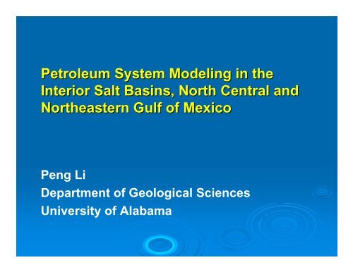
Petroleum System Modeling in the Interior Salt Basins, North Central ...
Petroleum System Modeling in the Interior Salt Basins, North Central ...
Petroleum System Modeling in the Interior Salt Basins, North Central ...

You also want an ePaper? Increase the reach of your titles
YUMPU automatically turns print PDFs into web optimized ePapers that Google loves.
<strong>Petroleum</strong> <strong>System</strong> <strong>Model<strong>in</strong>g</strong> <strong>in</strong> <strong>the</strong><br />
<strong>Interior</strong> <strong>Salt</strong> Bas<strong>in</strong>s, <strong>North</strong> <strong>Central</strong> and<br />
Nor<strong>the</strong>astern Gulf of Mexico<br />
Peng Li<br />
Department of Geological Sciences<br />
University of Alabama
Overview<br />
<br />
Introduction<br />
<br />
Methodology of Bas<strong>in</strong> Model<br />
<br />
Organic Geochemical Data (TOC, Ro, and kerogen type)<br />
<br />
Burial, Thermal Maturation, Expulsion Profiles<br />
<br />
Conclusions
Introduction
Stratigraphy
Methodology of Bas<strong>in</strong> Model
Methodology: Burial History<br />
‣ Assigned absolute age to each formation and<br />
unconformity<br />
‣ Recognized <strong>the</strong> tops of each formation from<br />
well logs<br />
‣ For major unconformities − <strong>in</strong>terpreted orig<strong>in</strong>al<br />
thickness of section<br />
‣ Lithology <strong>in</strong>terpretation<br />
‣ Burial depths corrected for compaction
Absolute Age<br />
- Geologic time scale:<br />
Harland (1990)<br />
- Formation ages:<br />
Manc<strong>in</strong>i and Tew (1991)<br />
Christopher (1982)<br />
Puckett (1995)<br />
Manc<strong>in</strong>i et al. (1996)<br />
Manc<strong>in</strong>i and Payton (1981)<br />
Imlay (1940)<br />
Young (1972)<br />
Imlay and Herman (1984)<br />
Young and Oloritz (1993)
Structure Map<br />
Top of UK <strong>in</strong> NLSB<br />
Top of LK <strong>in</strong> NLSB
Structure Map<br />
Top of UK <strong>in</strong> MISB<br />
Top of LK <strong>in</strong> MISB
Isopach Map<br />
LK - UK<br />
Cotton Valley - LK
Isopach Map<br />
LK - UK<br />
Cotton Valley - LK
Mid-Cretaceous Unconformity<br />
<strong>North</strong> Louisiana
Lithology<br />
45% LST<br />
50%SHL<br />
5% SST<br />
End member lithologies<br />
-SS, SH, LS, ANH<br />
50% LST<br />
45%SHL<br />
5% SST<br />
Tuscaloosa Formation<br />
Smackover Formation
Compaction<br />
(from Bas<strong>in</strong>Mod 1-D manual)
0<br />
porosity<br />
0.00 0.10 0.20 0.30 0.40 0.50 0.60<br />
Limestone<br />
Shale<br />
5000<br />
Reciprocal Compaction<br />
depth (ft)<br />
10000<br />
15000<br />
Sandstone<br />
1 ⎛<br />
= ⎜<br />
φ ⎝<br />
1<br />
φo<br />
⎞<br />
⎟+<br />
⎠<br />
Kz<br />
Where:<br />
φ = porosity<br />
φ 0<br />
= Initial porosity<br />
K = compaction factor<br />
z = depth<br />
20000
Burial History: Decompaction<br />
Present-day<br />
depths<br />
t1<br />
Remove 2 & 3<br />
Decompact 1<br />
t2<br />
Add 2<br />
Partially<br />
compact 1<br />
y’ 1<br />
1<br />
3<br />
y’ 2 2<br />
1<br />
2<br />
porosity<br />
y 1<br />
0.00 0.10 0.20 0.30 0.40 0.50 0.60 0.70<br />
0<br />
y 2<br />
1<br />
t3<br />
Add 3<br />
Compact 2 and 1<br />
3<br />
2<br />
1<br />
5000<br />
depth (ft)<br />
10000<br />
15000<br />
20000
Methodology: Thermal History<br />
‣ Heat flow approach: Transient heat flow<br />
‣ Present-day heat flow<br />
W<br />
meters 2<br />
Heat Flow<br />
= T 2 -T 1 (103 . deg K)<br />
y 2<br />
-y 1<br />
(meters)<br />
•Corrected<br />
BHTs<br />
•Surface temp = 20 o C<br />
•Thermal conductivity<br />
Temperature<br />
Gradient<br />
x<br />
W<br />
meter (10 3 . deg K)<br />
Thermal<br />
Conductivity<br />
T 1<br />
, y 1<br />
T 2<br />
, y 2<br />
•Porosity and lithology are major variables controll<strong>in</strong>g <strong>the</strong>rmal conductivityc<br />
•Thermal conductivity computed by Bas<strong>in</strong>Mod
Organic Geochemistry
Potential Source Rocks<br />
Visual<br />
Formation<br />
TOC Kerogen Ro<br />
(wt.%) Type a (%)<br />
Smackover (91) 0.08-8.43 (0.56) Am, H 1.07-1.89 (1.37)<br />
Cotton Valley (26) 0.25-1.80 (0.58) Am, H, I 0.75-1.80 (1.07)<br />
Bossier (11) 0.28-0.91 (0.45) H, I, W/I, Am/I 1.15-1.89 (1.62)<br />
Hosston (4) 0.17-4.09 (1.62) H, Am 1.29-1.37 (1.31)<br />
Sligo (3) 0.23-0.45 (0.30) Am/H, H 1.29-1.37 (1.32)<br />
Glen Rose (1) 0.10 Am 1.14<br />
Rodessa (1) 0.46 Am 1.14<br />
Aust<strong>in</strong> (1) 0.26 H 0.86<br />
Moor<strong>in</strong>gsport (1) 1.00 H/I 1.00<br />
James (1) 0.17 H 1.00
Calibration of Bas<strong>in</strong> Model<br />
%Ro<br />
0.00 0.50 1.00 1.50 2.00<br />
0<br />
2,000<br />
Depth (ft)<br />
%Ro<br />
0.55 0.7 1.0 1.3<br />
Maximum 8789 12564 15907 19174<br />
<strong>Model<strong>in</strong>g</strong> M<strong>in</strong>imum 3480 4810 6743 8346<br />
Average 5897 8084 10875 12805<br />
4,000<br />
From TAI<br />
7149 8132 10099 12066<br />
6,000<br />
2.50<br />
DEPTH (feet)<br />
8,000<br />
10,000<br />
12,000<br />
14,000<br />
%Ro (calc)<br />
2.00<br />
1.50<br />
1.00<br />
y = 1.0162x<br />
R 2 = 0.7036<br />
16,000<br />
0.50<br />
18,000<br />
20,000<br />
0.00<br />
0.00 0.50 1.00 1.50 2.00 2.50<br />
%Ro (meas)
Burial, Thermal Maturation,<br />
Hydrocarbon Expulsion Profiles
<strong>North</strong> Louisiana <strong>Salt</strong> Bas<strong>in</strong><br />
Cross Section Location
<strong>North</strong> Louisiana <strong>Salt</strong> Bas<strong>in</strong><br />
Cross Section
Thermal Maturation Profile Cross<br />
Section <strong>North</strong> Louisiana <strong>Salt</strong> Bas<strong>in</strong><br />
Average Maturation Depth<br />
6,500ft<br />
12,000ft
Source Rock Thermal Maturity
Burial History Profile<br />
<strong>North</strong> Louisiana <strong>Salt</strong> Bas<strong>in</strong><br />
API: 1706920079<br />
- Sediment accumulation<br />
rates were greatest <strong>in</strong> <strong>the</strong><br />
Jurassic (196-264 ft/my)<br />
- 50-60% of <strong>the</strong> tectonic<br />
subsidence occurred <strong>in</strong> <strong>the</strong><br />
Late Jurassic (135-157 ft/my)
Thermal Maturation History Profile<br />
<strong>North</strong> Louisiana <strong>Salt</strong> Bas<strong>in</strong>
Hydrocarbon Expulsion Profile<br />
<strong>North</strong> Louisiana <strong>Salt</strong> Bas<strong>in</strong><br />
Peak Oil<br />
Peak Gas
Monroe Uplift Cross section Location
Monroe Uplift Cross section
Thermal Maturation Profile Cross<br />
Section on Monroe Uplift
Burial History Profile Monroe Uplift<br />
API: 1706700008
Thermal History Profile<br />
Monroe Uplift<br />
Depth Unit Kerogen Type<br />
TAI Ro<br />
(ft) Lipt<strong>in</strong>ite (%) Vitr<strong>in</strong>ite (%) Inert<strong>in</strong>ite (%) (%)<br />
6,116.50 Smackover 80 15 5 2- to 2 0.63<br />
6,210.50 Smackover 80 15 5 2- to 2 0.60<br />
6,304.50 Smackover 80 15 5 2 0.66<br />
6,530.50 Smackover 75 20 5 2 0.70<br />
6,609.50 Smackover 70 25 5 2 0.69<br />
6,649.50 Smackover 70 25 5 2- to 2 0.51<br />
6,725.50 Smackover 85 10 5 - - - -
Hydrocarbon Expulsion Profile<br />
Monroe Uplift
Mississippi <strong>Interior</strong> <strong>Salt</strong> Bas<strong>in</strong>
Mississippi <strong>Interior</strong> <strong>Salt</strong> Bas<strong>in</strong> Cross<br />
Section Location
Mississippi <strong>Interior</strong> <strong>Salt</strong> Bas<strong>in</strong><br />
Cross Section
Thermal Maturation Profile Cross Section<br />
Mississippi <strong>Interior</strong> <strong>Salt</strong> Bas<strong>in</strong><br />
Average Maturation Depth<br />
8,000ft<br />
16,000ft
Source Rock Thermal Maturity
Burial History Profile<br />
Mississippi <strong>Interior</strong> Sal Bas<strong>in</strong>
Thermal Maturation History Profile<br />
Mississippi <strong>Interior</strong> <strong>Salt</strong> Bas<strong>in</strong>
Hydrocarbon Expulsion Plot<br />
Mississippi <strong>Interior</strong> <strong>Salt</strong> Bas<strong>in</strong><br />
Peak Oil<br />
Peak Gas
Event Chart for Smackover <strong>Petroleum</strong><br />
<strong>System</strong> <strong>in</strong> <strong>the</strong> <strong>North</strong> Louisiana and<br />
Mississippi <strong>Interior</strong> <strong>Salt</strong> Bas<strong>in</strong>s
Conecuh and Manila Sub-bas<strong>in</strong>s<br />
bas<strong>in</strong>s
Manila Sub-Bas<strong>in</strong> Cross Section
Manila and Conecuh Sub-Bas<strong>in</strong>s Cross<br />
Section Location
Thermal Maturation Profile Cross Section<br />
Manila Sub-Bas<strong>in</strong><br />
Average Maturation Depth<br />
8,000ft<br />
16,000ft
Source Rock Thermal Maturity
Burial History Profile<br />
Manila and Conecuh Sub-Bas<strong>in</strong>s
Thermal Maturation History Profile<br />
Manila and Conecuh Sub-Bas<strong>in</strong>s
Hydrocarbon Expulsion Plot<br />
Manila and Conecuh Sub-Bas<strong>in</strong>s
Event Chart for Smackover <strong>Petroleum</strong><br />
<strong>System</strong> <strong>in</strong> <strong>the</strong> Manila and Conecuh Sub-<br />
Bas<strong>in</strong>s
Conclusions<br />
‣ Upper Jurassic Smackover lime mudstone beds<br />
served as an effective regional petroleum source<br />
rock<br />
‣ Initiation of <strong>the</strong> generation of hydrocarbon from<br />
Smackover <strong>in</strong> <strong>the</strong> Early to Late Cretaceous and<br />
cont<strong>in</strong>u<strong>in</strong>g <strong>in</strong>to <strong>the</strong> Cenozoic<br />
‣ Peak oil expulsion occurred <strong>in</strong> <strong>the</strong> mid Early to<br />
Late Cretaceous, and peak gas expulsion <strong>in</strong><br />
Early-Mid Tertiary.