Montgomery County Law Reporter - Montgomery Bar Association
Montgomery County Law Reporter - Montgomery Bar Association
Montgomery County Law Reporter - Montgomery Bar Association

Create successful ePaper yourself
Turn your PDF publications into a flip-book with our unique Google optimized e-Paper software.
P E R I O D I C A L P U B L I C A T I O N<br />
NOW AVAILABLE in<br />
Electronic Format!<br />
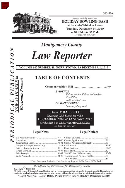
<strong>Montgomery</strong> <strong>County</strong><br />
<strong>Law</strong> <strong>Reporter</strong><br />
VOLUME 147 NUMBER 48, NORRISTOWN, PA DECEMBER 2, 2010<br />
TABLE OF CONTENTS<br />
Legal News<br />
Commonwealth v. Hill . . . . . . . . . . . . . . . . . . . . . . . . . . . . 313*<br />
EVIDENCE<br />
Falsus in Uno, Falsus in Omnibus<br />
Credibility<br />
Judicial Admission<br />
CIVIL PROCEDURE<br />
Summary Judgment<br />
Legal Notices<br />
313-316<br />
you are cordially invited to a<br />
HOLIDAY BOWLING BASH<br />
at Facenda-Whitaker Lanes<br />
Tuesday, December 14, 2010<br />
4:30 P.M. - 6:00 P.M.<br />
See page 5 in <strong>Bar</strong> News<br />
Think MBA for CLE<br />
Upcoming CLE Events for MBA<br />
DECEMBER 2010 & JANUARY 2011<br />
For the BEST in CLE...visit MBACLE.ORG<br />
See page 3 in <strong>Bar</strong> News<br />
<strong>Bar</strong> <strong>Association</strong> News.....................................3-7 Change of Name.............................................79<br />
Executions......................................................89-90 Charter Application........................................79<br />
Judgments & Liens.........................................90-91 Charter Application Nonprofit........................79<br />
<strong>Law</strong>yer to <strong>Law</strong>yer Networking......................11-14 Civil Action....................................................80-82<br />
Letters of Administration................................91 Estate Notices.................................................82-89<br />
Return Day List..............................................95-97 Dissolution......................................................82<br />
Suits Brought..................................................91-93 Sheriff Sales (1 st Publication).........................15-79<br />
Wills Probated................................................94-95 Termination of Parental Rights.......................89<br />
Trust Notices...................................................89<br />
*Pages Correspond To Opinion Page Numbering Sequence In The Center Of The Book<br />
The Official Legal Periodical for <strong>Montgomery</strong> <strong>County</strong><br />
©<br />
Copyright 2010 MBA<br />
All rights reserved. No part of this publication may be reproduced, stored in a retrieval system, or transmitted in any form by<br />
electronic, mechanical, photocopying, or any other means without the prior written permission of the copyright holder.<br />
* Dated Material. Do Not Delay. Please Deliver Before Monday, December 6, 2010
<strong>Montgomery</strong> <strong>County</strong> <strong>Law</strong> <strong>Reporter</strong><br />
(USPS 361-080)<br />
Reporting the Decisions of the Divisions of the Court of the<br />
Thirty-Eighth Judicial District of Pennsylvania,<br />
Composed of <strong>Montgomery</strong> <strong>County</strong>,<br />
Officially Designated by the Rule Thereof as the<br />
Legal Periodical for the Publication of Legal Notices<br />
Owned and Published by<br />
MONTGOMERY BAR ASSOCIATION<br />
SERVING THE PROFESSION AND THE COMMUNITY SINCE 1885<br />
<strong>Law</strong> <strong>Reporter</strong> Committee<br />
Matthew T. Wilkov, Esq., Chair<br />
Ellen S. Fischer, Esq.<br />
Bruce Pancio, Esq.<br />
Seth D. Wilson, Esq., Editor<br />
Colin J. O'Boyle, Esq., Associate Editor<br />
William G. Roark, Esq., Assistant Editor<br />
Office: 100 West Airy Street, P.O. Box 268, Norristown, PA 19404<br />
Tel: 610-279-9660 Fax: 610-279-4846<br />
Website: www.montgomerybar.org<br />
E-mail: LegalAds@montgomerybar.org<br />
(Mrs.) Nancy R. Paul, Executive Director<br />
George E. Cardenas, Publications Manager<br />
Published Every Thursday<br />
Legal Notices must be received by 12:00 noon the preceding Wednesday<br />
2010 Annual Subscription Cost (Pro-Rated) - $24.75<br />
Electronic Version Available For $23.00 (Pro-Rated)!<br />
Periodicals Postage Paid at Norristown, PA 19401 and additional changes of mailing offices (etc.)<br />
POSTMASTER: Send address changes to:<br />
<strong>Montgomery</strong> <strong>County</strong> <strong>Law</strong> <strong>Reporter</strong><br />
P.O. Box 268<br />
Norristown, PA 19404-0268<br />
Vol. 147 NORRISTOWN, PA, DECEMBER 2, 2010 No. 48<br />
The MONTGOMERY COUNTY LAW REPORTER is published every Thursday. The DEADLINE for<br />
submission of all notices is 12:00 noon on WEDNESDAY for the following Thursday issue. This deadline will<br />
be strictly enforced. Notices must be submitted in typewritten form and are published exactly as submitted by the<br />
advertiser. Neither the <strong>Law</strong> <strong>Reporter</strong> nor the printer will assume any responsibility to edit, make spelling corrections,<br />
eliminate errors in grammar or make any changes in content.<br />
Copyright © 2010 <strong>Montgomery</strong> <strong>Bar</strong> <strong>Association</strong>. All rights reserved. No portion of this transmission,<br />
nor any part of this publication, may be copied, downloaded, stored for future retrieval or use, further transmitted or<br />
otherwise reproduced, stored, transmitted, distributed, transferred or used, in any form by any means, in whole or in<br />
part, except with the prior written permission of the <strong>Montgomery</strong> <strong>Bar</strong> <strong>Association</strong>. Any reproduction of any part of this<br />
transmission or publication must contain the following: “Copyright © <strong>Montgomery</strong> <strong>Bar</strong> <strong>Association</strong> 2010.”<br />
—2 —
12/02/2010 MONTGOMERY COUNTY LAW REPORTER Vol. 147, No. 48<br />
BAR ASSOCIATION NEWS<br />
The Following Notices Are For <strong>Montgomery</strong> <strong>Bar</strong> <strong>Association</strong> Members Only<br />
Think MBA for CLE<br />
Upcoming CLE Events at MBA<br />
ATTENTION ATTORNEYS:<br />
Here’s a peek at the great lineup of<br />
CLE Events coming to the MBA in the weeks ahead!!!<br />
DECEMBER CLE<br />
Friday, December 3, 2010<br />
Solo and Small Firm Practice Institute<br />
Location: <strong>Montgomery</strong> <strong>Bar</strong> <strong>Association</strong><br />
9:00 AM to 4:30 PM - 4.0 Hrs. Sub. and 2.0 Hrs. Ethics<br />
Wednesday, December 8, 2010<br />
PBI GC - Land Use and Zoning 101<br />
Location: <strong>Montgomery</strong> <strong>Bar</strong> <strong>Association</strong><br />
9:00 AM to 12:15 PM - 3.0 Hrs. Sub.<br />
Thursday, December 16, 2010<br />
PBI GC - The Complete Legal Negotiator<br />
Location: <strong>Montgomery</strong> <strong>Bar</strong> <strong>Association</strong><br />
8:00 AM to 3:30 PM - 5.0 Hrs. Sub. and 1.0 Hr. Ethics<br />
Friday, December 17, 2010<br />
PBI GC - Municipality Liability Actions<br />
Location: <strong>Montgomery</strong> <strong>Bar</strong> <strong>Association</strong><br />
8:30 AM to 1:15 PM - 4.0 Hrs. Sub.<br />
Monday, December 20, 2010<br />
PBI GC - Facebook, Twitter and Blogging...oh MySpace<br />
Location: <strong>Montgomery</strong> <strong>Bar</strong> <strong>Association</strong><br />
9:00 AM to 4:30 PM - 5.0 Hrs. Sub. and 1.0 Hr. Ethics<br />
Tuesday, December 21, 2010<br />
PBI GC - Criminal <strong>Law</strong> Update #6457G<br />
Location: <strong>Montgomery</strong> <strong>Bar</strong> <strong>Association</strong><br />
11:30 AM to 4:15 PM - 4.0 Hrs. Sub.<br />
Tuesday, December 28, 2010<br />
Construction <strong>Law</strong> Presents: NLRA Section 7 - Employer Trap for the Unwary<br />
Location: <strong>Montgomery</strong> <strong>Bar</strong> <strong>Association</strong><br />
1:00 PM to 4:15 PM - 3.0 Hrs. Sub.<br />
JANUARY CLE<br />
Thursday, January 13, 2011<br />
PBI GC - Forensics for the Criminal Practitioner<br />
Location: <strong>Montgomery</strong> <strong>Bar</strong> <strong>Association</strong><br />
12:30 PM to 3:45 PM - 3.0 Hrs. Sub.<br />
Friday, January 21, 2011<br />
Bridge the Gap<br />
Location: <strong>Montgomery</strong> <strong>Bar</strong> <strong>Association</strong><br />
8:30 AM to 1:00 PM - 4.0 Hrs. Ethics<br />
For the BEST in CLE...<br />
To register, call 610-279-9660 or online at MBACLE.org<br />
— 3 —<br />
Copyright © <strong>Montgomery</strong> <strong>Bar</strong> <strong>Association</strong> 2010
12/02/2010 MONTGOMERY COUNTY LAW REPORTER Vol. 147, No. 48<br />
2010 NEW MONTGOMERY BAR ASSOCIATION MEMBERS<br />
(The following members were admitted as of November 23, 2010)<br />
Bifulco, David K., Esq., 117 Mill Grove Drive, Audubon, PA 19403<br />
PHONE: (631) 662-2221 E-MAIL: dbifulco@recoverylegal.net<br />
Connors, Margaret R., Esq., 3540 Schuylkill Road, Spring City, PA 19475<br />
PHONE: (610) 948-4800 FAX: (610) 948-5173<br />
Mayerson <strong>Law</strong> Offices, P.C.<br />
Cooper, Zachary B., Esq., Suite 416, One Belmont Avenue, Bala Cynwyd, PA 19004<br />
PHONE: (610) 667-5055 FAX: (610) 667-5065<br />
E-MAIL: zcooper@pennsylvaniaduilawyers.com<br />
Levow & Associates, P.C.<br />
Fina, Katherine E., Esq., 510 Swede Street, Norristown, PA 19401-4807<br />
PHONE: (610) 275-2000 FAX: (610) 275-2018<br />
E-MAIL: kfina@kanepugh.com<br />
Kane, Pugh, Knoell, Troy & Kramer, LLP<br />
Friedlander, Andrew, Esq., 510 Swede Street, Norristown, PA 19401-4807<br />
PHONE: (610) 275-2000 FAX: (610) 275-2018<br />
E-MAIL: afriedlander@kanepugh.com<br />
Kane, Pugh, Knoell, Troy & Kramer, LLP<br />
Jacquette, David R., Esq., Suite 416, 527 Plymouth Road,<br />
Plymouth Meeting, PA 19462-1641<br />
PHONE: (610) 825-0500 FAX: (610) 834-1776<br />
E-MAIL: djacquette@morrisclemm.com<br />
Morris and Clemm, P.C.<br />
Knowles, Timothy, Esq., 920 Lenmar Drive, Blue Bell, PA 19422<br />
PHONE: (610) 584-9400 FAX: (610) 584-9783 E-MAIL: tmkno@temple.edu<br />
Warren & McGraw, LLC<br />
Loxterman, John R., Esq., Aetna, 980 Jolly Road, U13N, Blue Bell, PA 19422<br />
PHONE: (215) 775-6858 FAX: (860) 907-3183<br />
Mayerson, Benjamin J., Esq., 3540 Schuylkill Road, Spring City, PA 19475<br />
DIRECT PHONE: (610) 864-0127 PHONE: (610) 948-4800<br />
FAX: (610) 948-5173 E-MAIL: ben@mayerson.com<br />
Mayerson <strong>Law</strong> Offices, P.C.<br />
Monaco, Judith E., Esq., Pottstown, PA 19464<br />
Norton, Sean, Esq., 261 Old York Road, Suite 200, Jenkintown, PA 19046-3706<br />
PHONE: (215) 576-1730 FAX: (215) 576-8188, E-MAIL: sjn@plotnickellis.com<br />
Plotnick & Ellis, P.C.<br />
Oroszian, Megan N., Esq., 1000 Sandy Hill Road, Suite 150, Norristown, PA 19401<br />
DIRECT PHONE: (484) 690-9313 PHONE: (484) 690-9300<br />
FAX: (484) 690-9301 E-MAIL: moroszian@portnoffonline.com<br />
Portnoff <strong>Law</strong> Associates, Ltd.<br />
— 4 —<br />
Copyright © <strong>Montgomery</strong> <strong>Bar</strong> <strong>Association</strong> 2010
12/02/2010 MONTGOMERY COUNTY LAW REPORTER Vol. 147, No. 48<br />
NOTICE: EARLY DEADLINES<br />
Due to the upcoming Holiday Season, our early deadlines are as follows:<br />
Vol. 147, Issue 51, December 23, 2010 - Deadline is Monday, December 13,<br />
2010 at Noon;<br />
Vol. 147, Issue 52, December 30, 2010 - Deadline is Monday, December 20,<br />
2010 at Noon;<br />
Vol. 148, Issue 1, January 7, 2011 - Deadline is Monday, December 27,<br />
2010 at Noon<br />
Please submit all ads necessary for publication according to the times above.<br />
Thank you in advance for your cooperation.<br />
Happy Holidays!<br />
MCLR Staff<br />
— 5 —<br />
Copyright © <strong>Montgomery</strong> <strong>Bar</strong> <strong>Association</strong> 2010
12/02/2010 MONTGOMERY COUNTY LAW REPORTER Vol. 147, No. 48<br />
— 6 —<br />
Copyright © <strong>Montgomery</strong> <strong>Bar</strong> <strong>Association</strong> 2010
12/02/2010 MONTGOMERY COUNTY LAW REPORTER Vol. 147, No. 48<br />
NOTICE OF TAX CLAIM BUREAU<br />
TO: OWNERS OF PROPERTIES ON WHICH<br />
TAXES ARE DELINQUENT, LIEN CREDITORS,<br />
AND ALL PERSONS OR TAXING DISTRICTS HAVING<br />
TAX LIENS, JUDGMENTS OR MUNICIPAL CLAIMS<br />
AGAINST SUCH PROPERTIES.<br />
NOTICE: IS HEREBY GIVEN that the Tax Claim Bureau<br />
of <strong>Montgomery</strong> <strong>County</strong>, Pennsylvania, has filed with<br />
the Court its consolidated return in connection with the<br />
Delinquent Tax Sale scheduled on September 15, 2010<br />
and as continued on October 20, 2010 in Norristown,<br />
Pennsylvania. The said tax sale was confirmed nisi by order<br />
dated November 23, 2010 in the Court of Common Pleas,<br />
Civil. Any owner, lien creditor or taxing district who wishes<br />
to file any objections or exceptions to said return or any sale<br />
of property therein, must do so within 30 days after the date<br />
of the aforesaid confirmation nisi, otherwise said return and<br />
all sales therein will be confirmed absolutely.<br />
Xspand, as agent of the<br />
<strong>Montgomery</strong> <strong>County</strong> Tax Claim Bureau<br />
1-888-343-2143<br />
— 7 —<br />
Copyright © <strong>Montgomery</strong> <strong>Bar</strong> <strong>Association</strong> 2010
12/02/2010 MONTGOMERY COUNTY LAW REPORTER Vol. 147, No. 48<br />
— 8 —<br />
Copyright © <strong>Montgomery</strong> <strong>Bar</strong> <strong>Association</strong> 2010
12/02/2010 MONTGOMERY COUNTY LAW REPORTER Vol. 147, No. 48<br />
A team of experts.<br />
Offering Investment Management and Trust Services, delivered with<br />
exceptional client service.<br />
Susquehanna Wealth Management is an Affinity Partner with the <strong>Montgomery</strong> <strong>Bar</strong> <strong>Association</strong>.<br />
Frank Corace • Mike Foster<br />
Valley Forge Asset Management Corp.<br />
800.225.3518<br />
Susquehanna Wealth Management is a registered trade mark of Susquehanna Bancshares, Inc. Trust and Private Client Services offered<br />
through Susquehanna Trust & Investment Company, a Pennsylvania chartered Trust Company. Valley Forge Asset Management Corp. is a<br />
registered investment advisor and a registered broker-dealer (member NASD & SIPC).<br />
Securities and insurance products are: NOT FDIC INSURED. NOT A DEPOSIT. MAY LOSE VALUE. NOT BANK GUARANTEED. NOT INSURED BY<br />
ANY GOVERNMENT ENTITY.<br />
1318_WealthMngmtAd_v4.indd 1<br />
— 9 —<br />
Copyright © <strong>Montgomery</strong> <strong>Bar</strong> <strong>Association</strong> 2010<br />
8/7/09 3:58 PM
12/02/2010 MONTGOMERY COUNTY LAW REPORTER Vol. 147, No. 48<br />
ON SITE. ON DEMAND.<br />
ON TIME.<br />
Introducing Univest’s Convenient Remote<br />
Deposit Solution: Onsite CheckPass ®<br />
Univest’s Remote Deposit Solution is easy, convenient and a<br />
cost savings for your business:<br />
• Expedite receivables from the convenience of your office -<br />
24/7/365<br />
• Scan and deposit checks when you want - daily or even by<br />
the hour<br />
• Retrieve check images from previous deposits in minutes<br />
• Save time and money by not having to send employees to<br />
the bank during business hours<br />
COMMUNITY BANKING SINCE 1876.<br />
For more information or a FREE<br />
demonstration, contact Ray Staley today:<br />
215.799.2948 · staleyr@univest.net<br />
www.univest.net<br />
BANKING · INSURANCE · INVESTMENTS · MORTGAGES · TRUST SERVICES · WEALTH MANAGEMENT<br />
Member FDIC<br />
— 10 —<br />
Copyright © <strong>Montgomery</strong> <strong>Bar</strong> <strong>Association</strong> 2010
12/02/2010 MONTGOMERY COUNTY LAW REPORTER Vol. 147, No. 48<br />
LAWYER TO LAWYER NETWORKING<br />
WILLIAM H. PUGH, IV<br />
PUGH FOUR RESOLUTIONS<br />
ARBITRATION<br />
MEDIATION<br />
Mr. Pugh is available in all counties to assist resolving cases in<br />
arbitration or mediation.<br />
•<br />
•<br />
•<br />
•<br />
•<br />
45 years of trial practice with extensive experience in<br />
professional negligence litigation, arbitration and mediation<br />
Past President: <strong>Montgomery</strong> <strong>Bar</strong> <strong>Association</strong><br />
<strong>Montgomery</strong> <strong>Bar</strong> Foundation<br />
<strong>Montgomery</strong> <strong>County</strong> Trial <strong>Law</strong>yers <strong>Association</strong><br />
Fellow, American College of Trial <strong>Law</strong>yers since 1989<br />
<strong>Montgomery</strong> <strong>County</strong> Settlement Master<br />
2008-2009<br />
Pennsylvania Super <strong>Law</strong>yers<br />
2004, 2005, 2006, 2007, 2008, 2009, 2010<br />
510 Swede Street, Norristown, PA 19401<br />
610-275-2000<br />
610-275-2006 (Direct)<br />
wpugh4@kanepugh.com<br />
Philadelphia location available<br />
C.V. and references available upon request<br />
— 11 —<br />
Copyright © <strong>Montgomery</strong> <strong>Bar</strong> <strong>Association</strong> 2010
12/02/2010 MONTGOMERY COUNTY LAW REPORTER Vol. 147, No. 48<br />
LAWYER TO LAWYER NETWORKING<br />
WORKPLACE INVESTIGATIONS<br />
Sexual harassment, discrimination & wrongful termination<br />
Michael J. Torchia, Esq.<br />
Semanoff Ormsby Greenberg & Torchia, LLC<br />
(215) 887.2042<br />
email: mtorchia@sogtlaw.com<br />
Voted 2007, 2008 “Leader in the <strong>Law</strong>” by Philadelphia<br />
Business Journal for Employment <strong>Law</strong> and Litigation<br />
Voted 2009 Super <strong>Law</strong>yer® by Philadelphia Magazine for Employment <strong>Law</strong><br />
S I L V E R & S I L V E R<br />
THE DISABILITY LAW FIRM<br />
MEYER SILVER, ESQUIRE<br />
Past President, National Organization of<br />
Social Security Claimants’ Representatives<br />
Chair, Phila. <strong>Bar</strong> Assoc. Disability <strong>Law</strong> Committee<br />
1995-2003<br />
Referrals & Consultations Are Welcomed<br />
6 1 0 . 6 5 8 . 1 9 0 0<br />
42 W. Lancaster Avenue, Ardmore, PA<br />
— 12 —<br />
Copyright © <strong>Montgomery</strong> <strong>Bar</strong> <strong>Association</strong> 2010
12/02/2010 MONTGOMERY COUNTY LAW REPORTER Vol. 147, No. 48<br />
LAWYER TO LAWYER NETWORKING<br />
ATTORNEY DISCIPLINARY/ETHICS MATTERS<br />
Representation, consultation and expert testimony in matters<br />
involving ethical issues, bar admissions and the Rules of Professsional Conduct<br />
James C. Schwartzman, Esq.<br />
Former Chairman, Disciplinary Board of the Supreme Court of Pennsylvania • Former Chairman,<br />
Continuing Legal Education Board of the Supreme Court of Pennsylvania • Former Federal Prosecutor<br />
Pennsylvania Interest on <strong>Law</strong>yers Trust Account Board<br />
Dana Pirone Carosella, Esq.<br />
Representing attorneys in disciplinary/ethics matters for 15 years • Author and Speaker on ethics matters<br />
1818 Market Street, 29th Floor • Philadelphia, PA 19103<br />
(215) 751-2863<br />
LAW OFFICES OF ROBERT A. SELIG<br />
Florida <strong>Law</strong><br />
REFERRALS & CONSULTATIONS ARE WELCOMED<br />
2311 NORTH ANDREWS AVENUE<br />
FORT LAUDERDALE FLORIDA 33311<br />
Telephone: 954-566-9919 ● FAX: 954-566-2680<br />
raselig@bellsouth.net<br />
WORKERS’ COMPENSATION CLAIMS<br />
ACCEPTING REFERRALS<br />
JONATHAN A. PICKER, ESQ.<br />
PICKER LAW OFFICES<br />
526 Swede Street<br />
Norristown, PA 19401<br />
jpickesq@hotmail.com<br />
Phone: 610-277-6660<br />
WWW.JOBACCIDENTLAWYERS.COM<br />
— 13 —<br />
Copyright © <strong>Montgomery</strong> <strong>Bar</strong> <strong>Association</strong> 2010
12/02/2010 MONTGOMERY COUNTY LAW REPORTER Vol. 147, No. 48<br />
LAWYER TO LAWYER NETWORKING<br />
BANKRUPTCY <br />
MORTGAGE FORECLOSURE<br />
DANIEL W. McCARTNEY, JR., P.C.<br />
ATTORNEYS AND COUNSELORS AT LAW<br />
Daniel W. McCartney, Jr., Esq.* Jason Donoghue, Esq. Liam O’Shaughnessy, Esq.*<br />
ONE EAST AIRY STREET, NORRISTOWN, PA 19401<br />
610-272-2260<br />
A Full Service <strong>Law</strong> Firm<br />
*Members of PA and NJ <strong>Bar</strong>s<br />
BANKRUPTCY CREDITORS’ RIGHTS<br />
Fox Rothschild LLP<br />
Edward J. DiDonato, Esquire<br />
10 Sentry Parkway, Ste. 200<br />
Blue Bell, PA 19422<br />
edidonato@foxrothschild.com<br />
PA Super <strong>Law</strong>yer 2005-2009 -30 Years of Experience<br />
Phone: 215-299-2817<br />
Former Chair, Bankruptcy and Creditors’ Rights Committee <strong>Montgomery</strong> <strong>Bar</strong> <strong>Association</strong><br />
— 14 —<br />
Copyright © <strong>Montgomery</strong> <strong>Bar</strong> <strong>Association</strong> 2010
12/02/2010 MONTGOMERY COUNTY LAW REPORTER Vol. 147, No. 48<br />
SHERIFF’S SALES<br />
By virtue of various writs issued out of the Court of Common Pleas of <strong>Montgomery</strong> <strong>County</strong>, Pa. to me directed will<br />
be sold at public sale on December 29, 2010 at 1:00 o’clock P.M. prevailing time, in Court Room “A”, Court House,<br />
Swede and Airy Streets, in the Borough of Norristown, said <strong>County</strong>, the following described Real Estate.<br />
To all parties in interest and claimants:<br />
Notice is hereby given the schedules of distribution by the Sheriff on January 26, 2011 and distribution will be made<br />
in accordance with the schedule unless exceptions are filed thereto within ten (10) days thereafter.<br />
All properties to be sold by ALFRED J. RICCI, ACTING SHERIFF.<br />
First Publication<br />
06-03837<br />
ALL THAT CERTAIN lot or piece of ground, hereditaments and appurtenances, situate in Abington Township,<br />
<strong>Montgomery</strong> <strong>County</strong>, Pennsylvania.<br />
BEGINNING at a point of tangent of a radius corner (or point of reverse curve) in the Westerly side of<br />
Roberts Avenue (60 feet wide) at the distance of 11 feet, 4 7/8 inches Southwardly from the intersection which the said<br />
side of Roberts Avenue produced, makes with the Southeasterly side of Clivedon Avenue (50 feet wide) produced;<br />
thence extending Southwardly along the said Westerly side of Roberts Avenue by a line curving to the left with<br />
a radius of 911 feet, 11 3/8 inches the arc distance of 124 feet, 10 3/8 inches to a point; thence through Lot #517,<br />
North 87 degrees, 49 minutes, 29 seconds West, 62 feet, 6 3/4 inches to an angle point; thence still through Lot #517<br />
North 57 degrees, 7 minutes, 30 seconds West, 62 feet, 6 inches to a point in the aforesaid Southeasterly side of<br />
Clivedon Avenue; thence extending Northeastwardly along the same by a line curving to the right with a radius of<br />
850 feet, the arc distance of 146 feet, 6 3/4 inches to point of curve of a radius corner (or point of compound curve);<br />
thence extending Eastwardly by a line curving to the right with a radius of 5 feet the arc distance of 11 feet,<br />
7 inches to the place of beginning.<br />
BEING part of Lot #517 Plan of Glenside Highlands.<br />
TITLE TO SAID PREMISES IS VESTED IN: Stephen J. Heeney and Kimberly A. Heeney by John V. McNamara and<br />
Dorothy D. McNamara dated 5/31/01, recorded 7/12/01 in Book 5366, Page 2218.<br />
Parcel Number: 30-00-56404-00-5.<br />
Location of property: 374 Roberts Avenue, Glenside, PA 19038.<br />
The improvements thereon are: Residential property.<br />
Seized and taken in execution as the property of Stephen J. Heeney and Kimberly A. Heeney at the suit of<br />
Aurora Loan Services, LLC. Debt: $251,334.09.<br />
Francis S. Hallinan, Attorney. I.D. #62695<br />
Above Property to be sold by ALFRED J. RICCI, ACTING SHERIFF.<br />
DOWN MONEY: A deposit of ten (10%) percent of the Price Bid or $3,000. dollars whichever amount is greater,<br />
shall be required to be paid in cash or by certified check to the Sheriff as down money on each property purchased.<br />
06-14161<br />
ALL THAT CERTAIN lot or piece of ground, situate in Upper Moreland Township, <strong>Montgomery</strong> <strong>County</strong>,<br />
Pennsylvania, and described according to a certain plan thereof known as “ Final Plan of Terwood Park Section C”<br />
made by Russell S. Lyman, Registered Professional Engineers, dated May 25, 1956 and last revised October 3, 1958,<br />
as follows, to wit:<br />
BEGINNING at a point on the Northwesterly side of Greyhorse Road (50 feet wide), said point of beginning<br />
being the two following courses and distances from a point of curve on the Northeasterly side of Overlook Avenue<br />
(45 feet wide): (1) leaving Overlook Avenue on the arc of a circle curving to the left having a radius of 20.00 feet<br />
the arc distance of 31.42 feet to a point of tangent on the Northwesterly side of Greyhorse Road; and (2) North 34 degrees,<br />
36 minutes, 40 seconds East along the Northwesterly side of Greyhorse Road 90.00 feet to the place of beginning;<br />
thence extending from said point of beginning North 55 degrees, 23 minutes, 20 seconds West, 157.43 feet to a point;<br />
thence extending North 40 degrees, 38 minutes, 45 seconds East, 35.07 feet to a point; thence extending North 46 degrees,<br />
38 minutes, 24 seconds East, 135.00 feet to a point on the Southwesterly side of Greyhorse Road; thence extending<br />
South 43 degrees, 21 minutes, 36 seconds East along the Southwesterly side of Greyhorse Road 22.34 feet to<br />
a point of curve on the same; thence extending Southeastwardly and Southwestwardly partly along the Southwesterly and<br />
partly along the Northwesterly side of Greyhorse Road on the arc of a circle curving to the right having a radius of<br />
125.00 feet the arc distance of 170.11 feet to a point of tangent on the Northwesterly side of Greyhorse Road aforesaid;<br />
thence extending South 34 degrees, 36 minutes, 40 seconds West along the Northwesterly side of Grey Horse Road<br />
39.12 feet to the first mentioned point and place of beginning.<br />
BEING Lot No. 64 as shown on the above mentioned plan.<br />
VESTED by Warranty Deed, dated 7/17/2003, given by <strong>Bar</strong>bara J. Belfatti to Christopher Foley and Elizabeth Foley,<br />
their heirs and assigns, as Tenants by the Entireties and recorded 8/7/2003 in Book 5468, Page 465.<br />
Parcel Number: 59-00-08899-00-6.<br />
Location of property: 445 Greyhorse Road, Willow Grove, PA 19090.<br />
— 15 —<br />
Copyright © <strong>Montgomery</strong> <strong>Bar</strong> <strong>Association</strong> 2010
12/02/2010 MONTGOMERY COUNTY LAW REPORTER Vol. 147, No. 48<br />
The improvements thereon are: Residential property.<br />
Seized and taken in execution as the property of Elizabeth Foley, a/k/a Elizabeth A. Rogacz and Christopher Foley,<br />
a/k/a Chris J. Foley at the suit of Deutsche Bank National Trust Company, as Trustee for Certificateholders of the<br />
Morgan Stanley ABS Capital 1, Inc., Trust 2003-NC10. Debt: $344,968.12.<br />
Jaime McGuinness, Attorney. I.D. #90134<br />
Above Property to be sold by ALFRED J. RICCI, ACTING SHERIFF.<br />
DOWN MONEY: A deposit of ten (10%) percent of the Price Bid or $3,000. dollars whichever amount is greater,<br />
shall be required to be paid in cash or by certified check to the Sheriff as down money on each property purchased.<br />
06-14446<br />
ALL THAT CERTAIN lot or piece of ground, situate on the West side of Main Street in Pennsburg Borough,<br />
<strong>County</strong> of <strong>Montgomery</strong>, Commonwealth of Pennsylvania, bounded and described, as follows, to wit:<br />
BEGINNING at a point in the Westerly curb line of Main Street, at the lines of Charles K. Kulp’s land; thence along said<br />
Kulp’s lands, South 61 degrees, 10 minutes West, 197.10 feet to a point along the Westerly side of a concrete wall;<br />
thence along land of the Grantor, North 27 degrees, 40 minutes West, 52.80 feet to a point in line of Charles Bernhard’s land;<br />
thence along same, North 61 degrees, 10 minutes East, 197.10 feet to the aforesaid curb line; thence along the same,<br />
South 27 degrees, 40 minutes East, 52.80 feet to the point of beginning.<br />
CONTAINING 10,406 square feet of land.<br />
Parcel Number: 15-00-01597-00-8.<br />
Location of property: 753 Main Street, Pennsburg, PA 18073.<br />
The improvements thereon are: Single family residential dwelling.<br />
Seized and taken in execution as the property of Wesley Meier and Linda Meier at the suit of Upper Perkiomen<br />
School District. Debt: $3,175.27.<br />
Robert P. Daday, Attorney.<br />
Above Property to be sold by ALFRED J. RICCI, ACTING SHERIFF.<br />
DOWN MONEY: A deposit of ten (10%) percent of the Price Bid or $4,000. dollars whichever amount is greater,<br />
shall be required to be paid in cash or by certified check to the Sheriff as down money on each property purchased.<br />
07-00298<br />
ALL THAT CERTAIN lot or piece of ground, situate in Norristown Borough, <strong>County</strong> of <strong>Montgomery</strong> and<br />
Commonwealth of Pennsylvania, bounded and described according to a Subdivision and Record Plan of 707 Cherry Street,<br />
made by Taylor, Wiseman & Taylor, Doylestown, Pennsylvania, dated 10/27/1999 and last revised 2/18/2000 and<br />
recorded in the Office of the Recorder of Deeds in Plan Book A-59, Page 351, as follows, to wit:<br />
BEGINNING at a point on the Northwesterly side of Cherry Street (50 feet wide) a corner of Lot A on said plan;<br />
thence extending along said Lot A, North 60 degrees, 25 minutes, 00 seconds West, 110.79 feet to a point,<br />
a corner of land N/L <strong>Montgomery</strong> <strong>County</strong> Development Corporation; thence extending along said land, North 34 degrees,<br />
32 minutes, 12 seconds East, 19.57 feet to a point, a corner of land, now or late of Dreisbach and Bosler;<br />
thence extending along said land, South 60 degrees, 25 minutes, 00 seconds East, 109.10 feet to a point on the Northwesterly side<br />
of Cherry Street, aforesaid; thence extending along said Cherry Street, South 29 degrees, 35 minutes, 00 seconds West,<br />
19.50 feet to a point, a corner of Lot A on said plan; being the first mentioned point and place of beginning.<br />
BEING Lot B on said plan.<br />
TOGETHER with a 14 feet wide driveway access and parking easement as shown on said plan for the benefit of Lot A and<br />
Lot B on said plan; subject to proportionate part of expense of maintaining same in good order, condition and repair.<br />
TOGETHER with all the improvements now or hereafter erected on the property, and all easements, rights,<br />
appurtenances, rents, royalties, mineral, oil and gas rights and profits, water rights and stock and all fixtures<br />
now or hereafter a part of the property. All replacements and additions shall also be coveted by this Security Instrument.<br />
All of the foregoing is referred to in this Security Instrument as the “Property.”<br />
BEING the same premises, which Habitat for Humanity of <strong>Montgomery</strong> <strong>County</strong>, by Indenture bearing the date of the<br />
13th day of December, 2002, and recorded in the Office for the Recording of Deeds in and for the <strong>County</strong> of <strong>Montgomery</strong>,<br />
at Norristown, Pennsylvania, in Book 5440, Page 2440, granted and conveyed unto Carolyn Harris in fee.<br />
Parcel Number: 13-00-08172-00-5.<br />
Location of property: 707 Cherry Street, Norristown, PA 19401.<br />
The improvements thereon are: A residential dwelling.<br />
Seized and taken in execution as the property of Carolyn Harris and/or Gennaro Rauso, Trustee for the Harris Trust<br />
at the suit of Habitat for Humanity of <strong>Montgomery</strong> <strong>County</strong>, Inc. Debt: $88,780.09 including judgment interest.<br />
Brendan P. Bovaird, Attorney.<br />
Above Property to be sold by ALFRED J. RICCI, ACTING SHERIFF.<br />
DOWN MONEY: A deposit of ten (10%) percent of the Price Bid or $3,000. dollars whichever amount is greater,<br />
shall be required to be paid in cash or by certified check to the Sheriff as down money on each property purchased.<br />
07-11732<br />
ALL THAT CERTAIN lot or piece of ground, situate in Pottstown Borough, <strong>County</strong> of <strong>Montgomery</strong> and<br />
Commonwealth of Pennsylvania, being more particularly bounded and described, as follows, to wit:<br />
BEGINNING at the South side of King Street, between Franklin and Washington Streets at a point, the Northwest corner<br />
of a brick house of premises of Sophia Spatzinni, wife of Antonio Spatzinni; thence by the South side of said King Street,<br />
West 30 feet, more or less, to land now or late of Marmaduke B. Casselberry; thence by the same, South 140 feet<br />
to a 20 feet wide alley; thence by said alley and parallel with the first described line, East 30 feet, more or less,<br />
to land now of Sophia Spatzinni ,aforesaid; thence by the same, North 140 feet to the place of beginning.<br />
Parcel Number: 16-00-17372-00-9.<br />
Location of property: 424 King Street, Pottstown, PA 19464.<br />
— 16 —<br />
Copyright © <strong>Montgomery</strong> <strong>Bar</strong> <strong>Association</strong> 2010
12/02/2010 MONTGOMERY COUNTY LAW REPORTER Vol. 147, No. 48<br />
The improvements thereon are: Commercial property.<br />
Seized and taken in execution as the property of 100 West Mall Associates at the suit of Borough of Pottstown.<br />
Debt: $2,305.87.<br />
Robert P. Daday, Attorney.<br />
Above Property to be sold by ALFRED J. RICCI, ACTING SHERIFF.<br />
DOWN MONEY: A deposit of ten (10%) percent of the Price Bid or $4,000. dollars whichever amount is greater,<br />
shall be required to be paid in cash or by certified check to the Sheriff as down money on each property purchased.<br />
07-16709<br />
ALL THAT CERTAIN lot or piece of land, with the buildings thereon erected, in Norristown Borough,<br />
<strong>County</strong> of <strong>Montgomery</strong> and Commonwealth of Pennsylvania, bounded and described, as follows, to wit:<br />
BEGINNING at a stake on the Southwesterly side of Minor Street, at the distance of 257.5 feet Southeastwardly from<br />
Green Street, a corner of this and land, now or late of George Leaver; thence along land, now or late of George Leaver,<br />
South 34 degrees, West 100 feet to the Northeasterly side of a 20 feet wide alley; thence along said side of said alley,<br />
South 56 degrees, East 19.92 feet to a line of land of Elmer J. Jackson and wife, recently conveyed to Franklin Booz;<br />
thence along land of said Franklin Booz, North 34 degrees, East the line for a portion of the distance passing through<br />
the middle of the partition wall 100 feet to Minor Street, aforesaid; thence along the Southwesterly side of said<br />
Minor Street, North 56 degrees, West 19.92 feet to the place of beginning.<br />
UNDER AND SUBJECT to restrictions of record.<br />
TOGETHER with all and singular the buildings and improvements, ways, streets, alleys, driveways, passages,<br />
waters, watercourses, rights, liberties, privileges, hereditaments and appurtenances whatsoever unto the hereby granted<br />
premises belonging, or in anywise appertaining.<br />
BEING the same premises which Kevin Grimm and Marie Grimm, husband and wife, by Deed dated 06/18/01 and<br />
recorded 07/03/01 in the Office of the Recorder of Deeds in and for <strong>Montgomery</strong> <strong>County</strong>, in Deed Book 5365, Page 1872,<br />
granted and conveyed unto Keisha Gresham.<br />
Parcel Number: 13-00-25836-00-8.<br />
Location of property: 232 Minor Street, Norristown, PA 19401.<br />
The improvements thereon are: A single family residential dwelling.<br />
Seized and taken in execution as the property of Keisha Y. Gresham at the suit of Deutsche Bank, National Trust Company,<br />
as Trustee of Argent Mortgage Securities, Inc., Asset-Backed Pass-Through Certificates, Series 2006-M2,<br />
Under the Pooling and Servicing Agreement dated as of August 1, 2006, Without Recourse. Debt: $123,272.26.<br />
Gary McCafferty, Attorney. I.D. #42386<br />
Above Property to be sold by ALFRED J. RICCI, ACTING SHERIFF.<br />
DOWN MONEY: A deposit of ten (10%) percent of the Price Bid or $3,000. dollars whichever amount is greater,<br />
shall be required to be paid in cash or by certified check to the Sheriff as down money on each property purchased.<br />
07-22918<br />
ALL THAT CERTAIN lot or piece of ground, with the buildings and improvements thereon erected,<br />
hereditaments and appurtenances, situate in Hatboro Borough, <strong>County</strong> of <strong>Montgomery</strong> and State of Pennsylvania,<br />
described according to a plan thereof, made by Charles E. Shoemaker, Registered Professional Engineer,<br />
of Abington, Pennsylvania, dated October 16, 1952, as follows, to wit:<br />
BEGINNING at a point on the Northwesterly side of Spring Street (50 feet wide), (the said Spring Street<br />
being formerly known as Lehman Avenue (33 feet wide), but since widened by the addition of 17 feet on the<br />
Northwesterly side thereof, to its present width of 50 feet) at the distance of 125 feet, measured North 28 degrees,<br />
58 minutes East along the said side of Spring Street (50 feet wide) from a point of tangent in the same, which said point<br />
of tangent is at the arc distance of 157.08 feet, measured on the arc of a circle, curving to the right having a radius of<br />
100 feet from a point of curve on the Southwest side of Spring Street (50 feet wide), which said point of curve is at<br />
the distance of 50 feet, measured North 61 degrees, 02 minutes West, along the Southwesterly side of Spring Street<br />
from its intersection with the Northwesterly side of Chester Avenue (formerly Spring Street) (50 feet wide);<br />
thence extending from said beginning point, North 61 degrees, 02 minutes West, along Lot “G” on said plan, 193.66 feet<br />
to a point in line of land, now or late of Estate of Henry Clay Borden and the line dividing the Borough of Hatboro and the<br />
Township of Upper Moreland; thence extending along said line, North 11 degrees, 43 minutes East, 52.36 feet to a point,<br />
a corner of Lot “E” on said plan; thence extending South 61 degrees, 02 minutes East, along said lot “E” 209.12 feet to<br />
a point on the Northwesterly side of Spring Street; thence extending along the said side of Spring Street, South 28 degrees,<br />
58 minutes West, 50 feet to the first mentioned point and place of beginning.<br />
BEING the same premises which Debra Heenan and Michael Brooks, by Deed dated 10/13/04 and recorded 11/3/04<br />
in Book 5531. Page 860, granted and conveyed unto Debra Heenan.<br />
Parcel Number: 08-00-05371-00-3.<br />
Location of property: 163 Spring Street, Hatboro, PA 19040.<br />
The improvements thereon are: A single family residential dwelling.<br />
Seized and taken in execution as the property of Debra Heenan at the suit of Deutsche Bank, National Trust Company,<br />
as Trustee of Ameriquest Mortgage Securities, Inc., Asset-Backed Pass-Through Certificates, Series 2005-R1,<br />
Under the Pooling and Servicing Agreement dated as of February 1, 2005, Without Recourse. Debt: $352,966.85.<br />
David Fein, Attorney. I.D. #82628<br />
Above Property to be sold by ALFRED J. RICCI, ACTING SHERIFF.<br />
DOWN MONEY: A deposit of ten (10%) percent of the Price Bid or $3,000. dollars whichever amount is greater,<br />
shall be required to be paid in cash or by certified check to the Sheriff as down money on each property purchased.<br />
— 17 —<br />
Copyright © <strong>Montgomery</strong> <strong>Bar</strong> <strong>Association</strong> 2010
12/02/2010 MONTGOMERY COUNTY LAW REPORTER Vol. 147, No. 48<br />
07-31022<br />
ALL THAT CERTAIN lot or piece of ground, with the buildings and improvements thereon erected,<br />
situate in <strong>Montgomery</strong> Township, <strong>County</strong> of <strong>Montgomery</strong> and Commonwealth of Pennsylvania, bounded and described<br />
according to a plan of subdivision for “Pine Crest Golf Club’’ prepared by Stout, Tacconelli & Associates, Inc.,<br />
Civil Engineering and Land Surveying, three pages thereof being dated July 18, 1988 and last revised February 14, 1989,<br />
and the final three pages thereof being dated November 14, 1988 and last revised February 14, 1989, and all recorded<br />
in the Office for the Recording of Deeds, in and for the <strong>County</strong> of <strong>Montgomery</strong>, at Norristown, Pennsylvania in<br />
Plan Book A-50, Pages 447, 478, 479, 480, 481 and 482, and with Page 477 thereto being later revised on July 10, 1989<br />
and recorded as aforesaid, in Plan Book A-51, Page 443, and with Pages 480, 481 and 482 thereto being all later revised on<br />
May 4, 1989 and recorded as aforesaid, in Plan Book A-51, Pages 444, 445 and 446, respectively, as follows, to wit:<br />
BEGINNING at a point on the Northeasterly side of Country Club Drive (50.00 feet wide), at a corner of Lot Number 2,<br />
as shown on said plan; thence extending from said point of beginning North 14 degrees, 12 minutes, 14 seconds West,<br />
along the said Northeasterly side of Country Club Drive, the distance of 90.00 feet to a point, a corner; thence extending<br />
North 75 degrees, 47 minutes, 46 seconds East, the distance of 120.00 feet to a point, a corner; thence extending<br />
South 14 degrees, 12 minutes, 14 seconds East, the distance of 90.00 feet to a point, a corner of Lot Number 2,<br />
the distance of 120.00 feet to the first mentioned point on the said Northeasterly side of Country Club Drive and<br />
place of beginning.<br />
BEING Lot Number 3, as shown on the above mentioned plan.<br />
TITLE TO SAID PREMISES IS VESTED IN Thomas S. Slack, Jr. and Kathy A. Slack, h/w, by Deed from<br />
Walter J. Aldridge and Teresa E. Aldridge, h/w, dated 02/23/2001, recorded 03/28/2001, in Deed Book 5354, Page 952.<br />
Parcel Number: 46-00-00548-50-3.<br />
Location of property: 104 Country Club Drive, Lansdale, PA 19446.<br />
The improvements thereon are: Residential property.<br />
Seized and taken in execution as the property of Thomas Slack, Jr. and Kathy Slack at the suit of<br />
U.S. Bank National <strong>Association</strong>, as Trustee for Residential Funding Company, LLC. Debt: $526,542.53.<br />
Joshua I. Goldman, Attorney. I.D. #205047<br />
Above Property to be sold by ALFRED J. RICCI, ACTING SHERIFF.<br />
DOWN MONEY: A deposit of ten (10%) percent of the Price Bid or $3,000. dollars whichever amount is greater,<br />
shall be required to be paid in cash or by certified check to the Sheriff as down money on each property purchased.<br />
08-03875<br />
ALL THAT CERTAIN lot or piece of ground with the buildings and improvements erected or to be erected thereon,<br />
situate in Roslyn Gardens, Abington Township, <strong>County</strong> of <strong>Montgomery</strong> and Commonwealth of Pennsylvania and<br />
being Lot No. 21 according to a plan thereof made by George B. Mebus, R.P.E. on 12/7/1948 as last revised 2/8/1949<br />
and being more fully bounded and described, as follows:<br />
BEGINNING at a point in the Easterly side of Woodland Road (40 feet wide) said point being at the distance of 13.38 feet<br />
measured North 24 degrees, 45 minutes, 38 seconds West from the intersection of said side of Woodland Road<br />
with the Northerly side of Rothley Avenue (50 feet wide); thence along the Easterly side of Woodland Road,<br />
North 24 degrees, 45 minutes, 38 seconds East a distance of 36.69 feet to a point of curve in said side of Woodland Road;<br />
thence still along said side of Woodland Road by a line to the left having a radius of 165 feet, the arc distance of 5 feet<br />
to a point; thence leaving said side of Woodland Road and along Lot No. 20, North 63 degrees, 30 minutes, 12 seconds East<br />
a distance of 120.13 feet to a point; thence South 24 degrees, 45 minutes, 38 seconds East a distance of 72.41 feet<br />
to a point in the Northerly side of Rothley Avenue; thence along the said side of Rothley Avenue, South 71 degrees,<br />
45 minutes, 24 seconds West a distance of 107.40 feet to a point of curve in said side of Rothley Avenue; thence in a<br />
Northwesterly direction by a line curving to the right having a radius of 15 feet, the arc distance of 21.86 feet to the<br />
first mentioned point and place of beginning.<br />
BEING the same premises which Charlotte Hall Williams, by Indenture dated September 21, 2005 and<br />
recorded October 19, 2005 in the Office of the Recorder of Deeds in and for <strong>Montgomery</strong> <strong>County</strong> in Deed Book 5575,<br />
Page 2274, granted and conveyed unto Charlotte Hall Williams and Natasha Shelly-Ann Mattis, as Joint Tenants with<br />
the Right of Survivorship.<br />
Parcel Number: 30-00-59724-00-6.<br />
Location of property: 1404 Rothley Avenue, Roslyn, PA 19001.<br />
The improvements thereon are: Residential property.<br />
Seized and taken in execution as the property of Charlotte Hall Williams, a/k/a Charlotte H. Williams and<br />
Natasha Shelly-Ann Mattis, a/k/a Natasha Mattis at the suit of EMC Mortgage Corporation, Attorney-in-Fact for<br />
LaSalle Bank National <strong>Association</strong> (“Assignee’’), f/k/a LaSalle National Bank, in its Capacity as Indenture Trustee<br />
Under That Certain Sale and Servicing Agreement dated December 1, 1999 Among AFC Trust Series 1999-4, as Issuer,<br />
Superior Bank FSB, as Seller and Servicer, and LaSalle Bank National <strong>Association</strong>, as Indenture Trustee, AFC Mortgage Loan<br />
Asset-Backed Notes, Series 1999-4 and Any Amendments Thereto. Debt: $155,067.94.<br />
Gregory Javardian, Attorney. I.D. #55669<br />
Above Property to be sold by ALFRED J. RICCI, ACTING SHERIFF.<br />
DOWN MONEY: A deposit of ten (10%) percent of the Price Bid or $3,000. dollars whichever amount is greater,<br />
shall be required to be paid in cash or by certified check to the Sheriff as down money on each property purchased.<br />
— 18 —<br />
Copyright © <strong>Montgomery</strong> <strong>Bar</strong> <strong>Association</strong> 2010
12/02/2010 MONTGOMERY COUNTY LAW REPORTER Vol. 147, No. 48<br />
08-09587<br />
ALL THAT CERTAIN lot or piece of ground with the buildings and improvements thereon erected,<br />
situate in Abington Township, <strong>Montgomery</strong> <strong>County</strong>, Pennsylvania, and described according to a plan thereof made<br />
by Charles E. Shoemaker, Registered Professional Engineer, dated the 19th day of June, 1950, as follows, to wit:<br />
BEGINNING at a point on the Southwesterly side of Glenwood Avenue (forty feet wide) at the distance of<br />
three hundred one and sixty-eight one-hundredths feet Southeastwardly measured along the said side of Glenwood Avenue<br />
and its extension from its point of intersection with the extension of the Southeasterly side of Edgeley Avenue<br />
(fifty feet wide) said point of beginning being the center line of a certain eight feet wide joint driveway laid out partly<br />
on these premises and partly on premises adjoining to the Northwest; thence extending South thirty-seven degrees,<br />
thirty minutes, sixteen seconds East along the said side of Glenwood Avenue fifty and fifty-nine one-hundredths feet to a point;<br />
thence extending South fifty-two degrees, twenty-nine minutes, forty-four seconds West, one hundred forty-five feet<br />
to a point; thence extending North thirty-seven degrees, thirty minutes, sixteen seconds West, fifty and two one-hundredths feet<br />
to a point; thence extending North fifty-two degrees, fifty-five minutes, twenty seconds East partly through a garage wall<br />
forty-two and fifty-nine one-hundredths feet to a point; thence extending North fifty-two degrees, twenty-five minutes,<br />
fifty-three seconds East, along the center line of the aforesaid eight feet wide joint right-of-way one hundred two and<br />
forty-one one-hundredths feet to the first mentioned point and place of beginning.<br />
TOGETHER with the free and common use, right, liberty and privilege of the aforesaid eight feet wide joint driveway<br />
as and for a driveway, passageway and water course at all times hereafter, forever in common with the owners, tenants, and<br />
occupiers of the property adjoining to the Northwest.<br />
TITLE TO SAID PREMISES IS VESTED IN David Moyer and Kathleen Stargell, by Deed from James H. Ridge<br />
and Dolores Ridge, dated 10/27/2000, recorded 11/28/2000, in Deed Book 5340, Page 337.<br />
Parcel Number: 30-00-24340-00-2.<br />
Location of property: 2054 Glenwood Avenue, Glenside, PA 19038.<br />
The improvements thereon are: Residential property.<br />
Seized and taken in execution as the property of Kathy Moyer, a/k/a Kathleen Stargell and David Moyer at the<br />
suit of HSBC Bank USA, National <strong>Association</strong>, as Trustee for FBR Securitization Trust 2005-3. Debt: $281,669.28.<br />
Joshua I. Goldman, Attorney. I.D. #205047<br />
Above Property to be sold by ALFRED J. RICCI, ACTING SHERIFF.<br />
DOWN MONEY: A deposit of ten (10%) percent of the Price Bid or $3,000. dollars whichever amount is greater,<br />
shall be required to be paid in cash or by certified check to the Sheriff as down money on each property purchased.<br />
08-11631<br />
ALL THAT CERTAIN lot or piece of land, with the buildings and improvements thereon erected, situate in<br />
Lower Merion Township, <strong>County</strong> of <strong>Montgomery</strong> and Commonwealth of Pennsylvania, described according to<br />
Record of Clarke Property prepared by Momenee-King Associates, Consulting Engineers, dated December 28, 1984 and<br />
last revised June 19, 1985 and recorded in Plan Book A-45, Page 308, as follows, to wit:<br />
BEGINNING at a point on the title line in the bed of Spring Mill Road (no width given) a corner of Lot No. 3 on said plan,<br />
which point is measured along the title line of Spring Mill Road, North 67 degrees, 20 minutes, 00 seconds East<br />
418.39 feet from a point of intersection of the title line in the bed of Spring Mill Road and the center line of Fairview Road<br />
(50 feet reserved right-of-way); thence extending from said point of beginning and along the title line in the bed of<br />
Spring Mill Road, North 67 degrees, 20 minutes, 00 seconds East, 190.00 feet to a point, a corner of Lot No. 1 on said plan;<br />
thence extending along the same the two following courses and distances, viz: (1) South 22 degrees, 40 minutes East,<br />
300.00 feet to a point, a corner; and (2) South 67 degrees, 22 minutes West, 190.00 feet to a point, corner of Lot No. 4<br />
on said plan; thence extending along the same and along Lot No. 3 aforesaid, North 22 degrees, 40 minutes West,<br />
300.00 feet to the first mentioned point and place of beginning.<br />
CONTAINING 49,400 square feet more or less.<br />
BEING Lot No. 2 on said plan.<br />
BEING the same premises which John P. Durante, Sheriff of the <strong>County</strong> of <strong>Montgomery</strong> by Sheriff’s Deed<br />
dated September 4, 2009 and recorded September 15, 2009 in the Office of the Recorder of Deeds in and for<br />
<strong>Montgomery</strong> <strong>County</strong> in Deed Book 5743, Page 2749, as Instrument Number 2009099545, granted and conveyed<br />
unto Merrill Seidman, in fee.<br />
PLEASE NOTE; On 6/30/2010, there was a motion to set aside the Sheriff Sale filed in Mortgage Foreclosure<br />
proceedings in C.P. #2008-11631. An order was handed down 6/30/2010 to set aside the aforesaid Sheriff Sale.<br />
The deed has not been stricken from the Recorder of Deeds Office to date of seach.<br />
Parcel Number: 40-00-56779-00-7.<br />
Location of property: 705 Spring Mill Road, Villanova, PA 19085.<br />
The improvements thereon are: Residential real estate.<br />
Seized and taken in execution as the property of Jefrry Marc Seiken, a/k/a Jeffrey M. Seiken and Lynn E. Seiken<br />
at the suit of Merill Seidman. Debt: $588,197.50.<br />
Kevin P. Diskin, Attorney.<br />
Above Property to be sold by ALFRED J. RICCI, ACTING SHERIFF.<br />
DOWN MONEY: A deposit of ten (10%) percent of the Price Bid or $3,000. dollars whichever amount is greater,<br />
shall be required to be paid in cash or by certified check to the Sheriff as down money on each property purchased.<br />
— 19 —<br />
Copyright © <strong>Montgomery</strong> <strong>Bar</strong> <strong>Association</strong> 2010
12/02/2010 MONTGOMERY COUNTY LAW REPORTER Vol. 147, No. 48<br />
08-17519<br />
ALL THAT CERTAIN lot, plot or parcel of land, with the messuage or tenement thereon erected, situate in<br />
Walnut Ridge Estates, Lower Pottsgrove Township, <strong>County</strong> of <strong>Montgomery</strong> and State of Pennsylvania,<br />
designated as Lot No. 2809 on a Certain Development Plan of Walnut Ridge Estates, recorded in the Office for the<br />
Recorder of Deeds of <strong>Montgomery</strong> <strong>County</strong> in Plan Book A-26, Page 19-A, described according to a situation survey<br />
of the 2800 Building of Walnut Ridge Estates, prepared by Ralph E. Shaner & Son Engineering Company,<br />
as endorsed hereon, as follows:<br />
BEGINNING at a point a corner on the party wall between this and Lot No. 2808, as shown on said plan,<br />
which plan is measured the 7 following courses and distances from a spike set at the intersection of the center line of<br />
Buchert Road and the center line of Main Drive, as shown on said plan: (1) leaving Buchert Road, South 28 degrees,<br />
23 minutes, 35 seconds West, along the center line of Main Drive, one hundred sixty-nine and thirty-nine one-hundredths feet<br />
to a point; (2) South 69 degrees, 00 minutes, 50 seconds East, still along the center line of Main Drive, eighty and<br />
seventy-seven one-hundredths feet to a point; (3) South 26 degrees, 18 minutes, 00 seconds East, still along the center line<br />
of Main Drive 95 feet; (4) North 63 degrees, 42 minutes, 00 seconds East, along the center line of “A” Drive, thirty-eight feet<br />
to a point of curve; (5) on the arc of a curve, curving to the right, still along the center line of “A” Drive,<br />
having a radius of one hundred sixteen and ninety-seven one-hundredths feet, the arc distance of eighty-five and<br />
ninety-one one-hundredths feet to a point of tangent; (6) South 74 degrees, 13 minutes, 00 seconds East, still along<br />
the center line of “A” Drive, one hundred sixty-four and seventy-five one-hundredths feet; and (7) South 25 degrees,<br />
47 minutes, 00 seconds West, fifty-two feet to the point of beginning.<br />
CONTAINING in frontage or breadth on a course measured South 74 degrees, 13 minutes, 00 seconds East, from<br />
said point of beginning 20 feet and extending of that width between parallel lines at right angles thereto 38 feet.<br />
BEING the same premises which <strong>Bar</strong>bara A. Beccaria, by Deed dated January 15, 2004 and recorded January 29, 2004<br />
in <strong>Montgomery</strong> <strong>County</strong> in Deed Book 5492, Page 2255, granted and conveyed unto Elizabeth Cunicelli,<br />
n/k/a Elizabeth Warriner and Eric Warriner, in fee.<br />
BEING the same premises conveyed to Christopher E. Bernhardt and Wendy L. Bernhardt, Tenants by the Entireties,<br />
by Deed of Elizabeth R. Cunicelli and Eric Warriner, dated 11/09/2007 and recorded 03/13/2008 in <strong>Montgomery</strong> <strong>County</strong><br />
Deed Book 5685, Page 2021.<br />
Parcel Number: 42-00-05119-07-7.<br />
Location of property: 2809 Walnut Ridge Estates, Pottstown, PA 19464.<br />
The improvements thereon are: Residential dwelling.<br />
Seized and taken in execution as the property of Christopher E. Bernhardt and Wendy L. Bernhardt at the suit<br />
of Sutton Funding, LLC. Debt: $166,788.40.<br />
Daniel J. Mancini, Attorney.<br />
Above Property to be sold by ALFRED J. RICCI, ACTING SHERIFF.<br />
DOWN MONEY: A deposit of ten (10%) percent of the Price Bid or $3,000. dollars whichever amount is greater,<br />
shall be required to be paid in cash or by certified check to the Sheriff as down money on each property purchased.<br />
08-19014<br />
ALL THAT CERTAIN lot or piece of ground, situate in Upper Moreland Township, <strong>Montgomery</strong> <strong>County</strong>, Pennsylvania<br />
and described according to a certain plan thereof known as Final Plan of Lots for Woodhill Gardens Number 2,<br />
Section “B”, made by Harris, Henry and Potter, Inc., Registered Engineers and Surveyors, dated February 24, 1958,<br />
as follows, to wit:<br />
BEGINNING at a point on the Southwesterly side of Whitehall Drive (50 feet wide) and point being the<br />
five following courses and distances from a point of curve on the Northeasterly side of Geoffrey Road (50 feet wide):<br />
(1) leaving Geoffrey Road, on the arc of a circle, curving to the right, having a radius of 20 feet, the arc distance of<br />
31.42 to a point of tangent on the Southeasterly side of Carlson Drive (50 feet wide); (2) North 69 degrees, 5 minutes,<br />
22 seconds East, partly along the Southeasterly side of Carlson Drive and partly along the Southeasterly side of<br />
Whitehall Drive 142.38 feet to a point on the Southeasterly side of Whitehall Drive; (3) Northeastwardly along<br />
the Southeasterly side of Whitehall Drive, on the arc of a circle, curving to the right, having a radius of 390 feet,<br />
the arc distance of 80.13 feet to a point of compound curve on the same; (4) Northeastwardly and Southeastwardly partly<br />
along the Southwesterly side of Whitehall Drive, on the arc of a circle, curving to the right, having a radius of 372.47 feet,<br />
the arc distance of 334.28 feet to a point of tangent on the Southwesterly side of Whitehall Drive; and (5) South 47 degrees,<br />
52 minutes East, along the Southwesterly side of Whitehall Drive, 484.02 feet to the place of beginning.<br />
CONTAINING in front or breadth Southeastwardly along the Southwesterly side of Whitehall Drive, 80 feet and extending<br />
of that width in length or depth Southwestwardly between parallel lines at right angles to Whitehall Drive, 183 feet.<br />
Parcel Number: 59-00-18301-00-9.<br />
Location of property: 3420 Whitehall Drive, Upper Moreland, PA.<br />
The improvements thereon are: Single family residential dwelling.<br />
Seized and taken in execution as the property of Cabenya T. Holmes at the suit of Upper Moreland Township<br />
School District. Debt: $3,872.10.<br />
Robert P. Daday, Attorney.<br />
Above Property to be sold by ALFRED J. RICCI, ACTING SHERIFF.<br />
DOWN MONEY: A deposit of ten (10%) percent of the Price Bid or $4,000. dollars whichever amount is greater,<br />
shall be required to be paid in cash or by certified check to the Sheriff as down money on each property purchased.<br />
— 20 —<br />
Copyright © <strong>Montgomery</strong> <strong>Bar</strong> <strong>Association</strong> 2010
12/02/2010 MONTGOMERY COUNTY LAW REPORTER Vol. 147, No. 48<br />
08-21749<br />
ALL THAT CERTAIN lot or piece of ground, situate in Upper Dublin Township, <strong>County</strong> of <strong>Montgomery</strong>,<br />
Pennsylvania, bounded and described according to a survey thereof made by C. Raymond Weir, Registered Engineer,<br />
dated 5/21/1947, as follows, to wit:<br />
BEGINNING at a point in the center line of Butler Pike (45 feet wide) at a distance of 100 feet measured North 43 degrees,<br />
32 minutes, 30 seconds East along said center line from a corner of land now or late of Upper Dublin School District;<br />
thence extending along the said center line of Butler Pike North 43 degrees, 32 minutes, 30 seconds East, 100 feet to a point,<br />
a corner of Lot No. 9 on said plan; thence extending along same South 46 degrees, 27 minutes, 30 seconds East,<br />
236.45 feet to a point in line of Lot No. 5 on said plan; thence extending along same South 69 degrees, 48 minutes,<br />
30 seconds West, 8.92 feet to a point, a corner of Lot No. 6 on said plan; thence extending along same South 43 degrees,<br />
32 minutes, 30 seconds West, 92 feet to a point, a corner of Lot No. 7 on said plan; thence extending along same<br />
North 46 degrees, 27 minutes, 30 seconds West, 232.50 feet to the first mentioned point and place of beginning.<br />
BEING Lot No. 8 on said plan.<br />
TITLE TO SAID PREMISES IS VESTED IN Martha L. Murry, by Deed from John J. Cotter and Amy C. Cotter,<br />
h/w, dated 09/24/2007, recorded 10/01/2007 in Book 5666, Page 2879.<br />
Parcel Number: 54-00-03382-00-2.<br />
Location of property: 1718 East Butler Pike, Ambler, PA 19002-2816.<br />
The improvements thereon are: Residential property.<br />
Seized and taken in execution as the property of Martha L. Murry at the suit of Chase Home Finance, LLC.<br />
Debt: $441,696.09.<br />
Joshua I. Goldman, Attorney. I.D. #205047<br />
Above Property to be sold by ALFRED J. RICCI, ACTING SHERIFF.<br />
DOWN MONEY: A deposit of ten (10%) percent of the Price Bid or $3,000. dollars whichever amount is greater,<br />
shall be required to be paid in cash or by certified check to the Sheriff as down money on each property purchased.<br />
08-28044<br />
ALL THAT CERTAIN lot or piece of land, situate in Lower Providence Township, <strong>County</strong> of <strong>Montgomery</strong> and<br />
State of Pennsylvania, bounded and described according to a survey, thereof made by Yerkes Engineering Company,<br />
Consulting Engineers and Surveyors, Bryn Mawr, Pennsylvania, dated 7/16/65 and recorded in the Recorder of<br />
Deeds Office in Plan Book B-10, Page 119, as follows, to wit:<br />
BEGINNING at a point in the center line of Summit Avenue (as now laid out forty feet wide) at the distance of<br />
246.75 feet measured along said center line from its intersection with the Northeast side of Ridge Pike; thence extending<br />
North 41 degrees, 15 minutes East, along the center line of Summit Avenue, 220.00 feet to a point; thence extending<br />
South 52 degrees, 30 minutes East, 188 feet, along lands, now or late of Ada S. Mayberry and Countus Mayberry,<br />
to a point in line of land of Howard Reiner; thence extending along the same, South 41 degrees, 15 minutes, 291.75 feet<br />
to a point a corner of land, now or late to be conveyed to Thomas Nagle; thence extending along the same, North 52 degrees,<br />
30 minutes West, 188 feet to the center line of Summit Avenue, the place of beginning.<br />
BEING part of the same premises which William J. Judge by Deed dated September 30, 1990 and recorded<br />
October 7, 1990 in Deed Book 4959 and Page 1111, granted and conveyed unto William J. Judge.<br />
Parcel Number: 43-00-13978-00-1.<br />
Location of property: 18 Summit Avenue, Eagleville, PA 19403.<br />
The improvements thereon are: Residential - single family dwelling.<br />
Seized and taken in execution as the property of William J. Judge at the suit of Falls Judge House, LLC,<br />
Successor by Assignment to Falls Trust 2010-1, Successor by Merger to First Niagara Bank, N.A., a National<br />
Banking <strong>Association</strong>, Successor, by Merger to Harleysville National Bank and Trust Company. Debt: $189,663.09.<br />
Everett K. Sheintoch, Attorney.<br />
Above Property to be sold by ALFRED J. RICCI, ACTING SHERIFF.<br />
DOWN MONEY: A deposit of ten (10%) percent of the Price Bid or $3,000. dollars whichever amount is greater,<br />
shall be required to be paid in cash or by certified check to the Sheriff as down money on each property purchased.<br />
08-30408<br />
ALL THAT CERTAIN lot, situate in Salford Township, <strong>County</strong> of <strong>Montgomery</strong> and Commonwealth of Pennsylvania,<br />
as shown on a plan of subdivision prepared for Roy A. and Ann L. Gerhart, by Urwiler & Walter, Inc.,<br />
dated January 25, 1996 and last revised July 25, 1996, bounded and described, as follows, to wit:<br />
BEGINNING at a point on the center line of Cowpath Road (S.R. 1011-60 feet wide), said point being a corner of<br />
this and lands of John B. Bitner; thence from said point and along the center line of Cowpath Road, North 22 degrees,<br />
23 minutes, 40 seconds West, 43.53 feet to a point on the center line of Cowpath Road, a corner of this and Lot No. 1<br />
on the above mentioned subdivision; thence from said point and along Lot No. 1, the 3 following courses and distances:<br />
(1) North 67 degrees, 36 minutes, 20 seconds East, 183.03 feet to a point, a corner; (2) South 38 degrees, 06 minutes,<br />
30 seconds East, 423.14 feet to a point, a corner; (3) North 51 degrees, 53 minutes, 30 seconds East, 232.65 feet to<br />
a point a corner of this and Lot No. 1 in line of lands of Roy E. Roberts; thence from said point and along lands of<br />
various owners, South 36 degrees, 06 minutes, 30 seconds East, 918.39 feet to a point, a corner of this and lands of<br />
Roy E. Roberts and lands of Laverne Z. Landis and lands of Robert N. Timins; thence from said point along lands of<br />
said Timins and land of Thelma M. Demetrius; South 61 degrees, 01 minute, 58 seconds West, 452.94 feet to a point,<br />
a corner of this and lands of said Demetrius’ and in line of lands of William F. Grubb; thence from said point and along<br />
said lands of Grubb, North 41 degrees, 47 minutes, 00 seconds West, 722.85 feet to a point a corner of this and<br />
— 21 —<br />
Copyright © <strong>Montgomery</strong> <strong>Bar</strong> <strong>Association</strong> 2010
12/02/2010 MONTGOMERY COUNTY LAW REPORTER Vol. 147, No. 48<br />
said lands of Grubb; thence extending along said lands of Grubb and lands of Kermit Moyer and crossing Cowpath Road,<br />
South 46 degrees, 22 minutes, 19 seconds West, 1,085.43 feet to a point, a corner of this lands of Kermit Moyer and<br />
Viola May Gerhart; thence along said lands of Gerhart, North 31 degrees, 58 minutes, 58 seconds West, 1,030.14 feet<br />
to a point, a corner of this and lands of John Bitner and in line of lands of said Gerhart; thence along lands of Bitner<br />
North 66 degrees, 38 minutes, 06 seconds West, 1,103.59 feet to the point and place of beginning.<br />
BEING Lot No. 2 on said plan, containing 32.390 acres of land, more or less.<br />
Parcel Number: 44-00-00505-00-9.<br />
Location of property: 120 Cowpath Road, Salford Township, PA.<br />
The improvements thereon are: Single family residential dwelling.<br />
Seized and taken in execution as the property of Breeze Valley Farm at the suit of Souderton Area School District.<br />
Debt: $2,882.09.<br />
Robert P. Daday, Attorney.<br />
Above Property to be sold by ALFRED J. RICCI, ACTING SHERIFF.<br />
DOWN MONEY: A deposit of ten (10%) percent of the Price Bid or $4,000. dollars whichever amount is greater,<br />
shall be required to be paid in cash or by certified check to the Sheriff as down money on each property purchased.<br />
08-34633<br />
ALL THAT CERTAIN lot or piece of ground, with the buildings and improvements thereon erected,<br />
situate in Norristown Borough, <strong>County</strong> of <strong>Montgomery</strong> and State of Pennsylvania, and described according to a<br />
revised subdivision plan of Pinewood, made on February 11, 1955, by Donald H. Schurr, Registered Surveyor,<br />
Norristown, Pennsylvania, as follows, to wit:<br />
BEGINNING at a point on the Southwest side of Johnson Highway (60 feet wide), at the distance of 114 feet, measured<br />
along same, South 47 degrees, 45 minutes East from its point of intersection with the Southeast side of Pine Street<br />
(66 feet wide); thence extending from the said beginning point, South 47 degrees, 45 minutes East along the said side<br />
of Johnson Highway, 28.00 feet to a point; thence extending South 42 degrees, 15 minutes West, 121.36 feet to a point;<br />
thence extending North 87 degrees, 12 minutes, 30 seconds West, 14.64 feet to a point; thence extending North 38 degrees,<br />
30 minutes West, 16.92 feet to a point; thence North 42 degrees, 15 minutes East, partly through a party wall between<br />
these premises and the premises adjoining to the Northwest 127.94 feet to the Southwest side of Johnson Highway,<br />
the point and place of beginning.<br />
BEING Lot No. 14 on said plan.<br />
Parcel Number: 13-00-17788-00-1.<br />
Location of property: 108 West Johnson Highway, Norristown, PA 19401.<br />
The improvements thereon are: A residential dwelling.<br />
Seized and taken in execution as the property of Phyllis Madison at the suit of Nationstar Mortgage, LLC,<br />
f/k/a Centex Home Equity Corporation. Debt: $146,168.11.<br />
Mary L. Harbert-Bell, Attorney.<br />
Above Property to be sold by ALFRED J. RICCI, ACTING SHERIFF.<br />
DOWN MONEY: A deposit of ten (10%) percent of the Price Bid or $3,000. dollars whichever amount is greater,<br />
shall be required to be paid in cash or by certified check to the Sheriff as down money on each property purchased.<br />
08-34927<br />
ALL THAT CERTAIN lot or piece of land, with the buildings therein erected, situate in the 1st Ward of Ambler Borough,<br />
<strong>County</strong> of <strong>Montgomery</strong> and State of Pennsylvania, being Lot No. 60 on plan of lots of Oak Park, said plan being recorded<br />
in the Office for the Recording of Deeds in and for the <strong>County</strong> of <strong>Montgomery</strong>, in Deed Book No. 633, Page 500,<br />
said lot being bounded and described, as follows, to wit:<br />
BEGINNING at an iron pipe set in the Southwesterly side of Spring Garden Street (40 feet in width) at the distance<br />
of one hundred feet Southeasterly from land formerly of Thomas Jenkins, being a corner of Lot No. 59 on said plan;<br />
thence along said side of Spring Garden Street, South forty-six degrees, East fifty feet to an iron pipe, a corner of<br />
Lot No. 61; thence by Lot No. 61, South forty-four degrees, West one hundred and ten feet to an iron pipe in line of<br />
Lot No. 78 on said plan; thence by the side of Lot No. 78, North forty-six degrees, West fifty feet to an iron pipe,<br />
a corner of Lot No. 59; thence by the side of said lot, North forty-four degrees, East one hundred and ten feet to the<br />
place of beginning.<br />
BEING the same premises which Aldo J. Cuce and Jean M. Cuce, husband and wife, by Deed dated 11/25/1998 and<br />
recorded 12/20/1998 in <strong>Montgomery</strong> <strong>County</strong> in Deed Book 5254, Page 663 conveyed unto Helen Brown, in fee.<br />
BEING the same premises which Joshua M. Blevins and Cecilia L. Blevins, by Warranty Deed dated 11/21/2006 and<br />
recorded 1/16/2007 in Book 5631, Page 1757, Instrument #2007007134, granted and conveyed unto Cecilia L. Blevins,<br />
as sole owner.<br />
Parcel Number: 01-00-04846-00-4.<br />
Location of property: 270 North Spring Garden Street, Ambler, PA 19002.<br />
The improvements thereon are: A single family residential dwelling.<br />
Seized and taken in execution as the property of Cecilia L. Blevins and Joshua M. Blevins at the suit of<br />
Bank of New York, as Trustee for the Certificateholders CWALT, Inc., Alternative Loan Trust 2005-54CB Mortgage<br />
Pass-Through Certificates, Series 2005-54CB. Debt: $241,118.59.<br />
David Fein, Attorney. I.D. 82628<br />
Above Property to be sold by ALFRED J. RICCI, ACTING SHERIFF.<br />
DOWN MONEY: A deposit of ten (10%) percent of the Price Bid or $3,000. dollars whichever amount is greater,<br />
shall be required to be paid in cash or by certified check to the Sheriff as down money on each property purchased.<br />
— 22 —<br />
Copyright © <strong>Montgomery</strong> <strong>Bar</strong> <strong>Association</strong> 2010
12/02/2010 MONTGOMERY COUNTY LAW REPORTER Vol. 147, No. 48<br />
08-36071<br />
ALL THAT CERTAIN lot or piece of ground, with the buildings and improvements thereon erected, situate in<br />
<strong>Montgomery</strong> Township, <strong>County</strong> of <strong>Montgomery</strong>, Commonwealth of Pennsylvania, bounded and described according to<br />
a Plan of Subdivision of <strong>Montgomery</strong> Crossing Phase 1, prepared for The Cutler Group, Inc., by Urwiler & Walter, Inc.,<br />
Sumneytown, Pennsylvania, dated July 1, 1989 and last revised February 7, 1995, said plan recorded in the<br />
Office of the Recorder of Deeds at Norristown, <strong>Montgomery</strong> <strong>County</strong>, Pennsylvania in Plan Book A-55, Page 319,<br />
described, as follows, to wit:<br />
BEGINNING at a point on the Southeasterly side of Tudor Drive (50 feet wide at this point), said point of beginning<br />
being a point of corner Lot 4230, as shown on the above mentioned plan; thence extending from the said point of<br />
beginning along the said side of Tudor Drive, North 85 degrees, 17 minutes, 25 seconds East, 100.00 feet to a point of<br />
corner of Lot 4232 as shown on the above mentioned plan; thence extending along the aforesaid lot, South 04 degrees,<br />
42 minutes, 35 seconds East, 125.00 feet to a point, a common corner of the aforesaid Lot 4232 and Lot 4225,<br />
as shown on the above mentioned plan; thence extending along the aforesaid lot and also along Lot No. 4226<br />
as shown on the above mentioned plan, South 87 degrees, 17 minutes, 25 seconds West, 100.00 feet to a point, a common corner<br />
of Lot 4226 and Lot 4230, as shown on the above mentioned plan; thence extending along the aforesaid lot, North 04 degrees,<br />
42 minutes, 35 seconds East, 125.00 feet to the first mentioned point and place of beginning.<br />
CONTAINING in area 12,500 square feet.<br />
BEING Lot Number 231 as shown on the above mentioned plan.<br />
TITLE TO SAID PREMISES IS VESTED IN Jin Sun Yoo and Chang H. Yoo, as Joint Tenants with the<br />
Right of Survivorship, by Deed from The Cutler Group, Inc., a Pennsylvania Corporation, dated 9/22/1998 and<br />
recorded 11/6/1998 in Deed Book 5247, Page 2180.<br />
Parcel Number: 46-00-03873-87-8.<br />
Location of property: 229 Tudor Drive, North Wales, PA 19454.<br />
The improvements thereon are: Residential dwelling.<br />
Seized and taken in execution as the property of Jin Sun Yoo and Chang H. Yoo, as Joint Tenants With Right of<br />
Survivorship by Deed from The Cutler Group, Inc., a Pennsylvania Corporation, dated 9/22/1998 and recorded<br />
11/6/1998 in Deed Book 5247, Page 2180 at the suit of Wachovia Mortgage, FSB, f/k/a World Savings Bank, FSB.<br />
Debt: $564,096.30 plus interest to sale date.<br />
Martha E. Von Rosenstiel, Attorney.<br />
Above Property to be sold by ALFRED J. RICCI, ACTING SHERIFF.<br />
DOWN MONEY: A deposit of ten (10%) percent of the Price Bid or $3,000. dollars whichever amount is greater,<br />
shall be required to be paid in cash or by certified check to the Sheriff as down money on each property purchased.<br />
09-01056<br />
ALL THAT CERTAIN lot or piece of ground, with the buildings and improvements thereon erected,<br />
situate in Springfield Township, <strong>County</strong> of <strong>Montgomery</strong> and State of Pennsylvania, being Lot No. 48 on the<br />
Final Plan of Valley Green Park, which plan is recorded in the Office for the Recording of Deeds and for<br />
<strong>Montgomery</strong> <strong>County</strong> at Norristown, Pennsylvania in Plan Book A-9, Page 96, as follows, to wit:<br />
BEGINNING at a point on the Southwesterly side of Bridle Lane (50 feet wide), which point is measured the<br />
five following courses and distances from the Southeasterly side of Valley Green Road (as shown on said plan), viz:<br />
(1) South 43 degrees, 01 minutes, 00 seconds East, 250.75 feet to a point of curve; (2) on the arc of a circle,<br />
curving to the right, having radius of 100 feet, the arc distance of 44.88 feet, to a point of tangent; (3) South 17 degrees,<br />
18 minutes, 00 seconds East, 294.63 feet to a point of curve; (4) on the arc of a circle curving to the right having a<br />
radius of 1954.73 feet the arc distance of 197.31 feet to a point of tangent; and (5) South 11 degrees, 31 minutes,<br />
00 seconds East, 138.69 feet to the point and place of beginning; thence extending along the said Southwesterly side<br />
of Bridle Lane South 11 degrees, 31 minutes, 00 seconds East, 89 feet to a point; thence extending along Lot No. 47<br />
on said plan, South 78 degrees, 29 minutes, 00 seconds West, 150 feet to a point; thence extending along lands of<br />
Philadelphia Electric Company, North 11 degrees, 31 minutes, 00 seconds West, 89 feet to a point; thence extending<br />
along Lot No. 49, North 78 degrees, 29 minutes, 00 seconds East, 150 feet to the point and place of beginning.<br />
TITLE TO SAID PREMISES IS VESTED IN Gerald Willis and Margery C. Willis, his wife, by Deed from<br />
Pat Sparango, Inc., a Pennsylvania Corporation, dated 11/28/1969, recorded 12/02/1969 in Book 3579, Page 825.<br />
Parcel Number: 52-00-02242-00-1.<br />
Location of property: 2016 Bridle Lane, Oreland, PA 19075-1503.<br />
The improvements thereon are: Residential property.<br />
Seized and taken in execution as the property of Margery C. Willis and Gerald Willis at the suit of<br />
Deutsche Bank National Trust Company, as Trustee for Fremont Home Loan Trust, Series 2006-3. Debt: $361,133.86.<br />
Jaime McGuinness, Attorney. I.D. #90134<br />
Above Property to be sold by ALFRED J. RICCI, ACTING SHERIFF.<br />
DOWN MONEY: A deposit of ten (10%) percent of the Price Bid or $3,000. dollars whichever amount is greater,<br />
shall be required to be paid in cash or by certified check to the Sheriff as down money on each property purchased.<br />
— 23 —<br />
Copyright © <strong>Montgomery</strong> <strong>Bar</strong> <strong>Association</strong> 2010
12/02/2010 MONTGOMERY COUNTY LAW REPORTER Vol. 147, No. 48<br />
09-02724<br />
ALL THAT CERTAIN lot or piece of ground, situate in Franconia Township, <strong>County</strong> of <strong>Montgomery</strong> and<br />
Commonwealth of Pennsylvania, bounded and described according to a plan of subdivision prepared for Glenn E. Garis,<br />
“Pear Tree Village, Phase III-B” by Urwiler & Walter Inc., dated 1/21/1988 and revised on 7/12/1993 and recorded in<br />
Plan Book A-54, Pages 369 and 370, as follows, to wit:<br />
BEGINNING at a point of curve on the Southwesterly side of Bosc Court cul-de-sac, said point being a corner of<br />
Lot No. 181 on the above mentioned plan and place of beginning; thence extending from said place of beginning and<br />
along Lot No. 181, the two (2) following courses and distances, viz: (1) South 13 degrees, 16 minutes, 16 seconds West,<br />
14.04 feet to a point, an angle; thence (2) South 20 degrees, 13 minutes, 32 seconds East, 117.96 feet to a point on the<br />
Northwesterly side of Pear Tree Circle (50.00 feet wide); thence extending along Northwesterly side of Pear Tree Circle,<br />
on the arc of a circle, curving to the left, having a radius of 275.00 feet, the arc distance of 30.84 feet to a point in line of<br />
Open Space Area #2; thence extending along said open space and thru the bed of a 30.00 feet wide storm sewer easement,<br />
the two (2) following courses and distances, viz: (1) North 38 degrees, 04 minutes, 49 seconds West, 52.77 feet to<br />
a point, an angle; and thence (2) North 64 degrees, 45 minutes, 19 seconds West, 53.32 feet to a point, a corner of<br />
Lot No. 183; thence extending along Lot No. 183 and partly thru said easement, North 31 degrees, 39 minutes,<br />
58 seconds East, 99.26 feet to a point on the Southwesterly side of Bosc Court cul-de-sac; thence extending along the<br />
Southwesterly side of Bosc Court cul-de-sac, on the arc of a circle, curving to the left, having a radius of 55.50 feet,<br />
the arc distance of 17.82 feet to a point, a corner of Lot No. 181; being the first mentioned point and place of beginning.<br />
BEING known as Lot No. 182 on the above mentioned plan.<br />
TITLE TO SAID PREMISES IS VESTED IN Ezazul Hoque and Rumania Ezaz, by Deed from Michael P. Burke and<br />
Colette A. Burke, h/w, dated 07/11/2003, recorded 08/13/2003 in Book 5468, Page 2384.<br />
Parcel Number: 34-00-00589-82-6.<br />
Location of property: 164 Bosc Court, Telford, PA 18969.<br />
The improvements thereon are: Residential property.<br />
Seized and taken in execution as the property of Ezazul Hoque and Rumania Ezaz at the suit of<br />
Wells Fargo Bank, N.A., s/b/m Wells Fargo Home Mortgage, Inc. Debt: $149,549.33.<br />
Jenine R. Davey, Attorney. I.D. #87077<br />
Above Property to be sold by ALFRED J. RICCI, ACTING SHERIFF.<br />
DOWN MONEY: A deposit of ten (10%) percent of the Price Bid or $3,000. dollars whichever amount is greater,<br />
shall be required to be paid in cash or by certified check to the Sheriff as down money on each property purchased.<br />
09-04358<br />
ALL THAT CERTAIN lot or piece of ground, with the buildings and improvements thereon erected,<br />
situate in Upper Dublin Township, <strong>County</strong> of <strong>Montgomery</strong> and Commonwealth of Pennsylvania, bounded and<br />
described according to a Final Plan-Phase 3, “Dublin Meadows”, made for Dublin Meadows, Inc., by Carroll<br />
Engineering Corporation, Consulting Engineers, dated November 30, 1984, last revised February 11, 1987,<br />
recorded in the Office for the Recording of Deeds, in and for the <strong>County</strong> of <strong>Montgomery</strong>, at Norristown, Pennsylvania,<br />
in Plan Book A-48, Page 229, as follows, to wit:<br />
BEGINNING at a point on the Northeasterly side of Patrick Court (40 feet wide), at a corner of Lot #90,<br />
as shown on said plan and which point is measured the seven following courses and distances from a point of tangent<br />
on the Southeasterly side of North Spring Hill Drive (50.00 feet wide), viz: (1) leaving the said Southeasterly side of<br />
North Spring Hill Drive, on the arc of a curve, curving to the left, having a radius of 25.00 feet, the arc distance of<br />
39.27 feet from a point of tangent on the said Northeasterly side of Patrick Court; (2) thence extending South 53 degrees,<br />
23 minutes, 30 seconds East, along the said side of Patrick Court, the distance of 67.99 feet to a point of curve on the same;<br />
(3) thence extending Southeastwardly along the said Northeasterly side of Patrick Court, on the arc of a curve,<br />
curving to the right, having a radius of 120.00 feet, the arc distance of 91.21 feet to the point of reverse curve on the same;<br />
(4) thence extending Southeastwardly along the said side of Patrick Court, on the arc of a curve, curving to the left,<br />
having a radius of 25.00 feet, the arc distance of 22.53 feet to a point of compound curve on the same;<br />
(5) thence extending Southeastwardly along the said Northwesterly side of Patrick Court, on the arc of a curve, curving to the left,<br />
having a radius of 50.00 feet, the arc distance of 7.14 feet to a point of tangent on the same; and (6) thence extending<br />
South 53 degrees, 23 minutes, 30 seconds East, along the said Northeasterly side of Patrick Court, the distance of 59.99 feet<br />
to a point of curve on the same; and (7) thence extending Southeastwardly along the said side of Patrick Court,<br />
on the arc of a curve, curving to the right, having a radius of 50.00 feet, the arc distance of 30.70 feet to the point<br />
of beginning; thence extending from said point of beginning, North 50 degrees, 07 minutes, 40 seconds East,<br />
along Lot No. 90 and also for a portion of the distance extending through the party wall, as shown on said plan,<br />
the distance of 132.52 feet to a point, a corner of Parcel “J”, as shown on said plan; thence extending along Parcel “J”<br />
the three following courses and distances, viz; extending South 39 degrees, 52 minutes, 20 seconds West, the distance of<br />
30.00 feet to a point, a corner; thence extending South 05 degrees, 07 minutes, 40 seconds West, the distance of<br />
21.21 feet to a point, a corner; and (3) thence extending South 50 degrees, 07 minutes, 40 seconds West,<br />
and also crossing through a certain storm easement (20.00 feet wide), as shown on said plan, the distance of 134.37 feet<br />
to a point, a corner in line of Lot Number 92 as shown on said plan; thence extending North 53 degrees, 23 minutes,<br />
30 seconds West, along Lot No. 92 and also recrossing into the aforesaid easement, the distance of 20.62 feet<br />
to a point on the Southeasterly side of Patrick Court; thence extending in a Northeastwardly to Northwardly to<br />
Northwestwardly direction, along the Southeasterly, Easterly and Northeasterly sides of Patrick Court, aforesaid,<br />
on the arc of a curve curving to the left, having a radius of 50.00 feet, the arc distance of 33.68 feet to the<br />
first mentioned point on the said Northeasterly side of Patrick Court and place of beginning.<br />
— 24 —<br />
Copyright © <strong>Montgomery</strong> <strong>Bar</strong> <strong>Association</strong> 2010
12/02/2010 MONTGOMERY COUNTY LAW REPORTER Vol. 147, No. 48<br />
TITLE TO SAID PREMISES IS VESTED IN Han K. Oh, by Deed from David Connolly, dated 06/20/2003,<br />
recorded 06/26/2003 in Book 5461, Page 2399.<br />
Parcel Number: 54-00-13103-18-1.<br />
Location of property: 1418 Patrick Court, Maple Glen, PA 19002-3144.<br />
The improvements thereon are: Residential property.<br />
Seized and taken in execution as the property of Han K. Oh at the suit of BAC Home Loans Servicing, L.P.,<br />
f/k/a Countrywide Home Loans Servicing, L.P. Debt: $257,388.95.<br />
Francis S. Hallinan, Attorney. I.D. #62695<br />
Above Property to be sold by ALFRED J. RICCI, ACTING SHERIFF.<br />
DOWN MONEY: A deposit of ten (10%) percent of the Price Bid or $3,000. dollars whichever amount is greater,<br />
shall be required to be paid in cash or by certified check to the Sheriff as down money on each property purchased.<br />
09-04746<br />
ALL THAT CERTAIN messuage and three lots or pieces of land, situate in Limerick Township,<br />
<strong>County</strong> of <strong>Montgomery</strong> and State of Pennsylvania, bounded and described, as follows, to wit:<br />
No. 1, being Lot No. 13 in a plan of lots, as laid out by Henry G. March in August, 1878, beginning at a stake or stone<br />
planted for a corner in the road leading from Schantz’s Old Schuylkill Ford Road to Limerick Station; thence along the same<br />
(middle) of said road, North seventy-five and one-half degrees, East fifty feet to a stake set for a corner of Lot No. 14<br />
conveyed to William R. Beans; thence South fourteen and one-quarter degrees, East three hundred fifty-three feet to a stake<br />
or a stone set for a corner; thence by land now or late of Abalom Richardson, South seventy-five and one-half degrees,<br />
West fifty feet to a stake or stone planted for a corner; thence by Lot No. 12, North fourteen and one-quarter degrees,<br />
West three hundred fifty-three feet to the place of beginning.<br />
CONTAINING seventeen thousand, six hundred fifty square feet of land, more or less.<br />
No. 2, beginning at a stake or stone planted for a corner in the road, leading from Schantz’s Old Schuylkill Ford Road<br />
to Limerick Station; thence along the middle of said road, seventy-five and one-half degrees, East thirty-three and<br />
one-third feet to a stone planted for a corner; thence by another lot now or late of Milton Shaner, South fourteen and<br />
one-quarter degrees, East three hundred fifty-three feet to a stake or stone planted for a corner; thence by land<br />
now or late of Theodore Koons, South seventy-five and one-half degrees, West thirty-three and one-third feet<br />
to a stake or stone planted for a corner; thence by Lot No. 13, North fourteen and one-quarter degrees,<br />
West three hundred fifty-three feet to the place of beginning.<br />
CONTAINING eleven thousand, seven hundred sixty-six and two thirds square feet of land, more or less.<br />
No. 3, beginning at a stake in the middle of a public road, leading from Schantz’s Old Schuylkill Ford Road to Linfield,<br />
a corner of this and other land of said B. Frank Deery; thence along the same, South fourteen and one quarter degrees,<br />
East 353 feet to a post, a corner in the line of Theodore Koons’ land; thence along land of Theodore Koons,<br />
South seventy-five and one-half degrees, West thirty-five feet to an iron pin, a corner of this and other land<br />
now or late of John W. Ash; thence along the same, North fourteen and one-quarter degrees, West 353 feet to<br />
an iron pin, a corner in the middle of the aforesaid road leading to Linfield; thence along the middle of said road,<br />
North seventy-five and one-half degrees, East thirty-five feet to the place of beginning.<br />
CONTAINING twelve thousand, three hundred fifty-five square feet of land, more or less.<br />
SUBJECT, nevertheless, to the reservations and uses of certain twenty foot wide alleys, as fully set forth and<br />
described along the chain of title.<br />
TITLE TO SAID PREMISES IS VESTED IN Andrew F. Smokowicz and Patricia Cassidy Smokowicz, h/w,<br />
by Deed from Andrew F. Smokowicz, dated 12/23/1992, recorded 03/31/1993 in Book 5037, Page 817.<br />
Parcel Number: 37-00-00580-00-4.<br />
Location of property: 27 Church Road, Linfield, PA 19468-1033.<br />
The improvements thereon are: Residential property.<br />
Seized and taken in execution as the property of Patricia Cassidy Smokowicz and Andrew F. Smokowicz at the<br />
suit of U.S. Bank National <strong>Association</strong>, as Trustee for Sasco 2007-WF1. Debt: $290,966.52.<br />
Andrew C. Bramblett, Attorney. I.D. #208375<br />
Above Property to be sold by ALFRED J. RICCI, ACTING SHERIFF.<br />
DOWN MONEY: A deposit of ten (10%) percent of the Price Bid or $3,000. dollars whichever amount is greater,<br />
shall be required to be paid in cash or by certified check to the Sheriff as down money on each property purchased.<br />
09-08960<br />
PREMISES “A”<br />
Premises No. 1:<br />
ALL THOSE CERTAIN four town lots, with the messuage or tenement thereon erected, being Lots Numbered 269,<br />
270, 271 and 272, in a plan of lots laid out by George Bullock, situate in West Conshohocken Borough,<br />
<strong>County</strong> of <strong>Montgomery</strong> and Commonwealth of Pennsylvania, bounded and described, as follows, to wit:<br />
BEGINNING at a stake on the Northeasterly side of Moir Avenue and a corner of Lot No. 273, sold to George W. Davis;<br />
thence by side of said Lot No. 273, Northeastwardly 130 feet to a stake on the Southwesterly side of Maria Street;<br />
thence by the Southwesterly margin of said Maria Street, Southeastwardly 115.3 feet to a stake on an old line<br />
dividing the properties of the said George Bullock and J. <strong>Bar</strong>low Moorehead, deceased; thence by and along said<br />
old line, South 81 degrees, 46 minutes West, 137.5 feet to a stone on the Northeasterly side of Moir Avenue;<br />
thence by said side of said Moir Avenue, North 27 degrees, 10 minutes West, 66.3 feet to the place of beginning.<br />
— 25 —<br />
Copyright © <strong>Montgomery</strong> <strong>Bar</strong> <strong>Association</strong> 2010
12/02/2010 MONTGOMERY COUNTY LAW REPORTER Vol. 147, No. 48<br />
Premises No. 2:<br />
ALL THAT CERTAIN lot or piece of land, situate in West Conshohocken Borough, <strong>County</strong> of <strong>Montgomery</strong> and<br />
Commonwealth of Pennsylvania, bounded and described according to a survey thereof as made by James Cresson,<br />
Civil Engineer, October 11, 1921, as follows, to wit:<br />
BEGINNING at a point on the Northeasterly side of Moir Avenue, said point being on an old line dividing the<br />
properties formerly of George Bullock and the said J. <strong>Bar</strong>low Moorehead, Deceased, the said point now dividing the<br />
property hereby conveyed and that of Hugh Adams, deceased; thence by and along said old line North 81 degrees,<br />
East 138 feet to the Southwesterly margin of Maria Street; thence South 30 degrees, 05 minutes East,<br />
along the Southwesterly margin thereof 51.8 feet to a point, a corner of this and other land of the said<br />
J. <strong>Bar</strong>low Moorehead, deceased; thence South 81 degrees, West 138 feet to the Northeast margin of Moir Avenue,<br />
aforesaid; thence North 30 degrees, 05 minutes West, 51.8 feet to the place of beginning.<br />
Premises 3:<br />
ALL THAT CERTAIN lot or piece of ground, with the buildings and improvements thereon erected, situate in<br />
West Conshohocken Borough, <strong>County</strong> of <strong>Montgomery</strong> and Commonwealth of Pennsylvania, described in accordance<br />
with a subdivision plan made for Terrance Campbell, by Donald H. Schurr, Civil Engineer and Registered Surveyor,<br />
Norristown, Pennsylvania, dated August 28, 1964, as follows, to wit:<br />
BEGINNING at an iron pin set on the Southwest side of Maria Street (twenty feet wide), at the distance of<br />
three hundred nineteen and thirty-four one-hundredths feet Northwestwardly from the North side of Ford Street<br />
(fifty feet wide); thence by other land of Terrance Campbell of which this was a part, South eighty-two degrees,<br />
thirty-one minutes West, one hundred forty-three and thirty-nine one-hundredths feet to an iron pin set on the<br />
Northeast side of Moir Avenue (fifty feet wide); thence along the Northeast side thereof, North twenty-eight degrees,<br />
thirty-four minutes West, eighty feet to another iron pin set on the Northeast side of Moir Avenue; thence by land<br />
now or late of Hugh Adams, North eighty-two degrees, thirty-one minutes East, one hundred forty-one and<br />
ten one-hundredths feet to a point on the Southwest side of Maria Street; thence along the Southwest side thereof,<br />
South thirty degrees, five minutes East, eighty and eighty-five one-hundredths feet to the first mentioned point and<br />
place of beginning.<br />
CONTAINING ten thousand, six hundred eighteen square feet of land.<br />
BEING Parcel #1 on said plan.<br />
TOGETHER with the free and common use, right, liberty and privilege unto the said grantee and her heirs and<br />
assigns of a certain extension of a proposed private roadway known as Moir Avenue, as laid out fifty feet wide,<br />
over remaining land of Terrance Campbell and Mary Campbell, his wife, from the Southeasterly line of the<br />
above described premises, extending to the portion of said Moir Avenue, as presently physically laid out and<br />
extending into Bullock Avenue, as and for a road, street and passageway, in common with the other owners of land<br />
abutting thereon and entitled to the use thereof, hereafter forever.<br />
SUBJECT, however, to a proportionate part of the expense of maintaining the same in good order and repair.<br />
RESERVING, however, the right and privilege to the said former grantors, Terrance Campbell and Mary Campbell<br />
in Deed recorded in Deed Book No. 3349, Page 1083 of granting the use of the same unto such abutting owners as<br />
hereinafter may be determined to have the use thereof.<br />
EXCEPTING thereof and therefrom premises conveyed by Pauline E. Gilmore and Robert P. Gilmore, her husband, to<br />
Richard S. Grubb and Dorothy D. Grubb, his wife, by Deed dated 4/14/1971 and recorded in Deed Book 3673, Page 214,<br />
bounded and described, as follows, to wit:<br />
ALL THAT CERTAIN lot or piece of ground, known as Tract No. 1, situate in West Conshohocken Borough,<br />
<strong>County</strong> of <strong>Montgomery</strong>, Commonwealth of Pennsylvania, bounded and described according to a survey and plan,<br />
thereof, made by C. Ray Minnich, R.P.E., Norristown, Pennsylvania, dated 6/29/1970 in Plan Book C-11, Page 10,<br />
as follows, to wit:<br />
BEGINNING at an interior point common to this and other land of Pauline E. Gilmore (of which this is a part), said<br />
point being 71.69 feet, measured 582 degrees, 31 minutes West, from a point in the Southwesterly right-of-way line<br />
of Maria Street (20 feet wide) (not open), a corner in line of land, now or late of Terrance Campbell; thence from<br />
the beginning point by land now or late of Terrance Campbell, South 82 degrees, 31 minutes West, 71.69 feet to<br />
a point, a corner in the Northeasterly right-of-way line of Moir Avenue (50 feet wide) (not open); thence by the<br />
same, North 28 degrees, 34 minutes West, 80.00 feet to a point, a corner in line of land now or late of Hugh Adams;<br />
thence by the same North 82 degrees, 31 minutes East, 70.55 feet to a point a corner; thence along a line dividing<br />
this and said other land of Pauline E. Gilmore, South 29 degrees, 21 minutes, 30 seconds East, 80.43 feet to the<br />
first mentioned point and place of beginning.<br />
CONTAINING 5,305 square feet more or less.<br />
Premises No. 4:<br />
ALL THAT CERTAIN lot or piece of ground, known as Tract No. 1, situate in West Conshohocken Borough,<br />
<strong>County</strong> of <strong>Montgomery</strong>, Commonwealth of Pennsylvania, bounded and described according to a survey and plan,<br />
thereof, made by C. Ray Minnich, R.P.E., Norristown, Pennsylvania, dated 6/19/1970 in Plan Book C-11, Page 10,<br />
as follows, to wit:<br />
BEGINNING at an interior point, common to this and other land of Pauline E. Gilmore (of which this is a part),<br />
said point being 71.09 feet, measured South 82 degrees, 31 minutes West, from a point in the Southwesterly right-of-way line<br />
of Maria Street (20 feet wide) (not open), a corner in line of land, now or late of Terrance Campbell; thence from the<br />
beginning point by land, now or late of Terrance Campbell South 82 degrees, 31 minutes West, 71.69 feet to a corner<br />
in the Northeasterly right-of-way line of Moir Avenue (50 feet wide) (not open); thence by the same, North 28 degrees,<br />
34 minutes West, 80.00 feet to a point a corner in line of land, now or late of Hugh Adams; thence by the same, North 82 degrees,<br />
31 minutes, 70.55 feet to a corner; thence along a line dividing this and said other land of Pauline E. Gilmore,<br />
South 29 degrees, 21minutes, 30 seconds East, 80.43 feet to the first mentioned point and place of beginning.<br />
CONTAINING 5,305 square feet, more or less.<br />
BEING Parcel Nos. 24-090-01948-00-8, 24-00-01728-00-3 and 24-00-01724-00-7.<br />
COMMONLY known as 142 Moir Avenue and 104 Maria Street, West Conshohocken, Pennsylvania.<br />
— 26 —<br />
Copyright © <strong>Montgomery</strong> <strong>Bar</strong> <strong>Association</strong> 2010
12/02/2010 MONTGOMERY COUNTY LAW REPORTER Vol. 147, No. 48<br />
Premises “B”<br />
ALL THAT CERTAIN lot or piece of ground, with the buildings and improvements thereon erected,<br />
situate in West Conshohocken Borough, <strong>County</strong> of <strong>Montgomery</strong>, Commonwealth of Pennsylvania and<br />
described according to a survey of property of Terrance Campbell, et ux, being conveyed to Joseph G. Soppick,<br />
made by Walter K. Gould of Serdy, Bursich & Associates, Inc., Engineers and Land Surveyors, as follows, to wit:<br />
BEGINNING at an iron pin on the Westerly side of Maria Street (20 feet wide), a corner of land, now or late of<br />
Ronald Walker, et ux; thence along the same, South 89 degrees, 46 minutes West, 120 feet to an iron pin, a corner of land,<br />
now or late of Terrance Campbell, et ux; thence along the same, North 88 degrees, 12 minutes West, 174.54 feet to<br />
an iron pin in line of lands now or late of Constance Ruth; thence along the same, North 2 degrees, East 162.47 feet<br />
to an iron pin, in Moir Avenue (50 feet wide); thence crossing Moir Avenue, from this line South Moir Avenue is<br />
unopened, North 81 degrees, East 38 feet to an iron pin; thence along the Easterly side of Moir Avenue unopened,<br />
South 31 degrees, 53 minutes, 37 seconds East, 44.07 feet to an unopened street, South 31 degrees, 53 minutes,<br />
37 seconds East, 44.07 feet to an iron pin, a corner of lands, now or late of John Maziarz, et ux; thence still along the<br />
Easterly side of Moir Avenue (unopened) and lands, now or late of John Maziarz, et ux, South 28 degrees, 32 minutes,<br />
25 seconds East, 79.64 feet to an iron pin; thence still along land of John Maziarz, North 82 degrees, 21 minutes,<br />
10 seconds East, 143.19 feet to an iron pin on the Westerly side of Maria Street; thence along the Westerly side of<br />
Maria Street, South 29 degrees, 27 minutes, 29 seconds East, 97.60 feet to the place of beginning.<br />
COMMONLY known as 142 Moir Avenue, West Conshohocken, Pennsylvania.<br />
BEING Parcel No. 24-00-01720-00-2.<br />
Premises “C”<br />
ALL THAT CERTAIN messuage and tract of land, situate in West Conshohocken Borough, <strong>County</strong> of <strong>Montgomery</strong><br />
and Commonwealth of Pennsylvania, bounded and described according to a survey and plan thereof made by<br />
Will D. Hiltner, Engineer, 10/42, as follows, to wit:<br />
BEGINNING at a point on the Southwest side of Josephine Street, at the distance of one hundred sixty feet Southeasterly<br />
from the Southeast side of Bullock Avenue, a corner of this and land of James Harper; thence along the said side of<br />
Josephine Street, South thirty-five degrees, three hundred sixteen and two-tenths feet, more or less, to a post, a corner of this<br />
and land of Thomas Jones; thence along the said Thomas Jones’ land, South fifty-five degrees, twenty-six minutes West,<br />
one hundred twenty-eight and four-tenths feet to a corner of this and land of the Moorehead Estate; thence along the said<br />
Moorehead Estate, North thirty-three degrees, fifty-nine minutes West, three hundred fourteen and seven-tenths feet,<br />
more or less, to a stake, a corner of this and said James Harper’s land; and thence along the same, North fifty-four degrees,<br />
forty-three minutes East, one hundred twenty-three feet to the place of beginning.<br />
BEING known as 149 Josephine Street, also known as 143 Josephine Street.<br />
EXCEPTING AND RESERVING thereout and therefrom:<br />
ALL THAT CERTAIN lot or piece of land, situate in West Conshohocken Borough, <strong>County</strong> of <strong>Montgomery</strong> and<br />
Commonwealth of Pennsylvania, bounded and described according to a survey and plan thereof made by<br />
Will D. Hiltner, in May 1947, as follows, to wit:<br />
BEGINNING at a point on the Southwesterly side of Josephine Avenue (fifty feet wide) at the distance of<br />
one hundred sixty feet Southeastwardly from the Southeasterly side of Bullock Avenue; thence along the said side<br />
of Josephine Avenue, South thirty-five degrees, East sixty minutes to a point, a corner of other land of<br />
Robert Joseph Reynolds of which this was a part; thence along the said land of Reynolds, South fifty-four degrees,<br />
forty-three minutes West, one hundred twenty-four and seven-hundredths feet to a stake a corner in line of land,<br />
now or late of the Moorehead Estate; thence along the same, North thirty-three degrees, fifty-nine minutes West,<br />
sixty feet to a stake, a corner of land of James Harper; thence along said land of Harper, North fifty-four degrees,<br />
forty-three minutes East, one hundred twenty-three feet to the first mentioned point and place of beginning.<br />
COMMONLY known as 143 Josephine Avenue, West Conshohocken, Pennsylvania.<br />
BEING Parcel Number 24-00-01664-00-4.<br />
Premises “A-1”, “A-2”, “A-3”, and “B”<br />
BEING the same premises which John T. <strong>Law</strong>less and Lois A. <strong>Law</strong>less, his wife, by Indenture bearing date 10/29/2004 and<br />
recorded 11/8/2004 at Norristown in the Office for the Recording of Deeds in and for the <strong>County</strong> of <strong>Montgomery</strong> in<br />
Deed Book 5531, Page 2307 etc., granted and conveyed unto PA Grant Company, a Pennsylvania Limited Partnership, in fee.<br />
Premises “C”<br />
BEING the same premises which Kathleen M. Bowe, by Indenture bearing date 10/26/2004 and recorded 11/8/2004 at<br />
Norristown in the Office for the Recording of Deeds in and for the <strong>County</strong> of <strong>Montgomery</strong> in Deed Book 5531, Page 2313 etc.,<br />
granted and conveyed unto PA Grant Company, a Pennsylvania Limited Partnership, in fee.<br />
Parcel Numbers: 24-00-01720-00-2, 24-00-01948-00-8, 24-00-01664-00-4, 24-00-01724-00-7, 24-00-01728-00-3.<br />
Location of property: 142 Moir Avenue, 143 Josephine Avenue and 104 Maria Street, West Conshohocken, PA 19428.<br />
The improvements thereon are: None.<br />
Seized and taken in execution as the property of PA Grant Company, L.P. at the suit of Conestoga Bank.<br />
Debt: $761,991.09.<br />
Elliot H. Berton, Attorney.<br />
Above Property to be sold by ALFRED J. RICCI, ACTING SHERIFF.<br />
DOWN MONEY: A deposit of ten (10%) percent of the Price Bid or $6,000. dollars whichever amount is greater,<br />
shall be required to be paid in cash or by certified check to the Sheriff as down money on each property purchased.<br />
— 27 —<br />
Copyright © <strong>Montgomery</strong> <strong>Bar</strong> <strong>Association</strong> 2010
12/02/2010 MONTGOMERY COUNTY LAW REPORTER Vol. 147, No. 48<br />
09-09065<br />
ALL THAT CERTAIN lot or parcel of land, with the buildings and improvements thereon erected, situate in<br />
Plymouth Township, <strong>County</strong> of <strong>Montgomery</strong> and Commonwealth of Pennsylvania, as shown on that certain subdivision plan<br />
as part of “Oakwood at Plymouth”, prepared for Gambone Brothers Development Company, by Stout, Tacconelli &<br />
Associates, Inc., Civil Engineering and Land Surveying, dated August 31, 1998, last revised January 14, 1999,<br />
recorded in the Office for the Recording of Deeds, in and for the <strong>County</strong> of <strong>Montgomery</strong>, at Norristown, Pennsylvania,<br />
in Plan Book A-58, Page 169; described herein according to an As-Built Unit 68, as part of “Oakwood at Plymouth”,<br />
prepared for Gambone Brothers Development Company, by Stout, Tacconelli & Associates, Inc., aforesaid,<br />
dated July 23, 1999, endorsed hereto, as follows, to wit:<br />
BEGINNING at a point, a common corner of this Unit Number 67 and the common area, as shown on said plans and<br />
which point is measured the seventeen following courses and distances from the point of intersection of the extended<br />
center line of Ashley Way (of variable widths) (a private road) with the center line of Donna Drive (of variable widths)<br />
(a private road), as shown on said plans, viz: (1) extending North 15 degrees, 26 minutes, 00 seconds West,<br />
the distance of 74.27 feet to a point, a corner; (2) thence extending South 74 degrees, 34 minutes, 00 seconds West,<br />
the distance of 46.94 feet to a point, a corner; (3) thence extending South 74 degrees, 33 minutes, 05 seconds West,<br />
the distance of 18.50 feet to a point, a corner; (4) thence extending South 15 degrees, 26 minutes, 55 seconds East,<br />
the distance of 3.50 feet to a point, a corner; (5) thence extending South 74 degrees, 33 minutes, 05 seconds West,<br />
the distance of 7.60 feet to a point, a corner; (6) thence extending North 15 degrees, 26 minutes, 55 seconds West,<br />
the distance of 3.50 feet to a point, a corner; (7) thence extending South 74 degrees, 33 minutes, 05 seconds West,<br />
the distance of 43.20 feet to a point, a corner; (8) thence extending North 57 degrees, 37 minutes, 33 seconds West,<br />
the distance of 4.20 feet to a point, a corner; (9) thence extending North 15 degrees, 26 minutes, 55 seconds West,<br />
the distance of 8.40 feet to a point, a corner; (10) thence extending North 26 degrees, 43 minutes, 43 seconds East,<br />
the distance of 4.20 feet to a point, a corner; (11) thence extending North 74 degrees, 33 minutes, 05 seconds East,<br />
the distance of 13.10 feet to a point, a corner; (12) thence extending North 15 degrees, 26 minutes, 55 seconds West,<br />
the distance of 75.70 feet to a point, a corner; (13) thence extending South 74 degrees, 33 minutes, 05 seconds West,<br />
the distance of 16.10 feet to a point, a corner; (14) thence extending North 15 degrees, 26 minutes, 55 seconds West,<br />
the distance of 8.30 feet to a point, a corner; (15) thence extending North 35 degrees, 56 minutes, 15 seconds East,<br />
the distance of 5.25 feet to a point, a corner; (16) thence extending North 74 degrees, 33 minutes, 05 seconds East,<br />
the distance of 12.00 feet to a point, a corner; and (17) thence extending North 15 degrees, 26 minutes, 55 seconds West,<br />
the distance of 10.00 feet to the point of beginning; thence extending from said point of beginning, North 15 degrees,<br />
26 minutes, 55 seconds West, the distance of 10.00 feet to a point, a corner; thence extending South 74 degrees,<br />
33 minutes, 05 seconds West, the distance of 13.10 feet to a point, a corner; thence extending North 58 degrees, 18 minutes,<br />
50 seconds West, the distance of 4.40 feet to a point, a corner; thence extending North 15 degrees, 26 minutes,<br />
55 seconds West, the distance of 8.40 feet to a point, a corner; thence extending North 27 degrees, 25 minutes,<br />
00 seconds East, the distance of 4.40 feet to a point, a corner; thence extending North 74 degrees, 33 minutes,<br />
05 seconds East, the distance of 43.20 feet to a point, a corner; thence extending North 15 degrees, 26 minutes,<br />
55 seconds West, the distance of 3.50 feet to a point, a corner; thence extending North 74 degrees, 33 minutes,<br />
05 seconds East, the distance of 7.60 feet to a point, a corner; thence extending South 15 degrees, 26 minutes,<br />
55 seconds East, the distance of 3.50 feet to a point, a corner; thence extending North 74 degrees, 33 minutes, 05 seconds East,<br />
the distance of 18.50 feet to a point, a corner; thence extending South 15 degrees, 26 minutes, 55 seconds East,<br />
the distance of 13.50 feet to a point, a corner; thence extending North 74 degrees, 33 minutes, 05 seconds East,<br />
the distance of 1.20 feet to a point, a corner; thence extending South 15 degrees, 26 minutes, 55 seconds East,<br />
the distance of 11.35 feet to a point, a corner; thence extending South 74 degrees, 33 minutes, 05 seconds West,<br />
the distance of 57.40 feet to the first mentioned point and place of beginning.<br />
BEING Unit Number 68, as shown on the above mentioned subdivision plan and as-built.<br />
BEING the same premises which Oakwood Estates LTD, acting herein by and through its Attorney-in-Fact<br />
William B. Murdoch duly constituted and appointed by Power of Attorney dated April 20, 1998 and recorded in<br />
Power of Attorney Book 198, Page 943, by Deed dated 8/6/1999 and recorded 9/15/1999 in <strong>Montgomery</strong> <strong>County</strong> in<br />
Book 5288, Page 179, granted and conveyed unto Shelia D. Roberts, in fee.<br />
Parcel Number: 49-00-03071-04-8.<br />
Location of property: 110 Ashley Way, Plymouth Meeting, PA 19462.<br />
The improvements thereon are: Townhome.<br />
Seized and taken in execution as the property of Sheila Roberts at the suit of Oakwood at Plymouth Community <strong>Association</strong>.<br />
Debt: $54,642.50.<br />
Seth D. Wilson, Attorney.<br />
Above Property to be sold by ALFRED J. RICCI, ACTING SHERIFF.<br />
DOWN MONEY: A deposit of ten (10%) percent of the Price Bid or $3,000. dollars whichever amount is greater,<br />
shall be required to be paid in cash or by certified check to the Sheriff as down money on each property purchased.<br />
09-11416<br />
ALL THAT CERTAIN lot or piece of land, with the buildings and improvements thereon erected, situate in<br />
Skippack Township, <strong>County</strong> of <strong>Montgomery</strong> and Commonwealth of Pennsylvania, bounded and described<br />
in accordance with a survey made by Francis W. Wack, Registered Surveyor of Schwenksville, Pennsylvania on 5/28/1952,<br />
as follows, to wit:<br />
BEGINNING at a pin in the bed of State Highway Route No. 113, leading from Trappe to Skippack,<br />
being a corner of this and land, recently conveyed to Matthew A. Mayor and Florence D. Mayor, his wife;<br />
thence extending in the bed of said State Highway Route No. 113, North 71 degrees, 51 minutes West, 80 feet to a point,<br />
in line of land, now or late of Claire Bachman; thence extending by the same, the two following courses and distances, viz:<br />
(1) North 18 degrees, 9 minutes East, 183.9 feet to an iron pin; and (2) South 71 degrees, 40 minutes East, 80 feet to a point,<br />
in line of land of said Matthew A. Mayor, et ux; thence extending by the same, South 18 degrees, 9 minutes West,<br />
183.7 feet to the first mentioned point and place of beginning.<br />
— 28 —<br />
Copyright © <strong>Montgomery</strong> <strong>Bar</strong> <strong>Association</strong> 2010
12/02/2010 MONTGOMERY COUNTY LAW REPORTER Vol. 147, No. 48<br />
TITLE TO SAID PREMISES IS VESTED IN Hany S. Elba and Amanda B. Elba, h/w, by Deed from<br />
Scott C. Haggerty, dated 01/16/2007, recorded 01/23/2007 in Book 5632, Page 2044.<br />
Parcel Number: 51-00-00388-00-2.<br />
Location of property: 959 Bridge Road, Collegeville, PA 19426-4100.<br />
The improvements thereon are: Residential property.<br />
Seized and taken in execution as the property of Hany S. Elba and Amanda B. Elba at the suit of<br />
Wells Fargo Bank, N.A. Debt: $248,618.18.<br />
Jenine R. Davey, Attorney. I.D. #87077<br />
Above Property to be sold by ALFRED J. RICCI, ACTING SHERIFF.<br />
DOWN MONEY: A deposit of ten (10%) percent of the Price Bid or $3,000. dollars whichever amount is greater,<br />
shall be required to be paid in cash or by certified check to the Sheriff as down money on each property purchased.<br />
09-12815<br />
ALL THAT CERTAIN lot or piece of ground with the buildings and improvements thereon erected,<br />
situate in Lower Moreland Township, <strong>County</strong> of <strong>Montgomery</strong> and Commonwealth of Pennsylvania,<br />
bounded and described according to a survey of lands made for Philmont Realty Associates by Keystone<br />
Surveying Company, Inc., dated 3/22/2000, as follows, to wit:<br />
BEGINNING at a point on the Southeasterly legal right-of-way line of Philmont Avenue (I. R. 198)<br />
(50 feet wide to be widened 15 feet on its Southeasterly side), said point being measured along the Southeasterly side<br />
of Philmont Avenue in a Northeasterly direction a distance of 558.28 feet from its intersection (if extended)<br />
with the center line of Pine Road (no width set out); thence extending from said point of beginning along the said<br />
Southeasterly side of Philmont Avenue North 78 degrees, 18 minutes East, 406.03 feet to a point, a corner of lands<br />
now or late of Theodore Malpezzi; thence extending along said lands the three following courses and distances:<br />
(1) South 10 degrees, 38 minutes, 30 seconds East, 250.00 feet to a point; (2) North 78 degrees, 18 minutes East,<br />
75.00 feet to a point; and (3) North 10 degrees, 36 minutes, 30 seconds West, 250.00 feet to a point on the Southeasterly<br />
legal right-of-way line of Philmont Avenue, aforesaid; thence extending along the same North 78 degrees, 18 minutes East,<br />
crossing the Southwesterly side of a 50 feet wide right-of-way 149.00 feet to a point on the center line of said right-of-way,<br />
a corner of lands now or late of Jade Corporation; thence extending along the last mentioned lands the two following<br />
courses and distances: (1) South 10 degrees, 25 minutes, 45 seconds East, along the center line of the aforesaid<br />
right-of-way 263.17 feet to a point; and (2) along the terminus of said right-of-way, crossing the Northeasterly side<br />
of thereof North 78 degrees, 38 minutes, 44 seconds East, 76.81 feet to a point; thence extending South 11 degrees,<br />
08 minutes, 22 seconds East, 200.26 feet to a point in line of lands now or late of the Reading Railroad;<br />
thence extending along the same South 78 degrees, 44 minutes, 16 seconds West, 941.74 feet to a point on the<br />
Northeasterly legal right-of-way line of Tomlinson Road (33 feet wide to be widened 10 feet more or less, on its<br />
Northeasterly side); thence extending along said legal right-of-way line North 45 degrees, 53 minutes, 15 seconds West,<br />
199.90 feet to a point; thence extending North 78 degrees, 07 minutes, 45 seconds East, 354.66 feet to a point;<br />
thence extending North 11 degrees, 38 minutes West, 290.21 feet to the first mentioned point and place of beginning.<br />
Parcel Number: 41-00-07024-10-8.<br />
Location of property: 3051 Philmont Avenue, Lower Moreland Township, PA.<br />
The improvements thereon are: Commercial property.<br />
Seized and taken in execution as the property of Philmont Business Center, L.L.C. at the suit of<br />
Lower Moreland Township School District. Debt: $25,242.42.<br />
Robert P. Daday, Attorney.<br />
Above Property to be sold by ALFRED J. RICCI, ACTING SHERIFF.<br />
DOWN MONEY: A deposit of ten (10%) percent of the Price Bid or $4,000. dollars whichever amount is greater,<br />
shall be required to be paid in cash or by certified check to the Sheriff as down money on each property purchased.<br />
09-14638<br />
ALL THAT CERTAIN lot or piece of ground, with the buildings and improvements thereon erected, situate in<br />
East Norriton Township, <strong>County</strong> of <strong>Montgomery</strong> and Commonwealth of Pennsylvania, bounded and described<br />
according to a Plan of Subdivision made for G B S Reality, Inc., by Urwiler and Walter, Inc., dated October 15, 1973,<br />
last revised August 28, 1974, as recorded in the Office for the Recorder of Deeds, in and for the <strong>County</strong> of <strong>Montgomery</strong>,<br />
Norristown, Pennsylvania, in Plan Book A-24, Page 80, as follows, to wit:<br />
BEGINNING at a point on the Northwesterly side of Sandra Lane (50.00 feet wide), said point being measured<br />
the five following courses and distance along the Northwesterly side of Sandra Lane from a point of tangent,<br />
said point of tangent being at the arc distance of 39.27 feet measured on the arc of a curve, curving to the right,<br />
having a radius of 25.00 feet from a point of curve on the Southwesterly side of Germantown Pike (originally 50.00 feet wide,<br />
but since widened at this point to a width of 75.00 feet by addition of 25.00 feet on the Southwesterly said side of said<br />
center line thereof), as shown on said plan, viz: (1) extending South 27 degrees, 42 minutes, 24 seconds West,<br />
the distance of 338.28 feet to a point of curve; (2) thence extending on the arc of a curve, curving to the right,<br />
having a radius of 275.00 feet, the arc distance of 187.19 feet to a point of tangent; (3) thence extending South 66 degrees,<br />
42 minutes, 24 seconds West, the distance of 111.42 feet to a point of curve; (4) thence extending on the arc of a curve,<br />
curving to the left, having a radius of 825.00 feet, the arc distance of 346.16 feet to a point of tangent;<br />
(5) thence extending South 42 degrees, 40 minutes, 00 seconds West, the distance of 240.00 feet to the point of beginning;<br />
thence extending from said point of beginning, South 42 degrees, 40 minutes, 00 seconds West, along the said<br />
Northwesterly side of Sandra Lane, the distance of 20.00 feet to a point, a corner of Lot No. 54, as shown on said plan;<br />
— 29 —<br />
Copyright © <strong>Montgomery</strong> <strong>Bar</strong> <strong>Association</strong> 2010
12/02/2010 MONTGOMERY COUNTY LAW REPORTER Vol. 147, No. 48<br />
thence extending North 47 degrees, 20 minutes, 00 seconds West, along line of Lot No. 54, also extending through the<br />
party wall of thence premises and the premises adjacent to the Southwest, as shown on said plan, the distance of 141.29 feet<br />
to a point a corner in line of lands now or late of Henry Cresswell, as shown on said plan; thence extending North 46 degrees,<br />
36 minutes, 26 seconds East, along said land, the distance of 20.05 feet to a point a corner of Lot No. 56, as shown on<br />
said plan; thence extending South 47 degrees, 20 minutes, 00 seconds East, along line of Lot No. 56, also extending<br />
through the party wall of these premises and the premises adjacent to the Northeast, the distance of 139.91 feet to a<br />
point on the Northwesterly side of Sandra Lane, being the first mentioned point and place of beginning.<br />
BEING Lot No 55, as shown on this above mentioned plan.<br />
TITLE TO SAID PREMISES IS VESTED IN Joseph V. Matozzo and Melanie L. Coccio, by Deed from<br />
Cristy M. Cupo, a/k/a Cristy H. M. Cupo and Cristy M. Cupo-Pancoast, dated 09/26/2005, recorded 10/20/2005 in<br />
Book 5575, Page 2892.<br />
Parcel Number: 33-00-07575-27-6.<br />
Location of property: 770 Sandra Lane, Norristown, PA 19403-3922.<br />
The improvements thereon are: Residential property.<br />
Seized and taken in execution as the property of Joseph V. Matozzo and Melanie L. Coccio at the suit of<br />
First Horizon Home Loans, a Division of First Tennessee Bank, National <strong>Association</strong>. Debt: $168,288.55.<br />
Lauren R. Tabas, Attorney. I.D. #93337<br />
Above Property to be sold by ALFRED J. RICCI, ACTING SHERIFF.<br />
DOWN MONEY: A deposit of ten (10%) percent of the Price Bid or $3,000. dollars whichever amount is greater,<br />
shall be required to be paid in cash or by certified check to the Sheriff as down money on each property purchased.<br />
09-16625<br />
ALL THAT CERTAIN lot or piece of ground, situate in Cheltenham Township, <strong>Montgomery</strong> <strong>County</strong> and<br />
Commonwealth of Pennsylvania, bounded and described according to the survey thereof made by Albright and Mebus,<br />
Civil Engineers of Philadelphia, Pennsylvania on April 6, 1920, as follows, to wit:<br />
BEGINNING at a point in the Southwesterly side of Germantown and Willow Grove Turnpike (50 feet wide)<br />
at the distance of 68.53 feet Southwest from the Southwesterly side of Waverly Road; thence South 49 degrees,<br />
58 minutes East, 150.53 feet to a point; thence South 40 degrees, 2 minutes West, 60 feet to a point; thence North 49 degrees,<br />
58 minutes West, 150.99 feet to a point in the Southwesterly side of the Germantown Willow Grove Turnpike<br />
North 40 degrees, 2 minutes East, 60 feet to the place of beginning.<br />
ALSO the free and uninterrupted use, liberty and privilege of and passage, in and along and over a certain alley or<br />
passageway of 15 feet in breadth by 129.66 feet in depth extending out of and from the aforesaid Waverly Road and<br />
along the rear or Northeasterly end of the premises herein conveyed and also along the rear of the lot adjoining the<br />
aforesaid premises in the North.<br />
TOGETHER with free ingress and egress to the said Grantees, their heirs and assigns, their tenants,<br />
occupiers or possessors, messuage and group contiguous to the said road or passageway at all times and season forever hereafter,<br />
into and along and upon and out of said road or passageway in common with the owners, tenants, or occupiers of the<br />
said ground adjacent to said ground.<br />
EXCEPTING AND RESERVING therefrom and thereout all that certain 10 feet wide strip or piece of ground,<br />
situate in Cheltenham Township, <strong>County</strong> of <strong>Montgomery</strong> and Commonwealth of Pennsylvania, described, as follows:<br />
BEGINNING at a point in the Southeasterly side of Easton Road (50 feet wide) at the distance of 68.53 feet<br />
measured Southwestwardly from the point of intersection which the aforesaid side of Easton Road makes with the<br />
Southwesterly side of Waverly Road (33 feet wide); thence South 49 degrees, 58 minutes East, 10 feet to a point;<br />
thence South 40 degrees, 2 minutes West, 60 feet to a point; thence North 49 degrees, 58 minutes West, 10 feet to a<br />
point in the aforesaid side of Easton Road; thence by and along the aforesaid side of Easton Road North 40 degrees,<br />
2 minutes East, 60 feet to a point, the place of beginning.<br />
Parcel Number: 31-00-08659-00-4.<br />
Location of property: 207 South Easton Road, Cheltenham, PA.<br />
The improvements thereon are: Commercial property.<br />
Seized and taken in execution as the property of Bruno O. Suttmann and Carol Suttmann at the suit of<br />
Cheltenham Township School District. Debt: $7,927.67.<br />
Robert P. Daday, Attorney.<br />
Above Property to be sold by ALFRED J. RICCI, ACTING SHERIFF.<br />
DOWN MONEY: A deposit of ten (10%) percent of the Price Bid or $4,000. dollars whichever amount is greater,<br />
shall be required to be paid in cash or by certified check to the Sheriff as down money on each property purchased.<br />
09-17194<br />
ALL THAT CERTAIN lot or piece of ground with the buildings and improvements thereon erected,<br />
situate in Upper Moreland Township, <strong>County</strong> of <strong>Montgomery</strong> and Commonwealth of Pennsylvania being Lot Number 10<br />
on a certain plan of lots recorded at Norristown in Deed Book 398, Page 500 bounded and described according thereto,<br />
as follows, to wit:<br />
BEGINNING at a point on the Northwesterly side of the Cheltenham and Willow Grove Turnpike or York Road<br />
(60 feet wide) at the distance of 469.65 feet Northeasterly from the Northeasterly side of Moreland (formerly Welsh) Road<br />
(33 feet wide); thence extending Northwestwardly along line of Lot Number 9, 150.60 feet to a point in the rear line<br />
of Lot Number 28; thence extending Northeastwardly along same 50 feet to a point in line of Lot Number 11;<br />
thence extending Southeastwardly along same 135 feet to a point in the said side of the Cheltenham and Willow Grove Turnpike;<br />
thence extending Southwestwardly along said 52.38 feet to the place of beginning.<br />
Parcel Number: 59-00-19462-00-9.<br />
Location of property: 20 York Road, Upper Moreland, PA.<br />
— 30 —<br />
Copyright © <strong>Montgomery</strong> <strong>Bar</strong> <strong>Association</strong> 2010
12/02/2010 MONTGOMERY COUNTY LAW REPORTER Vol. 147, No. 48<br />
The improvements thereon are: Commercial property.<br />
Seized and taken in execution as the property of Rare Rentals, L.L.C. at the suit of Upper Moreland Township<br />
School District. Debt: $4,001.56.<br />
Robert P. Daday, Attorney.<br />
Above Property to be sold by ALFRED J. RICCI, ACTING SHERIFF.<br />
DOWN MONEY: A deposit of ten (10%) percent of the Price Bid or $4,000. dollars whichever amount is greater,<br />
shall be required to be paid in cash or by certified check to the Sheriff as down money on each property purchased.<br />
09-18986<br />
“A”<br />
ALL THAT CERTAIN lot of piece of ground with the buildings and improvements thereon erected;<br />
situate in Cheltenham Township, <strong>County</strong> of <strong>Montgomery</strong> and State of Pennsylvania being the remaining half of<br />
the aforesaid Lot #12 on the aforesaid survey and plan of lots recorded at Norristown in Deed Book 330, Page 111<br />
bounded and described according thereto, as follows:<br />
BEGINNING at a point on the Northwest side of Central Avenue (33 feet wide as the same is widened to 41 feet by<br />
the addition of 8 feet on the Northwesterly side thereof) at the distance of 25 feet Northeast from the Northeast side<br />
of Beecher Avenue (50 feet wide); thence extending Northwest along the line of other land of Ernest Rieban,<br />
whereof this was a part, 150.52 feet to a point in line of Lot #103; thence extending Northeast along same 25 feet to a<br />
point in line of Lot #11; thence extending Southeast along same 150.76 feet to a point in said side of Central Avenue;<br />
thence extending Southwest along same 25 feet to the first mentioned point and place of beginning.<br />
“B”<br />
ALL THAT CERTAIN lot or piece of ground with the buildings and improvements thereon erected,<br />
situate in Cheltenham Township, <strong>County</strong> of <strong>Montgomery</strong> and State of Pennsylvania being approximately one-half<br />
of Lot #12 on a certain survey and plan of lots recorded in Norristown Deed Book 330, Page 111 bound and described<br />
according thereto, as follows:<br />
BEGINNING at a point of intersection of the Northwesterly side of Central Avenue (33 feet wide as the same is<br />
widened to 41 feet by the addition there to of 8 feet on the Northwesterly side thereof) with the Northeasterly side of<br />
Beecher Avenue (50 feet wide); thence extending Northwestwardly along said side of Beecher Avenue 150.28 feet to<br />
a point in line of Lot #103 and said plan; thence extending Northeastwardly along same 25 feet to a point in line of<br />
Lot #12 on said plan; thence extending Southwestwardly along same 150.52 feet to the said side of Central Avenue<br />
thence extending Southwestwardly along same 25 feet to the first mentioned point and place of beginning.<br />
Parcel Number: 31-00-04747-00-1.<br />
Location of property: 118 Central Avenue, a/k/a 116-118 Central Avenue, Cheltenham, PA.<br />
The improvements thereon are: Commercial property.<br />
Seized and taken in execution as the property of Carl S. Lehman and Lois W. Lehman at the suit of<br />
Cheltenham Township School District. Debt: $14,911.60.<br />
Robert P. Daday, Attorney.<br />
Above Property to be sold by ALFRED J. RICCI, ACTING SHERIFF.<br />
DOWN MONEY: A deposit of ten (10%) percent of the Price Bid or $4,000. dollars whichever amount is greater,<br />
shall be required to be paid in cash or by certified check to the Sheriff as down money on each property purchased.<br />
09-21796<br />
ALL THAT CERTAIN lot or piece of ground, situate in Hatfield Township, <strong>Montgomery</strong> <strong>County</strong>, Pennsylvania<br />
and described according to a certain plan thereof made for Solwen Corporation, by Russell S. Lyman,<br />
Registered Professional Engineer, dated May 1966, said plan being recorded in the Office of the Recorder of Deeds<br />
for <strong>Montgomery</strong> <strong>County</strong>, at Norristown, Pennsylvania in Plan Book A-9, Page 70, as follows, to wit:<br />
BEGINNING at a point tangent on the Northeasterly side of Peach Tree Lane (50 feet wide), said point being at the<br />
distance of 31.69 feet measured on the arc of a circle, curving to the right, having a radius of 20 feet from a point of curve<br />
on the Northwesterly side of South Circle Way (50 feet wide); thence extending from said point of beginning,<br />
North 47 degrees, 9 minutes West, along the Northeasterly side of Peach Tree Lane, 129.73 feet to a point;<br />
thence extending North 42 degrees, 3 minutes, 30 seconds East, 152.07 feet to a point; thence extending South 47 degrees,<br />
56 minutes, 30 seconds East, 150 feet to a point on the Northwesterly side of South Circle Way, aforesaid;<br />
thence extending South 42 degrees, 3 minutes, 30 seconds West, along the Northwesterly side of South Circle Way, 133.87 feet<br />
to a point of curve on the same; thence extending on the arc of a circle curving to the right, having a radius of 20 feet,<br />
the arc distance of 31.69 feet to the first mentioned point and place of beginning.<br />
BEING Lot #30 as shown on the above mentioned plan.<br />
TITLE TO SAID PREMISES IS VESTED IN Robert A. Jernigan and M. Carol Jernigan, his wife,<br />
by Deed from Celia Stamps, dated 06/14/1979, recorded 07/27/1979 in Book 4424, Page 32.<br />
Parcel Number: 35-00-08408-16-1.<br />
Location of property: 2402 Peach Tree Lane, Hatfield, PA 19440-2116.<br />
The improvements thereon are: Residential property.<br />
Seized and taken in execution as the property of Robert A. Jernigan and M. Carol Jernigan at the suit of<br />
Credit Based Asset Servicing and Securitization, LLC. Debt: $293,186.97.<br />
Michele M. Bradford, Attorney. I.D. #69849<br />
Above Property to be sold by ALFRED J. RICCI, ACTING SHERIFF.<br />
DOWN MONEY: A deposit of ten (10%) percent of the Price Bid or $3,000. dollars whichever amount is greater,<br />
shall be required to be paid in cash or by certified check to the Sheriff as down money on each property purchased.<br />
— 31 —<br />
Copyright © <strong>Montgomery</strong> <strong>Bar</strong> <strong>Association</strong> 2010
12/02/2010 MONTGOMERY COUNTY LAW REPORTER Vol. 147, No. 48<br />
09-23238<br />
ALL THAT CERTAIN tract or piece of land and messuage, situate on the Northeasterly side of North Farmington Avenue,<br />
in Upper Pottsgrove Township, <strong>County</strong> of <strong>Montgomery</strong>, State of Pennsylvania, bounded and described<br />
in accordance with a survey made by Ralph E. Shaner & Son Engineering Company, Pottstown, Pennsylvania,<br />
dated November 2, 1964, as follows, to wit:<br />
BEGINNING at a point on the Northwesterly line of lands of E. Russell Focht, said point marking the intersection<br />
of the Northeasterly side of Farmington Avenue, 40 feet wide, with the Southeasterly side of West Moyer Road,<br />
33 feet wide; thence along the Southeasterly side of West Moyer Road, North 31 degrees, 44 minutes, 48 seconds East,<br />
305.19 feet to the Southeasterly corner of lands previously conveyed by The Security Trust Company of<br />
Pottstown, Pennsylvania to E. Russell Focht; thence leaving West Moyer Road and along said lands, South 37 degrees,<br />
16 minutes, 12 seconds East, 367.63 feet to a corner on line of lands previously conveyed by The Security Trust Company<br />
of Pottstown, Pennsylvania to James C. Schroyer and Bernadine L. Schroyer, his wife; thence along said lands,<br />
South 52 degrees, 43 minutes, 48 seconds West, 332.92 feet to a corner on the Northeasterly right-of-way line of<br />
Farmington Avenue, 80 feet wide; thence along lands of E. Russell Focht and along the Northeasterly right-of-way line of<br />
Farmington Avenue, the following three (3) courses and distance to wit: (1) by a line distant 40.00 feet Northeastwardly of<br />
the center line of Farmington Avenue, North 22 degrees, 23 minutes, 12 seconds West, 231.76 feet, (2) South 67 degrees,<br />
36 minutes, 48 seconds West, 20.00 feet; and (3) distant 20.00 feet Northeastwardly of the center line of<br />
Farmington Avenue, North 22 degrees, 23 minutes, 12 seconds West, 30.19 feet to the place of beginning.<br />
TITLE TO SAID PREMISES IS VESTED IN Anita McCollum, a/k/a Anita F. McCollum, by Deed from<br />
Anita F. McCollum, Trustee of the Anita F. McCollum Revocable Living Trust, dated March 24, 2006 and<br />
recorded April 13, 2006 in Deed Book 5597, Page 419.<br />
Parcel Number: 60-00-00634-00-8.<br />
Location of property: 1623 Farmington Avenue, Pottstown, PA 19464.<br />
The improvements thereon are: Residential dwelling.<br />
Seized and taken in execution as the property of Anita McCollum, a/k/a Anita F. McCollum at the suit of<br />
U.S. Bank, National <strong>Association</strong>, as Trustee in Trust for the Benefit of The Certificateholders for Citigroup<br />
Mortgage Loan Trust, Inc. 2006-HE2, Asset-Backed Pass-Through Certificates, Series 2006-HE2. Debt: $261,755.82.<br />
Edward D. Conway, Attorney.<br />
Above Property to be sold by ALFRED J. RICCI, ACTING SHERIFF.<br />
DOWN MONEY: A deposit of ten (10%) percent of the Price Bid or $3,000. dollars whichever amount is greater,<br />
shall be required to be paid in cash or by certified check to the Sheriff as down money on each property purchased.<br />
09-23310<br />
ALL THAT CERTAIN lot or piece of ground with the buildings and improvements thereon erected,<br />
situate in Towamencin Township, <strong>Montgomery</strong> <strong>County</strong>, Pennsylvania, described according to a survey and<br />
plan of Inglewood Manor Section 5-A made by Herbert H. Metz, Registered Engineer of Lansdale, Pennsylvania,<br />
on September 26, 1956, as follows, to wit:<br />
BEGINNING at a point on the Northeasterly side of Washington Avenue (50 feet wide) which point is measured<br />
South 48 degrees, 05 minutes East, 89.53 feet from a point, which point is measured on the arc of a circle curving to the left<br />
having a radius of 20 feet the arc distance of 31.88 feet from a point on the Southeasterly side of Woodlawn Drive<br />
(50 feet wide); thence extending North 43 degrees, 14 minutes, 95.03 feet to a point, an angle; thence extending<br />
North 88 degrees, 12 minutes East, 57.89 feet to a point; thence extending South 48 degrees, 05 minutes East,<br />
39.23 feet to a point; thence extending South 41 degrees, 55 minutes West, 135 feet to a point on the Northeasterly side<br />
of Washington Avenue; thence extending along the Northeasterly side of Washington Avenue, North 48 degrees,<br />
05 minutes West, 83.25 feet to the first mentioned point and place of beginning.<br />
BEING Lot No. 232 Inglewood Manor.<br />
TITLE TO SAID PREMISES IS VESTED IN Angelo Cucuzza, by Deed from Kenneth G. Bonekemper and<br />
Diana L. Bonekemper, dated 04/26/2006, recorded 05/11/2006 in Book 5600, Page 1460.<br />
Parcel Number: 53-00-09308-00-8.<br />
Location of property: 1145 Washington Avenue, Lansdale, PA 19446-4231.<br />
The improvements thereon are: Residential property.<br />
Seized and taken in execution as the property of Angelo Cucuzza at the suit of Deutsche Bank Trust Company<br />
Americas as Trustee for RALI 2006QS7. Debt: $246,598.75.<br />
Joshua I. Goldman, Attorney. I.D. #205047<br />
Above Property to be sold by ALFRED J. RICCI, ACTING SHERIFF.<br />
DOWN MONEY: A deposit of ten (10%) percent of the Price Bid or $3,000. dollars whichever amount is greater,<br />
shall be required to be paid in cash or by certified check to the Sheriff as down money on each property purchased.<br />
09-23831<br />
ALL THAT CERTAIN lot or piece of ground, situate in Cheltenham Township, <strong>Montgomery</strong> <strong>County</strong>, Pennsylvania,<br />
bounded and described according to a plan of lots made by George B. Mebus, Registered Professional Engineer,<br />
Glenside, Pennsylvania, dated October 3, 1951, as follows, to wit:<br />
BEGINNING at a point on the Northwesterly side of Rice’s Mill Road (50 feet wide, as widened 8.5 feet on each<br />
side from its former width of 33 feet) said point being at the distance of 293.89 feet measured South 40 degrees,<br />
51 minutes West from the point of intersection which the said Northwesterly side of Rice’s Mill Road produced,<br />
makes with the said Southwesterly side of Church Road (60 feet wide, as widened 13.5 feet on each from its former width of 33 feet)<br />
produced; thence from the first mentioned point and place of beginning and along the said Northwesterly side of<br />
Rice’s Mill Road, South 40 degrees, 51 minutes West, 104.50 feet to a point; thence North 49 degrees, 09 minutes West,<br />
191.66 feet to a point; thence North 40 degrees, 56 minutes, 30 seconds East, 104.50 feet to a point; thence South 49 degrees,<br />
09 minutes East, 191.49 feet to a point on the Northwesterly side of Rice’s Mill Road and the place of beginning.<br />
— 32 —<br />
Copyright © <strong>Montgomery</strong> <strong>Bar</strong> <strong>Association</strong> 2010
12/02/2010 MONTGOMERY COUNTY LAW REPORTER Vol. 147, No. 48<br />
TITLE TO SAID PREMISES IS VESTED IN Mark Slade and Percita Slade, husband and wife by Deed from<br />
Charles W. Norris, III, dated 6/16/2003 and recorded 9/2/2003 in Deed Book 5471, Page 1101.<br />
Parcel Number: 31-00-23026-00-1.<br />
Location of property: 408 Rices Mill Road, Wyncote, PA 19095.<br />
The improvements thereon are: Residential dwelling.<br />
Seized and taken in execution as the property of Mark Slade and Percita Slade at the suit of The Huntington National Bank,<br />
as Trustee for Franklin Mortgage Asset Trust 2009-A220. Debt: $506,197.31 plus interest to sale date.<br />
Martha E. Von Rosenstiel, Attorney.<br />
Above Property to be sold by ALFRED J. RICCI, ACTING SHERIFF.<br />
DOWN MONEY: A deposit of ten (10%) percent of the Price Bid or $3,000. dollars whichever amount is greater,<br />
shall be required to be paid in cash or by certified check to the Sheriff as down money on each property purchased.<br />
09-24982<br />
ALL THAT CERTAIN tract of land, situate in Lower Pottsgrove Township, <strong>County</strong> of <strong>Montgomery</strong> and<br />
State of Pennsylvania, bounded and described in accordance with a survey as made by George F. Shaner, R.E.,<br />
as follows, to wit:<br />
BEGINNING at a spike set forth in center line intersection of Kleim Road (33 feet wide) a State Route #46153 and<br />
a township road known as Rhoads Road (33 feet wide); thence along the center line of Rhoads Road North 35 degrees,<br />
11 minutes East, 250.0 feet to a corner of other lands now or late of Acna L. Bucholtz North 43 degrees, 45 minutes West,<br />
100.0 feet, and South 35 degrees, 11 minutes West, 250.0 feet to a corner in the middle of Bliem Road; thence along<br />
the middle of the same South 43 degrees, 45 minutes East, 100.0 feet to the place of beginning.<br />
CONTAINING 0 acres and 90.12 perches of land.<br />
Parcel Number: 42-00-00217-00-2.<br />
Location of property: 983 Bleim Road, Pottstown, PA 19464.<br />
The improvements thereon are: Single family dwelling.<br />
Seized and taken in execution as the property of Joshua Palladino and Kimberlee R. Palladino, as Tenants by the Entireties<br />
at the suit of MetLife Home Loans, a Division of MetLife Bank, N.A. Debt: $236,014.53.<br />
Scott A. Dietterick, Attorney.<br />
Above Property to be sold by ALFRED J. RICCI, ACTING SHERIFF.<br />
DOWN MONEY: A deposit of ten (10%) percent of the Price Bid or $3,000. dollars whichever amount is greater,<br />
shall be required to be paid in cash or by certified check to the Sheriff as down money on each property purchased.<br />
09-28788<br />
ALL THAT CERTAIN tract or parcel of land, with the buildings and improvements thereon erected,<br />
situate in Whitpain Township, <strong>County</strong> of <strong>Montgomery</strong> and State of Pennsylvania, bounded and described according<br />
to a plan and survey thereof made August 6th, 1951 by C. Raymond Weir, Registered Professional Engineer,<br />
of Ambler, Pennsylvania, as follows, to wit:<br />
BEGINNING at a point, a corner of the Southeasterly side of the Southeasterly arm of a u shaped roadway<br />
(40 feet wide) known as Reeves Road, extending from Skippack Pike Northeastwardly; thence turning at right angles<br />
to the left of Northwestwardly parallel with Skippack Pike; and thence returning left of Southwestwardly at right angles<br />
and turning to the Skippack Pike, said point of beginning being 380 feet measured along the Southeasterly side of said<br />
Reeves Road from the point of intersection of the said side of Reeves Road with Northeasterly side of the said<br />
Skippack Pike (50 feet wide), as shown on said plan; thence along the Southeasterly side of said road, North 38 degrees,<br />
17 minutes East, 40 feet to a point marking the most Easterly corner of said roadway and the junction of the Northeasterly side<br />
of the arm of said roadway which extends Northwestwardly or parallel with Skippack Pike; thence continuing along<br />
the Southeasterly side of a 40 feet wide right-of-way or continuation of the Southeasterly arm of said u shaped road,<br />
North 38 degrees, 17 minutes East, 80 feet to a point, a corner in the Southeasterly side of said right-of-way;<br />
thence along other lands of Francis B. Reeves, 3rd and wife, which this is a part, South 51 degrees, 43 minutes East,<br />
300 feet to a point, a corner; thence still by said Reeves Lane of which this is a part South 38 degrees, 17 minutes West,<br />
120 feet to a point a corner; thence still by said Reeves Lane of which this is a part South 51 degrees, 43 minutes West,<br />
300 feet to the first mentioned point and place of beginning.<br />
CONTAINING .826 of an acre of land, more or less, as shown on said plan and survey.<br />
Parcel Number: 66-00-05797-00-5.<br />
Location of property: 876 Rabbit Run Road, Blue Bell, PA 19422.<br />
The improvements thereon are: A residential dwelling.<br />
Seized and taken in execution as the property of <strong>Law</strong>rence S. Russell, Sr. and Martha I. Russell,<br />
a/k/a Marthha I. Russell at the suit of Wells Fargo Bank, N.A., as Trustee Under the Pooling and Servicing Agreement<br />
dated as of April 1, 2005 Asset-Backed Pass-Through Certificates, Series 2005-WHQ. Debt: $538,087.48.<br />
Rob Saltzman, Attorney.<br />
Above Property to be sold by ALFRED J. RICCI, ACTING SHERIFF.<br />
DOWN MONEY: A deposit of ten (10%) percent of the Price Bid or $3,000. dollars whichever amount is greater,<br />
shall be required to be paid in cash or by certified check to the Sheriff as down money on each property purchased.<br />
— 33 —<br />
Copyright © <strong>Montgomery</strong> <strong>Bar</strong> <strong>Association</strong> 2010
12/02/2010 MONTGOMERY COUNTY LAW REPORTER Vol. 147, No. 48<br />
09-28821<br />
ALL THAT CERTAIN lot or piece of land with the messuage thereon erected, situate at Ardmore; in Lower Merion Township,<br />
<strong>County</strong> of <strong>Montgomery</strong>, and Commonwealth of Pennsylvania, bounded and described according to a survey thereof<br />
made in 1904 by Amos W. <strong>Bar</strong>nos, Civil Engineer, as follows, to wit:<br />
BEGINNING at a point on the Southerly side of Grandview Road, as shown on said plan, at the distance of 680 feet,<br />
Southwesterly from the Westerly line of Athens Avenue, it being a corner of this and land now or late of<br />
Norristown Trust Company; thence extending along said land, the line passing through the middle of the partition wall<br />
between the house erected hereon and the one on the adjoining lot, Southeasterly, 150 feet to a point in line of land<br />
now or late of Howard A. Sutton; thence extending along said land, South 74 degrees, 35 minutes West, 40 feet to a point<br />
in line of other land now or late of the said Norristown Trust Company; thence extending along said lane,<br />
Northwesterly 150 feet to a point on the Southerly side of Grandview Road aforesaid; thence extending along said<br />
side of said road, North 74 degrees, 35 minutes East, 40 feet to the place of beginning.<br />
TITLE TO SAID PREMISES IS VESTED IN Paul A. Mariani, Jr. and Lisa Rose Mariani, h/w, by Deed from<br />
Lisa Rose DeMarco, n/k/a, Lisa Rose Mariani, dated 07/31/2000, recorded 09/18/2000 in Book 5332, Page 416.<br />
Parcel Number: 40-00-20036-00-3.<br />
Location of property: 135 Grandview Road, Ardmore, PA 19003-3112.<br />
The improvements thereon are: Residential property.<br />
Seized and taken in execution as the property of Lisa Rose Mariani, a/k/a Lisa R. Mariani and Paul A. Mariani, Jr.<br />
at the suit of OneWest Bank, FSB, s/b/m Indymac Federal Bank, FSB, f/k/a Indymac Bank, FSB. Debt: $221,254.45.<br />
Francis S. Hallinan, Attorney. I.D. #62695<br />
Above Property to be sold by ALFRED J. RICCI, ACTING SHERIFF.<br />
DOWN MONEY: A deposit of ten (10%) percent of the Price Bid or $3,000. dollars whichever amount is greater,<br />
shall be required to be paid in cash or by certified check to the Sheriff as down money on each property purchased.<br />
09-29624<br />
ALL THAT CERTAIN lot or piece of ground with the buildings and improvements thereon erected,<br />
hereditaments and appurtenances, situate in Plymouth Township, <strong>County</strong> of <strong>Montgomery</strong>, Commonwealth of Pennsylvania<br />
bounded and described according to a subdivision plan of Domenico and Maria Romano, by Henry DePaoli, Incorporated,<br />
Professional Engineers dated December 7, 1973 and last revised September 16, 1974, recorded in the Office of the<br />
Recorder of Deeds in Norristown, <strong>Montgomery</strong> <strong>County</strong>, Pennsylvania in Plan Book A-23, Page 49, as follows, to wit:<br />
BEGINNING at a point created by the intersection of the center lines of Gallagher and Belvoir Roads;<br />
thence along the following courses and distances to the point of beginning South 32 degrees, 48 minutes West,<br />
a distance of 644.42 feet to a point in the center line of Belvoir Road (33 feet wide, proposed to be widened to 80 feet);<br />
thence a distance of 153.40 feet bearing South 26 degrees, 48 minutes West; thence a distance of 237.67 feet<br />
bearing South 20 degrees, 39 minutes West to the point of beginning of Lot #5; thence a distance of 85.96 feet bearing<br />
North 82 degrees, 21 minutes West to a point of curvature; thence on a curve to the right having a radius of 144.16 feet,<br />
and having a distance of 86.50 feet measured along that curve to a point; thence a distance of 85.24 feet<br />
bearing South 28 degrees, 38 minutes West; thence a distance of 159.20 feet bearing North 61 degrees, 22 minutes West;<br />
thence a distance of 49 feet bearing North 20 degrees, 39 minutes East to the point of beginning of Lot #5.<br />
TITLE TO SAID PREMISES IS VESTED IN Joseph M. Stewart and Joanna K. Stewart, h/w and Kathleen T. Stone,<br />
by Deed from Paula De Angelis Courtney, dated 02/21/2008, recorded 03/10/2008 in Book 5685, Page 536.<br />
Parcel Number: 49-00-00529-05-2.<br />
Location of property: 1701 Romano Drive, Plymouth Meeting, PA 19462-2821.<br />
The improvements thereon are: Residential property.<br />
Seized and taken in execution as the property of Joanna K. Stewart, Kathleen T. Stone and Joseph M. Stewart,<br />
a/k/a Joseph Michael Stewart at the suit of PHH Mortgage Corporation. Debt: $305,743.60.<br />
Lauren R. Tabas, Attorney. I.D. #93337<br />
Above Property to be sold by ALFRED J. RICCI, ACTING SHERIFF.<br />
DOWN MONEY: A deposit of ten (10%) percent of the Price Bid or $3,000. dollars whichever amount is greater,<br />
shall be required to be paid in cash or by certified check to the Sheriff as down money on each property purchased.<br />
09-30052<br />
ALL THAT CERTAIN tract or piece of land, situate in Towamencin Township, <strong>County</strong> of <strong>Montgomery</strong> and<br />
State of Pennsylvania, described according to a recent survey and plan dated the 11th day of November, A.D., 1939 and<br />
revised the 4th day of August, A.D., 1954, as prepared by Stanley F. Moyer, Registered Engineer and Land Surveyor,<br />
of Souderton, Pennsylvania, as follows:<br />
Lot No. 3 on said plan.<br />
BEGINNING at a spike in the center line of the Springhouse and Sumneytown Pike, said spike<br />
four hundred sixty-six feet Southeast of the intersection of the center lines of Springhouse and Sumneytown Pike<br />
and Kriebel Road (or Green Lane); thence along other lands of Walter K. Ruth of which this was a part and<br />
crossing an iron pin, North forty degrees, twenty-five minutes East, the distance of three hundred seventy-one and<br />
twenty-five one-hundredths feet to an iron pin in line of lands now or late of Curtiss Rittenhouse; thence along the same<br />
South forty-eight degrees, ten minutes East, eighty-three feet to an iron pin; thence along lands now or late<br />
of Earl W. Haywood, South forty degrees, twenty-five minutes West, crossing an iron pin, the distance of<br />
three hundred seventy-one and twenty-five one-hundredths feet to a point in the center line of Springhouse and<br />
Sumneytown Pike; thence along the center line of Springhouse and Sumneytown Pike, North forty-eight degrees,<br />
ten minutes West, the distance of eighty-three feet to the place of beginning.<br />
— 34 —<br />
Copyright © <strong>Montgomery</strong> <strong>Bar</strong> <strong>Association</strong> 2010
12/02/2010 MONTGOMERY COUNTY LAW REPORTER Vol. 147, No. 48<br />
BEING the same premises which Walter K. Ruth and Florence K. Ruth, husband and wife, by Deed dated<br />
April 17, 1961 and recorded on May 8, 1961, in <strong>Montgomery</strong> <strong>County</strong> Record Book 3157, at Page 57<br />
granted and conveyed to Walter K. Ruth, Jr. and Martha M. Ruth.<br />
Parcel Number: 53-00-08344-00-9.<br />
Location of property: 1331 Sumneytown Pike, Towamencin Township, PA.<br />
The improvements thereon are: Single family residential dwelling.<br />
Seized and taken in execution as the property of Walter K. Ruth, Jr. and Martha M. Ruth at the suit of<br />
Deutsche Bank National Trust Company, as Indenture Trustee, on Behalf of the Holders of the Accredited Mortgage Loan<br />
Trust 2006-2, Asset-Backed Notes. Debt: $207,264.39.<br />
<strong>Bar</strong>bara A. Fein, Attorney.<br />
Above Property to be sold by ALFRED J. RICCI, ACTING SHERIFF.<br />
DOWN MONEY: A deposit of ten (10%) percent of the Price Bid or $3,000. dollars whichever amount is greater,<br />
shall be required to be paid in cash or by certified check to the Sheriff as down money on each property purchased.<br />
09-31167<br />
ALL THOSE TWO CERTAIN lots or pieces of ground with the buildings and improvements thereon erected,<br />
situate at Wyndmoor in Springfield Township, <strong>Montgomery</strong> <strong>County</strong>, Commonwealth of Pennsylvania,<br />
known and designated as Lot Nos. 39 and 40 on a certain Plan of Lots of “Wyndmoor”, made by Charles F. Puff,<br />
Jr., Registered Engineer and surveyor, Jenkintown, Pennsylvania, bearing date the 8th day of May, A.D., 1924<br />
and recorded at Norristown in the Office for the Recording of Deeds in and for the <strong>County</strong> of <strong>Montgomery</strong> in<br />
Deed Book 944, Page 600 and described according thereto as one contiguous lot, as follows, to wit:<br />
BEGINNING at a point on the Northwest side of Moreland Avenue (fifty feet wide), at the distance of<br />
seven and fifty-five one-hundredths feet measured Southwestward along the said Northwest side of Moreland Avenue<br />
from its intersection with the Southwest side of Eastern Avenue (thirty-three feet wide), if both were extended to intersect;<br />
thence extending South thirty-seven degrees, forty minutes, thirty seconds West, along the said Northwest side of<br />
Moreland Avenue, eighty-four and seventy-seven one-hundredths feet to a point of curve; thence extending in a<br />
Southwesterly direction, still along the said Northwest side of Moreland Avenue, on the arc of a circle curving to the right<br />
having a radius of one thousand one hundred and twenty-eight and eighty-five one-hundredths feet the arc distance of<br />
one hundred and twenty-two and sixty-eight one-hundredths feet to a point; thence extending North forty-six degrees,<br />
five minutes, fifty-three seconds West, one hundred and fifty-seven and twenty-eight one-hundredths feet to a point;<br />
thence extending North forty-one degrees, two minutes, four seconds East, sixty-two and nine one-hundredths feet<br />
to a point; thence extending South fifty-three degrees, seventeen minutes, fifty-one seconds East, sixty-seven and<br />
four one-hundredths feet to a point; thence extending North thirty-seven degrees, forty minutes, thirty seconds East,<br />
one hundred and forty feet to the said Southwest side of Eastern Avenue; thence extending South forty-eight degrees,<br />
fifty-seven minutes, fifty-six seconds East, along the said Southwest side of Eastern Avenue eighty-four and<br />
ninety-six one-hundredths feet to point of curve; thence extending in a Southwesterly direction on the arc of a circle<br />
curving to the right with a radius of eight feet the arc distance of twelve and ten one-hundredths feet to the first mentioned<br />
point and place of beginning.<br />
Parcel Number: 52-00-12154-00-7.<br />
Location of property: 605 East Moreland Avenue, Wyndmoor, PA 19038.<br />
The improvements thereon are: 2 story residence.<br />
Seized and taken in execution as the property of Arthur W. Howe, IV and Lisa Webb Howe at the suit of<br />
VIST Bank, formerly Leesport Bank. Debt: $349,623.90.<br />
Keith Mooney, Attorney.<br />
Above Property to be sold by ALFRED J. RICCI, ACTING SHERIFF.<br />
DOWN MONEY: A deposit of ten (10%) percent of the Price Bid or $3,000. dollars whichever amount is greater,<br />
shall be required to be paid in cash or by certified check to the Sheriff as down money on each property purchased.<br />
09-31298<br />
ALL THAT CERTAIN lot or piece of ground, with the buildings and improvements thereon erected, situate in<br />
East Norriton Township, <strong>Montgomery</strong> <strong>County</strong>, Pennsylvania, bounded and described according to<br />
The Seltzer Organization Woodstream Crossing Storm Sewer Easement, made by Yerkes Associates, Inc.,<br />
Bryn Mawr, Pennsylvania, dated June 18, 1973, as follows, to wit:<br />
BEGINNING at a point of tangent on the Northeasterly side of Woodland Avenue (50 feet wide), said point<br />
being at the distance of 31.42 feet, measured on the arc of a circle, curving to the right, having a radius of 20.00 feet<br />
from a point of compound curve on the Northwesterly side of West Hayes Road (50 feet wide); thence extending from<br />
said point of beginning, North 26 degrees, 46 seconds West along the Northeasterly Woodland Avenue crossing the<br />
Southeasterly a certain 40.00 feet wide drainage easement, 140.00 feet to a point in the bed of the said drainage easement;<br />
thence extending through the bed of the aforesaid drainage easement, the 2 following courses and distances:<br />
(1) North 63 degrees, 14 minutes East, 20.00 feet to a point of curve; (2) Northeastwardly on the arc of a circle,<br />
curving to the left, having a radius of 1815.00 feet, the arc distance of 112.98 feet to a point; thence extending South 30 degrees,<br />
20 minutes East recrossing the Southeasterly side of the aforesaid 40.00 feet wide drainage easement,<br />
160.00 feet to a point on the Northwesterly side of West Hayes Road, aforesaid; thence extending Southwestwardly along<br />
the Northwesterly side of West Hayes Road, on the arc of a circle curving to the right, having a radius of 1975.00 feet,<br />
the arc distance of 122.94 feet to a point of compound curve of the same; thence extending on the arc of a circle<br />
curving to the right, having a radius of 20.00 feet, the arc distance of 31.42 feet to the first mentioned point and<br />
place of beginning.<br />
BEING Lot Number 384 as shown on the above mentioned plan.<br />
— 35 —<br />
Copyright © <strong>Montgomery</strong> <strong>Bar</strong> <strong>Association</strong> 2010
12/02/2010 MONTGOMERY COUNTY LAW REPORTER Vol. 147, No. 48<br />
BEING the same premises which Deborah Brown Hartley and Michael Brown Jackson, by Deed dated 5/25/2004 and<br />
recorded 6/3/2004 in Book 5510, Page 708, granted and conveyed unto Deborah Renee Brown and Michael Brown Jackson.<br />
Parcel Number: 33-00-10750-00-8.<br />
Location of property: 3101 West Hayes Road, Norristown, PA 19403.<br />
The improvements thereon are: A single family residential dwelling.<br />
Seized and taken in execution as the property of Deborah Renee Brown, a/k/a Deborah R. Brown and<br />
Michael B. Jackson at the suit of JP Morgan Chase Bank, N.A., as Acquirer of Certain Assets and Liabilities of<br />
Washington Mutual Bank from the Federal Deposit Insurance Corporation Acting as Receiver. Debt: $211,298.72.<br />
Kristina Murtha, Attorney. I.D. #61858<br />
Above Property to be sold by ALFRED J. RICCI, ACTING SHERIFF.<br />
DOWN MONEY: A deposit of ten (10%) percent of the Price Bid or $3,000. dollars whichever amount is greater,<br />
shall be required to be paid in cash or by certified check to the Sheriff as down money on each property purchased.<br />
09-32500<br />
ALL THAT CERTAIN lot or piece of ground, situate in Cheltenham Township, <strong>Montgomery</strong> <strong>County</strong>, Pennsylvania,<br />
bounded and described according to a final subdivision plan, made for Beth Sholom Congregation,<br />
by Charles E. Shoemaker, Inc., dated 11/21/1983, last revised 2/27/1984 and recorded in <strong>Montgomery</strong> <strong>County</strong> in<br />
Plan Book A-45, Page 310, as follows, to wit:<br />
BEGINNING at a point on the Southwesterly side of Township Line Road (65.00 feet wide), said point being<br />
measured the four following courses and distances along the Southwesterly side of Township Line Road,<br />
from a point of curve on the Southeasterly side of Township Line Road (40 feet wide): (1) on the arc of a circle,<br />
curving to the right, having a radius of 10 feet, the arc distance of 15.27 feet to a point of tangent; (2) South 40 degrees,<br />
49 minutes, 45 seconds East, 127.06 feet to a point; (3) South 51 degrees, 41 minutes, 15 seconds West, 5.00 feet to a point;<br />
and (4) South 40 degrees, 49 minutes, 45 seconds East, 389.15 feet to the point of beginning, said point also<br />
being a corner of Lot 4, as shown on the above mentioned plan; thence extending from said point of beginning,<br />
along the Southwesterly side of Township Line Road, South 40 degrees, 49 minutes, 45 seconds East, 70.64 feet to a<br />
corner of lands now or late of Nathan S. Schlezinger; thence extending along the same, South 41 degrees, 26 minutes,<br />
45 seconds West, 388.00 feet to a point, a corner of Lot 6, as shown on the above mentioned plan; thence extending<br />
along the same, North 18 degrees, 39 minutes, 28 seconds West, 80.74 feet to a point, a corner of Lot 4, as shown on<br />
the above mentioned plan; thence extending along the same North 41 degrees, 26 minutes, 45 seconds East, 357.25 feet<br />
to the first mentioned point and place of beginning.<br />
BEING Lot Number 5, as shown on the above mentioned plan.<br />
BEING the same premises which John R. Cogswell and Silvana M. Cogswell, husband and wife,<br />
by Deed dated September 3, 2004 and recorded October 12, 2004 in and for <strong>Montgomery</strong> <strong>County</strong>, Pennsylvania,<br />
in Deed Book Volume 5528, Page 1736, granted and conveyed unto <strong>Bar</strong>bara Jean Woods.<br />
Parcel Number: 31-00-26583-00-8.<br />
Location of property: 1024 Township Line Road, Elkins Park, PA 19027.<br />
The improvements thereon are: Single family dwelling.<br />
Seized and taken in execution as the property of <strong>Bar</strong>bara Jean Woods at the suit of Deutsche Bank National Trust Company<br />
as Trustee for Long Beach Mortgage Loan Trust 2005-1. Debt: $319,551.29.<br />
Kimberly A. Bonner, Attorney.<br />
Above Property to be sold by ALFRED J. RICCI, ACTING SHERIFF.<br />
DOWN MONEY: A deposit of ten (10%) percent of the Price Bid or $3,000. dollars whichever amount is greater,<br />
shall be required to be paid in cash or by certified check to the Sheriff as down money on each property purchased.<br />
09-33045<br />
ALL THAT CERTAIN lot or piece of ground with the buildings and improvements thereon erected, situate in<br />
East Norriton Township, <strong>County</strong> of <strong>Montgomery</strong> and State of Pennsylvania, and described according to a subdivision plan<br />
known as Norriton Gardens made by Donald H. Schurr, Registered Professional Engineer, dated 2/25/1955 and<br />
revised 3/6/1956 said plan being recorded in the Office of the Recorder of Deeds in and for the <strong>County</strong> of <strong>Montgomery</strong><br />
at Norristown, Pennsylvania in Plan Book A-2 on 3/25/1955, as follows, to wit:<br />
BEGINNING at a point on the Northwesterly side of Michele Drive (50 feet wide) at the distance of<br />
seven hundred eighty-five and seventy-three one-hundredths feet measured on a bearing of North 23 degrees,<br />
10 minutes East, along the said side of Michele Drive from a point of tangent in the same, said point of tangent<br />
being at the distance of twenty-two and eighty-one one-hundredths feet measured on the arc of a circle curving to the<br />
left having a radius of 15 feet from a point of curve on the Northeasterly side of <strong>Bar</strong>bara Drive (50 feet wide).<br />
CONTAINING in front or breadth on the said side of Michele Drive 75 feet and extending of that width in<br />
length or depth Northwestwardly between parallel lines at right angles to Michele Drive one hundred twenty-five feet.<br />
BEING known as Lot #25 Michele Drive as shown on the above mentioned plan.<br />
UNDER AND SUBJECT to certain restrictions as of record.<br />
TITLE TO SAID PREMISES IS VESTED IN Darryl Hanible, Sr., by Deed from Steven H. Leibowitz and<br />
Sara R. Leibowitz, his wife, dated 07/15/2004, recorded 07/26/2004 in Book 5518, Page 1860.<br />
Parcel Number: 33-00-05545-00-2.<br />
Location of property: 2933 Michele Drive, Norristown, PA 19403-4137.<br />
The improvements thereon are: Residential property.<br />
Seized and taken in execution as the property of Darryl Hanible, Sr. at the suit of PHH Mortgage Corporation.<br />
Debt: $292,693.14.<br />
Lauren R. Tabas, Attorney. I.D. #93337<br />
Above Property to be sold by ALFRED J. RICCI, ACTING SHERIFF.<br />
DOWN MONEY: A deposit of ten (10%) percent of the Price Bid or $3,000. dollars whichever amount is greater,<br />
shall be required to be paid in cash or by certified check to the Sheriff as down money on each property purchased.<br />
— 36 —<br />
Copyright © <strong>Montgomery</strong> <strong>Bar</strong> <strong>Association</strong> 2010
12/02/2010 MONTGOMERY COUNTY LAW REPORTER Vol. 147, No. 48<br />
09-34153<br />
ALL THAT CERTAIN lot or piece of ground, with the buildings and improvements thereon erected,<br />
situate in Cheltenham Township, <strong>Montgomery</strong> <strong>County</strong> and State of Pennsylvania, and described according to a<br />
certain plan of Pennhill, made for Ted Goodman dated 2/11/1966, and last revised on 2/24/1966 by Haggerty and Hagan, Inc.,<br />
Engineering and Surveying, and recorded in the Recorder of Deeds Office on 5/6/1966 at Norristown, Pennsylvania,<br />
in Plan Book A-9, Page 33, as follows, to wit:<br />
BEGINNING on the Northwesterly side of Cedar Road (41.50 feet wide), said point being the two (2)<br />
following courses and distances, from a point of curve on the Northeasterly side of Church Road (53.50 feet wide):<br />
(1) leaving Church Road, on the arc of a circle, curving to the left having a radius of 25 feet, the arc distance of<br />
36.16 feet to a point of tangent on the Northwesterly side of Cedar Road; (2) North 43 degrees, 22 minutes East,<br />
80.02 feet to the point of beginning; thence, extending from said point of beginning, along the Northwesterly side<br />
of Cedar Road aforesaid, North 43 degrees, 22 minutes East, 87 feet to a point, a corner of Lot #14 on said plan;<br />
thence, extending along the Southerly line of Lot #14 on said plan, North 46 degrees, 38 minutes West, 135 feet to a point,<br />
a corner of Lot #9 on said plan; thence, extending along the rear line of part of Lot #9 and along the rear line of<br />
part of Lot #8, South 43 degrees, 22 minutes West, 87 feet to a point, a corner of Lot #16, on said plan; thence,<br />
extending along the Northerly line of Lot #16 South 46 degrees, 38 minutes East, 135 feet to the Northwesterly side<br />
of Cedar Road, the first mentioned point and place of beginning.<br />
UNDER AND SUBJECT to certain conditions and rights as may now appear of record.<br />
BEING Lot #15 on the aforesaid plan.<br />
TITLE TO SAID PREMISES IS VESTED IN Leonid Vayzburg and Polina Vayzburg, h/w, by Deed from<br />
Charlotte R. Schwartz, dated 06/25/1996, recorded 07/10/1996 in Book 5153, Page 1975.<br />
Parcel Number: 31-00-04453-00-7.<br />
Location of property: 8102 Cedar Road, Elkins Park, PA 19027-2722.<br />
The improvements thereon are: Residential property.<br />
Seized and taken in execution as the property of Leonid Vayzburg and Polina Vayzburg at the suit of<br />
Citibank, N.A. Debt: $220,288.81.<br />
Courtenay R. Dunn, Attorney. I.D. #206779<br />
Above Property to be sold by ALFRED J. RICCI, ACTING SHERIFF.<br />
DOWN MONEY: A deposit of ten (10%) percent of the Price Bid or $3,000. dollars whichever amount is greater,<br />
shall be required to be paid in cash or by certified check to the Sheriff as down money on each property purchased.<br />
09-34155<br />
ALL THAT CERTAIN lot or piece of ground, situate in Widener Hills, Cheltenham Township,<br />
<strong>Montgomery</strong> <strong>County</strong>, Pennsylvania, described according to a plan of properties made for Harry Klinger,<br />
by Charles E. Shoemaker, Registered Professional Engineer, Abington, Pennsylvania, dated 2/27/1951 and<br />
revised 3/29/1951, as follows:<br />
BEGINNING at a point on the Northeasterly side of Chelten Hills Drive, 50 feet wide, at the distance of<br />
one hundred seventy-four one-hundredths feet, measured North thirteen degrees, fifty-five minutes, thirty-four seconds West,<br />
along the Northeasterly side of Chelten Hills Drive, from a point where Chelten Hills Drive widens to sixty feet wide,<br />
which last mentioned point is at the distance of five feet measured Southwestwardly from the Northeasterly side<br />
of Chelten Hills Drive, sixty feet wide, which last mentioned point is at the distance of eighty-three and<br />
ninety-one one-hundredths feet measured Northwestwardly along the Northeasterly side of Chelten Hills Drive from<br />
the Northwesternmost terminus of a radial round corner connecting the Northeasterly side of Chelten Hills Drive,<br />
60 feet wide, with the Northwesterly side of Old York Road, 70 feet wide; thence extending from the point of beginning,<br />
North thirteen degrees, fifty-five minutes, thirty-four seconds West, along the Northeasterly side of Chelten Hills Drive,<br />
65 feet to a point; thence extending North seventy-six degrees, four minutes, twenty-six seconds East,<br />
one hundred sixty-nine and sixty-four one-hundredths feet to a point; thence extending South seventeen degrees,<br />
fifty minutes, seven seconds East, thirteen and sixty-one one-hundredths feet to a point; thence extending<br />
South sixteen degrees, twenty minutes, seven seconds East, seven and sixty-three one-hundredths feet to a point;<br />
thence extending South seventy-two degrees, fifty-eight minutes, thirty-six seconds West, twenty-five feet to a point;<br />
thence extending South sixteen degrees, twenty-seven minutes, thirty-six seconds East, twenty feet to a point;<br />
thence extending South seventy-two degrees, thirty-two minutes, fifty-four seconds West, thirty-four and<br />
eighty-eight one-hundredths feet to a point; thence extending South twenty-seven degrees, twenty-three minutes,<br />
twenty-three seconds East, twenty and ninety-one one-hundredths feet to a point; thence extending South seventy-six degrees,<br />
four minutes, twenty-six seconds West, one hundred sixteen and eighty-seven and one-hundredths feet to the<br />
Northeasterly side of Chelten Hills Drive, the first mentioned point and place of beginning.<br />
TITLE TO SAID PREMISES IS VESTED IN John Mongeluzi, Jr., by Deed from Sonya Mendelovich,<br />
dated 09/19/2007, recorded 09/27/2007 in Book 5666, Page 1454.<br />
Parcel Number: 31-00-05860-00-4.<br />
Location of property: 609 Chelten Hills Drive, Elkins Park, PA 19027-1319.<br />
The improvements thereon are: Residential property.<br />
Seized and taken in execution as the property of John Middle Mongeluzi, a/k/a John Mongeluzi, Jr., at the suit<br />
of GMAC Mortgage, LLC. Debt: $270,745.17.<br />
Lauren R. Tabas, Attorney. I.D. #93337<br />
Above Property to be sold by ALFRED J. RICCI, ACTING SHERIFF.<br />
DOWN MONEY: A deposit of ten (10%) percent of the Price Bid or $3,000. dollars whichever amount is greater,<br />
shall be required to be paid in cash or by certified check to the Sheriff as down money on each property purchased.<br />
— 37 —<br />
Copyright © <strong>Montgomery</strong> <strong>Bar</strong> <strong>Association</strong> 2010
12/02/2010 MONTGOMERY COUNTY LAW REPORTER Vol. 147, No. 48<br />
09-35869<br />
ALL THAT CERTAIN lot or piece of ground, with the buildings and improvements thereon erected,<br />
situate at Cynwyd, Lower Merion Township, <strong>Montgomery</strong> <strong>County</strong>, Pennsylvania, described, as follows, to wit:<br />
BEGINNING at a point in the middle line of Derwen Road, at the distance of 117.14 feet, South 82 degrees,<br />
26 minutes East from a point in the bed of Manayunk Road; thence South 82 degrees, 26 minutes East,<br />
along the middle of said Derwen Road, 16.81 feet to a point, a bend in said Derwen Road; thence still continuing along<br />
the middle of said Derwen Road, North 69 degrees, 49 minutes East, 60.12 feet to a point; thence South 20 degrees,<br />
11 minutes East, 195.00 feet to a point; thence South 69 degrees, 49 minutes West, 128.62 feet to a point;<br />
thence extending Northeastward, 115.13 feet to a point; thence North 100.96 feet to the middle of said Derwen Road,<br />
the first mentioned point and place of beginning.<br />
BEING Lot #143 and the Southwesternmost one-half of Lot #144 on plan of the Cynwyd Realty Development.<br />
UNDER AND SUBJECT to restrictions of record.<br />
TITLE TO SAID PREMISES IS VESTED IN Richard D. Dassler and Rachelann C. Dassler, husband and wife,<br />
by Deed from ABC Holdings Corporation, dated 6/21/01, recorded 7/16/01 in Deed Book 5367, Page 1426.<br />
Parcel Number: 40-00-15404-00-9.<br />
Location of property: 126 Derwen Road, Bala Cynwyd, PA 19004.<br />
The improvements thereon are: Residential dwelling.<br />
Seized and taken in execution as the property of Richard D. Dassler and Rachelann C. Dassler at the suit of<br />
Household Finance Consumer Discount Company. Debt: $652,228.72.<br />
Stuart Winneg, Attorney.<br />
Above Property to be sold by ALFRED J. RICCI, ACTING SHERIFF.<br />
DOWN MONEY: A deposit of ten (10%) percent of the Price Bid or $3,000. dollars whichever amount is greater,<br />
shall be required to be paid in cash or by certified check to the Sheriff as down money on each property purchased.<br />
09-37183<br />
ALL THAT CERTAIN brick messuage and lot of land, situate in the Fifth Ward of Pottstown Borough,<br />
<strong>Montgomery</strong> <strong>County</strong>, Pennsylvania, being known as 114 North Warren Street, bounded and described, as follows, to wit:<br />
BEGINNING at a point, said point being the Southwesterly intersection of the property lines of Warren Street<br />
(forty feet wide) and Rowan Alley (twenty feet wide); thence along the Southerly property line of Rowan Alley<br />
South seventy-four degrees, forty-five minutes East, ninety-six feet to a corner of lands now or late of Paul Yednock;<br />
thence along said Yednock’s land South fifteen degrees, fifteen minutes West, twenty-eight feet to a point;<br />
thence along said lands North seventy-four degrees, forty-five minutes West, ninety-six feet, two inches to a point<br />
on the Easterly property line of Warren Street; thence alone said Easterly property line North fifteen degrees,<br />
twenty-six minutes East, twenty-eight feet to the point of beginning.<br />
BEING the same premises which George E. Reidnauer, Sr. by Deed dated 5/1/01 and recorded 5/15/01 in<br />
Book 5360, Page 680 granted and conveyed unto Richard Garner and Stacy Garner, husband and wife.<br />
Parcel Number: 16-00-31472-00-3.<br />
Location of property: 114 North Warren Street, Pottstown, PA 19464.<br />
The improvements thereon are: A single family residential dwelling.<br />
Seized and taken in execution as the property of Richard Garner and Stacy Garner at the suit of<br />
Citimortgage Inc., FNA Associates Home Equity Consumer Discount Company, Inc. Debt: $51,313.85.<br />
David Fein, Attorney. I.D. #82628<br />
Above Property to be sold by ALFRED J. RICCI, ACTING SHERIFF.<br />
DOWN MONEY: A deposit of ten (10%) percent of the Price Bid or $3,000. dollars whichever amount is greater,<br />
shall be required to be paid in cash or by certified check to the Sheriff as down money on each property purchased.<br />
09-37407<br />
ALL THAT CERTAIN tract or piece of ground, with the buildings and improvements thereon erected,<br />
situate in Horsham Township, <strong>County</strong> of <strong>Montgomery</strong> and Commonwealth of Pennsylvania, bounded and described<br />
according to a plan of “Horsham Terrace”, made for Willow Grove Real Estate Company, Inc., by William T. Muldrew,<br />
Civil Engineers, dated March 8, 1926 recorded in the Office for the Recording of Deeds, in and for the <strong>County</strong> of <strong>Montgomery</strong>,<br />
at Norristown, Pennsylvania in Deed Book 991, Page 600, as follows, to wit:<br />
BEGINNING at a point on the Northwesterly side of Columbia Avenue (50.00 feet wide), at a corner of<br />
Lot Number 25, Section “BB”, as shown on said plan and which point is at the distance of 85.00 feet, measured<br />
North 42 degrees, 49 minutes, 00 seconds East, along the said Northwesterly side of Columbia Avenue from its<br />
point of intersection with the Northeasterly side of Watson Avenue (40.00 feet wide).<br />
CONTAINING in front or breadth, measured North 42 degrees, 49 minutes, 00 seconds East, along the said<br />
Northwesterly side of Columbia Avenue, the distance of 89.24 feet and extending of that width in length or depth<br />
on a course of North 47 degrees, 11 minutes, 00 seconds West, between parallel lines at right angles to the said<br />
Columbia Avenue, the distance of 125 00 feet.<br />
BEING Lot Numbers 26, 27, 28, 29 and the Southwesterly 9.24 feet of Lot Number 30 Section “BB”<br />
as shown on the above mentioned plan.<br />
TITLE TO SAID PREMISES IS VESTED IN Charles M. Helmling, Jr., by Deed from Elaine Ann Heist,<br />
dated 12/07/2004, recorded 01/03/2005 in Book 5538, Page 2490.<br />
Parcel Number: 36-00-02392-00-2.<br />
Location of property: 206 Columbia Avenue, Horsham, PA 19044-2121.<br />
— 38 —<br />
Copyright © <strong>Montgomery</strong> <strong>Bar</strong> <strong>Association</strong> 2010
12/02/2010 MONTGOMERY COUNTY LAW REPORTER Vol. 147, No. 48<br />
The improvements thereon are: Residential property.<br />
Seized and taken in execution as the property of Charles M. Helmling, Jr. at the suit of Chase Home Finance, LLC.<br />
Debt: $208,156.91.<br />
Joshua I. Goldman, Attorney. I.D. #205047<br />
Above Property to be sold by ALFRED J. RICCI, ACTING SHERIFF.<br />
DOWN MONEY: A deposit of ten (10%) percent of the Price Bid or $3,000. dollars whichever amount is greater,<br />
shall be required to be paid in cash or by certified check to the Sheriff as down money on each property purchased.<br />
09-38634<br />
THE FOLLOWING described real property, situate in the City of Bala, Lower Merion Township,<br />
<strong>County</strong> of <strong>Montgomery</strong>, and Commonwealth of Pennsylvania, to wit:<br />
BEGINNING at a point on the Northwesterly side of Upland Terrace (35 feet wide) at the distance of<br />
218 feet and 1/4 inches Northeastwardly from the Northeasterly side of Merion Turnpike Road, it being a corner of this and<br />
other land now or late of John D. Shibe; thence along the said land Northwestwardly at right angles to said upland terrace<br />
103 feet to a point; thence still along said land Northeastwardly and parallel with the said Upland Terrace 50 feet to a point;<br />
thence Southeastwardly on a line at right angles to said Upland Terrace, 103 feet to a point on the Northwesterly side of<br />
the said Upland Terrace; and thence extending Southwestwardly along said Upland terrace 50 feet to the point of beginning.<br />
TITLE TO SAID PREMISES IS VESTED IN Stefany W. Jones, by Deed from Darrick Suber and Elke Suber, h/w,<br />
dated 08/05/2005, recorded 09/02/2005 in Book 5569, Page 1093.<br />
Parcel Number: 40-00-63092-00-3.<br />
Location of property: 173 Upland Terrace, Bala Cynwyd, PA 19004-3136.<br />
The improvements thereon are: Residential property.<br />
Seized and taken in execution as the property of Stefany W. Jones at the suit of U.S. Bank National <strong>Association</strong>,<br />
as Trustee. Debt: $352,604.32.<br />
Jenine R. Davey, Attorney. I.D. #87077<br />
Above Property to be sold by ALFRED J. RICCI, ACTING SHERIFF.<br />
DOWN MONEY: A deposit of ten (10%) percent of the Price Bid or $3,000. dollars whichever amount is greater,<br />
shall be required to be paid in cash or by certified check to the Sheriff as down money on each property purchased.<br />
09-41471<br />
ALL THAT CERTAN lot or piece of ground, situate in Upper Dublin Township, <strong>Montgomery</strong> <strong>County</strong>, Pennsylvania,<br />
bounded and described according to a final plan of subdivision of “Dublin Woods” ,prepared for The Cutler Group, Inc.,<br />
made by Urwiler and Walter, Inc., dated 12-3-1995, last revised 12-5-1995, said plan being recorded in Plan Book A-56,<br />
Page 164, as follows, to wit:<br />
BEGINNING at a point on the Southeasterly side of Catlin Way, said point of beginning, being a corner of Lot #14,<br />
as shown in the above mentioned plan; thence extending from said point of beginning along the Southeasterly side of<br />
Catlin Way, the two following courses and distances: (1) along the arc of a circle, curving to the left, having a radius of 50 feet,<br />
the arc distance of 22.69 feet to a point; and (2) North 43 degrees, 07 minutes, 00 seconds East, 5.12 feet to a<br />
point in line of land now or late of Eugene J. Coughlin and Hans E. Daniels; thence extending along the same,<br />
the three following courses and distances: (1) South 44 degrees, 52 minutes, 00 seconds East, 99 feet to a point;<br />
(2) North 46 degrees, 17 minutes, 00 seconds East, 14.85 feet to a point; and (3) South 44 degrees, 10 minutes, 00 seconds East,<br />
317.49 feet to a point, a corner of land now or late of John J., Jr. and Sharon L. Corbett; thence extending partly along the<br />
same and partly along lands now or late of John C. and Judith G. Endicott, South 34 degrees, 00 minutes, 54 seconds West,<br />
277.56 feet to a point a corner of Lot 10; thence extending along the same, North 44 degrees, 07 minutes, 10 seconds West,<br />
269.45 feet to a point and a corner of Lot 13; thence extending partly along Lot 13 and partly along Lot 14,<br />
North 44 degrees, 40 minutes, 00 seconds East, 240 feet to a point; thence continuing along Lot 14, North 45 degrees,<br />
13 minutes, 00 seconds West, 189.79 feet to the first mentioned point and place of beginning.<br />
BEING Lot 15 as shown on the above mentioned plan.<br />
VESTED by Warranty Deed dated May 30, 1997, given by The Cutler Group, Inc. (a Pennsylvania Corporation)<br />
to James S. Kunkel and Rosemary Pinto Kunkel, as Tenants by Entireties and recorded June 4, 1997, in Book 5187,<br />
Page 1990.<br />
REAL PROPERTY OWNER: James S. Kunkel and Rosemary Pinto Kunkel, a/k/a Rosemary Pinto.<br />
Parcel Number: 54-00-03885-10-2.<br />
Location of property: 1457 Catlin Way, Dresher, PA 19025.<br />
The improvements thereon are: A single family residential dwelling.<br />
Seized and taken in execution as the property of Rosemary Pinto Kunkel and James S. Kunkel at the suit of<br />
The Bank of New York Trust Company, National <strong>Association</strong>, as Successor in Interest to JP Morgan Chase Bank,<br />
National <strong>Association</strong>, as Trustee for the MLMI SURF Trust Series 2005-BC4. Debt: $651,057.56.<br />
David Fein, Attorney. I.D. #82628<br />
Above Property to be sold by ALFRED J. RICCI, ACTING SHERIFF.<br />
DOWN MONEY: A deposit of ten (10%) percent of the Price Bid or $3,000. dollars whichever amount is greater,<br />
shall be required to be paid in cash or by certified check to the Sheriff as down money on each property purchased.<br />
— 39 —<br />
Copyright © <strong>Montgomery</strong> <strong>Bar</strong> <strong>Association</strong> 2010
12/02/2010 MONTGOMERY COUNTY LAW REPORTER Vol. 147, No. 48<br />
09-41642<br />
ALL THOSE TWO CERTAIN contiguous lots or pieces of ground, with the buildings and improvements thereon erected,<br />
hereditaments and appurtenances, situate in Upper Moreland Township (formerly Moreland), <strong>County</strong> of <strong>Montgomery</strong>,<br />
Commonwealth of Pennsylvania, bounded and described according to a survey thereof, made by R. H. Bryan,<br />
Civil Engineer, Jenkintown, Pennsylvania, for J. Walter Ruddach Estate, and recorded on December 10, 1910,<br />
at Norristown, Pennsylvania in Deed Book 636, Page 500, as follows:<br />
SITUATE on the Southerly corner of Madison Road (as laid out fifty feet wide) and <strong>Bar</strong>tram Road<br />
(as laid out fifty feet wide).<br />
CONTAINING together in front or breadth on the Southeast side of the said Madison Road, fifty feet<br />
(each lot being twenty-five feet in front) and extending together of that width in length, or depth Southeastward<br />
between line parallel with and along the Southwest side of the said <strong>Bar</strong>tram Road, one hundred twenty-five feet.<br />
BEING Lots Numbered 1139 and 1140 on the above mentioned survey.<br />
BEING the same premises which Charles S. Stokes and Suzanne B. Stokes, husband and wife, by indenture bearing date<br />
August 29, 2003 and recorded September 30, 2003 in the Office of the Recorder of Deeds in and for the <strong>County</strong> of <strong>Montgomery</strong>,<br />
State of Pennsylvania in Deed Book 5475, Page 576, granted and conveyed unto Michael T. McHugh and<br />
Nicole C. McHugh, in fee.<br />
TITLE TO SAID PREMISES IS VESTED IN Michael T. McHugh and Nicole C. McHugh, Tenants by the<br />
Entirety by Deed from Charles S. Stokes and Suzanne B. Stokes, husband and wife, dated 8/29/03, recorded 9/30/03<br />
in Deed Book 5475, Page 576.<br />
Parcel Number: 59-00-11770-00-6.<br />
Location of property: 127 Madison Road, Willow Grove, PA 19090.<br />
The improvements thereon are: Residential dwelling.<br />
Seized and taken in execution as the property of Michael T. McHugh and Nicole C. McHugh at the suit of<br />
HSBC Mortgage Services, Inc. Debt: $248,957.14.<br />
Alan M. Minato, Attorney.<br />
Above Property to be sold by ALFRED J. RICCI, ACTING SHERIFF.<br />
DOWN MONEY: A deposit of ten (10%) percent of the Price Bid or $3,000. dollars whichever amount is greater,<br />
shall be required to be paid in cash or by certified check to the Sheriff as down money on each property purchased.<br />
09-41752<br />
ALL THAT CERTAIN lot or piece of ground, with the buildings and improvements to be thereon erected,<br />
situate in Lower Frederick Township, <strong>Montgomery</strong> <strong>County</strong>, Commonwealth of Pennsylvania, bounded and described<br />
according to a final plan of subdivision made of Sylvio Corporation, made by Urwiler and Walter, Inc.,<br />
Sumneytown, Pennsylvania, dated 10/15/1986, said plan recorded in the Office for the Recording of Deeds at Norristown,<br />
<strong>Montgomery</strong> <strong>County</strong>, Pennsylvania, in Plan Book A-27, Page 97, as follows, to wit:<br />
BEGINNING at a point on the Southwesterly ultimate right-of-way line of Zieglerville Road (no width given)<br />
point being measured these 3 following courses and distances from a point of curve on the Northwesterly side of<br />
Goshen Road (50 feet wide): (1) leaving Goshen Road on the arc of a circle curving to the left having a radius of<br />
20.00 feet and the arc distance of 30.37 feet to a point of tangent on the Southwesterly ultimate right-of-way line of<br />
Zieglerville Road; (2) North 72 degrees, 04 minutes, 22 seconds West, 87.59 feet to a point; and (3) North 68 degrees,<br />
(erroneously referred to as 88 degrees in Deed Book 5612, Page 1602) 28 minutes, 19 seconds West, 71.91 feet to a<br />
point of beginning, said point of beginning being a point, a corner of Lot No. 2 as shown on above mentioned plan;<br />
thence extending along the aforesaid lot, South 14 degrees, 56 minutes, 00 seconds West, 140.79 feet to a point,<br />
a corner of Lot No. 70 as shown on above mentioned plan; thence extending along the aforesaid lot, North 75 degrees,<br />
17 minutes, 35 seconds West, 46.00 feet (erroneously referred to as 48.00 feet in Deed Book 5612, Page 1602)<br />
to a point, a corner of lands now or late of Robert E. Little as shown on above mentioned plan; thence extending<br />
along the aforesaid lands, North 25 degrees, 47 minutes, 27 seconds West, 216.47 feet to a point on the<br />
Southwesterly ultimate right-of-way line of Zieglerville Road; thence extending along the same, South 68 degrees,<br />
28 minutes, 19 seconds East, 188.61 feet to the first mentioned point and place of beginning.<br />
BEING Lot No. 1 as shown on above mentioned plan.<br />
Parcel Number: 38-00-03043-10-5.<br />
Location of property: 111 Zieglerville Road, Schwenksville, PA 19473.<br />
The improvements thereon are: A residential dwelling.<br />
Seized and taken in execution as the property of Vicki E. Dowlatow, a/k/a Vicki Dowlatow and Anthony G.<br />
De<strong>Law</strong>rence at the suit of Bayview Loan Servicing, LLC, a Delaware Limited Liability Company. Debt: $223,352.11.<br />
Mary L. Harbert-Bell, Attorney.<br />
Above Property to be sold by ALFRED J. RICCI, ACTING SHERIFF.<br />
DOWN MONEY: A deposit of ten (10%) percent of the Price Bid or $3,000. dollars whichever amount is greater,<br />
shall be required to be paid in cash or by certified check to the Sheriff as down money on each property purchased.<br />
— 40 —<br />
Copyright © <strong>Montgomery</strong> <strong>Bar</strong> <strong>Association</strong> 2010
12/02/2010 MONTGOMERY COUNTY LAW REPORTER Vol. 147, No. 48<br />
09-41933<br />
ALL THAT CERTAIN lot or parcel of land, situated in Upper Providence Township, <strong>County</strong> of <strong>Montgomery</strong><br />
and Commonwealth of Pennsylvania, being Lot No. 13 as shown on plans entitled, “Final Record Plan,<br />
RiverCrest Phase II”, Sheets No. 1 through 7 of 7 dated June 25, 2003 last revised August 05, 2004, prepared by<br />
Eastern States Engineering, Horsham, Pennsylvania 19006 more particularly described, as follows:<br />
BEGINNING at a common corner of Lots No. 13 and No. 14 on the Easterly side of Goldfinch Circle<br />
(50 feet R.O.W.); thence (1) along the Easterly side, passing along an arc of a circle curving to the left,<br />
having a radius of 175.00 feet, an arc distance of 100.00 feet, a chord bearing of North 01 degrees, 20 minutes,<br />
30 seconds East, a chord distance of 98.64 feet to a corner of Lot No. 12; thence (2) along Lot No. 12, North 74 degrees,<br />
58 minutes, 17 seconds East, a distance of 256.11 feet to a corner on line of Lot No. 98 Open Space; thence (3) along Lot No. 98<br />
Open Space, South 44 degrees, 35 minutes, 18 seconds East, a distance of 56.67 feet to a corner on the Northwesterly side<br />
of Golf Course Drive; thence (4) along the Northwesterly side, South 36 degrees, 15 minutes, 23 seconds West,<br />
a distance of 218.14 feet to a corner of Lot No. 14; thence (5) along Lot No. 14, North 72 degrees, 17 minutes,<br />
17 seconds West, a distance of 168.42 feet to the first mentioned point and place of beginning.<br />
CONTAINING 37,388 square feet or 0.86 acres of land.<br />
SUBJECT to a 25 feet wide landscape easement as shown on said referenced final record plan. Subject to a<br />
50 feet wide landscape easement as shown on said referenced final record plan.<br />
TITLE TO SAID PREMISES IS VESTED IN Michael F. Zielinski and Danielle Zielinski, h/w, by Deed from<br />
Toll PA VI, L.P., dated 05/04/2006, recorded 05/10/2006 in Book 5600, Page 781.<br />
Parcel Number: 61-00-02187-12-8.<br />
Location of property: 65 Goldfinch Circle, Phoenixville, PA 19460-1001.<br />
The improvements thereon are: Residential property.<br />
Seized and taken in execution as the property of Michael F. Zielinski and Danielle Zielinski at the suit of<br />
Citigroup Global Markets Realty Corporation. Debt: $759,980.65.<br />
Michele M. Bradford, Attorney. I.D. #69849<br />
Above Property to be sold by ALFRED J. RICCI, ACTING SHERIFF.<br />
DOWN MONEY: A deposit of ten (10%) percent of the Price Bid or $3,000. dollars whichever amount is greater,<br />
shall be required to be paid in cash or by certified check to the Sheriff as down money on each property purchased.<br />
09-42524<br />
ALL. THAT CERTAIN lot or piece of ground with the buildings and improvements thereon erected,<br />
hereditaments and appurtenances, situate in Abington Township, <strong>County</strong> of <strong>Montgomery</strong> and State of Pennsylvania,<br />
known and designated as Lots No. 794 and 795 on a Certain Plan of Lots of Ardsley, recorded in the Office for the<br />
Recording of Deeds in and for the <strong>County</strong> of <strong>Montgomery</strong> at Norristown, in Deed Book 527, Page 500, as follows, to wit:<br />
BEGINNING at a point on the Northwest side of Edge Hill Road in line of Lot No. 793 on said plan;<br />
thence Northwest along Lot No. 793, 154 feet, 10-3/8 inches to a point in line of Lot No. 664; thence extending along<br />
Lots No. 664 and 663 Northeast, 50 feet to a point in line of Lot No. 796; thence extending along said<br />
Lot No. 796 Southeast, 151 feet, 7-5/8 inches to a point on the Northwest side of Edge Hill Road, aforesaid;<br />
thence along said side of Edge Hill Road Southwest, 50 feet 1-1/4 inches, more or less, to the place of beginning.<br />
BEING the same premises which Charles J. Schaefer, Mary E. Schaefer and Deborah Schaefer by Deed<br />
dated 5/5/2004 and recorded 6/8/2004 in <strong>Montgomery</strong> <strong>County</strong> in Deed Book 5510, Page 2462 conveyed unto<br />
Eric A. Greenbaum and Meryl B. Greenbaum, in fee.<br />
TITLE TO SAID PREMISES IS VESTED IN Lisa E. Rosen, as sole owner by Deed from Eric Greenbaum and<br />
Meryl B. Greenbaum dated 9/19/2005, recorded 10/16/2006 in Deed Book 5620, Page 14.<br />
Parcel Number: 30-00-15412-00-2.<br />
Location of property: 816 Edge Hill Road, Glenside, PA 19038.<br />
The improvements thereon are: Residential dwelling.<br />
Seized and taken in execution as the property of Lisa E. Rosen at the suit of HSBC Mortgage Services, Inc.<br />
Debt: $285,069.68.<br />
Stuart Winneg, Attorney.<br />
Above Property to be sold by ALFRED J. RICCI, ACTING SHERIFF.<br />
DOWN MONEY: A deposit of ten (10%) percent of the Price Bid or $3,000. dollars whichever amount is greater,<br />
shall be required to be paid in cash or by certified check to the Sheriff as down money on each property purchased.<br />
09-43336<br />
ALL THAT CERTAIN frame of messuage and lot of land, situate in Pottstown Borough, <strong>County</strong> of <strong>Montgomery</strong><br />
and State of Pennsylvania, bounded and described, as follows, to wit:<br />
BEGINNING at a point on the West side of Adams Street between Walnut and Chestnut Streets<br />
at the distance of one hundred and twelve feet Southwardly from the Southwest corner of Walnut and Adams Streets,<br />
and in the division line or middle of the partition wall of this and the adjoining frame messuage formerly of<br />
Frederick Schwab, now of George W. Roshon; thence Northwardly along the said division line one hundred and eight feet<br />
to land recently purchased by Katie Roshon from Lewis B. Bickhart and which the said Katie Roshon<br />
hereby gives and dedicated as a twelve feet wide alley for the use in common of the owners and occupiers of the<br />
hereby granted premises and the premises adjoining to the North; thence by the said twelve feet wide alley<br />
Southwardly twenty-eight feet more or less to the twenty feet wide alley; thence Eastwardly by the same one hundred and<br />
eight feet to the West side of Adams Street aforesaid; thence by the same Northwardly twenty eight feet to the<br />
place of beginning.<br />
Parcel Number: 16-00-00184-00-7.<br />
Location of property: 117 North Adams Street, Pottstown, PA 19464.<br />
— 41 —<br />
Copyright © <strong>Montgomery</strong> <strong>Bar</strong> <strong>Association</strong> 2010
12/02/2010 MONTGOMERY COUNTY LAW REPORTER Vol. 147, No. 48<br />
The improvements thereon are: Single family residential dwelling.<br />
Seized and taken in execution as the property of Big Tuna Property Management, L.L.C. at the suit of<br />
Borough of Pottstown. Debt: $2,213.62.<br />
Robert P. Daday, Attorney.<br />
Above Property to be sold by ALFRED J. RICCI, ACTING SHERIFF.<br />
DOWN MONEY: A deposit of ten (10%) percent of the Price Bid or $4,000. dollars whichever amount is greater,<br />
shall be required to be paid in cash or by certified check to the Sheriff as down money on each property purchased.<br />
09-43440<br />
ALL THAT CERTAIN brick messuage and lot or tract of land, situate in Pottstown Borough, <strong>Montgomery</strong> <strong>County</strong>,<br />
Pennsylvania, bounded, limited and described, as follows, to wit:<br />
BEGINNING at a stake on the West line of York Street as extended 50 feet wide, at a corner of this and Lot No. 20;<br />
thence by said lot at right angles with York Street, Westwardly 150 feet to a 10 feet wide alley; thence by said alley<br />
Northerly 30 feet to a corner of this and Lot No. 38; thence by said lot Easterly 140 feet to York Street, aforesaid;<br />
thence by said street Southerly 30 feet to the place of beginning.<br />
TITLE TO SAID PREMISES IS VESTED IN Reynolds V. Robinson and Erica M. Robinson, by Deed from Cobrysh, Inc.,<br />
a Pennsylvania Corporation, dated 11/28/2005, recorded 12/27/2005 in Book 5584, Page 1382.<br />
Parcel Number: 16-00-33948-00-2.<br />
Location of property: 405 North York Street, Pottstown, PA 19464-5253.<br />
The improvements thereon are: Residential property.<br />
Seized and taken in execution as the property of Reynolds V. Robinson and Erica M. Robinson at the suit of<br />
Metlife Home Loans, a Division of Metlife Bank, N.A. Debt: $128,318.59.<br />
Courtenay R. Dunn, Attorney. I.D. #206779<br />
Above Property to be sold by ALFRED J. RICCI, ACTING SHERIFF.<br />
DOWN MONEY: A deposit of ten (10%) percent of the Price Bid or $3,000. dollars whichever amount is greater,<br />
shall be required to be paid in cash or by certified check to the Sheriff as down money on each property purchased.<br />
09-43972<br />
ALL THAT CERTAIN lot or piece of ground, situate in Upper Merion Township, <strong>County</strong> of <strong>Montgomery</strong><br />
and Commonwealth of Pennsylvania, described in accordance with a Map of Section I, Lafayette Park,<br />
made for Anthony J. Volpi, by Valley Forge Engineers, Inc., King of Prussia, Pennsylvania, dated August 16, 1956<br />
and last revised November 15, 1956, as follows, to wit:<br />
BEGINNING at a point on the Southeast side of Keebler Road, said point being at the distance of 23.56 feet<br />
measured along the arc of a circle curving to the right, having a radius of 15 feet from a point of tangent on the<br />
Northeast side of Anthony Road (50 feet wide); thence extending along the Southeast side of Keebler Road,<br />
North 64 degrees, 46 minutes East, 105.08 feet to a corner of Lot #5; thence along the same South 25 degrees,<br />
14 minutes East, 123.56 feet to a point in line of Lot #32; thence along the same and passing through a<br />
10 feet wide utility easement, South 64 degrees, 46 minutes West, 113.40 feet to a point on the Northeast side of<br />
Anthony Road; thence along the same, on the arc of a circle curving to the right, having a radius of 524.85 feet,<br />
the arc distance of 83.83 feet to a point of tangent; thence North 25 degrees, 14 minutes West, 25 feet to a point of curve;<br />
thence along the same on the arc of a circle curving to the right, having a radius of 15 feet, the arc distance of 23.56 feet<br />
to the first mentioned point and place of beginning.<br />
BEING Lot #6 on said plan.<br />
UNDER AND SUBJECT to a certain easement, restrictions and rights as of record.<br />
BEING the same premises which Geraldine Mueller, widow by Indenture dated November 18, 2005 and<br />
recorded December 12, 2005 in the Office of the Recorder of Deeds in and for <strong>Montgomery</strong> <strong>County</strong> in Deed Book 5582,<br />
Page 1902, granted and conveyed unto Geraldine Mueller, as individual. On December 29, 2005, Geraldine Mueller,<br />
a/k/a Geraldine C. Mueller, departed this life. Certificate granting Letters Testamentary was issued by the<br />
Register for Probate of Wills of <strong>Montgomery</strong> <strong>County</strong> on March 27, 2007 naming Charles E. Mueller, III<br />
as Co-Executor and Karen Mueller, a/k/a Karen C. Romero Mueller as Co-Executrix of the Estate of Geraldine Mueller,<br />
a/k/a Geraldine C. Mueller, Deceased.<br />
Parcel Number: 58-00-11734-00-7.<br />
Location of property: 644 Keebler Road, King of Prussia, PA 19406.<br />
The improvements thereon are: Residential property.<br />
Seized and taken in execution as the property of Charles E. Mueller, III Co-Executor of The Estate of<br />
Geraldine Mueller, a/k/a Geraldine C. Mueller, Deceased and Karen Mueller, a/k/a Karen C. Romero<br />
Mueller, Co-Executrix of The Estate of Geraldine Mueller, a/k/a Geraldine C. Mueller, Deceased at the suit of<br />
EMC Mortgage Corporation, Attorney-in-Fact for U.S. Bank National <strong>Association</strong>, as Trustee for Certificateholders of<br />
Bear Stearns Asset-Backed Securities I, LLC, Asset-Backed Certificates, Series 2006-AC1. Debt: $213,609.88.<br />
Gregory Javardian, Attorney. I.D. #55669<br />
Above Property to be sold by ALFRED J. RICCI, ACTING SHERIFF.<br />
DOWN MONEY: A deposit of ten (10%) percent of the Price Bid or $3,000. dollars whichever amount is greater,<br />
shall be required to be paid in cash or by certified check to the Sheriff as down money on each property purchased.<br />
— 42 —<br />
Copyright © <strong>Montgomery</strong> <strong>Bar</strong> <strong>Association</strong> 2010
12/02/2010 MONTGOMERY COUNTY LAW REPORTER Vol. 147, No. 48<br />
09-43974<br />
ALL THAT CERTAIN lot or piece of ground with the buildings and improvements thereon erected,<br />
hereditaments an appurtenances, situate in Lower Providence Township, <strong>County</strong> of <strong>Montgomery</strong>, State of Pennsylvania,<br />
bounded and described in accordance with and in as shown on a certain plan dated 8/27/1990 prepared by<br />
SSM/Meixner, Civil Engineer, as follows, to wit:<br />
BEGINNING at a point on the Southeasterly ultimate right-of-way line of Level Road (S.R. No. 4008-80 feet wide)<br />
a corner of this and the lands now or late of Louis and Elizabeth Gangone; thence along the lands of the said<br />
Louis and Elizabeth Gangone South 47 degrees, 34 minutes East, 284.98 feet to a point; thence continuing along the same<br />
South 43 degrees, 23 minutes East, 55.54 feet to a point; thence along Lot No. A-2 the 4 following courses and distances, to wit:<br />
South 46 degrees, 36 minutes, 37 seconds West, 95.81 feet, South 42 degrees, 15 minutes, 32 seconds East, 32.00 feet,<br />
South 30 degrees, 45 minutes, 17 seconds East, 13.73 feet, and South 41 degrees, 43 minutes, 24 seconds West, 71.11 feet;<br />
thence along the lands now or late of David and Rosemary Dupell, Charles and Paulette App and Paul H. and<br />
Mary Martha Miller North 47 degrees, 11 minutes, 55 seconds West, 387.39 feet to a point; thence along the aforesaid<br />
Southeasterly ultimate right-of-way line of Level Road North 45 degrees, 05 minutes, 02 seconds East, 175.27 feet<br />
to the point and place of beginning.<br />
TITLE TO SAID PREMISES IS VESTED IN Rodrigo Escalante and Maria F. Escalante, h/w, by Deed from<br />
<strong>Bar</strong>bra Ferenchak, Executrix Under the Will of Evelyn F. Lattanze, Deceased, dated 02/16/2001, recorded 03/01/2001<br />
in Book 5351, Page 2255.<br />
Parcel Number: 43-00-07279-00-4.<br />
Location of property: 40 Level Road, Collegeville, PA 19426-3340.<br />
The improvements thereon are: Residential property.<br />
Seized and taken in execution as the property of Rodrigo Escalante and Maria F. Escalante at the suit of<br />
Aurora Loan Services, LLC. Debt: $553,444.12.<br />
Joshua I. Goldman, Attorney. I.D. #205047<br />
Above Property to be sold by ALFRED J. RICCI, ACTING SHERIFF.<br />
DOWN MONEY: A deposit of ten (10%) percent of the Price Bid or $3,000. dollars whichever amount is greater,<br />
shall be required to be paid in cash or by certified check to the Sheriff as down money on each property purchased.<br />
10-01363<br />
PREMISES “A”<br />
ALL THAT CERTAIN lot or piece of ground with the buildings and improvements thereon to be erected,<br />
situate in Lower Merion Township, <strong>County</strong> of <strong>Montgomery</strong> and State of Pennsylvania, bounded and described<br />
according to a survey and plan thereof made by Alva L. Rogers, Civil Engineer and Surveyor, Ardmore, Pennsylvania,<br />
dated September 19, 1953 and last revised December 14, 1954, as follows, to wit:<br />
BEGINNING at a point on the Southwesterly side of Tomkenn Road (50 feet wide) at the distance of 569.32 feet<br />
measured on a bearing of South 31 degrees, 22 minutes East, along said side of Tomkenn Road from its intersection<br />
with the title line in the bed of Remington Road (40 feet wide).<br />
CONTAINING in front or breadth on the said side of Tomkenn Road 70 feet and extending of that width in length<br />
or depth Southwestwardly between parallel lines at right angles to said Tomkenn Road 174.27 feet.<br />
BEING Lot No. 21 on the above mentioned plan.<br />
PREMISES “B”<br />
ALL THAT CERTAIN lot or piece of ground, situate in Lower Merion Township, <strong>County</strong> of <strong>Montgomery</strong> and<br />
State of Pennsylvania, bounded and described, as follows, to wit:<br />
BEGINNING at a point on the Southwesterly side of Tomkenn Road (50 feet wide) at the distance of 639.32 feet<br />
measured on a bearing of South 31 degrees, 22 minutes East, along the said side of Tomkenn Road from its intersection<br />
with the title line in the bed of Remington Road (40 feet wide).<br />
CONTAINING in front or breadth on the said side of Tomkenn Road 10 feet and extending of that width in<br />
length or depth Southwesterly between parallel lines at right angles to said Tomkenn Road 174.27 feet.<br />
TITLE TO SAID PREMISES IS VESTED IN Steven C. Braid and Cathy Braid, his wife, as Tenants by the Entireties<br />
by Deed from Zelma Fleischman, widow dated 7/24/78, recorded 7/26/78 in Deed Book 4324, Page 328.<br />
Parcel Number: 40-00-61656-00-8.<br />
Location of property: 258 Tomkenn Road, Wynnewood, PA 19096.<br />
The improvements thereon are: Residential dwelling.<br />
Seized and taken in execution as the property of Steven C. Braid and Cathy Braid at the suit of<br />
VNB Mortgage Services, Inc. Debt: $124,351.05.<br />
Stuart Winneg, Attorney.<br />
Above Property to be sold by ALFRED J. RICCI, ACTING SHERIFF.<br />
DOWN MONEY: A deposit of ten (10%) percent of the Price Bid or $3,000. dollars whichever amount is greater,<br />
shall be required to be paid in cash or by certified check to the Sheriff as down money on each property purchased.<br />
10-02171<br />
ALL THAT CERTAIN lot or piece of land, situate in Collegeville, Borough, <strong>County</strong> of <strong>Montgomery</strong>,<br />
and State of Pennsylvania, bounded and described according to a survey and plan thereof made by David Meixner,<br />
Registered Surveyor, Collegeville, Pennsylvania, R.D. #2, on May 17, 1956, as follows, to wit:<br />
BEGINNING at an iron pin on the Southeasterly side of Eighth Avenue, forty (40’) feet wide, at the distance of three<br />
hundred ten (310’) feet measured along the Southeast side of Eighth Avenue, on a course of North thirty-eight degrees,<br />
— 43 —<br />
Copyright © <strong>Montgomery</strong> <strong>Bar</strong> <strong>Association</strong> 2010
12/02/2010 MONTGOMERY COUNTY LAW REPORTER Vol. 147, No. 48<br />
forty-five minutes East (North 38°, 45’ East), from a point on the Northeasterly side of Locust Street (Eton Road)<br />
forty (40’) feet wide, a corner of land recently conveyed to Harry A. Joste; thence along the Southeasterly side of<br />
Eighth Avenue, North thirty-eight degrees, forty-five minutes East (North 38°, 45’ East), one hundred (100’) feet to<br />
an iron pin; thence by other land of Grace Saylor, the two (2) following courses and distances: ( 1 ) South fifty-one degrees,<br />
fifteen minutes East (South 51°, 15’ East), two hundred forty (240’) feet to an iron pin; (2) South thirty-eight degrees,<br />
forty-five minutes West (South 38°, 45’ West), one hundred (100’) feet to an iron pin, a corner of land recently conveyed<br />
to Harry A. Joste aforesaid; thence along said land, North fifty-one degrees, fifteen minutes West (North 51°, 15’ West),<br />
two hundred forty (240’) feet to the place of beginning.<br />
BEING the same premises which Charles William Genard and Ruth C. Genard, his wife, by their Deed dated<br />
August 22, 1997 and recorded September 5, 1997, in the Office of the Recorder of Deeds in and for the<br />
<strong>County</strong> of <strong>Montgomery</strong> in Deed Book 5198, Page 1748, did grant and convey unto Charles William Genard, Jr.,<br />
Grantor herein.<br />
ALSO being the same premises which Charles William Genard, Jr., a/k/a C. William Genard, Jr., by Deed<br />
dated March 27, 2906, and recorded on April 6, 2006, in <strong>Montgomery</strong> <strong>County</strong> Deed Book 5596, Page 1019, et seq.,<br />
granted and conveyed unto C. William Genard, III.<br />
Parcel Number: 04-00-00304-00-7.<br />
Location of property: 230 Eighth Avenue, Collegeville, PA 19426.<br />
The improvements thereon are: A single family residential dwelling and related improvements.<br />
Seized and taken in execution as the property of C. William Genard, III at the suit of Harleysville National Bank and<br />
Trust Company. Debt: $202,992.83.<br />
Jeffrey G. Trauger, Attorney.<br />
Above Property to be sold by ALFRED J. RICCI, ACTING SHERIFF.<br />
DOWN MONEY: A deposit of ten (10%) percent of the Price Bid or $3,000. dollars whichever amount is greater,<br />
shall be required to be paid in cash or by certified check to the Sheriff as down money on each property purchased.<br />
10-02484<br />
PREMISES “A”<br />
ALL THAT CERTAIN messuage or tenement and two tracts of land, situate in Towamencin Township,<br />
<strong>County</strong> of <strong>Montgomery</strong> and Commonwealth of Pennsylvania, bounded and described, as follows, to wit:<br />
TRACT #1:<br />
THE first tract with the buildings, beginning at a stake in a public road (now know as Hedrick Road) in a line of lands<br />
now or late of John K. Moyer; thence by lands of the same, South 81 and one-quarter degrees, East 9.84 perches to a stake,<br />
corner of lands of now or late Henry R. Feltry, being now the tract hereinafter described; thence along the same<br />
South 3 and one-quarter degrees, West 5.28 perches to a stake, a corner of land now or late of Henry R. Feltry;<br />
thence along the same, North 85 degrees, West 9.12 perches to a stake in the aforesaid Hedrick Road;<br />
thence by the same and lands now or late of Isaiah F. Gerger, North 4 and three-quarters degrees, West 5.16 perches to the<br />
place of beginning.<br />
CONTAINING 49 square perches of land, more or less.<br />
TRACT #2:<br />
BEGINNING at a corner of land now or late of John K. Moyer and also of the tract herein above described;<br />
thence along lands of the said now or late John K. Moyer, South 85 and one-quarter degrees, East 43.35 perches<br />
to a stone in said line; thence along other lands of the said now or late Henry R. Felty of which this was a part,<br />
South 29 degrees, West 6 perches to a corner; thence still along the same lands North 85 degrees, West 40.06 perches to<br />
a stone corner of the tract first above described; thence along the same North 4 and one-quarter degrees, East 5.28 perches<br />
to the place of beginning.<br />
CONTAINING 1 acre and 60 perches of land, more or less.<br />
PREMISES “B”<br />
ALL THAT CERTAIN tract or piece of land on the East side of Old Forty Foot Road at its intersection with<br />
Hedrick Road (formerly known as Felty Road) in Towamencin Township, <strong>County</strong> of <strong>Montgomery</strong> and<br />
Commonwealth of Pennsylvania, bounded and described according to a survey and plan thereof made by Stanley F. Moyer<br />
Registered Engineer and Land Surveyor, Souderton, Pennsylvania dated November 24, 1948, as follows, to wit:<br />
BEGINNING at a point a corner of other lands now or late of Paul Wenhold said point being the intersection of the<br />
center line of Hedrick Road (formerly Felty Road) and the Old Forty Foot Road; thence in the latter, North 46 degrees,<br />
31 minutes East, 37.37 feet to a spike; thence along other lands now or late of Walter Dinse, of which this was a part,<br />
the next two courses and distances: (1) South 79 degrees, 52 minutes East, 168.23 feet to an iron pin; thence (2) South 4 degrees,<br />
23 minutes West, 20.71 feet to an iron pin in line of other lands now or late of Paul Wenhold; thence along the same,<br />
North 82 degrees, 45 minutes West, 192.71 feet to the place of beginning.<br />
BEING the same premises which Gazak, LLC, by Deed dated July 25, 2007 and recorded on June 26, 2008,<br />
in <strong>Montgomery</strong> <strong>County</strong> Record Book 5697, at Page 2482 granted and conveyed to Stephen J. Gazak.<br />
Parcel Number: 53-00-03564-00-1.<br />
Location of property: 2361 Hedrick Road, Towamencin Township, PA.<br />
The improvements thereon are: Two story single family dwelling.<br />
Seized and taken in execution as the property of Stephen J. Gazak and Rita Gazak at the suit of<br />
JP Morgan Mortgage Acquisition Corporation. Debt: $466,066.36.<br />
<strong>Bar</strong>bara A. Fein, Attorney.<br />
Above Property to be sold by ALFRED J. RICCI, ACTING SHERIFF.<br />
DOWN MONEY: A deposit of ten (10%) percent of the Price Bid or $3,000. dollars whichever amount is greater,<br />
shall be required to be paid in cash or by certified check to the Sheriff as down money on each property purchased.<br />
— 44 —<br />
Copyright © <strong>Montgomery</strong> <strong>Bar</strong> <strong>Association</strong> 2010
12/02/2010 MONTGOMERY COUNTY LAW REPORTER Vol. 147, No. 48<br />
10-02779<br />
ALL THAT CERTAIN lot or piece of ground with the buildings and improvements thereon erected,<br />
situate in Cheltenham Township, <strong>County</strong> of <strong>Montgomery</strong> and State of Pennsylvania.<br />
BEGINNING at a point in the Northeasterly line of Curtis Drive distant 359.62 feet Southeasterly<br />
measured along the tangent and curved Northeasterly line of Curtis Drive, from the Southeasterly and of the curve<br />
connecting the curved Northeasterly line of Curtis Drive, with the Southeasterly line of Arboretum Road,<br />
said connecting curve having a radius of 20 feet said beginning point being in the division line between Lots 7 and 8,<br />
Block 4 on plan hereinafter mentioned; thence South 47 degrees, 47 minutes, 22 seconds East, along the<br />
Northeasterly line of Curtis Drive 100 feet to a point in the division line between Lots 6 and 7, Block 4 on said plan;<br />
thence North 42 degrees, 12 minutes, 38 seconds East, along the division line between Lots 6 and 7, Block 4 on said plan,<br />
140 feet to a point in the line of Lot 4, Block 4 on said plan; thence North 47 degrees, 47 minutes, 22 seconds West,<br />
partly along the line of Lots 3 and 4, Block 4, said plan, 100 feet to a point in the division line between lot 7 and 8,<br />
block 4 said plan; thence South 42 degrees, 12 minutes, 38 seconds West, along the division line between Lots 7 and 8<br />
Block 4, said plan 140 feet to the place of beginning.<br />
BEING Lot 7, Block, 4 Plan of Curtis Hills, Section No. 1 made for Curtis Hills Development Corporation<br />
dated February 7, 1953 made by George B. Mebus, Registered Professional Engineer.<br />
TITLE TO SAID PREMISES IS VESTED IN Karleen Marshall, by Deed from Supportive Care Services, Inc.,<br />
Guardian of the Estate of Rondell Richardson, dated 09/11/2006, recorded 10/18/2006 in Book 5620, Page 838.<br />
Parcel Number: 31-00-07870-00-1.<br />
Location of property: 309 Curtis Drive, Wyncote, PA 19095-2005.<br />
The improvements thereon are: Residential property.<br />
Seized and taken in execution as the property of Karleen Marshall at the suit of U.S. Bank National <strong>Association</strong>,<br />
as Trustee for CSFB Home Equity Asset Trust 2007-1. Debt: $270,863.26.<br />
Jaime McGuinness, Attorney. I.D. #90134<br />
Above Property to be sold by ALFRED J. RICCI, ACTING SHERIFF.<br />
DOWN MONEY: A deposit of ten (10%) percent of the Price Bid or $3,000. dollars whichever amount is greater,<br />
shall be required to be paid in cash or by certified check to the Sheriff as down money on each property purchased.<br />
10-04387<br />
ALL THAT CERTAIN condominium unit, being a Unit in Oxford of Blue Bell Condominium,<br />
situate in Whitpain Township, <strong>Montgomery</strong> <strong>County</strong>, as designated in the Declaration of Condominium for<br />
Oxford of Blue Bell Condominium (“Declaration”), established pursuant to the provisions of the<br />
Pennsylvania Uniform Condominium Act, 68 P S 3101 et seq., said Declaration dated 3/27/2006 and recorded in the<br />
Recorder of Deeds of <strong>Montgomery</strong> <strong>County</strong> on 3/28/2006 in Deed Book 5594, Page 2698, and a First Amendment<br />
to Declaration of Condominium for Oxford Blue Bell Condominium dated 4/3/2006, recorded 4/6/2006 in<br />
Deed Book 5596, Page 1281 and the Declaration Plan dated 3/9/2005 and last revised 3/23/2006 and recorded as part<br />
of the Declaration.<br />
TOGETHER with all right, title and interest, being an undivided interest of, in and to the common elements,<br />
as more particularly set forth in said Declaration and any amendments thereof.<br />
TITLE TO SAID PREMISES IS VESTED IN Christine Reif, by Deed from Oxford of Blue Bell, L.P.,<br />
a Pennsylvania Limited Partnership, dated 06/12/2006, recorded 07/26/2006 in Book 5609, Page 2266.<br />
Parcel Number: 66-00-04603-04-5.<br />
Location of property: 5 Winston Court, a/k/a 5 Winston Court, Building 101 U-5, Blue Bell, PA 19422-2533.<br />
The improvements thereon are: Residential property.<br />
Seized and taken in execution as the property of Christine Reif at the suit of Wachovia Mortgage Corporation.<br />
Debt: $211,710.39.<br />
Jaime McGuinness, Attorney. I.D. #90134<br />
Above Property to be sold by ALFRED J. RICCI, ACTING SHERIFF.<br />
DOWN MONEY: A deposit of ten (10%) percent of the Price Bid or $3,000. dollars whichever amount is greater,<br />
shall be required to be paid in cash or by certified check to the Sheriff as down money on each property purchased.<br />
10-04717<br />
ALL THAT CERTAIN lot or piece of ground with the buildings and improvements thereon erected,<br />
situate in Cheltenham Township, <strong>Montgomery</strong> <strong>County</strong>, Pennsylvania and described according to a certain plan<br />
thereof known as “Amended Plan of Wetherill Estates,” made by George E. Mebus, Inc., Engineers, dated June 16, 1955<br />
and last revised January 18, 1957, said plan being re-recorded in the Office of the Recorder of Deeds for<br />
<strong>Montgomery</strong> <strong>County</strong>, at Norristown, Pennsylvania in Plan Book A-3, Page 68, as follows, to wit:<br />
BEGINNING at a point of tangent on the Southeasterly side of Fenton Road (50 feet wide) said point being at<br />
the arc distance of 39.27 feet measured on the arc of a circle curving to the right having a radius of 25.00 feet from a<br />
point of curve on the Northeasterly side of Cheltenham Avenue (60 feet wide); thence extending from said point of<br />
beginning North 69 degrees, 00 minutes, 10 seconds East, along the southeasterly side of Fenton Road 106.13 feet<br />
to a point; thence extending South 20 degrees, 59 minutes, 50 seconds East, 65.00 feet to a point; thence extending<br />
South 69 degrees, 00 minutes, 10 seconds West, 127.73 feet to a point on the Northeasterly side of Cheltenham Avenue<br />
(of irregular width); thence extending Northwestwardly along the Northeasterly side of Cheltenham Avenue<br />
(of irregular width) on the arc of a circle curving to the right having a radius of 510.67 feet, the arc distance of 59.00 feet<br />
to a point of tangent on the same; thence extending North 20 degrees, 59 minutes, 50 seconds West, along the<br />
Northeasterly side of Cheltenham Avenue (60 feet wide), 1.84 feet to a point of curve on the same; thence extending on<br />
the arc of a circle curving to the right having a radius of 25.00 feet, the arc distance of 39.27 feet to the first mentioned<br />
point of tangent and place of beginning.<br />
BEING Lot No. 21 as shown on the above mentioned plan.<br />
— 45 —<br />
Copyright © <strong>Montgomery</strong> <strong>Bar</strong> <strong>Association</strong> 2010
12/02/2010 MONTGOMERY COUNTY LAW REPORTER Vol. 147, No. 48<br />
BEING the same premises which Irwin Jay Fredman and Ruth Fredman, his wife, by Deed dated 2/27/1978<br />
and recorded in <strong>Montgomery</strong> <strong>County</strong>, in Deed Book 4284, Page 584 conveyed unto Roland J. Waters, Jr. and<br />
Betty J. B. Waters, his wife, in fee.<br />
Parcel Number: 31-00-09904-00-1.<br />
Location of property: 8330 Fenton Road, Glenside, PA 19038.<br />
The improvements thereon are: Residential dwelling.<br />
Seized and taken in execution as the property of Theresa Gilliard at the suit of Fremont Reorganizing Corporation,<br />
f/k/a Fremont Investment & Loan, a California Corporation. Debt: $383,392.50.<br />
Daniel J. Mancini, Attorney.<br />
Above Property to be sold by ALFRED J. RICCI, ACTING SHERIFF.<br />
DOWN MONEY: A deposit of ten (10%) percent of the Price Bid or $3,000. dollars whichever amount is greater,<br />
shall be required to be paid in cash or by certified check to the Sheriff as down money on each property purchased.<br />
10-05211<br />
ALL THAT CERTAIN lot or piece of ground with the buildings and improvements thereon erected,<br />
situate in East Norriton Township, <strong>County</strong> of <strong>Montgomery</strong> and State of Pennsylvania and described according to a plan<br />
thereof made by Donald H. Schurr, Registered Legal Surveyor on 8/11/1952 and recorded at Norristown in the<br />
Office for the Recording of Deeds in Deed Book 2310, Page 601, as follows, to wit:<br />
BEGINNING at a point on the Southwesterly side of Stony Creek Road at the distance of one thousand ninety-one and<br />
twenty-two one-hundredths feet (measured along Stony Creek Road) Northeastwardly from a point of curve formed by the<br />
intersection of the Southeasterly side of Stony Creek Road and the Northeasterly side of Woodlawn Road (50 feet wide);<br />
thence extending Southeastwardly along Stony Creek Road on the arc of a circle on a line curving to the right<br />
with a radius of three hundred seventy-five feet the arc distance of six and eight one-hundredths feet to a point;<br />
thence extending along Stony Creek Road South 85 degrees, 28 minutes, 40 seconds East, sixty-three and<br />
ninety-two one-hundredths feet to a point; thence extending South 04 degrees, 31 minutes, 20 seconds West,<br />
one hundred forty feet to a point; thence extending North 85 degrees, 28 minutes, 40 seconds West, sixty-three and<br />
ninety-two one-hundredths feet to a point; thence extending North 72 degrees, 01 minutes, 20 seconds West,<br />
four and ten one-hundredths feet to a point; thence extending North 03 degrees, 35 minutes, 36 seconds East,<br />
one hundred forty-one and fifty-four one-hundredths feet to the first mentioned point and place of beginning.<br />
TITLE TO SAID PREMISES IS VESTED IN John J. McKernan, Jr., by Deed from John J. McKernan, Jr. and<br />
John J. McKernan, III, dated 10/14/2005, recorded 10/27/2005 in Book 5577, Page 57.<br />
Parcel Number: 33-00-08272-00-2.<br />
Location of property: 2946 Stony Creek Road, East Norriton, PA 19401.<br />
The improvements thereon are: Residential property.<br />
Seized and taken in execution as the property of Unknown Heirs, Successors, Assigns, and All Persons,<br />
Firms, or <strong>Association</strong>s Claiming Right, Title or Interest from or Under John McKernan, Jr., Deceased at the<br />
suit of Wells Fargo Bank, N.A. Debt: $208,519.00.<br />
Lauren R. Tabas, Attorney. I.D. #93337<br />
Above Property to be sold by ALFRED J. RICCI, ACTING SHERIFF.<br />
DOWN MONEY: A deposit of ten (10%) percent of the Price Bid or $3,000. dollars whichever amount is greater,<br />
shall be required to be paid in cash or by certified check to the Sheriff as down money on each property purchased.<br />
10-05364<br />
ALL THAT CERTAIN lot or piece of land, with the improvements thereon erected, situate in Towamencin Township,<br />
<strong>County</strong> of <strong>Montgomery</strong> and Commonwealth of Pennsylvania, described according to a plan of subdivision,<br />
made for Hunter Construction Company, by Herbert H. Metz, Inc., dated 12/13/1977 and last revised 08/16/1979,<br />
which plan is recorded in Plan Book B-35, Pages 3A and 3B, which plan is commonly known as Hunter Villa,<br />
as follows, to wit:<br />
BEGINNING at a corner of this lot and Lot #89 on the aforesaid plan, on the Southerly side of Ivywood Way<br />
(50 feet wide); thence along Lot #89, South 10 degrees, 07 minutes, 54 seconds East, 212.28 feet to a corner;<br />
thence along lands, now or late, of Fred and Joanne Serpt, South 73 degrees, 53 minutes, 30 seconds West,<br />
160 feet to a corner; thence along Lot #91, North 16 degrees, 47 minutes, 14 seconds East, 205.65 feet to a cul-de-sac;<br />
thence along the said cul-de-sac of said Ivywood Way, along the arc of a circle, curving to the left, with a radius of<br />
50 feet, the arc distance of 31.16 feet, the chord of said arc being North 37 degrees, 42 minutes, 50 seconds East,<br />
30.65 feet to a point of reverse curve; thence along the said cul-de-sac of said Ivywood Way, along the arc of a circle<br />
curving to the right, with a radius of 50 feet, the arc distance of 52.36 feet, the chord of said arc being North 49 degrees,<br />
52 minutes, 08 seconds East, 50 feet to the point and place of beginning.<br />
BEING known as Lot #90.<br />
TITLE TO SAID PREMISES IS VESTED IN Gary Yannaccone and Maria Yannaccone, as Tenants by the Entirety<br />
by Deed from Richard S. Golden and Lisa M.J. Golden, dated 3/15/2006 and recorded 3/22/2006 in Deed Book 5594,<br />
Page 1030.<br />
Parcel Number: 53-00-03918-51-1.<br />
Location of property: 1513 Ivywood Way, Lansdale, PA 19446.<br />
The improvements thereon are: Residential dwelling.<br />
Seized and taken in execution as the property of Gary Yannaccone and Maria Yannaccone at the suit of<br />
Freedom Credit Union. Debt: $300,793.76 plus interest to sale date.<br />
Martha E. Von Rosenstiel, Attorney.<br />
Above Property to be sold by ALFRED J. RICCI, ACTING SHERIFF.<br />
DOWN MONEY: A deposit of ten (10%) percent of the Price Bid or $3,000. dollars whichever amount is greater,<br />
shall be required to be paid in cash or by certified check to the Sheriff as down money on each property purchased.<br />
— 46 —<br />
Copyright © <strong>Montgomery</strong> <strong>Bar</strong> <strong>Association</strong> 2010
12/02/2010 MONTGOMERY COUNTY LAW REPORTER Vol. 147, No. 48<br />
10-07440<br />
ALL THAT CERTAIN Lot or piece of ground, situate in Lower Merion Township, <strong>Montgomery</strong> <strong>County</strong>,<br />
Pennsylvania, bounded and described according to a plan entitled Final Subdivision Plans for “Harrison Farms” made<br />
by Momenenee and Associates, Inc., dated 3/23/98 and last revised 9/2/98, as follows, to wit:<br />
BEGINNING at a point on the center line of Lanes End (40 feet wide) said point being measured along said center line<br />
from its intersection with the center line of Meadows Edge Lane (40 feet wide) North 40 degrees, 31 minutes,<br />
24 seconds East, 120.00 feet to the beginning point; thence from said beginning point along said center line<br />
North 40 degrees, 31 minutes, 24 seconds East, 25.00 feet to a point; thence leaving said center line of Lanes End<br />
crossing over the Easterly street line, marked by a monument to be set along the lands of Lot 9 South 49 degrees, 28 minutes,<br />
36 seconds East, 80.46 feet to a point; thence North 75 degrees, 14 minutes, 01 seconds East, 113.49 feet<br />
to a point in the line of Preservation Area II; thence along the same South 23 degrees, 08 minutes, 55 seconds East,<br />
87 feet to a point; thence South 66 degrees, 51 minutes, 05 seconds West, 420.00 feet to a point; thence North 23 degrees,<br />
08 minutes, 55 seconds West, 74.91 feet to a point; thence North 49 degrees, 28 minutes, 36 seconds West,<br />
crossing over the Easterly street line of Lanes End, marked by a monument to be set 100.04 feet to the center line<br />
the first mentioned point and place of beginning.<br />
BEING Lot 10 as shown on the plan.<br />
CONTAINING 14.178 square feet (0.3255 acres) more or less.<br />
SAID Lot 10 containing a portion of a 30 foot wide sanitary sewer easement as shown on the plan described as follows:<br />
BEGINNING at a point of intersection of the Easterly street line of Lanes End with the common line separating the lands<br />
of Lot 9 and Lot 10 marked by a monument to be set; thence from said beginning point leaving said street line of Lanes End<br />
along the lands of Lot 9, South 48 degrees, 28 minutes, 36 seconds East, 60.46 feet to a point; thence North 75 degrees,<br />
14 minutes, 01 seconds East, 113.49 feet to a point in the Preservation Area II; thence along the same South 23 degrees,<br />
08 minutes, 55 seconds East, 19.10 feet to a point; thence leaving said line and crossing through Lot 10, South 72 degrees,<br />
09 minutes, 25 seconds West, 23 degrees, 08 minutes, 55 seconds East, 19.10 feet to a point; thence leaving said line and<br />
crossing through Lot 10, South 72 degrees, 09 minutes, 25 seconds West, 121.64 feet to a point; thence North 49 degrees,<br />
28 minutes, 36 seconds West, 78.41 feet to the point of intersection with the Easterly street line of Lanes End;<br />
thence along said street line North 40 degrees, 31 minutes, 24 seconds West, 18.75 feet to the first mentioned point and<br />
place of beginning.<br />
BEING Lot #10 as shown on the above mentioned plan.<br />
BEING the same premises which Donald Totten, Trustee of the Little Angels Living Trust Under Trust Agreement<br />
dated 08/05/2005, by Deed dated July 17, 2007 and recorded July 20, 2007 in and for <strong>Montgomery</strong> <strong>County</strong>, Pennsylvania,<br />
in Deed Book Volume 5656, Page 1389, granted and conveyed unto Donald Totten.<br />
Parcel Number: 40-00-30457-09-4.<br />
Location of property: 1425 Lanes End, Villanova, PA 19085.<br />
The improvements thereon are: Single family dwelling.<br />
Seized and taken in execution as the property of Donald Totten at the suit of JP Morgan Chase Bank,<br />
National <strong>Association</strong>. Debt: $2,615,129.80.<br />
Kimberly A. Bonner, Attorney.<br />
Above Property to be sold by ALFRED J. RICCI, ACTING SHERIFF.<br />
DOWN MONEY: A deposit of ten (10%) percent of the Price Bid or $3,000. dollars whichever amount is greater,<br />
shall be required to be paid in cash or by certified check to the Sheriff as down money on each property purchased.<br />
10-08186<br />
ALL THAT CERTAIN messuage and lot or piece of land, situate in Pottstown Borough, <strong>County</strong> of <strong>Montgomery</strong><br />
and State of Pennsylvania, bounded and described, as follows, to wit:<br />
BEGINNING at a point on the North side of Chestnut Street, a corner of this and lot of Francis Duval;<br />
thence, Northwardly through middle of division wall of said properties and along Duvall’s line, 140 feet to a<br />
20 feet wide alley; thence Westerly along same 30 feet to a corner of this and land late of Mrs. Mack; thence by the same<br />
Southwardly 140 feet to the North line of said Chestnut Street; thence Eastwardly 30 feet to the place of beginning.<br />
TITLE TO SAID PREMISES IS VESTED IN Natalie M. Austin, by Deed from K-V Leasing & Development, Inc.,<br />
dated 10/27/2005, recorded 02/15/2006 in Book 5590, Page 1539.<br />
Parcel Number: 16-00-06100-00-4.<br />
Location of property: 329 Chestnut Street, Pottstown, PA 19464-5509.<br />
The improvements thereon are: Residential property.<br />
Seized and taken in execution as the property of Natalie Austin, a/k/a Natalie M. Austin at the suit of<br />
U.S. Bank National <strong>Association</strong>, as Trustee for the C-Bass Mortgage Loan Asset-Backed Certificates, Series 2007-RP1.<br />
Debt: $106,717.04.<br />
Michele M. Bradford, Attorney. I.D. #69849<br />
Above Property to be sold by ALFRED J. RICCI, ACTING SHERIFF.<br />
DOWN MONEY: A deposit of ten (10%) percent of the Price Bid or $3,000. dollars whichever amount is greater,<br />
shall be required to be paid in cash or by certified check to the Sheriff as down money on each property purchased.<br />
— 47 —<br />
Copyright © <strong>Montgomery</strong> <strong>Bar</strong> <strong>Association</strong> 2010
12/02/2010 MONTGOMERY COUNTY LAW REPORTER Vol. 147, No. 48<br />
10-08254<br />
ALL THAT CERTAIN lot or piece of ground with the buildings and improvements thereon erected,<br />
situate in Abington Township, <strong>County</strong> of <strong>Montgomery</strong> and State of Pennsylvania bounded and described according to<br />
a Plan of Roslyn Homesteade made by George B. Mebus, Registered Professional Engineer Glenside, Pennsylvania,<br />
dated 1/19/1951, as follows, to wit:<br />
BEGINNING at a point on the Southeasterly side of Reservoir Avenue (50 feet wide) at the distance of 319 feet,<br />
10 inches measured North 44 degrees, 0 minutes East, from the point of intersection of the said Southeasterly side<br />
of Reservoir Avenue with the Northeast side of Patene Avenue (50 feet wide) (both produced); thence extending<br />
North 44 degrees, 0 minutes East along the said side of Reservoir Avenue 62 feet, 10 inches to a point a corner of<br />
Lot No. 507 on said plan; thence extending along line of Lot No. 507 South 46 degrees, 6 minutes, 62 feet, 10 inches to a point<br />
a corner of Lot No. 505 on said plan; thence extending along line of Lot No. 505 North 46 degrees, 0 minutes West,<br />
175 feet to the first mentioned point and place of beginning.<br />
TOGETHER with the free and common use right liberty and privilege of a certain driveway as and<br />
for 9 feet in width between these premises and the premises to the Southwest as and for a driveway passageway and<br />
watercourse at all times hereafter forever.<br />
SUBJECT to the proportionate part of the expense of keeping said driveway in good order and repair.<br />
TITLE TO SAID PREMISES IS VESTED IN Erika Pelullo, by Deed from Earle R. Bray, dated 08/27/2004,<br />
recorded 08/30/2005 in Book 5560, Page 1426.<br />
Parcel Number: 30-00-55864-00-5.<br />
Location of property: 1527 Reservoir Avenue, Abington, PA 19001-1626.<br />
The improvements thereon are: Residential property.<br />
Seized and taken in execution as the property of Erika Pelullo at the suit of The Bank of New York Mellon,<br />
f/k/a The Bank of New York as Trustee for the Certificateholders CWALT, Inc., Asset-Backed Certificates,<br />
Series 2004-24CB. Debt: $144,914.19.<br />
Joshua I. Goldman, Attorney. I.D. #205047<br />
Above Property to be sold by ALFRED J. RICCI, ACTING SHERIFF.<br />
DOWN MONEY: A deposit of ten (10%) percent of the Price Bid or $3,000. dollars whichever amount is greater,<br />
shall be required to be paid in cash or by certified check to the Sheriff as down money on each property purchased.<br />
10-08675<br />
ALL THAT CERTAIN lot or piece of ground with the buildings and improvements thereon erected,<br />
situate in Upper Dublin Township, <strong>County</strong> of <strong>Montgomery</strong> and Commonwealth of Pennsylvania, bounded and described<br />
according to a Subdivision Plan Section Number Five, “Mundock Manor”, prepared for Mundock Manor, Inc.,<br />
by C. Raymond Weir Associates, Inc., Civil Engineers and Surveyors, dated February 10, 1972, and recorded in the<br />
Office for the Recording of Deeds in and for the <strong>County</strong> of <strong>Montgomery</strong> at Norristown, Pennsylvania, in Plan Book A-19,<br />
Page 58, as follows, to wit:<br />
BEGINNING at a point on the Southwesterly side of Shaw Drive (50 feet wide), said point being measured the two<br />
following courses and distances from a point of curve on the Southeasterly side of Tressler Drive (50 feet wide) viz:<br />
(1) leaving the Southeasterly side of Tressler Drive on the arc of a curve curving to the right, having a radius of 10 feet,<br />
the arc distance of 15.71 feet to a point of tangent on the Southwesterly side of Shaw Drive; and (2) thence extending<br />
South 44 degrees, 41 minutes East, along the aforementioned Southwesterly side of Shaw Drive, 447.15 feet to the<br />
point of beginning.<br />
CONTAINING in front or breadth South 44 degrees, 41 minutes East, along the aforesaid Southwesterly side of<br />
Shaw Drive 114 feet and extending of that width in length or depth between parallel lines at right angles to Shaw Drive<br />
Southwesterly 200 feet.<br />
BEING Lot No 104 as shown on said plan.<br />
UNDER AND SUBJECT to Agreements of Record.<br />
TITLE TO SAID PREMISES IS VESTED IN Peter A. Burns and Susan S. Burns, by Deed from Linda M. Waitkus,<br />
dated 01/14/2005, recorded 02/11/2005 in Book 5543, Page 1492.<br />
Parcel Number: 54-00-14003-04-6.<br />
Location of property: 1119 Shaw Drive, Fort Washington, PA 19034-1726.<br />
The improvements thereon are: Residential property.<br />
Seized and taken in execution as the property of Susan S. Burns and Peter A. Burns at the suit of<br />
Deutsche Bank National Trust Company, as Indenture Trustee Under the Indenture Relating to IMH Assets Corporation,<br />
Collateralized Asset-Backed Bonds, Series 2005-4. Debt: $435,760.05.<br />
Francis S. Hallinan, Attorney. I.D. #62695<br />
Above Property to be sold by ALFRED J. RICCI, ACTING SHERIFF.<br />
DOWN MONEY: A deposit of ten (10%) percent of the Price Bid or $3,000. dollars whichever amount is greater,<br />
shall be required to be paid in cash or by certified check to the Sheriff as down money on each property purchased.<br />
— 48 —<br />
Copyright © <strong>Montgomery</strong> <strong>Bar</strong> <strong>Association</strong> 2010
12/02/2010 MONTGOMERY COUNTY LAW REPORTER Vol. 147, No. 48<br />
10-09734<br />
PREMISES “A”<br />
ALL THAT CERTAIN lot or piece of ground, together with the buildings and improvements thereon erected,<br />
hereditaments and appurtenances; situate in Abington Township, <strong>County</strong> of <strong>Montgomery</strong> and Commonwealth of Pennsylvania<br />
and described according to a survey and plan thereof, made by William T. Muldrew, Civil Engineer,<br />
Jenkintown, Pennsylvania, dated July 1, 1939 and revised on November 28, 1939, as follows, to wit:<br />
BEGINNING a point in the center line of Monroe Avenue (40 feet wide) at the distance of 100 feet Southwestwardly<br />
from the center line of Woodrow Avenue (40 feet wide).<br />
CONTAINING in front or breadth on the said center line of Monroe Avenue 40 feet and extending of that width in<br />
length or depth Southeastwardly between parallel lines at right angles to the said center line of Monroe Avenue 140 feet.<br />
BEING Lots Numbered 447 and 448 on the said plan.<br />
PREMISES “B”<br />
ALL THOSE TWO CERTAIN contiguous lots or pieces of ground, hereditaments and appurtenances,<br />
situate in Abington Township, <strong>County</strong> of <strong>Montgomery</strong> and State of Pennsylvania and described according to a survey<br />
made by William T. Muldrew, Surveyor, Ferguson Plot No. 2, Abington Township, as follows:<br />
BEGINNING at a point in the middle line of Monroe Avenue (40 feet wide) at the distance of 140 feet Southwestward<br />
from the middle line of Woodrow Avenue (40 feet wide).<br />
CONTAINING together in front or breadth on the said middle line of Monroe Avenue 40 feet<br />
(each lot being 20 feet in front) and extending together of that width in length or depth Southeastward between lines<br />
at right angles to the said middle line of Monroe Avenue 140 feet to line of Lot Nos. 571 and 572 on the said survey.<br />
BEING Lot Nos. 449 and 450 on the said survey.<br />
TITLE TO SAID PREMISES IS VESTED IN Owen J. McNamara, by Deed from Ronald W. <strong>Montgomery</strong>,<br />
dated 08/22/2003, recorded 09/23/2003 in Book 5474, Page 468.<br />
Parcel Number: 30-00-44368-00-8.<br />
Location of property: 677 Monroe Avenue, Glenside, PA 19038-2510.<br />
The improvements thereon are: Residential property.<br />
Seized and taken in execution as the property of Owen J. McNamara at the suit of Sovereign Bank.<br />
Debt: $202,370.49.<br />
Joshua I. Goldman, Attorney. I.D. #205047<br />
Above Property to be sold by ALFRED J. RICCI, ACTING SHERIFF.<br />
DOWN MONEY: A deposit of ten (10%) percent of the Price Bid or $3,000. dollars whichever amount is greater,<br />
shall be required to be paid in cash or by certified check to the Sheriff as down money on each property purchased.<br />
10-10032<br />
ALL THAT CERTAIN lot or tract of land known as Lot 110 of the Pleasantview Estates/Hanover Ridge Subdivision,<br />
situate in Lower Pottsgrove Township, <strong>Montgomery</strong> <strong>County</strong>, Pennsylvania, as shown on a Subdivision Plan<br />
entitled “Pleasantview Estates, Phase II” prepared by Bursich Associates, Inc., Pottstown, Pennsylvania,<br />
Drawing Number 081644-2-1, dated 9/20/1989, last revised 9/27/1993, being more fully bounded and described,<br />
as follows, to wit:<br />
BEGINNING at a point on the Northerly legal right-of-way line of Quail Lane (50 feet wide), said point<br />
being a common corner of Lot 111 and herein described lot, as shown on the aforementioned plan; thence from<br />
said point of beginning along said right-of-way line of Quail Lane, South 78 degrees, 41 minutes, 47 seconds West,<br />
80.00 feet; thence along Lot 109, North 11 degrees, 18 minutes, 13 seconds West, 125.00 feet; thence along Lot 98 and<br />
partly Lot 97, North 78 degrees, 41 minutes, 47 seconds East, 80.00 feet; thence along said Lot 111, South 11 degrees,<br />
18 minutes, 13 seconds East, 125.00 feet to the first mentioned point and place of beginning.<br />
BEING Lot No. 110 on said plan.<br />
TITLE TO SAID PREMISES IS VESTED IN Michael Hughes and Michelle Hughes, h/w, by Deed from<br />
Souzan Issa, dated 12/31/2004, recorded 01/18/2005 in Book 5540, Page 2160.<br />
Parcel Number: 42-00-03930-72-6.<br />
Location of property: 1992 Quail Lane, Pottstown, PA 19464-2158.<br />
The improvements thereon are: Residential property.<br />
Seized and taken in execution as the property of Michael Hughes, a/k/a Michael E. Hughes and Michelle Hughes,<br />
a/k/a Michelle L. Hughes at the suit of Wells Fargo Bank, N.A. Debt: $243,499.45.<br />
Michele M. Bradford, Attorney. I.D. #69849<br />
Above Property to be sold by ALFRED J. RICCI, ACTING SHERIFF.<br />
DOWN MONEY: A deposit of ten (10%) percent of the Price Bid or $3,000. dollars whichever amount is greater,<br />
shall be required to be paid in cash or by certified check to the Sheriff as down money on each property purchased.<br />
10-10914<br />
ALL THOSE TWO CERTAIN lots of land with messuage thereon erected, situated in Pottstown Borough,<br />
<strong>Montgomery</strong> <strong>County</strong>, Pennsylvania, on the Northwest corner of Master and Pine Streets, being Lots Nos. 47 and 48<br />
in a plan of lots laid out by Joseph C. S. Bliem, bounded and described, as follows, to wit:<br />
BEGINNING at a point, the Northwest corner of Master and Pine Streets; thence Northwardly along said Pine<br />
Street 140 feet, 4 1/2 inches to a 20 feet wide alley; thence by the same Westwardly 60 feet, 7/8 of an inch to land of<br />
Jacob C. S. Bliem; thence by the same Southwardly 140 feet, 4 1/4 inches to the North side of Master Street aforesaid;<br />
thence by the same Eastwardly 60 feet, 7/8 of an inch to the place of beginning.<br />
— 49 —<br />
Copyright © <strong>Montgomery</strong> <strong>Bar</strong> <strong>Association</strong> 2010
12/02/2010 MONTGOMERY COUNTY LAW REPORTER Vol. 147, No. 48<br />
TITLE TO SAID PREMISES IS VESTED IN Paul H. Campbell and Mary Gladys Campbell, his wife,<br />
by Deed from Edward R. Ross and Elsie M. Ross, his wife, dated 02/14/1964, recorded 02/18/1964 in Book 3320, Page 33.<br />
Parcel Number: 16-00-20776-00-7.<br />
Location of property: 255 Master Street, Pottstown, PA 19464-3927.<br />
The improvements thereon are: Residential property.<br />
Seized and taken in execution as the property of Mary Gladys Campbell and Paul H. Campbell at the suit of<br />
Wells Fargo Financial Pennsylvania, Inc. Debt: $115,520.56.<br />
Jaime McGuinness, Attorney. I.D. #90134<br />
Above Property to be sold by ALFRED J. RICCI, ACTING SHERIFF.<br />
DOWN MONEY: A deposit of ten (10%) percent of the Price Bid or $3,000. dollars whichever amount is greater,<br />
shall be required to be paid in cash or by certified check to the Sheriff as down money on each property purchased.<br />
10-11354<br />
ALL THAT CERTAIN lot shown as Lot #1 of “ELKS” Subdivision, situate on the Northwesterly side of<br />
Green Hill Road, in Douglass Township, <strong>Montgomery</strong> <strong>County</strong>, Commonwealth of Pennsylvania, bounded and described<br />
according to a survey and Plot #3116-2436, dated August 15, 1988, last revised November 2, 1988, by Rockland Surveyors, Inc.,<br />
as follows:<br />
BEGINNING at a 5/8” rebar set this survey on Northwesterly ultimate right-of-way line of Green Hill Road,<br />
60 feet wide, said pin being the Easterly corner of the herein described Lot #1 and the Southerly corner of Lot #2;<br />
thence by the Northwesterly ultimate right-of-way line of Green Hill, crossing a public utility easement for overhead wires<br />
by a curve concave to the Southeast having a radius of 3,431.00 feet, a central angle of 02 degrees, 50 minutes,<br />
46 seconds, an arc length of 170.43 feet, measured by a chord South as 48 degrees, 19 minutes, 39 seconds West, 170.42 feet<br />
to a 5/8” rebar set this survey in line of lands now or late of Paul Hiryak; thence by the same North 49 degrees,<br />
03 minutes, 55 seconds West, 442.72 feet to a 5/8” rebar set this survey, a corner of residue lands of Franklin S. Eidle<br />
of which this was a part; thence by the same recrossing the aforementioned public utility easement North 50 degrees,<br />
38 minutes East, 194.91 feet to a 5/8” rebar set this survey, a corner of Lot #2; thence by the same South 46 degrees,<br />
East 432.44 feet to the point of beginning.<br />
CONTAINING 1.817 acre.<br />
BEING the same premises which Harry L. Garber, by Deed dated February 10, 1999, and recorded<br />
February 11, 1999, in the Office of the Recorder of Deeds in and for the <strong>County</strong> of <strong>Montgomery</strong>, Deed Book 5259,<br />
Page 873, granted and conveyed unto Scott Lee Groff and Laurie Ann Groff, in fee.<br />
Parcel Number: 32-00-02436-20-5.<br />
Location of property: 300 Green Hill Road, <strong>Bar</strong>to, PA 19054.<br />
The improvements thereon are: A dwelling.<br />
Seized and taken in execution as the property of Scott Lee Groff and Laurie Ann Groff at the suit of<br />
Provident Funding Associates, L.P. Debt: $313,709.21.<br />
Patrick Thomas Woodman, Attorney.<br />
Above Property to be sold by ALFRED J. RICCI, ACTING SHERIFF.<br />
DOWN MONEY: A deposit of ten (10%) percent of the Price Bid or $3,000. dollars whichever amount is greater,<br />
shall be required to be paid in cash or by certified check to the Sheriff as down money on each property purchased.<br />
10-11570<br />
ALL THAT CERTAIN messuage and lot of ground, situate in Norristown Borough, <strong>County</strong> of <strong>Montgomery</strong> and<br />
State of Pennsylvania, bounded and described, as follows, to wit:<br />
BEGINNING at a point on the Northwest side of Markley Street 160 feet Northeasterly from the North corner of<br />
Markley and Sterigere Streets; thence by other land now or late of the said Mary D. Halberstadt at right angles to said<br />
Markley Street the line passing though the middle of the partition wall between the house on these premises and that<br />
on the adjoining on the South Northwesterly for a distance of 112 feet to the Southeast side of a 15 feet wide alley<br />
laid out for the use of this and the adjoining premises; thence by and along said side of said alley Northeasterly 18 feet<br />
to a point; and thence parallel with the first named course Southeasterly 112 feet to a point on the Northwest side<br />
of Markley Street aforesaid; thence by and along the said side of said Markley Street Southwesterly 18 feet to the<br />
first mentioned point and place of beginning.<br />
UNDER AND SUBJECT to certain restrictions as of record.<br />
TITLE TO SAID PREMISES IS VESTED IN Gloria Young, by Deed from Alexander H. Nguyen, dated 10/19/2000,<br />
recorded 05/09/2001 in Book 5359, Page 1181.<br />
Parcel Number: 13-00-23744-00-3.<br />
Location of property: 1219 Markley Street, Norristown, PA 19401-3229.<br />
The improvements thereon are: Residential property.<br />
Seized and taken in execution as the property of Gloria Young at the suit of Wells Fargo Bank Minnesota, N.A.,<br />
as Trustee for the Reperforming Loan Remic Trust, Series 2002-2. Debt: $63,464.58.<br />
Lauren R. Tabas, Attorney. I.D. #93337<br />
Above Property to be sold by ALFRED J. RICCI, ACTING SHERIFF.<br />
DOWN MONEY: A deposit of ten (10%) percent of the Price Bid or $3,000. dollars whichever amount is greater,<br />
shall be required to be paid in cash or by certified check to the Sheriff as down money on each property purchased.<br />
— 50 —<br />
Copyright © <strong>Montgomery</strong> <strong>Bar</strong> <strong>Association</strong> 2010
12/02/2010 MONTGOMERY COUNTY LAW REPORTER Vol. 147, No. 48<br />
10-12001<br />
ALL THAT CERTAIN messuage and lot or piece of land, situate in Red Hill Borough, <strong>County</strong> of <strong>Montgomery</strong><br />
and Commonwealth of Pennsylvania, bounded and described according to a plan made by Will D. Hiltner,<br />
Registered Surveyor, February, 1943, as follows, to wit:<br />
BEGINNING at a point a corner in the center line of Sixth Street (36 feet wide) a corner of land formerly of<br />
Red Hill Rug Company now or late of David Phillips; thence by the same South 41 degrees, 15 minutes East,<br />
190.00 feet to a corner on the Northwesterly side of a 20 feet wide alley; thence along the same South 48 degrees,<br />
45 minutes West, 24.10 feet to a corner on the said side of said alley; thence leaving said alley by other land of the<br />
said Charles F. Bitting of which this is a part the line of a partition of the distance passing through the partition<br />
or party wall North 41 degrees, 15 minutes West, 190.00 feet to a point in the center line of said Sixth Street;<br />
thence along the center line of said Sixth Street North 48 degrees, 45 minutes East, 24.10 feet to the first mentioned<br />
point and place of beginning.<br />
TITLE TO SAID PREMISES IS VESTED IN Tina M. Sell by Deed from Dorothy M. Sell and Tina M. Sell,<br />
dated 2/1/07, recorded 3/8/07, Book 5638, Page 1313.<br />
Parcel Number: 17-00-00967-00-6.<br />
Location of property: 316 East 6th Street, Red Hill, PA 18076-1100.<br />
The improvements thereon are: Residential property.<br />
Seized and taken in execution as the property of Unknown Heirs, Successors, Assigns and All Persons,<br />
Firms, or <strong>Association</strong>s Claiming Right, Title or Interest from or Under Tina M. Sell, Deceased at the suit of<br />
GMAC Mortgage, LLC. Debt: $121,117.52.<br />
Daniel G. Schmieg, Attorney. I.D. #62205<br />
Above Property to be sold by ALFRED J. RICCI, ACTING SHERIFF.<br />
DOWN MONEY: A deposit of ten (10%) percent of the Price Bid or $3,000. dollars whichever amount is greater,<br />
shall be required to be paid in cash or by certified check to the Sheriff as down money on each property purchased.<br />
10-12848<br />
ALL THAT CERTAIN lot or piece of ground with the building and improvements thereon erected, situate in<br />
Upper Merion Township, <strong>County</strong> of <strong>Montgomery</strong> and Commonwealth of Pennsylvania, described in accordance with<br />
a preliminary subdivision made for William G. Marchini by Yerkes Engineering Company, Consulting Engineers and<br />
Surveyors, Bryn Mawr, Pennsylvania, dated October 11, 1966 and last revised April 22, 1968, as follows, to wit:<br />
BEGINNING at a point on the Northwest side of Roy Road (50 feet wide) measured the two following courses and<br />
distances from a point of tangent on the Southwest side of Beidler Road (60 feet wide): (1) along the arc of a circle<br />
curving to the right having a radius of 25 feet the arc distance of 39.27 feet to a point of tangent on the Northwest side<br />
of said Roy Road; (2) extending along said side of said Roy Road, South 24 degrees, 27 minutes West, 195 feet to<br />
the point and place of beginning; thence extending from said beginning point and along said side of said Roy Road,<br />
South 24 degrees, 27 minutes West, 8.86 feet to a point of curve being the beginning of said Roy Road cul-de-sac;<br />
thence extending along same, along the arc of a circle curving to the right having a radius of 50 feet the arc distance of<br />
42.40 feet to a point of reverse curve; thence extending still along same along the arc of a circle curving to the left having<br />
a radius of 50 feet the arc distance of 42.40 feet to a point, a corner of Lot No. 12; thence extending along the same,<br />
North 65 degrees, 33 minutes West, 120 feet to a point; thence extending North 24 degrees, 27 minutes East, 75 feet<br />
to a point, a corner of Lot No. 14; thence extending along same South 65 degrees, 33 minutes East, 145 feet to the<br />
first mentioned point and place of beginning.<br />
Parcel Number: 58-00-16345-00-4.<br />
Location of property: 739 Roy Road, King of Prussia, PA 19406.<br />
The improvements thereon are: A residential dwelling.<br />
Seized and taken in execution as the property of Francis P. McKiernan and Georgeanna L. McKiernan at the suit of<br />
Beneficial Consumer Discount Company, d/b/a Beneficial Mortgage Company of Pennsylvania. Debt: $246,175.64.<br />
Mary L. Harbert-Bell, Attorney.<br />
Above Property to be sold by ALFRED J. RICCI, ACTING SHERIFF.<br />
DOWN MONEY: A deposit of ten (10%) percent of the Price Bid or $3,000. dollars whichever amount is greater,<br />
shall be required to be paid in cash or by certified check to the Sheriff as down money on each property purchased.<br />
10-13095<br />
ALL THAT CERTAIN unit in the property known, named and identified in the Declaration Plan referred to<br />
below as “Westover Harbor” a Condominium located on South Schuylkill Avenue, West Norriton Township,<br />
<strong>Montgomery</strong> <strong>County</strong> Pennsylvania which heretofore has been submitted to the provisions of the Unit Property Act of<br />
Pennsylvania, Act of July 3, 1963 P.L. 106, by the recording in the Office of the Recorder of Deeds for <strong>Montgomery</strong> <strong>County</strong>,<br />
Pennsylvania, of a Declaration Condominium dated May 28, 1974 and recorded on June 12, 1974 in Deed Book 3949,<br />
Page 212 Amended by Indenture dated June 17, 1974 and recorded July 15, 1974 In Deed Book 3960, Page 112,<br />
and the Declaration Plan dated May 13, 1974 and recorded June 12, 1974 in Condominium Plan Book 3, Page 27;<br />
and the Code of Regulations dated May 28, 1974 and recorded June 12, 1974 in Deed Book 3949, Page 197<br />
Amended by Indenture dated June 17, 1974 and recorded July 5, 1974 in Deed Book 3960, Page 116, being designated<br />
on said Declaration Plan as Building Number 5, Entrance Number W-29 And Unit Number U-6 as more fully described<br />
in such Declaration Plan and Declaration, together with the proportionate undivided interest in the common elements<br />
(as defined in such Declaration) of .590%.<br />
— 51 —<br />
Copyright © <strong>Montgomery</strong> <strong>Bar</strong> <strong>Association</strong> 2010
12/02/2010 MONTGOMERY COUNTY LAW REPORTER Vol. 147, No. 48<br />
BEING the same premises which Elaine Marie Smith, by Deed dated 10/26/07 and recorded 11/08/07 in the<br />
Office of the Recorder of Deeds in and for <strong>Montgomery</strong> <strong>County</strong>, in Deed Book 6671, Page 1140, granted and<br />
conveyed unto Elaine Marie Smith and Walter T. Smith.<br />
Parcel Number: 63-00-09700-62-3.<br />
Location of property: 162 Woodstream Drive, a/k/a 162 Woodstream Drive, Building 5, Condominium,<br />
West Norriton, PA 19403.<br />
The improvements thereon are: A single family residential dwelling.<br />
Seized and taken in execution as the property of Elaine Marie Smith and Walter T. Smith at the suit of<br />
PNC Mortgage, a Division of PNC Bank, National <strong>Association</strong>. Debt: $158,548.83.<br />
Michael T. McKeever, Attorney.<br />
Above Property to be sold by ALFRED J. RICCI, ACTING SHERIFF.<br />
DOWN MONEY: A deposit of ten (10%) percent of the Price Bid or $3,000. dollars whichever amount is greater,<br />
shall be required to be paid in cash or by certified check to the Sheriff as down money on each property purchased.<br />
10-13322<br />
ALL THAT CERTAIN lot or piece of ground with the buildings and improvements thereon erected,<br />
situate in Lansdale Borough, <strong>County</strong> of <strong>Montgomery</strong> and State of Pennsylvania and described according to a<br />
plan of property made for William Jacobs, on November 8, 1951, by Herbert H. Metz, Registered Engineer,<br />
Lansdale, Pennsylvania, as follows, to wit:<br />
BEGINNING at a point on the Southeast side of Shaw Avenue (forty feet wide) at the distance of one hundred one and<br />
eighty-one one-hundredths feet measured along the said side of Shaw Avenue South forty-nine degrees,<br />
twenty-two minutes West, from its intersection with the Southwest side of Ninth Street (forty-eight feet wide);<br />
thence extending from said beginning point South forty degrees, thirty-eight minutes East, partly through a party wall<br />
between these premises and the premises adjoining to the Northeast ninety-one and thirty-two one-hundredths feet<br />
to a point in the center line of a certain sixteen feet wide alley which extends Southwestward from Ninth Street<br />
and communicates at its Southwesternmost end thereof with a certain other sixteen feet wide alley which extends<br />
Northwestward into Shaw Avenue; thence extending along the center line of the first above mentioned sixteen feet wide<br />
alley South forty-three degrees, West eighteen and eleven one-hundredths feet to a point; thence extending<br />
North forty degrees, thirty-eight minutes West, partly through a party wall between these premises and the premises<br />
adjoining to the Southwest ninety-three and thirty-three one-hundredths feet to a point on the Southeast side of<br />
Shaw Avenue; thence extending along same North forty-nine degrees, twenty-two minutes East, eighteen feet to the<br />
first mentioned point and place of beginning.<br />
BEING Lot No. 29.<br />
SUBJECT TO restrictions, reservations, easements, conditions, covenants and rights-of-way as contained in<br />
prior instruments of record.<br />
TITLE TO SAID PREMISES IS VESTED IN Lois Maloney, by Deed from Ensign D. Emerson and<br />
Judith A. Emerson, dated 12/06/2002, recorded 01/07/2003 in Book 5441, Page 1312.<br />
Parcel Number: 11-00-15012-00-7.<br />
Location of property: 823 Shaw Avenue, Lansdale, PA 19446-2335.<br />
The improvements thereon are: Residential property.<br />
Seized and taken in execution as the property of Lois Maloney, a/k/a Lois A. Maloney at the suit of<br />
Wells Fargo Bank, N.A., Successor by Merger to Wachovia Bank, N.A. Debt: $129,336.25.<br />
Joshua I. Goldman, Attorney. I.D. #205047<br />
Above Property to be sold by ALFRED J. RICCI, ACTING SHERIFF.<br />
DOWN MONEY: A deposit of ten (10%) percent of the Price Bid or $3,000. dollars whichever amount is greater,<br />
shall be required to be paid in cash or by certified check to the Sheriff as down money on each property purchased.<br />
10-13401<br />
ALL THAT CERTAIN lot or piece of ground with the buildings and improvements thereon erected,<br />
situate in Towamencin Township, <strong>Montgomery</strong> <strong>County</strong>, Pennsylvania, described according to a survey and plan<br />
made for Lot No. 92 Section #3 Englewood Manor, made by Herbert H. Metz, Registered Engineer,<br />
Lansdale, Pennsylvania on 1/7/1957 as follows, to wit:<br />
BEGINNING at a point on the West side of Swartley Road (50 feet wide) which point is measured on the arc of a circle<br />
curving to the right having a radius of 420 feet the arc distance of 46.39 feet from a point, which point is measured<br />
South 9 degrees, 28 minutes, 40 seconds East, 105.51 feet from a point which point is measured on the arc of a circle<br />
curving to the right having a radius of 20 feet the arc distance of 24.96 feet from a point on the South side of 24.96 feet<br />
from a point on the South side of Nash Avenue (50 feet wide); thence extending along the West side of Swartley Road<br />
along the arc of a circle curving to the right having a radius of 420 feet the arc distance of 85 feet to a point;<br />
thence extending North 1 degrees, 29 minutes, 40 seconds East, 43.97 feet to a point; thence extending North 86 degrees,<br />
51 minutes East, 202.88 feet to a point on the West side of Swartley Road the first mentioned point and place of beginning.<br />
BEING Lot No. 92 Englewood Manor.<br />
BEING the same premises which Russell W. Holden and Mary I. Holden, husband and wife, by Deed dated 12/31/1984<br />
and recorded 1/4/1985 in <strong>Montgomery</strong> <strong>County</strong> in Deed Book 4756, Page 2220, conveyed unto Harry w. Sweet and<br />
Georgette R. Sweet, husband and wife, in fee.<br />
UNDER AND SUBJECT, nevertheless to all reservations, restrictions, covenants, conditions, easements,<br />
leases and rights-of-way appearing of record.<br />
— 52 —<br />
Copyright © <strong>Montgomery</strong> <strong>Bar</strong> <strong>Association</strong> 2010
12/02/2010 MONTGOMERY COUNTY LAW REPORTER Vol. 147, No. 48<br />
TITLE TO SAID PREMISES IS VESTED IN James E. Reimel and Lynn Sweet-Reimel by Deed from<br />
Harry W. Sweet and Georgette R. Sweet dated 7/14/2006, recorded 8/3/2006 in Deed Book 5610, Page 2630.<br />
Parcel Number: 53-00-08488-00-9.<br />
Location of property: 812 Swartley Road, Lansdale, PA 19446.<br />
The improvements thereon are: Residential dwelling.<br />
Seized and taken in execution as the property of James E. Reimel and Lynn Sweet-Reimel at the suit of<br />
Deutsche Bank National Trust Company as Trustee for the Registered Holder of Soundview Home Loan Trust 2006-EQ1<br />
Asset-Backed Certificates, Series 2006-EQ1. Debt: $321,942.91.<br />
Stuart Winneg, Attorney.<br />
Above Property to be sold by ALFRED J. RICCI, ACTING SHERIFF.<br />
DOWN MONEY: A deposit of ten (10%) percent of the Price Bid or $3,000. dollars whichever amount is greater,<br />
shall be required to be paid in cash or by certified check to the Sheriff as down money on each property purchased.<br />
10-14189<br />
ALL THAT CERTAIN lot or piece of land being Lot No. 11 on plan of lots laid out for I. Reber Longacre by<br />
Will D. Hiltner, Registered Surveyor, Norristown, Pennsylvania, on May 25, 1947, revised August 18, 1947,<br />
situate in Lower Providence Township, <strong>Montgomery</strong> <strong>County</strong>, Pennsylvania, as follows, to wit:<br />
BEGINNING at a point on the Southwesterly side of Providence Road, forty feet wide, at the distance of<br />
seven hundred eleven and sixty-seven one-hundredths feet Northwestwardly from the center line of Church Road,<br />
which last mentioned point is at the distance of two hundred forty feet Northeastwardly from the line of land<br />
now or late of Kenny; thence from said point of beginning along Lot No. 10 on said place South forty-eight degrees,<br />
West two hundred thirty-nine and eighty-nine one hundredths feet to the line of land now or late of Hary Roediger and<br />
Mrs. Albert Krebbs; thence along the land of the same North forty-one degrees, forty-one minutes West, one hundred feet<br />
to a point a corner in line of Lot No. 12 on said plan; thence along Lot No. 12 forty-eight degrees East,<br />
two hundred thirty-nine and eighty-nine one hundredths feet to a point on the Southwesterly side of Providence Road aforesaid;<br />
thence along said side thereof South forty-one degrees, forty-one minutes East, one hundred feet to the place of beginning.<br />
TITLE TO SAID PREMISES IS VESTED IN Annette Cortez, by Deed from <strong>Bar</strong>bara Mazzarella, dated 09/19/2006,<br />
recorded 11/02/2006 in Book 5622, Page 2478.<br />
Parcel Number: 43-00-11356-00-4.<br />
Location of property: 3130 Providence Road, Norristown, PA 19403-1119.<br />
The improvements thereon are: Residential property.<br />
Seized and taken in execution as the property of Annette Cortez at the suit of Aurora Loan Services, LLC.<br />
Debt: $274,114.58.<br />
Joshua I. Goldman, Attorney. I.D. #205047<br />
Above Property to be sold by ALFRED J. RICCI, ACTING SHERIFF.<br />
DOWN MONEY: A deposit of ten (10%) percent of the Price Bid or $3,000. dollars whichever amount is greater,<br />
shall be required to be paid in cash or by certified check to the Sheriff as down money on each property purchased.<br />
10-14696<br />
ALL THAT CERTAIN frame messuage or tenement and lot or piece of ground, situate in Cheltenham Township,<br />
<strong>County</strong> of <strong>Montgomery</strong> and State of Pennsylvania, bounded and described, as follows:<br />
BEGINNING at a point, which point is situate at the distance of 104.6 feet measured along a line extending<br />
North 48 degrees, 39 minutes West, from a point in the center lint of Keenan Street, which last mentioned point<br />
is situate at the distance of 58.81 feet Northeastwardly from the intersection of the middle line of Keenan Street<br />
with the middle line of Cheltenham Avenue; thence front said beginning point North 48 degrees, 39 minutes West,<br />
100 feet to a point in line of land now or late of James Corr and Daniel McGrath; thence by said line North 41 degrees,<br />
21 minutes East, 42.7 feet to land now or late of Benjamin Anderson; thence by Anderson’s ground South 48 degrees,<br />
39 minutes East, 100 feet to a point; thence South 41 degrees, 21 minutes West, 42.7 feet to the first mentioned point<br />
and place of beginning.<br />
TITLE TO SAID PREMISES IS VESTED IN Marcellus S. Coleman and Tiffany Chavous, as Tenants by the<br />
Entirety by Deed from Joan Slade dated 11/3/2005, recorded 11/28/2005 in Deed Book 5580, Page 2118.<br />
Parcel Number: 31-00-15964-00-7.<br />
Location of property: 7302 Keenan Street (Rear), Elkins Park, PA 19027.<br />
The improvements thereon are: Residential dwelling.<br />
Seized and taken in execution as the property of Marcellus S. Coleman and Tiffany Chavous at the suit of<br />
The Bank of New York Mellon, f/k/a The Bank of New York as Successor to JP Morgan Chase Bank, N.A.,<br />
as Trustee for the Benefit of the Certificateholders of Popular ABS, Inc., Mortgage Pass-Through Certificates,<br />
Series 2006-B. Debt: $97,937.89.<br />
Alan M. Minato, Attorney.<br />
Above Property to be sold by ALFRED J. RICCI, ACTING SHERIFF.<br />
DOWN MONEY: A deposit of ten (10%) percent of the Price Bid or $3,000. dollars whichever amount is greater,<br />
shall be required to be paid in cash or by certified check to the Sheriff as down money on each property purchased.<br />
— 53 —<br />
Copyright © <strong>Montgomery</strong> <strong>Bar</strong> <strong>Association</strong> 2010
12/02/2010 MONTGOMERY COUNTY LAW REPORTER Vol. 147, No. 48<br />
10-15147<br />
ALL THAT CERTAIN lot or piece of ground, situate in Worcester Township, <strong>County</strong> of <strong>Montgomery</strong>,<br />
Commonwealth of Pennsylvania, bounded and described according to a final record plan “The Marx Tract”<br />
prepared by Woodrow and Associates, Inc., dated 8/12/1999, last revised 7/31/2000 and recorded in Plan Book A-59,<br />
Page 465, as followed, to wit:<br />
BEGINNING at a point on the Northwesterly side of Deep Meadow Lane (50 feet wide), a corner of this and<br />
Lot No. 3 on said plan; thence extending from said point of beginning and along the Northwesterly side of<br />
Deep Meadow Lane, aforesaid, the 2 following courses and distances, viz: (1) South 37 degrees, 16 minutes, 14 seconds West,<br />
98.00 feet to a point of curve therein; and (2) along the arc of a circle curving to the right having a radius of 50.00 feet<br />
the arc distance 50.94 feet to a point, a corner of Lot No. 5 on said plan; thence extending along the same, North 37 degrees,<br />
16 minutes, 14 seconds East, 127.00 feet to a point, a corner of Lot No. 3 aforesaid, and in the bed of a<br />
20 foot wide Emergency Access Easement; thence extending along and through the same, South 52 degrees, 45 minutes,<br />
46 seconds East, 240.00 feet to the first mentioned point and place of beginning.<br />
BEING Lot No. 4 on said plan.<br />
TITLE TO SAID PREMISES IS VESTED IN William E. Evans, by Deed from Andrea L. Evans and<br />
William E. Evans, dated 01/18/2010, recorded 02/23/2010 in Book 5759, Page 1468.<br />
Parcel Number: 67-00-00346-12-7.<br />
Location of property: 2097 Deep Meadow Lane, Lansdale, PA 19446-7409.<br />
The improvements thereon are: Residential property.<br />
Seized and taken in execution as the property of William E. Evans and Andrea L. Evans at the suit of<br />
HSBC Bank USA, National <strong>Association</strong>, as Trustee for Wells Fargo Asset Securities Corporation, Mortgage<br />
Asset-Backed Pass-Through Certificates, Series 2008-AR1. Debt: $704,572.59.<br />
Sheetal R. Shah-Jani, Attorney. I.D. #81760<br />
Above Property to be sold by ALFRED J. RICCI, ACTING SHERIFF.<br />
DOWN MONEY: A deposit of ten (10%) percent of the Price Bid or $3,000. dollars whichever amount is greater,<br />
shall be required to be paid in cash or by certified check to the Sheriff as down money on each property purchased.<br />
10-15368<br />
ALL THAT CERTAIN messuage or tenement and lot or piece of land, situate in Pottstown Borough,<br />
<strong>Montgomery</strong> <strong>County</strong>, Pennsylvania, on the North Side of Walnut Street, East of Franklin Street, bounded and described,<br />
as follows, to wit:<br />
BEGINNING at a point in the division line of this and Lot No. 407 on a Plan of Lots of the Pottstown Iron Company<br />
on file in the Recorder’s Office at Norristown, Pennsylvania; thence Northwardly by said division line 140 feet to an alley;<br />
thence Westwardly along said alley 18 feet, 1/2 inch (erroneously set forth as 19 feet, 1/2 inch on prior Deed) to a point<br />
in the division line of this and Lot 403 on said plan; thence Southwardly by said division line 140 feet to said<br />
Walnut Street; thence Eastwardly along the North line of said Walnut Street 18 feet, 1/2; inch to the place of beginning.<br />
TITLE TO SAID PREMISES IS VESTED IN Stephen M. Amenta, by Deed from Robert Haveron and<br />
Beth A. Haveron, dated 08/31/2006, recorded 09/22/2006 in Book 5617, Page 1070.<br />
Parcel Number: 16-00-30732-00-5.<br />
Location of property: 405 Walnut Street, Pottstown, PA 19464-5611.<br />
The improvements thereon are: Residential property.<br />
Seized and taken in execution as the property of Stephen M. Amenta, a/k/a Stephen Amenta at the suit of<br />
U.S. Bank National <strong>Association</strong>, as Trustee for CSAB 2006-4. Debt: $65,729.86.<br />
Francis S. Hallinan, Attorney. I.D. #62695<br />
Above Property to be sold by ALFRED J. RICCI, ACTING SHERIFF.<br />
DOWN MONEY: A deposit of ten (10%) percent of the Price Bid or $3,000. dollars whichever amount is greater,<br />
shall be required to be paid in cash or by certified check to the Sheriff as down money on each property purchased.<br />
10-15694<br />
ALL THAT CERTAIN lot or piece of ground with the improvements thereon erected, situate in Telford Borough,<br />
<strong>County</strong> of <strong>Montgomery</strong>, Commonwealth of Pennsylvania, described according to a subdivision of Telford Off the Pike<br />
made by Donald H. Schurr, Registered Surveyor, Norristown, Pennsylvania, dated 1954, as follows, to wit:<br />
BEGINNING at a point on the Southwesterly side of <strong>County</strong> Line Road (forty-six and five one-hundredths feet wide) at the<br />
distance of one-hundred fifty-four and seventy-six one-hundredths feet Northwestwardly from the Northernmost terminus<br />
of a radial round corner connecting the Southwesterly side of <strong>County</strong> Line Road with the Northwesterly side of Leaped Lane<br />
(fifty feet wide) containing in front or breadth on the said <strong>County</strong> Line Road, seventy-five feet and extending of<br />
that width in length or depth Southwestwardly between parallel lines at right angles to <strong>County</strong> Line Road,<br />
one hundred forty-five feet.<br />
BEING known as Lot 69 on the above-mentioned plan.<br />
TITLE TO SAID PREMISES IS VESTED IN Ronald Saylor by Deed from Ronald Saylor and Diane M. Saylor,<br />
husband and wife, dated October 17, 2003 and recorded October 29, 2003 in Deed Book 05479, Page 0882,<br />
Instrument #2003613130.<br />
Parcel Number: 22-02-01405-00-2.<br />
Location of property: 432 North Main Street, Telford, PA 18969.<br />
— 54 —<br />
Copyright © <strong>Montgomery</strong> <strong>Bar</strong> <strong>Association</strong> 2010
12/02/2010 MONTGOMERY COUNTY LAW REPORTER Vol. 147, No. 48<br />
The improvements thereon are: Residential dwelling.<br />
Seized and taken in execution as the property of Ronald Saylor at the suit of The Bank of New York, as Trustee<br />
for The Benefit of Alternative Loan Trust 2007-OA2 Mortgage Pass-Through Certificates, Series 2007-OA2 .<br />
Debt: $301,546.61.<br />
Edward D. Conway, Attorney.<br />
Above Property to be sold by ALFRED J. RICCI, ACTING SHERIFF.<br />
DOWN MONEY: A deposit of ten (10%) percent of the Price Bid or $3,000. dollars whichever amount is greater,<br />
shall be required to be paid in cash or by certified check to the Sheriff as down money on each property purchased.<br />
10-15803<br />
ALL THAT CERTAIN lot or piece of ground with the buildings and improvements thereon erected, hereditaments<br />
and appurtenances, situate in Cheltenham Township, <strong>County</strong> of <strong>Montgomery</strong> and Commonwealth of Pennsylvania<br />
and described according to a Plan of Wyncote Hills, made for Evans Construction Company by George B. Mebus,<br />
Engineers, Glenside, Pennsylvania, on 1/17/1956 and last revised 9/4/1956, as follows, to wit:<br />
BEGINNING at a point on the Southwesterly side of Redwood Lane (formerly Evans Lane) (50 feet wide)<br />
measured the three following courses and distances from the point formed by the intersection of the Westerly side<br />
of Redwood Lane (50 feet wide) with the Northerly side Gribbel Road (50 feet wide) (both lines produced):<br />
(1) extending from said point of intersection North 67 degrees, 31 minutes West, 63.98 feet to a point of curve; (2) on a line<br />
occurring to the left having a radius of 165 feet, the arc distance of 120.95 feet to a point of tangent; and (3) North 48 degrees,<br />
31 minutes West, 35.68 feet to the point and place of beginning; thence extending from said beginning South 41 degrees,<br />
29 minutes West, 79.05 feet to a point; thence extending South 83 degrees, 9 minutes, 15 seconds West, 114 feet to a point;<br />
thence extending North 68 degrees, 1 minute West, 101.10 feet.<br />
TITLE TO SAID PREMISES IS VESTED IN Walter W. Reeder, married, by Deed from Walter W. Reeder and<br />
Lydia H. Reeder, dated 4/13/2006 and recorded 4/20/2006 in Deed Book 5597, Page 2542.<br />
Parcel Number: 31-00-22816-00-4.<br />
Location of property: 1516 Redwood Lane, Wyncote, PA 19095.<br />
The improvements thereon are: Residential dwelling.<br />
Seized and taken in execution as the property of Walter W. Reeder at the suit of The Huntington National Bank,<br />
as Trustee for Franklin Mortgage Asset 2009-A. Debt: $427,326.81 plus interest to sale date.<br />
Martha E. Von Rosenstiel, Attorney.<br />
Above Property to be sold by ALFRED J. RICCI, ACTING SHERIFF.<br />
DOWN MONEY: A deposit of ten (10%) percent of the Price Bid or $3,000. dollars whichever amount is greater,<br />
shall be required to be paid in cash or by certified check to the Sheriff as down money on each property purchased.<br />
10-15874<br />
ALL THAT CERTAIN Unit 1006 in the property known, named and identified in the Declaration Plan<br />
referred to herein as Amended and Restated Declaration of Condominium of 191 Presidential Condominium,<br />
located in Lower Merion Township, <strong>County</strong> of <strong>Montgomery</strong>, State of Pennsylvania, which has heretofore been submitted<br />
to the provisions of the Uniform Condominium Act of Pennsylvania, Act No. 1982, by July 2, 1980, P.L. by the<br />
recording in the Office for the Recording of Deeds &c., in and for the <strong>County</strong> of <strong>Montgomery</strong>, aforesaid,<br />
of a Declaration of Condominium, and Declaration Plan attached thereto and made a part thereof, dated October 14, 2005<br />
and recorded December 12, 2005 in Book 5586, Page 2365, and any and all amendments thereto together with a<br />
proportionate undivided interest in the common elements (as defined in such Declaration).<br />
UNDER AND SUBJECT to the covenants, restrictions, easements, terms, rights, agreements, conditions, exceptions,<br />
reservations and exclusions as contained as set forth in said Declaration, Declaration Plan, and Code of Regulations<br />
and any amendments to the foregoing documents as may be duly made from time to time.<br />
AND UNDER AND SUBJECT to all rights of public Utility Companies, agreements, easements reservations,<br />
conditions, rights and restrictions of record.<br />
TITLE TO SAID PREMISES IS VESTED IN Farrokh M. Force, by Deed from Eric K. Foster, dated 05/01/2006,<br />
recorded 05/19/2006 in Book 5601, Page 1653.<br />
Parcel Number: 40-00-47570-58-5.<br />
Location of property: 191 Presidential Boulevard, Unit #R1006, Bala Cynwyd, PA 19004-1207.<br />
The improvements thereon are: Residential property.<br />
Seized and taken in execution as the property of Farrokh M. Force at the suit of Wells Fargo Bank, N.A.<br />
Debt: $146,930.11.<br />
Vivek Srivastava, Attorney. I.D. #202331<br />
Above Property to be sold by ALFRED J. RICCI, ACTING SHERIFF.<br />
DOWN MONEY: A deposit of ten (10%) percent of the Price Bid or $3,000. dollars whichever amount is greater,<br />
shall be required to be paid in cash or by certified check to the Sheriff as down money on each property purchased.<br />
— 55 —<br />
Copyright © <strong>Montgomery</strong> <strong>Bar</strong> <strong>Association</strong> 2010
12/02/2010 MONTGOMERY COUNTY LAW REPORTER Vol. 147, No. 48<br />
10-15978<br />
ALL THAT CERTAIN lot or piece of ground, situate in Upper Providence Township, <strong>County</strong> of <strong>Montgomery</strong><br />
and Commonwealth of Pennsylvania, bounded and described according to a Land Development Plan-Phase I<br />
Final Plan of “Ridgewood Communities”, made by Medveczsky Associates, Limited, dated 08/15/2003 and<br />
last revised on 10/15/2004 and recorded in Plan Book 25, Pages 192 to 200, as follows, to wit:<br />
BEING known as Lot No. 50 on the above mentioned plan.<br />
TITLE TO SAID PREMISES IS VESTED IN Marietta F. DiSanto and Ralph F. Piergrossi, by Deed from<br />
Ridgewood Partnership, a Pennsylvania Limited Partnership, dated 11/30/2007, recorded 12/06/2007 in Book 5674,<br />
Page 282.<br />
Parcel Number: 61-00-03169-56-4.<br />
Location of property: 18 Aubrey Lane, a/k/a 18 Aubrey Court, Royersford, PA 19468-2852.<br />
The improvements thereon are: Residential property.<br />
Seized and taken in execution as the property of Marietta F. DiSanto and Ralph F. Piergrossi at the suit of<br />
Suntrust Mortgage, Inc. Debt: $271,337.63.<br />
Jaime McGuinness, Attorney. I.D. #90134<br />
Above Property to be sold by ALFRED J. RICCI, ACTING SHERIFF.<br />
DOWN MONEY: A deposit of ten (10%) percent of the Price Bid or $3,000. dollars whichever amount is greater,<br />
shall be required to be paid in cash or by certified check to the Sheriff as down money on each property purchased.<br />
10-16275<br />
ALL THAT CERTAIN lot or piece of ground, situate in Upper Gwynedd Township, <strong>County</strong> of <strong>Montgomery</strong> and<br />
Commonwealth of Pennsylvania being bounded and described according to a Plan of Subdivision of Sturbridge Village<br />
(formerly Waverly Crossing) by Schlosser & Clauss, Consulting Engineers, Inc., dated 1/6/2006 and last revised 5/22/2007<br />
and recorded in the Office of the Recorder of Deeds at Norristown, Pennsylvania in Plan Book 28, Page 472,<br />
as follows, to wit:<br />
BEGINNING at a point on the Northeasterly side of Bainbridge Lane cul-de-sac (various widths),<br />
said point being a corner of this and Lot No. 9; thence extending from said point and place of beginning and<br />
extending along Lot No. 10 and extending through a variable width stormwater management easement No. 4<br />
North 45 degrees 35 minutes, 00 seconds East, 213.77 feet to a point a corner; thence extending South 41 degrees,<br />
40 minutes, 00 seconds East, 24.03 feet to a point a corner of Lot No. 11; thence extending along the same and<br />
extending through the aforesaid variable width stormwater management easement No. 4 South 45 degrees, 35<br />
minutes, 00 seconds West, 212.40 feet to a point of curve on the Northeasterly side of Bainbridge Lane cul-de-sac;<br />
thence extending along the same on the arc of a circle curving to the left having a radius of 52.00 feet<br />
the arc distance of 24.22 feet to the point and place of beginning.<br />
BEING Lot No. 10.<br />
TITLE TO SAID PREMISES IS VESTED IN Shanise N. Davis, by Deed from Atlantis Properties, L.P.,<br />
a Pennsylvania Limited Partnership, dated 01/16/2008, recorded 02/06/2008 in Book 5681, Page 1170.<br />
Parcel Number: 56-00-00003-16-3.<br />
Location of property: 317 Bainbridge Lane, Lansdale, PA 19446-6669.<br />
The improvements thereon are: Residential property.<br />
Seized and taken in execution as the property of Shanise N. Davis at the suit of GMAC Mortgage, LLC.<br />
Debt: $332,159.45.<br />
Joshua I. Goldman, Attorney. I.D. #205047<br />
Above Property to be sold by ALFRED J. RICCI, ACTING SHERIFF.<br />
DOWN MONEY: A deposit of ten (10%) percent of the Price Bid or $3,000. dollars whichever amount is greater,<br />
shall be required to be paid in cash or by certified check to the Sheriff as down money on each property purchased.<br />
10-16281<br />
ALL THAT CERTAIN lot of land, situate in West Pottsgrove Township, <strong>Montgomery</strong> <strong>County</strong>, Pennsylvania, on the<br />
South side of a road leading from Stowe to Rattle Hill, locally known as Constitution Avenue, bounded and described,<br />
as follows, to wit:<br />
BEGINNING at a point in the middle of the said public road leading from Stowe and Rattlesnake Hill,<br />
locally known as Constitution Avenue at a distance of two hundred ninety-three feet, one inch Northwestwardly from<br />
the intersection of the said public road and Grosstown Road, at a corner of this and other land late of Ralph Capaldi,<br />
now of Clayton W. Gillis; thence along the middle of said road North forty-eight degrees, West thirty-four feet,<br />
nine inches to other land of Augustus Neuman et ux; thence by the same South forty-three degrees, West two hundred<br />
sixty-three feet, six inches more or less to land of Holy Trinity Catholic Cemetery; thence by the same South forty-eight degrees,<br />
East thirty-four feet, nine inches to said other land late of Ralph Capaldi, now of Clayton W. Gillis; thence by the same<br />
North forty-three degrees, East two hundred sixty-three feet, six inches to the place of beginning.<br />
TITLE TO SAID PREMISES IS VESTED IN John A. Neuman and Donna E. Neuman, h/w, as Tenants<br />
by the Entireties of an undivided one-half (1/2) interest and Martha Neuman, widow, as undivided one-half (1/2) interest,<br />
the undivided one-half (1/2) interest are held as Joint Tenants With Right of Survivorship and not as Tenants in Common,<br />
by Deed from Martha Neuman, by and through her Attorney-in-Fact John A. Newman and Donna E. Neuman and<br />
Donna E. Neuman, joined by John A. Neuman her husband for any interest he may have, dated 06/14/2000, recorded<br />
06/20/2000 in Book 5320, Page 981.<br />
— 56 —<br />
Copyright © <strong>Montgomery</strong> <strong>Bar</strong> <strong>Association</strong> 2010
12/02/2010 MONTGOMERY COUNTY LAW REPORTER Vol. 147, No. 48<br />
BY VIRTUE of the death of Martha Neuman on 3/24/05 the defendants became sole owner of the mortgage premises<br />
as Surviving Tenant by the Entireties.<br />
Parcel Number: 64-00-00721-00-7.<br />
Location of property: 627 Constitution Avenue, Stowe, PA 19464-3601.<br />
The improvements thereon are: Residential property.<br />
Seized and taken in execution as the property of John A. Neuman and Donna E. Neuman at the suit of<br />
Deutsche Bank National Trust Company, as Trustee for Morgan Stanley ABS Capital I, Inc. Trust 2007-HE2.<br />
Debt: $167,166.38.<br />
Jaime McGuinness, Attorney. I.D. #90134<br />
Above Property to be sold by ALFRED J. RICCI, ACTING SHERIFF.<br />
DOWN MONEY: A deposit of ten (10%) percent of the Price Bid or $3,000. dollars whichever amount is greater,<br />
shall be required to be paid in cash or by certified check to the Sheriff as down money on each property purchased.<br />
10-16626<br />
ALL THAT CERTAIN messuage and piece of land, situate in the Tenth Ward of Pottstown Borough,<br />
<strong>County</strong> of <strong>Montgomery</strong> and Commonwealth of Pennsylvania, bounded and described, as follows:<br />
BEGINNING at a corner of Lot #217, said point being on the Northerly property line of Park Drive (50 feet wide);<br />
thence along the Westerly side of Lot #217, otherwise known as No. 1083 Park Drive as owned by Louis Weiner,<br />
North 47 degrees, 00 minutes East, 99.51 feet to a corner; thence along the Southerly side of a portion Lot #245,<br />
all of Lot #246 and a portion of Lot #247 North 43 degrees, 45 minutes West, 98.26 feet to a corner lands<br />
John H. Gardner; thence along the same South 18 degrees, 24 minutes, 06 seconds West, 126.18 feet to a corner on<br />
the Northerly side aforesaid Park Drive; thence along the same by a curve curving to the right having a radius of<br />
100 feet and an arc length of 39.90 feet to the place of beginning.<br />
TITLE TO SAID PREMISES IS VESTED IN Jefferey R. Bala, by Deed from Randy R. Kiss and Sue E. Kiss, h/w,<br />
dated 12/03/2007, recorded 12/11/2007 in Book 5614, Page 2213.<br />
Parcel Number: 16-00-22068-00-2.<br />
Location of property: 1081 Park Drive, Pottstown, PA 19464-4105.<br />
The improvements thereon are: Residential property.<br />
Seized and taken in execution as the property of Jefferey R. Bala, a/k/a Jeffrey R. Bala at the suit of<br />
Chase Home Finance, LLC. Debt: $174,326.48.<br />
Michele M. Bradford, Attorney. I.D. #69849<br />
Above Property to be sold by ALFRED J. RICCI, ACTING SHERIFF.<br />
DOWN MONEY: A deposit of ten (10%) percent of the Price Bid or $3,000. dollars whichever amount is greater,<br />
shall be required to be paid in cash or by certified check to the Sheriff as down money on each property purchased.<br />
10-16703<br />
ALL THAT CERTAIN lot or piece of ground, situate in Horsham Township, <strong>County</strong> of <strong>Montgomery</strong> and<br />
Commonwealth of Pennsylvania, described according to a Final Plan of Subdivision Plan Section “B” “Fairway Estate”<br />
made by Woodrow & Associates, Inc., dated 7/25/1997, last revised 5/7/1998 and recorded in Plan Book A-58,<br />
Pages 67, 68, 69, as follows, to wit:<br />
BEGINNING at a point on the Southwest side of Fairway Road (50.00 feet wide) said point of beginning<br />
being a point corner of now and late of Gregory and Rosario Buccaful; thence extending from said point of beginning<br />
and along the Southwest side of Fairway Road the two following courses and distances: (1) South 54 degrees,<br />
09 minutes, 59 seconds East and crossing Basin Area “A” and variable width drainage easement a distance of 250.00 feet<br />
to a point of curve; and (2) on a arc of a circle curving to the right having a radius of 150.00 feet and the arc distance<br />
of 51.46 feet to a point a corner of Lot 35 as shown on above plan; thence along said lot South 55 degrees, 29 minutes,<br />
27 seconds West, 205.22 feet to a point a corner of Lot 34 as shown on above plan; thence along said Lot North 54 degrees,<br />
09 minutes, 59 seconds West and again recrossing Basin Area “A” and aforesaid easement 232.22 feet to a point a corner of<br />
lands now or late of Gregory and Rosario Buccaful; thence along said lands North 35 degrees, 50 minutes, 00 seconds East<br />
and recrossing Basin Area “A” and aforesaid easement 202.00 feet to the first mentioned point and place of beginning.<br />
BEING Lot 36 as shown on above plan.<br />
TITLE TO SAID PREMISES IS VESTED IN Vito Braccia, Sr., by Deed from S. Paone, Inc., dated 08/28/2003,<br />
recorded 09/25/2003 in Book 5474, Page 1349.<br />
Parcel Number: 36-00-04414-17-6.<br />
Location of property: 184 Fairway Road, Ambler, PA 19002-1170.<br />
The improvements thereon are: Residential property.<br />
Seized and taken in execution as the property of Vito Braccia, Sr. at the suit of HSBC Bank USA,<br />
National <strong>Association</strong> as Trustee for Wells Fargo Asset Securities Corporation, Mortgage Pass-Through Certificates,<br />
Series 2006-5. Debt: $384,000.13.<br />
Michele M. Bradford, Attorney. I.D. #69849<br />
Above Property to be sold by ALFRED J. RICCI, ACTING SHERIFF.<br />
DOWN MONEY: A deposit of ten (10%) percent of the Price Bid or $3,000. dollars whichever amount is greater,<br />
shall be required to be paid in cash or by certified check to the Sheriff as down money on each property purchased.<br />
— 57 —<br />
Copyright © <strong>Montgomery</strong> <strong>Bar</strong> <strong>Association</strong> 2010
12/02/2010 MONTGOMERY COUNTY LAW REPORTER Vol. 147, No. 48<br />
10-17098<br />
ALL THAT CERTAIN lot or piece of ground with the buildings and improvements thereon erected,<br />
situate in Willow Grove Highlands, Upper Moreland Township, <strong>Montgomery</strong> <strong>County</strong>, Pennsylvania, and described<br />
according to a survey and plan thereof made by George B. Mebus, Registered Engineer, Glenside, Pennsylvania,<br />
dated April 30th, 1947, as follows, to wit:<br />
BEGINNING at a point of intersection of the Northerly side of Silver Avenue (40 feet wide) and the Southwesterly side of<br />
Woodlawn Avenue (40 feet wide); thence extending along the Northwesterly side of Silver Avenue, South 45 degrees,<br />
12 minutes West, 121.04 feet to a point; thence extending North 5 degrees, 52 minutes, 15 seconds West, 59.03 feet to a point;<br />
thence extending North 44 degrees, 7 minutes, 45 seconds East, 121.02 feet to a point on the Southwesterly side of<br />
Woodlawn Avenue; thence extending along the same, South 45 degrees, 52 minutes, 15 seconds East, 61.29 feet to<br />
the first mentioned place and point of beginning.<br />
BEING Lot No. 12, Section “G”.<br />
TITLE TO SAID PREMISES IS VESTED IN Jonathan C. Denithorne and Vasiliki Denithorne, b/w, by Deed from<br />
Mary Lamberton Cody, dated 03/28/2007, recorded 04/25/2007 in Book 5644, Page 1907.<br />
Parcel Number: 59-00-19102-00-9.<br />
Location of property: 320 Woodlawn Avenue, Willow Grove, PA 19090.<br />
The improvements thereon are: Residential property.<br />
Seized and taken in execution as the property of Jonathan C. Denithorne and Vasiliki A. Denithorne at the suit<br />
of Wells Fargo Bank, N.A. Debt: $297,853.97.<br />
Lauren R. Tabas, Attorney. I.D. #93337<br />
Above Property to be sold by ALFRED J. RICCI, ACTING SHERIFF.<br />
DOWN MONEY: A deposit of ten (10%) percent of the Price Bid or $3,000. dollars whichever amount is greater,<br />
shall be required to be paid in cash or by certified check to the Sheriff as down money on each property purchased.<br />
10-17134<br />
ALL THAT CERTAIN lot or piece of ground with the building and improvements thereon erected,<br />
situate in Wynnewood in Lower Merion Township, <strong>County</strong> of <strong>Montgomery</strong> and Commonwealth of Pennsylvania,<br />
bounded and described according to a survey and plan thereof made by Milton R. Yerkes, Civil Engineer, as follows, to wit:<br />
BEGINNING at a point in the middle of Minden Way at the distance of 341.06 feet measured Northwestwardly along<br />
the middle of Minden Way from its intersections with the middle line of Remington Road; thence leaving Minden Way<br />
by land now or late of Minden Estates, South leaving Minden Way by land now or late of Minden Estates,<br />
South 49 degrees, 24 minutes West, 296.22 feet to a point on the line of land of George W. Blabon; 2nd,<br />
thence by same North 34 degrees, 37 minutes West, 223.26 feet to a point in the middle of Berwind Road;<br />
thence along the middle of Berwind Road, North 45 degrees, 2 minutes East, 40.27 feet to a point and still along the<br />
middle of Berwind Road on a line curving to the right with a radius of 613.36 feet the arc distance of 268.31 feet<br />
the chord of said curved line having a bearing North 57 degrees, 7 minutes East, 266.35 feet to a spike marking the intersection<br />
of the middle line of Berwind Road with the middle line of Minden Way; thence along the middle line of Minden Way the<br />
2 following courses and distances: (1) South 28 degrees, 26 minutes East, 81.9 feet; (2) South 33 degrees, 20 minutes East,<br />
110.09 feet to the place of beginning.<br />
BEING the same premises which Helmut W. <strong>Bar</strong>tel and Carolyn R. <strong>Bar</strong>tel, a/k/a Carolyn R. Tate,<br />
by Deed dated July 5, 2000 and recorded in the <strong>Montgomery</strong> <strong>County</strong> Recorder of Deeds Office on July 28, 2000 in<br />
Deed Book 5325, Page 692, granted and conveyed unto Michael P. Gloster and Victoria C. Gloster.<br />
Parcel Number: 40-00-37832-00-9.<br />
Location of property: 414 Minden Way, Wynnewood, PA 19096.<br />
The improvements thereon are: A residential dwelling.<br />
Seized and taken in execution as the property of Michael P. Gloster and Victoria C. Gloster at the suit of<br />
JP Morgan Chase Bank, National <strong>Association</strong>. Debt: $1,553,924.29.<br />
Danielle Boyle-Ebersole, Attorney.<br />
Above Property to be sold by ALFRED J. RICCI, ACTING SHERIFF.<br />
DOWN MONEY: A deposit of ten (10%) percent of the Price Bid or $3,000. dollars whichever amount is greater,<br />
shall be required to be paid in cash or by certified check to the Sheriff as down money on each property purchased.<br />
10-17418<br />
ALL THAT CERTAIN lot or piece of ground with the buildings and improvements thereon erected,<br />
situate in Upper Providence Township, <strong>County</strong> of <strong>Montgomery</strong> and Commonwealth of Pennsylvania,<br />
known as Lot No. 6, Parcel “X” on a subdivision made for Boy-Roy Company by David Meixner, Registered Engineer,<br />
dated 1/27/1971 and last revised 8/18/1971, said plan being recorded in the Office of the Recorder of Deeds of<br />
<strong>Montgomery</strong> <strong>County</strong> at Norristown, Pennsylvania in Plan Book A-18, Page 73, as follows, to wit:<br />
TITLE TO SAID PREMISES IS VESTED IN Michael Ford and Christina Giordano Ford, h/w, by Deed from<br />
Deborah L. West, dated 10/24/2008, recorded 09/22/2009 in Book 5744, Page 1828.<br />
Parcel Number: 61-00-04469-77-1.<br />
Location of property: 86 Roboda Boulevard, Royersford, PA 19468-2965.<br />
The improvements thereon are: Residential property.<br />
Seized and taken in execution as the property of Christina Giordano Ford and Michael Ford at the suit of<br />
Fifth Third Mortgage Company. Debt: $227,915.90.<br />
Lauren R. Tabas, Attorney. I.D. #93337<br />
Above Property to be sold by ALFRED J. RICCI, ACTING SHERIFF.<br />
DOWN MONEY: A deposit of ten (10%) percent of the Price Bid or $3,000. dollars whichever amount is greater,<br />
shall be required to be paid in cash or by certified check to the Sheriff as down money on each property purchased.<br />
— 58 —<br />
Copyright © <strong>Montgomery</strong> <strong>Bar</strong> <strong>Association</strong> 2010
12/02/2010 MONTGOMERY COUNTY LAW REPORTER Vol. 147, No. 48<br />
10-17595<br />
ALL THAT CERTAIN lot or piece of ground, situate in Whitemarsh Township, <strong>County</strong> of <strong>Montgomery</strong> and<br />
Commonwealth of Pennsylvania, bounded and described according to a final plan made for “Garrison Greene”<br />
made by Andersen Engineering Associates, Inc., dated 7/17/1999 and last revised 5/18/2001 and recorded in<br />
Plan Book A 60, Pages 91 to 95, as follows, to wit:<br />
BEGINNING at a point of curve on the Northeasterly side of Fort Hill Circle (46.00 feet wide) at a corner of this and<br />
Lot No. 31 as shown on the above mentioned plan and place of beginning; thence extending from said place of beginning<br />
and along Lot No. 31 the two (2) following courses and distances, viz: (1) North 31 degrees, 33 minutes, 50 seconds East,<br />
26.99 feet to a point, an angle; thence (2) North 11 degrees, 27 minutes, 03 seconds West, 92.00 feet to a point in line<br />
of Lot No. 99; thence extending along same the four (4) following courses and distances, viz: (1) North 78 degrees,<br />
32 minutes, 57 seconds East, 10.78 feet to a point, a corner; thence (2) South 53 degrees, 38 minutes, 13 seconds East,<br />
36.51 feet to a point, a corner; thence (3) South 11 degrees, 27 minutes, 03 seconds East, 29.00 feet, more or less to a point,<br />
an angle; thence (4) South 39 degrees, 00 minutes, 30 seconds East, 40.83 feet to a point, a corner of Lot No. 98;<br />
thence extending along Lot No. 98, South 43 degrees, 06 minutes, 03 seconds West, 47.13 feet to a point on<br />
the Northwesterly side of Fort Hill Circle; thence extending along the Northwesterly side of Fort Hill Circle,<br />
South 43 degrees, 06 minutes, 03 seconds West, 22.00 feet to a point on the Northeasterly side of Fort Hill Circle;<br />
thence extending along the Northeasterly side of Fort Hill Circle on the arc of a circle curving to the left,<br />
having a radius of 123.00 feet, the arc distance of 24.77 feet to a point, a corner of Lot No. 31 aforesaid;<br />
being the first mentioned point and place of beginning.<br />
TITLE TO SAID PREMISES IS VESTED IN Joseph Rothberg by Deed from Ronald Zimmerman and<br />
Mary Kay Zimmerman dated October 28, 2004 and recorded November 18, 2004 in Deed Book 5533, Page 1978.<br />
Parcel Number: 65-00-03995-25-1.<br />
Location of property: 443 Fort Hill Circle, Fort Washington, PA 19034.<br />
The improvements thereon are: Residential dwelling.<br />
Seized and taken in execution as the property of Joseph Rothberg at the suit of HSBC Mortgage Services, Inc.<br />
Debt: $323,253.23.<br />
Edward D. Conway, Attorney.<br />
Above Property to be sold by ALFRED J. RICCI, ACTING SHERIFF.<br />
DOWN MONEY: A deposit of ten (10%) percent of the Price Bid or $3,000. dollars whichever amount is greater,<br />
shall be required to be paid in cash or by certified check to the Sheriff as down money on each property purchased.<br />
10-17723<br />
ALL THAT CERTAIN lot or piece of ground, situate in Cheltenham Township, <strong>County</strong> of <strong>Montgomery</strong>,<br />
State of Pennsylvania, drawn according to a Plan of Property on Plan of Melrose Land and Improvement Company<br />
made for Mary M. Anderson, dated April 11, 1968 by George B. Mebus, Inc., Engineers and recorded in<br />
Plan Book B-14, Page 61 bounded and described, as follows, to wit:<br />
BEGINNING at a point on the Southwesterly side of Melrose Avenue (40 feet wide) at the distance of<br />
70.00 feet measured North 53 degrees, 12 minutes West from the intersection of the Northwesterly side of<br />
Spring Avenue (40 feet wide) makes with the Southwesterly side of Melrose Avenue; thence from point of beginning<br />
South 36 degrees, 48 minutes West, 140 feet to a point; thence North 53 degrees, 12 minutes West, 70.00 feet to a point;<br />
thence North 36 degrees, 48 minutes East, 140.00 feet to a point on the Southwesterly side of Melrose Avenue;<br />
thence along same South 53 degrees, 12 minutes East, 70.00 feet to point and place of beginning.<br />
TITLE TO SAID PREMISES IS VESTED IN Charles Leamy and Denise Leamy, h/w, by Deed from Victor P. Goldberg and<br />
Ellen F. Goldberg, h/w, dated 07/15/2004, recorded 08/13/2004 in Book 5521, Page 2608.<br />
Parcel Number: 31-00-18925-00-7.<br />
Location of property: 1102 Melrose Avenue, Elkins Park, PA 19027-3016.<br />
The improvements thereon are: Residential property.<br />
Seized and taken in execution as the property of Charles Leamy and Denise Leamy at the suit of<br />
Wells Fargo Bank, N.A. Debt: $300,500.60.<br />
Michele M. Bradford, Attorney. I.D. #69849<br />
Above Property to be sold by ALFRED J. RICCI, ACTING SHERIFF.<br />
DOWN MONEY: A deposit of ten (10%) percent of the Price Bid or $3,000. dollars whichever amount is greater,<br />
shall be required to be paid in cash or by certified check to the Sheriff as down money on each property purchased.<br />
10-17862<br />
ALL THAT CERTAIN tract or piece or parcel of land with the buildings and improvements thereon being erected,<br />
situate Pottstown Borough, <strong>Montgomery</strong> <strong>County</strong>, Pennsylvania, bounded and described partly according to a survey<br />
made thereof by George F. Shaner, R.E., to wit:<br />
BEGINNING at a corner of 559 Belmont Street and said point being on the Westerly side of Belmont Street<br />
(fifty feet wide) and distant one hundred eleven and ten one-hundredths feet Northerly from the Northerly property line of<br />
10th Street (not ordained); thence along the Westerly side of Belmont Street North 38 degrees, 12 minutes East, 50 feet<br />
to a corner of 571 Belmont Street; thence along the same North 51 degrees, 48 minutes West, 140 feet to a point;<br />
thence continuing along land of George A. Gollub, et ux., South 38 degrees, 12 minutes West, 50 feet to a point;<br />
thence along property now or late of Frederick S. Weaver South 51 degrees, 48 minutes East, 140 feet to the<br />
first mentioned point and place of beginning.<br />
CONTAINING 7,000 square feet of land.<br />
— 59 —<br />
Copyright © <strong>Montgomery</strong> <strong>Bar</strong> <strong>Association</strong> 2010
12/02/2010 MONTGOMERY COUNTY LAW REPORTER Vol. 147, No. 48<br />
TITLE TO SAID PREMISES IS VESTED IN Michael J. Schutt, by Deed from Karen Schutt and Bernice Williams,<br />
dated 09/10/2008, recorded 12/01/2008 in Book 5715, Page 1771.<br />
Parcel Number: 16-00-02404-00-1.<br />
Location of property: 565 Belmont Street, Pottstown, PA 19464-5178.<br />
The improvements thereon are: Residential property.<br />
Seized and taken in execution as the property of Michael J. Schutt at the suit of CU Members Mortgage,<br />
a Division of Colonial Savings, F.A. Debt: $121,949.74.<br />
Lauren R. Tabas, Attorney. I.D. #93337<br />
Above Property to be sold by ALFRED J. RICCI, ACTING SHERIFF.<br />
DOWN MONEY: A deposit of ten (10%) percent of the Price Bid or $3,000. dollars whichever amount is greater,<br />
shall be required to be paid in cash or by certified check to the Sheriff as down money on each property purchased.<br />
10-17905<br />
ALL THAT CERTAIN lot, situate in Upper Hanover Township, <strong>Montgomery</strong> <strong>County</strong>, Pennsylvania<br />
shown on a plan of survey by John T. Aston, Registered Surveyor, Boyertown, Pennsylvania, Plan No. 9-1C<br />
dated October 4, 1972, as last revised, bounded on the Northeast by the land of Daniel T. and Amanda Moser,<br />
Lot No. 2 on the above plan, on the Southeast by the center of Traffic Route 663 and on the Southwest and Northwest<br />
by the land of Daniel T. and Amanda Moser, Tract A on the above plan, being more fully described as follows:<br />
BEGINNING point in the center line of the concrete paving of Traffic Route 663 a corner of this and the land<br />
of Daniel T. and Amanda Moser, Lot No. 2 on the above mentioned plan, being located 601.14 feet measured<br />
Southwestwardly along the center line of the concrete paving of Traffic Route 663 front the center line of Wild Run Road;<br />
thence from the point of beginning running along the center line of Traffic Route 663 (40 feet wide), South 16 degrees,<br />
40 minutes, 35 seconds West, 100.00 feet to a point in the center line, a corner of this and the land of Daniel T. and<br />
Amanda Moser, Tract A on the above mentioned plan; thence along Tract A the next two (2) courses and distances to wit:<br />
(1) North 58 degrees, 46 minutes, 40 seconds West, 218.73 feet to an iron pin a corner the line passing over an iron pin<br />
30.35 feet from the point in the road; (2) North 21 degrees, 31 minutes, 30 seconds East, 1001.50 feet to an iron pin<br />
a corner of this and Lot No. 2 on the above plan; thence along Lot No. 2 the land of Daniel T. and Amanda Moser,<br />
South 57 degrees, 53 minutes, 30 seconds East, 210.73 feet to the point of beginning, passing over an iron pin 23.03 feet<br />
from said point.<br />
BEING the same premises which Angela B. Hill by Deed dated 6/26/00 and recorded 6/28/00 in Book 5321, Page 1569<br />
granted and conveyed unto Tracy J. Walker and Nicole D. Rodenberger.<br />
Parcel Number: 57-00-02262-00-3.<br />
Location of property: 3715 Layfield Road, Pennsburg, PA 18073.<br />
The improvements thereon are: A single family residential dwelling.<br />
Seized and taken in execution as the property of Nicole D. Rodenberger and Tracy J. Walker at the suit of<br />
Citimortgage, Inc. Debt: $243,118.82.<br />
David Fein, Attorney. I.D. #82628<br />
Above Property to be sold by ALFRED J. RICCI, ACTING SHERIFF.<br />
DOWN MONEY: A deposit of ten (10%) percent of the Price Bid or $3,000. dollars whichever amount is greater,<br />
shall be required to be paid in cash or by certified check to the Sheriff as down money on each property purchased.<br />
10-18035<br />
ALL THAT CERTAIN lot or piece of ground together with the buildings and improvements thereon erected,<br />
situate in Abington Township, <strong>County</strong> of <strong>Montgomery</strong>, Commonwealth of Pennsylvania, and described<br />
in accordance with the plan of survey, made thereof by William T. Muldrew, Registered Engineer, dated 8/11/1941<br />
and revised 11/21/1941, as follows, to wit:<br />
BEGINNING at a point on the Northwesterly side of Lycoming Avenue (50 feet wide) said point of beginning<br />
being the Southwesternmost terminus of a radial round corner, which connects the said side of Lycoming Avenue with<br />
the Southwesterly side of Moreland Avenue (41.5 feet wide); thence extending from said point of beginning along the<br />
Northwesterly side of Lycoming Avenue, South 28 degrees, 10 minutes West, 48.63 feet to a point; thence extending<br />
North 61 degrees, 50 minutes West, 150 feet to a point; thence extending North 28 degrees, 10 minutes East, 101.98 feet<br />
to the Southwesterly side of Moreland Road; thence extending along same South 44 degrees, 48 minutes East, 149.48 feet<br />
to a point of curve; thence extending along the same on a line curving to the right having a radius of 10 feet<br />
the arc distance of 12.74 feet to the first mentioned point and place of origin.<br />
UNDER AND SUBJECT to restrictions as of record.<br />
TITLE TO SAID PREMISES IS VESTED IN Carol Stratton, a widow, by Deed from Robert Rose and Karen Rose,<br />
dated 07/16/2005, recorded 09/15/2005 in Book 5571, Page 123.<br />
Parcel Number: 30-00-40000-00-2.<br />
Location of property: 1980 Lycoming Avenue, Abington, PA 19001-1130.<br />
The improvements thereon are: Residential property.<br />
Seized and taken in execution as the property of Carol Stratton at the suit of Wells Fargo Bank, N.A.<br />
Debt: $219,024.38.<br />
Lauren R. Tabas, Attorney. I.D. #93337<br />
Above Property to be sold by ALFRED J. RICCI, ACTING SHERIFF.<br />
DOWN MONEY: A deposit of ten (10%) percent of the Price Bid or $3,000. dollars whichever amount is greater,<br />
shall be required to be paid in cash or by certified check to the Sheriff as down money on each property purchased.<br />
— 60 —<br />
Copyright © <strong>Montgomery</strong> <strong>Bar</strong> <strong>Association</strong> 2010
12/02/2010 MONTGOMERY COUNTY LAW REPORTER Vol. 147, No. 48<br />
10-18140<br />
ALL THAT CERTAIN lot or piece of ground, situate in Lower Merion Township, <strong>County</strong> of <strong>Montgomery</strong>,<br />
Commonwealth of Pennsylvania, bounded and described in accordance with a final plan by Momenee and Associates, Inc.,<br />
dated 2/15/2002 and last revised 11/14/2002, as follows, to wit:<br />
BEGINNING at a point on the Northwest side of Delmont Drive (50 feet wide) at a distance of 170 feet<br />
measured Southwestwardly along the Northwest side of Delmont Drive from the Southwest side of Haverford Road;<br />
thence from said point of beginning along the Northwest side of Delmont Drive, South 49 degrees, 01 minutes,<br />
00 seconds West, 50 feet to a point, a corner of Lot 1 on said plan; thence by the same North 40 degrees, 59 minutes,<br />
00 seconds West, 135 feet to a point; thence extending North 49 degrees, 01 minute, 00 seconds East, 50 feet to a point;<br />
thence extending South 40 degrees, 59 minutes, 00 seconds East, 135 feet to the first mentioned point and place of beginning.<br />
BEING Lot No. 2 on said plan.<br />
Parcel Number: 40-00-15148-00-4.<br />
Location of property: 922 Delmont Drive, Wynnewood, PA 19096.<br />
The improvements thereon are: Residential dwelling.<br />
Seized and taken in execution as the property of Miriam Lichtenstein and Ellen Lichtenstein and<br />
United States of America at the suit of Wells Fargo Bank, N.A., also known as Wachovia Mortgage, a Division of<br />
Wells Fargo Bank, N.A., formerly known as Wachovia Mortgage, FSB, formerly known as World Savings Bank, FSB.<br />
Debt: $334,921.64 plus interest to sale date.<br />
Martha E. Von Rosenstiel, Attorney.<br />
Above Property to be sold by ALFRED J. RICCI, ACTING SHERIFF.<br />
DOWN MONEY: A deposit of ten (10%) percent of the Price Bid or $3,000. dollars whichever amount is greater,<br />
shall be required to be paid in cash or by certified check to the Sheriff as down money on each property purchased.<br />
10-18506<br />
ALL THAT CERTAIN lot or piece of ground, situate in Trappe Borough, <strong>Montgomery</strong> <strong>County</strong>, Pennsylvania,<br />
and described according to a preliminary subdivision plan made for Charles E. Wismer, Jr., by John L. Dzedy, Inc.,<br />
dated July 21, 1977 and last revised July 27, 1984, and recorded 08/15/1984 in Plan Book A-45, Page 1412, as follows, to wit:<br />
BEGINNING at a point on the Northwesterly ultimate right-of-way line of East Third Avenue, (Route 113)<br />
(originally laid out 33 feet wide, but since widened by the addition of 23.50 feet on the Northwesterly side thereof)<br />
which point is measured the two following courses and distances from the point of intersection of the center line of<br />
East Third Avenue with the center line of Betcher Road, viz: (1) South 39 degrees, 15 minutes West, along said center line<br />
of East Third Avenue 898.24 feet to a point; and (2) North 29 degrees, 44 minutes, 30 seconds West, 42.85 feet<br />
to the place of beginning; thence extending from said point of beginning, South 39 degrees, 15 minutes West,<br />
along the said Northwesterly ultimate right-of-way Line of East Third Avenue, 143.36 feet to a point, a corner of<br />
remaining lands of Charles K. Wismer, Jr.; thence extending along the same, North 50 degrees, 45 minutes West, 290.00 feet<br />
to a point; thence extending North 30 degrees, 46 minutes, 49 seconds East, 256.69 feet to a point, a corner of land of<br />
Richard L. Franks and Alice M. Franks; thence extending along the same, South 29 degrees, 44 minutes, 30 seconds East,<br />
308.30 feet to the first mentioned point and place of beginning.<br />
BEING Lot No. 1, as shown on said plan.<br />
TITLE TO SAID PREMISES IS VESTED IN Joseph F. Sweeney, Jr. and Sally W. Sweeney, h/w, by Deed from<br />
Charles E. Wismer, Jr., dated 10/26/1984, recorded 12/11/1984 in Book 4754, Page 2069.<br />
Parcel Number: 23-00-01247-32-3.<br />
Location of property: 271 East 3rd Avenue, Collegeville, PA 19426-2027.<br />
The improvements thereon are: Residential property.<br />
Seized and taken in execution as the property of Joseph F. Sweeney, Jr. and Sally W. Sweeney,<br />
a/k/a Sally W. Sweeney, Jr. at the suit of Wells Fargo Bank, N.A. Debt: $318,915.20.<br />
Daniel G. Schmieg, Attorney. I.D. #62205<br />
Above Property to be sold by ALFRED J. RICCI, ACTING SHERIFF.<br />
DOWN MONEY: A deposit of ten (10%) percent of the Price Bid or $3,000. dollars whichever amount is greater,<br />
shall be required to be paid in cash or by certified check to the Sheriff as down money on each property purchased.<br />
10-18632<br />
ALL THAT CERTAIN lot or parcel of ground, situate in Lower Pottsgrove Township, <strong>Montgomery</strong> <strong>County</strong>,<br />
Pennsylvania, bounded and described in accordance with a survey dated 5/14/1974, last revised 11/30/1977,<br />
made by Serdy Bursich and Huch, Professional Engineers, as follows, to wit:<br />
BEGINNING at a point on the Northeasterly side of Oakdale Drive (50 feet wide) being a point in line of the Westerly side<br />
of Lot No. 121 on a plan of Woodgate II; thence extending from said point of beginning and extending along the said<br />
Northeasterly side of Oakdale Drive on the arc of a circle curving to the left having a radius of 456.80 feet<br />
the arc distance of 80 feet to a point in line of Lot No. 119; thence extending along line of Lot No. 119 and crossing over<br />
a 20 feet wide AT&T easement and cable North 10 degrees, 21 minutes, 48 seconds East, 200 feet to a point;<br />
thence South 79 degrees, 38 minutes, 12 seconds East, 80 feet to a point in line of Lot No. 122; thence extending along line<br />
of Lot No. 122 and line of Lot No. 121 and recrossing the aforesaid 20 feet wide AT&T easement and cable, South 10 degrees,<br />
28 minutes, 34 seconds West, 206.91 feet to the first mentioned point and place of beginning.<br />
BEING the same premises which Frank P. Lalley, Sheriff of <strong>Montgomery</strong> <strong>County</strong>, by Deed Poll bearing date<br />
April 22, 1999 and recorded April 23, 1999 in the Office of the Recorder of Deeds, in and for the <strong>County</strong> of <strong>Montgomery</strong><br />
in Deed Book 5268, Page 707 etc., granted and conveyed unto Sovereign Bank, in fee.<br />
— 61 —<br />
Copyright © <strong>Montgomery</strong> <strong>Bar</strong> <strong>Association</strong> 2010
12/02/2010 MONTGOMERY COUNTY LAW REPORTER Vol. 147, No. 48<br />
TITLE TO SAID PREMISES IS VESTED IN Gary D. Moyer, Sr. and Cathy L. Moyer, his wife,<br />
by Deed from Calmco Servicing, L.P., by Calmco G.P., LLC, its General Partner, as Attorney-in-Fact for<br />
Fortress Residential Holdings REO, LLC, dated 02/16/2000, recorded 09/13/2000 in Book 5331, Page 583.<br />
Parcel Number: 42-00-03231-44-4.<br />
Location of property: 1383 Oakdale Drive, Pottstown, PA 19464-2783.<br />
The improvements thereon are: Residential property.<br />
Seized and taken in execution as the property of Gary D. Moyer, Sr. and Cathy L. Moyer at the suit of<br />
U.S. Bank, National <strong>Association</strong>, as Trustee for Sasco 2005-WF4. Debt: $296,906.72.<br />
Joshua I. Goldman, Attorney. I.D. #205047<br />
Above Property to be sold by ALFRED J. RICCI, ACTING SHERIFF.<br />
DOWN MONEY: A deposit of ten (10%) percent of the Price Bid or $3,000. dollars whichever amount is greater,<br />
shall be required to be paid in cash or by certified check to the Sheriff as down money on each property purchased.<br />
10-18742<br />
ALL THAT CERTAIN lot or piece of ground, situate in Limerick Township, <strong>County</strong> of <strong>Montgomery</strong> and<br />
Commonwealth of Pennsylvania, bounded and described according to a Plan of Major Subdivision “Deer Run”<br />
made for Conti Construction Company, by Eustace Engineering & Associates, dated 11/9/1998 and last revised on<br />
3/17/1995 and recorded in Plan Book A-56, Page 241, as follows, to wit:<br />
BEGINNING at a point on the Southeasterly side of Deer Run Court (variable width) said point being a corner of Lot No. 24<br />
as shown on the above mentioned plan; thence extending from said beginning point and along the aforesaid lot South 41 degrees,<br />
48 minutes, 15 seconds East, and crossing a certain 10 feet wide utility easement 100 feet to a point on line of open space;<br />
thence extending along the same the 2 following courses and distances: (1) South 48 degrees, 11 minutes, 45 seconds West,<br />
33 feet to a point; and (2) North 41 degrees, 48 minutes, 15 seconds West, 100 feet to a point on the Southeasterly side<br />
of Deer Run Court; thence extending along the same North 48 degrees, 11 minutes, 45 seconds East, 33 feet to the<br />
first mentioned point and place of beginning.<br />
BEING Lot No. 25 as shown on the above mentioned plan.<br />
TITLE TO SAID PREMISES IS VESTED IN: Jennifer L. Dhawan, by Deed from Amy Landis,<br />
n/k/a Amy Landis-Short, dated 10/27/2006, recorded 11/02/2006 in Book 5622, Page 2353.<br />
Parcel Number: 37-00-06561-11-6.<br />
Location of property: 250 Deer Run Court, Limerick, PA 19468-1446.<br />
The improvements thereon are: Residential property.<br />
Seized and taken in execution as the property of Jennifer L. Dhawan at the suit of Wells Fargo Bank, N.A.,<br />
s/b/m Wells Fargo Home Mortgage, Inc. Debt: $195,175.13.<br />
Joshua I. Goldman, Attorney. I.D. #205047<br />
Above Property to be sold by ALFRED J. RICCI, ACTING SHERIFF.<br />
DOWN MONEY: A deposit of ten (10%) percent of the Price Bid or $3,000. dollars whichever amount is greater,<br />
shall be required to be paid in cash or by certified check to the Sheriff as down money on each property purchased.<br />
10-18748<br />
ALL THAT CERTAIN lot or piece of ground with the messuage thereon erected, situate in Whitpain Township,<br />
<strong>County</strong> of <strong>Montgomery</strong>, and State of Pennsylvania, bounded and described according to a survey thereof by<br />
C. Raymond Weir, Registered Engineer, 12/4/1952, as follows:<br />
BEGINNING at a point a corner in the center line of School House Road, 33 feet in width, at the distance of<br />
1410.75 feet Southwestwardly from the center line of Morris Road, 33 feet in width, a corner of this and land of<br />
William Doyle; thence along the said center line of School House Road, South 42 degrees, 30 minutes West,<br />
147.83 feet to a point a corner in line of other land of the said Francis B. Reeves, III; thence along the same<br />
the two following courses and distances, to wit: (1) North 47 degrees, 30 minutes West, 225 feet to a point a corner;<br />
and (2) North 42 degrees, 30 minutes East, 163.20 feet to a point a corner in line of land of the said William Doyle and<br />
along the same, South 43 degrees, 35 minutes, 30 seconds East, 225.52 feet to the point and place of beginning.<br />
TITLE TO SAID PREMISES IS VESTED IN Robert Leflar, Jr. Deed from George W. Grote, dated 8/12/05,<br />
recorded 9/1/05, Book 5568, Page 2787.<br />
Parcel Number: 66-00-06007-00-2.<br />
Location of property: 491 School Road, Blue Bell, PA 19422-1756.<br />
The improvements thereon are: Residential property.<br />
Seized and taken in execution as the property of Robert Leflar, Jr. at the suit of U.S. Bank, National <strong>Association</strong>,<br />
as Trustee for RASC 2005AHL3. Debt: $709,406.11.<br />
Jenine R. Davey, Attorney. I.D. #87077<br />
Above Property to be sold by ALFRED J. RICCI, ACTING SHERIFF.<br />
DOWN MONEY: A deposit of ten (10%) percent of the Price Bid or $3,000. dollars whichever amount is greater,<br />
shall be required to be paid in cash or by certified check to the Sheriff as down money on each property purchased.<br />
— 62 —<br />
Copyright © <strong>Montgomery</strong> <strong>Bar</strong> <strong>Association</strong> 2010
12/02/2010 MONTGOMERY COUNTY LAW REPORTER Vol. 147, No. 48<br />
10-19028<br />
ALL THAT CERTAIN lot or piece of land known as Lot No. 6 together with the one (1) story and basement<br />
stone and shingle ranch-type dwelling erected thereon, situate in Upper Pottsgrove Township (formerly partly in<br />
Upper Pottsgrove Township and partly in Douglass Township), <strong>Montgomery</strong> <strong>County</strong>, Pennsylvania, being more fully<br />
bounded and described in accordance with a plan of lots known as “Longview Heights” laid out for N. Douglas Ottinger and<br />
Bruce A. Davies by George F. Shaner, Registered Engineer, as follows, to wit:<br />
BEGINNING at the Northwestern corner of Lot No. 5 of a plan of lots known as “Longview Heights”,<br />
said corner being on the Southeastern property line of Bruce Drive (a fifty feet) (50 feet) wide street) and distant along<br />
Bruce Drive from a point marking the Southwestern property line intersection, as projected, of the aforesaid Bruce Drive<br />
and Moyer Road (a projected fifty feet (50 feet) wide street) South thirty-four degrees, thirty-seven minutes West,<br />
(South 34 degrees, 37 minutes) two hundred ninety-nine and sixty-seven one-hundredths feet (299.67 feet);<br />
thence from said corner of beginning along the Southeastern side of said Lot No. 5, South fifty-five degrees,<br />
twenty-three minutes East, (South 55 degrees, 23 minutes East) two hundred sixteen and fifty one-hundredths feet<br />
(216.50 feet) to a corner in the middle of the said Detwiler Road South thirty-four degrees, thirty-seven minutes West,<br />
(South 34 degrees, 37 minutes West) one hundred feet (100 feet) to a corner of Lot No. 7, property now or late<br />
of Carroll B. Pollock and Anna M. Pollock, his wife; thence along the said Lot No. 7 North fifty-five degrees,<br />
twenty-three minutes West, (North 55 degrees, 23 minutes West) two hundred sixteen and fifty one-hundredths feet<br />
(216.50 feet) to a corner on the Southeastern property line of said Bruce Drive; thence along the said Bruce Drive<br />
North thirty-four degrees, thirty-seven minutes East, (North 34 degrees, 37 minutes East) one hundred feet (100 feet)<br />
to the place of beginning.<br />
UNDER AND SUBJECT to restrictions, covenants, and condition of record.<br />
TITLE TO SAID PREMISES IS VESTED IN Peter McNamara, Jr. and Janine McNamara, h/w, by Deed from<br />
Jeffrey Peterman, Executor of the Estate of Harriet M. Ottinger, unremarried widow, dated 07/20/2006,<br />
recorded 08/03/2006 in Book 5610, Page 2657.<br />
Parcel Number: 60-00-00028-00-2.<br />
Location of property: 2276 Bruce Drive, Pottstown, PA 19464-1515.<br />
The improvements thereon are: Residential property.<br />
Seized and taken in execution as the property of Peter McNamara, Jr. and Janine McNamara at the suit of<br />
Wells Fargo Bank, N.A. Debt: $248,924.61.<br />
Jaime McGuinness, Attorney. I.D. #90134<br />
Above Property to be sold by ALFRED J. RICCI, ACTING SHERIFF.<br />
DOWN MONEY: A deposit of ten (10%) percent of the Price Bid or $3,000. dollars whichever amount is greater,<br />
shall be required to be paid in cash or by certified check to the Sheriff as down money on each property purchased.<br />
10-19218<br />
ALL THAT CERTAIN lot or piece of ground with the buildings and improvements thereon erected,<br />
situate in Plymouth Township, <strong>County</strong> of <strong>Montgomery</strong> and State of Pennsylvania, and described according to a<br />
plan thereof made by <strong>Bar</strong>ton & Martin, Engineers on February 25, 1946 and recorded at Norristown in<br />
Deed Book No. 1745, Page 600, as follows, to wit:<br />
BEGINNING at a point on the Northeasterly side of Erlen Road (40 feet wide) at the distance of three hundred and<br />
ninety-five and twenty-three one-hundredths feet Southeastwardly from a point of curve formed by the intersection<br />
of the Northeasterly side of Erlen Road with the Southeasterly side of Valley Road (40 feet wide); thence extending<br />
Southeastwardly along Erlen Road on a line curving to the left with a radius of fifteen hundred and four and<br />
seventy one-hundredths feet the arc distance of seventy-seven feet to a point; thence extending on a line North 66 degrees,<br />
29 minutes East, through the center of a nine feet wide driveway seventy-two and five one-tenths feet to the end thereof;<br />
thence continuing along said line one hundred and twenty-eight and thirty-five one-hundredths feet to a point;<br />
thence extending on a line North 20 degrees, 47 minutes, 37 seconds West, sixty-six and sixty-nine one-hundredths feet<br />
to a point; and thence extending on a line South 68 degrees, 56 minutes, 24 seconds West, two hundred and two and<br />
eighty-seven one-hundredths feet to the place of beginning.<br />
TOGETHER with the free use, right and liberty of said driveway as and for a passageway and driveway in<br />
common with the owners, tenants and occupiers of the premises adjoining to the Southeast.<br />
TITLE TO SAID PREMISES IS VESTED IN William Shollar and Jennifer Shollar, by Deed from William Shollar,<br />
dated 03/11/2008, recorded 04/18/2008 in Book 5689, Page 2081.<br />
Parcel Number: 49-00-03160-00-4.<br />
Location of property: 711 Erlen Road, Plymouth Meeting, PA 19462-2428.<br />
The improvements thereon are: Residential property.<br />
Seized and taken in execution as the property of William Shollar and Jennifer Shollar at the suit of<br />
Wells Fargo Bank, N.A. Debt: $178,407.28.<br />
Joshua I. Goldman, Attorney. I.D. #205047<br />
Above Property to be sold by ALFRED J. RICCI, ACTING SHERIFF.<br />
DOWN MONEY: A deposit of ten (10%) percent of the Price Bid or $3,000. dollars whichever amount is greater,<br />
shall be required to be paid in cash or by certified check to the Sheriff as down money on each property purchased.<br />
— 63 —<br />
Copyright © <strong>Montgomery</strong> <strong>Bar</strong> <strong>Association</strong> 2010
12/02/2010 MONTGOMERY COUNTY LAW REPORTER Vol. 147, No. 48<br />
10-19220<br />
ALL THAT CERTAIN unit in the property known, named and identified as “Hampton Green Condominium,” located<br />
in <strong>Montgomery</strong> Township, <strong>County</strong> of <strong>Montgomery</strong> and Commonwealth of Pennsylvania, which has heretofore been<br />
submitted to the Provisions of the Uniform Condominium Act 68, PA C.S. 3101 et sec., by the recording in the<br />
<strong>Montgomery</strong> <strong>County</strong> Recorder of Deeds Office of a Certain Declaration and Plan attached thereto dated 2/1/2000 and<br />
recorded 2/8/2000 in Deed Book 5306, Page 562 and re-recorded 3/29/2000 in Deed Book 5311, Page 1999 and a<br />
First Amendment to Declaration recorded 3/29/2000 in Deed Book 5311, Page 1805 and a Second Amendment<br />
recorded 4/18/2000 in Deed Book 5313, Page 2489 and Third Amendment recorded 7/21/2000 in Deed Book 5324,<br />
Page 598 and Fourth Amendment to Declaration recorded 8/2/2000 in Deed Book 5325, Page 2342 and Fifth Amendment<br />
to Declaration recorded 9/19/2000 in Deed Book 5332, Page 725 and re-recorded in Deed Book 5333, Page 954 and<br />
Sixth Amendment to Declaration recorded 10/3/2000 in Deed Book 5333, Page 2208 and Seventh Amendment to<br />
Declaration recorded in Deed Book 5338, Page 712 and Eighth Amendment to Declaration recorded in Deed Book 5340,<br />
Page 2443 and Ninth Amendment to Declaration recorded in Deed Book 5351, Page 263 and Tenth Amendment to<br />
Declaration recorded in Deed Book 5351, Page 271 and Eleventh Amendment to Declaration recorded in Deed Book 5354,<br />
Page 1542 and Twelfth Amendment to Declaration recorded in Deed Book 5355, Page 834 and Thirteenth Amendment to<br />
Declaration recorded in Deed Book 5369, Page 67 and Fourteenth Amendment to Declaration recorded in Deed Book 5369,<br />
Page 69 and a Fifteenth Amendment to Declaration recorded in Deed Book 5370, Page 1929, and Last Amendment<br />
thereto dated 9/30/2002 and recorded 10/3/2002 in Deed Book 5428, Page 506 Plats and Plans dated 6/7/1999 and<br />
attached as part of the Declaration.<br />
BEING known and designated as Unit No. 61.<br />
TOGETHER with the percentage interests in the common elements assigned to said unit, as more fully set forth<br />
in the Declaration and Plats and Plans, and any Amendments thereto, together with all right, title, and interest<br />
in and to all limited common elements to the unit, as more fully set forth in the Declaration and Plats and Plan,<br />
and any Amendments thereto.<br />
TITLE TO SAID PREMISES IS VESTED IN Kwang Soon Lee and Chun S. Lee, by Deed from Helen Wal-Shan Cheng and<br />
Brian Chi Shung, dated 11/17/2005, recorded 12/07/2005 in Book 5582, Page 230.<br />
Parcel Number: 46-00-00549-75-5.<br />
Location of property: 204 Castle Drive, a/k/a 204 Castle Drive, Unit 204, North Wales, PA 19454-1849.<br />
The improvements thereon are: Residential property.<br />
Seized and taken in execution as the property of Chun S. Lee and Kwang Soon Lee at the suit of Citimortgage, Inc.<br />
Debt: $338,349.65.<br />
Lauren R. Tabas, Attorney. I.D. #93337<br />
Above Property to be sold by ALFRED J. RICCI, ACTING SHERIFF.<br />
DOWN MONEY: A deposit of ten (10%) percent of the Price Bid or $3,000. dollars whichever amount is greater,<br />
shall be required to be paid in cash or by certified check to the Sheriff as down money on each property purchased.<br />
10-19834<br />
ALL THAT CERTAIN lot or piece of ground with the buildings and improvements thereon erected,<br />
hereditaments and appurtenances, situate in Rockledge Borough, <strong>County</strong> of <strong>Montgomery</strong>, Commonwealth of Pennsylvania<br />
bounded and described according to a survey and plan thereof made by William T. Muldrew Esquire, Civil Engineer,<br />
on June 17th, 1924, as follows, to wit:<br />
SITUATE on the North side of Winchester Street and West side of Thompson Street in the Borough of Rockledge,<br />
<strong>County</strong> of <strong>Montgomery</strong> and State of Pennsylvania.<br />
CONTAINING in front or breadth on the said Winchester Street, fifty-five feet and extending Northwardly of that<br />
width in length or depth between parallel lines at right angles with said Winchester Street and along the said side of<br />
Thompson Street, ninety feet.<br />
UNDER AND SUBJECT to certain rights as now of record.<br />
TITLE TO SAID PREMISES IS VESTED IN Charles C. Cahall and Jennifer L. Cahall, h/w, by Deed from<br />
John A. Madsen, III and Karen Lee Madsen, h/w, dated 12/28/2004, recorded 01/04/2005 in Book 5539, Page 547.<br />
Parcel Number: 18-00-02662-00-2.<br />
Location of property: 1001 Winchester Street, Jenkintown, PA 19046-4177.<br />
The improvements thereon are: Residential property.<br />
Seized and taken in execution as the property of Charles C. Cahall, a/k/a Charles Crawford Cahall and<br />
Jennifer L. Cahall, a/k/a Jennifer Lee Madsen Cahall at the suit of The Bank of New York Mellon Trust Company, N.A.,<br />
f/k/a The Bank of New York Trust Company, N.A. as Successor in Interest to JP Morgan Chase Bank, N.A., as Trustee<br />
for MASTR Alternative Loan Trust 2005-2, Mortgage Pass-Through Certificates, Series 2005-2. Debt: $104,275.51.<br />
Jaime McGuinness, Attorney. I.D. #90134<br />
Above Property to be sold by ALFRED J. RICCI, ACTING SHERIFF.<br />
DOWN MONEY: A deposit of ten (10%) percent of the Price Bid or $3,000. dollars whichever amount is greater,<br />
shall be required to be paid in cash or by certified check to the Sheriff as down money on each property purchased.<br />
— 64 —<br />
Copyright © <strong>Montgomery</strong> <strong>Bar</strong> <strong>Association</strong> 2010
12/02/2010 MONTGOMERY COUNTY LAW REPORTER Vol. 147, No. 48<br />
10-20084<br />
ALL THAT CERTAIN piece or parcel of land with the buildings and improvements thereon erected,<br />
situate in Norristown Borough, <strong>County</strong> of <strong>Montgomery</strong> and State of Pennsylvania, bounded and described,<br />
as follows, to wit:<br />
BEGINNING at a point on the Southwest side of Lafayette Street at the distance of sixty feet Southeastwardly<br />
from the Southeast side of Selma Street a corner of this and lot now or late of John DeMarco et al.; thence along the<br />
said lot South forty-three degrees, thirteen minutes West, ninety-eight feet to a point a corner on the Northeast side<br />
of a twenty feet wide alley; thence along said side of said alley, South forty-six degrees, forty-seven minutes East,<br />
twenty feet to a corner of land this day being conveyed to Milton F. Schell, et ux.; thence along the said Schell’s lot<br />
North forty-three degrees, thirteen minutes East, the line for a part of the distance passing through the partition wall<br />
between the house on this lot and the one being conveyed to the said Milton F. Schell ninety-eight feet to a point on<br />
the Southwest side of Lafayette Street aforesaid; thence by and along the said side thereof North forty-six degrees,<br />
forty-seven minutes West, twenty feet to the place of beginning.<br />
BEING the same premises which Michael Matozzo, by Deed dated September 28, 1997 and recorded September 30, 1997<br />
in the Office of the Recorder of Deeds in and for <strong>Montgomery</strong> <strong>County</strong> in Deed Book 5201, Page 1092,<br />
granted and conveyed unto Charles Petroline and Mary Petroline, as Joint Tenants with the Right of Survivorship and<br />
not as Tenants in Common, in fee.<br />
Parcel Number: 13-00-19744-00-7.<br />
Location of property: 1228 West Lafayette Street, Norristown, PA 19401.<br />
The improvements thereon are: Residential real estate.<br />
Seized and taken in execution as the property of Charles Petroline and Mary Petroline, a/k/a Mary Petraline<br />
at the suit of Beneficial Consumer Discount Company, d/b/a Beneficial Mortgage Company of Pennsylvania.<br />
Debt: $144,026.49.<br />
Steven K. Eisenberg, Attorney.<br />
Above Property to be sold by ALFRED J. RICCI, ACTING SHERIFF.<br />
DOWN MONEY: A deposit of ten (10%) percent of the Price Bid or $3,000. dollars whichever amount is greater,<br />
shall be required to be paid in cash or by certified check to the Sheriff as down money on each property purchased.<br />
10-20309<br />
ALL THAT CERTAIN messuage and tenement and lot or parcel of land, situate in Hatfield Borough,<br />
<strong>County</strong> of <strong>Montgomery</strong> and State of Pennsylvania, bounded and described, as follows, to wit:<br />
BEGINNING at an iron pin in the intersection of the South side of Union Street and the Western side of a<br />
16 feet wide alley; thence extending along the Western side of said alley South 45 degrees and 1/2 East, 150 feet<br />
to an iron pin and another 16 feet wide alley; thence along the Northern side of said alley South 45 degrees and 1/2 West,<br />
48.4 feet to an iron pin and lands of Jonas D. Kulp; thence by the same and through the middle of the party wall of<br />
a double dwelling house North 45 degrees and 1/2 West, 150 feet to an iron pin in the Southern side of the aforesaid<br />
Union Street; thence along the same North 45 degrees and 1/2 East, 48.4 feet to the place of beginning.<br />
TITLE TO SAID PREMISES IS VESTED IN Victor M. Aguilar and Xiomara R. Aguilar, by Deed from<br />
John D. Schaeffer and Emily A. Greble, dated 06/29/2007, recorded 07/13/2007 in Book 5655, Page 1137.<br />
Parcel Number: 09-00-01810-00-8.<br />
Location of property: 340 East Union Street, Hatfield, PA 19440-2435.<br />
The improvements thereon are: Residential property.<br />
Seized and taken in execution as the property of Victor M. Aguilar and Xiomara R. Aguilar at the suit of<br />
Wells Fargo Bank, N.A. Debt: $243,452.27.<br />
Michele M. Bradford, Attorney. I.D. #69849<br />
Above Property to be sold by ALFRED J. RICCI, ACTING SHERIFF.<br />
DOWN MONEY: A deposit of ten (10%) percent of the Price Bid or $3,000. dollars whichever amount is greater,<br />
shall be required to be paid in cash or by certified check to the Sheriff as down money on each property purchased.<br />
10-20385<br />
ALL THAT CERTAIN lot or parcel of land, situate in <strong>Montgomery</strong> Township, <strong>Montgomery</strong> <strong>County</strong>, Pennsylvania,<br />
and more particularly described according to a Site Improvement Plan known as Rutledge Court, Phase VII<br />
made by Urwiler & Walter, Inc., Registered Professional Engineers, dated February 9, 1979 and recorded in the<br />
Office for the Recording of Deeds in and for <strong>Montgomery</strong> <strong>County</strong> in Plan Book A-36, Page 1, as follows, to wit:<br />
BEGINNING at a point in the division line between Lot No. 201 and Lot No. 200 on the above mentioned plan,<br />
said beginning point also being in the Westerly corner of Lot No. 200 and running; thence (1) South 47 degrees,<br />
09 minutes, 57 seconds East, along the last mentioned division line a distance of 61.00 feet to a point thence;<br />
(2) South 42 degrees, 50 minutes, 03 seconds West, a distance of 21.00 feet to a point in the division line between<br />
Lot No, 201 and Lot No, 202 thence; (3) North 47 degrees, 09 minutes, 57 seconds West, along said dividing line a<br />
distance of 61.00 feet to a point thence; (4) North 42 degrees, 50 minutes, 03 seconds East, the distance of 21.00 feet<br />
to the point and place of beginning.<br />
BEING Lot No. 201, Rutledge Court, Phase VII.<br />
TITLE TO SAID PREMISES IS VESTED IN Kathryn E. Hertzog, by Deed from Dana L. Kelley, individually and as<br />
Administratrix of the Estate of William E. Kelley, deceased, dated 06/22/2005, recorded 07/08/2005 in Book 5561,<br />
Page 1091.<br />
Parcel Number: 46-00-03286-41-2.<br />
Location of property: 201 Rutledge Court, North Wales, PA 19454-1075.<br />
— 65 —<br />
Copyright © <strong>Montgomery</strong> <strong>Bar</strong> <strong>Association</strong> 2010
12/02/2010 MONTGOMERY COUNTY LAW REPORTER Vol. 147, No. 48<br />
The improvements thereon are: Residential property.<br />
Seized and taken in execution as the property of Kathryn E. Hertzog at the suit of Aurora Loan Services, LLC.<br />
Debt: $168,112.62.<br />
Jenine R. Davey, Attorney. I.D. #87077<br />
Above Property to be sold by ALFRED J. RICCI, ACTING SHERIFF.<br />
DOWN MONEY: A deposit of ten (10%) percent of the Price Bid or $3,000. dollars whichever amount is greater,<br />
shall be required to be paid in cash or by certified check to the Sheriff as down money on each property purchased.<br />
10-20410<br />
ALL THAT CERTAIN lot or piece of ground with the buildings and improvements thereon erected,<br />
situate in Beachwood, Lower Merion Township, <strong>Montgomery</strong> <strong>County</strong>, Commonwealth of Pennsylvania, and described<br />
according to a plan thereof made by Over and Tingley, Civil Engineers, dated April 18, 1951, as follows, to wit:<br />
BEGINNING at a point on the Southwesterly side of Haverford Road (fifty feet wide) at the distance of<br />
one hundred twenty-five feet Southeastwardly from the Southeasterly side of Beachwood Drive (fifty feet wide);<br />
thence extending South eighty-one degrees, thirty-six minutes East, along the said side of Haverford Road,<br />
fifty feet to a point; thence extending South right degrees, twenty-four minutes West, crossing the Northeasterly side of<br />
a certain five feet wide easement, one hundred twenty-five feet to a point; thence extending North eighty-one degrees,<br />
thirty-six minutes West, fifty feet to point; thence extending North eight degrees, twenty-four minutes East,<br />
recrossing the Northeasterly side of the said five feet wide easement, one hundred twenty-five feet to the first mentioned<br />
point and place of beginning.<br />
BEING the same premises which Robert E. Koenig, Surviving Trustee of the Robert E. Koenig and Norma E. Koenig<br />
Revocable Living Trust Agreement, dated March 11, 2006, by Deed dated August 10, 2007 and recorded in the<br />
Office of the Recorder of Deeds of <strong>Montgomery</strong> <strong>County</strong> on August 20, 2007, at Deed Book Volume 5661, Page 00473,<br />
granted and conveyed unto Oscar R. Estigarribia and Claudia T. Bobadilla.<br />
Parcel Number: 40-00-23916-00-2.<br />
Location of property: 566 Haverford Road, Havertown, PA 19083.<br />
The improvements thereon are: Single family dwelling.<br />
Seized and taken in execution as the property of Oscar R. Estigarribia and Claudia T. Bobadilla at the suit of<br />
Chase Home Finance, LLC, s/b/m/t Chase Manhattan Mortgage Corporation. Debt: $387,362.58.<br />
Kristine M. Anthou, Attorney.<br />
Above Property to be sold by ALFRED J. RICCI, ACTING SHERIFF.<br />
DOWN MONEY: A deposit of ten (10%) percent of the Price Bid or $3,000. dollars whichever amount is greater,<br />
shall be required to be paid in cash or by certified check to the Sheriff as down money on each property purchased.<br />
10-20440<br />
ALL THAT CERTAIN messuage and lot or piece of land, situate in Norristown Borough, <strong>County</strong> of <strong>Montgomery</strong><br />
and Commonwealth of Pennsylvania, bounded and described according to a survey made for Lloyd F. Kershner,<br />
November 1923, as follows, to wit:<br />
BEGINNING at a point on the Northwest side of Willow Street at the distance of 165.83 feet Northeastwardly<br />
from the North corner of Willow Street and Freedley Street; thence North 34 degrees, 18 minutes West, along land<br />
now or late of Lloyd F. Kershner, the line passing through the middle of the partition wall dividing the house erected<br />
on this lot from that on the adjoining lot 119.92 feet to the Southeast side of Bringhurst Alley; thence along said side<br />
of said alley, North 55 degrees, 36 minutes East, 14.61 feet, to land now or late of said Lloyd F. Kershner;<br />
thence by same South 34 degrees, 18 minutes East, the line passing through the middle of the partition wall<br />
dividing the house erected on this lot from that on the adjoining lot 119.92 feet to the Northwest side of<br />
Willow Street aforesaid; thence Southwestwardly along the Northwest side of Willow Street, 14.66 feet to the<br />
first mentioned point and place of beginning.<br />
TITLE TO SAID PREMISES IS VESTED IN Rita S. Bullock, by Deed from Richard D’Innocenzo and<br />
Linda E. Hook, n/k/a Linda E. Hook-D’Innocenzo, dated 01/03/1996, recorded 04/17/1996 in Book 5182, Page 1974.<br />
Parcel Number: 13-00-39016-00-4.<br />
Location of property: 1513 Willow Street, Norristown, PA 19401-3337.<br />
The improvements thereon are: Residential property.<br />
Seized and taken in execution as the property of Rita S. Bullock, a/k/a Rita Bullock at the suit of U.S. Bank<br />
National <strong>Association</strong>, as Trustee for Sasco Mortgage Pass-Through Certificates, Series 2005-RF1. Debt: $101,017.18.<br />
Michele M. Bradford, Attorney. I.D. #69849<br />
Above Property to be sold by ALFRED J. RICCI, ACTING SHERIFF.<br />
DOWN MONEY: A deposit of ten (10%) percent of the Price Bid or $3,000. dollars whichever amount is greater,<br />
shall be required to be paid in cash or by certified check to the Sheriff as down money on each property purchased.<br />
10-20659<br />
ALL THAT CERTAIN brick dwelling and lot or piece of ground, hereditaments and appurtenances,<br />
situate in Royersford Borough, <strong>County</strong> of <strong>Montgomery</strong> and State of Pennsylvania, being the Southwesterly 1/2 of a<br />
double brick dwelling, situate upon the Southwesterly side of Church Street, bounded and described, as follows:<br />
BEGINNING at a stake in the center line of Church Street 225 feet Northeasterly from the point of intersection<br />
of the center line of Church Street with the center line of 6th Avenue measured on the center line of Church Street;<br />
thence on the center line of Church Street, North 49 degrees, East 25.2 feet to a stake; thence by lands now or late of<br />
B.T. Latshaw along and through the middle of the division wall dividing said double brick dwelling, South 41 degrees,<br />
East 219.85 feet to a stake; thence by lands now or late of Reuben Winter, South 49 degrees, West 25.2 feet to a stake;<br />
thence by Lot 21, North 41 degrees, West 219.85 feet to the place of beginning.<br />
— 66 —<br />
Copyright © <strong>Montgomery</strong> <strong>Bar</strong> <strong>Association</strong> 2010
12/02/2010 MONTGOMERY COUNTY LAW REPORTER Vol. 147, No. 48<br />
TITLE TO SAID PREMISES IS VESTED IN Alison Pukowsky by Deed from Nancy K. Server dated<br />
January 17, 2007 and recorded January 30, 2007 in Deed Book 5633, Page 1765 Instrument #2007013936.<br />
Parcel Number: 19-00-00584-00-9.<br />
Location of property: 624 Church Street, Royersford, PA 19468.<br />
The improvements thereon are: Residential dwelling.<br />
Seized and taken in execution as the property of Alison Pukowsky at the suit of The Bank of New York Mellon,<br />
f/k/a The Bank of New York, as Trustee for the Certificateholders, CWABS, Inc., Asset-Backed Certificates, Series 2007-2.<br />
Debt: $191,958.96.<br />
Edward D. Conway, Attorney.<br />
Above Property to be sold by ALFRED J. RICCI, ACTING SHERIFF.<br />
DOWN MONEY: A deposit of ten (10%) percent of the Price Bid or $3,000. dollars whichever amount is greater,<br />
shall be required to be paid in cash or by certified check to the Sheriff as down money on each property purchased.<br />
10-21023<br />
ALL THAT CERTAIN lot or piece of ground with the building and improvements thereon erected,<br />
situate in <strong>Montgomery</strong> Township, <strong>County</strong> of <strong>Montgomery</strong>, Commonwealth of Pennsylvania, bounded and described<br />
according to a Plan of Subdivision of “Brittany Farms at Equus” for Equus Limited Partnership by Stout Tacconelli &<br />
Associates, Inc., Civil Engineering and Land Surveying, dated January 2, 1990, last revised November 21, 1990 and<br />
recorded in the Office for the Recording of Deeds, in and for the <strong>County</strong> of <strong>Montgomery</strong>, at Norristown, Pennsylvania,<br />
in Plan Book A-53, Page 50, as follows, to wit:<br />
BEGINNING at a point on the Southwesterly side of Horseshoe Lane (50.00 feet wide) at a corner of Lot Number 18,<br />
as shown on said plan, which point is at the distance of 38.77 feet, measured South 62 degrees, 12 minutes, 30 seconds East,<br />
along the said Southwesterly side of Horseshoe Lane from a point of tangent on the same and which last<br />
mentioned point of tangent is at the arc distance of 33.01 feet measured on the arc of a curve, curving to the right,<br />
having a radius of 25.00 feet from a point of curve on the Southeasterly side of Upper State Road (S R 2012)<br />
(100.00 feet wide); thence extending from said point of beginning and along the said Southwesterly side of<br />
Horseshoe Lane, the following two courses and distance, viz: (1) extending South 62 degrees, 12 minutes, 30 seconds East,<br />
the distance of 57.74 feet to a point of curve; and (2) thence extending Southeastwardly on the arc of a curve<br />
curving to the right, having a radius of 425.00 feet the arc distance of 38.24 feet to a point a corner of Lot 16,<br />
as shown on said plan; thence extending South 42 degrees, 09 minutes, 00 seconds West, along Lot Number 16,<br />
the distance of 167.18 feet to a point a corner in line of lands now or late of Upper State Limited Partnership,<br />
as shown on said plan; thence extending North 52 degrees, 38 minutes, 00 seconds West, along lands of<br />
Upper State Limited Partnership, the distance of 93.69 feet to a point a corner of Lot Number 18, aforesaid;<br />
thence extending North 42 degrees, 09 minutes, 00 seconds East, along Number 18, the distance of 152.87 feet to the<br />
first mentioned point on the said Southwesterly side of Horseshoe Lane and place of beginning.<br />
BEING Lot Number 17 as shown on the above mentioned plan.<br />
BEING the same property conveyed unto Tatyana Mazik by Deed from Tatyana Mazik and Ashley J. Shapiro,<br />
dated June 30, 2007 and recorded July 6, 2007 among the Deed Books of <strong>Montgomery</strong> <strong>County</strong>, Pennsylvania in<br />
Deed Book 5654, Page 685.<br />
ALSO BEING the same property conveyed unto Tatyana Mazik and Ashley J. Shapiro by Deed from<br />
Tatyana Mazik dated September 9, 2005 and recorded September 13, 2005 among the Deed Books of<br />
<strong>Montgomery</strong> <strong>County</strong>, Pennsylvania in Deed Book 05570, Page 1472.<br />
ALSO BEING the same property conveyed unto Tatyana Mazik by Deed from Eugenia Menis dated May 5, 2005 and<br />
recorded July 21, 2005 among the Deed Books of <strong>Montgomery</strong> <strong>County</strong>, Pennsylvania in Deed Book 5563, Page 436.<br />
ALSO BEING the same property conveyed unto Eugenia Menis by Deed from Joseph A. Carretta,<br />
dated August 23, 2004 and recorded March 11, 2005 among the Deed Books of <strong>Montgomery</strong> <strong>County</strong>, Pennsylvania<br />
in Deed Book 5546, Page 1106.<br />
Parcel Number: 46-00-01681-85-5.<br />
Location of property: 102 Horseshoe Lane, North Wales, PA 19454.<br />
The improvements thereon are: Residential dwelling.<br />
Seized and taken in execution as the property of Philip Shapiro and Susan M. Shapiro at the suit of<br />
Emigrant Mortgage Company, Inc. Debt: $365,021.56.<br />
Leona Mogavero, Attorney.<br />
Above Property to be sold by ALFRED J. RICCI, ACTING SHERIFF.<br />
DOWN MONEY: A deposit of ten (10%) percent of the Price Bid or $3,000. dollars whichever amount is greater,<br />
shall be required to be paid in cash or by certified check to the Sheriff as down money on each property purchased.<br />
10-21393<br />
ALL THAT CERTAIN unit, designated as Unit Number 506 being a unit in The Meadows Condominium,<br />
situate in Upper Providence Township, <strong>County</strong> of <strong>Montgomery</strong> and Commonwealth of Pennsylvania,<br />
which has heretofore been submitted to the provisions of the Uniform Condominium Act, 68 Pa. C.S. 3101 et seq.<br />
as designated in the Declaration of Condominium of The Meadows, bearing date 1/4/1984 and recorded in the<br />
Office for the Recording of Deeds in and for the <strong>County</strong> of <strong>Montgomery</strong> at Norristown, Pennsylvania on 1/12/1984,<br />
and Plats and Plans for Condominium bearing date 1/4/1984 and recorded as Exhibit C, of the Declaration of Condominium<br />
of The Meadows Condominium in Deed Book 4727, Page 1766.<br />
TOGETHER with all right, title and interest, being .33% undivided interest of, in and to the common elements<br />
as set forth in the aforesaid Declaration of Condominium.<br />
— 67 —<br />
Copyright © <strong>Montgomery</strong> <strong>Bar</strong> <strong>Association</strong> 2010
12/02/2010 MONTGOMERY COUNTY LAW REPORTER Vol. 147, No. 48<br />
AND the Grantor represents and warrants to the said Grantee(s) that the said Grantor has complied with the provisions<br />
of Section 3410 (b) of the said Pennsylvania Uniform Condominium Act.<br />
THE Grantee, for and on behalf of the Grantee and the Grantee’s heirs, personal representatives, successors and<br />
assigns, by the acceptance of this Deed, covenants and agrees to pay such charges for maintenance of, repairs to,<br />
replacement of and other expenses in connection with the common elements, and any limited common elements<br />
appurtenant to said unit, as may be assessed against him, them or said unit, from time to time by the Executive Board<br />
of the Meadows Condominium <strong>Association</strong> in accordance with the Uniform Condominium Act of Pennsylvania, and<br />
further covenants and agrees that the unit conveyed by this Deed shall be subject to a lien for all amounts so assessed<br />
except in so far as Section 3407(c) of said Uniform Condominium Act or the Declaration may relieve a subsequent<br />
unit owner of liability for prior unpaid assessments. This covenant shall run with and bind the unit hereby conveyed<br />
and all subsequent owners thereof.<br />
BEING the same premises which Robert Basile by Deed dated August 29, 1985 and recorded September 4, 1985<br />
in the Office of the Recorder of Deeds in and for <strong>Montgomery</strong> <strong>County</strong> in Deed Book 4777, Page 1022,<br />
granted and conveyed unto Kenneth A. Beatty and Loretta M. Beatty, his wife, in fee.<br />
Parcel Number: 61-00-01660-16-9.<br />
Location of property: 506 Meadowview Lane, a/k/a 506 Meadowview Lane, Unit 506, Mont Clare, PA 19453.<br />
The improvements thereon are: Residential real estate.<br />
Seized and taken in execution as the property of Loretta M. Beatty and Kenneth A. Beatty at the suit of<br />
Beneficial Consumer Discount Company, d/b/a Beneficial Mortgage Company of Pennsylvania. Debt: $166,615.89.<br />
Steven K. Eisenberg, Attorney.<br />
Above Property to be sold by ALFRED J. RICCI, ACTING SHERIFF.<br />
DOWN MONEY: A deposit of ten (10%) percent of the Price Bid or $3,000. dollars whichever amount is greater,<br />
shall be required to be paid in cash or by certified check to the Sheriff as down money on each property purchased.<br />
10-21767<br />
ALL THAT CERTAIN tract of land, situate in East Greenville Borough, <strong>County</strong> of <strong>Montgomery</strong>,<br />
Commonwealth of Pennsylvania, being Lot No. 132 as shown on Plan of “Colonial Village” made for<br />
Axelrod Construction Company by Urwiler and Walter, Inc. dated February 26, 1974, last revised March 26, 1988,<br />
being bounded and described, as follows, to wit:<br />
BEGINNING at a point on the Southwesterly side line of Blaker Drive (82 feet wide), said point being located<br />
North 24 degrees, 6 minutes, 10 seconds West, 277.50 feet from the intersection of said side line with the<br />
Northwesterly sideline of Hamilton Road (82 feet wide); thence extending along Lot No. 133, crossing a<br />
20 feet wide sanitary sewer easement South 65 degrees, 53 minutes, 50 seconds West, 101.50 feet to a point in line of<br />
Lot No. 156; thence extending along said lot North 24 degrees, 6 minutes, 10 seconds West, 20 feet to a point in line of<br />
Lot No. 131; thence extending along said lot, re-crossing the aforementioned 20 feet wide sanitary sewer easement<br />
North 65 degrees, 53 minutes, 50 seconds East, 101.50 feet to a point on the aforementioned side line of Blaker Drive;<br />
thence extending along said side line South 24 degrees, 6 minutes, 10 seconds East, 20 feet to a point and place of beginning.<br />
CONTAINING 2,030 square feet of land more or less.<br />
RESERVING unto the grantor a 20 foot wide easement for utilities through the rear of Lot No. 132 for the purpose of laying,<br />
relocating and maintaining sewer and water lines for utilities for purposes of providing public services to the premises in<br />
common with other lot owners in the development; as per Plan of Colonial Village, made for Axelrod Construction Company<br />
by Urwiler and Walter, Inc., Sumneytown, Pennsylvania, dated February 26, 1974; and it is intended that the lines<br />
shall be transferred and set over unto the municipal authority for municipal purposes.<br />
UNDER AND SUBJECT to the following restrictive covenant which will run with the land and bind all of the<br />
owners of the subdivision as follows: “Electric service will be supplied only from the underground distribution system<br />
in accordance with the current Pennsylvania Power and Light Company tariff provisions.”<br />
BEING the same premises which Kittie Swimley, by Deed dated 10/23/04 and recorded 11/22/04 in Book 5533,<br />
Page 2819, granted and conveyed unto Richard P. Gilliland.<br />
Parcel Number: 06-00-00140-00-7.<br />
Location of property: 424 Blaker Drive, East Greenville, PA 18041.<br />
The improvements thereon are: A single family residential dwelling.<br />
Seized and taken in execution as the property of Richard P. Gilliland at the suit of BAC Home Loans Servicing, L.P.,<br />
f/k/a Countrywide Home Loans Servicing, L.P. Debt: $124,952.32.<br />
David Fein, Attorney. I.D. #82628<br />
Above Property to be sold by ALFRED J. RICCI, ACTING SHERIFF.<br />
DOWN MONEY: A deposit of ten (10%) percent of the Price Bid or $3,000. dollars whichever amount is greater,<br />
shall be required to be paid in cash or by certified check to the Sheriff as down money on each property purchased.<br />
10-21944<br />
ALL THAT CERTAIN brick dwelling house, messuage or tenement and lot, tract or piece of land or ground,<br />
situate in Norristown Borough, <strong>County</strong> of <strong>Montgomery</strong> and Commonwealth of Pennsylvania., being premises<br />
generally known as and commonly called No. 418 West Airy Street, bounded and described, as follows, to wit:<br />
BEGINNING at a stake in the Southwest side of the aforesaid Airy Street at the distance of 41 feet, 6 inches Southeasterly<br />
from the Southeast side of Chain Street, a corner of these premises and premises now or late of Theodora Yocum;<br />
thence at right angles to the aforesaid side of said Airy Street Southwestwardly 109 feet, 6 inches to a point in the<br />
Northeast side of an alley laid out 20 feet wide, a corner; thence along the aforesaid side of said alley Southeastwardly 21 feet,<br />
— 68 —<br />
Copyright © <strong>Montgomery</strong> <strong>Bar</strong> <strong>Association</strong> 2010
12/02/2010 MONTGOMERY COUNTY LAW REPORTER Vol. 147, No. 48<br />
7 inches to a stake in the said side of said alley, a corner of these premises now or late of J. Frank Yocum;<br />
thence along the aforesaid premises now or late of said J. Frank Yocum, the line passing through the center or middle of<br />
the partition wall between the dwelling house thereon on these premises and dwelling house erected on the said premises<br />
now or late of the said J. Frank Yocum, Northeastwardly 111 feet, 5 inches to a point in the said side of Airy Street, a corner;<br />
and thence along the said side of Airy Street, Northwestwardly 21 feet, 6 inches to the stake or point or place of beginning.<br />
BEING the same premises which Douglas W. Purnton by Deed dated 11/15/2001 and recorded 12/11/2001 in<br />
<strong>Montgomery</strong> <strong>County</strong> in Deed Book 5388, Page 1403 conveyed unto Harry Scott and Robert Perry, in fee.<br />
TITLE TO SAID PREMISES IS VESTED IN David S. Stein and Kimberly Stein, husband and wife, as Tenants<br />
by the Entireties by Deed from Robert Perry and Harry Scott, dated 2/7/06 recorded 2/17/06 in Deed Book 5590,<br />
Page 2352.<br />
Parcel Number: 13-00-00748-00-4.<br />
Location of property: 418 West Airy Street, Norristown, PA 19401.<br />
The improvements thereon are: Residential property.<br />
Seized and taken in execution as the property of David S. Stein and Kimberly Stein at the suit of PNC Mortgage,<br />
a Division of PNC Bank, N.A. Debt: $118,493.43.<br />
Lorraine Doyle, Attorney.<br />
Above Property to be sold by ALFRED J. RICCI, ACTING SHERIFF.<br />
DOWN MONEY: A deposit of ten (10%) percent of the Price Bid or $3,000. dollars whichever amount is greater,<br />
shall be required to be paid in cash or by certified check to the Sheriff as down money on each property purchased.<br />
10-21947<br />
ALL THAT CERTAIN lot or piece of land with the dwelling thereon erected, being 157 West 7th Avenue,<br />
situate in Conshohocken Borough, <strong>County</strong> of <strong>Montgomery</strong> and State of Pennsylvania, bounded and described,<br />
as follows, to wit:<br />
BEGINNING at a stake on the Southwesterly side of Seventh Avenue (at the distance of 67.7 feet Southwesterly from<br />
the Southerly corner of Seventh Avenue and Maple Street); thence along the Southwesterly side of said Seventh Avenue<br />
Southeasterly 13 feet to a point a corner of this and other land of the said Herman Kleinman; thence along said<br />
Kleinman’s land and through the middle of the partition wall between the house on this property end the one on<br />
the adjoining premises Southwesterly 140 feet to the Northeasterly side of a 20 feet wide alley laid out for the use<br />
of the lots in common bounding thereon; thence along said alley Northwesterly 13 feet to the corner of lot sold to<br />
Ernest Remp, et ux; thence by and along said land Northeasterly and through the middle of the partition wall of the house<br />
on this property and the one on the adjoining premises 140 feet to Seventh Avenue aforesaid, the place of beginning.<br />
TITLE TO SAID PREMISES IS VESTED IN John V. Mailey and Anne M. Mailey, husband and wife,<br />
as Tenants by the Entireties by Deed from Anne M. Mailey, formerly known as Anne M. Hallman dated 12/26/1997,<br />
recorded 2/11/1998 in Deed Book 5216, Page 298.<br />
Parcel Number: 05-00-08208-00-4.<br />
Location of property: 157 West 7th Avenue, Conshohocken, PA 19428.<br />
The improvements thereon are: Residential dwelling.<br />
Seized and taken in execution as the property of John V. Mailey and Anne M. Mailey at the suit of<br />
PNC Mortgage, a Division of PNC Bank, N.A. Debt: $68,790.87.<br />
Alan M. Minato, Attorney.<br />
Above Property to be sold by ALFRED J. RICCI, ACTING SHERIFF.<br />
DOWN MONEY: A deposit of ten (10%) percent of the Price Bid or $3,000. dollars whichever amount is greater,<br />
shall be required to be paid in cash or by certified check to the Sheriff as down money on each property purchased.<br />
10-22063<br />
ALL THAT CERTAIN lot or parcel of land and premises, situate in Upper Dublin Township, in the<br />
<strong>County</strong> of <strong>Montgomery</strong> and Commonwealth of Pennsylvania, bounded and described as follows, to wit:<br />
BEGINNING at a point in the Northeasterly line of Schiavone Lane (40 feet wide) distance of 353.04 feet<br />
Southeastwardly from the Southeasterly end of the curve connecting the Northeasterly line of Schiavone Lane<br />
with the Southeasterly curved line of Farm Lane (50 feet wide) said connecting curve having a radius of 10 feet,<br />
said beginning point also being in the division line between Lots 3 and 4 as shown on plan hereinafter mentioned;<br />
thence South 51 degrees, 05 minutes, 30 seconds East, along the Northeasterly line of Schiavone Lane, 65.58 feet<br />
to a point in the division line between Lots 4 and 5 on plan hereinafter mentioned; thence North 38 degrees, 11 minutes,<br />
30 seconds East along the last mentioned division line and through the middle line of party wall between premises herein<br />
described and premises adjoining on the Southeast, 112.48 feet to a point in line of lands now or formerly of Nora Scafida;<br />
thence North 51 degrees, 05 minutes, 30 seconds West, along line of lands now or formerly of Nora Scafida, 64.17 feet<br />
to a point in the division line between Lots 3 and 4 on said plan; thence South 38 degrees, 54 minutes, 30 seconds West,<br />
along said division line, 112.47 feet to the place of beginning.<br />
BEING the same premises which Paul R. Blair, by Deed dated 8/11/95 and recorded 8/14/95 in Book 5121, Page 1850,<br />
granted and conveyed unto Arlene Taylor.<br />
Parcel Number: 54-00-13921-00-2.<br />
Location of property: 4 Schiavone Drive, Ambler, PA 19002.<br />
The improvements thereon are: A single family residential dwelling.<br />
Seized and taken in execution as the property of Arlene Taylor at the suit of Citimortgage, Inc. Debt: $132,898.06.<br />
Kristina Murtha, Attorney.<br />
Above Property to be sold by ALFRED J. RICCI, ACTING SHERIFF.<br />
DOWN MONEY: A deposit of ten (10%) percent of the Price Bid or $3,000. dollars whichever amount is greater,<br />
shall be required to be paid in cash or by certified check to the Sheriff as down money on each property purchased.<br />
— 69 —<br />
Copyright © <strong>Montgomery</strong> <strong>Bar</strong> <strong>Association</strong> 2010
12/02/2010 MONTGOMERY COUNTY LAW REPORTER Vol. 147, No. 48<br />
10-22211<br />
ALL THAT CERTAIN lot or piece of ground with the buildings and improvements thereon erected, situate in<br />
Upper Moreland Township, (formerly Moreland) <strong>County</strong> of <strong>Montgomery</strong>, State of Pennsylvania, described<br />
according to a plan and survey made thereof by William T. Muldrew, Civil Engineer, Jenkintown, Pennsylvania,<br />
for Alfred A. Trank on September 8, A.D. 1919, as follows, to wit:<br />
BEGINNING at a point at the intersection of the Southerly side of Highland Avenue (as laid out fifty feet wide)<br />
with the Easterly side of Easton Road (formerly the Doylestown Pike) as laid out fifty-seven feet wide; thence extending<br />
North eighty-five degrees, twenty-eight minutes East, one hundred twenty-six and fifty-four one-hundredths feet to a corner;<br />
thence extending South thirteen degrees, East thirty-two minutes East eighteen and sixty-one, one-hundredths feet to a point;<br />
thence South seventy-six degrees, twenty-eight minutes West, four and four one-hundredths feet to a point;<br />
thence South eighty-five degrees, sixteen minutes West, fifty-three and ninety-three one hundredths feet to a point;<br />
thence South seventy-six degrees, twenty-eight minutes West, sixty-seven and sixty-six one-hundredths feet to a corner,<br />
said line passing through the center of a party wall to the Easterly side of said Easton Road; thence North thirteen degrees,<br />
thirty-two minutes West, thirty-one and three one-hundredths feet to the first mentioned point and place of beginning.<br />
TITLE TO SAID PREMISES IS VESTED IN Massimiliano Sparacio, by Deed from Joseph T. Johnston and<br />
Kim Johnston, dated 07/25/2005, recorded 09/01/2005 in Book 5569, Page 356.<br />
Parcel Number: 59-00-05599-00-3.<br />
Location of property: 335 Easton Road, Willow Grove, PA 19090-2523.<br />
The improvements thereon are: Residential property.<br />
Seized and taken in execution as the property of Massimiliano Sparacio at the suit of U.S. Bank National <strong>Association</strong>,<br />
as Trustee for Credit Suisse First Boston 2005-10. Debt: $235,762.96.<br />
Joshua I. Goldman, Attorney.<br />
Above Property to be sold by ALFRED J. RICCI, ACTING SHERIFF.<br />
DOWN MONEY: A deposit of ten (10%) percent of the Price Bid or $3,000. dollars whichever amount is greater,<br />
shall be required to be paid in cash or by certified check to the Sheriff as down money on each property purchased.<br />
10-23903<br />
ALL THAT CERTAIN lot or piece of ground, situate in Horsham Township, <strong>County</strong> of <strong>Montgomery</strong> and<br />
Commonwealth of Pennsylvania, bounded and described according to a plan of property made for Abcon, Inc. by<br />
Kent W. Blades, Registered Surveyor, with Charles E. Shoemaker, Inc., Engineers and Surveyors, dated 1-12-1979 and<br />
revised 5-18-1979 and recorded in <strong>Montgomery</strong> <strong>County</strong> in Plan Book A-36, Page 96, as follows, to wit:<br />
BEGINNING at a point on the Northeasterly side of Davis Grove Road, (46.5 feet wide) at a corner of this lot and<br />
Lot No. 1 as shown on said plan; thence extending from said point of beginning, along Lot No. 1, North 43 degrees,<br />
09 minutes, 00 seconds East, 358.96 feet to a point; thence extending South 11 degrees, 17 minutes, 57 seconds East,<br />
331.85 feet to a point; thence extending South 43 degrees, 09 minutes, 00 seconds West, 199.96 feet to a point on the said<br />
Northeasterly side of Davis Grove Road; thence extending along the same, North 39 degrees, 41 minutes,<br />
00 seconds West, 272.12 feet to the first mentioned point and place of beginning.<br />
BEING Lot No. 2 as shown on said plan.<br />
TITLE TO SAID PREMISES IS VESTED IN Edward L. McKeon and Lois McKeon, his wife, by Deed from<br />
Fricker Corporation, a Pennsylvania Corporation, dated 10/06/1986, recorded 10/16/1986 in Book 4816, Page 1062.<br />
Edward L. McKeon was a co-record owner of the mortgaged premises as a Tenant by the Entirety.<br />
By virtue of Edward L. McKeon’s death on or about 03/17/2001, her ownership interest was automatically vested in<br />
the Surviving Tenant by the Entirety.<br />
Parcel Number: 36-00-03353-00-4.<br />
Location of property: 930 Davis Grove Road, Horsham, PA 19044-1304.<br />
The improvements thereon are: Residential property.<br />
Seized and taken in execution as the property of Lois McKeon and George E. McKeon at the suit of<br />
Wells Fargo Bank, N.A. Debt: $124,334.40.<br />
Jenine R. Davey, Attorney. I.D. #87077<br />
Above Property to be sold by ALFRED J. RICCI, ACTING SHERIFF.<br />
DOWN MONEY: A deposit of ten (10%) percent of the Price Bid or $3,000. dollars whichever amount is greater,<br />
shall be required to be paid in cash or by certified check to the Sheriff as down money on each property purchased.<br />
10-23939<br />
ALL THAT CERTAIN lot or piece of land with the buildings and improvements thereon erected, situate in<br />
Bridgeport Borough, <strong>County</strong> of <strong>Montgomery</strong> and Commonwealth of Pennsylvania, bounded and described,<br />
as follows, to wit:<br />
BEGINNING at a point on the Northeasterly side of Holstein Street at the distance of sixteen and five-tenths feet<br />
Northwestwardly from the Northwesterly side of Hurst Street, a corner of this and land now or late of Joseph Tarantino, et ux;<br />
thence along said side of Holstein Street, Northwestwardly twenty-three and five-tenths feet more or less,<br />
to a point, a corner of land now or late of Guiseppe Granese, et al.; thence along said land of Granese, Northeastwardly<br />
one hundred forty feet to a point on the Southwesterly side of a twenty feet wide alley; thence along said side of said alley<br />
Southeastwardly twenty feet more or less to a point a corner of land now or late of Joseph Tarantino, et ux.;<br />
thence along the said land of Tarantino, the three following courses and distances to wit: Southwestwardly seventy-six feet<br />
to a point; and Southeastwardly three and five-tenths feet to a point and Southwestwardly the line for a portion of the distance<br />
passing through the middle of the partition wall, dividing the house on these premises from that on the adjoining premises,<br />
sixty-four feet to the place of beginning.<br />
— 70 —<br />
Copyright © <strong>Montgomery</strong> <strong>Bar</strong> <strong>Association</strong> 2010
12/02/2010 MONTGOMERY COUNTY LAW REPORTER Vol. 147, No. 48<br />
BEING the same premises which Dolores M. Frame by Fee Simple Deed dated March 23, 2000 and<br />
recorded March 24, 2000 in the Office of the Recorder of Deeds in and for <strong>Montgomery</strong> <strong>County</strong> in Deed Book 5311,<br />
Page 932, granted and conveyed unto J. Curtis Hissner, Jr., in fee.<br />
Parcel Number: 02-00-03952-00-6.<br />
Location of property: 419 Holstein Street, Bridgeport, PA 19405.<br />
The improvements thereon are: Residential real estate.<br />
Seized and taken in execution as the property of J. Curtis Hissner, Jr. and Anita Marie Hissner at the suit of<br />
Beneficial Consumer Discount Company, d/b/a Beneficial Mortgage Company of Pennsylvania. Debt: $202,296.46.<br />
Steven K. Eisenberg, Attorney.<br />
Above Property to be sold by ALFRED J. RICCI, ACTING SHERIFF.<br />
DOWN MONEY: A deposit of ten (10%) percent of the Price Bid or $3,000. dollars whichever amount is greater,<br />
shall be required to be paid in cash or by certified check to the Sheriff as down money on each property purchased.<br />
10-23960<br />
ALL THAT CERTAIN lot or piece of ground with the buildings and improvements thereon erected,<br />
situate in Ambler Borough, <strong>County</strong> of <strong>Montgomery</strong> and State of Pennsylvania, more particularly bounded and described<br />
according to a survey made by C. Raymond Weir, Registered Surveyor, dated December 26, 1942 and revised May 18, 1943,<br />
as follows:<br />
BEGINNING at a point marking the intersection of the Southerly side of Woodland Avenue (40 feet wide) with<br />
the Westerly side of North Street (40 feet wide); thence extending along said side of North Street South 8 degrees,<br />
35 minutes West 67.81 feet to a point, a corner of other land now or late of the Grantor herein; thence extending along<br />
said other land now or late of the Grantor herein, North 51 degrees, 25 minutes West, 60.85 feet to a point a corner of land<br />
now or late of Eugene Smithey; thence extending along land now or late of Eugene Smithey, North 4 degrees, 4 minutes East,<br />
61.25 feet to a point on the Southerly side of Woodland Avenue; thence extending along said side of Woodland Avenue,<br />
South 57 degrees, 17 minutes East, 55.300 feet to the point and place of beginning.<br />
BEING the same premises which Joseph Budd, Jr. and Yvette Budd, by Deed dated 4/26/06 and recorded 5/1/06 in<br />
Book 5598, Page 2642 granted and conveyed unto Christopher A. Talese.<br />
Parcel Number: 01-00-05950-00-7.<br />
Location of property: 324 Woodland Avenue, Ambler, PA 19002.<br />
The improvements thereon are: A single family residential dwelling.<br />
Seized and taken in execution as the property of Christopher A. Talese at the suit of U.S. Bank National <strong>Association</strong><br />
as Trustee for PA Housing Finance Agency. Debt: $230,669.88.<br />
David Fein, Attorney. I.D. #82628<br />
Above Property to be sold by ALFRED J. RICCI, ACTING SHERIFF.<br />
DOWN MONEY: A deposit of ten (10%) percent of the Price Bid or $3,000. dollars whichever amount is greater,<br />
shall be required to be paid in cash or by certified check to the Sheriff as down money on each property purchased.<br />
10-23999<br />
ALL THAT CERTAIN lot or piece of land, situate in Norristown Borough, <strong>County</strong> of <strong>Montgomery</strong>, Pennsylvania,<br />
bounded and described, as follows:<br />
BEGINNING at a point on the Southwest side of West Wood Street at the distance of 204.1 feet more or less<br />
from the Southwest side of Astor Street, a corner of this property now or late of Hugh B. Cunningham;<br />
thence Southwesterly the line passing part of the distance through the middle of the partition wall between this and<br />
Cunningham’s house 110 feet to the Northeast side of a 20 feet wide alley which alley is laid out and dedicated<br />
by Joseph Jervis for use of properties abutting thereon forever; thence along said Northeast side of said alley,<br />
Southeasterly 20.95 feet to a point, a corner of this and other property now or late of Joseph Jervis; thence along said<br />
land and passing for part of the way through the middle of the partition wall between this and said Jervis’s other property<br />
Northeasterly 110 feet to a point on the Southwest side of West Wood Street; thence along said Wood Street Northwesterly<br />
20.95 feet to the place of beginning.<br />
TITLE TO SAID PREMISES IS VESTED IN Nathaniel Hernandez and Miriam Hernandez by Deed from<br />
Anthony Keane and Nicole Keane dated March 22, 2006 and recorded April 6, 2006 in Deed Book 5596, Page 869.<br />
Parcel Number: 13-00-39568-00-1.<br />
Location of property: 310 West Wood Street, Norristown, PA 19401.<br />
The improvements thereon are: Residential dwelling.<br />
Seized and taken in execution as the property of Nathaniel Hernandez and Miriam Hernandez at the suit of<br />
BAC Home Loans Servicing, L.P., f/k/a Countrywide Home Loans Servicing, L.P. Debt: $194,446.30.<br />
Edward D. Conway, Attorney.<br />
Above Property to be sold by ALFRED J. RICCI, ACTING SHERIFF.<br />
DOWN MONEY: A deposit of ten (10%) percent of the Price Bid or $3,000. dollars whichever amount is greater,<br />
shall be required to be paid in cash or by certified check to the Sheriff as down money on each property purchased.<br />
— 71 —<br />
Copyright © <strong>Montgomery</strong> <strong>Bar</strong> <strong>Association</strong> 2010
12/02/2010 MONTGOMERY COUNTY LAW REPORTER Vol. 147, No. 48<br />
10-24256<br />
ALL THOSE TWO certain lots or pieces of ground, described as one lot, situate in Abington Township,<br />
<strong>County</strong> of <strong>Montgomery</strong> and Commonwealth of Pennsylvania, bounded and described according to a plan of property<br />
made for Mont-Bux, Inc. by Charles E. Shoemaker, Inc., Engineers and Surveyors, Abington, Pennsylvania,<br />
dated 10/20/1981, as follows, to wit:<br />
BEGINNING at a point on the Southerly side of Washington Avenue (40 feet wide), a corner of Lot 827<br />
on said plan, said point being at the distance of 275.00 feet measured along the said side of Washington Avenue<br />
in an Eastwardly direction from the point of intersection which the said side of Washington Avenue makes with the<br />
Easterly side of Clearview Avenue (50 feet wide); thence extending from said point of beginning along the<br />
Southerly side of Washington Avenue, aforesaid, North 86 degrees, 30 minutes East, 50.00 feet to a point, a corner of Lot 830<br />
on said plan; thence extending along the same South 03 degrees, 30 minutes East, crossing the Southerly limit of a<br />
100 year flood plain 125.00 feet to a point; thence extending South 86 degrees, 30 minutes West, 50.00 feet to a point,<br />
a corner of Lot 827, aforesaid; thence extending along the same North 03 degrees, 30 minutes West recrossing said<br />
flood plain limit 125.00 feet to the first mentioned point and place of beginning.<br />
CONTAINING in area 6,250 square feet.<br />
BEING Lots 828 and 829 on said plan.<br />
BEING the same premises which Joseph D. Morrison, by Deed dated June 20, 2008 and recorded July 21, 2008<br />
in and for <strong>Montgomery</strong> <strong>County</strong>, Pennsylvania, in Deed Book Volume 5700, Page 2441, granted and conveyed unto<br />
Carole Anne Bishop.<br />
Parcel Number: 30-00-70572-00-3.<br />
Location of property: 1543 Washington Avenue, Willow Grove, PA 19090.<br />
The improvements thereon are: Single family dwelling.<br />
Seized and taken in execution as the property of Carole Anne Bishop at the suit of EquiCredit Corporation of America.<br />
Debt: $190,464.63.<br />
Kimberly A. Bonner, Attorney.<br />
Above Property to be sold by ALFRED J. RICCI, ACTING SHERIFF.<br />
DOWN MONEY: A deposit of ten (10%) percent of the Price Bid or $3,000. dollars whichever amount is greater,<br />
shall be required to be paid in cash or by certified check to the Sheriff as down money on each property purchased.<br />
10-24258<br />
ALL THAT CERTAIN lot of land with messuage thereon erected, situate in Norristown Borough,<br />
<strong>Montgomery</strong> <strong>County</strong>, Pennsylvania bounded and described, as follows, viz:<br />
BEGINNING at a point on the Southeast side of Arch Street at the distance of twenty-nine feet, ten inches<br />
from the East corner of Wood and Arch Streets a corner of this and the adjoining house; thence Northeast along said<br />
Southeast side of Arch Street nineteen feet, eight inches to a point a corner in the middle of a seven feet wide alley<br />
between this and the adjoining property; thence at right angles to Arch Street the line passing through the middle of<br />
said alley Southeast one hundred feet to a point, a corner; thence parallel with the first line Southwest nineteen feet,<br />
eight inches to a point a corner of this and the said adjoining house; thence Northwest the line passing partly through<br />
the middle of the partition wall between this and the adjoining house one hundred feet to the place of beginning.<br />
TITLE TO SAID PREMISES IS VESTED IN Darchelle Mangum by Deed from Sandra J. Mangum-Foggy and<br />
William Foggy, her husband, dated 10/12/1984 and recorded 10/15/1984 in Deed Book 4750, Page 513.<br />
Parcel Number: 13-00-01784-00-3.<br />
Location of property: 1302 Arch Street, Norristown, PA 19401.<br />
The improvements thereon are: Residential dwelling.<br />
Seized and taken in execution as the property of Darchelle Mangum Pierce at the suit of EquiCredit Corporation<br />
of America. Debt: $55,984.06 plus interest to sale date.<br />
Martha E. Von Rosenstiel, Attorney.<br />
Above Property to be sold by ALFRED J. RICCI, ACTING SHERIFF.<br />
DOWN MONEY: A deposit of ten (10%) percent of the Price Bid or $3,000. dollars whichever amount is greater,<br />
shall be required to be paid in cash or by certified check to the Sheriff as down money on each property purchased.<br />
10-24260<br />
TRACT NO. 1<br />
ALL THAT CERTAIN messuage and lot or piece of land, situate in Norristown Borough, <strong>County</strong> of <strong>Montgomery</strong><br />
and Commonwealth of Pennsylvania, bounded and described, as follows, to wit:<br />
BEGINNING at a point on the Northeasterly side of Moore Street at the distance of 80 feet Southeasterly<br />
from the East corner of Moore and Violet Streets, said point of beginning being in the center of the partition wall<br />
between the premises hereby conveyed and the said adjacent premises now or late of Elizabeth Shipman; thence;<br />
Northeasterly the line passing through the center of the partition wall between these premise and said Elizabeth Shipman’s<br />
adjacent premises, 60.4 feet to the line of land now or late of the Olivet Baptist Church; thence along the line of said<br />
Church’s land Southeasterly 20 feet to line of land now or late of William <strong>Law</strong>ler now of said Grantee; thence along<br />
the line of said Grantee’s ground, Southwesterly 60.4 feet to the Northeasterly side of Moore Street aforesaid and<br />
last mentioned line being parallel to the first line; thence along the said side of Moore Street Northwesterly 20 feet<br />
to the plate of beginning.<br />
— 72 —<br />
Copyright © <strong>Montgomery</strong> <strong>Bar</strong> <strong>Association</strong> 2010
12/02/2010 MONTGOMERY COUNTY LAW REPORTER Vol. 147, No. 48<br />
TRACT NO. 2<br />
ALL THOSE TWO certain lots or pieces of land, situate in Norristown Borough, <strong>County</strong> of <strong>Montgomery</strong>,<br />
Commonwealth of Pennsylvania and bounded and described according to a survey thereof as made by Hiltner and Hitchcock,<br />
Civil Engineers, September 13, 1917, as follows, to wit:<br />
BEGINNING at a point on the Northeastern side of Moore Street at the distance of 100 feet Southeasterly<br />
from the East corner of Moore and Violet Streets, a corner of this and property now or late of Elizabeth Shipman;<br />
thence along the line of Elizabeth Shipman’s property and property of the Olivet Baptist Church said line<br />
being parallel to a certain line passing through the center of the partition wall between the house adjacent<br />
now or late of the said Elizabeth Shipman, Northeasterly 90 feet to line of land now or late of Robert Atkins;<br />
thence along the line of said Atkins’ adjacent ground, Southeasterly 40 feet to other ground now or late of the said<br />
William F. <strong>Law</strong>ler; thence along the line of said <strong>Law</strong>ler’s adjacent ground Southwesterly parallel to the first line and<br />
also to the center line of the partition wall aforesaid 90 feet to the Northeasterly side of Moore Street aforesaid and<br />
along said side of said Moore Street Northwesterly 40 feet to the place of beginning.<br />
BEING the same premises which Frontier Financial Corporation by Deed dated 10/6/99 and recorded 11/24/99 in<br />
Book 5297, Page 2159 granted and conveyed unto Dianne W. Moore.<br />
Parcel Number: 13-00-26500-00-1.<br />
Location of property: 511 East Moore Street, Norristown, PA 19401.<br />
The improvements thereon are: A single family residential dwelling.<br />
Seized and taken in execution as the property of Dianne W. Moore at the suit of Citimortgage, Inc. Debt: $81,269.52.<br />
Kristina Murtha, Attorney. I.D. #61858<br />
Above Property to be sold by ALFRED J. RICCI, ACTING SHERIFF.<br />
DOWN MONEY: A deposit of ten (10%) percent of the Price Bid or $3,000. dollars whichever amount is greater,<br />
shall be required to be paid in cash or by certified check to the Sheriff as down money on each property purchased.<br />
10-24384<br />
ALL THAT CERTAIN lot or piece of ground, situate in <strong>Montgomery</strong> Township, <strong>County</strong> of <strong>Montgomery</strong>,<br />
and Commonwealth of Pennsylvania, described according to a subdivision plan prepared for BSA <strong>Montgomery</strong> Joint Venture,<br />
c/o Strouse Greenburg Company, Inc. (Welsh Village) made by D.S. Winokur Associates, Inc., Engineers,<br />
Planners and Surveyors, Philadelphia, dated March 28, 1988 and last revised October 27, 1988 and recorded in<br />
Plan Book A-50, Page 308 through 312, described, as follows, to wit:<br />
BEGINNING at a point on the Northeasterly side of Constitution Court (on said plan) a corner of Lot 801 on said plan;<br />
thence extending from Constitution Court and along Lot 801 on said plan and partly crossing a storm sewer easement<br />
North 17 degrees, 21 minutes, 30 seconds East, 90.0 feet to a point on the Southwesterly side of Spring Mill Drive<br />
(now known as Rolling Hill Drive); thence along the same South 72 degrees, 38 minutes, 30 seconds East,<br />
28.32 feet to a corner of Lot 803 on said plan; thence along the same South 17 degrees, 21 minutes, 30 seconds West,<br />
90.0 feet to a point on the Northeasterly side of Constitution Court; thence along the same North 72 degrees, 38 minutes,<br />
30 seconds West, 28.32 feet to a point being the first mentioned point and place of beginning.<br />
BEING Lot 802 on said plan.<br />
BEING the same premises which Bruce E. Stewart and Lisa G. Stewart, husband and wife, by Deed dated 10/31/94 and<br />
recorded 11/7/94 in Book 5906, Page 1502 granted and conveyed unto <strong>Law</strong>rence J. Coats and Mary Ann Coates,<br />
husband and wife.<br />
Parcel Number: 46-00-00548-41-4.<br />
Location of property: 5901 Constitution Court, North Wales, PA 19454.<br />
The improvements thereon are: A single family residential dwelling.<br />
Seized and taken in execution as the property of Mary Ann Coates and <strong>Law</strong>rence J. Coates at the suit of<br />
Midfirst Bank. Debt: $140,794.99.<br />
Gary McCafferty, Attorney. I.D. #42386<br />
Above Property to be sold by ALFRED J. RICCI, ACTING SHERIFF.<br />
DOWN MONEY: A deposit of ten (10%) percent of the Price Bid or $3,000. dollars whichever amount is greater,<br />
shall be required to be paid in cash or by certified check to the Sheriff as down money on each property purchased.<br />
10-24662<br />
ALL THAT CERTAIN lot or piece of ground with the buildings and improvements thereon erected,<br />
situate in <strong>Montgomery</strong> Township, <strong>County</strong> of <strong>Montgomery</strong> and State of Pennsylvania, described according to a<br />
Plan of Subdivision prepared for DeLuca Enterprises, Inc. (Mallard Pond, Section B) made by Urwiler and Walter,<br />
Sumneytown, Pennsylvania dated 5/30/1986 and last, revised 10/9/1987 and recorded in Plan Book A-49, Page 387,<br />
described, as follows, to wit:<br />
BEGINNING at point of curve on the Southwesterly side of Mallard Drive East (50 feet wide) a corner of<br />
Lot 130 on said plan;, thence extending from said point of beginning and along Mallard Drive East on the arc of a circle<br />
curving to the right having a radius of 328.70 feet the arc distance of 231.41 feet to a corner of Lot 128 on said plan;<br />
thence extending from Mallard Drive East and along Lot 128 on said plan, South 64 degrees, 52 minutes, 45 seconds West,<br />
163.23 feet to point in line of Lot 131 on said plan; thence along the same North 35 degrees, 10 minutes, 00 seconds West,<br />
119.00 feet to a corner of Lot 130 on said plan; thence along the same North 20 degrees, 06 minutes, 31 seconds East,<br />
126.25 feet to a point of curve on the Southwesterly side of Mallard Drive East, being the first point and place of beginning.<br />
BEING Lot 129 on said plan.<br />
CONTAINING lot area 26,059 square feet.<br />
— 73 —<br />
Copyright © <strong>Montgomery</strong> <strong>Bar</strong> <strong>Association</strong> 2010
12/02/2010 MONTGOMERY COUNTY LAW REPORTER Vol. 147, No. 48<br />
BEING the same premises which Bruce J. Reim and Dawn Kelly Reim, husband and wife, by Indenture<br />
dated 09-18-95 and recorded 08-27-96 in the Office of the Recorder of Deeds in and for the <strong>County</strong> of <strong>Montgomery</strong><br />
in Deed Book 5159, page 134, granted and conveyed unto Daniel Song and Gloria Song, husband and wife,<br />
as Tenants by the Entireties.<br />
TITLE TO SAID PREMISES IS VESTED IN Daniel Song and Gloria Song, husband and wife, as Tenants<br />
by the Entireties by Deed from Bruce J. Reim and Dawn Kelly Reim, husband and wife dated 9/18/95,<br />
recorded 8/27/96 in Deed Book 5159, Page 134.<br />
Parcel Number: 46-00-02578-74-2.<br />
Location of property: 221 Mallard Drive East, North Wales, PA 19454.<br />
The improvements thereon are: Residential dwelling.<br />
Seized and taken in execution as the property of Daniel Song and Gloria Song at the suit of Ocwen Loan Servicing, LLC.<br />
Debt: $396,507.61.<br />
Alan M. Minato, Attorney.<br />
Above Property to be sold by ALFRED J. RICCI, ACTING SHERIFF.<br />
DOWN MONEY: A deposit of ten (10%) percent of the Price Bid or $3,000. dollars whichever amount is greater,<br />
shall be required to be paid in cash or by certified check to the Sheriff as down money on each property purchased.<br />
10-25154<br />
ALL THAT CERTAIN lot or piece of land and messuage thereon, situate in Lower Providence Township,<br />
<strong>County</strong> of <strong>Montgomery</strong>, State of Pennsylvania, bounded and described according to a survey made by David Meixner,<br />
Registered Surveyor, dated June 28, 1957, as follows, to wit:<br />
BEGINNING at a point in the bed of Belmont Avenue, forty feet wide, which point is located North forty-three degrees,<br />
zero minutes East, five feet from the intersection of the Southwesterly side of Belmont Avenue with the Northwesterly side<br />
of proposed road, fifty feet wide; thence through the bed of Belmont Avenue and along the Northwesterly side<br />
of said proposed road, South forty-three degrees, zero minutes West, one hundred ninety-nine and forty-eight<br />
one-hundredths feet to an iron pin; thence along the other lands of Charles Lauman, Jr. (of which this is a part),<br />
the two following courses and distance are described, viz: North forty-one degrees, thirty-five minutes West,<br />
sixty-eight and four one-hundredths feet to an iron pin; thence North forty-three degrees, fifty-five minutes East,<br />
one hundred ninety and forty one-hundredths feet to a point in the bed of Belmont Avenue; thence through the bed of<br />
Belmont Avenue South forty-nine degrees, twenty-three minutes East, sixty-four and seventy-six one-hundredths feet<br />
to a point and place of beginning.<br />
BEING the same premises which Kevin Sell and Lori Ann Sell, husband and wife, by Fee Simple Deed dated<br />
January 26, 2005 and recorded February 2, 2005 in the Office of the Recorder of Deeds in and for <strong>Montgomery</strong> <strong>County</strong><br />
in Deed Book 5542 Page 1511, as Instrument Number 2005017730, granted and conveyed unto Timothy C. Carfrey<br />
and Jennifer L. Carfrey, husband and wife, in fee.<br />
Parcel Number: 43-00-01360-00-1.<br />
Location of property: 134 Belmont Avenue, Trooper, PA 19403.<br />
The improvements thereon are: Residential real estate.<br />
Seized and taken in execution as the property of Timothy C. Carfrey and Jennifer L. Carfrey at the suit of<br />
Beneficial Consumer Discount Company, d/b/a Beneficial Mortgage Company of Pennsylvania. Debt: $360,221.13.<br />
Steven K. Eisenberg, Attorney.<br />
Above Property to be sold by ALFRED J. RICCI, ACTING SHERIFF.<br />
DOWN MONEY: A deposit of ten (10%) percent of the Price Bid or $3,000. dollars whichever amount is greater,<br />
shall be required to be paid in cash or by certified check to the Sheriff as down money on each property purchased.<br />
10-25155<br />
ALL THAT CERTAIN lot or piece of ground, situate in the buildings and improvements thereon erected,<br />
situate in Plymouth Township, <strong>County</strong> of <strong>Montgomery</strong> and Commonwealth of Pennsylvania, and described<br />
according to a survey made by Schurr and Brattan, R.L.S. on August 7, 1950 and recorded at Norristown in<br />
Deed Book No. 2169, Page 601, as follows, to wit:<br />
BEGINNING at a point on the Southeasterly side of Old Arch Road (41 1/2 feet wide) at the distance of 734.97<br />
feet Southwestwardly from a point of curve formed by the intersection of the Southeasterly side of Old Arch Road and<br />
the Southwesterly side of Germantown Pike (60 feet wide); thence extending along Old Arch Road South 37°, 55’ ,<br />
10” West, 75 feet to a point; thence extending on a line, South 52°, 04’, 50” East, 150 feet to a point; thence extending<br />
on a line North 37°, 55’, 10” East, 75 feet to a point; thence extending on a line North 52°, 04’, 50” West,<br />
88 feet to a point and thence continuing along said line through the center of a 9 feet wide driveway 62 feet to the<br />
place of beginning.<br />
BEING known as Lot No. 601 on said plan.<br />
TOGETHER with the free use, right and liberty of the said driveway as and for a passageway and driveway in<br />
common with the owners, tenants and occupiers of the premises adjoining to the Northeast.<br />
BEING the same premises which Scott Cavanaugh and Brigitte Cavanaugh by Deed dated August 15, 2008 and<br />
recorded August 28, 2008 in the Office of the Recorder of Deeds in and for <strong>Montgomery</strong> <strong>County</strong> in Deed Book 5705,<br />
Page 1622, as Instrument Number 2008088340, granted and conveyed unto Heather A. Brash, Margaret J. Schultz and<br />
Francis D. Schultz, Sr., in fee.<br />
Parcel Number: 49-00-00142-00-7.<br />
Location of property: 22 Arch Road, Plymouth Meeting, PA 19462.<br />
— 74 —<br />
Copyright © <strong>Montgomery</strong> <strong>Bar</strong> <strong>Association</strong> 2010
12/02/2010 MONTGOMERY COUNTY LAW REPORTER Vol. 147, No. 48<br />
The improvements thereon are: Residential real estate.<br />
Seized and taken in execution as the property of Heather A. Bash, Margaret J. Schultz and Francis D. Schultz, Sr.<br />
at the suit of HSBC Mortgage Corporation (USA). Debt: $207,364.81.<br />
Steven K. Eisenberg, Attorney.<br />
Above Property to be sold by ALFRED J. RICCI, ACTING SHERIFF.<br />
DOWN MONEY: A deposit of ten (10%) percent of the Price Bid or $3,000. dollars whichever amount is greater,<br />
shall be required to be paid in cash or by certified check to the Sheriff as down money on each property purchased.<br />
10-25289<br />
ALL THAT CERTAIN messuage or dwelling and lot or parcel of land with the improvements thereon erected,<br />
situate in New Hanover Township, <strong>County</strong> of <strong>Montgomery</strong>, State of Pennsylvania, end described as shown on<br />
Drawing No. 547-SV-03 dated August 19, 1954, as prepared by Sanders and Thomas, Incorporated, Consulting Engineers,<br />
Pottstown, Pennsylvania, as follows, to wit:<br />
BEGINNING at a stake being a point on a curve on the Southwesterly side of LR 46192 at State Macadam Road,<br />
being a distance of 67.72 feet measured South 64 degrees 32 minutes East to a stake being the P.T. of a curve,<br />
being a distance of 616.82 feet measured South 51 degrees, East along the property line of Lots Numbered 57, 56,<br />
55, 54 and 53 to a stake being a corner of Lot Number 53, being distance of 576.66 feet measured South 50 degrees,<br />
2 minutes East along the property line of Lots Numbered 53, 52, 51, 50 and 48 to a stake being a corner of<br />
Lot Number 49, being a distance of 25 feet measured North 40 degrees, 39 minutes East, to a tack in the before<br />
said road. being a distance of 190 feet measured South 40 degrees, 55-1/2 minutes East, along a point in the center<br />
of a concrete State Road Traffic Route Number 663; thence extending from said beginning stake South 40 degrees,<br />
45-1/2 minutes West, 316.37 feet to a stake; thence extending North 49 degrees, 14-1/2 minutes West, 127.27 feet to a stake;<br />
thence extending North 40 degrees, 45-1/2 minutes East, 253.07 feet along a common side of Lot Number 39<br />
to a stake and a point on a curve. the P.C. of the curve being 44.82 feet measured North 85 degrees, 19-1/2 minutes West,<br />
from before said stake; thence extending along an arc of a curve, 142.55 feet to the first mentioned stake and place of beginning,<br />
said arc having a chord distance of 142.15 feet measured South 75 degrees, 41 minutes East, said curve having a<br />
radius distance of 548.69 feet and a tangent distance of 129.96 feet, being called Lot Number 38 and contained<br />
84 hundredths of a acre.<br />
BEING the same premises by Deed from Dorothy R. Houck dated 04/27/05 and recorded 05/17/05 in Book 5554,<br />
Page 1365 granted and conveyed unto John E. Zimmerman and Marie E. Zimmerman.<br />
Parcel Number: 47-00-05244-00-1.<br />
Location of property: 418 West Moyer Road, Pottstown, PA 19464, a/k/a 418 Moyer Road, Pottstown, PA 19464.<br />
The improvements thereon are: A single family residential dwelling.<br />
Seized and taken in execution as the property of John E. Zimmerman and Marie E. Zimmerman at the suit of<br />
Citimortgage, Inc. Debt: $174,624.95.<br />
David Fein, Attorney. I.D. #82628<br />
Above Property to be sold by ALFRED J. RICCI, ACTING SHERIFF.<br />
DOWN MONEY: A deposit of ten (10%) percent of the Price Bid or $3,000. dollars whichever amount is greater,<br />
shall be required to be paid in cash or by certified check to the Sheriff as down money on each property purchased.<br />
10-25387<br />
ALL THAT CERTAIN lot or piece of ground with the buildings and improvements thereon erected,<br />
situate in Horsham Township, <strong>Montgomery</strong> <strong>County</strong>, Pennsylvania bounded and described according to a<br />
Plan of Subdivision of Horsham Chase made for the Cutler Group, Inc., made by Urwiler and Walter, Inc.<br />
dated 03/02/1998, revised 03/03/2000 and recorded in Plan Book A-59, Page 211, as follows, to wit:<br />
BEGINNING at a point of curve on the Northwesterly side of a cul-de-sac of irregular width at the terminus of<br />
Franklin Court, said point being a point a corner of Lot 29 as shown on the above mentioned plan; thence extending<br />
from said point of beginning and along said lot North 46 degrees, 06 minutes, 06 seconds West, 254.83 feet to a point;<br />
thence extending from said point North 37 degrees, 52 minutes, 45 seconds East and crossing a certain 20 feet wide<br />
storm sewer easement 126.52 feet to a point a corner of Lot 24 as shown on the above mentioned plan; thence extending<br />
along the aforesaid lot, and also along Lot 25 as shown on the above mentioned plan, South 46 degrees, 06 minutes,<br />
06 seconds East, 207.67 feet to a point a corner of Lot 27 as shown on the above mentioned plan; thence extending<br />
along said lot South 02 degrees, 06 minutes, 29 seconds East, 229.58 feet to a point of curve on the Northwesterly side<br />
of a cul-de-sac of irregular width at the terminus of Franklin Court; thence extending along same on an arc of a circle<br />
curving to the left, and crossing the Northwesterly side of a certain storm sewer easement having a radius of 60.00 feet<br />
and the arc distance of 50.00 feet to the first mentioned point of cul-de-sac and place of beginning.<br />
CONTAINING in area 32,074 square feet.<br />
BEING Lot No. 28 as shown on the above mentioned plan.<br />
Parcel Number: 36-00-04423-03-2.<br />
Location of property: 344 Franklin Court, Ambler, PA 19002.<br />
The improvements thereon are: A single family residential dwelling.<br />
Seized and taken in execution as the property of Richard A. Lewis and Trina M. Lewis at the suit of Citimortgage, Inc.<br />
Debt: $449,675.73.<br />
David Fein, Attorney. I.D. #82628<br />
Above Property to be sold by ALFRED J. RICCI, ACTING SHERIFF.<br />
DOWN MONEY: A deposit of ten (10%) percent of the Price Bid or $3,000. dollars whichever amount is greater,<br />
shall be required to be paid in cash or by certified check to the Sheriff as down money on each property purchased.<br />
— 75 —<br />
Copyright © <strong>Montgomery</strong> <strong>Bar</strong> <strong>Association</strong> 2010
12/02/2010 MONTGOMERY COUNTY LAW REPORTER Vol. 147, No. 48<br />
10-25573<br />
ALL THAT CERTAIN unit in the property known named and identified in the Declaration Plan referred to below<br />
as Elkins Park House, located at the Northwest corner Old York Road and Spring Avenue, Cheltenham Township,<br />
<strong>Montgomery</strong> <strong>County</strong>, Pennsylvania which has heretofore been submitted to the provision of the Unit Property Act of<br />
Pennsylvania Act of July 3, 1963 P.L. 196 by the recording in the Office for the Recording of Deeds at<br />
<strong>Montgomery</strong> <strong>County</strong> a Declaration dated June 29, 1973 and recording on July 2, 1973 in Deed Book 3874, Page 161<br />
and Amendment to said Declaration dated October 23, 1973 and recorded on December 19, 1973 in Deed Book 3911,<br />
Page 123; and a Second Amendment to said Declaration dated July 25, 1978 and recorded on April 30, 1979 in<br />
Deed Book 4405, Page 461; and a Third Amendment to said Declaration dated May 1, 1980 and recorded<br />
August 25, 1980 in Deed Book 4554, Page 341; and Declaration Plan dated February 22, 1973 and recorded<br />
July 2, 1973 in Condominium Plan Book 2, Pages 1 and 2 thereof revised December 12, 1973 in Condominium<br />
Plan Book 2, Pages 44, and 45; and Page 9 thereof revised July 25, 1978 and recorded April 30, 1979 in Condominium<br />
Plan Book 6, Page 49 thereof revised August 9, 1979 and recorded August 25, 1980 in Condominium Plan Book 8,<br />
Pages 32 and 33 and a Code of Regulations dated June 29, 1973 and recorded July 2, 1973 in Deed Book 3874, Page 190<br />
and First Amendment thereto dated December 19, 1973 and recorded on December 19, 1973 in Deed Book 3911, Page 151;<br />
and Second Amendment thereto dated December 19, 1973 and recorded on January 8, 1974 in Deed Book 3915,<br />
Page 4; and Third Amendment thereto recorded in Deed Book __, Page __; and Fourth Amendment thereto<br />
recorded in Deed Book __, Page __; and Fifth Amendment thereto dated May 12, 1987 and recorded in<br />
Deed Book 4843, Page 506; and Sixth Amendment thereto dated September 8, 1987 and recorded in Deed Book 4857,<br />
Page 1838; and Seventh Amendment thereto dated October 11, 1988 and recorded in Deed Book 4902, Page 292;<br />
and Eighth Amendment thereto dated January 27, 2009 and recorded in Deed Book 5730, Page 216;<br />
and Ninth Amendment thereto recorded in Deed Book __, Page __ being designated on Declaration Plan as Unit 815-A<br />
as more fully described in such Declaration Plan and Declaration together with a proportionate undivided interest in<br />
the Common Elements (as defined in such Declaration).<br />
TITLE TO SAID PREMISES IS VESTED IN Fujie Grey by Deed from Yvonne C. King dated 7/9/2007 and<br />
recorded 8/2/2007 in Deed Book 5658, Page 1056.<br />
Parcel Number: 31-00-30006-03-2.<br />
Location of property: 7900 Old York Road, Apartment 815A, Elkins Park, PA 19027.<br />
The improvements thereon are: Residential dwelling.<br />
Seized and taken in execution as the property of Fujie Grey at the suit of Wells Fargo Bank, N.A., a/k/a Wachovia Mortgage,<br />
a Division of Wells Fargo Bank, N.A., f/k/a Wachovia Mortgage, FSB, f/k/a World Savings Bank, FSB. Debt: $80,470.33<br />
plus interest to sale date.<br />
Martha E. Von Rosenstiel, Attorney.<br />
Above Property to be sold by ALFRED J. RICCI, ACTING SHERIFF.<br />
DOWN MONEY: A deposit of ten (10%) percent of the Price Bid or $3,000. dollars whichever amount is greater,<br />
shall be required to be paid in cash or by certified check to the Sheriff as down money on each property purchased.<br />
10-25701<br />
ALL THAT CERTAIN lot or piece of land, with the buildings and improvements thereon erected, situate in<br />
Worcester Township, <strong>County</strong> of <strong>Montgomery</strong> and Commonwealth of Pennsylvania, described according to a<br />
Record Plan Phase 2 of “Fawn Creek” made for Vesterra Group by Robert E. Blue, Consulting Engineer, P.C.,<br />
dated 10/14/1996, last revised 12/17/1997 and recorded in Plan Book A-59, Pages 130 and 134, as follows, to wit:<br />
BEGINNING at a point on the Southwesterly side of Hawks Nest Drive, said point being a common corner of<br />
Lot No. 32 and Lot No. 33; thence from point of beginning and along Lot No. 33, South 49 degrees, 46 minutes,<br />
18 seconds West, 525.60 feet to a point: thence North 48 degrees, 30 minutes, 27 seconds West, 308.21 feet to a point;<br />
thence North 49 degrees, 46 minutes, 18 seconds East, 424.30 feet to a point and corner of Lot No. 31; thence along<br />
Lot No. 31, South 72 degrees, 44 minutes, 31 seconds East, 312.39 feet to a point on the side of Hawks Nest Road;<br />
thence along same on the arc of a circle curving to the left having a radius of 50.00 feet, the arc distance of 49.09 feet<br />
to the first mentioned point and place of beginning.<br />
BEING Lot No. 32 as shown on the above mentioned plan.<br />
UNDER AND SUBJECT to conditions and restrictions that may appear of record.<br />
BEING the same premises which Cendant Mobility Financial Corporation, by Deed dated 3/4/05 and<br />
recorded 10/6/05 in Book 5574, Page 340 granted and conveyed unto Cathy Y. Choi and Chang Choi.<br />
Parcel Number: 67-00-01821-81-2.<br />
Location of property: 1781 Hawks Nest Drive, a/k/a 1781 Hawks Nest Lane, Collegeville, PA 19426.<br />
The improvements thereon are: A single family residential dwelling.<br />
Seized and taken in execution as the property of Chang Choi and Cathy Y. Choi at the suit of Citimortgage, Inc.<br />
Debt: $362,807.31.<br />
David Fein, Attorney. I.D. #82628<br />
Above Property to be sold by ALFRED J. RICCI, ACTING SHERIFF.<br />
DOWN MONEY: A deposit of ten (10%) percent of the Price Bid or $3,000. dollars whichever amount is greater,<br />
shall be required to be paid in cash or by certified check to the Sheriff as down money on each property purchased.<br />
— 76 —<br />
Copyright © <strong>Montgomery</strong> <strong>Bar</strong> <strong>Association</strong> 2010
12/02/2010 MONTGOMERY COUNTY LAW REPORTER Vol. 147, No. 48<br />
10-26111<br />
ALL THAT CERTAIN lot or piece al ground with the building and improvements thereon, situate in<br />
Upper Merion Township, <strong>County</strong> of <strong>Montgomery</strong> and Commonwealth of Pennsylvania, bounded and described<br />
according to a plan thereof made by John I Aston, Registered Surveyor, Boyertown, Pennsylvania, dated March 20, 1987,<br />
last revised and recorded in Plan Book A-48, Page 288, as follows:<br />
BEGINNING at an iron pin set on the Northerly side of Dehaven Street (40 feet wide) a corner of this and<br />
Lot 1 as shown on the above mentioned plan; thence extending along said Lot 1, North 22 degrees, 15 minutes,<br />
43 seconds West, 150.00 feet to a point a corner of lands now or late of Battiste, Inc.; thence extending along said<br />
lands of Battiste, Inc., North 62 degrees, 57 minutes East, 114.56 feet to a point, a corner of lands now or late of<br />
George R. Groff; thence extending along said lands of Groff South 22 degrees, 15 minutes, 43 seconds East, 150.00 feet<br />
to a point, a corner on the Northerly side of said Dehaven Street; thence extending along said Northerly side of Dehaven Street,<br />
South 62 degrees, 57 minutes West, 114.56 feet to the first mentioned point and place of beginning.<br />
BEING Lot 2 as shown on the above mentioned plan.<br />
BEING the same premises which Mitchell Finkelstein, by Deed dated 09/10/06 and recorded 09/20/06,<br />
in the Office of the Recorder of Deeds in and for <strong>Montgomery</strong> <strong>County</strong>, in Deed Book 5161, Page 1971, granted and conveyed<br />
unto Mitchell Finkelstein and Frances Siegel, husband and wife.<br />
Parcel Number: 58-00-05941-00-4.<br />
Location of property: 360 Dehaven Street, Conshohocken, PA 19428.<br />
The improvements thereon are: A single family residential dwelling.<br />
Seized and taken in execution as the property of Mitchell J. Finkelstein and Frances Siegel at the suit of<br />
Citimortgage, Inc. Debt: $117,369.57.<br />
Gary McCafferty, Attorney. I.D. #42386<br />
Above Property to be sold by ALFRED J. RICCI, ACTING SHERIFF.<br />
DOWN MONEY: A deposit of ten (10%) percent of the Price Bid or $3,000. dollars whichever amount is greater,<br />
shall be required to be paid in cash or by certified check to the Sheriff as down money on each property purchased.<br />
10-26132<br />
ALL THOSE CERTAIN lots or pieces of land, situate in Abington Township, <strong>County</strong> of <strong>Montgomery</strong> and<br />
State of Pennsylvania, being Lots Nos. 386 and 387 on the Plan of the Willow Grove Homestead Company,<br />
recorded at Norristown, in the Office for the Recording of Deeds in and for the <strong>County</strong> of <strong>Montgomery</strong>,<br />
in Deed Book No. 419, Page 500, and described, as follows, to wit:<br />
BEGINNING at a point on the Northerly side of Parkview Avenue (50 feet wide) at the distance of 175 feet measured<br />
Westwardly from the Northeast corner of Fairview Avenue (50 feet wide) and said Parkview Avenue; thence continuing<br />
along said Northerly side of Parkview Avenue Westwardly the distance of 50 feet; thence extending of that width in<br />
depth or length, at right angles to said Parkview Avenue, the distance of 125 feet.<br />
BEING the same premises which Kevin Carney, by Deed dated 11/28/07 and recorded 12/19/07, in the<br />
Office of the Recorder of Deeds in and for <strong>Montgomery</strong> <strong>County</strong>, in Deed Book 5675, Page 2477, granted and conveyed<br />
unto Emil Rongione.<br />
Parcel Number: 30-00-51876-00-6.<br />
Location of property: 2315 Parkview Avenue, Willow Grove, PA 19090.<br />
The improvements thereon are: A single family residential dwelling.<br />
Seized and taken in execution as the property of Emil E. Rongione at the suit of Citimortgage, Inc.,<br />
s/b/m ABN AMRO Mortgage Group, Inc. Debt: $242,821.07.<br />
Gary McCafferty, Attorney. I.D. #42386<br />
Above Property to be sold by ALFRED J. RICCI, ACTING SHERIFF.<br />
DOWN MONEY: A deposit of ten (10%) percent of the Price Bid or $3,000. dollars whichever amount is greater,<br />
shall be required to be paid in cash or by certified check to the Sheriff as down money on each property purchased.<br />
10-26605<br />
ALL THAT CERTAIN tract of land, situate in Norristown Borough, <strong>County</strong> of <strong>Montgomery</strong> and<br />
Commonwealth of Pennsylvania, bounded and described, as follows, to wit:<br />
BEGINNING at a point on the Northeast side of the Ridge Pike known as Main Street, a corner of this and<br />
land of Felix Gambone, said point being two hundred ten (210) feet Northwesterly from the Borough line;<br />
thence North twelve (12) degrees, forty (40) minutes East, along the said Gambone’s land two hundred and<br />
eighty-four hundredths (200.84) feet, a corner of this and other land of Walter Cooke Estate; thence South forty-four (44) degrees,<br />
thirty (30) minutes East, eighty (80) feet to a corner of this and other land of said Cooke Estate; thence South twelve (12) degrees,<br />
forty (40) minutes West, one hundred ninety-six and nine tenths (196.9) feet to the Northeast side of Main Street aforesaid;<br />
thence along the said side thereof North seventy-seven (77) degrees, twenty (20) minutes West, eighty (80) feet to<br />
the place of beginning.<br />
EXCEPTING AND RESERVING THEREFROM AND THEREOUT all that certain lot or piece of land,<br />
situate in the Borough of Norristown, <strong>County</strong> of <strong>Montgomery</strong> and Commonwealth of Pennsylvania, bounded and described,<br />
as follows, to wit:<br />
BEGINNING at a point on the Northeast side of Main Street, at the distance of one hundred seventy (170) feet Northwesterly<br />
from the Borough line, a corner of this and other land of the grantor, formerly a part of this; thence North twelve (12) degrees,<br />
forty (40) minutes East, two hundred (200) feet more or less to the line of Walter Cooke Estate; thence along the said<br />
Cooke Estate land South seventy-four (74) degrees, thirty (30) minutes East, forty (40) feet to a corner;<br />
thence South twelve (12) degrees, forty (40) minutes West, along said Cooke Estate, one hundred ninety-six and<br />
nine-tenths (196.9) feet to the Northeast side of Main Street, aforesaid; and thence along the said side thereof<br />
Northwesterly forty (40) feet to the place of beginning.<br />
Parcel Number: 13-00-22328-00-6.<br />
Location of property: 963 East Main Street, Norristown, PA 19401.<br />
— 77 —<br />
Copyright © <strong>Montgomery</strong> <strong>Bar</strong> <strong>Association</strong> 2010
12/02/2010 MONTGOMERY COUNTY LAW REPORTER Vol. 147, No. 48<br />
The improvements thereon are: Commercial.<br />
Seized and taken in execution as the property of Engro Investments, LLC at the suit of Fulton Bank, N.A.,<br />
formerly known as Fulton Bank. Debt: $204,052.78.<br />
Scott F. Landis, Attorney.<br />
Above Property to be sold by ALFRED J. RICCI, ACTING SHERIFF.<br />
DOWN MONEY: A deposit of ten (10%) percent of the Price Bid or $3,000. dollars whichever amount is greater,<br />
shall be required to be paid in cash or by certified check to the Sheriff as down money on each property purchased.<br />
10-28076<br />
ALL THAT CERTAIN tract or piece of land, with the buildings and improvements thereon erected,<br />
situate in Lower Providence Township, <strong>County</strong> of <strong>Montgomery</strong> and Commonwealth of Pennsylvania,<br />
bounded and described according to a survey thereof made by Francis W. Wack, Registered Surveyor,<br />
Schwenksville, Pennsylvania on May 2, 1946, as follows, to wit:<br />
BEGINNING at a point in the center line of Ridge Pike, also called U.S. Route 422, in the bed of Perkiomen Creek,<br />
being the line dividing the Township of Lower Providence and the Borough of Collegeville; thence extending along<br />
the center line of Ridge Pike, or U.S. Route No. 422, South 87 degrees, 15 minutes East, 168.75 feet to a point;<br />
thence continuing along said center line, on a line curving to the right with a radius of 359.26 feet, the arc distance of<br />
314.60 feet to a point; thence still along the center line thereof, South 43 degrees, 15 minutes East, 247.70 feet to a point<br />
a corner; thence South 46 degrees, 45 minutes West, 22.50 feet to an iron pine set on the Southwardly curb line of Ridge Pike;<br />
thence by other land of Abraham Pearlstine and Jennie, his wife, of which this part, the three following<br />
courses and distances, viz: (1) North 83 degrees, 45 minutes West, 196.80 feet to an iron pin; (2) thence South 19 degrees,<br />
15 minutes West, 123.20 feet to an iron pin; and (3) thence North 83 degrees, 27 minutes West, 333.60 feet to a point<br />
in the bed of the Perkiomen Creek; thence up said creek in the bed thereof, North 04 degrees, 57 minutes West, 365.20 feet<br />
to the place of beginning.<br />
UNDER AND SUBJECT to the uninterrupted right of the grantors to keep, maintain and use a private water pipe over,<br />
along and under the within described premises.<br />
ALSO UNDER AND SUBJECT that portion of the demised premises described on the survey of Frances W. Wack,<br />
dated May 2, 1946, as parking area, beginning at a point on the South side of U.S. Route No. 422 and extending along the Route,<br />
South 43 degrees, 15 minutes East, 120.00 feet to an iron pin; thence extending North 83 degrees, 45 minutes West,<br />
150.00 feet to a point; thence in a Northeasterly direction, the line forming the basis of a triangle, 100.00 feet to the<br />
first mentioned point and place of beginning, shall be subject to the restrictions that no building shall be erected thereon<br />
over one story in height nor shall such premises be used as an automobile graveyard or similar business, but may be<br />
used for the transaction of the business of a gasoline service station.<br />
BEING known as 3974 and 3976 Ridge Pike.<br />
BEING as to 3974 Ridge Pike, Parcel No. 43-00-11857-00-7; and as to 3976 Ridge Pike, Parcel No. 43-00-11860-00-4<br />
of the <strong>Montgomery</strong> <strong>County</strong> Commissioners Registry.<br />
ALSO ALL THAT CERTAIN tract or parcel of ground with the buildings and improvements thereon erected,<br />
situate in Lower Providence Township, <strong>Montgomery</strong> <strong>County</strong>, Pennsylvania and described according to a<br />
Certain Plan of Property of Abraham Pearlstine, made by Donald H. Schurr, Civil Engineer and Surveyor dated,<br />
November 3, 1961, as follows, to wit:<br />
BEGINNING at a point formed by the intersection of the extended Southwesterly side of Ridge Pike (60.00 feet wide)<br />
with the title in the bed of Pechins Mill Road (33.00 feet wide); thence extending from said point of beginning,<br />
South 18 degrees, 45 minutes West, along the title line through the bed of Pechins Mill Road, 313.39 feet to a point;<br />
thence extending North 69 degrees, 53 minutes East, along lands now or late of Homer Betts, crossing the Southeasterly side<br />
of Pechins Mill Road, 120.74 feet to a point; thence extending South 27 degrees, 26 minutes East, along lands<br />
now or late of Earl H. Yost and lands now or late of Ralph M. <strong>Bar</strong>dsley 341.28 feet to a point in line of lands<br />
now or late of Counties Gas and Electric Company; thence extending South 50 degrees, 31 minutes West,<br />
along the last mentioned lands 237.90 feet to a point in line of lands now or late of Perkiomen Valley Sportsman <strong>Association</strong>;<br />
thence extending North 46 degrees, 35 minutes West, along the last mentioned lands, recrossing the Southeasterly side<br />
of Pechins Mill Road, 223.90 feet to a spike on the title line in the bed of same; thence extending South 18 degrees,<br />
43 minutes West, along the title line through the bed of Pechins Mill Road, 448.60 feet to a point a corner of lands<br />
now or late of Russell B. Weber; thence extending North 71 degrees, 36 minutes West, crossing the Northwesterly side<br />
of Pechins Mill Road, along the aforesaid lands of Weber crossing the head of Edishaw Road (25.00 feet wide)<br />
also crossing the Southeasterly side of Perkiomen Creek 486.73 feet to a point on the title line in the bed of same;<br />
thence extending North 05 degrees, 17 minutes East, along the title line through the bed of Perkiomen Creek 980.54 feet<br />
to a point; thence extending along lands now or late of Hahn Realty Company the three following courses and<br />
distances: (1) South 82 degrees, 07 minutes East, recrossing the Easterly side of Perkiomen Creek 333.61 feet to a pipe;<br />
(2) North 20 degrees, 35 minutes East, 123.21 feet to a pipe; and (3) South 85 degrees, 41 minutes East, 184.17 feet<br />
to a point on the Southwesterly side of Ridge Pike, aforesaid; thence extending South 46 degrees, 23 minutes East,<br />
along the Southwesterly side of Ridge Pike, recrossing the Northwesterly side of Pechins Mill Road, 222.90 feet<br />
to the first mentioned point of intersection and place of beginning.<br />
BEING Known as 4000 Ridge Pike.<br />
BEING Parcel No.43-00-11863-00-1 of the <strong>Montgomery</strong> <strong>County</strong> Commissioners Registry.<br />
BEING the same premises which Revest II Corporation, a Pennsylvania Corporation by Deed dated 5/31/1994 and<br />
recorded 6/1/1994 in <strong>Montgomery</strong> <strong>County</strong> in Deed Book 5079, Page 1262 conveyed unto The Collegeville Inn<br />
Conference & Training Center, Inc., a Pennsylvania Corporation, its successors and assigns, in fee.<br />
Parcel Numbers: 43-00-11857-00-7 (3974 Ridge Pike); 43-00-11860-00-4 (3976 Ridge Pike); 43-00-11863-00-1<br />
(4000 Ridge Pike).<br />
Location of property: 3974-4000 Ridge Pike, Lower Providence Township, PA.<br />
— 78 —<br />
Copyright © <strong>Montgomery</strong> <strong>Bar</strong> <strong>Association</strong> 2010
12/02/2010 MONTGOMERY COUNTY LAW REPORTER Vol. 147, No. 48<br />
The improvements thereon are: Residential/commercial.<br />
Seized and taken in execution as the property of The Collegeville Inn Conference & Training Center, Inc. at the<br />
suit of Siobain-VI, Ltd., Plaintiff, Assignee of Wilmington Trust Company and Wilmington Trust of Pennsylvania.<br />
Debt: $3,520,887.24.<br />
Kevin P. Ray, Attorney.<br />
Above Property to be sold by ALFRED J. RICCI, ACTING SHERIFF.<br />
DOWN MONEY: A deposit of ten (10%) percent of the Price Bid or $4,000. dollars whichever amount is greater,<br />
shall be required to be paid in cash or by certified check to the Sheriff as down money on each property purchased.<br />
To all parties in interest and claimants:<br />
Notice is hereby given the schedules of distribution by the Sheriff on January 26, 2011 and distribution will be made<br />
in accordance with the schedule unless exceptions are filed thereto within ten (10) days thereafter.<br />
All properties to be sold by<br />
Alfred J. Ricci, Acting Sheriff<br />
CHANGE OF NAME<br />
IN THE COURT OF COMMON PLEAS OF<br />
MONTGOMERY COUNTY, PENNSYLVANIA<br />
CIVIL ACTION - LAW<br />
NO. 2010-31959<br />
N O T I C E I S H E R E B Y G I V E N t h a t o n<br />
November 1, 2010, the Petition of Kimberly<br />
Sharon Tellez-Mandujano, a minor, was filed in the<br />
above named Court, praying for a Decree to change<br />
her name to KIMBERLY SHARON MANDUJANO.<br />
The Court has fixed January 5, 2011, at 9:30 AM in<br />
Courtroom “G” of the <strong>Montgomery</strong> <strong>County</strong> Courthouse,<br />
Norristown, Pennsylvania, as the time and place for the<br />
hearing of said Petition, when and where all persons<br />
interested may appear and show cause, if any they have,<br />
why the prayer of said Petition should not be granted.<br />
IN THE COURT OF COMMON PLEAS OF<br />
MONTGOMERY COUNTY, PENNSYLVANIA<br />
CIVIL ACTION - LAW<br />
NO. 2010-32152<br />
NOTICE IS HEREBY GIVEN that on November 3,<br />
2010, the Petition of Matthew Eric Parkinson and<br />
Elizabeth Ann Marino, his wife, was filed in the<br />
above named Court, praying for a Decree to change<br />
their name to MATTHEW ERIC WATKINS AND<br />
ELIZABETH ANN WATKINS.<br />
The Court has fixed January 5, 2011, at 9:30 AM in<br />
Courtroom “G” of the <strong>Montgomery</strong> <strong>County</strong> Courthouse,<br />
Norristown, Pennsylvania, as the time and place for the<br />
hearing of said Petition, when and where all persons<br />
interested may appear and show cause, if any they have,<br />
why the prayer of said Petition should not be granted.<br />
Peter W. McCann, Esquire<br />
160 Cliveden Avenue<br />
Glenside, PA 19038<br />
IN THE COURT OF COMMON PLEAS OF<br />
MONTGOMERY COUNTY, PENNSYLVANIA<br />
CIVIL ACTION - LAW<br />
NO. 2010-31639<br />
NOTICE IS HEREBY GIVEN that on October 26, 2010,<br />
the Petition of Suzanne A. Lobron was filed in the<br />
above named Court, praying for a Decree to change<br />
her name to SUZANNE A. SOLOMON.<br />
The Court has fixed January 5, 2011, at 9:30 AM in<br />
Courtroom “G” of the <strong>Montgomery</strong> <strong>County</strong> Courthouse,<br />
Norristown, Pennsylvania, as the time and place for the<br />
hearing of said Petition, when and where all persons<br />
interested may appear and show cause, if any they have,<br />
why the prayer of said Petition should not be granted.<br />
Jeffrey P. Resnick, Esquire<br />
4300 Haddonfield Road, Suite 311<br />
Pennsauken, NJ 08109<br />
CHARTER APPLICATION<br />
Notice is hereby given that a corporation is to be or<br />
has been incorporated under the Business Corporation<br />
<strong>Law</strong> of 1988, approved December 21, 1988, P.L. 1444,<br />
No. 177, effective October 1, 1989, as amended.<br />
B.U. Student Housing, Inc. has been incorporated<br />
under the provisions of the Pennsylvania Business<br />
Corporation <strong>Law</strong> of 1988, approved December 21,<br />
1988, P.L. 1444, No. 177, effective October 1, 1989,<br />
as amended.<br />
Hycult Biotech, Inc. has been incorporated under the<br />
provisions of the Pennsylvania Business Corporation<br />
<strong>Law</strong> of 1988, approved December 21, 1988, P.L. 1444,<br />
No. 177, effective October 1, 1989, as amended.<br />
David A. Feldheim, Esquire<br />
600 West Germantown Pike, Suite 400<br />
Plymouth Meeting, PA 19462<br />
— 79 —<br />
Copyright © <strong>Montgomery</strong> <strong>Bar</strong> <strong>Association</strong> 2010
12/02/2010 MONTGOMERY COUNTY LAW REPORTER Vol. 147, No. 48<br />
CHARTER APPLICATION NONPROFIT<br />
Notice is hereby given that Articles of Incorporation<br />
have been filed with the Department of State of the<br />
Commonwealth of Pennsylvania, at Harrisburg, PA,<br />
on November 8, 2010, for the purpose of obtaining a<br />
charter of a nonprofit corporation organized under the<br />
Nonprofit Corporation <strong>Law</strong> of the Commonwealth of<br />
Pennsylvania.<br />
The name of the corporation is: Heal The Burn<br />
The purposes for which it was organized are:<br />
for raising money for medical bills for Emma Kupper.<br />
CIVIL ACTION<br />
IN THE COURT OF COMMON PLEAS OF<br />
MONTGOMERY COUNTY, PENNSYLVANIA<br />
CIVIL ACTION - LAW<br />
NO. 2010-25816<br />
Jennifer Hughes and Paul Hughes, husband and wife,<br />
Plaintiffs<br />
vs.<br />
Nathan Marr, Defendant<br />
TO: Nathan Marr, Defendant, whose last known address is<br />
106 Jefferson Boulevard, Lincoln University, PA 19352.<br />
Take notice that a Complaint in Civil Action-<br />
Motor Vehicle Accident has been filed against you<br />
in the above named Court. Said complaint arises<br />
from an accident that took place on or about Tuesday,<br />
January 27, 2009, at approximately 7:07 A.M., at or near<br />
the intersection of Germantown Pike and Arch Road,<br />
East Norriton Township, <strong>Montgomery</strong> <strong>County</strong>,<br />
Commonwealth of Pennsylvania, in which you were<br />
involved.<br />
WHEREFORE, Plaintiffs Jennifer Hughes and<br />
Paul Hughes demands judgment against Defendant<br />
Nathan Marr in a sum in excess of Fifty Thousand Dollars<br />
($50,000.00) plus interest and costs of suit.<br />
NOTICE<br />
YOU HAVE BEEN SUED IN COURT. If you wish<br />
to defend against the claims set forth in the notice above,<br />
you must take action within twenty (20) days after<br />
this Complaint and Notice are served, by entering a<br />
written appearance personally or by attorney and filing<br />
in writing with the Court your defenses or objections to<br />
the claims set forth against you. You are warned that if<br />
you fail to do so the case may proceed without you and<br />
a judgment may be entered against you by the Court<br />
without further notice for any money claimed in the<br />
Complaint or for any other claim or relief requested by<br />
the Plaintiff. You may lose money or property or other<br />
rights important to you.<br />
You should take this paper to your lawyer at once.<br />
If you do not have a lawyer, go to or telephone the<br />
office set forth below. This office can provide you with<br />
information about hiring a lawyer.<br />
If you can not afford to hire a lawyer, this office may<br />
be able to provide you with information about agencies<br />
that may offer legal services to eligible persons at a<br />
reduced fee or no fee.<br />
<strong>Law</strong>yer Referral Service<br />
100 West Airy Street (Rear)<br />
Norristown, PA 19401<br />
610-279-9660, ext. 201<br />
Richard A. Stanko, Atty. for Plaintiffs<br />
Solomon, Berschler, Schatz & Monaghan, P.C.<br />
522 Swede Street<br />
Norristown, PA 19401<br />
610-279-4300<br />
IN THE COURT OF COMMON PLEAS OF<br />
MONTGOMERY COUNTY, PENNSYLVANIA<br />
CIVIL ACTION - LAW<br />
NO. 2010-24951<br />
Juliana J. Caltagirone and Antonio Vernacchio,<br />
wife and husband,<br />
Plaintiffs<br />
vs.<br />
Trevor B. Campbell and Alicia Sell,<br />
Defendants<br />
NOTICE FOR PUBLICATION<br />
NOTICE TO: DEFENDANT, Trevor B. Campbell<br />
A Complaint has been filed against you.<br />
If you wish to defend or oppose this Complaint,<br />
you must enter a written appearance personally or by<br />
attorney and file your defenses or objections to the<br />
Complaint in writing with the Court. You are warned<br />
that if you fail to do so, the case may proceed without<br />
you and a judgment may be entered against you without<br />
further notice. You may lose money or property or other<br />
rights important to you.<br />
You should take this paper to your lawyer at once.<br />
If you do not have a lawyer, go to or telephone the<br />
office set forth below. This office can provide you with<br />
information about hiring a lawyer.<br />
If you can not afford to hire a lawyer, this office may<br />
be able to provide you with information about agencies<br />
that may offer legal services to eligible persons at a<br />
reduced fee or no fee.<br />
<strong>Law</strong>yer Referral Service<br />
100 West Airy Street (Rear)<br />
Norristown, PA 19401<br />
610-279-9660, ext. 201<br />
Ronald E. Cirba, Esquire<br />
Cirba & Kirwan, P.C.<br />
2901 St. <strong>Law</strong>rence Avenue, Suite 201<br />
Reading, PA 19606<br />
610-370-5500<br />
Attorney for Plaintiffs<br />
— 80 —<br />
Copyright © <strong>Montgomery</strong> <strong>Bar</strong> <strong>Association</strong> 2010
12/02/2010 MONTGOMERY COUNTY LAW REPORTER Vol. 147, No. 48<br />
IN THE COURT OF COMMON PLEAS OF<br />
MONTGOMERY COUNTY, PENNSYLVANIA<br />
CIVIL ACTION - LAW<br />
NO. 2007-28879<br />
Borough of Pottstown,<br />
Plaintiff<br />
vs.<br />
Kwame B. Asiamah-Adjei, Defendant<br />
Notice is hereby given that the above was named as<br />
a defendant in a civil action instituted by the plaintiff.<br />
This is an action to recover delinquent sewer and<br />
trash fees for the year 2006-2007 for the property located<br />
at 446 King Street, Pottstown, Pennsylvania 19464,<br />
tax parcel 16-00-17420-00-6. A lien in the amount of<br />
$1,572.79 was filed on or about November 21, 2007,<br />
for this claim and a writ of scire facias was filed.<br />
You are hereby notified to plead to the writ in this<br />
case, on or before twenty (20) days from the date of this<br />
publication or a judgment will be entered.<br />
If you wish to defend, you must enter a<br />
written appearance personally or by attorney and file<br />
your defenses or objections in writing with the court.<br />
You are warned that if you fail to do so, the case may<br />
proceed without you and a judgment may be entered<br />
against you without further notice for the relief requested<br />
by the plaintiff. You may lose money or property or<br />
other rights important to you.<br />
You should take this paper to your lawyer at once.<br />
If you do not have a lawyer, go to or telephone the<br />
office set forth below. This office can provide you with<br />
information about hiring a lawyer.<br />
If you can not afford to hire a lawyer, this office may<br />
be able to provide you with information about agencies<br />
that may offer legal services to eligible persons at a<br />
reduced fee or no fee.<br />
<strong>Law</strong>yer Referral Service<br />
100 West Airy Street (Rear)<br />
Norristown, PA 19401<br />
610-279-9660, ext. 201<br />
Portnoff <strong>Law</strong> Associates, Ltd.<br />
P.O. Box 391<br />
Norristown, PA 19404-0391<br />
866-211-9466<br />
IN THE COURT OF COMMON PLEAS OF<br />
MONTGOMERY COUNTY, PENNSYLVANIA<br />
CIVIL ACTION - LAW<br />
NO. 2009-22293<br />
Wissahickon School District,<br />
Plaintiff<br />
vs.<br />
Fred Glick and Marcy Glick,<br />
Defendant<br />
Notice is hereby given that the above were named as<br />
defendants in a civil action instituted by the plaintiff.<br />
This is an action to recover delinquent real estate taxes<br />
for the year 2008 for the property located at<br />
41 High Gate Lane, Whitpain Township, Pennsylvania,<br />
tax parcel 66-00-02716-50-3. A lien in the amount<br />
of $3,273.43 was filed on or about July 20, 2009,<br />
for this claim and a writ of scire facias was filed.<br />
You are hereby notified to plead to the writ in this<br />
case, on or before twenty (20) days from the date of this<br />
publication or a judgment will be entered.<br />
If you wish to defend, you must enter a<br />
written appearance personally or by attorney and file<br />
your defenses or objections in writing with the court.<br />
You are warned that if you fail to do so, the case may<br />
proceed without you and a judgment may be entered<br />
against you without further notice for the relief requested<br />
by the plaintiff. You may lose money or property or other<br />
rights important to you.<br />
You should take this paper to your lawyer at once.<br />
If you do not have a lawyer, go to or telephone the<br />
office set forth below. This office can provide you with<br />
information about hiring a lawyer.<br />
If you can not afford to hire a lawyer, this office may<br />
be able to provide you with information about agencies<br />
that may offer legal services to eligible persons at a<br />
reduced fee or no fee.<br />
<strong>Law</strong>yer Referral Service<br />
100 West Airy Street (Rear)<br />
Norristown, PA 19401<br />
610-279-9660, ext. 201<br />
Portnoff <strong>Law</strong> Associates, Ltd.<br />
P.O. Box 391<br />
Norristown, PA 19404-0391<br />
866-211-9466<br />
— 81 —<br />
Copyright © <strong>Montgomery</strong> <strong>Bar</strong> <strong>Association</strong> 2010
12/02/2010 MONTGOMERY COUNTY LAW REPORTER Vol. 147, No. 48<br />
IN THE COURT OF COMMON PLEAS OF<br />
MONTGOMERY COUNTY, PENNSYLVANIA<br />
CIVIL ACTION - LAW<br />
NO. 2009-19224<br />
Souderton Area School District,<br />
Plaintiff<br />
vs.<br />
Raymond L. Dice and Judith A. Dice,<br />
Defendant<br />
Notice is hereby given that the above were named as<br />
defendants in a civil action instituted by the plaintiff.<br />
This is an action to recover delinquent real estate taxes<br />
for the year 2008 for the property located at<br />
270 Emily Lane, Lower Salford, Pennsylvania,<br />
tax parcel 50-00-00544-80-1. A lien in the amount<br />
of $4,055.09 was filed on or about June 24, 2009,<br />
for this claim and a writ of scire facias was filed.<br />
You are hereby notified to plead to the writ in this<br />
case, on or before twenty (20) days from the date of this<br />
publication or a judgment will be entered.<br />
If you wish to defend, you must enter a<br />
written appearance personally or by attorney and file<br />
your defenses or objections in writing with the court.<br />
You are warned that if you fail to do so, the case may<br />
proceed without you and a judgment may be entered<br />
against you without further notice for the relief requested<br />
by the plaintiff. You may lose money or property or<br />
other rights important to you.<br />
You should take this paper to your lawyer at once.<br />
If you do not have a lawyer, go to or telephone the<br />
office set forth below. This office can provide you with<br />
information about hiring a lawyer.<br />
If you can not afford to hire a lawyer, this office may<br />
be able to provide you with information about agencies<br />
that may offer legal services to eligible persons at a<br />
reduced fee or no fee.<br />
<strong>Law</strong>yer Referral Service<br />
100 West Airy Street (Rear)<br />
Norristown, PA 19401<br />
610-279-9660, ext. 201<br />
Portnoff <strong>Law</strong> Associates, Ltd.<br />
P.O. Box 391<br />
Norristown, PA 19404-0391<br />
866-211-9466<br />
DISSOLUTION<br />
Notice is hereby given that the shareholders and directors<br />
of Rubin Oxford, Inc., a Pennsylvania corporation,<br />
have approved a proposal that the corporation<br />
voluntarily dissolve, and that the Board of Directors is<br />
now engaged in winding up and settling the affairs of<br />
the corporation under the provisions of Section 1975 of<br />
the Pennsylvania Business Corporation <strong>Law</strong> of 1988,<br />
as amended.<br />
ESTATE NOTICES<br />
Notice is Hereby Given that, in the estate of the<br />
decedents set forth below, the Register of Wills has<br />
granted letters, testamentary or administration,<br />
to the persons named. All persons having claims against<br />
said estate are requested to make known the same to<br />
them or their attorneys and all persons indebted to said<br />
decedents are requested to make payment without delay,<br />
to the executors or administrators named below.<br />
First Publication<br />
BARONE, MARY R., dec’d.<br />
Late of Lower Merion Township.<br />
Executor: THE GLENMEDE TRUST COMPANY, N.A.,<br />
One Liberty Place, Suite 1200,<br />
1650 Market Street,<br />
Philadelphia, PA 19103.<br />
ATTORNEY: CHRISTOPHER H. GADSDEN,<br />
GADSDEN SCHNEIDER & WOODWARD LLP,<br />
201 King of Prussia Road, #100,<br />
Radnor, PA 19087<br />
CAPOBIANCHI, DAUNE A., dec’d.<br />
Late of Upper Salford Township.<br />
Executrix: KATHRYN CAPOBIANCHI,<br />
857 Heimbach Road,<br />
Perkiomenville, PA 18074.<br />
ATTORNEY: LYNELLE A. GLEASON,<br />
43 North Pine Street,<br />
Doylestown, PA 18901<br />
DONOVAN, PAUL E., SR., dec’d.<br />
Late of Borough of Conshohocken.<br />
Executor: PAUL E. DONOVAN, JR.,<br />
care of Mark Ryan, Esquire,<br />
621 Swede Street,<br />
Norristown, PA 19401.<br />
ATTORNEY: MARK RYAN,<br />
621 Swede Street,<br />
Norristown, PA 19401<br />
FLICK, MARGARET ANN also known as<br />
MARGARET A. FLICK and<br />
MARGARET FLICK, dec’d.<br />
Late of Upper Dublin Township.<br />
Executrix: PAMELA ANN FLICK,<br />
care of Sarah M. Ford, Esquire,<br />
585 Skippack Pike, Suite 100,<br />
Blue Bell, PA 19422.<br />
ATTORNEY: SARAH M. FORD,<br />
FORD & BUCKMAN, P.C.,<br />
Office Court at Blue Bell, Suite 100,<br />
585 Skippack Pike,<br />
Blue Bell, PA 19422<br />
HIRSHBERG, HERMAN, dec’d.<br />
Late of Lower Providence Township.<br />
Executors: MICHAEL G. MENKOWITZ AND<br />
EDWIN DASHEVSKY,<br />
care of Gerald M. Hatfield, Esquire,<br />
2000 Market Street, 20th Floor,<br />
Philadelphia, PA 19103.<br />
ATTORNEY: GERALD M. HATFIELD,<br />
FOX ROTHSCHILD LLP,<br />
2000 Market Street, 20th Floor,<br />
Philadelphia, PA 19103<br />
— 82 —<br />
Copyright © <strong>Montgomery</strong> <strong>Bar</strong> <strong>Association</strong> 2010
12/02/2010 MONTGOMERY COUNTY LAW REPORTER Vol. 147, No. 48<br />
KENT, BARBARA BRUCE, dec’d.<br />
Late of Lower Gwynedd Township.<br />
Executor: NORTON A. KENT,<br />
care of John Philip Crampton, Esquire,<br />
1500 Market Street, Suite 3500E,<br />
Philadelphia, PA 19102-2101.<br />
ATTORNEY: JOHN PHILIP CRAMPTON,<br />
DILWORTH PAXSON LLP,<br />
1500 Market Street, Suite 3500E,<br />
Philadelphia, PA 19102-2101<br />
LANZ, ROBERT D. also known as<br />
ROBERT DAVID LANZ,<br />
R.D. LANZ and<br />
ROBERT LANZ, dec’d.<br />
Late of Borough of North Wales.<br />
Executor: VINCENT LATHAM, III,<br />
2012 Oakwood Drive,<br />
Pennsburg, PA 18073.<br />
ATTORNEY: WILLIAM R. COOPER,<br />
COOPER & GREENLEAF,<br />
333 North Broad Street,<br />
Lansdale, PA 19446<br />
MANCUSO, LISA MARIE also known as<br />
LISA MANCUSO, dec’d.<br />
Late of Abington Township.<br />
Administrator: JOSEPH T. MANCUSO, III,<br />
care of Maureen T. Gatto, Esquire,<br />
2410 Bristol Road,<br />
Bensalem, PA 19020.<br />
ATTORNEY: MAUREEN T. GATTO,<br />
DORIAN, GOLDSTEIN, WISNIEWSKI &<br />
ORCHINIK, P.C.,<br />
Neshaminy Valley Commons,<br />
2410 Bristol Road,<br />
Bensalem, PA 19020<br />
McGONIGLE, KATHRYN MARGARET, dec’d.<br />
Late of Worcester Township.<br />
Executrix: KATHY GAINOR,<br />
711 Chestnut Street,<br />
Collegeville, PA 19426.<br />
McNAMARA, J. ARCH also known as<br />
JAMES ARCHIBALD GERARD McNAMARA,<br />
JAMES A. McNAMARA and<br />
J. ARCHIBALD McNAMARA, dec’d.<br />
Late of Whitpain Township.<br />
Executrix: JUDITH E. MELICK,<br />
care of Linda F. McDavid, Esquire,<br />
1735 Market Street, 51st Floor,<br />
Philadelphia, PA 19103-7599.<br />
ATTORNEY: LINDA F. McDAVID,<br />
BALLARD SPAHR LLP,<br />
1735 Market Street, 51st Floor,<br />
Philadelphia, PA 19103-7599<br />
MYERS, IRENE M., dec’d.<br />
Late of Franconia Township.<br />
Executor: IVAN L. DERSTINE,<br />
332 Homestead Drive,<br />
Harleysville, PA 19438.<br />
ATTORNEY: JEFFREY K. LANDIS,<br />
BRICKER, LANDIS, HUNSBERGER &<br />
GINGRICH, LLP,<br />
114 East Broad Street,<br />
P.O. Box 64769,<br />
Souderton, PA 18964<br />
OPPENHEIMER, MARJORIE J., dec’d.<br />
Late of Abington Township.<br />
Executors: ROBERT OPPENHEIMER AND<br />
THE GLENMEDE TRUST COMPANY, N.A.,<br />
One Liberty Place, Suite 1200,<br />
1650 Market Street,<br />
Philadelphia, PA 19103.<br />
ATTORNEY: MERVIN J. HARTMAN,<br />
MONTGOMERY, McCRACKEN, WALKER &<br />
RHOADS, LLP,<br />
Avenue of the Arts,<br />
123 South Broad Street,<br />
Philadelphia, PA 19109<br />
SMUKLER, HARRY, dec’d.<br />
Late of Borough of Ambler.<br />
Executrix: SUSAN WHITE,<br />
care of Alan F. Markovitz, Esquire,<br />
150 Monument Road, Suite 603,<br />
Bala Cynwyd, PA 19004.<br />
ATTORNEY: ALAN F. MARKOVITZ,<br />
150 Monument Road, Suite 603,<br />
Bala Cynwyd, PA 19004<br />
WHEELER, JOSEPH F., dec’d.<br />
Late of East Norriton Township.<br />
Executors: GEORGE J. WHEELER AND<br />
DAVID J. WHEELER,<br />
care of Robert A. Bacine, Esquire,<br />
101 Greenwood Avenue, 5th Floor,<br />
Jenkintown, PA 19046-2636.<br />
ATTORNEY: ROBERT A. BACINE,<br />
FRIEDMAN SCHUMAN P.C.,<br />
101 Greenwood Avenue, 5th Floor,<br />
Jenkintown, PA 19046-2636<br />
WIDMAN, LILLIAN, dec’d.<br />
Late of Cheltenham Township.<br />
Executors: LAWRENCE WIDMAN AND<br />
RUSSELL WIDMAN,<br />
care of Roy S. Ross, Esquire,<br />
1600 Market Street, Suite 3600,<br />
Philadelphia, PA 19103.<br />
ATTORNEY: ROY S. ROSS,<br />
SCHNADER HARRISON SEGAL & LEWIS LLP,<br />
1600 Market Street, Suite 3600,<br />
Philadelphia, PA 19103<br />
WIDMAN, ROBERT, dec’d.<br />
Late of Cheltenham Township.<br />
Executors: LAWRENCE WIDMAN AND<br />
RUSSELL WIDMAN,<br />
care of Roy S. Ross, Esquire,<br />
1600 Market Street, Suite 3600,<br />
Philadelphia, PA 19103.<br />
ATTORNEY: ROY S. ROSS,<br />
SCHNADER HARRISON SEGAL & LEWIS LLP,<br />
1600 Market Street, Suite 3600,<br />
Philadelphia, PA 19103<br />
YOUNG, CARL G., dec’d.<br />
Late of Towamencin Township.<br />
Executor: KEN KEEFE,<br />
6981 NW 82nd Court,<br />
Tamarac, FL 33321.<br />
— 83 —<br />
Copyright © <strong>Montgomery</strong> <strong>Bar</strong> <strong>Association</strong> 2010
12/02/2010 MONTGOMERY COUNTY LAW REPORTER Vol. 147, No. 48<br />
Second Publication<br />
AXLER, EDITH, dec’d.<br />
Late of Horsham Township.<br />
Executrix: HARRIET A. APFELBAUM,<br />
2982 Fairfield Drive North,<br />
Allentown, PA 18103.<br />
ATTORNEY: MARK H. SCOBLIONKO,<br />
SCOBLIONKO, SCOBLIONKO, MUIR & MELMAN,<br />
40 South 5th Street,<br />
Allentown, PA 18101<br />
610-434-7138, Ext. 12<br />
BAFFA, THEODORE F. also known as<br />
THEODORE BAFFA, dec’d.<br />
Late of Upper Merion Township.<br />
Executrix: MARY E. BAFFA,<br />
care of John R. Latourette, Jr., Esquire,<br />
1500 Market Street, Suite 3500E,<br />
Philadelphia, PA 19102-2101.<br />
ATTORNEY: JOHN R. LATOURETTE, JR.,<br />
DILWORTH PAXSON LLP,<br />
1500 Market Street, Suite 3500E,<br />
Philadelphia, PA 19102-2101<br />
CHMIELEWSKI, MARY DOROTHY also known as<br />
MARY D. FLACK, dec’d.<br />
Late of Upper Merion Township.<br />
Administratrix: KATHRYN A. BROPHY,<br />
375 Riverview Road,<br />
King of Prussia, PA 19406.<br />
ENTENMAN, FRANCIS J., dec’d.<br />
Late of Plymouth Township.<br />
Co-Executors: THOMAS ENTENMAN AND<br />
MARY FRANCES PIERAS,<br />
care of Janet E. Amacher, Esquire,<br />
311 North Sumneytown Pike, Suite 1A,<br />
North Wales, PA 19454.<br />
ATTORNEY: JANET E. AMACHER,<br />
311 North Sumneytown Pike, Suite 1A,<br />
North Wales, PA 19454<br />
FANELLI, NICHOLAS P., dec’d.<br />
Late of Abington Township.<br />
Executor: ROBERT N. FANELLI,<br />
461 Roberts Avenue,<br />
Glenside, PA 19038.<br />
ATTORNEY: ROBERT C. GERHARD, III,<br />
GERHARD & GERHARD,<br />
222 South Easton Road, Suite 104,<br />
Glenside, PA 19038<br />
215-885-6785<br />
FERKINS, ANDREW also known as<br />
ANDREW D. FERKINS, dec’d.<br />
Late of Marlborough Township.<br />
Executrix: KATIE SHERMAN,<br />
care of Tomlinson & Gerhart,<br />
414 Main Street,<br />
P.O. Box 14,<br />
East Greenville, PA 18041.<br />
ATTORNEY: ALLEN K. TOMLINSON,<br />
TOMLINSON & GERHART,<br />
414 Main Street,<br />
P.O. Box 14,<br />
East Greenville, PA 18041<br />
FREED, HENRY D. also known as<br />
HENRY DELP FREED,<br />
HENRY FREED and<br />
HENRY D. FREED, JR., dec’d.<br />
Late of Hatfield Township.<br />
Executrix: LOIS A. WINTON,<br />
414 York Avenue,<br />
Lansdale, PA 19446.<br />
ATTORNEY: WILLIAM R. COOPER,<br />
COOPER & GREENLEAF,<br />
333 North Broad Street,<br />
Lansdale, PA 19446<br />
FRIDEY, HARRIET H. also known as<br />
HARRIET HECKLER FRIDEY,<br />
HARRIET M. FRIDEY,<br />
HARRIET MARIE FRIDEY and<br />
HARRIET FRIDEY, dec’d.<br />
Late of Towamencin Township.<br />
Co-Executors: WILLIAM W. FRIDEY,<br />
148 Union Street,<br />
Hatfield, PA 19440,<br />
PATRICIA A. SHUPE,<br />
484 Store Road,<br />
Harleysville, PA 19438,<br />
CAROL F. FREY,<br />
21 West Mt. Vernon Street,<br />
Lansdale, PA 19446.<br />
ATTORNEY: WILLIAM R. COOPER,<br />
COOPER & GREENLEAF,<br />
333 North Broad Street,<br />
Lansdale, PA 19446<br />
FRIEDMAN, GLADYS, dec’d.<br />
Late of Lower Merion Township.<br />
Executor: STEWART J. BERGER,<br />
7207 Rising Sun Avenue,<br />
Philadelphia, PA 19111-3983.<br />
ATTORNEY: STEWART J. BERGER,<br />
LAW OFFICES OF STEWART J. BERGER, P.C.,<br />
7207 Rising Sun Avenue,<br />
Philadelphia, PA 19111-3983<br />
GOLDBERG, ETHEL C. also known as<br />
ETHEL GOLDBERG, dec’d.<br />
Late of Cheltenham Township.<br />
Executor: NEAL GOLDBERG,<br />
3818 River Hollow Court,<br />
Oviedo, FL 32765.<br />
ATTORNEY: EMORY A. WYANT, JR.,<br />
STRONG STEVENS & WYANT, P.C.,<br />
1250 Germantown Pike, Suite 300,<br />
Plymouth Meeting, PA 19462-2444<br />
GOLDMAN, BIENA S., dec’d.<br />
Late of Lower Merion Township.<br />
Co-Executrices: NANCI GOLDMAN AND<br />
FAYE E. GOLDMAN,<br />
care of Robert E. Donatelli, Esquire,<br />
32 North 6th Street,<br />
Allentown, PA 18101.<br />
HARRISON, JOSEPH P. also known as<br />
JAY HARRISON, dec’d.<br />
Late of Lower Merion Township.<br />
Executrix: KAREN A. MELIKIAN,<br />
care of Jonathan H. Ellis, Esquire,<br />
261 Old York Road, Suite 200,<br />
Jenkintown, PA 19046.<br />
ATTORNEY: JONATHAN H. ELLIS,<br />
PLOTNICK & ELLIS, P.C.,<br />
261 Old York Road, Suite 200,<br />
Jenkintown, PA 19046<br />
— 84 —<br />
Copyright © <strong>Montgomery</strong> <strong>Bar</strong> <strong>Association</strong> 2010
12/02/2010 MONTGOMERY COUNTY LAW REPORTER Vol. 147, No. 48<br />
HARZENSTEIN, HELENE B. also known as<br />
HELENE HARZENSTEIN, dec’d.<br />
Late of Abington Township.<br />
Administrator: STANLEY B. TOPLAN,<br />
care of James P. Burke, Esquire,<br />
510 Township Line Road, Suite 150,<br />
Blue Bell, PA 19422.<br />
ATTORNEY: JAMES P. BURKE,<br />
SALVO ROGERS & ELINSKI,<br />
510 Township Line Road, Suite 150,<br />
Blue Bell, PA 19422<br />
HOUCK, RAYMOND F. also known as<br />
RAYMOND FRANK HOUCK and<br />
RAYMOND HOUCK, dec’d.<br />
Late of Franconia Township.<br />
Executrix: DORIS L. HOUCK,<br />
815 Maplewood Drive, Apt. 167,<br />
Harleysville, PA 19438.<br />
ATTORNEY: WILLIAM R. COOPER,<br />
COOPER & GREENLEAF,<br />
333 North Broad Street,<br />
Lansdale, PA 19446<br />
JANULEWICZ, JOSEPH J. also known as<br />
JOSEPH JANULEWICZ, dec’d.<br />
Late of Towamencin Township.<br />
Administrator: ANTHONY S. JANULEWICZ,<br />
1099 Crossbow Way,<br />
Lansdale, PA 19446.<br />
ATTORNEY: ALICE HART HUGHES,<br />
HOWLAND, HESS, GUINAN, TORPEY &<br />
CASSIDY, LLP,<br />
2444 Huntingdon Pike,<br />
Huntingdon Valley, PA 19006<br />
JORDAN, CHARLOTTE E. also known as<br />
CHARLOTTE JORDAN, dec’d.<br />
Late of Springfield Township.<br />
Executrix: JOYCE JORDAN KLINEFELTER,<br />
care of Jay C. Glickman, Esquire,<br />
Rubin, Glickman, Steinberg & Gifford,<br />
2605 North Broad Street,<br />
P.O. Box 1277,<br />
Lansdale, PA 19446.<br />
ATTORNEY: JAY C. GLICKMAN,<br />
RUBIN, GLICKMAN, STEINBERG & GIFFORD,<br />
2605 North Broad Street,<br />
P.O. Box 1277,<br />
Lansdale, PA 19446<br />
KATRINA, ANTOINETTE, dec’d.<br />
Late of Borough of Schwenksville.<br />
Co-Executors: WILLIAM G. KATRINA AND<br />
SUZANNE MASLANKA,<br />
care of Vangrossi & Recchuiti,<br />
Francis Recchuiti, Esquire,<br />
319 Swede Street,<br />
Norristown, PA 19401.<br />
ATTORNEY: FRANCIS RECCHUITI,<br />
VANGROSSI & RECCHUITI,<br />
319 Swede Street,<br />
Norristown, PA 19401<br />
LUTEMAN, ROSS ALBERT also known as<br />
ROSS A. LUTEMAN, dec’d.<br />
Late of Borough of Green Lane.<br />
Administratrix: PATRICIA A. LUTEMAN,<br />
635 Willow Drive,<br />
Green Lane, PA 18054.<br />
ATTORNEY: LAWRENCE SAGER,<br />
SAGER & SAGER ASSOCIATES,<br />
43 High Street,<br />
Pottstown, PA 19464<br />
— 85 —<br />
Copyright © <strong>Montgomery</strong> <strong>Bar</strong> <strong>Association</strong> 2010<br />
McMILLAN, GERRY VALENTINO also known as<br />
GERRY V. McMILLAN, dec’d.<br />
Late of Borough of East Greenville.<br />
Executrix: ELIZABETH MIRANTE,<br />
care of Wolf, Baldwin & Associates,<br />
P.O. Box 444,<br />
Pottstown, PA 19464.<br />
ATTORNEY: JACK F. WOLF,<br />
WOLF, BALDWIN & ASSOCIATES,<br />
P.O. Box 444,<br />
Pottstown, PA 19464<br />
MILLES, SANDRA L., dec’d.<br />
Late of Borough of Pottstown.<br />
Executor: WILLIAM R. LINDAUER, JR.,<br />
932 Hale Street,<br />
Pottstown, PA 19464.<br />
ATTORNEY: KENNETH E. PICARDI,<br />
YERGEY. DAYLOR. ALLEBACH. SCHEFFEY.<br />
PICARDI.,<br />
1129 East High Street,<br />
P.O. Box 776,<br />
Pottstown, PA 19464<br />
MOLETTIERE, DOLORES V. also known as<br />
DOLORES VIRGINIA MOLETTIERE, dec’d.<br />
Late of Borough of Lansdale.<br />
Executrices: LINDA NEROTHIN AND<br />
MARIE TRAVERS,<br />
care of John T. Dooley, Esquire,<br />
1800 Pennbrook Parkway, Suite 200,<br />
P.O. Box 107,<br />
Lansdale, PA 19446.<br />
ATTORNEY: JOHN T. DOOLEY,<br />
DISCHELL, BARTLE, YANOFF & DOOLEY, P.C.,<br />
1800 Pennbrook Parkway, Suite 200,<br />
P.O. Box 107,<br />
Lansdale, PA 19446<br />
NOLAN, MARIA D. also known as<br />
MARIA NOLAN, dec’d.<br />
Late of Abington Township.<br />
Executor: JACK E. NOLAN,<br />
1334 Glenbrook Road,<br />
Meadowbrook, PA 19046.<br />
ATTORNEY: JOHN W. LAUFFER,<br />
Noble Plaza, Suite 221,<br />
801 Old York Road,<br />
Jenkintown, PA 19046<br />
O’BRIEN, ANNA K. also known as<br />
MARY O’BRIEN, dec’d.<br />
Late of Borough of Collegeville.<br />
Executor: GORDON M. O’BRIEN,<br />
29 Lloyd Avenue,<br />
Malvern, PA 19355.<br />
ATTORNEY: MICHAEL W. CASSIDY,<br />
HOWLAND, HESS, GUINAN, TORPEY &<br />
CASSIDY, LLP,<br />
2444 Huntingdon Pike,<br />
Huntingdon Valley, PA 19006<br />
ORANDOSH, EUGENE J., dec’d.<br />
Late of Borough of Pottstown.<br />
Executor: JOHN P. ORANDOSH,<br />
care of Armstrong & Carosella, P.C.,<br />
882 South Matlack Street, Suite 101,<br />
West Chester, PA 19382.<br />
ATTORNEY: VINCENT CAROSELLA, JR.,<br />
ARMSTRONG & CAROSELLA, P.C.,<br />
882 South Matlack Street, Suite 101,<br />
West Chester, PA 19382
12/02/2010 MONTGOMERY COUNTY LAW REPORTER Vol. 147, No. 48<br />
POTTASH, HERBERT, dec’d.<br />
Late of Lower Merion Township.<br />
Executor: CHARLES MUCHNICK,<br />
care of Maury B. Reiter, Esquire,<br />
910 Harvest Drive,<br />
Blue Bell, PA 19422.<br />
ATTORNEY: MAURY B. REITER,<br />
KAPLIN STEWART MELOFF REITER & STEIN,<br />
Union Meeting Corporate Center,<br />
910 Harvest Drive,<br />
Blue Bell, PA 19422<br />
RENNINGER, BETTY M. also known as<br />
BETTY MAE RENNINGER, dec’d.<br />
Late of Borough of Pennsburg.<br />
Administrator: ROBIN L. RENNINGER,<br />
care of Tomlinson & Gerhart,<br />
414 Main Street,<br />
P.O. Box 14,<br />
East Greenville, PA 18041.<br />
ATTORNEY: ALLEN K. TOMLINSON,<br />
TOMLINSON & GERHART,<br />
414 Main Street,<br />
P.O. Box 14,<br />
East Greenville, PA 18041<br />
ROSENWALD, NATHAN, dec’d.<br />
Late of Lower Merion Township.<br />
Executors: BRUCE KORNBERG AND<br />
EDWARD M. GENTILE,<br />
776 Periwinkle Lane,<br />
Wynnewood, PA 19096.<br />
ATTORNEY: LURENA S. LEWIS,<br />
GOWA LINCOLN PC,<br />
117 Forrest Avenue, Suite 210,<br />
Narberth, PA 19072<br />
ROYER, DOROTHY B., dec’d.<br />
Late of Borough of Pottstown.<br />
Executor: GALEN C. ROYER,<br />
247 Lee Avenue,<br />
Pottstown, PA 19464.<br />
ATTORNEY: JOHN A. KOURY, JR.,<br />
O’DONNELL, WEISS & MATTEI, P.C.,<br />
41 East High Street,<br />
Pottstown, PA 19464-5426<br />
SHANBACKER, ADELE S. also known as<br />
ADELE SHANBACKER, dec’d.<br />
Late of Lower Merion Township.<br />
Executors: FRANK M. SHANBACKER AND<br />
K. EDWARD SHANBACKER,<br />
care of Laurene Allison Gunther, Esquire,<br />
1800 John F. Kennedy Boulevard, Suite 1812,<br />
Philadelphia, PA 19103.<br />
ATTORNEY: LAURENE ALLISON GUNTHER,<br />
ALEXANDER & PELLI, LLP,<br />
1800 John F. Kennedy Boulevard, Suite 1812,<br />
Philadelphia, PA 19103<br />
SMITH, ROBERT C., dec’d.<br />
Late of Lower Pottsgrove Township.<br />
Executors: STEPHANIE S. MITCHELL,<br />
ROBERT S. SMITH AND<br />
KEITH E. ORDEMANN,<br />
care of George M. Riter, Esquire,<br />
400 Maryland Drive,<br />
Fort Washington, PA 19034-7544.<br />
ATTORNEY: GEORGE M. RITER,<br />
TIMONEY KNOX LLP,<br />
400 Maryland Drive,<br />
P.O. Box 7544,<br />
Fort Washington, PA 19034-7544<br />
SULLIVAN, JULEUS J., JR., dec’d.<br />
Late of Whitpain Township.<br />
Executrix: MARY E. SULLIVAN,<br />
care of John H. Filice, Esquire,<br />
Rubin, Glickman, Steinberg & Gifford,<br />
2605 North Broad Street,<br />
P.O. Box 1277,<br />
Lansdale, PA 19446.<br />
ATTORNEY: JOHN H. FILICE,<br />
RUBIN, GLICKMAN, STEINBERG & GIFFORD,<br />
2605 North Broad Street,<br />
P.O. Box 1277,<br />
Lansdale, PA 19446<br />
THOUROT, DOROTHY A., dec’d.<br />
Late of Springfield Township.<br />
Executor: TIMOTHY DALY,<br />
128 Ivy Lane,<br />
King of Prussia, PA 19406.<br />
ATTORNEY: TIMOTHY G. DALY,<br />
ROBERT P. SNYDER & ASSOCIATES,<br />
128 Ivy Lane,<br />
King of Prussia, PA 19406<br />
VAN SCIVER, EDWIN P., dec’d.<br />
Late of Lower Merion Township.<br />
Executor: RODMAN E. VAN SCIVER,<br />
11 Heather Drive,<br />
Rye, NH 03670.<br />
ATTORNEY: EMORY A. WYANT, JR.,<br />
STRONG STEVENS & WYANT, P.C.,<br />
1250 Germantown Pike, Suite 300,<br />
Plymouth Meeting, PA 19462-2444<br />
ZACHER, MORRIS, dec’d.<br />
Late of Lower Merion Township.<br />
Executrix: LINDA ZACHER,<br />
822 Morris Avenue,<br />
Bryn Mawr, PA 19010.<br />
ATTORNEY: JOEL S. LUBER,<br />
OFFIT KURMAN,<br />
Ten Penn Center, Suite 2300,<br />
1801 Market Street,<br />
Philadelphia, PA 19103<br />
Third and Final Publication<br />
AGNEW, HERBERT V. also known as<br />
HERBERT AGNEW, dec’d.<br />
Late of Abington Township.<br />
Executrix: EULALIA COX,<br />
care of John R. Jakubowski, Esquire,<br />
1330 Easton Road,<br />
Abington, PA 19001-3127.<br />
ATTORNEY: JOHN R. JAKUBOWSKI,<br />
1330 Easton Road,<br />
Abington, PA 19001-3127<br />
ALLEN, LONNELL S., SR., dec’d.<br />
Late of Borough of Pottstown.<br />
Executors: LONNELL S. ALLEN, JR. AND<br />
SHANNA ALLEN,<br />
care of Michael C. McBratnie, Esquire,<br />
747 Constitution Drive, Suite 100,<br />
Exton, PA 19341.<br />
ATTORNEY: MICHAEL C. McBRATNIE,<br />
FOX ROTHSCHILD LLP,<br />
747 Constitution Drive, Suite 100,<br />
Exton, PA 19341<br />
— 86 —<br />
Copyright © <strong>Montgomery</strong> <strong>Bar</strong> <strong>Association</strong> 2010
12/02/2010 MONTGOMERY COUNTY LAW REPORTER Vol. 147, No. 48<br />
AMSLER, MARTIN REHFUSS, dec’d.<br />
Late of Springfield Township.<br />
Executor: M. ROBERT AMSLER,<br />
827 North Fairway Road,<br />
Glenside, PA 19038.<br />
BACH, DOROTHY J., dec’d.<br />
Late of Borough of Jenkintown.<br />
Executor: WILLIAM F. GEILFUSS, JR.,<br />
care of John R. Jakubowski, Esquire,<br />
1330 Easton Road,<br />
Abington, PA 19001-3127.<br />
ATTORNEY: JOHN R. JAKUBOWSKI,<br />
1330 Easton Road,<br />
Abington, PA 19001-3127<br />
BECHTEL, JOHN M. also known as<br />
JOHN MARKLEY BECHTEL, dec’d.<br />
Late of Lower Frederick Township.<br />
Administratrix c.t.a.: ROBIN A. HIGHTOWER,<br />
care of Grim, Biehn & Thatcher,<br />
104 South Sixth Street,<br />
P.O. Box 215,<br />
Perkasie, PA 18944-0215.<br />
ATTORNEY: GREGORY E. GRIM,<br />
GRIM, BIEHN & THATCHER,<br />
104 South Sixth Street,<br />
P.O. Box 215,<br />
Perkaisie, PA 18944-0215<br />
BENSON, HARVEY also known as<br />
HARVEY J. BENSON, dec’d.<br />
Late of Abington Township.<br />
Executrix: BARBARA J. BENSON,<br />
care of George Luskus, Esquire,<br />
745 Yorkway Place,<br />
Jenkintown, PA 19046.<br />
ATTORNEY: GEORGE LUSKUS,<br />
LAW OFFICES OF GEORGE LUSKUS, P.C.,<br />
745 Yorkway Place,<br />
Jenkintown, PA 19046<br />
BIRCHLER, MARGARET also known as<br />
MARGARET M. BIRCHLER, dec’d.<br />
Late of Upper Dublin Township.<br />
Executrix: KATHLEEN BIRCHLER,<br />
1667 Jarrettown Road,<br />
Dresher, PA 19025.<br />
ATTORNEY: BERNARD V. DiGIACOMO,<br />
110 East 4th Avenue,<br />
Conshohocken, PA 19428<br />
COTTER, ELIZABETH, dec’d.<br />
Late of Borough of Pottstown.<br />
Executrix: ELIZABETH DUNN,<br />
209 Master Street,<br />
Pottstown, PA 19464.<br />
ATTORNEY: EDWARD A. SKYPALA,<br />
224 King Street,<br />
Pottstown, PA 19464<br />
ENGEL, MARION T., dec’d.<br />
Late of Borough of Hatboro.<br />
Executrix: SHARON E. TRYON,<br />
P.O. Box 667,<br />
Hatboro, PA 19040.<br />
FLAD, ELEANOR J., dec’d.<br />
Late of East Norriton Township.<br />
Executrix: LORETTA SCOTT,<br />
care of Beeghley and Beeghley,<br />
3038 Butler Pike,<br />
Conshohocken, PA 19428.<br />
ATTORNEY: DAVID B. BEEGHLEY,<br />
BEEGHLEY & BEEGHLEY,<br />
3038 Butler Pike,<br />
Conshohocken, PA 19428<br />
— 87 —<br />
Copyright © <strong>Montgomery</strong> <strong>Bar</strong> <strong>Association</strong> 2010<br />
FLEISHER, ALLAN HAROLD also known as<br />
ALLAN H. FLEISHER, dec’d.<br />
Late of Lower Merion Township.<br />
Executrix: BARBARA H. FLEISHER,<br />
550 Winding Way,<br />
Merion Station, PA 19066.<br />
HEATH, JAMES also known as<br />
JAMES C. HEATH, SR., dec’d.<br />
Late of Borough of Norristown.<br />
Executrix: CHERYL HEATH,<br />
care of Peter L. Reiss, Esquire,<br />
107 East Oakland Avenue,<br />
Doylestown, PA 18901.<br />
ATTORNEY: PETER L. REISS,<br />
CLEMONS RICHTER WALSH & REISS, P.C.,<br />
107 East Oakland Avenue,<br />
Doylestown, PA 18901<br />
HINE, SHARON L., dec’d.<br />
Late of Borough of Pottstown.<br />
Executrix: DANA L. STOUDT,<br />
8076 Priest Road,<br />
Mancelona, MI 49659.<br />
ATTORNEY: LAWRENCE SAGER,<br />
SAGER & SAGER ASSOCIATES,<br />
43 High Street,<br />
Pottstown, PA 19464<br />
ISRAEL, BETTY B., dec’d.<br />
Late of Upper Moreland Township.<br />
Executor: MILTON J. ISRAEL,<br />
care of Smith, Aker, Grossman & Hollinger, LLP,<br />
60 East Penn Street,<br />
P.O. Box 150,<br />
Norristown, PA 19404.<br />
ATTORNEY: JAMES L. HOLLINGER,<br />
SMITH, AKER, GROSSMAN & HOLLINGER, LLP,<br />
60 East Penn Street,<br />
P.O. Box 150,<br />
Norristown, PA 19404<br />
JONES, FRANCIS S. also known as<br />
FRANCIS STEWART JONES, dec’d.<br />
Late of Borough of Lansdale.<br />
Executor: LUCILLE S. KIDD,<br />
care of Jay C. Glickman, Esquire,<br />
Rubin, Glickman, Steinberg & Gifford,<br />
2605 North Broad Street,<br />
P.O. Box 1277,<br />
Lansdale, PA 19446.<br />
ATTORNEY: JAY C. GLICKMAN,<br />
RUBIN, GLICKMAN, STEINBERG & GIFFORD,<br />
2605 North Broad Street,<br />
P.O. Box 1277,<br />
Lansdale, PA 19446<br />
KNOUSE, DORIS M., dec’d.<br />
Late of Cheltenham Township.<br />
Executrix: LOIS K. WOODWARD,<br />
care of George Luskus, Esquire,<br />
745 Yorkway Place,<br />
Jenkintown, PA 19046.<br />
ATTORNEY: GEORGE LUSKUS,<br />
LAW OFFICES OF GEORGE LUSKUS, P.C.,<br />
745 Yorkway Place,<br />
Jenkintown, PA 19046
12/02/2010 MONTGOMERY COUNTY LAW REPORTER Vol. 147, No. 48<br />
KOCHENDERFER, ANNE also known as<br />
ANNE Y. KOCHENDERFER, dec’d.<br />
Late of Upper Providence Township.<br />
Co-Executors: THOMAS T. KOCHENDERFER AND<br />
MARY BLAKE STAUFFER,<br />
care of Tomlinson & Gerhart,<br />
414 Main Street,<br />
P.O. Box 14,<br />
East Greenville, PA 18041.<br />
ATTORNEY: ALLEN K. TOMLINSON,<br />
TOMLINSON & GERHART,<br />
414 Main Street,<br />
P.O. Box 14,<br />
East Greenville, PA 18041<br />
KULIKOWSKI, MARIE R., dec’d.<br />
Late of Whitemarsh Township.<br />
Executrix: KAREN F. CASSIDY,<br />
care of Beeghley and Beeghley,<br />
3038 Butler Pike,<br />
Conshohocken, PA 19428.<br />
ATTORNEY: DAVID B. BEEGHLEY,<br />
BEEGHLEY & BEEGHLEY,<br />
3038 Butler Pike,<br />
Conshohocken, PA 19428<br />
LANDENBERGER, J. WILLIAM, III also known as<br />
J. WILLIAM LANDENBERGER, 3RD and<br />
J. WILLIAM LANDENBERGER, dec’d.<br />
Late of Springfield Township.<br />
Executor: DAVID R. GLYN,<br />
1900 Market Street,<br />
Philadelphia, PA 19103.<br />
ATTORNEY: DAVID R. GLYN,<br />
COZEN O’CONNOR P.C.,<br />
1900 Market Street,<br />
Philadelphia, PA 19103<br />
LAUFER, IGOR, dec’d.<br />
Late of Lower Merion Township.<br />
Executrix: BERNICE H. LAUFER,<br />
care of Leigh W. Bauer, Esquire,<br />
1608 Walnut Street, Suite 900,<br />
Philadelphia, PA 19103.<br />
ATTORNEY: LEIGH W. BAUER,<br />
DIAMOND, POLSKY & BAUER, P.C.,<br />
1608 Walnut Street, Suite 900,<br />
Philadelphia, PA 19103<br />
LUXTON, MARY I., dec’d.<br />
Late of Springfield Township.<br />
Executor: HERBERT J. LUXTON, III,<br />
care of McLafferty & Kroberger, P.C.,<br />
807 Bethlehem Pike,<br />
Erdenheim, PA 19038.<br />
ATTORNEY: JEFFREY A. KROBERGER,<br />
McLAFFERTY & KROBERGER, P.C.,<br />
807 Bethlehem Pike,<br />
Erdenheim, PA 19038<br />
MACK, ABRAM D., dec’d.<br />
Late of Upper Providence Township.<br />
Executrix: DONNA L. SHENK,<br />
care of Brian S. Black, Esquire,<br />
P.O. Box 16,<br />
Lititz, PA 17543.<br />
ATTORNEYS: GIBEL KRAYBILL & HESS LLP,<br />
10 South Broad Street,<br />
Lititz, PA 17543<br />
MANZE, FRANK F. also known as<br />
FRANK MANZE, dec’d.<br />
Late of Lower Providence Township.<br />
Executrix: ANTOINETTE AURIEMMA,<br />
2445 Oakland Drive,<br />
Norristown, PA 19403.<br />
ATTORNEY: FRANK L. CAIOLA,<br />
2500 DeKalb Pike,<br />
East Norriton, PA 19401<br />
McCLURKEN, HEDWIG SCHILL, dec’d.<br />
Late of Towamencin Township.<br />
Executor: ROBERT W. McCLURKEN,<br />
care of John W. Bryant, Esquire,<br />
920 North Broad Street,<br />
Lansdale, PA 19446.<br />
ATTORNEY: JOHN W. BRYANT,<br />
920 North Broad Street,<br />
Lansdale, PA 19446<br />
MOFFLY, WILLIAM T., III, dec’d.<br />
Late of <strong>Montgomery</strong> Township.<br />
Executor: WILLIAM T. MOFFLY, IV,<br />
care of Herbert F. Rubenstein, Esquire,<br />
25 West Skippack Pike, Suite 107,<br />
Broad Axe, PA 19002-5152.<br />
OGLESBY, WILLIAM M., JR. also known as<br />
WILLIAM M. OGLESBY,<br />
WILLIAM OGLESBY, JR.,<br />
WILLIAM OGLESBY and<br />
WILLIAM McKINLEY OGLESBY, JR., dec’d.<br />
Late of Cheltenham Township.<br />
Executrix: HELEN OGLESBY,<br />
care of David M. Still, Esquire,<br />
5398 Wynnefield Avenue,<br />
Philadelphia, PA 19131.<br />
PATTERSON, YVONNE also known as<br />
YVONNE E. PATTERSON, dec’d.<br />
Late of Springfield Township.<br />
Executor: RODMAN M. ROSENBERGER,<br />
One Summit Street,<br />
Philadelphia, PA 19118.<br />
ATTORNEY: RODMAN M. ROSENBERGER,<br />
BARBER, SHARPE & ROSENBERGER,<br />
One Summit Street,<br />
Philadelphia, PA 19118<br />
PEARSON, LOIS C. also known as<br />
LOIS PEARSON, dec’d.<br />
Late of Lower Providence Township.<br />
Executors: WILLIAM W. PEARSON, II AND<br />
ALBERT F. PEARSON,<br />
care of Joseph L. Monte, Jr., Esquire,<br />
344 West Front Street,<br />
Media, PA 19063.<br />
ATTORNEY: JOSEPH L. MONTE, JR.,<br />
ECKELL, SPARKS, LEVY, AUERBACH, MONTE,<br />
SLOANE, MATTHEWS & AUSLANDER, P.C.,<br />
344 West Front Street,<br />
Media, PA 19063<br />
SHAFFER, MARY C., dec’d.<br />
Late of Abington Township.<br />
Executors: JOHN SHAFFER,<br />
MARIA BLAIR AND<br />
GLORIA TREVLYN,<br />
care of Shari J. Odenheimer, Esquire,<br />
130 North 18th Street,<br />
Philadelphia, PA 19103-6998.<br />
ATTORNEY: SHARI J. ODENHEIMER,<br />
BLANK ROME LLP,<br />
One Logan Square,<br />
130 North 18th Street,<br />
Philadelphia, PA 19103-6998<br />
— 88 —<br />
Copyright © <strong>Montgomery</strong> <strong>Bar</strong> <strong>Association</strong> 2010
12/02/2010 MONTGOMERY COUNTY LAW REPORTER Vol. 147, No. 48<br />
TASCIONE, GENEVIEVE D., dec’d.<br />
Late of Borough of Pottstown.<br />
Executrix: SHARON A. PLATCHEK,<br />
300 Evergreen Road,<br />
Pottstown, PA 19464.<br />
ATTORNEY: EDWARD A. SKYPALA,<br />
224 King Street,<br />
Pottstown, PA 19464<br />
TERMINI, JOSEPH also known as<br />
JOSEPH TERMINA, dec’d.<br />
Late of Borough of Royersford.<br />
Co-Executors: ROSALIE POWEL,<br />
604 Brandon Road,<br />
Norristown, PA 19403, and<br />
CHARLES TERMINE,<br />
2080 Fort Bevon Road,<br />
Harleysville, PA 19438.<br />
ATTORNEY: JOHN J. KILCOYNE,<br />
HEANEY, KILCOYNE, BLECZINSKI & KELM, LLC,<br />
P.O. Box 528,<br />
Worcester, PA 19490<br />
UNRUH, RUTH M., dec’d.<br />
Late of Borough of Pottstown.<br />
Co-Administrators: RICHARD M. UNRUH,<br />
109 Linden Street,<br />
Douglassville, PA 19518, or<br />
ROBERT W. UNRUH, JR.,<br />
103 Northside Road,<br />
Elverson, PA 19520.<br />
ATTORNEY: LEE F. MAUGER,<br />
MAUGER & METER,<br />
240 King Street,<br />
P.O. Box 698,<br />
Pottstown, PA 19464<br />
WALLACE, JEANNE H., dec’d.<br />
Late of Upper Dublin Township.<br />
Executrices: ELISABETH A. WALLACE AND<br />
MICHELLE H. WALLACE,<br />
care of 400 Maryland Drive,<br />
P.O. Box 7544,<br />
Fort Washington, PA 19034-7544.<br />
ATTORNEY: GEORGE M. RITER,<br />
TIMONEY KNOX, LLP,<br />
400 Maryland Drive,<br />
P.O. Box 7544,<br />
Fort Washington, PA 19034-7544<br />
WESNOWSKY, LAWRENCE V., SR. also known as<br />
LAWRENCE V. WESNOWSKY, dec’d.<br />
Late of Abington Township.<br />
Administratrix: ELIZABETH M. FITZPATRICK,<br />
care of Edward A. Fox, Esquire,<br />
713 Bethlehem Pike, 2nd Floor,<br />
Erdenheim, PA 19038.<br />
ATTORNEY: EDWARD A. FOX,<br />
713 Bethlehem Pike, 2nd Floor,<br />
Erdenheim, PA 19038<br />
WRIGHT, STEPHANYE Y., dec’d.<br />
Late of Borough of Lansdale.<br />
Administrator: JOHN ADAM Di PIETRO,<br />
care of John Adam Di Pietro, Esquire,<br />
2116 Old Arch Road,<br />
East Norriton, PA 19401,<br />
610-277-9970.<br />
YOUNG, KATHLEEN K., dec’d.<br />
Late of Borough of Souderton.<br />
Executor: JOHN U. YOUNG,<br />
214 Highland Avenue,<br />
Souderton, PA 18964.<br />
ATTORNEY: DOUGLAS M. JOHNSON,<br />
BUSCHMAN & JOHNSON,<br />
228 North Main Street,<br />
Souderton, PA 18964<br />
— 89 —<br />
Copyright © <strong>Montgomery</strong> <strong>Bar</strong> <strong>Association</strong> 2010<br />
TERMINATION OF PARENTAL RIGHTS<br />
TO: RENEE LYNN HENRY and JAMES DEREK<br />
HENRY<br />
In Re: James Derek Henry No. 2009-9032<br />
A Petition has been filed by the Bucks <strong>County</strong><br />
Children and Youth Social Services Agency to<br />
Terminate your Parental Rights with respect to the<br />
child James Derek Henry. A Hearing on the Petition<br />
has been fixed for 10:00 a.m., December 22, 2010,<br />
in Courtroom 7, of the Bucks <strong>County</strong> Courthouse,<br />
55 E. Court Street, Doylestown, Pennsylvania.<br />
Should you wish to defend this Petition, you should take<br />
this paper to your lawyer at once. If you do not have a<br />
lawyer or cannot afford one, call the Bucks <strong>County</strong> <strong>Bar</strong><br />
<strong>Association</strong> at 215-348-9413.<br />
Brad M. Jackman, Esquire<br />
Attorney for Petitioner<br />
107 N. Broad Street<br />
Doylestown, PA 18901<br />
215-348-1511<br />
TRUST NOTICES<br />
Second Publication<br />
NOTICE is hereby given of the administration of the<br />
Dorothy I. Kaas Trust, dated March 28, 2001. Dorothy I.<br />
Kaas, Settler of the Trust, late of Pottstown Borough,<br />
<strong>Montgomery</strong> <strong>County</strong>, PA, died on August 19, 2010.<br />
All persons having claims against the decedent are<br />
requested to make known the same, and all persons<br />
indebted to the decedent are required to make payment<br />
without delay to the attorney:<br />
Brett B. Weinstein, Esquire<br />
705 West DeKalb Pike<br />
King of Prussia, PA 19406<br />
EXECUTIONS ISSUED<br />
Week Ending November 22, 2010<br />
The Defendant’s Name Appears<br />
First in Capital Letters<br />
BOVE, DANIEL: IVES, THOMAS:<br />
620 CORSON STREET, L.P.: DNB FIRST, N.A.,<br />
GRNSH. - Downey, Philip; 201011863; WRIT/EXEC.<br />
CARFAGNO, JOHN: CITIZENS BK., GRNSH. -<br />
Unifund CCR Parts., et al.; 200701565; WRIT/EXEC.<br />
CHO, IRENE - Deutsche Bk. Natl. Tr. Co., et al.;<br />
201027843; $117,006.27.<br />
GEORGE, KEN: LANDMARK BLDG. SYSTS.:<br />
GEORGE, KENNETH: SUSQUEHANNA BK.,<br />
GRNSH. - Cogan, Joseph, et al.; 201027063;<br />
WRIT/EXEC.<br />
GUARDIAN FIRE EQUIP., LLC - Nappen, Robert, et al.;<br />
201029541; WRIT/EXEC.<br />
GUGLIELMUCCI, JOSEPH: SITES, RICHARD -<br />
BankUnited, FSB; 201029815; $90,341.80.<br />
GUGLIELMUCCI, JOSEPH: SITES, RICHARD -<br />
BankUnited, FSB; 201029619; $90,014.25.
12/02/2010 MONTGOMERY COUNTY LAW REPORTER Vol. 147, No. 48<br />
JORDAN, ARTHUR: GAINES, MARGARET -<br />
Wachovia Bk., N.A., et al.; 200932347; $55,184.36.<br />
LENHART, JAMES: TD BK., GRNSH. -<br />
Unifund Corp., et al.; 201020929; $2,498.07.<br />
LONG, RONALD - Turetsky, Rule & McLennan, P.C.;<br />
200913758; $3,572.27.<br />
NITKA, EDWARD: DILLON, CHARLES -<br />
Lakeland Bk.; 200930479; WRIT/EXEC.<br />
TWISTED GOURMET, INC.: TWISTED GOURMET:<br />
WACHOVIA BK., GRNSH. - Renaissance<br />
Land Assocs. Acq. Corp., et al.; 201016603;<br />
WRIT/EXEC.<br />
WAINRIGHT, TOM: SUSQUEHANNA BK., GRNSH. -<br />
Brax 3D, LLC; 200914053; WRIT/EXEC.<br />
WEBSTER, MAURICE: APEX COMMUNITY FCU,<br />
GRNSH. - Citibank South Dakota, N.A.;<br />
201025550; $681.12.<br />
JUDGMENTS AND LIENS ENTERED<br />
Week Ending November 22, 2010<br />
The Defendant’s Name Appears<br />
First in Capital Letters<br />
ALESSANDRINI, RICHARD: KRISTA -<br />
Platinum Pools, Inc.; 201033161; Mechanics<br />
Lien Claim; $12,195.00.<br />
BARNES, DELORES - Discover Bank; 201032925;<br />
Judgment fr. District Justice; $2,702.36.<br />
BECKER, MAUREEN - Bluestone Investments, Inc.;<br />
201033144; Judgment fr. District Justice; $6,833.26.<br />
BOOKER, TAKEYA: SHARAYNA - Templin, Christopher;<br />
201032837; Judgment fr. District Justice; $591.40.<br />
CASALE, ANTHONY - Arrow Financial Services, LLC;<br />
201032923; Judgment fr. District Justice; $1,713.85.<br />
DeVOSS, JACK - Arrow Financial Services, LLC;<br />
201032906; Judgment fr. District Justice; $1,779.73.<br />
DiBETTA, KELLY: BERRY, KELLY -<br />
Arrow Financial Services, LLC; 201032901;<br />
Judgment fr. District Justice; $1,743.48.<br />
DONNELLY, JOHN - Capital One Bank; 201032787;<br />
Judgment fr. District Justice; $1,253.38.<br />
ELMO, DOROTHY - Univest National Bank &<br />
Trust Co.; 201032900; Complaint In Confession of<br />
Judgment; $274,112.38.<br />
ELMO, F. - Univest National Bank & Trust Co.;<br />
201032878; Complaint In Confession of Judgment;<br />
$274,112.38.<br />
ELMO, F.: DOROTHY - Univest National Bank &<br />
Trust Co.; 201032893; Complaint In Confession of<br />
Judgment; $221,104.37.<br />
GARCIA, ANGELICA - Arrow Financial Services, LLC;<br />
201032928; Judgment fr. District Justice; $1,165.09.<br />
GROCE, PATRICK: DENELL - North Star<br />
Capital Acquisition; 201032894; Judgment fr.<br />
District Justice; $1,658.57.<br />
GUARDIAN FIRE EQUIPMENT, LLC -<br />
Univest National Bank & Trust Co.; 201032910;<br />
Complaint In Confession of Judgment; $221,104.37.<br />
GUARDIAN FIRE EQUIPMENT, LLC -<br />
Univest National Bank & Trust Co.; 201032981;<br />
Complaint In Confession of Judgment; $267,760.77.<br />
GUARDIAN FIRE EQUIPMENT, LLC -<br />
Univest National Bank & Trust Co.; 201033010;<br />
Complaint In Confession of Judgment; $274,112.38.<br />
HARDY, STEPHANIE - St. Joseph University;<br />
201032885; Certification of Judgment; $2,206.00.<br />
JOHNSON, BARBARA - Seaside Cap. Ptrs.;<br />
201033022; Judgment fr. District Justice; $2,275.39.<br />
KERNAG, JEFF - Commonwealth<br />
Financial Systems, Inc.; 201032954; Judgment fr.<br />
District Justice; $8,132.35.<br />
KNICKERBROCKER, CAROLYN - Arrow<br />
Financial Services, LLC; 201032913; Judgment fr.<br />
District Justice; $3,257.54.<br />
LEVY, STUART - FBE Prince Street, LLC;<br />
201033098; Foreign Judgment; $14,880.00.<br />
LUEDERS, DARRELL - National Auto Stores;<br />
201033047; Judgment fr. District Justice; $1,066.60.<br />
LYNCH, ELIZABETH - Cach, LLC; 201032918;<br />
Judgment fr. District Justice; $3,133.77.<br />
McKANE, SHANNON - North Star<br />
Capital Acquisition, LLC; 201032896; Judgment<br />
fr. District Justice; $1,415.01.<br />
MUSSER, HILARY - Nova Bank; 201032736;<br />
Complaint In Confession of Judgment; $3,337,905.13.<br />
NOCITO, ANTOINETTE - Arrow Financial Services, LLC;<br />
201032921; Judgment fr. District Justice; $1,030.10.<br />
PAXTON, JACQUELYN:<br />
PAXTON-HALL, JACQUELYN -<br />
Bluestone Investments, Inc.; 201033169;<br />
Judgment fr. District Justice; $4,636.04.<br />
POIT, CLAUDINE - FIA Card Services, N.A.;<br />
201032916; Judgment fr. District Justice; $1,645.51.<br />
PURI, RAMESH: BADWAL, BALWINDERS:<br />
BOMBAY HIGH, ET AL. - Norber Trust;<br />
201032505; Complaint In Confession of Judgment;<br />
$873,292.05.<br />
RANDEL, WILLIAM - Obzud, Joseph; 201032987;<br />
Judgment fr. District Justice; $3,128.60.<br />
ROBBINS, DANIELLE - Arrow Financial Services, LLC;<br />
201032907; Judgment fr. District Justice; $4,125.63.<br />
ROSELLI, MICHELLE - Drexel University;<br />
201032883; Certification of Judgment; $3,868.21.<br />
SCHIMPF, DEBORAH - Univest National Bank &<br />
Trust Co.; 201032998; Complaint In Confession of<br />
Judgment; $274,112.38.<br />
SCHIMPF, W.: DEBORAH - Univest National Bank &<br />
Trust Co.; 201032881; Complaint In Confession of<br />
Judgment; $221,104.37.<br />
SCHIMPF, W.: DEBORAH - Univest National Bank &<br />
Trust Co.; 201032892; Complaint In Confession of<br />
Judgment; $267,760.77.<br />
SCHROTH, FRANKLIN - Dougherty, Joseph;<br />
201033099; Judgment fr. District Justice; $4,014.80.<br />
SHERMAN ROOFING CO., LTD.:<br />
ALEMAN, ERICA: ISRAEL, ET AL. -<br />
First Sealord Surety, Inc.; 201032570; Complaint<br />
In Confession of Judgment; $250,000.00.<br />
SWEENEY SEED COMPANY - Wilmington Trust, FSB;<br />
201032684; Complaint In Confession of Judgment;<br />
$1,734,008.34.<br />
SWEENEY SEED COMPANY - Wilmington Trust, FSB;<br />
201032731; Complaint In Confession of Judgment;<br />
$498,770.28.<br />
THOMAS, BEVERLY - Viriva Coummunity<br />
Credit Union; 201032888; Certification of<br />
Judgment; $2,124.30.<br />
U-HAUL - Adamson, Rosetta; 201032948;<br />
Judgment fr. District Justice; $4,167.05.<br />
UNITED SEED PRODUCTION, LLC -<br />
Wilmington Trust, FSB; 201032713; Complaint In<br />
Confession of Judgment; $1,164,616.66.<br />
WARNER, RALPH: SEVILLE, F.: TRUST OF<br />
ADAM WARNER - Glennon, Daniel; 201033040;<br />
Certification of Judgment; $2,250.00.<br />
— 90 —<br />
Copyright © <strong>Montgomery</strong> <strong>Bar</strong> <strong>Association</strong> 2010
12/02/2010 MONTGOMERY COUNTY LAW REPORTER Vol. 147, No. 48<br />
LOWER MERION TWP. -<br />
entered municipal claims against:<br />
Atlass, Steven: Savar, David; 201032821; $420.14.<br />
Bernard, Jack: Miriam; 201032819; $207.59.<br />
Birmingham, John: Lisa; 201032826; $361.00.<br />
Candell, Alan; 201032834; $1,365.74.<br />
Carlin, Patricia; 201032814; $436.16.<br />
Cirrito, Mary; 201032827; $206.45.<br />
Cirrito, Philip: Mary; 201032828; $113.34.<br />
Cohen, Andrew: Lee; 201032850; $296.88.<br />
Cramp, A.: Linda; 201032849; $213.70.<br />
Dinenberg, David: Jennie; 201032852; $323.22.<br />
Dormond, Matthew: David; 201032818; $157.22.<br />
Esposto, <strong>Bar</strong>bara: John: Robert; 201032812; $80.52.<br />
Gale, Daniel: Melissa; 201032815; $243.46.<br />
Hansen, Mary; 201032833; $252.62.<br />
Harbison, Esther; 201032832; $216.37.<br />
Holloway, Anthony: Vanessa; 201032851; $753.28.<br />
Jordan, Franklin: Pauline; 201032817; $216.37.<br />
Mariani, Paul: Lisa; 201032813; $250.72.<br />
Massengill, Skip: Joann; 201032820; $726.18.<br />
McQuillen, Sara; 201032830; $209.11.<br />
Muse, William: Sarah; 201032829; $279.71.<br />
Pacelli, Michael; 201032825; $243.08.<br />
Spencer, John: Jolie; 201032816; $322.07.<br />
Traynham, Laura: Kyle; 201032853; $721.61.<br />
U.S. Bank, N.A., Trustee; 201032831; $244.99.<br />
PENNA. DEPT. OF REV. -<br />
entered claims against:<br />
Yondura, Joseph; 201063729; $43,036.30.<br />
PENNA. UNEMP. COMP. FUND -<br />
entered claims against:<br />
Cafe Fiori, Inc.; 201063730; $632.08.<br />
POTTSGROVE SCHOOL DIST. -<br />
entered municipal claims against:<br />
Fenyus, Deborah; 201033057; $2,807.05.<br />
POTTSTOWN BORO. AUTH. -<br />
entered municipal claims against:<br />
Amenta, Stephen; 201033067; $583.10.<br />
<strong>Bar</strong>rios, Robert; 201033063; $872.45.<br />
Datesman, Dwayne; 201033224; $850.48.<br />
Diemand, Michael: Estate Of Malcolm Diemand;<br />
201032873; $888.81.<br />
Diemand, Michael: Estate Of Malcolm Diemand;<br />
201032867; $858.69.<br />
Fisher, Georjean; 201032922; $968.33.<br />
Gallagher, Joseph; 201033170; $1,458.22.<br />
Knittle, Harry; 201032917; $697.64.<br />
Mendelsohn, Scott; 201033180; $934.04.<br />
Moyer, Vicki; 201032861; $714.56.<br />
Nelson, Christopher; 201032855; $1,028.95.<br />
Powers, Carolyn; 201033206; $703.13.<br />
Saraceni, Richard; 201032911; $1,008.91.<br />
Soule, Andrew; 201032904; $763.55.<br />
Soule, Andrew; 201033215; $743.06.<br />
Wallace, Stacey; 201032858; $799.19.<br />
Wayock, <strong>Bar</strong>bara; 201033235; $641.74.<br />
POTTSTOWN BORO. -<br />
entered municipal claims against:<br />
Domenico, Courtney; 201033226; $823.08.<br />
Gallagher, Joseph; 201033183; $752.26.<br />
Holloway, Bruce; 201033060; $756.13.<br />
Lyon, Joyce; 201033238; $776.22.<br />
Soule, Andrew; 201033212; $698.62.<br />
Zettlemoyer, E.; 201033220; $937.20.<br />
LETTERS OF ADMINISTRATION<br />
Granted Week Ending November 22, 2010<br />
Decedent’s Name Appears First,<br />
Then Residence at Death, and<br />
Name and Address of Administrators<br />
CRIPPEN, FRANCIS E. - Conshohocken Borough;<br />
Crippen, Peter A., 301 East 8th Avenue,<br />
Conshohocken, PA 19428; Crippen, Patricia A.,<br />
301 East 8th Avenue, Conshohocken, PA 19428.<br />
FARRELL, KEITH M. - Hatfield Township;<br />
Farrell, Janet D., 104 Bryan Way,<br />
Lansdale, PA 19446.<br />
HARZENSTEIN, HELENE B. - Abington Township;<br />
Fox, Phyllis, 1725 Ashbourne Road,<br />
Elkins Park, PA 19027; O’Shiver, Jacqueline C.,<br />
101 Claridge Street, #2, Princeton, NJ 08540;<br />
Iigren, Maxine, 1725 Ashbourne Road,<br />
Elkins Park, PA 19027; Toplan, Stanley B.,<br />
9711 Lochwood Road, Philadelphia, PA 19115.<br />
KUJAS, ERICH F. - Abington Township;<br />
Kujas, Alma, 910 Fox Chase Road,<br />
Rockledge, PA 19046.<br />
RECKAMP, RALPH - Upper Gwynedd Township;<br />
Reckamp, Joyce E., 933 Powderhorn Drive,<br />
Lansdale, PA 19446.<br />
RENNINGER, BETTY M. - Pennsburg Borough;<br />
Renninger, Robin L., 621 Oxford Drive,<br />
Maple Shade, NJ 08052.<br />
RUGGIERI, JOHN - Narberth Borough;<br />
Buck, Jennifer, 210 Franklin Court,<br />
North Wales, PA 19454; Ruggieri, John D.,<br />
111 Salem Road, Schwenksville, PA 19473.<br />
WHITE, SANDRA C. - Chittenden, James E.,<br />
4 Stone Street, Macedon, NY 14502;<br />
Ostrofsky, Bonnie G., 107 Atwood Road,<br />
Erdenheim, PA 19038.<br />
SUITS BROUGHT<br />
Week Ending November 22, 2010<br />
The Defendant’s Name Appears<br />
First in Capital Letters<br />
ABSE, DAVID - Abse, Bella; 201032905;<br />
Complaint Divorce; Young, Cheryl L.<br />
ACTAVIS TOTOWA, LLC - Johnson, Sam;<br />
201032979; Petition for Issuance of Subpoena;<br />
Grossman, Megan E.<br />
AHN, CHANG - Ahn, Mi; 201032989;<br />
Complaint Divorce; Rooney, Michael T.<br />
ALEXAKI, SCOTT: DEBORAH - PECO Energy<br />
Company; 201032807; Civil Action; Young,<br />
Theresa N.<br />
ALVIRA, BRANDY - Citibank South Dakota, N.A.;<br />
201033007; Civil Action; Blasker, Derek.<br />
AQUA PENNSYLVANIA, INC. - XL Ins. America, Inc.;<br />
201032935; Civil Action; Rossi, Peter G.<br />
ATTANASIO, CYNTHIA - Main Street Acq. Corp.;<br />
201032835; Civil Action; Swartz, Louis B.<br />
AYERS, WOODROW - Pennsylvania Department<br />
Of Transportation; 201033097; Appeal from<br />
Suspension/Registration/Insp.<br />
— 91 —<br />
Copyright © <strong>Montgomery</strong> <strong>Bar</strong> <strong>Association</strong> 2010
12/02/2010 MONTGOMERY COUNTY LAW REPORTER Vol. 147, No. 48<br />
BAKER, JOSEPH - Dell, Timothy; 201033092;<br />
Civil Action; Wilkov, Matthew T.<br />
BAKSH, MUHAMMAD - Equable Ascent<br />
Financial, LLC; 201033156; Civil Action;<br />
Ratchford, Michael F.<br />
BALOG, CAITLYN - Malauulu, Junior; 201032847;<br />
Civil Action; Davis, John P., III.<br />
BARR, DEIRDRE: ROGER - Tobin, John;<br />
201033023; Civil Action; Fine, Jason E.<br />
BENTLEY, DWAYNE - Cach, LLC; 201033117;<br />
Civil Action; Byck, Harrison R.<br />
BETESH, MARVIN: HELENE - Wells Fargo Bank, N.A.;<br />
201032969; Complaint In Mortgage Foreclosure;<br />
Dietterick, Scott A.<br />
BORKOWSKI, KASHI - Paugh, Sandra; 201032839;<br />
Appeal from District Justice.<br />
BOWEN, SHERYL - Bowen, Bruce; 201032836;<br />
Complaint Divorce; Stein, Cynthia W.<br />
BRAGG, LEASER - Equable Ascent Financial, LLC;<br />
201033129; Civil Action; Ratchford, Michael F.<br />
BROWN, HOWARD - Second Alarmers Assn. & Rescue;<br />
201032933; Appeal from District Justice.<br />
BURNS, ADAM - Burns, Amanda; 201032862;<br />
Complaint Divorce; Schneider, Nancy.<br />
CANNON, JEFFREY: DIANA - Grill, William;<br />
201033141; Civil Action; Lipow, Richard N.<br />
CINCOTTA, ANDREW: CHRISTINE -<br />
Pennsylvania Department Of Transportation;<br />
201033000; Appeal from Suspension/<br />
Registration/Insp.<br />
CONNOLLY, EDWARD - Discover Bank;<br />
201032583; Civil Action.<br />
DANIELS, ROBERT: AMY - Bank Of New York Mellon;<br />
201032955; Complaint In Mortgage Foreclosure;<br />
Dietterick, Scott A.<br />
DATESMAN, DWAYNE - Bank Of New York Mellon Corp.,<br />
Trustee; 201033126; Complaint In Mortgage<br />
Foreclosure; Blank, Jerome B.<br />
DAVI, FEDERICO - Davi, Rosalinda; 201032792;<br />
Complaint Divorce; Dougherty, Joseph H.<br />
DAVIS, JOHN - Jackson, Paula; 201031289;<br />
Complaint for Custody/Visitation.<br />
DeGUZMAN, CARMELITA - Anderson, Francine;<br />
201033041; Appeal from District Justice.<br />
DeMYUN, PAUL - Pennsylvania Department<br />
Of Transportation; 201032915; Appeal from<br />
Suspension/Registration/Insp.<br />
DETWILER, JEREMY - Discover Bank; 201033157;<br />
Civil Action; Ratchford, Michael F.<br />
DINENBERG INVESTMENTS, LLC -<br />
Citibank South Dakota, N.A.; 201032786;<br />
Civil Action; O’Brien, Edward J.<br />
DOMESTIC BLISS CLEANING SERV., INC.:<br />
DiPIETRO CLEANING SERVS.:<br />
DiPIETRO, JOEL - Yellow Book Sales &<br />
Distribution Co., Inc.; 201032804; Civil Action;<br />
Amato, Ronald.<br />
ELLENBERGER, MARJORIE - Wells Fargo Bank, N.A.;<br />
201032958; Complaint In Mortgage Foreclosure;<br />
Shah-Jani, Sheetal.<br />
ESTRADA, LINDA - Equable Ascent Financial, LLC;<br />
201033155; Civil Action; Ratchford, Michael F.<br />
FARLEY, JAMES - Discover Bank; 201032805;<br />
Civil Action; <strong>Law</strong>rence, Benjamin W.<br />
FRACK, THOMAS: KAREN - BAC Home Loans<br />
Servicing, L.P.; 201032953; Complaint In<br />
Mortgage Foreclosure; McGuinness, Jaime.<br />
— 92 —<br />
Copyright © <strong>Montgomery</strong> <strong>Bar</strong> <strong>Association</strong> 2010<br />
GALLO, NICHOLAS: HOLLINSHEAD, KATE -<br />
Ballentine, Ryan; 201033142; Civil Action;<br />
Penneys, Jeffrey H.<br />
GARNER, KRISTI - American Express; 201033134;<br />
Civil Action; Ratchford, Michael F.<br />
GAUDINI, AFRANCES - Wells Fargo Bank, N.A.;<br />
201032956; Complaint In Mortgage Foreclosure;<br />
Shah-Jani, Sheetal.<br />
GENERAL MOTORS CO., LLC:<br />
KERBECK CADILLAC CHE - Foltz, Bruce;<br />
201032945; Appeal from District Justice.<br />
GEORGETTI-KHEMRAJ, BONNIE -<br />
Khemraj, Steven; 201033090; Complaint Divorce;<br />
McLaughlin, Luke F., III.<br />
GIANDOMENICO, DOMENIC - Equable Ascent<br />
Financial, LLC; 201033100; Civil Action;<br />
Ratchford, Michael F.<br />
GIFFORD, CHARLES - Feretti, Inc.; 201032810;<br />
Appeal from District Justice.<br />
GRANT, JOSEPH: FITNESS TOGETHER:<br />
FITNESS TOGETHER BLUE BELL, ET AL. -<br />
Givnish, Bruce; 201033152; Civil Action;<br />
Sommar, James C.<br />
GREEN, ERWING - McAlpine, Dorothy;<br />
201032870; Complaint for Custody/Visitation.<br />
GUNDLACH, LANCE - FIA Card Servs., N.A.;<br />
201032766; Civil Action; Ratchford, Michael F.<br />
H&R INDUSTRIES, INC.: SCHMIDT, HARRY -<br />
Bollard & Associates, Inc.; 201033146;<br />
Civil Action; Sommar, Kevin J.<br />
HATBORO-HORSHAM SCHOOL DISTRICT -<br />
Orchakov, Ruslan; 201033124; Civil Action;<br />
Roberts, <strong>Law</strong>rence J.<br />
HIGH TECH LIFE: CHAING, ERIC -<br />
DWH2 & Associates, Inc.; 201033052;<br />
Appeal from District Justice.<br />
HONG, M. - BAC Home Loans Servicing, L.P.;<br />
201032920; Complaint In Mortgage Foreclosure;<br />
Shah-Jani, Sheetal.<br />
HOOVER, ALAN - Discover Bank; 201033151;<br />
Civil Action; Ratchford, Michael F.<br />
HSBC - Franceschini, Doreen; 201033197;<br />
Civil Action; O’Brien, John J., III.<br />
HUNSICKER, CAROL - Equable Ascent Financial, LLC;<br />
201033085; Civil Action; Ratchford, Michael F.<br />
HURRICANE CITY, INC.: TIKI BAR AT<br />
SPRING MOUNTAIN - Wells-Johnson, Susan;<br />
201033032; Civil Action; Ewing, Robert C.<br />
JENKINS, SHANNON - Jenkins, Joel; 201033066;<br />
Complaint for Custody/Visitation; Cohen, Richard E.<br />
JOHNSON, ANDREW: ALBERT - PECO Energy Co.;<br />
201033076; Civil Action; Eisenberg, Todd.<br />
JOHNSON, BLANCH - McNair, Lena; 201031477;<br />
Complaint for Custody/Visitation.<br />
KANE, SHAWN: RAMONA - PHH Mortgage Corp.;<br />
201033204; Complaint In Mortgage Foreclosure;<br />
Dunn, Courtenay R.<br />
KELLER, DAVID - Pennsylvania Department<br />
Of Transportation; 201033044; Appeal from<br />
Suspension/Registration/Insp.<br />
KELLY, EARL - Equable Ascent Financial, LLC;<br />
201033138; Civil Action; Ratchford, Michael F.<br />
KILMER, CYNTHIA: FRITSCH, CYNTHIA -<br />
Kilmer, James; 201033184; Complaint Divorce.<br />
KNOLL, INC. - Dierolf, Scott; 201033021;<br />
Civil Action; Krevsky, Solomon Z.
12/02/2010 MONTGOMERY COUNTY LAW REPORTER Vol. 147, No. 48<br />
KWON, KEUM - Citibank South Dakota, N.A.;<br />
201033009; Civil Action; Blasker, Derek.<br />
LANDIS, MARK - Wells Fargo Bank, N.A.;<br />
201032957; Complaint In Mortgage Foreclosure;<br />
Shah-Jani, Sheetal.<br />
LANDIS, TINA - Landis, Jared; 201033131;<br />
Complaint Divorce.<br />
LAYTON, ROBBIE: B & B ELECTRIC HEATING & AIR:<br />
LAYTON, JOSHUA - Yellow Book Sales &<br />
Distribution Co., Inc.; 201032806; Civil Action;<br />
Amato, Ronald.<br />
LOWER MERION TWP. ZONING<br />
HEARING BOARD: LOWER MERION TWP. -<br />
Adsmart Outdoor Advertising, Inc.; 201033014;<br />
Appeal from Zoning Board Non-Govt.;<br />
Kaplin, Marc B.<br />
MacPHEE, ANGELA - Citibank South Dakota, N.A.;<br />
201033315; Civil Action; Sarker, Neil.<br />
MAIORIELLO, JOHN - Capital One Bank USA, N.A.;<br />
201033122; Appeal from District Justice.<br />
MANLEY, LUKE - Kutchera, Angela; 201033056;<br />
Civil Action; Bort, Peter E.<br />
McGOVERN, PATRICIA - Wells Fargo Bank, N.A.;<br />
201032967; Complaint In Mortgage Foreclosure;<br />
Shah-Jani, Sheetal.<br />
MONK, DANIEL - American Express; 201033159;<br />
Civil Action; Ratchford, Michael F.<br />
MONTGOEMRY COUNTY BOARD OF<br />
ASSESSMENT APPEALS - Telford Gardens Assocs.;<br />
201033120; Appeal from Board of Assessment;<br />
Kerr, William F.<br />
MONTGOMERY COUNTY BOARD OF<br />
ASSESSMENT APPEALS - Picker, Alexander;<br />
201033034; Appeal from Board of Assessment;<br />
Picker, David J.<br />
MONTGOMERY COUNTY BOARD OF<br />
ASSESSMENT APPEALS - Picker, David;<br />
201033035; Appeal from Board of Assessment;<br />
Picker, David J.<br />
MONTGOMERY COUNTY BOARD OF<br />
ASSESSMENT APPEALS - SEI Corporation;<br />
201033106; Appeal from Board of Assessment;<br />
Van Allen, John E.<br />
MOON, CHRISTA - Moon, Timothy; 201033020;<br />
Complaint Divorce.<br />
MORSEY, JAMES - Discover Bank; 201033135;<br />
Civil Action; Ratchford, Michael F.<br />
MYERS, THOMAS: JENNIFER - BAC Home Loans<br />
Servicing, L.P.; 201032962; Complaint In<br />
Mortgage Foreclosure; McGuinness, Jaime.<br />
NORMAN, KIMBERLY: SAUNDERS, JONATHAN -<br />
Watts, Carolyn; 201031934; Complaint for<br />
Custody/Visitation.<br />
OLEJAR, FRANCINE - LVNV Funding, LLC;<br />
201033127; Civil Action; Ratchford, Michael F.<br />
PARK, SANGHYEOK - HSBC Mort. Corp. USA;<br />
201032676; Complaint in Ejectment;<br />
McCabe, Terrence J.<br />
PEART, SIDNEY: SID PEART GENL. CONTRACTOR -<br />
A.D. Moyer Lumber & Hardware; 201033030;<br />
Civil Action; Trauger, Jeffrey G.<br />
PEREZ, ROSARIO: ORDORICA, MARTHA -<br />
Ruffin, Linda; 201032926; Civil Action;<br />
Greenfield, Marc.<br />
PETERS, SEAN: FEDEX GROUND - Hale, Anna;<br />
201032949; Civil Action; Berlinger, Richard W.<br />
PROFESSIONAL ROOF OF SOLUTIONS, INC.:<br />
FAHR, ED - Yellow Book Sales & Dist. Co., Inc.;<br />
201032857; Civil Action; Amato, Ronald.<br />
RATZ, DANIEL - Citibank South Dakota, N.A.;<br />
201032984; Civil Action; Weinstein, Yale D.<br />
REED, KELLI: ROBERT: STREAMLINE<br />
RENTALS, L.P. - HSBC Bank USA, N.A.;<br />
201033070; Civil Action; Pereira, Jorge M.<br />
REED, ROBERT: HOMESTETTERS, LLC:<br />
REED, KELLI - HSBC Bank USA, N.A.;<br />
201033068; Civil Action; Pereira, Jorge M.<br />
REESE, CHRISTINE - Discover Bank; 201032808;<br />
Civil Action; <strong>Law</strong>rence, Benjamin W.<br />
REPKO, JAY - Repko, Jenny; 201033059;<br />
Complaint Divorce.<br />
SCHAEFFER, GERALD - Discover Bank;<br />
201032809; Civil Action; <strong>Law</strong>rence, Benjamin W.<br />
SCHANTZ, JOSEPH: COLLEEN:<br />
UNITED STATES OF AMERICA -<br />
Wells Fargo Bank, N.A.; 201032784; Complaint In<br />
Mortgage Foreclosure; Thomas, Marguerite L.<br />
SCHEIDEL, JESSICA - Scheidel, Daniel;<br />
201033096; Complaint Divorce.<br />
SCHULER, BARRY - Schuler, Kimberly;<br />
201032983; Complaint Divorce.<br />
SMALL, JOANNE: CANNELLA, PHIL -<br />
Cooke, Peter; 201032541; Appeal from<br />
District Justice.<br />
SMITH, ADRIAN - Smith, Maureen; 201033024;<br />
Complaint Divorce; Fridey, Jeanne E.<br />
ST. JUDE RELIGIOUS STONES - Keystone Air, Inc.;<br />
201032999; Appeal from District Justice.<br />
THE KILLINO FIRM, P.C.: KILLINO, JEFF:<br />
JEFFREY - Yellow Book Sales & Dist. Co., Inc.;<br />
201032860; Civil Action; Amato, Ronald.<br />
TIRRILL, DENNIS - Citibank South Dakota, N.A.;<br />
201032990; Civil Action; Farmer, Trenton A.<br />
WAMBOLD, DIANE - American Express;<br />
201033168; Civil Action; Ratchford, Michael F.<br />
WEBER, TAMMY - Citibank South Dakota, N.A.;<br />
201032992; Civil Action; Farmer, Trenton A.<br />
WELLS, WESLEY: ANGELA - Gigliotti, Salvatore;<br />
201032936; Civil Action; DeVine, David C.<br />
WILSON, GODFREY: PARKER, ANTHONY -<br />
Cottman Transmission Systems, LLC; 201032978;<br />
Civil Action; Jameson, William B.<br />
WYNN, TYRA - Citibank South Dakota, N.A.;<br />
201033002; Civil Action; Farmer, Trenton A.<br />
YANDI, YANDI - Palisades Collections, LLC;<br />
201032769; Civil Action; Ratchford, Michael F.<br />
YI, JUSTIN: SEUNG - Nino, Angela; 201033214;<br />
Civil Action; Clair, Mitchell S.<br />
ZISIS, PERIKILIS: ELENI - Citibank<br />
South Dakota, N.A.; 201032780; Civil Action;<br />
Santucci, Daniel.<br />
— 93 —<br />
Copyright © <strong>Montgomery</strong> <strong>Bar</strong> <strong>Association</strong> 2010
12/02/2010 MONTGOMERY COUNTY LAW REPORTER Vol. 147, No. 48<br />
WILLS PROBATED<br />
Granted Week Ending November 22, 2010<br />
Decedent’s Name Appears First,<br />
Then Residence at Death, and<br />
Name and Address of Administrators<br />
AMSLER, MARTIN R. - Springfield Township;<br />
Amsler, M.R., 827 North Fairway Road,<br />
Glenside, PA 19038.<br />
ARONSON, SANDRA - Lower Merion Township;<br />
Weinstock, Phyllis, 191 Presidential Boulevard,<br />
#222, Bala Cynwyd, PA 19004; Wacksman, <strong>Bar</strong>ry,<br />
40 Prince Street, 4D, New York, NY 10012.<br />
AXLER, EDITH - Horsham Township;<br />
Apfelbaum, Harriet A., 2982 Fairfield Drive North,<br />
Allentown, PA 18103.<br />
BROPHY, ELINOR - Upper Merion Township;<br />
Brophy, Denis, 111 Ashley Circle,<br />
Lansdale, PA 19446.<br />
BROPHY, MARGARET E. - Lower Merion Township;<br />
Brophy, Michael J., 1325 Horseshoe Drive,<br />
Blue Bell, PA 19422; McClory, Elizabeth V.,<br />
801 Wynnewood Road, Ardmore, PA 19003.<br />
BROWN, VIOLET M. - Telford Borough;<br />
Brown, Kevin L., 42 West Reliance Road,<br />
Telford, PA 18969.<br />
BRYANT, ROBERT P. - Lower Gwynedd Township;<br />
Bryant, <strong>Bar</strong>bara C., 1408 Foulkeways,<br />
Gwynedd, PA 19436.<br />
CAPOBIANCHI, DAUNE A. - Upper Frederick Township;<br />
CapoBianchi, Kathryn, 857 Heimbach Road,<br />
Perkiomenville, PA.<br />
CHANTELAU, SANDRA J. - Franconia Township;<br />
Chantelau, George E., 379 West Broad Street,<br />
Souderton, PA 18964.<br />
DeFRANCESCO, CELESTA M. - <strong>Montgomery</strong> Township;<br />
McDermott, Karen, 1931 Stirling Drive,<br />
Lansdale, PA 19446; DeFrancesco, Robert A.,<br />
721 York Avenue, Lansdale, PA 19446.<br />
DENISH, JACOB - Cheltenham Township;<br />
Denish, Paul, 60 Villa Drive, Warminster, PA 18974;<br />
Levy, Eileen M., 7904 Glen Oak Road,<br />
Elkins Park, PA 19027.<br />
DETERS, HELEN B. - Abington Township;<br />
Yoos, Nancy B., 4350 Kikaga Road,<br />
Granbury, TX 76048.<br />
DiGRAZIO, JOHN A. - Lower Merion Township;<br />
DiGrazio, Madeline, 534 Ott Road,<br />
Bala Cynwyd, PA 19004.<br />
DONOVAN,, PAUL E., SR. - Conshohocken Borough;<br />
Donovan,, Paul E., Jr., 1224 Sout Evergreen Drive,<br />
Phoenixville, PA 19460.<br />
DUTTENHOFER, CHARLES W. - Pottstown Borough;<br />
Duttenhofer, Gertrude S., 853 North Evans Street,<br />
Pottstown, PA 19465.<br />
ECKHART, EARL K. - Towamencin Township;<br />
Eckhart, G.R., 933 Telegraph Road,<br />
Perkasie, PA 18944; Eckhart, Ruth A.,<br />
933 Telegraph Road, Perkasie, PA 18944.<br />
EHRLICH, LAUREN - Lower Merion Township;<br />
Ehrlich, Isaac M., 1129 Greentree Lane,<br />
Penn Valley , PA 19072; Nathanson, Leonard B.,<br />
c/o Robinson Brog, 875 Third Avenue, 9th Floor,<br />
New York, NY 10022.<br />
FELTON, HARRY L. - West Norriton Township;<br />
Felton, Helen C., 352 Founders Village,<br />
Lansdale, PA 19446.<br />
FERKINS, ANDREW - Marlborough Township;<br />
Sherman, Katie, 985 Gravel Pike, Palm, PA 18070.<br />
FLICK, MARGARET A. - Upper Dublin Township;<br />
Flick, Pamela A., 576 Abbey Court,<br />
Blue Bell, PA 19422; Flick, <strong>Law</strong>rence G.,<br />
5 West Glendale Avenue, Alexandra, VA 22301.<br />
FRIDEY, HARRIET H. - Towamencin Township;<br />
Frey, Carol F., 21 West Mount Vernon Street,<br />
Lansdale, PA 19446; Shupe, Patricia A.,<br />
484 Store Road, Harleysville, PA 19438;<br />
Fridey, William, 148 Union Street,<br />
Hatfield, PA 19440.<br />
FRIEDMAN, GLADYS - Lower Merion Township;<br />
Berger, Stewart J., 1396 Lantern Circle,<br />
Dresher, PA 19025.<br />
FRIEDRICH, PAMELA D. - Cheltenham Township;<br />
Friedrich, Lewis A., 413 Ashbourne Road,<br />
Elkins Park, PA 19027.<br />
GLASBRENNER, ELLEN A. - Upper Hanover Township;<br />
Glasbrenner, Stanley N., 1012 Burgundy Circle,<br />
Pennsburg, PA 18073.<br />
GOOD, LAWRENCE E., SR. - Franconia Township;<br />
Good, Grace S., 369 Moyer Road,<br />
Souderton, PA 18964.<br />
GRABOWSKI, JOHN J. - Franconia Township;<br />
Haines, Veronica, 1405 Cobblestone Way,<br />
Quakertown, PA 18951; Grabowski, John, Jr.,<br />
2065 Huber Drive, Quakertown, PA 18951.<br />
GRUBB, ROBERT B. - Lower Gwynedd Township;<br />
Grubb, Robert P., 712 Lentz Avenue,<br />
Millersburg, PA 17061.<br />
HIRSHBERG, HERMAN - Lower Providence Township;<br />
Menkowitz, Michael G., 705 Old Gulph Road,<br />
Bryn Mawr, PA 19010; Dashevsky, Edwin,<br />
1114 Penmore Place, Rydal, PA 19046.<br />
HUTCHISON, BETTY A. - Lower Providence Township;<br />
Hagan, Anne H., 416 North 49th Street,<br />
Milwaukee, WI 53208.<br />
ISRAEL, BETTY B. - Upper Moreland Township;<br />
Israel, Milton J., 21 Forest Avenue,<br />
Willow Grove, PA 19090.<br />
JORDAN, CHARLOTTE E. - Springfield Township;<br />
Klinefelter, Joyce J., 7812 Linden Road,<br />
Wyndmoor, PA 19038.<br />
KENT, BARBARA B. - Lower Gwynedd Township;<br />
Kent, Norton A., 1503 Foulkeways, Apt. R3,<br />
Gwynedd, PA 19436.<br />
LUXTON, MARY I. - Springfield Township;<br />
Luxton, David A., 404 Suffolk Road,<br />
Flourtown, PA 19031; Luxton,, Herbert J., III,<br />
814 South Fairway Road, Glenside, PA 19038.<br />
MANERO, CHARLES A., SR. - Hatboro Borough;<br />
Manero, Marie, 100 Loller Road,<br />
Hatboro, PA 19040.<br />
MARTIN, JOAN E. - Plymouth Township;<br />
Martin, <strong>Law</strong>rence J., 102 Blue Ridge Road,<br />
Plymouth Meeting, PA 19462.<br />
McKENNA, JOHN J. - West Norriton Township;<br />
McKenna, Maryanne C., 391 Rittenhouse Boulevard,<br />
Norristown, PA 19403.<br />
McNAMARA, J.A. - Ambler Borough;<br />
Melick, Judith E., 280 Ridings Way,<br />
Ambler, PA 19002.<br />
— 94 —<br />
Copyright © <strong>Montgomery</strong> <strong>Bar</strong> <strong>Association</strong> 2010
12/02/2010 MONTGOMERY COUNTY LAW REPORTER Vol. 147, No. 48<br />
MILLES, SANDRA L. - Pottstown Borough;<br />
Lindauer,, William R., Jr., 932 Hale Street,<br />
Pottstown, PA 19464.<br />
MOLETTIERE, DOLORES V. - Lansdale Borough;<br />
Travers, Marie, 5 Courseview Drive,<br />
Weaverville, NC 28787; Nerothin, Linda,<br />
766 <strong>Bar</strong>ton Avenue NW, Buffalo, MN 55313.<br />
OPPENHEIMER, MARJORIE J. -<br />
Cheltenham Township; Oppenheimer, Robert,<br />
8302 Old York Road, #A-25, Elkins Park, PA<br />
19027; The Glenmede Trust Company, N.A.,<br />
1650 Market Street, Suite 1200,<br />
Philadelphia, PA 19103.<br />
ORANDOSH, EUGENE J. - Pottstown Borough;<br />
Orandosh, John P., 7023 Sprague Street,<br />
Philadelphia, PA 19119.<br />
PATTERSON, YVONNE - Springfield Township;<br />
Rosenberger, Rodman M., 300 West Elm Street,<br />
#2421, Conshohocken, PA 19428.<br />
POTTASH, HERBERT - Lower Merion Township;<br />
Muchnick, Charles, 27 East Levering Mill Road,<br />
Bala Cynwyd, PA 19004.<br />
ROYER, DOROTHY B. - Pottstown Borough;<br />
Royer, Galen, 247 Lee Avenue, Pottstown, PA 19464.<br />
SCHUEHLER, SUSAN S. - Lower Gwynedd Township;<br />
Hillyard, Diane S., 970 Palmers Mill Road,<br />
Media, PA 19063; Schuehler, Carol A.,<br />
1578 State Road, Coopersburg, PA 18036.<br />
SHANBACKER, ADELE S. - Lower Merion Township;<br />
Shanbacker, Frank M., 454 West 46 Street, 2BN,<br />
New York, NY 10036; Shanbacker, K.E.,<br />
12 Royal Dominion Court, Bethesda, MD 20817.<br />
SMITH, ROBERT C. - Lower Pottsgrove Township;<br />
Smith, Robert S., 1419 Evansbrooke Lane,<br />
Pottstown, PA 19464; Mitchell, Stephanie S.,<br />
1061 Briar Lane, Pottstown, PA 19464;<br />
Ordemann, Keith E., 12 Warbler Lane,<br />
Mohnton, PA 19540.<br />
SNYDER, JOAN B. - West Norriton Township;<br />
Snyder, Raymond L., 1040 Wayfield Road,<br />
Norristown, PA 19403.<br />
SULLIVAN,, JULEUS J., JR. - Whitpain Township;<br />
Sullivan, Mary E., 278 Pinecroft Place,<br />
Blue Bell, PA 19442.<br />
TAGUE, JAMES J. - Upper Merion Township;<br />
Tague, Isabelle J., 585 Hansen Road,<br />
King Of Prussia, PA 19406.<br />
WARD, JANICE M. - Lower Providence Township;<br />
Ward, Susan, 951 Radnor Road, Wayne, PA 19087;<br />
Ward, John, 200 Country Club Road,<br />
Royersford, PA 19468; Ward, Jeffrey D.,<br />
209 Cherry Hill Lane, Broomall, PA 19008;<br />
Ward, Susan, 951 Radnor Road, Wayne, PA<br />
19087; Ward, John F., 200 Country Club Road,<br />
Royersford, PA 19468.<br />
WHEELER, JOSEPH F. - East Norriton Township;<br />
Wheeler, George J., 155 Woodstream Drive,<br />
Norristown, PA 19403; Wheeler, David J.,<br />
38 East 4th Avenue, Collegeville, PA 19426.<br />
YADGAROFF, LOIS - Lower Merion Township;<br />
Yadgaroff, Mark E.; Yadgaroff, David S.,<br />
701 Conshohocken Street Road, Narberth, PA 19072.<br />
ZIEGLER, CONSTANCE S. - Perkiomen Township;<br />
Ziegler, F.C., 850 Limerick Road,<br />
Schwenksville, PA 19473; Ziegler, F.K.,<br />
660 North Limerick Road, Schwenksville, PA 19473;<br />
Ziegler, R.S., 856 Limerick Road,<br />
Schwenksville, PA 19473.<br />
— 95 —<br />
RETURN DAY LIST<br />
Copyright © <strong>Montgomery</strong> <strong>Bar</strong> <strong>Association</strong> 2010<br />
December 13, 2010<br />
COURT ADMINISTRATOR<br />
All motions “respecting discovery” in civil cases<br />
are subject to the provisions of Local Rule 4019* -<br />
Discovery Master. If such a motion is answered<br />
in opposition on or before the rule return date,<br />
the matter is automatically listed for argument before<br />
the Discovery Master at 9:00 a.m. on the Friday of<br />
the week in which the rule was made returnable.<br />
Check the MCCH electronic directory for assigned<br />
courtroom.<br />
1. Aber v. Gornish - Motion to Compel Plaintiff to<br />
Appear for Deposition - J. Cunilio - D. Doyle.<br />
2. Access Group, Inc. v. DiPippo - Motion for Sanctions<br />
to Compel Answer to Discovery - L. Swartz.<br />
3. Argento v. Moyer - Petition to Withdraw as Counsel.<br />
4. Asset Acceptance, LLC v. Gudz - Motion of<br />
Dismissal - F. Weinberg.<br />
5. Bank of America, N.A. v. Cipriotti - Motion to<br />
Reassess Damages - V. Srivastava.<br />
6. Bank of New York Mellon v. Allen - Motion to<br />
Strike Satisfaction of Mortgage - J. Davey.<br />
7. Bassyouni v. Bassyouni - Motion to Withdraw as<br />
Counsel (Only Docket #0906481) - M. Doherty -<br />
H. Crocker.<br />
8. Bethel v. Leon - Motion to Consolidate Actions -<br />
J. Mezyk - J. Godin.<br />
9. Bigler v. <strong>Association</strong> Management Consultants<br />
Corporation - Motion to Compel Discovery -<br />
A. Moore.<br />
10. Bohler Engineering, P.C. v. United Stor<br />
All Centers, Inc. - Motion to Compel Responses to<br />
Interrogatories in Aid of Execution - M. Lipman -<br />
D. Utain.<br />
11. Bradley v. Rydal Park - Motion to Compel<br />
Depositions of Plaintiff and Named Witness -<br />
D. Sherman - G. Shields.<br />
12. Browne v. <strong>Montgomery</strong> <strong>County</strong> Waterproofing -<br />
Motion to Compel Deposition of Defendant<br />
Gregory Perrone - M. Eidel.<br />
13. Cantu v. Days Inn Worldwide, Inc. - Motion<br />
to Deposit Funds into Court - J. Radmore -<br />
A. Pressman - C. Lecky.<br />
14. Cardamone v. Abington Township Zoning<br />
Hearing Board - Petition to Withdraw Appearance -<br />
J. Vonsprecklesen - B. Eckel.<br />
15. Cbiz Accounting, Tax & Advisory, LLC v.<br />
Greenburg - Motion to Withdraw Appearance -<br />
M. Zingarini.<br />
16. Cherkassky v. Smith - Motion to Compel Plaintiffs<br />
Leon Cherkassky and Milana Cherkassky’s<br />
Interrogatories and Request for Production of<br />
Documents - N. Hoffman - L. Borelli.<br />
17. Citibank, N.A. v. Vayzburg - Motion to Reassess<br />
Damages - A. Bramblett.<br />
18. Citimortgage, Inc. v. Lee - Motion to Reassess<br />
Damages - S. Shah-Jani.<br />
19. Countrywide Home Loans Servicing, L.P. v.<br />
Diehl - Motion to Set Aside Sheriff’s Sale -<br />
L. Phelan - D. Schmieg.<br />
20. Cummings v. Department of Corrections -<br />
Motion for Default Judgment.
12/02/2010 MONTGOMERY COUNTY LAW REPORTER Vol. 147, No. 48<br />
21. Cummings v. Department of Corrections - 43. Heary v. Horsham Fitness Club & Wellness Center -<br />
Motion for Default Judgment.<br />
Plaintiff’s Motion to Compel Answer to Discovery<br />
22. Cummings v. Department of Corrections -<br />
from Defendant Dr. Joseph Lerner - J. Young -<br />
Motion for Default Judgment.<br />
G. Lentz.<br />
23. Daniel C. Pappas, P.C. v. Marquis Ventures, Inc. - 44. Heary v. Horsham Fitness Club & Wellness Center -<br />
Plaintiff’s Motion to Amend Judgment to Add Post<br />
Plaintiff’s Motion to Compel Answer to Discovery<br />
Judgment Interest - J. Georges - E. Goldin.<br />
from Defendant Liberty Property, L.P. - J. Young -<br />
24. Davis v. Moles - Defendant’s Motion to Compel<br />
G. Lentz.<br />
Plaintiff’s Answer to Interrogatories and Request 45. Heary v. Horsham Fitness Club & Wellness Center -<br />
for Production of Documents - A. Grutzmacher -<br />
Plaintiff’s Motion to Compel Answer to Discovery<br />
T. Ellixson.<br />
from Defendant Joseph Tepper - J. Young -<br />
25. Discover Bank v. Sirulnik - Motion to Strike<br />
G. Lentz.<br />
and/or Withdraw Praecipe to Dismiss - K. Scian - 46. Highland General, Inc. v. Sales Management<br />
J. O’Brien.<br />
Partners, Inc. - Petition for Relief from<br />
26. Donegal Mutual Insurance Company v. Leamy -<br />
Default Judgment - D. Utain - S. Miller.<br />
Motion to Compel Answer to Interrogatories and 47. Itina v. St. Jules - Motion to Withdraw as Counsel -<br />
Request for Production of Documents - J. Cohen -<br />
C. Kracoff.<br />
G. Bender.<br />
48. Katz v. Krishna Fuel, LLC - Motion to Preclude -<br />
27. Dudkiewicz v. Patel - Motion to Compel Answer<br />
J. Kornblau - T. Henne.<br />
to Interrogatories and Request for Production of<br />
Documents - R. Tompkins - J. Birmingham.<br />
49. Kaufhold v. Kaufhold - Motion to Withdraw as<br />
28. Eberhardt v. Marin - Motion to Compel Plaintiff’s<br />
Counsel - D. Rasner - J. Bernbaum.<br />
Answer to Lien Interrogatories and Request<br />
50. Lam v. Chapel Insurance Associates, Inc. - Motion<br />
for Production of Documents - E. DiSandro -<br />
to Compel Discovery - J. Wheeler - A. Share.<br />
P. Lamb - W. Thrall.<br />
51. LaSalle Bank National <strong>Association</strong> v. Haskins -<br />
29. Education Resources Institute v. Irvin - Motion to<br />
Motion to Reassess Damages - J. Romano.<br />
Compel Answer to Interrogatories - R. Davis. 52. Lifeline Chiropractic, Inc. v. Corino - Motion to<br />
30. Ellerbe v. Marshall Woods Properties - Motion to<br />
Compel Co-Defendant to Appear for Deposition -<br />
Quash Motion for Leave to Withdraw Complaint -<br />
D. Gould - F. Clark.<br />
P. Cohen.<br />
53. Liu v. Lindsay - Defendant’s Motion for Leave to File<br />
31. Ely v. General Casualty Company of Wisconsin -<br />
a Joinder Complaint Against Chang Yai Liu and<br />
First Motion to Compel Discovery from Defendant -<br />
Hsin Y. Wu - E. Smith - M. Coughlin - M. Nissen.<br />
F. Clark - L. Janiczek.<br />
54. Lyndon Steel Company v. Axis Construction<br />
32. Engel v. Wartman - Motion to Compel Plaintiff’s<br />
Services, LLC - Motion to Compel Responses to<br />
Answer to Request for Production of Documents -<br />
Written Discovery - T. Kreiser.<br />
M. Yanoff - J. Walsh.<br />
55. Maio v. Giorgi - Motion to Compel Answer<br />
33. Feldman v. Brooks - Motion to Withdraw as Counsel -<br />
to Expert Witness Interrogatories (Seq. 13) -<br />
M. Weisberg - T. Stoner.<br />
E. Rysdyk - P. Moran.<br />
34. Fischer v. Schneider - Motion to Withdraw 56. Maio v. Giorgi - Motion to Compel Answer to<br />
Appearance (Only Docket #0300783) - K. Model -<br />
Interrogatories and Request for Production of<br />
J. Blumenthal.<br />
Documents (Seq. 22) - E. Rysdyk - P. Moran.<br />
35. Fox v. Crisci - Motion to Compel Plaintiffs’ 57. Maio v. Giorgi - Motion to Compel Answer to<br />
Responses to Supplemental Interrogatories<br />
Lien Interrogatories and Response to Request for<br />
and Request for Production of Documents and<br />
Production of Documents (Seq. 16) - E. Rysdyk -<br />
Things dated August 24, 2010 - G. Solomon -<br />
P. Moran.<br />
A. Romanowicz.<br />
58. Maio v. Giorgi - Motion to Compel Plaintiff Wife<br />
36. Fraschetta v. Costco Wholesale Corporation - Motion<br />
to Answer Consortium Interrogatories (Seq. 25) -<br />
to Compel Defendant’s Answer to Supplemental<br />
E. Rysdyk - P. Moran.<br />
Request for Production of Documents - B. Chae - 59. Maio v. Giorgi - Motion to Compel Plaintiffs to<br />
W. Sperling.<br />
Sign and Return to Counsel for the Defendants the<br />
37. Fuiman v. Concors - Motion to Compel Answer<br />
Requested Certified Federal Income Tax Release<br />
to Interrogatories and Request for Production of<br />
Form (Seq. 1-9) - E. Rysdyk - P. Moran.<br />
Documents - N. Hoffman - F. Miller.<br />
60. Maio v. Weaver - Motion of Defendants Against<br />
38. Glasgow, Inc. v. Hauser - Motion to Compel<br />
Louis Maio and Judith Maio, Plaintiffs to Compel<br />
Deposition - J. Kalkbrenner.<br />
Answer to Interrogatories and Request for<br />
39. Green v. <strong>Montgomery</strong> Hospital Medical Center -<br />
Production of Documents (Seq. 22) - E. Rysdyk -<br />
Motion to Compel Discovery - T. Fitzpatrick.<br />
C. Tretta.<br />
40. Hague v. Coleman - Motion to Compel Responses<br />
61. Maio v. Weaver - Motion to Compel Answer<br />
to First Set of Interrogatories and Production of<br />
to Expert Witness Interrogatories (Seq. 13) -<br />
Documents - T. Reilly - R. Ostriak.<br />
41. Handy & Harman Tube Company, Inc. v.<br />
E. Rysdyk - C. Tretta.<br />
Ace Property & Casualty Insurance Company -<br />
62. Maio v. Weaver - Motion to Compel Answer to<br />
Motion for Admission Pro Hac Vice of<br />
Lien Interrogatories and Response to Request for<br />
Jay I. Morstein, Esquire - S. Lupin - M. Shuster -<br />
Production of Documents (Seq. 16) - E. Rysdyk -<br />
S. Arena - S. McManus.<br />
C. Tretta.<br />
42. Heary v. Horsham Fitness Club & Wellness Center - 63. Maio v. Weaver - Motion to Compel Plaintiffs to<br />
Motion to Compel Answer to Discovery -<br />
Sign and Return to Counsel for Defendants the<br />
J. Young - G. Lentz.<br />
Requested Certified Federal Income Tax Release<br />
Form (Seq. 19) - E. Rysdyk - C. Tretta.<br />
— 96 —<br />
Copyright © <strong>Montgomery</strong> <strong>Bar</strong> <strong>Association</strong> 2010
12/02/2010 MONTGOMERY COUNTY LAW REPORTER Vol. 147, No. 48<br />
64. Maio v. Weaver - Motion to Compel Plaintiff Wife’s<br />
Answer to Consortium Interrogatories (Seq. 25) -<br />
E. Rysdyk - C. Tretta.<br />
65. Martin v. Martin - Motion to Compel Answer to<br />
Interrogatories from Plaintiff (Only Docket #082348-8) -<br />
E. Jarrell - R. Mennies.<br />
66. Matienko v. Martin - Motion to Compel Deposition -<br />
A. DeLuca.<br />
67. Mazzei v. Genesis Healthcare - Plaintiff’s<br />
Motion to Compel Discovery Responses of<br />
Defendant Genesis Healthcare, d/b/a Garden<br />
Spring Center, et al. - R. Lebovits - R. Dillon.<br />
68. McGee v. Sunrise Plus, LLC - Motion to Compel<br />
Discovery Documents - A. <strong>Bar</strong>ber - H. Viletto.<br />
69. Midlantic Machinery, Inc. v. RGB Enterprises, Inc. -<br />
Motion to Reopen Appeal from Magistrate’s<br />
Decision - W. Perrone - A. Murray.<br />
70. Moore v. Postek - Defendant’s Motion to<br />
Mark Action Settled, Discontinued and Ended -<br />
M. Van Der Veen - F. Smith.<br />
71. Muchler v. Estate of Edward K. Achuff, Jr. -<br />
Motion to Compel Plaintiff’s Discovery Responses -<br />
N. Sagot - N. Bednarski.<br />
72. Nielubowicz v. Kazmierczak - Petition to Withdraw<br />
as Counsel - C. Morrissey - L. Kane Brown.<br />
73. O’Brien v. Bray - Petition to Withdraw as Counsel<br />
for Additional Defendant Nancie Lara O’Brien -<br />
B. Tabakin - P. Gambone.<br />
74. Oister v. Heimbach - Petition to Withdraw<br />
as Counsel (Only Docket #199909693) -<br />
P. Giangiulio - L. Cappolella.<br />
75. One West Bank, FSB v. Mariani - Motion to<br />
Reassess Damages - L. Tabas.<br />
76. Onebeacon Insurance Company v. William A. Graham<br />
Company - Motion for Pro Hac Vice - W. Shelley -<br />
J. Levin - J. Eads - B. Datto.<br />
77. Onebeacon Insurance Company v. William A. Graham<br />
Company - Motion for Admission Pro Hac<br />
Vice of Jason B. Gurdus, Esquire - W. Shelley -<br />
J. Levin - J. Eads - B. Datto.<br />
78. Onebeacon Insurance Company v. William A. Graham<br />
Company - Motion for Admission Pro Hac Vice<br />
of Stephen J. Smirti, Jr., Esquire - W. Shelley -<br />
J. Levin - J. Eads - B. Datto.<br />
79. Onebeacon Insurance Company v. William A. Graham<br />
Company - Motion for Admission Pro Hac Vice<br />
of William A. Savino, Esquire - W. Shelley -<br />
J. Levin - J. Eads - B. Datto.<br />
80. Onebeacon Insurance Company v. William A. Graham<br />
Company - Motion for Admission Pro Hac Vice<br />
of Celeste M. Butera, Esquire - W. Shelley -<br />
J. Levin - J. Eads - B. Datto.<br />
81. Pennbridge Property Management v. Northridge<br />
Estates Condominium - Motion to Compel -<br />
G. Gitomer - S. Cullen.<br />
82. Perronace v. Laken - Petition to Open Judgment by<br />
Confession - H. Agzigian - A. Kashkashian.<br />
83. PHH Mortgage Corporation v. Hanible - Motion to<br />
Reassess Damages - J. McGuinness.<br />
84. Picard v. Walgreens Company - Motion to Compel<br />
Discovery - J. Picker - J. Moore.<br />
85. Pilla v. Integral Neuroscience - Motion for Judgment<br />
of Non Prosecution - J. Fenerty - T. Henry.<br />
86. Power to The Games, Inc. v. Carol Hickey of<br />
Conshohocken, Inc. - Motion to Compel Discovery -<br />
A. Beldecos - C. McCabe.<br />
87. Precision Transmission, Inc. v. DSH Equipment<br />
Company - Petition to Reinstate Action - M.<br />
Yanoff - H. Hunt.<br />
88. Pudles v. Shapiro - Motion to Compel Deposition of<br />
Defendant Aaron L. Shapiro, M.D. - N. Jokelson -<br />
K. Wright.<br />
89. Randa Family Realty Partnership v. Powell -<br />
Defendant’s Motion to Compel Production of<br />
Documents and Responses to Interrogatories -<br />
D. Utain - W. Hirsch.<br />
90. Riley Sales, Inc. v. Brennan Pendleton Enterprises -<br />
Motion to Break and Enter - M. Lannutti.<br />
91. Riverwalk Holdings, LTD v. Franklin - Motion to<br />
Compel Answer to Interrogatories - P. Warholic.<br />
92. Ruth v. Erie Insurance Company - Motion for<br />
Protective Order and Stay Bad Faith Claim -<br />
C. Hinderliter - J. Walsh.<br />
93. Saul v. Saul - Petition to Withdraw Appearance -<br />
S. Vandegrift.<br />
94. Shore v. Shellhammer - Motion to Compel<br />
Deposition - J. Izes - J. Sobel.<br />
95. Sovereign Bank v. Garff - Defendant’s Motion to<br />
Compel Plaintiff’s Response to Defendant’s First<br />
Request for Production of Documents and Answer<br />
to Defendant’s First Request for Interrogatories<br />
Propounded on Plaintiff - W. Weir - F. Hughes.<br />
96. Sovereign Bank v. Garff - Motion for Admission<br />
of Robert W. Plyes, Esquire Pro Hac Vice -<br />
W. Weir - F. Hughes.<br />
97. Target National Bank v. Carville - Petition to<br />
Reinstate - G. Morris.<br />
98. Torbet v. Donikowski - Motion for Protective Order -<br />
G. Smith - C. Goldberg.<br />
99. Trevdan Building Supply v. Toll Brothers, Inc. -<br />
Motion to Compel Discovery - L. Miller -<br />
E. Halberstadt - E. Pearce.<br />
100. Trojan v. Loancare Servicing Center, Inc. -<br />
Motion to Amend Complaint - T. Wolpert -<br />
D. Bernheim.<br />
101. U.S. Bank National <strong>Association</strong> v. Bullock -<br />
Motion to Reassess Damages - J. Dave.<br />
102. U.S. Bank National <strong>Association</strong> v. Jones -<br />
Motion to Reassess Damages - M. Bradford -<br />
R. Weinstein.<br />
103. U.S. Bank National <strong>Association</strong> Trust v. Sparacio -<br />
Motion to Reassess Damages - J. Davey.<br />
104. Weldon v. Jeffries - Petition to Withdraw as<br />
Counsel - W. Eagan - R. Berlinger.<br />
105. Wells Fargo Bank, N.A. v. Aguilar - Motion to<br />
Reassess Damages - C. Dunn.<br />
106. Wells Fargo Bank, N.A. v. Dhawan - Motion to<br />
Reassess Damages - A. Bramblett.<br />
107. Wells Fargo Bank, N.A. v. Force - Motion to<br />
Reassess Damages - S. Shah-Jani.<br />
108. Wells Fargo Bank, N.A. v. Palumbo - Motion to<br />
Reassess Damages - C. Fliakos.<br />
109. Wells Fargo Bank, N.A. v. Shollar - Motion to<br />
Reassess Damages - J. Goldman.<br />
110. Williams v. Haynes Williams - Motion for Protective<br />
Order to Stay Discovery - D. Courtney.<br />
111. Wingo v. Gresko - Motion for Non Pros -<br />
J. Bieber - K. O’Neill.<br />
112. Yellow Book Sales and Distribution Company, Inc. v.<br />
A1 Roofing Specialists, Inc. - Motion to Compel<br />
Answer to Discovery - R. Amato - N. Mittman.<br />
Zaman v. Rodrigues - Motion to Compel Discovery -<br />
113.<br />
M. Jan - I. Acevedo.<br />
Zuritsky v. Anastasi - Defendant’s Motion to Determine<br />
114.<br />
Sufficiency of Plaintiff’s Responses to Defendant’s<br />
Request for Admissions - D. Weisgold.<br />
— 97 —<br />
Copyright © <strong>Montgomery</strong> <strong>Bar</strong> <strong>Association</strong> 2010
12/02/2010 MONTGOMERY COUNTY LAW REPORTER Vol. 147, No. 48<br />
APPROVED FOR THREE HOURS OF CLE CREDITS!<br />
2021 Arch Street<br />
Philadelphia, PA 19103<br />
Phone: 215-563-8190<br />
Fax: 215-977-9386<br />
Mandatory Notary Public course for<br />
first time Notary applicants provided<br />
by Notaries Equipment Company.<br />
Check our website for dates and locations<br />
www.notariesequipment.com<br />
SIGN UP TODAY FOR ONLY $55.00!<br />
Service, Value & Experience...<br />
For Over 30 Years<br />
KARASCH<br />
Litigation Solutions that Make a Difference<br />
Covering the Tri-State Area<br />
Free Online Document Vault<br />
Rewards for Schedulers<br />
& Associates<br />
Available 24/7<br />
Independently Owned<br />
Whole Case Discounts<br />
Court Reporting<br />
Flexible, Reliable, Accurate<br />
Conference Rooms & Parking<br />
Searchable CDs/e-Transcripts<br />
Real Time Specialists<br />
Litigation Software Training & Support<br />
Data Scanning & Conversion<br />
Legal Video<br />
Video Depositions & Playback<br />
Videoconferencing<br />
Video Synching<br />
Evidence Preservation<br />
800-621-5689<br />
www.karasch.com<br />
— 98 —<br />
Copyright © <strong>Montgomery</strong> <strong>Bar</strong> <strong>Association</strong> 2010
12/02/2010 MONTGOMERY COUNTY LAW REPORTER Vol. 147, No. 48<br />
Household Checks<br />
Scene Photos<br />
DMV Nationwide<br />
Call Toll Free: 1-888-484-9827 • E-Mail: harrisinvestigations@verizon.net<br />
PENNSYLVANIA<br />
1001 North Broad St., Suite A<br />
Lansdale, PA 19446<br />
Vehicle Photos<br />
Asset Searches<br />
Product Liability<br />
NEW JERSEY<br />
P.O. Box 5182<br />
Deptford, NJ 08086<br />
Michele and Charles Harris, Members<br />
Surveillance<br />
Process Serving<br />
Police Reports<br />
Background Checks<br />
Litigation Support<br />
Statements<br />
DELAWARE<br />
2101 West 6th St., Suite 3<br />
Wilmington, DE 19805<br />
EXPERT ECONOMIC ANALYSIS AND TESTIMONY<br />
THE CENTER FOR<br />
FORENSIC ECONOMIC STUDIES<br />
Personal Injury / Wrongful Death Lost Profits Labor & Employment<br />
CHAD L. STALLER, J.D., M.B.A., M.A.C.<br />
Staller<br />
PIA DI GIROLAMO, Ph.D.<br />
JAMES MARKHAM, Ph.D., J.D., CPCU<br />
BERNARD F. LENTZ, Ph.D.<br />
DiGirolamo<br />
Lentz<br />
cfes@cfes.com 215-546-5600 www.cfes.com<br />
— 99 —<br />
Copyright © <strong>Montgomery</strong> <strong>Bar</strong> <strong>Association</strong> 2010<br />
Markham
12/02/2010 MONTGOMERY COUNTY LAW REPORTER Vol. 147, No. 48<br />
Ad Types: FLAT RATE PER AD<br />
Price: $82.00 (Includes one proof of publication)<br />
<strong>Montgomery</strong> <strong>Bar</strong> <strong>Association</strong><br />
<strong>Montgomery</strong> <strong>County</strong> <strong>Law</strong> <strong>Reporter</strong><br />
100 West Airy Street<br />
Norristown, PA 19404-0268<br />
Please contact: Jessica Gambone @<br />
Ph: 610-279-9660, ext. 220; Fax: 610-279-4846<br />
E-Mail: jessica@montgomerybar.org<br />
2011 Commercial and Classified Advertising Rate Sheet<br />
Deadline for submission of all Commerical and Classified Advertising is<br />
12:00 p.m. on Wednesday, for the following Thursday’s Issue.<br />
EXCEPTION: Multiple page insertions may require extra lead time.<br />
Contact Publications Department for assistance.<br />
Adoption<br />
Change of Name<br />
Dissolution<br />
Fictitious Name*<br />
Professional Corporation<br />
Certificate of Authority<br />
Charter Application<br />
Estate Notice<br />
Limited Liability Company<br />
Termination of Parental Rights<br />
*Add $7.00 for each owner after two for Fictitious Name advertising.<br />
Ad Types: CHARACTER COUNT<br />
Price: $6.65 per 100 characters Plus $10.00 for Proof of Publication<br />
Action in Divorce<br />
Annual Meeting<br />
Charter Amendment (Min. $82.00) Civil Action<br />
Establishment of Branch Office Miscellaneous (Min. $82.00)<br />
Sale of Real Estate Property Trust Notices<br />
Commercial & Classified Ad Rates<br />
Full Page Template (Size 5”x7”):<br />
4 Times - $380.00; 13 Times - $1,008.00;<br />
26 Times - $1,590.00; 52 Times - $2,550.00;<br />
Back/Inside Cover 52 Times - $2,750.00;<br />
Back/Inside Cover 26 Times $1,790.00<br />
1/2 Page Template (Size 4 1/4 ” x 3 1/2 ”):<br />
4 Times - $350.00; 13 Times - $790.00;<br />
26 Times - $1,050.00; 52 Times - $1,480.00<br />
1/3 Page Template (Size 5 ” x 2 1/4 ”):<br />
4 Times - $250.00; 13 Times - $490.00;<br />
26 Times - $600.00; 52 Times - $850.00<br />
CLE Advertising:<br />
Full Page - $250.00; 1/2 Page - $215.00; 1/3 Page - $175.00<br />
Classifieds Ads:<br />
$20.00 for the first three lines and each additional line is $5.00<br />
(35 characters/line; Times New Roman; 10 pt.)<br />
— 100 —<br />
Copyright © <strong>Montgomery</strong> <strong>Bar</strong> <strong>Association</strong> 2010
12/02/2010 MONTGOMERY COUNTY LAW REPORTER Vol. 147, No. 48<br />
— 101 —<br />
Copyright © <strong>Montgomery</strong> <strong>Bar</strong> <strong>Association</strong> 2010
12/02/2010 MONTGOMERY COUNTY LAW REPORTER Vol. 147, No. 48<br />
The Practice of <strong>Law</strong> is Just Part of<br />
a Successful Firm — Your Legal<br />
Administrator Takes Care of the Rest<br />
The <strong>Association</strong> of Legal Administrators, Independence Chapter,<br />
provides education, support, and professional networking<br />
opportunities to law firm administrators and office managers.<br />
Is your legal administrator in this photo If not, why<br />
Seated left to right: Linda Andrews, Lentz, Cantor & Massey, Ltd; Suzanne Cressman, Rubin, Glickman, Steinberg & Gifford PC;<br />
Anne Paisley, Unruh, Turner, Burke & Frees; Deborah Pinho, Flamm Walton PC; Amy Coral, Pepper Hamilton LLP; Adelaine Williams,<br />
Kaplin Stewart; Carmela Ginsberg, Bennett, Bricklin & Saltzburg LLP; Cristin Bucciaglia, Saul Ewing LLP; Joan Wean, Hamburg, Rubin,<br />
Mullin, Maxwell & Lupin; Beth Boyer, Drinker, Biddle & Reath LLP; Dacey Keller, Grim, Biehn & Thatcher; Standing back row left to<br />
right: Jennifer Katz, Heckscher, Teillon, Terrill & Sager; Beth Romberger, Mannion Prior, LLP; Mark Wallace, Pepper Hamilton LLP;<br />
Lindsey Goldberg, Fox Rothschild LLP; <strong>Bar</strong>bara Foley, RatnerPrestia; Katherine Cook, Mason, Griffin & Pierson PC; Sharon O’Donnell,<br />
Health Care <strong>Law</strong> Associates; Kitty Malcolm, Timoney Knox LLP; Lynn Denitz, RatnerPrestia; Holly Porcellini, Kaplin Stewart; Conni Sota,<br />
Heckscher, Teillon, Terrill & Sager; Dena Lyons, Gadsden, Schneider & Woodward LLP; Carlotta Frye, Semanoff Ormsby Greenberg &<br />
Torchia; Janet Molloy, Sweet, Stevens, Katz & Williams LLP; and Diane Scholl, <strong>Law</strong> Offices of William L. Goldman PC.<br />
Legal administrators manage more than a law firm’s personnel, finances, and human resources —<br />
they assist in managing your firm’s level of service and reputation for quality. As they navigate the<br />
daily pressures of firm management, who can they turn to to improve their skills<br />
The Independence Chapter of the <strong>Association</strong> of Legal Administrators brings together legal administrators<br />
from Bucks, Chester, Delaware, Lehigh and <strong>Montgomery</strong> counties for:<br />
• Educational Opportunities<br />
Seminars in finance, human resources, technology, disaster recovery, ethics, marketing, and<br />
professional development.<br />
• Networking and Leadership Opportunities<br />
• Collegial Support through Monthly Luncheons<br />
For membership and meeting information, view<br />
www.ALA-Independence.org or contact Membership Chair<br />
Joan Wean at 215-661-0400 or via email at jwean@hrmml.com.<br />
— 102 —<br />
Copyright © <strong>Montgomery</strong> <strong>Bar</strong> <strong>Association</strong> 2010
12/02/2010 MONTGOMERY COUNTY LAW REPORTER Vol. 147, No. 48<br />
— 103 —<br />
Copyright © <strong>Montgomery</strong> <strong>Bar</strong> <strong>Association</strong> 2010
D<br />
E<br />
L<br />
I<br />
V<br />
E<br />
R<br />
TO:<br />
PERIODICAL PUBLICATION<br />
* Dated Material. Do Not Delay. Please Deliver Before Monday, December 6, 2010<br />
POSTMASTER: Send address changes to:<br />
<strong>Montgomery</strong> <strong>County</strong> <strong>Law</strong> <strong>Reporter</strong>, P.O. Box 268, Norristown, PA 19404-0268<br />
Please Call 610-994-3670 Before 11:30 AM or After 1:15 PM<br />
"And do as adversaries do in law, strive mightily, but eat and drink as friends."<br />
- William Shakespeare<br />
THE COURTHOUSE CAFÉ
Sheriff’s Sale Index<br />
A<br />
Abington Township<br />
06-03837 15<br />
08-03875 18<br />
08-09587 19<br />
09-42524 41<br />
10-08254 48<br />
10-09734 49<br />
10-18035 60<br />
10-24256 72<br />
10-26132 77<br />
Ambler Borough<br />
08-34927 22<br />
10-23960 71<br />
B<br />
Bridgeport Borough<br />
10-23939 70<br />
C<br />
Cheltenham Township<br />
09-16625 30<br />
09-18986 31<br />
09-23831 32<br />
09-32500 36<br />
09-34153 37<br />
09-34155 37<br />
10-02779 45<br />
10-04717 45<br />
10-14696 53<br />
10-15803 55<br />
10-17723 59<br />
10-25573 76<br />
Collegeville, Borough<br />
10-02171 43<br />
Conshohocken Borough<br />
10-21947 69<br />
D<br />
Douglass Township<br />
10-11354 50<br />
E<br />
East Greenville Borough<br />
10-21767 68<br />
East Norriton Township<br />
09-14638 29<br />
09-31298 35<br />
09-33045 36<br />
10-05211 46<br />
F<br />
Franconia Township<br />
09-02724 24<br />
H<br />
Hatboro Borough<br />
07-22918 17<br />
Hatfield Borough<br />
10-20309 65<br />
Hatfield Township<br />
09-21796 31<br />
Horsham Township<br />
09-37407 38<br />
10-16703 57<br />
10-23903 70<br />
10-25387 75<br />
L<br />
Lansdale Borough<br />
10-13322 52<br />
Limerick Township<br />
09-04746 25<br />
10-18742 62<br />
Lower Frederick Township<br />
09-41752 40<br />
Lower Merion Township<br />
08-11631 19<br />
09-28821 34<br />
09-35869 38<br />
09-38634 39<br />
10-01363 43<br />
10-07440 47<br />
10-15874 55<br />
10-17134 58<br />
10-18140 61<br />
10-20410 66<br />
Lower Moreland Township<br />
09-12815 29<br />
Lower Pottsgrove Township<br />
08-17519 20<br />
09-24982 33<br />
10-10032 49<br />
10-18632 61<br />
Lower Providence Township<br />
08-28044 21<br />
09-43974 43<br />
10-14189 53<br />
10-25154 74<br />
10-28076 78<br />
M<br />
<strong>Montgomery</strong> Township<br />
07-31022 18<br />
08-36071 23<br />
10-19220 64<br />
10-20385 65<br />
10-21023 67<br />
10-24384 73<br />
10-24662 73<br />
N<br />
New Hanover Township<br />
10-25289 75<br />
Norristown Borough<br />
07-00298 16<br />
07-16709 17<br />
08-34633 22<br />
10-11570 50<br />
10-20084 65<br />
10-20440 66<br />
10-21944 68<br />
10-23999 71<br />
10-24258 72<br />
10-24260 72<br />
10-26605 77
P<br />
Pennsburg Borough<br />
06-14446 16<br />
Plymouth Township<br />
09-09065 28<br />
09-29624 34<br />
10-19218 63<br />
10-25155 74<br />
Pottstown Borough<br />
07-11732 16<br />
09-37183 38<br />
09-43336 41<br />
09-43440 42<br />
10-08186 47<br />
10-10914 49<br />
10-15368 54<br />
10-16626 57<br />
10-17862 59<br />
R<br />
Red Hill Borough<br />
10-12001 51<br />
Rockledge Borough<br />
10-19834 64<br />
Royersford Borough<br />
10-20659 66<br />
S<br />
Salford Township<br />
08-30408 21<br />
Skippack Township<br />
09-11416 28<br />
Springfield Township<br />
09-01056 23<br />
09-31167 35<br />
T<br />
Telford Borough<br />
10-15694 54<br />
Towamencin Township<br />
09-23310 32<br />
09-30052 34<br />
10-02484 44<br />
10-05364 46<br />
10-13401 52<br />
Trappe Borough<br />
10-18506 61<br />
U<br />
Upper Dublin Township<br />
08-21749 21<br />
09-04358 24<br />
09-41471 39<br />
10-08675 48<br />
10-22063 69<br />
Upper Gwynedd Township<br />
10-16275 56<br />
Upper Hanover Township<br />
10-17905 60<br />
Upper Merion Township<br />
09-43972 42<br />
10-12848 51<br />
10-26111 77<br />
Upper Moreland Township<br />
06-14161 15<br />
08-19014 20<br />
09-17194 30<br />
09-41642 40<br />
10-17098 58<br />
10-22211 70<br />
Upper Pottsgrove Township<br />
09-23238 32<br />
10-19028 63<br />
Upper Providence Township<br />
09-41933 41<br />
10-15978 56<br />
10-17418 58<br />
10-21393 67<br />
W<br />
West Conshohocken Borough<br />
09-08960 25<br />
West Norriton Township<br />
10-13095 51<br />
West Pottsgrove Township<br />
10-16281 56<br />
Whitemarsh Township<br />
10-17595 59<br />
Whitpain Township<br />
09-28788 33<br />
10-04387 45<br />
10-18748 62<br />
Worcester Township<br />
10-15147 54<br />
10-25701 76