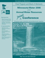
Minnesota Water Resources Conference - Water Resources Center ...
Minnesota Water Resources Conference - Water Resources Center ...
Minnesota Water Resources Conference - Water Resources Center ...

You also want an ePaper? Increase the reach of your titles
YUMPU automatically turns print PDFs into web optimized ePapers that Google loves.
BOOK OF ABSTRACTS<br />
Tuesday, Monday, October 27 23<br />
Poster Session 4:45–5:45<br />
Measuring the Volume of Lake <strong>Water</strong> Losses to Groundwater through Wintertime <strong>Water</strong> Surface<br />
Elevation Surveys<br />
Matthew Redington, HDR Engineering, matthew.redington@hdrinc.com; Adam Kessler, HDR Engineering; John Nieber,<br />
Chisago Lakes Lake Improvement District<br />
There are approximately 22 lakes within the CLLID, many of which are connected by wetlands, channels or<br />
pipes. <strong>Water</strong> budget analyses had been performed in the past for some of the lakes. These studies indicated<br />
there were water losses occurring from the lake system that could not be explained through evaporation or<br />
surface flow. It was suspected that water losses from the system were related to interaction between lakes and<br />
groundwater.<br />
In order to confirm and quantify water losses from lakes, 10 lakes were monitored over the winter of 2007-8. Ice<br />
cover on the lakes limited the evaporation and inflow factors of the water budget. Fluctuations in water level<br />
during the winter could then be attributed primarily to groundwater interactions. The lake monitoring involved<br />
biweekly measurements of water surface elevation through holes cored in the lake ice. By tracking elevation<br />
changes through the winter, and pairing elevation changes with aerial contour data, volume losses were<br />
confirmed and quantified. The presentation will include methodology, results, and conclusions.<br />
Vertical Agricultural Drains as a Source of Phosphorus to Streams<br />
Jason Roth, University of <strong>Minnesota</strong>, roth0293@umn.edu; Paul Capel, U.S. Geological Survey, University of <strong>Minnesota</strong><br />
Subsurface drainage networks are common in agricultural areas which have poorly-drained, glacially-deposited<br />
soils. In local topographical depressions, a vertical drain is often connected to the horizontal subsurface<br />
drainage network to expedite the removal of the ponded water from the field. These vertical drains act as<br />
sources of particle-associated phosphate and sediment to the stream via the subsurface drain network. For<br />
this study, the concentrations of major anions, nutrients and sediment are measured in the ponded areas<br />
around vertical drains, in the water moving through these vertical drains, and in the horizontal subsurface<br />
drain in a field in north-central Iowa. After a June 2007 precipitation event of 1.3 cm of rain, concentrations<br />
of orthophosphate increased from 0.05 mg/L to 0.12 mg/L-in a tile drain connected to vertical drains.<br />
Orthophosphate concentrations in the ponded water surrounding a drain after the precipitation event was<br />
observed at concentrations up to 0.30 mg/L.<br />
51 <strong>Minnesota</strong> <strong>Water</strong> <strong>Resources</strong> <strong>Conference</strong>, October 27–28, 2008