Minnesota Water Resources Conference - Water Resources Center ...
Minnesota Water Resources Conference - Water Resources Center ...
Minnesota Water Resources Conference - Water Resources Center ...

Create successful ePaper yourself
Turn your PDF publications into a flip-book with our unique Google optimized e-Paper software.
Poster Session 4:45–5:45<br />
Development of a Practical Method to Analyze Sod Farm Wetland Hydrology<br />
V. (Rama) Ramanathan, URS Corporation, v_ramanathan@urscorp.com; Joel Toso, URS Corporation<br />
BOOK OF ABSTRACTS<br />
Tuesday, Monday, October 27 23<br />
A practical technique to delineate wetland areas within sod farms has been developed based on the drainage<br />
rates indicated by field data obtained from monitoring wells. The water table elevations midway between<br />
parallel ditches at the end of an eight day drainage period have been used to develop site specific correlations to<br />
determine soil drainage rates as a function of peat depth and the initial height of the water table above the ditch<br />
water surface. A method has been developed to predict the water table profiles taking into account the variation<br />
of peat depth across the cross sections. The predicted water table profiles have been compared to actual field<br />
observations, and close agreement between the predicted values and field data have been demonstrated.<br />
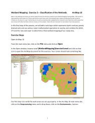
Wetland Web Map Connects Citizens, Staff, Data<br />
Nancy Read, Metro Mosquito Control, nancread@mmcd.org; Brian Fischer, Houston Engineering, Inc.<br />
Citizens call the Metropolitan Mosquito Control District every year asking if particular wetlands in their area<br />
are being treated to prevent mosquito problems. In 2007 we launched a web-based wetland look-up application<br />
that presents our maps of 70,000 metro-area wetlands and 2+ years of complete data about each wetland, with<br />
a backdrop of publicly-available map layers such as streets, city boundaries and aerial photos (see www.mmcd.<br />
org). The intent was to make map and treatment data easily available to staff at disparate locations as well as<br />
allowing citizens to answer questions directly. The site has worked well and received hits from over 3,500 unique<br />
users in 2007, with spikes of activity after media reports. It was assembled using the free open source software<br />
GeoMoose (www.geomoose.org) and MapServer plus an open source geocoder for address lookup, and most of<br />
the map layers are public Web Mapping Services.<br />
<strong>Minnesota</strong> <strong>Water</strong> <strong>Resources</strong> <strong>Conference</strong>, October 27–28, 20078 50