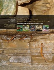
oak ridge reservation physical characteristics and natural resources
oak ridge reservation physical characteristics and natural resources
oak ridge reservation physical characteristics and natural resources

You also want an ePaper? Increase the reach of your titles
YUMPU automatically turns print PDFs into web optimized ePapers that Google loves.
Most groundwater flow in the saturated zone occurs within the water-table interval. Most flow is<br />
through weathered, permeable fractures <strong>and</strong> matrix rock <strong>and</strong> within solution conduits in the Knox<br />
Aquifer. The range of seasonal fluctuations of water-table depth <strong>and</strong> rates of groundwater flow vary<br />
significantly across the <strong>reservation</strong>. In areas underlain by the Knox Aquifer, seasonal fluctuations in<br />
water levels average 17 ft (5.3 m), <strong>and</strong> mean discharge from the active groundwater zone is typically<br />
85 gal/min (322 L/min) per 1 mile 2 (2.6 km 2 ). In the ORR Aquitards of Bear Creek Valley, Melton<br />
Valley, East Fork Valley, <strong>and</strong> Bethel Valley, seasonal fluctuations in water levels average 5 ft<br />
(1.5 m), <strong>and</strong> typical mean discharge is 26 gal/min (98 L/min) per 1 mile 2 (2.6 km 2 ).<br />
In the intermediate interval, groundwater flow paths are products of fracture density <strong>and</strong><br />
orientation. Groundwater movement primarily occurs in fractures that are poorly connected. In the<br />
Knox Aquifer, a few cavity systems <strong>and</strong> fractures control groundwater movement in this zone, but in<br />
the ORR Aquitards, the bulk of flow is through fractures, along which permeability can be increased<br />
by weathering.<br />
The deep interval of the saturated zone is delineated by a change to an Na-Cl water type.<br />
Hydrologically active fractures in the deep interval are significantly fewer <strong>and</strong> shorter than in the<br />
other intervals, <strong>and</strong> the spacing is greater. Wells in the deep interval of the ORR Aquitards typically<br />
yield less than 0.3 gal/min (1.1 L/min.) <strong>and</strong> thus are barely adequate for water supply.<br />
In the ORR Aquitards, saline water characterized by total dissolved solids ranging up to<br />
275,000 parts per million (275,000 mg/L) <strong>and</strong> chlorides generally in excess of 50,000 ppm<br />
(50,000 mg/L) (ranging up to 163,000 ppm [163,000 mg/L]) lies beneath the deep interval of the<br />
groundwater zone, delineating an aquiclude. Chemically, this water resembles brines typical of major<br />
sedimentary basins, which originated from evaporating water bodies. The brines are thought to have<br />
been pushed westward <strong>and</strong> trapped by overthrusting rock during the formation of the Appalachian<br />
Mountains (about 250 million years ago). The chemistry suggests extremely long residence times<br />
(i.e., very low flow rates); however, some mixing with shallow groundwater has been observed<br />
(Nativ, Halleran, <strong>and</strong> Hunley 1997).<br />
The aquiclude has been encountered at depths of 400 <strong>and</strong> 800 ft (122 <strong>and</strong> 244 m) in Melton <strong>and</strong><br />
Bethel Valleys, respectively, (near ORNL), <strong>and</strong> it is believed to approach 1000 ft (305 m) in portions<br />
of Bear Creek Valley (near the Y-12 Complex) underlain by aquitard formations. The depth to the<br />
aquiclude in areas of the Knox Aquifer is not known but is believed to be greater than 1200 ft<br />
(366 m). The depth to the aquiclude has not been established in the vicinity of ETTP.<br />
6.4 GROUNDWATER FLOW<br />
Many factors influence groundwater flow on the ORR. Topography, surface cover, geologic<br />
structure, karst features, <strong>and</strong> rock type exhibit especially strong influences on the hydrogeology.<br />
Variations in these features result in variations in the total amount of groundwater moving through the<br />
system (flux). As an example, the overall decrease in open fracture density with depth results in a<br />
decreased groundwater flux with depth.<br />
Topographic relief on the ORR is such that most active subsurface groundwater flow occurs at<br />
shallow depths. U.S. Geological Survey modeling (Tucci 1992) has suggested that 95% of all<br />
groundwater flow occurs in the upper 49 to 98 ft (15 to 30 m) of the saturated zone in the ORR<br />
Aquitards. As a result, flow paths in the active-flow zones (particularly in the aquitards) are relatively<br />
short, <strong>and</strong> nearly all groundwater discharges to local surface water drainages on the ORR.<br />
Conversely, in the Knox Aquifer it is believed that solution conduit flow paths could be considerably<br />
longer, perhaps as much as 1 mile (1.6 km) long in the along-strike direction. No evidence at this time<br />
substantiates the existence of any deep, regional flow off the ORR or between basins within the ORR<br />
in either the Knox Aquifer or the ORR Aquitards. Data collected in 1994 <strong>and</strong> 1995, however, have<br />
demonstrated that groundwater flow occurs off the ORR in the intermediate interval of the Knox<br />
Aquifer, near the east end of the Y-12 Complex.<br />
16