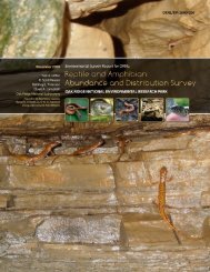
oak ridge reservation physical characteristics and natural resources
oak ridge reservation physical characteristics and natural resources
oak ridge reservation physical characteristics and natural resources

You also want an ePaper? Increase the reach of your titles
YUMPU automatically turns print PDFs into web optimized ePapers that Google loves.
northwest to north winds (i.e., perpendicular to the axis of the central Great Valley) coincide with<br />
vertically coupled flow. The phenomenon sometimes results in a split flow pattern (i.e., winds to the<br />
southwest of Knoxville moving down-valley <strong>and</strong> those to the east of Knoxville moving up-valley).<br />
The causes of such a flow pattern could include the shape <strong>characteristics</strong> of the Great Valley<br />
(Kossman <strong>and</strong> Sturman 2002) but also might be related to the specific location of the Cumberl<strong>and</strong> <strong>and</strong><br />
Great Smoky Mountains relative to upper-level wind flow (Eckman 1998). The convex shape of the<br />
Great Valley with respect to a northwest wind flow can lead to a divergent wind-flow pattern in the<br />
Knoxville area, resulting in downward air motion. Additionally, horizontal flow is reduced by the<br />
windward mountain range (the Cumberl<strong>and</strong> Mountains), which increases buoyancy <strong>and</strong> Coriolis<br />
effects (Froude <strong>and</strong> Rossby ratios in the meteorological field). Consequently, the leeward mountain<br />
range (the Great Smoky Mountains) becomes more effective at blocking or redirecting the winds.<br />
Vertically coupled winds occur when the atmosphere is unstable, a state characterized by cooler<br />
temperatures aloft. When a strong horizontal wind component is also present (as in conditions behind<br />
a winter cold front), winds ignore the terrain, flowing over it in roughly in the same direction as the<br />
winds aloft. This phenomenon is a consequence of the horizontal transport <strong>and</strong> momentum aloft being<br />
transferred to the surface. However, Coriolis effects can turn the winds by up to 25° to the left<br />
(Birdwell 1996).<br />
Thermally driven winds are common in areas of significantly complex terrain. These winds<br />
occur as a result of pressure <strong>and</strong> temperature differences caused by varied surface–air energy<br />
exchange at similar altitudes along a valley’s axis, sidewalls, <strong>and</strong>/or slopes. Thermal flows operate<br />
most effectively when synoptic winds are light <strong>and</strong> thermal differences are exacerbated by clear skies<br />
<strong>and</strong> low humidity (Whiteman 2000). The <strong>ridge</strong>-<strong>and</strong>-valley terrain can be responsible for enhancing or<br />
inhibiting such airflow, depending on the ambient weather conditions. Eckman (1998) suggested that<br />
the presence of daytime up-valley winds <strong>and</strong> nighttime down-valley (drainage) flows between the<br />
<strong>ridge</strong>-<strong>and</strong>-valley terrain of the Oak Ridge area tended to reverse at about 9:00 to 11:00 a.m. <strong>and</strong> at<br />
about 5:00 to 7:00 p.m. local time. The terrain-following nature of drainage winds suggests that they<br />
would be more directly impacted by the presence of the <strong>ridge</strong>-<strong>and</strong>-valley terrain than daytime flows,<br />
which tend to be accompanied by significant vertical motions.<br />
2.3 PRECIPITATION<br />
The 30-year annual average precipitation for 1976–2005 was 54 in. (137 cm), including about<br />
11 in. (27.4 cm) of snowfall (NOAA 2006).<br />
2.4 EVAPOTRANSPIRATION<br />
Evapotranspiration is defined as the total amount of water that is transferred from the earth’s<br />
surface to the atmosphere from surface water <strong>and</strong> ice by evapotranspiration <strong>and</strong> from the transpiration<br />
of plants. (Transpiration refers to the process through which water vapor is released by plants to the<br />
atmosphere.) Regionally, annual evapotranspiration has been estimated to range from 32 to 35 in. (81<br />
to 89 cm), or 60 to 65% of rainfall (Farnsworth, Thompson, <strong>and</strong> Peck 1982). More specifically,<br />
evapotranspiration in the Oak Ridge area has been estimated at 29 to 30 in. (74 to 76 cm), or 55 to<br />
56% of annual precipitation (TVA 1972; Moore 1988; <strong>and</strong> Hatcher et al. 1989).<br />
Evapotranspiration is greatest during the growing season, which in the vicinity of the ORR<br />
encompasses about 220 days, from late March through mid-October. During the growing season,<br />
evapotranspiration can exceed the rate of precipitation, resulting in soil-moisture deficits.<br />
2.5 MIXING HEIGHTS<br />
The mixing height (i.e., the atmospheric layer nearest the earth’s surface where active diffusion<br />
<strong>and</strong> mixing occur) varies significantly with respect to time of day, synoptic weather, season, <strong>and</strong><br />
6