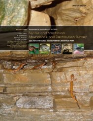
oak ridge reservation physical characteristics and natural resources
oak ridge reservation physical characteristics and natural resources
oak ridge reservation physical characteristics and natural resources

Create successful ePaper yourself
Turn your PDF publications into a flip-book with our unique Google optimized e-Paper software.
seasonal changes to cloud cover, precipitation, air mass, <strong>and</strong> wind-flow regimes.<br />
2.1 TEMPERATURE<br />
The mean 30-year annual temperature (1976–2005) for the Oak Ridge area was 58°F (14.4°C).<br />
The coldest month is typically January, with temperatures averaging about 36°F (2.3°C). However, in<br />
1985 the minimum temperature dipped to –24°F (–31°C). July tends to be the warmest month of the<br />
year, with temperatures averaging 78°F (25.3°C) <strong>and</strong> on rare occasions peaking as high as 99°F<br />
(37°C).<br />
Although average daily temperatures across the ORR are not significantly affected by the local<br />
terrain, noticeable differences do occur with respect to maximum <strong>and</strong> minimum temperatures. Such<br />
differences can result in significant temperature variations with changes in elevation as small as 33 to<br />
67 ft (10 to 20 m). This type of phenomenon occurs most frequently during nighttime hours<br />
(especially near sunrise) but can also occur during the approach of large-scale low-pressure areas as<br />
warm air advection interacts with the local <strong>ridge</strong>-<strong>and</strong>-valley terrain.<br />
2.2 WINDS<br />
The complex terrain significantly affects wind patterns in the Oak Ridge area. These factors<br />
primarily result from the presence of the Cumberl<strong>and</strong> Plateau, the Cumberl<strong>and</strong> Mountains, the Great<br />
Smoky Mountains, the orientation axis of the Great Valley (which includes most of the Valley <strong>and</strong><br />
Ridge Physiographic Province), <strong>and</strong> the local <strong>ridge</strong>-<strong>and</strong>-valley terrain structure. Although surface<br />
winds tend to follow the axes of the valleys, winds above the <strong>ridge</strong>-<strong>and</strong>-valley terrain (altitudes of<br />
328 ft [100 m] or more) often blow from significantly different directions than the surface winds as a<br />
result of several wind-forcing mechanisms created by regional terrain. The presence of the <strong>ridge</strong>-<strong>and</strong>valley<br />
terrain reduces average wind speeds at local valley-bottoms sites, resulting in frequent periods<br />
of near calm conditions (particularly during clear, early-morning hours).<br />
Five major terrain-related wind regimes regularly affect the Great Valley of eastern Tennessee:<br />
(1) pressure-driven channeling, (2) downward-momentum transport or vertically coupled flow,<br />
(3) forced channeling, (4) along-valley thermal circulations, <strong>and</strong> (5) mountain–valley circulations.<br />
Pressure-driven channeling <strong>and</strong> vertically coupled flow (unstably stratified conditions) affect wind<br />
flow on scales comparable to that of the Great Valley (i.e., hundreds of miles). Forced channeling<br />
occurs on similar scales but is also quite important at smaller spatial scales, such as that of the local<br />
<strong>ridge</strong>-<strong>and</strong>-valley terrain (Birdwell 1996). Along-valley <strong>and</strong> mountain–valley circulations are<br />
thermally-driven <strong>and</strong> occur within a large range of spatial scales. Thermal flows are more prevalent<br />
under conditions of clear skies <strong>and</strong> low humidity. Pressure-driven channeling, in its simplest form, is<br />
the redirection of synoptically induced wind flow through a valley channel. The direction of wind<br />
flow through the valley is determined by the pressure gradient superimposed on the valley’s axis<br />
(Whiteman 2000). The process is affected by Coriolis forces, a leftward deflection of winds (in the<br />
Northern Hemisphere). Eckman (1998) suggested that pressure-driven channeling plays a significant<br />
role in the Great Valley. Winds driven purely by such a process shift from up-valley to down-valley<br />
flow or conversely as weather-induced flow shifts across the axis of the Great Valley. Because the<br />
processes involved in pressure-driven flow primarily affect the horizontal motion of air, the presence<br />
of a temperature inversion significantly enhances flow. Weak vertical air motion <strong>and</strong> momentum<br />
associated with such inversions allow different layers of air to slide over each other (Monti et<br />
al. 2002). Forced channeling is the direct deflection of wind by terrain. This form of channeling<br />
necessitates some degree of vertical-motion transfer, implying that the mechanism is less pronounced<br />
during temperature-inversion conditions. Although forced channeling can result from interactions<br />
between large valleys <strong>and</strong> mountain ranges (such as the Great Valley <strong>and</strong> the surrounding mountains),<br />
the mechanism is especially important in small, narrow valleys such as those on the ORR (Kossman<br />
<strong>and</strong> Sturman 2002). Large-scale forced channeling regularly occurs within the Great Valley when<br />
5