Loyal - Oklahoma Forestry Services
Loyal - Oklahoma Forestry Services
Loyal - Oklahoma Forestry Services

You also want an ePaper? Increase the reach of your titles
YUMPU automatically turns print PDFs into web optimized ePapers that Google loves.
The<br />
Town of <strong>Loyal</strong><br />
Community Wildfire Protection Plan<br />
AN ACTION PLAN FOR WILDFIRE MITIGATION<br />
DATE: 2010<br />
Prepared by:<br />
Cecil Michael, Vicki Eggers<br />
Organization:<br />
Northern <strong>Oklahoma</strong> Development Authority<br />
Contact Information:<br />
Address 2901 North Van Buren, Enid, OK 73703<br />
Phone 580-237-4810<br />
E-Mail cecil@nodanet.org<br />
FAX 580-237-8230
1<br />
The following report is a cooperative effort between various entities. The<br />
representatives listed below comprise the core decision-making team responsible<br />
for this report and mutually agree on the plan’s contents.<br />
Community Representative(s):<br />
Name Kyle Glazier, Mayor<br />
Address PO Box 52, <strong>Loyal</strong>, OK 73756<br />
Phone Number 405-729-4462<br />
Other Contact<br />
Information<br />
405-368-0680<br />
Name William Hawkins, Town Trustee<br />
Address PO Box 52, <strong>Loyal</strong>, OK 73756<br />
Phone Number 405-729-4655<br />
Other Contact<br />
Information<br />
Name Dorothy Glazier, Town Treasurer<br />
Address PO Box 52, <strong>Loyal</strong>, OK 73756<br />
Phone Number 405-729-4226<br />
Other Contact<br />
Information<br />
dfglazier@pldi.net<br />
Name Frances Hughes, Town Clerk<br />
Address PO Box 52, <strong>Loyal</strong>, OK 73756<br />
Phone Number 405-368-4232<br />
Other Contact<br />
Information<br />
fhughes@pldi.net<br />
Local Fire Department Representative(s):<br />
Name Richard Meyer, Fire Chief<br />
Address RR1, Box 97A, <strong>Loyal</strong>, OK 73756<br />
Phone Number 405-729-4645<br />
Other Contact<br />
Information<br />
Name Alex White, Asst. Fire Chief<br />
Address PO Box 30<br />
Phone Number 580-541-1769<br />
Other Contact<br />
Information<br />
Local <strong>Oklahoma</strong> Division of <strong>Forestry</strong> Representative(s):<br />
Name Dan Stidham, Area Forester<br />
Address 2901 N. Van Buren, Enid, OK 73703<br />
Phone Number 405-237-4810<br />
Other Contact<br />
Information<br />
dan.stidham@oda.state.ok.us
2<br />
Name Brian Hall, Staff Forester<br />
Address ODAFF 2800 N. Lincoln Blvd., <strong>Oklahoma</strong> City, OK 73105<br />
Phone Number 405-522-8889<br />
Other Contact<br />
Information<br />
brian.hall@oda.state.ok.us<br />
The following federal and other interested parties were consulted and involved in<br />
the preparation of this report.<br />
Name<br />
Organization<br />
Keith Shroeder Kingfisher County Commissioner Dist. #3<br />
Dan Stidham<br />
ODAFF Area Forester, Enid<br />
Vicki Eggers<br />
NODA Staff<br />
Cecil Michael<br />
NODA Rural Fire Coordinator
3<br />
PLAN CONTENTS<br />
1. Community Background and Existing Situation<br />
2. Community Base Map and Other Visuals<br />
3. Objectives and Goals<br />
4. Prioritized Mitigation Recommendations<br />
5. Action Plan<br />
6. Wildfire Pre-Suppression Plan<br />
7. Additional Comments<br />
8. Attachments
4<br />
1) COMMUNITY BACKGROUND AND EXISTING SITUATION<br />
Community Description:<br />
County: Kingfisher Latitude/Longitude: 35 o 58'16" N<br />
98 o 07'15" W<br />
Frontage Road: First Street Nearest<br />
Intersection:<br />
Nearest Fire Department (name/location):<br />
<strong>Loyal</strong> FD<br />
Interface Areas: City Limits Year Established:<br />
Map #:<br />
Community Size:<br />
1st &<br />
Fredemann<br />
Number of Lots: 60 Number of Structures: 40<br />
Estimated Acres: 40 Development Status: Static<br />
Community Infrastructure:<br />
Home Owners Association/Organization: Yes X No<br />
If yes, attach<br />
a copy of<br />
ordinances.<br />
Contacts:<br />
Name<br />
Address<br />
Phone Number<br />
Other Contact Information<br />
N/A<br />
Resident Population:<br />
X Full Time<br />
Part-Time: 100-75% 75-50% 50-25%<br />
less than<br />
25%<br />
Wildfire Hazard Rating: (check one)<br />
Low X Moderate High Extreme<br />
Date Evaluated: Spring 2010 Attach Community Assessment Form.<br />
Community Assessment Highlights: (roads, water sources, primary fuel types, utilities and<br />
topography)<br />
With assistance from ODAFF representatives and the <strong>Loyal</strong> Firewise Board, Northern <strong>Oklahoma</strong><br />
Development Authority (NODA) completed Community Wildfire Risk Assessment in Spring of<br />
2010.<br />
<strong>Loyal</strong> is located in an agricultural area of mostly flat to rolling terrain, ranging from Bermuda<br />
pastures to cultivated crops. This assessment was completed noting that most of the surrounding<br />
area is agricultural and during certain times of the growing season the threat of wildfire can range<br />
from very high to extremely low.<br />
Cultivated portions of the community pose little threat during the growing season and after<br />
harvest. Wildfire risks with these areas peak during pre-harvest, as the plants dry out, and during<br />
harvest when crops are generally at their driest. This is best represented by Assessment Area
5<br />
#2.However an increased risk exists due to the creek bed and its associated tree line that winds<br />
through much of Area #2. As most wildfires are driven by the prevailing southerly winds,<br />
residents should be aware and monitor during fire season, as this would also increase the risk for<br />
Assessment Area #1 to the north.<br />
As we see in Assessment Area #3, pastures can pose significant wildfire risk during dry, low<br />
humidity, high wind speed conditions. Although the fuel types in the area are not typically<br />
considered a threat, the combination of these fuels, low humidity, high winds and open country<br />
creates a situation where large fires can quickly develop and destroy homes.<br />
Throughout much of the year, the <strong>Loyal</strong> community has a limited wildfire risk, however <strong>Loyal</strong>'s<br />
wildfire risk can become extreme. Specific hazards, like we see with large round bale storage in<br />
Area #2, can elevate that seasonal risk ending with catastrophic results. Due to the seasonal<br />
nature of the threat, the community is encouraged to monitor conditions and ramp up Firewise<br />
activities when warranted.<br />
Also noted during <strong>Loyal</strong>’s assessment were large, above ground fuel storage located in Area<br />
#2,which could quickly pose an increased threat during a wildfire.<br />
Community Wildfire History: (include surrounding areas)<br />
Relative Frequency: <strong>Loyal</strong> FD made approximately 30 fire runs in 2009.<br />
Common Causes:<br />
Areas of Future Concern:<br />
Additional Comments:<br />
Trash burning and carelessness.<br />
Heavy tree, brush and grass growth west of town limits; round<br />
haybales stored in town
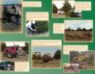
2) COMMUNITY BASE MAP AND OTHER VISUALS<br />
6
7<br />
3) OBJECTIVES / GOALS<br />
Objectives:<br />
The objective of this plan is to set clear priorities for the implementation of wildfire mitigation in<br />
the Town of <strong>Loyal</strong> and the <strong>Loyal</strong> Fire District. This includes prioritized recommendations for the<br />
community as a whole and also for individual homeowners where appropriate.<br />
Goals:<br />
1. Public awareness and education about Firewise landscapes.<br />
2. Identification and reduction of areas with an increased level of risk due to excessive vegetation<br />
or debris as.<br />
3. Improve accessibility for emergency vehicles or to allow better egress in event of evacuation<br />
from properties with limited access.<br />
4. Increase/improve frequency and accuracy of street markers and 911 addressing.<br />
5. Improve communications equipment to enhance ability to communicate with surrounding fire<br />
departments and other emergency responders.<br />
6. Annual evaluation of plan to monitor success and set new goals or address new problems.<br />
4) PRIORITIZED MITIGATION RECOMMENDATIONS<br />
The following recommendations were developed by the <strong>Loyal</strong> Firewise Board as a result of the<br />
community wildfire risk assessment and follow-up meetings with local, state, and community<br />
stakeholders. A priority order was determined based on which mitigation projects would best<br />
reduce the hazard of wildfire and increase resident safety in the assessment area.<br />
Proposed Community Hazard Reduction Priorities:<br />
List area and treatment recommended.<br />
1. Incorporate new street signs to coincide with new county addressing for 911.<br />
2. Address large quantity of round bales stored in town: recommend owner find alternate<br />
storage location.<br />
3. 3,000-4,000 gallon above ground gas storage. Should be monitored to ensure safe zone is<br />
maintained.<br />
4. Large grassy areas west edge of town: work with landowner to develop defensible space<br />
along roadways.<br />
5. Improve communications equipment to enhance ability to communicate with surrounding<br />
fire departments and other emergency responders.
8<br />
Proposed Structural Ignitability Reduction Priorities:<br />
Actions to be taken by homeowners. Example: Clean roofs and gutters.<br />
1. Remove and/or reduce excessive vegetation around buildings, especially abandoned, and<br />
vacant lots between homes.<br />
2. Encourage residents to increase driveway widths, raise tree canopies and improve access<br />
to pasture and oilfield sites to allow better access for emergency vehicles.<br />
3. Educate homeowners about Firewise landscaping techniques.
9<br />
Proposed Education and Outreach Priorities:<br />
Activities planned and implemented by community, local fire department and Department of<br />
<strong>Forestry</strong><br />
1. Engage community by making available Firewise informational and educational material<br />
available at vo-tech, grade school and businesses.<br />
2. Incorporate Firewise education into Fire Prevention Week.<br />
3. Advertise and promote Firewise day in Kingfisher paper, radio and/or community bulletin<br />
boards.<br />
4. Invite ODAFF area forester to speak to local civic groups concerning Firewise.<br />
5) ACTION PLAN<br />
Funding Needs:<br />
Outline each project (list highest priority projects first) including estimated cost and potential<br />
funding sources.<br />
1.<br />
2.<br />
3.<br />
To increase public awareness and encourage citizens to participate in community projects,<br />
educational articles should be created by the Firewise board and be run in area<br />
newspapers and posted in prominent places throughout the community. No funds needed.<br />
Distribute Firewise Brochures supplied by <strong>Oklahoma</strong> <strong>Forestry</strong>, no funds needed.<br />
Invite area forester to speak and distribute Firewise Brochures at upcoming school<br />
events. Firewise Brochures supplied by <strong>Oklahoma</strong> <strong>Forestry</strong>, no funds needed.<br />
4. Firewise booth incorporated into annual fundraiser event.<br />
5. Incorporate new street signs to coincide with new county addressing for 911. Funding to<br />
be determined by county participation. Possible Firewise mitigation grants.<br />
6. Improve communications equipment to enhance ability to communicate with surrounding<br />
fire departments and other emergency responders. Possible Firewise mitigation grants.
10<br />
Timetables:<br />
For each project (list highest priority projects first), provide an estimated duration, start date and<br />
targeted completion date.<br />
1. Newspaper articles and community postings to begin August 2010.<br />
- Should include information pertaining to Firewise education, contacts and upcoming<br />
events.<br />
- Run monthly, if possible, through Spring Clean-up.<br />
2. Firewise promotional booth and Firewise Day at Kingfisher County Fair August 2010.<br />
3. Firewise presentations and brochure distribution to begin August 2010 and repeated as<br />
possible.<br />
4. Firewise Booth at annual fundraiser.<br />
5. Distribute Firewise brochures, etc., during Fire Prevention Week each October.<br />
Assessment:<br />
Describe the strategy used to assess the plans progress and effectiveness.<br />
1. Firewise board to monitor number of articles published, and apparent improvement of any<br />
affected properties.<br />
2. Fire Chief to ensure delivery of brochures and report to Firewise board on feed back.<br />
3. Evaluate response at presentations and proactively respond to questions and requests.<br />
4. Review participation in clean up days and evaluate effectiveness as related to Firewise<br />
parameters of properties.<br />
5. Attend county meetings for updates on county 911 addressing and communications<br />
needs.
11<br />
6) WILDFIRE PRE-SUPPRESSION PLAN<br />
A. Wildfire Protection Responsibility<br />
Structural<br />
Protection:<br />
Wildland<br />
Protection:<br />
<strong>Loyal</strong> Volunteer Fire Department<br />
<strong>Loyal</strong> Volunteer Fire Department<br />
B. Incident Command Post Location<br />
<strong>Loyal</strong> Volunteer Fire Department or mobilized depending on incident.<br />
C. Incident Staging Area Location<br />
<strong>Loyal</strong> Volunteer Fire Department, <strong>Loyal</strong>, OK<br />
D. Medical Unit Staging Area Location<br />
<strong>Loyal</strong> Volunteer Fire Department, <strong>Loyal</strong>, OK<br />
E. Alarm Response<br />
First Alarm<br />
Fire Department/Rescue Squad Travel Distance Response Time<br />
<strong>Loyal</strong> FD<br />
5-10 minutes<br />
Second Alarm (report to designated staging area)<br />
Fire Department/Rescue Squad Travel Distance Response Time<br />
Omega FD (automatic mutual aid) 12 miles 10-15 minutes<br />
Kingfisher FD 20 miles 20-25 minutes<br />
Hitchcock FD 11 miles 15-20 minutes<br />
Dover FD 12 miles 15-20 minutes<br />
Okeene FD 21 miles 20-25 minutes<br />
F. Air Support<br />
Fixed Wing<br />
Aircraft Contact Name Dispatching Guidelines<br />
ODAFF<br />
Mark Goeller<br />
Contact local Emergency<br />
Manager<br />
Helicopter<br />
Aircraft Contact Name Dispatching Guidelines<br />
ODAFF<br />
Mark Goeller<br />
G. Water Availability (must be accessible to fire engines)<br />
Contact local Emergency<br />
Manager<br />
Location: <strong>Loyal</strong> Hydrants (9) Description: 15,000 gallon<br />
Location:<br />
Wheeler Bros.- Lomega Rd &<br />
<strong>Loyal</strong> E720<br />
Description:<br />
25,000 gallon
12<br />
H. Communications (Attach Communications Plan if available)<br />
Name Phone Number Radio Frequencies<br />
Dispatch/Fire Departments<br />
405-729-4222 -<br />
Local<br />
ringdown<br />
Kingfisher Sheriff<br />
911 - pagers<br />
Omega FD<br />
Local Department of <strong>Forestry</strong> Office<br />
RX151.190000 TX156.075000<br />
RX151.190000 TX156.075000<br />
Dan Stidham 405-237-4810 State Fire 154.1300000<br />
Other<br />
I. Evacuation (Attach Evacuation Plan)<br />
Do to the limited amount of area of the community, evacuation routes are to be considered<br />
county black top north and south and State highway 33 east and west.<br />
J. Resource List<br />
Name Contact Information Payment Information<br />
Support Agencies<br />
NODA Rural Fire<br />
Cecil Michael 580-237-4810<br />
Coordinator<br />
Kingfisher Co. Emergency Steve Loftis 405-375-5662<br />
Management<br />
Kingfisher County Sheriff Dennis Banther 405-375-<br />
4242<br />
Non-emergency 405-375-<br />
Kingfisher EMS<br />
4070; Emergency 911<br />
Keith Shroeder- King. Co. 1-405-375-5471<br />
Dist.3<br />
Tractor Operators<br />
Keith Shroeder- King. Co.<br />
Dist.3<br />
Crews<br />
Keith Shroeder- King. Co.<br />
Dist.3<br />
1-405-375-5471<br />
1-405-375-5471<br />
Utilities<br />
OG&E 1-800-272-9741<br />
Cimarron Electric 1-405-375-4121<br />
ONG 1-800-458-4251<br />
Fuel<br />
Coop 405-729-4257 Charge/cash<br />
J&M Fuel Service 405-729-4284 Charge/cash<br />
Food and Supplies<br />
Red Cross, Central Okla.<br />
Chapter, 601 NE 6th<br />
1-405- 228-9500
13<br />
Street, <strong>Oklahoma</strong> City, OK<br />
Kingfisher Area<br />
Restaurants<br />
Cash<br />
Wal-Mart, Kingfisher 1-405-375-5743 Cash<br />
Lodging<br />
Payless Inn, Kingfisher 1-405-375-9000 Cash<br />
7) ADDITIONAL COMMENTS<br />
8) ATTACHMENTS (List here in order of attachment)<br />
<strong>Loyal</strong> Assessment Area #1 - North of Main Street<br />
<strong>Loyal</strong> Assessment Area #2 - South of Main Street<br />
<strong>Loyal</strong> Assessment Area #3 - West of Town
Page 1<br />
OKLAHOMA FORESTRY DIVISION<br />
COMMUNITY WILDFIRE RISK AND HAZARD ASSESSMENT<br />
<strong>Loyal</strong> Assessment Area #1<br />
North from Main Street<br />
<strong>Forestry</strong> Office: Enid<br />
Community: <strong>Loyal</strong> County: Kingfisher<br />
Latitude: 35 o 58'16" N Longitude: 98 o 07'15" W<br />
Fire Department: <strong>Loyal</strong> FD<br />
Date: 2010<br />
Acres: Lots: Homes: Yes Future Homes: Yes<br />
Business and Industrial Area: Yes<br />
CALCULATING THE WILDFIRE HAZARD RATING<br />
SUBDIVISION<br />
DESIGN<br />
HAZARD<br />
RATING<br />
+ SITE<br />
HAZARD<br />
RATING<br />
+ BUILDING<br />
CONSTRUCTION<br />
HAZARD<br />
RATING<br />
+ ADDITIONAL<br />
FACTOR<br />
HAZARD<br />
RATING<br />
= OVERALL<br />
WILDFIRE<br />
HAZARD<br />
RATING<br />
4 35 5 36 80<br />
SUBDIVISION DESIGN RATING<br />
Rating<br />
ACCESS<br />
Two or more roads 0<br />
One road, plus alternative 3 0<br />
One road in/out 7<br />
SUBDIVISION BRIDGES<br />
No bridges or bridges with no weight and or width restrictions 0<br />
Low weight or narrow bridges restricting emergency access 5<br />
0<br />
PRIMARY ROAD WIDTHS<br />
>24 ft 0<br />
>20 ft and
Page 2<br />
OKLAHOMA FORESTRY DIVISION<br />
COMMUNITY WILDFIRE RISK AND HAZARD ASSESSMENT<br />
SITE HAZARD RATING: (within 30 feet of structure based on a<br />
majority of the properties in the community)<br />
Rating<br />
DRIVEWAY CHARACTERISTICS<br />
Less than 150 ft long 0<br />
More than 150 ft long with minimum 45 ft outside radius turnaround 3 0<br />
More than 150 ft with inadequate turnaround 5<br />
Average driveway width more than 12 ft 0<br />
Average driveway width less than 12 ft 5<br />
0<br />
No obstructing overhead branches below 15 ft 0<br />
Obstructing overhead branches below 15 ft 5<br />
0<br />
No bridges or bridges with no weight and or width restrictions 0<br />
Bridges restricting emergency vehicle access 5<br />
0<br />
Slopes level or less than 10% 0<br />
Slopes over 10% 5<br />
0<br />
No gate/non-locking gate 0<br />
Locked gate 5<br />
0<br />
Address clearly visible from road 0<br />
Address not clearly visible from road 5<br />
0<br />
DOMINANT TREES (within 100 ft of homes)<br />
Deciduous 1<br />
Mixed 5 5<br />
Evergreen 10<br />
LADDER FUELS<br />
Evergreen branches pruned up at least 6 ft 0<br />
Evergreen branches close to ground 5<br />
5<br />
VEGETATION (predominant type throughout community)<br />
Light (e.g. grasses and forbs)<br />
5<br />
NFDRS Fuels Models A, C, L, N, S and T<br />
Medium (e.g. light brush and small trees)<br />
10<br />
NFDRS Fuels Models D, E, F, H, P, Q and U<br />
Heavy (e.g. dense brush, timber and hardwoods)<br />
20<br />
10<br />
NFDRS Fuels Models B, G and O<br />
Slash (e.g. timber harvesting residue)<br />
25<br />
NFDRS Fuel Models J,K and L<br />
SLOPE OF PROPERTY<br />
Flat (0-5%) 0<br />
Moderate (6-20%) 2 0<br />
Steep (over 20%) 4<br />
DEFENSIBLE SPACE<br />
No trees, shrubs or tall grass within 30 ft 0<br />
Well spaced trees and shrubs within 30 ft 10 10<br />
Touching crowns or tall grass within 30 ft 20<br />
No unthinned or unmanaged timber within 100 ft 0<br />
Unthinned or unmanaged timber within 100 ft 5<br />
5<br />
TOTAL SITE HAZARD RATING 35
Page 3<br />
OKLAHOMA FORESTRY DIVISION<br />
COMMUNITY WILDFIRE RISK AND HAZARD ASSESSMENT<br />
BUILDING CONSTRUCTION HAZARD RATING<br />
Rating<br />
ROOFING MATERIALS<br />
Greater than 75% of homes have metal, tile or Class A shingles 0<br />
50 to 75% of homes have metal, tile or Class A shingles 10 0<br />
Less than 50% of homes have metal, tile or Class A shingles 15<br />
SIDING / SOFFETS<br />
Greater than 75% of homes have fire resistant siding and soffets 0<br />
50 to 75% of homes have fire resistant siding and soffets 5 5<br />
Less than 50% of homes have fire resistant siding and soffets 10<br />
UNDERSKIRTING<br />
Greater than 75% of homes have equivalent of fine mesh screening 0<br />
underneath<br />
50 to 75% of homes have equivalent of fine mesh screening<br />
5<br />
underneath<br />
0<br />
Less than 50% of homes have equivalent of fine mesh screening 10<br />
underneath<br />
TOTAL BUILDING CONSTRUCTION HAZARD RATING 5<br />
ADDITIONAL HAZARD FACTORS<br />
Rating<br />
FIRE CONTROL WATER SUPPLY<br />
Pressurized hydrants with minimum 500 gpm < 1,000 ft apart 0<br />
Pressurized hydrants with 1,000 ft apart 2<br />
Dry hydrant(s) available year round within the community 2<br />
Other accessible sources within community 5<br />
0<br />
Water sources located within 4 road miles of community 7<br />
No water sources within 4 road miles of community 15<br />
UTILITIES<br />
Both underground 0<br />
One underground, one above ground 3 3<br />
Both above ground 5<br />
SURROUNDING ENVIRONMENT<br />
Community is not surrounded by any large natural landscapes 0<br />
Large natural landscape adjoins one side of the community 5<br />
Large natural landscape adjoins two sides of the community 10 20<br />
Large natural landscape adjoins three sides of the community 15<br />
Community is completely surrounded by natural landscape 20<br />
UNDEVELOPED LOTS<br />
Less than 10% of lots have not been developed and pose no<br />
additional wildfire hazard due to lack of maintenance 0<br />
10 to 50% of lots have not been developed 3 3<br />
51 to 75% of lots have not been developed 5<br />
Greater than 75% of lots have not been developed 10<br />
RISK LOCATION<br />
Community is located within the following designated Wildfire Risk<br />
Areas according to the Southern Wildfire Risk Assessment<br />
Low 0<br />
Medium 10 10<br />
High 20<br />
TOTAL ADDITIONAL HAZARD FACTORS 36
Page 4<br />
OKLAHOMA FORESTRY DIVISION<br />
COMMUNITY WILDFIRE RISK AND HAZARD ASSESSMENT<br />
What does the Wildfire Hazard Rating mean<br />
Using the Wildfire Hazard Assessment, the highest possible rating is 247 points.<br />
Communities can be divided into the following four risk categories:<br />
Low Risk: Total Wildfire Risk Rating is 0 – 90 points<br />
The chances of a majority of homes in the community surviving a<br />
wildfire are GOOD. Little is needed to improve the community.<br />
Keep up the good work.<br />
Moderate Risk: Total Wildfire Risk Rating is 91 – 155 points<br />
The chances of a majority of homes in the community surviving a<br />
wildfire are FAIR. Some minor improvements will make the<br />
community more fire resistant. Check the areas on the form in<br />
which you scored poorly.<br />
High Risk: Total Wildfire Risk Rating is Over 155 points<br />
The chances of a majority of homes in the community surviving a<br />
wildfire are NOT GOOD. Some improvements in structure and<br />
site are necessary.<br />
Extreme Risk: Total Wildfire Risk Rating is Over 170 points<br />
The community MAY NOT SURVIVE if a wildfire passes<br />
through the area. Take a serious look at your community and make<br />
improvements. If you don’t, you may be facing disaster. You will<br />
find that even small changes could make the difference.<br />
HAZARD is defined as the potential fire behavior based on physical fuel characteristics.<br />
Risk is defined as the probability of fire occurrence determined by the number, presence<br />
and activity of potential ignition sources.<br />
This form may be used to evaluate your community to determine the level of wildfire<br />
risk. It covers roughly one-half of the hazards normally taken into account in calculating<br />
fire risk, but does provide an approximate indication of true risk. For more information<br />
on your home’s fire risk, or for more complete evaluation of your property, contact your<br />
local <strong>Oklahoma</strong> Department of Agriculture, Food and <strong>Forestry</strong>, <strong>Forestry</strong> <strong>Services</strong> office.
Page 1<br />
OKLAHOMA FORESTRY DIVISION<br />
COMMUNITY WILDFIRE RISK AND HAZARD ASSESSMENT<br />
<strong>Loyal</strong> Assessment Area #2<br />
South from Main Street<br />
<strong>Forestry</strong> Office: Enid<br />
Community: <strong>Loyal</strong> County: Kingfisher<br />
Latitude: 35 o 58'16" N Longitude: 98 o 07'15" W<br />
Fire Department: <strong>Loyal</strong> FD<br />
Date: 2010<br />
Acres: Lots: Homes: Yes Future Homes: Yes<br />
Business and Industrial Area: Yes<br />
CALCULATING THE WILDFIRE HAZARD RATING<br />
SUBDIVISION<br />
DESIGN<br />
HAZARD<br />
RATING<br />
+ SITE<br />
HAZARD<br />
RATING<br />
+ BUILDING<br />
CONSTRUCTION<br />
HAZARD<br />
RATING<br />
+ ADDITIONAL<br />
FACTOR<br />
HAZARD<br />
RATING<br />
= OVERALL<br />
WILDFIRE<br />
HAZARD<br />
RATING<br />
4 55 5 36 100<br />
SUBDIVISION DESIGN RATING<br />
Rating<br />
ACCESS<br />
Two or more roads 0<br />
One road, plus alternative 3 0<br />
One road in/out 7<br />
SUBDIVISION BRIDGES<br />
No bridges or bridges with no weight and or width restrictions 0<br />
Low weight or narrow bridges restricting emergency access 5<br />
0<br />
PRIMARY ROAD WIDTHS<br />
>24 ft 0<br />
>20 ft and
Page 2<br />
OKLAHOMA FORESTRY DIVISION<br />
COMMUNITY WILDFIRE RISK AND HAZARD ASSESSMENT<br />
SITE HAZARD RATING: (within 30 feet of structure based on a<br />
majority of the properties in the community)<br />
Rating<br />
DRIVEWAY CHARACTERISTICS<br />
Less than 150 ft long 0<br />
More than 150 ft long with minimum 45 ft outside radius turnaround 3 0<br />
More than 150 ft with inadequate turnaround 5<br />
Average driveway width more than 12 ft 0<br />
Average driveway width less than 12 ft 5<br />
0<br />
No obstructing overhead branches below 15 ft 0<br />
Obstructing overhead branches below 15 ft 5<br />
0<br />
No bridges or bridges with no weight and or width restrictions 0<br />
Bridges restricting emergency vehicle access 5<br />
0<br />
Slopes level or less than 10% 0<br />
Slopes over 10% 5<br />
0<br />
No gate/non-locking gate 0<br />
Locked gate 5<br />
0<br />
Address clearly visible from road 0<br />
Address not clearly visible from road 5<br />
0<br />
DOMINANT TREES (within 100 ft of homes)<br />
Deciduous 1<br />
Mixed 5 5<br />
Evergreen 10<br />
LADDER FUELS<br />
Evergreen branches pruned up at least 6 ft 0<br />
Evergreen branches close to ground 5<br />
5<br />
VEGETATION (predominant type throughout community)<br />
Light (e.g. grasses and forbs)<br />
5<br />
NFDRS Fuels Models A, C, L, N, S and T<br />
Medium (e.g. light brush and small trees)<br />
10<br />
NFDRS Fuels Models D, E, F, H, P, Q and U<br />
Heavy (e.g. dense brush, timber and hardwoods)<br />
20<br />
20<br />
NFDRS Fuels Models B, G and O<br />
Slash (e.g. timber harvesting residue)<br />
25<br />
NFDRS Fuel Models J,K and L<br />
SLOPE OF PROPERTY<br />
Flat (0-5%) 0<br />
Moderate (6-20%) 2 0<br />
Steep (over 20%) 4<br />
DEFENSIBLE SPACE<br />
No trees, shrubs or tall grass within 30 ft 0<br />
Well spaced trees and shrubs within 30 ft 10 20<br />
Touching crowns or tall grass within 30 ft 20<br />
No unthinned or unmanaged timber within 100 ft 0<br />
Unthinned or unmanaged timber within 100 ft 5<br />
5<br />
TOTAL SITE HAZARD RATING 55
Page 3<br />
OKLAHOMA FORESTRY DIVISION<br />
COMMUNITY WILDFIRE RISK AND HAZARD ASSESSMENT<br />
BUILDING CONSTRUCTION HAZARD RATING<br />
Rating<br />
ROOFING MATERIALS<br />
Greater than 75% of homes have metal, tile or Class A shingles 0<br />
50 to 75% of homes have metal, tile or Class A shingles 10 0<br />
Less than 50% of homes have metal, tile or Class A shingles 15<br />
SIDING / SOFFETS<br />
Greater than 75% of homes have fire resistant siding and soffets 0<br />
50 to 75% of homes have fire resistant siding and soffets 5 5<br />
Less than 50% of homes have fire resistant siding and soffets 10<br />
UNDERSKIRTING<br />
Greater than 75% of homes have equivalent of fine mesh screening 0<br />
underneath<br />
50 to 75% of homes have equivalent of fine mesh screening<br />
5<br />
underneath<br />
0<br />
Less than 50% of homes have equivalent of fine mesh screening 10<br />
underneath<br />
TOTAL BUILDING CONSTRUCTION HAZARD RATING 5<br />
ADDITIONAL HAZARD FACTORS<br />
Rating<br />
FIRE CONTROL WATER SUPPLY<br />
Pressurized hydrants with minimum 500 gpm < 1,000 ft apart 0<br />
Pressurized hydrants with 1,000 ft apart 2<br />
Dry hydrant(s) available year round within the community 2<br />
Other accessible sources within community 5<br />
0<br />
Water sources located within 4 road miles of community 7<br />
No water sources within 4 road miles of community 15<br />
UTILITIES<br />
Both underground 0<br />
One underground, one above ground 3 3<br />
Both above ground 5<br />
SURROUNDING ENVIRONMENT<br />
Community is not surrounded by any large natural landscapes 0<br />
Large natural landscape adjoins one side of the community 5<br />
Large natural landscape adjoins two sides of the community 10 20<br />
Large natural landscape adjoins three sides of the community 15<br />
Community is completely surrounded by natural landscape 20<br />
UNDEVELOPED LOTS<br />
Less than 10% of lots have not been developed and pose no<br />
additional wildfire hazard due to lack of maintenance 0<br />
10 to 50% of lots have not been developed 3 3<br />
51 to 75% of lots have not been developed 5<br />
Greater than 75% of lots have not been developed 10<br />
RISK LOCATION<br />
Community is located within the following designated Wildfire Risk<br />
Areas according to the Southern Wildfire Risk Assessment<br />
Low 0<br />
Medium 10 10<br />
High 20<br />
TOTAL ADDITIONAL HAZARD FACTORS 36
Page 4<br />
OKLAHOMA FORESTRY DIVISION<br />
COMMUNITY WILDFIRE RISK AND HAZARD ASSESSMENT<br />
What does the Wildfire Hazard Rating mean<br />
Using the Wildfire Hazard Assessment, the highest possible rating is 247 points.<br />
Communities can be divided into the following four risk categories:<br />
Low Risk: Total Wildfire Risk Rating is 0 – 90 points<br />
The chances of a majority of homes in the community surviving a<br />
wildfire are GOOD. Little is needed to improve the community.<br />
Keep up the good work.<br />
Moderate Risk: Total Wildfire Risk Rating is 91 – 155 points<br />
The chances of a majority of homes in the community surviving a<br />
wildfire are FAIR. Some minor improvements will make the<br />
community more fire resistant. Check the areas on the form in<br />
which you scored poorly.<br />
High Risk: Total Wildfire Risk Rating is Over 155 points<br />
The chances of a majority of homes in the community surviving a<br />
wildfire are NOT GOOD. Some improvements in structure and<br />
site are necessary.<br />
Extreme Risk: Total Wildfire Risk Rating is Over 170 points<br />
The community MAY NOT SURVIVE if a wildfire passes<br />
through the area. Take a serious look at your community and make<br />
improvements. If you don’t, you may be facing disaster. You will<br />
find that even small changes could make the difference.<br />
HAZARD is defined as the potential fire behavior based on physical fuel characteristics.<br />
Risk is defined as the probability of fire occurrence determined by the number, presence<br />
and activity of potential ignition sources.<br />
This form may be used to evaluate your community to determine the level of wildfire<br />
risk. It covers roughly one-half of the hazards normally taken into account in calculating<br />
fire risk, but does provide an approximate indication of true risk. For more information<br />
on your home’s fire risk, or for more complete evaluation of your property, contact your<br />
local <strong>Oklahoma</strong> Department of Agriculture, Food and <strong>Forestry</strong>, <strong>Forestry</strong> <strong>Services</strong> office.
Page 1<br />
OKLAHOMA FORESTRY DIVISION<br />
COMMUNITY WILDFIRE RISK AND HAZARD ASSESSMENT<br />
<strong>Loyal</strong> Assessment Area 3<br />
West of Town<br />
<strong>Forestry</strong> Office: Enid<br />
Community: <strong>Loyal</strong> County: Kingfisher<br />
Latitude: 35 o 58'16" N Longitude: 98 o 07'15" W<br />
Fire Department: <strong>Loyal</strong> FD<br />
Date: 2010<br />
Acres: Lots: Homes: Yes Future Homes:<br />
Business and Industrial Area:<br />
CALCULATING THE WILDFIRE HAZARD RATING<br />
SUBDIVISION<br />
DESIGN<br />
HAZARD<br />
RATING<br />
+ SITE<br />
HAZARD<br />
RATING<br />
+ BUILDING<br />
CONSTRUCTION<br />
HAZARD<br />
RATING<br />
+ ADDITIONAL<br />
FACTOR<br />
HAZARD<br />
RATING<br />
= OVERALL<br />
WILDFIRE<br />
HAZARD<br />
RATING<br />
12 65 0 43 120<br />
SUBDIVISION DESIGN RATING<br />
Rating<br />
ACCESS<br />
Two or more roads 0<br />
One road, plus alternative 3 0<br />
One road in/out 7<br />
SUBDIVISION BRIDGES<br />
No bridges or bridges with no weight and or width restrictions 0<br />
Low weight or narrow bridges restricting emergency access 5<br />
0<br />
PRIMARY ROAD WIDTHS<br />
>24 ft 0<br />
>20 ft and
Page 2<br />
OKLAHOMA FORESTRY DIVISION<br />
COMMUNITY WILDFIRE RISK AND HAZARD ASSESSMENT<br />
SITE HAZARD RATING: (within 30 feet of structure based on a<br />
majority of the properties in the community)<br />
Rating<br />
DRIVEWAY CHARACTERISTICS<br />
Less than 150 ft long 0<br />
More than 150 ft long with minimum 45 ft outside radius turnaround 3 0<br />
More than 150 ft with inadequate turnaround 5<br />
Average driveway width more than 12 ft 0<br />
Average driveway width less than 12 ft 5<br />
5<br />
No obstructing overhead branches below 15 ft 0<br />
Obstructing overhead branches below 15 ft 5<br />
0<br />
No bridges or bridges with no weight and or width restrictions 0<br />
Bridges restricting emergency vehicle access 5<br />
0<br />
Slopes level or less than 10% 0<br />
Slopes over 10% 5<br />
0<br />
No gate/non-locking gate 0<br />
Locked gate 5<br />
0<br />
Address clearly visible from road 0<br />
Address not clearly visible from road 5<br />
5<br />
DOMINANT TREES (within 100 ft of homes)<br />
Deciduous 1<br />
Mixed 5 5<br />
Evergreen 10<br />
LADDER FUELS<br />
Evergreen branches pruned up at least 6 ft 0<br />
Evergreen branches close to ground 5<br />
5<br />
VEGETATION (predominant type throughout community)<br />
Light (e.g. grasses and forbs)<br />
5<br />
NFDRS Fuels Models A, C, L, N, S and T<br />
Medium (e.g. light brush and small trees)<br />
10<br />
NFDRS Fuels Models D, E, F, H, P, Q and U<br />
Heavy (e.g. dense brush, timber and hardwoods)<br />
20<br />
20<br />
NFDRS Fuels Models B, G and O<br />
Slash (e.g. timber harvesting residue)<br />
25<br />
NFDRS Fuel Models J,K and L<br />
SLOPE OF PROPERTY<br />
Flat (0-5%) 0<br />
Moderate (6-20%) 2 0<br />
Steep (over 20%) 4<br />
DEFENSIBLE SPACE<br />
No trees, shrubs or tall grass within 30 ft 0<br />
Well spaced trees and shrubs within 30 ft 10 20<br />
Touching crowns or tall grass within 30 ft 20<br />
No unthinned or unmanaged timber within 100 ft 0<br />
Unthinned or unmanaged timber within 100 ft 5<br />
5<br />
TOTAL SITE HAZARD RATING 65
Page 3<br />
OKLAHOMA FORESTRY DIVISION<br />
COMMUNITY WILDFIRE RISK AND HAZARD ASSESSMENT<br />
BUILDING CONSTRUCTION HAZARD RATING<br />
Rating<br />
ROOFING MATERIALS<br />
Greater than 75% of homes have metal, tile or Class A shingles 0<br />
50 to 75% of homes have metal, tile or Class A shingles 10 0<br />
Less than 50% of homes have metal, tile or Class A shingles 15<br />
SIDING / SOFFETS<br />
Greater than 75% of homes have fire resistant siding and soffets 0<br />
50 to 75% of homes have fire resistant siding and soffets 5 0<br />
Less than 50% of homes have fire resistant siding and soffets 10<br />
UNDERSKIRTING<br />
Greater than 75% of homes have equivalent of fine mesh screening 0<br />
underneath<br />
50 to 75% of homes have equivalent of fine mesh screening<br />
5<br />
underneath<br />
0<br />
Less than 50% of homes have equivalent of fine mesh screening 10<br />
underneath<br />
TOTAL BUILDING CONSTRUCTION HAZARD RATING 0<br />
ADDITIONAL HAZARD FACTORS<br />
Rating<br />
FIRE CONTROL WATER SUPPLY<br />
Pressurized hydrants with minimum 500 gpm < 1,000 ft apart 0<br />
Pressurized hydrants with 1,000 ft apart 2<br />
Dry hydrant(s) available year round within the community 2<br />
Other accessible sources within community 5<br />
0<br />
Water sources located within 4 road miles of community 7<br />
No water sources within 4 road miles of community 15<br />
UTILITIES<br />
Both underground 0<br />
One underground, one above ground 3 3<br />
Both above ground 5<br />
SURROUNDING ENVIRONMENT<br />
Community is not surrounded by any large natural landscapes 0<br />
Large natural landscape adjoins one side of the community 5<br />
Large natural landscape adjoins two sides of the community 10 20<br />
Large natural landscape adjoins three sides of the community 15<br />
Community is completely surrounded by natural landscape 20<br />
UNDEVELOPED LOTS<br />
Less than 10% of lots have not been developed and pose no<br />
additional wildfire hazard due to lack of maintenance 0<br />
10 to 50% of lots have not been developed 3 10<br />
51 to 75% of lots have not been developed 5<br />
Greater than 75% of lots have not been developed 10<br />
RISK LOCATION<br />
Community is located within the following designated Wildfire Risk<br />
Areas according to the Southern Wildfire Risk Assessment<br />
Low 0<br />
Medium 10 10<br />
High 20<br />
TOTAL ADDITIONAL HAZARD FACTORS 43
Page 4<br />
OKLAHOMA FORESTRY DIVISION<br />
COMMUNITY WILDFIRE RISK AND HAZARD ASSESSMENT<br />
What does the Wildfire Hazard Rating mean<br />
Using the Wildfire Hazard Assessment, the highest possible rating is 247 points.<br />
Communities can be divided into the following four risk categories:<br />
Low Risk: Total Wildfire Risk Rating is 0 – 90 points<br />
The chances of a majority of homes in the community surviving a<br />
wildfire are GOOD. Little is needed to improve the community.<br />
Keep up the good work.<br />
Moderate Risk: Total Wildfire Risk Rating is 91 – 155 points<br />
The chances of a majority of homes in the community surviving a<br />
wildfire are FAIR. Some minor improvements will make the<br />
community more fire resistant. Check the areas on the form in<br />
which you scored poorly.<br />
High Risk: Total Wildfire Risk Rating is Over 155 points<br />
The chances of a majority of homes in the community surviving a<br />
wildfire are NOT GOOD. Some improvements in structure and<br />
site are necessary.<br />
Extreme Risk: Total Wildfire Risk Rating is Over 170 points<br />
The community MAY NOT SURVIVE if a wildfire passes<br />
through the area. Take a serious look at your community and make<br />
improvements. If you don’t, you may be facing disaster. You will<br />
find that even small changes could make the difference.<br />
HAZARD is defined as the potential fire behavior based on physical fuel characteristics.<br />
Risk is defined as the probability of fire occurrence determined by the number, presence<br />
and activity of potential ignition sources.
Page 5<br />
OKLAHOMA FORESTRY DIVISION<br />
COMMUNITY WILDFIRE RISK AND HAZARD ASSESSMENT<br />
This form may be used to evaluate your community to determine the level of wildfire<br />
risk. It covers roughly one-half of the hazards normally taken into account in calculating<br />
fire risk, but does provide an approximate indication of true risk. For more information<br />
on your home’s fire risk, or for more complete evaluation of your property, contact your<br />
local <strong>Oklahoma</strong> Department of Agriculture, Food and <strong>Forestry</strong>, <strong>Forestry</strong> <strong>Services</strong> office.