Conservation and Revitalisation of Historic Mostar - Aga Khan ...
Conservation and Revitalisation of Historic Mostar - Aga Khan ...
Conservation and Revitalisation of Historic Mostar - Aga Khan ...

Create successful ePaper yourself
Turn your PDF publications into a flip-book with our unique Google optimized e-Paper software.
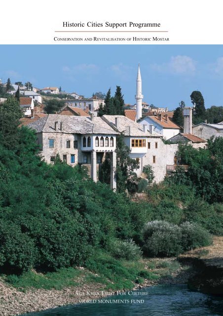
<strong>Historic</strong> Cities Support Programme<br />
CONSERVATION AND REVITALISATION OF HISTORIC MOSTAR<br />
AGA KHAN TRUST FOR CULTURE<br />
WORLD MONUMENTS FUND
© 2004 The <strong>Aga</strong> <strong>Khan</strong> Trust for Culture. All rights reserved. Republication or<br />
redistribution <strong>of</strong> <strong>Aga</strong> <strong>Khan</strong> Trust for Culture content by any means <strong>and</strong> in any media<br />
is prohibited without the prior written consent <strong>of</strong> the <strong>Aga</strong> <strong>Khan</strong> Trust for Culture. For<br />
enquiries, please write to:<br />
The <strong>Aga</strong> <strong>Khan</strong> Trust for Culture<br />
P.O. Box 2049<br />
1-3 Avenue de la Paix<br />
1211 Geneva 2<br />
Switzerl<strong>and</strong><br />
Tel. (+41 22) 909 7200<br />
Fax (+41 22) 909 7292
TABLE OF CONTENTS<br />
2 INTRODUCTION<br />
5 A SHORT HISTORY OF MOSTAR<br />
Amir Pašić<br />
13 REINTEGRATING THE OLD CITY<br />
Francesco Siravo<br />
31 REHABILITATING THE<br />
HISTORIC NEIGHBOURHOODS<br />
Amir Pašić <strong>and</strong> Francesco Siravo<br />
47 RECLAIMING MOSTAR’S<br />
MONUMENTS AND BUILDINGS<br />
Amir Pašić <strong>and</strong> Francesco Siravo<br />
57 INVESTING IN THE FUTURE:<br />
THE STARI GRAD AGENCY<br />
Stefano Bianca<br />
1
INTRODUCTION<br />
T<br />
his brochure celebrates the completion <strong>of</strong> a five-year-long restoration <strong>and</strong> rehabilitation<br />
effort in the historic city <strong>of</strong> <strong>Mostar</strong>, carried out in parallel with the restoration<br />
<strong>of</strong> <strong>Mostar</strong>’s most famous l<strong>and</strong>mark, the Old Bridge (Stari Most). While urban<br />
rehabilitation efforts are planned to continue after the opening ceremony <strong>of</strong> the Bridge,<br />
this documernt records <strong>and</strong> presents, in conjunction with the inauguration <strong>of</strong> the<br />
Stari Most, the considerable progress achieved so far.<br />
From the very beginning, the <strong>Aga</strong> <strong>Khan</strong> Trust for Culture (AKTC) <strong>and</strong> the World Monuments Fund (WMF)<br />
realised that the reconstruction <strong>of</strong> the bridge without an in-depth rehabilitation <strong>of</strong> the historic neighbourhoods<br />
flanking it on the picturesque Neretva riverbanks – its matrix as it were – would be devoid <strong>of</strong><br />
context <strong>and</strong> meaning. Thus the whole work programme was shaped in such a way as to establish a<br />
framework <strong>of</strong> urban conservation schemes <strong>and</strong> individual restoration projects that would help regenerate<br />
the most significant areas <strong>of</strong> historic <strong>Mostar</strong>, <strong>and</strong> particularly the urban tissue around the Old Bridge.<br />
AKTC’s involvement with <strong>Mostar</strong> goes back to 1986, when the City <strong>of</strong> <strong>Mostar</strong> was granted an <strong>Aga</strong> <strong>Khan</strong><br />
Award for its exemplary conservation, urban renewal <strong>and</strong> urban management efforts. Tragically, the<br />
1992-95 war annihilated much <strong>of</strong> what had been achieved by that time. After the war it was only logical<br />
for AKTC to become involved in the reconstruction <strong>of</strong> the old city. Fortunately, the Trust was able to join<br />
forces with the World Monuments Fund through a partnership created under WMF’s Robert W. Wilson<br />
Challenge to Conserve our Heritage. The work achieved under this partnership complements the bridge<br />
reconstruction project <strong>of</strong> the UNESCO/World Bank group with a comprehensive urban rehabilitation<br />
effort. AKTC’s <strong>and</strong> WMF’s work through the years 1998-2004 reflects the pursuit <strong>of</strong> a threefold strategy:<br />
• Establishment <strong>of</strong> a detailed conservation <strong>and</strong> development plan for the old city (within its 1918<br />
boundaries) in order to provide the city administration with an up-to-date record <strong>of</strong> the existing situation,<br />
as well as an appropriate urban management tool for plot-by-plot interventions ranging from restoration<br />
to appropriate new “infill” structures.<br />
• Development <strong>of</strong> a series <strong>of</strong> action plans for significant specific areas that are characterised by<br />
ensembles <strong>of</strong> historic buildings <strong>and</strong> their enclosed or adjacent public spaces, particularly the two historic<br />
neighbourhoods flanking the Old Bridge complex on both sides <strong>of</strong> the Neretva River. In these areas<br />
<strong>Mostar</strong>’s old townscape has been as much as possible re-established. In cooperation with the residents,<br />
owners <strong>and</strong> the authorities, interventions ranged from ro<strong>of</strong> repairs to the reconstruction <strong>of</strong> ruined buildings,<br />
environmental improvements, street furnishings, etc.<br />
• Identification <strong>of</strong> a list <strong>of</strong> 21 important historic buildings to be restored as a priority for the city’s<br />
recovery, with funds made available through public or private investment. Each building was carefully<br />
recorded <strong>and</strong> analysed, <strong>and</strong> corresponding conservation (or reconstruction) proposals were prepared,<br />
including cost estimates <strong>and</strong> recommendations for re-use. Out <strong>of</strong> this list four buildings were restored with<br />
funds from AKTC/WMF, while four others are under restoration thanks to funds received from the World<br />
Bank <strong>and</strong> other donors. The remaining thirteen priority buildings await donor funding or private investment.<br />
2
Through these inter-connected planning <strong>and</strong> restoration initiatives, AKTC <strong>and</strong> WMF have made a major<br />
contribution to the revival <strong>of</strong> the Old City <strong>of</strong> <strong>Mostar</strong>, not only in the physical sense but also with regard<br />
to the social dimension <strong>and</strong> the institutional setting. Indeed, the implementation <strong>of</strong> all the projects<br />
described in this brochure would not have been possible without the support <strong>and</strong> active participation <strong>of</strong><br />
the city administration <strong>and</strong> its technical services, the religious community, as well as the owners <strong>and</strong><br />
residents concerned. Another important aspect has been the training <strong>of</strong> young Bosnian architects who<br />
have participated in the project <strong>and</strong> formed the core <strong>of</strong> the AKTC/WMF <strong>Mostar</strong> <strong>of</strong>fice.<br />
This “rooting” <strong>of</strong> the project in local ground has also resulted in the establishment <strong>of</strong> the Stari grad<br />
Agency which, on behalf <strong>of</strong> the city, will have an important role in overseeing the ongoing implementation<br />
<strong>of</strong> the conservation plan, as well as operating <strong>and</strong> maintaining a series <strong>of</strong> restored historic buildings<br />
(including the Old Bridge complex) <strong>and</strong> promoting <strong>Mostar</strong> as a cultural <strong>and</strong> tourist destination. The<br />
Agency will thus be taking over the functions <strong>and</strong> responsibilities <strong>of</strong> the AKTC/WMF <strong>Mostar</strong> project<br />
<strong>of</strong>fice, as well as those <strong>of</strong> the World Bank Project Coordination Unit. The <strong>Aga</strong> <strong>Khan</strong> Trust for Culture <strong>and</strong><br />
the World Monuments Fund are delighted to see the <strong>of</strong>ficial inauguration <strong>of</strong> the Stari grad Agency<br />
coincide with the opening ceremony <strong>of</strong> the Bridge.<br />
As old <strong>Mostar</strong> regains its physical identity, it should again become a focal point for visitors from all over<br />
the world <strong>and</strong> – even more importantly – assume again its function as a truly multi-cultural urban centre,<br />
providing an example <strong>of</strong> a place where people <strong>of</strong> different cultures, religions <strong>and</strong> ethnic affiliations live<br />
<strong>and</strong> work side by side. May the joint restoration efforts <strong>of</strong> the city administration <strong>and</strong> the international<br />
community lead <strong>Mostar</strong> into a bright <strong>and</strong> peaceful future!<br />
Bonnie Burham, President, World Monuments Fund<br />
Stefano Bianca, Director, <strong>Historic</strong> Cities Support Programme <strong>of</strong> the <strong>Aga</strong> <strong>Khan</strong> Trust for Culture<br />
3
A SHORT HISTORY OF MOSTAR<br />
Amir Pašić<br />
Indescribable is <strong>Mostar</strong>’s most perfect beauty<br />
Are you surprised at the language used by this lover <strong>of</strong> <strong>Mostar</strong><br />
Not in all the universe, not even in Paradise<br />
Could one ever find the air <strong>and</strong> the water <strong>of</strong> <strong>Mostar</strong>....<br />
C<br />
Dervish Pasha Bajezidagić<br />
enturies before the Ottoman conquest <strong>of</strong> Bosnia, <strong>Mostar</strong> was a<br />
small hamlet situated at a strategic crossing <strong>of</strong> the Neretva River.<br />
Its hinterl<strong>and</strong>s consisted <strong>of</strong> a broad agricultural plain on the west bank<br />
<strong>and</strong> steep terraces on the east bank surrounded by barren mountains.<br />
<strong>Mostar</strong> was a representative multi-ethnic <strong>and</strong> multi-cultural settlement<br />
in Bosnia, which had possessed an independent political identity since<br />
the twelfth century. By the fifteenth century, most <strong>of</strong> the l<strong>and</strong>s that<br />
would later become part <strong>of</strong> modern Yugoslavia were inhabited primarily<br />
by peoples <strong>of</strong> the same south Slavic heritage.<br />
OTTOMAN MOSTAR<br />
Above: the Stari Most in a<br />
photograph taken at the beginning<br />
<strong>of</strong> the twentieth century. Built in<br />
1566 between two pre-Ottoman<br />
towers, the bridge replaced a<br />
wooden structure across the<br />
Neretva River.<br />
Left: plan <strong>of</strong> <strong>Mostar</strong> drawn in 1881.<br />
The survey shows the city at the end<br />
<strong>of</strong> the Ottoman period, three years<br />
after the establishment <strong>of</strong> the<br />
Austro-Hungarian administration.<br />
Commercial, religious <strong>and</strong><br />
administrative functions were<br />
located on the east side <strong>of</strong> the river,<br />
with industry <strong>and</strong> agriculture on the<br />
western sides <strong>of</strong> the flat plain.<br />
The first document that names the city was written in 1474, only eleven<br />
years after the Ottoman conquest <strong>of</strong> the Balkans. The bridge is at the<br />
heart <strong>of</strong> the town’s identity: <strong>Mostar</strong> means in fact “bridgekeeper”.<br />
Bosnia was added to the Ottoman Empire as a province <strong>and</strong> ruled by a<br />
pasha: an administrator <strong>of</strong> elevated rank. Following this occupation,<br />
<strong>Mostar</strong> was transformed, in a matter <strong>of</strong> decades, from a minor river<br />
crossing to a thriving colonial crossroads. As Ottoman administrators<br />
strove to integrate local inhabitants into their empire <strong>and</strong> extend their<br />
influence, architecture expressed important social <strong>and</strong> economic<br />
changes in <strong>Mostar</strong>. During the Ottoman period, the Stari Most was<br />
built to replace a precarious wooden suspension bridge that had<br />
spanned the river. Facilitating travel, trade <strong>and</strong> the movement <strong>of</strong> military<br />
troops, the Stari Most became a symbol <strong>of</strong> the benevolence <strong>and</strong> power<br />
<strong>of</strong> the Ottoman Empire; it insured <strong>Mostar</strong>’s primacy as the capital <strong>of</strong><br />
the county <strong>of</strong> Herzegovina.<br />
The Ottomans used monumental architecture to affirm, extend <strong>and</strong><br />
consolidate their colonial holdings. Administrators <strong>and</strong> bureaucrats –<br />
5
A view <strong>of</strong> Velika Tepa Street (today’s<br />
Maršal Tito Street), looking north,<br />
at the beginning <strong>of</strong> the twentieth<br />
century. The street was the main<br />
commercial spine <strong>of</strong> the city, lined<br />
with one- <strong>and</strong> two-storey shop-front<br />
buildings. Its east side was<br />
completely demolished after World<br />
War II. Only a few shop-front<br />
structures survive today on the west<br />
side <strong>of</strong> the street.<br />
many <strong>of</strong> them indigenous Bosnians who converted to Islam – founded<br />
mosque complexes that generally included Koranic schools, soup<br />
kitchens or markets. These foundations, or vakufs, were a traditional<br />
mode <strong>of</strong> philanthropy which allowed for routine distribution <strong>of</strong> wealth<br />
within the empire. The gr<strong>and</strong>est mosques were characterised by a large<br />
single dome, like the Koski Mehmet Pasha Mosque in <strong>Mostar</strong> on the<br />
east bank <strong>of</strong> the Neretva or the Karadjozbeg Mosque, bearing many<br />
hallmarks <strong>of</strong> the famous Ottoman architect Sinan. The dome had come<br />
to represent the imperial presence <strong>of</strong> the Ottomans throughout the<br />
territories they controlled; it seems to have signified both Ottoman<br />
dominion over a colony <strong>and</strong> benevolence towards the colonised.<br />
Mosques defined <strong>and</strong> strengthened communities. A good example is<br />
the Sevri Hadži Hasan Mosque, a hip-ro<strong>of</strong>ed structure that forms the<br />
nucleus <strong>and</strong> principal public open space <strong>of</strong> its neighborhoud, or<br />
mahalla. Such mahallas developed quickly on both banks <strong>of</strong> the<br />
Neretva during the Ottoman period. One- <strong>and</strong> two-storey houses were<br />
anonymous at the street level but rich <strong>and</strong> expressive within. Each was<br />
6
carefully sited to catch a view <strong>of</strong> a cypress or minaret from secondstorey<br />
windows <strong>and</strong> each was legally obliged not to block the views<br />
<strong>of</strong> a neighbour. A street-level entry would access the courtyard, creating<br />
a transition that allowed for intimacy <strong>and</strong> privacy within; rooms<br />
dedicated to family life were separated from those intended to receive<br />
outsiders. <strong>Mostar</strong>’s Biščevića house is a case in point: an austere<br />
entrance belies rooms <strong>of</strong> built-in cabinets, elaborately carved wooden<br />
ceilings <strong>and</strong> a windowed room that cantilevers over the Neretva River.<br />
In thriving commercial areas, houses like the Alajbegovica house<br />
addressed the commercial thoroughfare with a shop, with residential<br />
spaces above <strong>and</strong> behind.<br />
Though <strong>Mostar</strong> was <strong>of</strong>ficially part <strong>of</strong> the Ottoman Empire until the third<br />
quarter <strong>of</strong> the nineteenth century, all <strong>of</strong> the territories that would later<br />
become Bosnia <strong>and</strong> Herzegovina enjoyed an unusual measure <strong>of</strong><br />
independence in the eighteenth <strong>and</strong> most <strong>of</strong> the nineteenth centuries.<br />
Ottoman legislation assuring religious tolerance between Christians,<br />
Muslims <strong>and</strong> Jews had become an integral part <strong>of</strong> indigenous social <strong>and</strong><br />
political values, <strong>and</strong> the city functioned as a bonded, multicultural social<br />
entity. In <strong>Mostar</strong>, historicist architectural styles reflected cosmopolitan<br />
interest <strong>and</strong> exposure to foreign aesthetic trends <strong>and</strong> were artfully merged<br />
with indigenous styles. Examples include the Italianate Franciscan<br />
church, the Ottoman Muslibegovića house, the Dalmatian Ćorovića<br />
House <strong>and</strong> an Orthodox church built with a gift from the Sultan.<br />
THE AUSTRO-HUNGARIAN PERIOD<br />
Bosnia was made a crown l<strong>and</strong> <strong>of</strong> the Austro-Hungarian Empire in 1878,<br />
a move calculated to avoid a Serbian takeover. Though <strong>Mostar</strong>’s city<br />
council aspired to autonomy, it cooperated with the Austro-Hungarians<br />
to implement sweeping reforms in city planning: broad avenues <strong>and</strong> an<br />
urban grid were imposed on the western bank <strong>of</strong> the Neretva, <strong>and</strong><br />
significant investments were made in infrastructure, communications<br />
<strong>and</strong> housing. City administrators like Mustafa Mujaga Komadina were<br />
central players in these transformations, which facilitated growth <strong>and</strong><br />
linked the eastern <strong>and</strong> western banks <strong>of</strong> the city.<br />
Above: the front porch <strong>of</strong> the<br />
Karadjozbeg Mosque built in 1577.<br />
New monuments <strong>and</strong> architectural styles reflected the aspirations <strong>of</strong><br />
<strong>Mostar</strong>ians <strong>and</strong> the Austro-Hungarian administration. Monolithic neo-<br />
Renaissance buildings towered over their diminutive Ottoman<br />
predecessors <strong>and</strong> introduced sober, imposing street walls to the city.<br />
Below: view <strong>of</strong> the entry court <strong>of</strong> the<br />
Biščevića house, an eighteenth-century<br />
example <strong>of</strong> domestic architecture<br />
built during the Ottoman period.<br />
7
One example is the Municipality building. Designed by the architect<br />
Josip Vancaš from Sarajevo, it asserted a new prosperity, stability <strong>and</strong><br />
tradition, linking <strong>Mostar</strong> symbolically with other European centres.<br />
Residential districts around the Rondo invited gr<strong>and</strong> single-family<br />
homes <strong>and</strong> reaffirmed an occidental influence that complemented the<br />
city’s traditional buildings. By the early twentieth century, elements <strong>of</strong><br />
Art Nouveau <strong>and</strong> Secessionist styles began to appear in <strong>Mostar</strong>’s historicist<br />
buildings, such as Josip Vancaš’ L<strong>and</strong>bank constructed in 1910.<br />
Above: a view <strong>of</strong> today’s Maršal<br />
Tito Street at the beginning <strong>of</strong> the<br />
twentieth century when it turned<br />
into a broad avenue lined with tall<br />
neo-classical buildings inspired by<br />
Austro-Hungarian examples.<br />
The inevitable hybrid that emerged from this period <strong>of</strong> intense building<br />
was a new monumental style that combined the massing <strong>of</strong> European<br />
prototypes with Orientalist details. This contamination is illustrated<br />
well by Franc Blazek’s Gymnasium <strong>of</strong> 1902. Though its design was<br />
derived from Islamic styles <strong>of</strong> Spain <strong>and</strong> North Africa <strong>and</strong> bears no<br />
genuine relation with <strong>Mostar</strong>’s Ottoman past, it reflects the tendency<br />
<strong>of</strong> Austro-Hungarian administrators to harmonise rather than suppress<br />
cultural difference within the empire.<br />
8
WORLD WAR I TO SOCIALISM<br />
The First World War was triggered in Sarajevo when Serbian “Black<br />
H<strong>and</strong>” radicals confirmed their distaste for the incumbent empire by<br />
assassinating its heir, Archduke Franz Ferdin<strong>and</strong>. Fearing annexation<br />
by the Serbians, most Bosnians were loyal to the Austro-Hungarian<br />
Empire during World War I. Pragmatism <strong>and</strong> international pressure in<br />
light <strong>of</strong> a re-aligned Europe at the close <strong>of</strong> the war forged the “Kingdom<br />
<strong>of</strong> Serbs, Croats <strong>and</strong> Slovenes” (later Kingdom <strong>of</strong> Yugoslavia), a<br />
constitutional monarchy that included Bosnia <strong>and</strong> Herzegovina under<br />
the leadership <strong>of</strong> Serbia’s Prince Regent Alex<strong>and</strong>er. His attempts to<br />
“erase the old regional identities” antagonised all parties, culminating<br />
in a suspension <strong>of</strong> the constitution.<br />
These internal conflicts were soon overshadowed by the advance <strong>of</strong><br />
Hitler <strong>and</strong> the German alliance with an “Independent State <strong>of</strong> Croatia”<br />
(the NDH). A Partisan resistance in the region grew under the direction<br />
<strong>of</strong> Josip Broz Tito, <strong>and</strong> attracted large numbers <strong>of</strong> Bosnians. At the<br />
close <strong>of</strong> World War II, Tito was at the heart <strong>of</strong> a new socialist Yugoslavia.<br />
Between 1948 <strong>and</strong> 1974, Yugoslavia evolved from a repressive socialist<br />
regime to a federative socialist nation made up <strong>of</strong> discrete republics, <strong>of</strong><br />
which one was Bosnia-Herzegovina. During this period in <strong>Mostar</strong>, the<br />
industrial base was exp<strong>and</strong>ed with construction <strong>of</strong> a metal-working<br />
factory, cotton textile mills, <strong>and</strong> an aluminium plant. Skilled workers,<br />
both men <strong>and</strong> women, entered the work force <strong>and</strong> the social <strong>and</strong><br />
demographic pr<strong>of</strong>ile <strong>of</strong> the city was broadened dramatically; between<br />
1945 <strong>and</strong> 1980, <strong>Mostar</strong>’s population grew from 18,000 to 100,000.<br />
Because <strong>Mostar</strong>’s eastern bank was burdened by inadequate infrastructure,<br />
the city exp<strong>and</strong>ed on the western bank with the construction<br />
<strong>of</strong> large residential blocks. Local architects favored an austere modernist<br />
aesthetic, prefabrication <strong>and</strong> repetitive modules. Commercial buildings<br />
in the functionalist style appeared on the historic eastern side <strong>of</strong> the<br />
city as well, replacing more intimate timber constructions that had<br />
survived since Ottoman times. In the 1970s <strong>and</strong> 1980s, a healthy local<br />
economy fueled by foreign investment spurred recognition <strong>and</strong><br />
conservation <strong>of</strong> the city’s cultural heritage. An economically sustainable<br />
plan to preserve the old town <strong>of</strong> <strong>Mostar</strong> was implemented by the<br />
municipality, which drew thous<strong>and</strong>s <strong>of</strong> tourists from the Adriatic coast<br />
<strong>and</strong> invigorated the economy <strong>of</strong> the city. The results <strong>of</strong> this ten-year<br />
project earned <strong>Mostar</strong> an <strong>Aga</strong> <strong>Khan</strong> Award for Architecture in 1986.<br />
Above: <strong>Mostar</strong>’s main theatre<br />
(to the right) was built along<br />
Maršal Tito Street after World<br />
War II, following the demolition <strong>of</strong><br />
several old buildings. The functionalist<br />
architecture <strong>of</strong> the period<br />
resulted in the radical transformation<br />
<strong>of</strong> the traditional townscape.<br />
Below: the 1970s <strong>and</strong> 1980s were<br />
marked by the construction <strong>of</strong> large<br />
residential blocks, associated with<br />
the functionalist aesthetic <strong>and</strong> social<br />
programmes <strong>of</strong> the socialist regime.<br />
Opposite left: <strong>Mostar</strong>’s most<br />
prominent Orientalist building was<br />
Franc Blazek’s Gymnasium built<br />
in 1902 with classical proportions<br />
<strong>and</strong> Islamic details.<br />
9
The destroyed Stari Most (to the<br />
left) <strong>and</strong> the ruins <strong>of</strong> Girls’ High<br />
School (to the right) along Maršal<br />
Tito Street in a view taken after the<br />
1992-1995 war. Monuments <strong>and</strong><br />
prominent historic buildings were<br />
especially targeted by tank shells.<br />
The Girls’ High School remains in<br />
ruins to this day (see pages 59-61).<br />
THE COLLAPSE OF YUGOSLAVIA<br />
During the collapse <strong>of</strong> communism in Eastern Europe, ultra-nationalist<br />
leaders in the republics enjoyed political ascendancy which would<br />
have been unthinkable under Tito. Alija Izetbegović formed a new<br />
government in Bosnia, which included the representation <strong>of</strong> Muslim,<br />
Bosnian-Croat <strong>and</strong> Bosnian-Serb parties. In 1992, 64% <strong>of</strong> the Bosnian<br />
electorate voted for a state “<strong>of</strong> equal citizens <strong>and</strong> nations <strong>of</strong> Muslims,<br />
Serbs, Croats <strong>and</strong> others”. Days later, Sarajevo was under a siege that<br />
would last more than three years. During this same period, Bosnian<br />
Serb military <strong>and</strong> paramilitary forces pursued a campaign <strong>of</strong> terror <strong>and</strong><br />
ethnic cleansing in Bosnia. <strong>Mostar</strong> was overwhelmed by Serbian military<br />
units, <strong>and</strong> shelled from the surrounding hills during May <strong>and</strong> June <strong>of</strong><br />
1992. Nearly 100,000 people were forced from their homes <strong>and</strong> over<br />
1,600 died. Many historic buildings in the old city, including most <strong>of</strong><br />
the city’s important mosques, were heavily damaged. Even the Old<br />
Bridge was hit by a shell.<br />
10
A Croat-Muslim Federation was able to expel Serbian forces by June<br />
1992. Shortly thereafter, local Muslims <strong>and</strong> Croatians became adversaries<br />
due to competing territorial ambitions <strong>and</strong> ongoing political instability.<br />
The Bosnian-Croatian Militia (the HVO) took possession <strong>of</strong> the West<br />
Bank <strong>of</strong> the Neretva, expelling many Muslim families from their homes,<br />
<strong>and</strong> initiating a new round <strong>of</strong> hostilities in what was termed the “second<br />
battle <strong>of</strong> <strong>Mostar</strong>”. More than 3,000 people were killed, <strong>and</strong> another 10,000<br />
were sent to concentration camps. Throughout the HVO’s assaults, the<br />
Old Bridge was a favoured target for hostile artillery. On November 9,<br />
1993, the bridge’s springline was hit at point-blank range by a Croatian<br />
tank shell <strong>and</strong> <strong>Mostar</strong>’s 400-year-old symbol fell into the cold Neretva<br />
River, provoking deep sadness for citizens throughout the city for<br />
whom the Bridge had represented everything permanent <strong>and</strong> inviolable.<br />
MOSTAR SINCE 1995<br />
President Izetbegović <strong>of</strong> Bosnia-Herzegovina <strong>and</strong> President Tudjman<br />
<strong>of</strong> Croatia signed a Federation Agreement on 18 March 1994, which<br />
provided for an interim administration by the European Community in<br />
<strong>Mostar</strong>, a city still coveted by both Bosnians <strong>and</strong> Bosnian Croats.<br />
Following this partial peace agreement, <strong>Mostar</strong> remained a violently<br />
divided city; the east side remained without electricity, running water,<br />
70% <strong>of</strong> its pre-war housing units <strong>and</strong> nearly all economic activity. In<br />
the years following, European Community administrators were able to<br />
engineer political equilibrium, implement humanitarian assistance,<br />
restore essential infrastructure <strong>and</strong> build new schools.<br />
NATO’s intervention in the region began with the signing <strong>of</strong> a “General<br />
Framework Agreement for Peace in Bosnia-Herzegovina” in Dayton,<br />
Ohio. Delineating a Muslim-Croat Federation covering 51% <strong>of</strong> Bosnia’s<br />
territory <strong>and</strong> a Republika Srpska covering 49%, this agreement led to<br />
increased stability. By June <strong>of</strong> 1996 local residents <strong>of</strong> all backgrounds<br />
<strong>and</strong> absent refugees were able to participate in elections for a unified<br />
city government in <strong>Mostar</strong>. Today, there is a growing local economy<br />
<strong>and</strong> a joint administration, in which Muslim <strong>and</strong> Croat <strong>of</strong>ficials alternate<br />
in the post <strong>of</strong> Mayor <strong>and</strong> Deputy Mayor. Moderate <strong>and</strong> centrist<br />
politicians have put forward a conciliatory political agenda with<br />
increasing success <strong>and</strong> public support. As wartime tensions slowly fade,<br />
energies are being poured into new commercial <strong>and</strong> civic projects –<br />
including the reconstruction <strong>of</strong> damaged historic architecture – which have<br />
fostered a growing sense <strong>of</strong> hope in the city <strong>and</strong> its future prospects.<br />
Above: the Musala area as seen<br />
from the west side <strong>of</strong> the Neretva<br />
River following the war. Both<br />
Tito’s Villa (to the left) <strong>and</strong> the<br />
Neretva Hotel (to the right) were<br />
severely damaged.<br />
Below: map <strong>of</strong> the Balkan region<br />
with the location <strong>of</strong> <strong>Mostar</strong> after the<br />
Dayton agreement <strong>of</strong> 1995.<br />
11
REINTEGRATING THE OLD CITY<br />
Francesco Siravo<br />
M<br />
ostar, perched atop the steep banks <strong>of</strong> the Neretva River in<br />
south-western Bosnia-Herzegovina, was for centuries an<br />
outst<strong>and</strong>ing example <strong>of</strong> cultural <strong>and</strong> religious diversity in the heart <strong>of</strong><br />
the Balkans. In spite <strong>of</strong> the very considerable damage the city suffered<br />
during the 1992-1995 war, <strong>Mostar</strong> remains an extraordinarily important<br />
European cultural heritage site. Its preservation <strong>and</strong> development have<br />
a symbolic meaning <strong>and</strong> underscore Bosnia-Herzegovina’s determination<br />
to recover its multicultural past <strong>and</strong> to secure a future <strong>of</strong> tolerance <strong>and</strong><br />
peace. This is the reason why several international organisations have<br />
extended help – beyond political <strong>and</strong> material assistance – toward the<br />
reconstruction <strong>and</strong> restoration <strong>of</strong> <strong>Mostar</strong>’s architectural heritage.<br />
View <strong>of</strong> the Old Bridge <strong>and</strong> the<br />
surrounding historic fabric in 1986,<br />
before the destruction <strong>of</strong> the 1990s.<br />
While the joint project <strong>of</strong> the World Bank <strong>and</strong> UNESCO was established<br />
to tackle the reconstruction <strong>of</strong> the Old Bridge complex, the <strong>Aga</strong> <strong>Khan</strong><br />
Trust for Culture <strong>and</strong> the World Monuments Fund focused on the<br />
restoration <strong>of</strong> a number <strong>of</strong> monuments <strong>and</strong> on the urban fabric<br />
surrounding the Stari Most in an effort to re-establish their physical<br />
<strong>and</strong> operational integrity. Individually these various structures may be<br />
less important than the Old Bridge, but together they form an inalienable<br />
<strong>and</strong> essential part <strong>of</strong> <strong>Mostar</strong>’s historic townscape.<br />
To lay the ground for this comprehensive urban conservation effort,<br />
the AKTC/WMF team began in 1998 the preparation <strong>of</strong> a “<strong>Conservation</strong><br />
<strong>and</strong> Development Plan for the Old Town”. This Plan was formally<br />
adopted by the authorities on 15 May 2001. It includes plans,<br />
regulations <strong>and</strong> guidelines for the protection <strong>of</strong> the historic core <strong>of</strong><br />
<strong>Mostar</strong>, detailed proposals for the rehabilitation <strong>of</strong> the neighbourhood<br />
areas, <strong>and</strong> a series <strong>of</strong> adaptive re-use schemes for priority buildings, as<br />
well as provisions to support institutional strengthening <strong>and</strong> active<br />
management <strong>of</strong> the historic city’s future.<br />
Left: satellite image <strong>of</strong> <strong>Mostar</strong><br />
showing the city in year 2000<br />
straddling the Neretva River <strong>and</strong><br />
contained between the Hum Hill<br />
to the west, <strong>and</strong> Mount Prenj<br />
<strong>and</strong> Mount Velež to the east.<br />
Since 2000, the joint AKTC/WMF technical team has carried out a<br />
series <strong>of</strong> rehabilitation activities focused on individual buildings <strong>and</strong><br />
improving open spaces in the historic neighbourhoods. Planning work<br />
has also continued on the nineteenth-century parts <strong>of</strong> the city, adjacent<br />
to the Old Town. This shift represents an effort to integrate the central<br />
area with the rest <strong>of</strong> <strong>Mostar</strong> <strong>and</strong> put in place the conditions needed to<br />
establish a cohesive plan for the entire city.<br />
13
A PLANNING STRATEGY<br />
FOR GREATER MOSTAR<br />
Above: suburban development on<br />
agricultural l<strong>and</strong> outside the city.<br />
Below: piecemeal residential<br />
development on the eastern hills,<br />
above the central area <strong>of</strong> the city.<br />
The future <strong>of</strong> the historic core <strong>and</strong> the central area cannot be separated<br />
from <strong>Mostar</strong>’s peripheral areas <strong>and</strong> the development <strong>of</strong> the city as a<br />
whole. Future development trends at the city level will inevitably have<br />
repercussions on the central area, <strong>and</strong> indeed will determine its function<br />
<strong>and</strong> role within greater <strong>Mostar</strong>. The city’s population, following a sharp<br />
decline during <strong>and</strong> after the war, has been stable for quite some time at<br />
around 105,000 inhabitants. However, over the past several years, there<br />
has been substantial <strong>and</strong> disorderly urban expansion taking place on<br />
the hills overlooking the city <strong>and</strong> in the surrounding countryside. This<br />
should be reason for concern: the agricultural l<strong>and</strong> around the city is<br />
being swallowed by unregulated suburban development, precluding a<br />
wiser utilisation <strong>of</strong> precious l<strong>and</strong> assets <strong>and</strong> imposing on future<br />
administrations ever-greater infrastructure costs in new roads <strong>and</strong><br />
public utilities. Moreover, the clearing <strong>of</strong> the vegetation <strong>and</strong> subsequent<br />
construction on the surrounding hills is compromising the very stability<br />
<strong>of</strong> the slopes that lie above the central area <strong>of</strong> the city.<br />
14
These trends are made worse by a past tendency to create competing<br />
poles <strong>of</strong> attraction <strong>and</strong> duplicate urban facilities, the legacy <strong>of</strong> old<br />
conflicts <strong>and</strong> uncoordinated planning by the different municipalities.<br />
Even the planned highway connection could have a centrifugal effect<br />
<strong>and</strong>, unless it is carefully harmonised within the existing context, drain<br />
precious resources away from the city centre. If left unchecked, the<br />
combination <strong>of</strong> the recent uncontrolled growth <strong>and</strong> foreseeable new<br />
developments could easily result in a dispersed agglomeration<br />
surrounding a mono-functional centre, increasingly dependent on a<br />
tourism-based economy. These negative trends are not unique to<br />
<strong>Mostar</strong>, but they have been exacerbated here by the urgent need to<br />
rebuild <strong>and</strong> re-establish acceptable living conditions after the war. In<br />
the process, immediate, limited gains have conflicted with longer-term<br />
plans <strong>and</strong> may today preclude the achievement <strong>of</strong> future, more<br />
substantial benefits to the city as a whole.<br />
Comprehensive long-term planning will be the task <strong>of</strong> the newly unified<br />
city administration which, from 2004 onwards, will replace the former<br />
six sub-municipalities – one <strong>of</strong> which more or less coincided with the<br />
boundaries <strong>of</strong> the historic city. While for political reasons AKTC/WMF<br />
has not been able over the past several years to actively assist the city<br />
with planning the metropolitan areas as a whole, today certain guiding<br />
principles <strong>and</strong> planning concepts for strategic areas can begin to be<br />
put forward. <strong>Mostar</strong>’s urban history <strong>and</strong> current assets provide the<br />
key to identifying a different model <strong>of</strong> development <strong>and</strong> a significant<br />
future role for the city.<br />
Since its establishment as a military outpost <strong>of</strong> the Ottomans, the city’s<br />
form <strong>and</strong> growth were determined by natural factors: straddling the<br />
Neretva River <strong>and</strong> contained between the imposing elevation <strong>of</strong> the<br />
Hum Hill to the west <strong>and</strong> Mount Prenj <strong>and</strong> Mount Velež to the east,<br />
<strong>Mostar</strong> grew along the north-south axis, parallel to the water’s course.<br />
The available l<strong>and</strong> along both riverbanks was gradually filled. Expansion<br />
along the mountain slopes was likewise contained within an upper limit<br />
<strong>of</strong> 115 metres above sea level, as far as the supply <strong>of</strong> water would<br />
reach. These natural constraints account for the current size <strong>and</strong> form<br />
<strong>of</strong> the city, an irregular, elongated shape that extends over a total surface<br />
area <strong>of</strong> slightly more than 500 hectares. This basin is the city’s natural<br />
domain, <strong>and</strong> this is where future expansion should concentrate, rather<br />
than being determined by the current disorderly growth outside the<br />
city limits. In future, <strong>Mostar</strong>’s development will need to be carefully<br />
The first plan <strong>of</strong> <strong>Mostar</strong> drawn in<br />
1617 shows the city as an important<br />
communication node <strong>and</strong> crossing<br />
point between the two sides <strong>of</strong> the<br />
Neretva River. Even today, <strong>Mostar</strong>’s<br />
importance lies in its being a<br />
crossroads between the route that<br />
connects the Dalmatian coast to the<br />
inl<strong>and</strong> territory <strong>and</strong> the northern<br />
region <strong>of</strong> Bosnia.<br />
15
Greater <strong>Mostar</strong>:<br />
Road Network, Boundaries <strong>and</strong> Principal Locations<br />
Sarajevo<br />
Bijeli Brijeg<br />
1<br />
Train Station<br />
Rondo<br />
Stari Most<br />
Luka<br />
Hum Hill<br />
2<br />
Medjugorje<br />
Soko Model Factory<br />
3<br />
Bišće Polje<br />
1<br />
North Camp<br />
Jasenica<br />
2<br />
South Camp<br />
3<br />
Rodoč Two<br />
Aluminium Plant<br />
Airport<br />
1918 City Boundary<br />
Old Town Boundary<br />
M17 Highway (Proposed)<br />
Major Roads (Proposed)<br />
Main Avenues <strong>and</strong> City Streets<br />
Dubrovnik <strong>and</strong> Split<br />
16
planned, in line with its historical pattern <strong>of</strong> growth <strong>and</strong> according to<br />
the physical <strong>and</strong> environmental constraints <strong>of</strong> the site.<br />
Priority should be given to reconstructing <strong>and</strong> rehabilitating the central<br />
areas <strong>and</strong> the inner periphery <strong>of</strong> the city where there still is substantial<br />
scope for urban regeneration <strong>and</strong> the recycling <strong>of</strong> existing l<strong>and</strong> <strong>and</strong><br />
buildings. This would reinforce the role <strong>of</strong> the central area <strong>and</strong> provide<br />
the density <strong>and</strong> variety <strong>of</strong> activities necessary to sustain a truly urban<br />
environment. The proposals prepared for the central area by AKTC/<br />
WMF explore this course <strong>of</strong> action <strong>and</strong> indicate how this objective<br />
might be achieved through careful urban design planning <strong>and</strong> by<br />
targeting important opportunities to be found within existing sites<br />
<strong>and</strong> individual buildings.<br />
But it would be unrealistic to imagine that all <strong>of</strong> <strong>Mostar</strong>’s future growth<br />
can be absorbed entirely within the built-up areas. Today there remain<br />
three parcels <strong>of</strong> public l<strong>and</strong> that could accommodate the city’s future<br />
expansion. They lie inside the natural limits <strong>of</strong> the city, within a maximum<br />
radius <strong>of</strong> 2,000 metres from the central area. All three parcels can be<br />
organically integrated within the city’s well-established pattern <strong>of</strong> linear<br />
growth, <strong>and</strong> all <strong>of</strong> them should be considered precious “reservoirs” <strong>of</strong><br />
city growth to be used wisely in the years to come.<br />
The first parcel <strong>of</strong> l<strong>and</strong> is the so-called North Camp situated at the<br />
northern edge <strong>of</strong> <strong>Mostar</strong> where the Neretva River sharply bends to the<br />
east. Its surface area is approximately 36 hectares; the second is located<br />
at the southern end <strong>of</strong> the city, the so-called South Camp, <strong>and</strong> measures<br />
20 hectares; <strong>and</strong> the third, also located at the southern end, but on the<br />
west bank, is known as Rodoč Two <strong>and</strong> measures approximately 30<br />
hectares. Combined development <strong>of</strong> these l<strong>and</strong> assets could generate<br />
approximately 9,500 residential units, housing between 30 <strong>and</strong> 35<br />
thous<strong>and</strong> people. These units, when added to <strong>Mostar</strong>’s pre-war<br />
housing stock <strong>and</strong> the additional development within the built-up area,<br />
would increase the town’s capacity to between 140 <strong>and</strong> 145 thous<strong>and</strong><br />
inhabitants – 25 percent more than at present – enough to accommodate<br />
the city’s foreseeable expansion for the next twenty-five years. This<br />
represents a long-term growth prospect that is environmentally<br />
sustainable <strong>and</strong> compatible with the current physical configuration <strong>of</strong> the<br />
city. Any further growth should occur outside the city limits, beyond<br />
the industrial <strong>and</strong> rural zones located within a ten-kilometre radius <strong>of</strong> the<br />
city centre, preferably in satellite communities or separate municipalities.<br />
View <strong>of</strong> the North Camp located to<br />
the north <strong>of</strong> the Railway Station.<br />
In the background, bordering the<br />
river, is the area still available<br />
for development.<br />
17
A recent view <strong>of</strong> the old town<br />
following the reconstruction <strong>of</strong><br />
the Stari Most <strong>and</strong> restoration <strong>of</strong><br />
its surrounding structures.<br />
Development within the three proposed expansion areas will be<br />
facilitated by the fact that the l<strong>and</strong> is publicly owned. This will allow<br />
for comprehensive planning, rather than the haphazard, plot-by-plot<br />
development currently taking place in the agricultural areas around<br />
the city. Careful <strong>and</strong> sensitive planning will make it possible to “reknit”<br />
the city together, integrating the new with the existing <strong>and</strong> making<br />
it possible to think <strong>of</strong> the new expansion areas as integral, yet selfsufficient,<br />
parts <strong>of</strong> the city. With commercial <strong>and</strong> public facilities<br />
complementing the residential units, it will be possible to avoid the<br />
total dependency <strong>of</strong> the new expansion areas on the centre, as well as<br />
the kind <strong>of</strong> mono-functional residential development characterised by<br />
the large apartment blocks that prevailed during the socialist period.<br />
Comprehensive planning based on sound design principles <strong>and</strong> a model<br />
<strong>of</strong> compact, well-balanced urban development, would make the best <strong>of</strong><br />
<strong>Mostar</strong>’s traditional qualities <strong>and</strong> exploit to the full the city’s<br />
considerable assets. These are a productive agricultural base, a rich<br />
18
environmental <strong>and</strong> cultural heritage, the presence <strong>of</strong> the second largest<br />
university in the country <strong>and</strong> an existing, if ailing, industrial base. <strong>Mostar</strong><br />
would be able to reposition itself as the key centre <strong>of</strong> the region <strong>and</strong><br />
attract the investment <strong>and</strong> resources needed to fuel its revitalisation<br />
by promoting the products <strong>and</strong> resources <strong>of</strong> the surrounding<br />
agricultural region; by developing its cultural <strong>and</strong> environmental assets<br />
to attract quality tourism; by strengthening its role as a university centre<br />
committed to high st<strong>and</strong>ards <strong>of</strong> teaching <strong>and</strong> research; <strong>and</strong> by converting<br />
its industrial base to innovative, higher-technology products.<br />
These courageous actions could be the premise <strong>of</strong> an urban renaissance,<br />
one that many medium-sized cities across Europe – similar in size <strong>and</strong><br />
comparable to <strong>Mostar</strong> in many respects – are eagerly pursuing with<br />
encouraging results. Cities like Alicante, Toledo <strong>and</strong> Oviedo in Spain,<br />
Freiburg in Germany, Perugia <strong>and</strong> Siena in Italy, Volos in Greece, Nîmes in<br />
France – to name a few – have realised that for their future development<br />
they should capitalise on their distinctive qualities <strong>and</strong> assets, rather than<br />
on trying to compete with, or repeat the errors <strong>of</strong> the larger metropolitan<br />
areas. <strong>Mostar</strong> still has time to pursue such a model <strong>of</strong> development, one<br />
that is rooted in its urban past <strong>and</strong> which has considered the natural<br />
limitations <strong>of</strong> the site, yet is able to seize the current opportunities<br />
<strong>and</strong> reinvent the role <strong>of</strong> the city in the years to come.<br />
The historic area is <strong>Mostar</strong>’s<br />
principal asset, one that needs to be<br />
carefully managed to attract<br />
investment <strong>and</strong> resources for the<br />
future development <strong>of</strong> the entire city.<br />
CONSERVATION AND DEVELOPMENT<br />
OF THE CENTRAL AREA<br />
The AKTC/WMF planning efforts responded to the urgent need for a<br />
framework for the reconstruction <strong>of</strong> the historic core in order to put a<br />
halt to the hasty <strong>and</strong> unregulated developments that took place in the<br />
aftermath <strong>of</strong> the war. They also became the occasion for an in-depth<br />
investigation <strong>of</strong> the physical fabric <strong>and</strong> the establishment <strong>of</strong> coherent,<br />
long-term planning tools to better manage <strong>and</strong> coordinate action<br />
throughout the central area <strong>of</strong> the city, comprising its Ottoman core<br />
<strong>and</strong> the Austro-Hungarian extensions, as defined by the city’s historic<br />
1918 boundary.<br />
The principal tenets <strong>of</strong> the AKTC/WMF proposals are based on the<br />
conviction that planning <strong>and</strong> architecture are integral parts <strong>of</strong> a single<br />
process <strong>of</strong> urban rehabilitation, <strong>and</strong> that economic growth <strong>and</strong><br />
development are not incompatible with the historic fabric. On the<br />
contrary, the central area <strong>of</strong> <strong>Mostar</strong> constitutes an irreplaceable<br />
19
esource for the entire city. Its special qualities must be carefully<br />
protected <strong>and</strong> wisely managed in order that they may survive <strong>and</strong><br />
extend their legacy into the future.<br />
The proposals for the central area grow out <strong>of</strong> a few key ideas which<br />
have shaped the different components <strong>of</strong> the plan <strong>and</strong> gradually<br />
coalesced into the first concrete interventions realised by AKTC <strong>and</strong><br />
its partners. These can be summarised as follows:<br />
1. Reinforce the complementarity between the Old Bridge <strong>and</strong> the<br />
adjacent bazaar <strong>and</strong> historic neighbourhood areas. The bridge <strong>and</strong><br />
the surrounding urban fabric must be considered part <strong>of</strong> a single<br />
system that should be protected <strong>and</strong> managed in its entirety through<br />
consistent, unequivocal <strong>and</strong> well-coordinated planning <strong>and</strong> building<br />
measures.<br />
2. Recognise the centrality <strong>of</strong> the Neretva River in shaping the image<br />
<strong>and</strong> identity <strong>of</strong> the city <strong>and</strong> aim at preserving its natural l<strong>and</strong>scape<br />
qualities for the future. The natural features must not be compromised<br />
by too many access points or by the proliferation <strong>of</strong> buildings, terraces<br />
<strong>and</strong> other makeshift structures along the riverbanks.<br />
The Old Bridge <strong>and</strong> the adjacent<br />
bazaar <strong>and</strong> historic neighbourhoods<br />
are complementary parts <strong>of</strong> a single<br />
urban system.<br />
3. Streamline <strong>and</strong> improve circulation in the central area by<br />
establishing a clear hierarchy <strong>of</strong> motorised roads <strong>and</strong> a separate<br />
pedestrian network in which traffic <strong>and</strong> parking are regulated. Reinforce<br />
<strong>and</strong> extend car-parking points around the central area within easy<br />
pedestrian access to the historic core.<br />
4. Identify key “action areas” <strong>and</strong> “streetscapes” as priority zones,<br />
which should be the object <strong>of</strong> special planning efforts <strong>and</strong> public <strong>and</strong><br />
private investment. These links <strong>and</strong> urban nodes should re-connect<br />
the Ottoman <strong>and</strong> Austro-Hungarian parts <strong>of</strong> the central area, <strong>and</strong> try to<br />
mend the scars <strong>and</strong> gaps inflicted on the traditional cityscape by the<br />
modernist development <strong>of</strong> the seventies <strong>and</strong> eighties, as well as the<br />
destruction <strong>of</strong> the war <strong>and</strong> the unregulated development that ensued.<br />
5. Revitalise the many ruined, empty or underused historic buildings<br />
within the central area. These structures reflect <strong>Mostar</strong>’s multi-cultural<br />
past <strong>and</strong> should be reclaimed to meaningful use in order to spur<br />
economic growth, revitalise neighbourhoods <strong>and</strong> enhance community<br />
pride <strong>and</strong> identity.<br />
20
These key ideas underlie the planning documents <strong>and</strong> detailed proposals<br />
prepared by AKTC/WMF for the so called “Old Town <strong>Conservation</strong><br />
<strong>and</strong> Development Area”, comprising the historic centre <strong>and</strong> its immediate<br />
surroundings to the north <strong>and</strong> south <strong>of</strong> the Ottoman core. The plan<br />
pursues its objectives through two distinct but complementary levels<br />
<strong>of</strong> planning.<br />
The general plans <strong>and</strong> building regulations aim at regulating l<strong>and</strong> use<br />
<strong>and</strong> building activities so that these are compatible with the historic<br />
character <strong>of</strong> the town. They also make provisions for the protection <strong>of</strong><br />
monuments, traditional buildings, green areas <strong>and</strong> open spaces,<br />
indicating the forms <strong>of</strong> intervention applicable to each, <strong>and</strong> the level <strong>of</strong><br />
protection to be achieved in the different cases. These policies are<br />
supplemented by general traffic proposals aimed at improving motorised<br />
circulation in <strong>and</strong> around the central area, <strong>and</strong> at creating new pedestrian<br />
areas <strong>and</strong> additional parking for visitors <strong>and</strong> residents. Finally, a set <strong>of</strong><br />
infrastructure plans indicates the types <strong>of</strong> interventions necessary to<br />
complete or supplement the utility networks in order to ensure adequate<br />
provisions for water, sewage <strong>and</strong> electricity in the central area.<br />
The second, more focused level <strong>of</strong> planning identifies priority structures<br />
<strong>and</strong> urban zones earmarked for intervention, both inside <strong>and</strong> outside<br />
the conservation <strong>and</strong> development area, with an indication <strong>of</strong> the norms<br />
<strong>and</strong> design prescriptions to follow in rehabilitating individual buildings<br />
<strong>and</strong> reorganising specific areas. Each <strong>of</strong> these sites is seen as an<br />
opportunity to achieve <strong>and</strong> project a cohesive urban image through<br />
the use <strong>of</strong> appropriate materials <strong>and</strong> a consistent design vocabulary, to<br />
resolve specific problems – such as filling a gap in the fabric or<br />
reorganising a public space – <strong>and</strong> to improve the quality <strong>of</strong> the central<br />
area through additional facilities <strong>and</strong> new amenities.<br />
The natural qualities <strong>of</strong> the Neretva<br />
River need to be protected against<br />
the inappropriate development <strong>of</strong><br />
its riverbanks.<br />
In parallel to preparing these planning proposals, the AKTC/WMF<br />
team worked closely with the municipal authorities to ensure the<br />
establishment <strong>of</strong> an effective institutional setting <strong>and</strong> a solid management<br />
structure to sustain the implementation <strong>of</strong> the plan over the<br />
long term. To this effect, technical assistance <strong>and</strong> support was given<br />
to the technical department <strong>of</strong> the Old City Municipality – which<br />
eventually resulted in the establishment <strong>of</strong> the Stari grad Agency.<br />
This initiative was taken with the double aim <strong>of</strong> promoting <strong>and</strong><br />
directing planning <strong>and</strong> conservation efforts in the central area (see<br />
Investing into the Future: the Stari grad Agency). This remains the<br />
21
Highlights <strong>of</strong> the <strong>Conservation</strong><br />
<strong>and</strong> Development Plan<br />
The general plans <strong>and</strong> regulations prepared by AKTC/WMF for the<br />
“Old Town <strong>Conservation</strong> <strong>and</strong> Development Area” regulate l<strong>and</strong> use <strong>and</strong><br />
building activities <strong>and</strong> provide for the protection <strong>of</strong> monuments, traditional<br />
buildings, green areas <strong>and</strong> open spaces. In addition, a series <strong>of</strong><br />
interventions <strong>of</strong> reconstruction <strong>and</strong> rehabilitation were completed, <strong>and</strong><br />
detailed plans finalised to target individual buildings or specific sectors <strong>of</strong><br />
the old town. These are highlighted below.<br />
9a<br />
Interventions <strong>and</strong> Proposals<br />
Monuments <strong>and</strong> historic structures where rehabilitation <strong>and</strong><br />
reconstruction work has been completed.<br />
Priority historic buildings still endangered <strong>and</strong> in need <strong>of</strong> financing,<br />
for which detailed restoration <strong>and</strong> re-use plans have been prepared.<br />
1<br />
2<br />
3<br />
4<br />
5<br />
6<br />
7<br />
8<br />
9<br />
Streetscape improvements in Maršal Tito Street to exp<strong>and</strong><br />
the pedestrian use <strong>of</strong> the street <strong>and</strong> mitigate the impact <strong>of</strong><br />
motorised traffic;<br />
Shop-front improvements, “infill” proposals <strong>and</strong> l<strong>and</strong>scaping <strong>of</strong><br />
open areas in Fejić Street to reinforce the quality <strong>and</strong> pedestrian<br />
character <strong>of</strong> the street;<br />
Detailed plans for the market area<br />
(Mala Tepa <strong>and</strong> Mejdan Square);<br />
Detailed plans for the <strong>Historic</strong> Neighbourhoods near the<br />
Stari Most, on both sides <strong>of</strong> the Neretva River (see page 38);<br />
Protection measures to preserve the l<strong>and</strong>scape qualities <strong>of</strong><br />
the Neretva riverbanks;<br />
Preservation <strong>of</strong> the Baščine garden <strong>and</strong> regulation <strong>of</strong> the flow<br />
<strong>of</strong> water to feed the Radobolja River water channels during<br />
the hot season;<br />
Adaptive re-use plans for the former Girls’ High School to<br />
create a multifunctional centre (see pages 59-61);<br />
Detailed plans for the Brankovac mahalla, including the pedestrian<br />
Bajatova <strong>and</strong> Konak alleyways <strong>and</strong> related open spaces; <strong>and</strong><br />
Definition <strong>of</strong> building <strong>and</strong> rehabilitation guidelines for the Cernica<br />
(9a), Luka (9b) <strong>and</strong> Donja (9c) mahallas.<br />
22
5<br />
2<br />
1<br />
3<br />
8<br />
6<br />
4a<br />
4b<br />
7<br />
9b<br />
9c<br />
23
single, most critical challenge for the future: only a conscious planning<br />
<strong>and</strong> management effort will ensure that the quality <strong>and</strong> significance<br />
<strong>of</strong> the urban fabric as a whole can be retained <strong>and</strong> a sympathetic <strong>and</strong><br />
meaningful development process carried on.<br />
STREETSCAPES AND ACTION AREAS<br />
Several Streetscapes <strong>and</strong> Action Areas in key locations were selected<br />
for detailed planning within the framework <strong>of</strong> the plan. These areas are<br />
relevant because <strong>of</strong> their strategic position <strong>and</strong> their potential for<br />
future development.<br />
Maršal Tito <strong>and</strong> Fejić Streets were singled out for detailed planning as<br />
the two major streetscape systems crossing the Old Town <strong>and</strong> extending<br />
into the nineteenth- <strong>and</strong> early twentieth-century part <strong>of</strong> the city. As the<br />
principal corridors which connect <strong>and</strong> articulate the transition between<br />
the earlier Ottoman core <strong>and</strong> the later extensions <strong>of</strong> the city, these<br />
streets play a primary role in bringing the different parts <strong>of</strong> the central<br />
area together. In addition, some <strong>of</strong> <strong>Mostar</strong>’s most distinguished<br />
l<strong>and</strong>marks <strong>and</strong> significant buildings can be found along these streets.<br />
Their rehabilitation should be seen as a significant opportunity to<br />
spark investment in neighbouring buildings <strong>and</strong> city blocks.<br />
Fejić Street is today the principal<br />
pedestrian thoroughfare, busy at<br />
all times <strong>of</strong> the day.<br />
Former Police Commissary<br />
Administration Offices<br />
Jugobanka Complex in ruin<br />
Kino Zvijezda Cinema<br />
Streetscape improvements on Fejić Street<br />
24
Questions were asked about the present use <strong>of</strong> these streets, how well<br />
they function <strong>and</strong> how they might be made more inviting. In particular,<br />
this applied to Maršal Tito Street, which is today strongly compromised<br />
by the heavy one-way stream <strong>of</strong> vehicular traffic directed north to the<br />
railway station <strong>and</strong> west via the Tito Bridge. In this case, particular<br />
attention was paid to the design <strong>of</strong> pedestrian spaces to mitigate the<br />
impact <strong>of</strong> the vehicular traffic. In addition, improvements were<br />
envisioned with regard to on-street parking, planting, lighting, paving,<br />
street furniture, signage <strong>and</strong> road markings. Encouraging slower traffic<br />
<strong>and</strong> exp<strong>and</strong>ing the pedestrian use <strong>of</strong> the street will eventually lead to<br />
the opening <strong>of</strong> more shops <strong>and</strong> street activities <strong>and</strong> to improving the<br />
poor quality <strong>of</strong> the existing streetscape. In Fejić Street, already largely<br />
pedestrianised, a complete survey <strong>of</strong> the street’s façade highlighted<br />
the need to fill gaps <strong>and</strong> rebuild ruins through infill developments. The<br />
survey also showed the need for shop-front improvements to reverse<br />
the decline in the run-down sections <strong>and</strong> for the re-instatement <strong>of</strong><br />
appropriate details where buildings have been inappropriately altered.<br />
Detailed plans for the rehabilitation <strong>of</strong> the principal l<strong>and</strong>marks lining<br />
both streets complete the streetscape proposals contained in the plan.<br />
These combined actions for the improvement <strong>of</strong> Maršal Tito <strong>and</strong> Fejić<br />
Streets will go a long way toward restoring <strong>Mostar</strong>’s sense <strong>of</strong> place<br />
<strong>and</strong> bringing its central area back to life.<br />
The Karadjozbeg Mosque, with<br />
its recently restored minaret, is<br />
Fejić Street’s principal l<strong>and</strong>mark.<br />
Karadjozbeg Mosque<br />
Socialist-era Apartment Blocks<br />
Open Space<br />
25
The Action Areas were selected from across the entire central area,<br />
<strong>and</strong> are on the need <strong>and</strong> potential <strong>of</strong> each site to resolve urban issues<br />
<strong>and</strong> introduce beneficial change. The most important Action Areas<br />
are the <strong>Historic</strong> Neighbourhoods on either side <strong>of</strong> the Old Bridge<br />
(see Rehabilitating the <strong>Historic</strong> Neighbourhoods). This is where the<br />
transformations <strong>of</strong> the historic fabric in the aftermath <strong>of</strong> the war have<br />
been particularly worrisome <strong>and</strong> where the AKTC/WMF team has<br />
concentrated most <strong>of</strong> its efforts, either through direct funding <strong>and</strong><br />
implementation, or by providing technical assistance to the World<br />
Bank’s Project Coordination Unit.<br />
The other Action Areas are located around the Ottoman core <strong>and</strong> in key<br />
locations in the eastern Austro-Hungarian sector <strong>of</strong> the city. The briefs<br />
for the principal Action Areas detailed in the plan are described below:<br />
Above: view <strong>of</strong> the Railway Station<br />
today. Built in the 1980s, the station<br />
occupies a pivotal position at the<br />
north entrance <strong>of</strong> the town. The<br />
building is today underused <strong>and</strong><br />
partially empty.<br />
Below: view <strong>of</strong> the east <strong>and</strong> south<br />
sides <strong>of</strong> the Musala Square lined<br />
with prestigious buildings around<br />
the recently re-l<strong>and</strong>scaped<br />
central garden.<br />
The Railway Station (Stanica): This site lies in a key position at the<br />
northern edge <strong>of</strong> the central area, well connected to the western side <strong>of</strong><br />
<strong>Mostar</strong> <strong>and</strong> within direct proximity <strong>of</strong> the North Camp. Yet, the area has<br />
remained fairly suburban <strong>and</strong> undeveloped, calling for additional<br />
investment to increase urban densities <strong>and</strong> the quality <strong>of</strong> the city fabric.<br />
There is also a need to re-think access <strong>and</strong> circulation, re-position the<br />
bus station, exp<strong>and</strong> parking <strong>and</strong> introduce commercial activities <strong>and</strong><br />
public facilities in the under-used, partially empty railway station. The<br />
western edge <strong>of</strong> the site, along the river, requires urgent reorganisation<br />
<strong>of</strong> the workshops <strong>and</strong> housing developments that have haphazardly<br />
occupied part <strong>of</strong> the public l<strong>and</strong>. Further erosion <strong>of</strong> public l<strong>and</strong> in this<br />
location would irreversibly compromise public access to the river, as<br />
well as impede the establishment <strong>of</strong> a protected green area <strong>and</strong><br />
pedestrian link with the North Campus.<br />
The Musala Square: Located south <strong>of</strong> the Stanica area, the square lies<br />
on the eastern side <strong>of</strong> the Tito Bridge. It is organised around a central<br />
garden lined by prestigious buildings on the east <strong>and</strong> south sides. The<br />
recent restoration <strong>of</strong> the garden <strong>and</strong> the Austro-Hungarian public<br />
bathhouse set the stage for the general upgrading <strong>and</strong> restitution <strong>of</strong><br />
the square to its former importance, making it one <strong>of</strong> the premier public<br />
open spaces in the town. The key to achieving this result in full hinges<br />
on modifying <strong>and</strong> gradually harmonising the uneven quality <strong>of</strong> the<br />
building frontages facing the square, especially those along the north<br />
<strong>and</strong> east sides. This can be done by restoring the facades <strong>of</strong> the existing<br />
traditional buildings, removing inappropriate additions <strong>and</strong> finishes,<br />
26
<strong>and</strong> by improving the quality <strong>of</strong> the recent constructions through<br />
corrective interventions. The introduction <strong>of</strong> corrective measures to<br />
mitigate the impact <strong>of</strong> hasty, private developments in sensitive areas<br />
has already been successfully implemented by AKTC/WMF in the<br />
<strong>Historic</strong> Neighbourhoods areas (see Rehabilitating the <strong>Historic</strong><br />
Neighbourhoods). A similar strategy could be adopted here by the city<br />
planners to complete the reorganisation <strong>and</strong> improvement <strong>of</strong> the Musala<br />
Square.<br />
Fejić Street<br />
The Razvitak Area: Located in close proximity to the Musala Square,<br />
the Razvitak area developed primarily during the Austro-Hungarian<br />
period as part <strong>of</strong> an urban extension in the north-eastern sector <strong>of</strong> the<br />
city. The area was considerably modified in the 1970s <strong>and</strong> 1980s with<br />
the construction <strong>of</strong> apartment blocks <strong>and</strong> a large commercial centre<br />
<strong>and</strong> residential tower <strong>of</strong>f Maršal Tito Street, as well as a mixed-use<br />
complex along Fejić Street. These later developments contradicted the<br />
earlier organisation <strong>of</strong> the blocks along traditional town planning<br />
models, <strong>and</strong> have led over the years to an incremental fragmentation <strong>of</strong><br />
the traditional cityscape. This trend was exacerbated by the extensive<br />
war damage in the 1990s, which hit the Razvitak area especially hard.<br />
The axonometric shows in outline<br />
the “infill” structures proposed for<br />
the north western segment <strong>of</strong> Fejić<br />
Street. The proposed townhouse<br />
units are designed to reconstitute<br />
the block’s edge <strong>and</strong> relate in size,<br />
materials <strong>and</strong> proportions to the<br />
older townhouses along the street.<br />
Maršal Tito Street<br />
Braće Brkića Street<br />
The Razvitak area proposals<br />
showing the existing buildings in<br />
light sepia <strong>and</strong> the proposed “infill”<br />
structures in red-brown. The plan<br />
aims at reintegrating the continuity<br />
<strong>of</strong> the streetscapes, particularly<br />
where there are gaps or set-backs,<br />
<strong>and</strong> making use <strong>of</strong> building types,<br />
forms <strong>and</strong> proportions that<br />
maintain a sense <strong>of</strong> continuity with<br />
the existing urban fabric.<br />
Fejić Street<br />
27
Today, one can observe large gaps in the urban fabric, semi-ab<strong>and</strong>oned<br />
structures as well as ill-defined <strong>and</strong> somewhat degraded public open<br />
spaces. The remodelling <strong>of</strong> the Razvitak area <strong>of</strong>fers both an opportunity<br />
to “repair” the city fabric <strong>and</strong> to identify possibilities for increasing<br />
residential <strong>and</strong> commercial use, adding more private <strong>and</strong> public parking,<br />
improving pedestrian circulation <strong>and</strong> creating more green space in a<br />
very central location. The resulting plans show how such strategic<br />
locations can be reorganised in ways that respect the traditional<br />
configuration <strong>of</strong> the blocks <strong>and</strong> streets <strong>and</strong> that integrate new structures<br />
<strong>and</strong> urban amenities within the traditional context. As such, the Razvitak<br />
proposals exemplify a method <strong>of</strong> intervention that could be adopted<br />
throughout the central area, with important implications for the future<br />
development <strong>of</strong> the city.<br />
The market is the most frequented<br />
part <strong>of</strong> the Old Town, <strong>and</strong> requires<br />
a number <strong>of</strong> functional <strong>and</strong><br />
contextual improvements.<br />
Mala Tepa <strong>and</strong> Mejdan Square: The Market (Mala Tepa) <strong>and</strong> the Mejdan<br />
Square are located at the very edge <strong>of</strong> the Ottoman core <strong>and</strong> call for<br />
careful <strong>and</strong> co-ordinated planning as they are closely connected <strong>and</strong><br />
must accommodate multiple functions centred on the public market.<br />
Interventions on the market call for improving the disposition <strong>and</strong><br />
design <strong>of</strong> the vending stalls, re-designing the market edges –<br />
particularly the edge facing the river, <strong>and</strong> remodelling the existing<br />
enclosed spaces along the upper terrace <strong>and</strong> the balcony below,<br />
possibly with a change in use as these are hardly used as retail spaces.<br />
Mejdan Square needs new parking for residents, a restoration <strong>and</strong><br />
adaptive re-use scheme for Plot 25, as well as a scheme to reorganise<br />
the square’s northern edge where a hotel, now demolished, used to be<br />
located. The site <strong>of</strong> the former hotel is now subdivided into three plots<br />
used as a kayak club, boat storage <strong>and</strong> a restaurant. The complete<br />
remodelling or substitution <strong>of</strong> these three structures with a single<br />
building projecting onto the open space would re-establish the former<br />
unity <strong>of</strong> the square.<br />
Overall, the Streetscapes <strong>and</strong> Action Areas proposals prepared within<br />
the framework <strong>of</strong> the plan advocate protecting <strong>and</strong> ‘repairing’ the<br />
existing urban fabric, as well as “recycling” poorly used l<strong>and</strong> <strong>and</strong><br />
buildings in the central area. These proposals are the best alternative<br />
to the present sprawl <strong>and</strong> fragmentation, <strong>and</strong> they provide the necessary<br />
premise for “re-knitting” <strong>and</strong> reintegrating the entire city. Future<br />
development should be encouraged in built-up areas to repair ruins or<br />
fill in vacant or underutilised l<strong>and</strong> rather than building up open l<strong>and</strong><br />
or agricultural areas outside the city.<br />
28
Such a policy makes sense in <strong>Mostar</strong> for many reasons. To begin with,<br />
there is a scarcity <strong>of</strong> open l<strong>and</strong> outside the city, while the destruction<br />
that occurred during the war has rendered many urban sites available<br />
for rehabilitation <strong>and</strong> new construction. Urban infill will also cost the<br />
government <strong>and</strong> city administration less than new development, as it<br />
does not call for substantial public investment in new utility networks<br />
<strong>and</strong> roads, but rather it takes advantage <strong>of</strong> existing infrastructure<br />
installations <strong>and</strong> past investments. Moreover, infill development is less<br />
dependent on transport networks, whether public or private, than<br />
development in outlying areas, as residents are within walking distance<br />
<strong>of</strong> shops, <strong>of</strong>fices, schools <strong>and</strong> services.<br />
A further advantage in the case <strong>of</strong> residential infill development is that<br />
it helps meet the dem<strong>and</strong> for small- to medium-size apartments by<br />
returning or new families, singles <strong>and</strong> the elderly. These segments <strong>of</strong><br />
the population constitute an increasing share <strong>of</strong> the housing market<br />
<strong>and</strong> are more likely to buy or rent a condominium apartment or small<br />
house within or near the central area.<br />
Elevations <strong>of</strong> the wide-lot townhouses<br />
designed for Fejić Street.<br />
The scheme above presents a<br />
unified treatment for the entire<br />
group <strong>of</strong> façades. The scheme below<br />
shows a different treatment for each<br />
façade, but uses compatible<br />
proportions <strong>and</strong> forms throughout.<br />
To this effect, the plan includes “typological reconstruction” among<br />
the options available in cases where the old configuration <strong>of</strong> the city<br />
fabric, as inferred from cadastral plans <strong>and</strong> photographic records, has<br />
been destroyed or considerably altered. As a result, several infill models<br />
for residential buildings were developed as part <strong>of</strong> the Action Area<br />
proposals. They reflect the massing, proportions <strong>and</strong> materials <strong>of</strong> preexisting<br />
structures without trying to mechanically reproduce the forms<br />
<strong>and</strong> details <strong>of</strong> the old buildings. Such typological reconstructions are a<br />
better means <strong>of</strong> maintaining historical continuity in a traditional urban<br />
context than applying dubious or pseudo-historical styles <strong>and</strong> details<br />
where records are limited or fragmentary <strong>and</strong> the pre-existing buildings<br />
have totally disappeared.<br />
Finally, <strong>and</strong> most importantly, investment <strong>and</strong> appropriate development<br />
in the central area is the best way to ensure that <strong>Mostar</strong> maintains its<br />
identity <strong>and</strong> relevance in the coming years, avoiding the double risk <strong>of</strong><br />
encouraging peripheral sprawl while turning the city centre into a tourist<br />
enclave. To the contrary, strategic investment in the central area will<br />
spur community <strong>and</strong> economic revitalisation by keeping people closer<br />
to town, thus stimulating additional dem<strong>and</strong> for goods <strong>and</strong> services,<br />
<strong>and</strong> enhancing the increased activity that is the unmistakable sign <strong>of</strong> a<br />
vital <strong>and</strong> well-planned urban centre.<br />
Floor plans <strong>of</strong> the townhouses<br />
combine ground-floor commercial<br />
space with residential units above.<br />
29
REHABILITATING THE HISTORIC NEIGHBOURHOODS<br />
Amir Pašić <strong>and</strong> Francesco Siravo<br />
N<br />
owhere is the importance <strong>of</strong> appropriate development more<br />
evident than in the <strong>Historic</strong> Neighbourhoods that form the very<br />
heart <strong>of</strong> the old town. Straddling both sides <strong>of</strong> the Neretva River at the<br />
strategic crossing point <strong>of</strong> the Old Bridge, these neighbourhoods are<br />
in fact an integral part <strong>of</strong> the Stari Most. They constitute both its<br />
physical, visual <strong>and</strong> functional context. With the highly visible religious<br />
buildings counterbalanced by the simple one-storey shops lining the<br />
bazaar streets <strong>and</strong> low-rise residential structures that make up the bulk<br />
<strong>of</strong> the built fabric, these old neighbourhoods reflect the character <strong>of</strong><br />
the city formed during the Ottoman period, <strong>and</strong> remain an inextricable<br />
part <strong>of</strong> <strong>Mostar</strong>’s historic image.<br />
Ramića Street is one <strong>of</strong> several<br />
walled alleyways that give an<br />
intimate character to the secluded<br />
public spaces <strong>of</strong> <strong>Mostar</strong>’s<br />
neighbourhoods.<br />
The intimate, urban <strong>and</strong> cohesive quality <strong>of</strong> the mahallas depends on<br />
homogeneous building materials (stone, slate <strong>and</strong> wood) <strong>and</strong> on the<br />
uniform proportions <strong>and</strong> heights <strong>of</strong> the buildings. These elements come<br />
together in a subtle interplay between the occasional l<strong>and</strong>marks <strong>and</strong><br />
the simple residential structures, the walled alleyways <strong>and</strong> close public<br />
spaces, <strong>and</strong> the striking natural features <strong>of</strong> the river gorge. It is a delicate<br />
balance, <strong>and</strong> one that can be easily thrown <strong>of</strong>f. Many traditional<br />
buildings, particularly along the commercial <strong>and</strong> tourist enclave <strong>and</strong> in<br />
the secluded interiors <strong>of</strong> the mahallas, have maintained their<br />
architectural features <strong>and</strong> details. Many others, however, were shelled<br />
<strong>and</strong> have been left in a state <strong>of</strong> ruin, or hastily <strong>and</strong> poorly reconstructed,<br />
or radically transformed during the immediate aftermath <strong>of</strong> the war.<br />
DEFINING AN ACTION PLAN<br />
FOR THE NEIGHBOURHOODS<br />
Left: view <strong>of</strong> the Neretva River,<br />
looking north. In the foreground, to<br />
the right, is the residential complex<br />
in Ramića Street restored in 2003<br />
by AKTC/WMF.<br />
The <strong>Conservation</strong> <strong>and</strong> Development Plan for the old town <strong>of</strong> <strong>Mostar</strong><br />
gave special consideration to the <strong>Historic</strong> Neighbourhoods in an effort<br />
to establish a comprehensive, long-term programme <strong>of</strong> physical<br />
rehabilitation <strong>and</strong> reconstruction. This was considered a matter <strong>of</strong><br />
urgent priority in order to preserve the identity <strong>of</strong> this most valuable<br />
<strong>and</strong> sensitive part <strong>of</strong> the historic city <strong>and</strong> prevent inappropriate<br />
redevelopment from taking place. AKTC <strong>and</strong> WMF joined forces with<br />
the city <strong>of</strong> <strong>Mostar</strong> to identify a viable programme <strong>of</strong> interventions that,<br />
with the direct involvement <strong>of</strong> the residents, could foster a gradual<br />
process <strong>of</strong> urban rehabilitation <strong>and</strong> development.<br />
31
In particular, l<strong>and</strong>-use policies were established to maintain <strong>and</strong> protect<br />
traditional uses by reinforcing the close correlation between activities<br />
<strong>and</strong> buildings as well as the existing mix <strong>of</strong> uses. In all cases where<br />
buildings have a clear commercial purpose, such as those lining the<br />
bazaar streets, the l<strong>and</strong>-use policies confirm <strong>and</strong> reinforce this use<br />
through the rehabilitation <strong>of</strong> vacant or underused commercial<br />
structures. Similarly, the rehabilitation <strong>of</strong> buildings to be used as housing<br />
is recommended in all cases where the original use was clearly residential.<br />
Recommended l<strong>and</strong> uses do not preclude other existing uses or the<br />
development <strong>of</strong> new activities which are compatible with the traditional<br />
buildings. However, in a number <strong>of</strong> cases, measures are indicated to<br />
discourage or ban certain l<strong>and</strong> uses, particularly those that introduce<br />
activities that conflict with or that will lead to the radical transformation<br />
<strong>of</strong> the character <strong>and</strong> environmental quality <strong>of</strong> the <strong>Historic</strong> Neighbourhoods.<br />
These measures are recommended to avoid wholesale<br />
commercialisation <strong>of</strong> the area or its conversion into an exclusively<br />
tourism-oriented enclave. Instead, a continued strong residential<br />
presence is recognised as an essential factor in reinforcing <strong>and</strong><br />
safeguarding the lively urban character <strong>of</strong> the <strong>Historic</strong> Neighbourhoods.<br />
Above: inappropriate alteration<br />
<strong>and</strong> extensions <strong>of</strong> traditional<br />
buildings in the neighbourhoods<br />
took place in the immediate<br />
aftermath <strong>of</strong> the war.<br />
Below: the same location after<br />
AKTC/WMF’s corrective<br />
interventions.<br />
Infrastructure <strong>and</strong> environmental upgrading has considerable bearing<br />
on the general condition <strong>and</strong> image <strong>of</strong> the mahallas. The detailed plan<br />
identifies public <strong>and</strong> infrastructure projects that focus on streets,<br />
squares, riverbanks <strong>and</strong> canals, <strong>and</strong> specifies the necessary actions<br />
<strong>and</strong> technical briefs. Special attention was focused on analysing the<br />
current installations for water, sewage disposal <strong>and</strong> storm-water<br />
drainage. The Neighbourhoods programme calls for the rehabilitation<br />
<strong>and</strong> re-commissioning <strong>of</strong> the existing networks, <strong>and</strong> foresees selected<br />
improvements with the installation <strong>of</strong> new water mains <strong>and</strong> sewers in<br />
critical locations.<br />
Additional provisions have been included to regulate the Radobolja<br />
River that flows into the Neretva close to the Stari Most. The Plan<br />
proposes that water be pumped from the Neretva River above the<br />
Baščine garden <strong>and</strong> redistributed during the summer when water is<br />
short, thus regulating the flow <strong>and</strong> quality <strong>of</strong> the Radobolja water supply<br />
throughout the year. The existing water channels would be re-opened,<br />
<strong>and</strong> the flow <strong>of</strong> water automatically regulated through eight small locks.<br />
In addition, six <strong>of</strong> the nineteen original water mills would be re-activated<br />
with the Buka water mill serving as a cleaning station. Finally, upgrading<br />
plans foresee consolidation <strong>of</strong> the riverbank <strong>and</strong> its use for recreation<br />
32
such as swimming <strong>and</strong> kayaking, as well as selective improvements to<br />
streets, alleyways <strong>and</strong> open spaces throughout the Neighbourhoods.<br />
The measures above are complemented by intervention criteria to be<br />
applied to individual structures <strong>and</strong> plots within the <strong>Historic</strong><br />
Neighbourhoods. Definition <strong>of</strong> these criteria is based on a plot-by-plot<br />
assessment <strong>and</strong> detailed surveys, followed by the identification <strong>of</strong><br />
forms <strong>of</strong> intervention for each building according to whether it is<br />
traditional or contemporary, <strong>and</strong> according to its specific condition,<br />
architectural significance <strong>and</strong> state <strong>of</strong> integrity or alteration. The<br />
intervention criteria apply to the totality <strong>of</strong> the <strong>Historic</strong> Neighbourhoods,<br />
where building permits are now granted by the administration<br />
based on the residents’ compliance with the norms <strong>and</strong> guidelines<br />
established by the Plan. In a number <strong>of</strong> cases, incentives <strong>and</strong> other<br />
forms <strong>of</strong> support (rehabilitation grants, low-interest loans, free technical<br />
advice, etc.) have been made available to facilitate compliance. In<br />
addition to specifying forms <strong>of</strong> intervention applicable to individual<br />
buildings, the plan identifies architectural ensembles, including their<br />
immediate context, which, even though made up <strong>of</strong> a number <strong>of</strong> separate<br />
building units, form a coherent <strong>and</strong> recognisable whole. In the plan,<br />
these complexes, in order to avoid piecemeal <strong>and</strong> uncoordinated<br />
1<br />
Baščine Garden<br />
Above: the consolidation <strong>of</strong> the<br />
Radobolja riverbanks was carried<br />
out by the AKTC/WMF team as<br />
part <strong>of</strong> the infrastructural <strong>and</strong><br />
environmental upgrading <strong>of</strong><br />
the neighbourhoods.<br />
2<br />
Left: the plan regulates the flow <strong>and</strong><br />
quality <strong>of</strong> the Radobolja water<br />
supply by pumping additional water<br />
from the Neretva River.<br />
3<br />
1. Pumping station<br />
2. S<strong>and</strong> filter <strong>and</strong> control station at<br />
Buka water mill<br />
3. Pneumatic dam <strong>and</strong><br />
compression chamber<br />
33
Traditional construction details<br />
have been documented in order to<br />
serve as reference material for<br />
builders <strong>and</strong> residents.<br />
interventions, are subject to coordinated actions based on the identification<br />
<strong>of</strong> compatible uses <strong>and</strong> homogeneous treatments.<br />
The Neighbourhoods plans are complemented by a set <strong>of</strong> building <strong>and</strong><br />
rehabilitation guidelines. This is a permanent activity associated with<br />
the ongoing rehabilitation work, whereby typical traditional<br />
construction methods <strong>and</strong> details are documented <strong>and</strong> disseminated<br />
among residents, pr<strong>of</strong>essionals <strong>and</strong> the building trades to provide<br />
examples <strong>of</strong> “best practices” <strong>and</strong> thus help preserve <strong>Mostar</strong>’s traditional<br />
building heritage. In spite <strong>of</strong> the destruction <strong>and</strong> widespread<br />
introduction <strong>of</strong> modern construction technology <strong>and</strong> materials,<br />
traditional methods are still understood <strong>and</strong> practised by a select group<br />
<strong>of</strong> local artisans <strong>and</strong> master builders. The AKTC/WMF projects have<br />
made ample use <strong>of</strong> the local knowledge <strong>and</strong> have encouraged training<br />
<strong>and</strong> apprenticeship programmes as part <strong>of</strong> the building projects <strong>and</strong><br />
rehabilitation activities carried out in the <strong>Historic</strong> Neighbourhoods<br />
between 1999 <strong>and</strong> 2004. Re-introducing these traditional methods on<br />
construction sites is the best guarantee <strong>of</strong> perpetuating <strong>and</strong> eventually<br />
transferring them to the next generation <strong>of</strong> builders.<br />
All bearing walls are<br />
<strong>of</strong> equal thickness (50 cm)<br />
Main beams <strong>and</strong><br />
secondary wooden trusses<br />
support the ro<strong>of</strong><br />
The “divans” are used<br />
interchangeably as beds<br />
<strong>and</strong> for seating<br />
Hipped ro<strong>of</strong> covered<br />
with light grey slates<br />
2-3 cm thick<br />
Windows are made<br />
with simple wooden<br />
frames positioned<br />
flush with the<br />
exterior wall<br />
Ground-floor<br />
bearing walls made<br />
<strong>of</strong> krečnjak rock<br />
embedded in<br />
lime mortar<br />
Continuous foundations<br />
made <strong>of</strong> r<strong>and</strong>om stones<br />
Exterior walls on<br />
the second floor are<br />
made <strong>of</strong> “čatma”<br />
(light wood frame)<br />
covered with lime<br />
plaster<br />
River pebbles set in<br />
geometric patterns are<br />
used as exterior paving<br />
in the courtyard<br />
34
IMPLEMENTATION MODALITIES<br />
AND RESULTS<br />
In order to facilitate the implementation <strong>of</strong> the Neighbourhoods plan,<br />
the AKTC/WMF team identified <strong>and</strong> combined different financing<br />
mechanisms according to the nature <strong>of</strong> the buildings <strong>and</strong> open spaces<br />
in question, their tenure status (whether public, private or part <strong>of</strong> the<br />
vakuf holdings) <strong>and</strong> their specific rehabilitation needs. In such a way,<br />
public, donor <strong>and</strong> private funds are mixed <strong>and</strong> matched to achieve the<br />
desired results. Many <strong>of</strong> these activities were directly financed by<br />
AKTC/WMF. In other cases, AKTC/WMF acted as the technical<br />
advisor <strong>and</strong> implementing agency on behalf <strong>of</strong> the city administration,<br />
as well as other donors <strong>and</strong> private individuals.<br />
The main bazaar street on the<br />
eastern side <strong>of</strong> the historic area<br />
constituted the main commercial<br />
spine during Ottoman times <strong>and</strong><br />
remains an integral part <strong>of</strong> the<br />
urban fabric associated with the<br />
Old Bridge complex.<br />
In the case <strong>of</strong> monuments <strong>and</strong> significant historic buildings, the funding<br />
mechanisms include donor financing as well as acquisition <strong>and</strong><br />
35
estoration by the Stari grad Agency, <strong>of</strong>ten through grants extended<br />
by AKTC/WMF. In this case, the funds generated by the commercial<br />
re-use <strong>of</strong> the buildings – examples being the Hindo Han <strong>and</strong> the Buka<br />
water mill – are reinvested by the Agency in the historic area, either to<br />
finance other rehabilitation work or to maintain its properties. The<br />
rehabilitation <strong>and</strong> selected improvement <strong>of</strong> residential <strong>and</strong> commercial<br />
structures has generally been carried out through s<strong>of</strong>t loans extended<br />
to owners ready to invest directly in the improvement <strong>of</strong> their properties.<br />
In addition, AKTC/WMF provided design assistance <strong>and</strong> small grants<br />
for emergency repairs <strong>and</strong> corrective interventions to mitigate<br />
inappropriate recent transformations. Finally, improvements to water<br />
<strong>and</strong> sanitation, street paving, lighting <strong>and</strong> l<strong>and</strong>scaping <strong>of</strong> the riverbanks<br />
were financed through low-interest loans extended by the World Bank<br />
to the public administration.<br />
The implementation plan identifies three distinct sub-zones <strong>of</strong> priority<br />
intervention within the <strong>Historic</strong> Neighbourhoods:<br />
The Ottoman shop tower, located<br />
near the western tower <strong>of</strong> the Old<br />
Bridge, was the first rehabilitation<br />
project carried out by AKTC/WMF<br />
in the Neighbourhood Areas.<br />
The use <strong>of</strong> local limestone rubble,<br />
lime mortar <strong>and</strong> slate for the ro<strong>of</strong><br />
ensure that the original appearance<br />
<strong>and</strong> durability <strong>of</strong> the building<br />
are retained.<br />
• the Old Bridge complex itself, comprising the towers <strong>of</strong> the bridge<br />
<strong>and</strong> the adjoining commercial structures on both sides <strong>of</strong> the river;<br />
• the Jusovina-Spile sub-zone, on the west side <strong>of</strong> the historic area,<br />
including the residential structures along Jusovina <strong>and</strong> the Kriva<br />
<strong>and</strong> Oručevića Bridges spanning the Radobolja, Neretva’s<br />
tributary; <strong>and</strong><br />
• the complex formed by Ramića <strong>and</strong> Ćemalovića Streets between<br />
the Maršal Tito Street <strong>and</strong> the east bank <strong>of</strong> the Neretva.<br />
In all <strong>of</strong> these sub-zones, the work carried out by AKTC/WMF has<br />
sought to combine specific opportunities to rehabilitate individual<br />
buildings, achieve townscape improvements <strong>and</strong> upgrade public open<br />
spaces with the aim <strong>of</strong> re-establishing the integrity <strong>of</strong> this most sensitive<br />
part <strong>of</strong> historic <strong>Mostar</strong>.<br />
Restoration <strong>of</strong> Individual Buildings: This component has targeted<br />
both the east <strong>and</strong> west sides <strong>of</strong> the Neretva River, with special attention<br />
given to the commercial streets <strong>and</strong> to the residential buildings along<br />
the eastern riverfront. The first two pilot projects realised in 1999 – a<br />
shop front tower <strong>and</strong> the Kayak Club on the west side <strong>of</strong> the river set<br />
the stage for all the subsequent interventions on individual buildings<br />
by AKTC/WMF. Both structures had been severely damaged during<br />
the war <strong>and</strong> both were in public ownership. AKTC/WMF worked<br />
36
closely with the local authorities <strong>and</strong> provided a local team <strong>of</strong> builders<br />
<strong>and</strong> trainees with guidance <strong>and</strong> supervision during implementation <strong>of</strong><br />
the works. Project funds were thus used to generate employment <strong>and</strong><br />
training opportunities in the area.<br />
The shop tower (1 on the site plan) is a typical bazaar street commercial<br />
structure with retail space on the ground floor <strong>and</strong> storage above. The<br />
three-storey structure was built <strong>of</strong> limestone with wooden floors <strong>and</strong> a<br />
double-pitch ro<strong>of</strong> covered with slate. These same materials <strong>and</strong> similar<br />
architectural features were also employed originally in the construction<br />
<strong>of</strong> today’s Kayak Club (2), a residential tower historically related to the<br />
Vučjaković family. A suspended wooden bridge leads to its front<br />
entrance. Both buildings were restored using traditional materials <strong>and</strong><br />
methods <strong>and</strong> were returned to full use in 2000. Additional commercial<br />
units rehabilitated in 2001 include the shopfronts located in Priječka<br />
Čaršija (3) <strong>and</strong> the adjacent two-storey building, also commercial (4).<br />
The two-storey commercial<br />
building above <strong>and</strong> the Priječka<br />
Čaršija shopfronts were reconstructed<br />
from cadastral plans <strong>and</strong> existing<br />
similar buildings such as those below.<br />
37
Interventions in the <strong>Historic</strong> Neighbourhoods<br />
A<br />
Stari Most Complex<br />
The plan below identifies the location <strong>of</strong> buildings <strong>and</strong> open areas where<br />
AKTC/WMF carried out rehabilitation works <strong>and</strong> improvements between<br />
1999 <strong>and</strong> 2004. The work on buildings includes the rehabilitation <strong>of</strong><br />
residential <strong>and</strong> commercial structures, emergency repairs <strong>and</strong> corrective<br />
interventions. Works on open spaces include improvements to water <strong>and</strong><br />
sanitation, street paving, lighting as well as l<strong>and</strong>scaping <strong>of</strong> the riverbanks.<br />
B<br />
C<br />
Jusovina-Spile Sub-zone<br />
Ramića <strong>and</strong> Ćemalovića<br />
Streets<br />
City Wall Rehabilitation<br />
4<br />
3<br />
Onescukova Street<br />
5<br />
Jusovina Street<br />
7<br />
2<br />
8<br />
B<br />
6<br />
38
Rehabilitation work<br />
completed in 1999-2002<br />
Rehabilitation work<br />
completed in 2003<br />
Infrastructure <strong>and</strong> open<br />
space improvements<br />
1<br />
2<br />
3<br />
4<br />
5<br />
6<br />
Shop tower<br />
Kayak Club<br />
Priječka Čaršija<br />
Commercial building<br />
Buka water mill<br />
Hindo Han<br />
7<br />
8<br />
9<br />
10<br />
Oručevića Bridge<br />
Kriva Bridge<br />
Residential complex on<br />
Ramića Street<br />
Residential complex in ruins<br />
on the southwest riverbank<br />
Consolidation, cleaning<br />
<strong>and</strong> l<strong>and</strong>scaping <strong>of</strong> the<br />
riverbanks<br />
Stari Most Street<br />
A<br />
1<br />
Kalhanska Street<br />
Maršal Tito Street<br />
Ramića Street<br />
C<br />
9<br />
10<br />
Ćemalovića<br />
Street<br />
39
These units were probably part <strong>of</strong> the Tabačica Mosque property, <strong>and</strong><br />
were used as a source <strong>of</strong> income to maintain the religious building. The<br />
shop front units are a good example <strong>of</strong> the typical one-storey commercial<br />
structures found in the bazaar, with timber shutters <strong>and</strong> wooden posts<br />
supporting the pitched ro<strong>of</strong>.<br />
The largest restoration projects undertaken in the historic mahallas<br />
are the rehabilitation <strong>and</strong> conversion <strong>of</strong> the Hindo Han into a restaurant<br />
<strong>and</strong> the houses on Ramića Street into a guest house. The introduction<br />
<strong>of</strong> compatible commercial uses for both <strong>of</strong> these structures will provide<br />
revenue for the operation <strong>of</strong> the recently established Stari grad Agency<br />
<strong>and</strong> assure it a self-sustainable future.<br />
Above: the Hindo Han as it appears<br />
today after its reconstruction. In the<br />
background is the minaret <strong>of</strong> the<br />
reconstructed Neziraga Mosque.<br />
The Hindo Han (6), located at the edge <strong>of</strong> the bazaar area, just below<br />
the Neziraga Mosque, was built in the eighteenth century, later modified<br />
<strong>and</strong> eventually demolished in the 1960s, like the nearby mosque. It was<br />
a simple structure with masonry bearing walls on the ground floor, <strong>and</strong><br />
a light timber frame structure on the upper floor covered by a hipped<br />
ro<strong>of</strong>. The structure was originally a han, one <strong>of</strong> eight commercial hostels<br />
that used to exist in <strong>Mostar</strong>, <strong>and</strong> took its name from the Hindo family<br />
who owned it. Like the other hans, now disappeared, the lower level<br />
was a stable <strong>and</strong> storage area <strong>and</strong> the living quarters were above. Its<br />
original appearance <strong>and</strong> features, documented in the cadastral plans<br />
<strong>and</strong> historic photographs from the early part <strong>of</strong> the twentieth century,<br />
provided the basis for its recent reconstruction <strong>and</strong> adaptive re-use<br />
into a restaurant facility, under special agreement with the city administration,<br />
the owner <strong>of</strong> the l<strong>and</strong>.<br />
40
The residential complex on Ramića Street (9) was also reconstructed<br />
on the basis <strong>of</strong> the extant ruins <strong>and</strong> photographic records. These houses<br />
belonged to the Bajramović family who entrusted it to the local vakuf<br />
organisation as a charitable endowment. A prominent complex facing<br />
the eastern riverfront, it is highly visible from the opposite side <strong>and</strong><br />
from the nearby Old Bridge. Its reconstruction was critical to reestablishing<br />
the visual continuity <strong>of</strong> this section <strong>of</strong> the <strong>Historic</strong><br />
Neighbourhoods. Conversion to a guest house proved especially<br />
suitable to the plan <strong>of</strong> the building, which is organised into discrete<br />
units around a narrow open court leading to a garden overlooking the<br />
river. The interior follows the flexible arrangement typical <strong>of</strong> Ottoman<br />
houses, with cupboards (musenderas) <strong>and</strong> divans arranged around<br />
the room, such as may still be found in <strong>Mostar</strong> (e.g. the Kajtaz <strong>and</strong><br />
Muslibegovića houses).<br />
General view <strong>of</strong> the Ramića<br />
Street complex after its adaptive<br />
re-use into a guest house. In the<br />
background are the ruins <strong>of</strong><br />
the neo-classical façade <strong>of</strong> the<br />
Girls’ High School (see page 59).<br />
On the opposite page below is the<br />
riverside elevation <strong>of</strong> the<br />
Ramića Street complex.<br />
41
Proposed corrective measures: Some minor surgical interventions<br />
were planned mainly along the Jusovina-Spile. They advocate a<br />
realistic course <strong>of</strong> action that takes into account the modifications<br />
that have already occurred – most <strong>of</strong> which were carried out with<br />
building permits issued to private individuals by the municipal<br />
authorities during the early stage <strong>of</strong> reconstruction. In order to mitigate<br />
their negative impact, a compatible scale was needed with appropriate<br />
details <strong>and</strong> materials for the structures adversely affected. The<br />
interventions carried out under the supervision <strong>of</strong> the AKTC/WMF<br />
team resulted in a series <strong>of</strong> targeted interventions, including:<br />
• re-surfacing <strong>of</strong> concrete walls with natural stone;<br />
• re-l<strong>and</strong>scaping <strong>of</strong> altered riverbanks;<br />
• re-configuration <strong>of</strong> changed ro<strong>of</strong>s <strong>and</strong> substitution <strong>of</strong> clay tiles<br />
with traditional slate;<br />
• modification <strong>of</strong> the proportions <strong>of</strong> overly large new openings as<br />
well as their frames <strong>and</strong> exterior finishes.<br />
These interventions must be considered exceptional corrective<br />
measures, rather than the norm. They are an imperfect solution <strong>and</strong> can<br />
never fully redress the past. Given the circumstances, however, these<br />
measures represent an acceptable solution to the unacceptable transformations,<br />
<strong>and</strong> are the only practicable means <strong>of</strong> trying to restore this<br />
very sensitive <strong>and</strong> visible part <strong>of</strong> the Neighbourhoods to its former<br />
integral appearance. Following approval <strong>of</strong> the Plan <strong>and</strong> its regulations,<br />
these corrective interventions will no longer be necessary.<br />
Above: traditional slate has been<br />
reinstated as ro<strong>of</strong> cover.<br />
Below: sewerage installations <strong>and</strong><br />
other infrastructural improvements<br />
on the Jusovine-Spile sub-zone<br />
were completed before repaving<br />
the streets.<br />
Upgrading Infrastructure <strong>and</strong> Open Spaces: The improvements to<br />
public open areas have focused on the Jusovine-Spile <strong>and</strong> the Ramića-<br />
Ćemalovića sub-zones, respectively located west <strong>and</strong> east <strong>of</strong> the Neretva<br />
River. The Jusovina-Spile sub-zone comprises the Jusovina Street as<br />
well as the Kriva <strong>and</strong> the Oručevića Bridges spanning the Radobolja<br />
River. <strong>Historic</strong>ally, the development <strong>of</strong> this area followed the<br />
construction <strong>of</strong> these bridges <strong>and</strong> creation <strong>of</strong> the pedestrian pathways<br />
connecting this part <strong>of</strong> the old town to the Stari Most. The first solid<br />
stone bridge across the Radobolja River – the Kriva Bridge – was built<br />
sometime before 1558, probably in connection with the construction <strong>of</strong><br />
the Neziraga Mosque, dated 1550 <strong>and</strong> located some thirty metres further<br />
up on the small hill overlooking the bridge. The second bridge was<br />
built after the Stari Most in 1566. After its destruction in 1893, the<br />
Oručevića Bridge was replaced with a metal bridge in 1897. This entire<br />
42
area played an important economic <strong>and</strong> productive role that was based<br />
on its link to the Radobolja River, a source <strong>of</strong> energy <strong>and</strong> water for<br />
irrigation. Eventually, a network <strong>of</strong> channels provided energy for<br />
nineteen water mills, while a large tannery occupied this location<br />
between the sixteenth <strong>and</strong> nineteenth centuries, constituting an<br />
important source <strong>of</strong> economic activity <strong>and</strong> employment for the town.<br />
The public space <strong>and</strong> infrastructure improvements carried out during<br />
the period 2000-2004 by AKTC/WMF saw the drainage improved <strong>and</strong><br />
the main pedestrian streets resurfaced with the traditional small rubble<br />
stones set in geometric patterns, as well as the Oručevića Bridge<br />
restored. In addition, the consolidation <strong>and</strong> l<strong>and</strong>scaping <strong>of</strong> the<br />
escarpments along the Radobolja riverbanks were completed, together<br />
with the rehabilitation <strong>and</strong> improvement <strong>of</strong> the commercial <strong>and</strong><br />
residential structures along Onešćukova Street. Finally, three<br />
ab<strong>and</strong>oned water mills were reconstructed from the extant remains <strong>and</strong><br />
available documentation, including the Buka water mill (5) destroyed<br />
by a flood in the late-nineteenth century, which has been returned to use as<br />
a water cleaning station for the water pumped from the Neretva River.<br />
Above: street paving was carried<br />
out in the traditional way, with the<br />
use <strong>of</strong> small river stones.<br />
Below: general view <strong>of</strong> Jusovina<br />
Street after the completion <strong>of</strong> the<br />
building rehabilitation <strong>and</strong> open<br />
space improvements.<br />
43
A second programme <strong>of</strong> open-space improvements was also completed<br />
on the east side, focusing especially on the loop formed by Ramića<br />
<strong>and</strong> Ćemalovića Streets, the narrow alleyway that descends from Maršal<br />
Tito Street towards the river <strong>and</strong> then rejoins the higher ground along Tito<br />
Street further to the south. The programme included improved drainage<br />
<strong>and</strong> street paving, rehabilitation <strong>of</strong> the high walls on both sides <strong>of</strong> the<br />
alley, including portions <strong>of</strong> the former city walls, <strong>and</strong>, following a special<br />
arrangement with the residents, restoration <strong>of</strong> the residential gateways<br />
or, in some cases, their substitution with traditional wooden frames.<br />
This series <strong>of</strong> open space interventions also included works carried<br />
out to rehabilitate a portion <strong>of</strong> the former city walls, a system spanning<br />
both sides <strong>of</strong> the Neretva River. The walls were built in the sixteenth<br />
century to protect the houses <strong>and</strong> shops <strong>of</strong> the bazaar area, when<br />
<strong>Mostar</strong>’s importance as a crossroads <strong>and</strong> commercial centre grew after<br />
the Ottoman occupation. Only a small portion <strong>of</strong> this enclave survives<br />
today, along the Kriva Bridge <strong>and</strong> Ramića Street where the remains <strong>of</strong><br />
the wall can be observed flanking a pedestrian pathway still in use.<br />
Above: the consolidated<br />
Radobolja riverbanks, now part<br />
<strong>of</strong> an improved pedestrian<br />
circulation network.<br />
The improvements carried out between 2001 <strong>and</strong> 2002 include<br />
resurfacing <strong>and</strong> completion <strong>of</strong> missing steps along the pedestrian path,<br />
accompanied by selective interventions on the wall itself. Such<br />
interventions included replacement <strong>of</strong> missing stones, reintegration <strong>of</strong><br />
missing wall sections, capping where needed for drainage <strong>and</strong> the<br />
elimination <strong>of</strong> accretions <strong>and</strong> inappropriate building materials.<br />
Future Initiatives: With the completion <strong>of</strong> key interventions in the<br />
Jusovina-Spile <strong>and</strong> Ramića-Ćemalovića sub-zones, two <strong>of</strong> the most<br />
visible portions <strong>of</strong> the historic mahallas surrounding the Old Bridge<br />
have been restored to an acceptable level <strong>of</strong> integrity. Further actions<br />
will have to concentrate on the southwest riverbank, at the confluence<br />
<strong>of</strong> the Neretva <strong>and</strong> the Radobolja Rivers. Prominent in this area is a<br />
44
former residential complex, today in ruins, overlooking the west bank<br />
<strong>of</strong> the Neretva (10). Built at the beginning <strong>of</strong> the twentieth century, the<br />
complex was heavily damaged during the war <strong>and</strong> is today in ruins. It is<br />
made up <strong>of</strong> three buildings organised around a large common courtyard<br />
covering a total area <strong>of</strong> 450 square metres. The large open space at the<br />
front <strong>of</strong> the complex overlooks the Neretva River. The gardens at the<br />
back <strong>of</strong> the complex, occupying the space separating the building from<br />
the former city wall, can be successfully integrated into a future<br />
conversion programme.<br />
The panoramic position <strong>of</strong> the complex, at the confluence <strong>of</strong> the two<br />
rivers <strong>and</strong> with a direct view <strong>of</strong> the Old Bridge, make it a natural c<strong>and</strong>idate<br />
for conversion into a series <strong>of</strong> guest houses, applying the same formula<br />
successfully implemented by the AKTC/WMF team in other cases.<br />
The plans, now finalised, foresee a ten-room facility with a café <strong>and</strong><br />
restaurant overlooking the bridge. As in the case <strong>of</strong> the Ramića Street<br />
guest house, the rehabilitation <strong>and</strong> adaptive re-use <strong>of</strong> the complex<br />
would be done without modifying its existing organisation, while<br />
traditional materials <strong>and</strong> finishes would be used throughout.<br />
To date, the arrangements needed to carry out the rehabilitation <strong>and</strong><br />
partial reconstruction have proved difficult to finalise. This complex<br />
remains a crucial part in completing the work started on the other<br />
riverbanks <strong>and</strong> to restoring the visual continuity <strong>of</strong> the built fabric.<br />
Below: general view <strong>of</strong> the ruined<br />
residential complex looking south.<br />
The partial reconstruction <strong>and</strong><br />
rehabilitation <strong>of</strong> this complex is<br />
important to restore the visual<br />
continuity <strong>of</strong> this sensitive area at<br />
the juncture between the Neretva<br />
<strong>and</strong> Radobolja Rivers.<br />
Left: proposed north elevation <strong>of</strong><br />
the ruined residential complex on<br />
the western Neretva riverbank after<br />
its planned reconstruction.<br />
45
RECLAIMING MOSTAR’S MONUMENTS AND BUILDINGS<br />
Amir Pašić <strong>and</strong> Francesco Siravo<br />
M<br />
ostar’s l<strong>and</strong>marks were individually targeted <strong>and</strong> subjected<br />
to heavy damage during the war. While some have been or<br />
are being restored, many more are still endangered <strong>and</strong> require urgent<br />
attention to avoid additional damage or, in some cases, total collapse.<br />
Their revitalisation is a key component <strong>of</strong> the <strong>Conservation</strong> <strong>and</strong><br />
Development Plan <strong>and</strong> essential to making the central area once again<br />
a fully functioning urban entity. The strategy pursued by AKTC/WMF<br />
has been to intervene directly on a number <strong>of</strong> smaller traditional<br />
buildings, while at the same time preparing comprehensive redevelopment<br />
proposals for several monuments <strong>and</strong> larger structures. These<br />
more ambitious proposals reflect both the larger investment required<br />
<strong>and</strong> the high level <strong>of</strong> cooperation between public <strong>and</strong> private sectors<br />
needed to launch more complex revitalisation projects.<br />
COLLABORATION FOR<br />
DIRECT INTERVENTIONS<br />
The porch <strong>of</strong> the Sevri Hadži<br />
Hasan Mosque, severely damaged<br />
during the war, before <strong>and</strong> after<br />
the restoration carried out<br />
in 2002-2003.<br />
Left: the ruined L<strong>and</strong>bank building<br />
designed by Josip Vancaš in 1910<br />
is one <strong>of</strong> the priority buildings<br />
along Maršal Tito Street. The<br />
building, derived from<br />
contemporary Viennese models, is<br />
the best example <strong>of</strong> Secessionist<br />
architecture in <strong>Mostar</strong>.<br />
In addition to the rehabilitation work carried out in the <strong>Historic</strong><br />
Neighbourhoods, AKTC/WMF selected three other traditional<br />
structures for priority intervention: the Sevri Hadži Hasan Mosque, the<br />
Biščevića <strong>and</strong> Lakišića housing complex <strong>and</strong> the Muslibegovića house.<br />
These buildings were chosen in light <strong>of</strong> their urgent need <strong>of</strong> repair, the<br />
quality <strong>of</strong> the buildings themselves <strong>and</strong> the added training value <strong>of</strong><br />
each as building sites. Together they encompass most <strong>of</strong> the<br />
conservation <strong>and</strong> building repair activities typically found in <strong>Mostar</strong>.<br />
The AKTC/WMF planning team prepared conservation <strong>and</strong> adaptive reuse<br />
proposals <strong>and</strong> supervised the work on site, which was carried out<br />
by experienced local builders <strong>and</strong> a group <strong>of</strong> young apprentices under<br />
their direction. These initiatives are not only a tangible contribution to<br />
the preservation <strong>of</strong> endangered buildings <strong>of</strong> great significance; they<br />
have also helped to establish a group <strong>of</strong> builders specialised in<br />
international restoration <strong>and</strong> conservation st<strong>and</strong>ards <strong>and</strong> practices who<br />
will be able to carry on working on similar buildings in the future.<br />
The Sevri Hadži Hasan Mosque st<strong>and</strong>s at the centre <strong>of</strong> the Donja<br />
mahalla, one <strong>of</strong> the small neighbourhoods established during the<br />
Ottoman period on the west bank <strong>of</strong> the Neretva River. The mosque<br />
was built sometime before 1620 by Sevri Hadži Hasan, a religious man<br />
47
Above: interior <strong>of</strong> the Sevri Hadži<br />
Hasan Mosque after restoration.<br />
Below: view <strong>of</strong> the Biščevića <strong>and</strong><br />
Lakišića complex with its ćošak<br />
supported by slender masonry piers.<br />
who became the mosque’s first imam. He also established a vakuf, or<br />
religious charity, by donating various properties in the area for the<br />
upkeep <strong>of</strong> the mosque. This simple building is a typical example <strong>of</strong> its<br />
kind, exemplifying all the architectural features <strong>and</strong> details <strong>of</strong> a small<br />
religious Ottoman structure built in the Balkan region during the<br />
seventeenth century. The building is square in plan, topped by a hipped<br />
ro<strong>of</strong> covered in local slate <strong>and</strong> dominated by a slender circular minaret<br />
positioned at the northwest corner. The minaret rises above the<br />
surrounding residential buildings <strong>and</strong> is the focal point <strong>of</strong> the<br />
neighbourhood. An exterior porch attached to the north side <strong>of</strong> the<br />
mosque provides a transition to the interior space through a muqarnas<br />
portal <strong>of</strong> finely carved stones, an excellent example <strong>of</strong> its kind. The<br />
length <strong>of</strong> each side <strong>of</strong> the prayer hall is almost identical to the building’s<br />
height, approximating the form <strong>of</strong> a cube, with two storeys <strong>of</strong> pointed<br />
windows filtering the light into the interior space. The stone mihrab is<br />
carved with muqarnas motifs <strong>and</strong> provides a stylistic link <strong>and</strong><br />
counterpoint to the exterior portal.<br />
48
The partial reconstruction <strong>and</strong> restoration work started in the year<br />
2000 under the direction <strong>of</strong> Pr<strong>of</strong>essor Zeynep Ahunbay, with site<br />
supervision provided by the local AKTC/WMF team. Traditional<br />
techniques <strong>and</strong> materials were used throughout. Efforts were made to<br />
reposition the original stones, particularly those <strong>of</strong> the collapsed minaret,<br />
<strong>and</strong> to reintegrate the west <strong>and</strong> south perimeter walls <strong>of</strong> the mosque.<br />
The ro<strong>of</strong> structure <strong>and</strong> the decorated wooden ceiling had to be entirely<br />
rebuilt. The portico was brought back to its original appearance with<br />
the reconstruction <strong>of</strong> its ro<strong>of</strong> <strong>and</strong> the removal <strong>of</strong> a room added later on<br />
one side <strong>of</strong> the structure. The walled open space around the mosque<br />
was partially repaved with small stones set in geometric patterns <strong>and</strong><br />
the rear garden was re-l<strong>and</strong>scaped. The mosque has thus been restored<br />
to its original appearance, <strong>and</strong> once again it is the principal l<strong>and</strong>mark<br />
<strong>and</strong> social anchor <strong>of</strong> the neighbourhood.<br />
The Bišćevića <strong>and</strong> Lakišića housing complex is <strong>Mostar</strong>’s best example<br />
<strong>of</strong> domestic architecture built in the Ottoman-Balkan tradition. The<br />
complex was originally a single family house. Today it is made up <strong>of</strong><br />
two independent two-storey courtyard units: the Biščevića house <strong>and</strong><br />
the Lakišića house. The Lakišića house, which was the specific object<br />
<strong>of</strong> the AKTC/WMF intervention, used to be the family quarters<br />
(haremlik) <strong>of</strong> the larger complex <strong>and</strong> was connected to the public portion<br />
(selamlik) <strong>of</strong> the Biščevića house. Today the Lakišića house is a twostorey<br />
courtyard dwelling entered from a wooden portal facing Biščević<br />
Street. Surrounding the building, with its courtyard, garden <strong>and</strong> service<br />
structures, is a perimeter stone wall protecting the privacy <strong>of</strong> the house<br />
<strong>and</strong> creating an intimate enclave. The walls are masonry with wood<br />
used for the cantilevered bays <strong>and</strong> interior partitions. The timber ro<strong>of</strong><br />
structure, covered in local slate, slopes down to form projecting eaves<br />
that protect the interior spaces from the summer sun. An open stairway<br />
in the balcony provides access to the living quarters, the hajat below<br />
<strong>and</strong> the tavan above. On the first floor, the interior spaces also include<br />
a special reception room projecting over the Neretva River, the socalled<br />
ćošak, with its built-in seating (divan) <strong>and</strong> windows on three<br />
sides. Before its partial destruction during the war, this house was still<br />
embellished with its original carved wooden cabinetry <strong>and</strong> ceilings.<br />
Above: the two-storey porch <strong>of</strong> the<br />
Lakišića house after restoration.<br />
The space is used as an outdoor<br />
living area during the summer.<br />
Below: the restored interior shows<br />
the formal arrangement <strong>of</strong> the<br />
divan along the sides <strong>of</strong> the room.<br />
Traditional houses in <strong>Mostar</strong> were<br />
modeled after the gr<strong>and</strong>er Ottoman<br />
examples, adapted to respond to<br />
local climatic conditions <strong>and</strong><br />
building technologies.<br />
In 2001, following an agreement with the city <strong>and</strong> the Lakišića family to<br />
re-use the restored building as a guest house <strong>and</strong> source <strong>of</strong> revenue<br />
for the Stari grad Agency, AKTC/WMF began work on the building.<br />
The haremlik, selamlik <strong>and</strong> tavan, which had been hard hit during the<br />
49
war, were completely re-built based on the existing remains <strong>and</strong> old<br />
photographs. The timber ro<strong>of</strong> frame was reinforced, while the wooden<br />
ceilings <strong>and</strong> balustrades in the tavan, fortunately still in place, were<br />
repaired <strong>and</strong> cleaned, together with the interior cabinetwork. Only a<br />
few window frames could be repaired; the rest were substituted with<br />
replicas. The external masonry walls were consolidated with injections<br />
<strong>of</strong> grout <strong>and</strong>, if severely cracked, repaired with masonry stitches. In<br />
addition, where the piers supporting the ćošak had been repaired with<br />
concrete, these were removed <strong>and</strong> restored to their original appearance.<br />
Finally, the courtyards <strong>and</strong> garden were re-paved <strong>and</strong> re-l<strong>and</strong>scaped.<br />
Above: an interior view <strong>of</strong> the<br />
main family room <strong>of</strong> the restored<br />
Muslibegovića house.<br />
Below: the gr<strong>and</strong> entry front<br />
<strong>of</strong> the house.<br />
The Muslibegovića house was built in 1875 for a prominent local family.<br />
It is the largest <strong>and</strong> gr<strong>and</strong>est <strong>of</strong> the surviving houses built during the<br />
Ottoman period. Its four storeys are extremely rare in Ottoman-Balkan<br />
residential architecture, recalling prototypes more commonly found in<br />
Istanbul. The house is part <strong>of</strong> a large complex which included various<br />
out-buildings, a summer kitchen, a stable for livestock, accommodation<br />
for a horse-drawn carriage, <strong>and</strong> an ample courtyard. The ćošak, which<br />
supports another projecting windowed room above, links this home<br />
stylistically with the earlier, more intimate Biščevića <strong>and</strong> Lakišića<br />
complex. The house preserves some outst<strong>and</strong>ing examples <strong>of</strong> traditional<br />
woodwork, with nearly every room featuring a working cabinet<br />
(mus<strong>and</strong>era) <strong>and</strong> elaborately carved ceilings. Built only three years<br />
before the advent <strong>of</strong> Austro-Hungarian rule, the Muslibegovića house<br />
reminds us to what extent <strong>and</strong> how recently <strong>Mostar</strong> looked to Ottoman<br />
traditions <strong>and</strong> architectural styles as the st<strong>and</strong>ard for comfort <strong>and</strong><br />
graciousness.<br />
The Muslibegovića house has been owned by the same family since<br />
its construction <strong>and</strong> will retain its original residential use in future. The<br />
house suffered relatively minor structural damage in the recent war<br />
<strong>and</strong> was repaired, although poorly. In addition, recent changes had<br />
been made to the entry porch which needed to be reversed in order to<br />
bring the building back to its original appearance. In addition to<br />
remedying this, there was a general <strong>and</strong> great need for comprehensive<br />
maintenance <strong>and</strong> work to stabilise the auxiliary buildings, including<br />
the old stables, summer kitchen <strong>and</strong> storage areas. The need for these<br />
interventions, combined with the quality <strong>of</strong> the interior decorative<br />
surfaces, determined the inclusion <strong>of</strong> the house in the AKTC/WMF<br />
rehabilitation programme. Following completion <strong>of</strong> the works, the house<br />
became the temporary accommodation for the consultants participating<br />
50
Priority Buildings identified by AKTC/WMF<br />
1. University Library<br />
2. Konak complex<br />
3. Austro-Hungarian Gymnasium<br />
4. Third Primary School<br />
5. Alajbegovića house<br />
6. Serbian Primary School<br />
7. Čejvanbeg Hamam<br />
8. Karadjozbeg Mosque<br />
9. L<strong>and</strong>bank<br />
10. Municipality Building<br />
11. Bishop’s Palace<br />
12. Hrvoje Hall<br />
13. Kajtaz house<br />
14. Biščevića <strong>and</strong> Lakišića housing complex<br />
15. Muslibegović house<br />
16. Sevri Hadži Hasan Mosque<br />
17. Napredak Cultural Centre<br />
18. Vakuf Palace<br />
19. Metropolitan Palace<br />
20. The Music School in Musala Square<br />
21. Girls’ High School<br />
1<br />
3<br />
4<br />
17<br />
11<br />
12<br />
20<br />
6<br />
5<br />
18<br />
8<br />
14<br />
10<br />
9<br />
7<br />
15<br />
19<br />
2<br />
21<br />
13<br />
16<br />
in the project, while the stables were converted into <strong>of</strong>fices for the<br />
AKTC/WMF team. These investments were possible because the owner<br />
agreed to reinvest the rent in the restoration <strong>of</strong> the complex.<br />
PROGRAMMES FOR SELECTED BUILDINGS<br />
In an effort to place these direct interventions into a larger context,<br />
AKTC <strong>and</strong> WMF had earlier decided to launch a campaign for the<br />
restoration <strong>of</strong> twenty-one <strong>of</strong> the most significant endangered historic<br />
structures located on both the eastern <strong>and</strong> western sides <strong>of</strong> the city.<br />
They were chosen because they constitute critical gaps in the urban<br />
fabric <strong>and</strong> because they can serve as “anchor” sites during the long<br />
process <strong>of</strong> reconstruction. Moreover, these buildings represent some<br />
<strong>of</strong> <strong>Mostar</strong>’s highest architectural achievements, reflecting the city’s<br />
long history <strong>and</strong> rich culture. They include Catholic, Orthodox <strong>and</strong><br />
Muslim religious structures; Ottoman, Austro-Hungarian, <strong>and</strong> Socialist-<br />
The University Library awaits<br />
rehabilitation. Originally a private<br />
house, the building displays the style<br />
<strong>of</strong> the Austro-Hungarian period.<br />
51
The Napredak Cultural Centre is<br />
now undergoing rehabilitation.<br />
It is shown here in its current state<br />
(above), together with its restored<br />
main elevation reconstructed<br />
from the records (below).<br />
era public buildings; as well as important commercial, residential <strong>and</strong><br />
educational buildings. These structures are seen not only as monuments<br />
<strong>and</strong> historic buildings to be preserved, but also as potential focal points<br />
that can attract investment <strong>and</strong> stimulate the economic growth needed<br />
to revitalise the surrounding neighbourhoods. These wider implications<br />
are helping to define the adaptive re-use programmes <strong>and</strong> the detailed<br />
plans, economic feasibility studies <strong>and</strong> funding arrangements.<br />
To sustain the campaign, AKTC/WMF published in 1999 a brochure<br />
containing individual dossiers describing the history, condition,<br />
proposed interventions <strong>and</strong> costs <strong>of</strong> rehabilitationg twenty-one<br />
signficant historic structures in central <strong>Mostar</strong> entitled Reclaiming<br />
<strong>Historic</strong> <strong>Mostar</strong> – Opportunities for <strong>Revitalisation</strong>. The document was<br />
circulated among prospective donors <strong>and</strong> a number <strong>of</strong> the buildings<br />
were selected for rehabilitation. These included the Sevri Hadži Hasan<br />
Mosque, the Biščevića <strong>and</strong> Lakišića housing complex <strong>and</strong> the<br />
Muslibegovića house described above, as well as the Čejvanbeg<br />
52
Hamam taken on by Unesco with Funds-in-Trust provided by the<br />
French <strong>and</strong> Turkish governments. Four more buildings from the list<br />
are either being rehabilitated or have received a firm commitment<br />
from donors, including the Austro-Hungarian Gymnasium <strong>and</strong> three<br />
buildings selected by the World Bank on the basis <strong>of</strong> the detailed<br />
plans prepared by AKTC <strong>and</strong> WMF: the Napredak Cultural Centre,<br />
the Metropolitan Palace <strong>and</strong> the Vakuf Palace. Once completed, these<br />
buildings, which were all built around the turn <strong>of</strong> the twentieth century,<br />
will be returned to their respective Croatian, Serbian <strong>and</strong> Bosnian<br />
communities <strong>and</strong> serve as cultural centres <strong>and</strong>, in the case <strong>of</strong> the<br />
Metropolitan Palace, as the residence <strong>of</strong> the Orthodox bishop.<br />
The Napredak Cultural Centre is an Austro-Hungarian structure built<br />
in 1906 for the Croatian Cultural Society <strong>of</strong> Napredak. Designed in the<br />
Art Nouveau style fashionable at the time, it is a rectangular building<br />
with a cylindrical tower in the northwest corner, topped by a bulbshaped<br />
dome with a lantern above. Originally the building had two<br />
storeys <strong>and</strong> a basement. A third storey was added in 1926. During<br />
World War II, the building was expropriated from the Society <strong>of</strong><br />
Napredak by the national government <strong>and</strong> converted into a children’s<br />
hospital. After the war, the building was given back to its previous<br />
owner <strong>and</strong> functioned once more as a cultural centre until the outbreak<br />
<strong>of</strong> war in 1992, when the centre was seriously damaged. The structure<br />
is today in poor condition, <strong>and</strong> most <strong>of</strong> its stucco decoration is missing.<br />
The plan prepared by AKTC/WMF foresees the renovation <strong>of</strong> the<br />
building’s exterior decoration, which can be replaced on the basis <strong>of</strong><br />
old photographs <strong>and</strong> drawings. Eventually, the structure will be<br />
returned to its original use as a multi-functional centre <strong>and</strong> library for<br />
the Napredak Cultural Society. The architectural plans are limited to<br />
some interior partitioning <strong>and</strong> the improvement <strong>of</strong> the building’s utilities<br />
<strong>and</strong> services.<br />
Above: an historic image <strong>of</strong><br />
the Orthodox Metropolitan Palace.<br />
Below: the front façade <strong>of</strong><br />
the palace in its current<br />
condition before the building’s<br />
imminent restoration.<br />
The Orthodox Metropolitan Palace, perched on top <strong>of</strong> one <strong>of</strong> the<br />
highest points on <strong>Mostar</strong>’s east bank, can be seen from nearly any<br />
vantage point in the city. Built in 1910 as the residence for the Eastern<br />
Orthodox Bishop <strong>of</strong> <strong>Mostar</strong>, this is the only surviving monumental<br />
building associated with the Orthodox population. The rich texture <strong>and</strong><br />
sophistication <strong>of</strong> its decorated façade, which culminates dramatically<br />
in an attic decorated with niches <strong>and</strong> statuary, gives the building a<br />
Baroque feeling <strong>and</strong> makes a distinct contribution to the architectural<br />
diversity <strong>of</strong> <strong>Mostar</strong>’s city fabric. Several important interior elements<br />
53
endowed the palace with a sense <strong>of</strong> true opulence: an entrance hall<br />
with elegant columns filled with natural light filtering down from<br />
carefully positioned circular openings in the ro<strong>of</strong> <strong>and</strong> second floor, the<br />
beautiful meeting hall on the east side <strong>of</strong> the building <strong>and</strong> the large<br />
terrace above with spectacular views <strong>of</strong> the city. The gr<strong>and</strong> entrance<br />
<strong>and</strong> reception rooms were decorated with frescoes combining trompel’oeil<br />
<strong>and</strong> botanical motifs inspired by the archaeological finds <strong>of</strong> Pompeii.<br />
The photograph shows the street<br />
façade <strong>of</strong> the Vakuf Palace in its<br />
present condition. Most <strong>of</strong> the<br />
decorative elements were destroyed<br />
<strong>and</strong> will have to be reconstructed<br />
from the existing remains <strong>and</strong> the<br />
available documentation.<br />
Today, only the façade <strong>and</strong> parts <strong>of</strong> the exterior envelope survive. The<br />
floors, stairs <strong>and</strong> the ro<strong>of</strong> structure were heavily shelled <strong>and</strong> collapsed<br />
as a result. The exterior <strong>and</strong> interior stucco decoration, including the<br />
ceilings, are also missing or seriously damaged. There is sufficient<br />
evidence, however, to be able to reproduce the original details, including<br />
the rich decoration <strong>of</strong> the exterior entrance stair <strong>and</strong> balustrade, as well<br />
as the niches, obelisks, bas-reliefs <strong>and</strong> statuary <strong>of</strong> the attic. The original<br />
doors <strong>and</strong> windows are mostly gone <strong>and</strong> will need to be replaced with<br />
replicas <strong>of</strong> the original fixtures. Upon completion, the palace will be<br />
returned to its original owner, the diocese <strong>of</strong> the Orthodox Church <strong>of</strong><br />
Zahum-Hercegovina.<br />
The Vakuf Palace was built in 1897 by the Mehmed Karadjozbeg<br />
religious charity on the site <strong>of</strong> the former caravanserai <strong>of</strong> the<br />
Karadjozbeg Mosque. Originally, the building housed a library <strong>and</strong> an<br />
Islamic cultural centre, as well as other activities to support the<br />
maintenance <strong>and</strong> operation <strong>of</strong> the mosque. From the 1960s until its<br />
partial destruction in 1992, the Vakuf Palace served as the <strong>of</strong>fices <strong>of</strong> the<br />
Urban Planning Institute <strong>of</strong> <strong>Mostar</strong>. The building combines classical<br />
The street elevation <strong>of</strong> the palace<br />
showing the extent <strong>of</strong> reconstruction<br />
necessary to reintegrate the<br />
portions <strong>of</strong> wall still in place during<br />
the forthcoming restoration.<br />
54
proportions <strong>and</strong> massing with Orientalist decorative elements <strong>and</strong> is<br />
an excellent example <strong>of</strong> the eclectic style predominant in <strong>Mostar</strong> during<br />
the Austro-Hungarian period. As in other Orientalist buildings <strong>of</strong> the<br />
period, the Islamic motifs employed in the Vakuf Palace do not reflect<br />
Bosnian or Ottoman prototypes. Rather, the architects were inspired<br />
by the architectural styles <strong>of</strong> Egypt <strong>and</strong> Spain, as is evidenced by the<br />
horseshoe arches <strong>and</strong> the courses <strong>of</strong> ashlar stone. Even the balconies,<br />
which were executed by local craftsmen, included ornamental motifs<br />
recalling Moroccan traditions rather than Bosnian precedents. With<br />
the Vakuf Palace, the Islamic community chose an eclectic interpretation<br />
<strong>of</strong> the Islamic past, introducing new elements <strong>and</strong> adding visual<br />
diversity to <strong>Mostar</strong>’s architectural heritage.<br />
The plans prepared by AKTC/WMF for the restoration <strong>of</strong> the palace<br />
foresee the reintegration <strong>of</strong> the missing components, including the<br />
main staircase, the floors <strong>and</strong> the ro<strong>of</strong>, all destroyed during the hostilities.<br />
The north <strong>and</strong> east façades were severely damaged <strong>and</strong> will require<br />
extensive repair <strong>and</strong> reinstatement <strong>of</strong> the original decoration <strong>and</strong><br />
architectural details, whose form <strong>and</strong> quality can be reconstructed from<br />
the remains <strong>and</strong> available documentation. The building’s future use as<br />
a cultural centre for the Islamic community will not require any major<br />
change in the organisation <strong>of</strong> the spaces inside the building. The ground<br />
floor will be used as a cafe <strong>and</strong> gallery space, while the upper floors will<br />
contain <strong>of</strong>fices <strong>and</strong> meeting spaces.<br />
Above: an early image from the<br />
1900s <strong>of</strong> the Municipality Building.<br />
Below: the building as it appears<br />
today with the damage incurred<br />
during the war. The adaptive re-use<br />
plans foresee commercial use on the<br />
ground floor <strong>and</strong> <strong>of</strong>fices above.<br />
With the rehabilitation <strong>of</strong> the buildings described in this chapter,<br />
approximately one third <strong>of</strong> the twenty-one buildings earmarked for<br />
priority intervention will have been completed by 2005. Still, much<br />
remains to be done. This is especially true considering that the thirteen<br />
remaining priority buildings are the largest <strong>and</strong> most complex on the<br />
list. A case in point is the former Girls’ High School, a fifteen-thous<strong>and</strong>square-metre<br />
Austro-Hungarian structure overlooking the Stari Most,<br />
which is presented <strong>and</strong> discussed in the following chapter. Yet, what<br />
has been accomplished so far shows that rehabilitating <strong>and</strong> revitalising<br />
<strong>Mostar</strong>’s buildings can have a significant impact on the economy <strong>of</strong><br />
the city <strong>and</strong> on reversing the sense <strong>of</strong> blight <strong>and</strong> ab<strong>and</strong>onment that<br />
surrounds these empty structures. Intervening on these buildings<br />
provides an opportunity to re-establish a vital <strong>and</strong> necessary link<br />
between the past <strong>and</strong> the future, <strong>and</strong> to turn <strong>Mostar</strong>’s monuments into<br />
the urban assets needed to reinforce the city’s economic prosperity<br />
<strong>and</strong> civic identity.<br />
55
INVESTING IN THE FUTURE: THE STARI GRAD AGENCY<br />
Stefano Bianca<br />
The bazaar area on the east<br />
side <strong>of</strong> the Neretva River looking<br />
north with the minaret <strong>and</strong> dome <strong>of</strong><br />
the Koski Mehmet Pasha Mosque<br />
on the right in 1986.<br />
W<br />
hile preparing the <strong>Conservation</strong> <strong>and</strong> Development Plan (see<br />
Reintegrating the Old City) <strong>and</strong> during the subsequent stepby-step<br />
implementation <strong>of</strong> the neighbourhood rehabilitation projects,<br />
AKTC <strong>and</strong> WMF became aware <strong>of</strong> the need to build up local technical<br />
capacities <strong>and</strong> devise financial <strong>and</strong> institutional mechanisms to ensure<br />
the sustained operation <strong>and</strong> proper management <strong>of</strong> the restored<br />
buildings <strong>and</strong> sites – as well as initiate follow-up projects that build on<br />
<strong>and</strong> complement the activities carried out from 1998 to 2004 with external<br />
support. Reaching operational <strong>and</strong> financial sustainability, particularly<br />
in view <strong>of</strong> the imminent completion <strong>of</strong> several donor-supported projects,<br />
is also a concern <strong>of</strong> the World Bank as the City <strong>of</strong> <strong>Mostar</strong> begins<br />
repaying the 35-year loan it received to restore the Old Bridge.<br />
The institutional response to these needs is the Stari grad Agency.<br />
The structure <strong>of</strong> this new agency is based on several initial concepts<br />
put forward by the AKTC/WMF team that were then further developed<br />
<strong>and</strong> agreed upon by the city’s administration <strong>and</strong> the World Bank.<br />
While subordinate to the city administration, the Stari grad Agency<br />
has a special m<strong>and</strong>ate (<strong>and</strong> corresponding prerogatives) that enable it<br />
to take a more integrated, more direct, more flexible <strong>and</strong> more communityoriented<br />
approach to the particular problems <strong>of</strong> the historic areas than<br />
would be the case with a conventional city planning department.<br />
Planning departments are usually responsible for larger geographical<br />
areas or broad sectors, such as road <strong>and</strong> infrastructure systems, <strong>and</strong><br />
they find it difficult to cope with the very detailed planning requirements<br />
<strong>of</strong> historic cities.<br />
Left: the historic area <strong>of</strong> <strong>Mostar</strong> in<br />
1986 . The Stari Most is visible on<br />
the left <strong>and</strong> the neo-classical façade<br />
<strong>of</strong> the Girls’ High School on the<br />
right, above the east tower <strong>of</strong> the<br />
bridge. The photograph was taken<br />
in 1986, when the City <strong>of</strong> <strong>Mostar</strong><br />
received the <strong>Aga</strong> <strong>Khan</strong> Award for<br />
Architecture for its exemplary<br />
work in the conservation <strong>and</strong><br />
management <strong>of</strong> an historic area.<br />
CREATING A SPECIAL AGENCY<br />
RESPONSIBLE FOR THE OLD CITY<br />
The concept for the Stari grad Agency is based on the recognition that<br />
the old town, the nucleus <strong>of</strong> <strong>Mostar</strong> – now restored with the help <strong>of</strong><br />
donors <strong>and</strong> agencies such as the World Bank, AKTC <strong>and</strong> WMF – is a<br />
major cultural <strong>and</strong> economic asset for the city as a whole. As such,<br />
<strong>Mostar</strong>’s historic area can attract visitors from all over the world, thus<br />
generating employment <strong>and</strong> income for its citizens <strong>and</strong> increasing the<br />
city’s tax revenues. The Stari grad Agency, as the custodian <strong>of</strong> these<br />
assets, must therefore be empowered, on the one h<strong>and</strong>, to take an<br />
57
active part in the promotion <strong>and</strong> conservation <strong>of</strong> the old town, <strong>and</strong>, on<br />
the other h<strong>and</strong>, to draw income from its operation <strong>and</strong> management in<br />
order to sustain its staff <strong>and</strong> operational costs.<br />
Without going into the specific statutory details, it is fair to say that<br />
the new urban management unit being set up in <strong>Mostar</strong> will act as a<br />
platform for outreach <strong>and</strong> interaction, linking both international <strong>and</strong><br />
local interests. At the broader international level, it will promote the<br />
city’s cultural heritage <strong>and</strong> tourism, foster relations with donors <strong>and</strong><br />
investors <strong>and</strong> pursue bilateral aid agreements. Locally, it can mobilise<br />
prominent citizens, engage in public-private partnerships <strong>and</strong> maintain<br />
close relations with residents’ communities in the old town. In many<br />
ways, the Agency will play the role <strong>of</strong> an “honest broker” between the<br />
city administration <strong>and</strong> these various constituencies <strong>and</strong> opportunities,<br />
while always promoting the welfare <strong>of</strong> the old town <strong>and</strong> its residents.<br />
Above: the restored exterior <strong>of</strong><br />
the Muslibegovića house’s former<br />
stables, which served as the<br />
AKTC/WMF project <strong>of</strong>fices.<br />
Below: interior view <strong>of</strong> the <strong>of</strong>fice<br />
with the planning team at work.<br />
In particular, the Stari grad Agency will exert planning <strong>and</strong> building<br />
controls within the area defined by the <strong>Conservation</strong> <strong>and</strong> Development<br />
Plan. It will act as the city’s implementing arm for urban upgrading <strong>and</strong><br />
individual construction projects, <strong>and</strong> it will ensure that future projects<br />
within the boundaries <strong>of</strong> the old town conform to the rules <strong>and</strong><br />
regulations <strong>of</strong> the Plan. More generally, it will not only be responsible<br />
for the approval (or rejection) <strong>of</strong> private building applications, but will<br />
also be able to assist l<strong>and</strong> owners <strong>and</strong> developers prepare appropriate<br />
project submissions.<br />
In order to cope with these diverse tasks, the Agency will need adequate<br />
staff, trained in various disciplines, familiar with the particular conditions<br />
in the old town <strong>and</strong> committed to monitoring developments in the field<br />
on a day-to-day basis. Initially, the staff <strong>of</strong> the Agency will be composed<br />
<strong>of</strong> pr<strong>of</strong>essionals trained while working on AKTC/WMF projects <strong>and</strong> in<br />
the World Bank Project Coordination Unit. They will be complemented<br />
with staff from the former Institute <strong>of</strong> Preservation <strong>and</strong> the city’s<br />
planning department, as needed. The <strong>of</strong>fice <strong>of</strong> the Agency is being<br />
moved from the Muslibegovića house – the premises used by the<br />
AKTC/WMF team – into the former Institute <strong>of</strong> Preservation near the<br />
Poets’ Park in Maršal Tito Street, just above the Old Bridge.<br />
The operation <strong>of</strong> the Stari grad Agency, with this broad <strong>and</strong> dem<strong>and</strong>ing<br />
m<strong>and</strong>ate, will require funding that goes beyond the normal budgetary<br />
resources <strong>of</strong> the city. Additional funding for the operation <strong>of</strong> the Agency<br />
58
will therefore have to come from other sources. The first is rental income<br />
earned from the buildings restored with donor funding <strong>and</strong> h<strong>and</strong>ed<br />
over to the Agency, such as the Old Bridge complex (World Bank), the<br />
Hindo Han, the guest houses in Ramića Street <strong>and</strong> Lakišića house,<br />
<strong>and</strong> several shops <strong>and</strong> <strong>of</strong>fices in the old town (all AKTC/WMF projects).<br />
The second source will be a tax raised from <strong>Mostar</strong>’s visitors on behalf<br />
<strong>of</strong> the Stari grad Agency through travel agencies, restaurants, hotels<br />
<strong>and</strong> c<strong>of</strong>fee houses – acknowledging the fact that the existence <strong>and</strong><br />
work <strong>of</strong> the Agency spurs tourism development <strong>and</strong> generates income<br />
for the residents <strong>and</strong> businesses <strong>of</strong> the old town.<br />
FUTURE TASKS AND OPPORTUNITIES<br />
In future, the Agency may also generate income by acting as a catalyst<br />
in forming public-private property development partnerships to<br />
rehabilitate <strong>and</strong> convert public properties still in a state <strong>of</strong> ruin <strong>and</strong><br />
awaiting investors. As economic conditions improve, the rehabilitation<br />
<strong>of</strong> such sites, many <strong>of</strong> them in strategic locations in the city centre, will<br />
become commercially viable, <strong>and</strong> the Agency will be in a position to<br />
charge design <strong>and</strong> implementation fees. The AKTC/WMF team has<br />
already identified several such opportunities <strong>and</strong> prepared the<br />
corresponding preliminary adaptive re-use schemes <strong>and</strong> cost analyses.<br />
These “Priority Buildings” are described in a separate brochure,<br />
Reclaiming <strong>Historic</strong> <strong>Mostar</strong> – Opportunities for <strong>Revitalisation</strong>.<br />
Certainly the most prominent among these buildings is the former Girls’<br />
High School built from 1893 to 1901 during the Austro-Hungarian period<br />
<strong>and</strong> located in a dominant position on the east bank <strong>of</strong> the Neretva, a<br />
few steps above the Old Bridge complex. Initiated by the prominent<br />
citizen <strong>and</strong> later mayor, Mujaga Komadina, it is arguably the most<br />
impressive neo-classical building in <strong>Mostar</strong>. From the beginning, it<br />
was conceived as a mixed-use structure, accommodating various<br />
functions over time, including a girls’ secondary school, municipal <strong>and</strong><br />
private <strong>of</strong>fices, a sports club <strong>and</strong> shops along the main street.<br />
Above: the AKTC/WMF planning<br />
team worked closely with the city<br />
administration for the preparation<br />
<strong>of</strong> the <strong>Conservation</strong> Plan. Through<br />
its activities <strong>and</strong> interaction, the<br />
team has become the nucleus <strong>of</strong> the<br />
future Stari grad Agency.<br />
Below: discussing the Plan with<br />
local pr<strong>of</strong>essionals prior to its<br />
formal adoption in 2001.<br />
During the war, the building’s interior was completely burned <strong>and</strong> only<br />
the façades <strong>and</strong> some <strong>of</strong> the structural elements survived. With its<br />
fifteen-thous<strong>and</strong> square metres <strong>of</strong> usable surface area, the re-use<br />
potential <strong>of</strong> this large structure, in the heart <strong>of</strong> the historic city <strong>and</strong> a<br />
few footsteps from all the major tourist attractions, is unique. A plan for<br />
the adaptive re-use <strong>of</strong> the building, developed by Pr<strong>of</strong>essor Boris<br />
59
Podrecca in close cooperation with the AKTC/WMF team, makes the<br />
most <strong>of</strong> these opportunities with a design that preserves the historic<br />
façades <strong>of</strong> the former school <strong>and</strong> establishes a contemporary language<br />
in the development <strong>of</strong> the interior spaces, particularly through the<br />
introduction <strong>of</strong> new glass-ro<strong>of</strong>ing above the courtyard.<br />
Above: the proposed glass ro<strong>of</strong><br />
above the interior courtyard <strong>of</strong> the<br />
Girls’ High School project.<br />
Below: the axonometric view shows<br />
the covered courtyard converted<br />
into an open-air café, as well as<br />
the ro<strong>of</strong> terrace <strong>of</strong> the hotel wing<br />
overlooking <strong>Mostar</strong>.<br />
In keeping with its former multi-purpose character, the converted<br />
building will accommodate a variety <strong>of</strong> uses. They will include: a 36-<br />
room hotel, a restaurant <strong>and</strong> a shopping mall around the ro<strong>of</strong>ed<br />
courtyard, a multi-storey car park below the courtyard, <strong>of</strong>fices <strong>and</strong><br />
apartments on the top floors, <strong>and</strong> a sports club on the upper corner <strong>of</strong><br />
the site. A series <strong>of</strong> shops will be located at the lower level <strong>of</strong> the<br />
building along Maršal Tito Street. A ro<strong>of</strong> terrace will <strong>of</strong>fer unique views<br />
<strong>of</strong> the surrounding historic townscape.<br />
No doubt its prominent location <strong>and</strong> convivial character will make this<br />
restored building a prime destination for <strong>Mostar</strong>ians <strong>and</strong> visitors alike.<br />
Moreover, the future redevelopment <strong>of</strong> this key site will complement<br />
<strong>and</strong> increase the attraction <strong>of</strong> the Old Bridge <strong>and</strong>, together with other<br />
restored buildings <strong>and</strong> spaces in the old town, constitute a unique<br />
civic centre <strong>of</strong> a both historic <strong>and</strong> contemporary character.<br />
60
Proposed upper-ground floor plan<br />
<strong>of</strong> the converted Girls’ High School<br />
showing the various functions <strong>of</strong><br />
the building.<br />
Restaurant / Café<br />
Hotel Reception<br />
Commercial Space<br />
Office Space<br />
The side elevation along Kalhanska<br />
Street (above) <strong>and</strong> the main elevation<br />
<strong>of</strong> the Girls’ High School along<br />
Maršal Tito Street (below).<br />
61
ACKNOWLEDGMENTS<br />
The <strong>Aga</strong> <strong>Khan</strong> Trust for Culture <strong>and</strong> the World Monuments Fund<br />
gratefully acknowledge the support <strong>and</strong> contribution received from<br />
the City <strong>of</strong> <strong>Mostar</strong>, the Institute for the Preservation <strong>of</strong> the Cultural<br />
<strong>and</strong> <strong>Historic</strong>al Heritage <strong>of</strong> <strong>Mostar</strong> <strong>and</strong> the local Project Coordination<br />
Unit established by the World Bank for the reconstruction <strong>of</strong> the Old<br />
Bridge <strong>and</strong> other rehabilitation projects in the historic area <strong>of</strong> <strong>Mostar</strong>.<br />
Overall project direction was provided by Stefano Bianca, Director,<br />
HCSP/AKTC. As the full-time expert <strong>and</strong> coordinator in <strong>Mostar</strong>, Amir<br />
Pašić was responsible for project design <strong>and</strong> for the implementation <strong>of</strong><br />
planning <strong>and</strong> construction activities. Francesco Siravo, Senior Project<br />
Officer, HCSP/AKTC, provided technical advice during the formulation<br />
<strong>of</strong> the conservation plan <strong>and</strong> Action Area plans. On behalf <strong>of</strong> WMF,<br />
Jon Calame <strong>and</strong> Mark Weber followed the development <strong>of</strong> project<br />
activities during the periods 1998-2001 <strong>and</strong> 2001-2004 respectively.<br />
Zeynep Ahunbay <strong>of</strong> Istanbul Technical University provided technical<br />
advice on architectural conservation <strong>and</strong> was directly responsible for<br />
the supervision <strong>of</strong> restoration work in the Sevri Hadži Hasan Mosque.<br />
Boris Podrecca prepared the adaptive re-use design for the former<br />
Girls’ High School, <strong>and</strong> Amir Pašić <strong>and</strong> Alex<strong>and</strong>er Prager set up the<br />
financial feasibility study.<br />
The <strong>Mostar</strong> project is the result <strong>of</strong> the efforts <strong>of</strong> <strong>of</strong>fice staff, technical<br />
consultants <strong>and</strong> various contractors. The AKTC/WMF Istanbul Office<br />
was established in 1998 with the following staff: Pelin Özilkiz Çelik<br />
(Coordinator) Farkhod Bagirov, Zehra Demirok Telseren, Pinar Engincan,<br />
T. Seniha Koçer, Yonca Kösebay Erkan, Olcay Öztürk, Banu Tomruk,<br />
Mine Topçubași <strong>and</strong> M. Bengü Uluengin. The AKTC/WMF <strong>Mostar</strong><br />
Office was established in 2000 with the following staff: Senada Demirović,<br />
Aida Idrizbegović, Sladjo Jakirović, Maida Karahasanović, Edin Kostović,<br />
Maja Popovac, Elša Turkušić, Lejla Tuzlak <strong>and</strong> Jesenka Vuk.<br />
Esved Dugalić coordinated the construction activities <strong>and</strong> supervised<br />
the local contractors <strong>and</strong> companies who carried out the rehabilitation<br />
work, in particular: “Kara-Drvo” from Kiseljak (Omer Karahmet, Director<br />
<strong>and</strong> Chief Craftsman), as well as “Gradjevinar Fajić”, “Bišina”,<br />
“Duraković”, “Šaroši”, “Jelovac”, “Memo”, “Garant” <strong>and</strong> “Zanit<br />
Montaža” from <strong>Mostar</strong>.<br />
The AKTC/WMF team is indebted to the following pr<strong>of</strong>essionals who<br />
participated in the workshops organised jointly with the Research<br />
62
Center for Islamic History, Art, <strong>and</strong> Culture (IRCICA) from 1994 to<br />
2004: Judith Bing, Esther Charlesworth, Rusmir Čisić, Zijad Demirović,<br />
Jerrilyn Dodds, Enrico Fontanari, Nubar Gianighian, Brooke J.<br />
Harrington, Nedžad Kurto, Giorgio Lombardi, Darko Minarik, Attilio<br />
Petruccioli, Richard Plunz, Srećko Pegan <strong>and</strong> Tihomir Rozić.<br />
PUBLICATION CREDITS<br />
This brochure has been edited with assistance from William O’Reilly<br />
<strong>and</strong> Ann Pulver. Design <strong>and</strong> production managed by Robin Oldacre-<br />
Reed. Photographic research as well as preparatory graphics <strong>and</strong><br />
drawings were completed by Jeffrey Allen <strong>and</strong> Zehra Demirok Telseren.<br />
The drawings on page 27 (top) <strong>and</strong> 34 (bottom) were produced by<br />
Francesca Condň. The drawings on page 34 (top) were prepared by<br />
Aida Idrizbegović. The drawings on page 27 (bottom) <strong>and</strong> on page 29<br />
were developed by Robert Pilbeam. The plans <strong>and</strong> elevations on page<br />
61 were developed by Boris Podrecca. Photographs were supplied by<br />
Gary Otte, Stefano Bianca, <strong>and</strong> the AKTC/WMF <strong>Mostar</strong> <strong>and</strong> Istanbul<br />
staff. The following archives <strong>and</strong> collections contributed the historic<br />
plans <strong>and</strong> photographs presented in the brochure: the Kriegsarchiv in<br />
Vienna (page 4 <strong>and</strong> 15), the Fine Arts Library at Harvard University<br />
(page 5), the Anton Zimolo Collection in the Museum <strong>of</strong> Herzegovina<br />
in <strong>Mostar</strong> (pages 8, 53 <strong>and</strong> 55) <strong>and</strong> the <strong>Aga</strong> <strong>Khan</strong> Award for Architecture<br />
in Geneva (pages 13, 20, 56 <strong>and</strong> 57).<br />
Printed in July 2004, by Imprimeries Réunies Lausanne s.a. (IRL), Switzerl<strong>and</strong><br />
63
AGA KHAN TRUST FOR CULTURE<br />
The <strong>Aga</strong> <strong>Khan</strong> Trust for Culture (AKTC) is the cultural agency <strong>of</strong> the<br />
<strong>Aga</strong> <strong>Khan</strong> Development Network. It was formally established in 1988<br />
in Geneva as a private philanthropic foundation to integrate <strong>and</strong> coordinate<br />
the various initiatives <strong>of</strong> His Highness the <strong>Aga</strong> <strong>Khan</strong> regarding<br />
the improvement <strong>of</strong> cultural life – <strong>and</strong> in particular <strong>of</strong> the built<br />
environment, which is the most complex <strong>and</strong> tangible expression <strong>of</strong><br />
cultural development – in societies where Muslims have a significant<br />
presence. AKTC encompasses three programmes: the <strong>Aga</strong> <strong>Khan</strong> Award<br />
for Architecture, the <strong>Historic</strong> Cities Support Programme <strong>and</strong> the<br />
Education <strong>and</strong> Cultural Programme.<br />
The Trust’s <strong>Historic</strong> Cities Support Programme (HCSP) was established<br />
in 1991 to provide planning assistance to local government bodies<br />
<strong>and</strong> community groups, <strong>and</strong> to support conservation <strong>and</strong> development<br />
efforts in historic cities throughout the Muslim world. In addition to<br />
<strong>Mostar</strong>, HCSP’s activities include projects in the Northern Pakistan,<br />
Cairo, Zanzibar, Samark<strong>and</strong>, Syria, Afghanistan <strong>and</strong> India. These<br />
projects cover a wide scope <strong>of</strong> complementary activities, including<br />
development assistance to local government bodies <strong>and</strong> NGOs,<br />
community development work <strong>and</strong> the implementation <strong>of</strong> specific<br />
planning <strong>and</strong> rehabilitation proposals in historic areas <strong>and</strong> buildings<br />
that provide space for <strong>and</strong> revitalise cultural, social <strong>and</strong> economic activities.<br />
In all <strong>of</strong> its activities, the HCSP goes beyond specific physical<br />
interventions <strong>and</strong> strives to improve living <strong>and</strong> working conditions for<br />
the inhabitants <strong>of</strong> historic urban areas. The Programme’s planning <strong>and</strong><br />
rehabilitation efforts are thus designed to contribute to a positive<br />
economic climate that can be sustained over time <strong>and</strong> lead to further<br />
investment in the traditional built environment.<br />
For further information please contact:<br />
<strong>Aga</strong> <strong>Khan</strong> Trust for Culture<br />
P.O. Box 2049<br />
1211 Geneva, Switzerl<strong>and</strong><br />
Telephone: (41.22) 909 7200<br />
Facsimile: (41.22) 909 7292<br />
E-mail: aktc@akdn.ch<br />
64
THE IMAMAT<br />
AGA KHAN DEVELOPMENT NETWORK<br />
Economic<br />
Development<br />
Social<br />
Development<br />
Culture<br />
<strong>Aga</strong> <strong>Khan</strong> Fund for<br />
Economic Development<br />
<strong>Aga</strong> <strong>Khan</strong><br />
Foundation<br />
<strong>Aga</strong> <strong>Khan</strong><br />
University<br />
University <strong>of</strong><br />
Central Asia<br />
<strong>Aga</strong> <strong>Khan</strong> Trust<br />
for Culture<br />
Tourism Promotion<br />
Services<br />
Industrial Promotion<br />
Services<br />
<strong>Aga</strong> <strong>Khan</strong> Education<br />
Services<br />
<strong>Aga</strong> <strong>Khan</strong> Award<br />
for Architecture<br />
<strong>Historic</strong> Cities<br />
Support Programme<br />
Financial<br />
Services<br />
Media<br />
Services<br />
<strong>Aga</strong> <strong>Khan</strong> Health Services<br />
<strong>Aga</strong> <strong>Khan</strong> Planning <strong>and</strong><br />
Building Services<br />
Music ArchNet<br />
Initiative<br />
Education <strong>and</strong><br />
Culture Programme<br />
Humanities<br />
Project<br />
Museum<br />
Projects<br />
<strong>Aga</strong> <strong>Khan</strong> Program<br />
for Islamic Architecture at<br />
Harvard University <strong>and</strong><br />
Massachusetts Institute <strong>of</strong> Technology<br />
www. akdn.org
THE AGA KHAN TRUST FOR CULTURE<br />
1-3 Avenue de la Paix, 1202 Geneva, Switzerl<strong>and</strong><br />
Telephone: (41.22) 909 72 00 Facsimile: (41.22) 909 72 92<br />
www. akdn.org