A critical appraisal of South Africa's market-based land reform policy
A critical appraisal of South Africa's market-based land reform policy A critical appraisal of South Africa's market-based land reform policy
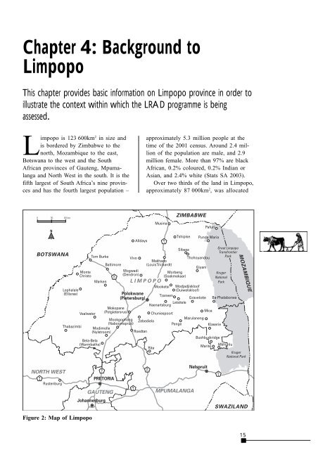
Chapter 4: Background to Limpopo This chapter provides basic information on Limpopo province in order to illustrate the context within which the LRAD programme is being assessed. Limpopo is 123 600km 2 in size and is bordered by Zimbabwe to the north, Mozambique to the east, Botswana to the west and the South African provinces of Gauteng, Mpumalanga and North West in the south. It is the fifth largest of South Africa’s nine provinces and has the fourth largest population – approximately 5.3 million people at the time of the 2001 census. Around 2.4 million of the population are male, and 2.9 million female. More than 97% are black African, 0.2% coloured, 0.2% Indian or Asian, and 2.4% white (Stats SA 2003). Over two thirds of the land in Limpopo, approximately 87 000km 2 , was allocated Figure 2: Map of Limpopo 15
A critical appraisal of South Africa’s market-based land reform policy for white ownership and use in the past, primarily commercial agriculture with some forestry and conservation. Farming on this land was carried out on about 7 200 commercial farming units (Stats SA 1996). Meanwhile the former homelands occupied 36 000km 2 , just under one third of the land area, and accommodated approximately 299 000 small farmers as well as the majority of the 5.1 million African population (see Figure 1 on page 2). Limpopo is arguably the poorest province in South Africa and faces enormous development challenges. It is the most rural of any province in the country with approximately 89% of the population living in non-urban areas. Less than 10% of the households have piped water in their dwellings, 38% rely on public taps for their water supply and 10.5% rely on dams, rivers or springs. A total of 59.5% of households use wood for cooking and heating. Limpopo has an unemployment rate of 48.8%, according to Statistics South Africa figures, which count those actively seeking work who could not find work at the time of the survey. A closer analysis shows that only 22.7% of the population between the ages of 15 and 65 actually have work (Stats SA 2003). The agricultural sector is the largest employer outside the public sector employing 118 261 people. Only the Western Cape has a larger number of farm workers (Stats SA 2000). Many of these people and their families live on the farms. Others live on the farms, but no longer work there. It is common in Limpopo for families to have lived for generations on one farm. In some cases people can trace their occupation of the same land to times before the first white settlers arrived. Conditions on farms are typical of those across the country with farm residents and workers receiving extremely low wages and suffering under notoriously poor working conditions. A national study carried out for the Department of Labour (2001) found that ‘(c)hildren living on commercial farms are more likely to be stunted and underweight than any other children’. 1 Limpopo had three ‘homeland’ governments during the apartheid era: Lebowa, Gazankulu and Venda. African people were forced to live in these areas on the basis of their ethnic origin. Forced removals, for the purpose of consolidating these homelands, are the basis of many restitution claims. Overcrowding in these areas resulted in soil erosion and the development of rural slums, whose residents have little opportunity to enter paid employment. This situation is compounded by the large-scale exodus of men to the industrialised centres such as Gauteng in search of work (Wilson & Ramphele 1989:42). As a result, over 55% of the province’s population is female. Children and youth make up the largest proportion of the population with 52.6% of the population under the age of 20 (Stats SA 2003). Limpopo has varied geography, rainfall and soil fertility. In the fertile areas agriculture is an important source of income. Here maize is the main crop, with fruit, vegetables, tea and cereals grown where possible. Cattle farming is practised in the western and northern parts where the rainfall is generally too low for cultivation (Kirsten 1996:306–9). The rural communities of Limpopo are characterised by a low degree of selforganisation, with weak and limited relations between the traditional authorities and the new local government structures that were set up in 1995 and restructured in 1999. Neither the traditional structures nor the newly-established democratic local government structures have engaged actively with the land reform programme, with one or two exceptions. These structures have not been effective in providing communities with information on development programmes and reforms, with the result that communities often do not know how to access the (limited) support available from the state (Nkuzi 2001). Land reform in Limpopo has suffered many of the same shortcomings as the rest of South Africa. It was very slow to get started and the projects that were implemented under SLAG in the period 16
- Page 1 and 2: A critical appraisal of South Afric
- Page 3 and 4: Hanging on a wire: A historical and
- Page 5 and 6: Hanging on a wire: A historical and
- Page 7 and 8: Hanging on a wire: A historical and
- Page 9 and 10: A critical appraisal of South Afric
- Page 11 and 12: A critical appraisal of South Afric
- Page 13 and 14: A critical appraisal of South Afric
- Page 15 and 16: A critical appraisal of South Afric
- Page 17 and 18: A critical appraisal of South Afric
- Page 19 and 20: A critical appraisal of South Afric
- Page 21: A critical appraisal of South Afric
- Page 25 and 26: A critical appraisal of South Afric
- Page 27 and 28: A critical appraisal of South Afric
- Page 29 and 30: A critical appraisal of South Afric
- Page 31 and 32: A critical appraisal of South Afric
- Page 33 and 34: A critical appraisal of South Afric
- Page 35 and 36: A critical appraisal of South Afric
- Page 37 and 38: A critical appraisal of South Afric
- Page 39 and 40: A critical appraisal of South Afric
- Page 41 and 42: A critical appraisal of South Afric
- Page 43 and 44: A critical appraisal of South Afric
- Page 45 and 46: A critical appraisal of South Afric
- Page 47 and 48: A critical appraisal of South Afric
- Page 49 and 50: A critical appraisal of South Afric
- Page 51 and 52: A critical appraisal of South Afric
- Page 53 and 54: A critical appraisal of South Afric
- Page 55 and 56: A critical appraisal of South Afric
- Page 57: 50 A critical appraisal of South Af
Chapter 4: Background to<br />
Limpopo<br />
This chapter provides basic information on Limpopo province in order to<br />
illustrate the context within which the LRAD programme is being<br />
assessed.<br />
Limpopo is 123 600km 2 in size and<br />
is bordered by Zimbabwe to the<br />
north, Mozambique to the east,<br />
Botswana to the west and the <strong>South</strong><br />
African provinces <strong>of</strong> Gauteng, Mpumalanga<br />
and North West in the south. It is the<br />
fifth largest <strong>of</strong> <strong>South</strong> Africa’s nine provinces<br />
and has the fourth largest population –<br />
approximately 5.3 million people at the<br />
time <strong>of</strong> the 2001 census. Around 2.4 million<br />
<strong>of</strong> the population are male, and 2.9<br />
million female. More than 97% are black<br />
African, 0.2% coloured, 0.2% Indian or<br />
Asian, and 2.4% white (Stats SA 2003).<br />
Over two thirds <strong>of</strong> the <strong>land</strong> in Limpopo,<br />
approximately 87 000km 2 , was allocated<br />
Figure 2: Map <strong>of</strong> Limpopo<br />
15


