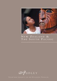
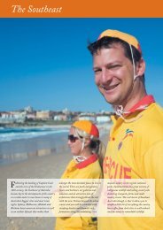
Download - Audley Travel
Download - Audley Travel
Download - Audley Travel

You also want an ePaper? Increase the reach of your titles
YUMPU automatically turns print PDFs into web optimized ePapers that Google loves.
The Kings’ Highway<br />
For centuries the Kings’ Highway was the<br />
principal route for traders travelling between<br />
Arabia and the Levant. It hugs the edge of the<br />
Great Rift Valley, with the Dead Sea filling the<br />
bottom of this huge split in the earth. The<br />
highway crosses countless river beds and the<br />
availability of water made this a key trade route.<br />
These days, most heavy traffic takes the Desert<br />
Highway, leaving the winding switchbacks,<br />
dramatic vistas, castles and churches to the<br />
intrepid visitor. Some of the sights of the Kings’<br />
Highway can be visited on a drive between<br />
Amman and Petra but a return journey on the<br />
same route may be necessary to visit them all.<br />
Kings’ Highway at Wadi Mujib<br />
Mount Nebo<br />
Said to be the spot from which Moses viewed<br />
the Holy Land and where tradition has it he<br />
was later buried, Mount Nebo is an important<br />
place for Christian pilgrimage. A church has<br />
existed on this site since 393 AD and although<br />
it has been much altered and restored since<br />
then, it still houses some mosaics which are<br />
around 1,500 years old. Mount Nebo is the<br />
perfect place to stop on the Kings’ Highway for<br />
a view over the Holy Land. On clear days, the<br />
towns of Jericho and Jerusalem can be made<br />
out in the distance, across the Jordan Valley<br />
and the Dead Sea.<br />
Holy Land mosaic, Madaba<br />
Mount Nebo<br />
Madaba<br />
Madaba, a town at the northern end of the<br />
Kings’ Highway, has a strong Christian heritage,<br />
with numerous churches dotted around its<br />
quiet, charming streets. The town is best known<br />
for the fine examples of Byzantine-era mosaics,<br />
the most famous of which is a map from the<br />
6th century depicting the Holy Land. It is easily<br />
explored on a walking tour, taking in all the<br />
churches and the archaeological park, which is<br />
an open-air museum.<br />
Mukawir<br />
A short drive off the Kings’ Highway, on a lonely<br />
pinnacle overlooking the Dead Sea, is the castle<br />
of Mukawir. It was the site of Herod’s Palace,<br />
where Salome asked for the head of John the<br />
Baptist as a reward for her dancing, and also a<br />
centre of resistance to Rome during the First<br />
Jewish Revolt. After the steep climb up to the<br />
castle you are rewarded with fantastic views<br />
over the surrounding hills. The outline of the<br />
camps and even the siege ramp built by the<br />
Romans to capture Mukawir can still be seen.<br />
34