

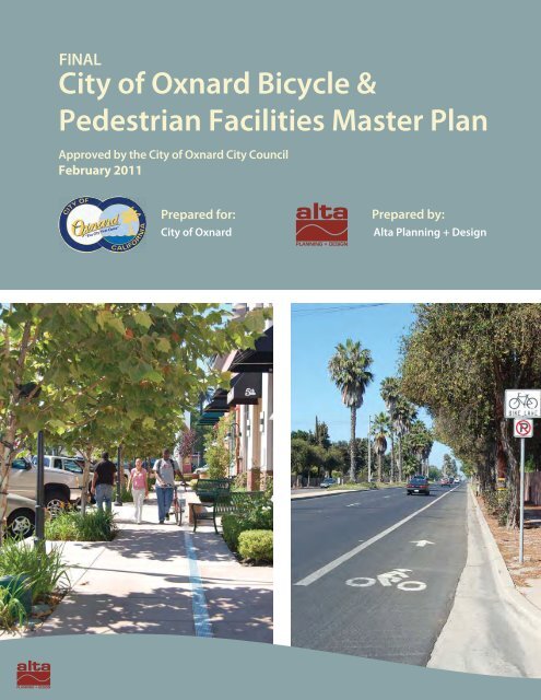
City of Oxnard Bicycle & Pedestrian Facilities Master Plan
City of Oxnard Bicycle & Pedestrian Facilities Master Plan
City of Oxnard Bicycle & Pedestrian Facilities Master Plan

You also want an ePaper? Increase the reach of your titles
YUMPU automatically turns print PDFs into web optimized ePapers that Google loves.
FINAL<br />
<strong>City</strong> <strong>of</strong> <strong>Oxnard</strong> <strong>Bicycle</strong> &<br />
<strong>Pedestrian</strong> <strong>Facilities</strong> <strong>Master</strong> <strong>Plan</strong><br />
Approved by the <strong>City</strong> <strong>of</strong> <strong>Oxnard</strong> <strong>City</strong> Council<br />
February 2011<br />
Prepared for:<br />
<strong>City</strong> <strong>of</strong> <strong>Oxnard</strong><br />
Prepared by:<br />
Alta <strong>Plan</strong>ning + Design
<strong>Oxnard</strong> <strong>Bicycle</strong> and <strong>Pedestrian</strong> <strong>Master</strong> <strong>Plan</strong><br />
Acknowledgements<br />
Prepared for:<br />
<strong>City</strong> <strong>of</strong> <strong>Oxnard</strong><br />
Prepared by:<br />
Alta <strong>Plan</strong>ning + Design in collaboration with MNS Engineers, Inc.<br />
Brett Hondorp, Principal<br />
Matt Benjamin, Project Manager<br />
Emily Duchon, Designer<br />
Jessie Holzer, <strong>Plan</strong>ner<br />
Adrian Leung, <strong>Plan</strong>ner
<strong>City</strong> <strong>of</strong> <strong>Oxnard</strong> | <strong>Bicycle</strong> and <strong>Pedestrian</strong> <strong>Master</strong> <strong>Plan</strong><br />
Table <strong>of</strong> Contents<br />
1 Introduction ................................................................................................................................. 1<br />
1.1 Benefits <strong>of</strong> Walking and Bicycling ............................................................................................................................. 1<br />
1.2 <strong>Plan</strong> Overview ................................................................................................................................................................... 1<br />
2 <strong>Plan</strong> Goal and Objectives ............................................................................................................ 3<br />
2.1 Goal ....................................................................................................................................................................................... 3<br />
2.2 Objectives ........................................................................................................................................................................... 3<br />
3 Existing Conditions ..................................................................................................................... 5<br />
3.1 Relevant Documents and Policies ............................................................................................................................. 5<br />
3.2 Existing <strong>Bicycle</strong> and <strong>Pedestrian</strong> <strong>Facilities</strong> ............................................................................................................ 18<br />
4 Needs Analysis ........................................................................................................................... 29<br />
4.1 Existing Bicycling and Walking Activity ................................................................................................................ 29<br />
4.2 <strong>Bicycle</strong> and <strong>Pedestrian</strong> Demand Model ............................................................................................................... 30<br />
4.3 Collision Analysis .......................................................................................................................................................... 41<br />
4.4 Additional Generator Considerations ................................................................................................................... 46<br />
5 Recommended Improvements ................................................................................................. 49<br />
5.1 Bicycling <strong>Facilities</strong> ......................................................................................................................................................... 49<br />
5.2 <strong>Pedestrian</strong> <strong>Facilities</strong> ..................................................................................................................................................... 58<br />
5.3 Existing <strong>Bicycle</strong> Lane Enhancements .................................................................................................................... 61<br />
5.4 Recommended Policies and Programs ................................................................................................................. 63<br />
6 Prioritization Strategy .............................................................................................................. 73<br />
6.1 Project Selection Criteria and Ranking ................................................................................................................. 73<br />
6.2 Prioritization Tables ..................................................................................................................................................... 76<br />
6.3 Cost Assumptions ......................................................................................................................................................... 88<br />
6.4 Past Expenditures ......................................................................................................................................................... 91<br />
6.5 Project Sheets ................................................................................................................................................................ 92<br />
7 Funding .................................................................................................................................... 103<br />
8 Monitoring and Maintenance ................................................................................................. 117<br />
8.1 Maintenance Guidelines .......................................................................................................................................... 117<br />
8.2 Monitoring and Evaluation ..................................................................................................................................... 118<br />
Appendix A: Design Guidelines .............................................................................................................. A-1<br />
Appendix B: Trip and Emissions Reduction Estimates .......................................................................... B-1<br />
Appendix C: Safety Review ..................................................................................................................... C-1<br />
Appendix D: <strong>Bicycle</strong> Transportation Account Checklist ........................................................................ D-1<br />
Alta <strong>Plan</strong>ning + Design | i
Table <strong>of</strong> Contents<br />
List <strong>of</strong> Figures<br />
Figure 3-1: 2002 <strong>Master</strong> <strong>Plan</strong> Recommended <strong>Facilities</strong> Map ............................................................................................... 6<br />
Figure 3-2: <strong>Oxnard</strong> Land Use Map: .............................................................................................................................................. 10<br />
Figure 3-3: Existing <strong>Pedestrian</strong> Conditions in the Channel Islands Harbor .................................................................. 17<br />
Figure 3-4: Caltrans Bikeway Classifications ............................................................................................................................ 20<br />
List <strong>of</strong> Maps<br />
Map 3-1: <strong>Oxnard</strong> Existing <strong>Bicycle</strong> <strong>Facilities</strong>…………………………………………………………………….23<br />
Map 4-1: <strong>Oxnard</strong> Airport and Metrolink Buffers ..................................................................................................................... 33<br />
Map 4-2: Shopping Center Buffers .............................................................................................................................................. 34<br />
Map 4-3: Commercial/Industrial Area Buffers ......................................................................................................................... 35<br />
Map 4-4: Park/Beach/Recreational Area Buffers .................................................................................................................... 36<br />
Map 4-5: School Buffers ................................................................................................................................................................... 37<br />
Map 4-6: Government/Hospital/Library Buffers ..................................................................................................................... 38<br />
Map 4-7: Bike and <strong>Pedestrian</strong> Attractors Model ..................................................................................................................... 39<br />
Map 4-8: Bike and <strong>Pedestrian</strong> Generators Model .................................................................................................................. 44<br />
Map 4-9: Bike and <strong>Pedestrian</strong> Detractors Model .................................................................................................................... 45<br />
Map 4-10: Bike and <strong>Pedestrian</strong> Composite Model ................................................................................................................ 47<br />
Map 5-1: <strong>Oxnard</strong> Existing and Proposed <strong>Bicycle</strong> <strong>Facilities</strong> ................................................................................................. 51<br />
Map 5-2: <strong>Oxnard</strong> Proposed <strong>Pedestrian</strong> Improvement Areas ............................................................................................. 60<br />
Map 5-3: Existing Bike Lane Enhancement Corridors .......................................................................................................... 62<br />
Map 6-1: <strong>Oxnard</strong> Prioritized <strong>Bicycle</strong> Projects ........................................................................................................................... 83<br />
Map 6-2: <strong>Oxnard</strong> Prioritized <strong>Pedestrian</strong> Projects ................................................................................................................... 87<br />
List <strong>of</strong> Tables<br />
Table 3-1:<strong>Oxnard</strong> <strong>City</strong> Ordinances Related to Bicycling ...................................................................................................... 11<br />
Table 3-2: <strong>Oxnard</strong> <strong>City</strong> Ordinances Related to Walking ...................................................................................................... 14<br />
Table 3-3: Existing <strong>Bicycle</strong> <strong>Facilities</strong> ............................................................................................................................................ 21<br />
Table 4-1: Estimated Existing and Projected Bicycling Activity ........................................................................................ 29<br />
Table 4-2: Estimated Existing and Projected Walking Activity ........................................................................................ 30<br />
Table 4-3: <strong>Oxnard</strong> Major Destinations ....................................................................................................................................... 31<br />
Table 4-4: Weighted Values Based on Distance ..................................................................................................................... 32<br />
Table 4-5: Trip Attractor Factors and Scoring ......................................................................................................................... 32<br />
Table 4-6: Population Density and Scoring .............................................................................................................................. 40<br />
Table 4-7: Scoring <strong>Bicycle</strong> and <strong>Pedestrian</strong> Detractors by Detractor Type .................................................................... 40<br />
ii | Alta <strong>Plan</strong>ning + Design
<strong>City</strong> <strong>of</strong> <strong>Oxnard</strong> | <strong>Bicycle</strong> and <strong>Pedestrian</strong> <strong>Master</strong> <strong>Plan</strong><br />
Table 4-8: <strong>Oxnard</strong> <strong>Bicycle</strong> Collisions ........................................................................................................................................... 41<br />
Table 4-9: <strong>Oxnard</strong> <strong>Pedestrian</strong> Collisions .................................................................................................................................... 42<br />
Table 5-1: Proposed Multi-Use Paths ......................................................................................................................................... 50<br />
Table 5-2: Proposed <strong>Bicycle</strong> Lanes .............................................................................................................................................. 53<br />
Table 5-3: Proposed <strong>Bicycle</strong> Routes ............................................................................................................................................ 54<br />
Table 5-4: Proposed <strong>Bicycle</strong> Boulevards .................................................................................................................................... 55<br />
Table 5-5: List <strong>of</strong> Proposed <strong>Pedestrian</strong> <strong>Facilities</strong> .................................................................................................................... 58<br />
Table 5-6: Safe Routes to School Information Gathering ................................................................................................... 66<br />
Table 6-1: Criteria Rank and Weight ........................................................................................................................................... 74<br />
Table 6-2: <strong>Bicycle</strong> Criteria Scoring Description ....................................................................................................................... 74<br />
Table 6-3: <strong>Pedestrian</strong> Criteria Scoring Description................................................................................................................ 75<br />
Table 6-4: <strong>Bicycle</strong> Project Prioritization ..................................................................................................................................... 77<br />
Table 6-5:<strong>Pedestrian</strong> Project Prioritization ............................................................................................................................... 85<br />
Table 6-6: <strong>Bicycle</strong> Facility Cost Assumptions ........................................................................................................................... 88<br />
Table 6-7: <strong>Pedestrian</strong> Facility Cost Assumptions ................................................................................................................... 88<br />
Table 6-8: Proposed <strong>Bicycle</strong> Facility Cost Estimates ............................................................................................................. 89<br />
Table 6-9: Proposed <strong>Pedestrian</strong> Improvement Cost Estimates ........................................................................................ 89<br />
Table 6-10: <strong>Bicycle</strong> and <strong>Pedestrian</strong> Project Expenditures 2001-2012 ............................................................................ 91<br />
Table 7-1: Funding Sources .......................................................................................................................................................... 104<br />
Table 8-1: Annual Maintenance Costs <strong>of</strong> <strong>Bicycle</strong> <strong>Facilities</strong> ............................................................................................... 117<br />
Alta <strong>Plan</strong>ning + Design | iii
Table <strong>of</strong> Contents<br />
This page intentionally left blank.<br />
iv | Alta <strong>Plan</strong>ning + Design
<strong>City</strong> <strong>of</strong> <strong>Oxnard</strong> | <strong>Bicycle</strong> and <strong>Pedestrian</strong> <strong>Master</strong> <strong>Plan</strong><br />
1 Introduction<br />
The <strong>City</strong> <strong>of</strong> <strong>Oxnard</strong> recognizes that walking and bicycling enhances the quality <strong>of</strong> life for its residents and<br />
visitors, both directly and indirectly. The <strong>Bicycle</strong> and <strong>Pedestrian</strong> <strong>Facilities</strong> <strong>Master</strong> <strong>Plan</strong> is for all residents and<br />
visitors <strong>of</strong> <strong>Oxnard</strong> who desire to walk or bike for purposes <strong>of</strong> recreation, commuting, or physical health.<br />
1.1 Benefits <strong>of</strong> Walking and Bicycling<br />
Bicycling and walking are important to <strong>Oxnard</strong>’s future due to their potential for addressing several<br />
interrelated challenges, including traffic, air quality, creating a sense <strong>of</strong> community, and public health. Nonmotorized<br />
transportation infrastructure can also provide economic benefits to the community. As the city<br />
becomes more inviting to pedestrians and bicyclists, increasing numbers <strong>of</strong> work, school, shopping, and<br />
recreational trips will be made on bicycle and foot. Cumulatively, this pattern may reduce traffic in some areas<br />
and improve air quality. Furthermore, providing facilities for walking and bicycling increases a community’s<br />
livability. More activity at a slower rate provides what Jane Jacobs referred to as “eyes on the street,”<br />
increasing an area’s sense <strong>of</strong> place and safety. Walking and bicycling can also improve public health through<br />
an increase in physical activity. In recent years, public health pr<strong>of</strong>essionals and urban planners have become<br />
increasingly aware that dependency on motor vehicles can make people more sedentary. The resulting health<br />
care cost savings, as well as reduced expenditures on gas, can enliven the local economy. 1 Additionally,<br />
building local pride and recognition for <strong>Oxnard</strong>’s non-motorized infrastructure will likely increase the<br />
attraction <strong>of</strong> the area for tourists interested in conferences, races, and other related events and associations.<br />
Developing these facilities can potentially enhance the economy through tourism dollars. By planning a region<br />
that is more bikeable and walkable, <strong>Oxnard</strong> can affect all <strong>of</strong> these elements and collectively influence existing<br />
and future quality <strong>of</strong> life.<br />
1.2 <strong>Plan</strong> Overview<br />
The <strong>Bicycle</strong> and <strong>Pedestrian</strong> <strong>Facilities</strong> <strong>Master</strong> <strong>Plan</strong> provides a broad vision, strategies, and actions for the<br />
improvement <strong>of</strong> bicycling and walking in the <strong>City</strong> <strong>of</strong> <strong>Oxnard</strong>. This <strong>Plan</strong> is an update to the <strong>Bicycle</strong> and<br />
<strong>Pedestrian</strong> <strong>Facilities</strong> <strong>Master</strong> <strong>Plan</strong> adopted in 2002 and was developed to build upon and enhance that plan.<br />
The purpose <strong>of</strong> this <strong>Plan</strong> is to expand the existing networks, close gaps, address constrained areas, provide<br />
greater connectivity, educate, encourage, and maximize funding sources.<br />
1 Litman T.A. (2011). Economic value <strong>of</strong> walking. Victoria: Victoria Transport Policy Institute.<br />
Litman T.A. (2011). Evaluating non-motorized transportation benefits and costs. Victoria: Victoria Transport Policy Institute 2011.<br />
Alta <strong>Plan</strong>ning + Design | 1
Chapter One | Introduction<br />
This page intentionally left blank.<br />
2 | Alta <strong>Plan</strong>ning + Design
<strong>City</strong> <strong>of</strong> <strong>Oxnard</strong> | <strong>Bicycle</strong> and <strong>Pedestrian</strong> <strong>Master</strong> <strong>Plan</strong><br />
2 <strong>Plan</strong> Goal and Objectives<br />
This chapter presents the goal and objectives <strong>of</strong> the <strong>Oxnard</strong> <strong>Bicycle</strong> and <strong>Pedestrian</strong> <strong>Master</strong> <strong>Plan</strong>.<br />
2.1 Goal<br />
The <strong>Oxnard</strong> <strong>Bicycle</strong> and <strong>Pedestrian</strong> <strong>Facilities</strong> <strong>Master</strong> <strong>Plan</strong> intends to make bicycling and walking integral<br />
modes <strong>of</strong> transportation in <strong>Oxnard</strong> through a safe, interconnected system <strong>of</strong> bicycle and pedestrian facilities.<br />
The following objectives serve to implement this overarching goal:<br />
2.2 Objectives<br />
<br />
Continue to improve and expand pedestrian and bicycle facilities, as needed throughout the<br />
community, with a focus on improved connectivity within the city.<br />
<br />
<br />
<br />
<br />
Ensure that pedestrian and bicycle networks provide direct connections between major activity<br />
centers (e.g., civic, employment, and retail centers) and minimize conflicts with other modes <strong>of</strong><br />
transportation.<br />
Improve bicycle and pedestrian access and safety to public transportation stops and stations.<br />
Regard facilities for bicyclists and pedestrians as important parts <strong>of</strong> the overall transportation system<br />
and not just recreational facilities.<br />
Increase the bicycle mode share throughout the city and improve bicycle access to the city's<br />
transportation system.<br />
Cyclist along Vineyard Avenue.<br />
Alta <strong>Plan</strong>ning + Design | 3
Chapter Two | <strong>Plan</strong> Goal and Objectives<br />
This page intentionally left blank.<br />
4 | Alta <strong>Plan</strong>ning + Design
<strong>City</strong> <strong>of</strong> <strong>Oxnard</strong> | <strong>Bicycle</strong> and <strong>Pedestrian</strong> <strong>Master</strong> <strong>Plan</strong><br />
3 Existing Conditions<br />
The Existing Conditions chapter reviews existing plans, policies, programs, and facilities related to walking<br />
and bicycling in the <strong>City</strong> <strong>of</strong> <strong>Oxnard</strong>.<br />
3.1 Relevant Documents and Policies<br />
This section summarizes relevant documents and policies that regulate and establish a framework for<br />
bicycling and walking in <strong>Oxnard</strong>. These include <strong>Oxnard</strong> plans and policies, as well as plans from neighboring<br />
and regional jurisdictions. This <strong>Plan</strong> is consistent with not only these local transportation plans, but also<br />
existing energy conservation plans, including, but not limited to, programs that provide incentives for bicycle<br />
commuting (see Appendix B: Trip and Emission Reduction Estimates for breakdowns <strong>of</strong> estimates that are required to<br />
make <strong>Oxnard</strong> eligible for funding from the State <strong>Bicycle</strong> Transportation Account).<br />
3.1.1 <strong>Oxnard</strong> <strong>Plan</strong>s and Policies<br />
Major plans and policies within <strong>Oxnard</strong> include the 2002 <strong>Bicycle</strong> and <strong>Pedestrian</strong> <strong>Facilities</strong> <strong>Master</strong> <strong>Plan</strong>, the<br />
2030 General <strong>Plan</strong>, the Channel Islands Harbor Public Area <strong>Plan</strong>, and all relevant city ordinances.<br />
3.1.1.1 <strong>Oxnard</strong> <strong>Bicycle</strong> and <strong>Pedestrian</strong> <strong>Facilities</strong> <strong>Master</strong> <strong>Plan</strong> (2002)<br />
The 2002 <strong>Oxnard</strong> <strong>Bicycle</strong> and <strong>Pedestrian</strong> <strong>Facilities</strong> <strong>Master</strong> <strong>Plan</strong><br />
provides recommendations for new bicycle and pedestrian facility<br />
segments, programs, and policies in <strong>Oxnard</strong>.<br />
The 2002 plan recommends facilities focusing on connections to<br />
existing segments <strong>of</strong> bike lanes and sidewalks. It addresses bicycle<br />
and pedestrian routes and specific regional and local access<br />
opportunities. The recommendations consist <strong>of</strong> gap closures and<br />
new links, creating a network along major thoroughfares. The 2002<br />
plan recommends other routes, lanes, and multi-use paths<br />
connecting residential neighborhoods in <strong>Oxnard</strong> with schools,<br />
parks, libraries, employment centers, shopping areas and the<br />
downtown area. Figure 3-1 provides an overview <strong>of</strong> the existing and<br />
recommended bikeways and pedestrian facilities from the 2002 plan.<br />
In addition, the plan recommends that safe, secure bicycle parking<br />
capacity be included throughout the city at both public and private<br />
<strong>Oxnard</strong> adopted the previous bicycle and<br />
pedestrian master plan in 2002.<br />
destinations. It also recommends informational signage be provided at public destinations; including parks,<br />
schools, the downtown area, the <strong>Oxnard</strong> Transportation Center, and the Civic Center.<br />
Alta <strong>Plan</strong>ning + Design | 5
Chapter Three | Existing Conditions<br />
Figure 3-1: 2002 <strong>Master</strong> <strong>Plan</strong> Recommended <strong>Facilities</strong> Map<br />
6 | Alta <strong>Plan</strong>ning + Design
<strong>City</strong> <strong>of</strong> <strong>Oxnard</strong> | <strong>Bicycle</strong> and <strong>Pedestrian</strong> <strong>Master</strong> <strong>Plan</strong><br />
The plan recommends a number <strong>of</strong> education, enforcement, and outreach programs, including grade school<br />
safety curriculum, school commute route improvement plans, safe-routes-to-school programs, bicycle fairs,<br />
employer incentives for alternative travel, transportation demand management, motorist education, bicycle<br />
and pedestrian maps, and walking tours.<br />
The 2002 plan recommends the establishment <strong>of</strong> a <strong>Bicycle</strong> Advisory Committee with a prioritized set <strong>of</strong><br />
criteria that regularly identifies and implements bicycle and pedestrian improvements.<br />
3.1.1.2 <strong>City</strong> <strong>of</strong> <strong>Oxnard</strong> 2030 General <strong>Plan</strong><br />
The <strong>Oxnard</strong> 2030 General <strong>Plan</strong> sets goals related to providing a safe and comprehensive transportation<br />
network. The 2030 General <strong>Plan</strong> folds bicycle-related goals and policies into Chapter 4, Infrastructure and<br />
Community Services (Section 4.3). The 2030 General <strong>Plan</strong> identifies “Urban Villages,” a new emphasis on<br />
transit-oriented mixed-use neighborhoods, to be bicycle and pedestrian oriented.<br />
A Safe and Comprehensive Network<br />
The 2030 General <strong>Plan</strong> Circulation Element Infrastructure and Community Service (ICS) Goal 8 seeks to<br />
provide “Safe bicycle and pedestrian circulation throughout the <strong>City</strong>.” The 2030 General <strong>Plan</strong> (General <strong>Plan</strong>)<br />
identifies 14 policies to achieve this goal:<br />
ICS-8.1 Improved <strong>Bicycle</strong> and <strong>Pedestrian</strong> Safety<br />
Promote safety by minimizing conflicts between automobiles, bicycles, and pedestrians with special attention<br />
to lighting resources on commercial corridors.<br />
ICS-8.2 <strong>Bicycle</strong> Route <strong>Plan</strong><br />
<strong>Plan</strong> a citywide system <strong>of</strong> safe, efficient, and attractive bicycle routes for commuter, school, and recreational<br />
use. Maintain a bicycle route map in the <strong>of</strong>fice <strong>of</strong> the <strong>City</strong> Traffic Engineer that is widely available for public<br />
use.<br />
ICS-8.3 Completing <strong>Bicycle</strong> and Sidewalk Network<br />
Prioritize plans for bicycle and pedestrian facilities that provide continuity, and close gaps in the city’s<br />
existing bike path and sidewalk network.<br />
ICS-8.4 New Development Requires <strong>Bicycle</strong> Improvements<br />
Where designated, require proposed developments to include bicycle paths and / or lanes in their plan and to<br />
clearly indicate possible bicycling hazards such as speed bumps and storm drain inlet grates in parking lots.<br />
ICS-8.5 Public Sidewalks and <strong>Pedestrian</strong> Orientation<br />
Consider and require where appropriate and feasible the enhancement <strong>of</strong> the pedestrian environmental as part<br />
<strong>of</strong> private development and public works projects, especially for public sidewalks.<br />
ICS-8.6 Americans with Disability Act (ADA) Handicap Requirements<br />
Require installation <strong>of</strong> ADA 2 compliant handicapped ramp curb-cuts and other ADA access with all new<br />
roadway construction and significant reconstruction <strong>of</strong> existing roadways, parking lots, plazas and pedestrian<br />
area, and parks.<br />
2 The Americans with Disabilities Act (ADA) <strong>of</strong> 1990 prohibits discrimination <strong>of</strong> persons with disabilities. Titles II and III <strong>of</strong> the<br />
ADA require persons with disabilities be provided access to public entities, public transportation, and public accommodations.<br />
Alta <strong>Plan</strong>ning + Design | 7
Chapter Three | Existing Conditions<br />
ICS-8.7 Downtown and Beach Area <strong>Bicycle</strong> Accessibility<br />
Support improvements to increase bicycle accessibility in and around the Downtown area and bicycle route<br />
access to the harbor, beach, and other popular destinations.<br />
ICS-8.8 Educational <strong>Facilities</strong><br />
Coordinate with public school districts and other educational facilities to design pedestrian and bicycle<br />
access as the preferred access to schools rather than vehicular, and improve drop <strong>of</strong>f and pick up circulation,<br />
especially during the morning and afternoon peak periods.<br />
ICS-8.9 Street Crossings<br />
Design street crossings to provide for the safety needs <strong>of</strong> bicyclists and pedestrians in accordance with the<br />
designations set forth in the <strong>Bicycle</strong> <strong>Master</strong> <strong>Plan</strong>.<br />
ICS-8.10 Coastal Trail Development<br />
Encourage, plan, and participate in development <strong>of</strong> an aesthetic, educational, safe and convenient trail<br />
program in the coastal resource areas in cooperation with other agencies, where environmentally appropriate.<br />
ICS-8.11 <strong>Bicycle</strong> Parking and Storage<br />
Develop standards for safe and adequate facilities for storing and locking bicycles at business and employment<br />
centers, recreation areas, and major public facilities.<br />
ICS-8.12 Roadway Surfacing<br />
Maintain and improve the surface quality <strong>of</strong> the right shoulder <strong>of</strong> roadways so that it is suitable for bicycle<br />
travel.<br />
ICS-8.13 Importance <strong>of</strong> <strong>Pedestrian</strong> and <strong>Bicycle</strong> Access in Site <strong>Plan</strong>ning<br />
Require that new development treat pedestrian and bicycle circulation as equal to or preferred to vehicular<br />
access in site design including, but not limited to, access to neighborhood and commercial shopping centers,<br />
schools, and parks.<br />
ICS-8.14 Connecting <strong>Facilities</strong><br />
Create a physical link for pedestrian and bicycle traffic between parks and recreation facilities as specified in<br />
the Bike and <strong>Pedestrian</strong> <strong>Master</strong> <strong>Plan</strong>.<br />
Transportation Demand Management<br />
The General <strong>Plan</strong> also references bicycling and walking through Infrastructure and Community Services Goal<br />
7, which addresses transportation demand management. It directs the city to promote development patterns<br />
that encourage pedestrian and bicycle travel in order to reduce vehicle trips, meet air quality goals, and<br />
minimize congestion.<br />
Urban Villages<br />
An important new land use overlay defined by the General <strong>Plan</strong> is “Urban Village.” These six neighborhoods<br />
are intended for transit-oriented mixed-use incorporating commercial and employment uses with residential.<br />
They are primarily designed to allow people to live near their place <strong>of</strong> employment with support and transit<br />
services. This proximity creates communities where it is easier to walk and bicycle for many short trips. Areas<br />
designated as Urban Villages include the Channel Islands Harbor Marina Village, Downtown East Transit<br />
8 | Alta <strong>Plan</strong>ning + Design
<strong>City</strong> <strong>of</strong> <strong>Oxnard</strong> | <strong>Bicycle</strong> and <strong>Pedestrian</strong> <strong>Master</strong> <strong>Plan</strong><br />
Oriented District (DETOD), Southeast Entry Village, Teal Club Specific <strong>Plan</strong>, East Village Phase III, and<br />
North <strong>Oxnard</strong> Transit Enhancement District (NOTED).<br />
The Channel Islands Harbor Marina Village is designated as an<br />
Urban Village.<br />
Figure 3-2 provides a visual representation <strong>of</strong> land use for the whole city, including identification <strong>of</strong> the seven<br />
Urban Village areas.<br />
Alta <strong>Plan</strong>ning + Design | 9
Chapter Three | Existing Conditions<br />
Figure 3-2: <strong>Oxnard</strong> Land Use Map<br />
10 | Alta <strong>Plan</strong>ning + Design
<strong>City</strong> <strong>of</strong> <strong>Oxnard</strong> | <strong>Bicycle</strong> and <strong>Pedestrian</strong> <strong>Master</strong> <strong>Plan</strong><br />
3.1.1.3 <strong>Oxnard</strong> <strong>City</strong> Code<br />
The <strong>City</strong> <strong>of</strong> <strong>Oxnard</strong> has ordinances related to bicycling and walking, including regulation <strong>of</strong> behavior and<br />
facility provisions.<br />
Bicycling-Related <strong>City</strong> Ordinances<br />
The <strong>Oxnard</strong> <strong>City</strong> Code includes restrictions on where bicycling is permitted, requirements for provision <strong>of</strong><br />
bicycle paths in the subdivision process, and specific guidelines for the provision <strong>of</strong> bicycle parking. It also<br />
designates bicycling as an alternative travel mode that can be used for trip reduction measures. No changes to<br />
the <strong>Oxnard</strong> <strong>City</strong> Code are proposed as part <strong>of</strong> this <strong>Plan</strong>. Existing <strong>City</strong> <strong>of</strong> <strong>Oxnard</strong> ordinances related to<br />
bicycling are presented in Table 3-1 below.<br />
<strong>City</strong> Code Number<br />
Sec. 7-132.(D)<br />
Bicycling on Sidewalks<br />
Sec. 7-144. (A)(1) & (B)(1)<br />
Bicycling in Public Parking<br />
Lots and Private Property<br />
Table 3-1:<strong>Oxnard</strong> <strong>City</strong> Ordinances Related to Bicycling<br />
Summary<br />
Except for an on-duty peace <strong>of</strong>ficer, as defined in Cal. Penal Code, Section 830, no person<br />
12 years <strong>of</strong> age or older shall ride a bicycle on a public sidewalk in the city.<br />
No person shall ride, propel or in any manner operate a bicycle on or over any public<br />
parking lot upon which the city has posted signs informing such person that such uses are<br />
prohibited, nor on or over any privately owned property upon which the owner, manager,<br />
or person in charge <strong>of</strong> such private property has posted signs prohibiting such use.<br />
Sec. 15-88.<br />
<strong>Bicycle</strong> Path Subdivision<br />
Provision<br />
As a condition <strong>of</strong> approval <strong>of</strong> any map, the subdivider may be required to dedicate or <strong>of</strong>fer<br />
to dedicate land for bicycle paths subject to the requirements <strong>of</strong> the Subdivision Map Act.<br />
Sec. 16-616.<br />
Off-street <strong>Bicycle</strong> Parking<br />
Provision<br />
Off-street bicycle parking facilities shall be provided for any new building constructed, for<br />
any new use established, and for any change in use in an existing building that would<br />
result in additional parking spaces being required.<br />
Alta <strong>Plan</strong>ning + Design | 11
Chapter Three | Existing Conditions<br />
<strong>City</strong> Code Number<br />
Sec. 16-623.<br />
Minimum <strong>Bicycle</strong> Parking<br />
Requirements by Specific<br />
Use<br />
Sec. 16-631.(B)<br />
Trip Reduction Measures<br />
Summary<br />
The following sub-table lists the minimum bicycle parking requirements. Only those uses<br />
listed in this table are required to install bicycle parking.<br />
Use<br />
Requirements<br />
Shopping Centers:<br />
Regional shopping center<br />
Five spaces at each mall entrance<br />
Shopping center with more than 50,000 square One space per 33 automobile<br />
feet <strong>of</strong> gross floor area<br />
parking spaces<br />
Restaurants:<br />
Fast-food or c<strong>of</strong>fee shop<br />
Five spaces<br />
Pizza parlor<br />
Five spaces<br />
Commercial recreation:<br />
Arcades, games or videos<br />
One space per one game or<br />
amusement device (Need not<br />
exceed 30 spaces)<br />
Bowling alleys, miniature golf, skating rinks, One space per 33 automobile spaces<br />
movie theaters and similar commercial<br />
required<br />
recreation activities as determined by the<br />
director <strong>of</strong> planning and building services<br />
Community facilities:<br />
Swim clubs, racquet and tennis clubs,<br />
One space per 33 automobile spaces<br />
community centers and similar uses as<br />
required<br />
determined by the director <strong>of</strong> planning and<br />
building services<br />
Libraries<br />
One space per each 1,000 square<br />
feet <strong>of</strong> floor area<br />
Office developments, over 100,000 square feet Five spaces<br />
<strong>of</strong> floor area<br />
Banks, savings and loans<br />
Two spaces<br />
Hospitals<br />
Four spaces<br />
Medical and dental buildings<br />
Two spaces<br />
Industrial<br />
Five spaces<br />
Churches<br />
Four spaces<br />
Commercial and industrial developments shall provide bicycle racks or other secure<br />
bicycle parking in accordance with the provisions <strong>of</strong> sections 16-623 and 16-637.<br />
12 | Alta <strong>Plan</strong>ning + Design
<strong>City</strong> <strong>of</strong> <strong>Oxnard</strong> | <strong>Bicycle</strong> and <strong>Pedestrian</strong> <strong>Master</strong> <strong>Plan</strong><br />
<strong>City</strong> Code Number<br />
Sec. 16-637. (A)-(D)<br />
Design Standards for<br />
<strong>Bicycle</strong> Parking<br />
Summary<br />
<strong>Bicycle</strong> racks shall be located to be highly visible from the street or building<br />
entrance where bicyclists approach.<br />
No bicycle rack shall be installed in an isolated location but rather near the main<br />
entrance <strong>of</strong> the building for which they are intended or in a comparably<br />
convenient location.<br />
<strong>Bicycle</strong> racks are intended for use by the general public as well as employees.<br />
Development shall provide safe and convenient access for bicyclists from the<br />
external circulation system to on-site buildings or internal streets and bicycle<br />
parking areas must be separated from motor vehicle parking areas by at least a<br />
curb barrier which would prevent vehicles from damaging bicycles.<br />
<strong>Bicycle</strong> racks shall be constructed to allow a bicycle to be locked to the rack and<br />
to support the bicycle in an upright position when either a “U” type bike lock or<br />
a “Cable I Chain” type bike lock is used.<br />
<strong>Bicycle</strong> racks shall be securely anchored to a supporting surface.<br />
<strong>Bicycle</strong> racks shall be installed in conformance with the requirements <strong>of</strong> the<br />
bicycle rack manufacturer and shall be installed in a rectangular space no less<br />
than 2½ feet wide by 6 feet long per bicycle, unless a locker or a permanent<br />
device to stand the bicycle on end is provided.<br />
<strong>Bicycle</strong> racks shall be readily visible to pedestrians, and the rack must be at least<br />
three feet high, unless the bicycle parking area is surrounded by railing, hedge or<br />
chain at least three feet in height.<br />
<strong>Bicycle</strong> racks shall be installed with adequate space (12 inches minimum) beside<br />
the parked bicycle so that a bicyclist will be able to reach and operate the locking<br />
mechanism.<br />
<strong>Bicycle</strong> lockers and racks shall be located near the primary building entrance, but<br />
not in the main walkway area.<br />
A hard-surfaced parking area is required.<br />
A ramp, at least two feet wide, shall connect all bicycle parking areas to the<br />
nearest roadway in order to provide safe and convenient access from the external<br />
circulation system to on-site buildings and internal streets and sidewalks.<br />
The following image is included to help guide bicycle parking design.<br />
Alta <strong>Plan</strong>ning + Design | 13
Chapter Three | Existing Conditions<br />
<strong>City</strong> Code Number Summary<br />
Sec. 16-643.<br />
All bicycle parking areas shall be surfaced with asphalt-concrete or concrete so as to keep<br />
Parking Area Paving and the area in a dust-free condition.<br />
Construction Standards<br />
Source: <strong>City</strong> <strong>of</strong> <strong>Oxnard</strong> <strong>City</strong> Code<br />
<strong>Pedestrian</strong>-Related <strong>City</strong> Ordinances<br />
Table 3-2 presents ordinances that regulate walking facilities in <strong>Oxnard</strong>. The <strong>City</strong> Code includes<br />
requirements for the provision <strong>of</strong> walkways and crosswalks, designation <strong>of</strong> the Central Business District as a<br />
pedestrian-oriented area, and regulation <strong>of</strong> encroachments upon walkways.<br />
<strong>City</strong> Code<br />
Number<br />
Sec. 16-98. (A)<br />
Walkways<br />
Sec. 16-145. (A)<br />
Purpose and<br />
Intent <strong>of</strong> the<br />
Central Business<br />
District for<br />
<strong>Pedestrian</strong>s<br />
Sec. 16-152. (C)(7)<br />
Providing<br />
<strong>Pedestrian</strong>-<br />
Oriented<br />
Storefronts<br />
Table 3-2: <strong>Oxnard</strong> <strong>City</strong> Ordinances Related to Walking<br />
Summary<br />
<strong>Pedestrian</strong> circulation shall be provided by a system <strong>of</strong> walkways. A walkway shall originate near<br />
an individual mobile home lot, service area, parking bay or storage area and shall lead to a<br />
common recreation area or service facility.<br />
This zone shall integrate residential, commercial, cultural and recreational land uses; encourage<br />
conservation <strong>of</strong> land resources and minimize auto travel; encourage a lively pedestrian-oriented<br />
commercial district; and provide for the location <strong>of</strong> employment and retail centers in close<br />
proximity to residential development <strong>of</strong> varying densities.<br />
At least one new pedestrian-oriented storefront element shall be incorporated into all commercial<br />
buildings or sites, including but not limited to special entryway architecture, recessed main entry,<br />
bulkheads, transom windows, special building design details (e.g., tile, wood or stone trim), special<br />
door design, pedestrian hanging signs, awnings, balconies, terraces, fountains, sculpture, outdoor<br />
seating, decorative paving and public plaza.<br />
Sec. 16-152.<br />
(H)(1)(a-b)<br />
Sidewalk Café<br />
Locations and<br />
Encroachments<br />
on Walkways<br />
A sidewalk café, where permitted, may be located on the public right-<strong>of</strong>-way adjacent to the<br />
restaurant serving the café. A business license for a sidewalk café may be granted after review <strong>of</strong><br />
the application by appropriate city departments, and issuance <strong>of</strong> an encroachment permit or<br />
license agreement.<br />
All sidewalk cafés shall leave clear space for pedestrian movement between the outer edge <strong>of</strong> the<br />
café and the curb line. Sidewalk cafés located at street intersections shall provide a 15-foot clear<br />
space radial to the corner. If pedestrian traffic is especially heavy, the manager may require<br />
additional clear space to ensure adequate room for pedestrian movements.<br />
14 | Alta <strong>Plan</strong>ning + Design
<strong>City</strong> <strong>of</strong> <strong>Oxnard</strong> | <strong>Bicycle</strong> and <strong>Pedestrian</strong> <strong>Master</strong> <strong>Plan</strong><br />
<strong>City</strong> Code Summary<br />
Number<br />
Sec. 16-636. (E) All properties shall provide attractive, direct and safe pedestrian access to parking. The layout <strong>of</strong><br />
<strong>Pedestrian</strong> the parking areas shall relate to building entrances or important architectural elements.<br />
Access to Parking<br />
Areas<br />
Sec. 8-76.<br />
The traffic engineer may establish crosswalks at and between intersections as necessary to<br />
Crosswalks minimize hazards to pedestrians crossing the streets.<br />
Sec. 7-1. (C) The city council declares that any structure, grass, dirt, or thing which in any manner interferes<br />
Nuisances<br />
with, obstructs or endangers the free passage <strong>of</strong> pedestrians or vehicles upon, along or in public<br />
sidewalks, alleys, thoroughfares, buildings, parks or places are nuisances and authorizes the city<br />
manager to abate any such nuisance in accordance with the standard procedures.<br />
Source: <strong>City</strong> <strong>of</strong> <strong>Oxnard</strong> <strong>City</strong> Code<br />
3.1.2 Neighboring Cities and Regional <strong>Plan</strong>s<br />
Neighboring communities that have adopted bicycle plans include the cities <strong>of</strong> Camarillo, Port Hueneme, and<br />
San Buenaventura. Additionally, the Ventura Countywide <strong>Bicycle</strong> <strong>Master</strong> <strong>Plan</strong> addresses regional and<br />
unincorporated bicycling connections. The Santa Clara River Trail Enhancement and Management <strong>Plan</strong><br />
provide policies and programs to promote public access and recreation along the reaches <strong>of</strong> the Santa Clara<br />
River. The McGrath State Beach has a master plan than emphasizes bicycle access from <strong>Oxnard</strong> to the park.<br />
3.1.2.1 Camarillo Bikeway <strong>Master</strong> <strong>Plan</strong> (2003)<br />
The city <strong>of</strong> Camarillo, located<br />
east <strong>of</strong> <strong>Oxnard</strong>, has a bicycle<br />
network consisting primarily <strong>of</strong><br />
bike lanes on major arterials and<br />
bike routes on residential<br />
connectors. The 2003 Bikeway<br />
<strong>Master</strong> <strong>Plan</strong> proposes<br />
enhancement <strong>of</strong> facilities at their<br />
western border, in the direction<br />
<strong>of</strong> <strong>Oxnard</strong>, on Ventura<br />
Boulevard, Pasadena Drive, and<br />
Central Avenue. Although the<br />
cities are not contiguous, these<br />
routes feed into areas <strong>of</strong><br />
unincorporated county between<br />
the two jurisdictions and<br />
provide important connections.<br />
A Class I facility in the <strong>City</strong> <strong>of</strong> Camarillo.<br />
Alta <strong>Plan</strong>ning + Design | 15
Chapter Three | Existing Conditions<br />
3.1.2.2 Port Hueneme <strong>Bicycle</strong> Transportation <strong>Plan</strong> (2007)<br />
The bicycle plan for Port Hueneme, which is located south <strong>of</strong> <strong>Oxnard</strong>, was developed as part <strong>of</strong> the Ventura<br />
Countywide <strong>Bicycle</strong> <strong>Master</strong> <strong>Plan</strong> process. Existing facilities connect to <strong>Oxnard</strong> along Channel Islands<br />
Boulevard, Victoria Avenue, and Bard Road. Proposed facilities would make connections to <strong>Oxnard</strong> along<br />
Hueneme Road, Channel Islands Boulevard, Patterson Road, Pleasant Valley Drive, and Ventura Road.<br />
3.1.2.3 <strong>City</strong> <strong>of</strong> Ventura <strong>Bicycle</strong> <strong>Master</strong> <strong>Plan</strong> (2011)<br />
The <strong>City</strong> <strong>of</strong> San Buenaventura (Ventura) is located along the Pacific Ocean coast directly north <strong>of</strong> <strong>Oxnard</strong>.<br />
The <strong>City</strong>’s <strong>Bicycle</strong> <strong>Master</strong> <strong>Plan</strong>, adopted in May 2011, sets forth a complete bikeway network to provide<br />
bikeways along all major cross-town thoroughfares. Ventura’s bikeway network provides existing on-road<br />
connections to <strong>Oxnard</strong> along Harbor Boulevard and Victoria Avenue, as well as a separated path along the<br />
east side <strong>of</strong> the Victoria Avenue river crossing. The plan proposes constructing a trail along the north bank <strong>of</strong><br />
the Santa Clara River with an alignment connecting to Harbor Avenue bike lanes, the Omer Rains Bike Trail<br />
at Surfer’s Point, the Ventura River Trail, and the Ojai Valley Trail.<br />
3.1.2.4 Ventura Countywide <strong>Bicycle</strong> <strong>Master</strong> <strong>Plan</strong> (2007)<br />
The Ventura County Transportation Commission (VCTC) adopted the Ventura Countywide <strong>Bicycle</strong> <strong>Master</strong><br />
<strong>Plan</strong> in 2007. This document provides a blueprint for bicycle transportation and recreation at the regional<br />
level. The plan makes recommendations to enhance and expand the existing countywide bikeway network,<br />
connect gaps, address constrained areas, provide for greater regional connectivity, and encourage more<br />
residents to bicycle. The primary importance <strong>of</strong> this planning document is its identification <strong>of</strong> funding<br />
sources from inside and outside <strong>of</strong> Ventura County. The countywide plan defers to the 2002 <strong>Oxnard</strong> <strong>Bicycle</strong><br />
and <strong>Pedestrian</strong> <strong>Facilities</strong> <strong>Master</strong> <strong>Plan</strong>. Priority projects recommended for the countywide system in <strong>Oxnard</strong><br />
include bike lanes on Victoria Avenue between Gonzales Road and 5th Street.<br />
3.1.2.5 County <strong>of</strong> Ventura Board <strong>of</strong> Supervisors <strong>Bicycle</strong> Vision (2005)<br />
The Ventura County Board <strong>of</strong> Supervisors adopted a Transportation Vision to emphasize alternative<br />
transportation modes and to be incorporated in the Ventura Countywide <strong>Bicycle</strong> <strong>Master</strong> <strong>Plan</strong>. The Board<br />
created the vision with the intent to move the County toward increasing access to mobility, relieving<br />
congestion, and reducing dependence on single occupancy vehicles. The <strong>Bicycle</strong> Vision portion <strong>of</strong> the<br />
Transportation Vision is presented below. This plan supports the vision <strong>of</strong> the Board <strong>of</strong> Supervisors.<br />
<br />
<br />
<br />
<br />
<br />
Establish a system <strong>of</strong> bicycle lanes/trails linking all county cities<br />
Establish bicycle trail connections to California State University Channel Islands (CSUCI)<br />
Establish adequate bicycle lanes on well-used bicycle routes<br />
Provide adequate bicycle carrying capacity on public transit vehicles<br />
Encourage provision <strong>of</strong> adequate bicycle racks and lockers<br />
3.1.2.6 Santa Clara River Enhancement and Management <strong>Plan</strong> (SCREMP, 2005)<br />
The Santa Clara River stretches from south <strong>of</strong> the Palmdale area in Los Angeles County, through Ventura<br />
County to the Pacific Ocean. The river is the northern boundary <strong>of</strong> the <strong>City</strong> <strong>of</strong> <strong>Oxnard</strong>. The Ventura County<br />
Watershed Protection District, Los Angeles County Department <strong>of</strong> Public Works, and the SCREMP Project<br />
Steering Committee partnered to create the SCREMP, which provides a guidance document for the<br />
16 | Alta <strong>Plan</strong>ning + Design
<strong>City</strong> <strong>of</strong> <strong>Oxnard</strong> | <strong>Bicycle</strong> and <strong>Pedestrian</strong> <strong>Master</strong> <strong>Plan</strong><br />
preservation, enhancement, and sustainability <strong>of</strong> the physical, biological, and economic resources that occur<br />
within the river’s mainstem floodplain limits to benefit stakeholders when planning and implementing<br />
projects and activities.<br />
Two developments are proposed along the riverfront in <strong>Oxnard</strong>. The 323-acre Northwest Golf Course<br />
Community adds a substantial number <strong>of</strong> residential units, an elementary school site, and a new golf course to<br />
the area abutting the existing River Ridge Golf Course. Further east where Highway 101 crosses the Santa<br />
Clara River, the proposed 702-acre Riverpark community consists <strong>of</strong> 2,805 single-family and multi-family<br />
dwelling units and up to 2,485,000 square feet <strong>of</strong> retail, hotel/convention, and <strong>of</strong>fice uses.<br />
The SCREMP recognizes that the south side <strong>of</strong> the river in this area has flood control levees, groins, and access<br />
roads that are used by the public as de facto trails. However, these facilities are not designed for pedestrian<br />
use. Due to the high residential densities proposed nearby, the SCREMP recommends pedestrian and bicycle<br />
facilities in this area.<br />
3.1.2.7 Channel Islands Harbor Public Areas <strong>Plan</strong> (2008)<br />
The purpose <strong>of</strong> the County <strong>of</strong> Ventura’s Channel Islands Harbor Public Areas <strong>Plan</strong> is to improve the public<br />
areas <strong>of</strong> the Harbor so they are attractive to a wide range <strong>of</strong> residents and visitors, and to tie all three areas <strong>of</strong><br />
the Harbor together as one common destination with an updated visual identity. The plan includes uniform<br />
design standards for future development and redevelopment projects.<br />
Figure 3-3: Existing <strong>Pedestrian</strong> Conditions in the Channel Islands Harbor<br />
Alta <strong>Plan</strong>ning + Design | 17
Chapter Three | Existing Conditions<br />
The plan presents a review <strong>of</strong> existing conditions for pedestrians and bicyclists in the harbor area, which can<br />
be seen in Figure 3-3. Some <strong>of</strong> the key concerns are non-uniform sidewalks, the lack <strong>of</strong> pedestrian and bicycle<br />
access to the water’s edge, facilities that are not ADA 3 compliant, and a discontinuous promenade with<br />
restricted access due to private development. A public meeting held during the planning process gathered<br />
input regarding bicycle and pedestrian safety. Participants said they felt Victoria Avenue was dangerous for<br />
pedestrians, and that the current condition <strong>of</strong> shared paths created potential for bicycle-pedestrian conflicts.<br />
For solutions, the plan recommends improving pedestrian access to the water’s edge and creating a<br />
continuous promenade around the Harbor. It also suggests considering alternative routes in parking lots to<br />
reduce possible vehicular collisions with pedestrians.<br />
The plan is accompanied with design guidelines that provide implementation details for pedestrian and<br />
bicycle improvements. These include guidelines for public walkways, landscaping, bicycle racks, wayfinding,<br />
lighting, and refuge islands.<br />
3.2 Existing <strong>Bicycle</strong> and <strong>Pedestrian</strong> <strong>Facilities</strong><br />
This section reviews existing bicycling and pedestrian facilities in <strong>Oxnard</strong>. For bicycling, this includes onroad<br />
and <strong>of</strong>f-road bikeways along with support facilities. For pedestrians, this includes a review <strong>of</strong> major<br />
pedestrian areas and popular walking destinations.<br />
3.2.1 Bikeways<br />
The <strong>Plan</strong> refers to bikeways using California Department <strong>of</strong> Transportation (Caltrans) standard<br />
classifications. The three types <strong>of</strong> bikeways identified by Caltrans in Chapter 1000 <strong>of</strong> the Highway Design<br />
Manual are described below. Figure 3-4 displays typical cross-sections <strong>of</strong> each bikeway type.<br />
Class I Bikeway: Typically called a “bike path” or “multi-use path,” a Class I Bikeway provides for bicycle<br />
and other non-motorized travel on a paved right-<strong>of</strong>-way completely separated from any street or<br />
highway.<br />
Class II Bikeway: “Bike lane,” a striped and stenciled lane for one-way travel on a street or highway.<br />
Class III Bikeway: "Bike route,” shared use <strong>of</strong> a motor vehicle travel lane identified only by signage.<br />
3 The Americans with Disabilities Act (ADA) <strong>of</strong> 1990 prohibits discrimination <strong>of</strong> persons with disabilities. Titles II and III <strong>of</strong> the<br />
ADA require persons with disabilities be provided access to public entities, public transportation, and public accommodations.<br />
18 | Alta <strong>Plan</strong>ning + Design
<strong>City</strong> <strong>of</strong> <strong>Oxnard</strong> | <strong>Bicycle</strong> and <strong>Pedestrian</strong> <strong>Master</strong> <strong>Plan</strong><br />
Clockwise from top left: Class I path on Vineyard Avenue, Class II bike lane on Gonzales Street, Intersection <strong>of</strong> A Street<br />
and 3 rd Street, Class III bike route along Mandalay Beach Road.<br />
Alta <strong>Plan</strong>ning + Design | 19
Chapter Three | Existing Conditions<br />
Figure 3-4: Caltrans Bikeway Classifications<br />
20 | Alta <strong>Plan</strong>ning + Design
<strong>City</strong> <strong>of</strong> <strong>Oxnard</strong> | <strong>Bicycle</strong> and <strong>Pedestrian</strong> <strong>Master</strong> <strong>Plan</strong><br />
<strong>Oxnard</strong> contains approximately 66.0 miles <strong>of</strong> designated bikeways, including 3.3 miles <strong>of</strong> <strong>of</strong>f-street bicycle<br />
paths, and 62.7 miles <strong>of</strong> bike lanes and routes. Table 3-3 details the existing bicycle facilities that are<br />
illustrated on Map 3-1. Existing mileage is based on total mileage <strong>of</strong> roadway and therefore does not reflect<br />
mileage <strong>of</strong> facilities on both sides <strong>of</strong> the road.<br />
Table 3-3: Existing <strong>Bicycle</strong> <strong>Facilities</strong><br />
Name Start Finish Class Length<br />
101 Freeway Bridge East Bank, Santa Clara River<br />
West Bank, Santa Clara<br />
River<br />
I 0.4<br />
Mandalay Beach Path End <strong>of</strong> Mandalay Beach Rd. <strong>Oxnard</strong> <strong>City</strong> Limit I 0.6<br />
<strong>Oxnard</strong> Blvd Multi-use path South <strong>of</strong> Gonzales Rd. North <strong>of</strong> Colonia Rd. I 0.5<br />
Patterson Rd. <strong>Bicycle</strong> Path Gonzales Rd. Vineyard Ave. I 0.6<br />
Ventura Rd. <strong>Bicycle</strong> Path Wooley Rd. Doris Ave. I 1.2<br />
5 th St. Victoria Ave. H St. II 0.7<br />
7 th St. Ventura Rd. C St. II 0.8<br />
9 th St. Ventura Rd. J St. II 0.3<br />
Auto Center Dr. Rose Ave. Santa Clara Ave. II 1.1<br />
Bard Rd. J St. Pleasant Valley Rd. II 2.0<br />
Camino del Sol Garfield Ave. Del Norte Blvd. II 2.7<br />
Channel Islands Blvd.<br />
Ventura County Railroad Right <strong>of</strong><br />
way<br />
<strong>Oxnard</strong> Blvd. II 4.2<br />
Del Norte Blvd. 101 Freeway 5th St. II 1.4<br />
Doris St. Ventura Rd. A St. II 0.9<br />
Eastman Ave. Rose Ave. Rice Ave. II 1.0<br />
Emerson Ave. Pacific Ave. Rose Ave. II 0.3<br />
Esplanade Dr. Wagon Wheel Rd. West <strong>of</strong> Vineyard Ave. II 0.3<br />
Garonne St. Ventura Rd. <strong>Oxnard</strong> Blvd. II 0.1<br />
Garonne St. <strong>Oxnard</strong> Blvd. Forest Park Blvd. II 0.3<br />
Gonzales Rd. Victoria Ave. C St. II 2.3<br />
Gonzales Rd. <strong>Oxnard</strong> Blvd. Rice Ave. II 2.0<br />
Graves Ave./Wankel Wy./Solar<br />
Dr.<br />
Gonzales Rd. Camino del Sol II 0.9<br />
Harbor Blvd <strong>City</strong> <strong>of</strong> Ventura 5 th St. II 3.4<br />
Harbor Blvd/Channel Islands<br />
Blvd.<br />
5 th St. Victoria Ave. II 3.7<br />
Hemlock St. Victoria Ave. Patterson Rd. II 0.8<br />
Hueneme Rd. J St. Saviers Rd. II 0.5<br />
J St./Hobson Wy./ H St. Hueneme Rd. Vineyard Ave. II 5.7<br />
Kiawah River Dr. <strong>Oxnard</strong> Blvd Thames River Dr. II 0.4<br />
Lombard St. Camino del Sol Eastman Ave. II 0.5<br />
Moss Landing Blvd. Kiawah River Dr. Lakeview Ct. II 0.1<br />
Myrtle St. Vineyard Ave. River Park Blvd II 0.3<br />
Alta <strong>Plan</strong>ning + Design | 21
Chapter Three | Existing Conditions<br />
Name Start Finish Class Length<br />
<strong>Oxnard</strong> Blvd. 101 Freeway <strong>Oxnard</strong> Cir. II 0.9<br />
<strong>Oxnard</strong> Cir. <strong>Oxnard</strong> Blvd. <strong>Oxnard</strong> Blvd. II 0.1<br />
Pacific Ave. <strong>Oxnard</strong> Blvd Wooley Rd. II 0.7<br />
Patterson Rd. Channel Islands Blvd. Wooley Rd. II 1.0<br />
Patterson Rd. Doris Ave. Gonzales Rd. II 0.8<br />
Perkins Rd. Hueneme Rd Pacific Ocean II 0.6<br />
Pleasant Valley Rd. Squires Dr. <strong>Oxnard</strong> Blvd. II 1.2<br />
Rice Ave./Santa Clara Ave. Auto Center Dr. <strong>City</strong> Limit II 1.9<br />
River Park Blvd. Myrtle St. Forest Park Blvd II 0.5<br />
Rose Ave Camino Del Sol Gonzales Rd. II 1.5<br />
Rose Ave Auto Center Dr. Gonzales Rd. II 0.4<br />
Rose Ave. Pleasant Valley Rd. 5th St. II 1.7<br />
Saviers Rd. Birch St. Iris St. II 0.4<br />
Saviers Rd. South <strong>of</strong> Bryce Canyon Ave Hueneme Rd. II 1.4<br />
Sturgis Rd. Lombard St. Del Norte Blvd. II 1.3<br />
Thames River Dr. Kiawah River Dr. Vineyard Ave. II 0.3<br />
Town Center Dr. Ventura Rd. <strong>Oxnard</strong> Blvd. II 0.2<br />
Ventura Rd. Gonzales Rd. Vineyard Ave. II 0.7<br />
Ventura Rd. 101 Freeway Garonne St. II 0.5<br />
Victoria Ave.<br />
Teal Club Rd.<br />
Port Hueneme County<br />
Limit<br />
II 2.7<br />
Victoria Ave. Santa Clara River Gonzales Rd II 1.1<br />
Vineyard Ave. Patterson Rd. <strong>Oxnard</strong> Blvd. II 2.1<br />
Wooley Rd. Harbor Blvd J St. II 2.8<br />
Indus Pl. Orleans Ln. Thames River Dr. III 0.2<br />
Orleans Ln. Garonne St. Indus Pl. III 0.0<br />
Saviers Rd.<br />
Iris St.<br />
South <strong>of</strong> Bryce Canyon<br />
III<br />
Ave<br />
0.9<br />
Thames River Dr. Indus Pl. Kiawah River Dr. III 0.1<br />
TOTAL 66.0<br />
22 | Alta <strong>Plan</strong>ning + Design
Alta <strong>Plan</strong>ning + Design | 23<br />
Map 3-1: <strong>Oxnard</strong> Existing <strong>Bicycle</strong> <strong>Facilities</strong><br />
<strong>City</strong> <strong>of</strong> <strong>Oxnard</strong> | <strong>Bicycle</strong> and <strong>Pedestrian</strong> <strong>Master</strong> <strong>Plan</strong>
Chapter Three | Existing Conditions<br />
This page intentionally left blank.<br />
24 | Alta <strong>Plan</strong>ning + Design
<strong>City</strong> <strong>of</strong> <strong>Oxnard</strong> | <strong>Bicycle</strong> and <strong>Pedestrian</strong> <strong>Master</strong> <strong>Plan</strong><br />
3.2.2 <strong>Bicycle</strong> Parking <strong>Facilities</strong><br />
<strong>Bicycle</strong> parking can range from a sidewalk bicycle rack to storage in a fully enclosed bicycle locker. <strong>Bicycle</strong><br />
racks are generally intended for short-term use, while bicycle lockers afford weather protection, vandalism<br />
protection, and gear storage space for longer term bicycle storage needs. <strong>Oxnard</strong> has existing bicycle parking<br />
facilities at parks, schools, major employment centers, city hall, the civic center, and major commercial<br />
centers. The <strong>City</strong> does not currently have an existing inventory <strong>of</strong> mapped bicycle parking locations, see the<br />
Figure 3-2 <strong>Oxnard</strong> Land Use Map for land uses with existing bicycle parking facilities. The <strong>Oxnard</strong> <strong>City</strong> Code<br />
addresses bicycle parking requirements for new development in sections 16-616, 16-623, 16-631, 16-637, and 16-<br />
643. Section 16-637 includes design guidance for rack types (ribbon/wave racks and post racks) and rack<br />
placement (See Table 3-1).<br />
3.2.2.1 Transit Connections<br />
Improving the bicycle-transit link is important in making bicycling a part <strong>of</strong> daily life in <strong>Oxnard</strong>.<br />
Gold Coast Transit Bus Racks<br />
Fixed route Gold Coast Transit buses are equipped<br />
with double and triple bike racks, available on a firstcome,<br />
first-served basis.<br />
Metrolink and Amtrak<br />
Metrolink trains provide space for two bicycles per<br />
train car. The Amtrak Surfliner line features roll-on<br />
service with racks for three bicycles per car.<br />
A Gold Coast Transit bus with bicycle racks.<br />
Separated bike and pedestrian path on Ventura Road<br />
between 7 th and 9 th Streets.<br />
Greyhound Bus Service<br />
<strong>Oxnard</strong> is also linked to regional and interstate bus<br />
service at the <strong>Oxnard</strong> Transportation Center. Each<br />
Greyhound passenger is allowed to bring one bicycle,<br />
provided that it is properly packaged; the cost for<br />
bringing a bicycle is based on distance to the<br />
destination.<br />
<strong>Oxnard</strong> Transportation Center<br />
The <strong>Oxnard</strong> Transportation Center has bicycle<br />
lockers that provide long-term storage for six<br />
bicycles and racks that provide short-term storage<br />
for six bicycles. The transit hub is served by<br />
Metrolink, Amtrak, Greyhound, and Gold Coast<br />
Transit.<br />
Alta <strong>Plan</strong>ning + Design | 25
Chapter Three | Existing Conditions<br />
3.2.3 <strong>Pedestrian</strong> <strong>Facilities</strong><br />
Elements <strong>of</strong> the pedestrian infrastructure network include paths and sidewalks, crosswalks, crossing signals,<br />
traffic calming measures, and streetscape enhancements.<br />
3.2.3.1 Paths<br />
<strong>Oxnard</strong> has four multi-use paths available for pedestrians. The Mandalay Beach Path connects the coastal<br />
neighborhoods from the south end <strong>of</strong> Mandalay Beach Road to the city limit along <strong>Oxnard</strong> State Beach and<br />
provides recreational opportunities along the Pacific Ocean. Paths along <strong>Oxnard</strong> Boulevard, Ventura Road,<br />
and Vineyard Avenue create pedestrian corridors along these busy arterials. The setback from the road and<br />
landscape plantings provide a buffer from traffic. The Ventura Road Path has separated facilities for<br />
pedestrians and bicyclists between 7 th and 9 th Streets.<br />
3.2.3.2 <strong>Pedestrian</strong> Demand Areas<br />
Downtown <strong>Oxnard</strong><br />
Downtown <strong>Oxnard</strong> has a rich pedestrian environment.<br />
<strong>Pedestrian</strong>-scale buildings oriented toward sidewalks,<br />
historic building façades, site furnishings, street trees,<br />
landscape plantings, and lighting all add to the quality <strong>of</strong><br />
the pedestrian environment within the core downtown<br />
district. A comprehensive sidewalk network with marked<br />
crosswalks connects surrounding neighborhoods to the<br />
downtown core. However, gaps in the sidewalk network<br />
create obstacles to pedestrians, especially those with<br />
disabilities.<br />
The city has installed traffic calming measures to slow<br />
traffic and make pedestrians more visible. Curb<br />
extensions on 5 th Street at B and C Street intersections<br />
narrow the traffic lane by extending the curb into the<br />
street, reducing the distance to walk across the<br />
intersection.<br />
Mandalay Bay Development<br />
The Mandalay Bay area occupies the marina areas north <strong>of</strong><br />
the Channel Islands Harbor and the Channel Island<br />
Boulevard bridge. The area is comprised <strong>of</strong> three<br />
peninsulas, designated for marina-oriented residential<br />
land uses. The Seabridge, Harbour Island, and Westport<br />
developments include extensive bicycle accessible<br />
pathways that connect to street bike lanes Victoria<br />
Avenue and Wooley Road.<br />
A pedestrian-friendly plaza in downtown <strong>Oxnard</strong> at<br />
5 th and B Street.<br />
<strong>Pedestrian</strong> bridge on West Channel Islands<br />
Boulevard.<br />
26 | Alta <strong>Plan</strong>ning + Design
<strong>City</strong> <strong>of</strong> <strong>Oxnard</strong> | <strong>Bicycle</strong> and <strong>Pedestrian</strong> <strong>Master</strong> <strong>Plan</strong><br />
Channel Islands Harbor Marina Village<br />
The Channel Islands Harbor Marina Village is a regional tourist destination. Enhanced pedestrian connections<br />
from the residential areas north <strong>of</strong> Channel Islands Boulevard to the recreational areas south <strong>of</strong> Channel<br />
Islands Boulevard are important along this busy arterial road. A separated pedestrian walkway on the south<br />
side <strong>of</strong> the Channel Islands Boulevard Bridge is a popular route connecting the harbor to the beach.<br />
Additionally, marked crosswalks at signalized intersections are provided at Channel Island Boulevard at<br />
Victoria Avenue, Peninsula Road, and Harbor Boulevard; Harbor Boulevard at Costa de Oro; and Victoria<br />
Avenue at Curlew Way. The Channel Islands Harbor experiences an abundance <strong>of</strong> visitors; wayfinding<br />
signage is minimal.<br />
<strong>Oxnard</strong> Transportation Center<br />
The <strong>Oxnard</strong> Transportation Center (OTC) is<br />
located on 4 th Street east <strong>of</strong> <strong>Oxnard</strong> Boulevard. One<br />
transit center parking lot is located on the south<br />
side <strong>of</strong> 4 th Street, requiring pedestrians to cross at a<br />
pair <strong>of</strong> midblock crosswalks in order to access<br />
transit options. Sidewalks along 4 th Street and<br />
<strong>Oxnard</strong> Boulevard, as well as marked crosswalks at<br />
the intersection, allow for pedestrian access from<br />
the downtown core to the west, and to the adjacent<br />
north and south areas. A public parking lot, east <strong>of</strong><br />
Meta Street and north <strong>of</strong> 5th Street, was completed<br />
in 2009 to further serve the Transportation Center,<br />
but railroad tracks obstruct convenient pedestrian<br />
access. One sidewalk exists on the north side <strong>of</strong> the<br />
Midblock crosswalk connects parking to the bus and train<br />
stations across 4 th Street.<br />
3rd Street Bridge, with a stairway leading to <strong>Oxnard</strong> Boulevard, providing the only direct pedestrian<br />
connection from the east. This sidewalk is not physically separated from fast-moving traffic by railings.<br />
Schools<br />
<strong>Oxnard</strong> has sixteen public elementary schools,<br />
three public intermediate schools, six public high<br />
schools, and one community college. <strong>Oxnard</strong><br />
schools have high levels <strong>of</strong> pedestrian activity. One<br />
identified concern is frequent jaywalking across<br />
<strong>Oxnard</strong> Boulevard south <strong>of</strong> Gonzales Road by high<br />
school students. Providing schools with strong<br />
non-motorized access and encouraging walking<br />
and bicycling as a viable means <strong>of</strong> transportation is<br />
important for many reasons: it can create a lifelong<br />
habit that can potentially reduce rates <strong>of</strong> obesityrelated<br />
health problems; traffic congestion; and<br />
greenhouse gas emissions.<br />
Intersection <strong>of</strong> Gonzalez Road at <strong>Oxnard</strong> Boulevard.<br />
Alta <strong>Plan</strong>ning + Design | 27
Chapter Three | Existing Conditions<br />
3.2.4 Educational and Support Programs<br />
The <strong>Oxnard</strong> Police Department previously <strong>of</strong>fered <strong>Bicycle</strong> Rodeo events as safety curriculum in elementary<br />
schools. However, the <strong>City</strong> does not currently sponsor educational or enforcement programs specifically<br />
targeting the needs <strong>of</strong> bicyclists and pedestrians.<br />
The Public Works Department Call Center is a general program that bicyclists and pedestrians can utilize for<br />
some <strong>of</strong> their needs regarding road maintenance, right-<strong>of</strong>-way clearance, and management <strong>of</strong> street trees and<br />
medians. Additionally, the recently passed Measure O allocates funding for city services, including road<br />
rehabilitation and sidewalk repair. Updates on roadway conditions and detours are posted on the <strong>City</strong>’s<br />
website under the link “Road Construction Projects” on the home page: www.ci.oxnard.ca.us.<br />
28 | Alta <strong>Plan</strong>ning + Design
<strong>City</strong> <strong>of</strong> <strong>Oxnard</strong> | <strong>Bicycle</strong> and <strong>Pedestrian</strong> <strong>Master</strong> <strong>Plan</strong><br />
4 Needs Analysis<br />
This chapter describes the needs <strong>of</strong> bicyclists and pedestrians in <strong>Oxnard</strong>. It provides estimates <strong>of</strong> existing and<br />
future bicyclists and pedestrians in the city, as well as the results <strong>of</strong> the bicycle and pedestrian demand model.<br />
4.1 Existing Bicycling and Walking Activity<br />
This section presents current and estimated future levels <strong>of</strong> bicycling and walking, as well as the associated air<br />
quality benefits. These results were obtained using census data and standard EPA emissions rates for cars.<br />
The estimates are a required element <strong>of</strong> this <strong>Plan</strong> in order for <strong>Oxnard</strong> to be eligible for funding from the<br />
California <strong>Bicycle</strong> Transportation Account.<br />
Elements from census data used in the estimates include journey-to-work information, the number <strong>of</strong> children<br />
age 6-14, and the number <strong>of</strong> college students. These are combined with studies that provide national averages<br />
for bike-to-school mode share, or bike-to-college mode share. Appendix B: Trip and Emission Reduction Estimates<br />
presents a detailed discussion <strong>of</strong> estimate calculations.<br />
4.1.1 Bicycling and Walking Activity, Vehicle Trips and Emissions Reductions<br />
Table 4-1 and Table 4-2 present estimates for the existing and future (2020) number <strong>of</strong> bicycling and<br />
walking commuters, total daily existing and future trips, and the projected reduction in vehicle trips, miles<br />
and hydrocarbon (HC), carbon monoxide (CO), nitrogen oxide (NOX), and carbon dioxide (CO2) emissions.<br />
Table 4-1: Estimated Existing and Projected Bicycling Activity<br />
Existing Bicycling Commuter Statistics<br />
Existing total number <strong>of</strong> bike commuters 2,623<br />
Total daily bicycling trips 5,247<br />
Future Commuting Statistics 2020<br />
Future total number <strong>of</strong> bicycle commuters 7,086<br />
Future total daily bicycling trips 14,172<br />
Future Vehicle Trips and Mileage Reduction 2020<br />
Reduced Vehicle Trips per Year 1,232,379<br />
Reduced Vehicle Miles per Year 8,154,614<br />
Air Quality Benefits<br />
Reduced HC (tons/year) 25<br />
Reduced CO (tons/year) 188<br />
Reduced NOX (tons/year) 12<br />
Reduced CO2 (tons/year) 3,735<br />
Alta <strong>Plan</strong>ning + Design | 29
Chapter Four | Needs Analysis<br />
Table 4-2: Estimated Existing and Projected Walking Activity<br />
Existing Walking Commuter Statistics<br />
Existing total number <strong>of</strong> walk commuters 5,863<br />
Total daily walking trips 11,727<br />
Future Commuting Statistics 2020<br />
Future total number <strong>of</strong> walk commuters 23,251<br />
Future total daily walking trips 46,501<br />
Future Vehicle Trips and Miles Reduction 2020<br />
Reduced Vehicle Trips per Year 3,966,085<br />
Reduced Vehicle Miles per Year 4,056,229<br />
Air Quality Benefits<br />
Reduced HC (tons/year) 13<br />
Reduced CO (tons/year) 93<br />
Reduced NOX (tons/year) 6<br />
Reduced CO2 (tons/year) 1,858<br />
In summary, walking and bicycling improvements can have a significant impact on air quality benefits. Upon<br />
plan implementation, with the estimate assumptions, total HC emissions could be reduced by 25 tons per<br />
year. CO emissions could be reduced by 181 tons per year. NOX could be reduced by 18 tons per year, and CO2<br />
emissions could be reduced by 5,593 tons per year.<br />
The Ventura County Air Pollution Control District (APCD) developed thresholds at which Reactive Organic<br />
Compounds (ROC) 4 and Nitrous Oxides (NOX) have a significant impact on the environment. The threshold<br />
<strong>of</strong> significance for these air pollutants is 25 pounds per day (4.6 tons per year) 5 . ROCs and NOXs are<br />
associated with the combustion <strong>of</strong> fossil fuels, thus increased walking and bicycling has the potential to keep<br />
air pollutants below these APCD defined levels.<br />
4.2 <strong>Bicycle</strong> and <strong>Pedestrian</strong> Demand Model<br />
While the census-based bicycle and pedestrian commute forecasts above are useful for identifying overall<br />
citywide vehicle miles traveled (VMT) and air quality benefits from non-motorized improvements, a spatial<br />
model is necessary in order to identify specific geographic areas for prioritization. This section describes the<br />
<strong>Bicycle</strong> and <strong>Pedestrian</strong> Demand Model, which identifies and prioritizes key locations likely to generate nonmotorized<br />
trips in <strong>Oxnard</strong>, along with detractors requiring improvement. Additionally, the needs analysis<br />
includes a detailed review <strong>of</strong> collision data, major barriers to walking and bicycling, and new development.<br />
The Demand Model is based on a Geographic Information Systems (GIS) database, developed by Alta<br />
<strong>Plan</strong>ning + Design with data provided by the <strong>City</strong> and census-based demographic information. The Demand<br />
Model identifies and prioritizes areas that need bicycling and walking improvements. The model utilizes three<br />
main components: trip attractors, trip generators, and trip detractors. The first two components help<br />
4 ROCs are comprised <strong>of</strong> many types <strong>of</strong> hydrocarbons.<br />
5 http://www.vcapcd.org/pubs/<strong>Plan</strong>ning/VCAQGuidelines.pdf<br />
30 | Alta <strong>Plan</strong>ning + Design
<strong>City</strong> <strong>of</strong> <strong>Oxnard</strong> | <strong>Bicycle</strong> and <strong>Pedestrian</strong> <strong>Master</strong> <strong>Plan</strong><br />
determine likely origins and destinations for bicyclists and pedestrians in <strong>Oxnard</strong>. The model uses detractor<br />
data to identify and prioritize target areas.<br />
4.2.1 Model Description<br />
The Demand Model divides the city into a grid <strong>of</strong> cells. Each grid represents an area on the ground that is<br />
10,000 square feet (100 feet x 100 feet cell size). This cell size was chosen to capture the best detail possible in<br />
relation to the overall scale <strong>of</strong> the datasets and the geographic size <strong>of</strong> <strong>Oxnard</strong>. The model identifies the<br />
attractors, trip-generators, and detractor characteristics <strong>of</strong> each particular geographic area and assigns a<br />
numeric value for each <strong>of</strong> these characteristics. The score per area is then added to create a ranking for that<br />
geographic area.<br />
4.2.1.1 <strong>Bicycle</strong> and <strong>Pedestrian</strong> Attractors<br />
The Demand Model uses major destinations to identify popular activity areas. Specific examples <strong>of</strong> major<br />
destinations are listed in Table 4-3.<br />
Attractors by Category<br />
Downtown Destinations<br />
<strong>City</strong>-wide Destinations<br />
Other Attractors<br />
Table 4-3: <strong>Oxnard</strong> Major Destinations<br />
Examples<br />
Carnegie Art Museum, Children’s Museum (Gull Wings),<br />
Civic Center/Public Safety Bldg, Heritage<br />
Square/Tourism Office, Library, Plaza Park, Post Office,<br />
Farmers Market, Transportation Center/Transit Center,<br />
Centennial Plaza<br />
College Park, Harbor/Beach Areas, Channel Islands<br />
Harbor, McGrath State Beach, <strong>Oxnard</strong> State Beach Park,<br />
Seabridge/Westport, <strong>Oxnard</strong> College, Performing Arts<br />
Center/Community Center Park, South Oxford Library<br />
Esplanade, The Village, Riverpark, The Palms, Shopping<br />
@ the Rose I & II, the Department <strong>of</strong> Motor Vehicles<br />
(DMV), Saint John’s Regional Medical Center<br />
Certain destinations, referred to as attractors in the model, are more likely to attract bicyclists and<br />
pedestrians, therefore, the model assigns these destinations a higher rank or starting score. These scores have<br />
been tuned to accurately reflect <strong>Oxnard</strong>’s travel patterns and use <strong>of</strong> attractors.<br />
After an initial rank is assigned to the attractor, buffers are drawn around each destination at increasing<br />
distances. Table 4-4: Weighted Values Based on Distance shows the weighted values assigned to each buffer<br />
based on their proximity to the feature. For example, a ¼-mile radius buffer is assigned a higher value than 1/2-<br />
mile radius buffer because people will more likely bicycle or walk 1/4 <strong>of</strong> a mile versus one mile.<br />
Alta <strong>Plan</strong>ning + Design | 31
Chapter Four | Needs Analysis<br />
Table 4-4: Weighted Values Based on Distance<br />
Miles<br />
Multiplier<br />
0.25 1.5<br />
0.5 1<br />
0.75 0.75<br />
1 0.5<br />
The values assigned to each attractor are multiplied by the weighted distance values for each distance buffer.<br />
For example, libraries are given a rank value <strong>of</strong> four and hospitals a rank value <strong>of</strong> two, ¼-mile distance value <strong>of</strong><br />
1.5, and ¾-mile distance value <strong>of</strong> 0.75. Thus, a library with a ¾-mile radius buffer would have the same<br />
weighted value (3.0) as a hospital with a ¼-mile radius buffer.<br />
Table 4-5: shows the classification <strong>of</strong> attractors and their scoring. Maps 4-1 to 4-6 show the individual<br />
buffers maps.<br />
Bike/<strong>Pedestrian</strong><br />
Attractor<br />
Rank<br />
Table 4-5: Trip Attractor Factors and Scoring<br />
Multiplier<br />
(0.25M)<br />
Multiplier<br />
(0.50M)<br />
Multiplier<br />
(0.75M)<br />
Multiplier<br />
(1M)<br />
Final<br />
Score<br />
Bike/Ped Routes 9 13.5 9 6.75 4.5 33.75<br />
Metrolink 7 10.5 7 5.25 3.5 26.25<br />
Parks, Beaches &<br />
Recreation<br />
7 10.5 7 5.25 3.5 26.25<br />
Shopping 5 7.5 5 3.75 2.5 18.75<br />
Commercial/<br />
Industrial<br />
5 7.5 5 3.75 2.5 18.75<br />
Schools 5 7.5 5 3.75 2.5 18.75<br />
Government/<br />
Libraries<br />
4 6 4 3 2 15<br />
Hospitals 2 3 2 1.5 1 7.5<br />
Each individual buffered attractor type is overlaid on the citywide cell grid with their weighted values. Each<br />
cell is assigned a total attractor value based on the sum <strong>of</strong> weighted values <strong>of</strong> the nearby features. Areas with a<br />
concentration <strong>of</strong> cells with high values are more likely to attract bicyclists and pedestrians. Map 4-7 shows<br />
the combined overlay maps.<br />
32 | Alta <strong>Plan</strong>ning + Design
<strong>City</strong> <strong>of</strong> <strong>Oxnard</strong> | <strong>Bicycle</strong> and <strong>Pedestrian</strong> <strong>Master</strong> <strong>Plan</strong><br />
Map 4-1: <strong>Oxnard</strong> Airport and Metrolink Buffers<br />
Alta <strong>Plan</strong>ning + Design | 33
Chapter Four | Needs Analysis<br />
Map 4-2: Shopping Center Buffers<br />
34 | Alta <strong>Plan</strong>ning + Design
<strong>City</strong> <strong>of</strong> <strong>Oxnard</strong> | <strong>Bicycle</strong> and <strong>Pedestrian</strong> <strong>Master</strong> <strong>Plan</strong><br />
Map 4-3: Commercial/Industrial Area Buffers<br />
Alta <strong>Plan</strong>ning + Design | 35
Chapter Four | Needs Analysis<br />
36 | Alta <strong>Plan</strong>ning + Design<br />
Map 4-4: Park/Beach/Recreational Area Buffers
<strong>City</strong> <strong>of</strong> <strong>Oxnard</strong> | <strong>Bicycle</strong> and <strong>Pedestrian</strong> <strong>Master</strong> <strong>Plan</strong><br />
Map 4-5: School Buffers<br />
Alta <strong>Plan</strong>ning + Design | 37
Chapter Four | Needs Analysis<br />
Map 4-6: Government/Hospital/Library Buffers<br />
38 | Alta <strong>Plan</strong>ning + Design
<strong>City</strong> <strong>of</strong> <strong>Oxnard</strong> | <strong>Bicycle</strong> and <strong>Pedestrian</strong> <strong>Master</strong> <strong>Plan</strong><br />
Map 4-7: Bike and <strong>Pedestrian</strong> Attractors Model<br />
Alta <strong>Plan</strong>ning + Design | 39
Chapter Four | Needs Analysis<br />
4.2.2 <strong>Bicycle</strong> and <strong>Pedestrian</strong> Trip Generation<br />
The Demand Model uses 2000 Census population data to gauge the potential volume <strong>of</strong> bicyclists and<br />
pedestrians, based on how many people live or work within the activity areas identified in the first step <strong>of</strong> the<br />
model. Activity areas, with a greater number <strong>of</strong> people living or working, are more likely to have people<br />
walking and bicycling. Since census data are not collected in accordance to the model’s grid, each cell is scored<br />
according to the population density <strong>of</strong> the census tract in which it is contained. Table 4-6 shows the scoring<br />
attached to population density. Map 4-8 shows population distribution within <strong>Oxnard</strong>.<br />
Table 4-6: Population Density and Scoring<br />
Population Density<br />
(Pop per Sq. Mile)<br />
Rank<br />
>16,000 very high 4<br />
12,001 – 16,000 high 3<br />
7,000 – 12,000 medium 2<br />
<strong>City</strong> <strong>of</strong> <strong>Oxnard</strong> | <strong>Bicycle</strong> and <strong>Pedestrian</strong> <strong>Master</strong> <strong>Plan</strong><br />
4.3 Collision Analysis<br />
Ranges Points Multiplier Final Score<br />
Speed by road type (MPH)<br />
55 -65 3 1 3<br />
35-45 2 1 2<br />
1-25 1 1 1<br />
The <strong>Oxnard</strong> Police Department keeps a database <strong>of</strong> collision data for motor vehicle collisions with bicyclists<br />
and pedestrians. The collision data employed in the model include all reported incidents for a five-year period.<br />
In total, between early 2004 and early 2009, <strong>Oxnard</strong> experienced 426 bicycle collisions and 432 pedestrian<br />
collisions.<br />
4.3.1 <strong>Bicycle</strong> Collisions<br />
The majority <strong>of</strong> collisions happen at intersections during automobile turning movements. In <strong>Oxnard</strong>, 97% <strong>of</strong><br />
bicycle collisions with motor vehicles occurred at intersections.<br />
4.3.1.1 Arterials<br />
Over 64% <strong>of</strong> the recorded bicycle collisions occurred on arterials or highways, including Channel Islands<br />
Boulevard, 5th Street, Gonzales Road, H Street, J Street, <strong>Oxnard</strong> Boulevard, Pleasant Valley Road, Rose<br />
Avenue, Saviers Road, Ventura Road, Vineyard Avenue, and Wooley Road. These roads tend to have higher<br />
speed limits and larger volumes <strong>of</strong> traffic. Improvements may involve providing dedicated right <strong>of</strong> way to<br />
bicyclists, removal <strong>of</strong> travel lanes for streets wider than necessary given existing traffic volumes, provision <strong>of</strong><br />
bicycle lanes to the left <strong>of</strong> right-turn pockets for through bicycle traffic, or installation <strong>of</strong> shared lane<br />
markings.<br />
4.3.1.2 Minor Roads<br />
A notable number <strong>of</strong> bicycle collisions in <strong>Oxnard</strong> occurred on smaller residential and collector roads,<br />
including Bard Road, C Street, Camino Del Sol, Cooper Street, and Hemlock Street. Although these streets are<br />
smaller and less busy than arterials and highways, they are feeder streets that provide routes connecting<br />
through neighborhoods, which may explain why they might host more bicycle-automobile conflicts.<br />
4.3.1.3 Bicycling Safety Rating<br />
The collision rate in <strong>Oxnard</strong> is 0.43 per 1,000 people per year. Table 4-8 shows that this is above the average<br />
California State collision rate.<br />
Parameter<br />
Table 4-8: <strong>Oxnard</strong> <strong>Bicycle</strong> Collisions<br />
Total number <strong>of</strong> bicycle collisions for 5 years 426<br />
Average # <strong>of</strong> bicycle collisions per year 85.2<br />
Average <strong>Bicycle</strong> Collision Rate per 1,000/year 0.43<br />
Index (relative to statewide average <strong>of</strong> 0.32 /1000) 1.35<br />
Number/Rate<br />
Alta <strong>Plan</strong>ning + Design | 41
Chapter Four | Needs Analysis<br />
4.3.2 <strong>Pedestrian</strong> Collisions<br />
Compared to bicycle collision data, pedestrian collisions were five times more likely to occur at mid-block<br />
locations. Still, the vast majority <strong>of</strong> pedestrian collisions (83%) occurred at, or near, intersections.<br />
4.3.2.1 Mid-Block Collisions<br />
Closer examination reveals that the majority <strong>of</strong> mid-block incidents tend to be located on major roads,<br />
suggesting that they may result from pedestrians attempting to cross outside <strong>of</strong> designated crosswalks.<br />
Facility enhancements to prevent dangerous crossings include limiting mobility options—for example,<br />
median barriers to inhibit pedestrians from attempting to cross—and facilitating mobility options—adding<br />
pedestrian controlled stop-lights and crosswalks that create safe crossing conditions.<br />
4.3.2.2 Intersection Collisions<br />
A host <strong>of</strong> improvements can create safer pedestrian environments. Signal-timing can be lengthened to<br />
appropriately accommodate user needs. Proper assessment <strong>of</strong> traffic flow and road geometry may also be<br />
useful in identifying conditions that may encourage speeding; subsequent improvements like curb extensions,<br />
signage, and modified traffic control can collectively affect existing hazards.<br />
4.3.2.3 Walking Safety Rating<br />
The collision rate in <strong>Oxnard</strong> is 0.44 per 1,000 people per year. Table 4-9 shows that this is below the average<br />
California State collision rate.<br />
4.3.3 Other Barriers<br />
Table 4-9: <strong>Oxnard</strong> <strong>Pedestrian</strong> Collisions<br />
Parameter<br />
Number/Rate<br />
Total number <strong>of</strong> pedestrian collisions for 5 years 432<br />
Average # <strong>of</strong> pedestrian collisions per year 86.4<br />
Average <strong>Pedestrian</strong> Collision Rate per 1000/year 0.44<br />
Index (relative to statewide average <strong>of</strong> 0.499 /1000) 0.87<br />
Network gaps can stem directly from other identifiable barriers, like the lack <strong>of</strong> through streets from highway,<br />
freeway, or railroad right <strong>of</strong> way; water bodies; topography; street network configurations, and disjointed<br />
jurisdictional control.<br />
In <strong>Oxnard</strong>, notable barriers include the following:<br />
<br />
<br />
<br />
US 101 separates the Riverpark & El Rio neighborhoods from the Financial Plaza, Esplanade, The<br />
Village and southwestern portions <strong>of</strong> town.<br />
State Route (SR)-1/<strong>Oxnard</strong> Boulevard presents numerous difficulties; the adjacent active railroad<br />
impedes crossings and through traffic, and it is currently outside the city’s jurisdiction.<br />
The flood control channel running parallel between Saviers Road and Rose Avenue, south <strong>of</strong> <strong>Oxnard</strong><br />
Boulevard, creates a natural east-west division—to the east, College Estates and Terrace Estates, and<br />
to the west, the Blackstock neighborhoods and Pleasant Valley Estates; channel crossings only occur<br />
at major arterials, which are less accommodating to bicyclists and pedestrians.<br />
42 | Alta <strong>Plan</strong>ning + Design
<strong>City</strong> <strong>of</strong> <strong>Oxnard</strong> | <strong>Bicycle</strong> and <strong>Pedestrian</strong> <strong>Master</strong> <strong>Plan</strong><br />
<br />
<br />
A number <strong>of</strong> neighborhoods have closed street systems; while this is helpful for reducing through<br />
auto-traffic, lack <strong>of</strong> easements and throughways for pedestrians and bicyclists force them to use<br />
collector streets with automobiles.<br />
Some streets in <strong>Oxnard</strong>, that may require bicycle or pedestrian facility improvements, may be under<br />
state or county jurisdiction.<br />
Alta <strong>Plan</strong>ning + Design | 43
Chapter Four | Needs Analysis<br />
Map 4-8: Bike and <strong>Pedestrian</strong> Generators Model<br />
44 | Alta <strong>Plan</strong>ning + Design
<strong>City</strong> <strong>of</strong> <strong>Oxnard</strong> | <strong>Bicycle</strong> and <strong>Pedestrian</strong> <strong>Master</strong> <strong>Plan</strong><br />
Map 4-9: Bike and <strong>Pedestrian</strong> Detractors Model<br />
Alta <strong>Plan</strong>ning + Design | 45
Chapter Four | Needs Analysis<br />
4.3.4 Composite Value Conclusion<br />
Finally, the attractor, generator, and detractor grid cell points are overlaid on top <strong>of</strong> each into a single map.<br />
The cells contain each level <strong>of</strong> analysis to provide a total composite value. This value identifies areas that have<br />
both high potential for non-motorized activity, along with high detractors. The ranking <strong>of</strong> each cell is lumped<br />
into block groups and normalized by dividing the total composite score by the geographical area. This allows<br />
the comparison <strong>of</strong> communities based on a common denominator and identifies the communities with high<br />
densities <strong>of</strong> potential pedestrian and bicycling activity. Map 4-10 shows the final output <strong>of</strong> the <strong>Bicycle</strong> and<br />
<strong>Pedestrian</strong> Demand Model.<br />
4.4 Additional Generator Considerations<br />
4.4.1 Community Involvement<br />
As part <strong>of</strong> the community involvement process, the consultant team reported to the <strong>City</strong> <strong>of</strong> <strong>Oxnard</strong> <strong>Plan</strong>ning<br />
Commission. In addition, the <strong>City</strong>’s project manager met with residents, neighborhood councils and<br />
community bicycle advocates. Feedback from the public during these meetings was incorporated into the<br />
plan through city comments. Finally, the draft plan was open for public comment from September 22, 2011<br />
through October 21, 2011. Comments were received and addressed from surrounding public agencies<br />
including; County <strong>of</strong> Ventura and Ventura County Watershed Protection District as well as residents.<br />
4.4.2 New Developments in Specific <strong>Plan</strong>ning Areas<br />
The <strong>City</strong> <strong>of</strong> <strong>Oxnard</strong> has a number <strong>of</strong> planned residential, commercial, and industrial developments. Some are<br />
located in already built-out portions <strong>of</strong> the city; others are sited in previously undeveloped areas. In addition<br />
to solutions for barriers in the existing built environment, comprehensive bicycle and pedestrian networks<br />
must also accommodate projects in these areas. These specific planning areas include RiverPark, The Village,<br />
SouthShore, Sakioka, Teal Club, South Ormond Beach, and Las Brisas.<br />
46 | Alta <strong>Plan</strong>ning + Design
<strong>City</strong> <strong>of</strong> <strong>Oxnard</strong> | <strong>Bicycle</strong> and <strong>Pedestrian</strong> <strong>Master</strong> <strong>Plan</strong><br />
Map 4-10: Bike and <strong>Pedestrian</strong> Composite Model<br />
Alta <strong>Plan</strong>ning + Design | 47
Chapter Four | Needs Analysis<br />
This page intentionally left blank.<br />
48 | Alta <strong>Plan</strong>ning + Design
<strong>City</strong> <strong>of</strong> <strong>Oxnard</strong> | <strong>Bicycle</strong> and <strong>Pedestrian</strong> <strong>Master</strong> <strong>Plan</strong><br />
5 Recommended Improvements<br />
The <strong>City</strong> requires solutions for both bicycling and walking. For bicycling, this primarily includes a one-half<br />
mile grid <strong>of</strong> bicycle facilities, targeting gaps, barriers and new developments. For walking, this includes<br />
identification <strong>of</strong> intersections and road segments that require improvement, ranging from the installation <strong>of</strong><br />
sidewalks, signal re-timing or crosswalk implementation, to pedestrian bridges or traffic calming measures.<br />
This chapter presents the recommended improvements to <strong>Oxnard</strong>’s bicycle and pedestrian networks.<br />
Recommended facilities connect to proposed facilities in the County <strong>of</strong> Ventura where possible. This <strong>Plan</strong><br />
does not recommend any changes to the <strong>Oxnard</strong> <strong>City</strong> Code.<br />
5.1 Bicycling <strong>Facilities</strong><br />
The proposed bicycle network includes Class I, II and III improvements (i.e. multi-use paths, bike lanes, and<br />
bicycle boulevards and routes). <strong>City</strong> <strong>of</strong> <strong>Oxnard</strong> design standards for bicycle facility types is detailed in the<br />
plan’s design guidelines located in Appendix A: Design Guidelines. The 2011 plan contains 30.5 miles <strong>of</strong> proposed<br />
Class I facilities, 40.7 miles <strong>of</strong> proposed Class II facilities, and 52.0 miles <strong>of</strong> proposed Class III facilities, which<br />
includes 13.9 miles <strong>of</strong> proposed bicycle routes and 38.1 miles <strong>of</strong> proposed bicycle boulevards. See Map 5-1 for a<br />
map <strong>of</strong> the proposed bicycle network.<br />
5.1.1 Multi-Use Paths (Class I)<br />
Table 5-1 summarizes the proposed bicycle path improvements. Paths can <strong>of</strong>fer connections where roads fail<br />
to connect. This is especially useful for <strong>Oxnard</strong> where neighborhood roads exhibit a closed network for auto<br />
traffic. <strong>Bicycle</strong> paths can also act as major arterials <strong>of</strong> connectivity. For example, four <strong>of</strong> the proposed paths<br />
combine to form a continuous north-south route through the city from the Santa Clara River in the north to<br />
the Pacific Ocean in the south. These four trails are (1) N. Ventura Rd-Wagon Wheel Rd path (2) Rail with<br />
Trail North path, (3) Rail with Trail South path, and (4) J Street Drain Path. <strong>City</strong> <strong>of</strong> <strong>Oxnard</strong> standards for<br />
bicycle lanes can be found in Appendix A: 1.2 Design <strong>of</strong> Multi-use Paths (Class I).<br />
A number <strong>of</strong> the proposed paths already exist for pedestrians. Further enhancement to accommodate<br />
bicyclists may involve right <strong>of</strong> way widening or striping for mode-separation. Additional proposed Class I<br />
facilities include bicycle and pedestrian bridges that will provide access across major barriers. For example,<br />
the Gary Drive Flood Channel Bridge will provide an improved direct connection for neighborhood residents<br />
to parks and schools across the flood control channel.<br />
Alta <strong>Plan</strong>ning + Design | 49
Chapter Five | Recommended Improvements<br />
Table 5-1: Proposed Multi-Use Paths<br />
Full Name From To Class Mileage<br />
5th Street Harbor Blvd Victoria Ave I 1.2<br />
5th Street <strong>Oxnard</strong> Blvd Del Norte Blvd I 2.7<br />
Detroit Dr Connection Detroit Dr Forest Park Blvd I 0.1<br />
Edison Canal*<br />
West <strong>of</strong> Harbor Blvd (at<br />
North <strong>City</strong> Limit)<br />
Harbor Blvd via Eastbourne Bay I 4.1<br />
Holly Ave Rhonda St. N. H St. I 0.2<br />
J Street Drain Path Hueneme Rd South <strong>City</strong> Limits I 0.6<br />
N. Ventura Rd-Wagon Existing Class I (on N.<br />
Wheel Rd<br />
Ventura Rd)<br />
<strong>Oxnard</strong> Blvd at Esplanade Dr I 1.1<br />
River Park Loops Santa Clara River Trail Santa Clara River Trail I 2.2<br />
I-C1 (UPRR/<strong>Oxnard</strong><br />
Blvd)<br />
Camino Del Sol Perkins Rd/J Street Canal I 5.3<br />
I-C2 (UPRR/<strong>Oxnard</strong><br />
Blvd)<br />
Village Development Martin Luther King Jr Dr I 1.5<br />
Santa Clara River Trail<br />
East<br />
Victoria Ave Central Ave I 4.0<br />
Santa Clara River Trail<br />
West*<br />
Harbor Blvd/Pacific Ocean Victoria Ave I 2.3<br />
South Shore<br />
Rail with Trail – South (loop via South<br />
Rail With Trail – South<br />
Extension**<br />
Shore Dr and Olde Rd)<br />
I 2.7<br />
Victoria Ave* Santa Clara River 5th Street I 2.5<br />
TOTAL 30.5<br />
*Includes facility outside <strong>of</strong> <strong>City</strong> limits<br />
**Provided the South Shore Specific <strong>Plan</strong> is adopted by <strong>City</strong> Council.<br />
50 | Alta <strong>Plan</strong>ning + Design
Pl<br />
Gallatin<br />
M St<br />
St<br />
Lantana<br />
St<br />
Kentia<br />
H St<br />
G St<br />
C St<br />
C St<br />
C St<br />
Blvd<br />
<strong>Oxnard</strong><br />
Dr<br />
Entrada<br />
Av<br />
Juanita<br />
Ave<br />
Rice<br />
Ave<br />
Rice<br />
Ave<br />
Rice<br />
Blvd<br />
Norte<br />
Del<br />
Harbor Bl<br />
92<br />
88<br />
Vineyard Av<br />
68<br />
20<br />
Holly Av<br />
£¤ 101 1V<br />
85<br />
Garonne St<br />
Forest Park Bl<br />
Santa Clara River<br />
65<br />
Town Center Dr<br />
43<br />
W. Esplanade Dr<br />
UV1<br />
76<br />
Kiawah River<br />
St Marys Dr<br />
84<br />
51<br />
Vineyard Av Vineyard Av<br />
31<br />
90<br />
42<br />
Ventura Bl<br />
53<br />
Rose Av<br />
Auto Center Dr<br />
Central Av<br />
Santa Clara Av<br />
80<br />
2<br />
Harbor Bl<br />
Gonzales Rd<br />
74<br />
5<br />
V i ctoria<br />
Av<br />
89<br />
Doris Ave<br />
Teal Club Rd<br />
Fifth St<br />
Patterson Rd<br />
V entura R d<br />
V entura R d<br />
Ivywood Dr<br />
2 2<br />
Oarfish Ln<br />
69<br />
23<br />
46<br />
21<br />
70<br />
66<br />
9<br />
32<br />
15<br />
Doris Av<br />
4th St<br />
Fifth St<br />
9th St<br />
Gonzales Rd<br />
Commercial Av<br />
3rd St<br />
Camino Del Sol<br />
Wooley Rd Wooley Rd Wooley Rd<br />
22<br />
24<br />
2nd St<br />
7th St<br />
34<br />
4<br />
10<br />
7<br />
54<br />
45<br />
Cooper Rd<br />
11<br />
17<br />
1<br />
58<br />
27<br />
36<br />
Cesar Chavez Dr<br />
3<br />
19<br />
Rose Av<br />
6<br />
Lockwood St<br />
Eastman Av<br />
£¤ 101<br />
G raves Av<br />
Ventura Bl<br />
Gonzales Rd<br />
Camino Del Sol<br />
Sturgis Rd<br />
Fifth St Fifth St<br />
5<br />
47<br />
60<br />
29<br />
52<br />
35<br />
33<br />
78<br />
87<br />
Mandalay Beach Rd Sunset Ln<br />
Alta <strong>Plan</strong>ning + Design | 51<br />
Pacific Ocean<br />
LEGEND<br />
Existing<br />
Source: <strong>City</strong> <strong>of</strong> <strong>Oxnard</strong><br />
Date: February 2012<br />
Proposed<br />
V i ctoria<br />
Av<br />
Proposed Bridge<br />
<strong>City</strong> Limit Parks Schools<br />
81<br />
91<br />
Offshore St<br />
Class I - Multi-use path<br />
Class II - <strong>Bicycle</strong> Lane<br />
Class III - <strong>Bicycle</strong> Route<br />
Class III - <strong>Bicycle</strong> Boulevard<br />
Pacific Coast Bikeway Route<br />
Patterson Rd<br />
Novato Dr<br />
Channel Islands Bl<br />
Surrounding Communities Network<br />
Transportation<br />
Center<br />
Hill St<br />
Hemlock St<br />
V entura R d<br />
Surfside Dr<br />
<strong>Oxnard</strong> Prioritized Existing and <strong>Bicycle</strong> Proposed Projects <strong>Bicycle</strong> <strong>Facilities</strong><br />
59<br />
Spruce St<br />
J St<br />
Hueneme Rd<br />
Hill St<br />
Rd<br />
Perkins<br />
Bryce Canyon Av<br />
Bard Rd<br />
Birch St<br />
Laurel St<br />
Dollie St<br />
Pleasant Valley Rd<br />
Clara St<br />
Cloyne Av<br />
Gisler Av<br />
P acific Av<br />
Channel Islands Bl<br />
Paula St<br />
Av<br />
Simeon<br />
San<br />
Statham Bl<br />
Albany Dr<br />
Shore Dr<br />
South<br />
Rose Av<br />
Gary Dr<br />
Anchorage St<br />
Rose Av<br />
Sanford St<br />
Emerson Av<br />
St<br />
Dupont<br />
San Mateo Pl<br />
Beaumont Av<br />
Olde Rd<br />
Hueneme Rd<br />
<strong>Oxnard</strong>, CA<br />
I <strong>Bicycle</strong> & <strong>Pedestrian</strong> <strong>Master</strong> <strong>Plan</strong> 0 1 2<br />
57<br />
18<br />
14<br />
41<br />
12<br />
8<br />
56<br />
50<br />
13<br />
16<br />
49<br />
Yucca St<br />
Map 5-1: <strong>Oxnard</strong> Existing and Proposed <strong>Bicycle</strong> <strong>Facilities</strong><br />
75<br />
77<br />
72<br />
26<br />
61<br />
64<br />
UV1<br />
38<br />
28<br />
48<br />
37<br />
39<br />
30<br />
55<br />
73<br />
40<br />
71<br />
67<br />
62<br />
44<br />
63<br />
Pleasant Valley Rd<br />
0.5<br />
Miles<br />
79<br />
25<br />
83<br />
86<br />
82<br />
U<br />
<strong>City</strong> <strong>of</strong> <strong>Oxnard</strong> | <strong>Bicycle</strong> and <strong>Pedestrian</strong> <strong>Master</strong> <strong>Plan</strong>
Chapter Five | Recommended Improvements<br />
This page intentionally left blank.<br />
52 | Alta <strong>Plan</strong>ning + Design
<strong>City</strong> <strong>of</strong> <strong>Oxnard</strong> | <strong>Bicycle</strong> and <strong>Pedestrian</strong> <strong>Master</strong> <strong>Plan</strong><br />
5.1.2 <strong>Bicycle</strong> Lanes (Class II)<br />
The bicycle lanes listed in Table 5-2 have been proposed to complete the existing bicycle lane network within<br />
<strong>Oxnard</strong>. They are mostly located on arterials and collectors. <strong>City</strong> <strong>of</strong> <strong>Oxnard</strong> standards for bicycle lanes can be<br />
found in Appendix A: 1.3 Design <strong>of</strong> <strong>Bicycle</strong> Lanes (Class II).<br />
Table 5-2: Proposed <strong>Bicycle</strong> Lanes<br />
Full Name From To Class Mileage<br />
2nd St Ventura Rd H St II 0.4<br />
3rd St A St Rose Ave II 1.1<br />
5th St K St H St II 0.2<br />
5th St Mandalay Beach Rd. Harbor Blvd II 0.3<br />
5th St<br />
Victoria Ave<br />
West to <strong>City</strong> Limit (ab. 1300’<br />
west <strong>of</strong> Victoria Ave)<br />
II 0.3<br />
Auto Center Dr Rose Ave Ventura Blvd II 0.1<br />
C Street Channel Islands Blvd Pleasant Valley Rd II 1.3<br />
Camino Del Sol<br />
Existing Bike Lanes (east<br />
<strong>of</strong> <strong>Oxnard</strong> Blvd)<br />
<strong>Oxnard</strong> Blvd II 0.2<br />
Doris Ave Victoria Ave Ventura Rd II 1.5<br />
Esplanade Dr <strong>Oxnard</strong> Blvd Vineyard Ave II 0.2<br />
Gonzales Rd (east) N. C St <strong>Oxnard</strong> Blvd II 0.2<br />
Gonzalez Rd* Victoria Ave Harbor Bl II 1.2<br />
Gonzales-Rd (Sakioka Extension -<br />
Street A-Street B-Street C)**<br />
Rice Ave Del Norte Blvd II 2.7<br />
Hemlock St Elsinore Ave Ventura Rd II 0.6<br />
Hueneme Rd – Surfside Dr* J St Hueneme Rd II 1.9<br />
Hueneme Rd*<br />
Existing Bike Lanes (east<br />
<strong>of</strong> Southshore Dr)<br />
Olde Rd II 1<br />
Hueneme Rd<br />
Existing Bike Lanes (east)<br />
Existing Bike Lanes (east <strong>of</strong><br />
Arcturus Ave)<br />
II 0.3<br />
Lockwood St<br />
Existing Bike Lanes (east<br />
<strong>of</strong> Rose)<br />
Rose Ave II 0.8<br />
Olde Rd* Hueneme Rd Sanford St II 0.5<br />
<strong>Oxnard</strong> Blvd Train tracks (north) Pleasant Valley Rd II 1.9<br />
<strong>Oxnard</strong> Blvd Access-E. Channel<br />
Islands Blvd*<br />
E. Channel Island Blvd Rice Ave II 1<br />
Patterson Rd 5th St Dunkirk Dr II 0.1<br />
Patterson Rd* Doris Ave Teal Club Rd II 0.4<br />
Patterson Rd W. Vineyard Ave Gonzales Rd II 0.6<br />
Pleasant Valley Rd J St. Squires Dr II 0.9<br />
Rice Ave Auto Center Dr Gonzales Rd II 0.4<br />
Rice Ave* 5th St Hueneme Rd II 3.5<br />
Alta <strong>Plan</strong>ning + Design | 53
Chapter Five | Recommended Improvements<br />
Full Name From To Class Mileage<br />
Rose Ave Camino Del Sol E 5th St. II 0.6<br />
Rose Ave<br />
Bike lanes on Rose Ave<br />
(end <strong>of</strong>)<br />
Gonzales Rd II 0.2<br />
Rose Ave* Auto Center Dr Los Angeles Ave II 3.3<br />
Southshore Dr Loop* Hueneme Rd Olde Rd II 1.1<br />
Sturgis Rd Lombard St 650 ft. West <strong>of</strong> Candelaria Rd II 0.1<br />
Teal Club Rd Victoria Ave Ventura Rd II 1.5<br />
Town Center Dr <strong>Oxnard</strong> Blvd RiverPark Blvd II 0.4<br />
Ventura Blvd Santa Clara Ave Del Norte Blvd II 0.9<br />
Ventura Rd Highway 101 Vineyard Ave II 1.0<br />
Ventura Rd. Gonzales Rd Teal Club Rd/2nd Street II 1.1<br />
Ventura Rd 5th St Teakwood St II 1.9<br />
Victoria Ave* Gonzalez Rd Teal Club Rd II 1.1<br />
Vineyard Ave <strong>City</strong> Limits north <strong>Oxnard</strong> Blvd II 1.8<br />
Wooley Rd C St Saviers Rd II 0.2<br />
Wooley Rd* Richmond Ave Rice Ave II 1.5<br />
Wooley Rd Existing Bike Lanes east Harbor Blvd II 0.4<br />
TOTAL 40.7<br />
*Includes facility outside <strong>of</strong> <strong>City</strong> limits<br />
**Pending approval <strong>of</strong> the Sakioka Farms Specific <strong>Plan</strong><br />
5.1.3 <strong>Bicycle</strong> Routes (Class III)<br />
<strong>Bicycle</strong> Routes are defined as facilities shared with motor vehicles. They are typically used on roads with low<br />
speeds and traffic volumes, however can be used on higher volume roads with wide outside lanes or with<br />
shoulders. <strong>Bicycle</strong> routes can employ a large variety <strong>of</strong> treatments from simple signage to complex treatments<br />
involving various types <strong>of</strong> traffic calming and/or pavement stenciling. Table 5-3 lists the proposed bicycle<br />
routes. The proposed bicycle route facilities would feature wide outside lanes, signage and/or pavement<br />
markings. <strong>City</strong> <strong>of</strong> <strong>Oxnard</strong> standards for bicycle lanes can be found in Appendix A: 1.4 Design <strong>of</strong> <strong>Bicycle</strong> Routes (Class<br />
III).<br />
Table 5-3: Proposed <strong>Bicycle</strong> Routes<br />
Full Name From To Class Mileage<br />
2nd St H St C St III 0.4<br />
5th St Meta St Del Norte Blvd III 2.9<br />
4th St Meta St C Street III 0.3<br />
Arcturus Ave-Cypress Rd-Cloyne St (through Johnson<br />
Creek Park)-Gisler Ave- Date St-Pine St-Commercial Ave- Hueneme Rd 4th St III 3.9<br />
Meta St<br />
C St Magnolia Kamala St III 1.8<br />
54 | Alta <strong>Plan</strong>ning + Design
<strong>City</strong> <strong>of</strong> <strong>Oxnard</strong> | <strong>Bicycle</strong> and <strong>Pedestrian</strong> <strong>Master</strong> <strong>Plan</strong><br />
Full Name From To Class Mileage<br />
Camino Ave<br />
Del Norte<br />
Blvd<br />
<strong>City</strong> Limits (east) III 0.4<br />
Channel Islands Blvd<br />
Ventura Rd<br />
Existing Bike Lanes<br />
(east <strong>of</strong> Paula St)<br />
III 1.5<br />
Dodge Road*<br />
Pleasant<br />
Valley Rd<br />
Rainbow Dr III 0.4<br />
Hemlock St<br />
Patterson<br />
Ave<br />
Elsinore Ave III 0.1<br />
Pleasant Valley Rd* <strong>Oxnard</strong> Blvd Dodge Rd III 0.5<br />
Ventura Blvd E Vineyard N. Rose Ave III 1.2<br />
Wooley Rd Saviers Rd Richmond Ave III 0.5<br />
TOTAL 13.9<br />
5.1.4 <strong>Bicycle</strong> Boulevards (Class III)<br />
Table 5-4 lists the proposed bicycle boulevards. <strong>Bicycle</strong> boulevards are generally installed on minor or local<br />
roadways and feature both lane markings and traffic calming measures. The alignment for bicycle boulevards<br />
is meant to facilitate bicycling on roads with slower and or fewer cars, and on connections through residential<br />
areas. <strong>City</strong> <strong>of</strong> <strong>Oxnard</strong> standards for bicycle lanes can be found in Appendix A: 1.4.4 <strong>Bicycle</strong> Boulevards.<br />
Table 5-4: Proposed <strong>Bicycle</strong> Boulevards<br />
Full Name From To Class Mileage<br />
Albany Dr<br />
E. Channel Island<br />
Blvd<br />
Gary Pl III 0.4<br />
Birch St-California St C St Date St. III 0.6<br />
Boston Dr-Jason Pl-Anchorage St-<br />
Berkshire St-Terrace Ave<br />
Gary Dr. Pleasant Valley Rd. III 1.0<br />
Bryce Canyon Ave J St. Saviers Rd III 0.5<br />
Bryce Canyon Ave-Thomas Ave Saviers Rd Cloyne St. III 0.3<br />
C Street Gonzales Rd Magnolia Ave III 1.0<br />
C Street Pleasant Valley Rd Hueneme Rd III 0.5<br />
Cesar Chavez Dr.-Gilbralter St -Milagro Pl-<br />
Kohala St-Latigo Ave<br />
Juanita Ave N. Rice Ave III 1.6<br />
Clara St. J St. Cypress Rd. III 0.8<br />
Colonia Ave-Sycamore St-Detroit Dr<br />
(through parkway/Class I) - Thames River RiverPark Blvd Indus Pl III 0.7<br />
Rd<br />
<strong>Oxnard</strong> Blvd<br />
Dupont St-Ives Pl-Carnegie Ct-San Mateo<br />
Emerson Ave<br />
Access/Channel Islands<br />
Pl-Dupont St<br />
Blvd<br />
III 0.7<br />
Edelweiss Ave-through Orchard Park- Ilex W. Vineyard Ave Gonzales Rd III 0.7<br />
Alta <strong>Plan</strong>ning + Design | 55
Chapter Five | Recommended Improvements<br />
Full Name From To Class Mileage<br />
Dr- Carnation-Fauna Dr-C St.<br />
Emerson Ave Rose Ave Dupont St III 0.3<br />
Entrada Dr-Garfield Ave E. Gonzales Rd Cooper Rd III 1.2<br />
Falkirk Ave (via S Harbor Service Bl) - Harbor<br />
Mandalay Beach Rd<br />
Blvd/Eastbourne Bay<br />
Sunset Lane III 0.7<br />
G St/Hemlock St W. Wooley Rd Ventura Rd III 1.0<br />
Gary Dr Albany Dr N. Rose Ave III 0.4<br />
Guava Street G St C St III 0.3<br />
Harbor Blvd Sunset Ln Ocean Dr III 0.2<br />
Hill St Novato Dr C St III 1.4<br />
Holly Ave Ironbark Dr. N. H St. III 0.1<br />
Holly Ave. Rhonda St. Lantana St. III 0.5<br />
Keel Ave-Kelp St-Jacktar Ave-Jetty St Offshore St. W. Hemlock St III 0.5<br />
La Canada Ave - Sam Simeon Ave Cloyne St. Bard Rd. III 0.7<br />
Laurel St C St Gisler Ave III 0.5<br />
M St. Hemlock St Spruce St. III 0.6<br />
Magnolia Ave-A St-Cooper Rd N. C St. S. Juanita Ave. III 0.8<br />
Mandalay Beach Rd W. 5th St. Beach Way III 1.2<br />
Moss Landing Blvd Garonne St <strong>Oxnard</strong> Blvd III 0.3<br />
N. Vineyard Ave-St Marys Dr-Princeton<br />
Ave-Rio Lindo St<br />
W Vineyard Ave Snow Ave III 0.9<br />
Novato Dr-Hill St-McLoughlin Ave Kite Dr Hemlock St III 1.1<br />
Oarfish Ln (via Peir Walk & Pilot Way) Victoria Ave OffShore St III 0.6<br />
Oarfish Ln-Stern Ln Offshore St Novato III 0.6<br />
Offshore St- Ketch Av- Capstan Dr. Oarfish Ln Hemlock St III 1.0<br />
Outlet Center Dr Lockwood St Gonzales Rd III 0.2<br />
Paula St-Tamarac St-Fournier St Channel Islands Blvd La Canada Ave III 0.4<br />
Rhonda St-Bevra Ave-Spyglass Trail East-<br />
Gallatin Pl-Oneida Pl-Coronado Pl<br />
Holly Ave Doris Ave III 1.5<br />
River Ridge Rd-Kapalua Dr-Princeville Ln W. Vineyard Ave Holly Ave III 0.3<br />
Rosa St – B St- Dollie St. C St. Cloyne St. III 0.5<br />
Rose Ave-Sanford St-Peoria Av -Tulsa Dr-<br />
Sanford St-Beaumont Ave<br />
Pleasant Valley Rd. Pleasant Valley Rd. III 1.2<br />
San Mateo Pl-El Dorado Ave Carnegie St E. Channel Island Blvd III 0.6<br />
Snow Ave-Torero Dr-Limonero Pl-Martin<br />
Luther King Jr Dr-Juanita<br />
Rio Lindo St. E. 3rd St. III 1.8<br />
Spruce St.(east) J St. S. C St. III 0.3<br />
Spruce St.(west) N. Ventura Rd. J St. III 0.5<br />
Statham Blvd Pacific Ave Channel Islands Blvd III 0.5<br />
Sunset Ln Mandalay Beach Rd. Harbor Blvd III 1.0<br />
56 | Alta <strong>Plan</strong>ning + Design
<strong>City</strong> <strong>of</strong> <strong>Oxnard</strong> | <strong>Bicycle</strong> and <strong>Pedestrian</strong> <strong>Master</strong> <strong>Plan</strong><br />
Full Name From To Class Mileage<br />
Talus St-Ebony Dr-Cabrillo Way-Gina Dr-<br />
Ivywood Dr<br />
N. Patterson Rd. N. C St III 1.6<br />
Upper Bay Dr-Huneysuckle Dr-H St-Violet<br />
Way<br />
Kentia St Grapevine Dr III 0.3<br />
Van Ness Ave J St. C St III 0.3<br />
Ventura Rd-Kiawah River Dr Garonne St <strong>Oxnard</strong> Blvd III 0.4<br />
Yearling Pl-Kentia St-Indigo Pl-Lantana St-<br />
Lodgewood Way-Lakehurst<br />
Honeysuckle Dr Glenwood Dr III 1.9<br />
Yucca St San Simeon Ave J St III 1.1<br />
TOTAL 38.1<br />
5.1.5 <strong>Bicycle</strong> Parking<br />
Support facilities are essential components <strong>of</strong> a bicycle system because they enhance safety and convenience<br />
for bicyclists at the end <strong>of</strong> every trip. With nearly all utilitarian and many recreational bike trips, bicyclists<br />
need secure and well-located bicycle parking. A comprehensive bicycle parking strategy is one <strong>of</strong> the most<br />
important things that a jurisdiction can apply to immediately enhance the bicycling environment.<br />
The <strong>City</strong> <strong>of</strong> <strong>Oxnard</strong> should continue to provide short-term bicycle parking in the form <strong>of</strong> bicycle racks at all<br />
major trip attractors, including commercial and civic activity centers and transit hubs, and ensure that an<br />
adequate supply is available. The <strong>City</strong> should prioritize the installation <strong>of</strong> bicycle parking throughout the city,<br />
with particular attention directed at the following locations:<br />
<br />
<br />
<br />
<br />
<br />
Parks<br />
Schools<br />
Commercial/<strong>of</strong>fice areas<br />
Civic/government buildings<br />
Public transit stations<br />
High-activity locations such as transit stations, <strong>of</strong>fices, and major commercial districts should consider<br />
providing more secure, long-term bicycle parking options, such as bicycle lockers. Any future transit hubs and<br />
intermodal facilities could include secure bicycle parking areas as part <strong>of</strong> their design. Secure bicycle parking<br />
areas that provide services, such as bicycle rentals and repair, could be considered at major transit stations<br />
and commuter destinations.<br />
<strong>Oxnard</strong> should also consider providing facilities for changing and storing clothes and bicycle equipment.<br />
Amenities such as lockers and showers can increase bicycle facility use, especially among active pr<strong>of</strong>essionals.<br />
5.1.6 Bridges<br />
Bridges provide improvements for increased bicycle access across barriers. The proposed bridges would<br />
accommodate all non-motorized transportation modes, diverting them from busy arterials and providing safe<br />
and convenient connections. Bridges proposed as part <strong>of</strong> this plan are the Gary Place bridge, the 5 th Street<br />
bridge, and the bridge from the South Bank Neighborhood over the railroad to the proposed Transit Village<br />
Alta <strong>Plan</strong>ning + Design | 57
Chapter Five | Recommended Improvements<br />
Center. Widening 5th Street to accommodate travel lanes, sidewalks, and bike lanes could be an alternative<br />
to a pedestrian bridge.<br />
5.2 <strong>Pedestrian</strong> <strong>Facilities</strong><br />
<strong>Pedestrian</strong>-oriented improvements were identified through a two-step process. The needs analysis model<br />
provided a high level survey <strong>of</strong> city-wide pedestrian activity. <strong>City</strong> staff worked closely with the consultant<br />
team to determine pedestrian areas that lacked facilities such as sidewalks or posed safety concerns.<br />
Improvements were categorized into corridors, intersections, and pedestrian bridges. Map 5-2 illustrates<br />
where these improvements are located and Table 5-5 defines in detail the specific location <strong>of</strong> recommended<br />
improvements.<br />
5.2.1 Corridor Improvements<br />
Corridor improvements are important because they enhance mobility and aid in a city’s compliance with the<br />
American Disabilities Act (ADA). <strong>City</strong>-level policies can also mandate the implementation <strong>of</strong> corridor<br />
facilities in new development that exceed ADA compliance. Mobility enhancements on corridors include<br />
installing new sidewalks, replacing or upgrading older sidewalks, and putting in crossings to help pedestrians<br />
reach their destinations.<br />
5.2.2 Intersection Improvements<br />
Intersection improvements are also necessary to enhance mobility and comply with ADA. Upgrading<br />
intersections increases the connectivity <strong>of</strong> the pedestrian network by linking corridors. Intersection<br />
enhancements include truncated domes at intersection crosswalks, audible crossing signals, countdown timer<br />
signals, pedestrian refuge islands, and curb ramps for wheelchair access.<br />
5.2.3 Bridges<br />
Bridges provide improvements for increased pedestrian access across specific barriers such as railroads. The<br />
proposed bridges would accommodate all non-motorized transportation modes, diverting them from busy<br />
arterials and providing safe and convenient connections.<br />
Table 5-5: List <strong>of</strong> Proposed <strong>Pedestrian</strong> <strong>Facilities</strong><br />
Corridors<br />
Full Name From To Mileage<br />
Cooper Rd Hayes Ave Juanita Ave 0.33<br />
<strong>Oxnard</strong> Blvd South <strong>of</strong> Vineyard <strong>Oxnard</strong> Service Rd. 0.07<br />
<strong>Oxnard</strong> Blvd Gonzales Rd A St 0.40<br />
<strong>Oxnard</strong> Blvd Orchard Pl 101 Overpass 0.65<br />
Rose Ave <strong>Oxnard</strong> Blvd Ives Blvd 0.24<br />
Saviers Rd Bard Rd Yucca 0.34<br />
Saviers Rd Bard Rd Pleasant Valley Rd 0.4<br />
Saviers Rd Elm Street 4th Street 1.1<br />
Ventura Blvd Vineyard Ave Rose Ave 1.0<br />
Victoria Ave Gonzalez Rd 5th St 0.9<br />
58 | Alta <strong>Plan</strong>ning + Design
<strong>City</strong> <strong>of</strong> <strong>Oxnard</strong> | <strong>Bicycle</strong> and <strong>Pedestrian</strong> <strong>Master</strong> <strong>Plan</strong><br />
Corridors<br />
Full Name From To Mileage<br />
TOTAL 5.43<br />
Intersections<br />
Street 1 Street 2 Street 3<br />
A St<br />
Deodar<br />
A St<br />
Roderick<br />
Channel Islands Blvd Merced El Dorado<br />
Channel Islands Blvd<br />
Olds<br />
Juanita Ave<br />
1st St<br />
<strong>Oxnard</strong> Blvd Channel Islands Blvd Rose Ave<br />
Saviers Rd<br />
Hill (north)<br />
Saviers Rd<br />
Clara<br />
Bridges<br />
Gary Pl Bridge<br />
5 th St Bridge over Channel<br />
South Bank Neighborhood over railroad to Proposed Village Transit Center.<br />
*Widening 5 th Street to accommodate travel lanes, sidewalks, and bike lanes is an alternative to a<br />
pedestrian bridge<br />
Alta <strong>Plan</strong>ning + Design | 59
Chapter Five | Recommended Improvements<br />
60 | Alta <strong>Plan</strong>ning + Design<br />
Map 5-2: <strong>Oxnard</strong> Proposed <strong>Pedestrian</strong> Improvement Areas
<strong>City</strong> <strong>of</strong> <strong>Oxnard</strong> | <strong>Bicycle</strong> and <strong>Pedestrian</strong> <strong>Master</strong> <strong>Plan</strong><br />
5.3 Existing <strong>Bicycle</strong> Lane Enhancements<br />
As part <strong>of</strong> the scope <strong>of</strong> work <strong>of</strong> this plan, MNS Engineers conducted a review <strong>of</strong> existing bike lanes in the <strong>City</strong><br />
<strong>of</strong> <strong>Oxnard</strong> to identify areas where facility upgrades could be made to enhance the safety or functionality <strong>of</strong> the<br />
facility. In addition, staff from the <strong>City</strong> <strong>of</strong> <strong>Oxnard</strong> participated in bike audits <strong>of</strong> the existing bike lanes and<br />
made recommendations based on the proposed bike lane standards.<br />
5.3.1 Methodology<br />
The safety review conducted included the following elements:<br />
<br />
<br />
<br />
<br />
A review <strong>of</strong> all <strong>of</strong> the existing bike lanes for compliance with the proposed bike lane standards<br />
outlined in Appendix C;<br />
Recommend modifications with generalized cross sections (if any are required);<br />
Discussion <strong>of</strong> bike lane options at intersections;<br />
<strong>Plan</strong>ning level cost estimates for any recommended changes.<br />
5.3.2 Results<br />
MNS Engineers recorded 106 miles <strong>of</strong> bike lanes and intersection enhancement recommendations. The<br />
estimated cost for the improvements is approximately $4.2 million. Enhancements identified include striping<br />
bike lanes to close gaps, delineating parking areas, adding ‘Bike Lane’ stencils, removing on-street parking, and<br />
widening bike lanes.<br />
Map 5-3 depicts the areas in need <strong>of</strong> improvement. See Appendix C: Safety Review for the detailed list <strong>of</strong><br />
improvements needed and itemized cost estimates.<br />
Alta <strong>Plan</strong>ning + Design | 61
Chapter Five | Recommended Improvements<br />
Map 5-3: Existing Bike Lane Enhancement Corridors<br />
62 | Alta <strong>Plan</strong>ning + Design
<strong>City</strong> <strong>of</strong> <strong>Oxnard</strong> | <strong>Bicycle</strong> and <strong>Pedestrian</strong> <strong>Master</strong> <strong>Plan</strong><br />
5.4 Recommended Policies and Programs<br />
This section contains recommended enforcement, education and awareness policies and programs for <strong>Oxnard</strong>.<br />
Creating a city that supports and encourages its residents to bicycle and walk involves more than just<br />
infrastructure and amenity improvements.<br />
5.4.1 Enforcement Policies and Programs<br />
Motorists, pedestrians and bicyclists alike can be unaware <strong>of</strong> each<br />
other’s rights as they travel. Educating the public through<br />
enforcement policies will supplement the physical improvements<br />
made in <strong>Oxnard</strong>.<br />
Targeted enforcement action should be focused in areas with high<br />
bicycle and pedestrian volumes or where non-motorized traffic is<br />
particularly high (e.g., Downtown <strong>Oxnard</strong>, Mandalay Beach Path,<br />
and <strong>Oxnard</strong> Transportation Center). Law enforcement efforts should<br />
be targeted at locations where motorists and the general public will<br />
become aware <strong>of</strong> bicycle/pedestrian laws and their penalties. It is<br />
recommended that such targeted enforcement occur at least four<br />
times per year and last one week. Focused enforcement should also<br />
take place at the start <strong>of</strong> the school year at selected schools near their<br />
primary access points by walking and bicycling children.<br />
Police visibility encourages safe<br />
behavior.<br />
Coordination between the <strong>Oxnard</strong> Police Department and <strong>City</strong> staff will ensure that enforcement activities<br />
are conducted at strategic locations and where public feedback warrants focused efforts. The <strong>Oxnard</strong> Police<br />
Department should also be surveyed for input on appropriate educational material, advisory and warning<br />
signs, and other tools to help them accomplish their mission.<br />
<strong>Pedestrian</strong>s and bicyclists are protected in the public right-<strong>of</strong>-way by the California Vehicle Code, as enforced<br />
by the <strong>Oxnard</strong> Police Department. For a review <strong>of</strong> <strong>Oxnard</strong> <strong>City</strong> Ordinances affecting bicyclists and<br />
pedestrians, please refer to Table 3-1.<br />
5.4.1.1 <strong>Bicycle</strong> Patrol Unit<br />
<strong>Oxnard</strong> may want to work with its Police<br />
Department and with local businesses and<br />
neighborhood groups to establish additional local<br />
<strong>Bicycle</strong> Patrol Units. The city’s size and topography<br />
make many parts <strong>of</strong> it highly accessible by bicycle. A<br />
<strong>Bicycle</strong> Patrol Unit may be an <strong>of</strong>ficial law<br />
enforcement unit, a private security guard patrol, or<br />
a volunteer network. <strong>Bicycle</strong>s are an excellent<br />
community-policing tool, as <strong>of</strong>ficers on bikes are<br />
<strong>of</strong>ten viewed as more approachable, thus improving<br />
trust and relations between the citizens and police.<br />
<strong>Bicycle</strong> Patrol Units police areas <strong>of</strong> the community<br />
accessible by bicycle.<br />
Alta <strong>Plan</strong>ning + Design | 63
Chapter Five | Recommended Improvements<br />
<strong>Bicycle</strong> patrol units can work closely with citizens to address concerns before they become problems. <strong>Bicycle</strong><br />
patrol units can have a direct impact on bicycle and pedestrian safety by enforcing bicycle traffic laws (e.g.,<br />
wrong-way riding, sidewalk riding, obeying traffic controls, children wearing helmets etc.), enforcing<br />
pedestrian laws (e.g. use <strong>of</strong> crosswalks, obeying pedestrian countdown signals, etc.) and providing bicycle and<br />
pedestrian safety education. Additional resources for a police education course can be found at:<br />
<br />
<br />
www.bicyclinginfo.org/enforcement/training.cfm<br />
www.massbike.org/police<br />
5.4.1.2 Speed Limit Enforcement<br />
<strong>City</strong> staff can work with police to enforce speed limits on designated bikeways<br />
near schools and in response to cyclist/pedestrian complaints. This increases<br />
safety and reduces crashes, which decreases barriers to walking and bicycling.<br />
5.4.1.3 Speed Radar Trailer<br />
Speed radar trailers can be used to reduce speeds and enforce speed limit<br />
violations in areas with speeding problems. In these areas, police set up an<br />
unmanned trailer that displays the speed <strong>of</strong> approaching motorists along with a<br />
speed limit sign. Speed trailers may be effective on busier arterial roads where<br />
bikeway facilities currently do not exist or near schools were speeding has been<br />
reported.<br />
Speed trailers may be used as both an educational and an enforcement tool. By<br />
Speed trailer in use.<br />
itself, the unmanned trailer serves as effective education to motorists about<br />
their current speed in relation to the speed limit. As an alternative enforcement<br />
measure, the <strong>Oxnard</strong> Police Department may choose to station an <strong>of</strong>ficer near the trailer to issue citations to<br />
motorists exceeding the speed limit. Because they can be easily moved, radar trailers are <strong>of</strong>ten brought to<br />
streets where local residents have complained about speeding problems. If frequently left in the same location<br />
without <strong>of</strong>ficer presence, motorists may learn that speeding in that location will not result in a citation and<br />
increase their speeds.<br />
<strong>City</strong> staff may provide the management role for this program to work with the public and determine which<br />
locations are in most need. Because <strong>of</strong> the portability <strong>of</strong> speed trailers, this program can be used at random,<br />
cyclically, or as demand/public opinion necessitates.<br />
5.4.2 Education Policies and Programs<br />
<strong>City</strong> staff can complement bicycle and pedestrian facilities with effective education programs and policies to<br />
promote biking and walking. Education programs ensure that bicyclists, pedestrians and motorists know how<br />
to travel safely and understand the regulations that govern these modes <strong>of</strong> transportation. They also increase<br />
the public awareness <strong>of</strong> bicycling and walking as means <strong>of</strong> transportation and increase public support for<br />
policies that promote safe walking and biking.<br />
64 | Alta <strong>Plan</strong>ning + Design
<strong>City</strong> <strong>of</strong> <strong>Oxnard</strong> | <strong>Bicycle</strong> and <strong>Pedestrian</strong> <strong>Master</strong> <strong>Plan</strong><br />
5.4.2.1 Share the Road Campaign<br />
A Share the Road campaign is intended to educate motorists,<br />
bicyclists and pedestrians about their legal rights and<br />
responsibilities on the road, and the need to increase courtesy<br />
and cooperation to improve safety. The campaign targets not<br />
just youth, but all residents and visitors to a community. The<br />
<strong>Oxnard</strong> Police Department, the Ventura County <strong>Bicycle</strong><br />
Coalition and other partners should work together to develop a<br />
Share the Road Campaign. To establish a Share the Road<br />
campaign, the city should:<br />
<br />
<br />
<br />
<br />
<br />
<br />
Develop Share the Road flyers, one targeting bicyclists<br />
and pedestrians and one targeting motorists, which<br />
outline safe and courteous behavior, collision reporting<br />
procedures and local bicycling resources and hotlines.<br />
<strong>Bicycle</strong> Safety Class.<br />
Hold periodic traffic checkpoints during months with<br />
high bicycling and walking rates. At checkpoints,<br />
motorists, bicyclists and pedestrians are stopped, given a Share the Road flyer and have the<br />
opportunity to provide feedback to <strong>of</strong>ficers regarding the campaign ideas. Checkpoints could be held<br />
along local bikeways such as the Ventura Rd <strong>Bicycle</strong> Path.<br />
Create public service announcements on radio and TV to promote the Share the Road campaign,<br />
including publicity about the Share the Road checkpoints. Promote the campaign on the <strong>City</strong>’s<br />
website.<br />
Develop public PowerPoint presentations with the Share the Road message for presentation to the<br />
public.<br />
Develop adult bicycle safety classes to teach how to properly share the road and hold them at<br />
regular intervals.<br />
Develop driver education classes to teach motorists how to share the road with bicyclists and hold<br />
them at regular intervals<br />
5.4.2.2 Continue and Expand <strong>Bicycle</strong> and <strong>Pedestrian</strong> Education Programs<br />
The <strong>City</strong> should continue and expand bicycle and pedestrian education programs through the existing Safe<br />
Routes to School program. The <strong>City</strong>’s role in the Safe Routes to School process is to provide resources to<br />
support school-based Safe Routes to School stakeholder teams and to provide assistance in funding,<br />
construction, and program implementation. An effective Safe Routes to School will require technical support<br />
and implementation assistance from <strong>Oxnard</strong>’s Public Works Department, <strong>Plan</strong>ning Department, and Police<br />
Department. Public Works and <strong>Plan</strong>ning personnel trained in engineering, traffic management and innovative<br />
bicycle and pedestrian treatments and programs can work with schools to determine the best way to improve<br />
school area bicycle and pedestrian safety.<br />
Alta <strong>Plan</strong>ning + Design | 65
Chapter Five | Recommended Improvements<br />
To help identify locations to improve bicycling and walking around schools and determine where to<br />
implement educational programs, the <strong>City</strong> should work with each school to collect the information presented<br />
in Table 5-6.<br />
Information<br />
Walking and biking conditions around school<br />
Traffic conditions around school<br />
Drop-<strong>of</strong>f/pick-up conditions<br />
High-priority issues<br />
School signage and pavement marking<br />
conditions<br />
Number <strong>of</strong> children who walk or bike to school<br />
Attitudes toward biking and walking to school<br />
Barriers to biking and walking to school<br />
School policies that encourage or hinder biking<br />
and walking to school<br />
Table 5-6: Safe Routes to School Information Gathering<br />
Ways to Gather<br />
Mapping<br />
Walkabouts with parents, teachers, bicycle and pedestrian<br />
engineers<br />
Traffic counts<br />
Speed monitoring<br />
Observations during drop-<strong>of</strong>f and pickup<br />
Public stakeholder meetings<br />
Parent surveys<br />
Sign inventory conducted with the assistance <strong>of</strong> a traffic<br />
engineer to ensure signage meets state MUTCD standards<br />
Student surveys<br />
Parent surveys<br />
In-classroom surveys/ hand counts<br />
Student surveys<br />
Parent surveys<br />
In-classroom surveys<br />
Student surveys<br />
Parent surveys<br />
Walkabouts<br />
Meetings with teachers, school <strong>of</strong>ficials and school district<br />
<strong>of</strong>ficials<br />
To complement the <strong>City</strong>’s current Safe Routes to School programs, <strong>Oxnard</strong> should consider developing an<br />
educational program for bicyclists and pedestrians and working with the school districts to incorporate this<br />
type <strong>of</strong> safety class into the school curriculum. Typical school-based bicycle and pedestrian education<br />
programs educate students about the rules <strong>of</strong> the road, proper use <strong>of</strong> bicycle equipment, biking skills, street<br />
crossing skills, and the benefits <strong>of</strong> biking and walking. These types <strong>of</strong> education programs are usually<br />
sponsored by a joint <strong>City</strong>/school district committee that includes appointed parents, teachers, student<br />
representatives, administrators, police, active bicyclists and engineering department staff.<br />
Classroom educational materials should be presented in a variety <strong>of</strong> formats (safety videos, printed materials,<br />
and classroom activities), and should continually be updated to make use <strong>of</strong> the most recent educational tools<br />
available. Classroom education programs should also be expanded to promote the health and environmental<br />
benefits <strong>of</strong> bicycling and walking. Outside schools, educational materials should be developed for different<br />
audiences, including elected <strong>of</strong>ficials (describing the benefits <strong>of</strong> and need for a SR2S program), parents<br />
(proper school drop-<strong>of</strong>f procedures, obeying speed limits near school, yielding to bicyclists and pedestrians<br />
and safety for their children) and neighbors (keeping pedestrian ways clear, obeying speed limits, yielding to<br />
66 | Alta <strong>Plan</strong>ning + Design
<strong>City</strong> <strong>of</strong> <strong>Oxnard</strong> | <strong>Bicycle</strong> and <strong>Pedestrian</strong> <strong>Master</strong> <strong>Plan</strong><br />
bicyclists and pedestrians). Educational programs should be linked with events and incentive programs when<br />
appropriate, and students should be included in task force activities, such as mapping locations for<br />
improvements. The <strong>City</strong> may want to consider working with local bicycle advocacy groups, as well as the<br />
School Districts, to develop a standard safety handbook and make it available to each school in a digital format<br />
for customization.<br />
Education need not be limited to younger children. <strong>Oxnard</strong> should also <strong>of</strong>fer bicycle safety classes for adults,<br />
such as those that teach how to share the road as mentioned above. The <strong>City</strong> may consider working with the<br />
<strong>Oxnard</strong> Police Department to utilize adult bicycle and pedestrian education programs such as a<br />
“bicycle/pedestrian traffic school” in lieu <strong>of</strong> fines for bicycle or pedestrian-related traffic violations. These<br />
courses could be geared toward motorists as well, for drivers involved in collisions with bicyclists or<br />
pedestrians.<br />
5.4.2.3 Provide Safety Handbook<br />
Safety handbooks are generally developed as part <strong>of</strong> a school-based bicycle and pedestrian safety program.<br />
Handbooks and educational programs for adults are also available from the League <strong>of</strong> American Bicyclists, and<br />
bicycle coalitions around the country. Handbooks may include a circulation map <strong>of</strong> the campus and<br />
immediate neighborhood showing the preferred circulation and parking patterns, suggested routes to school,<br />
locations <strong>of</strong> crosswalks, crossing guards and signalized intersections, instructions for bicycle maintenance and<br />
use, instructions for fitting and wearing a helmet, instructions for crossing the street, use <strong>of</strong> hand signals, rules<br />
<strong>of</strong> the road, city ordinances regulating bicycling, and lists <strong>of</strong> emergency and school numbers. A general<br />
handbook can be published by the <strong>City</strong> and used by each school in conjunction with the school-specific map.<br />
5.4.2.4 Educate Motorists, <strong>City</strong> Staff, Maintenance and Construction Crews<br />
<strong>Bicycle</strong> and pedestrian related education should be targeted towards motorists, <strong>City</strong> staff, developers and<br />
others who directly or indirectly affect the biking and walking environment. Information regarding the rights<br />
<strong>of</strong> bicyclists and pedestrians and the rules <strong>of</strong> the road are especially important. As an example <strong>of</strong> a common<br />
misconception due to lack <strong>of</strong> education, many motorists mistakenly believe that bicyclists do not have a right<br />
to ride in travel lanes or that bicyclists should only ride on sidewalks. This is something that can be prevented<br />
or remedied with education about the rights and responsibilities <strong>of</strong> pedestrians and bicyclists. This education<br />
may include:<br />
<br />
<br />
<br />
<br />
<br />
Incorporating bicycle and pedestrian safety into traffic school curriculum;<br />
Producing a brochure on bicycle and pedestrian safety and laws for public distribution;<br />
Enforcing traffic laws for bicyclists;<br />
Providing training in bicycle and pedestrian planning for all <strong>City</strong> planners;<br />
Working with contractors, subcontractors, and <strong>City</strong> maintenance and utility crews to ensure they<br />
understand the needs <strong>of</strong> bicyclists and pedestrians and follow standard procedures when working on<br />
or adjacent to roadways and walkways.<br />
5.4.2.5 Create a Multi-Modal Access Guide<br />
A multi-modal access guide provides concise customized information on how to access specific destinations<br />
with emphasis on biking, walking, and public transit. Access guides can be as simple as a map printed on the<br />
Alta <strong>Plan</strong>ning + Design | 67
Chapter Five | Recommended Improvements<br />
back <strong>of</strong> a business card or as complex as a multi-page packet distributed to employees. Some items commonly<br />
included in access guides are:<br />
<br />
<br />
<br />
<br />
A map <strong>of</strong> the area with rail and bus stops, recommended walking and biking routes, nearby<br />
landmarks, facilities such as restrooms and drinking fountains, locations <strong>of</strong> bicycle and vehicle<br />
parking and major roads.<br />
Information on transit service including: frequency, fares, accepted methods <strong>of</strong> payment, first and last<br />
runs, schedules, phone numbers and websites <strong>of</strong> transit service providers and taxis.<br />
Information on how long it takes to walk or bike from a transit station to a destination.<br />
Accessibility information for people with disabilities.<br />
Best practices include using graphics, providing specific step-by-step travel directions, providing parking<br />
locations and pricing information, and providing information about the benefits <strong>of</strong> walking and biking. Highquality<br />
access guides should be concise, accurate, and incorporate input from key stakeholders, including<br />
public transportation operators, public <strong>of</strong>ficials, employees, staff who will be distributing the access guide,<br />
and those with disabilities. Access guides are usually developed by facility managers, employers, or<br />
Transportation Management Associations.<br />
5.4.2.6 System Identification (Wayfinding)<br />
System identification creates greater awareness <strong>of</strong> the bicycle<br />
and pedestrian network and provides wayfinding assistance<br />
for cyclists and walkers. System identification usually begins<br />
with the identification <strong>of</strong> a series <strong>of</strong> bicycle and pedestrian<br />
routes, development <strong>of</strong> a unique logo and facility signage, and<br />
development <strong>of</strong> a network map. Signage may also include<br />
informational kiosks, directional signage pointing out<br />
destinations, and mileage indicators. System identification<br />
plans are usually implemented and maintained by the <strong>City</strong>.<br />
The <strong>City</strong> should begin its system identification on its high<br />
priority projects (see Chapter 6). Development <strong>of</strong> a user map<br />
can be an excellent way to identify and publicize key routes<br />
throughout the <strong>City</strong>.<br />
Example trailhead marker on the Santa Clara<br />
River Trail in the <strong>City</strong> <strong>of</strong> Santa Clarita.<br />
5.4.2.7 Bike Light Campaign<br />
California Vehicle Code (CVC 21201) requires bicycles to be mounted with a front white light and red rear<br />
reflectors. <strong>Bicycle</strong> lights are more visible than reflectors, enhancing the visibility <strong>of</strong> bicyclists while riding at<br />
night. To promote cooperation with the CVC and increase safe riding habits, a Bike Light campaign could be<br />
conducted in <strong>Oxnard</strong>.<br />
Portland, Oregon developed a “See and Be Seen” public safety campaign to encourage bicyclists to use lights<br />
and to remind motorists to watch for bikes. Campaign elements included coupons for bike lights and other<br />
reflective gear and a parade to celebrate bright bikes. More information on Portland’s program is available at:<br />
www.portlandonline.com/transportation/index.cfm&c=deibb&a=bebfjh.<br />
68 | Alta <strong>Plan</strong>ning + Design
<strong>City</strong> <strong>of</strong> <strong>Oxnard</strong> | <strong>Bicycle</strong> and <strong>Pedestrian</strong> <strong>Master</strong> <strong>Plan</strong><br />
5.4.3 Encouragement Programs<br />
Strategies for community involvement in bicycle and pedestrian improvements will be important to ensure<br />
broad-based support to help secure financial resources. Involvement by the private sector in raising awareness<br />
<strong>of</strong> the benefits <strong>of</strong> bicycling can range from small incremental activities by non-pr<strong>of</strong>it groups, to efforts by the<br />
largest employers in the <strong>City</strong>. Specific programs are described below.<br />
5.4.3.1 Facilitate the Development <strong>of</strong> Employer Incentive Programs<br />
Facilitate employer incentive programs to encourage employees to try bicycling and walking to work by<br />
including such strategies as supplying bicycle lockers and shower facilities, educate employers about<br />
California parking cash out program, <strong>of</strong>fering more flexible arrival & departure times, and providing fun<br />
incentives such as entry into monthly raffle contests. The <strong>City</strong> may <strong>of</strong>fer incentives to employers to institute<br />
these improvements through air quality credits, lowered parking requirements, reduced traffic mitigation fees,<br />
or other means.<br />
5.4.3.2 Event <strong>Bicycle</strong> Parking<br />
Providing safe and secure bicycle parking helps encourage individuals to bicycle. The <strong>City</strong> <strong>of</strong> <strong>Oxnard</strong> may<br />
consider temporary bicycle parking or bike valet for events with expected large attendance and at regularly<br />
occurring events like a farmers market. <strong>Oxnard</strong> could partner with the Ventura County <strong>Bicycle</strong> Coalition to<br />
<strong>of</strong>fer secure, pr<strong>of</strong>essional, and attended bike valet services at <strong>City</strong> and private events.<br />
5.4.3.3 Community Bikeway/Walkway Adoption<br />
Community Bikeway/Walkway Adoption programs are similar to the widely instituted Adopt-a-Highway<br />
programs throughout the country. These programs identify local individuals, organizations, or businesses<br />
that would be interested in “adopting” a bikeway/walkway. Adopting a bikeway/walkway would mean that<br />
person or group would be responsible for maintenance <strong>of</strong> the bikeway/walkway either through direct action<br />
or as the source <strong>of</strong> funding for the <strong>City</strong>’s maintenance <strong>of</strong> that bikeway/walkway. For example, members <strong>of</strong> a<br />
local recreation group may volunteer every other weekend to sweep a bikeway/walkway and identify and<br />
address larger maintenance needs. Alternatively, a local bike shop may adopt a bikeway by providing funding<br />
for the maintenance costs. The managers <strong>of</strong> an adopted bikeway/walkway may be allowed to post their name<br />
on bikeway/walkway signs throughout the bikeway/walkway in order to display their commitment to<br />
bicycling and/or walking in <strong>Oxnard</strong>.<br />
5.4.3.4 Work with Businesses to Develop Incentives for Biking and Walking<br />
Incentive programs to encourage biking and walking to local businesses can be developed in coordination<br />
with individual businesses, the Chamber <strong>of</strong> Commerce, the Ventura County <strong>Bicycle</strong> Coalition and Channel<br />
Islands <strong>Bicycle</strong> Club. Such efforts may include:<br />
<br />
<br />
Creating promotional events such as “<strong>Bicycle</strong> to the Grocery Store” days, when bicyclists get vouchers<br />
for, or discounts on items in the store, or “<strong>Bicycle</strong> to the Video Store” days, when bicyclists receive<br />
free popcorn or a discount on a movie rental.<br />
Holding an annual community event to encourage residents to replace one car trip a week with a<br />
bicycle trip.<br />
Alta <strong>Plan</strong>ning + Design | 69
Chapter Five | Recommended Improvements<br />
<br />
<br />
<br />
<br />
Developing, promoting and publicizing bicycle commuter services, such as bike shops selling<br />
commute gear, bike-on-transit policies, and regular escorted commute rides.<br />
Creating an annual commuter challenge for area businesses.<br />
Encouraging and facilitating the development <strong>of</strong> small satellite business services near bicycle<br />
trailheads such as mobile cafes and stands that sell amenities such as snacks, sunscreen, Band-Aids,<br />
and trail maps. Potential locations include the Santa Clara River Trail and the trail along the Edison<br />
Canal.<br />
Encouraging and facilitating the development <strong>of</strong> lunchtime amenities, such as outdoor lunch areas<br />
and satellite or mobile food stations in the Industrial Center.<br />
5.4.3.5 Commit to Becoming a Recognized <strong>Bicycle</strong> Friendly Community<br />
The League <strong>of</strong> American Bicyclists sponsors an awards<br />
program that recognizes cities and counties that actively<br />
support bicycling. According to the League, a <strong>Bicycle</strong><br />
Friendly Community is one that “provides safe<br />
accommodation for cycling and encourages its residents to<br />
bike for transportation and recreation.” The League<br />
recognizes four tiers <strong>of</strong> bicycle friendly communities: bronze,<br />
silver, gold and platinum. The <strong>City</strong> <strong>of</strong> <strong>Oxnard</strong> should<br />
develop an action plan to meet the League <strong>of</strong> American<br />
Cyclist’s requirements to become a <strong>Bicycle</strong> Friendly<br />
<strong>Oxnard</strong> is eligible to apply for the national<br />
<strong>Bicycle</strong> Friendly Community award program.<br />
Community. The application process for being considered as a <strong>Bicycle</strong> Friendly Community involves an audit<br />
<strong>of</strong> the engineering, education, encouragement, enforcement, evaluation and planning efforts for bicycling. The<br />
League reviews the application and solicits feedback from bicyclists in the community to determine if <strong>Bicycle</strong><br />
Friendly Status should be awarded. The League provides technical assistance and other information for cities<br />
working toward <strong>Bicycle</strong> Friendly Community status at: www.bicyclefriendlycommunity.org.<br />
5.4.3.6 Develop “Walking/Biking School Bus”<br />
If parents are uncomfortable allowing their children to walk or<br />
bicycle alone to or from school, parent or neighborhood<br />
volunteers can escort a group <strong>of</strong> children walking or bicycling to<br />
school together in a “Walking School Bus” or “Bike Train.”<br />
Children can be picked up at home along the route, or at<br />
designated staging areas. The parents <strong>of</strong>fer a level <strong>of</strong> supervision<br />
and protection and the larger numbers allow the children to be<br />
more visible to traffic. Usually, one parent acts as the organizer,<br />
recruiting other parents, neighbors, seniors or community<br />
volunteers to walk or bicycle with the children. As in a carpool,<br />
the participants need to work out schedules and meeting places.<br />
Adults and children can wear safety vests or use other means to<br />
enhance visibility. Sometimes the adult pulls a wagon to carry<br />
the children’s books and projects.<br />
Children participating in a walking/biking<br />
school bus.<br />
70 | Alta <strong>Plan</strong>ning + Design
<strong>City</strong> <strong>of</strong> <strong>Oxnard</strong> | <strong>Bicycle</strong> and <strong>Pedestrian</strong> <strong>Master</strong> <strong>Plan</strong><br />
5.4.3.7 Bike-to-Health Campaign<br />
The <strong>City</strong> <strong>of</strong> <strong>Oxnard</strong> aims to support healthier lifestyles by encouraging and enabling bicycling and walking.<br />
Obesity and sedentary lifestyles are on the rise for both adults and children in America, and one way to<br />
combat this is to integrate daily exercise into American lifestyles.<br />
A Bike-to-Health marketing campaign may include the following:<br />
<br />
<br />
<br />
A website used as a central location for information on getting started, events, advice from health<br />
pr<strong>of</strong>essionals, and safety information for adults and children;<br />
Print ads in community newspapers to increase the exposure <strong>of</strong> the campaign;<br />
Promotion <strong>of</strong> the campaign through community events and rides. These rides occur during the<br />
summer and early fall months. Participants earn prizes and attain better health through reaching<br />
mileage goals. Families are encouraged to participate and bike to better health together.<br />
5.4.3.8 Ciclovias/”Sunday Streets”<br />
First implemented in Bogota, Colombia, the Ciclovia is a community event based around a temporary street<br />
closure. Ciclovias provide local recreational and business opportunities for the community and are<br />
increasingly popular citywide events. Ciclovias can combine with other popular community events to<br />
promote walking and bicycling as a form <strong>of</strong> viable transportation. Ideally, Ciclovias should provide access to<br />
civic, cultural, or commercial destinations.<br />
The <strong>City</strong> <strong>of</strong> Los Angeles has hosted three ciclovias, called “CicLAvia,” since October 2010. At all CicLAvia<br />
events, routes went through downtown Los Angeles. The <strong>City</strong> could develop a ciclovia in <strong>Oxnard</strong> as an<br />
opportunity to highlight some <strong>of</strong> the new bikeways once constructed. 6<br />
6 More information is available at www.ciclavia.org<br />
Alta <strong>Plan</strong>ning + Design | 71
Chapter Five | Recommended Improvements<br />
This page intentionally left blank.<br />
72 | Alta <strong>Plan</strong>ning + Design
<strong>City</strong> <strong>of</strong> <strong>Oxnard</strong> | <strong>Bicycle</strong> and <strong>Pedestrian</strong> <strong>Master</strong> <strong>Plan</strong><br />
6 Prioritization Strategy<br />
This section provides the methodology for prioritizing bicycle and pedestrian projects in the <strong>City</strong> <strong>of</strong> <strong>Oxnard</strong>.<br />
Prioritizing these projects will allow <strong>Oxnard</strong> to identify high priority projects and provide a foundation for<br />
implementation phasing. The prioritization framework builds upon the outcomes <strong>of</strong> the Needs Analysis<br />
Model from the Need Analysis in Chapter 4. Though project prioritization is meant to be a guideline for the<br />
<strong>City</strong> in the implementation phase <strong>of</strong> this plan, <strong>Oxnard</strong> can implement proposed projects outside <strong>of</strong> the<br />
prioritized ordering when appropriate. For example, striping lower priority bike lanes may be combined with<br />
street resurfacing projects to reduce costs.<br />
6.1 Project Selection Criteria and Ranking<br />
The criteria used to rank the bicycle and pedestrian projects are discussed below.<br />
System Gaps and Connectivity to Existing <strong>Facilities</strong><br />
<strong>Facilities</strong> that fill gaps among existing facilities (especially gaps that discourage walking/biking because they<br />
limit route continuity) qualify for this priority criterion.<br />
Attractors Model Results<br />
The attractors model identifies popular activity areas in <strong>Oxnard</strong>. Areas <strong>of</strong> activity such as transit centers,<br />
shopping centers, commercial and industrial centers, recreation areas, schools, libraries, hospitals and<br />
government buildings are the major trip-driving destinations within <strong>Oxnard</strong>. By increasing bicycle and<br />
pedestrian accessibility to major Activity Centers, the <strong>City</strong> <strong>of</strong> <strong>Oxnard</strong> <strong>Bicycle</strong> & <strong>Pedestrian</strong> <strong>Master</strong> <strong>Plan</strong> can<br />
reduce traffic congestion and support <strong>Oxnard</strong> residents and visitors who choose to bicycle or walk for<br />
transportation. Projects located within the most popular activity areas qualify for this prioritization criterion.<br />
Generators Model Results<br />
Population density is used to gauge the potential volume <strong>of</strong> bicyclists and pedestrians. Projects located within<br />
the most dense activity areas fit this priority criterion.<br />
Detractors Model Results<br />
The detractors model identifies the areas in <strong>Oxnard</strong> that are likely to discourage or detract people from<br />
walking or bicycling. Proposed facilities that can reduce the frequency <strong>of</strong> bicycle/pedestrian and vehicle<br />
collisions by serving areas with high volumes <strong>of</strong> such occurrences fit this priority criterion.<br />
<strong>City</strong> Input<br />
Projects with <strong>City</strong> input are those that have been previously considered by the <strong>City</strong> as desirable. Per the scope<br />
<strong>of</strong> this project, the <strong>Plan</strong> did not include an existing sidewalk survey, and therefore was more difficult to model.<br />
To address this, the <strong>City</strong> provided input based on project readiness and synergy <strong>of</strong> development in the<br />
vicinity. This criterion applies only to pedestrian projects.<br />
Each <strong>of</strong> the five criteria contains elements <strong>of</strong> a project’s value to the bicycle and pedestrian network. Ranking<br />
the criteria establishes which factors have greater influence over prioritization. Each criterion was ranked and<br />
then given a weight according to the rank. Table 6-1 defines the rank and weight for each criterion.<br />
Alta <strong>Plan</strong>ning + Design | 73
Chapter Six | Prioritization Strategy<br />
Table 6-1: Criteria Rank and Weight<br />
Rank Criteria Weight<br />
1 System Gaps & Connectivity to Existing <strong>Facilities</strong> 3<br />
2 Attractors 3<br />
3 Generators 2<br />
4 Detractors 2<br />
5 <strong>City</strong> Input (<strong>Pedestrian</strong> Only) 1<br />
Each pedestrian and bicycle facility was grouped into a project area and analyzed under the five criteria and<br />
scored based upon their compliance with the ranking priorities. The following pages contain a breakdown <strong>of</strong><br />
the scoring weights, as well as the complete pedestrian and bicycle project prioritization, sorted from highest<br />
scoring projects to the lowest.<br />
Criteria Score Multiplier<br />
Table 6-2: <strong>Bicycle</strong> Criteria Scoring Description<br />
Connectivity 2 3.0 6<br />
Attractors:<br />
-Transit<br />
-Shopping Centers<br />
-Commercial Centers<br />
-Recreation<br />
-Schools, Libraries, Hospitals &<br />
Government<br />
Generators<br />
Detractors:<br />
-Collisions<br />
-High Speeds<br />
-High Traffic Volume<br />
1 3.0 3<br />
Total<br />
Possible<br />
Score<br />
Description<br />
Directly connects to more than one existing<br />
bicycle facility<br />
Directly connects to at least one existing<br />
bicycle facility<br />
0 3.0 0 Does not connect any existing bicycle facility<br />
2 3.0 6<br />
Located in an area <strong>of</strong> high demand according<br />
to the attractors model<br />
1 3.0 3<br />
0 3.0 0<br />
2 2.0 4<br />
1 2.0 2<br />
0 2.0 0<br />
2 2.0 4<br />
1 2.0 2<br />
0 2.0 0<br />
Located in an area <strong>of</strong> medium demand<br />
according to the attractors model<br />
Located in an area <strong>of</strong> low demand according<br />
to the attractors model<br />
Located in an area <strong>of</strong> very high demand<br />
according to the generators model<br />
Located in an area <strong>of</strong> high demand according<br />
to the generators model<br />
Located in an area <strong>of</strong> medium to low<br />
demand according to the generators model<br />
Located in an area with many detractors to<br />
bicycle activity<br />
Located in an area with moderate detractors<br />
to bicycle activity<br />
Located in an area with few detractors to<br />
bicycle activity<br />
74 | Alta <strong>Plan</strong>ning + Design
<strong>City</strong> <strong>of</strong> <strong>Oxnard</strong> | <strong>Bicycle</strong> and <strong>Pedestrian</strong> <strong>Master</strong> <strong>Plan</strong><br />
Table 6-3: <strong>Pedestrian</strong> Criteria Scoring Description<br />
Criteria Score Multiplier<br />
Connectivity 2 3.0 6<br />
Attractors:<br />
-Transit<br />
-Shopping Centers<br />
-Commercial Centers<br />
-Recreation<br />
-Schools, Libraries, Hospitals &<br />
Government<br />
Generators<br />
Detractors:<br />
-Collisions<br />
-High Speeds<br />
-High Traffic Volume<br />
<strong>City</strong> Input<br />
1 3.0 3<br />
Total<br />
Possible<br />
Score<br />
Description<br />
Closes a sidewalk gap by connecting to<br />
existing sidewalks on both sides<br />
Partially closes a sidewalk gap by connecting<br />
to an existing sidewalk on one side<br />
0 3.0 0 Does not close a sidewalk gap<br />
2 3.0 6<br />
1 3.0 3<br />
0 3.0 0<br />
2 2.0 4<br />
1 2.0 2<br />
0 2.0 0<br />
2 2.0 4<br />
1 2.0 2<br />
0 2.0 0<br />
1 1.0 1<br />
Located in an area <strong>of</strong> high demand according<br />
to the attractors model<br />
Located in an area <strong>of</strong> medium demand<br />
according to the attractors model<br />
Located in an area <strong>of</strong> low demand according<br />
to the attractors model<br />
Located in an area <strong>of</strong> very high demand<br />
according to the generators model<br />
Located in an area <strong>of</strong> high demand according<br />
to the generators model<br />
Located in an area <strong>of</strong> medium to low<br />
demand according to the generators model<br />
Located in an area with many detractors to<br />
pedestrian activity<br />
Located in an area with moderate detractors<br />
to pedestrian activity<br />
Located in an area with few detractors to<br />
pedestrian activity<br />
<strong>City</strong> previously considered<br />
0 1.0 0<br />
Not previously considered by <strong>City</strong><br />
Alta <strong>Plan</strong>ning + Design | 75
Chapter Six | Prioritization Strategy<br />
6.2 Prioritization Tables<br />
Table 6-4: <strong>Bicycle</strong> Project Prioritization and Table 6-5 present the proposed bicycle and pedestrian projects<br />
according to their scored ranking. It should be noted that proposed bicycle facilities outside city limits are not<br />
included in the prioritization table unless portions <strong>of</strong> the project lie within city limits and proposed bridge<br />
projects are included only in the bicycle project prioritization. The following acronyms are used in Table 6-4<br />
to describe bikeway types:<br />
<br />
<br />
<br />
<br />
MUP= Class I Multi-use Path<br />
BL = Class II Bike Lane<br />
BR = Class III Bike Route<br />
BB= Class III Bike Boulevard.<br />
The following acronyms are used in Table 6-5 to describe pedestrian facility types:<br />
<br />
<br />
I=Intersection<br />
C=Corridor<br />
Map 6-1 and Map 6-2 display the proposed bicycle and pedestrian projects according to the Project ID<br />
numbers on the following tables.<br />
76 | Alta <strong>Plan</strong>ning + Design
<strong>City</strong> <strong>of</strong> <strong>Oxnard</strong> | <strong>Bicycle</strong> and <strong>Pedestrian</strong> <strong>Master</strong> <strong>Plan</strong><br />
Project<br />
ID<br />
Table 6-4: <strong>Bicycle</strong> Project Prioritization<br />
Bikeway<br />
Type Project Name From To<br />
Connectivty<br />
Attractors<br />
Detractors<br />
WEIGHT 3 3 2 2<br />
1 BB Entrada Dr-Garfield Ave E. Gonzales Rd Cooper Rd 2 2 2 2 20<br />
2<br />
BL/MUP/<br />
Bridge<br />
5th St Mandalay Beach Rd. H St 2 2 2 2 20<br />
Generators<br />
TOTAL<br />
3 BB<br />
Snow Ave-Torero Dr-Limonero Pl-<br />
Martin Luther King Jr Dr-Juanita<br />
Rio Lindo St. E. 3rd St. 2 2 1 2 18<br />
4 BL/BR/BB<br />
C Street-Canterbury Way -Courtland<br />
St<br />
Gonzales Rd W. Hueneme Rd 2 2 1 2 18<br />
5 BL/BR Wooley Rd* ** Harbor Blvd Rice Ave 2 2 2 1 18<br />
6 BL Rose Ave Camino Del Sol E 5th St. 2 2 2 0 16<br />
7 BL Gonzales Rd (east)* N. C St. <strong>Oxnard</strong> Blvd 2 2 2 0 16<br />
8 BB G St W. Wooley Rd Guava St. 2 2 1 1 16<br />
9 BL/BR Teal Club Rd-2nd St. Victoria Ave N. C St 2 2 1 1 16<br />
10 MUP<br />
I-C2 (UPRR/<strong>Oxnard</strong> Blvd) Village Development Martin Luther King Jr Dr 2 2 2 0<br />
16<br />
11 BB/MUP<br />
Arcturus Ave-Cypress Rd-Cloyne St<br />
(through Johnson Creek Park)-Gisler<br />
Ave- Date St-Pine St-Commercial<br />
Ave-Meta St<br />
Hueneme Rd 4th St 2 1 1 2 15<br />
12 BL/BB/BR Hemlock St-Guava St Patterson Rd C St 2 1 1 2 15<br />
13 BB Clara St. J St. Cypress Rd. 2 1 1 2 15<br />
Alta <strong>Plan</strong>ning + Design | 77
Chapter Six | Prioritization Strategy<br />
Project<br />
ID<br />
Bikeway<br />
Type Project Name From To<br />
Connectivty<br />
Attractors<br />
Detractors<br />
WEIGHT 3 3 2 2<br />
14 BB Hill St Novato Dr C St 1 2 1 2 15<br />
15 BL<br />
Ventura Rd Gonzales Rd Teal Club Rd/2nd St 2 1 1 2<br />
16 BR Channel Islands Blvd Ventura Rd Paula St 1 1 2 2 14<br />
17 MUP I-C1 (UPRR/<strong>Oxnard</strong> Blvd) Camino Del Sol (south) Perkins Rd/J Street Canal 0 2 2 2 14<br />
18 BL Ventura Rd 5th St Teakwood St 1 1 2 2 14<br />
19 BL Rose Ave<br />
Bike Lanes on Rose Ave<br />
(end <strong>of</strong>)<br />
Gonzales Rd 2 1 2 0 13<br />
20 BL Ventura Rd. Highway 101 W. Vineyard Ave 2 1 1 1 13<br />
21 BL Patterson Rd 5th St Dunkirk Dr 2 1 2 0 13<br />
22 BB<br />
Yearling Pl-Kentia St-Indigo Pl-<br />
Lantana St-Lodgewood Way-<br />
Honeysuckle Dr Glenwood Dr 2 1 0 2 13<br />
Lakehurst<br />
23 BB<br />
Offshore St-Ketch Ave- Capstan Dr.-<br />
Oarfish Ln<br />
Novato Dr Hemlock St 2 1 1 1 13<br />
24 BB/MUP Holly Ave Rhonda St. N. H St. 2 1 1 1 13<br />
25 BL<br />
<strong>Oxnard</strong> Blvd Access-E. Channel<br />
Islands Blvd<br />
E. Channel Island Blvd Rice Ave 1 1 1 2 12<br />
26 BL Pleasant Valley Rd J St. Squires Dr 1 1 1 2 12<br />
27 BB Magnolia Ave-A St-Cooper Rd N. C St. S. Juanita Ave. 0 2 1 2 12<br />
28 BL Hueneme Rd Saviers Rd Arcturus Ave 2 1 1 0 11<br />
29 BL Sturgis Rd Lombard St Candelaria Rd 2 1 1 0 11<br />
Generators<br />
TOTAL<br />
15<br />
78 | Alta <strong>Plan</strong>ning + Design
<strong>City</strong> <strong>of</strong> <strong>Oxnard</strong> | <strong>Bicycle</strong> and <strong>Pedestrian</strong> <strong>Master</strong> <strong>Plan</strong><br />
Project<br />
ID<br />
Bikeway<br />
Type Project Name From To<br />
Connectivty<br />
Attractors<br />
Detractors<br />
WEIGHT 3 3 2 2<br />
Generators<br />
TOTAL<br />
30 BB Statham Blvd Pacific Ave Channel Islands Blvd 2 1 1 0 11<br />
31 BR Ventura Blvd E Vineyard N. Rose Ave 2 1 1 0 11<br />
32 BB<br />
Talus St-Ebony Dr-Cabrillo Way-Gina<br />
Dr-Ivywood Dr<br />
N. Patterson Rd. N. C St 2 1 0 1 11<br />
33 BR 5th Street Meta St. Del Norte Blvd 1 2 1 0 11<br />
34 BB<br />
Edelweiss Ave-through Orchard Park-<br />
Ilex Dr-Carnation-Fauna Dr-C St.<br />
W. Vineyard Ave Gonzales Rd 2 1 1 0 11<br />
35 MUP 5th Street <strong>Oxnard</strong> Blvd Del Norte Blvd 0 2 2 0 10<br />
36 BL 3rd St A St Rose Ave 0 2 0 2 10<br />
37 BB Paula St-Tamarac St-Fournier St Channel Islands Blvd La Canada Ave 1 1 1 1 10<br />
38 BB Laurel St C St Gisler Ave 1 1 1 1 10<br />
39 BB La Canada Ave - Sam Simeon Ave Cloyne St. Bard Rd. 1 1 1 1 10<br />
40 BB<br />
Boston Dr-Jason Pl-Anchorage St-<br />
Berkshire St-Terrace Ave<br />
Gary Dr. Pleasant Valley Rd. 2 0 1 1 10<br />
41 BB Spruce St.(west) N. Ventura Rd. J St. 1 1 1 1 10<br />
42 BL Vineyard Ave <strong>Oxnard</strong> Blvd North <strong>City</strong> limits 1 1 2 0 10<br />
43 BL Town Center Dr <strong>Oxnard</strong> Blvd River Park Blvd 2 1 0 0 9<br />
44 BL <strong>Oxnard</strong> Blvd Train tracks Pleasant Valley Rd 0 1 2 1 9<br />
45 BL Camino Del Sol Existing Bike Lanes west <strong>Oxnard</strong> Blvd 1 2 0 0 9<br />
46 BL Doris Ave Ventura Rd Victoria Ave 2 1 0 0 9<br />
Alta <strong>Plan</strong>ning + Design | 79
Chapter Six | Prioritization Strategy<br />
Project<br />
ID<br />
Bikeway<br />
Type Project Name From To<br />
Connectivty<br />
Attractors<br />
Detractors<br />
WEIGHT 3 3 2 2<br />
47 BB<br />
Cesar Chavez Dr.-Gibralter St-Milagro<br />
Pl-Kohala St-Latigo Ave<br />
Juanita Ave N. Rice Ave 2 1 0 0 9<br />
48 BB Rosa St -B St-Dollie St. C St. Cloyne St. 0 1 1 2 9<br />
49 BB Bryce Canyon Ave J St. Saviers Rd 0 1 2 1 9<br />
50 BB Yucca St J St. San Simeon St 0 1 2 1 9<br />
Generators<br />
TOTAL<br />
51 BB/MUP<br />
Colonia Ave-Sycamore St-Detroit Dr-<br />
(through parkway/Class I)-Thames<br />
River Rd<br />
Riverpark Blvd Indus Pl 2 1 0 0 9<br />
52 BL Rice Ave-Ventura Blvd Auto Center Dr Gonzales Rd/Del Norte Blvd 2 0 1 0 8<br />
53 BL Rose Ave-Auto Center Dr Los Angeles Ave Ventura Blvd 1 1 1 0 8<br />
54 BR 4th St C. St Meta St 0 2 1 0 8<br />
55 BB Albany Dr E. Channel Island Blvd Gary Pl 1 1 1 0 8<br />
56 BB Spruce St.(east) J St. S. C St. 1 1 0 1 8<br />
57 BB Novato Dr-Hill St-McLoughlin Ave Kite Dr Hemlock St 1 1 0 1 8<br />
58 BB<br />
N. Vineyard Ave-St Marys Dr-<br />
Princeton Ave-Rio Lindo St<br />
W Vineyard Ave Snow Ave 1 1 1 0 8<br />
59 BB Keel Ave-Kelp St-Jacktar Ave-Jetty St Offshore St. W. Hemlock St 1 1 0 1 8<br />
60 BL/BR Lockwood St-Outlet Center Dr Existing Bike Lanes Rose Ave 1 1 1 0 8<br />
61 BB Birch St-California St C St Date St. 0 1 1 1 7<br />
62 BB<br />
Dupont St-Ives Pl-Carnegie Ct-San<br />
Mateo Pl-Dupont St<br />
Emerson Ave <strong>Oxnard</strong> Blvd Access 0 1 0 2 7<br />
80 | Alta <strong>Plan</strong>ning + Design
<strong>City</strong> <strong>of</strong> <strong>Oxnard</strong> | <strong>Bicycle</strong> and <strong>Pedestrian</strong> <strong>Master</strong> <strong>Plan</strong><br />
Project<br />
ID<br />
Bikeway<br />
Type Project Name From To<br />
Connectivty<br />
Attractors<br />
Detractors<br />
WEIGHT 3 3 2 2<br />
Generators<br />
TOTAL<br />
63 BB San Mateo Pl-El Dorado Ave Dupont St. E. Channel Island Blvd 0 1 0 2 7<br />
64 BB Bryce Canyon Ave-Thomas Ave Saviers Rd Cloyne St. 0 1 1 1 7<br />
65 MUP/BL<br />
N. Ventura Rd-Wagon Wheel Rd- Existing Class I (on N.<br />
Esplanade Dr<br />
Ventura Rd)<br />
Vineyard Ave 1 1 0 0 6<br />
66 BB<br />
Rhonda St-Bevra Ave-Spyglass Trail-<br />
Gallatin Pl-Oneida Pl-Corona<br />
Holly Ave Doris Ave 1 1 0 0 6<br />
67 BB Emerson Ave Rose Ave Dupont St 1 1 0 0 6<br />
68 BB<br />
River Ridge Rd-Kapalua Dr-Princeville<br />
Ln<br />
W. Vineyard Ave Holly Ave 1 1 0 0 6<br />
69 BB<br />
Oarfish Ln (via Pier Walk and Pilot<br />
Way)<br />
Victoria Ave Offshore St 0 2 0 0 6<br />
70 BL Patterson Rd Vineyard Ave Gonzales Rd 0 1 1 0 5<br />
71 BB Gary Dr Albany Dr N. Rose Ave 1 0 1 0 5<br />
72 BB Van Ness Ave J St. C St 0 1 1 0 5<br />
73 Bridge Gary Pl Bridge Channel Access Rd Gary Pl 0 0 1 1 4<br />
74 MUP Edison Canal*<br />
West <strong>of</strong> Harbor Blvd (at Harbor Blvd via Eastbourne<br />
north city limit)<br />
Bay<br />
0 0 2 0 4<br />
75 BB M St. Hemlock St Spruce St. 0 0 0 2 4<br />
76 BB Ventura Rd-Kiawah River Dr Garonne St <strong>Oxnard</strong> Blvd 0 0 2 0 4<br />
77 MUP J Street Drain Path Hueneme Rd South <strong>City</strong> Limits 0 1 0 0 3<br />
78 BL<br />
Gonzales Rd (Sakioka Specific <strong>Plan</strong><br />
Extension)<br />
Rice Ave Del Norte Blvd 1 0 0 0 3<br />
Alta <strong>Plan</strong>ning + Design | 81
Chapter Six | Prioritization Strategy<br />
Project<br />
ID<br />
Bikeway<br />
Type Project Name From To<br />
Connectivty<br />
Attractors<br />
Detractors<br />
WEIGHT 3 3 2 2<br />
Generators<br />
TOTAL<br />
79 BB<br />
Rose Ave-Sanford St-Peoria Ave-<br />
Tulsa Dr-Stanford St-Beaumont Ave<br />
Pleasant Valley Rd. Pleasant Valley Rd. 1 0 0 0 3<br />
80 BB Mandalay Beach Rd W. 5th St. Beach Way 1 0 0 0 3<br />
81 BB Sunset Ln Mandalay Beach Rd. Harbor Blvd 1 0 0 0 3<br />
82 BR Dodge Rd* Pleasant Valley Rd. Rainbow Dr 1 0 0 0 3<br />
83 BR Pleasant Valley Rd* <strong>Oxnard</strong> Blvd Dodge Rd 1 0 0 0 3<br />
84 BB Moss Landing Blvd Garonne St <strong>Oxnard</strong> Blvd 1 0 0 0 3<br />
85 BB<br />
Upper Bay Dr-Huneysuckle Dr-H St-<br />
Violet Way<br />
Kentia St Grapevine Dr 0 1 0 0 3<br />
86 BL Rice Ave* 5th Street Hueneme Rd 0 0 1 0 2<br />
87 BR Camino Ave <strong>City</strong> limits west Del Norte Blvd 0 0 1 0 2<br />
88 MUP Santa Clara River Trail East* Victoria Ave Central Ave 0 0 0 0 0<br />
89 MUP Victoria Ave Santa Clara River 5th St 0 0 0 0 0<br />
90 MUP<br />
Northeast Town Center Connector to<br />
Santa Clara River<br />
Santa Clara River Trail Santa Clara River Trail 0 0 0 0 0<br />
91 BB<br />
Falkirk Ave (via S . Harbor Service Bl)-<br />
Mandalay Beach Rd<br />
Harbor Blvd/Eastbourne<br />
Bay<br />
Sunset Lane 0 0 0 0 0<br />
92 MUP Santa Clara River Trail West* Harbor Blvd/Pacific Ocean Victoria Ave 0 0 0 0 0<br />
*Project extends outside city limits<br />
*Project is designed and/or underway<br />
82 | Alta <strong>Plan</strong>ning + Design
Pl<br />
Gallatin<br />
M St<br />
St<br />
Lantana<br />
St<br />
Kentia<br />
H St<br />
G St<br />
C St<br />
C St<br />
C St<br />
Blvd<br />
<strong>Oxnard</strong><br />
Dr<br />
Entrada<br />
Av<br />
Juanita<br />
Ave<br />
Rice<br />
Ave<br />
Rice<br />
Ave<br />
Rice<br />
Blvd<br />
Norte<br />
Del<br />
Harbor Bl<br />
92<br />
88<br />
Vineyard Av<br />
68<br />
20<br />
Holly Av<br />
£¤ 101 1V<br />
85<br />
Garonne St<br />
Forest Park Bl<br />
Santa Clara River<br />
65<br />
Town Center Dr<br />
43<br />
W. Esplanade Dr<br />
UV1<br />
76<br />
Kiawah River<br />
St Marys Dr<br />
84<br />
51<br />
Vineyard Av Vineyard Av<br />
31<br />
90<br />
42<br />
Ventura Bl<br />
53<br />
Rose Av<br />
Auto Center Dr<br />
Central Av<br />
Santa Clara Av<br />
80<br />
2<br />
Harbor Bl<br />
Gonzales Rd<br />
74<br />
5<br />
V i ctoria<br />
Av<br />
89<br />
Doris Ave<br />
Teal Club Rd<br />
Fifth St<br />
Patterson Rd<br />
V entura R d<br />
V entura R d<br />
Ivywood Dr<br />
2 2<br />
Oarfish Ln<br />
69<br />
23<br />
46<br />
21<br />
70<br />
66<br />
9<br />
32<br />
15<br />
Doris Av<br />
4th St<br />
Fifth St<br />
9th St<br />
Gonzales Rd<br />
Commercial Av<br />
3rd St<br />
Camino Del Sol<br />
Wooley Rd Wooley Rd Wooley Rd<br />
22<br />
24<br />
2nd St<br />
7th St<br />
34<br />
4<br />
10<br />
7<br />
54<br />
45<br />
Cooper Rd<br />
11<br />
17<br />
1<br />
58<br />
27<br />
36<br />
Cesar Chavez Dr<br />
3<br />
Rose Av<br />
19<br />
6<br />
Lockwood St<br />
Eastman Av<br />
£¤ 101<br />
G raves Av<br />
Ventura Bl<br />
Gonzales Rd<br />
Camino Del Sol<br />
Sturgis Rd<br />
Fifth St Fifth St<br />
5<br />
47<br />
60<br />
29<br />
52<br />
35<br />
33<br />
78<br />
87<br />
Mandalay Beach Rd Sunset Ln<br />
Alta <strong>Plan</strong>ning + Design | 83 51<br />
Pacific Ocean<br />
LEGEND<br />
Existing<br />
Source: <strong>City</strong> <strong>of</strong> <strong>Oxnard</strong><br />
Date: February 2012<br />
Proposed<br />
V i ctoria<br />
Av<br />
Proposed Bridge<br />
<strong>City</strong> Limit Parks Schools<br />
81<br />
91<br />
Offshore St<br />
Class I - Multi-use path<br />
Class II - <strong>Bicycle</strong> Lane<br />
Class III - <strong>Bicycle</strong> Route<br />
Class III - <strong>Bicycle</strong> Boulevard<br />
Pacific Coast Bikeway Route<br />
Patterson Rd<br />
Novato Dr<br />
Channel Islands Bl<br />
Surrounding Communities Network<br />
Transportation<br />
Center<br />
Hill St<br />
Hemlock St<br />
V entura R d<br />
Surfside Dr<br />
<strong>Oxnard</strong> Prioritized Existing and <strong>Bicycle</strong> Proposed Projects <strong>Bicycle</strong> <strong>Facilities</strong><br />
59<br />
Spruce St<br />
J St<br />
Hueneme Rd<br />
Hill St<br />
Rd<br />
Perkins<br />
Bryce Canyon Av<br />
Bard Rd<br />
Birch St<br />
Laurel St<br />
Dollie St<br />
Pleasant Valley Rd<br />
Clara St<br />
Cloyne Av<br />
Gisler Av<br />
P acific Av<br />
Channel Islands Bl<br />
Paula St<br />
Av<br />
Simeon<br />
San<br />
Statham Bl<br />
Albany Dr<br />
Shore Dr<br />
South<br />
Rose Av<br />
Gary Dr<br />
Anchorage St<br />
Rose Av<br />
Sanford St<br />
Emerson Av<br />
St<br />
Dupont<br />
San Mateo Pl<br />
Beaumont Av<br />
Olde Rd<br />
Hueneme Rd<br />
<strong>Oxnard</strong>, CA<br />
I <strong>Bicycle</strong> & <strong>Pedestrian</strong> <strong>Master</strong> <strong>Plan</strong> 0 1 2<br />
57<br />
18<br />
Yucca St<br />
Map 6-1: 5-1: <strong>Oxnard</strong> Prioritized Existing and <strong>Bicycle</strong> Proposed Projects <strong>Bicycle</strong> <strong>Facilities</strong><br />
14<br />
41<br />
12<br />
75<br />
77<br />
8<br />
56<br />
72<br />
50<br />
13<br />
16<br />
49<br />
26<br />
61<br />
64<br />
UV1<br />
38<br />
28<br />
48<br />
37<br />
39<br />
30<br />
55<br />
73<br />
40<br />
71<br />
67<br />
62<br />
44<br />
63<br />
Pleasant Valley Rd<br />
0.5<br />
Miles<br />
79<br />
25<br />
83<br />
86<br />
82<br />
U<br />
<strong>City</strong> <strong>of</strong> <strong>Oxnard</strong> | <strong>Bicycle</strong> and <strong>Pedestrian</strong> <strong>Master</strong> <strong>Plan</strong>
Chapter Six | Prioritization Strategy<br />
This page intentionally left blank.<br />
84 | Alta <strong>Plan</strong>ning + Design
<strong>City</strong> <strong>of</strong> <strong>Oxnard</strong> | <strong>Bicycle</strong> and <strong>Pedestrian</strong> <strong>Master</strong> <strong>Plan</strong><br />
Project<br />
ID<br />
Table 6-5:<strong>Pedestrian</strong> Project Prioritization<br />
Project<br />
Type Location Treatment Mileage<br />
TOTAL<br />
WEIGHT 3 3 2 2 1<br />
1 I<br />
<strong>Oxnard</strong> Blvd / Channel Island Blvd Improve sidewalk on bridge and improve<br />
/ Rose Ave<br />
intersection <strong>of</strong> Rose / <strong>Oxnard</strong><br />
N/A 2 1 2 2 1 18<br />
2 C<br />
Victoria Ave - From Teal Club Road<br />
to Wooley Road<br />
Class I path 0.9 2 2 0 2 1 17<br />
3 C Cooper from Hayes to Juanita<br />
Stripe crosswalks across Cooper at<br />
uncontrolled intersections; consider RRFB<br />
0.33 0 2 2 2 0 14<br />
4 I<br />
Channel Islands Blvd / Merced and Install missing sidewalk segment; stripe<br />
El Dorado<br />
crosswalks across Channel Islands Boulevard<br />
N/A 2 0 2 2 0 14<br />
5 C<br />
Ventura Boulevard - Between<br />
Vineyard and Rose<br />
Install sidewalks 1.00 2 1 0 2 1 14<br />
6 C<br />
Speed feedback signs; additional crosswalks<br />
Saviers Road - Between Elm and<br />
across Saviers at intersections; consider RRFB /<br />
4th<br />
HAWK<br />
1.1 0 2 1 2 0 12<br />
7 I Juanita / 1 st Stripe high visibility crosswalks; consider RRFB 0 2 2 1 0 12<br />
Connectivity<br />
Attractors<br />
Generators<br />
Detractors<br />
<strong>City</strong> Input<br />
8 C<br />
<strong>Oxnard</strong> Blvd - From Orchard Place<br />
to the 101overpass<br />
Install sidewalks on east side to connect with<br />
existing and on the 101 overpass.<br />
0.65 2 1 0 1 1 12<br />
9 C<br />
Saviers Road - From Bard Road to<br />
Pleasant Valley Road<br />
Speed feedback signs 0.43 0 1 2 2 1 12<br />
Alta <strong>Plan</strong>ning + Design | 85
Chapter Six | Prioritization Strategy<br />
Project<br />
ID<br />
10 C<br />
Project<br />
Type Location Treatment Mileage<br />
Saviers Road - Between Bard Road<br />
and Yucca<br />
Additional marked crosswalk with RRFB;<br />
enhanced median refuge; speed feedback<br />
signs<br />
Connectivity<br />
Attractors<br />
Generators<br />
Detractors<br />
WEIGHT 3 3 2 2 1<br />
<strong>City</strong> Input<br />
0.34 0 1 2 2 0 11<br />
11 C<br />
<strong>Oxnard</strong> Blvd - South <strong>of</strong> Gonzales<br />
New sidewalk/ramp improvements to connect<br />
Road at frontage road to Petunia<br />
upper sidewalk with frontage road<br />
Way<br />
0.40 1 1 0 2 0 10<br />
Install marked two crosswalks across A Street<br />
12 I A Street / Deodar<br />
and two across Deodar; reconfigure<br />
0 2 1 1 0 10<br />
intersection<br />
13 I Saviers / Hill (north)<br />
Enhance with HAWK or RRFB; high visibility<br />
crosswalk<br />
0 1 1 2 0 9<br />
14 I A Street / Roderick Marked crosswalks 0 2 0 1 0 8<br />
15 C<br />
Rose Ave - Between <strong>Oxnard</strong> Blvd New sidewalk along sound wall on east side <strong>of</strong><br />
and Ives Ave<br />
Rose Ave; speed feedback signs<br />
0.24 1 1 0 1 0 8<br />
16 I Saviers / Clara New marked crosswalk; HAWK or RRFB 0 1 1 1 0 7<br />
TOTAL<br />
17 C<br />
<strong>Oxnard</strong> Blvd (west side)- South <strong>of</strong><br />
Vineyard Ave at frontage road<br />
New sidewalk/ ramp improvements to connect<br />
upper sidewalk with frontage road<br />
0.07 0 1 0 2 0 7<br />
18 I Channel Islands Blvd / Olds Install RRFB and bulbouts 0 0 0 2 0 4<br />
19 Bridge Over railroad<br />
Connect proposed transit center in<br />
coordination with future village development<br />
2 1 1 0 0 4<br />
86 | Alta <strong>Plan</strong>ning + Design
<strong>City</strong> <strong>of</strong> <strong>Oxnard</strong> | <strong>Bicycle</strong> and <strong>Pedestrian</strong> <strong>Master</strong> <strong>Plan</strong><br />
Map 6-2: <strong>Oxnard</strong> Prioritized <strong>Pedestrian</strong> Projects<br />
Alta <strong>Plan</strong>ning + Design | 87
Chapter Six | Prioritization Strategy<br />
<strong>Pedestrian</strong> improvements are warranted for the east side <strong>of</strong> <strong>Oxnard</strong> Boulevard from Vineyard Avenue and St.<br />
Mary’s to the <strong>Oxnard</strong> Transit Center. These improvements are not included in the above table because they<br />
are covered by the I-C1 (UPRR/<strong>Oxnard</strong> Blvd) and I-C2 (UPRR/<strong>Oxnard</strong> Blvd) projects in Table 5-1. The <strong>City</strong><br />
<strong>of</strong> <strong>Oxnard</strong> has conceptual designs for these improvements.<br />
6.3 Cost Assumptions<br />
<strong>Plan</strong>ning level unit costs are provided for capital costs <strong>of</strong> bicycle facilities in Table 6-6 and for pedestrian<br />
facilities in Table 6-7.<br />
Table 6-6: <strong>Bicycle</strong> Facility Cost Assumptions<br />
Facility Type<br />
<strong>Bicycle</strong> Path (along flood control channel or rail corridor)<br />
<strong>Bicycle</strong> Path (in park, short connector no crossings)<br />
<strong>Bicycle</strong> Lanes (signage, striping, and pavement markings)<br />
<strong>Bicycle</strong> Route (signage only)<br />
<strong>Bicycle</strong> Boulevard (signage, pavement markings, some traffic calming)<br />
Grade Separated Crossing (Flood Control Channel)<br />
Capital Cost<br />
$2,600,000 /mile<br />
$500,000 /mile<br />
$65,000 /mile<br />
$5,000 /mile<br />
$30,000 /mile<br />
$500,000 /each<br />
Table 6-7: <strong>Pedestrian</strong> Facility Cost Assumptions<br />
Facility Type<br />
Capital Cost<br />
Sidewalk (Assumes 5 feet wide)<br />
$8 /foot<br />
Curb and Gutter<br />
$34 /foot<br />
Curb and Gutter Removal<br />
$10 /foot<br />
Ramp<br />
$6,500 /each<br />
Multi Use Path<br />
$650,000 /mile<br />
Crosswalk<br />
$260 /each<br />
RRFB/HAWK<br />
$26,000 /each<br />
Speed Feedback Signs<br />
$13,000 /each<br />
Bulbout<br />
$65,000 /each<br />
Intersection Geometry Modification<br />
$1,300,000 /each<br />
Curb Ramp<br />
$6,500 /each<br />
Median Refuge<br />
$130 /linear foot<br />
Bridge over active rail<br />
$2,000,000 /each<br />
Based on the cost assumptions <strong>of</strong> Table 6-6 and Table 6-7 above, the price <strong>of</strong> the total build out for the<br />
proposed bicycle network, which includes the cost <strong>of</strong> all new facilities, is $52,376,500 and the cost <strong>of</strong> the<br />
proposed pedestrian improvements is $10,203,400 in 2011 dollars. The cost for each proposed bicycle facility<br />
type is defined in Table 6-8. The cost for each proposed pedestrian improvement is displayed in Table 6-9.<br />
The estimated cost for upgrading existing bike facilities is approximately $4.2 million. Safety enhancements<br />
identified in Chapter 5.3 include striping bike lanes to close gaps, delineating parking areas, adding ‘Bike Lane’<br />
88 | Alta <strong>Plan</strong>ning + Design
<strong>City</strong> <strong>of</strong> <strong>Oxnard</strong> | <strong>Bicycle</strong> and <strong>Pedestrian</strong> <strong>Master</strong> <strong>Plan</strong><br />
stencils, removing on-street parking, and widening bike lanes. See Appendix C: Safety Review for the detailed<br />
list <strong>of</strong> improvements needed and itemized cost estimates.<br />
Table 6-8: Proposed <strong>Bicycle</strong> Facility Cost Estimates<br />
Facility Type Quantity Project Cost<br />
<strong>Bicycle</strong> Path (along flood control channel or rail corridor) 15.4 $40,040,000<br />
<strong>Bicycle</strong> Path (in park, short connector no crossings) 15.1 mi $7,550,000<br />
<strong>Bicycle</strong> Lanes (may include signage, striping, and pavement<br />
markings)<br />
40.7 mi $2,645,500<br />
<strong>Bicycle</strong> Route (signage only) 13.9 $69,500<br />
<strong>Bicycle</strong> Boulevard 38.1 $1,143,000<br />
Grade Separated Crossing (Flood Control Channel ) 2 ea $1,000,000<br />
TOTAL 123.2 $52,448,000<br />
Table 6-9: Proposed <strong>Pedestrian</strong> Improvement Cost Estimates<br />
Project Name Treatment Quantity Units Unit Cost<br />
Intersections<br />
A St / Deodar<br />
A St / Roderick<br />
Channel Islands Blvd /<br />
Merced / El Dorado<br />
Channel Islands Blvd /<br />
Olds<br />
Juanita Ave / 1st St<br />
<strong>Oxnard</strong> Blvd / Channel<br />
Islands Blvd / Rose Ave<br />
Estimated<br />
Cost<br />
Crosswalk 4 EA $260 /each $1,040<br />
Intersection Geometry Modification 1 EA $1,300,000 /each $1,300,000<br />
Subtotal $1,301,040<br />
Crosswalk 4 EA $260 /each $1,040<br />
Subtotal $1,040<br />
Sidewalk 100 FT $7.9 / foot $788<br />
Curb and Gutter 100 FT $33.8 / foot $3,380<br />
Crosswalk 4 EA $260 each $1,040<br />
Subtotal $5,208<br />
Bulbouts 2 EA $65,000 /each $130,000<br />
RRFB 1 EA $26,000 /each $26,000<br />
Subtotal $156,000<br />
Crosswalk 3 EA $260 /each $780<br />
RRFB 1 EA $26,000 /each $26,000<br />
Subtotal $26,780<br />
Crosswalk 2 EA $260 /each $520<br />
Sidewalk 1,780 FT $7.9 / FT $14,024<br />
Intersection Geometry Modification 3 EA $1,300,000 /each $3,900,000<br />
Saviers Rd / Hill (north)<br />
Subtotal $3,914,544<br />
Crosswalk 1 EA $260 /each $260<br />
RRFB 1 EA $26,000 /each $26,000<br />
Alta <strong>Plan</strong>ning + Design | 89
Chapter Six | Prioritization Strategy<br />
Project Name Treatment Quantity Units Unit Cost<br />
Saviers Rd / Clara<br />
Corridors<br />
Cooper Rd (Hayes Ave<br />
to Juanita Ave)<br />
<strong>Oxnard</strong> Blvd (South <strong>of</strong><br />
Vineyard to <strong>Oxnard</strong><br />
Service Rd)<br />
<strong>Oxnard</strong> Blvd (Gonzales<br />
Rd to A Street)<br />
<strong>Oxnard</strong> Blvd (Orchard<br />
Pl to 101 Overpass)<br />
Estimated<br />
Cost<br />
Subtotal $26,260<br />
Crosswalk 1 EA $260 /each $260<br />
RRFB 1 EA $26,000 /each $26,000<br />
Subtotal $26,260<br />
TOTAL $5,457,100<br />
Crosswalk 8 EA $260 /each $2,080<br />
RRFB 1 EA $26,000 /each $26,000<br />
Subtotal $28,080<br />
Sidewalk 370 FT $7.9 /foot $2,915<br />
Curb and Gutter 370 FT $33.8 /foot $12,506<br />
Curb Ramp 1 EA $6,500 /foot $6,500<br />
Subtotal $21,921<br />
Sidewalk 1100 FT $7.9 /foot $8,667<br />
Curb and Gutter 1100 FT $33.8 /foot $37,180<br />
Crosswalk 1 EA $260 /each $260<br />
Subtotal $46,107<br />
Sidewalk 1370 FT $7.9 /foot $10,794<br />
Curb and Gutter 1370 FT $33.8 /foot $46,306<br />
Curb and Gutter Removal 1370 FT $10 /foot $14,248<br />
Intersection Geometry Modification 1 EA $1,300,000 /each $1,300,000<br />
Rose Ave (<strong>Oxnard</strong> Blvd<br />
to Ives Blvd)<br />
Saviers Rd (Bard Rd to<br />
Yucca)<br />
Saviers Rd (Bard Rd to<br />
Pleasant Valley Rd)<br />
Saviers Rd (Elm Street<br />
to 4th Street)<br />
Crosswalk 1 EA $260 /each $260<br />
Subtotal $1,371,608<br />
Sidewalk 1270 FT $7.9 /foot $10,006<br />
Curb and Gutter 1270 FT $33.8 /foot $42,926<br />
Speed Feedback Signs 2 EA $13,000 /each $26,000<br />
Subtotal $78,932<br />
Crosswalk 1 EA $260each $260<br />
RRFB 1 EA $26,000 /each $26,000<br />
Median Refuge 1565 LF $130 /linear foot $203,450<br />
Speed Feedback Signs 2 EA $13,000 /each $26,000<br />
Subtotal $255,710<br />
Speed Feedback Signs 2 EA $13,000 /each $26,000<br />
Subtotal $26,000<br />
Speed Feedback Signs 2 EA $13,000 /each $26,000<br />
Crosswalk 10 EA $260 /each $2,600<br />
90 | Alta <strong>Plan</strong>ning + Design
<strong>City</strong> <strong>of</strong> <strong>Oxnard</strong> | <strong>Bicycle</strong> and <strong>Pedestrian</strong> <strong>Master</strong> <strong>Plan</strong><br />
Project Name Treatment Quantity Units Unit Cost<br />
Ventura Blvd (Vineyard<br />
Ave to Rose Ave)<br />
Victoria Ave (Gonzales<br />
Rd to 5th Str)<br />
Estimated<br />
Cost<br />
RRFB 1 EA $26,000 /each $26,000<br />
Subtotal $54,600<br />
Sidewalk 2000 FT $7.9 /foot $15,758<br />
Curb and Gutter 2000 FT $33.8 /foot $67,600<br />
Subtotal $83,358<br />
Multi-Use Path 1.2 MI $500,000 /mile $780,000<br />
Subtotal $780,000<br />
<strong>Pedestrian</strong> Bridges<br />
South Bank Neighborhood over railroad to Proposed Village<br />
Transit Center.<br />
TOTAL $2,746,300<br />
1 EA $2,000,000 /<br />
each<br />
$2,000,000<br />
TOTAL $2,000,000<br />
6.4 Past Expenditures<br />
Past expenditures made by the <strong>City</strong> <strong>of</strong> <strong>Oxnard</strong> for bicycle and pedestrian projects are described in Table 6-8:<br />
<strong>Bicycle</strong> and <strong>Pedestrian</strong> Project Expenditures 2001-2012. As shown, the <strong>City</strong> spent $1,379,315 on bicycle and<br />
pedestrian projects in that time period. Many <strong>of</strong> facilities were constructed through developer funded projects<br />
and are not reflected in Table 6-10.<br />
Table 6-10: <strong>Bicycle</strong> and <strong>Pedestrian</strong> Project Expenditures 2001-2012<br />
Project Name<br />
Year <strong>of</strong> Total<br />
Construction Amount<br />
<strong>Oxnard</strong> Blvd <strong>Bicycle</strong> and <strong>Pedestrian</strong> Facility Design – ROW efforts. No construction. 2001-2010 $255,626<br />
Grant for bicycle racks, lockers from Ventura County Transportation Commission 2004 $2,500<br />
<strong>Oxnard</strong> Transportation Center – <strong>Bicycle</strong> parking racks 2006 $2,750<br />
<strong>Oxnard</strong> Blvd/Highway 101 Interchange 2006 $528,192<br />
Doris Ave Resurfacing 2008 $5,881<br />
Ormond Beach Resurfacing 2009 $5,713<br />
East Fourth Street Parking Lot – <strong>Bicycle</strong> parking racks 2009 $2,963<br />
Bartolo Sq. North Neighborhood – Resurfacing Phase I 2009 $4,111<br />
Gonzalez Road Resurfacing Project 2009-2010 $14,339<br />
Saviers Road Improvement 2009-2010 $26,955<br />
Bartolo Sq. South Neighborhood – Resurfacing Phase I 2010 $1,364<br />
Bartolo Sq. North Neighborhood – Resurfacing Phase II 2010-2011 $730<br />
Rice Ave/Highway 101 – <strong>Bicycle</strong> lanes on bridge 2012 $528,191<br />
TOTAL $1,379,315<br />
Alta <strong>Plan</strong>ning + Design | 91
Chapter Six | Prioritization Strategy<br />
6.5 Project Sheets<br />
Concept designs were developed for five bicycle and five pedestrian projects selected by the <strong>City</strong>. The<br />
projects sheets include a description <strong>of</strong> the project area and issues; a listing <strong>of</strong> the specific improvement<br />
recommendations; a cost estimate; an overview map <strong>of</strong> the project area; and conceptual designs <strong>of</strong> each <strong>of</strong> the<br />
bicycle/pedestrian improvement recommendations.<br />
92 | Alta <strong>Plan</strong>ning + Design
<strong>City</strong> <strong>of</strong> <strong>Oxnard</strong> | <strong>Bicycle</strong> and <strong>Pedestrian</strong> <strong>Master</strong> <strong>Plan</strong><br />
<strong>Bicycle</strong> Project 1: <strong>Bicycle</strong> Route and <strong>Bicycle</strong> Boulevard on C Street from Gonzalez Road to Channel Islands Boulevard<br />
Description <strong>of</strong> Area and Issues<br />
Improvement Recommendations<br />
C Street is a long, uninterrupted, mostly residential street that runs almost the entire length <strong>of</strong> <strong>Oxnard</strong> with a<br />
speed limit <strong>of</strong> 30 mph. This project corridor connects the downtown area with <strong>Oxnard</strong>’s northern and southern<br />
neighborhoods and is a city bus route. A bicycle boulevard on the northern segment <strong>of</strong> the project is<br />
recommended because this portion <strong>of</strong> C Street runs through primarily residential land uses with low traffic<br />
speeds and volumes, whereas the southern segment <strong>of</strong> the project runs through commercial land uses. This<br />
project will connect to existing bikeways on C Street, Wooley Rd, 7 th St, Doris Ave, and Gonzales Road. Signs<br />
and pavement markings will help bicyclists’ interactions with motorists, and help increase bicyclist safety to<br />
ensure that bicyclists can use C Street as a through road.<br />
<br />
<br />
<br />
<br />
Shared Lane Markings<br />
<strong>Bicycle</strong> Route signage<br />
<strong>Bicycle</strong> Signal Actuation<br />
<strong>Bicycle</strong> Video Detection<br />
Cost Estimate (excluding bike detection):<br />
$125,000<br />
Site Photo: C Street Photo Simulation<br />
Design Guidelines & Standards<br />
C Street can be improved for bicyclists by installing shared lane<br />
markings and signage that identifies it as a bicycle route. The<br />
existing bike lanes on C Street do not meet new design<br />
guidelines and should be reconstructed to 7’ in width if right-<strong>of</strong>way<br />
is available or to a minimum <strong>of</strong> 5’ as part <strong>of</strong> the project.<br />
<strong>Bicycle</strong> Route on Collector / Residential Street 1.4.2<br />
<strong>Bicycle</strong> Boulevards 1.4.4- 1.4.8.<br />
Shared Lane Marking 1.4.3<br />
Signalization (Video Detectors) 1.5<br />
The photo simulation at left shows C Street with shared lane<br />
markings.<br />
Alta <strong>Plan</strong>ning + Design | 93
Chapter Six | Prioritization Strategy<br />
<strong>Bicycle</strong> Project 2: <strong>Bicycle</strong> Boulevard on Snow Avenue – Juanita Avenue from Vineyard Avenue to 3rd Street<br />
Description <strong>of</strong> Area and Issues<br />
Improvement Recommendations<br />
Snow Avenue and Juanita Avenue are residential roads that run north-south through <strong>Oxnard</strong> with speed limits<br />
<strong>of</strong> 25 miles per hour. They connect the surrounding neighborhoods to five schools, several parks, and areas <strong>of</strong><br />
employment to the south. The proposed bicycle boulevard on Snow Avenue – Juanita Ave will connect to<br />
existing bikeways on Gonzales Road and Camino del Sol. Wayfinding signs will direct bicyclists to and through<br />
the bicycle boulevard. Existing traffic circles and additional traffic calming around schools will keep vehicle<br />
speeds low to enhance the bicycling environment. Intersection crossing treatments will guide bicyclists<br />
through the intersection <strong>of</strong> Snow Avenue and Gonzales Road, minimizing potential conflicts with vehicles.<br />
<br />
<br />
<br />
<br />
Wayfinding Signs<br />
<strong>Bicycle</strong> Signal Detection<br />
Intersection Crossing Treatment<br />
Traffic Calming – Speed Humps<br />
Cost Estimate (excluding bike detection):<br />
$110,000<br />
Site Photo: Juanita Avenue<br />
Design Guidelines & Standards<br />
Wayfinding signage will help bicyclists<br />
navigate through the neighborhoods to<br />
access the bicycle boulevard.<br />
<strong>Bicycle</strong> Boulevards 1.4.4- 1.4.8<br />
Signalization (Video Detectors) 1.5<br />
94 | Alta <strong>Plan</strong>ning + Design
<strong>City</strong> <strong>of</strong> <strong>Oxnard</strong> | <strong>Bicycle</strong> and <strong>Pedestrian</strong> <strong>Master</strong> <strong>Plan</strong><br />
<strong>Bicycle</strong> Project 3: <strong>Bicycle</strong> Boulevard on Cesar Chavez Drive – Latigo Avenue from Juanita Avenue to Rice Avenue<br />
Description <strong>of</strong> Area and Issues<br />
Improvement Recommendations<br />
Cesar Chavez Drive and Latigo Avenue are residential streets that run east-west through <strong>Oxnard</strong>, connecting<br />
residential neighborhoods to schools and parks, including the future East Village Park, as well as areas <strong>of</strong><br />
employment on Rice Avenue. The bicycle boulevard and bike lanes on Cesar Chavez Drive – Latigo Avenue will<br />
connect to existing bikeways on Gonzales Road and Camino del Sol. A bicycle lane will separate bicyclists from<br />
motorists to help reduce conflicts between the two modes. Wayfinding signs will allow bicyclists to traverse the<br />
bicycle boulevard more easily. An intersection crossing treatment at the intersection <strong>of</strong> Cesar Chavez Drive and<br />
Rose Avenue will direct bicyclists across Rose and alert motorists <strong>of</strong> their presence.<br />
<br />
<br />
<br />
<br />
<br />
Wayfinding Signs<br />
<strong>Bicycle</strong> Lane Striping<br />
<strong>Bicycle</strong> Lane Signs<br />
Intersection Crossing Treatment<br />
Traffic Calming – Speed Humps<br />
Cost Estimate (excluding bike detection):<br />
$75,000<br />
Site Photo: Cesar Chavez Drive at Rose Avenue<br />
The photo at left displays an example <strong>of</strong> intersection crossing<br />
markings.<br />
The intersection <strong>of</strong> Cesar Chavez and Rose has four travel<br />
lanes without existing bicycle facilities, making this a<br />
challenging intersection for bicyclists to cross. Intersection<br />
crossing markings will help bicyclists cross more easily.<br />
Design Guidelines & Standards<br />
<strong>Bicycle</strong> Boulevards 1.4.4- 1.4.8<br />
<strong>Bicycle</strong> Lane Next to On-Street Parallel Parking 1.3.2<br />
Signalization (Video Detectors) 1.5<br />
Alta <strong>Plan</strong>ning + Design | 95
Chapter Six | Prioritization Strategy<br />
<strong>Bicycle</strong> Project 4: <strong>Bicycle</strong> Route and <strong>Bicycle</strong> Lanes on Hemlock Street – Guava Street from Patterson Road to C Street<br />
Description <strong>of</strong> Area and Issues<br />
Improvement Recommendations<br />
Hemlock Street and Guava Street are residential streets that run east-west through <strong>Oxnard</strong>, connecting<br />
<strong>Bicycle</strong> Lane Striping<br />
residential neighborhoods. The speed limit in this location is 35 miles per hour. This project will connect with <strong>Bicycle</strong> Lane Signs<br />
existing bicycle lanes west <strong>of</strong> Patterson. A bicycle lane will provide bicyclists with a degree <strong>of</strong> protection from<br />
motorists and a bicycle boulevard will enhance the bicycling environment on Hemlock and Guava by keeping<br />
Add parking stripe along areas existing <strong>of</strong> on-street<br />
parking<br />
vehicle speeds and volumes low.<br />
<strong>Bicycle</strong> Route Signs<br />
Cost Estimate (excluding bike detection):<br />
$65,000<br />
Site Photo: Hemlock Street<br />
Design Guidelines & Standards<br />
The photo to the left shows the existing three lane cross<br />
section on Hemlock Street between Ventura Rd and Elsinore<br />
Avenue. In order to have sufficient width for a bicycle lane<br />
the street must be converted from three travel lanes to two<br />
or remove parking.<br />
<strong>Bicycle</strong> Route on Collector / Residential Street 1.4.2<br />
<strong>Bicycle</strong> Lane Next to On-Street Parallel Parking 1.3.2<br />
Shared Lane Marking 1.4.3<br />
Signalization (Video Detectors) 1.5<br />
96 | Alta <strong>Plan</strong>ning + Design
<strong>City</strong> <strong>of</strong> <strong>Oxnard</strong> | <strong>Bicycle</strong> and <strong>Pedestrian</strong> <strong>Master</strong> <strong>Plan</strong><br />
<strong>Bicycle</strong> Project 5: <strong>Bicycle</strong> Boulevard on Cloyne Street – Cypress Road from Channel Islands Boulevard to Hueneme Road<br />
Description <strong>of</strong> Area and Issues<br />
Improvement Recommendations<br />
Cloyne Street and Cypress Road are residential streets that run north-south through <strong>Oxnard</strong>, connecting<br />
residential neighborhoods to schools. The bicycle boulevard on Cloyne Street – Cypress Road will connect to<br />
existing bikeways on Bard Road and Hueneme Road. Enhancing the existing sidewalk through the park will<br />
provide a convenient connection to the bicycle boulevard from the north and the south. Rectangular Rapid<br />
Flashing Beacons (RRFB) crossing at Bard Road and Justin Way will help both bicyclists and pedestrians cross<br />
the street, which has five travel lanes without stops for vehicles.<br />
<br />
<br />
<br />
Traffic Calming – Speed Humps<br />
Class I Path – Widen sidewalk<br />
RRFB Crossing<br />
Cost Estimate (excluding bike detection):<br />
$175,000<br />
Site Photo: Existing Sidewalk through Johnson Creek Park<br />
The existing sidewalk will connect the proposed bicycle<br />
boulevard from the north and the south. It should be widened<br />
to 12’ meet the minimum <strong>City</strong> standards for Multi-use Paths.<br />
Additional width to accommodate a separated pedestrian<br />
path may be necessary if there are high volumes <strong>of</strong> bicycle<br />
and pedestrian traffic in the park.<br />
Design Guidelines & Standards<br />
Design <strong>of</strong> Multi-Use Paths 1.2<br />
<strong>Bicycle</strong> Route on Collector / Residential Street 1.4.2<br />
Alta <strong>Plan</strong>ning + Design | 97
Chapter Six | Prioritization Strategy<br />
<strong>Pedestrian</strong> Project 1: Intersection Improvements at <strong>Oxnard</strong> Boulevard / Channel Islands Boulevard / Rose Avenue<br />
Description <strong>of</strong> Area and Issues<br />
Improvement Recommendations<br />
<strong>Oxnard</strong> Boulevard is a major north-south arterial through <strong>Oxnard</strong> that is designated as California State Route 1.<br />
<strong>Oxnard</strong> Boulevard travels diagonally through the project site, and intersects both Channel Islands Boulevard<br />
Sidewalk enhancements along <strong>Oxnard</strong> Boulevard<br />
Access overcrossing<br />
and Rose Avenue at adjacent skewed intersections. The intersection <strong>of</strong> <strong>Oxnard</strong> Boulevard / Rose Avenue is a<br />
four-legged at-grade intersection. The intersection <strong>of</strong> <strong>Oxnard</strong> Boulevard / Channel Islands Boulevard is<br />
New crosswalk at west intersection <strong>of</strong> Channel<br />
Islands Blvd /Access overcrossing<br />
configured with a grade-separated overcrossing for through traffic on Channel Islands Boulevard, and on/<strong>of</strong>f<br />
ramps for traffic accessing <strong>Oxnard</strong> Boulevard. These adjacent intersections are important crossing points for<br />
<strong>Pedestrian</strong> connection from <strong>Oxnard</strong> Boulevard<br />
Access overcrossing sidewalk into new park site<br />
pedestrians traveling between residential neighborhoods on the east side <strong>of</strong> <strong>Oxnard</strong> Boulevard and<br />
commercial, recreational, institutional, and shopping destinations to the west. This project will improve<br />
Reduction <strong>of</strong> wide crossings at <strong>Oxnard</strong> Boulevard /<br />
Rose<br />
sidewalk and crossing conditions at these intersections.<br />
Cost Estimate: $4,100,000<br />
Site Photo: <strong>Oxnard</strong> Boulevard Access Overcrossing / Channel Islands Boulevard<br />
The photo at left shows the view looking south at the intersection <strong>of</strong><br />
<strong>Oxnard</strong> Boulevard Access at Channel Islands Boulevard.<br />
A new crosswalk at the west intersection <strong>of</strong> <strong>Oxnard</strong> Boulevard Access<br />
overcrossing and Channel Islands Boulevard will provide a direct<br />
pedestrian connection from the sidewalk to a variety <strong>of</strong> commercial<br />
uses in a shopping center on the north side <strong>of</strong> the street.<br />
Design Guidelines & Standards<br />
Sidewalk Zones – Residential 1.8.2<br />
Sidewalk Zones – Industrial Zones 1.8.4<br />
Sidewalk and Pathway Materials 1.8.5<br />
Crosswalks 1.8.11<br />
<strong>Pedestrian</strong> Refuge Islands 1.8.13<br />
98 | Alta <strong>Plan</strong>ning + Design
<strong>City</strong> <strong>of</strong> <strong>Oxnard</strong> | <strong>Bicycle</strong> and <strong>Pedestrian</strong> <strong>Master</strong> <strong>Plan</strong><br />
<strong>Pedestrian</strong> Project 2: Extend Proposed Multi-Use Path on Victoria Avenue from Gonzales Road to 5 th Street<br />
Description <strong>of</strong> Area and Issues<br />
Improvement Recommendations<br />
Victoria Avenue is a major north-south arterial located in the western part <strong>of</strong> <strong>Oxnard</strong>. Victoria Avenue is also<br />
the western terminus <strong>of</strong> the Santa Clara River Trail (SCRT) <strong>Master</strong> <strong>Plan</strong> alignment along the river, three miles<br />
east <strong>of</strong> the Pacific Ocean. The SCRT <strong>Master</strong> <strong>Plan</strong> proposes a multi-use path along the east side <strong>of</strong> Victoria<br />
Avenue to Gonzales Road. This project proposes to extend the multi-use path on the east side <strong>of</strong> Victoria<br />
Avenue from Gonzales Road south to a proposed multi-use path on 5 th Street which extends west toward the<br />
beach (see Map 5-1). This project will help connect residents to the SCRT as well as help to build a more<br />
comfortable pedestrian and bicycle connection to the ocean from the SCRT and surrounding neighborhoods.<br />
<br />
Class I Multi-Use Path<br />
Cost Estimate: $800,000<br />
Site Photo: Victoria Avenue at Teal Club Road<br />
The photo at left is looking south at the intersection <strong>of</strong> Victoria<br />
Avenue at Teal Club Road.<br />
Design Guidelines & Standards<br />
Multi-use Paths in River & Utility Corridors 1.2.1<br />
Constraints south <strong>of</strong> Teal Club Road include drainage ditch<br />
along road, constrained right-<strong>of</strong>-way along the airport, and<br />
driveway crossings near 5 th Street. A detailed feasibility study is<br />
needed to addresses these constraints.<br />
Alta <strong>Plan</strong>ning + Design | 99
Chapter Six | Prioritization Strategy<br />
<strong>Pedestrian</strong> Project 3: Sidewalks on Ventura Boulevard from Vineyard Avenue to Rose Avenue<br />
Description <strong>of</strong> Area and Issues<br />
Improvement Recommendations<br />
Ventura Boulevard runs parallel to US-101 and provides a bus route and local access to commercial and<br />
residential areas along the east side <strong>of</strong> the freeway between Vineyard Avenue and Rose Avenue. The roadway<br />
has one travel lane in each direction, with businesses fronting only the east side <strong>of</strong> the road. A number <strong>of</strong><br />
missing sidewalk segments exist along this segment. These areas lack curb and gutter, and the paved or<br />
unpaved shoulder areas are used as <strong>of</strong>f-street parking by businesses. This project would complete the missing<br />
sidewalks along the east side <strong>of</strong> Ventura Boulevard between Vineyard and Rose, including curb and gutter to<br />
match to existing sidewalks along and at either end <strong>of</strong> this segment. All existing and proposed curb ramps<br />
would be designed with detectable warning strips per the Americans with Disabilities Act.<br />
<br />
Install sidewalk, curb and gutter to provide<br />
continuous sidewalk between Vineyard Avenue to<br />
Rose Avenue<br />
Cost Estimate: $265,000<br />
Site Photo: Ventura Boulevard<br />
Design Guidelines & Standards<br />
The photo at left displays the north side <strong>of</strong> Ventura Boulevard<br />
south <strong>of</strong> Alvarado Street.<br />
Installing a sidewalk on the north side <strong>of</strong> Ventura Boulevard<br />
will increase connectivity to the surrounding businesses and<br />
residences and increase pedestrian safety.<br />
Sidewalk Zones – Residential 1.8.2<br />
Sidewalk Zones – Industrial Zones 1.8.4<br />
Sidewalk and Pathway Materials 1.8.5<br />
100 | Alta <strong>Plan</strong>ning + Design
<strong>City</strong> <strong>of</strong> <strong>Oxnard</strong> | <strong>Bicycle</strong> and <strong>Pedestrian</strong> <strong>Master</strong> <strong>Plan</strong><br />
<strong>Pedestrian</strong> Project 4: Sidewalks on <strong>Oxnard</strong> Boulevard from Orchard Place to Esplanade Dr<br />
Description <strong>of</strong> Area and Issues<br />
<strong>Oxnard</strong> Boulevard is a major north-south arterial through <strong>Oxnard</strong> that is designated as California State Route 1.<br />
Sidewalks are missing on the east side <strong>of</strong> <strong>Oxnard</strong> Boulevard between Orchard Place and Esplanade Drive, a<br />
segment that travels beneath overcrossings <strong>of</strong> the Union Pacific Railroad line and Wagon Wheel Road. Only a<br />
narrow striped shoulder is present on the east side through this segment. The nearest marked crossings across<br />
<strong>Oxnard</strong> Boulevard are at Vineyard Avenue and Cross Avenue, a distance <strong>of</strong> 0.6 miles, meaning that pedestrians<br />
may have a significant distance to travel if they wish to use the crosswalks to access the sidewalks on the west<br />
side rather than walking in the shoulder.<br />
Improvement Recommendations<br />
Shared lane markings<br />
<strong>Bicycle</strong> Route signage]<br />
<strong>Bicycle</strong> Signal Actuation<br />
<strong>Bicycle</strong> Video Detection<br />
Cost Estimate (excluding bike detection):<br />
$125,000<br />
Site Photo: Intersection <strong>of</strong> <strong>Oxnard</strong> Boulevard and Esplanade Drive<br />
The photo at left displays the intersection <strong>of</strong> <strong>Oxnard</strong><br />
Boulevard and Esplanade Drive.<br />
The intersection <strong>of</strong> <strong>Oxnard</strong> Boulevard and Esplanade<br />
Drive is wide and does not have a pedestrian crossing.<br />
Tightening the intersection to reduce the crossing<br />
distance and installing a crosswalk will enhance the<br />
safety <strong>of</strong> pedestrians.<br />
Design Guidelines & Standards<br />
Sidewalk Zones – Industrial Zones 1.8.4<br />
Sidewalk and Pathway Materials 1.8.5<br />
Crosswalks 1.8.11<br />
Alta <strong>Plan</strong>ning + Design | 101
Chapter Six | Prioritization Strategy<br />
<strong>Pedestrian</strong> Project 5: Sidewalks on <strong>Oxnard</strong> Service Boulevard from 0.12 mi south <strong>of</strong> Gonzales Road to A Street<br />
Description <strong>of</strong> Area and Issues<br />
Improvement Recommendations<br />
<strong>Oxnard</strong> Boulevard is a major north-south arterial that is designated California State Route 1. Along this<br />
segment <strong>of</strong> <strong>Oxnard</strong> Boulevard a parallel frontage road (<strong>Oxnard</strong> Service Boulevard) is present that provides<br />
access to local commercial areas. The frontage road has free westbound vehicle access points and is separated<br />
from the main roadway by a landscaped median. Between Gonzales Road and Petunia Way <strong>Oxnard</strong> Service<br />
Boulevard has a number <strong>of</strong> sidewalk gaps. There is only sidewalk on the west side <strong>of</strong> this roadway. This project<br />
would provide curb, gutter, and sidewalk to provide a complete sidewalk network from the residential areas in<br />
the southern and western part <strong>of</strong> this segment to the commercial areas near the intersection <strong>of</strong> <strong>Oxnard</strong><br />
Boulevard / Gonzales Road. Additionally, it would provide a sidewalk for Pacifica High School students to<br />
access Gonzales Road.<br />
<br />
Install curb, gutter and sidewalk to provide<br />
continuous sidewalk along west side <strong>of</strong> <strong>Oxnard</strong><br />
Service Boulevard<br />
Cost Estimate: $1,500,000<br />
Site Photo: Missing Sidewalk on <strong>Oxnard</strong> Service Boulevard<br />
The photo at left shows the <strong>Oxnard</strong> Service<br />
Boulevard north <strong>of</strong> Glenwood Drive and south <strong>of</strong><br />
Gonzales Road.<br />
Design Guidelines & Standards<br />
Sidewalk Zones – Industrial Zones 1.8.4<br />
Sidewalk and Pathway Materials 1.8.5<br />
Crosswalks 1.8.11<br />
Installing sidewalks along the west side <strong>of</strong> the<br />
frontage road will allow pedestrians to walk free<br />
<strong>of</strong> conflict with vehicles to access the residences<br />
to the south.<br />
102 | Alta <strong>Plan</strong>ning + Design
<strong>City</strong> <strong>of</strong> <strong>Oxnard</strong> | <strong>Bicycle</strong> and <strong>Pedestrian</strong> <strong>Master</strong> <strong>Plan</strong><br />
7 Funding<br />
Funding opportunities for the recommended projects and programs are available through a variety <strong>of</strong> federal,<br />
state, and local sources. Table 7-1 presents the funding sources for which the proposed projects are eligible.<br />
Alta <strong>Plan</strong>ning + Design | 103
Chapter Seven | Funding<br />
Table 7-1: Funding Sources<br />
Funding<br />
Source<br />
Due<br />
Date*<br />
Administering<br />
Agency<br />
Federally-Administered Funding<br />
Transportation,<br />
Community and<br />
System<br />
Preservation<br />
Program**<br />
Varies,<br />
generally<br />
January or<br />
February.<br />
Federal Transit<br />
Administration<br />
Federal Lands<br />
Highway<br />
Programs**<br />
Not<br />
available<br />
Federal Highway<br />
Administration<br />
Annual<br />
Total<br />
$204<br />
million<br />
nationally<br />
in 2009<br />
$1,019<br />
million<br />
nationally<br />
in 2009<br />
Matching<br />
Requirement<br />
Eligible<br />
Applicants<br />
<strong>Plan</strong>ning<br />
Construction<br />
Other<br />
Notes<br />
20% States, MPOs,<br />
local<br />
governments<br />
and tribal<br />
agencies<br />
X X X Implementation grants provide financial resources to<br />
enact activities that address transportation efficiency,<br />
while meeting community preservation and<br />
environmental goals. Policy and program examples<br />
include spending policies that direct funds to highgrowth<br />
regions; urban growth boundaries to guide<br />
metropolitan expansion; and “green corridor”<br />
programs that provide access to highway corridors in<br />
areas targeted for efficient and compact development.<br />
Program <strong>of</strong>ficials are not currently accepting<br />
applications for 2011. In most years, Congress has<br />
identified projects to be selected for funding through<br />
the TCSP program. <strong>Oxnard</strong> should track the program<br />
over the long term and apply if the program is<br />
extended.<br />
States X X Grant funds are allocated for highways, roads, and<br />
parkways (which can include bicycle and pedestrian<br />
facilities) and transit facilities that provide access to or<br />
within public lands, national parks, and Indian<br />
reservations.<br />
104 | Alta <strong>Plan</strong>ning + Design
<strong>City</strong> <strong>of</strong> <strong>Oxnard</strong> | <strong>Bicycle</strong> and <strong>Pedestrian</strong> <strong>Master</strong> <strong>Plan</strong><br />
Funding<br />
Source<br />
Due<br />
Date*<br />
Administering<br />
Agency<br />
Annual<br />
Total<br />
Matching<br />
Requirement<br />
Eligible<br />
Applicants<br />
<strong>Plan</strong>ning<br />
Construction<br />
Other<br />
Notes<br />
Rivers, Trails<br />
and<br />
Conservation<br />
Assistance<br />
Program<br />
Aug 1 for<br />
the<br />
following<br />
fiscal year<br />
National Parks<br />
Service<br />
Program<br />
staff time is<br />
awarded.<br />
Not applicable Public agencies X RTCA staff provides technical assistance to<br />
communities to conserve rivers, preserve open space,<br />
and develop trails and greenways. The program<br />
provides only for planning assistance – there are no<br />
implementation monies available.<br />
Paul S. Sarbanes<br />
Transit in Parks<br />
and Public<br />
Lands Program<br />
Varies,<br />
Generally<br />
October.<br />
Federal Transit<br />
Administration<br />
$27 million<br />
nationally<br />
in 2009<br />
Not available<br />
Federal, State,<br />
local and tribal<br />
agencies that<br />
manage federal<br />
lands<br />
X X Grant funds transportation modes that reduce<br />
congestion in parks and public lands.<br />
Partnership for<br />
Sustainable<br />
Communities<br />
Not<br />
applicable<br />
Environmental<br />
Protection<br />
Agency (EPA),<br />
the U.S.<br />
Department <strong>of</strong><br />
Housing and<br />
Urban<br />
Development<br />
(HUD), and the<br />
U.S. Department<br />
<strong>of</strong><br />
Transportation<br />
(USDOT)<br />
Varies Not applicable Varies by grant X X X Though not a formal agency, the Partnership for<br />
Sustainable Communities is a joint project <strong>of</strong> the EPA,<br />
the HUD, and the USDOT. One goal <strong>of</strong> the project is to<br />
expand transportation options that improve air quality<br />
and public health, which has already resulted in several<br />
new grant opportunities (including TIGER I and TIGER II<br />
grants). <strong>Oxnard</strong> should track Partnership<br />
communications and be prepared to respond<br />
proactively to announcements <strong>of</strong> new grant programs.<br />
Alta <strong>Plan</strong>ning + Design | 105
Chapter Seven | Funding<br />
Funding<br />
Source<br />
Due<br />
Date*<br />
Administering<br />
Agency<br />
Annual<br />
Total<br />
Matching<br />
Requirement<br />
Eligible<br />
Applicants<br />
<strong>Plan</strong>ning<br />
Construction<br />
Other<br />
Notes<br />
New Freedom<br />
Initiative**<br />
Not<br />
available<br />
U.S. Department<br />
<strong>of</strong> Health and<br />
Human Services<br />
(HHS)<br />
Not<br />
available<br />
Not applicable Public agencies X X Grant funds provide capital and operating costs to<br />
provide transportation services and facility<br />
improvements that exceed those required by the<br />
Americans with Disabilities Act. <strong>Pedestrian</strong><br />
improvements include installing Accessible <strong>Pedestrian</strong><br />
Signals (APS), enhancing transit stops to improve<br />
accessibility, and establishing a mobility coordinator<br />
position.<br />
Surface<br />
Transportation<br />
Program**<br />
Not<br />
available<br />
Federal Highway<br />
Administration<br />
$6,577<br />
million<br />
nationally<br />
in 2009<br />
Not applicable<br />
States and local<br />
governments<br />
X X X Grants fund projects on any federal-aid highway.<br />
<strong>Bicycle</strong> and pedestrian improvements include on-street<br />
facilities, <strong>of</strong>f-street paths, sidewalks, crosswalks, bicycle<br />
and pedestrian signals, parking, and other ancillary<br />
facilities. Non-construction projects, such as maps,<br />
bicycle/pedestrian coordinator positions, and<br />
encouragement programs are eligible. The<br />
modification <strong>of</strong> sidewalks to comply with the<br />
requirements <strong>of</strong> the Americans with Disabilities Act<br />
(ADA) is also an eligible activity.<br />
106 | Alta <strong>Plan</strong>ning + Design
<strong>City</strong> <strong>of</strong> <strong>Oxnard</strong> | <strong>Bicycle</strong> and <strong>Pedestrian</strong> <strong>Master</strong> <strong>Plan</strong><br />
Funding<br />
Source<br />
Due<br />
Date*<br />
Administering<br />
Agency<br />
Annual<br />
Total<br />
Matching<br />
Requirement<br />
Eligible<br />
Applicants<br />
<strong>Plan</strong>ning<br />
Construction<br />
Other<br />
Notes<br />
Congestion<br />
Mitigation and<br />
Air Quality<br />
(CMAQ)**<br />
Not<br />
available<br />
Federal Highway<br />
Administration<br />
and Federal<br />
Transit<br />
Administration<br />
$1,777<br />
million<br />
nationally<br />
in 2009<br />
Not applicable<br />
States and<br />
Metropolitan<br />
<strong>Plan</strong>ning<br />
Organizations<br />
in air quality<br />
non-attainment<br />
and<br />
maintenance<br />
areas<br />
X X X Funds are allocated by the Ventura County<br />
Transportation Commission for transportation projects<br />
that aim to reduce transportation related emissions.<br />
Funds can be used for construction <strong>of</strong> bicycle<br />
transportation facilities and pedestrian walkways or for<br />
non-construction projects related to safe bicycling and<br />
walking (i.e. maps and brochures).<br />
Transportation<br />
Enhancements*<br />
*<br />
Not<br />
available<br />
Federal Highway<br />
Administration<br />
10 percent<br />
<strong>of</strong> State<br />
Transportat<br />
ion<br />
Program<br />
funds<br />
Not applicable States X X X Funds are a set-aside <strong>of</strong> Surface Transportation<br />
Program (STP) monies designated for Transportation<br />
Enhancement (TE) activities, which include the<br />
pedestrians and bicycles facilities, safety and<br />
educational activities for pedestrians and bicyclists,<br />
and the preservation <strong>of</strong> abandoned railway corridors<br />
(including the conversion and use there<strong>of</strong> for<br />
pedestrian and bicycle trails).<br />
Highway Safety<br />
Improvement<br />
Program**<br />
October<br />
Federal Highway<br />
Administration<br />
$1,296<br />
million<br />
nationally<br />
in 2009<br />
Varies between<br />
0% and 10%<br />
<strong>City</strong>, county or<br />
federal land<br />
manager<br />
X X X Funds projects on publicly-owned roadways or<br />
bicycle/pedestrian pathways or trails that address a<br />
safety issue and may include education and<br />
enforcement programs. This program includes the<br />
Railroad-Highway Crossings and High Risk Rural Roads<br />
programs.<br />
Alta <strong>Plan</strong>ning + Design | 107
Chapter Seven | Funding<br />
Funding<br />
Source<br />
Due<br />
Date*<br />
Administering<br />
Agency<br />
Annual<br />
Total<br />
Matching<br />
Requirement<br />
Eligible<br />
Applicants<br />
<strong>Plan</strong>ning<br />
Construction<br />
Other<br />
Notes<br />
Community<br />
Development<br />
Block Grants<br />
Varies<br />
between<br />
grants<br />
U.S. Dept. <strong>of</strong><br />
Housing and<br />
Urban<br />
Development<br />
(HUD)<br />
$42.8 m Varies between<br />
grants<br />
<strong>City</strong>, county X X X Funds local community development activities such as<br />
affordable housing, anti-poverty programs, and<br />
infrastructure development. Can be used to build<br />
sidewalks and recreational facilities.<br />
Recreational<br />
Trails Program**<br />
October<br />
CA Dept. <strong>of</strong> Parks<br />
and Recreation<br />
$1.3 m in<br />
2010<br />
12% Agencies and<br />
organizations<br />
that manage<br />
public lands<br />
X X X Provides funds to states for acquisition <strong>of</strong> easements<br />
for trails from willing sellers, maintenance and<br />
restoration <strong>of</strong> existing trails, construction <strong>of</strong> new paved<br />
or unpaved trails, and operation <strong>of</strong> educational<br />
programs to promote safety and environmental<br />
protection related to trails.<br />
Federal Safe<br />
Routes to<br />
School**<br />
Mid-July<br />
Federal Highway<br />
Administration<br />
Max.<br />
funding cap<br />
for<br />
infrastructu<br />
re project:<br />
$1 million.<br />
Max<br />
funding cap<br />
for noninfrastructu<br />
re project:<br />
500,000<br />
none<br />
State, city,<br />
county, MPOs,<br />
RTPAs and<br />
other<br />
organizations<br />
that partner<br />
with one <strong>of</strong> the<br />
above.<br />
X X X Grant funds for infrastructure and non-infrastructure<br />
projects. Infrastructure projects are engineering<br />
projects or capital improvements that will substantially<br />
improve safety and the ability <strong>of</strong> students to walk and<br />
bicycle to school. Non-infrastructure projects are<br />
education/encouragement/enforcement activities that<br />
are intended to change community behavior, attitudes,<br />
and social norms to make it safer for children in grades<br />
K-8 to walk and bicycle to school.<br />
108 | Alta <strong>Plan</strong>ning + Design
<strong>City</strong> <strong>of</strong> <strong>Oxnard</strong> | <strong>Bicycle</strong> and <strong>Pedestrian</strong> <strong>Master</strong> <strong>Plan</strong><br />
Funding<br />
Source<br />
Due<br />
Date*<br />
Administering<br />
Agency<br />
Annual<br />
Total<br />
Matching<br />
Requirement<br />
Eligible<br />
Applicants<br />
Notes<br />
Petroleum<br />
Violation<br />
Escrow Account<br />
Not<br />
applicable<br />
Department <strong>of</strong><br />
Energy<br />
Varies<br />
annually<br />
None<br />
Local and<br />
regional<br />
agencies<br />
X X PVEA funds come from fines paid by oil companies in<br />
the 70s for violating oil price caps set by the federal<br />
government. Funds are used for projects that save<br />
energy, such as public transportation, computerized<br />
bus routing and ride sharing, home weatherization,<br />
energy assistance and building energy audits, highway<br />
and bridge maintenance, and reducing airport user<br />
fees.<br />
Community<br />
Transformation<br />
Grant<br />
July<br />
Centers for<br />
Disease Control<br />
and Prevention<br />
$50,000-<br />
10,000,000<br />
per<br />
applicant<br />
Not applicable State and local<br />
governmental<br />
agencies, tribes<br />
and territories,<br />
and national<br />
and<br />
communitybased<br />
X X Funding is available to support evidence and practicebased<br />
community and clinical prevention and wellness<br />
strategies that will lead to specific, measurable health<br />
outcomes to reduce chronic disease rates. <strong>Bicycle</strong> and<br />
pedestrian improvements are applicable as they<br />
encourage physical activity, which has been proven to<br />
reduce the risks <strong>of</strong> diseases associated with inactivity.<br />
organizations<br />
State-Administered Funding<br />
<strong>Bicycle</strong><br />
Transportation<br />
Account<br />
March Caltrans $7.2 million Minimum 10%<br />
local match on<br />
construction<br />
Public agencies X X X Funds bicycle projects that improve safety and<br />
convenience <strong>of</strong> bicycle commuters. In addition to<br />
construction and planning, funds may be used for right<br />
<strong>of</strong> way acquisition.<br />
California Safe<br />
Routes to<br />
School<br />
Varies Caltrans $24.5<br />
million<br />
10% Cities and<br />
counties<br />
X X SR2S is primarily a construction program to enhance<br />
safety <strong>of</strong> pedestrian and bicycle facilities near schools.<br />
<strong>Plan</strong>ning<br />
Construction<br />
Other<br />
Alta <strong>Plan</strong>ning + Design | 109
Chapter Seven | Funding<br />
Funding<br />
Source<br />
State<br />
Transportation<br />
Improvement<br />
Program (STIP)<br />
State Coastal<br />
Conservancy<br />
California<br />
Conservation<br />
Corps<br />
Community<br />
Based<br />
Transportation<br />
<strong>Plan</strong>ning<br />
Due<br />
Date*<br />
Administering<br />
Agency<br />
Annual<br />
Total<br />
Matching<br />
Requirement<br />
Eligible<br />
Applicants<br />
Notes<br />
December Caltrans Varies None Cities X X X The STIP is a multi-year capital improvement program<br />
<strong>of</strong> transportation projects on and <strong>of</strong>f the State Highway<br />
System, funded with revenues from the Transportation<br />
Investment Fund and other funding sources. <strong>Oxnard</strong><br />
should work with the Ventura County Transportation<br />
Commission to submit projects for the STIP.<br />
Rolling State Coastal Varies None Public<br />
X X X Projects must be in accordance with Division 21 and<br />
Conservancy<br />
agencies, nonpr<strong>of</strong>it<br />
meet the goals and objectives <strong>of</strong> the Conservancy’s<br />
strategic plan. More information can be found at<br />
organizations<br />
http://scc.ca.gov/applying-for-grants-andassistance/forms.<br />
On-going California<br />
CCC<br />
None<br />
Federal and<br />
X X Funds projects that improve public access to and along<br />
Conservation donates<br />
state agencies,<br />
the coast, natural resource protection and restoration<br />
Corps<br />
labor hours<br />
city, county,<br />
in the coastal zone or affecting coastal areas,<br />
school district,<br />
restoration <strong>of</strong> coastal urban waterfronts, protection <strong>of</strong><br />
NPO, private<br />
coastal agricultural land, and resolution <strong>of</strong> land use<br />
industry<br />
conflicts. CCC provides labor assistance on<br />
construction projects and annual maintenance.<br />
March Caltrans $3 million 20% MPO, RPTA,<br />
X Eligible projects that exemplify livable community<br />
city, county<br />
concepts including enhancing bicycle and pedestrian<br />
access.<br />
<strong>Plan</strong>ning<br />
Construction<br />
Other<br />
110 | Alta <strong>Plan</strong>ning + Design
<strong>City</strong> <strong>of</strong> <strong>Oxnard</strong> | <strong>Bicycle</strong> and <strong>Pedestrian</strong> <strong>Master</strong> <strong>Plan</strong><br />
Funding<br />
Source<br />
Due<br />
Date*<br />
Administering<br />
Agency<br />
Annual<br />
Total<br />
Matching<br />
Requirement<br />
Eligible<br />
Applicants<br />
<strong>Plan</strong>ning<br />
Construction<br />
Other<br />
Notes<br />
Land and Water<br />
Conservation<br />
Fund<br />
March<br />
NPS, CA Dept. <strong>of</strong><br />
Parks and<br />
Recreation<br />
$2.3 million<br />
in CA in<br />
2009<br />
50% + 2-6%<br />
administration<br />
surcharge<br />
Cities, counties<br />
and districts<br />
authorized to<br />
operate,<br />
acquire,<br />
develop and<br />
maintain park<br />
and recreation<br />
facilities<br />
X X Fund provides matching grants to state and local<br />
governments for the acquisition and development <strong>of</strong><br />
land for outdoor recreation areas. Lands acquired<br />
through program must be retained in perpetuity for<br />
public recreational use. Individual project awards are<br />
not available. The Department <strong>of</strong> Parks and Recreation<br />
levies a surcharge for administering the funds. The<br />
LCWF could fund the development <strong>of</strong> river-adjacent<br />
bicycle facilities.<br />
Environmental<br />
Enhancement<br />
and Mitigation<br />
Program<br />
October<br />
California<br />
Natural<br />
Resources<br />
Agency<br />
$10 million None Federal, State,<br />
local agencies<br />
and NPO<br />
X X Support projects that <strong>of</strong>fset environmental impacts <strong>of</strong><br />
modified or new public transportation facilities. These<br />
projects can include highway landscaping and urban<br />
forestry projects, roadside recreation projects, and<br />
projects to acquire or enhance resource lands. EEMP<br />
funds projects in California, at an annual project<br />
average <strong>of</strong> $250,000. Funds may be used for land<br />
acquisition.<br />
State Highway<br />
Operations and<br />
Protection<br />
Program<br />
(SHOPP)<br />
Not<br />
Available<br />
Caltrans $1.69<br />
million<br />
statewide<br />
annually<br />
through FY<br />
2013/14<br />
Not Available<br />
Local and<br />
regional<br />
agencies<br />
X X Capital improvements and maintenance projects that<br />
relate to maintenance, safety and rehabilitation <strong>of</strong> state<br />
highways and bridges.<br />
Alta <strong>Plan</strong>ning + Design | 111
Chapter Seven | Funding<br />
Funding<br />
Source<br />
Due<br />
Date*<br />
Administering<br />
Agency<br />
Annual<br />
Total<br />
Matching<br />
Requirement<br />
Eligible<br />
Applicants<br />
<strong>Plan</strong>ning<br />
Construction<br />
Other<br />
Notes<br />
Office <strong>of</strong> Traffic<br />
Safety (OTS)<br />
Grants<br />
January Caltrans Varies<br />
annually -<br />
$82 million<br />
statewide in<br />
FY<br />
2009/2010<br />
None<br />
Government<br />
agencies, state<br />
colleges, state<br />
universities,<br />
city, county,<br />
school district,<br />
fire<br />
department,<br />
public<br />
emergency<br />
service<br />
provider<br />
X<br />
Funds are used to establish new traffic safety<br />
programs, expand ongoing programs, or address<br />
deficiencies in current programs. <strong>Bicycle</strong> safety is<br />
included in the list <strong>of</strong> traffic safety priority areas. Grant<br />
funding cannot replace existing program expenditures,<br />
nor can traffic safety funds be used for program<br />
maintenance, research, rehabilitation, or construction.<br />
Evaluation criteria to assess needs include potential<br />
traffic safety impact, collision statistics and rankings,<br />
seriousness <strong>of</strong> problems, and performance on previous<br />
OTS grants.<br />
Transportation<br />
Development<br />
Act (TDA)<br />
Article 3 (SB<br />
821)<br />
Not<br />
applicable<br />
State <strong>of</strong><br />
California and<br />
Ventura County<br />
Transportation<br />
Commission<br />
Varies Not applicable Cities and<br />
counties<br />
X X Funds are a percentage <strong>of</strong> the state sales tax given<br />
annually to local jurisdictions for bicycle and<br />
pedestrian projects. Funds may be used for<br />
engineering expenses leading to construction, right-<strong>of</strong>way<br />
acquisition, construction and reconstruction,<br />
retr<strong>of</strong>itting existing facilities, route improvements, and<br />
bicycle support facilities.<br />
Habitat<br />
Conservation<br />
Fund<br />
October<br />
CA Department<br />
<strong>of</strong> Parks and<br />
Recreation<br />
$2 million Requires a<br />
dollar-for-dollar<br />
match <strong>of</strong> grant<br />
funds<br />
Cities, counties,<br />
and districts<br />
X X Funds provide grants to protect fish, wildlife, and<br />
native plant resources, to acquire or develop wildlife<br />
corridors and trails, and to provide for nature<br />
interpretation programs and other programs which<br />
bring urban residents into park and wildlife areas.<br />
112 | Alta <strong>Plan</strong>ning + Design
<strong>City</strong> <strong>of</strong> <strong>Oxnard</strong> | <strong>Bicycle</strong> and <strong>Pedestrian</strong> <strong>Master</strong> <strong>Plan</strong><br />
Funding<br />
Source<br />
Due<br />
Date*<br />
Administering<br />
Agency<br />
Annual<br />
Total<br />
Matching<br />
Requirement<br />
Eligible<br />
Applicants<br />
Notes<br />
Tire-Derived Varies CA Department Varies Not applicable Public agencies<br />
X Promotes markets for recycled-content products<br />
Product Grant<br />
<strong>of</strong> Resources<br />
and qualifying<br />
derived from waste tires generated in California and<br />
Program<br />
Recycling and<br />
tribes<br />
decrease the adverse environmental impacts created<br />
Recovery<br />
by unlawful disposal and stockpiling <strong>of</strong> waste tires.<br />
(CalRecycle)<br />
Funds can be used to purchase materials for bicycle<br />
and pedestrian projects, including sidewalks/pathways,<br />
accessibility ramps, and traffic safety products.<br />
Regional- and Local-Administered Funding<br />
<strong>Bicycle</strong><br />
Not<br />
Ventura County $17,000 in Not applicable Local<br />
The <strong>Bicycle</strong> Endowment Fund is a special revenue fund<br />
Endowment applicable Transportation FY<br />
governments<br />
that is legally restricted to expenditures for bicyclespecific<br />
Fund<br />
Commission 2009/2010<br />
purposes.<br />
Developer Air Not<br />
<strong>City</strong> <strong>of</strong> <strong>Oxnard</strong> Varies Not applicable <strong>City</strong> <strong>of</strong> <strong>Oxnard</strong> X X X As an alternative to paying impact fees, a developer<br />
Pollution Buy applicable<br />
may reduce the number <strong>of</strong> trips made by motorized<br />
Down Fees<br />
vehicles by paying for on- and <strong>of</strong>f-street bikeway<br />
improvements to encourage trips by transit, bicycling,<br />
and walking. Eligible projects include bicycle and<br />
pedestrian planning, bicycle lane striping, sidewalks,<br />
bike and pedestrian path acquisition and construction,<br />
and bicycle signage.<br />
<strong>Plan</strong>ning<br />
Construction<br />
Other<br />
Alta <strong>Plan</strong>ning + Design | 113
Chapter Seven | Funding<br />
Funding<br />
Source<br />
Mello-Roos<br />
Community<br />
<strong>Facilities</strong> Act<br />
Measure O<br />
Adopt-A-Trail<br />
Programs<br />
AB 434<br />
Due<br />
Date*<br />
Not<br />
applicable<br />
Not<br />
applicable<br />
Not<br />
applicable<br />
Not<br />
applicable<br />
Administering<br />
Agency<br />
Local<br />
governments<br />
Annual<br />
Total<br />
Matching<br />
Requirement<br />
Eligible<br />
Applicants<br />
<strong>Plan</strong>ning<br />
Notes<br />
Varies Not applicable Local<br />
X X A Mello-Roos Community <strong>Facilities</strong> District can be<br />
governments<br />
established to fund public services or improvements<br />
through a special tax on property owners in the area.<br />
<strong>Bicycle</strong>/ pedestrian paths and bicycle lanes can be<br />
funded as part <strong>of</strong> a local assessment or benefit district.<br />
Defining the boundaries <strong>of</strong> the benefit district may be<br />
difficult unless the facility is part <strong>of</strong> a larger parks and<br />
recreation or public infrastructure program with broad<br />
community benefits and support.<br />
<strong>City</strong> <strong>of</strong> <strong>Oxnard</strong> Varies Not applicable <strong>City</strong> <strong>of</strong> <strong>Oxnard</strong> X X Measure O is a <strong>City</strong>-voter adopted sales tax to protect,<br />
maintain, and enhance vital city services, such as by<br />
increasing street paving/pothole repair to improve<br />
traffic flow and acquiring property for parks/open<br />
space preservation. Measure O funds could be used to<br />
for the maintenance <strong>of</strong> bicycle and pedestrian facilities.<br />
Local trail<br />
Varies Not applicable Local<br />
X X These programs used to fund new construction,<br />
commission or<br />
governments<br />
renovation, trail brochures, informational kiosks and<br />
non-pr<strong>of</strong>it<br />
other amenities. These programs can also be extended<br />
to include sponsorship <strong>of</strong> trail segments for<br />
maintenance needs.<br />
Ventura County Varies Not applicable Cities X X X AB 434 funds are generated from vehicle registration<br />
Air Pollution<br />
fees for clean air transportation projects, including<br />
Control District<br />
bicycle and pedestrian projects.<br />
(VCAPCD)<br />
Construction<br />
Other<br />
114 | Alta <strong>Plan</strong>ning + Design
<strong>City</strong> <strong>of</strong> <strong>Oxnard</strong> | <strong>Bicycle</strong> and <strong>Pedestrian</strong> <strong>Master</strong> <strong>Plan</strong><br />
Funding<br />
Source<br />
Design Arts<br />
Program<br />
Due<br />
Date*<br />
Varies by<br />
grant<br />
Administering<br />
Agency<br />
National<br />
Endowment for<br />
the Arts<br />
Annual<br />
Total<br />
Varies<br />
Matching<br />
Requirement<br />
A nonfederal<br />
match <strong>of</strong> at<br />
least 1 to 1<br />
Eligible<br />
Applicants<br />
Counties, local<br />
governments,<br />
public entities,<br />
or nonpr<strong>of</strong>its<br />
Other Funding Sources<br />
Community<br />
Action for a<br />
Renewed<br />
Environment<br />
March US EPA Varies Not Available Applicant must<br />
fall within the<br />
statutory terms<br />
<strong>of</strong> EPA’s<br />
research and<br />
demonstration<br />
grant<br />
authorities<br />
Bikes Belong Multiple Bikes Belong Not<br />
50% minimum Organizations<br />
Grant<br />
dates<br />
Available<br />
and agencies<br />
throughout<br />
year.<br />
<strong>Plan</strong>ning<br />
Construction<br />
Other<br />
Notes<br />
X X Provides grants to states and local agencies, individuals<br />
and nonpr<strong>of</strong>it organizations for projects that<br />
incorporate urban design, historic preservation,<br />
planning, architecture, landscape architecture and<br />
other community improvement activities, including<br />
greenway development. Grants to organizations and<br />
agencies must be matched by a 50% local contribution.<br />
Agencies can receive up to $50,000.<br />
X X Grant program to help community organize and take<br />
action to reduce toxic pollution in its local environment<br />
X X Bikes Belong provides grants for up to $10,000 with a<br />
50% match that recipients may use towards paths,<br />
bridges and parks.<br />
Alta <strong>Plan</strong>ning + Design | 115
Chapter Seven | Funding<br />
Funding<br />
Source<br />
Due<br />
Date*<br />
Administering<br />
Agency<br />
Annual<br />
Total<br />
Matching<br />
Requirement<br />
Eligible<br />
Applicants<br />
<strong>Plan</strong>ning<br />
Construction<br />
Other<br />
Notes<br />
Volunteer and<br />
Public-Private<br />
Partnerships<br />
Not<br />
Applicable<br />
<strong>City</strong>, county,<br />
joint powers<br />
authority<br />
Varies Not Applicable Public agency,<br />
private<br />
industry,<br />
schools,<br />
community<br />
groups<br />
X X Requires community-based initiative to implement<br />
improvements.<br />
* Due dates are subject to change due to pending authorization <strong>of</strong> a new federal transportation bill.<br />
** Program is one <strong>of</strong> many programs authorized under SAFETEA-LU and current funding has only been extended through September 30, 2011.<br />
116 | Alta <strong>Plan</strong>ning + Design
<strong>City</strong> <strong>of</strong> <strong>Oxnard</strong> | <strong>Bicycle</strong> and <strong>Pedestrian</strong> <strong>Master</strong> <strong>Plan</strong><br />
8 Monitoring and Maintenance<br />
This chapter presents the guidelines for monitoring bicycle and pedestrian facilities once implemented, as<br />
well as how the <strong>City</strong> <strong>of</strong> <strong>Oxnard</strong> should monitor and evaluate the facilities’ usage.<br />
8.1 Maintenance Guidelines<br />
While implementing bikeway and pedestrian facilities is critical, keeping them in good condition is equally as<br />
important. Ill-maintained bicycle facilities deter bicyclists from using them as they risk flat tires and a<br />
hazardous riding experience. When a bicycle lane becomes filled with debris, for example, cyclists are forced<br />
into the motor vehicle lane, which can create conflicts with vehicles and potentially result in collisions.<br />
Table 8-1 illustrates the estimated cost for properly maintaining bikeway facilities. Activities included in the<br />
costs <strong>of</strong> maintenance <strong>of</strong> bikeways are outlined below. These activities should be undertaken as early as<br />
possible and constitute the majority <strong>of</strong> on-street bikeway maintenance.<br />
<br />
<br />
<br />
Class I paths: Sweeping and trash removal, replacing missing signage, filling in cracks in pavement,<br />
periodic slurry seal, AC overlay<br />
Class II Bike Lanes/Bike Boulevards: Replacing missing signage, refreshing worn striping or stenciling<br />
Class III Bike Routes: Replacing missing signage, refreshing worn stenciling (if present)<br />
Table 8-1: Annual Maintenance Costs <strong>of</strong> <strong>Bicycle</strong> <strong>Facilities</strong><br />
Facility<br />
Cost (Annual)<br />
Class I Multi Use Path<br />
$8,500 / mile<br />
Class II <strong>Bicycle</strong> Lanes / <strong>Bicycle</strong> Boulevards<br />
$3,500 / mile<br />
Class III <strong>Bicycle</strong> Routes<br />
$2,500 / mile<br />
New bicycle and pedestrian projects will increase costs <strong>of</strong> operations and maintenance for the <strong>City</strong> <strong>of</strong> <strong>Oxnard</strong>.<br />
Maintenance and operations for on-street bikeways can typically be rolled into existing street sweeping and<br />
repaving programs, but maintenance <strong>of</strong> sidewalks, pathways, bridges and undercrossings will require<br />
significant additional resources.<br />
Ideally, funding for maintenance and operations should be secured before the <strong>City</strong> decides to construct new<br />
bicycle or pedestrian infrastructure. As grant funding is generally not available for on-going costs <strong>of</strong><br />
maintenance and operations, the <strong>City</strong> will need to identify local revenues to fund these activities. Local<br />
funding mechanisms for maintenance include development <strong>of</strong> a local assessment district, business<br />
improvement district, community facilities district, and requiring property owners to maintain adjacent<br />
sidewalks and pathways. Any funding source should include an automatic increase linked to inflation and<br />
bring in enough revenue to support a reserve fund for larger maintenance needs, such as emergency repair,<br />
path resurfacing, or bridge replacement.<br />
The <strong>City</strong> may also consider volunteer community-based maintenance and patrols for pathways, and adopt-atrail<br />
programs. The costs <strong>of</strong> administering these programs should be weighed against the benefits <strong>of</strong> reduced<br />
maintenance and operations costs.<br />
Alta <strong>Plan</strong>ning + Design | 117
Chapter Eight | Monitoring and Maintenance<br />
8.2 Monitoring and Evaluation<br />
In order to track the progress <strong>of</strong> the <strong>Oxnard</strong> <strong>Bicycle</strong> and <strong>Pedestrian</strong> <strong>Master</strong> <strong>Plan</strong>, it is critical that the <strong>City</strong><br />
monitor and evaluate changes in bicycling.<br />
8.2.1 <strong>Bicycle</strong> and <strong>Pedestrian</strong> Counts<br />
As a mechanism for tracking bicycling and walking trends over time and for evaluating the impact <strong>of</strong> bicycle<br />
and pedestrian projects, policies, and programs from the <strong>Oxnard</strong> <strong>Bicycle</strong> and <strong>Pedestrian</strong> <strong>Master</strong> <strong>Plan</strong>, the <strong>City</strong><br />
<strong>of</strong> <strong>Oxnard</strong> may consider partnering with local advocacy groups and volunteers to conduct annual bicycle and<br />
pedestrian counts. The <strong>City</strong>’s future mobility coordinator (see section 8.2.3) could analyze and report the<br />
change in bicycling levels after each count.<br />
The <strong>City</strong>’s future mobility coordinator could also conduct annual surveys to measure “attitudes” about<br />
bicycling and walking in <strong>Oxnard</strong>. These surveys could be either online surveys or intercept surveys. Surveys<br />
should determine if bicyclists and pedestrians are reacting positively or negatively to the facilities and<br />
programs implemented. Results <strong>of</strong> the counts and surveys can inform future bicycle and pedestrian planning<br />
efforts.<br />
8.2.2 <strong>City</strong>-Wide Sidewalk Survey<br />
To inform future pedestrian planning efforts in <strong>Oxnard</strong>, the <strong>City</strong> should conduct a city-wide sidewalk survey<br />
to evaluate locations for future improvements. The survey should collect information including gaps in<br />
existing sidewalks and level <strong>of</strong> sidewalk condition. <strong>Oxnard</strong> could consider partnering with advocacy and<br />
community groups to recruit volunteers to conduct the survey.<br />
8.2.3 Mobility Coordinator Position<br />
A number <strong>of</strong> cities around the country staff a part- or full-time Mobility Coordinator position. Cities with<br />
such a position usually experience relative success in plan implementation. To take full advantage <strong>of</strong> current<br />
bicycle and pedestrian planning and safety efforts and to assist with implementation <strong>of</strong> programs, <strong>Oxnard</strong><br />
should explore options in creating and staffing an ongoing mobility coordinator position in the Development<br />
Services Department. In addition to supporting existing programs, such as bicycling parking provision and<br />
educational activities, job duties for this staff position may include the following:<br />
<br />
Monitoring facility planning, design, and construction that may impact bicycle and pedestrian<br />
facilities<br />
Staffing bicycle and pedestrian advisory committee meetings (section 8.2.4)<br />
<br />
<br />
<br />
<br />
Coordinating the implementation <strong>of</strong> the recommended projects and programs listed in this <strong>Plan</strong><br />
Identifying new projects and programs that would improve the city’s bicycling and walking<br />
environment and improve safety for bicyclists, pedestrians, and motorists<br />
Coordinating evaluation <strong>of</strong> projects and programs, such as bicycle and pedestrian counts<br />
Pursuing funding sources for project and program implementation<br />
118 | Alta <strong>Plan</strong>ning + Design
<strong>City</strong> <strong>of</strong> <strong>Oxnard</strong> | <strong>Bicycle</strong> and <strong>Pedestrian</strong> <strong>Master</strong> <strong>Plan</strong><br />
8.2.4 <strong>Bicycle</strong> and <strong>Pedestrian</strong> Advisory Committee<br />
The <strong>City</strong> <strong>of</strong> <strong>Oxnard</strong> should appoint individuals to serve on a <strong>Bicycle</strong> and <strong>Pedestrian</strong> Advisory Committee. This<br />
committee could consist <strong>of</strong> approximately six participants and the <strong>City</strong>’s Mobility Coordinator in order to<br />
represent the needs <strong>of</strong> the different neighborhoods and user groups in <strong>Oxnard</strong>. The purpose <strong>of</strong> the committee<br />
would be to implement the <strong>Oxnard</strong> <strong>Bicycle</strong> and <strong>Pedestrian</strong> <strong>Master</strong> <strong>Plan</strong>. The committee could meet quarterly<br />
in order to continuously prioritize and investigate funding as it becomes available. A committee chair would<br />
be appointed with the responsibility to report to the <strong>Plan</strong>ning Commission as necessary.<br />
8.2.5 Coordination with Transit<br />
The <strong>City</strong> <strong>of</strong> <strong>Oxnard</strong> should continue coordination with Gold Coast Transit and regional transit agencies to<br />
encourage combining transit trips with bicycling and walking. <strong>Oxnard</strong> should collaborate with Gold Coast<br />
Transit on the Transit Service Strategy and <strong>Plan</strong> by helping to develop policies for the plan. The <strong>City</strong> should<br />
work with transit providers to establish safe and secure bicycle parking at transit stops and stations and<br />
prioritize additional bicycle parking where ridership is highest. For example, Gold Coast Transit analyzes<br />
ridership data to determine which routes and stops have the highest numbers <strong>of</strong> bicycles boarding. The<br />
analysis found that Gold Coast Transit routes 6, 16, and 1 had the highest numbers <strong>of</strong> bicycle boarding during<br />
fiscal year 2010/2011 on both weekday and weekends. Therefore, stops along these routes could be appropriate<br />
locations for additional bicycle parking. To increase safety, transit stops should be equipped with lighting<br />
near bicycle parking. Additional design guidelines on bicycle parking at transit stops and stations can be<br />
found in Appendix A.6.<br />
Alta <strong>Plan</strong>ning + Design | 119
Chapter Eight | Monitoring and Maintenance<br />
This page intentionally left blank.<br />
120 | Alta <strong>Plan</strong>ning + Design


