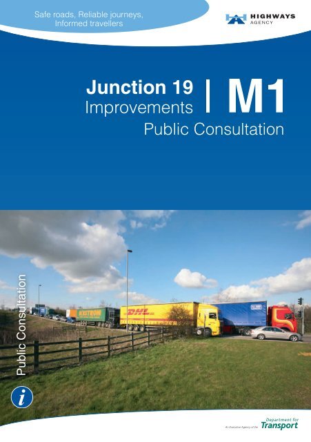
M1 Junction 19 Improvements - Highways Agency
M1 Junction 19 Improvements - Highways Agency
M1 Junction 19 Improvements - Highways Agency

Create successful ePaper yourself
Turn your PDF publications into a flip-book with our unique Google optimized e-Paper software.
Safe roads, Reliable journeys,<br />
Informed travellers<br />
<strong>Junction</strong> <strong>19</strong><br />
<strong>M1</strong><br />
<strong>Improvements</strong><br />
Public Consultation<br />
Public Consultation<br />
An Executive <strong>Agency</strong> of the
The Project Objectives<br />
The existing junction currently suffers from the<br />
following problems:<br />
• congestion, delays and long queues<br />
• accidents sometimes resulting in serious<br />
injuries and fatalities<br />
• conflicts between local and long distance<br />
traffic<br />
• creates a barrier to pedestrians, cyclists<br />
and horse riders.<br />
If no improvements are made these problems will<br />
get worse.<br />
We aim to relieve congestion at the junction,<br />
making the roads safer and decreasing journey<br />
times, whilst minimising the environmental impacts<br />
of the scheme.<br />
The current problems can be resolved by changing<br />
the junction layout and separating local and long<br />
distance traffic.<br />
Public Consultation<br />
o
Update on Progress<br />
2000 A study commenced to look at possible improvements<br />
to the junction.<br />
2002 Public Consultation on a number of junction options.<br />
2003 Secretary of State announced a Preferred Scheme - now<br />
known as the Blue <strong>Junction</strong>.<br />
2004 Public Exhibition to present Local Road Network (LRN)<br />
options.<br />
2004-2007 Further options identifi ed which may have advantages<br />
over the 2003 Preferred Scheme.<br />
2008 Public Consultation on the current options.<br />
Current Improvement Options<br />
We have developed three possible motorway junction options and<br />
three Local Road Network (LRN) options. These can only be combined<br />
as follows:<br />
Blue <strong>Junction</strong> and Green LRN<br />
Brown <strong>Junction</strong> and Green LRN<br />
Red <strong>Junction</strong> and Green LRN<br />
Red <strong>Junction</strong> and Orange LRN<br />
Red <strong>Junction</strong> and Purple LRN<br />
These alternatives have been assessed and<br />
are presented on the following pages.
Blue <strong>Junction</strong><br />
and Green Local Road Network<br />
<strong>M1</strong><br />
LUTTERWORTH ROAD<br />
Shawell<br />
Hill Top<br />
Farm<br />
Swinford<br />
Lodge<br />
RUGBY ROAD<br />
CATTHORPE ROAD<br />
Shawell<br />
Motte &<br />
Bailey<br />
Grange<br />
Farm<br />
M6<br />
SHAWELL ROAD<br />
Tomley Hall<br />
Farm<br />
Lambcote Hill<br />
Farm<br />
RUGBY RD<br />
Westfield<br />
Lodge<br />
Jnct <strong>19</strong><br />
Swinford<br />
Stanford<br />
Park<br />
STANFORD ROAD<br />
WATLING STREET<br />
SHAWELL LANE<br />
Catthorpe<br />
Manor Farm<br />
SWINFORD RD<br />
Old<br />
Barn<br />
Farm<br />
R<br />
i v e<br />
r A v o n<br />
Catthorpe<br />
Manor<br />
A14<br />
R i v e r<br />
A v o n<br />
Lovepark<br />
Farm<br />
STATION RD<br />
Dismantled Railway<br />
A5<br />
Lilbourne<br />
Motte &<br />
Bailey<br />
C l a y<br />
C o t o n - Y e<br />
l v e r t o f t B r o o k<br />
Lilbourne Gorse<br />
Motte & Bailey<br />
RUGBY ROAD<br />
<strong>M1</strong><br />
Lilbourne<br />
YELVERTOFT ROAD<br />
© Crown copyright. All rights reserved<br />
<strong>Highways</strong> <strong>Agency</strong> 100018928. 2008.<br />
The Green LRN would include:<br />
• <strong>Improvements</strong> to Shawell Road between Swinford and Shawell<br />
• A new link between Shawell Road and Shawell Lane<br />
• <strong>Improvements</strong> to Shawell Lane between Catthorpe Road and<br />
Catthorpe village.
The Blue <strong>Junction</strong> would cater for<br />
movements in all directions.<br />
It would be constructed on four levels, with<br />
the top tier above the highest level of the<br />
existing junction.<br />
New direct links would be provided for the:<br />
• M6 to A14 in both directions<br />
• M6 to <strong>M1</strong> southbound<br />
• <strong>M1</strong> northbound to M6 including a new<br />
viaduct over the River Avon.<br />
Traffi c between the A14 and the <strong>M1</strong> would<br />
use a new roundabout at the level of the<br />
existing double roundabout. The new<br />
roundabout would also provide for all<br />
other long distance traffi c movements, but<br />
would remove direct access from the local<br />
roads.<br />
The <strong>M1</strong> would remain on its current<br />
alignment.<br />
The estimated cost is in the range of<br />
£205 million to £325 million.
Brown <strong>Junction</strong><br />
and Green Local Road Network<br />
<strong>M1</strong><br />
LUTTERWORTH ROAD<br />
Shawell<br />
Hill Top<br />
Farm<br />
Swinford<br />
Lodge<br />
RUGBY ROAD<br />
CATTHORPE ROAD<br />
Shawell<br />
Motte &<br />
Bailey<br />
Grange<br />
Farm<br />
M6<br />
SHAWELL ROAD<br />
Tomley Hall<br />
Farm<br />
Lambcote Hill<br />
Farm<br />
RUGBY RD<br />
Westfield<br />
Lodge<br />
Jnct <strong>19</strong><br />
Swinford<br />
Stanford<br />
Park<br />
STANFORD ROAD<br />
WATLING STREET<br />
SHAWELL LANE<br />
Catthorpe<br />
Manor Farm<br />
SWINFORD RD<br />
Old<br />
Barn<br />
Farm<br />
R<br />
i v e<br />
r A v o n<br />
Catthorpe<br />
Manor<br />
A14<br />
R i v e r<br />
A v o n<br />
Lovepark<br />
Farm<br />
STATION RD<br />
Dismantled Railway<br />
A5<br />
Lilbourne<br />
Motte &<br />
Bailey<br />
C l a y<br />
C o t o n - Y e<br />
l v e r t o f t B r o o k<br />
Lilbourne Gorse<br />
Motte & Bailey<br />
RUGBY ROAD<br />
<strong>M1</strong><br />
Lilbourne<br />
YELVERTOFT ROAD<br />
© Crown copyright. All rights reserved<br />
<strong>Highways</strong> <strong>Agency</strong> 100018928. 2008.<br />
The Green LRN would include:<br />
• <strong>Improvements</strong> to Shawell Road between Swinford and Shawell<br />
• A new link between Shawell Road and Shawell Lane<br />
• <strong>Improvements</strong> to Shawell Lane between Catthorpe Road and<br />
Catthorpe village.
The Brown <strong>Junction</strong> would be constructed on four levels, with<br />
the top tier above the highest level of the existing junction.<br />
New direct links would be provided for the:<br />
• M6 to A14 in both directions<br />
• M6 to <strong>M1</strong> southbound<br />
• <strong>M1</strong> northbound to M6<br />
A new roundabout, at the level of the<br />
existing double roundabout, would provide<br />
for all other existing long distance traffic<br />
movements. Movements between the<br />
A14 and <strong>M1</strong> south of the junction would<br />
not be provided.<br />
The Brown <strong>Junction</strong> does not require a new<br />
viaduct over the River Avon.<br />
The Brown <strong>Junction</strong> would remove direct<br />
access to the motorway network from the<br />
local roads.<br />
The <strong>M1</strong> would remain on its current<br />
alignment.<br />
The estimated cost is in the range of<br />
£205 million to £325 million.
Red <strong>Junction</strong><br />
and Green Local Road Network<br />
<strong>M1</strong><br />
LUTTERWORTH ROAD<br />
Shawell<br />
Hill Top<br />
Farm<br />
Swinford<br />
Lodge<br />
RUGBY ROAD<br />
CATTHORPE ROAD<br />
Shawell<br />
Motte &<br />
Bailey<br />
Grange<br />
Farm<br />
M6<br />
SHAWELL ROAD<br />
Tomley Hall<br />
Farm<br />
Lambcote Hill<br />
Farm<br />
RUGBY RD<br />
Westfield<br />
Lodge<br />
Jnct <strong>19</strong><br />
Swinford<br />
Stanford<br />
Park<br />
STANFORD ROAD<br />
WATLING STREET<br />
SHAWELL LANE<br />
Catthorpe<br />
Manor Farm<br />
SWINFORD RD<br />
Old<br />
Barn<br />
Farm<br />
R<br />
i v e<br />
r A v o n<br />
Catthorpe<br />
Manor<br />
A14<br />
R i v e r<br />
A v o n<br />
Lovepark<br />
Farm<br />
STATION RD<br />
Dismantled Railway<br />
A5<br />
Lilbourne<br />
Motte &<br />
Bailey<br />
C l a y<br />
C o t o n - Y e<br />
l v e r t o f t B r o o k<br />
Lilbourne Gorse<br />
Motte & Bailey<br />
RUGBY ROAD<br />
<strong>M1</strong><br />
Lilbourne<br />
YELVERTOFT ROAD<br />
© Crown copyright. All rights reserved<br />
<strong>Highways</strong> <strong>Agency</strong> 100018928. 2008.<br />
The Green LRN would include:<br />
• <strong>Improvements</strong> to Shawell Road between Swinford and Shawell<br />
• A new link between Shawell Road and Shawell Lane<br />
• <strong>Improvements</strong> to Shawell Lane between Catthorpe Road and<br />
Catthorpe village.
The Red <strong>Junction</strong> would be constructed on three<br />
levels and would be similar in height to the existing<br />
junction.<br />
The Red <strong>Junction</strong> would not include a roundabout but<br />
would provide the following direct links:<br />
• A14 to <strong>M1</strong> northbound<br />
• <strong>M1</strong> southbound to A14<br />
• M6 to A14 in both directions<br />
• M6 to <strong>M1</strong> southbound<br />
• <strong>M1</strong> northbound to M6<br />
Movements between the A14 and <strong>M1</strong> south<br />
of the junction would not be provided.<br />
Existing movements between the M6 and<br />
the <strong>M1</strong> north of the junction would not be<br />
allowed.<br />
The Red <strong>Junction</strong> would remove direct access<br />
to the motorway network from the local roads.<br />
The <strong>M1</strong> would remain on its current<br />
alignment.<br />
The estimated cost is in the range of<br />
£185 million to £285 million.
Red <strong>Junction</strong><br />
and Orange Local Road Network<br />
<strong>M1</strong><br />
LUTTERWORTH ROAD<br />
Shawell<br />
Hill Top<br />
Farm<br />
Swinford<br />
Lodge<br />
RUGBY ROAD<br />
CATTHORPE ROAD<br />
Shawell<br />
Motte &<br />
Bailey<br />
Grange<br />
Farm<br />
M6<br />
SHAWELL ROAD<br />
Tomley Hall<br />
Farm<br />
Lambcote Hill<br />
Farm<br />
RUGBY RD<br />
Westfield<br />
Lodge<br />
Jnct <strong>19</strong><br />
Swinford<br />
Stanford<br />
Park<br />
STANFORD ROAD<br />
WATLING STREET<br />
SHAWELL LANE<br />
Catthorpe<br />
Manor Farm<br />
SWINFORD RD<br />
Old<br />
Barn<br />
Farm<br />
R<br />
i v e<br />
r A v o n<br />
Catthorpe<br />
Manor<br />
A14<br />
R i v e r<br />
A v o n<br />
Lovepark<br />
Farm<br />
STATION RD<br />
Dismantled Railway<br />
A5<br />
Lilbourne<br />
Motte &<br />
Bailey<br />
C l a y<br />
C o t o n - Y e<br />
l v e r t o f t B r o o k<br />
Lilbourne Gorse<br />
Motte & Bailey<br />
RUGBY ROAD<br />
<strong>M1</strong><br />
Lilbourne<br />
YELVERTOFT ROAD<br />
© Crown copyright. All rights reserved<br />
<strong>Highways</strong> <strong>Agency</strong> 100018928. 2008.<br />
This option includes the motorway and trunk road improvements<br />
described previously for the Red <strong>Junction</strong>.<br />
The Orange LRN would include:<br />
• A new link between Rugby Road and Shawell Lane north of the M6<br />
• A local route under the junction between Swinford and Catthorpe<br />
• <strong>Improvements</strong> to Shawell Lane between Catthorpe Road and the M6.<br />
The estimated cost is in the range of £200 million to £310 million.
Red <strong>Junction</strong><br />
and Purple Local Road Network<br />
<strong>M1</strong><br />
LUTTERWORTH ROAD<br />
Shawell<br />
Hill Top<br />
Farm<br />
Swinford<br />
Lodge<br />
RUGBY ROAD<br />
CATTHORPE ROAD<br />
Shawell<br />
Motte &<br />
Bailey<br />
Grange<br />
Farm<br />
M6<br />
SHAWELL ROAD<br />
Tomley Hall<br />
Farm<br />
Lambcote Hill<br />
Farm<br />
RUGBY RD<br />
Westfield<br />
Lodge<br />
Jnct <strong>19</strong><br />
Swinford<br />
Stanford<br />
Park<br />
STANFORD ROAD<br />
WATLING STREET<br />
SHAWELL LANE<br />
Catthorpe<br />
Manor Farm<br />
SWINFORD RD<br />
Old<br />
Barn<br />
Farm<br />
R<br />
i v e<br />
r A v o n<br />
Catthorpe<br />
Manor<br />
A14<br />
R i v e r<br />
A v o n<br />
Lovepark<br />
Farm<br />
STATION RD<br />
Dismantled Railway<br />
A5<br />
Lilbourne<br />
Motte &<br />
Bailey<br />
C l a y<br />
C o t o n - Y e<br />
l v e r t o f t B r o o k<br />
Lilbourne Gorse<br />
Motte & Bailey<br />
RUGBY ROAD<br />
<strong>M1</strong><br />
Lilbourne<br />
YELVERTOFT ROAD<br />
© Crown copyright. All rights reserved<br />
<strong>Highways</strong> <strong>Agency</strong> 100018928. 2008.<br />
This option includes the motorway and trunk road improvements<br />
described previously for the Red <strong>Junction</strong>.<br />
The Purple LRN would include:<br />
• A new link between Rugby Road and Shawell Lane north of the M6<br />
• <strong>Improvements</strong> to Shawell Lane between Catthorpe Road and<br />
Catthorpe village.<br />
The estimated cost is in the range of £<strong>19</strong>5 million to £295 million.
Rejected Options<br />
One further option has<br />
been considered but<br />
rejected because of<br />
environmental impact,<br />
engineering issues and<br />
cost.<br />
Other options considered<br />
and rejected during<br />
the previous public<br />
consultation can be seen<br />
at the public exhibitions.<br />
Grange<br />
Farm<br />
M6<br />
CATTHORPE ROAD<br />
R i v e r<br />
WATLING STREET<br />
Shawell<br />
Catthorpe<br />
Manor Farm<br />
A5<br />
A v o n<br />
Hill Top<br />
Farm<br />
SHAWELL LANE<br />
Dismantled Railway<br />
Tomley Hall<br />
Farm<br />
Lilbourne Gorse<br />
Motte & Bailey<br />
<strong>M1</strong><br />
SHAWELL ROAD<br />
Jnct <strong>19</strong><br />
SWINFORD RD<br />
Lovepark<br />
Farm<br />
© Crown copyright. All rights reserved<br />
<strong>Highways</strong> <strong>Agency</strong> 100018928. 2008.<br />
Old<br />
Barn<br />
Farm<br />
Catthorpe<br />
Manor<br />
STATION RD<br />
RUGBY ROAD<br />
Lilbourne<br />
Lambcote Hill<br />
Farm<br />
Lilbourne<br />
Motte &<br />
Bailey<br />
Swinford<br />
Lodge<br />
Swinford<br />
RUGBY RD<br />
Westfield<br />
Lodge<br />
A14<br />
LUTTERWORTH ROAD<br />
C l ay C o t o n<br />
<strong>M1</strong><br />
River Avon<br />
-<br />
YELVERTOFT ROAD<br />
r<br />
Y e l v e<br />
t o f t B<br />
r o o k<br />
RUGBY ROAD<br />
Stanford<br />
Park<br />
STANFORD ROAD<br />
Comparative Effects<br />
We have compared the effects of each option. The general effects are<br />
summarised below with specific detailed findings presented in the<br />
Options Comparison Table on the following pages.<br />
Traffi c and Economics<br />
• All options would remove existing congestion and queues at the<br />
junction, improving journey reliability<br />
• All options would improve road safety<br />
• All options would provide high value for money<br />
• All options would remove local access to the junction<br />
• Predicted traffic fl ows between A14 and <strong>M1</strong> south of the junction<br />
and between M6 and <strong>M1</strong> north of the junction are small
Environment<br />
• The most noticeable changes in noise would be for dwellings<br />
affected by local traffic through the villages<br />
• Low noise surfacing would be used for all new motorway and<br />
trunk road construction<br />
• Changes in air quality due to each option would be small<br />
• All options would result in a small decrease in carbon emissions<br />
compared with the existing junction<br />
• The key issues for landscape would be the scale and height of<br />
the options and the retention of screen planting<br />
• A key heritage issue is the impact of the<br />
options on Lilbourne Motte and Bailey, a<br />
Scheduled Monument<br />
• All options would impact upon archaeological<br />
sites, historic buildings and landscapes<br />
• All options would include the creation of new<br />
habitats, but would disturb protected species<br />
• All options would include ponds to improve<br />
existing drainage, providing better pollution control<br />
• Safer facilities would be provided for pedestrians, cyclists<br />
and horse riders, in consultation with user groups and other<br />
interested parties<br />
• The key issue for agriculture is the loss of Best and Most<br />
Versatile (BMV) land<br />
• Noise, dust and other pollution would be controlled during<br />
construction<br />
Engineering<br />
• All junctions are likely to be lit, but the Local Road Network<br />
would remain unlit<br />
• The Blue and Brown <strong>Junction</strong>s would be on four levels and the<br />
Red <strong>Junction</strong> on three levels
Options Comparison Table<br />
Option Blue and Green Brown and Green<br />
Construction Period 36 months 36 months<br />
Estimated Cost £205 to £325 million £205 to £325 million<br />
Present Value Benefi ts £515 million £520 million<br />
Long Distance Traffi c<br />
This option provides an all<br />
movement junction.<br />
Movements between the A14<br />
and <strong>M1</strong> south of the junction<br />
would not be provided.<br />
Local Roads<br />
Noise<br />
Landscape<br />
The distance between Swinford<br />
and Catthorpe increases from<br />
1.4 miles to 2.6 miles.<br />
The proposed route passes<br />
Swinford primary school.<br />
Moderate Beneficial overall<br />
Increase for 44 dwellings<br />
Decrease for 265 dwellings<br />
Moderate Adversee<br />
effect from loss<br />
of 9.7 hectares of established<br />
screen planting and increased<br />
scale and height of this option.<br />
Adverse impact on 46 dwellings.<br />
The distance between Swinford<br />
and Catthorpe increases from<br />
1.4 miles to 2.6 miles.<br />
The proposed route passes<br />
Swinford primary school.<br />
Moderate Benefi cial overall<br />
Increase for 49 dwellings<br />
Decrease for 272 dwellings<br />
Moderate Adverse e effect from loss<br />
of 5.2 hectares of established<br />
screen planting and increased<br />
scale and height of this option.<br />
Adverse impact on 44 dwellings.<br />
Cultural Heritage<br />
Biodiversity<br />
Agriculture<br />
Slight Adversee<br />
overall.<br />
Moderate Adversee<br />
effects on<br />
Lilbourne Motte and Bailey<br />
Scheduled Monument.<br />
Moderate Adversee<br />
effects on otter<br />
(new River Avon crossing and<br />
potential bridleway) and great<br />
crested newt (new local road<br />
close to 5 breeding ponds).<br />
9 farms affected<br />
Landtake 33.5 hectares<br />
including 16.4 hectares BMV<br />
Slight Adversee<br />
overall.<br />
Moderate Adverse e effects on otter<br />
(potential bridleway) and great<br />
crested newt (new local road<br />
close to 5 breeding ponds).<br />
8 farms affected<br />
Landtake 31.3 hectares<br />
including 15.6 hectares BMV<br />
Disruption during Construction<br />
Environmental effects described for 2027.<br />
Terms in italics are the results of the formal comparative assessment.<br />
800,000 m 3 of material imported<br />
for embankments. 24 dwellings<br />
within 100m of the works. Local<br />
roads would be built prior to<br />
closing local access through the<br />
junction.<br />
760,000 m 3 of material imported<br />
for embankments. 16 dwellings<br />
within 100m of the works. Local<br />
roads would be built prior to<br />
closing local access through the<br />
junction.
Red and Green Red and Orange Red and Purple<br />
27 months 33 months 27 months<br />
£185 to £285 million £200 to £310 million £<strong>19</strong>5 to £295 million<br />
£560 million £590 million £570 million<br />
Movements between the A14<br />
and <strong>M1</strong> south of the junction<br />
would not be provided. Existing<br />
movements between the M6 and<br />
<strong>M1</strong> north of the junction would<br />
be removed.<br />
The distance between Swinford<br />
and Catthorpe increases from<br />
1.4 miles to 2.6 miles.<br />
The proposed route passes<br />
Swinford primary school.<br />
Moderate Beneficial overall<br />
Increase for 25 dwellings<br />
Decrease for 273 dwellings<br />
Slight Adverse effect from loss<br />
of 3.8 hectares of established<br />
screen planting. Option similar<br />
in scale and height to existing<br />
junction. Adverse impact on<br />
23 dwellings.<br />
Slight Adversee<br />
overall.<br />
Movements between the A14<br />
and <strong>M1</strong> south of the junction<br />
would not be provided. Existing<br />
movements between the M6 and<br />
<strong>M1</strong> north of the junction would<br />
be removed.<br />
The distance between Swinford<br />
and Catthorpe remains<br />
1.4 miles. Local traffic flows<br />
through Catthorpe would<br />
increase.<br />
Slight Benefi cial overall<br />
Increase for 145 dwellings<br />
Decrease for <strong>19</strong>6 dwellings<br />
Slight Adverse effect from loss<br />
of 3.8 hectares of established<br />
screen planting. Option similar<br />
in scale and height to existing<br />
junction. Adverse impact on<br />
18 dwellings.<br />
Slight Adversee<br />
overall.<br />
Movements between the A14<br />
and <strong>M1</strong> south of the junction<br />
would not be provided. Existing<br />
movements between the M6 and<br />
<strong>M1</strong> north of the junction would<br />
be removed.<br />
The distance between Swinford<br />
and Catthorpe increases from<br />
1.4 miles to 2.1 miles.<br />
Moderate Benefi cial overall<br />
Increase for 69 dwellings<br />
Decrease for 245 dwellings<br />
Slight Adverse effect from loss<br />
of 3.8 hectares of established<br />
screen planting. Option similar<br />
in scale and height to existing<br />
junction. Adverse impact on 20<br />
dwellings.<br />
Slight Adversee<br />
overall.<br />
Moderate Adverse e effects on otter<br />
(potential bridleway) and great<br />
crested newt (new local road<br />
close to 5 breeding ponds).<br />
Moderate Adversee<br />
effects on otter<br />
(potential bridleway) and great<br />
crested newt (new local road<br />
100m from 1 breeding pond).<br />
Moderate Adversee<br />
effects on otter<br />
(potential bridleway) and great<br />
crested newt (new local road<br />
100m from 1 breeding pond).<br />
7 farms affected<br />
Landtake 23.5 hectares<br />
including 14.0 hectares BMV<br />
27,000 m 3 of material imported<br />
for embankments. 14 dwellings<br />
within 100m of the works. Local<br />
roads would be built prior to<br />
closing local access through the<br />
junction.<br />
6 farms affected<br />
Landtake <strong>19</strong>.1 hectares<br />
including 13.6 hectares BMV<br />
42,000 m 3 of material imported<br />
for embankments. 5 dwellings<br />
within 100m of the works.<br />
Temporary local road closures<br />
and diversions required.<br />
7 farms affected<br />
Landtake 20.0 hectares<br />
including 14.0 hectares BMV<br />
50,000 m 3 of material imported<br />
for embankments. 13 dwellings<br />
within 100m of the works.<br />
Temporary local road closures<br />
and diversions required.<br />
Agricultural landtake is that required permanently for the works. Other land<br />
would be required temporarily<br />
BMV is Best and Most Versatile land, as defi ned by government policy.<br />
Present Value Benefi ts (PVB) is a term used in the economic appraisal of a<br />
project and represents the future benefi ts associated with a project in fi nancial<br />
terms discounted to 2002 prices.
What Happens Next <br />
Public Consultation<br />
commencing<br />
June 2008<br />
Analysis of<br />
Public Consultation<br />
Preferred<br />
Scheme Decision<br />
Design &<br />
Development<br />
Draft Order<br />
Publication<br />
Public Inquiry<br />
(if required)<br />
Statutory Orders<br />
Made<br />
Detailed Design and<br />
Construction<br />
Opening of<br />
Scheme<br />
If you wish to express your views on any of the proposed options, or the<br />
scheme itself, you can leave your completed questionnaire at the exhibition.<br />
Alternatively you can complete the questionnaire on-line at<br />
www.highways.gov.uk or post a completed questionnaire, or a letter, to the<br />
address given on the following page. All correspondence should be received<br />
before 12th September 2008.
Exhibitions from<br />
4th July to 5th July 2008<br />
Swinford<br />
Friday 4th July 2pm to 8pm<br />
Swinford Village Hall,<br />
1 Chapel Street,<br />
Swinford,<br />
Leicestershire,<br />
LE17 6AZ<br />
Lilbourne<br />
Saturday 5th July 10am to 4pm<br />
Lilbourne Village Hall,<br />
Station Road,<br />
Lilbourne,<br />
Warwickshire,<br />
CV23 0SU<br />
If you require further information please contact:<br />
<strong>M1</strong> <strong>Junction</strong> <strong>19</strong> Improvement Team<br />
<strong>Highways</strong> <strong>Agency</strong><br />
Broadway<br />
Broad Street<br />
Birmingham<br />
B15 1BL<br />
or e-mail: m1junction<strong>19</strong>@highways.gsi.gov.uk<br />
or visit the <strong>Highways</strong> <strong>Agency</strong>’s website; www.highways.gov.uk
Information provided in response to this consultation, including<br />
personal information, may be published or disclosed in<br />
accordance with the access to information regimes (these are<br />
primarily the Freedom of Information Act 2000 (FOIA), the Data<br />
Protection Act <strong>19</strong>98 (DPA) and the Environmental Information<br />
Regulations 2004).<br />
If you want the information that you provide to be treated as<br />
confi dential, please be aware that, under the FOIA, there is a<br />
statutory Code of Practice with which public authorities must<br />
comply and which deals, amongst other things, with obligations<br />
of confi dence. In view of this it would be helpful if you could<br />
explain to us why you regard the information you have provided<br />
as confi dential. If we receive a request for disclosure of the<br />
information we will take full account of your explanation, but we<br />
cannot give an assurance that confi dentiality can be maintained<br />
in all circumstances. An automatic confi dentiality disclaimer<br />
generated by your IT system will not, of itself, be regarded as<br />
binding on the <strong>Agency</strong>.<br />
The <strong>Agency</strong> will process your personal data in accordance with<br />
the DPA and in the majority of circumstances; this will mean that<br />
your personal data will not be disclosed to third parties.<br />
Confi dential responses will be included in any statistical summary<br />
of number of comments and views expressed.
CODE OF PRACTICE ON CONSULTATION<br />
The Consultation is being conducted in line with the principles of the Code of<br />
Practice on Consultation.<br />
The six consultation criteria<br />
• Consult widely throughout the process, allowing a minimum of 12<br />
weeks for written consultation at least once during the development<br />
of the policy.<br />
• Be clear about what your proposals are, who may be affected, what<br />
questions are being asked and the timescale for responses.<br />
• Ensure that your consultation is clear, concise and widely<br />
accessible.<br />
• Give feedback regarding the responses received and how the<br />
consultation process infl uenced the policy.<br />
• Monitor your department’s effectiveness at consultation, including<br />
through the use of a designated consultation co-ordinator.<br />
• Ensure your consultation follows better regulation best practice,<br />
including carrying out a Regulatory Impact Assessment if<br />
appropriate.<br />
A full version of the criteria can be found at<br />
http://www.berr.gov.uk/fi les/fi le44364.pdf<br />
If you feel that this consultation does not fulfi l these criteria and therefore you<br />
are not happy about the way the consultation is being run (rather than what<br />
the consultation is about) please contact<br />
Monica Brown<br />
<strong>Highways</strong> <strong>Agency</strong> Consultation Co-ordinator<br />
Zone 2/09K<br />
Temple Quay House<br />
2 The Square<br />
Temple Quay<br />
Bristol<br />
BS1 6HA<br />
e-mail: monica.brown@highways.gsi.gov.uk<br />
phone: 0117 372 8220
Got a question or comment<br />
08457 50 40 30 *<br />
email: ha_info@highways.gsi.gov.uk<br />
24 hours a day, 365 days a year<br />
Live traffic information<br />
08700 660 115 *<br />
www.highways.gov.uk<br />
24 hours a day, 365 days a year<br />
*Calls from BT landlines to 0845 numbers will cost no more than 4p per minute and<br />
to 0870 numbers no more than 8p per minute, mobile calls usually cost more.<br />
<strong>Highways</strong> <strong>Agency</strong> Publications Code PR122/08<br />
<strong>Highways</strong> <strong>Agency</strong> Publications Group Leeds n070111. © Crown copyright 2008<br />
Printed on recycled paper containing 75% post consumer waste and 25% ECF pulp.<br />
For wider motoring advice visit DirectGov<br />
www.direct.gov.uk/en/motoring