

download PDF - Imaging Notes
download PDF - Imaging Notes
download PDF - Imaging Notes

Create successful ePaper yourself
Turn your PDF publications into a flip-book with our unique Google optimized e-Paper software.
EARTH REMOTE SENSING<br />
FOR SECURIT Y<br />
ENERGY AND<br />
THE ENVIRONMENT<br />
Winter 2013<br />
Vol. 28 No. 1<br />
LOCATION<br />
M E D I A<br />
A LLIANCE<br />
Precision<br />
Ag<br />
Big Social<br />
Data<br />
Better<br />
Weather<br />
Forecasts<br />
Bathymetric<br />
Lidar
the Force that<br />
drives smarter<br />
decisions<br />
Welcome to Intergraph Geospatial 2013<br />
We are united. Whether it’s by desktop, server, web, or<br />
cloud – our integrated geospatial portfolio delivers what you<br />
need, where you need it. Less hassle. Complete workflow.<br />
One partner.<br />
We are modern. Our fresh and intuitive interfaces and<br />
automated technology transform the way you see and share<br />
your data. This world has new challenges. Combat them with<br />
a smarter design.<br />
We are dynamic. Leverage our single integrated, dynamic<br />
environment for spatial modeling. Our core geospatial tools<br />
enable you to exploit the wealth of information found in data<br />
from any source.<br />
Geospatial.interGraph.com/2013<br />
TEAM GEO-FORCE<br />
interGraph Geospatial 2013<br />
Experience the force that’s driving smarter<br />
decisions at a road show near you.<br />
© 2013 Intergraph Corporation. All rights reserved. Intergraph is part of Hexagon. Intergraph and the Intergraph logo<br />
are registered trademarks of Intergraph Corporation or its subsidiaries in the United States and in other countries.
Winter 2013<br />
CONTENTS<br />
12<br />
> > Columns<br />
4<br />
7<br />
9<br />
11<br />
38<br />
Cover Image<br />
MAYN RIVER, SIBERIA<br />
Publisher’s Letter<br />
ANNOUNCING THE LOCATION<br />
MEDIA ALLIANCE<br />
By Myrna James Yoo<br />
News & Views<br />
FROM LBX JOURNAL<br />
News & Views<br />
FROM SENSORS & SYSTEMS<br />
Secure World<br />
Foundation Forum<br />
THE NEXT 10-15 YEARS<br />
By Ray Williamson, PhD<br />
24<br />
> > Features<br />
12<br />
16<br />
20<br />
24<br />
30<br />
34<br />
Jenn Sabers of Landsat<br />
Executive Interview<br />
Anne Miglarese<br />
of PLANETiQ<br />
Executive Interview<br />
Nancy Colleton of IGES<br />
Executive Interview<br />
Bathymetric Lidar<br />
SANDY’S COASTAL IMPACT<br />
By Matteo Luccio<br />
Contributor<br />
Precision Ag<br />
SENSORS DRIVE EFFICIENCY<br />
By Matteo Luccio<br />
Contributor<br />
Big Social Data<br />
THE LONG TAIL OF<br />
SCIENCE DATA<br />
By Richard Heimann<br />
Data Tactics Corporation<br />
30<br />
IMAGING NOTES // WINTER 2013 // WWW.IMAGINGNOTES.COM<br />
3
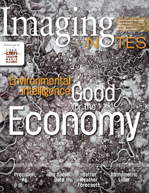
Mayn River,<br />
Siberia<br />
COVER IMAGE<br />
Winter 2013 / Vol. 28 / No. 1<br />
Our Mission<br />
<strong>Imaging</strong> <strong>Notes</strong> is the premier publication for commercial, government and academic<br />
remote sensing professionals around the world. It provides objective exclusive in-depth<br />
reporting that demonstrates how remote sensing technologies and spatial information<br />
illuminate the urgent interrelated issues of the environment, energy and security.<br />
<strong>Imaging</strong> <strong>Notes</strong> has partnerships<br />
with Secure World Foundation<br />
(www.swfound.org)<br />
and Sensors & Systems<br />
(www.sensysmag.com).<br />
Publisher/Managing Editor<br />
Myrna James Yoo<br />
myrna@imagingnotes.com<br />
Editor<br />
Ray A. Williamson, PhD<br />
Contributing Writers<br />
Leonard David<br />
Matteo Luccio<br />
Copy Editor<br />
Bette Milleson<br />
Creative Director<br />
Jürgen Mantzke<br />
Enfineitz LLC<br />
jurgen@enfineitz.com<br />
www.enfineitz.com<br />
<strong>Imaging</strong> <strong>Notes</strong> is affiliated with the<br />
Alliance for Earth Observations, a<br />
program of The Institute for Global<br />
Environmental Strategies<br />
(www.strategies.org).<br />
Editorial Advisory Board<br />
Mark E. Brender<br />
GeoEye<br />
Anita Burke<br />
The Catalyst Institute<br />
Nancy Colleton<br />
Institute for Global<br />
Environmental Strategies<br />
William B. Gail, PhD<br />
Global Weather Corporation<br />
Anne Hale Miglarese<br />
PLANETiQ<br />
Kevin Pomfret, Esq.<br />
Centre for Spatial Law and Policy<br />
Deputy Art Director<br />
Andrew Sternard<br />
Editorial Contributions<br />
<strong>Imaging</strong> <strong>Notes</strong> welcomes contributions for feature articles. We publish articles on the<br />
remote sensing industry, including applications, technology, and business. Please see<br />
Contributor’s Guidelines on www.imagingnotes.com, and email proposals to<br />
editor@imagingnotes.com.<br />
Subscriptions<br />
This image of the Mayn River in<br />
Siberia was taken Oct. 1, 2000 by Landsat 7. The<br />
image shows the Mayn River with a portion of the<br />
Anadyr River, flowing through the far northeastern<br />
corner of Siberia.<br />
The Landsat Data Continuity Mission, Landsat<br />
8, is set to launch on Feb. 11, 2013. An Executive<br />
Interview with Jenn Sabers begins on page 12.<br />
She is Remote Sensing Branch Chief of the Earth<br />
Resources Observations and Science (EROS)<br />
Center, at the U.S. Geological Survey (USGS).<br />
To subscribe or renew, please go to www.imagingnotes.com, and click on ‘subscribe.’<br />
If you are a current subscriber, renew by locating your account<br />
number on your address label to enter the database and update your subscription.<br />
If you cannot go online, you may write to the address below.<br />
<strong>Imaging</strong> <strong>Notes</strong> (ISSN 0896-7091) Copyright © 2013<br />
Blueline Publishing LLC, P.O. Box 11519, Denver, CO 80211, 303-477-5272<br />
All rights reserved. No material may be reproduced or transmitted in any form or by<br />
any means without written permission from the publisher. While every precaution is<br />
taken to ensure accuracy, the publisher and the Alliance for Earth Observations cannot<br />
accept responsibility for the accuracy of information or for any opinions or views<br />
presented in <strong>Imaging</strong> <strong>Notes</strong>.<br />
Although trademark and copyright symbols<br />
are not used in this publication, they are honored.<br />
<strong>Imaging</strong> <strong>Notes</strong> is printed on 20% recycled (10% post-consumer waste) paper.<br />
All inks used contain a percentage of soy base. Our printer meets or<br />
exceeds all federal Resource Conservation Recovery Act (RCRA) Standards.<br />
4<br />
IMAGING NOTES // WINTER 2013 // WWW.IMAGINGNOTES.COM
LiDAR + IMAGING<br />
Drive route at normal vehicle speeds<br />
and collect required data, in one visit,<br />
eliminating return trips to the field.<br />
Cost per point is dramatically reduced.<br />
Personnel collect data safely from<br />
a vehicle.<br />
Bring the field to the office.<br />
View a powerful 3D high density point<br />
cloud with georeferenced images<br />
on the PC. Extract features or make<br />
measurements from the desktop.<br />
Data judgments are made by the<br />
data user.<br />
Quickly create and deliver GIS, CAD,<br />
point cloud and/or image files.<br />
Revisit the data set to mine data and<br />
create additional deliverables at any time.<br />
With this one-source turnkey solution<br />
your workflow is as easy as 1-2-3.<br />
topconpositioning.com/MAPPING
Copyright © 2012 Esri. All rights reserved.<br />
Imagery courtesy of DigitalGlobe.<br />
Imagine Your<br />
Imagery Everywhere<br />
Esri’s ArcGIS ® simplifies the next generation of imagery<br />
management and dissemination through on-the-fly<br />
processing, image services, and dynamic mosaicking.<br />
With ArcGIS, your imagery is accessible to more<br />
people in less time.<br />
Learn more at esri.com/imgnotes
Announcing the<br />
Location Media Alliance<br />
LOCATION<br />
M E D I A<br />
A LLIANCE<br />
Publisher’s Letter<br />
Dear Readers,<br />
<strong>Imaging</strong> <strong>Notes</strong> is proud to be a part of<br />
the Location Media Alliance (LMA), which<br />
includes also LBx Journal, Sensors &<br />
Systems, Informed Infrastructure, and Asian<br />
Surveying & Mapping. We offer a combined<br />
audience of 59,200 business, technology,<br />
and policy professionals. The LMA promotes<br />
the power of location analytics and geospatial<br />
and remote sensing technologies to improve<br />
our world—socially, politically, and economically—with<br />
more efficient businesses, smarter<br />
built environments, and the better stewardship<br />
of our planet’s scarce resources.<br />
The LMA will cross-promote and work<br />
together in all aspects of our publications,<br />
serving distinct user and vendor<br />
domains while collectively spanning the<br />
full breadth of the geospatial industry and<br />
location-based applications. LMA offers<br />
an unprecedented coordinated media<br />
and advertising distribution platform for<br />
optimum market education and brand<br />
recognition. Cross-cutting all publications<br />
will be quarterly themes, including in<br />
the current issues precision agriculture<br />
(see page 30). Upcoming themes for all<br />
publications are water (Spring), energy<br />
(Summer) and security (Fall).<br />
We are celebrating the launch of LMA<br />
at the International LiDAR Mapping Forum.<br />
Read about bathymetric LiDAR used after<br />
Hurricane Sandy on page 24.<br />
DigitalGlobe and GeoEye confirmed the<br />
combination of their two companies on Jan.<br />
31, 2013. This begins a new era for imagery,<br />
as the combined company will provide a<br />
wider variety of earth imagery and geospatial<br />
analysis to help customers solve their most<br />
complex problems, and to serve better the<br />
global market. (See page 11 for more news.)<br />
An article about Astrium’s offerings will<br />
appear in our Spring 2013 issue.<br />
In late January, an important<br />
announcement was made at the DGI<br />
conference in London by Esri President<br />
Jack Dangermond: Esri and DigitalGlobe<br />
are expanding their strategic partnership<br />
through a collaborative offering of<br />
global high-resolution imagery that will be<br />
accessible directly from ArcGIS Online<br />
as dynamic cloud-based image services.<br />
Esri’s Director of Imagery Lawrie Jordan<br />
noted, “Making recently collected imagery<br />
available quickly and simply to millions of<br />
GIS users globally is a compelling example<br />
of the benefits of leveraging cloud-based<br />
GIS as a platform. This is a game-changer<br />
for the industry and for our users.<br />
Other exciting developments are<br />
occurring under the banner of GeoDesign.<br />
At this year’s GeoDesign Summit, Bran<br />
Ferren of Applied Minds noted that GIS is<br />
layers of data at one time, while GeoDesign<br />
is a “geo-temporal domain,” with<br />
temporal compression of data, giving us<br />
the ability to tell stories about the past, and<br />
future. He says that we must be brave and<br />
use GeoDesign to build a “Bill of Rights for<br />
the Planet.” We can use science combined<br />
with engineering and design to rise above<br />
the rhetoric and start a public dialog about<br />
the subjects that really matter. Watch for<br />
articles in the Spring issue.<br />
Finally, not a moment too soon, The<br />
Landsat Data Continuity Mission (to be<br />
named Landsat 8 after launch) is scheduled<br />
for launch Feb. 11, 2013, just after we<br />
go to press with this issue. We talk to Jenn<br />
Sabers of EROS Center on page 12. This<br />
mission is important for the continuity of<br />
the nearly 40-year dataset, provided free of<br />
charge for users around the world.<br />
Thank you to our long-time strategic<br />
partners, Secure World Foundation (read<br />
Ray Williamson’s column on page 38) and<br />
the Alliance for Earth Observations (read<br />
the interview with Nancy Colleton on page<br />
20). Thanks also to other long-term Editorial<br />
Board members Mark Brender, Anita<br />
Burke, Bill Gail and Kevin Pomfret.<br />
Our final board member is Anne Hale<br />
Miglarese, who is CEO of newly formed<br />
PLANETiQ, a company that will launch<br />
a minimum of 12 satellites primarily for<br />
weather forecasting, with the vision of<br />
having their data available within three<br />
minutes! Read more on page 16.<br />
I am more excited than ever to be a part<br />
of this industry, as the convergence of cloud<br />
computing, Big Data (see article on page<br />
34), standards and crowdsourcing/Community<br />
Remote Sensing all come together to<br />
bring us closer to the vision of a true “living<br />
planet” – a representation of our planet<br />
online with real-time data for every part of the<br />
world, to be used for the greater good.<br />
It is truly a privilege to be able to report<br />
on the trends and new applications that<br />
are developing all the time. Thank you for<br />
reading. Please email feedback, and keep<br />
a close eye on your next issues! We have<br />
more exciting news of our own!<br />
Best regards,<br />
Myrna James Yoo<br />
Publisher<br />
IMAGING NOTES // WINTER 2013 // WWW.IMAGINGNOTES.COM<br />
7
LOCATION<br />
M E D I A<br />
A LLIANCE<br />
Stay Informed:<br />
on Applications, Technology, Business and Policy<br />
Read These PublicaTions<br />
Informed Infrastructure<br />
promotes the combination<br />
of sensor inputs, simulation<br />
and modeling to tune<br />
infrastructure design/<br />
build/operation for the<br />
greatest efficiency. Areas<br />
of coverage include smart<br />
grids, water, transportation,<br />
facility management, and<br />
smart cities. Read daily<br />
news updates online, and<br />
sign up for the weekly<br />
e-newsletter.<br />
<strong>Imaging</strong> <strong>Notes</strong> covers<br />
Earth remote sensing<br />
for security, energy<br />
and the environment<br />
with a quarterly print<br />
publication and monthly<br />
eNews. Reporting is<br />
in-depth and exclusive<br />
about the uses of imagery<br />
and geospatial solutions<br />
worldwide.<br />
www.imagingnotes.com<br />
Sensors & Systems<br />
provides details on new<br />
and existing frameworks<br />
of instrumented and<br />
interconnected networks<br />
and decision support<br />
tools to monitor and<br />
adapt to global change<br />
with daily online news<br />
and a weekly newsletter.<br />
www.sensorsandsystems.com<br />
LBx Journal is location in<br />
the language of business<br />
– a resource for business<br />
professionals who are<br />
exploring the location<br />
dimensions of business.<br />
We connect geospatial<br />
technologies with<br />
business needs through<br />
in-depth reporting and<br />
the Location SmartBrief<br />
eNewsletter.<br />
www.lbxjournal.com<br />
Asian Surveying &<br />
Mapping provides<br />
news and a weekly<br />
e-newsletter focused on<br />
geospatial technology<br />
applications in Asia-<br />
Pacific areas of coverage<br />
including surveying,<br />
positioning, GIS, and<br />
remote sensing tools and<br />
case studies.<br />
www.asmmag.com<br />
www.informedinfrastructure.com<br />
8<br />
IMAGING NOTES // WINTER 2013 // WWW.IMAGINGNOTES.COM
QUARTERLY LOCATION BUSINESS NEWS REVIEW: HERE ARE THE RECENT<br />
most interesting or important articles according to Location SmartBrief readers.<br />
LOCATION NEWS FROM THE WEB<br />
LOCATION ECOSYSTEM<br />
1. Maps may decide who rules mobile’s future http://bit.ly/128K4hB January 2, 2013<br />
Advanced location-based services linked to maps are at the forefront of mobile technology and could play a critical role in<br />
which corporate behemoth emerges on top, Rolfe Winkler writes. Apple’s disastrous mapping application reinforced Google’s<br />
sizable lead in the arena, and Google is expected to release a sophisticated predictive tool to provide wireless-device users<br />
with information before they even request it.<br />
2. Why indoor mapping is the next frontier http://bit.ly/XRn3c7 December 12, 2012<br />
Indoors is the next mapping frontier for location data, writes Matt Ball. Up-front costs can be high and real-time location<br />
tracking can be a challenge, but businesses that take the time and effort will be leaders in indoor marketing. For businesses<br />
such as manufacturing plants and hospitals, such maps can improve safety and efficiency.<br />
3. Geospatial projects found to save time and money http://bit.ly/14rlHKL January 16, 2013<br />
A review of nine geospatial projects by Kim Geomatics revealed that the projects have many benefits, such as cost savings,<br />
better market intelligence and increased productivity. Geospatial data can be expensive, however, which might lead to some<br />
databases being out of date, but using Web-based databases can help solve that problem, according to Kim Geometrics<br />
President Bob Ryerson.<br />
INDUSTRY APPLICATIONS<br />
1. How location data helped break the Petraeus scandal http://bit.ly/YDAxy4 November 14, 2012<br />
Former CIA Director David Petraeus’ affair was discovered in part because of location data encoded in a series of alleged<br />
harassing e-mails that his mistress sent to another woman. “Email, information-wise, says as much about its sender as its<br />
receiver. The messages’ metadata told investigators what they needed to know, even if they weren’t looking to know it in the<br />
first place,” this article notes.<br />
2. Online atlas offers precinct-level view of 2008 election results http://bit.ly/WAuC72 November 7, 2012<br />
Researchers at Stanford and Harvard have joined forces to create an online “Election Atlas” giving a precinct-level view of<br />
the 2008 election results. The tool lets researchers glean information about the demographic and geographic foundations of<br />
President Barack Obama’s winning coalition, showing how Obama and John McCain split rural and suburban voters.<br />
3. Disney introduces bracelet technology to make parks even friendlier http://bit.ly/X7t2ZF January 9, 2013<br />
This spring, Walt Disney World will launch a program that will allow participating customers to bypass entry turnstiles and use<br />
rubber bracelets encoded with credit card data to enter and buy items inside the park. The bracelets are part of a vacation<br />
management system called MyMagic+, which is part of a larger effort to make the park easier for guests to navigate.<br />
BUSINESS AND STRATEGY PLANNING<br />
1. Why location data will be a gold mine to marketers in 2013 http://bit.ly/128K4hB January 2, 2013<br />
Location-based technology on smartphones will be a boon to marketers in 2013, Neal Leavitt writes. Marketers can target ads<br />
and offer instant discounts to customers who “check in” at specific locations. Marketing tech firm Tabbedout caters to users<br />
who don’t like to broadcast their location by offering applications that allow users to search businesses by ZIP code.<br />
2. How retailers set prices using customer location data http://bit.ly/WAuR1T December 26, 2012<br />
Some retailers, such as Staples and Office Depot, are using customer location data to set prices when a customer shops<br />
online. Prices can be different depending on where a customer lives and how close that location is to a competitor.<br />
3. How the cloud takes GIS to the next level http://bit.ly/14rlHKL January 16, 2013<br />
Geospatial information systems running in the cloud gives everyone across an organization quick access to location data<br />
IMAGING NOTES // WINTER 2013 // WWW.IMAGINGNOTES.COM<br />
without worrying about installing software or calling in a GIS professional, Krairop Luanguthai writes. “It provides easy-to-use<br />
workflow to enable not only GIS professionals but typical users to convert their own spreadsheet data and create a beautiful<br />
map on their own,” Luanguthai said.<br />
9
JOIN US F OR<br />
13–16 MAY, 2013<br />
Rotterdam, The Netherlands<br />
BEURS-WORLD TRADE CENTER<br />
MONETISING GEOSPATIAL VALUE AND PRACTICES<br />
BRINGING TOGETHER GEOSPATIAL COMMUNITY<br />
Agency9 | ARCADIS | Association of Geographic Information Laboratories for Europe (AGILE) | Astrium | Bentley | Brabant Water | Brazilian Institute of Geography and Statistics (IBGE)<br />
| BRGM, France | Cadastre, Land Registry and Mapping Agency | Capgemini | 4C-Grid | Delft University of Technology | Department of Rural Development and Land Reform, South<br />
Africa | DigitalGlobe | e-Leaf | Environment Agency Abu Dhabi | Esri | EuroGeographics | European Association of Remote Sensing Companies<br />
European Commission | European Environmental Agency | Exelis | GeoBusiness Nederland | Geo-Information Nederland | Geonovum | Google | Group on Earth Observations<br />
Heathrow Airport | Hexagon | iCEO/iEEE | Instituto Pereira Passos (IPP) Brazil | International Cartographic Association | ISPRS | King County Municipality | Leibniz Universität Hannover<br />
Leica Geosystems | MDA Geospatial Services | Microsoft Bing Maps | Ministry of Lands and Natural Resources, Ghana | Ministry of Municipal and Rural Affairs, Kingdom of Saudi<br />
Arabia | Munich Airport | NASA | Open Geospatial Consortium | Oracle | Ordnance Survey of Great Britain | OSGeo | Pitney Bowes Software | Progis | Riegl | Scanex<br />
Spectra Energy | Swisstopo | Terrago Technologies | The Joint Research Centre | Topcon | Trimble | UNIGIS, University of Salzburg | University of Wageningen | VALE | World Bank…<br />
TO EXPLORE THE VALUE AND BENEFITS OF GEOSPATIAL TECHNOLOGIES<br />
Monetising Geospatial Value and Practices for Business Enterprises | Monetising Geospatial Value and Practices for National Developmental Goals | Round Table on<br />
Geospatial Research and Innovation<br />
FOR POLICY, TECHNOLOGY, AND USER DOMAINS<br />
Land Administration > Public Safety > City Management > Agriculture > Construction & Infrastructure > Mining & Exploration > Capacity Building > Electricity & Gas<br />
Water Utility > Cloud Computing > Earth Observation Systems > LiDAR > Open Source > Photogrammetry > Cartography Environment > Asset Management > Gaming and<br />
Virtual Reality > Financial Services > 3D > Sensor Web > Big Data > Enterprise GIS > Geospatial Innovations > Airborne Sensors > GI Policy > Spatial Data Infrastructure<br />
Crowd Sourcing Vs Field Sourcing > Standards and Interoperability > Spatial Thinking > European Location Framework<br />
FROM ACROSS THE WORLD<br />
IMAGING NOTES // WINTER 2013 // WWW.IMAGINGNOTES.COM<br />
10<br />
Australia | Austria | Bahrain | Belgium | Brazil | Canada | China | Czech Republic | Denmark | Estonia | Ethiopia | Finland | France | Germany | Ghana | Greece | Hungary<br />
Iceland | India | Indonesia | Iran | Italy | Japan | Kenya | Korea | Malaysia | Mexico | Nepal | Norway | Poland | Russia | Saudi Arabia | Singapore | South Africa | Sweden<br />
Switzerland | Taiwan | Thailand | The Netherlands | Turkey | UAE | United Kingdom | United States of America | Vietnam | Zimbabwe…<br />
www.geospatialworldforum.org
FOLLOWING ARE THE TOP TEN NEWS STORIES FOR EACH MONTH PRIOR TO<br />
this issue as recorded via visitor views to the daily updates on Sensors &<br />
Systems (www.sensorsandsystems.com). The stories at the top received the most<br />
views for the month. Type in the short URL to access each story or access all here:<br />
http://bit.ly/UdsOTO<br />
News & Views<br />
NOVEMBER DECEMBER JANUARY<br />
China Blocks Protection of Antarctica’s<br />
Waters: Report<br />
http://bit.ly/WkS9cM<br />
SAIC Launches GRGlobe<br />
http://bit.ly/Wy6iDi<br />
Envitia Announce the Release of<br />
MapLink Pro 7.1<br />
http://bit.ly/WQwLuz<br />
Trimble Adds Smartphone App to<br />
MyTopo Terrain Navigator Pro Software<br />
http://bit.ly/VIu810<br />
Sandy’s Devastating Impact to Hudson<br />
River Includes Widespread Toxic Spills<br />
http://bit.ly/W9ZL47<br />
BroadMap Releases MapConnect<br />
Enterprise 2012.10 with Enhanced<br />
Census and Postal Data<br />
http://bit.ly/XuDjPB<br />
NASA Maps How Nutrients Affect Plant<br />
Productivity<br />
http://bit.ly/XrycAb<br />
Avenza Releases MAPublisher 9.1 for<br />
Adobe Illustrator<br />
http://bit.ly/Wy7F4S<br />
Intergraph Introduces GeoMedia<br />
WebMap 2013<br />
http://bit.ly/YhX8A2<br />
Microsoft Announces Release of<br />
UltraMap v3.0<br />
http://bit.ly/Wh5oKC<br />
LizardTech Releases Updated<br />
GeoViewer Application<br />
http://bit.ly/T7Th75<br />
Trimble Launches Elite Membership:<br />
A Complete Mapping Solution for<br />
Outdoor Enthusiasts<br />
http://bit.ly/13UWtoG<br />
Open Spatial Announces the General<br />
Availability Release of Enlighten Bi 3.0<br />
http://bit.ly/VIwtca<br />
Intergraph Launches Geospatial<br />
Portal 2013<br />
http://bit.ly/13WzxEq<br />
New Release of SuperGIS Engine<br />
3.1 Beta<br />
http://bit.ly/13UX1Lj<br />
Leica Geosystems Introduces Virtual<br />
Vista for Farmers<br />
http://bit.ly/Xrz7kb<br />
WCS Applauds Dept. of Interior Plan<br />
Balancing Conservation and Energy<br />
Development in NPR-A<br />
http://bit.ly/VUkj0Q<br />
GeoSpatial Experts Introduces<br />
GeoJot+ Subscription to Mobilize<br />
Field Teams<br />
http://bit.ly/WkUKDP<br />
Mission Accomplished for Landsat 5<br />
http://bit.ly/10wLEt0<br />
European Earth Observation<br />
Programme Renamed Copernicus<br />
http://bit.ly/VivQ85<br />
DigitalGlobe and GeoEye Complete<br />
Combination<br />
http://bit.ly/11o0Jcd<br />
Lockheed Martin Delivers GOES-R<br />
Weather Satellite Core Structure for<br />
Propulsion System Integration<br />
http://bit.ly/13WABbx<br />
DigitalGlobe Top Satellite Image 2012 -<br />
Winner Announced<br />
http://bit.ly/XPSDce<br />
OpenStreetMap: A Year of Edits 2012<br />
http://bit.ly/10f0YG1<br />
New Norwegian Satellite to Monitor the<br />
High North<br />
http://bit.ly/YhY9s4<br />
1Spatial & LSI Partnership Awarded<br />
Important U.S. Census Bureau<br />
Contract<br />
http://bit.ly/11KDHRi<br />
USGS Issues an App Development<br />
Challenge<br />
http://bit.ly/WyaGCu<br />
Sherborne Sensors Automates<br />
Mineshaft Inspection<br />
http://bit.ly/UdsEf1<br />
Pléiades 1B Captures First Images<br />
Using e2v Sensors<br />
http://bit.ly/ViwGSf<br />
U.S. Forest Service Forecasts Trends<br />
and Challenges for Next 50 Years<br />
http://bit.ly/WQydNi<br />
COLOR-CODED CATEGORIES:<br />
Corporate News Product News Policy/Research Global Change Energy Environment Food/<br />
Agriculture<br />
IMAGING NOTES // WINTER 2013 // WWW.IMAGINGNOTES.COM<br />
11
Executive Interview<br />
Jenn Sabers<br />
This interview originally appeared in Sensors<br />
& Systems. It can be accessed online at www.<br />
sensysmag.com/dialog/interviews.<br />
Remote Sensing Branch Chief, EROS Data Center, USGS<br />
Landsat Poised to<br />
Meet Scientific Mission<br />
LAUNCH SCHEDULED FOR FEB. 11, 2013<br />
THE LANDSAT DATA CONTINUITY<br />
Mission (ldcm.nasa.gov), a joint project<br />
between NASA and the U.S. Geological<br />
Survey, is poised to deliver better<br />
data to monitor global land-use change<br />
with the planned launch of Landsat 8<br />
on Feb. 11, 2013. Sensors & Systems<br />
(S&S) special correspondent Matteo<br />
Luccio spoke with Jenn Sabers, Remote<br />
Sensing Branch Chief, Earth Resources<br />
Observations and Science (EROS) Data<br />
Center, U.S. Geological Survey (USGS),<br />
about the upcoming Landsat mission,<br />
the technology, and the important role<br />
of meeting the scientific mission.<br />
S&S What intellectual and academic<br />
path brought you to this job<br />
SABERS I began in mathematics, here<br />
in South Dakota. I was familiar with<br />
the EROS Center and visited EROS<br />
in college, as part of a math club. I<br />
XX<br />
FIGURE 1. This image shows Guinea-<br />
Bissau, a small country in West Africa.<br />
Complex patterns can be seen in the<br />
shallow waters along its coastline, where<br />
silt carried by the Geba and other rivers<br />
washes out into the Atlantic Ocean. Image<br />
taken Dec. 1, 2000, by Landsat 7.<br />
remained in mathematics and got my<br />
Master’s Degree from the University<br />
of South Dakota. I wanted to come to<br />
EROS because I was very interested<br />
in its mission of understanding the<br />
changing Earth and what it did with its<br />
data in studying Earth resources. I originally<br />
came to EROS to work on the<br />
data processing side and programmed<br />
mathematical equations to process<br />
Earth imagery. Then, I got more and<br />
more into the satellite missions and now<br />
head up the preparation for participation<br />
by the USGS in the Landsat Data<br />
Continuity Mission (LDCM).<br />
S&S For what aspects of the mission<br />
are you responsible<br />
SABERS It is important to understand<br />
that Landsat is a joint program<br />
managed by both USGS and NASA.<br />
It is a great partnership that has<br />
existed for the 40 years of the Landsat<br />
program. NASA is primarily responsible<br />
for building and launching the<br />
satellite and USGS is responsible for<br />
the ground aspects, which include<br />
flying and operating the satellite and<br />
receiving, processing, archiving, and<br />
distributing the data. So, here at EROS,<br />
we are ensuring that all the systems are<br />
in place to perform all of those tasks.<br />
S&S And you head all of that<br />
SABERS Yes. We have more than a<br />
dozen government staff who oversee<br />
our technical services contract, as well<br />
as other contractors for other portions<br />
of the mission.<br />
S&S Who at NASA do you work with<br />
the most closely<br />
SABERS We work closely with several<br />
folks at NASA. We work mainly with<br />
Ken Schwer, LDCM Project Manager<br />
at NASA’s Goddard Space Flight<br />
Center in Greenbelt, Maryland. So, for<br />
developing the ground system, we tend<br />
to work through Ken at the overall<br />
LDCM mission manager level.<br />
We also work with Jim Irons,<br />
who is the Landsat Scientist at NASA<br />
Goddard. We work extremely closely<br />
with the science community, because<br />
we want to insure that the mission<br />
meets the science requirements and<br />
needs to the maximum extent possible.<br />
Our Chief Scientist here at EROS is<br />
12<br />
IMAGING NOTES // WINTER 2013 // WWW.IMAGINGNOTES.COM
“Users who participate<br />
share their content, get<br />
to use the integrated<br />
services, and maintain<br />
the intellectual property<br />
rights of any content<br />
brought into this system.”<br />
IMAGING NOTES // WINTER 2013 // WWW.IMAGINGNOTES.COM<br />
13
Dr. Tom Loveland, who was instrumental<br />
in establishing the first Landsat<br />
Science Team, which he co-chairs.<br />
A new Landsat Science Team was<br />
recently selected and announced.<br />
S&S How does Landsat 8 differ from<br />
previous Landsat satellites<br />
SABERS There are a number of significant<br />
improvements. The operational<br />
land imager (OLI) is a push-broom<br />
system, which is an enhancement from<br />
our prior instrument. It has two new<br />
spectral bands: a blue, visible channel,<br />
which is specifically designed for water<br />
resources and coastal zone investigation,<br />
and a new infrared band that we<br />
use for detecting cirrus clouds. Those<br />
are both significant improvements.<br />
Also, the quality of the data has<br />
increased, and we expect to see significant<br />
improvement in our ability to<br />
detect changes on the Earth’s surface.<br />
Another improvement is that we plan<br />
to collect at least 400 scenes a day,<br />
which is a significant improvement<br />
over the current Landsat mission. Not<br />
only will the data we get be of higher<br />
quality and more spectral depth, but<br />
we will get much more coverage of the<br />
entire Earth.<br />
S&S What is your perspective on<br />
consistency vs. improvements with<br />
regards to Landsat products<br />
SABERS With the Landsat products,<br />
there is a fine balance between<br />
consistency and improvements. Since<br />
Landsat has been around for more<br />
than 40 years, we are the leading<br />
resource in being able to do longterm<br />
Earth studies. It is essential to<br />
maintain that consistency, so that we<br />
can continue that longest global data<br />
record of the Earth. So, consistency in<br />
areas such as spatial resolution, calibration,<br />
and spectral characterization<br />
is extremely important. However, we<br />
do want to take advantage of advancements<br />
in engineering and remote<br />
sensing, to try to ensure that we’re<br />
getting the best data and the most data<br />
as cost-effectively as possible for the<br />
users and the government.<br />
S&S Will UAS (unmanned aerial<br />
systems) and/or microsats change the<br />
role of Landsat<br />
SABERS The National Research<br />
Council hosted a workshop earlier this<br />
year, on behalf of the USGS, to get a<br />
sense of the current state of smallsat<br />
technologies and how they can be<br />
utilized for future Landsat missions.<br />
We want to ensure that Landsat<br />
is operational and that we have a<br />
solid path forward. We want to take<br />
advantage of new technologies, but<br />
we need to assure that they are proven<br />
and can maintain our long-term data<br />
records and that we can maintain that<br />
consistency. We definitely want to keep<br />
monitoring the technology and, when<br />
the time is right and we have confidence<br />
in it, take advantage of it.<br />
The approach has not yet been<br />
decided for any mission past LDCM.<br />
However, we want to take advantage<br />
of any sort of future technology, as<br />
long as we can ensure that we can get<br />
the global coverage and the type of<br />
imagery that we need to satisfy our<br />
user needs. There is also potential<br />
for UAS and microsat technology for<br />
augmenting Landsat’s capabilities.<br />
S&S What has been the biggest change<br />
in Landsat during the life of the<br />
program<br />
SABERS It is the free archive of<br />
Landsat data. It became freely available<br />
several years ago and that has<br />
revolutionized the way that scientists<br />
study land change across the entire<br />
planet. It has increased the types of<br />
studies that are done and the number<br />
of uses of Landsat data. One area in<br />
which we’ve seen a large increase in<br />
monitoring is evapotranspiration.<br />
The western states, in dealing with<br />
water rights, have used Landsat data<br />
heavily over the past few years and<br />
I think that it is due to the fact that<br />
it became freely available and so the<br />
number of applications of the data<br />
has grown.<br />
THERE ARE A NUMBER OF SIGNIFICANT<br />
IMPROVEMENTS. THE OPERATIONAL<br />
LAND IMAGER (OLI) IS A PUSH-BROOM<br />
SYSTEM, AND IT HAS TWO NEW SPECTRAL<br />
BANDS: A BLUE, VISIBLE CHANNEL,<br />
WHICH IS SPECIFICALLY DESIGNED FOR<br />
WATER RESOURCES AND COASTAL ZONE<br />
INVESTIGATION, AND A NEW INFRARED<br />
BAND THAT WE USE FOR DETECTING<br />
CIRRUS CLOUDS.<br />
S&S Do you have any final comments<br />
SABERS Landsat is the most comprehensive<br />
record of the global landmass<br />
ever assembled. The Landsat archive,<br />
going back to 1972 and continuing<br />
into the future with LDCM, provides<br />
an unprecedented record of the status<br />
of the Earth’s natural resources<br />
and human activity. The Landsat<br />
program’s success is largely due to the<br />
great partnership between NASA and<br />
the USGS. I hope that we can build on<br />
that for future missions.<br />
14<br />
IMAGING NOTES // WINTER 2013 // WWW.IMAGINGNOTES.COM
THE<br />
IMAGING & GEOSPATIAL<br />
INFORMATION SOCIETY<br />
Confluence by the Bay —<br />
A Gathering of<br />
Geospatial Insights<br />
ASPRS 2013 Annual Conference<br />
March 24–28, 2013<br />
Baltimore Marriott Waterfront Hotel<br />
Baltimore, Maryland<br />
www.asprs.org/Conferences/Baltimore2013<br />
The ASPRS Annual Conference returns to Baltimore, Maryland March<br />
24–28, 2013. The conference theme: Confluence by the Bay — A<br />
Gathering of Geospatial Insights, refers to the “coming together”<br />
of researchers and practitioners for the purpose of open dialogue with<br />
respect to the most recent advances in geospatial analysis. The term<br />
“confluence” also has meaning in the assessment of the three earth’s<br />
spheres (hydrologic, terrestrial, and atmospheric) via remote sensing;<br />
very apropos for our conference location on the eastern seaboard of the<br />
United States. Year 2013 promises to be an encouraging period due to<br />
the successful launch (scheduled for February 2012 – fingers crossed!)<br />
of the LDCM Earth observing satellite. We anticipate first look imagery<br />
from Landsat 8 will be presented at our meeting.<br />
Follow Us<br />
#ASPRS13A<br />
@ASPRSorg
Executive Interview<br />
Anne Hale Miglarese<br />
This interview was conducted by Matt Ball, and<br />
originally appeared in Sensors & Systems, where<br />
he is editor. It can be accessed online at www.<br />
sensysmag.com/dialog/interviews.<br />
CEO of PLANETiQ<br />
PLANETiQ<br />
A NEW SERVICE MODEL<br />
PLANNED FOR EARTH MONITORING<br />
THE RECENT IMPACT OF SUPERSTORM<br />
Sandy speaks to a need for greater<br />
weather monitoring, particularly in<br />
light of an aging constellation of satellites.<br />
This coupled with the budgetary<br />
constraints on federal agencies provides<br />
an opening for private industry<br />
to fill in the gaps. PLANETiQ is a new,<br />
privately funded start-up company that<br />
plans to launch a constellation of microsatellites<br />
to provide real-time data<br />
about our atmosphere and planet.<br />
Sensors & Systems (S&S) editor Matt<br />
Ball spoke with Anne Hale Miglarese,<br />
CEO of PLANETiQ, about the company’s<br />
plans and approach.<br />
S&S How did PLANETiQ get started<br />
MIGLARESE In 2006, there was a<br />
mission called Cosmic, which was a<br />
collaboration between the Taiwanese<br />
space agency (NSPO) and UCAR<br />
(University Corporation for Atmospheric<br />
Research) in the U.S. to fly an<br />
experimental constellation of six satellites;<br />
they were launched in 2006. The<br />
technology is GPS-RO with the RO<br />
standing for radio occultation.<br />
The Cosmic program, which was<br />
experimental by design, has been wildly<br />
successful with many of the forecast<br />
agencies around the world seeing a<br />
dramatic improvement in their weather<br />
forecasts, to the extent that several<br />
national weather forecast agencies<br />
around the globe now have GPS-RO<br />
data in their operational forecast models.<br />
This has been a significant gate to cross<br />
from a technical validation standpoint.<br />
However, the Cosmic-1 constellation is<br />
degrading rapidly. There are only four<br />
out of six satellites that are operational<br />
now, and the life expectancy of the<br />
remaining is dropping dramatically.<br />
The follow-on mission that was<br />
to be Cosmic-2 has run into a whole<br />
host of issues. Part of the burning<br />
platform are the severe issues that have<br />
been encountered by NOAA and the<br />
U.S. Air Force in flying their weather<br />
missions, including program cancellations<br />
that we’ve seen for both. They<br />
have much larger issues to approach<br />
right now in dealing with the basic<br />
data that they need. GPS-RO data<br />
does not immediately replace any of<br />
the traditional data required, but it<br />
improves the impact of that data and<br />
the forecast significantly for extreme<br />
events. You can see where this is of<br />
great interest to forecast agencies.<br />
Broad Reach Engineering built the<br />
original GPS-RO instrument for the<br />
Cosmic mission and gratefully are one<br />
of PLANETiQ’s financial investors.<br />
There’s been a good deal of talk for<br />
seven or eight years about commercializing<br />
GPS-RO data. I think the<br />
science community is on the verge of<br />
embracing commercial organizational<br />
efforts to supply this data. They understand<br />
how important it is, as well as<br />
the limitations that so many countries<br />
around the world face in funding a<br />
full-scale mission for GPS-RO data.<br />
Within that environment, Chris<br />
McCormick, founder of Broad Reach,<br />
has brought together two additional<br />
firms, Moog and Millennium Engineering<br />
and Integration, to provide the<br />
seed capital for PLANETiQ. We are<br />
putting together the business plan to raise<br />
the capital required to make this a reality.<br />
S&S Is it a phased approach with a<br />
constellation of satellites to span the<br />
globe<br />
16<br />
IMAGING NOTES // WINTER 2013 // WWW.IMAGINGNOTES.COM
“Users who participate<br />
share their content, get<br />
to use the integrated<br />
services, and maintain<br />
the intellectual property<br />
rights of any content<br />
brought into this system.”<br />
MIGLARESE Ideally our maximum<br />
constellation would be 24 satellites.<br />
Right now, we’re looking at 12, and<br />
we’ll need approximately $125 million<br />
for that. Each satellite is about 75 kg,<br />
with launches of four at a time in three<br />
consecutive years. The 12 satellites will<br />
provide excellent data across the globe.<br />
S&S You mentioned the weather<br />
forecast measurement as the primary<br />
market. Are there other areas of<br />
measurement and monitoring that you<br />
can monetize<br />
MIGLARESE The ionospheric space<br />
weather measurements are of huge<br />
interest to the United States Air<br />
Force as well as a large number of<br />
commercial organizations that operate<br />
satellites in space, the airlines, and<br />
power grid operators. If we get a solid<br />
constellation of 12, and particularly<br />
if we can take it to 24, there will be<br />
a dramatic increase in the ability to<br />
monitor and forecast space weather.<br />
That clearly is a product that we’d<br />
like to offer the community. The effectual<br />
primary parameters of data that<br />
come off of this sensor are temperature<br />
and pressure, and secondary data<br />
include water vapor, wind speed and<br />
wind direction. This is vector-based<br />
data, from the atmosphere back to<br />
the spacecraft in low Earth orbit. It’s<br />
SEVERAL NATIONAL WEATHER<br />
FORECAST AGENCIES AROUND<br />
THE GLOBE NOW HAVE GPS-RO DATA<br />
IN THEIR OPERATIONAL FORECAST<br />
MODELS.<br />
not big data, but a profile for multiple<br />
points with X, Y and Z coordinates.<br />
That raw data is ingested in forecast<br />
models to then make a forecast.<br />
There is four trillion dollars in<br />
weather risk impacting the economy<br />
every year. There are a whole host of<br />
applications, with every citizen, society<br />
and business interested in weather.<br />
Globally, society is very interested in<br />
climate change. Another very important<br />
variable of this data is the ability<br />
to improve climate models over time.<br />
S&S Are you planning to provide a<br />
service<br />
MIGLARESE We will be a data<br />
provider, not a service provider. We<br />
will have professional expertise necessary<br />
to support our customers as they<br />
ingest the data, but we will not offer<br />
services. There are many highly qualified<br />
government agencies and private<br />
weather companies across the globe,<br />
and we look to them as our customers.<br />
S&S So, the opportunity is clearly a<br />
business opportunity, but is it also tied<br />
into policy<br />
MIGLARESE I think there are many<br />
interesting policy questions here, most<br />
of which parallel the policy issues that<br />
have played out in the satellite imagery<br />
business. I’m grateful to have spent<br />
decades in the imagery world to have<br />
learned some of those lessons.<br />
Our customers in the United States<br />
will be organizations like NOAA, the<br />
United States Air Force, which I’ve met<br />
with several times already, the United<br />
States Navy, and the National Science<br />
Foundation. I would see NOAA as<br />
holding a license to distribute the data<br />
throughout the federal civilian government.<br />
The Air Force will hopefully buy a<br />
license for the DOD efforts, the National<br />
Science Foundation could distribute the<br />
data to all of their principle investigators<br />
who are engaged in research related to<br />
weather and climate variability.<br />
If you look at the other governments<br />
around the world, I see very<br />
similar customers in those organizations.<br />
In France for instance – their<br />
weather organization, their Air Force,<br />
and their climate research organization.<br />
Those are the type of government<br />
customers we’re looking at.<br />
As far as commercial customers,<br />
those very high-end weather forecast<br />
companies that generate tailored forecasts<br />
for their commercial customers,<br />
and their customer base may be the<br />
Future’s Market, commercial airlines,<br />
IMAGING NOTES // WINTER 2013 // WWW.IMAGINGNOTES.COM<br />
17
shipping or the derivatives market.<br />
There are a few handful or more of<br />
those companies in the United States<br />
and around the globe, and we see<br />
those as potential customers. We want<br />
to focus on what we believe we can do<br />
well, and that is to provide the data.<br />
S&S With this Summer’s drought, I<br />
remember reading about analysts in<br />
the Future’s Market getting out of<br />
their offices to visit fields and verify<br />
more directly, which speaks to a need<br />
for more granular data. Do you have<br />
experience with the Future’s Market<br />
MIGLARESE Not yet. I’ve been on the<br />
job about three months now, and I’m<br />
employee number one. We’re working<br />
with lawyers to set up all the corporate<br />
documents and things of that nature. I<br />
recently traveled to Boulder for a science<br />
meeting where many of the GPS-RO<br />
scientists from around the world gathered<br />
for their annual conference.<br />
Something worth mentioning<br />
is that one of the reasons we have<br />
Landsat today is based on the Future’s<br />
Market. The first large-scale commercial<br />
Earth observation mission was the<br />
LACIE Project. It was a study done<br />
in the early to mid-1970s to look at<br />
crop forecasts locally for the Future’s<br />
Market, and it is still an application of<br />
Landsat data today.<br />
S&S Is the future maybe a living<br />
model, with direct updates from<br />
multiple systems<br />
MIGLARESE Maybe. This data will be<br />
delivered via an Inmarsat terminal,<br />
and will be available within three<br />
minutes of taking the observation.<br />
I think another interesting policy<br />
implication, where your question is<br />
leaning, is that in the imagery world<br />
we are dealing with commercial<br />
THERE IS FOUR TRILLION DOLLARS<br />
IN WEATHER RISK IMPACTING THE<br />
ECONOMY EVERY YEAR. THERE ARE<br />
A WHOLE HOST OF APPLICATIONS,<br />
WITH EVERY CITIZEN, SOCIETY AND<br />
BUSINESS INTERESTED IN WEATHER.<br />
industry providing data to the government<br />
where traditionally governments<br />
owned their own data.<br />
There was NextView and then<br />
EnhancedView, and there’s certainly a<br />
lot of activity around that right now. The<br />
intelligence community has been grappling<br />
with this for a whole host of reasons<br />
for twenty years. I’ve spent a decade<br />
working for NOAA, and working on<br />
many of these imagery issues. In an ideal<br />
world, government might have all the<br />
resources necessary to collect all the data<br />
possible, and to distribute it. But, I just<br />
don’t see that happening; I don’t believe<br />
that is the model of the future.<br />
NOAA, like the National Geospatial-<br />
Intelligence Agency (NGA), is grappling<br />
with the cultural and policy issue of<br />
identifying the highest priority targets<br />
where they will absolutely collect their<br />
own data, and where they will partner<br />
with the commercial sector to acquire<br />
data. You’re familiar with NextView<br />
and EnhancedView, and I anticipate the<br />
same sort of evolution across the U.S.<br />
federal civilian government agencies.<br />
S&S How much of the shift is due to<br />
risk and high profile of satellite failure,<br />
and the need to cut costs<br />
MIGLARESE It is very difficult for a<br />
government to build an operational<br />
satellite. All of the programmatic reviews<br />
that they have to go through, and the<br />
requirements analysis, tends to lead to<br />
mission creep. Regardless of who you<br />
are, whether you are NOAA or another<br />
agency, that happens and when it happens<br />
you add a tremendous amount of cost.<br />
We are very focused on providing<br />
GPS-RO data on a 75-kilogram<br />
satellite that we can build, launch<br />
and insure for $5 million per satellite.<br />
That’s an efficiency that I just<br />
don’t believe it is possible to achieve<br />
in government, given all the things<br />
that a government has to do to oversee<br />
the citizens’ and taxpayer investment.<br />
At that level of accountability and<br />
complexity, it becomes very expensive.<br />
S&S The $125 million figure for this<br />
global constellation seems small,<br />
certainly when compared with<br />
government programs. The ability<br />
to launch four satellites at once also<br />
sounds compelling. Are these costs and<br />
efficiencies only possible with recent<br />
advancements<br />
18<br />
IMAGING NOTES // WINTER 2013 // WWW.IMAGINGNOTES.COM
MIGLARESE I think the timing is right<br />
with the commercialization, and I<br />
think society is encouraging that. The<br />
reason that I embrace this challenge is<br />
that I’m really passionate about what<br />
the data can do to improve the forecast<br />
around the globe, and to give us better<br />
science about what is going on with<br />
our climate. Regardless of what your<br />
personal beliefs may be about what<br />
is changing the climate, the climate is<br />
changing. We need to do a much better<br />
job of trying to understand that and<br />
to mitigate those changes. It’s so much<br />
fun to be working on an issue that is so<br />
important to society.<br />
S&S There have been a number of<br />
mandates to spur action, with such<br />
things as carbon markets to factor in<br />
the economic impacts of greenhouse<br />
gas emissions, as well as the economic<br />
benefits of carbon sinks. Are mandates<br />
a necessity to spur the next level of<br />
awareness<br />
MIGLARESE I think there are a couple<br />
of issues. There is the general commercialization<br />
of space with this administration.<br />
You just have to look at the<br />
Space Shuttle program, and what’s<br />
happened there. I don’t think anyone<br />
would have thought that commercialization<br />
was possible six years ago.<br />
There are also all the financial<br />
issues that our country has to face<br />
in the next ten years, and how those<br />
changes will impact the budgets of the<br />
Air Force, NOAA, and NASA. We<br />
need to consider the appropriate roles<br />
of government, as you look at efficiencies<br />
that can be garnered in the private<br />
sector, but where the data can also<br />
contribute to a public cause.<br />
The important thing is that citizens<br />
get an accurate forecast and can get out<br />
of harm’s way, and that we understand<br />
the impacts of weather on climate and<br />
ecosystem services. There is a part of<br />
that mission that is inherently governmental,<br />
but does it have to be as a<br />
supplier of data Those are huge policy<br />
questions that I think will be addressed<br />
in the next couple of years.<br />
Every citizen, government and business<br />
wants better weather data. Forecast<br />
agencies across the globe have done<br />
a fabulous job of improving the forecast<br />
over the last ten years, and I think this<br />
data can help them even more.<br />
S&S The latest stumbles of the<br />
GOES-13 weather satellite speak to a<br />
greater redundancy. Has that spurred<br />
you on, and helped the cause<br />
THIS DATA WILL BE DELIVERED VIA AN<br />
INMARSAT TERMINAL, AND WILL BE<br />
AVAILABLE WITHIN THREE MINUTES OF<br />
TAKING THE OBSERVATION.<br />
MIGLARESE They did a great job of<br />
moving that spare satellite into action.<br />
Imagine what would have happened<br />
if that spare wasn’t there. Those satellites<br />
are multi-billion dollar satellites,<br />
and they are very important to have.<br />
We aren’t talking about multi-billion<br />
dollar satellites; we’re talking about $5<br />
million satellites, with a constellation<br />
that is going to cost $125 million that<br />
provides a dramatic improvement on<br />
the forecast when assimilated with the<br />
other data.<br />
IMAGING NOTES // WINTER 2013 // WWW.IMAGINGNOTES.COM<br />
19
Executive Interview<br />
Nancy Colleton<br />
This interview was conducted by Matt Ball, and<br />
originally appeared in Sensors & Systems,<br />
where he is editor. It can be accessed online at<br />
www.sensysmag.com/dialog/interviews.<br />
President, Institute for Global Environmental Strategies<br />
Environmental<br />
Intelligence Important<br />
for the Economy<br />
THE CASE FOR ENVIRONMENTAL MONITORING<br />
DURING THE DEBATES OF THE RECENT<br />
presidential race, both candidates<br />
avoided the polarizing issue of climate<br />
change, although there was certainly<br />
some mention during both campaigns.<br />
Now that the Obama administration<br />
will continue, many are asking what<br />
steps will be taken, particularly in light<br />
of the historic east coast storms. Sensors<br />
& Systems (S&S) editor Matt Ball<br />
recently spoke with Nancy Colleton,<br />
president of the Institute for Global Environmental<br />
Strategies and co-founder<br />
of the Alliance for Earth Observations,<br />
about a recent column that she wrote<br />
on the next administration’s priorities<br />
and the need to foster Earth observation’s<br />
connection between the economy<br />
and the environment.<br />
S&S The Alliance for Earth Observations<br />
has provided a nice platform<br />
for policy discussion in Washington.<br />
How will the Alliance contribute in<br />
the future<br />
COLLETON One of the things that the<br />
Alliance can do is to help provide<br />
the connection between industry and<br />
the federal government. If you’re a<br />
private sector company and you have<br />
a new idea, or a different way of<br />
doing things, I think it’s really hard to<br />
understand where those entry points<br />
might be. There are some barriers<br />
of course on the federal side that<br />
prohibit engagement with a number of<br />
companies in some ways. We’re hoping<br />
that we can provide a solution to that,<br />
become a conduit for new ideas, and<br />
connect those ideas to federal agencies.<br />
S&S Your recent column<br />
[http://wapo.st/116wwny], discusses<br />
the Earth observation gaps that we<br />
face. It’s coming to a head isn’t it<br />
COLLETON There was a piece recently<br />
in Federal Computer Week where<br />
they were talking with David Powner<br />
[director of IT management issues for<br />
the Government Accountability Office<br />
(GAO)], who has done many studies<br />
on satellite weather coverage, and<br />
he’s quoted as saying that there will<br />
probably be a 17-month gap. NOAA<br />
issued a request for public comment<br />
this week seeking ideas on “contingency<br />
options” in the event of a gap.<br />
So, all signs seem to point to the very<br />
unfortunate predicament of a gap in<br />
our weather satellite coverage.<br />
S&S What about our analytical capabilities<br />
Is the U.S. falling behind<br />
COLLETON There have been several pieces<br />
published in USA Today, The Wall Street<br />
Journal, and other leading publications<br />
that talk about how European weather<br />
forecasts of Hurricane Sandy came out<br />
earlier than the U.S. forecast.<br />
The editorial in The Wall Street<br />
Journal was by Kerry Emmanuel,<br />
professor of atmospheric science at<br />
MIT, who talks about why America is<br />
falling behind in weather forecasting,<br />
identifying the fact that the European<br />
model came out first. The U.S. forecast<br />
was right on target; it’s just wasn’t<br />
produced as quickly. When you look<br />
at this across the whole of U.S. Earth<br />
observations, it’s really scary, because<br />
weather is our most sophisticated<br />
area when it comes to observing and<br />
producing forecasts. So, if this is where<br />
we are with our weather capability as a<br />
nation, what does that say about other<br />
areas like ocean observation, climate,<br />
terrestrial monitoring, and water<br />
20<br />
IMAGING NOTES // WINTER 2013 // WWW.IMAGINGNOTES.COM
“If there is one thing the<br />
Obama Administration<br />
could do over the next<br />
four years to really make<br />
a difference, it would be<br />
to make environmental<br />
information a priority.”<br />
WE NEED TO<br />
FIND A BETTER<br />
WAY TO TIE THIS<br />
INFORMATION<br />
TO ECONOMIC<br />
SECURITY.<br />
availability How will we ever move<br />
towards integrated information that<br />
produces environmental intelligence<br />
S&S Is there a lack of leadership or is<br />
the science community just not being<br />
paid attention to<br />
COLLETON I do believe there is a lack<br />
of leadership. You have these capabilities<br />
spread through a number of<br />
federal agencies. The U.S. Geological<br />
Survey is responsible for the Landsat<br />
program; NASA is doing research<br />
satellites; NOAA is responsible for<br />
the operational weather satellites;<br />
the National Science Foundation<br />
is funding research, and then you<br />
have cubesats, uavs, aircraft, ocean<br />
buoys, balloons, stream gauges, and<br />
on and on… When you consider our<br />
Earth observation capabilities and the<br />
number of agencies involved, there’s<br />
really no one responsible at a high level<br />
to look at all these capabilities and to<br />
make sure that the United States has<br />
a vision and a road map for achieving<br />
it. What is different is that we need to<br />
find a better way to tie this information<br />
to economic security.<br />
If there is one thing the Obama<br />
Administration could do over the next<br />
four years to really make a difference,<br />
it would be to make environmental<br />
information a priority – find ways to<br />
infuse greater innovation and efficiency,<br />
to engage the private sector both as<br />
users and providers of information, and<br />
to establish a long-term plan.<br />
I think we desperately need to focus<br />
on taking that government investment<br />
and leveraging it to grow the U.S.<br />
economy. That happens two ways:<br />
first, all this environmental intelligence<br />
that is produced helps us to better<br />
manage risk. The second way is in<br />
building up the capacity and private<br />
enterprise around the government<br />
investment. You see that with weather.<br />
At The Weather Channel, for example,<br />
they don’t have their own satellite; they<br />
use satellite data from NOAA.<br />
S&S What are some of the strong<br />
economic impacts<br />
COLLETON If you just look at it from<br />
a natural disaster standpoint the<br />
numbers are staggering. Equicat<br />
estimates that Hurricane Sandy is<br />
resulting in $20 billion in insured<br />
losses, and $50 billion in economic<br />
losses. Those numbers are likely to rise<br />
though, because the power is not back<br />
on, some stores are still not open, and<br />
there are still transportation issues and<br />
structural issues around New York.<br />
Crop losses from the drought are<br />
estimated at $25 billion. The drought<br />
also has caused low water levels on<br />
the Mississippi, which have led to<br />
commerce and transportation impacts.<br />
The New York Times recently reported<br />
that $7 billion in products could be<br />
stalled in the December-January timeframe<br />
if water levels don’t increase.<br />
S&S It’s something that was forecast,<br />
in terms of long-term warnings, that<br />
this level of damage might be possible<br />
with a major storm, just like Hurricane<br />
Katrina was one of the top ten possible<br />
disasters and then it occurred. When is<br />
there some liability for not reacting to<br />
these long-term forecasts and building<br />
in some resilience and adaptability<br />
COLLETON I think that’s a really important<br />
question. A couple of weeks ago I<br />
was invited to speak on a satellite colloquium<br />
at a law firm. They were asking<br />
about some of the legal and regulatory<br />
issues coming up. The complexion of<br />
our forecasting sources is changing,<br />
and with climate change becoming ever<br />
more present, there are people who may<br />
ask, “why didn’t we better prepare”<br />
At some point I think there is going to<br />
be some liability somewhere. I’m not<br />
sure it will happen any time soon, but I<br />
suspect it will happen.<br />
Already there have been shareholders<br />
of companies that have been<br />
wondering, if the company is damaging<br />
the environment (specifically thinking<br />
about climate), what’s their liability<br />
as board members and shareholders<br />
Turning it around, if you have more<br />
companies in the weather enterprise<br />
IMAGING NOTES // WINTER 2013 // WWW.IMAGINGNOTES.COM<br />
21
that are issuing forecasts, and there are<br />
major business losses related to those<br />
forecasts if they are not accurate, what’s<br />
the liability related to that<br />
S&S The models have been very<br />
predictive, where the lay of the land<br />
in New York City amplifies a storm<br />
surge. Why aren’t we planning and<br />
designing around those eventualities<br />
COLLETON Exactly, and I come back<br />
to all of this as environmental intelligence.<br />
What can these products tell<br />
us about improving our infrastructure<br />
as a nation We put so much money<br />
into the economic stimulus, but were<br />
we taking climate change into account<br />
while we were building those new roads<br />
and bridges<br />
If you look at states like North<br />
Carolina where there have been moves,<br />
even proposed legislation, not to recognize<br />
climate change, one has to ask<br />
whether those policy makers are putting<br />
their citizens at risk I always argue that<br />
whether you believe in climate change<br />
or not, you have to agree with the need<br />
for long-term forecasting. We have to<br />
improve the capabilities that allow us to<br />
look at events like storms and drought<br />
in the context of trends.<br />
S&S It’s disconcerting how much<br />
climate change has been politicized.<br />
COLLETON What I try to do is to talk<br />
about all of this as environmental<br />
intelligence. I look at it in the light of<br />
why we need long-term forecasting.<br />
If we’re going to have 80- or 90-mileper-hour<br />
winds as the new norm, we<br />
need to build our houses differently.<br />
The Institute for Business & Home<br />
Safety (IBHS) is putting out new<br />
standards for how we build based on<br />
these trends. At the last Forum on<br />
WHAT THE OPENEIS DOES IS PROVIDE<br />
THE MECHANISM FOR WIDER ACCESS<br />
TO GOVERNMENT-COLLECTED EARTH<br />
OBSERVATIONS.<br />
Earth Observations, Carl Hedde, who<br />
is head of risk accumulation at Munich<br />
Reinsurance, showed video of two<br />
houses built similarly, and that have<br />
been put in a huge wind tunnel. One<br />
of the houses has brackets to hold the<br />
roof down, the door opens outward<br />
rather than inward, and it has fortified<br />
windows and siding. Both houses were<br />
built to modern standards, with just<br />
$3,000 invested for the fortifications.<br />
They did an experiment with Category<br />
3 hurricane winds. The house without<br />
the added elements was destroyed.<br />
It looked like the Big Bad Wolf had<br />
blown it down! [http://www.youtube.<br />
com/watchv=cXF44jBBwxU]<br />
Home builders want to be building<br />
good homes, so you do see movement in<br />
this sector to better prepare homeowners<br />
so that they can withstand more severe<br />
weather events. And the companies that<br />
insure those homes are providing their<br />
customers with reduced rates if houses<br />
meet new, safer standards.<br />
S&S The recent column that you<br />
wrote points to the economic impact.<br />
Have you had good response to that<br />
COLLETON I have had very good<br />
feedback, and people have been very<br />
appreciative that I made the link with<br />
the economic argument. Investment<br />
in these systems, and the entire supply<br />
chain of environmental information,<br />
is directly relevant to our economy.<br />
In fact, I did a short piece on The<br />
Weather Channel as well.<br />
Earlier this summer we were<br />
looking at insured crop losses of $20<br />
billion and now $25 billion. We saw<br />
the impact of that globally with the<br />
rise in food costs. When you look at<br />
the ideas for what the administration<br />
could do, there is an effort underway<br />
for adopting what is called Open<br />
Environmental Information Services<br />
(OpenEIS).<br />
This came out of a report produced<br />
by the Environmental Information<br />
Services Working Group that I co-chair<br />
with Walt Dabberdt of Viasala for the<br />
NOAA Science Advisory Board. The<br />
OpenEIS concept provides the nonfederal<br />
sector with more access to all<br />
of the information that the government<br />
has and it also recommends better and<br />
earlier engagement with the private<br />
sector in algorithm development and<br />
other technology areas.<br />
NOAA regularly releases its forecasting<br />
and data, but there’s a lot of<br />
other data that doesn’t get released<br />
that may be helpful to a particular<br />
sector. The OpenEIS concept challenges<br />
the federal government to<br />
look at ways that we can bring the<br />
private sector inside the walls of these<br />
data centers with better access to the<br />
incredible amount of existing data.<br />
22<br />
IMAGING NOTES // WINTER 2013 // WWW.IMAGINGNOTES.COM
S&S The computing power, coupled<br />
with cloud storage, is really extending<br />
the needed tools to the average<br />
citizen.<br />
COLLETON That’s true, but if you don’t<br />
know someone within the community,<br />
how do you get access to understand<br />
what we really have What the<br />
OpenEIS does is provide the mechanism<br />
for wider access to governmentcollected<br />
Earth observations. There<br />
are all kinds of data where it is still<br />
difficult to get access.<br />
S&S There seems to be a bit of backlash<br />
for the fact that climate change<br />
wasn’t mentioned at all during the<br />
recent presidential debates. There is a<br />
lot of hope now that it will become a<br />
focus area.<br />
COLLETON Hopefully, we can rise<br />
above the political division in this<br />
country and address the significant<br />
topic of climate change because it is<br />
related to so many other important<br />
topics such as water availability, the<br />
health of our coastal regions, agriculture<br />
and more.<br />
S&S I really appreciate your approach,<br />
and this idea of the E-Q-Tel project<br />
(that would establish an E-Q-Tel<br />
organization based on the successful<br />
In-Q-Tel model to help accelerate<br />
Earth-related technologies that<br />
advance environmental intelligence,<br />
recommended by Colleton in her Washington<br />
Post article) that would team the<br />
government with industry to put the<br />
United States back into a leadership<br />
role in terms of both Earth observation<br />
capacity as well as analysis.<br />
COLLETON You know all of our issues<br />
aren’t technical or financial. A lot of them<br />
are process-oriented, and I think we need<br />
a new way of doing business that gives<br />
the country the ability to develop these<br />
technologies on a faster track. That’s<br />
what the In-Q-Tel model does for the<br />
WHETHER YOU BELIEVE IN CLIMATE<br />
CHANGE OR NOT, YOU HAVE TO AGREE<br />
WITH THE NEED FOR LONG-TERM<br />
FORECASTING. WE HAVE TO IMPROVE<br />
THE CAPABILITIES THAT ALLOW US<br />
TO LOOK AT EVENTS LIKE STORMS<br />
AND DROUGHT IN THE CONTEXT OF<br />
TRENDS.<br />
intelligence sector and the E-Q-Tel model<br />
could do for our civil environmental<br />
information sector. We don’t have this on<br />
the civil side, and we need it.<br />
S&S There is so much on the military<br />
side that gets classified and hidden<br />
behind walls. Is there any hope that<br />
some of those barriers will come<br />
down, specifically for historical data<br />
that could be so helpful for understanding<br />
change<br />
COLLETON I have absolutely no experience<br />
working on the defense side.<br />
However, I have learned a great deal from<br />
my colleagues in the aerospace field that<br />
serve both civil and defense programs.<br />
And, one of the key lessons is that data<br />
alone will not solve our problems, but<br />
analytical tools certainly lead to better<br />
intelligence for decision-making, whether<br />
on a battlefield or a boardroom.<br />
Look at New York right now:<br />
policy makers need that same integrated<br />
battle space capability to<br />
understand what’s happening there,<br />
to respond, and to reconstruct. So in<br />
addition to data, we should be sharing<br />
best practices and new technologies.<br />
There has to be a way to bring some of<br />
those risk management capabilities to<br />
the civil side, and it’s not just data.<br />
S&S Are you optimistic about the next<br />
four years<br />
COLLETON I am optimistic and<br />
certainly energized to keep working<br />
to improve our U.S. environmental<br />
information capabilities. There has<br />
been attention, even prior to Hurricane<br />
Sandy, on our weather forecasting<br />
capabilities. However, we<br />
also need more support for climate,<br />
ocean, land, and more atmospheric<br />
observations. Space weather is also<br />
an important area we should not<br />
ignore. Environmental intelligence<br />
extends beyond weather and I hope<br />
that our national approach includes<br />
giving responsibility to someone at a<br />
high level to manage these important<br />
capabilities in the future.<br />
IMAGING NOTES // WINTER 2013 // WWW.IMAGINGNOTES.COM<br />
23
Bathymetric LiDAR<br />
SANDY’S COASTAL IMPACT<br />
Detailed and accurate charting of the sea bottom along<br />
coastlines is vital for environmental monitoring and remediation,<br />
shoreline construction, and coastal navigation.<br />
Each of these activities requires reliable depth data for planning and<br />
management purposes. However, sonar-equipped vessels conducting<br />
hydrographic surveys cannot navigate very shallow or rocky coastal<br />
areas or narrow inlets with high tidal ranges, and topographic<br />
airborne LiDAR mapping (ALM) systems cannot penetrate the<br />
water. Airborne LiDAR bathymetry (ALB) fills this gap: as a supplementary<br />
survey method, it provides a seamless transition between<br />
mapping the land and charting the sea.<br />
<br />
EDITOR’S NOTES All<br />
images except the last<br />
two are of point clouds<br />
collected with an Optech<br />
CZMIL sensor and are<br />
courtesy of JALBTCX and<br />
Optech.<br />
<br />
MATTEO LUCCIO<br />
Contributing Writer<br />
Pale Blue Dot LLC<br />
Portland, Ore.<br />
www.palebluedotllc.com<br />
Superstorm Sandy — technically, a post-tropical cyclone by the time it made landfall along<br />
the coastline of the United States on October 29 — affected 24 states, including the entire Eastern<br />
Seaboard from Florida to Maine, causing particularly severe damage in New Jersey and New<br />
York. Storm surges, made worse by the full moon, caused high tides to rise about 20 percent<br />
higher than normal and wreaked havoc along hundreds of miles of coastline. Its impact included<br />
widespread flooding, erosion, and movement of millions of tons of coastal sediments with the<br />
extreme power of storm-driven water — thereby actually altering vast stretches of coastline.<br />
In the wake of this devastation, dozens of federal, state, and local agencies, as well as many<br />
private companies, contributed to the response. A couple of weeks after the storm, the Joint<br />
Airborne LiDAR Bathymetry Technical Center of Expertise (JALBTCX) of the U.S. Army<br />
Corps of Engineers (USACE) flew its Coastal Zone Mapping and <strong>Imaging</strong> LiDAR (CZMIL)<br />
24<br />
IMAGING NOTES // WINTER 2013 // WWW.IMAGINGNOTES.COM
2<br />
XX<br />
FIGURE 1. George<br />
Washington Bridge, X<br />
between New York and<br />
New Jersey<br />
1<br />
XX<br />
FIGURE 2. Throgs<br />
Neck Bridge, New York<br />
along several stretches of the northeast<br />
coast, collecting a consistent data set.<br />
How Bathymetric LiDAR Works<br />
Bathymetry has traditionally been<br />
performed using echo sounders (sonars)<br />
mounted on ships or boats. The use of<br />
multi-beam echo sounders has allowed for<br />
highly detailed, accurate seabed charting.<br />
While these systems can measure depths<br />
even in very shallow water, boats cannot<br />
access areas with skerries, shallow reefs,<br />
long shallow beaches, large waves, and<br />
underwater currents. Furthermore, echo<br />
sounder systems are expensive and difficult<br />
to deploy at short notice.<br />
ALM systems operated from fixed or<br />
rotary wing aircraft, on the other hand,<br />
can be deployed at short notice and enable<br />
accurate, cost-effective data collection,<br />
but use an infrared laser that has poor<br />
water penetration capabilities. Therefore,<br />
in coastal zones the combination of these<br />
two technologies is not always sufficient<br />
to create seamless mapping.<br />
ALB systems are also operated from<br />
aircraft. However, unlike ALM systems,<br />
they transmit two light waves, one in the<br />
infrared and one in the green portion<br />
of the electromagnetic spectrum, and<br />
are capable of separately detecting the<br />
returns from each. The infrared band is<br />
quickly absorbed and is therefore used to<br />
detect the water surface. The green band,<br />
which is the optimum color to achieve<br />
maximum penetration in shallow water,<br />
is used to delineate the sea bottom.<br />
As the pulse of green laser light travels<br />
through the water and reflects off the<br />
seabed, it is subjected to refraction, scattering,<br />
and absorption, which attenuate it<br />
and limit the depth of water that it can<br />
measure. The greater the water’s particle<br />
content, the greater the backscattering,<br />
up to the point that it becomes impossible<br />
to distinguish the backscatter from<br />
the bottom return.<br />
Therefore, the maximum depth for<br />
ALB is determined by the reflective characteristics<br />
of the seabed and by water<br />
clarity. Under ideal conditions, the theoretical<br />
maximum depth measurement is<br />
about 70 meters.<br />
In order to penetrate the denser<br />
medium of water and then minimize scattering,<br />
LiDAR bathymetry requires much<br />
higher power and longer laser pulses than<br />
topographic LiDAR. Therefore, bathymetric<br />
systems operate at a much slower<br />
rate and with much longer pulses than<br />
topographic ones. For example, Optech’s<br />
CZMIL has a measurement rate of 70 kHz<br />
when operating in topographic mode but<br />
of only 10 kHz when operating in hydrographic<br />
mode. This lower pulse frequency<br />
reduces the achievable point density.<br />
Even in relatively smooth air, all<br />
aircraft are subject to vibrations, sudden<br />
loss of attitude, and constant small<br />
changes in their pitch, roll and yaw.<br />
Therefore, knowing the range to a target<br />
is not sufficient to determine its position,<br />
which also requires knowledge<br />
of the aircraft’s exact location and attitude<br />
at the time each laser pulse is fired.<br />
Differential GPS provides the former<br />
and an inertial measurement unit (IMU)<br />
provides the latter.<br />
ALB systems make it possible to<br />
survey in a single scan features and<br />
constructions both above and below<br />
the waterline. Typically, digital images<br />
are recorded at the same time, enabling<br />
their visual analysis and use with digital<br />
terrain models.<br />
The Mission<br />
JALBTCX is a joint center of<br />
government agencies working together<br />
to advance LiDAR bathymetry and<br />
IMAGING NOTES // WINTER 2013 // WWW.IMAGINGNOTES.COM<br />
25
TT<br />
FIGURE 3. Sandy Hook, New Jersey<br />
TT<br />
FIGURE 4. Ellis Island, New York<br />
4<br />
3<br />
complementary technologies for coastal mapping, explains Jennifer<br />
Wozencraft, the center’s director. It is made up of USACE, the U.S.<br />
Naval Oceanographic Office, the Remote Sensing Division of the<br />
National Geodetic Survey of the National Oceanographic and Atmospheric<br />
Administration (NOAA), and the U.S. Geological Survey’s<br />
Coastal and Marine Geology Program. “We own and operate,<br />
through contract, LiDAR bathymetry and airborne remote sensing<br />
sensors for coastal mapping for the USACE and the Navy, and then<br />
with the other agencies we do research and development to advance<br />
hardware and software and to demonstrate the different applications<br />
of the data that we collect,” says Wozencraft.<br />
The center funds companies to develop hardware for it —<br />
primarily airborne sensors. “It all started with the SHOALS<br />
program, back in the late 1980s,” Wozencraft recalls, referring<br />
to the Scanning Hydrographic Operational Airborne LiDAR<br />
Survey. “One of the main goals of that program was to develop<br />
a capability that could be commercialized to make it more<br />
widely available for the USACE and our other partners.”<br />
Immediately following Sandy, JALBTCX was tasked by<br />
USACE’s North Atlantic Division to collect LiDAR data<br />
for the districts that fall within that division’s jurisdiction.<br />
The center used its own planes to collect the data for the<br />
New York District and contracted with private companies<br />
to collect data for the New England District, the<br />
Philadelphia District, and the Norfolk District.<br />
The flights took place November 11-24, as soon<br />
as the center had been able to gather the requirements<br />
from the impacted areas. “The primary requirement,”<br />
says Wozencraft, “was classified topographic<br />
LiDAR data as well as bare earth DEMs generated<br />
26<br />
IMAGING NOTES // WINTER 2013 // WWW.IMAGINGNOTES.COM
for mapping. There was a coordinated<br />
effort in advance of the survey with<br />
other agencies to see what everyone else<br />
was doing to try to collect a consistent<br />
dataset and a vertical accuracy of 12.5<br />
centimeters RMSE (root mean square<br />
error). We typically fly about 1,000<br />
meters off shore or to laser extinction,<br />
whichever happens first. In this case, I<br />
think it was probably less than that,<br />
maybe even only 250 meters off shore.”<br />
JALBTCX flew from its base in New<br />
Haven, Connecticut along the New<br />
Jersey coast line, the Long Island shoreline,<br />
New York’s inner harbor, Sandy<br />
Hook, Staten Island, and the East River.<br />
“Typically, after a storm, you have<br />
access issues,” Wozencraft explains,<br />
“and we did experience those getting<br />
the GPS way stations and ground truth<br />
locations and such. Ours was the only<br />
bathymetric LiDAR that was deployed.<br />
We fly lower than everybody else, so<br />
we had some air traffic control issues<br />
that forced us to fly most of our flights<br />
at night, which is different for us. We<br />
usually do our work in the summer,<br />
when the water is nice and clear. This<br />
time, of course, it was much colder than<br />
usual. It wasn’t particularly a challenge,<br />
but different than it usually is, and the<br />
wave climate was a little more energetic<br />
than it is in the summer.”<br />
Normally, JALBTCX collects concurrent<br />
RGB and hyperspectral imagery,<br />
which it was not able to do in this case<br />
due to having to fly at night. Instead, it<br />
collected that imagery subsequently,<br />
when it was able to fly during the day.<br />
“Another part of the work that<br />
JALBTCX did and is currently doing for<br />
the North Atlantic Division is volumetric<br />
change analysis of beach projects,” says<br />
Wozencraft. “The main operational<br />
program that JALBTCX does for the<br />
USACE is called the National Coastal<br />
Mapping Program. We collect data<br />
around the coast of the United States on<br />
a cyclical basis. We had collected data in<br />
this area in 2010, so we are comparing<br />
all of that data to the post-event data for<br />
volumetric change analysis.”<br />
The Sensor<br />
The CZMIL ALB sensor that<br />
JALBTCX used for its post-Sandy<br />
flights was built by Optech Inc., the U.S.<br />
subsidiary of the Canadian company<br />
Optech Incorporated, for the U.S. Navy,<br />
which then loaned it to the center. It is an<br />
airborne coastal zone mapping system<br />
that produces simultaneous high-resolution<br />
3D data and imagery of the beach<br />
and shallow water seafloor, including<br />
coastal topography, benthic classification,<br />
and water column characterization.<br />
According to Optech, CZMIL<br />
performs particularly well in shallow,<br />
turbid waters. Its bathymetric LiDAR is<br />
integrated with a hyperspectral imaging<br />
system and a digital metric camera.<br />
The CZMIL requires no ground<br />
truthing. “It is connected to a GPS<br />
receiver and an IMU,” says Max Elbaz,<br />
Optech Inc.’s president, “so all collected<br />
data is automatically georeferenced and<br />
co-registered with initial geometric calibration<br />
procedures. When we built the<br />
system, before delivery, we compared<br />
CZMIL data with ground truth data to<br />
characterize the system performance.<br />
When these very stringent specifications<br />
are being met, the data is deemed within<br />
required accuracies.”<br />
According to Elbaz, his company’s<br />
history in using LiDAR for bathymetry<br />
and environmental applications for<br />
rapid response and disaster management<br />
scenarios began in the 1970s and the<br />
company helped pioneer airborne LiDAR<br />
throughout the 1980s. “We followed up<br />
with the SHOALS LiDAR bathymeter<br />
system in the 1990s and after,” he says,<br />
“adding a camera and a hyperspectral<br />
sensor. Then, last year, we introduced the<br />
Optech CZMIL, which includes an RGB<br />
camera, a hyperspectral sensor, and a<br />
topographic LiDAR, as well as the bathymetric<br />
LiDAR. To date we have delivered<br />
three CZMIL systems: one to the U.S.<br />
Army Corps of Engineers (USACE), one<br />
to the U.S. Navy, and one to the Japanese<br />
Coast Guard.”<br />
The nominal height of CZMIL operation<br />
is 400 meters, Elbaz explains, but<br />
JALBTCX flew it mostly at 570 meters<br />
to cover a wider area. “They were not<br />
interested in surveying deeper water;<br />
they wanted to fly only over shallow<br />
areas.” Because the device is a joint<br />
topographic and bathymetric LiDAR<br />
system, it can be used to probe land,<br />
shallow water, and deep water up to<br />
about 50 meters, he points out. “Beyond<br />
50 meters it isn’t as essential because you<br />
can use sonar on ships.”<br />
“Our team in Kiln, Mississippi,<br />
where CZMIL was developed and<br />
built, supported the mission from data<br />
acquisition through to data processing,”<br />
says Elbaz. “However, we did not send<br />
personnel out; instead we supported the<br />
mission remotely, using CZMIL’s Web<br />
monitoring and diagnostic tools. It’s a<br />
new system on an important mission, so<br />
our team made sure USACE had all the<br />
support it needed.”<br />
The Data<br />
To process the data from its post-<br />
Sandy mission, USACE used Optech’s<br />
HydroFusion post-processing software<br />
suite, which handles data from all three<br />
CZMIL sensors, from mission planning<br />
to the fused LiDAR and imagery<br />
data set. “It’s a single user interface<br />
that replaces the seven to eight<br />
different pieces of software that our<br />
customers previously used to get to the<br />
same level,” says Elbaz. HydroFusion<br />
handles mission planning, georeferencing<br />
of topographic and bathymetric<br />
LiDAR data and of hyperspectral<br />
and digital camera image data, image<br />
mosaic processing, the generation of<br />
LiDAR sea floor reflectance data, the<br />
extraction of sea floor spectral data<br />
using data fusion techniques, classification<br />
of the sea floor, and extraction<br />
of the shoreline, explains Joong Yong<br />
Park, Optech Inc.’s Software Development<br />
Manager, who manages a group<br />
for post-processing software and algorithms<br />
development.<br />
“Once the data are <strong>download</strong>ed,<br />
several steps of processing are required<br />
to extract interesting points from the<br />
IMAGING NOTES // WINTER 2013 // WWW.IMAGINGNOTES.COM<br />
27
6<br />
FIGURE 5. Citi Field, Queens, New York<br />
5<br />
FIGURE 6. Coney Island, New York<br />
waveform,” says Park. The process<br />
involves filtering the input waveform,<br />
converting the optical signal to an electric<br />
signal, detecting the peaks or half<br />
peaks in LiDAR wave format at the<br />
water surface and the sea floor, and<br />
georeferencing the data to compute the<br />
coordinates at the water surface and the<br />
sea floor in ellipsoid height.<br />
Unlike in the typical TIM-based<br />
processing used for topographic LiDAR,<br />
Park explains, bathymetric LiDAR<br />
requires waveform processing for each<br />
point in order to extract the time and<br />
position at the water surface and the<br />
sea floor. “Since the CZMIL is a bathymetric<br />
LiDAR system, even though it has<br />
70 kHz topo/shallow returns, all point<br />
clouds were processed by waveform<br />
analysis techniques. Therefore CZMIL<br />
point clouds are from multiple returns<br />
from one waveform, up to 31 returns.<br />
Optech and JALBTCX worked very<br />
closely to keep the CZMIL system in<br />
operation and to resolve data processing<br />
problems on a daily base.”<br />
The Future<br />
The key recent advance in LiDAR<br />
bathymetry has been the development<br />
of new ‘shallow water’ high-resolution<br />
sensors, according to Edwin Danson, a<br />
Chartered Surveyor and Past-President<br />
and Fellow of the Chartered Institution<br />
of Civil Engineering Surveyors in the<br />
United Kingdom. “This technology,” he<br />
says, “offers significant advantages and<br />
matches well with the commercial transition<br />
zone between traditional vesselbased<br />
swathe systems and airborne. In<br />
my opinion, this holds a more interesting<br />
future for the technique.”<br />
Wozencraft sees a couple of paths<br />
for developments looking forward. “At<br />
JALBTCX,” she says, “we are focusing<br />
on a comprehensive system for coastal<br />
mapping that includes LiDAR bathymetry,<br />
topography, aerial photography,<br />
and hyperspectral imagery, along with<br />
exploitation software that allows us to<br />
generate products beyond point clouds,<br />
such as land cover and sea floor classifications.<br />
This information, with the<br />
point cloud elevation data, enables us to<br />
begin to truly characterize the coastal<br />
zone in terms of both geomorphology<br />
and environmental resources.” In<br />
industry, she adds, “there is a push for<br />
smaller bathymetric LiDAR sensors that<br />
work well in water that is shallow (less<br />
than 10 meters) and very clear, to make<br />
for more cost-effective surveys of clear<br />
water beaches, coral reefs, and clear,<br />
shallow rivers and streams.”<br />
“In the future,” Wozencraft predicts,<br />
“we’ll continue to see advancements in<br />
data fusion and exploitation to really<br />
take advantage of all the information<br />
contained in the LiDAR returns<br />
and imagery data. The JALBTCX and<br />
industry efforts will focus a lot in the<br />
near term on data processing strategies<br />
for these new systems as we begin to<br />
understand the new data better.”<br />
“Bathymetric LiDAR systems are<br />
not only for bathymetry anymore,”<br />
Park points out. “Using an optical<br />
signal from a laser through a water<br />
column now makes sea floor reflectance<br />
imagery available for environmental<br />
monitoring. LiDAR system<br />
data will be fused with data from other<br />
sensors and used for oceanographic<br />
and environmental monitoring. The<br />
main interest area for bathymetry<br />
will shift to shallow and turbid water<br />
near coastlines. The system will be<br />
lighter and smaller for small aircraft<br />
and UAS, with an advanced laser and<br />
digitizer.”<br />
28<br />
IMAGING NOTES // WINTER 2013 // WWW.IMAGINGNOTES.COM
ArcGIS Also Used for Analysis<br />
DATA ACQUIRED USING USACE’S COASTAL ZONE MAPPING AND IMAGING LIDAR (CZMIL) was also analyzed in<br />
ESRI ArcGIS to lend insight into storm-driven coastal geomorphology change, and to produce information products critical<br />
to USACE emergency response requirements. In the past, workflows for vector, lidar, and imagery have been collected on<br />
a project-by-project basis. ArcGIS enables users such as USACE to manage these massive collections of data for more<br />
than one purpose and extend the content into 3D. These 3D models, lidar, and imagery can be cataloged and distributed for<br />
access in multiple collections as either raster data, raw elevation data, or Esri webscenes. If data is not necessary, it can be<br />
easily filtered out for a clean representation. By managing massive 3D models and point clouds with ArcGIS, data can be<br />
more easily visualized and analyzed.<br />
7<br />
8<br />
FIGURE 7. This is the bridge at Mantoloking (CR-528) in New Jersey. Barnegal Bay is to the West,<br />
IMAGING and the NOTES Atlantic // Ocean WINTER is to the 2013 East. // This WWW.IMAGINGNOTES.COM<br />
strip of land including the beach is barely 1000 ft wide.<br />
Image from the Esri ArcGIS Online base map, before Superstorm Sandy.<br />
29<br />
FIGURE 8. The same area after Superstorm Sandy, from NOAA Aerial Image Service, hosted by the<br />
Esri Disaster Response Team on ArcGIS Online.
If Old McDonald had a farm today, he could manage it from his laptop<br />
computer and map it with an application on his handheld device. When he is out in the field, his tractor’s guidance system<br />
could know its position to within less than an inch, turning his planters and sprayers on and off accordingly. A boom height<br />
control system would make sure that his sprayer did not hit the ground and a yield monitor on his combine would measure<br />
the exact volume of his harvest, in real time. Soil moisture sensors networked via cellular modems, soil density sensors on<br />
his planters, and infrared crop health sensors on his tractor would gather a wealth of data that his agronomist would use to<br />
prepare a prescription map for the next season.<br />
In a few years, that data stream would also include aerial imagery collected by his unmanned aerial vehicle (UAV) and his<br />
tractor would also be running unmanned as a robot in the field. If a chick, duck, turkey, pig, cow, cat, mule, dog, turtle, or<br />
farm hand got in its way, the tractor’s radar collision avoidance system would recognize it and stop.<br />
The most widely used term to describe this complex suite of technologies is precision agriculture, and the uptake is<br />
exploding. Most new tractors and implements are sold with factory-installed global navigation satellite system (GNSS, which<br />
includes the better-known GPS) receivers and a variety of sensors. Reversing a long-standing trend, kids who were born and<br />
raised on farms are now returning there after college, because the work is much more intellectually challenging and less<br />
manual labor-intensive than it used to be.<br />
<br />
EDITOR’S NOTES This feature is one of three in<br />
publications of the Location Media Alliance that tackle<br />
different applications of geospatial technology to improve<br />
agricultural efficiency. This feature shares high-tech tools<br />
that farmers now use in precision farming. Learn about the<br />
precision tools being applied along the full plant lifecycle in<br />
Precision Agriculture: Sensors Drive Agricultural Efficiency<br />
(http://bit.ly/WerP76) by Matteo Luccio in Sensors &<br />
Systems. Gain insight on how farmers and suppliers are<br />
now able to track individual plants back to the field for<br />
greater food safety in LBx Journal (www.lbxjournal.com).<br />
Also, the application of mapping for agricultural gleaning<br />
from fruit trees in urban yards is covered in Informed<br />
Infrastructure (http://bit.ly/UBEtfd).<br />
FIGURE 3. A Kinze Autonomous Harvest System consists of<br />
a tractor, grain cart and combine. Image courtesy of Kinze.<br />
<br />
MATTEO LUCCIO<br />
Contributing Writer<br />
Pale Blue Dot LLC<br />
Portland, Ore.<br />
www.palebluedotllc.com<br />
30<br />
Precision A<br />
IMAGING NOTES // WINTER 2013 // WWW.IMAGINGNOTES.COM
Addressing Variability<br />
Soil characteristics — including the<br />
amount of phosphorus, potassium,<br />
calcium, and magnesium — often vary<br />
significantly from one area of a field to<br />
another. The practice of variable rate takes<br />
this variability into account to reduce<br />
inputs of water, seed, fertilizers, and fuel<br />
as well as to increase yields by dividing<br />
fields into sectors and prescribing rates for<br />
each one. Fertilizer dealers, seed salesmen,<br />
and crop consultants analyze farm<br />
data and advise farmers on these rates.<br />
However, farmers can also create prescription<br />
maps themselves, by uploading soil<br />
type data, historical yield data,<br />
and aerial imagery into<br />
farm management<br />
software on their computers. They<br />
can then upload those maps to their tractors’<br />
guidance systems, which use them to<br />
vary the rates depending on location, with<br />
wireless networks creating a farm-wide<br />
system.<br />
Precision also plays with environmental<br />
impacts, such as reducing water<br />
use or the amount of farm chemicals in<br />
water. “To be more efficient with our<br />
water and to stop flushing out so much<br />
nitrogen through the soil into the water<br />
table,” says Chris Gallo, a Precision<br />
Agriculture Specialist at Simplot, “many<br />
farmers are switching from<br />
flood irrigation to drip irrigation<br />
and micro-sprinklers.”<br />
By managing their fields<br />
based on soil properties and<br />
putting fertilizer where it<br />
needs to go, farmers can<br />
better manage their nutrients.<br />
By setting up “exclusion<br />
zones,” farmers are also able to cut<br />
off the spray of fertilizer automatically<br />
before it reaches a critical distance from<br />
a water supply. “That has saved many<br />
farmers from litigation and fines,” says<br />
Mike Martinez, a market manager at<br />
Trimble Agriculture.<br />
Another benefit of precision agriculture<br />
is that it enables farmers to avoid<br />
gaps and overlaps when planting. “We<br />
are able to geospatially sense where<br />
we have already applied fertilizer and<br />
planted. That way the system cuts the<br />
supply at those points, so that you don’t<br />
waste inputs,” says Martinez.<br />
Standard Equipment<br />
Just as car buyers today expect Bluetooth<br />
integration and XM satellite Sirius<br />
radio, farmers expect new tractors to<br />
come with guidance. Case IH tractors,<br />
sprayers, and combines are sold with a<br />
factory-installed Glonass-enabled GNSS<br />
receiver, a display, and<br />
a controller, which<br />
consists of accelergriculture<br />
IMAGING NOTES // WINTER 2013 // WWW.IMAGINGNOTES.COM<br />
SENSORS DRIVE AGRICULTURAL EFFICIENCY<br />
31
SS<br />
FIGURE 1. Case IH AFS Pro 700, courtesy<br />
of Case IH.<br />
SS<br />
FIGURE 2. Image courtesy of Kinze.<br />
ometers and gyroscopes that compensate<br />
for uneven terrain.<br />
“Just as you pay for different levels<br />
of XM radio in your vehicle, you pay<br />
to unlock different levels of positioning<br />
accuracy,” says Trevor Mecham, America’s<br />
marketing manager for Case IH,<br />
Advanced Farming Systems. “You can get<br />
free WAAS corrections or pay for DGPS<br />
accuracy that gets you plus or minus a<br />
couple of inches pass-to-pass,” he points<br />
out, referring to the Federal Aviation<br />
Administration’s Wide Area Augmentation<br />
System and the U.S. Coast Guard’s<br />
Differential Global Positioning System.<br />
1<br />
2<br />
“If you need year-after-year repeatability<br />
for controlled traffic farming, so that<br />
you can do the side dressing and strip<br />
till applications, you need RTK,” which<br />
stands for real-time kinematic satellite<br />
navigation. See Figure 1.<br />
Likewise, John Deere sells its tractors<br />
and combines with an integrated<br />
guidance system. “The sensors on the<br />
combines are already factory-installed<br />
for yield mapping and harvest documentation,”<br />
says Cole Murray, product<br />
manager for the company’s Intelligent<br />
Solutions Group (ISG). “We also<br />
have some add-on opportunities: for<br />
example, by adding a GPS receiver to a<br />
sprayer you can do swath control.”<br />
John Deere owns NavCom, which<br />
designs and builds GNSS receivers and<br />
writes software. It also owns a differential<br />
corrections network, the StarFire<br />
network, which works worldwide.<br />
Kinze manufactures planters and<br />
grain carts that quantify planting and<br />
harvesting. “We’ve added scales to<br />
these carts, so as farmers unload the<br />
grain from the combine into the cart,<br />
they can use it to record how much<br />
grain they are getting out in the field,”<br />
says Rhett Schildroth, one of the<br />
company’s product managers.<br />
“When they are planting, farmers<br />
care about three things: how deep they<br />
plant that seed into the soil, getting good<br />
seed-to-soil contact, and the spacing<br />
between the seeds,” Schildroth explains.<br />
“So, we’ve added sensors in order to<br />
make sure that we can gauge each of those<br />
things and then also control it on the go,<br />
so that they can vary it throughout the<br />
field.” See Figures 2-3 (on previous page).<br />
Analyzing the Data<br />
Various services analyze farm data<br />
and generate prescription maps. Fertilizer<br />
dealers, crop consultants and<br />
agronomists take the data, analyze it,<br />
and help the farmers make decisions.<br />
Nick Achen, an agricultural engineer,<br />
and his brother, a farmer,<br />
co-founded and co-own www.easyfarmmaps.com.<br />
“We identified a need<br />
in our community to be able to process<br />
all this data that farmers collect in the<br />
field,” he says. “There is software for<br />
sale that is expensive and complicated,<br />
so many farmers don’t know how to<br />
use it or don’t want to learn to use these<br />
systems. So we set up a Web site to take<br />
those files, then process them into readable<br />
maps.” See Figures 4-5.<br />
AgJunction, a Web-based agronomy<br />
system operated by Hemisphere GPS,<br />
allows users to import soil test data<br />
and the locations of the soil samples,<br />
as well as data from John Deere,<br />
Raven, Trimble and other systems,<br />
and generate prescription maps. Its<br />
customers are primarily agriculture<br />
retailers, such as independent chemical<br />
fertilizer retailers or cooperatives.<br />
According to John Lueger, director<br />
of Product Management at Hemisphere<br />
GPS, “A retailer could use our system to<br />
send a prescription map directly to one of<br />
our terminals on a tractor or a sprayer and<br />
then the farmer, when he has completed<br />
that job, can send that data back to the<br />
retailer and automatically archive it for<br />
historical purposes.” See Figure 6.<br />
Other options and approaches<br />
from the different manufacturers take<br />
a similar approach. Raven Industries<br />
has a product called Slingshot<br />
that records what you are doing with<br />
various datasets and synchs to cloudbased<br />
software. Trimble’s Connected<br />
Farm wirelessly extracts the data from<br />
the growers’ applications throughout<br />
the seasons and consolidates it. Across<br />
the board, manufacturers assert that<br />
these technologies pay for themselves<br />
in about a season of use.<br />
Sensors<br />
Almost every piece of agricultural<br />
equipment has sensors and controls<br />
these days. Sprayers now have sensors<br />
that sense whether plants are nutrientdeprived<br />
or not, and sensors dragged<br />
across the field show the textural variation<br />
in the soil.<br />
“We use load cells on grain carts,<br />
magnetic flux sensors to sense when<br />
32<br />
IMAGING NOTES // WINTER 2013 // WWW.IMAGINGNOTES.COM
XX<br />
FIGURE 4. Dual Map View of grain harvest<br />
and soil survey of the same plot of land,<br />
courtesy of www.easyfarmmaps.com.<br />
XX<br />
FIGURE 5. Reports such as condensed<br />
farm report, yield vs. soil type, yield vs.<br />
seed variety, and yield vs. population can<br />
be viewed, courtesy of www.easyfarmmaps.<br />
com.<br />
TT<br />
FIGURE 6. GPS image courtesy of<br />
Hemisphere GPS.<br />
power take-off (PTO) shafts are turning<br />
and grain is unloaded, infrared sensors to<br />
count the seed as it goes down the seed<br />
tube, load cells on planters to understand<br />
the down force required to plant the<br />
seeds, and GPS receivers for positioning,”<br />
says Schildroth.<br />
The use of soil moisture sensors,<br />
networked using cellular modems, is<br />
growing very rapidly. “When I was on<br />
our family farm, in the early 90s, the task<br />
I disliked the most was to go in the fields<br />
and read soil moisture content meters,”<br />
says Mecham. “Corporate family farms<br />
can have as many as 35,000 acres and<br />
one person doing just that all day. So,<br />
this is extremely important, especially in<br />
areas where you have to pump the water<br />
from deep well systems. Now farmers<br />
can receive that information via e-mail or<br />
text messages.”<br />
“Our basic guidance system will<br />
come standard with a series of inertial<br />
sensors that provide feedback to<br />
the guidance system on the tilt of the<br />
field or the vehicle’s pitch, roll, yaw, or<br />
heading,” says Martinez. “Combines<br />
have optical sensors that record the<br />
volume that is passing through their<br />
grain elevator, as well as moisture<br />
sensors. So, in real time, we know the<br />
volume and we know the moisture<br />
content of that crop being harvested.”<br />
Sensors are now being used to control<br />
the height of spray booms, which can be<br />
up to 120 feet across. “So, as they are<br />
traveling at high speeds across the field,<br />
if you don’t have a perfectly flat field,<br />
you are going to hit that boom on the<br />
ground,” Martinez points out. “It is no<br />
longer feasible for the driver to control<br />
the height of his boom fast enough. So,<br />
we just announced a system that uses<br />
ultrasonic sensors to sense, very quickly,<br />
the profile of the ground so that it can<br />
then, via hydraulics, move the boom up<br />
and down as needed.”<br />
Trimble’s GreenSeeker sensor is<br />
a localized, real-time sensor that is<br />
mounted right to the spraying vehicle. It<br />
uses an optical sensor and a few different<br />
light bands to measure the health of the<br />
crop in real-time.<br />
“Immediately, as the sprayer is traveling<br />
and recording this data, it is creating<br />
a prescription to also then apply nitrogen<br />
in the right amount needed in that<br />
particular portion of the field,” Martinez<br />
explains. The company’s WeedSeeker<br />
spot spray system uses advanced optics<br />
to sense whether a weed is present and<br />
signals a spray nozzle to deliver a precise<br />
amount of chemical — spraying only the<br />
weed and not the bare ground.<br />
Future<br />
Future developments in precision<br />
agriculture include autonomous farm<br />
vehicles, the use of imagery from UAVs,<br />
and telemetry — wirelessly transmitting<br />
back to the office data on crop<br />
health, soil characteristics, and yield,<br />
as well as on the status of the farm<br />
machines, which will allow farmers to<br />
improve planning for vehicle servicing<br />
and maintenance, says Swain. Sensors<br />
5<br />
that can analyze and manage soil<br />
compaction are also in the future,<br />
according to Achen.<br />
Currently, growers get feature<br />
unlock codes from their dealer. “In the<br />
future,” says Mecham, “we would like<br />
dealers to be able to send them directly<br />
to the devices on the vehicles, via<br />
modem, to allow customers to try new<br />
features. Our customers are demanding<br />
that level of simplicity.”<br />
6<br />
4<br />
IMAGING NOTES // WINTER 2013 // WWW.IMAGINGNOTES.COM<br />
33
…THE LONG TAIL OF SCIENCE DATA<br />
<br />
RICHARD HEIMANN<br />
Analytics Coordinator<br />
Data Tactics Corportation<br />
McLean, Va.<br />
www.data-tactics-corp.com<br />
THE 20TH CENTURY was seminal for the natural sciences, with discoveries such<br />
as penicillin (Fleming, 1945), the polio vaccine (Salk, 1952), the double helix structure<br />
of DNA (Watson & Crick, 1953), and the first complete DNA sequence of an<br />
organism (Sanger et al., 1977), all of which advanced human understanding and<br />
human welfare. The advent of the OpenWeb and a seemingly endless amount of<br />
new science data have the potential to do for the computational social sciences in<br />
the 21st century what other measurement tools did for the natural sciences of the<br />
20th century – advancing further human understanding and human welfare. Big<br />
Data will be central to that pursuit.<br />
“Data is the new oil” is a phrase coined by Clive Humby and embraced by the<br />
World Economic Forum in 2011 as it considered data as an economic asset like oil.<br />
Every day, we create 2.5 quintillion bytes of data – so much that 90% of the data<br />
in the world today has been created in the last two years alone. (IBM) These data<br />
come from everywhere: hard sensors used to gather information, the social web,<br />
transaction records, and cell phone GPS signals, to name a few. The amount of such<br />
data is big and by every account growing exponentially. These facts, however, give<br />
no hint to where the largest growth is, or comparatively speaking, where the greatest<br />
rewards lie for researchers. It is difficult to believe that data are increasing uniformly.<br />
34<br />
IMAGING NOTES // WINTER 2013 // WWW.IMAGINGNOTES.COM
Despite the remarkable growth<br />
of data, the description of Big Data<br />
still seems rather empty. The description<br />
of the distribution of the 90%<br />
outgrowth of Big Data would more<br />
accurately define what Big Data is and,<br />
more importantly, how it is different<br />
from traditional science data. If, for<br />
example, the data explosion is normally<br />
distributed, then perhaps Big Data will<br />
have less impact than expected for the<br />
social sciences. This would result from<br />
the fact that the tails are closer to the<br />
average than what would be true under<br />
a power law distribution. If this is the<br />
case, Big Data isn’t special or is not as<br />
special as suspected, and is less “oil”<br />
than it is an average economic asset.<br />
The Long Tail of Science Data<br />
A distribution is said to have a long<br />
tail if a larger share of population or use<br />
rests within its tail than would under a<br />
normal distribution. A signature quality<br />
of a power law is the long tail and the<br />
large number of occurrences far from<br />
the head or central part of a distribution.<br />
The long tail has gained popularity in<br />
describing a retailing strategy of selling a<br />
large number of unique items with relatively<br />
small quantities. The Long Tail<br />
(Anderson, 2004) encourages entertainment<br />
to “forget squeezing millions from<br />
a few megahits at the top of the charts.”<br />
Anderson quite successfully foretells that<br />
“the future of entertainment is in the<br />
millions of niche markets at the shallow<br />
end of the bit stream.” This principle<br />
explains why Netflix beat out Blockbuster,<br />
and how Amazon has been so<br />
successful, with stock prices increasing<br />
from $40 in late 2004 to nearly $240 in<br />
late 2012.<br />
The long tail of science data follows<br />
the power law distribution. The National<br />
Science Foundation has shown its grants<br />
in dollar amounts to follow the power<br />
law – empirical support for the long tail<br />
of science data. The tail has many heterogeneous<br />
datasets; these data are small,<br />
often individually curated and unmaintained.<br />
As a result, the data are discontiguous<br />
from other research efforts and<br />
discontinuous over space and time. See<br />
Figures 1-2.<br />
Intelligence data too are often<br />
collected in a manner that is limited in<br />
scope and almost never preserves any<br />
semblance of external validity. These<br />
data are often collected for small projects<br />
and are often forgotten and not maintained.<br />
The poor curation of these data<br />
leads to their inevitable misplacement –<br />
dark data, or data that are suspected to<br />
exist or ought to exist, but are difficult or<br />
impossible to find. The problem of dark<br />
data is real and prevalent in the tail. The<br />
utter lack of central management of data<br />
in the tail invariably leads these data to<br />
be forgotten. The long tail is an intractably<br />
large management problem and an<br />
analytical one as well. The central curation<br />
of data in the head ensures maintenance,<br />
unlike data in the tail.<br />
Professor and mathematician Richard<br />
Hamming’s prominent words during a<br />
speech titled “You and Your Research”<br />
encourage researchers to ask, “What are<br />
the important problems in my field’’<br />
Understanding the long tail of science data<br />
may suggest where computational social<br />
scientists will have the greatest impact and<br />
contribute the greatest social good.<br />
The head of the distribution is where<br />
large, homogenous datasets reside and<br />
perhaps where the greatest impact is<br />
on human understanding and human<br />
welfare. The high volume of data<br />
produces coincident datasets in time<br />
and space – unintentionally producing<br />
binding research across social science<br />
disciplines, even producing binding<br />
research between the natural and social<br />
sciences. Their coincident nature makes<br />
them ideal for cross-correlation and<br />
multivariate analysis.<br />
Open Innovation initiatives hold<br />
certain promise for sharing risk and<br />
rewards. “Open Innovation is a paradigm<br />
that assumes that firms can and<br />
should use external ideas as well as<br />
internal ideas.” (Chesbrough, 2003)<br />
Designing binding research across social<br />
science disciplines and between the<br />
natural and social sciences will require<br />
shared laboratories provided by the head<br />
of the long tail, and shared interest in<br />
socially critical problems.<br />
Big Social Data<br />
There is no argument that Big Data<br />
has spurred technological innovation, the<br />
result of which has lowered processing<br />
cost on data and consequently has had a<br />
social impact. Businesses especially are<br />
using Big Data to answer questions that<br />
five years ago were not answerable. A<br />
recent study (Brynjolfsson, 2011) found<br />
that technology investments of 179 large<br />
publicly traded firms that adopted datadriven<br />
decision making have output and<br />
productivity that is five to six percent<br />
higher than what would be expected<br />
IMAGING NOTES // WINTER 2013 // WWW.IMAGINGNOTES.COM<br />
35
Head: Big Data<br />
$7,000,000<br />
$6,000,000<br />
$5,000,000<br />
$4,000,000<br />
$3,000,000<br />
$2,000,000<br />
$1,000,000<br />
$0<br />
1 586 1171 1756 2341 2926 3511 4096 4681 5266 5851 6436 7021 7606 8191 8776<br />
Power Law<br />
Number of Grants<br />
Dollar Amount<br />
Total Grants (NSF07)<br />
80%<br />
7,478<br />
$938,548,595<br />
9,347 (Count)<br />
20%<br />
1,859<br />
$1,199,088,125<br />
$2,137,636,716 (Amount)<br />
given their other investments and information<br />
technology usage.<br />
Big Data advancements have included<br />
better targeted Web ads by the likes of<br />
Google and Facebook, as well as better<br />
recommendation systems by Netflix and<br />
Amazon. The use of data on the part of<br />
these and similarly savvy data-driven<br />
companies has seemingly had a positive,<br />
unilateral impact on operations, offering<br />
supporting evidence for a data-driven<br />
approach.<br />
The social turn in Big Data, however,<br />
promises the marked improvement of<br />
policy and governance decisions affecting<br />
the lives of everyone. Big Social Data<br />
makes great effort to disspell a number<br />
of enduring malpositions of Big Data.<br />
The contributions on the part of several<br />
socially conscious data scientists are<br />
Long Tail: Intelligence Reporting, Science Data, Dark Data<br />
ultimately highlighting the differences<br />
between the demands on data and analysis<br />
on the part of private industry and<br />
the demands on data and analysis on the<br />
part of security, governance, and policy –<br />
foreign or domestic.<br />
Lieutenant General Michael Flynn<br />
(Director of the Defense Intelligence<br />
Agency, 2012) recently noted that focuses<br />
on the precursors of war are needed<br />
– what he calls “left of boom.” When<br />
speaking of national security, he notes<br />
that one thing needed in greater frequency<br />
is the engagement of populations before<br />
starting a counterinsurgency campaign.<br />
He notes that there have been 32 major<br />
insurgencies since 1960, and in 22 of these<br />
cases the insurgent forces were the victors.<br />
Irregular warfare is the template for future<br />
battlefields; U.S. interests are best served<br />
1<br />
2<br />
by preventive measures that ensure these<br />
wars are never fought.<br />
Ethnic tension is frequently a part of<br />
the developing world, a world often in<br />
the greatest need of aid or humanitarian<br />
assistance, and the frontlines of current<br />
or perhaps future engagements. These<br />
areas have also seen some significant, if<br />
not dramatic, increases in data. Flynn<br />
cautiously accounts for potential social<br />
ills facing the industrialized world as<br />
well. Big Social Data is a potential that is<br />
largely untapped and will allow decision<br />
makers to track progress, better understand<br />
and improve social conditions of<br />
local populations, and understand where<br />
existing policies require adjustment.<br />
Big Data, Small Theory<br />
The typical state-centric analysis<br />
that seeks to determine how states<br />
can or do maintain stability must<br />
also develop a sensory capability to<br />
better detect the precursors to political<br />
change, a social radar of sorts with a<br />
level of granularity that enables policy<br />
leaders to make informed decisions<br />
that maximize national influence left of<br />
boom. (Flynn, 2012)<br />
The Failed States Index (Foreign Policy,<br />
2012) claims that 108 of the 178 countries<br />
evaluated are in high warning of failing.<br />
Assuming the remaining unmeasured<br />
countries (18) are “stable,” then Foreign<br />
Policy estimates 55% of the world’s countries<br />
to be in serious danger of failing.<br />
Many of these countries are important<br />
pivots in foreign policy, currently receiving<br />
aid and/or simply in close proximity to<br />
the United States, (see Figure 3) either<br />
geographically or economically.<br />
The Failed States Index provides<br />
annual snapshots of a state at a national<br />
level. It turns out that states fail for a<br />
variety of reasons, shaped in innumerable<br />
ways, many of which are not violence.<br />
Violence, as it is, may result from the<br />
failure of the state, what Thomas Hobbes<br />
called the “state of nature.” Flynn’s idea<br />
of left of boom is an acknowledgement<br />
of the “state of nature” and a plea for<br />
better data analysis. State failures are not<br />
36<br />
IMAGING NOTES // WINTER 2013 // WWW.IMAGINGNOTES.COM
without disharmonies of local communities<br />
or without heterogeneous castings of<br />
ethnicities, economies, and other human<br />
characteristics of the landscape.<br />
Geographers already know stationarity<br />
is a tenuous claim due to heteroscedasticity<br />
in the response and spatial<br />
heterogeneity in the control. Analytical<br />
pursuits seeking nomothetic laws quickly<br />
sacrifice internal validity. At times, the<br />
reaction on the part of human geographers<br />
is to treat every observation as a<br />
special case. This is extreme heterogeneity<br />
with multiple equilibrium – one<br />
process for every observation over space.<br />
Analyses of this nature prove to be<br />
overly descriptive and quite idiographic,<br />
ultimately lacking any external validity,<br />
which is the hope of making generalizations<br />
to other places or times of interest.<br />
By clutching complexity, the computational<br />
social sciences can blend these two<br />
contrasting outlooks.<br />
Peter Norvig, Director of Research<br />
at Google Inc., (2009) writes in “The<br />
Unreasonable Effectiveness of Data”<br />
about seizing complexity. He draws<br />
direct comparison to Eugene Wigner’s<br />
article, “The Unreasonable Effectiveness<br />
of Mathematics in the Natural Sciences”<br />
(1960) and acknowledges that sciences<br />
that involve humans rather than elementary<br />
particles have proven resistant to<br />
elegant mathematics. Norvig continues,<br />
“(We) should stop acting as if our goal is<br />
to author extremely elegant theories, and<br />
instead embrace complexity and make<br />
use of the best ally we have: the unreasonable<br />
effectiveness of data.”<br />
Italian scientist Galileo’s experiment<br />
of dropping two balls of different masses<br />
from the Leaning Tower of Pisa demonstrated<br />
that their time of decent was independent<br />
of their mass. Wigner explains<br />
how this result is true everywhere, was<br />
always true, and will always be true. It is<br />
valid no matter whether it rains or not,<br />
whether the experiment is carried out in<br />
the Far East, Near East, or Northeast D.C.,<br />
no matter whether the person is a man or a<br />
woman, rich or poor, Muslim or Catholic.<br />
This invariance property of physics is well<br />
recognized, and without invariance principles,<br />
physics would not be possible.<br />
Social phenomena are not invariant<br />
however. As Gelfand and others (Velupillai,<br />
Poli, Norvig) noted, there is only<br />
one thing more unreasonable than the<br />
unreasonable effectiveness of mathematics<br />
in physics, and that is the unreasonable<br />
ineffectiveness of mathematics in other<br />
sciences, including the humanities. While<br />
serial and spatial autocorrelation exist,<br />
so do temporal and spatial heterogeneity<br />
and, ultimately, uncontrolled variance.<br />
Exploiting the complexity of data in the<br />
head of the distribution holds certain<br />
promise, rather than creating models to<br />
decisively model all of human behavior.<br />
Big Social Data’s goal is to learn about<br />
social systems at a speed commensurate<br />
with decision making and at a spatial<br />
support commensurate with policy development<br />
and assessment. Small theory is<br />
one framework to operate within. These<br />
small theories are not small in significance<br />
but locally calibrated to the populations<br />
they measure. They are based on empirical<br />
observation and are expected to be generally<br />
true and sufficient to be useful norms.<br />
The social turn in big data mimics<br />
similar social turns in the Department of<br />
Defense and the U.S. Intelligence Community.<br />
One ought to wonder what U.S.<br />
Government engagements would look like<br />
if Big Social Data could improve decision<br />
making or intelligence analysis by a mere<br />
five to six percent, as industry has done for<br />
output and production. Big Social Data<br />
has untapped potential, as Anyon (1982)<br />
envisioned, for social sciences to study<br />
socially critical problems.<br />
WW<br />
FIGURE 1. The Long Tail of data<br />
WW<br />
FIGURE 2. Power Law Distribution example,<br />
similar to The Long Tail<br />
SS<br />
FIGURE 3. Failed States Index, Foreign<br />
Policy magazine, 2012<br />
CITATIONS<br />
> > Anderson, C. (2004). Wired<br />
12.10: The Long Tail. wired.com.<br />
Retrieved December 30, 2012, from<br />
http://www.wired.com/wired/<br />
archive/12.10/tail.html<br />
> > Anyon, Jean. (1982). “Adequate Social<br />
Science, Curriculum Investigation, and<br />
Theory.” Theory Into Practice. Vol. 21,<br />
Number 1, 1982: 34-38.<br />
> > Brynjolfsson, E., Hitt, L. M., & Kim, H.<br />
H. (2011). Strength in Numbers: How<br />
Does Data-Driven Decision Making<br />
Affect Firm Performance SSRN<br />
Electronic Journal. doi:10.2139/<br />
ssrn.1819486<br />
> > Chesbrough, H. W. (2006). Open<br />
Innovation: The New Imperative<br />
for Creating And Profiting from<br />
Technology. Harvard Business School<br />
Press.<br />
> > Failed States Index. (n.d.). Retrieved<br />
from http://www.foreignpolicy.com/<br />
failed_states_index_2012_interactive<br />
> > Halevy, A., Norvig, P., & Pereira,<br />
F. (2009). The Unreasonable<br />
Effectiveness of Data. Intelligent<br />
Systems, IEEE, 24(2), 8-12.<br />
> > NSI, A., OSD, M. Flynn., H., Casebeer,<br />
B., Chapman, M., & Rice, C. et al<br />
(2012). National Security Challenges:<br />
Insights from Social, Neurobiological,<br />
and Complexity Sciences. DTIC<br />
Document, (July).<br />
> > Long Tail. (n.d) In Wikipedia.<br />
Retrieved December 30, 2012, from<br />
http://en.wikipedia.org/wiki/Long_tail<br />
IMAGING NOTES // WINTER 2013 // WWW.IMAGINGNOTES.COM<br />
37
The Next 15–20 Years<br />
SECURE WORLD FOUNDATION FORUM<br />
This past December, the National Intelligence Council, an<br />
element of the Department of National Intelligence (DNI), issued Global Trends 2030,<br />
a voluminous report assessing the state of the world and trends from a geopolitical<br />
perspective. The DNI oversees and coordinates the work of the Central Intelligence<br />
Agency, the National Security Agency, and other entities charged with collecting and<br />
interpreting information that might affect U.S. national security.<br />
Global Trends 2030 (http://www.dni.gov/index.php/about/organization/nationalintelligence-council-global-trends)<br />
is well worth reading, not only to bring us up to<br />
speed regarding the interplay of the various geopolitical influences that affect the<br />
United States and the rest of the world, but also to explore the possible futures that we<br />
all might encounter. Although the report does not mention the use of Earth observations<br />
(EO), remote sensing or other geospatial technologies, many of the concerns it raises<br />
can be addressed in part through the use of data provided by space systems.<br />
The report is notable for its methodology. Before starting on Global Trends 2030, the<br />
authors commissioned a review of its four earlier global trends studies to “highlight any persistent<br />
blind spots and biases as well as distinctive strengths,” which they then used in designing<br />
this study. After completing the first draft, they actively sought feedback and criticism of it from<br />
non-U.S. interlocutors around the globe, researchers and analysts who provided a broader<br />
perspective on worldwide trends than could have been possible without it. The report’s<br />
authors also created a public blog, accessible worldwide, that invited additional feedback and<br />
inputs on the report’s major themes. Many of the concerns of experts in other countries about<br />
the initial draft are reproduced in a section devoted to the responses received.<br />
<br />
The report has three major sections:<br />
RAY A. WILLIAMSON, PHD, is editor of<br />
<strong>Imaging</strong> <strong>Notes</strong> and Senior Advisor to the<br />
Secure World Foundation, an organization<br />
devoted to the promotion of cooperative<br />
approaches to space security<br />
(www.swfound.org).<br />
a. Megatrends – four broad trends<br />
they considered as especially<br />
important today;<br />
b. Game-Changers – elements of the<br />
world’s political, economic, technological,<br />
and social fabric that could<br />
affect the trends in major ways;<br />
c. and a Set of Potential Worlds –<br />
alternative futures that could result<br />
from the dynamic interaction among<br />
elements of the first two sections.<br />
The report and the methodology used<br />
to create it are designed “to stimulate<br />
thinking about the rapid and vast geo-<br />
political changes characterizing the world<br />
today and possible global trajectories<br />
during the next 15-20 years.” This report<br />
certainly started me thinking. Among other<br />
things, it helped me review just how many<br />
of the worldwide challenges we face that<br />
can be met with more effective use of<br />
space technologies, particularly geospatial<br />
ones. Unfortunately, the world community<br />
falls far short in using space systems<br />
effectively to tackle these challenges, many<br />
of which could improve the chances of<br />
reaching sustainable Earth environments.<br />
Among the report’s broad conclusions<br />
is the likelihood that as a result of increased<br />
population and the growth of the middle<br />
class in developing countries, demand for<br />
food and clean water resources will increase,<br />
potentially leading to regional scarcities that<br />
engender or exacerbate conflict. As readers<br />
of this magazine are well aware, climate<br />
change will likely have a major impact on<br />
humankind’s ability to meet these resource<br />
needs, especially in developing countries.<br />
That line of thinking led me to focus on<br />
two other security-related reports that have<br />
appeared in the past year and a half, both<br />
issued by the Center for a New American<br />
Security (CNAS). The first saw the light of<br />
day in July 2011 (see <strong>Imaging</strong> <strong>Notes</strong>, Winter<br />
2012). Appropriately titled, Blinded: The<br />
Decline of U.S. Earth Monitoring Capabilities<br />
and Its Consequences for National Security<br />
(http://www.cnas.org/blinded), this report<br />
laments the steep decline in U.S. environmental<br />
monitoring capabilities and urges the<br />
U.S. Government to put additional resources<br />
toward maintaining and even strengthening<br />
the capacity for environmental monitoring.<br />
U.S. national security depends on it.<br />
As shown by the surprisingly rapid<br />
losses of ice in the Arctic Sea, Greenland,<br />
and Antarctica and other dramatic<br />
environmental changes over the past few<br />
years or so, climate change is occurring at a<br />
much faster rate than climate scientists had<br />
predicted. Yet our ability to track these and<br />
other environmental modifications and to<br />
38<br />
IMAGING NOTES // WINTER 2013 // WWW.IMAGINGNOTES.COM
analyze how they might affect food production<br />
or access to water resources in regions<br />
around the world is declining as resources<br />
for this purpose dry up.<br />
There is a strong disconnect between<br />
what the scientific and technical communities<br />
are capable of doing and the financial<br />
resources available to carry out crucial<br />
tasks of environmental monitoring. As the<br />
CNAS report documents, these lacks<br />
undermine U.S. national security in several<br />
important ways. For example, according<br />
to a National Academy of Science study<br />
released in May 2012 (http://www.nap.edu/<br />
catalog.phprecord_id=13405), we are<br />
faced with a serious gap even in the ability<br />
of the National Oceanic and Atmospheric<br />
Administration (NOAA) to provide the basic<br />
accurate weather forecast services that we<br />
depend upon every day in our fast-paced<br />
world, even though 95 percent of the data<br />
inputs to U.S. meteorological models derive<br />
from space-borne platforms devoted to<br />
weather monitoring.<br />
The more sophisticated scientific information<br />
available from NASA’s declining EO<br />
research capabilities have helped scientists<br />
and policymakers understand better how<br />
and at what rates the world’s environments<br />
are changing. They have provided the basic<br />
data for developing environmental trend<br />
models. Yet nearly all of the rich collection of<br />
environmental research satellites that NASA<br />
lofted into orbit during the last decade have<br />
passed the end of their design lives and<br />
many of their instruments will not be replaced<br />
with new versions, further reducing our ability<br />
to follow environmental trends.<br />
It is necessary to monitor climate<br />
change, not only to track it for the scientific<br />
knowledge gained but also to provide the<br />
information needed for advance warning to<br />
populations likely to be affected.<br />
Not all changes in climate are likely to be<br />
negative for the affected populations; some<br />
will be beneficial. Warming trends, for<br />
example, could extend the growing season<br />
in northern regions while leading to hotter,<br />
drier weather in already parched regions of<br />
the U.S. Southwest. For farmers and others<br />
whose businesses are weather dependent,<br />
it is very important to have advance warning<br />
about the impacts of major environmental<br />
changes so that they can plan ahead.<br />
Space systems can help with those tasks.<br />
Climate change models strongly<br />
suggest that storms will become a lot<br />
more frequent and more severe. Hence it<br />
will be especially important for emergency<br />
management officials to use every tool at<br />
their disposal to track progress of major<br />
storms, to monitor the oceans for the occurrence<br />
of tsunamis, and to track deformations<br />
of Earth’s surface in earthquake<br />
zones. Satellite systems are particularly<br />
good at those tasks. Sentries in the Sky:<br />
Using Space Technologies for Disaster<br />
Response, the latest CNAS report, focuses<br />
on space systems and natural disasters<br />
(http://www.cnas.org/sentriesinthesky). In<br />
it, analyst Will Rogers argues that America<br />
could make much better use of space<br />
technology to mitigate the damage and<br />
destruction of major natural disasters.<br />
This latest CNAS report centers in<br />
on the use of space systems to support<br />
tsunami detection and prediction, but<br />
many of its conclusions can be applied to<br />
other natural disasters, from earthquakes,<br />
flooding, and hurricanes to long-term<br />
drought. Major natural disasters like Hurricane<br />
Sandy have garnered a lot of attention<br />
because of the tremendous damage and<br />
disruption they inflict on people and infrastructure<br />
in a short period, but incremental<br />
changes in average temperature over a long<br />
term can well inflict more economic damage<br />
and social disruption. EO satellite systems,<br />
because they provide a repeatable, synoptic<br />
view of Earth’s surface and the atmosphere,<br />
are ideal for long-term, regional studies of<br />
environmental change.<br />
Altering the current declining course<br />
will require not just additional funding, but<br />
the development of innovative ways to<br />
provide the needed data and the modeling<br />
and analytic tools needed to make effective<br />
use of the satellite data. Sentries in the<br />
Sky argues, for example, that modest<br />
investments in government and academic<br />
research programs could be targeted toward<br />
“improving current disaster management<br />
tools…that help disseminate information<br />
more rapidly to first responders.” The report<br />
also suggests that the government should<br />
explore the feasibility of placing sensors<br />
on commercial satellites, such as new<br />
communications satellites. Such a practice<br />
could reduce costs and spur innovation. It<br />
also emphasizes the role that international<br />
cooperation can play in easing funding<br />
constraints for any one agency or country.<br />
Taken together, these three reports<br />
present not only an assessment of the world<br />
community and where it might be headed, but<br />
also a set of solutions to address several of<br />
the most serious challenges we face, based<br />
on more effective use of space technologies.<br />
Because these challenges are global ones,<br />
we should be tackling them together as a<br />
global community.<br />
Global Trends 2030 notes that one<br />
of the major challenges we face is the<br />
question of evolving better governance<br />
mechanisms, on all levels, local, country,<br />
regional, and international. Organizing more<br />
effective governance of space activities,<br />
especially for environmental monitoring,<br />
could assist that process.<br />
IMAGING NOTES // WINTER 2013 // WWW.IMAGINGNOTES.COM<br />
39
GLOBAL BASEMAP<br />
With Global Basemap, imagery consumption is easy. Global<br />
Basemap provides the most accurate and up-to-date imagery<br />
available and ensures seamless coverage of every square<br />
kilometer of the Earth’s landmass. DigitalGlobe is responsible for<br />
all processing, updating, and hosting, enabling users to focus on<br />
understanding and analyzing their area of interest.<br />
LARGEST<br />
ONLINE<br />
IMAGE<br />
LIBRARY<br />
COMPLETE<br />
GLOBAL<br />
COVERAGE<br />
40<br />
imaging notes // winter 2013 // www.imagingnotes.com<br />
GELORA BUNG KARNO STADIUM, JAKARTA<br />
www.digitalglobe.com/qualitygbm


