Reporter No. 50, April 2004 English (PDF, 1.5 MB) - Leica Geosystems
Reporter No. 50, April 2004 English (PDF, 1.5 MB) - Leica Geosystems
Reporter No. 50, April 2004 English (PDF, 1.5 MB) - Leica Geosystems

Create successful ePaper yourself
Turn your PDF publications into a flip-book with our unique Google optimized e-Paper software.
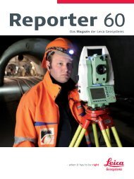
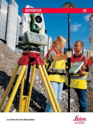
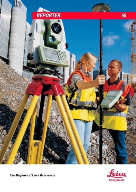
REPORTER <strong>50</strong><br />
The Magazine of <strong>Leica</strong> <strong>Geosystems</strong><br />
<strong>Geosystems</strong>
2<br />
CEO Message<br />
The <strong>2004</strong> productivity offensive<br />
Contact<br />
You can find <strong>Leica</strong><br />
<strong>Geosystems</strong> at numerous<br />
exhibitions, congresses and<br />
roadshows in your region.<br />
In addition, you can find<br />
information and<br />
documentation on our<br />
national websites or on<br />
www.leicageosystems.com.<br />
Here you<br />
will also find previous<br />
<strong>Reporter</strong> issues in different<br />
languages. Please visit us.<br />
IMPRINT<br />
Published by: <strong>Leica</strong> <strong>Geosystems</strong> AG<br />
CH-9435 Heerbrugg<br />
CEO Hans Hess<br />
Editorial Office: <strong>Leica</strong> <strong>Geosystems</strong> AG,<br />
CH-9435 Heerbrugg, Switzerland<br />
Fax +44 1908 246 259<br />
Email: Teresa.Belcher@leicageosystems.com<br />
Editors: Fritz Staudacher (Stfi);<br />
Teresa Belcher (Bt); Desktop and<br />
Publishing: Teresa Belcher, Niklaus<br />
Frei<br />
Production details: The <strong>Reporter</strong> is<br />
published in <strong>English</strong>, German,<br />
French and Spanish, four times a<br />
year.<br />
When competitive pressures are building up on our<br />
customers around the world, and tasks are getting<br />
bigger, there is only one way to gain an advantage: by<br />
increasing productivity! In the last two years our<br />
researchers and engineers have been examining the<br />
operating sequences and added value chains of our<br />
biggest customer groups in various key tasks. They<br />
have been examining the latest technologies with<br />
regard to their suitability for surveying, remote<br />
reconnaissance and geomatics, and have incorporated<br />
them where appropriate. They have also continued to<br />
develop existing methods and processes – such as the<br />
patented laser beam in our range of TPS stations. As its<br />
measuring field at the target point is only one tenth of<br />
the area in relation to other systems, it measures<br />
considerably more precisely. Our experts have also<br />
removed numerous barriers that once impeded the interoperability of data between<br />
previously isolated systems.<br />
In my last editorial, I introduced you to one of these new developments, our HDS3000 and<br />
HDS4<strong>50</strong>0 high-definition surveying systems, together with our world-beating Cyclone<br />
Software, which enables even the most complex properties to be scanned rapidly, in three<br />
dimensions, and subsequently measured and transformed into 3D models in comfort back<br />
in the office.<br />
In this <strong>50</strong>th issue of the <strong>Reporter</strong>, our customer magazine, you will find the presentation of<br />
our revolutionary Universal System 1200, which for the first time in the world, merges data<br />
from GPS and TPS sensors. With its standardized method of operation and power supply, it<br />
exploits the strengths of both technologies, and is capable of delivering productivity gains<br />
of 25 percent and more.<br />
Any of our readers who want to enrich and speed up the added value chain by means of<br />
products from the areas of photogrammetry and remote reconnaissance, will greet the<br />
new ALS<strong>50</strong> 83 kHz laser scanner with just as much enthusiasm as the new <strong>Leica</strong> Photogrammetry<br />
Suite – a well-rounded range of software for digital photogrammetry and<br />
integrated remote image reconnaissance.<br />
In addition, anyone who wants to be quicker and more accurate in the transportation<br />
industries, such as aircraft, automobile and ship building, can now secure a considerable<br />
lead on the basis of laser-scanning technology, using our T-Probe, the world's first<br />
coordinate measuring machine, including Horizon, the CAD-based application software.<br />
Also, our new DISTO Plus hand-held laser model, with Bluetooth data transfer and<br />
versatile application software offers previously unknown solutions for a large number of<br />
measuring and plan preparation tasks.<br />
With all these new developments, <strong>Leica</strong> <strong>Geosystems</strong> is still setting the technological<br />
standards in our industry. But most of all they are helping our customers to gain an<br />
advantage. So launch your <strong>2004</strong> product offensive now, with these revolutionary new<br />
solutions! It will start to pay off right away in terms of time saved, but above all in<br />
increased productivity and improved positioning in the medium to long term.<br />
Reprints and translations, including<br />
excerpts, are subject to the Editor's<br />
prior permission in writing.<br />
The publication is printed on<br />
chlorine-free paper made by<br />
environmentally compatible<br />
processes.<br />
Hans Hess<br />
CEO <strong>Leica</strong> <strong>Geosystems</strong><br />
© <strong>Leica</strong> <strong>Geosystems</strong> AG,<br />
Heerbrugg, <strong>April</strong> <strong>2004</strong>,<br />
Printed in Switzerland<br />
Editorial deadline for next issue:<br />
31 May, <strong>2004</strong>
Contents 3<br />
4<br />
Gotthard Base Tunnel:<br />
Tunnel technology for<br />
the future<br />
7<br />
World-famous<br />
airplane model<br />
created with<br />
<strong>Leica</strong> Axyz software<br />
11<br />
Improving Cellular<br />
Coverage in Rio de<br />
Janeiro<br />
14<br />
Dealers' new<br />
addiction: The <strong>Leica</strong><br />
<strong>Geosystems</strong> Partners'<br />
Store<br />
4<br />
Gotthard Base Tunnel:<br />
Tunnel technology for the<br />
future<br />
7<br />
World-famous airplane<br />
model created with <strong>Leica</strong><br />
Axyz software<br />
8<br />
High-Definition survey<br />
provides accurate DTM and<br />
cross sections of busy<br />
highway<br />
10<br />
Geographic imaging helps<br />
endangered birds find a<br />
new home<br />
11<br />
Improving cellular coverage<br />
in Rio de Janeiro<br />
18<br />
<strong>Leica</strong>'s Universal<br />
System 1200<br />
12<br />
Surveyors charged with tall<br />
order<br />
14<br />
Dealers' new addiction: The<br />
<strong>Leica</strong> <strong>Geosystems</strong> Partners'<br />
Store<br />
26<br />
World first in<br />
precision paving<br />
at Heathrow<br />
22<br />
Laser<br />
trackers<br />
revolutionize<br />
industrial<br />
measurement<br />
procedures at<br />
Eurocopter<br />
28<br />
T16 #178277:<br />
a life of travel<br />
and tacheometry<br />
15<br />
<strong>Leica</strong>'s latest top model in<br />
the DISTO family: <strong>Leica</strong><br />
DISTO plus<br />
18<br />
<strong>Leica</strong>'s Universal System<br />
1200<br />
20<br />
Emerging permanent<br />
reference station networks<br />
22<br />
Laser trackers revolutionize<br />
industrial measurement<br />
procedures at Eurocopter<br />
24<br />
News in Brief<br />
26<br />
World first in precision<br />
paving at Heathrow<br />
27<br />
Gradestar in New Zealand<br />
28<br />
T16 #178277: a life of travel<br />
and tacheometry<br />
30<br />
Recording movements on<br />
Mt Everest using GPS
4<br />
Tunnel Surveying<br />
Gotthard Base Tunnel:<br />
Tunnel technology for the future<br />
The Alp Transit Gotthard is an ambitious railway construction project, which will incorporate the world's<br />
longest railway tunnel of 57 km travelling through the Swiss Alps and under the St. Gotthard massif. Future<br />
passenger trains will journey at speeds of up to 2<strong>50</strong> km/h, adding further to the highly successful European<br />
high-speed network and bringing a huge reduction in travelling time. The combined surveying systems of<br />
<strong>Leica</strong> <strong>Geosystems</strong> and Amberg Measuring Technique Ltd are greatly assisting the tunnel workers in their dayto-day<br />
work - not only reducing time needed to ensure that excavation is correctly undertaken, but also making<br />
the whole construction process much more efficient and accurate.<br />
The Gotthard Base Tunnel has<br />
been divided into five sections:<br />
Erstfeld, Amsteg, Sedrun, Faido<br />
and Bodio<br />
In order to integrate<br />
Switzerland into the<br />
modern rail network, lines<br />
must be prepared which<br />
can be travelled at high<br />
speed. The Gotthard Base<br />
Tunnel, which will cost<br />
around seven billion francs,<br />
is thus the foundation stone<br />
of the Swiss railway of the<br />
future. The connections in<br />
international transport,<br />
built up around the nodes<br />
of Zurich and Milan, will<br />
become considerably faster,<br />
thus presenting a real alternative<br />
to travelling by car<br />
or by air. It is anticipated<br />
that between 200-220<br />
goods trains will run daily<br />
following its completion.<br />
The Gotthard Base Tunnel<br />
consists of two single-track<br />
tunnels that lie approximately<br />
40m apart and these<br />
are linked by a series of<br />
connecting galleries every<br />
325m. The entire tunnel<br />
construction has been<br />
divided into five sections,<br />
each with its own separate<br />
access point:<br />
· Erstfeld - northern portal<br />
· Amsteg - horizontal access<br />
tunnel, 1.2km long<br />
· Sedrun - two blind shafts,<br />
800m deep and 8 m in<br />
diameter accessed<br />
through a horizontal<br />
tunnel about 1km long<br />
· Faido - a 2.7km long<br />
inclined access tunnel<br />
(adit) with a 12% gradient<br />
and a height difference of<br />
300m<br />
· Bodio - southern portal<br />
The Gotthard Base Tunnel<br />
will pave the way in quality<br />
and safety with an extremely<br />
comprehensive safety<br />
system. By using two tunnels<br />
the possibility of head<br />
on collisions is eliminated<br />
and the two pairs of crossover<br />
tunnels allow the<br />
trains to move from one<br />
tunnel to the other, which is<br />
particularly important during<br />
maintenance work. The<br />
Sedrun and Faido sections<br />
each include a Multi-functional<br />
Station that, in the<br />
event of an accident, provides<br />
safe rooms for passengers<br />
and emergency<br />
train stations. Connecting<br />
galleries provide track<br />
cross-over tunnels, a ventilation<br />
system and a quick<br />
route to the outside in the<br />
event of an evacuation.<br />
These intermediate access<br />
headings not only allow<br />
these safety features to be<br />
incorporated, but also allow<br />
up to four Tunnel Boring<br />
Machines (TBMs) to operate<br />
at the same time thus<br />
reducing the overall con-
Tunnel Surveying 5<br />
struction time of the tunnel<br />
by almost half to nine<br />
years.<br />
The geology and rock type<br />
of the area determines the<br />
method of tunnelling and<br />
therefore engineers must<br />
create different tunnelling<br />
profiles according to the<br />
rock encountered. Nearly<br />
90% of the Gotthard Base<br />
Tunnel has rock that is suitable<br />
for mining using T<strong>MB</strong>s,<br />
with the remaining areas -<br />
the Sedrun section and the<br />
multi-function station at<br />
Faido - having to be excavated<br />
by drill and blast.<br />
Over major sections of the<br />
tunnel, the overburden will<br />
be extremely high, including<br />
5km with more than<br />
2000m where rock temperatures<br />
can be as high as<br />
45 o C. These conditions all<br />
affect the methods and<br />
complexity of the tunnelling<br />
operation.<br />
Tunnel Measurement<br />
System<br />
It is in the depths of the<br />
tunnel at Faido that <strong>Leica</strong><br />
<strong>Geosystems</strong> and Amberg<br />
Measuring Technique Ltd<br />
are providing an integrated<br />
surveying solution for the<br />
drill and blast method. Over<br />
300m of this section has<br />
been excavated so far, and<br />
due to the immense pressure<br />
from the rock, the tunnel<br />
in this section is being<br />
excavated in two sections -<br />
firstly the upper part of the<br />
face and then the lower<br />
part, known as the heading<br />
and the bench. Approximately<br />
4<strong>50</strong>kg of explosive<br />
is required to advance each<br />
round and the tunnel<br />
advances at around one to<br />
three metres per day.<br />
The LEICA TMS (Tunnel<br />
Measurement System)<br />
offers automatic profile<br />
surveying and setting out<br />
using total stations from the<br />
LEICA TPS 1100 Professional<br />
series. The concept<br />
behind this was to identify<br />
the production tasks<br />
required for the job and to<br />
automate them so that a<br />
non-surveyor, such as the<br />
tunnel foreman, could carry<br />
out the setting out.<br />
Previously, in order to<br />
position the arches accurately<br />
in a tunnel, the excavation<br />
crew would finish a tunnel<br />
to the approximate profile<br />
required within which to fit<br />
the arches. The site surveyors<br />
would then be called<br />
back on site to examine the<br />
work, place the arches in the<br />
face and then direct further<br />
work. If the face had not<br />
been excavated to a large<br />
enough profile, then the<br />
arches had to be removed<br />
and the excavation continued.<br />
Alternatively, if the profile<br />
was too large, the quantity<br />
of shotcrete required in<br />
between the arches would<br />
be increased considerably.<br />
Both activities significantly<br />
increase the costs of the<br />
tunnel construction.<br />
In the tunnels, <strong>Leica</strong><br />
TCRA1105 total stations are<br />
mounted high on the walls<br />
and are controlled by the<br />
<strong>Leica</strong> TMS which automatically<br />
performs the surveying<br />
and monitoring work such<br />
as alignment, excavated<br />
profile, position of arches, or<br />
thickness of shotcrete<br />
required. Each <strong>Leica</strong> total<br />
station contains the powerful<br />
onboard LEICA TMS<br />
SETout PLUS software. The<br />
surveyor prepares and<br />
enters all the project data<br />
and geometry using the<br />
<strong>Leica</strong> TMS OFFICE on an<br />
office based computer and<br />
then transfers this information<br />
to the total station via a<br />
PCMCIA card prior to job<br />
commencement.<br />
Kurt Weidner, Senior<br />
Surveyor from Amberg<br />
Measuring Techniques, is<br />
one of the contracting<br />
surveyors on-site at Faido.<br />
"We are using completely<br />
<strong>Leica</strong> tools here at this site,"<br />
he said. "TMS, the combination<br />
of the <strong>Leica</strong> total<br />
stations and the Amberg<br />
software, is currently being<br />
used in four tunnel sections.<br />
The total stations are used<br />
directly for the controlling of<br />
the arc position and the<br />
profile situation after we drill<br />
and blast and to ensure that<br />
the surface of our gauge is<br />
in the right form."<br />
Setout made easy<br />
Obviously in the construction<br />
industry, time is<br />
money and as such the<br />
Gotthard Base Tunnel is a<br />
24-hours a day operation<br />
with eight-hour shifts for<br />
each six-person tunnelling<br />
crew. Every four days there<br />
is also an eight-hour period<br />
when the machines undergo<br />
maintenance. Handover<br />
between shifts only takes a<br />
couple of minutes and one<br />
or two people per crew are<br />
trained in using the TMS<br />
and are responsible for<br />
passing on information to<br />
the next shift. The <strong>Leica</strong><br />
TMS greatly assists in a<br />
smooth handover and the<br />
continuation of work<br />
because all the project data<br />
is already there on the<br />
machine.<br />
"The principle is very<br />
simple: the installation is<br />
undertaken by the surveyor<br />
and then we can explain<br />
and train people so they<br />
know what points need to<br />
be entered into the<br />
program," Kurt said. "We<br />
prepare the information<br />
plate describing what the<br />
section is and what the<br />
points are. These people<br />
can then use the instrument<br />
alone without any<br />
more support from the<br />
surveyor."<br />
Once installed, the operation<br />
of the system is carried<br />
out by the construction<br />
site personnel, who do not<br />
need to have any specific<br />
knowledge about surveying.<br />
The key benefit of<br />
this approach is that there<br />
is no delay waiting for the<br />
surveyor and the work carried<br />
out by the excavation<br />
crew is more accurate and<br />
productive, thereby<br />
improving the process and<br />
saving costs.<br />
"During any one shift there<br />
are six surveyors available<br />
on-site. The new system<br />
saves a lot of time and the<br />
surveyors are freed-up<br />
to continue with design<br />
work and solving other<br />
problems."<br />
<strong>Leica</strong> TCR1105 total stations are<br />
mounted high on the walls<br />
where they undertake surveying<br />
and monitoring work<br />
Senior Surveyor from Amburg<br />
Measuring Techniques, Kurt<br />
Weidner<br />
Surveyor Elke Fischer prepares<br />
and enters all the project data<br />
and geometry using the <strong>Leica</strong><br />
TMS OFFICE
6<br />
Tunnel Surveying<br />
About Amberg<br />
The highly specialised companies of the Amberg<br />
Group cover a wide spectrum of underground<br />
construction tasks, developing solutions in order<br />
to advance into new dimensions of underground<br />
construction. Amberg Engineering Ltd. plans and<br />
designs new structures and refurbishment<br />
projects, provides site management, delivers<br />
expert opinions and carries out damage and<br />
state assessments. Amberg Measuring Technique<br />
Ltd. develops systems and instruments that<br />
address measurement problems in underground<br />
construction and the rail industry, which includes<br />
initial reconnaissance, site supervision and<br />
surveying.<br />
The Sedrun section and the<br />
multi-function station at Faido -<br />
have to be excavated by drill<br />
and blast<br />
The tunnelling foreman can<br />
do routine production<br />
surveying tasks using the<br />
TMS SETout PLUS in<br />
production mode, including:<br />
· Drill and blast<br />
· Conventional advance<br />
· Roadheader advance<br />
· Jetting and pipe umbrella<br />
· Alignment laser<br />
· Position arches<br />
"It's very easy to use,<br />
people are working with it<br />
and they are happy with its<br />
performance. The remote<br />
control can be held in your<br />
hand, directly in front of<br />
you or you can control it<br />
over a wireless system,"<br />
Kurt said. "We also have a<br />
special place for the<br />
computer that is set back<br />
100-1<strong>50</strong> metres away from<br />
the work, for safety<br />
distance."<br />
Adverse conditions at<br />
Faido<br />
Although geological sampling<br />
and assessment can<br />
be carried out prior to the<br />
commencement of tunnelling,<br />
it is not until the<br />
excavators actually begin<br />
work that they know for<br />
certain what type of rock is<br />
to be encountered. This has<br />
been the case at Faido<br />
where, in <strong>April</strong> of 2002, a<br />
partial collapse occurred in<br />
the cross cavern vault, leaving<br />
a cavity about eight<br />
metres high. Despite the<br />
prediction of exploratory<br />
drill cores, a fault zone containing<br />
a very poor rock<br />
layer of silty Lucomagno<br />
geniss was encountered.<br />
This meant implementation<br />
of modified work methods<br />
and strengthening of the<br />
excavation support was<br />
necessary with deformable<br />
steel arches and a dense<br />
anchoring system.<br />
"Deformations required<br />
some re-design of the tunnelling,"<br />
Kurt said. "We<br />
prepare the theoretical profile<br />
based on the design<br />
drawings and change the<br />
profile according to the rock<br />
conditions. With the LEICA<br />
TMS, to prepare only a few<br />
coordinates of the profile, is<br />
no longer a problem.<br />
Previously, this all had to be<br />
done manually and took a<br />
lot of time."<br />
Profile measurement<br />
Another program available<br />
as part of the LEICA TMS is<br />
the LEICA TMS PROFILE<br />
which enables profile measurement<br />
and monitoring,<br />
providing a comprehensive<br />
comparison of design vs<br />
actual measurement and<br />
project data.<br />
"We can also now monitor<br />
our precise position in the<br />
tunnel. We can establish if<br />
we are in exactly the right<br />
position for the profile, by<br />
comparing the measured<br />
tunnel meter with the theoretical<br />
one and we can<br />
adjust this immediately if it<br />
is wrong," Kurt said.<br />
"Before we were never able<br />
to have this control and had<br />
to use a tape."<br />
"Electronic Distance<br />
Measurements (EDM)<br />
defined on the integrated<br />
software of the total station<br />
allows us to have each<br />
point measured precisely<br />
after 10 seconds," Kurt said.<br />
"Alternatively we can use a<br />
special function of the program<br />
when we want exact<br />
control so that we can also<br />
select individual points.<br />
This is the part that is new<br />
in surveying."<br />
Monitoring<br />
As the tunnel progresses, it<br />
is necessary to monitor the<br />
tunnel profile for deformation.<br />
A lot of pressure is<br />
built up using the drill and<br />
blast method, and as such<br />
there is normally a difference<br />
between the powerpoint<br />
direction and the control<br />
point at the front. A<br />
<strong>Leica</strong> TCA2003 is used for<br />
this type of monitoring as it<br />
is more precise when millimetre<br />
accuracy is needed.<br />
Yellow targets with a white<br />
faces are used for reflection,<br />
and these are placed<br />
in the heading (at three<br />
points) and the bench (two<br />
points) of the tunnel.<br />
"Over 300-400 targets have<br />
been installed so far for<br />
deformation monitoring,"<br />
Kurt said. "These points are<br />
controlled one to two times<br />
a week in order to provide a<br />
record of the movement.<br />
The highest deformation<br />
measured so far has been<br />
<strong>50</strong> cm. Using the software<br />
you can see the calculation<br />
and check the points from<br />
<strong>50</strong>-100 metres being the<br />
current head. Over a fourmonth<br />
period, the control<br />
points are checked twice,<br />
and the control brackets are<br />
checked once every four<br />
months.<br />
Bt
The Junkers W33 was developed from the passenger<br />
aircraft F13 as a single-engined freight transport, lowwinged<br />
monoplane. The first flight of the prototype took<br />
place on 17 June, 1926 on the Elbe at Leopoldshafen<br />
near Dessau, Germany. It was subsequently massproduced,<br />
with different versions, in the following period<br />
up to the year 1934, and became well known as an<br />
airplane with landing capabilities on the sea as well as<br />
the land. Besides the simple use as freight transport, and<br />
due to its collapsible (opening) floor, the plane was used<br />
as a passenger aircraft for aerial flights, as well as for the<br />
delivery of pesticides in pest control.<br />
3D Measuring Systems 7<br />
World-famous airplane model created with <strong>Leica</strong><br />
Axyz software<br />
The world-famous airplane, Junkers W33, has been measured with extreme 3D precision and modelled<br />
using <strong>Leica</strong>'s Axyz software. <strong>Leica</strong> Axyz is the world's only integrated, intelligent industrial 3D measuring<br />
system, which measures industrial objects, on an electro-optical non contact basis. Under the supervision<br />
of Professor Günther Stegner, Stefan Brüser undertook this work as part of his Engineering masters thesis,<br />
which involved data acquisition for modelling. Approximately 3000 object points of the areoplane’s<br />
outerskin were recorded, evaluated, and then realistically copied in a CAD system. The resulting model is<br />
an 'extremely realistic' copy of the airplane. Originally built in Dresden, 198 planes still exist worldwide.<br />
The W33 was generally regarded as a multi-purpose<br />
airplane. Initially, however, it was designed for the air<br />
goods traffic, and the view windows were missing. In<br />
newer versions, and in this model example, windows<br />
were refitted for composite freight passenger. Entry to<br />
the machine could be gained by a lateral door or by a<br />
hatch in the cubical roof.<br />
The W33 'Bremen' became world-famous (Work number<br />
2<strong>50</strong>4, Signal 1167) on the 12-13 <strong>April</strong>, 1928 when it<br />
carried out the first non-stop trans-Atlantic flight from<br />
east to west. The machine, crewed by German Kühl and<br />
Irishman Fritzmaurice, began the flight in Dublin,<br />
crossing Iceland, and reaching the island of Grennly,<br />
located between Labrador and Newfoundland after<br />
approximately 26 hours.<br />
(above): photo of the Junker<br />
W33 ‘Bremen’ in flight<br />
(below): wire netting model<br />
(bottom): phororealistic<br />
representation<br />
An attempt to continue the flight to New York was not<br />
possible, after a makeshift repair failed. Following this,<br />
the 'Bremen' was recovered by ship and returned to<br />
Germany, where it was repaired and exhibited in Berlin<br />
at ILA (International Aeronautics Exhibition) in the same<br />
year (1928). However, since no German museum showed<br />
an interest following this, the 'Bremen' was given to<br />
America.<br />
In America, the plane was displayed at various different<br />
museums, including the Edison Institute Museum in<br />
Dearborn, Detroit, and the 'Bremen' has remained in this<br />
museum of contemporary history since then. There have<br />
been several unsuccessful efforts from the Germans to<br />
have the machine returned to Germany, and an initiative<br />
of interested and enthusiastic Bremen citizens achieved<br />
it as a gift for one year. In March 2003, the Junkers W33<br />
was taken to pieces and transported to Detroit. During<br />
the dismantling, additional measuring documentation<br />
was done.<br />
Gunter Stegner
8<br />
High Definition Surveying<br />
High-Definition Survey provides accurate DTM and<br />
cross sections of busy highway<br />
“The Cyra scanning system saved us $24,000 in lane<br />
closure costs, cut our field surveying crew hours in<br />
half and allowed us to give our customer more than<br />
they expected without a return visit to the site. And<br />
since we worked on the side of the road, our crew was<br />
safe and drivers weren't aggravated by lane closures.”<br />
Ken Moscetti,<br />
Project Surveyor,<br />
Medina Consultants, P.C.<br />
From the side of the roadway,<br />
Cyrax ® 2<strong>50</strong>0 laser scanner<br />
captures detailed road surface<br />
geometry<br />
Scope:<br />
Digital terrain model of<br />
6,<strong>50</strong>0 feet of a busy<br />
four and six lane roadway<br />
and railroad<br />
bridge overpass; ASCII<br />
file of cross sections<br />
Owner:<br />
New Jersey<br />
Department of<br />
Transport (DOT)<br />
Date:<br />
July - August 2002<br />
Project Facts<br />
Field: 5 days; twoperson<br />
Cyrax crew plus<br />
two-person survey<br />
crew; 46 scans<br />
Office: 15 days; one<br />
person<br />
Deliverables:<br />
Digital Terrain Model of<br />
roadway and adjacent<br />
area<br />
ASCII list of points on<br />
cross sections at 25 ft<br />
intervals<br />
Background<br />
New Jersey Department of<br />
Transport (DOT) is replacing<br />
a traffic circle at a heavy<br />
traffic intersection of State<br />
routes 30 and 130. A professional<br />
engineering design<br />
and consulting firm hired<br />
Medina Consultants, P.C. to<br />
provide accurate crosssections<br />
and a digital terrain<br />
model (DTM) of the existing<br />
four and six-lane roadway.<br />
The contract was awarded<br />
based on conventional and<br />
aerial survey techniques.<br />
After winning the bid,<br />
Medina Consultants agreed<br />
to use their Cyrax ® 2<strong>50</strong>0<br />
(since rebranded as<br />
HDS2<strong>50</strong>0) for the project.<br />
The Cyrax system could save<br />
$24,000 budgeted for lane<br />
closure costs and halve<br />
survey labor to five days<br />
with a four-person crew from<br />
20 days with a two-person<br />
crew. In addition, operators<br />
would not be at risk in traffic<br />
lanes and drivers would not<br />
be aggravated by closing<br />
lanes.<br />
Project Workflow<br />
A four-person crew worked<br />
on the project for five nights,<br />
from 7pm to about 6am,<br />
when traffic was at its<br />
lightest. Two members of the<br />
crew moved and surveyed<br />
the targets with a <strong>Leica</strong><br />
TCR 1101 reflectorless total<br />
station to tie them into the<br />
control system.<br />
The Cyrax scanner was<br />
mounted on a CST-Berger<br />
heavy duty, 42 ft tripod. A<br />
cable connected the scanner<br />
to a laptop controller at<br />
ground level. The crew<br />
moved the Cyrax system to<br />
positions at 1<strong>50</strong> ft intervals<br />
along each side of the<br />
roadway. The scanner was<br />
elevated about 11-1/2 ft to<br />
obtain scans with a wider<br />
and longer field of view with<br />
more detail of the shoulder<br />
and sidewalks.<br />
They obtained 46 scans, with<br />
the range typically between<br />
160 and 170 ft. The roadway<br />
was scanned with a minimum<br />
3.5 inch point density,<br />
each point better than 6mm<br />
accuracy. Each scan included<br />
a minimum of four hemispherical<br />
targets. Targets<br />
were scanned with a very<br />
high density point spacing to<br />
allow accurate extraction of<br />
the target center.<br />
In the office, one operator<br />
processed the field data in<br />
about 15 days using<br />
Cyclone, CloudWorx,<br />
Bentley MicroStation and<br />
InRoads software.<br />
Point clouds were registered<br />
and referenced to the<br />
control system in Cyclone<br />
software. Customers were<br />
shown the registered point<br />
clouds of the roadway, railroad<br />
bridge and surrounding<br />
features. They gained<br />
confidence in the accuracy<br />
and completeness of the<br />
scan data. They also realized<br />
they could obtain more<br />
data in the future - wire<br />
heights, railroad bridge<br />
clearances, pole size/locations,<br />
and information to<br />
settle potential encroachment<br />
disputes. After discus-
sion, Medina Consultants<br />
agreed to provide cross sections<br />
at 25 ft (instead of<br />
<strong>50</strong> ft) intervals and define<br />
3D elevation points randomly<br />
at 7-1/2 to 12 ft intervals<br />
between cross sections<br />
at no additional cost.<br />
Cyclone software was<br />
used to extract the crosssections<br />
and define 3D elevation<br />
points for the DTM.<br />
Some cross-sections were<br />
also created using<br />
CloudWorx in<br />
MicroStation. They matched<br />
the Cyclone cross-sections<br />
accurately.<br />
The cross-sections and 3D<br />
points were imported to<br />
InRoads to create a DTM<br />
with contour lines at 1/2 ft<br />
intervals. The DTM data<br />
was imported to Cyclone<br />
and checked with the point<br />
cloud for errors.<br />
By using <strong>Leica</strong>'s 3D laser<br />
scanning system instead of<br />
conventional equipment,<br />
Medina Consultants<br />
eliminated $24,000 in road<br />
closure fees, cut their field<br />
labor and per diem by <strong>50</strong><br />
percent, and gave their<br />
customer more accurate and<br />
complete information than<br />
specified in the contract. In<br />
addition, the scan data could<br />
be used in the future to<br />
provide more information.<br />
Laslo Vespremi<br />
High Definition Surveying 9<br />
Benefits:<br />
* Saved $24,000 in road closure fees and cut field labor cost by <strong>50</strong> percent<br />
* More detailed scan provided accurate DTM with contour lines and elevation points<br />
* 3D scan provided more cross sections at closer intervals, 3D elevations, other<br />
information needed in the future<br />
* Off-road operation kept operators safe and didn't interfere with traffic flow<br />
* Scan cloud gave customer confidence in data and showed information for future<br />
use<br />
Laser scans of roadway in<br />
Microstation<br />
High-Definition Surveying: Laser Scanning Re(de)fined<br />
<strong>Leica</strong> <strong>Geosystems</strong> has coined a new name for laser scanning<br />
technology: High-Definition Surveying or HDS. Why First, High-<br />
Definition better describes its single most distinguishing feature -<br />
high density data and rich images - compared to point-by-point<br />
surveying. Second, by describing it as High-Definition Surveying,<br />
<strong>Leica</strong> is stating that its new family of hardware and software<br />
products is fully fit and friendly for surveying and engineering.<br />
For example, the new <strong>Leica</strong> HDS3000 not only has the look and<br />
feel of a surveying instrument, now you can geo-reference to<br />
local or assumed coordinates more efficiently by setting up over<br />
a survey point. Other survey-friendly features include a standard<br />
tribrach mount, H.I. measurement capability, efficient battery<br />
swapping, and improved weight/portability. In addition, <strong>Leica</strong>'s<br />
Cyclone and CloudWorx are feature-rich software products<br />
that make creating surveying and engineering deliverables easier<br />
than ever before. Welcome to the world of HDS! Learn more<br />
about the HDS family of products at www.cyra.com.<br />
The HDS family of products (left-to-right clockwise): The super-fast<br />
HDS4000, the all-new HDS3000, world's best selling HDS2<strong>50</strong>0 and the<br />
Cyclone and CloudWorx software products.
10 GIS and Mapping<br />
Geographic imaging helps endangered birds find a<br />
new home<br />
Researchers at New Mexico State University (NMSU)<br />
have employed <strong>Leica</strong> <strong>Geosystems</strong>' remote sensing<br />
and GIS applications to evaluate the Chihuahuan<br />
Desert region in Mexico in order to identify habitat<br />
features most likely to sustain a population of the<br />
endangered Aplomado Falcon (Falco femoralis). The<br />
final products, a documented predictive model and a<br />
map depicting habitat suitability across a large<br />
portion of the species' range, are aiding in prioritizing<br />
areas for conservation consideration and making land<br />
use decisions that benefit falcon habitat restoration.<br />
The Transformed Divergence<br />
(TD) tool in ERDAS IMAGINE's<br />
Signature Editor tool was used<br />
to reduce the number of land<br />
cover classes produced from<br />
unsupervised classification to<br />
those with distinct spectral<br />
signatures. The distinct spectral<br />
signatures were then applied to<br />
the image to perform a supervised<br />
classification. Using this<br />
process, the number of spectral<br />
classes was reduced to 26 for<br />
the fall (wet season) image and<br />
33 for the spring (dry season)<br />
image.<br />
The Aplomado Falcon, once<br />
a common raptorial (predatory)<br />
bird in the coastal and<br />
interior grasslands of the<br />
American southwest, was<br />
declared an endangered<br />
species by the U.S. Fish and<br />
Wildlife Service in 1986.<br />
Increased sightings during<br />
the 1990s renewed recovery<br />
effort interests in New<br />
Mexico to evaluate the<br />
Chihuahuan Desert region<br />
that stretches from the Rio<br />
Grande Valley in southern<br />
New Mexico far into<br />
Mexico. A thriving ecosystem<br />
of other large birds and<br />
small prey is needed to sustain<br />
the Falcon's population<br />
because rather than building<br />
its own nests, it takes<br />
over the abandoned nests<br />
of other large birds.<br />
Researchers needed to<br />
better understand the<br />
Aplomado Falcon's natural<br />
history by describing falcon<br />
use areas in northern<br />
Chihuahua, Mexico. The GIS<br />
predictive modeling section<br />
was part of a five-year<br />
research endeavor that consisted<br />
of three phases. The<br />
first and second phases<br />
involved surveying the<br />
Aplomado Falcon habitat in<br />
Mexico's Chihuahuan<br />
Desert to locate and<br />
describe the physical features<br />
of the landscape<br />
where the birds exist.<br />
During the third phase,<br />
researchers analyzed satellite<br />
imagery as well as terrain<br />
data derived from digital<br />
elevation models (DEMs)<br />
of the Chihuahuan Desert to<br />
digitally locate the features<br />
identified as indicators of<br />
possible falcon habitat.<br />
The NMSU research results<br />
will help government<br />
agencies make informed<br />
decisions about the allocation<br />
of federal resources as<br />
well as environmental and<br />
development planning.<br />
Analyses were conducted<br />
using <strong>Leica</strong> <strong>Geosystems</strong><br />
GIS & Mapping's ERDAS<br />
IMAGINE®, ESRI's ArcGIS<br />
and FRAGSTATS public<br />
domain software packages.<br />
Falcon Facts:<br />
Population: Extirpated in U.S., extremely rare and endangered throughout <strong>No</strong>rthern<br />
Mexico and reduced to remnant population in Southern Mexico.<br />
Range: Formerly ranged throughout the southwestern<br />
U.S. and Mexico. It has rarely been seen in the U.S. and<br />
northern Mexico since the 1940s.<br />
Description: A medium-sized, steel grey falcon<br />
(aplomado is Spanish for dark grey). It is characterized by<br />
a long tail, a black cummerbund, contrasting with a white<br />
upper body. A distinguishing field characteristic of this<br />
falcon is the white dash above each eye and along the<br />
tailing edge of their secondary feathers.<br />
Habitat: Open grasslands and savannahs where tall cacti,<br />
tree yuccas and taller pines and oaks grow in open<br />
stands. Uses old stick nests of hawks and other species<br />
which share the same range and habitat.<br />
The three components were<br />
key to the project's success,<br />
as they produced the<br />
accurate results needed.<br />
ArcGIS interacted with both<br />
ERDAS IMAGINE (provided<br />
under an educational agreement)<br />
and FRAGSTATS<br />
applications; and ArcGIS<br />
was familiar to most end<br />
users of the final model, a<br />
critical factor in the project.<br />
To visually identify the land<br />
cover patterns that corresponded<br />
to those found in<br />
the Aplomado Falcon habitat,<br />
imagery was collected<br />
for spring and fall seasons<br />
that produce different vegetation<br />
responses found in<br />
the Chihuahuan Desert. The<br />
falcons require a combination<br />
of vegetation types:<br />
grasslands (for their prey<br />
base) with shrublands<br />
(where they perch and<br />
nest). Because of cloud<br />
cover conditions, each set<br />
of 15 LANDSAT 7 ETM+<br />
data imagery was collected<br />
over a five-week span.<br />
ERDAS IMAGINE software<br />
was used to import,<br />
reconcile, and analyze the<br />
two sets of data images<br />
covering the study area of<br />
246,848 km 2 . After the<br />
multispectral data was<br />
imported, the digital values<br />
were converted to spectral<br />
reflectance values to<br />
describe the vegetation<br />
around the habitat. Using<br />
the histogram bias technique,<br />
the images were<br />
standardized to a single<br />
date for each season while<br />
maintaining the true shape<br />
and distribution of the data<br />
in the image. When both<br />
data sets were standardized
(each roughly 20 gigabytes),<br />
the imagery was evaluated<br />
for spectrally distinct<br />
classes contained within the<br />
entire study area for both<br />
seasons. The distribution of<br />
falcon use sites among the<br />
land cover classes was<br />
examined to identify classes<br />
that corresponded with<br />
falcon presence.<br />
Once converted to ArcGrid,<br />
FRAGSTATS software was<br />
used on the classified<br />
images to calculate landscape<br />
metrics around falcon<br />
use sites using the thematic<br />
grids as input. This information,<br />
coupled with that of<br />
the configuration and<br />
composition of land cover<br />
classes within a larger<br />
landscape, was used in the<br />
habitat modeling process.<br />
Five predictor variables<br />
were converted to binary<br />
grids and added to create<br />
an output map representing<br />
ranges of Aplomado Falcon<br />
habitat suitability. Higher<br />
values in the map represent<br />
areas where a greater<br />
number of qualifying<br />
criteria were met, and lower<br />
values represent areas<br />
where fewer criteria were<br />
met. The binary input layer<br />
and final predictive model<br />
grids were converted to<br />
images in ERDAS IMAGINE;<br />
then all files were combined<br />
into one.<br />
Accuracy assessment<br />
analyses determined that<br />
the resulting model was<br />
highly effective in predicting<br />
"places of promise" for<br />
Aplomado Falcon conservation.<br />
At least 67 percent<br />
agreement was found<br />
between the field assessed<br />
and predictive model<br />
rankings at evaluated field<br />
sites. (Errors were largely<br />
attributed to differences in<br />
assigning like predictive<br />
values between field<br />
biologists and predictive<br />
model values.) Each of the<br />
21 prospective or known<br />
falcon habitat assessment<br />
areas that were identified<br />
independent of spatial<br />
modeling, contained habitat<br />
with high predictive<br />
ranking. Cartographic<br />
production was performed<br />
using the ArcMap tool<br />
within ArcGIS Desktop. The<br />
resulting predictive model<br />
and map of suitable<br />
Aplomado Falcon habitat<br />
now serves as an effective<br />
tool for identifying areas<br />
similar to falcon use areas<br />
in Chihuahua.<br />
Improving cellular coverage in Rio de Janeiro<br />
Telefonica Celular, one of the largest mobile telephone companies in Brazil, contracted<br />
IMAGEM, a GIS solutions company, to help them build a GIS database in<br />
order to plan and improve their cellular network. The goal was to simulate the<br />
actual cellular network coverage of Telefonica Celular in Rio de Janeiro.<br />
GIS and Mapping 11<br />
For more information about<br />
NMCFWRU, visit:<br />
http://leopold.nmsu.edu/fws<br />
coop/.<br />
For more information about<br />
Peregrine Fund falcon<br />
conservation initiatives,<br />
visit: http://www.peregrinefund.org.<br />
As IMAGEM was originally hired by Telefonica Celular to provide all the data they needed to<br />
deploy their cellular network, they contracted IMAGEM once again to help them improve<br />
their network.<br />
IMAGEM contracted a local aerial surveying company to obtain aerial photographs of Rio de<br />
Janeiro. With IMAGINE OrthoBASE, IMAGEM created orthophotos, and conducted aerial<br />
triangulation with OrthoBASE Pro to define the relationship between the project imagery, the<br />
sensor model and the ground. IMAGINE OrthoBASE Pro determined the position, rotation<br />
and internal geometry of the aerial sensor as they existed at the time of image capture for<br />
each exposure station, along with the X, Y and Z positions of any tie points.<br />
IMAGEM also produced Digital Terrain Models (DTMs) of the area with IMAGINE OrthoBASE<br />
Pro. The accuracy of each DTM was determined and verified. Multiple images were then<br />
orthorectified using the DTMs.<br />
With the help of Stereo Analyst, IMAGEM restored individual buildings, and aligned street<br />
and curb vectors within the orthophotos, and applied the result to the Base Building Heights.<br />
Image visualization was used with ERDAS IMAGINE V8.6.<br />
Throughout this process, analysts categorized the results<br />
and display them in the IMAGINE Viewer. Once they had<br />
enough accurate data, IMAGEM produced Base Building<br />
Heights, a detailed 3D model of Rio de Janeiro depicting its<br />
topographic terrain, including each individual building.<br />
The Base Building Heights were used in conjunction with<br />
third-party prediction software to simulate Telefonica<br />
Celular's network coverage.<br />
With the help of ERDAS IMAGINE software, IMAGEM was<br />
able to provide Telefonica Celular a GIS database that<br />
allows them to generate better maps depicting wireless<br />
coverage in their area, as well as conduct simulations of<br />
wireless coverage in the city. As a result of these accurate<br />
simulations, Telefonica Celular employees have a better<br />
idea of their current coverage and can plan the best ways to<br />
optimize wireless service to their customers. In return, their<br />
customers can enjoy improved coverage and services.<br />
Andrea Yegros<br />
Base building heights of Rio<br />
de Janeiro. IMAGEM used<br />
ERDAS IMAGINE, IMAGINE<br />
OrthoBASE and Stereo Analyst<br />
to create base building heights<br />
of the city to help Telefonica<br />
Celular analyze their cellular<br />
network coverage.
12<br />
Construction Surveying<br />
Surveyors charged with tall order<br />
Gold Coast surveyors, Treasure and Associates have been charged with a tall<br />
order - the surveying and monitoring of the world's soon-to-be tallest residential<br />
building - "The Q1 Tower". Currently being constructed in the heart of Surfers<br />
Paradise on the Gold Coast of Australia and planned for completion in 2005, the<br />
architecturally stunning tower will soar to a massive 80 storeys (323m / 1,058 ft).<br />
By March <strong>2004</strong>, construction of the complex had reached level 30 and just 46<br />
apartments remain for sale.<br />
(below from left): Brian Rogers<br />
and Rod Stead from Treasure<br />
and Associates together with<br />
Lawrie Watson from <strong>Leica</strong><br />
<strong>Geosystems</strong>’ Australian distributors,<br />
C.R.Kennedy and Company<br />
Pty Ltd.<br />
Developers, Sunland Group<br />
Ltd have designed the<br />
Q1 Tower to offer five-star<br />
resort living, with 527 apartments<br />
comprising of penthouses,<br />
as well as one-,<br />
two- and three-bedroom<br />
apartments. The fastest lifts<br />
in Australia travelling at 9.0<br />
m/s (1772 ft/min) will take<br />
visitors and residents to the<br />
observation deck at the top<br />
of the tower where they will<br />
enjoy the breathtaking<br />
views that encompass the<br />
crystal clear waters of the<br />
Pacific Ocean; the 42 kilometres<br />
of pristine sandy<br />
beaches of the Gold Coast;<br />
the green hills of the hinterland;<br />
as well as the extensive<br />
waterways and the<br />
Broadwater. A ten-storey<br />
Sky Garden from level 60<br />
upwards will showcase<br />
tropical Queensland's<br />
unique flora and fauna.<br />
Engineering innovation<br />
During construction, a polymer<br />
liquid was used prior to<br />
pouring of the concrete to<br />
prevent the sand falling in.<br />
The aboveground construction<br />
wasn't easy either, with<br />
the outside building<br />
columns needing to be<br />
linked to the central core to<br />
minimise wind movement<br />
and to strengthen the structure.<br />
Although concrete performs<br />
exceptionally well<br />
under compression, it does<br />
not perform so well under<br />
tension, so it was necessary<br />
to reinforce the concrete<br />
with steel bars (rebars).<br />
Despite its lavish features<br />
and impressive grandeur, it<br />
is the engineering behind<br />
its construction where Q1<br />
achieves real innovation.<br />
Construction challenges<br />
were encountered due to<br />
the sandy soil and proximity<br />
to the ocean, which<br />
meant that it was necessary<br />
for foundations to stretch<br />
almost 17 storeys underground.<br />
After boring<br />
through the ancient seabed,<br />
drillers eventually struck<br />
rock that was seven times<br />
harder than concrete and<br />
literally drilled the 26 building<br />
plings 5 metres into it.<br />
The six largest of these<br />
span 2.4m in diameter.<br />
Monitoring of the<br />
construction<br />
Brian Rogers and Rod<br />
Stead, Project Managers of<br />
surveying consultants<br />
Treasure and Associates,<br />
have been working closely<br />
on the logistics involved in<br />
monitoring the construction<br />
of the massive building.<br />
A significant problem in<br />
monitoring is the wind<br />
movement. "We prefer to do<br />
the surveying work during<br />
times of low wind," Rod<br />
Stead said. "The sea breeze<br />
can cause the buildings to<br />
move up to 20mm."<br />
Plumbing of the lift shafts is<br />
undertaken by the builders
Construction Surveying 13<br />
World record holder<br />
The Q1 tower will hold a number of world records.<br />
When completed it will become the tallest residential<br />
tower in the world and will eclipse world famous<br />
structures such as New York's 319m Chrysler<br />
building and the 321m Eiffel Tower in Paris. Its ovalshaped<br />
spire, which starts at level <strong>50</strong> (146m high)<br />
and extends 47m above the glass fin, will be the<br />
world's longest at 176m in length. It also boasts the<br />
highest swimming pool in Australia (15m x 6m),<br />
which will be located in the penthouse on level 74,<br />
217m above ground level. Q1 will be the 16th<br />
building on the Gold Coast to hold the "tallest title"<br />
since the first highrise was built in 1957.<br />
for verticality. Surveyors<br />
then check the walls and<br />
columns using external control.<br />
This determines how<br />
straight the structure is and<br />
whether there is a twist.<br />
Brian Rogers said: "When<br />
plumbing, you get accumulative<br />
errors, and these<br />
errors are exacerbated when<br />
the cranes and hoist are<br />
working. Crane hours are<br />
paramount on these sites,<br />
and everything is scheduled<br />
around the crane so it's<br />
not ideal for this type of<br />
monitoring most of the time<br />
during the construction."<br />
'Radiation' surveying<br />
In an attempt to overcome<br />
this problem, the so-called<br />
'radiation' surveying<br />
method was used. This<br />
involves re-section with a<br />
free-standing total station<br />
from the control network<br />
(some are ground marks<br />
and others are on surround-<br />
ing buildings).<br />
"Prisms are<br />
permanently<br />
attached to<br />
surrounding<br />
buildings,"<br />
Brian Rogers<br />
said. "These<br />
are checked<br />
using a <strong>Leica</strong><br />
TCR1101 with<br />
Automatic<br />
Target Recognition<br />
(ATR)<br />
both day and<br />
night if<br />
required."<br />
"This method<br />
means we<br />
work from the<br />
whole to part<br />
and it allows<br />
us to establish our stations<br />
at the most convenient<br />
position," said Rod Stead.<br />
"Using a one-second<br />
machine with ATR means<br />
we can get results down to<br />
a 10mm accuracy."<br />
Bt<br />
(above): Surveyor, Brian Rogers<br />
of Treasure & Associates uses a<br />
<strong>Leica</strong> TCR1101 for monitoring on<br />
the Q1 construction site.<br />
(above): aerial view of the<br />
construction of Q1 in July 2003.<br />
(below): aerial view of the construction<br />
in December 2003.<br />
Photos courtesy of Sunland<br />
Group<br />
The Gold Coast is not only Australia's sixth largest<br />
city, it is also the tourist mecca for the country with<br />
over four million domestic and international tourists<br />
visiting the city every year.<br />
(below): an artist’s view of the<br />
Gold Coast landscape when Q1<br />
construction is completed.<br />
Image courtesy of Sunland<br />
Group
14<br />
E-Commerce<br />
Dealers' new addiction:<br />
The <strong>Leica</strong> <strong>Geosystems</strong> Partners' Store<br />
http://store.leica-geosystems.com is the entry to the<br />
Partners' Store, also known as B2B (Business to<br />
Business) Store - a new ordering channel established<br />
in <strong>No</strong>vember 2002 with the aim of making it easier<br />
and more valuable for our partners to do business<br />
with us. It aims to increase the productivity of<br />
ourselves and that of our dealers, as well as improving<br />
the value of our service to our partners by automating<br />
order entry and providing more control and information<br />
prior to and following the placement of an order.<br />
Curtis Finn of US dealer FLT<br />
<strong>Geosystems</strong> and Jeff Felker,<br />
Director of Sales US SE Region<br />
"I thought I would never<br />
use the store, but it is so<br />
easy to place an order,<br />
I use it now all the time."<br />
Bob Fintak, FLT<br />
<strong>Geosystems</strong>, USA<br />
Miren Kauer (front) with the<br />
team of Gradtek in Montreal,<br />
Canada. Gene Maynard, Director<br />
of Sales is taking the picture<br />
Before ordering, our dealers<br />
are able to quickly find products<br />
and bundles by part<br />
number, search by keyword<br />
or browse categories, obtain<br />
real-time quotations with<br />
product pricing, discover<br />
availability and shipment<br />
dates, choose whether to<br />
ship complete or not, select<br />
the shipping location and<br />
freight option, order on<br />
credit and pay by invoice as<br />
with fax orders.<br />
After ordering, an Order<br />
Confirmation is automatically<br />
emailed and a Shipping<br />
Confirmation is emailed<br />
once the goods have been<br />
dispatched. Dealers can subsequently<br />
check the order<br />
status online and track each<br />
shipment status, including a<br />
link to FedEx or UPS<br />
tracking system. In the order<br />
status our partners can also<br />
track the orders sent by fax.<br />
The B2B Store saves an<br />
enormous amount of time<br />
for our dealers, reducing<br />
phone calls to our busy Customer<br />
Service team who can<br />
be gradually freed up from<br />
part of the routine order<br />
entry tasks, thus enabling<br />
them to evolve into a proactive,<br />
problem-preventing,<br />
mistake-free and valueadding<br />
Customer Care.<br />
Because of the higher<br />
accuracy and controllability<br />
of online orders, failures and<br />
returns are being dramatically<br />
reduced.<br />
Current Store activities and<br />
the team<br />
The Store is currently open<br />
to our partners in the USA<br />
and Canada. In countries of<br />
Europe, Africa and Asia<br />
where we do not have a<br />
“The answer you get back<br />
from the website is instant<br />
and 99.99 percent accurate.<br />
Since I have started using<br />
the <strong>Leica</strong> Store the amount<br />
of purchase orders that<br />
have to be reprinted or<br />
changed due to in-accurate<br />
information has been<br />
cut drastically.”<br />
Steve Crane,<br />
Surveyors Service<br />
Company, USA<br />
<strong>Leica</strong> <strong>Geosystems</strong> Selling<br />
Unit, the store offers Spare<br />
Parts only for the time<br />
being. In <strong>2004</strong>, our European<br />
countries' partners will<br />
also start to experience its<br />
benefits.<br />
The Store is driven globally<br />
by Miren Kauer, Business<br />
Manager E-commerce, and<br />
developed by Martin Brockmann<br />
from IT Heerbrugg.<br />
Our experience with the two<br />
previous Stores has helped<br />
us build up know-how and a<br />
small, but solid E-commerce<br />
team, which resulted in a<br />
speedy four-month initial<br />
Store set up project with a<br />
minimal investment.<br />
Of course it all came to life<br />
thanks to the enthusiastic,<br />
excellent job of our<br />
Customer Service and Sales<br />
teams in the USA and<br />
Canada. The Customer Care<br />
and Support and Service<br />
teams in Heerbrugg also<br />
proudly launched the Spare<br />
Parts B2B Store in non-Selling<br />
Unit areas in January<br />
<strong>2004</strong>.<br />
All works smoothly and reliably<br />
thanks to our Logistics<br />
teams at the warehouse<br />
facilities in our Customization<br />
Centers in Lawrenceville,<br />
USA and in Widnau,<br />
Switzerland.<br />
“18,300 products, about<br />
120 users to date, over<br />
1000 quotation or status<br />
checks per month… dealers<br />
ordering nearly <strong>50</strong>% online<br />
and growing”<br />
The Partners' Store was<br />
opened for three pilot<br />
dealers in <strong>No</strong>vember 2002.<br />
Today, about 100 users from<br />
40 dealers are regularly<br />
using the Store to check<br />
availability, and easily place<br />
and track their orders. A<br />
large proportion of the<br />
products purchased are<br />
Spare Parts but there is also<br />
a growing request for<br />
Construction lasers, TPS,<br />
DISTO and all kind of<br />
accessories.<br />
Trust and acceptance is<br />
already proven: most<br />
Service dealers are set up<br />
and have placed 60 to 100%<br />
of their orders via the Store<br />
and the largest full-line<br />
dealers are submitting nearly<br />
<strong>50</strong>% of their total orders<br />
of all Divisions online!!<br />
The Store product offer<br />
opened end of 2002 with a<br />
select catalog of 100 topselling<br />
Construction lasers<br />
and Surveying Accessories.<br />
Today, it comprises about<br />
18,300 items including the<br />
full range of Spare Parts and<br />
is being constantly<br />
improved and expanded.<br />
Additionally, about 600<br />
items are browseable by<br />
navigation categories and<br />
include product pictures,<br />
texts and downloadable <strong>PDF</strong><br />
brochures.<br />
Miren Kauer
<strong>Leica</strong>’s latest top model in the DISTO family:<br />
<strong>Leica</strong> DISTO plus<br />
A model that provides everything you could wish for<br />
and that ideally equips you and your customers for<br />
the future. The highest level of precision, the<br />
integrated BLUETOOTH® technology combined with<br />
elegant design: is the best equipment for every situation.<br />
The measuring process on the <strong>Leica</strong> DISTO<br />
plus isn’t over with the display of the results, as can<br />
be seen by the free software programs supplied.<br />
Creating automatic sketches and transmitting wireless<br />
recorded values - <strong>Leica</strong> <strong>Geosystems</strong> offers you a<br />
global solution for your measuring applications!<br />
The <strong>Leica</strong> DISTO plus is<br />
the only device in the world<br />
that offers the highest accuracy,<br />
attractive design and<br />
wireless data transfer by<br />
means of BLUETOOTH® in<br />
one package. Even if you<br />
are currently still working<br />
with paper and pencil, integrated<br />
BLUETOOTH® technology<br />
allows you to make<br />
the change at any time and<br />
to record your values<br />
electronically. The data can<br />
be transferred on site wireless<br />
to a PDA (Pocket PC) or<br />
directly to a laptop and easily<br />
used for other purposes.<br />
The free software programs<br />
help to ease your workload.<br />
"PlusDraw" allows you to<br />
create simple sketches with<br />
the values on the pocket PC.<br />
The sketches can be<br />
transferred as a graphic file<br />
(bmp-file) to the PC while<br />
your recorded data is stored<br />
in a dedicated Excel file.<br />
"PlusXL" enables you to<br />
record the recorded values<br />
immediately and directly<br />
into an Excel table and to<br />
edit them on the PC.<br />
Naturally you can also send<br />
the recorded results directly<br />
from your <strong>Leica</strong> DISTO<br />
plus to your laptop –<br />
wireless.<br />
Experience for yourself the<br />
comfortable interaction<br />
between <strong>Leica</strong> DISTO<br />
plus, PDA and PC!<br />
Petra Ammann<br />
(Above): <strong>Leica</strong> DISTO plus:<br />
providing high accuracy,<br />
attractive design, and wireless<br />
data tranfer<br />
New Product 15<br />
In its basic functions the <strong>Leica</strong> DISTO plus is identical<br />
with the tried-and-tested <strong>Leica</strong> DISTO classic5, and is<br />
based on its simple user navigation. The <strong>Leica</strong><br />
DISTO plus, however, offers quite a bit more:<br />
· The highest precision ± <strong>1.5</strong> mm<br />
· Range of 0.2 - 200 m (use target plate from approx.<br />
70 m)<br />
· Integrated BLUETOOTH® technology for the wireless<br />
transfer of recorded values<br />
· Two free software programs (PlusDraw and PlusXL)<br />
for the electronic processing of recorded data and to<br />
create sketches<br />
· Direct navigation of the software via the <strong>Leica</strong><br />
DISTO plus<br />
· Attractive, stylish design<br />
· Enhanced key comfort<br />
Peter Reed (Architect)<br />
“Along with the accuracy and<br />
efficiency of laser measurement,<br />
for me the ability to further<br />
process the measurement was<br />
crucial. The resulting increase<br />
in productivity is enormous.”<br />
Fritz Becker (Craftsman):<br />
“Since I have been using a <strong>Leica</strong><br />
DISTO, I need only half the<br />
time for taking measurements.<br />
The investment has paid for<br />
itself in a very short time.”<br />
Lisa Miles (Real Estate Agent):<br />
“The <strong>Leica</strong> DISTO is child’s<br />
play to use - it makes taking<br />
measurements fun. I also now<br />
have more time for my<br />
customers. I recommend this<br />
instrument to anybody.”
ERDAS IMAGINE ®<br />
Comprehensive<br />
toolbox of software<br />
designed to process<br />
and exploit imagery<br />
data.<br />
<strong>Leica</strong><br />
Photogrammetry Suite<br />
Seamlessly integrated<br />
suite of digital photogrammetry<br />
software<br />
that empowers users<br />
to transform raw<br />
imagery into reliable<br />
data.<br />
LEICA ADS40 Airborne<br />
Digital Sensor<br />
High-performance<br />
digital sensor delivers<br />
digital panchromatic<br />
and multispectral data<br />
and initiates the first<br />
all digital flowline.<br />
ArcGIS Extensions<br />
ArcGIS-compatible<br />
software enables GIS<br />
professionals to use<br />
imagery to collect,<br />
analyze and manage<br />
data in a GIS.<br />
The large aerial picture shows the “Earthman” of the LandArte project in Switzerland. The<br />
image documentation was made with <strong>Leica</strong> ADS40 digital aerial sensor, <strong>Leica</strong> RC30 aerial<br />
camera, and <strong>Leica</strong> Erdas IMAGINE ® software.<br />
Visit us at our exhibition<br />
booth at the ISPRS<br />
Congress in Istanbul<br />
(19-23 July <strong>2004</strong>)
Discover your Partners in Productivity<br />
LEICA SYSTEM 1200<br />
The world’s first universal<br />
surveying system. GPS and<br />
TPS working together with<br />
uniform software, identical<br />
controls, and a common<br />
database.<br />
LEICA GPS Reference Networks<br />
Multi-purpose networked<br />
frameworks that deliver<br />
enhanced GPS positioning<br />
data across large sites and<br />
territories.<br />
LEICA DNA 03 Digital Level<br />
The second generation of<br />
digital levels with the largest<br />
LC-display on the market.<br />
Created by <strong>Leica</strong> <strong>Geosystems</strong>,<br />
the inventors of digital levels<br />
worldwide.<br />
LEICA HDS 2<strong>50</strong>0/3000/4<strong>50</strong>0<br />
High-Definition Surveying<br />
product family with<br />
Cyclone and CloudWorx<br />
software.<br />
Powerful partners providing high productivity. In the new<br />
range of technologies and products from <strong>Leica</strong> <strong>Geosystems</strong><br />
there are a lot of productivity drivers to discover.<br />
<strong>Leica</strong> <strong>Geosystems</strong> provides the most comprehensive<br />
program of products and systems for capturing,<br />
modelling and presenting spatial reality world-wide in<br />
the fields of surveying, mapping, metrology and monitoring.<br />
As a customer you are able to take advantage<br />
of the easy integration of data and the extension of the<br />
value chain into new growing areas. Visit us at our<br />
website, or contact a <strong>Leica</strong> <strong>Geosystems</strong> representative<br />
directly to learn more about these new possibilities.<br />
www.leica-geosystems.com
The Harmonisation<br />
18 New Product<br />
<strong>Leica</strong> <strong>Geosystems</strong> introduces System 1200: Working Together<br />
TPS1200 – Setting the Standard in Total<br />
Stations<br />
More flexibility with new improved ATR<br />
Improved range with accuracy<br />
New patented precision and reliability<br />
PinPoint R300<br />
Improved ergonomics and flexible<br />
configurations RX1200<br />
Meets all your requirements with the most<br />
comprehensive range in the industry<br />
One Learning Curve<br />
Learn one, use both<br />
Common graphical user interface<br />
Same display and keys<br />
Common applications<br />
Highly configurable<br />
One Database<br />
Two sensors – one database<br />
One common database – simplified data management<br />
Complete data storage to database<br />
Storage on CompactFlash cards<br />
Seamless data transfer between sensors<br />
User-definable output formats<br />
One office package - <strong>Leica</strong> GEO Office<br />
One Office package for all sensors<br />
User-friendly Windows interface<br />
Visualisation and management of survey data<br />
Simplify data management with common tools<br />
for all sensors<br />
One Battery and Charger
New Product 19<br />
GPS Innovations – System1200<br />
More productivity and confidence in hostile<br />
environments<br />
New improved AX1200 antenna<br />
Improved ruggedness<br />
Improved ergonomics and flexible<br />
configurations<br />
Works with complimentary technology<br />
Future proofing your GPS investment<br />
of GPS and TPS<br />
High performance Lithium-Ion batteries<br />
The most advanced battery technonogy today<br />
Work all day – 15 to 16 hours battery life<br />
Carry less and be more comfortable<br />
One charger for all batteries<br />
Backwards compatibility<br />
One onboard application suite<br />
Identical applications on GPS/TPS<br />
Autopoints – automatic logging<br />
Stakeout with Active Map<br />
DTM Stakeout<br />
Road Runner<br />
Quality Assurance with user defineable log files<br />
XFunction<br />
Represents the convergence of GPS & TPS<br />
By using System 1200, your staff will become more<br />
productive, more efficient and more skilled<br />
Making your business more efficient and more<br />
profitable<br />
Setting new standards in Quality,<br />
Performance, Robustness & Flexibility
20 Reference Station Networks<br />
Emerging permanent reference station networks<br />
(right): members of the CTC<br />
Positioning and Navigation<br />
Group (from left): Stephan<br />
Seeger, Dejan Seatovic, Frank<br />
Takac, Benedikt Zebhauser,<br />
Hans-Juergen Euler and Oliver<br />
Zelzer<br />
Over the last few years, permanent reference station<br />
installations have emerged in several countries.<br />
These installations allow for roving GPS users in the<br />
field to achieve instant centimetre accuracies without<br />
the need of setting up a GPS reference station on a<br />
known station. This is quite appealing, since in areas<br />
with considerable GPS surveying activity, a number<br />
of users might share the infrastructure and the associated<br />
costs. Some of the installations are operated<br />
by companies and provide a service to the surveying<br />
community.<br />
Background<br />
Group leader Hans-Jürgen<br />
Euler: “Researchers in CTC are<br />
observing the upcoming opportunities<br />
and are investigating the<br />
modern approaches for our<br />
products for the future.”<br />
Installations can be just<br />
single reference stations, a<br />
number of single reference<br />
stations, or networking reference<br />
stations. A single<br />
reference station set-up<br />
within up to 20-30 km is<br />
required if a user is operating<br />
in baseline mode.<br />
Otherwise the performance,<br />
accuracy, and with some<br />
systems the reliability of<br />
user's RTK is degraded.<br />
The integration of several<br />
reference stations into a<br />
combined network is providing<br />
benefits for the user<br />
by increasing distances to<br />
reference stations and<br />
overall user system performance.<br />
These permanent<br />
reference station networks<br />
are requiring real-time<br />
communication to a networking<br />
computation center<br />
and real-time estimation<br />
of biases between reference<br />
stations. <strong>Leica</strong> <strong>Geosystems</strong><br />
is actively participating<br />
worldwide in setting up and<br />
maintaining all kinds of<br />
installations.<br />
A key factor of success is<br />
the distribution of the information<br />
generated within the<br />
networking computation<br />
center to the roving user in<br />
the field. Some of the<br />
installations are relying on<br />
proprietary formats and<br />
restricting themselves with<br />
the field equipment.<br />
However, in general it is in<br />
the interest of service<br />
providers to supply the<br />
service for more than a single<br />
type of RTK field equipment.<br />
Therefore, the<br />
detailed understanding of<br />
the supplied information<br />
such as applied corrections<br />
or the way of processing is<br />
absolutely mandatory.<br />
Two approaches<br />
Today, installations are<br />
supplying the information<br />
basically in two ways: the<br />
so-called FKP-approach<br />
(FKP stands for the German<br />
word of spatial correction<br />
parameter) and the VRS<br />
approach (Virtual Reference<br />
Station). Both approaches<br />
deliver observations that<br />
are supposed to be operational<br />
with modern RTK<br />
equipment. However, as<br />
noted above, the way the<br />
computational algorithms<br />
running at the networking<br />
computation center are proprietary.<br />
The optimal interoperability<br />
is not guaranteed,<br />
since the definition<br />
and an interface mechanism<br />
is missing. While the<br />
roving user equipment<br />
might work optimally with<br />
one vendor's networking<br />
SW providing a service, it<br />
might have degraded<br />
performance with another<br />
vendor's software.<br />
Independent RTCM format<br />
Traditionally, the communication<br />
interface between<br />
different manufacturer's<br />
equipment is the manufacturer<br />
independent RTCM<br />
format, which is jointly<br />
defined in a committee and<br />
all manufacturers have the<br />
possibility to participate in<br />
the definition discussions.<br />
Networking services based<br />
on either FKP or VRS<br />
approaches are providing<br />
the observations via the<br />
RTCM standard, but are<br />
basically operating in a<br />
mode not defined in the
Reference Station Networks 21<br />
standard document.<br />
Figure 1 shows the<br />
schematic sequence of<br />
operations and calculations<br />
required until a rover's<br />
position has been calculated.<br />
Several steps are distinguishable<br />
and are realized<br />
in one way or another in all<br />
environments where several<br />
permanent reference<br />
stations are providing their<br />
observation for a combined<br />
rover solution. In principle,<br />
the best approach would be<br />
to run the full calculations<br />
for the rover's position in<br />
one place, either the networking<br />
SW or the rover's<br />
firmware, since than the<br />
whole process can be<br />
optimized for performance<br />
and reliability. Only when<br />
all computations are<br />
completed in one location<br />
do the programmers have<br />
the full knowledge of<br />
applied models and bias<br />
estimations within the software.<br />
However, the current<br />
networking approaches are<br />
distributing the principle<br />
calculations over the<br />
software of the network and<br />
the rover. The arrows, 1<br />
through 5, indicate possible<br />
interfaces that could be<br />
utilized for the information<br />
transmission from the<br />
reference station network to<br />
the roving user system. It<br />
should be mentioned that<br />
as long as calculation steps<br />
are performed within the<br />
same software, these steps<br />
can be combined into one<br />
step. This is actually done<br />
in some approaches.<br />
Interfaces for information<br />
transmission<br />
Some of the interfaces are<br />
easily described while<br />
others are quite sophisticated<br />
and need a detailed<br />
description of the manipulations<br />
completed, since all<br />
these manipulations are<br />
affecting the remainder of<br />
the processing chain. The<br />
first two interfaces, 1 and 2,<br />
marked in green are quite<br />
easily described. Through<br />
the first, the raw observations<br />
of all reference stations<br />
are transferred. Within<br />
the second schematic box<br />
the main calculations for<br />
fixing and removing are the<br />
so-called integer ambiguities<br />
are summarized.<br />
Through the interface afterwards<br />
basically the raw<br />
observations leveled to a<br />
common integer ambiguity<br />
level transferred to the next<br />
calculation step.<br />
The next three interfaces<br />
are carrying information<br />
modified by algorithms of<br />
the previous boxes and<br />
need detailed descriptions.<br />
In order to keep the computational<br />
burden low on the<br />
roving user system the<br />
most logical is interface 2,<br />
since the network has<br />
already resolved the integer<br />
ambiguities between<br />
reference stations. The<br />
remainder of the calculations<br />
can be optimized<br />
within one software, the<br />
roving user's firmware.<br />
The future: a standardised<br />
way of interfacing<br />
In the RTCM committee, a<br />
Network RTK working<br />
group is working on the<br />
future standardized way of<br />
interfacing between networking<br />
reference stations<br />
and roving field users. <strong>Leica</strong><br />
is actively participating in<br />
the definition of the standard<br />
messages. Interface 2<br />
as described above has<br />
been identified and proposed<br />
by <strong>Leica</strong> as the most<br />
common ground between<br />
all vendors. After the initial<br />
proposal in 2001, the<br />
Network RTK messages of<br />
RTCM are being jointly<br />
discussed with other<br />
vendors and reached in the<br />
meantime conclusion. After<br />
some testing the RTCM<br />
standard for Network RTK<br />
should be released soon.<br />
Continuing research<br />
Several publications were<br />
prepared and published<br />
by researchers of <strong>Leica</strong>'s<br />
Corporate Technology<br />
Center (CTC) in Heerbrugg,<br />
Switzerland for detailing the<br />
basis of the Network RTK.<br />
These publications define<br />
and describe the advantages<br />
in comparison to the<br />
currently used approaches.<br />
The focus is on the interface<br />
itself. More recent publications<br />
by the same authors<br />
are focusing on methods<br />
used at the roving equipment.<br />
During the ION GPS/GNSS<br />
2003 symposium in Oregon<br />
held in September 2003,<br />
Hans-Juergen Euler, Oliver<br />
Zelzer, Frank Takac, and<br />
Benedikt Zebhauser<br />
published their research<br />
results of approaches for<br />
RTK field equipment<br />
utilizing Network RTK information.<br />
The significance of<br />
the publication was<br />
recognized by the selection<br />
for a Best Presentation<br />
Award in its session. The<br />
paper investigates two<br />
different approaches for<br />
required calculations within<br />
a roving platform for<br />
optimal performance of the<br />
system. It proves the<br />
functionality of the interface<br />
definition for interoperability<br />
and provides a first<br />
stepping-stone for further<br />
investigations in that area.<br />
Detailed statistics show the<br />
improvement of observation<br />
quality for the final<br />
steps of positioning calculations.<br />
By using these<br />
methods, remaining geometry<br />
and ionospheric<br />
biases have been greatly<br />
reduced.<br />
Another session’s Best<br />
Presentation Award was<br />
given to <strong>Leica</strong> <strong>Geosystems</strong>’<br />
second publication during<br />
ION GPS/GNSS 2003. The<br />
team consisting of Holger<br />
Kotthoff, Christian Hilker<br />
and Christian Ziegler was<br />
awarded for their paper<br />
“Strategy of Reliable<br />
Ambiguity Resolution for<br />
Static and Kinematic Applications”.<br />
Within this decade the<br />
European Community is<br />
establishing the new<br />
satellite positioning system<br />
Galileo. The system will be<br />
interoperable with the<br />
American GPS. In the future<br />
both systems will help to<br />
provide better performance<br />
Figure 1, Schematic Sequence<br />
of Processing<br />
for <strong>Leica</strong> <strong>Geosystems</strong>' rover<br />
equipment. Researchers in<br />
CTC are observing the<br />
upcoming opportunities<br />
and are investigating the<br />
modern approaches for our<br />
products for the future.<br />
Hans-Jürgen Euler
22 Metrology<br />
Mobile<br />
Lasers<br />
Trackers<br />
optimize the<br />
measuring<br />
technique<br />
at<br />
Eurocopter<br />
The laser tracker is an easily<br />
transportable coordinate<br />
measuring system<br />
Laser Trackers are commonly used primarily in the automobile and<br />
aerospace industries and are gaining increasingly greater popularity due<br />
to their flexibility and high measuring precision. Eurocopter, the world's<br />
leading helicopter manufacturer, has improved production line efficiency<br />
by up to 70% in just a few years - thanks to two new state-of-the-art Laser<br />
Tracker measurement systems from <strong>Leica</strong> <strong>Geosystems</strong>.<br />
Metrological testing in<br />
helicopter and airbus<br />
manufacture<br />
Eurocopter Deutschland<br />
GmbH in Donauwörth not<br />
only produce helicopters,<br />
but are also the main supplier<br />
for the airbus industry.<br />
Around 95 percent of passenger<br />
doors, emergencyexit<br />
doors and freight gates<br />
for the A-380 airbus come<br />
from the manufacturers. For<br />
each door type there is a<br />
different specification that<br />
must be controlled and<br />
checked regularly. In order<br />
to be examined, the devices<br />
must be taken from the regular<br />
production and transported<br />
to the device-making<br />
department.<br />
Reinhold Grosskopf, head<br />
of FEMI development, said:<br />
"The pressure is great. With<br />
regard to the manufacture<br />
of doors and doorways for<br />
the Airbus assembly operations,<br />
our employees have<br />
to cope with a huge work<br />
and maintenance turnover.<br />
These problems can only be<br />
solved in a goal-oriented<br />
way with a flexible measurement<br />
system such as the<br />
<strong>Leica</strong> Laser Tracker."<br />
Until only a few years ago<br />
theodolite systems were<br />
used for these metrological<br />
tasks. The large assembly<br />
devices for helicopter components<br />
were physically<br />
checked, however, using<br />
these measuring tools<br />
proved quite inflexible.<br />
Eurocopter's ultimate aim<br />
was to perform direct<br />
measurements during manufacture,<br />
rather than having<br />
to temporarily remove the<br />
item from the production<br />
line and move it to the fixed<br />
examination point. The time<br />
was ideal for a new measuring<br />
technique.<br />
Reinhold Grosskopf did not<br />
make his decision lightly:<br />
after an intensive market<br />
study, two technologies<br />
represented the solution:<br />
photogrammetry and the<br />
mobile Laser Tracker. Three<br />
companies: <strong>Leica</strong><br />
<strong>Geosystems</strong>, another Laser<br />
Tracker manufacturer, as<br />
well as a supplier of a<br />
Photogrammetry system,<br />
began to demonstrate their<br />
knowledge on a test assem-<br />
bly device. After an assessment<br />
a following detailed<br />
criterion catalog, the choice<br />
to use the mobile Laser<br />
Tracker of <strong>Leica</strong><br />
<strong>Geosystems</strong> was finally<br />
made, based on its high<br />
precision, long-term stability<br />
and proven customer<br />
support.<br />
A mobile coordinatemeasuring<br />
system<br />
The Laser Tracker is an easily<br />
transportable, mobile<br />
coordinate-measuring<br />
system. Thanks to the builtin<br />
laser interferometer, fast<br />
measurements with high<br />
precision can be carried<br />
out. Whether measuring an<br />
individual point or surface,<br />
the tracker can capture<br />
objects with a precision of<br />
+/- 10ppm (µm/m), from one<br />
single position in a<br />
measurement range of up<br />
to 80 m diameter. "Trackers<br />
are very exact engineering<br />
tools used for geometrical<br />
examination applications,<br />
especially in the automobile<br />
and air-plane industries,"<br />
Christian Hellwig, <strong>Leica</strong>
Metrology 23<br />
<strong>Geosystems</strong>' Sales<br />
Engineer and Eurocopter<br />
Key Account Manager said.<br />
"Periodical checks, repetition<br />
tests and additional<br />
tasks can be undertaken<br />
fully automatically. The<br />
Laser Trackers can adapt<br />
the list to the object size or<br />
the restricted location<br />
conditions well."<br />
Revolutionising the<br />
metrological process<br />
The first of two Laser<br />
Trackers was delivered to<br />
Eurocopter in 1999. Since<br />
then, this tracker technology<br />
has virtually revolutionalised<br />
the metrological<br />
processes in Donauwörth. In<br />
the past, the examination<br />
process involved dismantling<br />
of the devices with a<br />
crane, transportation to the<br />
measuring machine and<br />
rebuilding again with the<br />
forklift truck. Following<br />
measurement, the devices<br />
were then returned to the<br />
production line. Employees<br />
were busy undertaking this<br />
task for at least six hours<br />
during a whole working day.<br />
"Today we drive the Laser<br />
Tracker system directly to<br />
the unit that requires measurement<br />
and build up the<br />
instrument right there. This<br />
takes about a quarter of an<br />
hour - the ease of mobility<br />
of the trackers is a significant<br />
advantage to us,"<br />
Reinhold Grosskopf said.<br />
The Laser Tracker is used<br />
most frequently for the construction<br />
of large assembly<br />
devices. Whereas slipways<br />
previously had to be built in<br />
modular fashion within the<br />
coordinate measurement<br />
machine prior to subsequent<br />
assembly, this can<br />
now be done completely<br />
during the building process<br />
- in other words, right in the<br />
place where they will later<br />
be needed. Examples are<br />
the large devices built for<br />
the transport helicopter<br />
NH-90, which are 7m long,<br />
3m wide and 4m high. As<br />
even the base frame is<br />
measured with the Laser<br />
Tracker, the technicians<br />
have few problems with<br />
retrospective changes.<br />
These can simply be added<br />
to the existing systems,<br />
without the need to involve<br />
the construction department<br />
again. This application<br />
of the Laser Tracker at<br />
Donauwörth has resulted in<br />
time savings of at least<br />
70 percent.<br />
New robot facility<br />
One other application worth<br />
mentioning is the new<br />
robot facility at Eurocopter.<br />
With the help of the Laser<br />
Tracker, the quality of error<br />
compensation can be measured<br />
precisely. The Kuka<br />
robot has the task of undertaking<br />
very exact drilling on<br />
the door and gate assembly<br />
and carrying out milling<br />
work to precise distances in<br />
the process line. This application<br />
is novel because it is<br />
the first worldwide use of<br />
robots on a flying device.<br />
The robot-worker must<br />
work to a precision of 0.05<br />
mm, something that it is<br />
not usually achieveable.<br />
The specialists from<br />
Donauwörth have collaborated<br />
with a special software<br />
company to teach the<br />
robot the necessary precision.<br />
With the help of the<br />
Laser Tracker, the quality of<br />
the error compensation and<br />
safety is metrologically documented.<br />
The Laser Tracker<br />
checks whether the robot<br />
really has drilled and milled<br />
with the same precision as a<br />
NC machine. These applications<br />
can continue running<br />
later without the Laser<br />
Tracker, however, the<br />
mobile measuring device<br />
from <strong>Leica</strong> <strong>Geosystems</strong> has<br />
the central controlling function<br />
for the installation of<br />
the robot into the operation.<br />
Examination of Airbus<br />
doors<br />
The Laser Tracker also plays<br />
a key role during the examination<br />
of Airbus doors, as<br />
virtually every door has different<br />
specifications. For<br />
example, spherical doors<br />
for the left or right sides,<br />
and cylindrical doors in<br />
four variants. In the past<br />
there was a special gauge<br />
for each door type, which<br />
had its own place in the<br />
hall, and the space cost<br />
according to the area. In the<br />
meantime, with the help of<br />
the Laser Tracker,<br />
Eurocopter had started<br />
moving to the future too.<br />
"We have one gauge for all<br />
doors now, and this universal<br />
gauge allows us to<br />
simulate the processes of<br />
measuring for all types of<br />
doors," Project Manager<br />
Florian Brix said.<br />
If the door in the fixture is<br />
closed, the positions of socalled<br />
doorstops have to be<br />
measured, an additional criterion<br />
for interchangeability<br />
and a further quality requirement<br />
for Eurocopter's<br />
French partners.<br />
The positioning of the<br />
doorstops are carried out<br />
with the Laser Tracker. For<br />
this application, Florian Brix<br />
uses the newest model of<br />
<strong>Leica</strong>, the LTD800, in combination<br />
with the optional<br />
T-Probe (Tracker-Probe),<br />
which allows users to reach<br />
test points that are<br />
concealed or deep within<br />
the fixture. Brix himself can<br />
freely move the wireless<br />
and armless T-Probe<br />
equipped with Renishaw<br />
sensors.<br />
The Tracker has about 5 m<br />
distant from the universal<br />
gauge its fixed and<br />
measured place. Because the<br />
doorstops are located behind<br />
the door lining, they can't be<br />
directly reached by the laser<br />
beam. Using the T-Probe, this<br />
problem can be solved easily<br />
and economically.<br />
Eurocopter, the world's leading<br />
helicopter manufacturer, has<br />
improved production line efficiency<br />
by up to 70% in just a few<br />
years<br />
The Laser Tracker system is<br />
driven directly to the unit that<br />
requires measurement.<br />
Eurocopter's ultimate aim was<br />
to perform direct measurements<br />
during manufacture, rather than<br />
having to temporarily remove<br />
the item from the production line<br />
and move it to the fixed<br />
examination point.
24 News in Brief<br />
<strong>Leica</strong> <strong>Geosystems</strong> establishes a direct<br />
presence in Belgium<br />
<strong>Leica</strong> <strong>Geosystems</strong> has signed an agreement<br />
to acquire the Geodesy business of<br />
Van Hopplynus Instruments SA in Belgium.<br />
This will further develop and strengthen<br />
the high level of service and support<br />
provided in the region and will bring direct<br />
benefits to both customers and company.<br />
Van Hopplynus Instruments has been<br />
known as the preferred partner for the<br />
supply of quality instrumentation in<br />
Belgium for over 60 years, and has been<br />
the main distributor of <strong>Leica</strong> <strong>Geosystems</strong><br />
products since 1946. During this time it<br />
has created a reputation for offering a<br />
comprehensive product range, as well as<br />
high level support and service facilities.<br />
Van Hopplynus has established and maintained<br />
close relationships with leading<br />
customers in the survey, construction and<br />
associated markets. The integration of the<br />
Van Hopplynus Geodesy team into <strong>Leica</strong><br />
<strong>Geosystems</strong>' global organization will<br />
enhance the local professional presence<br />
valued by the market.<br />
The new business will be consolidated<br />
into <strong>Leica</strong> <strong>Geosystems</strong>' Surveying and<br />
Engineering Division together with the GIS<br />
and Mapping Division, operating from the<br />
Van Hopplynus offices in Brussels. Direct<br />
customer contacts are a strong advantage<br />
of <strong>Leica</strong> <strong>Geosystems</strong> and will be important<br />
for the future development of the business.<br />
Mark Concannon, <strong>Leica</strong> <strong>Geosystems</strong>'<br />
Surveying and Engineering Vice President<br />
for Europe and Africa said: "The acquisition<br />
of Van Hopplynus Geodesy business<br />
is an exciting development for both<br />
parties. It is also a great opportunity for<br />
<strong>Leica</strong> <strong>Geosystems</strong>' business in Europe,<br />
particularly given Brussels' role in the<br />
European Union. We envisage that this will<br />
enable us to offer an exceptional service to<br />
our customers and partners in the region,<br />
as well as realising immediate sales<br />
growth through more formal sales and<br />
marketing management".<br />
<strong>Leica</strong> DISTO makes movie debut in<br />
"The Italian Job"<br />
DISTO, the first name in portable laser<br />
measuring tools, recently made its motion<br />
picture debut in the hit movie "The Italian<br />
Job."<br />
The DISTO product played an important<br />
role in one of the movie's opening scenes,<br />
when a band of burglars used the handheld<br />
device to make critical measurements<br />
for the placement of explosive charges<br />
when stealing a safe. The cameo<br />
appearance included a close-up of the<br />
product, in which the DISTO name<br />
clearly appeared on camera.<br />
"The movie appearance showed the<br />
capabilities of DISTO to good effect,"<br />
said Matt Miles, Marketing Manager for<br />
DISTO. "It is the ideal tool for making<br />
measurements in places where it is<br />
impractical to use a steel tape. With<br />
DISTO, you can measure with an accuracy<br />
of 1/8 inch or better, at distances up to<br />
300 ft., with simple point-and-click<br />
operation."<br />
<strong>No</strong>w in their fifth generation of technology,<br />
DISTO products provide unprecedented<br />
speed and convenience for measuring<br />
distances, areas and volumes. "With<br />
DISTO, one person can take literally<br />
hundreds of measurements in a matter of<br />
minutes," said Miles. "DISTO measuring<br />
tools have become indispensable tools for<br />
a wide variety of users, such as architects,<br />
builders, flooring and carpet layers,<br />
plumbers, air conditioning contractors,<br />
painters, real estate agents, insurance<br />
adjusters and law enforcement agencies."<br />
Photo courtesy of Paramount Pictures
News in Brief 25<br />
New Shanghai Bridge takes title of<br />
largest arch bridge in the world<br />
From June 2003, the Shanghai Lu Pu<br />
Suspension Bridge, became the "<strong>No</strong>.1 Arch<br />
Bridge in the World". The central 5<strong>50</strong><br />
meter-long steel arch, which spans the<br />
new 3,900 meter-long bridge over the<br />
Huang Pu River, is 32 meters longer than<br />
the previous world record holder - the 518<br />
meter-long New River Gorge Bridge, West<br />
Virginia, United States. To place the steel<br />
arch elements with the highest accuracy,<br />
the most precise surveying methods<br />
required the use of an automated laser<br />
Total Station <strong>Leica</strong> TCA2003.<br />
Construction of the huge six-lane Lu Pu<br />
Bridge began in October 2000 and has cost<br />
2.25 billion yuan (272 million US dollars).<br />
The main section of the 3,900 meter-long<br />
bridge is 7<strong>50</strong> meters long and 28.7 meters<br />
wide. The 5<strong>50</strong> meter-long main arch is<br />
made up of 27 box connectors, assembled<br />
by jointing, and 28 pairs of hangers linking<br />
the bridge deck. Over 35,000 tons of steel<br />
has been used in its construction.<br />
The final stage of installation - the connection<br />
of the two bridge sections - proved to<br />
be the most difficult part of the project. In<br />
order to ensure that the final two segments<br />
from both sides of the river met exactly,<br />
precision surveying equipment of <strong>Leica</strong><br />
<strong>Geosystems</strong> was also used in this phase of<br />
construction by monitoring the movements<br />
of the arch elements with an automated<br />
laser Total Station <strong>Leica</strong> TCA2003<br />
providing an accuracy of fractions of a<br />
millimetre.<br />
According to Vice-mayor Han Zheng, the<br />
bridge will help to relieve traffic crossing<br />
the river, and also contribute to Shanghai's<br />
bid for the World Expo 2010. The Lu Pu<br />
Suspension Bridge represents one of the<br />
three new river crossings to be opened for<br />
public in 2003 in the fast developing<br />
metropolitan area of Shanghai, the two<br />
other crossings being constructed in form<br />
of tunnels.<br />
<strong>Leica</strong> GS20 helps measure tropical<br />
glacial recession in Ecuador<br />
When gathering geospatial data in a<br />
remote and hostile location like a mountain<br />
glacier 16,000 feet above sea level, it<br />
pays to have a rugged, reliable mapping<br />
instrument that's easy to use. That's why<br />
the International <strong>No</strong>n-Traditional Teaching<br />
Initiative 2003 Expedition (INTI 2003) chose<br />
a new GPS/GIS receiver from <strong>Leica</strong><br />
<strong>Geosystems</strong> for their recent expedition to<br />
Ecuador's Nevado Cayembe to study<br />
glacial recession in the tropics.<br />
As a major sponsor of INTI 2003, an allgirls<br />
scientific mountaineering expedition<br />
in May-June 2003, <strong>Leica</strong> <strong>Geosystems</strong><br />
supplied a GS20 professional data mapper,<br />
which played a key role in taking vital<br />
measurements aimed at determining the<br />
extent of glacial recession on one of the<br />
world's highest tropical glaciers.<br />
The INTI 2003 expedition was made up<br />
of a group of girls, age 14-18, from the<br />
Oldfields School, Maryland. "Paramount<br />
among the expedition's many successes<br />
was the data collected, which included<br />
meteorological data, glacial mass balance<br />
data and glacial geometry data,"<br />
Expedition leader Red Talbot said.<br />
A major goal of the expedition was to map<br />
the glacier and its environment to facilitate<br />
future studies of the nature and extent of<br />
tropical glacial recession. In addition to<br />
being an important indicator of global<br />
climate fluctuations, glacial recession in<br />
the tropics could have a major impact on<br />
water resources in the region, which has a<br />
disproportionate amount of the world's<br />
readily available freshwater reserves.<br />
"The cable-free operation facilitated by the<br />
GS20's Bluetooth wireless technology<br />
made data collection efficient and<br />
streamlined," said Talbot. "In a highaltitude<br />
mountaineering environment<br />
where efficiency means safety, this gave us<br />
peace of mind."
26 Machine Automation<br />
World first<br />
in precision<br />
paving at<br />
Heathrow<br />
The demanding<br />
tolerances of concrete<br />
slab laying required at<br />
T5 and Heathrow Airport<br />
has called for the use of<br />
the high-tech 3-D<br />
Machine Guidance<br />
Systems of <strong>Leica</strong><br />
<strong>Geosystems</strong> installed on<br />
Gomaco GHP2800 Slip-<br />
Form Pavers.<br />
BENEFITS:<br />
· a better quality surface<br />
· laying of concrete with<br />
precision, reliability and<br />
speed<br />
· concrete is laid with less<br />
paving preparation<br />
· elimination of on-site<br />
obstructions improves<br />
overall airport logistics<br />
The project saw the deployment<br />
of the world's first entirely<br />
string line free paving system at<br />
a major international airport.<br />
This four year project funded<br />
by the BAA and AMEC<br />
Pavement Team will deploy<br />
the world's first entirely<br />
stringline-free paving<br />
system at a major international<br />
airport. After<br />
installation of the system in<br />
February this year and the<br />
start of production in July,<br />
the system is delivering real<br />
savings and quality<br />
improvements at Heathrow.<br />
Gone are the days of the<br />
time consuming and costly<br />
installation of steel pins,<br />
flags and guide wires traditionally<br />
used in slip-form<br />
guidance. This error-prone<br />
method severely restricted<br />
site logistics, impacted on<br />
safety and increased costs.<br />
Today at Heathrow, the<br />
Pavement Team are<br />
completing all the slipform<br />
concrete paving for T5 and<br />
the upgrade of existing runways<br />
at Heathrow Airside<br />
by using two <strong>Leica</strong> LMGS-S<br />
Machine Control Systems<br />
and 6 x TCA1101+ total<br />
stations. Once the sub base<br />
has been prepared, the road<br />
/ slab design is imported<br />
into the <strong>Leica</strong> LMGS-S<br />
system and the engineer<br />
sets up a pair of TCA1101<br />
total stations adjacent to the<br />
working area to start<br />
tracking the slip-form<br />
paving machine.<br />
The paver - a Gomaco<br />
GHP2800, receives real-time<br />
digital commands for steering<br />
and height corrections<br />
via an on-board <strong>Leica</strong> computer<br />
from the TCA1101's.<br />
This also includes the<br />
machine's attitude (roll and<br />
pitch) from two dual-axis tilt<br />
sensors and adjusts the<br />
machine's hydraulics if<br />
necessary, affording an<br />
extremely accurate position<br />
and heading data. The<br />
machine is automatically<br />
steered according to the<br />
design and allows the<br />
concrete to be placed in.<br />
Two instruments guide the<br />
Gomaco and a third checks<br />
the final surface and<br />
re-aligns the machine if<br />
required.<br />
Concrete is laid with less<br />
paving preparation (as by<br />
previous methods) at a rate<br />
of 1m / minute (510mm x<br />
7.5m slabs) with a resulting<br />
accuracy of +/- 3 mm in<br />
height and +/- 10mm in plan<br />
(standard deviation). This<br />
increase in productivity is<br />
estimated to be around 20%<br />
and a better, smoother<br />
surface results without any<br />
costly wastage of concrete.<br />
Kevin Robinson, Works<br />
Superintendent, who is<br />
responsible for the day-today<br />
operation of all of<br />
AMEC's paving machines,<br />
said: "This machine automation<br />
system means much<br />
easier and safer access to<br />
the machines, without the<br />
restrictions previously<br />
placed with the old<br />
stringline system."<br />
"The elimination of on-site<br />
obstructions has considerably<br />
improved overall airport<br />
logistics."<br />
These new Heathrow terminal<br />
taxiways and associated<br />
paved areas will have had<br />
all the benefits of using this<br />
major new 3-D Machine<br />
Guidance System. This has<br />
been the first time such a<br />
system has been used on<br />
such a scale on such a large<br />
and prestigious project.<br />
The results speak for themselves<br />
- a better quality<br />
surface, laid with precision,<br />
reliability and speed - the<br />
only choice for large-scale<br />
projects and an end to<br />
string line guidance.<br />
"This machine automation system means much<br />
easier and safer access to the machines, without<br />
the restrictions previously placed with the<br />
old stringline system."<br />
Kevin Robinson<br />
Works Superintendent, AMEC
Laing Contractors invest in Gradestar<br />
Machine Automation 27<br />
(left): Laing's grader with mast<br />
and 360o prism for tracking by<br />
the Robotic Total Station<br />
Laing Contractors Christchurch, New Zealand, have invested in a GradeStar 3D<br />
machine control from <strong>Leica</strong> <strong>Geosystems</strong> to deliver engineering value and provide<br />
greater job site accuracy. The GradeStar machine control system, based on the<br />
robotic TPS1100 Total Stations series, was installed on a Cat 12G grader over an<br />
existing Sonicmaster system. This 3D machine control system enables grader<br />
operators to complete grading work in a shorter amount of time, more efficiently<br />
and with greater accuracy.<br />
(above): Ray Copeland from<br />
Global, trains Laing's staff on the<br />
operation of the Powersearch<br />
Robotic Total Stations<br />
Laing Contractor's management<br />
and staff soon<br />
realised the benefits that<br />
the new 3D GradeStar, Total<br />
Control Concept would<br />
have on the efficiency of<br />
their business and on projects<br />
that featured complex<br />
designs. "The GradeStar 3D<br />
control system proved to be<br />
invaluable on the earthworks<br />
stage of the recently<br />
completed Warehouse<br />
Distribution Centre Project<br />
in Rolleston," Managing<br />
Director, Duncan Laing said.<br />
"Job site tolerances were<br />
exceeded and large floor<br />
areas were completed in<br />
record time with fewer men<br />
on the ground and less<br />
material wastage, resulting<br />
in a very happy customer."<br />
The GradeStar-TPS system<br />
offers enormous advantages<br />
compared to conventional<br />
machine control<br />
methods. The system does<br />
all the work for the operator.<br />
On site pre-preparation<br />
work such setting out centreline<br />
pegs or grade stakes<br />
is no longer required.<br />
Digital Terrain Models<br />
(DTMs) can be loaded<br />
directly onto the GradeStar<br />
computer mounted in the<br />
driver's cab, allowing grading<br />
to be undertaken exactly<br />
according to the project<br />
data. The GradeStar system<br />
controls vertical curves and<br />
superelevations automatically<br />
- enabling more efficient<br />
construction of subdivisions,<br />
roading and earthworks<br />
projects where fine<br />
grading tolerances are<br />
required.<br />
A Robotic Total Station is<br />
used instead of a rotating<br />
laser. The <strong>Leica</strong> TCRA<br />
Robotic Total Station tracks<br />
a 360-degree prism that is<br />
attached to a mast mounted<br />
on the grader blade. The<br />
exact position of the grader<br />
blade is known at all times<br />
and the onboard GradeStar<br />
computer (mounted in the<br />
cab) compares the position<br />
of the blade with the design<br />
data and automatically<br />
adjusts the elevation and<br />
cross slope of the blade to<br />
within a tolerance of 5-10<br />
mm. This is truly 3D operation<br />
controls the blades'<br />
elevation and slope as well<br />
as the position.<br />
"It is our mission at Laing<br />
Contractors to deliver<br />
excellent quality to the<br />
client," Duncan Laing, said.<br />
"The <strong>Leica</strong> 3D GradeStar<br />
lets us achieve this by<br />
enabling increased job site<br />
efficiency, a reduction in<br />
waste as well as employing<br />
an environmentally friendly<br />
technology." Most recently,<br />
Laings have ordered a<br />
second GradeStar system<br />
for their new Volvo grader.<br />
Included in the GPS<br />
GradeStar purchase is a<br />
Sonicmaster blade control<br />
system. Laings have also<br />
decided to purchase the<br />
recently released GPS1200<br />
Surveying System and will<br />
use this state of the art<br />
product in the form of a<br />
GPS base and GPS rover for<br />
their future work.<br />
Bt<br />
About GradeStar 3D machine<br />
control<br />
The GradeStar 3D machine control system can work<br />
with either GPS sensors or TPS total stations and has a<br />
standard control panel that can be used with sonic,<br />
laser and 3D systems. Special benefits of the<br />
GradeStar 3D GPS solution are the long control range<br />
(up to six miles); no need for direct line of sight and<br />
unlimited machines can be controlled simultaneously<br />
from one base station. The GradeStar TPS solution is<br />
the perfect choice when highest accuracy is required or<br />
when works in tunnels, under bridges or other areas<br />
are need to be carried out, where obstructions could<br />
impede GPS signals. Other typical applications for the<br />
GradeStar 3D machine control system include fine<br />
grading on roads or highways, airport and runway<br />
projects, and the grading of parking lots.
28 Archaeology<br />
T16 #178277: a life of travel and tacheometry<br />
<strong>Leica</strong> <strong>Geosystems</strong>' worldwide reputation for quality precision<br />
instruments stems from the legacy of research and development<br />
left by forefathers Kern Swiss and WILD Heerbrugg. Most surveyors<br />
would have begun their professional careers using Wild<br />
instruments and for many years, a Wild T2 was synonymous with<br />
precision work. Today, the foundation of <strong>Leica</strong> <strong>Geosystems</strong> is<br />
based on this legacy - on the commitment of quality and<br />
precision and on the continuous application of the most modern<br />
technology. Customers know and trust <strong>Leica</strong> <strong>Geosystems</strong>' quality<br />
precision instruments and are confident that they will stand the<br />
test of time. One such example is that of a T16 optical theodolite,<br />
used for optical distance measurement, and now owned by<br />
archaeological surveyor, Dr Hans Barnard. Nearly 3-decades old,<br />
this instrument has certainly done its share of work. Yet Barnard<br />
continues to use it in the field despite the accession of new models.<br />
Here is its story.....<br />
My best photograph, taken in<br />
1999 in Cairo between the<br />
medieval city and the encroaching<br />
high-rises.<br />
The Roman fort in Wadi Umm<br />
Wikala (Wadi Semna) as it<br />
could still be seen in the<br />
Summer of 1998.<br />
Allow me to introduce<br />
myself: my serial number is<br />
178277 and I am a T16 optical<br />
theodolite. Back in 1975, I left<br />
my home of manufacture in<br />
Heerbrugg, Switzerland to<br />
begin my working life in the<br />
Netherlands. In 1979, I was<br />
sold to the municipality of<br />
Purmerend, which was a<br />
growing community just<br />
north of Amsterdam. Most of<br />
my work had to do with<br />
laying out the streets and<br />
houses that were going to<br />
be built in the existing<br />
agricultural land. It was<br />
honest work and, apart from<br />
the rain, not very difficult.<br />
After a while I was replaced<br />
with more advanced,<br />
electronic equipment even<br />
though I had been outfitted<br />
with a heavy DI4 Distomat.<br />
Being from a generation of<br />
durable all-metal theodolites,<br />
with not too many moving<br />
parts and without vulnerable<br />
electronics, there were still<br />
many things I could do -<br />
maybe not as fast or as accurate<br />
as the younger generation<br />
- but certainly more<br />
straightforward and reliable.<br />
The first to appreciate this<br />
was a company called Passepartout<br />
in Gouda, who undertook<br />
contract survey work<br />
and the maintenance and<br />
trading of survey instruments.<br />
They also trained construction<br />
workers in various<br />
survey techniques, and it was<br />
for these classes that I<br />
became the practice instrument.<br />
A career as archaeological<br />
surveyor<br />
When I was about to retire<br />
from this job, my life took the<br />
dramatic turn that justifies my<br />
claim to fame. In 1993, a<br />
young medical doctor named<br />
Hans Barnard, used most of<br />
his life savings to purchase<br />
me in pursuit of his second<br />
vocation: archaeology. He<br />
had been to Egypt a couple of<br />
times as a member of the<br />
British expedition to Qasr<br />
Ibrim. Once an eagle's nest<br />
high above the Nile Valley,<br />
this city is now on an island in<br />
Lake Nasser, as a result of the<br />
construction of the Aswan<br />
High Dam in the early 1960's.<br />
Hans' first responsibility was<br />
the health and safety of the<br />
foreign archaeologists and<br />
the Egyptian workmen. Fortunately<br />
this was not a full time<br />
job, and in his spare time he<br />
studied the excavated human<br />
bones, whilst at the same<br />
time teaching himself<br />
planning and surveying.<br />
Soon he was able to not only<br />
expertly use the line level,<br />
plumbob and planning frame,<br />
but also the plane table and<br />
tacheometry. At the time we<br />
became partners, he had<br />
decided to pursue a career as<br />
an archaeological surveyor<br />
and consequently he needed<br />
to own the tools of that trade.<br />
Mapping in Egypt<br />
From this time on my life was<br />
filled with adventure. Hans<br />
took me all over Egypt to<br />
map fascinating places and<br />
meet interesting people. First<br />
was Abu Sha'ar on the Red<br />
Sea just north of Hurghada,<br />
the site of a Roman fort that<br />
was subsequently transformed<br />
into a monastery.<br />
Here we met Brian Cannon,<br />
an American surveyor who<br />
worked for the court, but had<br />
previously surveyed the route<br />
of an oil pipeline in Alaska<br />
and had a short spell of<br />
selling survey equipment.<br />
Next we visited Berenike, the<br />
most important harbour on<br />
the Egyptian Red Sea coast in<br />
Graeco-Roman times<br />
(between the 3rd century BC<br />
and the 6th century AD), and<br />
worked with British surveyor<br />
Fred Aldsworth, a former<br />
Ordnance Survey surveyor<br />
who now specialised in<br />
archaeological survey work<br />
and conservation. Fred, Brian<br />
and Hans drew a detailed<br />
plan of Berenike and of a<br />
number of the ancient<br />
settlements and road stations<br />
nearby.<br />
Soon after the potential of a<br />
small team in the desert was<br />
established, my life became<br />
even more interesting, but
Archaeology 29<br />
also more difficult than<br />
before. Together with Steve<br />
Sidebotham and Hans,<br />
I started planning ancient<br />
settlements in the Egyptian<br />
Eastern Desert. Steve is a professor<br />
of Ancient History and<br />
Classical Archaeology at the<br />
University of Delaware (USA),<br />
with a particular interest in<br />
the ancient Red Sea trade and<br />
the Egyptian Eastern Desert.<br />
He directed the excavations at<br />
Abu Sha'ar and co-directed<br />
those at Berenike. He also<br />
traced the Graeco-Roman<br />
trade routes through the<br />
desert and planned the way<br />
stations associated with<br />
these. When he decided to<br />
start mapping the ancient<br />
settlements in the desert he<br />
asked for our help. As there<br />
was only time for this during<br />
the summer holidays we<br />
went out when the desert<br />
was at its most inhospitable.<br />
The project had no budget,<br />
and so I usually travelled in<br />
the back of an old Toyota<br />
Hilux pick-up truck, and I was<br />
even loaded on a camel a<br />
couple of times to go places<br />
that could not be reached by<br />
car!<br />
Most of the settlements we<br />
visited were associated with<br />
“I also got some compensation<br />
for my hard work - not<br />
only did I see places that<br />
few have visited, but also<br />
from time to time I was<br />
cleaned and calibrated.”<br />
T16 #178277<br />
ancient gold mines or stone<br />
quarries. Others were related<br />
to the ancient road system<br />
or served a still unknown<br />
function. All consisted of<br />
simple structures of local<br />
un-worked stone, built<br />
without the use of mortar.<br />
The roofs must have been<br />
made of cloth or mats over a<br />
wooden frame and the buildings<br />
may have looked more<br />
like tents than like houses.<br />
They had all been abandoned<br />
1<strong>50</strong>0 years before and had<br />
since been slowly reclaimed<br />
by the desert, a process aided<br />
by the removal of useful<br />
parts, the occasional flash<br />
floods, treasure hunters and<br />
tourists. After all these years<br />
we were the first to once<br />
more spend a couple of<br />
nights in the settlement that<br />
we studied during the day.<br />
These nights were silent<br />
under an impressive dome of<br />
stars at which I sometimes<br />
had a look to establish <strong>No</strong>rth.<br />
The days were hot and more<br />
than once my spirit levels<br />
followed the sunlight rather<br />
than gravity.<br />
Taping and tacheometry in<br />
the desert<br />
Survey work in the desert is<br />
seriously hampered by the<br />
lack of electric power.<br />
Ordinary batteries can be<br />
brought in large quantities,<br />
but recharging battery packs<br />
is impossible without<br />
bringing special equipment<br />
or driving long distances. As<br />
the environment is harsh to<br />
delicate electronics as well as<br />
to the human brain, simple<br />
non-electronic survey<br />
methods are the preferred<br />
methods anyway. The loss in<br />
accuracy is irrelevant as the<br />
objects to be surveyed are<br />
usually too poorly constructed<br />
and too damaged to allow<br />
extreme precision. A possible<br />
loss in speed is more than<br />
compensated for by the additional<br />
information that can be<br />
gathered during the extra<br />
time on site. I was therefore<br />
mostly used to lay out a grid<br />
for taping or involved in<br />
tacheometry on the site.<br />
For the first method I was<br />
only needed to construct a<br />
grid of <strong>50</strong> x <strong>50</strong> m squares.<br />
After this I could rest in the<br />
shade while a tape was laid<br />
out along one of the grid<br />
lines. A second tape perpendicular<br />
to the first allowed<br />
Hans to measure the co-ordinates<br />
of whatever needed to<br />
be surveyed and draw this<br />
directly to scale. Square<br />
angels were obtained by<br />
either a third tape parallel to<br />
the first one or, more often,<br />
by an optical square. For the<br />
task of tacheometry I was<br />
required to work all the time.<br />
The method used required a<br />
stadia rod to measure both<br />
angle and distance between<br />
the surveyor and the point to<br />
be surveyed. Depending on<br />
the local situation these two<br />
methods were often combined,<br />
or supplemented with<br />
data from trigonometry or<br />
GPS-receivers. All these<br />
measurements had then to<br />
be converted into a drawing.<br />
At first Hans did so on site,<br />
using ruler and protractor,<br />
enabling him to immediately<br />
check the final result. As he<br />
became more confident he<br />
started working at home,<br />
using sketches and notes to<br />
explain his long lists of measurements.<br />
From ruler and<br />
protractor he moved on to<br />
Excel and AutoCad. The final<br />
drawing was, however,<br />
always made by hand using a<br />
Rotring pen on drawing film.<br />
PhotoShop was then used to<br />
clean the drawing and add<br />
the necessary captions. Many<br />
sites were mapped this way<br />
and many of the resulting<br />
plans were published, or will<br />
be soon. One of the nicest<br />
projects we worked on is the<br />
plan of the Roman fort in<br />
Wadi Umm Wikala that was<br />
destroyed only a short while<br />
after this plan was drawn.<br />
To Iceland and back<br />
Hans was rewarded now and<br />
again by seeing his name in<br />
print, and I also got some<br />
compensation for my hard<br />
work - not only did I see<br />
places that few have visited,<br />
but also from time to time I<br />
was cleaned and calibrated.<br />
At some point I also got a<br />
new set of legs, bought<br />
second hand from a foreign<br />
company involved in the construction<br />
of several tunnels in<br />
Cairo, both for sewage and<br />
traffic.<br />
Less fortunate were the times<br />
when Hans left me to use different<br />
instruments elsewhere.<br />
At one stage he went to<br />
Travelling rough, in the back<br />
of an old Toyota Hilux pick-up<br />
truck (photograph S.E.<br />
Sidebotham, August 1997.<br />
Yemen to survey the environments<br />
of Baynun using a<br />
Wild RDS (serial # 218107)<br />
belonging to the German<br />
Institute in Sana'a.<br />
More recently he was in<br />
Iceland to find early structures<br />
in Skagafjör∂ur, in the<br />
north of the island, with geophysical<br />
methods. At one<br />
stage, the use of a Wild T1000<br />
(serial # 333638) with<br />
attached DI1000 Distomat and<br />
GRE4 datalogger was<br />
required. When he contacted<br />
the <strong>Leica</strong> <strong>Geosystems</strong>'<br />
helpdesk, to ask for the necessary<br />
software to run this<br />
combination, he not only<br />
promptly received technical<br />
support, but was also asked<br />
to share some of his<br />
adventures. As so, here we<br />
are....<br />
T16 #178277<br />
& Hans Barnard<br />
Further information about Hans<br />
Barnard’s work can be found at<br />
http://www.barnard.nl/desert/<br />
and associated pages.
30 Geological Survey<br />
What's happening on Mt. Everest and K2 in <strong>2004</strong><br />
For the first time ever, a <strong>Leica</strong> GPS system records<br />
movements around Mt. Everest every 30 seconds...<br />
Mountain climbers and scientists aren't the only<br />
things that move around on the world's highest<br />
mountain; in fact, Mt. Everest and the entire<br />
Himalayan region is constantly transforming itself. In<br />
order to capture the positions of people and nature<br />
as well record their movements, a permanent,<br />
solar-powered <strong>Leica</strong> GPS 530 surveying station was<br />
installed in 2003. It is located on the Nepalese side of<br />
the mountain, near the glass research pyramid that<br />
was set up more than a decade ago by the Italian<br />
research team "Ev-K2-CNR".<br />
In a flank overhanging the<br />
mighty Khumbu Glacier and with<br />
a good view of several 8000-<br />
meter mountains - including<br />
Everest, Lhotse, Nuptse - the<br />
Italian research pyramid (left)<br />
was set up in 1992 with<br />
numerous laboratory facilities<br />
for medical and environmental<br />
research. In 2003, the lab<br />
received a GPS 530 station<br />
located on undisturbed rock<br />
(red circle).<br />
Photo: Ev-K2-CNR Poretti/<strong>Leica</strong><br />
<strong>Geosystems</strong><br />
The newly erected <strong>Leica</strong> GPS<br />
hemispheric antenna at the foot<br />
of Mt. Everest receives GPS signals<br />
year all year round, 24<br />
hours a day. The <strong>Leica</strong> GPS System<br />
530 calculates the signals<br />
and transmits exact positioning<br />
data for researchers, climbers<br />
and emergency teams in the<br />
region every 30 seconds. Solar<br />
technology supplies the<br />
equipment with energy throughout<br />
the entire year. The data are<br />
also transmitted directly to the<br />
Italian research center in order<br />
to track tectonic changes.<br />
Photo: Ev-K2-CNR Poretti/<strong>Leica</strong><br />
<strong>Geosystems</strong><br />
The GPS system from <strong>Leica</strong><br />
<strong>Geosystems</strong> receives<br />
signals around the clock<br />
from the 24 Navstar GPS<br />
satellites, allowing it to<br />
determine its exact position<br />
and to also transmit a<br />
precise positioni signal<br />
every 30 seconds. This<br />
reference signal allows<br />
researchers and climbers in<br />
the region with their own<br />
GPS receivers to orientate<br />
themselves with centimeter<br />
accuracy.<br />
GPS technology and equipment<br />
from <strong>Leica</strong> <strong>Geosystems</strong><br />
was used to survey<br />
the highest mountain in the<br />
world for the first time in<br />
1992, by an international<br />
team led by Italian geophysicist<br />
Giorgio Poretti.<br />
The <strong>Leica</strong> GPS system is<br />
now permanently installed<br />
at base-camp altitude. It<br />
delivers the extremely<br />
precise referential data to<br />
researchers and climbers<br />
and at the same time<br />
records valuable information<br />
on changes in the<br />
earth's crust. "After a series<br />
of tough tests and based on<br />
our many years of positive<br />
experience in extreme<br />
situations, we decided once<br />
again in favour of GPS<br />
equipment from <strong>Leica</strong><br />
<strong>Geosystems</strong>. In this climatic<br />
zone, with no way to<br />
maintain the equipment<br />
over the course of many<br />
months, precision and<br />
reliability are the top<br />
priority," says Giorgio<br />
Poretti.<br />
Mt. Everest ice cover and<br />
the <strong>50</strong>th anniversary of the<br />
first K2 conquest<br />
To this day it is not known<br />
exactly how thick the ice<br />
cover is on the top of<br />
Mt. Everest, and thus the<br />
course and height of the<br />
profile of the summit are<br />
not known. In a GPS<br />
surveying campaign to be<br />
led by the Italian research<br />
team "Ev-K2-CNR" under<br />
the direction of the Triestebased<br />
geophysicist Giorgio<br />
Poretti in <strong>2004</strong>, the two<br />
highest mountain peaks in<br />
the world will be climbed<br />
and surveyed with state-ofthe-art<br />
GPS systems from<br />
Switzerland, in such a way<br />
that even the precise profile<br />
of the summit can be<br />
recognized.<br />
The combined expedition<br />
on Mt. Everest and K2<br />
marks the <strong>50</strong>-year anniversary<br />
of the first successful<br />
climb of 8611-meter K2<br />
in 1954, accomplished by<br />
an Italian mountaineering<br />
team led by Professor<br />
Poretti's "Ev-K2-CNR"<br />
predecessor, Ardito Desio.<br />
<strong>Leica</strong> GPS surveying instruments<br />
will accompany the<br />
teams to the world's two<br />
highest summits in <strong>2004</strong>.<br />
It will be the first GPS topographical<br />
survey of K2's<br />
summit ever!<br />
Stfi
Double prism solves curves in tunnel monitoring<br />
The Mass Rapid Transport<br />
(MRT) underground train system<br />
in Singapore is constantly<br />
being improved with new<br />
tunnel additions. The Land<br />
Transport Authority (LTA) first<br />
commissioned the installation<br />
of an automatic tunnel<br />
monitoring system at Bugis<br />
Junction over eight years ago<br />
- the first system in the world<br />
to monitor in a live tunnel.<br />
The latest project involves the<br />
building of the Singapore<br />
Management University City<br />
Campus, over two tunnels of<br />
the Dhoby Ghaut Station. In<br />
addition, the new Marina<br />
Tunnel, phase one of the Circle<br />
line, is being constructed<br />
alongside these existing tunnels<br />
and extend into the back<br />
of the Station where monitoring<br />
is also required.<br />
Installation of monitoring<br />
system<br />
With such jobs, it is always<br />
necessary to make sure that<br />
the monitoring system works<br />
before construction commences.<br />
If the excavation is anticipated<br />
to reach what is defined<br />
as the first and second<br />
reserves (zones that are<br />
defined by the distance they<br />
are away from an existing<br />
tunnel), then monitoring for<br />
movement or distortion must<br />
be undertaken. The project<br />
team can then be forewarned<br />
if any preventative measures<br />
are needed. Wisecan<br />
Engineering Services Pte Ltd<br />
were selected as the surveyors<br />
for the project in February<br />
2002. "We first completed<br />
the tunnel geometry and<br />
then started to do the planning<br />
in accordance for authority<br />
requirement," Managing<br />
Director, Mr Chua Keng Guan<br />
said.<br />
Wisecan was formed in 1992<br />
and begin by providing<br />
survey work for cable laying<br />
in Singapore. Prior to that Mr<br />
Chua worked for the MRTC<br />
and had a particular interest<br />
in tunnel projects. They<br />
began cooperation with <strong>Leica</strong><br />
in 1994 and have worked<br />
together on many projects<br />
since then.<br />
"The monitoring zone is a<br />
<strong>50</strong>0-metre long tunnel and<br />
this is too big for one instrument,<br />
making it necessary to<br />
use four total stations to<br />
cover its length for southbound,<br />
and another four for<br />
the northbound," said<br />
William Tang, Sales and Project<br />
Manager for <strong>Leica</strong> <strong>Geosystems</strong>'<br />
Singapore agent<br />
SiberHegner (SEA) Pte Ltd.<br />
"It is also on a curve, creating<br />
the need for the bi-directional<br />
prism."<br />
Over 2000 prisms, including<br />
sixty bi-directional prisms<br />
were needed to cover the<br />
roof, walls and floor of the<br />
tunnels.<br />
Installation in live tunnel<br />
Because the tunnel is live - a<br />
train passes every four<br />
minutes - and it is very costly<br />
to have the tunnel closed during<br />
the day, the team had to<br />
install the prisms and monitoring<br />
system at night. Due to<br />
continual maintenance and<br />
repair activities also during<br />
this time, the team were lucky<br />
to be granted one or two<br />
nights per week for tunnel<br />
access, and then are only<br />
allocated three hours to<br />
undertake their work. Only a<br />
total of 30 access nights - 15<br />
for each tunnel - have been<br />
approved so the schedule is<br />
very tight.<br />
"The train stops at 1am and<br />
starts again at 5am," William<br />
Tang said. "Because it is a<br />
high voltage area, safety is a<br />
high issue and the power<br />
needs to be turned off and<br />
signals need to be working<br />
properly."<br />
It takes 16 people working in<br />
three teams to install up to<br />
200 prisms per night. <strong>Leica</strong><br />
TCA2002 total stations were<br />
used for the measurement.<br />
"There is only three metres<br />
between each prism which is<br />
Tunnel Monitoring 31<br />
In today's big cities, there is often new construction under already existing infrastructure. This raises a big<br />
safety issue, making it necessary to stringently monitor the stability of existing buildings and also for signs of<br />
movement or distortion during construction. Specific requirements of projects are always creating new<br />
challenges for surveyors, and in Singapore the new tunnel construction at Dhoby Ghaut station has done just<br />
that - necessitating the use of bi-directional prism to enable monitoring along the curved tunnel.<br />
extremely dense<br />
and therefore<br />
quite a challenge,"<br />
said<br />
William Tang.<br />
Monitoring of<br />
this particular<br />
project will continue<br />
for three<br />
years until 2005.<br />
However,<br />
despite installation<br />
of the automatic<br />
monitoring<br />
system,<br />
manual checking will also<br />
need to continue as a backup<br />
every one to two months.<br />
Data flow<br />
The four TCA2003 measure<br />
simultaneously and after<br />
each measurement cycle the<br />
raw data is being transmitted<br />
via GSM modem to a Server<br />
at Wisescan office. The data<br />
will be automatically processed<br />
and transmitted to the<br />
client almost instantly.<br />
Should the measurement<br />
exceed the trigger levels,<br />
SMS warning messages will<br />
be automatically generated<br />
and broadcast to the responsible<br />
people. This proc-ess<br />
ensures that client gets the<br />
data on time for corrective<br />
action to be taken.<br />
"If anything is found to be<br />
moving, we need to be able<br />
to provide convincing<br />
answers to the authority," Mr<br />
Chua said. "We are very confident<br />
that <strong>Leica</strong> instruments<br />
are able to provide consistency,<br />
and that is what we want<br />
for the important jobs - especially<br />
government authorities<br />
- we are able to tell the LTA<br />
that we are using a reliable<br />
instrument."<br />
He added: "We have always<br />
believed in accuracy,<br />
performance and reliability. I<br />
liken <strong>Leica</strong> to a Mercedes - it<br />
lasts a long time and at the<br />
end of the day <strong>Leica</strong><br />
outperforms the rest."<br />
Bt<br />
William Tang and Ghua Keng<br />
Guan with the purpose-designed<br />
bi-directional prism<br />
"We have always<br />
believed in accuracy,<br />
performance and reliability.<br />
I liken <strong>Leica</strong> to<br />
a Mercedes - it lasts<br />
a long time and at the<br />
end of the day <strong>Leica</strong><br />
outperforms the rest."<br />
Chua Keng Guan<br />
Managing Director<br />
Wisecan Engineering<br />
Services Pte Ltd<br />
Over 2000 prisms - over the roof,<br />
walls and floor were intalled in<br />
the tunnel
Solutions in Geospatial Imaging<br />
230,000<br />
10,800<br />
City of Pasto residents safer from the<br />
Galera Volcano<br />
Hours saved calculating Colorado<br />
Springs Utilities' irrigated lands<br />
x<br />
80<br />
City of Bellevue communities<br />
accessing ecological data<br />
2,345<br />
Man-years of <strong>Leica</strong> <strong>Geosystems</strong> GIS<br />
and Mapping expertise<br />
1Company powering geospatial imaging!<br />
Two new software solutions from<br />
<strong>Leica</strong> <strong>Geosystems</strong> GIS & Mapping<br />
As the expert in enabling<br />
image-based maps, <strong>Leica</strong><br />
<strong>Geosystems</strong> GIS &<br />
Mapping empowers<br />
geospatial professionals to<br />
create and put precise imaging to work. We are proud<br />
to introduce two new software solutions - the <strong>Leica</strong><br />
Photogrammetry Suite and ERDAS IMAGINE ® 8.7.<br />
The <strong>Leica</strong> Photogrammetry Suite integrates technologies<br />
to create a package that incorporates photogrammetry,<br />
remote sensing, 3D visualization and image processing<br />
into one powerful tool.<br />
ERDAS IMAGINE 8.7 provides the latest software for<br />
remote sensing, complex image analysis, radar analysis<br />
and advanced classification.<br />
With <strong>Leica</strong> Photogrammetry Suite and ERDAS IMAGINE<br />
8.7, regardless of your imaging needs - we have the solution!<br />
All this and the exceptional service and support<br />
you expect from the company powering geospatial<br />
imaging.<br />
Visit us at www.lggm.com for information on these two<br />
exciting geospatial solutions.<br />
<strong>Geosystems</strong>