Hawaii's Forests - Western Forestry Leadership Coalition
Hawaii's Forests - Western Forestry Leadership Coalition
Hawaii's Forests - Western Forestry Leadership Coalition

Create successful ePaper yourself
Turn your PDF publications into a flip-book with our unique Google optimized e-Paper software.
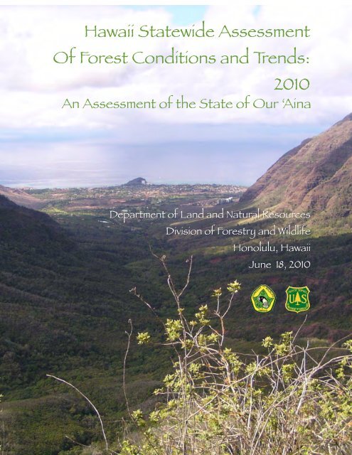
Hawaii Statewide Assessment<br />
Of Forest Conditions and Trends:<br />
2010<br />
An Assessment of the State of Our ‘Aina<br />
Department of Land and Natural Resources<br />
Division of <strong>Forestry</strong> and Wildlife<br />
Honolulu, Hawaii<br />
June 18, 2010
HAWAII ASSESSMENT OF FOREST CONDITIONS: 2010<br />
Note from Hawaii State Forester Paul Conry<br />
Aloha<br />
It is my pleasure to invite you to join the Department of Land and Natural Resources, Division of<br />
<strong>Forestry</strong> and Wildlife to help assess the conditions of our forests, native species, forests products<br />
industry and forest recreational opportunities and plan our strategy to protect, manage and<br />
sustain these resources for current and future generations. The U.S. Secretary of Agriculture, as<br />
part of the 2008 Farm Bill, has asked each state and territory to complete a Statewide Forest<br />
Assessment and Resource Strategy that will help inform our federal agency partners and national<br />
policy makers on where and how to direct natural resource funding and more importantly, help<br />
us work together to guide our efforts here in the state to be more collaborative and productive.<br />
The basic requirements of this effort will be to:<br />
• Identify and provide an analysis of present and future forest conditions, trends, and threats on<br />
all land ownerships.<br />
• Identify any areas or regions of that state that are a priority.<br />
• Identify any multi-state areas or issues that are a regional priority.<br />
• Incorporate existing forest management plans including state wildlife action plans and<br />
community wildfire protection plans.<br />
Every state has the responsibility to deliver a Statewide Forest Resource Assessment and<br />
Strategy to the U.S. Secretary of Agriculture by June 2010.<br />
This effort is unique in many ways, it involves all landownership - state, private and federal, and<br />
views forests and trees as a whole and not by programs. It will enable the Division to seek and<br />
base funding on landscape scale management and not only on narrow program mandates. This<br />
initiative offers us an opportunity to plan, and integrate the many programs we work on together<br />
under one document. We have an opportunity to demonstrate the value of our forests and trees to<br />
the State and nation, and describe our strategy to work together to protect our forests from harm,<br />
and conserve forests in a working landscape. Hopefully, this information will be useful to<br />
influence our communities, our State and national legislators, and our government leaders to<br />
invest in Hawaii’s forests for the future.<br />
This document represents the beginning of a process, not the end, where we will work together to<br />
continually update and inform our collective understanding of our forest assets and what is<br />
affecting them, and apply that knowledge to guide and improve our management. This is our<br />
initial assessment and strategy, it will evolve over time, we will need your help to update and<br />
improve upon it. Please join us in this effort.<br />
Mahalo for your participation, assistance and support.<br />
Paul J. Conry<br />
Hawaii State Forester<br />
PAGE 2
HAWAII STATEWIDE ASSESSMENT OF FOREST CONDITONS 2010<br />
Acknowledgements<br />
Acknowledgements<br />
There are far too many people, agencies and organizations who have contributed to these<br />
documents to list by name. For everyone who has given their time, energy and resources we<br />
sincerely thank you; and we hope that you will find this information useful in helping to<br />
appreciate and preserve Hawaii’s natural resources. Those mentioned below are in no particular<br />
order. Mahalo!<br />
US Forest Service Institute of Pacific Island <strong>Forestry</strong>, particularly Katie Friday<br />
US Forest Service Region 5<br />
The Natural Resources Conservation Service staff, especially Dave Clausnizer and the Honolulu<br />
staff who went out of their way to being stakeholders together<br />
Sheri Mann of DOFAW for just about everything<br />
The dedicated staff of the Division of <strong>Forestry</strong> and Wildlife<br />
Our volunteers and interns:<br />
Kelly Hartman, UH who created our Urban Realm GIS Layer<br />
Jim Henry, Professor of English and his students who contributed to the History of<br />
<strong>Forestry</strong> in Hawaii<br />
Caroline Tucker and Nicole Galase and Melissa Kolonie for doing the heavy lifting<br />
Zena Grecni under the supervision of Maxine Burkett for her extraordinary work<br />
compiling data for our Climate Change Issue<br />
Michelle Jones, with eternal inspiration and always there when we needed extra help<br />
The Kaulunani Urban & Community <strong>Forestry</strong> Advisory Council who were a joy to work with<br />
The State Forest Stewardship Advisory Council for their guidance and insight<br />
The Hawaii Conservation Alliance, particularly the Executive Director Deanna Spooner<br />
The entire LANDFIRE organization, particularly Darren Johnson and Jim Smith<br />
The "Biodiversity Team:" Sam Gon, Stephanie Tom, Jason Sumiye and Teresa Menard from the<br />
Nature Conservancy of Hawaii, Jim Jacobi, USGS/BRD, Jon Price, UH Hilo, and Emma Yuen,<br />
NARS planner with DOFAW.<br />
Colleen Carroll, Ed.D.<br />
All of the Invasive Species Committees in Hawaii<br />
The Hawaii Association of Watershed Partnerships, particularly Miranda Smith<br />
UH NREM, and especially intern Kelly Hartman, for her excellent GIS work<br />
Roxanne Darling and Shane Robinson at Barefeet Studios for their Web 2.0 guidance<br />
Bob Merriam, Forester for his historic perspective and archive of historic documents<br />
Dr. Kimberly Burnett, UH Dept. of Economics and the UH Economic Research Organization<br />
USGS/NBII Pacific Basin Node, particularly Derek Masaki for technical support<br />
Alan Yue, Prentsys Systems for his unwavering support and guidance<br />
The Hawaii Wildfire Management Organization<br />
Numerous Government Agencies in Hawaii:<br />
PAGE 2
HAWAII STATEWIDE ASSESSMENT OF FOREST CONDITONS 2010<br />
Department of Agriculture<br />
Department of Business, Economic Development and Tourism<br />
The Hawaii Tourism Authority<br />
Office of Planning Statewide GIS Program<br />
Coastal Zone Management Program Staff<br />
The Ocean Resources Management Plan Working Group<br />
Department of Hawaiian Homelands<br />
Department of Health<br />
Department of Transportation<br />
Department of Permitting & Planning<br />
Department of Land and Natural Resources:<br />
Office of the Chairperson<br />
Office of Conservation and Coastal Lands<br />
Aquatic Resources Division<br />
<strong>Forestry</strong> and Wildlife Division<br />
Land Division<br />
State Parks Division<br />
Harbors Division<br />
State Office of Hawaiian Affairs<br />
UH Sea Grant Program<br />
UH Institute of Marine Biology<br />
Chip Fletcher, UH School of Ocean and Earth Science and Technology<br />
Maxine Burkett, Professor of Law and Director of the Center for Island Climate Adaptation<br />
and Policy<br />
City and County of Honolulu<br />
County of Hawaii Planning Department<br />
County of Kauai Planning Department<br />
County of Maui Department of Planning<br />
National Oceanic and Atmospheric Administration Pacific Services Center<br />
National Marine Sanctuary Program<br />
U.S. Army Corps of Engineers<br />
U.S. Department of Agriculture -Natural Resource Conservation Service<br />
U.S. Environmental Protection Agency<br />
U.S. Navy<br />
U.S. Fish and Wildlife Service<br />
U.S. Fish and Wildlife Service Refuges<br />
Community Conservation Network<br />
Marine and Coastal Zone Advocacy Council<br />
Sherri Wormstead – North Eastern Area Association of State Foresters<br />
Bill Cowren, Hawaiian Mahogany, INC.<br />
John Ray, SunFuels Hawaii, LLC<br />
<strong>Western</strong> <strong>Forestry</strong> <strong>Leadership</strong> <strong>Coalition</strong> University of Hawaii (UH)<br />
PAGE 3
HAWAII STATEWIDE ASSESSMENT OF FOREST CONDITONS 2010<br />
The U.S. Department of Agriculture (USDA) prohibits discrimination in all its programs and<br />
activities on the basis of race, color, national origin, age, disability, and where applicable,<br />
sex, marital status, familial status, parental status, religion, sexual orientation, genetic<br />
information, political beliefs, reprisal, or because all or part of an individual’s income is<br />
derived from any public assistance program. (Not all prohibited bases apply to all<br />
programs.) Persons with disabilities who require alternative means for communication of<br />
program information (Braille, large print, audiotape, etc.) should contact USDA’s TARGET<br />
Center at (202) 720-2600 (voice and TDD). To file a complaint of discrimination, write to<br />
USDA, Director, Office of Civil Rights, 1400 Independence Avenue, S.W., Washington, D.C.<br />
20250-9410, or call (800) 795-3272 (voice) or (202) 720-6382 (TDD). USDA is an equal<br />
opportunity provider and employer.<br />
PAGE 4
HAWAII STATEWIDE ASSESSMENT OF FOREST CONDITONS 2010<br />
Executive Summary<br />
This is Hawaii’s Statewide Assessment of Forest Conditions (2010) and Resource Strategy. It<br />
was produced by the Hawaii Department of Land and Natural Resources/Division of <strong>Forestry</strong><br />
and Wildlife (DOFAW) to fulfill a mandate of the Redesign effort of the State and Private<br />
<strong>Forestry</strong> (S&P) organization within the U.S. Forest Service a suite of new provisions added to<br />
the <strong>Forestry</strong> Title of the 2008 Farm Bill (P.L. 110-234). This document meets the legal<br />
requirements set forth by the 2008 Farm Bill and it directly addresses the National Outcomes and<br />
Objectives of the S&P Redesign to 1) Conserve Working Landscapes; 2) Protect <strong>Forests</strong> From<br />
Harm; and 3) Enhance Public Benefits Associated with Trees and <strong>Forests</strong>. We have addressed all<br />
of the related plans, directly engaged all of the committees and worked with our stakeholders as<br />
set forth in the Official Checklist.<br />
We have used this process as an opportunity for DOFAW to promote new collaborative efforts<br />
among the many agencies, institutions and landowners actively involved in the stewardship of<br />
Hawaii’s natural resources.<br />
The 2008 Farm Bill in conjunction with the Redesign process for the State and Private <strong>Forestry</strong><br />
organization of the US Forest Service made it a requirement that each state forestry agency<br />
coordinate with the State Forest Stewardship Coordinating Committee, the State Technical<br />
Advisory Committee of the Natural Resources Conservation Service, the State Urban <strong>Forestry</strong><br />
Council, state wildlife agency and applicable federal land management agencies to ensure that<br />
their completed Assessment and Strategy addresses the rural-to-urban landscape continuum and<br />
identifies opportunities for program coordination and integration.<br />
In addition, the Farm Bill explicitly directed the states to integrate the Comprehensive Wildlife<br />
Conservation Strategy (CWCS), and the Statewide Comprehensive Outdoor Recreation Plan<br />
(SCORP), all Community Wildfire Protection Plans (CWPP’s), and other relevant plans. States<br />
were required to involve other key land management and natural resource partners as appropriate<br />
to ensure the state’s assessment integrates, builds upon and complements other natural resource<br />
plans.<br />
We accomplished this and more in the process of completing our Assessment and Strategy.<br />
In a series of meetings with our stakeholders we identified 10 issues. For each issue we<br />
characterized the trends, the existing conditions, the threats and benefits of our forest and treed<br />
landscapes. We created maps with the most current public information available, and then<br />
developed a set of strategies for addressing the issues identified in partnership with our<br />
stakeholders.<br />
The required deliverable products from this project are the Hawaii’s Assessment of the condition<br />
of our <strong>Forests</strong> as they are in 2010, and our 5-10 year Strategy. In the process of completing our<br />
PAGE 5
HAWAII STATEWIDE ASSESSMENT OF FOREST CONDITONS 2010<br />
project we produced a great variety of products and data that will be of use to others in the<br />
future. But perhaps the most valuable and enduring legacy of this project is the sum of the new<br />
relationships, enhanced capacities, educational experiences of our interns, and the renewed<br />
commitment to the 21st century ahupuaa.<br />
PAGE 6
HAWAII STATEWIDE ASSESSMENT OF FOREST CONDITONS 2010<br />
LIST OF ACRONYMS<br />
ACRONYM<br />
AAA<br />
BWS<br />
C&C<br />
C&CH<br />
CAO<br />
CELCP<br />
CGAPS<br />
CE<br />
CFP<br />
CREP<br />
CZM<br />
DAR<br />
DHHL<br />
DLNR<br />
DOA<br />
DOD<br />
DOFAW<br />
DOFAW FP<br />
DOH<br />
DPCH<br />
DPCK<br />
DPCM<br />
EE<br />
ELP<br />
EQIP<br />
FAO UN<br />
FH<br />
FHMP<br />
FSP<br />
FLP<br />
Friends<br />
FRPP<br />
FRS<br />
FS<br />
FSCG<br />
FSP<br />
FWS<br />
FWSR<br />
GTZ<br />
HARC<br />
HAWP<br />
HCA<br />
HEAR<br />
HFIA<br />
HISC<br />
HTA<br />
ICAP<br />
IPIF<br />
LICH<br />
MCZAC<br />
Na Ala Hele<br />
NPS<br />
ACRONYMS<br />
Aloha Arborists Association<br />
Board of Water Supply<br />
City & County of Government of Hawaii<br />
City and County of Honolulu<br />
Carnegie Airborne Observatory<br />
Coastal Estuarine Land Conservation Program<br />
Committee Group on Alien Pest Species<br />
Conservation Education<br />
Coopertative Fire Protection<br />
Conservation Reserve Enhancement Program<br />
Coastal Zone Management<br />
Division of Aquatic Resources<br />
Department of Hawaiin Homelands<br />
Department of Land and Natural Resources<br />
Department of Agriculture<br />
State Department of Defense<br />
Division of <strong>Forestry</strong> and Wildlife<br />
Division of <strong>Forestry</strong> and Wildlife - Fire Management<br />
State Department of Health<br />
Department of Planning for County of Hawaii<br />
Department of Planning for County of Kauai<br />
Department of Planning for County of Maui<br />
Environmental Educational<br />
Environmental Literacy Plan<br />
Environmental Quality Incentive Program (NRCS)<br />
Food and Agriculture Organization of the United Nation<br />
Forest Health<br />
Forest Health Monitoring & Protection<br />
Forest Stewardship Program (State & Federal)<br />
Forest Legacy Program<br />
Friends of Urban <strong>Forests</strong><br />
Farm & Ranchland Program<br />
Forest Reserve System<br />
Forest Service<br />
Forest Service Competitive Grants<br />
Forest Stewardship Program<br />
Fish & Wildlife Service<br />
Fish & Wildlife Service - Refuge<br />
Deutsche Gesellschaft für Technische Zusammenarbeit<br />
Hawaii Agriculture Research Center<br />
Hawaii Association of Watershed Partnerships<br />
Hawaii Conservation Alliance<br />
Hawaii Ecosystem At Risk<br />
Hawaii Forest Industry Association<br />
Hawaii Invasive Species Council<br />
Hawaii Tourism Authority<br />
The Center for Island Climate Adaptation and Policy<br />
Institute of Pacific Island <strong>Forestry</strong><br />
Landscape Industry Council of Hawaii<br />
Marine & Coastal Zone Advocacy Council<br />
State Na Ala Hele Trails & Access Program<br />
National Park Service<br />
PAGE 7
HAWAII STATEWIDE ASSESSMENT OF FOREST CONDITONS 2010<br />
LIST OF ACRONYMS<br />
ACRONYM<br />
NAPP<br />
NARF<br />
NASF<br />
NOAA<br />
NRCS<br />
OHA<br />
ORMP<br />
PBIN<br />
PIER<br />
PICCC<br />
PIER<br />
PR<br />
PSWRS<br />
RLA<br />
SAF<br />
SOEST<br />
SOPAC<br />
SPC<br />
SPREP<br />
STAC<br />
STDP<br />
TAT<br />
TNC<br />
TPL<br />
UCF<br />
UH<br />
UHSOE<br />
UHCTAHR<br />
UNFAO<br />
USFS<br />
USGS<br />
WFLC<br />
WHIP<br />
YCC<br />
ACRONYMS<br />
Natural Area Partnership Program<br />
Natural Area Reserve Fund<br />
National Association of State Foresters<br />
National Oceanographic and Atmospheric Administration<br />
Natural Resources Conservation Service<br />
Office of Hawaiian Affairs<br />
Ocean Resources Management Plan<br />
Pacific Biodiversity Information Node<br />
Pacific Island Ecosystems at Risk<br />
Pacific Islands Climate Change Cooperative<br />
Pacific Island Ecosystems at Risk<br />
Pittman-Robertson Funds<br />
Pacific Southwest Research Station<br />
Recovery Land Acquisition Program<br />
Society of American Foresters<br />
University of Hawaii School of Ocean and Earth Science and<br />
Technology<br />
Secretariat of the Pacific Applied Geoscience Commission<br />
Secretariat of the Pacific Consulate<br />
South Pacific Regional Environmental Program<br />
State Technical Advisory Committee (NRCS)<br />
Special Technology Development Program<br />
Transient Accommodation Tax administered by HTA<br />
The Nature Conservancy<br />
The Trust For Public Lands<br />
Urban & Community <strong>Forestry</strong> (Kaulunani)<br />
University of Hawaii<br />
University of Hawai‘i School of Ocean & Earth Sciences<br />
University of Hawaii College of Tropical Agriculture and Human<br />
United Resources Nations Food and Agricultural Organization<br />
United States Forest Service<br />
US Geological Service<br />
<strong>Western</strong> <strong>Forestry</strong> <strong>Leadership</strong> <strong>Coalition</strong><br />
Wildlife Enhancement Program<br />
Youth Conservation Corps<br />
PAGE 8
HAWAII STATEWIDE ASSESSMENT OF FOREST CONDITONS 2010<br />
Notes on Orthography and Language<br />
Hawaii is unique for many reasons. It is the only State with two official languages, Hawaiian and<br />
English. Regrettably, the use of the Hawaiian language has been nearly lost over the last 100<br />
years and English has become the dominant language of government, education, mass media and<br />
general use.<br />
Today, there is a renewed interest in reviving and expanding the use of the Hawaiian language<br />
and reaffirming the values of the native Hawaiian culture and language in everyday life. In<br />
1978, Hawaiian was re-established as an official language of the State of Hawaii and, in 1990,<br />
the federal Government of the United States adopted a policy to recognize the right of Hawaii to<br />
preserve, use, and support its indigenous language. To this end, Hawaiian language and culture<br />
are being taught in Hawaii immersion schools, Hawaiian language broadcasts on public<br />
television and radio, and in continuing education programs developed by the Hawaii Department<br />
of Education.<br />
The State of Hawaii, and the authors of this document recognize that proper pronunciation and<br />
spelling of Hawaiian is a requirement in order to properly and respectfully represent the words<br />
used in place names, cultural concepts, and the names of our native plants and animals, and<br />
physical attributes of our unique geography.<br />
The information contained in this document will likely be used in many different media such as a<br />
printed report, word processing documents in several formats, the Internet, and PowerPoint<br />
presentations to name a few. Unfortunately, current computer-based word processing<br />
applications, keyboard layouts, and web browser technology do not facilitate universal and<br />
uniform representation of these diacritical marks by browser fonts, word processors, presentation<br />
applications and search engines. Our experience is that the macron and the okina are often<br />
mistranslated to random characters thus rendering the intended Hawaiian word unintelligible or<br />
unreadable<br />
The authors of this document share the aspirations of native Hawaiian speakers to one day<br />
restore the use of spoken and written Hawaiian language to its former status as a primary<br />
language spoken in these Hawaiian Islands. At this time however, we do not have the resources<br />
to produce this document in both English and Hawaiian, and the state of technology does not<br />
guarantee that unique Hawaiian orthography will be correctly represented to the person reading<br />
this document. For these reasons we have chosen to forgo the use of the macron and the okina.<br />
PAGE 9
HAWAII STATEWIDE ASSESSMENT OF FOREST CONDITONS 2010<br />
THE WATER OF KANE<br />
In the Hawaiian pantheon, there are four<br />
principal gods and innumerable lesser deities.<br />
The god Kane is particularly distinguished,<br />
for he is the father of living creatures. The<br />
following mele, or chant, in honor of Kane<br />
comes from the island of Kauai. It was<br />
translated into English by Dr. Nathaniel B.<br />
Emerson who is considered one of the most<br />
skillful translators of native Hawaiian<br />
literature. This ancient mele speaks to the<br />
cultural and spiritual importance of water. It<br />
is timeless.<br />
The Water of Kane<br />
A query, a question,<br />
I put to you:<br />
Where is the water of Kane<br />
At the Eastern Gate<br />
Where the Sun comes in at Haehae;<br />
There is the water of Kane.<br />
A question I ask of you:<br />
Where is the water of Kane<br />
Out there with the floating Sun,<br />
Where cloud-forms rest on Ocean's breast.<br />
Uplifting their forms at Nihoa,<br />
This side the base of Lehua;<br />
There is the water of Kane.<br />
Yonder, at sea, on the ocean,<br />
In the driving rain,<br />
In the heavenly bow,<br />
In the piled-up mist-wraith,<br />
In the blood-red rainfall,<br />
In the ghost-pale cloud-form;<br />
There is the water of Kane.<br />
One question I put to you:<br />
Where, where is the water of Kane<br />
Up on high is the water of Kane,<br />
In the heavenly blue,<br />
In the black piled cloud,<br />
In the black-black cloud.<br />
In the black-mottled sacred cloud of the gods;<br />
There is the water of Kane.<br />
One question I ask of you:<br />
Where flows the water of Kane<br />
Deep in the ground, in the gushing spring,<br />
In the ducts of Kane and Loa,<br />
A well-spring of water, to quaff,<br />
A water of magic power--<br />
The water of life!<br />
Life! O give us this life!<br />
From Unwritten Literature of Hawaii: The<br />
Sacred Songs of the Hula, translated by N. S.<br />
Emerson (Washington, D.C. Smithsonian<br />
Institution, Bureau of American Ethnology,<br />
Government Printing Office. 1909).<br />
One question I put to you:<br />
Where is the water of Kane<br />
Yonder on mountain peak,<br />
On the ridges steep,<br />
In the valleys deep,<br />
Where the rivers sweep;<br />
There is the water of Kane.<br />
This question I ask of you:<br />
Where, pray, is the water of Kane<br />
PAGE 10
HAWAII STATEWIDE ASSESSMENT OF FOREST CONDITONS 2010<br />
Contents<br />
Background ............................................................................................................................... 2<br />
Hawaii’s <strong>Forests</strong>: The Historical Context ................................................................................. 8<br />
Issue 1: Water Quality & Quantity ........................................................................ 37<br />
Issue 2: Forest Health: Invasive Species, Insects & Disease ................................. 59<br />
Issue 3: Wildfire .................................................................................................... 84<br />
Issue 4: Urban & Community <strong>Forestry</strong> ................................................................. 99<br />
Issue 5: Climate Change/Sea Level Rise ............................................................. 122<br />
Issue 6: Conservation of Native Biodiversity ..................................................... 143<br />
Issue 7: Hunting, Nature-Based Recreation and Tourism .................................... 167<br />
Issue 8: Forest Products & Carbon Sequestration ............................................... 197<br />
Issue 9: Multi-State Issues .................................................................................. 217<br />
References ........................................................................................................... 240<br />
Appendix A: Stakeholder Involvement ................................................................................ 268<br />
Appendix B: Plans Incorporated & Referenced ................................................................... 269<br />
Appendix C: <strong>Forestry</strong> Related Assistance Programs ............................................................ 270<br />
Appendix D: Community Wildfire Protection Plans ............................................................ 271<br />
Appendix E: Conservation Education .................................................................................. 272<br />
Appendix F: Glossary ........................................................................................................... 284<br />
PAGE 11
HAWAII STATEWIDE ASSESSMENT OF FOREST CONDITONS 2010<br />
Background<br />
The Hawaii Statewide Forest Resource Assessment was initiated in response to a mandate from<br />
the U.S. Forest Service (USFS) and contained in the <strong>Forestry</strong> Title of the 2008 Farm Bill (P.L.<br />
110-234). The assessment was developed in a collaborative style by the staff of the Hawaii<br />
Department of Land and Natural Resources/Division of <strong>Forestry</strong> and Wildlife (DOFAW) with the<br />
assistance of our partners and stakeholders in accordance with national direction issued jointly<br />
by the USFS and the National Association of State Foresters (NASF).<br />
Statewide assessments are a key component of the USFS State and Private <strong>Forestry</strong> (S&PF)<br />
Redesign Initiative that was launched in 2008. These assessments will provide a science-based<br />
foundation to assist state forestry agencies and their partners in: 1) identifying the areas of<br />
greatest need and opportunity for forests across their states; and 2) developing a subsequent longterm<br />
strategy to address them.<br />
By encouraging states to work collaboratively with their partners to identify and address<br />
priorities, the U.S. Congress and the USFS hope to ensure that S&PF funds are invested in those<br />
areas where they will make the most significant difference for both the state and the nation.<br />
In Hawaii, DOFAW and our partners will also use the state assessment and the associated GIS<br />
data layers as tools to identify where opportunities exist to facilitate forest management across<br />
jurisdictional boundaries and help all partners quantify the full scale of actions and resources<br />
needed to address Hawaii’s forest health challenges.<br />
USDA Forest Service State and Private <strong>Forestry</strong> Redesign Initiative<br />
The S&PF branch of the US Forest Service provides technical assistance and cost-share funding<br />
to every state in the nation in support of issues related to wildland fire, insects and disease,<br />
private forest stewardship and community forestry on non-federal land. In Hawaii, this funding is<br />
received and distributed primarily by DOFAW.<br />
The S&PF Redesign Initiative was conceived by state and federal partners in response to<br />
increasing pressures on our nation’s forests and decreasing availability of resources and funds. In<br />
the face of these challenges, the USFS and state foresters determined that more progressive,<br />
large-scale strategies were needed to sustain our nation’s forest resources.<br />
The purpose of the redesign initiative is “to shape and influence forest land use on a scale and in<br />
a way that optimizes public benefits from trees and forests for both current and future<br />
generations.” In designing the initiative, state foresters worked closely with the USFS to:<br />
• Examine current conditions and trends affecting forest lands.<br />
PAGE 12
HAWAII STATEWIDE ASSESSMENT OF FOREST CONDITONS 2010<br />
• Review existing S&PF programs to determine how best to address threats to forests on a<br />
meaningful scale.<br />
• Develop a strategy to deliver a relevant and focused set of S&PF programs and<br />
opportunities.<br />
The new redesign approach focuses on three consensus-based national themes with<br />
accompanying strategic objectives:<br />
Conserve working forest landscapes<br />
• Identify and conserve high-priority forest ecosystems and landscapes.<br />
• Actively and sustainably manage forests.<br />
Protect forests from harm<br />
• Restore fire-adapted lands and reduce risk of wildfire impacts.<br />
• Identify, manage and reduce threats to forest and ecosystem health.<br />
Enhance public benefits from trees and forests<br />
• Protect and enhance water quality and quantity.<br />
• Improve air quality and conserve energy.<br />
• Assist communities in planning for and reducing wildfire risks.<br />
• Maintain and enhance the economic benefits and values of trees and forests.<br />
• Protect, conserve and enhance wildlife and fish habitat.<br />
• Connect people to trees and forests.<br />
• Manage and restore trees and forests to mitigate and adapt to global climate change.<br />
Since 2008, a portion of S&PF funding has been, and will continue to be, allocated through a<br />
competitive process guided by these national themes. To ensure that proposals for this funding<br />
are being focused on high-priority areas with the greatest opportunity to achieve meaningful<br />
outcomes, each state or territory that wants to receive S&PF funding must work collaboratively<br />
with the USFS and other key partners to develop the following documents:<br />
Statewide Assessment of Forest Conditions – Provides an analysis of forest conditions and<br />
trends in the state, and delineates priority rural and urban forest landscape areas.<br />
Statewide Forest Resource Strategy – Provides long-term strategies for investing state, federal<br />
and other resources to manage priority landscapes identified in the assessment, focusing on areas<br />
PAGE 13
HAWAII STATEWIDE ASSESSMENT OF FOREST CONDITONS 2010<br />
in which federal investment can most effectively stimulate or leverage desired actions and<br />
engage multiple partners.<br />
States that receive S&PF funds also will be asked to submit an annual report that describes how<br />
such funds were used to address the opportunities identified in the assessment and strategy,<br />
including the leveraging of funding and resources through partnerships.<br />
According to the 2008 Farm Bill, each state is required to complete both the assessment and<br />
strategy by June 18, 2010 in order to qualify for most S&PF funds.<br />
This document represents Hawaii’s completion of these requirements.<br />
National Guidance for Statewide Forest Resource Assessments<br />
The development of a comprehensive statewide assessment of forest resources provides a<br />
valuable and unique opportunity to highlight the full scale of work needed to address priorities in<br />
the forests of each state and potentially across multiple states. At a minimum, each statewide<br />
assessment must:<br />
• Describe forest conditions and threats on all ownerships in the state.<br />
• Identify forest-related benefits and services consistent with the national themes.<br />
• Delineate priority forest landscapes or otherwise identify issues and opportunities that will<br />
emphasize and address the Statewide Forest Resource Strategy.<br />
• Identify any multi-state areas that are a regional priority.<br />
• Incorporate existing statewide plans as appropriate.<br />
The national guidance recommends that states base their assessments on publicly available<br />
geospatial data, but it allows states to use a combination of qualitative, quantitative and<br />
geospatial sources to provide information relevant to key state issues and national themes. In<br />
addition, non-geospatial information can be used in combination with geospatial data to identify<br />
priorities. States may identify separate priority areas for different programs and issues.<br />
In developing a statewide assessment, each state forestry agency is directed to coordinate with<br />
the State Forest Stewardship Coordinating Committee, State Technical Committee, State Urban<br />
<strong>Forestry</strong> Council, state wildlife agency and applicable federal land management agencies to<br />
ensure that the assessment addresses the rural-to-urban landscape continuum and identifies<br />
opportunities for program coordination and integration. State forestry agencies also are asked to<br />
involve other key land management and natural resource partners as appropriate to ensure the<br />
state’s assessment integrates, builds upon and complements other natural resource plans.<br />
PAGE 14
HAWAII STATEWIDE ASSESSMENT OF FOREST CONDITONS 2010<br />
Process for Development of Hawaii’s Statewide Assessment<br />
Hawaii’s Statewide Forest Resource Assessment was developed under the leadership and<br />
guidance of the DOFAW staff in close cooperation with our partners and stakeholders. The<br />
process was managed by our staff Resource Planner, and our staff specialists developed the<br />
assessment, trends, threats and strategies for each of our issues. The individual issue chapters<br />
were then reviewed by our cooperators and revisions were incorporated into the final document.<br />
The State of Hawaii consists of two distinctly different geographical regions; the Main Hawaiian<br />
Islands and the Northwest Hawaiian Islands. (Please refer to the following section “Hawaii’s<br />
<strong>Forests</strong>: The Historical Context for more detail.). The Northwest Hawaiian Islands do not support<br />
forests, and are now managed as the The Papahanaumokuakea Marine National Monument.<br />
This assessment therefore pertains only to the forested Main Hawaiian Islands from Niihau to the<br />
Island of Hawaii.<br />
The States were given a good deal of leeway in how they identified the issues relevant to them.<br />
For Hawaii, we identified our priority issues using several questionnaires, on-line surveys and in<br />
collaboration with our partners. Appendix A: Stakeholder Involvement details the collaborative<br />
process and surveys that we used to come up with our Priority Issues. For Hawaii, our priority<br />
issues are:<br />
Issue 1: Water Quality & Quantity<br />
Issue 2: Forest Health: Invasive Species, Insects & Disease<br />
Issue 3: Wildfire<br />
Issue 4: Urban & Community <strong>Forestry</strong><br />
PAGE 15
HAWAII STATEWIDE ASSESSMENT OF FOREST CONDITONS 2010<br />
Issue 5: Climate Change/Sea Level Rise<br />
Issue 6: Conservation of Native Biodiversity<br />
Issue 7: Hunting, Nature Based Recreation and Tourism<br />
Issue 8: Forest Products & Carbon Sequestration<br />
Issue 9: Multi-State Issues<br />
At the time we were preparing this document, our state began to experience the economic crisis<br />
that has affected so many other states. Declining revenues required that the State implement a<br />
number of cost saving measures that included a reduction in workforce, the implementation of a<br />
furlough system that reduced working hours by approximately 14%, and a general restriction on<br />
spending. As an island state, the only method of transportation between the islands is by air, and<br />
for most of this project inter-island travel was limited.<br />
In order to complete the project, we found new ways to collaborate. We took advantage of every<br />
opportunity we could to get our project on the agenda for meetings and conferences that were<br />
already scheduled. In every case, our partners were glad to assist and in the process we<br />
developed new relationships between agencies and organizations that had not previously worked<br />
together. Notably among these conferences was the 2009 Hawaii Conservation Conference<br />
produced by the Hawaii Conservation Alliance, the Urban and Community <strong>Forestry</strong> Summit<br />
produced by the Kaulunani Urban and Community <strong>Forestry</strong> Committee, the Watershed<br />
Prioritization Summit produced by the Coastal Zone Management Program and the Hawaii<br />
Office of Planning, and the California/Nevada/Hawaii (CNH) annual Wildfire conference which<br />
was held on the island of Kauai in 2010.<br />
In order to overcome the barrier of working on different islands, and to hold down our costs, we<br />
utilized the internet as much as possible, and adopted new technologies such as Google Docs,<br />
Dropbox, Basecamp and set up a website so that we could communicate at minimal cost, and<br />
often in real-time. Thus, it is difficult to document formal “meetings” with our stakeholders,<br />
since in many instances several people on different islands would be collaborating on a<br />
document in real time. We held conference calls on a daily basis, and recorded the entire 2009<br />
Hawaii Conservation Conference focusing on Climate Change and posted the presentations on<br />
the web at no cost.<br />
We also utilized in-house student interns, partnered with several University of Hawaii professors<br />
who provided students the opportunity to assist us in the production of this document as part of<br />
their class requirements. We utilized Americorps interns at critical points in the project.<br />
We were very fortunate that while we were working on this project, LANDFIRE was just<br />
beginning its work in Hawaii. DOFAW staff and many of our cooperators worked closely with<br />
LANDFIRE staff specifically with the intent of making their data products directly relevant to<br />
this Assessment. The Hawaii Nature Conservancy provided invaluable assistance by applying for<br />
PAGE 16
HAWAII STATEWIDE ASSESSMENT OF FOREST CONDITONS 2010<br />
a grant from LANDFIRE to help us refine our biodiversity layer, and they continued to provide<br />
support long after the deliverables were provided to LANDFIRE.<br />
In order to evaluate the enormous amount of historical data and other relevant plans, we scanned<br />
and converted over 10,000 pages of original source material to PDF. This allowed us to quickly<br />
search an enormous amount of information, and we are in the process of identifying a permanent<br />
repository for these scanned documents.<br />
In doing the GIS analysis for the various issues we utilized publicly available data. In some<br />
cases. we utilized raster-based overlay analysis as we did in the Spatial Analysis Project, but<br />
many of our issues did not lend themselves to that particular technique. In the course of our<br />
analysis we identified a number of public layers that were out of date, and where possible we<br />
updated these layers and provided Federal Geodata Data Committee (FGDC) compliant<br />
metadata. These layers were then provided to the State of Hawaii Office of Planning and posted<br />
for public access via their website.<br />
Two professional peer-review papers have been produced and a chapter in a forthcoming book<br />
on Technical Writing will feature our collaboration with the University of Hawaii English<br />
Department.<br />
Perhaps most importantly, this project has helped bring together the three parts of the landscape<br />
that comprise the 21st Century Ahupuaa. Our existing relationships are strengthened, new<br />
partnerships have been developed, and all parties are ready to play their part in managing their<br />
portion of the landscape.<br />
PAGE 17
HAWAII STATEWIDE ASSESSMENT OF FOREST CONDITONS 2010<br />
Hawaii’s <strong>Forests</strong>: The Historical Context<br />
Summary<br />
Hawaii has a long tradition of comprehensive landscape-level planning for sustainably<br />
maintaining our natural resource base upon which our livelihood, our economy and our culture<br />
are based. This is the third statewide assessment and long-term strategy; the first was the<br />
planning and establishment of our Forest Reserve System in 1903. The second was the Hawaii<br />
State Land Use Law and the establishment of the Conservation District.<br />
In addition, four previous comprehensive statewide forestry plans have been produced evaluating<br />
only state-owned forest lands; “Multiple Use Program for the State Forest Lands of Hawaii” in<br />
1962, “A Plan for the State Forest Lands of Hawaii” in 1975, “The Hawaii Tropical <strong>Forestry</strong><br />
Action Plan” (which did include private lands, but not urbanized areas) in 1994.<br />
Thorough them all runs a common thread: our life in these islands is directly tied to the health of<br />
our forests and the role that they play in recharging our groundwater, springs, and streams.<br />
The Hawaiian Archipelago: Isolated, Ancient<br />
Continually Renewed<br />
What we know today as the Hawaiian Archipelago<br />
actually consists of three distinct landforms all<br />
created by the same volcanic “hot spot”, an apparently<br />
stationary feature in the middle of the Pacific tectonic<br />
plate. This hot spot pushes lava upwards from deep<br />
mountain reaches the surface of the ocean, and continues<br />
to grow. Meanwhile, the Pacific plate slowly moves,<br />
generally in a Northwest direction and is also slowly<br />
“sinking”. The combination of this sinking tendency and<br />
the powerful forces of erosion by wind, rain and sea<br />
begin to wear the young island down. Thus, the<br />
youngest islands are those at the southeast portion of the<br />
island chain, and the islands get progressively older as<br />
one travels west.<br />
Figure 1. Hawaii is the most isolated<br />
archipelago in the world. Image courtesy<br />
of Google Earth.<br />
The process of creating new land from lava continues to this day. Kilauea Volcano in Hawaii<br />
Volcanoes National Park has been continually erupting since 1983. Visitors to Kilauea are treated<br />
to a rare spectacle of molten lava pouring into the ocean. Kilauea lies on the eastern flank of<br />
another volcano, Mauna Loa, which rises to over 13,000 ft above sea level. When measured from<br />
the sea floor to the summit, Mauna Loa is the tallest mountain on the planet.<br />
PAGE 18
HAWAII STATEWIDE ASSESSMENT OF FOREST CONDITONS 2010<br />
Figure 2 The Hawaii Hotspot. Image courtesy of the U.S. Geological Survey.<br />
The High Islands<br />
Those islands that have not been eroded down to sea level are known as “high islands”. The<br />
Main Hawaiian Islands which sustain permanent populations are all high islands. The island of<br />
Kauai is the oldest of these high islands. In the millions of years that it takes for an island to<br />
move away from the hot spot, significant changes take place in soil chemistry and structure as<br />
the lava weathers and ages. Thus, soil fertility and the landscape itself are very different from<br />
island to island. The Big Island of Hawaii has rich, young volcanic soils, and many portions of<br />
the island are still so porous that they do not support perennial streams. At the other end of the<br />
PAGE 19
HAWAII STATEWIDE ASSESSMENT OF FOREST CONDITONS 2010<br />
high islands, Kauai has highly weathered and compacted soils, it supports many perennial<br />
streams and its highest peak is only 5,148 ft.<br />
The high islands also produce a precious commodity: water. As the tradewinds approach a high<br />
tropical island, the air that has traveled thousands of miles over the open ocean rises and drops its<br />
cargo of rain. Trees on the forested peaks also capture fog from the misty clouds. This rainfall<br />
and fog drip are essential in sustaining life on the high islands. The wet northeastern portion of<br />
all of Hawaii’s high islands, known as the “windward side” are wet, and support rainforests and<br />
cloudforests.<br />
As the winds cross the ridges, they have lost most of their moisture, and so little rain falls. The<br />
dry southwest portion of each island is known as the “leeward side”, or in Hawaiian, the kona<br />
portion of the island. The forests of the kona side of the islands are very different from those<br />
found on the windward side. These dry forests grow more slowly and are more prone to wildfire.<br />
For this reason, Frank Hosmer, Hawaii’s first forester identified two types of forest in Hawaii: 1)<br />
protection forests, those on the wet windward slopes, the most important product of which was<br />
water; And, 2) commercial forests, the most important product of which was wood.<br />
Throughout the world, the tropical dry forests are the most endangered and Hawaii is no<br />
exception. The Puuwaawaa unit of the Hawaii Experimental Tropical Forest is highly degraded,<br />
and it is our hope that research and adaptive management of this area will provide insight into<br />
managing dry tropical forests throughout the world.<br />
The Atolls of the Northwest Hawaiian Islands<br />
Once a high island has eroded to sea level, all that remains is the live coral reef that once ringed<br />
the high islands. Corals require sunlight for their survival, and grow at the rate of approximately<br />
1 cm per year. As the Pacific plate continues its movement to the northwest, and as long as the<br />
corals can keep up with the sinking of the plate, a coral atoll forms. The State of Hawaii includes<br />
these coral atolls, which are referred to as the Northwest Hawaiian Islands. These atolls are not<br />
capable of sustaining permanent human populations because they do not have the ability to<br />
capture rainwater as the Main Hawaiian Islands do. Nevertheless, they are rich in marine life,<br />
and support huge populations of sea birds. They are also the habitat of the Hawaiian Monk Seal,<br />
one of the most endangered animals in the world.<br />
For these reasons, the Northwest Hawaiian Islands were designated as the Papahanamokuakea<br />
Marine National Monument. The Papahanaumokuakea Marine National Monument is the single<br />
largest conservation area under the U.S. flag, and one of the largest marine conservation areas in<br />
the world. It encompasses 139,797 square miles of the Pacific Ocean (105,564 square nautical<br />
miles) - an area larger than all the country's national parks combined.<br />
PAGE 20
HAWAII STATEWIDE ASSESSMENT OF FOREST CONDITONS 2010<br />
Figure 3. The State of Hawaii shown in comparison to the US Mainland.<br />
The First Hawaiians: Culture<br />
These islands have been continually inhabited since the arrival of the first Polynesian settlers<br />
around 400 AD. They developed a land stewardship system called the ahupuaa system, a culture<br />
of respect for the land and life known as the aloha spirit. These principles, the ahupuaa system,<br />
the aloha spirit, and respect for the cultural values of the Hawaiian people are fundamental, and<br />
are infused throughout this assessment of the condition of our forests, and our long-term<br />
strategies for facing challenges affecting our lands.<br />
The Ahupuaa System and Culture<br />
Hawaii is renowned as a tropical paradise, and anyone fortunate enough to visit or reside in these<br />
fair islands can attest to the beauty of our forests, beaches, waterfalls and coral reefs. This is no<br />
accident; it is the result of centuries of land stewardship practices and cultural values that have<br />
perpetuated the land and sustained its people. Our values are rooted in the close bond between<br />
PAGE 21
HAWAII STATEWIDE ASSESSMENT OF FOREST CONDITONS 2010<br />
Figure 4. Typical ahupuaa. Image courtesy of East<br />
Maui Watershed Partnership.<br />
lived and tended their agricultural lands, and out to the reef.<br />
the first people to populate these islands,<br />
the Native Hawaiians. They developed a<br />
unique land stewardship system, called<br />
the Ahupuaa system. In the ahupuaa<br />
system the land was managed a series of<br />
nested units. The most fundamental of<br />
these was the ahupuaa, which generally<br />
followed geographical watershed<br />
boundaries (Figure 4). The ahupuaa was<br />
managed as a single unit, from the<br />
mountain tops, in Hawaiian these areas<br />
are the wao akua, or realm of the gods, to<br />
the wao kanaka, or realm where people<br />
When the Europeans first happened upon these islands, they encountered a large and thriving<br />
population of Hawaiians and a healthy function ecosystem. See Map 2 for a map of landcover at<br />
the time of European Contact and Map 3 depicting only the forested lands at that time. But, as<br />
elsewhere where Europeans encountered indigenous people in the Americas and the Pacific<br />
Islands, change came swiftly as a result to introduced ideas, technologies, introduced species and<br />
disease.<br />
The Hawaiians adapted to these changes beyond their control in remarkable ways. Within 15<br />
years of Captain Cook’s first contact in 1778, King Kamehameha I transformed Hawaii from a<br />
series of warring island-states to a modern nation and eventually a constitutional monarchy.<br />
Christian missionaries, whalers and entrepreneurs, mostly from the United States brought new<br />
ideas of religion and land tenure.<br />
Within two generations, in 1831 Queen Kaahumanu officially outlawed the official state religion,<br />
known as the kapu system and replaced it with Christianity as the new state religion. In a similar<br />
vein, the ahupuaa system was officially abolished by the stroke of the king’s pen in 1848 and<br />
replaced with a land tenure system similar to that of the United States in a process known as the<br />
Great Mahele. The Great Mahele divided all lands into one of three classes; privately owned fee<br />
simple, lands reserved for the government and lands reserved for the Crown.<br />
The consequences of the Great Mahele were profound and yielded unanticipated result. Instead<br />
of providing the Native Hawaiians with the security of owning their own lands, many Hawaiians<br />
were instead disenfranchised from their lands. Large agricultural interests, many owned by<br />
American entrepreneurs, acquired large tracts of land, and the era of large-scale plantation<br />
agriculture based mostly on sugar cane and pineapple began. Private land was consolidated in the<br />
hands of a few large landowners, and laborers were imported from China, Japan, the Philippines,<br />
Puerto Rico and Portugal to work the fields.<br />
PAGE 22
HAWAII STATEWIDE ASSESSMENT OF FOREST CONDITONS 2010<br />
Map 2 Landcover at the time of first contact between Europeans and Native Hawaiians.<br />
$<br />
O`ahu<br />
Ni`ihau Kaua`i<br />
Molokai<br />
Honolulu [ Lana`i<br />
Kaho`olawe<br />
Hawai`i<br />
Main Hawaiian Islands<br />
County of Hawaii<br />
County of Maui<br />
City & County of Honolulu<br />
Honoluluh<br />
County of Kaua`i<br />
Landcover at The<br />
Time of European<br />
Contact in Hawaii<br />
1778<br />
Landcover Type<br />
Wet Ecosystems<br />
Hawai'i Wet-Mesic Coastal Strand<br />
Hawai'i Freshwater Marsh<br />
Hawai'i Lowland Rainforest<br />
Hawai'i Montane Rainforest<br />
Hawai'i Montane Cloud Forest<br />
Hawai'i Montane-Subalpine Mesic Forest<br />
Hawai'i Wet Cliff and Ridge Crest Shrubland<br />
Hawai'i Bog<br />
Mesic Ecosystems<br />
Hawai'i Lowland Mesic Forest<br />
Hawai'i Lowland Mesic Shrubland<br />
Hawai'i Lowland Mesic Grassland<br />
Hawai'i Subalpine Mesic Shrubland<br />
Hawai'i Montane-Subalpine Mesic Grassland<br />
Dry Ecosystems<br />
Hawai'i Dry Coastal Strand<br />
Hawai'i Lowland Dry Forest<br />
Hawai'i Lowland Dry Shrubland<br />
Hawai'I Lowland Dry Grassland<br />
Hawai'i Alpine Dwarf-Shrubland<br />
Hawai'i Dry Cliff<br />
Hawai'i Montane-Subalpine Dry Forest<br />
and Woodland - Lava<br />
Hawai'i Montane-Subalpine Dry Shrubland<br />
Hawai'i Montane-Subalpine Dry Grassland<br />
Barren/Lava<br />
Data Source: State of Hawaii GIS,<br />
LANDFIRE Biophysical Settings Layer<br />
SUMMARY The biophysical settings (BpS) data<br />
layer represents the vegetation that may have been<br />
dominant on the landscape prior to Euro-American<br />
settlement and is based on both the current<br />
biophysical environment and an approximation of<br />
the historical disturbance regime. It is a refinement<br />
of the environmental site potential map. In this<br />
refinement, we attempt to incorporate current<br />
scientific knowledge regarding the functioning<br />
of ecological processes - such as<br />
fire - in the centuries preceding non-indigenous<br />
human influence.<br />
Data Source: LANDFIRE<br />
Date of Production: June 18, 2010<br />
Contact: Ronald Cannarella, Forester<br />
Department of Land and Natural Resources<br />
PAGE 23
HAWAII STATEWIDE ASSESSMENT OF FOREST CONDITONS 2010<br />
Map 3. Showing only the forested lands at the time of first contact between Europeans and<br />
Native Hawaiians.<br />
$<br />
O`ahu<br />
Ni`ihau Kaua`i<br />
Molokai<br />
Honolulu [ Lana`i<br />
Kaho`olawe<br />
Hawai`i<br />
Main Hawaiian Islands<br />
County of Hawaii<br />
County of Maui<br />
City & County of Honolulu<br />
Honoluluh<br />
County of Kaua`i<br />
Forested Lands at The<br />
Time of European<br />
Contact in Hawaii<br />
1778<br />
Forest Type<br />
Dry Forest<br />
Mesic Forest<br />
Wet Forest<br />
Data Source: State of Hawaii GIS,<br />
LANDFIRE Biophysical Settings Layer<br />
SUMMARY This maps uses the Biophysical<br />
settings (BpS) data layer produced by the<br />
LANDFIRE project, showing only forested<br />
lands grouped in three broad classes: Dry<br />
Forest, Mesic Forest and Wet Forest.<br />
Data Source: LANDFIRE<br />
Date of Production: June 18, 2010<br />
Contact: Ronald Cannarella, Forester<br />
Department of Land and Natural Resources<br />
PAGE 24
HAWAII STATEWIDE ASSESSMENT OF FOREST CONDITONS 2010<br />
While a few large landowners grew wealthy, the condition of the forests of Hawaii continued to<br />
deteriorate due to feral animals. The Native Hawaiians, who were once self-sufficient,<br />
experienced homelessness, hunger, and fell victim to waves of introduced diseases. Shiploads of<br />
immigrants were brought in, and soon outnumbered the Native Hawaiians. Near the end of the<br />
1800’s the economy of the monarchy was faltering, and the large colonial powers of the era,<br />
England, Spain, France and the United States all had their sights on Hawaii and its most coveted<br />
asset: The deepwater port of Pearl Harbor.<br />
In 1893, a small group of American sugar planters unilaterally declared an end to the monarchy,<br />
proclaimed themselves the new Provisional Government of the Hawaiian Islands and<br />
immediately sought the support of an American war ship anchored in Honolulu harbor. In that<br />
moment the Kingdom of Hawaii was abolished and Queen Liliuokalani, last reigning monarch of<br />
the Kingdom of Hawaii was imprisoned in the Royal Palace. The Queen realized that the<br />
remaining loyal Hawaiian subjects would be no match for the new American superpower, and so<br />
she called upon her people not to take up arms against the new government in a bloody rebellion,<br />
but instead to focus on protecting their families, and survive as a people.<br />
In 1900, the United States officially annexed the Hawaiian Islands as the Territory of Hawaii. All<br />
government lands and crown lands from the Great Mahele were transferred to the United States<br />
and collectively are referred to as the Ceded Lands. The status of the Ceded Lands is still being<br />
debated in the courts, in the Hawaii Legislature and in Congress. Ironically, the native Hawaiian<br />
people are still not officially recognized by the Federal Government. This stands in stark contrast<br />
to the official relationship that the federal government has with all remaining Native American<br />
tribes in the other 49 states. This issue is still unresolved, but like so many other challenges that<br />
Hawaiians have faced, this issue too will one day be resolved.<br />
Whatever the outcome of the status of the Ceded Lands and the relationship of the Native<br />
Hawaiians with the Federal Government, it should be noted that one of the first actions of the<br />
Provisional Government and the Territory of Hawaii was to address the serious environmental<br />
problems that affected every citizen of these islands. First and foremost was the crisis caused by<br />
deforestation and the resulting water shortages.<br />
Hawaii’s First Statewide Assessment and Resource Strategy: 1902 and the Establishment of<br />
the Forest Reserve System<br />
The first statewide assessment of forest conditions was undertaken in 1902 in response to a water<br />
crisis, experienced on all islands. The water crisis was the direct result of widespread<br />
deforestation caused by the unregulated extraction of sandalwood, but more significantly, due to<br />
animals introduced centuries earlier on all major islands by the legendary explorers Captain<br />
James Cook and Captain George Vancouver. By 1850, damage to the forests was already<br />
becoming a concern, and by 1900 there was a general sense of panic among all residents of the<br />
islands as the springs and rivers that had sustained them for centuries dried up or became<br />
undrinkable due to sedimentation from denuded slopes. Water borne disease ran rampant through<br />
PAGE 25
HAWAII STATEWIDE ASSESSMENT OF FOREST CONDITONS 2010<br />
the population, and Honolulu’s only public water supply, the Nuuanu Stream could no longer<br />
sustain the city’s growth.<br />
Fortunately, at the same time, it was discovered that there was an abundant supply of<br />
groundwater when the first artesian well was dug in 1889 on the Ewa side of the island of Oahu.<br />
The discovery of this resource was completely unexpected. It had never occurred to anyone that<br />
an abundance of groundwater could be found on a tropical island. Wells were dug on all islands,<br />
and soon geologists and water engineers made the connection between groundwater recharge and<br />
the condition of nearby forests.<br />
The environmental degradation and suggested strategy for addressing the deforestation is<br />
detailed in a letter written in 1902 by E.M. Griffith. 1<br />
E.M. Griffith’s Assessment and Strategy are included here in its entirety. His task was to<br />
document the condition and trends of Hawaii’s forests in 1902, when they were at their worst<br />
condition, and to propose a long-term strategy for addressing the threats. We are fortunate to<br />
Photograph of Nuuanu Valley in 1929. The hillsides were almost devoid of any vegetation. Photo<br />
provided courtesy of Suzanne Case.<br />
CAPTION GOES HERE CAPTION GOES HERE CAPTION GOES HERE<br />
PAGE 26
HAWAII STATEWIDE ASSESSMENT OF FOREST CONDITONS 2010<br />
have such a thorough assessment, and well articulated strategy. His report was well received, and<br />
his recommended strategy was implemented. By 1930, all of his recommendations had been<br />
implemented, Hawaii’s <strong>Forestry</strong> agency was established, and a Forest Reserve System was<br />
created that protected nearly 1,000,000 acres of land, both public and private.<br />
The establishment of the Forest Reserve System was a true public-private partnership. All<br />
Territorial lands identified as important recharge areas were dedicated to the Reserve System,<br />
and private landowners volunteered their adjacent lands via “surrender agreements” with the<br />
Territorial government so that the Reserves could be managed as whole units regardless of<br />
ownership. Tree propagation and planting were popular civic activities, and countless volunteers<br />
contributed to reforesting and protecting the Forest Reserves. That tradition continues to this day<br />
GENERAL DESCRIPTION OF THE HAWAIIAN FORESTS 1902<br />
A Report of U.S. Forester E.M. Griffith on Hawaiian <strong>Forests</strong><br />
Presented at Yokohama, Japan, on March 5, 1902<br />
Note: This following was copied in its entirety in July 1991 from a manuscript<br />
hanging (framed) in the main office of the Division of <strong>Forestry</strong> and Wildlife,<br />
Department of Land and Natural Resources. Typographical adjustments were<br />
made mainly to the title and opening portion of the manuscript for cosmetic<br />
purposes. It is assumed that the manuscript was a talk given by Griffith in Japan<br />
in 1902. It seems that it was made up of excerpts from a letter to Dole written by<br />
Griffith. Note also that a discussion of Kauai's conditions is missing.<br />
His Excellency Governor<br />
Dole<br />
Honolulu, Hawaii<br />
Dear Sir<br />
I have the honor to forward herewith my report upon the condition of the<br />
Hawaiian Islands for your consideration. During the course of my preliminary<br />
examination, I visited the Islands of Oahu, Maui, Hawaii and Molokai, and paid<br />
particular attention to investigating the rapid destruction of the forests. I feel<br />
perfectly satisfied that the indiscriminate ranging of cattle in the forests have<br />
been very largely responsible for the present conditions, and that the sure<br />
remedy will be to fence off the forests and confine the cattle to the lower slopes.<br />
Very respectfully,<br />
/s/<br />
E.M. Griffith<br />
Assistant Forester<br />
PAGE 27
HAWAII STATEWIDE ASSESSMENT OF FOREST CONDITONS 2010<br />
Bureau of <strong>Forestry</strong>, U.S. Department of Agriculture<br />
Formerly, the Hawaiian Islands were covered with dense and almost<br />
impenetrable forests which covered the steep ridges and deep canyons extending<br />
down to the narrow strip of arable land along the coasts and up to an elevation of<br />
8,000 to 9,000 feet on the highest mountains. Ever-running streams and springs<br />
occurred on all the islands and the rainfall was fairly even and much heavier<br />
than it is today.<br />
The old chiefs began the destruction of the forests by cutting enormous quantities<br />
of sandalwood but the blanks were soon filled up by other forest trees. The<br />
rapidity with which the native Hawaiian forest can be absolutely destroyed is<br />
truly remarkable and peculiar to the islands.<br />
Dense forests which were absolutely impassable have, within the short space of<br />
five to ten years, been completely wiped out, so that at the present time, the soil<br />
is covered with a thick matting of grass. This comes from the fact that all the<br />
natives trees have a very shallow root system so that the least drying up of the<br />
soil immediately affects their vitality.<br />
In nearly all sections of the islands, the undergrowth is composed largely of a<br />
dense mass of ferns which absorbs a very large amount of moisture thus<br />
affording a most favorable protection to the soil.<br />
Stock, particularly cattle, are responsible for the destruction of the forests in as<br />
much as they eat and trample down the ferns and other undergrowth, thus<br />
allowing the soil to become dry and often hardened under the full force of the hot<br />
tropical sun so that the roots begin to dry up and the trees naturally die. The<br />
worst feature, however, is that as soon as the undergrowth is killed out, the<br />
heavy Hilo grass immediately covers the soil and forms such a thick mat that it is<br />
impossible for seed to reach the soil and germinate. Then the life of the forest<br />
simply depends on how long the old trees can survive, for as soon as they fall the<br />
space which they occupied in the forest is taken possession of by the grasses.<br />
Stock also destroy many trees by stripping off the bark and by injuring the roots<br />
which they have already exposed by trampling. Another very bad feature of<br />
pasturing stock in the forests is that they eat and trample down the young trees.<br />
In a virgin forest where no stock have been allowed to graze, with very few<br />
exceptions, the only trees which are dying are those which would naturally do so<br />
from old age. The virgin Hawaiian forest is healthy, but where stock have<br />
destroyed the undergrowth the trees are dying in great numbers and are found to<br />
be attacked by insects particularly borers and the large girdling worms.<br />
Insects can readily be collected by breaking off the limb of a tree or injuring it in<br />
some other way. The forests which are being attacked by insects are those whose<br />
vitality has been affected in some other way, usually by stock grazing. After<br />
PAGE 28
HAWAII STATEWIDE ASSESSMENT OF FOREST CONDITONS 2010<br />
investigating the matter very carefully I should say that stock are alone<br />
responsible for the rapid destruction of the forests. This is readily admitted by<br />
those who have studied the matter carefully and from an unprejudiced point of<br />
view; so that it seems essentially wrong that the welfare of the whole islands<br />
should be sacrificed to benefit the cattle business which forms such a small part<br />
of the commercial prosperity of the islands.<br />
With a few exceptions the forests are only valuable in conserving the water<br />
supply and increasing the rainfall. Koa and algaroba are the only two species<br />
which occur in sufficient quantities to be of any considerable commercial<br />
importance.<br />
Koa is a high grade cabinet wood with a very handsome grain and capable of a<br />
high polish while the algaroba furnishes the bulk of the firewood for the islands.<br />
The algaroba grows very well at low elevations, particularly on the leeward side<br />
of Oahu and it would pay the government to plant it on rocky or denuded areas<br />
which are unsuited to any form of agriculture.<br />
The chief characteristic of the native species is their small size averaging only<br />
fifteen to twenty inches in diameter and thirty to 40 feet in height, together with<br />
the short length of clear bole. As a rule the side branches extend low down on the<br />
trunk which is accounted for from the fact that the trees have grown up in open<br />
stands.<br />
Ohia occurs far more frequently than any other species and together with kukui,<br />
koa, mamane and hala forms the bulk of the forest, while the undergrowth is<br />
composed very largely of ferns.<br />
As the forest of the Hawaiian Islands contain such a very limited amount of<br />
merchantable timber, the question of the best methods of lumbering does not<br />
enter into consideration; the whole problem is conserving the water supply which<br />
depends upon the preservation of the existing forests and restocking some of the<br />
denuded slopes either by natural reproduction or planting.<br />
During the course of my preliminary examination the forest areas on the islands<br />
of Oahu, Maui, Hawaii and Molokai were examined, particular attention being<br />
paid to the condition of the forests along the headwaters of all streams.<br />
Forest protection means not only increasing the rainfall but--more important<br />
still--conserving the water supply. Upon the right solution of this problem<br />
depends to a very large extent the future welfare and agricultural prosperity of<br />
the Hawaiian Islands. Sugar, the backbone of the islands, comprising over 80% of<br />
the exports, is absolutely dependent upon a plentiful and constant supply of<br />
water. The planter who does not depend upon the natural rainfall but irrigates his<br />
cane is apt to think that forest protection does not directly affect his business; but<br />
PAGE 29
HAWAII STATEWIDE ASSESSMENT OF FOREST CONDITONS 2010<br />
in reality he should be far more solicitous about the preservation of the forest<br />
than the planter who depends on the rainfall, for whether he is taking his water<br />
from a stream or an artesian well his supply will be very quickly affected by any<br />
disturbance of the forest cover along the important watersheds. Particularly is<br />
this the case where water is being taken from a stream whose headwaters lie<br />
within the forest belt, which is the case with most of the streams on the islands.<br />
Fluming cane is by far the cheapest means of transportation, for this reason to<br />
many plantations it is of vital necessity that their supply of water be at least held<br />
constant and increased if possible. The stockman or farmer and those engaged in<br />
growing rice or taro are also dependent, though not to the same extent as the<br />
sugarcane planter, upon a water supply which shall be fairly constant through all<br />
seasons of the year.<br />
As previously stated, the denudation of the Hawaiian forests has been brought<br />
about to a very large extent by the practice of pasturing stock in the forests.<br />
Certainly this has been admitted by those who have studied the question and it is<br />
believed that fencing and the absolute exclusion of all stock is the only sure<br />
remedy. There is no necessity for abandoning the cattle business in order to<br />
protect the forests, but the cattle must be confined to the lower slopes.<br />
It is especially important that fences should be built along the upper limits of the<br />
forest in order to prevent the wild cattle, sheep and goats which at present are<br />
ranging on the higher grass slopes from working down into the forests.<br />
Wherever fences have already been built, the reclamation of the forests is as<br />
surprisingly rapid as their destruction when stock are allowed to range freely. As<br />
previously stated, the first effort should be to fence and protect those forests<br />
along the headwaters of all the important streams.<br />
In order to place the work upon a thoroughly efficient basis, it will be necessary<br />
for the government, planter, ranchers and all others owning or leasing land upon<br />
which water is the chief consideration to cooperate and see to it that the forests<br />
are thoroughly protected.<br />
A. Hawaii (the island). During the three weeks which were spent in the<br />
examination of Hawaii, I was enabled through the courtesy of the plantation and<br />
ranch managers throughout the island to visit all the districts and obtain a<br />
general idea of the conditions of the forests and what was being done to preserve<br />
them. In treating the forest problems of this island, the various districts will be<br />
considered in their order commencing with Hamakua.<br />
A1. Hamakua. This district extends from the northern slope of Mauna Loa,<br />
north to the sea and includes the greater portion of Mauna Kea which rises to an<br />
elevation 13,805 feet.<br />
PAGE 30
HAWAII STATEWIDE ASSESSMENT OF FOREST CONDITONS 2010<br />
During the summer of 1901, a considerable portion of the forest lying between<br />
Mauna Kea and the coast on the north was burned over very severely. There is<br />
very little question but that most of the trees in this section are so badly burned<br />
that they will die and blow down, thus furnishing fuel for succeeding forest fires.<br />
The undergrowth had been destroyed by cattle so that the fire had swept; in fact,<br />
if this had been a virgin forest with a rank undergrowth it would probably have<br />
been impossible to set it on fire. The forest had been so opened up by cattle that it<br />
died out thoroughly as is proved by the almost complete destruction of the humus<br />
so that the bare soil is now exposed. This latter result would be extremely<br />
favorable to the natural restocking of this burned area by self-sown seed but,<br />
very unfortunately, cattle are grazing in the forest and will destroy any young<br />
growth which may come up.<br />
Within the present generation, forest fires have been almost unknown in the<br />
Hawaiian Islands but the indiscriminate pasturing of cattle in the forests makes<br />
their destruction by fire not only possible but extremely probable either through<br />
malice or carelessness in burning brush, cane trash or by camping parties.<br />
A large part of the burned forest is on government land which has been leased<br />
until 1906, but it is extremely important that the government should induce the<br />
lessee, by an extension of time on his cane land lease or in some other way, to<br />
absolutely exclude cattle from this forest and protect it by fencing.<br />
The forests in the remainder of the northern portion of the district of Hamakua<br />
are being rapidly destroyed by cattle, both wild and tame, so that the whole<br />
section within a few years will be a continuation of the Waimea plains unless<br />
adequate means are taken to protect the forests from cattle.<br />
The wild cattle, sheep and pigs should be driven down from the mountains and<br />
the forests preserved by fencing.<br />
On the north slopes of Mauna Kea, the mamane forest is spreading itself rapidly<br />
and appears to be holding out against the cattle, which is truly remarkable<br />
inasmuch as it is the only case of the kind which was seen anywhere on the<br />
islands. The mamane is a tough mountain tree and it is believed that it could be<br />
used to good advantage in restocking denuded slopes.<br />
Between Mauna Kea and Mauna Loa the extensive plain or table land is covered<br />
with a rather broken growth of ohia, with scattering koa and mamane, while both<br />
mountain slopes are fairly heavily timbered.<br />
On the whole the forests of Hamakua are in very poor condition and in some<br />
section fast disappearing solely on account of cattle grazing and the consequent<br />
forest fire.<br />
A2. North Kohala. The Kohala mountains which extend northwest and<br />
PAGE 31
HAWAII STATEWIDE ASSESSMENT OF FOREST CONDITONS 2010<br />
southeast through the district were formerly covered with very dense forests<br />
which were practically impassable except by cutting trail with cane knives.<br />
Cattle, however, have absolutely destroyed all the forests on the lower slopes and<br />
are rapidly denuding the forests on the higher slopes. In order to save any of the<br />
remaining forests, they should be fenced off and protected as soon as possible. On<br />
the lower slopes which have been absolutely denuded, artificial restoration will be<br />
necessary.<br />
Some of the planters in this district have fenced their forests, but concerted<br />
action on the part of the government, planters and ranchers will be necessary in<br />
order to save the water supply.<br />
A3. South Kohala. The Kohala mountains extend along the northern portion of<br />
this district, but here too the forests have been very badly damaged by the cattle.<br />
The central and southern portion include the Waimea plans and the open grazing<br />
country west of Mauna Kea. On all sides of Waimea the country is a rolling plain<br />
which is unquestionably suited to agriculture and should not be covered with<br />
forests. But this fine agricultural land will be almost useless unless a constant<br />
water supply is assured and this can only be accomplished by carefully protecting<br />
the forests on the Kohala mountains, particularly north of the village of Waimea.<br />
At present, cattle are being run on this range and it is possible to ride through a<br />
large portion of the forest which a few years ago was impassable. Here, as<br />
elsewhere, there is no necessity for abandoning the cattle business but it should<br />
be carried on with much more system, with paddocks or na open range on the<br />
plains and the mountain forests protected from all grazing.<br />
A4. Kona. This district is covered to a very large extent with lava flows a very<br />
restricted area of land suitable for any form of agriculture and nor running<br />
streams of any importance. Here the need of protecting the forests is not so<br />
pressing as in many parts of the island, as there are no headwaters of streams to<br />
be protected and the chief value of a large area of forest land will be to increase<br />
the rainfall and maintain an equable climate.<br />
Here lava flows are gradually being covered with a forest growth composed<br />
chiefly of ferns and ohia which assist greatly in the rapid disintegration of the<br />
lava and the formation of a fairly rich soil. Such tracts are naturally suited to<br />
forest growth and as they are not, at present, capable of producing any more<br />
valuable crop, the should be used as forest reserves. Cattle grazing on such lands<br />
does not yield sufficient returns to justify the destruction of the young forests.<br />
On all parts of the island, the heaviest rains occur within the forests on the<br />
higher slopes of the mountains. Hence it is extremely important that the forest<br />
growth should be encouraged on Hualalai and the existing forest protected.<br />
The combined area of the rocky slopes and the lava flows is considerable and the<br />
PAGE 32
HAWAII STATEWIDE ASSESSMENT OF FOREST CONDITONS 2010<br />
territorial government should see to it that these sections are kept under forests<br />
as they are almost worthless for any other purpose. Provided such a definite<br />
policy is adopted, it would be entirely safe to permit the clearing of all forest land<br />
for agriculture within the district.<br />
A5. Kau. Formerly this was considered the driest district on the island of Hawaii,<br />
but since the plantations and ranches have commenced to preserve the forests by<br />
means of fencing out the cattle, the rainfall has increased materially.<br />
Great credit is due the gentlemen who have been so far-sighted and liberal thus<br />
preserving a magnificent stretch of forest. Over 31 miles of protection fence have<br />
been built on the slopes of Mauna Loa back of the Pahala plantation and ranch,<br />
and within five years, since the fence has been constructed, the young growth,<br />
composed for the most part of ferns and ohia, has come up in such dense masses<br />
that it is almost impassable and the land is rapidly regaining its marshy<br />
character. This very satisfactory reclamation of a large forest belt which had<br />
been severely thinned out by both wild and tame cattle within a few years speaks<br />
for itself and points out the way both for the government, corporations and<br />
private owners who are all vitally interested in preserving the water supply.<br />
Within this district, also notably, in the vicinity of the crater of Kilauea, are large<br />
tracts of land covered with lava and upon which the young forest growth which is<br />
struggling to gain a foothold and make soil should be absolutely protected. The<br />
growth of all species which are easily self-sown, particularly the pines, should be<br />
encouraged. This is especially true on the mountain slopes and higher elevations<br />
where it is important to conserve the heavy rainfall which, at present, is very<br />
largely lost through the rapid evaporation on soil which is exposed to the full<br />
force of the sun's rays.<br />
A6. Puna. Puna is called the tropical district of the island and contains the truly<br />
magnificent forests of Olaa which are composed very largely of tree ferns which<br />
are composed very largely of tree ferns which grow to a height of from 30 to 40<br />
feet with a mass of smaller ferns as an undergrowth. In this connection the fact<br />
should be emphasized that a dense of ferns conserves the water more completely<br />
and gives it off more gradually than a more open forest of native trees. The ferns<br />
act as a sponge, absorbing an enormous amount of moisture and giving it off very<br />
gradually, especially if the ferns are in dense shade from an overhead or secondstoried<br />
forest of trees.<br />
Puna has a vast forest area and while large tracts are being cleared for sugar and<br />
homesteads, yet it is probable that there will be no diminution of the rainfall or<br />
water supply for fluming or irrigating provided the upper slopes of the forest are<br />
protected.<br />
A7. Hilo. This district contains nearly all the running streams on the island of<br />
Hawaii and it is therefore more important to protect the forests on the<br />
PAGE 33
HAWAII STATEWIDE ASSESSMENT OF FOREST CONDITONS 2010<br />
headwaters of these streams than in nearly all other section combined. Most of<br />
these streams come from underground water which rises to the surface at a<br />
comparatively low elevation and are used extensively for fluming cane along the<br />
line of plantations which extend from Hilo to Hamakua. The loss or decrease in<br />
flow of these streams would be a severe blow to the plantations as they depend on<br />
fluming almost exclusively for the transportation of their cane to the mell. Above<br />
the plantations, the extensive forest covered slopes of Mauna Kea produce a very<br />
heavy rainfall which seeps through the aa flows and is carried to the lower levels<br />
by the more or less solid pahoehoe.<br />
The lower edge of the forest is protected by the cane lands but wild and tame<br />
cattle, sheep and goats are killing the forest along the upper slopes and so<br />
gradually narrowing the forest belt. The rains which fall on the higher grass<br />
covered slopes and which is not lost by evaporation runs off very rapidly thus<br />
causing the small streams to overflow their banks after a very heavy rain<br />
without conserving any of it for the drier season when it is most needed.<br />
Nearly all of this government land has been leased for a long term of years and<br />
the plantations in order to protect the headwaters of the streams must fence<br />
along the upper forest slopes and drive out or kill the stock which remains below<br />
the fence.<br />
The government should assist the plantations in every possible way to protect<br />
the forests and incorporate in all future leases a provision that all important<br />
forest areas shall either be fenced by the lessee or all cattle absolutely excluded.<br />
B. Maui. The forests on the island of Maui, upon the whole, are in a fairly<br />
satisfactory condition although in certain sections they are disappearing very<br />
rapidly. Nearly all the sugar plantations and the bulk of the arable land lies<br />
between Wailuku and Honomanu and here the forests have been seriously injured<br />
by stock grazing.<br />
The sugar planters and farmers in this locality all depend upon irrigation, the<br />
water being taken from small streams which for the most part rise on the slopes<br />
of Haleakala. For many years, cattle were allowed an unrestricted range in the<br />
forests along the headwaters of these streams so that in many sections the forest<br />
is either dead of dying.<br />
The almost total destruction of the undergrowth has allowed the soil to bake and<br />
harden thus causing the rainfall to run off rapidly with the resultant effect of<br />
very low water during the dry season. The Haiku and Spreckelsville ditches have<br />
prevented stock from ranging in the upper forests and so have formed a<br />
protection belt from Haiku to Honomanu. Along the line of the Haiku ditch the<br />
almost total destruction of the forests by stock is clearly shown; for whereas the<br />
forests on the upper side of the ditch, which have been protected, are very dense<br />
and healthy, those on the lower side, which have been open to grazing, are either<br />
PAGE 34
HAWAII STATEWIDE ASSESSMENT OF FOREST CONDITONS 2010<br />
almost destroyed or in a very unhealthy condition.<br />
The district of Kula is also a striking example and, in order to save the little<br />
remaining forest, the cattle must be absolutely excluded. It is far easier and a<br />
much better policy to save the existing forests than to certainly destroy them by<br />
grazing and attempt to realize by planting a forest in some other locality.<br />
Planting is extremely expensive, especially if the trees are set out very close<br />
together as must be done if a dense forest is to be secured which will act as a<br />
sponge and hold the water supply. Then too, a small amount of planting here and<br />
there does very little good and such expensive work will seldom be necessary in<br />
the islands if a common sense forest policy is pursued.<br />
The government owns some very important forests areas on Maui along the<br />
headwaters of the streams and the upper slopes of the mountains which should<br />
be segregated and set aside as forest reserves. It will probably be advisable to<br />
build fences and necessary to determine which lands are suitable for agriculture<br />
and those which should always be kept under timber.<br />
The forests in the Iao valley are very well protected and consequently show no<br />
signs of deterioration while the streams are maintained with a fairly even flow.<br />
The forests in the remainder of the district of Lahaina show very plainly the<br />
effect of grazing and must be much more carefully looked after in order to<br />
conserve the all important water supply.<br />
The whole question on the island of Maui is protecting the existing forests; it is of<br />
the most vital importance to the plantations that these should be done at once<br />
and thus save the very large expense of artificial planting.<br />
C. Molokai. Cattle, goats and deer have totally destroyed the forests upon the<br />
larger portion of the island of Molokai so that the western half is practically<br />
destitute of any tree growth. It is possible that the algaroba forests which have<br />
secured such a strong old along the coast near Kaunakakai may gradually spread<br />
over this end of the island. At present the soil is covered with a thin growth of<br />
grass which is apt to die down during the dry season thus allowing the top soil to<br />
cake and powder.<br />
Molokai is exposed to the full force of very heavy winds which are rapidly<br />
blowing most of this fine soil top soil off into the ocean. The algaroba will hold this<br />
soil, furnish splendid firewood and the bean pods make a very good feed for cattle<br />
during the dry season.<br />
Planting in belts or strips is recommended on the western half of the island in<br />
order to form windbreaks and thus hold the shifting soils. The eastern half of the<br />
island including the entire Olokui section is by far the most important for here all<br />
the streams rise.<br />
PAGE 35
HAWAII STATEWIDE ASSESSMENT OF FOREST CONDITONS 2010<br />
Cattle and deer, particularly the latter, have destroyed a large area of the forests<br />
but within late years their numbers have been greatly reduced by hunters who<br />
have been paid to shoot them.<br />
The condition at present time is that the forest has been pushed back into the<br />
deeper and more inaccessible canyons and onto the highest slopes of the<br />
mountain. The effective watershed in respect to the conservation of the water<br />
supply has thus been greatly reduced and the careful protection of the remaining<br />
forests is an absolute necessity.<br />
A small amount of fencing has already been done and the results are surprisingly<br />
satisfactory although the forests had been very badly denuded. The remaining<br />
fences should be constructed at once while there is still a small amount of<br />
undergrowth which will assist very materially in the rapid reclamation of the<br />
forests.<br />
D. Oahu. Forest protection on Oahu is far more important than on any other<br />
island of the Hawaiian group on account of the large interests at stake and the<br />
great value of the water supply. Probably there is a greater daily consumption of<br />
water for irrigation purposes between Honolulu and Kahuku than on any equal<br />
area in the United States. The sugar plantations alone pump over 314 million<br />
gallons of water daily.<br />
Both the Waianae and Koolau Mountain Ranges were formerly covered with a<br />
heavy forest growth extending down nearly to the shore line and in the center to<br />
the Waialua plains. But the indiscriminate ranging of cattle has resulted in the<br />
total destruction of all the undergrowth and trees on the lower slopes so that<br />
today the remaining forests are confined to the upper slopes and the more<br />
inaccessible canyons. Still the cattle continue to rapidly destroy the forest<br />
although in many cases the land and cattle owners are far more financially<br />
concerned in the welfare of the sugar plantations.<br />
The water which is being pumped by the plantations to irrigate their cane is very<br />
largely that which falls within the forest belt on the higher slopes and gradually<br />
sinks to the artesian level. Consequently if the cattle and goats are allowed to<br />
destroy these forests, a considerable amount of water will be lost through largely<br />
increased evaporation on the exposed soil and the rapid run off.<br />
There is a large amount of natural grazing land such as the Waialua plains and<br />
the lower slopes of the two ranges above the cane lands so that the necessary<br />
protection of the forest areas does not mean doing away with cattle business.<br />
There is also a large amount of fine agricultural land on the Waialua plains but<br />
these will be absolutely worthless unless the water supply is protected.<br />
The reforestation of Tantalus by the Department of Agriculture and <strong>Forestry</strong> is<br />
an unusually fine piece of work very successfully carried out but it clearly<br />
PAGE 36
HAWAII STATEWIDE ASSESSMENT OF FOREST CONDITONS 2010<br />
demonstrates how difficult and expensive the reclamation of such land becomes<br />
when all the forest growth has been destroyed. It emphasizes the fact of how<br />
much easier it is to fence and protect the forests in time while a few trees remain<br />
to seed up the surrounding soil than it is to delay until artificial reforestation is<br />
necessary.<br />
If the lower slopes of the forests on the Waianae and Koolau ranges are fenced off<br />
as soon as possible, the scattering trees will gradually reforest the slopes, the<br />
young koa, which at present is being eaten off and tramped by cattle, will come up<br />
and a small amount of planting of those areas which are absolutely denuded will<br />
be necessary. The fencing should have been done long ago and at present the<br />
reclamation of the forests will be very slow on account of the few seeds which<br />
remain and the mass of Hilo grass which has covered the soil and makes<br />
reproduction very difficult if not impossible.<br />
So much of the government land on this island has been leased for a long term of<br />
years that the effective protection of the remaining forests depend upon the<br />
planters and other lessees will be benefitted. However, it is hoped that the<br />
government can assist in building the fences and they will appoint a ranger to<br />
patrol the forest lands not under lease and see to it that all cattle are excluded.<br />
In future the forest areas on this island should never be leased for grazing<br />
purposes and the lessees of cane and agricultural lands should be obliged by the<br />
terms of their lease, to build stock fences and keep them in repair.<br />
I recommend that a Forest Force be organized. In order to thoroughly protect the<br />
forest areas and carry out the forest policy of the government, the organization<br />
of a field force is extremely important. The following forest force which is similar<br />
to those in charge of the forest reserves in the United States is recommended, viz:<br />
A forest inspector who shall be a practical forester and have charge of all<br />
government forest land and direct the work of the forest rangers. Four forest<br />
rangers who shall have had some practical training in forestry, understand<br />
lumbering and tree planting, with rangers as follows: One on the island of Oahu;<br />
one on the island of Hawaii; one on the island of Kauai; one for the islands of Maui<br />
and Molokai.<br />
Their duties should consist in patrolling all government forest land within their<br />
ranges and enforcing the terms of the lease, supervising the construction of all<br />
government fences, acting as fire wardens and taking charge of all the planting.<br />
If thoroughly competent men are appointed, such a force should prove<br />
wonderfully efficient in protecting and building up the forest reserves.<br />
PAGE 37
HAWAII STATEWIDE ASSESSMENT OF FOREST CONDITONS 2010<br />
Hawaii’s Second Statewide Assessment and Resource Strategy: 1961 Hawaii State Land<br />
Use Law and the Establishment of the Conservation District<br />
Shortly after Hawaii became a state, the Hawaii Legislature passed the Hawaii State Land Use<br />
Law. All lands in the state were assigned to one of three “Districts” regardless of land<br />
ownership. The first and arguably most important District to be delineated was the “Conservation<br />
District” (See Map A: The Conservation District Zone (2009).. The boundaries of the<br />
Conservation District closely followed the original Forest Reserve Boundaries. The main<br />
purpose for establishing the Conservation District was to protect our forested water recharge<br />
zones, as well as protect habitat for native species and cultural resources.<br />
The next District to be determined was the Urban District. The purpose of the Urban District was<br />
to direct urban growth to appropriate areas. This was significant for Hawaii since the state does<br />
not have a municipal level of government. Each of our islands are designated as Counties, each<br />
headed by a County Council and a Mayor. The remaining lands were classified as belonging to<br />
the the Agricultural District. Several years later the Legislature established the Rural District<br />
with the purpose of preserving the quality of life for residents who chose to live in rural areas.<br />
Significance of the Conservation District<br />
Planning and development in the Urban District, the Agricultural District and the Rural District<br />
are regulated by the County governments. However, all activities within the Conservation<br />
District are regulated by the Department of Land and Natural Resources. If a landowner wishes<br />
to undertake any actions on lands in the Conservation District they must apply for a permit from<br />
the Department of Land and Natural Resources. Thus, the Conservation District is essentially<br />
Hawaii’s Priority Landscape Area for conservation and to ensure that those lands continue to<br />
provide vital ecosystem services into perpetuity. Map 4 shows the current boundaries of the<br />
Conservation District.<br />
The New Forest Reserve System: Unanticipated Consequences<br />
With the implementation of the State Land Use Law, the definition of Forest Reserve changed.<br />
The New Forest Reserve System, which we currently have, includes only State owned lands in<br />
the Conservation District. The Division of <strong>Forestry</strong> and Wildlife was entrusted with management<br />
of the Forest Reserves, but had no jurisdiction over non-state lands that once comprised the old<br />
Forest Reserve system. Federal and privately owned lands within the Conservation District were<br />
still subject to permitting requirements by the Department, but over time management activities<br />
became less coordinated. Landowners and Federal agencies managed their lands according to<br />
their own priorities or other mandates. New threats to the forested uplands emerged; with<br />
increased access to the Hawaiian islands with the advent of jet travel and increased trade<br />
between the United States and Asia, the rate of introduction of dangerous invasive plants, insects<br />
and disease increased significantly. In a positive move, the passage of Federal and State<br />
PAGE 38
HAWAII STATEWIDE ASSESSMENT OF FOREST CONDITONS 2010<br />
Map 4. The Conservation District.<br />
County of Hawaiii<br />
County of Maui<br />
City & County of Honolulu<br />
Honoluluh<br />
County of Kauai<br />
Conservation<br />
District<br />
Zone (2009)<br />
Conservation District<br />
Data Source: The State of Hawaii implemented a<br />
unique land zoning system in 1959 in which land<br />
is assgned to one of four Districts; The Urban<br />
District, The Rural District, The Agricultural District<br />
and The Conservation District.<br />
The Conservation District was the<br />
first District to be determined because of<br />
its critical role in protecting our aquifer<br />
rechjarge areas. The Conservation District<br />
boundary closely followed the original boundaries<br />
of the Forest Reserve System as it existed prior to<br />
1959.<br />
The main function of the Conservation District was<br />
to continue to preserve the forested uplands<br />
necessary for the preservation of the groundwater<br />
and streamwater sources. Subsequent to the State<br />
Land Use Law, the definition of the Forest Reserve<br />
System was changed to include only State-owned<br />
lands, and privately owned lands under special<br />
surrender arrangements.<br />
The Conservation District is unique, however<br />
in that the Department of Land and Natural<br />
Resources regulates all activities within the<br />
District, regardless of ownership. Virtually<br />
all of the State-owned lands within the<br />
Conservation District are protected as Forest<br />
Reserves, Natural Area Reserves or Wildlife<br />
Preserves. For activities on lands not owned<br />
by the State of Hawaii the landowner must<br />
apply to the Department of Land and Natural<br />
Resources for a permit.<br />
$<br />
O`ahu<br />
Ni`ihau Kaua`i<br />
Molokai<br />
Honolulu [ Lana`i<br />
Kaho`olawe<br />
Hawai`i<br />
Main Hawaiian Islands<br />
Data Source: State of Hawaii GIS<br />
Date of Production: June 18, 2010<br />
Contact: Ronald Cannarella, Forester<br />
Department of Land and Natural Resources<br />
PAGE 39
HAWAII STATEWIDE ASSESSMENT OF FOREST CONDITONS 2010<br />
Map 5 Current forested lands in Hawaii. Note the high proportion of non-native tree<br />
species in our forests.<br />
County of Hawaii<br />
County of Maui Forested Areas of the<br />
Main Hawaiian Islands<br />
2010<br />
Forest Type<br />
Native Dry Forest<br />
Native Mesic Forest<br />
Native Wet Forest<br />
Non-Native Dry Forest<br />
Non-Native Wet-Mesic Forest<br />
Managed Tree Plantation<br />
City & County of Honolulu<br />
Treed Land by Ownership<br />
Ownership Acres<br />
Federal 13,593<br />
State of Hawaii 63,741<br />
County 1,551<br />
Hawaiian Homelands 4,614<br />
TOTAL ACRES 83,498<br />
Ni`ihau Kaua`i<br />
$<br />
O`ahu<br />
Molokai<br />
Honolulu [ Lana`i<br />
Kaho`olawe<br />
Hawai`i<br />
Honoluluh<br />
Main Hawaiian Islands<br />
Data Source: State of Hawaii GIS,<br />
LANDFIRE Existing Vegetation Layer<br />
This maps depicts areas that are<br />
mapped as "Treed" or "Tree-Dominated"<br />
County of Kauai<br />
Data Source: State of Hawaii GIS<br />
and LANDFIRE<br />
Date of Production: June 18, 2010<br />
Contact: Ronald Cannarella, Forester<br />
Department of Land and Natural Resources<br />
PAGE 40
HAWAII STATEWIDE ASSESSMENT OF FOREST CONDITONS 2010<br />
Endangered Species Acts focused energy and resources on saving individual species from<br />
extinction. Hawaii established a Natural Area Reserve System (NARS) in 1975 specifically for<br />
the preservation of native ecosystems and cultural resources. The State’s Natural Area Reserves<br />
consisted of lands that were withdrawn from the Forest Reserve System and an independent<br />
Natural Area Reserve Commission was established to develop policy for the NARS. The<br />
Division of <strong>Forestry</strong> and Wildlife established a new class of land managers specifically for the<br />
NARS, and although staff members work side by side, their mandates differ. NARS staff focused<br />
on conservation of biodiversity, and <strong>Forestry</strong> staff focused on management of the Forest Reserve<br />
System under a multiple-use mandate. See Map B Hawaii’s State Forest Reserve System.<br />
Additional programs were created or transferred to DOFAW in the 1970’s and 1980’s. The<br />
regulation of hunting was transferred from the Division of Fish and Game to the Division of<br />
<strong>Forestry</strong> to create the Division of <strong>Forestry</strong> and Wildlife. In 1988, the State established the Na Ala<br />
Hele Trail and Access system to plan and maintain hiking trails and to provide access to public<br />
resources such as beaches, cultural sites and scenic forest lands.<br />
Federal agencies including The National Park Service, The US Fish and Wildlife Service and the<br />
US Military and conservation organizations such as The Nature Conservancy acquired lands for<br />
the purpose of conservation. Over time, more and more lands were put into permanent<br />
conservation. Overall, the trend has been positive for conservation of our natural resource base;<br />
conversion of forest lands to other uses such as agriculture or urbanization has been effectively<br />
managed. But at the same time, land management for our most precious resources of water,<br />
native species, and cultural resources, became incrementally fragmented and uncoordinated.<br />
A similar scenario was evolving with Hawaii’s coastal waters. Conflicting activities increased as<br />
the visitor industry grew. Traditional Hawaiian gathering rights which are guaranteed by the<br />
State Constitution created conflicts between commercial fishermen, recreational uses such as<br />
surfing and use of motorized watercraft. Multiple State and Federal agencies were charged with<br />
different mandates. At a national level, the same phenomenon was also taking place.<br />
Meanwhile, pressure on all of Hawaii’s natural resources has continued to increase, and the rate<br />
of introduction of new invasive species is accelerating at an alarming pace. Today’s forests are<br />
threatened by invasive weeds, insects, introduced animals and disease. Map 5 shows how much<br />
of our forested lands are dominated by non-native species.<br />
1990’s; Hawaii’s New Partnerships and Initiatives<br />
Approximately one century after the establishment of the original Forest Reserve System we<br />
have seen the voluntary establishment of several new public-private watershed partnerships and<br />
other resource management alliances to facilitate cooperation among various land management<br />
agencies for the benefit of all. The same values that we inherited from the Native Hawaiians, a<br />
deep love of the land, respect of community and a spirit of aloha and cooperation has lead to the<br />
establishment of these new successful and effective partnerships.<br />
PAGE 41
HAWAII STATEWIDE ASSESSMENT OF FOREST CONDITONS 2010<br />
In addition to their ongoing activities, all of these stakeholder organizations were instrumental in<br />
helping DOFAW produce this document. The authors of this document interact on a daily basis<br />
with these organizations. The organizations are:<br />
The Hawaii Conservation Alliance (HCA): The HCA is an alliance of 15 Federal, State,<br />
Hawaiian, and Not For Profit Organizations engaged in the stewardship and conservation of<br />
Hawaii’s natural resources. HCA has been a valued partner of DOFAW since its inception, and<br />
was instrumental in helping produce this document. HCA is also helping the U.S. Fish and<br />
Wildlife Service to coordinate the establishment of their new Landscape Conservation<br />
Cooperative for the Pacific Islands region to address issues of climate change. Please see Issue 6,<br />
Conservation of Native Biodiversity for details on how conservation is being coordinated in<br />
Hawaii.<br />
Watershed Partnerships: Public and private landowners voluntarily came together to manage<br />
their lands for the purpose of recharging groundwater and surface water resources. After several<br />
watershed partnerships had established themselves, they came together to form an overall<br />
coordinating body - Hawaii Association of Watershed Partnerships (HAWP). DOFAW helps<br />
coordinate the various Watershed Partnerships which have proven to be very effective at<br />
leveraging funding from various sources, both public and private. This issue is covered in more<br />
detail in Issue 1: Water Quality and Quantity.<br />
Invasive Species Coordinating Bodies Council (HISC): The HISC is the statewide<br />
coordinating organization for addressing the threat of newly introduced invasive species. Public<br />
and private agencies working on invasive species have founded to coordinate activities including<br />
the Coordinating Group on Alien Pest Species (CGAPS), the policy level Hawaii Invasive<br />
Species Council (HISC), and county-based coordinating committees. Like the HAWP, the HISC<br />
has been very effective at leveraging funding for the control of invasive species and for<br />
coordinating the activities of the myriad of government agencies, not for profit organizations and<br />
volunteer groups working tirelessly to protect Hawaii from dangerous non-native plants, animals,<br />
insects and diseases that continue to arrive by air, sea and on the wind.<br />
The Ocean Resources Management Plan (ORMP) Working Group: The Ocean Resources<br />
Management Plan (ORMP) was mandated by the Hawaii Legislature to provide a forum for<br />
coordinating the numerous agencies and organizations involved in the management and use of<br />
Hawaii’s ocean resources. Like the HCA, the ORMP working group consists of representatives<br />
of many Federal, State, County and private organizations.<br />
The Hawaii Tropical Experimental Forest (HTEF): The most recent comprehensive forest<br />
planning effort in Hawaii was initiated by the Hawaii Tropical Forest Recovery Act (Public Law<br />
102-574). The Act required the development of a Hawaii Tropical Forest Recovery Action Plan.<br />
The Action Plan was completed in 1994. One of the most significant outcomes of the Action Plan<br />
was the need for an experimental forest in Hawaii to provide research opportunities on tropical<br />
island forestry issues. Two distinct forested areas, one representing wet forest systems and one<br />
PAGE 42
HAWAII STATEWIDE ASSESSMENT OF FOREST CONDITONS 2010<br />
representing dry forests were selected on Hawaii Island and in 2007 The HETF was established<br />
as the first tropical experimental forest in the United States. The HETF is a cooperative<br />
partnership between the U.S. Forest Service’s Institute of Tropical Island <strong>Forestry</strong> in Hilo and the<br />
Department of Land and Natural Resources. See Map 5 for the boundaries of the HETF.<br />
1 For a detailed Timeline of <strong>Forestry</strong> in Hawaii refer to Appendix F.<br />
PAGE 43
Puuwaawaa<br />
Unit<br />
Laupahoehoe Unit<br />
Island of Hawaii<br />
The Hawaii Experimental<br />
Tropical Forest<br />
(HETF)<br />
Laupahoehoe and<br />
Puuwaawaa Units<br />
Established 2007<br />
HETF Forest Units<br />
Forest Type<br />
Native Dry Forest<br />
Native Mesic Forest<br />
Native Wet Forest<br />
Non-Native Dry Forest<br />
Non-Native Wet-Mesic Forest<br />
Managed Tree Plantation<br />
1 0.5 0 1 2 3 4 5 6<br />
Both Maps to Same Scale<br />
Miles<br />
Data Source: State of Hawaii GIS,<br />
LANDFIRE Existing Vegetation Layer<br />
This map depicts the two sections of the<br />
Hawaii Tropical Experimental Forest. The<br />
Laupahoehoe Section represents high<br />
quality Native Wet and Mesic Forest. The<br />
Puuwaawaa Section has a variety of Dry<br />
Forest Habitats.<br />
Data Source: State of Hawaii GIS<br />
Date of Production: June 18, 2010<br />
Contact: Ronald Cannarella, Forester<br />
Department of Land and Natural Resources<br />
$<br />
HAWAII STATEWIDE ASSESSMENT OF FOREST CONDITONS 2010<br />
Map 5 The Hawaii Experimental Tropical Forest.<br />
PAGE 44
HAWAII STATEWIDE ASSESSMENT OF FOREST CONDITONS 2010<br />
Issue 1: Water Quality & Quantity<br />
"In Hawaii, the most valuable product of the forest is water, rather than wood."<br />
Ralph S. Hosmer, First Territorial Forester<br />
Overview<br />
The forested areas of Hawaii are vital for recharge of groundwater aquifers and a dependable<br />
supply of surface water for its streams from rainfall Hawaii Association of Watershed<br />
Partnerships (www.hawp.org) In addition, fog drip and irrigation water not lost to runoff or<br />
evapotranspiration are critical components of Hawaiian watersheds’ ability to collect rainwater.<br />
Fog condensation on trees high on forested mountains can increase rainfall collection and<br />
absorption by as much as thirty percent. <strong>Forests</strong> support infiltration of rainfall into the water<br />
table, where it percolates through permeable rock into groundwater aquifers formed by volcanic<br />
rocks.<br />
Ancient Hawaiians recognized the important link between terrestrial and aquatic systems, and<br />
therefore designed land tenure systems within what is called “Ahupuaa” - tracts of land capable<br />
of providing all that is needed to support the local families and populations within. “Watershed”<br />
is the term used to describe the geographic area of land that drains water to a given destination<br />
such as a river or bay. This term is synonymous with ahupuaa, and includes not only the land<br />
from the mountains to the coast, but also the near shore marine resources. Since the first humans<br />
settled the Hawaiian Islands, people have recognized the importance of the links they share with<br />
the hydrologic systems. Watersheds are places, as the geographer John Wesley Powell put it,<br />
“within which all living things are inextricably linked by their common water course and where,<br />
as humans settled, simple logic demands that they become part of a community.”<br />
Hawaii’s watersheds are rich in biological resources, unique ecosystems, and rare and<br />
endangered plant and animal species. Hawaii has 395 listed threatened and endangered species,<br />
the highest number in the nation, of these, 295 are plants. 1 These rare plants live in varied<br />
habitats⎯⎯from windward coastal sea cliffs to montane bogs; and from remnant dry forest to<br />
some of the wettest forests on earth. Native animal species within the watersheds include<br />
endemic birds, hoary bats, snails, and arthropods. The many small streams that drain these<br />
systems are home to diverse native aquatic insects, fishes, crustaceans, and mollusks.<br />
Hawaii’s watersheds are also rich in cultural history. Native Hawaiians recognized the<br />
importance of forests in water production and water quality, as reflected in the saying, “Haihai<br />
ka ua i ka ulu la au” (The rain follows the forests). Early Hawaiians practiced wetland<br />
agriculture with taro in the fertile valleys, and other staple crops were intensively cultivated on<br />
many lower elevation windward slopes. On the leeward side of the islands, Hawaiians practiced<br />
dryland agriculture, in some cases transporting water for miles to crops in auwai (irrigation<br />
PAGE 45
HAWAII STATEWIDE ASSESSMENT OF FOREST CONDITONS 2010<br />
ditches or canals). Much later technological advances allowed for the development of<br />
complicated ditch & dam systems that even today support vast sugar and pineapple plantations.<br />
Today, water quantity and quality remain critically important for all populations, and water is<br />
impacted significantly by human development and land use practices. Best management<br />
practices both in upland and coastal watersheds are needed to ensure groundwater recharge for<br />
drinking water, to protect habitat for threatened & endangered species, encourage native forest<br />
carbon sequestration and support of all island and near shore hydrologic functions in general. In<br />
the urbanized areas, stream channelization and a high proportion of impervious surfaces in the<br />
densely populated areas contribute to flash flooding resulting in large discharges of fresh water,<br />
sediments and pollutants which negatively impact our near-shore areas. In addition, these flashflood<br />
events often overwhelm sewage treatment facilities resulting in an overflow of raw sewage<br />
into our coastal waters that threatens public health and coastal zone ecosystems.<br />
Priority Areas for Water Quality & Quantity<br />
This Assessment and Strategy explicitly supports all existing approved plans and programs of<br />
our Federal, State, County and Watershed Partnerships. Our Priority Areas for Groundwater<br />
recharge consist of all lands classified as the Conservation District by the Hawaii Land Use Law<br />
and/or any lands managed by a Watershed Partnership (Map 1.1). For stream and nearshore water<br />
quality and quantity we have relied on the Hawaii Watershed Prioritization Process which is the<br />
most current statewide assessment and strategy for prioritizing watersheds for protection and<br />
restoration (Maps 1.2 and 1.3).<br />
Benefits<br />
Water quality and quantity conservation practiced at the watershed level creates benefits within<br />
and beyond the management area of interest. The magnitude of the benefits also depends<br />
considerably on economic policies accompanying conservation measures. 2 One of the most<br />
important ecosystem functions is a consistent supply of water, which is needed for domestic,<br />
agricultural, industrial, and tourism needs. As important, forests slow the flow of water from<br />
steep mountainsides to coastal and near shore marine areas. This slow movement of water<br />
flowing through streams maximizes aquifer recharge and prevents flooding during heavy rains<br />
that cause topsoil erosion and sedimentation. Reefs are particularly vulnerable to smothering by<br />
fine sediment, which blocks the light necessary for their growth. Sediment deposition from<br />
streams and urban drainages is responsible for beach deterioration and reef degradation and, in<br />
some cases, death. Healthy forests and functional hydrologic processes are critical to ensuring<br />
our waters are fishable and swimmable, and that beaches and coastal watersheds are healthy,<br />
which are critical to food production and tourism, Hawaii’s #1 economic force.<br />
Other ecosystem services provided from healthy watersheds and hydrologic functions are<br />
drought mitigation, traditional cultural resources, recreation, and preservation of unique native<br />
species. The cost of replicating any of these essential services through technology or engineering<br />
PAGE 46
HAWAII STATEWIDE ASSESSMENT OF FOREST CONDITONS 2010<br />
is staggering and often unnecessary if forethought and restraint is practiced under the enticement<br />
of quick economic gain.<br />
In Hawaii the steep mountainous areas have long been recognized as crucial elements of a<br />
sustainable ecosystem. There is a direct connection between forest quality and water quality. 3 A<br />
University of Hawaii study estimates the Koolau Mountains on Oahu alone provide services<br />
worth up to $14 billion. Beginning more than a century ago, upland areas began to be set aside<br />
for protection. The lands currently zoned “Conservation District” and those within the<br />
“Watershed Partnerships” are managed and responsible for providing billions of gallons of water<br />
each year. Some of the benefits of these partnerships are:<br />
• Managing resource threats is more economical across landowner boundaries<br />
• Limited State funds are leveraging federal, county and private funds<br />
• Private landowners increase their capacity and desire to protect their forests.<br />
• Resources and expertise are pooled to reduce redundancy<br />
Threats<br />
There are many threats to sustaining water quality and quantity in the Hawaiian Islands. At the<br />
core of all of these threats are the results from decisions made by humans. Sometimes the impact<br />
of the lack of action is as important as that of action. A proactive approach to reducing long term<br />
threats is needed if we are to affect impacts such as:<br />
Fracture of Hydrologic Functions: Watersheds are impacted by humans through development<br />
and land use practices. There is a need to assess the health of and distribute knowledge about<br />
hydrologic functions and watershed sustainability to the public to inform policy makers.<br />
Destructive Animals: Feral ungulates like pigs, goats, sheep, deer, and cattle trample and destroy<br />
vegetation, tear up the ground with their hooves, leaving the ground bare and exposed, resulting<br />
in increased erosion and allowing seeds of fast growing non-native species to germinate and<br />
thrive.<br />
Destructive Weeds: Habitat-modifying invasive species shade out natives, especially those that<br />
are shallow rooted and contribute to erosion. Some alien invasive species such as strawberry<br />
guava (Psidium cattleianum) or albizzia (Falcataria mulucana) have been shown to significantly<br />
alter the microhabitat rendering it less conducive to the support of native species.<br />
Other important threats include urbanization, wildfire, the effects of climate change, terrestrial<br />
and aquatic pollutants, invasive species, feral ungulates, pests, diseases, human activities such as<br />
use of ATVs and motorcycles, and the loss of important cultural practices.<br />
Urban Impacts<br />
PAGE 47
HAWAII STATEWIDE ASSESSMENT OF FOREST CONDITONS 2010<br />
The effects of urbanization and human activities such as burning, logging, cattle grazing, large<br />
scale agriculture and associated chemicals and fertilizers, and development have permanently<br />
altered many coastal and lowland areas and the native species that once inhabited them. In recent<br />
years, it has become increasingly clear that the nation’s waters have serious water quality<br />
problems. Virtually everywhere, the problems result from what is commonly called polluted<br />
runoff or non-point source pollution. These terms both refer to pollutants that enter a body of<br />
water as a result of water flowing over the surface of the land, such as rainfall or irrigation or<br />
common non-point source pollutants include soil, fertilizers, animal wastes, oil, grease, litter, and<br />
agricultural chemicals. These and other pollutants end up in public waters all across the country.<br />
In Hawaii, land-based activities are the primary source of polluted runoff problems statewide. 4<br />
The consequences of non-point source pollution are all too well known: increased risk of disease<br />
from water recreation, algae blooms, fish kills, destroyed aquatic habitats, and turbid waters.<br />
Some polluted runoff results from natural causes. Most, however, result from people’s activities<br />
on the land and water.<br />
Feral Ungulates<br />
The effects of Hawaii’s extreme isolation from other land masses are illustrated well by its<br />
absence of a single native mammalian herbivore. Hoofed grazing animals, a group of mammals<br />
present on islands and continents throughout most of the world, are completely absent from<br />
Hawaii’s evolutionary history. The pressures associated with ungulates such as trampling, heavy<br />
browsing and grazing have resulted in the loss of many species and/or their ability to evolve and<br />
adapt to new evolutionary pressures and climate change.<br />
Cattle - In 1793, Captain George Vancouver delivered domestic cattle (Bos taurus) as a gift to<br />
King Kamehameha I. A 20-year prohibition on their use (kapu) was issued, and they were<br />
allowed to proliferate across the landscape without harm from the Hawaiian population. During<br />
that time, they exacted heavy impacts on the native vegetation as well as cultivated crops. 5<br />
Currently, most cattle grazing takes place on private and State leased lands. However, wild cattle<br />
persist in many areas where inadequate or absent fencing have allowed them to wander into the<br />
forest in search of highly palatable foods. Unmanaged cattle are widely recognized as a major<br />
destructive agent in Hawaiian ecosystems and have had a significant effect on montane mesic<br />
forests. 6<br />
Pigs - Initially introduced by the Polynesians was the relatively small, forty to fifty pound<br />
Polynesian pig. Europeans arrived over 1,000 years later and brought with them the domestic<br />
hog, a much larger animal than the Polynesian pig. Over the first 100+ years of occupation, the<br />
hog became well-established in the wild. In a 1930 Hawaii Planter’s record, G.A. McEldowney<br />
reported that pigs were a bigger threat to watersheds than cattle or goats because they eat seeds<br />
and seedlings of trees, upturn soil, and cause erosion. Pigs depredate native plants, facilitate the<br />
spread of alien plants through seed dispersal and creation of sites favorable for colonization,<br />
vector disease and pathogens, and facilitate erosion. 7,8,9,10 See Forest Health Chapter for more<br />
details.<br />
PAGE 48
HAWAII STATEWIDE ASSESSMENT OF FOREST CONDITONS 2010<br />
Non-Native Animals: Fifty-three birds, 33 reptiles and amphibians, and 19 mammals are<br />
naturalized in Hawaii, and have the potential to become serious pests in watersheds. Rats, in<br />
particular, have significant affects on native vegetation and birds. Black rats (Rattus rattus) and<br />
Polynesian rats (Rattus exulans) are the dominant species throughout most of Hawaii’s forests.<br />
They consume the seeds, fruits, and flowers of numerous native plant species, including many<br />
rare ones. Rats also prey on native bird eggs and nestlings. Like ungulates, rats can affect water<br />
quality by serving as vectors for water-borne diseases such as Leptospirosis and<br />
Cryptosporidiosis.<br />
Other non-native animals that may pose problems in Hawaii’s watersheds include mongoose,<br />
feral cats, dogs, mice, chameleons and birds. Non-native forest birds have been observed in all<br />
vegetation types. They compete with native forest birds for food and other resources, provide<br />
vectors for avian diseases, and are vectors for the spread of alien plants. Over 3,300 alien<br />
arthropods are estimated as naturalized in Hawaii; this number grows by 20 to 40 per year. Alien<br />
arthropod species have been introduced intentionally and unintentionally over the past few<br />
centuries for a variety of reasons. Impacts of alien invertebrates include direct consumption of<br />
rare plants, interference with plant reproduction, predation and parasitism of native animals,<br />
transmission of disease, alterations to soil formation processes, and hybridization with native<br />
forms. 11<br />
Pathogens<br />
Koa (Acacia koa) is one of the two dominant tree species in Hawaii’s native forests. Pathogens<br />
have limited the success of numerous native species; most significantly, koa wilt disease, caused<br />
by Fusarium oxisporum, threatens the health of this tree. This soil born disease causes dieback<br />
and decline of koa in native forests by compromising the trees vascular system. 12 Additionally,<br />
rust species have the potential to negatively affect the other dominant tree species in Hawaii’s<br />
native forests, ohia lehua (Metrosideros polymorpha). A recently introduced strain of Puccinia<br />
psidii was found to be pathogenic to ohia. Although this race of rust has demonstrated low<br />
virulence to ohia, scientists are concerned about introductions of future strains. Compromised<br />
health of Hawaii’s dominant native tree species, Koa and Ohia, would have devastating effects<br />
on Hawaii’s forested watersheds. (See Forest Health Chapter for more details).<br />
Human Activities<br />
Hikers and hunters can spread seeds or propagules of invasive plants on their shoes, equipment<br />
or vehicles. Illegal trails have been created by ATVs, motorcycles, and bicyclists. Over<br />
harvesting of some culturally important plants may be occurring. Fires, whether caused<br />
inadvertently or maliciously, are a threat, primarily in dry forest or during drought periods.<br />
Aquatic Pollutants<br />
PAGE 49
HAWAII STATEWIDE ASSESSMENT OF FOREST CONDITONS 2010<br />
Numerous alien aquatic species that exhibit the characteristics of being invasive threaten to cause<br />
ecological and economic harm. The loss of these native stream fauna would degrade the entire<br />
native stream ecosystem. Invasive aquatic species could also cause economic impacts to<br />
agricultural users of water, resulting from crop damage, infrastructure damage, or contamination.<br />
Introductions of aquaculture and aquarium species into streams occur via flooding, effluents<br />
discharged back into the streams, intentional introduction, and by overland travel. In addition,<br />
disease and pathogens associated with cage-reared species could potentially spread through<br />
streams and ditches. A number of fish distributed via the aquarium industry, directly compete<br />
with native stream fauna for food and other resources. 13<br />
Sediments<br />
Most water quality problems in the upper watershed do not have anthropogenic origins. They are<br />
related to soil erosion, a natural process in forested areas that can be amplified by animals and to<br />
lesser extent human disturbances. Sediment pollutants occur as siltation, suspended solids,<br />
turbidity, nutrients, and pathogens. Suspended sediments can: stress native fish; damage the gills<br />
of some fish species, causing them to suffocate; increase water turbidity, which limits light<br />
penetration and impairs photosynthesis for aquatic plants; raise water temperatures; and/or lower<br />
dissolved oxygen concentrations, which at decreased levels can kill aquatic vegetation, fish, and<br />
bottom dwellers. Settled sediment can: affect levels of nutrients, solids and oxygen-demanding<br />
materials; eliminate essential habitat and bury food sources and spawning sites for stream life;<br />
smother bottom-dwelling organisms; and reduce the capacity of stream channels and ditches to<br />
carry water and of reservoirs to hold water.<br />
Toxins and Bacteria<br />
Leptospirosis and Cryptosporidiosis are potentially fatal illnesses caused by water-borne<br />
microorganisms spread by pigs, dogs, mongooses, rats, and even frogs. Leptospirosis is a<br />
bacterium, transmitted from animals to humans where people contact the bacteria through water<br />
or mud that has been contaminated by animal urine or droppings. About 500 cases, including<br />
seven deaths, have been reported in Hawaii in the past decade. Cryptosporidiosis is a diarrheal<br />
illness caused by a microscopic intestinal parasite, Cryptosporidium. People are typically<br />
exposed by eating food or drinking water contaminated with feces of infected animals, including<br />
cattle, rodents, cats, dogs, and humans.<br />
Wildfire<br />
Because Hawaii’s flora have evolved with infrequent, naturally-occurring episodes of fire, most<br />
native species are not fire-adapted and are unable to recover well after wildfires. Alien plants,<br />
particularly grasses, are often more fire-adapted than native species and will quickly exploit<br />
suitable habitat after a fire such fire-adapted species are themselves flammable and foster an<br />
increase in frequency and/or intensity of fires. Increased occurrence of fire leads to erosion, and<br />
PAGE 50
HAWAII STATEWIDE ASSESSMENT OF FOREST CONDITONS 2010<br />
the whole cycle thereby reduces the integrity and biodiversity in Hawaii’s watersheds. (See<br />
Wildfire Chapter for more information).<br />
Climate Change<br />
Global and local climate change have the potential to affect Hawaii’s hydrology through the<br />
alteration of rainfall patterns and cloud banks thereby affecting agricultural water users over a<br />
broad geographic area. Sea level rise, an inevitable outcome of climate change, will impact<br />
islands dramatically by killing vegetation that is not adapted to salt water intrusion. Many cities<br />
and villages located near the ocean are already being impacted by frequent storm surges and<br />
reduction in beach length and width.<br />
Watershed functions would be compromised from the drying of the air, vegetation and soil,<br />
resulting from an elevation of the cloud bank. Rare ecosystems and species may be affected by<br />
relatively quick changes in precipitation, temperature, and humidity that result from a rapid and<br />
drastic change in regional or local climate patterns. Such intensive rainfall events can cause<br />
flooding and damage to crops and human infrastructure and health. Climate change could also<br />
impact the local culture and lifestyle by causing a decline in culturally-used plants that are<br />
dependent on niche environments. Recreational opportunities might also be adversely affected.<br />
(See Climate Change Chapter for more information).<br />
Trends<br />
Humans activities such as intentional introduction of plants for food and ornament, accidental<br />
introductions and large scale modification of the natural landscape for agriculture and<br />
development has affected hydrologic functions. One legacy of Hawaii’s agricultural history is the<br />
development of miles of extensive ditches and culverts designed to divert water to reservoirs and<br />
irrigation systems that supplied the now waning sugar and pineapple industries. Stream<br />
diversions and channelization are more modern modifications created to support the ever<br />
increasing urban populations with negative impacts to Hawaii’s water. See Forest Health<br />
Chapter for more information.<br />
Trends in Stream Flow<br />
Proper management of the water resources of the State requires an understanding of surface<br />
water and the long and short-term variability in stream flow characteristics that may occur. The<br />
U.S. Geological Survey maintains a network of stream gauging stations in Hawaii, including a<br />
number of stations with long-term stream flow records that can be used to evaluate long-term<br />
trends and variations in stream flow on the islands of Hawaii, Maui, Molokai, Oahu, and Kauai,<br />
where long-term stream gauging stations exist.<br />
PAGE 51
HAWAII STATEWIDE ASSESSMENT OF FOREST CONDITONS 2010<br />
From 1913 to 2002 in streams for which data are available base flows generally decreased, and<br />
this trend is consistent with the long-term downward trend in annual rainfall over much of the<br />
State during that period (see Figure 1.2). Monthly mean base flows generally were above the<br />
long-term average from 1913 to the early 1940s and below average after the early 1940s to 2002,<br />
and this pattern is consistent with the detected downward trends in base flow from 1913 to 2002.<br />
Figure 1.2 1910-2001 trend depicting reduced mean base flow and annual rainfall in Hawaii.<br />
Image courtesy of U.S. Geological Survey.<br />
Long-term downward trends in base flows of streams may indicate a reduction in ground-water<br />
storage and recharge. Because ground water provides about 99 percent of <strong>Hawaii's</strong> domestic<br />
drinking water, a reduction in ground-water storage and recharge has serious implications for<br />
drinking water availability. In addition, reduction in stream base flows may reduce habitat<br />
availability for native stream fauna and water availability for irrigation purposes.<br />
Statistically significant downward trends in annual base flow during 1913-2002 were detected at<br />
all seven stations. Long-term downward trends in base flow are consistent with long-term<br />
downward trends in rainfall over much of the State during this period. Thus, the downward<br />
trends in base flow at the long-term trend stations may be representative of many other streams<br />
throughout the State as well. For more recent periods, such as 1953-2002 and 1973-2002,<br />
significant trends in base flow generally were not detected at the long-term-trend stations (Oki,<br />
in press). For the period 1953-2002, a significant downward trend in base flow was detected at<br />
only one of 14 long-term-trend stations (16400000 on Molokai), and for the period 1973-2002, a<br />
significant downward trend was detected at only one of 16 stations (16019000 on Kauai).<br />
Detection of trends in base flow may be highly dependent on the period being considered. The<br />
downward trends detected during 1913-2002 may reflect higher than average base flows prior to<br />
the 1940s, followed by a period after the 1940s during which base flows did not trend<br />
significantly upward or downward.<br />
PAGE 52
HAWAII STATEWIDE ASSESSMENT OF FOREST CONDITONS 2010<br />
A statistically significant downward trend in annual total stream flow (base flow plus direct<br />
runoff) during 1913-2002 was detected at only one of the seven long-term-trend stations<br />
(16229000 on Oahu). For more recent periods, such as 1953-2002 and 1973-2002, significant<br />
trends in total stream flow generally were not detected at the long-term-trend stations (Oki, In<br />
Press). For the period 1953-2002, a significant downward trend in total stream flow was detected<br />
at only one of 14 long-term-trend stations (16211600 on Oahu), and for the period 1973-2002, no<br />
significant trends in total stream flow were detected at 16 long-term-trend stations. (USGS 2010)<br />
Trends in Land Management & Collaborative Partnerships<br />
Over 100 years ago the territorial government of Hawaii established the Forest Reserve System<br />
to protect important public and private watershed lands and began to restore degraded forests.<br />
Since the inception of the first Watershed Partnership in 1991, the alliance of watershed<br />
partnerships has grown. Watershed Partnerships are voluntary alliances of both public and<br />
private landowners committed to the common value of protecting forested watersheds for water<br />
recharge, conservation, and other ecosystem services through collaborative management.<br />
Partners commit to work collaboratively to protect their lands despite differences in priorities,<br />
mandates and constituencies.<br />
Watershed Partnership Goals & Successes<br />
The Watershed Partnership (WP) goals are to develop and implement initiatives that support<br />
long-term sustainability of the Watershed Partnerships. The five main objectives identified to<br />
implement these goals are:<br />
1. Investigate long-term, sustainable funding options and determine solutions to support<br />
continued implementation of the management plans developed under the Watershed Partnerships.<br />
2. Address capacity-building needs for the Watershed Partnerships.<br />
3. Support policies and laws that will benefit Partnership goals and management plans.<br />
4. Facilitate the annual Watershed Symposium and/or other similar events to maintain<br />
communication amongst partners and facilitate information exchange.<br />
5. Expand outreach and education initiatives to develop support for the work done by<br />
Watershed Partnerships, particularly amongst the public and decision makers.<br />
Watershed Partnership staff in the field<br />
PAGE 53
HAWAII STATEWIDE ASSESSMENT OF FOREST CONDITONS 2010<br />
The WP have a proven track record of on-the-ground management that has led to results oriented<br />
protection and restoration of forested watersheds through fencing and ungulate removal, invasive<br />
species control, native out plantings, and outreach and education involving schools and<br />
communities. Much of this success can be attributed to having committed partners, dedicated<br />
staff and leadership, directed management plans that prioritize threats and actions, effective<br />
organizational structures which insure dollars go directly to projects, and passionate volunteers<br />
and community support. To date, combined partnership success includes:<br />
• 300,000 acres managed for feral ungulates and destructive invasive species;<br />
• Planted 83,000 native and endangered plants for forest restoration;<br />
• Engaged 5,500 volunteers including community members, teachers, and school groups in<br />
projects;<br />
• 0 miles of protective forest fence completed.<br />
Today, there are eleven statewide on six major islands: Kauai, 14 Oahu, 15 Lanai, 16 Molokai, 17<br />
Maui, 18,19,20 and Hawaii. 21,22 Together, these partnerships involve over 65 private landowners and<br />
24 public agencies that cover over 2 million acres of land in the state. To learn more about the<br />
WP and their many accomplishments visit www.hawp.org.<br />
Urban Watershed Collaborations<br />
While non-point source pollution is associated as the cause of many water quality issues, a large<br />
number of non-point source pollution issues are preventable. The Center for Watershed<br />
Protection emphasizes that the key to maintaining and improving the quality of our valuable<br />
water resources is to minimize the collective impacts of urbanization and other land use changes<br />
at the local watershed scale. 23<br />
One example of a grassroots, community based partnership in Hawaii working on local water<br />
quality issues is the project at Maunalua Bay on Oahu (see malamamaunalua.org). Key problems<br />
identified at the bay include sediment, nutrients and polluted runoff from modified streams and<br />
impervious surfaces. Trees and forests are considered part of the solution for improving these<br />
water quality issues. 24 Trees can decrease the amount of stormwater runoff and associated<br />
pollutants that reach the ocean and promote the infiltration of rainwater into the soil.<br />
At the November 2009 Hawaii Urban <strong>Forestry</strong> Summit Urban <strong>Forestry</strong> council members in<br />
conjunction with watershed partnership representatives, the landscape community, local NGO’s<br />
and educators, identified using trees as a solution for environmental mitigation to help clean up<br />
water and slow down runoff as a priority strategies for Hawaii’s Urban & Community Forest.<br />
(See Urban & Community <strong>Forestry</strong> Chapter for more information).<br />
PAGE 54
HAWAII STATEWIDE ASSESSMENT OF FOREST CONDITONS 2010<br />
Priority Landscapes<br />
Hawaii’s priority areas for maximizing water quality and quantity and for recharging our<br />
groundwater resources consist of the lands in the Conservation District and/or lands being<br />
managed by an organized Watershed Partnership (Map 1.1). For stream and nearshore water<br />
quality and quantity we have relied on the Hawaii Watershed Prioritization Process which is the<br />
most current statewide assessment and strategy for prioritizing watersheds for protection and<br />
restoration (Maps 1.2 and 1.3).<br />
Summary<br />
The importance of water quality to the State of Hawaii cannot be overstated. Water quality is<br />
vital to human health, cultural practices; leisure and recreation, such as swimming, boating,<br />
snorkeling, diving, and surfing; tourism and economic strength; ecosystem and species health<br />
and diversity; fishing and other food-gathering activities. Important threats to water quality and<br />
quantity include non point source pollution, the effects of climate change, terrestrial and aquatic<br />
pollutants, wildfire, pests, diseases, human activities and development and the loss of important<br />
cultural practices. The practice of watershed level management requires collaboration and<br />
cooperation across landscapes and organizations. The Watershed Partnerships are a great<br />
example of this in action in Hawaii, however, much more needs to be done. "Each time we lose<br />
another Hawaiian plant or bird or forest, we lose a living part of our ancient culture." Nainoa<br />
Thompson, Polynesian Voyaging Society.<br />
Data Gaps & Opportunities<br />
• Refinement of ungulate survey methods and conducting surveys.<br />
• Weed surveys and further analysis of RMH and other imagery.<br />
• Better local modeling of predicted changes in rainfall w/climate change.<br />
• Better quantification of effects of different vegetation/ungulate communities on local water<br />
budget (a few preliminary studies have had inconclusive results).<br />
• Economic data/practical models for costs/benefits of tropical urban forestry “green<br />
• engineering” effects on storm runoff mitigation<br />
• Explore existing community, government, research and NGO collaborations on a coastal<br />
watershed scale<br />
• Identify specific areas, regions or watershed to target for concentrated efforts<br />
• Increase community outreach and education efforts.<br />
• Better communication between the Watershed Partnerships and the Invasive Species<br />
Councils to consolidate our GIS data regarding the location of invasive species and the<br />
actions being taken to control them.<br />
PAGE 55
HAWAII STATEWIDE ASSESSMENT OF FOREST CONDITONS 2010<br />
Map 1.1: Priority Areas for Groundwater Recharge.<br />
County of Hawaii<br />
County of Maui<br />
City & County of Honolulu<br />
Honoluluh<br />
County of Kauai<br />
Priority Areas<br />
for<br />
Groundwater Recharge<br />
Priority Area for<br />
Groundwater Recharge<br />
Watershed Partnership<br />
Perennial Stream<br />
Data Source: The State of Hawaii GIS 2010<br />
Protection of <strong>Hawaii's</strong> water recharge areas<br />
and streams lead to the establishment of<br />
the Board of Agriculture and <strong>Forestry</strong> in 1903,<br />
and the establishment of the original<br />
Forest Reserve System. The origianl Forest<br />
Reserve System was replaced by the<br />
Conservation District established by the<br />
Hawaii State Land Use Law of 1961.<br />
However, land ownership of the<br />
Conservation District was fragmented<br />
between private landowners, and Federal,<br />
State and County entities.<br />
Watershed Partnerships began to organize<br />
themselves in the 1990's in an effort to<br />
reestablish landscape-level coordination<br />
of our most important aquifer recharge<br />
areas.<br />
Thus, our prioriry areas for groundwater<br />
recharge consist of the Conservation<br />
District and/or a formally established<br />
Watershed Partnership.<br />
$<br />
O`ahu<br />
Ni`ihau Kaua`i<br />
Molokai<br />
Honolulu [ Lana`i<br />
Kaho`olawe<br />
Hawai`i<br />
Main Hawaiian Islands<br />
Data Source: State of Hawaii GIS<br />
Date of Production: June 18, 2010<br />
Contact: Ronald Cannarella, Forester<br />
Department of Land and Natural Resources<br />
PAGE 56
HAWAII STATEWIDE ASSESSMENT OF FOREST CONDITONS 2010<br />
Map 1.2: Watersheds Most In Need of Protection for the Maintenance of Water<br />
Quality of Streams and Near-Shore Waters.<br />
PAGE 57
HAWAII STATEWIDE ASSESSMENT OF FOREST CONDITONS 2010<br />
Map 1.3 Watersheds Most In Need of Restoration for the Maintenance of Water Quality<br />
of Streams and Near-shore Waters.<br />
PAGE 58
Strategy: Water Quality & Quantity<br />
There are many factors affecting the quality and quantity of water in Hawaii. The priority areas for one department of State or Federal government and private landowners may<br />
differ significantly from another, however collectively the goal is to monitor, manage and protect all areas that impact water. Certainly this includes watersheds, but it also<br />
includes understanding and addressing issues around, above and below watersheds. The below table strives to capture the majority of issues, stakeholders, programs and<br />
management priorities pertaining to water across the State of Hawaii. The State acknowledges and strives to incorporate all existing management plans pertaining to water.<br />
Water Quality & Quantity: Invasive Species Control<br />
Long Term Strategy Priority<br />
Landscape Areas<br />
1) Control established and<br />
incipient invasive species by<br />
conducting weed surveys &<br />
creating and implementing<br />
prioritized weed management<br />
plans for important watersheds.<br />
Watershed<br />
Partnership Areas<br />
Statewide, Dept<br />
of Health,<br />
CZM/EPA &<br />
Board of Water<br />
Supply Priority<br />
Watersheds<br />
Secondary<br />
Issues<br />
Addressed<br />
Reduced soil<br />
erosion,<br />
increased<br />
carbon<br />
sequestration,<br />
coral<br />
reef<br />
protection.<br />
Program Areas that<br />
Contribute<br />
Watershed<br />
Partnerships, NARS,<br />
FRS, HISC, USFS<br />
Forest Health and<br />
Special Technology<br />
Development<br />
Program, FSP, FLP,<br />
CREP, LLCF,<br />
NAPP’s, FWS,<br />
FSCG<br />
Key Stakeholders Resources Available<br />
& Implementing<br />
Partners<br />
Private landowners,<br />
Watershed<br />
partnerships, DHHL,<br />
OHA, HI Counties,<br />
NPS, TNC, County<br />
water Departs,<br />
visitors to HI<br />
Special Technology<br />
Development<br />
Program, Americorps<br />
Internships, USFS,<br />
NRCS, USGS, US<br />
Army, USFWS, UH,<br />
CGAPS, HCA, YCC,<br />
DAR, IPIF<br />
Measures of Success Supports<br />
National<br />
Objectives<br />
Acres surveyed/ treated<br />
for invasive species that<br />
threaten watersheds,<br />
# of weed management<br />
plans completed or<br />
updated, improved<br />
hydrologic functions<br />
island wide.<br />
1.1, 1.2<br />
2.1<br />
3.1, 3.4,<br />
3.5<br />
2) Control feral ungulates through<br />
fencing, public and staff<br />
hunting, trapping and other<br />
approved methods.<br />
Water Quality & Quantity: Outreach & Education<br />
Long Term Strategy Priority<br />
Landscape<br />
Areas(s)<br />
1) Increase public involvement in<br />
watershed management through<br />
outreach education and<br />
volunteer programs for children<br />
and adults that integrate science<br />
with Hawaii’s unique cultural<br />
traditions.<br />
Same as above Improved<br />
coral reef<br />
health,<br />
reduced<br />
mosquitos.<br />
Secondary<br />
Issues<br />
Addressed<br />
Statewide Improved<br />
policies and<br />
more<br />
incentives<br />
promoting<br />
water quality<br />
enhancement<br />
Same as above Same as above Same as above # of acres fenced,<br />
Miles of fence line<br />
inspected and<br />
maintained, # of feral<br />
ungulates removed.<br />
Program Areas that<br />
Contribute<br />
Watershed<br />
Partnerships, NARS,<br />
FRS, HISC, USFS<br />
Forest Health and<br />
STDP, FSP, FLP,<br />
CREP, LLCF,<br />
NAPP’s, FWS,<br />
FSCG<br />
Key Stakeholders Resources Available<br />
& Implementing<br />
Partners<br />
Same as above. Americorps<br />
Internships,<br />
HISC, Hawaiian<br />
County, CGAPS,<br />
YCC, DAR, OHA<br />
1.2<br />
2.2<br />
3.1, 3.4,<br />
3.5, 3.6<br />
Measures of Success Supports<br />
National<br />
Objectives<br />
# of outreach events and<br />
presentations, # of<br />
participants in outreach<br />
and education events,<br />
# of volunteers<br />
participating in<br />
watershed events,<br />
increased partnerships<br />
3.6<br />
.<br />
HAWAII STATEWIDE ASSESSMENT OF FOREST CONDITONS 2010<br />
PAGE 59
HAWAII STATEWIDE ASSESSMENT OF FOREST CONDITONS 2010<br />
Strategy: Water Quality & Quantity<br />
2) Build public support, create<br />
sustainable funding, and<br />
develop new policies and laws<br />
supporting water quality and<br />
quantity.<br />
3) Raise the capacity of Watershed<br />
Partnerships to share watershed<br />
management expertise.<br />
Statewide Improved<br />
wildlife<br />
habitat &<br />
reduced<br />
extinctions.<br />
Statewide Multi-state &<br />
International<br />
collaboration<br />
Water Quality & Quantity: Improve coastal watersheds<br />
Long Term Strategy Priority<br />
Landscape<br />
Areas(s)<br />
1) Protect surface water for<br />
economic, ecologic, cultural and<br />
aesthetic purposes.<br />
2) Improve water quality in<br />
estuaries, bays and near shore<br />
waters.<br />
Major surface<br />
water areas<br />
statewide<br />
Coastal bays &<br />
estuaries,<br />
streams<br />
statewide<br />
Secondary<br />
Issues<br />
Addressed<br />
Improved<br />
quantity of<br />
marine food<br />
stocks, lower<br />
salt water<br />
intrusion.<br />
Improved<br />
quantity of<br />
marine food<br />
stocks.<br />
Water Quality & Quantity: Address key forest health concerns<br />
1) Work closely with other<br />
programs to address additional<br />
key watershed threats such as<br />
fire, diseases, and inappropriate<br />
human use.<br />
2) Restoration of native species in<br />
priority watershed forests and<br />
eroded areas.<br />
Statewide Improves and<br />
increase<br />
native carbon<br />
sequestration<br />
Statewide Increase<br />
native carbon<br />
sequestration<br />
PICCC, HCA Same as above &<br />
regional island<br />
neighbors<br />
DAR, HAWP,<br />
EQIP, CREP, EQIP,<br />
FSCG, NARF, UCF,<br />
HCA, FWS<br />
Private landowners,<br />
Watershed<br />
partnerships, DHHL,<br />
OHA, HI Counties,<br />
NPS, TNC, visitors<br />
TNC, HCA,<br />
Watershed<br />
Partnerships, IPIF,<br />
Land Trusts, OHA<br />
HCA, TNC, IPIF,<br />
NOAA, UH<br />
Increased State funding<br />
and programs<br />
supporting water. Water<br />
related Bills proposed to<br />
HI State Congress.<br />
# of watershed symposia<br />
and meetings, Total<br />
annual funding for<br />
watershed partnerships,<br />
New policies or laws<br />
enacted.<br />
3.6<br />
1.2<br />
2.2<br />
3.1, 3.3,<br />
3.4,<br />
3.5, 3.6<br />
Program Areas that<br />
Contribute<br />
DAR, NARF,<br />
HAWP, FSCG,<br />
UCF, HCA, EQIP,<br />
WHIP, FWS,<br />
NOAA, Army Corps<br />
of Engineers<br />
DAR, HAWP,<br />
EQIP, CREP, EQIP,<br />
FSCG, NARF, UCF,<br />
HCA, FWS<br />
Key Stakeholders Resources Available<br />
& Implementing<br />
Partners<br />
Measures of Success Supports<br />
National<br />
Objectives<br />
Same as above Same as above Increased drinking<br />
water, improved water<br />
quality, increased<br />
aquifer recharge.<br />
Same as above HCA, TNC, IPIF,<br />
NOAA, UH<br />
Increased water quality<br />
assessments. Reduced<br />
negative chemicals in<br />
waterways and bays.<br />
1.2<br />
2.2<br />
3.1, 3.3,<br />
3.4,<br />
3.5, 3.6<br />
1.2<br />
2.2<br />
3.1, 3.3,<br />
3.4,<br />
3.5, 3.6<br />
HAWP, DOFAW<br />
Fire, <strong>Forestry</strong> &<br />
Forest Health,<br />
FSCG, NRCS, FWS,<br />
Army, OHA<br />
Watershed<br />
Partnerships,<br />
USFWS, USFS,<br />
Same as above NARF, CGAPS,<br />
HISC, HCA, HAWP,<br />
FSCG, Land Trusts<br />
Same as above NARF, US Fish and<br />
Wildlife Service,<br />
FSCG, Land Trusts<br />
# of projects completed<br />
related to fire, disease,<br />
and human activity.<br />
# of plants planted, # of<br />
plants surviving after 5<br />
years.<br />
1.2<br />
2.2<br />
3.1, 3.3,<br />
3.4,<br />
3.5, 3.6<br />
1.1, 1.2<br />
2.2<br />
3.1, 3.4, 3.5<br />
PAGE 60
HAWAII STATEWIDE ASSESSMENT OF FOREST CONDITONS 2010<br />
Strategy: Water Quality & Quantity<br />
Acronyms Used:<br />
1. CZM – Coastal Zone Management<br />
2. OHA – Office of Hawaiian Affairs<br />
3. HAWP – Hawaii Association of Watershed Partnerships<br />
4. EQIP – Environmental Quality Incentive Program (NRCS)<br />
5. NARF – Natural Area Reserve Fund<br />
6. NARS – Natural Area Reserve System<br />
7. FRS – Forest Reserve System<br />
8. RLA – Recovery Land Acquisition Program – FWS<br />
9. FRPP - Farm & Ranchland Program - NRCS<br />
10. LLCF - Legacy Land Conservation Program<br />
11. FLP – Forest Legacy Program – Forest Service<br />
12. FSCG - Forest Service Competitive Grants<br />
13. DAR - Division of Aquatic Resources<br />
14. Na Ala Hele – State Na Ala Hele Trails & Access Program<br />
15. HISC – Hawaii Invasive Species Council<br />
16. FSP – Forest Stewardship Program<br />
17. CGAPS – Committee Group on Alien Pest Species<br />
18. NAPP - Natural Area Partnership Program<br />
19. HCA – Hawaii Conservation Alliance<br />
20. IPIF – Institute of Pacific Island <strong>Forestry</strong><br />
21. UCF – Urban & Community <strong>Forestry</strong> (Kaulunani)<br />
22. NOAA – National Oceanographic and Atmospheric Administration<br />
23. USGS – US Geological Service<br />
24. YCC – Youth Conservation Corps<br />
25. STDP - Special Technology Development Program<br />
PAGE 61
HAWAII STATEWIDE ASSESSMENT OF FOREST CONDITONS 2010<br />
References<br />
1 U.S. Fish and Wildlife Service Pacific Islands Fish and Wildlife Office, "Endangered Species"<br />
http://www.fws.gov/pacificislands/species.html (accessed February 2 2010).<br />
2 Fares, Ali, Aly I. Kadi. Coastal Watershed Management International Series on Progress in<br />
Water Resources, Edited by A.H-D Cheng. Southampton, Boston, MA: WIT Press, 2008.<br />
3 Fares, Ali, Aly I. Kadi. Coastal Watershed Management International Series on Progress in<br />
Water Resources, Edited by A.H-D Cheng. Southampton, Boston, MA: WIT Press, 2008.<br />
4<br />
Hawaii Coastal Zone Management Program State Office of Planning, "<strong>Hawaii's</strong> Coastal<br />
Nonpoint Pollution Control Program Management Plan Volume 1", Office of State Planning<br />
http://hawaii.gov/dbedt/czm/initiative/nonpoint_mgmt_plan.php (accessed June 2010).<br />
5 Cuddihy, L.W., and C.P. Stone. Alteration of Native Hawaiian Vegetation; Effects of Humans,<br />
Their Activities and Introductions. Manoa: Cooperative National Park Resources Study Unit<br />
University of Hawaii 1990.<br />
6 Stone, C.P. "Alien Animals in Hawaii’s Native Ecosystems: Toward Controlling the Adverse<br />
Effects of Introduced Vertebrates." In Hawaii’s Terrestrial Ecosystems: Preservation and<br />
Management, edited by C.P. Stone and J.M. Scott, 251-297. Honolulu: Cooperative National<br />
Park Studies Unit, Department of Botany, University of Hawaii, 1985.<br />
7 McEldowney, G.A. "<strong>Forestry</strong> on Oahu." Hawaiian Planters' Record 34, no. 3 (1930): 267-287.<br />
8 Giffin, J. "Ecology of the Feral Pig on the Island of Hawaii." Elepaio 37, no. 12 (1977):<br />
140-142.<br />
9 L. L. Loope and P.G. Scowcroft. "Vegetation Response within Exclosures in Hawaii: A<br />
Review." In <strong>Hawaii's</strong> Terrestrial Ecosystems: Protection and Management, edited by C.P. Stone<br />
& J.M. Scott, 377-400. Honolulu: University of Hawaii Press, 1985.<br />
10 McEldowney, G.A. "<strong>Forestry</strong> on Oahu." Hawaiian Planters' Record 34, no. 3 (1930): 267-287.<br />
11 Howarth, F.G. "The Impacts of Alien Land Arthropods and Mollusks on Native Plants and<br />
Animals." In <strong>Hawaii's</strong> Terrestrial Ecosystems: Protection and Management, edited by C.P. Stone<br />
& J.M. Scott, 584p. Honolulu: University of Hawaii Press, 1985.<br />
12 Gardner, Donald. "Acacia Koa Seedling Wilt Caused by Fusarium Oyxisporum."<br />
Phytopathology 70 (1980): 594-597.<br />
13 USDA, "Aqautic Species", U.S. Department of Agriculture National Agriculture Library ttp://<br />
www.invasivespeciesinfo.gov/aquatics/controlplans.shtml (accessed June 2010).<br />
PAGE 62
HAWAII STATEWIDE ASSESSMENT OF FOREST CONDITONS 2010<br />
14 Kauai Watershed Alliance, "Kauai Watershed Management Plan Overall Management<br />
Strategy" http://www.kauaiwatershed.org/ (accessed January 25 2010).<br />
15 Koolau Mountains Watershed Partnership, "Koolau Mountains Watershed Partnership<br />
Management Plan" http://hawp.org/about-kmwp.asp (accessed January 2010 2010).<br />
16 Hawaii Association of Watershed Partnerships, "Lanai Forest and Watershed Partnership"<br />
http://hawp.org/lanaiforest.asp (accessed January 25 2010)<br />
17 "East Molokai Watershed Partnership", The Nature Conservancy http://www.nature.org/<br />
wherewework/northamerica/states/hawaii/preserves/art2361.html (accessed January 25 2010).<br />
18 West Maui Mountains Watershed Partnership, "Natural Resource Management for the<br />
Conservation of West Maui's Native Hawaiian <strong>Forests</strong> & Watersheds" http://<br />
www.westmauiwatershed.org/home (accessed January 25 2010).<br />
19 East Maui Watershed Partnership, "East Maui Watershed Partnership" http://<br />
www.eastmauiwatershed.org/index.htm (accessed January 25 2010).<br />
20 Leeward Haleakala Watershed Restoration Partnership, "Leeward Haleakala Watershed<br />
Restoration Partnership" http://www.lhwrp.org/c=home (accessed January 25 2010).<br />
21 Kohala Watershed Partnership, "Kohala Mountain Watershed Management Plan" http://<br />
hawp.org/_library/documents/kwp/jankwpmanagement_plan.pdf (accessed January 25 2010).<br />
22 Three Mountain Alliance, "Three Mountain Alliance Management Plan December 31, 2007"<br />
http://hawp.org/three-mountain-alliance.asp.<br />
23 Center for Watershed Protection, "Protecting Streams, Lakes & Rivers" http://www.cwp.org/<br />
Our_Work/index.htm (accessed June 2010).<br />
24 Wanger, Jolie. "Urban Watershed Case Study Maunalua Bay." In Hawaii Urban <strong>Forestry</strong><br />
Summit. East West Center, University of Hawaii, Honolulu: Kaulunani, Urban <strong>Forestry</strong> Council,<br />
2009.<br />
PAGE 63
HAWAII STATEWIDE ASSESSMENT OF FOREST CONDITONS 2010<br />
Issue 2: Forest Health: Invasive Species, Insects &<br />
Disease<br />
Overview<br />
The Hawaiian Islands once comprised the most isolated archipelago in the world, with a<br />
multitude of climates and varied topography conducive to forest growth. These islands provided<br />
a remarkable opportunity for establishment, population growth and evolution of the relatively<br />
few plant, insect, and vertebrate visitors that arrived early in the islands’ development. One<br />
particularly successful plant species among these, the ancestor of endemic Metrosideros<br />
polymorpha (in the myrtle family), now known in Hawaii as ohia lehua, arrived on Kauai nearly<br />
4 million years ago and evolved to form the matrix of forests found throughout roughly 80-85%<br />
of the archipelago. 1 Acacia koa (in the legume family), likely arrived more recently, but codominates<br />
in 10-15% of the forest. 2 Hawaii has many other plant species, but most are endemic<br />
to very small areas, hence Hawaii’s exceptionally high number of endangered species. 3 Hawaii,<br />
like oceanic islands in general, is especially vulnerable to the establishment of invaders and<br />
subsequent impacts of invasions. 4,5 While habitat destruction by humans has been a direct factor<br />
in Hawaii’s ecological losses in the past, human-facilitated biological invaders are currently the<br />
primary agents of continuing degradation.<br />
Polynesian settlers were the first humans to land on Hawaii’s shores, and with their arrival they<br />
brought plants and animals needed to survive the long voyage and settle a new land. The settlers<br />
quickly learned how to use the forest resources of Hawaii for food, clothing, medicine, and<br />
shelter. Several of the Polynesian introduced plants, such as kukui (Aleurites moluccana),<br />
naturalized in forests while the Polynesian rat (Rattus exulans) impacted both native plant and<br />
animal populations. Wide-scale ecosystem degradation caused by introduced species<br />
commenced with European visits to the islands in the 18th century. Over the past two centuries<br />
entire ecosystems have been replaced by invasive species in Hawaii.<br />
Managing invasive species, along with reducing human impacts and protecting watersheds, are<br />
key elements of forest health in Hawaii today. To protect forest resources both area-based and<br />
species-based partnership programs have been implemented. The area-based programs follow a<br />
model of identifying landowners who manage a common area often linked by watersheds or<br />
other geographic features. By working across borders the landowners can achieve effective<br />
management providing landscape-scale benefits for habitat, watersheds and perpetuating cultural<br />
traditions. Area-based invasive species management is an integral component of native forest<br />
restoration (See Water Quality and Quantity Chapter for more information).<br />
Species-based programs recognize that introduced species often arrive at ports and become<br />
established first in urban areas. Once species are established, early detection and rapid response<br />
programs search for, evaluate and remove new invasive species that have not yet invaded native<br />
PAGE 64
HAWAII STATEWIDE ASSESSMENT OF FOREST CONDITONS 2010<br />
forest areas. The highest chance of success for eradication is when the numbers of a new invader<br />
are low. Eradication also provides the greatest long-term benefit by removing the risk that the<br />
newly establishing species will cause harm.<br />
The long history of colonization and human use in Hawaii has led to a large number of<br />
introduced species that degrade forest resources. These invasive species are very widespread and<br />
include pigs (Sus scrofa), albizia (Falcataria moluccana), rats (Rattus spp.) and slugs. The only<br />
way to preserve the function of important watershed areas and native species habitat is to find<br />
new tools to target these species across large areas. Research into toxicants, biological control<br />
and landscape scale management techniques is critical to slowing the harm caused by invasive<br />
species that are already widespread.<br />
The harm caused by invasive species in Hawaii is so great that multiple federal, state, county,<br />
non-profit and private agencies have developed separate programs to address the issue. The<br />
Hawaii State Legislature and Governor established the Hawaii Invasive Species Council (HISC)<br />
to provide enhanced statewide coordination. This body operates under the authority of state law<br />
and ensures that state agency actions related to invasive species are complementary to each other.<br />
The strategic plan is available at: http://www.hawaiiinvasivespecies.org/hisc/strategicplan.html.<br />
The Coordinating Group on Alien Pest Species (CGAPS) which pre-dates the Hawaii Invasive<br />
Species Council, is a voluntary group including state, federal, and county agency directors and<br />
managers, nonprofit directors, and chairs and managers of island-based invasive species<br />
committees. CGAPS benefits from the knowledge and guidance of world-renowned scientists<br />
who are dedicated to protecting Hawaii from invasive species. Since its formation in 1995,<br />
CGAPS has met quarterly and has published strategic plans identifying priority invasive species<br />
needs (http://www.hawaiiinvasivespecies.org/cgaps/pdfs/cgapsvisionactionplan200912.pdf).<br />
Field capacity to tackle invasive species as species-based projects is effectively provided by the<br />
Island Invasive Species Committees (ISCs). 6 The ISCs have two essential components that work<br />
together: a voluntary committee of local agencies and landowners who are working on invasive<br />
species issues and a field crew that is dedicated to invasive species detection and control.<br />
Landscape scale projects in Hawaii are carried out by the Watershed Partnerships who exercise<br />
area-based management to protect and restore native forest communities. Watershed Partnerships<br />
are voluntary alliances of public and private landowners and other partners working<br />
collaboratively to protect forested watersheds for water recharge, biodiversity, and other<br />
ecosystem services. Much of the work carried out by Watershed Partnerships involves the control<br />
of invasive species, especially feral ungulates and invasive plants. (For more information see the<br />
chapter on Water Quality & Quantity).<br />
Threats<br />
Invasive Species – Plants & Animals<br />
PAGE 65
HAWAII STATEWIDE ASSESSMENT OF FOREST CONDITONS 2010<br />
The two main threats to watershed health in Hawaii and the focus of most on-the-ground<br />
management are feral ungulates and invasive plants. Animals, such as pigs, goats, sheep,<br />
mouflon, deer, and cattle, trample, browse and destroy vegetation that evolved without any<br />
protective measures from these animals. Feral ungulates also tear up the ground with their<br />
hooves, leaving the ground bare and exposed resulting in increased erosion and allowing seeds of<br />
fast growing non-native species to germinate and thrive. These animals also serve as important<br />
seed vectors for invasive plants.<br />
Invasive plants often have negative impacts on the hydrologic processes of forested watersheds.<br />
Habitat-modifying invasive species shade out native understory species, exposing soil surface<br />
and contributing to erosion. Some alien invasive species such as miconia have been shown to be<br />
significantly less effective than native trees in allowing rain to slowly infiltrate watersheds and<br />
instead create runoff. 7 There is also evidence that strawberry guava has higher evapotranspiration<br />
rates than ohia forest, but this has not been fully documented 8 ; what has been well demonstrated<br />
for strawberry guava is that it reduces (vs. ohia forest) the proportion of rainfall that becomes<br />
available for ground water recharge. 9<br />
Figure 2.1 Brought to the islands for its beautiful foliage, miconia is one of Hawaii’s worst<br />
invasive plant threats.<br />
Fifty-five birds, 30 reptiles and amphibians, and 19 mammals are naturalized in Hawaii and have<br />
the potential to become serious pests in Hawaii’s watersheds. Rats, in particular, have a<br />
PAGE 66
HAWAII STATEWIDE ASSESSMENT OF FOREST CONDITONS 2010<br />
significant effect on native vegetation and bird species. Black rats (Rattus rattus) and Polynesian<br />
rats (Rattus exulans) are found in abundance throughout most of Hawaii’s forests. Rats consume<br />
the seeds, fruits, and flowers of numerous native plant species, including many rare ones; they<br />
also prey on native bird eggs and nestlings. 10,11 Like ungulates, rats can affect water quality by<br />
serving as vectors for water-borne diseases such as Leptospirosis and Cryptosporidiosis.<br />
Other non-native vertebrates that pose problems in Hawaii’s watersheds include mongoose, feral<br />
cats, dogs, mice, and birds. Non-native forest birds have been observed in all vegetation types.<br />
They compete with native forest birds for food and other resources, provide vectors for avian<br />
diseases, and are vectors for the spread of many invasive plants species such as miconia<br />
(Miconia calvescens). Invasive vertebrate issues are managed through partnerships with federal<br />
and state agencies with jurisdiction over harmful and injurious wildlife such as the US Fish &<br />
Wildlife Service and USDA Wildlife Services.<br />
Global and local climate change has the potential to affect Hawaii’s suite of established invasive<br />
species by extending their ranges to higher elevations. One well documented example of this<br />
threat of warming is potential range expansion of mosquito species to higher elevations, resulting<br />
in increasing exposure of remnant forest bird populations to mosquito-transmitted infectious<br />
diseases. 12 Both vertical range shifts and increased disturbance from violent weather events may<br />
open opportunities for invasive species to establish in new areas. (See Climate Change Chapter<br />
for further details.)<br />
Insects & Disease<br />
Insect and disease pests are a continual threat to Hawaii’s native forests and occur in all forest<br />
ecosystems in the state. Non-native pest introductions can devastate plant species that have no<br />
history of exposure or resistance to the pest or similar taxa, as is frequently the case in Hawaii.<br />
Of special concern are pests that could cause widespread mortality to wide ranging dominant<br />
native forest species such as koa and ohia. Large scale dieback of these predominant forest<br />
species would be devastating to Hawaii’s remaining native ecosystems.<br />
Hawaii does not have a particularly dramatic history of plant pathogen introductions to date, but<br />
given greatly increased movement of plant material with globalization and the tendency for a few<br />
endemic plant species to have dominance and broad elevational range, prevention measures<br />
through rigorous pathway management are urgently needed. Hawaii Department of Agriculture<br />
has succeeded in keeping important pathogens of coffee and coconut out of Hawaii for over a<br />
century using such a strategy. Most significantly, a rust species has the potential to negatively<br />
affect the dominant tree species in Hawaii’s native forests, ohia lehua. A strain of Puccinia psidii<br />
was found to be pathogenic to Metrosideros polymorpha, commonly known as ohia, as well as<br />
many other species in the Myrtaceae family. Although this genetically non-variable race of rust<br />
has demonstrated low virulence to ohia, scientists are concerned about introductions of future<br />
strains. 13 The same disease is quite virulent on Eugenia koolauensis, an endangered native<br />
Hawaiian plant with only a few populations remaining. 14<br />
PAGE 67
HAWAII STATEWIDE ASSESSMENT OF FOREST CONDITONS 2010<br />
Figure 2.2 Dieback of non-native rose apple trees (Sygyzium jambos) caused by Puccinia psidii<br />
has raised concerns for Hawaii’s native ohia forests. Photo credit: Randy Bartlett<br />
There is tremendous opportunity for the spread of pests of Myrtaceae through pathways such as<br />
establishment of commercial eucalyptus plantations. For example, Coniothyrium zuluense, a<br />
serious fungal leaf pathogen of Eucalyptus, believed to be derived from a pathogen on native<br />
Myrtaceae in South Africa, has already arrived in Hawaii. 15 Whether this pathogen can infect<br />
ohia is unknown, but its arrival further illustrates the need for careful management of the myrtle<br />
family pathway, not just for P. psidii, but for numerous forest pests. 16<br />
Another major pathogen is koa wilt disease, caused by Fusarium oxysporum f.sp koae, that<br />
threatens the health of Acacia koa. This soil born disease causes dieback and decline of Acacia<br />
koa in native forests by compromising the tree’s vascular system. 17 The disease has been<br />
especially virulent in lowland plantations of koa on former agriculture lands (James and others<br />
2007) and greatly hinders the establishment of commercial plantations. Natural forest decline<br />
attributed to this disease has so far been limited to a couple of areas, although more work is<br />
needed to fully understand its effect and interaction with abiotic factors such as soil types and<br />
climate patterns. The full extent of the impact of koa wilt disease in natural forests is still<br />
PAGE 68
HAWAII STATEWIDE ASSESSMENT OF FOREST CONDITONS 2010<br />
unknown. Where outplanting of koa is used as a tool for reforestation, using disease resistant<br />
planting stock could be important to project success. In areas where a koa seedbank already<br />
exists, scarification instead of outplanting is the preferred method of regeneration.<br />
Figure 2.3 Stain on koa wood attributed to Fusarium oxysporum in a plantation.<br />
Invasive insect herbivores have wrought substantial damage to certain forest species in Hawaii.<br />
Particularly notable examples include the fern weevil (Syagrius fulvitarsus), established about<br />
1900, especially damaging to species of the tree fern Sadleria; the black twig borer (Xylosandrus<br />
compactus), established in the 1970s, and particularly damaging to Acacia koa18 and numerous<br />
rare endemic dry forest trees, such as mehamehame (Flueggea neowawrea); the two-spotted<br />
leafhopper (Sophonia rufofascia), established in 1988; and the erythrina gall wasp<br />
(Quadrastichus erythrinae), established in 2005. 19 A species of thrips (Klambothrips myopori)<br />
first detected on the Big Island in March 2009 seems to have the potential to severely damage<br />
naio (Myoporum sandwicense), a locally important tree in Hawaii forests. 20 Climatic ranges for<br />
most of these insects are not well studied, but typically they are a problem throughout the<br />
environmental range of the host, such as with the Erythrina gall wasp which has infested all<br />
known populations of wiliwili to varying degrees. Black twig borer with a much wider host<br />
range is limited by elevation (found under 3000 feet) but is widely distributed in ecosystems at<br />
lower elevations.<br />
PAGE 69
HAWAII STATEWIDE ASSESSMENT OF FOREST CONDITONS 2010<br />
Figure 2.4 Damage to leaves by the erythrina gall wasp--responsible for the death of 1000’s of<br />
Erythrina trees throughout the state. Photo credit: Ron Heu<br />
The absence of social insects in Hawaii throughout its evolutionary history has had enormous<br />
implications for Hawaiian flora and fauna. 21 Over time, unfortunately, accidental introductions<br />
of social insects has greatly altered Hawaiian ecosystems. Today, Hawaii is home to over 40<br />
known species of ants. Without ants present for protection, piercing and sucking insects (such as<br />
scales and aphids) were unable to successfully colonize the Hawaiian islands and were therefore<br />
absent. These insect pests are now established and in tandem with the introduced ants are<br />
common pests of many native Hawaiian plants.<br />
Climate change is also expected to exacerbate pest impacts on Hawaii’s forests. Warming<br />
temperatures at higher elevations where most remaining native forests exist could make them<br />
more vulnerable to pest damage by increasing the climatic range of certain pests that are still<br />
limited to lower elevation, non-native forests. Increased drought could also increase<br />
susceptibility to existing pests. (See Climate Change Chapter for further information.)<br />
PAGE 70
HAWAII STATEWIDE ASSESSMENT OF FOREST CONDITONS 2010<br />
Trends<br />
Invasive Species<br />
The numbers of invasive species establishing in Hawaii is increasing over time. While there are<br />
shifts from accidental introductions to new pathways such as internet mail order for some taxa,<br />
new species continue to be detected each year. Island wide plant surveys continue to find new<br />
island records as well as new species in cultivation. Through the Invasive Species Committees,<br />
there is more capacity to respond to new invasive species and at least a dozen species have been<br />
eradicated island wide preventing harm to the environment and economy of the state. 22 (See<br />
Figure 9.3. in Chapter on Multi-regional issues for map of shipping routes showing Hawaii’s<br />
exposure to invasive species from around the world).<br />
Insects & Disease<br />
Introductions of insects and disease is a continuing problem in part because Hawaii is so heavily<br />
dependent on imports. Approximately 20 insect species establish in Hawaii each year, about half<br />
from foreign countries and half from the U.S. mainland. The loss of 30% of existing Hawaii<br />
Department of Agriculture (HDOA) inspectors in 2009 reduced state quarantine capacity.<br />
Additionally, loss of HDOA monitoring and biocontrol positions in 2009 seriously compromised<br />
detection and assessment of new pests. (See Multi Regional Chapter for more information).<br />
PAGE 71
HAWAII STATEWIDE ASSESSMENT OF FOREST CONDITONS 2010<br />
Figure 2.5. An introduced thrips insect damaging native naio (Myoporum sandwicensis) was<br />
first detected in 2009 on the island of Hawaii.<br />
Outreach & Education<br />
Public awareness surveys show that public knowledge of invasive species in Hawaii has<br />
improved in past years and the percentage of people who view invasive species as a serious<br />
problem is rising (see Figure 2.6). Ongoing efforts to convey to the public the threat and costs of<br />
invasive species such as snakes, red imported fire ants, invasive seaweeds, and miconia, appear<br />
to be working. Special efforts are now underway to increase public understanding of the<br />
important role of biological control in managing invasive species in Hawaii.<br />
Although public awareness is quite high for the concept of invasive species in general and<br />
certain species in specific (see http://www.hawaiiinvasivespecies.org/cgaps/<br />
whitepapersreports.html for a full report on recent surveys), much more can be done to engage<br />
the public in understanding, preventing, detecting and controlling invasive species in Hawaii.<br />
Figure 2.6. Public awareness survey<br />
PAGE 72
HAWAII STATEWIDE ASSESSMENT OF FOREST CONDITONS 2010<br />
Present Conditions<br />
Invasive Species<br />
In response to the complaint that “you cannot conserve what you do not know,” the Hawaii<br />
Biological Survey embarked on a study of the numbers of species known to occur in Hawaii.<br />
This group, sponsored by Bishop Museum, scoured the published literature and compiled the<br />
names of all the plants and animals that reported to occur in Hawaii. The result of those efforts<br />
was the first tabulation of the numbers of species in Hawaii by Eldredge & Miller. 23 It provided a<br />
detailed table by kingdom, phylum, and class of the numbers of species that were known from<br />
the Hawaiian Islands. Each year subsequent to that study, supplements were published in the<br />
annual Records of the Hawaii Biological Survey summarizing in an abridged format the changes<br />
in the constituent fauna and flora of the islands Miller & Eldredge, 1996;, 2000; Eldredge &<br />
Evenhuis, 2002). 24,25,26,27,28,29<br />
The list of species identified in Hawaii is expected to continue growing. Approximately 10,000<br />
alien plant species are or have been cultivated in the islands. Of these, it is expected that at least<br />
10% will naturalize leading to additional species that could pose a threat to native species<br />
survival, changes to the watershed, interfere with agriculture or decrease our quality of life.<br />
Building capacity to identify and address these species is a high priority and the following three<br />
areas are the focus of our partnership work with the US Forest Service:<br />
Prevention. It is well established that prevention is this most cost-effective tool for invasive<br />
species management. The agencies responsible for Hawaii’s biosecurity are the Hawaii<br />
Department of Agriculture, USDA APHIS, and DHS CBP. Working with these agencies<br />
DOFAW attempts to prevent new species from being introduced to the state as well as between<br />
islands. This includes invasive plants, insects, and diseases as well as any other organisms that<br />
could harm Hawaii’s environment. Risk assessments for pathways and specific pests are an<br />
important tool for prevention.<br />
Hawaii-Pacific Weed Risk Assessment. The Hawaii-Pacific Weed Risk Assessment is used as a<br />
diagnostic tool to help predict a plant’s likelihood to become a weed. The WRA was developed<br />
in Australia and New Zealand and modified for use in Hawaii and other Pacific islands by<br />
Professor Curt Daehler of the University of Hawaii. The WRA screens plant species and assigns<br />
a score based on propensity to become weedy. A high scoring plant poses a high risk of<br />
becoming an invasive pest. The assessment is based on 49 questions that address several plant<br />
characteristics, such as number of seeds produced and habitat preferences to determine if a<br />
species is likely to become invasive. Although the WRA was developed as a tool to prevent new<br />
invasions, it is also used to evaluate the threat of newly established plants. Use of the WRA for<br />
directing biosecurity regulations is being pursued.<br />
Early Detection. Several limited-term projects have been completed that focused on identifying<br />
the locations and extent of populations of plants known to have been planted in Hawaii and<br />
PAGE 73
HAWAII STATEWIDE ASSESSMENT OF FOREST CONDITONS 2010<br />
considered (use link to Weed Risk Assessment process below) to pose a threat to native<br />
ecosystems (http://www.botany.hawaii.edu/faculty/daehler/WRA/default2.htm). These surveys<br />
covered specific areas at high risk for introduction of vascular plants, creating a framework of<br />
agencies and data collection to ensure that these high-risk areas are monitored on a periodic basis<br />
and are tied to an effective rapid response capability.<br />
Early Detection projects for new invasive plant species that may have been introduced via<br />
arboreta, nurseries or residential plantings have been initiated on Oahu, the Big Island, Kauai,<br />
Lanai, Maui, and Molokai. Continued support is needed to complete or expand these surveys<br />
across the islands. A new survey is scheduled for Kauai this year. The Oahu Early Detection<br />
project employs two botanists based at the Bishop Museum who assist with identifying new<br />
plants found in early detection surveys statewide; these botanists will carry out the survey on<br />
Kauai.<br />
Support is also needed to evaluate and prioritize rapid response targets following the<br />
identification of targets through these surveys. Detecting species when they are limited to a few<br />
individuals or cover less than ten acres greatly increases the likelihood of a successful<br />
eradication effort as supported by studies on invasive trees in the Galapagos. A process has been<br />
developed in Hawaii for evaluating species detected in early detection surveys (see above), and<br />
candidates will be evaluated on an ongoing basis.<br />
Early detection efforts for insects and disease are also being developed in collaboration with US<br />
Forest Service, Hawaii Department of Agriculture, USDA APHIS, and the University of Hawaii.<br />
While only now getting off the ground, it is hoped that this program will be as successful in<br />
finding new introductions as the plant early detection program has been. Efforts will focus on<br />
areas where introductions are likely to occur such as harbors and airports, new developments,<br />
and urban forests.<br />
A significant improvement to the process of picking new invasive species targets has been the<br />
standardization of the evaluation process. Initially, the “Eradicate this weed or not” decision<br />
tree created by the New Zealand Department of Conservation was used on Oahu and in a<br />
modified form on Maui. This decision tree has been modified to use the Hawaii Weed Risk<br />
Assessment screening system to evaluate species as to their risk of becoming serious forest pests<br />
along with other factors relating to their ecology, distribution and known control techniques. This<br />
standardized process ensures that limited resources are used to control the species that pose the<br />
greatest risk and have the best possibility for island-wide eradication.<br />
Rapid Response. Hawaii is unique in its extreme isolation from other terrestrial biodiversity<br />
centers. Even once an invasive species becomes established in the state, individual islands may<br />
remain free of pest species through intra-state quarantine practices and constant monitoring<br />
followed by effective control. Eradication, even island-specific eradication, is the most costeffective,<br />
long-term protection for native ecosystems. While several of the highest priority plant<br />
PAGE 74
HAWAII STATEWIDE ASSESSMENT OF FOREST CONDITONS 2010<br />
species are fairly widespread, new targets will be prioritized by the level of the threat they pose<br />
to native forest ecosystems and the feasibility of eradication.<br />
Insects & Disease<br />
Insect and disease pests damage all forest ecosystems in the state. Non-native insects and<br />
diseases are a primary threat in Hawaii. While current efforts focus on invasive pests such as the<br />
erythrina gall wasp (biological control), black twig borer (development/refinement of lures for<br />
local control), guava rust (trying to get regulation/capacity in place to prevent arrival/<br />
establishment of new strains), and naio thrips (assessment and exploration of biocontrol options),<br />
preventing new pests from entering Hawaii by strengthening quarantine agencies is key to<br />
protecting Hawaii’s forests.<br />
Figure 2.7. Ohia seedling infested by Puccinia psidii. In nurseries where conditions are<br />
conducive to outbreaks the disease must be managed with fungicides<br />
Other pests such as koa wilt disease (Fusarium oxysporum) and the koa moth (Scotorythra<br />
paludicola), which is native to Hawaii, occur periodically causing defoliation or mortality.<br />
Efforts to isolate genetic resistance in koa to F. oxysporum have been successful and continue to<br />
PAGE 75
HAWAII STATEWIDE ASSESSMENT OF FOREST CONDITONS 2010<br />
be developed. Abiotic stressors such as vog (volcanic fumes) and drought also impact forests in<br />
Hawaii and may interact with pest damage stress.<br />
Biological Control<br />
As a part of an integrated pest management strategy, biological control is often the most<br />
effective, permanent, and best use of limited funds to control pest species, especially when a pest<br />
is widely established. With current regulatory reviews and approvals, it is also the best<br />
environmental solution to controlling pest problems in Hawaii. Long-term suppression of<br />
ecosystem altering pests or pests that threaten key native species is often unachievable with any<br />
other tool. The Hawaii Department of Agriculture, the US Forest Service, the University of<br />
Hawaii and the Agricultural Research Service all maintain some capacity for biological control<br />
research and collaborate with scientists in other states and countries to efficiently pool resources.<br />
Their efforts are coordinated through a statewide biological control working group.<br />
Figure 2.8. The Septoria leaf-spot fungus has brought the weedy vine banana poka (Passiflora<br />
tarminiana) under control in many areas.<br />
However, current statewide capacity to develop biological control is severely limited. Facilities<br />
are outdated, cramped, and inadequate for comprehensive non-target testing of multiple<br />
PAGE 76
HAWAII STATEWIDE ASSESSMENT OF FOREST CONDITONS 2010<br />
candidates. State budget shortfalls jeopardize HDOA’s biological control program, and staff is<br />
frequently tasked with non-biological control duties. Funding for exploratory trips is rarely<br />
available. In order to adequately address invasive species issues in Hawaii, a substantial increase<br />
in resources for biological control is required. This needs to be accompanied by public outreach<br />
efforts so that the public has a better understanding of biological control as a necessary tool in<br />
invasive species management.<br />
Restoration<br />
Restoration is an integral part of invasive species management. Without revegetating treated<br />
areas with desirable plants, invasive are likely to return. Native forest restoration in Hawaii<br />
normally follows a two-pronged effort of fencing out harmful ungulate species and suppressing<br />
invasive plants. Outplanting native plants or scarification which can release the seedbank in<br />
areas previously covered by koa forests, can also be used to suppress invasive plants. Creating<br />
forest canopy can suppress invasive grasses which promote fire and prevent native species from<br />
reestablishing. Restoration efforts need to be site-specific based on the climate and other<br />
physical factors. Invasive species management needs to take into consideration how treatment<br />
will affect future plant and animal communities.<br />
Part of restoration also involves the genetic preservation of species threatened by a pest or<br />
disease. For example, a statewide effort was made to collect wiliwili seed from as many<br />
populations as possible when the gall wasp was introduced, and it became apparent that the<br />
species could become endangered. As the gall wasp population has become suppressed by the<br />
introduced biocontrol agent, restoration efforts will utilize this seedbank for reestablishing<br />
wiliwili in forests. Similarly, collections of koa that are screened for koa wilt resistance can be<br />
used to establish koa forests where they have been long extirpated by animal grazing.<br />
Priority Landscapes & Issues<br />
Management of invasive species in Hawaii involves working in diverse areas. Many species are<br />
initially detected in urban areas through the efforts of the island Invasive Species Councils<br />
around harbors and ports, along roadways, and in people’s yards. If eradication is not initially<br />
possible they can quickly spread to adjacent forested watersheds. Much of Hawaii’s low<br />
elevation forests, and where control of incipient populations frequently occurs, is predominantly<br />
made up of non-native species. The above early detection and rapid response actions are taken to<br />
protect priority forest areas where native ecosystems remain largely intact, primarily at higher<br />
elevations (see Chapter on Conservation of Biodiversity, Priority Landscapes, Intact Native<br />
Ecosystems, High Biodiversity). Maintenance of these priority forest areas requires ongoing<br />
monitoring and control of invasive species (see Water Quantity & Quality Chapter for more<br />
information). Therefore, priority landscapes for invasive species include high-risk areas such as<br />
ports and new developments in urban areas, as well as high-value areas such as predominantly<br />
native forests identified to have important hydrological or biodiversity values in other chapters.<br />
PAGE 77
HAWAII STATEWIDE ASSESSMENT OF FOREST CONDITONS 2010<br />
This does not preclude working in any area that becomes infested with a high-priority species<br />
utilizing a species-led strategy as described above.<br />
Currently many long-established insect pests and disease damage native Hawaiian forest trees,<br />
but little work has been done on describing their environmental range or mapping their risk. This<br />
is in part due to the extreme variation and heterogeneity in Hawaiian ecosystems. Therefore<br />
maps are not included for the most of these pests, nor are specific priority landscapes given<br />
because the pests range and sometimes that of the host is neither well known nor mapped.<br />
Priority areas from highest to lowest are those with intact native ecosystems (see Conservation of<br />
Biodiversity Chapter, Priority Landscapes, Category 1: Intact Native Ecosystems, High<br />
Biodiversity), valued native species outside of intact ecosystems (such as wiliwili), urban areas,<br />
commercial forests, and non-native forested watershed. In reality, most pests heavily overlap<br />
these various areas.<br />
PAGE 78
HAWAII STATEWIDE ASSESSMENT OF FOREST CONDITONS 2010<br />
Forested Lands<br />
and<br />
Potential Distribution of Strawberry Guava<br />
Island of Hawai`i<br />
Legend<br />
Major Road<br />
Potential Distribution of<br />
Strawberry Guava<br />
Alien Dominated Forest<br />
Mixed Native/Alien Forest<br />
Native Dominated Forest<br />
Miles<br />
0 5 10 20 30<br />
Data Source:<br />
Forested Lands derived from Hawaii GAP Landcover Map<br />
http://hbmp.hawaii.edu/Public_data/HIGAP/ as per table 2.10<br />
in the Final Report. February 2006.<br />
Map Contact: Ronald Cannarella<br />
DLNR/Division of <strong>Forestry</strong> and Wildlife<br />
Date of Production: July 3, 2008<br />
Potential Distribution of Strawberry Guava (Psidium cattleianum)<br />
provided by Julie Denslow, USDA Forest Service, Institute of<br />
Pacific Islands <strong>Forestry</strong>, July 2008<br />
Figure 2.9. The map shows how one invasive plant, strawberry guava, threatens remaining<br />
native forests on the island of Hawaii. It is already widely established in the lower elevation<br />
mixed and alien dominated forest types.<br />
Data Gaps<br />
Currently few maps exist for widespread invasive species because of the lack of data and the<br />
technology to acquire it. Monitoring of forest health conditions occurs throughout the state on<br />
private, state, and federal lands. The monitoring objectives include: the spread and impact of<br />
invasive plants, invertebrate pests, diseases, biological control, and ungulates. These programs<br />
use ground surveys, transect monitoring, helicopter surveys, road surveys, photo points, and<br />
remote sensing for gathering data. The watershed partnerships have extensive data on invasive<br />
plant management, but the data is not standardized throughout the state to communicate<br />
statewide species-specific information in the same manner as the data from the invasive species<br />
PAGE 79
HAWAII STATEWIDE ASSESSMENT OF FOREST CONDITONS 2010<br />
committees. Progress has been made in developing remote sensing tools for monitoring invasive<br />
plants as well as plant mortality and damage from insects and disease in Hawaii’s forests. These<br />
efforts require continued support to become a practical tool for resource managers to effectively<br />
use this technology and create products that can be used to direct limited field resources.<br />
The diverse and well-established urban forests in Hawaii are an extraordinary resource for local<br />
communities (see chapter on Urban and Community <strong>Forestry</strong>). However, these forests link ports<br />
with the native forests and could provide a bridge for the spread of introduced pests and<br />
pathogens into native forests. Establishing closer links between forest health, agriculture staff,<br />
and urban forest professionals will lead to the detection of these pests and diseases and analyze<br />
their impact. It will also promote the development of appropriate control measures and inform<br />
arborists and other interested parties on how to recognize and contend with these pests and<br />
pathogens.<br />
A thorough risk assessment of pathways and pests that threaten Hawaii’s native forests is<br />
required to provide important information for managers and quarantine agencies. A similar risk<br />
assessment that focuses on agriculture commodities has been made and an inspection ‘blitz’ at<br />
the Kahului airport on the island of Maui several years ago pointed to several high-risk pathways<br />
and commodities. A forest pest risk assessment would build on these previous efforts and<br />
contribute greatly to the protection of Hawaii’s native forests.<br />
For invasive species monitoring, another data need is for close coordination between shippers<br />
and federal and local quarantine agencies. Creating the capacity for electronic, advance manifests<br />
for all incoming cargo will assist inspectors in targeting their inspections to the highest risk<br />
products.<br />
There is also a gap of information to support candidates for HDOA’s restricted and prohibited<br />
plant lists, the expansion of which could help protect forests from damaging pests. Most insects<br />
and plant pathogens arrive on imported plants—the more diverse the imported flora the higher<br />
the risk. Information on what plants are entering the state is very limited. Information on plant<br />
pests that are entering the state would be used to compile the necessary risk assessments to ‘list’<br />
plants by the state agriculture agency. This information could also be used to get high risk<br />
species on USDA APHIS’s NAPRA (Not Approved Pending Risk Assessment) list for plants for<br />
planting.<br />
PAGE 80
HAWAII STATEWIDE ASSESSMENT OF FOREST CONDITONS 2010<br />
County of Hawaii<br />
County of Maui<br />
City & County of Honolulu<br />
Honoluluh<br />
County of Kauai<br />
Areas Surveyed or Treated<br />
for Control of Incipient<br />
Invasive Species<br />
by the<br />
Invasive Species Councils<br />
2009<br />
Action Taken by Invasive<br />
Species Council Staff<br />
!<br />
!<br />
!<br />
!<br />
Action Not Specified<br />
Pest Location<br />
Pest Surveyed<br />
Pest Treated<br />
Data Source: State of Hawaii GIS,<br />
Hawaii Invasive Species Council<br />
This map depicts points where the island<br />
Invasive Species Councils undertook an<br />
action in 2009.<br />
It should be noted that the mission of the<br />
Invasive Species Councils on each island is<br />
to rapidly identify and eradicate newly<br />
introduced pest species. One exception to this<br />
principle is the highly invasive plant Miconia<br />
Calvescens. That plant is eradicated as soon as<br />
it is detected because of its ability to spread<br />
rapidly and completely dominate areas within its<br />
range.<br />
It should also be noted that this map does not<br />
depict the ongoing eradication of established<br />
pests by the Watershed Partnerships, Dept of Ag<br />
and Dept of Health. This data gap will be<br />
addressed in subsequent Statewide Assessments.<br />
$<br />
O`ahu<br />
Ni`ihau Kaua`i<br />
Molokai<br />
Honolulu [ Lana`i<br />
Kaho`olawe<br />
Hawai`i<br />
Main Hawaiian Islands<br />
Data Source: Hawaii Invasive Species Council<br />
Date of Production: June 18, 2010<br />
Contact: Ronald Cannarella, Forester<br />
Department of Land and Natural Resources<br />
PAGE 81
HAWAII STATEWIDE ASSESSMENT OF FOREST CONDITONS 2010<br />
County of Hawai`i<br />
County of Maui<br />
City & County of Honolulu<br />
Honoluluh<br />
County of Kaua`i<br />
Areas Surveyed for<br />
Incipient<br />
Invasive Species<br />
2009<br />
Area Surveyed for Incipient<br />
Invasive Species<br />
Data Source: State of Hawaii GIS,<br />
Hawaii Invasive Species Council<br />
This map depicts those areas that were<br />
surveyed by the Invasive Species Councils<br />
(ISC's) on the main Hawaiian islands either<br />
by helicopter, in a vehicle doing roadside<br />
surveys or hiking on the ground.<br />
Many of the areas, particularly on Maui, have<br />
been surveyed several times in various modes (air,<br />
roadside and on foot).<br />
It should be noted that the mission of the<br />
Invasive Species Councils on each island is<br />
to rapidly identify and eradicate newly<br />
introduced pest species. One exception to this<br />
principle is the highly invasive plant Miconia<br />
Calvescens. That plant is eradicated as soon as<br />
it is detected because of its ability to spread<br />
rapidly and completely dominate areas within its<br />
range.<br />
The ISC's on each of the islands are more or less<br />
autonomous, each with its own staff and facilities,<br />
and unique affiliation with DOFAW, Hawaii Dept of<br />
Ag, and Dept of Health and other partners. Funding<br />
and staffing challenges are reflected in the varying<br />
areas surveyed on the different islands.<br />
It should also be noted that this map does not<br />
depict the ongoing eradication of established<br />
pests by the Watershed Partnerships, Dept of Ag<br />
and Dept of Health. This data gap will be<br />
addressed in subsequent Statewide Assessments.<br />
$<br />
O`ahu<br />
Ni`ihau Kaua`i<br />
Molokai<br />
Honolulu [ Lana`i<br />
Kaho`olawe<br />
Hawai`i<br />
Main Hawaiian Islands<br />
Data Source: Hawaii Invasive Species Council<br />
Date of Production: June 18, 2010<br />
Contact: Ronald Cannarella, Forester<br />
Department of Land and Natural Resources<br />
PAGE 82
HAWAII STATEWIDE ASSESSMENT OF FOREST CONDITONS 2010<br />
Strategy: Forest Health<br />
Although Hawaii is one of the most isolated island chains in the world, it is the center for travel and transport of goods to the Pacific and far west. As such, many non-native and<br />
invasive species and have been brought to these islands that threatened those that are native or endemic to Hawaii. Management of invasive species in the Pacific involves working in<br />
diverse landscapes from mauka to makai. Many species are initially detected in urban areas, around harbors and ports, along roadways, and in people’s yards, but there are many more<br />
that go undetected. Where total eradication is not possible, invasive species can quickly spread to adjacent areas and eventually impact entire watersheds and/or ecological hydraulic<br />
functions. Much of Hawaii’s low elevation forests are fractured into patches that are dominated by non-native incipient populations; whereas upland priority forested areas are more<br />
intact and encompass more native species. Maintenance & protection of these priority forests and suppression of encroaching lowland non-native species are equally important.<br />
Forest Health: Suppression of Invasive Species<br />
Long Term Strategy Priority Landscape<br />
Areas<br />
1) Prevent harm from<br />
new invasive species<br />
by improving<br />
biosecurity policies<br />
2) Establish early<br />
detection networks<br />
& support islandwide<br />
eradication and<br />
containment of<br />
incipient species<br />
3) Restore areas where<br />
invasive plants,<br />
insects, and disease<br />
have harmed forests.<br />
4) Develop new tools to<br />
increase<br />
effectiveness of<br />
invasive plant,<br />
insect, and disease<br />
management,<br />
including biological<br />
control.<br />
Ports and harbors,<br />
urban areas;<br />
targeted upland<br />
areas, Wildland<br />
Urban interface<br />
Ports, urban areas,<br />
wildland urban<br />
interface, degraded<br />
ecosystems<br />
Intact native<br />
forests; threatened<br />
ecosystems;<br />
watershed<br />
partnership lands<br />
Intact native<br />
forests; threatened<br />
ecosystems;<br />
watershed<br />
partnership lands;<br />
commercial<br />
plantations<br />
Secondary Issues<br />
Addressed<br />
Improved<br />
protection of T&E<br />
spp., improved<br />
hydraulic functions,<br />
coral reef<br />
protection<br />
Program Areas that<br />
Contribute<br />
HISC, HDOA,<br />
USDA APHIS, DHS<br />
CBP, Invasive<br />
Species Program<br />
(Wildlife), Forest<br />
Health, UCF, WPP,<br />
HTA, DOD, EQIP,<br />
FSCG,<br />
Key Stakeholders Resources Available &<br />
Partners<br />
Private landowners,<br />
NPS, TNC, HI<br />
Counties, public,<br />
DOD, HAWP,<br />
USFWS<br />
Cargo fees, conveyance<br />
tax, state general funds,<br />
HDOA<br />
CGAPS, HISC, FHP,<br />
PBIN, LICH, TNC,<br />
SPC, SPREP, HCA,<br />
USDA APHIS CAPS,<br />
USGS-BRD<br />
Measures of Success Supports<br />
National<br />
Objectives<br />
Interceptions of<br />
forest weeds and<br />
pests by quarantine<br />
officials;<br />
Risk assessments<br />
Same as above Same as above Same as above Same as above Species eradicated<br />
New state or island<br />
records<br />
Acres surveyed/<br />
treated for incipient<br />
invasive species<br />
Same as above Watershed<br />
Partnershps, NARS,<br />
Wildlife, FRS, FHP,<br />
Stewardship,<br />
Share new<br />
knowledge with the<br />
rest of the Pacific &<br />
Caribbean, T&E<br />
spp. protection<br />
Invasive Species<br />
Program (Wildlife),<br />
Forest Health,<br />
Special Tech.<br />
Development<br />
Program, FSCG,<br />
NRCS<br />
Public, private<br />
landowners,<br />
TNC, DOD,<br />
HAWP,<br />
USFWS<br />
UH, USFWS,<br />
USDA APHIS WS,<br />
USDA APHIS WS<br />
NWRC, HDOA,<br />
TNC, HARC, WPP,<br />
USGS-BRD<br />
State general,<br />
Natural Area<br />
Reserve Fund,<br />
FHP, USFWS,<br />
Stewardship<br />
HISC, STDP<br />
IPIF, PSWRS, HDOA<br />
staff and facility,<br />
UH scientists, CGPS<br />
Acres forest<br />
restored<br />
Increased capacity<br />
to suppress invasive<br />
species, insects, and<br />
disease, improved<br />
Best Management<br />
Practices,<br />
1.2<br />
2.2<br />
3.1<br />
3.4<br />
3.5<br />
1.2<br />
2.2<br />
3.1<br />
3.4<br />
3.5<br />
1.2<br />
2.2<br />
3.1<br />
3.4<br />
3.5<br />
1.2<br />
2.2<br />
3.1<br />
3.4<br />
3.5<br />
PAGE 83
HAWAII STATEWIDE ASSESSMENT OF FOREST CONDITONS 2010<br />
Strategy: Forest Health<br />
Forest Health: Outreach & Education<br />
Long Term Strategy Priority Landscape<br />
Areas(s)<br />
1) Increase public<br />
support and<br />
involvement in<br />
invasive species<br />
prevention and<br />
control.<br />
2) Monitor invasive<br />
plants and damage or<br />
mortality caused by<br />
forest pests for trends<br />
to inform<br />
management activities<br />
3) Work with other<br />
programs ensuring<br />
integrative<br />
approaches to<br />
management of<br />
invasive species.<br />
Secondary Issues<br />
Addressed<br />
Statewide Increased funding,<br />
improved coral reef<br />
health<br />
Native and nonnative<br />
forests;<br />
urban forests<br />
Utilize a variety of<br />
new technologies<br />
already available<br />
Program Areas that<br />
Contribute<br />
Conservation<br />
Education, HISC,<br />
Invasive Species<br />
Program (Wildlife),<br />
FSCG, Forest Health,<br />
WPP, UCF, HCA<br />
HISC, Invasive<br />
Species Program<br />
(Wildlife), Forest<br />
Health Protection,<br />
Forest Health<br />
Monitoring, UCF,<br />
WPP competitive<br />
grants<br />
Statewide Forest Health, UCF,<br />
FSP, Wildfire<br />
Conservation<br />
Education, FSCG<br />
Key Stakeholders Resources Available &<br />
Implementing Partners<br />
Public at large,<br />
agricultural &<br />
horticultural<br />
industries, urban<br />
forest users &<br />
workers, land<br />
management<br />
agencies<br />
Public, agricultural<br />
industry,<br />
horticultural<br />
industry, urban<br />
forest users and<br />
workers, land<br />
management<br />
agencies<br />
UCF, FSP Council,<br />
HAWP, HISC<br />
HISC, State special<br />
funds, CGAPS, LICH,<br />
AAA,<br />
DOFAW staff<br />
Conveyance Tax, state<br />
funds,<br />
HISC,<br />
CGAPS, Forest Health<br />
Monitoring<br />
Lab facilities<br />
DOFAW and US<br />
Forest Service<br />
personnel, CGAPS<br />
Measures of Success Supports<br />
National<br />
Objectives<br />
More effective<br />
invasive spp. control<br />
messages to the<br />
public, combined<br />
funding<br />
More informed<br />
decision making,<br />
appropriate funding<br />
levels for the<br />
profundity of<br />
problems we have<br />
Improvement in<br />
sharing resources,<br />
1.2<br />
2.2<br />
3.1<br />
3.4<br />
3.5<br />
3.6<br />
1.2<br />
2.2<br />
3.1<br />
3.4<br />
3.5<br />
3.6<br />
1.2<br />
2.2<br />
3.1<br />
3.4<br />
3.5<br />
3.6<br />
Acronyms Used:<br />
1. CZM – Coastal Zone Management<br />
2. OHA – Office of Hawaiian Affairs<br />
3. C&C – City & County of Government of Hawaii<br />
4. AAA – Aloha Arborists Association<br />
5. NARF – Natural Area Reserve Fund<br />
6. Friends – Friends of Urban <strong>Forests</strong><br />
7. FRS – Forest Reserve System<br />
8. DOFAW – EE – Environmental Educational<br />
9. HARC – Hawaii Agriculture Research Center<br />
10. LLCF - Legacy Land Conservation Program<br />
11. FLP – Forest Legacy Program – Forest Service<br />
12. FSCG - Forest Service Competitive Grants<br />
13. DAR - Division of Aquatic Resources<br />
14. Na Ala Hele – State Na Ala Hele Trails & Access Program<br />
15. HISC – Hawaii Invasive Species Council<br />
16. FSP – Forest Stewardship Program<br />
17. CGAPS – Committee Group on Alien Pest Species<br />
18. HCA – Hawaii Conservation Alliance<br />
19. IPIF – Institute of Pacific Island <strong>Forestry</strong><br />
20. UCF – Urban & Community <strong>Forestry</strong> (Kaulunani)<br />
21. NOAA – National Oceanographic and Atmospheric Administration<br />
22. USGS – US Geological Service<br />
23. YCC – Youth Conservation Corps<br />
PAGE 84
HAWAII STATEWIDE ASSESSMENT OF FOREST CONDITONS 2010<br />
Strategy: Forest Health<br />
24. STDP - Special Technology Development Program<br />
25. PSWRS – Pacific Southwest Research Station<br />
26. HFIA – Hawaii Forest Industry Association<br />
27. SPC – Secretariate of the Pacific Consolate<br />
28. SPREP – South Pacific Regional Environmental Program<br />
29. FAO UN – Food and Agriculture Organization of the United Nation<br />
30. SOPAC – Secretariat of the Pacific Applied Geoscience Commission<br />
31. HFIA - Hawaii Forest Industry Association<br />
32. SAF - Society of American Foresters<br />
33. LICH – Landscape Industry Council of Hawaii<br />
34. PBIN – Pacific Biodiversity Information Node<br />
PAGE 85
HAWAII STATEWIDE ASSESSMENT OF FOREST CONDITONS 2010<br />
References<br />
1<br />
Percy, D.M., A.M. Garver, W.L. Wagner, H.F. James, C.W. Cunningham, S.E. Miller, and R.C.<br />
Fleischer. 2008. Progressive island colonization and ancient origin of Hawaiian Metrosideros<br />
(Myrtaceae). Proceedings of the Royal Society of London, Series B, 275: 1479-1490.<br />
2<br />
Baker, P.J., P.G. Scowcroft, and J.J. Ewel. 2009. Koa (Acacia koa) ecology and silviculture.<br />
Gen. Tech. Rep. PSW-GTR-211. USDA Forest Service, Pacific Southwest Research Station.<br />
Albany, CA. 129 pp.<br />
3<br />
Loope, L., and A.M. La Rosa. 2008. An analysis of the risk of introduction of additional strains<br />
of the rust Puccinia psidii Winter (`Ohi`a rust) to Hawaii. U.S. Geological Survey Open File<br />
Report 2008-1008, Reston, Virginia.www.hear.org/species/puccinia_psidii/pdfs/<br />
ofr_2008_1008_loope_ohia_rust_assessment.pdf<br />
4<br />
Denslow, J. S. 2003. Weeds in paradise: Thoughts on the invasibility of tropical islands. Annals<br />
of the Missouri Botanical Garden 90:119-127.<br />
5<br />
Loope, L.L. 2010 (in press). Hawaiian Islands: invasions, Pages xxx-xxxx in D. Simberloff and<br />
M. Rejmánek (Eds.), Encyclopedia of Invasive Introduced Species. University of California<br />
Press, Berkeley.<br />
6<br />
Kraus, F., and D. Duffy. 2009. A successful model from Hawaii for rapid response to invasive<br />
species. Journal for Nature Conservation, doi:10.1016/j.jnc.2009.07.001<br />
7<br />
Giambelluca, Tom."Geography Department, University of Hawaii, Manoa ". Personal<br />
Communication. Honolulu, 2010.<br />
8<br />
Giambelluca, Tom."Geography Department, University of Hawaii, Manoa ". Personal<br />
Communication. Honolulu, 2010.<br />
9<br />
Takahashi, M., T. Giambelluca, R. Mudd, T. DeLay, M. Nullet, and G. Asner. 2010. In press.<br />
Rainfall Partitioning and Cloud Water Interception in Native Forest and Invaded Forest in<br />
Hawaii Volcanoes National Park. Hydrological Processes<br />
10<br />
Stone, C.P. 1985. Alien animals in Hawai‘i’s native ecosystems: Toward controlling the<br />
adverse effects of introduced vertebrates, p. 251-297. In C.P. Stone and J.M. Scott (eds.),<br />
Hawaii’s Terrestrial Ecosystems: Preservation and Management. Cooperative National Park<br />
Studies Unit, Department of Botany, University of Hawaii, Honolulu, Hawaii.www.hear.org/<br />
books/hte1985/pdfs/hte1985stone.pdf<br />
11<br />
Drake, D.R., and T.L. Hunt. 2009. Invasive rodents on islands: integrating historicaland<br />
contemporary ecology Biological Invasions 11: 1483–1487.<br />
PAGE 86
HAWAII STATEWIDE ASSESSMENT OF FOREST CONDITONS 2010<br />
12<br />
Benning, T.L, D. LaPointe, C.T. Atkinson, and P. Vitousek. 2002. Interactions of climate<br />
change with biological invasions and land use in the Hawaiian Islands: Modeling the fate of<br />
endemic birds using a geographic information system. Proceedings of the National Academy of<br />
Sciences of the United States of America 99: 14246-14249.<br />
13<br />
Uchida, Janice. "Plant Pathologist, Plants and Environmental Protection Sciences Department<br />
at the University of Hawaii, Manoa." Personal Communication. Honolulu, 2009.<br />
14<br />
Loope, L.and A.M. La Rosa. 2010 (in press). Protecting Hawaii’s forests from harm: An<br />
argument for strong measures to prevent arrival of pests of Hawaii’s myrtle family. In:<br />
Proceedings of the 7th meeting of IUFRO Working Party 7.03-04. USDA Forest Service.<br />
Southern Region, Forest Health Protection. Report 10-X:X-X<br />
15<br />
Cortinas, M.N., N. Koch, J. Thain, B.D. Wingfield, and M.J. Wingfield. 2004. First record of<br />
the Eucalyptus stem canker pathogen, Coniothyrium zuluense from Hawaii. Australasian Plant<br />
Pathology 33: 309-312.<br />
16<br />
Loope, L., and A.M. La Rosa. 2008. An analysis of the risk of introduction of additional strains<br />
of the rust Puccinia psidii Winter (`Ohi`a rust) to Hawaii. U.S. Geological Survey Open File<br />
Report 2008-1008, Reston, Virginia. www.hear.org/species/puccinia_psidii/pdfs/<br />
ofr_2008_1008_loope_ohia_rust_assessment.pdf<br />
17<br />
Gardner, Donald. "Acacia Koa Seedling Wilt Caused by Fusarium Oyxisporum."<br />
Phytopathology 70 (1980): 594-597.<br />
18<br />
Daehler, C.C., and N.S. Dudley. 2002. Impact of the black twig borer, an introduced insect<br />
pest, on Acacia koa in the Hawaiian Islands. Micronesica Supplement 6: 35-53.http://<br />
university.uog.edu/up/micronesica/abstract_supp6-7/pdfs_s6/Daeler%2035-53.pdf<br />
19<br />
Conant, P., R. Hauff, L.Loope, and C. King. 2010 (in press). Forest pest insects in Hawaii:<br />
Past, present, and future. In: Proceedings of the 7th meeting of IUFRO Working Party 7.03-04.<br />
USDA Forest Service. Southern Region, Forest Health Protection. Report 10-X:X-X<br />
20<br />
Conant, P., R. Hauff, L.Loope, and C. King. 2010 (in press). Forest pest insects in Hawaii:<br />
Past, present, and future. In: Proceedings of the 7th meeting of IUFRO Working Party 7.03-04.<br />
USDA Forest Service. Southern Region, Forest Health Protection. Report 10-X:X-X<br />
21<br />
Wilson, E.O. 1996. Hawaii: a world without social insects. Bishop Museum Occasional<br />
Papers. 45:4-8.<br />
22<br />
Kraus, F., and D. Duffy. 2009. A successful model from Hawaii for rapid response to invasive<br />
species. Journal for Nature Conservation, doi:10.1016/j.jnc.2009.07.001<br />
23<br />
Eldredge, L.G., and S.E. Miller. 1995. How many species are there in Hawaii Bishop<br />
Museum Occasional Papers. 41:1-18.<br />
24<br />
Miller, S.E., and L.G. Eldredge. 1996. Number of Hawaiian species: supplement 1. Bishop<br />
Museum Occasional Papers. 45:8-17.<br />
PAGE 87
HAWAII STATEWIDE ASSESSMENT OF FOREST CONDITONS 2010<br />
25<br />
Eldredge, L.G., and S.E. Miller. 1997. Numbers of Hawaiian species: Supplement 2,<br />
including a review of freshwater invertebrates. Bishop Museum Occasional Papers. 48:3-22.<br />
26<br />
Eldredge, L.G., and S.E. Miller. 1998. Numbers of Hawaiian species: supplement 3, with<br />
notes on fossil species. Bishop Museum Occasional Papers. 55:3-16.<br />
27<br />
Eldredge, L.G. 1999. Numbers of Hawaiian species: supplement 4. Bishop Museum<br />
Occasional Papers. 58:72-77.<br />
28<br />
Eldredge, L.G. 2000. Numbers of Hawaiian species: supplement 5. Bishop Museum<br />
Occasional Papers. 63:3-8.<br />
29<br />
Eldredge, L.G. and N.L. Evenhuis. 2002. Numbers of Hawaiian species for 2002. Bishop<br />
Museum Occasional Papers. 68:71-78.<br />
Internet Resources<br />
Hawaii’s Invasive Species Partnerships – reports and strategic plans<br />
http://www.hawaiiinvasivespecies.org/<br />
Statewide Partnerships annual report for 2009:<br />
http://www.hawaiiinvasivespecies.org/cgaps/whitepapersreports.html<br />
Control of Rats:<br />
http://removeratsrestorehawaii.org/<br />
Kahalui Airport Risk Assessment:<br />
http://hawaii.gov/hdoa/pi/pq/KARA<br />
Hawaii Pacific Weed Risk Assessment<br />
http://www.botany.hawaii.edu/faculty/daehler/wra/default2.htm<br />
Acknowledgements<br />
Important input was provided by the following reviewers: Anne Marie LaRosa (US Forest<br />
Service Region 5), Lloyd Loope (USGS-BRD), Teya Penniman (Maui Invasive Species<br />
Committee), and Pat Conant (Hawaii Department of Agriculture).<br />
PAGE 88
HAWAII STATEWIDE ASSESSMENT OF FOREST CONDITONS 2010<br />
Issue 3: Wildfire<br />
Overview<br />
Native ecosystems in Hawaii are not adaptive to wildfire. Except in active volcanic areas, fire is<br />
not a part of the natural life cycle of native Hawaiian ecosystems, and only a few native species<br />
are able to regenerate after after fire. 1 Two-thirds of Hawaii’s threatened and endangered species<br />
are in fire hazard areas. Wildfires in Hawaii place communities at risk, destroy irreplaceable<br />
cultural resources, cost taxpayers money, negatively impact drinking water supplies and human<br />
health, increase soil erosion, impact near shore and marine resources, and destroy native species<br />
and native ecosystems.<br />
Brief History of Fire Management in Hawaii<br />
Historically, the Department of <strong>Forestry</strong> and Wildlife (DOFAW) relied on a system of district<br />
Fire Wardens to help suppress wildfires in rural settings. Many plantation and ranch personnel<br />
across the Islands served as Fire Wardens, creating an effective network of partners who<br />
responded to wildland fires with manpower and equipment, extinguishing the blazes in a timely<br />
fashion. However, these partnerships began to diminish in the 1980s with the decline of ranching<br />
and plantation agriculture.<br />
As the number of Fire Wardens decreased and the state’s population increased, particularly in<br />
rural areas, the need for mutual aid between agencies became increasingly important. County fire<br />
departments improved their capabilities by increasing the number of stations and personnel.<br />
Mutual Aid Agreements (MAA) with DOFAW and Federal land management agencies, such as<br />
the National Park Service, and the U.S. military were strengthened. These MAAs are now the<br />
cornerstones of DOFAW's Fire Management Program. With the number of wildfires increasing<br />
and funding levels diminishing, these Mutual Aid Agreements are crucial to providing rapid<br />
multi-agency response to wildfires. Mutual Aid Agreements with Hawaii’s four county fire<br />
departments, and other statewide fire response agencies, ensure coordinated efforts in<br />
successfully suppressing wildfires.<br />
Division of <strong>Forestry</strong> & Wildlife Fire Management Program<br />
The State’s Fire Management Program is part of the Watershed Protection and Management<br />
Section of DOFAW. The principle function of the Watershed Protection and Management Section<br />
is to ensure viable water yields by institutionalizing statewide protection and enhancement of<br />
Hawaii’s forested watersheds commensurate with their social, economic and environmental<br />
values. The mission of the Fire Management Program is to provide fire protection of State Forest<br />
Reserves, public hunting areas, wildlife and plant sanctuaries, and Natural Area Reserves.<br />
PAGE 89
HAWAII STATEWIDE ASSESSMENT OF FOREST CONDITONS 2010<br />
DOFAW’s Fire Management Program continues to be at the forefront of wildfire and all other<br />
risk-management training throughout the State, despite the fact that DOFAW personnel are<br />
Natural Resource Managers and not full-time wildland firefighters. Approximately 90% of<br />
DOFAW’s personnel have received basic training in Incident Command System (ICS) and<br />
approximately 50% are specifically trained in command and general staff positions within ICS.<br />
DOFAW’s Fire Management Program also provides training to other fire response agencies<br />
statewide, including county fire departments and the National Park Service.<br />
In the event of a wildfire, DOFAW personnel are mobilized often with the assistance of county<br />
and federal partners. In the event of a large fire, DOFAW staff can be called from neighboring<br />
islands to assist in suppression efforts.<br />
Benefits<br />
In mainland/fire adapted ecosystems, fire plays a vital role in forest successional patterns and<br />
other ecological functions; however in Hawaii and many Pacific islands this is not part of or<br />
positive for the native ecosystems.<br />
Trends<br />
Causes of Fires<br />
An overwhelming majority of wildfires in the state of Hawaii are caused by arson or human<br />
error. Human error includes errant fireworks, trash, cooking accidents, vehicle-caused wildfires,<br />
and agricultural fires that get out of control in the wildland-urban interface. The Wildland Urban<br />
Interface (WUI) is the zone where structures and other human development meet and intermingle<br />
with underdeveloped wildland or vegetative fuels. Human error combined with the spread of<br />
non-native invasive fire-adapted grasses, shrubs, and trees, has led to an increase in wildfires<br />
across the islands. The leeward portions of the main Hawaiian Islands, which typically receive<br />
less rain than other parts of the islands, are particularly susceptible to wildfires and have<br />
experienced an increase in the number and severity of wildfires.<br />
Wildfire & Fuel Loading Cycle<br />
Wildfires are increasing in areas where non-native fire-adapted grasses, shrubs and trees are<br />
increasing in range and abundance. Fountain Grass (Pennisetum setaceumis) is perhaps the best<br />
example of this cycle. Introduced to Hawaii as an ornamental plant nearly a century ago,<br />
Fountain Grass is rapidly spreading throughout the islands. During a wildfire, most of the<br />
aboveground portion of the grass is burned, including a highly flammable seed head. The seeds<br />
are dispersed by windy conditions that occur during wildfires. Fountain Grass roots, which can<br />
easily withstand fire, quickly regenerate during Hawaii’s rainy winter season. The ash from the<br />
fire nourishes the existing Fountain Grass rhizomes and provides nutrients for the newly<br />
PAGE 90
HAWAII STATEWIDE ASSESSMENT OF FOREST CONDITONS 2010<br />
sprouting seeds. Thus, the range of Fountain Grass spreads into native habitats preventing native<br />
species regeneration.<br />
Threats & Harmful Effects of Wildfire in Hawaii<br />
Table 3.1. Wildfire Threats & National Themes<br />
Wildfire Threats<br />
National Themes<br />
Wildfires threaten homes and lives. 2.1, 3.3<br />
Wildfires destroy native Hawaiian plants and forests and deprive 1.1,1.2, 2.2<br />
native animals of their habitat.<br />
Wildfires cause soil erosion that pollutes and impacts the ocean and 3.1,3.5.<br />
reefs.<br />
Wildfires increase the spread of invasive plants that are highly 2.1, 2.2<br />
flammable.<br />
Wildfires impact the health of Hawaii’s watersheds. 3.1<br />
Threats to Communities and the Wildland Urban Interface (WUI)<br />
In 2005, DOFAW began identifying Communities at Risk from wildfires (CAR’s) in the<br />
Wildland Urban Interface on a statewide basis. 2 Criteria used to identify communities at risk<br />
include current vegetation type, climate regimes, and fire history. The threat of wildfire to the<br />
Wildland Urban Interface (WUI) is of great concern in Hawaii. Map 3.1 depicts the<br />
Communities at Risk (CAR’s) and the WUI. The WUI for Hawaii is currently defined as areas<br />
identified as all areas designated as High Risk, Medium Risk or No risk in the CAR assessment<br />
buffered by one mile. Vast tracts of land, once used and maintained for agricultural purposes, are<br />
now fallow and are used for cattle grazing or developed for residential housing. Today, where<br />
there was previously little or no wildfire risk, now there is an increased incidence with more<br />
people living in close proximity to wildland areas. Wildfires can also begin in these residential<br />
areas and spread to the wildland, putting threatened and endangered plant and animal species at<br />
risk.<br />
Threats to Native Biodiversity<br />
The State of Hawaii is the most geographically isolated island chain on earth, home to plants and<br />
animals found nowhere else in the world. Approximately 90 percent of Hawaii’s 10,000 native<br />
species are endemic, which makes them even less capable of regenerating populations after<br />
large-scale fires. 3 Wildfires in Hawaii have caused many native plants to go extinct, and some<br />
have such narrow ranges that even if seed stock were still available, the necessary habitat many<br />
not be. According to local biologists, many native plant and animal species are only a wildfire<br />
away from extinction. 4<br />
Impacts to Watersheds & Groundwater<br />
PAGE 91
HAWAII STATEWIDE ASSESSMENT OF FOREST CONDITONS 2010<br />
Map 3.1 Communities at Risk from Wildfire and the Wildland Urban Interface.<br />
County of Hawaii<br />
County of Maui<br />
City & County of Honolulu<br />
Honoluluh<br />
County of Kaua`i<br />
Communities at Risk<br />
from Wildfire<br />
and<br />
The Wildland Urban<br />
Interface<br />
Forested Lands<br />
Communities at Risk from Wildfire<br />
High<br />
Low<br />
Risk Ranking<br />
Medium<br />
Data Source: State of Hawaii GIS<br />
and Hawaii Division oif <strong>Forestry</strong> and<br />
Wildlife<br />
This map depicts areas identified as<br />
Communities at Risk from Wildfire and<br />
the Wildland Urban Interface.<br />
$<br />
O`ahu<br />
Ni`ihau Kaua`i<br />
Molokai<br />
Honolulu [ Lana`i<br />
Kaho`olawe<br />
Hawai`i<br />
Main Hawaiian Islands<br />
Data Source: State of Hawaii GIS<br />
Date of Production: June 18, 2010<br />
Contact: Ronald Cannarella, Forester<br />
Department of Land and Natural Resources<br />
Virtually all of Hawaii’s public water systems are supplied by artesian wells, which rely on<br />
groundwater aquifers. Wildfires destroy vegetation in watersheds, and diminish capacity to<br />
absorb rainfall and fog drip that replenishes groundwater resources. Watersheds on all islands are<br />
PAGE 92
HAWAII STATEWIDE ASSESSMENT OF FOREST CONDITONS 2010<br />
subject to frequent tropical downpours and these brief but intense events can quickly cause<br />
erosion and landslides in areas impacted by wildfire. Without vegetation that is resilient to fire<br />
and/or does not carry heavy fuel loads, terrestrial plants & animals, fresh & marine water<br />
species, and the quality of streams and wetland ecosystems will diminish and their capacity to<br />
function properly will degrade.<br />
Soil Erosion & Coral Reef Impacts<br />
Wildfires destroy vegetation in Hawaii’s coastal watersheds. Frequent tropical downpours cause<br />
soil erosion in fire-damaged areas, leading to increased sediment deposits in the near shore zone.<br />
This sedimentation damages coral reef ecosystems that are vital economic, cultural, and<br />
subsistence resources for local residents. For example, between 1988 and 1998, the island of<br />
Molokai experienced three wildfires that damaged more than 10,000 acres on the island. All<br />
three wildfires took place on mountain slopes where run off is channeled directly to the longest<br />
continuous reef in the United States. In addition to deteriorating the health of the reef, the soil<br />
erosion and sedimentation caused stress on local food supplies and residents that rely on near<br />
shore fishing for sustenance.<br />
Spread of Invasive Fire-adapted Species<br />
The dry, dense biomass of fire adapted non-native grass species is an easily combustible fuel that<br />
carries fire quickly over large areas, particularly in windy conditions. As wildfires destroy native<br />
plants, soil moisture is reduced, making it more difficult for native plants (in sub-surface seed<br />
banks) to germinate and re-colonize these ‘arid’ areas. This wildfire/invasive plant cycle<br />
perpetuates advantageous grasses.<br />
Climate Change<br />
Changes in climatic conditions could cause more negative impacts such as the fire/grass cycle<br />
described above, and have serious impacts on the coast zones due to sea level rise. Some<br />
modeling research has been conducted to predict these scenarios but still more is needed. It is<br />
important to factor in fire as a possible ramification of upland land use changes, such as been<br />
done in some areas in South Kona. Upland land use practices, for example deforestation to<br />
support cattle grazing above 4000 feet, can have dramatic affects on lowland area water quantity<br />
and quality and native plant animal habitat needs.<br />
Present Conditions<br />
The Hawaiian Islands are approximately 4.1 million acres in size. Of this land, 48% is zoned<br />
Conservation, 47% Agriculture, and 5% is zoned Urban. Combined, the Conservation and<br />
Agriculture zones constitute approximately 3.3 million acres. Map 3.2 depicts these lands. This<br />
represents the area qualified under the State Fire Assistance Program, as well as many other<br />
landowner assistance programs (See Appendix C <strong>Forestry</strong> Related Assistance Programs).<br />
PAGE 93
HAWAII STATEWIDE ASSESSMENT OF FOREST CONDITONS 2010<br />
Map 3.2 Lands which qualify for the State Fire Assistance Program.<br />
County of Hawaii<br />
County of Maui<br />
Lands Qualified Under<br />
the<br />
State Fire Assistance<br />
Program<br />
Lands Qualified for<br />
State Fire<br />
Assistance Program<br />
City & County of Honolulu<br />
Forested Lands<br />
Honoluluh<br />
Data Source: State of Hawaii GIS<br />
and Hawaii Division oif <strong>Forestry</strong> and<br />
Wildlife<br />
This map depicts areas the qualify<br />
for the State Fire Assistance<br />
Program. The qualifying lands<br />
are classified as either the<br />
Agricultural Zone or the<br />
Conservation Zone.<br />
Ni`ihau<br />
Kaua`i<br />
$<br />
O`ahu<br />
Molokai<br />
Honolulu [ Lana`i<br />
Kaho`olawe<br />
Hawai`i<br />
Main Hawaiian Islands<br />
County of Kauai<br />
Data Source: State of Hawaii GIS<br />
Date of Production: June 18, 2010<br />
Contact: Ronald Cannarella, Forester<br />
Department of Land and Natural Resources<br />
Fire Response Zones<br />
DOFAW has established formal agreements with all County and Federal land management<br />
agencies for responding to wildland fires. DOFAW is the primary response agency for 3,360,000<br />
acres of combined cooperative zones (81% of the State). Map 3.3 depicts areas where DOFAW<br />
is the designated first responder, areas where DOFAW may assist Federal and County agencies<br />
according to the terms of the agreements with those agencies, and areas where no formal<br />
agreement exists and are generally out of the DOFAW’s jurisdiction. DOFAW is authorized to<br />
respond to fires in extraordinary circumstances in areas without formal agreements only under<br />
specific conditions, i.e. extreme threats to public safety, local resources are fully committed, and<br />
extreme fire behavior. In addition, the request for DOFAW’s assistance must go through the<br />
appropriate channels before DOFAW can respond, i.e., if State resources are available.<br />
Funding<br />
PAGE 94
HAWAII STATEWIDE ASSESSMENT OF FOREST CONDITONS 2010<br />
Map 3.3 Lands Under Wildfire Protection by DOFAW and other Federal and County Agencies.<br />
County of Maui<br />
Lands Under Wildfire<br />
Protection With<br />
DOFAW 2010<br />
County of Hawaii<br />
Agency Responsibility for<br />
for Wildlifire Response<br />
DOFAW Pimaray Responder<br />
DOFAW Secondary Responder<br />
with Another Agency via MOU<br />
Forested Area<br />
City & County of Honolulu<br />
Data Source: State of Hawaii GIS,<br />
Division of <strong>Forestry</strong> and Wildlife,<br />
LANDFIRE<br />
Honoluluh<br />
This map depicts lands with wildfire protection<br />
plans in place. Lands in red are those lands<br />
where DOFAW is the primary responder. Those<br />
lands in yellow are lands where DOFAW has a<br />
formal agreement via MOU with a County or<br />
Federal agency and may be called upon to<br />
assist in wildland firefighting, The<br />
remaining lands are those for which DOFAW<br />
does not have jurisdiction to assist in<br />
wildland firefighting.<br />
Ni`ihau<br />
Kaua`i<br />
$<br />
O`ahu<br />
Molokai<br />
Honolulu [ Lana`i<br />
Kaho`olawe<br />
Hawai`i<br />
Main Hawaiian Islands<br />
County of Kauai<br />
Data Source: State of Hawaii GIS<br />
Date of Production: June 18, 2010<br />
Contact: Ronald Cannarella, Forester<br />
Department of Land and Natural Resources<br />
State and Federal budget constraints on funding fire pre-suppression and suppression activities<br />
impact the response time needed for effective suppression efforts. DOFAW depends heavily on<br />
the Federal Excess Personal Property program for fire equipment. This is supplemented by State<br />
Fire Assistance grants to purchase slip-on units, communication equipment, and personal<br />
protective equipment. The funds also provide for all-risk management training, including ICS.<br />
The Volunteer Fire Assistance Program plays a key component in engaging the county fire<br />
departments in providing continued fire protection to rural communities. Funds from this<br />
program supplement the county's efforts in equipping, training, and organizing their personnel to<br />
meet agency policy and objectives in rural community fire protection. Federal Emergency<br />
Management Agency (FEMA) Fire Management Assistance Grants provide financial support<br />
when firefighting resources are critically low due to budgetary or personnel constraints.<br />
Establishment of a Land Fire Protection Law<br />
A Firefighter's Contingency Fund was established by Hawaii State Law HRS Chapter 1-85, the<br />
Land Fire Protection Law. The funds provided under this law are used for fire prevention,<br />
preparedness, and suppression activities.<br />
PAGE 95
HAWAII STATEWIDE ASSESSMENT OF FOREST CONDITONS 2010<br />
The Land Fire Protection Law, provides the authority for DOFAW to "...take measures for the<br />
prevention, control, and extinguishment of forest fires on state owned lands within forest<br />
reserves, public hunting areas, wildlife and plant sanctuaries and natural area reserves; and shall<br />
cooperate with established fire control agencies from the counties and the federal government in<br />
developing plans and programs and mutual aid agreements for assistance for the prevention,<br />
control, and extinguishment of forest, grassland brush fires, and watershed lands not within the<br />
department's fire protection responsibilities described above." 5<br />
Community Wildfire Protection Plans<br />
The requirement for developing Community Wildfire Protection Plans (CWPP) was a result of<br />
the 2003 Healthy Forest Restoration Act (HFRA). Wildfires within wildland urban interface pose<br />
a tremendous risk to life, property, and infrastructure. Recognizing this risk, the National Fire<br />
Plan and the Ten-Year Comprehensive Strategy for Reducing Wildland Fire Risks to<br />
Communities and the Environment, made it a priority to work collaboratively with communities<br />
to reduce their wildfire risks. The Healthy Forest Restoration Act provided statutory incentives<br />
Map 3.4 Areas with Community Wildfire Protection Plans.<br />
County of Maui<br />
Areas with Community<br />
Wildfire Protection Plans<br />
(CWPPS)<br />
Waihee CWPP<br />
County of Hawaii<br />
Community Wildfire<br />
Protection Plans<br />
Forested Lands<br />
Kahikinui CWPP<br />
Northwest Hawaii<br />
CWPP<br />
City & County of Honolulu<br />
Volcano<br />
Community CWPP<br />
Kauai CWPP<br />
Honoluluh<br />
Data Source: State of Hawaii GIS<br />
and Hawaii Firewise Program<br />
This map depicts areas with Community<br />
Wildfire Protection Plans (CWPP's) as<br />
of 2010.<br />
Ni`ihau<br />
Kaua`i<br />
$<br />
O`ahu<br />
Molokai<br />
Honolulu [<br />
Lana`i<br />
Kaho`olawe<br />
Hawai`i<br />
Oceanview CWPP<br />
Main Hawaiian Islands<br />
County of Kaua`i<br />
Data Source: State of Hawaii GIS<br />
Date of Production: June 18, 2010<br />
Contact: Ronald Cannarella, Forester<br />
Department of Land and Natural Resources<br />
PAGE 96
HAWAII STATEWIDE ASSESSMENT OF FOREST CONDITONS 2010<br />
for federal agencies, such as the U.S. Forest Service and the Bureau of Land Management, to<br />
implement fuel mitigation projects deemed a priority by a community. CWPP’s allow<br />
community members to prioritize fuel mitigation projects.<br />
Currently, six areas on three of the main Hawaiian Islands have Community Wildfire Protection<br />
Plans. See Map 3.4.<br />
Community Wildfire Protection Plans offer multiple benefits including:<br />
• Provide a comprehensive look at the wildfire problems facing a community;<br />
• Identify a community’s wildfire risk;<br />
• Prioritize fuel mitigation projects and;<br />
• Are required for a community to be eligible for Federal National Fire Plan grant funding<br />
Hawaii Island<br />
• Community of Volcano 6 on the southeast side of the island,<br />
• Community of Ocean View 7 on the southwest side, and the<br />
• Northwest portion of the island encompassing 451,086 acres across 13 community<br />
Principal Stakeholders 8<br />
CWPP stakeholders vary by island and community; however, each CWPP includes participation<br />
from the county Fire Department, DOFAW, and the Civil Defense Agency. Other agencies that<br />
participate in the CWPP process include: the National Park Service, the U.S Army, Natural<br />
Resource Conservation Service, the U.S. Fish & Wildlife Service, and the Department of<br />
Hawaiian Home Lands. While the communities in Hawaii with CWPP’s differ dramatically, they<br />
also hare similar concerns and recommended actions, some of which are described below.<br />
Recommended actions include:<br />
• Improvement of roads within residential area. Creation and/or improvement of secondary<br />
emergency access roads in residential areas where necessary.<br />
• Creation and maintenance of a buffer zone / fuel break around residential zone and/or<br />
subdivision.<br />
• Increased utilization of current reservoirs and/or installation of pre-staged static water<br />
tanks. Development of wells or damming of narrow gulches to increase water reservoir<br />
resources.<br />
• Creation of dedicated landing zones for helicopters for fire suppression purposes. Creation<br />
of a contingency fund to hire private government-certified helicopters during wildfires.<br />
• Implementation of pre-incident planning meetings between community members and<br />
County Fire Department officials to make fire officials aware of sensitive ecological areas.<br />
PAGE 97
HAWAII STATEWIDE ASSESSMENT OF FOREST CONDITONS 2010<br />
• Fuel load reduction along highways, especially in summer months. Reduction of excessive<br />
fuel loads around individual properties.<br />
• Community newsletter article to increase fire-prevention awareness among homesteaders.<br />
Coordination and implementation of at least one fire prevention awareness event per year.<br />
• Identification of evacuation route roads within subdivisions. Installation of metal reflection<br />
signs showing evacuation routes within the residential areas.<br />
• Development of a Community Emergency Operation Plan. Development to include<br />
identification of ham radio operator points of contact, training in ham radios, and purchase<br />
of equipment.<br />
• Community Emergency Response Training (CERT) for community members.<br />
• Creation of community compost pile for local residents and development of a green-waste<br />
dumping education program.<br />
• Implementation of community chipping days to encourage fuel load mitigation and green<br />
waste recycling.<br />
• Increased use of fire-resistant building materials in new residential development.<br />
• Implementation of Firewise guidelines in the planning process of new residential<br />
developments, (i.e.) fuel-breaks and multiple means on ingress/egress.<br />
• Increased radio communications between federal, state, and county fire response agencies.<br />
There are no CWPP’s in development at this time and no CWPPS have been officially finalized<br />
on Oahu, the island with the highest population. With the current economic climate, it is<br />
becoming more difficult for groups and agencies to find funding for CWPPs. This is unfortunate<br />
because there are community groups in high-risk areas that want to initiate wildfire mitigation<br />
projects but are unable to receive grant funding because they do not have a CWPP. Several<br />
communities on Oahu and in South Maui are examples of this problem. South Maui, including<br />
Wailea, Kihei, and Maalaea, are in high-risk fire hazard areas that have a history of wildfires that<br />
cause damage to homes, disrupted traffic, and negatively impacted the community.<br />
Firewise Hawaii Program<br />
DOFAW engages homeowners who live in Wildland Urban Interface areas via the Hawaii<br />
Firewise program, which has been very active statewide since 2002. This program was borne out<br />
of the national Firewise Communities program, which is designed to encourage homeowners,<br />
community leaders, and others to take actions to protect people, property, and natural resources<br />
from the risk of wildfires - before a wildfire starts. This approach emphasizes community<br />
responsibility for planning a safe community, as well as effective emergency response, and<br />
individual responsibility for safer home design, construction, landscaping, and maintenance.<br />
Several communities have applied for and received Federal National Fire Plan funding for fuel<br />
reduction projects. Kohala By The Sea, a community on the leeward side of Hawaii Island<br />
received National Fire Plan grants, achieving national Firewise Communities USA recognition<br />
status for six consecutive years. The national Firewise Communities Organization,<br />
PAGE 98
HAWAII STATEWIDE ASSESSMENT OF FOREST CONDITONS 2010<br />
www.firewise.org, serves as a valuable resource for information about reducing the threat of<br />
wildfires in rural communities<br />
Wildfire Priority Landscapes:<br />
Wildfire Priority Landscapes consist of any land that<br />
1. Communities at Risk from Wildfire buffered by one mile<br />
2. Lands where DOFAW is the primary responder<br />
Please refer to Map 3.5 for the map of DOFAW’s Priority Landscape Areas for Wildfire<br />
Data and Opportunity Gaps<br />
- Modeling for climate change potential impacts on fire adapted invasive species.<br />
- More imagery is needed at a fine scale to ascertain the movement and rates of recruitment of<br />
many invasive species.<br />
- Clearly more concise and irrefutable information is needed to inform the public at-large as well<br />
as decision makers (funding and policy).<br />
PAGE 99
HAWAII STATEWIDE ASSESSMENT OF FOREST CONDITONS 2010<br />
Map 3.5 Wildfire Priority Landscapes.<br />
County of Hawai`i<br />
County of Maui<br />
Wildfire Priority<br />
Landscapes<br />
Priority Landscape Area<br />
for Wildfire<br />
CWPPs<br />
Wildfire Size on DOFAW Lands<br />
1989-2008 (incomplete)<br />
0 - 235<br />
235 - 1000<br />
1000 - 2800<br />
2800 - 6500<br />
Total Acres<br />
6500 - 12453<br />
Communities at Risk from Wildfire<br />
Risk Rating<br />
High<br />
Medium<br />
City & County of Honolulu<br />
Low<br />
Data Source: State of Hawaii GIS<br />
This map depicts Communities at Risk from<br />
Wildfire, the size of some of the wildfires<br />
on DOFAW-managed lands, and areas covered<br />
by Community Wildfire Protection Plans.<br />
Honoluluh<br />
It should be noted that the wildfire<br />
history dataset is very incomplete, and<br />
only depicts wildfires on DOFAW-managfed<br />
lands.<br />
The Priority Landscape Areas for Wildfire<br />
are Communities at Risk from Wildfire<br />
buffered by 1 mile.<br />
$<br />
O`ahu<br />
Ni`ihau Kaua`i<br />
Molokai<br />
Honolulu [ Lana`i<br />
Kaho`olawe<br />
Hawai`i<br />
Main Hawaiian Islands<br />
County of Kaua`i<br />
Data Source: State of Hawaii GIS<br />
Date of Production: June 18, 2010<br />
Contact: Ronald Cannarella, Forester<br />
Department of Land and Natural Resources<br />
PAGE 100
HAWAII STATEWIDE ASSESSMENT OF FOREST CONDITONS 2010<br />
Strategy: Wildfire<br />
Unlike ecosystems and forests in most of the continental states, Hawaii’s ecosystems are not adapted to wildfire. Except in active volcanic areas, fire is not a part of the natural life<br />
cycle of native Hawaiian ecosystems, and only a few native species are able to regenerate after a fire. Wildfires in Hawaii place communities at risk, destroy irreplaceable cultural<br />
landmarks, native species, and complex ecosystems linking the mountains to the sea.<br />
Wildfire<br />
Long Term Strategy Priority Landscape<br />
Area(s)<br />
1) Reduce the impacts of<br />
wildfires on native<br />
ecosystems and<br />
watersheds<br />
2) Reduce the impacts of<br />
wildfires on communities<br />
and threatened rare<br />
habitats hear them.<br />
forest reserves,<br />
public hunting<br />
areas, wildlife and<br />
plant sanctuaries<br />
and natural area<br />
reserves<br />
Communities at<br />
Risk<br />
Secondary<br />
Issues<br />
Addressed<br />
Reduced<br />
erosion;<br />
coral reef<br />
health<br />
improved<br />
Stronger<br />
message to<br />
private<br />
landowners<br />
about Firewise<br />
practices<br />
Program<br />
Areas that<br />
Contribute<br />
Cooperative<br />
Fire<br />
Assistance,<br />
Forest<br />
Stewardship,<br />
Environmental<br />
Quality<br />
Incentive<br />
Program<br />
(EQIP), Forest<br />
Health<br />
Cooperative<br />
Fire<br />
Assistance,<br />
Forest<br />
Stewardship,<br />
EQIP<br />
Key Stakeholders Resources Available/required Measure of Success Supports National<br />
Objective<br />
State Civil<br />
Defense; County<br />
Civil Defense;<br />
County Fire<br />
Departments;<br />
Volunteer Fire<br />
Departments;<br />
National Park<br />
Service; U.S.<br />
Forest Service;<br />
U.S. Army<br />
Garrison Hawaii;<br />
U.S. Fish &<br />
Wildlife Service<br />
HI Wildfire<br />
Mgmt.<br />
Organization;<br />
County Fire<br />
Departments;<br />
Community<br />
Associations;<br />
County Civil<br />
Defense<br />
Dept. Firefighter Contingency<br />
Fund; State Fire Assistance;<br />
Volunteer Fire Assistance:<br />
Wildland Urban Interface<br />
competitive grants<br />
State Fire Assistance;<br />
Wildland Urban Interface<br />
competitive grants<br />
Number of acres protected;<br />
Number of homes &<br />
structures protected;<br />
Number of populations of<br />
T&E species protected<br />
Number of homes protected;<br />
increase acres of dryland<br />
forests; reduced acres of<br />
invasvie grasses and fire that<br />
cycle together<br />
1.2<br />
2.1<br />
2.2<br />
3.1<br />
3.3<br />
3.5<br />
2.1<br />
2.2<br />
3.3<br />
3.6<br />
PAGE 101
HAWAII STATEWIDE ASSESSMENT OF FOREST CONDITONS 2010<br />
References<br />
1 Gon, Sam quoted in Naomi Sodetani, "Be Fire-Smart Wildfires Threaten Island Ecology,<br />
Economy", The Nature Conservancy http://www.nature.org/wherewework/northamerica/states/<br />
hawaii/projectprofiles/art21976.html. (accessed February 2010).<br />
2<br />
SILVIS Lab, Forest & w\Wildfire Ecology University of Wisconsin - Madison. , "The<br />
Wildland-Urban Interface", Northern Research Station, the Pacific Northwest Forest Inventory<br />
and Analysis Program, and the Northern Global Change Program of the USDA Forest Service<br />
under the National Fire Plan. http://silvis.forest.wisc.edu/projects/WUI_Main.asp (accessed<br />
February 2010).<br />
3<br />
Gagne and Cudahy, (1999) quoted in LaRosa, Anne Marie, et.al. "Chapter 11: Fire and<br />
Nonnative Invasive Plants in the Hawaiian Islands Bioregion." In Wildland Fire in Ecosystems:<br />
Fire and Nonnative Invasive Plants. Gen. Tech. Rep. Rmrs-Gtr-42, 6, 225-242. Ogden: U.S.<br />
Department of Agriculture, Forest Service, Rocky Mountain Research Station.<br />
4<br />
Gon, Sam quoted in Naomi Sodetani, "Be Fire-Smart Wildfires Threaten Island Ecology,<br />
Economy", The Nature Conservancy http://www.nature.org/wherewework/northamerica/states/<br />
hawaii/projectprofiles/art21976.html. (accessed February 2010).<br />
5<br />
Land Fire Protection Law Chapter 185, Hawaii Revised Statutes, C185hrs ", http://hawaii.gov/<br />
dlnr/dofaw/forestry/forest-and-wildland-fire/c185hrs (accessed March 2010).<br />
6<br />
Laitinen, Denise. Community Wildfire Protection Plan for Volcano, Hawaii, 2006.<br />
7<br />
Laitinen, Denise. Community Wildfire Protection Plan for Ocean View, Hawaii, 2006.<br />
8<br />
Laitinen, Denise. Community Wildfire Protection Plan for Northwest Hawaii Island, 2007.<br />
PAGE 102
HAWAII STATEWIDE ASSESSMENT OF FOREST CONDITONS 2010<br />
Issue 4: Urban & Community <strong>Forestry</strong><br />
Overview<br />
Tropical urban forests are complex ecosystems that provide a wide range of important functions<br />
that are invaluable to humans and native & non native species in Hawaii. Urban forests provide<br />
essential green infrastructure for diverse lowland and coastal plant and animal communities.<br />
They are the first line of defense from catastrophic storms and inland water runoff that can<br />
deleteriously impact coral reefs and near shore marine ecosystems. These forests also reduce city<br />
temperatures through, provide temporary refuge for migrating birds and reduce air pollutants.<br />
Urban forests also play a contributing role to carbon storage and sequestration, they are home to<br />
the majority of parks in the State and they minimize the effects of climate change occurrences<br />
such as sea level rise and coastal erosion. These essential areas provide environmental,<br />
psychological and social benefits; as well as a dramatic and visual backdrop for <strong>Hawaii's</strong> greatest<br />
economic engine--tourism.<br />
To clarify urban forestry conditions, threats, trends, visions and strategies Kaulunani, an urban<br />
forestry program of the Division of <strong>Forestry</strong> and Wildlife and the USDA Forest Service, along<br />
with the Friends of <strong>Hawaii's</strong> Urban Forest and The Outdoor Circle, hosted a Tropical Urban and<br />
Community <strong>Forestry</strong> Summit, November 4-5, 2009. Forty-two participants from across the state<br />
and the Pacific shared insights on key urban forestry issues and priorities in Pacific urban and<br />
community forests. Their findings contribute to the outcomes reflected in this statewide<br />
Assessment and Strategies Report.<br />
!<br />
Figure 4.1 Kaulunani Council members convene with other<br />
urban forestry leaders at the Summit at the East-West Center<br />
in Honolulu. Photo courtesy of Heidi Bornhorst.<br />
PAGE 103
HAWAII STATEWIDE ASSESSMENT OF FOREST CONDITONS 2010<br />
!<br />
<strong>Hawaii's</strong> Kaulunani Urban and Community <strong>Forestry</strong> Program is funded by<br />
the USDA Forest Service and the Division of <strong>Forestry</strong> & Wildlife in<br />
Hawaii. Goals of this program are: to improve the understanding of the<br />
benefits of trees in urban areas and communities, increase tree canopy<br />
cover, reduce carbon emissions, conserve energy, improve air quality and<br />
increase other environmental benefits, support community tree planting and<br />
tree demonstration projects, support Arbor Day activities, enhance the<br />
technical skills and knowledge of the urban forest industry, and expand<br />
research and educational efforts. Kaulunani’s Mission is:<br />
Balance the urban and natural environment by encouraging, empowering and equipping the<br />
people of Hawaii to Malama the trees in our aina. 1<br />
Since its inception in 1991, Kaulunani has awarded $2.1 million to more than 400 organizations<br />
across the state in the form of cost-share grants, which were matched with $6.1 million in cash<br />
and in-kind contributions. The key to the success of this program is the blend of partners, people,<br />
and projects. Project elements such as environmental change, advanced planning, leadership,<br />
volunteer commitment, community involvement, interagency partnerships, appropriate plant<br />
selection, proper horticultural procedures and maintenance are important indicators of successful<br />
urban forestry projects. 2 See Urban Chart One for projects by category, funds awarded and<br />
matching since 2002.<br />
Kaulunani has grown from a program focusing primarily on tree planting projects and education,<br />
to one that engages in challenging topics such as invasive species control, the role of trees in<br />
shoreline protection and restoration practices, measuring the environmental benefits of street<br />
trees, and supporting chemical trials to control of the Erythrina Gall Wasp.<br />
Invasive Species Weed Risk Assessment Development Project<br />
In 2001, Kaulunani hosted a gathering of urban foresters, botanists, conservationists and<br />
educators to discuss the relationship between invasive species in urban areas and those found in<br />
upland wild areas. This collaborative working group recommended an integrated course of<br />
action to reduce the negative impacts of invasive species on the native ecosystems. The Hawaii-<br />
Pacific Weed Risk Assessment [HP-WRA] was developed with the intent of identifying plants<br />
that pose a high weed risk in Hawaii and on other Pacific Islands. By the time this urban forestry<br />
project was completed in 2004, more than 600 plants had been analyzed and given a weed risk<br />
score. Presently, the HP-WRA is widely used and recognized as one of the primary measurement<br />
systems predicting invasive plant probability across all ecosystems in Hawaii. See Forest Health<br />
Chapter for more information.<br />
<strong>Hawaii's</strong> Urban Realm/Priority Areas<br />
Urban forestry is about tree management in any area influenced and utilized by the urban<br />
population. 3 Islands ecosystems are more dramatically and intricately connected than those on<br />
continents. Because of these tight connections integrating urban forest issues into landscape and<br />
PAGE 104
HAWAII STATEWIDE ASSESSMENT OF FOREST CONDITONS 2010<br />
Map 4.1. The Urban Realm.<br />
Kaua'i County<br />
City and County of Honolulu<br />
Maui County<br />
The Urban Realm<br />
15-100% Impervious Surface<br />
Urban Zone, Developed Areas,<br />
Roads and Trails.<br />
0 5 10 20 30 40<br />
Hawai'i County<br />
Miles<br />
!<br />
Buffer Scheme by Layer:<br />
1320Ft Urban Zones<br />
1320Ft Coastline<br />
100Ft Roads<br />
50Ft Trails<br />
Map Notes:<br />
Date: June 2009<br />
Data Source: 2001 NLCD: land Cover &<br />
Percent Impervious, Hawaii State GIS Program:<br />
Major Roads, Other Roads & Trails<br />
Data Layer: Urban Realm<br />
Map By: Kelly Hartman<br />
PAGE 105
Data Sources:<br />
Urban Realm; Kaulunani Urban & Community <strong>Forestry</strong> Program<br />
Impervious Surfaces; NOAA Coastal Change Program<br />
Major Road: State of Hawaii GIS<br />
Agricultural Zone: State of Hawaii GIS<br />
Date of Production: February 18, 2010<br />
Contact: Ronald Cannarella, DLNR/Division of <strong>Forestry</strong> & Willdife<br />
Phone (808) 587-4189 Email: Ronald.J.Cannarella@hawaii.gov<br />
Urbanized Lands and Agricultural Lands<br />
Island of Oahu<br />
Hawaii<br />
LEGEND<br />
Impervious Surface (roads, buildings)<br />
North Shore<br />
<strong>Hawaii's</strong> Urban Realm (where people live, work or play)<br />
Major Road<br />
Lands Zoned "Agriculture"<br />
Kanehoe<br />
Waianae Coast<br />
Kauai County<br />
[<br />
Honolulu<br />
Urban<br />
Core<br />
City and County of Honolulu<br />
(Island of Oahu)<br />
Maui County<br />
Main Hawaiian Islands<br />
Hawaii County<br />
Honolulu Urban Core<br />
Miles<br />
10 5<br />
0 10<br />
$<br />
HAWAII STATEWIDE ASSESSMENT OF FOREST CONDITONS 2010<br />
Map 4.2. Is a map of the island of Oahu showing impervious surfaces including roads and<br />
buildings; the urban realm where people live, work and play; and all zoned agriculture lands.<br />
PAGE 106
HAWAII STATEWIDE ASSESSMENT OF FOREST CONDITONS 2010<br />
island-wide management efforts is necessary. The importance of the urban environment was<br />
echoed by partners and stakeholders stating that “urban forest stewardship is critical to our<br />
forests and reefs”. 4 Maps 4.1 generally describe the Hawaii Urban Realm and that area that<br />
urban forestry will focus. Map 4.2 depicts the urbanized areas and the agriculture lands. These<br />
close proximity areas are one of the many reasons that urban forestry must be considered when<br />
prioritizing land management on other parts (upland and lowland resources) of the island.<br />
Benefits<br />
Urban forests, whether public or private, offer a multitude of benefits, and research indicates that<br />
healthy trees can decrease negative impacts of urbanization while improving human health. Trees<br />
and plants buffer wind and noise, and generally are recognized as positive influences on health<br />
and well being. Trees are one of the natural world’s most efficient multi-taskers. Trees can reduce<br />
energy costs, cool heat islands, sequester carbon, trap pollutants, and slow storm runoff. The<br />
right tree in the right place can provide beauty, a shady place to shelter from the sun, food, soil<br />
stabilization, increase property values, conservation and cultural benefits.<br />
In 2006 Kaulunani funds STRATUM--Street Tree Resource Analysis Tool for Urban <strong>Forestry</strong><br />
Managers--to gather baseline data on the benefits of urban trees in tropical settings.<br />
Figure 4.2, Monkey Pods, Samanea saman, are a staple in urban<br />
forests & provide significant shade and beauty in downtown Oahu.<br />
Photo courtesy of Kevin Eckhart.<br />
!<br />
With the STRATUM City & County of Honolulu Municipal Forest Resource data from 43,817<br />
street trees was studied by the Center for Urban Forest Research, Pacific Southwest Research<br />
Station. <strong>Hawaii's</strong> urban trees were found to provide extensive environmental benefits. For<br />
example the annual environmental benefits were calculated at $90 per tree, and provide $2.98 in<br />
benefits for every $1 spent on tree care. The replacement value of urban trees was calculated at<br />
$1,665 per tree. 5 The report identified benefits such as electricity savings and climate effects,<br />
PAGE 107
HAWAII STATEWIDE ASSESSMENT OF FOREST CONDITONS 2010<br />
carbon storage, air pollution removal, and rain interception. A summary of the environmental<br />
benefits of trees in Honolulu include:<br />
Benefit<br />
Electricity saved from shading & climate effects<br />
Carbon storage<br />
Value<br />
$343,356 or $8/tree<br />
25,529 tons<br />
Air pollution removal (ozone & sulfur dioxide) 21,441 lbs. or $32,175<br />
Rain interception – reduce runoff by 35 million<br />
gallons per year<br />
Annual total benefit<br />
Based on 43,817 street trees<br />
$350,104<br />
$3.9 million or $90/tree<br />
Present Conditions of <strong>Hawaii's</strong> Urban Forest<br />
Human Population and Urbanization<br />
Hawaii is approximately 4.1 million acres in size distributed over the main islands of Kauai,<br />
Oahu, Maui, Hawaii, and several smaller islands Lanai, Molokai, Niihau, and the primarily<br />
unpopulated northwest Hawaiian islands. According to the July 1, 2009 census data, the State of<br />
Hawaii had a total resident population of 1,295,178 and a de facto population including military<br />
and tourists of 1,388,605. Hawaii’s population is dispersed over an island landscape primarily<br />
composed of small towns and rural communities.<br />
De facto population<br />
Year<br />
State<br />
City & County<br />
County of<br />
of Honolulu<br />
Hawaii<br />
County of<br />
County of Kauai Maui<br />
2008 1,388,605 934,262 192,691 80,054 181,598<br />
The de facto population is defined as the number of persons physically present in an area,<br />
regardless of military status or usual place of residence; it includes visitors present but excludes<br />
residents temporarily absent. 6<br />
Land Use<br />
In Hawaii 48% of all land is zoned for conservation, 47% is zoned agriculture, and 5% is zoned<br />
urban. However, urbanization is occurring at a rapid pace on non-urban zoned lands across the<br />
State. Development and urbanization without conserving and planting trees contributes to many<br />
environmental issues including a decline in the quality and quantity of water, increases in<br />
erosion, pollution and sedimentation of coastal watersheds and damage to the near shore reefs.<br />
Poor development practices have resulted in the increases of impervious surfaces, which added<br />
PAGE 108
HAWAII STATEWIDE ASSESSMENT OF FOREST CONDITONS 2010<br />
to waste management issues. De-vegetation, top soil erosion and soil compaction has lead to<br />
more frequent flooding. Population growth and increased housing demands heavily impact<br />
existing resources resulting in pressure to change current zoning. In fact, the percentage of<br />
population (53%) living in coastal areas and the rising number of predicted high intensity storms<br />
has created highly vulnerable coastal areas.<br />
Coastal Readiness Project<br />
Effects from the devastating tsunamis in the Indian Ocean showed that coastal communities with<br />
high tree density and appropriate species selection were not only more defensible to intense<br />
storms, but also more resilient. The disaster resulted not only from these tsunamis but also from<br />
the lack of coastal area preparedness for storm events. This prompted Kaulunani to assemble a<br />
committee of experts to investigate<br />
the issue in Hawaii. The committee<br />
included the Pacific Disaster Center,<br />
the University of Hawaii Civil<br />
Engineering and Tropical Plant and<br />
Soil Sciences Departments, arborists,<br />
landscape architects, Louisiana State<br />
University Department of the Coast<br />
and Environment, and the University<br />
of Florida. Phase One of this project<br />
was a global literature review of the<br />
role of vegetation and engineered<br />
defenses in coastal areas for the<br />
protection of people against<br />
Figure ! 4.3 above Ironwood Trees, Casuarina<br />
equisetifolia, line Hawaii’s shoreline on many beaches.<br />
Photo courtesy of Teresa Trueman-Madriaga.<br />
tsunamis, hurricanes, cyclones and<br />
typhoons. This lead to a<br />
comprehensive report and database<br />
entitled, “The Protective Role of<br />
Natural and Engineered Defense<br />
Systems in Coastal Hazards: Effectiveness of Vegetation for Mitigating the Coastal Impact Due<br />
to Storm Surges, Hurricanes and Tsunami,” completed by Spatial Information Group LLC .7<br />
Phase Two focused on the investigation of the existence and arrangement of vegetation in several<br />
coastal areas in Hawaii and in Samoa after their recent tsunami in 2009. This information will be<br />
used to gain an understanding of the effects of vegetation on the reduction of ocean wave run-up,<br />
inundation and overall coastal vegetation resiliency.<br />
Water Issues<br />
Most polluted runoff results from human activities on the land and in the water. Polluted runoff is<br />
the greatest threat to <strong>Hawaii's</strong> surface and ground water quality, which make it unsafe for<br />
drinking, swimming, fishing, wildlife and other recreational uses. Polluted runoff, or non-point<br />
source pollution, results from storm water or irrigation water washing pollutants off the land—<br />
from farms, urban areas and construction sites—into streams and coastal watersheds and<br />
PAGE 109
HAWAII STATEWIDE ASSESSMENT OF FOREST CONDITONS 2010<br />
waterways. 8 Roads, buildings and parking lots prevent rain water from soaking into the ground.<br />
This increases the volume and speed of water runoff, increases erosion and washes pollutants<br />
through storm drains into streams and eventually into the ocean. 9<br />
!<br />
Figure 4.4 Impervious cover in the urbanized region of Maunalua located in East Oahu. These<br />
surfaces, including streets, drainage canals, parking lots, driveways and rooftops cause excessive<br />
overland water flow into nearshore aquatic ecosystems. This decreases vegetation and<br />
groundwater percolation areas where water uptake and filtration occurrence restores hydrologic<br />
function of the urban watersheds of Maunalua. Map courtesy of University of Hawaii, Sea<br />
Grant Extension Program.<br />
Invasive Species<br />
The Hawaiian Islands are at risk from imported plants, insects and diseases. It is estimated that<br />
10,000 plant species have been introduced in Hawaii, 200 of which have become<br />
environmentally harmful. Many more species worldwide could potentially become harmful if<br />
they are allowed to be introduced. Ninety-one percent of the invasive species found in the forest<br />
were intentional introductions to Hawaii. 10 See Forest Health Chapter for more information.<br />
Introduced pests and disease can cause devastating effects on upland/rural and urban trees.<br />
PAGE 110
HAWAII STATEWIDE ASSESSMENT OF FOREST CONDITONS 2010<br />
Recently, widespread death of Erythrina spp. (Wiliwili) trees was caused by the Erythrina gall<br />
wasp, a tiny insect that was only recently discovered. The wasps have created one of the most<br />
serious epidemics ever caused by an invasive species in Hawaii, and thousands of trees<br />
throughout Hawaiian forest have been victims of these tiny insects. 11<br />
Chemical Trials for Erythrina Gall Wasp Management Project<br />
The Erythrina gall wasp (EGW) was first detected in Hawaii on Oahu in April 2005. The insect<br />
!<br />
Figure 4.5 Erythrina<br />
gall wasp damage<br />
quickly spread throughout the state infesting Erythrina variegate, E.<br />
sandwicensis and E. crista-galli. Extensive damage occurred<br />
throughout the state, including in urban and natural forests. Little<br />
was known about controlling EGW. The University of Hawaii (2007)<br />
12<br />
along with collaborative partners from the Department of<br />
Agriculture, the Department of Land and Natural Resources, and the<br />
USDA Forest Service conducted trials using different cultural and<br />
chemical treatments to control EGW. Figure 4.5 left shows damage<br />
from the erythrina gall wasp. The study found that there was no one<br />
perfect solution and all of them have advantages and drawbacks.<br />
Injecting trees to inoculate them successfully required practice and<br />
was difficult to duplicate from tree to tree. Trenching showed little or<br />
no effects. The work to determine longevity of treatments and to<br />
improve reliability of treatment results following trunk injections is ongoing.<br />
Urban <strong>Forestry</strong> Tree Health & Best Management Practices<br />
<strong>Hawaii's</strong> urban forest has a mixture of young and mature canopies. Like most cities there is a<br />
mixture of established new community developments. Some newer urban areas have a limited<br />
number of or are devoid of trees. Frequent tree damage problems include topping, trimming,<br />
poisoning of street trees, charcoal damage to park trees, and asphalt or concrete proximity<br />
damage to root systems. Tree maintenance does not always follow the American National<br />
Standards Institute, ANSI standards. 13 On a positive note federal and state contracts have adopted<br />
the City and County of Honolulu’s tree specifications that require qualified arborists to supervise<br />
tree work on military bases, along state highways, and on state property. 14<br />
Tree Inventories<br />
There are no active inventories, other than at Schofield Army Base, in any Hawaiian county to<br />
measure or monitor tree health, form, structure and public safety.<br />
Tree Assessment<br />
There is no active assessment of the urban forestry canopy and there is an over dependence on a<br />
limited tree palette.<br />
Tree Best Management Practices<br />
Generally, some Best Management Practices have been implemented but are inconsistent with<br />
poor application in both the public and private sector.<br />
PAGE 111
HAWAII STATEWIDE ASSESSMENT OF FOREST CONDITONS 2010<br />
Public Relations and Education<br />
There is no overall marketing initiative<br />
regarding increasing an awareness of trees and<br />
the benefits that they provide. Urban forestry<br />
activities are celebrated on Earth Day and<br />
Arbor Day, are well received, and include<br />
public, private and non-profit partners.<br />
Figure 4.6. Winning poster representing<br />
Hawaii in the 2009 National Arbor Day Poster<br />
Contest. Artist 5 th grade student from Mililani<br />
Mauka Elementary.<br />
Cultural Respect for Trees<br />
The cultural respect for trees is an important<br />
social norm in tropical areas. In many tropical<br />
areas forests provide not only food and shelter<br />
but also form an integral part of cultural and<br />
spiritual traditions 15 The use of native trees and<br />
culturally important trees in urban areas has not<br />
been promoted, although state legislation is in<br />
place that requires the planting of natives<br />
around public buildings whenever possible. There is also a lack of integration of tribal<br />
knowledge relating to urban trees and a need to develop a culturally appropriate strategy for<br />
restoring balance.<br />
Threats & Concerns in the Urban Forest<br />
The threats to the urban forest are extensive. Table 4.2, below highlights threats and concerns<br />
from Council and stakeholder discussions and ties them to the Forest Service National Themes.<br />
Table 4.1. Threats & Concerns to Urban & Community <strong>Forestry</strong> linked to National Themes<br />
Threats & Concerns<br />
Forest Service<br />
( Multi state issues are identified with ** )<br />
National<br />
Themes<br />
BMP – Tropical Urban <strong>Forestry</strong><br />
PAGE 112
HAWAII STATEWIDE ASSESSMENT OF FOREST CONDITONS 2010<br />
Overdependence on limited plant palette - monocultures**<br />
Treeless communities = reduced ecosystems benefits**<br />
Poor tree trimming = increased accidents or failure**<br />
Increased impervious surfaces = more heat islands**<br />
Lack of knowledge about the urban forest canopy**<br />
Lack of research on best tree species for tropical urban areas**<br />
No working inventory used by any county to measure or monitor tree health,<br />
form, structure and public safety. **<br />
Inadequate tree replacement policies**<br />
Low staffing & funding<br />
Staff qualifications<br />
Tree protection<br />
1.2<br />
2.2<br />
3.4<br />
Climate Change<br />
Increase in number and intensity of tropical storms **<br />
Decrease in water quality and quantity**<br />
Salt water intrusion in drinking water supplies**<br />
Inundation of wastewater treatment infrastructure<br />
Coastal sea level changes**<br />
Increases in temperature = tree line changes, mosquito range increases, hyper<br />
evolution of species adapted, fecundity changes, etc.<br />
Other as yet unknown impacts<br />
Coastal Zone<br />
Shoreline erosion**<br />
1.1<br />
Development and urbanization has increased in coastal areas, escalating the 1.2<br />
potential for significant shoreline damage and loss of life should storms occur. 2.2<br />
Impacts of hazards on social groups such as homeless when storms occur as<br />
well as the ability to recover<br />
Economics<br />
Decline in tourism<br />
Increase in fuel costs<br />
Inadequate funding sources and rely too heavily on federal funds**<br />
1.1<br />
3.1<br />
3.5<br />
3.7<br />
Education and Culture<br />
Lack of awareness of the value of urban trees**<br />
Loss of indigenous knowledge**<br />
Trees as source of food<br />
Funding<br />
3.6<br />
PAGE 113
HAWAII STATEWIDE ASSESSMENT OF FOREST CONDITONS 2010<br />
Lack of funding results in inadequate tree care, planning and missed<br />
opportunities at state and county levels<br />
Human Health<br />
Concerns with food security including marine productivity<br />
Population increases<br />
Poverty**<br />
Oil Scarcity<br />
Genetically Modified Organisms<br />
3.1<br />
3.2<br />
3.4<br />
3.7<br />
Invasive Species<br />
Continued use of invasive species in the urban landscape<br />
Concerns of new urban forest pests and ability to quickly respond<br />
Codes of Conduct not widely used or accepted<br />
Lack of understanding regarding pathways for tropical invasive and exotic<br />
species**<br />
2.2<br />
Policy & Planning<br />
Legislation for parking lot trees needs to improve<br />
Agency inconsistencies<br />
Lack of planning relating to urbanization and population increase<br />
Land use trends<br />
Concerns with continued use of impervious surfaces<br />
Need for local and regional ordinances to implement comprehensive land use<br />
plans **<br />
Need for GIS tree inventories, assessments, and mapping to reflect<br />
composition and baseline values**<br />
Need for more tree planting or demonstration projects<br />
Urban Sprawl<br />
Demands for urban sprawl influence land use policy and degrade ecosystem<br />
services<br />
Loss of Agriculture lands<br />
Land use trends<br />
Watershed/Water Issues<br />
PAGE 114
HAWAII STATEWIDE ASSESSMENT OF FOREST CONDITONS 2010<br />
Urban is not an active partner in Ahupuaa management<br />
Dedicate resources to address priority watersheds<br />
Need to address sediment and polluted runoff, work to increase pervious<br />
surfaces**<br />
Poor water quality<br />
Wildfire<br />
Wildfire Fuels – grasses<br />
Urban / wildland interface concern with fuels and fire<br />
2.1<br />
Trends & Opportunities<br />
There is growing local and national support for increasing the urban forests efficiency in the<br />
infrastructure. Hawaii needs to develop a 21st Century Ahupuaa culturally appropriate strategy<br />
for restoring balance and sustainability. The wisdom of our ancestors, coupled with technological<br />
innovations of today, will make our islands sustainable for the future.<br />
IslandAbility—Living Pono<br />
The need for Hawaii to be more sustainable and the urban forestry industry to be more proactive<br />
has been echoed throughout the industry. The SWARS Urban committee labeled the effort<br />
“IslandAbility” which echoes Living Pono. This is a cultural/Hawaiian ideology that stresses<br />
living right with the land and the sea, living in harmony with each other, being sustainable,<br />
having a good quality of life and having prosperity. Hawaii itself means breath, water and<br />
creative energy.<br />
Green Movement<br />
There is increased public interest in the green movement, ecotourism and awareness of the<br />
environment. This creates an opportunity for urban forestry to link to the visitor industry.<br />
Funding for urban forestry projects could be attained through federal, state and local sources<br />
such as Hawaii Tourism Authority, Livable Communities grants, and federal Forest Service,<br />
DOT, HUD, and EPA grants. Hawaii could consider incorporating biofuels, vertical landscaping,<br />
green roofs, use of permeable surfaces, and increased use of native species and non invasive<br />
plants. New legislation could be considered such as Complete Streets and Sustainable<br />
Transportation. Construction ordinances with mandatory pervious surfaces, revised and updated<br />
landscape ordinances, and stormwater management legislation should be enacted. Urban<br />
development, and land use trends (changes in the use of agriculture lands) combined with the<br />
economic crisis and a heightened awareness of environmental issues could lead to more support<br />
for the effective use of trees and innovation in the landscape.<br />
Water<br />
Water is a primary concern for aquifer and well recharge, smart channeling, reef health concerns,<br />
and water quality, which are all affected by urbanization. Using trees in urban areas can<br />
positively affect all of these. Figure 4.7 below. Hawaii stream, just above, or mauka of<br />
residential area.<br />
PAGE 115
HAWAII STATEWIDE ASSESSMENT OF FOREST CONDITONS 2010<br />
Priority Landscapes & Issues<br />
The following represent priority landscapes and issues identified by the Kaulunani Council,<br />
stakeholders at the Tropical Urban <strong>Forestry</strong> Summit and other partners in Hawaii’s Urban and<br />
Community Forest.<br />
Spatially Explicit Priority Issues<br />
1. Urban, rural and agriculture zoned lands<br />
2. Buffer zones - including trails into uplands and marine areas<br />
3. Canopy assessment data<br />
4. Urban/coastal zone interface<br />
5. Future urban development<br />
6. Highly polluted bays overlapped with prime tourism destinations<br />
7. Impermeable surfaces<br />
8. Invasive species in the urban/wildland interface as a point of entry<br />
9. Priority Watersheds – most impacted and most pristine (for example those within a certain<br />
area i.e., not upland ones)<br />
10. Stream channels that run through urban realm<br />
11. Wildland/Urban Interface<br />
PAGE 116
HAWAII STATEWIDE ASSESSMENT OF FOREST CONDITONS 2010<br />
12. Non Geospatial Priority Issues<br />
13. Improve best management practices for the tropics<br />
14. Emphasize cultural aspects of urban trees<br />
15. Improve economic stability & create green jobs<br />
16. Focus on creating a sense of place such as the Lei of Green concept<br />
17. Increase the emphasis on public awareness, education and outreach<br />
18. Examine, revise and implement tree ordinances & guidelines<br />
19. Improve policies and planning<br />
20. Conduct exploratory and baseline tropical urban forestry research<br />
21. Advance quality of life issues by demonstrating the benefits of green infrastructure<br />
Needed Tropical Urban <strong>Forestry</strong> Research, Gaps & Opportunities<br />
1. Tropical Urban <strong>Forestry</strong> Research<br />
2. The need for research on tropical urban forests was noted not only in Hawaii, but also at the<br />
Tropical Urban <strong>Forestry</strong> Forum in Puerto Rico in 2008.16 The resulting report advised the<br />
Forest Service to support research and technology transfer by developing:<br />
3. A tropical urban forestry strategic plan.<br />
4. A model for island-wide land use plans.<br />
5. Research at the local level.<br />
6. Standardized tropical nursery standards and inclusion of all tropical islands in the Forest<br />
Service Inventory.<br />
7. Strategies to share research across disciplines and networks.<br />
8. Assess the urban canopy and identify the environmental benefits of trees.<br />
9. Inventory the number and tree species in the tropical urban forests.<br />
10. Identify examples of green infrastructure for island ecosystems.<br />
11. Assess tropical root structures and benefits.<br />
12. Assess environmental benefits of urban trees across the state.<br />
13. Research important maintenance needs for tropical urban forests.<br />
14. Develop alternatives to minimize risks associated with monocultural landscapes and<br />
buffering critical root zones.<br />
15. Identify the entities in Hawaii working on sustainability and identify where there is an<br />
overlap with urban forestry.<br />
16. Map the historic path of devastating hurricanes, floods, tsunamis, and storm surges and you<br />
will also find some of the fastest growing communities.<br />
17. Identify the type of tropical urban forestry research needed such as recommended tree<br />
species for the tropical urban forests, examples of good green infrastructure for island<br />
ecosystems, roots structures and benefits – for storm runoff, an Urban Forest Effects Model<br />
- an assessment of the entire tree benefits across the state and a canopy assessment,<br />
information on trees, identifying a numerical target for forest cover, model for energy<br />
savings – cooling and shade that trees provide.<br />
18. Map invasive species through the urban communities, and point of entry.<br />
19. Examine and revise policies, ordinances, and best management practices across the state.<br />
20. Create urban forest management plans at the county and state levels.<br />
PAGE 117
HAWAII STATEWIDE ASSESSMENT OF FOREST CONDITONS 2010<br />
21. Create a better understanding of green infrastructure in tropical urban environments.<br />
22. Maps to identify:<br />
23. Invasive species in the urban/wildland interface<br />
24. Urban/watershed impacts<br />
25. Urban/coastal impacts<br />
26. Canopy assessment<br />
27. Exceptional trees<br />
28. Historic path of devastating hurricanes, floods, tsunamis, and storm surges with<br />
communities especially the fastest growing communities.<br />
29. Identify the economics of doing nothing. (What is the cost in pollution, lost visitor dollars<br />
etc of NOT implementing green infrastructure practices.)<br />
Summary<br />
Hawaii’s trees are a dynamic resource. Tropical urban forests have a critical role to play in island<br />
communities. Using trees as green infrastructure in the watershed addresses water quality and<br />
quantity, reduces storm run-off, cools heat islands and improves human health. The need for<br />
Hawaii to be more sustainable and the urban forest industry to be more proactive has been<br />
voiced. A number of issues that are of highest concern include the importance of measuring the<br />
tree canopy; the need for tropical urban forestry research; the need to educate the community<br />
about trees and gain their support; the lack of the use of trees and vegetation to intercept and<br />
catch water; the need to update the infrastructure using tested tools such as green roofs,<br />
permeable paving, bioinfiltration and rain gardens, drainage swales, and naturalized detention<br />
basins. Coupled with these concerns are worries about loss of agriculture lands and food<br />
security, the number of communities without trees, the lack of basic tree inventories and canopy<br />
assessments, and a lack of a plan to achieve these goals collaboratively. This assessment and the<br />
strategy provide the road map.<br />
Urban trees and forests are considered integral to the sustainability of cities as a whole. Yet<br />
sustainable urban forests are not born, they are made. They do not arise at random, but result<br />
from a community-wide commitment to their creation and management.<br />
Quote from “A Model for Urban Forest Sustainability” Jim Clark, et.al. 16<br />
PAGE 118
HAWAII STATEWIDE ASSESSMENT OF FOREST CONDITONS 2010<br />
Figure 4.8. One of Hawaii’s exceptional trees at ___Botanic Garden.<br />
Monkey Pod, Samanea saman. Photo courtesy of Kevin Eckhart<br />
PAGE 119
HAWAII STATEWIDE ASSESSMENT OF FOREST CONDITONS 2010<br />
Strategy: Urban and Community <strong>Forestry</strong><br />
The Hawaii UCF Program (Kaulunani) recently updated its Strategic Plan that incorporated input from a number of stakeholder meetings, including the Urban <strong>Forestry</strong> Summit held in Honolulu<br />
in mid 2009. People from various Hawaiian professional groups and agencies attended this summit; as well as number of people from the Federated States of Micronesia and the Commonwealth<br />
of Mariana Islands. The strategies and priority landscapes identified below strive not only to define issues and spatial priority areas related to urban forestry issues in Hawaii, but they also<br />
demonstrate those vulnerable areas that are also corridors for invasive species from many entry points in these islands. Urban areas simply cannot be held to the same standards that other areas<br />
are held to. Urban areas are the most vulnerable, the most human populated, and the most impacted of any areas & ecosystems in Hawaii. It is important to note that many of the issues portrayed<br />
below are highlighted in most of the other US Pacific and US Caribbean Island Assessments and Strategies. Please see the Reference Section pertaining to the US Tropical Islands for more<br />
details.<br />
Urban and Community <strong>Forestry</strong>: Improve Spatial & Vegetative Understanding of HI Urban <strong>Forests</strong> Through Technology<br />
Long Term Strategy Priority<br />
Landscape<br />
Areas<br />
1) Acquire the “Urban<br />
Canopy Assessment &<br />
Inventory” from UV/USFS;<br />
used with local existing<br />
satellite & LiDar imagery<br />
2) Establish a tropical urban<br />
& community forestry<br />
research center (virtual /<br />
internet based is a real<br />
potential)<br />
3) Take advantage of existing<br />
imagery / previous efforts to<br />
examine specific areas of<br />
interest<br />
See State-<br />
Wide Urban<br />
Realm Map<br />
Global<br />
tropical island<br />
impact<br />
potential.<br />
See State-<br />
Wide Urban<br />
Realm Map –<br />
likely a highly<br />
motivated<br />
community.<br />
Secondary Issues<br />
Addressed<br />
Partner on imagery<br />
& get it utilized more<br />
by urban groups;<br />
carbon credit<br />
programs; stimulate<br />
use of (UFORE,<br />
STRATUM), UH<br />
Blue Line<br />
Tropical island<br />
research,<br />
conservation<br />
technology &<br />
education integration;<br />
Children’s Forest<br />
Partner on imagery<br />
& get it utilized more<br />
by urban groups;<br />
carbon credit<br />
programs; stimulate<br />
use of (UFORE,<br />
STRATUM), UH<br />
Blue Line<br />
Program Areas<br />
that Contribute<br />
HI Counties ,<br />
FSCG,U&CF<br />
grants, UH, City<br />
of Honolulu<br />
Arborists,<br />
C&C, AAA,<br />
CZM<br />
FSCG, U&CF,<br />
SPREP, CZM,<br />
NOAA, F&WS,<br />
NRCS, HFIA,<br />
AAA, PSW<br />
Forest Service,<br />
HARC<br />
HI Counties ,<br />
FSCG,U&CF<br />
grants, UH, CHA,<br />
Any county not<br />
included in #1,<br />
AAA<br />
Key Stakeholders Resources Available &<br />
Partners<br />
Counties,<br />
State Utility<br />
Companies,<br />
private landowners,<br />
DOD, DOT, Na Ala<br />
Hele, DAR<br />
HI C&C Gov.,<br />
UH, US &<br />
International<br />
Pacific Islands,<br />
Counties,<br />
State Utility<br />
Companies,<br />
private landowners,<br />
DOD, DOT<br />
TNC, State & National<br />
Parks, Non-profits, Friends<br />
of Urban <strong>Forests</strong>, HCA,<br />
HFIA, HISC, CGAPS,<br />
Friends, SOPAC, HARC<br />
SAF, HFIA, FSCG<br />
PSWRS, UH,<br />
Arboretums, Botanical<br />
Gardens,<br />
Non profits, FHUF, FAO,<br />
SPREP, SPC, Friends,<br />
SPOAC, HFIA, SAF,<br />
TNC, State & Nat. Parks,<br />
Non-profits, Friends, HCA,<br />
HFIA, HISC, CGAPS<br />
Measures of Success Supports<br />
National<br />
Objectives<br />
Define vegetation imagery at<br />
a micro & macro-scale;<br />
impact growth of Kapolei<br />
Edu. efforts focus on city<br />
planners & policy makers.<br />
Impact how $ is spent.<br />
Research strategic plan<br />
completed; protective<br />
mechanisms in place in more<br />
islands across Pacific;<br />
political impact/money, more<br />
biocontrols<br />
Define vegetation imagery at<br />
a micro scale; have a REAL<br />
impact on policy decisions at<br />
the local scale.<br />
1.2<br />
3.4<br />
1.1<br />
1.2<br />
2.2<br />
3.1<br />
3.2<br />
3.4<br />
1.1<br />
1.2<br />
2.2<br />
3.1<br />
3.2<br />
3.4<br />
PAGE 120
HAWAII STATEWIDE ASSESSMENT OF FOREST CONDITONS 2010<br />
Strategy: Urban and Community <strong>Forestry</strong><br />
Urban and Community <strong>Forestry</strong>: Local, Regional, National and International Outreach<br />
Long Term Strategy Priority<br />
Landscape<br />
Areas(s)<br />
1) Develop, Introduce,<br />
implement and integrate the<br />
HI State-wide<br />
Environmental Literacy<br />
Plan with other Pacific CE<br />
plans.<br />
Industry<br />
School age<br />
students<br />
Public<br />
Tourists<br />
Secondary Issues<br />
Addressed<br />
Learn about climate<br />
change issues &<br />
mitigation<br />
technologies<br />
elsewhere in the<br />
Pacific<br />
Program Areas<br />
that Contribute<br />
UCF, CE, FSCG,<br />
HI Counties ,<br />
FSCG,U&CF<br />
grants, UH,<br />
C&C, AAA<br />
2) U&CF management plans<br />
for all major cities in<br />
Hawaii<br />
3) Discuss new BMP’s with<br />
EPA as they affect parks<br />
and public lands so they<br />
can- mitigate<br />
environmental impacts of<br />
urbanization<br />
All Hawai`i<br />
counties<br />
Watersheds,<br />
areas with<br />
high<br />
impervious<br />
surfaces,<br />
Identify plans,<br />
policies, ordinances,<br />
rules and laws<br />
impacting <strong>Hawaii's</strong><br />
urban forest, sink<br />
actions with the<br />
Micronsian<br />
Challenge.<br />
Base line research<br />
for tropical low<br />
impact development<br />
tools; Future plans,<br />
resource agency BMP<br />
updates.<br />
4) Children’s Forest State-wide Invasive spp. control.<br />
Hunting vs native<br />
spp. devastation.<br />
UCF, CE, FSCG,<br />
HI Counties ,<br />
FSCG,U&CF<br />
grants, UH,<br />
C&C, AAA<br />
Watershed,<br />
DOFAW, U&CF,<br />
counties, HI<br />
Counties ,<br />
FSCG,U&CF<br />
grants, UH, City<br />
of Honolulu<br />
Arborists,<br />
C&C, AAA<br />
UCF, CE/EE,<br />
FSP, FH,<br />
5) Demonstration urbanwatershed<br />
project<br />
Id partners,<br />
project site<br />
and urban<br />
watershed<br />
Collaboration with<br />
watershed partners<br />
U&CF, watershed<br />
partners<br />
Key Stakeholders Resources Available &<br />
Implementing Partners<br />
Practitioners,<br />
scientists, non<br />
profits,<br />
governments,<br />
Hawai`i Tourism<br />
Authority<br />
Use UCF grant for<br />
inventory.<br />
Private/stakeholder<br />
donations, SOPAC, YCC,<br />
DOFAW EE, HFIA, SAF,<br />
FSCG, HEEA<br />
Public, policy<br />
makers, county<br />
parks, county<br />
arborists county<br />
planning,<br />
practitioners<br />
Counties, non-profits, UCF<br />
funds, University, SOPAC,<br />
HARC, HFIC, FSCG<br />
Counties,<br />
watershed<br />
partnerships,<br />
University, USACE<br />
Watershed partnerships,<br />
use UCF funds, University<br />
CTAHR, Counties, non<br />
profits, SOPAC, FSCG<br />
Private landowners,<br />
UCF, FSCG, HISC,<br />
ELP, SAF, HFIA, HCA,<br />
TNC<br />
UCF, watershed<br />
partners,<br />
Watershed partners, UCF<br />
to fund trees<br />
Measures of Success Supports<br />
National<br />
Objectives<br />
Execution, dissemination and<br />
or Implementation of the<br />
State ELP. Sink actions with<br />
the FSM Micronsian<br />
Challenge.<br />
UCF management plan<br />
template developed and<br />
implemented. Take any CE<br />
plan to the next level.<br />
1.2<br />
2.2<br />
3.1<br />
3.2<br />
3.4<br />
3.6<br />
3.7<br />
1.2<br />
2.2<br />
3.4<br />
3.7<br />
New standards for low<br />
impact development<br />
developed; develop new<br />
BMP’s for urban areas such<br />
as grating standards or<br />
‘green’ LEED development.<br />
2.2<br />
3.1<br />
3.1<br />
2.1<br />
3.4<br />
Template for urbanwatershed<br />
projects<br />
3.1<br />
3.4<br />
3.6<br />
PAGE 121
HAWAII STATEWIDE ASSESSMENT OF FOREST CONDITONS 2010<br />
Strategy: Urban and Community <strong>Forestry</strong><br />
Urban and Community <strong>Forestry</strong>: Climate Change, Coastal Watersheds & Carbon Sequestration<br />
Long Term Strategy Priority Landscape<br />
Areas(s)<br />
1) Mitigate impacts of<br />
invasive species from the<br />
urban forest on native<br />
ecosystems<br />
2) Use trees as a tool to<br />
mitigate the effects of sea<br />
level rise<br />
Urban invasive<br />
species outbreaks in<br />
the urban & upland<br />
areas,<br />
industrial areas,<br />
ports, nurseries &<br />
botanical gardens<br />
Vulnerable urban<br />
forest areas based<br />
on sea level rise<br />
Secondary<br />
Issues<br />
Addressed<br />
More native and<br />
non invasive<br />
plants in trade,<br />
grower rewards<br />
Tree species in<br />
coastal area,<br />
urban planning,<br />
research<br />
hypotheses<br />
development<br />
Program Areas<br />
that Contribute<br />
State, U&CF,<br />
competitive grant<br />
UCF, Coastal,<br />
western<br />
competitive grant<br />
Key Stakeholders Resources Available &<br />
Partners<br />
Private nurseries,<br />
UH, colleges,<br />
botanical gardens,<br />
ASLA, DLNR,<br />
DOFAW, HI<br />
Invasive Species<br />
Committee<br />
State, federal, UH,<br />
CGAPS, Use UCF grant<br />
for inventory.<br />
Private/stakeholder<br />
donations, SOPAC,<br />
YCC, DOFAW EE,<br />
HFIA, SAF, FSCG<br />
State, County, U&CF State - Office of<br />
Conservation and Coastal<br />
Lands<br />
UCF funds, FSCG<br />
Measures of Success Supports<br />
National<br />
Objectives<br />
Mapped invasive species in<br />
urban/wildland interface.<br />
Vulnerable areas and<br />
appropriate coastal tree<br />
species<br />
2.2<br />
3.6<br />
3.4<br />
3.6<br />
3.7<br />
Acronyms Used:<br />
1. CZM – Coastal Zone Management<br />
2. OHA – Office of Hawaiian Affairs<br />
3. C&C – City & County of Government of Hawaii<br />
4. AAA – Aloha Arborists Association<br />
5. NARF – Natural Area Reserve Fund<br />
6. Friends – Friends of Urban <strong>Forests</strong><br />
7. FRS – Forest Reserve System<br />
8. DOFAW – EE – Environmental Educational<br />
9. HARC – Hawaii Agriculture Research Center<br />
10. LLCF - Legacy Land Conservation Program<br />
11. FLP – Forest Legacy Program – Forest Service<br />
12. FSCG - Forest Service Competitive Grants<br />
13. DAR - Division of Aquatic Resources<br />
14. Na Ala Hele – State Na Ala Hele Trails & Access Program<br />
15. HISC – Hawaii Invasive Species Council<br />
16. FSP – Forest Stewardship Program<br />
17. CGAPS – Committee Group on Alien Pest Species<br />
19. HCA – Hawaii Conservation Alliance<br />
20. IPIF – Institute of Pacific Island <strong>Forestry</strong><br />
21. UCF – Urban & Community <strong>Forestry</strong> (Kaulunani)<br />
22. NOAA – National Oceanographic and Atmospheric Administration<br />
23. USGS – US Geological Service<br />
24. YCC – Youth Conservation Corps<br />
25. STDP - Special Technology Development Program<br />
26. PSWRS – Pacific Southwest Research Station<br />
27. HFIA – Hawaii Forest Industry Association<br />
28. SPC – Secretariat of the Pacific Consulate<br />
29. SPREP – South Pacific Regional Environmental Program<br />
30. FAO UN – Food and Agriculture Organization of the United Nation<br />
31. SOPAC – Secretariat of the Pacific Applied Geoscience Commission<br />
32. HFIA - Hawaii Forest Industry Association<br />
33. SAF - Society of American Foresters<br />
34. HEEA – Hawaii Environmental Education Alliance<br />
35. ELP - Environmental Literacy Plan<br />
36. BMP – Best Management Practices<br />
PAGE 122
HAWAII STATEWIDE ASSESSMENT OF FOREST CONDITONS 2010<br />
References<br />
1<br />
Kaulunani. <strong>Hawaii's</strong> Urban and Community <strong>Forestry</strong> Program : Kaulunani 2005--2009<br />
Strategic Plan, 2009.<br />
2<br />
Carroll, Colleen. Kaulunani Tree Planting Project Assessment: Phase I. Koloa, 2002.<br />
3<br />
Jorgenson quoted in Konijnendijk C.C., Ricard R.M., Kenney A., Randrup T.B. "Defining<br />
Urban <strong>Forestry</strong> - a Comparative Perspective of North America and Europe." Urban <strong>Forestry</strong> and<br />
Urban Greening 4, no. 3-4 (2006): 93-103.<br />
4<br />
Case, Susan. "Mauka to Makai – Coastal Impacts and Climate Change." In Urban and<br />
Community <strong>Forestry</strong> Summit, edited by Teresa Trueman Madriaga & Colleen Carroll, Ed.D. East<br />
West Center, Honolulu: Kaulunani Urban <strong>Forestry</strong> Council,, 2009.<br />
5<br />
Vargas, Kelaine E., E. Gregory McPherson, James R. Simpson, Paula J. Peper, Shelley L.<br />
Gardner, and Qingfu Xiao. City of Honolulu, Hawaii Municipal Forest Resource Analysis, 2007.<br />
6<br />
EPA. Population projections. Retrieved on March 15, 2010 from http://www.epa.gov/ ttn/<br />
naaqs/ozone/areas/pop/popp_hi.pdf.<br />
7<br />
Spatial Informatics Group, LLC. The Protective Role of Natural and Engineered Defense<br />
Systems in Coastal Hazards. Honolulu: Prepared for the State of Hawaii, DLNR, Division of<br />
<strong>Forestry</strong> and Wildlife, Kaulunani and the USDA Forest Service., 2007.<br />
8<br />
State of Hawaii Department of Health Clean Water Branch, "Polluted Runoff Control Program"<br />
http://hawaii.gov/health/environmental/water/cleanwater/prc/cleanwater/prc/index.html<br />
(accessed January 28 2010).<br />
9<br />
Hawaii Department of Health Clean Water Branch Polluted Runoff Control Program and U.S.<br />
Environmental Protection Agency. "What's Going Down with the Rain" 2pp. Honolulu.<br />
10<br />
Wilkinson, M. "Invasive Species and the Urban Forest." In Urban and Community <strong>Forestry</strong><br />
Summit edited by Teresa Trueman Madriaga & Colleen Carroll, Ed.D. East West Center,<br />
Honolulu: Kaulunani Urban <strong>Forestry</strong> Council, 2009.<br />
11<br />
Earth Times, "Tiny Wasps Killing Hawaiian Trees" http://www.earthtimes.org/. articles/show/<br />
124720.html (accessed January 28 2010).<br />
12<br />
Hara, A.H. , Entomologist,. Management of the Invasive Erythrina Gall Wasp, Quadrasticus<br />
Erythrinae Kim (Hymenoptera: Eulophidae) on Native and Landscape Erythrina Spp. Honolulu:<br />
University of Hawaii at Manoa, College of Tropical Agriculture and Human Resources 2007.<br />
13<br />
Tree Care Industry Association, "American National Standards Institute (ANSI) 300 Series of<br />
Standards for Tree Care Operations" http://www.standardsportal.org/usa_en/sdo/tcia.aspx.<br />
(accessed March 16, 2010).<br />
PAGE 123
HAWAII STATEWIDE ASSESSMENT OF FOREST CONDITONS 2010<br />
14<br />
Oka, S., Koike, T. (2010) City and County of Honolulu, Department of Parks and Recreation,<br />
Division of Urban <strong>Forestry</strong>. personal communications. Honolulu, 2010<br />
15<br />
Thompson, Robin, Steve Marshall, Robert Prather, Nancy Stremple. A Comprehensive Look at<br />
Tropical Urban <strong>Forestry</strong>; Executive Summary to the Secretary of Agriculture. Washington, DC:<br />
National Urban and Community <strong>Forestry</strong> Advisory Council (NUCFAC), 2008.<br />
16<br />
Clark, James R., Nelda P. Matheny, and Victoria Wake. "A Model of Urban Forest<br />
Sustainability." Journal of Arboriculture 23, no. 1 (1997): 14 pp<br />
PAGE 124
HAWAII STATEWIDE ASSESSMENT OF FOREST CONDITONS 2010<br />
Issue 5: Climate Change/Sea Level Rise<br />
Overview: Hawaii’s Changing Climate<br />
According to the Intergovernmental Panel on Climate Change (hereafter, IPCC), global average<br />
temperatures have risen by 1.5°F since 1970 and can be expected to rise another 2-11°F by the<br />
end of the 21st Century, depending on future greenhouse gas emission levels. Scientific<br />
modeling suggests that the surface temperature will continue to increase beyond the year 2100<br />
even if concentrations of greenhouse gases are stabilized by that time. 1<br />
Mounting evidence indicates that Hawaii’s climate is changing in ways that are consistent with<br />
the influence of global climate change. Data show a rapid rise in air temperature in the past 30<br />
years (averaging 0.3°F per decade), with a stronger warming at higher elevations (See Figure<br />
5.1). 2 The increase in average annual temperature is largely due to an increase in minimum<br />
temperatures. This response to global climate change is consistent with similar trends observed<br />
in North America. 3 Along with an increase in surface air temperature, documented climate<br />
changes in Hawaii include (1) decreased rainfall and stream flows, (2) increased rain intensity,<br />
(3) sea-level rise, (4) rising sea surface temperatures, and (5) ocean acidification. 4 Because<br />
changes in Hawaii’s climate will continue and intensify, scientists anticipate growing impacts to<br />
water resources, forests, marine systems, the economy, and coastal communities.<br />
In Hawaii, based on current data and trends, climate change will:<br />
• Reduce the amount of fresh water available;<br />
• Decrease Hawaii’s forest health and biodiversity;<br />
• Increase the frequency, size, and intensity of wildfires;<br />
• Increase flash flooding, land slides, agricultural losses, and infrastructure damage; and,<br />
• Negatively impact beaches, coral reefs and key marine resources on which the State’s<br />
economy depends.<br />
Although climate change threatens forest health, Hawaii’s forest resources, appropriately<br />
managed, have the potential to mitigate global climate change and promote resilience for the<br />
islands. Mitigation involves actions to reduce emissions and enhance sinks of greenhouse gases,<br />
so as to lessen the impacts and effects of climate change. 5 Tropical forests sequester and store<br />
high amounts of carbon, and managing forests for maximum carbon sequestration can enhance<br />
forests’ capacity to decrease atmospheric carbon dioxide levels. Though mitigation is essential to<br />
promote a productive global future, climate change is already impacting Hawaii. It is timely to<br />
consider facilitated adaptation, involving initiatives and measures to reduce the vulnerability of<br />
natural and human systems against actual or expected climate change effects. 6 Presently,<br />
Hawaii’s forests offer many benefits that will help safeguard Hawaii’s communities in a<br />
changing climate. <strong>Forests</strong>, however, are facing other stressors that severely limit their adaptive<br />
PAGE 125
HAWAII STATEWIDE ASSESSMENT OF FOREST CONDITONS 2010<br />
capacity. Healthy urban forests can provide cooling shade, lessen flooding, and offer natural<br />
protection during extreme weather events. Upland forests support the highest concentration of<br />
native terrestrial plant and animal species in Hawaii, and they generally represent the most intact<br />
portions of the watersheds upon which residents and visitors depend for ecosystem services,<br />
agricultural productivity, manufacturing, recreation, and household water consumption.<br />
Enhanced conservation of existing forests and facilitated adaptation will help preserve Hawaii’s<br />
ecosystems and human communities.<br />
In order to adapt resource management and forestry practices to the changing climate, there is a<br />
significant need for sustained and enhanced climate monitoring and assessment activities.<br />
Assessing the vulnerability of key resources, infrastructure, and ecosystems can inform the<br />
process of setting goals, determining management priorities and deciding on appropriate<br />
adaptation strategies.<br />
Given the broad spatial and temporal scales associated with climate change, implementing<br />
strategies for protecting forests and human communities requires a high level of collaboration<br />
and cooperation among state and local agencies, federal and community partners. It is critical to<br />
engage stakeholders, the public, educators and learners, and policy decision-makers because of<br />
the interconnections between human and natural systems.<br />
Threats & Trends<br />
Decreased rainfall has reduced the quantity of freshwater resources.<br />
Perhaps nothing is more critical to life in the islands than rain, and in Hawaii, shallow cumulus<br />
clouds formed by trade winds are the most reliable and abundant source of rainfall. Atmospheric<br />
circulation in the tropical Pacific has decreased due to global warming, and while it is still<br />
unclear how Hawaiian trade winds will change in the future, the results of modeling studies<br />
indicate that rainfall will decrease. Indeed, studies of records confirm rainfall has steadily<br />
declined (about 15%) over the past two decades. 7 Global climate models predict that net<br />
precipitation at sea level near the Hawaiian Islands will decrease during the cool season<br />
(November though April) an additional 4-6% by 2100, with no significant change during the<br />
drier summer months (May through October). 8<br />
Rain recharges groundwater aquifers, which are the principal sources of municipal water supplies<br />
in Hawaii. Groundwater also feeds Hawaii’s streams and provides water for agriculture and<br />
aquaculture systems. Base flow of streams supplied by groundwater discharge has declined<br />
around the state since the early 1940s likely due to decreased rainfall. 9<br />
Another concern is the potential for increased rates of evapotranspiration (the emission of water<br />
vapor through the leaves of plants) in the presence of higher air surface temperatures. Higher<br />
evapotranspiration rates would return more water to the atmosphere and reduce the amount going<br />
PAGE 126
HAWAII STATEWIDE ASSESSMENT OF FOREST CONDITONS 2010<br />
into steams and groundwater. Effects of warming on evapotranspiration are as yet unknown, but<br />
changes could further impact water resources already being affected by reduced rainfall. 10<br />
Rising air temperatures and decreased rainfall threaten forest health and biodiversity.<br />
In Hawaii, rainfall and extreme topography result in unique ecosystems that support a diversity<br />
of plants and animals. The combination of decreased rainfall and rising air temperatures<br />
threatens these ecosystems and the diversity<br />
they support. The potential effects of<br />
climate change to the state’s biodiversity<br />
are of particular concern considering many<br />
of Hawaii’s endemic species are specialists,<br />
and many are restricted to small geographic<br />
areas with limited populations.<br />
In Hawaii, temperature increases are not<br />
consistent at all elevations. For example, at<br />
elevations below 2600 feet, the recorded<br />
increase per decade of 0.16°F is less than<br />
the global rate of about 0.36°F per decade;<br />
however, the increase per decade at<br />
elevations above 2600 feet, 0.48°F per<br />
decade, is greater than the global rate (See<br />
Figure 5.1). The rapid warming trend at<br />
high elevations is a significant threat for a<br />
number of reasons. First, most remaining<br />
Figure 5.1.Rain and fog are captured by our<br />
forested uplands which recharges groundwater,<br />
springs and streams. Photo -Chip Fletcher, UH/<br />
intact native forest occurs at higher elevations. Second, most native land birds are restricted to<br />
cool high elevation forests, which are inhospitable to the non-native diseases and their vectors,<br />
which have devastated the Hawaiian avifauna at lower elevations. Finally, this pattern will likely<br />
result in lower rainfall at higher elevations because of a reduction in the width of the inversion<br />
layer, or cloud zone, which is a source of rain and fog drip. The second will result in a reduction<br />
in disease-free forest and the latter will prevent the establishment of forest above the current tree<br />
line11. Thus, only those plants that can tolerate drier conditions will persist. Micro-habitats that<br />
support rare plants and animals are often isolated and natural migration (without human<br />
intervention), in many cases, is unlikely.<br />
A warmer, drier climate puts Hawaii at risk for larger and more frequent wildfires.<br />
Although it remains unclear how wildfire behavior and frequency will change in Hawaii as a<br />
result of climate change, studies in the western mainland US have found that warmer<br />
temperatures are increasing the frequency, intensity and duration of large fires.12 Warmer, dryer<br />
weather causes fires to spread more quickly, particularly when associated with high winds. In<br />
Hawaii, rainfall is expected to decrease during the winter and early spring months (historically,<br />
PAGE 127
HAWAII STATEWIDE ASSESSMENT OF FOREST CONDITONS 2010<br />
Figure.5.2: Air temperature data in Hawaii show a warming trend that has accelerated in recent<br />
decades. From: C. Fletcher, “Hawaii’s Changing Climate,” (briefing sheet, University of Hawaii<br />
Sea Grant College Program, 2010).<br />
the rainy season), a change which may lead to a longer wildfire season. Such an increase in the<br />
duration of wildfire season has already been observed in western states.13 In addition to the<br />
increased suppression costs and potential economic damages, changes in fire severity would<br />
affect vegetation distribution and forest condition, and increase the risk to property, natural<br />
resources, and human life.<br />
PAGE 128
HAWAII STATEWIDE ASSESSMENT OF FOREST CONDITONS 2010<br />
More severe tropical storms and increasing rain intensity pose challenges for disaster mitigation<br />
and management.<br />
While global climate change will result in a reduction in freshwater, rain and storm intensity will<br />
likely increase. Typhoons and hurricanes will become more forceful, with larger peak wind<br />
speeds and greater precipitation. 14 Warming will cause the global averaged intensity of tropical<br />
cyclones to increase by 2–11% by 2100. Modeling consistently projects decreases in the global<br />
averaged frequency of tropical cyclones, by 6–34%, although the frequency of the most intense<br />
cyclones is predicted to increase. 15 Such storms can devastate forests, as well as threaten<br />
Hawaii’s communities and infrastructure. Damage from high winds associated with hurricanes<br />
will exacerbate changes to forest structure and species composition, spread exotic species, affect<br />
critically endangered plants and animals, reduce carbon storage, and elevate vulnerability to<br />
fire. 16 In 1992, Hurricane forceful demonstrated the destructive force of cyclones on Hawaii<br />
when it struck the island of Kauai with sustained winds of 130 mph and caused over $2.3 billion<br />
in property damage. 17<br />
Rain intensity is also increasing. Between 1958 and 2007, the amount of precipitation in the<br />
heaviest 1% of all rainstorm events in Hawaii has increased approximately 12%. 18 Intense rains<br />
result in flash flooding, mudslides and debris flows, road and business closure, infrastructure<br />
damage, and loss of public services especially to isolated communities. In March 2006, heavy<br />
rains caused over $80 million dollars of damage in Manoa Valley and Laie on Oahu, cut off town<br />
of Hana from the rest of Maui for weeks, and swept houses off their foundations in Hilo, Hawaii.<br />
While these events cannot be directly tied to global warming, they illustrate the severe impacts<br />
associated with intense rains. 19<br />
Sea-level is rising, impacting beaches, coastal forests, and human communities.<br />
Long-term sea-level rise will exacerbate coastal erosion, coastal flooding, and drainage<br />
problems, all of which are occurring in Hawaii. Sea level in Hawaii has risen at approximately<br />
0.6 inches per decade over the past century 20 and probably longer. 21 This long-term trend has<br />
increased the effects of short-term fluctuations in coastal sea level and tides, leading to episodic<br />
flooding and erosion along the coast.22 Shoreline retreat, larger storm surges, and water-table<br />
salinization will likely diminish the health and integrity of forests and wetlands close to sea<br />
level. 23<br />
Although coastal erosion occurs for a variety of reasons, and is not uniquely tied to climate<br />
change, high sea levels will likely exacerbate this problem. Waves, currents, and human<br />
structures are the principal causes of erosion. Sea-level rise increases erosion, potentially<br />
affecting beaches that were previously stable. Chronic erosion of developed lands has led to<br />
seawall construction resulting in beach loss. 24 Approximately 25% of beaches on Oahu have<br />
been narrowed or lost because of seawall construction. Losses are similar on other islands, where<br />
the average long-term rate of coastal erosion is about one foot per year. 25 On Kauai for instance,<br />
72% of beaches are chronically eroding and 24% of these are accelerating.<br />
PAGE 129
HAWAII STATEWIDE ASSESSMENT OF FOREST CONDITONS 2010<br />
Because of global climate change, sea level rise is expected to continue, and accelerate, for<br />
several centuries. Research indicates that sea level may exceed three feet above the 1990 level by<br />
the end of the 21st century. 26 Continued sea-level rise will increase marine inundation of coastal<br />
roads and communities. Saltwater intrusion will intensify in coastal forests, wetlands and<br />
groundwater systems, agricultural land, estuaries, and elsewhere. While extreme tides already<br />
cause drainage problems in developed areas, Hawaii’s communities located at the confluence of<br />
intensifying storm runoff and rising ocean waters will endure increased flooding. 27<br />
Combined, the effects of climate change add to pressure on resources important to recreation<br />
and tourism.<br />
The State’s largest industry, tourism, depends on scenic beach parks, coral reefs, fisheries, and<br />
unique montane forest and coastal ecosystems. Higher sea levels, as well as accelerated beach<br />
erosion, greater damage from sea surges and storms, and reduced water supply will likely impact<br />
coastal tourism. 28 Two additional climate-related factors, increasing sea surface temperature and<br />
ocean acidification, are likely to affect marine ecosystems and, thus, the economy.<br />
Marine researchers at the University of Hawaii and cooperating institutions have measured an<br />
increase of sea surface temperature of 0.22°F per decade. Because of global climate change, this<br />
rate is likely to rise, exposing marine ecosystems to negative impacts, including coral<br />
bleaching. 29<br />
Increasing ocean<br />
acidification is another<br />
threat to coral reef and<br />
marine ecosystems. As<br />
rising carbon dioxide in the<br />
atmosphere mixes with<br />
seawater, the ocean<br />
acidifies. Measurements<br />
taken at station ALOHA<br />
over two decades<br />
document that the surface<br />
ocean around Hawaii has<br />
grown more acidic. 30<br />
Increases in seawater<br />
acidity reduce the<br />
availability of dissolved<br />
carbonate, vital to shell<br />
and skeleton formation in<br />
corals, shellfish, and<br />
other marine organisms,<br />
putting at risk the entire<br />
Figure 5.3. Corals and other shelled sea creatures are threatened by<br />
rising ocean temperatures and acidification resulting from<br />
increasing levels of greenhouse gasses in the atmosphere. Photo<br />
courtesy of Chip Fletcher, UH/SOEST<br />
PAGE 130
HAWAII STATEWIDE ASSESSMENT OF FOREST CONDITONS 2010<br />
ocean food web. This rapidly emerging issue has raised concerns across sectors because<br />
declining coral reefs will impact coastal communities, tourism, fisheries, and overall marine<br />
biodiversity.<br />
Benefits of <strong>Forestry</strong><br />
If managed properly, Hawaii’s forests will help to mitigate the effects of climate change and<br />
promote adaptation and resilience for Hawaii’s communities. 31<br />
Climate Change Mitigation<br />
Tropical forests, such as those on Pacific islands, can help curtail climate change by sequestering<br />
carbon from the atmosphere and storing it in trees, under-story vegetation, and soil. Globally,<br />
forests contain 1.2 trillion tons of carbon, just over half the total in all terrestrial vegetation and<br />
soils. 32 <strong>Forests</strong> take in carbon at a rate that is determined by a number of factors, including the<br />
type of forest, its location, and its age. Tropical forests are able to take-in and store carbon at a<br />
greater rate than boreal forests. The IPCC estimates that about 65% of the total mitigation<br />
potential of all forests is located in the tropics and about 50% of this total could be achieved by<br />
reducing deforestation.33Although deforestation is not a major source of greenhouse gas<br />
emissions in Hawaii, the state could develop sound sustainable forestry strategies that maximize<br />
carbon sequestration and storage and share these best practices with other Pacific islands. (See<br />
Chapters: Forest Products & Carbon and Multi-Regional Issues).<br />
Climate Change Adaptation<br />
Healthy forests and sustainable forest management can decrease the vulnerability of Hawaii’s<br />
communities to the impacts of climate change. Tropical deciduous forests have been shown to<br />
regulate floods associated with cyclones. A long-term ecological study in the Chamela Region on<br />
the Pacific Coast of Mexico reports that, in tropical deciduous forests, a constant leaf litter layer<br />
on the forest floor protects the soil from the direct impact of raindrops associated with cyclones<br />
that regularly hit the area.34 The leaf litter helps maintain high infiltration rates in the soil,<br />
preventing runoff and soil erosion, thus reducing floods. Studies also suggest that loss of forest<br />
vegetation increases vulnerability of human populations to landslides and storm surges during<br />
tropical cyclone events. 35<br />
Healthy forests and wetlands help protect coastal communities and infrastructure in other, less<br />
obvious ways as well. <strong>Forests</strong> can rehabilitate degraded land and maintain water quality by<br />
trapping sediments, taking up nutrients, and immobilizing toxic substances. Thus, forests and<br />
wetlands help reduce land-based sources of marine pollution, which are the primary causes of<br />
coral reef ecosystem degradation. Coral reefs are a source of subsistence fishing and harvesting,<br />
as well as vital tourist income for island destinations, and are frequently essential in protecting<br />
low-lying islands, such as those in the Pacific and Indian Oceans, from storm surges even where<br />
man-made protection is unlikely to succeed.<br />
PAGE 131
HAWAII STATEWIDE ASSESSMENT OF FOREST CONDITONS 2010<br />
Although forests and other ecosystems have the potential to reduce the impacts of climate change<br />
on human communities, many of Hawaii’s ecosystems are currently threatened by a number of<br />
stressors, including invasion by non-native species and expanded human development.<br />
Continued and improved efforts to promote biodiversity and forest health may help facilitate<br />
ecosystem adaptation to climate change. For example, eliminating invasive weed species and<br />
reestablishing native plants will help preserve freshwater availability in forests, as well as<br />
prevent the spread of avian diseases. 36 (See Forest Health and Biodiversity Chapters).<br />
Collaboration & Planning<br />
The large-scale nature of climate change, combined with the importance of coordinating<br />
management at an ecologically meaningful scale, indicates that coordination within and between<br />
state and federal agencies will need to improve. Although growing evidence of a changing<br />
climate has catalyzed new discussions among state and local agencies, non government<br />
organizations (NGOs), scientists, universities, and federal partners regarding the need to<br />
collaborate to develop workable solutions to climate change, adaptation and mitigation planning<br />
is still in the earliest stages in Hawaii.<br />
The State of Hawaii’s Ocean Resources Management Plan (ORMP) Working group, an<br />
interdisciplinary group established by the Office of Planning and the Coastal Zone Management<br />
Program, has recently directed efforts to climate change adaptation. Though ORMP is oceanfocused,<br />
its members include a range of stakeholder groups, including county planning<br />
departments, some state departments and offices, federal partners, and the Hawaii Conservation<br />
Alliance. The Center for Island Climate Adaptation and Policy at the University of Hawaii works<br />
in partnership with the ORMP working group to support their efforts. In November 2009, the<br />
Group released a collaborative document, A Framework for Climate Adaptation in Hawaii, 37 to<br />
encourage and facilitate the adaptation planning process. The document initially identifies<br />
planning areas relevant to climate change and describes some potential climate change impacts<br />
and considerations for each area. The ORMP working group is innovative and represents the<br />
kind of partnerships essential to a coordinated approach to climate change adaptation and<br />
mitigation. However, the group does not encompass all sectors and program areas vulnerable to<br />
climate change. It also lacks adequate resources to complete a comprehensive vulnerability<br />
assessment and implement a statewide adaptation plan.<br />
Another example of collaboration that will enhance Hawaii’s capacity to adapt to climate change<br />
is a partnership between the Hawaii Conservation Alliance (HCA), and the newly formed Pacific<br />
Islands Climate Change Cooperative (PICCC). See Map 5.1 for the PICCC region. Together,<br />
HCA and PICCC are developing scientific assessments of climate change impacts on physical<br />
and ecological systems at a scale relevant to conservation planning. 38<br />
With additional support and collaboration, state and local entities, federal and community<br />
partners, can develop statewide adaptation strategies and adjust management practices to ensure<br />
a productive future for Hawaii. As climate changes, it will be difficult or even impossible to<br />
PAGE 132
HAWAII STATEWIDE ASSESSMENT OF FOREST CONDITONS 2010<br />
MAP 5.1 Proposed PICCC Geographic Area<br />
PAGE 133
HAWAII STATEWIDE ASSESSMENT OF FOREST CONDITONS 2010<br />
achieve forest management and resource conservation goals that are dependent on static<br />
conditions. Future goals and decisions should therefore be informed by current data and<br />
projected future climate conditions and explicitly address whether they aim to lessen the impacts<br />
of climate change on natural and human systems, promote resilience, accommodate changing<br />
conditions, and/or mitigate climate change. Because of the uncertainty and complexity of climate<br />
change, the process should be iterative to allow for informed decisions and early implementation<br />
of adaptive strategies. Where there is a high level of uncertainty about specific impacts, agencies<br />
should focus on “no regrets” conservation actions likely to be beneficial regardless of future<br />
climate conditions. These can include reducing non-climate forest stressors, managing for<br />
ecological function and biodiversity, and maintaining and restoring coastal resources. 39<br />
Since the potential for uncertainty and controversy associated with climate change could be high,<br />
state agencies should consider public participation planning and strive to improve the public’s<br />
understanding of the impacts of climate change. Gaining public support or acceptance is<br />
prerequisite for making successful adjustments in management plans and policies as a result of<br />
observed or anticipated climate changes.<br />
Data Gaps<br />
Despite the certainty that climate change is currently underway and having an impact on natural<br />
resources, there are still many unanswered questions about how these climate effects will play<br />
out at local, state and regional scales and how ecosystems will respond to those changes.<br />
Successful adaptation strategies in Hawaii will require intimate knowledge of the local<br />
economies, culture and ecosystems and attention to less obvious changes such as carrying<br />
capacities, wildfire, climate-driven immigration, disease-vectors and invasive species.<br />
Determining which natural and human systems are most at risk from climate change can guide<br />
our future management decisions.<br />
We can no longer plan based solely on historical data because climate change is a moving target,<br />
requiring continuous monitoring. Observing trends and modeling the future impacts of climate<br />
change on forest systems and resources requires localized data collection. it is imperative to set<br />
up instrumentation to fill existing climate and biodiversity data gaps and monitor climate and<br />
ecosystem variables in the future.<br />
Though some climate models exist for the Pacific region, the diversity of microclimates in<br />
Hawaii presents a challenge for predicting future climate impacts on landscapes. We need downscaled<br />
models that anticipate climate change scenarios at specific locations and microclimates,<br />
such as urban and coastal zones, and areas that support unique native ecosystems and species,<br />
such as dry forests and anchialine pools. In addition, to find the most effective management<br />
solutions, it is important to assess the effects of climate change over multiple climate scenarios.<br />
Complex systems, in particular, need improved modeling. Fire is a major mediator of terrestrial<br />
climate, yet there are presently few models that predict the impacts of climate change on wildfire<br />
PAGE 134
HAWAII STATEWIDE ASSESSMENT OF FOREST CONDITONS 2010<br />
and suppression effectiveness in Hawaii. Likewise, we have little information about how changes<br />
in climate will affect the threat of invasive species and our strategies for control. Another<br />
example of a complex, changing system that requires careful monitoring and improved modeling<br />
efforts is sea level rise. This complexity is due, in part, to the fact that winds and ocean currents<br />
affect sea level, and those are changing as well. 40<br />
Using climate scenario modeling and ecological knowledge, we can identify potential climate<br />
change impacts on natural systems, community and environmental infrastructure, operations<br />
across planning sectors, and key resources on which Hawaii’s residents and communities depend.<br />
It is necessary to: (1) determine the degree to which natural and built systems are directly or<br />
indirectly affected by changes in climate conditions and (2) assess their ability to accommodate<br />
changes in climate with minimum disruption or minimum additional cost. A vulnerability<br />
assessment, conducted collaboratively, would accomplish these two goals and indicate the<br />
susceptibility of systems to harm from climate change impacts. This type of assessment would<br />
help in the process of prioritizing areas on which to focus climate adaptation efforts and funding.<br />
Because no one agency can collect the variety and amount of data necessary to monitor climate<br />
and ecosystem changes, sharing information among partners is important in planning for climate<br />
change adaptation and coordinating landscape-scale conservation. A central clearinghouse of<br />
current climate change data and publications documenting best management practices for climate<br />
adaptation could serve as a tool for managers in many sectors of government, NGOs, and<br />
community groups.<br />
PAGE 135
HAWAII STATEWIDE ASSESSMENT OF FOREST CONDITONS 2010<br />
Figure 5.4. Unusually high tide events such as this<br />
one at Waikiki Beach are expected to occur more<br />
frequently as sea levels rise. Photo courtesy of Chip<br />
Fletcher, UH/SOEST<br />
Figure 5.5. Data indicate global land and ocean temp has risen in 2 centuries.<br />
PAGE 136
HAWAII STATEWIDE ASSESSMENT OF FOREST CONDITONS 2010<br />
Strategy: Climate Change<br />
To effectively understand and respond to climate change, Pacific Islands need climate modeling and ecological knowledge in order to identify how climate change impacts are<br />
affecting natural systems, encourage community and environmental infrastructure operations across planning sectors, and utilize key resources that enable change at many levels.<br />
Because no one agency can collect the variety and amount of data necessary to monitor climate and ecosystem changes, sharing information among partners and the public is<br />
mandatory in planning for climate change adaptation and coordinating landscape-scale conservation.<br />
Climate Change: Identify Missing Data, Assess Trends & Develop Adaptation Strategies<br />
Long Term Strategy Priority<br />
1) Develop and implement a<br />
coordinated Statewide<br />
Instrumentation Improvement<br />
Strategy (SIIS) to identify data<br />
gaps and enhance data<br />
collection and monitoring<br />
systems.<br />
2) Assess the vulnerabilities,<br />
risks, and opportunities for<br />
important resources,<br />
infrastructure, and ecosystems<br />
using knowledge of trends and<br />
future scenarios of climate<br />
change.<br />
Landscape<br />
Areas<br />
Secondary<br />
Issues<br />
Addressed<br />
Statewide Affect future<br />
policy<br />
pertaining use<br />
practices in<br />
upland, coastal<br />
and marine<br />
areas. Focus<br />
broad<br />
environmental<br />
educatinon<br />
messages.<br />
Urban and<br />
coastal<br />
zones;<br />
targeted<br />
upland areas<br />
Affect future<br />
policy<br />
pertaining use<br />
practices in<br />
upland, coastal<br />
and marine<br />
areas. Material<br />
for better grant<br />
applications.<br />
Program<br />
Areas that<br />
Contribute<br />
Fire &<br />
Aviation,<br />
Forest Health<br />
Protection,<br />
UCF,<br />
Conservation<br />
Education,<br />
schools,<br />
volunteer<br />
groups, FSCG<br />
UCF, Forest<br />
Health<br />
Protection,<br />
Watershed<br />
Partnerships,<br />
Fire &<br />
Aviation,<br />
EQIP, WHIP,<br />
FLP, FSP,<br />
FSCG<br />
Key Stakeholders Resources<br />
Available &<br />
Partners<br />
HCA, Pacific Islands<br />
Climate Change<br />
Cooperative (PICCC),<br />
USFWS, NPS, USDA,<br />
HDOA, DOT, TNC,<br />
NOAA Office of Ocean<br />
& Coastal Resource<br />
Management, DOD,<br />
CWRM, UHSOG, USGS,<br />
NWHI, EPA, USACE<br />
HCA, NOAA Pacific<br />
Services Center, OHA,<br />
DOD, HTA, USFWS,<br />
NPS, DOT, HDOA,<br />
TNC, DPCH, DPCM,<br />
DPCK, BWS, C&CH<br />
DOH, MCZAC US Army<br />
Corps of Engineers,<br />
UHSG<br />
USFWS (on<br />
NWHI), USGS,<br />
UHSOG,<br />
NOAA and<br />
National<br />
Weather<br />
Service, NASA,<br />
USDA Forest<br />
Service, IPIF,<br />
USACE, CAO,<br />
DAR<br />
PICCC, IPIF,<br />
Center for<br />
Island Climate<br />
Adaptation and<br />
Policy (ICAP)<br />
at UH,<br />
DOFAW staff,<br />
DAR<br />
Measures of Success Supports<br />
National<br />
Objectives<br />
New instrumentation for<br />
improving the evaluations of<br />
local and regional trends in<br />
climate and ecosystems; New<br />
monitoring that fills existing<br />
gaps in baseline knowledge<br />
of Hawaiian biodiversity;<br />
Monitoring systems are<br />
sufficient for assessing the<br />
effectiveness of management<br />
activities designed to<br />
facilitate climate adaptation<br />
Describe exposure,<br />
sensitivity, and capacity to<br />
adapt to climate change<br />
scenarios for ecosystems,<br />
resources, and landscapes;<br />
Prioritize actions among<br />
program areas with the most<br />
beneficial outcomes based on<br />
assessments of and<br />
management activities.<br />
3.7<br />
3.6<br />
3.7<br />
3.6<br />
PAGE 137
HAWAII STATEWIDE ASSESSMENT OF FOREST CONDITONS 2010<br />
Strategy: Climate Change<br />
Climate Change: Develop Adaptation Strategies & Outreach Activities<br />
Long Term Strategy Priority<br />
Landscape<br />
Areas<br />
1) Develop and implement<br />
facilitated adaptation strategies<br />
for forest and resource<br />
conservation management;<br />
monitor effectiveness;<br />
continually incorporate new<br />
information; and, adjust<br />
actions as needed.<br />
Urban and<br />
coastal<br />
zones;<br />
targeted<br />
upland areas<br />
Secondary<br />
Issues<br />
Addressed<br />
Development<br />
of Best<br />
Management<br />
Practices for<br />
Climate<br />
Change<br />
remediation<br />
Program<br />
Areas that<br />
Contribute<br />
UCF, Forest<br />
Health<br />
Protection,<br />
Watershed<br />
Partnerships,<br />
Fire &<br />
Aviation,<br />
EQIP, WHIP,<br />
FSP, FLP,<br />
HAWP, FSCG<br />
2) Help landowners,<br />
conservation managers, and<br />
the public understand changing<br />
conditions; and, establish<br />
strong alliances and<br />
partnerships with other<br />
programs, agencies, and<br />
stakeholders to ensure a<br />
coordinated and collaborative<br />
approach to climate change<br />
adaptation.<br />
Statewide New and<br />
creative<br />
incentive<br />
programs for<br />
private<br />
landowners<br />
Conservation<br />
Education,<br />
Forest Heath<br />
Protection,<br />
Urban &<br />
Community<br />
<strong>Forestry</strong>, Fire<br />
& Aviation,<br />
EQIP, WHIP,<br />
FSP, FSCG,<br />
UCF,<br />
Acronyms Used:<br />
1. UCF – Urban & Community <strong>Forestry</strong><br />
2. HCA – Hawaii Conservation Alliance<br />
3. PICCC -Pacific Islands Climate Change Cooperative<br />
Key Stakeholders Resources<br />
Available &<br />
Partners<br />
HCA, NOAA Office of<br />
Ocean & Coastal<br />
Resource Management,<br />
NOAA Pacific Services<br />
Center, OHA, DOD,<br />
HTA, USFWS, NPS,<br />
DOT, HDOA, TNC,<br />
MCZAC , DOH, , US<br />
Army Corps of Engineers,<br />
UH Sea Grant Program,<br />
DPCH, DPCM, DPCK,<br />
BWS, C&CH<br />
Coastal industries,<br />
landowners, schools,<br />
HTA, HCA, NOAA<br />
Office of Ocean &<br />
Coastal Resource<br />
Management, NOAA<br />
Pacific Services Center,<br />
USFWS, NPS, US Army<br />
Corps of Engineers,<br />
TNC, UHSG<br />
ICAP,<br />
PICCC,<br />
FWS,<br />
UHSOE,<br />
IPIF, HCA,<br />
IPIF,<br />
FSP,<br />
Conservation<br />
Education,<br />
PICCC, UH,<br />
NRCS, FWS,<br />
HCA, HFIA,<br />
ELP.<br />
Measures of Success Supports<br />
National<br />
Objectives<br />
Adoption of a State wide<br />
climate change adaptation plan;<br />
Implement actions intended to<br />
prevent serious disruptions in<br />
forests and ecosystem services<br />
due to changing climate;<br />
Implement actions that take<br />
advantage of man-made or<br />
natural disturbance events to<br />
facilitate adaptation to future<br />
climate; Re-iterative processes,<br />
continual monitoring and the<br />
use of new science into<br />
planning, policies and decisions.<br />
Number of trained individuals<br />
specializing in climate change<br />
adaptation and mitigation;<br />
increased # of educated<br />
landowners; More public<br />
support for implementation of<br />
innovative approaches for<br />
adaptation; Strategies, policies,<br />
and actions for addressing<br />
climate change are integrated<br />
across all programs areas.<br />
3.7<br />
3.6<br />
2.2<br />
1.1<br />
3.7<br />
3.6<br />
2.2<br />
4. UHSOE - University of Hawai‘i School of Ocean & Earth Sciences<br />
5. HTA - Hawai‘i Tourism Authority<br />
6. TNC - The Nature Conservancy<br />
PAGE 138
HAWAII STATEWIDE ASSESSMENT OF FOREST CONDITONS 2010<br />
Strategy: Climate Change<br />
7. MCZAC - Marine & Coastal Zone Advocacy Council<br />
8. BWS - Board of Water Supply<br />
9. C&CH - City and County of Honolulu<br />
10. DPCH - Department of Planning for County of Hawai‘i<br />
11. DPCM - Department of Planning for County of Maui<br />
12. DPCK - Department of Planning for County of Kauai<br />
13. CAO – Carnegie Airborne Observatory<br />
14. FWS – Fish & Wildlife Service<br />
15. EQIP – Environmental Quality Program<br />
16. WHIP – Wildlife Enhancement Program<br />
17. FSP – Forest Stewardship Program<br />
18. FSCG – Forest Service Competitive Grants<br />
19. IPIF – Institute of Pacific Island <strong>Forestry</strong><br />
20. HFIA – Hawaii Forest Industry Association<br />
21. DAR – Department of Aquatic Resources<br />
22. ELP – Environmental Literacy Plan<br />
23. UHSG - Seagrant<br />
PAGE 139
HAWAII STATEWIDE ASSESSMENT OF FOREST CONDITONS 2010<br />
References<br />
1<br />
IPCC, Climate Change 2007: Synthesis Report. Contribution of Working Groups I, II, and III to<br />
the Fourth Assessment Report of the Intergovernmental Panel on Climate Change, R. K.<br />
Pachauri and A. Reisinger, Core Writing Team (Geneva, Switzerland: IPCC, 2007), 45-47.<br />
2<br />
T.W. Giambellca, H.F. Diaz, and M. S. A. Luke, “Secular Temperature Changes in Hawai‘i,”<br />
Geophysical Research Letters 35 (2008):L12702.<br />
3<br />
G. A. Meehl, C. Tebaldi, G. Walton, D. Easterling, and L. McDaniel, “Relative Increase of<br />
Record High Maximum Temperatures Compared to Record Low Minimum Temperatures in the<br />
U.S.,” Geophysical Research Letters 36 (2009): L23701.<br />
4<br />
C. Fletcher,“Hawai‘i’s Changing Climate,” (briefing sheet, University of Hawai‘i Sea Grant<br />
College Program, 2010).<br />
5<br />
US Forest Service, Forest Service Strategic Framework for Responding to Climate Change,<br />
Version 1.0, 2007, 5.<br />
6<br />
US Forest Service, 4-5.<br />
7<br />
P.S. Chu, H. Chen, “Interannual and Interdecadal Rainfall Variations in the Hawaiian Islands,”<br />
Journal of Climate 18 (2005): 4796-4813.<br />
8<br />
IPCC, 47.<br />
9<br />
Oki, D., Trends in Streamflow Characteristics at Long-term Gauging Stations, Hawaii, U.S. in<br />
Geological Survey Scientific Investigations Report 2004-5080 (2004).<br />
10<br />
Fletcher, “Hawaii’s Changing Climate,” 3.<br />
11<br />
L.L. Loope, T.W. Giambelluca, “Vulnerability of Island Tropical Montane Cloud <strong>Forests</strong> to<br />
Climate Change, with Special Reference to East Maui, Hawaii,” Climate Change 39 (1998):<br />
503-517.<br />
12<br />
J. S. Fried, M. S. Torn, and E. Mills, “The Impact of Climate Change on Wildfire Severity: A<br />
Regional Forecast for Northern California,” Climate Change 64 (2004): 169–191. See also A. L.<br />
Westerling, H. G. Hidalgo, D. R. Cayan, T. W. Swetnam, “Warming and Earlier Spring Increase<br />
<strong>Western</strong> U.S. Forest Wildfire Activity,” Science 313 (2006): 940-943.<br />
13<br />
Fried, Torn, and Mills.<br />
14<br />
IPCC, 46.<br />
15<br />
T. R. Knutson, McBride, J.L., Chan, J., Emanuel, K., Holland, G., Landsea, C., Held, I.,<br />
Kossin, J.P., Srivastava, A. K., and Sugi , M., 2009 Tropical cyclones and climate change, Nature<br />
Geoscience 3, 157 – 163<br />
PAGE 140
HAWAII STATEWIDE ASSESSMENT OF FOREST CONDITONS 2010<br />
16<br />
W. F. Laurance and T. J. Curran, “Impacts of wind disturbance on fragmented tropical forests:<br />
A review and synthesis,” Austral Ecology 33 (2008): 399-408.<br />
17<br />
S. Businger, “Hurricanes in Hawaii” (Honolulu: S. Businger, University of Hawaii School of<br />
Ocean and Earth Science and Technology, 1998) http://www.soest.hawaii.edu/MET/Faculty/<br />
businger/poster/hurricane/ (accessed April 26, 2010).<br />
18<br />
P. Y. Groisman, R.W. Knight, T.R. Karl, D.R. Easterling, B. Sun, J.H. Lawrimore,<br />
“Contemporary changes of the hydrological cycle over the contiguous United States, trends<br />
derived from in situ observations,” Journal of Hydrometeorology 5(1) (2004): 64-85. Cited in:<br />
Global Climate Change Impacts in the United States, T. R. Karl, J. M. Melillo, T. C. Peterson,<br />
eds., (Cambridge: Cambridge University Press, 2009).<br />
19<br />
Fletcher, “Hawaii’s Changing Climate,” 3.<br />
20<br />
See the Honolulu tide record at National Oceanographic and Atmospheric Administration, Sea<br />
Levels Online: http:// tidesandcurrents.noaa.gov/sltrends/sltrends.html; last accessed January 16,<br />
2010.<br />
21<br />
S. Jevrejeva, J.C. Moore, A. Grinsted, P.L. Woodworth, “Recent global sea level acceleration<br />
started over 200 years ago” Geophysical Research Letters 35 (2008): LO8715.<br />
22<br />
Y. Firing, M. A. Merrifield, “Extreme sea Level Events at Hawaii: Influence of Mesoscale<br />
Eddies,” Geophysical Research Letters 31 (2004): L24306.<br />
23<br />
A. Robichaud and Y. Bégin, “The Effects of Storms and Sea-Level Rise on a Coastal Forest<br />
Margin in New Brunswick, Eastern Canada,” Journal of Coastal Research 13: (Spring, 1997),<br />
429-439.<br />
24<br />
C.H. Fletcher, R.A. Mullane, B.M. Richmond, “Beach Loss along Armored Shorelines of<br />
Oahu, Hawaiian Islands,” Journal of Coastal Research 13 (1997): 209–215.<br />
25<br />
C.H. Fletcher, J. Rooney, M. Barbee, S.-C. Lim, B.M. Richmond, “Mapping shoreline change<br />
using digital orthophotogrammetry on Maui, Hawaii,” Journal of Coastal Research Special Issue<br />
No. 38 (2003): 106-124.<br />
26<br />
M. Vermeer, S. Rahmstorf, “Global sea level linked to global temperature,” Proceedings of the<br />
National Academy of Sciences, 106.51 (2009): 21527-21532. See also C.H. Fletcher, “Sea Level<br />
by the End of the 21st Century: A Review,” Shore and Beach 77.4 (2009): 1-9.<br />
27<br />
Fletcher, “Hawaii’s Changing Climate,” 4.<br />
28<br />
World Tourism Organization, “Climate Change and Tourism”: Proceedings of the 1st<br />
International Conference on Climate Change and Tourism, Djerba, Tunisia, 9-11 April 2003.<br />
PAGE 141
HAWAII STATEWIDE ASSESSMENT OF FOREST CONDITONS 2010<br />
29<br />
P. Jokiel, E. Brown, “Global Warming, Regional Trends and Inshore Environmental<br />
Conditions Influence Coral Bleaching in Hawaii,” Global Change Biology 10 (2004): 1627–<br />
1641. See also P.L. Jokiel, S.L. Coles, “Response of Hawaiian and other Indo- Pacific Reef<br />
Corals to Elevated Temperature,” Coral Reefs 8 (1990): 1155-162.<br />
30<br />
J.E. Dore, R. Lukas, D.W. Sadler, M.J. Church, D.M. Karl, “Physical and Biogeochemical<br />
Modulation of Ocean Acidification in the Central North Pacific,” Proceedings of the National<br />
Academy of Sciences 106 (2009): 12235-12240. See also R.H. Byrne, S. Mecking, R. A. Feely,<br />
X. Liu, “Direct Observations of Basin-wide Acidification of the North Pacific Ocean,”<br />
Geophysical Research Letters 37 (2010): L02601.<br />
31<br />
Hawaii Conservation Alliance, “Climate Change in the Hawaiian Islands” Report, (Honolulu:<br />
HCA, 2009).<br />
32<br />
Food and Agriculture Organization of the United Nations, World Agriculture: Toward 2015 /<br />
203 (Rome, Italy: FAO, 2003): 6.4 Probable changes up to 2015 and 2030, http://www.fao.org/<br />
docrep/004/y3557e/y3557e10.htm (Accessed April 7, 2010). Cited in Spatial Informatics Group,<br />
LLC, “Chapter 2: Evidence for a Protective Role of Vegetation as a Natural Defence System,” in<br />
The Protective Role of Natural and Engineered Defence Systems in Coastal Hazards, Bijan<br />
Khazai, Jane C. Ingram, David S. Saah, eds. (San Leandro, California: Spatial Informatics<br />
Group, 2007).<br />
33<br />
IPCC, Climate change 2007: Mitigation. Contribution of Working group III to the Fourth<br />
Assessment Report of the Intergovernmental Panel on Climate Change, B. Metz, O. R.<br />
Davidson, P. R. Bosch, R. Dave, L. A. Meyer, eds. (Cambridge, United Kingdom and New York,<br />
New York: Cambridge University Press, 2007).<br />
34<br />
J. M. Maass, et al., “Ecosystem services of tropical dry<br />
forests: Insights from long-term ecological and social research on the Pacific Coast of Mexico,”<br />
Ecology and Society 10 (2005). Cited in Spatial Informatics Group, 2007.<br />
35<br />
A. Cockburn, J. St Clair, and K. Silverstein. 1999. The politics of "natural" disaster: Who made<br />
Mitch so bad International Journal of Health Services 29:459-462. See also M. Fischetti,<br />
“Protecting against the next Katrina - Wetlands mitigate flooding, but are they too damaged in<br />
the gulf” Scientific American 293 (2005):18+. Both cited in Spatial Informatics Group, 2007.<br />
36<br />
One of the most aggressive and rapidly spreading invasive weeds in Hawaii, strawberry guava<br />
or waiawī (Psidium cattleianum), evapotranspires 27% more water than trees and plants native to<br />
Hawaii and increases the spread of avian malaria. See M. Takahashi, et al., “Rainfall partitioning<br />
and cloud water interception in native forest and invaded forest in Hawaii Volcanoes National<br />
Park,” Accepted, Hydrological Processes.<br />
PAGE 142
HAWAII STATEWIDE ASSESSMENT OF FOREST CONDITONS 2010<br />
37<br />
Ocean Resources Management Plan Working Group with the assistance of the University of<br />
Hawaii, Center for Island Climate Change Adaptation and Policy, "A Framework for Climate<br />
Change Adaptation in Hawaii" hawaii.gov/dbedt/czm/.../<br />
climate_change_adaptation_framework_final.pdf (accessed April 23 2010).<br />
38<br />
This was a key recommendation from the participants of the Hawaii Conservation Alliance<br />
Climate Change <strong>Leadership</strong> Summit held of July 31, 2009.<br />
39<br />
A recommended step for developing and implementing adaptation strategies from the Climate<br />
Change Wildlife Action Plan Work Group of the Association of Fish & Wildlife Agencies in<br />
“Voluntary Guidance for States to Incorporate Climate Change into State Wildlife Action Plans<br />
& Other Management Plans,” (November, 2009)<br />
40<br />
Fletcher, “Hawaii’s Changing Climate,” 4.<br />
PAGE 143
HAWAII STATEWIDE ASSESSMENT OF FOREST CONDITONS 2010<br />
Issue 6: Conservation of Native Biodiversity<br />
Overview<br />
The Hawaiian Islands are the most isolated archipelago in the world, situated in the middle of the<br />
Pacific Ocean more than 3,200 kilometers (2,000 miles) from the nearest continent. Due to its<br />
extreme isolation and climactic conditions, Hawaii is characterized by high levels of endemism<br />
in both its native animals and plants, with over 10,000 species found nowhere else on earth.<br />
Although thousands of Hawaiian species have yet to be described, the estimated number of<br />
native species is thought to include more than 14,000 terrestrial, 100 freshwater, and 6,500<br />
marine taxa. For more than 70 million years, the evolution of new species vastly exceeded losses<br />
to extinction. Yet after the arrival of humans to the islands, about 700 years ago, numerous<br />
extinctions have occurred and many more species are threatened. These losses include more than<br />
half of the endemic birds, including flightless ducks, rails, and ibis, hundreds of plant species,<br />
and possibly thousands of lesser known taxa such as terrestrial insects and spiders that were lost<br />
before they were ever described.<br />
Because of this extreme isolation, relatively few species have colonized the archipelago and only<br />
a subset of these successfully establish populations over the islands’ 70 million year history.<br />
Those that did, however, found a diversity of habitat types because of elevation and climate<br />
gradients. Extremely limited or no gene flow from their distant, original populations, facilitated<br />
the rapid adaptation of colonists to their novel environments. For many such colonists, unique<br />
adaptations occurred simultaneously among populations that were isolated from one another on<br />
an island and between islands. Hawaii provides a text-book example of adaptive radiation, the<br />
process by which many new species evolved from a single common ancestor in a relatively short<br />
time span.<br />
Although comprising less than 0.2 percent of the land area of the United States, the Hawaiian<br />
Islands hold more than 30 percent of the nation’s federally listed species, including 317 taxa of<br />
plants and animals listed by the U.S. Fish and Wildlife Service (USFWS) as endangered or<br />
threatened, 12 taxa proposed as endangered and 105 taxa as candidates for listing. Unique and<br />
varied habitats are also found across the islands. As a result, Hawaii presents both an<br />
opportunity and a challenge for conservation.<br />
In 2005, Congress required all states to develop a Comprehensive Wildlife Conservation Strategy<br />
(CWCS). 1 The CWCS are to be updated every five years. In Hawaii, this provides the<br />
opportunity for resource managers to develop and modify a comprehensive planning process to<br />
help manage all of Hawaii’s unique native wildlife. The CWCS recognizes the importance of<br />
protecting all native terrestrial animals, all endemic aquatic wildlife, other aquatic species<br />
threatened with decline, and a broad range of native flora. On the ecological level, the CWCS<br />
takes a habitat management approach, adopting a landscape view that takes into account the<br />
complex inter-relationships between species and their habitats and the need for change and<br />
adaptability. This plan builds on and synthesizes information gathered from existing<br />
PAGE 144
HAWAII STATEWIDE ASSESSMENT OF FOREST CONDITONS 2010<br />
conservation partnerships and cooperative efforts. Additionally, it highlights partnerships and<br />
their efforts in Hawaii with a goal to enhance and expand existing and to create new partnerships,<br />
ultimately increasing support for implementing Hawaii’s wildlife strategy.<br />
The DLNR coordinated the development of Hawaii’s CWCS, with joint cooperation by the<br />
Division of <strong>Forestry</strong> and Wildlife (DOFAW) and the Division of Aquatic Resources (DAR), the<br />
divisions primarily charged with protecting the State’s terrestrial and aquatic resources. The<br />
foundation for this assessment of Hawaii’s Biodiversity was derived from the CWCS with up-todate<br />
data on Hawaii’s habitats and species contributed collaboratively by DOFAW staff, The<br />
Nature Conservancy and other Hawaii biodiversity and wildlife experts. The assessment provides<br />
an overview of the range of species found in Hawaii and offers a number of strategies that could<br />
positively impact the conservation of biodiversity in these islands.<br />
Benefits & Services<br />
In present day Hawaii, the link between Native Hawaiian culture and native species continues to<br />
be practiced in belief systems as well as traditional practices such as gathering of native plants<br />
and animals for hula, traditional medicines, food, structural materials, carving, weaving, tool<br />
making, jewelry, and ceremonies. For many native Hawaiians, the relationship with the land and<br />
native ecosystems is integral to their identity and sense of well-being. The special role and<br />
relationship Native Hawaiians have with some native species and ecosystems in the islands is<br />
perhaps best reflected in their increasing role in natural resource management in places such as<br />
the island of Kahoolawe; Limahuli and Lumahai valleys on Kauai; Moomomi, Molokai; and<br />
Keauhou, Hawaii where traditional management practices such as kapu (taboo) and ahupuaa<br />
(watershed)-scale thinking predominate.<br />
Native biodiversity is not only important to native Hawaiians, but also to many non-Hawaiian<br />
residents and to many outside of the islands. Active local lifestyles may include activities such as<br />
hiking, backpacking, snorkeling, boating, fishing, and hunting and are enhanced when interacting<br />
with native wildlife and ecosystems unique to the Hawaiian islands. Based on a 2004 survey<br />
“Wildlife Values in the West”, a large majority of Hawaii’s residents (71.4%) strongly agree that<br />
it is important to take steps to prevent the extinction of endangered species. 2 Economically,<br />
wildlife viewing opportunities have become an important part of the State’s $10 billion a year<br />
tourism industry. 3 Hawaii’s native wildlife and their habitats also provide essential goods and<br />
services to residents such as water quality, soil stabilization, carbon storage, and climate control.<br />
A University of Hawaii study of the economic value of these services estimated between $7.4 to<br />
$14 billion in the Koolau Mountains on Oahu alone. 4 Other examples of ecological services<br />
provided by native habitats include coral reefs that protect beaches, homes, and businesses from<br />
erosion, storms, and tsunami waves; wetland habitats that filter the water supply, mitigate<br />
pollution, and slow storm runoff; and other natural areas that provide social and human health<br />
benefits through recreation, beauty and a spiritual connection to nature.<br />
PAGE 145
HAWAII STATEWIDE ASSESSMENT OF FOREST CONDITONS 2010<br />
Forest conservation plays a critical role in maintaining the health of makai (ocean) resources<br />
such as coral reef ecosystems and limu (seaweed) beds. Local wisdom passed on by kupuna<br />
(elders) cautions that unless we take care of mauka resources, makai resources will suffer.<br />
Current Conditions<br />
The Hawaiian Archipelago possesses a wide range of habitats, from wet forests to extremely dry<br />
coastal grasslands and subalpine areas. With the arrival of humans and consequent clearing of<br />
native habitats for agriculture, the introduction of invasive species and more recently<br />
development, many of these habitats have declined. For example, an estimated 90 percent of<br />
Hawaii’s dryland habitat, 61 percent of the mesic habitat, and 42 percent of wetlands habitats<br />
have been lost. Today, native vegetation occurs over less than 40 percent of the islands’ land<br />
area. Similarly, much of the habitat for freshwater species has declined, with 58 percent of the<br />
perennial streams in the State having been altered in some way.<br />
Terrestrial Habitats<br />
The distribution of terrestrial habitats in Hawaii is influenced by elevation, climate, and<br />
substrate. Using elevation zones and moisture gradients, Hawaii can be classified into nine<br />
terrestrial habitat types. These nine habitat types can be further refined based on the dominant<br />
plants and structural characteristics of the vegetation. The Manual of the Flowering Plants of<br />
Hawaii5 recognizes 33 native forest communities, 36 native shrubland communities, eight native<br />
grassland communities, and four native herbland communities. Subterranean systems form a<br />
tenth habitat type defined by geology rather than elevation zones and moisture.<br />
Aquatic Habitats<br />
Aquatic habitats link together most of Hawaii’s terrestrial habitats. Streams and groundwater<br />
flow play an important role in providing water for plants and animals throughout the ecosystem.<br />
The flow of water that rains down on the high mountaintops transports nutrients, and organic<br />
matter through the various forested and shrubland areas into estuaries and wetlands at low<br />
elevations and then finally into the ocean. Many of Hawaii’s native freshwater aquatic animals<br />
migrate between the ocean, estuaries, and upper reaches of streams as part of their life cycle.<br />
This interconnected network of streams and the adjacent land areas collectively is referred to as a<br />
watershed, similar to the traditional Hawaiian land division ahupuaa. Activities or threats that<br />
affect one part of this interconnected system will affect some other part, thus affecting the whole<br />
of the system. To effectively protect watersheds, the entire ahupuaa must be maintained or<br />
allowed to restore itself. Equally important are marine ecosystems, which are affected by<br />
pollution and/or onshore activities. Therefore, effective conservation of terrestrial habitats has<br />
direct relevance to the health of marine ecosystems.<br />
PAGE 146
HAWAII STATEWIDE ASSESSMENT OF FOREST CONDITONS 2010<br />
Native Taxa<br />
Seventy-five percent of plant and animal extinctions documented in the United States have<br />
occurred in Hawaii. Today, Hawaii has the highest number of threatened and endangered species<br />
in the United States accounting for more than 30 percent of all federally listed taxa. The decline<br />
in native species is also mirrored by the loss of native habitat, with less than 40 percent of the<br />
land surface covered with native-dominated vegetation today.<br />
The Hawaii CWCS6 selected a large cohort as Species of Greatest Conservation Need including:<br />
one terrestrial mammal, 77 birds, over 5,000 known terrestrial invertebrates, over 500 plants, six<br />
species of endemic terrestrial algae, 12 freshwater invertebrates, five freshwater fishes, 24<br />
species of endemic freshwater algae, 20 anchialine-pond associated fauna, 26 marine mammals,<br />
six marine reptiles, 154 marine fishes, 197 marine invertebrates, and 79 species of endemic<br />
marine plants or algae.<br />
Threats<br />
The current, most pervasive threats to Hawaiian biodiversity in Hawaii are non-native invasive,<br />
habitat-modifying plants, animal and disease. For many endangered species, small populations<br />
make recovery difficult. Fire, residential development, and military training are also important at<br />
specific locations. Threats include some that are pervasive across all conservation areas in the<br />
archipelago and some that are specific to particular places (See Table 6.1).<br />
Invasive alien species: The continuing invasion of alien weeds, predators, herbivores, pathogens,<br />
and competitors into native ecosystems is the engine that currently drives the Hawaiian<br />
extinction crisis. Since the establishment of Forest Reserves, during the first three decades of the<br />
20th century, alien invasion —not direct habitat destruction by humans—has been the dominant<br />
threat to native species and ecosystems across the Hawaiian Islands.<br />
Hawaii is extraordinarily vulnerable to human-accelerated alien species invasions due to: 1) its<br />
geographic isolation as the hub of Pacific travel and trade, and 2) an exceptional range of<br />
hospitable habitats for invaders to occupy. The estimated rate for successful, new colonization of<br />
the islands by a plant or animal species before human arrival was once every 25,000 - 50,000<br />
years. In contrast, over the past 30 years, newly established species have been recorded in<br />
Hawaii at the rate of once every 18 days. The existing complement of established invasive aliens<br />
has the capacity to overwhelm most remaining native habitat if left unchecked.<br />
Over human history in the islands, several major groups of alien species have emerged as the<br />
most damaging to native ecosystems and species:<br />
Ungulates – lacking any large native herbivorous mammals, the Hawaiian flora is not adapted to<br />
ungulate browsing or trampling. Feral pigs, goats, sheep, deer, and cattle were responsible for<br />
destruction of lowland ecosystems, and continue to degrade remaining native ecosystems.<br />
PAGE 147
HAWAII STATEWIDE ASSESSMENT OF FOREST CONDITONS 2010<br />
Invasive weeds – through a history of increasing introduction of alien plants, there are now more<br />
species of naturalized alien vascular plants in the wilds of Hawaii than there are native species.<br />
An estimated 200 of these are extremely aggressive, habitat-modifying weeds.<br />
Predators – small mammals such as rats, mongoose, and feral cats prey on native birds. Rats are<br />
implicated as wholesale vegetation modifiers via selective seed predation. Predatory<br />
invertebrates such as ants and other social Hymenoptera have greatly disrupted invertebrate<br />
communities at all elevations, particularly in the lowlands.<br />
For these reasons, successful conservation in Hawaii requires keeping remaining, relatively<br />
uninvaded native areas intact, stemming the establishment of new invasive species, restoring<br />
degraded areas needed for species-specific conservation goals, and devising practical strategies<br />
to limit the impact of widely-established species. Table 6.1 reveals that alien species such as<br />
ungulates and weeds are prominent and ubiquitous, with other threats active in specific locations.<br />
Climate Change: Rising sea levels, increased climate variability, and increased flooding threaten<br />
native biodiversity through the change in baseline moisture and temperature conditions. Climate<br />
change has invariably played a role in the frequency of fires on the leeward sides of many of the<br />
Hawaiian Islands, as well as the nearly total loss of the dryland forests.<br />
Development: Widespread conversion and development of the lowlands in Hawaii took place<br />
from prehistoric times to present day. Following statehood, the implementation of strong<br />
conservation zoning laws has largely limited development of natural areas and Forest Reserves.<br />
However, incremental conversion of lowland native areas continues on the most densely<br />
populated island (Oahu), as well as the largest island (Hawaii), particularly in Windward Mauna<br />
Loa and Kailua Kona. Development also impacts important agricultural areas that render the<br />
human populations more dependent on imports for daily needs.<br />
Grazing: Clearing of forest for production of cattle has a 200 year history in Hawaii. Cattle have<br />
the same damaging effects on native vegetation as other ungulates, and the devastating effects of<br />
cattle in Hawaii are well documented. Today, there are still a number of very large private<br />
ranches, several of which occur within native ecological systems. Ranching-related loss of native<br />
ecosystems is active in the Kona conservation area in particular. There is a long history of the<br />
State providing extremely low cost leases to ranchers on State lands, which perpetuates grazing<br />
impacts on already degraded lands and the loss of more cattle (feral) into forested areas.<br />
Logging: Although logging and other high-intensity harvesting is not practiced widely in Hawaii<br />
(most high timber value areas were cleared in the last century), these and other clearing practices<br />
are important concerns in some conservation areas on Hawaii Island. Commercial logging of<br />
native koa (Acacia koa), ohia (Metrosideros spp.), sandalwood (Santalum spp.), and hapuu tree<br />
ferns (Cibotium spp.) are approaching the limits of available resources, and the forest products<br />
industry supports planting programs to restore former forest lands. On the Hamakua Coast on<br />
Windward Hawaii Island, vast mesic and lowland areas, formerly dominated by sugar cane, have<br />
PAGE 148
HAWAII STATEWIDE ASSESSMENT OF FOREST CONDITONS 2010<br />
been planted with eucalyptus species and are awaiting a viable logging industry for harvest. This<br />
could stimulate the harvest of more adult hardwood stands and strike the need for aggressive<br />
replanting and sustainable harvest practices. (See Forest Products and Carbon Chapter).<br />
Military training activities: Live-fire training, large-scale troop movements and heavy<br />
equipment operations are serious threats to native species at U.S. Army training facilities in areas<br />
of Oahu and Hawaii Island. Training operations have resulted in vegetation clearing, increases in<br />
wildfire frequency, and the introduction and spread of unwanted alien species. The Army has<br />
instituted an ecosystem management program to mitigate these impacts, and is now among the<br />
state’s most active and well-funded stewards of native systems. The Army and other military<br />
branches in Hawaii also have acquisition buffer programs that have played important roles in<br />
acquiring important threatened and endangered species habitat. (Please refer to Appendix C:<br />
<strong>Forestry</strong> Related Assistance Programs for more information).<br />
Overharvesting: Most minor forest and stream “commodities” (plant materials for lei making,<br />
flower arrangements, and herbal use; stream fishes and invertebrates for food) can be harvested<br />
for home and cultural use on a sustainable basis. These activities are not sustainable at the<br />
commercial scale, however, and are restricted by permit systems. Similar issues prevail in the<br />
seaweed and fishing industries.<br />
Pathogens (including invertebrate pests): Diseases and pests can play an important role in<br />
reduction of viability of native species, and indirectly, the natural communities and ecological<br />
systems comprised of these species. Pathogens and pests related to declines in native species<br />
include mosquitoes and mosquito-borne diseases (avian malaria and pox), ants (various species),<br />
Erythrina Gall Wasp (Quadrastichus erythrinae), Two-Spotted Leafhopper (Sophonia<br />
rufofascia), slugs (various species), and Black Twig Borer (Xylosandrus compactus). Often the<br />
role of pathogens is tied to other threats. For example, avian diseases affecting native forest bird<br />
concentrations are spread by mosquitoes, and spread of mosquitoes into forest bird habitat is tied<br />
to wallows of feral pigs that create mosquito breeding sites where none otherwise existed.<br />
Proliferation of diseases across taxa can be common in Hawaii due to the fragility and<br />
vulnerability of these ecosystems.<br />
Recreational use: Typical recreational uses of native ecosystems include hiking, camping,<br />
hunting and off-road vehicle touring. Restrictions on damaging activities in the state<br />
conservation district somewhat limits the impacts of recreational use, although indirect effects of<br />
recreational activities such as hiking, e.g., spread of invasive weeds, has been documented.<br />
Hunting is also a very important sport and source of food for many people in Hawaii. There is<br />
much disagreement on how to manage feral ungulates in such a way that they do not devastate<br />
native forests, but also continue to maintain a viable hunting capacity.<br />
Small Mammals: There are no native small mammals (e.g., rodents, cats, dogs, rabbits,<br />
mongooses) in Hawaii. The long term ecological effects of herbivorous, omnivorous and<br />
predatory small mammals has drastically reduced populations of native species, sometimes to<br />
PAGE 149
HAWAII STATEWIDE ASSESSMENT OF FOREST CONDITONS 2010<br />
extinction. Rodents damage lowland forests via seed predation, as well as on both groundnesting<br />
seabirds and forest birds. Feral cats and dogs impose similar impacts. Rodents seem<br />
particularly damaging in the Waianae conservation area of Oahu, where they affect endangered<br />
tree snails, rare native plants, and an endangered forest bird, the elepaio (Chasiempis<br />
sandwichensis gayi).<br />
Stream diversion: Native stream communities are highly dependent on continuous stream flows<br />
to the sea that support the diadromous life cycles of their dominant aquatic animals. Most of the<br />
state’s streams are already partially or fully altered (channelized, diverted, or de-watered via<br />
groundwater pumping), and those that remain are vulnerable as the demand for fresh water<br />
outstrips the current yield of harvesting. The new Hawaii State Water Code 7 provides<br />
mechanisms for protecting stream flow, but these mechanisms await their first test cases.<br />
Wildfire: Wildfire is an uncommon natural occurrence in Hawaii, where ground-strike lightning<br />
is rare and wet plant communities cover large areas. Fire-adapted aliens (especially grasses and<br />
short-lived shrubs) are established in lower, leeward slopes and some subalpine areas. When<br />
ignited these weeds fuel major wildfires that can carry into native forests. Native forests are<br />
destroyed and replaced with fire-adapted weeds in a trend that increases the range and intensity<br />
of these fires. This grass/fire cycle perpetuates itself and without intervention can render native<br />
ecosystems permanently altered and unable to be restored to a natural state.<br />
Other non-biological factors that threaten conservation of biodiversity in Hawaii include: limited<br />
information and insufficient information management; uneven compliance with existing<br />
conservation laws, rules and regulations; constraints in management capacity; and inadequate<br />
funding.<br />
In addition to geographic specificity, threats are also specific to certain terrestrial habitats,<br />
freshwater habitats and individual species or groups of species. Tables 6.2, 6.3, and 6.4<br />
summarize threats by habitat and species.<br />
TABLE 6.1. Terrestrial Habitats & Principal Threats<br />
Terrestrial Habitat<br />
Alpine<br />
Subalpine<br />
Montane wet<br />
Montane mesic<br />
Principal Threats<br />
Alien Insects (ex. Argentine Ant)<br />
Introduced ungulates: sheep & mouflon, pigs, goats<br />
& cattle browse naïve vegetation & disperse invasive<br />
plants<br />
Rooting pigs (pigs also spread habitat modifying<br />
invasive plants); logging; conversion to pastureland<br />
Conversion to pastureland; invasive grasses; feral<br />
goats, sheep & pigs, fire, clearing for commercial<br />
tree planting<br />
PAGE 150
HAWAII STATEWIDE ASSESSMENT OF FOREST CONDITONS 2010<br />
Table 6.2. Threat Assessment Summary by Geographic Landscape11 FIX Table<br />
Threat<br />
Ka<br />
uai<br />
Wa<br />
ian<br />
ae<br />
Ko<br />
ola<br />
u<br />
Eas<br />
t<br />
Mo<br />
lok<br />
ai<br />
We<br />
st<br />
Ma<br />
ui<br />
Eas<br />
t<br />
Ma<br />
ui<br />
Ko<br />
hal<br />
a<br />
Ma<br />
uka<br />
Ke<br />
a<br />
Wi<br />
nd<br />
war<br />
d<br />
Ma<br />
una<br />
Lo<br />
a<br />
Ka<br />
ū-<br />
Ka<br />
pāp<br />
ala<br />
Ko<br />
na<br />
Po<br />
hak<br />
ulo<br />
a-<br />
Pu<br />
u<br />
Wa<br />
aw<br />
aa<br />
Ungulates H H H H H H H H H H H H<br />
Weeds H VH VH H H H H H VH H H H<br />
Fire L H M H M L L M L L H VH<br />
Small Mammals M H M L L M L M M M M L<br />
Pathogens M L L L L M L M M M M L<br />
Development L M M L L L L L H L H L<br />
Military Training L H M L L L L L L L L H<br />
Recreational Use L L L L L L L L L L L L<br />
Stream Diversion L NA L L M M L M NA NA NA NA<br />
Overharvesting L L L L L L L L L L L L<br />
Logging L L L L L L L M L L H L<br />
Grazing L L L L L L M M L L H M<br />
Overall rank: M H H M M M M H H M H H<br />
Montane dry<br />
Invasive plants and grazing by feral goats, sheep &<br />
mouflon<br />
PAGE 151
HAWAII STATEWIDE ASSESSMENT OF FOREST CONDITONS 2010<br />
Lowland wet<br />
Lowland mesic<br />
Lowland dry<br />
Coastal<br />
Subterranean<br />
Establishment & spread of invasive plants, especially<br />
kahili ginger & strawberry guava and degradation of<br />
the understory by feral pigs.<br />
Most converted to agriculture, ranching or logging,<br />
remaining threatened by a number of invasive plant<br />
species, wildfires, feral ungulates & introduced game<br />
animals, particularly goats, pigs, and axis deer.<br />
Most converted to urban & residential use; degraded<br />
by fire, grazing, and invasives ex. Fountain grass,<br />
beard grass and natal red top – these grasses<br />
constitute a major fire threat<br />
Conversion to residential development, introduced<br />
plant species, off road vehicles and arson<br />
Degradation of habitat, habitat loss to development,<br />
invasive invertebrates<br />
Table 6.3. Aquatic Habitats & Principal Threats<br />
Aquatic Habitat<br />
Streams<br />
Estuaries<br />
Sandy Bottom<br />
Coral reefs<br />
Bathypelagic, Mesopelagic, and<br />
Pelagic<br />
Additional Marine Habitats<br />
Principal Threats<br />
Sedimentation caused by grazing animals,<br />
development, water diversions: dams, channelizing/<br />
concreting stream bottom & sides, introduced<br />
gamefish. Lack of vegetation along banks, reducing<br />
shade, nutrient inputs from decaying plant matter,<br />
and shelter provided by tree roots. Excessive<br />
vegetation adjacent to streams leading to decline in<br />
native aquatic organisms.<br />
Similar to streams: sedimentation, development, &<br />
invasive species boat harbors & other sources of<br />
human disturbance.<br />
Pollution, human impacts<br />
Human impacts, invasive species, disease and global<br />
climate change<br />
Offshore aquaculture is a potential new threat to<br />
these areas<br />
Direct and indirect human impacts due to proximity<br />
to the coast<br />
PAGE 152
HAWAII STATEWIDE ASSESSMENT OF FOREST CONDITONS 2010<br />
Table 6.4. Native Species, Principal Threats & Conservation Needs<br />
Species<br />
Hawaiian hoary bat<br />
Forest birds<br />
There are only 33 extant species of native<br />
Hawaiian forest birds in the main Hawaiian<br />
islands—less than half the number known<br />
from historic and fossil records—and one<br />
third of those remaining are extremely rare or<br />
possibly extinct. 21 are endangered.<br />
Raptors<br />
The io (Hawaiian hawk) & pueo (Hawaiian<br />
short-eared owl) are the only extant native<br />
raptors in Hawaii. Historically there were at<br />
least two additional species of hawks/eagles<br />
and four owls.<br />
Waterbirds<br />
Six species of extant, endemic waterbirds<br />
occur in Hawaii: the endemic Laysan duck<br />
(Anas laysanensis), nēnē (Hawaiian goose),<br />
koloa maoli (Anas wyvilliana [Hawaiian<br />
duck]), and the native alae ula (Gallinula<br />
chloropus sandvicensis [Hawaiian<br />
moorhen]), alae keokeo (Fulica alai<br />
[Hawaiian coot]), and aeo (Hawaiian stilt). At<br />
least eight species of duck/geese, three<br />
species of ibis, and 12 species of rails have<br />
been lost.<br />
Principal Threats<br />
Habitat loss, roost disturbance, pesticides,<br />
collision with structures in the built<br />
environment.<br />
Conversion of land from forests to<br />
agricultural & other use. Degradation by<br />
ungulates & invasive plant species,<br />
introduction of the avian malaria virus and<br />
avian pox. Rats, feral cats, & mongooses<br />
prey on bird nests, nestlings, and<br />
incubating adults. Alien bird & arthropod<br />
species may compete for food or nest<br />
resources.<br />
Primary threats include predation by<br />
introduced rodents and cats (particularly<br />
for the ground-nesting pueo) and habitat<br />
loss.<br />
Loss and degradation of wetland habitats.<br />
Predation (primarily by feral cats, also by<br />
mongooses and feral dogs (Canis<br />
familiaris), hybridization between nonnative<br />
mallards and the koloa maoli<br />
(Hawaiian duck), and disease.<br />
PAGE 153
HAWAII STATEWIDE ASSESSMENT OF FOREST CONDITONS 2010<br />
Seabirds<br />
40 species observed, at least 20 known to<br />
breed in Hawaii. 2 are endemic: uau<br />
(Pterodroma sandwichensis [Hawaiian<br />
petrel]) and ao (Puffinus auricularis newelli<br />
[Newell’s shearwater]). Many are of global<br />
or national importance: over 95 percent of<br />
the world’s mōlī (Phoebastria immutabilis<br />
[Laysan albatross]) and kaupu (Phoebastria<br />
nigripes [black-footed albatross]) populations<br />
nest in the Hawaiian Archipelago.<br />
Migratory shorebirds and waterfowl<br />
Many species of migratory shorebirds and<br />
waterfowl winter in Hawaii. kōlea (Pluvialis<br />
fulva [Pacific golden plover]), akekeke<br />
(Arenaria interpres [ruddy turnstone]), ūlili<br />
(Heteroscelus incanus [wandering tattler]),<br />
kioea (Numenius tahitiensis [bristle-thighed<br />
curlew]) are regular migrants that have been<br />
identified as important (by the U.S. Shorebird<br />
Conservation Plan) because the populations<br />
in Hawaii are hemispherically significant or<br />
relatively large.<br />
Trends<br />
Primary threats on the main islands<br />
includes predation by feral cats, rodents, &<br />
mongooses, loss or degradation of habitat<br />
due to habitat-modifying invasive plants or<br />
animals, & human disturbance including<br />
coastal lighting. Threats at sea include<br />
fisheries by catch and pollution (including<br />
oil spills).<br />
Primary threats include loss or degradation<br />
of habitat and predation by feral cats and<br />
dogs.<br />
While the threats to Hawaii’s native species persist, recent years have seen greater awareness of<br />
the need to take action to conserve biodiversity through more assertive political will to address<br />
these problems, and wider community involvement in project implementation. These changes<br />
have resulted in positive steps towards the recovery of many of Hawaii’s endangered species and<br />
in the protection of species that remain common so that they do not become endangered.<br />
Success stories include recovering the nēnē (Branta sandvicensis [Hawaiian goose and State<br />
bird]) from the edge of extinction, increasing populations of honu (Chelonia mydas agassizi<br />
[green sea turtle]), protection of numerous important habitats and community-led restoration<br />
efforts such as in Waimanalo streams encouraging the return of the endangered aeo (Himantopus<br />
mexicanus knudseni [Hawaiian stilt]). However, despite these success stories, Hawaii continues<br />
to face major conservation challenges in protecting its over 10,000 native wildlife species, as<br />
well as some critically endangered such as the Hawaiian monk seal (Monachus schauinslandi).<br />
PAGE 154
HAWAII STATEWIDE ASSESSMENT OF FOREST CONDITONS 2010<br />
Collaborative Working Groups<br />
Conservation of Hawaii’s unique habitats and species requires cooperation across land<br />
ownerships and organizations. Examples of successful collaborative partnerships protecting and<br />
conserving habitats and species are:<br />
The Hawaiian Bat Research Cooperative, a partnership composed of government agencies, nonprofit<br />
organizations, and private landowners, was formed to prioritize and fund needed bat<br />
research.<br />
The Hawaiian Forest Bird Recovery Team, a cooperative effort involving multiple government<br />
agencies and non-profit organizations guide forest bird conservation work, including the<br />
development of the Draft Revised Recovery Plan for Hawaiian Forest Birds8 and five-year<br />
implementation plans for identified critical species, captive propagation, annual forest bird<br />
surveys, as well as other identified research and management projects.<br />
Dryland Forest Working Group is an ad hoc partnership formed in the early 1990s. It was the<br />
driving force behind restoration science at Kaupulehu dryland forest. In 1993 the DFWG began<br />
to advise and participate in a cooperative restoration project and agreement between the Hawaii<br />
Forest Industry Association (HFIA) and the USFWS.<br />
Innovative Management Techniques<br />
Select innovative biodiversity management techniques are under pilot testing for potential<br />
adoption in Hawaii. One example, use of predator-proof fencing to protect seabird nests and<br />
monk seals, will be demonstrated at Kaena Point on Oahu. These fences, developed in New<br />
Zealand, prevent in the ingress of all mammals and once constructed the mammals inside the<br />
fence can be eradicated. The Kaena Point fence will protect nesting seabirds and monk seal, and<br />
equally important will exemplify to visitors the impact that predators have on Hawaii’s wildlife<br />
and habitats. Other trials include implementation of consistent aerial shooting techniques and<br />
timing and landscape-scale mapping of specific weeds through aerial imagery.<br />
Funding for Conservation<br />
Since the arrival of humans more than half of the Hawaiian archipelagos known endemic bird<br />
taxa have been lost. Of the taxa that remain, 31 are federally listed under the US Endangered<br />
Species Act and 17 have populations of less than 1000 individuals. Previous studies have<br />
documented a geographic disparity in recovery expenditures on listed species, but none have<br />
specifically focused on Hawaiian birds. To draw attention to this disparity with the aim to<br />
improve Hawaiian bird conservation, Leonard summarized recovery expenditures on listed birds<br />
from 1996 to 2004 comparing mainland and Hawaiian taxa in the context of their degree of<br />
endangerment. Federal and state spending on the 95 listed bird taxa over this nine year period<br />
totaled $752,779,924. Hawaiian birds comprise a third of the listed bird taxa (n = 31), yet<br />
PAGE 155
HAWAII STATEWIDE ASSESSMENT OF FOREST CONDITONS 2010<br />
dedicated recovery expenditures was only $30,592,692 or 4.1% of the total spent on all listed<br />
birds. Despite similar priority ranks assigned by the US Fish and Wildlife Service, listed<br />
mainland birds received over 15 times the funding of Hawaiian birds. In general, the threats to<br />
island taxa are unlike those of mainland taxa (e.g., non-native predators), management actions<br />
are expensive, and in many cases they must be conducted in perpetuity. Because of the status of<br />
many Hawaiian birds and the threats facing them, current recovery expenditures are inadequate<br />
to prevent additional extinctions. 9<br />
Hawaii ranks near the bottom (48th) in the nation for state spending on fisheries and wildlife,<br />
though the State forest reserve system ranks 11th in size and the State boasts the largest marine<br />
protected areas in the United States. In Fiscal Year 2006, the State Department of Land and<br />
Natural Resources was allocated approximately $76.8 million of the State’s $8.9 billion dollar<br />
executive budget. With less than one percent (0.86%) of the State’s budget, the Department must<br />
manage the State’s marine and freshwater resources (e.g., commercial fisheries, aquaculture,<br />
aquatic resources protection, recreational fisheries), protect threatened and endangered species,<br />
manage State-owned lands (both those for lease and those set aside as forest reserves, natural<br />
areas, plant and wildlife sanctuaries, and parks/recreation), manage statewide ocean recreation<br />
and coastal areas programs (i.e., boating), oversee permitting associated with the Conservation<br />
District, implement the State’s historic preservation mandates, maintain the statewide recording<br />
system for title to real property, and enforce the Department’s rules and regulations.<br />
A conservative estimate of the amount of State funds actually dedicated solely to conservation of<br />
native wildlife and their habitats was approximately $23 million dollars for Fiscal Year 2006.<br />
Though no comprehensive cost estimates exist for the protection and recovery of wildlife in<br />
Hawaii, the inadequacy of current funding levels is obvious based on costs included in recovery<br />
plans for endangered species. For example, the recently published Draft Revised Recovery Plan<br />
for Hawaiian Forest Birds (2003) estimates the cost of recovering 21 species of forest birds at<br />
nearly $2.5 billion dollars over the next 30 years – an annual cost ($83 million) that exceeds the<br />
budget for the entire DLNR. Costs associated with the recovery for endangered whales, sea<br />
turtles, seabirds, waterbirds, invertebrates and plants would add tens of millions more per year.<br />
Funding levels from Federal sources are also inadequate and inequitably apportioned. With more<br />
than 30 percent of the nation’s imperiled species, Hawaii receives less than 15 percent of the<br />
national appropriation under the Endangered Species Act, the traditional Section 6 Program and<br />
only one percent of the national appropriation under the State Wildlife Grants Program. In recent<br />
years, through related competitive grant programs within the Section 6 program, additional<br />
funding for conservation on private lands and for land acquisition (see Appendix C: <strong>Forestry</strong><br />
Related Assistance Programs) has become available. Though Hawaii has been successful in<br />
securing a portion of these grants because of extensive and progressive partnerships with<br />
landowners, lack of sufficient overall funding to implement recovery programs, especially on<br />
State lands, leaves both critically endangered species and lesser known native species (e.g.,<br />
terrestrial invertebrates) with little support.<br />
PAGE 156
HAWAII STATEWIDE ASSESSMENT OF FOREST CONDITONS 2010<br />
Loss and Degradation of Habitat<br />
Loss, fragmentation, and degradation of habitat have been primary contributors to extinction and<br />
rarity of native bird species and are suspected to play an important role in the decline of native<br />
invertebrate populations. Historically, logging, agriculture, grazing, military use, fire, and urban<br />
and residential development have claimed more than half of Hawaii’s native habitats. At low<br />
elevations where development pressures are highest, less than ten percent of native vegetation<br />
remains. Alterations of streams, non-point source pollution, sedimentation, and storm water<br />
runoff have decreased, fragmented, or degraded freshwater habitats. Marine systems<br />
downstream are affected by changes in stream systems, especially by any increase in sediment<br />
load. Corals, in particular, are susceptible to both pollution and excessive sedimentation.<br />
Anchialine ponds are threatened by the filling and trampling of the ponds, and the photosynthetic<br />
organisms (algae) that form the base of their food chain are easily disturbed. For other sensitive<br />
areas such as subterranean systems or nearshore reefs, the increase in human visitation,<br />
particularly by tourists, cumulatively impacts habitat quality and is a growing cause for concern.<br />
Populations of many species are limited by the amount of suitable habitat available. This results<br />
in multiple problems that increase the probability of future extinction. Because many of the<br />
Hawaiian plant and animals co-evolved with one another, extinction of one species could lead to<br />
cascading extinctions of other species. While the current land use zoning of the Conservation<br />
District limits further loss of forested habitat to development, this designation confers only the<br />
coarsest protection. Without active management, these lands remain threatened by invasive<br />
plants and animal species or require restoration to support native wildlife. In addition, zoning<br />
does not protect the entire remaining quality habitat from being converted to another land use.<br />
Priority Landscapes & Issues<br />
Public Education<br />
There is a lack of awareness about Hawaii’s avifauna. Mainland US visitors and birdwatchers<br />
generally have little or no acquaintance with Hawaiian birds. Unlike most mainland areas, many<br />
listed Hawaiian birds are restricted to remote, high-elevation forests where access is difficult or<br />
impossible, so the opportunities to see native birds are limited. Similarly, many Hawaiian<br />
residents have little connection to, or knowledge, of native taxa, and without this connection,<br />
there is little demand from the public for increased funding.<br />
Improve Information Access & Management<br />
Huge gaps in knowledge exist for many native species. Gaps in information are often magnified<br />
by the challenges inherent in sharing information across institutions. Building on existing efforts<br />
to centralize information storage in a spatial database could better identify data gaps, provide a<br />
PAGE 157
HAWAII STATEWIDE ASSESSMENT OF FOREST CONDITONS 2010<br />
more comprehensive view of the status of a particular species or habitat, and allow management<br />
decisions to be made using the most up-to-date and accurate information.<br />
Geospatial Data<br />
Through a grant from the LANDFIRE national organization to the The Nature Conservancy of<br />
Hawaii, a group of GIS technicians and ecologists developed a GIS layer depicting the condition<br />
of native ecosystems throughout the main Hawaiian Islands specifically for this Statewide<br />
Assessment. Based on extensive field inventories, ecological modeling and expert opinion all<br />
lands were classified in one of six categories.<br />
Category 1: Intact Native Ecosystems, High Biodiversity<br />
These areas are important for maintaining native ecosystems and forest birds. These high-quality<br />
native-dominated areas (as designated by a habitat quality analysis developed from a<br />
combination of Hawaii Gap Analysis and Landfire datasets) have more intact structure and<br />
function and have historically documented high plant diversity and contain some of the most<br />
important areas to conserve forest birds. Within these areas, for example, native seed banks and<br />
other ecosystem components needed for persistence of native biodiversity are likely present and<br />
functional. These areas also have the potential to support a number of plant species and are<br />
considered to be high priority areas for maintenance of biodiversity.<br />
Category 2: Intact Native Ecosystems, Low Natural Biodiversity<br />
These areas are important for maintaining native-dominated ecosystems, waterbirds, and coastal<br />
vegetation. While also native dominated, these areas have the potential to support fewer species<br />
of plants and forest birds than the Category 1 areas. Category 2 areas include those supporting<br />
core waterbird concentrations as designated by the US Fish and Wildlife Service, and any areas<br />
containing high quality coastal vegetation, including islets.<br />
Category 3: Rapidly Degrading Ecosystems<br />
This area represents lands where native plants are no longer dominant, often still present, and are<br />
near native-dominated ecosystems. Also include areas that support a high number of native forest<br />
and seabirds. These Bright Yellow areas have some of the highest potential for restoration due to<br />
their proximity to native-dominated vegetation. Native seed banks and other ecosystem<br />
components needed for native biodiversity may still be present and functioning. Restoring these<br />
areas can help defragment and reduce threats to adjacent areas. Some false Bright Yellow<br />
categorizations on Maui, Oahu, and Hawaii Island exist due to inaccuracies in the underlying<br />
HIGAP landcover data. Areas that should be included in this High Priority Restoration but were<br />
omitted include Puu o Kali, southern west Maui, back of Makaha Valley, and northern Koolaus.<br />
Areas that were accidentally categorized as Bright Yellow (High Priority Restoration) and should<br />
PAGE 158
HAWAII STATEWIDE ASSESSMENT OF FOREST CONDITONS 2010<br />
be Gray instead (Localized Restoration) are Makena/Lower Olinda, any lowland dry natural<br />
community (especially the lowland dry shrubland on Lanai), and Hualalai/South Kohala.<br />
Category 4: Threatened Native Ecosystems Enhancement<br />
These areas have high potential and opportunity for habitat improvement. While dominated by<br />
natives, they also display the highest potential to increase species richness, representing<br />
opportunities to enhance species that have experienced a significant loss in historic range. Note<br />
that blue areas on Lanai should be much reduced in area. Because the lowland dry shrubland on<br />
Lanai is much less extensive than HIGAP maps it to be<br />
Category 5: Degraded Ecosystems<br />
These areas represent a localized potential for restoration. These are dominated by non-native<br />
species, and are not located adjacent to substantial native vegetation areas. These areas may or<br />
may not contain native elements or pockets of native biodiversity, but at a large scale, often<br />
exhibit a reduced capacity for some major ecosystem processes such as nutrient cycling, soil and<br />
moisture retention and pollination. Localized Restoration areas also include secondary areas for<br />
protecting waterbirds and coastal vegetation.<br />
Category 6: Native Ecosystems No Longer Exist<br />
Category 6 areas are locations where habitat conversion is severe enough to minimize chances of<br />
restoration of native biodiversity, due to paving over, contamination, and interruption of natural<br />
processes in the area. Alternative habitat uses like development and agriculture have destroyed<br />
seed banks, soil composition, and/or natural processes needed for native biodiversity. Very<br />
limited opportunities for restoration in these areas would require extensive reconditioning of the<br />
area before restoration could be possible. These areas are currently absent of substantial native<br />
biodiversity value (e.g., developed areas, intensive current and former agriculture, and managed<br />
tree plantations).<br />
Priority Landscapes<br />
Priority Landscape Areas for the conservation of native biodiversity consist of all areas that are<br />
designated Critical Habitat by the US Fish & Wildlife Service and/or are identified as Essential<br />
Habitat in the current Recovery Plans for Hawaii’s Forest Birds and Water Birds. Please refer to<br />
Map 6.1 for Priority Landscapes for the Conservation of Native Biodiversity.<br />
Summary<br />
Hawaii is home to the greatest number of threatened and endangered species in the United States.<br />
The decline in native species is mirrored by the loss of native habitat, with less than 40% of the<br />
land surface covered with native-dominated vegetation today. Loss, fragmentation, and<br />
PAGE 159
HAWAII STATEWIDE ASSESSMENT OF FOREST CONDITONS 2010<br />
degradation of habitat are primary contributors to extinction and rarity of native species. Because<br />
many of the Hawaiian plant and animals co-evolved with one another, extinction of one species<br />
could lead to cascading extinctions of other species.<br />
Alterations of streams, non-point source pollution, sedimentation, and storm water runoff have<br />
decreased, fragmented, or degraded freshwater habitats. At low elevations where development<br />
pressures are highest, less than ten percent of native vegetation remains. Forest conservation<br />
plays a critical role in maintaining the health of makai (ocean) resources like coral reef<br />
ecosystems and limu (seaweed) beds. The interconnected network of streams and the adjacent<br />
land areas collectively, is referred to as a watershed, similar to the traditional Hawaiian land<br />
division ahupuaa. Activities or threats that affect one part of this interconnected system will<br />
affect some other part, thus affecting the whole of the system. Effective conservation of<br />
terrestrial habitats has direct relevance to the health of marine ecosystems<br />
Successful conservation in Hawaii requires keeping remaining, relatively uninvaded native areas<br />
intact, stemming the establishment of new invasive species, restoring degraded areas needed for<br />
species-specific conservation goals, and devising practical strategies to limit the impact of<br />
widely-established species.<br />
Hawaii continues to face major conservation challenges in protecting its over 10,000 native<br />
wildlife species.<br />
Data Gaps<br />
Limited Information & Insufficient Information Management<br />
Resource managers must typically make decisions based on incomplete data and information.<br />
Data on the effects of different threats to native species is often lacking, as is information on the<br />
effects of different management techniques or actions on natural resources. Management<br />
decisions based on inadequate data can result in a misallocation of extremely limited<br />
conservation dollars.<br />
For example, Hawaii’s forest birds have been systematically surveyed for the past 25 years, yet<br />
current information on population size or distribution in certain areas remains poorly known for<br />
some species. Limited funds restrict surveys mainly to currently managed lands and may not<br />
accurately reflect a population’s full distribution or abundance. Accurate population estimates<br />
for many Hawaiian waterbirds, seabirds, fishes, and for most non-threatened or endangered<br />
invertebrate populations are not available. Large numbers of native invertebrates have not even<br />
been described, making assessment of their populations and consideration of the consequences of<br />
proposed management actions problematic at best.<br />
Huge gaps in knowledge exist for many native species. Population censuses cannot provide data<br />
on basic demographic parameters or determine threats to specific species. Such information is<br />
PAGE 160
HAWAII STATEWIDE ASSESSMENT OF FOREST CONDITONS 2010<br />
often necessary to direct management, especially for those species persisting at low populations.<br />
For example, for many Hawaiian forest birds, virtually nothing is known about their reproductive<br />
behavior, demography, survival, or dispersal tendencies.<br />
Gaps in information are often magnified by the challenges inherent in sharing information across<br />
institutions. Multiple agencies and organizations in Hawaii collect and manage data on a variety<br />
of species and habitats. This information is often collected in different formats and for different<br />
purposes. There are no comprehensive computerized spreadsheets or databases that list even the<br />
names of all known Hawaiian species. Building on existing efforts to centralize information<br />
storage in a spatial database could better identify data gaps, provide a more comprehensive view<br />
of the status of a particular species or habitat, and allow management decisions to be made using<br />
the most up-to-date and accurate information.<br />
PAGE 161
HAWAII STATEWIDE ASSESSMENT OF FOREST CONDITONS 2010<br />
Map 6.1 Priority Landscape Areas for the Conservation of Native Biodiversity<br />
County of Hawai`i<br />
County of Maui<br />
City & County of Honolulu<br />
Honoluluh<br />
County of Kaua`i<br />
Priority Landscape<br />
Areas<br />
for Conservation<br />
of Native Biodiversity<br />
Priority Area for Conservation<br />
of Biodiversity<br />
Condition of Native Ecosystems 2010<br />
Intact Native Ecosystems, High Biodiversity<br />
Intact Native Ecosystems, Low Natural Biodiversity<br />
Rapidly Degrading Ecosystems<br />
Threatened Native Ecosystems<br />
Degraded Ecosystems<br />
Native Ecosystems No Longer Exist<br />
Data Source: State of Hawaii GIS,<br />
US Fish & Wildlife Service, TNC/UH/USGS<br />
and LANDFIRE<br />
This map depicts the current<br />
condition of <strong>Hawaii's</strong> native<br />
ecosystems and Priority Landscape<br />
areas for the conservation of native<br />
biodiversity.<br />
Priority Landscape Areas consist of<br />
all lands that are either classified<br />
as Critical Habitat by the US Fish &<br />
Wildlife Service, or are designated<br />
as essential habitat for the recovery<br />
of plants, forest birds, seabirds and<br />
water fowl.<br />
Ni`ihau Kaua`i<br />
O`ahu<br />
Molokai<br />
Honolulu<br />
Lana`i<br />
$<br />
[<br />
Kaho`olawe<br />
Hawai`i<br />
Main Hawaiian Islands<br />
Data Source: State of Hawaii GIS<br />
Date of Production: June 18, 2010<br />
Contact: Ronald Cannarella, Forester<br />
Department of Land and Natural Resources<br />
PAGE 162
HAWAII STATEWIDE ASSESSMENT OF FOREST CONDITONS 2010<br />
Strategy: Biodiversity<br />
The biodiversity described in this Assessment is meant to include all non-human living organisms in Hawaii. The link between native hawaiian culture and native species continues to be<br />
practiced in belief systems; as well as traditional practices such as gathering of plants, animals for hula, medicines, food, structural materials, carving materials, and more products.<br />
Biodiversity conservation is also very important to many non-Hawaiian residents as well. Protection of the native species is very important, but critically important is the protection of the<br />
endemic endangered and threatened species in the upland and mesic forests, in the coastal areas, and among the coral reefs from the Northwestern Hawaiian Islands to South Big Island. To<br />
accomplish this, private landowners, resource specialists, Federal and non-federal Hawaiian Government agencies and policy makers must all understand the urgency & value the<br />
uniqueness of these species; as well as designate the appropriate resources to protect them for future generations.<br />
Biodiversity Objective/Management Strategy: Maintenance of native ecosystems and species.<br />
Long Term<br />
Strategy<br />
1) Engage in<br />
conservation to<br />
maintain intact<br />
native ecosystems<br />
and species.<br />
2) Maintain native<br />
dominated<br />
ecosystems (50 –<br />
100% native),<br />
including<br />
waterbird habitat<br />
and intact coastal<br />
sites.<br />
Priority Landscape<br />
Areas(s)<br />
See “TBD<br />
Maintenance” Category<br />
of Map;<br />
Landscapes dominated<br />
by native species with<br />
intact structure and<br />
function; Critical,<br />
essential or recovery<br />
habitats as identified by<br />
USFWS.<br />
See “TBD<br />
Maintenance” on map;<br />
Native forests,<br />
grasslands &<br />
shrublands; Areas with<br />
FWS designated core<br />
waterbird;<br />
concentrations; Any<br />
Secondary Issues<br />
Addressed<br />
Other ecosystem<br />
services including<br />
water quality and<br />
quantity, flood<br />
control,<br />
carbon storage &<br />
sequestration. Open<br />
space, ecotourism,<br />
information &<br />
education<br />
dissemination.<br />
Program Areas<br />
that Contribute<br />
Forest Health<br />
Protection &<br />
Monitoring,<br />
Coop Fire,<br />
Forest<br />
Stewardship,<br />
Forest Legacy,<br />
Conservation<br />
Education;<br />
S&PF<br />
Redesigned<br />
competitive<br />
grants<br />
Key<br />
Stakeholders<br />
Public and<br />
private<br />
landowners,<br />
TNC, NAPP,<br />
NARS, FSP<br />
clients, Forest<br />
Legacy clients,<br />
USFWS, OHA,<br />
National Park<br />
Service, etc.<br />
Resources Available &<br />
Implementing Partners<br />
FSCG, NRCS, FWS, DAR,<br />
non-profits, NOAA, DOD Army,<br />
Watershed Partnerships, Forest<br />
Legacy Program (FLP), Bishop<br />
Museum, Duke Foundation,<br />
etc.Facilities and infrastructure<br />
including (e.g. captive breeding<br />
facilities, seed storage,<br />
nurseries); research and<br />
monitoring technologies and<br />
partnerships (e.g. aerial imagery,<br />
IPIF, PEP, PICCC, HAWP;<br />
Private Landowners; S&WCD<br />
Measures of Success Supports<br />
National<br />
Objectives<br />
Invasive species removed;<br />
Acres of fenced, ungulate free<br />
habitat created and maintained;<br />
Acres of predator controlled<br />
habitat; Acres protected by<br />
fuel breaks created<br />
and/maintained; Native species<br />
re-introduced; Plant genetic<br />
materials secured in seed<br />
storage facilities; Long-term<br />
monitoring of rare plant and<br />
animal populations; Acres of<br />
land under conservation<br />
easements that limit habitat<br />
altering activities.<br />
See above See above See above See above In addition to the measures<br />
detailed above, this strategy<br />
would also measure:<br />
Acres of habitat maintained for<br />
waterbirds; Acres of land<br />
under conservation easements<br />
that limit habitat altering<br />
activities; New policy<br />
1.1<br />
1.2<br />
2.1<br />
2.2<br />
3.1<br />
3.5<br />
3.6<br />
3.5<br />
1.1<br />
1.2<br />
2.2<br />
3.1<br />
3.5<br />
3.6<br />
PAGE 163
HAWAII STATEWIDE ASSESSMENT OF FOREST CONDITONS 2010<br />
Strategy: Biodiversity<br />
coastal area designated<br />
by TNC as good to<br />
very good<br />
providing incentive programs<br />
for private landowners to<br />
engage in this type of land<br />
management.<br />
Biodiversity Objective/Management Strategy: Enhance native habitat<br />
Long Term Strategy Priority<br />
Landscape<br />
Areas(s)<br />
1) Enhance native<br />
dominated habitat<br />
with formerly widespread<br />
plant species<br />
that are now limited<br />
in range.<br />
Enhancement<br />
sites (please<br />
refer to map)<br />
Secondary<br />
Issues<br />
Addressed<br />
Biodiversity Objective/Management Strategy: Restoration<br />
Long Term Strategy Priority<br />
Landscape<br />
Areas(s)<br />
1) Restoration of<br />
landscapes with high<br />
potential for successful<br />
restoration due to their<br />
proximity (within<br />
1km) to substantial<br />
areas of nativedominated<br />
vegetation.<br />
2) Localized<br />
restoration in nonnative<br />
dominated areas<br />
with localized<br />
potential for<br />
restoration.<br />
High quality<br />
restoration<br />
sites 1km<br />
from a nativedominated<br />
landscape<br />
Restoration<br />
sites with high<br />
value post<br />
restoration:<br />
wetlands,<br />
coastlines,<br />
etc.<br />
Program Areas<br />
that Contribute<br />
Key Stakeholders Resources Available<br />
& Implementing<br />
Partners<br />
Measures of Success Supports<br />
National<br />
Objectives<br />
See above See above See above See above & CREP See # 1 above; Establishment of two or more rare<br />
plant nurseries on each of the main Hawaiian<br />
Islands, more seed storage facilities and fully<br />
operational Plant Extinction Protection programs.<br />
Secondary<br />
Issues<br />
Addressed<br />
Program Areas<br />
that Contribute<br />
Key Stakeholders Resources Available<br />
& Implementing<br />
Partners<br />
1.1<br />
1.2<br />
3.1<br />
3.4<br />
3.5<br />
Measures of Success Supports<br />
National<br />
Objectives<br />
See above See above See above See above & CREP Invasives removed; Natural native plant<br />
regeneration; Length of barriers created to control<br />
the introduction of habitat modifying weeds and<br />
predators; Miles of fuel break created<br />
and/maintained; Native species re-introductions;<br />
Rare plants cultivated in nurseries for<br />
outplanting; Rare plants regularly monitored.<br />
Information<br />
and education<br />
See above Public and private<br />
landowners, OHA,<br />
non-profits, etc.<br />
CREP, non-profits,<br />
HFIA, S&WCD<br />
Number of common native plant populations<br />
established; Number of constituent native plants<br />
genetically and historically appropriate to<br />
location; Soil testing and soil improvement if<br />
necessary;<br />
1.1<br />
1.2<br />
2.2<br />
3.5<br />
1.2<br />
2.2<br />
3.5<br />
PAGE 164
Strategy: Biodiversity<br />
Biodiversity Objective/Management Strategy: Limited Opportunity<br />
Long Term Strategy Priority<br />
Landscape<br />
Areas(s)<br />
1) Degraded land<br />
management and<br />
enhancement with<br />
native species or noninvasive<br />
exotic<br />
species.<br />
Areas where<br />
habitat<br />
conservation<br />
has<br />
minimized the<br />
likelihood of<br />
successful<br />
restoration of<br />
native<br />
biodiversity.<br />
Secondary<br />
Issues<br />
Addressed<br />
Flood control,<br />
carbon storage<br />
& sequestration,<br />
outreach and<br />
education<br />
Acroynms Used:<br />
1. CZM – Coastal Zone Management<br />
2. PICCC – Pacific Island Climate Change Cooperative<br />
3. PEP – Plant Extinction Program<br />
4. AAA – Aloha Arborists Association<br />
5. NARF – Natural Area Reserve Fund<br />
6. DAR – Division of Aquatics (DLNR)<br />
7. FRS – Forest Reserve System<br />
8. DOFAW – EE – Environmental Educational<br />
9. HARC – Hawaii Agriculture Research Center<br />
10. LLCF - Legacy Land Conservation Program<br />
11. FLP – Forest Legacy Program – Forest Service<br />
12. FSCG - Forest Service Competitive Grants<br />
13. CREP – Conservation Reserve Enhancement Program<br />
14. DOD – Department of Defense<br />
15. HISC – Hawaii Invasive Species Council<br />
16. FSP – Forest Stewardship Program<br />
17. CGAPS – Committee Group on Alien Pest Species<br />
Program Areas<br />
that Contribute<br />
Forest Health,<br />
Coop Fire, FSP,<br />
UCF, CE<br />
Key Stakeholders Resources Available<br />
& Implementing<br />
Partners<br />
Public and private<br />
landowners<br />
Measures of Success Supports<br />
National<br />
Objectives<br />
See above Harvest of forest products; # of acres restored to<br />
site capacity; acres put into buffer or Wild<br />
Urban land Interface protection;<br />
3.6<br />
19. HCA – Hawaii Conservation Alliance<br />
20. IPIF – Institute of Pacific Island <strong>Forestry</strong><br />
21. UCF – Urban & Community <strong>Forestry</strong> (Kaulunani)<br />
22. NOAA – National Oceanographic and Atmospheric Administration<br />
23. USGS – US Geological Service<br />
24. YCC – Youth Conservation Corps<br />
25. STDP - Special Technology Development Program<br />
26. PSWRS – Pacific Southwest Research Station<br />
27. HFIA – Hawaii Forest Industry Association<br />
28. SPC – Secretariate of the Pacific Consolate<br />
29. SPREP – South Pacific Regional Environmental Program<br />
30. FAO UN – Food and Agriculture Organization of the United Nation<br />
31. SOPAC – Secretariat of the Pacific Applied Geoscience Commission<br />
32. HFIA - Hawaii Forest Industry Association<br />
33. SAF - Society of American Foresters<br />
34. HEEA – Hawaii Environmental Education Alliance<br />
35. ELP - Environmental Literacy Plan<br />
36. SWCD - Soil & Water Conservation Districts<br />
<br />
HAWAII STATEWIDE ASSESSMENT OF FOREST CONDITONS 2010<br />
PAGE 165
HAWAII STATEWIDE ASSESSMENT OF FOREST CONDITONS 2010<br />
References<br />
1<br />
Mitchell, C., Christine Ogura, DW. Meadows, A. Kane, L. Strommer, S. Fretz, D. Leonard and<br />
A. McClung. <strong>Hawaii's</strong> Comprehensive Wildlife Conservation Strategy, 2005.<br />
2<br />
Teel, T.L., A.A. Dayer. Preliminary State-Specific Results from the Research Project Entitled<br />
“Wildlife Values in the West 2004". Fort Collins: Human Dimensions in Natural<br />
Resources Unit, Colorado State University. 2005.<br />
3<br />
U.S. Department of Interior Fish & Wildlife Service. Bulletin 20-983, 2003<br />
4<br />
Kaiser B, Krause N, Roumasset J. 1999. Environmental valuation and the Hawaiian economy.<br />
Honolulu: University of Hawaii Economic Research Organization.<br />
5<br />
Warren L. Wagner, Derral R. Herbst, S.H. Sohmer ; Yevonn Wilson-Ramsey, illustrator<br />
University of Hawaii Press : Bishop Museum Press, 1990 [Honolulu]<br />
6<br />
Mitchell, C., Christine Ogura, DW. Meadows, A. Kane, L. Strommer, S. Fretz, D. Leonard and<br />
A. McClung. <strong>Hawaii's</strong> Comprehensive Wildlife Conservation Strategy, 2005.<br />
7<br />
"HRS Chapter 174c - the Water Code", http://www.hawaii.edu/ohelo/statutes/HRS174C/<br />
HRS174C.html (accessed April 2010).<br />
8<br />
U.S. Fish & Wildlife Service, Pacific Islands Fish and Wildlife, "Draft Revised Recovery Plan<br />
for Hawaiian Forest Birds " http://www.fws.gov/pacificislands/recoveryplans.html.<br />
9<br />
Leonard, Dave L., Jr. "Recovery Expenditures for Birds Listed under the Us Endangered<br />
Species Act: The Disparity between Mainland and Hawaiian Taxa." Biological<br />
Conservation 141, no. 8 (2008): 2054-2061.<br />
PAGE 166
HAWAII STATEWIDE ASSESSMENT OF FOREST CONDITONS 2010<br />
Issue 7: Hunting, Nature-Based Recreation and<br />
Tourism<br />
Overview<br />
Protection of Hawaii’s natural resources is essential for the quality of life of residents, the<br />
environment, and the future of Hawaii’s visitor industry, which is the top revenue producing<br />
industry in the state. Hunting is a popular activity for residents and some visitors, and provides<br />
recreational opportunities, vital food source for many families, and helps to protect the<br />
environment by controlling the population of introduced feral ungulates.<br />
Table 7.1, below, illustrates the numbers of residents and visitors that participate in wildlife<br />
associated recreation.<br />
Table 7.1. <strong>Hawaii's</strong> Wildlife-Associated Recreation<br />
Activities Resident Non-resident Total<br />
Fishing<br />
Anglers 92,000 65,000 157,000<br />
Days of fishing 1,300,000 171,000 1,471,000<br />
Average days per angler 14 3 9<br />
Total expenditures* $76,305,000 $34,211,000 $110,516,000<br />
Average per angler $831 $524 $702<br />
Average trip expenditure per day $33 $177 $49<br />
Hunting<br />
Hunters 18,000 - 18,000<br />
Days of hunting 418,000 - 420,000<br />
Average days per hunter 23 - 23<br />
Total expenditures* $20,156,000 - $21,098,000<br />
Average per hunter $1,110 - $1,136<br />
Average trip expenditure per day $24 $26<br />
Wildlife Watching<br />
Wildlife-watching participant 155,000 107,000 262,000<br />
Days of participating away from 386,000 723,000 1,109,000<br />
home<br />
Average days of participation 8 7 7<br />
Total expenditures* $42,228,000 $168,186,000 $210,414,000<br />
Average per participant $271 $1,568 $793<br />
Average trip expenditure per day $49 $230 $167<br />
Notes:<br />
* Includes trip-related, equipment, and other expenses<br />
- Sample size too small to report data reliably<br />
PAGE 167
HAWAII STATEWIDE ASSESSMENT OF FOREST CONDITONS 2010<br />
Hunting<br />
Public hunting is an essential tool in controlling game mammal populations on public and private<br />
lands, and well as a subsistence source of food for the last century.The Division of <strong>Forestry</strong> and<br />
Wildlife is the state agency responsible for managing native and non-native wildlife. Chapter<br />
183D, Hawaii Revised Statutes (HRS), established The DLNR-DOFAW hunting program. The<br />
program is organized around participation in the federal Pittman-Robertson Wildlife Restoration<br />
Act, which defines activities and projects that qualify for federal funding from taxes on firearms<br />
and ammunition. Programs must facilitate hunting recreation by state wildlife agencies, within<br />
the constraints of other <strong>Forestry</strong> and Wildlife goals and priorities.<br />
Chapter 183D HRS also creates the Wildlife Revolving Fund, whereby monies collected from<br />
hunters, hunter education programs, and public shooting ranges are returned to those programs.<br />
Economic benefits of hunting have been relatively stable since 1985, with approximately $20<br />
million annually in direct expenditures, and over $50 million in indirect benefits. Since World<br />
War II, hunting has become a major outdoor recreational activity in Hawaii, taking place on<br />
DOFAW managed lands, in Cooperative Game Management Ares (GMA’s) managed by<br />
DOFAW, and on private lands, particularly on ranches. State-maintained trails and roads provide<br />
hunter access to some remote and pristine sites, thereby helping to control game mammal<br />
populations in those areas.1 There are more than 60 separate public hunting areas in the state,<br />
constituting approximately 1.2 million acres of public hunting land.<br />
Threats from Game Mammals<br />
Non-native feral ungulates introduced in the 18th century were largely responsible for the<br />
widespread deforestation and resulting water crisis of the 1860‘s. The Island of Kahoolawe<br />
provides us with an example of what would happen if populations of feral-ungulates were left<br />
unchecked.<br />
Goats were introduced to Kahoolawe in the 1793. In 1858 the Hawaiian government issued the<br />
first of many leases for ranching on the island. From 1858-1941 the uncontrolled grazing of<br />
cattle, sheep and goats virtually denuded the island of all vegetation 2 . This lead to the complete<br />
erosion of the island’s fertile topsoil. Today, the island soils are depleted of nutrients and nearly<br />
impermeable to water infiltration. The streams have been filled in with silt and no longer flow<br />
and the reefs have been severely impacted from sediment due to erosion. 3<br />
Beginning in World War II In Kahoolawe was used by the US military as a bombing range for<br />
training purposes. After decades of protests the Navy ended life-fire training on Kahoolawe in<br />
1990, and in 1993 the last feral ungulates were removed from the island. In 1994 the island was<br />
transferred to the State of Hawaii. Because of decades of bombing, the island was covered with<br />
unexploded ordinance (UXO) and public access to the island was prohibited because of<br />
possibility of someone unwittingly causing UXO to explode. An effort to remove all UXO from<br />
PAGE 168
HAWAII STATEWIDE ASSESSMENT OF FOREST CONDITONS 2010<br />
the island has not been entirely successful, and today there are only a few main corridors that<br />
have been sufficiently cleared to allow public access.<br />
Currently, there is a comprehensive program managed by the Koohawe Island Reserve<br />
Commission to revegetate the island. Management activities are hampered because of the<br />
restricted access to large portions of the island due to UXO, but progress is being made and the<br />
island is slowly coming back to life.<br />
Hunting and game management involve a number of potentially contradictory and conflicting<br />
issues.<br />
• Game animals hunted include axis deer, black-tailed deer, mouflon sheep, feral sheep, feral<br />
goat, and feral pigs, all of which may be problematic in large numbers or in sensitive<br />
habitats. Game birds hunted include pheasant, francolin, quail, dove, chukar, and wild<br />
turkey, which are much less problematic in terms of environmental or watershed impacts.<br />
• Game mammals are managed not only through the hunting program, but also through<br />
endangered species projects, Natural Area Reserve projects, Watershed Partnership<br />
activities, and many other efforts aimed at reducing or eliminating game mammal<br />
populations. Nonetheless, hunting and hunters serve as the first effort to control game<br />
mammal populations in sensitive areas. This is done through normal hunting activities, and<br />
special control permits granted to individual hunters to reduce game mammal numbers<br />
where or when necessary<br />
• A continuing series of efforts have been made to resolve conflicts between hunters and<br />
conservation and protection advocates including state agencies, and most have had limited<br />
success at best. Currently, a game management plan is being completed for the island of<br />
Hawaii in an attempt to at least sharply focus some of the issues and problems, and identify<br />
activities that might benefit hunting without creating other problems.<br />
Benefits of hunting are listed below.<br />
• Game mammals seriously impact native vegetation, watersheds, and threatened and<br />
endangered species. Hunting helps manage populations of feral ungulates while providing<br />
recreation and food. For more about the threats of non-native game mammals see Water<br />
Quality and Quantity, Biodiversity and Forest Health Chapters.<br />
• Many of the Game Management Program activities benefit and enhance endangered or<br />
threatened species. For example, predator control and water unit development for game<br />
birds also benefit Nene (Branta sandvicensis) in many areas.<br />
• Public hunting provides direct and indirect economic benefits to state agencies and the<br />
state’s economy. Nature-Based Recreation<br />
PAGE 169
HAWAII STATEWIDE ASSESSMENT OF FOREST CONDITONS 2010<br />
Priority Areas for Hunting on Public Lands and in Cooperative Game Management Areas<br />
(GMA’s)<br />
Priority Areas for hunting in hunting areas managed by DOFAW are identified in DOFAW’s<br />
Management Guidelines (Maps 7.1 and 7.2).<br />
Nature-Based Recreation and Tourism<br />
Hawaii’s favorable climate and environment offer year round opportunities for outdoor<br />
recreation for both residents and island visitors. With eight National Parks/Historic Sites, ten<br />
National Wildlife Refuges, 55 State Parks, 56 State Forest Reserves, 31 State Harbors and<br />
Boating Facilities and hundreds of County Park and Recreation areas 4 , the opportunities for<br />
outdoor (terrestrial and marine) experiences can accommodate the young and old, as well as the<br />
thrill seeker or the sunbather. There are growing numbers of ocean recreation sports from<br />
windsurfing and para-surfing to paddleboarding and kayaking. Mountain and coastal trails are<br />
not only used for hiking, but have become popular venues for mountain-bikers, joggers,<br />
horseback riding (where permitted) and numerous extreme races. These and other outdoor<br />
recreation opportunities provide a chance for people to experience and interact with nature on<br />
lands managed by private, federal, state, and county agencies.<br />
The tourism industry continues to play a significant role in Hawaii’s economy. Hawaii attracts<br />
over six million visitors each year, and in 2007 tourism generated more than 12.8 billion in<br />
visitor spending. 5 In addition, tourism generates state taxes through accommodation taxes, sales<br />
tax, and auto rental taxes. According to a 2001 Visitor Satisfaction Survey conducted by the<br />
Department of Business, Economic Development and Tourism (DBEDT), for the majority of<br />
visitors, vacation is the primary purpose of their trip. While on vacation, nature-based<br />
sightseeing and outdoor recreation opportunities are two of the main visitor attractions.<br />
Hawaii’s recreational environment is often divided into mauka (upland) and makai (seaward).<br />
Mauka recreation, often in forest and park settings, includes land and nature-based activities such<br />
as hiking, wilderness camping, picnicking and hunting. State recreation agencies most directly<br />
connected with mauka recreation include the Division of State Parks and the Division of <strong>Forestry</strong><br />
and Wildlife, both under the Department of Land and Natural Resources. This chapter primarily<br />
describes the benefits, threats and impacts in natural resources areas mauka, where recreation &<br />
tourism overlap: focusing on National, State, and City and County Parks, and Wildlife<br />
Associated Recreation. The 2008 State Comprehensive Outdoor Recreation Plan and the Hawaii<br />
Tourism Authority Natural Resources Assessment provided much of this information. 1,6<br />
Benefits<br />
The greatest benefit of tourism in Hawaii is considered to be economic. The visitor population<br />
helps support maintenance of outdoor recreation programs and facilities through spending and<br />
taxes, with tourism-related employment quite high. A study by the National Parks Conservation<br />
PAGE 170
HAWAII STATEWIDE ASSESSMENT OF FOREST CONDITONS 2010<br />
Map 7.1 Priority Areas for Hunting on Public Land.<br />
County of Hawai`i<br />
Note: Hunting Priority Areas<br />
on the Island of Hawaii are<br />
for Pig Only.<br />
County of Maui<br />
City & County of Honolulu<br />
#*<br />
#*<br />
#*<br />
Honoluluh<br />
#* #*<br />
County of Kaua`i<br />
#* #*<br />
Priority Landscape<br />
Areas<br />
for<br />
Hunting on Public Land<br />
Note: Hunting Priority Areas<br />
on the Island of Hawaii are<br />
for Pig Only.<br />
THE DATA SET IS FROM THE DOFAW<br />
MANAGEMENT GUIDELINES. FOR<br />
ALLHUNTING OPPORTUNITIES APPLY<br />
TO ALL GAME ON KAUAI, OAHU, MOLOKAi<br />
AND LANAI.<br />
HOWEVER, OUR BIG ISLAND GAME<br />
BRANCH WILD PIGS (BOAR) GAME BIRDS<br />
AND SHEEP AND GOATS WITH DIFFERENT<br />
OBJECTIVES. . PLEASE REFER TO MAP xxxB<br />
FOR HUNTING OPPORTUNITIES FOR SHEEP,<br />
GOATS AND GAMEBIRDS, PLEAS SEE MAP 3B.<br />
Na Ala Hele Hiking Trail<br />
Game Hunting Prioriry Areas<br />
Maximum Game Production<br />
Mixed Hunting and Other Uses<br />
Game Control by Public<br />
Game Control by Public and DOFAW<br />
Data Source: State of Hawaii GIS,<br />
Division of Foretry and Wildlife Management<br />
Guidelines<br />
This map depicts priority areas hunting on<br />
public lands in Hawaii. Our Priority Areas are<br />
all hunting areas on Public Lands, inclding those<br />
land designated as Staff Conrtol.<br />
Ni`ihau Kaua`i<br />
O`ahu<br />
Molokai<br />
Honolulu<br />
Lana`i<br />
$<br />
[<br />
Kaho`olawe<br />
Hawai`i<br />
Main Hawaiian Islands<br />
Data Source: State of Hawaii GIS<br />
Date of Production: June 18, 2010<br />
Contact: Ronald Cannarella, Forester<br />
Department of Land and Natural Resources<br />
PAGE 171
HAWAII STATEWIDE ASSESSMENT OF FOREST CONDITONS 2010<br />
Map 7.2 Priority Areas for Hunting on Public Land.<br />
Priority Areas<br />
for Game Birds<br />
Priority Areas<br />
for Sheep and Goats<br />
Priority Landscape<br />
Areas<br />
for<br />
Hunting Sheep, Goats and<br />
Game Birds Island of Hawaii<br />
Note: Game management<br />
priorities for sheeep/goats<br />
and game birds are set<br />
diffferently on the Island<br />
of Hawaii as depicted<br />
in this map<br />
Na Ala Hele Hiking Trail<br />
Game Hunting Prioriry Areas<br />
Maximum Game Production<br />
Mixed Hunting and Other Uses<br />
Game Control by Public<br />
Game Control by Public and DOFAW<br />
Data Source: State of Hawaii GIS,<br />
Division of Foretry and Wildlife Management<br />
Guidelines<br />
This map depicts priority areas hunting on<br />
public lands in Hawaii. Our Priority Areas are<br />
all hunting areas on Public Lands, inclding those<br />
land designated as Staff Conrtol.<br />
Ni`ihau Kaua`i<br />
O`ahu<br />
Molokai<br />
Honolulu<br />
Lana`i<br />
$<br />
[<br />
Kaho`olawe<br />
Hawai`i<br />
Main Hawaiian Islands<br />
Data Source: State of Hawaii GIS<br />
Date of Production: June 18, 2010<br />
Contact: Ronald Cannarella, Forester<br />
Department of Land and Natural Resources<br />
PAGE 172
HAWAII STATEWIDE ASSESSMENT OF FOREST CONDITONS 2010<br />
Figure Association demonstrated that visitors to Hawaii’s National Parks spent nearly $240<br />
million in 2001, which directly support 4,844 jobs. 7 The Hawaii Coral Reef Initiative Research<br />
Program (HCRI-RP) has estimated that coral reefs in Hawaii have an overall economic value of<br />
$363.71 million, $304.16 million of which is directly related to recreation and tourism. 3 Surveys<br />
of visitors conducted by DBEDT and HCRI-RP reveal that<br />
although many factors play impact a visitor’s decision to<br />
plan a vacation to Hawaii, the state’s unique natural<br />
resources and the range of outdoor activities available are<br />
often the primary attraction. Therefore, continued viability<br />
and growth in the tourism industry, and in turn Hawaii’s<br />
economic future, strongly depend on the sustainability of<br />
natural environments and resources. While economic gains<br />
are considered the greatest benefit, there are also other<br />
environmental and community benefits specific to<br />
recreational activities.<br />
Trends<br />
In Hawaii, as well as nationally, trends in population age<br />
show that those 65 years and older rose by 12% between<br />
the years of 2000 to 2007.8 Aging population is attributed<br />
to declining birth rates and longer life expectancies, which<br />
in turn impact the preference for recreational opportunities.<br />
For example, an aging population is less likely to demand<br />
youth-oriented facilities such as little league ball fields or<br />
skate parks. Rather, they demand facilities that provide less strenuous activities such as walking,<br />
golfing, and fishing. Other trends include population growth projections contributing to overuse<br />
and overcrowding of recreational and nature areas, and an increase in sports tourism, cultural<br />
tourism and ecotourism.<br />
Cultural Tourism<br />
Figure 7.1 Aeo, Hawaiian Stilt,<br />
one of six endemic waterbirds<br />
Photocredit: DOFAW Archives<br />
The fundamental idea behind cultural tourism is to create activities, events and destinations that<br />
attract residents and visitors interested in learning about Hawaii’s rich ethnic and cultural<br />
resources. Many believe cultural tourism will become a substantial part of the tourism industry. 9<br />
In addition, cultural tourism fosters understanding, preservation, and appreciation for the history<br />
and heritage of the area.<br />
The 2009 Hawaii Capital National Heritage Area Study, (www.hawaiicapitalculture.org)<br />
examined the feasibility and suitability of National Heritage Area designation for central<br />
Honolulu and documented the areas cultural and heritage resources. This highly collaborative<br />
process involved the public, the support of state and city agencies, nonprofit and community<br />
organizations, educational institutions, and business owners. This study demonstrates that the<br />
PAGE 173
HAWAII STATEWIDE ASSESSMENT OF FOREST CONDITONS 2010<br />
Figure 7.2. The entire ahupuaa of Honolulu is proposed for National Heritage Area designation<br />
PAGE 174
HAWAII STATEWIDE ASSESSMENT OF FOREST CONDITONS 2010<br />
proposed National Heritage Area meets all ten of the National Park Service criteria for evaluation<br />
of candidate areas, and that there is public support for such a designation.<br />
The proposed boundaries are the ancient boundaries of the ahupuaa of Honolulu and Kapalama,<br />
covering the beautiful valley of Nuuanu, and adjacent coastal plains in the ancient and historic<br />
village of Kou, now the City of Honolulu, on the island of Oahu. According to the moolelo, the<br />
storytelling oral tradition of Hawaii’s native people, Kanaka Maoli, this area has been an<br />
important region for thousands of years. Its rich cultural and natural history is written in the<br />
lands that reach from the heights and mountain ridges of the majestic Koolau Mountains, to the<br />
welcoming seas of the Pacific (See Figure 7.2). 10<br />
Ecotourism<br />
Ecotourism is an emerging market in Hawaii. Many activities popular among visitors, such as<br />
enjoying scenic views, visiting museums, and photography are inherently “ecotourism related,”<br />
whether participants choose to label themselves as an “eco-tourist” or not. A variety of people<br />
participate in ecotourism vacations or activities. On one end of the spectrum are environmentally<br />
aware travelers, who consciously choose to be eco-tourists. They are largely motivated to<br />
participate in eco-vacations according to their environmental beliefs and values. These visitors<br />
are primarily concerned with wilderness, tropical forests, and wildlife. The other end of the<br />
spectrum include travelers who visit natural places easily accessible from a car or participate in a<br />
simple nature-based activity while on vacation, but may not consider themselves eco-tourists or<br />
realize that they are participating in ecotourism activities. 11<br />
Table 7.1. Ecotourism Statistical Factsheet<br />
Rank Activity Incidence<br />
1 Visiting Parks 55.8%<br />
2 Hiking 55.0%<br />
3 Exploring a Preserved Area 47.8%<br />
4 Wildlife Viewing (non-birds) 45.8%<br />
5 Visiting Nature Trails in Ecosystems 37.1%<br />
6 Visiting Unique Natural Places (sinkhole, dunes) 27.5%<br />
7 Environmental Education 20.3%<br />
8 Bird Watching 19.5%<br />
9 Biking 18.7%<br />
10 Freshwater Fishing 17.9%<br />
11 Snorkeling or Scuba Diving 14.7%<br />
12 Exploring a Major Protected Swamp, Marsh 12.0%<br />
13 Mountain or Rock Climbing 11.6%<br />
14 Canoeing or Kayaking 9.2%<br />
Ecotourist activities vary<br />
as widely as ecotourists<br />
themselves. In general,<br />
any nature-based outdoor<br />
activity in which visitors<br />
participate can be<br />
considered an ecotourist<br />
activity. The Ecotourism<br />
Society has created a<br />
USA Ecotourism<br />
Statistical Factsheet, in<br />
which they rank the most<br />
popular nature-based<br />
activities. 12 Visiting<br />
parks and hiking were the<br />
most popular nature-based<br />
activities.<br />
PAGE 175
HAWAII STATEWIDE ASSESSMENT OF FOREST CONDITONS 2010<br />
Threats & Concerns<br />
The State’s largest industry depends on scenic beach parks, coral reefs, fisheries, and unique<br />
mountain and coastal ecosystems. While lack of funding and the subsequent inadequate<br />
maintenance of facilities are considered primary concerns other issues, such as invasive species,<br />
have proven to be a serious threat to tourism and recreation. Certain species such as the<br />
imported red fire ant have the potential to cause extensive economic and environmental harm in<br />
Hawaii. 13 Projected impacts from climate change include higher sea levels, accelerated beach<br />
erosion, greater damage from sea surges and storms, and reduced freshwater supply. (See<br />
Climate Change chapter for more information). All of these could negatively impact coastal<br />
tourism, a mainstay of Hawaii’s economy. Table 7.2 below, provides an overview of threats and<br />
concerns to recreation and tourism in Hawaii.<br />
Table 7.2. Threats & Concerns: Recreation & Tourism<br />
Introduction of Invasive Species<br />
Recreational hikers can unintentionally be vectors for invasive species. 2.2, 3.5<br />
National Themes &<br />
Objectives<br />
Overuse of trails and subsequent erosion can lead to opening up habitat for 1.2, 2.2, 3.5<br />
invasive species and landslide events.<br />
Invasive species such as the red fire ant have the potential to cause 2.2, 3.5<br />
extensive environmental and economic harm.<br />
Release of pets and animals in the park is a threat to native species. 2.2, 3.5<br />
Inadequate Funding<br />
Inadequate funding and subsequent lack of proper maintenance of lands<br />
and facilities will cause a reduction in health of natural resources and<br />
subsequent reduction in use by residents and visitors.<br />
User Conflicts<br />
1.1, 1.2, 2.2<br />
User conflicts can occur with over-crowding, poor regulations and 1.2<br />
conflicting uses (ex. hunters and hikers).<br />
Game animals can harm threatened and endangered species and/or habitat. 1.2, 2.2<br />
Beach and Coastal Erosion<br />
Over the last half-century, nearly one-quarter of Hawaii’s beaches have<br />
been significantly degraded. Typical erosion rates throughout the state<br />
range between 0.5 and 1.0 feet per year.<br />
There are considerable concerns about the future condition of Hawaii’s<br />
coastal ecosystems, particularly erosion & the health of coral reefs. Loss<br />
or damage of reefs and beaches is detrimental to overall coastal health, as<br />
well as recreational activities.<br />
Pollution<br />
Visible pollution significantly damages the image of Hawaii as an<br />
unspoiled tropical destination.<br />
1.1, 1.2, 2.2, 3.7<br />
1.1, 1.2, 2.2, 3.1, 3.5,<br />
3.7<br />
1.1, 1.2, 2.2<br />
PAGE 176
HAWAII STATEWIDE ASSESSMENT OF FOREST CONDITONS 2010<br />
Concentrated pollution in all forms from urbanization - air, water, and<br />
solid waste - particularly when the infrastructure necessary to<br />
accommodate growth is not in place.<br />
Overcrowding & Population Growth<br />
Overuse threatens resources. Projected growth in both resident and visitor<br />
population has the potential to negatively impact the health of the<br />
environment, as well as its accompanying “attractiveness” to visitors.<br />
An increase in the number and size of urban areas will result in further<br />
encroachment into natural areas.<br />
An increase in the number of residents and visitors, combined with a<br />
decrease in the size of accessible natural resource areas may result in<br />
overcrowding at remaining resource based sites.<br />
Aquatic Resources & Marine Life<br />
1.1, 1.2, 2.2, 3.1,3.2<br />
1.2, 2.2, 3.6<br />
1.2, 2.2,<br />
1.2, 2.2<br />
Numerous factors have the potential to negatively impact the quality of 1.1, 2.2, 3.1<br />
streams and estuaries that drain into the ocean and near shore ocean<br />
waters. The most significant impacts on marine waters are caused by<br />
siltation, turbidity, nutrients, organic enrichment, and pathogens from nonpoint<br />
sources, including agriculture and urban runoff.<br />
Point source discharge into coastal waters by industrial facilities and 1.1, 2.2, 3.1<br />
wastewater treatment plants is also a serious concern.<br />
Leptospirosis is a threat to water-based activities. 1.1, 2.2, 3.1<br />
Present Conditions<br />
Much of Hawaii’s popularity as a visitor destination is based on the range and extent of outdoor<br />
activities available. In 2002, the tourism sector provided one out of every five jobs and<br />
generated approximately 21 percent of total state and county tax revenues, as well as 16.5<br />
percent of the Gross State Product. 14 It is for this reason that so much of the state’s resources and<br />
planning efforts are directed toward sustaining and promoting the visitor industry. In contrast,<br />
funding for natural resource protection and management at all levels of government continues to<br />
be drastically reduced during the past decade. For example, the 2003 budget for the Department<br />
of Land and Natural Resources (DLNR), the agency primarily in charge of statewide natural<br />
resource protection and management, represented less than one percent of the state’s total<br />
budget, despite the fact that DLNR manages over one-fourth of the total land mass, as well as<br />
many coastal areas.<br />
Tourism & Natural Resources<br />
In 2003, Hawaii Tourism Authority (HTA) commissioned a study of the inter-relationships<br />
between the health of Hawaii’s natural resources and the health of Hawaii’s visitor industry. The<br />
goal of the assessment was to develop strategies to enhance this relationship for the benefit of<br />
both the visitor industry and the natural environment. To accomplish this, the assessment<br />
PAGE 177
HAWAII STATEWIDE ASSESSMENT OF FOREST CONDITONS 2010<br />
included the identification of natural resource areas most commonly frequented by visitors, and<br />
an in depth assessment of each of the identified areas. The primary objective of this assessment,<br />
as directed by the Act 250; SLH 2002, was to provide a long-term planning for improving<br />
heavily visited natural resource sites. It was also conducted to establish a baseline for the quality<br />
of natural resource sites in general throughout the state, as well as to identify specific sites in<br />
greatest need of improvements in order to prioritize future projects and initiatives.<br />
One hundred and ten sites were<br />
selected based on a<br />
comprehensive review of travel<br />
guides and other sources of<br />
information used for vacation<br />
planning, meetings with HTA’s<br />
Natural Resources Advisory<br />
Group (NRAG), consultation<br />
with various agencies and<br />
organizations responsible for<br />
recreational and natural<br />
resource management, and<br />
public input. The final list of<br />
sites assessed included: 30 sites<br />
on Oahu, 19 sites on Maui, five<br />
sites on Molokai, six sites on<br />
Lanai, 27 sites on Kauai, and<br />
23 sites on Hawaii Island.<br />
It was found that in many<br />
cases, the quality of the<br />
experience may be negatively<br />
affected by aging facilities,<br />
deferred maintenance,<br />
vandalism, lack of parking,<br />
difficulty finding and accessing<br />
the site, and other issues. The<br />
assessments also revealed that<br />
in some instances, the poor quality of facilities has a negative impact on the natural resources as<br />
well. As such, an effort to improve important natural resource areas in general will in turn<br />
improve the visitor experience and the resources themselves.<br />
There were, of course, exceptions where the quality of the site and its facilities served as an<br />
excellent visitor experience and protected the natural and/or cultural resources of the site. Sites<br />
were then prioritized for improvements based on a number of indicators, including estimated<br />
volume of use, safety concerns, threats to natural resources, and economic potential. Preliminary<br />
PAGE 178
HAWAII STATEWIDE ASSESSMENT OF FOREST CONDITONS 2010<br />
cost estimates and project descriptions were prepared for each of the 23 priority sites (five each<br />
on Kauai, Maui, and Hawaii, six on Oahu, and one each on Lanai and Molokai).<br />
Hawaii’s Parks<br />
Hawaii’s parks are situated in forested, coastal, mountainous and urban landscapes. An<br />
estimated 10.1 million people visit Hawaii State Parks in a year. Of this total, two thirds are outof-state<br />
visitors and one third are residents. 15 A large percentage of visitors engage in<br />
photography and general enjoyment of scenic views while visiting State Parks. Almost threefifths<br />
of out-of-state visitors to parks are repeat visitors. 16 Maintaining the natural beauty of the<br />
parks increases the likelihood that visiting State and National Parks will continue to be a high<br />
priority for many Hawaii vacationers.<br />
There are many benefits related to Hawaii’s Parks:<br />
• By visiting State and National Parks, residents and tourists develop an appreciation for<br />
Hawaii’s natural and cultural resources, which in turn fosters respect and stewardship for<br />
these resources.<br />
• Parks provide public access to natural areas<br />
for passive outdoor recreation and the<br />
enjoyment of nature.<br />
• Parks preserve open space and scenic view<br />
corridors.<br />
• Parks offer interpretation of cultural and<br />
historical sites increasing understanding and<br />
appreciation of Hawaii’s unique culture and<br />
history.<br />
• Parks conserve natural areas.<br />
National Parks<br />
The Hawaiian Islands are famous for their<br />
volcanoes, beautiful landscapes and complex<br />
ecosystems, which offer unusual hiking and<br />
camping opportunities. The State of Hawaii<br />
contains eight national parks established to<br />
preserve native Hawaiian activities, history and<br />
culture. 2 The National Park Service manages two<br />
parks in forested regions; Hawaii Volcanoes<br />
National Park and Haleakala National Park, one<br />
in the urban realm; the Arizona Memorial, one<br />
An ancient Hawaiian trail of smooth stones<br />
helped travelers cross rough a’a lava.<br />
PAGE 179
HAWAII STATEWIDE ASSESSMENT OF FOREST CONDITONS 2010<br />
Historic Trail; Ala Kahakai National Historic Trail, and four parks that preserve and interpret<br />
Hawaiian culture and history; Kalaupapa National Historical Park, Kaloko-Honokohau National<br />
Historical Park, Puuhonua O Honaunau National Historical Park, and Puukohola Heiau National<br />
Historic Site. Three of the eight National Parks in Hawaii charge an entrance or recreation fee, of<br />
which 80% is returned to the park and 20%, is given to parks that do not charge fees. 17<br />
State Parks<br />
The Department of Land and Natural Resources Division of State Parks is responsible for the<br />
development and management of sites that have outdoor recreation and heritage value. The<br />
objective of the State Parks program is …to provide opportunities and facilities for unorganized<br />
outdoor park recreation activities and to preserve and make available for appreciation and study<br />
these places of historical, cultural, scenic and natural significance. 18 The Hawaii State Park<br />
System manages 53 parks on the five major islands encompassing over 30,000 acres.<br />
Figure 7.3 Parks and trails provide important opportunities for education<br />
and recreation<br />
Historically, many of the early state parks were carved out of State Forest Reserves to enhance<br />
and promote the recreational opportunities available to the public. The State Park system<br />
includes beach parks, historical parks, state monuments, hiking trails, and mountain forest parks.<br />
Passive recreation available in State Parks includes camping, picnicking, hiking, fishing,<br />
swimming, scenic viewing and photography. Among repeat visitors from out-of-state, it has been<br />
reported that the nature and scenery of the area is what brings them back to Hawaii. 19<br />
Visitors and residents continue to use State Parks in growing numbers every year, while the<br />
resources to manage and maintain the parks and resources in them have decreased. Many State<br />
PAGE 180
HAWAII STATEWIDE ASSESSMENT OF FOREST CONDITONS 2010<br />
Park facilities were built between 1960 and 1980, resulting in facilities that are in need of major<br />
repair and renovation. Some of this renovation has been accomplished through required federal<br />
compliance with the Americans with Disabilities Act (ADA) and conversion to large capacity<br />
wastewater systems.<br />
Table 7.3. City & County of Honolulu Parks & Recreation Facilities Summary<br />
Facility Description Number Area (acres)<br />
Regional Parks Serve entire island or region of island; 11 2,054.69<br />
include a variety of recreation types and<br />
facilities, natural and cultural sites.<br />
Beach/Shoreline Parks Areas/sites along shoreline; include facilities<br />
and support services for water activities,<br />
69 1,078.66<br />
sunbathing, picnicking, and other passive<br />
activities.<br />
Nature Parks/Preserves Areas maintained primarily to preserve<br />
or conserve unique natural features.<br />
7 1,059.47<br />
District Parks Community-based park averaging 20<br />
26 565.93<br />
acres; intended to serve 25,000 people;<br />
includes playfields, playcourts, passive<br />
areas, gym/recreation complex,<br />
swimming pool.<br />
Community Parks Community-based park averaging 10+<br />
acres; intended to serve 10,000 people;<br />
52 444.09<br />
includes playfields, playcourts, passive<br />
areas, recreation building.<br />
Neighborhood Parks Community-based parks averaging 6<br />
78 362.70<br />
acres; intended to serve 5,000 people;<br />
includes playfields, playcourts, passive<br />
areas, comfort station.<br />
Mini-Parks<br />
Small landscaped areas serving high-density<br />
neighborhoods as well as high-density<br />
business and industrial areas. Facilities may<br />
include benches, picnic tables, children's<br />
play area.<br />
31 37.36<br />
Urban Parks Passive landscaped areas including squares<br />
and triangles usually located in residential or<br />
17 45.09<br />
business areas.<br />
Zoos Honolulu Zoo 1 41.96<br />
Botanical Gardens Areas developed for the recreational and<br />
educational appreciation of specific types<br />
5 459.04<br />
of plants and plant communities.<br />
Public Golf Courses Golf courses owned and managed by the<br />
City & County of Honolulu.<br />
6 1,002.26<br />
Malls<br />
Any pedestrian promenade that is or has been<br />
established and is under the control,<br />
management, or ownership of the City.<br />
7 4.84<br />
PAGE 181
HAWAII STATEWIDE ASSESSMENT OF FOREST CONDITONS 2010<br />
Due to the recent economic downturn, the Division of State Parks has shifted emphasis to public<br />
health and safety, and repair and maintenance, rather than developing new facilities. To generate<br />
revenues to support the operation of the state park system, new fees are being implemented along<br />
with increases in the existing fee structure.<br />
Limited State Park funding is used primarily to:<br />
• Acquire new parks and expand existing parks.<br />
• Manage natural resources such as beaches, forests, and trails.<br />
• Manage cultural resources.<br />
• Provide adequate security. Park personnel have maintenance responsibilities but are unable<br />
to enforce park rules. There are no full-time enforcement personnel in State parks.<br />
• Provide visitor services and interpretive programs in the parks. In several parks, non-profit<br />
organizations provide some of these services through management leases.<br />
City & County Parks<br />
Hawaii’s residents and visitors enjoy the favorable year round climate and outdoor recreation<br />
activities that the islands have to offer. In addition to State Parks, there are hundreds of City and<br />
County parks, as well as recreational sites in Hawaii. For example, on the island of Kauai the<br />
County Department of Parks and Recreation manages nearly 500 acres of recreational sites, and<br />
Maui County has over 1,200 acres designated for recreational activities. Honolulu, the most<br />
populated city, has the greatest number of park facilities (See Table 7.3 below).<br />
Table 7.4 Revenues from Commercial Trail Tour Activity (CTTA)<br />
CTTA<br />
Revenue<br />
FY09 FY08 FY07 FY06 FY05 FY04 FY03 FY02<br />
Kauai $19,574 $41,792 $35,973 $ 37,332 $ 34,273 $11,114 $33,232 $36,145<br />
Oahu $43,597 $30,622 $32,260 $ 38,356 $ 37,442 $18,884 $ 6,119 $ 2,154<br />
Maui $55 $1,012 $836 $1,348 $1,644 $336 $640 $ 3,436<br />
Hawaii $6967 $5,989 $22 844 $37,368 $38,723 $10,172 $25,752 $4,028<br />
Total $70,193 $79,415 $91,913 $114,404 $112,082 $40,506 $65,743 $45,763<br />
PAGE 182
HAWAII STATEWIDE ASSESSMENT OF FOREST CONDITONS 2010<br />
Na Ala Hele Trails & Access Program<br />
Na Ala Hele (NAH) is the State of Hawaii Trail and Access Program is administered through<br />
Department of Land and Natural Resources Division of <strong>Forestry</strong> and Wildlife (DOFAW). This<br />
program was established in 1988 (Chapter 198D, Hawaii Revised Statutes (HRS), in response to<br />
public concern about the loss of public access to certain trails and the threat to historic trails from<br />
development pressure. The Program plans, develops, acquires land or rights for public use of<br />
land, constructs, and engages in coordination activities to implement a trail and access system. It<br />
also conducts environmental risk assessment and establishes methods to improve public safety<br />
by assessing trail and ancillary natural resource condition for specific hazards and executing<br />
mitigation actions and applying warning signage along transit corridors.20 NAH has become<br />
increasingly engaged in trail management and regulatory issues due to both public and<br />
commercial recreational activities and emerging legal issues.<br />
Trails and unpaved access roads serve multiple functions. They are essential as access to<br />
recreational features and critical for resource management, trails provide access for:<br />
• County search and rescue efforts.<br />
• Watershed restoration.<br />
• Monitoring and removal of invasive plant and animal species.<br />
• Combating and controlling wildland fire as firebreaks and firefighter access routes.<br />
• Experiencing, protecting and preserving Hawaiian culture.<br />
• Recreating, hunting, hiking, bicycling, equestrian riding, off-highway vehicle riding.<br />
The Commercial Trail Tour Activity (CTTA) program allows commercial tour operators to utilize<br />
NAH trails diversifying Hawaii’s economy via management and monitoring of commercial trail<br />
and access road tours. Table 7.4 reflects revenue brought in by the CTTA program since its<br />
inception in 2002, totaling over $600,000 in eight years.<br />
Priority Landscapes & Issues for Nature-Based Recreation<br />
Three agencies in addition to DOFAW identified priority landscapes, issues and goals relating to<br />
nature-based recreation and tourism in Hawaii. Documents referenced include: the 2008<br />
Statewide Comprehensive Outdoor Recreation Plan (SCORP); DLNR Recreational Renaissance<br />
Plan B, the Hawaii Tourism Assessment of Natural Resources and Strategic Plan and DOFAW’w<br />
Management Guidelines. In addition, 10 areas were highlighted in “The Hawaii Watchable<br />
Wildlife Guide” 21 . The areas were carefully selected to help direct anyone interested in watching<br />
wildlife find accessible locations for viewing wildlife. Our Priority Areas for nature-based<br />
recreation and tourism consist of all State and National Parks, the priority areas identified by<br />
these four agencies and the locations suggested in the “Hawaii Watchable Wildlife Guide”.<br />
Please refer to Map 7.3 for Hawaii’s Priority Areas for Hawaii’s Priority Areas for Nature Based<br />
Recreation.<br />
The 2008 Statewide Comprehensive Outdoor Recreation Plan identified five priority issues:<br />
PAGE 183
#*<br />
County of Hawai`i<br />
#<br />
# # # # #<br />
#*<br />
###<br />
#<br />
# # ##<br />
#<br />
##<br />
# ##<br />
# ##<br />
# #<br />
# #*<br />
#<br />
# ##<br />
# # # #<br />
#<br />
# ##<br />
# # #<br />
#<br />
# ####<br />
# ###<br />
# #<br />
#*<br />
# ## # ## #<br />
#*<br />
#<br />
##<br />
#<br />
#* #* ##<br />
#* # #<br />
# #<br />
#<br />
#<br />
#<br />
#<br />
#<br />
#<br />
#<br />
#* #<br />
#<br />
# #<br />
#<br />
#<br />
#<br />
# #<br />
# # #<br />
#<br />
#<br />
#<br />
#<br />
###<br />
# # #<br />
#<br />
#<br />
#<br />
#<br />
#* #<br />
#<br />
# #<br />
#<br />
# ##<br />
#<br />
# #### ##<br />
# # ###<br />
#<br />
# # #<br />
#<br />
##<br />
#*<br />
#<br />
#<br />
City & County of Honolulu<br />
#* #<br />
#<br />
# # #<br />
#<br />
County of Maui<br />
Priority Landscape<br />
Areas<br />
for<br />
Nature-Based Recreation<br />
#*<br />
#*<br />
# #<br />
#<br />
### ### ##<br />
#*<br />
## #<br />
#*<br />
## # #<br />
######<br />
#<br />
#<br />
#* #*<br />
##<br />
#<br />
#<br />
# ##<br />
# # # #<br />
#<br />
# #<br />
# # #<br />
#<br />
#<br />
#* #* #*<br />
#<br />
##<br />
#<br />
# #<br />
#<br />
# # # # #<br />
#<br />
###<br />
####<br />
# # ###<br />
#<br />
##<br />
### # # ##<br />
#<br />
# # ####<br />
# ##<br />
#<br />
# ##<br />
## ## #<br />
#######<br />
#<br />
##<br />
##<br />
## #<br />
####<br />
#<br />
# # #*<br />
### # # ## # # # # ##<br />
## # ##<br />
#### # ## # ###<br />
###<br />
# ###<br />
#<br />
#<br />
#<br />
###<br />
###<br />
#<br />
Honoluluh #* #*<br />
#*<br />
#<br />
# # # #<br />
#<br />
#* #* #*<br />
#<br />
#<br />
#<br />
#<br />
## # #<br />
#<br />
#* #*<br />
Ni`ihau<br />
Na Ala Hele Hiking Trail<br />
#* Site Featured in<br />
"Hawaii Wildlife Viewing Guide"<br />
Kaua`i<br />
State and National Parks<br />
Hawaii Tourism Authority<br />
Priority Parks for Restoration<br />
# County Parks, Beach Parks<br />
Recreational Levels Permitted<br />
in State Forest Reserves<br />
Heavy Use Area<br />
Medium Use Area<br />
Restricted Use Area<br />
Data Source: State of Hawaii GIS,<br />
Hawaii Tourism Authority<br />
This map depicts priority areas for<br />
nature-based recreation. Our beach<br />
parks are used quite heavily for<br />
land and water-based recreation.<br />
Our two National Parks, Haleakala on<br />
Maui, and Hawaii Volcanoes National<br />
Park recieve millions of visitors<br />
per year.<br />
Our Na Ala Hele Trail and Access<br />
System is used by residents and<br />
visitors alike.<br />
O`ahu<br />
Molokai<br />
Honolulu<br />
Lana`i<br />
$<br />
[<br />
Kaho`olawe<br />
Hawai`i<br />
##<br />
##<br />
#<br />
##<br />
### #<br />
County of Kaua`i<br />
# ## #<br />
####<br />
# ##<br />
#<br />
###<br />
# #<br />
#*<br />
Main Hawaiian Islands<br />
Data Source: State of Hawaii GIS<br />
Date of Production: June 18, 2010<br />
Contact: Ronald Cannarella, Forester<br />
Department of Land and Natural Resources<br />
###<br />
HAWAII STATEWIDE ASSESSMENT OF FOREST CONDITONS 2010<br />
Map 7.3: Priority Landscape Areas for Nature-Based Recreation<br />
PAGE 184
HAWAII STATEWIDE ASSESSMENT OF FOREST CONDITONS 2010<br />
• Protection of Natural and Cultural Resources<br />
• Management of Recreation Resources and Facilities<br />
• Meeting the Needs of Recreation Users<br />
• Access to Recreation Resources<br />
• Funding<br />
DOFAW’s Management Guidelines identified priority areas for non-hunting recreational use in<br />
the State Forest Reserves, and also identified priority areas for hunting in State Forest Reserves<br />
and Game Management Areas.<br />
DLNR Recreational Renaissance Plan B 22 focuses on two goals:<br />
• Increase routine repair, maintenance and improved operations<br />
• Start the longer-term process of raising new revenues from vacant urban lands<br />
The Hawaii Tourism Authority identified 110 sites across the State in which visitor usage was<br />
high or growing. From the evaluation, a list of 23 key sites was identified for more intensive<br />
study. The key sites list represents sites with high visitor use that have critical needs and could<br />
generate economic benefits if the needs were to be addressed. The 23 sites are:<br />
Kauai:<br />
• Haena Beach County Park (and Maniniholo Dry Cave)<br />
• Haena State Park<br />
• Kalalau Lookout (Kokee State Park)<br />
• Opaekaa Falls (Wailua River State Park)<br />
• Puu Hinahina Lookout (Waimea Canyon State Park)<br />
Oahu:<br />
• Diamond Head Lighthouse Overlook<br />
• Diamond Head State Monument<br />
• Laie Point State Wayside<br />
• Makapuu Point State Wayside<br />
• Manoa Falls<br />
• Pupukea Beach Park<br />
Maui County:<br />
• Palaau State Park Lookout, Molokai<br />
• Luahiwa Petroglyphs, Lanai<br />
• Ahihi-Kinau Natural Area Reserve, Maui<br />
• Honolua Bay and Mokuleia Bay (Marine Life Conservation District)<br />
• Kamaole III Beach Park<br />
• Kaumahina State Wayside<br />
• Waianapanapa State Park<br />
Hawaii Island:<br />
PAGE 185
HAWAII STATEWIDE ASSESSMENT OF FOREST CONDITONS 2010<br />
• Akaka Falls State Park<br />
• Hapuna Beach State Recreation Area<br />
• Kealakekua Bay State Historical Park<br />
• Punaluu Beach Park<br />
• Waipio Lookout<br />
Summary<br />
According to the Hawaii State Parks Survey conducted in 2007, an estimated 10.1 million users<br />
visit State Parks each year, of which 67% are out-of-state visitors (6.7 million) and 33% are<br />
residents (3.4 million). While these statistics are for State Parks alone, a similar trend of<br />
increasing usage is also evident at other sites including less frequented resources such as Natural<br />
Area Reserves, Forest Reserves, botanic gardens and museums, difficult-to-access beaches, and<br />
hiking trails. In addition to usage, there are other factors such as signage, parking, accessibility<br />
and other amenities e.g., restrooms and concessions, that impact the overall quality and condition<br />
of each natural resource site in Hawaii. To continue to provide recreational areas for residents<br />
and visitors alike, natural resource sites need to be maintained, and in some cases, restored.<br />
Interviews with recreation agencies and providers indicate that inadequate funding is one of the<br />
most critical problems. As departments struggle to maintain services and recreation programs in<br />
spite of staff reductions, natural resources will ultimately be negatively impacted. Potential<br />
problems include: not meeting the public’s recreational needs, increased liability exposure if<br />
recreation areas are not maintained to assure public safety, park and trail closures, and resource<br />
degradation, all which will harm <strong>Hawaii's</strong> visitor industry.<br />
In 2003, the Hawaii Tourism Authority commissioned a<br />
Natural Resources Assessment to focus on those natural<br />
resources important to tourism, particularly those<br />
vulnerable to tourism activity or overuse. The purpose of<br />
this study was to provide a long-term plan for the<br />
expenditure of monies set aside for improving natural<br />
resources. The study found that many physical<br />
improvements are required at nearly all of the various state<br />
and county natural resource sites. In many cases, the<br />
improvements recommended are needed to address either<br />
deferred maintenance and/or vandalism. Thus, while a<br />
restroom can be renovated, if maintenance is not<br />
performed regularly, or minor repairs made quickly, or if<br />
vandalism is frequent and destructive, then the<br />
improvements made are for naught. County, State, and<br />
Federal funding for outdoor recreation and natural resource<br />
protection has remained drastically reduced throughout the<br />
1990’s and into this decade.<br />
PAGE 186
HAWAII STATEWIDE ASSESSMENT OF FOREST CONDITONS 2010<br />
The majority of visitors choose Hawaii as a<br />
vacation destination based on the unique<br />
natural resources found here. The impact of<br />
a degraded environment in general would<br />
not only diminish Hawaii’s attraction to<br />
visitors but also impact the lives of our<br />
resident population whose recreational,<br />
cultural, subsistence and physical health are<br />
often closely linked with the health of the<br />
land. Given the trend towards reducing State<br />
and County funding for natural resources<br />
and outdoor recreation, creative strategies<br />
must be implemented to ensure the proper<br />
maintenance of natural resource sites<br />
frequented by residents and visitors alike.<br />
Data Gaps<br />
Over the past few years, multiple mandates of the Na Ala Hele Trails have become particularly<br />
challenging due to the increased development actions affecting ancient and historic trails and<br />
responding at a rapid pace to development pressure, while also managing increased demand for<br />
developing recreational trail opportunities such as managing the new off-highway vehicle riding.<br />
This challenge requires continuous evaluation and assessment.<br />
Trails & Access<br />
• There is a need for more research to be done on the impact of new and emerging<br />
recreational opportunities on trails and access lands, such as off-highway vehicle riding.<br />
• Historic Trails require research, mapping and documentation.<br />
Wildlife Associated Recreation<br />
• Research on game mammal habitat areas<br />
PAGE 187
HAWAII STATEWIDE ASSESSMENT OF FOREST CONDITONS 2010<br />
Strategy: Hunting, Nature-Based Recreation and Tourism<br />
Residents and visitors alike engage in recreational opportunities enhanced by Hawaii’s unique natural resources. The impact of a degraded environment in general would not only<br />
diminish Hawaii’s attraction to visitors but also impact the lives of our resident population whose recreational, cultural, subsistence and physical health are often closely linked<br />
with the health of the land.<br />
Recreation and Tourism: Provide Public Access to Natural Areas<br />
Long Term Strategy Priority<br />
Landscape Areas<br />
1) Provide public access to natural<br />
areas for outdoor recreation,<br />
including mountain/forest areas<br />
for hiking, camping &<br />
picnicking<br />
2) Preserve open space and natural<br />
settings through public &<br />
private acquisitions,<br />
conservation easements,<br />
MOU’s, Access Agreements,<br />
Cooperative Agreements<br />
3) Promote responsible behavior<br />
and preservation of natural and<br />
cultural resources through<br />
understanding and stewardship<br />
of these resources.<br />
Public recreation<br />
sites, and right of<br />
entry through<br />
applicable private<br />
lands<br />
Public recreation<br />
areas, targeted<br />
private lands<br />
Public & private<br />
recreation areas,<br />
coastal areas<br />
Secondary<br />
Issues<br />
Addressed<br />
Reduced<br />
negative<br />
impact on<br />
recreational<br />
resources<br />
Mgmt<br />
buffers, new<br />
conservation<br />
lands, more<br />
carbon,<br />
Multi-State<br />
involvement<br />
Awareness of<br />
invasive spp.<br />
impact on<br />
natural areas<br />
Program Areas that<br />
Contribute<br />
Na Ala Hele,<br />
NARS, FRS, State<br />
& County Parks,<br />
DAR, NPS, FSP,<br />
FLP, LLCF, UCF<br />
State and County<br />
Planning offices,<br />
Federal - LWCF,<br />
CELCP, FLP,<br />
LLCF, RLA, FRPP,<br />
UCF, FSCG<br />
Gov. & Community<br />
partnerships,<br />
Volunteer prgms,<br />
Eco-tourism Co’s,<br />
Various Park<br />
Rangers, UCF<br />
Key Stakeholders Resources Available<br />
& Implementing<br />
Partners<br />
All private residents<br />
/ landowners and<br />
visitors, <br />
All private residents<br />
/ landowners and<br />
visitors,<br />
All private residents<br />
/ landowners and<br />
visitors<br />
Recreation and Tourism: Priority – Provide Recreational Opportunities and Manage Game Mammals<br />
Long Term Strategy Priority<br />
Landscape<br />
Areas(s)<br />
1) Comply with relevant State<br />
statutes (HRS 183D & 195D)<br />
and federal laws (Pittman-<br />
FRS, Private<br />
lands, Land<br />
locked State lands<br />
Secondary<br />
Issues<br />
Addressed<br />
Env. Edu.<br />
enhancement,<br />
Incipient<br />
Program Areas<br />
that Contribute<br />
Na Ala Hele,<br />
Conservation<br />
Education, Forest<br />
NARF, various<br />
federal grants, TAT<br />
and HTA, TNC, TPL,<br />
Land Trusts, HCA<br />
Land Trusts, TPL,<br />
TNC, County “open<br />
space” funds, Private<br />
donations, HCA,<br />
NOAA<br />
TAT, HTA, State<br />
special funds, HISC,<br />
HCA, NOAA<br />
Key Stakeholders Resources Available<br />
& Implementing<br />
Partners<br />
Recreationists,<br />
Hunters, Rural<br />
communities,<br />
Hunting fees, PR,<br />
Appropriate land<br />
parcels engaged,<br />
Measures of Success Supports<br />
National<br />
Objectives<br />
Increase in number of<br />
people responsibly using<br />
recreation areas<br />
annually, Reduced user<br />
conflicts<br />
Increased acreage under<br />
public ownership or<br />
control & managed for<br />
recreation, Expansion of<br />
park systems<br />
Increase in interpretive<br />
materials available to<br />
visitors, Increase in<br />
public support for<br />
stewardship projects<br />
3.6<br />
3.3<br />
3.6<br />
2.2<br />
3.6<br />
Measures of Success Supports<br />
National<br />
Objectives<br />
Hunting licenses sold,<br />
Hunter days in the<br />
field, Game mammals<br />
3.4<br />
3.6<br />
PAGE 188
HAWAII STATEWIDE ASSESSMENT OF FOREST CONDITONS 2010<br />
Strategy: Hunting, Nature-Bas<br />
ed Recreation and Tourism<br />
Robertson [PR] and Section 7 of<br />
the Endangered Species Act)<br />
invasive spp.<br />
identification<br />
2) Increase the capacity to<br />
effectively manage game<br />
mammals, though better research<br />
& monitoring<br />
3) Increase effective<br />
communication between<br />
programs and the public, and<br />
among programs regarding<br />
resource problems, management<br />
and protection issues<br />
Public hunting<br />
areas, private<br />
hunting lands,<br />
state leased lands<br />
Urban & Rural<br />
communities &<br />
institutions statewide<br />
Recreation and Tourism: Outreach and Education<br />
Long Term Strategy Priority<br />
Landscape<br />
Areas(s)<br />
1) Children’s Forest State <strong>Forests</strong> and<br />
the Tropical<br />
Experimental<br />
2) Maintain a relationship with the<br />
Hawaii Environmental<br />
Education Alliance (HEEA)<br />
Forest<br />
Env. Edu.<br />
enhancement,<br />
Incipient<br />
invasive spp.<br />
identification<br />
& control<br />
Env. Edu.<br />
enhancement,<br />
Incipient<br />
invasive spp.<br />
Id & control,<br />
targeted<br />
research<br />
Secondary<br />
Issues<br />
Addressed<br />
Multi-State /<br />
Island<br />
participation<br />
State-wide Invasive spp.,<br />
coastal area<br />
protection,<br />
water quality<br />
& quantity<br />
Stewardship, FSP,<br />
CREP, UCF<br />
Wildlife Program,<br />
USGS-PIRG, UH-<br />
Manoa Dept. of Nat.<br />
Res. & Env. Mgmt.,<br />
FLP, FSP, UCF,<br />
FSCG<br />
HISC, Invasive<br />
Species Program<br />
(Wildlife), Forest<br />
Health, Watershed<br />
Partnerships, FRS,<br />
NARSFSP, CREP,<br />
UCF<br />
Program Areas<br />
that Contribute<br />
Conservation Ed.,<br />
FSP, FRS, NAPP,<br />
UCF, FSCG<br />
Conservation Ed.,<br />
UCF, FSP, FSCG,<br />
State & County<br />
Parks, FSP<br />
Private landowners FSCG harvested, New acres<br />
added / removed for<br />
hunting<br />
Hunters, Rural<br />
communities, UH,<br />
Watershed<br />
Partnerships, Private<br />
Landowners<br />
Public & private<br />
landowners,<br />
Resource<br />
management<br />
agencies<br />
Fees from hunters,<br />
PR, Research<br />
capacity of State &<br />
Federal institutions,<br />
HCA<br />
HCA, <strong>Forestry</strong> &<br />
Wildlife Education &<br />
Outreach, HISC and<br />
CGAPS outreach<br />
staff, NOAA<br />
Number of areas &<br />
game spp. with<br />
population estimates,<br />
Number of plans &<br />
estimates of desirable<br />
game population #’s<br />
Reduced conflict &<br />
increased cooperation in<br />
natural resource mgmt,<br />
Participation in<br />
management &<br />
protection initiatives,<br />
2.2<br />
3.4<br />
3.6<br />
2.2<br />
3.4<br />
3.6<br />
Key Stakeholders Resources Available<br />
& Implementing<br />
Partners<br />
All private residents<br />
/ landowners and<br />
visitors,<br />
Public & private<br />
landowners,<br />
Resource<br />
management<br />
agencies<br />
HCA, TPL, TNC,<br />
IPIF, Dryland Forest<br />
Alliance, Outdoor<br />
Circle, Parks<br />
TNC, TPL, NOAA,<br />
NPS, Univ. Hawaii<br />
Measures of Success Supports<br />
National<br />
Objectives<br />
Number of children<br />
engaged, Broad Pacific<br />
Island involvement,<br />
Demonstration sites<br />
More Coop. Agreements<br />
and MOU’s, more<br />
research, political<br />
engagement in climate<br />
change issues<br />
3.6<br />
3.3<br />
3.6<br />
3.7<br />
PAGE 189
HAWAII STATEWIDE ASSESSMENT OF FOREST CONDITONS 2010<br />
Strategy: Hunting, Nature-Based Recreation and Tourism<br />
Acronyms Used:<br />
1. TAT = Transient Accommodation Tax administered by HTA; $1m annually to<br />
State Parks and Trails.<br />
2. HTA = Hawaii Tourism Authority<br />
3. CELCP = Coastal Estuarine Land Conservation Program<br />
4. PR - Pittman-Robertson Funds<br />
5. NARF – Natural Area Reserve Fund<br />
6. NARS – Natural Area Reserve System<br />
7. FRS – Forest Reserve System<br />
8. RLA – Recovery Land Acquisition Program – FWS<br />
9. FRPP - Farm & Ranchland Program - NRCS<br />
10. LLCF - Legacy Land Conservation Program<br />
11. FLP – Forest Legacy Program – Forest Service<br />
12. FSCG - Forest Service Competitive Grants<br />
13. DAR - Division of Aquatic Resources<br />
14. Na Ala Hele – State Na Ala Hele Trails & Access Program<br />
15. HISC – Hawaii Invasive Species Council<br />
16. FSP – Forest Stewardship Program<br />
17. CGAPS – Committee Group on Alien Pest Species<br />
18. NAPP - Natural Area Partnership Program<br />
19. HCA – Hawaii Conservation Alliance<br />
20. IPIF – Institute of Pacific Island <strong>Forestry</strong><br />
21. UCF – Urban & Community <strong>Forestry</strong> (Kaulunani)<br />
22. NOAA – National Oceanographic and Atmospheric Administration<br />
PAGE 190
HAWAII STATEWIDE ASSESSMENT OF FOREST CONDITONS 2010<br />
1<br />
State of Hawaii Department of Land and Natural Resources, Hawaii State Comprehensive<br />
Outdoor Recreation Plan (SCORP) 2008 Update. Honolulu, 2009, page 27.<br />
2<br />
Kahoolawe Island Reserve Commission. "Kahoolawe History." Kahoolawe Island Reserve<br />
Commission, State of Hawaii, http://kahoolawe.hawaii.gov/history.shtml.<br />
3<br />
(CRAMP), Coral Reef Assessment & Monitoring Program of Hawaii. "Cramp Study Sites:<br />
Island of Kaho‘Olawe." http://cramp.wcc.hawaii.edu/LT_Montoring_files/<br />
lt_study_sites_Kahoolawe.htm.<br />
4<br />
State of Hawaii Department of Land and Natural Resources. Hawaii State Comprehensive<br />
Outdoor Recreation Plan (SCORP) 2008 Update. Honolulu, 2009. Page 4.<br />
5<br />
State of Hawaii Department of Business, Economic Development and Tourism (DBEDT)<br />
Outlook for the Economy. Honolulu<br />
2008, as quoted in State of Hawaii Department of Land and Natural Resources. Hawaii<br />
State Comprehensive Outdoor Recreation Plan (SCORP) 2008 Update. Honolulu, 2009.<br />
Page 10 .<br />
6<br />
Herman, Ceasar Economic valuation of the coral reefs of Hawaii. University of Hawaii, Hawaii<br />
Coral Reef Initiative. December 2002 as quoted in State of Hawaii, Hawaii Tourism<br />
Authority, PBR Hawaii and Associates, Hawaii Tourism Authority Natural Resources<br />
Assessment Report. Honolulu, 2003. PDF. Page 1.<br />
7<br />
Stynes, Daniel, "Visitor Spending and Economic Impact Reports", University of Michigan<br />
http://www.prr.msu.edu/mgm2/default.htm.<br />
8<br />
State of Hawaii Data Book 2007, Table 1.21 as quoted in Department of Land and Natural<br />
Resources, Hawaii State Comprehensive Outdoor Recreation Plan (SCORP) 2008<br />
Update. Honolulu, 2009, page 7.<br />
9<br />
Hawaii Capital Cultural <strong>Coalition</strong>, "Hawaii Capital National Heritage Area Suitability,<br />
Feasibility Study", Hawaii Tourism Authority. www.hawaiicapitalculture.org.<br />
10<br />
Hawaii Capital Cultural <strong>Coalition</strong>, "Hawaii Capital National Heritage Area Suitability,<br />
Feasibility Study", Hawaii Tourism Authority www.hawaiicapitalculture.org<br />
11<br />
State of Hawaii, Hawaii Tourism Authority, PBR Hawaii and Associates. Hawaii Tourism<br />
Authority Natural Resources Assessment Report. Honolulu, 2003. PDF. Appendix D,<br />
Section D.3.<br />
PAGE 191
HAWAII STATEWIDE ASSESSMENT OF FOREST CONDITONS 2010<br />
12<br />
Ecotourism Statistical Fact Sheet, The International Ecotourism Society, (1999) as quoted in<br />
State of Hawaii, Hawaii Tourism Authority, PBR Hawaii and Associates, Hawaii Tourism<br />
Authority Natural Resources Assessment Report. Honolulu, 2003. PDF. Appendix D,<br />
Section D.3.<br />
13<br />
Gutrich, J., VanGelder, E., Loope, L. Potential Economic Impact of Introduction and Spread of<br />
the Red Imported Fire Ant, Solenopsis invicta, in Hawaii. Environmental Science & Policy,<br />
Volume 10, Issue 7, 2007. Pages 685-696.<br />
14<br />
State of Hawaii, Hawaii Tourism Authority, PBR Hawaii and Associates. Hawaii Tourism<br />
Authority Natural Resources Assessment Report. Volume 1, Honolulu, 2003. PDF. Page 1.<br />
15<br />
State of Hawaii, Hawaii Tourism Authority, OmniTrak Group Inc. Hawaii State Parks Survey<br />
Honolulu, 2007. Page 7.<br />
16<br />
State of Hawaii, Hawaii Tourism Authority, OmniTrak Group Inc. Hawaii State Parks Survey<br />
Honolulu, 2007. Page 61.<br />
17<br />
National Park Service. http://www.nps.gov/state/HI/index.htm<br />
18<br />
State of Hawaii Department of Land and Natural Resources, Hawaii State Comprehensive<br />
Outdoor Recreation Plan (SCORP) 2008 Update. Honolulu, 2009, page 24.<br />
19<br />
State of Hawaii, Hawaii Tourism Authority, OmniTrak Group Inc. Hawaii State Parks Survey<br />
Honolulu, 2007. Page 61.<br />
20<br />
Actions pursuant to Act 82 Session Laws of Hawaii (SLH), 2003.<br />
21<br />
Clark, Jeanne L. Hawaii Wildlife Viewing Guide: Watchable Wildlife, Inc, 2005.<br />
22<br />
State of Hawaii, Department of Natural Resources Recreation Renaissance Plan B "Back to<br />
Basics." http://hawaii.gov/dlnr/recreate.<br />
PAGE 192
HAWAII STATEWIDE ASSESSMENT OF FOREST CONDITONS 2010<br />
Issue 8: Forest Products & Carbon Sequestration<br />
Overview<br />
The history of forest utilization and management in Hawaii is diverse and unique - as unique as<br />
the products and services historically and currently utilized from these forests. Hawaii’s forests<br />
have changed dramatically from the time humans first arrived; the result of many events<br />
occurring over a long period of time. Native plants and animals have been harvested, new plants<br />
and animals have been introduced, and forests have been altered by many causes including fires,<br />
hurricanes, land clearing, cattle grazing, invasive plants, and feral animals. 1 See Forested Areas<br />
map in the Introduction of this document.<br />
Increasing timber production and developing markets to support those products is highly<br />
desirable in Hawaii, but timber is not the only product derived from these forests. For the<br />
purposes of this assessment, forest products are defined as a suite of products including but not<br />
limited to the following categories and their corresponding examples:<br />
Timber and Commercial Products (see Managed Tree Plantation map below)<br />
• Timber, woodchips, craft wood and other solid wood products – non-native planted<br />
commercial forests, new native forest plantations (koa most likely) for sustainable timber<br />
production, salvage operations<br />
• Biomass and/or biofuel production – plantations, invasive species control efforts, commercial<br />
forestry byproducts, biomass fuel management, salvage operations<br />
• Salvage and non-timber forest products – forest product recovery following natural disasters,<br />
pest or disease outbreaks or natural mortality<br />
In addition to products, forests provide services including but not limited to:<br />
Ecosystem Services<br />
• Watershed protection and production of water – water capture, percolation, recharge and<br />
supply (detailed in the “Water Quality and Quantity” chapter)<br />
• Carbon sequestration – native or non-native plantations, reforestation or restoration projects<br />
for both non-commercial and commercial utilization (detailed on pages 3 & 4 of this chapter)<br />
• Native ecosystem protection – preservation of Hawaii’s unique flora and fauna (detailed in the<br />
“Biodiversity” chapter)<br />
Social, Cultural and Non-Traditional Forest Products<br />
• Benefits to human health – open space, air quality, exercise opportunities<br />
• Cultural – sacred site protection, resource gathering & medicinal plants, access for cultural<br />
practices, spiritual inspiration<br />
• Recreational opportunities – hunting, hiking, camping<br />
PAGE 193
HAWAII STATEWIDE ASSESSMENT OF FOREST CONDITONS 2010<br />
Present Conditions & Trends<br />
The timber industry in Hawaii is in a nascent stage of development. A thriving forest products<br />
industry has many components that need to be operational in order for it to function at its<br />
capacity. Once fully operational such an industry will likely include lumber, veneer, wood<br />
biomass and biofuels, export wood chips, and more. Hawaii has a number of wood product<br />
companies, operators, and primary log processors who use small portable mills. However, there<br />
is currently no primary log or biomass processing equipment or facility operating on a large scale<br />
in Hawaii.<br />
An increased focus on reducing fossil fuel reliance and improving energy self-sufficiency has<br />
bolstered interest in development of wood biomass for fuel or electrical generation facilities in<br />
Hawaii. Also of interest are products such as biodiesel, biochar, biofuels, and carbon credits.<br />
Through implementation of appropriate policies and actions, such as Hawaii’s Greenhouse Gas<br />
Emissions and Climate Change taskforces, it is hoped that the forest products industry can<br />
become operational at a meaningful scale. If accomplished, this could strengthen economic<br />
opportunities for other entities to become involved in sustainable forest products, ecosystem<br />
services, and increased self sustainability for Hawaii. Clearly there is the potential for a ‘win,<br />
win’ situation in using the native Acacia koa for restoration of wildlife habitat, conversion of<br />
marginal pasturelands and degraded croplands to native species, timber production, and carbon<br />
sequestration. Koa may not be as fast growing a tree as some other non-natives, but the overall<br />
positive impacts of using this species for the above goals, clearly outweigh that of a rather short<br />
sided view/quick gain approach that focuses on non-natives. Certainly, there are non-natives that<br />
could work to achieve a suite of ecosystem benefits as well.<br />
A veneer plant and cogeneration facility<br />
There are plans for a medium-sized veneer plant and cogeneration facility on the Hamakua Coast<br />
on Hawaii Island, scheduled for initial operations in 2011. This facility will be supported by<br />
locally-grown hardwoods (see maps below). Tradewinds Forest Products<br />
(www.tradewindsforestproducts.com) has proposed a two part plan: Phase One - construction of<br />
a $62 million veneer manufacturing plant at Ookala on the Hamakua Coast. Phase two entails<br />
building a small cogeneration biomass power plant that will burn mill residuals and provide<br />
steam for running the dryers to finish the veneer products. Tradewinds Forest Products has a<br />
power purchase agreement with Hawaii Electric Company, as well as a Clear Air Permit issued<br />
by the State of Hawaii Department of Health - both of which are important steps in achieving<br />
these plans. Should Tradewinds complete these plans, the operation could have a significant<br />
impact on Hawaii’s ability to produce, market, and export high value timber, which could also<br />
positively impact related operations throughout the state.<br />
Carbon Sequestration<br />
The active management and sustainable use of carbon can help reduce the harmful effects of<br />
carbon dioxide in our atmosphere, but there is much to learn about how to go about<br />
accomplishing this. A number of studies suggest that carbon storage and sequestration play very<br />
PAGE 194
HAWAII STATEWIDE ASSESSMENT OF FOREST CONDITONS 2010<br />
important roles in climate change by removing harmful carbon dioxide (CO 2 ) from the<br />
atmosphere via photosynthesis in plant matter 11, 12, 13, 14, 20 . The development of carbon markets is<br />
also occurring globally to incentivize ‘smart’ growth and ‘green’ living. Mathew Smith of the<br />
Society of American Foresters says “Carbon markets are more of a riddle to be solved than an<br />
easily defined path to a new payday for forestry.” 18 Such a philosophy may be applicable to a<br />
small state with a young forest products industry such as Hawaii; however there is interest<br />
among private landowners, federally owned lands, and state agencies that hold & manage land to<br />
investigate the Voluntary Carbon Market. It is hoped that the use of this market could be an ideal<br />
option because it would highlight what is being phrased “charismatic carbon”, that is to say<br />
carbon that has more values than fast sequestration of CO2 from the atmosphere.<br />
We seek to better understand what role countries, states and private landowners can play in<br />
positively affecting climate change. We also need to be more diligent at managing our carbon<br />
resources and the many services they provide. An important factor to consider is the kind of<br />
carbon we plant on State lands and/or promote on private lands. We need to be very careful<br />
when planting invasive species for short term products and CO2 sequestration, and consider the<br />
potential total ecosystem impacts from such activities.<br />
An alternative for Hawaii could be ‘niche’ or voluntary carbon markets or those that incorporate<br />
value added qualities to carbon. Such a proposal would be akin to paying more to purchase<br />
lumber that was sustainably harvested i.e., certified by the Forest Stewardship Council (fsc.org)<br />
or other such entities. A ‘niche’ carbon market could contribute to sequestration but also provide<br />
equally important services like conserving native habitat for endangered species, contributing to<br />
cleaner water and increased water supplies, and much more. This type of multi-faceted carbon<br />
market emphasizes the importance of including the entire ecosystem or ahupuaa concept as a<br />
center piece of our management goals. The forests are part of a larger system of which carbon is<br />
one element, therefore we should be looking at the whole system when considering how to<br />
manage the products from it.<br />
The Natural Capitol Project<br />
This project works with State and private landowners to develop ecological and economic<br />
approaches for protecting and restoring biodiversity and ecosystem services, and in ways that are<br />
economically attractive. Their major focus is on opportunities to restore native koa tree cover for<br />
its diverse economic, ecological, and cultural benefits 15 . Collaborative efforts like this, offer<br />
hope that Hawaii can engage in new methods of maintaining natural resources and their<br />
products, while ensuring a sustainable economic return. The use of conservation easements, tax<br />
reductions for conservation practices, endowments for natural capital and other new programs<br />
are possible alternatives for maintaining Hawaii’s forest products and services.<br />
There are a number of community based forests with important social, cultural, and physically<br />
protected forests throughout Hawaii. The Waikoloa Dryland forest on the leeward side of the<br />
Big Island provides an important opportunity for the community to get involved in the protection<br />
of a relic dry forest (see below and drylandforest.org/partners). It also increases the chances of<br />
PAGE 195
HAWAII STATEWIDE ASSESSMENT OF FOREST CONDITONS 2010<br />
survival of two endemic tree species (wili wili- Erythrina sandwichensis and Uhi Uhi-<br />
Caesalpinia kavaiensis), which are very culturally important. Another leeward Big Island unique<br />
forest is the Kiawe (Prosopis pallida) forest near Puako. This forest protects the village of<br />
Puako from frequent flooding and wildfires, and is also home to a very unique brand of honey.<br />
Programs<br />
There are a number of programs that support the development of forest products and services on<br />
State and private lands in Hawaii. The Forest Reserve System was established by the Territorial<br />
Government of Hawaii through Act 44 in 1903. Its primary purpose is to protect mauka forests,<br />
enabling them to provide forest products/services for makai communities and agricultural<br />
demands – sustainable water supply was the principal underlying consideration. Today the<br />
Forest Reserve System includes approximately 640,000 acres across the state and is managed to<br />
provide a suite of services for the public:<br />
1) Protect and manage forested watersheds for production of fresh water supply for public<br />
uses now and into the future;<br />
2) Maintain biological integrity of native ecosystems;<br />
3) Provide public recreational opportunities; and<br />
4) Strengthen the economy by assisting in the production of high quality forest products in<br />
support of a sustainable forest industry.<br />
Timber management areas can be found within a number of the Forest Reserves and contain<br />
economic opportunities supporting local timber and wood product industries. These timber<br />
PAGE 196
HAWAII STATEWIDE ASSESSMENT OF FOREST CONDITONS 2010<br />
management areas contain a variety of primarily non-native species and non-timber forest<br />
products that can be harvested for commercial purposes or small-scale salvage uses.<br />
Other State and Federal programs that support forest product capacity, forest restoration and/or<br />
conservation needs on public and private lands are: the Forest Stewardship Program, the Tree<br />
Farm Program, Native Forest Dedication, Watershed Partnership Program, Conservation Reserve<br />
Enhancement Program, Environmental Quality Incentives Program, and others. See Appendix C:<br />
<strong>Forestry</strong> Related Assistance Programs.<br />
Participants<br />
The development of a sustainable forest products industry, resource restoration and conservation<br />
through landowner assistance programs, policy change, outreach and education are all important<br />
goals in Hawaii. Achieving these goals can only be accomplished through a wide variety of<br />
partnerships and expertise focusing on creative solutions to challenging endeavors. There are a<br />
number of organizations and private landowners that are engaged in forest product development<br />
and such an industry in Hawaii.<br />
Hawaii Forest Industry Association (HFIA) is dedicated to responsible forest management.<br />
HFIA offers an annual woodworking exhibition, sponsors the <strong>Hawaii's</strong> Wood trademark, and<br />
serves as an advocate for <strong>Hawaii's</strong> diverse forest industry from tree planting and harvesting<br />
to creating and selling wood products (see hawaiiforest.org/).<br />
Private timber plantations owners, land lessees & green energy companies such as<br />
Kamehameha Schools, Parker Ranch and others have large amounts of standing timber that<br />
will play an important role in a forest products industry in Hawaii. Hawaii Mahogany Inc.<br />
(hawaiianmahogany.com) operates a mature tree farm on Kauai that produces a variety of<br />
forest products including: animal feed, lumber, biochar & soil blends, carbon credits from<br />
tree farms and a small hydroelectric plant 19 . A green energy company, SunFuels Hawaii<br />
LLC, on the Big Island develops biomass-to-energy, uses gasification technology from<br />
renewable biomass feedstocks, and is examining other thermal conversion technologies<br />
suitable for the production of a renewable bio-oil to power electrical generation plants 21 .<br />
Federal and non-profit landowners such as The Nature Conservancy, US National Park<br />
Service the US Fish & Wildlife Service Refuge System and the Office of Hawaiian Affairs<br />
have large expanses of primarily native forests that are actively managed for a variety of<br />
forest products & ecosystems services.<br />
Hawaii Agriculture Research Center (harc-hspa.com) is actively pursuing Acacia koa and<br />
other hardwood tree species research to identify Fusarium resistant koa, as well as koa that<br />
exhibits a straight tree growth form.<br />
Benefits<br />
A well managed forest products industry not only provides needed products in and outside of<br />
Hawaii but it also provides jobs and landscape level ecosystem services. Other important<br />
PAGE 197
HAWAII STATEWIDE ASSESSMENT OF FOREST CONDITONS 2010<br />
benefits from such an industry are those associated with biomass production for fuels (possibly<br />
reducing mainland/foreign dependency), carbon storage and sequestration and positively<br />
addressing climate change issues and related management efforts.<br />
Valuation of forest products can be difficult if all products and services are considered.<br />
Measuring the value of water, medicinal plants, wildlife habitat, recreation, and other social<br />
considerations is not an exact science; inherently, subjectivity plays an important role depending<br />
on your particular point of view. In Hawaii and much of the Pacific, these types of forest<br />
products are very important and are often managed specifically to perpetuate their long-term<br />
sustainability.<br />
Due to the Forest Reserve tax deferment policy in 1957, forest land greatly increased between<br />
1961 and 1970, as did logging; total board foot production for forest products throughout the<br />
State rose from 915,000 in 1958, to 4,121,000 board feet in 1967 2 . After the Endangered Species<br />
Act in 1973, commercial tree planting dropped from an average of 580 acres per year during the<br />
period 1956 to 1965, to only 82 acres in 1985 2 . However, the long process of slowing the rate of<br />
extinction rate of plant and animals began. The 2004 survey "Economic Value of Hawaii’s Forest<br />
Industry in 2001” revealed that over 900 workers were employed in the Hawai`i forest industry,<br />
with a corresponding payroll of $30.7 million 3 . This “placed the average wage rate for forest<br />
industry employees at over 50% higher than the average for farm labor” 4 .<br />
We know that a multitude of benefits are derived from or positively influenced in some way by<br />
forests. Because islands function as an integrated system rather than a grouping of independent<br />
systems, it is important to understand that forest products need to be valued by more than the<br />
individual product but rather by its role in a larger system.<br />
Threats<br />
A principal threat to the forest products industry in Hawai`i is the conversion of forest to nonforest<br />
uses. Labor and land costs are high in Hawaii and with the global economic downturn,<br />
many landowners who have suitable land to support the production of forest products, are<br />
choosing or being forced to sell instead. Keeping forests from being converted to non-forest uses<br />
is an ever-present challenge in Hawaii. As an isolated island state, concerns about food,<br />
construction material and energy security should be included in discussions about urban<br />
development on productive lands and the associated debate between expanding agriculture areas<br />
for food and/or forest products.<br />
People living in Hawaii are dependent on imported resources for a large percentage of life<br />
sustaining needs such as food, fuel, equipment and many wood products and supplies. On the<br />
Island of Oahu, an estimated two weeks of food, water and supplies are available to support a<br />
population of more than 800,000 people if the air and sea ports are rendered non-operational. It<br />
is very important that Hawaii address self-sustainability issues, including the importation of<br />
food, fuel and forest products. The role of forest management and forest products should be<br />
PAGE 198
HAWAII STATEWIDE ASSESSMENT OF FOREST CONDITONS 2010<br />
central in discussions and decisions regarding how our society addresses crucial resource<br />
allocation decisions.<br />
Another obstacle to the development and maintenance of an operational timber industry in<br />
Hawaii is port capacity. Currently, existing ports and facilities may not have the proper size,<br />
configuration or accessibility to handle large volumes of primary or processed timber products.<br />
If an increase in exportation of Hawaiian grown timber or wood products occurs, some<br />
expansion or further development of port facilities may be necessary.<br />
Lack of access to Federal and/or State programs for private landowner loans, land management<br />
planning assistance, and marketing assistance has also impacted the development of a timber<br />
industry. Due to considerations such as scale, geographic location and local economic<br />
conditions, entities seeking to develop forest industry infrastructure in Hawaii commonly<br />
encounter challenges in obtaining capital and loans, yet their success in this regard is critical for<br />
Hawaii’s forest industry to grow.<br />
Priority Landscapes<br />
The Forest Products maps (see below) are based on the State’s Prime Forest Land map units.<br />
This layer was derived by analyzing environmental factors such as rainfall, elevation and soils.<br />
Forest Products Ranking<br />
High Potential<br />
Medium Potential Prime 2<br />
Low Potential<br />
Poor Potential<br />
Prime Forest Land Map Units<br />
Prime 1 & Unique<br />
National Standard<br />
Other areas<br />
State Forest Reserve acreage not included within the original Prime Forest Land map units were<br />
subsequently added and categorized as low potential in part to recognize that opportunities exist<br />
for managing “low potential” areas for considerations such as ecosystem services, salvage of<br />
resources after natural disasters, invasive species control, native species reforestation, etc.<br />
Finally, non-native commercial timber plantation areas managed by DOFAW were automatically<br />
ranked as High Potential.<br />
PAGE 199
HAWAII STATEWIDE ASSESSMENT OF FOREST CONDITONS 2010<br />
Forest Products and Services - Big Island<br />
Legend<br />
Poor Potential<br />
Low Potential<br />
Medium Potential<br />
High Potential<br />
Major Roads<br />
Hilo<br />
Kailua<br />
±Miles<br />
0 5 10 20 30<br />
Important note: This map provides a generalization of land areas where various “Forest Products” objectives<br />
(as defined at the beginning of this chapter) may be pursued. Many areas depicted on this map are not<br />
intended to actively support timber harvest and commercial industry uses, but are included here as potential<br />
sites for: Stewardship management; salvage harvest in case of emergencies such as hurricane, disease<br />
or other unforeseeable circumstances; or contingencies relating to natural disasters, development of new<br />
markets or technologies, etc. The State will develop more detailed maps for sub-categories of Forest Products<br />
at a later time.<br />
PAGE 200
HAWAII STATEWIDE ASSESSMENT OF FOREST CONDITONS 2010<br />
Forest Products and Services - Kauai<br />
Legend<br />
Princeville<br />
Poor Potential<br />
Low Potential<br />
Medium Potential<br />
High Potential<br />
Major Roads<br />
±<br />
Waimea<br />
Miles<br />
0 2.5 5 10<br />
Lihue<br />
Important note: This map provides a generalization of land areas where various “Forest Products” objectives (as defined at the beginning<br />
of this chapter) may be pursued. Many areas depicted on this map are not intended to actively support timber harvest and commercial<br />
industry uses, but are included here as potential sites for: Stewardship management; salvage harvest in case of emergencies such as hurricane,<br />
disease or other unforeseeable circumstances; or contingencies relating to natural disasters, development of new markets or technologies, etc.<br />
The State will develop more detailed maps for sub-categories of Forest Products at a later time.<br />
PAGE 201
HAWAII STATEWIDE ASSESSMENT OF FOREST CONDITONS 2010<br />
Forest Products and Services - Maui<br />
Legend<br />
Poor Potential<br />
Low Potential<br />
Medium Potential<br />
Kahului<br />
High Potential<br />
Major Roads<br />
Kihei<br />
±<br />
0 2.5 5 10<br />
Miles<br />
Important note: This map provides a generalization of land areas where various “Forest Products” objectives (as defined at the beginning<br />
of this chapter) may be pursued. Many areas depicted on this map are not intended to actively support timber harvest and commercial<br />
industry uses, but are included here as potential sites for: Stewardship management; salvage harvest in case of emergencies such as hurricane,<br />
disease or other unforeseeable circumstances; or contingencies relating to natural disasters, development of new markets or technologies, etc.<br />
The State will develop more detailed maps for sub-categories of Forest Products at a later time.<br />
PAGE 202
HAWAII STATEWIDE ASSESSMENT OF FOREST CONDITONS 2010<br />
Forest Products and Services - Molokai<br />
Legend<br />
Poor Potential<br />
Low Potential<br />
Medium Potential<br />
High Potential<br />
Major Roads<br />
±<br />
Miles<br />
0 2.5 5 10<br />
Kaunakakai<br />
Important note: This map provides a generalization of land areas where various “Forest Products” objectives (as defined at the beginning<br />
of this chapter) may be pursued. Many areas depicted on this map are not intended to actively support timber harvest and commercial<br />
industry uses, but are included here as potential sites for: Stewardship management; salvage harvest in case of emergencies such as hurricane,<br />
disease or other unforeseeable circumstances; or contingencies relating to natural disasters, development of new markets or technologies, etc.<br />
The State will develop more detailed maps for sub-categories of Forest Products at a later time.<br />
PAGE 203
HAWAII STATEWIDE ASSESSMENT OF FOREST CONDITONS 2010<br />
Forest Products and Services - Oahu<br />
Legend<br />
Kahuku<br />
Poor Potential<br />
Low Potential<br />
Medium Potential<br />
Haleiwa<br />
High Potential<br />
Major Roads<br />
Waianae<br />
Kailua<br />
±<br />
Miles<br />
0 2.5 5 10<br />
Honolulu<br />
Important note: This map provides a generalization of land areas where various “Forest Products” objectives (as defined at the beginning<br />
of this chapter) may be pursued. Many areas depicted on this map are not intended to actively support timber harvest and commercial<br />
industry uses, but are included here as potential sites for: Stewardship management; salvage harvest in case of emergencies such as hurricane,<br />
disease or other unforeseeable circumstances; or contingencies relating to natural disasters, development of new markets or technologies, etc.<br />
The State will develop more detailed maps for sub-categories of Forest Products at a later time.<br />
PAGE 204
HAWAII STATEWIDE ASSESSMENT OF FOREST CONDITONS 2010<br />
County of Hawai`i<br />
County of Maui<br />
City & County of Honolulu<br />
Honoluluh<br />
County of Kaua`i<br />
Managed Tree<br />
Plantations<br />
Managed Tree Plantation<br />
Ni`ihau Kaua`i<br />
O`ahu<br />
Molokai<br />
Honolulu<br />
Lana`i<br />
$<br />
[<br />
Kaho`olawe<br />
Hawai`i<br />
Main Hawaiian Islands<br />
Data Source: State of Hawaii GIS,<br />
LANDFIRE Existing Vegetation Layer<br />
This maps depicts areas that are<br />
mapped as "Hawaiian Managed Tree<br />
Plantation"<br />
Data Source: State of Hawaii GIS<br />
and LANDFIRE<br />
Date of Production: June 18, 2010<br />
Contact: Ronald Cannarella, Forester<br />
Department of Land and Natural Resources<br />
PAGE 205
HAWAII STATEWIDE ASSESSMENT OF FOREST CONDITONS 2010<br />
Data Gaps & Opportunities<br />
1. Management of native forests for social and cultural objectives. For example, the State seeks<br />
to develop an Acacia koa canoe log production forest at Kapapala on the Big Island.<br />
2. Niche Carbon Markets as part of the voluntary and/or cap & trade system.<br />
3. Studies or research to determine:<br />
a. How much forested and agricultural land is needed to produce adequate quantities<br />
of products to support processing plants for solid wood products for electricity or<br />
biomass conversion to diesel or other fuels.<br />
b. How do existing stands of mature commercial forest on state lands fit into the<br />
long term goal of a viable forest products industry. Sub-topics could include what<br />
are the best uses/options for commercial stands on State lands, is there a<br />
combination of biomass and solid wood plantings that would meet the needs of<br />
both developing industries.<br />
c. Where timber resources are relative to potential markets.<br />
d. What range of products can be produced from available species.<br />
e. What are the characteristics of the existing industry, including logging<br />
infrastructure.<br />
f. What are the markets (expected price and depth) for various products including<br />
high, medium and low grade hardwood lumber and other products<br />
g. What opportunities exist to use or sell manufacturing and forest residue How<br />
sustainable are the various components of the timber resource<br />
h. New products or services suitable for Hawaii.<br />
i. Refining or providing silvicultural practices, volume tables, wood properties,<br />
certification, establishment and management of new koa forests on fallow lands<br />
for conservation or commercial purposes, etc.<br />
4. Hawaii needs assistance with its nascent sawmill, veneer mill & bioenergy establishment.<br />
This includes loan programs to assist private businesses in capitalizing their field equipment<br />
and processing facility needs, marketing, infrastructure development, etc. What research and<br />
development is needed to facilitate access to such loan programs<br />
5. Development of genetically improved or disease resistant seedling stock for non-native and<br />
native species.<br />
6. Use of commercial forestry as a way to convert weedy, invasive species, to productive forests<br />
and native forests.<br />
7. Complete comprehensive management plans for all State Forest Reserves - hawaii.gov/dlnr/<br />
dofaw/forestry/FRS/frplans.<br />
Summary<br />
Hawaii’s forests will continue to be critically important to the state’s water supply, unique plants<br />
and animals, the economy, people and their culture. Benefits of Hawaii’s forests go well beyond<br />
wood and fiber products and include aesthetic value, recreational enjoyment, specialty nontimber<br />
forest products, water conservation, improved air quality, coral reef protection and many<br />
other important resources 5 . Increased economic and development pressures that alter land use<br />
and management will continue to be challenges for the state’s forest product industry 5 . It is<br />
important that forest industry potential in Hawaii be considered from a holistic perspective in<br />
order to sustain the growth and health of the forests over the long term, as well as provision of<br />
the services and benefits associated with healthy forests. Hawaii’s forest industry must also look<br />
towards the future for new technologies, programs, and cooperative opportunities that provide<br />
PAGE 206
HAWAII STATEWIDE ASSESSMENT OF FOREST CONDITONS 2010<br />
alternatives fitting for Hawaii’s unique resources.<br />
PAGE 207
HAWAII STATEWIDE ASSESSMENT OF FOREST CONDITONS 2010<br />
Strategy: Forest Products & Carbon Sequestration<br />
While the forest industry is in its nascent stages in Hawaii, there is tremendous potential for a sustainable and economically viable industry if a series of actions take place such as:<br />
research on key species, developing carbon credit programs in Hawaii, garnering political will to support forest management and industry development from policy, statutory and<br />
financial perspectives, and provision of incentive programs that provide alternatives to converting forests to non-forest uses for private landowners.<br />
Forest Products & Carbon Sequestration: Support Development of a Forest Products Industry<br />
Long Term Strategy<br />
1) Foster the Development<br />
of an Integrated Forest<br />
Products Industry in<br />
Hawaii.<br />
2) Develop and implement<br />
strategic research plan<br />
based on existing<br />
symposia and research<br />
findings regarding<br />
Forest Product<br />
Industry.<br />
Priority<br />
Landscape<br />
Area(s)<br />
Secondary Issues<br />
Addressed<br />
See maps Solid wood<br />
products, carbon<br />
sequestration,<br />
biomass for energy<br />
and fuels reduction,<br />
economic growth.<br />
Salvage and<br />
invasive species<br />
control operations.<br />
Statewide Investment<br />
strategy, improved<br />
Best Mgmt<br />
Practices, informed<br />
public<br />
Program Areas that<br />
Contribute<br />
Rural Development,<br />
FSP, EQIP, Farm Bill<br />
Programs: Biomass &<br />
Biofuel, FSCG,<br />
Cooperative Fire<br />
Assistance<br />
Farm Bill: Biomass &<br />
Biofuel Programs;<br />
S&PF Rural<br />
Development<br />
Program, Ecosystem<br />
Services Program,<br />
FSP<br />
Key Stakeholders Resources<br />
Available/required<br />
Public and private<br />
forest landowners,<br />
TNC, OHA,<br />
lessees<br />
Private<br />
landowners<br />
PICCC,<br />
FWS, TNC, UH<br />
HFIA, WFLC, HCA,<br />
TNC, IPIF, Hawaii<br />
State Legislature,<br />
USFS<br />
Measure of Success Supports<br />
National<br />
Objective<br />
Increase public and private lands<br />
under commercial forestry<br />
management; Execute more leases<br />
for commercial timberlands.<br />
Proportion of energy or raw<br />
materials produced locally vs.<br />
imported.<br />
Same as above Hawaii forest product literature<br />
available at appropriate<br />
clearinghouses, websites, and<br />
research stations. New research<br />
projects initiated & completed.<br />
1.1, 1.2<br />
3.1, 3.4,<br />
3.5, 3.6<br />
1.1, 1.2,<br />
2.1, 2.2,<br />
3.1, 3.4,<br />
3.5, 3.6, 3.7<br />
3) Improve opportunities<br />
for Forest Product<br />
entities doing business<br />
in Hawaii.<br />
Statewide Creating economic<br />
opportunities,<br />
biomass & fuel<br />
production<br />
FRS, HCA, Special<br />
Technology Dev.<br />
Program, FSP, FLP,<br />
CREP, LLCF, FSCG,<br />
OHA, HCA<br />
HCA, NPS, DOT,<br />
Office of<br />
Planning, HDOA,<br />
TNC,<br />
Same as above Low interest loans available to<br />
private entities, cultural products<br />
available throughout the year,<br />
export potential enhanced.<br />
1.1, 1.2,<br />
3.1, 3.4,<br />
3.6, 3.7<br />
PAGE 208
HAWAII STATEWIDE ASSESSMENT OF FOREST CONDITONS 2010<br />
Strategy: Forest Products & Carbon Sequestration<br />
Forest Products and Carbon Sequestration: Explore the Feasibility of Carbon Credits on State Lands<br />
Long Term Strategy<br />
1) Research and<br />
development of a<br />
carbon market for<br />
Hawaii.<br />
Priority<br />
Landscape<br />
Area(s)<br />
Secondary Issues<br />
Addressed<br />
Statewide Carbon<br />
sequestration, cap<br />
and trade,<br />
watershed<br />
protection &<br />
enhancement<br />
Program Areas that<br />
Contribute<br />
FRS, HCA, Special<br />
Technology<br />
Development<br />
Program, FSP, FLP,<br />
CREP, LLCF,<br />
FSCG, OHA, HCA<br />
Key Stakeholders Resources<br />
Available/required<br />
Resource managers<br />
increased budgets,<br />
private landowners,<br />
OHA, TNC<br />
HCA, OHA, DOD,<br />
DOT, Office of<br />
Planning, TNC, WFLC,<br />
IPIF, HISC,<br />
universities, carbon<br />
brokers<br />
Forest Products and Carbon Sequestration: Hardwood Tree and Native Tree Research<br />
Long Term Strategy<br />
1) Conduct research<br />
studies focused on<br />
improving growth form<br />
and fusarium resistance<br />
for koa and wilt<br />
resistance for ohia wilt.<br />
2) Identify invasive<br />
species vectors to<br />
reduce potential<br />
introductions such as<br />
Erythrina Gall Wasp.<br />
Priority<br />
Landscape<br />
Area(s)<br />
Secondary Issues<br />
Addressed<br />
Statewide More deliberate<br />
planting of koa and<br />
ohia at all<br />
elevations.<br />
Statewide Informed literature<br />
shared with Pacific<br />
neighbors.<br />
Program Areas that<br />
Contribute<br />
FRS, HCA, Special<br />
Technology<br />
Development<br />
Program, FSP, FLP,<br />
CREP, LLCF,<br />
FSCG, OHA, HCA<br />
Dept. of<br />
Transportation, Dept.<br />
of Ag., PIER,<br />
HEAR, FSCG,<br />
DOA, FSP<br />
Key Stakeholders Resources<br />
Available/required<br />
Resource managers<br />
increased budgets,<br />
private landowners,<br />
OHA, TNC<br />
Multi-State,<br />
International<br />
neighbors, HAWP,<br />
private landowners<br />
HCA, OHA, DOD,<br />
DOT, Office of<br />
Planning, TNC, WFLC,<br />
IPIF, HISC, CGAPS,<br />
HAWP<br />
HCA, OHA, DOD,<br />
DOT, Office of<br />
Planning, TNC, WFLC,<br />
IPIF, HISC, CGAPS<br />
Measure of Success Supports<br />
National<br />
Objective<br />
Discussions with State Attorney<br />
General’s office and various carbon<br />
credit companies; establish one or<br />
more carbon credit market<br />
demonstration projects.<br />
1.1, 1.2,<br />
3.1, 3.4,<br />
3.5, 3.6,<br />
3.7<br />
Measure of Success Supports<br />
National<br />
Objective<br />
Improved genetic native tree stock<br />
distributed throughout the State;<br />
Reduced dieback of koa and ohia;<br />
enhanced economic potential for koa<br />
due to more straight boles.<br />
1.1, 1.2,<br />
2.2,<br />
3.1, 3.4,<br />
3.5, 3.6,<br />
3.7<br />
Improved biosecurity at sea and<br />
airports; reduced biosecurity threat of<br />
native flora and fauna.<br />
1.1, 1.2,<br />
2.2,<br />
3.1, 3.2,<br />
3.4,<br />
3.5, 3.6,<br />
3.7<br />
PAGE 209
HAWAII STATEWIDE ASSESSMENT OF FOREST CONDITONS 2010<br />
Strategy: Forest Products & Carbon Sequestration<br />
Forest Products and Carbon Sequestration: Hardwood Tree and Native Tree Research<br />
Long Term Strategy<br />
1) Social, Cultural and<br />
Non-Traditional Forest<br />
Products.<br />
Priority<br />
Landscap<br />
e Area(s)<br />
Statewide<br />
Secondary Issues<br />
Addressed<br />
Cultural uses,<br />
benefits to human<br />
health,<br />
recreational<br />
opportunities<br />
Acronms Used:<br />
1. WFLC - <strong>Western</strong> <strong>Forestry</strong> <strong>Leadership</strong> <strong>Coalition</strong><br />
2. OHA – Office of Hawaiian Affairs<br />
3. HAWP – Hawaii Association of Watershed Partnerships<br />
4. EQIP – Environmental Quality Incentive Program (NRCS)<br />
5. NARF – Natural Area Reserve Fund<br />
6. FRS – Forest Reserve System<br />
7. FSCG - Forest Service Competitive Grants<br />
8. HISC – Hawaii Invasive Species Council<br />
9. FSP – Forest Stewardship Program<br />
10. CGAPS – Committee Group on Alien Pest Species<br />
Program Areas that<br />
Contribute<br />
Conservation<br />
Education, UCF,<br />
FSCG, TPL, TNC,<br />
Land Trusts<br />
Key Stakeholders Resources<br />
Available/required<br />
Community groups,<br />
individuals, public and<br />
private landowners,<br />
recreation<br />
organizations.<br />
OHA, DBEDT, DLNR,<br />
TNC, HCA, National<br />
Park Service, FWS<br />
Refuge System<br />
11. NAPP - Natural Area Partnership Program<br />
12. HCA – Hawaii Conservation Alliance<br />
13. IPIF – Institute of Pacific Island <strong>Forestry</strong><br />
14. UCF – Urban & Community <strong>Forestry</strong> (Kaulunani)<br />
15. UH – University of Hawaii<br />
16. DOD – State Department of Defense<br />
17. DOH – State Department of Health<br />
18. CREP – Conservation Reserve Enhancement Program<br />
19. PIER – Pacific Island Ecosystems at Risk<br />
20. HEAR – Hawaii Ecosystem At Risk<br />
21. DOA – Department of Agriculture<br />
22. USFS – United States Forest Service<br />
Measure of Success Supports<br />
National<br />
Objective<br />
Reduce negative impacts on public<br />
lands due to increased education,<br />
more implementation of ancient HI<br />
land management practices<br />
3.1, 3.2,<br />
3.4,<br />
3.5, 3.6<br />
PAGE 210
HAWAII STATEWIDE ASSESSMENT OF FOREST CONDITONS 2010<br />
References:<br />
1<br />
. Hawaii <strong>Forestry</strong> Industry Association News. Hawaii’s Forest Industry: Where We’ve Been,<br />
Where We’re Going… Volume 2. Issue 7. Website: hawaii-forest.org.<br />
2<br />
. Robinson, M.E. Hawaiis <strong>Forestry</strong> Website, hawaii.gov/dlnr/hfciforest.<br />
3.<br />
Yanagida, John F., James B. Friday, Prabodh Illukpitiya, Rusyan J. Mamiit, and Quincy<br />
Edwards. "Economic Value of <strong>Hawaii's</strong> Forest Industry in 2001." Cooperative Extension<br />
Service, College of Tropical Agriculture and Human Resources, University of Hawaii at<br />
Manoa, www.ctahr.hawaii.edu/oc/freepubs/pdf/EI-7.pdf<br />
4<br />
. Robinson, M.E. February 2007. HFIA President’s Message.<br />
5<br />
. University of Hawaii College of Tropical Agriculture. "Action Plan <strong>Forestry</strong> and Related<br />
Resources of Hawaii." In PDF. Honolulu, 1981.<br />
6<br />
. State of Hawaii Department of Land and Natural Resources Division of <strong>Forestry</strong> and Wildlife.<br />
"Forest Management Plan for the Waiakea Timber Management Areas." 25 pp. Honolulu,<br />
1998.<br />
7<br />
. Hawaii Agriculture Research Center Nicklos S. Dudley & JQuinn Company James E. Quinn.<br />
"Hardwood Lumber and Wood Product Market Analysis for Hawaii or Hawaii Hardwood<br />
Market Study." State of Hawaii, Department of Land and Natural Resources, state.hi.us/.../<br />
Hawaii%20Hardwood%20Market%20Study.pdf.<br />
8<br />
. Groome Poyry Limited. "Hawaii <strong>Forestry</strong> Investment Memorandum." State of Hawaii,<br />
Department of Business and Economic Development, state.hi.us/dlnr/dofaw/pubs/Groome<br />
%20Report %201994.pdf.<br />
9<br />
. Jaakko Poyry Consulting (Asia-Pacific) Pty Ltd. "Market Research on Commodity Wood<br />
Products from 8 Non-Native, Hawaiian Grown Timber Species." Hawaii Forest Industry<br />
Association, funded by USDA Forest Service Hawaii <strong>Forestry</strong> & Communities Initiative,<br />
state.hi.us/dlnr/dofaw/pubs/98088r.PDF.<br />
10<br />
. State of Hawaii, DLNR Contract # 53416, Medallion Hardwoods LLC,. "Forest Industry<br />
Development Research December 15, 2006 Edited and Updated through August 2008."<br />
hawaii.gov/dlnr/dofaw/pubs/FIDR%20Hawaii.tmp.pdf/view.<br />
11<br />
. Sarmiento, Jorge L. and Steven C. Worfsy: Carbon and Climate Working Group. “A U.S.<br />
Carbon Cycle Science Plan” 1999.<br />
12<br />
. Asner, Gregory P. et al. 2009. “Environmental and Biotic Controls over Aboveground<br />
Biomass Throughout a Tropical Rain Forest”. Ecosystems 12:261-278.<br />
13<br />
. Lal, R. “Soil Carbon Sequestration Impacts on Global Climate Change and Food Security”.<br />
Science 11 June 2004: Vol. 304. no. 5677, pp. 1623 – 1627.<br />
14<br />
. World Wildlife Fund. “Climate Change and Forest Carbon Sequestration”. 2002.Jill Bowling<br />
WWF International, Tel: +41-(0)22-364-9010, jbowling@wwfint.org.<br />
15<br />
. Natural Capitol Project - naturalcapitalproject.org/hawaii.html<br />
16<br />
. Yanagida, J. F., J. B. Friday. Directions for Hawaii’s Forest Industry for the Next Century,<br />
Hawai`i Forest Journal.<br />
17<br />
. The State of Hawaii Forest Reserve System. Technical Document, December 2007. dofaw.net.<br />
PAGE 211
HAWAII STATEWIDE ASSESSMENT OF FOREST CONDITONS 2010<br />
18<br />
. Smith, Mathew. U.S. Carbon Markets: Where are we now and how did we get there The<br />
<strong>Forestry</strong> Source. February 2010. Vol. 15. No. 2. Society of American Foresters.<br />
19<br />
. Hawaii Mahogany Inc. Investment Expansion Overview Phase I. 2010.<br />
Hawaiianmahogany.com.<br />
20<br />
. The Environmental Protection Agency. Carbon Sequestration in Agriculture and <strong>Forestry</strong>.<br />
epa.gov/sequestration/faq.html.<br />
21<br />
. SunFuels Hawaii LLC. Personal communication from General Manager John Ray, March<br />
2010.<br />
PAGE 212
HAWAII STATEWIDE ASSESSMENT OF FOREST CONDITONS 2010<br />
Issue 9: Multi-State Issues<br />
Overview<br />
Tropical forests serve many unique and essential life-supporting roles for the world at large; as<br />
such tropical islands have the potential to be leaders in the global dialogue pertaining to climate<br />
change and conservation of rare plants, animals and cultures. Pacific islands represent the<br />
'canaries in the coal mine’ – by feeling the impact of climate change in coastal areas. 1 The<br />
forested ecosystems on Pacific islands are also heavily impacted by deforestation, urban growth<br />
and expansion, increased carbon emissions, and threats to tropical biodiversity.<br />
The Hawaiian islands have developed a myriad of ecosystems with high rates of endemism<br />
among the plant, animal and invertebrate inhabitants. 2 These islands also afford opportunities for<br />
many different human cultures to coexist. Various ares in Hawaii are highly developed; offering<br />
a wealth of products and technologies. There are also world class marine and<br />
terrestrial experiences that stimulate tourism, sporting events and unique research opportunities.<br />
The U.S. Military in the Pacific is also quite substantial, with Oahu and Guam having the largest<br />
total presence.<br />
This chapter will offer a broad look at some of the important historic, present, and future issues<br />
related to Hawaii’s interaction with other people and cultures from the Pacific and around the<br />
world. It will also explore ideas about how to improve technologies, expand opportunities, and<br />
offer ideas on how we can better manage and protect these natural resources of many islands in<br />
the Pacific.<br />
Neighbors & Visitors<br />
Hawaii is located between several continents: Asia, Australia, and North & South America.<br />
Nearby countries are: Mexico, Central American countries, South American countries, Canada,<br />
Russia, Japan, New Zealand, Fiji, Tuvalu, Kiribati, Tahiti, Tonga, Samoa, Cook Islands and<br />
Easter Island. There are a number of U.S. territories and affiliated islands in the Pacific.<br />
Hawaii’s vast beauty and convenient location in the Pacific make it a natural place for travelers<br />
to visit by air and sea using transportation such as: personally owned yachts, cargo vessels and<br />
small aircraft; national and international airlines, cruise ships; and a variety of military air and<br />
sea transportation.<br />
This trend began when the whaling industry found Hawaii to be a convenient and hospitable port<br />
of call. This trend increased as international trade among Pacific Rim countries grew during the<br />
20th century (see Figure 9.1.)<br />
Figure 9.1. Density of Pacific shipping routes in 1938. 3<br />
PAGE 213
HAWAII STATEWIDE ASSESSMENT OF FOREST CONDITONS 2010<br />
Today, Honolulu still maintains its position as the shipping hub of the Pacific (see Figure 9.2)<br />
Being an ideal place for millions of visitors, Hawaii, and other Pacific islands inevitably struggle<br />
Figure 9.2. Modern Pacific shipping traffic.<br />
with cultural and ecological resiliency. Despite being one of the most expensive states in the<br />
Nation with limited capacity for ‘mega’ business opportunities, Hawaii’s human population<br />
PAGE 214
HAWAII STATEWIDE ASSESSMENT OF FOREST CONDITONS 2010<br />
continues to grow. This growth puts more strain on the natural environment and the services<br />
derived from it to sustain these growing populations.<br />
U.S. Tropical Islands<br />
The Hawaiian Islands are one of many U.S. Tropical Islands (USTIs), together, they contain<br />
virtually all of the tropical forests associated with the United States. Most of these islands have<br />
significant indigenous populations, many of which continue to live traditional subsistence<br />
lifestyles. These highly diverse native ecosystems on small land masses are subject increasing<br />
development pressures, are frequently susceptible to significant storm events, and operate under<br />
strained economies. Due to their strategic locations, many of these islands have and continue to<br />
play important roles in trade, cultural exchange and national security with the United States. All<br />
of the USTI’s (See Table 9.1, below), share similar natural resource concerns, lifestyles and<br />
cultural practices.<br />
Table 9.1. Shared Characteristics of U.S. Affiliated Tropical Islands in 2006 4<br />
Islands<br />
Total Area<br />
(acres)<br />
Existing<br />
Forest<br />
Number of Islands<br />
Population<br />
(acres)<br />
8 main islands, with<br />
Hawaii* 4,110,720 1,490,000<br />
numerous atolls<br />
1,275,000<br />
American Samoa** 49,280 28,686 5 60,000<br />
Commonwealth of<br />
the Northern Mariana<br />
113,280 40,000 14 80,000<br />
Islands**<br />
Guam** 135,680 65,005 1 170,000<br />
Puerto Rico** 2,199,901 710,156 3 3,900,000<br />
Virgin Islands** 85,760 not mapped 4 110,000<br />
Republic of the<br />
Marshall Islands***<br />
44,800 not mapped 5 and 29 atolls 60,000<br />
Federated States of<br />
Micronesia ***<br />
(Kosrae, Pohnpei,<br />
Chuuk, Yap)<br />
149,804 76,527 607 100,000<br />
PAGE 215
HAWAII STATEWIDE ASSESSMENT OF FOREST CONDITONS 2010<br />
4 main islands,<br />
Republic of Palau<br />
114,560 77,241 200 rock islands, 20,000<br />
***<br />
6 remote islands<br />
* State, ** U.S. Territory, *** Freely Associated State (US Compact Agreement)<br />
Pacific islands are particularly vulnerable to a number of natural perturbations such as: tsunamis,<br />
earthquakes, hurricanes and sea level rise. The probelm is so dire that, Mr. Fredrick Mueller,<br />
Secretary of Environment, Republic of Marshall Islands, stated that “at the current rate of sea<br />
level rise the Marshall Islands will be gone in 50 years.” 5 Low islands and atolls must face<br />
climate change and sea level rise issues with cooperation from all levels U.S. and International<br />
governments, and begin implementing management actions, as this is an urgent problem.<br />
Human caused problems that exacerbate natural resource management and sustainability are:<br />
deforestation due to increased population; hydrology changes; over harvesting; and invasive<br />
species. Outcomes from these pressures on the land often result in: reduced water percolation<br />
into aquifers, increased soil erosion, coral reef siltation/reduction of marine resources, increased<br />
fire frequency and severity, reduced plant and animal habitat, reduced forest products. These<br />
pressures can lead to the loss of indigenous cultures, traditional knowledge and continued island<br />
exodus to places that hold the chance of a better life. 6<br />
Benefits & National Interests in the U.S. Tropical Islands<br />
• USTI's preserve a rich array of flora and fauna – a national and international biological<br />
heritage found no where else in the nation or the world.<br />
• Sustainability of the tropical forests is integral to efforts to provide resilient communities, to<br />
diversify the local economies, and to mediate the impacts of burgeoning tourist industries.<br />
• <strong>Forests</strong> replenish important fresh water aquifers and river systems, protect reefs, shelter and<br />
protect shorelines and coastal communities from hurricanes, storm surges, tsunamis and<br />
floods.<br />
• The USTIs in general are the equivalent of “canaries in the coal mine” for issues of global<br />
warming, sea level change, storm frequency and severity, environmental degradation and<br />
effects of climate and environmental change on vulnerable human populations due to<br />
ecosystem sensitivity and connectivity.<br />
• The USTIs provide unique opportunities for scientific research in tropical ecology. Due to the<br />
vigorous growth potential, adaptations to natural disturbances and invasions of alien plants<br />
and animals USTIs offer many opportunities to test approaches to management and<br />
understand landscape level effects of benefit nationally and internationally. Island<br />
ecosystems are self-contained study units.<br />
PAGE 216
HAWAII STATEWIDE ASSESSMENT OF FOREST CONDITONS 2010<br />
• The USTIs provide significant cultural diversity. To know, understand and maintain these<br />
intact cultures and their knowledge about sustainable agroforestry systems and cultural uses<br />
of forest products may help guide future management of continental areas.<br />
• The USTIs are important in creating bridges to international neighbors and a window to the<br />
cultures of the Caribbean, Latin America, and the Pacific and Asian countries. These<br />
islands can be models for sustainable tropical forestry management in the international<br />
arena.<br />
• The USTIs, especially Guam, Kwajalein, Samoa, Oahu and Puerto Rico provide strategic<br />
military locations highlighting the need to sustain the services provided by the environment<br />
(e.g. potable water) to support military personnel and their families. Today, the islands are<br />
stepping stones for movement of people (illegal aliens), drugs, weapons and invasive<br />
species which could threaten national security. Sufficient attention is not currently provided<br />
to mediate potential negative affects of this movement. The United States has an intrinsic<br />
interest in ensuring a sustainable environment, vital economic development, and safety for<br />
those who live in and visit these special places.<br />
Present Conditions, Trends & Opportunities<br />
Traditionally, the Forest Service has not been deeply involved in coastal and nearshore marine<br />
resource protection, and management of terrestrial threatened and endangered species. This is in<br />
part due to the assumption that the U.S. Fish & Wildlife Service, NOAA and other federal<br />
agencies or initiatives focus on and provide adequate funding for these resource needs. This is<br />
changing in the Pacific due to the overwhelming need and scientific information now available<br />
that supports coastal and marine resource conservation via upland forest management. There are<br />
many countries and organizations working collaboratively in the Pacific, either on isolated<br />
issues, islands or states, that understand the relationship between terrestrial and marine<br />
ecosystems. Tables 2 and 3 list a few examples of interactions Hawaii is currently involved in<br />
with with a number of countries and International organizations that support education and<br />
technical capacity exchanges, research and natural resource management cooperative efforts.<br />
Table 9.2. Examples of <strong>Hawaii's</strong> Collaborations with Other Countries<br />
Country<br />
Tahiti<br />
New Zealand<br />
Australia, Caribbean<br />
Thailand<br />
Chile<br />
Area of Focus<br />
Miconia Suppression<br />
Weed Risk Assessment<br />
White Water to Blue Water<br />
Tsunami Technologies<br />
Disaster Preparedness Collaborations<br />
PAGE 217
HAWAII STATEWIDE ASSESSMENT OF FOREST CONDITONS 2010<br />
Table 9.3. A Selection of National Organizations working on Pacific Island Issues<br />
Partnerships and Organizations<br />
- Pacific Island Ecosystems at Risk (PIER)<br />
- South Pacific Regional Environment<br />
Programme (SPREP)<br />
- Secretariate of the Pacific Community<br />
(SPC)<br />
- International Union for the Conservation<br />
of Nature (IUCN)<br />
- German Technical Operation/<br />
Deutsche Gesellschaft für Technische<br />
Zusammenarbeit (GTZ)<br />
- United Nations Food &Agriculture<br />
Organization (UN FAO)<br />
- Pacific Biodiversity Information Node<br />
(PBIN)<br />
U.S. Natural Resource Agencies/Organizations<br />
- National Oceanagraphic Atmospheric Administration<br />
(NOAA)<br />
- Fish & Wildlife Service (F&WS)<br />
- Natural Resource Conservation Service (NRCS)<br />
- Farm Services Agency (FSA)<br />
- Pacific Coast Joint Venture (PCFV)<br />
- National Fish & Wildlife Foundation<br />
- Trust for Public Lands (TPL)<br />
- The Nature Conservancy (TNC)<br />
- National Association of State Foresters (NASF)<br />
- National Association of University Forest Resources<br />
Programs (NAUFRP)<br />
- Society of American Foresters (SAF)<br />
- Association of Fish & Wildlife Agencies (AFWA)<br />
- National Urban & Community <strong>Forestry</strong> Advisory<br />
Council (NUCFAC)<br />
The connection between the uplands, lowlands and marine areas has long been part of the<br />
indigenous Pacific Island life. The balance between what the people need and what the terrestrial<br />
and marine environments can offer, has always been central to Polynesian and other Pacific<br />
Island culture’s ability to live in harmony with the land and sea. Population increases and<br />
reduced resources demand drastic changes in land use practices, which cause extreme<br />
sedimentation from coastal and upland development dredging, shoreline modifications, and<br />
upstream agricultural and deforestation. These activities cause coral to smother due to blocking<br />
respiration and photosynthesis, and reduce suitable substrata for coral colonization. Simple<br />
changes to limited practices could bring about dramatic changes not only to the negative impact<br />
on the coral reef, but also on the human practices that need regulating on these important<br />
ecosystems.<br />
It is important to "strengthen policy frameworks and institutional capacities to reduce impacts to<br />
coral reef ecosystems from pollution due to land-based activities" 7 . Traditional land tenure<br />
systems include ridge to reef management of the land and are viewed as models of whole<br />
watershed or ecosystem-function management systems valuable to contemporary conservation.<br />
Threats & Concerns<br />
PAGE 218
HAWAII STATEWIDE ASSESSMENT OF FOREST CONDITONS 2010<br />
Table 9.4. Key Regional Threats and Concerns<br />
Threats and Concerns<br />
Forest Service<br />
National Themes<br />
Aquatic health concerns i.e. litter, sustainable fishing practices, wetland 2.2, 3.1, 3.5, 3.6,<br />
protection and implementation of Best Management Practices.<br />
3.7<br />
Climate Change – changes in temperature, fire frequency and other 1.1, 3.5, 2.2, 3.1,<br />
potential impacts (See Climate Change Chapter)<br />
3.3, 3.7<br />
Food security (land, sea and near shore reefs) - loss of traditional crops, 1.1,1.2, 3.4,3.6<br />
native plants & genetic diversity, dependence on imports.<br />
Loss of threatened & endangered species, habitats and the associated 1.1, 1.2, 2.2, 3.4,<br />
indigenous knowledge/culture.<br />
3.6<br />
Human health concerns related to water quality - parasitic insects (dengue 1.1, 1.2, 2.2, 3.1,<br />
fever, filiriasis, malaria, schistosomiasis), drainage & industrial waste 3.4, 3.5, 3.6<br />
contaminants, etc.<br />
Need to target research and educational efforts and communicate results 1.2, 3.6<br />
with partners and neighbors in the Pacific.<br />
Human population increases and associated development pressures. 1.1, 1.2, 2.2, 3.5,<br />
3.6<br />
Impacts on Biodiversity – plant & animal extinctions due to loss of wildlife 1.1, 1.2, 2.2, 3.4,<br />
& their habitat and insects & disease.<br />
3.5, 3.6, 3.7<br />
Impacts of and increases in the number and intensity of tropical storms and 1.1, 1.2, 2.2, 3.1,<br />
typhoons.<br />
3.5, 3.7<br />
Invasive species transport and biosecurity i.e. brown tree snake, rhinoceros 1.1, 1.2, 2.2, 3.4,<br />
beetle, erythrina gall wasp, coqui frog, little fire ant.<br />
3.5, 3.6<br />
Smart urban growth. Green growth is needed. Need to engage in more 1.1, 1.2, 3.1, 3.5,<br />
projects like the Hawaii Urban Tree Canopy Project that strives to help the 3.6<br />
City of Kapolei grow environmentally smart.<br />
Sea level rise and associated migration. When native peoples loose the ties 1.2, 2.2, 3.4, 3.6<br />
to their culture & community/land; it often leads to a loss of land ethic and<br />
increases in drug & alcohol use. More attention needs to be paid to<br />
preserving indigenous knowledge and historic management systems.<br />
Tourists and visitors as a method of plant, insect and disease dispersal. 2.2 , 3.6<br />
Tourists and visitors influence on cultural land ethics. 2.2 , 3.6<br />
A summary of the threats and concerns pertaining to regional Pacific island issues is provided in<br />
Table 4. While many are stand alone issues, they often relate and exacerbate each other leading<br />
to complicated connections that require complex solutions. Vast distances amongst Pacific<br />
islands can be a buffer for unwanted species entry, however, these distances can also perpetuate<br />
an already strained human collaboration capacity. Clearly more education and capacity building<br />
is needed in the Pacific if these threats and concerns are to be adequately addressed.<br />
Priority Issues & Strategies for Inter-island Coordination<br />
PAGE 219
HAWAII STATEWIDE ASSESSMENT OF FOREST CONDITONS 2010<br />
1.) Invasive species are the most important threat to Pacific biota and native ecosystems. The<br />
challenge is not only to control existing populations of invasive species, but also to prevent new<br />
introductions. The most detrimental exotic invasive species can vary from country to country or<br />
island to island, but there are a number of species that appear to be a problem on almost every<br />
island they are found. Rats, especially the Pacific rat, and introduced arthropods such as ants<br />
(Little Fire Ant especially) are particularly widespread. 8<br />
The classic example of the impact of an introduced predator is the brown tree snake (Boiga<br />
irregularis). In the past 40 to 50 years, this predator from the Papua region has caused the<br />
extinction of nine of 11 native species of forest birds and the apparent extinction of three skink<br />
species and two species of gecko on Guam. The snake has now spread to Saipan and there are<br />
serious fears that if the snake were to spread throughout the Pacific it would cause similar<br />
devastation. 9<br />
Figure 9.3 Illustrates a route map for Continental Airlines, one company that has significant<br />
flights in the Pacific. As you can see, Continental travels all over the world into and out of<br />
countries with disparate regulations governing plant, animal and disease transportation and<br />
quarantine. In addition, there are other commercial airlines, and many military flights and ocean<br />
vessels that frequent areas around the world and through the Pacific subject to an even greater<br />
variety in regulations or lack of. It is important that individual States and Islands increase the<br />
level of biosecurity to protect their islands from inadvertent entry of landscape level damaging<br />
weeds and pests.<br />
2.) Public Land Management Funding - Hawaii and all US Pacific Islands do not have<br />
National <strong>Forests</strong> (with the exception of El Yunque in Puerto Rico), which receive substantial<br />
funding from the US Forest Service to manage and maintain. As such, many public lands (State<br />
or Territory owned) represent the majority of productive/service producing lands in USTI's yet<br />
they are rarely eligible for many Landowner Assistance funding programs (See Appendix C<br />
<strong>Forestry</strong> Related Assistance Program).<br />
3.) Unique Inventory/Monitoring Needs - In order to understand the trends, threats and<br />
patterns in the loss of forests and inherent biodiversity in them, tropical forests must use more<br />
intensive survey, inventory and monitoring methods that are specifically devised for tropical<br />
forests, rather than methods applicable to less diverse continental forests. If surveys are to be<br />
used to assess forested conditions and trends locally and rolled up to a national level to determine<br />
funding levels, the changes in tropical forest structures need to be accurately assessed and<br />
considered. The high degree of spatial variability in tropical forests must to be captured in<br />
vegetation surveys in order to adequately define and describe them. 10<br />
Equally important is the need to inventory and monitor urban forests where population increases<br />
and frequent storm events are projected. Catastrophic storms are not localized, but regional.<br />
When storms damage urban trees, it typically affects large populations and multiple jurisdictions.<br />
The ability of individual citizens, communities, and local governments to prepare and respond<br />
PAGE 220
HAWAII STATEWIDE ASSESSMENT OF FOREST CONDITONS 2010<br />
can be quickly overwhelmed. Regional and national organizations should organize emergency<br />
plans along regional lines so that recovery efforts and resources are delivered more efficiently to<br />
Figure 9.3. Continental Airlines global flight route map.<br />
multiple communities and states. High-resolution tree canopy mapping from aerial or satellite<br />
imagery, coordination of biomass/volume removal estimates before and after storm events, as<br />
well as economic and environmental loss statements after urban forest damage due to storms is<br />
essential if infrastructure and human response systems are expected to be implemented. 11<br />
4) Land Development Pressures - In Hawaii, agriculture zoned lands that were formally used<br />
for mono-crop production like sugar or pineapple, are being converted to support human<br />
development pressures, as opposed to being restored to their former food crop productivity.<br />
Formerly forested and/or marginal pasture lands are also being pressured to support human<br />
development needs and biomass production for fast growing single species, that are often very<br />
invasive.<br />
5) Food Security - Pacific island societies have traditionally depended on the environment and<br />
natural resources for food, shelter, water, and medicine through agriculture and fisheries. Today,<br />
these traditional resources are vulnerable to increasing pollution, invasive species, over<br />
harvesting, climate change and sea level rise. In 2010, at the Pacific Island Committee meeting<br />
held in Chuuk, Federated States of Micronesia, representatives from seven island affiliated states<br />
and territories gathered to talk about important forestry issues and their importance to local<br />
communities. Food security was a top priority of nearly every representative present at the<br />
meeting. In March 2010, the FSM launched an intensive research expedition gathering baseline<br />
data to answer questions such as: how much food does each island generate from their own<br />
lands; how vulnerable are individual islands to sea level rise; what are current development and<br />
PAGE 221
HAWAII STATEWIDE ASSESSMENT OF FOREST CONDITONS 2010<br />
land use threats, etc. The study will also integrate marine and terrestrial biodiversity information<br />
with socio-economic data. In Hawaii, an estimated 80 to 90% of food is imported. Because of<br />
recent economic pressures there is a growing interest in local food production and sustainable<br />
practices. More thought should be put to strategically planning for all of these needs and<br />
reducing <strong>Hawaii's</strong> dependency on imported food, fuel and other supplies.<br />
Table 9.5. Climate Change and its Effects on Food & Agriculture in Hawaii 12<br />
Primary Vulnerabilities<br />
A. Changes in Temperature & sea level<br />
B. Changes in Rainfall Amount & Patterns<br />
C. Rising Atmospheric Concentrations of CO2<br />
D. Changes in Water Availability<br />
E. Increase in Extreme Weather Events<br />
(droughts, floods, hurricanes)<br />
Primary Adaptations<br />
A. New crops & controversial GMO’s<br />
B. Manage Water<br />
C. Alter Management Practices<br />
D. Shift Crop Production/species<br />
E. Change human development areas &<br />
increase coastal vegetation resilency<br />
6) Technology Sharing - There are a number of positive examples demonstrating the<br />
effectiveness of sharing technologies or methodologies for resource management in the<br />
Pacific. A good example is <strong>Hawaii's</strong> use of the New Zealand "Weed Risk Assessment". (See<br />
Forest Health & Urban and Community <strong>Forestry</strong> Chapters). An important need in the Pacific<br />
is imagery. The Pacific Imagery Consortium is a collaboratively funded group of federal<br />
agencies that purchase satellite imagery on a regular basis. These images are used for a variety<br />
of purposes throughout the Pacific. Typically, the images cover very large swaths of areas around<br />
the specific island it is being used for, however, none of the images are shared with neighboring<br />
countries and some are desperately in need of this type of resource management tool.<br />
7) Technical Capacity - Perhaps the most limiting factor to implementing successful natural<br />
resource programs throughout the USTI forests is limited technical capacity. Local professionals<br />
are essential to participate in collaborative efforts, implement on-the-ground actions, to integrate<br />
cultural knowledge and practices into conservation practices and to raise awareness at the local<br />
community level about the threats in this instance invasive species transport. 13<br />
8) Fisheries – Pacific island cultures historically and presently are dependent on marine<br />
resources. Any island management plan must have elements pertaining to the ocean and the<br />
interaction between the two ecosystems. Pacific Islands Fish & Wildlife Office, in their 2008<br />
report, emphasize the global relationships between coral reef ecosystems, showing the<br />
importance of working collaboratively across borders. "International efforts to promote healthy,<br />
resilient coral reef ecosystems also benefit coral reefs in U.S. waters. Most coral reef ecosystems<br />
in U.S. waters are interconnected with, depend on and affect coral reefs in other countries. Ocean<br />
PAGE 222
HAWAII STATEWIDE ASSESSMENT OF FOREST CONDITONS 2010<br />
currents carry not only essential larvae and juvenile corals, fish, and other invertebrates that<br />
replenish reefs but also potentially harmful pollutants and diseases. Thus, strategies for<br />
supporting healthy coral reef ecosystems in the United States must also consider protecting coral<br />
reefs beyond U.S. waters". 14 Projects that support both terrestrial and marine ecosystem health<br />
are necessary, not only for cultural preservation, but also for food security and protection of<br />
fragile marine habitat and those important species that occupy them.<br />
9) Environmental Education - Education, outreach and training needs to be elevated in the<br />
priorities for the Pacific islands. While education is one of President Obama's important focal<br />
points of his administration, is among the new Forest Service National Themes, and is part of the<br />
newly redesigned Forest Service's Pacific Southwest Research Station Programs; this critical<br />
program has been given no specific programatic designation in the <strong>Western</strong> Region 5 Forest<br />
Service. For this reason, Conservation Education is not given the funding and support it<br />
desperately needs among the various programs offered to States and Territories. Conservation<br />
Education is a component of many existing S&PF programs and is an integral aspect of all<br />
environmental work done on islands. It is important that education funding be either included in<br />
the programs themselves or as a stand alone program so that islands have dedicated and<br />
continuous funding for enhancing public support for natural resources management. 15 More<br />
effort should be made to be creative with information sharing, capacity development and<br />
ensuring that important land management actions are based in sound best management practice<br />
technologies.<br />
10) Coastal Area Protection - In tropical islands, the majority of human populations are found<br />
in coastal areas, where people live, work<br />
and play. These areas serve as very<br />
Figure 9.4. A tsunami travel time map for the Chilean<br />
important protection of the inland areas<br />
earthquake generated tsunami in March 2010 that<br />
from ocean sea storms/events, as well as<br />
occurred across the Pacific.<br />
protecting the near shore marine<br />
resources from inland/upland erosion<br />
and siltation depositing. Vegetation is<br />
important for shoreline protection and<br />
wetland preservation. 16 Direct the<br />
Forest Service to support<br />
comprehensive land use plans for all<br />
islands and coastal communities,<br />
including: coastal zone protection plans<br />
and regulations; watershed and land use<br />
management; draft and adopt local and<br />
regional ordinances to implement<br />
comprehensive land use plans;<br />
vegetation selection for coastal<br />
protection for example; mangroves". 17<br />
Because islands utilize all parts of the<br />
PAGE 223
HAWAII STATEWIDE ASSESSMENT OF FOREST CONDITONS 2010<br />
island equally, we can not separate marine and coastal<br />
areas from our 'island resource' management planning<br />
efforts.<br />
11) Shorebirds and migratory waterfowl can travel<br />
tremendous distances in the Pacific. For instance<br />
Kolea or Pacific Golden Plover (Pluvialis fulva) breed<br />
in Alaska and winter anywhere from American Samoa,<br />
Hawaii to Saipan. “Kolea can spend eight months<br />
away from Hawaii each year and then return to the<br />
same grassland or wetland”. 18 Habitat protection for<br />
these migratory birds must be collaboratively<br />
undertaken because they utilize and need more than<br />
one type of environment in order to flourish.<br />
12) Rare forest types and the species that occupy them are a priority for Hawaii. For instance<br />
“90% of Hawaii’s native dryland forest has been destroyed, largely by human activity and<br />
encroachment”. 19 Hawaii’s Plant Extinction Protection Program states on its website<br />
“Hawaii has the dubious distinction of being the endangered species capitol of the world,”<br />
with 37% of all endangered plant species in the United States and the highest number of<br />
Figure 9.6. Erythrina on a small atoll in<br />
Majuro Lagoon in the Marshall Islands.<br />
Figure 9.5. Kolea or Pacific Golden<br />
Plover (Pluvialis fulva)<br />
endangered plant species on earth. 20 Yet Hawaii<br />
comprises only a small fraction of the earth’s land<br />
area (0.02%), resulting in extreme diversity over<br />
very small areas. To date, Hawaii is home to an<br />
overwhelming 173 species that have fewer than 50<br />
plants remaining in the wild, coined “PEP species.” 21<br />
It is important that more collaborative efforts take<br />
place in the Pacific and Caribbean to ensure that rare<br />
species protection and proliferation occur within and<br />
among island groups that can sustain them.<br />
Priority Geographic Areas<br />
The areas described at the beginning of this chapter are frequently involved in <strong>Hawaii's</strong><br />
economy, therefore are high priorities for future collaborations. However, the greatest priority<br />
will be given to those areas that Hawaii interacts with the most: Australia, mainland United<br />
States, New Zealand, Tahiti, Fiji, Tonga, Samoa, Philippines, Indonesia; and all of the U.S.<br />
territories and affiliated island groups.<br />
PAGE 224
HAWAII STATEWIDE ASSESSMENT OF FOREST CONDITONS 2010<br />
As technologies, climates and interests change so too will priority areas to focus natural resource<br />
management efforts. For the immediate future, collaborations with the Pacific islands and<br />
countries in the above map will be a priority for Hawaii. Clearly relationships with mainland<br />
Pacific State will remain a high priority.<br />
Summary<br />
The United States Tropical Islands offer unique opportunities for Forest Service State and Private<br />
<strong>Forestry</strong> Programs and other local, regional and National programs (See Appendix C <strong>Forestry</strong><br />
Related Assistance Programs) to work collaboratively at international, national and local levels.<br />
These types of collaborations support projects directly tied to the protection of forests, culture<br />
and marine resources; thus shaping land use on a scale and in a manner that optimizes benefits in<br />
critical watersheds to protect important ecosystem services.<br />
Working collaboratively on biosecurity, transport of invasive species, health of coral reefs,<br />
preserving traditional knowledge, protection of rare species, sustainable fishing practices and<br />
other shared issues; benefits not only the natural resources and communities among tropical<br />
islands, but also the nation as a whole. The islands are harbingers of the future given their high<br />
population densities and dependency on external subsidies for energy, food and materials. US<br />
Tropical Islands are also where the effects of global climate change are expected to be first and<br />
most seriously felt.<br />
The way in which islands address and resolve these issues will benefit the Nation and the world.<br />
The lessons from our tropical islands are exportable to continental systems where the<br />
connections between the social and ecological conditions are sometimes not as obvious as they<br />
are on islands. Vibrant programs, while crafted uniquely to suit islands and their cultures, will<br />
have benefits that go well beyond those that the islands themselves derive from these efforts.<br />
Multi-state and regional programs, projects and collaborations are essential for sustainable<br />
management of island ecosystems, and are essential for our Nation to learn from and plan for the<br />
future.<br />
PAGE 225
HAWAII STATEWIDE ASSESSMENT OF FOREST CONDITONS 2010<br />
Strategy: Multi-State and Regional Issues<br />
Tropical forests serve many unique and essential life-supporting roles for the world at large. These important ecosystems are heavily impacted by deforestation, urban growth and expansion,<br />
increased global warming, and threats to tropical biodiversity. It is important to engage in the sharing of ideas, funding and opportunities with our Pacific Island neighbors because there is a vast<br />
amount of knowledge among peoples of these islands and their intimate knowledge of how to sustainably manage these unique and fragile ecosystems. Climate change and sea level rise are<br />
perhaps the number one threat the Pacific Island culturess and ecosystems and we must work together as a global community to ensure that the unique plants animals and peoples of these regions<br />
persist for generations to come<br />
Multi-State and Regional Issue: Invasive Species Transport<br />
Long Term Strategy<br />
1) Develop and Implement<br />
a Collaborative<br />
Improvement Strategy<br />
(CIS) to raise awareness<br />
and implement programs<br />
to stop transport of insects<br />
& diseases, and<br />
export/import of species<br />
rated highly invasive<br />
across the Pacific.<br />
Priority<br />
Landscape<br />
Area(s)<br />
Pacific-<br />
Wide: US &<br />
International<br />
Secondary<br />
Issues<br />
Addressed<br />
Airlines<br />
contribute to<br />
screening<br />
protocols; more<br />
inspectors at<br />
high vector<br />
areas;<br />
coordinated<br />
message across<br />
the Pacific<br />
Program Areas that<br />
Contribute<br />
Forest Health<br />
Protection &<br />
Monitoring, UCF,<br />
CE/EE, EQIP,<br />
CIG, FSCG, UN<br />
FAO, SOPAC,<br />
NARF, CGAPS,<br />
SPREP, SPC<br />
Key Stakeholders Resources<br />
Available/required<br />
US Dept. of Ag. in all,<br />
HCA, PIC, SPREP,<br />
SPC, New Zealand<br />
DOC, Australia, NPS,<br />
NOAA, NRCS, Forest<br />
Service, DOT, TNC,<br />
US Airline<br />
Companies, APHIS,<br />
Homeland Security,<br />
RISC, DOD<br />
USFWS, PICCC, UH,<br />
University of Guam,<br />
Australian Universities,<br />
New Zealand<br />
Universities,<br />
Community Colleges,<br />
Heads of <strong>Forestry</strong><br />
across Pacific, NOAA<br />
and National Weather<br />
Service, NRCS, TNC<br />
Measure of Success Supports<br />
National<br />
Objective<br />
Better & boarder entry protocols;<br />
More awareness of invasive spp.<br />
issues by travelers that visit Pacific<br />
Islands and countries; More<br />
stringent screening for incoming<br />
visitors to Pacific Islands; Reduce<br />
trans-portation and relocation of<br />
highly invasive species.<br />
1.1<br />
2.2<br />
3.1<br />
3.4<br />
3.5<br />
3.6<br />
Multi-State and Regional Issue: Protection of Genetic Diversity and Important Food Plants<br />
Long Term Strategy<br />
1. Workshops among<br />
Hawaii and various<br />
Pacific Islands to share<br />
technical and cultural<br />
knowledge related to<br />
sustainable agroforestry<br />
and marine resource<br />
practices.<br />
2. Work collaboratively<br />
to mitigate impacts of loss<br />
of genetic diversity of<br />
food plants, native species<br />
Priority<br />
Landscape<br />
Area(s)<br />
Chuuk,<br />
American<br />
Samoa, Yap,<br />
Hawaii,<br />
other<br />
international<br />
Pacific<br />
Islands.<br />
Secondary<br />
Issues<br />
Addressed<br />
Coral reef<br />
protection;<br />
critical habitat<br />
protection;<br />
cultural<br />
knowledge<br />
sharing<br />
Pacific Wide T&E species<br />
protection;<br />
improved<br />
remote nursery<br />
Program Areas that<br />
Contribute<br />
Seacology, FSCG,<br />
CE/EE, FSP,<br />
Forest Health, UN<br />
FAO, SOPAC,<br />
FWS, Seagrant<br />
FWS Section 7<br />
grants,<br />
UCF, Conservation<br />
Education, FSP,<br />
Key Stakeholders Resources<br />
Available/required<br />
Private and public<br />
land owners in the<br />
Pacific, HCA, PICCC,<br />
TNC, NOAA, DOD,<br />
UH Ocean & Earth<br />
Sciences, USGS,<br />
NWHI, Seagrant,<br />
HCA, PICCC,<br />
USFWS, NPS, USDA,<br />
HDOA, DOT, TNC,<br />
NOAA, DOD,<br />
USFWS, PICCC, UH,<br />
University of Guam,<br />
New Zealand, Heads of<br />
<strong>Forestry</strong> across Pacific,<br />
NOAA, TNC<br />
US FWS, Dept. of Ag<br />
across Pacific, Local<br />
and Fed. EPA, Dept. of<br />
Transportation, NOAA,<br />
Measure of Success Supports<br />
National<br />
Objective<br />
A series of workshops aimed at<br />
bringing highly successful<br />
agroforesters and near shore fishery<br />
management experts that allow<br />
cross-sharing of this rare<br />
knowledge. Brochures and videos<br />
describing the techniques and<br />
rotational practices.<br />
Increased food security;More<br />
studies that define monitoring of<br />
Hawaiian biodiversity, test new crop<br />
species under new climate<br />
1.1<br />
2.2<br />
3.1<br />
3.4<br />
3.5<br />
3.6<br />
1.1<br />
2.2<br />
3.1<br />
3.4<br />
PAGE 226
HAWAII STATEWIDE ASSESSMENT OF FOREST CONDITONS 2010<br />
Strategy: Multi-State and Regional Issues<br />
and culturally important<br />
species.<br />
installation<br />
techniques;<br />
invasive spp.<br />
controlled;<br />
FLP, schools,<br />
volunteer groups,<br />
NARF, PEP<br />
Multi-State and Regional Issue: Migratory Shorebird Protection<br />
Long Term Strategy<br />
Collaborate on the<br />
protection and<br />
enhancement of known<br />
migratory habitat. Increase<br />
capacity to monitor and<br />
protect these birds.<br />
Priority<br />
Landscape<br />
Area(s)<br />
Secondary<br />
Issues<br />
Addressed<br />
Pacific-Wide Wetland and<br />
upland bird<br />
habitat<br />
protection;<br />
improved Best<br />
Mgmt Practices<br />
for bird habitat.<br />
Multi-State and Regional Issue: Collaborative Multi-Regional Plan<br />
Long Term Strategy<br />
Work collaboratively<br />
across the Pacific to<br />
identify the highest<br />
priority regional issues,<br />
from which strategies can<br />
be developed.<br />
Priority<br />
Landscape<br />
Area(s)<br />
Secondary<br />
Issues<br />
Addressed<br />
Pacific-Wide Incorporate<br />
multiple<br />
resource needs<br />
into plan. Share<br />
funding &<br />
technical info.<br />
Program Areas that<br />
Contribute<br />
FWS Section 7,<br />
FLP, Forest<br />
Health Protection,<br />
Watershed<br />
Partnerships, Fire<br />
& Aviation, EQIP,<br />
WHIP, FLP, FSP,<br />
FSCG, NARF,<br />
SPREP, SPC<br />
Program Areas that<br />
Contribute<br />
UCF, Forest<br />
Health Protection,<br />
Watershed<br />
Partnerships, Fire<br />
& Aviation, EQIP,<br />
WHIP, FSP, FLP,<br />
PEP<br />
CWRM, UH Ocean &<br />
Earth Sciences, USGS,<br />
NWHI<br />
Coastal Zone Mgmt<br />
Program, Forest<br />
Service Competitive<br />
grants, PBIN<br />
Key Stakeholders Resources<br />
Available/required<br />
HCA, NOAA, DOD,<br />
HTA, USFWS, NPS,<br />
DOT, Office of<br />
Planning, HDOA,<br />
TNC, DOH, Marine &<br />
Coastal Zone<br />
Advocacy Council,<br />
US Coast Guard, Sea<br />
Grant , SPREP, SPC<br />
PICCI, CZM Pacificwide,<br />
US FWS Section<br />
7 grants, Audobon<br />
Society, Ducks<br />
Unlimited, Audubon<br />
Society<br />
Key Stakeholders Resources<br />
Available/required<br />
HCA, NOAA, DOD,<br />
HCA, USFWS, NPS,<br />
Office of Planning,<br />
TNC, Sea Grant,<br />
SPREP, SPC<br />
Center for Island<br />
Climate Adaptation and<br />
Policy (ICAP) at UH,<br />
US Forest Service, US<br />
FWS<br />
conditions, Shift agriculture to<br />
suitable new lands, Initiate more<br />
trainings and expanded nurseries<br />
production areas for rare plant seed<br />
protection and propagation with<br />
forest plants and food crops, Using<br />
methodologies that can be<br />
duplicated.<br />
3.5<br />
3.6<br />
Measure of Success Supports<br />
National<br />
Objective<br />
Increase in habitat; Increase in<br />
knowledge about these birds; More<br />
collaboration with international<br />
countries in the Pacific for<br />
collaborative opportunities.<br />
1.1<br />
2.2<br />
3.1<br />
3.5<br />
3.6<br />
3.7<br />
Measure of Success Supports<br />
National<br />
Objective<br />
Develop a clearly defined plan<br />
detailing priorities; Reiterations in<br />
the process to review management<br />
objectives and actions, incorporate<br />
new information and adjust<br />
conservation actions as needed.<br />
1.1<br />
2.2<br />
3.5<br />
3.7<br />
PAGE 227
HAWAII STATEWIDE ASSESSMENT OF FOREST CONDITONS 2010<br />
Strategy: Multi-State and Regional Issues<br />
Acronyms Used:<br />
1. CZM – Coastal Zone Management<br />
2. OHA – Office of Hawaiian Affairs<br />
3. C&C – City & County of Government of Hawaii<br />
4. NARF – Natural Area Reserve Fund<br />
5. PEP – Plant Extinction Provention<br />
6. FRS – Forest Reserve System<br />
7. DOFAW – EE – Environmental Educational<br />
8. HARC – Hawaii Agriculture Research Center<br />
9. LLCF - Legacy Land Conservation Program<br />
10. FLP – Forest Legacy Program – Forest Service<br />
11. FSCG - Forest Service Competitive Grants<br />
12. DAR - Division of Aquatic Resources<br />
13. HTA – Hawaii Tourism Authority<br />
14. HISC – Hawaii Invasive Species Council<br />
15. FSP – Forest Stewardship Program<br />
16. CGAPS – Committee Group on Alien Pest Species<br />
17. HCA – Hawaii Conservation Alliance<br />
18. IPIF – Institute of Pacific Island <strong>Forestry</strong><br />
19. UCF – Urban & Community <strong>Forestry</strong> (Kaulunani)<br />
20. NOAA – National Oceanographic and Atmospheric Administration<br />
21. USGS – US Geological Service<br />
22. YCC – Youth Conservation Corps<br />
23. STDP - Special Technology Development Program<br />
24. PSWRS – Pacific Southwest Research Station<br />
25. SPC – Secretariate of the Pacific Consolate<br />
26. SPREP – South Pacific Regional Environmental Program<br />
27. FAO UN – Food and Agriculture Organization of the United Nation<br />
28. SOPAC – Secretariat of the Pacific Applied Geoscience Commission<br />
29. PBIN – Pacific Biodiversity Information Node<br />
PAGE 228
HAWAII STATEWIDE ASSESSMENT OF FOREST CONDITONS 2010<br />
References<br />
1<br />
Thompson, R., Steve Marshall, Robert Prather, Nancy Stremple (2008). A Comprehensive Look<br />
at Tropical Urban <strong>Forestry</strong>; Executive Summary to the Secretary of Agriculture. Washington,<br />
DC, National Urban and Community <strong>Forestry</strong> Advisory Council (NUCFAC): 16.<br />
2<br />
Holdridge, L.R. (1947). "Determination of World Plant Formations from Simple Climatic<br />
Data." Science 105 (No. 2727): 367-368.<br />
3<br />
"Density of Traffic on Pacific Shipping Routes Map." from http://lib.utexas.edu/maps/<br />
historical/pacific_islands_1943_1945/shipping_routes_traffic_density.jpg<br />
4<br />
Prepared by <strong>Forestry</strong> Representatives of the U.S. Tropical Islands and the U.S. Forest Service<br />
for use by the State & Private <strong>Forestry</strong> Program Redesign Committee (2007). Tropical <strong>Forests</strong> of<br />
the United States; Applying USDA State and Private <strong>Forestry</strong> Programs: 9pp.<br />
5<br />
Mueller, Frederick, Secretary of Environment, Republic of Marshall Islands (2007) Personal<br />
communication. Pacific Island Committee Meeting, Majuro, RMI.<br />
6<br />
National Oceanographic Atmospheric Association. Coral Reef Conservation Program (2009).<br />
"Coral Reef Conservation Program International Strategy 2010-2015."<br />
7<br />
National Oceanographic Atmospheric Association. Coral Reef Conservation Program (2009).<br />
"Coral Reef Conservation Program International Strategy 2010-2015."<br />
8<br />
Keitt, B., B. Tershy, et al. (2003). "Breeding biology and conservation of the Black-vented<br />
Shearwater Puffinus opisthomelas." Ibis 145: 673-680<br />
9<br />
Sherley, G., Lowe, S. Toward a Regional Invasive Species Strategy for the South Pacific: Issues<br />
and Options. In Invasive Species in the Pacific: A Technical Review and Draft Regional Strategy<br />
quoted in Critical Ecosystem Partnership Fund, (2000). "Synopsis of Threats and Constraints.<br />
Ecosystem Profile. Polynesia-Micronesia Hotspot.” Retrieved March 23,, 2010, from<br />
www.cepf.net/where_we_work/regions/asia_pacific/polynesia_micronesia/ecosystem_profile/<br />
Pages/synopsis_of_threats_and_constraints.aspx.<br />
9<br />
Allison, A., Eldredge, L. Polynesia and Micronesia. Earth’s Biologically Richest and Most<br />
Endangered Terrestrial Ecoregions. Cemex and Conservation International quoted in Critical<br />
Ecosystem Partnership Fund, (1999). "Socioeconomic Features. Ecosystem Profile Polynesia-<br />
Micronesia Biodiversity Hotspots." Retrieved March 23, 2010, from (http://www.cepf.net/<br />
where_we_work/regions/asia_pacific/polynesia_micronesia/ecosystem_profile/Pages/<br />
socioeconomic_features.aspx)<br />
10<br />
Prepared by <strong>Forestry</strong> Representatives of the U.S. Tropical Islands and the U.S. Forest Service<br />
for use by the State & Private <strong>Forestry</strong> Program Redesign Committee (2007). Tropical <strong>Forests</strong> of<br />
the United States; Applying USDA State and Private <strong>Forestry</strong> Programs: 9pp.<br />
PAGE 229
HAWAII STATEWIDE ASSESSMENT OF FOREST CONDITONS 2010<br />
11<br />
National Urban & Community <strong>Forestry</strong> Advisory Council (2008). Report to the Secretary of<br />
Agriculture on Catastrophic Storms in Urban <strong>Forests</strong>.<br />
12<br />
Burns, William C., Global Warming—the United Nations Framework Convention on Climate<br />
Change and the Future of Small Island States, Dick. J. Envtl. L. & Pol'y 147 (1997).<br />
13<br />
Prepared by <strong>Forestry</strong> Representatives of the U.S. Tropical Islands and the U.S. Forest Service<br />
for use by the State & Private <strong>Forestry</strong> Program Redesign Committee (2007). Tropical <strong>Forests</strong> of<br />
the United States; Applying USDA State and Private <strong>Forestry</strong> Programs: 9pp.<br />
14<br />
U.S. Fish and Wildlife Service Pacific Islands Fish and Wildlife Office (2008). Conservation<br />
Partnerships Program Annual Report Fiscal Year 2008. Craig Rowland Conservation<br />
Partnerships Coordinator. Honolulu: 18 pp.<br />
15<br />
Prepared by <strong>Forestry</strong> Representatives of the U.S. Tropical Islands and the U.S. Forest Service<br />
for use by the State & Private <strong>Forestry</strong> Program Redesign Committee (2007). Tropical <strong>Forests</strong> of<br />
the United States; Applying USDA State and Private <strong>Forestry</strong> Programs: 9pp.<br />
16<br />
Wetland Shoreline Protection and Erosion Control: Design Considerations. WRP Technical<br />
Note HS-RS-3.1 January 1998<br />
17<br />
National Urban & Community <strong>Forestry</strong> Advisory Council (2008). Report to the Secretary of<br />
Agriculture on Catastrophic Storms in Urban <strong>Forests</strong><br />
18<br />
Erickson, T. A., C.F. Puttock (2006). Hawaii Wetland Field Guide: An Ecological and<br />
Identification Guide to Wetlands and Wetland Plants of the Hawaiian Islands. Honolulu.<br />
19<br />
Hawaii Forest Industry Association, D. W. G. (2007). "Hawaii’s Dryland <strong>Forests</strong>, Can They Be<br />
Restored" Retrieved April 13, 2010, from http://www.hawaiiforest.org/reports/dryland.html.<br />
20<br />
Plant Extinction Prevention Program - http://hawaii.gov/dlnr/dofaw/rpc/pep-program<br />
21<br />
Plant Extinction Protection Program - www.pepphi.org/<br />
PAGE 230
HAWAII STATEWIDE ASSESSMENT OF FOREST CONDITONS 2010<br />
References<br />
Allison, A., Eldredge, L. Polynesia and Micronesia. Earth’s Biologically Richest and Most<br />
Endangered Terrestrial Ecoregions quoted in Critical Ecosystem Partnership Fund,<br />
"Socioeconomic Features. Ecosystem Profile Polynesia- Micronesia Biodiversity<br />
Hotspots" www.cepf.net/where_we_work/regions/asia_pacific/polynesia_micronesia/<br />
ecosystem_profile/Pages/socioeconomic_features.aspx)<br />
Anderson, Henry W., Walt Hopkins, Robert E. Nelson. A Program for Watershed Management<br />
Research in Hawaii Wildlands, 1962. Technical Paper 72.<br />
Anonymous. Methods of Calculating Structural Members of Eucalyp-Tus Robusta. Madison:<br />
Forest Products Laboratory, Forest Service, U.S. Department of Agriculture, 1960,<br />
PE-204.<br />
Anonymous. Strength of Hawaiian Wood for Poles. Madison: Forest Products Laboratory, Forest<br />
Service, U.S. Department of Agriculture, 1960, PE-205, Unpublished paper.<br />
Aplet, G.H., Anderson, S.J., and Stone, C.P."Association between Feral Pig Disturbance and the<br />
Composition of Some Alien Plant Assemblages in Hawaii Volcanoes National Park."<br />
Plant Ecology 95, no. 1 (1991): 55-62.<br />
Arbor Day Foundation, "The Four Standards for Tree City USA Recognition", Tree City USA is<br />
supported by the USDA Forest Service Urban and Community <strong>Forestry</strong> Program http://<br />
www.arborday.org/programs/treeCityUSA/standards.cfm (accessed January 28 2010).<br />
Asner, Gregory P., et al. "Environmental and Biotic Controls over Aboveground Biomass<br />
Throughout a Tropical Rain Forest." Ecosystems 12 (2009): 261-278.<br />
Atkinson, I.A.E. "A Reassessment of Factors, Particularly Rattus Rattus L., That Influenced the<br />
Decline of Endemic Forest Birds in the Hawaiian Islands." Pacific Science 31 (1977):<br />
109-133.<br />
Baker, Harold L. "<strong>Hawaii's</strong> New Approach to Land Use Regulation." Journal of Farm<br />
Economics 44, no. 5 (1962): 1745-1748.<br />
Baker, P.J., P.G. Scowcroft, J.J. Ewel. Koa (Acacia Koa) Ecology and Silviculture. Albany:<br />
USDA Forest Service, Pacific Southwest.<br />
Beaver, Janice Cheryl. U.S. International Borders: Brief Facts, 2006. Order Code RS21729.<br />
Beavers, Andrew M. Analysis of Fire History and Management Concerns at Pohakuloa Training<br />
PAGE 231
HAWAII STATEWIDE ASSESSMENT OF FOREST CONDITONS 2010<br />
Area, 2000. TPS 02-02.<br />
Benning, T.L, D. LaPointe, C.T. Atkinson, P. Vitousek. "Interactions of Climate Change with<br />
Biological Invasions and Land Use in the Hawaiian Islands: Modeling the Fate of<br />
Endemic Birds Using a Geographic Information System." In Proceedings of the National<br />
Academy of Sciences of the United States of America, 99, 14246-14249, 2002.<br />
Benson, Jack. Land in Hawaii, 1970.<br />
Biogeochemical Modulation of Ocean Acidification in the Central North Pacific.” Proceedings<br />
of the National Academy of Sciences 106 (2009): 12235-12240.<br />
Board of Water Supply, City and County of Honolulu, "Watershed Management Plans"<br />
www.hbws.org/cssweb/display.cfmsid=1406 (accessed December 3 2009).<br />
Bowling, Jill. Climate Change and Forest Carbon Sequestration. World Wildlife Fund, 2002.<br />
Buck, Michael G., Jeanine M. Branam, Willlian T. Stormont, and Patrick G. Costales. The<br />
Multiresource Forest Inventory for Oahu, Hawaii. Portland: United States Department of<br />
Agriculture, Forest Service, Pacific Northwest Research Station, 1988, Bull. PNW-<br />
RB-155.<br />
Buck, Michael G., Patrick G. Costales, Katherine McDuffee. The Multiresource Forest Inventory<br />
for Molokai, Hawaii. Portland: United States Department of Agriculture, Forest Service,<br />
Pacific Northwest Research Station, 1986, Resource Bulletin PNW ; 136.<br />
Buck. The Multiresource Forest Inventory for Kauai, Hawaii. Portland: United States<br />
Department of Agriculture, Forest Service, Pacific Northwest Research Station,, 1988,<br />
Bull. PNW-RB-156.<br />
Burns, William C., Global Warming. The United Nations Framework Convention on Climate<br />
Change and the Future of Small Island States, 6 Dick. J. Envtl. L. & Pol'y 147 (1997).<br />
Businger, S. “Hurricanes in Hawai‘i.” Honolulu: S. Businger, University of Hawai‘i School of<br />
Ocean and Earth Science and Technology, 1998, www.soest.hawaii.edu/MET/<br />
Faculty/businger/poste r/hurricane/ (accessed April 26, 2010).<br />
Byrne, R. H., S. Mecking, R. A. Feely, and X. Liu. “Direct Observations of Basin-wide<br />
Acidification of the North Pacific Ocean.” Geophysical Research Letters 37 (2010):<br />
L02601.<br />
Cappiella, Karen, Tom Schueler, and Tiffany Wright, Center for Watershed Protection,. Urban<br />
Watershed <strong>Forestry</strong> Manual Part 1: Methods for Increasing Forest Cover in a Watershed.<br />
PAGE 232
HAWAII STATEWIDE ASSESSMENT OF FOREST CONDITONS 2010<br />
Ellicott City, 2005.<br />
Cappiella, Karen, Tom Schueler, and Tiffany Wright, Center for Watershed Protection, Urban<br />
Watershed <strong>Forestry</strong> Manual Part 2. Conserving and Planting Trees at Development Sites.<br />
Newton Square, 2006. PDF.<br />
Cappiella, Karen, Tom Schueler, Jeniifer Tomlinson, and Tiffany Wright, Center for Watershed<br />
Protection, Urban Watershed <strong>Forestry</strong> Manual Part 3. Urban Tree Planting Guide.<br />
Newton Square, 2006. PDF.<br />
Carroll, Colleen. Kaulunani Tree Planting Project Assessment: Phase I. Koloa, 2002.<br />
Carroll. Engaging Uninvolved Audiences in Urban and Community <strong>Forestry</strong>: It's About More<br />
Than Trees. Kapaa, 2007. E Book on Disk.<br />
Case, Susan. "Mauka to Makai – Coastal Impacts and Climate Change." In Urban and<br />
Community <strong>Forestry</strong> Summit, edited by Teresa Trueman Madriaga and Colleen Carroll<br />
Ed.D. East West Center, Honolulu: Kaulunani Urban <strong>Forestry</strong> Council,, 2009.<br />
Center for Watershed Protection, "Protecting Streams, Lakes & Rivers" www.cwp.org/<br />
Our_Work/index.htm (accessed June 2010).<br />
Chu, P.S. and H. Chen. “Interannual and Interdecadal Rainfall Variations in the Hawaiian<br />
Islands.” Journal of Climate 18 (2005): 4796-4813.<br />
City and County of Honolulu Parks & Recreation Facilities Summary 1997 (and updated by<br />
consultation with the Department of Parks and Recreation, 2008) page 35 as cited in State<br />
of Hawaii Department of Land and Natural Resources, . "Hawaii State Comprehensive<br />
Outdoor Recreation Plan (Scorp) 2008 Update." p35. Honolulu, 2009.<br />
Clark, James R., Nelda P. Matheny, and Victoria Wake. "A Model of Urban Forest<br />
Sustainability." Journal of Arboriculture 23, no. 1 (1997): 14 pp.<br />
Clark, Jeanne L. Hawaii Wildlife Viewing Guide. Watchable Wildlife, Inc, 2005.<br />
Climate Change Wildlife Action Plan Work Group, Association of Fish & Wildlife Agencies.<br />
“Voluntary Guidance for States to Incorporate Climate Change into State<br />
Wildlife Action Plans & Other Management Plans.” Washington, DC: Association of<br />
Fish & Wildlife Agencies, November, 2009. Accessed April 8, 2010. Available from<br />
www.fishwildlife.org/pdfs/ClimateChangeGuidance %20Document_Final_reduced<br />
%20size.pdf.<br />
Coastal Zone Management Program. Hawaii Community Stewardship Directory. Honolulu:<br />
PAGE 233
HAWAII STATEWIDE ASSESSMENT OF FOREST CONDITONS 2010<br />
Offce of Planning, Department of Business, Economic Development and Tourism, State<br />
of Hawaii, , 2009. PDF.<br />
Cockburn, A., J. St Clair, and K. Silverstein. The politics of "natural" disaster: Who made Mitch<br />
so bad International Journal of Health Services 29 (1999):459-462.<br />
College of Tropical Agriculture and Human Resources, University of Hawaii at Manoa.<br />
Agricultural Industry Analysis the Status, Potential, and Problems of Hawaiian Crops.<br />
Honolulu: College of Tropical Agriculture and Human Resources, University of Hawaii<br />
at Manoa, 1981. Report.<br />
Conant, P., R. Hauff, L.Loope, C. King "Forest Pest Insects in Hawaii: Past, Present, and<br />
Future." In Proceedings of the 7th meeting of IUFRO Working Party 7.03-04: USDA<br />
Forest Service. Southern Region, Forest Health Protection, 2010 (in press).<br />
Congress, 110th United States. The Food, Conservation, and Energy Act of 2008, Commonly<br />
Referred to as the 2008 Farm Bill, 110 sess., 2008.<br />
Conry, Paul J., Sheri S. Mann, Ronald J.Cannarella, Yoshiko Akashi. Hawaii Spatial Analysis<br />
Project. Honolulu: Hawaii Department of Land and Natural Resources, Division of<br />
<strong>Forestry</strong> and Wildlife. Funded by USDA Forest Service. 2008.<br />
Cook, Captain James, F.R.S.; King, Captain James, LL.D. and F.R.S. A Voyage to the Pacific<br />
Ocean : Undertaken by Command of His Majesty, for Making Discoveries in the<br />
Northern Hemisphere...Performed under the Direction of Captains Cook, Clerke, and<br />
Gore, in His Majesty's Ships the Resolution and Discovery: In the Years 1776, 1777,<br />
1778, 1779, and 1789. Vol. 3. 4 vols. London: Champante and Whitrow, 1793.<br />
Coordinating Group on Alien Pest Species. CGAPS Vision and Action Plan December 2009.<br />
Honolulu. PDF.<br />
Coral Reef Assessment & Monitoring Program of Hawaii, "Cramp Study Sites: Island of<br />
Kahoolawe". (accessed June 10, 2010 2010). cramp.wcc.hawaii.edu/LT_Montoring_files/<br />
lt_study_sites_Kahoolawe.htm<br />
Cortinas, M.N., N. Koch, J. Thain, B.D. Wingfield, M.J. Wingfield. "First Record of the<br />
Eucalyptus Stem Canker Pathogen, Coniothyrium Zuluense from Hawaii." Australasian<br />
Plant Pathology 33 (2004): 309-312.<br />
Cox, T.R., as quoted in Derrickson, S.A.K., M.P. Robotham, S.G. Olive and C.I. Evenson.<br />
"Watershed Management and Policy in Hawaii: Coming Full Circle." Journal of the<br />
American Water Resources Association 38, no. 2 (2002): 14.<br />
PAGE 234
HAWAII STATEWIDE ASSESSMENT OF FOREST CONDITONS 2010<br />
Cox, Thomas R., Professor of History, San Diego State University, "The Birth of Hawaiian<br />
<strong>Forestry</strong>: The Web of Influences." In XVII Pacific Science Congress. Honolulu:<br />
Department of Land and Natural Resources, 1991.<br />
Critical Ecosystem Partnership Fund, "Socioeconomic Features. Ecosystem Profile Polynesia-<br />
Micronesia Biodiversity Hotspots" (www.cepf.net/where_we_work/regions/asia_pacific/<br />
polynesia_micronesia/ecosystem_profile/Pages/socioeconomic_features.aspx)<br />
Cuddihy, L.W., and C.P. Stone. Alteration of Native Hawaiian Vegetation; Effects of Humans,<br />
Their Activities and Introductions. Manoa: Cooperative National Park Resources Study<br />
Unit University of Hawaii. 1990.<br />
Daehler, C.C., N.S. Dudley. "Impact of the Black Twig Borer, an Introduced Insect Pest, on<br />
Acacia Koa in the Hawaiian Islands." Micronesica Supplement 6 (2002): 35-53.<br />
Denslow, J. S. "Weeds in Paradise: Thoughts on the Invasibility of Tropical Islands." Annals of<br />
the Missouri Botanical Garden 90 (2003): 119-127.<br />
Department of Land and Natural Resources, Division of Aquatic Resources & Hawaii<br />
Ecotourism Association. <strong>Hawaii's</strong> Local Action Strategy to Address Recreational Impacts<br />
to Reefs. Honolulu. PDF.<br />
Department of Land and Natural Resources, Division of <strong>Forestry</strong> and Wildlife. The State of<br />
Hawaii Forest Reserve System. 2007.<br />
Department of Land and Natural Resources, Division of <strong>Forestry</strong> and Wildlife. State of Hawaii<br />
Forest Stewardship Handbook, 2008.<br />
Department of Land and Natural Resources. "Coral Reef Local Action Strategies."<br />
Department of Land and Natural Resources, Division of <strong>Forestry</strong> and Wildlife. Adoption of<br />
Chapter 13-109 Hawaii Administrative Rules for Establishing Forest Stewardship, 1998.<br />
Department of Land and Natural Resources, Division of <strong>Forestry</strong> and Wildlife. Adoption of<br />
Chapter 13-5 Hawaii Administrative Rules: The Conservation District, 1994.<br />
Department of Land and Natural Resources, Division of <strong>Forestry</strong> and Wildlife. Coastal Erosion<br />
Management Plan - Coemap, 2000.<br />
Department of Land and Natural Resources, Division of <strong>Forestry</strong> and Wildlife. Hawaii State<br />
Comprehensive Outdoor Recreation Plan (SCORP) 2008 Update. Honolulu, 2009.<br />
Department of Land and Natural Resources, Division of <strong>Forestry</strong> and Wildlife. "Recreation<br />
PAGE 235
HAWAII STATEWIDE ASSESSMENT OF FOREST CONDITONS 2010<br />
Renaissance Plan B "Back to Basics", State of Hawaii, Department of Natural Resources<br />
http://hawaii.gov/dlnr/recreate.<br />
Dept. of Agriculture, Food and <strong>Forestry</strong> Oklahoma <strong>Forestry</strong> Services, Management Protection,,<br />
"Forest Resource Assessment and Strategy Plan, Survey for Public Input".<br />
www.forestry.ok.gov/Websites/forestry/Images/Survey.pdf.<br />
Dept. of Agriculture, Oklahoma <strong>Forestry</strong> Services. Management Protection, "Oklahoma<br />
Forest Assessment/Resource Strategy Planning Process" www.forestry.ok.gov/Websites/<br />
forestry/Images/Assessment%20and%20Strategy,%20Planning%20Processs.pdf<br />
(accessed June 2009).<br />
Derrickson, S.A.K., M.P. Robotham, S.G. Olive and C.I. Evenson. "Watershed Management and<br />
Policy in Hawaii: Coming Full Circle." Journal of the American Water Resources<br />
Association 38, no. 2 (2002): 14.<br />
Diamond, Jared. Guns, Germs and Steel: W.W.Norton and Company, 1997.<br />
Drake, D.R., T.L. Hunt. 2009. "Invasive Rodents on Islands: Integrating Historical and<br />
Contemporary Ecology." Biological Invasions 11, no. 1483-1487 (2009).<br />
Dudley, Nicklos, S. Hawaii Agriculture Research Center & James E. Quinn, JQuinn Company<br />
"Hardwood Lumber and Wood Product Market Analysis for Hawaii or Hawaii Hardwood<br />
Market Study". State of Hawaii, Department of Land and Natural Resources. (accessed<br />
March 2010). www.state.hi.us/.../Hawaii%20Hardwood%20Market%20Study.pdf.<br />
Dwyer, John F., David Nowak, Mary Heather Noble, and Susan M. Sisinni. Connecting People<br />
with Ecosystems in the 21st Century: An Assessment of Our Nation's Urban <strong>Forests</strong>,<br />
2000. Vol. 2009. pt. October 12, Gen.Tech.Rpt. PNW-GTR-490.<br />
Earth Times. "Tiny Wasps Killing Hawaiian Trees". www.earthtimes.org/. articles/show/<br />
124720.html (accessed January 28 2010).<br />
East Maui Watershed Partnership, "East Maui Watershed Partnership"<br />
www.eastmauiwatershed.org/index.htm (accessed January 25 2010).<br />
Easterling, D., M. Wehner. “Is the Climate Warming or Cooling.” Geophysical Research Letters<br />
36 (2009): L08706.<br />
Eckbo, Dean, Austin, Williams (1969) State of Hawaii Land Use Districts and Regulations<br />
Review. Report Prepared for State of Hawaii Land Use Commission cited in. Urban<br />
Conversion of <strong>Hawaii's</strong> Agricultural Lands, 1975-89." J.Haw.Pac.Agri., no. 3 (1991):<br />
pp1-8.<br />
PAGE 236
HAWAII STATEWIDE ASSESSMENT OF FOREST CONDITONS 2010<br />
Ecotourism Statistical Fact Sheet, The International Ecotourism Society, (1999) as quoted in<br />
State of Hawaii, Hawaii Tourism Authority, PBR Hawaii and Associates,. Hawaii<br />
Tourism Authority Natural Resources Assessment Report. Honolulu, 2003. PDF.<br />
Englis, Jr., A and Naughton, M. . U.S. Pacific Islands Regional Shorebird Conservation Plan.<br />
U.S. Shorebird Conservation Plan. Portland: U.S. Department of the Interior, Fish and<br />
Wildlife Service, 2004.<br />
Environmental Protection Agency, "Population Projections”. www.epa.gov/ ttn/naaqs/ozone/<br />
areas/pop/popp_hi.pdf. (accessed March 15 2010).<br />
Erickson, T.A, C.F. Puttock. Hawaii Wetland Field Guide: An Ecological and Identification<br />
Guide to Wetlands and Wetland Plants of the Hawaiian Islands. Honolulu, 2006.<br />
Fares, Ali, Aly I. Kadi. Coastal Watershed Management International Series on Progress in Water<br />
Resources, Edited by A.H-D Cheng. Southampton, Boston, MA: WIT Press, 2008.<br />
Fazio, James R. , "Urban and Community <strong>Forestry</strong>, a Practical Guide to Sustainability", The<br />
National Arbor Day Foundation. www.sref.info/publications/print_pubs/pub_1553/view<br />
(accessed October 12 2009).<br />
Firing, Y. and M. A. Merrifield. “Extreme sea Level Events at Hawai’i: Influence of Mesoscale<br />
Eddies.” Geophysical Research Letters 31 (2004): L24306.<br />
Fischetti, M. “Protecting against the next Katrina - Wetlands mitigate flooding, but are they too<br />
damaged in the gulf” Scientific American. 293:18+, 2005.<br />
Fletcher, C. H. “Hawai‘i’s Changing Climate.” (briefing sheet, University of Hawai‘i Sea Grant<br />
College Program, 2010).<br />
Fletcher, C. H. “Sea Level by the End of the 21st Century: A Review.” Shore and Beach 77.4<br />
(2009): 1-9.<br />
Fletcher, C. H., J. Rooney, M. Barbee, S.-C. Lim, and B.M. Richmond. “Mapping shoreline<br />
change using digital orthophotogrammetry on Maui, Hawai’i.” Journal of Coastal<br />
Research Special Issue No. 38 (2003): 106-124.<br />
Fletcher, C. H., R.A. Mullane, and B.M. Richmond. “Beach Loss along Armored Shorelines of<br />
Oahu, Hawaiian Islands.” Journal of Coastal Research 13 (1997): 209 215.<br />
Fletcher, Dr. Chip. "<strong>Hawaii's</strong> Changing Climate." 8 pp. Honolulu: University of Hawaii at<br />
Manoa, School of Ocean and Earth Science and Technology, Sea Grant Program, Center<br />
PAGE 237
HAWAII STATEWIDE ASSESSMENT OF FOREST CONDITONS 2010<br />
for Island Climate Adapatation and Policy, 2010.<br />
Food and Agriculture Organization of the United Nations. World Agriculture: Toward 2015 /<br />
203. Rome, Italy: FAO, 2003. (Accessed April 7, 2010).www.fao.org/docrep/004/y3557e/<br />
y3557e10.htm<br />
Fried, J. S., M. S. Torn, and E. Mills. “The Impact of Climate Change on Wildfire Severity: A<br />
Regional Forecast for Northern California.” Climate Change 64 (2004): 169–191.<br />
Gagne and Cuddihy, (1999) quoted in LaRosa, Anne Marie, et.al.,. "Chapter 11: Fire and<br />
Nonnative Invasive Plants in the Hawaiian Islands Bioregion." In Wildland Fire in<br />
Ecosystems: Fire and Nonnative Invasive Plants. Gen. Tech. Rep. Rmrs-Gtr-42, 6,<br />
225-242. Ogden: U.S. Department of Agriculture, Forest Service, Rocky Mountain<br />
Research Station. .<br />
Gardner, Donald. "Acacia Koa Seedling Wilt Caused by Fusarium Oyxisporum." Phytopathology<br />
70 (1980): 594-597.<br />
Giambellca, T.W., H.F. Diaz, and M. S. A. Luke. “Secular Temperature Changes in Hawai‘i.”<br />
Geophysical Research Letters 35 (2008): L12702.<br />
Giffin, J. "Ecology of the Feral Pig on the Island of Hawaii." Elepaio 37, no. 12 (1977): 140-142.<br />
Giffin, Jon. Ecology of the Feral Pig on the Island of Hawaii, 1968-1972. Project No. W-1S-3,<br />
Study No.11.<br />
Glenn, Jerome C., Theodore J. Gordan and Elizabeth Florescu. "2009 State of the<br />
Future." (2009). www.millennium-project.org/millennium/sof2009.html.<br />
Gon, Sam quoted in Naomi Sodetani, "Be Fire-Smart Wildfires Threaten Island Ecology,<br />
Economy", The Nature Conservancy. (accessed February 2010).http://www.nature.org/<br />
wherewework/northamerica/states/hawaii/projectprofiles/art21976.html.<br />
Griffith, E.M., U.S. Forester,, "General Description of the Hawaiian <strong>Forests</strong>", Watershed<br />
Protection and Management Program. www.state.hi.us/dlnr/dofaw/wmp/griffith.htm.<br />
Grigg, Richard W. "Paleoceanography of Coral Reefs in the Hawaiian-Emperor Chain." Science<br />
240, no. 4860 (1988): 1737.<br />
Groisman, P. Y., R.W. Knight, T.R. Karl, D.R. Easterling, B. Sun, J.H. Lawrimore.<br />
“Contemporary changes of the hydrological cycle over the contiguous United States,<br />
trends derived from in situ observations.” Journal of Hydrometeorology 5(1)<br />
(2004): 64-85.<br />
PAGE 238
HAWAII STATEWIDE ASSESSMENT OF FOREST CONDITONS 2010<br />
Groome Poyry Limited. Hawaii <strong>Forestry</strong> Investment Memorandum. Auckland: The State of<br />
Hawaii Business, Ecomomic Development & Tourism. 1994.<br />
Gutrich, J., VanGelder, E., Loope, L. "Potential Economic Impact of Introduction and Spread of<br />
the Red Imported Fire Ant, Solenopsis Invicta, in Hawaii." Environmental Science &<br />
Policy 10, no. 7 (2007): 685-696.<br />
Handy, E.S. Craighill, and Marh Kawena Pukui. The Polynesian Family System in Ka`U,<br />
Hawai`I. 1999 ed. Honolulu: Mutual Publishing, 1998.<br />
Hannemann, Mayor Mufi, "Mayor's Energy & Sustainability Task Force Working toward the<br />
21st Century Ahupua'a, Version 1.1" (accessed September 29 2009). www.honolulu.gov/<br />
refs/ahupuaa/sustainability_plan.html<br />
Hara, A.H. , Entomologist,. Management of the Invasive Erythrina Gall Wasp, Quadrasticus<br />
Erythrinae Kim (Hymenoptera: Eulophidae) on Native and Landscape Erythrina Spp.<br />
Honolulu: University of Hawai‘i at Mānoa, College of Tropical Agriculture and Human<br />
Resources 2007.<br />
Hawaii Conservation Alliance. “Climate Change in the Hawaiian Islands.” Report (Honolulu:<br />
HCA, 2009).<br />
Hawaii (Ter.) Land Laws Revision Commission. Final Report. Honolulu: Land Laws Revision<br />
Commission. 1946, 1946.<br />
Hawaii Association of Watershed Partnerships. Hawaii Association of Watershed Partnerships.<br />
2008.<br />
Hawaii Association of Watershed Partnerships. "Lanai Forest and Watershed Partnership".<br />
hawp.org/lanaiforest.asp (accessed January 25 2010).<br />
Hawaii Capital Cultural <strong>Coalition</strong>, "Hawaii Capital National Heritage Area Suitability,<br />
Feasibility Study", Hawaii Tourism Authority www.hawaiicapitalculture.org (accessed<br />
April 6 2010).<br />
Hawaii Coastal Zone Management Program State Office of Planning, "<strong>Hawaii's</strong> Coastal<br />
Nonpoint Pollution Control Program Management Plan Volume 1", Office of State<br />
Planning hawaii.gov/dbedt/czm/initiative/nonpoint_mgmt_plan.php (accessed June<br />
2010).<br />
Hawaii Conservation Conference. 2009. "Hawaii Restoration and Conservation Initiative "<br />
SYMPOSIUM: Integrating Science and Culture: A New Paradigm for Large Scale<br />
PAGE 239
HAWAII STATEWIDE ASSESSMENT OF FOREST CONDITONS 2010<br />
Ecological Restoration and Conservation in Hawai‘i Powerpoint Presentation, http://<br />
blip.tv/file/2454515 (accessed September 14, 2009).<br />
Hawaii Conservation Conference. 2009. "The Importance of Rare Plant Conservation in Large<br />
Scale Ecological Restoration," SYMPOSIUM: Integrating Science and Culture: A New<br />
Paradigm for Large Scale Ecological Restoration and Conservation in Hawai‘i.<br />
Powerpoint Presentation, http://blip.tv/file/2454522.<br />
Hawaii Conservation Conference 2009. "Statewide Assessments: Resource and Condition<br />
Mapping for Large Scale Restoration and Conservation," SYMPOSIUM: Integrating<br />
Science and Culture: A New Paradigm for Large Scale Ecological Restoration and<br />
Conservation in Hawai‘i. Powerpoint Presentation., http://blip.tv/file/2447151 (accessed<br />
September 14, 2009).<br />
Hawaii County Planning Director. "Hawaii Land Use Regulatory System." hilanduse.blogspot<br />
(2006).<br />
Hawaii CZM Program Coastal Zone Management, "Coastal Nonpoint Source Pollution Control<br />
(Section 6217)", State of Hawaii Department of Business, Economic Development &<br />
Tourism Office of Planning, (accessed June 2010). hawaii.gov/dbedt/czm/initiative/<br />
nonpoint.php.<br />
Hawaii CZM Program, Coastal Zone Management, "What Is the Czm Program", State of<br />
Hawaii, Department of Business, Economic Development and Tourism, Office of<br />
Planning. hawaii.gov/dbedt/czm/program/program_czm.php (accessed June 2010).<br />
Hawaii Department of Agriculture and Conservation. A Wildland Research Plan for Hawaii.<br />
1960.<br />
Hawaii Department of Health Clean Water Branch Polluted Runoff Control Program and U.S.<br />
Environmental Protection Agency. "What's Going Down with the Rain", 2pp. Honolulu.<br />
Hawaii Forest Industry Association, Dryland Working Group. "Hawaii’s Dryland <strong>Forests</strong>, Can<br />
They Be Restored". www.hawaiiforest.org/reports/dryland.html (accessed April 13<br />
2010).<br />
Hawaii Invasive Species Council (HISC). "Stopping the Silent Invasion <strong>Leadership</strong>,<br />
Coordination and Action for Protecting Hawaii from Invasive Species"<br />
www.hawaiiinvasivespecies.org/cgaps/whitepapersreports.html (accessed January 25<br />
2010).<br />
Hawaii Invasive Species Council. Hawaii Invasive Species Council Strategy 2008- 2013.<br />
Honolulu: State of Hawaii, Department of Land and Natural Resources, 2008.<br />
PAGE 240
HAWAII STATEWIDE ASSESSMENT OF FOREST CONDITONS 2010<br />
Hawaii Mahogany Inc., "Investment Expansion Overview Phase I "<br />
www.hawaiianmahogany.com.<br />
Hawaii Natural Heritage Program. "Ecological Zones of Hawaii in 1999." In The Nature<br />
Conservancy of Hawaii. Honolulu, HI: The Nature Conservancy of Hawaii, 1999.<br />
Hawaii Office of Planning. Coastal Zone Management Plan. Hawaii Ocean Resources<br />
Management Plan. 2006.<br />
Hawaii Restoration and Conservation Initiative. "Protecting Hawaii Cultural and Natural<br />
Heritage: The Hawaii Restoration and Conservation Initiative." 9 pp.<br />
Hawaii State Department of Health. Strategic Plan Update for <strong>Hawaii's</strong> Environmental<br />
Protection Programs. Honolulu, 2001.<br />
Hawaii Tropical Forest Recovery Task Force. Hawaii Tropical Forest Recovery Appendix 2b<br />
Working Group Papers Working Groups 4,5, and 6, 1994.<br />
Hawaii Tropical Forest Recovery Task Force. Hawaii Tropical Forest Recovery Action Plan.<br />
Honolulu, 1994.<br />
Herman, Ceasar as quoted in State of Hawaii, Hawaii Tourism Authority, PBR Hawaii and<br />
Associates,. Hawaii Tourism Authority Natural Resources Assessment Report. Honolulu,<br />
2003. PDF.<br />
Heu, Ronald A., Dick M. Tsuda, Walter T. Nagamine, Juliana A. Yalemar and Troy H. Suh. "New<br />
Pest Advisory No. 05-03 Erythrina Gall Wasp." No. 05-03. Honolulu: PLANT PEST<br />
CONTROL BRANCH, Division of Plant Industry, State of Hawaii Department of<br />
Agriculture,, 2008.<br />
Holdridge, L.R. "Determination of World Plant Formations from Simple Climatic Data." Science<br />
105, no. No. 2727 (1947): 367-368.<br />
Howarth, F.G. "The Impacts of Alien Land Arthropods and Mollusks on Native Plants and<br />
Animals." In <strong>Hawaii's</strong> Terrestrial Ecosystems: Protection and Management, edited by<br />
C.P. Stone & J.M. Scott, 584p. Honolulu: University of Hawaii Press, 1985.<br />
Intergovernmental Panel on Climate Change (IPCC). Climate Change 2007: Mitigation.<br />
Contribution of Working group III to the Fourth Assessment Report of the<br />
Intergovernmental Panel on Climate Change. B. Metz, O. R. Davidson, P. R. Bosch, R.<br />
Dave, L. A. Meyer, eds. Cambridge, United Kingdom and New York, New York:<br />
Cambridge University Press, 2007.<br />
PAGE 241
HAWAII STATEWIDE ASSESSMENT OF FOREST CONDITONS 2010<br />
IPCC. Climate Change 2007: Synthesis Report. Contribution of Working Groups I, II, and III to<br />
the FourthAssessment Report of the Intergovernmental Panel on Climate Change. R. K.<br />
Pachauri and A. Reisinger, Core Writing Team. Geneva, Switzerland: IPCC, 2007.<br />
Jaakko Poyry Consulting (Asia-Pacific) Pty Ltd. Market Research on Commodity Wood<br />
Products from 8 Non-Native, Hawaiian Grown Timber Species. Canberra: prepared for<br />
Hawaii Forest Industry Association, funded by USDA Forest Service through the Hawaii<br />
<strong>Forestry</strong> & Communities Initiative, 1999.<br />
James, R.L., N.S. Dudley, A. Yeh, "Colonization of Diseased Acacia Koa Trees with Fusarium<br />
Species", USDA Forest Service, Northern Region. Forest Health Protection.<br />
www.fs.fed.us/r1-r4/spf/fhp/publications/bynumber/<br />
R1pub_07-06_disease_acacia_koa.pdf.<br />
Jevrejeva, S., J.C. Moore, A. Grinsted, P.L. Woodworth. “Recent global sea level acceleration<br />
started over 200 years ago” Geophysical Research Letters 35 (2008): LO8715.<br />
Jokiel, P. and E. Brown. “Global Warming, Regional Trends and Inshore Environmental<br />
Conditions Influence Coral Bleaching in Hawai‘i.” Global Change Biology 10 (2004):<br />
1627–1641.<br />
Jokiel, P.L. and S.L. Coles. “Response of Hawaiian and other Indo- Pacific Reef Corals to<br />
Elevated Temperature.” Coral Reefs 8 (1990): 1155-162.<br />
Jorgenson cited in Konijnendijk C.C., Ricard R.M., Kenney A., Randrup T.B. "Defining Urban<br />
<strong>Forestry</strong> - a Comparative Perspective of North America and Europe." Urban <strong>Forestry</strong> and<br />
Urban Greening 4, no. 3-4 (2006): 93-103.<br />
Kahoolawe Island Reserve Commission. "Kahoolawe History". Kahoolawe Island Reserve<br />
Commission, State of Hawaii kahoolawe.hawaii.gov/history.shtml (accessed June 11,<br />
2010 2010).<br />
Kahoolawe Island Reserve Commission. Kahoolawe Island Reserve Strategic Plan 2009-2013.<br />
Wailuku, 2008.<br />
Kaiser, B., N. Krause N, J. Roumasset. Environmental Valuation and the Hawaiian Economy.<br />
Honolulu: University of Hawaii Economic Research Organization, 1999.<br />
Kamakau, Samuel Manaikalani. Ruling Chiefs of Hawaii. Honolulu: Bishop Museum Press,<br />
1992.<br />
Karl, T. R., J. M. Melillo, T. C. Peterson, eds. Global Climate Change Impacts in the United<br />
States. Cambridge: Cambridge University Press, 2009.<br />
PAGE 242
HAWAII STATEWIDE ASSESSMENT OF FOREST CONDITONS 2010<br />
Kauai Watershed Alliance. "Kauai Watershed Management Plan Overall Management Strategy".<br />
www.kauaiwatershed.org/ (accessed January 25 2010).<br />
Kaulunani. <strong>Hawaii's</strong> Urban and Community <strong>Forestry</strong> Program: Kaulunani 2005--2009 Strategic<br />
Plan, 2009.<br />
Kefford, N.P. "Analysis of <strong>Forestry</strong> and Related Natural Resources--State of Hawaii." 7.<br />
Honolulu, 1980.<br />
Kefford, N.P. "Final Review of Analysis and Action Sheet for <strong>Forestry</strong> and Related Natural<br />
Resources of Hawaii (Enclosed)." edited by Contributors and Working Conference<br />
Participants, 3. Honolulu: University of Hawaii, College of Tropical Agriculture, 1981.<br />
Kefford, N.P. "Revised Pages of Analysis and Work Plan for <strong>Forestry</strong> and Related Natural<br />
Resources of Hawaii (Enclosed)." 2. Honolulu, 1981.<br />
Keitt, B., B. Tershy, et al. (2003). "Breeding biology and conservation of the Black-vented<br />
Shearwater Puffinus opisthomelas.". Ibis 145: 673-680<br />
Kent, Harold Winfield. "Treasury of Hawaiian Words in One Hundred and One Categories."<br />
p316. Honolulu: Masonic Public Library of Hawaii, 1986.<br />
Kingdom of Hawaii and United States of America. "Reciprocity Treaty of 1876." 1876.<br />
Kohala Watershed Partnership, "Kohala Mountain Watershed Management Plan" hawp.org/<br />
_library/documents/kwp/jankwpmanagement_plan.pdf (accessed January 25 2010).<br />
Koolau Mountains Watershed Partnership, "Koolau Mountains Watershed Partnership<br />
Management Plan". hawp.org/about-kmwp.asp (accessed January 2010).<br />
Korte, Karl H., District Forester, Maui. "From World War Ii to the Present...The History of<br />
<strong>Forestry</strong> in Hawaii`." Aloha Aina.<br />
Kraus, F., D. Duffy. "A Successful Model from Hawaii for Rapid Response to Invasive Species."<br />
Journal for Nature Conservation (2009).<br />
Kuykendall, Ralph S. The Hawaiian Kingdom, 1778 - 1854, Foundation and Transformation.<br />
Honolulu: University of Hawaii Press, 1996.<br />
Laitinen, Denise. Community Wildfire Protection Plan for Ocean View, Hawaii, 2006<br />
Laitinen, Denise. Community Wildfire Protection Plan for Kahikinui, Island of Maui, Hawaii,<br />
PAGE 243
HAWAII STATEWIDE ASSESSMENT OF FOREST CONDITONS 2010<br />
2008.<br />
Laitinen, Denise.Community Wildfire Protection Plan for Kauai, Hawaii, 2009.<br />
Laitinen, Denise. Community Wildfire Protection Plan for Northwest Hawaii Island, 2007.<br />
Laitinen, Denise. Community Wildfire Protection Plan for Volcano, Hawaii, 2006.<br />
Laitinen, Denise. Community Wildfire Protection Plan for Waihee, Hawaii. 2007.<br />
Laitinen, Denise. Community Wildfire Protection Plans. 2006-2009.<br />
Lal, R. "Soil Carbon Sequestration Impacts on Global Climate Change and Food Security."<br />
Science 304, no. no. 5677 (2004): 1623-1627.<br />
Lanly, J.P. . The Potential of Urban <strong>Forestry</strong> in Developing Countries: A Concept Paper. Rome:<br />
<strong>Forestry</strong> Department, Food and Agricutlrue Division of the United Nations.<br />
Laurance, W. F. and T. J. Curran. “Impacts of wind disturbance on fragmented tropical forests:<br />
A review and synthesis.” Austral Ecology 33 (2008): 399-408.<br />
LeBarron, Russell K., Assistant to State Forester. "The Beginning Thru World War II. The<br />
History of <strong>Forestry</strong> in Hawaii." Aloha Aina.<br />
Leeward Haleakala Watershed Restoration Partnership, "Leeward Haleakala Watershed<br />
Restoration Partnership". www.lhwrp.org/c=home (accessed January 25 2010).<br />
Lemmo, Sam. Kuhio Beach Improvements: Summary of Beach History and Engineering,<br />
Department of Land & Natural Resources. 2005.<br />
Leonard, Dave L., Jr. "Recovery Expenditures for Birds Listed under the Us Endangered Species<br />
Act: The Disparity between Mainland and Hawaiian Taxa." Biological Conservation 141,<br />
no. 8 (2008): 2054-2061.<br />
Logan, Neil, Integrated Living Systems Design, LLC, , "Wildfire Threats and Mitigation - Puako<br />
Forest. An Analysis and Report" . (Accessed March 2010). www.rnl3.net/ILSDWeb/<br />
Projects/kiawe/PuakoFire/WildfireThreatsandMitigation_1.htm<br />
Loh, Rhonda, Alison Ainsworth, Tim Tunison, and Carla D’Antonio. Testing Native Species<br />
Response to Fire – a First Step Towards Building Fire Resilient Native Plant<br />
Communities at Hawai’i Volcanoes National Park, 2009. Technical Report No.167.<br />
Loh, Rhonda, Sierra McDaniel, David Benitez, Matthew Schultz, David Palumbo, Alison, and<br />
PAGE 244
HAWAII STATEWIDE ASSESSMENT OF FOREST CONDITONS 2010<br />
Kimberly Smith Ainsworth, Tim Tunison, Maya Vaidya. Rehabilitation of Seasonally Dry<br />
‘Ōhi’a Woodlands and Mesic Koa Forest Following the Broomsedge Fire, Hawaii<br />
Volcanoes National Park. Technical Report No. 147., 2007.<br />
Loope, L.L., A.M. La Rosa. An Analysis of the Risk of Introduction of Additional Strains of the<br />
Rust Puccinia Psidii Winter (`Ohi`a Rust) to Hawaii. Reston, 2008.<br />
Loope, L.L. "Protecting Hawaii’s <strong>Forests</strong> from Harm: An Argument for Strong Measures to<br />
Prevent Arrival of Pests of Hawaii’s Myrtle Family." In Proceedings of the 7th meeting of<br />
IUFRO Working Party 7.03-04: USDA Forest Service. Southern Region, Forest Health<br />
Protection, 2010 in press.<br />
Loope, L.L., and P.G. Scowcroft. "Vegetation Response within Exclosures in Hawaii: A Review."<br />
In <strong>Hawaii's</strong> Terrestrial Ecosystems: Protection and Management, edited by C.P. Stone &<br />
J.M. Scott, 377-400. Honolulu: University of Hawaii Press, 1985.<br />
Loope, L.L., and T.W. Giambelluca. “Vulnerability of Island Tropical Montane Cloud <strong>Forests</strong> to<br />
Climate Change, with Special Reference to East Maui, Hawai’i.” Climate Change 39<br />
(1998): 503-517.<br />
Loope, L.L., Encyclopedia of Invasive Introduced Species. Berkeley: University of California<br />
Press, 2010 (in press).<br />
Loope, L.L., S.M. Gon. "Biological Diversity and Its Loss." In Conservation Biology in Hawaii,<br />
edited by C.P. Stone and D.B. Stone, 109-117. Honolulu: University of Hawaii Press for<br />
Cooperative National Park Resource Studies Unit, 1989.<br />
"Managing Wet Weather with Green Infrastructure", Office of Water cfpub.epa.gov/npdes/<br />
greeninfrastructure/technology.cfm#urbanforestry (Accessed December 31 2009).<br />
M. Takahashi, et al. “Rainfall partitioning and cloud water interception in native forest and<br />
invaded forest in Hawai‘i Volcanoes National Park.” Accepted, Hydrological<br />
Processes.<br />
Mackenzie, Melody Kapilialoha, "Native Hawaiian Rights Handbook", University of Hawaii<br />
Press openlibrary.org/b/OL8161225M/Native_Hawaiian_Rights_Handbook.<br />
Mann, Horace. Flora of the Hawaiian Islands. Honolulu, 1868.<br />
Maryland Department of Natural Resources, "The Benefits of Urban Trees: Urban and<br />
Community <strong>Forestry</strong>: Improving Our Quality of Life ", USDA Forest Service<br />
www.dnr.state.md.us/forests/publications/urban.html (accessed December 15 2009).<br />
PAGE 245
HAWAII STATEWIDE ASSESSMENT OF FOREST CONDITONS 2010<br />
McEldowney, G.A. "<strong>Forestry</strong> on Oahu." Hawaiian Planters' Record 34, no. 3 (1930): 267-287.<br />
Medallion Hardwoods LLC. Forest Industry Development Research. State of Hawaii, DLNR<br />
Contract # 53416, 2006.<br />
Meehl, G. A., C. Tebaldi, G. Walton, D. Easterling, L. McDaniel, "Relative Increase of Record<br />
High Maximum Temperatures Compared to Record Low Minimum Temperatures in the<br />
U.S." Geophysical Research Letters 36 (2009): L23701.<br />
Merriam, Robert A. "Forest Watersheds for the 21st Century." In Big Island RC&D <strong>Forestry</strong><br />
2000 Conference, edited by Dr. Samir El-Swaify, Dr. Stephen Lau, Dr. James Juvik, 10.<br />
Kailua-Kona, Hawaii, 1990.<br />
Milkbreath. "Map of U.S. States Having an Ocean Coastline." edited by Wikipedia, Map of U.S.<br />
States Having An Ocean Coastline, 2007.<br />
Misaki, Ed. "Ridge to Reef! A Summary of Concurrent Studies." 4pp. South Molokai: US<br />
Geological Survey.<br />
Mitchell, C., Christine Ogura, DW. Meadows, A. Kane, L. Strommer, S. Fretz, D. Leonard and<br />
A. McClung. <strong>Hawaii's</strong> Comprehensive Wildlife Conservation Strategy, 2005.<br />
Morgan, Theodore. Hawaii, a Century of Economic Change, 1778-1876. Cambridge: Harvard<br />
University Press, 1948.<br />
Morison, Ian G. "Formation of a <strong>Forestry</strong> and Related Natural Resources Multidisciplinary<br />
Group." 3. Honolulu: University of Hawaii at Manoa, College of Tropical Agriculture and<br />
Human Resources, 1983.<br />
Morison, Ian G. <strong>Forestry</strong> and Related Natural Resources Multidisciplinary Group Meeting.<br />
Honolulu: University of Hawaii, College of Tropical Agriculture and Human Resources,<br />
1983. Meeting Minutes.<br />
Mueller, Frederick, Secretary of Environment, Republic of Marshall Islands (2007) Personal<br />
communication. Pacific Island Committee meeting, Majuro, RMI.<br />
National Association of State Foresters. Assessing Urban Forest Canopy Cover: A Primer for<br />
State Foresters. Washington, D.C., 2009. PDF.<br />
National Oceanographic and Atmospheric Administration. Sea Levels Online. NOAA: 2010.<br />
Database online. (Accessed April 7, 2010). tidesandcurrents.noaa.gov/sltrends/<br />
sltrends.shlml.<br />
PAGE 246
HAWAII STATEWIDE ASSESSMENT OF FOREST CONDITONS 2010<br />
National Oceanographic Atmospheric Association. Coral Reef Conservation Program, "Coral<br />
Reef Conservation Program International Strategy 2010-2015".<br />
National Urban & Community <strong>Forestry</strong> Advisory Council. "Report to the Secretary of<br />
Agriculture on Catastrophic Storms in Urban <strong>Forests</strong>." 2008.<br />
National Urban and Community <strong>Forestry</strong> Advisory Council. 2010 U.S. Forest Service National<br />
Urban and Community <strong>Forestry</strong> Challenge Cost-Share Grant Program, Urban Forest<br />
Innovation Grants Funding Opportunity, Request for Proposals. 2009.<br />
Natural Area Reserves System Commission. Management Policies of the Natural Area Reserves<br />
System, 1997.<br />
Natural Capitol Project, "Aligning Economic Forces with Conservation: Hawaiian Islands, the<br />
United States", The Woods Institute for the Environment at Standford University, The<br />
Nature Conservancy and World Wildlife Fund www.naturalcapitalproject.org/hawaii.html<br />
(accessed April 2010).<br />
Nelson, Robert E. The USDA Forest Service in Hawaii: The First 20 Years (1957-1977), 1989.<br />
USDA Forest Service Gen. Tech. Rep. PSW-111.<br />
Nelson, Robert E., Philip R. Wheeler. Forest Resources of Hawaii – 1961. 1963.<br />
Newfields Companies, LLC. The Hawaii Natural Area Reserves System Strategic Plan for<br />
<strong>Hawaii's</strong> Natural Area Reserves (Version 2.4 April 21, 2008)( Internal Use Only: Not<br />
Intended for Distribution). Atlanta: State of Hawaii, Department of Land and Natural<br />
Resources, Division of <strong>Forestry</strong> and Wildlife, 2008.<br />
Northeastern Area Association of State Foresters. "NAASF Guide for Statewide Forest Resource<br />
Assessments Updated May 11, 2009" www.northeasternforests.org/FRPC/files/<br />
1248202969NAASF_Guide_State_Assess_Strategies_05_11_09.pdf.<br />
Ocean Resources Management Plan Working Group with the assistance of the University of<br />
Hawaii, Center for Island Climate Change Adaptation and Policy, "A Framework for<br />
Climate Change Adaptation in Hawaii" hawaii.gov/dbedt/czm/.../<br />
climate_change_adaptation_framework_final.pdf<br />
Oka, S., Koike, T. (2010) City and County of Honolulu, Department of Parks and Recreation,<br />
Division of Urban <strong>Forestry</strong>. personal communications. edited by Teresa Trueman<br />
Madriaga and Colleen Carroll Ed.D. Honolulu, 2010.<br />
Oki, D. Trends in Streamflow Characteristics at Long-term Gauging Stations, Hawai‘i, U.S. in<br />
Geological Survey Scientific Investigations Report 2004-5080, 2004.<br />
PAGE 247
HAWAII STATEWIDE ASSESSMENT OF FOREST CONDITONS 2010<br />
Pachauri, R.K., A. Reisinger, Core Writing Team Climate Change 2007: Synthesis Report.<br />
Contribution of Working Groups I, Ii, and Iii to the Fourth Assessment Report of the<br />
Intergovernmental Panel on Climate Change. Geneva: IPCC, 2007.<br />
Pacific Island Committee of the <strong>Western</strong> <strong>Forestry</strong> <strong>Leadership</strong> <strong>Coalition</strong>, "Pacific Islands<br />
<strong>Forestry</strong>" www.islandforestry.org (accessed March 23 2010).<br />
"Pacific Northwest Forest Inventory and Analysis, Pacific Island Inventory Results"<br />
www.fs.fed.us/pnw/fia/statewide_results/pacific-islands.shtml. USDA Forest<br />
Service. (accessed March 17 2010).<br />
Partners for Sustainable Development, "White Water to Blue Water". webapps01.un.org/dsd/<br />
partnerships/public/partnerships/834.html. USDA Forest Service. (accessed March 22<br />
2010).<br />
Percy, D.M., A.M. Garver, W.L. Wagner, H.F. James, C.W. Cunningham, S.E. Miller, R.C.<br />
Fleischer. "Progressive Island Colonization and Ancient Origin of Hawaiian Metrosideros<br />
(Myrtaceae)." Proceedings of the Royal Society of London, Series B 275 (2008):<br />
1479-1490.<br />
Pipan, John, "Hawaii Watershed Prioritization Process", Hawaii Office of Planning, Coastal<br />
Zone Management Program hawaii.gov/dbedt/czm/initiative/nonpoint/<br />
Watershed_Prioritization_Report.pdf<br />
Pipan, John. "Watershed Prioritization Report Appendix", Hawaii Office of Planning, Coastal<br />
Zone Management Program hawaii.gov/dbedt/czm/initiative/nonpoint/<br />
Watershed_Prioritization_Report_Appendix.doc<br />
Plant Extinction Prevention Program - hawaii.gov/dlnr/dofaw/rpc/pep-program. Department of<br />
Land and Natural Resources.<br />
Prepared by <strong>Forestry</strong> Representatives of the U.S. Tropical Islands and the U.S. Forest Service for<br />
use by the State & Private <strong>Forestry</strong> Program Redesign Committee. Tropical <strong>Forests</strong> of the<br />
United States; Applying USDA State and Private <strong>Forestry</strong> Programs. 2007. PDF.<br />
Puuoha, Terry. 2009. "Kilauea Crater, Volcano National Park You Can See Two Craters, a Lava<br />
Field, a Lava Tube and a Beautiful Rainforest. Part of the Trail Is Rocky with Some Steep<br />
up and Down Hill Climbs. The Park Is at 4,000 Foot Elevation." 2009, photographic<br />
usage. www.ava.org/clubs/menehunemarchers/Kilauea.jpg (accessed Dec 25, 2009).<br />
Regional Paper: Us-Affiliated Islands of the Pacific and Caribbean". www.usgcrp.gov/usgcrp/<br />
nacc/education/islands/islands-edu-3.htm.<br />
PAGE 248
HAWAII STATEWIDE ASSESSMENT OF FOREST CONDITONS 2010<br />
Robichaud, A. and Y. Bégin, “The Effects of Storms and Sea-Level Rise on a Coastal Forest<br />
Margin in New Brunswick, Eastern Canada.” Journal of Coastal Research 13 Spring,<br />
1997): 429-439.<br />
Robinson, M.E. "HFIA President’s Message". Hawaii Forest Industry Association, 2007.<br />
Sacramento Tree Foundation, "Greenprint a Regional Urban Forest Initiative" www.sactree.com/<br />
assets/files/financials/STF_AnnualReport06.pdf (accessed October 12 2009).<br />
Sarmiento, Jorge L., Steven C. Worfsy. Carbon and Climate Working Group,. "A U.S. Carbon<br />
Cycle Science Plan." (1999).<br />
School of Ocean and Earth Science and Technology at the University of Hawaii at Manoa,<br />
"Bathymetric Atlas of the Northwestern Hawaiian Islands " www.soest.hawaii.edu/<br />
pibhmc/pibhmc_nwhi.htm.<br />
School of Ocean and Earth Science and Technology at the University of Hawaii at Manoa, "The<br />
Main Hawaiian Islands". www.soest.hawaii.edu/pibhmc/pibhmc_mhi.htm.<br />
Segal, Dave, "Aloha Air Shuts Down" archives.starbulletin.com/2008/03/31/news/story01.html<br />
(accessed April 7, 2010).<br />
Sherley, G, Lowe, S. Toward a Regional Invasive Species Strategy for the South Pacific: Issues<br />
and Options. In Invasive Species in the Pacific: A Technical Review and Draft Regional<br />
Strategy quoted in Critical Ecosystem Partnership Fund, "Synopsis of Threats and<br />
Constraints. Ecosystem Profile. Polynesia-Micronesia Hotspot."Conservation<br />
International, www.cepf.net/where_we_work/regions/asia_pacific/polynesia_micronesia/<br />
ecosystem_profile/Pages/synopsis_of_threats_and_constraints.aspx (accessed March 23,<br />
2010).<br />
SILVIS Lab, Forest & wildfire Ecology University of Wisconsin – Madison, "The Wildland-<br />
Urban Interface", Northern Research Station, the Pacific Northwest Forest Inventory and<br />
Analysis Program, and the Northern Global Change Program of the USDA Forest Service<br />
under the National Fire Plan. silvis.forest.wisc.edu/projects/WUI_Main.asp (accessed<br />
February 2010).<br />
Smith, Mathew. "U.S. Carbon Markets: Where Are We Now and How Did We Get There"<br />
Society of American Foresters. The <strong>Forestry</strong> Source 15, no. 2 (2010).<br />
South Carolina <strong>Forestry</strong> Commission, "Benefits of Urban Trees", USDA Forest Service<br />
www.state.sc.us/forest/urbben.htm (accessed December 15 2009).<br />
PAGE 249
HAWAII STATEWIDE ASSESSMENT OF FOREST CONDITONS 2010<br />
Spatial Informatics Group, LLC. “Chapter 2: Evidence for a Protective Role of Vegetation as a<br />
Natural Defence System,” in The Protective Role of Natural and Engineered Defence<br />
Systems in Coastal Hazards. Bijan Khazai, Jane C. Ingram, David S. Saah, eds. San<br />
Leandro, California: Spatial Informatics Group, 2007.<br />
Spatial Informatics Group, LLC. The Protective Role of Natural and Engineered Defence<br />
Systems in Coastal Hazards. Honolulu: Prepared for the State of Hawai`i, DLNR,<br />
Division of <strong>Forestry</strong> and Wildlife, Kaulunani and the USDA Forest Service., 2007.<br />
Srinivas, Hari, "Urban Watersheds", Urban Water Resources Management www.gdrc.org/uem/<br />
water/watershed/introduction.html (accessed June 2010).<br />
State of Hawaii City and County of Honolulu Department of Planning and Permitting (DPP),<br />
"Development/Sustainable Communities Plan". City and County of Honolulu.<br />
honoluludpp.org/planning/DevSustCommPlans.asp (accessed December 3 2009).<br />
State of Hawaii Department of Agriculture, "History of Agriculture in Hawaii", State of Hawaii.<br />
hawaii.gov/hdoa/ag-resources/history (accessed September 1, 2009 2009).<br />
State of Hawaii Department of Business Economic Development and Tourism. "Greenhouse<br />
Gas", State of Hawaii. hawaii.gov/dbedt/info/energy/greenhouse/ (accessed April 2010).<br />
State of Hawaii Department of Business, Economic Development and Tourism, "Outlook for the<br />
Economy". State of Hawaii.<br />
State of Hawaii Department of Health. "Polluted Runoff Control Program" hawaii.gov/health/<br />
environmental/water/cleanwater/prc/cleanwater/prc/index.html (accessed January 28<br />
2010).<br />
State of Hawaii Department of Land and Natural Resources State Historic Preservation<br />
Division. Statewide Historic Preservation Plan for the State of Hawaii. Honolulu, 2001.<br />
State of Hawaii Department of Land and Natural Resources Division of <strong>Forestry</strong>. Forest<br />
Conservation Research Plan for the Seventies. Honolulu, 1971. Government Report.<br />
State of Hawaii Department of Land and Natural Resources Division of <strong>Forestry</strong>. A Program for<br />
the State Forest Lands of Hawaii. Honolulu, 1975.<br />
State of Hawaii Department of Land and Natural Resources Division of <strong>Forestry</strong>. Hawaii<br />
Renewable Resources Research Plan for the 80s, 1985.<br />
State of Hawaii Department of Land and Natural Resources Division of <strong>Forestry</strong>. Forest Legacy<br />
PAGE 250
HAWAII STATEWIDE ASSESSMENT OF FOREST CONDITONS 2010<br />
Amended Assessment of Needs Hawaii. Honolulu, 2004.<br />
State of Hawaii Department of Land and Natural Resources Division of <strong>Forestry</strong> and Wildlife.<br />
Forest Management Plan for the Waiakea Timber Management Areas, 1998.<br />
State of Hawaii Department of Land and Natural Resources Division of <strong>Forestry</strong> and Wildlife.<br />
Dofaw Management Guidelines for the Island of Molokai. 2001. PDF.<br />
State of Hawaii Department of Land and Natural Resources Division of <strong>Forestry</strong> and Wildlife.<br />
Dofaw Management Guidelines for the Island of Oahu. 2001. PDF.<br />
State of Hawaii Department of Land and Natural Resources Division of <strong>Forestry</strong> and Wildlife.<br />
Dofaw Management Guidelines Island of Hawaii, 2001.<br />
State of Hawaii Department of Land and Natural Resources Division of <strong>Forestry</strong> and Wildlife.<br />
Dofaw Management Guidelines Island of Lanai, 2001.<br />
State of Hawaii Department of Land and Natural Resources Division of <strong>Forestry</strong> and Wildlife.<br />
Dofaw Resource Management Guidelines Island of Kauai. 2001.<br />
State of Hawaii Department of Land and Natural Resources Division of <strong>Forestry</strong> and Wildlife.<br />
Dofaw Resource Management Guidelines, 2001.<br />
State of Hawaii Department of Land and Natural Resources. "Resource Land Aquisition Plans<br />
and Priorities in the State of Hawaii (1) County Plans & Priorities; (2) State Plans &<br />
Priorities; (3) Other Plans & Priorities" hawaii.gov/dlnr/dofaw/llcp/resource-landacquisition-planning<br />
(accessed April 2010).<br />
State of Hawaii Division of <strong>Forestry</strong>. A Program for the State Forest Lands of Hawaii, 1975.<br />
State of Hawaii Sustainability Task Force. Hawaii 2050 Sustainability Plan. Honolulu, 2008.<br />
State of Hawaii, Department of Land and Natural Resources, Division of <strong>Forestry</strong>. A Multiple<br />
Use Program for the State Forest Lands of Hawaii. 1962. Report.<br />
State of Hawaii, Department of Land and Natural Resources. Hawaii State Comprehensive<br />
Outdoor Recreation Plan (Scorp) 2008 Update. Honolulu, 2009.<br />
State of Hawaii, Hawaii Tourism Authority, OmniTrak Group Inc. Hawaii State Parks Survey.<br />
Honolulu, 2007.<br />
State of Hawaii, Hawaii Tourism Authority, PBR Hawaii and Associates,. Hawaii Tourism<br />
Authority Natural Resources Assessment Volume Ii Site Inventory and Assessment. 2003.<br />
PDF.<br />
PAGE 251
HAWAII STATEWIDE ASSESSMENT OF FOREST CONDITONS 2010<br />
State of Hawaii, Hawaii Tourism Authority. Hawaii Tourism Strategic Plan 2005-2015.<br />
Honolulu.<br />
State of Hawaii, Hawaii Tourism Authority. Natural Resources Assessment Report. Honolulu,<br />
2003. PDF.<br />
State of Hawaii. "State Law Defines an Exceptional Tree as a Tree, Stand or Grove of Trees with<br />
Historic or Cultural Value Because of Its Age, Rarity, Location, Size, Beauty or Endemic<br />
Status." 1975.<br />
Stone, C.P. "Alien Animals in Hawaii’s Native Ecosystems: Toward Controlling the Adverse<br />
Effects of Introduced Vertebrates." In Hawaii’s Terrestrial Ecosystems: Preservation and<br />
Management, edited by C.P. Stone and J.M. Scott, 251-297. Honolulu: Cooperative<br />
National Park Studies Unit, Department of Botany, University of Hawaii, 1985.<br />
Stone, C.P. "Alien Animals in <strong>Hawaii's</strong> Native Ecosystems: Towards Controlling the Adverse<br />
Effects of Introduced Vertebrates." In <strong>Hawaii's</strong> Terrestrial Ecosystems: Preservation and<br />
Management, edited by C.P. Stone and J.M. Scott, 251-297. Honolulu: Cooperative<br />
National Park Resources Studies Unit University of Hawaii, 1985.<br />
Storrs, Olson L. Helen F. James. "Fossil Birds from the Hawaiian Islands: Evidence for<br />
Wholesale Extinction by Man before <strong>Western</strong> Contact." Science 217, no. 4560 (1982):<br />
633.<br />
Stynes, Daniel, "Visitor Spending and Economic Impact Reports". University of Michigan.<br />
www.prr.msu.edu/mgm2/default.htm.<br />
Szuster, Brian Ph.D., and Graceson Ghen, University of Hawaii, Department of Geography. Draft<br />
Hawaii Coastal and Estuarine Land Conservation Plan, 2006.<br />
Teel, T.L., A.A. Dayer. Preliminary State-Specific Results from the Research Project Entitled<br />
“Wildlife Values in the West 2004". Fort Collins: Human Dimensions in Natural<br />
Resources Unit, Colorado State University., 2005.<br />
The Cheseapeake Executive Council, "Summary: Guidelines for Implementing the Chesapeake<br />
Bay Program's Urban and Community Tree Canopy Goals" www.co.cal.md.us/assets/.../<br />
ChesapeakeBay.Prog.Tree.Canopy.Goals.pdf (accessed August 4 2009).<br />
The Conservation Fund. State of the Chesapeake <strong>Forests</strong>. Arlington: The Conservation Fund, The<br />
Northeastern Area State and Private <strong>Forestry</strong>, USDA Forest Service, 2006. PDF.<br />
PAGE 252
HAWAII STATEWIDE ASSESSMENT OF FOREST CONDITONS 2010<br />
The Department of Land and Natural Resources, Division of Aquatic Resources. State of Hawaii<br />
Aquatic Invasive Species Management Plan. Honolulu: The Department of Land and<br />
Natural Resources, Division of Aquatic Resources, 2003.<br />
The Kohala Center, "Pelekane Bay Watershed Restoration Project" kohalacenter.org/<br />
pelekaneblog/ (accessed January 25 2010).<br />
The Nature Conservancy, "Hawaiian High Islands Ecoregion" www.hawaiiecoregionplan.info/<br />
introduction.html (2010).<br />
The State of Hawaii Department of Land and Natural Resources Division of <strong>Forestry</strong> and<br />
Wildlife. Final Report to the Twenty-Fourth Legislature Regular Session of 2008<br />
Requesting the Department of Land and Natural Resources Conduct an Analysis of<br />
Incentives to Promote Landowner Protection of Important Mauka Lands (Response to<br />
Hcr 200). Honolulu, 2007.<br />
The Sustainable Sites Initiative, "The Case for Sustainable Landscapes" http://<br />
www.sustainablesites.org/report.<br />
The West Hawaii Wildfire Management Organization. "The Puu Anahulu Wildfire Management<br />
Study: Techniques for Managing Invasive Grass Fuel Loads." Kamuela, 2006.<br />
Thompson, Robin, Steve Marshall, Robert Prather, Nancy Stremple. A Comprehensive Look at<br />
Tropical Urban <strong>Forestry</strong>; Executive Summary to the Secretary of Agriculture.<br />
Washington, DC: National Urban and Community <strong>Forestry</strong> Advisory Council (NUCFAC),<br />
2008.<br />
Three Mountain Alliance, "Three Mountain Alliance Management Plan December 31, 2007".<br />
hawp.org/three-mountain-alliance.asp.<br />
Tree Care Industry Association. "American National Standards Institute (Ansi) 300 Series of<br />
Standards for Tree Care Operations" www.standardsportal.org/usa_en/sdo/tcia.aspx.<br />
(accessed March 16 2010).<br />
U.S. Department of Commerce, National Oceanic and Atmospheric Administration, "Ocean and<br />
Coastal Management in Hawaii", Office of Ocean and Coastal Resource Management<br />
http://coastalmanagement.noaa.gov/mystate/hw.html (accessed December 3 2009).<br />
U.S. Department of the Interior, U.S. Geological Survey. A Gap Analysis of Hawaii: February<br />
2006 Final Report. A Geographic Approach to Planning for Biological Diversity.<br />
Honolulu: University of Hawaii/ Research Corporation of the University of Hawaii,<br />
2006. Report PDF.<br />
PAGE 253
HAWAII STATEWIDE ASSESSMENT OF FOREST CONDITONS 2010<br />
U.S. Department of the Interior, U.S. Geological Survey. "USGS Pacific Coral Reefs Website"<br />
coralreefs.wr.usgs.gov/news.html (accessed February 22 2010).<br />
U.S. Environmental Protection Agency, "Carbon Sequestration in Agriculture and <strong>Forestry</strong>"<br />
www.epa.gov/sequestration/faq.html (accessed April 2010).<br />
U.S. Fish & Wildlife Service, Pacific Islands Fish and Wildlife, "Draft Revised Recovery Plan for<br />
Hawaiian Forest Birds " www.fws.gov/pacificislands/recoveryplans.html.<br />
U.S. Fish and Wildlife Service Pacific Islands Fish and Wildlife Office. Conservation<br />
Partnerships Program Annual Report Fiscal Year 2008. Honolulu, 2008. PDF.<br />
U.S. Fish and Wildlife Service U.S. Department of the Interior, "Recovery Plans", Pacific Islands<br />
Fisn and Wildlife Office, www.fws.gov/pacificislands/recoveryplans.html (accessed April<br />
2010).<br />
U.S. Fish and Wildlife Service, Pacific Islands Fish and Wildlife Office, "Pacific Region (1)<br />
Overview" www.fws.gov/pdfs/pacific%20region%201%20transition%202009.pdf -<br />
(accessed February 22 2010).<br />
U.S. Fish and Wildlife Service, U.S. Department of Commerce, U.S. Census Bureau (page 62),<br />
2008 as cited in Department of Land and Natural Resources,. "Hawaii State<br />
Comprehensive Outdoor Recreation Plan (Scorp) 2008 Update." p62. Honolulu, 2009.<br />
U.S. Fish & Wildlife Service, "Draft Revised Recovery Plan for Hawaiian Forest Birds "<br />
www.fws.gov/pacificislands/recoveryplans.html.<br />
U.S.Water Resources Council and State of Hawaii. "Plan of Study Hawaii Water Resources<br />
Regional Study." multiple volumes. Honolulu, 1973.<br />
Uchida, Janice "Plant Pathologist, Plants and Environmental Protection Sciences Department at<br />
the University of Hawaii, Manoa." Honolulu, 2009.<br />
United States Congress. The Food, Conservation, and Energy Act of 2008, 110 sess., 2008. Vol.<br />
H.R. 6124.<br />
United States Coral Reef Task Force, "Local Action Strategies", National Oceanic and<br />
Atmospheric Administration. coralreef.gov/las/welcome.html (accessed December 3<br />
2009).<br />
United States Department of Agriculture, Agricultural Stabilization and Conservation Service,<br />
Hawaii State ASCS Office,. State Program Handbook Hawaii Rural Environmental<br />
Conservaiton Handbook, 1974. 1-HI(RECP)_.<br />
PAGE 254
HAWAII STATEWIDE ASSESSMENT OF FOREST CONDITONS 2010<br />
United States Department of Agriculture. Draft National Report on Sustainable <strong>Forests</strong>.<br />
Arlington, 2008.<br />
University of Hawaii at Manoa, "Center for Pacific Island Studies" www.hawaii.edu/cpis/<br />
(accessed February 22 2010).<br />
University of Hawaii College of Tropical Agriculture. "Action Plan <strong>Forestry</strong> and Related<br />
Resources of Hawaii." In PDF. Honolulu, 1981.<br />
US Climate Change Science Program / US Global Change Research Program, "Us National<br />
Assessment of the Potential Consequences<br />
US Department of Commerce National Oceanic and Atmospheric Administration, "Pacific<br />
Islands Regional Office, National Marine Fisheries Service" http://www.fpir.noaa.gov/<br />
index.html (accessed February 22 2010).<br />
US Forest Service, US Department of Agriculture, California Forest and Range Experiment<br />
Station and Calfornia Region,. Plan for an Initial Survey of the Timber Resource in the<br />
Territory of Hawaii. 1958.<br />
US Forest Service. Forest Service Strategic Framework for Responding to Climate Change,<br />
Version 1. October 2, 2007.<br />
USDA Forest Service Northeastern Area State and Private <strong>Forestry</strong>. 2008. "State Assessments<br />
and Strategies: What Is Required and Naasf Regional Guidance," Northeastern Area State<br />
and Private <strong>Forestry</strong>,. Powerpoint, www.northeasternforests.org/FRPC/ (accessed<br />
September 17, 2009).<br />
USDA Forest Service, "Benefits of Urban <strong>Forests</strong>". www.na.fs.fed.us/spfo/pubs/uf/techguide/<br />
values.htm.<br />
USDA Forest Service. "Future Forest Development in Alaska, Hawaii, Puerto Rico, the Virgin<br />
Islands and the Pacific Islands", USDA Forest Service, Coopertative <strong>Forestry</strong>.<br />
www.fs.fed.us/openspace/fote/future_forest.html (accessed February 22 2010).<br />
USDA Forest Service. "Private <strong>Forests</strong>, Public Benefits Increases Housing Density and Other<br />
Pressures on Private Forest Contributions", USDA Forest Service, Coopertative <strong>Forestry</strong>.<br />
www.fs.fed.us/openspace/fote/benefits.html (accessed February 22 2010).<br />
USDA Forest Service, State and Private <strong>Forestry</strong>, Cooperative <strong>Forestry</strong>. Forest Stewardship<br />
Program National Standards and Guidelines, 2005.<br />
PAGE 255
HAWAII STATEWIDE ASSESSMENT OF FOREST CONDITONS 2010<br />
USDA United States Department of Agriculture, "2008 Farm Bill" http://www.usda.gov/wps/<br />
portal/usda/farmbill2008navid=FARMBILL2008.<br />
USDA, "Aqautic Species", U.S. Department of Agriculture National Agriculture Library ttp://<br />
www.invasivespeciesinfo.gov/aquatics/controlplans.shtml (accessed June 2010).<br />
Vargas, Kelaine E., E. Gregory McPherson, James R. Simpson, Paula J. Peper, Shelley L.<br />
Gardner, and Qingfu Xiao. Tropical Community Tree Guide Benefits, Costs and Strategic<br />
Planning, 2008. PSW-GTR-216.<br />
Vecchi, G. A., B. J. Soden, A. T. Wittenberg, I. M. Held, A. Leetmaa, M. J. Harrison. “Weakening<br />
of Tropical Pacific Atmospheric Circulation due to Anthropogenic Forcing.” Nature 441<br />
(2006):73–76.<br />
Vermeer, M. and S. Rahmstorf. “Global sea level linked to global temperature.” Proceedings of<br />
the National Academy of Sciences, 106.51 (2009): 21527-21532.<br />
Wagner, Warren L., Derral R. Herbst, S.H. Sohmer ; Yevonn Wilson-Ramsey, illustrator. Manual<br />
of the Flowering Plants of Hawaii. Honolulu: University of Hawaii Press: Bishop<br />
Museum Press, 1990.<br />
Walker, Ronald L., "A History of the Division of Fish and Game", State of Hawaii, Department<br />
of Land and Natural Resources, Division of Fish and Game state.hi.us/dlnr/dofaw/pubs/<br />
Walker%20DOFAW%20History.pdf.<br />
Wanger, Jolie. "Urban Watershed Case Study Maunalua Bay." Presentation at Hawaii Urban<br />
<strong>Forestry</strong> Summit. East West Center, University of Hawaii, Honolulu: Kaulunani, Urban<br />
<strong>Forestry</strong> Council, 2009.<br />
West Maui Mountains Watershed Partnership, "Natural Resource Management for the<br />
Conservation of West Maui's Native Hawaiian <strong>Forests</strong> & Watersheds" http://<br />
www.westmauiwatershed.org/home (accessed January 25 2010).<br />
Westerling, A. L., H. G. Hidalgo, D. R. Cayan, T. W. Swetnam. “Warming and Earlier Spring<br />
Increase <strong>Western</strong> U.S. Forest Wildfire Activity.” Science 313 (2006): 940-943.<br />
<strong>Western</strong> Pacific Regional Fisheries Management Council, "Ecosystem-Based Management of<br />
Fisheries in the U.S. Pacific Islands" www.wpcouncil.org/index.html (accessed February<br />
22 2010).<br />
“Wetland Shoreline Protection and Erosion Control: Design Considerations.” WRP Technical<br />
Note HS-RS-3.1 January 1998<br />
PAGE 256
HAWAII STATEWIDE ASSESSMENT OF FOREST CONDITONS 2010<br />
Wikipedia The Free Encyclopedia, "Ancient Hawaii", Wikimedia Foundation, Inc. http://<br />
en.wikipedia.org/wiki/Ancient_Hawaii (accessed April 9 2010).<br />
Wikipedia The Free Encyclopedia "Charles Reed Bishop", Wikimedia Foundation, Inc. http://<br />
en.wikipedia.org/wiki/Charles_Reed_Bishop (accessed April 9 2010).<br />
Wilkinson, M. "Invasive Species and the Urban Forest." In Urban and Community <strong>Forestry</strong><br />
Summit edited by Teresa Trueman Madriaga and Colleen Carroll Ed.D. East West Center,<br />
Honolulu: Kaulunani Urban <strong>Forestry</strong> Council,, 2009.<br />
William Okamoto & Associates, Inc. in association with Jean Nishida Souza. Summary of<br />
Financial and Technical Assistance Programs for the Conservation of Natural Resources.<br />
Honolulu: State of Hawaii Office of Planning, 1998.<br />
World Tourism Organization. Climate Change and Tourism: Proceedings of the 1st International<br />
Conference on Climate Change and Tourism. Djerba, Tunisia 9-11 April 2003.<br />
Yanagida, J. F., and J. B. Friday. Directions for Hawaii’s Forest Industry for the Next Century,<br />
quoted in Hawaii <strong>Forestry</strong> Industry Association News,. "Hawaii’s Forest Industry: Where<br />
We’ve Been, Where We’re Going… " 2, no. 7 (2007): 4-5.<br />
Yanagida, John F., James B. Friday, Prabodh Illukpitiya, Rusyan J. Mamiit, and Quincy Edwards,<br />
Department of Natural Resources and Environmental Management,, "Economic Value of<br />
<strong>Hawaii's</strong> Forest Industry in 2001", Cooperative Extension Service, College of Tropical<br />
Agriculture and Human Resources, University of Hawaii at Manoa<br />
www.ctahr.hawaii.edu/oc/freepubs/pdf/EI-7.pdf (accessed April 2010).<br />
Yates, Steve. "On the Cutting Edge of Extinction." Audubon 86, no. July-August (1984): 62-84.<br />
2008 Requesting the Department of Land and Natural Resources Conduct an Analysis of<br />
Incentives to Promote Landowner Protection of Important Mauka Lands (Response to<br />
Hcr 200) Honolulu, 2007.<br />
2008 Requesting the Department of Land and Natural Resources. Report to the Twenty-Fourth<br />
Legislature Regular Session of 2008 Budgetary and Other Issues Regarding Invasive<br />
Species. Honolulu, 2007. PDF.<br />
PAGE 257