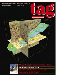
Marble Bar Chert - Geological Society of Australia
Marble Bar Chert - Geological Society of Australia
Marble Bar Chert - Geological Society of Australia

You also want an ePaper? Increase the reach of your titles
YUMPU automatically turns print PDFs into web optimized ePapers that Google loves.
The <strong>Geological</strong> <strong>Society</strong><br />
<strong>of</strong> <strong>Australia</strong> Inc<br />
tag<br />
Newsletter Number 151<br />
June 2009<br />
<strong>Marble</strong> <strong>Bar</strong> <strong>Chert</strong>:<br />
Early oxygenation <strong>of</strong> the Earth<br />
Special Report:<br />
Geoscientists remember Marysville<br />
Feature: The Yarragadee Aquifer<br />
Focus on greenfields:<br />
Regolith geology in research
The <strong>Australia</strong>n Geologist<br />
Newsletter 151, June 2009<br />
Registered by <strong>Australia</strong> Post<br />
Publication No. PP243459/00091<br />
ISSN 0312 4711<br />
Managing Editor: Sue Fletcher<br />
Technical Editor: Bill Birch<br />
Production Editor: Heather Catchpole<br />
Send contributions to: tag@gsa.org.au<br />
22 From the President<br />
23 Report <strong>of</strong> the Merger Committee<br />
24 Editor’s Comment<br />
25 <strong>Society</strong> Update<br />
Central Business Office<br />
Executive Director: Sue Fletcher<br />
Suite 61, 104 Bathurst Street,<br />
Sydney NSW 2000<br />
Tel: (02) 9290 2194<br />
Fax: (02) 9290 2198<br />
Email: info@gsa.org.au<br />
GSA website: www.gsa.org.au<br />
Business Report<br />
Membership Update<br />
From the AJES Editor’s Desk<br />
Education & Outreach<br />
Stratigraphic Column<br />
Heritage Matters<br />
Data Metallogenica<br />
Design and typesetting The Visible Word Pty Ltd<br />
Printed by Ligare Pty Ltd<br />
Distributed by Trade Mailing & Fulfilment Pty Ltd<br />
Red and white banded chert<br />
at <strong>Marble</strong> <strong>Bar</strong> Pool in the east<br />
Pilbara. <strong>Geological</strong> mapping<br />
reveals that the 3460 millionyear-old<br />
<strong>Marble</strong> <strong>Bar</strong> <strong>Chert</strong> was<br />
deposited in a caldera setting<br />
across an area <strong>of</strong> at least 50 km x<br />
30 km; sedimentological evidence<br />
indicates water depths exceeding<br />
200 m. The layers <strong>of</strong> red chert<br />
(jasper) contain up to 10%<br />
hematite, whereas adjacent layers<br />
<strong>of</strong> white chert are almost entirely<br />
composed <strong>of</strong> silica.<br />
A detailed study <strong>of</strong> drill core<br />
from the chert (p 13 this issue)<br />
concluded that the hematite was<br />
a primary precipitate and not, as<br />
previously suggested, an oxidation<br />
product <strong>of</strong> Fe-rich minerals<br />
such as siderite. This new interpretation<br />
controversially suggests<br />
the existence <strong>of</strong> oxygenated<br />
seawater 1000 million years prior<br />
to Earth's generally accepted<br />
"great oxidation event". Image<br />
courtesy Pr<strong>of</strong>essor Munetomo<br />
Nedachi, Department <strong>of</strong> Physics,<br />
Kagoshima University, Japan.<br />
13 News<br />
20 Feature: New water from old sources: case study <strong>of</strong><br />
the south–west Yarragadee aquifer<br />
23 Special Report: Geoscientists remember Marysville<br />
26 In Focus: “Grassroots” and “greenfields”:<br />
regolith geology in teaching and research<br />
30 Awards<br />
32 Forum: Magma chambers and igneous<br />
net-veined complexes<br />
36 Book Reviews<br />
43 Letters to the Editor<br />
46 Calendar<br />
47 Office Bearers<br />
48 Publishing Details
From the President<br />
Bringing Earth Science to the forefront<br />
In early April I had the pleasure <strong>of</strong> meeting <strong>Australia</strong>’s Chief<br />
Scientist, Pr<strong>of</strong>essor Penny Sackett. The meeting provided an<br />
opportunity to brief the Chief Scientist on key issues relevant<br />
to the <strong>Geological</strong> <strong>Society</strong> <strong>of</strong> <strong>Australia</strong> including: 1) the importance<br />
<strong>of</strong> including Earth and Environmental Science in the National<br />
Curriculum Board’s proposed National Science Curriculum;<br />
2) the need for a National Earth Science Research Strategy; and<br />
3) the need for a National Earth Science Expert Panel.<br />
1. The National Curriculum Board is currently preparing a<br />
document on the contents <strong>of</strong> a proposed National Science<br />
Curriculum, with the release <strong>of</strong> their deliberations expected sometime<br />
mid-year. The GSA made two submissions to the board, the<br />
preparation <strong>of</strong> which was expertly driven by Greg McNamara (see<br />
Greg’s report in TAG 150, p 10), who coordinates Education and<br />
Outreach for the <strong>Society</strong>. In these submissions, the GSA strongly<br />
supported the development <strong>of</strong> a National Science Curriculum<br />
covering all years from kindergarten through to high school. Our<br />
submissions stressed that Earth and Environmental Science must<br />
receive the same significant focus in classrooms as biology,<br />
chemistry and physics, given its critical role in understanding and<br />
combating the environmental, energy and economic crises that<br />
<strong>Australia</strong> and the world are now facing.<br />
The new curriculum will be a ‘make or break’ opportunity for<br />
Earth and Environmental Science to finally be given dedicated<br />
teaching time at <strong>Australia</strong>n schools after decades <strong>of</strong> being largely<br />
ignored in order to make way for studies in the traditional sciences<br />
<strong>of</strong> biology, chemistry and physics. The GSA fully supports the need<br />
for students to be well-grounded in these sciences, but a solid<br />
grounding in Earth and Environmental Science is just as critical<br />
given the centre-stage role this discipline is now playing in<br />
combatting the major crises <strong>of</strong> the 21st century. The great success<br />
<strong>of</strong> Earth and Environment-type courses, which have been<br />
introduced recently in Western <strong>Australia</strong> and New South Wales<br />
(see Jim Ross’ reports in TAG 149 (p 31) and 150 (p 25)) demonstrates<br />
the need for such a course and the positive response it will<br />
receive if properly structured and implemented by the National<br />
Science Curriculum.<br />
2. I also highlighted to Pr<strong>of</strong>essor Sackett the need for a National<br />
Geoscience Research Strategy to combat a continuing lack <strong>of</strong><br />
government funding for undergraduate and postgraduate Earth<br />
Science places at <strong>Australia</strong>’s universities, a continuing lack <strong>of</strong><br />
funding for Earth Science research, and an ongoing shortage <strong>of</strong><br />
Earth Science graduates for industry and research (particularly<br />
during resource booms). As many <strong>of</strong> you are well aware, the<br />
industries centred around Earth Science generate billions <strong>of</strong><br />
dollars in wealth for <strong>Australia</strong> each year. For example, the<br />
minerals and petroleum sector contributed<br />
about 10% <strong>of</strong> <strong>Australia</strong>’s GDP<br />
in 2007–2008.<br />
In its July 2008 submission to the<br />
Higher Education Review, the <strong>Australia</strong>n Geoscience Council (AGC)<br />
stated: “Of <strong>Australia</strong>’s total commodity export income <strong>of</strong> $150<br />
billion forecast for 2007–2008, minerals and energy will account<br />
for 78%. In the 2004/05 financial year the <strong>Australia</strong>n and State<br />
and Territory governments received taxes and royalties totalling<br />
$7.1 billion from the minerals sector and $8.1 billion from the oil<br />
and gas sector.” The AGC submission further pointed out that the<br />
number <strong>of</strong> dedicated Earth Science schools at <strong>Australia</strong>n universities<br />
has nearly halved from 28 to 17 departments in 1990, and this<br />
decade the number <strong>of</strong> Earth Science students currently enrolled in<br />
Honours courses has more than halved. Between 1990 and 2007<br />
the number <strong>of</strong> academic teaching staff in Earth Sciences at<br />
<strong>Australia</strong>n universities dropped from 220 to 170, and the Honours<br />
retention rate fell from 50% to 30%.<br />
This has already contributed – and will continue to contribute –<br />
to a serious shortage <strong>of</strong> Earth Science graduates in <strong>Australia</strong>,<br />
particularly during resource booms. This shortage is not <strong>of</strong> course<br />
limited to <strong>Australia</strong> but affects other countries too. For example, a<br />
recent report by the Canadian Federation <strong>of</strong> Earth Sciences outlines<br />
the Human Resources needs in Earth Sciences in Canada, estimating<br />
the current work force composition and future challenges for<br />
Canadian Earth Science (www.geoscience.ca/CFES_HR_requirements_<br />
Canadian_earth_sciences.pdf). The GSA believes that a National Earth<br />
Science Research Strategy is needed to combat the current shortfall<br />
in funding for Earth Science studies and research.<br />
3. The final point I raised with Pr<strong>of</strong>essor Sackett concerned<br />
establishment <strong>of</strong> a National Earth Science Expert Panel to provide<br />
Federal, State and Territory governments with early warnings on<br />
potential Earth and Environmental issues. This panel <strong>of</strong> expert<br />
Earth Scientists would serve as an independent voice to provide<br />
scientifically-based warnings and recommendations on a wide<br />
range <strong>of</strong> Earth and Environmental problems to governments. It<br />
would focus on potential problems rather than current ones.<br />
The meeting with Pr<strong>of</strong>essor Sackett was positive and she<br />
was genuinely interested in promoting Science in general and in<br />
better understanding the role <strong>of</strong> Earth Sciences within <strong>Australia</strong><br />
in particular.<br />
PETER CAWOOD<br />
President<br />
2 | TAG June 2009
GSA–AIG merger negotiations<br />
The <strong>Australia</strong>n Institute <strong>of</strong> Geoscientists and the<br />
<strong>Geological</strong> <strong>Society</strong> <strong>of</strong> <strong>Australia</strong> are proposing<br />
to merge and create a national body <strong>of</strong> some<br />
3600 members to represent the interests <strong>of</strong> <strong>Australia</strong>n<br />
Earth Science. Since September 2008, the two merger<br />
committees have met on a regular basis to prepare a<br />
proposal for voting by their respective members.<br />
There is substantive agreement between the two negotiating<br />
committees on the key issues for an effective<br />
merger and both have the support <strong>of</strong> their respective<br />
national Executives to continue develop a model to<br />
present to their respective members for a vote.<br />
Components discussed include the possible structure,<br />
governance and functions <strong>of</strong> the merged entity. Late<br />
June/early July GSA members will receive an outline<br />
<strong>of</strong> the proposal, mechanisms for feedback by members,<br />
details on the process <strong>of</strong> integrating feedback into a<br />
revised proposal, and a timeline for voting and for<br />
commencement <strong>of</strong> the new merged organisation.<br />
The mission statement developed for the merged<br />
organisation is also forward looking: Our purpose is<br />
to promote Earth Science and support Earth Scientists in<br />
meeting the strategic needs <strong>of</strong> society.<br />
We will achieve this by:<br />
■ Encouraging excellence in Earth Science<br />
education, research and pr<strong>of</strong>essional practice;<br />
■ Ensuring that Earth Science fully informs public<br />
policy;<br />
■ Raising community awareness and respect for Earth<br />
Science and its practitioners; and<br />
■ Improving the pr<strong>of</strong>essional standing <strong>of</strong> Earth<br />
Scientists.<br />
The merged entity will represent the pr<strong>of</strong>essional and<br />
learned interests <strong>of</strong> <strong>Australia</strong>n Earth Scientists. The<br />
underlying driver for the merger is to enhance the<br />
current activities <strong>of</strong> both organisations for the benefit<br />
<strong>of</strong> all members.<br />
The merger committees are reviewing risks, structure<br />
governance, Code <strong>of</strong> Ethics and Pr<strong>of</strong>essional Standards,<br />
membership categories and rates, capitation fees, awards<br />
and publications. Due diligence requires extensive legal<br />
and financial advice as well as substantial financial<br />
modelling.<br />
The merger negotiations and planning incorporates<br />
membership feedback in the early stages (June-July).<br />
The timing <strong>of</strong> further membership communication<br />
and voting will be subject to member feedback.<br />
For the merger to be undertaken, members <strong>of</strong> both<br />
societies have to provide approval. For the GSA this is<br />
75% <strong>of</strong> returning votes and for AIG it is 50%. It is<br />
proposed that the voting will occur in the latter half <strong>of</strong><br />
this year and, if in favour, the two organisations would<br />
formally merge in the first half <strong>of</strong> 2010. These estimates<br />
depend on completion <strong>of</strong> a number <strong>of</strong> legal and<br />
financial actions and therefore may vary.<br />
The GSA has provided facilities for member feedback<br />
and comment – we hope you utilised these resources.<br />
The September issue <strong>of</strong> TAG will include another<br />
progress report.<br />
PETER CAWOOD, ANDREW GLEADOW,<br />
JON HRONSKY and JIM ROSS<br />
GSA Executive Merger Committee<br />
April 2009<br />
ISSUE COPY FINISHED INSERTS<br />
ART<br />
SEPTEMBER 2009 31 Jul 8 Aug 16 Aug<br />
DECEMBER 2009 30 Oct 3 Nov 10 Nov<br />
MARCH 2010 29 Jan 5 Feb 8 Mar<br />
JUNE 2010 30 Apr 5 May 25 May<br />
TAG June 2009 | 3
Editor’s Comment<br />
Over the past three years, TAG has been undergoing<br />
internal changes as I have been filling the role <strong>of</strong><br />
Managing Editor (working behind the scenes) to<br />
develop and further nurture TAG with a number <strong>of</strong> people. TAG<br />
is not bereft <strong>of</strong> geological advice though: Bill Birch adopted the<br />
role <strong>of</strong> Technical Editor after stepping down as Editor in July<br />
2008. The role <strong>of</strong> Technical Editor lets Bill <strong>of</strong>f the hook for<br />
writing a column each issue and Heather Catchpole does the<br />
work <strong>of</strong> Production Editor. If you’ve submitted to TAG, you’ve<br />
been liaising with Heather. While the model differs from the<br />
one we had a few years ago, it has evolved to keep up with the<br />
changing format and content <strong>of</strong> TAG. With the position<br />
<strong>of</strong> Technical Editor, the editorial team can ensure that TAG<br />
maintains the high quality <strong>of</strong> the news and information that<br />
it publishes.<br />
From time to time GSA members are invited to write a<br />
Guest Column: David Branagan (TAG 150) reminisced about the<br />
early days <strong>of</strong> TAG under his stewardship and the massive<br />
contribution Brenda Franklin made. David also reminded us <strong>of</strong><br />
the Charles Darwin celebrations throughout the world in this<br />
year commemorating the anniversary <strong>of</strong> his birth and the<br />
publication <strong>of</strong> his seminal work. Mike Freeman (TAG 149)<br />
commented on the implications for town-planning, mining and<br />
conflict with home-owner aspirations and land zoning in his<br />
column: Case <strong>of</strong> science versus social aspirations.<br />
We will continue to invite Guest Columnists as part <strong>of</strong><br />
the ongoing development <strong>of</strong> TAG in its role as a channel <strong>of</strong><br />
communication for all members <strong>of</strong> the <strong>Geological</strong> <strong>Society</strong>.<br />
SUE FLETCHER<br />
Managing Editor, The <strong>Australia</strong>n Geologist<br />
The Broken Hill Exploration<br />
Initiative Conference (BHEI2009)<br />
will be held in Broken Hill from<br />
29 September, 2009. BHEI2009 will<br />
showcase the extensive resource<br />
potential in the Curnamona Province<br />
and scientific advances within the<br />
economic catchment area <strong>of</strong><br />
Broken Hill.<br />
Broken Hill<br />
Entertainment<br />
Centre<br />
29 September –<br />
1 October<br />
The geology <strong>of</strong> the Olary Domain —<br />
the Bimbowrie and Walparuta inliers,<br />
25–26 September<br />
Stratigraphy and mineralisation<br />
<strong>of</strong> the Broken Hill region,<br />
27–28 September<br />
The Koonenberry Belt —<br />
an underexplored belt,<br />
2–4 October<br />
4 | TAG June 2009 Conference excursions:<br />
Continued innovations in<br />
technology, research and<br />
exploration — built upon a vast<br />
resource <strong>of</strong> quality data and<br />
geoscience — will provide the<br />
key to ‘Discovering the Future‘<br />
<strong>of</strong> the Curnamona Province.<br />
The Broken Hill Exploration<br />
Initiative (BHEI) is a15-year<br />
collaboration between the NSW<br />
Department <strong>of</strong> Primary Industries,<br />
Primary Industries and Resources SA<br />
and Geoscience <strong>Australia</strong>.<br />
For further details contact: BHEI.info@dpi.nsw.gov.au Or www.dpi.nsw.gov.au/minerals/geological/bhei2009
<strong>Society</strong>Update<br />
Business Report<br />
Planning for the <strong>Australia</strong>n Earth Sciences Convention<br />
2010 is now in full swing and this issue <strong>of</strong> TAG includes<br />
the first call for papers. The convention will be held<br />
4–8 July 2010 in Canberra. Earth systems: change, sustainability,<br />
vulnerability is the over-arching theme. The GSA has<br />
adopted the international standard <strong>of</strong> one oral paper per presenter,<br />
with a renewed focus on posters. Brad Pillans is the<br />
Chair, Brian Kennett is Scientific Program Director; Chris<br />
Pigram brings his expertise and experience to the convention,<br />
along with Clinton Foster and Michelle Cooper from<br />
Geoscience <strong>Australia</strong>. Monica Yeung from Gondwana<br />
Dreaming, <strong>Bar</strong>ry Frodham from FrOGTech, Allan Chivas from<br />
the University <strong>of</strong> Wollongong, and John Mavrogenes and Brad<br />
Opdyke from the ANU round out the core organising committee.<br />
At the time <strong>of</strong> publishing not all theme coordinators had<br />
been confirmed, and we were having discussions with additional<br />
people from AIG and industry — further details will be<br />
provided in September.<br />
The deadline for abstracts is 15 January 2010 — put this in<br />
your diary now!<br />
This issue <strong>of</strong> TAG covers many topics, including the feature<br />
from Phil Commander: New water from old sources: case study<br />
<strong>of</strong> the south-west Yarragadee aquifer (Phil was a keynote<br />
speaker at the AESC 2008). Stimulated by Jon Hronsky’s March<br />
article, Steve Hill contributes to the discussion on greenfields<br />
exploration in his article: Grassroots and greenfields: regolith<br />
geology in teaching and research.<br />
Graziella Caprarelli reminds us why we should be celebrating<br />
the International Year <strong>of</strong> Astronomy, taking us from the<br />
early days <strong>of</strong> Alfred Lothar Wegener in 1905 to the discovery in<br />
2008 <strong>of</strong> three planets orbiting the star HR 8799.<br />
Regular columns include an update from Tony Cockbain<br />
about the next issue <strong>of</strong> the <strong>Australia</strong>n Journal <strong>of</strong> Earth Sciences<br />
(congratulations for the improved ranking); Cathy Brown<br />
writes <strong>of</strong> the importance <strong>of</strong> stratigraphic names, practices and<br />
descriptions; and Susan White comments on the role <strong>of</strong><br />
documenting type sections. Arthur Hickman has contributed a<br />
report on his research: Oxygen on Earth 3460 million years ago,<br />
and the <strong>Geological</strong> <strong>Society</strong> <strong>of</strong> America provides an update<br />
on EarthTrek: Global Citizen Science Program. EarthTrek is an<br />
education and outreach program aimed to engage communities,<br />
scientists and partners to encourage participation in<br />
worldwide scientific research and activities. The Gravestone<br />
Project is a great opportunity to participate – anyone can do it<br />
from schools, to community groups or<br />
individuals. To find out more go to:<br />
http://goearthtrek.com/index.html<br />
As well as the GSA activities, local<br />
news, book reviews, and letters to the Editor, I’m confident you<br />
will find this issue <strong>of</strong> TAG a stimulating and worthy read:<br />
representative <strong>of</strong> GSA as a national organisation that encompasses<br />
a diversity <strong>of</strong> interests, but also has common ground (no<br />
pun intended!).<br />
Finally, this issue <strong>of</strong> TAG carries a special report on the<br />
Victorian fires, looking at Marysville with two different focuses,<br />
one from Vince Morand: The last field trip to Marysville for<br />
a while and from Bill Birch: Memories <strong>of</strong> Marysville.<br />
The GSA has been promoting Earth Science through submissions<br />
to government for the National Curriculum review<br />
and with media work. The GSA’s media release in April, Global<br />
crises must make Earth and Environmental Science a major<br />
focus <strong>of</strong> National Science Curriculum, attracted radio interest<br />
— more so in the eastern seaboard. To read all media releases<br />
in full go to: www.gsa.org.au/resources/media.html.<br />
At the time <strong>of</strong> writing we were massaging the media<br />
releases for the Earth Science showcase — a targeted media<br />
campaign highlighting the work <strong>of</strong> Earth Scientists in <strong>Australia</strong><br />
across a variety <strong>of</strong> expertise, interests and research. I hope you<br />
managed to catch some <strong>of</strong> the media coverage. In addition to<br />
publishing and supporting members in their activities, the GSA<br />
seeks to actively raise the pr<strong>of</strong>ile and contribution Earth<br />
Sciences makes to society.<br />
SUE FLETCHER<br />
Executive Director<br />
Congratulations<br />
Malcolm<br />
GSA Fellow and long-time GSA Member, Pr<strong>of</strong>essor<br />
Malcolm McCulloch FAA, from the <strong>Australia</strong>n<br />
National University, has been awarded the prestigious<br />
2009 Jaeger Medal for research in Earth<br />
Sciences.<br />
TAG June 2009 | 5
New members<br />
The GSA welcomes the<br />
following new members to<br />
the <strong>Society</strong>. May you all<br />
have a long and beneficial<br />
association with the GSA:<br />
ACT<br />
M EMBER<br />
Andrew Spate<br />
R ETIRED M EMBER<br />
Philip Brown<br />
HUNTER VALLEY<br />
M EMBER<br />
Steven Palmer<br />
NSW<br />
M EMBER<br />
Ambrose Ezenwa<br />
Rabin Choudhury<br />
Martin Young<br />
S TUDENT<br />
Ariel Astudillo<br />
Jay Jensen-Langford<br />
Michael Ostrowski<br />
Rhiannon McKeon<br />
Dayna McGeeney<br />
Nhan le Thanh Phu<br />
NT<br />
M EMBER<br />
James Sullivan<br />
JOINT MEMBER<br />
Jonathan Higgins<br />
QLD<br />
M EMBER<br />
Karolina Centkowski<br />
Norbert Tim<strong>of</strong>te<br />
Todd Sercombe<br />
A SSOCIATE M EMBER<br />
Stephen Jensen<br />
SA<br />
M EMBER<br />
Biju Sebastian<br />
TAS<br />
M EMBER<br />
Jafar Taheri<br />
S TUDENT<br />
Robert Moye<br />
Tim Stubley<br />
Katherine Webb<br />
Kate Howie<br />
Jarrod Crew<br />
Mathew Ageneau<br />
Nichola McMillan<br />
Kate Miedecke<br />
Dominic Neyland<br />
Michael Gill<br />
Michelle Slater<br />
Carla Vincent<br />
Stephanie Howe<br />
Tanya Maksimovic<br />
Tania Hillman<br />
Sam Kruimink<br />
Emma Brown<br />
Simon Enman<br />
Alexandra Eastburn<br />
Norman Heckscher<br />
Simon Sullivan<br />
Markus Staudmann<br />
Michael Tomlin<br />
Chun Lai<br />
Ting Kor<br />
VIC<br />
A SSOCIATE M EMBER<br />
Howard Mitchell<br />
S TUDENT<br />
Katrina Rast<br />
WA<br />
M EMBER<br />
Katrin Karner<br />
Eric Tohver<br />
Bradley Brown<br />
Dianne Tompkins<br />
A SSOCIATE M EMBER<br />
Elijah Bada<br />
S TUDENT<br />
Louise Holbrook<br />
Daniel Townend<br />
Daniel Sully<br />
Aaron Benincasa<br />
James Thomson<br />
6 | TAG June 2009
<strong>Society</strong>Update<br />
From the AJES Hon Editor’s Desk<br />
Poetry and geology<br />
Icertainly stirred up a few poets with my remarks on poetry.<br />
Many thanks to those who sent me their poems, two <strong>of</strong><br />
which have been published in past issues <strong>of</strong> TAG. I wonder<br />
whether we can persuade the Editor <strong>of</strong> TAG to set aside a Poets’<br />
Corner; not for dead poets (who already have a society) as in<br />
Westminster Abbey, but for those amongst us who wish to<br />
share their joy in writing poetry on geological themes.<br />
Taking the geo out <strong>of</strong> geology<br />
No doubt many <strong>of</strong> you saw an article on the ‘Eureka machine’<br />
that can work out the laws <strong>of</strong> nature by observing the world<br />
around it – the machine took only hours to come up with the<br />
basic laws <strong>of</strong> motion, a task that occupied Newton for years.<br />
According to the Guardian website for 3 April 2009, the<br />
developers at Cornell University say: “We've reached a point in<br />
science where there's a lot <strong>of</strong> data to deal with. It's not Newton<br />
looking at an apple, or Galileo looking at heavenly bodies any<br />
more, it's more complex than that…This takes the grunt out <strong>of</strong><br />
science by sifting through data and looking for the laws that<br />
govern how something behaves.”<br />
We <strong>of</strong>ten hear those amongst us lamenting the decline <strong>of</strong><br />
geological field work. Just think what we could do with the<br />
‘Eureka machine’. The data can be gathered by satellite (or from<br />
Google Earth) and fed into the machine which will come up<br />
with the answers and, presumably, write the ensuing paper in<br />
perfect English — and probably even review it and revise it all<br />
by itself. The geologist need never leave the <strong>of</strong>fice: in fact the<br />
<strong>of</strong>fice need not have windows (except for the Bill Gates’ type).<br />
Is this the future<br />
The existing machine is called Adam. The designers are already<br />
working on a second model called Eve. Quite poetic really!<br />
Review papers<br />
I have frequently mentioned that publishers consider that<br />
review papers sell journals. While we managed to get a number<br />
<strong>of</strong> such papers during the International Year <strong>of</strong> Planet Earth<br />
(see the list in TAG 149, p 7) the stream has now dried up.<br />
I always welcome reviews on any aspect <strong>of</strong> geoscience, so if<br />
any <strong>of</strong> you out there have one gestating in your mind, please<br />
get cracking and put it on paper and send it in.<br />
Journal ranking<br />
Many <strong>of</strong> you will be aware that last year the Minister for<br />
Innovation, Industry, Science and Research, Senator the<br />
Hon Kim Carr, announced plans for a<br />
new research quality and evaluation<br />
system — the Excellence in Research for<br />
<strong>Australia</strong> (ERA) initiative to be developed<br />
by the ARC. This will assess<br />
research quality within <strong>Australia</strong>'s higher education institutions<br />
using a combination <strong>of</strong> indicators and expert review by<br />
committees comprising experienced, internationallyrecognised<br />
experts. The ERA initiative will use a range <strong>of</strong><br />
indicators and other proxies to support the evaluation<br />
<strong>of</strong> research excellence. One <strong>of</strong> these indicators is disciplinespecific<br />
tiered outlet rankings. The ARC has consulted with<br />
the sector to assist with the development <strong>of</strong> research journal<br />
rankings, a subset <strong>of</strong> tiered outlet rankings.<br />
This has resulted in a journals being ranked as A*, A, B, C,<br />
with A* being the highest category. After some discussion AJES<br />
has been ranked in category A. A full list <strong>of</strong> ranked journals can<br />
be found at www.arc.gov.au/era/journal_list.htm<br />
Forthcoming papers and<br />
thematic issues<br />
M Hendrickx: ‘Carbonate-hosted asbestos occurrences in<br />
South <strong>Australia</strong>: review <strong>of</strong> geology and implications for<br />
mesothelioma’<br />
RJ Korsch, CJ Adams, LP Black, DA Foster, GL Fraser,<br />
CG Murray, C Foudoulis and WL Griffin: ‘Geochronology and<br />
provenance <strong>of</strong> the Late Palaeozoic accretionary wedge and<br />
Gympie Terrane, New England Orogen, eastern <strong>Australia</strong>’<br />
PG Lennox and R Offler: ‘Kinematic history <strong>of</strong> serpentinites in<br />
the faulted margins <strong>of</strong> the Hastings Block, New England<br />
Orogen, eastern <strong>Australia</strong>’<br />
C Vérard: ‘Palaeomagnetic study <strong>of</strong> the Late Silurian–Early<br />
Devonian Mt Daubeny Formation from the Broken Hill area,<br />
New South Wales’<br />
JJ Veevers: ‘Mid-Carboniferous Centralian uplift linked by U–Pb<br />
zircon chronology to the onset <strong>of</strong> <strong>Australia</strong>n glaciation and<br />
glacio-eustasy’<br />
Thematic issues<br />
<strong>Australia</strong>n Cenozoic continental sediments; guest editors:<br />
JDA Clarke and CF Pain.<br />
Permian–Triassic mass extinction and subsequent recovery;<br />
guest editors: ZQ Chen, RJ Twitchett and J Tong.<br />
TONY COCKBAIN<br />
Hon Editor AJES<br />
TAG June 2009 | 7
The use <strong>of</strong> liquid crystal displays is now commonplace. Truly amazing advances have been made in recent years in<br />
understanding the behaviour <strong>of</strong> sub-microscopic particles in response to electric charges. Principles governing the<br />
behaviour <strong>of</strong> charged particles also apply to high-energy sediment components like clay. Many geologists now<br />
recognise interactions between charged particles and ions in surrounding pore fluids relate to ore forming processes.<br />
This e-book is the first systematic use <strong>of</strong> modern colloid science to define the properties and<br />
behaviour <strong>of</strong> the high-energy sediment particles from which crustal rocks and mineral deposits<br />
were formed.<br />
World leaders in surface chemistry and the earth sciences have achieved this<br />
classic work over many years and it is based on the current physical chemistry<br />
<strong>of</strong> small particle systems. Existing problematic observations relating to the<br />
formation <strong>of</strong> rocks and ore deposits are simply resolved by using principles<br />
more recently established in colloid science.<br />
The many far-reaching interdisciplinary research projects have been recorded in<br />
89 progress reports and papers. The principles <strong>of</strong> sediment particle interactions<br />
and surface chemistry apply universally but the cross-referenced e-book selects<br />
and illustrates 259 separate problematic observations to provide clear evidence<br />
<strong>of</strong> the properties <strong>of</strong> ancient sediment components. It details the processes by<br />
which veins and mineral deposits were formed. The photographic records <strong>of</strong><br />
actual structures and textures that are preserved in rock outcrops, drill cores,<br />
and polished rock surfaces are therefore unusual in number, scope, and their<br />
global extent. Geophysical data, seismic reflection pr<strong>of</strong>iles and microscope and<br />
SEM images have also been used. A comprehensive glossary provides simple<br />
explanations <strong>of</strong> the physical chemistry, particle interactions and rheology.<br />
Recognition <strong>of</strong> source rocks and understanding the ore forming processes<br />
have resulted in improved exploration success rates. Over 300% better cost effectiveness was achieved in a<br />
comparison <strong>of</strong> the results <strong>of</strong> 13 successful exploration companies over 15 years. Exploration managers can now<br />
identify source rocks and assess the likelihood <strong>of</strong> associated economic mineral deposits.<br />
Principal Technical Advisers and experimental confirmation:<br />
Pr<strong>of</strong>essor T.W. Healy, Particulate Fluids Processing Centre, The University <strong>of</strong> Melbourne.<br />
Pr<strong>of</strong>essor A.E. Alexander, Department <strong>of</strong> Physical Chemistry, The University <strong>of</strong> Sydney.<br />
Pr<strong>of</strong>essor S.W. Carey, Department <strong>of</strong> Geology, The University <strong>of</strong> Tasmania.<br />
Pr<strong>of</strong>essor T.F.W. <strong>Bar</strong>th, The University <strong>of</strong> Oslo, President, 23rd International <strong>Geological</strong> Congress.<br />
Dr. Ralph K. Iler, Cornell University and E.I. DuPont de Nemours & Co, Wilmington, Delaware.<br />
Pr<strong>of</strong>essor R.L. Stanton, Department <strong>of</strong> Geology & Geophysics, University <strong>of</strong> New England, Armidale, NSW. (Independent<br />
complimentary research that established the precursor principle by direct measurement with a microprobe analyzer.)<br />
Particulate Fluids Processing Centre, The University <strong>of</strong> Melbourne. (Independent research that confirmed DLVO theory<br />
by direct measurement <strong>of</strong> interparticle forces with an atomic force microscope.)<br />
Research Coordinator and Author:<br />
John Elliston, Research Geologist (Previously Chief Geologist and Executive Director Peko-Wallsend Limited and then<br />
Research Consultant to CRA-Rio-Tinto for 12 years).<br />
This E-book contains: - 706 pages, 144 diagrams, 756 colour photographs, 227 references, 4 referee reports,<br />
40 comments and endorsements, <strong>Australia</strong>n Government assessment and certification.<br />
Price: $AU75.00 each plus $10 postage (see order form for student concession price at $25).<br />
Printable Order Forms at CODES: http://fcms.its.utas.edu.au/scieng/codes/index.asp<br />
ELLISTON RESEARCH: http://www.ellistonresearch.com.au/book_order.html
<strong>Society</strong>Update<br />
Education&Outreach<br />
The geoscience community responded effectively to the<br />
call for submissions from the National Curriculum Board<br />
(NCB) regarding the shape that a national curriculum<br />
and the science curriculum should take, sending in numerous<br />
submissions all more or less responding with the same message. In<br />
the previous TAG I reported on the GSA submission on ‘The shape<br />
<strong>of</strong> the national curriculum: a proposal for discussion’. A second<br />
submission was made late February on the specifics <strong>of</strong> the science<br />
curriculum. It was clear from the science framing paper that the<br />
NCB did not propose to radically change the pre-senior school<br />
curricula (Stages 1–3). However, their proposal for Year 11–12<br />
(Stage 4) was a cause for concern in as much as the suggested<br />
fourth subject in an expanded science curriculum was identified as<br />
Environmental Science. This in and <strong>of</strong> itself is not a bad thing, but<br />
the fact that it was not named Earth and Environmental Science<br />
rang alarm bells.<br />
Language is a powerful tool, and given how effective the Earth<br />
and Environmental Science Year 11–12 subjects have been in New<br />
South Wales and Western <strong>Australia</strong>, the omission <strong>of</strong> the ‘Earth’<br />
component from the title, in the opinion <strong>of</strong> all geoscience submissions<br />
to the NBC, was sending the wrong message. Not only would<br />
the omission mean students would not associate Earth Science<br />
with Environmental Science but neither would teachers nor the<br />
curriculum developers who will be writing the detailed structure<br />
and content for this course in the near future.<br />
I am pleased report that in the NCB’s recently published<br />
recommendations — The shape <strong>of</strong> the <strong>Australia</strong>n curriculum:<br />
science — they have listened to our submissions, with the fourth<br />
Yr 11–12 science subject recommended as being named as Earth<br />
and Environmental Science. All other areas <strong>of</strong> the P–10 curriculum<br />
appear to have had their Earth Science components retained or<br />
expanded, although Stage 1 and 2 content is not specified.<br />
To read more visit the NCB website: www.ncb.org.au/default.asp<br />
Specific suggestions for a<br />
science curriculum<br />
The GSA-developed suggestions for the NCB with respect to all 23<br />
response points in the framing paper are detailed here in the<br />
executive summary:<br />
■ Any NCB recommendation to government leading to a more<br />
student-inquiry centred curriculum must be with the caveat that<br />
implementation can only follow adequate resourcing <strong>of</strong> all<br />
schools that ensures appropriate capacities exist for its delivery.<br />
■ The development <strong>of</strong> senior school science curriculum (Stage 4)<br />
must include the subject, Earth and Environmental Sciences<br />
(EES), with a strongly mandated Earth Sciences component along<br />
the lines <strong>of</strong> the model proposed by Earth<br />
Sciences Western <strong>Australia</strong>.<br />
■ In all Stage 4 non-EES science<br />
subjects there should be mandatory<br />
inclusion <strong>of</strong> Earth Science components<br />
such as Geophysics, Geochemistry,<br />
Biogeochemistry and Evolutionary/fossil biology.<br />
■ In the Stage 2 curriculum there should be explicit mention <strong>of</strong><br />
'Earth materials' and the relationship between landscape and<br />
geology to enable teachers to recognise they can be used to<br />
deliver outcomes relevant to the big ideas <strong>of</strong> science.<br />
■ Stage 3 must retain the Earth and Space topic and include<br />
Plate Tectonics & the Dynamic Earth, Evolution (as seen through<br />
the rock record) and the 'geology' and formation <strong>of</strong> the Solar<br />
System as major concepts to be embraced by that topic.<br />
■ In any Stage 4 additional multidisciplinary science subject<br />
there must also be a mandatory Earth Science component to<br />
allow students only taking that science subject to also garner<br />
some appreciation <strong>of</strong> the contribution Earth Sciences makes<br />
to society.<br />
■ The NCB should convene an advisory body comprising<br />
personnel from Earth Science organisations to assist the NCB<br />
in its further deliberations on the specific details <strong>of</strong> all aspects<br />
<strong>of</strong> Stages 1–4 <strong>of</strong> the new curriculum, especially the Earth and<br />
Environmental Science subject.<br />
Appointing writers for the new courses is already underway with<br />
further consultation on the draft documents scheduled for<br />
January 2010. The NCB did note that the Earth and Environmental<br />
Science course should be developed in consultation with industry<br />
to ensure currency <strong>of</strong> content, scientific practice and direction.<br />
However, just how the content <strong>of</strong> this course is formulated<br />
remains to be seen. It is incumbent upon us now to face up to this<br />
challenge, and provide the course developers with the guidance<br />
needed to ensure the availability <strong>of</strong> a high-quality course once the<br />
States take this national curriculum on board. This is truly a<br />
pivotal moment in education history in <strong>Australia</strong> and it will impact<br />
on the Earth Sciences for generations to come. We need to be<br />
vigilant to ensure the impact is a beneficial one.<br />
GREG McNAMARA<br />
Education and Outreach<br />
Send all comments to Greg McNamara at<br />
outreach@gsa.org.au<br />
TAG June 2009 | 9
<strong>Society</strong>Update<br />
Stratigraphic Column<br />
Defined units: why aren’t there more<br />
In mid-April, the <strong>Australia</strong>n Stratigraphic Units Database<br />
(ASUD), had 13 492 names recorded as current formal or<br />
reserved units, but only 4435 were defined or redefined.<br />
Including units no longer current, only 5514 have ever been<br />
defined or redefined. examples to add to the discussion.<br />
On a positive note, these numbers suggest that there is still<br />
a lot more to learn about <strong>Australia</strong>n geology, if we can<br />
persuade the funding bodies to let us look at and write about<br />
what we find, but I suspect that quite a few <strong>of</strong> these units are<br />
well enough known that they could (and should) be defined<br />
now. Some <strong>of</strong> them probably have ‘definitions’ hidden away in<br />
theses, but these have no standing and are not very accessible.<br />
Naming a unit is a convenient shorthand way <strong>of</strong> referring to<br />
it, but if you name a unit, you have a responsibility to define it<br />
so that others know what you mean by it. There needs to be at<br />
least a good description <strong>of</strong> the unit published somewhere.<br />
Showing the extent <strong>of</strong> a unit on a map and giving it a brief<br />
description in a map legend is a start, but units <strong>of</strong>ten extend<br />
beyond standard map sheet or study areas, or beyond the<br />
boundaries <strong>of</strong> data sets, and there are limits to what can be<br />
said in a map legend.<br />
Defining a unit is really not as hard as most people seem to<br />
think. While there are some basic minimum issues to address,<br />
you don’t have to know everything there is to know about a<br />
unit before you can define it. What you do have to do is to<br />
identify a place (type locality/section), where others can go to<br />
see your unit and to say what distinguishes it from the<br />
surrounding materials, so that your intentions are clear. Some<br />
units are known only from drill core and geophysics, so the type<br />
sections and descriptions will obviously reflect this, but<br />
definitions are still possible. And, <strong>of</strong> course, unit definitions<br />
are not fixed in stone. Units can be redefined when new<br />
information on age, extent, lithology, boundary types or other<br />
data becomes available.<br />
Guidelines on defining lithostratigraphic units are available at:<br />
www.ga.gov.au/oracle/stratnames/defined.jsp and guidelines<br />
for igneous units are available at:<br />
www.ga.gov.au/oracle/stratnames/guide.jsp and a<br />
definition form is available at:<br />
www.ga.gov.au/oracle/stratnames/unit_definition.jsp.<br />
If your favourite publication doesn’t want to give you the space<br />
to publish whole definitions, they can be made widely available<br />
through the ASUD web pages, once approved by the relevant<br />
State Stratigraphy Subcommission.<br />
Other types <strong>of</strong> units<br />
Of course there are other kinds <strong>of</strong> geological units too, used in<br />
sequence stratigraphy and regolith–landform mapping for<br />
example, that we don’t have national guidelines for, although<br />
there are some common practices and discussion papers<br />
around. Brakel (2000) gives some guiding principles on<br />
sequence stratigraphy and Pain (2008) discusses regolith<br />
description and mapping. There is a long history <strong>of</strong> discussion<br />
on the use and misuse <strong>of</strong> stratigraphic principles in describing<br />
regolith and soil units from Brewer et al (1967) to Pain and<br />
Ollier (1996). Perhaps it is time to try again to seek consensus<br />
from the experts in these fields and produce some acceptable<br />
<strong>Australia</strong>n guidelines for defining these units too.<br />
I welcome your feedback on these or any other<br />
stratigraphy-related issues.<br />
CATHY BROWN<br />
National Convenor, <strong>Australia</strong>n Stratigraphy Commission<br />
c/- Geoscience <strong>Australia</strong><br />
GPO Box 378, Canberra, ACT, 2601<br />
cathy.brown@ga.gov.au or cathyeb@netspeed.com.au<br />
REFERENCES<br />
Brakel, AT, 2000, ‘Standard database entry <strong>of</strong> sequence stratigraphic units in AGSO’<br />
AGSO Research Newletter 32, p 33–36.<br />
Brewer, R (Convener), 1967, ‘Soil stratigraphic units: the sub-committee for soil<br />
stratigraphic nomenclature’ <strong>Geological</strong> <strong>Society</strong> <strong>of</strong> <strong>Australia</strong>.<br />
Pain, CF, 2008, ‘Regolith description and mapping’ in Scott, KM, Pain, CF (Eds),<br />
Regolith science, CSIRO Publishing, Collingwood p 281–305.<br />
Pain, CF, and Ollier, CD, 1996, ‘Regolith stratigraphy: principles and problems’ AGSO<br />
Journal <strong>of</strong> Geology & Geophysics 16(3), p 197–202.<br />
Speight, G, 1970, ‘Proposal for soil-stratigraphic units in the <strong>Australia</strong>n<br />
Stratigraphic code’ Journal <strong>of</strong> the <strong>Geological</strong> <strong>Society</strong> <strong>of</strong> <strong>Australia</strong> 17(1), p 103–111.<br />
10 | TAG June 2009
<strong>Society</strong>Update<br />
Heritage Matters<br />
This is quite a short article as I am <strong>of</strong>f to the Nullarbor<br />
to look for caves as I write this. However, I have been<br />
thinking about the role <strong>of</strong> type sections and type locations<br />
for some time. As many <strong>of</strong> you know, I currently work in a first-year<br />
course in Geology where the bulk <strong>of</strong> students are undertaking<br />
Biological Science majors. As a result, some discussion on issues<br />
around type specimens has arisen. Explaining how the geological<br />
community manages type sections and type locations has been an<br />
interesting exercise. Also, how do we document type sections and<br />
locations in terms <strong>of</strong> their significance<br />
As part <strong>of</strong> this discussion, one issue that came up recently was<br />
why we would bother to document all the type sections and locations<br />
in Victoria for the Victorian <strong>Geological</strong> Heritage Database. The<br />
enquirer was <strong>of</strong> the opinion that many were <strong>of</strong> limited significance<br />
and <strong>of</strong> only local importance. Also, the rationale was that the GSA<br />
Stratigraphic Commission and Geoscience <strong>Australia</strong> would record<br />
any such sites in the Stratigraphic Database. This all made me think.<br />
Was I just indulging in ‘busy work’, or are there really good reasons<br />
why we should document the geological significance <strong>of</strong> type<br />
sections and locations And how should geologists value such sites<br />
Type sections (and locations) are a key aspect <strong>of</strong> geology. They<br />
are the equivalent for us <strong>of</strong> the type specimens used by botanists<br />
and zoologists. Biologists describe details <strong>of</strong> a particular species<br />
using the type specimens as the benchmark description, but<br />
such specimens are kept for posterity in permanent collections,<br />
particularly in museums. If new ideas become available, these type<br />
specimens can be referred to. This has been very important with the<br />
advances in speciation, especially with respect to DNA technology<br />
and genetics. The existence <strong>of</strong> these type specimens is seen as <strong>of</strong><br />
significance to the biological community.<br />
Although similar systems are in place for palaeontology and<br />
mineral documentation, many rock formations and groups and<br />
other geological features must rely on the type sections and<br />
locations.<br />
The Stratigraphic Column in TAG has discussed over the years<br />
many issues to do with nomenclature and documentation <strong>of</strong> type<br />
sections. Over time, there have been changes in the way these<br />
sections are documented and recorded. Unless access to the actual<br />
site is possible, it is difficult to relate new concepts <strong>of</strong> stratigraphy<br />
to the actual sites.<br />
Type sections cannot be stored in a permanent collection like<br />
biological specimens. The documentation <strong>of</strong> these type<br />
sections, as well as their significance, is thus a step towards their<br />
protection. Their protection is invaluable to future geologists, if the<br />
sites can be integrated into updated material.<br />
A few years ago I was involved in a geological heritage survey<br />
for a project looking at sites <strong>of</strong> significance on public land in<br />
northern Victoria, with the aim <strong>of</strong> identifying various sites <strong>of</strong><br />
significance so that they could be better managed. One <strong>of</strong> the most<br />
widespread geological formations across northern Victoria is the<br />
Shepparton Formation. The type section at Kialla was very difficult<br />
to identify and locate, and any work on the sedimentology or<br />
stratigraphy <strong>of</strong> the Shepparton Formation is seriously hampered by<br />
the degraded nature <strong>of</strong> the site. The site is not spectacular, and the<br />
land manager concerned had no methods <strong>of</strong> identifying that this<br />
site was important. <strong>Geological</strong> significance statements are <strong>of</strong>ten<br />
the only way local land managers can see that the site has value.<br />
Therefore, the documenting <strong>of</strong> all the type sections and<br />
locations can have an important role. These sometimes may have<br />
local or regional significance rather than very high significance,<br />
such as State or national, but it is not just ‘busy work’. We cannot<br />
expect them to be always there if we do not draw attention to<br />
them. Biological type specimens are protected by being in museum<br />
collections; geological type sections do not have that luxury.<br />
SUSAN WHITE<br />
2010<br />
AUSTRALIAN ACADEMY OF SCIENCE<br />
AWARDS FOR<br />
SCIENTIFIC EXCELLENCE<br />
Nominations are now invited for the<br />
HADDON FORRESTER KING MEDAL<br />
SPONSORED BY RIO TINTO<br />
for research in mineral exploration<br />
The Medal is one <strong>of</strong> the Academy’s<br />
prestigious career awards for life-long<br />
achievement and outstanding<br />
contribution to science.<br />
Criteria and application forms<br />
can be found at<br />
www.science.org.au/awards/haddon<br />
or contact awards@science.org.au<br />
for further information.<br />
Closing date 31 July 2009<br />
TAG June 2009 | 11
<strong>Society</strong>Update<br />
Data Metallogenica<br />
“<br />
Merlin’s magic enchants Ivanhoe” declared The<br />
<strong>Australia</strong>n newspaper on 22 April, confirming earlier<br />
reports that the Canadian-based explorer had discovered<br />
the world’s highest-grade molybdenum–rhenium<br />
deposit at its Merlin prospect in the Cloncurry mineral district<br />
<strong>of</strong> Queensland. Average grades at Merlin now appear to be an<br />
order <strong>of</strong> magnitude higher than those <strong>of</strong> the highest-grade<br />
existing molybdenum producers. Rhenium is used in superstrength<br />
aerospace alloys and molybdenum is a component <strong>of</strong><br />
stainless steel and other alloys. Merlin is new, it is different,<br />
and it is very exciting.<br />
Importantly, detailed information was made available to<br />
Data Metallogenica in late March in the form <strong>of</strong> a presentation<br />
donated by Ivanhoe. The company, and in particular Doug<br />
Kirwin, executive vice-president <strong>of</strong> exploration, has long been<br />
strong and generous supporters <strong>of</strong> the Data Metallogenica<br />
vision.<br />
Also rating a significant mention this quarter are<br />
the Victorian goldfields. Formative in shaping the <strong>Australia</strong><br />
character, as portrayed by ST Gill, the “artist <strong>of</strong> the goldfields”,<br />
they were also critical in financing early development <strong>of</strong> the<br />
fledgling nation. Gold rush fever was so strong in 1851 that<br />
about half <strong>of</strong> the men in Victoria were on the goldfields. By<br />
1858, at the height <strong>of</strong> the gold rush, Victoria held just over half<br />
the population <strong>of</strong> the entire country.<br />
The goldfields are well represented in Data Metallogenica,<br />
containing as it does 37 suites <strong>of</strong> rocks that span the goldfield<br />
regions, together with ever-growing supporting data. This last<br />
period saw addition <strong>of</strong> two major presentations donated by<br />
Bendigo Mining Ltd: (1) ‘Geology at Bendigo Mining’ with<br />
excellent graphics <strong>of</strong> mineralisation development, and<br />
(2) ‘Proving our approach’, moving on to detail current mine<br />
practice, illustrated by explicit photographs <strong>of</strong> mineralised reefs<br />
in underground exposure. History has not been neglected<br />
either; with permission, an excellent historical summary has<br />
been added, courtesy <strong>of</strong> the Bendigo Historical <strong>Society</strong>.<br />
Other significant new data in brief<br />
■ Ghana: Damang gold deposit – discovery history;<br />
■ Namibia: more data on uranium mineralisation and the<br />
Rossing deposit;<br />
■ Tanzania: nickel–PGE deposits in the Kabanga–Musongati–<br />
Kapalagulu belt;<br />
■ Ireland: more data on the Lisheen zinc–lead–silver deposit;<br />
■ <strong>Australia</strong>: deposits in the Cloncurry district, Queensland,<br />
including Merlin molybdenum–copper–gold; Amethyst Castle<br />
copper–gold; Swan copper–gold; Selwyn iron–copper–gold;<br />
and Mt Dore copper (gold–zinc);<br />
■ theses: seven full-text theses added for a total <strong>of</strong> 58 online.<br />
Zhaoshan Chang on the Empire Mine skarn deposit in Idaho,<br />
USA; Daniel Layton-Matthews on the Finlayson Lake V(H)MS<br />
deposit in the Yukon, Canada; Dan Olberg on the Gosowong<br />
gold deposit in Indonesia; Melissa Gregory on the Mt Isa<br />
district <strong>of</strong> Queensland; Thomas Monecke on the Waterloo<br />
V(H)MS deposit in Queensland; Robert Duncan on the Western<br />
Fold Belt <strong>of</strong> the Mt Isa district, Queensland; and Jan Peter on<br />
a comparison between the ancient and modern volcanic<br />
massive sulphide deposits <strong>of</strong> Windy Craggy in British<br />
Columbia, Canada and submarine ‘smoker’ deposits in<br />
the Guaymas Basin <strong>of</strong> the Gulf <strong>of</strong> California.<br />
As a Foundation Sponsor <strong>of</strong> Data Metallogenica, members <strong>of</strong><br />
the <strong>Geological</strong> <strong>Society</strong> <strong>of</strong> <strong>Australia</strong> pay only $110 pa (inc GST)<br />
for an individual (personal) subscription, which is half price.<br />
Subscriptions support maintenance and development <strong>of</strong> the<br />
database. DM is not-for-pr<strong>of</strong>it so your contribution will help<br />
us to provide you with a better service and a faster growing<br />
database.<br />
For more information please contact: Alan Goode, DM Project<br />
Director (alan.goode@amira.com.au), or Kerry O’Sullivan, DM<br />
Project Manager (kerry.osullivan@amira.com.au), at AMIRA<br />
International.<br />
KERRY O’SULLIVAN<br />
DM Project Manager<br />
12 | TAG June 2009
NEWS<br />
Oxygen on Earth 3460<br />
million years ago<br />
The discovery <strong>of</strong> primary, syndepositional<br />
hematite in the 3460-Ma <strong>Marble</strong> <strong>Bar</strong> <strong>Chert</strong><br />
Member <strong>of</strong> the Duffer Formation (Hoashi<br />
et al, Nature Geoscience, March 2009) has<br />
highlighted the need for more research<br />
into the oxygen content <strong>of</strong> the Archean<br />
atmosphere and oceans. The hematite forms<br />
up to 10% <strong>of</strong> jasper beds in the chert, and<br />
was precipitated when hydrothermal fluids<br />
mixed with oxygenated seawater. Evidence<br />
that water depths during deposition <strong>of</strong> the<br />
hematite exceeded 200 m appear to rule<br />
out hematite precipitation by photochemical<br />
reactions driven by ultraviolet radiation.<br />
This, combined with mapping evidence that<br />
the basin extended over an area at least<br />
50 km x 30 km, greatly increases the<br />
significance <strong>of</strong> the hematite.<br />
Archean oxygen<br />
Until a few years ago, it was widely accepted<br />
that the Earth’s atmosphere and oceans<br />
contained little or no oxygen at any time<br />
prior to the so-called “great oxidation event”<br />
between 2300 and 2200 Ma (Cloud, 1972;<br />
Holland, 2002). However, more recent<br />
research has indicated significant levels <strong>of</strong><br />
free oxygen during the Neoarchean (Ohmoto<br />
et al, 2006; Anbar et al, 2007; Kaufman et al,<br />
2007; Kump and <strong>Bar</strong>ley, 2007; Kato et al,<br />
2009). Today, an increasing number <strong>of</strong><br />
researchers are asking when significant<br />
levels <strong>of</strong> oxygen first appeared on a global<br />
scale, and if there was a progressive rise in<br />
oxygen over time. Any free oxygen in the<br />
Archean atmosphere and oceans was<br />
probably produced by photosynthetic<br />
organisms such as bacteria, and numerous<br />
researchers have reported evidence for<br />
organic carbon, micr<strong>of</strong>ossils and stromatolites<br />
(all interpreted as evidence <strong>of</strong> bacteria)<br />
back to about 3500 Ma. As oxygen was<br />
formed, some <strong>of</strong> it would have been removed<br />
by chemical sedimentation and reactions<br />
with volcanic gases; so did oxygen levels<br />
fluctuate through the Archean Finding<br />
robust answers to these questions will<br />
require studying rocks <strong>of</strong> many different<br />
ages, from different depositional environments,<br />
and from different parts <strong>of</strong> the world.<br />
The work by Hoashi et al (2009) will hopefully<br />
soon be followed by similar field-based<br />
geological and geochemical investigations.<br />
In June 2003, the first diamond drill hole <strong>of</strong> the Archean Biosphere Drilling Project (ABDP)<br />
was successfully completed at the ‘Jasper Deposit’, 4 km south-west <strong>of</strong> <strong>Marble</strong> <strong>Bar</strong>. Here, the<br />
<strong>Marble</strong> <strong>Bar</strong> <strong>Chert</strong> Member is 110 m thick, steeply dipping and stratigraphically overturned,<br />
and outcrops in a north-westerly striking ridge. Jasper beds which are exposed on top <strong>of</strong> the<br />
ridge were also intersected 200 m beneath the ridge. Image courtesy Arthur Hickman.<br />
Banded chert in the upper part <strong>of</strong> <strong>Marble</strong> <strong>Bar</strong> <strong>Chert</strong> Member, <strong>Marble</strong> <strong>Bar</strong> Pool. Bedding is<br />
almost vertical, providing a superb section through the member (way ‘up’ is right to left).<br />
Image courtesy Arthur Hickman.<br />
TAG June 2009 | 13
International geoscientific<br />
drilling project<br />
In June 2003, the Archean Biosphere Drilling<br />
Project (ABDP) commenced with a 260 m-<br />
deep diamond drill hole (ABDP #1) into the<br />
<strong>Marble</strong> <strong>Bar</strong> <strong>Chert</strong> Member, 4 km south-west<br />
from <strong>Marble</strong> <strong>Bar</strong>. The ABDP was the first<br />
<strong>of</strong> four projects in which the <strong>Geological</strong><br />
Survey <strong>of</strong> Western <strong>Australia</strong> has facilitated<br />
geoscientific drilling by research teams from<br />
Japan, USA, France and <strong>Australia</strong>. In total,<br />
over 3000 m <strong>of</strong> drill core has been obtained,<br />
mainly from depths exceeding 100 m, to<br />
provide samples free from near-surface<br />
chemical and biological contamination,<br />
essential for research into Earth’s early life.<br />
The aims, methods, research teams and early<br />
results <strong>of</strong> the ABDP were summarized by<br />
Hickman (2005). In the case <strong>of</strong> ABDP #1,<br />
the primary objective was to determine if<br />
hematite, which together with silica forms<br />
the thousands <strong>of</strong> thin layers <strong>of</strong> jasper in the<br />
<strong>Marble</strong> <strong>Bar</strong> <strong>Chert</strong> Member (below and<br />
bottom p 13), extends below the range<br />
<strong>of</strong> present-day, near-surface oxidation.<br />
The drilling revealed that the hematite<br />
does continue to the deepest intersection <strong>of</strong><br />
the chert, approximately 200 m below the<br />
present land surface.<br />
Outcrop geology <strong>of</strong> the<br />
<strong>Marble</strong> <strong>Bar</strong> <strong>Chert</strong> Member<br />
Exceptionally good exposures <strong>of</strong> the 100 m-<br />
thick <strong>Marble</strong> <strong>Bar</strong> <strong>Chert</strong> Member are easily<br />
accessible at <strong>Marble</strong> <strong>Bar</strong> Pool, 3 km westsouth-west<br />
<strong>of</strong> <strong>Marble</strong> <strong>Bar</strong>. Here, the chert is<br />
almost vertical (slightly overturned), and rock<br />
pavements in the bed <strong>of</strong> the Coongan River<br />
provide a complete stratigraphic section<br />
through the member. Although the ABDP #1<br />
drilling site is 2.5 km south-east <strong>of</strong> <strong>Marble</strong> <strong>Bar</strong><br />
Pool, the drill core reveals an almost identical<br />
thickness and lithological section to the one<br />
mapped at the pool. At both localities,<br />
hematite-rich red chert (jasper) is largely<br />
restricted to the upper part <strong>of</strong> the member.<br />
Important relationships, visible in outcrop at<br />
<strong>Marble</strong> <strong>Bar</strong> Pool (Van Kranendonk et al, 2001,<br />
2006; Van Kranendonk, 2006; Hickman and<br />
Van Kranendonk, 2008), include the observations<br />
that where red chert is present, it is<br />
invariably intruded and replaced by white<br />
chert, and that veins, sheets, and breccia<br />
zones <strong>of</strong> blue-black chert intrude both red<br />
and white chert. Secondly, the discordant<br />
veins and breccia zones <strong>of</strong> blue-black chert<br />
terminate in the upper part <strong>of</strong> the member<br />
and do not intrude the overlying 3460 Ma<br />
Apex Basalt. In other words, all three chert<br />
types formed prior to 3460 Ma, during deposition<br />
and diagenesis <strong>of</strong> the member, and<br />
hematite is present in the oldest recognisable<br />
type <strong>of</strong> chert.<br />
Close-up view <strong>of</strong> alternating jasper and white chert layers (1–10 cm) in the <strong>Marble</strong> <strong>Bar</strong><br />
<strong>Chert</strong> Member, <strong>Marble</strong> <strong>Bar</strong> Pool. White chert (silica and minor siderite) visibly replaces red<br />
chert (silica and hematite — shown here in grey) along the bedding, but at the abrupt<br />
contacts between the two chert types microbanding (sub-millimetre scale) is continuous,<br />
indicating in situ replacement <strong>of</strong> red chert by white chert. White chert locally protrudes into<br />
red chert across the microbanding, forming lobate and cuspate contacts. Cross-cutting<br />
veins are composed <strong>of</strong> quartz. Image courtesy Arthur Hickman.<br />
Age relations <strong>of</strong> hematite<br />
Outcrop evidence on the age <strong>of</strong> the hematite<br />
was supported by detailed microscopic studies<br />
<strong>of</strong> the core. Hoashi et al (2009) report<br />
that the hematite in the chert is present as<br />
extremely small crystals, commonly in clusters,<br />
that are concentrated to form red chert<br />
microbands. Where siderite is in close proximity<br />
to hematite, it forms euhedral crystals,<br />
some <strong>of</strong> which contain hematite inclusions.<br />
The siderite crystals show no evidence <strong>of</strong><br />
oxidation, and the same is true for scattered<br />
pyrite crystals. Magnetite crystals are much<br />
larger than the hematite crystals, and<br />
commonly contain minute hematite particles.<br />
Hematite is never present on the faces <strong>of</strong><br />
magnetite crystals, indicating that hematite<br />
did not form after magnetite.<br />
Depositional environment<br />
Based on geochemical and mineralogical data<br />
from the ABDP #1 drill core, Hoashi et al<br />
(2009) recognise five stratigraphic subdivisions<br />
in the member, which they refer to<br />
as “zones”. In the stratigraphically lowest zone<br />
(1), siderite is relatively common (locally up to<br />
36%), but hematite and magnetite are almost<br />
completely absent. In the central zones (2 and<br />
3), siderite is minor, and hematite and magnetite<br />
are almost absent. In the highest stratigraphic<br />
zones (4 and 5), hematite and<br />
magnetite are common (up to 10%), whereas<br />
siderite is minor (generally less than 0.5%).<br />
The interpretation <strong>of</strong> this vertical zonation is<br />
that the depositional environment changed<br />
from anoxic (siderite deposition) to oxic<br />
(hematite deposition). The <strong>Marble</strong> <strong>Bar</strong> <strong>Chert</strong><br />
Member was deposited at the end <strong>of</strong> a major<br />
mafic–felsic volcanic cycle, when collapse <strong>of</strong><br />
the underlying volcanic pile formed a series <strong>of</strong><br />
hydrothermally active caldera basins (Hickman<br />
et al, in prep). Increasing subsidence,<br />
accompanied by erosion <strong>of</strong> caldera rims,<br />
caused early basins to eventually merge,<br />
forming a much larger, deep-water basin. In<br />
such an environment, minerals precipitated in<br />
the vicinity <strong>of</strong> hydrothermally active vents<br />
could suddenly change when the basin was<br />
flooded by water <strong>of</strong> a different composition. If<br />
the interpretation presented by Hoashi et al<br />
(2009) is correct, the later, more extensive,<br />
deep-water basin was oxygenated, and it was<br />
anoxic deposition that was more localised.<br />
Anyone interested in reading more on the<br />
debate over the composition <strong>of</strong> the Archean<br />
atmosphere is referred to a review by Ohmoto<br />
(2004).<br />
ARTHUR HICKMAN<br />
<strong>Geological</strong> Survey <strong>of</strong> Western <strong>Australia</strong><br />
14 | TAG June 2009
REFERENCES<br />
Anbar, AD, et al, 2007, ‘A whiff <strong>of</strong> oxygen before the<br />
great oxidation event’ Science 317, p 1903–1906.<br />
Cloud, PE, 1972, ‘A working model for the primitive<br />
Earth’ American Journal <strong>of</strong> Science, 272, p 537–548.<br />
Hickman, AH, 2005, ‘Evidence <strong>of</strong> early life from international<br />
collaborative drilling in the Pilbara Craton’<br />
<strong>Geological</strong> Survey <strong>of</strong> Western <strong>Australia</strong> Annual Review<br />
2004–05, p 27–32.<br />
Hickman, AH and Van Kranendonk, MJ, 2008, ‘Archean<br />
crustal evolution and mineralisation <strong>of</strong> the northern<br />
Pilbara Craton – a field guide’ <strong>Geological</strong> Survey <strong>of</strong><br />
Western <strong>Australia</strong>, Record 2008/13, 79 pages.<br />
Hickman, AH, Van Kranendonk, MJ and Glikson, AY, in<br />
prep, ‘Geology <strong>of</strong> the Mount Edgar Dome, Pilbara<br />
Craton’ <strong>Geological</strong> Survey <strong>of</strong> Western <strong>Australia</strong> Report.<br />
Hoashi, M, et al, 2009, ‘Primary hematite formation in<br />
an oxygenated sea 3.46 billion years ago’ Nature<br />
Geoscience, advance online publication, March 15,<br />
2009, 6 pages.<br />
Holland, HD, 2002, ‘Volcanic gases, black smokers and<br />
the great oxidation event’ Geochim. Cosmochim. Acta.<br />
66, p 3811–3826.<br />
Kato, Y, et al, 2009, ‘Hematite formation by oxygenated<br />
groundwater more than 2.76 billion years ago’<br />
Earth and Planetary Science Letters, 278, p 40–49<br />
Kaufman, AJ, et al, 2007, ‘Late Archean biospheric<br />
oxygenation and atmospheric evolution’ Science 317,<br />
p 1900–1903.<br />
Kump, LR and <strong>Bar</strong>ley, ME, 2007, ‘Increased subaerial<br />
volcanism and the rise <strong>of</strong> atmospheric oxygen 2.5<br />
billion years ago’ Nature 448, p 1033–1036.<br />
Ohmoto, H, 2004, ‘The Archaean atmosphere,<br />
hydrosphere and biosphere’ in The Precambrian Earth:<br />
tempos and events, PG Eriksson, W Altermann,<br />
DR Nelson, WU Mueller and O Catuneau (Eds),<br />
Elsevier, p 361–388.<br />
Ohmoto, H, et al, 2006, ‘Sulphur isotope evidence for<br />
an oxic Archean atmosphere’ Nature 442, p 908–911.<br />
Van Kranendonk, MJ, 2006, ‘Volcanic degassing,<br />
hydrothermal circulation and the flourishing <strong>of</strong> life on<br />
Earth: new evidence from the c. 3.46 Ga Warrawoona<br />
Group, Pilbara Craton, Western <strong>Australia</strong>’ Earth-<br />
Science Reviews 74(3–4), p 197–240.<br />
Van Kranendonk, MJ, Hickman, AH, Williams, IR and<br />
Nijman W, 2001, ‘Archaean geology <strong>of</strong> the East Pilbara<br />
granite–greenstone terrane Western <strong>Australia</strong> – a field<br />
guide’ <strong>Geological</strong> Survey <strong>of</strong> Western <strong>Australia</strong>, Record<br />
2001/9, 134 pages.<br />
Van Kranendonk, MJ, et al, 2001, ‘Archaean geology <strong>of</strong><br />
the East Pilbara granite–greenstone terrane Western<br />
<strong>Australia</strong> – a field guide’ <strong>Geological</strong> Survey <strong>of</strong> Western<br />
<strong>Australia</strong>, Record 2001/9, 134 pages.<br />
New digital geological<br />
map <strong>of</strong> <strong>Australia</strong><br />
A new digital surface geology dataset<br />
covering <strong>Australia</strong> at 1: 1 000 000 scale was<br />
released recently by Geoscience <strong>Australia</strong>.<br />
The digital map, which depicts geological<br />
units and structures seamlessly across<br />
State and Territory borders, will provide an<br />
invaluable baseline dataset for national and<br />
regional evaluation <strong>of</strong> resources, as well as<br />
for environmental management and land use<br />
decision-making. This national project was<br />
undertaken with the full cooperation <strong>of</strong> the<br />
<strong>Geological</strong> Surveys <strong>of</strong> each <strong>Australia</strong>n State<br />
and the Northern Territory. The Surveys<br />
provided their most recent map data for the<br />
national compilation as well as their advice<br />
in resolving stratigraphic issues.<br />
The compilation <strong>of</strong> a seamless surface<br />
geology map <strong>of</strong> <strong>Australia</strong> at 1: 1 000 000<br />
scale commenced in 2001. Since then, more<br />
than 20 geologists, GIS technicians and<br />
stratigraphic indexers have combined their<br />
efforts to produce the most detailed,<br />
informative and consistent national geology<br />
coverage available.<br />
The new data replace the 1: 2 500 000 scale<br />
digital map published by Geoscience<br />
<strong>Australia</strong> in 1998. The improved standard <strong>of</strong><br />
information in the new dataset is exemplified<br />
by an increase from 8000 to 247 000<br />
polygons, and the increase from 200 to<br />
around 5900 described geological units in<br />
the new data.<br />
Most <strong>of</strong> the new <strong>Australia</strong>n geology dataset<br />
has been compiled from the most recent<br />
1: 250 000 scale mapping or regional<br />
compilation maps. In some areas where<br />
the 1: 250 000 maps were out <strong>of</strong> date, the<br />
compilers used 1: 100 000 and even<br />
1: 50 000 scale source maps. Although compiled<br />
from these detailed geological maps, all<br />
the national data have been simplified for<br />
use at 1: 1 000 000 scale.<br />
In the past, geological information <strong>of</strong>ten<br />
failed to match up across jurisdictional<br />
boundaries because <strong>of</strong> differences in data<br />
acquisition methods and geological<br />
interpretations that may have been published<br />
decades apart. An important and timeconsuming<br />
task for the compilation team<br />
was matching the geological information<br />
between more than 400 source maps.<br />
Considerable time was invested in resolving<br />
stratigraphic mismatches across map tile and<br />
jurisdictional boundaries. Sometimes satellite<br />
imagery and geophysical data, such as<br />
gamma-ray spectrometry and magnetics,<br />
were also used to resolve edge-matching<br />
discrepancies and to reposition poorlylocated<br />
geological data on the oldest maps.<br />
An overview <strong>of</strong> the new digital geology map <strong>of</strong> <strong>Australia</strong>. Image courtesy Geoscience<br />
<strong>Australia</strong>.<br />
TAG June 2009 | 15
The standardisation <strong>of</strong> unit classification and<br />
descriptions was also important for the<br />
unconsolidated regolith materials which<br />
cover a large proportion <strong>of</strong> the <strong>Australia</strong>n<br />
continent. Regolith mapping has advanced<br />
considerably over the last few decades,<br />
particularly with the advent <strong>of</strong> remote<br />
sensing imagery. A simple standard scheme<br />
for regolith unit compilation, based largely<br />
on the classification <strong>of</strong> Grimes (in Wilford,<br />
Ed, BMR Record 1983/27), was used for the<br />
new national map. The new dataset contains<br />
comprehensive descriptions <strong>of</strong> around 5900<br />
lithostratigraphic units. These unit descriptions<br />
include a unique stratigraphic name<br />
and number which provides a link to the<br />
<strong>Australia</strong>n Stratigraphic Units Database,<br />
which is the authoritative repository <strong>of</strong><br />
<strong>Australia</strong>n geological unit descriptions.<br />
Other geological attributes include a<br />
stratigraphic parent–child hierarchy, a text<br />
description <strong>of</strong> the unit, maximum and<br />
minimum ages, and lithological classifications.<br />
Faults and stratigraphic boundaries<br />
are also coded in the database. The dataset<br />
also includes comprehensive metadata<br />
describing the origins <strong>of</strong> the source data.<br />
The new data are designed primarily as a<br />
digital tool for GIS applications. It is not<br />
planned to issue a printed map — a paper<br />
map <strong>of</strong> <strong>Australia</strong> at 1: 1 000 000 scale would<br />
be almost four metres tall!<br />
The <strong>Australia</strong>n geology data are also<br />
available to view on the OneGeology portal<br />
website (http://portal.onegeology.org/).<br />
This international project aims to provide<br />
national scale geology data freely via the<br />
internet for users across the world using<br />
agreed international digital data standards.<br />
The data is currently displayed as a Web Map<br />
Service (WMS) with the national geological<br />
coverage <strong>of</strong> many other nations. Geoscience<br />
<strong>Australia</strong> will be moving towards providing<br />
the data as a Web Feature Service (WFS)<br />
EarthTrek developer, Gary Lewis, measures<br />
gravestones in Brighton Cemetery,<br />
Melbourne. Image courtesy Gary Lewis.<br />
using the GeoSciML data standard (GeoScience<br />
Markup Language; Simons et al, 2008,<br />
Abstracts, 33rd International <strong>Geological</strong><br />
Congress, Oslo) in the near future.<br />
The new digital map data is available for free<br />
download from the Geoscience <strong>Australia</strong><br />
website in shapefile and ESRI export formats<br />
(www.ga.gov.au/minerals/research/national/<br />
nat_maps/nat_geol_maps.jsp).<br />
OLLIE RAYMOND<br />
Geoscience <strong>Australia</strong><br />
EarthTrek...<br />
the community being<br />
part <strong>of</strong> the solution!<br />
The <strong>Geological</strong> <strong>Society</strong> <strong>of</strong> <strong>Australia</strong> is a proud<br />
concept partner <strong>of</strong> a new global community<br />
science project called EarthTrek which is<br />
being developed by our sister society,<br />
the <strong>Geological</strong> <strong>Society</strong> <strong>of</strong> America, and<br />
organisations around the world.<br />
EarthTrek is a world-wide program in which<br />
people in the community can participate in<br />
real scientific projects led by scientists from<br />
a wide range <strong>of</strong> institutions. As individuals,<br />
families, clubs or school groups, people trek<br />
Gravestones in Norway. Image courtesy<br />
Gary Lewis.<br />
Gravestones in Arlington Cemetery,<br />
Washington, DC. Image courtesy<br />
Gary Lewis.<br />
out into their environment and participate by<br />
collecting data following the protocols set by<br />
the lead scientists. They then go and log<br />
those data online to add to the pool <strong>of</strong><br />
knowledge being collected by other<br />
“EarthTrekkers” around the world.<br />
Scientists maintain contact with the project<br />
participants so each participant knows how<br />
their contribution is helping understand the<br />
problem or issue, and how the data will be<br />
used to make decisions in the future.<br />
Participants are also rewarded online for<br />
their contribution by statistics, certificates<br />
and other rewards.<br />
One EarthTrek project involves visiting and<br />
collecting data from graveyards around the<br />
globe. Participants will measure the thickness<br />
<strong>of</strong> marble gravestones, or the distance<br />
between marble and lead lettering, so that<br />
the scientists can create a world wide map<br />
<strong>of</strong> how gravestones are weathering over<br />
time. This information can provide insights<br />
into shifts in world pollution levels and<br />
climate change over time.<br />
Other projects being discussed with scientists<br />
include earthquake monitoring and measuring<br />
the size <strong>of</strong> hail stones.<br />
Participants can now sign up to EarthTrek<br />
(see www.goearthtrek.com/), and the first<br />
science projects will commence on<br />
1 July 2009. The first 1000 participants will<br />
receive a welcome package in the mail.<br />
GARY LEWIS<br />
<strong>Geological</strong> <strong>Society</strong> <strong>of</strong> America<br />
Celebrating the<br />
International<br />
Year <strong>of</strong> Astronomy<br />
"Scientists still do not … understand … that all<br />
Earth Sciences must contribute evidence<br />
toward unveiling the state <strong>of</strong> our planet in<br />
earlier times, and that the truth <strong>of</strong> the<br />
matter can only be reached by combining all<br />
this evidence. ...It is only by combining the<br />
information furnished by all the Earth<br />
Sciences that we can hope…to find the<br />
picture that sets out all the known facts in<br />
the best arrangement and that therefore has<br />
the highest degree <strong>of</strong> probability. Further,<br />
we have to be prepared always for the<br />
possibility that each new discovery, no matter<br />
what science furnishes it, may modify the<br />
conclusions we draw." Thus wrote Alfred<br />
Wegener in 1915 in his book The origin <strong>of</strong><br />
continents and oceans.<br />
16 | TAG June 2009
Artist's conception <strong>of</strong> the multiple planet system around the star HR 8799, initially discovered with Gemini North adaptive optics images.<br />
Image courtesy Gemini Observatory, artwork by Lynette Cook.<br />
Alfred Lothar Wegener obtained a PhD in<br />
astronomy in 1905 from the University<br />
<strong>of</strong> Berlin, before starting a career as a<br />
geophysicist and meteorologist. His eclectic<br />
interests did not earn him many favours in<br />
academic circles, and he landed his first<br />
pr<strong>of</strong>essorship only in 1924, at the University<br />
<strong>of</strong> Graz in Austria. Yet, it is precisely his<br />
ability to work across disciplines, fuelled by<br />
his interests in different fields <strong>of</strong> science,<br />
which allowed him to provide the first<br />
sensible explanation <strong>of</strong> the similarities<br />
between observed fauna, flora, geography<br />
and geology on the continents on the<br />
opposite sides <strong>of</strong> the Atlantic.<br />
Wegener postulated that the continents had<br />
been joined together in the geological past.<br />
His continental drift theory, first presented in<br />
1912, and formally published in 1915, was<br />
widely disregarded and actively opposed by<br />
the establishment <strong>of</strong> the day, possibly<br />
because <strong>of</strong> pr<strong>of</strong>essional jealousy, but also<br />
because there were several problematic<br />
aspects in the theory, which was missing an<br />
explanation <strong>of</strong> the underlying causative<br />
mechanism <strong>of</strong> continental drift. The theory<br />
was vindicated – in its general lines – in the<br />
1950s and '60s, when scientific missions<br />
explored and mapped the ocean floor.<br />
Fast forward to 2009, the International Year<br />
<strong>of</strong> Astronomy. Similarities <strong>of</strong> method and<br />
scope link geology, the study <strong>of</strong> planet<br />
Earth, and astronomy: both are (mostly)<br />
observational sciences; both study processes<br />
spanning millions <strong>of</strong> years; both work within<br />
the frameworks <strong>of</strong> universal theories, the<br />
investigation <strong>of</strong> which requires confirmation<br />
by independent lines <strong>of</strong> evidence. It is<br />
therefore not surprising that a trained<br />
astronomer provided the first unifying model<br />
<strong>of</strong> the geological observations available at the<br />
time, although it could have easily been a<br />
trained geologist, for the very same reasons.<br />
Researchers in geology and astronomy<br />
require the ability to think about large<br />
spatial and temporal scale phenomena.<br />
Geologists' interpretations <strong>of</strong> rocks provide<br />
pictures <strong>of</strong> Earth as it was through time,<br />
from its formation 4.56 billion years ago to<br />
the present. Astronomers' detection <strong>of</strong> electromagnetic<br />
radiation from stars and galaxies<br />
light years away depicts the universe as it<br />
was millions <strong>of</strong> years ago. This historical<br />
dimension sets geology and astronomy apart<br />
from other sciences, and endows their practitioners<br />
with unique perspectives <strong>of</strong> nature.<br />
Knowledge and discoveries in Earth Science<br />
and astronomy reinforce and enrich each<br />
other. One <strong>of</strong> the most stunning scientific<br />
achievements <strong>of</strong> 2008 was the (confirmed)<br />
direct observation <strong>of</strong> three planetary objects<br />
orbiting star HR 8799, an approximately<br />
60-million-year-old star 1.5 times the mass<br />
<strong>of</strong> the Sun, in the constellation <strong>of</strong> Pegasus,<br />
about 128 light years from Earth 1 . The<br />
observations were made using the Keck and<br />
Gemini telescopes on the summit <strong>of</strong> Mauna<br />
Kea in Hawaii. That such far-reaching<br />
observations were possible because <strong>of</strong> the<br />
specific geological setting <strong>of</strong> the volcano,<br />
with its high elevation and relative isolation,<br />
adds poetic dimension to the discovery.<br />
The three planets orbiting HR 8799 are<br />
five to 10 times bigger than Jupiter, and<br />
their distances from the star range from<br />
24 to 68 AU. An accretionary disk lies about<br />
75 AU from the primary. The star itself has<br />
an unusual abundance <strong>of</strong> metals. This could<br />
be a larger version <strong>of</strong> our solar system,<br />
possibly comprising also small, undetected,<br />
terrestrial-type planets, orbiting closer to<br />
the star. It is a system presently in its early<br />
evolutionary stages, the study <strong>of</strong> which will<br />
advance our understanding <strong>of</strong> the early<br />
stages <strong>of</strong> our solar system, which in turn<br />
shaped the way Earth evolved. The fact that<br />
HR 8799 is a relatively close star <strong>of</strong>fers<br />
opportunities for further direct observations,<br />
when we improve on the techniques used to<br />
observe the planets. The required methodological<br />
adjustments are sufficiently small to<br />
appear to be already within our grasp. The<br />
day in which humans will be able to set eye,<br />
albeit with the help <strong>of</strong> powerful telescopes,<br />
on another (very young) Earth, might be<br />
nearer than we could have ever imagined.<br />
Another example <strong>of</strong> the transdisciplinary<br />
impact on research from the recently<br />
published scientific literature is that <strong>of</strong> a<br />
petrological study <strong>of</strong> achondrites GRA 06128<br />
and 06129. These meteorites have andesitic<br />
bulk compositions, are ancient (~4.52 Ga)<br />
and originated in the asteroid belt 2 . That<br />
andesitic crust could form on asteroids<br />
indicates that magmas <strong>of</strong> the kind we<br />
normally associate with geodynamic<br />
processes, such as subduction or magma<br />
oceans, were already being produced by<br />
partial melting <strong>of</strong> volatile-rich chondritic<br />
material early in the history <strong>of</strong> the solar<br />
system. This is an important piece <strong>of</strong><br />
geological evidence contributing to our<br />
understanding <strong>of</strong> the solar system. It also<br />
TAG June 2009 | 17
prompts us to work toward improving the<br />
methods astronomers use to determine the<br />
spectra <strong>of</strong> asteroids.<br />
Geology is a science <strong>of</strong> exploration. Geologists<br />
have investigated the most inaccessible<br />
places on Earth: the top <strong>of</strong> the highest<br />
mountains, the depths <strong>of</strong> the oceans, the<br />
coldest lands, the hottest deserts. A geologist<br />
landed on the Moon. Geoscientists are now<br />
actively involved in space missions to remote<br />
and different worlds. To research in the most<br />
varied fields and seek evidence from many<br />
disciplines is the ultimate thrill and the best<br />
chance to reach a unified understanding <strong>of</strong><br />
nature. This is Wegener’s legacy, and in<br />
this spirit geoscientists celebrate the<br />
International Year <strong>of</strong> Astronomy.<br />
GRAZIELLA CAPRARELLI<br />
University <strong>of</strong> Technology, Sydney<br />
REFERENCES<br />
1 Marois et al, 2008, 'Direct Imaging <strong>of</strong> Multiple<br />
Planets Orbiting the Star HR 8799' Science, 322(5906),<br />
p 1348<br />
2 Day, James MD et al, 2009, 'Early formation <strong>of</strong><br />
evolved asteroidal crust' Nature 457, p 179–182.<br />
Geotourism focus at<br />
Outback NSW conference<br />
At the end <strong>of</strong> March, the small outback town<br />
<strong>of</strong> Wentworth, NSW, hosted the second<br />
annual Outback NSW Tourism Conference.<br />
The town, better known for its location at<br />
the confluence <strong>of</strong> two <strong>of</strong> <strong>Australia</strong>’s greatest<br />
river systems, the Murray and the Darling,<br />
welcomed three leaders <strong>of</strong> <strong>Australia</strong>n geotourism<br />
as keynote speakers, Ross Dowling,<br />
Joane McKnight and Bram Collins.<br />
Ross Dowling, Edith Cowan University's<br />
Foundation Pr<strong>of</strong>essor and Head <strong>of</strong> Tourism,<br />
provided an overview to fascinated tourism<br />
operators <strong>of</strong> the scope <strong>of</strong> geotourism<br />
activities, featuring many iconic geotourism<br />
sites around the world.<br />
Geotourism gurus pictured at the NSW<br />
Outback Tourism Conference, from left to<br />
right: Ross Dowling, Joane McKnight and ,<br />
Bram Collins, Wentworth, March 2009.<br />
Image courtesy Angus Robinson.<br />
Joane McKnight, the founder and director <strong>of</strong><br />
the Kanawinka Geopark, described how<br />
<strong>Australia</strong>’s first Global Geopark was listed in<br />
June 2008, after having applied for UNESCO<br />
Global status in December 2006. Joane<br />
explained how this region now forms the<br />
keystone for further development <strong>of</strong> a<br />
national network <strong>of</strong> geoparks. Of particular<br />
geological interest, the volcanic region <strong>of</strong> the<br />
Kanawinka Geopark covers some 26 910<br />
square kilometres, extending as a continuous<br />
belt across Victoria and South <strong>Australia</strong>, and<br />
is the sixth largest volcanic plains area in the<br />
world. The detailed geoscientific assessment<br />
work <strong>of</strong> the University <strong>of</strong> Melbourne’s Bernie<br />
Joyce was a key factor in gaining global<br />
recognition for this significant contribution<br />
to the <strong>Australia</strong>n geological heritage estate.<br />
Finally, Bram Collins, director <strong>of</strong> the famous<br />
Undara Lava Tubes Experience located in<br />
North Queensland, described how this cattlegrazing<br />
area has been converted into an<br />
exemplar <strong>of</strong> living geotourism and a major<br />
contributor to regional tourism.<br />
After the conference, delegates had the<br />
opportunity to visit nearby Lake Willandra<br />
within the Mungo National Park. This ancient<br />
lake (now completely dry), together with<br />
residual sediments and associated sand<br />
dunes, represents a unique geomorphological<br />
landform system within which a continual<br />
record <strong>of</strong> Aboriginal occupation over the past<br />
50 000 years is preserved. The site clearly<br />
demonstrates evidence <strong>of</strong> major changes in<br />
climate as well as fossil evidence <strong>of</strong> extinct<br />
megafauna.<br />
Next year, the conference moves to Lightning<br />
Ridge where no doubt the mining heritage<br />
aspect <strong>of</strong> geotourism will be particularly well<br />
demonstrated.<br />
ANGUS M ROBINSON<br />
Managing Partner, Leisure Solutions®<br />
Geologist Ross Dowling, Edith Cowan<br />
University's Foundation Pr<strong>of</strong>essor<br />
and Head <strong>of</strong> Tourism, with a ‘Wall <strong>of</strong> China’<br />
sedimentary remnant at Lake Willandra,<br />
Mungo National Park, NSW. Image courtesy<br />
Angus Robinson.<br />
Chief Scientist meets<br />
with GSA President<br />
The Chief Scientist Pr<strong>of</strong>essor Penny Sackett<br />
met with Peter Cawood in Perth earlier in the<br />
year. This was an ideal opportunity to discuss<br />
the National Curriculum Board, the GSA’s<br />
recent submission and the importance <strong>of</strong> EES<br />
(Earth and Environmental Sciences). The GSA,<br />
AIG, and the AGC all made submissions to<br />
the National Curriculum Board.<br />
Chief Scientist Pr<strong>of</strong>essor Penny Sackett and<br />
Peter Cawood. Image courtesy Lindy Brophy<br />
from the University <strong>of</strong> Western <strong>Australia</strong>.<br />
18 | TAG June 2009
7th International Association<br />
<strong>of</strong> Geomorphologists (IAG) Conference<br />
Be in Melbourne from 6–11 July 2009 for the<br />
7th IAG conference – ANZIAG – which will be on the theme<br />
‘Ancient Landscapes – Modern Perspectives’.<br />
For the first time in the history <strong>of</strong> the International Association<br />
<strong>of</strong> Geomorphologists the international conference will be held<br />
in the Southern Hemisphere, on an ancient piece <strong>of</strong> Gondwana.<br />
Topical sessions include:<br />
■ Southern Hemisphere/Gondwana geomorphology;<br />
■ river management;<br />
■ fire effects on geomorphology and environmental processes;<br />
■ coastal geomorphology and management;<br />
■ biogeomorphology;<br />
■ geomorphological impacts <strong>of</strong> armed conflict;<br />
∑ ... and many more.<br />
See the website for details: www.geomorphology2009.com/<br />
The <strong>Geological</strong> <strong>Society</strong> <strong>of</strong> <strong>Australia</strong> Victoria Division<br />
invites you to the Selwyn Symposium 2009<br />
Thursday 24 September 2009 at the<br />
Fritz-Loewe Theatre, McCoy Building,<br />
Earth Sciences, University <strong>of</strong> Melbourne<br />
Origin <strong>of</strong> the<br />
<strong>Australia</strong>n Highlands<br />
The apparently quiescent continent <strong>of</strong><br />
<strong>Australia</strong> lies near the middle <strong>of</strong> a plate<br />
yet there are many mountain ranges and<br />
highlands, in particular along the eastern<br />
seaboard. The origin and timing <strong>of</strong><br />
these enigmatic features have been<br />
subject to considerable debate, ever<br />
since Andrews* (1910) assigned a<br />
Pliocene (5–2 million year old) age to<br />
the south-eastern Highlands — the<br />
‘Kosciuszko Uplift event’.<br />
Some researchers suggest that most<br />
highland relief was present by the<br />
Cretaceous. Others believe Cainozoic<br />
uplift created most <strong>of</strong> the mountains.<br />
This symposium brings together leading<br />
researchers in thermochronology,<br />
geochronology, stratigraphy and geomorphology<br />
to discuss the timing and<br />
nature <strong>of</strong> uplift in south-east <strong>Australia</strong>.<br />
*Andrews E C, 1910, Journal <strong>of</strong> the Proc.<br />
Royal Soc. NSW 44, p 420–480<br />
Presenters:<br />
Mike Sandiford, Melbourne University<br />
(plenary address):<br />
Tectonic signals in an ancient<br />
landscape’<br />
Max Brown, Canberra:<br />
Cenozoic tectonics and<br />
volcanism and major changes<br />
in drainage and divides in<br />
south-east <strong>Australia</strong>: the<br />
Shoalhaven catchment and<br />
other examples<br />
Ian Duddy, Geotrack International:<br />
Origin <strong>of</strong> the <strong>Australia</strong>n highlands<br />
Andrew Gleadow, Melbourne University:<br />
Low temperature thermochronology<br />
and the origin <strong>of</strong> the<br />
south-east <strong>Australia</strong>n highlands:<br />
seeing an elephant in the dark<br />
Paul Green, Geotrack International:<br />
Why are there mountains in<br />
south-eastern <strong>Australia</strong>, or<br />
Norway, or West Greenland,<br />
or Brazil, or Scotland, or . . .<br />
Guy Holdgate, Melbourne University:<br />
No mountains to snow on —<br />
palaeoenvironments <strong>of</strong> the deeplead<br />
valleys in a low-altitude<br />
peneplain — today’s Victoria's<br />
highlands<br />
Bernie Joyce, Melbourne University:<br />
The origin and development <strong>of</strong><br />
the West Victorian Uplands:<br />
a different story to the rest <strong>of</strong><br />
the <strong>Australia</strong>n highlands<br />
Ian McDougall, ANU:<br />
Constraints on the evolution <strong>of</strong><br />
the south-east <strong>Australia</strong>n<br />
Highlands from K–Ar dating <strong>of</strong><br />
basalts<br />
Cliff Ollier, University <strong>of</strong> Western <strong>Australia</strong>:<br />
Overseas analogues <strong>of</strong> eastern<br />
highland morphotectonics<br />
Colin Pain, Geoscience <strong>Australia</strong>:<br />
Morphology <strong>of</strong> the eastern<br />
highlands and implications for<br />
landscape evolution<br />
Ian Roach, ANU:<br />
Mesozoic–Cenozoic volcanism<br />
in eastern <strong>Australia</strong> and its<br />
implications for long-term<br />
landscape evolution<br />
Graham Taylor, Canberra University:<br />
Geomorphic evidence for highland<br />
movement from the Monaro<br />
and far north Queensland<br />
Fons Vandenberg, DPI Victoria:<br />
Evidence for major mid-<br />
Cretaceous uplift <strong>of</strong> the Eastern<br />
Uplands<br />
John Webb, Latrobe University:<br />
The significance <strong>of</strong> peneplains in<br />
the uplift history <strong>of</strong> the southeastern<br />
<strong>Australia</strong>n Highlands<br />
Program:<br />
8.30 am Registration<br />
9.00–5.30 pm: The Selwyn Symposium —<br />
20 to 25 minute presentations from<br />
invited speakers with morning c<strong>of</strong>fee,<br />
lunch and afternoon tea.<br />
6.30 pm Selwyn Lecture (free public<br />
lecture) at the JH Mitchell Theatre,<br />
Richard Berry Building, by Pr<strong>of</strong>essor Cliff<br />
Ollier, University <strong>of</strong> Western <strong>Australia</strong>:<br />
Title: ‘Theories <strong>of</strong> the Earth and<br />
mountain building’<br />
Cost for the Selwyn Symposium:<br />
Full delegate: $120.00 including GST<br />
Retired delegate: $50.00 including GST<br />
Student delegate: $20.00 including GST<br />
(cost includes: lunch, morning/afternoon<br />
tea, abstract volume)<br />
Contact: Stephen Gallagher<br />
(sjgall@unimelb.edu.au) or David<br />
Cantrill (David.Cantrill@rbg.vic.gov.au)<br />
for registration forms and further details.<br />
STEPHEN GALLAGHER<br />
TAG June 2009 | 19
Feature<br />
New water from old sources: case study<br />
<strong>of</strong> the south-west Yarragadee aquifer<br />
In 2001 and 2002, record low run<strong>of</strong>f to the catchments<br />
providing part <strong>of</strong> Perth’s public water supply stimulated a<br />
proposal to develop a new groundwater scheme large<br />
enough to replace the shortfall. Already some 60% <strong>of</strong> the city’s<br />
water supply was sourced from local groundwater, so attention<br />
focussed on the south-west Yarragadee aquifer, 200 km from<br />
Perth, as the nearest source capable <strong>of</strong> supplying 45 GL/a<br />
(Gigalitres per year) <strong>of</strong> drinking-quality groundwater. Moreover,<br />
the projected source was below the Blackwood Plateau, an area<br />
largely under State forest, and therefore not subject to future<br />
private development.<br />
The Yarragadee aquifer consists mainly <strong>of</strong> the Yarragadee<br />
Formation, a thick (up to 3000 m) Late Jurassic continental<br />
succession <strong>of</strong> mainly weakly-consolidated sandstone, and is the<br />
most widespread aquifer in the Perth Basin. Removal <strong>of</strong> the<br />
formation by erosion in the Early Cretaceous divided the<br />
Yarragadee into a two sections: a northern groundwater flow<br />
system, extending from near Geraldton, 400 km north <strong>of</strong> Perth,<br />
to the southern Perth area; and a southern flow system (now<br />
known as the SW Yarragadee) extending from Bunbury in WA’s<br />
south-western corner, to the south coast. Bunbury, Busselton,<br />
other small towns, the mineral sands industry and some horticultural<br />
projects use groundwater from the Yarragadee aquifer.<br />
The south-west<br />
Yarragadee aquifer<br />
underlies the Perth<br />
Basin 200–300 km<br />
south <strong>of</strong> Perth, and<br />
supplies water<br />
to local towns,<br />
industry and<br />
horticulture.<br />
The south-west Yarragadee occupies the central and eastern<br />
part <strong>of</strong> the southern Perth Basin, thickening eastwards to<br />
abut the Darling Fault. The aquifer is mainly confined, being<br />
overlain unconformably by the Early Cretaceous Leederville<br />
Formation, and also by Bunbury Basalt, which represents the<br />
post Neocomian break-up sequence. The Yarragadee is faultbounded<br />
to the west, abutting Permian and Triassic sediments<br />
which underlie the Leederville Formation. The Yarragadee<br />
Formation outcrops in a comparatively small area on the south<br />
<strong>of</strong> the Blackwood Plateau and in the valley <strong>of</strong> the Blackwood<br />
River, and also subcrops beneath the Quaternary superficial<br />
formations in small areas on the eastern parts <strong>of</strong> the Swan and<br />
Scott coastal plains.<br />
Exploration history<br />
Systematic regional groundwater exploration <strong>of</strong> the aquifer by<br />
the <strong>Geological</strong> Survey started in 1966 with the Quindalup boreline.<br />
From 1987–1990 the drilling <strong>of</strong> the Cowaramup and<br />
Karridale Lines culminated in the State’s deepest exploratory<br />
water bore, Karridale Line 7, still in fresh water within the<br />
Yarragadee at a total depth <strong>of</strong> 1681 metres.<br />
In 2003, an investigation by the Water Corporation was<br />
directed to defining the outcrop area to allow quantification <strong>of</strong><br />
recharge and <strong>of</strong> leakage from the overlying Leederville aquifer,<br />
and to provide the basis for a groundwater flow model. Some<br />
12 km <strong>of</strong> drilling was undertaken, with the installation <strong>of</strong><br />
The Yarragadee occupies the eastern part <strong>of</strong> the basin, and is<br />
overlain conformably by the Parmelia Formation, and unconformably<br />
by the Bunbury Basalt and Leederville Formation.<br />
20 | TAG June 2009
a) Subcrop <strong>of</strong> formations below the Bunbury Basalt and Leederville<br />
Formation. Outcrop and subcrop <strong>of</strong> Yarragadee Formation below<br />
the superficial formations shown in darker shading;<br />
b) potentiometric head; c) groundwater salinity and<br />
d) groundwater radiocarbon age all indicate direct recharge to<br />
the Yarragadee aquifer from rainfall on the outcrop area, and<br />
groundwater flow north towards Bunbury.<br />
The only exposure <strong>of</strong> Yarragadee Formation is about 0.8 m thick on<br />
the south bank <strong>of</strong> the Blackwood River, overlain by conglomeratic<br />
alluvium. Image courtesy Len Baddock.<br />
68 new sites with up to four bores at each site, to a maximum<br />
depth <strong>of</strong> 400 m. The network mainly filled the gap in knowledge<br />
between the previous Cowaramup and Karridale lines, and<br />
the Scott Coastal Plain bores. Drilling was preceded by the<br />
acquisition <strong>of</strong> new aeromagnetic survey (to map the basalt),<br />
and accompanied by a full reinterpretation <strong>of</strong> existing data,<br />
including gravity, seismic and petroleum-exploration-well data.<br />
The new drilling data enabled the Yarragadee to be subdivided<br />
into four units, <strong>of</strong> which Unit 3 (up to 800 m thick and<br />
mainly sandstone) is the main aquifer, overlain by more shaley<br />
Units 1 and 2. The stratigraphy <strong>of</strong> the Leederville Formation was<br />
also reinterpreted, with the erection <strong>of</strong> new members, giving a<br />
better hydrogeological framework.<br />
Direct recharge to the Yarragadee takes place from rainfall on<br />
the outcrop areas on the south <strong>of</strong> the Blackwood Plateau, where<br />
the water table reaches a maximum elevation <strong>of</strong> 45 m <strong>Australia</strong>n<br />
Height Datum (AHD). The groundwater salinity in the recharge<br />
area is as low as 180 mg/L (Total Dissolved Salts), and progressively<br />
increases along the flow path to around 400 mg/L at Bunbury<br />
and Busselton, where it is used for public water supply.<br />
Radiocarbon dates for groundwater in the outcrop area <strong>of</strong><br />
Yarragadee Units 2 and 3 are modern, and the apparent age<br />
progressively increases along the flow path to around 30 ka<br />
at Bunbury, consistent with the groundwater flow direction<br />
indicated by potentiometric head and groundwater salinity<br />
distributions.<br />
Results and constraints<br />
One <strong>of</strong> the unexpected results <strong>of</strong> the drilling was the discovery<br />
<strong>of</strong> unsaturated Yarragadee Formation below a perched water<br />
table in the overlying Leederville aquifer on the Blackwood<br />
Plateau. This occurs where the highly permeable Unit 3 underlies<br />
the Leederville, and where the formation contact is above<br />
+30 m AHD. This was an important finding, as it demonstrates<br />
that pumping Yarragadee Unit 3 cannot affect the surface<br />
environment on the plateau.<br />
TAG June 2009 | 21
was carried out, which provided a hydraulic conductivity<br />
for Unit 3, but the length <strong>of</strong> the test was limited by the<br />
environmental constraints <strong>of</strong> discharging the pumped water to<br />
Rosa Brook. The uncertainties in modelled drawdown meant<br />
that adaptive management would be required, with no<br />
guarantee from the start that the required abstraction could be<br />
met in the long term.<br />
Freshwater pools and flow in the Blackwood River are maintained<br />
in summer by discharge from the Yarragadee aquifer.<br />
Image courtesy the Department <strong>of</strong> Water.<br />
Quantifying the downward leakage from the Leederville<br />
into the underlying Yarragadee was recognised to be difficult at<br />
the start <strong>of</strong> the investigation. Radiocarbon dates at the base <strong>of</strong><br />
the 200 m thick Leederville are relatively old, typically ranging<br />
from 6 ka to 10 ka, and indicating a low leakage rate. The<br />
watertable in the Leederville relates to the topography, with a<br />
strong downward head gradient except in incised drainage<br />
lines. This contrasts with the potentiometric head distribution<br />
in the Yarragadee, which is determined mainly by the outcrop<br />
which forms the area <strong>of</strong> direct recharge from rainfall.<br />
The major environmental constraint on using the<br />
Yarragadee was recognised at the outset <strong>of</strong> the investigation to<br />
be the discharge to the Blackwood River. The river is incised<br />
into the Yarragadee outcrop area, and the aquifer locally<br />
discharges to maintain fresh summer pools and river flow<br />
during the summer, when there is <strong>of</strong>ten no river flow entering<br />
the Perth Basin at Nannup. During the winter, the Blackwood is<br />
saline or brackish, the flow being derived from the wheatbelt to<br />
the east which is affected by dryland salinity. Yarragadeemaintained<br />
tributaries are refugia for freshwater fish during<br />
the first saline winter flows. There is up to nine metres <strong>of</strong><br />
artesian head below the river, and maintenance <strong>of</strong> head is a<br />
constraint on available drawdown, since it would be deemed<br />
unacceptable for spring flow to cease due to groundwater<br />
abstraction, or to allow saline river flow to enter the aquifer.<br />
The conceptual understanding <strong>of</strong> the groundwater<br />
flow system was translated into an eight-layer MODFLOW<br />
groundwater flow model, calibrated against the observed<br />
potentiometric heads. The modelled direct recharge to the<br />
Yarragadee was 44 GL/a, and leakage from the Leederville<br />
around 100 GL/a.<br />
Normally, groundwater systems can be developed gradually,<br />
and the impacts monitored, as abstraction is progressively<br />
increased. In this case, pumping at full rate would be required<br />
at the outset. A major difficulty with the investigation was the<br />
inability to carry out long-term pumping tests. A two-week test<br />
Public opposition and<br />
future directions<br />
Opposition to the proposal to pipe water for Perth and the<br />
integrated scheme (which also supplies the goldfields) came<br />
from several areas; the environmental lobby presented doomsday<br />
scenarios <strong>of</strong> the forest dying, in spite <strong>of</strong> the proven<br />
disconnection <strong>of</strong> the Yarragadee from the surface, and this took<br />
the focus from the very real issues surrounding the<br />
maintenance <strong>of</strong> the Blackwood pools and associated tributaries<br />
and wetlands. Local groundwater users, both urban and<br />
agricultural, opposed the transfer <strong>of</strong> water to metropolitan<br />
Perth on the basis that it would reduce development options for<br />
the south-west. Public opposition culminated in a march <strong>of</strong> the<br />
‘Friends <strong>of</strong> the Yarragadee’ to Parliament House in Perth.<br />
Early on in the groundwater investigation, the decision to<br />
build Perth’s first desalination plant had been made, and the<br />
plant successfully built. Because <strong>of</strong> public opposition, and the<br />
inherent uncertainties <strong>of</strong> the groundwater flow modelling<br />
predictions, the State Government decided to forego the<br />
development <strong>of</strong> the south–west Yarragadee, and to build a<br />
second desalination plant.<br />
The development <strong>of</strong> large groundwater schemes will<br />
certainly be more difficult in future, and one <strong>of</strong> the negative<br />
aspects is that the public’s perception <strong>of</strong> the impacts <strong>of</strong> using<br />
the south-west Yarragadee are largely incorrect, in spite <strong>of</strong> the<br />
good science that was carried out. Another result is a more<br />
conservative and precautionary approach to allocation in the<br />
recently-released strategic water management plan. However,<br />
the legacy <strong>of</strong> a comprehensive network <strong>of</strong> monitoring bores will<br />
allow appreciation <strong>of</strong> the effects <strong>of</strong> abstraction and climate<br />
impacts. That network is currently being added to by the WA<br />
Department <strong>of</strong> Water with new Yarragadee monitoring bores.<br />
The investigation involved staff <strong>of</strong> the Water Corporation<br />
and Department <strong>of</strong> Water over a long period. The results <strong>of</strong> the<br />
investigation compiled by Water Corporation are now being<br />
consolidated into a groundwater bulletin by Department <strong>of</strong><br />
Water, principally authored by Len Baddock, who has a long<br />
involvement with the hydrogeology <strong>of</strong> the area, both with<br />
GSWA and the Water Corporation.<br />
The Water Corporation’s December 2007 report on the<br />
Hydrogeological investigations and evaluation is available on<br />
the WA Department <strong>of</strong> Water website.<br />
PHILIP COMMANDER<br />
Philip has recently retired as Principal Hydrogeologist at<br />
the Department <strong>of</strong> Water after a 38-year career in the<br />
WA Public Service.<br />
22 | TAG June 2009
Special Report<br />
The last field trip to Marysville<br />
for a while<br />
The week leading up to what is now known as Black<br />
Saturday saw several GeoScience Victoria geologists<br />
and field staff working in the Marysville area. With us<br />
was Dr Jouni Vuollo, a visiting geologist from the <strong>Geological</strong><br />
Survey <strong>of</strong> Finland. He was here to see how we capture field data<br />
and enter it into our database, and to show us the Finnish way<br />
<strong>of</strong> doing the same.<br />
We stayed at Marysville on the Monday and Tuesday nights.<br />
For those who don’t know Marysville, it is (or was) one <strong>of</strong> the<br />
more idyllic towns in Victoria, cradled in the mountains,<br />
surrounded by forest. The town had a range <strong>of</strong> motels, B & Bs,<br />
cafes, restaurants and quirky shops, plus plenty <strong>of</strong> trees and<br />
gardens. It was a good base for nearby destinations such as<br />
Lake Mountain, Cathedral Range and Cambarville (where some<br />
<strong>of</strong> <strong>Australia</strong>’s tallest mountain ash reside). <strong>Geological</strong>ly, we<br />
were mainly looking at road cuttings with weathered<br />
Palaeozoic sandstone and mudstone (this is Victoria after all).<br />
We called in at the local Department <strong>of</strong> Sustainability and<br />
Environment <strong>of</strong>fice to check on the condition <strong>of</strong> roads and the<br />
bushfire situation. No fires were burning in the local area at the<br />
time. On the Monday afternoon we noticed a small fire on the<br />
Mt Gordon Range nearby, but it seemed to be out by the end <strong>of</strong><br />
the day, so nothing to worry about there.<br />
On the Wednesday morning we left Marysville with Bruce<br />
Simons and Jouni going back to Melbourne via Heathcote, and<br />
the other two vehicles going north to the Yea–Alexandra area.<br />
Fons VandenBerg and Fran Parkhowell remained in that area till<br />
Friday, while Ken Sherry and I worked near Alexandra till midafternoon<br />
then went back to Melbourne. The day was uncomfortably<br />
hot, about 37 0 C, but not windy, and no fires were seen:<br />
the calm before the storm. We returned to Melbourne via the<br />
Maroondah Highway, a route that proved to be deadly only<br />
three days later. Many <strong>of</strong> the villages and hamlets we had<br />
passed through in the last three days were virtually destroyed<br />
on the Saturday.<br />
After spending the remainder <strong>of</strong> the very hot week traversing<br />
the Black Range, Fons and Fran returned to Melbourne by<br />
Friday, just in time as the weather bureau was issuing warnings<br />
that Saturday would be the worst fire day in Victoria’s history.<br />
Worse than Ash Wednesday 1983. This was dire warning indeed<br />
— catastrophic fires seemed inevitable.<br />
Saturday, as we know, turned out to be a horror day: 46 0 C<br />
in Melbourne (hottest on record), a fierce hot wind blowing out<br />
<strong>of</strong> the north, and by afternoon a yellow pall <strong>of</strong> smoke blanketing<br />
the city. I stayed indoors all day. It was not a day to be out<br />
in the bush. I didn’t hear any news until the 7 pm ABC TV news,<br />
which mentioned a big fire in the Kilmore–Wandong area,<br />
about 60 km north <strong>of</strong> Melbourne, and some other fires in the<br />
region, but nothing serious seemed to have happened. In fact,<br />
by then about 170 people had been killed across the State, but<br />
the news had not got onto the TV.<br />
Nevertheless, it seems that several people from Kinglake<br />
had called the local ABC radio station about 3.30 pm saying<br />
that the town <strong>of</strong> Kinglake was on fire. Odd that this information<br />
didn’t get to the TV news. Communication was clearly a<br />
problem on the day.<br />
In hindsight I should have been more vigilant, living in the<br />
north-eastern suburbs, as the fires were licking at the northeastern<br />
edges <strong>of</strong> Melbourne that afternoon. I was unaware <strong>of</strong><br />
this till about 10 pm when a friend phoned and asked if I knew<br />
there were fires around Hurstbridge and St Andrews (just<br />
beyond the suburban fringe) and there were reports that<br />
14 people had been killed.<br />
I realised that I better get some info, so I logged onto the<br />
Country Fire Authority (CFA) website, as these communities are<br />
only 10 or 12 km from where I live. Luckily for Melbourne, a<br />
change in wind direction from north to west in the afternoon<br />
meant that the fires were moving away from Melbourne, but<br />
who can predict where and when an arsonist might strike This<br />
change in wind direction was accompanied by a strengthening<br />
in wind speed, which was not so lucky for the towns in its path.<br />
The CFA website listed over 100 fires across the State, ranging<br />
from extinguished to out <strong>of</strong> control, but even late on<br />
Saturday night they had no idea <strong>of</strong> the severity <strong>of</strong> the<br />
Kilmore–Kinglake fire, and the Marysville and Churchill fires. In<br />
fact I don’t recall seeing any fires at Marysville listed.<br />
On Sunday I read on an internet news site that Marysville<br />
had been virtually wiped <strong>of</strong>f the map. This news gave me quite<br />
a shock. At first I didn’t think this was possible, it must be a<br />
news beat-up. But as photos came in during the Sunday and<br />
the following days it was clear that Marysville was pretty much<br />
destroyed, along with Kinglake and several villages north and<br />
east <strong>of</strong> Melbourne. We were among the last people to see<br />
Marysville before the conflagration.<br />
Looking at aerial photos <strong>of</strong> the devastated town we realised<br />
that the motel we stayed in was still standing, although possibly<br />
damaged, and also our favourite bakery. Most other buildings<br />
in the main street were now ash and wreckage: the shops<br />
and cafes we went to, the restaurants we dined at. I wonder<br />
how many people we met there — hotel staff, shop staff,<br />
people who worked in the petrol station, the DSE <strong>of</strong>fice — didn’t<br />
make it.<br />
TAG June 2009 | 23
Many people at GeoScience Victoria know people who<br />
escaped with nothing but their lives. My partner knew two<br />
couples who died at Kinglake. Fortunately nobody at GSV was<br />
directly affected, although a few people here were very close to<br />
the action.<br />
It is obvious that many people were completely unprepared<br />
and uninformed on Black Saturday. The best source <strong>of</strong> information<br />
on the fires is local ABC radio. But how many people listen<br />
to it How many people even know it exists, especially those<br />
who have been raised on a diet <strong>of</strong> commercial TV and radio<br />
Maybe comparisons with Ash Wednesday were lost on people<br />
too young to remember that event.<br />
There are implications for field geologists, with firestorms<br />
predicted to become more frequent with global warming. At<br />
GeoScience Victoria we have a policy <strong>of</strong> not working in forest<br />
areas on a total fire ban day, although we can work in open<br />
country or along major roads, as long as we keep in touch with<br />
DSE or Parks Victoria <strong>of</strong>fices to be warned <strong>of</strong> any fires in the<br />
area.<br />
When it comes to extreme fire days, we don’t have a policy<br />
as yet. What if the Saturday weather had been predicted for the<br />
Tuesday or Wednesday when we were in the area My instinct<br />
would be to cancel or curtail a field trip that had an extreme fire<br />
day predicted. I wouldn’t be working on a day <strong>of</strong> 46 0 C anyway —<br />
I’d be too hot and bothered to do any useful work. Summer is<br />
the traditional field season in Victoria, but we may have to<br />
question whether it’s such a good time to be in the bush. The<br />
same questions will have to be asked in Tasmania and NSW.<br />
VINCE MORAND<br />
GeoScience Victoria<br />
Memories <strong>of</strong> Marysville<br />
When Marysville first entered my consciousness, on a family<br />
holiday during my childhood, I had no way <strong>of</strong> knowing how<br />
integral it would become to my geological career. Through the<br />
five or so decades since, the town seemed unchangeable, as did<br />
the thick forested highlands beyond it, and the majestic scarp <strong>of</strong><br />
the Cathedral Range to its north.<br />
I was one <strong>of</strong> a group <strong>of</strong> five Melbourne University Honours<br />
students, including Andy Gleadow, who commenced our mapping<br />
<strong>of</strong> the incredible Cerberean Cauldron early in 1970. We had<br />
used ES Hills’ landmark 1932 paper, ‘The geology <strong>of</strong> Marysville’,<br />
to familiarise ourselves with the sequence <strong>of</strong> volcanic rocks<br />
exposed in cuttings up the road that led eastwards to the old<br />
gold town <strong>of</strong> Woods Point. Once up on the plateau, you could<br />
take the road to the ski resort <strong>of</strong> Lake Mountain, or continue<br />
through the old timber settlement <strong>of</strong> Cambarville, with its<br />
stands <strong>of</strong> immense mountain ash. We sampled the cuttings on<br />
Robleys Spur extensively and puzzled over the weird rocks on<br />
the plateau, in what Hills had termed the ‘hybrid zone’, where<br />
the Cerberean and Acheron cauldron sequences interfingered,<br />
and were affected by late granitic intrusions.<br />
Bill Birch pointing out the contact between the the Rubicon<br />
Rhyolite and the Robleys Spur Formation, Marysville to Cumberland<br />
Road, June 1980. Image courtesy Robin Gill.<br />
After Honours, I never completely lost touch with Marysville.<br />
It was the base for geological excursions, for both pr<strong>of</strong>essional<br />
and amateur groups, and for taking interested international<br />
visitors on day trips to see how well an ancient cauldron<br />
subsidence complex was preserved. I recall the disbelief <strong>of</strong> one<br />
geologist that the coarsely recrystallised Lake Mountain<br />
Rhyodacite could possibly be a volcanic rock. Vivid in my<br />
memory are the tiger snakes basking on the conglomerate outcrops<br />
at our first excursion stop outside Marysville — two years<br />
in a row! The impressive Stephenson’s Falls, a short drive out <strong>of</strong><br />
town, were the closest tourists got to a geological experience<br />
without knowing it, as the stream tumbled over the scarpforming<br />
Rubicon Rhyolite.<br />
It wasn’t just Marysville though. To get there you drove up<br />
the Black Spur out <strong>of</strong> Healesville, through the iconic layered<br />
forest <strong>of</strong> tree fern and mountain ash, to perhaps have a c<strong>of</strong>fee<br />
break in the village <strong>of</strong> Narbethong. If you were bypassing<br />
Marysville, you proceeded northwards with the Cathedral Range<br />
on your right, through the townships <strong>of</strong> Buxton and Taggerty.<br />
Behind the range’s rocky heights were the hard-to-find<br />
exposures <strong>of</strong> ES Hill’s Devonian fish beds, within the volcanic<br />
sequence in the southern part <strong>of</strong> the Blue Range. If you<br />
detoured to the Cathedral Range State Park, almost always you<br />
could hear or see lyrebirds.<br />
24 | TAG June 2009
View <strong>of</strong> the Cerberean Highlands and the Cathedral Range, looking south from the position where Eugene von Guerard painted his 1863<br />
landscape (compare this with the cover <strong>of</strong> Geology <strong>of</strong> Victoria SP23). Nearly all <strong>of</strong> this country was burnt in the fires <strong>of</strong> February 2009.<br />
Image courtesy Bill Birch.<br />
All these places I’ve mentioned are within the boundaries <strong>of</strong><br />
the devastating firestorms that began on Saturday 7 February.<br />
Marysville and Narbethong were destroyed, Buxton and<br />
Taggerty came close, with the loss <strong>of</strong> over 40 lives, but the<br />
Black Spur forest seems to have escaped destruction. You can<br />
get some idea <strong>of</strong> the extent <strong>of</strong> the fires from Eugene von<br />
Guerard’s classic 1863 landscape painting on the cover <strong>of</strong><br />
Geology <strong>of</strong> Victoria (GSA Special Publication 23). Almost the<br />
entire vista has been burnt. Looking southwards, to the right <strong>of</strong><br />
the scarp, is the broad valley <strong>of</strong> the Acheron River, now largely<br />
cleared for farming. Taggerty, Buxton and Narbethong are<br />
in this valley, while Marysville is tucked in behind the low<br />
wooded hills in the far distance. With the wind change, the<br />
fires swept up the slopes <strong>of</strong> the Cathedral Range and onto the<br />
Cerberean plateau to the left, eventually burning as far to the<br />
north-east as Mt Torbreck, the highest point, before being<br />
checked by much-needed rain a week or so later.<br />
I haven’t been back since the fires. Perhaps I will wait until<br />
winter and spring rains have brought some green back to the<br />
forests. They won’t restore the lives or the towns that have<br />
been lost, but they will begin to help s<strong>of</strong>ten the landscape and<br />
restore some peace <strong>of</strong> mind. The rocks around Marysville, <strong>of</strong><br />
course, like memories, will endure.<br />
BILL BIRCH<br />
Museum Victoria<br />
TAG June 2009 | 25
In Focus<br />
“Grassroots” and “greenfields”: regolith geology in<br />
teaching and research<br />
Recent articles in TAG have focused on both the insecurities<br />
<strong>of</strong> geology education at "grassroots" levels as well<br />
as the greater need for exploration efforts in "greenfields"<br />
areas.<br />
A teaching and research program in regolith geology at the<br />
University <strong>of</strong> Adelaide addresses some <strong>of</strong> these issues at the<br />
grassroots levels and in greenfields areas both literally and<br />
metaphorically. Although <strong>Australia</strong> is a regolith-dominated continent,<br />
regolith geology has not been a traditional part <strong>of</strong><br />
geology courses at universities. At the University <strong>of</strong> Adelaide,<br />
regolith geology is part <strong>of</strong> the undergraduate program from first<br />
year through to Honours levels. This program includes<br />
the topics <strong>of</strong> hydrogeology and hydrogeochemistry, lowtemperature<br />
geochemistry, landscape evolution, pedology and<br />
geohazards, and integrates field trips within the local Adelaide<br />
region, Kangaroo Island, <strong>Bar</strong>rier Ranges and the northern<br />
Flinders Ranges – Lake Frome Plains.<br />
Student numbers across this program have continued to<br />
increase in recent years. In general, courses that may have had<br />
30 or so students in them four years ago now have more than<br />
double the enrolments with some exceeding or approaching 100<br />
enrolments. Enrolments in the second year Landscape Processes<br />
and Environments II course have increased to over 100 students<br />
for the past two years, meaning that there have now been over<br />
100 students a year camping under the stars, mapping regolith<br />
and sampling soils and trees on the Fowlers Gap fieldtrip for this<br />
course.<br />
Mineral Exploration Under Cover Honours field-course in the northern<br />
Flinders Ranges: Honours students Miki Jennings and Deanne<br />
Gallasch sampling ants and nest soils on Radium Ridge. Image<br />
courtesy Steve Hill.<br />
The reasons for the major increase in student enrolments are<br />
probably varied but a few factors appear to have prevailed. The<br />
increased enrolments are as part <strong>of</strong> the revamped teaching<br />
program and subsequent increased enrolments in geology at the<br />
University <strong>of</strong> Adelaide. Increased local media and geology<br />
stories in national shows such as ABC TV's Catalyst<br />
(eg www.abc.net.au/catalyst/stories/2008/03/06/2179694.htm)<br />
have raised attention to the demand and applications in the<br />
minerals industry. Although the demand from the minerals<br />
industry has recently decreased, student enrolments have not<br />
declined. Very important here has been the demonstration <strong>of</strong><br />
the diversity <strong>of</strong> knowledge and applications in geology, including<br />
mineral exploration and mining, as well as environmental<br />
geology and research applications.<br />
Many students with multi-disciplinary backgrounds, such as<br />
in biology and chemistry, are specifically attracted to regolith<br />
geology, where they can realise the potential to contribute to<br />
the science because <strong>of</strong> their multi-disciplinary perspective. The<br />
close interaction with industry has also provided the potential<br />
for students to use Honours projects as a ‘foot in the door’<br />
with particular companies, and provided valuable industry<br />
experience.<br />
Minerals exploration through cover<br />
Industry uptake <strong>of</strong> these students has been high and many<br />
accounts from ex-students claim that their regolith geology<br />
skills and knowledge have helped them keep their job during<br />
industry's recent economic constraints. A major part <strong>of</strong> the<br />
success <strong>of</strong> the teaching and research programs has included<br />
recent breakthroughs in the use <strong>of</strong> the biogeochemistry <strong>of</strong><br />
<strong>Australia</strong>n flora and fauna for mineral exploration under cover<br />
and its integration with a framework <strong>of</strong> regolith-landform<br />
mapping and landscape history.<br />
At the 4th year level, the University <strong>of</strong> Adelaide <strong>of</strong>fers a<br />
course in Mineral Exploration Under Cover, where a major<br />
emphasis is on the application <strong>of</strong> regolith geology for mineral<br />
exploration programs. This course is run as a one-week module<br />
within the Mineral Council <strong>of</strong> <strong>Australia</strong>'s Minerals Tertiary<br />
Education Council (MTEC) Honours program. The fieldcourse<br />
had 24 enrolments in 2008 and is set to have up to 50 in 2009,<br />
making it the largest <strong>of</strong> all <strong>of</strong> the MTEC Honours courses in the<br />
nation. The course is conducted in the spectacular<br />
Arkaroola–Beverley area <strong>of</strong> the northern Flinders Ranges – Lake<br />
Frome plains, and includes fieldwork at the Four Mile uranium<br />
prospect and a visit to the Beverley Uranium Mine (Hill and<br />
Hore, in press).<br />
26 | TAG June 2009
Honours students also conduct research projects within the<br />
field <strong>of</strong> regolith geology. From 2003 to 2009, 32 Honours<br />
students conduct research projects in regolith geology at the<br />
University <strong>of</strong> Adelaide. In recent years, there have been projects<br />
in the Beverley–Four Mile area, Tunkillia Au prospect, Broken<br />
Hill–Pinnacles, Tibooburra–Thomson Orogen region, and the<br />
Hillside Cu–Au prospect near Ardrossan. An outline <strong>of</strong><br />
extensions <strong>of</strong> this program into PhD research is given in the<br />
following section.<br />
The regolith geology research program<br />
The regolith geology research program at the University <strong>of</strong><br />
Adelaide has been largely developed from the core party investment<br />
in the Cooperative Research Centre for Landscapes<br />
Environment and Mineral Exploration (CRC LEME) up to June<br />
2008. Since 2003, there have been 21 PhD students enrolled in<br />
regolith research programs. The research emphasis has mainly<br />
been mineral exploration under cover using regolith-landform<br />
mapping and landscape-history techniques.<br />
Some research projects have also had environmental<br />
geoscience applications, particularly using geophysics for<br />
groundwater characterisation and management. Research<br />
funding has largely been through CRC LEME, as well as the<br />
university and one-on-one projects with mineral exploration<br />
companies and government, such as Primary Industries and<br />
Resources South <strong>Australia</strong> (PIRSA) and NSW Department <strong>of</strong><br />
Primary Industry (NSW DPI). The research has involved Honours<br />
and PhD students along with their academic supervisors and<br />
external collaborators.<br />
Major research advances have been made in understanding<br />
the ability <strong>of</strong> flora and fauna biogeochemistry to express<br />
underlying geological substrates, such as buried mineralisation.<br />
In <strong>Australia</strong>, sedimentary cover is widespread and abundant,<br />
and has provided a major challenge for traditional geochemical<br />
exploration approaches, such as soil and stream sediment<br />
sampling. The basic principle <strong>of</strong> using biota for mineral<br />
exploration is that living organisms are an integral part <strong>of</strong> the<br />
landscape and as such are able to provide a biogeochemical<br />
expression <strong>of</strong> their landscape setting, including the geological<br />
substrate. The most obvious and widely adopted approach uses<br />
plant biogeochemistry for mineral exploration. This exploits<br />
processes where plant roots take in metals and trace elements<br />
from the ground and transfer these within the plant, including<br />
plant organs (eg leaves, twigs, bark, fruit, flowers) that may be<br />
readily sampled at the land surface.<br />
Geochemical variations between different geological<br />
substrates can provide different amounts <strong>of</strong> metals and trace<br />
elements for plants to take up, and therefore the plants growing<br />
over these substrates may have different biogeochemical<br />
compositions. In the simplest cases, substrates that contain<br />
more <strong>of</strong> particular metals or trace elements are more likely to<br />
support plants that contain more <strong>of</strong> these elements. In extreme<br />
cases, these substrates may include mineralisation and<br />
PhD student fieldwork in the Tanami: Nathan Reid and Anna Petts<br />
sampling vegetation and termitaria at Newmont's Titania<br />
prospect. Image courtesy Steve Hill.<br />
therefore provide plants with metals and trace elements<br />
associated with the particular mineralisation system, and<br />
therefore express buried mineralisation in the plant tissues.<br />
Animals and microorganisms can have equivalent relationships<br />
with their geological substrate, particularly through<br />
burrowing and uptake, as well as by grazing on plants. Minerals<br />
exploration programs can exploit these interactions by taking<br />
samples <strong>of</strong> animal faeces and soil-based microorganisms and<br />
relating these to the underlying geological substrates in the<br />
search for mineral deposits.<br />
Research projects have been conducted in major geological<br />
provinces including: Curnamona Province (Hill and Hill, 2003;<br />
Hill, 2004; Hill et al, 2005; Fabris et al, 2008), Gawler Craton<br />
(Lowrey and Hill, 2006; Sheard et al, 2008), Mt Painter-Lake<br />
Frome plains (Neimanis and Hill, 2006; Neimanis et al, 2007;<br />
Hill, 2008; Hill et al, 2008b), Thomson Orogen near Tibooburra<br />
(Hill et al, 2008a) , and the Tanami (Petts and Hill, 2007; Reid<br />
et al, 2008). Highlights <strong>of</strong> this research have involved the<br />
development <strong>of</strong> sampling and sample-preparation methodology,<br />
and the constraint <strong>of</strong> environmental variables, such as<br />
climate and landscape position, in influencing biogeochemical<br />
results (eg Hulme and Hill, 2004). This has involved the<br />
biogeochemical characterisation <strong>of</strong> over 50 <strong>Australia</strong>n native<br />
plant species from across <strong>Australia</strong>, many <strong>of</strong> which are now<br />
being widely adopted in mineral exploration programs (Hill and<br />
Hill, 2003).<br />
TAG June 2009 | 27
Overcoming the challenges <strong>of</strong> sampling the upper parts <strong>of</strong> cathedral termitaria at Titania. Image courtesy Steve Hill.<br />
This initial research contributed to the discovery <strong>of</strong> the<br />
buried Perseverance Lode extending from near the Pinnacles<br />
Mine, near Broken Hill, using river red gum biogeochemistry<br />
(Hill, 2004; Hulme and Hill, 2003). Deep-rooted plants such as<br />
spinifex are also becoming widely used in arid <strong>Australia</strong> (Reid<br />
et al, 2008; in press). The use <strong>of</strong> fauna in biogeochemical<br />
exploration programs has included termitaria sampling in<br />
northern <strong>Australia</strong> (Petts and Hill, 2007; Petts et al, in press);<br />
meat ants in semi-arid southern <strong>Australia</strong> (Jennings et al, 2007);<br />
and macropod (kangaroo and wallaby) scats for regional<br />
exploration surveys (Hill, 2004; McMahon and Hill, 2007).<br />
Industry uptake <strong>of</strong> this exploration approach, as well as<br />
employment for graduates with skills and knowledge in this<br />
field, have been strong. Since 2003, over 20 companies and<br />
government departments have used biogeochemistry<br />
techniques for mineral exploration, whereas prior to this, it was<br />
difficult to identify any mineral exploration companies in<br />
<strong>Australia</strong> that were regularly using these techniques.<br />
It is obviously important to maintain and further develop<br />
this regolith geology teaching and research program. In hindsight,<br />
it has demonstrated the value <strong>of</strong> the Federal<br />
Government’s CRC Program as an investment seed for establishing<br />
a non-traditional geology field at a university. Some <strong>of</strong> the<br />
challenges yet to be faced include adequately servicing the<br />
needs and providing the teaching quality for increased student<br />
numbers, particularly on fieldtrips where the costs have more<br />
than doubled due to increased enrolments. At the Honours and<br />
PhD research levels, it appears that increased industry awareness<br />
and demand for these skills and knowledge has translated<br />
into more reliable one-on-one industry funding and support for<br />
student projects. Similarly, industry investment and support into<br />
Honours-level teaching programs such as the Minerals Tertiary<br />
Education Council (MTEC) have also been extremely valuable<br />
and important for extending the impact <strong>of</strong> this program beyond<br />
a single university.<br />
STEVE HILL<br />
Geology and Geophysics, University <strong>of</strong> Adelaide<br />
REFERENCES<br />
Fabris, AJ, et al, 2008, ‘A guide for mineral exploration through the regolith in the<br />
Curnamona Province, South <strong>Australia</strong>’ CRC LEME Explorers' Guide Series (edited by<br />
D Garnett, G Govett and L Worrall). CRC LEME, Perth<br />
Hill, SM and Hill, LJ, 2003, ‘Some important plant characteristics and assay<br />
overviews for biogeochemical surveys in western NSW’ In: Roach, IC (Ed), Advances<br />
in Regolith, CRC LEME, p 187–192<br />
Hill, SM, 2004, ‘Biogeochemical sampling media for regional-to prospect-scale mineral<br />
exploration in regolith-dominated terrains <strong>of</strong> the Curnamona Province and<br />
adjacent areas in western NSW and eastern SA’ In: Roach, IC (Ed), Regolith 2004,<br />
CRC LEME, p 128–133<br />
Hill, SM, 2008, ‘A regolith and landscape evolution framework for mineral exploration<br />
under cover in the northern Flinders Ranges–Frome Embayment, South<br />
<strong>Australia</strong>’ In: <strong>Geological</strong> <strong>Society</strong> <strong>of</strong> <strong>Australia</strong> and the <strong>Australia</strong>n Institute <strong>of</strong><br />
Geoscientists, <strong>Australia</strong>n Earth Sciences Convention (AESC) 2008. New Generation<br />
Advances in Geoscience, Abstracts No 89, p 135<br />
Hill, SM, et al, 2008, ‘A guide for mineral exploration through and within the<br />
regolith in the south-western Thomson Orogen, NSW’ CRC LEME Explorers' Guide<br />
Series (edited by D Garnett, G Govett and L Worrall). CRC LEME, Perth<br />
Hill, SM and Hore, SB, in press, ‘Northern Flinders Ranges–Lake Frome plains<br />
uranium exploration under cover: new geological insights through collaboration’<br />
MESA Journal<br />
Hill, SM, et al, 2008, ‘Uranium in animals, vegetables and minerals: the biological<br />
expression <strong>of</strong> uranium for mineral exploration under cover’ AusIMM International<br />
Uranium Conference 2008 Abstracts Volume, p 89–90<br />
Hill, SM and Roach, IC, 2005, ‘Regolith-landforms <strong>of</strong> northern Lake Paddock,<br />
Fowlers Gap Arid Zone Research Station, western NSW’ In: Roach, I C (Ed) Regolith<br />
2005 — ten years <strong>of</strong> CRC LEME, CRC LEME, Perth, p 139–145<br />
28 | TAG June 2009
Hill, SM and Roach, IC, 2006, Sandstone Paddock 1: 12 500 regolith-landform map,<br />
2008a, Hotel Paddock 1: 12 5000 regolith-landform map, 2008b, ‘Connors Paddock<br />
1: 12 5000 regolith-landform map, CRC LEME (maps available at<br />
http://crcleme.org.au/Pubs/regmaps.html)<br />
Hill, SM and Roach, IC, 2008c, ‘Fowlers Gap regolith field class’, national undergraduate<br />
regolith geology school lecture notes and reading material, CRC LEME<br />
Open File Report, 236<br />
Hill, SM, et al, 2004 ‘A collaborative undergraduate field school for regolith geoscience<br />
at Fowlers Gap, western NSW: 2004 a regolith odyssey’ In: Roach, IC (Ed),<br />
Regolith 2004, CRC LEME, p 134–139<br />
Hill, SM, et al, 2005, ‘Flying doctor Ag–Pb–Zn prospect, Northern Leases, Borken<br />
Hill. In: CRM Butt, et al, (Eds), Regolith Expression <strong>of</strong> <strong>Australia</strong>n Ore Systems: A<br />
compilation <strong>of</strong> geochemical case histories and conceptual models. p 146–148, CRC<br />
LEME Monograph, Perth.<br />
Hulme, KA, and Hill, SM, 2003, ‘River red gums as a biogeochemical sampling medium<br />
in mineral exploration and environmental chemistry programs in the<br />
Curnamona Craton and adjacent regions <strong>of</strong> NSW and SA’. In: Roach, IC (Ed),<br />
Advances in Regolith, CRC LEME, p 205–210<br />
Hulme, KA and Hill, SM, 2004, Seasonal element variations <strong>of</strong> Eucalyptus camaldulensis<br />
biogeochemistry and implications for mineral exploration: an example from<br />
Teilta, Curnamona Province, western NSW, In: Roach, IC (ed), Regolith 2004, CRC<br />
LEME, pp 151-156<br />
Jennings, MF, et al, 2007, ‘Biogeochemical trace element cycling over the Four Mile<br />
West uranium mineralisation by invertebrate soil biota’ In Cooper, BJ and Keeling,<br />
JL (Eds), 5th Sprigg Symposium, November 2007: Regolith Mineral Deposits and<br />
Environment, <strong>Geological</strong> <strong>Society</strong> <strong>of</strong> <strong>Australia</strong> Abstracts No 87, p 34–37<br />
Lowrey, JR and Hill, SM, 2006, ‘Plant biogeochemistry <strong>of</strong> Au-mineralisation buried<br />
by an aeolian dunefield: Tunkillia SA’ In: R W Fitzpatrick and P Shand (Eds) Regolith<br />
2006 — Consolidation and Dispersion <strong>of</strong> Ideas, CRC LEME, Perth, p 217–220<br />
McMahon, JMP, and Hill, SM, 2007, ‘Biogeochemical and geochemical expressions<br />
<strong>of</strong> uranium prospectivity across the Four Mile Creek catchment, South <strong>Australia</strong>’ In<br />
Cooper, BJ and Keeling, JL (Eds), 5th Sprigg Symposium, November 2007: Regolith<br />
Mineral Deposits and Environment, <strong>Geological</strong> <strong>Society</strong> <strong>of</strong> <strong>Australia</strong> Abstracts No 87,<br />
p 54–58<br />
Neimanis, MJ and Hill, SM, 2006 ‘Plant biogeochemical expression <strong>of</strong> uranium mineralisation<br />
in <strong>Australia</strong>: research outline and preliminary results’ In: RW Fitzpatrick<br />
and P Shand (Eds) Regolith 2006 — Consolidation and Dispersion <strong>of</strong> Ideas, CRC<br />
LEME, Perth, p 256–259<br />
Neimanis, M, Hill, SM and Hore, S, 2007 ‘Plant biogeochemical expression <strong>of</strong> the<br />
Four Mile Uranium Mineralisation, Frome Embayment, South <strong>Australia</strong>’ In Cooper,<br />
BJ and Keeling, JL (Eds), 5th Sprigg Symposium, November 2007: Regolith Mineral<br />
Deposits and Environment, <strong>Geological</strong> <strong>Society</strong> <strong>of</strong> <strong>Australia</strong> Abstracts No 87, p 59–61<br />
Petts, AE and Hill, SM, 2007 ‘Termitaria as regolith and landscape attributes: a case<br />
study from Titania Au-prospect, NT’ In Cooper, BJ and Keeling, JL (Eds), 5th Sprigg<br />
Symposium, November 2007: Regolith Mineral Deposits and Environment,<br />
<strong>Geological</strong> <strong>Society</strong> <strong>of</strong> <strong>Australia</strong> Abstracts No 87, p 62–66<br />
Petts, A, et al, in press, ‘Termite species variations and significance for termitaria<br />
biogeochemistry: towards a robust approach for mineral exploration’ Geochemistry<br />
Exploration Environment Analysis<br />
Reid, N, et al, 2008, ‘Spinifex biogeochemical expressions <strong>of</strong> buried gold<br />
mineralisation: the great mineral exploration penetrator <strong>of</strong> transported regolith’<br />
Applied Geochemistry, 23, p 76–84<br />
Reid, N, et al, in press, ‘Vegetation biogeochemical expression <strong>of</strong> buried<br />
Au-mineralisation in semi-arid northern <strong>Australia</strong>: penetration <strong>of</strong> transported cover<br />
at the Titania Gold Prospect, Tanami Desert <strong>Australia</strong>’ Geochemistry Exploration<br />
Environment Analysis<br />
Roach, IC and Hill, SM, 2007 South Sandstone Paddock 1: 12 500<br />
Regolith–Landform Map CRC LEME<br />
Sheard, MJ, et al, 2008, ‘A guide for mineral exploration through the regolith in the<br />
Central Gawler Craton, South <strong>Australia</strong>’ CRC LEME Explorers' Guide Series (edited by<br />
D Garnett, G Govett and L Worrall), CRC LEME, Perth<br />
The Centre for Groundwater Studies (CGS) is an international<br />
cooperative venture that undertakes leading edge groundwater<br />
research, education and training in <strong>Australia</strong> and<br />
internationally. CGS Short Courses include training in<br />
groundwater recharge, discharge, contamination, remediation<br />
and management.<br />
Centre for Groundwater Studies<br />
Ph: +61 (0)8 8201 5632<br />
Fax: +61 (0)8 8201 5635<br />
Email: cgs@groundwater.com.au<br />
Web : www.groundwater.com.au<br />
2009 Groundwater Short Courses & Workshops<br />
1 st MIKE SHE Integrated<br />
Surfacewater-Groundwater Modelling<br />
Workshop<br />
Tues 14 – Fri 17 July 2009 QLD<br />
21 st Getting to Know Groundwater<br />
and Surfacewater<br />
Wed 29 – Fri 31 July 2009<br />
NT<br />
11 th <strong>Australia</strong>n Groundwater<br />
Modelling School: Concepts;<br />
Application Visual MODFLOW; PEST<br />
Tues 18 - Fri 21 Aug 2009 QLD<br />
Groundwater will be an enduring gauge <strong>of</strong> this generation’s<br />
intelligence in water and land management<br />
3 rd NZ Groundwater Modelling School:<br />
Concepts; Application Visual Tues 25 - Fri 28 Aug 2009<br />
MODFLOW; PEST<br />
37 th <strong>Australia</strong>n Groundwater School Mon 21– Fri 25 Sept 2009 SA<br />
NZ<br />
4 th NZ Getting to Know Groundwater<br />
and Surfacewater<br />
Wed 21 – Fri 23 Oct 2009<br />
NZ<br />
38 th <strong>Australia</strong>n Groundwater School Mon 9 – Fri 13 Nov 2009 TAS<br />
www.groundwater.com.au<br />
TAG June 2009 | 29
FL Stillwell Award 2008<br />
Nominees<br />
NG Direen, HMJ Stagg, PA Symonds and JB Colwell,<br />
‘Architecture <strong>of</strong> volcanic rifted margins: new insights from the<br />
Exmouth–Gascoyne margin, Western <strong>Australia</strong>’ 55, 341–363<br />
AD Heap and PT Harris, ‘Geomorphology <strong>of</strong> the <strong>Australia</strong>n<br />
margin and adjacent seafloor’ 55, 555–585<br />
GR Holdgate, MW Wallace, SJ Gallagher, BE Wagstaff and<br />
D Moore, ‘No mountains to snow on: major post-Eocene<br />
uplift <strong>of</strong> the East Victoria Highlands; evidence from Cenozoic<br />
deposits’ 55, 211–234<br />
I Metcalfe, RS Nicoll and RJ Willink, ‘Conodonts from the<br />
Permian–Triassic transition in <strong>Australia</strong> and position <strong>of</strong> the<br />
Permian–Triassic boundary’ 55, 365–377<br />
W Potma, PA Roberts, PM Schaubs, HA Sheldon, Y Zhang,<br />
BE Hobbs and A Ord, ‘Predictive targeting in <strong>Australia</strong>n<br />
orogenic-gold systems at the deposit to district scale using<br />
numerical modelling’ 55, 101–122<br />
PM Vasconcelos, KM Knesel, BE Cohen and JA Heim,<br />
‘Geochronology <strong>of</strong> the <strong>Australia</strong>n Cenozoic: a history <strong>of</strong><br />
tectonic and igneous activity, weathering, erosion, and<br />
sedimentation’ 55, 865–914<br />
Award<br />
The Stillwell Award for the best paper published in the<br />
<strong>Australia</strong>n Journal <strong>of</strong> Earth Sciences, Volume 55 for 2008 has<br />
been given to Andrew Heap and Peter Harris for their paper<br />
‘Geomorphology <strong>of</strong> the <strong>Australia</strong>n margin and adjacent seafloor’<br />
(AJES 55, 555–585).<br />
Citation<br />
The 2008 Stillwell Award paper presents, for the first time, the<br />
distribution <strong>of</strong> seafloor geomorphic features on the <strong>Australia</strong>n<br />
margin, including two areas <strong>of</strong> extended continental shelf,<br />
based on a systematic mapping study <strong>of</strong> the most up-to-date<br />
high-resolution bathymetry data ever compiled for <strong>Australia</strong>.<br />
The paper contains a quantification <strong>of</strong> the distribution and areal<br />
extents <strong>of</strong> 21 geomorphic features, and also includes a discussion<br />
<strong>of</strong> the composition <strong>of</strong> the <strong>Australia</strong>n margin compared with<br />
other continents. A total <strong>of</strong> 6702 individual geomorphic<br />
features were mapped, and the data reveal that the <strong>Australia</strong>n<br />
margin is over-represented in continental slope and marginal<br />
plateaus. Significantly, marginal plateaus on the <strong>Australia</strong>n<br />
margin cover 20% <strong>of</strong> all the marginal plateaus in the world.<br />
Although the research presented in the paper is largely<br />
aimed at supporting resource management by being used as a<br />
starting point to infer broad-scale seafloor habitat types, it is<br />
also has wider application as a valuable teaching aid for the<br />
make up and geological history <strong>of</strong> <strong>Australia</strong>. The Award paper is<br />
the result <strong>of</strong> collaboration between the federal Departments <strong>of</strong><br />
Resources, Energy and Tourism, and Environment, Water,<br />
Heritage and the Arts, and is an indication <strong>of</strong> the support the<br />
<strong>Australia</strong>n Commonwealth Government provides for marine<br />
geoscience research in <strong>Australia</strong>.<br />
Andrew Heap is currently the project leader <strong>of</strong> the Seabed<br />
Mapping and Characterisation project in the Marine and Coastal<br />
Environment Group, Geoscience <strong>Australia</strong>. This project provides<br />
fundamental geoscience information for <strong>Australia</strong>'s seafloor and<br />
coordinates the delivery <strong>of</strong> products to the Commonwealth<br />
Government in support <strong>of</strong> the management <strong>of</strong> <strong>Australia</strong>’s nonliving<br />
and living marine resources. Andrew’s main role in the<br />
project is to lead research examining the interrelationships<br />
between geoscience, oceanography and biology in the context<br />
30 | TAG June 2009
<strong>of</strong> spatial modelling and process studies. Andrew received his<br />
PhD in marine geology from James Cook University in 2000.<br />
Joining GA in the same year he has since developed a national<br />
classification <strong>of</strong> 974 <strong>of</strong> <strong>Australia</strong>’s estuaries based on mapping<br />
their geomorphology, created a national seabed classification<br />
based on mapping the geomorphic features on <strong>Australia</strong>’s<br />
margin, and helped discover a new coral reef province in the<br />
Gulf <strong>of</strong> Carpentaria.<br />
Peter Harris has worked as a marine geologist in <strong>Australia</strong><br />
since 1985. For the last six years he has been Group Leader for<br />
GA’s Marine and Coastal Environment Group, which presently<br />
employs 50 staff working in seven project areas. Previously, he<br />
was leader <strong>of</strong> the Paleoenvironment Program at the Antarctic<br />
CRC in Hobart from 1994–2003 and before that a Senior<br />
Lecturer at the University <strong>of</strong> Sydney. Peter completed a BSc at<br />
the University <strong>of</strong> Washington in Seattle, USA, and a PhD on the<br />
evolution <strong>of</strong> macrotidal estuaries at the University <strong>of</strong> Wales in<br />
Swansea, UK. He was awarded the first Bureau <strong>of</strong> Mineral<br />
Resources Postdoctoral Fellowship in 1985. His research interests<br />
include the paleoenvironments and physical sedimentology<br />
<strong>of</strong> the <strong>Australia</strong>n and Antarctic margins and the application <strong>of</strong><br />
marine geology to environmental management in <strong>Australia</strong>.<br />
David I Groves Award 2008<br />
Winner<br />
The David I Groves Award for the best paper published in the<br />
<strong>Australia</strong>n Journal <strong>of</strong> Earth Sciences, Volume 55, for 2008 by a<br />
senior author less than five years after graduating with a<br />
BSc (Hons) degree in Earth Sciences has been given to Justin<br />
Payne, the senior author <strong>of</strong> the paper ‘Temporal constraints on<br />
the timing <strong>of</strong> high-grade metamorphism in the northern Gawler<br />
Craton: implications for assembly <strong>of</strong> the <strong>Australia</strong>n Proterozoic’<br />
(AJES 55, 623–640), written jointly with Martin Hand, Karen<br />
<strong>Bar</strong>ovich and Ben Wade.<br />
Citation<br />
The David I Groves Award paper investigates the timing <strong>of</strong> upper<br />
amphibolite–granulite-grade metamorphism in the northern<br />
Gawler Craton, South <strong>Australia</strong>. This research was undertaken in<br />
the course <strong>of</strong> Justin Payne’s PhD studies. The results <strong>of</strong> this<br />
study provide the first constraints on the age <strong>of</strong> orogenesis in a<br />
large area <strong>of</strong> unexposed Proterozoic crystalline basement in<br />
northern South <strong>Australia</strong>. In doing so, the study has further<br />
expanded the known areal extent <strong>of</strong> the ~1.73–1.69 Ga Kimban<br />
orogenic event and strengthened arguments for the coherence<br />
<strong>of</strong> the Gawler Craton at ~1.7 Ga. This contrasts with a number<br />
<strong>of</strong> previously proposed models for the evolution <strong>of</strong> the Gawler<br />
Craton and Proterozoic <strong>Australia</strong> and highlights the importance<br />
<strong>of</strong> understanding the nature <strong>of</strong> ~1.7 Ga orogenesis in the<br />
amalgamation <strong>of</strong> Proterozoic <strong>Australia</strong> and Antarctica.<br />
Justin Payne obtained his PhD from the University <strong>of</strong><br />
Adelaide in 2008. His PhD research focused on utilising<br />
geochemistry, isotope geochemistry and geochronology to<br />
refine the Palaeoproerozoic tectonothermal evolution <strong>of</strong> the<br />
Gawler Craton, South <strong>Australia</strong>. This work led to reassessment <strong>of</strong><br />
palaeotectonic reconstruction models for the growth and<br />
amalgamation <strong>of</strong> <strong>Australia</strong> and East Antarctica during the<br />
Proterozoic. He is currently working at GEMOC, Macquarie<br />
University as an ICP-MS geochemist involved in technique<br />
development for geochronological and geochemical applications<br />
<strong>of</strong> (Laser Ablation-) ICP-MS. Martin Hand is an Associate<br />
Pr<strong>of</strong>essor in metamorphic geology and tectonics at the<br />
University <strong>of</strong> Adelaide. His research focuses on using a multidisciplinary<br />
approach to solve fundamental and applied Earth<br />
Science problems relating to all aspects <strong>of</strong> crustal growth and<br />
evolution. Reflecting this, he has established and leads the<br />
Continental Evolution Research Group at the University<br />
<strong>of</strong> Adelaide to encourage and promote the integration <strong>of</strong><br />
geological, geochemical and geophysical techniques to solve<br />
a wide range <strong>of</strong> Earth Science problems, including crustal<br />
reworking, supercontinent evolution and geothermal energy<br />
exploration targetting.<br />
Karin <strong>Bar</strong>ovich is a senior lecturer in geology and geophysics<br />
at the University <strong>of</strong> Adelaide. Her current research focuses on<br />
Precambrian geology and crustal evolution with the goal <strong>of</strong><br />
improving our understanding <strong>of</strong> the processes by which the<br />
continental crust has separated from the mantle and<br />
the processes which have affected the chemical growth and<br />
stability <strong>of</strong> this crust. This research relies heavily on accurate<br />
geochronological studies (primarily U–Pb mineral ages)<br />
combined with whole-rock elemental (major and trace<br />
elements) and isotopic data (U–Pb, Rb–Sr, and Sm–Nd) that can<br />
be used to trace the overall evolutionary path <strong>of</strong> individual<br />
crustal segments.<br />
Ben Wade is a geologist by training and electron<br />
microscopist by practice. He obtained his PhD in geology from<br />
the University <strong>of</strong> Adelaide in 2006, predominantly involving the<br />
application <strong>of</strong> U–Pb geochronology and Nd–Sr isotopes in<br />
deconvoluting the tectonic history <strong>of</strong> the Musgrave Province in<br />
central <strong>Australia</strong>. Following a short stint <strong>of</strong> postdoctoral<br />
studies, he is now employed as a microscopist at Adelaide<br />
Microscopy, with activities including maintaining the laser<br />
ablation and solution ICP-MS instruments, along with SEM<br />
and TEM.<br />
TAG June 2009 | 31
FORUM<br />
Speculations on magma chambers, magma mingling,<br />
and igneous net-veined complexes<br />
Idle thoughts <strong>of</strong> a<br />
retired geologist<br />
holidaying in south-west<br />
Western <strong>Australia</strong><br />
These musings are my tribute to the<br />
inspirational work <strong>of</strong> the eminent British<br />
geologist, George PL Walker, FRS, who died in<br />
January 2005. I greatly benefited during the<br />
early 1960s from many stimulating discussions<br />
on geological matters with George<br />
while camping with him in Iceland (eg, Blake<br />
et al, 1965, Walker and Blake, 1966). Since<br />
that time I have spent nearly 40 years as a<br />
research scientist engaged in regional<br />
geological mapping <strong>of</strong> mainly hard-rock<br />
terranes. I was stimulated to write this<br />
article while on holiday in January 2009 in<br />
the Albany and Esperance regions <strong>of</strong> Western<br />
<strong>Australia</strong>, where there are magnificent<br />
exposures <strong>of</strong> extensive early Precambrian<br />
net-veined complexes in which I think<br />
magma mingling has taken place. These<br />
exposures are shown on current geological<br />
maps published by the <strong>Geological</strong> Survey <strong>of</strong><br />
Western <strong>Australia</strong> as mainly heterogeneous<br />
and xenolithic granite, gneiss, and migmatite.<br />
Magma is the primary source for all igneous<br />
and most other rocks now exposed at the<br />
surface. Its properties affect all geological<br />
interpretations involving igneous processes.<br />
During its crystallisation, a process which<br />
in large intrusions may take many millions<br />
<strong>of</strong> years to complete, magma remains<br />
partly fluid. Any substantial intrusion now<br />
consisting <strong>of</strong> crystalline igneous rocks can<br />
be regarded as a fossil magma chamber.<br />
Mafic magmas crystallise at much higher<br />
temperatures and are much more fluid (less<br />
viscous) than normal felsic magmas.<br />
Therefore mafic magma, on cooling, will<br />
solidify and crystallise while adjacent felsic<br />
magma is still fluid. Felsic magmas, having<br />
lower melting temperatures, can be expected<br />
to become superheated, and thereby<br />
rendered more fluid, by hotter adjacent<br />
mafic magmas. In contrast, most sedimentary<br />
and metamorphic rocks have much higher<br />
melting temperatures than any magma.<br />
Magma mingling takes place in intrusions<br />
(magma chambers) when voluminous<br />
magmas <strong>of</strong> contrasting compositions,<br />
eg felsic and mafic, come together and<br />
crystallise to form net-veined complexes. In<br />
these complexes, the more mafic components<br />
typically occur as rounded pillow-like bodies<br />
or partly angular pillow fragments enclosed<br />
in felsic rock (typically granite). Contacts<br />
between mafic pillows and adjacent felsic<br />
rock suggest a liquid-to-liquid relationship.<br />
The mafic components are commonly<br />
intricately veined by the felsic material, but<br />
never vice versa. This may indicate that they<br />
had solidified before becoming veined by<br />
highly fluid (superheated) felsic magma.<br />
ABOVE: Net-veined complex in the Torndirrup<br />
National Park near Natural Bridge, Albany<br />
Image courtesy David Blake.<br />
RIGHT: Features attributed to magma mingling<br />
in net-veined complex in the Torndirrup<br />
National Park near Natural Bridge, Albany.<br />
Image courtesy David Blake.<br />
32 | TAG June 2009
Net-veined complex in Bay <strong>of</strong> Islands National Park near Esperance. Image courtesy David Blake.<br />
My geological career has involved the<br />
recognition <strong>of</strong> numerous net-veined<br />
complexes ranging in age from Tertiary to<br />
Archaean in many parts <strong>of</strong> <strong>Australia</strong>, including<br />
the highly mineralised East Kimberley<br />
(Blake and Hoatson, 1993) and Mount Isa<br />
(Blake, 1987) regions, and also in Europe<br />
(Blake et al, 1965), North America and China.<br />
The formation <strong>of</strong> net-veined complexes by<br />
injections <strong>of</strong> mafic magma into felsic magma<br />
can be considered somewhat analogous to<br />
the extrusion <strong>of</strong> mafic magma under water.<br />
In both cases, the mafic magma solidifies as<br />
pillows and pillow breccias (eg Walker and<br />
Blake 1966).<br />
Superheating <strong>of</strong> felsic magma by mafic<br />
magma may be much more widespread than<br />
is generally supposed, especially in netveined<br />
complexes, where it could account for<br />
the common development <strong>of</strong> hybrid rocks<br />
attributable to chemical mixing and for<br />
abundant felsic veinlets indicative <strong>of</strong> highlyfluid,<br />
felsic magma. Perhaps superheating <strong>of</strong><br />
felsic magma by mafic magma may help<br />
trigger some volcanic eruptions, such as<br />
those resulting in the emission <strong>of</strong> major<br />
ignimbrites. Of course, any effects <strong>of</strong><br />
superheating, like all geological factors, will<br />
depend on the temperature, pressure, and<br />
time involved.<br />
The net-veined complexes in the Albany and<br />
Esperance areas are shown on recently<br />
published geological maps as mainly<br />
heterogenous and xenolithic granite, foliated<br />
granite, gneiss, and migmatite. They cover<br />
many hundreds <strong>of</strong> square kilometres and are<br />
surrounded by medium to coarse-grained<br />
leucocratic granite containing euhedral<br />
feldspar phenocrysts, like many <strong>of</strong> the<br />
granites exposed in the Yilgarn Block to the<br />
north, eg, at Wave Rock and near Kalgoorlie<br />
and Norseman. The granites are generally<br />
foliated, but may not be significantly<br />
recrystallised or deformed, as the feldspar<br />
phenocrysts in them appear to be typically<br />
igneous (magmatic) in character. Perhaps the<br />
foliations were imposed before the granites<br />
had become solid rock.<br />
These net-veined complexes contain a wide<br />
variety <strong>of</strong> igneous rocks that have crystallised<br />
directly from magma, and also other<br />
heterogeneous rocks with textures suggestive<br />
<strong>of</strong> hybridisation and partial assimilation.<br />
I suggest that these complexes represent<br />
magma chambers that have had histories<br />
involving many separate magma-mingling<br />
events. The availability <strong>of</strong> felsic and mafic<br />
magmas over long periods during the<br />
Precambrian in this part <strong>of</strong> Western <strong>Australia</strong><br />
is indicated not only by the many fossil<br />
magma chambers evident, but also by the<br />
abundant felsic and mafic volcanic rocks<br />
exposed in the greenstone belts <strong>of</strong> the<br />
Eastern Goldfields.<br />
D H BLAKE<br />
Do you know<br />
these<br />
geologists<br />
Hint: Location is Gippsland, Victoria,<br />
February 1965. (See page 45)<br />
TAG June 2009 | 33
REFERENCES<br />
Blake, DH, 1987, ‘Geology <strong>of</strong> the<br />
Mount Isa Inlier and environs,<br />
Queensland and Northern Territory’<br />
Bureau <strong>of</strong> Mineral Resources, Geology<br />
& Geophysics, Bulletin 225<br />
Blake, DH, Elwell, RWD, Gibson, IL,<br />
Skelhorn, RR, & Walker, GPL, 1965,<br />
‘Some relationships resulting from the<br />
intimate association <strong>of</strong> acid and basic<br />
magma’ Quarterly Journal <strong>of</strong> the<br />
<strong>Geological</strong> <strong>Society</strong> <strong>of</strong> London, Vol 121,<br />
p 31–49<br />
Blake, DH, and Hoatson, DM, 1993,<br />
‘Granite, gabbro, and migmatite field<br />
relationships in the Proterozoic<br />
Lamboo Complex <strong>of</strong> the East<br />
Kimberley region, Western <strong>Australia</strong>’<br />
AQGSO Journal <strong>of</strong> <strong>Australia</strong>n Geology<br />
& Geophysics, Vol 14/4, p 319–310<br />
Walker, GPL, and Blake, DH, 1966, ‘The<br />
formation <strong>of</strong> a palagonite breccia<br />
mass beneath a valley glacier in<br />
Iceland’ Quarterly Journal <strong>of</strong> the<br />
<strong>Geological</strong> <strong>Society</strong> <strong>of</strong> London, Vol 122,<br />
p 45–61<br />
Features attributed to magma mingling in net-veined complex<br />
in Cape Le Grand National Park, near Esperance.<br />
Image courtesy David Blake.<br />
A few more teasers to exercise<br />
the brain in 2009<br />
1. Most <strong>of</strong> us are accustomed to reading about D1, D2, F1, F2 etc,<br />
but what are H1, H2, H3 and H4<br />
2. With what concept do you associate the names Airy, Pratt and<br />
Heiskanen<br />
3. What was the Tetrahedral Hypothesis and who introduced it<br />
4. Which is the odd one out: Udden, Wentworth, Phi, Shand.<br />
5. At one time every new igneous rock was given a new name.<br />
What is an Ailsite, which comes from Ailsa Craig in Scotland and<br />
is used for making curling stones<br />
6. What do the following abbreviations stand for: AMU, AAS, ATO<br />
7. ‘King Zog Can't Sit Down Because Princess Elisabeth Has<br />
Removed Grandfather’s Armchair’ is a mnemonic for the zonal<br />
scheme used in the British Carboniferous. You might like to work<br />
them out. But, <strong>of</strong> more relevance to <strong>Australia</strong>, do you know <strong>of</strong><br />
similar mnenonics for any <strong>of</strong> the <strong>Australia</strong> zonal/stage schemes (I<br />
could use them in a future Geoquiz!)<br />
8. Roadian, Rupelian, Rhaetian and Riphean are stage names in<br />
which Periods<br />
9. In this year <strong>of</strong> celebrating Charles Darwin, what is a ’darwin’<br />
10. Why should the date 18 November 1929 be important to<br />
sedimentologists<br />
BY TOR MENTOR Answers on page 44<br />
34 | TAG June 2009 GEOQuiz
Coming soon in an<br />
AJES near you<br />
Amongst the many contributions geology can make<br />
in its service to society is in the field <strong>of</strong> health. In<br />
his paper ‘Carbonate-hosted asbestos occurrences in<br />
South <strong>Australia</strong>: review <strong>of</strong> geology and implications<br />
for mesothelioma’ Marc Hendrickx reviews the<br />
stratigraphic units in South <strong>Australia</strong> that have the<br />
potential for carbonate-hosted asbestos. The known<br />
asbestos occurrences are small, low grade and commonly<br />
weathered, and account for
Book Reviews<br />
Building stone decay from<br />
diagnosis to conservation<br />
R Prikryl and BJ Smith (Eds)<br />
<strong>Geological</strong> <strong>Society</strong> <strong>of</strong> London Special Publication 271<br />
2007<br />
330 pages<br />
If you are seeking reference to <strong>Australia</strong>n geology<br />
or to works done by <strong>Australia</strong>n geologists, this<br />
handsome volume from the <strong>Geological</strong> <strong>Society</strong> <strong>of</strong><br />
London is not for you. However, this laudable<br />
compilation <strong>of</strong> 29 papers from a special session<br />
<strong>of</strong> the European Geosciences Union General<br />
Assembly, held in Vienna in April 2005, does<br />
provide a different perspective on major issues,<br />
as well as several new approaches to geological<br />
problems that are worthy to entertain.<br />
Take, for example, the paper by CM Grossi and<br />
P Brimblecombe, entitled ‘Effect <strong>of</strong> long-term<br />
changes in air pollution and climate on the decay<br />
and blackening <strong>of</strong> European stone buildings’. This<br />
contribution traces the past history and likely<br />
future history <strong>of</strong> pollution and temperature change<br />
on building stone. It provides an example <strong>of</strong> how<br />
hard stone could be used anywhere in the world to<br />
monitor environmental change. Throughout human<br />
history, fuel type, air pollution and climate have<br />
changed, and so has the damage to (or perception<br />
<strong>of</strong> damage to) stone buildings. Grossi and<br />
Brimblecombe rightly argue that geologists are able<br />
to record this transformation in rocks.<br />
In general, this volume considers the human use<br />
<strong>of</strong> a wide variety <strong>of</strong> natural stone ranging through<br />
sandstones, marbles, granites, limestones, tuffs<br />
and serpentinites, and the effects on them <strong>of</strong> wetting/drying,<br />
temperature change and atmospheric<br />
dust. It is also cross disciplinary, in that it covers<br />
topics in geology and architecture, specifically<br />
natural weathering processes and human-induced<br />
stone decay. Techniques such as decay mapping<br />
are utilised that have not been widely applied to<br />
the <strong>Australia</strong>n situation, despite their obvious<br />
applicability.<br />
Overall, the papers are arranged in six sections:<br />
● inventorying built heritage and its raw materials;<br />
● patterns and monitoring <strong>of</strong> decay;<br />
● processes <strong>of</strong> decay;<br />
● salt decay testing;<br />
● record <strong>of</strong> decay in rock properties;<br />
● performance in use and conservation.<br />
In an introductory paper, Czech geologist, Richard<br />
Přikryl, argues for the establishment <strong>of</strong> “lithotheques”,<br />
libraries <strong>of</strong> building stone samples with<br />
analytical and historical data. In the Czech<br />
Republic this involves thousands <strong>of</strong> samples.<br />
Again there is no parallel in <strong>Australia</strong> and thus is<br />
a subject worthy <strong>of</strong> appraisal here.<br />
Subjects that would be considered unusual by<br />
<strong>Australia</strong>n geologists are also discussed here. For<br />
example Vazquez-Clavo et al review the nature<br />
<strong>of</strong> coatings or patinas, applied to building stones<br />
for centuries in Spain, as traditional methods <strong>of</strong><br />
providing conservation and protection. Such<br />
patinas are <strong>of</strong> great current interest for<br />
sustainability reasons.<br />
Some new technologies that could have much<br />
wider application are also introduced, specifically<br />
X-ray computerised tomography (CT) and neutron<br />
tomography, in a paper by Vlassenbroek et al.<br />
The former technique is utilised to visualise the<br />
internal structure <strong>of</strong> natural stone and yield<br />
information on pore size distribution. Recently<br />
developed neutron tomography is also introduced<br />
as a visualisation technique for fluids inside<br />
porous materials. Such techniques surely have<br />
a wider application in geology.<br />
With few exceptions, the contributors to this<br />
volume range across much <strong>of</strong> Europe with the<br />
largest number <strong>of</strong> researchers from Germany, the<br />
United Kingdom, Italy and Spain. All papers are in<br />
English. As a consequence this volume is also an<br />
excellent reference source on the widely scattered<br />
literature on building stone from these countries.<br />
This volume is well presented, well edited and has<br />
a useful index. It would have benefitted from<br />
more colour images. For example, trying to appreciate<br />
“s<strong>of</strong>t orange” from “intensive orange” colour<br />
in black and white images <strong>of</strong> granites (on p 49) is<br />
rather difficult. Some <strong>of</strong> the other images should<br />
have been larger, for example, illustrating sandstone<br />
from Strasbourg Cathedral on p 168 in a<br />
3.5 cm x 2.5 cm image requires some reader<br />
imagination. Despite these minor failings, this is<br />
an excellent and thoughtful compilation <strong>of</strong><br />
articles and one worthy <strong>of</strong> a prominent place<br />
on my bookshelf.<br />
BARRY COOPER<br />
Burnside, South <strong>Australia</strong><br />
The relationship between<br />
damage and localization<br />
H Lewis and GD Couples (Eds)<br />
<strong>Geological</strong> <strong>Society</strong> <strong>of</strong> London Special Publication 289<br />
2007<br />
247 pages<br />
ISBN 978-1-86239-236-6<br />
This book is strictly for those interested,<br />
experienced and expert in higher-level rock<br />
mechanics, rock physics, and related fields. As to<br />
reservoir rock considerations, reference was made<br />
to hydrocarbons but not to ore mineralisation<br />
systems! Having frequently complained in earlier<br />
and recent book reviews in TAG and other journals<br />
(eg International Journal <strong>of</strong> General Systems in<br />
2005 to 2009 issues), I am pleased to see that this<br />
book refers to the more modern concepts/theories<br />
<strong>of</strong> self-organisation, attractors, continuum,<br />
scalar-variation, complexity, non-linear, and feedback.<br />
However, why were the theories <strong>of</strong> chaos,<br />
order/disorder, fuzzy logic, uncertainty, hierarchy,<br />
among others, ignored — especially fractal<br />
geometry (see below)!<br />
After a fine introduction by the editors, the<br />
following topics are covered: damage and<br />
localisation: two key concepts in rock deformation<br />
studies (a useful overview, <strong>of</strong> course); mechanics<br />
<strong>of</strong> fault distribution localised in high-porosity<br />
sands; strain localisation in geomaterials; progression<br />
from damage to localisation displacement<br />
observed in laboratory testing <strong>of</strong> porous rocks;<br />
microscale damage evolution in compacting<br />
sandstone; grain-size and geothermal-gradient<br />
influences on the ductile-to-brittle transition in<br />
arenaceous sedimentary rocks: implications for<br />
fault structure and fluid flow; fracture geometry,<br />
laboratory studies; permeability <strong>of</strong> fault rocks in a<br />
tectonic area using pressure-cycling tests; insights<br />
into faulting process from numerous<br />
simulations <strong>of</strong> rock-layer bending; improved<br />
seismic identification <strong>of</strong> inter-fault damage<br />
via linked geomechanics–seismic approach;<br />
localisation processes in a coupled hydrogeomechanical<br />
sensitive fractured system; and<br />
proximity to a critical point: evidence from and<br />
implications for hydrocarbon reservoirs. No doubt,<br />
the book is both theoretical and applied/practical<br />
in its <strong>of</strong>fering — all for the expert/specialist!<br />
36 | TAG June 2009
As with all my reviewed Special Publications <strong>of</strong><br />
this <strong>Society</strong>, this book is again well written, and<br />
well edited. For this conclusion’s specific reasons,<br />
see the comments in my earlier reviews in TAG<br />
and in other published book reviews. For instance,<br />
the editors’ introduction is again a must to obtain<br />
a good overview <strong>of</strong> the ‘damage and localisation’<br />
phenomena and a summary <strong>of</strong> all the book’s<br />
contributions!<br />
My earlier book review <strong>of</strong> Fossil earthquakerelated<br />
pseudotachylites (TAG 148, p 39) pr<strong>of</strong>fers<br />
a topical context for the damage/localisation<br />
geo-rock-mechanical fracture products. The rather<br />
natural question arises as to whether the two<br />
schools <strong>of</strong> research can eventually combine their<br />
efforts And to what extent can those studying<br />
the ‘Deformation and gravity change’ phenomena<br />
be correlated with the other two research<br />
approaches (see Letter in TAG 146, p 37). In this<br />
structural-geology context (plus damage and<br />
localisation), the question naturally arises as to<br />
why fractal theories were not applied – see,<br />
among many others, Fractals and chaos in geology<br />
and geophysics by DF Turcotte (1997, Cambridge<br />
University Press).<br />
KARL H WOLF<br />
Mesozoic sub-continental<br />
lithospheric thinning<br />
under eastern Asia<br />
MG Zhang, BF Windley, TM, Kusky, QR Meng (Eds)<br />
<strong>Geological</strong> <strong>Society</strong> Special Publication 280<br />
The <strong>Geological</strong> <strong>Society</strong>, London<br />
2007<br />
The eastern margin <strong>of</strong> Asia is characterised by<br />
widespread intraplate magmatism, which various<br />
lines <strong>of</strong> evidence show can be attributed to<br />
tectono-thermal events beginning in the Early<br />
Mesozoic (~208 Ma) and probably continuing to<br />
present day (Pirajno et al, 2008). These events are<br />
particularly well studied in the North China<br />
Craton, where a NNE-trending gravity lineament<br />
marks the boundary between thick lithosphere to<br />
the west and thin lithosphere to the east.<br />
To the east <strong>of</strong> the gravity lineament, where the<br />
crust and lithosphere are thinner, there is high<br />
heat flow and the Bouguer anomalies are from<br />
zero to slightly positive. This region is also<br />
seismically active, and there are low-velocity<br />
and high-conductivity anomalies which have been<br />
interpreted to be associated with fluids. Xenoliths<br />
carried by Ordovician kimberlites and lamproites<br />
and by Cenozoic basalts provide valuable information<br />
on depths <strong>of</strong> the crust–mantle boundary and<br />
the thermal structure <strong>of</strong> the lithosphere to a<br />
depth <strong>of</strong> up to 250 km (O’Reilly et al, 2001).<br />
Thus, to the west <strong>of</strong> the gravity lineament, the<br />
Archaean lithospheric keel is about 200 km thick<br />
with low heat flow, whereas to the east, high heat<br />
flow is associated with a lithosphere that is only<br />
55 to 120 km thick. Clearly, there was substantial<br />
and rapid removal or erosion <strong>of</strong> the lithospheric<br />
keel. This phenomenon is manifested by widespread<br />
magmatic activity, encompassing a wide<br />
range <strong>of</strong> granitoid types, mafic-ultramafic intrusions,<br />
bimodal volcanism, rifting and basin formation<br />
hosting major gas and hydrocarbon resources<br />
and world-class mineral systems.<br />
The <strong>Geological</strong> <strong>Society</strong> London Special Publication<br />
No 280 addresses this theme under the following<br />
topics: Precambrian–Palaeozoic history and<br />
framework (introduction); magmatism and<br />
geochemistry; structure and tectonics; basin<br />
evolution; geophysical constraints; mineralisation<br />
and models. It contains 18 papers and 154 figures<br />
in 352 pages. A brief overview <strong>of</strong> the articles in<br />
this book is presented below.<br />
In the introduction, Kusky, Windley and Zhai discuss<br />
the “de-cratonisation” <strong>of</strong> the North China<br />
Craton, and suggest that subduction systems, at<br />
various stages between 300 Ma and 100 Ma,<br />
resulted in hydration and weakening <strong>of</strong> the subcontinental<br />
lithospheric mantle and its subsequent<br />
detachment. This in turn resulted in the upwelling<br />
<strong>of</strong> asthenosphere, followed by intrusive activity<br />
and associated metallogenesis.<br />
Zhang reviews the spatial and temporal<br />
distribution and relationships <strong>of</strong> the Mesozoic<br />
mafic magmatism and volcanism in the North<br />
China Craton. Huang, Li and Yang examine the<br />
geochemistry <strong>of</strong> Yanshanian mafic rocks in the<br />
North China Craton. A model <strong>of</strong> lithospheric<br />
thinning and delamination is proposed to explain<br />
the geochemical features <strong>of</strong> these mafic rocks.<br />
Fan, Guo, Wang and Zhang use major and trace<br />
element data and Sr–Nd isotopic signatures to<br />
study the nature <strong>of</strong> mafic magmatism in different<br />
tectonic units from the eastern North China<br />
Craton. Guo, Fan, Li and Li, also using geochemical<br />
and isotopic data, focus on mafic volcanic rocks<br />
that erupted on the northern margin <strong>of</strong> the North<br />
China Craton. Chen, Zhai and Tian look at both<br />
intrusive and extrusive rocks, ranging in age from<br />
180 to 120 Ma, and peaking at 135–127 Ma.<br />
These authors consider this surge <strong>of</strong> Mesozoic<br />
magmatism to be genetically linked with<br />
upwelling asthenospheric mantle in a back-arc<br />
extensional setting.<br />
Lin, Faure, Monié and Wang report on the tectonic<br />
and structural evolution <strong>of</strong> eastern China, recognising<br />
extensional events with the formation <strong>of</strong><br />
half-graben basins and metamorphic core complexes<br />
accompanied by the intrusion <strong>of</strong> granitic<br />
plutons. Similarly, Li, Kusky, Zhao, Wu, Liu, Sun<br />
and Wang examine metamorphic core complexes<br />
in the eastern part <strong>of</strong> the North China Craton, and<br />
are able to identify deformation events associated<br />
with shear zones and strike-slip faults. Shao, He<br />
and Zhang consider the Yanshanian as an intracontinental<br />
orogen characterised by uplift <strong>of</strong> tectonic<br />
blocks and the formation in the Cretaceous<br />
<strong>of</strong> basin structures in which sedimentary and<br />
volcanic rocks accumulated. Cope and Graham<br />
study in detail the facies and geometry <strong>of</strong><br />
sedimentary basins in the Yanshan fold-and-thrust<br />
belt in the Liaoning region.<br />
Miao, Zhang, Fan and Liu work on the tectonic<br />
evolution <strong>of</strong> the Inner Mongolia-Daxingangling<br />
orogen, which is mainly defined by dismembered<br />
ophiolitic blocks. The ophiolitic rocks enable the<br />
recognition <strong>of</strong> the Ondor Sum and the Hegenshan<br />
oceanic basins, separated by a magmatic arc. The<br />
closure <strong>of</strong> these basins took place in the Triassic,<br />
which is coeval with the timing <strong>of</strong> the<br />
Yangtze–North China Craton collision. Basin fill<br />
sequences provide a good record <strong>of</strong> tectonic<br />
evolution and Li, Li, Zheng, and Han report on<br />
two basin systems, one from the Yansha–Liaoxi<br />
region and the other from southern Hefei, in the<br />
northern and southern margins <strong>of</strong> the North China<br />
Craton, respectively.<br />
Hu, Fu, Yang, Yuan and Wang use vitrinite<br />
reflectance from basin Mesozoic sedimentary<br />
successions to reconstruct palaeo-temperatures<br />
gradients and heat flow. They find that temperature<br />
and heat flow were higher in the Cretaceous<br />
than in the Triassic and present day. Gravity and<br />
seismic tomography data for the Yellow Sea<br />
enabled Hao, Xu, Suh, Xu, Liu, Zhang and Dai to<br />
identify a major dextral strike-slip fault zone (East<br />
Marginal Fault <strong>of</strong> the Yellow Sea), defining the<br />
eastern margin <strong>of</strong> the Yangtze Craton. Chang, Liu,<br />
Zhai and Wang construct slices <strong>of</strong> 3D seismic<br />
velocity images for various depths and find that<br />
the spatial distribution <strong>of</strong> gold deposits coincides<br />
with zones <strong>of</strong> high velocity.<br />
Fan, Hu, Yang and Zhai examine the gold<br />
metallogeny <strong>of</strong> the Jiaodong peninsula, where<br />
TAG June 2009 | 37
world-class ore deposits account for more than<br />
25% <strong>of</strong> the gold resources <strong>of</strong> China. Although<br />
admittedly a biased opinion, I must lament the<br />
fact that this is the only paper dealing with mineral<br />
systems, which are not only economically<br />
important in the North China Craton, but have a<br />
direct relationship with the Yanshanian<br />
tectono–thermal event that constitutes the topic<br />
<strong>of</strong> Special Publication 280. The authors suggest<br />
that ore fluids are <strong>of</strong> magmatic origin, effectively<br />
throwing out previous ideas that considered the<br />
Jiaodong gold lodes as orogenic.<br />
Deng, Zhou, Flower, Su, Zhai, Liu, Zhao, Zhao,<br />
Zhou and Wu explore the current models that<br />
attempt to explain the lithospheric thinning <strong>of</strong> the<br />
North China Craton, namely thermal erosion and<br />
delamination <strong>of</strong> lithospheric mantle. Kusky,<br />
Windley and Zhai conclude Special Publication<br />
280 with a paper in which they review the tectonic<br />
models <strong>of</strong> the loss <strong>of</strong> the continental root <strong>of</strong><br />
the North China Craton discussed therein and in<br />
the literature. The authors again emphasise the<br />
critical role <strong>of</strong> water introduced by subduction<br />
zones, which surrounded the craton on at least<br />
three sides, resulting in the “hydro-weakening” <strong>of</strong><br />
the lithosphere.<br />
Special Publication 280 is a very good update <strong>of</strong><br />
the phenomenon <strong>of</strong> lithospheric thinning and<br />
“de-cratonisation” <strong>of</strong> the eastern part <strong>of</strong> the<br />
North China Craton. The collection <strong>of</strong> papers in<br />
the volume nicely covers all aspects <strong>of</strong> the<br />
Mesozoic to Cenozoic tectono-thermal events<br />
associated with the loss <strong>of</strong> lithospheric keel <strong>of</strong> a<br />
Precambrian cratonic block.<br />
FRANCO PIRAJNO<br />
<strong>Geological</strong> Survey <strong>of</strong> Western <strong>Australia</strong>;<br />
School <strong>of</strong> Earth and Geographical Sciences,<br />
University <strong>of</strong> Western <strong>Australia</strong><br />
REFERENCES<br />
O'Reilly SY, Griffin, WL, Djomani, YHP, Morgan, P,<br />
2001, ‘Are lithospheres forever Tracking changes in<br />
subcontinental lithospheric mantle through time’<br />
GSA Today, Vol 11, p 4–10.<br />
Pirajno, F, Ernst, RE, Borisenko, AS, Fedoseev, G,<br />
Naumov, EA, 2008, ‘Intraplate magmatism in Central<br />
Asia and associated metallogeny’ Ore Geology<br />
Reviews, doi: 10.1016/j.oregeolrev.2008.10.003.<br />
The Neoproterozoic<br />
Timanide Orogen <strong>of</strong><br />
Eastern Baltica<br />
DG Gee and V Pease (Eds)<br />
<strong>Geological</strong> <strong>Society</strong>, London Memoir 30<br />
2004<br />
255 pages<br />
This volume represents the outcome <strong>of</strong> cooperation<br />
between western European and Russian scientists<br />
within the framework <strong>of</strong> the EUROPROBE<br />
program. It was conceived during EUROPROBE’s<br />
investigations into the dynamic evolution <strong>of</strong> the<br />
Palaeozoic Uralide Orogen and relationships<br />
northwards into the Eurasian high Arctic.<br />
The Timanide Orogen has been the subject <strong>of</strong><br />
many recent and ongoing investigations. It is<br />
located in the Yiman Range <strong>of</strong> north-western<br />
From the <strong>Geological</strong> <strong>Society</strong> Publishing House<br />
NEW<br />
•ISBN: 978-1-86239-269-4<br />
•April 2009<br />
•360 pages<br />
•Hardback<br />
•Prices:<br />
List:<br />
£95.00/US$190.00<br />
GSL:<br />
£47.50/US$95.00<br />
AAPG/SEPM/GSA/RAS/<br />
EFG/PESGB/TMS:<br />
£57.00/US$114.00<br />
• Special Publication 310<br />
Geology and Religion: A History <strong>of</strong> Harmony and Hostility<br />
By M. Kölbl-Ebert<br />
For thousands <strong>of</strong> years, religious ideas have shaped the thoughts and actions <strong>of</strong> human beings. Many <strong>of</strong> the<br />
early geological concepts were initially developed within this context. The long-standing relationship<br />
between geology and religious thought, which has been sometimes indifferent, sometimes fruitful and<br />
sometimes full <strong>of</strong> conflict, is discussed from a historical point <strong>of</strong> view. This relationship continues into the<br />
present. Although Christian fundamentalists attack evolution and related palaeontological findings as well<br />
as the geological evidence for the age <strong>of</strong> the Earth, mainstream theologians strive for a fruitful dialogue<br />
between science and religion. Much <strong>of</strong> what is written and discussed today can only be understood within<br />
the historical perspective.<br />
This book considers the development <strong>of</strong> geology from mythological approaches towards the European<br />
Enlightenment, biblical or geological Flood and the age <strong>of</strong> the Earth, geology within ‘religious’ organizations,<br />
biographical case studies <strong>of</strong> geological clerics and religious geologists, religion and evolution, and historical<br />
aspects <strong>of</strong> creationism and its motives.<br />
Online bookshop code:<br />
SP310<br />
Postage: UK: +5% (£4.00 minimum) Europe: +15% (£8.00 minimum) Rest <strong>of</strong> world: +15% (£12.50 minimum) All prices and postage valid until 31 December 2009. Please allow up to 28 days for delivery <strong>of</strong> in stock items in the UK.<br />
Parcels to Europe and Rest <strong>of</strong> World are sent by surface mail and can take 6 to 12 weeks to arrive. (Air or courier rates available on request).<br />
Please order from: <strong>Geological</strong> <strong>Society</strong> Publishing House, Unit 7 Brassmill Enterprise Centre, Brassmill Lane, Bath BA1 3JN, UK Tel: +44 (0)1225 445046 Fax: +44 (0)1225 442836<br />
Email: sales@geolsoc.org.uk Online bookshop: www.geolsoc.org.uk/bookshop <strong>Society</strong> Web Site: www.geolsoc.org.uk<br />
For full details see the Online Bookshop:<br />
www.geolsoc.org.uk/bookshop<br />
The <strong>Geological</strong> <strong>Society</strong>’s Lyell Collection: journals, Special Publications and<br />
books online. For more information visit www.geolsoc.org.uk/LyellCollection<br />
38 | TAG June 2009
Russia, which separates the Far European Craton<br />
from the Pechora Basin and Polar Urals. The<br />
orogen extends over 3000 km, from the southern<br />
Ural Mountains <strong>of</strong> Kazakhstan to the Varangar<br />
Peninsula <strong>of</strong> northernmost Norway, thus<br />
influencing a huge region <strong>of</strong> north-western<br />
Russia.<br />
The studies presented in the book have been<br />
structured to provide an introductory overview<br />
and the volume covers a number <strong>of</strong> topics that<br />
can be broadly divided into the following areas:<br />
the pre-Timanian passive margin deposits <strong>of</strong> the<br />
northern and north-eastern flanks <strong>of</strong> the East<br />
European Craton; the magmatic, metamorphic<br />
and structural evolution <strong>of</strong> the orogen across the<br />
Timan Mountain and Pechora Basin regions to the<br />
Ural Mountains; the post-Timanian platform<br />
successions; the northern extension <strong>of</strong> the orogen<br />
toward Novaya and Zemlya. This is reflected in<br />
the titles to the five sections which comprise the<br />
volume: pre-orogenic successions and foreland<br />
basins; Timanide fold-and-thrust belt; Timanide<br />
hinterland; post-Timanian Palaeozoic platform<br />
successions; regional relationships and<br />
correlations.<br />
The book is a synthesis <strong>of</strong> ideas and introductory<br />
papers reflecting current progress into understanding<br />
the Timanide Orogeny. Although a lot<br />
<strong>of</strong> work has been done historically, much <strong>of</strong> this<br />
previous information has been inaccessible as it<br />
was published in Russian. This volume circumvents<br />
this to a large degree by presenting papers by<br />
Russian and western European workers in English.<br />
As such, it is really an introductory text into the<br />
Timanide Orogen and points the reader toward<br />
ongoing and future research. Many <strong>of</strong> the papers<br />
cited in the reference lists are accessible in<br />
English although a moderate number <strong>of</strong> publications<br />
are cited in each contribution (the number<br />
<strong>of</strong> Russian references predictably increases when<br />
the authors are Russian).<br />
The papers comprising the volume are typically<br />
10 to 15 pages long. All <strong>of</strong> the figures are black<br />
and white but are generally <strong>of</strong> good quality. Some<br />
papers do have fairly average maps, however,<br />
with different rock-types that have very similar<br />
patterns, which makes it difficult to discern the<br />
individual units. As an aside, I’ve never quite<br />
understood why people can’t seem to realise that<br />
they are writing and illustrating for other people,<br />
not themselves, and that figures should be clear<br />
and appealing to the eye. Rubbish figures <strong>of</strong>ten<br />
impart the reader with an impression <strong>of</strong> a rubbish<br />
paper when this may not be the case.<br />
An understanding <strong>of</strong> the Timanide Orogen is still<br />
in its infancy and this book serves as a first step<br />
into the geology as it is known now. The topics<br />
are fairly general and the reader would need to<br />
delve into the reference lists for more detail.<br />
Given the introductory nature <strong>of</strong> the text it would<br />
have been nice to see an overarching paper on<br />
the general geology <strong>of</strong> the Timanide Orogen in<br />
addition to the three-page introduction.<br />
Regardless, it is still a useful volume for people<br />
dipping their toe in the geology <strong>of</strong> this region for<br />
the first time.<br />
Overall, the book meets the high standards <strong>of</strong> the<br />
<strong>Geological</strong> <strong>Society</strong>. It is well presented and the<br />
information included is up to date and well<br />
organised. However, the topic is quite specific and<br />
I would recommend it only for people working in<br />
the area, as there is not much that is applicable<br />
for any other regions in terms <strong>of</strong> processes,<br />
structure, or geology. The exception would be for<br />
workers in the far eastern portion <strong>of</strong> the<br />
Caledonides.<br />
In summary, a well-organised, introductory work<br />
for people with interests specific to the Timanide<br />
Orogeny. There is nothing to be gained with<br />
regard to information on tectonic processes or ore<br />
deposits. Little reference is given to other orogenic<br />
belts by way <strong>of</strong> comparison and all <strong>of</strong> the datagathering<br />
techniques described are very routine.<br />
All in all a very non-controversial volume specific<br />
to one part <strong>of</strong> the globe and not worth purchasing<br />
unless the reader has particular interests to the<br />
Timanide Orogen.<br />
BRETT DAVIS<br />
Consolidated Minerals Ltd<br />
Rock star:<br />
the story <strong>of</strong> Reg Sprigg –<br />
an outback legend<br />
Kristin Weidenbach<br />
East Street Publications, Hindmarsh, South <strong>Australia</strong><br />
2008<br />
351pages, illustrated<br />
This affectionate book by Reg Sprigg’s daughterin-law,<br />
well-known for her previous book,<br />
Mailman <strong>of</strong> the Birdsville Track, has built upon<br />
Sprigg’s two autobiographical books; Geology is<br />
fun and A geologist strikes out, supplemented by<br />
material from the copious letters and notes made<br />
by Reg over the years. (As one who knew Reg<br />
I trust I will be excused for referring to him thus<br />
during this short review.)<br />
The book opens with a chapter on Reg’s early life,<br />
and his enthusiasm for geology as a teenager,<br />
fostered at age 10 by a retired Broken Hill<br />
miner, who gave him some interesting mineral<br />
specimens. This led him finally to matriculate with<br />
the first place in the State in geology, having<br />
carried out his final geology study at a school<br />
which had dropped the subject.<br />
Reg had already been helped by CT Madigan with<br />
his enthusiastic mineral, rock and fossil collecting,<br />
but the university was to be the setting for a<br />
love–hate relationship with the redoubtable<br />
Sir Douglas Mawson, honoured ultimately by Reg<br />
with a monument at Arkaroola.<br />
Through this contact, it was thus almost<br />
inevitable that Reg would become involved in the<br />
search for and development <strong>of</strong> uranium in South<br />
<strong>Australia</strong>. Reg’s involvement with uranium is<br />
covered in two chapters, the search for uranium<br />
during WWII, and the later development work at<br />
Radium Hill, for which he received only grudging<br />
acknowledgement.<br />
These two chapters are separated by the interesting<br />
and important story <strong>of</strong> the discovery <strong>of</strong> the<br />
extraordinary Ediacaran fauna, which came about<br />
during Reg’s uranium searches, and the rather<br />
dismissive reaction this discovery received for at<br />
least 10 years. The adoption <strong>of</strong> an Ediacaran<br />
Period was in progress at the time <strong>of</strong> Reg’s death,<br />
and became <strong>of</strong>ficially accepted in 2004.<br />
The geological mapping carried out by Reg and his<br />
colleagues <strong>of</strong> the <strong>Geological</strong> Survey <strong>of</strong> South<br />
<strong>Australia</strong> in the early 1950s was a follow-up <strong>of</strong><br />
the nine months overseas travel Reg undertook on<br />
behalf <strong>of</strong> the Department <strong>of</strong> Mines in 1948. The<br />
author, naturally enough, concentrates on Reg’s<br />
meeting in Scotland with Griselda and the consequent<br />
romance. This followed Reg’s divorce from<br />
his first wife, whose affair is discreetly handled.<br />
While the pressure and extent <strong>of</strong> travel are<br />
stressed in the book, the story here is rather too<br />
compressed, giving the broad itinerary, but we<br />
learn little <strong>of</strong> the geologists Reg met with overseas.<br />
These meetings, I believe, had a significant<br />
effect on the approach to geological mapping<br />
which Reg undertook on his return to the SA<br />
<strong>Geological</strong> Survey, supported, as he then was, by<br />
Ben Dickinson, Director <strong>of</strong> the Department <strong>of</strong><br />
Mines. This was the beginning <strong>of</strong> the 1: 250 000-<br />
scale geological sheet mapping in <strong>Australia</strong>, which<br />
was taken up a little later by the then Bureau <strong>of</strong><br />
TAG June 2009 | 39
Mineral Resources (BMR), followed in turn by the<br />
other State <strong>Geological</strong> Surveys. This had possibly<br />
the most far-reaching consequences for practical<br />
<strong>Australia</strong>n geology.<br />
The story then moves to private industry, Reg’s<br />
formation <strong>of</strong> Geosurveys in 1954, a move<br />
prompted by the highly-publicised Rough Range<br />
oil discovery, and then linked with oil exploration<br />
in association with Santos, and later Bridge Oil.<br />
This period, for the next 18 years or so, saw Reg<br />
and his enthusiastic team working in the Simpson<br />
Desert, much <strong>of</strong> south-west Queensland, rather<br />
disastrously in Turkey, and also in the coastal<br />
region <strong>of</strong> south-east South <strong>Australia</strong>.<br />
The coastal work caused Reg to become involved<br />
in <strong>of</strong>f-shore exploration, something which caused<br />
him to form the South <strong>Australia</strong>n Oceanographic<br />
Research Institute, paying much <strong>of</strong> the cost <strong>of</strong> the<br />
Institute’s vessel, re-affirming his earlier work on<br />
the existence <strong>of</strong> very deep <strong>of</strong>f-shore canons, and<br />
seeing him and his colleagues become accomplished<br />
aqualung divers. Throughout the book,<br />
the author rightly pays tribute to many <strong>of</strong> Reg’s<br />
enthusiastic staff, and in so doing does not<br />
underplay the strain on family lives for many<br />
geologists who become entranced by the<br />
attraction <strong>of</strong> geology.<br />
Reg was, perhaps, at times, his own worst enemy, as<br />
indicated in his reaction to the rejection <strong>of</strong> his doctoral<br />
thesis, which was (and still is) acknowledged<br />
by many as a seminal work on the Adelaide<br />
Geosyncline, and which probably merely needed<br />
some tidying. However, by this time Reg had already<br />
moved on to the next challenge. From comments <strong>of</strong><br />
various colleagues it seems his ideas were always<br />
inclined to rush ahead <strong>of</strong> his writing, and no doubt<br />
some <strong>of</strong> his research papers, as originally written,<br />
benefited from good editorial work by others.<br />
A minor error puts Reg’s attendance at the<br />
formation <strong>of</strong> the <strong>Geological</strong> <strong>Society</strong> <strong>of</strong> <strong>Australia</strong> in<br />
Sydney in 1952. This was at the ANZAAS meeting,<br />
1951, in Brisbane. However Reg probably also<br />
attended the Sydney ANZAAS meeting in 1952<br />
when the <strong>Society</strong>’s draft constitution was adopted.<br />
There are also a few infelicities (eg ‘he and<br />
Mawson’; ‘on he’; ‘handsome cab’) in an otherwise<br />
nicely moving text. I think a few more detailed<br />
maps would benefit the casual reader.<br />
A slight disappointment is the quality <strong>of</strong> reproduction<br />
<strong>of</strong> some photos, (except for two doublesided<br />
pages <strong>of</strong> plates) partly the result <strong>of</strong> the<br />
quality <strong>of</strong> the paper used for the book. The quality<br />
certainly affects the reproduction <strong>of</strong> the fascinating<br />
Ediacaran fauna.<br />
While not a ‘scholarly book’, lacking footnotes or<br />
specific references to particular sources, there is a<br />
reasonably full bibliography (although WN Hoerr’s<br />
Clipped Wings…giving some details <strong>of</strong> CT<br />
Madigan’s life (another biography in the waiting)<br />
is missed).<br />
This book is a delightful read, in places a real<br />
‘page-turner’ and a fine tribute to an outstanding<br />
geologist and a ‘modern pioneer’, a relatively pugnacious<br />
fighter for his ideas who was not afraid to<br />
put his money where his mouth was, and work for<br />
what he believed in, and in the process succeeding<br />
well beyond what might have been expected.<br />
It seems only yesterday, but it is more than 14<br />
years since Reg Sprigg died. Similarly, only a short<br />
time before that my wife and I were enjoying his<br />
company on a delightful, but sadly too brief visit<br />
to Arkaroola — the sanctuary that he and his wife<br />
‘carved‘ out <strong>of</strong> the harsh landscape <strong>of</strong> the northern<br />
Flinders Ranges that they loved so well. A<br />
recent art show touring the country was the work<br />
<strong>of</strong> seven or eight well-known artists following the<br />
Hans Heysen Trail. It was fascinating to see how<br />
each <strong>of</strong> the artists had been affected by their visit<br />
to the Northern Flinders Ranges and particularly<br />
to Arkaroola. Reg would have been delighted to<br />
see the various paintings <strong>of</strong> Mt Griselda. I’m sure,<br />
if he were still alive, more than one <strong>of</strong> these<br />
works would now be gracing the walls at<br />
Arkaroola. While others might argue about his<br />
achievements, Reg possibly felt that Arkaroola, a<br />
conservation area in a challenging region <strong>of</strong><br />
<strong>Australia</strong>, deserved the greatest credit. Although<br />
he died in Scotland, his ashes were scattered over<br />
the geological home he loved best.<br />
This review could only briefly touch on a few<br />
aspects <strong>of</strong> the life and achievements <strong>of</strong> this<br />
remarkable man. I can only recommend that you<br />
read the book and see what was accomplished in<br />
the relatively recent past. Reg Sprigg was one who<br />
revelled in being paid to doing his hobby ‘geology’.<br />
Read and enjoy.<br />
DAVID BRANAGAN<br />
Sydney<br />
The role <strong>of</strong> women in the<br />
history <strong>of</strong> geology<br />
CV Burek and B Higgs (Eds)<br />
<strong>Geological</strong> <strong>Society</strong> <strong>of</strong> London Special Publications 281<br />
2007<br />
342 pages<br />
ISBN 978-1-86239-227-4<br />
Price £85.00<br />
This book originated from a conference in London<br />
in 2005. The content mainly covers women in the<br />
UK and Ireland with contributions from <strong>Australia</strong>,<br />
Russia and North America. Papers range over the<br />
period from the late 1700s through to the present.<br />
The book covers a diverse list <strong>of</strong> roles that women<br />
entered including academic positions, museum curator,<br />
illustrator, research assistant and companion.<br />
The book contains an introductory chapter and<br />
21 papers which are grouped roughly into themes.<br />
The first papers cover more general topics, such<br />
as women in higher education; those working in<br />
geological and natural history museums, British<br />
Quaternary science, and in different countries<br />
such as Ireland and <strong>Australia</strong>; and problems<br />
associated with travelling to undertake fieldwork.<br />
The more engaging stories are in the second group<br />
<strong>of</strong> papers, which present the work <strong>of</strong> individual<br />
women. The early life <strong>of</strong> Marie Stopes as a<br />
successful palaeobotanist is one <strong>of</strong> the more<br />
compelling stories. Stopes reassessed the<br />
taxonomy <strong>of</strong> the flora <strong>of</strong> Fern Ledges <strong>of</strong> Saint<br />
John, New Brunswick. Her detailed work proved<br />
they were not Devonian in age but Pennsylvanian.<br />
Of course, her later controversial work on birth<br />
control and her famous sex manual are briefly<br />
mentioned. One can only wonder how different<br />
the world would have been if she had remained a<br />
palaeobotanist.<br />
The paper on women in <strong>Geological</strong> and Natural<br />
History Museums breaks the roles they played into<br />
two groups. The first group, working from 1900 to<br />
the 1930s, acted as the wife/sister/daughter and<br />
the museum assistant (paid or unpaid). The second<br />
group date from the 1920s to the 1950s, and<br />
included academics, research scientists and<br />
women that used museums for research. One<br />
woman who did gain employment at the British<br />
Museum (History Natural) was Helen Muir-Wood.<br />
40 | TAG June 2009
She initially joined in a part-time role and by<br />
1923 was in charge <strong>of</strong> the brachiopod collection.<br />
Muir-Wood was made permanent in 1936, finally<br />
reaching Deputy Keeper in 1955, just five years<br />
before she retired.<br />
S Turner has contributed a thoroughly-researched<br />
review which is aptly titled: ‘Invincible but mostly<br />
invisible: <strong>Australia</strong>n women’s contribution to<br />
<strong>Australia</strong>n geology and palaeontology’. <strong>Australia</strong><br />
has had many great contributors in geosciences,<br />
such as Irene Crespin, Joan Crockford, Isabel<br />
Cookson, Germaine Joplin, Nellie Ludbrook,<br />
Dorothy Hill and Mary Wade. Some, such as<br />
Dorothy Hill, have been acknowledged and<br />
extensively discussed elsewhere. The strength<br />
<strong>of</strong> this paper is that other significant, but less<br />
well-known workers are recognised, such as<br />
Elizabeth Ripper, Lucy Hosking and Ida Brown.<br />
The paper by C Bureck and M Kölbl-Ebert<br />
describes the historical problems <strong>of</strong> women<br />
undertaking fieldwork. It highlights how they<br />
dealt with problems <strong>of</strong> decency, chaperones and<br />
the clothes <strong>of</strong> the period. Photographs <strong>of</strong> both<br />
ladies and gentlemen on field trips show the<br />
correct attire <strong>of</strong> the day, shirt and tie for men and<br />
long skirts and large hats for women. Present-day<br />
collectors and geologists should be thankful for<br />
modern work clothes and to have escaped the<br />
limitations such clothes would have placed on<br />
them.<br />
Any female geologist who has worked for any<br />
time in the field will relate to the comments<br />
found in this book. It is sad that a book has to be<br />
written covering the bias there was and still is in<br />
the geological world. Reading this book made this<br />
reviewer recall some <strong>of</strong> the incidents <strong>of</strong> sexist<br />
treatment that occurred during my own career.<br />
What these stories tell is how women adapted<br />
through time and managed to overcome<br />
difficulties put in their way and find success<br />
in their own fields.<br />
Everyone interested in the history <strong>of</strong> geology<br />
should read the book. Hopefully it will encourage<br />
other women to exchange their geological hammers<br />
for pens and write about more female pioneers<br />
<strong>of</strong> geology. Certainly female geologists<br />
starting their career should read it to understand<br />
the foundations laid by the women that preceded<br />
them. It is the first volume <strong>of</strong> its kind and makes<br />
a sound starting point as a reference for this<br />
subject. The <strong>Geological</strong> <strong>Society</strong> <strong>of</strong> London is to<br />
be commended for adding this to their excellent<br />
series <strong>of</strong> Special Publications.<br />
SUSAN PARFREY<br />
Geosciences, Queensland Museum<br />
GSA MEMBER OFFER: DISCOUNT ON GSA LONDON PUBLICAT I O N S<br />
GEOLOGICAL SOCIETY OF LONDON SPECIAL BOOK OFFER<br />
To: Alison Tucker, Marketing Executive, Unit 7, Brassmill Lane, Enterprise Centre, Brassmill Lane, Bath BAI 3JN UK<br />
Tel: +44 1 225 445 046. Fax: +44 1 225 442 836. Email: alison.tucker@geolsoc.org.uk<br />
NO. ITEM LIST PRICE GSA MEMBER PRICE<br />
SP310<br />
Geology and Religion: A History <strong>of</strong> Harmony and Hostility<br />
By M. Kölbl-Ebert<br />
Hardback £95.00/US$190.00 £47.50/US$95.00<br />
To UK address +5% <strong>of</strong> the full price (£4 minimum), to Europe address +15% <strong>of</strong> the full price<br />
(£8 minimum), to Rest <strong>of</strong> World +15% <strong>of</strong> the full price (£12.50 minimum)<br />
SUBTOTAL:<br />
Please tick<br />
■ VIsa ■ AmEx ■ Diner’s Club ■ MasterCard – for the full amount above.<br />
POSTAGE:<br />
TOTAL $<br />
CARD NUMBER:| | | | | SECURITY CODE EXPIRY DATE |<br />
NAME:<br />
GSA MEMBER NUMBER:<br />
DELIVERY ADDRESS:<br />
PHONE NO:<br />
EMAIL ADDRESS:<br />
Orders can be faxed or posted. members may use VISA, American Express, Diners Club or MasterCard or post a cheque for the full amount,<br />
payable to THE GEOLOGICAL SOCIETY OF LONDON. Note: Orders at the GS London member rate must be made on this form (or a photocopy/fax<br />
copy <strong>of</strong> it). Prepayment is required on all orders. Please allow up to 28 days for delivery <strong>of</strong> in stock items in the UK. Parcels to Europe<br />
and Rest <strong>of</strong> the World are sent surface mail and can take 6 to 12 weeks to arrive. Air or courier rates are available on request.<br />
TAG June 2009 | 41
Books for reviews<br />
Please contact the <strong>Geological</strong> <strong>Society</strong> <strong>of</strong> <strong>Australia</strong> Business<br />
Office (info@gsa.org.au) if you would like to review any <strong>of</strong> the<br />
following publications.<br />
New for June 2009<br />
Cores and core logging for geoscientists<br />
(2009 new edition)<br />
Graham A Blackbourn<br />
www.whittlespublishing.com<br />
From the <strong>Geological</strong> <strong>Society</strong> <strong>of</strong> London<br />
www.geolsoc.org.uk/bookshop<br />
GSL Memoir No 33, The Gregory Rift Valley and<br />
Neogene–Recent volcanoes <strong>of</strong> Northern Tanzania<br />
JB Dawson<br />
1001 million Saharan nights: petroleum geology<br />
<strong>of</strong> Southern Libya DVD<br />
Seven Continents Science Productions<br />
S Luning, N Fello, J Craig, D Le Heron, S Lubeseder, S Schulz,<br />
G Pyke, A Dunford and Y Abutarruma<br />
The geology <strong>of</strong> central Europe — volume 1<br />
T McCann<br />
The geology <strong>of</strong> central Europe —- volume 2<br />
T McCann<br />
SP288 Climate change and groundwater<br />
W Dragoni and BS Sukhija<br />
SP293 Metasomatism in oceanic<br />
and continental lithospheric mantle<br />
M Coltorti and M Gregoire<br />
SP294 West Gondwana<br />
RJ Pankhurst, RAJ Trouw, BB de Brito Neves and MJ de Wit<br />
SP295 Fishes and the break-up <strong>of</strong> Pangea<br />
L Cavin, A Longbottom and M Richter<br />
SP296 Landscape evolution: denudation, climate<br />
and tectonics over different time and space scales<br />
K Gallagher, S J Jones and J Wainwright<br />
SP297 The boundaries <strong>of</strong> the West African craton<br />
N Ennih and J-P Liegeois<br />
SP298 Tectonic aspects <strong>of</strong> the<br />
Alpine–Dinaride–Carpathian system<br />
S Siegesmund, B Fugenschuh and N Froitzheim<br />
SP299 The internal structure <strong>of</strong> fault zones:<br />
implications for mechanical and fluid-flow properties<br />
CAJ Wibberley, W Kurz, J Imber, RE Holdsworth and C Collettini<br />
SP302 Structure and emplacement <strong>of</strong> high-level<br />
magmatic systems<br />
K Thomson and N Petford<br />
SP303 Biogeochemical controls on<br />
palaeoceanographic environmental proxies<br />
WEN Austin and RH James<br />
SP304 Dynamics <strong>of</strong> crustal magma transfer,<br />
storage and differentiation<br />
C Annen, GF Zellmer<br />
SP305 Communicating environmental geoscience<br />
DGE Liverman, CPG Pereira, B Marker<br />
SP306 The nature and origin <strong>of</strong> compression<br />
in passive margins<br />
H Johnson, AG Dore, RW Gatliff, RE Holdsworth, ER Lundin,<br />
JD Ritchie<br />
SP307 Fluid motions in volcanic conduits<br />
SJ Lane and JS Gilbert<br />
SP308 Geodynamic evolution <strong>of</strong> East Antarctica<br />
M Satish-Kumar, Y Motoyoshi, Y Osanai, Y Hiroi and K Shiraishi<br />
SP309 The future <strong>of</strong> geological modelling in<br />
hydrocarbon development<br />
A Robinson, P Griffiths, S Price, J Hegre and A Muggeridge<br />
Re-advertised<br />
Mining and the environment; from ore to metal<br />
K Spitz and J Trudinger<br />
Taylor & Francis / CRC Press / Balkems<br />
www.crcpress.com / www.balkema.nl<br />
The evolution <strong>of</strong> clastic sedimentology<br />
H Okada and AJ Kenyon-Smith<br />
www.inbooks.com.au<br />
The following books are published by the <strong>Geological</strong> <strong>Society</strong> <strong>of</strong><br />
London, www.geolsoc.org.uk/bookshop but are available from<br />
the GSA for review, contact info@gsa.org.au<br />
SP244 Submarine slope systems: processes<br />
and products<br />
DM Hodgson and SS Flint<br />
SP257 Geomaterials in cultural heritage<br />
M Maggetti and B Messiga<br />
SP264 Compositional data analysis in the<br />
geosciences<br />
A Buccianti, G Mateu-Figueras and V Pawlowsky-Glahn<br />
SP276 Economic and palaeoceanographic<br />
significance <strong>of</strong> contourite deposits<br />
AR Viana and M Rebesco<br />
SP277 Seismic geomorphology<br />
RJ Davies, HW Posamentier, LJ Wood and JA Cartwright<br />
Key issues in petroleum geology: stratigraphy<br />
P Copestake, J Gregory and JM Pearce<br />
42 | TAG June 2009
Letters to the Editor<br />
Greenfields exploration<br />
and “pre-competitive data”<br />
Jon Hronsky and colleagues ('The case for a<br />
greenfields renaissance', TAG, March 2009,<br />
p 29–31) provide a welcome and refreshing view<br />
on the future <strong>of</strong> mineral exploration. I congratulate<br />
them on their position and the implicit move<br />
away from the <strong>of</strong>t-repeated (and I believe flawed)<br />
view that <strong>Australia</strong> is a mature exploration environment<br />
lacking opportunities, and that greenfields<br />
exploration is and has been commercially<br />
ineffective. Their bullet point recommendations<br />
include flow-through shares but also emphasise<br />
management changes needed in industry; we<br />
would do well to take these on board. However,<br />
relevant to greenfields exploration Hronsky et al<br />
omit mention <strong>of</strong> Federal and State government<br />
policy on exploration data and intellectual capital.<br />
The current policy framework for funding geoscience<br />
research and data collection was set out<br />
in the 2002–2003 Mineral Exploration Action<br />
Agenda. The policy was strongly influenced by<br />
three companies, WMC Resources, Placer Dome<br />
and Sons <strong>of</strong> Gwalia. At that time these companies<br />
and many <strong>of</strong> their peers were moving or had<br />
moved away from greenfields exploration (greenfields<br />
exploration is defined here as pre- to earlyresource<br />
exploration distant to existing mining<br />
infrastructure.)<br />
The gap left was to be filled by government activity<br />
with increased geoscientific data collection<br />
and research. This has become known as “precompetitive<br />
data”. CRCs and CSIRO, but mostly<br />
GA and the State Surveys, acquire regional data<br />
including that over terrains that had not previously<br />
been recognised as prospective. Recent<br />
“pre-competitive data” and government research<br />
programmes have brought together some excellent<br />
scientists and yielded numerous impressive<br />
products. But, as shown by Hronsky et al (their<br />
greenfields vs brownfields $ exploration graph),<br />
the period 2002 onward <strong>of</strong> “pre-competitive data”<br />
has been synchronous with record low industry<br />
expenditure on greenfields exploration. This low<br />
is despite the period being coincident with a<br />
mining boom. Importantly, “pre-competitive data”<br />
has failed to galvanise the mineral industry.<br />
To achieve a sustainable minerals industry,<br />
<strong>Australia</strong> needs greenfields exploration to find new<br />
reserves to replace those that are mined. This is<br />
more important for some commodities such as<br />
gold, and less so for others such as coal. In the<br />
interests <strong>of</strong> <strong>Australia</strong>n greenfields exploration,<br />
I suggest that the time is ripe for an evolution<br />
beyond “pre-competitive data”. I note that “precompetitive<br />
data” whilst a popular phrase with<br />
ministers <strong>of</strong> past governments Federal and State, is<br />
a term that is now in decline, perhaps because its<br />
meaning is ambiguous. The argument for “precompetitive<br />
data” is to make <strong>Australia</strong> competitive!<br />
Whilst not a contradiction itself; the logic is not<br />
straightforward. The phrase “pre-competitive” is<br />
too easily seen as “un-commercial”, enabling the<br />
collection <strong>of</strong> vast amounts <strong>of</strong> data over geographically<br />
wide areas, but without immediate commercial<br />
aims. An example would be the running <strong>of</strong><br />
aeromagnetic surveys at 400 m line spacing. This<br />
spacing is simply too wide for anything but the<br />
most regional view, it is not a spacing industry<br />
commonly uses, as it lacks the detail required to<br />
recognise prospective anomalies and map structures.<br />
In place <strong>of</strong> “pre-competitive data”, I suggest<br />
similar scientific programs but on a commercial<br />
model not unlike that <strong>of</strong> the governmentsupported<br />
drilling programs <strong>of</strong> South <strong>Australia</strong>,<br />
and now followed by Victoria. Programs should<br />
be joint ventures between the government<br />
institution(s) and one or more private companies<br />
with shared costs. Despite their importance,<br />
juniors and service providers have had only minor<br />
influence on government policy. There are about<br />
750 resource juniors on the ASX and perhaps<br />
some <strong>of</strong> these should be the preferred partners.<br />
The target areas should be selected jointly and<br />
designed to test prospectiveness critically. The<br />
survey area and data-collection parameters should<br />
be dictated by the need to fully assess a target,<br />
rather than spreading a budget evenly to ensure<br />
complete geographic coverage. There should <strong>of</strong><br />
course be a reasonable expectation that the<br />
industry partners would conduct detailed followup<br />
exploration after a successful survey.<br />
There are ore bodies out there, some beneath<br />
regolith and cover sequences, and others buried<br />
beneath misleading and unverified company data.<br />
Their discovery will grow <strong>Australia</strong>, but greenfields<br />
exploration should not be the domain <strong>of</strong><br />
government, nor can industry ignore the wealth<br />
<strong>of</strong> quality data available. Greenfields exploration<br />
needs to be commercially savvy and a partnership<br />
<strong>of</strong> government and private enterprise.<br />
JULIAN R VEARNCOMBE<br />
Vearncombe & Associates Pty Ltd<br />
Western <strong>Australia</strong><br />
Boom bust boom<br />
The <strong>Australia</strong>n minerals exploration industry – as<br />
its practitioners have known it – has come to pass.<br />
In fact, the death knell was sounded in the late<br />
1990s, though it wasn’t obvious at the time.<br />
As society began rebuilding after WWII, the<br />
demand for raw materials gradually escalated until<br />
it outstripped supply, thereby rendering the mining<br />
business highly pr<strong>of</strong>itable. The industry was<br />
undoubtedly cyclical, as evidenced by the various<br />
booms: uranium in the 1950s; nickel and iron ore<br />
in the 1960s; nickel, uranium and coal in the 1970s;<br />
followed by gold in the 1980s and early 1990s; and<br />
then all commodities in the early 2000s.<br />
Starting in the 1960s, <strong>Australia</strong> began needing<br />
geologists to find resources, as well as engineers to<br />
exploit them. Mining companies were at the forefront<br />
<strong>of</strong> wealth creation and enthusiastically hired<br />
all specialist graduates from the various schools<br />
<strong>of</strong> mines, technical colleges and universities.<br />
The reasoning was straightforward: successful<br />
companies were run by people with engineering<br />
backgrounds and an engineer’s discipline requires<br />
a sound base on which to build an enduring<br />
structure; in this instance, knowledge.<br />
Whilst prospecting entrepreneurs made some individual<br />
discoveries, well-funded companies made<br />
others. The bigger resources were subsequently harvested<br />
by a few and then developed into export<br />
operations. The lineage <strong>of</strong> the architects and drivers<br />
<strong>of</strong> these enterprises can be traced back to the discovery<br />
<strong>of</strong> the Broken Hill lead–zinc lodes in 1883.<br />
But the business paradigm began changing in the<br />
early 1990s with financiers replacing an aging<br />
TAG June 2009 | 43
generation <strong>of</strong> experienced mining men. Two things<br />
happened: resource operations were effectively<br />
consolidated into an oligopoly and exploration was<br />
abandoned. Suddenly, the raising <strong>of</strong> risk capital on<br />
the stock exchange became limited to modest<br />
amounts that precluded the formation <strong>of</strong> the most<br />
critical component: the foundational knowledge<br />
base. Unsurprisingly, discoveries slowed to a trickle.<br />
The increased amplitude and volatility <strong>of</strong> the mining/exploration<br />
business cycle has produced a<br />
drifting away <strong>of</strong> seasoned pr<strong>of</strong>essionals who still<br />
have mortgages to pay and families to feed. For<br />
most, emigration acquires its own permanence and<br />
so subsequent booms sire progressively more<br />
chronic skill shortages. By fixating on instant gratification,<br />
the bottom line and quarterly performance<br />
reviews, the long-term viability <strong>of</strong> resource<br />
producers has been compromised by the very same<br />
players behind the current global financial crisis.<br />
But further down the track, why should dedicated<br />
pr<strong>of</strong>essionals risk all by returning to the industry<br />
to make that next discovery A smaller number <strong>of</strong><br />
hardy souls with indomitable spirits will undoubtedly<br />
report for duty along with the next crop <strong>of</strong><br />
rosy-cheeked graduates, but their fate is written in<br />
the stones: in the blink <strong>of</strong> an eye they will be<br />
consumed by a voracious, glassy-eyed omnivore.<br />
BOHDAN (BOB) BURBAN<br />
Remembering the fires<br />
In February this year I, with the rest <strong>of</strong> <strong>Australia</strong>,<br />
became only too well aware <strong>of</strong> the tragic events in<br />
Marysville and elsewhere in Victoria resulting from<br />
bushfires and firestorms. The number <strong>of</strong> people<br />
who perished in the town is 45 out <strong>of</strong> a population<br />
<strong>of</strong> just over 500 and the town, as such, hardly<br />
exists any more.<br />
Perhaps as a reminder to TAG readers, it may be<br />
worth recalling much better times in Marysville<br />
when, in December 1997, the Specialist Group on<br />
Tectonics and Structural Geology combined with<br />
the Specialist Group in Solid Earth Geophysics and<br />
IGCP to run a very productive and successful<br />
three-day symposium in Marysville, on themes<br />
associated with improving our knowledge <strong>of</strong><br />
<strong>Australia</strong>'s crustal architecture.<br />
Let us not forget this town in its days, months and<br />
years <strong>of</strong> need ahead.<br />
DOUG FINLAYSON<br />
Canberra, 23 February 2009<br />
Musings on poetry<br />
and geology<br />
I thoroughly enjoyed the musings on poetry and<br />
geology but was a little disappointed that our own<br />
geological poet has not been recognised. Andrew<br />
Glikson has written two books <strong>of</strong> poems. At one<br />
stage I owned both but sadly, with all my moving,<br />
one has been lost and I cannot find Gondwana<br />
Dreaming. However, I still have Dreaming a<br />
Uni/Verse with its many poems relevant to areas in<br />
<strong>Australia</strong> that influenced the geological thinking <strong>of</strong><br />
both Andrew and me. One <strong>of</strong> my favourites is dedicated<br />
to the great explorer, Ernest Giles and is<br />
entitled Champ de Mars, a reference to a sandy<br />
plain in the midst <strong>of</strong> the central <strong>Australia</strong>n Giles<br />
Complex.<br />
Baked in the sun I dormantly lie still<br />
A secret valley <strong>of</strong> one hundred hills<br />
Ancient route <strong>of</strong> kangaroos and native trackers<br />
Ages preceding Ernest Giles last traverse<br />
1874 years since Christ's birth I was found<br />
A name, after some Parisian parade ground<br />
Where you rehearse deadly war games I should shun<br />
For ages yet I'll keep baking in the sun<br />
Eons past your last defeat in battle<br />
My dreamtime snake will sound a fatal rattle.<br />
Andrew Glikson<br />
If any geoscientists have an interest in matters<br />
literary, I suggest they get hold <strong>of</strong> some <strong>of</strong><br />
Andrew's poems and enjoy the marriage <strong>of</strong> science<br />
and art.<br />
ALAN MOORE<br />
GEOQuiz ANSWERS<br />
(From page 34)<br />
1. H1 to 4 are the clocks built by John<br />
Harrison between 1730 and 1759 in the<br />
search for a marine chronometer that would<br />
accurately enable the determination <strong>of</strong> a<br />
ship’s longitude.<br />
2. Isostasy.<br />
3. Lothian Green’s Tetrahedral Hypothesis<br />
tried to account for the distribution <strong>of</strong> continents<br />
and oceans. He suggested that a<br />
sphere (a regular figure with the greatest<br />
volume) would shrink to become a tetrahedron<br />
(a regular figure with the smallest volume)<br />
with the oceans on the face <strong>of</strong> the<br />
tetrahedron and the continents on the edges<br />
and corners.<br />
4. Shand, the others are all associated with<br />
sediment grainsize scales.<br />
5. Riebeckite microgranite.<br />
6. Atomic mass unit, Atomic absorption spectrophotometer,<br />
<strong>Australia</strong>n Taxation Office.<br />
7. (K) Cleistopora, (Z) Zaphrentis,<br />
(C) Caninia, (S) Seminula,<br />
(D) Dibunophyllum, (B) Beyrichoceras,<br />
(P) Posidonia, (E) Eumorphoceras,<br />
(H) Homoceras, (R) Reticuloceras,<br />
(G) Gastrioceras, (A) Anthracoceras.<br />
8. Permian, Oligocene, Triassic and<br />
Proterozoic.<br />
9. A darwin is a unit <strong>of</strong> evolutionary change,<br />
defined by JBS Haldane in 1949 to be an e-<br />
fold (about 2.718) change in a trait over one<br />
million years.<br />
10. This is the date <strong>of</strong> the magnitude 7.2<br />
Grand Banks earthquake that released an<br />
<strong>of</strong>fshore landslide and a turbidity current<br />
which flowed down the continental slope to<br />
the abyssal plain, cutting trans-Atlantic<br />
telegraph cables along the way.<br />
44 | TAG June 2009
TAG apologises...<br />
TAG 150, p 23: The article Tsunami hazard and mitigation in<br />
<strong>Australia</strong> by <strong>Bar</strong>ry Drummond, Trevor Dhu and Jane Sexton that<br />
appeared in the March edition contained satellite images <strong>of</strong> the tsunami<br />
<strong>of</strong> 26 December 2004 both before and during the impacting <strong>of</strong> a<br />
beach in Sri Lanka. This image was not submitted by the authors as part<br />
<strong>of</strong> the article.<br />
The caption to the figure contains an error. It refers to the epicentre<br />
being “30 km under the seabed and approximately 250 km southsouth-west<br />
<strong>of</strong> Banda Aceh.” It should have referred to the hypocentre.<br />
The epicentre is the location on the surface above the hypocentre, or<br />
focus.<br />
The authors <strong>of</strong> the article point out that this raises an important point<br />
about epicentres, hypocentres and the positions <strong>of</strong> the faults that rupture<br />
during earthquakes. For small earthquakes, hypocentres are good<br />
estimators <strong>of</strong> the positions <strong>of</strong> the fault rupture. Actually, hypocentres<br />
are the locations where fault rupture starts, but for large earthquakes<br />
the rupture continues along the fault at an <strong>of</strong>ten measurable speed and<br />
direction, such as in the Solomon Islands example provided in the article.<br />
In a paper in Nature, Ishii et al (2004) showed that the rupture on<br />
26 December 2004 continued for over 10 minutes, and propagated over<br />
1000 km to the north from the epicentre.<br />
REFERENCE: Ishii M, Shearer P M, Houston H, and Vidale JE, 2005,<br />
‘Extent, duration and speed <strong>of</strong> the 2004 Sumatra–Andaman earthquake<br />
imaged by the Hi-Net array’ Nature 435, p 933–936.<br />
TAG 150, p 20: The caption for figure showing the path <strong>of</strong> the<br />
South Magnetic Pole referred to the “principle point where the Earth’s<br />
magnetic field is vertically upwards”. The correct term is the "principal<br />
point". Many thanks to Andrew Milne for pointing out these errors.<br />
Know your geologist...<br />
Several people who appeared in the ‘Know your geologist’ section in<br />
the March issue (p 41) were identified incorrectly. TAG apologises for<br />
the error. Many thanks to Dave Ransom who provided the following<br />
information regarding the photo:<br />
“The person identified as Chris Herbert is actually Chris Wilson,<br />
Pr<strong>of</strong>essor <strong>of</strong> Geology at the University <strong>of</strong> Melbourne. The man with the<br />
dog was a field assistant and horse manager, George someone, who<br />
worked with Chris, Ed and myself, and who carried two skittle bottles<br />
<strong>of</strong> beer around in a hessian sack for lunch.<br />
The others I can’t remember, but Ed probably would. One was probably a<br />
suave Pom surveyor, Ian someone, who had a taste for Black Russian and<br />
Gaulloise cigarettes and also for Mateus Rose, which he introduced to us<br />
uncultured colonials. Brought back memories for me.”<br />
Know your Geologist . . .<br />
Did you know them<br />
(From page 33)<br />
This photograph was taken in February 1965 by the late Alfred A Baker, who was curator <strong>of</strong> the Melbourne University<br />
Geology Department collections. It depicts Tom Darragh on the left and John Talent on the right beside an opalised<br />
log <strong>of</strong> wood on a basalt plain near Gillingall, Gippsland. Tom was then a demonstrator at Melbourne University<br />
Geology Department, but the following month started as Curator <strong>of</strong> Fossils at the National Museum <strong>of</strong> Victoria, and<br />
John was a Senior Geologist with the <strong>Geological</strong> Survey <strong>of</strong> Victoria, but later Pr<strong>of</strong>essor in the Earth Sciences<br />
Department at Macquarie University. John was leader <strong>of</strong> a party <strong>of</strong> palaeontologists on a tour through East Gippsland,<br />
which came together during a visit to Victoria by Art Boucot, the well known Middle Palaeozoic brachiopod palaeontologist.<br />
The group was shown over the Middle Palaeozoic formations that John had been researching. Text by Tom<br />
Darragh, photo courtesy Bill Birch (Museum Victoria collection).<br />
Please send your ‘Know your Geologist’ to<br />
tag@gsa.org.au for the September issue.<br />
TAG June 2009 | 45
Calendar<br />
2009<br />
27 June–8 July<br />
International Union <strong>of</strong> Geodesy<br />
and Geophysics (IUGG) 2011<br />
Earth on the Edge:<br />
Science for a Sustainable Planet<br />
Melbourne Convention & Exhibition<br />
Centre Melbourne, <strong>Australia</strong><br />
www.iugg2011.com/<br />
6–11 July<br />
7th International Conference<br />
on Geomorphology (ANZIAG)<br />
Melbourne, Victoria<br />
www.geomorphology2009.com/<br />
geomorphology2009@tourhosts.com.au<br />
13–14 August<br />
NSW Mineral Exploration<br />
& Investment 2009 Conference<br />
Four Seasons Hotel, Sydney<br />
This major biennial two day conference<br />
will feature the latest information on:<br />
exploration initiatives; project development,<br />
and investment opportunities.<br />
Email: meetings@tmm.com.au<br />
17–20 August<br />
<strong>Society</strong> for Geology Applied to<br />
Mineral Deposits (SGA 2009)<br />
Townsville, QLD<br />
http://sga2009.jcu.edu.au/<br />
sga2009@jcu.edu.au<br />
9–11 September<br />
Fourth International<br />
Conference on Mine Closure<br />
ACG <strong>Australia</strong>n Centre for Geomechanics<br />
Perth, WA<br />
www.mineclosure2009.com/<br />
24 September<br />
Selwyn Symposium 2009<br />
The <strong>Geological</strong> <strong>Society</strong> <strong>of</strong> <strong>Australia</strong><br />
(Victoria Division)<br />
Origin <strong>of</strong> the <strong>Australia</strong>n Highlands<br />
Selwyn Lecture: Pr<strong>of</strong>essor Cliff Ollier<br />
19–26 September<br />
Joint 61st ICCP–<br />
26th TSOP Meeting<br />
Advances in Organic Petrology and<br />
Organic Geochemistry<br />
Gramado/Porto Alegre, Brazil<br />
International Committee for Coal and<br />
Organic Petrology (ICCP), The <strong>Society</strong> for<br />
Organic Petrology (TSOP)<br />
www.ufrgs.br/ICCP_TSOP_2009/<br />
29 September–1 October<br />
Broken Hill Exploration<br />
Initiative 2009 - BHEI<br />
Broken Hill Entertainment Centre, NSW<br />
www.dpi.nsw.gov.au/minerals/geological/<br />
bhei2009<br />
18–21 October<br />
<strong>Geological</strong> <strong>Society</strong> <strong>of</strong> America<br />
Annual Meeting<br />
Portland, Oregon USA<br />
meetings@geosociety.org<br />
25–28 October<br />
First World Young Earth<br />
Scientists Congress<br />
Young Earth Scientists for <strong>Society</strong><br />
Beijing, China<br />
www.yescongress2009.org/<br />
26–30 October<br />
Minerals Council <strong>of</strong> <strong>Australia</strong>’s<br />
SD09 Conference<br />
Adelaide Convention Centre<br />
Email: events@minerals.org.au<br />
www.sd09.com.au<br />
8–13 November<br />
SGGMP –<br />
Kangaroo Island 2009<br />
http://sggmp.gsa.org.au/events.html<br />
2010<br />
1-5 February<br />
Specialist Group in Tectonics<br />
& Structural Geology<br />
Biannual field conference<br />
The Glasshouse, Port Macquarie, NSW<br />
www.sgtsg.gsa.org.au<br />
5 February<br />
6th International Brachiopod<br />
Congress<br />
Deakin University, Melbourne, VIC<br />
www.deakin.edu.au/conferences/ibc/<br />
6–9 April<br />
13th Quadrennial Iagod<br />
Symposium<br />
Giant Ore Deposits down-under<br />
Adelaide, SA<br />
www.iagod.info/<br />
20–22 April<br />
Caving 2010: Second<br />
International Symposiym on<br />
Block and Sublevel Caving<br />
ACG <strong>Australia</strong>n Centre for Geomechanics<br />
Perth, WA<br />
www.caving2010.com/<br />
4–8 July<br />
<strong>Australia</strong>n Earth Sciences<br />
Convention 2010<br />
Canberra Convention Centre, ACT<br />
5–9 September<br />
5th International Archean<br />
Symposium<br />
Perth, WA<br />
www.5ias.org/<br />
6–8 October<br />
The Bowen Basin Symposium<br />
Yeppoon, QLD<br />
For more information go to<br />
www.gsa.org.au/events/calendar.html<br />
46 | TAG June 2009
<strong>Geological</strong> <strong>Society</strong> <strong>of</strong> <strong>Australia</strong> Inc. Office Bearers 2009<br />
MEMBERS OF COUNCIL<br />
AND EXECUTIVE<br />
President<br />
Peter Cawood<br />
University <strong>of</strong> Western <strong>Australia</strong><br />
Vice President<br />
Brad Pillans<br />
<strong>Australia</strong>n National University<br />
Secretary<br />
Myra Keep<br />
School <strong>of</strong> Earth & Geographical Sciences<br />
Treasurer<br />
Fons VandenBerg<br />
GeoScience Victoria<br />
Past President<br />
Andy Gleadow<br />
University <strong>of</strong> Melbourne<br />
Hon Editor<br />
<strong>Australia</strong>n Journal <strong>of</strong> Earth Sciences<br />
Tony Cockbain<br />
COUNCILLORS OF THE<br />
EXECUTIVE DIVISION<br />
Administration Officer<br />
Dr Simon Turner<br />
GEMOC<br />
Co-opted Members<br />
Jenny Bevan<br />
E de C Clarke Earth Science Museum<br />
Allan Collins<br />
University <strong>of</strong> Adelaide<br />
Jon Hronsky<br />
Western Mining Services, LLC<br />
Russell Korsch<br />
Geoscience <strong>Australia</strong><br />
Marc Norman<br />
<strong>Australia</strong>n National University<br />
Jim Ross<br />
Ian Scrimgeour<br />
NT <strong>Geological</strong> Survey<br />
Gregg Webb<br />
Qld University <strong>of</strong> Technology<br />
Chris Yeats<br />
CSIRO <strong>Australia</strong><br />
STANDING COMMITTEES<br />
<strong>Geological</strong> Heritage<br />
National Convenor<br />
Susan White<br />
<strong>Australia</strong>n Stratigraphy<br />
Commission<br />
National Convenor and<br />
External Territories Convenor<br />
Cathy Brown<br />
Geoscience <strong>Australia</strong><br />
STATE CONVENORS<br />
ACT<br />
Albert Brakel<br />
New South Wales<br />
Lawrence Sherwin<br />
<strong>Geological</strong> Survey <strong>of</strong> New South Wales<br />
Northern Territory<br />
Pierre Kruse<br />
Northern Territory <strong>Geological</strong> Survey<br />
Queensland<br />
Ian Withnall<br />
<strong>Geological</strong> Survey <strong>of</strong> Queensland<br />
South <strong>Australia</strong><br />
Wayne Cowley<br />
Primary Industries & Resources<br />
South <strong>Australia</strong><br />
Tasmania<br />
Stephen Forsyth<br />
Mineral Resources Tasmania<br />
Victoria<br />
Fons VandenBerg<br />
GeoScience Victoria<br />
Western <strong>Australia</strong><br />
Roger Hocking<br />
<strong>Geological</strong> Survey <strong>of</strong> Western <strong>Australia</strong><br />
DIVISIONS AND<br />
BRANCHES<br />
<strong>Australia</strong>n Capital Territory<br />
Chair: Brad Opdyke<br />
<strong>Australia</strong>n National University<br />
Secretary: Michelle Cooper<br />
New South Wales<br />
www.nsw.gsa.org.au<br />
Chair: Ron Vernon<br />
Macquarie University<br />
Secretary: Craig O’Neill<br />
Dept <strong>of</strong> Earth & Planetary Science,<br />
Macquarie University<br />
Northern Territory<br />
Chair: Christine Edgoose<br />
Northern Territory <strong>Geological</strong> Survey<br />
Secretary: Linda Glass<br />
Northern Territory <strong>Geological</strong> Survey<br />
Queensland<br />
www.qld.gsa.org.au<br />
Chair: Gregg Webb<br />
Queensland University <strong>of</strong> Technology<br />
South <strong>Australia</strong><br />
www.sa.gsa.org.au<br />
Chair: Patrick Lyons<br />
Lincoln Minerals Ltd<br />
Secretary: Jim Jago<br />
University <strong>of</strong> South <strong>Australia</strong><br />
Tasmania<br />
Chair: Nick Direen<br />
FrOG Tech<br />
Secretary: Andrew McNeill<br />
CODES<br />
Victoria<br />
www.vic.gsa.org.au<br />
Chair: David Cantrill<br />
National Herbarium <strong>of</strong> Victoria<br />
Secretary: Adele Seymon<br />
GeoScience Victoria<br />
Western <strong>Australia</strong><br />
www.wa.gsa.org.au<br />
Chair: Chris Yeats<br />
CSIRO Exploration & Mining<br />
Secretary: Katy Evans<br />
Curtin University<br />
Broken Hill Branch<br />
Chair: <strong>Bar</strong>ney Stevens<br />
<strong>Geological</strong> Survey <strong>of</strong> New South Wales<br />
Secretary: Kingsley Mills<br />
Hunter Valley Branch<br />
Chair: John Greenfield<br />
<strong>Geological</strong> Survey <strong>of</strong> New South Wales<br />
Secretary: Phil Gilmore<br />
<strong>Geological</strong> Survey <strong>of</strong> New South Wales<br />
SPECIALIST GROUPS<br />
Applied Geochemistry Specialist<br />
Group (SGAG)<br />
www.sgag.gsa.org.au<br />
Chair: Louisa Lawrance<br />
Secretary: Craig Rugless<br />
Association <strong>of</strong> Australasian<br />
Palaeontologists (AAP)<br />
www.es.mq.edu.au/mucep/aap/index<br />
Chair: Glenn Brock<br />
Department <strong>of</strong> Earth and Planetary<br />
Sciences<br />
Secretary: John Paterson<br />
University <strong>of</strong> New England<br />
Australasian Sedimentologists Group<br />
(ASG)<br />
Chair: Bradley Opdyke<br />
<strong>Australia</strong>n National University<br />
Secretary: Sarah Tynan<br />
<strong>Australia</strong>n National University<br />
Coal Geology (CGG)<br />
www.cgg.gsa.org.au<br />
Chair: Wes Nichols<br />
Secretary: Mark Biggs<br />
Earth Sciences History Group (ESHG)<br />
www.vic.gsa.org.au/eshg.htm<br />
Chair: Peter Dunn<br />
Secretary: John Blockley<br />
Economic Geology Specialist Group<br />
sgeg.gsa.org.au<br />
Chair: Frank Bierlein<br />
University <strong>of</strong> Western <strong>Australia</strong><br />
Secretary: Oliver Kreuzer<br />
University <strong>of</strong> Western <strong>Australia</strong><br />
Environmental Engineering &<br />
Hydrogeology Specialist Group<br />
(EEHSG)<br />
Chair: Ken Lawrie<br />
Geoscience <strong>Australia</strong><br />
Secretary: Vanessa Wong<br />
Geochemistry, Mineralogy &<br />
Petrology Specialist Group<br />
(SGGMP)<br />
www.gsa.org.au/specialgroups/<br />
sggmp.html<br />
Chair: Chris Clark<br />
Curtin University<br />
Secretary: Nick Timms<br />
Curtin University<br />
<strong>Geological</strong> Education (SGE)<br />
Chair: Greg McNamara<br />
Geoscience Education & Outreach<br />
Services<br />
Planetary Geoscience Specialist<br />
Group (SGPG)<br />
Chair: Graziella Caprarelli<br />
University <strong>of</strong> Technology<br />
Solid Earth Geophysics Specialist<br />
Group (SGSEG)<br />
www.gsa.org.au/specialgroups/sgseg.<br />
html<br />
Chair: Brian Kennett<br />
<strong>Australia</strong>n National University<br />
Secretary: Bruce Goleby<br />
Geoscience <strong>Australia</strong><br />
Tectonics & Structural Geology<br />
Specialist Group (SGTSG)<br />
www.sgtsg.gsa.org.au<br />
Chair: Nathan Daczko<br />
Macquarie University<br />
Secretary: Cameron Quinn<br />
<strong>Geological</strong> Survey <strong>of</strong> NSW<br />
Volcanology (LAVA)<br />
www.es.mq.edu.au/geology/volcan/<br />
hmpg.htm<br />
Chair: Rick Squire<br />
Monash University<br />
Secretary: Karin Orth<br />
Monash University<br />
TAG June 2009 | 47
Publishing Details<br />
The <strong>Australia</strong>n Geologist<br />
48 | TAG June 2009 Background Information<br />
GENERAL NOTE<br />
The <strong>Australia</strong>n Geologist (TAG) a quarterly member magazine which includes society news,<br />
conference details, special reports, feature articles, book reviews and other items <strong>of</strong> interest to Earth<br />
Scientists. Each issue has a long shelf-life and is read by more than 3,000 geologists, geophysicists,<br />
palaeontologists, hydrologists, geochemists, cartographers and geoscience educators from <strong>Australia</strong><br />
and around the world.<br />
COPYRIGHT<br />
Schedule and Deadlines for 2009/2010<br />
I SSUE C OPY F INISHED ART I NSERTS<br />
September 2009 31 July 8 August 16 August<br />
December 2009 30 October 3 November 10 November<br />
March 2010 29 January 5 February 8 March<br />
June 2010 30 April 5 May 25 May<br />
Artwork<br />
Material can be supplied electronically via Email (if attachments, total to less than 2Mb) or mail<br />
CD (MAC or PC). The advertisements or photographs can be sent as jpeg, eps or tiff. Word files<br />
are not accepted as finished art (please convert to pdf). Do not embed logos, images/pictures in<br />
Word documents. If artwork cannot be supplied in any <strong>of</strong> the preferred formats listed above, an<br />
additional production/typesetting fee will be charged. Material must be minimum <strong>of</strong> 300 dpi for<br />
JPEG, EPS or TIFF formats. Logotypes or line symbols 800dpi or larger, eps or tiff. If advertisements<br />
are two colour, black plus one spot colour, please supply as black and magenta. If finished art is<br />
to be provided for the advertising material supply by the copy deadline (see above). CD’s will be<br />
returned upon request only. Please contact the <strong>Geological</strong> <strong>Society</strong> <strong>of</strong> <strong>Australia</strong> for more<br />
information or to discuss other options.<br />
Advertising Rates and Sizes<br />
Full colour advertising is available for inside-front and inside-back covers as well as the middle<br />
spread. Advance bookings are essential for colour advertising. Spot colour for other pages is<br />
available on request. Basic rates quoted are for finished art supplied in one <strong>of</strong> the file formats<br />
specified above. Discount rates apply where the same material is run in two issues within a calendar<br />
year. Where typesetting is required, only one typesetting fee is charged for multiple advertisements.<br />
Please note that an additional 10% GST applies to all advertising.<br />
DETAILS 1 ISSUE 2 ISSUES TYPESETTING<br />
Full Page<br />
250mm deep x 180mm wide (Type area)<br />
Full page Trim 275mm x 210mm plus 5mm Bleed<br />
EDITORIAL MATTERS<br />
Colour $1,350 $1,280 $tba<br />
Spot colour Price on request<br />
Black and White $750 $703 $tba<br />
1/2 Page Vertical 250mm deep x 88mm wide<br />
Black and White $375 $350 $tba<br />
1/4 Page 125mm deep x 88mm wide<br />
Black and White $200 $180 $tba<br />
1/2 Page Horizontal 125mm deep x 180mm wide<br />
Black and White $375 $350 $tba<br />
1/3 Page Horizontal 80mm deep x 180mm wide<br />
Black and White $290 $270 $tba<br />
2 Column Horizontal 125mm deep x 119mm wide<br />
(3 Column Page) Black and White $410 $390 $tba<br />
1 Column Vertical 250mm deep x 57mm wide<br />
(3 Column Page) Black and White $410 $390 $tba<br />
INSERTS (as supplied) PER ISSUE<br />
PER ISSUE<br />
A4 size $1,285 $1,180<br />
Colour Advertorials or Feature Articles<br />
Three to four page colour advertorials are accepted at a negotiable cost.<br />
It is requested however that these articles have a geological theme.<br />
Black and White Advertorials Cost negotiable.<br />
Contact Sue Fletcher, Executive Director <strong>Geological</strong> <strong>Society</strong> <strong>of</strong> <strong>Australia</strong> Inc<br />
Suite 706, 301 George Street Sydney NSW 2000<br />
Tel: 02 9290 2194 Fax: (02) 9290 2198 Email: info@gsa.org.au<br />
The <strong>Australia</strong>n Geologist is published by the <strong>Geological</strong> <strong>Society</strong> <strong>of</strong><br />
<strong>Australia</strong> Inc four times a year, March, June, September and December.<br />
The Publication is copyright by the GSA Inc unless specifically stated<br />
otherwise. However, material in this issue may be photocopied by individuals<br />
for research or classroom use. Permission is also granted to use<br />
short articles, quotes, figures, tables, etc, for publication in scientific<br />
books and journals or in other scientific newsletters provided acknowledgement<br />
is made. For permission for any other use or publication <strong>of</strong><br />
longer articles please contact the Honorary Editor.<br />
Every effort has been made to trace and acknowledge copyright<br />
holders <strong>of</strong> material in this publication. If any rights have been omitted,<br />
apologies are <strong>of</strong>fered.<br />
The <strong>Geological</strong> <strong>Society</strong> <strong>of</strong> <strong>Australia</strong> Inc is a learned <strong>Society</strong>. The<br />
<strong>Australia</strong>n Geologist is published by the <strong>Geological</strong> <strong>Society</strong> <strong>of</strong> <strong>Australia</strong><br />
Inc, to provide information for the members and a forum for the<br />
expression <strong>of</strong> their pr<strong>of</strong>essional interests and opinions. Observations,<br />
interpretations and opinions published herein are the responsibility <strong>of</strong><br />
the contributors and are not necessarily supported by the <strong>Geological</strong><br />
<strong>Society</strong> <strong>of</strong> <strong>Australia</strong> Inc or the Hon Editor.<br />
While the Hon Editor and the <strong>Geological</strong> <strong>Society</strong> <strong>of</strong> <strong>Australia</strong> Inc<br />
have taken all reasonable precautions and made all reasonable efforts<br />
to ensure the accuracy <strong>of</strong> material contained in this publication the<br />
aforesaid make no warranties, expressed or implied with respect to any<br />
<strong>of</strong> the material contained herein.<br />
BUSINESS CORRESPONDENCE<br />
Advertising/Membership: All business enquiries and correspondence<br />
relating to advertising space, inserts and/or subscription matters,<br />
should be addressed to the Business Manager <strong>of</strong> the <strong>Society</strong>.<br />
Contributions: All editorial enquiries or contributions should be sent to<br />
tag@gsa.org.au or mailed to the GSA business <strong>of</strong>fice.<br />
Contributions are preferred as email. MS WORD documents for PC<br />
(or compatible) are the preferred file attachment. Photos, maps, etc,<br />
should be submitted as separate files and saved as either a .tif .pdf or<br />
.jpg at a resolution greater than 300 dpi. If contributors produce a<br />
file greater than 3MB it would be appreciated if they could be copied<br />
to CD and forwarded to the Hon Editor. Short clearly typed<br />
contributions (up to ~1000 words) are accepted, should a member be<br />
unable to send an email. The editor reserves the right to reject, revise<br />
and change text editorially.<br />
Photographs: Cover photograph submissions should preferably be<br />
digital taken at a resolution greater than 300dpi. Web resolution<br />
images and colour prints (unless exceptional) are not <strong>of</strong> sufficient<br />
quality for full colour printing.<br />
Colour transparencies are also acceptable. Photographs for articles<br />
may be prints, slides or digital images; they may be black and white<br />
and colour.