ET2004 for pdf - Washington Trails Association
ET2004 for pdf - Washington Trails Association
ET2004 for pdf - Washington Trails Association

You also want an ePaper? Increase the reach of your titles
YUMPU automatically turns print PDFs into web optimized ePapers that Google loves.
ENDANGERED TRAILS<br />
2004<br />
A REPORT OF THE WASHINGTON TRAILS ASSOCIATION
Acknowledgements<br />
This Guide would not have been possible without the generous<br />
support of our members, sponsors, and partners. Special thanks<br />
go to Dave Morgan, whose graphic design work has been a great<br />
addition to WTA's publications<br />
<strong>Washington</strong> <strong>Trails</strong> <strong>Association</strong> extends its sincere gratitude to the<br />
volunteers and WTA staff members who gave invaluable<br />
contributions. Jonathan Guzzo coordinated production of the<br />
Guide. Dave Shiefelbein contributed the beautiful North Cascades<br />
Sunset cover photograph, and the photographs <strong>for</strong> the South Fork<br />
Skokomish and West Fork Methow. Dave Morgan contributed the<br />
White Chuck Bench photo, and brother Colin Morgan took the shot<br />
of the PCT/Suiattle Creek/Milk Creek loop. Alan Bauer is<br />
responsible <strong>for</strong> photographs of Lake Creek, Middle Cascade River,<br />
and Thunder Creek. Douglas Diekema photographed Little Beaver<br />
Creek. Finally, <strong>Washington</strong> <strong>Trails</strong> Managing Editor Andrew<br />
Engleson took the photo of Peek-A-Boo Lake.<br />
<strong>Washington</strong> <strong>Trails</strong> <strong>Association</strong> Executive Director Elizabeth Lunney<br />
and Director of Outreach and Communications Lauren Braden gave<br />
invaluable advice in the course of this Guide's production, and have<br />
done yeoman's work to publicize the damage wreaked by storms in<br />
the Cascades this year.<br />
TOPO! map were created using National Geographic TOPO!<br />
<strong>Washington</strong> State Series with 3D Shaded Relief. Support WTA by<br />
purchasing TOPO! on our website.<br />
Additional copies of this guide are available online at www.wta.org.<br />
Thanks to Adobe <strong>for</strong> donating Adobe Illustrator and Acrobat<br />
Distiller to make that possible.
About <strong>Washington</strong> <strong>Trails</strong> <strong>Association</strong><br />
<strong>Washington</strong> <strong>Trails</strong> <strong>Association</strong> (WTA) is the voice <strong>for</strong> hikers in<br />
<strong>Washington</strong> state. We advocate protection of hiking trails, take<br />
volunteers out to maintain them, and promote hiking as a healthy,<br />
fun way to explore <strong>Washington</strong>.<br />
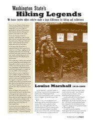
Ira Spring and Louise Marshall co-founded WTA in 1966 in<br />
response to the lack of a political voice <strong>for</strong> <strong>Washington</strong>'s hiking<br />
community. WTA is now the largest state-based hiker advocacy<br />
organization in the country, with over 5,500 members and more than<br />
2000 volunteers.<br />
Maintaining <strong>Washington</strong>'s <strong>Trails</strong><br />
In the past decade, WTA conducted more than 350,000 hours of<br />
volunteer maintenance on public lands in <strong>Washington</strong>. That's an inkind<br />
donation of more than $3.5 million to parks and <strong>for</strong>ests<br />
statewide. Fun trail work parties let volunteers (1,800 of them each<br />
year) give back to the trails they love.<br />
Advocating <strong>for</strong> Hiking <strong>Trails</strong><br />
WTA collaborates with federal and state land managers and elected<br />
officials to advance the interests of hikers. We combine our<br />
advocacy with education and in<strong>for</strong>mation. Our Endangered <strong>Trails</strong><br />
Guide, published every spring, highlights many of the challenges<br />
facing trails today, including a lack of maintenance, resource<br />
extraction and overuse.<br />
Getting People Outdoors More<br />
WTA promotes hiking as a fun, healthy way to explore <strong>Washington</strong>.<br />
Events like <strong>Trails</strong>Fest (www.trailsfest.org) and our Wildland<br />
Discovery Hike series offer an enjoyable and safe environment <strong>for</strong><br />
families and urban dwellers to explore the outdoors. <strong>Washington</strong><br />
<strong>Trails</strong> magazine is packed with backcountry advocacy opportunities,<br />
gear reviews, hiking tips, and feature stories. Our website,<br />
www.wta.org, is a superb, interactive resource <strong>for</strong> hikers to stay<br />
in<strong>for</strong>med on the latest trail conditions and backcountry news.
When you join <strong>Washington</strong> <strong>Trails</strong> <strong>Association</strong>, you<br />
help make hiking trails a guarantee <strong>for</strong> miles and<br />
miles to come.<br />
<strong>Washington</strong> <strong>Trails</strong> <strong>Association</strong> members play a vital role in preserving<br />
our state's wealth of trails by supporting our volunteer program,<br />
legislative outreach, and in<strong>for</strong>mative publications. Please consider<br />
becoming a member today. If you love to hike, you stand to benefit<br />
from WTA's work:<br />
Results On the Ground: Each year, WTA recruits and trains over<br />
1800 volunteers to maintain hundreds of trail miles throughout<br />
<strong>Washington</strong>, both in the backcountry and in parks closer to home.<br />
Up-to-Date Trail In<strong>for</strong>mation: You can visit www.wta.org <strong>for</strong> the<br />
latest trail conditions. Find your favorite trail in our "Freshest Trip<br />
Reports" and learn which flowers are blooming and where the snow<br />
level is. Hikers like you file more than 2000 online Trip Reports each<br />
year.<br />
A Political Voice <strong>for</strong> <strong>Washington</strong> Hikers: WTA works closely with<br />
elected officials and government staff to secure trail funding, protect<br />
wilderness areas, initiate new trail projects, and more.<br />
A Great Hiking Magazine: We publish <strong>Washington</strong> <strong>Trails</strong> ten times<br />
a year and deliver it straight to your mailbox. In every issue, you'll find<br />
the latest outdoor recreation news, helpful backpacking advice, and<br />
trip reports from across <strong>Washington</strong>.<br />
Don't wait. Join today! Your membership gift will help maintain old<br />
trails, build new trails and ensure that WTA continues speaking out<br />
on behalf of hikers like you.<br />
To join, use the envelope provided with this guide, or join online at<br />
www.wta.org.
Introduction<br />
<strong>Washington</strong>'s hiking trails suffered a very difficult year. Last<br />
summer, enormous wildfires swept through the Okanogan-<br />
Wenatchee National Forest, severely damaging trails. Devastating<br />
rainstorms swept across the Cascades, hitting the north Mount<br />
Baker-Snoqualmie National Forest the hardest. Some of our most<br />
loved hiking trails are totally inaccessible or so damaged that they are<br />
unsafe or impossible to hike.<br />
That's why we call them 'endangered.' This year, the Endangered<br />
<strong>Trails</strong> Guide focuses on these trails. Each trail provided a unique<br />
opportunity <strong>for</strong> backcountry recreation and connection with nature<br />
that is now gone, at least <strong>for</strong> the time being.<br />
What will it take to make this situation right Sweat from the brow<br />
of trail volunteers. A critical assessment of why these trails are so<br />
important. But most of all, it will take money. The funds needed to<br />
repair trails and roads in the Mount Baker-Snoqualmie exceed the<br />
total annual recreation budget of the entire Forest. Without<br />
supplemental money, repairs will take decades.<br />
Damage of this scale cannot be corrected by even the hardest<br />
working, best trained, most dedicated group of volunteers-which<br />
aptly describes WTA's corps of trail maintenance workers. Congress<br />
must stand up and do its part, matching the sweat equity of<br />
volunteers withfunds to do the work that we simply cannot. Our<br />
Senators and members of Congress can fight <strong>for</strong> the funds to rebuild<br />
these trails. See the back pages of this Guide <strong>for</strong> in<strong>for</strong>mation on how<br />
to contact them.<br />
There has never been a better time to step up and do your part <strong>for</strong><br />
our trails. We'll be out there, and hope to have you with us.
Be<strong>for</strong>e You Hit The Trail<br />
Hiking is a wonderful way to explore <strong>Washington</strong>'s wildlands, but<br />
remember, it is a potentially dangerous activity. Neither the hike<br />
descriptions nor the maps contained in this guide should be<br />
considered definitive. Please contact the land management agencies<br />
cited in the guide <strong>for</strong> complete and up-to-date in<strong>for</strong>mation, trail<br />
conditions, road quality, etc. The maps provided are <strong>for</strong> reference<br />
only. The following websites offer great trail condition in<strong>for</strong>mation:<br />
<strong>Washington</strong> <strong>Trails</strong> <strong>Association</strong>: www.wta.org. Click on Trip Reports<br />
Mount Baker-Snoqualmie National Forest: www.fs.fed.us/r6/mbs<br />
Okanogan Wenatchee National Forest: www.fs.fed.us/r6/wenatchee<br />
Olympic National Forest: www.fs.fed.us/r6/olympic<br />
National Park Service: www.nps.gov<br />
Be<strong>for</strong>e you leave <strong>for</strong> any hike, no matter how short or simple it<br />
seems, stock your pack with the Ten Essentials:<br />
Extra Clothing: Prepare <strong>for</strong> the worst possible climatic conditions,<br />
including insulating layers and wind and rain protection.<br />
Extra Food: Take more food than you think you'll need, so that if<br />
you're stuck out overnight, your supplies will see you through.<br />
Knife: Good <strong>for</strong> first aid or cutting wood.<br />
Firestarter: Candle or chemical fuel <strong>for</strong> lighting wet wood.<br />
First-Aid Kit: At a minimum, take Band-aids, aspirin and<br />
disinfectant.<br />
Matches: Keep them dry with a plastic bag or other waterproof<br />
container.<br />
Flashlight: In case you're unexpectedly on the trail after dark, pack<br />
an extra bulb and batteries.<br />
Map: Green <strong>Trails</strong>, TOPO! or USGS Topographical maps are<br />
acceptable. The maps in this book are not.<br />
Compass: Know how to at least find north.<br />
Sunglasses: They will protect your eyes on sunny days or when you<br />
encounter snow.
Leave No Trace 101<br />
In the 1970s, the sport of backpacking boomed. Back-to-the-landers<br />
streamed onto hiking trails all over the country to find quiet and a<br />
connection with nature. Un<strong>for</strong>tunately, all that use has had its<br />
impacts. People who have been hiking <strong>for</strong> decades lament the loss of<br />
microbe-free mountain water, and government agencies responsible<br />
<strong>for</strong> our wild places have had to limit access to areas like the<br />
Enchantments and the Seven Lakes Basin because of environmental<br />
damage. For all these reasons and more, it is important to practice<br />
leave-no-trace (LNT) principles no matter where you hike. Here are<br />
some general principles and resources:<br />
Water: Treat all water with iodine tablets or use a mechanical water<br />
purifier. Parasites such as giardia, found in backcountry water<br />
worldwide, can cause serious illness. Camp, cook, and wash dishes at<br />
least 100 feet from lakes and streams. Only use soap <strong>for</strong> personal<br />
sanitation-when washing dishes, warm water is usually sufficient.<br />
Campsites: Take care to camp in areas that have seen previous<br />
heavy use. Pristine campsites should stay that way. Lightly used ones<br />
should be allowed to rebound. High country plants take decades to<br />
grow; don't camp on them. Instead, look <strong>for</strong> bare rock.<br />
Wildlife: Animals are attracted by food smells; prepare meals at<br />
least 100 feet from camp, downwind. Either hang all food 12 feet up<br />
in a tree, 12 feet from the trunk, or use a bear-resistant container,<br />
such as Garcia Machine's product.<br />
Waste: Urine is sterile, but salty! In the mountains, pee on rocks<br />
rather than heather, to protect plants from salt-loving mountain<br />
goats. Bury solid human waste in holes six inches deep. Tampons<br />
should be packed out in a double-sealed ziploc bag. Hang the bag as<br />
you would hang your food, as the blood smell can attract smaller<br />
animals.<br />
Demeanor: Except during hunting season, choose earth-toned gear,<br />
so that you blend in with your surroundings. Respect others need <strong>for</strong><br />
quiet; don't make excess noise. When in the wilderness, don't camp<br />
too close to other hikers--one reason we go into the woods is to enjoy<br />
the expansive aloneness of the outdoors.
Table of Contents<br />
1. PCT/Suiattle Creek/Milk Creek Loop Page 8<br />
2. Middle Cascade River Page 10<br />
3. White Chuck Bench Page 12<br />
4. Peek-A-Boo Lake Page 14<br />
5. Thunder Creek Page 16<br />
6. Little Beaver Creek Page 18<br />
7. Andrews Creek Page 20<br />
8. Lake Creek Page 22<br />
9. West Fork Methow Page 24<br />
10. South Fork Skokomish Page 26
9<br />
8<br />
7<br />
5<br />
6<br />
2<br />
1<br />
4<br />
3<br />
10
Pacific Crest Trail/Suiattle River/Milk Creek Loop<br />
Round Trip: 33 mile loop<br />
Hiking Time: 3-5 days<br />
High Point: 6000 feet<br />
Elevation Gain: 4400 feet<br />
Best hiking time: Summer/Fall<br />
Maps: Green <strong>Trails</strong> #112 Glacier Peak<br />
Getting There: From Darrington, drive north on State Highway<br />
530 toward Rockport 7.0 miles to the Suiattle River Road #26.<br />
Follow this road 22.6 miles to the end of the road. Parking is<br />
available at trailhead.<br />
Whom to Contact: Darrington Ranger District, (360) 436-1155<br />
Wild and beautiful, this trail leads hikers through a lovely river valle<br />
high onto Glacier Peak's north side, and back down into another<br />
sweetly flowing stream corridor. This hike is one of the finest longweekend<br />
loops that <strong>Washington</strong> has to offer, set in the classic<br />
backcountry of the Glacier Peak Wilderness.<br />
Starting at the end of the Suiattle River Road (#26), hike the old<br />
road to an intersection and turn right, crossing a bridge over Milk<br />
Creek. Entering the creek valley is like a little Shangri-La, replete<br />
with a grove of old cedars, hemlocks, and douglas firs. The river<br />
North
streams through a broad meadow with a fine camp, and the trail<br />
makes occasional ups and downs as it heads toward its intersection<br />
with the Pacific Crest Trail (PCT) at 7.5 miles.<br />
When you reach the<br />
intersection, start<br />
heading up. You'll<br />
grunt out dozens of<br />
switchbacks as you<br />
ascend the flowerspangled<br />
flanks of<br />
Glacier Peak. Amazing<br />
views abound up here;<br />
the looming hulk of<br />
Photo by Colin Morgan<br />
Glacier Peak is just one<br />
of the sights. The valleys run with rivers fed by the mountain's<br />
snowmelt; wildflowers in crazy profusion dot the high meadows.<br />
Mountains such as Dome Peak and Plummer Mountain rise in the<br />
distance, becoming more prominent the higher you get. A climber's<br />
trail heads north from here, offering even better views <strong>for</strong> the<br />
hardiest hikers.<br />
Heading down slightly again, the trail descends into the Suiattle<br />
River valley and follows the stream along a well maintained trail <strong>for</strong><br />
11 miles. There's some beautiful old growth on the banks of the<br />
river, as well as nice campsites.<br />
The Problem<br />
Much of this loop was damaged in the massive fall storms.<br />
Sections of the Suiattle River trail are currently slumping into the<br />
river, and the Suiattle River Road (#26) is washed out in two<br />
places: milepost 14.5 and milepost 21. Milepost 21 is at Downey<br />
Creek; hikers and stock should not try to <strong>for</strong>d Downey Creek.<br />
Until repairs are made to this section of road, this loop will be<br />
inaccessible to hikers. This hike has it all--high country, rivers, old<br />
growth, flowers--and is a real loss <strong>for</strong> hikers all over the Pacific<br />
Northwest.
Middle Cascade River Trail<br />
Round Trip: 6.2<br />
Hiking Time: 4 hours<br />
High Point: 3220 feet<br />
Elevation Gain: 1616 feet<br />
Best hiking time: Summer/ Fall<br />
Maps: Green <strong>Trails</strong> #80 Cascade Pass<br />
Getting There: From I-5, take exit 230/Anacortes/Burlington.<br />
Follow Highway 20/North Cascades highway east <strong>for</strong> 46 miles to<br />
Marblemount. Turn east on Cascade River Road and follow it<br />
approximately 16.5 to South Fork Cascade River Road/Forest<br />
Service Road 1590. Turn left and drive to the trailhead at the road's<br />
end.<br />
Whom To Contact: Mount Baker Ranger District, (360) 856-5700<br />
The Middle and South Fork Cascade River trails are scenic wonders<br />
of the Glacier Peak Wilderness. Spanning two National Forests,<br />
Glacier Peak encompasses diverse ecosystems: wet, westside river<br />
valleys filled with cedar and sword fern, and the dry ponderosa pine<br />
savannahs of the eastern crest. Both sides share devil's club, so<br />
watch out!<br />
North
These two valleys are very much<br />
in the sword fern-and-cedar<br />
category. The Middle Fork is<br />
deeper and darker, but oddly<br />
gains more elevation. Steep at<br />
the start, with the clamorous<br />
river to the right, the trail climbs<br />
to the lip of a hanging valley, an<br />
interesting remnant of the last<br />
ice age. The valley has old<br />
growth, lots of brush, and some<br />
beautiful views just off the trail.<br />
There are also numerous camps<br />
along the river as well, making<br />
this a nice, if somewhat brushy,<br />
backpack. The trail ends at<br />
around three miles and 3200<br />
feet. Get better views by hiking<br />
the gravel bars of the river.<br />
Photo by Alan Bauer<br />
The South Fork gains less elevation, but af<strong>for</strong>ds more intense views.<br />
The South Fork is loaded with old growth; tall trees abound here.<br />
High, icy peaks show through the greenery, visible as long as you can<br />
keep your eyes off your feet; this trail, like the Middle Fork, is<br />
brushy. There are camps along the river. The trail ends at about<br />
three miles from the road, at 2200 feet. The very ambitious can take<br />
a hard climber's route six miles to Mertensia Pass, at 5000 feet. This<br />
leg is not recommended <strong>for</strong> any but the strongest hikers.<br />
The Problem<br />
As with many trails in the Mount Baker Ranger District, the<br />
Middle and South Fork Cascade River trails are suffering damage<br />
from the heavy fall and winter rains. A bridge is out on the South<br />
Fork, and the Middle Fork was very heavily damaged by both<br />
floods and fire. The trails are nearly unhikeable.
Whitechuck Bench Trail<br />
Round Trip: 13 miles<br />
Hiking Time: 11 hours<br />
High Point: 1600 feet<br />
Elevation Gain: 600 feet<br />
Best hiking time: Summer/ Fall<br />
Maps: Green <strong>Trails</strong> #111 Sloan Peak<br />
Getting There: From Darrington, take the Mountain Loop<br />
Highway 10 miles to the White Chuck River Road on the left (east).<br />
Follow this road <strong>for</strong> 5.5 miles. The trailhead is on the left just after<br />
crossing the White Chuck River.<br />
Whom To Contact: Darrington Ranger District, (360)436-1155<br />
Less well known than<br />
the White Chuck River<br />
trail, White Chuck<br />
Bench af<strong>for</strong>ds a little<br />
more solitude and a<br />
slightly more intense<br />
Wilderness experience.<br />
This is one of those<br />
lovely green / red /<br />
brown trails that hikers<br />
who spend time in the<br />
Darrington Ranger<br />
District know well--<br />
green undergrowth,<br />
red cedar, and dark<br />
North<br />
brown soil blend into<br />
a sweet earthy mix, delighting the eye. The trail starts in secondgrowth<br />
<strong>for</strong>est which grows thickly together. Splash through many<br />
little streams that cross the path, and look <strong>for</strong> signs of old timber<br />
operations. The trail departs second-growth <strong>for</strong> old-growth<br />
eventually, with some truly magnificent cedars lining the path.<br />
After crossing Black Oak Creek, the trail winds through trees with
mountain views peeking through. Hikers getting to the end of the<br />
trail (6.5 miles) will find themselves high enough to get some<br />
breathtaking mountain views: Mount Pugh and White Chuck<br />
Mountain are arrayed in all their glory.<br />
Photo by Dave Morgan<br />
The Problem<br />
The massive storms that hit the Darrington Ranger District in late<br />
October 2003 caused huge damage on the roads and trails of this<br />
district. The White Chuck road is washed out, and the trail has<br />
slid out in numerous areas. Washouts and slides are normal<br />
occurrences in a wet range like the Cascades, but there was<br />
nothing normal about the October storms and the attendant<br />
damage. This weather was extreme, and piled one slide and<br />
washout on another. The cost of repairing this damage far<br />
exceeds the total annual maintenance budget <strong>for</strong> the entire<br />
Forest.
Peek-a-Boo Lake<br />
Round Trip: 6 miles<br />
Hiking Time: 3 hours<br />
High Point: 4000 feet<br />
Elevation Gain: 800 feet<br />
Best hiking time: Summer/ Fall<br />
Maps: Green <strong>Trails</strong> #110 Silverton<br />
Getting There: From Darrington, take the Mountain Loop<br />
Highway #20 along the west side of the Sauk River <strong>for</strong> 9.2 miles to<br />
road #2080. Turn right (west) and follow this road <strong>for</strong> 1 mile to road<br />
#2081. Follow this road to road #2086 (a sharp switchback about 1.6<br />
miles beyond Dutch Creek) on the left. Trailhead is at the road end.<br />
Whom to Contact: Darrington Ranger District, (360) 436-1155<br />
Peek-A-Boo Lake gives hikers a nice, steady climb to beautiful<br />
meadows and views and an exquisite little alpine lake with great<br />
camping opportunities. It's short enough to do as an easy 2-day,<br />
introduction-to-backpacking trip.<br />
Peek-A-Boo Lake starts as an old logging road, heading up slightly<br />
North
<strong>for</strong> about 1/3 mile. Once it enters old <strong>for</strong>est, it becomes a trail.<br />
Some of the trees show signs of old timber operations.<br />
From here, hikers will<br />
head up, up, and up to<br />
4300 feet. The trail<br />
becomes easier from<br />
this point, leading to a<br />
lovely pond<br />
surrounded by<br />
meadowland. Across<br />
the meadow loom<br />
views of Mount Pugh,<br />
White Chuck<br />
Mountain, Dome<br />
Peak, Mount Shuksan,<br />
and the White Chuck<br />
River. Once out of the<br />
meadow, a short path<br />
heads down to Peek-<br />
A-Boo Lake and<br />
camps, at 3900 feet.<br />
Photo by Andrew Engleson<br />
The Problem<br />
The Mountain Loop Highway is washed out at both milepost 35.6,<br />
and near Elliot Creek. The Highway is also damaged by flooding<br />
and is one lane in several spots with stop signs posted. The<br />
Mountain Loop is inaccessible at 18.6 miles from Darrington with<br />
washouts on both sides of Road 4080.<br />
While these washouts primarily impact the Elliot Creek/Goat<br />
Lake trail, the road from the Mountain Loop to the Peek-A-Boo<br />
trailhead is also washed out. These trails are yet another example<br />
of trail access caused by severe weather this year.
Thunder Creek<br />
Round Trip: 36 miles to Park Creek Pass<br />
Hiking Time: 3-5 days<br />
Elevation Gain: 5600 feet<br />
High Point: 6040 feet<br />
Best Hiking Time: Summer/Fall<br />
Maps: Green <strong>Trails</strong> #48 Diablo Dam, #49 Mount Logan, #81<br />
McGregor Mountain<br />
Getting There: Drive Highway 20 to Diablo Dam and continue 4<br />
miles to Colonial Creek Campground, where the trailhead is located.<br />
Whom to Contact: North Cascades National Park, (360)856-5700<br />
Thunder Creek is wild,<br />
deep, and fast. High<br />
glaciers drain into the<br />
creek bed, birthing a<br />
cataract that flows 18 miles<br />
into Diablo Lake. Lined<br />
with ancient <strong>for</strong>est, the trail<br />
starts out easy but finally<br />
heads up into classic North<br />
Cascades alpine scenery.<br />
Thunder Creek Trail is one<br />
of the finest hikes in the<br />
North Cascades.<br />
The first portion of this<br />
hike is essentially flat,<br />
meandering next to<br />
Thunder Creek through a<br />
nice <strong>for</strong>est of old-growth<br />
Douglas fir, hemlock, and<br />
cedar. The views here are<br />
occasional. Here and there<br />
a snow clad peak will reveal<br />
itself through the <strong>for</strong>est<br />
deeps. Fire breaks along<br />
the trail also af<strong>for</strong>d nice<br />
North
views. You'll pass numerous<br />
camps here, so this section is<br />
ideal <strong>for</strong> an early season<br />
backpack. Typically, it's snow<br />
free by April.<br />
The trail climbs 1000 feet about<br />
one mile after entering North<br />
Cascades National Park. After<br />
Fisher Creek, the trail starts to<br />
climb in earnest. Heading up<br />
steadily, the trail opens up, with<br />
views increasing into the valley,<br />
as well as of nearby peaks such<br />
as Tricouni and Primus. More<br />
elevation gain along the trail<br />
equals more alpine beauty, with<br />
views of Boston Glacier, Mount<br />
Forbidden and Mount Buckner Photo by Alan Bauer<br />
steadily growing. Dropping 800 feet and then gaining it back, the<br />
trail heads to Skagit Queen Camp. The trail continues to climb to<br />
Thunder Basin Camp, the last official camp. Follow the trail<br />
another 2.5 miles to Park Creek Pass.<br />
The Problem<br />
Many bridges along this hike are simply gone. Within a short<br />
distance from the trailhead, a major bridge across Thunder Creek<br />
has washed into the Thunder Arm of Diablo Lake. Thunder<br />
Creek is deep and strong; do not attempt to <strong>for</strong>d this stream.<br />
Beyond that, bridges at Fisher Creek and McAllister Creek<br />
Camps are washed out. The Skagit Queen bridge survived the<br />
floodwaters that took these other bridges out.<br />
Combined with damage in the Mount Baker-Snoqualmie, damage<br />
in North Cascades National Park will stretch federal<br />
appropriations <strong>for</strong> trails thin <strong>for</strong> years to come.
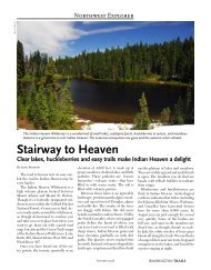
Little Beaver Creek<br />
Round Trip: 26 miles<br />
Hiking Time: 3 days<br />
Elevation Gain: 3500 feet<br />
High Point: 5250 feet<br />
Best Hiking Time: Summer/Fall<br />
Maps: Green <strong>Trails</strong> #15 Mt. Challenger, #16 Ross Lake<br />
Getting There: Drive Highway 20 to Diablo Dam and continue<br />
past the Colonial Creek Campground 3.8 miles to the Ross Lake<br />
trailhead. Follow the trail to Ross Lake Resort and take a taxi from<br />
there.<br />
Whom to Contact: North Cascades National Park, (360)856-5700<br />
This outing can be a hike in its own right--a wonderful in-and-out<br />
over two days. Or hikers can add a day or two to their trip and do a<br />
26.5-mile loop by adding the Big Beaver trail. Either way, hikers will<br />
enjoy a wonderful North Cascades sampler of stately ancient <strong>for</strong>est,<br />
pristine streams, and unparalleled mountain views.<br />
Ride up Ross Lake to Little Beaver Landing, elevation 1600 feet. A<br />
steep set of switchbacks takes hikers 800 feet to the top of a canyonelevation<br />
which is swiftly lost. The trail intersects with numerous<br />
creeks along the way. Perry Creek at 4.5 miles has a nice camp, as<br />
well as lots of <strong>for</strong>ds or footlog crossings--none of which are terribly<br />
challenging. Cross Redoubt Creek at 9 miles; hope <strong>for</strong> a footlog.<br />
North
Join the Big Beaver Trail at 11.5 miles <strong>for</strong> the full 26 mile Big<br />
Beaver/Little Beaver loop.<br />
Continue 6 more miles on the Little Beaver Creek Trail to get to<br />
Whatcom Pass. Hikers gain 2800 feet from here in a long series of<br />
switchbacks. The trip is worth it; views from Whatcom Pass are<br />
beyond compare. For those with time on their hands, this hike can<br />
be considered the first leg of a 38 mile cross-Park hike--one of the<br />
premiere trips in the North Cascades.<br />
Photo by Douglas Diekema<br />
The Problem<br />
As with Thunder Creek, the Little Beaver Creek Trail's problem is<br />
a lost bridge. The bridge over Little Beaver Creek at mile 10.4<br />
near Stilwell Camp was swept away in the fall storms. This<br />
crossing is dangerous in high water. In low water, hikers should<br />
keep their eyes peeled <strong>for</strong> shallow, safer crossings. There is also<br />
extensive trail damage on Little Beaver, with routefinding<br />
necessary in between miles four and nine.
Andrews Creek<br />
Round Trip: 42 miles<br />
Hiking Time: 5-7 days<br />
High Point: 7400 feet<br />
Elevation Gain: 5300 feet cumulative<br />
Best hiking time: Summer/Fall<br />
Maps: Green <strong>Trails</strong> #20 Coleman Peak<br />
Getting There: From Winthrop travel on State Route 20 and turn<br />
right onto Okanogan Country Road 1213 (West Chewuch Road).<br />
Drive 6 miles where county road joins with Forest Service Road 51<br />
<strong>for</strong> 15 miles to the end of the paved road, then turn right <strong>for</strong> parking<br />
at the Andrews Creek Trailhead (some parking to the left).<br />
Whom to Contact: Methow Valley Ranger District, (509) 996-4003<br />
Hikers traversing this trail<br />
will alternate between flat<br />
and up, flat and up on the<br />
way to ice-polished slabs on<br />
the shores of Upper<br />
Cathedral Lake, with<br />
Cathedral Peak looming in<br />
the background. This hike<br />
is horsey, used frequently<br />
by outfitter guides heading<br />
into the Pasayten<br />
Wilderness backcountry.<br />
You'll encounter significant<br />
dust and frequent horseapples.<br />
Still, its charms are<br />
manifold, and the presence<br />
of heavy stock here keeps<br />
the nearby Lake Creek<br />
Trail a hiker haven.<br />
The trail starts out steep,<br />
then evens out, with the<br />
exception of some quick, North<br />
tight ups along the way. At four miles, stay left at a <strong>for</strong>k in the trail,
and head up a steep hillside. At 8 miles, you head up hard into<br />
Andrews Pass, which tops out at 6700 feet.<br />
Dropping into the Spanish Creek valley at 15 miles, you'll finally<br />
break into meadows and tundra-like country with colossal views.<br />
Camp here or near the intersection with the Boundary Trail.<br />
Cathedral Lake and Remmel Lake have camps, but they're small and<br />
often loaded with stock.<br />
Six more miles and<br />
Cathedral Lake emerges.<br />
Glaciers have been at work<br />
here, grinding the granite<br />
shore into smooth, polished<br />
planes. Side trips abound,<br />
including a hike to Lower<br />
Cathedral Lake and a hike<br />
along the Boundary trail to<br />
still more tundra and<br />
wildflowers. Take your time<br />
here.<br />
Photo by Laurie Dowie<br />
The Problem<br />
For the past three summers, massive fires have swept through the<br />
Okanogan, burning and felling trees, destroying trail tread, and<br />
taking out bridges. As of this writing, Andrews and Lake Creek<br />
are still closed. Like all Forests in <strong>Washington</strong>, money simply<br />
does not exist to do the needed maintenance on this trail. Until<br />
the trail planning and maintenance team on the Okanogan-<br />
Wenatchee is given the support it needs at the federal level, these<br />
trails will remain closed and dangerous.
Lake Creek<br />
Round Trip: 8.5 miles<br />
Hiking Time: 4 hours<br />
High Point: 3982 feet (Black Lake)<br />
Elevation Gain: 800 feet<br />
Best Hiking Time: Late Spring/Fall<br />
Maps: Green <strong>Trails</strong> #20 Coleman Peak<br />
Getting there: From Winthrop take Okanogan County Road 1213<br />
(West Chewuch Road) north about 6 miles to where it joins with<br />
Forest Service Road #51. Continue north. Just after the Lake Creek<br />
bridge, turn left on FS Road #51-100 and drive 2 miles to the Lake<br />
Creek Trailhead.<br />
Whom to Contact: Methow Valley Ranger District, (509)996-4003<br />
Lake Creek is the<br />
drainage just to the<br />
east of Andrews Creek.<br />
Given that Andrews is<br />
so heavily used by<br />
stock, Lake Creek is<br />
more appropriate <strong>for</strong><br />
hikers who don't wish<br />
to share a trail with<br />
horses or other stock.<br />
This is one of the most<br />
heavily used trails in<br />
the Pasayten<br />
Wilderness, but most<br />
folks don't often go<br />
past Black Lake. North<br />
Hikers heading into the higher reaches beyond Black Lake<br />
will be treated to relative solitude.<br />
Staying level and close to the river practically the whole way to Black<br />
Lake, the trail is lined with old timber, and, in season, loaded with<br />
huckleberries and raspberries. Twinflower, tiger lilies, and wild roses<br />
bloom all along the trail, with paintbrush and columbine scattered
among them. Campsites are lovely along the river, with openings <strong>for</strong><br />
sun and lots of space.<br />
The trail grows brushy as it nears Black Lake, which is a mile long<br />
and ringed by yet more old <strong>for</strong>est and rolling, tree-clad mountains.<br />
The lake is intensely popular, so hikers won't have much time to<br />
themselves here.<br />
Beyond the lake hikers<br />
will enjoy moresparsely<br />
used areas of the<br />
Pasayten, including the<br />
charming Fawn Lake.<br />
From here the whole<br />
Wilderness spreads out<br />
be<strong>for</strong>e the hardy hiker,<br />
available <strong>for</strong> rambles<br />
both long and short.<br />
Photo by Alan Bauer<br />
The Problem<br />
As with the West Fork Methow and Andrews Creek, Lake Creek<br />
was heavily damaged in the fires over the past couple of summers<br />
and, as of this printing, is now closed. This is a serious loss. It is<br />
one of the trails in the Pasayten Wilderness that is less frequently<br />
used by equestrians, and so it is generally more pleasant <strong>for</strong> hikers<br />
than Andrews Creek.<br />
It's also one of those wonderful rarities in <strong>Washington</strong>: an earlymelting,<br />
easy-hiking, day-trip or backpack, with a lake visit, or<br />
long Wilderness ramble trail. In other words, it's versatile.<br />
Hikers itching to get out early could usually count on Lake Creek,<br />
one of a few hikes of this type. Until Congress matches the<br />
importance of this hike with the funds necessary to keep it open,<br />
then we are one great hike poorer.
West Fork Methow River<br />
Round Trip: 12 miles<br />
Hiking Time: 6 hours<br />
Elevation Gain: 900 feet<br />
High Point: 3600 feet<br />
Best hiking time: Early Summer/ Fall<br />
Maps: Green <strong>Trails</strong> #50 <strong>Washington</strong> Pass<br />
Getting There: From Mazama, head up the valley on the Hart's<br />
Pass road 9 miles to a junction. Head left on Road #(5400)060,<br />
marked "Riverbed Campground" about 1 mile to the road's end and<br />
trailhead.<br />
Whom to Contact: Methow Valley Ranger District, (509)996-4003<br />
Melting out early, the West Fork Methow River trail takes you to<br />
some of the prettiest country in the Okanogan-Wenatchee. It's a<br />
fantastic early season hike, mellow in terms of elevation gain,<br />
rambling close to the river, and loaded with wildflowers in early<br />
spring.<br />
This is one of those hikes that, although relatively easy, feels a little<br />
roller-coasterish with lots of little ups and downs. Dry side <strong>for</strong>ests<br />
abound with fir and ponderosa pine. The West Fork Methow is<br />
happy company all along the trail, even when hikers head up above<br />
North
the river to skirt big rock<br />
piles. Camps are great<br />
along the way, at both 2<br />
and 3 miles in. The trail<br />
starts to leave the river at<br />
about 4 miles and heads<br />
up completely at 6 miles.<br />
Hikers can either turn<br />
around here, or continue<br />
to the Pacific Crest Trail<br />
junction at 7 miles.<br />
Heading south along the<br />
Pacific Crest Trail takes<br />
hikes to even greater<br />
rewards--this way lies<br />
Golden Horn with its<br />
shining pink-gold<br />
granodiorite, and other<br />
reaches of the Okanogan.<br />
Photo by Dave Schiefelbein<br />
The Problem<br />
Like many trails in the Okanogan, the West Fork Methow River<br />
Trail is closed and dangerous. Fires raging in the Okanogan have<br />
created numerous hazards, ranging from burned trees on the<br />
brink of falling to trails crusted over cavities that could break a<br />
hiker's ankle. Additionally, loose ash and burned soils load<br />
streams with silt which is very bad <strong>for</strong> fish species that depend on<br />
clear, cold water.<br />
Dealing with these hazards will be a difficult and expensive<br />
proposition. This is exactly the sort of challenge that the Forest<br />
Service does not need at a time when its budget is in decline and<br />
long-term staff are retiring. Elected officials and the Forest<br />
Service at the federal level need to prioritize repairing and<br />
reopening this and other backcountry routes.
South Fork Skokomish River<br />
Round Trip: 18 miles<br />
Hiking Time: 2 days<br />
Elevation Gain: 3200 feet<br />
High Point: 3800 feet<br />
Best Hiking Time: Summer/Fall<br />
Maps: Green <strong>Trails</strong> #166 Mount Christie, #167 Mount Steel, #199<br />
Mount Tebo<br />
Getting There: Travel 6 miles north of Shelton on Hwy 101 and<br />
turn west on the Skokomish Valley Road. Continue 5 miles to FS<br />
Road #23. Turn right and continue <strong>for</strong> 9 miles to FS Road #2353.<br />
Turn right onto FS Road #2353 and drive 1.0 mile to the trailhead.<br />
Whom to Contact: Hood Canal Ranger District, (360)877-5254<br />
The southeast corner of Olympic National Forest has seen quite a bit<br />
of logging. Stands of old growth remaining in the Forest are few,<br />
and when one of those stands is accessible by trail and runs along the<br />
bank of a wild river, hikers should consider themselves lucky.<br />
The South Fork Skokomish River trail is an example of remaining<br />
wild <strong>for</strong>est in the midst of this intensively managed landscape.<br />
Starting in a timber cut that is beginning to grow in, the trail soon<br />
enters a stretch of more soothing old growth as it continues along the<br />
river. For the most part, the trail hugs the river's course offering lots<br />
North
of opportunities <strong>for</strong> lunches on<br />
the bank overhung with old<br />
trees.<br />
After a small up at the<br />
beginning, the trail evens out<br />
<strong>for</strong> the first 2.5 miles or so. The<br />
rest of the trail is a constant up<br />
and down, gaining 50 feet here,<br />
losing 100 feet there be<strong>for</strong>e<br />
entering the National Park at 9<br />
miles. There are camps along<br />
the river, which runs very clear--<br />
a surprise, considering the<br />
timber activity that has taken<br />
place in this area <strong>for</strong> years. Photo by Dave Schiefelbein<br />
Forest managers with<br />
<strong>for</strong>esight saw fit to leave old trees standing along the Skokomish.<br />
Hikers will pass a couple of logging sites--small and not clearcuts--by<br />
the river. Beyond those small examples, though, the trees have been<br />
beautifully preserved, with many as large as 6 feet in diameter.<br />
The Problem<br />
There is a lot of water on this trail. Muddy in many places,<br />
slumping in others, this trail is in rough condition. Last fall's<br />
storms took out a trail bridge, as well as about 150 feet of trail. A<br />
rough, temporary detour has been cut around this slump, but it's<br />
only a short-term fix. The Forest needs money to repair the<br />
bridge and relocate this lost section of trail.<br />
Olympic National Forest has lost a lot of talented staff over the<br />
last year. Trail designers and volunteer coordinators such as Mark<br />
Wamsley, Scott Burgwin, and Steve Ricketts have all left the<br />
agency after decades of faithful service, taking with them an<br />
enormous amount of experience and expertise. On top of that<br />
loss, there is simply no money available to replace these staff.
TAKE ACTION! Elected Officials' Contact<br />
In<strong>for</strong>mation<br />
Senators<br />
Name: Patty Murray<br />
Name: Maria Cantwell<br />
Phone: (202) 224-2621 Phone: (202) 224-3441<br />
Fax: (202) 224-0238 Fax: (202) 228-0514<br />
Representatives<br />
Jay Inslee-1st Dist.<br />
Jennifer Dunn-8th Dist.<br />
Phone: (202) 225-6311 Phone: (202) 225-7761<br />
Fax: (202) 225-3524 Fax: (202) 225-8673<br />
Rick Larsen-2nd Dist. Adam Smith-9th Dist.<br />
Phone: (202) 225-2605 Phone: (202) 225-8901<br />
Fax: (202) 225-4420 Fax: (202) 225-5893<br />
Brian Baird-3rd Dist.<br />
Phone: (202) 225-3536<br />
Fax: (202) 225-3478<br />
Doc Hastings-4th Dist.<br />
Phone: (202) 225-5816<br />
Fax: (202) 225-3251<br />
George Nethercutt-5th Dist.<br />
Phone: (202) 225-2006<br />
Fax: (202) 225-3392<br />
Norman Dicks-6th Dist.<br />
Phone: (202) 225-5916<br />
Fax: (202) 226-1176<br />
James McDermott-7th Dist.<br />
Phone: (202) 225-3106<br />
Fax: (202) 553-7175
National Parks<br />
North Cascades National Park Olympic National Park<br />
2105 Highway 20 3002 Mt. Angeles Rd<br />
Sedro Woolley, WA 98284 Port Angeles, WA 98362<br />
(360) 865-5700 (360) 565-3130<br />
Mount Rainier National Park<br />
Tahoma Woods, Star Route<br />
Ash<strong>for</strong>d, WA 98304-9751<br />
(360) 569-2211 XT 3314<br />
National Forests<br />
Colville National Forest Gif<strong>for</strong>d Pinchot National Forest<br />
765 S Main St 10600 NE 51 Circle<br />
Colville, WA 99114 Vancouver, WA 98682<br />
(509) 684-7000 (360) 891-5001<br />
Mount Baker-Snoqualmie Okanogan-Wenatchee<br />
National Forest<br />
National Forest<br />
21905 64th Ave W 215 Melody Lane<br />
Mountlake Terrace, WA 98043 Wenatchee, WA 98801<br />
(425)775-9702 (509) 662-4335<br />
Olympic National Forest<br />
1835 Black Lake Blvd SW<br />
Olympia, WA 98502<br />
(360) 956-2400
<strong>Washington</strong> <strong>Trails</strong> <strong>Association</strong><br />
1305 4th Ave, Suite 512<br />
Seattle, WA 98101<br />
(206) 625-1367<br />
www.wta.org