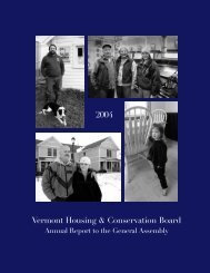
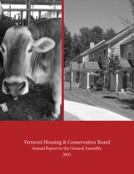
Vermont Housing Conservation Board 2005 - Vermont Housing and ...
Vermont Housing Conservation Board 2005 - Vermont Housing and ...
Vermont Housing Conservation Board 2005 - Vermont Housing and ...

You also want an ePaper? Increase the reach of your titles
YUMPU automatically turns print PDFs into web optimized ePapers that Google loves.
CROSS VERMONT TRAIL<br />
A Trail to Connect Communities<br />
T<br />
he long-term vision of the Cross <strong>Vermont</strong> Trail Association is to create a<br />
multi-use recreation trail running east-west across the state. In the Central<br />
<strong>Vermont</strong> area, the goal is to conserve an off-road trail all the way from East<br />
Montpelier to Groton State Forest, along the 37-mile former track bed of the<br />
Montpelier-Wells River Railroad. But unlike nearly all other former railroad<br />
beds eyed as recreation trails around the nation, this one presents a unique challenge:<br />
the track bed’s final owner, the state of <strong>Vermont</strong>, conveyed it in parcels to<br />
all the abutting l<strong>and</strong>owners, several decades ago.<br />
The complexity created by so many owners is one that Eric Scharnberg,<br />
executive director of the Trail Association, knows only too well. From East<br />
Montpelier to Plainfield, he says, “We’re working on a l<strong>and</strong>owner-to-l<strong>and</strong>owner<br />
basis, to try to get easements” that will secure public access to the trail.<br />
That cause got a boost this year when VHCB funding enabled the Association<br />
to acquire a small but key property in Plainfield, between Country Club<br />
<strong>and</strong> Recreation Field roads. “It’s a keystone piece in connectivity between the<br />
village of Plainfield <strong>and</strong>, ultimately, over toward Montpelier,” Scharnberg says of<br />
the six-acre property.<br />
The Cross-<strong>Vermont</strong> Trail will ultimately link to the Montpelier Recreation<br />
Path, connecting into the capital. To the west, most of the trackbed between the<br />
Marshfield edge of Groton State Forest, all the way to Wells River, has already<br />
been secured.<br />
In the now-targeted stretch between East Montpelier <strong>and</strong> Plainfield, says<br />
Scharnberg, “our goal is to target areas where the stretch between roads isn’t too<br />
far apart — <strong>and</strong> where we can see that within two or three years, we may be able<br />
to establish those stretches as trails.<br />
Many l<strong>and</strong>owners have been supportive, <strong>and</strong> have offered to donate easements.<br />
Others prefer to subdivide <strong>and</strong> sell parcels. Bit by bit, the project is moving<br />
forward. “This is very much a grassroots trail,” Scharnberg says. “It’s part of a<br />
statewide effort to connect villages <strong>and</strong> communities.”<br />
The Cross <strong>Vermont</strong> Trail is a planned<br />
83-mile multi-use recreation trail<br />
<strong>and</strong> alternative transportation route<br />
stretching from <strong>Vermont</strong>’s western<br />
border on Lake Champlain to its<br />
eastern border in the Village of Wells<br />
River. As currently mapped, the trail<br />
alignment contains both on <strong>and</strong> offroad<br />
sections <strong>and</strong> connects 17 towns,<br />
10 village centers, 10 state parks <strong>and</strong><br />
recreation areas <strong>and</strong> 10 schools. The<br />
trail also links two nationally known<br />
trails, the 300-mile Catamount Trail<br />
<strong>and</strong> the 270-mile Long Trail. Currently,<br />
45 miles of trail are secured either<br />
as public right-of-ways or due to their<br />
location within designated state <strong>and</strong><br />
town-owned public parcels.<br />
31