GeoMoS - Leica Geosystems
GeoMoS - Leica Geosystems
GeoMoS - Leica Geosystems

You also want an ePaper? Increase the reach of your titles
YUMPU automatically turns print PDFs into web optimized ePapers that Google loves.
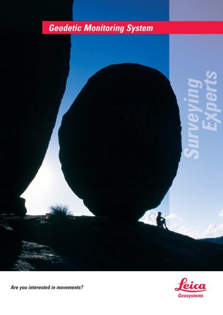
Are you interested in movements<br />
Geodetic Monitoring System
<strong>GeoMoS</strong>: The Geodetic Monitoring System<br />
Monitoring<br />
Numerous accidents and disasters in the past have shown<br />
the risks that are associated with large construction<br />
projects (e.g. dams, tunnels, bridges, high-rise buildings,<br />
etc.) or natural events (e.g. volcanoes, landslide and settlement<br />
areas). The monitoring of construction objects and<br />
dangerous areas is thus becoming more and more important.<br />
Monitoring involves periodically and automatically<br />
measuring reference points in or around an active area to<br />
determine the deformation.<br />
It is often necessary to immediately analyze the measured<br />
data and to activate various events when movement tolerances<br />
are exceeded. Monitoring tasks and deformation<br />
analysis present some of the most sophisticated challenges<br />
in the surveying industry today, because they require the<br />
highest accuracy, maximum reliability of the sensors, automatic<br />
measurements, and highly flexible computation and<br />
analysis tools.<br />
Unique Features of <strong>GeoMoS</strong><br />
• Open system architecture allows the system to be remotely<br />
accessed and configured from all over the world<br />
• Small or large system configurations possible<br />
• Large database support with multi-user access<br />
(SQL-Server)<br />
• Multiple sensors can be connected to the measurement<br />
station<br />
• Integration and connection of various sensors is possible<br />
(Total Stations, GPS, meteorological and geotechnical<br />
sensors)<br />
• Automatic measurement and sensor control over cable,<br />
radio, LAN, WLAN and GSM communications<br />
• Real time data synchronization and security between client<br />
and server using standard data transaction technologies<br />
• Fast measurement using full measurement or<br />
distance only<br />
• Long distance measurement capability (up to 8 km)<br />
• Sophisticated measurement cycle management<br />
• Meteorological network modeling over measurement<br />
area (i.e. Meteo Model)<br />
• Automatic computation of deformation results including<br />
limit checks of measured and calculated results<br />
• Powerful Analyzer Toolbox for visual and alphanumeric<br />
analysis<br />
• Data screening, validation and remeasurement for highest<br />
accuracy data collection<br />
• Editing and post-processing throughout data history<br />
• Powerful event management (e.g. limit exceeded,<br />
power failure, burglary)<br />
• System messages via E-mail, SMS, Command Line,<br />
Digital I/O Interfaces and SQL Database<br />
• Import/Export to other systems (ASCII, SQL, DXF, BMP)<br />
• Backup and Archive
Components of <strong>GeoMoS</strong><br />
<strong>GeoMoS</strong> is an open, scalable<br />
and customizable software<br />
suitable for a wide<br />
range of monitoring applications.<br />
All measurement<br />
and result data are stored<br />
in a SQL database where<br />
they can be accessed locally<br />
and remotely for data<br />
anlysis and security either<br />
by <strong>GeoMoS</strong> or third party<br />
software. A wide range of<br />
sensor types are supported<br />
and the software is designed<br />
such that additional sensors<br />
may be added easily.<br />
By combining data from a<br />
range of geodetic and geotechnical<br />
sensors <strong>GeoMoS</strong><br />
helps to ensure that risk is<br />
reduced to a minimum.<br />
A powerful event management system<br />
allows messages to be sent via E-mail or<br />
Digital I/O Interfaces, according to defined<br />
rules (e.g. measured displacement<br />
exceeds a set tolerance, power failure).<br />
External devices and applications can<br />
be controlled by assigned events during<br />
the measurement process.<br />
<strong>GeoMoS</strong> Analyzer enables data<br />
to be visualized graphically or<br />
numerically. The standard<br />
views can be configured or<br />
extended with additional views<br />
to display data and results<br />
from the database.<br />
<strong>GeoMoS</strong> uses rigorous data<br />
screening and processing<br />
algorithms to ensure that<br />
the highest possible data<br />
quality is obtained from the<br />
connected sensors. For<br />
combined GPS/Total Station<br />
monitoring systems,<br />
<strong>GeoMoS</strong> can be seamlessly<br />
combined with <strong>Leica</strong> GPS<br />
Spider for advanced GPS<br />
monitoring using the latest<br />
GNSS technology.<br />
The <strong>GeoMoS</strong> software<br />
comprises of two main<br />
applications called Monitor<br />
and Analyzer. The Monitor is<br />
the on-line application responsible<br />
for the sensor control,<br />
collection of data and event management.The<br />
Analyzer is the off-line application for the<br />
analysis, visualization and post-processing of the data.<br />
Both applications can be run from a single computer<br />
for a small configuration or from a remote computer<br />
in a larger configuration.<br />
Your<br />
sensor<br />
Screenshots from <strong>GeoMoS</strong><br />
<strong>GeoMoS</strong> Monitor has<br />
sophisticated total<br />
station measurement<br />
and calculation routines<br />
that make it ideal for<br />
applications requiring<br />
the highest possible<br />
accuracy, such as<br />
tunnel monitoring.<br />
<strong>GeoMoS</strong> Analyzer represents<br />
the data and<br />
results graphically and<br />
numerically. The results<br />
can be visualized in<br />
various ways such as<br />
time line graphs that<br />
show the trends of the<br />
movement over selected<br />
time periods. Multiple<br />
points can be shown<br />
simultaneously in the<br />
same graph.
<strong>GeoMoS</strong> Configurations<br />
Description<br />
Option 1<br />
Option 2<br />
Option 3<br />
Notes<br />
<strong>GeoMoS</strong><br />
Office<br />
Offline analysis<br />
and post<br />
processing of<br />
monitoring<br />
data<br />
No direct sensor<br />
connections<br />
possible<br />
<strong>GeoMoS</strong><br />
Lite<br />
Measurement<br />
collection and<br />
calculation,<br />
3 sensor<br />
connections<br />
<strong>GeoMoS</strong><br />
Analyzer not<br />
included<br />
<strong>GeoMoS</strong><br />
Professional<br />
Measurement<br />
collection and<br />
calculation,<br />
3 sensor<br />
connections,<br />
scalable<br />
Large database<br />
support<br />
(SQL Server)<br />
Support for up<br />
to 10 sensors<br />
Messaging<br />
System with<br />
E-mail, SMS,<br />
command line<br />
and Digital I/O<br />
<strong>GeoMoS</strong><br />
Analyzer<br />
included<br />
<strong>GeoMoS</strong><br />
Analyzer<br />
Graphical and<br />
numerical<br />
visualization<br />
of results,<br />
Editing<br />
functionality,<br />
Post<br />
processing,<br />
Import/Export<br />
of data<br />
* For more information please contact your local <strong>Leica</strong> <strong>Geosystems</strong> representative.<br />
<strong>GeoMoS</strong><br />
Server*<br />
Connection<br />
of one<br />
<strong>GeoMoS</strong><br />
Professional,<br />
Data transfer<br />
and storage<br />
on Server,<br />
Large database<br />
support<br />
Up to 5<br />
<strong>GeoMoS</strong><br />
Professional<br />
connections<br />
Messaging<br />
System with<br />
E-mail, SMS,<br />
command line<br />
and Digital I/O<br />
<strong>GeoMoS</strong><br />
Remote*<br />
Online Remote<br />
configuration<br />
of <strong>GeoMoS</strong><br />
Professional<br />
via <strong>GeoMoS</strong><br />
Server,<br />
including<br />
<strong>GeoMoS</strong><br />
Analyzer<br />
No direct sensor<br />
connections sor connections<br />
No direct sen-<br />
possible possible<br />
Services<br />
Support and<br />
Maintenance<br />
Contract<br />
Installation<br />
Training<br />
System Requirements<br />
Hardware:<br />
• 128 MB RAM<br />
• Pentium III<br />
• 10 GB Harddisk<br />
• CD ROM drive<br />
Supported Sensors:<br />
• <strong>Leica</strong> TCA2003/TCA1800<br />
• <strong>Leica</strong> TPS 1200 Series<br />
• <strong>Leica</strong> GPS System 1200<br />
• <strong>Leica</strong> GPS Spider<br />
• <strong>Leica</strong> Nivel200<br />
• Meteorological sensors<br />
• Geotechnical sensors<br />
• 3rd party sensors<br />
Operating System:<br />
• Windows XP Professional<br />
• Windows 2000<br />
Others:<br />
• COM ports for sensor and<br />
computer connections<br />
• Data transfer via cable,<br />
radio link, etc.<br />
• UPS<br />
We solve the puzzle<br />
to suit your needs<br />
Illustrations, descriptions and technical data are not binding and<br />
may be changed. Printed in Switzerland.<br />
Copyright <strong>Leica</strong> <strong>Geosystems</strong> AG, Heerbrugg, Switzerland, 2006<br />
723238en – V.06 – RDV<br />
Total Quality Management –<br />
Our commitment to total<br />
customer satisfaction<br />
Ask your local <strong>Leica</strong><br />
<strong>Geosystems</strong> agent<br />
for more information about<br />
our TQM program.<br />
<strong>Leica</strong> <strong>Geosystems</strong> AG<br />
CH-9435 Heerbrugg<br />
(Switzerland)<br />
Phone +41 71 727 31 31<br />
Fax +41 71 727 46 73<br />
www.leica-geosystems.com