Andrea Munoz Hernandez
Andrea Munoz Hernandez
Andrea Munoz Hernandez

Create successful ePaper yourself
Turn your PDF publications into a flip-book with our unique Google optimized e-Paper software.
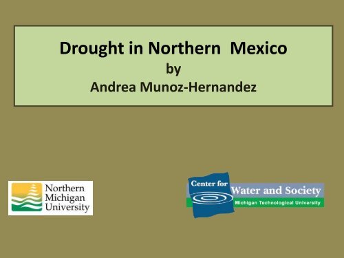
Drought in Northern Mexico<br />
by<br />
<strong>Andrea</strong> <strong>Munoz</strong>-<strong>Hernandez</strong>
Objective and Tasks<br />
The objective of this presentation is to perform a<br />
brief overview of the impacts of drought during<br />
the late twentieth century and early twenty first<br />
century in northwest Mexico, specifically in the<br />
Yaqui Basin of Sonora.<br />
Additionally, the implementation of some adaptive<br />
strategies, and future challenges faced within the<br />
basin are discussed.
Mexico<br />
The most important irrigation<br />
zones and the majority of<br />
industrial plants within the<br />
country are located in the<br />
northern states of Mexico.<br />
Mean annual precipitation from<br />
1945-2005 (INEGI, 2010)<br />
However, the states located<br />
in the southeast and along<br />
the Gulf of Mexico hold<br />
approximately 70% of the<br />
available water in Mexico<br />
(Magana and Conde, 2000).
The Yaqui Basin, Sonora<br />
The Yaqui basin is characterized by semi arid conditions<br />
with an average precipitation of 526 mm/year and a<br />
mean annual temperature above 22 C.
The Yaqui Basin<br />
The basin consists of roughly<br />
72,000 square kilometers.<br />
Water users include farmers,<br />
rural and urban municipalities,<br />
industries, and mines.<br />
The water to satisfy user needs<br />
comes from reservoirs<br />
constructed in series.<br />
The Yaqui River Basin includes one of the most important<br />
agricultural regions in Mexico, known as the Yaqui Valley.
The Yaqui Basin<br />
Reservoir<br />
Capacity*<br />
(MCM)<br />
Extractive<br />
Water Rights<br />
(MCM/yr)<br />
Primary Purpose<br />
of Extractions<br />
La Angostura 880 88 Small towns, mine<br />
El Novillo 2,799 NA<br />
El Oviachic 2,782<br />
Hydroelectric power<br />
production<br />
60 Ciudad Obregon<br />
255 Yaqui tribe<br />
2500<br />
Yaqui Valley<br />
irrigation<br />
*less dead storage<br />
Additionally, irrigated agriculture in the Yaqui Valley holds<br />
water rights of 600 MCM/yr of groundwater.
The Yaqui Basin<br />
Key<br />
Runoff from<br />
Upper Basin<br />
Flows<br />
Demand site<br />
Reservoir<br />
Copper<br />
Mine<br />
La<br />
Angostura<br />
Pueblos<br />
Riberenos<br />
Hydropower<br />
production site<br />
Aquifer<br />
Runoff from<br />
Middle Basin<br />
El Novillo<br />
Runoff from<br />
Lower Basin<br />
Distrito de Riego<br />
del Rio Yaqui<br />
El<br />
Oviachic<br />
Ciudad<br />
Obregon<br />
Yaqui Valley<br />
Aquifer<br />
System<br />
Yaqui Delta<br />
Ecological<br />
Flows<br />
Sea of Cortez
Monthly Fraction of Average Annual<br />
Runoff<br />
Runoff Distribution<br />
30%<br />
25%<br />
20%<br />
15%<br />
10%<br />
5%<br />
0%<br />
J F M A M J J A S O N D<br />
Month<br />
<strong>Munoz</strong>-<strong>Hernandez</strong> et al., 2010<br />
The monthly<br />
distribution of runoff<br />
within the basin<br />
shows three distinct<br />
runoff seasons:<br />
a) a wet summer<br />
season, when the<br />
majority of the runoff<br />
is generated,<br />
b) a wet winter<br />
season;<br />
c) a dry spring<br />
season.
Runoff (MCM)<br />
The Rio Yaqui Basin<br />
8,000<br />
6,000<br />
4,000<br />
2,000<br />
Average<br />
The annual runoff of<br />
the basin is highly<br />
variable with an<br />
average of<br />
approximately 3000<br />
MCM/year.<br />
0<br />
Year<br />
The severe drought<br />
(1994-2003) is clearly<br />
indicated in this<br />
record.<br />
<strong>Munoz</strong>-<strong>Hernandez</strong> et al., 2010
The Yaqui Valley<br />
The Yaqui Valley<br />
contains roughly of<br />
227,000 hectares of<br />
irrigated land.<br />
Map by:<br />
Distrito de Riego del Rio Yaqui.<br />
The rainfall in the<br />
Yaqui Valley is<br />
significantly lower<br />
than the rest of the<br />
basin with an<br />
average of 317<br />
mm/year.
Groundwater in the Yaqui Valley<br />
Shallow Horizon<br />
Connector Horizon (5m-80 m)<br />
Aquifer Horizon (25 m -160 m)<br />
after Addams (2004)
Policies Reforms in the 1990s.<br />
A series of reforms produced new policies aimed to<br />
increase the efficiency of the agricultural sector (Naylor<br />
et al., 2001).<br />
Some of these policies included:<br />
• Elimination of direct price supports for grains,<br />
•Privatization of the Mexican Fertilizer Company<br />
(FERTIMEX),<br />
•The operation and maintenance of irrigation<br />
districts was transferred from the government to<br />
local groups of farmers.
Drought<br />
•The policy reforms, in combination with the severe<br />
drought that affected the area, severely impacted the<br />
farmers.<br />
•In the 2003 agricultural cycle, the farmers were able to<br />
irrigate only 1/5 of the total area, using mainly<br />
groundwater.<br />
•This situation affected not only agriculture, but also a<br />
variety of businesses that depend indirectly on this<br />
activity.
Farmers Response<br />
•Traditionally, the farmers had two agricultural cycles<br />
(one in the winter and one in the summer) reaching a<br />
maximum irrigated area of 360,000 hectares.<br />
Nowadays, they only irrigate one cycle.<br />
•The Yaqui Valley increased the number of pumping<br />
wells to increase their water extractions. Water rights<br />
increased from 450 MCM/year to 600 MCM/year.<br />
•Several infrastructure upgrades went into effect, trying<br />
to improve the water distribution system.
Farmers Response<br />
•Several proposals were petitioned to organizations like<br />
the World Bank, with the objective of obtaining funding<br />
to line the distribution canals.<br />
•A set of “sustainable rules” were created to achieve<br />
sustainable water use within the basin (Minjares,<br />
2004).<br />
•Partial conversion of the Yaqui Valley to less intensive<br />
water use crops.
Modeling Tool<br />
An Integrated Water Resources Model was created to<br />
support decision makers in managing the water resources in a<br />
more efficient way (<strong>Munoz</strong>-<strong>Hernandez</strong>, 2009). The model<br />
integrates hydrologic model with economic models.<br />
This IWRM model has the capability of evaluating:<br />
a) Alternative Water Management strategies<br />
b) Climate Change (using GCMs and RCMs)<br />
c) Climate Variability (ARMA Models)<br />
d) Environmental Flow Strategies
Future Challenges<br />
•Based on the annual growth rate, the population in<br />
Ciudad Obregon is projected to double in the next 30<br />
years.<br />
•There is a desire to further develop the area. However<br />
all the water resources are completely allocated.<br />
•Water is allocated without consideration to the<br />
environment causing degradation of the local system.
Future Challenges<br />
The basin is located close to the ocean. If groundwater<br />
extractions exceeds the recharge, salt-water intrusion<br />
may occur damaging the water quality.<br />
•Currently, there is a heated debate regarding water<br />
transfers from El Novillo to Hermosillo, which is the<br />
capital of the State.<br />
•Climate model experiments indicate that Northwest<br />
Mexico will experience a progressive drying during the<br />
21 st century (Seager et al., 2007).
Thanks!