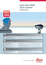
Leica Viva GNSS GS10 receiver Datasheet - Northern Survey Supply
Leica Viva GNSS GS10 receiver Datasheet - Northern Survey Supply
Leica Viva GNSS GS10 receiver Datasheet - Northern Survey Supply

You also want an ePaper? Increase the reach of your titles
YUMPU automatically turns print PDFs into web optimized ePapers that Google loves.
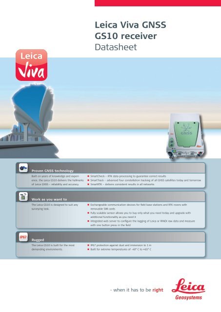
<strong>Leica</strong> <strong>Viva</strong> <strong>GNSS</strong><br />
<strong>GS10</strong> <strong>receiver</strong><br />
<strong>Datasheet</strong><br />
Proven <strong>GNSS</strong> technology<br />
Built on years of knowledge and experience,<br />
the <strong>Leica</strong> <strong>GS10</strong> delivers the hallmarks<br />
of <strong>Leica</strong> <strong>GNSS</strong> – reliability and accuracy.<br />
• n SmartCheck – RTK data-processing to guarantee correct results<br />
• n SmartTrack – advanced four constellation tracking of all <strong>GNSS</strong> satellites today and tomorrow<br />
• n SmartRTK – delivers consistent results in all networks<br />
Work as you want to<br />
The <strong>Leica</strong> <strong>GS10</strong> is designed to suit any<br />
surveying task.<br />
• n Exchangeable communication devices for field base stations and RTK rovers with<br />
removable SIM cards<br />
• n Fully scalable sensor allows you to buy only what you need today and upgrade with<br />
additional functionality as you need it<br />
• n Integrated web server to configure the logging of <strong>Leica</strong> or RINEX raw data and measure<br />
with one button press in the field<br />
Rugged<br />
The <strong>Leica</strong> <strong>GS10</strong> is built for the most<br />
demanding environments.<br />
• n IP67 protection against dust and immersion to 1 m<br />
• n Built for extreme temperatures of -40° C to +65° C
Technical Specifications<br />
<strong>Leica</strong> <strong>GS10</strong> <strong>GNSS</strong> <strong>receiver</strong><br />
<strong>Leica</strong> <strong>GS10</strong><br />
Single Frequency<br />
<strong>Leica</strong> <strong>GS10</strong><br />
Basic<br />
<strong>Leica</strong> <strong>GS10</strong><br />
Limited<br />
<strong>Leica</strong> <strong>GS10</strong><br />
Performance<br />
<strong>Leica</strong> <strong>GS10</strong><br />
Professional<br />
Supported <strong>GNSS</strong> Systems<br />
GPS L2 ¢ • • • •<br />
GPS L5 ¢ ¢ ¢ ¢ •<br />
GLONASS ¢ ¢ ¢ ¢ •<br />
Galileo ¢ ¢ ¢ ¢ •<br />
RTK performance<br />
DGPS / RTCM ¢ ¢ • • •<br />
RTK up to 5 km ¢ ¢ • • •<br />
RTK unlimited ¢ ¢ ¢ • •<br />
Network RTK ¢ ¢ ¢ • •<br />
<strong>Leica</strong> Lite RTK ¢ ¢ ¢ ¢ •<br />
Position update & data recording<br />
5 Hz positioning • ¢ • • •<br />
20 Hz positioning ¢ ¢ ¢ • •<br />
Raw data logging • ¢ • • •<br />
RINEX logging ¢ ¢ ¢ ¢ •<br />
NMEA out ¢ ¢ ¢ ¢ •<br />
Additional features<br />
RTK Reference Station functionality ¢ ¢ ¢ • •<br />
• = Standard<br />
¢ = Optional<br />
<strong>GNSS</strong> Performance <strong>GNSS</strong> technology <strong>Leica</strong> patented SmartTrack+ technology:<br />
• Advanced measurement engine<br />
• Jamming resistant measurements<br />
• High precision pulse aperture multipath correlator for pseudorange measurements<br />
• Excellent low elevation tracking<br />
• Very low noise <strong>GNSS</strong> carrier phase measurements with
<strong>Leica</strong> <strong>GS10</strong> <strong>GNSS</strong> <strong>receiver</strong><br />
Hardware<br />
Memory & Data Recording<br />
SD<br />
Weight & Dimensions<br />
Weight (<strong>GS10</strong>)<br />
Weight<br />
Dimension (<strong>GS10</strong>)<br />
Environmental specifications<br />
1.20 kg<br />
5.40 kg standard RTK backpack rover including GFU RTK device, controller, batteries,<br />
pole and bracket<br />
212 mm x 166 mm x 79 mm<br />
Temperature, operating -40° C to +65° C, compliance with ISO9022-10-08, ISO9022-11-special, MIL STD 810F –<br />
502.4-II, MIL STD 810F – 501.4-II<br />
Temperature, storage -40° C to +80° C, compliance with ISO9022-10-08, ISO9022-11-special, MIL STD 810F –<br />
502.4-II, MIL STD 810F – 501.4-II<br />
Humidity<br />
100%, compliance with ISO9022-13-06, ISO9022-12-04 and MIL STD 810F – 507.4-I<br />
Proof against: water, sand and dust IP67 according IEC60529 and MIL STD 810F - 506.4-I, MIL STD 810F – 510.4-I and<br />
MIL STD 810F – 512.4-I<br />
Protected against blowing rain and dust<br />
Protected against temporary submersion into water (max. depth 1 m)<br />
Vibration<br />
Withstands strong vibration during operating, compliance with ISO9022-36-08 and<br />
MIL STD 810F – 514.5-Cat.24<br />
Drops<br />
Withstands 1.0 m drop onto hard surfaces<br />
Functional shock<br />
40 g / 15 to 23 msec, compliance with MIL STD 810F – 516.5-I<br />
No loss of lock to satellite signal when used on a pole set-up and submitted to pole bumps<br />
up to 150 mm<br />
Power & Electrical<br />
<strong>Supply</strong> voltage<br />
Nominal 12 V DC<br />
Range 10.5 – 28 V DC<br />
Power consumption<br />
Typically: 3.2 W, 270 mA<br />
Internal power supply<br />
Recharge & removable LI-Ion battery, 4.4 Ah / 7.4 V, 2 batteries fit into <strong>receiver</strong><br />
Internal power supply,<br />
operation time<br />
External power supply<br />
Certifications<br />
Memory<br />
Memory medium<br />
Data capacity<br />
Data recording<br />
Type of data<br />
Recording rate<br />
• 15.00 h receiving RTK data with standard radio 4<br />
• 13.00 h transmitting RTK data with standard radio 4<br />
• 14.00 h RTK via GSM / GPRS connection 4<br />
using 2 internal batteries<br />
Rechargeable external NiMh battery 9 Ah / 12 V<br />
Compliance to:<br />
FCC, CE<br />
Local approvals (as IC Canada, C-Tick Australia, Japan, China)<br />
Removable SD card: 1 GB<br />
1 GB is typically sufficient for about GPS & GLONASS (8+4 satellites)<br />
• 280 days raw data logging at 15 s rate<br />
Onboard recording of:<br />
• <strong>Leica</strong> <strong>GNSS</strong> raw data<br />
• RINEX data<br />
Up to 20 Hz<br />
User Interface Buttons • ON / OFF button<br />
• Function button<br />
Button functionality<br />
Function button:<br />
• Easy switch between Rover / Base mode<br />
• Easy “Here” positioning functionality<br />
Led status indicator<br />
Bluetooth ® , position, RTK status, data logging, detailed power status<br />
Additional user interface<br />
Integrated web interface functionality provides full status indicator and configuration options<br />
Communications Communication ports 2 x serial RS232 Lemo<br />
1 x USB / RS232 Lemo<br />
1 x 5pin Lemo external power<br />
1 x Bluetooth ® port, Bluetooth ® v 2.00 + EDR, class 2<br />
Simultaneous data links<br />
• Up to 3 data links can be attached and used simultaneously<br />
• 2 real-time output interfaces via independent ports, providing identical or different RTK /<br />
RTCM formats<br />
External data links<br />
Radio modems<br />
• Support of any suitable UHF / VHF radio with RS232 interface and operating in<br />
transparent mode<br />
• Satelline3AS in <strong>Leica</strong> GFU housing, fully sealed and protected, IP67<br />
• Pacific Crest PDL in <strong>Leica</strong> GFU housing, fully sealed and protected, IP67<br />
GSM / UMTS(HSDPA) phone modems • Support of any suitable GSM / GPRS / UMTS(HSDPA) modem<br />
• Siemens MC75 in <strong>Leica</strong> GFU housing, Quad-Band 850 / 900 / 1800 / 1900 MHz fully<br />
sealed and protected, IP67<br />
CDMA phone modems<br />
• Support of any suitable CDMA modem<br />
• Multitech MTMMC CDMA in <strong>Leica</strong> GFU housing, Dual-Band 800 / 900 MHz, 1xRTT, fully<br />
sealed and protected, IP67<br />
Landline phone modems<br />
• Support of any suitable Landline phone modem<br />
Communication protocols<br />
Real-Time data formats for data<br />
transmission and reception<br />
Real-Time data formats according<br />
RTCM standard for data transmission<br />
and reception<br />
NMEA output<br />
<strong>Leica</strong> proprietary formats (<strong>Leica</strong>, <strong>Leica</strong> 4G)<br />
CMR, CMR+<br />
RTCM 2.1, RTCM 2.3, RTCM 3.0, RTCM 3.1<br />
NMEA 0183 V 2.20 and <strong>Leica</strong> proprietary<br />
1<br />
The Compass signal is not finalized, although, test signals have been tracked in a test environment. As changes in the signal<br />
structure may still occur, <strong>Leica</strong> Geosystems cannot guarantee full Compass compatibility.<br />
2<br />
Measurement precision, accuracy and reliability are dependent upon various factors including number of satellites, geometry,<br />
obstructions, observation time, ephemeris accuracy, ionospheric conditions, multipath etc. Figures quoted assume normal to<br />
favorable conditions. Times required are dependent upon various factors including number of satellites, geometry, ionospheric<br />
conditions, multipath etc. GPS and GLONASS can increase performance and accuracy by up to 30% relative to GPS only. A full<br />
Galileo and GPS L5 constellation will further increase measurement performance and accuracy.<br />
3<br />
Might vary due to atmospheric conditions, signal multipath, obstructions, signal geometry and number of tracked signals.<br />
4<br />
Might vary with temperatures, age of battery, transmit power of data link device.
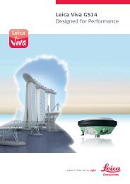
Whether you want to stake-out an object on a construction site or you<br />
need accurate measurements of a tunnel or a bridge; whether you<br />
want to determine the area of a parcel of land or need the position of<br />
a power pole or to capture objects for as-built maps – you need<br />
reliable and precise data.<br />
<strong>Leica</strong> <strong>Viva</strong> combines a wide range of innovative products designed to<br />
meet the daily challenges for all positioning tasks. The simple yet<br />
powerful and versatile <strong>Leica</strong> <strong>Viva</strong> hardware and software innovations<br />
are redefining state-of-the-art technology to deliver maximum performance<br />
and productivity. <strong>Leica</strong> <strong>Viva</strong> gives you the inspiration to make<br />
your ambitious visions come true.<br />
When it has to be right.<br />
Illustrations, descriptions and technical data are not binding. All rights reserved.<br />
Printed in Switzerland – Copyright <strong>Leica</strong> Geosystems AG, Heerbrugg, Switzerland, 2009.<br />
774162en – II.11 – RDV<br />
Total Quality Management –<br />
our commitment to total<br />
customer satisfaction.<br />
The Bluetooth ® word mark and<br />
logos are owned by Bluetooth<br />
SIG, Inc. and any use of such<br />
marks by <strong>Leica</strong> Geosystems AG is<br />
under license. Other trademarks<br />
and trade names are those of<br />
their respective owners.<br />
<strong>Leica</strong> <strong>Viva</strong><br />
Overview brochure<br />
<strong>Leica</strong> <strong>Viva</strong> <strong>GNSS</strong><br />
Product brochure<br />
<strong>Leica</strong> SmartWorx<br />
<strong>Viva</strong><br />
Product brochure<br />
<strong>Leica</strong> <strong>Viva</strong> LGO<br />
Product brochure<br />
<strong>Leica</strong> <strong>Viva</strong><br />
SmartPole<br />
Product brochure<br />
SD is a trademark of the SD Card<br />
Association.<br />
<strong>Leica</strong> Geosystems AG<br />
Heerbrugg, Switzerland<br />
www.leica-geosystems.com