Sacramento Relocation Guide - Antevia
Sacramento Relocation Guide - Antevia
Sacramento Relocation Guide - Antevia

Create successful ePaper yourself
Turn your PDF publications into a flip-book with our unique Google optimized e-Paper software.
703 Radford Lane<br />
Foster City, CA 94404<br />
Tel: (650) 373-7700<br />
Fax: (650) 240-4050<br />
www.antevia.com<br />
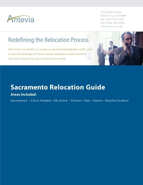
Redefining the <strong>Relocation</strong> Process<br />
Attention to detail, a curteous and knowledgable staff, and<br />
a vast knowledge of local rental markets make <strong>Antevia</strong><br />
the best choice for your relocation needs<br />
<strong>Sacramento</strong> <strong>Relocation</strong> <strong>Guide</strong><br />
Areas Included:<br />
<strong>Sacramento</strong> • Citrus Heights • Elk Grove • Folsom • Galt • Isleton • Rancho Cordova
Citrus Heights, California<br />
From Wikipedia, the free encyclopedia<br />
Citrus Heights is a city in <strong>Sacramento</strong> County, California, USA. As of the 2000 census,<br />
the city had a total population of 85,071. As of 2004, the city's total increased to 87,383.<br />
It has two ZIP Codes: 95610 and 95621.<br />
Geography<br />
Citrus Heights is located at 38°41′41″N, 121°17′26″W (38.694702, -121.290548) GR1 .<br />
According to the United States Census Bureau, the city has a total area of 37.2 km² (14.4<br />
mi²), all land.<br />
The city incorporated January 2, 1997, becoming only the fifth city in <strong>Sacramento</strong><br />
County.<br />
Demographics<br />
As of the census GR2 of 2000, there were 85,071 people, 33,478 households, and 21,660<br />
families residing in the city. The population density was 2,288.9/km² (5,929.3/mi²). There<br />
were 34,897 housing units at an average density of 938.9/km² (2,432.3/mi²). The racial<br />
makeup of the city was 84.64% White, 2.87% African American, 1.01% Native
American, 2.85% Asian, 0.34% Pacific Islander, 3.56% from other races, and 4.73%<br />
from two or more races. Hispanic or Latino of any race were 10.04% of the population.<br />
There were 33,478 households out of which 30.9% had children under the age of 18<br />
living with them, 46.4% were married couples living together, 12.9% had a female<br />
householder with no husband present, and 35.3% were non-families. 26.9% of all<br />
households were made up of individuals and 9.5% had someone living alone who was 65<br />
years of age or older. The average household size was 2.52 and the average family size<br />
was 3.06.<br />
In the city the population was spread out with 25.2% under the age of 18, 10.2% from 18<br />
to 24, 30.3% from 25 to 44, 21.3% from 45 to 64, and 12.9% who were 65 years of age or<br />
older. The median age was 35 years. For every 100 females there were 93.7 males. For<br />
every 100 females age 18 and over, there were 90.4 males.<br />
The median income for a household in the city was $43,859, and the median income for a<br />
family was $51,207. Males had a median income of $38,614 versus $29,399 for females.<br />
The per capita income for the city was $20,744. About 5.6% of families and 8.3% of the<br />
population were below the poverty line, including 10.9% of those under age 18 and 6.1%<br />
of those age 65 or over.<br />
Points of interest<br />
• Rusch Botanical Gardens<br />
• Sunrise Shopping Center<br />
• Brooktree Park, Home of Northridge Little League Baseball<br />
External links<br />
• Maps and aerial photos Coordinates: 38.694702° -121.290548°<br />
o Street map from Google Maps or Yahoo! Maps<br />
o Topographic map from TopoZone<br />
o Aerial image or topographic map from TerraServer-USA<br />
o Satellite image from Google Maps or Windows Live Local<br />
Elk Grove, California
From Wikipedia, the free encyclopedia<br />
Seal of the City Of Elk Grove<br />
Elk Grove is a city in <strong>Sacramento</strong> County, California, located south of the state capital of<br />
<strong>Sacramento</strong>. The (U.S. Census' 2004 population estimates) list the city's population as<br />
100,760. Newly-placed city limit signs list the population as just over 130,000. Either<br />
way, Elk Grove is the second-largest city in <strong>Sacramento</strong> County. As of the 2000 Census,<br />
the CDP had a total population of 59,984, but Elk Grove is one of the fastest growing<br />
towns in California owing to proximity to <strong>Sacramento</strong> and expanses of undeveloped land<br />
(former agricultural lands). The incorporated city boundaries are larger than the censusdesignated<br />
place boundaries set by the Census in 2000.<br />
Elk Grove was founded in 1850 as a stage stop. It is located about 15 miles south of<br />
historic Sutter’s Fort and thus became a crossroads for business, entertainment, mail<br />
service and agriculture, and acted as home base for gold miners in nearby communities.<br />
After it played its part in the early gold rush and statehood history in California, a closeknit<br />
community evolved with a distinctly rural and western lifestyle.<br />
Although the town developed around agriculture, it has since become a residential suburb<br />
of <strong>Sacramento</strong>. "Old" Elk Grove is located about a mile east of Highway 99 (formerly<br />
U.S. Highway 99, the north-south artery of California central valley). Most newer<br />
housing developments in Elk Grove lie west of Highway 99, toward Interstate 5, now the<br />
major north-south artery for the U.S. West Coast, in an area locally called "Laguna" or<br />
"Laguna Creek".<br />
Elk Grove's telephone area code is 916. Its ZIP codes are:<br />
95624<br />
95757<br />
95758<br />
east of Highway 99<br />
west of Highway 99 and south of Elk Grove Boulevard<br />
west of Highway 99 and north of Elk Grove Boulevard<br />
The city's ZIP codes are not necessarily continuous with city boundaries. For example,<br />
while the 95758 ZIP code does indicate an Elk Grove address, a portion of the ZIP code<br />
actually lies within the city of <strong>Sacramento</strong>. Residents with an Elk Grove ZIP code living<br />
within the city of <strong>Sacramento</strong> receive <strong>Sacramento</strong> city services, such as police and trash
collection. An unusual case is a neighborhood at the north end of Laguna Star Drive,<br />
which has an Elk Grove ZIP code but lies within <strong>Sacramento</strong>'s city limits, and is only<br />
accessible by traveling through Elk Grove.<br />
Education<br />
The Elk Grove Unified School District is the 12th largest school district in California and<br />
one of the fastest growing school districts in the nation. Located in southern <strong>Sacramento</strong><br />
County, the district covers 320 square miles, one-third of the county. For the 2002-03<br />
school year, the district will serve more than 52,500 students and expects to reach 80,000<br />
students by 2010. Of the 52,500 students, there are 38 elementary schools, 8 middle<br />
schools, and 12 comprehensive high schools.<br />
More than 60 percent of the district's students are on a four-track year-round schedule,<br />
where students attend school for three months and are then off for a month. The district<br />
serves a diverse student population and enrolled students speak more than 80 languages.<br />
There are also several private schools in town, such as Elk Grove Montessori School and<br />
several locations of Merry Hill Schools. A local community college, Cosumnes River<br />
College, offers both vocational training and a transfer program to four-year universities.<br />
Located nearby are California State University, <strong>Sacramento</strong> and the University of<br />
California, Davis, as well as branches of Golden Gate University and St. Mary's College.<br />
Climate<br />
Elk Grove’s climate varies from low temperatures of 24 to 44 degrees to highs of 80 to<br />
110 degrees. Average annual rainfall is 22 inches per year falling primarily from October<br />
through April. The elevation of the city is 45 feet.<br />
Government<br />
The City of Elk Grove incorporated on July 1, 2000. It is a general law city and operates<br />
on the Manager-City Council type of governance. Elk Grove is in the 3rd and 5th<br />
Congressional Districts, the 10th and 15th State Assembly Districts, and the 1st and 5th<br />
State Senate Districts.
Geography<br />
Elk Grove is located at 38°26'18" North, 121°22'55" West (38.438222, -121.381925) GR1 .<br />
According to the United States Census Bureau, the CDP has a total area of 39.4 km² (15.2<br />
mi²). 39.4 km² (15.2 mi²) of it is land and none of it is covered by water.<br />
The city of Elk Grove is divided into several major areas, including Laguna West,<br />
Laguna Creek, Elk Grove proper, and East Elk Grove. Laguna West is the area within the<br />
city limits between Interstate 5 and the Union Pacific railroad tracks. Laguna Creek, just<br />
east of this area, is bordered by the city boundary to the south, Sheldon Road to the north,<br />
the Union Pacific railroad tracks to the west, and State Highway 99 to the east. Elk Grove<br />
proper is bordered by Highway 99 to the west, Waterman Road to the east, Calvine Road<br />
to the north, and Grant Line Road to the south and includes old Elk Grove east of Elk<br />
Grove-Florin Road. East Elk Grove is bordered by Calvine Road to the north, Grant Line<br />
Road to the east and south, and Waterman Road to the west.<br />
Demographics<br />
As of the census of 2000, there were 59,984 people, 18,526 households, and 15,358<br />
families residing in the CDP. The population density was 1,523.7/km² (3,947.0/mi²).<br />
There were 18,894 housing units at an average density of 479.9/km² (1,243.3/mi²). The<br />
racial makeup of the CDP was 59.12% White, 8.52% Black or African American, 0.94%<br />
Native American, 17.59% Asian, 0.59% Pacific Islander, 6.44% from other races, and<br />
6.79% from two or more races. 14.00% of the population were Hispanic or Latino of any<br />
race.<br />
There were 18,526 households out of which 49.4% had children under the age of 18<br />
living with them, 65.0% are married couples living together, 12.6% had a female<br />
householder with no husband present, and 17.1% were non-families. 12.9% of all
households were made up of individuals and 3.5% had someone living alone who is 65<br />
years of age or older. The average household size was 3.22 and the average family size is<br />
3.51.<br />
In the CDP the population was spread out with 32.9% under the age of 18, 8.1% from 18<br />
to 24, 31.9% from 25 to 44, 20.3% from 45 to 64, and 6.8% who were 65 years of age or<br />
older. The median age was 32 years. For every 100 females there were 95.3 males. For<br />
every 100 females age 18 and over, there were 90.9 males.<br />
The median income for a household in the CDP was $60,661, and the median income for<br />
a family was $64,069. Males had a median income of $42,247 versus $33,119 for<br />
females. The per capita income for the CDP was $20,916. 5.2% of the population and<br />
3.8% of families were below the poverty line. Out of the total population, 6.0% of those<br />
under the age of 18 and 4.9% of those 65 and older were living below the poverty line.<br />
Police<br />
Currently, the Elk Grove Police Department is operated by a contract with the<br />
<strong>Sacramento</strong> County Sheriff's Department. Since April 2005 there has been a gradual<br />
transition from SCSD to city control. The Elk Grove Police Department will become<br />
fully independent and self-sustaining on July 1, 2006.<br />
External links<br />
City of Elk Grove website<br />
Maps and aerial photos Coordinates: 38.438222° -121.381925°<br />
Street map from Google Maps or Yahoo! Maps<br />
Topographic map from TopoZone<br />
Aerial image or topographic map from TerraServer-USA<br />
Satellite image from Google Maps or Windows Live Local
Folsom, California<br />
From Wikipedia, the free encyclopedia<br />
Folsom is a city in <strong>Sacramento</strong> County, California, USA. Though Folsom is most<br />
commonly known by its famous Folsom Prison, it is a thriving suburb of <strong>Sacramento</strong>.<br />
History<br />
Folsom started as a small town called Granite City, mostly occupied by gold miners<br />
seeking fortune in the Sierra Nevada foothills. Though few amassed a great deal of<br />
wealth, the city prospered due to the Joseph Folsom's lobbying to get a railway to connect<br />
the town with <strong>Sacramento</strong>. Though Folsom died in 1855, the town was later renamed to<br />
Folsom in his honor. The railway was abandoned in the 1950's but later opened up as the<br />
terminus of the Gold Line of <strong>Sacramento</strong> Regional Transit District's light rail service.<br />
Folsom Prison was established in 1880, when the Livermore family made an agreement<br />
with the state to donate land for the prison in exchange for prison labor. Their plan was to<br />
build a hydro-electric dam from the American River for a sawmill. Though the sawmill<br />
did not work out, the Livermores soon realized that the natural force of running water<br />
could provide enough power to transmit to <strong>Sacramento</strong>, and the Folsom Powerhouse,<br />
now a National Historic Landmark was opened. At the time it was opened, it had the<br />
longest overhead run of electricity (22 miles) in the country. The powerhouse operated<br />
until 1952.<br />
Folsom Dam was built in 1956, providing much-needed flood control and water rights for<br />
the <strong>Sacramento</strong> Valley. The creation of this dam also created one of the most popular<br />
lakes in Northern California, Folsom Lake.<br />
Today, Folsom is most known as being a popular middle-class suburb, with abundant<br />
parks, good schools, and a strong community. Folsom is home to Folsom Lake College,<br />
Folsom Dam, Folsom Lake, and a charming historic district. Folsom is also home to the<br />
largest employer in the <strong>Sacramento</strong> area, Intel. The population was 51,884 at the 2000<br />
census.<br />
Geography
Folsom is located at 38°40′20″N, 121°9′28″W (38.672127, -121.157838) GR1 .<br />
According to the United States Census Bureau, the city has a total area of 62.6 km² (24.2<br />
mi²). 56.3 km² (21.7 mi²) of it is land and 6.3 km² (2.4 mi²) of it (10.09%) is water.<br />
primarily accounted for by Folsom Lake.<br />
Demographics<br />
As of the census GR2 of 2000, there were 51,884 people, 17,196 households, and 12,518<br />
families residing in the city. The population density was 921.5/km² (2,386.7/mi²). There<br />
were 17,968 housing units at an average density of 319.1/km² (826.5/mi²). The racial<br />
makeup of the city was 77.89% White, 5.99% African American, 0.58% Native<br />
American, 7.19% Asian, 0.19% Pacific Islander, 4.71% from other races, and 3.43%<br />
from two or more races. Hispanic or Latino of any race were 9.47% of the population.<br />
There were 17,196 households out of which 39.1% had children under the age of 18<br />
living with them, 61.7% were married couples living together, 8.0% had a female<br />
householder with no husband present, and 27.2% were non-families. 21.8% of all<br />
households were made up of individuals and 7.1% had someone living alone who was 65<br />
years of age or older. The average household size was 2.61 and the average family size<br />
was 3.08.<br />
In the city the population was spread out with 24.2% under the age of 18, 6.6% from 18<br />
to 24, 39.0% from 25 to 44, 21.4% from 45 to 64, and 8.8% who were 65 years of age or<br />
older. The median age was 36 years. For every 100 females there were 123.4 males. For<br />
every 100 females age 18 and over, there were 131.0 males.<br />
The median income for a household in the city was $73,175, and the median income for a<br />
family was $82,448. Males had a median income of $60,616 versus $42,434 for females.<br />
The per capita income for the city was $30,210. About 2.6% of families and 7.3% of the
population were below the poverty line, including 4.1% of those under age 18 and 4.3%<br />
of those age 65 or over.<br />
Landmarks<br />
Folsom Powerhouse State Historic Park<br />
Folsom State Prison<br />
Rainbow Bridge<br />
Folsom Dam<br />
Folsom City Zoo Sanctuary<br />
Folsom Lake College<br />
Famous Residents<br />
Cristina Mendonsa, news broadcaster<br />
Peter Camejo, former vice presidential candidate and Green Party activist<br />
Phil Cowan, radio personality ("Paul & Phil")<br />
Sister cities<br />
Jiaohe City, Jilin Province, PR China<br />
Crespano del Grappa, Italy<br />
Arts<br />
Home to the Folsom Lake Civic Ballet
Home to Hawkins School of Performing Arts, the official school of the Folsom Lake<br />
Civic Ballet<br />
Home to Folsom Lake Symphony Orchestra<br />
External links<br />
Folsom Today<br />
City of Folsom Homepage<br />
MyFolsom.com<br />
Sister city relationship established with Crespano del Grappa, Italy<br />
Folsom Forum<br />
Maps and aerial photos Coordinates: 38.672127° -121.157838°<br />
Street map from Google Maps or Yahoo! Maps<br />
Topographic map from TopoZone<br />
Aerial image or topographic map from TerraServer-USA<br />
Satellite image from Google Maps or Windows Live Local<br />
Folsom Tourism Map<br />
Rancho Cordova, California<br />
From Wikipedia, the free encyclopedia
City seal<br />
Rancho Cordova is a city in <strong>Sacramento</strong> County, California that incorporated in 2003.<br />
Geography<br />
Rancho Cordova is located at 38°35′6″N, 121°17′50″W (38.585083, -121.297269) GR1 .<br />
According to the United States Census Bureau, the CDP has a total area of 59.1 km² (22.8<br />
mi²). 58.3 km² (22.5 mi²) of it is land and 0.8 km² (0.3 mi²) of it (1.27%) is water.<br />
Demographics<br />
As of the census GR2 of 2000, there were 55,060 people, 20,407 households, and 13,550<br />
families residing in the CDP. The population density was 944.0/km² (2,445.4/mi²). There<br />
were 21,584 housing units at an average density of 370.1/km² (958.6/mi²). The racial<br />
makeup of the CDP was 66.66% White, 11.34% African American, 0.95% Native<br />
American, 8.24% Asian, 0.54% Pacific Islander, 5.72% from other races, and 6.54%<br />
from two or more races. Hispanic or Latino of any race were 12.90% of the population.
There were 20,407 households out of which 34.1% had children under the age of 18<br />
living with them, 44.1% were married couples living together, 16.7% had a female<br />
householder with no husband present, and 33.6% were non-families. 25.5% of all<br />
households were made up of individuals and 6.3% had someone living alone who was 65<br />
years of age or older. The average household size was 2.68 and the average family size<br />
was 3.22.<br />
In the CDP the population was spread out with 28.4% under the age of 18, 10.2% from<br />
18 to 24, 31.9% from 25 to 44, 19.4% from 45 to 64, and 10.1% who were 65 years of<br />
age or older. The median age was 32 years. For every 100 females there were 95.5 males.<br />
For every 100 females age 18 and over, there were 92.1 males.<br />
The median income for a household in the CDP was $40,095, and the median income for<br />
a family was $43,211. Males had a median income of $35,706 versus $29,383 for<br />
females. The per capita income for the CDP was $18,121. About 12.9% of families and<br />
16.0% of the population were below the poverty line, including 24.4% of those under age<br />
18 and 6.2% of those age 65 or over.<br />
External links<br />
City of Rancho Cordova Home Page<br />
Maps and aerial photos Coordinates: 38.585083° -121.297269°<br />
Street map from Google Maps or Yahoo! Maps<br />
Topographic map from TopoZone<br />
Aerial image or topographic map from TerraServer-USA<br />
Satellite image from Google Maps or Windows Live Local